FRIENDLY STREETS TOOLKIT
82
FRIENDLY STREETS TOOLKIT A resident’s guide to creating safer and vibrant streets for walking and biking in Hamilton
Transcript of FRIENDLY STREETS TOOLKIT

FRIENDLY
STREETS TOOLKIT
A resident’s guide to creating safer and vibrant
streets for walking and biking in Hamilton
2
2
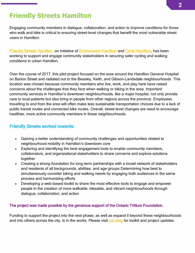
Friendly Streets Hamilton
Engaging community members in dialogue, collaboration, and action to improve conditions for those
who walk and bike is critical to ensuring street-level changes that benefit the most vulnerable street
users in Hamilton.
Friendly Streets Hamilton, an initiative of Environment Hamilton and Cycle Hamilton, has been
working to support and engage community stakeholders in securing safer cycling and walking
conditions in urban Hamilton.
Over the course of 2017, this pilot project focused on the area around the Hamilton General Hospital
on Barton Street and radiated out to the Beasley, Keith, and Gibson-Landsdale neighbourhoods. This
location was chosen because community members who live, work, and play here have raised
concerns about the challenges that they face when walking or biking in the area. Important
community services in Hamilton’s downtown neighbourhoods, like a major hospital, not only provide
care to local patients but also bring in people from other regions across the province. Employees
travelling to and from the area will often make less sustainable transportation choices due to a lack of
public transit routes and connected bike routes. Overall, street-level changes are need to encourage
healthier, more active community members in these neighbourhoods.
Friendly Streets worked towards:
• Gaining a better understanding of community challenges and opportunities related to
neighbourhood mobility in Hamilton’s downtown core
• Exploring and identifying the best engagement tools to enable community members,
collaborators, and organizational stakeholders to share concerns and explore solutions
together
• Creating a strong foundation for long-term partnerships with a broad network of stakeholders
and residents of all backgrounds, abilities, and age groups Determining how best to
simultaneously consider biking and walking needs by engaging both audiences in the same
process and harmonizing efforts
• Developing a web-based toolkit to share the most effective tools to engage and empower
people in the creation of more walkable, bikeable, and vibrant neighbourhoods through
dialogue, collaboration, and action
The project was made possible by the generous support of the Ontario Trillium Foundation.
Funding to support the project into the next phase, as well as expand it beyond these neighbourhoods
and into others across the city, is in the works. Please visit our blog for toolkit and project updates.

3
3
Friendly Streets Toolkit
Over the course of this year-long pilot project, Friendly Streets explored and tested methods of
engaging community stakeholders and residents of all backgrounds, abilities, and age groups in
assessing current challenges and barriers to walking and biking, as well as re-imagining
neighbourhood streets as places that are delightful for active transportation. We aimed to empower
residents and other community stakeholders to engage in, and contribute to, the conversation around
safe and vibrant streets. We also explored ways of harmonizing walking and biking efforts in order to
identify common ground between both groups which can help to strengthen the case for friendlier
streets.
We heard from over 200 community members: residents, neighbourhood associations, businesses,
people who walk or bike to commute or for pleasure, community organizations, City of Hamilton staff,
and major community institutions. Many tools that we tested to engage these groups were developed
by the Friendly Streets team and other collaborators, but many were also existing tools that were
adapted to better serve the context of active transportation in Hamilton.
This toolkit is the result of our efforts. It is a living document that will be frequently updated with
additional tools, information pertaining to city services or plans, and resources. In this toolkit, we refer
to “pedestrians” and “cyclists” as “people who walk or bike” because language matters. As Toronto
Centre for Active Transportation says: “Labels encourage an ‘us versus them’ mentality, with clear cut
groups that have very little to do with one another. Once we lock our bikes, park our cars, we all
become pedestrians. Moreover, all of these road ‘users’ share the common characteristic of being
people”. So let’s work together to create safer, more vibrant streets for people who walk or bike in
Hamilton.
The following modules provide information and resources to help residents, like you, who want to see
the momentum for friendly streets turn into concrete changes in your local streetscape. This is not a
list of steps to be completed in order. Rather, these are ideas to help familiarize you with different
ways that you could make changes in your neighbourhood. You can pick and choose which activities
best suit your interest and the needs of your community.
This toolkit was prepared by:
Elise Desjardins Beatrice Ekoko
Project Manager Project Manager
Cycle Hamilton Environment Hamilton With the assistance of Sara Mayo, Social Planning and Research Council of Hamilton,
through the Love Your Streets guidebook.

4
4
Collaborators
5
5
TABLE OF CONTENTS
MODULE 1 – About the Friendly Streets Pilot __________________________ 7
The Case for Friendly Streets _________________________________________________ 7
Our Strategy: A Community Stakeholder Neighbourhood Approach to Engagement _____ 9
Findings and Recommendations _____________________________________________ 15
MODULE 2 – Be Informed _________________________________________ 20
Understand current city plans that are shaping Hamilton’s streets ___________________ 20
Understand the city’s traffic calming and management policies _____________________ 23
Understand current Neighbourhood Action Plans ________________________________ 25
Understand biking in the city _________________________________________________ 26
MODULE 3 – Be a Friend of the City ________________________________ 28
Stay informed about upcoming street projects in your neighbourhood ________________ 28
How to request garbage bins, street furniture, and street trees ______________________ 29
Report infrastructure that should be repaired or improved _________________________ 30
Participate in consultations and reviews of the City of Hamilton’s official plans _________ 31
MODULE 4 – Build Support for your Friendly Streets Ideas ______________ 32
Start a Friendly Streets Café in your neighbourhood ______________________________ 32
Collect data about your streets: Tell the city what’s there, what could be there, and what you want there ____________________________________________________________ 33
Conduct a community assessment ____________________________________________ 35
Conduct a survey with businesses ____________________________________________ 37
Connect with City of Hamilton staff and talk to your councillor ______________________ 38
Host an interactive workshop ________________________________________________ 39
Host a neighbourhood bike ride ______________________________________________ 42
Create a neighbourhood desire map __________________________________________ 44
Share stories about your streets ______________________________________________ 45
Use social media tools _____________________________________________________ 45
Express your support for friendly streets _______________________________________ 46
Celebrate the Friendly Streets changes in your neighbourhood _____________________ 47
MODULE 5 – Steps for Traffic Calming ______________________________ 49
Traffic Calming and Management 101 – Frequently Asked Questions ________________ 49
How to request traffic calming in your neighbourhood _____________________________ 55
How to organize a petition___________________________________________________ 56
MODULE 6 – Street Vibrancy ______________________________________ 57
The case for street vibrancy and why “friendly” streets is not a luxury ________________ 57
How to make streets into people places: Enhance street vibrancy ___________________ 58

6
6
MODULE 7 – Tips for Business Owners ______________________________ 61
How to make your business bike-friendly _______________________________________ 61
How to make your business pedestrian-friendly__________________________________ 63
Become Ontario by Bike certified _____________________________________________ 64
Offer incentives for people who walk or bike to your business ______________________ 64
Apply for funding for façade improvement opportunities offered by the City of Hamilton __ 65
MODULE 8 – Expand your Network _________________________________ 66
Connect with your neighbourhood association___________________________________ 66
Connect with local advocacy groups __________________________________________ 67
Connect with local cycling businesses and organizations __________________________ 67
MODULE 9 – Friendly Streets Desire Map ____________________________ 68
MODULE 10 – Templates of Engagement Tools _______________________ 69
MODULE 11 – Tips for Social Media ________________________________ 70
Communicating Your Message _______________________________________________ 70
Tips for posting on social media ______________________________________________ 70
Tips for personalized hashtags _______________________________________________ 71
Twitter handles of neighbourhood associations, city staff, councillors, and local organizations _____________________________________________________________ 72
MODULE 12 – Friendly Streets Case Studies _________________________ 75
When traffic calming is not enough: Beasley Neighbourhood Association’s traffic management plan _________________________________________________________ 75
Partnering and collaborating with a major community institution: Hamilton General Hospital ________________________________________________________________________ 76
MODULE 13 – Fact Sheets ________________________________________ 80
MODULE 14 – More Resources ____________________________________ 82
7
7
MODULE 1 – ABOUT THE FRIENDLY STREETS
PILOT
The Case for Friendly Streets
This sect ion provides context for active transportation in the city of Hamilton
and why prior it izat ion of walk ing and biking is needed to create healthier,
act ive communit ies.
Why Fr iendly Streets?
Brent Toderian, former Vancouver Chief City Planner, said it best: “If ‘balanced transportation’
is truly your city's goal, you must prioritize the active modes that have been deprioritized for
many decades”1. The problem with ‘balancing transportation’ is that if our cities have been
built over the past decades for cars, other modes can't catch up without prioritization.
Therefore, we really must prioritize improvements for walking and biking, as well as street
vibrancy, in the city of Hamilton.
By ‘street vibrancy’, we refer to the elements of a streetscape that make it livable, inviting, and
enjoyable for people. This often includes public art, street furniture, wide sidewalks,
storefronts, green infrastructure, and interesting destinations. These elements must be
included in the conversation about active transportation and mobility in our city because
vibrant streets attract people to arrive by foot or by bike.
Mobility in our city is influenced by the designs of our streets and how friendly they are for
people who walk or bike. It has been said that people get the leftover parts of the street after
1 https://twitter.com/brenttoderian/status/645794356142567425
“Having friendly streets isn’t a luxury - it’s a necessity. Without it, you only get two types of active transportation users: the super
dedicated and those who have no other choice. With friendly
streets, everyone will want to use them.”
- Dr. John Neary, MD, Beasley resident
8
8
we build them for cars. After we’ve accommodated for cars, then we give space to people
who walk or bike on that street. It is for this reason that people who walk or bike in the city
experience particular challenges. Mobility is also about more than your mode of
transportation. Mobility is about your experience on a street – it’s about the safety and
connectivity of the routes that you can take to get from A to B. Mobility is about having more
than one safe option for routes when you walk or bike. There are streets and areas in our city
that are enjoyable for people who walk and bike. We see people walking and biking in these
areas, enjoying the experience on the street! People want to be there. But there are also
streets and areas in our city that are less friendly for people who choose active travel. If we
prioritize mobility and active travel in our city, we will better understand the challenges and
needs in order to create a city that is friendly, vibrant, and safe for walking and biking
everywhere.
Vibrant and social streets are the future. Research has shown that when they are safe for
walking and biking, our neighbourhoods and communities are healthier and strengthened by
social, economic, environmental, cultural, and health benefits23.To arrive at this point, public
participation is a critical part of the process. We need to include all voices, particularly those
of women, youth, seniors, and limited mobility. Without these voices, our streets are unlikely
to reach their full potential as enjoyable and safe spaces that are tailored to the diverse needs
and desires of those who use them.
Outcomes of our efforts to engage the community include:
• This toolkit, which will enable residents to work together to improve conditions for walking
and biking in their neighbourhoods, and replicate our efforts in other areas across the city
• The establishment of a working group with Hamilton General Hospital staff to improve the
patient journey with focused efforts on mobility, safety, and beautification
• An ongoing, neighbourhood-targeted, resident and community stakeholders’ conversation
that continues to evolve and change the dialogue from “streets for cars to travel through”
to “community and neighbourhood streets where people are prioritized”
• A broad network of residents and community stakeholders who want the same thing: Safe,
vibrant streets that strengthen our neighbourhoods and our communities socially,
economically, environmentally, and culturally
2 http://canadawalks.ca/about/benefits/ 3 https://www.bicycling.com/rides/news/building-bike-friendly-communities-good-economies

9
9
• A nurtured sense of belonging, pride, and ownership of neighbourhood streets that are for
people
• A nurtured sense of responsibility among residents and businesses to support initiatives
that make streets friendlier for people who walk and bike
Our Strategy: A Community
Stakeholder Neighbourhood
Approach to Engagement
This sect ion provides an overview of
the strategy that Fr iendly Streets used
to engage with the community in our
p ilot area. As a cross-sector
neighbourhood approach, it covers
pract ica l steps for you to take in order
to engage a broader audience in your
effor ts.
Safe and vibrant streets benefit us all. In order to maximize success in securing safer, more
vibrant streets for walking and biking, Friendly Streets takes the position that we need the
participation of all community sectors. The approach outlined below will provide a starting
point for your engagement efforts and some tips on how to build relationships with key
stakeholders.
1. A neighbourhood-centred approach
Why take a neighbourhood-focused approach? The streets where we live, work, shop, and
play should be safe for all ages. People care about their neighbourhoods, or at the very least,
are more likely to be concerned about safety where it impacts them the most. This starts at
the neighbourhood level - a shared experience and investment in place can bring people
together. A louder and unified voice for a concern in the neighbourhood can go a longer way
than one or two residents working alone.
As well, a neighbourhood-centred approach aligns with the City of Hamilton’s Neighbourhood
Action Strategy (NAS) which is focused on helping certain neighbourhoods “be great places
to live, work, play and learn”. There is a direct rapport with the NAS since it supports
community planning teams in developing and implementing action plans that build healthier
10
10
communities. Many neighbourhoods have established neighbourhood associations and
identified priorities, so it can be easier to leverage momentum around these. Connections
within a neighbourhood can also happen more easily and organically because people tend to
know one another or can at least think of a few people who might share similar concerns.
Beasley neighbourhood residents note that community developers are excellent at facilitating
those connections so take advantage if you have one working in your neighbourhood.
If you feel that there isn’t enough interest in friendly streets, or that there is a lack of resources
towards these kinds of initiatives in your neighbourhood, you can always reach out to other
neighbourhoods to learn from their efforts and receive support. For example, Dundas Works,
a community working group from Dundas, reached out to Friendly Streets because they had
heard of the work that we were doing in the downtown core and were interested in
discovering how this might align with or further their community vision and aspirations.
2. Engage key stakeholders
Our engagement strategies focused on 5 key stakeholders within the target area:
1. Residents
2. Community groups and organizations
3. Institutions (e.g., local hospitals or service providers)
4. Businesses
5. City councillors and staff (e.g., Public Health Services, Transportation Management,
Public Works)
It is important to include different perspectives and gather
feedback from all community members who are interested. We all
have different stories of mobility in our neighbourhood that should
be included in the narrative. That being said, there are certain
groups whose voices are often left out of the conversation around
active transportation and the planning processes. These include
women, youth, seniors, and those with mobility challenges.
Friendly Streets engaged these groups by connecting with the
YWCA Hamilton, Hamilton’s Council on Aging, Advisory Committee for Persons with
Disabilities, local secondary schools in the downtown core, Smart Commute’s Active &
11
11
Sustainable School Transportation Hub, and held group-specific tables at Change Camp
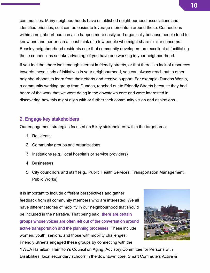
Hamilton in Fall 2017. Engaging major community institutions such as the Hamilton General
Hospital also gave legitimacy and added weight to our cause. As a community stakeholder
providing services to local and regional patients, as well as one of the largest employers in
Hamilton, the hospital’s involvement in improving walking and biking conditions is important
given the large volume of people who move in and out of the area each day. Major community
institutions, like local hospitals, can have a lot of power and resources, so finding ways to
align with their aspirations can further your efforts.
Who are the key stakeholders in your community? Make a list and continue to add to it as
your engagement efforts broaden. Make sure that you connect with all key stakeholders early
on and include them in all efforts of your initiative.
3. Understand aspirations of various community stakeholders
Community aspirations do not necessarily mesh, but sometimes they overlap.
Every community stakeholder has ideas about how they would like their streets to be
designed or what they think could make them safer. These desires may be different
depending on if you are a resident, business owner, or traffic engineer. For example, the
Hamilton General Hospital talks about the “patient journey” at the hospital. Patients certainly
want to get to the hospital safely. An aspiration to explore would be a pedestrian crossover
near the hospital that would make it safer for both patients and local residents who walk in the
area – this could be a way to extend the “patient journey” beyond the hospital walls. Another
example would be a local high school that wants bike racks to reduce bike theft for students
who ride to school. The Active & Sustainable School Travel hub in Hamilton has been trying
to make connections with the school to develop a school travel plan, which would incidentally
also include funding for bike racks. As a last example, a business owner may be keen to
increase the number of customers that they see each day. Residents want to get there by
bike but don’t want their bikes to get stolen. Perhaps an audit of travel modes could reveal
that a bike rack in front of the business would solve the problem for both parties.
The trick is find for synergies for all stakeholders in order to identify priorities and
opportunities to further your efforts.

12
12
Building on Aspirations
You will also need to build on aspirations in order to make connections between various
overlapping interests or priorities, as well as make a stronger case for friendly streets. Where
do you see an opportunity to influence positive change? This will encourage multiple
stakeholders to get involved and work together to address challenges and pursue solutions.
For example, Hamilton General Hospital wants to build better relationships in the community
with surrounding neighbourhoods, as well as find ways to satisfy parking demand for both
employees and patients. Friendly Streets has learned that hospital employees want to get to
work quickly and efficiently. Employees who live on the mountain note that lack of transit
connections to the hospital make it less convenient for them to use public transit. There is
interest in securing a direct HSR bus line from the mountain to the hospital. Building on these
aspirations involves identifying solutions that would align with multiple stakeholders and their
interests. Therefore, connecting with HSR transit to look into options for rerouting a specific
line is a potential solution to alleviate demand for parking and open up parking spots for those
who absolutely need to drive to the hospital. This is a solution worth exploring because it
would increase the number of safe and viable active transportation routes to the hospital,
encourage more hospital employees to take active travel to for the last mile of their journey,
and improve public health. We’ve also learned that the hospital wants employees to feel safe
in the community, such as when they walk around at lunch hour or when they travel through
parking lots to their cars. How might public art, green infrastructure, and street furniture along
the Barton St. corridor and around the hospital site make the area friendlier and enjoyable?
These are all projects that the working group of Friendly Streets and Hamilton General
Hospital are collaborating on.
4. Identifying allies and partners
Allies and partners are everywhere! Find out about any efforts in your neighbourhood or
community that relate to walkability, bikeability, and vibrancy of streets. Where do your
objectives overlap? It is a lot easier to work together with people who support your vision for
friendly streets than to tackle different sides of the same challenge on your own.
During our year-long project, we found support from groups such as Hamilton Bike Share, the
Community Skills Building Network (a partnership of Evergreen and the Social Planning and
Research Council), Beautiful Alleys, Smart Commute Hamilton, and the City of Hamilton staff.

13
13
These groups are actively working to improve active transportation, public spaces, and street
vibrancy in Hamilton. They were natural partners to collaborate with during the Friendly
Streets project.
There are even allies outside of Hamilton. Lots of people are doing innovative projects to
improve the streetscape for people who walk and bike. An urban planner from Toronto, doing
her PhD at the University of Waterloo, was interested in our project because her mother lives
in Hamilton. She helped to facilitate a workshop to build knowledge and skills with residents
about urban planning, policies, and design. Inspiration can also come as far from other
provinces! A city of Vancouver initiative to improve active transportation along the 10th
Avenue Health Precinct around Vancouver General Hospital inspired us to begin talking in
terms of a “Hospital Zone” for the Hamilton General Hospital, in the same way as the city of
Vancouver is doing. Connect far and wide with people who
5. Leverage momentum on existing plans or projects
There are likely many stakeholders in your neighbourhood who are working to address
challenges or barriers to active transportation, like reviewing existing truck routes or
improving secure bike parking. What is currently being done, or is in the works, that aligns
with your efforts? How can you help each other?
For example, Hamilton Health Sciences’ is developing a twenty-year planning process called
Our Healthy Future for the healthcare that communities will need. There are many elements
of this vision that echo the need for more sustainable and healthier transportation choices.
Through the Friendly Streets Community Stakeholder Group, we are working on short-term
collaborative initiatives but plan to align these projects with Our Healthy Future to ensure that
planning for active transportation is a priority of the planning process.
6. Use the correct language or narrative for different stakeholders and audiences You can gain more traction with certain community groups when you are able to find the
language that resonates with them. For example, Friendly Streets started using the context of

14
14
the “patient journey” with staff from the Hamilton General Hospital to convey the idea that a
patient’s experience includes their journey that begins well beyond the hospital doors (i.e., a
patient needs to get to the hospital in a safe way!). By using this language, we found that our
vision for friendly streets was better understood than when we were saying “improved walking
conditions” or “safer bike routes.” The key was putting the emphasis on the patient.
We also found that referring to pedestrians and cyclists as “people who walk or bike” is well
received and is more inclusive. Likewise, “safer streets” resonates better with a lot of people
than “improved infrastructure for pedestrians and cyclists” does. Everyone wants safer streets
regardless of how they travel!
Think about the various stakeholders that you have connected with or would like to involve in
your efforts. How can you reframe the language or narrative so that it appeals to the interests
and needs of your stakeholders? Be creative!
7. Keep the conversation and action moving
Follow up with stakeholders as needed, prod (politely!) to move forward with identified
priorities, and invite and share when possible. Being aware of what is going on and who is
doing what is also helpful because you will be able to revise your list of stakeholders and
include more people as you move forward.
Remember to include allies and partners, seek local leadership, and support community
leaders. Working to secure safer streets for walking and biking is a community effort.
15
15
Findings and Recommendations
This sect ion provides a detailed summary of the project’s f indings related to
challenges and barriers to act ive transportat ion, as well as concerns and
anecdotal evidence from community stakeholders who partic ipated in our
effor ts.
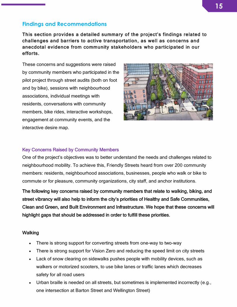
These concerns and suggestions were raised
by community members who participated in the
pilot project through street audits (both on foot
and by bike), sessions with neighbourhood
associations, individual meetings with
residents, conversations with community
members, bike rides, interactive workshops,
engagement at community events, and the
interactive desire map.
Key Concerns Raised by Community Members
One of the project’s objectives was to better understand the needs and challenges related to
neighbourhood mobility. To achieve this, Friendly Streets heard from over 200 community
members: residents, neighbourhood associations, businesses, people who walk or bike to
commute or for pleasure, community organizations, city staff, and anchor institutions.
The following key concerns raised by community members that relate to walking, biking, and
street vibrancy will also help to inform the city’s priorities of Healthy and Safe Communities,
Clean and Green, and Built Environment and Infrastructure. We hope that these concerns will
highlight gaps that should be addressed in order to fulfill these priorities.
Walking
• There is strong support for converting streets from one-way to two-way
• There is strong support for Vision Zero and reducing the speed limit on city streets
• Lack of snow clearing on sidewalks pushes people with mobility devices, such as
walkers or motorized scooters, to use bike lanes or traffic lanes which decreases
safety for all road users
• Urban braille is needed on all streets, but sometimes is implemented incorrectly (e.g.,
one intersection at Barton Street and Wellington Street)

16
16
• The slope of sidewalk ramps or curbs is often too steep or not wide enough for mobility
devices
• There is a need for monitoring and reducing speed in Beasley neighbourhood
• Wilson St. has too many trucks, especially for a street with a neighbourhood park,
community centre, and elementary school
• One house on Wilson St. has been hit by a car 4 times in the past decade, the most
serious incident resulted in a sheared gas line and the evacuation of the people in the
surrounding radius
Biking
• Lack of signage to alert motorists that they need to be aware of people biking
eastbound on the Cannon Cycle Track
• Signage on north-south streets that approach the Cannon Cycle Track is set too far
back from the intersection to be effective in reminding drivers to look both ways before
they turn left on Cannon Street
• Many collisions and near misses between people on bikes and people driving cars
along the Cannon Cycle Track
• Parked vehicles in bike lanes (specifically on Bay Street, Cannon Street, and York
Boulevard) is extremely dangerous and pus people on bikes at risk
• There is a need for more bike lanes to the Hamilton General Hospital (e.g., along
Wellington Street, Birge Street, Sanford Avenue, and Wentworth Street)
• Crossing Main Street East on the Ferguson Avenue bike route is very unsafe
• Bike lanes that just end are a huge concern (e.g., the Cannon Cycle Track ending at
Sherman is problematic area)
• Messaging about cycling in the city should always feature someone wearing a helmet
• “Cyclist” and “cycling” is not a term that everyone likes, but “people who bike” or
“biking” appears to be a more effective narrative
• There is a need for a secure bike parking facilities along Barton Street and surrounding
community facilities, as well as in the downtown core (e.g., the Birge Outdoor Pool)
• Safe and viable north-south bike routes are very limited in Ward 3
• Bike-friendly streets are mostly quiet, residential streets and some streets with higher
traffic like Delaware Avenue

17
17
Street Vibrancy
Friendly Streets has embraced the term “street vibrancy” to convey the sense of how people
experience “well-being” on the street – how they feel, what captures their interest or sense of
enjoyment, what features captures their sense of attachment to the street and how they
identify to it, what would enhance that sense of attachment. Elements of street vibrancy can
include: green infrastructure, public art, benches, wayfinding signs, water fountains. Most
importantly, people on the street create vibrancy and the feeling of being safe.
Street vibrancy points of interest that our work flagged included:
• General need for more green infrastructure in our pilot area
• Continued efforts to promote business and economic activity in the Barton Village BIA
• More park benches in Barton Village BIA
• Benches and shelters at each bus stop
• More street trees on Wentworth Street North
• People are opposed to gentrification, but want more businesses and “people places”
• Areas where safety is a concern: downtown parking lots, hospital parking lots, along
Barton BIA corridor
• Green infrastructure is important to make a street feel more liveable, especially
important to provide shade on days with extreme heat advisories
Exploring potential policy and infrastructure solutions
The pilot project also provided an opportunity for community stakeholders to explore policy
and infrastructure opportunities that would improve mobility in the city’s downtown core.
These potential solutions reflect evidence-based research and best practices from other
municipalities across the province, as well as suggest ways to make active travel safer and
more enjoyable, as well as encourage more people to walk and bike. Where possible,
proposed solutions have been aligned with future capital projects in the downtown core. They
align with and support the Traffic Calming/Management Policy’s objectives:
“Improve neighbourhood liveability by mitigating the impact of vehicular traffic on local (residential) streets.” “Promote safe and pleasant conditions for cyclists, pedestrians and motorists on local (residential) streets.” “Encourage citizen involvement and engage citizens in all phases of neighbourhood traffic calming/management activities”.

18
18
The City of Hamilton’s vision is to be the best place to raise a child and age successfully.
The City of Hamilton’s mission is to provide high quality cost conscious public services that
contribute to a healthy, safe and prosperous community, in a sustainable manner.
In order to further the city’s vision and mission, the feedback that we received from the
community suggests that the following improvements to policy and planning would make it
safer and more enjoyable for active travel:
Walking
• Continuously refer to the Pedestrian Mobility Plan as a tool to ensure that mobility in
the City of Hamilton is prioritized and that recommendations in the Plan be
implemented
• Provide a clear explanation of how pedestrian crossover (PXO) requests to the City of
Hamilton Public Works Department are prioritized and if the ranking system that has
been developed by staff is reflective of the neighbourhood’s residential, institutional
and commercial needs
• A snow clearing pilot for residential sidewalks to be conducted by the City of Hamilton
• Reducing the speed limit on residential streets
Biking
• A pilot project by the City of Hamilton to test the efficacy of green paint along specific
intersections of the Cannon Cycle Track. Green paint
• Reconstruction of York Boulevard (from Caroline Street North to Dundurn Street North)
in 2025 – using this opportunity to install a protected and separated one-way bike lane
• The installation of an activated pedestrian crossover and improved signage would
between the Rail Trail and Waterfront to make it easier to cross and improve
connections
• Reconstruction of Sanford Avenue (between Main Street East and Barton Street East)
– using this opportunity to install protected and separated on-street bike facilities. While
Sanford Avenue is not in the Cycling Master Plan, it is a relatively quieter major arterial
road and community feedback has highlighted that north-south routes east of Victoria
Avenue are needed in Ward 3
19
19
• Reconstruction of Birch Avenue in 2018 – using this opportunity to install protected and
separated on-street bike facilities
• Protected and separated on-street bike facility on Burlington St. from Birch Ave. to
Gage Ave.
• Protected and separated on-street bike facilities on Delaware and Maplewood
• Bike lanes on major arterial roads should be prioritized as Class A, and not Class 3
because they are viable active travel routes, especially in the downtown core. This can
result in delays of snow clearing which makes it less safe for people who bike
• Supports recommendation of Beasley Community Association Meeting re: Beasley
Park redevelopment in 2014: bike infrastructure along south side of Cannon Street
near Elgin Street cul-de-sac and Ferguson Avenue. Bike racks, shade structure, and
water fountain are needed in this area due to proximity of local park, elementary
school, and community centre
• The exploration of offering secure bike parking at recreation centres across the street,
whereby residents could rent a secure spot (i.e., similar to renting a day locker)
• Summers Lane reconstruction in 2018 – using this opportunity for more bike parking
downtown that is sheltered and secure
• Gore Master Plan redevelopment of Macdonald Square in 2018 – using this opportunity
for more secure bike parking
• Central Park redevelopment in 2018 – using this opportunity for more bike parking
• Beasley Park Kelly St. pedestrianization – using this opportunity to provide adequate
signage that directs cyclists to routes on Ferguson Avenue and Cannon Street
Street Vibrancy
• The pilot initiative of the John/Rebecca Park in 2017 was perceived well by community,
but the community would like to see more commitment with
• Gore Master Plan redevelopment of Macdonald Square in 2018 – using this opportunity
for more green infrastructure (e.g., trees, rain garden, bioswales, etc.)
• Central Park redevelopment in 2018 – using this opportunity for more green
infrastructure (e.g., community garden, rain garden, etc.)

20
20
MODULE 2 – BE INFORMED This sect ion wil l help you better understand the City of Hamilton’s polic ies,
plans, and designs that direct ly or indirect ly make our streets more or less
fr iendly for walking and bik ing.
Many important policy documents approved by Hamilton’s City Council include concepts that
support safe, walkable, bikeable, and vibrant streets. A basic understanding of how these
concepts fit into municipal plans is useful because your support for friendly streets can help
get these plans implemented and put into action. It can be helpful to be familiar with key
sections of each policy document because it gives community members something to point to
when they advocate for change on their streets or neighbourhoods.
Understand current city plans that are shaping Hamilton’s streets
Transportation Master Plan
The central goal of Hamilton’s Transportation Master Plan is to
reduce reliance on car travel in the city, and to promote travel by
transit, bike, and foot. Here are some sections from the executive
summary that show clear support for modal shifts to active
transportation:
“key objectives of the Transportation Master Plan include reducing dependence on single-occupant vehicles and promoting improved options for walking, cycling and transit, while maintaining and improving the efficiency of trips related to the movement of goods and servicing of employment areas.”
“a high emphasis on significantly improving transit services, providing options for cycling and walking and optimizing existing road capacity before considering major expansions.”
“A potential incline railway near Wentworth Street, which can serve to reduce the barrier effect of the Escarpment for cyclists and pedestrians while potentially becoming a major tourist attraction for the City.”
The Transportation Master Plan was recently reviewed and updated – a process that included
opportunities for public input. The city has already indicated that a Complete-Liveable-Better
(CLB) Streets policy and framework will be the major theme of the revised Transportation
Master Plan. Many of these concepts will likely align with the goals of Friendly Streets to
ensure that walking and biking, as well as liveable streetscapes, are prioritized more in
municipal transportation planning processes.
21
21
One of the ways to ensure that the new Transportation Master Plan is more fully implemented
this time is to select the parts that align with your goals for your neighbourhood, create a plan
of how it could be implemented in your neighbourhood and then ask your city councilor to
help make it happen. The more these plans are discussed and brought back to the attention
of councilors the more they will understand that residents want these plans implemented. The
revised Transportation Master Plan will be presented to General Issues Committee in
February 2018 for approval.
The City of Hamilton’s Downtown Transportation Master Plan has also made specific
recommendations to improve the downtown environment for those who walk and bike:
“Identifying crucial pedestrian corridors and connections that should be upgraded with wider sidewalks, improved lighting and other features to make walking more attractive.”
“Introducing bicycle lanes on specific downtown streets to make cycling easier and safer.”
“Introducing two-way streets, which are generally friendlier for walking and cycling.”
The current Transportation Master Plan is available here. The current Downtown Transportation Master Plan is available here. Rapid Ready Transit Strategy Active transportation includes transit opportunities. In 2013, City Council adopted a new
transit strategy called Rapid Ready: Expanding Mobility Choices in Hamilton. The
implementation of this strategy has started with some improvements to transit service on the
Mountain, including the 44 Rymal, 43 Stone Church, and 20 A-line. The longer term goals of
this strategy are to increase ridership by increasing transit funding by $45 Million/year in
operating costs and $155 Million in capital investments.
The full Rapid Ready report is available here. (This link includes the staff report to Council.
The report begins on page 14 of the PDF.)
Full provincial capital investment to build an Light Rail Transit (LRT) line from Eastgate
Square to McMaster University has been gained and the city has received confirmation that
the province of Ontario will be investing $1 Billion for the LRT line. Major construction is
scheduled for 2019 to 2024.
More information about LRT in Hamilton is available here.
22
22
Metrolinx is also hosting periodic Public Information Centres to engage with the community.
Specific consultations have been held for cycling integration or accessibility for persons with
disabilities. There is opportunity for community members to provide feedback on this project
before construction begins. Learn more about how the LRT is engaging with the community
and how you can share your feedback.
Cycling Master Plan
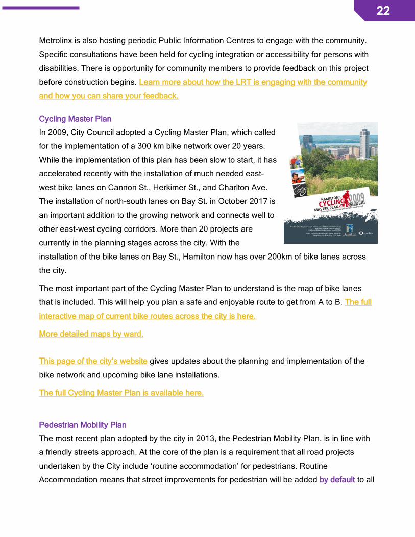
In 2009, City Council adopted a Cycling Master Plan, which called
for the implementation of a 300 km bike network over 20 years.
While the implementation of this plan has been slow to start, it has
accelerated recently with the installation of much needed east-
west bike lanes on Cannon St., Herkimer St., and Charlton Ave.
The installation of north-south lanes on Bay St. in October 2017 is
an important addition to the growing network and connects well to
other east-west cycling corridors. More than 20 projects are
currently in the planning stages across the city. With the
installation of the bike lanes on Bay St., Hamilton now has over 200km of bike lanes across
the city.
The most important part of the Cycling Master Plan to understand is the map of bike lanes
that is included. This will help you plan a safe and enjoyable route to get from A to B. The full
interactive map of current bike routes across the city is here.
More detailed maps by ward.
This page of the city’s website gives updates about the planning and implementation of the
bike network and upcoming bike lane installations.
The full Cycling Master Plan is available here.
Pedestrian Mobility Plan
The most recent plan adopted by the city in 2013, the Pedestrian Mobility Plan, is in line with
a friendly streets approach. At the core of the plan is a requirement that all road projects
undertaken by the City include ‘routine accommodation’ for pedestrians. Routine
Accommodation means that street improvements for pedestrian will be added by default to all
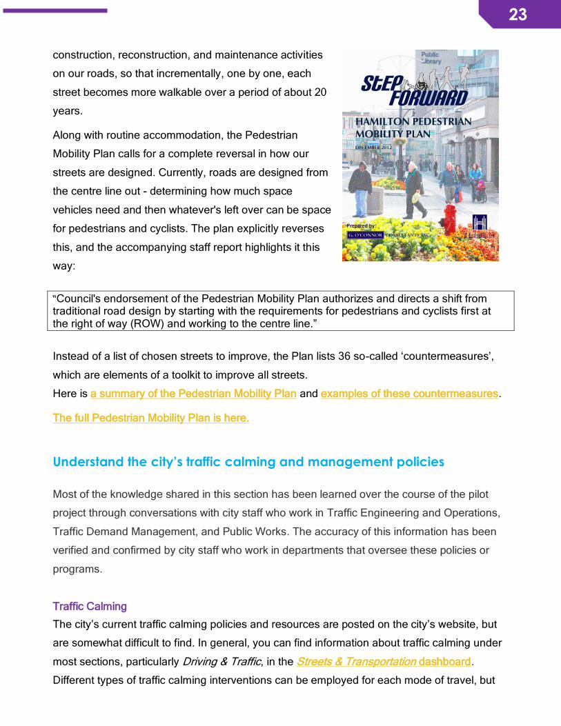
23
23
construction, reconstruction, and maintenance activities
on our roads, so that incrementally, one by one, each
street becomes more walkable over a period of about 20
years.
Along with routine accommodation, the Pedestrian
Mobility Plan calls for a complete reversal in how our
streets are designed. Currently, roads are designed from
the centre line out - determining how much space
vehicles need and then whatever's left over can be space
for pedestrians and cyclists. The plan explicitly reverses
this, and the accompanying staff report highlights it this
way:
“Council's endorsement of the Pedestrian Mobility Plan authorizes and directs a shift from traditional road design by starting with the requirements for pedestrians and cyclists first at the right of way (ROW) and working to the centre line.”
Instead of a list of chosen streets to improve, the Plan lists 36 so-called ‘countermeasures’,
which are elements of a toolkit to improve all streets.
Here is a summary of the Pedestrian Mobility Plan and examples of these countermeasures.
The full Pedestrian Mobility Plan is here.
Understand the city’s traffic calming and management policies
Most of the knowledge shared in this section has been learned over the course of the pilot
project through conversations with city staff who work in Traffic Engineering and Operations,
Traffic Demand Management, and Public Works. The accuracy of this information has been
verified and confirmed by city staff who work in departments that oversee these policies or
programs.
Traffic Calming
The city’s current traffic calming policies and resources are posted on the city’s website, but
are somewhat difficult to find. In general, you can find information about traffic calming under
most sections, particularly Driving & Traffic, in the Streets & Transportation dashboard.
Different types of traffic calming interventions can be employed for each mode of travel, but
24
24
often most serve the purpose of making travel safer for all street users regardless of travel
mode choice. Specific examples of traffic calming measures, like red light cameras, can be
found by navigating the Streets & Transportation dashboard.
Here are some helpful links to understand commonly used traffic calming interventions that
you may have in your neighbourhood:
• Accessible pedestrian signals
• Slow Down Safety Zones
• Traffic Signs
• Traffic Signals
• School Zones & Safety Tips
The city recently introduced pedestrian crossovers to improve safety for people when they
cross the street. This is a new traffic calming intervention in the city. There are 3 different
types of pedestrian crossover, so it’s possible that you have seen different designs across the
city or in your neighbourhood. The city receives a large volume of requests for pedestrian
crossovers and uses an internal ranking system to determine which locations are the highest
priority. The city is only able to install a limited number, the highest-ranked locations, based
on available funding each year.
For more information about city’s new pedestrian crossovers.
Traffic Management Plans
If the city receives a significant number of complaints or requests for traffic calming from one
neighbourhood, that are based on valid concerns, the Traffic Engineering and Operations
department can choose to begin a review of the entire neighbourhood. The goal is usually to
develop a neighbourhood-wide traffic management plan to address all concerns in a
systematic and cohesive way. The process typically involves a review of current traffic and
transportation problems in the neighbourhood, as well as public consultation through public
information centres and community advisory meetings. Information about data collected
throughout the review is shared at public information centres. Throughout the process, there
is opportunity to raise concerns about current issues and to provide feedback on the
proposed plan. (See the section on requesting a Traffic Management Plan in Module 5).
25
25
Several neighbourhoods in the city, including the North End neighbourhood and Binbrook
Village, have secured a neighbourhood traffic management plan.
Here is a summary of the North End Traffic Management Plan.
Here is a summary of the Binbrook Village Neighbourhood Traffic Management Plan.
This plan also features examples of different traffic calming measures that the city can
implement.
Understand current Neighbourhood Action Plans
Under the city’s Neighbourhood Action Strategy, enacted
in 2011, specific neighbourhoods developed
neighbourhood action plans (NAP) “that communicate a
clear vision for the future of the neighbourhood and describe specific projects that can be
implemented, are achievable, and have widespread community support”. The
neighbourhoods of Beasley, Gibson-Landsdale, and Keith each have an NAP that was
developed through the neighbourhood associations with help from staff at the city and
community developers from the Social Research and Planning Council of Hamilton. As of
mid-2017, the city is undertaking a project called (Re)Imagine the Neighbourhood Action
Strategy to plan for the next generation and gather ideas for improvement.
Here is more information about the Neighbourhood Action Strategy.
While each neighbourhood set their own priorities and projects to be implemented, based on
the history and desires of the neighbourhood residents, many have prioritized traffic calming
or street safety. Some have also prioritized beautification of their neighbourhood or improving
the cycling network. If you live in a neighbourhood that has an NAP, but weren’t part of the
development process or haven’t heard of the NAP yet, it can be helpful to look it over and
understand what your neighbourhood has already looked at or planned for. If there was a
‘champion’ assigned to oversee any projects related to traffic calming, street safety, or biking,
then you might feel inspired to share your ideas to contribute to the vision or join their project
team to take action in moving your ideas forward.

26
26
There are also small grant opportunities available for residents to use for small projects in
their neighbourhood. Each neighbourhood has up to $5,000 to spend on local projects, with a
maximum of $1,500 per project. This can be a great resource to apply for if your
neighbourhood is interested in beautifying the streets through community art or building
capacity through workshops that teach residents about traffic calming.
Here is more information about the small grant opportunities.
If your neighbourhood has a community developer, connecting with them can also give you
more information about how to address the specific concerns that you might have.
Connecting with other neighbourhood associations is also a great idea because they have
successfully implemented a project, or are working towards implementation, that could lead to
collaboration and be a good fit for your neighbourhood as well.
Understand biking in the city
With over 200 km of bike lanes across the city, Hamilton
is slowly building a connected cycling network.
Understanding common city by-laws for people on bikes
is a first start to feeling more confident and ensuring that
you are biking safely.
A few tips for riding safely in the city:
• It is illegal to bike on the sidewalks in Hamilton - you may be at fault if you are in an
accident.
• If the lane is narrow, you should be in the centre of the right lane. This forces vehicles
to change lanes to navigate around the person riding a bike. In this case, be a vehicle
and be part of traffic.
• If the lane is wide and there is enough room for a vehicle, buffer, and a person riding a
bike, you should ride 1m from the curb. Avoid swerving around sewer grates because
this makes you less predictable. Make yourself visible to traffic!
• Be predictable so that vehicles are aware of you and can see you.
• Communicate with other road users by using the appropriate signals. You must signal
your turn with arm signals ($85 fine for violation)
• Anyone riding a bike under the age of 18 must wear a helmet ($60 fine for violation)
27
27
There are several things that your bike must have:
• A working bell or horn (85$ fine for violation)
• A front white light and a rear red reflector or light if you ride a half hour before sunset
and after sunrise ($35 fine for violation)
• At least one working brake ($85 fine for violation)
While it is only mandatory for people under the age of 18 to wear a bicycle helmet in
Hamilton, there are many health and protective benefits to wearing a helmet. Finally, always
bike according to your skill level! If you are new to biking in Hamilton, check out the city’s
website for bike routes and a variety of resources that are offered to help improve your skills.
For more information on cycling education.
You can use various maps offered by the city or Smart Commute to plan your trip. The full
interactive map of current bike routes across the city is here.
For information about secure bike parking in the city.
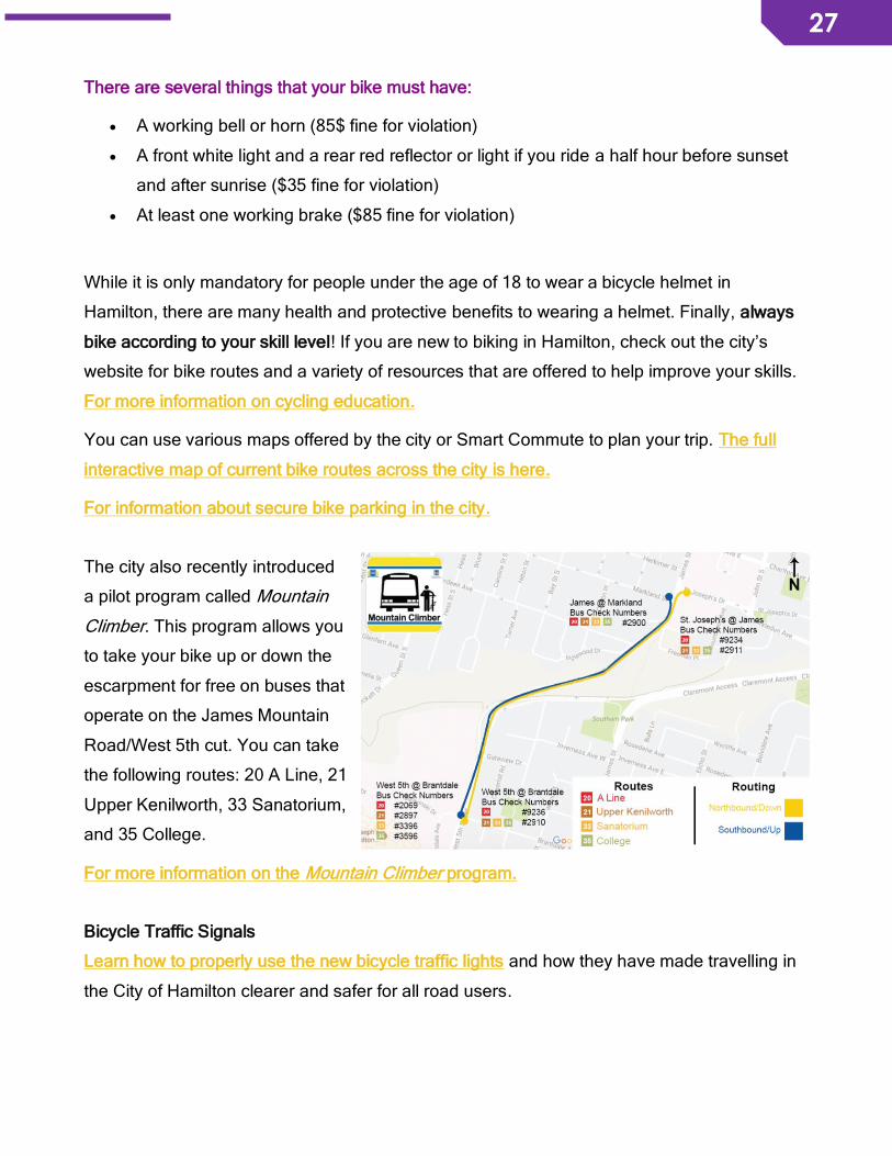
The city also recently introduced
a pilot program called Mountain
Climber. This program allows you
to take your bike up or down the
escarpment for free on buses that
operate on the James Mountain
Road/West 5th cut. You can take
the following routes: 20 A Line, 21
Upper Kenilworth, 33 Sanatorium,
and 35 College.
For more information on the Mountain Climber program.
Bicycle Traffic Signals
Learn how to properly use the new bicycle traffic lights and how they have made travelling in
the City of Hamilton clearer and safer for all road users.
28
28
MODULE 3 – BE A FRIEND OF THE CITY This sect ion provides information about when and how you can contact the city
whenever there are repairs or improvements needed to city infrastructure,
such as streets or sidewalks. It also includes information on how to stay
informed about potent ial changes that might be planned for your
neighbourhood.
Stay informed about upcoming street projects in your neighbourhood
There are annual street changes planned all over the city. Finding out about these projects is
helpful so that you can prepare feedback and comments to give to the city to ensure that
changes create safer and more vibrant streets in your neighbourhood for those who walk and
bike.
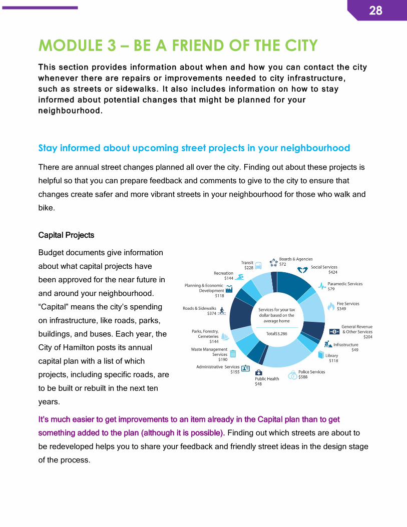
Capital Projects
Budget documents give information
about what capital projects have
been approved for the near future in
and around your neighbourhood.
“Capital” means the city’s spending
on infrastructure, like roads, parks,
buildings, and buses. Each year, the
City of Hamilton posts its annual
capital plan with a list of which
projects, including specific roads, are
to be built or rebuilt in the next ten
years.
It’s much easier to get improvements to an item already in the Capital plan than to get
something added to the plan (although it is possible). Finding out which streets are about to
be redeveloped helps you to share your feedback and friendly street ideas in the design stage
of the process.

29
29
Being informed about the upcoming road projects in your neighbourhood will help you
understand which streets you can target in the short term for improvements. Keep an eye out
for capital project opportunities to leverage momentum that would directly improve the streets
is one of the most effective ways to raise concerns or provide feedback before the plan is
finalized.
You can visit the city’s interactive map to view capital construction projects. In order to add
something to the Capital plan, connect with your neighbours and neighbourhood association.
Asking your Councillor about upcoming capital projects in your neighbourhood can save you
lots of time. But if you want to do some of the work yourself, the following links are a good
start.
For any given year, the main Budget and Funding dashboard.
The direct link for the 2018 capital budget is here. On that page there are links for the
summary capital budget document (Book 1) and the detailed version (Book 2). After the table
of contents, the detailed budget book shows a summary of capital projects by ward, with the
last section listing all the roads that will be upgraded in each year. All the amounts are in
thousands, so 600 means $600,000 and 2,300 means $2,300,000. The detailed budget book
is quite long, but using the table of contents, you can go directly to the pages for your
neighbourhood streets. There you will find a map, budget, and specific improvements planned
for each street.
To find out more about the redevelopment plans for any street, you can contact your ward
councillor or city staff in the transportation planning division of Public Works. There may be
detailed plans available, if the project is already some ways along.
In addition, the following links can give you more information about projects that are often
beyond the planning and design stage and are moving into the construction phase.
Search City Construction Projects (information for current or recent city construction projects).
City of Hamilton Corridor Activities Web App (Map of road and other construction – active,
upcoming and pending).
How to request garbage bins, street furniture, and street trees
30
30
For public inquiries including questions about or request for garbage receptacles, benches,
bus shelters, or street trees, it is best to contact the City’s Contact Centre at 905-546-2489 or
Information about the Contact Centre info is available here, as well as locations of all
Municipal Service Centres. The Contact Centre staff will be able to either provide the answers
or direct residents to staff who can help them.
Report infrastructure that should be repaired or improved
The city needs residents to contact them whenever there are repairs needed to city
infrastructure, such as streets and sidewalks.
Currently installed elements that contribute to making your streets safer may include:
• Sidewalks • Painted pedestrian crosswalks • Pedestrian activated traffic lights
• Pedestrian crossovers • Bus stops and shelters • Bike lanes
Whenever any of these needs repair, isn’t working as it should be, or is damaged by graffiti,
report the issue to the city’s contact centre. Many types of repairs are made within a few days;
issues that can impact public safety such as a malfunctioning pedestrian signal button are
often repaired the next day or sooner.
Contact the city either by phone or email:
905-546-CITY (2489) (staffed 24 hours per day)
Translation is available in 149 languages. When calling callers can identify their
language preference to be connected to the appropriate interpreter.
(For residents in Campbellville, dial 905-634-2971; for residents with a 519 area code,
dial 519-647-2577)
The Bell Canada Relay Service is available to assist in placing a call from persons who
use a TTY/teletypewriter. For TTY, type 711 for the operator and by telephone, dial 1-
800-855-0511. The operator will also assist in placing VCO (Voice Carry Over) and
HCO (Hearing Carry Over) calls. There is no charge for local calls.
31
31
If the issue you report is not repaired to your satisfaction, contacting your city councillor for
assistance can be helpful to understand the reason and bring more attention to the issue.
City councillor contact info can be found here.
Participate in consultations and reviews of the City of Hamilton’s official plans
Master plans that relate to transportation, cycling, and pedestrian mobility, are routinely
reviewed. The process typically involves consultation phases where the city will hold Public
Information Centres to present highlights and findings of ongoing work, as well as to receive
feedback from the public.
Keeping up to date on consultations about policies and plans related to complete streets
gives you the opportunity to influence these city strategies and projects as they are being
designed. You can stay informed by following groups like Environment Hamilton for alerts on
upcoming reviews.
Sign up for your councillor’s email list, so you will receive public consultation notices for your
ward. Councillor contact information is here.
You can also visit this page on the city’s website that lists the policies or plans currently in a
public review period.
You can participate in person or online in the consultations that interest you. You can submit
comments and ideas as an individual or you can get multiple people to sign off on the written
document you submit. This shows that the ideas have broader support than just one person.
You can also edit your submission into a Letter to the Editor for The Hamilton Spectator or a
community newspaper. This adds your views to the public discourse and helps increase
public awareness of and support for friendly streets.
32
32
MODULE 4 – BUILD SUPPORT FOR YOUR
FRIENDLY STREETS IDEAS This sect ion provides information and engagement tools for you to use in your
effor ts to make your neighbourhood streets safer for walk ing and bik ing.
Working with other community members to improve neighbourhood streets for walking,
biking, and general vibrancy has far more impact than going about it on your own - plus it’s a
lot more fun! Conversation with multiple perspectives can lead to surprising new ideas,
building on individual strengths that when pulled together often lead to more interesting and
useful actions or results. As well, the added support from many people amplifies the voice of
the group, leading to more effective advocacy. There are many ways to gain support for your
friendly streets ideas. Here are some to pick and choose from.
Start a Friendly Streets Café in your neighbourhood You can join existing city-wide or neighbourhood groups (check out your local neighbourhood
association) and take leadership within those groups, or you can start a neighbourhood
Friendly Streets Cafe! Starting one in your neighbourhood is a great way to bring together
people who share the same concerns as you do about the safety of walking and biking, as
well as the vibrancy of your local streets. Your Friendly Streets Cafe can be a short-term
committee created to achieve one goal on one specific street. It can also be a long-term
committee looking to address broad issues across the neighbourhood with multiple
stakeholders. A Friendly Streets Cafe can be as simple as meeting at the library or a local
coffee shop once a month to share concerns and brainstorm ideas to move forward. Many of
the tools listed below can be used by your Friendly Streets Cafe.
Refer to Module 8, Expand Your Network, for a list of all neighbourhood associations across Hamilton.

33
33
Collect data about your streets: Tell the city what’s there, what could be
there, and what you want there
Gathering data can strengthen your
case for safer and friendlier streets in
your neighbourhood. This evidence
can be shared with your ward
councillor, city staff, or other residents
in your neighbourhood to support your
ideas and inform how solutions can be
implemented. Data can be collected in
a variety of ways: a street audit (either on foot or by bike), photos, videos, anecdotal stories,
or social media responses. You can use these sources to document a narrative of your
neighbourhood and some of the challenges or issues that need to be resolved. Is there a
street or part of your neighbourhood that is friendly and enjoyable? Document it too!
Showcasing the areas that are vibrant and safe can also contribute to the narrative of your
neighbourhood.
Street audits are a good start to better understanding how a street currently operates and how
it serves or doesn’t serve vulnerable users. Audits can be done by individuals or they can be
used as a group activity, either on foot or by bike. Street audits are a great way to involve
neighbourhood residents who might not have the time or interest to participate in a formal
meeting but enjoy interactive activities. Tailoring the street audit for kids is another approach,
providing a different perspective from the most vulnerable street users, which makes this tool
more inclusive for families and all-ages
Key people to invite on a street audit:
• Residents and those who work and play in the neighbourhood
• Your neighbourhood association
• Your ward councillor! This gives them the chance to hear from the community and
experience the street or neighbourhood from their perspective.
• Business owners - they provide services to residents from local neighbourhoods and
across the city. It’s likely that they would be interested to hear how their customers
experience the street.

34
34
The results and findings of a street audit can be sent to your local councillor and city staff.
Based on the results of the audit, you can identify areas of concern and priorities for
improvements. Writing up the findings into a simple document and posting it online can help
to bring more attention to the experience of the street audit.
You can also do your own traffic counts. A few hours of observation on your neighbourhood
streets can reveal very useful data to support your efforts. If time is limited, perform some
counts at the highest peak times in both morning and afternoon. Don’t forget to count all
street users: cars, trucks, buses, people on bikes, and people walking. It can also be helpful
to shoot a short video that visually demonstrates the way your neighbourhood street is not
safe or friendly. Showcasing the areas that are vibrant and safe can also contribute to the
narrative of your neighbourhood.
Some examples of other tools to collect data about your streets:
Tool Resource
Neighbourhood assessment of different kinds of infrastructure
http://www.physicalactivitystrategy.ca/pdfs/BEAT/B.E.A.T.Neighbourhood_Assessment.pdf
Short video about how to conduct a street audit by walking
https://www.youtube.com/watch?v=X94o3PZ70w8
Short video about how to conduct a street audit by biking
https://www.youtube.com/watch?v=mEmJ3yNz_dg
Traffic count of pedestrians and cyclists
http://bikepeddocumentation.org/index.php/downloads
Handbook of simplified practice for traffic studies
http://www.ctre.iastate.edu/pubs/traffichandbook/3TrafficCounts.pdf
Intersection traffic volume count
http://www.ctre.iastate.edu/pubs/traffichandbook/appB.pdf
Refer to Module 10, Templates for Engagement Tools, for a walkability and bikeability checklist

35
35
Often, citing city-wide data or even from other cities is all that’s needed to back up your
arguments. Here are a few data sources provided by the city about local traffic in Hamilton:
Tool Data Source
Location-specific traffic volume from City of Hamilton
Requires a payment of $59.65 to obtain traffic volume data per location (when available). Contact [email protected] for more information. You can also contact your local councillor to help with this request.
Historical traffic volume data from 1999
https://www.hamilton.ca/NR/rdonlyres/82525E9C-331B-46E0-999D-B13A807AF732/0/TrafficVolumes1999.pdf
City of Hamilton traffic count mapping tool
http://hamilton.ms2soft.com/tcds/tsearch.asp?loc=Hamilton&mod=
Take photos or videos to paint a realistic picture of
how people experience the street or
neighbourhood. This can be done while you
conduct a street audit or do a traffic count to help
support the other forms of data that you collect.
Anytime that you see something that is a concern,
document it! A picture really does say 1,000 words. It also gives the viewer a chance to
experience the street from the perspective of that user and to witness other mobility
challenges that they might not be aware of.
Sharing collected data through social media also allows you to reach a broader audience.
You can tag your local councillor or start a discussion with other community members about
the problem areas or concerns that you’ve identified. Refer to the section below, Use social
media tools, for more ideas.
Conduct a community assessment
“Community needs are defined as ‘the gap between what a situation is and what it should be… Examining needs helps us discover what is lacking, and points us in the direction of future improvements.’ A goal of a community assessment is to develop an informed understanding of the gaps or needs that exist within a community and their impacts upon the community’s members. Community needs can affect a large or small number of a community’s members: families,
36
36
individuals, youth, seniors, parents, businesses, community organizations, faith-based organizations, anyone who claims membership in the community. Community assets are defined as ‘those things that can be used to improve the quality of life’. Another goal of a community assessment is to develop a detailed analysis of community assets, or resources, that currently exist in the community and can be used to help meet community needs.”
• From Strengthening Nonprofits: A Capacity Builder’s Resource Library - Conducting a Community Assessment
Before or after you’ve collected some initial data about specific concerns, you can start to
think about ways to identify the broad gaps or challenges to mobility across the
neighbourhood. A community assessment is a participatory approach used in public health,
social work, and community development to “develop an understanding of the gaps or needs
within a community and their impacts upon the community’s members”. This can be a good
start after you’ve established a Friendly Streets Cafe. Based on known community feedback,
perhaps there are a lot of concerns about cars speeding on residential streets, or lack of
protected bike lanes, or excessive truck routes in your neighbourhood, or narrow sidewalks
that don’t accommodate those who use mobility devices. This approach is helpful to hear from
as many residents as possible in your neighbourhood. Focus groups or roundtable
discussions can organize concerns into general priorities for your initiative.
Another component of a community assessment is to analyze what assets, skills, or
knowledge, already exist in the community that can be used to improve the neighbourhood
and address the community’s needs. Everyone has something to contribute to your initiative,
so identifying and using your community’s strengths gives you more control and creativity
when addressing your concerns. This also helps to map out any gaps in assets - what’s
missing in terms of skills or knowledge? Who do you know beyond the neighbourhood, but in
the broader community, that can contribute these assets?
There is no single or best way to conduct a community assessment. Common approaches
involve collecting feedback and data through surveys, focus groups, and interviews to
develop a plan for addressing community needs. However, there are lots of resources,
templates, and different approaches available online to help guide you in facilitating this
activity in your neighbourhood. Refer to the link in the text box above for a guidebook on
conducting a community assessment.

37
37
Conduct a survey with businesses
Business owners are important community members to connect with because they offer
services that bring people to the streets. These customers might be from your neighbourhood,
other parts of the city, or the broader Southern Ontario region. To ensure that you capture all
mobility journeys in your local area, visit the businesses in your neighbourhood to share your
interest in creating friendlier streets.
There is a lot of evidence that accommodating for people who walk or bike to a store has a
positive effect on local businesses. Mention how walkable, bikeable streets provide direct
benefits to businesses. Research is dispelling common beliefs, proving that when people are
out walking and biking, they make more stops, linger, and shop more. You can look to recent
pilot projects like the Bloor Street bike lanes in Toronto for some compelling arguments. Their
findings revealed that there was increased economic activity (i.e., people spending money at
businesses on Bloor Street) after the installation of bike lanes despite the removal of 160
parking spots and one lane of traffic. You can learn more from their published reports and
write down a few talking points to share!
When going door-to-door to visit businesses, try to get a sense of their perceived safety of the
street - is it safe for community members who walk or bike? They might be able to share
anecdotal or personal stories that you can add to the narrative of mobility in your
neighbourhood. Find out if the business has a bike rack or if they would be willing to purchase
or request one from the city. Do they want to attract more people who walk or bike? How can
their desires be complemented by your friendly streets efforts? How can you collaborate?
This conversation can lead to emerging partnerships or innovative ways for business
members to directly improve the mobility journey for their customers. What a win!
Refer to Module 10, Templates for Engagement Tools, for an activity that you can do with your Friendly Streets Café to identify assets in
your community.
38
38
Give them some ideas about how they can get involved in your efforts. Perhaps it’s as simple
as requesting a bike rack from the city or offering incentives to those who walk or bike. You
can refer them to this toolkit for more tips on how businesses can become more friendly to
customers who walk or bike.
Connect with City of Hamilton staff and talk to your councillor
Councillors and staff with the City of Hamilton have the tools, resources, and power to both
evaluate community requests and implement policy and infrastructure solutions. It is
important to share residents’ concerns and feedback about current barriers to walking and
biking with them so that your suggestions can inform and enhance city planning.
Talk to City of Hamilton staff
Staff in the departments of Public Health Services, Public Works, Traffic Operations and
Engineering Services, and Transportation Planning can provide information and offer
resources that may support your group’s efforts. They may also be able to connect you with
others in the community who are working on similar efforts so that you can work together and
have a louder voice. Staff who are responsible for writing and developing transportation or
streetscape policies can be invited to community meetings or Friendly Streets Cafes to hear
directly from residents and answer any questions that you may have.
Talk to your Councillor
Your city councillor can be your best ally for getting the changes you envision for your
neighbourhood’s streets. They can give you more information about upcoming road projects
in the ward and connect you with city staff to answer your questions. Through Friendly
Streets, the Beasley Neighbourhood Association connected with Councillor Farr to express
their concerns about lack of safe condition for walking and biking, and traffic dangers in this
neighbourhood. Councillor Farr has assigned city staff to join concerned residents on a
walking audit of Beasley streets, as a first step to assessing the conditions.
Refer to Module 10, Templates for Engagement Tools, for a template
of a survey focused on businesses. Refer to Module 14, Fact Sheets,
for a fact sheet that can be printed and shared with businesses.
39
39
Even if your councillor is not immediately supportive of your friendly streets vision, it’s still
crucial to communicate with them to let them know that you support friendly streets. Request
a meeting with them and discuss their perspective about friendly streets in their ward. That
can then guide your next steps: either find relevant research on that particular issue and bring
it to their attention, or do some public engagement to allow the community to find out more
and demonstrate public support for friendly streets.
You can also contact city councillors outside of your ward, especially if there’s a future vote or
budget request that will be coming to Council.
Contact information for city councillors and the Mayor can be found here.
Make a Deputation at a committee of Council
One way to get your issue and perspective known by all councillors at once is to make a
deputation at a committee of Council. This means that you speak or present to council on a
particular issue. These are two useful guides to making deputations. While written about the
process in Toronto, much of the information applies to Hamilton as well:
http://witopoli.com/resources/deputation-guide/
For more information on how to submit a deputation request in Hamilton
Host an interactive workshop
Interactive workshops are excellent participatory approaches to engage the community. They
often draw large groups because people like to learn, share and discuss ideas with others,
and apply skills to real-world concerns that affect them or their families. Interactive workshops
can be held at neighbourhood association meetings, Friendly Streets Cafes, or at a
community space. Many topics related to walking and biking, as well as street safety, are
likely to be of interest to residents and community organizations. When planning an
interactive workshop, here are a few tips to make your event successful:
• Start planning 2-3 months in advance. This will give you enough time to secure a
venue, invite guest speakers, and coordinate any supplies that will be needed. If you
are planning to apply for funding to cover the cost of a guest speaker or to purchase
supplies, planning may need to begin even more in advance to meet the funding
application deadline.

40
40
• Start advertising 3-4 weeks in advance. Spread the word via social media, put up
posters at local community spaces and businesses, and share the invite with your
neighbourhood association or core group of interested residents. You can also send
the event details to the local newspaper and post on the events calendar of community
websites like Raise the Hammer.
• It is helpful to set up an event page online so that interested participants can RSVP.
You can use websites like Eventbrite, Bruha, or Facebook for free. Although it is not
necessary, it can give you an idea of how many people to expect when setting up the
venue or when purchasing supplies and refreshments.
• If possible, make the event child-friendly. This can be a barrier for parents who are
unable to find someone to watch their children while they attend the workshop. If there
are volunteers who can take care of any child who attend, then parents can join the
discussion without worry. However, if there are no volunteers to supervise, ensuring
that parents know that the event is child-friendly may encourage them to attend. It’s
also a great opportunity for young residents to become more involved in their
communities.
• Document the workshop throughout for those who couldn’t attend: Facebook live
stream, live-tweet key moments or takeaways from discussion among attendees, and
take photos to share on social media. After the workshop, share a blog post or
reflection on the turnout, what went well, any lessons learned, and share make any
materials available online.
Below are examples of 3 interactive workshops that you can host in your neighbourhood to
build capacity for your efforts.
How planning, policy, and design affects the walking and biking experience
There are many ways that plans, policies, and designs at multiple scales (for example: local,
regional, or provincial) directly or indirectly make streets in Hamilton friendly or unfriendly for
those who walk or bike. It can take a lot of time and reading for one person to delve into the
long documents that govern how we plan and design our cities.
However, having an understanding of how these processes affect the walking and biking
experience is important to provide context for what you are trying to achieve and what is
feasible. Sharing that knowledge at a workshop is an opportunity for a broader audience to

41
41
learn, network with others, and ensure that
members of the community working on this
initiative are all equipped with the tools to
enact change.
You can also invite guest speakers to help
guide your initiative - whose perspective or
skills can complement or better inform what
you are trying to achieve? You might think to invite a local community leader who has worked
a lot to beautify streets, another neighbourhood association that was successful in addressing
a similar concern in their ward, or a researcher with a lot of knowledge in the area of interest.
There is a variety of people working in Hamilton, either with non-profit organizations or
advocacy groups, who can contribute time to share their expertise.
100in1 Day
This global festival of civic engagement has happened in Hamilton since 2013. On the first
Saturday of June each year, residents develop innovative, creative, fun, and interactive
interventions to improve their city. Many are related to active transportation, community
connections, the environment, and the arts or music. Examples from last year include a pop-
up reading garden, community knitting at the Dundas library, a plant exchange, and bike
share as art. In 2017, Friendly Streets used washable spray chalk and traffic cones to create
a traffic calming intervention on Wentworth St. N. It was interesting to see how simple and
cost-effective measures encouraged people driving cars to slow down and be more
cautionary for other street users.
You could think about registering an intervention and participating in 100in1 Day Hamilton to
raise awareness about your efforts and explore some innovative solutions to address the
neighbourhoods needs. It’s also a fun way to experience Hamilton’s communities and
connect with residents who are working to make the city more liveable, vibrant, and
enjoyable.
Refer to Module 10, Templates for Engagement Tools, for the slide
presentation and workshop on policy, planning, and design.
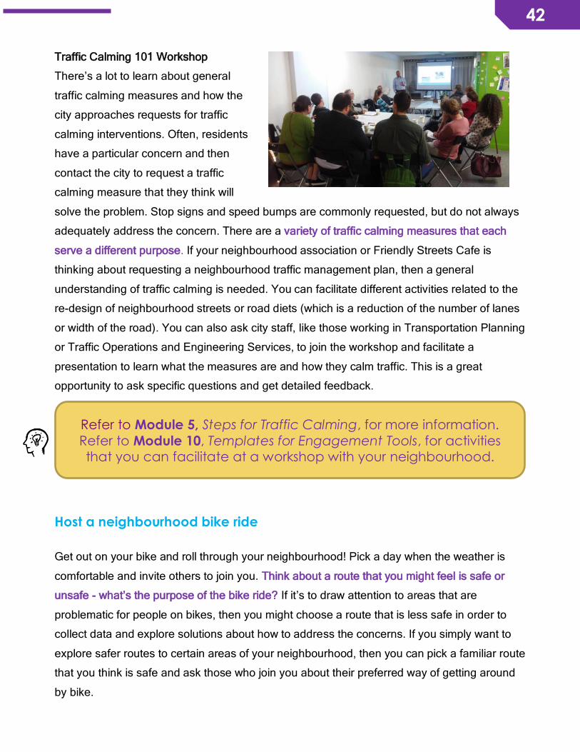
42
42
Traffic Calming 101 Workshop
There’s a lot to learn about general
traffic calming measures and how the
city approaches requests for traffic
calming interventions. Often, residents
have a particular concern and then
contact the city to request a traffic
calming measure that they think will
solve the problem. Stop signs and speed bumps are commonly requested, but do not always
adequately address the concern. There are a variety of traffic calming measures that each
serve a different purpose. If your neighbourhood association or Friendly Streets Cafe is
thinking about requesting a neighbourhood traffic management plan, then a general
understanding of traffic calming is needed. You can facilitate different activities related to the
re-design of neighbourhood streets or road diets (which is a reduction of the number of lanes
or width of the road). You can also ask city staff, like those working in Transportation Planning
or Traffic Operations and Engineering Services, to join the workshop and facilitate a
presentation to learn what the measures are and how they calm traffic. This is a great
opportunity to ask specific questions and get detailed feedback.
Host a neighbourhood bike ride
Get out on your bike and roll through your neighbourhood! Pick a day when the weather is
comfortable and invite others to join you. Think about a route that you might feel is safe or
unsafe - what’s the purpose of the bike ride? If it’s to draw attention to areas that are
problematic for people on bikes, then you might choose a route that is less safe in order to
collect data and explore solutions about how to address the concerns. If you simply want to
explore safer routes to certain areas of your neighbourhood, then you can pick a familiar route
that you think is safe and ask those who join you about their preferred way of getting around
by bike.
Refer to Module 5, Steps for Traffic Calming, for more information.
Refer to Module 10, Templates for Engagement Tools, for activities that you can facilitate at a workshop with your neighbourhood.

43
43
Similar to a walking street audit, think about the
audience that you are trying to engage with. Do
you want to know if the route is safe for kids,
women, or seniors? Do you want to know if the
route is safe for all-ages? You can also invite
your ward councillor and other community
organizations to ride with you and experience
the street from the community’s perspective.
The route can include key destinations if you’re
trying to get a sense of how to reach those areas by using the city’s bike network.
Street audit ride
Similar to a walking street audit, you can conduct a street audit by biking. How safe is your
neighbourhood for people who bike? You may also choose to venture out of your
neighbourhood to assess other routes in parts of the city that you or your neighbours
frequently travel to. This is an opportunity to collect data about particular bike lanes or routes
that have areas of concern, either due to poor infrastructure, lack of infrastructure, or travel
patterns of other street users. What ideas do you have, as a group, about how these areas
can be more safe for all street users? Take photos or videos if you can, and share on social
media! After the ride, you can send your feedback to city staff or request to meet with them to
discuss the findings. Don’t forget to experience your streets during the winter – viking biking is
safe and fun, but will let you document challenges or concerns that are specific to winter.
Neighbourhood and social ride
Bike rides for the sole purpose of exploring the neighbourhood and socializing with others is
also an effective way to engage the community. People are always looking for fun and social
activities in their communities. They can learn about safe routes that they might not have
explored and share how they like to get around the city. Creating friendly streets is also about
celebrating the ways in which your neighbourhood is already safe and vibrant! Make sure to
enjoy the areas that you love most.
Refer to Module 10, Templates for Engagement Tools, for a bikeability checklist to use on your ride.
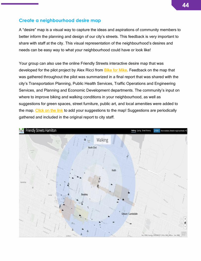
44
44
Create a neighbourhood desire map A “desire” map is a visual way to capture the ideas and aspirations of community members to
better inform the planning and design of our city’s streets. This feedback is very important to
share with staff at the city. This visual representation of the neighbourhood’s desires and
needs can be easy way to what your neighbourhood could have or look like!
Your group can also use the online Friendly Streets interactive desire map that was
developed for the pilot project by Alex Ricci from Bike for Mike. Feedback on the map that
was gathered throughout the pilot was summarized in a final report that was shared with the
city’s Transportation Planning, Public Health Services, Traffic Operations and Engineering
Services, and Planning and Economic Development departments. The community’s input on
where to improve biking and walking conditions in your neighbourhood, as well as
suggestions for green spaces, street furniture, public art, and local amenities were added to
the map. Click on the link to add your suggestions to the map! Suggestions are periodically
gathered and included in the original report to city staff.

45
45
Share stories about your streets
“Lead with story, not facts. Facts rarely speak for themselves. While the factual accuracy of your message is essential, facts should only serve as the supporting details for the story, not the hook that makes the story compelling. If you want to convey the devastation of unemployment, don’t lead with statistics. Tell us a compelling story about one person. Then tell us there are ten million more like her out there.”
• From “Show Don’t Tell” principle in Beautiful Trouble: A toolbox for revolution
Stories about how particular streets affect the residents who use them are effective in
convincing the general public on broader friendly street issues. Everyone has a story about
their experiences on the streets in their neighbourhood. Talk to your neighbours and ask them
how the streets affect their lives. For example: do the unsafe streets prevent kids from visiting
a friend who lives across a busy street or going to the park on their own? Have they
experienced a near miss or collision, and how did that affect them or their feeling of safety on
the streets? Instead of driving, would they walk or bike to the corner store to get milk if they
felt safer? Make these stories a central part of the narrative to explain why friendly streets are
needed in your neighbourhood.
The problems on your local street may not be well known by residents outside your
neighbourhood. Your direct knowledge of the streets in your neighbourhood makes you an
expert and you can bring your expertise to the city-wide debate on safer streets.
Use social media tools The use of social media is one of the most effective ways to share your campaign. To connect
with Friendly Streets on social media, you can tag
@CycleHamilton and @EnvHamilton, or use the
hashtag #FriendlyStreetsHamilton and #HamOnt.
Always use images and short, concise, and relevant
wording.
One example of a social media campaign is the
#BestRoutestoBarton campaign that Friendly Streets
project conducted in the pilot. We ran this campaign in
the summer as a way to engage more residents in the
conversation. We asked: which routes do you take to
46
46
walk or bike in Barton Village? Where would you like to see more bike connectivity? We
invited residents to share a photo of their travels to Barton Village using #BestRoutestoBarton
for a chance to win a prize! We ran weekly themes, included best places to eat, best public
art, which we announced every Wednesday. If possible, make sure to connect with the local
businesses for prizes and rewards to offer participants!
Express your support for friendly streets
There are lots of ways to let your city know that you support friendly streets or to raise
awareness about particular initiatives that you are working to address in your community. For
example, you can get in touch with the media by calling in to radio shows or writing an article
for a local newspaper. These are all great ways to amplify your voice and share your friendly
streets message and stories beyond your neighbourhood’s borders.
Another way to contribute to the city discussion on friendly streets is to read the articles and
letters to the editor in The Hamilton Spectator, CBC Hamilton, and Hamilton Community
News papers. When you see topics that relate to your issues, you can send your own letter to
bring your point of view to the debate.
Letters are more likely to be published if they are short, about 200 words, and include a
daytime phone number. The phone number is not published, but simply used to verify your
identity.
Email addresses for letters to the editor:
Hamilton Spectator: [email protected]
Hamilton Community News
Ancaster News: [email protected]
Dundas Star: [email protected]
Hamilton Mountain News: [email protected]
Sachem and Glanbrook Gazette: Have Your Say/Letters to the Editor: [email protected]
Stoney Creek News: [email protected]
Refer to Module 10, Tips for Social Media, for more ideas on how to
take advantage of social media.
47
47
Submissions to Raise the Hammer can be longer, and are more likely to be read if they
include photos: [email protected]
Celebrate the Friendly Streets changes in your neighbourhood
“Getting results is important, but much of the potential value is lost if you fail to celebrate your success and thank those who made it possible. Neighbours need to know that people like themselves are responsible. The sharing of such stories inspires people about what is possible when they work together and build on their assets.”
• Jim Diers, former director of Seattle’s Department of Neighbourhoods (http://www.neighborpower.org/papers/five-keys.pdf)
Friendly Streets is about serious issues – like health, accessibility, mobility, and the
environment. It is also about enjoying public spaces - so be sure to have fun in them and
celebrate all your victories, large and small! Make sure to include everyone in your
celebration by recognizing caring neighbours, strengths, and skills that everyone offers in
your community.
One way to celebrate friendly street victories is to throw a street party. Street parties are a
great way to experience streets on a pedestrian scale. That’s how public spaces become
people places!
Parties are also a natural way to build “social capital.” In a casual, less formal setting,
neighbours have the opportunity to share stories, learn about each other’s concerns, interests
and skills, and network. That growing sense of closer connection between people who live
near each other can become a critical step towards fostering neighbourhood friendly streets.
Organize a barbecue or potluck, have games for children, and encourage local talent to come
forward and perform. Organizing a street party can be easier to organize than many expect, if
you choose a residential street with little through traffic.
In Hamilton, an official street closure would require a formal request to city hall (complete with
fee), two million dollars in liability insurance, and ninety days' notice for city council
deliberations. But for smaller scale events on some streets, there is an alternative.
Instead of a full street closure, you can opt for a street closure that uses "street hockey
etiquette" by placing cones at each end of the block, and spacing them so that cars can pass
48
48
through them, but slowly. Notify all neighbours on the street through a letter delivered to all
mailboxes with contact information and ask for a reply with any concerns (this is key, you
don’t want anyone to be surprised by the event). Invite your city councillor (also a must for this
kind of event).
If you would like to take a look at more resources, a great group called Resilient
Neighbourhoods has a Celebrations & Gatherings section available online in their Resilient
Streets Toolkit. You will find helpful checklists and planning tips for throwing a more “formal”
Street Party. This group refers to “Resilient Streets” as places where neighbours know each
other and over time develop strong ties, share resources and other items (like tools, yards,
sports equipment, kids’ toys etc.), are available to help each other out in small or sometimes
big ways and are able to cooperate and share leadership in street or building issues and
activities. A really interesting concept – one that undoubtedly includes a lot of things that
“Friendly Streets” can bring to communities too.
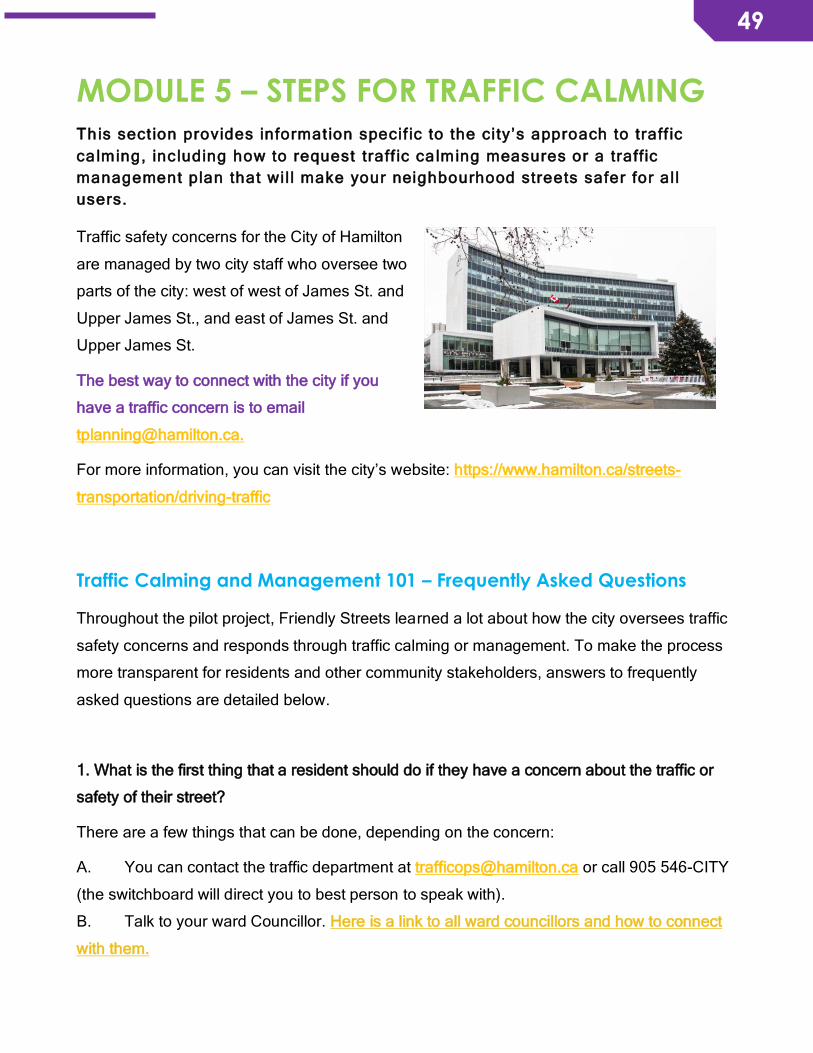
49
49
MODULE 5 – STEPS FOR TRAFFIC CALMING This sect ion provides information specif ic to the city’s approach to traff ic
calming, including how to request traff ic ca lming measures or a traffic
management plan that wil l make your neighbourhood streets safer for all
users.
Traffic safety concerns for the City of Hamilton
are managed by two city staff who oversee two
parts of the city: west of west of James St. and
Upper James St., and east of James St. and
Upper James St.
The best way to connect with the city if you
have a traffic concern is to email
For more information, you can visit the city’s website: https://www.hamilton.ca/streets-
transportation/driving-traffic
Traffic Calming and Management 101 – Frequently Asked Questions
Throughout the pilot project, Friendly Streets learned a lot about how the city oversees traffic
safety concerns and responds through traffic calming or management. To make the process
more transparent for residents and other community stakeholders, answers to frequently
asked questions are detailed below.
1. What is the first thing that a resident should do if they have a concern about the traffic or
safety of their street?
There are a few things that can be done, depending on the concern:
A. You can contact the traffic department at [email protected] or call 905 546-CITY
(the switchboard will direct you to best person to speak with).
B. Talk to your ward Councillor. Here is a link to all ward councillors and how to connect
with them.
50
50
C. Connect to your neighbourhood association and seek support. See Module 8, Expand
Your Network, for contact details for all neighbourhood associations in Hamilton.
D. If you have a concern that relates to cycling or on-street bike facilities, you can connect
with the Hamilton Cycling Committee ([email protected]) at the City. You can also email
Daryl Bender, Project Manager - Alternative Transportation with Public Works, at
[email protected]. Some of your questions or concerns may already be answered
through information provided on the city’s website for cycling.
E. If your concern is a maintenance issue (i.e., immediate concern), call 905 546-CITY to
speak directly with city staff.
2. What happens when a resident raises a valid concern about the safety of a street and
offers a solution (i.e., Complete Streets policy, etc.)?
It’s very important for residents to clearly identify and describe the problem first. Be as
specific as possible and provide details that relate to or show evidence for your concern. If
you’ve collected data about your streets (either through an audit or from anecdotal evidence),
you can share that with the city to provide context.
3. Is there a traffic calming request form on the city’s website that is accessible and promoted
to residents?
There is currently no form. Residents should send an email request to the appropriate city
staff (see above).
4. How does the city integrate resident concerns/solutions to inform future planning and
infrastructure development (i.e., related to walking or biking)?
The city’s approach is a patchwork process. It’s a preferred route strategy that will be more
connected and completed over time. Designs pitched by residents may not necessarily be
possible, so alternative routes might be suggested.
For broader issues, residents are typically invited to give input on City plans and policies
when these are under review, such as the Transportation Master Plan or the Cycling Master
Plan. The public is given opportunity to provide input to influence the review, before the
revised plan or policy goes to committee and Council for final review and approval.
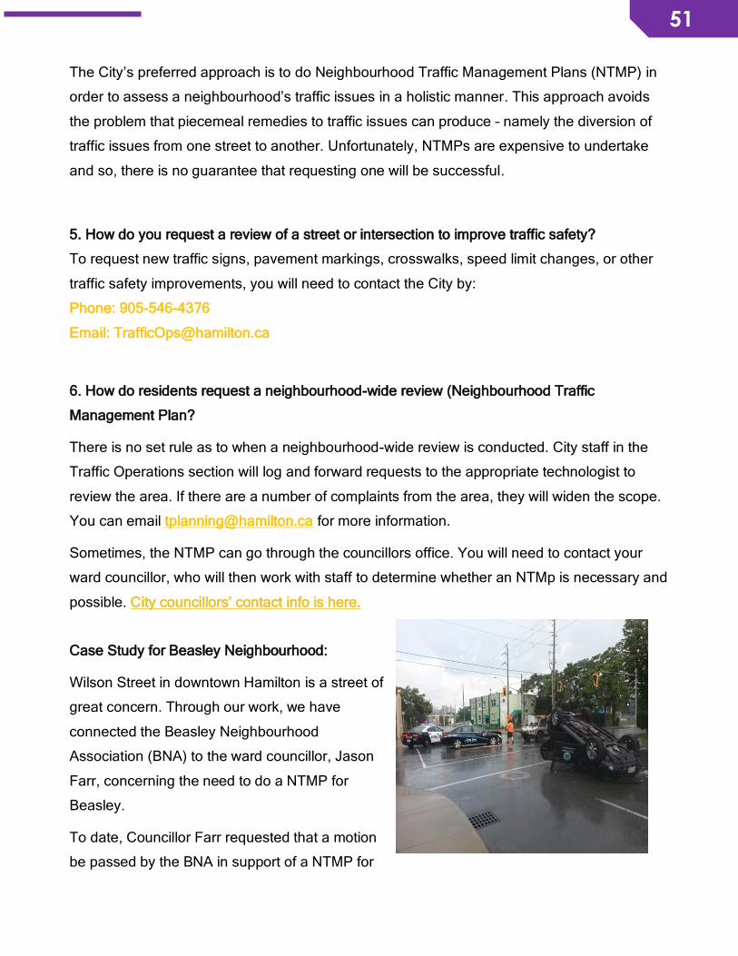
51
51
The City’s preferred approach is to do Neighbourhood Traffic Management Plans (NTMP) in
order to assess a neighbourhood’s traffic issues in a holistic manner. This approach avoids
the problem that piecemeal remedies to traffic issues can produce – namely the diversion of
traffic issues from one street to another. Unfortunately, NTMPs are expensive to undertake
and so, there is no guarantee that requesting one will be successful.
5. How do you request a review of a street or intersection to improve traffic safety?
To request new traffic signs, pavement markings, crosswalks, speed limit changes, or other
traffic safety improvements, you will need to contact the City by:
Phone: 905-546-4376
Email: [email protected]
6. How do residents request a neighbourhood-wide review (Neighbourhood Traffic
Management Plan?
There is no set rule as to when a neighbourhood-wide review is conducted. City staff in the
Traffic Operations section will log and forward requests to the appropriate technologist to
review the area. If there are a number of complaints from the area, they will widen the scope.
You can email [email protected] for more information.
Sometimes, the NTMP can go through the councillors office. You will need to contact your
ward councillor, who will then work with staff to determine whether an NTMp is necessary and
possible. City councillors’ contact info is here.
Case Study for Beasley Neighbourhood:
Wilson Street in downtown Hamilton is a street of
great concern. Through our work, we have
connected the Beasley Neighbourhood
Association (BNA) to the ward councillor, Jason
Farr, concerning the need to do a NTMP for
Beasley.
To date, Councillor Farr requested that a motion
be passed by the BNA in support of a NTMP for
52
52
Beasley. This has happened and the Councillor has now given the go-ahead for the staff to
proceed with an audit.
7. Why do some neighbourhoods have a Neighbourhood Traffic Management Plan, but
others don’t?
Neighbourhoods have to identify a need for one and then request the review. The request
needs the support of the ward councillor.
Residents can build the case for a NTMP by documenting concerns (e.g., use street audits,
photos, data collection). You are more likely to be successful in getting an NTMP by working
with your neighbourhood association, if one exists in your area.
When to request a neighbourhood traffic management plan
To request a neighbourhood traffic management plan, you will need to contact the city:
Phone: 905-546-4376
Email: [email protected]
The decision to undertake a review of the neighbourhood and draft a neighbourhood traffic
management plan ultimately rests with the city’s Traffic Engineering and Operations
department. However, if you aren’t satisfied with the response that you received from the city
then you can reach out to your neighbourhood association and local businesses for support.
A louder, unified voice from a large group of residents in your neighbourhood may be helpful
in moving forward. It can also help to identify other issues at the street-level that need to be
looked at and included in the neighbourhood review. You can also meet with your ward
councillor to raise awareness about the issue, and s/he may be willing to contact the city and
request that the issue be re-assessed and resolved with traffic calming measures. Please go
to Module 11 on Engagement Tools to find a sample Petition for Traffic Calming.
8. What is the ranking system that the city uses to prioritize and implement requests for traffic
calming measures or street infrastructure (e.g., Pedestrian Crossovers (PXO))?
The City of Hamilton has developed a ranking system to prioritize and rank requests for traffic
calming measures like a pedestrian crossover. This ranking system sets criteria for which
53
53
pedestrian crossovers are implemented annually in the city. The staff report was released in
January 2018.
Methodology for the priority ranking of bike lanes is explained in the Cycling Master Plan (see
Chapter 4, section 4.2.2.2.)
9. What is the City of Hamilton Strategic Road Safety Program?
Funded through the Red Light Camera Reserve Fund, this program’s primary emphasis areas
are intersections and vulnerable road users, consistent with priorities and objectives of
Neighbourhood Action Plans. The 2017 Hamilton Strategic Road Safety program has
identified the following initiatives.
1. Pedestrian Crossovers
2. Collision Analysis and Reporting – The plan here is to prepare a Yearly Annual Collision
report for September each year which ranks collisions by Wards and highlights areas related
to Pedestrian and Cyclist collisions. Traffic Operations is also looking into creating an active
collision map that the public can access.
3. Public Safety and Education – In 2018, the program is looking to focus on doing a Road
Safety Pledge in partnership with the Ontario Road Safety Committee of Ontario
4. Traffic Calming
5. Neighbourhood Safety Reviews
6. School Zone Safety Flasher Upgrades
7. Message board signage on the LINC and RHVP
It is estimated that between 2017 and 2018, $4.3 million will be used from the reserve to
address these items.
10. Does the City have an official Complete Streets policy?
The City is working on a Complete-Liveable-Better Streets policy as part of the Transportation
Master Plan review. The revised TMP will go to Council in February 2018, thus the framework
and policy has been developed. It will also develop specific design guidelines for multi-modal
service and promote transportation equity, as well as create a vision for individual streets.
54
54
11. Hamilton’s Pedestrian Mobility Plan made a recommendation for the establishment of a
Pedestrian Mobility Advisory Committee. City Council did not adopt that recommendation.
Can stakeholders in the community create such a committee?
A Vision Zero Committee at the city-level and neighbourhood-level Vision Zero Committees
are scheduled to be established in 2018 to address and improve concerns related to safer
streets. We are optimistic and hope that it can achieve the vision, goals, and objectives of the
Pedestrian Mobility Plan.
Vision Zero is a global movement transforming the way we use, interact with, and travel on
our roads. It has a simple and clear goal: ZERO fatalities or serious injuries on roadways.
Vision Zero aims for safer streets through improved education, enforcement, engineering,
evaluation and engagement.
For more information about the City of Hamilton exploring Vision Zero for our
neighbourhoods.
12. Transit between various sites is not connected, which makes it difficult for residents who
have to access services across different parts of the city. What is the correct process to
request that a transit route be re-directed so that there is better connectivity between sites
such as the Juravinski and General Hospital sites, for example?
The HSR's route reevaluation is promised to start this year - but no hard indication has been
given as to when it will be done. The first step is to get the automatic passenger counters
(APCs) up and running - and they're also going to be looking at Presto data which will help
them establish where people's destinations typically are and where popular transfer points
are. At the operating budget presentation early in 2018, councillors asked staff to have some
answers and progress report on this process later in 2018. The public meetings that HSR
plants to host may also play a role in collecting rider feedback, but that hasn’t been explicitly
stated.
To stay in the loop about this process, connect with and follow the Fix the HSR campaign, a
project of Environment Hamilton.
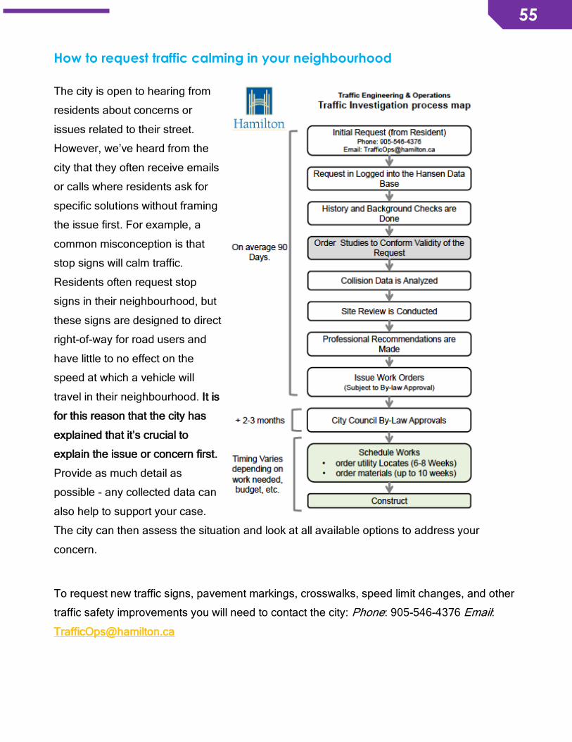
55
55
How to request traffic calming in your neighbourhood
The city is open to hearing from
residents about concerns or
issues related to their street.
However, we’ve heard from the
city that they often receive emails
or calls where residents ask for
specific solutions without framing
the issue first. For example, a
common misconception is that
stop signs will calm traffic.
Residents often request stop
signs in their neighbourhood, but
these signs are designed to direct
right-of-way for road users and
have little to no effect on the
speed at which a vehicle will
travel in their neighbourhood. It is
for this reason that the city has
explained that it’s crucial to
explain the issue or concern first.
Provide as much detail as
possible - any collected data can
also help to support your case.
The city can then assess the situation and look at all available options to address your
concern.
To request new traffic signs, pavement markings, crosswalks, speed limit changes, and other
traffic safety improvements you will need to contact the city: Phone: 905-546-4376 Email:

56
56
How to organize a petition
You can use the petition template below if you identify the need to do so in order to support your efforts.
We the undersigned residents of <Street Name> between <Street1 and Street2> support:
1. Installing traffic calming features on <Street Name> between <Street1 and Street2>. 2. These features may be; speed hump, speed cushion, chicanes, median island, bump outs, reduced
lanes and other devices as required
I/We also accept that I/We MAY BE impacted by additional Noise, loss of on-street parking & delay to travel time/ EMS response times. Sheet of
Name (PLEASE PRINT)
Address (unit #)
Telephone No.
Email Address
Signature Support
√
Opposed
√
No Opinion
√
GUIDELINES:
• Contact person must be the first person to sign the first page of the petition.
• Maximum of one signature per dwelling unit.
• Each person signing must indicate his/her opinion.
• A 70% majority of the total abutting dwelling units of a street must indicate support of the request for the petition to be considered.
Personal information collected on this form is collected solely for the purpose of determining
whether or not a majority support the installation of traffic calming features. The information is
collected under the legal authority of the Municipal Act, 2001, S.P. 2001, c. 25, Sec. 11(1) 1 and is subject to the provisions of the Municipal Freedom of Information and Protection of Privacy Act. If you have questions or concerns about this
collection, please contact:
Councillor (name) at (905) 546-XXXX
Councillor <Name> Ward <#>, City of Hamilton 71 Main Street West, 2nd floor Hamilton, ON L8P 4Y5 www.hamilton.ca

57
57
MODULE 6 – STREET VIBRANCY This sect ion provides information and resources about creat ing public spaces
in our community that are more vibrant, liveable, and enjoyable for people.
In 2013, Hamilton’s CoBALT Connects’ group conducted a research project called Expressing
Vibrancy “to get to a working definition of the term vibrant as it relates to specific
communities, or how to meaningfully implement plans to help realize the goal of “vibrant
communities.” They noted that what was also missing is “the recognition that vibrant can
mean different things to different people, so there is a need to adequately capture a range of
impressions from the members of a community.”
The case for street vibrancy and why “friendly” streets is not a luxury
Street vibrancy is about people on the
streets. If there are no people, then there
is no vibrancy!
Dan Burden, Director of Innovation and
Inspiration at Blue Zones and cofounder of
the Walkable and Livable Communities
(WALC) Institute, said, “Focus on building
communities through transportation,
instead of transportation through
communities.” Streets that are envisioned
and designed this way help to strengthen
and build communities.
More and more, people are seeking out experiences of place - how can the public places they
go to be “third spaces”? A third space is a place after home and work. People are starting to
reimagine streets as third spaces, gathering places that are welcoming, interesting, and
worthy of lingering. Animated spaces and destination places can be enjoyed when there are
benches, other street furniture, art, shady trees, something of interest, and a feeling of safety.
Naturally, streets that are safe for walking and biking are beneficial to local businesses.
Results from a California study show that the number of businesses per acre is the single
58
58
most robust indicator of whether people are likely to walk in their neighbourhoods. People
living in neighbourhoods with more business establishments per acre conduct more of their
travel within their neighbourhood and are more likely to travel by walking. This study suggests
that neighbourhoods that support active transportation are places where there are a large
number and variety of businesses in a relatively small area.
How to make streets into people places: Enhance street vibrancy How to request street furniture Street furniture consists of a wide variety of elements and amenities installed in the public
right of way for the use and convenience of the public.
Key street furniture elements include:
• Transit shelters
• Litter receptacles
• Benches
• Multi-publication structures
• Poster kiosks
• Wayfinding signs
• Bicycle racks
• Cigarette receptacles
To request street furniture, garbage receptacles, benches, bus shelters, etc. it is best to
contact the City’s Contact Centre at 905-546-2489 or at [email protected]. The Contact
Centre staff will be able to either provide the answers or direct residents to staff who can help
them. Check out the City of Hamilton Coordinated Street Furniture Guidelines for city
planners and designers.
Tips to increase green infrastructure in your neighbourhood
Green infrastructure refers to trees, as well as rain and pollinator gardens. These elements
not only serve to increase the attractiveness of a street and clean the air, but also contribute
to the street’s viability and provide climate change benefits. Green infrastructure on local
streets is crucial for increasing biodiversity within the city. This is becoming increasingly
needed as habitat for pollinators and wildlife has declined dramatically in our rural
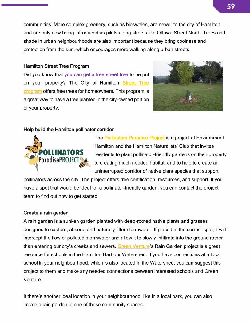
59
59
communities. More complex greenery, such as bioswales, are newer to the city of Hamilton
and are only now being introduced as pilots along streets like Ottawa Street North. Trees and
shade in urban neighbourhoods are also important because they bring coolness and
protection from the sun, which encourages more walking along urban streets.
Hamilton Street Tree Program
Did you know that you can get a free street tree to be put
on your property? The City of Hamilton Street Tree
program offers free trees for homeowners. This program is
a great way to have a tree planted in the city-owned portion
of your property.
Help build the Hamilton pollinator corridor
The Pollinators Paradise Project is a project of Environment
Hamilton and the Hamilton Naturalists’ Club that invites
residents to plant pollinator-friendly gardens on their property
to creating much needed habitat, and to help to create an
uninterrupted corridor of native plant species that support
pollinators across the city. The project offers free certification, resources, and support. If you
have a spot that would be ideal for a pollinator-friendly garden, you can contact the project
team to find out how to get started.
Create a rain garden
A rain garden is a sunken garden planted with deep-rooted native plants and grasses
designed to capture, absorb, and naturally filter stormwater. If placed in the correct spot, it will
intercept the flow of polluted stormwater and allow it to slowly infiltrate into the ground rather
than entering our city’s creeks and sewers. Green Venture’s Rain Garden project is a great
resource for schools in the Hamilton Harbour Watershed. If you have connections at a local
school in your neighbourhood, which is also located in the Watershed, you can suggest this
project to them and make any needed connections between interested schools and Green
Venture.
If there’s another ideal location in your neighbourhood, like in a local park, you can also
create a rain garden in one of these community spaces.
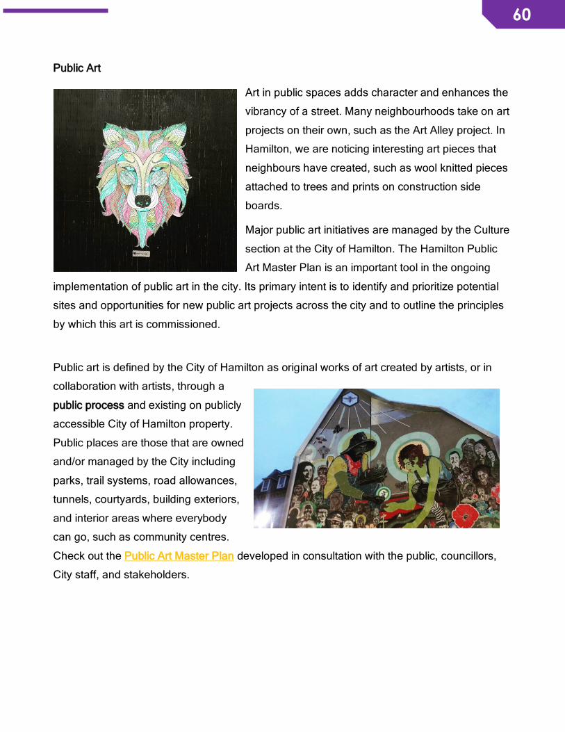
60
60
Public Art
Art in public spaces adds character and enhances the
vibrancy of a street. Many neighbourhoods take on art
projects on their own, such as the Art Alley project. In
Hamilton, we are noticing interesting art pieces that
neighbours have created, such as wool knitted pieces
attached to trees and prints on construction side
boards.
Major public art initiatives are managed by the Culture
section at the City of Hamilton. The Hamilton Public
Art Master Plan is an important tool in the ongoing
implementation of public art in the city. Its primary intent is to identify and prioritize potential
sites and opportunities for new public art projects across the city and to outline the principles
by which this art is commissioned.
Public art is defined by the City of Hamilton as original works of art created by artists, or in
collaboration with artists, through a
public process and existing on publicly
accessible City of Hamilton property.
Public places are those that are owned
and/or managed by the City including
parks, trail systems, road allowances,
tunnels, courtyards, building exteriors,
and interior areas where everybody
can go, such as community centres.
Check out the Public Art Master Plan developed in consultation with the public, councillors,
City staff, and stakeholders.
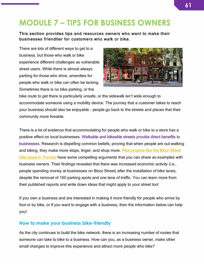
61
61
MODULE 7 – TIPS FOR BUSINESS OWNERS This sect ion provides tips and resources owners who want to make their
businesses fr iendlier for customers who walk or bike.
There are lots of different ways to get to a
business, but those who walk or bike
experience different challenges as vulnerable
street users. While there is almost always
parking for those who drive, amenities for
people who walk or bike can often be lacking.
Sometimes there is no bike parking, or the
bike route to get there is particularly unsafe, or the sidewalk isn’t wide enough to
accommodate someone using a mobility device. The journey that a customer takes to reach
your business should also be enjoyable - people go back to the streets and places that their
community more liveable.
There is a lot of evidence that accommodating for people who walk or bike to a store has a
positive effect on local businesses. Walkable and bikeable streets provide direct benefits to
businesses. Research is dispelling common beliefs, proving that when people are out walking
and biking, they make more stops, linger, and shop more. Pilot projects like the Bloor Street
bike lanes in Toronto have some compelling arguments that you can share as examples with
business owners. Their findings revealed that there was increased economic activity (i.e.,
people spending money at businesses on Bloor Street) after the installation of bike lanes,
despite the removal of 160 parking spots and one lane of traffic. You can learn more from
their published reports and write down ideas that might apply to your street too!
If you own a business and are interested in making it more friendly for people who arrive by
foot or by bike, or if you want to engage with a business, then the information below can help
you!
How to make your business bike-friendly As the city continues to build the bike network, there is an increasing number of routes that
someone can take to bike to a business. How can you, as a business owner, make other
small changes to improve this experience and attract more people who bike?

62
62
Tips for making your business friendlier for people who arrive by bike:
• Have a bike rack right out front! This small gesture of convenience can go a long way
and save someone time instead of looking for a street post or fence to lock their bike.
• Have a small bike repair kit in the event that someone needs to fix something on their
bike. This can include a mini pump, chain checker, wrench, hex key, screwdriver, and
patches for a tire. This can be helpful if a customer experiences some problems with
their bike so that they can continue safely on their travels.
• Have one or two bike locks available to check out - not everyone can afford a bike lock!
Bike theft is a growing concern in particular neighbourhoods in Hamilton. If you
developed a system to sign out a bike lock to a customer, that can give them peace of
mind while they shop and encourage them to return by bike in the future. A safe bike is
always good for business!
• Offer a glass of water or refill their water bottle! Staying hydrated makes biking a lot
easier.
• Own a bike? Conduct a street audit! Explore the nearest bike routes to your business
and gather feedback about particular challenges or concerns related to safety.
If you currently don’t have a bike rack for customers, you can choose to purchase one and
place it on your property or you can request one from the city. After you submit the request,
the city will do a site analysis prior to receiving funding for installation. The site visit usually
happens within one month of receiving the request, but it can take longer depending on the
time of year. If a bike rack can be installed at the desired location, then a work order is
submitted which takes at least 6-8 weeks before installation.
You can request a bike rack from the city here.
Lastly, you can become more informed about the design and implementation of the city’s bike
network. If you hear from customers that they wish there was a safer route to get to your
business, you can connect with city staff or your ward councillor to provide that feedback. You
can also get involved in the municipal transportation planning processes by advocating for
rapid implementation of the bike network or by providing anecdotal and detailed feedback at a
consultation event held by the city.

63
63
How to make your business pedestrian-friendly Walking is one of the most essential ways that people get around. At some point in the day,
everyone is a pedestrian - we walk to transit or to our cars, and we walk from transit or car to
a store. How can you, as a business owner, make small changes to improve this experience
and attract more people who walk?
Tips for making your business friendlier for people who arrive by foot:
• Put a bench or street furniture in front of the store! It can be a restful spot after their
travels. People also like to sit and linger. Enjoying the streetscape is the first step to
nurturing a sense of belonging and responsibility to make streets for people.
• Improve the street vibrancy - make it a people place! Connect with local artists who
may be willing to showcase their art. Adding beautification elements, even in the form
of decorative bike racks, makes the street more interesting to look at and contributes to
the creation of a community space.
• Add more green infrastructure to the street. You can plant a garden or trees that
provide shade for people walking by. Being near nature enhances liveability for all!
• Shovel the sidewalk soon after a snowfall! People have difficulty walking down paths
that have not been cleared, particularly those with mobility issues.
• Offer a glass of water or refill their water bottle! Staying hydrated makes the trip back a
lot easier.
• Host a street audit to get a sense of your customers’ journeys from their perspective.
Take notes and document the walk on social media!
Keep an ear out for any stories that you hear from customers about their experience travelling
to or from your business. Similar to any feedback that you hear from those who bike, you can
share any walking-related concerns with city staff and your ward councillor. Stay informed of
any capital construction projects that may affect the streetscape and weigh in early on with
suggestions for accommodating people who walk in the area.
Request an on-street patio
The City of Hamilton’s On-Street Patio program allows local businesses to establish
temporary seasonal patios and seating areas utilizing on-street parking spaces within
business improvement areas (BIAs) and community improvement plan areas (CIPAs).
Applications are due on April 1 of each year at 4:30pm. The on-street patio program was

64
64
inspired by the pop-up patio interventions that community members held as part of 100in1
Day Hamilton.
On-street patios act as buffers to vehicular traffic on the street, making it safer for people who
walk. The presence of more people on the street, socializing or enjoying a meal, also
contributes to the vibrancy and friendliness of street. Building people places in our
neighbourhoods only brings positive benefits to the community and invites people to linger for
longer periods of time and to strengthen social connections.
More information about applying for an on-street patio is available here.
Become Ontario by Bike certified
Ontario by Bike is a network that offers information related to biking and showcases bicycle
friendly locations across the province! This includes accommodations, attractions, breweries,
cafes and restaurants, and business areas. There is a growing number of people who enjoy
travelling within and outside their cities by bike and who contribute to “cycle tourism”. This
growing industry generates revenue for local and regional businesses alike.
The City of Hamilton is Ontario by Bike certified, along with 32 bicycle friendly locations
across the city. The city is also interested in helping more businesses, particularly business
improvement areas, to become certified. Becoming certified can connect you to a larger
network of bicycle friendly businesses and can increase business from both local and regional
people who arrive by bike.
Offer incentives for people who walk or bike to your business Research is dispelling common beliefs, proving that when people are out walking and biking,
they make more stops, linger, and shop more. Why not encourage them to stop by more
often? Similar to days where seniors get discounts at stores, you can also think of interesting
ways to attract more people who walk or bike. Some ideas include: 10% off on a certain day
of the week, a free cold or hot beverage, or a monthly raffle for a chance to win a bike lock or
tool.
Refer to Module 15, More Resources for more information about Ontario by Bike and how you can become certified.

65
65
Apply for funding for façade improvement opportunities offered by the
City of Hamilton
The City of Hamilton offers several grant opportunities and programs for businesses and
business improvement areas across the city. These can go a long way with recreating a
business facade that is more attractive and enjoyable for the streetscape. You can connect
with the city’s Planning and Economic Development Department for more information specific
to your business.
Here are a few opportunities relevant to business owners in the downtown core:
• BIA Commercial Property Improvement Grant Program
• Commercial Facade Property Improvement Grant Program
• Barton-Kenilworth Commercial Corridor Building Improvement Grant Program

66
66
MODULE 8 – EXPAND YOUR NETWORK This sect ion provides a l is t of key stakeholders to connect with in order to
build a strong network of people who support safer streets in your
neighbourhood or ward.
A neighbourhood is more than the residents that live there - your network should include your
neighbourhood association, local businesses, advocacy groups for pedestrians and cyclists,
local organizations whose work aligns with your efforts, and local cycling businesses. These
key stakeholders likely have a lot of connections in the community, as well as expertise or
resources, to support your efforts and give you a louder voice for friendly streets.
Connect with your neighbourhood association Many neighbourhoods in the city have neighbourhood associations. These groups represent
the interests and priorities of the neighbourhood, and work together to enhance the
community. They typically meet once per month and discuss different topics like affordable
housing, local transportation, and upcoming community events. You can email them and ask
to be put on the agenda so that you can speak to the whole group. This might generate some
more discussion about particular priorities for your streets and you may connect with other
neighbours who are interested in joining your initiative or working on similar efforts. Your
neighbourhood association should also have resources to help.
Neighbourhood associations in Hamilton:
For more information on the neighbourhood associations across Hamilton, you can consult
The Red Book of Hamilton. Using the term “neighbourhood association”, you will be directed
to a list of active groups in the city.
Other groups led by the community that are interested in community development and a
variety of topics related to active transportation and liveability:
• Dundas Works
• Hamilton LRT Advocacy
• Hamilton Light Rail Initiative
67
67
Connect with local advocacy groups Groups like Environment Hamilton and Cycle Hamilton can lend support and work with you to
advance your efforts or initiatives related to active transportation.
Connect with local cycling businesses and organizations Other groups in the community that work to make our city a safer and more enjoyable place to
ride a bike:
• Hamilton Bike Share
• New Hope Community Bikes
• Downtown Bike Hounds
• Bike Locke
• Ancaster Cycle
• Freewheel Cycle
These groups often host social rides, which are good opportunities to connect with other
people who rides bikes and learn about their experiences.

68
68
MODULE 9 – FRIENDLY STREETS DESIRE MAP This sect ion shares a tool created by the Fr iendly Streets pilot pro ject that
residents can use to share what can be done to improve your neighbourhood
streets . The suggestions and feedback are routine ly shared with c ity
departments in order to pursue policy and in frastructure solut ions.
We invite people to share input on where to improve biking and walking conditions in our pilot
neighbourhood and elsewhere across the city, as well as suggestions for green spaces, street
furniture, public art, and local amenities. The link to the desire map form is shared below.
The map shows where others have voiced their concerns or shared ideas about improving
walkability, bikeability, and street vibrancy in your neighbourhood. The suggestions and
feedback are routinely shared with city departments in order to pursue policy and
infrastructure solutions.
Put your voice on the map to share your feedback on the city-wide online desire map!
69
69
MODULE 10 – TEMPLATES OF ENGAGEMENT
TOOLS This sect ion shares engagement tools created or adapted for the Fr iendly
Streets p ilot project that you can use to engage other community residents,
stakeholders, businesses, major community inst itut ions, and your ward
council lor. These tools are helpful to assess current challenges and re -imagine
neighbourhood streets.
Links to each engagement toolkit will be available on the Friendly Streets blog, and Environment Hamilton and Cycle Hamilton websites, in early February 2018.
• Walking street audit template
• Biking street audit template
• Walking and biking street audit template
• Survey for businesses template
o Template to record responses
• Presentation on traffic calming
• Presentation on policy, planning, and design
• Map of bicycle-friendly routes
• General online survey
• Presentation on winter cycling and route planning
70
70
MODULE 11 – TIPS FOR SOCIAL MEDIA This sect ion provides tools for effect ively using socia l media in your efforts
and how to launch a social media campaign.
Communicating Your Message
It is important to clearly and effectively communicate your message if you want to have a
greater impact and reach a broader audience. Think about who your audience is. Is it the
public, the media, elected officials? In all your written, verbal, and visual communications, it is
critical to be clear about who you are trying to reach.
Depending on who you are trying to reach, it is helpful to tailor your language and narrative in
a way to best communicate your message.
In addition to explaining the facts and arguments that support your desire for friendly streets,
consider sharing stories from your life or from the life of residents in your neighbourhood.
Facts provide the foundation for telling a simple story, but to complete the picture, real stories
and people are needed. Storytelling is a powerful way to reshape and include more voices in
the narrative of mobility in our communities. We need to hear stories to understand the impact
that
Explain why concerns about friendly streets are important to you and how the solutions that
you are exploring might lead to safer walking and biking conditions for you and your
community. Often these issues are not well understood by members outside of your
immediate community, but hearing about the ways in which people are personally affected
can create a much better understanding. Stories can also link experiences – people might feel
the same way about other streets or challenges related to their mobility. Stories ultimately
make a stronger case for friendly streets.
Tips for posting on social media If you want to connect with the Friendly Streets project, we encourage you to tag us in your
twitter message:
Environment Hamilton: @EnvHamilton
Cycle Hamilton: @CycleHamilton
71
71
Include the link to your event or you campaign in your message. You can use Bitly to shorten
links that will be too long to include on a poster or in a tweet.
Use relevant hashtags "#." Hashtags are words or multi-word phrases preceded by the #
symbol, such as #FriendlyStreetsHamilton or #HamOnt. People can search for posts with a
specific hashtag, so they are helpful to categorize content or track topics on Twitter and other
social media platforms including Facebook, Instagram, and Pinterest. Using hashtags helps
people find posts and tweets that interest them.
Including hashtags helps your audience find your messages when posting on social networks.
Consider using terms such as; #ActiveTransportation, #walking, #cycling, #cycle, #bike,
#walking, and #HamOnt. If you develop a name for your efforts, you can create a hashtag for
that
Don't use any spaces in your hashtag; if you need to use more than one word, simply run
them together. If it's hard to read the meaning of the phrase without spaces, you can
capitalize each word. For example, #throwbackthursday and #HamOnt are examples of
popular multi-word hashtags.
Use relevant pictures. Including these in your posts makes your social media messages more
engaging. There’s a reason that the saying goes “a picture says 1000 words”.
Tips for personalized hashtags
How do you decide which hashtags to use? You can come up with a phrase that you find
appropriate to describe your efforts or you can use hashtags that you've seen other people
use in their posts. You can definitely include more than one hashtag in your Tweet, if
appropriate, but beware of using too many hashtags. Once you get above three hashtags or
when your post has more hashtags than text in it, your post begins to look like spam. You can
insert a hashtag at the beginning, middle, or end of your post.
Sample Tweets
-Spring is here! Get your bikes in gear and join us on a #bikeride #friendlystreetshamilton.
June 2-11. Link to event.
-Dust off your #walking shoes we are going on a #neighbourhood walkabout! June 29th

72
72
-Does your #business have a #bikerack? Request one @cityofHamilton
#SustainableBusinesses [add bike rack photo]
-Ditch the car! Take the #BestRoutestoBarton and curb emissions. Link to event
-Tweet us a photo of your favourite place to eat in @Barton-BIA for a chance to win a gift card
to La Luna restaurant #bestEats #HamOnt
Hashtags to use
#FriendlyStreetsHamilton
#FriendlyStreets
#VisionZero
#ActiveTransportation
#Multimodal
#MultiModalTransport
#MultiModalHamOnt
#PlaceMaking
#UrbanThinkers
#SaferCities
Use the #HamONT hashtag to reach local audiences
Twitter handles of neighbourhood associations, city staff, councillors, and local organizations
Friendly Streets partnering organizations Twitter Handle
Environment Hamilton @EnvHamilton
Cycle Hamilton @CycleHamilton
Neighbourhood Associations Twitter Handle
Beasley Neighbourhood Association @OurBeasley
Gibson & Landsdale Community Planning Team
@GibsonLandsdale
Central Neighbourhood Association @CentralHamOnt
Strathcona Community @hamiltonscc

73
73
Durand Neighbourhood @Durand_NA
Crown Point Hub @CrownPointHub
Jamesville Hub @JamesvilleHUB
The Sherman Hub @TheShermanHub
North End Neighbours @nenhamilton
Ward Councillors and City Staff Twitter Handle
City of Hamilton @cityofhamilton
Ward 1 - Councillor Aidan Johnson @aidan_johnson
Ward 2 - Councillor Jason Farr @JasonFarrHamOnt
Ward 3 - Matthew Green @MGreenWard3
Ward 4 - Sam Merulla @Sam_Merulla
David Ferguson, Superintendent of Traffic Engineering
@FergusonDF
Jason Thorne, General Manager of Planning & Economic Development
@JasonThorne_RPP
Smart Commute @SmartCommuteHam
Aaron Grieser, Parking Control Officer @HamOntParking
Business Improvement Areas (BIA) Twitter Handle
Barton Village BIA @Barton_Village
Downtown Hamilton BIA @DwntwnHamBIA
International Village @HamIntlVillage
Ottawa Street @OttawaSt_BIA
Concession St @OttawaSt_BIA
Downtown Dundas BIA @dwntwnDundasBIA
The Westdaler @mywestdale
Ancaster Village @AncasterVillage
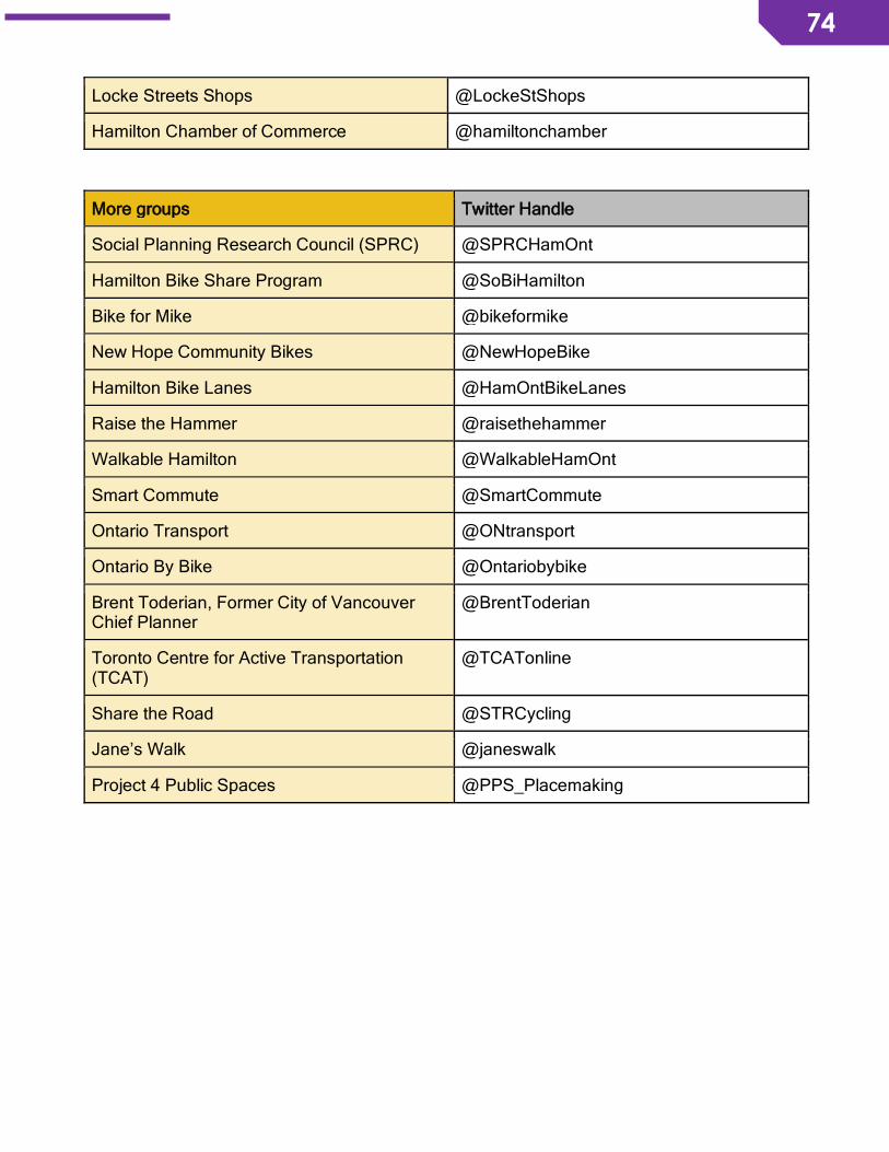
74
74
Locke Streets Shops @LockeStShops
Hamilton Chamber of Commerce @hamiltonchamber
More groups Twitter Handle
Social Planning Research Council (SPRC) @SPRCHamOnt
Hamilton Bike Share Program @SoBiHamilton
Bike for Mike @bikeformike
New Hope Community Bikes @NewHopeBike
Hamilton Bike Lanes @HamOntBikeLanes
Raise the Hammer @raisethehammer
Walkable Hamilton @WalkableHamOnt
Smart Commute @SmartCommute
Ontario Transport @ONtransport
Ontario By Bike @Ontariobybike
Brent Toderian, Former City of Vancouver Chief Planner
@BrentToderian
Toronto Centre for Active Transportation (TCAT)
@TCATonline
Share the Road @STRCycling
Jane’s Walk @janeswalk
Project 4 Public Spaces @PPS_Placemaking
75
75
MODULE 12 – FRIENDLY STREETS CASE
STUDIES This sect ion offers insight from local Beasley Neighbourhood Associat ion and
major community inst itut ion Hamilton General Hospita l about current issues
that impact the safety, walkabil i ty, bikeabil ity of neighbourhoods. Learn about
how these stakeholders are working together and with the community to get
th ings done.
When traffic calming is not enough: Beasley Neighbourhood
Association’s traffic management plan
There are major concerns about traffic safety in the Beasley neighbourhood downtown
Hamilton. The corner of Hughson Street and Wilson Street is one area of particular concern,
where a residential home has been hit by a car 5 times over the last 15 years. Through the
Friendly Streets project, the Beasley residents who live in the home have now been
connected to the Beasley Neighbourhood Association, which has led to interest in moving
forward with a Neighbourhood Traffic Management Plan. Residents are concerned that
designing a two-way street with signals optimized to allow speeding in one direction, which
currently describes the reality of Wilson Street, is a dangerous combination that impacts the
safety and liveability of the neighbourhood.
Background
The first Beasley Neighbourhood Plan was published in 2011 and was reviewed in 2016
through public engagement. The revised Neighbourhood Plan includes an endorsement of
Vision Zero, which aligns with the work of Friendly Streets and the desire for safer streets.
Mike Borelli, current co-chair of the Beasley Neighbourhood Association (BNA), reports that
the BNA has called on the city to immediately support and implement proposals for 40km/h on
all residential streets in Beasley in their latest Neighbourhood Plan. The Plan also includes
actions for the community: individuals, small groups, and other associations will work with the
Ward 2 Councillor to address traffic safety through design and other infrastructure
improvements. Happily, there are a few residents who are willing to work together and ready
to take the lead on these priority actions.

76
76
Jason Farr is the City Councillor for Ward 2, which includes Beasley neighbourhood. Jason
Farr holds quarterly meetings, through the Ward 2 Community Council, with the six
neighbourhoods of the ward. The resident of the home that was hit by several cars has met
with Councillor Farr and other city staff to discuss safety on Wilson Street between James
Street North and John Street North. There is currently a list of improvements that will be
implemented in future, including improved signage to warn drivers of the curve along Wilson
Street. Staff reported that they did not want to make any significant changes to the street in
anticipation of LRT construction. Other street-level improvements that were discussed include
light timing, reduced speed limit along this section of Wilson Street, narrowing lanes, and
other traffic calming measures.
To move forward with addressing traffic and safety concerns, Councillor Farr suggested that
the BNA invite city staff to participate in a street audit to share their concerns and
experiences, as well as discuss long-term solutions for Wilson Street.
On February 5, 2018, residents of Beasley and other community stakeholders will conduct a
street assessment with city staff to highlight areas of concerns and explore policy or
infrastructure solutions.
Working and collaborating with a major community institution: Hamilton
General Hospital
The Friendly Streets pilot focused on the area around
the Hamilton General Hospital and radiated out to
surrounding neighbourhoods. We chose to begin the
project around the General Hospital because
community members have expressed concerns about
the challenges they face walking and biking in this
area.
Hamilton Health Sciences and the Hamilton General Hospital
An initial meeting with a representative from Hamilton Health Sciences provided a broad
picture of this major community institution’s background and goals for the future. Some key
points for consideration include the nature of the 7am-7pm workplace for health care
77
77
professionals, the hospital’s role as a regional destination for trauma patients, the twenty-year
Our Healthy Future plan for the health care that the community will need in years to come
(which is one of their biggest planning efforts in decades), the future consolidation of Hamilton
Health Sciences’ sites, engagement approaches with the community, current parking demand
for hospital employees and patients, and the role of Smart Commute Hamilton encouraging
and promoting more opportunities for hospital staff and employees to walk or bike. The
representative also shared data that was collected through a Smart Commute survey, which
revealed that the average commute for an employee is 15-30 minutes and that 80% commute
to work alone. Most employees commute between 6-10km each way and report that driving is
a preferred travel mode because it is faster than alternatives. Lastly, Hamilton Health
Sciences does not currently have a transit strategy.
Engagement with the Community
From March to July 2017, we began engaging and involving residents who live in the area in
street-level assessments along Barton Street and around the hospital so that people could
share their perspectives on current barriers and challenges to walking and biking. We also
another street-level assessment specific to the Hamilton General Hospital site, which was
attended by local public health officials who work for the City of Hamilton and shared their
expertise.
Engaging Staff
With support from our connections at the Hamilton General Hospital and the Smart Commute
working group at the hospital, we organized an outreach event in the cafeteria to talk to
hospital staff and gather feedback about how to make sustainable, alternative transportation
choices a viable option. We learned that driving is currently the most convenient way for many
employees to get to work, but that many would take public transit if there was a fast, direct,y
and convenient route from the mountain. Many employees were keen to learn more about the
carpooling option offered through the Smart Commute working group. Lastly, we heard that
perceived safety was a concern for some employees and a barrier to walking in the
surrounding area.
78
78
Aspirations of multiple stakeholders
Given the current efforts of the Smart Commute working group at the hospital, as well as the
current parking demand, it would be useful to focus on linking sustainable transportation to
the vision of Our Healthy Future and to think of the hospital area in a similar way to
Vancouver’s “Hospital District”. The lack of connectivity between transportation modes, for
example a multi-modal commute, and the lack of transit connections to the hospital site is a
challenge for both hospital employees and patients. Improving transit and active
transportation connections would not only enhance the commute for employees and provide
more travel options for patients, it would also alleviate parking demand and improve public
health. The future consolidation of Hamilton Health Sciences sites will also create more
demand for parking and increase the number of cars that travel to the site each day. It would
be strategic then to look at other examples in the community, like Mohawk College, who
prioritized active transportation and transit options on campus. The synergies between these
aspirations, to alleviate parking demand and to plan for the future vision of health care, aligns
well with planning for active travel and encouraging these modes among employees and
patients. Beautification of the hospital site was also identified as an aspiration.
Taking it to the next level: Connecting with the Administration
Through our connections, we met with the CEO of Hamilton Health Sciences, Rob MacIsaac,
in August 2017 to express how together, Friendly Streets and HHS, might work to develop a
plan of action for sustainable transportation in and around the Hamilton General Hospital.
Rob MacIsaac arranged for Friendly Streets to meet with Teresa Smith, President of Hamilton
General Hospital, to discuss how our work and findings from the community might improve
the patient and employee journey. This lead to the creation of a partnership between Friendly
Streets and the Hamilton General Hospital, as well as the establishment of a steering
committee to work on specific actions and initiatives.
A Friendly Streets Community Stakeholder Group
Since the fall of 2017, the Friendly Streets Community Stakeholder Group has been working
on specific actions and initiatives that relate to the patient journey, pedestrian safety, cycling
infrastructure, and beautification. The first meeting included community partners who were
already engaged in initiatives around the Hamilton General Hospital, including Trees for
79
79
Hamilton, Beautiful Alleys, and the Hamilton Pollinator Paradise Project. Moving forward, the
Friendly Streets Community Stakeholder Group will continue to explore how we can begin
addressing some of the concerns that were raised through the street-level assessments
around the hospital and feedback from employees. Some major concerns include the need
for a pedestrian crossing at Victoria Avenue North and Copeland Avenue North, improving
north-south bike routes to the hospital, and exploring the rerouting of an HSR bus to better
serve this area.

80
80
MODULE 13 – FACT SHEETS This sect ion has mult ip le fact sheers that can be shared in your neighbourhood
or ward to help inform and engage other stakeholders around issues related to
walk ing and bik ing.

81
81
82
82
MODULE 14 – MORE RESOURCES This sect ion offers a variety of resources rela ted to act ive transportat ion,
part ic ipatory planning, community engagement, urban planning, tact ica l
urbanism, and community development. These tools can be helpful to further
support any resident-led efforts for fr iendly streets at the neigbourhood level.
A Resident’s Guide for Creating Safer Communities A guide that provides examples from other communities working to improve pedestrian and
bicycle safety, includes ideas and resources to help residents find ways to address street-
level issues, and promote safety for all road users.
Active Neighbourhoods Canada A partnership of organizations across Ontario to build active citizenship and active streets.
Their case studies provide resources, ideas, and inspiration for community building and
tactical urbanism to secure safer streets.
Ecology Ottawa Walk/Bike Audit Tools Provides an audit toolkit, which includes checklists for walkability and bikeability, as well as
an active transportation community guidebook. These resources help residents to identify
obstacles to walking and biking in their community.
CAPE Active Travel Toolkit A guide for health professionals aiming to promote active travel to patients. Includes five
modules and fact sheets that can be shared.