Free and open source GIS in South America: political ...
38
Central Washington University Central Washington University ScholarWorks@CWU ScholarWorks@CWU All Faculty Scholarship for the College of the Sciences College of the Sciences 9-2019 Free and open source GIS in South America: political inroads and Free and open source GIS in South America: political inroads and local advocacy local advocacy Sterling Quinn Central Washington University Follow this and additional works at: https://digitalcommons.cwu.edu/cotsfac Part of the Geographic Information Sciences Commons Recommended Citation Recommended Citation Quinn, S. (2019). Free and open source GIS in South America: political inroads and local advocacy. International Journal of Geographical Information Science, 34(3), 464–483. https://doi.org/10.1080/ 13658816.2019.1665672 This Article is brought to you for free and open access by the College of the Sciences at ScholarWorks@CWU. It has been accepted for inclusion in All Faculty Scholarship for the College of the Sciences by an authorized administrator of ScholarWorks@CWU. For more information, please contact [email protected].
Transcript of Free and open source GIS in South America: political ...

Central Washington University Central Washington University
ScholarWorks@CWU ScholarWorks@CWU
All Faculty Scholarship for the College of the Sciences College of the Sciences
9-2019
Free and open source GIS in South America: political inroads and Free and open source GIS in South America: political inroads and
local advocacy local advocacy
Sterling Quinn Central Washington University
Follow this and additional works at: https://digitalcommons.cwu.edu/cotsfac
Part of the Geographic Information Sciences Commons
Recommended Citation Recommended Citation Quinn, S. (2019). Free and open source GIS in South America: political inroads and local advocacy. International Journal of Geographical Information Science, 34(3), 464–483. https://doi.org/10.1080/13658816.2019.1665672
This Article is brought to you for free and open access by the College of the Sciences at ScholarWorks@CWU. It has been accepted for inclusion in All Faculty Scholarship for the College of the Sciences by an authorized administrator of ScholarWorks@CWU. For more information, please contact [email protected].

The following is the author’s accepted edition of the article. The Version of Record of
this manuscript was published in the International Journal of Geographical Information
Science in September 2019 and is available at
https://www.tandfonline.com/doi/full/10.1080/13658816.2019.1665672
Free and open source GIS in South America: political inroads and
local advocacy
Sterling Quinn Department of Geography -- Central Washington University [email protected]
Geographical information systems (GIS) practitioners worldwide enjoy a
growing array of free and open source software (FOSS) options. This software
has expanded the accessibility of GIS in economically developing countries while
fostering local technical expertise. This article reviews FOSS GIS uptake and
advocacy in South America, especially how it relates to a climate of political
friendliness toward FOSS in the region. The use or absence of FOSS GIS is
assessed in public-facing web maps in South America, first at the national
government level, and then at the provincial level using Argentina as a country of
study. Local technical support groups and software development initiatives
surrounding FOSS GIS in South America are then summarized. Finally, three
case studies are presented of notable efforts to build FOSS GIS technical
communities at the local level: the FOSSGIS Brasil online magazine, the
Geoinquietos Argentina professional network, and the FOSS.4GIS.GOV
conference in Brazil. A study of the leaders, dynamics, and practices of these
groups can inform others in similar circumstances around the world who are
trying to promote FOSS GIS adoption, development, skills, and services.
Introduction
In the field of geographical information systems (GIS), free and open source software
(FOSS) offers a variety of choices rivaling commercial software alternatives (Steiniger
and Hunter 2013). Here the term FOSS means software whose license is compliant with
the Free Software Foundation’s list of four essential freedoms: Freedom to run the
program as you wish, freedom to study and change the program, freedom to redistribute
copies, and freedom to distribute copies of your modified versions (Free Software
Foundation 2018). Such software is alternatively known as free/libre open source
software (FLOSS), or in Ibero-America, simply software libre/livre. In contrast,
proprietary software restricts access to the source code and often requires license fees.
Popular examples of FOSS GIS include QGIS, GRASS, gvSIG, and SAGA for desktop-
based mapping and data processing, MapServer and GeoServer for web service
publishing, Leaflet and OpenLayers for website programming, and PostreSQL with
PostGIS for back-end data storage and query. Popular examples of proprietary GIS
include ArcGIS, MapInfo, and Manifold GIS.
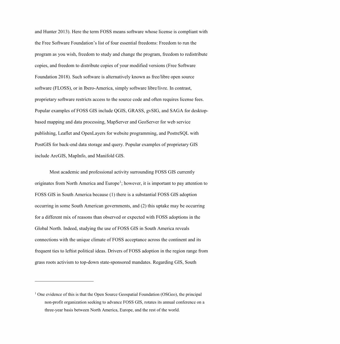
Most academic and professional activity surrounding FOSS GIS currently
originates from North America and Europe1; however, it is important to pay attention to
FOSS GIS in South America because (1) there is a substantial FOSS GIS adoption
occurring in some South American governments, and (2) this uptake may be occurring
for a different mix of reasons than observed or expected with FOSS adoptions in the
Global North. Indeed, studying the use of FOSS GIS in South America reveals
connections with the unique climate of FOSS acceptance across the continent and its
frequent ties to leftist political ideas. Drivers of FOSS adoption in the region range from
grass roots activism to top-down state-sponsored mandates. Regarding GIS, South
1 One evidence of this is that the Open Source Geospatial Foundation (OSGeo), the principal
non-profit organization seeking to advance FOSS GIS, rotates its annual conference on a
three-year basis between North America, Europe, and the rest of the world.
America has seen some unique local efforts to promote and support FOSS through
media, conferences, and forward-looking technical communities whose operations
deserve deeper study.
Understanding the adoption of FOSS GIS in South America requires the
consideration of technical, economic, social, and political factors. This article first
describes how South America as a region has been generally amicable toward FOSS
and the reasons that current scholarship has given for this. Current trends in FOSS GIS
use and development in South America are then summarized and situated within the
region’s political climate. The discussion concludes with three cases from Argentina
and Brazil where people have been particularly successful with rallying the FOSS GIS
community, and suggests how these practices might be applied effectively in other
places.
Public openness toward FOSS in South America
South America has seen a unique variety of laws and decrees at the city, state, and
federal levels promoting FOSS use on government computers. This includes at least five
national level policies (Table 1), a rate higher than any other continent. By 2010, Lewis
had tallied 57 FOSS-friendly policy actions (at any level of government) in the whole of
Latin America. Puentes Vargas (2015) offers a more recent summary of the most
significant ones in South America. These initiatives indirectly affect the private sector
because government buying power can influence the software market, and the state-
sponsored universities that produce qualified engineers receive their research funds
from the government (Câmara and Fonseca 2007).

Beyond encouraging FOSS, some governments even mandate its use for state
business. For example, Venezuela’s ‘Infogobierno’ law requires public institutions
migrate to FOSS, and Bolivia has enacted a series of decrees leading toward public
sector migration to FOSS. The 2010 survey by Lewis (p. 3) found that the tendency to
adopt strict mandates of FOSS was more common in Latin America and Africa than in
other parts of the world. Policies in other regions tended to take more of a hands-off
advisory role.
Country FOSS-related policy Year adopted
Summary
Bolivia Decreto Supremo 1793
2013 Requires the use of FOSS in government computing. Follows Ley 164 from 2011 which directed all levels of government to promote and prioritize FOSS. Further directives for migration were given in 2017 under Decreto Supremo 3251.
Brazil Instrução Normativa nº 04/2010/SLTI/MP
2010 Requires the identification and consideration of FOSS options as part of the government’s software acquisition process.
Ecuador Decreto 1014 2008 Establishes a policy that the national government will use FOSS in public administration, allowing only a few exceptions, such as when no alternative exists or when national security is at risk.
Uruguay Ley 19.179 2013 Gives preference to FOSS licensing during the software acquisition process for a wide range of state institutions. Use of other software requires justification. Encourages the use of FOSS in the educational system.
Venezuela Ley de Infogobierno 2013 Mandates the use of FOSS in public institutions and levies fines for noncompliance.
Table 1: Notable country-level policies in South America related to government use of
FOSS
Why have these South American governments been so aggressive about
adopting FOSS? The following section explores the technical, economic, and social
drivers behind the region’s FOSS-friendly politics. This discussion provides important

context for understanding the current momentum and advocacy for FOSS GIS in South
America.
Technical factors
The use of information and communication technologies in Latin America and the
Caribbean is increasing, but still varies widely from country to country and lags behind
all other world regions except Sub-Saharan Africa (Baller et al. 2016). In the private
sector, uptake is strongest among larger, skill-intensive, urban firms; but all sectors are
hindered by a deficit of skilled workers (Grazzi and Jung 2019). In economically
developing countries such as those in South America, digital piracy runs rampant,
leading to complacency with proprietary software and actually facilitating vendor lock-
in (Yapa 1991; CENATIC 2010, p.74; Kamau and Namuye 2012). Recent government
crackdowns on illegal software copying are leading public institutions to look for lower-
cost software alternatives (James 2003; Karume and Mbugua 2012). Some have turned
to FOSS solutions, recognizing them as a way to not only economize, but also foster
local skills, develop context-specific applications, and institute social changes (Câmara
and Fonseca 2007).
In addition to specialized software like GIS, the FOSS adopted by governments
includes operating systems, web servers, databases, and office software such as word
processors and spreadsheet management programs. The nature of FOSS licenses allows
anyone to audit and examine the source code of these programs, creating a line of
defence against hacking and foreign sabotage (Oram 2011). These licenses also allow
modification and redistribution of the code, providing a way to fix, enhance, or
internationalize the software without waiting for a vendor to release a (potentially
costly) upgrade (Shaikh and Cornford 2012).

Economic factors
An attractive element of FOSS for the public sector is that the software can be
distributed without licensing fees. The amount of money required to keep proprietary
software running in government offices is substantial. For example, one Brazilian
official estimated that between 1999 and 2004, the country paid $1 billion in software
licenses and royalties, and that it would take $2 billion per year to begin paying for the
pirated software its employees were using (Day to Day 2004). Perhaps more
conservatively, the Brazilian federal data processing service SERPRO reported that
Brazil saved over R$380 million (roughly $160 million USD) by adopting FOSS on
public-sector computers during the early years of the Lula administration, 2003–2008
(SERPRO 2010).
Although the money saved on software licenses may be viewed as a decisive
benefit of FOSS, the total cost of ownership (TCO) must also be considered. This
includes migrating to the new software, training the staff who use it, and maintaining
the system over time (Shaikh & Cornford 2012). Ghosh (2003) argues that in
economically developing countries, the advantages of FOSS are more pronounced
because labor costs tend to constitute a smaller proportion of the TCO than they do in
developed countries.
Social factors
The reasons for government promotion of FOSS in South America go beyond
economics, and involve attitudes about society, sovereignty, and the role of the state.

This is illustrated in a public debate between Microsoft Peru and legislator Edgar
Villanueva over a proposed bill (later much watered-down) requiring the use of FOSS
on Peruvian government computers. Microsoft warned that the mandate would lead to
excessive migration costs, mismatches in platforms, and lowered productivity.
Villanueva and free software advocates countered that FOSS was the only way for the
state to guarantee that citizens should be able to access public information, including the
code that stored and protected their personal records (Chan 2004).
Chan (2004) noted that this line of reasoning represented a key difference from
FOSS promotion in North America, where supporters tended to emphasize FOSS's
protection of consumer freedoms. The South America-based FOSS advocates that
helped craft Villanueva’s response couched their argument in the protection of
collective social rights. An Argentinean FOSS advocate involved in the debate
remarked, ‘Cost is important but it is only secondary. When we began to think about the
possible insecurities in government systems that store [citizens’] personal data, and the
way this data is handled, I as a citizen have an interest in how this is guarded’ (quoted in
Chan 2007).
Political factors
In South America, the idea of FOSS as an avenue to independence from the perceived
imperialism of US-based proprietary software companies has appeared in the rhetoric of
free software advocates all the way up to speeches made by heads of states. Zanotti

(2014) quotes an Argentinean hacker2 thus: ‘If we talk about FOSS, we’re going to
wind up talking politics. We’re not going to talk programming.’ Connections between
Peronist politics and FOSS are visible in blogs like Ubuntu Peronista and Si Evita
viviera, sería Linuxera3, the latter of which contained a post celebrating that Evita ‘can
now have a socially just, economically free, and politically sovereign operating system’
(quoted in Zanotti 2014). Along similar lines, the Uruguayan foreign minister Luis
Almagro remarked that ‘Free software is part of our agenda and our future because the
values it represents are the same values of Uruguay: equality, freedom, sovereignty,
right to choose, democracy, and development.’ (UNESCO 2013)
Many of the strongest policies of FOSS support in South America came during
the so-called ‘pink tide’ period of the early 2000s, wherein a surge of charismatic left-
leaning leaders came to power on the promise of challenging neoliberal hegemonies in
the region. As part of this agenda, they eagerly promoted free software as an alternative
to US-made proprietary software. In April 2007, then-president of Ecuador Rafael
Correa went so far as to go on television and declare that the public adoption of FOSS
was ‘an important step for the integration and, why not say it, the liberation of Latin
America.’4 All of Bolivia’s FOSS-related policies have come into being under Evo
Morales, in order to ‘break the bands of technological and informational dependence’
and guarantee technological sovereignty, according to the text of the decrees.5 In
2 In the FOSS developer community, the term ‘hacker’ is often used as a term of respect for
someone with high technical skill, and is not necessarily associated with nefarious activity. 3 ‘If Evita were still alive, she’d be a Linux user’ 4 Todos a utilizar software libre. Let’s use Free Software. Published on YouTube on 25 April
2007 by presidenciaecuador. https://www.youtube.com/watch?v=59PyU_7iqaU
5 Decreto Supremo 1793, Article 4, Section IV

Venezuela, Hugo Chávez repeatedly linked FOSS to socialist doctrine and promoted it
using terms like ‘freedom’, ‘equality’, and ‘independence’. The politicizing of FOSS in
this way sometimes made software migration a tough sell to those who did not agree
with Chávez’ revolution, but from a policy perspective it led to one of the strictest
FOSS mandates in the region (Maldonado 2010, Puentes Vargas 2015).
FOSS was also promoted aggressively by Brazil’s president Luiz Inácio Lula da
Silva’s administration in the early 2000s. In Brazil, many political parties emphasize
openness as a value of the state (Shaikh & Cornford 2012), and Lula’s administration
appointed FOSS advocates to high-level posts in the government’s Institute for
Information Technology (Birkinbine 2016, Milano 2016). Many of these individuals
had come of age during Brazil’s military dictatorship and had been active in labor
unions and opposition movements in addition to their software activities (Shaw 2011,
Evangelista 2014). They got their start promoting FOSS in universities and lower levels
of government, particularly in the state of Rio Grande do Sul. They were also
instrumental in launching the Fórum Internacional Software Livre (International Free
Software Forum, or FISL), which today is one of the largest regular gatherings of the
Latin American FOSS community.
The influence of these ‘insurgent experts’, as Shaw (2011) calls them, led Lula’s
government to form the Technical Committee for the Implementation of Free Software
(CISL). Roughly a dozen federal agencies migrated to FOSS during this period,
although the effort was hindered by opposition from proprietary software companies
and bureaucrats who wanted to keep their current software. Both often complicate the
implementation of FOSS mandates, as do constraints on training and migration budgets.
In 2010, Brazil passed Instrução Normativa MP/SLTI No 4 stating that
government entities should consider FOSS options when conducting feasibility analyses
for software purchases (Birkinbine 2016). This was a win for the FOSS advocates;
nevertheless, Microsoft regained momentum during the Rousseff and Temer
administrations and maintains substantial presence in the Brazilian government software
mix (Dias 2016).
Through the policy battles, the FOSS community sometimes struggles to
maintain a unified purpose and approach. Evangelista (2014) sees a schism between
what he and free software pioneer Richard Stallman (2016) have termed the ‘free’ and
the ‘open’ camps. A young group of technical professionals and ‘nerds’ interested in
business careers are focusing on the production of high quality FOSS software products,
regardless of which for-profit organizations might help create or adopt them. They
believe that this willingness to see beyond ideological lines will contribute most to the
advancement and expansion of the FOSS community. This ‘open’ camp is much less
interested in the purism and political propaganda of their rival ‘free’ camp, which is
wary of corporate involvement in FOSS development and consists mainly of
bureaucrats and activists. The relationship between the two groups is complicated and
the more politicized ‘free’ camp still wields significant power in community gatherings
in Brazil. Such complexities may be present in other FOSS communities throughout
South America.
FOSS GIS in South America
Some of the earliest discussions about GIS and society raised warnings about the cost of
the software and its effect on accessibility (Sheppard 1995, Harris and Weiner 1996).
Prior to the development of most FOSS GIS software, Yapa (1991) remarked that the
high price tag of commercial GIS rendered it out of reach for students, teachers, and
small shops in developing countries. He suggested that the development of ‘public
domain GIS’ could help remedy this. Around that time period, a few FOSS GIS projects
such as GRASS and MapServer were gaining momentum. Now, numerous FOSS
options allow for desktop-based GIS data processing, cartography, web service hosting,
and web application development (Steiniger and Hunter 2013). This software operates
using open data specifications developed by both proprietary firms and community-
based consortia.6 The use of FOSS is part of a broader shift toward an open culture for
GIS that includes open data, open research, and open education (Sui 2014).
How does one determine the strength of the FOSS GIS community and
landscape in any particular geography, including South America? Studies such as that of
Gonzales-Barahona et al. (2008) focus on detecting the locations of FOSS developers or
elaborating on the dynamics of the developer community; yet, we know comparatively
little about the adopters of FOSS and how they have fared (Aksulu and Wade 2010).
Ways to assess regional strength and momentum of FOSS GIS could include evaluating
cases of software implementation, documenting the presence and activity of local
technical communities, and investigating any software developed to meet local needs.
The following sections discuss each of these aspects in a South American context.
6 KML (Keyhole Markup Language) and the Esri shapefile are examples of open spatial data
formats originally developed by proprietary firms. In contrast, formats such as the Web Map
Service (WMS) were developed by the Open Geospatial Consortium (OGC).
Glimpsing implementation patterns through a study of publicly-available web
maps
Just as with general FOSS, there are evidences of strong currents of FOSS GIS uptake
and advocacy throughout South America, although some of these are localized in nature
and more detailed studies need to be carried out in individual countries or subregions.
For example, surveying public or private organizations to ask about GIS software
preferences would be a useful approach. One can also discern quite a bit about software
usage trends by looking at tools used in publicly available GIS and mapping websites.
To demonstrate that a variety of South American government GIS groups actively use
FOSS, the latter method is applied here at two scales of geography.
Most South American countries have a mapping agency that shares online
geographic data and web services with the public. These agencies often host interactive
web maps wherein users can explore the available geographical layers or obtain general
information about the country. Table 2 below shows the addresses of the principal map
visualization websites for 10 countries, the technology used to build each, and whether
or not this technology could be considered FOSS. In this table, the ‘principal viewer’ is
considered to be the one coming from the agency responsible for the country’s
geography, mapping, or spatial data infrastructure activities. The technology was
discerned by looking at the web site source code files and network traffic, which is
information obtainable for any website whether it is built with FOSS or not.

Principal government map viewer URL (accessed September 2018) Technologies used FOSS
Argentina IGN Visualizador de Mapas https://ide.ign.gob.ar/portal/apps/webappviewer/index.html
Esri ArcGIS Enterprise, ArcGIS API for JavaScript
No
Bolivia GeoBolivia geovisualizador https://geo.gob.bo/mapfishapp/ GeoServer, MapFish Yes
Brazil SIG IBGE http://mapasinterativos.ibge.gov.br/sigibge/ Esri ArcGIS Enterprise, ArcGIS API for JavaScript
No
Chile Geoportal de Chile - Visor de Mapas http://www.geoportal.cl/visorgeoportal/
Esri ArcGIS Enterprise, ArcGIS API for JavaScript
No
Colombia IGAC Geoportal (various apps) http://geoportal.igac.gov.co/
Esri ArcGIS Enterprise, ArcGIS API for JavaScript
No
Ecuador Geoportal IGM Visor de Datos Geográficos Oficiales
http://www.geoportaligm.gob.ec/portal/index.php/visualizador/
GeoServer, Terria Map Yes
Guyana (Could not identify a viewer)
Paraguay Portal Paraguay - Mapas https://mapas.paraguay.gov.py/ Google Maps API No
Peru GeoIDEP Visor de Mapas del Perú http://mapas.geoidep.gob.pe/mapasperu/
Esri ArcGIS Enterprise, ArcGIS API for JavaScript
No
Suriname (Could not identify a viewer)
Uruguay IDE UY Visualizador http://ide.uy/visor/ GeoServer, OpenLayers Yes
Venezuela Geoportal Nacional Simón Bolívar
http://visor.ide.igvsb.gob.ve/nacional/portal.php
GeoServer, OpenLayers Yes
Table 2: Technologies used by national governments in South America to produce web
maps for geographic data exploration
Notably, the four countries using FOSS GIS for their principal map viewers
(Bolivia, Ecuador, Uruguay, and Venezuela) are the same ones that have supported
FOSS through legislation or decree at the national level. Brazil is the only country with
national support for FOSS that is not using FOSS in its principal map viewer, yet
Brazil’s support of FOSS is not as binding as some of the other countries’ policies.
Despite these countries’ ongoing challenges with fully implementing general FOSS
migration policies (Machado 2017), it appears that the policies are affecting GIS and
mapping services. As an example, Molina Rodriguez and Lesage (2013) describe how
Bolivia designed its spatial data infrastructure to support a FOSS-based web viewer.

The situation is more complex than can be conveyed in the above chart because
some lower level ministries, or even different offices of the same ministry, may conduct
mapping activities and maintain online map viewers using different mixes of software.
For example, although Argentina’s National Geographical Institute (IGN) is not using
FOSS in its main public-facing map viewer, its employees use FOSS GIS from day to
day as described later in this paper, and the institute hosted a major conference in the
use of FOSS GIS in 2017.
Software trends in provincial and municipal governments can differ markedly
from software used at the national level. For example, using the same methods it can be
seen that nearly all of Argentina’s provincial governments are using FOSS in their map
viewers. Table 3 shows that among the 23 Argentinian provinces and the federal
district, 16 offer a map viewer built with FOSS GIS, while one has built a map viewer
using proprietary GIS software. These numbers contrast with the strong market
presence held by proprietary GIS software in state governments in the United States.7
7 For example, see https://orthos.dhses.ny.gov/ in New York State and
http://gisweb.glo.texas.gov/glomapjs/index.html in Texas, both built with Esri software.
An example of a state running a FOSS GIS web map is Oklahoma at
https://okmaps.org/OGI/search.aspx, but this is a rare exception in the US.

URL (accessed November 2018) Technologies used FOSS
Buenos Aires Viewer not found or not functional
Capital Federal https://idecaba.estadisticaciudad.gob.ar/maps/ne
w
GeoServer, GeoExplorer Yes
Catamarca http://200.43.169.149/ GeoServer, GeoNode Yes
Chaco http://idechaco.gob.ar/sigide/ GeoServer, GeoExt Yes
Chubut http://ide.estadistica.chubut.gov.ar/mapas/ GeoServer, OpenLayers Yes
Córdoba https://idecor-ws.cba.gov.ar/maps/5/view GeoServer, GeoExplorer Yes
Corrientes https://www.arcgis.com/apps/PublicInformation/i
ndex.html?appid=754d728c2ffc46d1b5bb5d300b
152150
Esri ArcGIS Online No
Entre Ríos Viewer not found or not functional
Formosa http://idef.formosa.gob.ar/visor/ GeoServer, GeoExt Yes
Jujuy http://190.52.39.247:9880/mapas/application/vis
or_de_mapas_idej
GeoServer, MapBender Yes
La Pampa Viewer not found or not functional
La Rioja https://visor2.iderioja.larioja.org/mapa.php MapServer, OpenLayers Yes
Mendoza http://idemza2.mendoza.gov.ar/ GeoServer, Heron MC Yes
Misiones http://www.ide.misiones.gov.ar/index.php?optio
n=com_content&view=article&id=8&Itemid=3
MapServer, OpenLayers Yes
Neuquén http://ideneu.neuquen.gov.ar:8080/geo/compose
r/
GeoServer, GeoExplorer Yes
Río Negro http://ide.extranet.rionegro.gov.ar/maps/new GeoServer, GeoExplorer Yes
Salta http://geoportal.idesa.gob.ar/maps/455/view GeoServer, GeoExplorer Yes
San Juan Viewer not found or not functional
San Luis Viewer not found or not functional
Santa Cruz Viewer not found or not functional
Santa Fe https://www.santafe.gov.ar/idesf/visualizador/ MapServer, GeoExt Yes
Santiago del
Estero
https://www.santafe.gov.ar/idesf/visualizador/ OpenLayers (server unknown) Yes
Tierra del Fuego Viewer not found or not functional
Tucumán http://idet.tucuman.gob.ar/visor/ GeoServer, GeoExt Yes

Table 3: Technologies used by Argentinian provincial governments to produce public
web maps for geographic data exploration
Most of the provincial sites in the above table are using well-known and basic
FOSS GIS software such as OpenLayers, MapServer, and GeoServer. Stability and
long-term maintenance of some of the sites appear to be challenges: occasionally the
streaming map layers were not operational when accessed for this study, even when the
rest of the site appeared to be functional.8 More research is required to understand
whether these challenges are due to underfunding, difficulties with finding or retaining
skilled workers, the dynamics between governments and consultants, deficiencies in the
software itself, or other reasons.
Local technical support groups for FOSS GIS
Another evidence of FOSS GIS activity is the presence of local technical support
networks where software users can exchange troubleshooting tips, share ideas and
success stories, post employment information, and arrange conferences and meetups of
people with similar skills and interests. As has been observed with FOSS in general,
these ‘communities’ offer access to technical help, friendships, and recognition; and are
held together with shared philosophical motives (Zanotti 2012). They foster local
expertise, and facilitate expanded software choices by promoting documentation,
training, and translation of software (Câmara and Fonseca 2007).
OSGeo, a global nonprofit organization dedicated to the promotion of open
geospatial technology, has fostered a number of these communities (Brovelli et al.
8 Sites that were entirely unusable do not have a web address listed in Table 3.

2012).9 OSGeo offers local chapters that fill the need for language-specific support in
places like Korea, Italy, and Japan (OSGeo 2017). These chapters provide resources
such as translated documentation, regional user meetups, a mailing list, and social
media feeds. In Ibero-America, the Spanish language chapter of OSGeo has been
supplemented by more localized chapters of a group called Geoinquietos, with chapters
appearing in Argentina, Bolivia (Santa Cruz), and Brazil (Brasília). The case of
Geoinquietos Argentina is examined in more detail later in this paper. A similar global
network of support groups called Maptime, more geared toward beginners, has also
seen chapters created in Bogotá, Colombia and Campinas, Brazil, but these appear to
have waned while Geoinquietos and other organized efforts have increased in
popularity.10
A few other regional gatherings have established some momentum, including
the FOSS.4GIS.GOV conference series focused on government applications in Brazil
(also mentioned below). Regional ‘State of the Map’ conferences discussing the
crowdsourced geographic database OpenStreetMap and related tools have been held in
São Paulo and Lima, and a worldwide State of the Map came to Buenos Aires in 2014.
Members of Geoinquietos Argentina were instrumental in hosting that conference.
Some user groups are organized around a certain product or project. Technical
support groups for the popular desktop GIS program QGIS have been registered in
Brazil, Perú, and Colombia. They hold meetups, offer workshops, broadcast news on
9 https://www.osgeo.org/about/ 10 Maptime is a worldwide network of local meetup groups that teach digital mapping skills
with an emphasis on beginner-friendliness and the use of FOSS. These groups
communicate almost entirely through Twitter, blogs, and signup sites like Meetup.com.

social media, and provide links to technical resources including consultants who
specialize in FOSS GIS. QGIS Brasil contributed to the software development by
translating the interface into Portuguese, thereby enabling uptake of the software by a
wider user base (Nanni 2016).
Other groups are organized around particular causes or identities. These include
the various YouthMappers chapters operating out of at least four universities in
Colombia, part of a global network of student-based groups that employ open geospatial
technologies toward service and humanitarian mapping efforts.11 Another example is
GeoChicas, which has rallied women to increase the breadth of features included in
OpenStreetMap and highlight gender inequalities inscribed on the cultural landscape,
such as the relatively small percentage of streets named after women (Revista de la
Universidad 2018).12 The group started in Ibero-America and has spread into the United
States, Africa, and many parts of Europe. Its FOSS-based re-mappings of gendered
spaces are a noteworthy contribution to critical and feminist GIS praxis (Pavlovskaya
and St. Martin 2007).13
Local software development
An important indication of FOSS GIS presence in any region is the local production and
improvement of software. Indeed a common argument for government support of FOSS
11 http://www.youthmappers.org
12 http://www.geochicas.org
13 https://wiki.openstreetmap.org/wiki/GeoChicas

is that money should be invested toward local technical expertise and programming,
rather than giving the money to foreign corporations (Maldonado 2010; Evangelista
2014; Milano 2016). FOSS development is evidence of this process occurring. FOSS
GIS development efforts in South America include the aforementioned translation of
user interfaces, the testing and use of products, and the creation of new software to meet
community needs.
Ibero-America has incubated several FOSS GIS programs that are widely used
in South America. One of these is gvSIG, a desktop GIS program developed in
Valencia, Spain. It is attractive to South American institutions because its interface is
originally developed in Spanish, and much of the documentation and support for the
product is available in Spanish and Portuguese. This allows new users to get their
bearings in GIS without the burden of a language barrier. Out of the gvSIG’s 15
worldwide user groups, eight are based in South American countries14 and several have
held regional conferences promoting the software.
Another GIS, called SPRING, was developed by the Brazilian National Institute
for Space Research (INPE) (Câmara et al. 1996). SPRING’s emphasis is in processing
and extracting information from remotely sensed data, although it also supports vector
data. The software was always free, and after a code cleanup it was eventually released
under an open source license. At over 1 million lines of code, it remains in common use
in Brazilian universities and government applications (Medeiros 2011).
Other open source GIS tools developed by Brazilian government and
educational institutions include i3Geo, E-foto, and TerraLib. i3Geo is a web mapping
14 http://www.gvsig.com/pt/comunidade/grupos-de-comunidades

and geoprocessing framework originally developed by the Brazilian ministry of the
environment and currently maintained by the ministry of health.15 E-Foto is
photogrammetry workstation software developed at the State University of Rio de
Janeiro (UERJ). Its goal is to provide a cost-accessible way for students to learn about
digital photogrammetry workflows (Mota et al. 2012). Finally, TerraLib is a software
library supporting spatio-temporal modeling, data mining, and analysis, particularly for
social and environmental applications. It was developed by INPE with support from
Catholic University of Rio de Janeiro (PUC-RIO) and FUNCATE, a non-profit
organization that develops GIS applications. According to Câmara and Fonseca (2007),
TerraLib’s purpose was to offer Brazilian users an alternative to commercial GIS
software so that they could avoid vendor lock-in. A complementing product is
TerraView, a general-purpose GIS that can work with TerraLib databases (Câmara et al.
2008).
Case studies of FOSS GIS community activity
Cases of regional success in disseminating information, building technical support
communities, and training individuals may offer helpful lessons for those interested in
cultivating more FOSS GIS activity. This is especially true in countries that are under
mandate to use or give preference to FOSS. The remainder of this paper discusses three
notable efforts from Argentina and Brazil.
15 https://softwarepublico.gov.br/social/i3geo

FOSSGIS Brasil magazine
Perhaps the most ambitious effort ever to publish information about FOSS GIS in
periodical format was a Portuguese language magazine launched by the Brazilian
systems analyst Fernando Quadro in 2011. Quadro noticed that there was a lot of
interesting work occurring in FOSS GIS in Brazil, but the reporting on it was scattered
throughout different publications, some of them centered on proprietary software.
Quadro sent out invitations to people whose work he admired, and asked them if they
wanted to help create a publication entirely about FOSS GIS (Mendonça 2012). The
result was a digital magazine called FOSSGIS Brasil that saw six colorful and
information-packed issues in 2011-2012 with the goal of releasing on a quarterly cycle.
Issue length ranged from about 50 to 80 pages.

Figure 1. Issues of FOSSGIS Brasil published in 2011 – 2012.
Members of the initial editorial core reached into their professional networks to
find FOSS GIS experts who could write content. The magazine included articles about
FOSS GIS software options, a column comparing functionalities of FOSS GIS with
proprietary software, case studies of successful software implementations in various
branches of the Brazilian government, and interviews with figureheads in the Brazilian
FOSS GIS community. For example, one issue included a conversation with Gilberto
Câmara, then president of INPE, about the development of the SPRING GIS (Medeiros
2011). A map gallery section in the magazine allowed GIS analysts and cartographers
working in Brazilian industries and governments to showcase their work. Contributors
to the gallery included geographers, teachers, and government planning officials at the
state and municipal levels.
The professional scope and appearance of the magazine belied the fact that it
was produced entirely by volunteers, many of whom were also raising families, working
full time jobs, or even running their own businesses. With these many commitments
faced by the contributors, the original goal of a quarterly publication became difficult to
sustain. FOSSGIS Brasil reached an abrupt end after approximately a year and a half,
but its longer-term benefits included the friendships and professional relationships
forged by the volunteer contributors, some of whom lived thousands of kilometers apart
and could only communicate through e-mail (F. Quadro, personal communication, 15
October 2018). Additionally, the back issues of the magazine are still available online
and constitute a useful Portuguese-language primer on available FOSS GIS options at
the time (much of which is still applicable).

The FOSSGIS Brasil identity continues today as a Facebook and Twitter feed,
and Quadro maintains an active technical blog.16 These social media channels allow for
a more frequent publishing cycle, and they are easier to maintain than a full length
magazine.
Geoinquietos Argentina
Geoinquietos is a network of local groups throughout Ibero-America interested in
geospatial sciences and FOSS. The Geoinquietos Argentina chapter has been one of the
most active of these groups, repeatedly organizing conferences that attract hundreds of
people from the Southern Cone area of South America and beyond. The history of
Geoinquietos Argentina can be traced to the founding of the Spanish language chapter
of OSGeo in 2007. As Spanish is spoken across a broad geographic region, there was a
need for more local interest groups where people could connect face to face and share
information relevant to a particular city or country. Thus, a list of ‘Geoinquietos’
chapters eventually took shape on the OSGeo Spanish wiki page.17 The Spanish word
inquieto means restless or edgy; describing this group’s affinity toward constant activity
and self-improvement.
The first few Geoinquietos chapters were in Spain, but in May 2012, Mauricio
Miranda added a link to the Geoinquietos Buenos Aires chapter (now Geoinquietos
Argentina), the first one in the Western Hemisphere. Since that time, other Geoinquietos
16 http://www.fernandoquadro.com.br/html/
17 https://wiki.osgeo.org/wiki/Cap%C3%ADtulo_Local_de_la_comunidad_hispanohablante
chapters have appeared throughout the region. The fact that Brazil and Portugal have
also seen the formation of chapters suggests that the Geoinquietos brand and mission
may be more strongly associated with Ibero-American identity rather than the Spanish
language.
Geoinquietos Argentina organized ‘FOSS4G Argentina’ conferences in 2013,
2016, 2017, and 2019 (which occurred after the initial submission of this manuscript).
These were a local variation of OSGeo’s flagship FOSS4G conference for all things
related to FOSS GIS. The 2017 conference went under the dual moniker
FOSS4G+SOTM to indicate its affiliation with the State of the Map OpenStreetMap
conferences. It was held over a six-day period that October at the Argentinian National
Geographical Institute (IGN) in Buenos Aires. The event included a round table meetup
day for educators, two days of technical workshops, two days of technical presentations
with up to three concurrent session tracks, and a hackathon day wherein participants
contributed to FOSS GIS projects such as OpenStreetMap, GeoNetwork, and
pgRouting.
During one of the plenary sessions of the FOSS4G Argentina 2017, Miranda
acted as a spokesperson for Geoinquietos Argentina to present an overview of the group
and its practices (Miranda 2017).18 The purposes he listed for the group include a mix
of seriousness and leisure: to learn, to have fun, to work, to earn money, to teach, to eat
asado (traditional Argentinian barbecue), to drink beer, and to change the world.
18 The information from this session comes from the author’s notes taken while in attendance.
The author is not aware of any transcripts or videos from this conference; however, the
people mentioned in this subsection have read and approved the author’s representation of
their words.
Miranda describes the group as completely anarchic; there is no hierarchy of
participants. He is candid that increasing members’ earning power and business
potential with FOSS is a real objective (‘we’re not hippies’), a characteristic of
Evangelista’s (2014) ‘open’ camp mentioned earlier; however, the group's philosophy
differs from that of commercial software developers: the main objective is to share
knowledge and effort. Although Miranda concedes that this may seem underwhelming,
he points out that government entities such as provinces often pay private GIS
consulting companies for the same services over and over, and that such redundancy is
wasteful when communities could share technical information.
Geoinquietos accomplishes its mission through meetings, informal social
gatherings (‘geobeers’), workshops, FOSS4G conferences, a mailing list, an online
mobile messaging group, and a Twitter account. The group has received support from
Argentina’s geographical institute IGN, evidenced through the conference venue, but
also through the FOSS advocacy of some of its employees, including its (then) Director
of Spatial Information Horacio Castellaro. Speaking on an impromptu panel during this
same session, Castellaro mentioned his desire for the institute to become entirely free
from ties to commercial software. He emphasized that every peso spent on commercial
software is a peso lost from the country, and Argentina does not have a way to get that
peso back. In his view, pesos spent on FOSS will help a broader group of stakeholders.
Also on this panel, conference director Malena Libman shared how
Geoinquietos lent her the social and technical support needed to finish her degree in
geospatial technologies. The growth of Geoinquietos is important, she said, because the
world consists of more than Europe and the United States. The expansion of FOSS in
Argentina has allowed new data to be published that previously was unavailable.
Although the Geoinquietos organizers worked long hours to hold the conference and the

admission charge was under $17 USD, Libman only asked that participants ‘pay’ them
with their participation in the community.
Conference organizers announced that over 115 people attended the event,
representing various forms of government, private industry, and universities. Perhaps
the scarcity of similar conferences in neighboring countries fueled the diverse
attendance, which included participants from Chile, Brazil, Paraguay, and Venezuela.
Additional countries represented by speakers on the agenda included Spain, Mexico,
Peru, Italy, and the United States.
How has Geoinquietos Argentina been so successful at organizing large,
technical, low-cost, and attractive conferences on such a regular basis, bringing together
members throughout a geographically large and diverse country? As evidenced by the
panel session previously referenced, the group has benefitted from a core of highly
dedicated and consistent individuals, rather than one person doing the majority of the
work. It has also found strength by allying with groups that have similar interests, but
slightly different social and technical avenues of focus. For example, in 2019
Geoinquietos Argentina joined forces with OpenStreetMap Argentina and GeoChicas to
officially register as a non-governmental organization under the laws of Argentina. This
organization calls itself GeoLibres, or “the geo-free”.19 Its formation was meant to be a
signal of long-term commitment toward the technical communities served by these
groups (M. Miranda, personal communication, 3 December 2018).
Many of the group's members are young professionals who have come to know
each other well through local events and the group’s communication channels. These
19 http://geolibres.org.ar/
bonds have been strengthened by the group’s use of the Telegram messaging system as
a primary means of communication. Telegram can be thought of as a kind of public chat
room that happens in a mobile app. The use of Telegram distinguishes Geoinquietos
Argentina from many other FOSS GIS special interest groups that use traditional
mailing list technology, hearkening back to a generation that used e-mail more than text
messages. Even social media feeds such as Twitter are perhaps too formal and
organized to facilitate the style of jovial, relaxed, and occasionally very technical banter
that characterizes the Geoinquietos Argentina Telegram chat.
The group has also focused on inclusivity, recently changing some of its
branding and communication to use the more gender-neutral term Geoinquiet@s. The
holding of the conference at a government facility likely lowered costs, helping the
group to welcome persons from a variety of industries, countries, and skill levels. The
inclusion of technical workshops, educator forums, and hackathons expanded the tent of
participants and added value to the conference experience, giving conference-goers
multiple reasons to justify their attendance and get the most return on travel investment.
Geography itself may also play a role in the group's success, as Argentina’s
economy and government are dominated by Buenos Aires, a city of nearly 15 million
people that is well connected to other regions of the country (United Nations 2018, p.
25). For many attendees, participation involves hopping onto a car, bus, or subway, or at
most a single short airplane flight. Events throughout the year bring participants
together often, such that the FOSS4G conferences are not the only times they gather.
Other South American primate cities such as Lima, Santiago, and Montevideo might
offer significant bases of potential interest that could incubate local technical
communities. In larger countries or those without a primate city, such as Brazil,
circumstances are different. Brazil’s geography with several major technical and

economic centers apart from the capital might make it challenging to form a core group
of organizers, although it could certainly create the circumstances for many
knowledgeable and enthusiastic participants.
FOSS.4GIS.GOV conferences in Brazil
The success of Geoinquietos Argentina at gathering the FOSS GIS community was
noticed in other areas of South America. Fernando Quadro, the once-editor of the
FOSSGIS Brasil magazine series, lamented on his blog: ‘How come we haven’t been
able to hold an event of this [FOSS4G Argentina] size here in Brazil? . . . .I wonder why
a country as big as Brazil, with so many competent people engaged with open source
GIS doesn’t have an annual event to get the community together, share experiences,
network, and socialize’ (Quadro 2016). Following Quadro’s post it appears some
movement was made toward organizing a FOSS4G Brazil conference in 2017, but plans
were ultimately scrapped.
Actually, several notable gatherings of open source GIS software enthusiasts
have occurred in Brazil’s capital, but they have largely focused on government
applications. In both 2016 and 2018, the FOSS.4GIS.GOV conference brought together
hundreds of professionals from various arms of government to share their experiences
with free and open source geospatial technology. Speakers at these conferences have
included representatives from the country’s data processing service SERPRO, the
Brazilian Institute of the Environment and Renewable Natural Resources (IBAMA), the
Chico Mendes Institute for Biodiversity Conservation (ICMBio), the National
Telecommunications Agency (ANATEL), the Federal Police, and the Army. State level
government employees, university professors, and volunteers from QGIS Brasil have

also given presentations. Attendance at the events was free, and the proceedings were
posted on YouTube, constituting a useful Portuguese-language source of information
for the geospatial FOSS community.20
Both iterations of FOSS.4GIS.GOV were hosted at IBAMA headquarters in
Brasília, and admission was free. At the opening ceremony of the 2018 conference,
IBAMA’s vice-president Luciano Evaristo stated that all the anti-deforestation missions
that the organization carries out in conjunction with federal and local police begin with
geoprocessing tools. Evaristo noted that he saw long ago the economic value of
replacing proprietary GIS software licenses with open source ones, but he was also
impressed by the software quality that IBAMA gained by implementing FOSS.21
Instrumental in IBAMA’s migration to open source GIS software was George
Porto Ferreira, general coordinator of its National Center for Environmental Information
and Monitoring (CENIMA). His team is active in the Amazon deforestation detection
work mentioned by Evaristo. Working with longtime FOSS GIS community member
Luiz Pacheco Motta and other colleagues from IBAMA, Ferreira spearheaded the
FOSS.4GIS.GOV conference series. The first gathering in 2016 received some funding
from European Union sources and welcomed visiting representatives from Denmark
and Italy. The 2018 conference did not receive this funding, but saw the conference
move closer toward association with the mainline FOSS4G conference series.22 OSGeo
20 At the time of this writing, the 2016 and 2018 proceedings are available in playlists at
https://www.youtube.com/user/gorgjo/playlists 21 Evaristo’s talk from the opening ceremony is available at
https://www.youtube.com/watch?v=n1bCDCbovHA. 22 Evidences of this include the FOSS4G signature ‘ribbon’ emblem in the conference logo and
the presence of keynote speaker Jeff McKenna from the OSGeo board of directors.
appears to be a potential future source of funding that could help ensure the longevity of
the event, although a bigger factor may be the continued ability and initiative of
IBAMA and its employees (or a comparable agency) to support the conference on a
regular basis.
Conclusions
FOSS GIS has a strong and growing presence in South America, evidenced by
government use of FOSS in interactive map websites, the variety of FOSS technical
support groups for GIS and mapping, and the development of software to meet local
geoprocessing needs. Some of this success is likely due to the generally friendly attitude
toward FOSS throughout the region, where some governments have mandated that
FOSS be used, or at least considered, as an alternative to proprietary software. Such
affinity toward FOSS includes economic considerations, but also a strong belief that
national interest is served by keeping software code transparent and investment money
local.
This article has given much attention to government use and promotion of FOSS
at the national level. The relatively small number of countries in South America makes
it difficult to draw conclusions without studying more local levels of government.
Beyond the Argentinian provinces that were studied here, other provincial or municipal
FOSS implementations could be queried to better discern FOSS GIS uptake throughout
the continent. Surveying the private sector, as well as educational and nonprofit
institutions, would help to provide a well-rounded assessment. It would be informative
to examine the evolution of FOSS GIS use in higher education and what kind of effects
(if any) this has wrought on the general software mix in each country.

This article discussed three case studies of particularly successful efforts to
promote FOSS GIS and rally local user groups through education and sharing of
technical expertise. The common thread between these case studies is their ability to
connect individuals. The FOSSGIS Brasil online magazine connected professionals
throughout a large and diverse country. The Geoinquietos Argentina group keeps
practitioners constantly connected through modern mobile messaging technologies and
regular meetups. The FOSS.4GIS.GOV conferences connect government officials
across different ministries and a variety of jurisdictional levels.
Each of these three efforts was driven by highly motivated people who have
embraced FOSS and want to see its use expand throughout their local regions. Reasons
given for this support include economic benefits (as mentioned by IBAMA’s Evaristo),
but have also included themes of sovereignty and politics (such as the declarations by
Geoinquietos Argentina members that it is in the national interest for software
investments to stay local). These ideas of FOSS implementation as manifestations of
political and economic independence resonate in South America.
The Argentinian and Brazilian government employees involved in these case
studies exhibit some characteristics of Shaw’s (2011) ‘insurgent experts’ who instigated
migrations to FOSS after infiltrating the ministries of Lula’s Brazil. They exercised the
power available to them to implement FOSS GIS in their respective agencies. At the
same time, government entities in South America and elsewhere often see employees
using a mix of FOSS and proprietary software to satisfy both personal preference and
functional needs. Hybrid approaches are likely to remain popular, although the above
study of national web map viewers does convey the lesson that when FOSS is
mandated, FOSS gets used.
What can FOSS advocacy groups around the world learn from these case
studies? The retiring of the FOSSGIS Brasil magazine and the sometimes-fizzling
activity levels of some of the other technical support groups mentioned above (such as
Maptime) demonstrate that long-term momentum can be a challenge. This is especially
true with FOSS, as much work is done by volunteers whose interests and availability
may change as they progress through different jobs and life stages. The decentralized
nature of Geoinquietos Argentina seems to have helped impart staying power, with the
Telegram messaging system keeping the group agile, inclusive, and in touch. Finally,
the presence of supportive partnering institutions can provide a venue for meetings and
supply a pool of interested and active individuals.
Face-to-face gatherings take an extraordinary effort to execute, but can boost
recruitment and strengthen the core group of organizers both technically and socially.
The global FOSS4G conference came to Africa (Dar es Salaam) for the first time in
2018, and Geoinquietos Argentina is preparing a bid to host the conference in Buenos
Aires in 2021. Re-evaluating the ‘North America, Europe, Rest of the World’ three-year
FOSS4G conference rotation to include a more flexible mix of countries could help
foster a more global focus for OSGeo (although the practice does ensure that North
America and Europe do not always dominate the bid process). In the meantime,
OSGeo’s support for regional and local conferences has helped strengthen new FOSS
communities.
The use of government offices by both FOSS4G Argentina and
FOSS.4GIS.GOV helped keep fees down and allowed more people to attend, a contrast
with the worldwide FOSS4G 2017 conference in Boston that was held at the Seaport
Hotel and World Trade Center and cost a hefty $800 per person for registration.
Nonetheless, nongovernmental funding streams are also helpful: the FOSS.4GIS.GOV

2018 conference in Brazil was smaller than the 2016 iteration due to fewer funding
sources, but the long-term outlook for the continuation and expansion of the conference
appears positive if it keeps strong ties with OSGeo. This conference and the other
initiatives mentioned above should be of future interest to those who are promoting and
developing FOSS as the software increases in accessibility and popularity.
Acknowledgements
The author would like to thank the members of the FOSS GIS communities in South
America who welcomed him to their gatherings and provided feedback on this
manuscript. Also deserving of thanks are student Benito Gonzalez for Internet research,
and the Office of International Studies and Programs at Central Washington University
for financial assistance.
Translations from Spanish and Portuguese are by the author.
References
Aksulu, A. and Wade, M., 2010. A Comprehensive Review and Synthesis of Open Source Research. Journal of the Association for Information Systems, 11 (11).
Baller, S., Dutta, S., and Lanvin, B., 2016. The Global Information Technology Report
2016. World Economic Forum.
Birkinbine, B., 2016. Free Software as Public Service in Brazil: An Assessment of Activism, Policy, and Technology. International Journal of Communication, 10 (0), 16.
Brovelli, M.A., Mitasova, H., Neteler, M., and Raghavan, V., 2012. Free and open source desktop and Web GIS solutions. Applied Geomatics, 4 (2), 65–66.
Câmara, G. and Fonseca, F., 2007. Information Policies and Open Source Software in
Developing Countries. J. Am. Soc. Inf. Sci. Technol., 58 (1), 121–132.

Câmara, G., Souza, R.C.M., Freitas, U.M., and Garrido, J., 1996. SPRING: Integrating remote sensing and GIS by object-oriented data modelling. Computers & Graphics, 20 (3), 395–403.
Câmara, G., Vinhas, L., Ferreira, K.R., Queiroz, G.R.D., Souza, R.C.M.D., Monteiro, A.M.V., Carvalho, M.T.D., Casanova, M.A., and Freitas, U.M.D., 2008. TerraLib: An Open Source GIS Library for Large-Scale Environmental and Socio-Economic Applications. In: G.B. Hall and M.G. Leahy, eds. Open Source Approaches in Spatial Data Handling. Berlin, Heidelberg: Springer Berlin Heidelberg, 247–270.
CENATIC, 2010. Report on the International Status of Open Source Software 2010. National Open Source Software Observatory, No. 04. Available from: https://opensource.org/files/Report%20on%20the%20International%20Status%20of%20Open%20Source%20Software%202010.pdf [Accessed 11 June 2019].
Chan, A., 2004. Coding Free Software, Coding Free States: Free Software Legislation and the Politics of Code in Peru. Anthropological Quarterly, 77 (3), 531–545.
Chan, A., 2007. Retiring the Network Spokesman: The Poly-Vocality of Free Software Networks in Peru. Science & Technology Studies.
Day to Day, 2004. Brazil Switches from Microsoft to ‘Open Source’ Software, National Public Radio. Sep 15. Available from: https://www.npr.org/templates/story/story.php?storyId=3919175 [Accessed 14 June 2019].
Dias, T., 2016. Por que o software livre vai perder espaço no governo federal. Nexo Jornal, 3 Nov.
Evangelista, R., 2014. O movimento software livre do Brasil: política, trabalho e hacking. Horizontes Antropológicos, 20 (41), 173–200.
Free Software Foundation, 2018. What is Free Software? [online]. Available from: https://www.gnu.org/philosophy/free-sw.en.html [Accessed 7 Mar 2019].
Ghosh, R.A., 2003. License fees and GDP per capita: The case for open source in developing countries. First Monday, 8 (12).
Gonzalez-Barahona, J.M., Robles, G., Andradas-Izquierdo, R., and Ghosh, R.A., 2008.
Geographic origin of libre software developers. Information Economics and Policy, 20 (4), 356–363.
Grazzi, M. and Jung, J., 2019. What Are the Drivers of ICT Diffusion? Evidence from
Latin American Firms. Information Technologies & International Development, 15 (0), 15.
Harris, T. and Weiner, D., 1996. GIS and Society: The Social Implications of How
People, Space, and Environment Are Represented in GIS. National Center for Geographic Information and Analysis, No. 96–7.

James, J., 2003. Free software and the digital divide: opportunities and constraints for developing countries. Journal of Information Science, 29 (1), 25–33.
Kamau, J. and Namuye, S., 2012. A Review of Users Adoption of Open Source
Software in Africa. Computer and Information Science, 5 (5), p45. Karume, S.M. and Mbugua, S., 2012. Trends in Adoption of Open Source Software in
Africa. Journal of Emerging Trends in Computing and Information Sciences, 3 (11).
Lewis, J., 2010. Government Open Source Policies [online]. Center for Strategic and International Studies. Available from: https://opensource.org/files/100416_Open_Source_Policies.pdf [Accessed 14 June 2019].
Machado, D., 2017. Software Libre en Ecuador: la necesidad de pasar del discurso a la práctica [online]. Decio Machado. Available from: http://deciomachado.blogspot.com/2017/07/software-libre-en-ecuador-la-necesidad.html [Accessed 14 June 2019].
Maldonado, E., 2010. The Process of Introducing FLOSS in the Public Administration: The Case of Venezuela. Journal of the Association for Information Systems, 11 (11).
Medeiros, A.M.L. de, 2011. Entrevista: Gilberto Câmara. FOSSGIS Brasil, (1), 24–26.
Mendonça, A., 2012. Entrevista: Fernando Quadro. FOSSGIS Brasil, (5), 47–51.
Milano, M.T., 2016. A construção social do mercado colaborativo de software livre durante o Governo Lula: agentes, estratégias e discursos. Universidade Estadual Paulista. Available from: https://repositorio.unesp.br/handle/11449/139468 [Accessed 14 June 2019].
Miranda, M., 2017. Una comunidad geoinquieta. Presented at FOSS4G+State of the Map Argentina 2017, Buenos Aires, Argentina.
Molina Rodriguez, R.F. and Lesage, S., 2013. Spatial Data Infrastructure of the Plurinational State of Bolivia - A free and democratic SDI. Free and Open Source Software for Geospatial (FOSS4G) Conference Proceedings, 13.
Mota, G.L.A., Nunes e Silva Brito, J.L., Ribeiro, J.A., Filho, O.B., Silveira, M.T., de
Aguiar, R.A., da Silva Badolato, I., da Costa, S.L., and Reolon, P.F., 2012. The E-Foto Project and the Research to Implement a GNU/GPL Open source Educational Digital Photogrammetric Workstation. In: E. Bocher and M. Neteler, eds. Geospatial Free and Open Source Software in the 21st Century: Proceedings of the first Open Source Geospatial Research Symposium, OGRS 2009. Berlin, Heidelberg: Springer Berlin Heidelberg, 89–106.

Nanni, A., 2016. QGISBrasil. Presented at FOSS.4GIS.GOV 2016, Brasília, Brazil. Available from: https://www.youtube.com/watch?v=iSe5JFCw_Kc [Accessed 14 June 2019].
Oram, A., 2011. Promoting Open Source Software in Government: The Challenges of Motivation and Follow-Through. Journal of Information Technology & Politics, 8 (3), 240–252.
OSGeo, 2017. OSGeo AGM 2017. Presented at the OSGeo Annual General Meeting 2017, Boston, Massachusetts, USA. Available from: https://www.slideshare.net/jgarnett/osgeo-agm-2017 [Accessed 6 September 2019].
Pavlovskaya, M. and St. Martin, K., 2007. Feminism and Geographic Information Systems: From a Missing Object to a Mapping Subject. Geography Compass, 1 (3), 583–606.
Puentes Vargas, J.P., 2015. Recommendations for the adoption of libre software in the public sector in South America. Tilburg University Law School, Tilburg, Netherlands. Available from: https://www.slideshare.net/JuanPabloPV/recommendations-for-the-adoption-of-libre-software-in-the-public-sector-in-south-america [Accessed 14 June 2019].
Quadro, F., 2016. FOSS4G: Por que os argentinos conseguem, e nós não? Blog do Fernando Quadro. Available from: http://www.fernandoquadro.com.br/html/2016/04/05/foss4g-por-que-os-argentinos-conseguem-e-nos-nao/ [Accessed 5 December 2018].
Revista de la Universidad 2018. ‘Geochicas’, con Miriam González y Céline Jacquin [online]. Available from: https://www.youtube.com/watch?v=UIoYLUx55TE [Accessed 14 June 2019].
SERPRO, 2010. Governo federal economiza R$380 mi ao adotar softwares livres [online]. Available from: http://www.serpro.gov.br/menu/noticias/noticias-antigas/governo-federal-economiza-r-380-mi-ao-adotar-softwares-livres [Accessed 27 May 2019].
Shaikh, M. and Cornford, T., 2012. Strategic drivers of open source software adoption in the public sector: Challenges and opportunities. ECIS 2012 Proceedings.
Shaw, A., 2011. Insurgent Expertise: The Politics of Free/Livre and Open Source Software in Brazil. Journal of Information Technology & Politics, 8 (3), 253–272.
Sheppard, E., 1995. Sleeping with the enemy, or keeping the conversation going? Environment and Planning A, 27 (7), 1026–1028.
Stallman, R., 2016. Why Open Source misses the point of Free Software [online]. Available from: https://www.gnu.org/philosophy/open-source-misses-the-point.html [Accessed 7 Mar 2019].

Steiniger, S. and Hunter, A.J., 2013. The 2012 free and open source GIS software map–A guide to facilitate research, development, and adoption. Computers, Environment and Urban Systems, 39, 136–150.
Sui, D., 2014. Opportunities and Impediments for Open GIS. Transactions in GIS, 18 (1), 1–24.
UNESCO, 2013. Software libre y de código abierto para el desarrollo [online]. UNESCO. Available from: https://es.unesco.org/news/software-libre-y-c%C3%B3digo-abierto-desarrollo [Accessed 7 Mar 2019].
United Nations, 2018. The World’s Cities in 2018: Data booklet. Available from: https://www.un.org/en/events/citiesday/assets/pdf/the_worlds_cities_in_2018_data_booklet.pdf [Accessed 27 May 2019].
Yapa, L., 1991. Is GIS appropriate technology? International Journal of Geographical Information Systems, 5 (1), 41–58.
Zanotti, A., 2012. Comunidades de Software Libre en Argentina: Algunas Exploraciones y Vectores de Análisis. In: B. Tejerina and I. Perugorría, eds. Global Movements, National Grievances: Mobilizing for ‘Real Democracy’ and Social Justice. Universidad del País Vasco, 602–620.
Zanotti, A., 2014. Comunidades de software libre en Argentina: motivaciones, participación, militancia. Perspectivas de la Comunicación - ISSN 0718-4867, 7 (2), 55–74.