Fox River Natural River Plan - State of Michigan · FOX RIVER NATURAL RIVER PLAN ... The Fox River...
64
FOX RIVER NATURAL RIVER PLAN ALGER, LUCE AND SCHOOLCRAFT COUNTIES NOVEMBER 1988 Reprinted May 1995 MICHIGAN DEPARTMENT OF NATURAL RESOURCES Revised March 12, 2002 FISHERIES DIVISION
Transcript of Fox River Natural River Plan - State of Michigan · FOX RIVER NATURAL RIVER PLAN ... The Fox River...

FOX RIVER NATURAL RIVER PLAN
ALGER, LUCE AND SCHOOLCRAFT COUNTIES
NOVEMBER 1988Reprinted May 1995
MICHIGAN DEPARTMENT OF NATURAL RESOURCES Revised March 12, 2002
FISHERIES DIVISION

Equal Rights for Natural Resource Users The Michigan Department of Natural Resources (MDNR) provides equal opportunities for employment and for access to Michigan natural resources. State and federal laws prohibit discrimination on the basis of race, color, sex, national origin, religion, disability, age, marital status, height and weight. If you believe that you have been discriminated against in any program, activity, or facility, please write the DNR Equal Opportunity Office, P.O. Box 30028, Lansing, MI 48909, or the Michigan Department of Civil Rights, 1200 6th Avenue, Detroit, MI 48226, or the Office of Human Resources, U.S. Fish and Wildlife Service, Washington, DC 20240. For more information or assistance on this publication, contact MDNR, Fisheries Division, P.O. Box 30446, Lansing, MI 48909.
TABLE OF CONTENTS I. INTRODUCTION......................................................................................................... 1 II. PHYSICAL FEATURES .............................................................................................. 2
A. GENERAL DESCRIPTION ............................................................................. 2 B. STREAM CHARACTERISTICS AND WATE QUALITY ............................ 2
1. Upper Fox Mainstream, West Branch and Little Fox ................................. 3 2. Lower Fox ................................................................................................... 8 3. East Branch ................................................................................................. 9
C. FISHERY ........................................................................................................ 11 D. PHYSICAL GEOGRAPHY............................................................................ 13 E. VEGETATION ............................................................................................... 14
1. Threatened and Endangered Species......................................................... 15 F. WILDLIFE...................................................................................................... 15
1. Threatened and Endangered Species......................................................... 16 III. CULTURAL RESOURCES AND EXISTING USES ............................................... 17
A. POPULATION AND ECONOMY................................................................. 17 B. TRANSPORTATION AND AREA GOVERNMENT................................... 17 C. OWNERSHIP AND LAND USE ................................................................... 18 D. RECREATION................................................................................................ 19 E. ARCHAEOLOGY AND HISTORY .............................................................. 20
IV. FOX RIVER NATURAL RIVER PLAN ................................................................... 23
A. OVERALL DIRECTION................................................................................ 23 1. Goals and Objectives................................................................................. 23 2. Designated Portions................................................................................... 23 3. Key Values – Compatible Secondary Uses............................................... 24 4. Natural River District ................................................................................ 25
B. PRIVATE LAND MANAGEMENT – ZONING GUIDELINES.................. 25 1. Minimum Lot Size and River Frontage..................................................... 25 2. Building Setbacks...................................................................................... 26 3. Natural Vegetation Strip............................................................................ 26 4. On Site Sanitation Systems ....................................................................... 29 5. Land Alteration/Erosion Control............................................................... 29 6. Docks......................................................................................................... 30 7. Signs .......................................................................................................... 30 8. Disposal of Solid Wastes........................................................................... 31 9. Agriculture ................................................................................................ 31 10. Minerals..................................................................................................... 31 11. Industrial and Commercial Uses ............................................................... 31
C. PUBLIC LAND MANAGEMENT................................................................. 32 1. Building Setbacks...................................................................................... 32 2. Natural Vegetation Strip............................................................................ 32

4
3. Land Alteration/Erosion Control............................................................... 32

4. Signs .......................................................................................................... 33 5. Disposal of Solid Wastes........................................................................... 33 6. Minerals..................................................................................................... 33 7. Motorized Vehicles ................................................................................... 33 8. Camping .................................................................................................... 34 9. Public Access ............................................................................................ 34
D. STATE PROGRAM MANAGEMENT.......................................................... 35 1. Stream Alteration ...................................................................................... 35 2. Utilities and Transporting System............................................................. 36 3. Fishing, Hunting and Trapping ................................................................. 36 4. Watercraft.................................................................................................. 37 5. Water Quality Management ...................................................................... 37 6. Historic and Archaeological Sites ............................................................. 38
E. ADMINISTRATION ...................................................................................... 38 1. Land Use Guidelines ................................................................................. 38 2. State Resources ......................................................................................... 38 3. Existing Nonconforming Uses .................................................................. 38 4. Appeals...................................................................................................... 39 5. Voluntary Conservation Agreements ........................................................ 39 6. Recommendations ..................................................................................... 39 7. Assistance.................................................................................................. 40
APPENDIX A – Part 305 – Natural Rivers PA 451 of 1994.................................................. 42 APPENDIX B – Natural Resources Commission Policy and Procedures
Regarding the Natural River Act of 1970 .................................................. 47 APPENDIX C – “Alteration of Rivers” Laws ........................................................................ 53 APPENDIX D – Designated Stream Mileage......................................................................... 55 APPENDIX E – Log-Sod Dock Design.................................................................................. 57
1
I. INTRODUCTION
The Fox River, located in Michigan’s east-central Upper Peninsula, is held in high esteem by anglers for its brook trout fishery. The river is also valued by other recreationists and area property owners who use and appreciate this natural resource. This report provides a description of the physical characteristics of the river and its watershed. It also reviews cultural features of the watershed, and factors affecting its future nature and use. The third section of the report outlines a plan for the protection of the Fox River system, its related natural qualities, and associated human values. Under authority of the Natural River Act (Part 305, P.A. 451 of 1994), the Natural Resources Commission is authorized to establish a system of designated “natural rivers” in the State to provide for their protection and wise use. The Plan recommends that the Fox River Mainstream, East Branch, and selected tributaries be designated as a “wild-scenic river”. A “wild-scenic” river is of a wild character with wild or forested borders, in close proximity to human development. The wild aspect may be relatively broad or confined to a narrow ribbon. Through state land and program management, and local and state zoning, the Fox River Natural River Plan will serve as a basis for “preserving and enhancing (the rivers) values for water conservation, its free flowing condition and its fish, wildlife, boating, scenic, aesthetic, flood plain, ecologic, historic and recreational values and uses”.

2
II. PHYSICAL FEATURES
A. GENERAL DESCRIPTION
The Fox River system is located in Alger, Schoolcraft and Luce counties in the eastern half of Michigan’s Upper Peninsula. The mainstream of the Fox flows south from northeastern Alger County through flat sand plains and lowland hardwoods to its confluence with the Lake Branch of the Manistique River, which continues on the Lake Michigan. The Fox’s East Branch, West Branch and Little Fox are its main tributaries. The East Branch joins the Fox River Mainstream about a mile above the Manistique River and is nearly equal to the Mainstream in length and discharge. The basin is approximately 26 miles long and 10 miles wide.
B. STREAM CHARACTERISTICS AND WATER QUALITY
The water quality of the Fox River is very good. No industrial uses, limited commercial timber harvest, and only a few homes exist along the river. No point sources discharge into the river. Stream bank vegetation is abundant, provides shade, and acts as a nutrient filter. Much of the river is considered top quality trout water. The river maintains high levels of dissolved oxygen, and cool temperatures during the summer (rarely above 68 degrees Fahrenheit). The water is soft, slightly alkaline, and low in nutrients, dissolved solids, and suspended solids. Because of scattered raw banks and erosion, however, the river does carry an unusually high amount of sand of suspension. These particles cover gravel spawning areas, and interfere with respiration by fish and other aquatic organisms. The Fox River Mainstream is particularly vulnerable to erosion and sedimentation because of high, sandy banks and a lack of vegetation in certain areas. The close proximity of the Fox River Road to the Mainstream, and the recreational impacts that result from easy access, further increases the erosion potential along this section of stream. The Fox River drains 270 square miles and drops 170 feet from the outfall of Casey Lake in Alger County to its confluence with the Lake Branch of the Manistique River. This is a drop of approximately five feet per mile. The average discharge at the confluence of the Manistique River is 180 cubic feet per second. There are 158 miles of streams in the Fox River system. This includes the 35 mile long Mainstream. The table below lists the larger, named streams within the watershed.

3
FOX RIVER SYSTEM
Fox River Mainstream 35 Casey Creek 3
Pickerel Lake Outlet 3 Moose Lake Outlet 3 West Branch 9 Pelican Creek 1 Loon Creek 1 Grass Creek 2 West Branch Lakes Outlet 1 Spring Lake Outlet 1 Spring Pond Outlet 1 Little Fox 10 Hudson Creek 1 Two Mile Ditch 6 Gronden Creek 1 Dead Creek 2 East Branch Fox River 36 Carpenter Lake Outlet 1 Haymeadow Creek 3 Camp Seven Creek 3 Clear Creek 3 Snyder Creek 1 Deer Creek 6 Bev Creek 3 Cold Creek 5 Spring Creek 2 East Branch Slough 6 Various unnamed tributaries 9 TOTAL 158
1. Upper Fox Mainstream, West Branch, and Little Fox
The Fox River originates in a semi-open marsh a quarter mile west of Deadman Lake in northeastern Alger County. As it flows downstream to its confluence with the West Branch, the stream courses through Casey Lake and through an area of lowland hardwoods and scattered swamp conifers. The stream bank is lined with an alder thicket. In this stretch the stream is small, with moderate to rapid flow and a sand/silt bottom with enough scattered gravel to provide adequate brook trout spawning habitat. The remains of an old logging dam are located about a half mile below the Moose Lake outlet. In the past, it provided water to float logs through this section, which is characterized by shallow swift rapids. Fishing pressure is light and success is fair for brook trout less than 11 inches.

4
Several lakes drain into the Fox in this section. The stream flows through Casey Lake; Defrost, Hemlock, Centerline and Moose lakes enter via the Moose Lake outlet; Pickerel, Second, Claypit and Porky lakes enter via the Pickerel Lake outlet. These lakes are part of the “Sunrise Landing Group” and are small, shallow, clear and acidic. Most contain simple warm water communities dominated by rough fish such as bullheads and suckers, with small populations of pike and perch. Dark Lake drains into the Fox about one mile below the Alger-Schoolcraft county line, and is reported to contain no fish. Due to tannins from swampy areas, these waters are naturally low in productivity. Acid rain precipitation has further reduced the carrying capacity of these waters. The ability to sustain fish life in these lakes in the future is questionable due to the relatively low buffering capacity of their water.
The headwaters of the West Branch include a semi-open marsh, a beaver pond, and Mallard Lake in eastern Alger County. This is flat sand plains country with the open Kingston Plains to the west and upland hardwoods to the east. The bottomlands are narrow and covered with lowland hardwoods and conifers. The stream has maximum width of about 30 feet and maximum depth of six feet. There is sufficient gravel spawning areas to sustain a good trout population. Taylor Dam site, an old logging dam, is located about 1 ½ miles upstream from the confluence with the Mainstream. There are four tributaries to this stream: Pelican, Lon, Grass, and Spring creeks. The first three are classified second quality warmwater tributaries. Spring Creek is classified second quality trout water and provides good spawning and nursery habitat for brook trout. Several lakes drain to the West Branch: Pelican, Pickerel, and Alger lakes via Grass Creek; and Spring and Sucker lakes via Spring Creek. These lakes are small, shallow, clear water

5
lakes containing small populations of yellow perch and northern pike. Access is poor resulting in little fishing pressure. From the confluence of the West Branch, the Fox flows through one-half mile of northern hardwoods where flow is rapid over a gravelly bottom, then through four miles of flat sand plains, covered with grass and scattered red pine plantations, to its confluence with the Little Fox. The River valley is sandy loam covered by lowland hardwoods and conifers with a dense alder fringe along the stream. The stream here is about 30 feet wide and the maximum depth is about four feet. Cover in this area is fair and there is sufficient spawning habitat to maintain a healthy brook trout population.

6

7
Eight miles northwest of Seney the Mainstream is joined by the Little Fox River. This 10 mile long stream originates from springs above Stanley Lake and flows southeast through flat, sandy grass plains dotted with aspen, white birch and scattered red and jack pine plantations. A dense thicket of alders borders the stream. The stream ranges in width from 8 to 25 feet and up to 4 feet in depth. The stream supports a good brook trout population, but the dense alder thicket limits fishing. There are four dam sites along the Little Fox: Stanley Lake Dam across the outlet of Stanley Lake was used as a logging reservoir control structure and has been replaced to maintain the Stanley Lake Flooding for waterfowl. A second dam was located about one mile below this to facilitate movement of logs through a flat marsh area. The debris of two other dams remain, and, as with the previous dams, were used by loggers as water storage devices. The remains of these structures provide good trout cover.
The Fox River from the mouth of the Little Fox traverses eight sections of flat grassy sand plains with scattered red, jack and white pine stands. The bottomland is sandy loam with lowland conifers and alder along the stream’s edge. The river in this segment is 30 to 40 feet wide and flows in a series of slicks and pools, with occasional riffles. It has a light brown color due to tannin from cedar swamp drainage. The bottom composition is 80 percent

8
sand, 5 percent silt, and 15 percent gravel below the Little Fox, but becomes 98 percent sand and 2 percent gravel just above Seney. Cover is good and includes deep pools, dead falls, log jams, overhanging brush and stream improvement structures. This portion of the stream receives moderate fishing pressure with good success. Fish range in size up to 2.5 pounds. There are three tributaries entering the Fox River between the Little Fox and Seney: Hudson Creek, Two Mile Ditch, and Gronden Creek. Hudson and Gronden creeks are classified as second quality trout tributaries. No recent survey work has been done on these two streams. Two Mile Ditch normally flows into Clark Ditch, but there is an old stream bed that functions as an overflow during spring runoff.
2. Lower Fox
There is an abrupt change in the River below Seney. The river splits here to form The Spreads. This area is made up of many small shallow channels flowing through cattail, sweetgale and other marsh vegetation.
Below The Spreads the river is clear and brown and flows at a leisurely pace. Sand/sedimentation problems are now obvious. Instream cover is sparse due to the sediment deposition and shifting which has buried most instream trout cover. Because of the bottom type, very little, if any, good brook trout spawning, cover, or nursery habitat is available. The river is classified second

9
quality warmwater mainstream below Dead Creek, and lowland hardwoods predominate. Two tributaries enter below M-28. Both Dead Creek and Townline Ditch are small dark streams (draining low swamp areas), and are classified as second quality warmwater.
3. East Branch
The East Branch begins in a series of small spring fed lakes just west of M-77 near the Alger-Schoolcraft county line. These include Carpenter Lake, Mud Lake, and The Reservoir. The river flows south about 6.5 miles before it swings southeast and crosses M-77. The land in the first two miles of river is flat sandy loam covered with northern hardwoods. The remainder of its course is through sand plains with scattered stands of jack and red pine, plus aspen and white birch. The river bottom is sandy loam with swamp conifers and a thicket of alder along the stream. The stream in this area is from 10 to 30 feet wide, has a maximum depth of 8 feet and the bottom is sand (80 percent), gravel/rubble (19 percent) and silt (1 percent). The water is clear and nearly colorless, flowing along in a series of riffles and slicks until it meets Clear Creek. From there it flows in a series of slicks and pools. It is classified as a second quality trout tributary until its confluence with Haymeadow Creek and then top quality trout water. Haymeadow, Snyder, Clear, and Camp Seven creeks empty into the East Branch in this segment. All are second quality trout tributaries—small, shallow, clear water, sand bottom streams. All four receive light fishing pressure, producing fair catches of small brook trout. There are several small lakes and ponds associated with this stream. The Reservoir is the site of an old logging dam. A pond that once covered about 60 acres now resembles an old beaver meadow, and brook trout, which once produced an exciting fishery, are now confined to the deeper holes of the nearly cut stream channel. Forty-seven acre Carpenter Lake, in Section 6, is just north of the Reservoir. It is less than 30 feet deep, the water is light brown in color and it supports a small population of northern pike and yellow perch. This lake is completely encompassed by private land. Haymeadow Pond is a four-acre, shallow (4-5 feet), clear spring pond at the head of Haymeadow Creek. It contains a small population of brook trout and produces some occasional nice catches. Snyder Lake, a 63-acre body of water, is the largest drained by the East Branch. As with the rest of these lakes, it is shallow, clear and contains yellow perch and northern pike. There are several large boiling springs in the

10
north central part of the lake that keeps it clear and cool. Fishing pressure is light and success is fair. At the East Branch Fox River Forest Campground is Kings Pond, a six-acre impoundment once used as a rearing pond by the state. This pond has a series of springs at its head that supply it with cold clear water, making it ideal for trout production. The former site of Clear Pond is located at the headwaters of Clear Creek and at the site of an old beaver dam. Due to the relatively high cost of reconstruction and low fishery benefits generated by the former three-acre pond, the site was abandoned as a managed trout pond in 1984. Current plans call for the removal of the present structure and return to the original stream flow. The East Branch changes abruptly below M-77. Just below the bridge it flows from a grassy sand plain into a sandy loam cattail bog. The stream below the bridge is a series of slicks and pools, but in the The Spreads it splits briefly into several broad shallow sandy channels which unite at the mouth of Cold Creek. The stream then continues south to M-28, a distance of about 14 miles.
Cold Creek, along with its tributary Spring Creek, Deer Creek, Bev Creek, and East Branch Sough all enter the river in this segment. Cold and Spring

11
creeks are top quality trout and the remainder are second quality trout tributaries. All provide spawning and nursery habitat for brook trout. Fishing, except for beaver dams, is restricted to their mouths at the East Branch. From M-28 downstream to its confluence with the Fox River, the East Branch flows through a muck cattail bog with patches of high sandy loam covered with spruce and fir. The stream bottom is sand and hardpan. The water is darker here and the river has slowed to glassy smooth. The river from the Soo Line Railroad Bridge downstream is classified second quality warmwater containing pike, perch, burbot, white suckers and associated minnows.
C. FISHERY
Historically, the Fox River has been known for its excellent brook trout fishing. The upper portions of the Fox, which includes the Mainstream above Seney and the East Branch above M-28, are prime trout waters. The stream bottom is primarily sand and silt, but contains enough scattered gravel to provide adequate brook trout spawning habitat. The brook trout fishery in the East Branch is probably the best in the system, but brown trout are starting to replace the brookies, which are the preferred fish of most local anglers. Brown trout now comprise about 50 percent of the trout population in the upper East Branch. In addition to brook trout, the stream supports scattered populations of brown trout, yellow perch, and rock bass. Forage fish include sculpins, darters, dace, shiners, chubs, and mud-minnows. Course fish include burbot, eastern brook lamprey, white suckers and brown bullheads. Invertebrate food organisms include caddisfly, stonefly, mayfly, cranefly, and crayfish. Most lakes in the upper watershed are small and shallow, and contain small populations of pike and perch. White suckers and bullheads are common, with the latter dominating many of these lakes. Access is poor, resulting in little fishing pressure. One notable exception is Kings Pond. Managed for brook trout, this pond has docks extending out into the water to make access easier for those without a boat or waders. It occasionally produces catches of 8-12” trout. Fishing pressure on the upper Fox is generally light and success fair to good. Wading is not difficult except for some of the deeper pools on the Mainstream. Both live bait and artificial flies are used with success. Fishing pressure on the East Branch below M-77 is heavy, probably the heaviest in this system. Excellent catches of brook trout up to two pounds, along with an occasional brown trout, are taken. The best fishing is obtained by parking on the west side of the M-18 bridge, motoring a small boat upstream to the Spreads and then fishing the holes and undercuts back down to the Soo Line Railroad Bridge. The stream reach in Luce County is currently managed as a no wake zone for motors.

12
In this segment, there’s a strong population of brook trout and brown trout. There are also yellow perch, burbot, white suckers, eastern brook lamprey, and the usual assortment of minnows. Cover is good, consisting of improvement structures, log jams, undercuts and deep holes. There is an abrupt change in the Mainstream and East Branch below M-28, and a corresponding change in the fishery. Both streams are now wider and have a leisurely flow to the confluence with the Manistique River. Instream cover consists of an abundance of windfalls, log hams, undercut banks, overhanging brush, and deep pools. Because of the bottom type, however, very little brook trout spawning habitat is available. Fishing pressure is light producing a few pike, walleye, and perch. The East Branch below M-28 and the Mainstream below the Spreads are classified as second quality warmwater streams. Northern pike, yellow perch, burbot and white suckers are the predominant species. Food organisms are in moderate supply and consist of sculpins, sucker fry, mayfly, caddis nymphs, and lamprey ammocetes. Access to the river is difficult due to the swampy conditions, thus fishing pressure is generally very light. Prior to 1964, the entire Fox System was stocked with legal brook trout. Every tributary with a road to it, plus many of the small lakes and ponds, were stocked. However, because surveys of so many of these streams indicated large populations of small fish, the “put and take” fishery was discontinued. All of these waters were dropped from the stocking schedule. Except for the Mainstream and portions of the upper East Branch, where sediment problems occur, natural reproduction is sufficient to maintain good populations of brook trout. Today only Kings Pond, Spring Creek Pond, and the Mainstream Fox above the confluence with the Little Fox, are being stocked. The ponds are under single species management for brook trout and stocked annually with fall fingerlings.

13
Extensive stream improvement work was done from 1947 to 1953 by the Department of Conservation (DNR) under the old Lake and Stream Improvement Program. Work was done on the upper Mainstream, upper East Branch, West Branch, and Little Fox. Earlier work was also done by the Civilian Conservation Corps in the Middle and late 1903s. The list of activities included placement of wing deflectors, log deflectors, digger logs, stump covers, and sodden log covers, plus riprapping, seeding, or sodding banks, planting willows, and constructing rush mat bank covers.

14
Another stream improvement initiative was begun in 1972. Work began on the Little Fox River above the “Spring” in May 1972 and continued through 1978. Work on the East Branch, just below the campground to the mouth of Camp Seven Creek, was done in 1973-74 and 1982-84. Work here included tag alder removal to facilitate better fishing and improve bank cover, placement of new structures, replacement of old structures, camouflaging of sound existing structures, and placement of half logs. This work was done to improve trout habitat. Fisheries Division (DNR) constructed three sediment traps in the East Branch during November 1987. These were placed as follows: (1) at the lower end of the The Reservoir; (2) 1.2 miles below Clear Creek; and (3) just upstream of M-77. Sediment removed through the maintenance of these traps should improve the trout fisheries downstream of these areas.
D. PHYSICAL GEOGRAPHY
The geology of Michigan, including the Fox River watershed, was formed over a vast period of time. The more recent advance and recession of glaciers, however, have done the most to shape the watershed. Land forms in the watershed that have resulted from such glaciation include outwash deposits (stratified deposits of sand and gravel), lacustrine plains (fine sediments deposited on former lakebeds), and moraines (hills formed by the deposition of unsorted debris at the margins of the ice). The general topography of the Fox River basin is flat, with swampy plains interspersed with hummocks and ridges of dry sand. The upper watershed contains numerous lakes that feed into the Fox. This area had more upland and relief than the lower watershed, and soil that is sandy and acidic. The lower watershed is mostly wetland, with large pockets of marshy and swampy areas. The terrain is generally level with several notable exceptions such as the Blue Mountains, which rise about 80-100’ above the level of the surrounding land. The soil is sand, sandy loam, peat, muck, local hardpan, and is strongly acidic. Much of the area is a former lake bed plain, with post-glacial accumulations. Access to the River in this region is very limited, and it is doubtful that the lands in private ownership could be developed or used for anything except limited timber harvesting. Maximum elevation above sea level is about 1100 feet at one spot in the northern end of the watershed and the minimum elevation is 690 feet at the confluence with the Lake Branch of the Manistique River. The Fox River basin lies between 46 and 47 degrees north latitude. Mean daily temperatures for July are a high of 75° F and a low of 52° F. January high and low daily temperatures average 24° F and 8° F, respectively.

15
Climatic features include mean annual precipitation (including melted snow) of about 30 inches, an annual snowfall of about 120 inches, high relative humidity and low evaporation. The growing season averages 120 days. Summers are moderately sunny, winters generally overcast. Considerable precipitation is stored as snow during the winter, which results in heavy spring runoff. Much of this runoff is stored in the bogs and marshes of the lower Mainstream, and following years of heavy snow, the Fox releases large amounts of water in a short time that causes a reversal of flow of the Lake Branch of the Manistique River and contributes to flood conditions on Manistique Lake.
E. VEGETATION
The Fox and its tributaries flow through a variety of forest cover types. Much of the area was extensively logged during the late 19th and early 20th centuries, and the resulting slash burned in the fires common during this period. The upper Fox flows through northern hardwoods mixed with swamp conifers. Downstream from the confluence with the West Branch the surrounding lands are mainly burned over flat sand plains—some of which have been planted in red and jack pine. The immediate river valley is characterized by swamp conifers and the stream is fringed by a thick alder thicket. The East Branch is similar in character until reaching The Spreads. Occasionally, large red and white pines can be seen. The Mainstream below Seney and the East Branch from The Spreads downstream flow through marsh, swamp, and bog areas. Vegetation along The Spreads of both the Mainstream and East Branch includes grasses, sedges, cattail, sweetgale, and alder. Woody vegetation downstream from these areas includes soft maple (mainly silver), ash, elm, and bogs of tamarack and spruce. Several pockets of upland contain pine, spruce and fir. Presettlement forest included beech, maple, yellow birch, hemlock, and balsam fir on loamy upland areas. Pine, black spruce and white cedar could be found on sandy or low sites. A small tract of land in the western portion of the watershed near Two-Mile Creek is considered a unique area by the Michigan Natural Features Inventory. Because of good vegetative reproduction, this second growth forest of white pine, red pine, and red maple is an excellent representation of presettlement forests for dry, sandy acidic soils. 1. Threatened and Endangered Species. Although the Fox River watershed has
not been thoroughly surveyed, at least one legally protected plant species is found here. Alga pondweed (Potamogeton confervoides) is known to exist in the upper tributaries to the Mainstream. Fir clubmoss (Lycopodium selago), in the lower watershed is of special concern because of declining or very small populations.

16
F. WILDLIFE
The upper portions of the watershed are burned over sand plains and areas of sparse second growth which provide good summer range for whitetail deer. The river bottoms provide travel ways for the whitetail, but overbrowsing has reduced the wintering areas along most of the Fox River system. The East Branch flows through a deer wintering area from The Spreads to about six miles below M-28. The Spring Creek watershed is also important for wintering deer. Although food supplies have been greatly reduced in this area, deer move in during early winter to avoid the heavy snows to the north. The watershed contains a good population of black bear, fox, coyote, bobcat, and snowshoe hare. Mammals such as otter, beaver, mink and muskrat are common. Trapping produces fair to good catches of beaver, otter and mink. A few muskrats are trapped in the marshy areas below Seney and at Stanley Lake. The river bottoms provide important habitat for ruffed grouse and woodcock. Although the population of these game birds fluctuate from year to year, they provide good sport for the hunter. There are also sharptail grouse areas between the Fox and Driggs rivers and along the Taylor Dam Road. Populations of this game bird are low as the grassy openings in its habitat are gradually being replaced by brush and trees. The river and adjacent marshes produce moderate numbers of waterfowl, particularly in the lower stretches. The crooked water course makes it a fairly good stream to float for waterfowl hunting. Ducks and geese from the Seney National Wildlife Refuge frequently use the river.

17
Many other animals are commonly found along the Fox River. Songbirds include those that inhabit both boreal and deciduous forests. White-throated sparrow, nuthatch, black-capped chickadee, and woodpeckers are all common. Birds of prey include the red-tailed and broad-winged hawk, and the barred owl. Various reptiles and amphibians can be found in the watershed. Reptiles include the snapping turtle, painted turtle, green snake, northern water snake and garter snake. Amphibians such as the leopard frog, gray tree frog, and wood frog are also common. Sandhill cranes are relatively abundant, and their distinct call can be heard throughout the area. Moose were reintroduced to the western Upper Peninsula several years ago. This herd has since expanded, and these large animals are occasionally seen in the Fox River area. The DNR also has plans to reintroduce fishers in the future. 1. Threatened and Endangered Species
Animals found in the watershed that are legally protected in Michigan include the common loon, bald eagle, osprey, pine marten, and loggerhead shrike. Wolves have been reported in the area, and although sightings have been reported by reliable sources, these are unconfirmed.

18
III. CULTURAL RESOURCES AND EXISTING USES
A. POPULATION AND ECONOMY
The human population of the three county area that encompasses the watershed is 23, 100. The density of this area is 10 people per square mile, although the Fox River watershed is less densely populated. This is far less than the statewide average of 156 people per square mile. The population of this area has shown a slight decrease since 1970. Seney is the only town in the watershed, and has a population of 174 permanent residents. During the summer this increases to about 800. The nearby towns of Newberry, Munising, and Manistique have populations of approximately 2,000 , 3,000 and 4,000 respectively. The economy of the Fox River watershed relies primarily on forest products and recreation/tourism. Services such as retail merchants, education, and government also contribute to the area economy, along with agriculture. In 1985, the area labor force had an unemployment rate of about 17 percent, compared to a statewide rate of 10 percent. Per capita income for the region was about $9,300 compared to $12,600 statewide.
B. TRANSPORTATION AND AREA GOVERNMENT
Two state highways intersect at Seney. M-77 runs north-south from Grand Marries to Blaney Park. The more heavily used M-28 runs east-west along the entire northern half of the Upper Peninsula. These two highways are the only paved roads in the watershed. Numerous two tracks and gravel roads of varying quality crisscross the region. The Fox River Road (County Road P450) follows the Mainstream from Seney upstream, and is the best maintained secondary road. Although numerous logging roads exist in the river basin, particularly near the Alger-Schoolcraft county line, nearly all of these are dirt roads and many are not accessible except by truck or four wheel drive vehicle. Ten bridges cross the Mainstream and larger tributaries, with several of these in remote areas of the upper watershed. These roads are usually not plowed in winter, and so are inaccessible by automobile. Many sections of land in the watershed contain no roads at all. The effort involved in gaining access to these parts of the river has maintained the isolation of the area, and contributes to the solitude and enjoyment of using the river. Commercial airline service is available at Marquette, Escanaba, and Sault St. Marie. Small airports are located at Newberry, Blaney Park, and Manistique. The Soo Line Railroad passes through the basin, but offers no passenger service. The watershed is located within parts of three counties—Alger, Luce, and Schoolcraft. The area includes six administrative townships (12 geographic). The Fox River Mainstream flows through the Village of Seney.

19
C. OWNERSHIP AND LAND USE
Approximately 70 percent of the lands adjacent to the Fox River system (riparian land) are in public ownership. The remaining lands are mainly corporate owned (Cliffs Forest Products and Champion Realty) or are in parcels of 40 acres or more. The upper reaches of the Mainstream are privately owned to about ½ mile below the confluence with the West Branch; the extreme headwaters and the lower mile of the West Branch are privately owned; the Little Fox is entirely surrounded by publicly owned land and the Mainstream from just below the West Branch to its confluence with the Manistique River passes through only about four miles of privately owned land. The Village of Seney encompasses less than 40 acres. In the vicinity of the town, the River flows through less than ½ mile of privately owned land. The upper mile or so of the East Branch is privately owned, as is about two miles between the East Branch Spreads and M-28. Between M-28 and the confluence with the Mainstream, the East Branch passes through about five miles of land owned by Champion Realty, and another mile or so owned in smaller parcels by several private landowners. Much of this land is low and swampy, and has little potential for future development. Some of this land is important for deer yarding and other wildlife, however. The table below illustrates public and private ownership along the Mainstream and tributaries.
FOX RIVER-RIPARIAN OWNERSHIP
Length Miles # of
Stream Miles State Private Owners Mainstream 35 23 (66%) 12 (34%) *14 East Branch 36 22 (60%) 14 (40%) 12 West Branch 9 7 (81%) 2 (19%) 4 Little Fox 10 10 (100%) 0 (0%) 0 Tributaries 68 46 (68%) 22 (32%) 10 Total 158 108 (68%) 50 (31%) *40 *Plus Village of Seney
Approximately 60 percent of the entire Fox River watershed is in public ownership. Almost of all this public land is part of the Lake Superior State Forest. The remainder is part of the Seney National Wildlife Refuge or owned by Seney Township. Much of the private ownership is in the upper watershed, where numerous lakes are found. A considerable portion of this private land is owned by Cliffs Forest Products. Land use patterns in the watershed have followed a typical pattern. The heavily timbered virgin forest of pine was logged off. Although some of this logged land

20
was held by the timber companies, much of it was either sold to the State or reverted to the State through nonpayment of taxes. Agriculture never gained a strong foothold in this region due to unsuitable soils and a short growing season.
D. RECREATION
There are four rustic campgrounds located along the Fox River or its tributary lakes and streams: 1. The Stanley Lake State Forest Campground is located on the Stanley Lake
flooding on the upper Little Fox (ten sites). 2. The Fox River State Forest Campground is on the Mainstream five miles
northwest of Seney (six sites). 3. The Seney Township Campground is also on the Mainstream and is
located just north of Seney. Electricity is available (fifteen sites). 4. The East Branch Fox River State Forest Campground is on the East
Branch at Kings Pond (sixteen sites).
Public access sites to the River are numerous, but mostly undeveloped.
Fishing for brook trout during the spring and summer months is the most popular recreational pursuit. One canoe livery operates in the area, but most of the use is on the Manistique River, which is considered a more enjoyable float. Hunting for grouse and woodcock in the fall is good. Winter activities have increased in recent years and includes cross country skiing and snowmobiling. Bird watching occurs in the nearby Seney National Wildlife Refuge throughout the year.
21
E. ARCHAEOLOGY AND HISTORY
No archaeological surveys have been conducted in the Fox River watershed. The most likely area for prehistoric sites would be around the numerous small lakes in Alger County. The more recent history of the area is colorful and closely associated with the logging industry. Seney, the only village located on the river, was once a wide open mill town reputed to have 21 saloons along one street. Logs for the mills arrived at Seney both by rail and by river. The remains of eight old logging dams can be found on the upper fox and its tributaries. Logs were also floated from this region to Manistique via the Fox-Manistique river system. Much of the lumber used to rebuild Chicago after the fire came from Manistique and Thompson on the north shore of Lake Michigan. At one time, the Chicago Lumbering Company and the Weston Lumber Company owned over 70 percent of the acreage in Schoolcraft County. The original town of Seney burned in 1891 and burned again about the time the timber industry died. Several major logging companies operated in the area, with timbering activities particularly heavy in the Kingston Plains region. Evidence of these camps exist in some areas, but no systematic studies have been done to date. When Ernest Hemmingway’s Nick Adams stepped off the train in Seney that summer day in 1919 and wandered down to the railroad bridge to look at the trout swimming in the clear, brown-stained waters of the “Big Two Hearted River”, he was probably looking at the Mainstream of the Fox. Hemmingway merely borrowed the more romantic name of a river similar in character and located 25 miles to the northeast. As luck would have it, the Two Hearted was immortalized while the river Hemmingway actually fished flowed on in relative obscurity. This obscurity may be one reason the Fox is cherished by the relatively few anglers who now fish its waters.

22

23

24
IV. FOX RIVER NATURAL RIVER PLAN
A. OVERALL DIRECTION
1. Goals and Objectives
The goal of the Fox River Natural River Plan is to preserve, protect, and enhance the Fox River environment in a natural state for the use and enjoyment by all generations. Objectives of the designation and management program include: • To maintain the water quality of the Fox River and its tributaries
consistent with the wild-scenic classification of the river and adhere to the concept of nondegradation of water quality.
• To prohibit or limit those developments and activities which may damage or destroy the Fox River’s free-flowing condition, its fish, wildlife, scenic, aesthetic, flood plain, ecologic and recreational values and uses.
• To ensure that the development and activities which do occur shall be done in an orderly manner, shall ensure the protection of the river’s natural values and qualities, and shall protect the river’s outstanding scenic and aesthetic qualities.
• To ensure that recreational uses which do occur, be done in an orderly manner consistent with the natural environment and aesthetic qualities of the stream, and that a quality recreation experience is maintained.
2. Designated Portions
The following portions of the Fox River system shall be designated and managed as a wild-scenic river under authority of Part 305, P.A. 451 of 1994: MAINSTEAM – All channels from its source above Casey Lake (T48N, R14W, Section 21) to the confluence with the Lake Branch of the Manistique River (T45N, R13W, Section 25). Casey Creek – From its source (T48N, R14W, Section 20) to its confluence with the Fox River. West Branch – From the confluence of Pelican Creek (T48N, R15W, Section 26) to its confluence with the Fox River. Spring Ponds (2) – One mile below the West Branch (T47N, R14W, Section 16). Little Fox – From the outlet of Stanley Lake (T47N, R15W, Section 11) to its confluence with the Fox River.

25
Hudson Creek – From its source (T46N, R14W, Section 2) to its confluence with the Fox River (all channels). EAST BRANCH – All channels from its source above The Reservoir (T47N, R14W, Section 1) to its confluence with the Mainstream. Clear Creek – From its source (T47N, R13W, Section 15) to its confluence with the East Branch. Camp Seven Creek – From its source (T47N, R13W, Section 30) to its confluence with the East Branch. Cold Creek – From its source (T46N, R13W, Section 3) to its confluence with the East Branch (all channels). Spring Creek – From its source at Spring Creek Pond (T46N, R12W, Section 7) to its confluence with Cold Creek. Deer Creek – From its source (T46N, R12W, Section 18) to its confluence with the East Branch (all channels). Bev Creek – From its source (T46N, R12W, Section 21) to its confluence with the East Branch.
3. Key Values – Compatible Secondary Uses
It is department policy that State Forest Management Units consider all public forest resource values. These include commercial as well as environmental, natural and recreational values. The department shall manage these units to yield a combination of products, services and other values to meet the needs of both present and future generations. All important products of the forest shall be given fair and equitable consideration. A primary or “key value” use will be identified for each unit. Secondary uses will be assigned within the unit where they are compatible with the key value. A key value system can be helpful to reduce or eliminate resource or user conflicts. When using a key value system, the importance of the unit’s resource or recreational base to the regional economic and community development base is recognized. Due to the unique qualities of the river system and adjoining land areas, extensive public land holdings and opportunity to meet outdoor recreational needs, the key value for the Fox River Wild-Scenic River Area can be defined as DISPERSED RIVER RECREATION. Because of

26
the change in the character of the river, subdefinitions of the key values are identified below. a. Mainstream above the Seney Township campground, East Branch
above Cold Creek, and all tributaries-DISPERSED RIVER RECREATION WITH EMPHASIS ON QUALITY BROOK TROUT FISHING.
Compatible secondary uses include hiking, cross-country skiing, trapping, snowshoeing, commercial timber harvesting, hunting, picnicking, nature study, horseback riding and camping on private lands by the landowner and his invited guests, or on public lands where such activities are permitted, and ecologically sensitive residential development.
b. Mainstream below the Seney Township Campground, and the East Branch below Cold Creek-DISPERSED RECREATION WITH EMPHASIS ON AESTHETIC ENJOYMENT.
Compatible secondary uses include dispersed watercraft use in addition to those listed above.
4. Natural River District
The Fox River Wild-Scenic River District includes an area 400 feet deep
on each side of a parallel to all channels of the Mainstream and designated tributaries. This district establishes a definable area within which local or State zoning may guide future development and use. ESTABLISHMENT OF THIS DISTRICT IN NO WAY IMPLIES A “TAKING” OF THESE LANDS BY THE STATE NOR OPENING THEM UP TO PUBLIC USE. PRIVATE LANDS REMAIN PRIVATE AND ARE SUBJECT TO ALL RIGHTS AND RESPONSIBILITIES OF PRIVATE OWNERSHIP.
B. PRIVATE LAND MANAGEMENT-ZONING GUIDELINES
1. Minimum Lot Size and River Frontage
Unplatted lots and new subdivisions in the Natural River District shall have a minimum riverfront lot width of three hundred and thirty (330) feet and a minimum lot size of five (5) acres. One single family dwelling will be permitted on each lot or parcel within the Natural River District subject to the building setbacks and other standards as set forth in this plan. In certain circumstances, cluster or multifamily dwellings may be permitted, provided setback and other restrictions are adhered to, and that the density of development is not increased.

27
2. Building Setback
The building setback for new structures and appurtenances along the Fox River Mainstream and designated tributaries shall be one hundred (100) feet from the ordinary high water mark. Furthermore, all structures must be set back at least 50 feet from the top of a bluff and outside of the flood plain. (Refer to endnotes for definition of these terms.) Lots or property of record that are nonconforming at the time of the effective date of these regulations because of lack of size to accommodate building setbacks from the water’s edge shall be allowed to be built upon and variances shall be allowed for required setbacks upon such reasonable terms as set forth by the zoning board, providing that structures be so placed as to best meet the objectives of the Natural River Act.
3. Natural Vegetation Strip
Trees, shrubs and other vegetation types native to the area shall be maintained and enhanced on each side of the river and tributaries to retain the river’s natural values. The presence of the natural vegetation strip is to help in stabilizing the riverbanks, prevent erosion, provide shading which will help maintain cool water temperatures, absorb nutrients from surface water runoff, provide screening of man-made elements, enhance fisheries and wildlife habitat and maintain the scenic qualities of the river. On private land, a one hundred (100) foot natural vegetation strip shall be maintained immediately adjacent to each side of the Fox River and designated tributaries. Restricted cutting of dead, diseased, unsafe, or fallen trees is allowed. Trees and shrubs may be selectively pruned or removed for access or a filtered view of the river upon approval of the zoning administrator. Filtered view of the river means maintenance or establishment of woody vegetation of sufficient density to screen new developments from the river, provide for streambank stabilization and erosion control, serve as an aid to infiltration of surface runoff and provide cover to shade the water. It need not be so dense as to completely block the river view. It means no clearcutting.

28

29

30
By the landowner on his own property and with the approval of the DNR area forester: Trees and shrubs may be selectively removed or thinned for timber
harvest or woodlot improvement. Clearcutting may be allowed, if necessary, to maintain or enhance
fish/wildlife habitat, or to control insect infestations, provided such activities do not degrade the water quality of the Fox River system.
Grazing within the natural vegetation strip shall be prohibited.
4. On Site Sanitation Systems
All habitations within the Natural River District must contain sanitary waste disposal facilities conforming in type to those required by health specifications of the State of Michigan and the county or district health department having legal jurisdiction. The facilities provided may be for either water borne waste disposal by the septic tank absorption tile field method or for nonwater borne disposal by the use of health department approved or other State approved sanitary system. Health Department standards are for public health only. They do not reflect standards necessary to protect fisheries, wildlife, water quality or other environmental values. Therefore, in addition to public health guidelines, the following standards must be met. a. Septic tanks and absorption tile fields shall be a minimum of 150
feet from the ordinary high water mark and not within the flood plain.
b. The bottom of the absorption field shall be at least four feet above the high groundwater table and located in a well drained area. No absorption field shall be installed where there is less than two feet of natural grade between the bottom of the absorption field and the high groundwater table. (Refer to endnotes for definition of this term).
c. No absorption field shall be closer than 100 feet from any surface or subsurface drainage system.
d. In addition to the standards listed above, the bottom of an earth privy shall be not less than four feet above the high groundwater table. Where this is not feasible, a watertight vault shall be installed.
5. Land Alteration/Erosion Control
Grading, dredging, or filling is permitted provided existing laws are
followed and the activity is outside of the natural vegetation strip and outside of the flood plain.

31
All earth changing activities, other than normal landscaping or maintenance, undertaken within 500 feet of a lake or stream, must be conducted in accordance with the requirements of the Soil Erosion and Sedimentation Control Act, Part 91, P.A. 451 of 1994, its administrative rules and those procedures established by the local enforcing agency. Construction of fish or wildlife ponds within 500 feet of a stream also requires a permit under the Inland Lakes and Streams Act, Part 301, P.A. 451 of 1994.
Sediments that end up in the stream from grading, filling or removing vegetation suffocate small aquatic organisms and fish, destroy spawning habitat, and absorb sunlight, thereby increasing water temperature. A combination of methods can provide the most effective erosion control. Construction or development activities, as much as possible, shall: a. Take advantage of existing soils and topography, and retain
existing vegetation. b. Be revegetated after construction with native trees and shrubs. c. Provide for grassed waterways, sediment catch basins, sand traps,
or other natural filtering systems. d. Protect critical areas exposed during construction with temporary
vegetation and/or mulching.
6. Docks
The construction of docks along the designated portions of the Fox River system is discouraged. However, if necessary to provide safe and ecologically sound access for the riparian landowner, docks may be constructed not to exceed four feet in width nor more than 12 feet in length with no more than four feet of the dock extending over the water. Docks require a permit from the Department of Natural Resources and must be constructed in accordance with the Inland Lakes and Streams Act and its administrative rules. The rules of natural materials is encouraged. Property owners are encouraged to build “log-sod covered” docks. Upon request from the property owner, the Department of Natural Resources will assist in the siting and location of a dock so as to blend in with the natural surroundings and best meet the objectives of the natural river area. See Appendix E for plans for a log-sod covered dock.
7. Signs
Only those signs necessary for identification, direction, resource information, regulation of use, and related to permitted uses, shall be placed along the designated river and tributaries. Within the Natural River District, signs for the sale of products or services shall be prohibited. Signs within the Natural River District must be in conformance with the following standards:

32
a. Signs may not be larger than one square foot in area. b. No more than one per 100 feet or one sign posted at upstream and
downstream corner of lot. However, one temporary real estate “for sale” sign per parcel of land not to exceed four square feet in area shall be allowed outside of the natural vegetation strip.
c. Not attached to any tree or shrub. d. Not illuminated.
8. Disposal of Solid Wastes
No unsightly or offensive material including, but not limited to: trash, refuse, junk cars, junk appliances or garbage, shall be dumped or stored within the Natural River District. No dumps or sanitary landfills shall be permitted within 400 feet of the designated portions of the Fox River system.
9. Agriculture
Grazing within the natural vegetation strip shall be prohibited. Livestock must be fenced out to protect the riverbanks. Cattle crossings and watering areas shall be constructed according to accepted methods, after the landowner has consulted with the local Soil Conservation District, Soil Conservation Service, Cooperative Extension Service, and/or the Department of Natural Resources. Water withdrawal for irrigation will not be affected by natural river designation, but will continue to be permitted in accordance with the riparian doctrine of reasonable use.
10. Minerals
New development, exploration, or production of salt brine, sand, gravel or other minerals other than oil, gas or groundwater shall be prohibited within the Natural River District. Oil and gas activities shall be prohibited within 300 feet of any designated stream (Part 305, P.A. 451 of 1994).
11. Industrial and Commercial Uses
New industrial uses and buildings, and expansion of existing uses and buildings will not be permitted within the Natural River District (400 feet on each side of the Fox River and designated tributaries). Generally, commercial uses and buildings will not be permitted within the Natural River District. However, certain commercial uses that are compatible with the residential or rural nature of the river corridor may be allowed by special exception. The Special Exception Permit shall control factors such as location, parking, drainage, signs, hours of operation, and noise. Such uses must meet all of the following standards:

33
a. Maintain the natural character and values of the river. b. Not generate traffic or density greater than would normally be
expected for single family residential use. c. Not create noise, glare, odor, smoke, electrical interference, or
unsightly scrap. d. Meet all other guidelines in this plan.
Agricultural uses and timber management shall be allowed outside of the natural vegetation strip provided they do not significantly impact the river system.
C. PUBLIC LAND MANAGEMENT
1. Building Setbacks
On public land, no new structures associated with a campground, picnic area, rest area, access site or any other publicly provided facilities, except those necessary to protect the river, will be permitted within two hundred (200) feet of the Mainstream and designated tributaries. Such structures shall be designed and constructed in such a manner as to further the purposes of the Natural River Act. Structures associated with handicapper facilities may be appropriate closer than 200 feet.
2. Natural Vegetation Strip
On public land, a two hundred (200) foot natural vegetation strip shall be maintained immediately adjacent to each side of the Fox River and designated tributaries. Within this restricted cutting strip, trees and shrubs may be selectively pruned or thinned for timber harvest, habitat improvement, or to maintain public utility facilities. Clearcutting, while generally prohibited, may be allowed if necessary to maintain or enhance fish/wildlife habitat, or to control insect infestations, provided such activities do not degrade the water quality of the Fox River system, and meet the approval of all affected divisions of the Department of Natural Resources. Guidelines for state lands currently scheduled for fish/wildlife habitat improvement, where clearcutting is prescribed, is shown in Appendix F.
3. Land Alteration/Erosion Control
Grading, dredging, or filling is permitted provided existing laws are followed and the activity is outside of the natural vegetation strip and outside of the flood plain.

34
All earth changing activities, other than normal landscaping or maintenance undertaken within 500 feet of a lake or stream must be conducted in accordance with the requirements of the Soil Erosion and Sedimentation Control Act, Part 91, P.A. 451 of 1994, its administrative rules and those procedures established by the local enforcing agency. Planning and construction activities on public land must follow the same recommendations listed for private land. In addition, unauthorized vehicles should be kept off of fragile areas by placing natural barriers when appropriate.
4. Signs
Only those signs necessary for identification, direction, resource information and regulation of use shall be placed along the designated river and tributaries. Signs posted by public agencies must be kept to a minimum, of rustic design, no larger than 10 square feet in area, not attached to any tree or shrub, and placed so as to best meet the objective of the Natural River Act. Signs by public agencies may need to be larger or within the 400 foot Natural River District to provide for public safety, such as warning of impending dangers in the river, or for an interpretive or historic sign. Unobtrusive signs recognizing contributions to help finance or build habitat improvement or erosion control structures may be appropriate on or near the structures.
5. Disposal of Solid Wastes
No unsightly or offensive material, including, but not limited to: trash, refuse, junk cars, junk appliances or garbage, shall be dumped or stored within the Natural River District. No dumps or sanitary landfills shall be permitted within 400 feet of the designated portions of the Fox River system.
6. Minerals
New developments, exploration, or production of salt brine, sand, gravel or other minerals, other than oil, gas, or groundwater, shall be prohibited within the Natural River District. Oil and gas activities shall be prohibited within 300 feet of any designated stream (Part 305, P.A. 451 of 1994).
7. Motorized Vehicles
Operation of all motorized vehicles other than on designated public roads or access roads to permitted uses will be prohibited within the Natural River District.

35
Use of ORVs on publicly owned lands contiguous to the Natural River District shall be in conformance with guidelines and regulations of the agency administering such lands, and with state and federal noise level standards strictly enforced.
8. Camping
New structures associated with a campground or picnic area, except those necessary to protect the riverbank, must meet the building setback and be outside of the natural vegetation strip. Site density and structures must be designed in such a manner as to further the purposes of the Natural River Act. Moving existing campgrounds further from the river should be considered in the future in lieu of extensive renovation or landscaping. Current impacts on the river can be minimized by reestablishing or maintaining the required natural vegetation strip where possible, or “hardening” of sites near the river. On public lands adjacent to the river, the following measures will be taken to minimize the impact of camping along the river: a. Enforce registration of camps. b. Block specific problem sites with natural barriers and post against
camping. c. Discourage camping within the natural vegetation strip (200 feet
on public land) d. Prohibit camping within the natural vegetation strip in the future if
the above measures do not control noise, litter, or erosion associated with camping.
9. Public Access
The Fox River shall be managed to provide a quality experience for the recreationist and riparian landowners. No additional access sites or rest areas are anticipated. Access to the river at undeveloped sites may need to be limited or improved in the future for safety, if environmental damage is occurring, or if a quality experience can no longer be maintained. Any access sites, rest areas, or parking facilities must maintain building setbacks and the natural vegetation strip. These should be located only where there are sufficient adjacent public lands so that trespass and user conflicts on privately owned lands will not occur. A bridge replacement is being planned for the M-28 crossing of the East Branch, and a developed boat launch area is being considered in conjunction with the new bridge, as there is some concern with safety as the site is currently being used. The design of this site should limit boats/motors to the recommended size or horsepower limit.

36
Developed watercraft launching sites above the Seney Township Campground on the Mainstream should only be installed or maintained to prevent streambank erosion or for safety reasons. These structures must be as unobtrusive as possible, and designed so as not to promote inappropriate watercraft use in this area. Existing public roads adjacent to the Fox River need not be closed off unless significant streambank erosion is occurring. New access roads should be blocked off after the use which the road was designed to accomplish is completed.
D. STATE PROGRAMMANAGEMENT
1. Stream Alteration
To protect the natural character of the river and the natural flow of its waters, no damming, dredging, filling or channelization of the stream channel will be permitted in those portions of the Fox River or tributaries designated under the Natural River Act unless approved by the Department of Natural Resources under authority of the Inland Lakes and Streams Act, Wetlands Protection Act, and other appropriate statutes. Such activities must further the purposes of the Natural River Act. Natural materials should be used to construct stream bank stabilization projects or to enhance fisheries habitat. These structures should blend in with the river, and the district fisheries biologist contacted to provide technical advice for such projects. Sediment basins may be constructed to remove suspended sediments in an effort to improve fisheries habitat. On a public stream, fallen trees and log jams may be removed only so far as is necessary to exercise the right of passage and navigation. This right is subject to other existing laws and regulations. Any other removal of fallen trees or logs requires permission of the riparian property owner. If any extensive removal of log material is anticipated, advice should be sought from the district fisheries biologist in order to protect existing fisheries habitat.
2. Utilities and Transportation Systems
New gas or oil pipelines, highways, roads, electric transmission lines or public recreation facilities shall be done in accordance with the rule entitled Utilities and Publicly Provided Facilities in Designated Natural River Areas. Such activities must be approved by the Department of Natural Resources and meet all applicable laws. Generally, the least environmental disruptive methods shall be used, various alternatives considered, and
37
minimal clearing of vegetation take place, both before and after construction. Special measures may also be necessary to protect the river. Applicants and department staff should begin working together in the planning stages to minimize problems and delays. Local service lines to private dwellings shall originate from the landward side of the dwelling as much as practical.
3. Fishing, Hunting and Trapping
Fishing, hunting and trapping will be permitted in the Natural River District in accord with current state and local laws and regulations. NATURAL RIVER DESIGNATION, OR ESTABLISHMENT OF A ZONING DISTRICT ALONG THE RIVER, DOES NOT OPEN PRIVATE LANDS TO THE PUBLIC. Fisheries and wildlife management practices will be done in conformance with the character of the area and objectives of the natural river designation. Emphasis will be placed on maintaining the high quality trout fishery of the Fox River system. The department shall place a high priority on acquiring parcels of land along the river to protect areas important for fish or wildlife habitat.
4. Watercraft
The natural characteristics of the Fox River system vary throughout the watershed. Soil types, slopes and vegetation all affect the river. The type and intensity of human uses also affects the river and are, in turn, limited by the natural features. Because of these factors, different areas should be managed differently. The following management guidelines, by recognizing physical and cultural differences along the river, will serve to protect and enhance the values associated with the Fox River system. On the entire Fox River system, except the East Branch between M-28 and the mouth of Cold Creek (the Spreads), motorized watercraft will be prohibited. This will minimize physical disturbances to the river bottom and banks, and reduce sedimentation and channelization. On these portions of the Fox River system, motorized watercraft also pose a safety hazard to wading anglers, and most of the areas are readily accessible by foot.
FOX RIVER MAINSTREAM-Non-motorized watercraft are permitted, but their use will not be promoted or encouraged above the Seney Township Campground (26N, R13W, Section 29). This means that this segment of stream will not be included in canoe guides, local DNR offices will not refer the public to such areas for floating, removal of logjams or overhanging vegetation will not be

38
encouraged, and no improvement or development of launch sites will occur to facilitate watercraft use. This stream segment is small and relatively shallow with high sandy banks, many of which are devoid of vegetation, and it contains numerous downed trees that provide critical, and fragile, fish cover. Because of these factors, the potential for erosion, habitat degradation and conflicting uses is very high. FOX RIVER EAST BRANCH-All watercraft shall be prohibited on the East Branch system upstream of the mouth of Cold Creek (The Spreads T46N, R13W, Section 24). This section of stream is critical as a spawning and nursery area for brook trout, and the streamside vegetation provides food and cover for young fish. In addition, the many small, braided channels make watercraft passage extremely difficult. In addition to a prohibition on use of watercraft upstream of Cold Creek, the removal of logjams and overhanging vegetation on state land along the stream in this segment of the East Branch will be prohibited. Motorized watercraft five (5) HP or less will be allowed on the East Branch between M-28 and the mouth of Cold Creek, subject to a SLOW-NO WAKE speed limit. This stretch of river provides an important brook trout fishery, and access, except by motorized watercraft from the south, is extremely difficult. A five HP size limit on motors will permit reasonable access to this important fishery, while maintaining and protecting the river bottom from damage due to use of larger motors. These limitations are also important to minimize safety problems caused by watercraft operating at excessive speeds through this small, meandering stream channel.
The Department of Natural Resources will post signs at appropriate locations advising the public of watercraft regulations in effect.
5. Water Quality Management
Waters in the Fox River system are protected for: • Total body contact-recreation • Agriculture • Industrial water supply • Navigation • Public water supply • Cold water fish • Other indigenous aquatic life and wildlife
6. Historic and Archaeological Sites

39
To date, no comprehensive historic or archaeological survey has been done on the Fox River watershed. The identification, preservation and interpretation of historical and archaeological sites along the Fox River system, by public agencies and local historical societies, is encouraged.
E. ADMINISTRATION
1. Land Use Guidelines
Under Part 305, P.A. 451 of 1994, zoning by local governmental units and/or the state shall be a major means of protecting the Fox River and its designated tributaries as a natural river. Zoning shall be applied within the 400 foot Natural River District on both the Mainstream and designated tributaries. Upon adoption of a local zoning ordinance, certified copies of maps and/or documents describing the Natural River District shall be filed with the local tax assessing officer and County Equalization Department. In establishing true cash value of property within the Natural River District, the assessing officer shall recognize the effect of use limits established by the ordinance (Section 30511, Part 305, P.A. 451 of 1994). Management of state land within the 400 foot Natural River District will follow the guidelines set forth in this plan.
2. State Resources
Overall responsibility for implementing and coordinating the Natural River Plan is assigned to Fisheries Division of the Department of Natural Resources. The Natural Rivers Unit and the Department of Natural Resources’ Natural Rivers Task Force will act in an advisory capacity. Enforcement of water quality standards and water use regulations will be the responsibility of the Surface Water Quality, Department of Environmental Quality and divisions of the Department of Natural Resources. Other laws and programs reinforcing natural rivers management objectives should be utilized to the extent necessary to protect the river and implement the management plan for the river system. The state may purchase or trade lands with owner consent on the designated river and tributaries to maintain or improve the river and its environment. Efforts should be made by the appropriate public agency to purchase key parcels to protect sensitive environmental areas. The department shall give high priority to purchasing such areas within the designated river corridor.
3. Existing Nonconforming Uses

40
The lawful use of any structure or land at the time of enactment of a zoning ordinance or rule may be continued although such use may not conform with the provisions of the ordinance or rule. The ordinance or rule shall provide for the completion, restoration, extension or substitution of nonconforming uses upon reasonable terms set forth in the ordinance or rule or by the zoning review board.
4. Appeals
Under certain circumstances, strict adherence to this plan may create unreasonable hardships for property owners. Such cases may be appealed to the appropriate local board for a variance. Applications for a variance shall be based on a site plan. A site plan should include contours, vegetation, roads, septic systems, dimensions, and location of existing and proposed structures. The county health department, Soil Conservation Service, appropriate staff and field personnel of the Department of Natural Resources and other experts should be consulted to recommend to the zoning review board a course of action which will have the least degrading impact on the river area. Final determination of the variance shall be made by the local zoning review board.
5. Voluntary Conservation Agreements
Property owners with undeveloped frontage on the river or its designated tributaries may sign an open space development rights easement with the state under the Farmland and Open Space Preservation Act, Part 361, P.A. 451 of 1994, as amended. By agreeing to leave the property undeveloped for 10 years, that property would be assessed with development rights not included. While natural river designation will not interfere with tax reductions received under the Commercial Forest Act, Part 511, P.A. 451 of 1994, such commercial forest land is not eligible to be enrolled as open space under Part 361, P.A. 451 of 1994. Some landowners in the Natural River District may be interested in offering scenic or other easements or inserting restrictions in their deeds which serve to protect the river environment and which coincide with their property interests. The opportunity to obtain such easements or restrictions should be pursued by interested public agencies.
6. Recommendations
Land use and water resources are closely related. What happens on the lands beyond the Natural River District, but within the drainage area of the river, affects the river. Local units of government and landowners adjacent to the district, through their powers to influence the location,

41
timing and nature of development, can have a positive effect on water resources. It is recommended that the local units of government and landowners recognize environmentally sensitive areas throughout the watershed and plan and manage appropriately. Sensitive areas would include certain soils and vegetation, wetlands, slopes, and flood plains. Activities outside the Natural River District should not have a significant adverse impact on the river or its tributaries. Local governments should incorporate water resource protection measures into their plans and decisions involving land use. Furthermore, local governments are strongly encouraged to adopt zoning standards for all lakes and streams under their jurisdiction. Standards should include provisions for a building setback, minimum lot width, septic systems, and maintaining natural vegetation. Such standards could be the same as, or similar to, those for the Fox River. It is recommended that the Fox River Advisory Group meet annually to review implementation and enforcement of this plan. DNR’s Fisheries Division will be responsible for organizing such meetings.
7. Assistance
The Department of Natural Resources is committed to assisting riverfront property owners and local governments concerning the recommendations found in this plan, and will give high priority to such assistance. The department will also advise on:
a. Selection of building sites b. Selection of planting stock c. Pond construction/land alteration d. Streambank stabilization
The Natural Rivers Program, Fisheries Division will provide technical assistance in development of a local zoning ordinance designed to protect the natural qualities of the river and meet the provisions of the Natural River Plan. Periodically, or on request, the division will review special exceptions, variance requests, or other projects, and offer comments to local governments or other public agencies or officials.
ENDNOTES
“Ordinary high water mark” means “the line between upland and bottomland which persists through successive changes in water levels, below which the presence and action of the water is so common or recurrent that the character of the land is markedly distinct from the upland and is apparent in the soil itself, the configuration of the surface of the soil and the vegetation. Where water returns to its natural level as the result of the permanent removal or abandonment of a dam,

42
it means the natural ordinary high water mark. (This is the definition used for administration of the Inland Lakes and Streams Act, Part 301, P.A. 451 of 1994.) “Bluff” means the top of a steep bank rising sharply from the water’s edge. “Cutting edge of a stream” means that outside edge of a river or stream where water velocity has increased to the point where it may cause soil or stream bank erosion. “Flood plain” means that area of land adjoining the designated portions of rivers and tributaries which: 1. Will be inundated by a flood which as a one percent chance of occurring or being
exceeded in any given year (intermediate regional flood), as determined by detailed hydraulic studies which are acceptable to the Michigan Water Resources Commission; or
2. In the absence of such detailed flood plain studies, have a history of flooding or are delineated by approximate methods such as USGS flood prone area maps or HUDs special flood hazard boundary maps.
“High groundwater table” means the upper boundary of the zone of water saturated soils. “SLOW-NO WAKE SPEED” means a very slow speed whereby the wake or wash created by the vessel would be minimal.

43
APPENDIX A
PART 305 NATURAL RIVERS
324.30501 Definitions. Sec. 30501. As used in this part: (a) "Free flowing" means existing or flowing in natural condition without impoundment, diversion, straightening, riprapping, or other modification. (b) "Natural river" means a river that has been designated by the department for inclusion in the wild, scenic, and recreational rivers system. (c) "River" means a flowing body of water or a portion or tributary of a flowing body of water, including streams, creeks, or impoundments and small lakes thereon. (d) "System" means all of those rivers or portions of rivers designated under this part. History: Add. 1995, Act 59, Imd. Eff. May 24, 1995. 324.30502 Natural river; designation; purpose; long-range plans; publicity; cooperation. Sec. 30502. The department, in the interest of the people of the state and future generations, may designate a river or portion of a river as a natural river area for the purpose of preserving and enhancing its values for water conservation, its free flowing condition, and its fish, wildlife, boating, scenic, aesthetic, floodplain, ecologic, historic, and recreational values and uses. The area shall include adjoining or related lands as appropriate to the purposes of the designation. The department shall prepare and adopt a long-range comprehensive plan for a designated natural river area that sets forth the purposes of the designation, proposed uses of lands and waters, and management measures designed to accomplish the purposes. State land within the designated area shall be administered and managed in accordance with the plan, and state management of fisheries, streams, waters, wildlife, and boating shall take cognizance of the plan. The department shall publicize and inform private and public landowners or agencies as to the plan and its purposes, so as to encourage their cooperation in the management and use of their land in a manner consistent with the plan and the purposes of the designation. The department shall cooperate with federal agencies administering any federal program concerning natural river areas, and with any watershed council established under part 311, when such cooperation furthers the interest of the state. History: Add. 1995, Act 59, Imd. Eff. May 24, 1995. 324.30503 Qualifications for designation; categories of rivers. Sec. 30503. A river qualifying for designation as a natural river area shall possess 1 or more of the natural or outstanding existing values cited in section 30502 and shall be permanently managed for the preservation or enhancement of such values. Categories of natural rivers shall be defined and established by the department, based on the characteristics of the waters and the adjoining lands and their uses, both as existing and as proposed, including such categories as wild, scenic, and recreational. The categories shall be specified in the designation and the long-range comprehensive plan. History: Add. 1995, Act 59, Imd. Eff. May 24, 1995. 324.30504 Land acquisition; purpose; interest acquired; consent. Sec. 30504. The department may acquire lands or interests in lands adjacent to a designated natural river for the purpose of maintaining or improving the river and its environment in conformance with the purposes of the designation and the plan. Interests that may be acquired include, but are not limited to, easements designed to provide for preservation and to limit development, without providing public access and use. Lands or interests in lands shall be acquired under this part only with the consent of the owner.

44
History: Add. 1995, Act 59, Imd. Eff. May 24, 1995. 324.30505 Federal financial assistance programs; leases; expenditures; purposes. Sec. 30505. (1) The department may administer federal financial assistance programs for natural river areas. (2) The department may enter into a lease or agreement with any person or political subdivision to administer all or part of their lands in a natural river area. (3) The department may expend funds for works designed to preserve and enhance the values and uses of a natural river area and for construction, management, maintenance, and administration of facilities in a natural river area conforming to the purposes of the designation, if the funds are appropriated by the legislature. History: Add. 1995, Act 59, Imd. Eff. May 24, 1995. 324.30506 Public hearings; notice. Sec. 30506. Before designating a river as a natural river area, the department shall conduct public hearings in the county seat of any county in which a portion of the designated natural river area is located. Notices of the hearings shall be advertised at least twice, not less than 30 days before the hearing, in a newspaper having general circulation in each such county and in at least 1 newspaper having general circulation in the state and 1 newspaper published in the Upper Peninsula. History: Add. 1995, Act 59, Imd. Eff. May 24, 1995. 324.30507 Land uses; zoning; local ordinances; state rule. Sec. 30507. After designation of a river or portion of a river as a natural river area and following the preparation of the long-range comprehensive plan, the department may determine that the uses of land along the river, except within the limits of an incorporated municipality, shall be controlled by zoning contributing to accomplishment of the purposes of this part and the natural river plan. County and township governments are encouraged to establish these zoning controls and additional controls as may be appropriate, including, but not limited to, building and subdivision controls. The department may provide advisory, planning, and cooperative assistance in the drafting of ordinances to establish these controls. If the local unit does not, within 1 year after notice from the department, have in full force and effect a zoning ordinance or interim zoning ordinance established under authority of the acts cited in section 30510, the department, on its own motion, may promulgate a zoning rule in accordance with section 30512. A zoning rule may also be promulgated if the department finds that an adopted or existing zoning ordinance fails to meet adequately guidelines consistent with this part as provided by the department and transmitted to the local units concerned, does not take full cognizance of the purposes and objectives of this part, or is not in accord with the purposes of designation of the river as established by the department. History: Add. 1995, Act 59, Imd. Eff. May 24, 1995. 324.30508 Zoning ordinance or rule; purpose. Sec. 30508. A zoning ordinance adopted by a local unit of government or a zoning rule promulgated by the department shall provide for the protection of the river and its related land resources consistent with the preservation and enhancement of their values and the objectives set forth in section 30502. The ordinance or rule shall protect the interest of the people of the state as a whole. It shall take cognizance of the characteristics of the land and water concerned, surrounding development, and existing uses and provide for conservation of soil, water, streambed and banks, floodplains, and adjoining uplands. History: Add. 1995, Act 59, Imd. Eff. May 24, 1995. 324.30509 Zoning ordinance or rule; establishment of districts; powers; distance.

45
Sec. 30509. The ordinance or rule shall establish zoning districts within which such uses of land as for agriculture, forestry, recreation, residence, industry, commerce, and additional uses may be encouraged, regulated, or prohibited. It may limit or prohibit the placement of structures of any class or designate their location with relation to the water's edge, to property or subdivision lines, and to flood flows and may limit the subdivision of lands for platting purposes. It may control the location and design of highways and roads and of public utility transmission and distribution lines, except on lands or other interests in real property owned by the utility on January 1, 1971. It may prohibit or limit the cutting of trees or other vegetation, but such limits shall not apply for a distance of more than 100 feet from the river's edge. It may specifically prohibit or limit mining and drilling for oil and gas, but such limits shall not apply for a distance of more than 300 feet from the river's edge. It may contain other provisions necessary to accomplish the objectives of this part. A zoning rule promulgated by the department shall not control lands more than 400 feet from the river's edge. History: Add. 1995, Act 59, Imd. Eff. May 24, 1995. 324.30510 Local zoning ordinance; conformance with applicable law; construction. Sec. 30510. A local unit of government, in establishing a zoning ordinance, in addition to the authority and requirements of this part, shall conform to the township zoning act, 1943 PA 184, MCL 125.271 to 125.310, or the county zoning act, 1943 PA 183, MCL 125.201 to 125.240, including, but not limited to, the variance provisions of those acts. Any conflict shall be resolved in favor of the provisions of this part. The powers granted under this part shall be liberally construed in favor of the local unit or the department exercising them, in such manner as to promote the orderly preservation or enhancement of the values of the rivers and related land resources and their use in accordance with a long-range comprehensive general plan to ensure the greatest benefit to the state as a whole. History: Add. 1995, Act 59, Imd. Eff. May 24, 1995;--Am. 2000, Act 17, Imd. Eff. Mar. 8, 2000. 324.30511 Districts; valuation for tax purposes. Sec. 30511. Upon adoption of a zoning ordinance or rule, certified copies of the maps showing districts shall be filed with the local tax assessing officer and the state tax commission. In establishing true cash value of property within the districts zoned, the assessing officer shall take cognizance of the effect of limits on use established by the ordinance or rule. History: Add. 1995, Act 59, Imd. Eff. May 24, 1995. 324.30512 Rules; enforcement; promulgation; variance; existing use. Sec. 30512. (1) The department shall prescribe administrative procedures and rules and provide personnel as it considers necessary for the enforcement of a zoning ordinance or rule enacted in accordance with this part. A circuit court, upon petition and a showing by the department that there exists a violation of a rule properly promulgated under this part, shall issue any necessary order to the defendant to correct the violation or to restrain the defendant from further violation of the rule. (2) The department shall promulgate a zoning rule to implement this part. The rule shall include procedures for receiving and acting upon applications from local units of government or landowners for change of boundaries or change in permitted uses in accordance with chapter 4 of the administrative procedures act of 1969, 1969 PA 306, MCL 24.271 to 24.287. An aggrieved party may seek judicial review under chapter 6 of the administrative procedures act of 1969, 1969 PA 306, MCL 24.301 to 24.306. (3) A variance from a zoning rule promulgated by the department to implement this part may be applied for and granted pursuant to section 4 of the uniform condemnation procedures act, 1980 PA 87, MCL 213.54, and the variance provisions of the zoning rule.

46
(4) The lawful use of any building or structure and of any land or premise as existing and lawful at the time of enactment of a zoning ordinance or rule or of an amendment of a zoning ordinance or rule may be continued although the use does not conform with the ordinance, rule, or amendment. The ordinance or rule shall provide for the completion, restoration, reconstruction, extension, or substitution of nonconforming uses upon reasonable terms as set forth in the zoning ordinance or rule. History: Add. 1995, Act 59, Imd. Eff. May 24, 1995;--Am. 2000, Act 17, Imd. Eff. Mar. 8, 2000. 324.30513 National wild and scenic river system; administration. Sec. 30513. This part does not preclude a component of the system from becoming a part of the national wild and scenic river system under the wild and scenic rivers act, Public Law 90-542, 16 U.S.C. 1271 to 1287. The department may enter into written cooperative agreements for joint federal-state administration of rivers that may be designated under the wild and scenic rivers act. History: Add. 1995, Act 59, Imd. Eff. May 24, 1995. 324.30514 Area plans; approval; rules. Sec. 30514. The department shall approve preliminary and final plans for site or route location, construction, or enlargement of utility transmission lines, publicly provided recreation facilities, access sites, highways, roads, bridges, or other structures and for publicly developed water management projects, within a designated natural river area, except within the limits of a city or incorporated village. The department may require any measure necessary to control damaging erosion or flow alteration during or in consequence of construction. The department shall promulgate rules concerning the approvals and requirements provided for in this section. History: Add. 1995, Act 59, Imd. Eff. May 24, 1995. 324.30515 Construction of part. Sec. 30515. This part does not prohibit a reasonable and lawful use of any other natural resource that benefits the general welfare of the people of this state and that is not inconsistent with the purpose of this part. History: Add. 1995, Act 59, Imd. Eff. May 24, 1995.

47

48

49

50

51
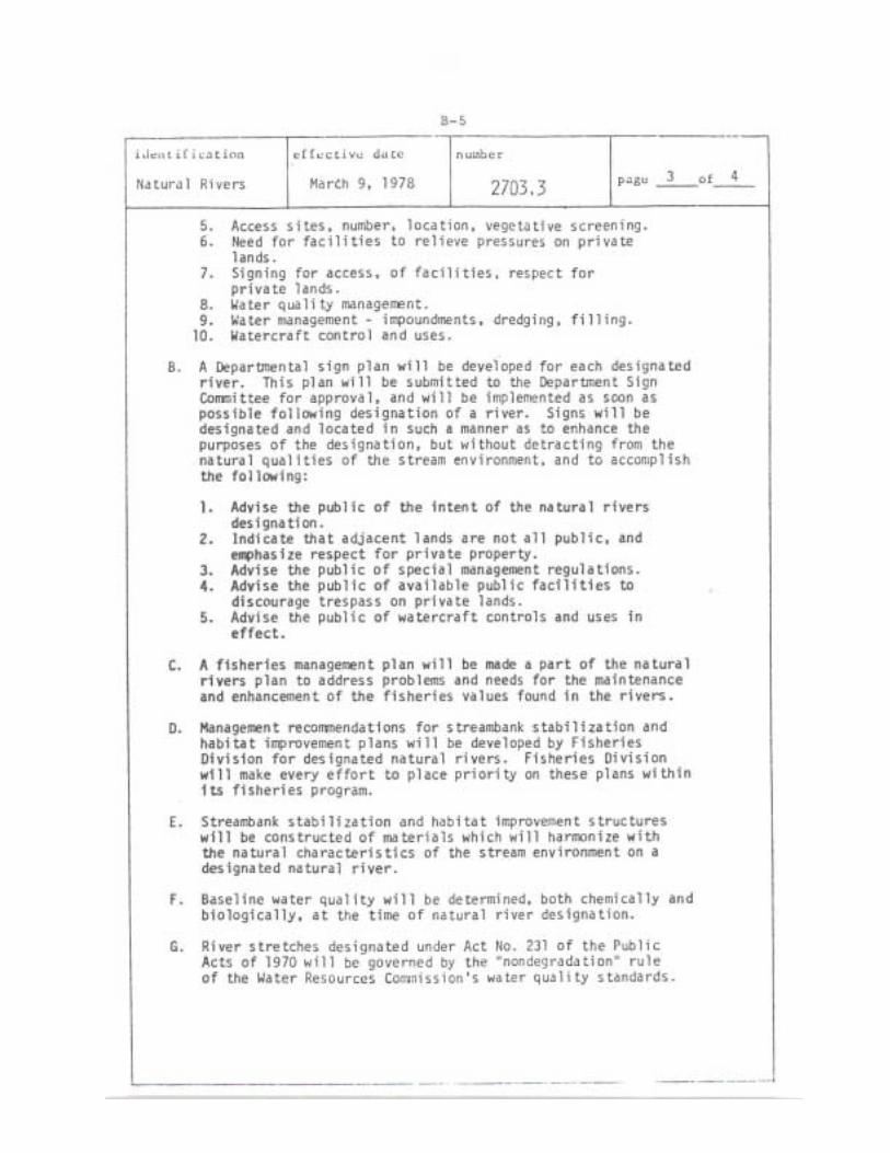
52

53

54
APPENDIX C
“ALTERATION OF RIVERS” LAWS
Construction on Streams (Act 156, 1951): Authorizes county commissioners to permit or prohibit the construction of dams or bridges on navigable streams. They can also provide for the removal of obstructions. Construction of Dams in Streams (Act 184, 1963): Prohibits dam building on a stream or river impounding more than five acres without a permit from the Department of Natural Resources. Inland Lakes and Streams Act of 1972 (Act 346, 1972): Authorizes the Department of Natural Resources to regulate structures, fills, dredgings and other such actions on waterfronts. Soil Erosion and Sedimentation Control Act of 1972 (Act 347, 1972): Control of soil erosion for the identified land uses of an area to prevent sedimentation of the waters of this state. Regulate Alteration of Floodplain and Floodways (Act 167, 1968): Authorizes the Water Resources Commission to control alteration of the water courses and the floodplains of all rivers and streams, and to prohibit the obstruction of the floodways of rivers and streams of the state. Goemaere-Andreson Wetland Protection Act (Act 203, 1979): Authorizes the Department of Natural Resources to regulate dredging, filling, draining and other such actions to wetlands, including those contiguous to Michigan rivers (effective October 1, 1980).
RIVER USE LAWS
Marine Safety Act (Act 303, 1967): Sets forth general regulations for the use of vessels on waters of the state. Department of Natural Resources may, via hearings and adoption of rules by local governments, further regulate the use of such waters by special regulation. Pending Canoe Registration Act: Would require registering of canoes that are intended for use in public waters of the state.
POLLUTION LAWS AND PROGRAMS
Water Resources Commission (Act 245, 1929): Commission must establish “pollution standards for waters of the state in relation to the use to which they are or may be put.” Has the authority to make regulations and issue orders and permits restricting the polluting content of discharges into state surface and ground waters. Act prohibits discharges of any substance into water which are or may become injurious to public health, safety, welfare; domestic, commercial, industrial, agricultural, recreational or other uses of water; value or utility of riparian lands; to livestock, wild animals, birds, fish, aquatic life or plants, etc. Prohibits structures that will unduly restrict the capacity of the floodway.

55
Environmental Protection Act (Act 127, 1970): Allows the Attorney General, any public body, and private body or person to sue to enjoin the pollution or likely pollution of any natural resource or obtain relief with respect to such actions. Clean Water Boding Act (Act 76, 1968 implemented by Act 329, 1966, as amended): For sewage treatment facilities eligible for federal aid, the Water Resources Commission may grant up to 25 percent of the project cost providing that the sum of state and federal aid shall not exceed 80 percent of the project cost.
RELATED & GENERAL LAWS APPLICABLE TO NATURAL RIVERS PROGRAM
Shorelands Protection and Management Act (Act 245, 1970): The Great Lakes counterpart of the Natural River Act. Farmland and Open Space Preservation Act (Act 116, 1974): Provides tax relief for certain property owners signing nondevelopment agreements with the state. Subdivision Control Act (Act 288, 1967): Regulates the subdivision of land; requires that the land be suitable for building sites and public improvements, and that there be adequate drainage thereof; to control residential building development within floodplain areas, etc. State Constitution (Act IV, s.52): Legislature must provide for the protection of natural resources. Department of Conservation (Act 17, 1921): Department must protect and conserve the natural resources of the State of Michigan. Natural Beauty Roads (Act 150, 1970): Such roads may be established by county road commission upon local petition. After establishment, commission may enact regulations to preserve native vegetation in the road right-of-way. Safety Zones (Act 61, 1968): Prohibits discharge of firearms within 150 yards of an occupied dwelling. Reckless Use of Firearms Act (Act 45, 1952): Recreational Trespass Act (Act 323, 1976): Must have written permission to be on an individual’s property, and prohibits possession or discharge of a firearm within the limits of a right-of-way on certain public roads.
RIVER PLANNING & DEVELOPMENT ORGANIZATIONS
Local River Management Act (Act 253, 1964): Authority to establish both a watershed council (like a planning or advisory board) and a river management district and board (planning a development agency).

56
Intermunicipality Study Committee (Act 200, 1957): Two or more municipalities may establish an intermunicipality study committee to study area problems and formulate recommendations to their governing bodies.

57

58
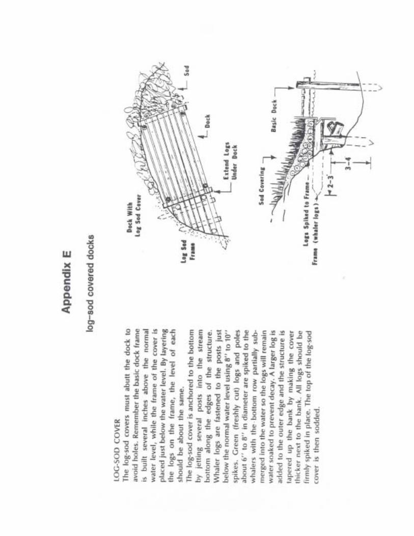
59