for Introduction to Integrated - Iowa Stormwater · Introduction to Integrated WPCOP) Watershed...
14
10/24/2013 1 Iowa Watershed Planning for Communities Program (I‐WPCOP) Introduction to Integrated Watershed Management Planning RDG Planning & Design Objectives • Understand the “triple bottom line” approach. • Understand how to integrate watershed and land use plans. • Identify the challenges associated with integrated watershed and land use plans. • Recognize the value of collaboration.
Transcript of for Introduction to Integrated - Iowa Stormwater · Introduction to Integrated WPCOP) Watershed...
10/24/2013
1
Iowa Watershed Planning for
Communities Program
(I‐WPCOP)
Introduction to Integrated Watershed Management Planning
RDG Planning & Design
Objectives• Understand the “triple bottom line” approach.
• Understand how to integrate watershed and land use plans.
• Identify the challenges associated with integrated watershed and land use plans.
• Recognize the value of collaboration.

10/24/2013
2
What is a Land Use Plan?
• Provides an organized framework for the growth of our communities – through a comprehensive plan
• Strategically identifies the location of intended uses for urban, suburban and rural communities and open spaces
• Creates safe, healthy, affordable communities for resilient future
Where do we start?
• Current Planning Framework
– No Comprehensive Plan
– Outdated
– Recent
• QUESTION: Do you have a plan? Is it current?

10/24/2013
3
A Paradigm Shift
• Past – no watershed concerns in land use planning
• Present ‐ watershed planning principles are being integrated
• Future – holistic planning that emphasizes a triple bottom line approach, smart growth principles
Triple Bottom LineWhy is this important?
• Environmental Health
• Economic Growth
• Quality of Life

10/24/2013
4
Integrating Watershed Planning into Land Use Plans
Where do we start?• Identify Watershed goals
– Water quality, flooding, recreation, preserve natural areas, erosion control, wildlife, open space preservation, impaired waters, etc
Basic Components
Watershed
Natural Resource
Infrastructure
Land Use
Integrated Planning

10/24/2013
5
Watershed
• A Watershed is a Watershed is a Watershed!
• Non Political Boundary
Natural Resource Planning
• Regulatory Mapping– Wetlands, Floodplains
• Soil Mapping– Hydric Soils, Water Table, Infiltration Rates, erosion class, etc
• Landscape Mapping– Topography (LiDAR), Vegetation
• Parks and Open Spaces
• Key Point: Greenways are a critical component to managing our natural resources through community development
• Key Point: GIS Mapping Availability – publically available.
• Key Point: At a minimum should include the soils, wetlands and floodplains

10/24/2013
6
3 Minute Brainstorm!
• What are your concerns?
• Do you have specific watershed goals for improvement?
• What resources are available to you?
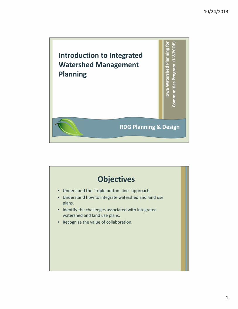
Natural Resource Planning
• KEY POINT: Natural resource planning involves the inventory and analysis of multiple ecological systems. These typically include wetlands, floodplains, streams, lakes, ponds, soil type, geological profile, hydric soils, erosion class, water table, corn suitability rating, topography, general land office surveys, wildlife habitat, etc.
10/24/2013
7
Natural Resource Planning
Infrastructure
• Transportation Network
– Vehicular, Rail, Air, Pedestrian, Bicycle
• Utilities
– Stormwater, Sanitary, Electrical, Gas, Etc
• Greenways
– Water, people, wildlife
– Green Infrastructure
– Connectivity

10/24/2013
8
How does it all fit together?
• Balanced Approach – Integrated Planning!
• Natural Resources
• Objective Decision Making
Systems Approach = Informed Decisions

10/24/2013
9
Systems Approach = Informed Decisions
Systems Approach = Informed Decisions

10/24/2013
10
Systems Approach = Informed Decisions
Challenges• Support
– Internal and External Struggles
– Public, Developers, Land Owners
• Implementation
– Ordinances, Enforcement
• Measured Results
– Takes Time!
10/24/2013
11
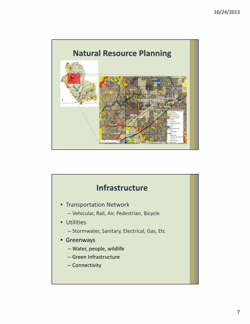
Challenges
• Watershed Development
– Upstream / Areas out of planning limits/ jurisdictional boundaries, Fringe areas
• Get the plan in place and built!
Value of Collaborations
Working Together
• Multi Jurisdiction
– Economies of scale, efficiencies, cost savings, 28E Agreements
• Urban – Rural
– Role of urban areas for providing county development ‐ recognize need for urban services
• Property Owners
10/24/2013
12
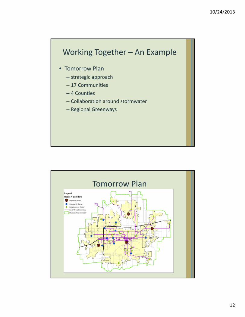
Working Together – An Example
• Tomorrow Plan
– strategic approach
– 17 Communities
– 4 Counties
– Collaboration around stormwater
– Regional Greenways
Tomorrow Plan

10/24/2013
13
How are these concepts implemented?
Cedar FallsSec. 29‐157. ‐ F‐P general floodplain overlay district.
(a)Principal permitted uses. The following uses shall be permitted within the F‐P general floodplain district to the extent they are not prohibited by any other ordinance or underlying zoning district and provided they do not require placement of structures, factory‐built homes, fill or other obstruction, the storage of materials or equipment, excavation or alteration of a watercourse:
(1)Agricultural uses such as general farming, pasture, grazing, outdoor plant nurseries, horticulture, viticulture, truck farming, forestry, sod farming and wild crop harvesting.
(2)Industrial‐commercial uses such as loading areas, parking areas and airport landing strips.
(3)Private and public recreation uses such as golf courses, tennis courts, driving ranges, archery ranges, picnic grounds, boat launching ramps, swimming areas, parks, wildlife and nature preserves, game farms, fish hatcheries, shooting preserves, target ranges, trap and skeet ranges, hunting and fishing areas and hiking and horseback riding trails.
(4)Residential uses such as lawns, gardens, parking areas and play areas.
(b)Conditional uses. Any use which involves placement of structures, factory‐built homes, fill or other obstructions, the storage of materials or equipment, excavation or alteration of a watercourse may be allowed only upon issuance of a special exception permit by the board of adjustment. All such uses shall be reviewed by the state department of natural resources to determine:
(1)Whether the land involved is either wholly or partly within the floodway or floodway fringe; and
(2)The 100‐year or 500‐year flood level.
The applicant shall be responsible for providing the state department of natural resources with sufficient technical information to make the determination.
How are these concepts implemented?
Cedar Falls Continued….(c) Performance standards.
(1)All conditional uses or portions thereof to be located in the floodway, as determined by the state department of natural resources, shall meet the applicable provisions and standards of the floodway district.
(2)All conditional uses or portions thereof to be located in the floodway fringe, as determined by the state department of natural resources, shall meet the applicable standards of the floodway fringe district.
(d)Prohibited uses. No structure located within the designated floodplain district may be subdivided or converted for the purpose of establishing a separate dwelling unit either wholly or partially below the 500‐year flood elevation.
(Ord. No. 2750, § 9, 7‐11‐11)
Editor's note—

10/24/2013
14
Key Points & Conclusions• Planning through the lens of a watershed – all decisions
impact costs, communities and policy.
• Watershed “systems based approach” Use existing mapping resources – LiDAR, GIS Data to take a systems approach towards land stewardship and development.
• It starts with the Soil!
• Changing paradigms take time – educate and empower others to think holistically.
• Make smart planning decisions – integrate team members from multiple backgrounds.
• Plan to get your “plan” built!
Tool Box Resources• Watershed Planning
– http://water.epa.gov/type/watersheds/approach.cfm
• Example Watershed Plan
– http://bigcreeklake.files.wordpress.com/2011/12/bigcreekwmp_final.pdf
• Land Use Planning and Smart Growth Principles
– https://rio.urban.uiowa.edu/sites/rio/files/Iowa_Smart_Planning_Overview_0.pdf
• Example Comprehensive Plan Based featuring Smart Growth Principles and Watershed Planning (Chapter 4)
– http://www.ci.ankeny.ia.us/Index.aspx?page=116
• Example Flood Plain Ordinance – Cedar Falls
– http://library.municode.com/HTML/10264/level4/COOR_CH29ZO_ARTIIIDIDIRE_DIV2SPDI.html#COOR_CH29ZO_ARTIIIDIDIRE_DIV2SPDI_S29‐157GEFLOVDI
• Sensitive Areas Ordinance – Johnson County– http://www.johnson‐county.com/dept_zoning.aspx?id=5121