S2 Matchday Program: Sounders FC 2 vs. Switchbacks FC - August 19, 2015

From DESERT USA -- http://www.desertusa.com/gc/du_gc_main.html
Grand Canyon National Park is the nation's most popular national park with 5 million visitors annually. Located entirely in northern Arizona, the park encompasses 277 miles of the Colorado River and adjacent uplands. One of the most spectacular examples of erosion anywhere in the world, the Grand Canyon is unmatched in the incomparable vistas it offers from the rims. Grand Canyon National Park is a World Heritage Site.
Expect crowds during the spring, summer, and fall months. During these months reservations for camping and lodging are essential. For books to help plan your Grand Canyon visit click here.
General Information
Seasons / Hours
South Rim: Open 24 hours a day, 365 days a year.
North Rim - Open 24 hours a day. Closed from late October to mid-May.
1

From DESERT USA -- http://www.desertusa.com/gc/du_gc_main.html
Rates & Fees
ENTRANCE FEES
Private vehicle - $25.00 7 days Individual (pedestrians, bicycle, etc..) - $12.00 7 days Annual Grand Canyon pass - $50.00 (individual or vehicle) Annual Golden Eagle pass - $50.00 (all U.S. recreation sites)
BACKCOUNTRY FEES
Permit Fee (per permit) - $10.00 plus $5.00 per person Frequent Hiker (all permits annually) - $25.00 Nightly Impact Fee (per person) - $4.00
Visitor Centers
South Rim - Hours: 8:00 a.m. to 5:00 p.m. (longer hours during peak season). The main park Visitor Center is located just east of Grand Canyon Village, approximately 6 miles north of the south entrance station.
North Rim - 8:00 a.m. to 5:00 p.m. (longer hours during peak season) mid-May through late October only; located in the lobby of Grand Canyon Lodge
Interpretive Centers are also located at
Yavapai Observation Station Tusayan Museum Desert View
Quick overview:
Climate And Map Camping and Lodging Things To Do and see
Facilities/Features
Stores/MuseumIn addition to the main park Visitor Centers, historic Kolb Studio is open to the public for most of the year and features a variety of canyon-related exhibits. There are six lodges in the park (including the historic El Tovar Hotel) and a wide variety of eating establishments
2

From DESERT USA -- http://www.desertusa.com/gc/du_gc_main.html
(from cafeterias to formal dining at the El Tovar Hotel). Tusayan Museum offers exhibits of Anasazi and Hopi culture.
Programs/EventsThe park offers free ranger-led programs throughout the year, including a wide variety of walks, talks, and a nightly evening program (outdoors in summer, indoors during cooler weather). Regularly scheduled special events at Grand Canyon include the Grand Canyon Chamber Music Festival each September, regularly scheduled theatrical productions in summer, art exhibits at Kolb Studio on the rim (April through October), and others. Check THE GUIDE upon arrival for details and schedules of current activities.
Food/SuppliesGroceries and supplies are available on the South Rim at Babbitt's General Store (both in Grand Canyon Village and at Desert View). There is a small camper store on the North Rim, adjacent to the North Rim Campground.
AccessibilityFacilities vary a great deal. Write for a copy of the park's free 8-page Accessibility Guide.
Rules, Regulations, Precautions
Firearms, including air pistols, bow & arrows, and fireworks are prohibited. Fires are not allowed except in grills at Mather and Desert View campgrounds. Hiking and other strenuous activities in extreme heat can be hazardous. Pace
yourself and rest often. Carry water (at least 1 gallon per person per day is recommended) and drink even when you don't feel thirsty. There is no water available at picnic areas or along most trails.
Reservations for camping and lodging must be made in advance, particularly during peak season. Permits are required for all overnight hikes; permits must be obtained in person or by written request (phone reservations are not accepted). Write and request a copy of the park's Backcountry Trip Planner for additional information on backpacking in the park. Permits are not required for day hikes.
Pets are allowed in the park but must be on a leash at all times. Leashed pets are allowed on rim trails throughout the developed areas in the park but not below the rim, in park lodging or on park buses. The only exception is certified service dogs. Persons wishing to take a certified service dog below the rim must check in first at the Ranger Office (at the corner of Center Road and Village Loop Drive.) There is a kennel at the South Rim; call 520-638-2631, extension 6549. Reservations are suggested. Kennel services are not available on the North Rim; pets are not recommended.
Climate, Geography, MapSetting
Grand Canyon National Park is located in north-central Arizona about 80 miles northwest of Flagstaff. It runs for 215 miles along both sides of the Colorado River between Glen Canyon National Recreation Area (much of which is in Utah) and Lake Mead National Recreation (much of which is in Nevada).
3

From DESERT USA -- http://www.desertusa.com/gc/du_gc_main.html
Grand Canyon National Park encompasses areas of the Kaibab Plateau (on the southern extreme of the Colorado Plateau) at elevations between 7,000 and 8,000 feet, and also the Colorado River gorge which runs through it at elevations as low as 2,000 feet
Climate
The Grand Canyon's South Rim has an elevation 7,000 feet above sea level. Such an elevation means snow in the winter and cool nights, even in summer. The Inner Canyon (below the rim) has a distinctly different climate, since at the bottom along the Coloardo River, elevation is almost a mile lower. Temperatures herealong the Colorado River at the canyon bottom can reach 120 degrees F.
The North Rim is 8,000 feet above sea level (1,000 feet higher than the South Rim) and can receive snow throughout most of the year. Weather is particularly unpredicatable in spring and fall so visitors should be prepared for a variety of climates. The North Rim is closed in winter.
Summer
Summer temperatures on the South Rim are relatively pleasant (50s-80s F; low teens to high 20s C) but inner canyon temperatures are extreme; daytime highs at the river (5000 feet below the rim) often exceed 100 F. North Rim summer temperatures are cooler than those on the South Rim because of its increased elevation.
Winter
Winter conditions at the South Rim can be extreme: expect snow, icy roads and trails, and possible road closures. Canyon views may be temporarily obscured during winter storms; in such cases entrance fees are not refundable. The North Rim is closed in winter.
Spring & Fall
Spring and fall on both rims and the Inner Gorge weather is quite unpredictable, so visitors be prepared for sudden changes in the weather and a variety of climates.
4

From DESERT USA -- http://www.desertusa.com/gc/du_gc_main.html
Average Monthly Precipitation and Temperature Highs & Lows
South Rim(Degrees F. - Inches)
North Rim(Degrees F. - Inches)
Inner Canyon(Degrees F. - Inches)
Jan 41 18 1.32 37 16 3.17 56 36 .68Feb 45 21 1.55 39 18 3.22 62 42 .75Mar 51 25 1.38 44 21 2.63 71 48 .79Apr 60 32 .93 53 29 1.73 82 56 .47May 70 39 .66 62 34 1.17 92 63 .36Jun 84 54 1.81 77 46 1.93 106 78 .84Jul 84 54 1.81 77 46 1.93 106 78 .84Aug 82 53 2.25 75 45 2.85 103 75 1.40Sep 76 47 1.56 69 39 1.99 97 69 .97Oct 65 36 1.10 59 31 1.38 84 58 .65Nov 52 27 .94 46 24 1.48 68 46 .43Dec 43 20 1.62 40 20 2.83 57 37 .87
Getting There
Grand Canyon Village (South Rim) is located 60 miles north of Interstate 40 at Williams via highway 64, and 80 miles northwest of Flagstaff via highway 180. Only ten miles from rim to rim as the crow flies, the North Rim is 215 miles (about 4 1/2 hours) from the South Rim by car. The North Rim is 44 miles south of Jacob Lake, AZ, via highway 67.
Public Transportation
TO PARK
Commercial air carriers serve Las Vegas, Phoenix, Flagstaff, and Grand Canyon Airport (in Tusayan, just south of the park).
Bus service is available from Flagstaff and Williams via Nava-Hopi Bus Tours ((800) 892-8687).
Historic steam train service is available from Williams (call 1(800) THE TRAIN).
IN PARK
Free shuttle service is available throughout Grand Canyon Village, along the West Rim Drive, and out to the South Kaibab Trailhead during peak season only (generally Memorial Day to September). At that time of the year the West Rim Drive and Yaki
5

From DESERT USA -- http://www.desertusa.com/gc/du_gc_main.html
Point are closed to private vehicles. Shuttle service is also available (for a fee) to Tusayan. Taxis are available (on call) from Grand Canyon National Park Lodges, call (928) 638-2631 ext. 6563.
Cultural History
Native Peoples
Paleo-Indians were the first to settle in the Grand Canyon region about 11,000 years ago. Gradually, this culture evolved into to the Archaic, which ended about 3,000 years ago. Archeologists found remnants of this culture when they discovered small animal figures made of willow twigs in the caves of the Redwall Limestone cliffs. Radiocarbon dating revealed that the figurines were approximately 4,000 years old.
No other indication of human habitation in the canyon has been discovered until the time of the Anasazi , who flourished in the canyon from 500 to 1500 AD. During the end of this time, the Anasazi, shared the region with the Cohonino who wove baskets and hunted deer, sheep and rabbits. Later, as the civilization advanced, the Anasazi settled into pueblos, or "towns," and built irrigation structures to aid in farming. Living in peaceful coexistence, both tribes
6

From DESERT USA -- http://www.desertusa.com/gc/du_gc_main.html
traded with each other until a prolonged drought during the thirteenth century forced them to leave. As the Anasazi moved east, they became the ancestors of today's Hopi.
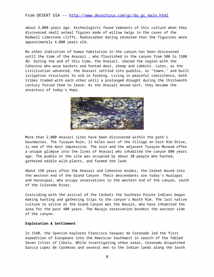
More than 2,000 Anasazi sites have been discovered within the park's boundaries. The Tusayan Ruin, 21 miles east of the Village on East Rim Drive, is one of the most impressive. The ruin and the adjacent Tusayan Museum offer a unique glimpse into the lives of Anasazi who inhabited the canyon 800 years ago. The pueblo at the site was occupied by about 30 people who hunted, gathered edible wild plants, and farmed the land.
About 150 years after the Anasazi and Cohonino exodus, the Cerbat moved into the western end of the Grand Canyon. Their descendants are today's Hualapai and Havasupai, who occupy reservations in the western end of the canyon, south of the Colorado River.
Coinciding with the arrival of the Cerbats the Southern Paiute Indians began making hunting and gathering trips to the canyon's North Rim. The last native culture to arrive at the Grand Canyon was the Navajo, who have inhabited the area for the past 400 years. The Navajo reservation borders the eastern side of the canyon.
Exploration & Settlement
In 1540, the Spanish explorer Francisco Vasquez de Coronado led the first expedition of Europeans into the American Southwest in search of the fabled Seven Cities of Cibola. While investigating other areas, Coronado dispatched Garcia Lopez de Cardenas and several men to the Indian lands along the South Rim of the canyon, where they were assisted by Hopi guides. It was Cardenas who made the first European discovery of the canyon, However, Cardenas and his men left disappointed that they had not found the riches they sought.
In the 250 years following the Cardenas expedition, only a handful of trappers and missionaries visited the canyon. Most quickly turned away after finding the terrain impenetrable. It was first called the "Grand Canyon" by John Wesley Powell who, in a daring expedition down the Colorado River, led the first fully documented exploration of the canyon in 1869 with nine men and four boats. Powell's party covered more than 1,000 miles of the river in just 98 days. After he led a second journey in 1871, Powell published an official, illustrated report of his journeys in 1875, which encouraged many travelers to explore the Grand Canyon for themselves.
Prospectors also entered the region hoping to cash in on the river's rich mineral ores. The canyon's ruggedness made mining extremely difficult, however, and pioneering prospectors soon realized that tourism would provide a more lucrative trade.
One prospector, John Hance, built a ranch east of Grandview Point and began to offer bed and board to visitors. Reportedly the first white settler at the canyon, Hance arrived about 1883 and remained until his death in 1919. He is credited with carving many of the existing trails in the park, many of which follow old Havasupai Indian paths.
7
From DESERT USA -- http://www.desertusa.com/gc/du_gc_main.html
Park History
Grand Canyon tourism began to boom in 1901 with the completion of the Santa Fe Railroad. Development of Grand Canyon Village began shortly thereafter, primarily by the Fred Harvey Company, which opened El Tovar Hotel in 1905. Many of the early buildings of Grand Canyon Village survive today and are included on the National Register of Historic Landmarks.
Mary Jane Colter, an architect for the Fred Harvey Company from 1902 to 1948, designed several landmark buildings throughout the park. Colter applied her knowledge of architecture and ethnology, and with a respect for the Native American cultures that thrived in the canyon, designed Desert View Watchtower, Hopi House, Hermit's Rest, the Lookout Studio, Phantom Ranch, among others.
In 1908, under authority of the Act for the Preservation of American Antiquities, President Theodore Roosevelt declared the Grand Canyon a national monument. This status protected the region from private development until 1919, when President Woodrow Wilson signed the bill creating Grand Canyon National Park. In 1979, it was named a World Heritage Site, joining Victoria Falls in Zimbabwe, Great Barrier Reef off the coast of Australia, and other distinguished sites having exceptional natural and cultural features considered universally valuable for all humankind.
Natural History
Because the Grand Canyon ranges from 2,000 feet to 7,400 feet above sea level, it can support a wide variety of plant and animal life indigenous to desert and mountain environments. Almost 2,000 animals and plants have been cataloged in Grand Canyon National Park.
Plants
Four species of trees have adapted well to the rims of the Grand Canyon: the Ponderosa Pine, the Pinyon Pine, Gambel oak and Utah Juniper. At elevations below 7,000 feet the Pinyon Pine and the Utah juniper are the dominant members of the South Rim "pygmy forest." The short-needled pinyon is prized for its edible seeds. The juniper with its shaggy bark is particularly well adapted to this and climate. Ponderosa Pines grow to great heights proliferating on the North Rim.
Also common here is the Banana yucca, one of the most common and useful plants in the American southwest. Native Americans have traditionally used it in the manufacture of soap, as a source of fiber for rope and sandals, and for its edible fruits which resemble small bananas.
Grand Canyon is home to many shrubs, including Cliffrose, Fernbush (both members of the Rose Family) and Mountain Mahogany. The Cliffrose's gnarled branches produce white flowers in late spring, while the Fernbush is a late bloomer, waiting until August to blossom. Mountain mahogany sprouts a white flower that twists like a corkscrew when it rains.
The bright red claret cup is the more common of two species of hedgehog cactus at Grand Canyon. At lower elevations its showy red blooms appear in April. On the edge of the rim it blooms in May or June.
Animals
8

From DESERT USA -- http://www.desertusa.com/gc/du_gc_main.html
Today, 67 different species of mammals are known to inhabit the canyon region, including Bighorn Sheep, Bobcat, Mule Deer, Albert Squirrel, Coyote and Mountain Lion. In developed areas along the rim rock squirrels have lost their natural fear of humans and are often seen begging for handouts. It is dangerous and illegal to feed them.
The Colorado River in the canyon region is home to 16 species of fish. There are also many reptiles and amphibians, including 22 types of lizards and 24 types of snakes. Among the reptiles commonly seen along the rim are the Eastern Fence lizards. Look for a blue patch on either side of their throat. Of the two dozen snakes living in the canyon, thhe commonly encountered are harmless to humans, usually Gopher Snakes, which feed son rodents and insects. Poisonous snakes, such as the Grand Canyon rattlesnake, Crotalus virdis abyssus, are found in the area, but are rare.
More than 290 species of birds have also been counted. Seven types of hawks and eagles have been seen in the park, but the one most visible is the Red-tailed hawk. Both the Mountain Chickadee and the Nuthatch are small, acrobatic birds common in the Grand Canyon's coniferous forests. The White-throated Swifts and Violet-Green Swallows dive through the air in pursuit of insects. The large black bird commonly seen perched along the rim or soaring in the canyon below is the Raven.
Geology
The Grand Canyon is the world's most spectacular example of erosion and most remarkable assemblage of exposed of rocks in sequence and intact.
The Grand Canyon officially measures 277 river miles from Lees Ferry to the Grand Wash Cliffs. Today the Colorado River through Grand Canyon is bracketed at either end by dams - Glen Canyon Dam (Lake Powell) on the upstream end and Hoover Dam (Lake Mead) at the lower end. As a result, the dynamics of the Colorado River have changed considerably. Prior to its impoundment the river carried a sediment load many times what it carries today.
Compared to the rocks in which it is carved, Grand Canyon is geologically young, occurring only in the past 6 million years. The Grand Canyon is the result of erosion, primarily by water. While the Colorado River has played the primary role in creating the canyon's present depth, runoff from rain and snow, and the streams that flow into the Canyon from both rims also helped shape and size the Canyon.
Almost a mile -- 5,000 vertical feet -- below the South Rim of the Grand Canyon the Colorado River, from its origins high in the Colorado Rockies, the river flows more than 1,400 miles toward the Gulf of California and passes through a series of remarkable canyons, of which Grand Canyon is only one.
In addition to its size, the Grand Canyon shares many things with its neighbors -- Zion, Bryce, Canyonlands, Arches, and Mesa Verde -- which all lie within the geologic province
9

From DESERT USA -- http://www.desertusa.com/gc/du_gc_main.html
called Colorado Plateau. This region is characterized by relatively flat-lying sedimentary rocks of great thickness that have been raised thousands of feet above sea level in a series of pancake-like plateaus.
Due in part to climate the semi-arid climate which exists in this part of the U.S., erosion proceeds in a very dramatic fashion. Each of the rock layers within the Grand Canyon erodes in its own manner, giving the Canyon its characteristic stepped-pyramid appearance.
Shales erode to slopes, sandstones and limestones form cliffs; the dark igneous rocks of the Inner Gorge and southern end -- more resistant to erosion than the softer sedimentary rocks above-- produce the steep-walled narrow gorge. Vertical fractures are common and are responsible for the tall pillars and erosional remnants that are prevalent along the rims. The flat-topped mesas and buttes are characteristic landforms of Southwest where flat-lying sedimentary rocks are present.
Many of the stunning colors of the remarkable features of this landscape are due to the presence of small amounts of iron and other minerals which stain the surface of the canyon walls. The measured thickness of rock in Grand Canyon is about six thousand feet. Each layer represents an interval of time during which a particular environment of deposition prevailed, but many of the layers are separated by gaps of unrecorded time and missing rock layers referred to as "unconformities."
Most of the flat-lying rocks visible from the rims are Paleozoic in age, recording events that took place on the North American continent hundreds of millions of years ago, long before dinosaurs roamed the earth.
The youngest of these layers is the Kaibab Limestone, the top layer, deposited in shallow warm seas at the end of the Paleozoic period (65 million years ago). Below the rim these layers become progressively older, reaching back into the early Paleozoic.
Four thousand feet below the rim, in the walls of the Inner Gorge, are the oldest rocks of this region: the igneous and metamorphic rocks known as the Vishnu Group. Very different from the sedimentary rocks above them, these ancient schists and gneisses are almost 2 billion years old and form the very basement of the North American continent.
Here is the Paloezoic & Precambrian rock sequence in the Grand Canyon, from top to bottom:
Kaibab Limestone (Permian) Torpweap Limestone (Permian) Coconino Sandstone (Permian) Hermit Shale (Permian) Supai Group (Pennsylvanian) Redwall Limestone (Mississippian) Temple Butte Limestone (Devonian) Muav Limestone (Cambrian) Bright Angel Shale (Cambrian) TapeatsSandstone (Cambrian) Grand Canyon Supergroup (Precambrian-proterozoic) Vishnu Schist (Precambrian-archeozoic)
10

From DESERT USA -- http://www.desertusa.com/gc/du_gc_main.html
Zoroaster Granite (Precambrian-archeozoic)
Things to Do
The Grand Canyon is unique among national parks because, in addition to its natural
geologic wonders and incredible wilderness resources, it is also a small town in itself, containing a multitude of hotels, restaurants, gift shops, various stores and a variety of services. Grand National Park is also huge! So many activities can take place at different locations and seasons. There are numerous activities available at the Grand Canyon, but most occur on the South Rim's Grand Canyon Village. They include:
Hiking & Backpacking Vehicle Tours Mule Rides
Shuttle Tours Helicopter & Air Tours
Biking Smooth-Water Rafting
Fishing Whitewater Rafting
Horseback Riding Archeology / Museum Tour
For books to help plan your Grand Canyon visit. - click here. Motor Vehicle Tours
11

From DESERT USA -- http://www.desertusa.com/gc/du_gc_main.html
The Grand Canyon may be viewed from the rim at a number of overlooks along the East Rim Drive (26 miles from Grand Canyon Village to Desert View) and the West Rim Drive (9 miles from Grand Canyon Village to Hermits Rest; closed to private vehicles from Memorial Day through September, when it may be accessed by free park shuttles). There are many overlooks accessible by car which offer spectacular views of the canyon. If you're a dedicated scenic driver, head to the South Rim while you have a chance. Because of of severe overcrowding, the park will soon be switching over to a new shuttle service.
East Rim Drive
Highway 64 follows the canyon rim for 26 miles east of Grand Canyon Village to Desert View (the east entrance to the park). To date, the East Rim Drive is open to private vehicles throughout the year. The following are highlights of the drive:
Yaki Point: Offers great views over the Canyon from South Kaibab Trailhead.Grandview Point: Remains of an old mine on Horseshoe Mesa can be seen from here.Moran Point: Named for Canyon booster Thomas Moran, offers views of Hance Canyon.Desert View: Panoramic view the Vermillion Cliffs, Painted Desertb San Francisco Peaks ands the Coloprado River.
West Rim Drive
12

From DESERT USA -- http://www.desertusa.com/gc/du_gc_main.html
This follows the rim for 8 miles west from Grand Canyon Village to Hermits Rest. The West Rim Drive is closed to private automobiles from late May through September. At that time of year the park runs a free shuttle bus to provide transportation to overlooks on the West Rim Drive.
North Rim
The North Rim is 1,000 feet higher and considerably wetter than the South Rim. Because of snow, the North Rim is closed for most of the winter, between October and May. There are four main overlooks along the paved route of the North Rim developed area: Point Imperial, Cape Royal, Bright Angel Point and Point Sublime. For a real driving adventure, travel by dirt road to Tuweep Wilderness at the park's far western end.
Special Activities
Grand Canyon Shuttle Service
Between Memorial Day and late September, enjoy a free shuttle ride through the Grand Canyon historic district. Hikers on the Rim Trail can board or exit the shuttle at any stop. Sights include:
Kolb Studio Hopi House Lookout Studio Bright Angel Lodge El Tovar Santa Fe Railway Station
Biking
Bicycles are allowed on paved rim roads, secondary roads and some fire roads in the park. Bicyclists may also use West Rim Drive in summer, when it is closed to all but shuttle buses. There are no bicycle rentals available in or near the park. Numerous mountain biking trails are available in the Kaibab National Forest, primarily on the North Rim.
Fishing
Record-sized game fish are now more abundant in the Colorado River of Grand Canyon , with Rainbow Trout becoming plentiful. In Arizona a fishing license is required and available at Babbitt's Store. Several concessionaires offer fishing trips.
Horseback Riding
Horseback rides are offered in Tusayan outside the park. Take a 2- or 4-hour ride through Kaibab National Forest or to the east Rim. Evening and wagon rides are also available.
Mule Rides
South Rim: Take a 1-day round trip to Plateau Point 3,200 feet below the rim or try a 2-day trip to Phantom Ranch and back (includes lodging and meals). Both leave from the Stone Corral at the head of Bright Angel Trail.
13

From DESERT USA -- http://www.desertusa.com/gc/du_gc_main.html
North Rim: Full- and half-day mule trips into the canyon from the Norh Rim are less crowded and easier to book. Offered daily when Grand Canyon Lodge is open.
Helicopter & Air Tours
Grand Canyon helicopter tours are offered by several air tour companies operating out of Tusayan. Usually 30- and 50-minute rides.
Smooth-Water Raft Trips
Spend 4 to 5 hours floating down the Colorado, upstream from the Grand Canyon. The 12-hour round trip departs by bus from Grand Canyon Village. It includes stops at East Rim Drive, Cameron Trading Post on the Navajo Reservation and a picnic lunch.
Whitewater Raft Trips
Numerous companies offer white-water rafting expeditions lasting from 3 days to 3 weeks. Most trips are offered April through October and embark upstream at Lees Ferry. For a list of companies contact the park's River Permits Office, 502-638-7843. Private river running trips require a permit -- the waiting list is 6 to 8 years long.
Read a DesertUSA correspondent's first-hand account of a rafting the Colorado River through the Grand Canyon Gorge.
Archeological Tour - Museum & Ruins
The Tusayan Museum features exhibits of prehistoric Anasazi Indians and their decedants, the Hopi who still live on a reservation east of Grand Canyon National Park. Take a 1/4-mile trail through the ruins of a 12th-century Anasazi Pueblo leading from the museum. The museum is 23 miles east of Grand Canyon Village on East Rim Drive.
Hike to the Bottom Of the Grand CanyonSouth Kaibab Trail ~ River Trail ~ Bright Angel Trail
By Shay Summers
After living in Arizona for 6 months, I felt as if I had grossly neglected one of the state's (and country's) most popular and magnificent treasures -- the Grand Canyon. So with the heat from the summer expired (yes, 90s is "cooled down" for a Phoenician), I entreated my most consistent and most "in shape" hiking buddy, Monica, to hike the Grand Canyon with me, which wasn't hard because she would rather hike than go to Disneyland.
Being a novice of how the Grand Canyon operates, I wanted to camp in the Canyon two nights and spend the days doing hikes that wouldn't kill me. However, I quickly learned that camping in the Canyon was a bit trickier than that. One is required to obtain a permit at least 4 to 6 weeks in advance (4 to 6 months is more realistic).
14

From DESERT USA -- http://www.desertusa.com/gc/du_gc_main.html
Information required on the application for the permit includes the names of the people camping, license plates of the automobiles to be driven to the Canyon, and the itinerary of all of the hikers. And the people operating the Grand Canyon want this information HOW LONG in advance? Come on! I am part of Generation X and am in my 20s! I am incapable of committing to anything 4 to 6 weeks in advance -- much less anything 4 to 6 months in advance.
So alas, we consigned ourselves to a day hike of about 18 miles. And again, being the novice, I chose the trails we would hike. After spending the night in Flagstaff, we arrived early at the South Rim entrance. First of all, I have to tell you -- of all of the pictures and IMAX films I have seen of the Grand Canyon, I was truly surprised by how many trees and how GREEN the Grand Canyon was! I was really expecting a big barren red hole! But trees were everywhere! And the panorama over the edge of the rim was overwhelming.
We parked near El Tovar Lodge, only because we couldn't get any closer to Bright Angel Lodge. We wanted to start our hike from Yaki Point at the South Kaibab Trailhead [a few miles east of Bright Angel], and hike back up Bright Angel Trail, which emerges at Bright Angel Lodge. So we took the free shuttle bus, which 45 minutes later took us to within 2 miles of the trailhead. We hiked from there until reaching Yaki Point [elevation 7,262 feet].
Once there, looking over the edge of the Grand Canyon is amazing, breath-taking, and unbelievable! But I didn't get a true feel for how large and astounding the Grand Canyon is until I started to hike INTO it. Because South Kaibab Trail [6.3-miles to the bottom] is one of the few trails in the park that follows the ridge lines instead of the canyons, it is VERY steep. This allowed us to see up the top and below to the bottom almost the whole way. In fact, just a few hundred yards into the descent, we saw the Colorado River almost a mile below.
15

From DESERT USA -- http://www.desertusa.com/gc/du_gc_main.html
It did make me feel like I had been thrust into the middle of the Canyon very quickly. The trail was not on the edge of a sheer cliff drop-off, but injury was certainly likely if one took a tumble off the trail!. The terrain is rugged, but the trail is well groomed. Kaibab Trail has two pit stops but no drinkable water refilling stations. Oh, and those little greenish dots that are sometimes visible on the other side of the Canyon -- well, they are trees.
As we descended further, we encountered markers that had been placed by the Park Service providing geology lessons as we passed from one layer of rock [geological formation] to another layer. The two changes that stuck me the most were a brief white strip [Coconino Sandstone] that contrasted sharply against the bright red layer below it [Hermit Shale]; the other was an area near the bottom where lava [diabase sills] had filled fissures of previous rock formations [Hakatai Shale] leaving a striking vertical red-and-black striped pattern. All together, in our hike from top to bottom, we traveled 6.7 miles, 5,000 vertical feet and 1.5 billion years of geological history.
Upon reaching the bottom, we crossed over the Colorado River on a suspension foot bridge. Once on the north side, the trail runs west to where we stumbled upon an Anasazi Indian site -- I mean, we stopped and looked. We really didn't go tripping through this beautiful archeological find -- it's roped off. Only the foundation of some buildings and some old stone tools remained. The Anasazi were the ancestors of the Hopi and other modern Pueblo Indians.
Further along River Trail, we came upon a marker relating the adventures of Captain John Wesley Powell, [for whom Lake Powell is named] the leader of the first expedition to explore
16

From DESERT USA -- http://www.desertusa.com/gc/du_gc_main.html
the Grand Canyon Gorge . Powell, who had only one arm due to a Civil War injury, accomplished this amazing feat by traveling in small boats down the Colorado River.
Monica expanded on this story by relating how 3 members of Powell's expedition lacked sufficient courage to continue their descent of the rapids, fearing all the boats would be lost and all the men would drown. They refused to continue and attempted to hike out of the Canyon. A couple of the river craft were, in fact, destroyed, but the only men to perish were those who had abandoned the expedition. That location, now called Separation Canyon, bears a plaque stating that on August 28, 1869, the 3 men "climbed to the North Rim and were killed by the Indians," who had been watching and following the expedition from above.
[John Wesley Powell went on to explore and map much of the Colorado Plateau. He was appointed the first director of the Smithsonian Institution Bureau of Ethnology in 1879 and also served as director of the U.S. Geological Survey from 1881 to 1892.]
After our pre-lunch archeology and history lessons, we arrived at Bright Angel Campground, on the south bank of Bright Angel Creek, which flows into the Colorado from the North Rim . [North Kaibab Trail, after passing Phantom Ranch, follows this creek almost to the top of the North Rim.]. The part of the campground we saw looked more like the remains of the OK Corral than a campground. And to put a little damper on the trip, the water line providing water to the campground from the North Rim was broken! Yikes! Luckily, we still had enough water from our descent to make it to the next potable water source.
After passing the restrooms [which had a public telephone!] we crossed back over the Colorado River via the second suspension foot bridge where we could see through the bottom directly into the river -- kind of cool. Once across the bridge, we found ourselves a few rocks to sit on, ate lunch, watched the river rafters go by, and rested.
Then we continued west for another mile or so. The trail remained level, and at first, we spent a lot of time walking along the river's edge through sand deposits left from centuries of water pounding on the rocks. Actually, all of the trails were rather sandy, much to my surprise. Thius was due, we later learned, to the many sandstone formations comprising Grand Canyon geology. Finally, Bright Angel Trail broke off to the left [south] and began ascending. Once we started UP the trail, we entered a whole new world!
Bright Angel Trail follows Garden Creek which flows from the South Rim, running through its own little "mini" canyon within the Grand Canyon -- Garden Creek Canyon. We lost sight of the Colorado River pretty quickly. But Bright Angel Trail was so green! And the canyon was
17

From DESERT USA -- http://www.desertusa.com/gc/du_gc_main.html
filled with Cottonwood trees for miles of the trail, which crosses over Garden Creek several times.
One time, I crossed over the creek for a picture next to an old ranger station that was not in use anymore, or at least after the ummer months. The area looked like a scene described in a romance novel or a travel brochure. The creek was just shallow enough with little rocks perfectly protruding from the water to allow me to cross to the other side without getting my shoes the least bit damp. The little crooks in the red walls of the Canyon were filled in with young cottonwood trees providing ample shade and contrasting colors. Even the old ranger station looked like it was posing for a postcard picture.
During this part of the ascent, I had forgotten we had run into some fairly steep switchbacks because I was too busy looking around at the scenery. Also, I got a real kick out of looking down at the trail we had already climbed. There are apparently not many indigenous animal species viewable in the Grand Canyon because of the many people. But we saw big-eared deer -- I think they are really called Mule Deer -- and big-eared squirrels, too. I wanted to see some of the Bighorn Sheep to see if they had big ears, too, but none appeared.
During the hike, we were frequently passing or being passed by the same groups of people. I was glad to see that everyone kind of kept an eye out for their fellow hikers. When we were resting and refilling water at Indian Gardens, a wonderful little rest stop/campground [about 4.5 miles from the top], a woman we had several times passed and been passed by, arrived and told us another hiker was cramping up and out of water. She took him back some water -- and he wasn't even in the group she was hiking with. I thought that was so cool. Monica found someone else to play tennis with if she ever goes to Milwaukee. We also shared stories and information about other hikes in the Arizona/Utah area.
OK, I have to mention this guy because of his hair. He had basically made about the same hike we had -- we're talking about 14 miles at this point -- and his hair looked like he had just turned off the blow dryer. We waited until he had passed us after Indian Gardens and gawked and giggled in amazement! While we were at Indian Gardens, I was tempted to run my hands through it just to see if he had tons of hair spray in it or what.
About half a mile out of Indian Gardens, Monica down-shifted and started to increase the pace. "Wait a minute, we're going up really steep stuff!" But I found ways to slow her down. "Wait, I need to take a picture." -- breath, breath -- "My camel back is empty and I need to refill it." -- breath, breath -- And my personal favorite, "Cough, Cough, Cough, Cough. Ooops, there goes a lung." I really was recovering from a nasty cold so that wasn't much fun.
18

From DESERT USA -- http://www.desertusa.com/gc/du_gc_main.html
The last three miles of the hike were really amazing. Sometimes I wondered how we were going to get over that blankety blank cliff that was overhanging us. But then I would look at where we had come from. We saw the trail we had just hiked descending for miles -- well, it felt and looked like it. The last mile and a half, Mother Nature really saved the best for last and put on one of the most beautiful sunsets I have ever seen!
We were on the last set of switchbacks, so we were able to watch over our shoulder as the long rays of light from the sun were turning everything red, pink, and fuchsia. Cameras cannot capture what the eye can see. I had seen some of the rock formations before in pictures, but the splendor of the real thing is unbelievable. We arrived at the top just as the sun went down.
Hiking the Grand Canyon was an amazing experience. I recommend to anyone who has the ability to do it. One cannot see what the Grand Canyon is about from the top. Even if 18 miles isn't feasible, hike part way down and back up! The top half of Bright Angel Trail has drinkable water every 1.5 miles, so traveling light on this part of the trail is possible. If you do venture down toward the bottom, remember to drink a lot of water, to eat a sufficient amount of food, to pack your trash back out of the Grand Canyon, and to watch your step so you don't tread where the mules have been -- and yes, they have big ears, too!
Grand, Grand Canyon DeliveranceText and Photos by John Thomas
On May 24, 1869, John Wesley Powell set out from the banks of the Green River with nine men and four boats. A one-armed veteran of the Civil War, Powell was a professor of geology at Illinois Wesleyan University. His goal was to observe the geology of the Colorado River region. His expedition was the first to map the Grand Canyon.
19

From DESERT USA -- http://www.desertusa.com/gc/du_gc_main.html
On May 24, 1998, Kathy and I joined 30 other vacationers in two large rafts to retrace the last 100 miles of Powell's journey. We had never seen the Grand Canyon and wanted our first perspective to be from the river. Powell arrived at the Grand Canyon after 81 days of travel through the Green and Colorado rivers, having lost one boat and more than a third of his supplies to the rapids. He wrote, "We are now ready to start on our way down the Great Unknown. Our boats, tied to a common stake, chafe each other as they are tossed by the fretful river. They ride high and buoyant, for their loads are lighter than we could desire. We have but a month's rations remaining. The flour has been resifted through the mosquito-net sieve; the spoiled bacon has been dried and the worst of it boiled. The few pounds of dried apples have been spread in the sun and reshrunken to their normal bulk. The sugar has all melted and gone on its way down the river. But we have a large sack of coffee. The lightening of the boats has this advantage: they will ride the waves better and we shall have but little to carry when we make a portage."
Kathy and I arrived at the canyon after a one hour plane ride from Las Vegas. We landed on a dirt strip at a working cattle ranch about 10 miles north of the canyon rim. With no towns for 80 miles, the Bar 10 Ranch is a popular staging point for river trips. They offer horseback rides, hikes in the afternoon and tall tales told by weathered cowboys. College kids working the ranch feed the tourists and stage a Wild West Show in the evening. We spent the night
there in a covered wagon. After breakfast and a shower, we lined up for a 6-minute helicopter ride into the canyon to our rafts. We'd been told to limit our luggage to 15 pounds each. The river guides would supply us with life jackets, cots, sleeping bags and all the food we could want.
As our helicopter passed the lip of the canyon and began descending, the scale of the canyon became apparent. It's overwhelming. It's the biggest thing anybody's ever seen. The walls rise so steeply and close that walking in or out seems impossible. The air is so clear that canyon walls many miles away appear vivid. This view must affect everybody similarly -- 129 years ago, Powell wrote, "We are three quarters of a mile in the depths of the earth, and the great river shrinks into insignificance as it dashes its angry waves against the walls and cliffs that rise to the world above; the waves are but puny ripples, and we but pigmies, running up and down the sands or lost among the boulders."
The Colorado River that Powell rode is not the same today -- 190 miles upstream of us, the Glen Canyon Dam has tamed the river. Flash floods can still occur, but seasonal peaks in flow are gone. Water is diverted for cities and for desert irrigation. The river's flow is now determined by the air temperature. On very hot days, electrical demand for air conditioners increases, and the dam releases more water through its generators. The rapids are still there, but are known precisely by the guides. The rafts we ride may occasionally be flipped, but this is a rare occurrence. Our guides seem to aim the rafts for the worst of the waves in order to give us a more exciting ride. We're far from being in survival mode.
20

From DESERT USA -- http://www.desertusa.com/gc/du_gc_main.html
Still, we feel a sense of adventure. The river ahead of us is smooth and quiet before vanishing around a bend a half mile away. Before we can see them, we can hear the rapids; a continuous rumbling, crashing roar. A freight train crossing the road. Other than this sound, the canyon is silent. We realize that we'll soon be immersed in the source of this sound, which cannot yet be seen. The volume of the noise at this distance is ominous. I can't help but think of Powell and his men, feeling this same sense of the immediacy of their destiny. While I'm fairly sure that we'll live through the next few minutes, Powell could not have shared my confidence. Near this spot he wrote, "We have an unknown distance yet to run, an unknown river to explore. What falls there are, we know not; what rocks beset the channel, we know not; what walls ride over the river, we know not. Ah, well! we may conjecture many things. The men talk as cheerfully as ever; but to me the cheer is somber and the jests are ghastly."Our raft follows the river around a bend, and the rapids come into view. The crashing of the water becomes much louder. We can hear it even above the raft's outboard motor, which is now running at high speed. Our guide reminds us to hold on. The river ahead is foam. The downhill slope through the rapids is apparent. The far end is clearly lower than we are. This difference in elevation drives the water at a furious pace.
The smooth water of the river extends into the rapids in a long tongue. As the roiling waters close in on our sides, our speed increases and the river banks rush by in a blur. Ahead, a depression in the water becomes visible. As we approach, it seems deeper and deeper. We enter the rapids by dropping into this hole and then running up over a mountain of water behind it as the river careens over unseen obstacles. The raft jumps and tries to throw us. White water fills the air. The air temperature is over 90 degrees F, but the water is only about 55. We catch our breath as solid waves of water wash over us. There is no sound now, as all concentration is focused on the water ahead, the water being thrown at us and our strained grips on the raft.
And then we're through. The bucking ceases. Sound returns. Voices and arms are raised to celebrate our deliverance. We turn to watch the other raft run the same course. Somehow it seems their passage wasn't as violent as ours. I'd felt my legs were thrown in the air at each huge mogul of water, only my grip keeping me aboard. I didn't see that happen on the other raft, but their reaction upon reaching the calm was the same as ours. We encounter rapids several times an hour. Some are wild roller coasters, some merely watery washboards that cover us with icy spray. All are exhilarating. We're explorers. There is no sign of any human life, and it's easy to believe that nobody has ever been here before.
Between these short bursts of excitement, calmer interludes allows us to wonder at the vast expanse of time displayed in the layered canyon walls. The cliffs beside us are 800 feet tall.
21

From DESERT USA -- http://www.desertusa.com/gc/du_gc_main.html
Beyond and above them are more cliffs of equal or greater height. Each ribbon of color in the rock represents millions of years of sediment, with deeper layers being older. Fossils of dinosaurs are found only in the uppermost layers. The rock we see beside us is older than life. We take a lot of pictures. I have my underwater camera. The guy beside me watches water drain from his 35mm after a set of rapids. It still makes clicking noises when he pushes the button, so he points and hopes.
We stop for the night beside Pumpkin Spring, a travertine pool. It's a natural hot tub, with walls of limestone that precipitated from the spring water. It's about 10 feet above the river and is much warmer than the river. Kathy and I lounge in it with another couple while our guides make dinner. We're near the same point that Powell reached on Aug 26, 1869. With very little food left, Powell writes, "About eleven o'clock to-day we discover an Indian garden at the foot of the wall on the rightthere are some nice green squashes. We carry ten or a dozen of these on board our boats and run down a short distance where we feel certain no Indian can follow, and what a kettle of squash sauce we make! Never was fruit so sweet as these stolen squashes."
We have spaghetti, garlic bread and salad, fresh cake baked in a Dutch oven. With full bellies, the entire camp falls into cots beside the river at sunset. The stars are as bright as 100-watt bulbs. There is no moon, and the Milky Way stretches across the narrow sky, bordered by the deep black of the canyon walls. We're asleep around 9:00 pm and awake at sunrise. By 5:30 our guides are announcing "COFFEE." It's some of the worst coffee I've ever had -- my only complaint. I toss it out, make some instant and line up for eggs, bacon, potatoes and toast. We pack up and the whole troop is on the river again shortly after 7:00, leaving only our footprints in the sandy bank.
This day, the wind is strong and everybody wears rain gear to make the river's spray bearable. Even the rapids seem warmer, although it's not possible to actually stay dry. We stop at a spring to fill up with water and see some Anasazi rock art. A little later, we stop at another spring, this one with a series of waterfalls. The spring falls into a cave, runs out into the sunshine and down two more waterfalls to join the river. We use ropes to climb up through the waterfalls and into the cave. This water is like a bathtub, much warmer than the river. With several new scrapes and bruises, we reboard the rafts and brave the angry waters to our second campsite.
Kathy and I find a fairly private section of sand above the river to set up our cots. We try to clean up a little and do some exploring. I find some quicksand and have to wash all over again after dragging myself out of thigh-deep muck. Tonight is the Captain's Dinner, and we approach the rafts to find our guides dressed in jackets and gowns, serving shrimp cocktail. Steak and fish are broiling, vegetables are steaming, more cake is baking. We're fed better than at many restaurants. I can't help thinking of Powell's trip. He may have stopped at this same stretch of sand to rest. His dinner would have been a little more spartan.
We get another early start. We're past the last of the rapids. Within an hour we arrive at Separation Canyon. The water here is smooth, the beginning of Lake Mead. It wasn't always like this. When Powell arrived at this spot on Aug 28, 1869 he wrote, "We come to a place which seems worse than any yet: to run it would be sure destruction. After supper Captain Howland asks to talk with me. He, his brother, and William Dunn have determined to go no
22

From DESERT USA -- http://www.desertusa.com/gc/du_gc_main.html
farther. All night long I pace up and down. Is it wise to go on? At last daylight comes; breakfast is as solemn as a funeral. Two rifles and a shotgun are given to the men who are going out. I ask them to help themselves to rations. They refuse, but Billy the cook has a pan biscuits for dinner; and these he leaves on a rock. Some tears are shed; each party thinks the other is taking the dangerous course." The three men walked out and were never heard from again. It's thought they were killed by Indians on the canyon rim. Powell and his remaining party ran the rapid that had worried them so. It was the last set of rapids. Two days later, on calm water, they arrived in 'civilization' in the form of a group of Mormons that gave them food.
Powell's odyssey was over. So was ours. A jet boat ferried us to a bus some miles down-lake. We returned to Las Vegas and hot showers.
At the Edge of the Tuweep WildernessText & Photos by A.R. Royo
If you're looking for an out-of-the-way hiking and camping adventure with breath-taking views of the desert and the Grand Canyon gorge, check out the Tuweep Wilderness.
23

From DESERT USA -- http://www.desertusa.com/gc/du_gc_main.html
The Tuweep Wilderness is one of the most remote areas in the United States. It is located in the Arizona Strip, an isolated region of northwestern Arizona along the North Rim of the western Grand Canyon, just before it meets Lake Mead National Recreation Area.
Such a journey is not for the faint of heart, nor the feeble of vehicle. To arrive at the Toroweap Overlook requires a 70-mile drive over unpaved, bone-jarring roads across the Great Basin Desert. It is at least as far to get back. There is no water, no habitation and no services, so you want to make sure you have a full tank of gas, carry plenty of water and food and have a VERY reliable vehicle.
I recently ventured into the Tuweep Wilderness with a group of geologists driving primarily 4WD vehicles with CB radios. We assembled in Fredonia, Arizona, a small town near the Utah border at the junction of routes U.S. 89 and Arizona 395. There is a great U.S. Forest Service office here with dozens of pamphlets about hiking, camping, biking etc. in the Kaibab National Forest and the Grand Canyon's North Rim.
24

From DESERT USA -- http://www.desertusa.com/gc/du_gc_main.html
We ate lunch, gassed up, stocked up on water and checked our oil, food and spare tires before heading west on Route 395. After about 9 miles, we turned left on an unpaved road designated Route 1 (if you can find a sign). It is called Mt. Trumbull Loop on some maps. From here, we bounced along in each other's dust for the next couple hours listening to CB chatter.
There are two other routes to Tuweep. Route 2 (named Clayhole Road on some maps) leaves Arizona 395 past Pipe Spring National Monument at Colorado City. It is also 65 miles to the Overlook, has a reputation for being less washboardy, but is slicker in wet weather.
After the routes converge at about mile 45, the road is called Toroweap Road on some maps. Route 3 is the most scenic and comes from St. George, Utah. This is the route our group took out, but it is almost twice as long and is impassable in winter, October through May.
25

From DESERT USA -- http://www.desertusa.com/gc/du_gc_main.html
The park service has made a decision to keep these roads unimproved to limit the number of visitors to Tuweep. The signage can also be very confusing, and posted mileage can be inaccurate with Tuweep referred to as Tuweap, Toroweap, Grand Canyon National Monument and/or Grand Canyon National Park.
Fifty-six miles from where we left Route 395, we arrived at the abandoned town of Tuweep, formed in the 1920s in an effort to colonize the Arizona strip. A restored church is all that
remains today.
Eight miles further on, soon after crossing the Grand Canyon National Park boundary, we came upon the year-round Toroweap Ranger Station. It is another 6 miles to the edge of the Grand Canyon and the Toroweap Overlook.
We parked here near the edge and piled out with cameras and binoculars for our first breathtaking view into the Colorado River Gorge. This provides a much different view than the better known regions of the North or South Rims to the east.
Here the canyon is less than a mile wide. Toroweap Point, at an elevation of 4,600 feet, is on a broad platform called an Esplanade, with the Colorado River clearly flowing 3,000 feet straight below.
We spent the next 30 minutes gaping into the gorge, bounding along the edge, taking photos and discussing
geology. We then hiked west as a group along a 1.2-mile trail for a view of Vulcan's Throne, a large cinder cone remnant from a volcanic eruption that occurred about a million years ago. It is located along the Toroweap fault and rests on a sequence of lava flows from more than 60 volcanic cones which fill the valley and created the Pine Mountains.
From here, a trail (of sorts) runs through red obsidian down to Lava Falls on the Colorado River itself. Lava Falls is a remnant from one of the many lava flows occurring about a million years ago after the principle topographic features of the area and the side canyons had been cut to their present levels. These flows obstructed the Colorado River, at one time forming lakes, but they have since been eroded.
Today, Lava Falls remains one of the largest and most dangerous series of rapids on the Colorado River with a 30 foot drop. From where we stood viewing Vulcan's Throne, we could hear the whitewater rapids of Lava Falls 3,000 feet below.
But a brisk wind suddenly came up, and we could see rain heading our way, so we hurried to make camp before we got drenched. Since our
group was larger than the two campsites here on the edge of the gorge could accommodate, we got back in our vehicles and drove a mile east to the individual sites.
26

From DESERT USA -- http://www.desertusa.com/gc/du_gc_main.html
This campground offers a series of campsites arranged beneath overhangs of Toroweap Limestone and Coconino Sandstone. It has picnic tables, and a wonderful, large composting toilet. As we were choosing our sites, the rain began, and by the time we finished pitching our tents, most of us were wet.
We cooked and ate dinner beneath the dripping sandstone ledges. My minestrone soup, sourdough bread and salad with olive oil and feta cheese were especially enjoyable under the soggy circumstances. Just before dark, the rain stopped, and a lovely rainbow formed in the east over the gorge.
Fairly early that evening, I fell asleep shortly after the wine and cocoa ran out and rose at 4:30 AM the following morning. A quick walk over to Toroweap Point got me there in time to watch the sun rise in the over the Colorado River.
I spent the next hour hiking along the rim to the east, then cut cross-country, arriving back at the campgrounds around 7 AM to make breakfast. After granola and coffee, a group of us took another walk to photograph the local plants. When we returned, we broke camp and packed up.
By mid-morning, we caravaned out of the campground, driving back past the park boundary, then headed west on Route 3. We drove through the Mt. Trumbull Wilderness, across Hurricane Ridge and along the western rim of the Colorado Plateau for more than 100 scenic, bouncing, CB-chattering miles, arriving in St. George, Utah by day's end.
Park Service Upgrade
The U.S. Park Service has drawn up plans to ensure uncrowded, primitive experiences. They are attempting to limit day use to a maximum of 30 vehicles or 85 visitors at one time. This total includes visitors at Toroweap Overlook, the campground, the Vulcan's Throne area and local trails.
Existing trails will be maintained, including Tuckup, Saddle Horse Canyon and access to the Lava Falls trail. A new group campsite with a maximum of 11 people is also in the plans.
RESOURCES
The South Rim and North Rim Visitor Centers are only 10 miles apart, across Grand Canyon's Colorado River gorge, but 215 miles apart by highway.
Cities & Towns From SOUTH RIM Visitor
Center From NORTH RIM Visitor
Center Flagstaff, AZ: 84 miles southeast.
Jacob Lake, AZ: 44 miles north.
Williams, AZ: 56 miles south. Fredonia, AZ: 74 miles north. Tuba City, AZ: 79 miles east Marble Canyon, AZ: 82 miles
27

From DESERT USA -- http://www.desertusa.com/gc/du_gc_main.html
east.Holbrook, AZ: 186 miles east. St. George, UT : 163 miles
northwest. Sedona, AZ: 110 miles south. Kanab, UT: 80 miles north. Page, AZ : 140 miles northeast. Page, AZ : 128 miles east.
Parks & Monuments From SOUTH RIM Visitor Center From NORTH RIM Visitor CenterWupatki NM: 73 miles east. Wupatki NM: 172 miles southeast.Sunset Crater NM: 90 miles east. Pipe Springs, NM: 90 miles
northwest.Walnut Canyon NM: 90 miles east. Escalante Staircse NM: 120 miles
north.Slide Rock SP: 105 miles south. Navajo NM: 185 miles east.Montezuma Castle NM: 134 miles south. Zion NP: 105 miles northwest.
Tuzigoot NM: 124 miles south. Coral Pink Sand Dunes SP: 92 miles west.
Recreation & Wilderness Areas From SOUTH RIM Visitor Center From NORTH RIM Visitor CenterOak Creek Cyn. Nat. Area: 90 miles south.
Glen Canyon NRA: 115 miles northeast.
Lake Mead NRA: 235 miles west. Lake Mead NRA: 200 miles west.Kaibab National Forest: Adjoins the park.
Kaibab National Forest: Adjoins the park.
Historic & Points of Interest From SOUTH RIM Visitor Center From NORTH RIM Visitor Center Navajo Reservation: Adjoins the park.
Navajo Reservation: Adjoins the park.
Havasupai Reservation: Kaibab Moccasin Res: Adjoins the park.
Grand Canyon Caverns: 99 miles west. Lees Ferry: 90 miles east.
Tusayan Ruin/Museum: 22 miles east.
Pariah Canyon Wilderness: 115 miles north.
Before the Grand Canyon Skywalk – a $40 million glass and steel structure surrounded by simmering controversy – even opened to the public, it received a huge amount of national and international attention. It prompted more than 2500 articles in countries around the world, including Great Britain, Germany, Italy, Japan, France, Australia and the United
28

From DESERT USA -- http://www.desertusa.com/gc/du_gc_main.html
States. Popular Mechanics called it the “best of what’s new” in engineering. Famed astronaut and Apollo lunar explorer Buzz Aldrin lead the first walkers onto the Grand Canyon Glass Skywalk in a private ceremony on March 20, 2007.
Grand Canyon SkywalkThe Glass Bride at Grand Canyon West
by Felice Prager
With all the hype, the opening of Grand Canyon Skywalk – in a remote part of Arizona – has been promising. Since March 28, 2007, the official opening day, the lines to get onto the glass bridge have been long and interest has been strong despite high summer temperatures and high cost.
The Grand Canyon Skywalk is located, not in Grand Canyon National Park, but at Grand Canyon West, on the Hualapai Indian Reservation, approximately halfway between Las Vegas and Grand Canyon’s South Rim. It is a three-hour drive from Las Vegas by way of Hoover Dam, a six-hour drive from Phoenix through Wickenburg and Kingman, or a five-hour drive from the Grand Canyon’s South Rim.
29

From DESERT USA -- http://www.desertusa.com/gc/du_gc_main.html
No matter what route you take to the Skywalk, you will have to negotiate Dolan Springs Diamond Bar Road, a 15-mile-long unpaved and deeply rutted drive, to complete the last leg of your journey. Since automobile agencies consider the trip off-road travel, you will be held liable for any consequent damage to a rented vehicle. If you are not comfortable with off-road drives, you may want to consider another alternative.
The Skywalk is a U-shaped glass and steel structure that extends out 70 feet beyond the rim, over the canyon. Its elevation is about 4000 feet above the floor of the canyon. The other side of the canyon can be seen three miles away. The Skywalk is not directly above the main canyon, or Granite Gorge, which contains the Colorado River. Rather, it instead extends out over a side canyon.
The Skywalk walls and floor are built of four-inch-thick glass. According to press reports, this remarkable structure can support 70 tons of weight—the equivalent of 800 people, each weighing 175 pounds. The Skywalk, according to the Grand Canyon Skywalk official Internet site, is strong enough to withstand 8.0 magnitude earthquakes within 50 miles and 100 mile-per-hour winds from any of eight different directions. However, reflecting an abundance of caution, no more than 120 persons are permitted on the structure at one time.
30

From DESERT USA -- http://www.desertusa.com/gc/du_gc_main.html
To avoid incidents that might chip or scratch the glass floor, visitors must cover their shoes with booties and check items such as cameras, cell phones, keys and other personal belongings before stepping onto the structure. Tourists can make pictures when not on the structure, and souvenir photographs are available for sale.
The costs of a visit can mount in a hurry. Many who have been to Skywalk have taken a Park and Ride Shuttle Service offered from the Grand Canyon West Welcome Center located near Meadview, Arizona. This costs $10 per person and reservations are required. Next, there is an entry fee of $49 per person. This price is for the “Spirit Package,” which covers the permit to enter the area, an opportunity to see Native American performances, and a chance to photograph Hualapai tribal members in ceremonial regalia. It also covers transportation to the glass bridge and to a non-working mine as well as an all-you-can-eat western style buffet lunch. More elaborate packages include Hummer tours and horseback riding along the canyon rim, helicopter rides down to the Colorado River, and pontoon trips on the river. The total cost can range from $50 and $200 per person, depending on which package you choose. None of the packages includes the costs of actually walking onto the Grand Canyon Skywalk. That fee equals an additional $25 per person. Thus, if you drive yourself to the site, the minimum cost for the trip will be $74 per person—$49 for the entrance fee and $25 for the Skywalk access. If you choose the most expensive package, the cost can exceed $200 per person.
Many visitors have been disappointed in the difference between advertisements and artist renderings of the Skywalk and the reality of the Skywalk. Although the canyon overlook is undeniably awe-inspiring, it is not the equal of Grand Canyon National Park. To the dismay of many, the site itself is also not yet fully developed. It is a work in progress. It still looks like a construction site, with at least 15 more years of construction ahead of it, at a minimum, to fulfill the builders’ vision.
31

From DESERT USA -- http://www.desertusa.com/gc/du_gc_main.html
There is also no nearby lodging currently available. Tourists must go to Kingman, which is one and a half hours away, or to Laughlin or Las Vegas, which is still farther, just to find a hotel. Some have opted to travel from Las Vegas or the South Rim in airplane tours just to avoid the difficulties of finding lodging anywhere near the site.
Through the first summer since the opening, visits to the Skywalk have meant long lines in blistering heat. Grand Canyon West is considerably hotter than Grand Canyon National Park. Since it is so remote, there has been a shortage of water and food at times.
It is hoped by the Hualapais that Grand Canyon West’s Skywalk Project will give an economic boost to the tribe, which has battled widespread unemployment and poverty for decades. The project was the dream of Las Vegas entrepreneur, David Jin, who, with the help of Las Vegas design firm, Lochsa Engineering, came up with the conceptual vision.
32

From DESERT USA -- http://www.desertusa.com/gc/du_gc_main.html
The Skywalk is the cornerstone of a larger plan by the Hualapai tribe, which hopes the structure will be the catalyst for a 9,000-acre development called Grand Canyon West. Future plans call for a museum, movie theater, VIP lounge, gift shop, restaurants and a golf course. There are plans for a high-end restaurant called The Skywalk Café, where visitors will be able to dine outdoors at the canyon rim. There would be cable cars to ferry visitors from the canyon rim to the Colorado River, which has been previously inaccessible.
33

From DESERT USA -- http://www.desertusa.com/gc/du_gc_main.html
As one might expect, there has been considerable controversy about the potential impact of such a large project in the Grand Canyon area:
1. The project is unpopular with environmentalists. 2. It a long drive from anywhere. 3. The last 15 miles are bumpy and unpaved. 4. The views are not as spectacular as those in Grand Canyon National Park. 5. It is expensive. 6. Cameras are not permitted on the Skywalk. 7. Tourists are advised to bring sun protection (hat, sunglasses, and sunscreen)
because the wait on the line is long and the summer heat, intense. 8. It is a work in progress and resembles a construction site.
If you are willing to make the long and rough drive, deal with the elements, and pony up the dollars, you may feel that the Grand Canyon Skywalk is a once-in-a-lifetime experience. Otherwise, it might be a better choice to just wait for the Grand Canyon Skywalk site to be more fully developed.
Photographs courtesy of http://www.destinationgrandcanyon.com/indexe.html (attention: Amanda Hill)
34


![[PPT]PowerPoint Presentation - University of Missouri-St. …naumannj/Geography PowerPoint Slides/extra... · Web viewTitle PowerPoint Presentation Last modified by Shana Melnysyn](https://static.fdocuments.in/doc/165x107/5aa782837f8b9a294b8c300c/pptpowerpoint-presentation-university-of-missouri-st-naumannjgeography.jpg)