Folkestone Fieldwork: Where is Folkestone? What will we be ...
12
Folkestone Fieldwork: Where is Folkestone? What will we be investigating? Starter: Answer the question. Using your knowledge from last lesson-Why does Folkestone require coastal management?
Transcript of Folkestone Fieldwork: Where is Folkestone? What will we be ...

Folkestone Fieldwork: Where is
Folkestone? What will we be
investigating?
Starter:
Answer the question.
Using your knowledge
from last lesson-Why
does Folkestone require
coastal management?

Where is Folkestone?
• Using digimaps for schools.
• Username: DA27BB
• Password: slodds11
• Screenshot two maps at different scales to show the location of
Folkestone.

Where is Folkestone?
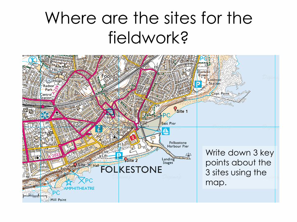
Where are the sites for the
fieldwork?
Write down 3 key points about the
3 sites using the
map.

Why are we doing the
fieldwork?
• The aim of the fieldwork is to gather
data for the Coast Assessment.
• This is your own project so you can
choose how you direct your
investigation. We will provide two
choices for your key question.

Key Questions
1. What evidence is there of processes
along the coast?
2. How successful has coastal
management been?
All groups will collect evidence for both.

What evidence is there of
processes along the coast?
• Measure longshore drift at both site 1
and site 2.
• Take pictures of size of sediment at
both site 1 and site 2.
Ideas of things to discuss:
• Are there any landforms of erosion along the coast?
• Is longshore drift happening?
• Are there any beaches?
• What are the waves like?
• Is there more (erosion/transport/deposition) at site 1 or site 2

How successful has coastal
management been? • Take photos of the different management
strategies.
• Use a bi-polar evaluation to evaluate the strategies.
• Ask the local people what they think of the defences?
Ideas of things to discuss: • Has the impact of processes been reduced as a result of the
management strategies? (ties into first Q) • What are the advantages and disadvantages of the different
management strategies? • Do they benefit the people?
• Why are they there?

Methods
Measuring longshore drift: • Decide on an appropriate distance to
measure longshore drift over, for example 10 metres
• Lay out tape measure close to water and mark start and finish points
• Place your float into water in the breakwater zone (where the wave crests and you can see white) at the start point
• Observe and time the object's movement across the pre-set distance
• Repeat 3 times.

Limitations to Method • Tidal and wind conditions, the size and weight of float used and the slope angle of the
beach may all affect measurements
• Take note of the wind speed and direction on the day the fieldwork is undertaken as this may affect the speed at which the float is transported. This is particularly important if further sampling for the investigation is undertaken on another day
• Obstructions to the movement of float, for example rocky outcrops, may affect results.
• Floats may be lost during the investigation. Repeated experiments or the use of more than one marker can reduce this problem
• Floats should be placed in the water ahead of the start line to allow them to settle prior to recording, and avoid giving the floats extra momentum
• The float should lie low in the water to ensure that it is not influenced by the wind
• The measuring should be undertaken in an area where there are no swimmers or paddlers for safety reasons and to ensure the reliability of results
• Any anomalies should be recorded, for example obstructions which may affect the movement of the float
• Weather and sea conditions can have a dramatic affect on observations

Task
• Think about which question you would
like to investigate.
• Brainstorm some ideas or questions you
would like to answer that are related
to your chosen key question.
• Extension: Add images of Sunny Sands,
The Leas, and the pebble beach to
your maps.
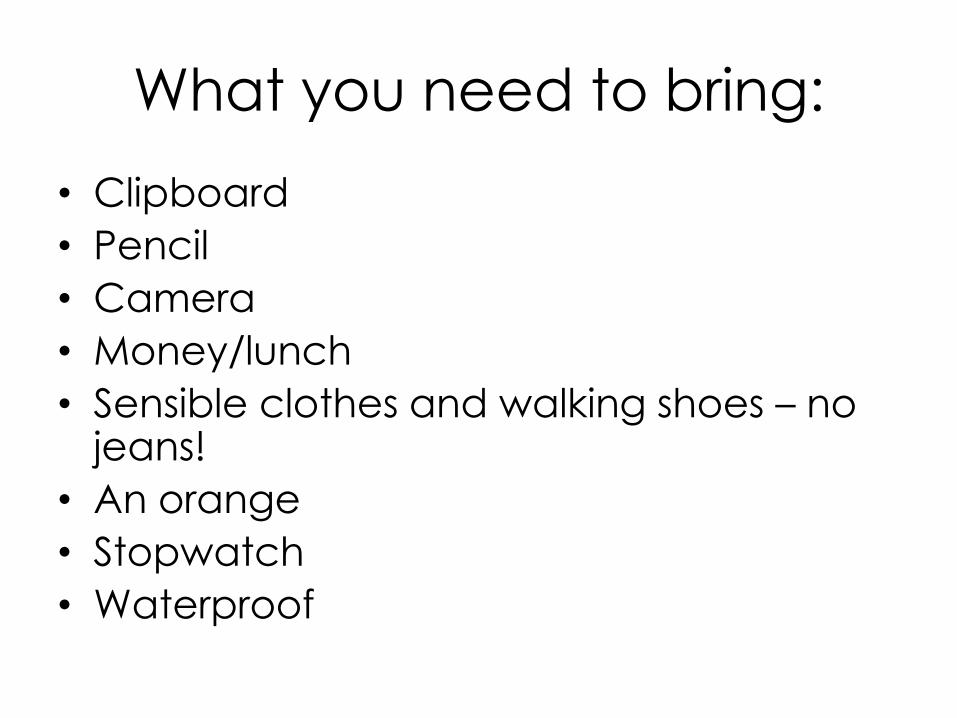
What you need to bring:
• Clipboard
• Pencil
• Camera
• Money/lunch
• Sensible clothes and walking shoes – no jeans!
• An orange
• Stopwatch
• Waterproof