Flathead River - 3 km E of Kalispell · Flathead River – 3 km East of Kalispell ... plans to...
38
Transcript of Flathead River - 3 km E of Kalispell · Flathead River – 3 km East of Kalispell ... plans to...


May 12, 2005 Janice W. Brown, Division Administrator Federal Highway Administration (FHWA) 2880 Skyway Drive Helena, MT 59602 Subject: BR 9015(44)
Flathead River – 3 km East of Kalispell Control No. 4229
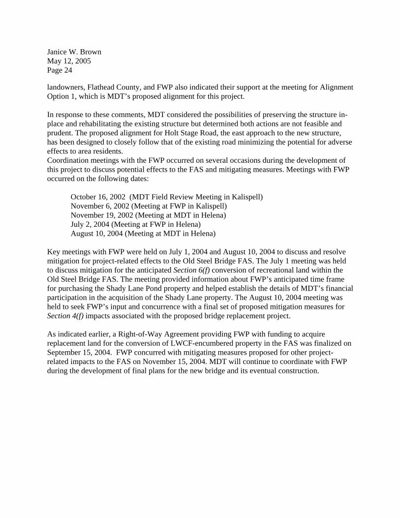
This is a request for the FHWA’s concurrence that the proposed project meets the criteria for classification as a Categorical Exclusion under the provisions of 23 CFR 771.117(d). The proposed action also qualifies as a Categorical Exclusion under the provisions of ARM 18.2.261 (Sections 75-1-103 and 75-1-201, M.C.A.). The MONTANA DEPARTMENT OF TRANSPORTATION (MDT), in cooperation with Flathead County, plans to construct a new bridge over the Flathead River. The existing bridge (locally known as the "Old Steel Bridge") is located approximately 3 kilometers (km) (about 1.9 miles) east of the City of Kalispell on Kiwanis Lane and Holt Stage Road. Specifically, the project is located in NE 1/4, NE 1/4, Section 10, Township-28-North; Range-21-West, M.P.M. A project location map is attached. This proposed project would replace the existing 183.6 meter (m) (602.4-foot) long steel truss and timber bridge with a 220 m (722-foot) long four-span, continuous welded plate girder structure. The new 12.25 m (40-foot) wide bridge would be built on a skewed alignment located slightly downstream from the existing bridge and would be designed both for greater safety and to accommodate larger and/or heavier vehicle loads. The new structure would accommodate two 3.6 m (12-foot) wide travel lanes, two 1.2 m (4-foot) wide shoulders, and a 1.6 m (5-foot) wide sidewalk along the right (downstream) side of the new bridge. A railing would be used to separate the new sidewalk from the roadway. The proposed project would also realign and construct new approaches to the structure on Kiwanis Lane and Holt Stage Road. Additionally, a short section of Steel Bridge Road (located on the east side of the river) would be rebuilt, including the intersection of Steel Bridge and Holt Stage Roads. The proposed approaches connecting the new bridge to Kiwanis Lane and Holt Stage Road) would be 9.6 m (about 32 feet) wide and paved with plant mix bituminous surfacing. Sidewalk would be extended both east and west of the new bridge to facilitate pedestrian access to the Old Steel Bridge Fishing Access Site (FAS). The proposed approach construction would be done to comply with MDT's current geometric design standards for Rural Collectors.
Janice W. Brown May 12, 2005 Page 2 Other activities associated with the project include: right-of-way acquisition, utility relocation, grading, drainage, signing, and pavement markings. The planned letting date for this project is December 2006. PURPOSE AND NEED The fundamental purpose of this proposed project is to ensure continuing and safe travel for users of the river crossing by replacing the existing bridge with a new structure that meets MDT’s current bridge and road design standards. The steel caissons supporting the truss spans have been subject to severe scour by the Flathead River, causing these important structural members to shift over time. This shifting has cracked the caissons and required numerous repairs during the life of the bridge. The expansion bearings on the bridge no longer function and the timber deck and abutments are deteriorating. These conditions have compromised the structural integrity of the existing bridge and resulted in the posting of a 3-ton load limit. In fact, load limits on this bridge are likely even lower than 3-tons. Therefore, vehicles larger than a 1-ton pickup with a heavy load likely exceed the load restriction. Road users and local residents are also inconvenienced by the bridge’s narrow width and restricted vertical clearance. In some extreme cases, lives and property could be at an increased risk due to longer required response times since large emergency service vehicles may not be able to cross the structure. The existing structure does not meet MDT's optimal width for (two-lane) Rural Collectors and serves just one lane of traffic. The existing bridge's deck is only 4.66 m (15.3 feet) wide. MDT's typical minimum width for a two-lane bridge such as this is 8.4 m (about 28 feet). MDT proposes to build a 12.25 m (40-foot) wide bridge instead of the typical minimum width for a two-lane bridge due to the anticipated future traffic volumes at this crossing. The average daily traffic (ADT) volume for the Old Steel Bridge is presently estimated at 1,690 vehicles per day and is projected to be about 1,750 vehicles per day by the time the proposed project is let in 2006. By the year 2026, the ADT at this river crossing is expected to be about 3,490 vehicles per day. This forecasted design year ADT indicates that a wider bridge would better serve the future users of this crossing.
The existing bridge has a vertical clearance of 4.72 m (15.5 feet). Low overhead members of the steel trusses on the existing bridge severely limit the height of vehicles that can cross the structure. The west approach to the river crossing (Kiwanis Lane) includes a substandard horizontal curve that limits the line of sight across the structure. Additionally, due to its poor structural condition, the County has restricted use of the bridge to one vehicle at a time and posted a 24 km/h (15 mph) speed limit for travel across the structure. None of these conditions are consistent with
Janice W. Brown May 12, 2005 Page 3 driving conditions on roads that adjoin either side of the present crossing. The existing bridge is considered by MDT to be structurally deficient and functionally obsolete based on its Sufficiency Rating. The Sufficiency Rating is a composite of several ratings of individual bridge items that are used to assess the structural condition and geometry of bridges. A bridge with a low rating on structural items will be designated as “structurally deficient” and a bridge with a poor rating for geometry items will be designated as “functionally obsolete.” The existing bridge had a Sufficiency Rating of only 25.7 on a 100-point scale based on its most recent condition evaluation review. An analysis of reported accidents over a recent ten-year period identified seven (7) recorded accidents on or near the bridge. Five of the seven crashes took place on the approach at the northwest end of the bridge. Four of these five crashes involved vehicles failing to negotiate the tight turn at the approach, mainly under icy conditions. The fifth crash was a rear-end collision involving a car that had stopped for oncoming traffic. The other two collisions took place at or near the southeastern approach to the bridge. One involved a vehicle backing up from the bridge to allow oncoming traffic to proceed. The other crash involved a vehicle failing to negotiate a tight turn as it accelerated after crossing the bridge. The bridge’s single lane configuration, one-direction at a time operation, and deficient geometrics on its approaches were factors in each of these accidents. In summary, the existing bridge and its approaches have physical deficiencies that contribute to reduced safety for users of this crossing. Reconstructing this river crossing would substantially improve road safety by providing a new structure capable of accommodating all legal loads and simultaneous two-way traffic. The new bridge provided by this proposed project would have no overhead clearance limitations and a significantly increased load carrying capacity. ENVIRONMENTAL IMPACTS The proposed project has been evaluated for, and would have minor effects on the following environmental areas of concern:
Prime, Unique and Important Farmlands A review of the U.S. DEPARTMENT OF NATURAL RESOURCES CONSERVATION SERVICE (NRCS) soils database determined one soil type in the project area is classified as Prime Farmland If Irrigated. The proposed project would directly convert an estimated 0.39 ha (about 0.97 acres) of this soil type to new right-of-way. A Farmland Conversion Impact Rating form (#AD-1006) was prepared for this project in accordance with the Farmland Protection Policy Act (FPPA – 7 U.S.C. 4201, et seq.). The Total Points for this project’s Site Assessment Criteria were 146. Since the Total Points were less than 160 points, under 7 CFR 658.4(c), no additional consideration for farmland protection is necessary. The completed form was not submitted to the NRCS but a copy is attached to this

Janice W. Brown May 12, 2005 Page 4 document.
Stream Modifications and Water Quality The MONTANA DEPARTMENT OF ENVIRONMENTAL QUALITY (MDEQ) has the responsibility under Section 401 of the federal Clean Water Act (33 U.S.C. 1251 – 1376) and the Montana Water Quality Act (75-5-101 M.C.A., et seq.) to monitor and assess the quality of Montana surface waters, and to identify impaired or threatened stream segments and lakes. The MDEQ sets limits, known as Total Maximum Daily Loads (TMDLs), for each pollutant entering a body of water. TMDLs are established for streams or lakes that fail to meet certain standards for water quality and describe the amount of each pollutant a waterbody can receive without violating water quality standards. The Flathead River is not considered an “impaired water” according to MDEQ’s Draft 2004 Montana Water Quality Integrated Report. The Integrated Report combines surface water quality information that in recent years was presented in both the MDEQ’s “303(d) List” and the “305(b) Report.” The 303(d) List contained specific information relating to waters assessed as having one or more of their beneficial uses impaired or threatened by human activities. The 305(b) Report provided a more general view including waters where all applicable beneficial uses had been found to be fully supported and waters in the assessment “system” for which there was not sufficient data to make use support determinations. The main stem of the Flathead River was not on MDEQ’s 2002 303(d) list of impaired waters in Montana. Impacts to the Flathead River would primarily result from direct disturbance associated with bridge construction or possibly the removal of the old structure. Construction activities may occur both up and downstream of the existing bridge. Such activities may include construction and use of temporary work bridges, cofferdams for pier construction, and the use of an in-stream work barge. Temporary bridges would be removed following construction of the new bridge. Construction activities would result in temporary increases in erosion potential, reduced slope stability, and would temporarily increase turbidity in the river downstream of the project. Pier and abutment construction and removal of the old bridge would result in temporary turbidity increases by disturbing the river bottom and re-suspending existing sediments in the water column. Other construction activities could adversely affect the quality of surface waters in the project area unless preventative measures are taken. Rock or soil particles from disturbed areas could be transported to surface waters by runoff and deposited at downstream locations. This process occurs naturally to some extent, however, the potential erosion of areas disturbed by the construction could contribute additional sediments to surface waters. Increased sediment loads may alter downstream deposition patterns, cause water temperature to increase, cause the turbidity of the water to rise, increase the level of nutrients (nitrates and phosphorus), decrease the quality of existing fisheries, and promote algal growth. However, such adverse effects are not expected because MDT would design and implement a Storm Water Pollution Prevention Plan (SWPPP) for this project. The SWPPP will be submitted to the MDEQ Permitting and Compliance Division in accordance with their Montana Pollutant

Janice W. Brown May 12, 2005 Page 5 Discharge Elimination System Regulations (ARM 16.20.1314). The SWPPP would be developed using procedures and methods established in MDT's "Erosion and Sediment Control Best Management Practices: Reference Manual" whose main objective is to minimize erosion of disturbed areas during and after construction of the project. Because the SWPPP would be implemented to control erosion and sediment transport during and after construction, the proposed bridge replacement would not cause notable adverse effects on surface water quality. All proposed work would also be in accordance with the Water Quality Act of 1987 (P.L. 100-4, as amended). Timing of work within the Flathead River channel and other restrictions would be indicated as conditions of approval for the issuance of a 124SPA Stream Protection Permit from the MONTANA DEPARTMENT OF FISH, WILDLIFE & PARKS (FWP). Likewise, the placement of any fill material in the Flathead River would be subject to the conditions of a Clean Water Act Section 404 permit issued by the U.S. ARMY CORPS OF ENGINEERS (COE). Floodplains Executive Order No. 11988 and FHWA’s floodplain regulations (23 CFR 650, Subpart A) require that the effects of the proposed action be evaluated to determine if it encroaches on the “base” (or 100-year) floodplain. The project area lies within a 100-year floodplain of the Flathead River delineated by the FEDERAL EMERGENCY MANAGEMENT AGENCY (FEMA). The crossing area is included in a Flood Insurance Study published September 4, 1985, by the FEMA and is shown on National Flood Insurance Program – Flood Boundary and Floodway Map, Panels 300023 1818 D (revised October 16, 1996). The proposed project would involve a transverse encroachment on the base floodplain of the Flathead River due to the construction of a new bridge at a location slightly downstream from the present structure. Reconstruction of the approaches to the new crossing would also encroach upon the delineated floodplain. However, the replacement bridge would be designed in a manner that would not substantially increase the water surface elevations over existing conditions for the 100-year flood event. The proposed project would not promote or encourage development within this delineated floodplain or increase flood liability hazards from its construction. Therefore, the proposed project would meet floodplain management criteria. Flathead County has adopted Floodplain Development Regulations and administers the delineated floodplain for the FEMA. A Floodplain Development Permit from the County would be obtained for any floodplain encroachments associated with this proposed project. Erosion Control and Seeding The MDEQ has regulatory authority over activities that may cause discharges of sediment into “state waters” (which include, but are not limited to lakes/reservoirs, rivers, streams, unnamed tributaries to state waters, wetlands, and irrigation channels). Permanent seeding of areas

Janice W. Brown May 12, 2005 Page 6 disturbed by construction activities beyond roadway surfaces is required on MDT’s proposed projects in rural areas. Coordination would occur with the Flathead County Weed District. The proposed project would cause temporary soil disturbances during construction of the new bridge approaches and miscellaneous features or facilities within the Old Steel Bridge FAS. Because the area of soil disturbances for this project would exceed 0.4 ha (1.0 acre), a MPDES storm water permit administered by the MDEQ will be required. Best Management Practices, including temporary and long-term erosion control measures, would be considered in the design of a SWPPP for this project. Such practices may include silt fences, ditch blocks, mulch, slope protection and other commonly accepted control measures. In accordance with 7-22-2152 and 60-2-208, M.C.A., MDT would re-establish a permanent desirable vegetation community along roadside slopes and on currently vegetated areas within the Old Steel Bridge FAS as soon as practicable following disturbance. A set of revegetation guidelines would be developed by MDT, which the contractor would be required to follow. These specifications include instructions on seeding methods, dates, mix components, and the types and amounts of mulch and fertilizer. Seed mixes include a variety of species to assure that vegetative cover immediately stabilizes areas disturbed by construction. The Seeding Special Provisions developed for the project would be forwarded to the Flathead County Weed District and FWP for review and approval. Executive Order No. 13112 addresses the responsibilities of federal agencies with respect to invasive species. Of the 23 listed or proposed noxious weeds in Montana, twenty-one have been identified in Flathead County. Canada thistle and spotted knapweed, Category I noxious weeds, were observed in the immediate project area. The proposed project’s contractor must also follow the requirements of both the County Noxious Weed Management Act (7-22-2101, M.C.A.) as well as all county and contract noxious weed control provisions.
Air Quality The proposed project is located within the Kalispell PM-10 Nonattainment Area identified in the Federal Register (56 FR 56874) on November 6, 1991. PM-10 is particulate matter less than 10 microns in diameter. The primary sources of PM-10 related to street and highway use are dust re-entrained (re-suspended) in the air by vehicles traveling over road surfaces, particles from pavement wear, vehicle tailpipe emissions, and particles from brake and tire wear. Studies conducted by the MDEQ showed that re-entrained road dust was the predominant PM-10 emission source during the year at monitoring sites in Kalispell. During the winter season, residential wood burning is also a significant source of PM-10 emissions. According to 40 CFR 93.126, several types of actions are exempt from project conformity requirements under the EPA's September 15, 1997 Final Rule. Widening narrow pavements or reconstructing bridges (without adding travel lanes), shoulder improvements, increasing sight distance, and safety improvements are activities generally exempted from the project conformity requirements. This project will provide an additional travel lane only on the new bridge to be

Janice W. Brown May 12, 2005 Page 7 consistent with the number of lanes on the existing approaches to the bridge. This proposed project would not create new violations of the Federal air quality standards, increase the frequency or severity of existing violations of the standards, or delay attainment of the standards in the Kalispell PM-10 Nonattainment Area. Noise This proposed project involves reconstruction of a bridge and its approaches with minor changes in horizontal alignment. An additional travel lane would be provided on the bridge to match the existing two-lane approaches to the structure. Due to the nature of this project, a detailed noise analysis is not required. Design Year traffic noise levels would not exceed the Noise Abatement Criteria and would not increase substantially over existing levels (23 CFR Part 772). The operation of heavy equipment during the construction of the proposed bridge and its approaches would generate noise and vibrations noticeable to area residents and possibly some river users. Pile drivers, cranes, road grading equipment, and portable generators would be likely sources of construction-related noise. Noise and vibration effects would be temporary and would occur at various times during the construction period. Hazardous Waste Sites The potential for the presence of hazardous wastes in the project area was researched and there were no hazardous materials concerns or sources of hazardous wastes identified. Disposal of non-salvageable and leftover materials would be in accordance with all applicable laws, rules, and regulations, including the Montana Solid Waste Management Act (75-10-203, M.C.A.). The steel members of the existing bridge likely contain remnants of lead-based paint. The lead-based paint on the existing bridge is not considered to be a hazardous waste until the paint is removed. No substantial impacts from lead paint are anticipated since portions of the bridge would either be reused at another location or the entire bridge would be disassembled. If the individual spans of the structure are reused, the new owner would assume all liability for the bridge. The Contractor would be required to take precautions to minimize the effects of construction operations and to prevent leakage or spilling of fluids from construction equipment.
Janice W. Brown May 12, 2005 Page 8 Wetlands Land & Water Consulting, Inc. delineated wetlands in the project area during July 2002 (and field verified again in September 2004) according to criteria and methods outlined in the COE’s 1987 Wetlands Delineation Manual. The Manual provides guidance for determining the presence of jurisdictional wetlands based on observations of vegetation, soils, and hydrology. Wetland location maps, found plant species lists, and COE Routine Wetland Determination forms were completed for wetland sites identified within the project area. Additionally, MDT Field Evaluation forms were completed to assess the many functions and values attributable to wetlands. The Biological Resources Report (BRR) for the project contains these materials. Wetlands were identified at two locations within or immediately adjacent to the proposed action. The first wetland is located immediately north of the existing end bent on the west side of the bridge. This willow-dominated wetland lies outside the proposed limits of this project and was not evaluated in detail. The second wetland is associated with a historic meander channel of the Flathead River and is located downstream of the east approach to the bridge. Emergent and scrub/shrub species in this wetland include reed canary grass, field horsetail, redtop, sandbar willow, red-osier dogwood, and cottonwood. Wetland habitat within the site rates as Category III according to MDT’s Wetland Rating System. The construction limits for the proposed project would extend into this wetland site and minor portions of the site may be subject to temporary disturbances during construction. However, this anticipated impact falls below MDT’s reportable standard and is therefore, considered negligible. Compensatory mitigation for the negligible wetland loss will not be required. Threatened/Endangered Species In accordance with Section 7(a) of the Endangered Species Act (16 U.S.C. 1531-1543), MDT contacted the U.S. FISH AND WILDLIFE SERVICE (USFWS) for a list of endangered, threatened, proposed, and candidate species that could occur in the project area. MDT's consulting biologists assessed whether or not any of the Federally-listed threatened or endangered wildlife species or important habitat for the species occur in the project area. Considering the listed species that may be found in Montana counties and literature reviews, the following species could potentially occur in the vicinity of this crossing:
Canada lynx (Lynx Canadensis) Gray wolf (Canis lupus) Grizzly bear (Ursos arctos horribilis) Bald eagle (Halieetus leucocephalus) Bull trout (Salvelinus confluentus)
Canada lynx, gray wolf, and grizzly bear are threatened species that also occur in northwestern Montana. However, due to the location of this project within an urbanized area and the general

Janice W. Brown May 12, 2005 Page 9 lack of suitable habitat for these species, it is unlikely that any of these species would occur near the proposed bridge replacement. For these reasons, any potential effects to these species would be negligible. The BRR concluded that this proposed project would have no effect to Canada lynx, gray wolf, or grizzly bear. Based on research and field reviews, it was concluded that two threatened species, the bald eagle and bull trout, might occur in the vicinity of the proposed bridge replacement project. These species and potential project-related effects are discussed below. Bald Eagles. The greater Kalispell area supports the highest density of nesting bald eagles in Montana and two active nests exist within 4 km (2.5 miles) of this proposed project. The project lies within the expected home range for each nest, but not within the primary use areas for these nests. Bald eagles are known to winter in the project area, feeding primarily on fish, waterfowl, and carrion. Migrating bald eagles are also likely to use the project area during travel between summer and winter ranges. Due to the distance between the two nest sites in the area, bridge construction and demolition activities are not expected to substantively disturb eagle activity at either nest. The bridge is visually screened from the nest sites and a sufficient distance away from the nests so construction-related noise is not a concern. Since bald eagles may be present year around in the project area, construction activities during all seasons could temporarily disturb or displace eagles where the project is visible from roosting and foraging locations. These impacts are not considered substantial because the work area and duration of construction activities would be relatively confined; the work would take place in a currently disturbed corridor; and undisturbed habitat is abundant and exists nearby. A may affect, not likely to adversely affect determination for project-related effects to the bald eagle was made in the BRR. The BRR outlined several coordination measures to ensure any impacts to bald eagles area minimized including:
confirming the nesting status of bald eagles in the project area prior to construction; coordinating with the FWP and USFWS to determine if any spatial or temporal
restrictions are warranted if new nests are identified in the area at the time of construction; and
implementing best management practices for erosion control to safeguard water quality.

Janice W. Brown May 12, 2005 Page 10 Bull Trout. The Flathead drainage is inhabited primarily by bull trout that occupy Flathead Lake as adults and then migrate upstream to spawn in tributaries of the Middle and North Forks of the Flathead River. Bull trout populations in the Flathead drainage are thought to be declining as a result of habitat modifications and competition and predation from other species. Adult bull trout are typically present in the reach of the Flathead River between mid-April and June during their migration to upstream spawning areas. Adults then return to Flathead Lake in the fall after spawning is complete, once again passing through the project area. Subadult bull trout may also be found in this reach of the Flathead River. The Flathead River in the project area was proposed as critical habitat for the Klamath River and Columbia River distinct population segments of bull trout by the USFWS in November 2002. On September 22, 2004, the USFWS formally designated approximately 2,814 km (1,748 miles) of streams and 24,800 ha (61,235 acres) of lakes in the Columbia and Klamath River basins of Oregon, Washington, and Idaho as critical habitat for the bull trout under the Endangered Species Act. No streams in Montana, including this reach of the Flathead River, are subject to this critical habitat designation. Project-related activities in or near the Flathead River have the potential to affect water quality and cause temporary adverse effects to bull trout. Increases in turbidity, suspended sediment and other pollutants can reduce stream productivity, reduce feeding opportunities for bull trout, and result in avoidance of important habitat by adult migrants and juvenile or subadult resident fish. Since bull trout spawning does not occur in this area, no notable impacts to spawning or the embryonic development of bull trout are anticipated from this proposed project. Impacts to Flathead River and its water quality would occur due to direct disturbances associated with bridge construction, the installation and removal of a work bridge, and the demolition of the old bridge. The most apparent potential effects to bull trout from this proposed project include:
sedimentation from construction activity in the river and erosion of disturbed areas adjacent to the stream;
minor loss of riparian vegetation and wetlands; oil/gas contamination from equipment working above or near the river and/or spills
within the project area; direct mortality of fish in the river during in-stream construction or removal of the old
bridge and work bridge(s); long-term increase in runoff from an increased area of impervious surfaces; long-term increase in sediment loads from sanding/graveling of the wider highway during
winter months; introduction of contaminants such as petroleum products from the highway during runoff
events; and unanticipated events such as a traffic accident which leads to stream impacts.
Janice W. Brown May 12, 2005 Page 11 Based on the types of impacts expected and extensive coordination with the USFWS and FWP, a may affect, likely to adversely affect determination was concluded for project-related effects to bull trout. The BRR included several coordination measures to minimize potential impacts to bull trout. These measures include: actions to control erosion and sediment transport from disturbed areas during and after construction; complying with timing restrictions for instream activities and other specified conditions for environmental permits (Section 404, 124SPA, etc.); locating construction staging or materials storage areas a sufficient distance from the stream; and strict adherence to MDT’s “Standard Specifications for Road and Bridge Construction” and applicable special provisions for this proposed project. The may affect, likely to adversely affect determination means that formal consultation with the USFWS regarding the proposed bridge replacement and its potential effects to bull trout must be undertaken and concluded as soon as possible. MDT has and will continue to coordinate the bridge design with the USFWS and other environmental permitting agencies. Rare and Sensitive Species In addition to species listed by the USFWS under the Endangered Species Act, the MONTANA NATURAL HERITAGE PROGRAM (MNHP) and the FWP have designated other species as rare, sensitive, or of special concern. A search of the MNHP database revealed no known locations of rare or sensitive plants within 8 km (5 miles) of the project corridor. Additionally, no sensitive plant species were encountered during the field reconnaissance for the BRR. The MNHP data search indicated no known sensitive wildlife species in the vicinity of this bridge project. The search did identify two Great Blue Heron rookeries within about 3.2 km (2 miles) of the project, occurring both up and downstream from the river crossing. The BRR noted the potential occurrence of twelve wildlife species of concern in the general area, but identified only westslope cutthroat trout and the common loon, as species likely to occur in the project area based on existing habitat. No long-term negative impacts or irretrievable losses to rare and sensitive plants or wildlife or habitat are likely to occur as a result of this project. The cumulative impacts of this project and other developments in the area would not result in a decline of these species or populations. Other Wildlife Resources The project area provides limited habitat for a variety of birds, mammals, reptiles and amphibians. Overall, the effects to wildlife in the project area would be minor since the new bridge and its approaches would be built within an area that provides low to moderate quality habitat due to the relatively high level of human disturbance. Habitat for species potentially displaced by project activities is abundant and exists nearby. The most notable impacts to the wildlife species in the project area would be displacement during the construction of the bridge construction and its approaches and other miscellaneous work within the Old Steel Bridge FAS.

Janice W. Brown May 12, 2005 Page 12 This impact would be temporary and no long-term negative impacts or irretrievable losses to wildlife or habitat are expected to occur. Disturbances to native plant communities that provide habitat for wildlife would be minimized and unnecessary disturbance beyond the construction zone would be avoided. In accordance with the Migratory Bird Treaty Act (16 U.S.C. 703-712 as amended) and Executive Order No. 13186, the existing bridge was reviewed for evidence of nesting and roosting sites to ensure this proposed project does not result in the death or injury to migratory birds. Field investigations for the BRR did not identify any nesting concerns for migratory birds on the structure. Therefore, this project does not warrant special provisions to protect nesting bird species. Aquatic Resources The main stem of the Flathead River has been assigned a fishery resource value of “outstanding” by the FWP. According to data from the agency, the primary species found in this reach of the Flathead River includes westslope cutthroat trout, lake whitefish, mountain whitefish, lake trout, and bull trout. Other species including rainbow trout, largescale and longnose suckers, slimy sculpin, and kokanee salmon may also be found in this portion of the Flathead River. Impacts to aquatic resources would primarily result from direct disturbances associated with bridge construction, installation and removal of the necessary work bridge, and demolition of the old bridge. Construction activities would disturb area soils and temporarily increase erosion potential. Increased exposure of soils would provide a source of sediment that could enter the river. After construction, other minor impacts would be expected due to sanding the deck of the bridge during winter months and general runoff from the bridge and road surface. Temporary erosion controls would be installed and maintained within the project area to minimize the possibility of sediments entering the river. Additionally, MDT would obtain and comply with various state and federal water quality permits. The conditions attached to these permits would help safeguard water quality and aquatic resources. Vegetation The proposed project traverses riparian habitat primarily comprised of mature cottonwood in the overstory and various shrubs and immature trees including red-osier dogwood, wood’s rose, sandbar willow, and serviceberry. Smooth brome, yellow sweet clover, mullein, and several species of grasses exist in roadside ditches and other disturbed areas. Much of the native habitat immediately adjacent to the river remains intact although some areas have been converted to agriculture and development. The proposed bridge and approach work would occur in areas that are immediately adjacent to the existing roadway and are currently subjected to other sources of human disturbance including residential development and recreational activities. Consequently, the vegetation in the area provides only low to moderate quality habitat. The disturbance or loss of such habitat from the

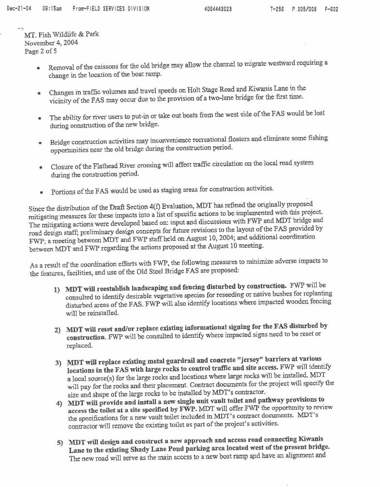
Janice W. Brown May 12, 2005 Page 13 project area would be a minor impact. Construction would disturb existing noxious weed communities and would create additional habitat for weed establishment in newly disturbed areas. These effects should be offset by the contractor’s adherence to noxious weed control provisions. Land Use The lands surrounding the Flathead River Bridge project are a mix of urban, agricultural and forested land. The majority of the lands within the project area are owned and administered by the FWP. The Old Steel Bridge Fishing Access Site (FAS), a public fishing access, is located on both sides of the Flathead River adjacent to the existing bridge. There are no residences within the immediate project area. Due to the proposed change in location for the proposed bridge and necessary construction of the east and west approaches to the new structure, right-of-way would be required through the Old Steel Bridge FAS. The proposed project would affect some features and facilities within the FAS and require limited changes to internal circulation roads. The potential impacts to the features, facilities and use of the FAS have been discussed with FWP and numerous measures to mitigate anticipated impacts have been coordinated and agreed upon by both MDT and FWP. Potential effects to the FAS and associated mitigation measures are discussed later in this document under Section 4(f) Impacts. The proposed road realignment and bridge replacement would not cause notable changes to adjacent land uses, encourage new or undesirable growth or development, eliminate or substantially alter access to adjacent properties, or alter real property values. Right-of-Way and Utilities The existing right-of-way corridor for Kiwanis Lane and Holt Stage Road is typically 18.3 m (60 feet) in width. Flathead County holds a right-of-way easement for Kiwanis Lane within in the Old Steel Bridge FAS. Kiwanis Lane is a "declared" road meaning the County has a right-of-way easement for the road but does not own the land beneath the road. Section 7-14-2615, Montana Code Annotated (M.C.A.) says a county road may be abandoned if the County Commissioners do so by proper procedure. Sections 70-30-321 and 322, M.C.A., indicate that if there is only an easement, the property interest reverts to the original owner or the original owner's successor in interest upon abandonment. Therefore, if the Flathead County Commissioners choose to abandon portions of Kiwanis Lane within the FAS, then ownership of the abandoned road property would revert to the FWP as the underlying landowner. The proposed new right-of-way corridor would generally range from 40 to 90 m (about 130 to 295 feet) in width throughout the length of the project. In total, an estimated 2.74 hectares (ha) (6.78 acres) of additional right-of-way would be needed to accomplish the proposed bridge
Janice W. Brown May 12, 2005 Page 14 replacement. Please note this total is based on MDT’s Preliminary Right-of-Way Plans and could change slightly as the final design of the project progresses. The proposed project would not relocate any residences, businesses, farms, or ranches. The acquisition of land or improvements for highway construction is governed by state and federal laws and regulations designed to protect both the landowners and taxpaying public. Landowners affected are entitled to receive fair market value for any land or buildings acquired and any damages as defined by law to remaining land due to the effects of highway construction. This action would be in accordance with the Uniform Relocation Assistance and Real Property Act of 1970 (P.L. 91-646 as amended), (42 U.S.C 4601, et. seq.) and the Uniform Relocation Act Amendments of 1987 (P.L. 100-17). The Old Steel Bridge FAS was acquired and developed with funds administered under the National Land & Water Conservation Fund (LWCF) Act (16 U.S.C. 460) and the Federal Aid in Sport Fisheries Restoration Act (16 U.S.C. 777). Section 6(f)(3) of the LWCF Act assures that once an area has been funded with LWCF assistance, it is continually maintained in public recreation use unless the NATIONAL PARK SERVICE (NPS) or their designee (FWP in this instance) approves the substitution of property of reasonably equivalent usefulness and location and of at least equal fair market value. Therefore, the conversion of land in the FAS to new highway right-of-way, requires the provision of replacement land to the FWP. Additional details regarding the provision of replacement land for this proposed conversion of LWCF-encumbered land can be found under Section 6(f) Impacts presented later in this document. An overhead power line crosses the new alignment approximately 40 m (130 feet) south of the proposed centerline of the new bridge. Telephone lines attached to the existing bridge would need to be relocated. Affected utilities would be relocated and/or replaced as part of the proposed project. Traffic and Circulation Impacts Long-term changes in traffic volumes and travel speeds on Kiwanis Lane and Holt Stage Road in the vicinity of the FAS may occur as a result of the proposed project. The existing bridge artificially restricts traffic flows on these county roads due to its load limitations and one vehicle at a time operation. Traffic is often required to stop on either side of the bridge to permit an opposing vehicle to pass. As indicated previously, the load limit restrictions and the vertical and horizontal clearance limitations of the old bridge make it impossible for oversize or large vehicles to use the present crossing.

Janice W. Brown May 12, 2005 Page 15 The provision of a two-lane road and the elimination of load restrictions with the new bridge would be expected to result in minor changes to local traffic patterns. Traffic volumes on Kiwanis Lane and Holt Stage Road would be expected to increase as area residents choose to use these routes instead of others for local trips. As indicated previously, present traffic volumes on Kiwanis Lane and Holt Stage Road are estimated to be about 1,690 vehicles per day. MDT's design traffic information for this proposed project anticipates that volumes may increase to about 3,490 vehicles per day by the Design Year 2026. The composition of traffic on these county roads may change slightly as oversize vehicles would be able to use the new crossing for the first time. Travel speeds through the project area would likely increase over current conditions. As indicated previously, the present bridge is limited to use by one vehicle at a time and eastbound or westbound motorists must often stop to allow opposing vehicles to pass. The elimination of this condition would allow for the free flow of two-directional traffic at travel speeds higher than the posted speed of 25 km/h (15 mph) on the bridge. The section of Kiwanis Lane adjoining the FAS has a 40 km/h (25 mph) posted speed limit. Since the existing bridge would be closed to traffic during the construction period, the proposed project would temporarily disrupt the local circulation of traffic. Should it be necessary to help address potential adverse traffic circulation effects during the closure of the Flathead River Bridge, MDT’s contractor would install a temporary traffic signal at the intersection of Montana Highway 35 and Fairmont Road, a likely detour route for local traffic. Access to private properties east of the project area would be maintained during construction. Social Impacts/Environmental Justice Since the proposed project involves limited right-of-way impacts, no adverse social impacts are foreseen. The proposed project would not affect the location, distribution, density or growth rate of the population in the vicinity. The proposed improvements would not adversely affect any social or ethnic groups nor would they isolate or divide any existing residential areas. The proposed project would be in accordance with Executive Order No. 12898, and would not create disproportionately high and adverse human health or environmental effects on minority and/or low-income populations. The proposed project would also comply with the provisions of Title VI of the Civil Rights Act of 1964 (42 U.S.C. 2000d, as amended) under the FHWA’s regulations (23 CFR 200).

Janice W. Brown May 12, 2005 Page 16 Economic Impacts No notable long-term effects to businesses in the Kalispell area are anticipated from this proposed project. However, the Kalispell area could see minor positive benefits if local workers and craftsmen are employed for construction of the new bridge or if workers on the project require temporary housing in the area. Road users would realize minor long-term economic benefits through the provision of a safer and more efficient travel route. Historical/Cultural Resources A cultural resources report was completed for the proposed project in October 2001. The report identified one historic site, the Old Steel Bridge (24FH463), and recommended the structure as eligible for the NATIONAL REGISTER OF HISTORIC PLACES (NRHP). The Montana STATE HISTORIC PRESERVATION OFFICE (SHPO) concurred with the determination that the Old Steel Bridge (24FH463) is NRHP-eligible on October 22, 2001. A copy of the MDT's letter to the agency with SHPO's stamp of concurrence is attached. There would be an adverse effect to the NRHP-eligible Old Steel Bridge (24FH463) due to the required removal of the historic structure. A Determination of Adverse Effect describing the impacts of the project on the Flathead River Bridge and a draft Memorandum of Agreement (MOA) outlining proposed mitigation measures, was prepared by MDT and submitted to SHPO for concurrence on October 23, 2001. The SHPO concurred with MDT's determination of effect to the historic bridge on February 27, 2002. A Final MOA outlining mitigating measures to be implemented for the adverse effect to 24FH463 was prepared by MDT and signed by the FHWA and the SHPO in May 2002. A copy of the signed MOA is attached. MDT offered the existing structure for adoption and initially found no willing parties and little community support for adopting the structure. However, MDT’s continued efforts to find a use for the old bridge identified parties that were interested in using two of the three old bridge spans on the local Rails-to-Trails system. In February 2002, MDT agreed to award the bridge spans to Flathead County and Rails to Trails of NW Montana for reuse on the rails-to-trail system in the Kalispell area. Since awarding the spans to Rails to Trails of NW Montana, MDT contacted the group on two occasions to verify their continued interest in spans from the old bridge. Contacts in late 2003 indicated that the group’s interest in the old spans was waning; however, they did not want to rule out the possibility of reusing the old spans. In February 2005, MDT sent a letter to Rails to Trails of NW Montana asking the group to reaffirm their interest in the bridge spans. On April 19, 2005, the president of Rails to Trails of NW Montana informed MDT they were no longer interested in the bridge spans.

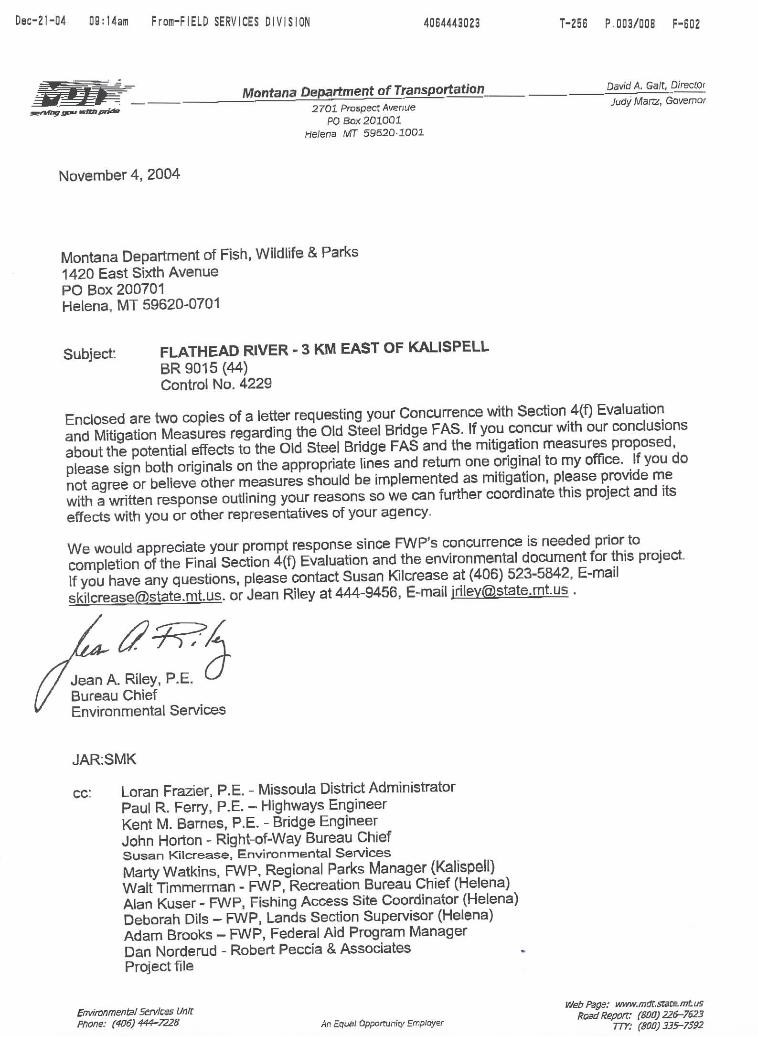
Janice W. Brown May 12, 2005 Page 17 Since an adopting party for the old bridge no longer exists, MDT will re-advertise the bridge for adoption with the understanding that the structure would have to be moved to a new location. If an adopting party cannot be found as a result of the new solicitation, then the old bridge would be dismantled by the contractor. The MOA would also be amended to reflect the disposition of the historic structure. Section 4(f) Impacts Section 4(f) of the 1966 Department of Transportation Act (49 U.S.C. 303) provides for the protection of publicly-owned parks, recreation lands, historical sites, and wildlife and waterfowl refuges. This project would not affect any publicly-owned parks or wildlife and waterfowl refuges. However, the proposed bridge replacement would require the removal of the Flathead River Bridge (24FH463), a historic structure determined eligible for the NHRP. Additionally, the proposed project would require new right-of-way from and impact the features, facilities and use of the Old Steel Bridge FAS. Because the amount of new right-of-way acquisition through the FAS exceeds one percent (1%) of the total area of the FAS, a Draft and Final Section 4(f) Evaluation was prepared for this proposed project. The effects of the proposed action on 4(f) properties in the project area and measures to mitigate identified impacts are discussed in the Final Section 4(f) Evaluation. The Final Section 4(f) Evaluation was approved in May 2005. MDT and FWP have developed and agreed upon a variety of measures to mitigate the anticipated impacts of this proposed project on the Old Steel Bridge FAS. These mitigating measures will: replace affected facilities or features in the FAS; construct new features to enhance the FAS; and implement other actions to minimize temporary construction-related effects of the proposed bridge replacement project. On November 4, 2004, a letter was sent to FWP’s Regional Supervisor in Kalispell outlining MDT’s proposed mitigation commitments. A copy of the November 4, 2004 letter to FWP outlining MDT’s mitigation commitments is attached. On November 15, 2004, the FWP concurred with the conclusions made about potential effects to the FAS and the proposed mitigation measures with two exceptions. The FWP asked MDT to provide a firmer commitment to implement measures with this project to enhance safety for pedestrian crossings of Kiwanis Lane within the FAS. Additionally, the agency advised MDT that the proposed Section 6(f) mitigation is still subject to approval by the National Park Service and the FWP Commission. A copy of FWP’s November 15, 2004 letter is attached. Since receiving these comments, MDT’s Traffic Engineers have agreed to allow a painted crosswalk and associated signing at a location within the FAS where a designated pedestrian path would cross Kiwanis Lane. MDT will include crosswalk striping and signing in the plans for this project. FWP will be asked to identify the location for the designated crosswalk. Further, the FWP’s comment about the approval requirement for the proposed Section 6(f) mitigation has been incorporated into this document and the Final Section 4(f) Evaluation for this project.

Janice W. Brown May 12, 2005 Page 18 Following the successful implementation of these commitments, the Section 4(f) use of land from the FAS would not be readily apparent. Section 6(f) Impacts Section 6(f) of the National Land & Water Conservation Fund (LWCF) Act (16 U.S.C. 460) requires that coordination be undertaken to determine if federal funds were used to acquire or improve any lands in the project area for recreation or water conservation purposes. The Old Steel Bridge FAS was acquired and developed with the assistance of LWCF funds and funds administered under Federal Aid in Sport Fisheries Restoration Act (also known as the Dingell-Johnson Act) (16 U.S.C. 777). Wallop-Breaux funds provided by an amendment to the Federal Aid in Sport Fisheries Restoration Act were used to develop improvements on the east side of the FAS during 1994. Section 6(f)(3) of the LWCF Act assures that once an area has been funded with LWCF assistance, it is continually maintained in public recreation use unless the NATIONAL PARK SERVICE (NPS) approves the substitution of property of reasonably equivalent usefulness and location and of at least equal fair market value. Consequently, any conversion of land from the Old Steel Bridge FAS for new highway right-of-way, requires the provision of replacement land to the FWP. MDT (on behalf of Flathead County) is therefore obligated to provide replacement land for the conversion of about 1.09 ha (2.71 acres) of LWCF-encumbered land at the Old Steel Bridge FAS. In cooperation with the FWP, MDT has identified a parcel of land adjacent to the Old Steel Bridge FAS believed to be suitable replacement property. The parcel, referred to as the "Shady Lane Pond" site, consists of about 2.2 ha (5.47 acres) of privately owned land located immediately west of the existing FAS property. The Shady Lane Pond site consists of a gravel quarry that has been filled with surface and ground water. The FWP has recognized that the pond presents an opportunity to develop a children's fishing pond as part of the FAS and has worked with the landowner to explore the acquisition of the property. FWP has structured an agreement with the landowner for acquiring the property and performing bank shaping and other work to make the pond suitable for a fishing pond prior to the agency’s acquisition of the property.
The FWP agreed to allow MDT to pay for all or a portion of the purchase price of the Shady Lane property as mitigation for the conversion of LWCF-encumbered land at the FAS. MDT appraised the values of impacted land within the FAS and the proposed replacement land and established comparable values for the properties. FWP subsequently agreed to these appraised values and a right-of-way agreement outlining MDT’s financial involvement in the acquisition of the Shady Lane Pond property was finalized on September 15, 2004. Under the agreement, MDT agreed to pay the FWP the entire purchase amount ($70,000) for the Shady Lane Pond property. The right-of-way agreement indicates that FWP will accept the Shady Lane Pond property as: 1) replacement land mitigation for the impacts of this proposed

Janice W. Brown May 12, 2005 Page 19 bridge project; 2) a 6(f) bank site to serve as replacement property mitigation for unidentified future impacts on FWP lands due to other MDT highway projects; and 3) mitigation for outstanding 6(f) impacts to FWP properties associated with two other MDT projects. The implementation of the right-of-way agreement satisfies MDT’s obligation to provide replacement land for the conversion of LWCF-encumbered property within the FAS. This mitigation measure is subject to approval by the NPS and the FWP Commission as specified in the right-of-way agreement between MDT and FWP. FWP acquired the Shady Lane Pond property on November 30, 2004 with the funds provided by MDT. With this transaction, MDT has fulfilled its obligations to provide replacement land for the conversion of LWCF-encumbered land at the Old Steel Bridge FAS. Cumulative Impacts Cumulative impacts are those effects that result from the incremental consequences of an action when added to other past and reasonably foreseeable future actions regardless of what agency (federal or non-federal) undertakes such actions. Flathead County has been, and continues to be, one of Montana’s most rapidly growing counties. Over the past three decades, a substantial amount of the County’s growth has occurred in the Flathead Valley on lands surrounding the City of Kalispell. The area near this proposed bridge replacement has been one of the areas surrounding the City of Kalispell that has experienced residential growth and development. This growth has occurred for many years even without improvements at this Flathead River crossing. The proposed bridge replacement project may indirectly contribute to further growth and development in the Flathead Valley by providing a route that would make commuting to and from Kalispell from outlying areas to the east of the community easier and safer. While this is a possibility, there are too many other factors that promote growth to make accurate predictions about exactly where and when such growth may occur. The factors include items such as the general economy, land prices, tax levels and the existence of services and infrastructure. Replacing the existing bridge would not substantially change the character of the much of the project area or cause current property owners and developers to build faster or any differently than they would have without the proposed project. For these reasons, it is not believed that replacing the existing bridge would be a major cause of additional residential growth and development in the Kalispell area.

Janice W. Brown May 12, 2005 Page 20 Projects Planned by MDT. MDT currently has seven active and proposed projects in this part of its Missoula District not including the “Flathead River – 3 km E of Kalispell” project. Other notable projects under development within the Kalispell area are identified and briefly described below:
• Ashley Creek – Kalispell; NH 5-3(66)109 F; CN 1012 – an active 4.01 km (2.50 miles) long reconstruction project on U.S. Highway 93 beginning south of Kalispell and ending within the City. This project was let to contract in January 2004.
• Kalispell– North; NH 5-3(89)115; CN 5454 – a 3.54 km (2.20 miles) long pavement
preservation project on U.S. Highway 93 within Kalispell. The project is scheduled for implementation in Fiscal Year 2005.
• Stillwater River–N; NH 5-3(64)118F; CN 1061 – a planned 2.09 km (1.30 miles) long
reconstruction and structure replacement project on U.S. Highway 93 north of Kalispell. The project is scheduled for implementation in Fiscal Year 2006.
• MT 35/SEC 317 Int; STPP-STPHS 52-2(28)51; CN 4022 – a planned signal and turn
lane addition project on Montana Highway 35. The project is scheduled for implementation in Fiscal Year 2005.
• Ashley Cr Strs – SW Kalispell; BR 1-2(113)114; CN 4773 - a planned bridge
replacement project southwest of Kalispell. The project is scheduled for implementation in FiscalYear 2005.
• North Meridian Road-Kalispell; STPU 6701(5); CN 2950 – a planned reconstruction
project on North Meridian Road between U.S. Highway 2 and U.S. Highway 93 within the City of Kalispell. The project is in the utility relocation phase with construction scheduled to begin in 2005.
• Kalispell Bypass; NH 5-3 (60)109 - a proposed MDT project that would provide a new
four-lane arterial corridor along the west side of Kalispell from U.S. Highway 93 south of the City to U.S. Highway 93 at West Reserve north of the City. The project is intended to provide an alternative route around Kalispell. Work is presently underway to re-evaluate the environmental document for the project. A date for construction of the Kalispell Bypass has not been set but could occur within the next five years if federal funding is secured.

Janice W. Brown May 12, 2005 Page 21 The highway-related projects described above are being undertaken in response to the demands of increasing traffic volumes and will provide additional roadway capacity and improve the operation of the local roads and streets. The most apparent cumulative effect of implementing these projects will be a safer and more efficient road and street system. The proposed bridge replacement project and other planned highway improvements in and around Kalispell will help reduce operational problems and relieve congestion in the area. Ongoing/Planned Projects by Others in the Area. The FWP has plans for the “Old Steel Bridge Site Protection Project” at the Old Steel Bridge FAS. The proposed project is intended to make the east side of the FAS more aesthetically appealing by replacing guardrail barriers with rock or other barrier types. Additionally, the project would replace several deteriorated facilities, restructure parking and circulation, and provide a host pad for a park caretaker. FWP released a Draft EA for public comment in 2003. The project would be implemented at the same time as MDT’s proposed bridge replacement project and coordinated with the bridge replacement project. Flathead County plans to pave Holt Stage Road east of Fairmont Road in anticipation of this bridge replacement project to better accommodate the anticipated traffic expected to use this crossing. Fairmont Road is a north-south county road located about 2.7 km (1.7 miles) east of this proposed project. The County paved about 1.6 km (1 mile) of Holt Stage Road about a year ago and may pave another 1.6 km (1 mile) section during 2005. If the work planned for 2005 is done, only 0.8 km (0.5 miles) of Holt Stage Road between the project area and Montana Highway 35 would remain unpaved. Once paved, Holt Stage Road Holt Stage Road (together with Mennonite Church Road east of Montana Highway 35) will provide an east-west connection between the south side of Kalispell and the Creston area in the eastern portion of the Flathead Valley. An improved river crossing and the paving of Holt Stage Road may attract traffic that now uses Montana Highway 35. Discussions have occurred within the Kalispell community to develop a new connecting road between Conrad Drive and the intersection of U.S. Highway 2 and Montana Highway 35 at the east edge of the City. The proposed connection, along with Conrad Drive and Willow Glen, would form an east “bypass” from U.S. Highway 93 just south of Kalispell to Montana Highway 35 and could help decrease traffic on U.S. Highway 93 in downtown Kalispell. There has been no firm commitment by the City or the County to implement this project due to funding uncertainties and right-of-way issues. Conrad Drive joins Shady Lane and Kiwanis Lane about 0.6 km (0.4 miles) southwest of MDT’s proposed bridge replacement. The DNRC adopted a plan in 1999 to manage a 259 ha (640 acres) parcel identified as Spring Prairie (DNRC) Section 36 adjacent to U.S. Highway 93 North. The DNRC's property is situated north and east of the Meridian Road project. The DNRC has developed a neighborhood plan that designates development "pods" within the Section 36 property. Planned uses for this area include Commercial/Retail, Mixed Professional Office, and Mixed Use Residential. DNRC is

Janice W. Brown May 12, 2005 Page 22 presently considering leasing and development opportunities on the site. Build out of the property is expected to occur over the next 20 to 50 years. A major development known as Lowe's/Spring Prairie Center, was recently proposed for this area which is located about 5 km (3 miles) west of the proposed bridge site. Developers have also discussed building the Glacier Mall, a large regional shopping center, in or near Kalispell. The proposed Glacier Mall project would construct 110 ha (274 acres) of commercial development, 26 ha (64 acres) of mixed-use residential and office space on land near the intersection of U.S. Highway 93 and West Reserve Drive. The Flathead County Commissioners recently amended the county growth policy and modified existing zoning to accommodate the development of the regional mall. However, mall opponents have filed lawsuits that may delay or potentially block the proposed commercial development. Construction of Glacier Mall cannot begin until lawsuits are resolved and the developer has obtained applicable permits and approvals. The Kalispell area continues to be one of the most rapidly growing areas in Montana with most residential growth occurring outside the incorporated limits of the City, including portions of the area generally east of the project area. There is nothing to suggest this trend will not continue over the foreseeable future as Kalispell’s importance as a regional economic and population center grows. The cumulative effects from the proposed bridge replacement project on projects proposed by others were found to be minor. This conclusion was reached because: 1) the timing of construction activities for these projects would generally not coincide; 2) many of the projects are located a considerable distance from Flathead River project area; and 3) the provision of the new bridge will ultimately benefit the operation of the road and street system in the Kalispell area. The projects proposed by others in the area may ultimately result in some adverse cumulative effects to Kiwanis Lane and Holt Stage Road and other local roads due to the traffic generated by these new developments. Traffic generated at new and proposed developments in northwest Kalispell will likely accelerate the need for making operational and safety improvements elsewhere on the local street and road system. The impacts directly associated with this proposed bridge replacement would be subject to the mitigation measures generally discussed in this document. When applicable, the impacts associated with future projects would be identified and mitigated through the permitting processes established by the federal, state and local authorities.

Janice W. Brown May 12, 2005 Page 23 Permits Required The proposed project would require the following be obtained prior to any relevant disturbances:
• 124SPA Permit. A 124SPA Permit as required under the Montana Stream Protection Act will be required from the FWP for work within the Flathead River.
• Section 402/Montana Pollutant Discharge Elimination System (MPDES) Permit.
The project would be in compliance with the CLEAN WATER ACT (33 U.S.C. 1251 - 1376) - Section 402/Montana Pollutant Discharge Elimination System. Accordingly, MDT would submit a Notice of Intent (NOI) package to MDEQ's Permitting and Compliance Division for coverage under the MPDES "General Permit for Storm Water Discharges Associated with Construction Activity." This permitting process would serve only as a notice of intent to discharge, rather than a submittal for agency review or approval of a SWPPP.
• Section 404 Permit. A CLEAN WATER ACT (33 U.S.C. 1251 - 1376) - Section 404 permit
from the COE would be required for the placement of fill or excavation in “Waters of the U.S.” or delineated jurisdictional wetlands associated with the construction of the proposed bridge. The COE will determine if this proposed project requires an “Individual” permit or qualifies for a “Nationwide” permit under the provisions of 30 CFR 330.
• Land Use License - MDT must obtain a land use license from the DNRC and a permanent
right-of-way for the new bridge over the Flathead River.
• Floodplain Development Permit. A floodplain development permit from Flathead County would be required for any work within the delineated 100-year floodplain of the Flathead River.
COORDINATION A news release describing the proposed bridge replacement was issued in March 2000. The news release generally described the scope of work associated with the proposed project. As a result of the news release, articles appeared in the March 31, 2000 edition of the Kalispell Daily Inter Lake and the April 6, 2000 edition of the Hungry Horse News. MDT held a public information meeting to discuss the proposed project on May 8, 2001. The meeting was held at the Outlaw Inn in Kalispell and began at 7:00 p.m. Notice of the information meeting was published in the April 24, 2001 edition of the Kalispell Daily Inter Lake. MDT described the need for the project, its anticipated scope and presented three alignment options (including the proposed alignment) to those attending the meeting. Notable comments heard at the 2001 meeting encouraged MDT to save the existing structure and to ensure new approach roads for the crossing are not located closer to area residences. Area
Janice W. Brown May 12, 2005 Page 24 landowners, Flathead County, and FWP also indicated their support at the meeting for Alignment Option 1, which is MDT’s proposed alignment for this project. In response to these comments, MDT considered the possibilities of preserving the structure in-place and rehabilitating the existing structure but determined both actions are not feasible and prudent. The proposed alignment for Holt Stage Road, the east approach to the new structure, has been designed to closely follow that of the existing road minimizing the potential for adverse effects to area residents. Coordination meetings with the FWP occurred on several occasions during the development of this project to discuss potential effects to the FAS and mitigating measures. Meetings with FWP occurred on the following dates:
October 16, 2002 (MDT Field Review Meeting in Kalispell) November 6, 2002 (Meeting at FWP in Kalispell) November 19, 2002 (Meeting at MDT in Helena) July 2, 2004 (Meeting at FWP in Helena) August 10, 2004 (Meeting at MDT in Helena)
Key meetings with FWP were held on July 1, 2004 and August 10, 2004 to discuss and resolve mitigation for project-related effects to the Old Steel Bridge FAS. The July 1 meeting was held to discuss mitigation for the anticipated Section 6(f) conversion of recreational land within the Old Steel Bridge FAS. The meeting provided information about FWP’s anticipated time frame for purchasing the Shady Lane Pond property and helped establish the details of MDT’s financial participation in the acquisition of the Shady Lane property. The August 10, 2004 meeting was held to seek FWP’s input and concurrence with a final set of proposed mitigation measures for Section 4(f) impacts associated with the proposed bridge replacement project. As indicated earlier, a Right-of-Way Agreement providing FWP with funding to acquire replacement land for the conversion of LWCF-encumbered property in the FAS was finalized on September 15, 2004. FWP concurred with mitigating measures proposed for other project-related impacts to the FAS on November 15, 2004. MDT will continue to coordinate with FWP during the development of final plans for the new bridge and its eventual construction.

Project Location
Kalispell, MT
Not To ScaleN
Flathead River3 km East of Kalispell

U.S. Department of Agriculture FARMLAND CONVERSION IMPACT RATING
PART I (To be completed by Federal Agency) Date of Land Evaluation Request December 23, 2004 Name of Project FLATHEAD RIVER-3 KM E. OF KALISPELL Project No. BR 9015(44); Control No. 4229
Federal Agency Involved U.S. DOT Federal Highway Administration/ MDT
Proposed Land Use New Bridge Construction, Reconstruct Bridge Approaches, and New R/W Acquisition
County and State Flathead County, Montana
PART II (To be completed by SCS) Date Request Received by SCS Does the site contain prime, unique, statewide or local important farmland? Yes No (If no, the FPPA does not apply - do not complete additional parts of this form). : 9
Acres Irrigated
Average Farm Size
Major Crop(s)
Farmable Land in Govt. Jurisdiction Acres: %
Amount of Farmland As Defined in FPPA Acres: %
Name of Land Evaluation System Used
Name of Local Site Assessment System
Date Land Evaluation Returned by SCS
Alternative Site Rating PART III (To be completed by Federal Agency) Land Evaluation Information Proposed Action Site B Site C No-Action A. Total Acres To Be Converted Directly (New Right-of-Way thru Farmland) 0.97 N/A N/A 0.00 B. Total Acres To Be Converted Indirectly 0 N/A N/A 0.00 C. Total Acres in Site (Estimated Total Right-of-Way) 6.78 N/A N/A 5.96 PART IV (To be completed by SCS) Land Evaluation Information A. Total Acres Of Prime And Unique Farmland
B. Total Acres Of Statewide or Local Important Farmland
C. Percentage Of Farmland in County or Local Govt. Unit To Be Converted
D. Percentage Of Farmland in Govt. Jurisdiction With Same Or Higher Relative Value
PART V (To be completed by SCS) Land Evaluation Criterion
Relative Value Of Farmland To Be Converted (Scale of 0 to 100 Points)
PART VI (To be completed by Federal Agency)
Site Assessment Criteria (These criteria are explained in 7 CFR 658.5(b)
Maximum
Points
1. Area in Nonurban Use 15 5
2. Perimeter in Nonurban Use 10 2
3. Percent of Site Being Farmed 20 0
4. Protection Provided by State and Local Government 20 0
5. Distance From Urban Builtup Area N/A --
6. Distance to Urban Support Services N/A --
7. Size of Present Farm Unit Compared to Average 10 10
8. Creation of Nonfarmable Farmland 25 5
9. Availability of Farm Support Services 5 5
10. On-Farm Investments 20 15
11. Effects of Conversion on Farm Support Services 25 0
12. Compatibility With Existing Agricultural Use 10 4 TOTAL SITE ASSESSMENT POINTS
160
46
PART VII (To be completed by Federal Agency)
Relative Value Of Farmland (From Part V)
100
100 assumed
Total Site Assessment (From Part VI above or a local Site assessment)
160
46
TOTAL POINTS (Total of above 2 lines)
260
146
Site Selected:
Date of Selection
Was a Local Site Assessment Used? Yes � No :
Reason For
(See Instructions on reverse side) Form AD-1006 (10-83)