Scavenger Hunt Scavenger Hunt Scavenger Hunt BLACKBOARD SCAVENGER HUNT.
Find Your Park Selfie Scavenger Hunt Bay Area National Parks
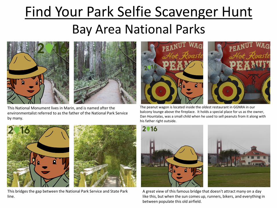
This National Monument lives in Marin, and is named after the environmentalist referred to as the father of the National Park Service by many.
The peanut wagon is located inside the oldest restaurant in GGNRA in our balcony lounge above the fireplace. It holds a special place for us as the owner, Dan Hountalas, was a small child when he used to sell peanuts from it along with his father right outside.
This bridges the gap between the National Park Service and State Park line.
A great view of this famous bridge that doesn't attract many on a day like this, but when the sun comes up, runners, bikers, and everything in between populate this old airfield.
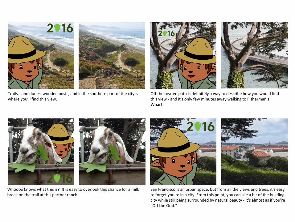
Trails, sand dunes, wooden posts, and in the southern part of the city is where you’ll find this view.
Off the beaten path is definitely a way to describe how you would find this view - and it's only few minutes away walking to Fisherman's Wharf!
San Francisco is an urban space, but from all the views and trees, it's easy to forget you're in a city. From this point, you can see a bit of the bustling city while still being surrounded by natural beauty - it's almost as if you're "Off the Grid."
Whoooo knows what this is? It is easy to overlook this chance for a milk break on the trail at this partner ranch.
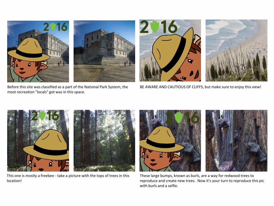
Before this site was classified as a part of the National Park System, the most recreation "locals" got was in this space.
BE AWARE AND CAUTIOUS OF CLIFFS, but make sure to enjoy this view!
These large bumps, known as burls, are a way for redwood trees to reproduce and create new trees. Now it's your turn to reproduce this pic with burls and a selfie.
This one is mostly a freebee - take a picture with the tops of trees in this location!
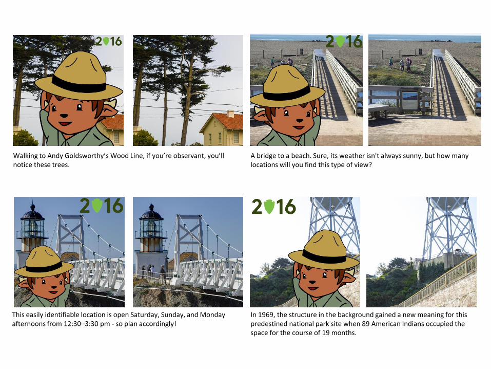
Walking to Andy Goldsworthy’s Wood Line, if you’re observant, you’ll notice these trees.
A bridge to a beach. Sure, its weather isn't always sunny, but how many locations will you find this type of view?
In 1969, the structure in the background gained a new meaning for this predestined national park site when 89 American Indians occupied the space for the course of 19 months.
This easily identifiable location is open Saturday, Sunday, and Monday afternoons from 12:30–3:30 pm - so plan accordingly!
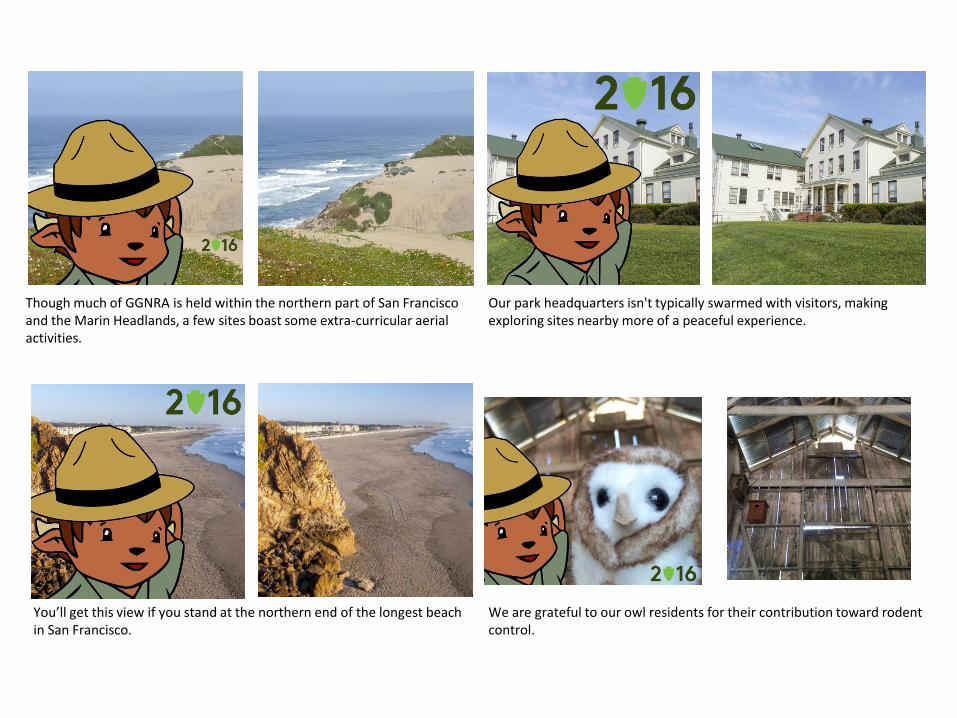
Though much of GGNRA is held within the northern part of San Francisco and the Marin Headlands, a few sites boast some extra-curricular aerial activities.
Our park headquarters isn't typically swarmed with visitors, making exploring sites nearby more of a peaceful experience.
We are grateful to our owl residents for their contribution toward rodent control.
You’ll get this view if you stand at the northern end of the longest beach in San Francisco.
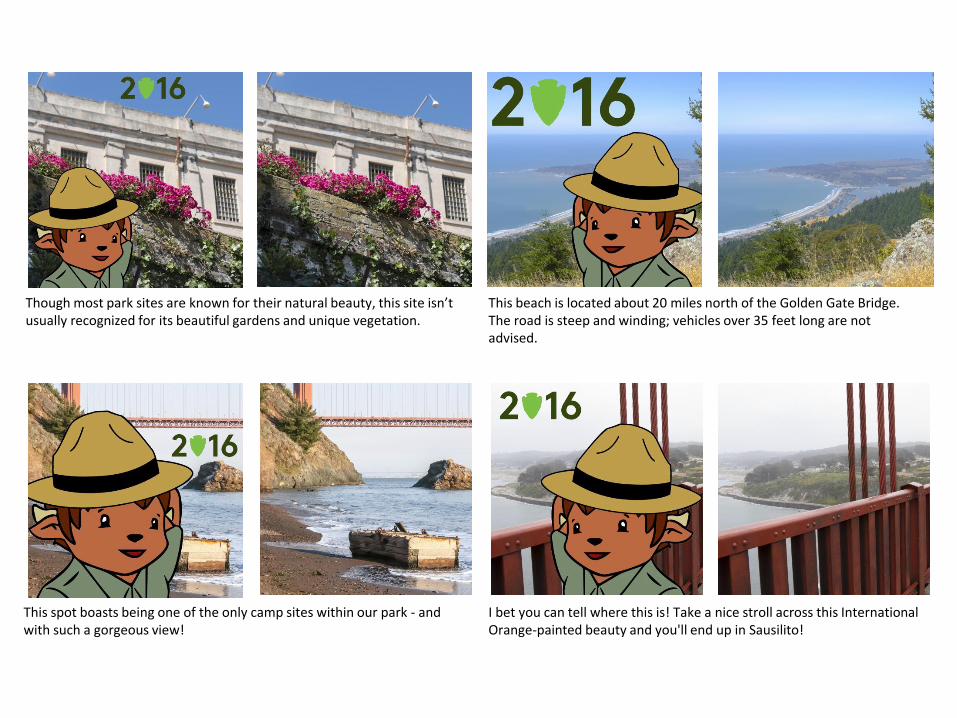
Though most park sites are known for their natural beauty, this site isn’t usually recognized for its beautiful gardens and unique vegetation.
This beach is located about 20 miles north of the Golden Gate Bridge. The road is steep and winding; vehicles over 35 feet long are not advised.
I bet you can tell where this is! Take a nice stroll across this International Orange-painted beauty and you'll end up in Sausilito!
This spot boasts being one of the only camp sites within our park - and with such a gorgeous view!
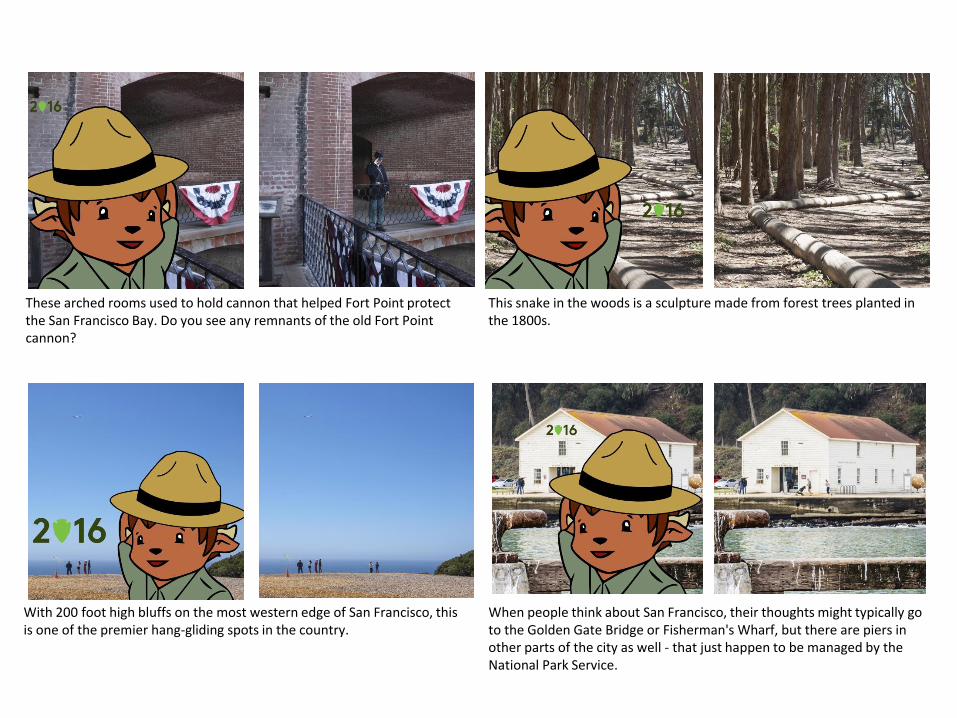
These arched rooms used to hold cannon that helped Fort Point protect the San Francisco Bay. Do you see any remnants of the old Fort Point cannon?
This snake in the woods is a sculpture made from forest trees planted in the 1800s.
When people think about San Francisco, their thoughts might typically go to the Golden Gate Bridge or Fisherman's Wharf, but there are piers in other parts of the city as well - that just happen to be managed by the National Park Service.
With 200 foot high bluffs on the most western edge of San Francisco, this is one of the premier hang-gliding spots in the country.

North of the bridge, if you're a visitor to the Marin Headlands, this is the spot to go.
This recently-redone pathway creates a nice lead-in to this small beach.
In January of this year, this moveable median barrier was added to the center of the bridge.
Gaze upon the Balclutha bowsprit and journey beyond the Golden Gate
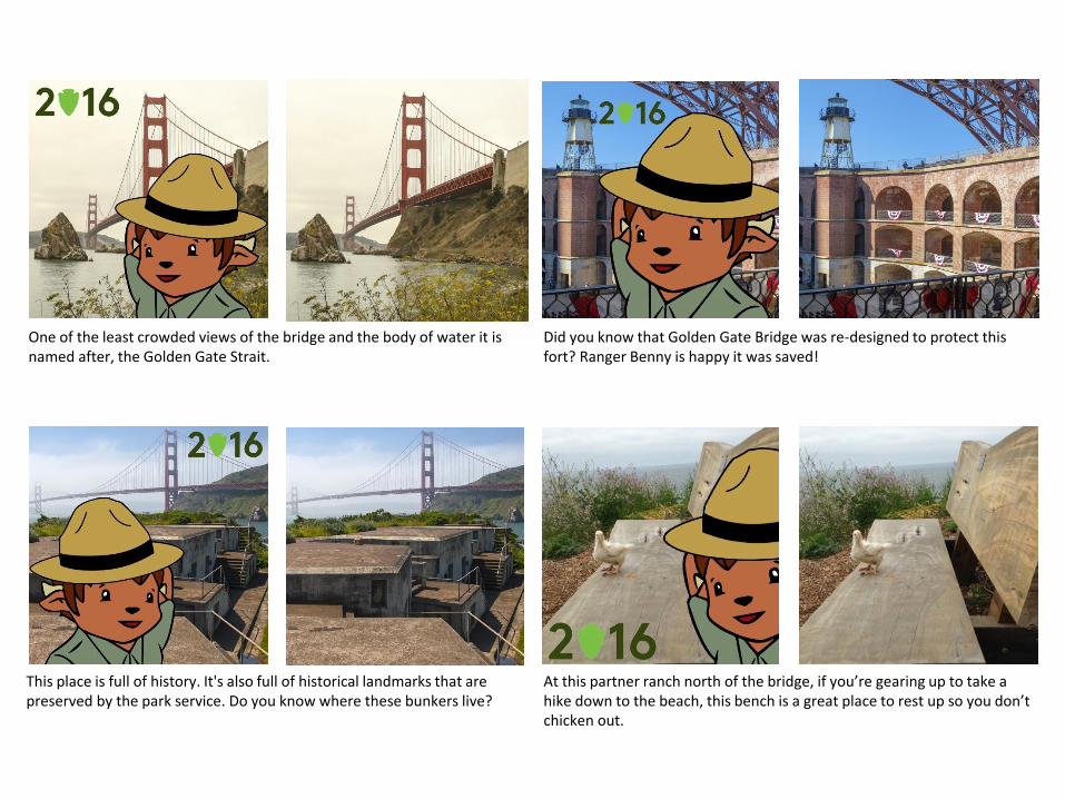
One of the least crowded views of the bridge and the body of water it is named after, the Golden Gate Strait.
Did you know that Golden Gate Bridge was re-designed to protect this fort? Ranger Benny is happy it was saved!
At this partner ranch north of the bridge, if you’re gearing up to take a hike down to the beach, this bench is a great place to rest up so you don’t chicken out.
This place is full of history. It's also full of historical landmarks that are preserved by the park service. Do you know where these bunkers live?
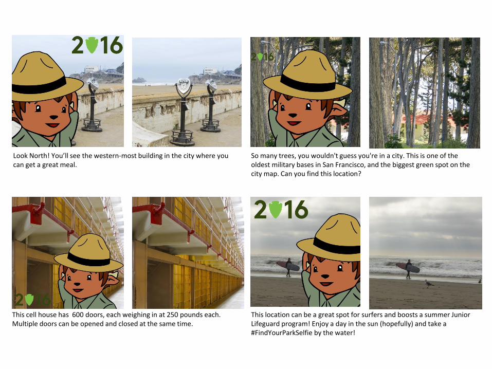
Look North! You’ll see the western-most building in the city where you can get a great meal.
So many trees, you wouldn't guess you're in a city. This is one of the oldest military bases in San Francisco, and the biggest green spot on the city map. Can you find this location?
This location can be a great spot for surfers and boosts a summer Junior Lifeguard program! Enjoy a day in the sun (hopefully) and take a #FindYourParkSelfie by the water!
This cell house has 600 doors, each weighing in at 250 pounds each. Multiple doors can be opened and closed at the same time.
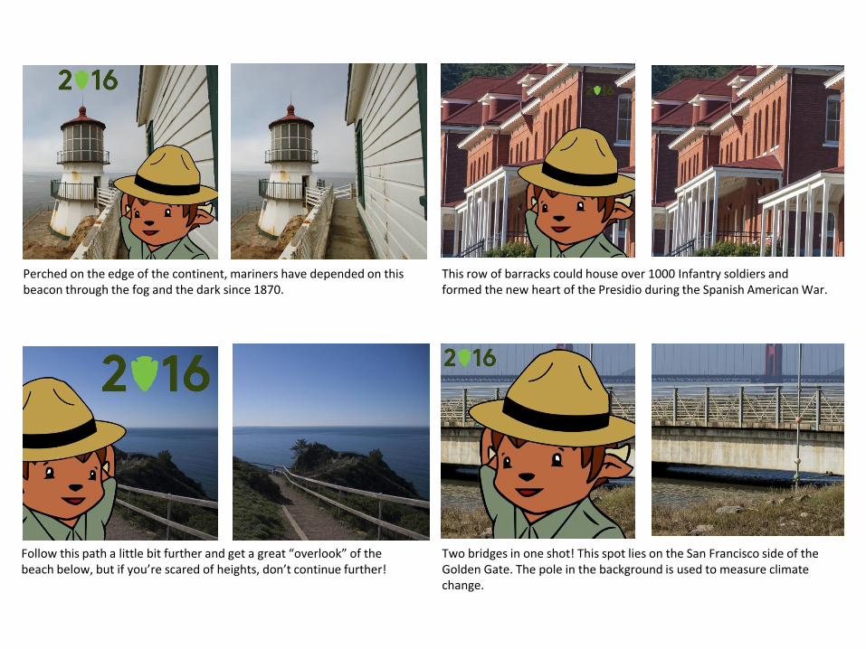
Perched on the edge of the continent, mariners have depended on this beacon through the fog and the dark since 1870.
This row of barracks could house over 1000 Infantry soldiers and formed the new heart of the Presidio during the Spanish American War.
Two bridges in one shot! This spot lies on the San Francisco side of the Golden Gate. The pole in the background is used to measure climate change.
Follow this path a little bit further and get a great “overlook” of the beach below, but if you’re scared of heights, don’t continue further!
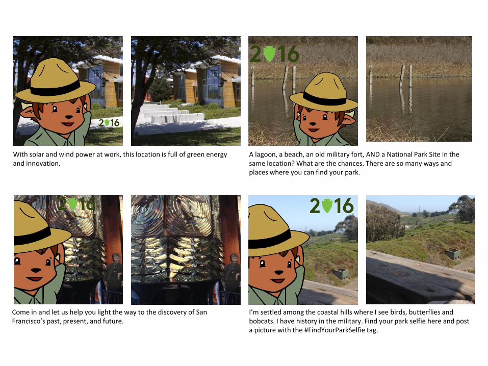
With solar and wind power at work, this location is full of green energy and innovation.
A lagoon, a beach, an old military fort, AND a National Park Site in the same location? What are the chances. There are so many ways and places where you can find your park.
I’m settled among the coastal hills where I see birds, butterflies and bobcats. I have history in the military. Find your park selfie here and post a picture with the #FindYourParkSelfie tag.
Come in and let us help you light the way to the discovery of San Francisco’s past, present, and future.
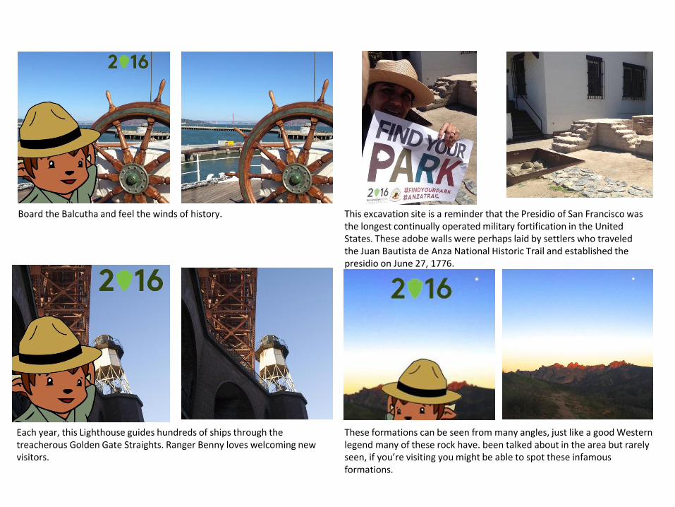
Board the Balcutha and feel the winds of history. This excavation site is a reminder that the Presidio of San Francisco was the longest continually operated military fortification in the United States. These adobe walls were perhaps laid by settlers who traveled the Juan Bautista de Anza National Historic Trail and established the presidio on June 27, 1776.
These formations can be seen from many angles, just like a good Western legend many of these rock have. been talked about in the area but rarely seen, if you’re visiting you might be able to spot these infamous formations.
Each year, this Lighthouse guides hundreds of ships through the treacherous Golden Gate Straights. Ranger Benny loves welcoming new visitors.

This Lone Sailor Memorial is the only one of twelve in the country that is located in the Bay Area and is north of the Golden Gate. As you can see, he's much taller than Ranger Benny.
This likeness of Juan Bautista de Anza stands near a freshwater lake near San Francisco State University. When he passed this lake in 1776, Pedro Font, diarist of the Anza Expedition, reported, "here we saw many bears."
These rocks are seen from a narrow trail around the steep boulders of volcanic rock, these rocks formed from ancient lava are located near the San Andreas fault. Coined by the locals as the “hidden jewel of the central coast” these tall spires stand out from the rock formations around them, making them unique.
Find me in a loop close to one of our partner locations. I’ll be the first one you see as you keep walking. Find your park selfie here and post a picture with the #FindYourParkSelfie tag.
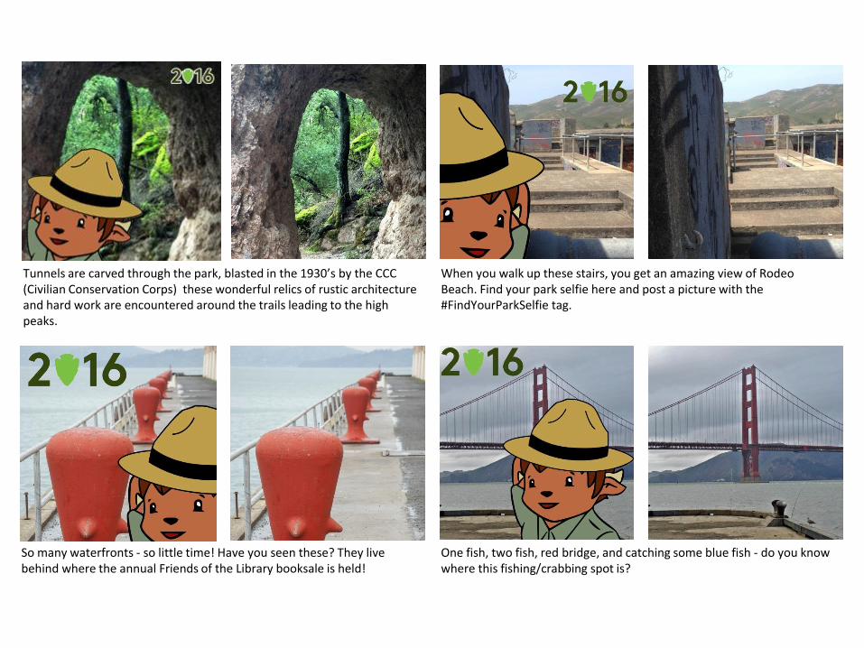
Tunnels are carved through the park, blasted in the 1930’s by the CCC (Civilian Conservation Corps) these wonderful relics of rustic architecture and hard work are encountered around the trails leading to the high peaks.
When you walk up these stairs, you get an amazing view of Rodeo Beach. Find your park selfie here and post a picture with the #FindYourParkSelfie tag.
One fish, two fish, red bridge, and catching some blue fish - do you know where this fishing/crabbing spot is?
So many waterfronts - so little time! Have you seen these? They live behind where the annual Friends of the Library booksale is held!
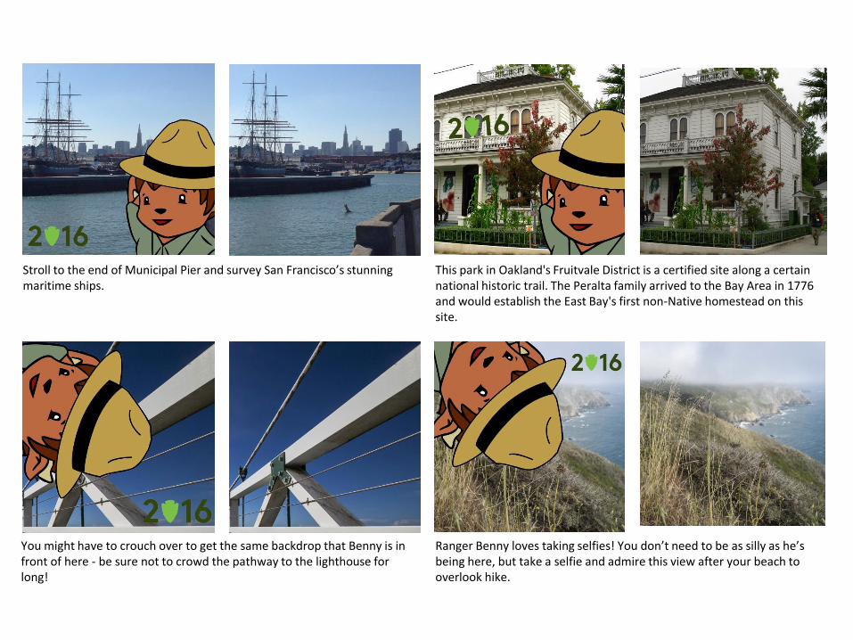
Stroll to the end of Municipal Pier and survey San Francisco’s stunning maritime ships.
This park in Oakland's Fruitvale District is a certified site along a certain national historic trail. The Peralta family arrived to the Bay Area in 1776 and would establish the East Bay's first non-Native homestead on this site.
Ranger Benny loves taking selfies! You don’t need to be as silly as he’s being here, but take a selfie and admire this view after your beach to overlook hike.
You might have to crouch over to get the same backdrop that Benny is in front of here - be sure not to crowd the pathway to the lighthouse for long!
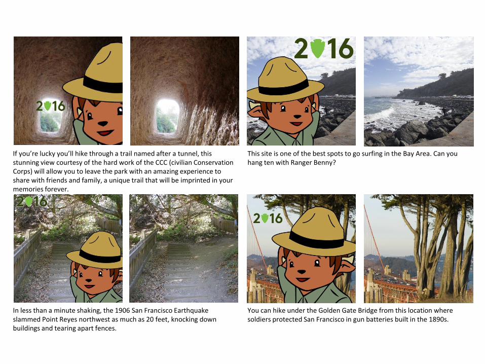
If you’re lucky you’ll hike through a trail named after a tunnel, this stunning view courtesy of the hard work of the CCC (civilian Conservation Corps) will allow you to leave the park with an amazing experience to share with friends and family, a unique trail that will be imprinted in your memories forever.
This site is one of the best spots to go surfing in the Bay Area. Can you hang ten with Ranger Benny?
You can hike under the Golden Gate Bridge from this location where soldiers protected San Francisco in gun batteries built in the 1890s.
In less than a minute shaking, the 1906 San Francisco Earthquake slammed Point Reyes northwest as much as 20 feet, knocking down buildings and tearing apart fences.

A great place to start any visit to the park, this bull elephant seal could be one of the first to welcome you to Point Reyes National Seashore.
The Spanish oversaw construction of this oldest standing building in San Francisco, built on the land of the Yelamu Ohlone people. At this site, people continue to practice the faith introduced to the Bay Area in 1776 by settlers traveling the Juan Bautista de Anza National Historic Trail.
In the Aquatic Bathhouse, plumb the artistic depths of WPA art. Some of these trails are equipped with primitive technology to allow easier navigation through the steep paths in near the high peaks, you may see more than expected, look up and you may see birds the size of a small plane.
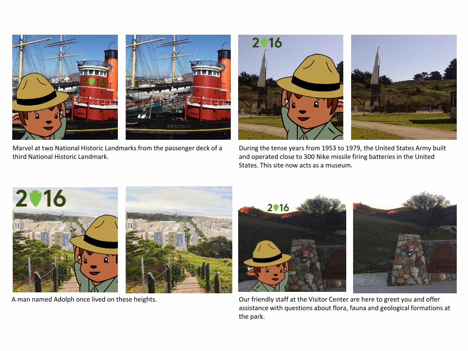
Marvel at two National Historic Landmarks from the passenger deck of a third National Historic Landmark.
During the tense years from 1953 to 1979, the United States Army built and operated close to 300 Nike missile firing batteries in the United States. This site now acts as a museum.
Our friendly staff at the Visitor Center are here to greet you and offer assistance with questions about flora, fauna and geological formations at the park.
A man named Adolph once lived on these heights.
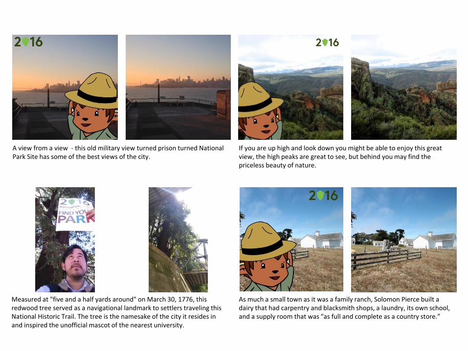
A view from a view - this old military view turned prison turned National Park Site has some of the best views of the city.
If you are up high and look down you might be able to enjoy this great view, the high peaks are great to see, but behind you may find the priceless beauty of nature.
As much a small town as it was a family ranch, Solomon Pierce built a dairy that had carpentry and blacksmith shops, a laundry, its own school, and a supply room that was “as full and complete as a country store.”
Measured at "five and a half yards around" on March 30, 1776, this redwood tree served as a navigational landmark to settlers traveling this National Historic Trail. The tree is the namesake of the city it resides in and inspired the unofficial mascot of the nearest university.
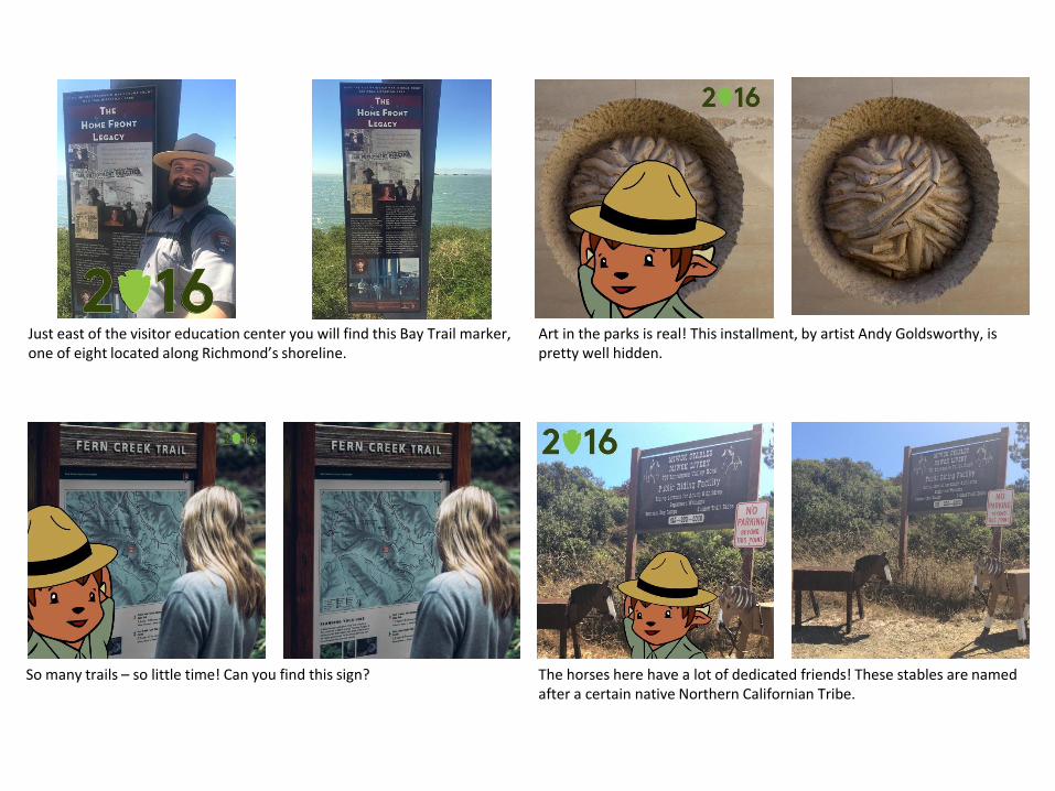
Just east of the visitor education center you will find this Bay Trail marker, one of eight located along Richmond’s shoreline.
Art in the parks is real! This installment, by artist Andy Goldsworthy, is pretty well hidden.
The horses here have a lot of dedicated friends! These stables are named after a certain native Northern Californian Tribe.
So many trails – so little time! Can you find this sign?
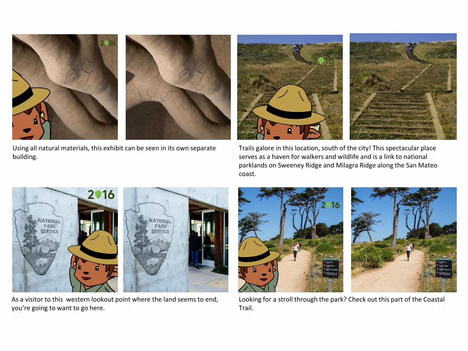
Using all natural materials, this exhibit can be seen in its own separate building.
Trails galore in this location, south of the city! This spectacular place serves as a haven for walkers and wildlife and is a link to national parklands on Sweeney Ridge and Milagra Ridge along the San Mateo coast.
Looking for a stroll through the park? Check out this part of the Coastal Trail.
As a visitor to this western lookout point where the land seems to end, you’re going to want to go here.
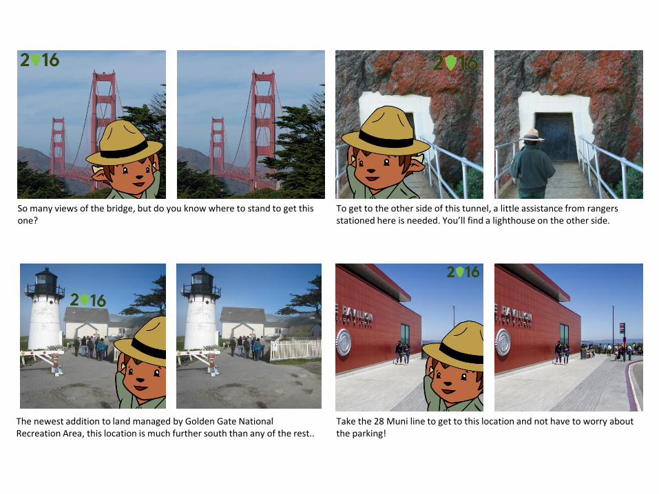
So many views of the bridge, but do you know where to stand to get this one?
To get to the other side of this tunnel, a little assistance from rangers stationed here is needed. You’ll find a lighthouse on the other side.
Take the 28 Muni line to get to this location and not have to worry about the parking!
The newest addition to land managed by Golden Gate National Recreation Area, this location is much further south than any of the rest..
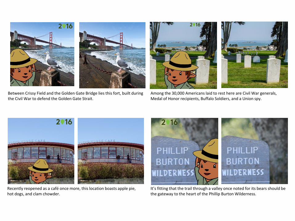
Between Crissy Field and the Golden Gate Bridge lies this fort, built during the Civil War to defend the Golden Gate Strait.
Among the 30,000 Americans laid to rest here are Civil War generals, Medal of Honor recipients, Buffalo Soldiers, and a Union spy.
It’s fitting that the trail through a valley once noted for its bears should be the gateway to the heart of the Phillip Burton Wilderness.
Recently reopened as a café once more, this location boasts apple pie, hot dogs, and clam chowder.

Face the opposite way of this famous Civil War fort and get this view! As an exhibit built at Bear Valley, this place is used to teach the importance of the traditions and history of the Coast Miwok People to thousands of school children every year.
So much history lives in the Marin Headlands. Can you find this battery? City and bridge views from out in the Bay – do you know where this could be?


![Selfie Scavenger Hunt - Cloudinary · [Selfie Scavenger Hunt] Explore Kansas City, KS with this family-friendly Selfie Scavenger Hunt and discover all the fun things to do and see!](https://static.fdocuments.in/doc/165x107/5c89e96909d3f2431b8ce1ee/selfie-scavenger-hunt-cloudinary-selfie-scavenger-hunt-explore-kansas-city.jpg)