Final Reclamation Plan1
50
1 | Page PREPARED BY ANDREW JANE MATHISEN, AARON LARRY, ANDREW NEILSEN, AND RUSSEL SPAULDING EDITED BY | RUSSEL SPAULDING The Continental Mine Permit A PROPOSED MINE IN NEW MEXICO
-
Upload
jane-mathisen -
Category
Documents
-
view
225 -
download
0
Transcript of Final Reclamation Plan1

8/13/2019 Final Reclamation Plan1
http://slidepdf.com/reader/full/final-reclamation-plan1 1/49
1 | P a g e
PREPARED BY ANDREW JANE MATHISEN, AARON LARRY, ANDREW NEILSEN, AND RUSSEL SPAULDING
EDITED BY | RUSSEL SPAULDING
The Continental
Mine PermitA PROPOSED MINE IN NEW MEXICO

8/13/2019 Final Reclamation Plan1
http://slidepdf.com/reader/full/final-reclamation-plan1 2/49
2 | P a g e
I: Administrative
1 Executive Summary (Jane)
2 Land Use (Aaron)
2.1 Land Use Planning Analysis
2.2 Post-Mining Land Use (PMLU)
3 Mine Application (Jane)
4 Public Relations (Russ)
4.1 Local Interest Groups and Stakeholders
4.2 Public Outreach
II: Baseline Data and Operational Management Plans
5 Geology and Hydrological Data (Russ)
5.1 Geology
5.2 Hydrology
5.2.1 Watershed and Local Hydrology
5.2.2 Water Source
5.2.3 Precipitation and Climatology
5.2.4 Monitoring
6 Vegetation (Aaron)
6.1 Common Vegetation
6.2 Vegetation Coverage
7 Common WIldlife (Aaron)
7.1 Wildlife Species
7.1.1 Endangered Wildlife Species
7.2 Listed and Sensitive Species
7.3 Grant County Species of Concern
7.4 Endangered Species7.4.1 Local Animal Species
8 Soils (Russ)
8.1 Baseline Soil Types
8.2 Soil Profiles
8.3 Topsoil Storage

8/13/2019 Final Reclamation Plan1
http://slidepdf.com/reader/full/final-reclamation-plan1 3/49
3 | P a g e
9 Cultural Resources (Russ)
9.1 Indian Reservation
9.2 Historical Town of Fierro
9.3 Historic Mining
III: Operational Permits (Jane)
10 TRI Reporting
11 Air Quality Permit
12 Water Discharge Permits
12.1 Permit Section A8
12.2 Permit Section A9
13 Stream Permits
14 Drinking Water Permit
15 Chemical Storage Plan
16 Mine Waste Storage
VI: Site Decommissioning
17 Earthwork and Grading (Jane)
18 Re-vegetation Plans and Seed Mix (Aaron)
18.1 Seeding
18.2 Seed Mix
18.3 Timing
18.4 Protection
18.5 Contingency
19 Reclamation Cost and Bond Cost (Andrew)
20 Bond Release (Russ)
20.1 Mine Life and Waste Rock
20.2 Timing

8/13/2019 Final Reclamation Plan1
http://slidepdf.com/reader/full/final-reclamation-plan1 4/49
4 | P a g e
Appendix: Maps and Plans (Andrew)
Base Maps: Figures 1 (a and b) and 2
Figure 1a: Area Location Map
Figure 1b: Base Mine Location Map
Figure 1c: Streams, Springs, and Water Bodies
Figure 1d: State Locator Map
Figure 2: Land Ownership Map
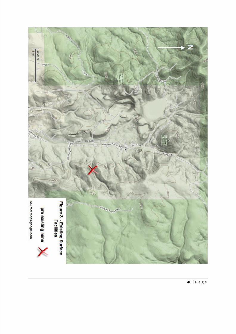
Figure 3: Existing Surface Facilities
Figure 4: Mine Plan Map
Figure 4a: Phasing Map
Figure 5a: Reclamation Treatments Phase 1 Existing Structures
Figure 5b: Reclamation Treatments Phase 2 Dumps and Tailings Caped and Sealed
Figure 5c: Reclamation Treatments Phase 3 Topsoil
Figure 5a: Reclamation Treatments Phase 4 Reseeding
Figure 6: Any Cross-Sections of the Reclaimed Area
Figure 7: Water Rights
Figure 8: Soils Map
Figure 9: Geology Map

8/13/2019 Final Reclamation Plan1
http://slidepdf.com/reader/full/final-reclamation-plan1 5/49
5 | P a g e
1 Executive Mine Summary
The Continental Copper Mine will be located approximately 200 miles southwest of Alburquerque, New
Mexico, in the Fierro-Hanover mining district. The mine will excavate approximately 6,500 tons of
copper ore per day for an annual total of 2,400,000 tons per year. The ore body reserves contain
approximately 9,500,000 tons of .86% grade copper and 4,500,000 tons of 2.22% grade copper. Themine will be constructed on both patented and unpatented land. The mine will consist of a single open
pit. It will be mined by traditional surface blasting and excavation methods. Two 10-hour shifts will
meet the production goals of the mine with a daily four hour maintenance period.
After the production phase, reclamation efforts will begin for the open pit, the tailings pond, and the
waste pile. These reclamation efforts include recontouring, re-seeding, and hydrologically managing the
site until it works with the undisturbed property around it (which includes the wildlife habitats,
recreation, and education). The reclamation budget is estimated to be $4,500 per an acre for bonding
purposes. The reclamation period is predicted to take five years to meet all state and federal
reclamation requirements, as well as social expectations for a modern American mine.
8/13/2019 Final Reclamation Plan1
http://slidepdf.com/reader/full/final-reclamation-plan1 6/49
6 | P a g e
2 Land Use
2.1 Land Use Planning Analysis
Before mining efforts began, the areas between Hermosa Mountain and Hanover Mountain were filled
with wildlife habitats and open graze land. These areas had minimal disturbance to vegetation and
wildlife, other than the livestock grazing in the area. The ground coverage of the desert and grassland
biome was mostly juniper and desert grasses.
2.2 Post –Mining Land Use (PMLU)
The land will be returned to its former use for many wildlife habitats. It will also be maintained as an
arboretum for endangered species of the southwest. The purpose of this arboretum is to promote
biodiversity and education. Once reclaimed, the mine land will be used for recreation activities with
trails, picnic areas, and an education center that teaches mining history, local flora, fauna, and
sustainability. Partial mining structures will be preserved for the purposes of sustainability education
and historical comparisons.
3 Mine Permit
FOR MMD USE
ONLY:
REV.DATE: 5/18/09
PROJECT NAME:
PERMIT #:
DATE RECEIVED:
DATE APPROVED:
LEAD INSPECTOR:
STATE OF NEW MEXICO
ENERGY, MINERALS AND NATURAL RESOURCES DEPARTMENT
Director
Mining and Minerals Division
1220 South Saint Francis Drive
Santa Fe, New Mexico 87505

8/13/2019 Final Reclamation Plan1
http://slidepdf.com/reader/full/final-reclamation-plan1 7/49
7 | P a g e
Telephone: (505) 476-3400
SUBPART 3
MINIMAL IMPACT NEW MINING OPERATIONS
PERMIT APPLICATION
The following information is required under the New Mexico Mining Act (Sections 69-36-1 through 69-36-20, NMSA 1978) and
associated rules. The Mining and Minerals Division of the Energy, Minerals and Natural Resources Department is the administrative
agency through which this application is to be processed. See §304, Minimal Impact New Mining Operations, of the New Mexico
Mining Act Rules for all regulations associated with Minimal Impact Mining operations.
Permit Application Requirements: (§304.A-C and §601)
A minimal impact new mining operation will not be considered a minimal impact mining
operation if it exceeds 10 acres of disturbed land, except that pre-existing roads and reclaimed
areas within the permit area will not be counted. Reclaimed, for this purpose means all financial
assurance has been released, except the amount held to reestablish vegetation pursuant to
§1204.
Permit applications shall be submitted in ample time to have the permit issued before miningoperations begin, and operations shall not begin until after the permit is issued.
Six copies of the completed application need to be submitted.
Confidential information needs to be clearly indicated and submitted separately.
Check the "YES" or "NO" box for each of the following characteristics as related to the proposedminimal impact mining operation:
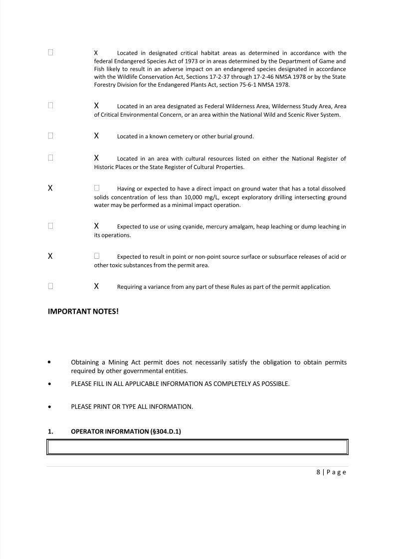
YES NO
X Located in or having a direct surface impact on wetlands, springs, perennial or
intermittent streams, lakes, rivers, reservoirs or riparian areas.
8/13/2019 Final Reclamation Plan1
http://slidepdf.com/reader/full/final-reclamation-plan1 8/49
8 | P a g e
X Located in designated critical habitat areas as determined in accordance with the
federal Endangered Species Act of 1973 or in areas determined by the Department of Game and
Fish likely to result in an adverse impact on an endangered species designated in accordance
with the Wildlife Conservation Act, Sections 17-2-37 through 17-2-46 NMSA 1978 or by the State
Forestry Division for the Endangered Plants Act, section 75-6-1 NMSA 1978.
X Located in an area designated as Federal Wilderness Area, Wilderness Study Area, Area
of Critical Environmental Concern, or an area within the National Wild and Scenic River System.
X Located in a known cemetery or other burial ground.
X Located in an area with cultural resources listed on either the National Register of
Historic Places or the State Register of Cultural Properties.
X Having or expected to have a direct impact on ground water that has a total dissolved
solids concentration of less than 10,000 mg/L, except exploratory drilling intersecting groundwater may be performed as a minimal impact operation.
X Expected to use or using cyanide, mercury amalgam, heap leaching or dump leaching in
its operations.
X Expected to result in point or non-point source surface or subsurface releases of acid or
other toxic substances from the permit area.
X Requiring a variance from any part of these Rules as part of the permit application.
IMPORTANT NOTES!
Obtaining a Mining Act permit does not necessarily satisfy the obligation to obtain permits
required by other governmental entities.
PLEASE FILL IN ALL APPLICABLE INFORMATION AS COMPLETELY AS POSSIBLE.
PLEASE PRINT OR TYPE ALL INFORMATION.
1. OPERATOR INFORMATION (§304.D.1)

8/13/2019 Final Reclamation Plan1
http://slidepdf.com/reader/full/final-reclamation-plan1 9/49
9 | P a g e
LIST PROJECT NAME: Continental Mine
NAME OF APPLICANT Russel Spaulding, Jane Mathisen, Aaron Larry, Andrew Neilsen
ADDRESS: 201 Presidents Cir, Salt Lake City, UT 84112
PHONE #: 555-555-5555
NAME OF OWNER (if different from applicant's name and address):
ADDRESS:
PHONE #:
NAME OF ON-SITE CONTACT OR OPERATOR'S REPRESENTATIVE:
ADDRESS:
PHONE #:

8/13/2019 Final Reclamation Plan1
http://slidepdf.com/reader/full/final-reclamation-plan1 10/49
10 | P a g e
2. RIGHT TO ENTER INFORMATION (§304.D.1)
A. Describe or provide evidence for the basis of the applicant's right to enter the property
to conduct the mining and reclamation:
B. List the names and addresses of surface and mineral ownership within the proposed
permit area:
1. Surface Owner(s):
Name Address Phone #
2. Mineral Owner(s):
Name Address Phone #
C. List the author(s), title(s), date(s) and report number(s) of any cultural resource survey report(s)
submitted to the agency(ies) or landowner(s) listed above:
3. MAPS (§304.D.2)
8/13/2019 Final Reclamation Plan1
http://slidepdf.com/reader/full/final-reclamation-plan1 11/49
11 | P a g e
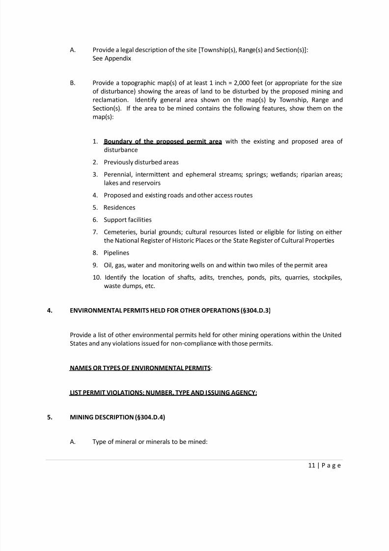
A. Provide a legal description of the site [Township(s), Range(s) and Section(s)]:
See Appendix
B. Provide a topographic map(s) of at least 1 inch = 2,000 feet (or appropriate for the size
of disturbance) showing the areas of land to be disturbed by the proposed mining and
reclamation. Identify general area shown on the map(s) by Township, Range and
Section(s). If the area to be mined contains the following features, show them on the
map(s):
1. Boundary of the proposed permit area with the existing and proposed area of
disturbance
2. Previously disturbed areas
3. Perennial, intermittent and ephemeral streams; springs; wetlands; riparian areas;
lakes and reservoirs
4. Proposed and existing roads and other access routes
5. Residences
6. Support facilities
7. Cemeteries, burial grounds; cultural resources listed or eligible for listing on either
the National Register of Historic Places or the State Register of Cultural Properties
8. Pipelines
9. Oil, gas, water and monitoring wells on and within two miles of the permit area
10. Identify the location of shafts, adits, trenches, ponds, pits, quarries, stockpiles,
waste dumps, etc.
4. ENVIRONMENTAL PERMITS HELD FOR OTHER OPERATIONS (§304.D.3)
Provide a list of other environmental permits held for other mining operations within the United
States and any violations issued for non-compliance with those permits.
NAMES OR TYPES OF ENVIRONMENTAL PERMITS:
LIST PERMIT VIOLATIONS; NUMBER, TYPE AND ISSUING AGENCY:
5. MINING DESCRIPTION (§304.D.4)
A. Type of mineral or minerals to be mined:

8/13/2019 Final Reclamation Plan1
http://slidepdf.com/reader/full/final-reclamation-plan1 12/49
12 | P a g e
B. Check the method of proposed mining: Surface Underground
C. Describe the sizes and volumes of the facilities to be used:
Plant Site/Staging Area:
How Many 802 Acreage
Pits or Quarries: How Many 1 Acreage TBD Volume (cu.yds.) TBD
Stockpiles: How Many 1 Acreage TBD Volume (cu.yds.) TBD
Waste Dumps: How Many 1 Acreage TBD Volume (cu.yds.) TBD
List the following for New Road(s):
Length (ft.) 15,000 Width (ft.) 25
List the following for extension or widening of Existing Road(s):
Length (ft.) 0 Width (ft.)
Other Disturbances: Type
How Many Acreage Volume (cu.yds.)
TOTAL ACREAGE TO BE DISTURBED: 802 Acres
D. Describe the type of processing that will be conducted on site:
An on-site mill will crush, grind, and process ore and electroplate the resulting metal
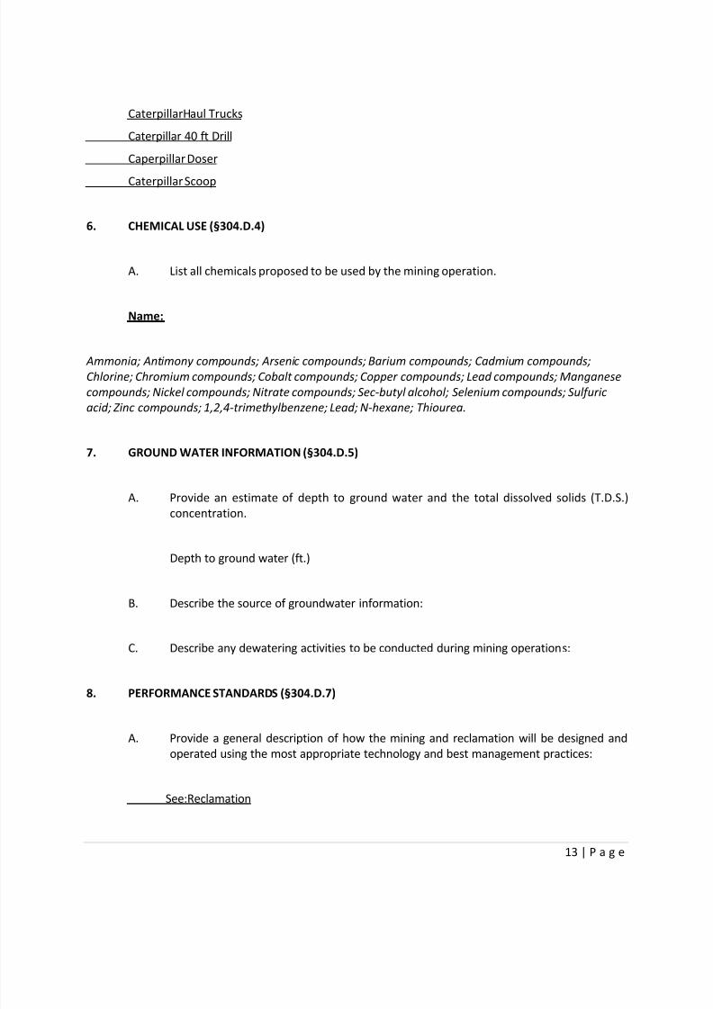
E. Describe the typical equipment to be used for the mining operations:
8/13/2019 Final Reclamation Plan1
http://slidepdf.com/reader/full/final-reclamation-plan1 13/49
13 | P a g e
CaterpillarHaul Trucks
Caterpillar 40 ft Drill
Caperpillar Doser
Caterpillar Scoop
6. CHEMICAL USE (§304.D.4)
A. List all chemicals proposed to be used by the mining operation.
Name:
Ammonia; Antimony compounds; Arsenic compounds; Barium compounds; Cadmium compounds;
Chlorine; Chromium compounds; Cobalt compounds; Copper compounds; Lead compounds; Manganese
compounds; Nickel compounds; Nitrate compounds; Sec-butyl alcohol; Selenium compounds; Sulfuric
acid; Zinc compounds; 1,2,4-trimethylbenzene; Lead; N-hexane; Thiourea.
7. GROUND WATER INFORMATION (§304.D.5)
A. Provide an estimate of depth to ground water and the total dissolved solids (T.D.S.)
concentration.
Depth to ground water (ft.)
B. Describe the source of groundwater information:
C. Describe any dewatering activities to be conducted during mining operations:
8. PERFORMANCE STANDARDS (§304.D.7)
A. Provide a general description of how the mining and reclamation will be designed and
operated using the most appropriate technology and best management practices:
See:Reclamation
8/13/2019 Final Reclamation Plan1
http://slidepdf.com/reader/full/final-reclamation-plan1 14/49
14 | P a g e
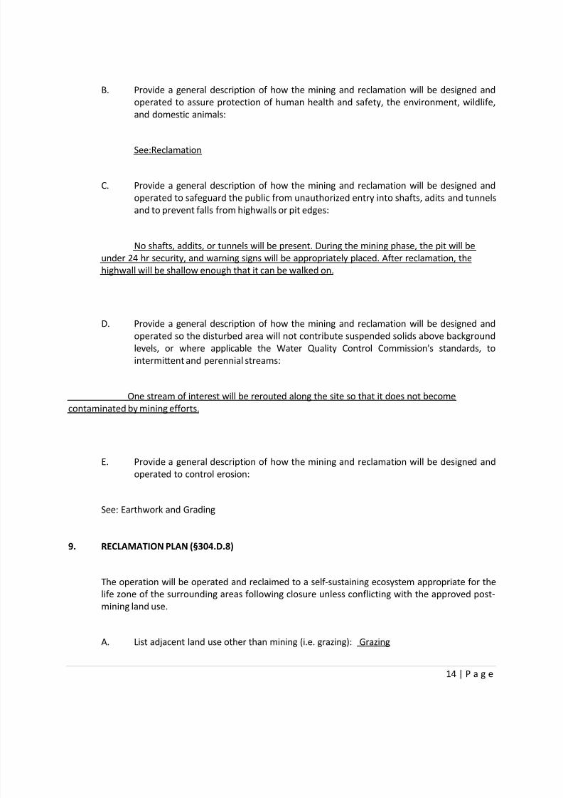
B. Provide a general description of how the mining and reclamation will be designed and
operated to assure protection of human health and safety, the environment, wildlife,
and domestic animals:
See:Reclamation
C. Provide a general description of how the mining and reclamation will be designed and
operated to safeguard the public from unauthorized entry into shafts, adits and tunnels
and to prevent falls from highwalls or pit edges:
No shafts, addits, or tunnels will be present. During the mining phase, the pit will be
under 24 hr security, and warning signs will be appropriately placed. After reclamation, the
highwall will be shallow enough that it can be walked on.
D. Provide a general description of how the mining and reclamation will be designed and
operated so the disturbed area will not contribute suspended solids above background
levels, or where applicable the Water Quality Control Commission's standards, to
intermittent and perennial streams:
One stream of interest will be rerouted along the site so that it does not become
contaminated by mining efforts.
E. Provide a general description of how the mining and reclamation will be designed and
operated to control erosion:
See: Earthwork and Grading
9. RECLAMATION PLAN (§304.D.8)
The operation will be operated and reclaimed to a self-sustaining ecosystem appropriate for the
life zone of the surrounding areas following closure unless conflicting with the approved post-
mining land use.
A. List adjacent land use other than mining (i.e. grazing): Grazing

8/13/2019 Final Reclamation Plan1
http://slidepdf.com/reader/full/final-reclamation-plan1 15/49
15 | P a g e
B. List the proposed post mining land use (i.e. wildlife): Wildlife habitat and recreation
C. Describe how reclamation activities will avoid adverse impact to cultural resources:
See: Reclamation
D. Describe any backfilling and grading operations to be performed after mining:
See: Earthwork and Grading
E. Describe what mitigation steps will be taken to reconstruct or protect the hydrologic
balance of the site after mining:
All waste and tailings will be reclaimed and contained so that they do not leak into the
nearby water sources.
F. Describe how topsoil or topdressing will be salvaged, stockpiled and distributed for the
re-establishment of vegetation:
Top-soil will be stockpilied on-site and redistributed during the reconturing phase ofreclamation. Topsoil will also be distributed on top of the waste pile and tailings pond.
G. Describe what kind of seed bed preparation will take place prior to seeding. What soil
amendments will be added? Scarification of the seed bed needs to take place. Will this
involve discing or ripping?
See: Reclamation
H. Describe in detail the plant species to be used in the re-establishment of vegetation:
Plant Name: Rate of application (lb/ac)
See: Reclamation
8/13/2019 Final Reclamation Plan1
http://slidepdf.com/reader/full/final-reclamation-plan1 16/49
16 | P a g e
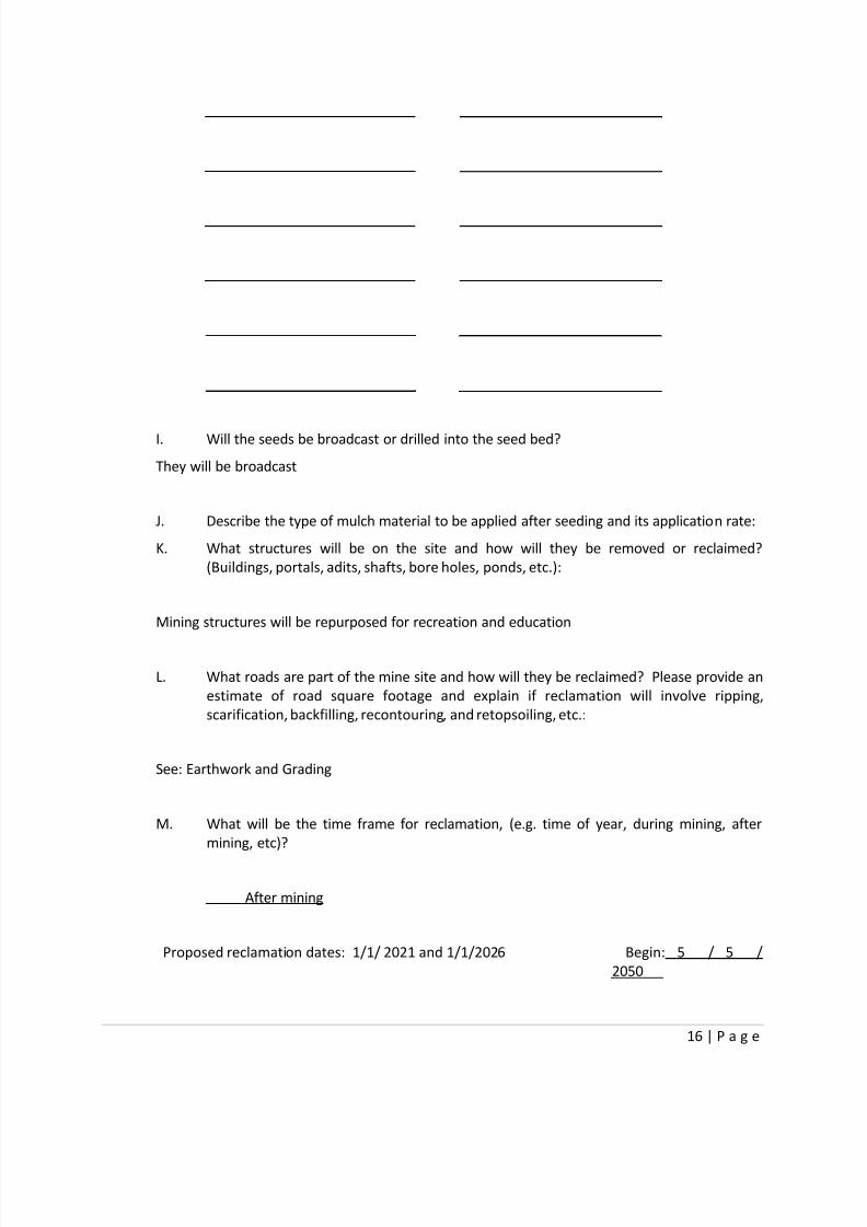
I. Will the seeds be broadcast or drilled into the seed bed?
They will be broadcast
J. Describe the type of mulch material to be applied after seeding and its application rate:
K. What structures will be on the site and how will they be removed or reclaimed?
(Buildings, portals, adits, shafts, bore holes, ponds, etc.):
Mining structures will be repurposed for recreation and education
L. What roads are part of the mine site and how will they be reclaimed? Please provide an
estimate of road square footage and explain if reclamation will involve ripping,
scarification, backfilling, recontouring, and retopsoiling, etc.:
See: Earthwork and Grading
M. What will be the time frame for reclamation, (e.g. time of year, during mining, after
mining, etc)?
After mining
Proposed reclamation dates: 1/1/ 2021 and 1/1/2026 Begin: 5 / 5 /
2050

8/13/2019 Final Reclamation Plan1
http://slidepdf.com/reader/full/final-reclamation-plan1 17/49
17 | P a g e
10. OTHER REQUIRED PERMITS FOR THIS OPERATION (§304.D.9)
A. Provide a list of other permits required for the operation and the anticipated schedule
for receipt of these.
Permit Name & Issuing Agency Date or anticipated date of
receipt
See Section III: Operational Permits
11. FINANCIAL ASSURANCE AND PERMIT FEES (§304.E & F)
A. Provide a financial assurance estimate based on the cost of reclaiming the site by a third
party. Include supporting calculations. Operations with less than 2 acres total
disturbance are not required to provide financial assurance.
Reclamation costs: $4500/acre
Total: $3,609,000
12. CERTIFICATION REQUIREMENT (§304.J.5)
Each application shall be signed and notarized by an applicant for the operation with the
following certification made:
I certify that I have personally examined and am familiar with the informationsubmitted herein, and based on my inquiry of those individuals responsible for
obtaining the information, I believe the submitted information is true, accurate, and
complete. I agree to comply with the requirements of the permit, these Rules, and
the Act. Further, I hereby allow the Director to enter the permit area for the purpose
of conducting inspections until release of financial assurance.
8/13/2019 Final Reclamation Plan1
http://slidepdf.com/reader/full/final-reclamation-plan1 18/49
18 | P a g e
Signature of Applicant:
Name (typed or print):
Title/Position:
Date:
Signature of Notary:
└── Notary Seal ──┘
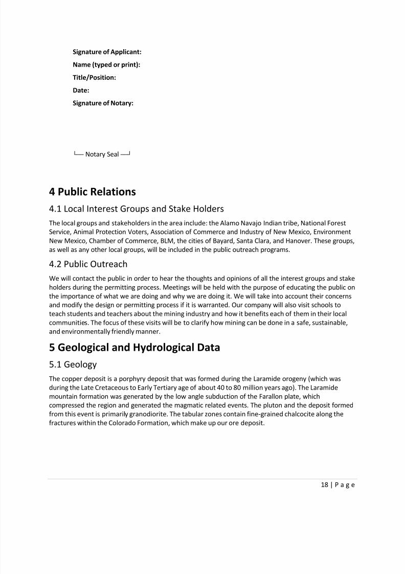
4 Public Relations
4.1 Local Interest Groups and Stake Holders
The local groups and stakeholders in the area include: the Alamo Navajo Indian tribe, National Forest
Service, Animal Protection Voters, Association of Commerce and Industry of New Mexico, Environment
New Mexico, Chamber of Commerce, BLM, the cities of Bayard, Santa Clara, and Hanover. These groups,
as well as any other local groups, will be included in the public outreach programs.
4.2 Public Outreach
We will contact the public in order to hear the thoughts and opinions of all the interest groups and stake
holders during the permitting process. Meetings will be held with the purpose of educating the public on
the importance of what we are doing and why we are doing it. We will take into account their concerns
and modify the design or permitting process if it is warranted. Our company will also visit schools to
teach students and teachers about the mining industry and how it benefits each of them in their local
communities. The focus of these visits will be to clarify how mining can be done in a safe, sustainable,
and environmentally friendly manner.
5 Geological and Hydrological Data
5.1 Geology
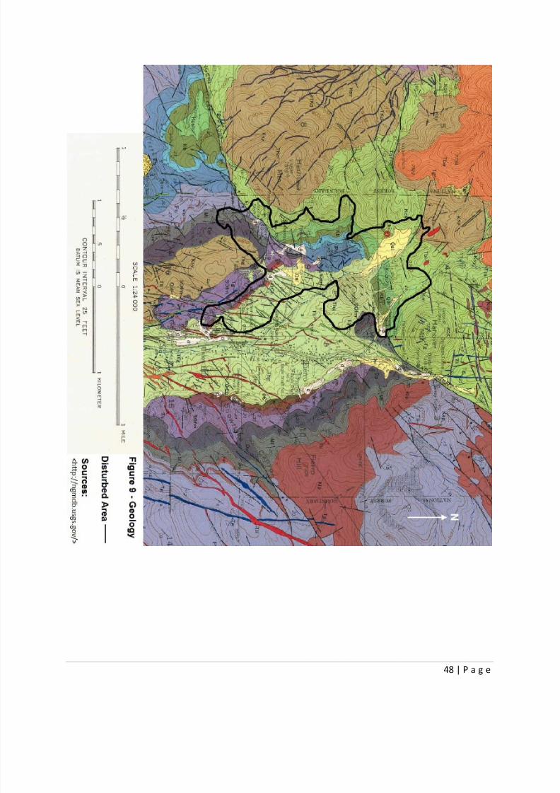
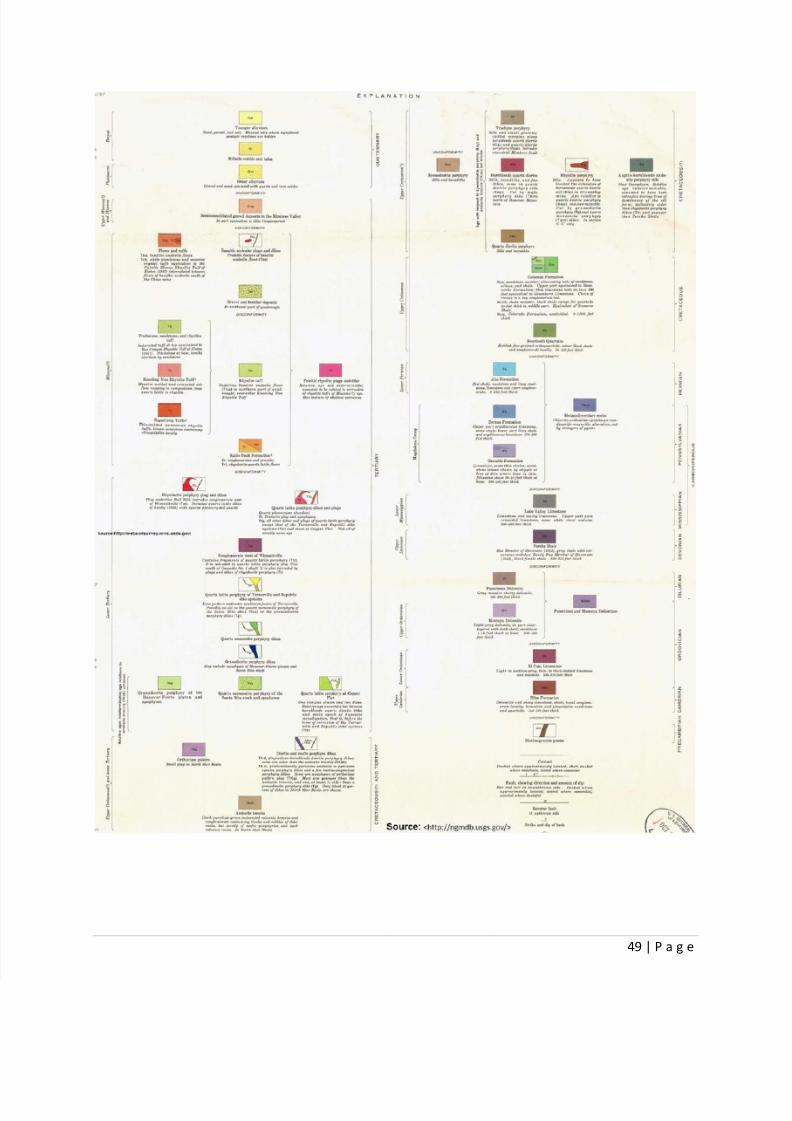
The copper deposit is a porphyry deposit that was formed during the Laramide orogeny (which was
during the Late Cretaceous to Early Tertiary age of about 40 to 80 million years ago). The Laramide
mountain formation was generated by the low angle subduction of the Farallon plate, which
compressed the region and generated the magmatic related events. The pluton and the deposit formed
from this event is primarily granodiorite. The tabular zones contain fine-grained chalcocite along the
fractures within the Colorado Formation, which make up our ore deposit.

8/13/2019 Final Reclamation Plan1
http://slidepdf.com/reader/full/final-reclamation-plan1 19/49
19 | P a g e
5.2 Hydrology
5.2.1 Watershed and Local Hydrology
The watershed in the area feeds into Hanover Creek, which travels along the east side of the mine. The
creek has an access road and a rail line that follow it through the property to an existing rail line and
mine site just south of our location. The Mantoya Tank reservoir is located one-forth of a mile west ofthe property. Because the reservoir is positioned on the opposite side of the mountain crest, its
watershed does not lie within the mine property. There will be wells put into place on the east side of
the reservoir to ensure there is no contamination of the water table from the mine (NRCS).
5.2.2 Water Source
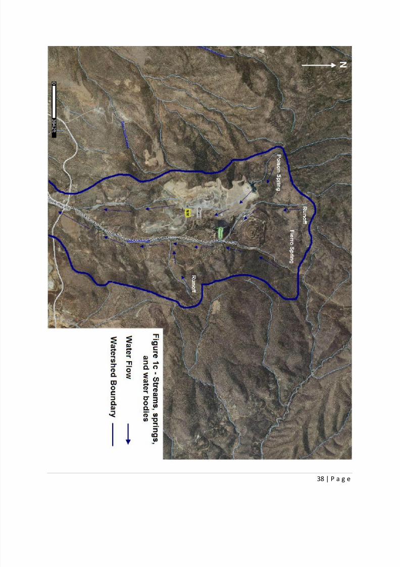
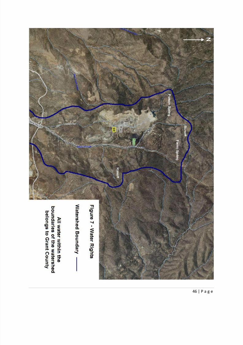
The main water sources for the mine are the Poison Spring and Hanover Creek. The spring is located
northwest of the mine, close to the mine dump and Hanover Creek. Poison Spring water feeds into a
stream that flows towards the waste dumps through the mine pit, as seen in figure 1c, and will be
diverted into Hanover Creek using a piping system to prevent leaking into the mine pit. The spring is
allowed to flow unobstructed to ensure no damage is done to the spring itself and to avoid
contamination from any of our operations. The stream will be monitored for flow and contaminatesweekly to ensure the spring is healthy. This type of monitoring will also be applied to Fierro Spring,
which is located on the mine property and heads Hanover Creek. The water from Poison Spring is used
by the mine for the processing of ore and for dust control. Hanover Creek supplies the remainder of the
water demand just east of the mine pit (NRCS).
5.2.3 Precipitation and Climatology
Precipitation in Grant County averages around 16 centimeters and has a mean snowfall of 11.8
centimeters. Although the precipitation in the area is low, it increases from July to August, which
averages about 3 centimeters per month. There is also very little snowfall at the mine, but the
surrounding mountains receive snow usually from November until March because of their higher
elevation. The runoff totals for the area of rain and snow are low, but generally increase in the monthsof July and August. The average annual temperature of all the means for the year range from 48° F to
52° F, indicating that warmer temperatures exist in the area of the mine. The maximum temperature for
July and August is about 90° F and the lowest temperature is 65° F, which can be seen in the graph
below (Storm247). No evidence of landslides have been found in the geologic record or in the historical
record for this location. The data for precipitation is summarized in the table below.

8/13/2019 Final Reclamation Plan1
http://slidepdf.com/reader/full/final-reclamation-plan1 20/49
20 | P a g e
Annual Precipitation
Precipitation Total Snowfall
Average High Low Mean High
January 1.08 3.65 0.00 3.3 13.9
February 1.13 3.82 0.02 2.8 15.5
March 0.95 4.34 0.00 1.5 6.5
April 0.58 2.88 0.00 0.7 5.5
May 0.39 2.38 0.00 0.0 0.0
June 0.68 2.48 0.00 0.0 0.0
July 3.02 8.75 0.46 0.0 0.0
August 3.06 7.40 0.31 0.0 0.0
September 1.97 5.31 0.00 0.0 0.0
October 1.26 4.37 0.00 0.0 0.0
November 0.71 2.73 0.00 0.9 6.8
December 1.24 4.20 0.00 2.5 15.6
Annual 16.08 24.92 6.77 11.8 27.0
(http://www.silvercity.org/precipitation.shtml)
5.2.4 Monitoring
Monitoring wells will be placed on the south end of the mine to track the water coming out of the minesite. A berm will also collect the water from the mine’s waste dumps and treat it for possible sulfide
contaminates. These wells will also be used to test the aquifer water for two years to establish a
baseline for the contaminate levels in the permitting area. This will insure the mine doesn’t affect the
water quality beyond the already established limits. Each of the streams in the area will be monitored
monthly and Hanover Creek will be monitored daily (with the exception of Poison Spring, which will be
monitored weekly as stated above). The area has very little subsurface water primarily because of the
ground’s low water capacity as well as the atmosphere’s low precipitation rate.

8/13/2019 Final Reclamation Plan1
http://slidepdf.com/reader/full/final-reclamation-plan1 21/49
21 | P a g e
6 Vegetation
For a normal year, total range production is the amount of vegetation that can be expected to grow
annually in a well-managed area that is supporting the potential natural plant community. It includes all
vegetation, whether or not it is palatable to grazing animals. It includes the current year's growth of
leaves, twigs, and fruits of woody plants. It does not include the increase in stem diameter of trees and
shrubs. It is expressed in pounds per acre of air-dry vegetation. In a normal year, growing conditions are
about average. Yields are adjusted to a common percent of air-dry moisture content.
Grant County in New Mexico lies in the Chihuahuan Desert at an elevation above 4,500 feet. This gives
the site a milder climate than that of the lower Sonoran Desert. We expect to have a normal year in
regards to vegetation production and precipitation in Grant County. The mine will implement
concurrent reclamation efforts whenever possible in their process plan. Reseeding will occur in the late
fall months of September or October between the heavy monsoon rains and the winter snowfall.
Reseeding for the area is indicated in phase map 5d. The contingency plan for reclamation is to monitor
the seeding (and reseeding if needed) the following April or May when the snow has melted but before
the heat of the summer.
6.1 Common Vegetation
The common vegetation for the area includes: Mesquite, Cactus, Creosote, Valley Cottonwood, Black
Grama Grass, Juniper, Cedar Pinon, Willow, Blue Grama Grass, Sagebrush, Ponderosa Pine, Scrub Oak,
Aspen, Douglas Fir, Spruce, Siberian Juniper, Engelmann Spruce, numerous types of berries, hardy
grasses, and wildflowers.
6.2 Vegetation Coverage
Vegetation surveys have been conducted. Sample plots with dimensions of three feet by three feet were
selected and used to determine coverage percentage. Vegetation coverage was taken on the property
and determined to be an accurate representative sample. Vegetation coverage as sampled is 35%.
Riparian shrubs, vines, and trees are adapted to soil conditions that are wetter than those common inthe drier upland areas. The soils suitable for riparian’s habitat generally occur along flood plains,
depressions, bottomlands, and drainage ways adjacent to ephemeral, intermittent, or perennial
streams. This biome lies on the outlying mine property where the drainage occurs and along the spring
water streams. The main biome on the mine site is more of a riparian desert biome.
Grant County, NM

8/13/2019 Final Reclamation Plan1
http://slidepdf.com/reader/full/final-reclamation-plan1 22/49
22 | P a g e
7
Common Wildlife
The common wildlife animals includes: jackrabbits, cottontail rabbits, bats, kangaroo rats, roadrunners,
squirrels, deer, coyotes, antelope, prairie dogs, mountain lions, bears, mountain bobcats, elk,
chipmunks, woodchucks, cony, and mountain sheep.
The Roadrunner
8/13/2019 Final Reclamation Plan1
http://slidepdf.com/reader/full/final-reclamation-plan1 23/49
23 | P a g e
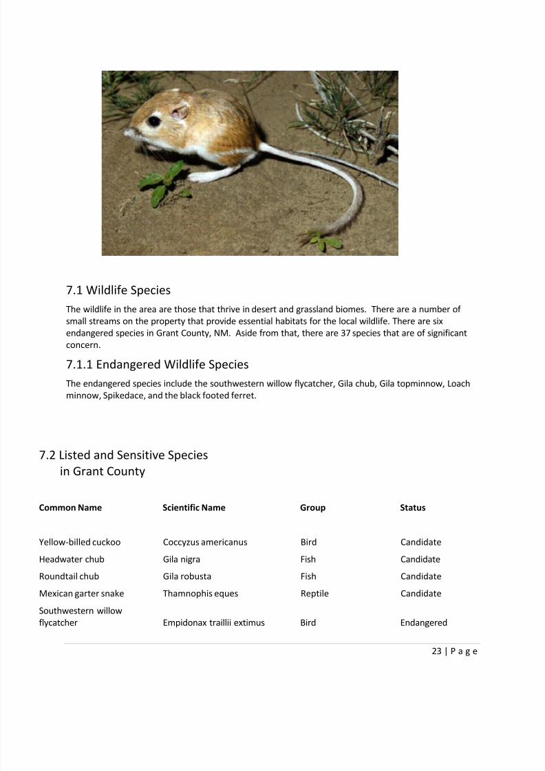
7.1 Wildlife Species
The wildlife in the area are those that thrive in desert and grassland biomes. There are a number of
small streams on the property that provide essential habitats for the local wildlife. There are six
endangered species in Grant County, NM. Aside from that, there are 37 species that are of significant
concern.
7.1.1 Endangered Wildlife Species
The endangered species include the southwestern willow flycatcher, Gila chub, Gila topminnow, Loach
minnow, Spikedace, and the black footed ferret.
7.2 Listed and Sensitive Species
in Grant County
Common Name Scientific Name Group Status
Yellow-billed cuckoo Coccyzus americanus Bird Candidate
Headwater chub Gila nigra Fish Candidate
Roundtail chub Gila robusta Fish Candidate
Mexican garter snake Thamnophis eques Reptile Candidate
Southwestern willow
flycatcher Empidonax traillii extimus Bird Endangered

8/13/2019 Final Reclamation Plan1
http://slidepdf.com/reader/full/final-reclamation-plan1 24/49
24 | P a g e
Gila chub
Designated Critical Habitat Gila intermedia Fish Endangered
Gila topminnow 3 Poeciliopsis occidentalis Fish Endangered
Loach minnow Tiaroga cobitis Fish Endangered
Spikedace Meda fulgida Fish Endangered
Black-footed ferret 2 Mustela nigripes Mammal Endangered
Northern aplomado falcon Falco femoralis septentrionalis Bird
Experimental, Non-essentia
Population
Whooping Crane Grus americana Bird
Experimental, Non-essentia
Population
Gray Wolf (Mexican Gray
Wolf) Canis lupus baileyi Mammal
Experimental, Non-essentia
Population
Chiricahua leopard frog
Designated Critical Habitat Rana chiricahuensis Amphibian Threatened
Mexican spotted owl
Designated Critical Habitat Strix occidentalis lucida Bird Threatened
Beautiful shiner 3 Cyprinella formosa Fish Threatened
Chihuahua chub Gila nigrescens Fish Threatened
Gila trout Oncorhynchus gilae Fish Threatened
7.3 Grant County Species of Concern
Species of Concern are included for planning purposes only.
Common Name Scientific Name Group Status
Lowland leopard frog Rana yavapaiensis Amphibian Species of Concern
Desert viceroy butterfly Limenitis archippus obsoletaArthropod -Invertebrate Species of Concern
New Mexico silverspot
butterfly Speyeria nokomis nitocris
Arthropod -
Invertebrate Species of Concern
American peregrine falcon Falco peregrinus anatum Bird Species of Concern
Arctic peregrine falcon Falco peregrinus tundrius Bird Species of Concern

8/13/2019 Final Reclamation Plan1
http://slidepdf.com/reader/full/final-reclamation-plan1 25/49
25 | P a g e
7.4 Endangered Species
After a complete environmental analysis, no endangered plants or animal species were found on the
property. In accordance with the Endangered Species Act, a Section 7 consultation will be conducted inconjunction with the Fish and Wildlife Service. This will determine if there are any adverse effects to
endangered species.
7.4.1 Local Animals Species
There is a joint effort with the local college to study the wildlife in the area. The college has set up
motion detection video cameras that monitor waterways, valleys, and fields. The college and the mine
currently monitor numerous birds, deer, coyotes, and three mountain lions.
Baird's sparrow Ammodramus bairdii Bird Species of Concern
Bell’s vireo Vireo bellii Bird Species of Concern
Common black hawk Buteogallus anthracinus Bird Species of Concern
Northern goshawk Accipiter gentilis Bird Species of Concern
Northern gray hawk Buteo nitidus maxima Bird Species of Concern
Western burrowing owl Athene cunicularia hypugaea Bird Species of Concern
Desert sucker Catostomus clarki Fish Species of Concern
Rio Grande sucker Catostomus plebeius Fish Species of Concern
Sonora sucker Catostomus insignis Fish Species of Concern
Townsend's big-eared bat Corynorhinus townsendii Mammal Species of Concern
Shortneck snaggletooth
(snail) Gastrocopta dalliana dalliana Mollusc - Invertebrate Species of Concern
Desert night-bloomingcereus Cereus greggii var. greggii Plant Species of Concern
Dwarf milkweed Asclepias uncialis var. uncialis Plant Species of Concern
Parish's alkali grass Puccinellia parishii Plant Species of Concern
Pinos Altos flame flower Talinum humile Plant Species of Concern
Porsild's starwort Stellaria porsildii Plant Species of Concern
San Carlos wild-buckwheat Eriogonum capillare Plant Species of Concern
Slender spiderflower Cleome multicaulis Plant Species of Concern
Wright's dogweedAdenophyllum wrightii var.wrightii Plant Species of Concern
Narrowhead garter snake Thamnophis rufipunctatus Reptile Species of Concern

8/13/2019 Final Reclamation Plan1
http://slidepdf.com/reader/full/final-reclamation-plan1 26/49
26 | P a g e
8 Soils
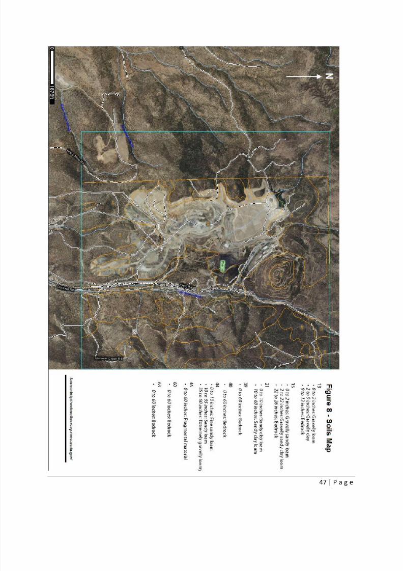
8.1 Baseline Soil Types
The soil located on the mine site is primarily mixed alluvium and colluvium derived from parent
metamorphic, sedimentary, and igneous rock. On the mine property, the majority of the area is exposed
bedrock. The top soil can be seen along the northeastern part of the property, in the proposed pit area,and along Hanover Creek. The types of soil found on our site include: Encerro, Gaddes, Jonale, and
Paymaster. These soils consist of a sandy loam topsoil, a sandy clay intermediate layer, and then
bedrock. The summary of the types of soil and rock in the area are seen in the table below, which
correlates with map figure 8.
We can see from the table that the area is well drained and has a very small chance of flooding or
ponding. The drainage in the area is well defined and will require very little manmade intervention to
insure proper drainage. The majority of the rock and soil has low permeability, except in area 44 by
Hanover Creek where the soil is underneath the access road and rail line.
8.2 Soil Profiles
The general soil profile in the area is 0 to 2 inches of gravelly sandy loam and then 2 to 22 inches of
gravelly, sandy clay loam followed by the bedrock that starts at 22 to 26 inches. The soil profiles
according to location can be seen in map figure 8.
8.3 Topsoil Storage
The topsoil where the pit is to be mined will be relocated and stored in a bench style of dump on the
east of the mine pit. The dump can be seen in map figure 4. The mine pit, road, and railway will require
the topsoil to be moved and stored in this location. The topsoil will be vegetated in October orSeptember in order to preserve it in this location. From each site where the soil is removed, a pedon will
be left in order to have an image of what the profile looked like in its original state.
9 Cultural Resources
9.1 Indian Reservation
Area Name
Elevation
(ft)
Mean annual
precipitation
(in) Soil type
Drainage
class
Frequency
of
flooding
Frequency
of
ponding
Water table
depth (in) Salinity
13 Encierro-rock outcrop 5500-7000 14 to 17 Encierro well-drained none none more than 80 none to strong
15 Gaddes-Santa Fe-Rock 4000-8000 12 to 16 Gaddes well-drained none none more than 80 nonsaline
21 Jonale sandy clay loam 5000-6000 12 to 16 Jonale well-drained none none more than 80 nonsaline40 Oro-Grande rock 5700-7000 12 to 16 Oro grande well-drained none none more than 80 nonsaline
44 Paymaster-Ellicott 5000-7000 12 to 16 paymaster well-drained Rare none more than 80 nonsaline
46 Pit-Dumps association N/A N/A Rock well-drained none Rare more than 80 nonsaline
60 Santa Fe-Rock 5500-8000 12 to 16 Santa fe well-drained none none more than 80 nonsaline
63 Santana-Rock 5000-7000 12 to 16 Santana well-drained none none more than 80 nonsaline
Baseline soil types
8/13/2019 Final Reclamation Plan1
http://slidepdf.com/reader/full/final-reclamation-plan1 27/49
27 | P a g e
The proposed mine site possibly lies within the Alamo Navajo Indian tribe ancestral lands. The tribe has
a reservation next to the city of Bayard and may hold some of the proposed property as sacred grounds.
The tribe representative has been contacted and we are waiting for a response. From our observations
of the property, no ancient or recent Indian artifacts have been found within the proposed mine site.
9.2 Historical Town of Fierro
The historic town of Fierro will be unaffected by mining operations and its traffic. The few homes in the
town have been purchased by the mine and will be used by employees. The locals will be allowed access
into the town so that they can visit the graveyard that contains about 200 graves. The rail line and
access road will be built over 1,500 feet away from the graveyard to preserve the historic area. The area
will be monitored during blasting to insure that the vibrations will not damage any of the grave stones.
9.3 Historic Mining
An old mining shaft lies within the property that has been abandoned since the late 1800’s. The shaft
was once part of a small underground mining operation that primarily mined a high grade copper. The
only existing mining structure that remains is the original A-frame. The site has been thoroughly
surveyed and no other mines or structures exist within the mine permit area. The mine is located up acanyon just east of the proposed south waste dump. Because the location is approximately 4,000 feet
away from the nearest disturbed area, it will be essentially unaffected by mining operations. The
location can be seen in map figure 3.
10 TRI Reporting
The TRI (Toxics Release Inventory) is a national database managed by the EPA which contains
information on the variety and quantity of toxic material that is handled and disposed of by major
production industries in the United States. The TRI was established under the Emergency Planning and
Community Right-to-Know Act of 1986. Our mine will be mandated to report toxic releases to the TRI
because it will produce more than 25,000 pounds of reportable material in any given year in the form of
uneconomic overburden material. For each toxic material, a section 313 TRI Report must be filed usingForm R found on the EPA’s website. Our mine will need to fill out Form R for each of the following
(quantities produced TBD):
Ammonia, Antimony compounds, Arsenic compounds, Barium compounds, Cadmium compounds,
Chlorine, Chromium compounds, Cobalt compounds, Copper compounds, Lead compounds, Manganese
compounds, Nickel compounds, Nitrate compounds, Sec-butyl alcohol, Selenium compounds, Sulfuric
acid, Zinc compounds, 1,2,4-trimethylbenzene, Lead, N-hexane, and Thiourea.
11 Air Permit
The Air Quality Bureau (AQB) of the New Mexico Environment Department (NMED), under the authority
of Chapter 74, Article 2 NMSA 1978 "Air Quality Control Act," issues air quality Construction and
Operating Permits.
The AQB administers most Federal Air Programs, which include: New Source Performance Standards
(NSPS), National Emission Standards for Hazardous Air Pollutants (NESHAPS) Prevention of significant
Deterioration (PSD), Title V Operating Permits, Title III Air Toxics, and Title IV Acid Rain. Since our mine is
estimated to release more than 10 short tons of air pollutants in any given year, we will submit a Notice
of Intent (NOI) permit to the AQB with the following information:
Company Information

8/13/2019 Final Reclamation Plan1
http://slidepdf.com/reader/full/final-reclamation-plan1 28/49
28 | P a g e
Facility Name; Operator Information; Ownership information; Mailing information; etc.
Facility Status
Has the facility already been constructed? (No.)
Has this facility been issued an NOI in the past? (No)
Etc.
Facility Input and Capacity
Current hourly, daily, annually (tons of production)? (none)
Proposed hourly, daily, annually (tons of production)? ( 325 TPH; 6,500 TPD; 2,372,500 TPY)
Location Information
See Maps
Proposed Operating Schedule
2, 10hr shifts
365 day/year
In addition, a NOI report will be submitted with an application that contains the following table of
contents:
Table of Contents
Section 1: General Facility Information
Section 2: Tables
Section 3: Application Summary
Section 4: Process Flow Sheet
Section 5: Plot Plan Drawn to Scale
Section 6: All Calculations
Section 7: Information Used to Determine Emissions
Section 8: Map(s)
Section 9: Proof of Public Notice
Section 10: Written Description of the Routine Operations of the Facility
Section 11: Source Determination
Section 12: PSD Applicability Determination for All Sources & Special Requirements for a
PSD Application
Section 13: Discussion Demonstrating Compliance with Each Applicable State & Federal
Regulation
Section 14: Operational Plan to Mitigate Emissions
Section 15: Alternative Operating Scenarios
Section 16: Air Dispersion Modeling

8/13/2019 Final Reclamation Plan1
http://slidepdf.com/reader/full/final-reclamation-plan1 29/49
29 | P a g e
Section 17: Compliance Test History
Section 18: Addendum for Streamline Applications (streamline applications only)
Section 19: Requirements for the Title V (20.2.70 NMAC) Program (Title V applications
only)
Section 20: Other Relevant InformationSection 21: Addendum for Landfill Applications
Section 22: Green House Gas Applicability
Section 23: Certification Page
Our mine will first and foremost utilize the most highly-efficient, low emission haul truck fleet
commercially available. Although the mining process should not liberate significant quantities of
underground stored gasses, we will still monitor the emitted gases around the shovels to evaluate this
claim. Gasses will be released as a result of the drill-and-blast mining method used at the mine.
Appropriate mitigation efforts will take place and will be documented.
12 Water Discharge
The Ground Water Quality Bureau (GWQB) of the New Mexico Environment Department is responsible
for the issuance of ground water discharge permits. Our mine will submit a ground water discharge
permit to the GWQB as a result of our mill tailings pond, waste dump (both of which are lined), and
septic tank system. The purpose of this permit process is to prevent ground water pollution, which could
result from discharges of effluent or leachate. Discharge permits are required for all discharges of
effluent or leachate which may move directly or indirectly into ground water that has an existing
concentration of 10,000 mg/l or less of total dissolved solids.
12.1 Permit Section A8: Processing, Treatment, Storage, and DisposalSystem
We will briefly describe how wastewater, sludge, etc. is processed, treated, stored, and/or disposed of
at our facility. The milling process is water-intensive at the mine. In order to maximize recyclability and
environmental responsibility with regards to water, the following procedures will take place to process,
store, and/or dispose of water:
Thickeners will remove 80% of the water from the slurry, which exits the grinding and sorting circuit.
Additional water will be removed by a filter and drum presses until the slurry becomes mineral cake. The
removed water will be filtered through an on-site water treatment plant and recycled as much as
possible to limit the total quantity of water affected.
When water is no longer recyclable, treated water will be tested for contents which might make it non-dischargeable. All “clean” water will be discharged according to appropriate regulations. If water is
found which cannot be discharged, it will be shipped to a contracted water treatment facility for
additional treatment.
12.2 Permit Section A9: Discharge Locations
Water that is found to be legally dischargeable, but not recyclable, will be emptied into a designated
drainage site, which will be constantly monitored. In addition, some water will be discharged into the

8/13/2019 Final Reclamation Plan1
http://slidepdf.com/reader/full/final-reclamation-plan1 30/49
30 | P a g e
tailings pond from the mill. This pond will be lined with a layer of clay, rock, sand, and a plastic liner so
that the contaminated water cannot precipitate into ground water. The septic tank will be regularly
emptied and monitored for leaks.
13 Stream Permit
The New Mexico Environmental Department's Surface Water Quality Bureau (NMED-SWQB) issuesconditional certification to work in arroyos, rivers, streams, or wetlands, according to the United States
Army Corps of Engineers (USACE) permit Section 10 of the Rivers and Harbors Act and/or Section 404 of
the Clean Water Act. The mine will obtain the appropriate permit in order to carry out the following
project:
The site designated for the tailings pond of the mine is above a small stream that runs across the mine
site. In an effort to prevent water contamination, the mine will reroute the stream outside of the
boundaries of the tailings pond, mine pit, and waste pile. During the reclamation phase of the mine life,
this new route for the stream will remain to prevent wear into the caps of the waste structures.
The stream movement will be monitored in collaboration with the Hydrology Department at the New
Mexico Tech Science and Engineering Research University and the Wildlife Biology Department at the
University of New Mexico. It has been determined that the stream ’s movement will not negatively affect
any endangered or threatened species. Permission for the stream movement has been obtained by all
local property owners. Consultations and agreements have also been conducted with nearby Indian
tribes that have special interest in the land.
14 Clean Drinking Water
The Environmental Improvement Board promulgates the Drinking Water Regulations. The New Mexico
Environment Department (NMED) has the responsibility for enforcing the regulations under the
authority of the Environmental Improvement Act and the Federal Safe Drinking Water.
The mine will submit an application for the “approval of construction of a new public water supply
system or modification of an existing public water supply system.” The mine will build into the localpublic water system (PWS) # NM3580009, which principally serves other nearby mines in Grant County.
Listed below are the primary contacts for the system, which will be listed in the permit:
Name Job Title Type Phone Address Email
CROTTS, LARRY DO 575-574-4889 PO BOX 85,
HANOVER,
NM-88041 [email protected]
MOON, RICHIE OP 575-912-5906 PO BOX 10,
BAYARD,
NM-88023
Not Available
TAYLOR, BRUCE AC 575-912-5907 PO BOX 10,
BAYARD,
NM-88023 Not Available
The new build-in system will be large enough to support twenty-five employees with their on-site water
needs including cooking, bathing, and drinking.
8/13/2019 Final Reclamation Plan1
http://slidepdf.com/reader/full/final-reclamation-plan1 31/49
31 | P a g e
15 Chemical Storage
The New Mexico Environment Department (NMED) is responsible for the regulation of hazardous waste.
The Hazardous Waste Bureau receives its statutory authority from the New Mexico Hazardous Waste
Act (NMSA 1978, §§74-4-1 et seq.) as a state authorized program to implement the federal program,
from the Solid Waste Disposal Act, as amended by the Resource Conservation and Recovery Act (RCRA),
as amended (42 U.S.C. 6901 et seq.).
The mine will submit a Hazardous Waste Permit (treatment, storage, and disposal) to the NMED. The
waste which will be handled by the mine includes (but are not be limited to):
Ammonia; Antimony compounds; Arsenic compounds; Barium compounds; Cadmium compounds;
Chlorine; Chromium compounds; Cobalt compounds; Copper compounds; Lead compounds; Manganese
compounds; Nickel compounds; Nitrate compounds; Sec-butyl alcohol; Selenium compounds; Sulfuric
acid; Zinc compounds; 1,2,4-trimethylbenzene; Lead; N-hexane; Thiourea.
Because the majority of the hazardous waste is the result of waste rock, it will be managed in the mine’s
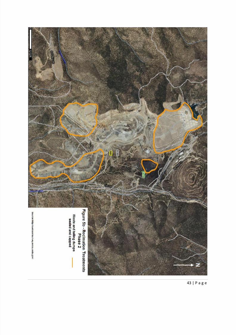
lined waste piles and dumps. These will be capped off during the reclamation phase of the mine. Non-
waste rock based hazardous materials will be handled appropriately during their use to prevent mine
site contamination. At the end of their use, they will be hauled out and managed by a permitted
hazardous waste contractor.
The permit application will include the following information:
General description of the facility
Chemical and physical analyses of the hazardous waste and hazardous debris to be handled
Waste analysis plan
Security procedures
Required equipment
Inspection schedule
Contingency plan
Description of procedures, structures, and equipment used
Description of precautions to prevent accidents
Traffic patterns and volumes
Facility location information regarding seismic standards, faults, floodplain
Training programs
Closure plan
Closure and post-closure cost estimates
Liability
Proof of financial coverage
Facility-specific topographic map
Ground water monitoring data
Identification of the uppermost aquifer and parameters
Ground water monitoring program
Specific information requirements for hazardous waste management units (containers, tank
systems, surface impoundments, waste piles, incinerators, land treatment facilities, landfills,
etc.)
16 Mine Waste Storage
8/13/2019 Final Reclamation Plan1
http://slidepdf.com/reader/full/final-reclamation-plan1 32/49
32 | P a g e
Tailings and mine waste will be managed in an environmentally responsible manner according to
industry standards. Prior to the beginning of production, both the mine dump pile site and the mine
tailings pond will be constructed. Because a portion of the mine site falls on National Forest Service land
(as seen in Figure 2), all plans regarding the location of mine dumps and tailing ponds have been
carefully considered with the collaboration of the National Forest Service.
The mine tailing sites will have a layered system of ground water seepage prevention. This systemconsists of a bottom-most liner, a layer of non-permeable clay, and a layer of rock for filtration and
drainage. No liner will be placed below the mine waste dumps, as the weight of the haul trucks on the
mine dump would render it ineffective. Instead, a water drainage collection system has been put into
place to treat any contaminated water. At the conclusion of mining, a top liner will be situated over the
waste dumps and tailings pond. Both systems will be capped using the layered system consisting of a
liner, clay, rock and lastly a layer of top soil. The returned top soil will be roughened and re-vegetated to
prevent erosion that could expose the waste pile. In addition to erosion control, the vegetation should
absorb much of the rainfall before it can reach the liner to prevent acid rock drainage.
17 Earthwork and Grading
The reclamation goals of the open pit portion of the mine consists of:
Slope restoration to ensure the highwalls are stable and rounded (rather than linear) so that
features appear natural instead of manmade
Preservation and restoration of the topsoil
Final topography with rolling mounds, hills, sinuous contours, chutes, buttresses, and spurs that
blend in with adjacent topography
Effective re-vegetation with multi-species ground cover and trees
Water and erosion control as it pertains to reclamation
These goals will be reached through the following methods:
A combination of blasting and machine re-contouring will decrease the angle of the slopes. These re-
contouring efforts will not be entirely homogenous. The final slope will vary across the pit, so that
natural runoff streams are formed. See figure 5a for affected area.
Top soil will be removed from the surface of the pit and stored for the duration of the mine operations.
Figure 4 displays the area allocated for top soil storage. When the mining portion of the mine life is
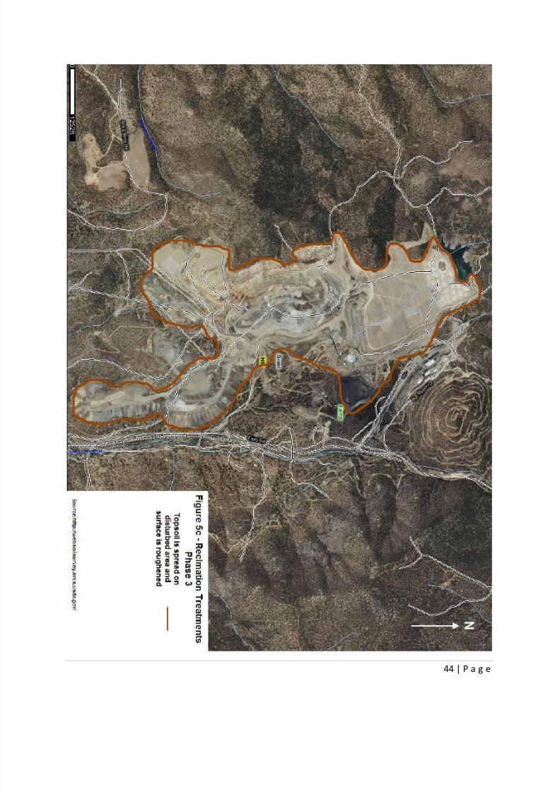
complete and the slopes have been rounded, topsoil will be reintroduced to the new surface. Topsoil
will be spread in the area as shown by figure 5c in the Appendix. This topsoil will be roughened prior to
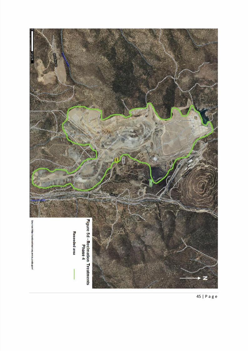
reseeding, so that it is similar in appearance to naturally eroded slopes. Vegetation will be reintroduced
on the newly placed topsoil so that the root systems will “lock-in” with the topsoil to prevent mass
erosion and exposure of waste rock. Figure 5d shows the area of the mine site that will be reseeded. Thebottom of the pit will be lined with a manmade liner that consists of a layer of clay and rocks on top. In
order to prevent the pit from filling with water, a waterway will be drilled from the bottom of the pit
horizontally towards a nearby stream. Figure 5c of the Appendix shows the proposed waterway. This will
allow the pit to properly drain with the small quantity of precipitation received by the area annually.
The waste pile will be re-contoured, so that it is structurally stable and has sufficient drainage paths
across the surface. A liner will cover the waste pile that consists of a layer of clay, rocks, and topsoil to
8/13/2019 Final Reclamation Plan1
http://slidepdf.com/reader/full/final-reclamation-plan1 33/49
33 | P a g e
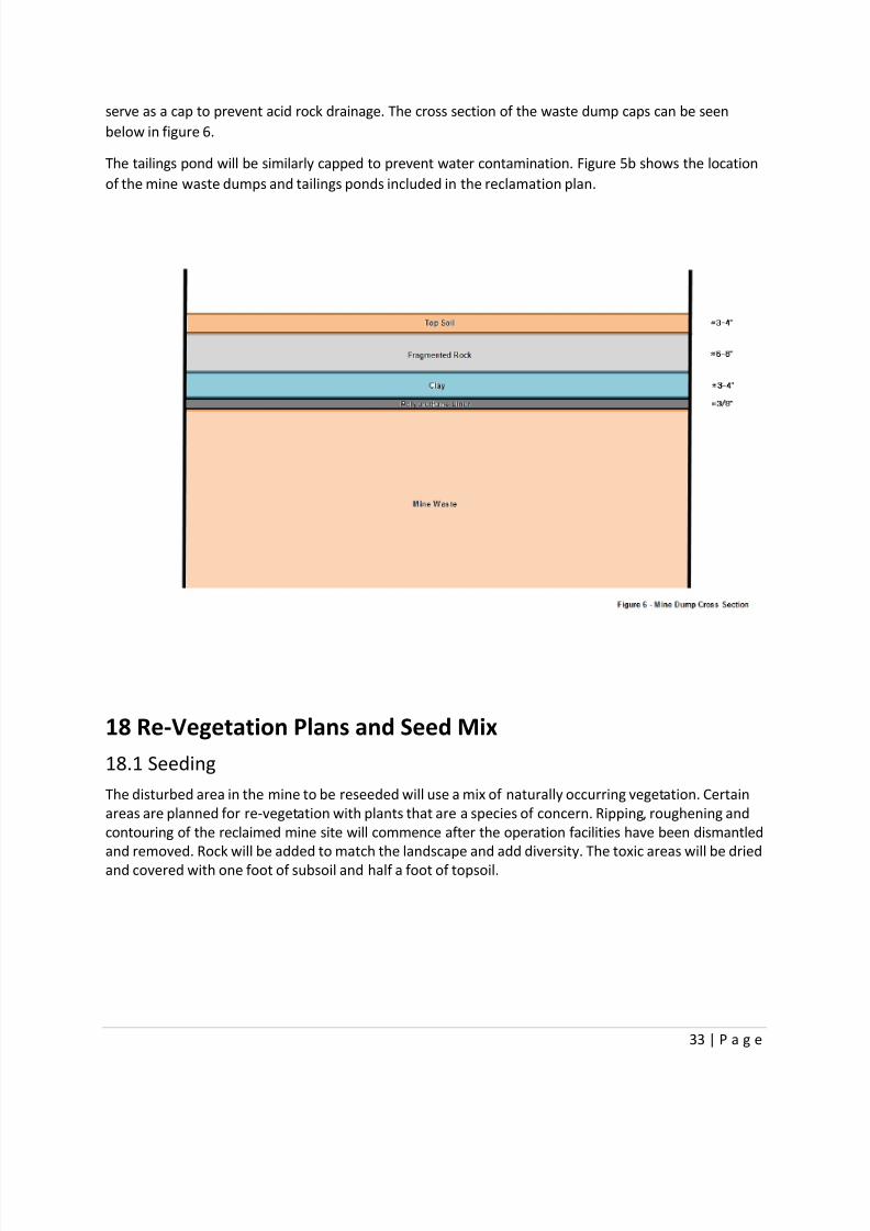
serve as a cap to prevent acid rock drainage. The cross section of the waste dump caps can be seen
below in figure 6.
The tailings pond will be similarly capped to prevent water contamination. Figure 5b shows the location
of the mine waste dumps and tailings ponds included in the reclamation plan.
18 Re-Vegetation Plans and Seed Mix
18.1 Seeding
The disturbed area in the mine to be reseeded will use a mix of naturally occurring vegetation. Certain
areas are planned for re-vegetation with plants that are a species of concern. Ripping, roughening and
contouring of the reclaimed mine site will commence after the operation facilities have been dismantled
and removed. Rock will be added to match the landscape and add diversity. The toxic areas will be dried
and covered with one foot of subsoil and half a foot of topsoil.
8/13/2019 Final Reclamation Plan1
http://slidepdf.com/reader/full/final-reclamation-plan1 34/49
34 | P a g e
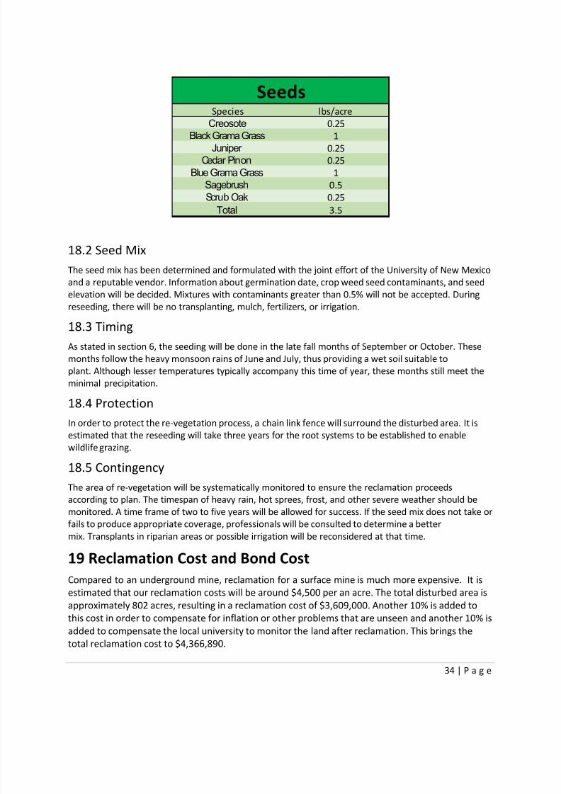
18.2 Seed Mix
The seed mix has been determined and formulated with the joint effort of the University of New Mexico
and a reputable vendor. Information about germination date, crop weed seed contaminants, and seed
elevation will be decided. Mixtures with contaminants greater than 0.5% will not be accepted. During
reseeding, there will be no transplanting, mulch, fertilizers, or irrigation.
18.3 Timing
As stated in section 6, the seeding will be done in the late fall months of September or October. These
months follow the heavy monsoon rains of June and July, thus providing a wet soil suitable to
plant. Although lesser temperatures typically accompany this time of year, these months still meet the
minimal precipitation.
18.4 Protection
In order to protect the re-vegetation process, a chain link fence will surround the disturbed area. It is
estimated that the reseeding will take three years for the root systems to be established to enable
wildlife grazing.
18.5 Contingency
The area of re-vegetation will be systematically monitored to ensure the reclamation proceeds
according to plan. The timespan of heavy rain, hot sprees, frost, and other severe weather should be
monitored. A time frame of two to five years will be allowed for success. If the seed mix does not take or
fails to produce appropriate coverage, professionals will be consulted to determine a better
mix. Transplants in riparian areas or possible irrigation will be reconsidered at that time.
19 Reclamation Cost and Bond CostCompared to an underground mine, reclamation for a surface mine is much more expensive. It is
estimated that our reclamation costs will be around $4,500 per an acre. The total disturbed area is
approximately 802 acres, resulting in a reclamation cost of $3,609,000. Another 10% is added to
this cost in order to compensate for inflation or other problems that are unseen and another 10% is
added to compensate the local university to monitor the land after reclamation. This brings the
total reclamation cost to $4,366,890.
Species lbs/acre
Creosote 0.25
Black Grama Grass 1Juniper 0.25
Cedar Pinon 0.25
Blue Grama Grass 1
Sagebrush 0.5
Scrub Oak 0.25
Total 3.5
Seeds
8/13/2019 Final Reclamation Plan1
http://slidepdf.com/reader/full/final-reclamation-plan1 35/49
35 | P a g e
20 Bond Release
20.1 Mine Life and Waste Rock
The total tonnage of waste rock predicted during the 11 years of mine life will be approximately 84
million tons. The waste dump on the north side will be filled first with an expected six year fill life
and 40 million ton capacity. The dumps on the south side will be filled in the remaining five years of
the mine life. The southwest dump has a 25 million ton capacity and the southeast dump has a 19
million ton capacity.
20.2 Timing
The north waste dump will be reclaimed after six years by capping. The capping of the north dump
will take approximately one year to complete. The re-vegetation and seeding of the area will take
an estimated three years to establish. The lower two dumps will be capped after the mining is
complete at the end of the eleventh year. These dumps will also take one year to cap and three
years to vegetate through a seeding regimen. By the twelfth year, the liner system used for the
tailings pond will be caped on the surface, taking about six months to complete. The mine pit will bere-contoured and prepared for permanent drainage that same year. A drainage pipe will be drilled
and sleeved from the mine pit to a nearby stream in a horizontal direction. The pit will then be
capped with a liner and rock, which will take one year to complete. The bond is set to be released
by the seventeenth year of the mine life, around 2032.
References
Mclemore, Virginia. 2008. Potential for Laramide Porphyry Copper Deposits in Southwestern New
Mexico. New Mexico Bureau of Geology and Mineral Resources, New Mexico Tech, Socorro, NM
87801. http://www.nmenv.state.nm.us/wqcc/documents/ExhibitLande-02.pdfNRCS. Web Soil Survey application. April 9, 2013.
http://websoilsurvey.nrcs.usda.gov/app/WebSoilSurvey.aspx
Silver City Chamber of Commerce. http://www.silvercity.org/precipitation.shtml
U.S. Fish and Wildlife Services. Species Reports.
http://ecos.fws.gov/tess_public/pub/stateListingAndOccurrenceIndividual.jsp?state=NM&s8fid=
112761032792&s8fid=112762573902
Storm247. StormGeo. Houston, Texas. http://www.storm247.com/weather/116910346/climateProject
Vote Smart. New Mexico Special Interest Groups. http://votesmart.org/interest-
groups/NM/#.UXdjQLWfh3U
USACE permit (Section 10 of the Rivers and Harbors Act and/or Section 404*****

8/13/2019 Final Reclamation Plan1
http://slidepdf.com/reader/full/final-reclamation-plan1 36/49
36 | P a g e
Appendix

8/13/2019 Final Reclamation Plan1
http://slidepdf.com/reader/full/final-reclamation-plan1 37/49
37 | P a g e
8/13/2019 Final Reclamation Plan1
http://slidepdf.com/reader/full/final-reclamation-plan1 38/49
38 | P a g e

8/13/2019 Final Reclamation Plan1
http://slidepdf.com/reader/full/final-reclamation-plan1 39/49
39 | P a g e
8/13/2019 Final Reclamation Plan1
http://slidepdf.com/reader/full/final-reclamation-plan1 40/49
40 | P a g e

8/13/2019 Final Reclamation Plan1
http://slidepdf.com/reader/full/final-reclamation-plan1 41/49
41 | P a g e

8/13/2019 Final Reclamation Plan1
http://slidepdf.com/reader/full/final-reclamation-plan1 42/49
42 | P a g e
8/13/2019 Final Reclamation Plan1
http://slidepdf.com/reader/full/final-reclamation-plan1 43/49
43 | P a g e
8/13/2019 Final Reclamation Plan1
http://slidepdf.com/reader/full/final-reclamation-plan1 44/49
44 | P a g e
8/13/2019 Final Reclamation Plan1
http://slidepdf.com/reader/full/final-reclamation-plan1 45/49
45 | P a g e
8/13/2019 Final Reclamation Plan1
http://slidepdf.com/reader/full/final-reclamation-plan1 46/49
46 | P a g e
8/13/2019 Final Reclamation Plan1
http://slidepdf.com/reader/full/final-reclamation-plan1 47/49
47 | P a g e
8/13/2019 Final Reclamation Plan1
http://slidepdf.com/reader/full/final-reclamation-plan1 48/49
48 | P a g e
8/13/2019 Final Reclamation Plan1
http://slidepdf.com/reader/full/final-reclamation-plan1 49/49