FINAL PRESENTATION MacDill Avenue Segment 1FINAL PRESENTATION MacDill Avenue Segment 1 From W El...
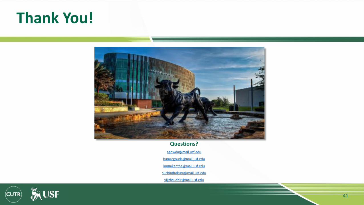
41
FINAL PRESENTATION MacDill Avenue Segment 1 From W El Prado to W Knights Avenue. City of Tampa, Florida. Group 2 Ashwin Manjunath Gowda Kavindra Umakantha Kumar Gouda Patil Suchindra Kumar Mahesh Vijith Sudhirnath Kumbla CGN 6933 Sustainable Transportation Spring 2019 University of South Florida Department of Civil and Environmental Engineering April 18 2019 1
Transcript of FINAL PRESENTATION MacDill Avenue Segment 1FINAL PRESENTATION MacDill Avenue Segment 1 From W El...
FINAL PRESENTATIONMacDill Avenue Segment 1
From W El Prado to W Knights Avenue.City of Tampa, Florida.
Group 2
Ashwin Manjunath Gowda
Kavindra Umakantha
Kumar Gouda Patil
Suchindra Kumar Mahesh
Vijith Sudhirnath Kumbla
CGN 6933 Sustainable Transportation Spring 2019University of South Florida Department of Civil and Environmental EngineeringApril 18 2019
1

SOUTH MACDILL AVENUE OVERVIEW
From El Prado Blvd to West Knight Avenue
2

GOALS AND OBJECTIVES
Goal 1: Enhance safety for all modes of travel
Reduce collisions at intersections up to 80% by 2040.
Eliminate traffic fatalities and serious injuries to achieve vision zero.
Implement traffic calming to induce slower speeds and increase driver awareness by 30% by 2025.
Goal 2: Improve accessibility and mobility for all modes
Improve pedestrian and bicycle facilities to achieve a 100% walkable and bikeable segment by 2040.
Promote modes of transportation other than the automobile.
Promote usage of the bike share and ride share service up to 40% by 2040.
Goal 3: Increase environmental quality and livability of the corridor
Provide street furniture and increase green cover up to 40% by 2040.
Apply green infrastructure and energy harvesting treatments such as solar powered street lights to improve environmental quality and reduce energy consumption up to 70% by 2040.
3
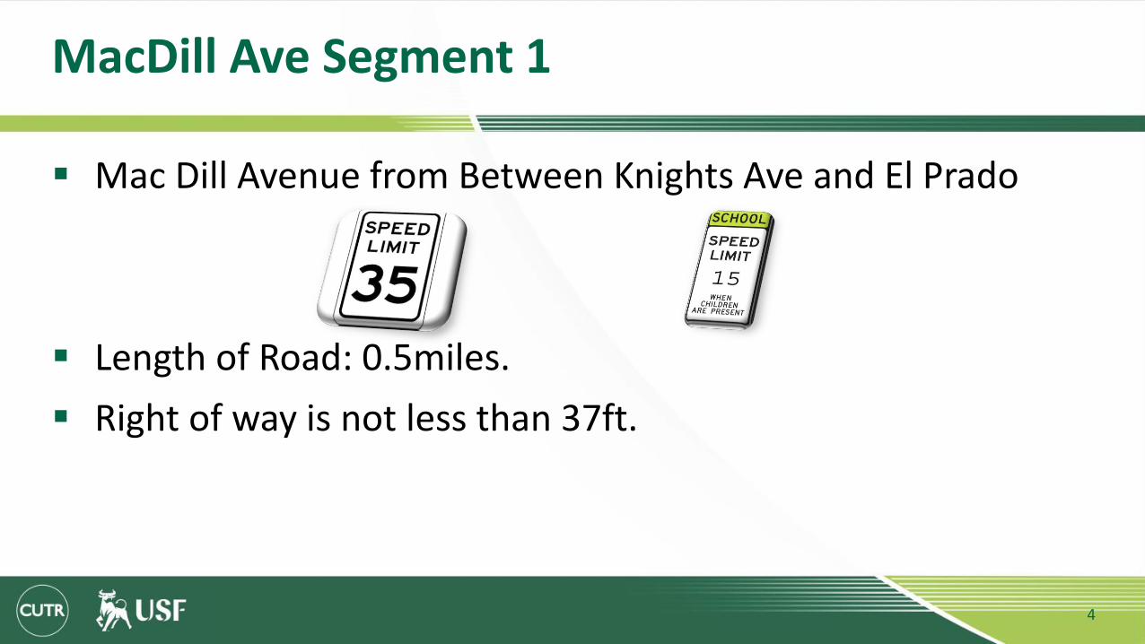
MacDill Ave Segment 1
Mac Dill Avenue from Between Knights Ave and El Prado
Length of Road: 0.5miles.
Right of way is not less than 37ft.
4
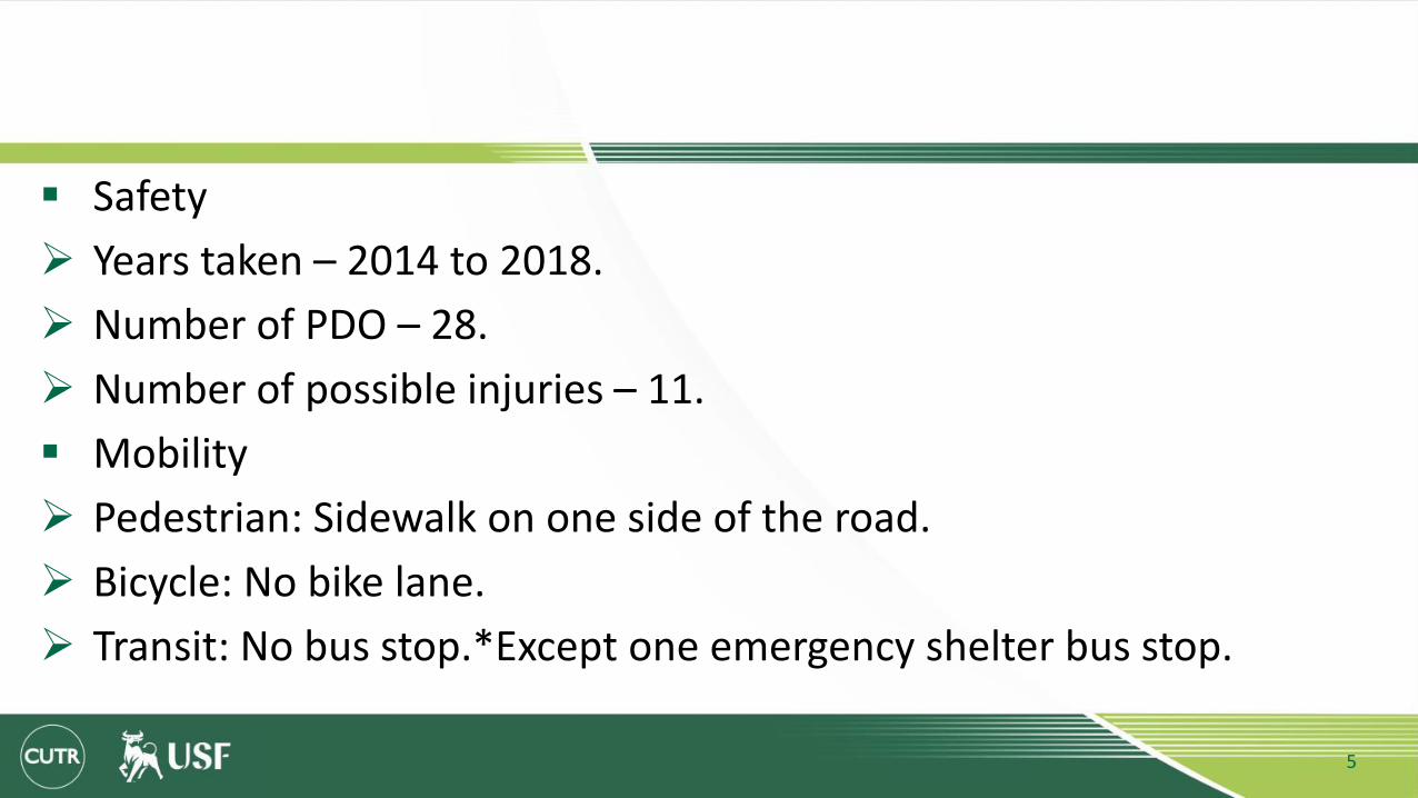
Safety
Years taken – 2014 to 2018.
Number of PDO – 28.
Number of possible injuries – 11.
Mobility
Pedestrian: Sidewalk on one side of the road.
Bicycle: No bike lane.
Transit: No bus stop.*Except one emergency shelter bus stop.
5

ACTIVITY CENTERS- (From W Euclid to W Knight avenue)
1. China Wok.2. Spa Jardin.3. Mad dogs and Englishmen.4. Chihuahua Mexican Grill.5. Flourish Tampa.6. Potting Shed.7. PUSH fitness and performance.8. Majesty Title Services.9. Flirt Wax Bar.10. Edsons barber shop.11. Marathon Gas station.12. Corner Shoppe Tpa.13. Yogurt naturally.14. Bayshore Christian School.15. Bayshore United Methodist Church.16. Lifeline Chiropractic clinic.
6

Annual Average Daily Traffic Counts (Hillsborough County)
County count station: 329210
Road Name: MacDill Ave.
Location description: Bay to Bay Blvd to Gandy Blvd.
Counts: 2014: 14,242
2018: 16,217
7

Annual Average Daily Traffic Counts (FDOT)
Road Name: S MacDill Ave.
From: MacDill AFB Ent/Ext. To: W Kennedy Blvd
AADT: 3100
Roadway: 10000030
County: Hillsborough.
8
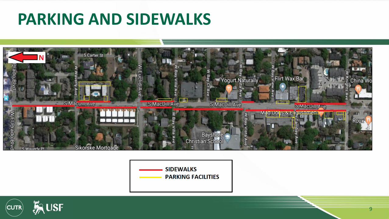
PARKING AND SIDEWALKS
9
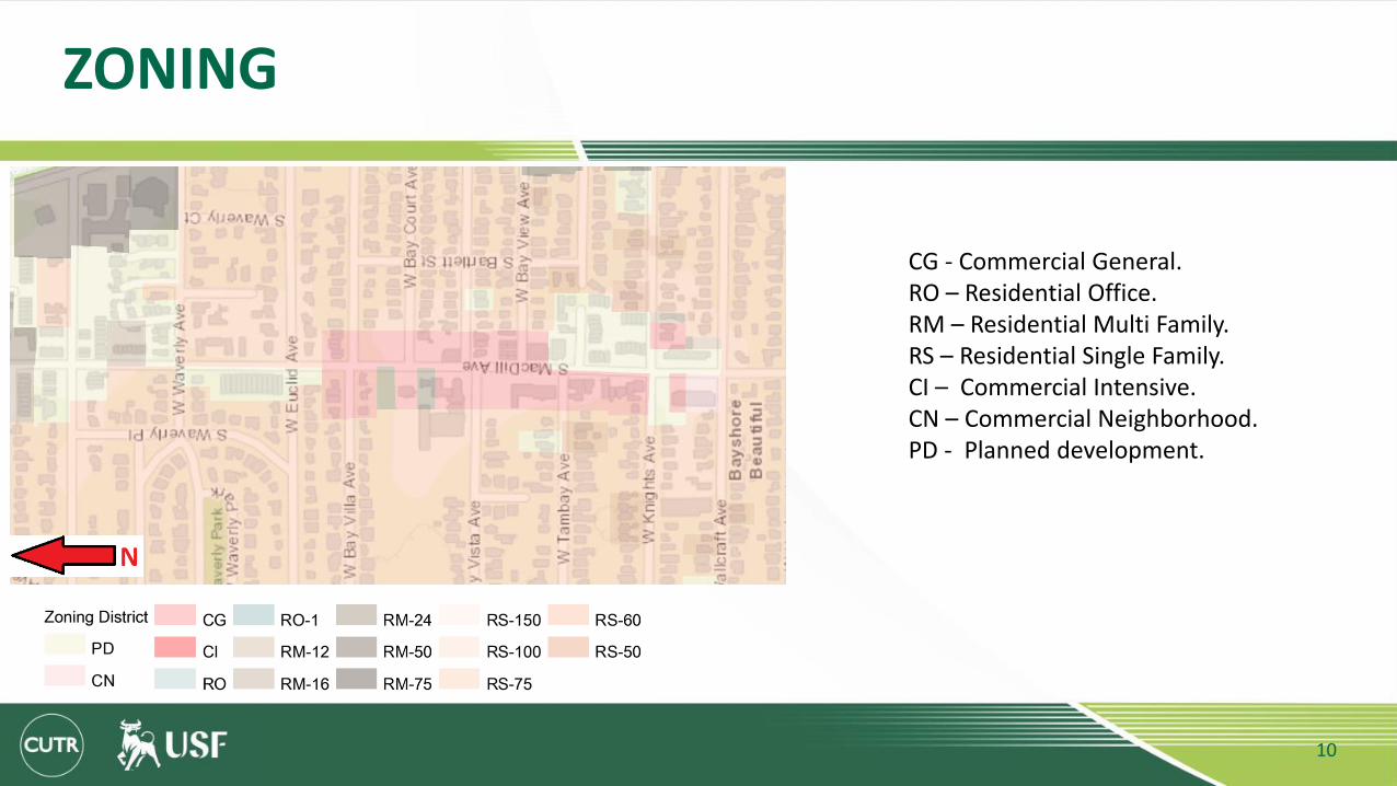
ZONING
CG - Commercial General.RO – Residential Office.RM – Residential Multi Family. RS – Residential Single Family.CI – Commercial Intensive.CN – Commercial Neighborhood.PD - Planned development.
10
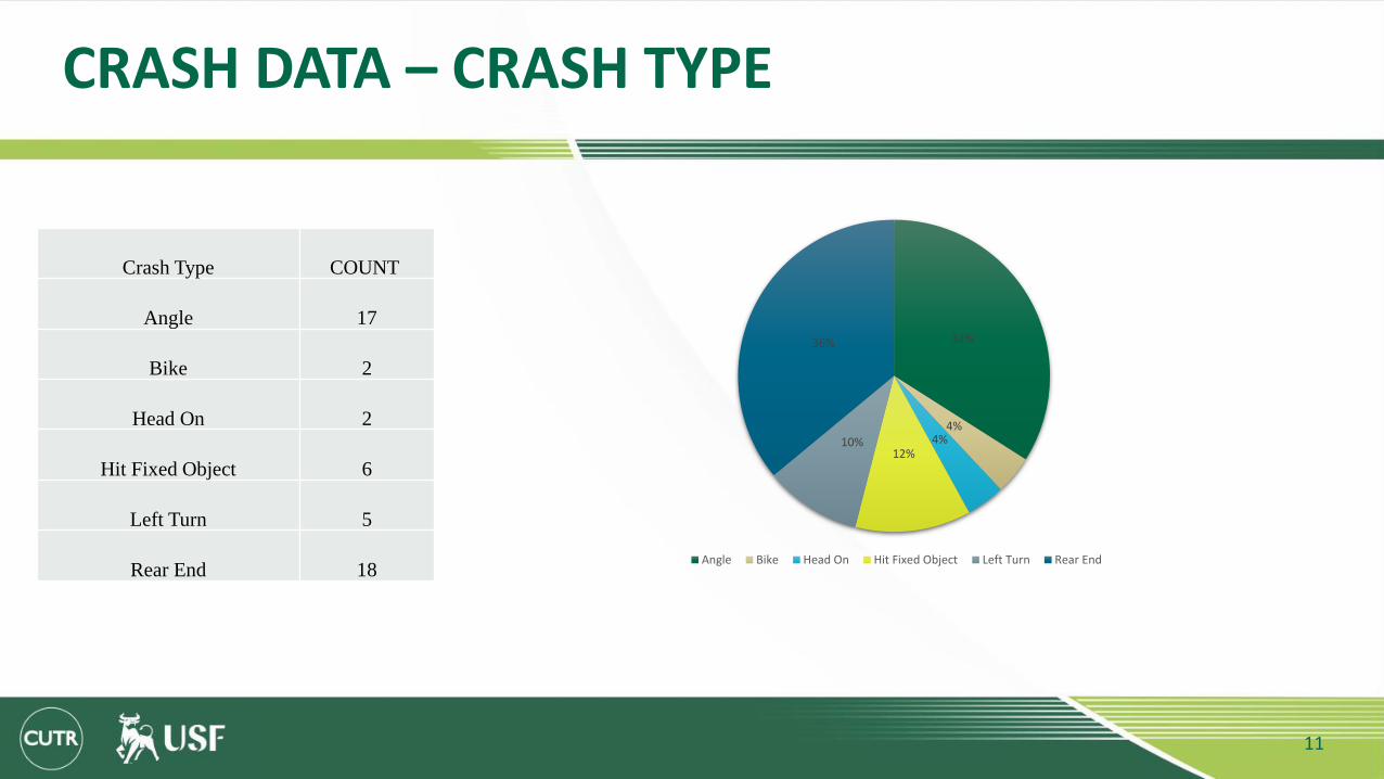
CRASH DATA – CRASH TYPE
Crash Type COUNT
Angle 17
Bike 2
Head On 2
Hit Fixed Object 6
Left Turn 5
Rear End 18
34%
4%4%
12%10%
36%
Angle Bike Head On Hit Fixed Object Left Turn Rear End
11
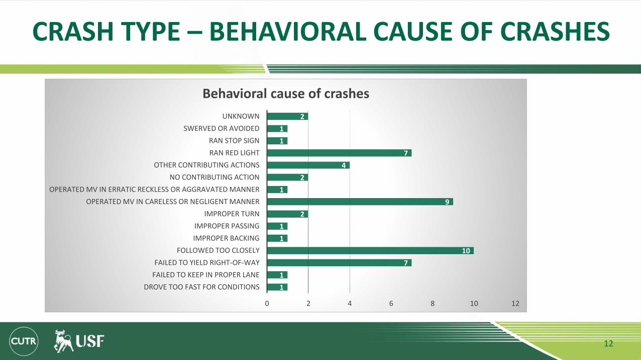
CRASH TYPE – BEHAVIORAL CAUSE OF CRASHES
1
1
7
10
1
1
2
9
1
2
4
7
1
1
2
0 2 4 6 8 10 12
DROVE TOO FAST FOR CONDITIONS
FAILED TO KEEP IN PROPER LANE
FAILED TO YIELD RIGHT-OF-WAY
FOLLOWED TOO CLOSELY
IMPROPER BACKING
IMPROPER PASSING
IMPROPER TURN
OPERATED MV IN CARELESS OR NEGLIGENT MANNER
OPERATED MV IN ERRATIC RECKLESS OR AGGRAVATED MANNER
NO CONTRIBUTING ACTION
OTHER CONTRIBUTING ACTIONS
RAN RED LIGHT
RAN STOP SIGN
SWERVED OR AVOIDED
UNKNOWN
Behavioral cause of crashes
12

CRASHES BY INTERSECTION
17
3
15
0 2 2 2
54
W El-pradoBlvd
W WaverlyAve
W Euclid Ave W Bay villaAve
W Bay Ct Ave W Bay vistaAve
W Bay viewAve
W TambayAve
W Knights Ave
Crashes by Intersection
13
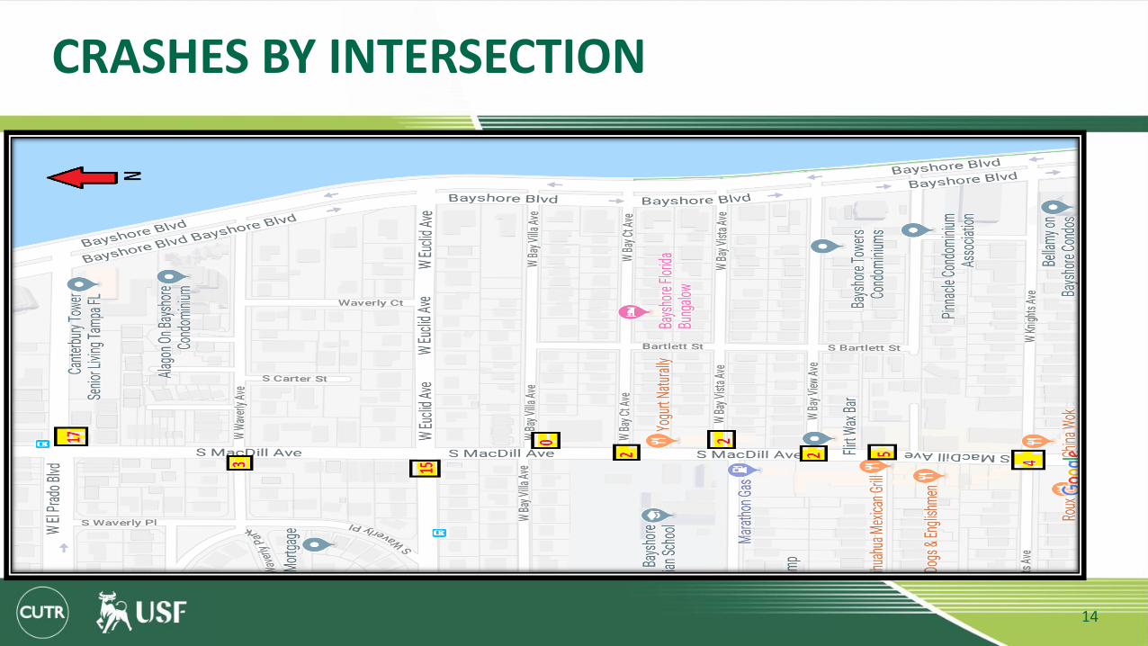
CRASHES BY INTERSECTION
14
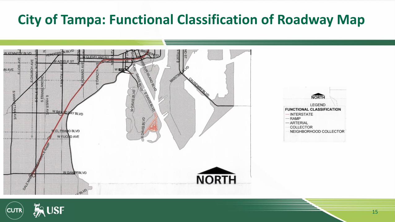
City of Tampa: Functional Classification of Roadway Map
15
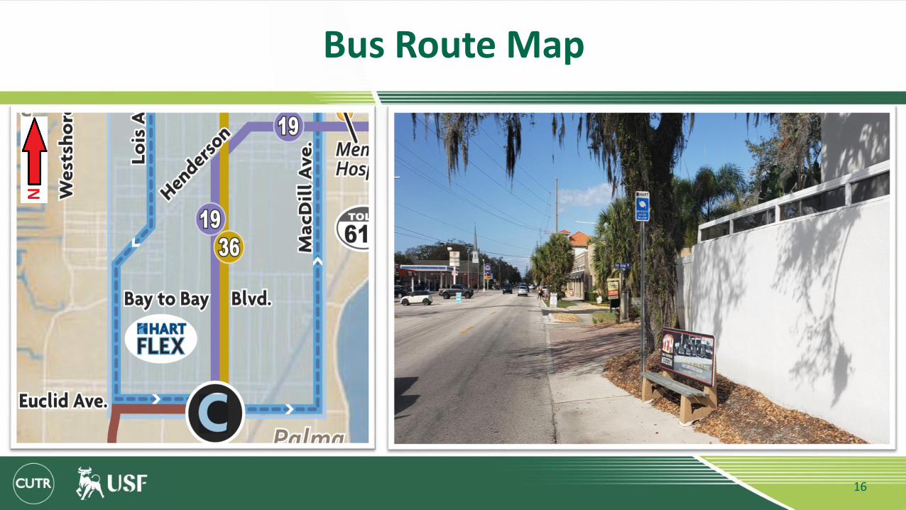
Bus Route Map
16

NEAREST BUS STOPS
1. MacDill Av @ El Prado Blvd.2. Euclid Ave @ Waverly Cir
17
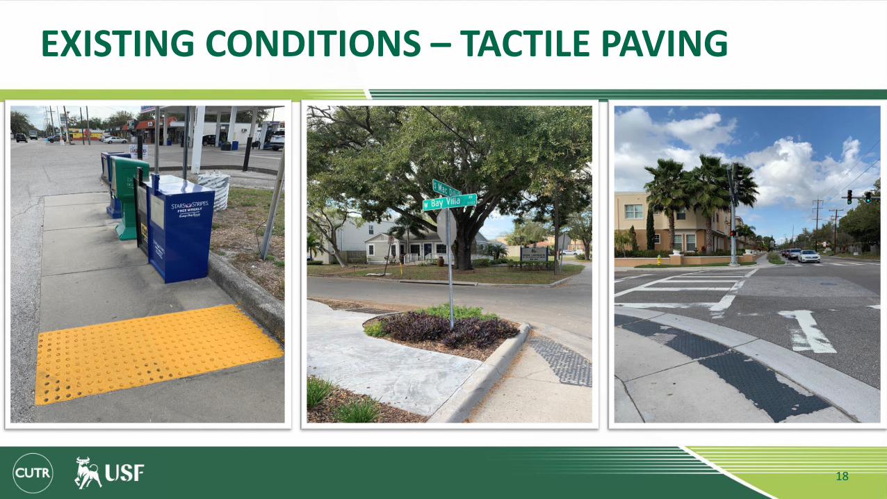
EXISTING CONDITIONS – TACTILE PAVING
18
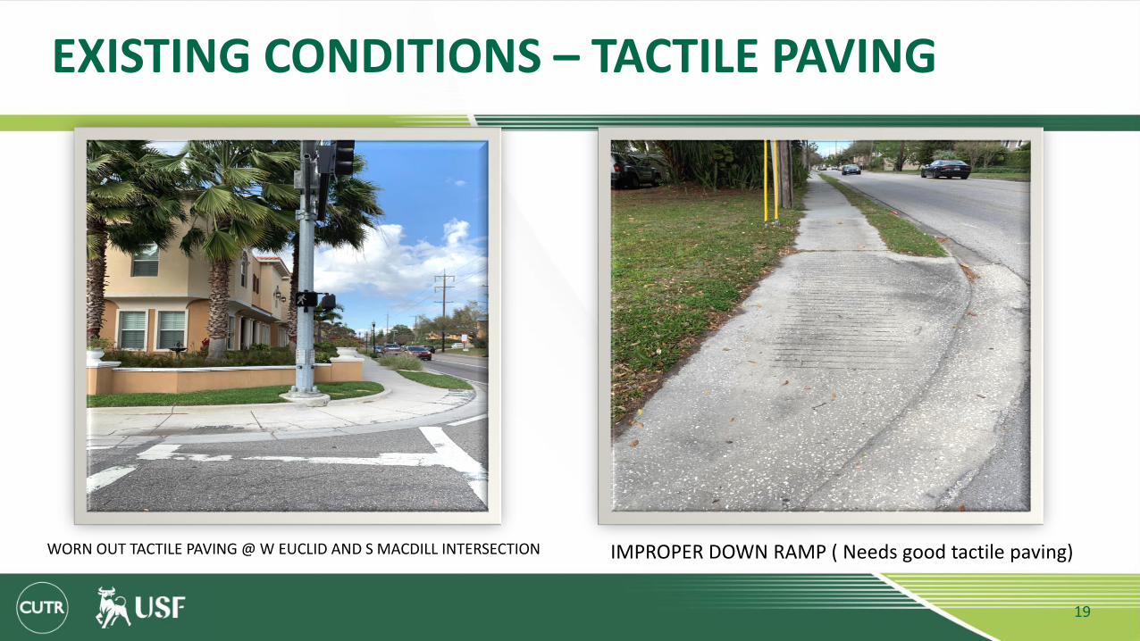
EXISTING CONDITIONS – TACTILE PAVING
WORN OUT TACTILE PAVING @ W EUCLID AND S MACDILL INTERSECTION IMPROPER DOWN RAMP ( Needs good tactile paving)
19

EXISTING CONDITIONS - SIDEWALKS
SIDEWALK BLOCKED BY OVERGROWN BUSHES VEHICLE COVERING THE SIDEWALK SIDEWALK BLOCKED BY NEWSPAPER STANDS
20

EXISTING CONDITIONS - SIDEWALKS
NO SEPERATION BETWEEN ROAD,SIDEWALK AND PARKING RAISED SIDEWALKS
21

EXISTING CONDITIONS - SIDEWALKS
22

Existing Design
23
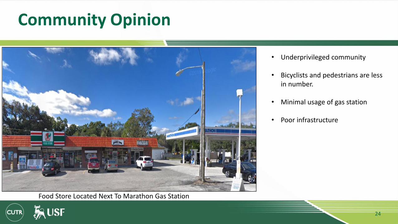
Community Opinion
24
• Underprivileged community
• Bicyclists and pedestrians are less in number.
• Minimal usage of gas station
• Poor infrastructure
Food Store Located Next To Marathon Gas Station

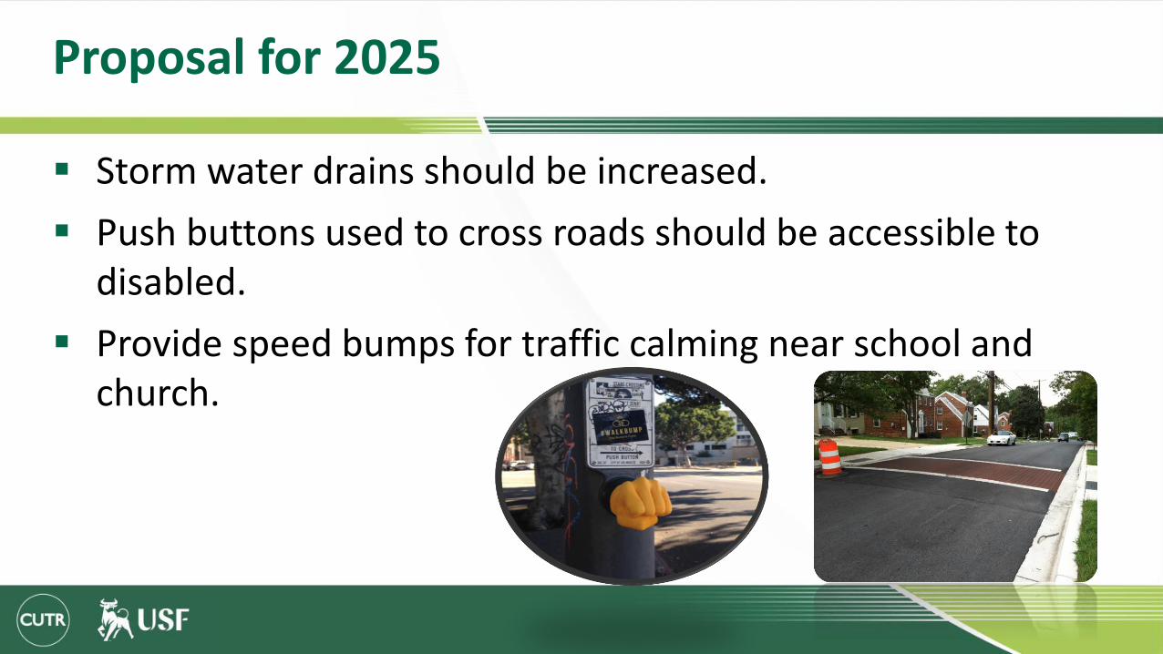
Proposal for 2025
Proper placement of cross walks and stop bars to enhance safety.
Placing Flashing beacons near school zone.
Provide Solar powered lights for crossing.
Provide separate lane for automobile and bicycles.
Dynamic speed limit indication signs to check aggressive drivers.
Proposal for 2025
Storm water drains should be increased.
Push buttons used to cross roads should be accessible to disabled.
Provide speed bumps for traffic calming near school and church.

Proposed plan for 2025
27
• ROW of 37ft
• No acquiring private properties.
• Sufficient width for bicyclists and the pedestrians.
• Solar lighting can be provided.
• 10’ for drive lane to accommodate buses.
• Green markings for bike lanes.
Proposed Plan For 2025
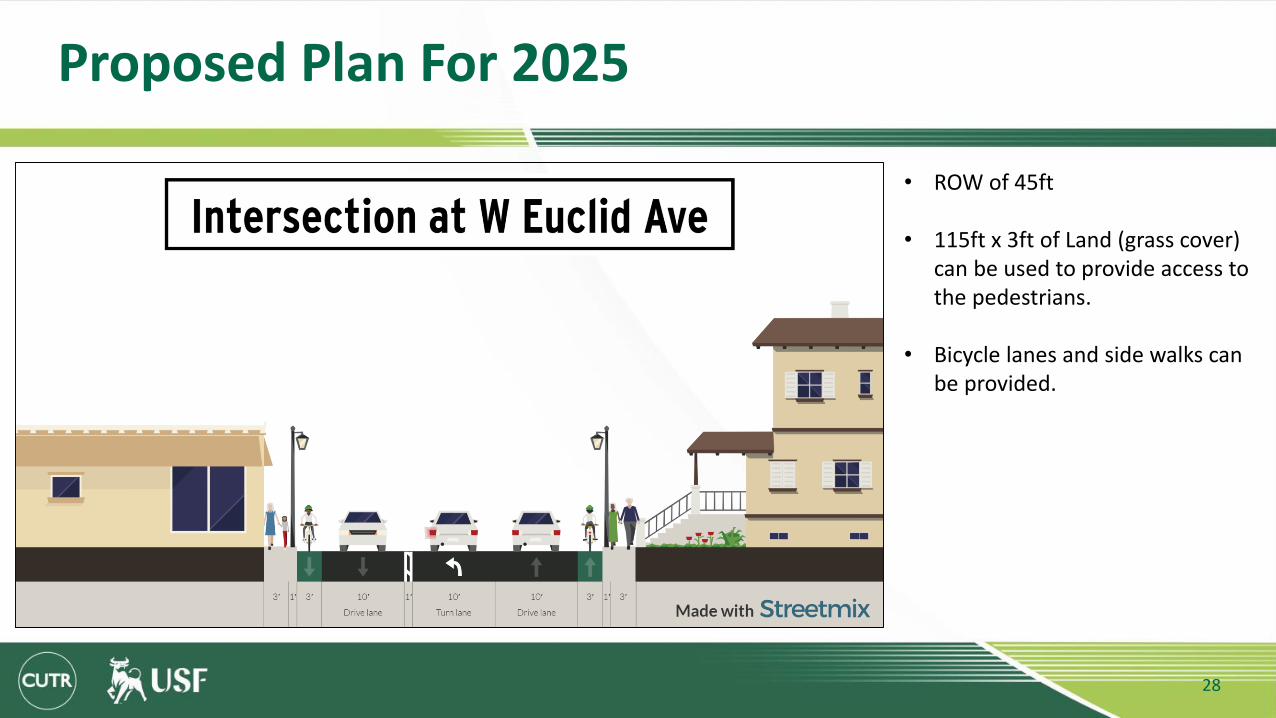
28
• ROW of 45ft
• 115ft x 3ft of Land (grass cover) can be used to provide access to the pedestrians.
• Bicycle lanes and side walks can be provided.

Proposed Plan For 2025
29
<-Existing
Proposed ->
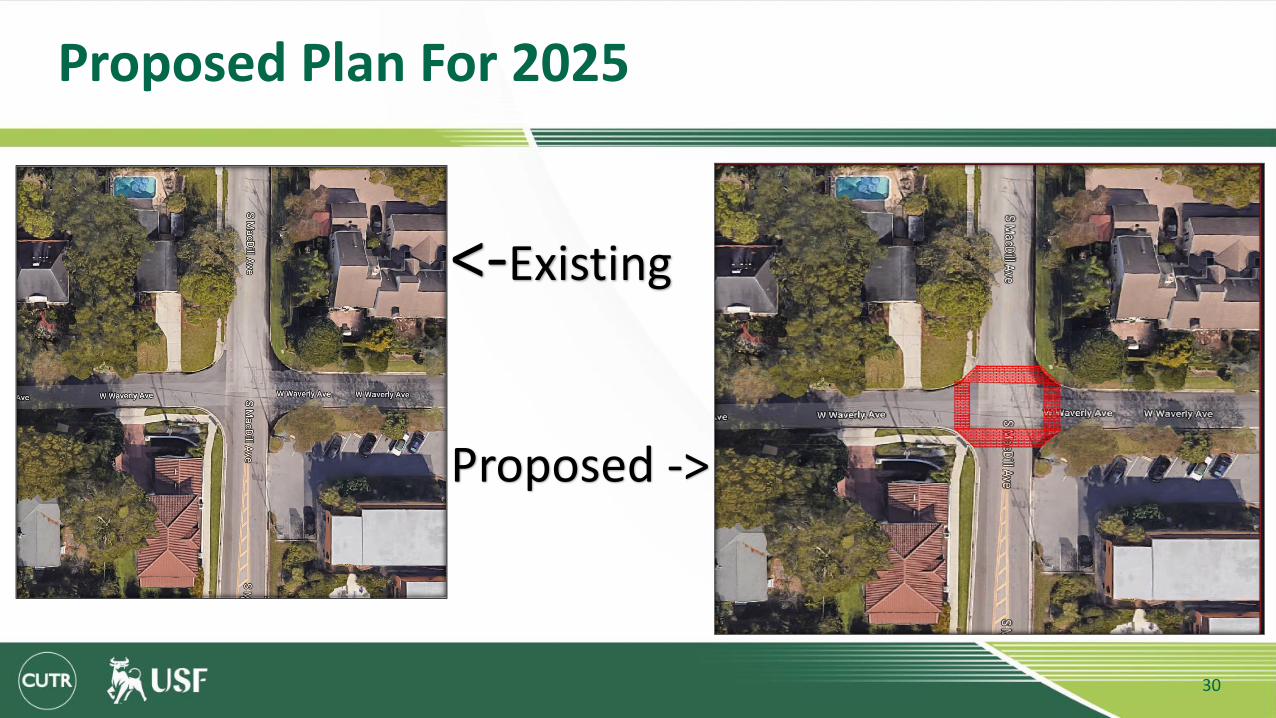
Proposed Plan For 2025
30
<-Existing
Proposed ->

Proposed Plan For 2025
31
<-Existing
Proposed ->

Proposed Plan For 2025
32
<-Existing
Proposed ->
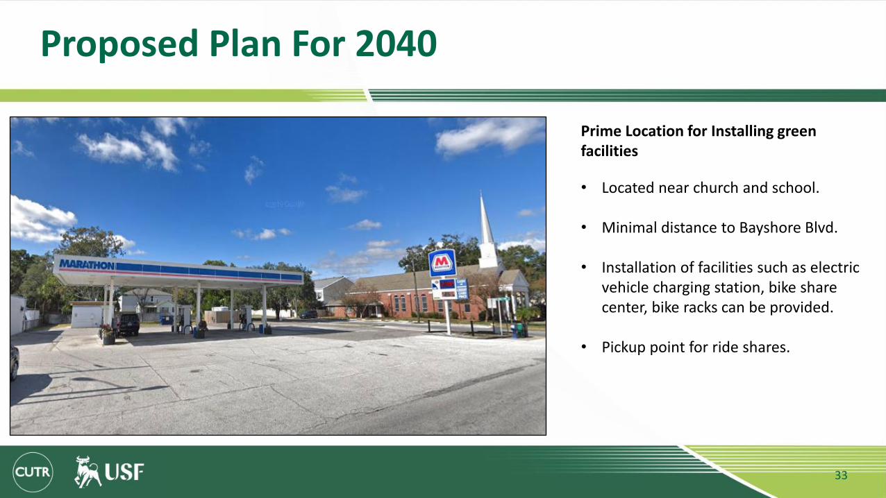
Proposed Plan For 2040
33
• Located near church and school.
• Minimal distance to Bayshore Blvd.
• Installation of facilities such as electric vehicle charging station, bike share center, bike racks can be provided.
• Pickup point for ride shares.
Prime Location for Installing green facilities
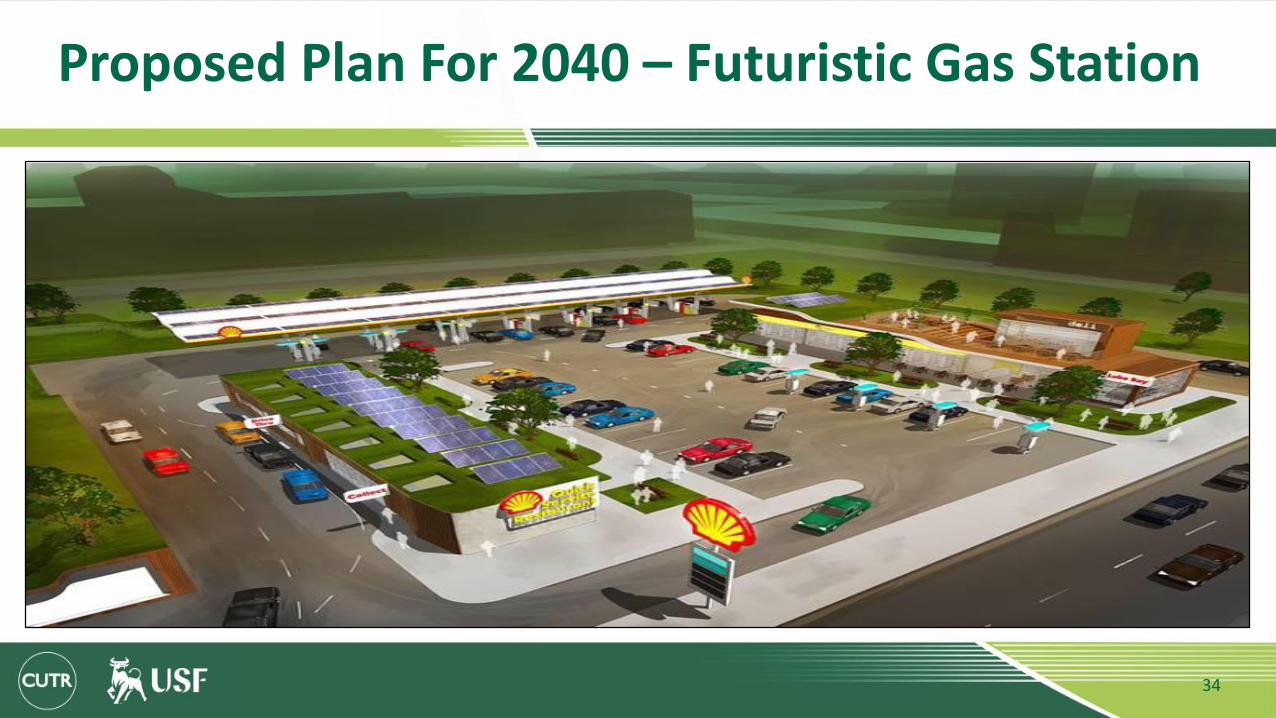
Proposed Plan For 2040 – Futuristic Gas Station
34

Proposed Plan For 2040
35
Solar Powered Bus Stop
• Pollution free
• Low maintenance
• Decrease usage of fossil fuels
• Excessive power can be sold back.
• Facilities such as lighting and power sockets can be provided.
• Safer than electric current

Proposed Plan For 2040
36
Smart Pedestrian Crosswalk
• Increased visibility during night time.
• Low energy consumption
• Auto detection of pedestrians
• Reduce in number of fatalities
• Eco-friendly

Proposed Plan For 2040
37
Solar Trees
• Provides sufficient shade for the pedestrians
• Generated energy can be used for lighting purposes
• Increases the aesthetic value while decreasing usage of electricity.
Proposed Plan For 2040
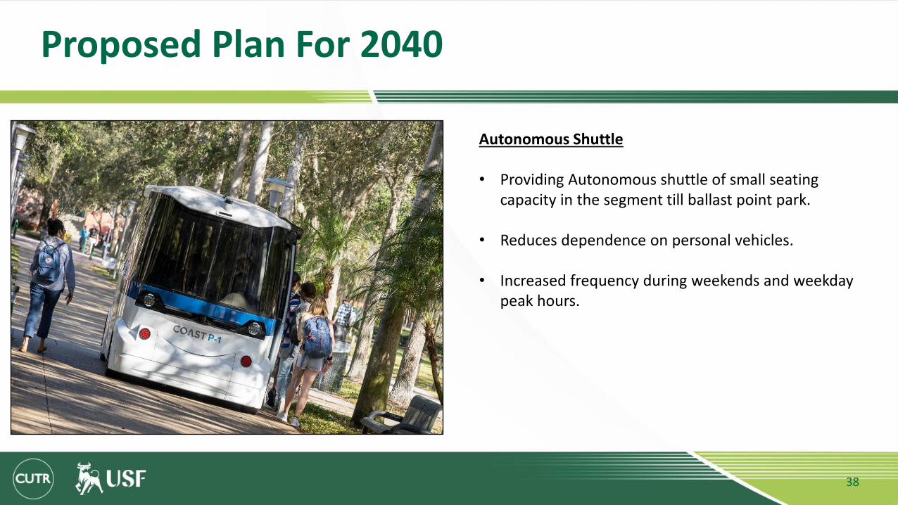
38
Autonomous Shuttle
• Providing Autonomous shuttle of small seating capacity in the segment till ballast point park.
• Reduces dependence on personal vehicles.
• Increased frequency during weekends and weekday peak hours.

Proposal for 2040
39
1. Raise the intersections to create a safe, slow-speed intersection.
2. Add curb extensions to increase the pedestrian space.
3. Use bollards or street furniture to prevent vehicles from invading the pedestrian space.
4. Design corners with the smallest constructible radius, approximately 0.6 m.
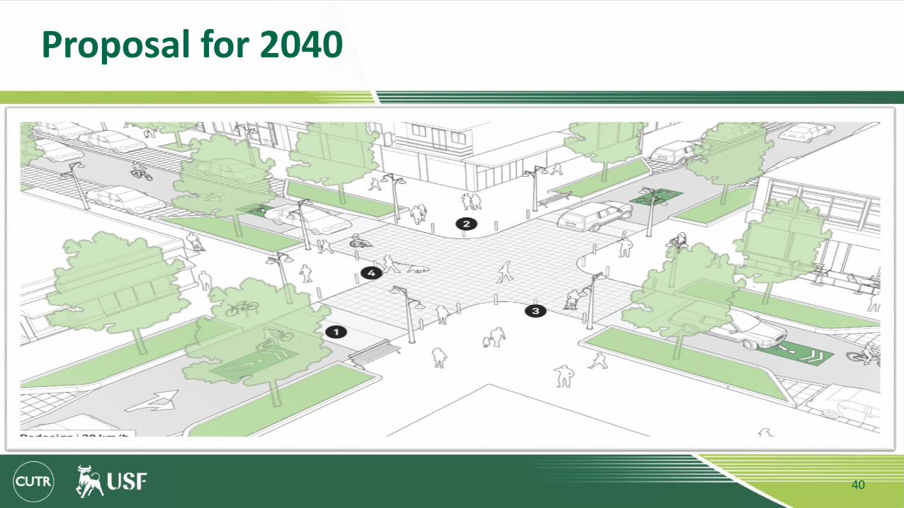
Proposal for 2040
40