FIELD SURVEY METHODOLOGY - epa.wa.gov.au
12
1 11 November 2019 Our ref: 4484-19R1 draft Malleefowl Monitoring Field Report Shane McAdams Specialist Biological Science Covalent Lithium L18, 109 St Georges Tce PERTH WA 6000 Dear Shane COVALENT MALLEEFOWL MONITORING Ecoscape staff Bruce Turner and Melinda Henderson, Covalent Lithium staff Shaun McAdams and Brigitta Longbottom and Carl Danzi from the National Malleefowl Recovery Team (NRMT) undertook Malleefowl mound monitoring at the Mt Holland Lithium Project during 14-23 October 2019. Carl Danzi provided training services in NMRT data collection standards for the field team. The purpose of this field survey was to train Ecoscape and Covalent staff in the NMRT monitoring standards and procedures for Malleefowl mounds, and to collect monitoring data on all mounds within the development envelope. This is to enable future annual monitoring of mounds which occur within the Development Envelope and local area by NRMT-trained personnel. Trail cameras were mounted at mounds which were currently active or had evidence of recent activity. Some ground truthing of LiDAR results was undertaken opportunistically when potential mounds were within the vicinity of mound searches. Recommendations have been made with respect to future monitoring and management of Malleefowl within the development envelope of the project. FIELD SURVEY METHODOLOGY Mounds previously identified in a targeted Level 2 survey in 2016/17 were revisited (Western Wildlife 2017) (Map 1). The team, with guidance from Carl Danzi, assessed each of these mounds to determine signs of current activity and the term of monitoring which each mound should receive in future events e.g. annually, 5 yearly monitoring or do not monitor. At each mound a series of criteria was addressed as stated in section three of the NRMT Monitoring Manual (add reference). Each mound was recorded as either active or inactive and given a mound profile. A series of measurements and observations were taken and recorded on an android device running the CyberTracker application (provided by NRMT). Mounds were marked with a numbered star picket, photographed and cross sticks were left in place for future monitoring events. A 20 m radius was searched around active mounds only for any signs of predation. At the end of each day data collected was downloaded and verified by the NRMT representative.
Transcript of FIELD SURVEY METHODOLOGY - epa.wa.gov.au
1
11 November 2019
Our ref: 4484-19R1 draft Malleefowl Monitoring Field Report
Shane McAdams
Specialist Biological Science
Covalent Lithium
L18, 109 St Georges Tce
PERTH WA 6000
Dear Shane
COVALENT MALLEEFOWL MONITORING
Ecoscape staff Bruce Turner and Melinda Henderson, Covalent Lithium staff Shaun McAdams and Brigitta Longbottom
and Carl Danzi from the National Malleefowl Recovery Team (NRMT) undertook Malleefowl mound monitoring at the
Mt Holland Lithium Project during 14-23 October 2019. Carl Danzi provided training services in NMRT data collection
standards for the field team.
The purpose of this field survey was to train Ecoscape and Covalent staff in the NMRT monitoring standards and
procedures for Malleefowl mounds, and to collect monitoring data on all mounds within the development envelope.
This is to enable future annual monitoring of mounds which occur within the Development Envelope and local area
by NRMT-trained personnel.
Trail cameras were mounted at mounds which were currently active or had evidence of recent activity. Some ground
truthing of LiDAR results was undertaken opportunistically when potential mounds were within the vicinity of mound
searches.
Recommendations have been made with respect to future monitoring and management of Malleefowl within the
development envelope of the project.
FIELD SURVEY METHODOLOGY
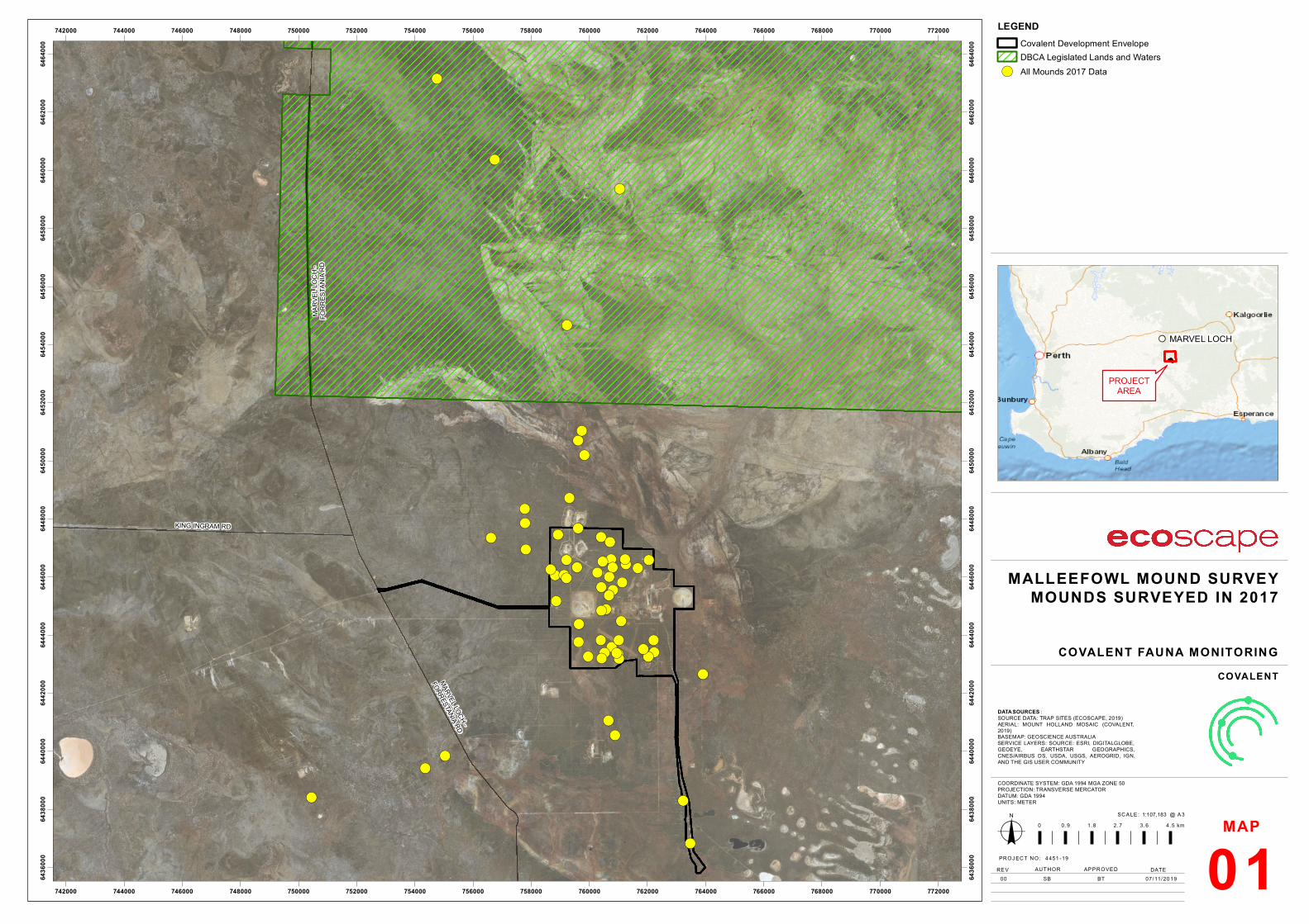
Mounds previously identified in a targeted Level 2 survey in 2016/17 were revisited (Western Wildlife 2017) (Map 1).
The team, with guidance from Carl Danzi, assessed each of these mounds to determine signs of current activity and
the term of monitoring which each mound should receive in future events e.g. annually, 5 yearly monitoring or do
not monitor.
At each mound a series of criteria was addressed as stated in section three of the NRMT Monitoring Manual (add
reference). Each mound was recorded as either active or inactive and given a mound profile. A series of
measurements and observations were taken and recorded on an android device running the CyberTracker application
(provided by NRMT). Mounds were marked with a numbered star picket, photographed and cross sticks were left in
place for future monitoring events. A 20 m radius was searched around active mounds only for any signs of predation.
At the end of each day data collected was downloaded and verified by the NRMT representative.
2
SURVEY RESULTS
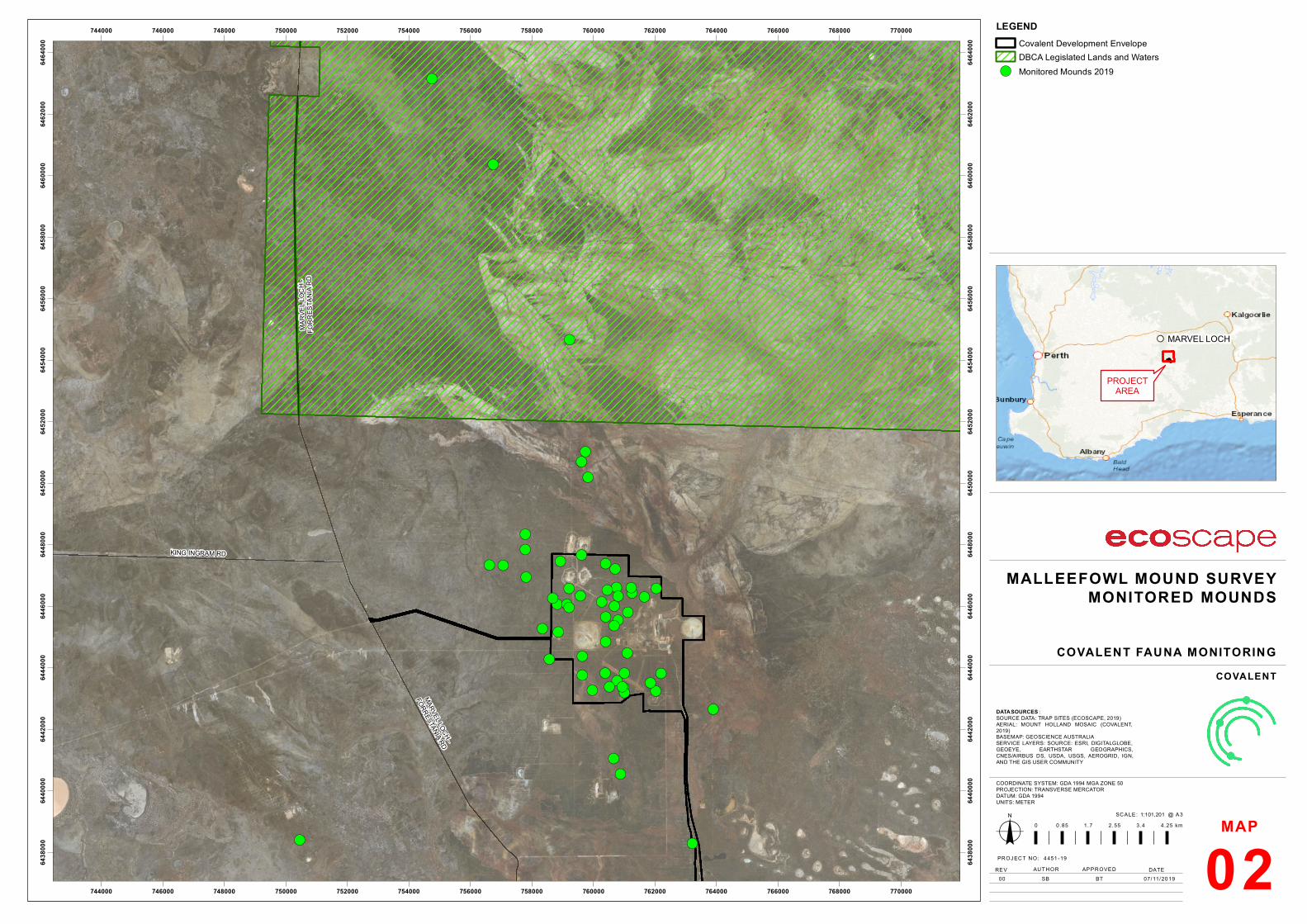
A total of 57 Malleefowl mounds were monitored over the course of the survey period; 43 of these were within the
development envelope (Table 1; Map 2). Three mounds (MM14, MM15, MM20) were not visited due to access and
time constraints. Mounds MM14 and MM15 are located close to the Van Uden pit and MM20 is in Jilbadji NR. An
additional three new mounds were discovered through ground truthing of preliminary LiDAR data (MM63, MM64,
MM65); mound MM63 is within the development envelope.
A total of 39 cameras were placed at active mounds and mounds which had been active within the past 5 years, with
31 of these within the development envelope (Table 2; Map 3).
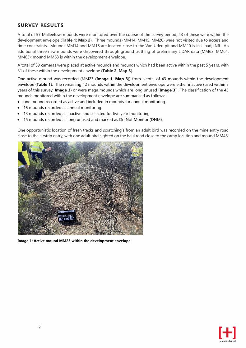
One active mound was recorded (MM23 (Image 1; Map 3)) from a total of 43 mounds within the development
envelope (Table 1). The remaining 42 mounds within the development envelope were either inactive (used within 5
years of this survey; Image 3) or were mega mounds which are long unused (Image 3). The classification of the 43
mounds monitored within the development envelope are summarised as follows:
• one mound recorded as active and included in mounds for annual monitoring
• 15 mounds recorded as annual monitoring
• 13 mounds recorded as inactive and selected for five year monitoring
• 15 mounds recorded as long unused and marked as Do Not Monitor (DNM).
One opportunistic location of fresh tracks and scratching’s from an adult bird was recorded on the mine entry road
close to the airstrip entry, with one adult bird sighted on the haul road close to the camp location and mound MM48.
Image 1: Active mound MM23 within the development envelope
3
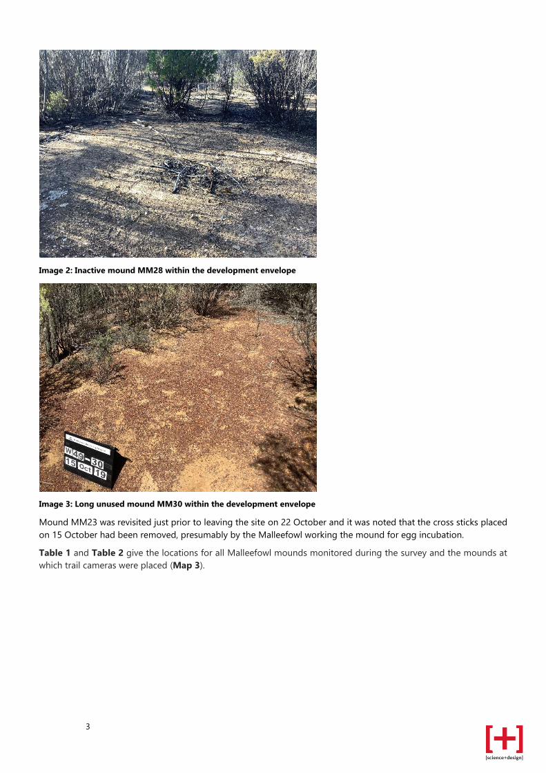
Image 2: Inactive mound MM28 within the development envelope
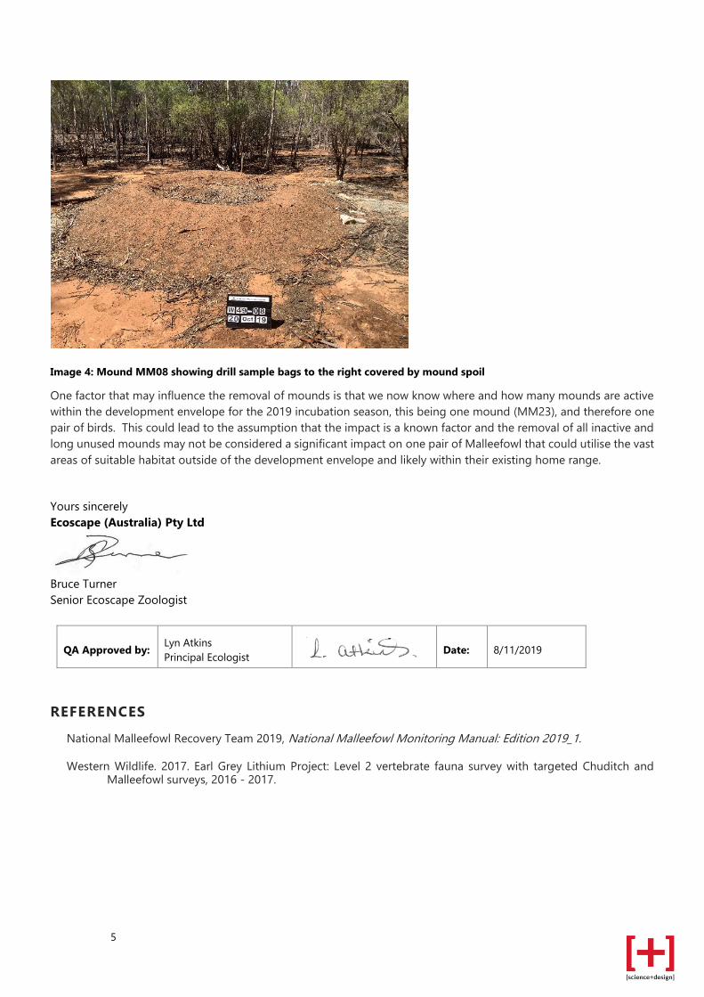
Image 3: Long unused mound MM30 within the development envelope
Mound MM23 was revisited just prior to leaving the site on 22 October and it was noted that the cross sticks placed
on 15 October had been removed, presumably by the Malleefowl working the mound for egg incubation.
Table 1 and Table 2 give the locations for all Malleefowl mounds monitored during the survey and the mounds at
which trail cameras were placed (Map 3).

4
RECOMMENDATIONS
These recommendations are made without knowledge of the possible conditions of approval and pertain to
monitoring of the likely Malleefowl population within the overall project area and are aligned with the guidelines of
the NMRT Monitoring Manual (2019). Monitoring of mounds both within and outside of the development envelope
may provide insight on the number of birds breeding and foraging that may be impacted by potential clearing activity.
To provide Malleefowl population health and abundance data the following aspects are recommended to be
monitored annually:
• Trail camera monitoring during the egg incubation season (September to January) of all Malleefowl mounds that
have been identified as annual, within and adjacent to the development envelope. Each active mound (i.e. a
mound that has Malleefowl images recorded) indicates one breeding pair.
• Implement agreed buffer zone around active mounds and update Covalent GIS data.
• Maintain database of Malleefowl sightings within a fauna register and report annually on number and location of
active mounds.
• Collate image data and report on status of all monitored mounds.
• Collate and report on records of sightings of feral predators and images captured on trail cameras at the
monitored mounds.
• Complete ground truthing of LiDAR data within the development envelope.
• Commence development of a procedure for removal of mounds.
The recommendation for development of a mound removal procedure is dependent on approval from relevant
regulators and is likely to be restricted to February to August once active mounds are no longer producing hatchlings.
Ecoscape is hopeful that inactive and long unused mounds could be approved for removal at any time of the year. It
should be noted that Malleefowl have been recorded as using inactive and long unused mounds to commence new
mounds and is the reason that NMRT stipulate that all mounds should be monitored without exception.
Mitigation measures that could be implemented for mound removal could be achieved by the following;
• spoil from removed mounds could be used to create potential mounds in areas outside of the development
envelope and should be monitored accordingly. A number of recorded mounds showed evidence that spoil piles
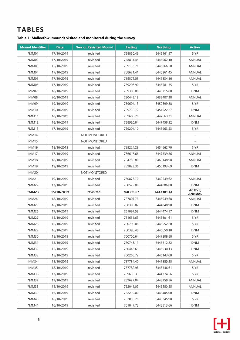
from previous drill line clearing had been utilised by Malleefowl to build mounds. An example is mound MM08
in the Van Uden area that showed the mound had been built over drilling sample bags (Image 4).
• implement an annual fox and cat baiting program around the development envelope to control feral predators
• commit to future monitoring of mounds adjacent to the development envelope to provide evidence of continued
presence of Malleefowl.
5
Image 4: Mound MM08 showing drill sample bags to the right covered by mound spoil
One factor that may influence the removal of mounds is that we now know where and how many mounds are active
within the development envelope for the 2019 incubation season, this being one mound (MM23), and therefore one
pair of birds. This could lead to the assumption that the impact is a known factor and the removal of all inactive and
long unused mounds may not be considered a significant impact on one pair of Malleefowl that could utilise the vast
areas of suitable habitat outside of the development envelope and likely within their existing home range.
Yours sincerely
Ecoscape (Australia) Pty Ltd
Bruce Turner
Senior Ecoscape Zoologist
QA Approved by: Lyn Atkins
Principal Ecologist Date: 8/11/2019
REFERENCES
National Malleefowl Recovery Team 2019, National Malleefowl Monitoring Manual: Edition 2019_1.
Western Wildlife. 2017. Earl Grey Lithium Project: Level 2 vertebrate fauna survey with targeted Chuditch and Malleefowl surveys, 2016 - 2017.
6
TABLES Table 1: Malleefowl mounds visited and monitored during the survey
Mound Identifier Date New or Revisited Mound Easting Northing Action
*MM01 17/10/2019 revisited 758850.46 6445161.57 5 YR
*MM02 17/10/2019 revisited 758814.45 6446062.10 ANNUAL
*MM03 15/10/2019 revisited 759133.71 6446066.50 ANNUAL
*MM04 17/10/2019 revisited 758671.41 6446261.45 ANNUAL
*MM05 17/10/2019 revisited 759571.05 6446334.56 ANNUAL
*MM06 17/10/2019 revisited 759206.90 6446581.35 5 YR
MM07 18/10/2019 revisited 759306.00 6448715.00 DNM
MM08 20/10/2019 revisited 750445.19 6438407.38 ANNUAL
MM09 19/10/2019 revisited 759604.13 6450699.88 5 YR
MM10 19/10/2019 revisited 759730.72 6451022.27 DNM
*MM11 18/10/2019 revisited 759608.78 6447663.71 ANNUAL
*MM12 18/10/2019 revisited 758920.84 6447458.32 DNM
*MM13 17/10/2019 revisited 759204.10 6445963.53 5 YR
MM14 NOT MONITORED -
MM15 NOT MONITORED -
MM16 19/10/2019 revisited 759224.28 6454662.70 5 YR
MM17 17/10/2019 revisited 756616.66 6447339.36 ANNUAL
MM18 18/10/2019 revisited 754750.80 6463148.98 ANNUAL
MM19 19/10/2019 revisited 759823.36 6450193.69 DNM
MM20 NOT MONITORED -
MM21 19/10/2019 revisited 760873.70 6440549.62 ANNUAL
*MM22 17/10/2019 revisited 760572.00 6444886.00 DNM
*MM23 15/10/2019 revisited 760393.67 6447381.41 ACTIVE; ANNUAL
MM24 18/10/2019 revisited 757807.78 6446949.68 ANNUAL
*MM25 16/10/2019 revisited 760398.02 6444848.90 DNM
*MM26 17/10/2019 revisited 761097.59 6444474.57 DNM
*MM27 15/10/2019 revisited 761651.63 6446301.61 5 YR
*MM28 16/10/2019 revisited 760796.08 6445552.20 5 YR
*MM29 16/10/2019 revisited 760398.40 6445650.18 DNM
*MM30 15/10/2019 revisited 760706.64 6447208.88 5 YR
*MM31 15/10/2019 revisited 760743.19 6446612.82 DNM
*MM32 15/10/2019 revisited 760446.63 6446530.13 DNM
*MM33 15/10/2019 revisited 760265.72 6446143.08 5 YR
MM34 18/10/2019 revisited 757784.40 6447850.35 ANNUAL
MM35 18/10/2019 revisited 757782.98 6448346.61 5 YR
*MM36 17/10/2019 revisited 759630.33 6444374.56 5 YR
*MM37 17/10/2019 revisited 759627.84 6443759.56 ANNUAL
*MM38 15/10/2019 revisited 762041.07 6446580.55 ANNUAL
*MM39 16/10/2019 revisited 762219.00 6443405.00 DNM
*MM40 16/10/2019 revisited 762018.78 6443245.98 5 YR
*MM41 16/10/2019 revisited 761847.73 6443513.66 DNM

7
Mound Identifier Date New or Revisited Mound Easting Northing Action
*MM42 15/10/2019 revisited 760380.82 6443823.55 ANNUAL
*MM43 15/10/2019 revisited 760762.25 6443581.31 ANNUAL
MM44 18/10/2019 revisited 756735.09 6460365.86 DNM
*MM45 16/10/2019 revisited 760667.08 6445368.62 DNM
*MM46 15/10/2019 revisited 760796.61 6446325.78 5 YR
*MM47 15/10/2019 revisited 760678.55 6446002.24 ANNUAL
*MM48 15/10/2019 revisited 761113.91 6445807.59 DNM
*MM49 18/10/2019 revisited 763460.00 6436828.00 DNM
*MM50 15/10/2019 revisited 761250.79 6446432.87 5 YR
*MM51 15/10/2019 revisited 761222.70 6446607.56 5 YR
*MM52 16/10/2019 revisited 759958.90 6443272.68 DNM
*MM53 16/10/2019 revisited 760983.09 6443348.36 ANNUAL
*MM54 15/10/2019 revisited 761003.17 6443827.19 5 YR
*MM55 16/10/2019 revisited 760510.32 6443384.60 DNM
*MM56 16/10/2019 revisited 761001.85 6443190.01 ANNUAL
MM57 18/10/2019 revisited 763891.58 6442652.82 ANNUAL
MM58 19/10/2019 revisited 760649.57 6441052.37 ANNUAL
*MM59 16/10/2019 revisited 760416.00 6443199.00 DNM
*MM60 16/10/2019 revisited 760934.21 6443386.15 ANNUAL
MM61 18/10/2019 revisited 763216.78 6438292.68 ANNUAL
*MM62 16/10/2019 revisited 762197.18 6443821.82 ANNUAL
MM63 17/10/2019 new 757062.49 6447330.29 ANNUAL
MM64 18/10/2019 new 758558.64 6444285.37 ANNUAL
MM65 18/10/2019 new 758336.65 6445274.99 ANNUAL
*= Inside Development Envelope; DNM = Do Not Monitor; 5 YR = placed on 5 year monitoring list; Annual =
monitored each year.
Table 2: Trail camera locations at Malleefowl mounds
Mound Identifier Camera Identifier Date Set Easting Northing
*MM01 MC55 17/10/2019 759624.44 6443755.08
*MM02 MC69 17/10/2019 760680.94 6446001.77
*MM03 MC41 15/10/2019 756617.76 6447338.97
*MM04 MC38 17/10/2019 759204.53 6445963.16
*MM05 MC70 17/10/2019 761115.15 6445807.63
*MM06 MC30 17/10/2019 758921.13 6447459.50
*MM11 MC73 18/10/2019 760979.97 6443350.14
*MM12 MC68 18/10/2019 760666.71 6445365.37
*MM13 MC67 17/10/2019 760757.68 6443583.35
MM17 MC56 18/10/2019 762042.47 6446581.13
*MM23 MC48 15/10/2019 760399.39 6445649.98
MM24 MC29 18/10/2019 759607.53 6447666.18
*MM25 MC96 17/10/2019 757063.75 6447333.60
*MM27 MC83 15/10/2019 760931.24 6443383.36
*MM28 MC19 17/10/2019 760794.15 6446327.35
*MM29 MC26 17/10/2019 759568.40 6446336.18
*MM30 MC45 15/10/2019 761652.70 6446300.08
MM34 MC97 18/10/2019 758553.68 6444289.63

8
Mound Identifier Camera Identifier Date Set Easting Northing
*MM36 MC02 17/10/2019 760707.85 6447210.13
*MM37 MC24 17/10/2019 758666.64 6446257.39
*MM38 MC99 15/10/2019 758336.18 6445275.59
*MM40 MC28 16/10/2019 759209.38 6446583.48
*MM41 MC23 16/10/2019 759132.69 6446065.31
*MM42 MC15 16/10/2019 761223.80 6446606.19
*MM43 MC66 16/10/2019 760382.03 6443821.70
*MM45 MC54 17/10/2019 759632.21 6444373.55
*MM46 MC44 15/10/2019 760398.09 6444850.68
*MM47 MC42 15/10/2019 760391.89 6447383.13
MM49 MC47 15/10/2019 760796.00 6445555.59
*MM50 MC94 15/10/2019 762197.05 6443823.41
*MM51 MC43 15/10/2019 757807.10 6446948.92
*MM53 MC20 16/10/2019 758851.66 6445168.15
*MM56 MC65 16/10/2019 761849.92 6443511.20
*MM60 MC22 16/10/2019 758815.43 6446060.40
MM61 MC52 18/10/2019 757788.22 6447848.03
*MM62 MC72 16/10/2019 761253.38 6446437.30
MM63 MC81 18/10/2019 761001.11 6443195.12
MM64 MC92 18/10/2019 763218.60 6438292.66
MM65 MC58 18/10/2019 762014.24 6443246.73
*= Inside Development Envelope

9
MAPS
AUTHOR
!(
!(!(!( !(!(
!(
!(
!(!(
!(!(
!(
!(!(
!(
!(
!(
!(
!(
!(
!(
!(!(
!(!(
!(
!(!(
!(
!(!(!(
!(!(
!(
!(
!(
!(!(!(
!(!(
!(
!(
!(!(!(
!(
!(!(
!( !(!(
!( !(!(
!(
!( !(
!(
!(
KING INGRAM RD
MARVEL LOCH -
FORRESTANIA RD
MARV
EL LO
CH -
FORR
ESTA
NIA R
D
742000
742000
744000
744000
746000
746000
748000
748000
750000
750000
752000
752000
754000
754000
756000
756000
758000
758000
760000
760000
762000
762000
764000
764000
766000
766000
768000
768000
770000
770000
772000
772000
6436
000
6436
000
6438
000
6438
000
6440
000
6440
000
6442
000
6442
000
6444
000
6444
000
6446
000
6446
000
6448
000
6448
000
6450
000
6450
000
6452
000
6452
000
6454
000
6454
000
6456
000
6456
000
6458
000
6458
000
6460
000
6460
000
6462
000
6462
000
6464
000
6464
000
MALLEEFOWL MOUND SURVEYMOUNDS SURVEYED IN 2017
o1:107,183SCALE: @ A3
0 0.9 1.8 2.7 3.6 4.5 km
COORDINATE SYSTEM: GDA 1994 MGA ZONE 50PROJECTION: TRANSVERSE MERCATORDATUM: GDA 1994UNITS: METER
!! MARVEL LOCH
LEGENDCovalent Development EnvelopeDBCA Legislated Lands and Waters
!( All Mounds 2017 Data
COVALENT FAUNA MONITORING
MAP
0100
PROJ ECT NO: 4 451 -19
07/11/20 19REV APPROVED DATE
SB BT
COVALENT
DATA SOURCES :SOURCE DATA: TRAP SITES (ECOSCAPE, 2019)AERIAL: MOUNT HOLLAND MOSAIC (COVALENT,2019)BASEMAP: GEOSCIENCE AUSTRALIASERVICE LAYERS: SOURCE: ESRI, DIGITALGLOBE,GEOEYE, EARTHSTAR GEOGRAPHICS,CNES/AIRBUS DS, USDA, USGS, AEROGRID, IGN,AND THE GIS USER COMMUNITY
PROJECTAREA
AUTHOR
!(
!(!(!( !(!(
!(
!(!(
!(!(
!(
!(
!(
!(
!(
!(
!(
!(!(
!(!(
!(!(
!(
!(!(!(
!(!(
!(
!(
!(
!(!(
!(!(
!(
!(
!(!(!(
!(!(
!( !(!(
!( !(
!(
!(
!(
!(
!(
!(
!(
!(
KING INGRAM RD
MARVEL LOCH -
FORRESTANIA RD
MARV
EL LO
CH -
FORR
ESTA
NIA R
D
744000
744000
746000
746000
748000
748000
750000
750000
752000
752000
754000
754000
756000
756000
758000
758000
760000
760000
762000
762000
764000
764000
766000
766000
768000
768000
770000
770000
6438
000
6438
000
6440
000
6440
000
6442
000
6442
000
6444
000
6444
000
6446
000
6446
000
6448
000
6448
000
6450
000
6450
000
6452
000
6452
000
6454
000
6454
000
6456
000
6456
000
6458
000
6458
000
6460
000
6460
000
6462
000
6462
000
6464
000
6464
000
MALLEEFOWL MOUND SURVEYMONITORED MOUNDS
o1:101,201SCALE: @ A3
0 0.85 1.7 2.55 3.4 4.25 km
COORDINATE SYSTEM: GDA 1994 MGA ZONE 50PROJECTION: TRANSVERSE MERCATORDATUM: GDA 1994UNITS: METER
!! MARVEL LOCH
LEGENDCovalent Development EnvelopeDBCA Legislated Lands and Waters
!( Monitored Mounds 2019
COVALENT FAUNA MONITORING
MAP
0200
PROJ ECT NO: 4 451 -19
07/11/20 19REV APPROVED DATE
SB BT
COVALENT
DATA SOURCES :SOURCE DATA: TRAP SITES (ECOSCAPE, 2019)AERIAL: MOUNT HOLLAND MOSAIC (COVALENT,2019)BASEMAP: GEOSCIENCE AUSTRALIASERVICE LAYERS: SOURCE: ESRI, DIGITALGLOBE,GEOEYE, EARTHSTAR GEOGRAPHICS,CNES/AIRBUS DS, USDA, USGS, AEROGRID, IGN,AND THE GIS USER COMMUNITY
PROJECTAREA

AUTHOR
!(
!(
!(
!(
!( !(!(
!(
!(
!(
!(
!(
!( !(
!(
!(
!(
!(!(
!(
!(
!(
!(
!(
!(
!(
!(
!(
!(!(
!(
!(!(!(
!(
!(
!(
!(
!(
MARVEL LOCH -
FORRESTANIA RD
MC45
MC43
MC44
MC55
MC69 MC41MC38 MC70
MC30
MC73MC68
MC67
MC56 MC48
MC29
MC96
MC83
MC19MC26
MC97
MC02
MC24
MC99
MC28
MC23
MC15MC66
MC54
MC42MC47
MC94
MC20MC65
MC22
MC52
MC72
MC81
MC92
MC58
756000
756000
758000
758000
760000
760000
762000
762000
764000
764000
6438
000
6438
000
6440
000
6440
000
6442
000
6442
000
6444
000
6444
000
6446
000
6446
000
6448
000
6448
000
MALLEEFOWL MOUND SURVEYCAMERA MONITORED MOUNDS
o1:39,023SCALE: @ A3
0 0.3 0.6 0.9 1.2 1.5 km
COORDINATE SYSTEM: GDA 1994 MGA ZONE 50PROJECTION: TRANSVERSE MERCATORDATUM: GDA 1994UNITS: METER
!! MARVEL LOCH
LEGENDCovalent Development EnvelopeDBCA Legislated Lands and Waters
!( Camera Monitored Mounds
COVALENT FAUNA MONITORING
MAP
0300
PROJ ECT NO: 4 451 -19
07/11/20 19REV APPROVED DATE
SB BT
COVALENT
DATA SOURCES :SOURCE DATA: TRAP SITES (ECOSCAPE, 2019)AERIAL: MOUNT HOLLAND MOSAIC (COVALENT,2019)BASEMAP: GEOSCIENCE AUSTRALIASERVICE LAYERS: SOURCE: ESRI, DIGITALGLOBE,GEOEYE, EARTHSTAR GEOGRAPHICS,CNES/AIRBUS DS, USDA, USGS, AEROGRID, IGN,AND THE GIS USER COMMUNITY
PROJECTAREA
MM23 Active