FEDERAL HIGHWAY ADMINISTRATION - PL FUNDS FISCAL YEAR …
20
FEDERAL HIGHWAY ADMINISTRATION - PL FUNDS FISCAL YEAR 2020-2021 Anderson Area Transportation Study (ANATS) UNIFIED PLANNING WORK PROGRAM FEDERAL ID # 57 - 6000221 CITY OF ANDERSON SOUTH CAROLINA http://www.cityofandersonsc.com Funded by: Federal Highway Administration South Carolina Department of Transportation City of Anderson
Transcript of FEDERAL HIGHWAY ADMINISTRATION - PL FUNDS FISCAL YEAR …

FEDERAL HIGHWAY ADMINISTRATION - PL FUNDS FISCAL YEAR 2020-2021
Anderson Area Transportation Study (ANATS)
UNIFIED PLANNING WORK PROGRAM
FEDERAL ID # 57 - 6000221
CITY OF ANDERSON SOUTH CAROLINA
http://www.cityofandersonsc.com
Funded by:
Federal Highway Administration South Carolina Department of Transportation
City of Anderson

TABLE OF CONTENTS
Page Introduction 1 Status of Transportation Planning 1 ANATS 1 Project Acceleration Program 1 Mass Transit 2 Air 2 Status of Community Planning 3 Organization and Management 3 Unified Planning Work Program 5 A. Program Administration 5 Program Administration (A-1) 5 Public Participation (A-2) 6 Enhancements (A-3) 7 B. Surveillance 8 Travel Surveillance (B-1) 8 Land Use Surveillance and Planning Information System (B-2) 9 Special Area Studies (B-3) 10 C. Plan and Program Development and Maintenance 11 Plan and Program Development and Maintenance (C-1) 11 Mapping Update (C-2) 12 Electric City Transit Marketing and Analysis (C-3) 13
DOCUMENTS, TABLES AND MAPS Table Page 1. Proposed Funding Sources 14 2. Proposed Agency Participation 14 Map 1. MPO Self Certification 15 2. Map of ANATS Study Area 16 3. LPA Agreement 17
1
INTRODUCTION Purpose The Unified Planning Work Program (UPWP) is a description of all transportation related planning activities and associated task budgets anticipated within the Anderson Area Transportation Study (ANATS) area for the fiscal years 2018-2019. The UPWP is multi-modal in scope and includes as applicable, highways, transit, aviation, railway, port, and terminal facilities. The UPWP is primarily a report from the ANATS Policy Committee to other public officials and community leaders informing them of the expenditure of funds and manpower for the ANATS work program.
STATUS OF TRANSPORTATION PLANNING ANATS The Anderson Area Transportation Study was begun in February, 1972 by cooperative agreements between the local governments and the State Highway Department. The studies and techniques used in ANATS are consistent with those prescribed by the Federal Highway Administration and used by the South Carolina Department of Transportation (SCDOT) in other transportation studies throughout the state. Most data gathering occurred during 1972 and 1973. The recommended street and highway plan was presented in final form at a public meeting on November 17, 1975. The plan was subsequently adopted in concept by all participating agencies. The local governments and the Highway department signed agreements on January 15, 1976, for the implementation of the ANATS plan. A Transportation Improvement Program (TIP) was developed and adopted by the ANATS Policy Committee. Several projects have been completed from the original TIP. The ANATS Policy Committee meets periodically to review the TIP and update the Committee as to the status of various projects. In November of 1992 the ANATS Policy Committee voted to make the City of Anderson the designated Metropolitan Planning Agency for the Anderson Area Transportation Study. The contract between the City and the SCDOT was executed in March 1993. Project Acceleration Program In February of 1998, the ANATS Policy Committee approved the Project Acceleration Program. This program was designed to take advantage of the SCDOT’s bonding ability to move projects up for right-of-way acquisition and construction. The two projects that were selected for inclusion in this program were SC 81 and the East/West Connector, which were moved up by over seven years.

2
Mass Transit In 1989, Duke Power Company phased out its bus service in the Anderson urban area. In the process of doing this, Duke Power gave the City of Anderson an endowment to continue the service. The interest from this endowment partly funds the operation of a bus service primarily within the corporate limits of Anderson. The other portion of the operation is funded through grants from FTA Section 5307 and 5303 (Planning Funds) moneys along with SMTF (State Mass Transit Funds). There are currently four fixed routes with two trolleys and five buses. Special pick-ups are available for people who do not have access to these routes. Air Transportation The Anderson County Airport serves Anderson County. The Federal Aviation Administration has funded numerous airport projects here. The airport was begun in 1927, used as a World War II air base, and later transferred back to Anderson County for development as a community airport. The airport has two runways of at least 5,000 feet, modern lighting, and a new terminal. The Planning & Development Board and the Anderson County Airport Commission have worked together to obtain the placement of an automated flight service station at the Anderson County Airport. Construction of the Automated Flight Service Station was completed in the summer of 1986. Over the last few years, several improvements have taken place at the airport making it a better facility for use in air transportation. The projects include: Rehabilitation of Itinerant Ramps and Connecting Taxiway, Rehabilitation of a Ramp, Construction of Airport Helicopter Pads, installation of an Instrument Landing System, and installation of white way lighting along the road between SC 24 and the 0.5-mile entrance to the airport.

3
STATUS OF COMMUNITY PLANNING General Land Use Planning Both Anderson County and the City of Anderson have general land use planning programs and future land use plans. The City of Anderson’s most recent Comprehensive Plan was adopted in 1999and is currently being updated. The City of Anderson completed an update of their zoning ordinance that was approved in January of 1998and has been updated incrementally as needed with the last update coming in 2008. Anderson County completed its first county-wide land use plan in 1972 with subsequent updates in 1977, 1982, 1984, 2000 and 2007. In February 1987 the Anderson County Council directed the Anderson County Land Use Commission to develop a performance land use ordinance. Anderson County began a subsequent precinct-by-precinct approach to zoning in 2000. The format of both the City and County plans follows the seven elements mandated by the SC Legislature. These elements include: transportation, housing, natural resources, cultural resources, population, economic and land use. The County and the City update each in a coordinated manner. Neighborhood scale plans are undertaken for certain key portions of the city faced with major development problems. Both the City of Anderson and the County of Anderson have undertaken various planning projects: i.e. housing, community development, community facilities, water and sewer.
ORGANIZATION & MANAGEMENT The local governments and the Governor designated the ANATS Policy Committee as the Metropolitan Planning Organization for the Anderson Urbanized Area. This designation means that the Policy Committee is responsible, together with the South Carolina Department of Transportation (SCDOT), for carrying out the provision of 23 U.S.C. 134 in the Anderson Area. The staff for the ANATS process consists of the staff of the City's Planning and Transportation Division and SCDOT's Planning Section. These two staffs are jointly responsible for carrying out the day-to-day ANATS activities. The Policy Committee has established a "Study Team" to evaluate plans and programs and make recommendations to the committee. The Study Team is composed of the joint City-County-State Planning Staff (ANATS staff) as well as design and traffic engineering staff from the SCDOT. ANATS will continue to incorporate the eight Planning Emphasis Areas (PEAs) listed begun in SAFETEA‐LU and continued in the MAP-21, and now the FAST Act transportation legislation. 1. Support the economic vitality of the metropolitan area, especially by enabling global competitiveness, productivity, and efficiency; 2. Increase the safety of the transportation system for motorized and non‐motorized users; 3. Increase the security of the transportation system for motorized and non‐motorized users; 4. Increase the accessibility and mobility of people and freight;

4
5. Protect and enhance the environment, promote energy conservation, improve the quality of life, and promote consistency between transportation improvements and State and local planned growth and economic development patterns; 6. Enhance the integration and connectivity of the transportation system, across and between modes, for people and freight; 7. Promote efficient system management and operation, and; 8. Emphasize the preservation of the existing transportation system. Throughout the UPWP for FY 2020-21, the above referenced PEAs are associated with the function and coordination of the multi‐modal transportation planning process. The following table indicates the PEAs that ANATS staff will continue to focus on as objectives are fulfilled for each section of the UPWP.
Planning Emphasis Areas (PEA's) UPWP Task 1 2 3 4 5 6 7 8
A. Program Administration A-1 X X A-2 X X A-3 X X B. Surveillance B-1 X X X B-2 X X X B-3 X X X C. Program Development and Maintenance C-1 X X X X X C-2 X X X X X C-3 X X X X X

5
UNIFIED PLANNING WORK PROGRAM The work program describes the specific tasks to be performed in the upcoming fiscal years (July 1, 2019 - June 30, 2021) to direct the Anderson Area Transportation Study. The activities are listed as follows: A) Program Administration, B) Surveillance, and C) Plan & Program Development and Maintenance. A. PROGRAM ADMINISTRATION A-1. Administration Objective: The objective of this element is to administer the transportation planning program in Anderson. Administration of the program includes: coordination of all activities included in the operation of the Policy Committee, Study Team, development of narrative reports for citizens, public, and private agencies, and the provision of information to and the performance of liaison activities with local government agencies and the general public. Other administrative activities include the preparation of narrative and expenditure reports, maintenance of a record of financial accountability including an annual internal audit, routine correspondence, records keeping and preparation of related activities not chargeable to another specific task in the UPWP. Methodology: The ANATS Staff will provide technical assistance to the ANATS Policy Committee and Study Team in the updating of the ANATS Program, and other programs and projects during the year. The Anderson City Planning & Transportation Division will maintain records and staff all ANATS Committee meetings. Financial accountability will be maintained through an annual audit of records and internal controls. Products: Minutes, resolutions, agreements, audits and other records of ANATS will be produced and maintained. The UPWP and any other required documents will be published. Status reports will be developed on a regular basis that will inform the Policy Committee of the progress of various projects that are being completed within the ANATS area. All these tasks will be performed prior to June 30, 2021. Staffing: The staffs of the SCDOT and the City of Anderson’s Planning & Transportation Division will be utilized. Financial Responsibility: Source of Funds Ratio FY 2020 Cost FY 2021 Cost Local 20% $12,500 $7,500 Federal (FHWA-PL) 80% $50,000 $30,000 State 0% $0

6
A-2. Public Participation Objective: To provide a process through which persons, agencies and groups can become involved in the development of the transportation planning process in the ANATS area. Previous Work: All meetings are open to the general public. The public is notified by public notice in the news media as to all ANATS activities. Written comments are accepted and presented to the Policy Committee. These activities are elements of the Public Involvement Plan adopted by the ANATS Policy Committee in 1994 and updated in 2009. The update of the Long Range Plan created an increased opportunity for public involvement. Public participation for the ANATS Long Range Transportation Plan took place primarily through a series of workshops and public meetings. The survey solicited public comment on such topics as road maintenance, road and intersection congestion, and current road conditions Overall the public input helped to identify several projects important to the community. Methodology: A Public Involvement Plan has been developed and adopted by the ANATS Policy Committee. This plan was on display for 45 days prior to approval. This plan is in the process of being updated. The general public will be informed of all activities of the ANATS planning process through meetings and the news media. ANATS will continue to document the attendance and public input received at all ANATS functions to assist in evaluating the effectiveness of current public involvement practices. Copies of all materials that pertain to the plan including the TIP, UPWP and LRTP are available to the public. Written responses will be accepted and presented to the policy committee. The City of Anderson has a web page that is being used to inform the public of transportation related issues, including a page specifically for ANATS related information. Citizens requesting enrollment on the ANATS meeting notice list are added to the list and mailed meeting announcements. Products: All materials that are related to the ANATS planning process are available to the public to inform them of existing and future transportation facilities and improvements. A public involvement push is being planned for FY2021. This will include new software and commenting process to better capture public input. In addition, all required Performance Measures will be disseminated to the public through any necessary meeting or published for public consumption. Financial Responsibility: Source of Funds Ratio FY 2020 Cost FY 2021 Cost Local 20% $15,000 $5,000 Federal (FHWA-PL) 80% $60,000 $20,000 State (SCDOT) 0% $0 Functional Agency Responsibility: City Planning & Transportation Division

7
A-3. Transportation Alternatives Objective: To provide a process through which Transportation Alternatives Program funds may be applied for, awarded and distributed within the ANATS area. Previous Work: TAP was created by MAP-21(and continues in the FAST Act) to replace the Enhancement Program. A TAP committee consisting of the ANATS Study Team exists with the primary responsibility of determining the most beneficial way to appropriate TAP funds in the ANATS area and make recommendations policy committee prior to application to the SCDOT for the competitive selection process. This is done on a yearly basis. Methodology: ANATS will assist the study team in identifying future projects that best utilize enhancement funds and meet the needs of the community. ANATS staff will also aid in the application process by offering reviews of projects and acting as a liaison with SCDOT as needed. Transportation Alternatives projects will to be planned and maintained regardless of the current state of funding on the state level. Products: A prioritized list of projects that will be eligible for inclusion in the TIP prior to June 30, 2021. Staffing: The City of Anderson Planning & Transportation Division. Financial Responsibility Source of Funds Ratio FY 2020 Cost FY 2021 Cost Local 20% $5,000 $2,500 Federal (FHWA-PL) 80% $20,000 $10,000

8
B. SURVEILLANCE B-1. Travel Surveillance Objective: Monitor the highway system and maintain accurate travel data within the study area, and provide a database for evaluation of transportation projects, particularly TSM elements. Previous Work: The annual count program is an ongoing activity. Manual counts were made at selected locations and were added into the GIS database. Annual traffic counts allow updates to be made more efficiently and provide for the analysis of trends. These trends can then be mapped in order to demonstrate traffic growth areas. Based on data collected through the annual count program, the City Planning & Transportation Division produced a traffic count report containing traffic count data from 1990 to 2012. Methodology: SCDOT has a statewide count program that counts locations in each County on an annual basis. Additional meter or manual statistics will be monitored to determine area wide trends. Counts will be made at selected locations, as necessary, to monitor traffic composition and/or turning characteristics. The City Planning and Transportation Division utilizes two traffic counters and an intersection turning movement counter. We also provide staff time to run these counters and analyze traffic conditions in areas of special concern or where traffic analysis is needed. In addition, we began the process of evaluating pavement quality to determine our current maintenance needs. The efforts will continue on a yearly basis. Product: Traffic Count Data and any completed maintenance data will be made available to the public in map and digital form prior to June 30, 2021. Staffing: The City of Anderson Planning & Transportation Division. Financial Responsibility: Source of Funds Ratio FY 2020 Cost FY 2021 Cost Local 20% $5,000 $5,000 Federal (FHWA-PL) 80% $20,000 $20,000 Functional Agency Responsibility: The City of Anderson Planning & Transportation Division

9
B-2. Land Use Surveillance & the Planning Information System Objective: Monitor changes in urban growth and development within the ANATS area and update ANATS information to reflect current census data. Maintain a database through which growth in the ANATS area can be analyzed on a continuing basis. All data is broken down by traffic analysis zones. Previous Work: The ANATS database has been expanded and developed over the years and the base year data is complete. Data projections for 2035 were to identify projects in the most recent LRTP. Updated socioeconomic data was submitted for the ANATS travel demand model based on changes in the socioeconomic data for Census 2000. A County Land Use Update was completed in 1984 and updates to that plan were completed in 1993, 2000 and 2007. The City of Anderson's Land Use Plan was updated and adopted in 1990, 1999 and is currently being updated. Methodology: We will establish an ongoing process for monitoring data by traffic analysis zone for the complete ANATS Study Area. Studies will be undertaken utilizing standard market analysis techniques and the most reliable population data projecting techniques. Two databases, one containing categorized population and one containing employment data have been developed. The staff of the City of Anderson Planning & Transportation Division will update these databases as needed. The databases will be used to demonstrate growth trends in the ANATS area. There are, however, still some refinements to be made. The use of our Geographic Information System will facilitate this process. We have completed building permit and major employer databases and will continue to update this information. Product: We will continue to update socioeconomic projections based the 2010 census data and a purchased database of business and households. Staff participates in the US Census Bureau Complete Count Committee in order to better the count in traditionally underserved communities. This and other data will be collected and analyzed in order to implement all Performance Targets adopted by the ANATS Policy Committee. This process will be complete prior to June 30, 2021. Staffing: The staff of the City of Anderson Planning & Transportation Division. Financial Responsibility: Source of Funds Ratio FY 2020 Cost FY 2021 Cost Local 20% $5,000 $5,000 Federal (FHWA-PL) 80% $20,000 $20,000

10
B-3. Special Area Studies Objective: To review existing traffic signal conditions, traffic flow patterns, and perform corridor studies as necessary. To complete a traffic signal study similar to the Central Business District Traffic Signal Study for the Clemson Blvd. area. To purchase and utilize computer software for traffic impact analysis and related transportation projects. Previous Work: The Congestion Management Study including major corridors within the ANATS region was completed in 2005 and is currently under review in preparation of a needed update. Our corridors received new traffic lights and retiming was done by SCDOT. Methodology: Future corridor study locations and excessive queuing at signals can be determined using data on signal inventory including speed and delay travel times gathered from field surveys, traffic volume counts obtained from SCDOT, and base maps. Future plans for study areas include: determining traffic flow patterns, impacts of developments on the transportation systems, and system related intersection capacity deficiencies. Products: Continued analysis as well as studies relating to the feasibility of: congestion management practices, pedestrian travel, and transit facilities in the ANATS study area. These tasks will be carried out for the fiscal year ending on June 30, 2021. Staffing: City of Anderson Planning & Transportation Division, and SCDOT Financial Responsibility: Source of Funds Ratio FY 2020 Cost FY 2021 Cost Local 20% $5,000 $2,500 Federal (FHWA-PL) 80% $20,000 $10,000

11
C. PROGRAM DEVELOPMENT AND MAINTENANCE This section describes the technical planning activities to be undertaken to develop and maintain the Long Range Transportation Plan and Transportation Improvement Program (TIP). It includes Public Transportation Planning, as well as activities specified in the FAST Act. C-1. Plan and Program Development and Maintenance Objective: Adopt and keep current the TIP, UPWP, ANATS Long Range Plan and Public Participation Plan. Establish a good record keeping system for all ANATS activities and make such information available to the public. Make revisions and adopt by resolution the TIP for next year. ANATS will also comply with all Title VI requirements contained in the federal regulations in the development of our plans and programs. Previous Work: The original ANATS plan was published in 1976 based on detailed surveys begun in 1972 and 1973. Since then regular 5 year updates have been completed and adopted by the ANATS Policy Committee with the most recent being in 2017. An update is ongoing. Methodology: The TIP and UPWP will be revised yearly and presented to the ANATS Policy Committee. Public meetings will be held to gather input from the public at large on the recommendations proposed in the plan and program as needs indicate. The ANATS staff and Study Team will review all items and will recommend plan and program actions to the Policy Committee in conjunction with the seven factors set down by the FAST Act. Products: The following projects will be developed:
1. A TIP update will be completed yearly prior to June 30. 2. The two year UPWP will be updated yearly prior to June 30.
All documents will reflect the adopted Performance Measures and all implementation and education efforts undertaken to meet our goals. Staffing: The staffs of the SCDOT and the City of Anderson Planning & Transportation Division will be utilized. Financial Responsibility: Source of Funds Ratio FY 2020 Cost FY 2021 Cost Local 20% $10,000 $7,500 Federal (FHWA-PL) 80% $40,000 $30,000 State (SCDOT) 0% $0

12
C-2. Mapping Update Objective: To provide a visual instrument that identifies areas of study and provides a detailed tool for planning and analysis within the ANATS area. To continue comprehensive inventory, mapping, and updating of roads within the urban area, and also to create and maintain a schedule of improvement priorities for those roads in need of repair as necessary. Complete our database of addresses for buildings and left/right address ranges for streets. To purchase additional computer hardware, upgrade of additional hardware, additional software, and upgrades of existing software. Also provide for training and educational classes as needed. Previous Work: In 2004 an Internet Mapping Service was implemented on the City of Anderson’s website and transportation routes, aerial photography and other GIS data can readily be accessed and printed out in the form of a map. The general public can access this site. Methodology: ANATS will provide technical support and map updates. Socioeconomic data will be gathered and entered into the GIS for the purpose of analysis. This is an ongoing process that must be updated on a consistent basis in order to have an accurate database. Products:
1. The City of Anderson GIS staff in conjunction with Anderson County personnel, and ANATS Staff continue to work together in maintaining the GIS database. The ANATS GIS data will remain updated through June 30, 2021.
Staffing: City of Anderson Planning & Transportation Division Financial Responsibility: Source of Funds Ratio FY 2020 Cost FY 2021 Cost Local 20% $10,000 $7,500 Federal (FHWA-PL) 80% $40,000 $30,000 State (SCDOT) 0% $0

13
C-3. Electric City Transit’s Bus Service Marketing and Analysis Objective: To promote the bus system within its service area and develop material suitable for the general public and for the disabled. The material produced must meet all Americans with Disabilities Act (ADA) requirements. A final objective is to ensure adequate and coordinated transportation services and to improve public transportation in the City of Anderson. Methodology: ANATS will prepare short-range plans for the City’s bus system that describes current services. ANATS will develop consistent means of evaluating needs for new services and identify conditions for service expansion. Preparation of the annual ADA update will be completed as well as updates of community transit services and capital assets. The ECT utilizes funds from both FHWA and FTA, taking advantage of the consolidated planning grant. 5307 funds are used for operating expenses and 5303 funds to complete planning tasks. Previous Work: Brochures were produced outlining current services. Transit routes were added to the GIS database, allowing route analysis using existing socioeconomic data. Routes are evaluated on a continuing basis to provide services to the appropriate locations, including update routes based on new development or unmet demand. Products: Transit routes will be evaluated and maintained in the GIS database, as well as being made available on the ANATS Website through June 30, 2021. Staffing: City of Anderson Planning and Transportation Division Financial Responsibility: Source of Funds Ratio FY 2020 Cost FY 2021 Cost Local 20% $7,500 $7,500 Federal (FHWA-PL) 80% $30,000 $30,000

14
ANDERSON, SOUTH CAROLINA
PROPOSED FUNDING SOURCES FISCAL YEAR 2020*
TABLE 1
WORK TASK FHWA/FTA PL
LOCAL SHARE
STATE SHARE TOTAL
A-1 $50,000 12,500 $0 $62,500 A-2 $60,000 $15,000 $0 $75,000 A-3 $20,000 $5,000 $25,000 B-1 $20,000 $5,000 $25,000 B-2 $20,000 $5,000 $25,000 B-3 $20,000 $5,000 $25,000 C-1 $40,000 $10,000 $0 $50,000 C-2 $40,000 $10,000 $0 $50,000 C-3 $30,000 $7,500 $37,500
TOTAL $300,000 $75,000 $0 $375,000
CARRYOVER USED $114,716 $0 $0
PROPOSED AMOUNT OF AGENCY PARTICIPATION
FISCAL YEAR 2020* TABLE 2
WORK TASK PLANNING SCDOT TRANSIT
PLANNING TOTAL
A-1 $50,000 $0 $50,000 A-2 $60,000 $0 $60,000 A-3 $20,000 $20,000 B-1 $20,000 $20,000 B-2 $20,000 $20,000 B-3 $20,000 $20,000 C-1 $40,000 $0 $40,000 C-2 $40,000 $0 $40,000 C-3 $30,000 $30,000
TOTAL $270,000 $0 $30,000 $300,000 *Information for fiscal year 2021 will be provided prior to June 30, 2020

15
ANDERSON, SOUTH CAROLINA
PROPOSED FUNDING SOURCES FISCAL YEAR 2021
TABLE 1
WORK TASK FHWA/FTA PL
LOCAL SHARE
STATE SHARE TOTAL
A-1 $30,000 $7,500 $0 $37,500 A-2 $20,000 $5,000 $0 $25,000 A-3 $10,000 $2,500 $12,500 B-1 $20,000 $5,000 $25,000 B-2 $20,000 $5,000 $25,000 B-3 $10,000 $2,500 $0 $12,500 C-1 $30,000 $7,500 $0 $37,500 C-2 $30,000 $7,500 $37,500 C-3 $30,000 $7,500 $37,500
TOTAL $200,000 $50,000 $0 $250,000
CARRYOVER USED $13,938 $0 $0
PROPOSED AMOUNT OF AGENCY PARTICIPATION
FISCAL YEAR 2021 TABLE 2
WORK TASK PLANNING SCDOT TRANSIT
PLANNING TOTAL
A-1 $30,000 $0 $30,000 A-2 $20,000 $0 $20,000 A-3 $10,000 $10,000 B-1 $20,000 $20,000 B-2 $20,000 $20,000 B-3 $10,000 $0 $10,000 C-1 $30,000 $0 $30,000 C-2 $30,000 $30,000 C-3 $30,000 $30,000
TOTAL $170,000 $0 $30,000 $200,000

Mike
Typewritten Text
6/10/19
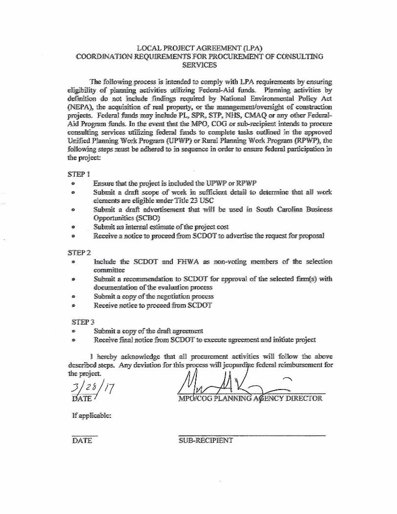
LOCAL PROJECT AG!RlEEM!ENT {LPA) roDJIIDJNATION RIEQU!l.1Ra1EMI'S FOR PROCUR!EMENT OF CONSUJL1I'mG
SiE!RVICES
The folliknwmg pm:ooss ~s iiime.J~derl oo ·comply '\\.-it'h LPA req11iFeIDen:ts by <e!lll-5llrfrng dfigiilbj]J~ of piamilng :a~es W1liillr.tii:ng IF~ual-Aad f11mrls. Pilamll:ritg af;lWtllies 'by ~efm5ll.1on do lilot mellude fm.d.iings iro~Rd by Natin:ma1 Ennimnmental P.:Jj)ll.icy- Acit (lNllEPA),,. \the 21;qwisiliM ·Df reai property,, m the ~memf3we1s3€)bt ·!:>f ~tmGE projects. F•ra'.I fwMls may nnelhlde ?4 SPR,. SJP,, NHJSl> CMAQ or any ~ FenerallAid ~gram iliuruis. llm ltlbe :ew£Et that the MF>O,. COO (Of sub-reci;pii1mt in'.tenils 1l:o procure ~·!)llSU)itiing semres E:f:ilJjzfilFlf, :feder.a/l furu:h 1l:o compldie tasks OllJllii11JetlJ ID 'ilbe :a;ppw¥.ecl Ucifaed J>uamDing W.ru-k JPro~~ (U!P\\IJP>) or bnlil Paamiing WGrk Pmgr.am (IRP\\tlF')~ me fuJJo~irilg steps l!D'Jlfil b:e We.T-W 11@ in Seijllllellre fo OnWr \to fmfilll:re federal paritlt;ipatIDn ]rn 1lbe project:
STEP1 • lEillsm;e 1lhai itlbe jprojrol as m~ooed 11.be \UlP\VJP or lRiP\ViP' e Slllhmit a draft soope '1:)f work m s.efficient deiaiill w ·~ioe itlhart aJD work
-e:le.ments are :eligtD1e E1J1dtm 1i!lil.1e 23 USC • :Sl!lbJDit .a draft ll'J1lh.·uttii:sem.e1ilt tJbait ~'fjg} \be Ero ID $!)nth cQare~fua JEmsfuess
Oppormnilies {S'CDO) • S11ibmift an iimemall zesiliirnme ,mf itbe project cost • JReccive a noti}oe 1liO p.:roo~ hm SCDOT w a~e the req,nest f:or jpmpnsal
ST.EJ>2 • lnclm.ile 11lhe SCDOT 2llrl JFHW A as !IIDn-w.o:tfag memben; «Df fue se11eclii·rm
oommmee • Submilt ~ ir:eoo.name1iLrl.atioo to SCD:Off :for appnn1a1 .of the seD~ fimr(s) wii11h
filxoommrlafioiil m the ev.alwttio:n process • Slllbrnit a :e.ll}py of 1be 111eg!l'.tfaltion pmtiess ., Rece5'¥e !11lroiee ro prore:ed !from SCDOlf'
STEP3 " Sllbmffit a ~!ilP.f of 1lhe draft~ ~ R~e f"m Dolfoe fro.m. S<DOlf'iro ~~a~ amd ~ proj~t
ft hereby .aclwrowJedge that a1Il pr<Cl~~mt :ae.lirviiillies w:i.1ll fo!11ow 1he .abovie desoo'betil !>1q)s. ~ ilewiat.ID.n for tlhlls pro:ceS!> will .fioo'p:ati · • f~ reimbur.semoot fur 1ibe project.
i,f~s/17
DA1f'E
Mike
Rectangle
Mike
Typewritten Text
6/10/2019

16