Feature Extraction for Terrain Classication with Crawling Robotsceur-ws.org/Vol-1422/179.pdf ·...
7
Feature Extraction for Terrain Classification with Crawling Robots Jakub Mrva and Jan Faigl Czech Technical University in Prague, Technická 2, 166 27 Prague, Czech Republic jakub.mrva|[email protected] Abstract: In this paper, we address the problem of terrain classification using a technically blind hexapod walking robot. The proposed approach is built on top of the ex- isting method based on analysis of the feedback from the robot’s actuators and the desired trajectory. The formed method uses features for the Support Vector Machine clas- sification method that assumes a regular time-invariant gait to control the robot. However, such a gait does not allow the robot to traverse rough terrains, and therefore, it is nec- essary to consider adaptive motion gait to deal with small obstacles, which is, unfortunately, not a regular gait with some fixed predefined period. Therefore, we propose to al- ter the features extraction process to utilize the terrain clas- sification method also for an adaptive motion gait, which enables the robot to traverse rough terrains. The proposed method has been experimentally verified on several ter- rains that are not traversable by a default regular gait. The achieved results not only confirmed the high accuracy of the terrain classification as the existing approach, but also expanded the area of operation of a hexapod walking robot into more challenging terrains. 1 Introduction Crawling robots can operate in a much greater scope in terms of terrain diversity than classical wheeled robots. The control complexity is, however, much greater due to the high number of degrees of freedom (DOF). One way to handle a high DOF is to generate a walking pattern—a gait [1]. A simple regular gait gives the robot predefined trajectories for all legs, which are therefore alternating in their support and transfer phases. In order to increase the robot’s perception of the environment—for example to classify the terrain the robot is traversing—one can employ the robot with a variety of sensors. There can be found two complementary ap- proaches based on exteroceptive and interoceptive sensors. In the case of exteroceptive sensing, we can utilize cam- era [2, 3] or laser-based range measurements [4] for terrain classification. However, if the robot is technically blind and depen- dent solely on interoceptive sensing, we can use force, torque [5, 6], or other tactile sensors to gather data about the interaction of the robot with the terrain. Moreover, we can utilize the robot’s actuators themselves and develop a classifier based on the differences between the expected and real trajectories of the robot servo drives [7] without the need of any additional sensor. Figure 1: Used hexapod walking robot for the terrain clas- sification The existing method [7] uses a default robot motion gait with regular and periodic phases of the leg movements, and therefore, it is suitable only for flat terrains without significant obstacles. Based on this method, we consider several terrains with obstacles or stairs and their classifica- tion using an adaptive motion gait [8] that allows a smooth transition while reducing the workload of the servos and thus avoiding overheating. Such a gait does not preserve the predefined trajectories of each leg as a default motion gait does. Hence, the existing method of feature extrac- tion proposed in [7] is not directly applicable because it assumes a regular time-invariant gait with fixed trajecto- ries. Therefore, in this paper, we propose a modification of the feature extraction process of [7] to enable the terrain classification based only on the servo drive feedback also in crawling rough terrain using the adaptive motion gait. Therefore, the method can be used in more challenging terrains up to the structural limits of the hexapod walking robot. The paper is organized as follows. A brief overview of the adaptive motion gaits for rough terrains and ter- rain classification methods is provided in the next section. A description of the considered robotic platform and def- inition of the problem is presented in Section 3. The uti- lized adaptive motion gait is briefly described in Section 4. The proposed feature extraction method is presented in Section 5 and experimental results in Section 6. The con- cluding remarks are in Section 7. 2 Related Work Adaptive motion of a walking robot to traverse a rough ter- rain has been addressed by many researchers and several J. Yaghob (Ed.): ITAT 2015 pp. 179–185 Charles University in Prague, Prague, 2015
Transcript of Feature Extraction for Terrain Classication with Crawling Robotsceur-ws.org/Vol-1422/179.pdf ·...
Feature Extraction for Terrain Classification with Crawling Robots
Jakub Mrva and Jan Faigl
Czech Technical University in Prague, Technická 2, 166 27 Prague, Czech Republicjakub.mrva|[email protected]
Abstract: In this paper, we address the problem of terrainclassification using a technically blind hexapod walkingrobot. The proposed approach is built on top of the ex-isting method based on analysis of the feedback from therobot’s actuators and the desired trajectory. The formedmethod uses features for the Support Vector Machine clas-sification method that assumes a regular time-invariant gaitto control the robot. However, such a gait does not allowthe robot to traverse rough terrains, and therefore, it is nec-essary to consider adaptive motion gait to deal with smallobstacles, which is, unfortunately, not a regular gait withsome fixed predefined period. Therefore, we propose to al-ter the features extraction process to utilize the terrain clas-sification method also for an adaptive motion gait, whichenables the robot to traverse rough terrains. The proposedmethod has been experimentally verified on several ter-rains that are not traversable by a default regular gait. Theachieved results not only confirmed the high accuracy ofthe terrain classification as the existing approach, but alsoexpanded the area of operation of a hexapod walking robotinto more challenging terrains.
1 Introduction
Crawling robots can operate in a much greater scope interms of terrain diversity than classical wheeled robots.The control complexity is, however, much greater due tothe high number of degrees of freedom (DOF). One wayto handle a high DOF is to generate a walking pattern—agait [1]. A simple regular gait gives the robot predefinedtrajectories for all legs, which are therefore alternating intheir support and transfer phases.
In order to increase the robot’s perception of theenvironment—for example to classify the terrain the robotis traversing—one can employ the robot with a varietyof sensors. There can be found two complementary ap-proaches based on exteroceptive and interoceptive sensors.In the case of exteroceptive sensing, we can utilize cam-era [2, 3] or laser-based range measurements [4] for terrainclassification.
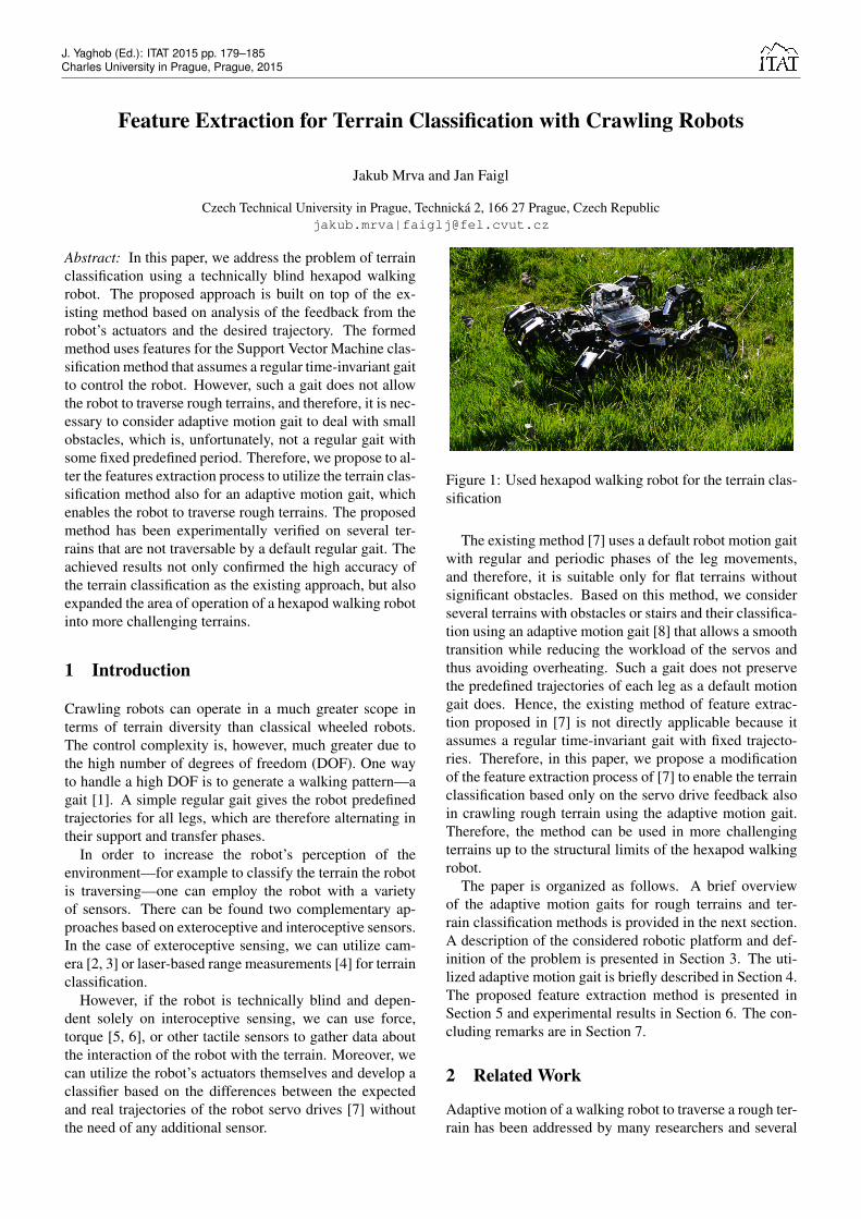
However, if the robot is technically blind and depen-dent solely on interoceptive sensing, we can use force,torque [5, 6], or other tactile sensors to gather data aboutthe interaction of the robot with the terrain. Moreover, wecan utilize the robot’s actuators themselves and develop aclassifier based on the differences between the expectedand real trajectories of the robot servo drives [7] withoutthe need of any additional sensor.
Figure 1: Used hexapod walking robot for the terrain clas-sification
The existing method [7] uses a default robot motion gaitwith regular and periodic phases of the leg movements,and therefore, it is suitable only for flat terrains withoutsignificant obstacles. Based on this method, we considerseveral terrains with obstacles or stairs and their classifica-tion using an adaptive motion gait [8] that allows a smoothtransition while reducing the workload of the servos andthus avoiding overheating. Such a gait does not preservethe predefined trajectories of each leg as a default motiongait does. Hence, the existing method of feature extrac-tion proposed in [7] is not directly applicable because itassumes a regular time-invariant gait with fixed trajecto-ries. Therefore, in this paper, we propose a modificationof the feature extraction process of [7] to enable the terrainclassification based only on the servo drive feedback alsoin crawling rough terrain using the adaptive motion gait.Therefore, the method can be used in more challengingterrains up to the structural limits of the hexapod walkingrobot.
The paper is organized as follows. A brief overviewof the adaptive motion gaits for rough terrains and ter-rain classification methods is provided in the next section.A description of the considered robotic platform and def-inition of the problem is presented in Section 3. The uti-lized adaptive motion gait is briefly described in Section 4.The proposed feature extraction method is presented inSection 5 and experimental results in Section 6. The con-cluding remarks are in Section 7.
2 Related Work
Adaptive motion of a walking robot to traverse a rough ter-rain has been addressed by many researchers and several
J. Yaghob (Ed.): ITAT 2015 pp. 179–185Charles University in Prague, Prague, 2015
approaches can be found in literature. A complex controlarchitecture of quadruped walking robot to traverse chal-lenging terrains has been presented in [9] using severalsensors attached to the robot and a precise map createdoff-line. The off-line scanning can be avoided by usingan elevation map created from an on-board laser scannerand used further to alter the gait according to the terrainstructure [10].
Another existing direction of the adaptive motion gaitsare based on approaches that do not utilize a terrain map.They are based on a tactile information from force sen-sors [11] (or torque-based estimation of the force [12])utilized to adapt the gait according to the terrain and toensure the leg reaches the foothold. A passive actuatorto measure the ground reaction force has been proposedin [13] to substitute direct force or torque sensors, whichis a suitable approach for the deployment of cheap roboticplatforms. In [8], we proposed a similar approach that iseven more minimalist since it does not need additional ser-vos and thus it is solely based on the robot’s actuators.
The problem of terrain classification is widely investi-gated also regarding on-board processing. A camera canbe used to estimate the terrain class based on extractedfeatures [3] that can be further used to select an energyefficient motion gait [2]. Authors of [14] used a laserrange finder for distinguishing between twelve terrains andachieved promising results; however, under specific labo-ratory conditions only.
Focusing on a structural point of view, an off-line scanof the terrain from a precise external laser-scanning systemwas used in [15] to generate a database of terrain templatesthat are used for proper foothold planning. Authors of [4]proposed an approach to avoid building a large databaseof templates. Their idea is based on a creation of a setof several templates that define good and poor footholdsbased on local concavity and sloppiness, which are usefulattributes for predicting slipperiness of the terrain.
Beside exteroceptive sensing, tactile sensors are used toclassify the terrain based on the direct measurements ofthe robot interaction with the terrain. In [5], authors usedfeatures extracted from the measurements of force sensorsplaced at the tip of the leg that are combined with the mea-surements of the motor current of the knee joint of a sin-gle vibrating robot leg detached from the body. A 6-DOFtorque-force sensor was used in [16] (under the same lab-oratory conditions as in [14]) for a discriminant analysisbetween six types of terrain. However, all of these ap-proaches are based on additional sensors, and therefore,they increase a complexity of the robot.
A slightly different approach that utilizes only intero-ceptive sensors built within the actuators was presentedin [7]. The actuators consist of position controllers that cansend both the desired and the current position of the servo.The difference in these positions is then analyzed in timeand frequency domains to extract a 660-dimensional fea-ture vector from the two front legs during each gait cycle.This method is limited by using a periodic time-invariant
gait and thus it is applicable almost exclusively on flat ter-rains without obstacles.
In this paper, we proposed a combination of the terrainclassification method [7] with the adaptive motion gait [8].Both these approaches are based solely on interoceptivesensing using active actuators and we propose a new fea-ture extraction procedure to overcome limitations of [7]and enable on-line classification of rough terrains.
3 Problem Statement
The main problem being addressed in this paper is to ex-tend the existing terrain classification approach [7] to theadaptive motion gait [8] and thus generalize terrain classi-fication also for traversing rough terrains. A new featureextraction method is needed to deal with rough terrainsbecause the adaptive motion gait does not preserve the re-quired condition on the motion gait of [7], i.e., a time-invariant motion gait. In the proposed approach, we con-sider a relatively cheap and easy-to-use platform Phan-tomX Hexapod Mark II with Dynamixel AX-12A actua-tors, see Fig. 1, which is further described in the next sec-tion. An overview of the terrain classification method [7]is provided in Section 3.2 to provide a background for theproposed approach.
3.1 Hexapod Structure
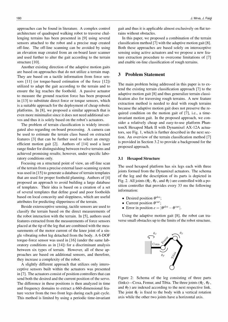
The used hexapod platform has six legs each with threejoints formed from the Dynamixel actuators. The schemaof the leg and the description of its parts is depicted inFig. 2. All joints (θC, θF , and θT ) are controlled with a po-sition controller that provides every 33 ms the followinginformation:
• Desired position θ des;• Current position θ cur;• Error in position e = |θ des−θ cur|.
Using the adaptive motion gait [8], the robot can tra-verse small obstacles up to the limits of the robot structure.
Coxa Femur
Tibia
θC
θF
θT
Figure 2: Schema of the leg consisting of three parts(links)—Coxa, Femur, and Tibia. The three joints (θC, θF ,and θT ) are indexed according to the next respective link.The joint θC is fixed to the body with a vertical rotationaxis while the other two joints have a horizontal axis.
180 J. Mrva, J. Faigl

We consider the robot is operating in an environment thatsatisfies the robot’s structural limits and there is not a largeobstacle that the robot cannot traverse. Hence, we are notaddressing obstacle avoidance and other high-level navi-gation problem in this paper. Thus we are strictly focusedon the problem of terrain classification and its practicalvalidation in real experiments.
3.2 Terrain Classification
The method of the terrain classification [7] has been pro-posed for the same hexapod platform as we are using;however, a regular time-invariant gait is utilized for robotmotion. The very general idea of the terrain classificationis based on the small errors in position control (e) of allservo drives of the front legs (i.e., six servos) that are mea-sured in the time domain at a non-uniform sample rate ofapproximately 20 Hz.
In order to obtain a more dense data and to get a uniformsample rate for the FFT used in the feature extraction, thesignal is interpolated using a cubic Hermite spline inter-polation method that creates a continuous function witha continuous first derivative. The interpolated function isthen resampled at the frequency of 100 Hz. After that,a feature vector for the classification is created from thesampled data and computed characteristics of the signal.
Having the default regular gait, the data is windowedusing a uniform window that contains the last three fullgait cycles; so, each terrain-class prediction is based on thepast three gait cycles worth of data. Given the motivationthat different terrain surfaces induce a specific behavior indifferent sections of the gait cycle, the data are dividedinto 16 equally wide segments within a gait cycle to forma gait-phase domain. Respective segments from the lastthree gait cycles are joined together and basic statistics ofall data samples that fall within are computed yielding in5 values (features) for each segment (i.e., minimum, max-imum, mean, median, and standard deviation). Repeatedfor each servo, we obtain a total of 480 gait-phase features,i.e., 2 (legs) × 3 (servos per leg) × 5 (features) × 16 (seg-ments).
Additional 180 features are calculated in the frequencydomain. A Hamming window and discrete Fourier trans-form are applied on the same resampled position error sig-nal to obtain a frequency spectrum of 25 bins (0–12 Hz).All amplitude values of frequency bins are used alone, giv-ing another 25 features (for each servo), supplemented by4 features obtained from the shape of the spectrum (i.e.,centroid, standard deviation, skewness, and kurtosis) andfinalized with the energy of the spectrum. The overall660-dimensional feature vector consists of:
• Statistics of each segment for each servo (5× 16×6 = 480);• Bins of the frequency spectrum (25×6 = 150);• Shape of the frequency spectrum (4×6 = 24);• Energy of the frequency spectrum (6).
Such 660-dimensional feature vectors for particulartype of the terrain and several trials of traversing the ter-rain are used to train a multi-class linear Support VectorMachine (SVM) classifier and authors of [7] report 95%accuracy in distinguishing between 3 terrain classes (con-crete, grass, and rocks/mulch).
In our approach presented in this paper, we follow thesame idea of the terrain classifier based on the SVM, butwe propose a new feature extraction process to address theabsence of regularity in the adaptive motion gait for crawl-ing rough terrains.
4 Adaptive Motion Gait
The adaptive gait is originally based on a regular tripodgait in terms of predefined trajectories for each particularleg. However, the trajectories can be changed and the gait-cycle is divided into separate phases of the leg and bodymotion.
STABLE STATEChoose next legsfrom given order
Move legs up
Move legs forward
Move legsdown until
ground detected
Compute(R, ~t ) fromleg positions
Transform allleg positions
Apply positions –– level body
BodyLeveling L
egmotion
Figure 3: Diagram of a gait cycle. Firstly, the legs in thetransfer phase move to find new footholds. Secondly, thebody is leveled to adapt the new footholds. Finally, an-other legs are chosen for the next transfer phase. Orangecolor highlights the motion of legs in the transfer phaseonly, while red color highlights the motion of all legs.
The gait diagram is shown in Fig. 3, where it can beseen that legs in the transfer phase move through prede-fined checkpoints (up and forward) and begin approach-ing another predefined checkpoint, which is situated farbelow the current ground level (but still reachable). Theground sensing is done via observing the position errore of the joint θF during lowering the leg with respect toa certain threshold value. Although all legs in the trans-fer phase are moving simultaneously, each ground contactstops only the particular corresponding leg.
After the legs found their new footholds (the rest legsstay motionless), a new body posture is found given thefeet positions in order to adapt to the terrain the robot istraversing. The body motion itself is provided by movingall legs according to a transformation of the feet positions.
Feature Extraction for Terrain Classification with Crawling Robots 181
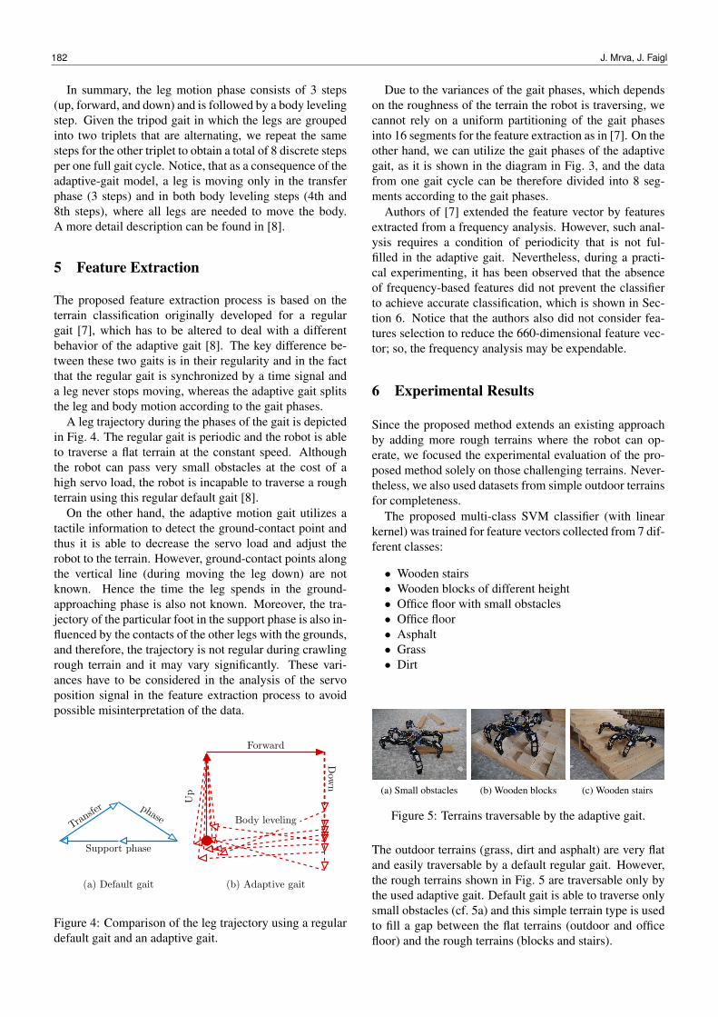
In summary, the leg motion phase consists of 3 steps(up, forward, and down) and is followed by a body levelingstep. Given the tripod gait in which the legs are groupedinto two triplets that are alternating, we repeat the samesteps for the other triplet to obtain a total of 8 discrete stepsper one full gait cycle. Notice, that as a consequence of theadaptive-gait model, a leg is moving only in the transferphase (3 steps) and in both body leveling steps (4th and8th steps), where all legs are needed to move the body.A more detail description can be found in [8].
5 Feature Extraction
The proposed feature extraction process is based on theterrain classification originally developed for a regulargait [7], which has to be altered to deal with a differentbehavior of the adaptive gait [8]. The key difference be-tween these two gaits is in their regularity and in the factthat the regular gait is synchronized by a time signal anda leg never stops moving, whereas the adaptive gait splitsthe leg and body motion according to the gait phases.
A leg trajectory during the phases of the gait is depictedin Fig. 4. The regular gait is periodic and the robot is ableto traverse a flat terrain at the constant speed. Althoughthe robot can pass very small obstacles at the cost of ahigh servo load, the robot is incapable to traverse a roughterrain using this regular default gait [8].
On the other hand, the adaptive motion gait utilizes atactile information to detect the ground-contact point andthus it is able to decrease the servo load and adjust therobot to the terrain. However, ground-contact points alongthe vertical line (during moving the leg down) are notknown. Hence the time the leg spends in the ground-approaching phase is also not known. Moreover, the tra-jectory of the particular foot in the support phase is also in-fluenced by the contacts of the other legs with the grounds,and therefore, the trajectory is not regular during crawlingrough terrain and it may vary significantly. These vari-ances have to be considered in the analysis of the servoposition signal in the feature extraction process to avoidpossible misinterpretation of the data.
Transfer phase
Support phase
Up
Forward
Dow
n
Body leveling
(a) Default gait (b) Adaptive gait
Figure 4: Comparison of the leg trajectory using a regulardefault gait and an adaptive gait.
Due to the variances of the gait phases, which dependson the roughness of the terrain the robot is traversing, wecannot rely on a uniform partitioning of the gait phasesinto 16 segments for the feature extraction as in [7]. On theother hand, we can utilize the gait phases of the adaptivegait, as it is shown in the diagram in Fig. 3, and the datafrom one gait cycle can be therefore divided into 8 seg-ments according to the gait phases.
Authors of [7] extended the feature vector by featuresextracted from a frequency analysis. However, such anal-ysis requires a condition of periodicity that is not ful-filled in the adaptive gait. Nevertheless, during a practi-cal experimenting, it has been observed that the absenceof frequency-based features did not prevent the classifierto achieve accurate classification, which is shown in Sec-tion 6. Notice that the authors also did not consider fea-tures selection to reduce the 660-dimensional feature vec-tor; so, the frequency analysis may be expendable.
6 Experimental Results
Since the proposed method extends an existing approachby adding more rough terrains where the robot can op-erate, we focused the experimental evaluation of the pro-posed method solely on those challenging terrains. Never-theless, we also used datasets from simple outdoor terrainsfor completeness.
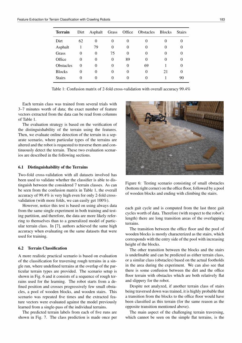
The proposed multi-class SVM classifier (with linearkernel) was trained for feature vectors collected from 7 dif-ferent classes:
• Wooden stairs• Wooden blocks of different height• Office floor with small obstacles• Office floor• Asphalt• Grass• Dirt
(a) Small obstacles (b) Wooden blocks (c) Wooden stairs
Figure 5: Terrains traversable by the adaptive gait.
The outdoor terrains (grass, dirt and asphalt) are very flatand easily traversable by a default regular gait. However,the rough terrains shown in Fig. 5 are traversable only bythe used adaptive gait. Default gait is able to traverse onlysmall obstacles (cf. 5a) and this simple terrain type is usedto fill a gap between the flat terrains (outdoor and officefloor) and the rough terrains (blocks and stairs).
182 J. Mrva, J. Faigl
Terrain Dirt Asphalt Grass Office Obstacles Blocks Stairs
Dirt 62 0 0 0 0 0 0Asphalt 1 79 0 0 0 0 0Grass 0 0 75 0 0 0 0Office 0 0 0 89 0 0 0Obstacles 0 0 0 0 69 1 0Blocks 0 0 0 0 0 21 0Stairs 0 0 0 0 0 1 90
Table 1: Confusion matrix of 2-fold cross-validation with overall accuracy 99.4%
Each terrain class was trained from several trials with3–7 minutes worth of data; the exact number of featurevectors extracted from the data can be read from columnsof Table 1.
The evaluation strategy is based on the verification ofthe distinguishability of the terrain using the features.Then, we evaluate online detection of the terrain in a sep-arate scenario, where particular types of the terrains arealtered and the robot is requested to traverse them and con-tinuously detect the terrain. These two evaluation scenar-ios are described in the following sections.
6.1 Distinguishability of the Terrains
Two-fold cross-validation with all datasets involved hasbeen used to validate whether the classifier is able to dis-tinguish between the considered 7 terrain classes. As canbe seen from the confusion matrix in Table 1, the overallaccuracy of 99.4% is very high even for only 2-fold cross-validation (with more folds, we can easily get 100%).
However, notice this test is based on using always datafrom the same single experiment in both training and test-ing partition, and therefore, the data are more likely refer-ring to themselves than to a generalized model of partic-ular terrain class. In [7], authors achieved the same highaccuracy when evaluating on the same datasets that wereused for training.
6.2 Terrain Classification
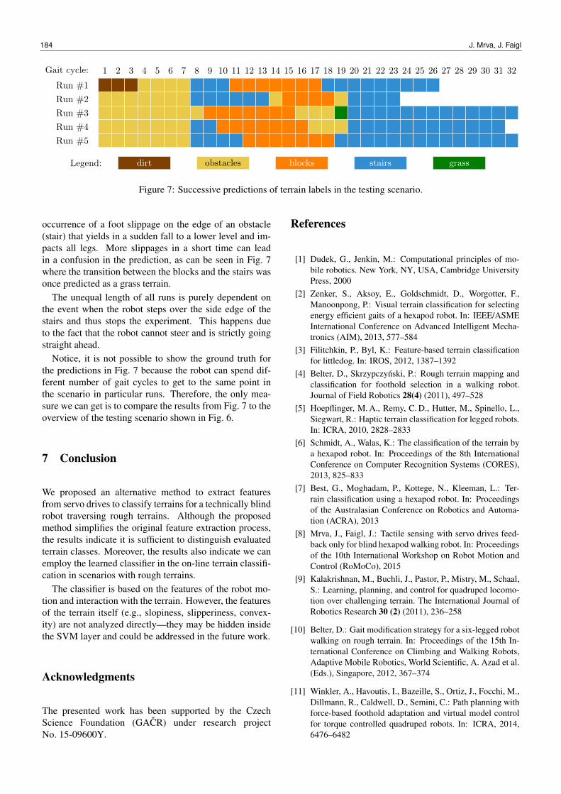
A more realistic practical scenario is based on evaluationof the classification for traversing rough terrains in a sin-gle run, where undefined terrains at the overlap of the par-ticular terrain types are provided. The scenario setup isshown in Fig. 6 and it consists of a sequence of rough ter-rains used for the learning. The robot starts from a de-fined position and crosses progressively few small obsta-cles, a pool of wooden blocks, and wooden stairs. Thisscenario was repeated five times and the extracted fea-ture vectors were evaluated against the model previouslylearned from a single-pass of the individual terrains.
The predicted terrain labels from each of five runs areshown in Fig. 7. The class prediction is made once per
Figure 6: Testing scenario consisting of small obstacles(bottom right corner) on the office floor, followed by a poolof wooden blocks and ending with climbing the stairs.
each gait cycle and is computed from the last three gaitcycles worth of data. Therefore (with respect to the robot’slength) there are long transition areas of the overlappingterrains.
The transition between the office floor and the pool ofwooden blocks is mostly characterized as the stairs, whichcorresponds with the entry side of the pool with increasingheight of the blocks.
The other transition between the blocks and the stairsis undefinable and can be predicted as either terrain class,or a similar class (obstacles) based on the actual footholdsin the area during the experiment. We can also see thatthere is some confusion between the dirt and the officefloor terrain with obstacles which are both relatively flatand slippery for the robot.
Despite not analyzed, if another terrain class of stairsbeing traversed down was trained, it is highly probable thata transition from the blocks to the office floor would havebeen classified as this terrain (for the same reason as theopposite transition mentioned above).
The main aspect of the challenging terrain traversing,which cannot be seen on the simple flat terrains, is the
Feature Extraction for Terrain Classification with Crawling Robots 183
Gait cycle: 1 2 3 4 5 6 7 8 9 10 11 12 13 14 15 16 17 18 19 20 21 22 23 24 25 26 27 28 29 30 31 32
Run #1
Run #2
Run #3
Run #4
Run #5
Legend: dirt obstacles blocks stairs grass
Figure 7: Successive predictions of terrain labels in the testing scenario.
occurrence of a foot slippage on the edge of an obstacle(stair) that yields in a sudden fall to a lower level and im-pacts all legs. More slippages in a short time can leadin a confusion in the prediction, as can be seen in Fig. 7where the transition between the blocks and the stairs wasonce predicted as a grass terrain.
The unequal length of all runs is purely dependent onthe event when the robot steps over the side edge of thestairs and thus stops the experiment. This happens dueto the fact that the robot cannot steer and is strictly goingstraight ahead.
Notice, it is not possible to show the ground truth forthe predictions in Fig. 7 because the robot can spend dif-ferent number of gait cycles to get to the same point inthe scenario in particular runs. Therefore, the only mea-sure we can get is to compare the results from Fig. 7 to theoverview of the testing scenario shown in Fig. 6.
7 Conclusion
We proposed an alternative method to extract featuresfrom servo drives to classify terrains for a technically blindrobot traversing rough terrains. Although the proposedmethod simplifies the original feature extraction process,the results indicate it is sufficient to distinguish evaluatedterrain classes. Moreover, the results also indicate we canemploy the learned classifier in the on-line terrain classifi-cation in scenarios with rough terrains.
The classifier is based on the features of the robot mo-tion and interaction with the terrain. However, the featuresof the terrain itself (e.g., slopiness, slipperiness, convex-ity) are not analyzed directly—they may be hidden insidethe SVM layer and could be addressed in the future work.
Acknowledgments
The presented work has been supported by the CzechScience Foundation (GACR) under research projectNo. 15-09600Y.
References
[1] Dudek, G., Jenkin, M.: Computational principles of mo-bile robotics. New York, NY, USA, Cambridge UniversityPress, 2000
[2] Zenker, S., Aksoy, E., Goldschmidt, D., Worgotter, F.,Manoonpong, P.: Visual terrain classification for selectingenergy efficient gaits of a hexapod robot. In: IEEE/ASMEInternational Conference on Advanced Intelligent Mecha-tronics (AIM), 2013, 577–584
[3] Filitchkin, P., Byl, K.: Feature-based terrain classificationfor littledog. In: IROS, 2012, 1387–1392
[4] Belter, D., Skrzypczynski, P.: Rough terrain mapping andclassification for foothold selection in a walking robot.Journal of Field Robotics 28(4) (2011), 497–528
[5] Hoepflinger, M. A., Remy, C. D., Hutter, M., Spinello, L.,Siegwart, R.: Haptic terrain classification for legged robots.In: ICRA, 2010, 2828–2833
[6] Schmidt, A., Walas, K.: The classification of the terrain bya hexapod robot. In: Proceedings of the 8th InternationalConference on Computer Recognition Systems (CORES),2013, 825–833
[7] Best, G., Moghadam, P., Kottege, N., Kleeman, L.: Ter-rain classification using a hexapod robot. In: Proceedingsof the Australasian Conference on Robotics and Automa-tion (ACRA), 2013
[8] Mrva, J., Faigl, J.: Tactile sensing with servo drives feed-back only for blind hexapod walking robot. In: Proceedingsof the 10th International Workshop on Robot Motion andControl (RoMoCo), 2015
[9] Kalakrishnan, M., Buchli, J., Pastor, P., Mistry, M., Schaal,S.: Learning, planning, and control for quadruped locomo-tion over challenging terrain. The International Journal ofRobotics Research 30 (2) (2011), 236–258
[10] Belter, D.: Gait modification strategy for a six-legged robotwalking on rough terrain. In: Proceedings of the 15th In-ternational Conference on Climbing and Walking Robots,Adaptive Mobile Robotics, World Scientific, A. Azad et al.(Eds.), Singapore, 2012, 367–374
[11] Winkler, A., Havoutis, I., Bazeille, S., Ortiz, J., Focchi, M.,Dillmann, R., Caldwell, D., Semini, C.: Path planning withforce-based foothold adaptation and virtual model controlfor torque controlled quadruped robots. In: ICRA, 2014,6476–6482
184 J. Mrva, J. Faigl

[12] Walas, K., Belter, D.: Supporting locomotive functions of asix-legged walking robot. International Journal of AppliedMathematics and Computer Science 21 (2) (2011)
[13] Palmer, L., Palankar, M.: Blind hexapod walking over un-even terrain using only local feedback. In: IEEE Interna-tional Conference on Robotics and Biomimetics (ROBIO),2011, 1603–1608
[14] Walas, K., Nowicki, M.: Terrain classification using laserrange finder. In: IROS, 2014, 5003–5009
[15] Kalakrishnan, M., Buchli, J., Pastor, P., Schaal, S.: Learn-ing locomotion over rough terrain using terrain templates.In: IROS, 2009, 167–172
[16] Walas, K.: Tactile sensing for ground classification. Journalof Automation, Mobile Robotics & Intelligent Systems 7(2) (2013), 18–23
Feature Extraction for Terrain Classification with Crawling Robots 185