FDOT D4 Complete Streets -...
19
FDOT D4 Complete Streets
Transcript of FDOT D4 Complete Streets -...
FDOT D4 Complete Streets

Context Sensitive Solutions• Directs that complete street solutions will• complement the context of the community.
• Collaborative approach to decision making,• project development, and implementation
• Takes into account views of stakeholders and• the local area
• Considers the physical setting and seeks to• enhance and conserve community defining• features and environmental resources
• Balances safety and mobility with local• priorities
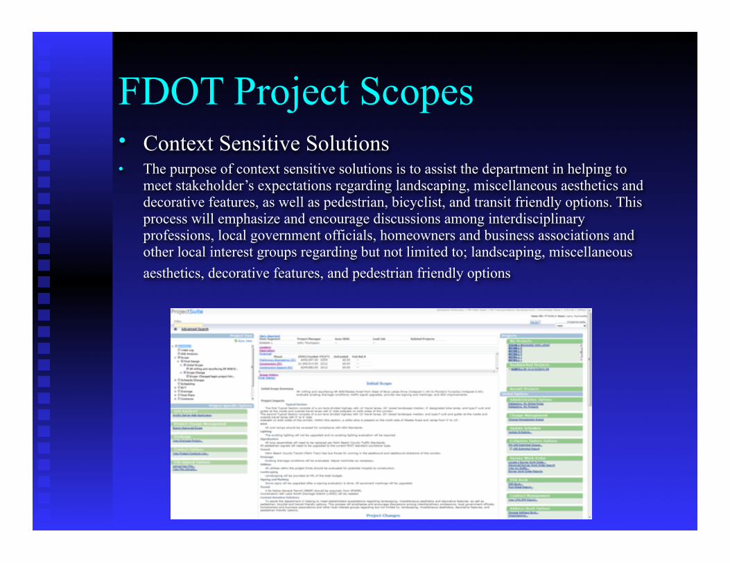
FDOT Project Scopes• Context Sensitive Solutions • The purpose of context sensitive solutions is to assist the department in helping to
meet stakeholder’s expectations regarding landscaping, miscellaneous aesthetics and decorative features, as well as pedestrian, bicyclist, and transit friendly options. This process will emphasize and encourage discussions among interdisciplinary professions, local government officials, homeowners and business associations and other local interest groups regarding but not limited to; landscaping, miscellaneous aesthetics, decorative features, and pedestrian friendly options
Livable Communities GISA GIS approach to
Context Sensitive Solutions
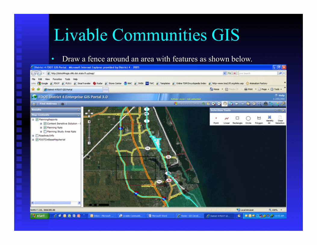
• Draw a fence around an area with features as shown below.
Livable Communities GIS
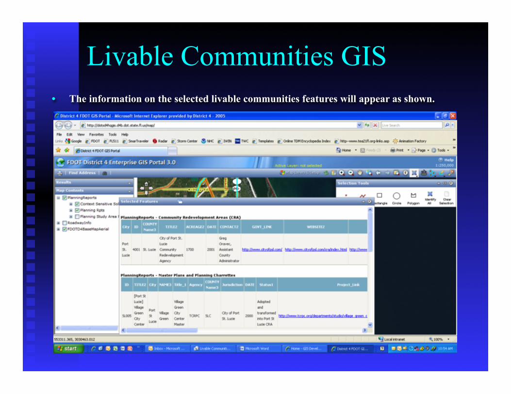
• The information on the selected livable communities features will appear as shown.
Livable Communities GIS
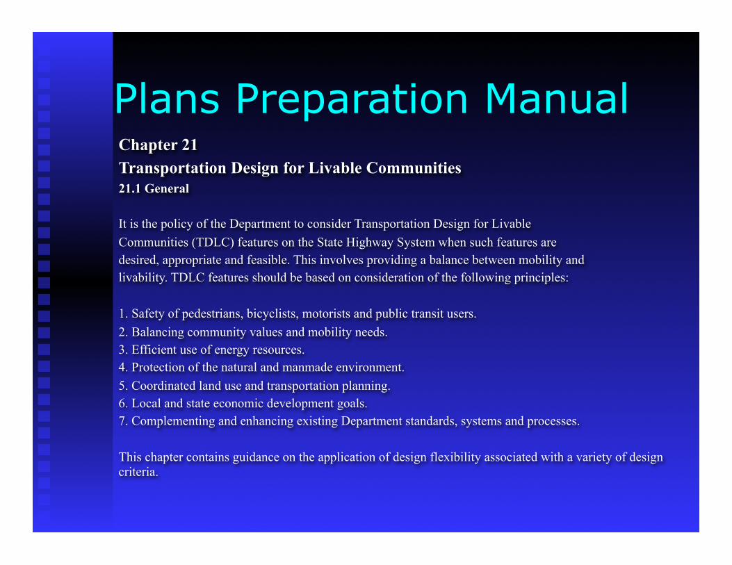
Chapter 21Transportation Design for Livable Communities21.1 General
It is the policy of the Department to consider Transportation Design for LivableCommunities (TDLC) features on the State Highway System when such features aredesired, appropriate and feasible. This involves providing a balance between mobility andlivability. TDLC features should be based on consideration of the following principles:
1. Safety of pedestrians, bicyclists, motorists and public transit users.2. Balancing community values and mobility needs.3. Efficient use of energy resources.4. Protection of the natural and manmade environment.5. Coordinated land use and transportation planning.6. Local and state economic development goals.7. Complementing and enhancing existing Department standards, systems and processes.
This chapter contains guidance on the application of design flexibility associated with a variety of design criteria.
Plans Preparation Manual
Plans Preparation ManualChapter 8
Section 8.1.1: … goal of theDepartment …Bicycle andpedestrian ways shall be givenfull consideration in theplanning and development oftransportation facilities…specialemphasis shall be given toprojects in or within 1 mile ofan urban area.
Section 8.1.2: The integrationof public transit street facilitiesalong with pedestrian andbicycle facilities furthers theimplementation of this goal.
Plans Preparation ManualEncourages street connectivity and aimsto create a comprehensive, integratednetwork for all modes.
Section 8.1.2:Multimodalism is theultimate goal of theDepartment… Public transitstreet side facilities shouldbe considered in all phasesof a project…
Section 8.3: All roadwaysand bridges wherepedestrian travel is expectedshould have separatewalking areas …outside thevehicle travel lanes.
Section 8.4: Appropriatelydesigned and located bicyclefacilities play an importantrole in supporting safebicycle travel.
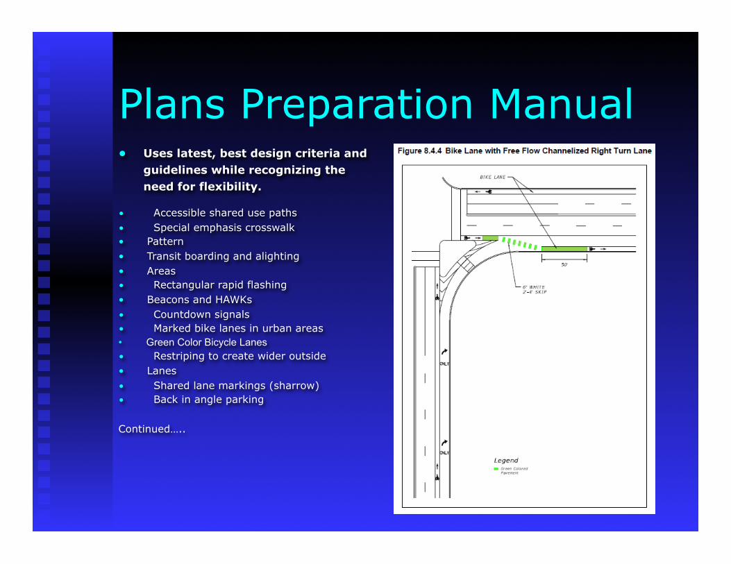
Plans Preparation Manual• Uses latest, best design criteria and guidelines while recognizing the need for flexibility.
• Accessible shared use paths• Special emphasis crosswalk• Pattern• Transit boarding and alighting• Areas• Rectangular rapid flashing• Beacons and HAWKs• Countdown signals• Marked bike lanes in urban areas• Green Color Bicycle Lanes• Restriping to create wider outside• Lanes• Shared lane markings (sharrow)• Back in angle parking
Continued…..
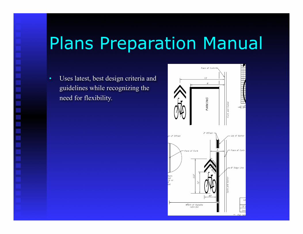
• Uses latest, best design criteria and guidelines while recognizing the
need for flexibility.
Plans Preparation Manual
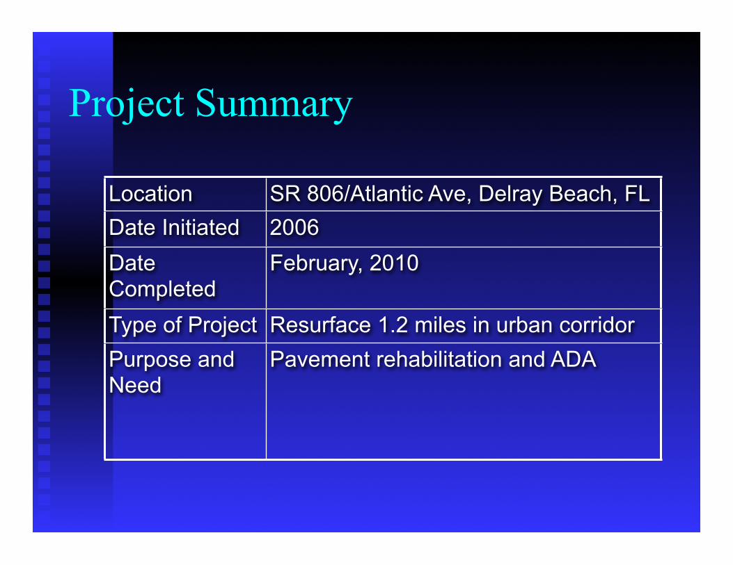
Project Summary
Location SR 806/Atlantic Ave, Delray Beach, FLDate Initiated 2006Date Completed
February, 2010
Type of Project Resurface 1.2 miles in urban corridorPurpose and Need
Pavement rehabilitation and ADA
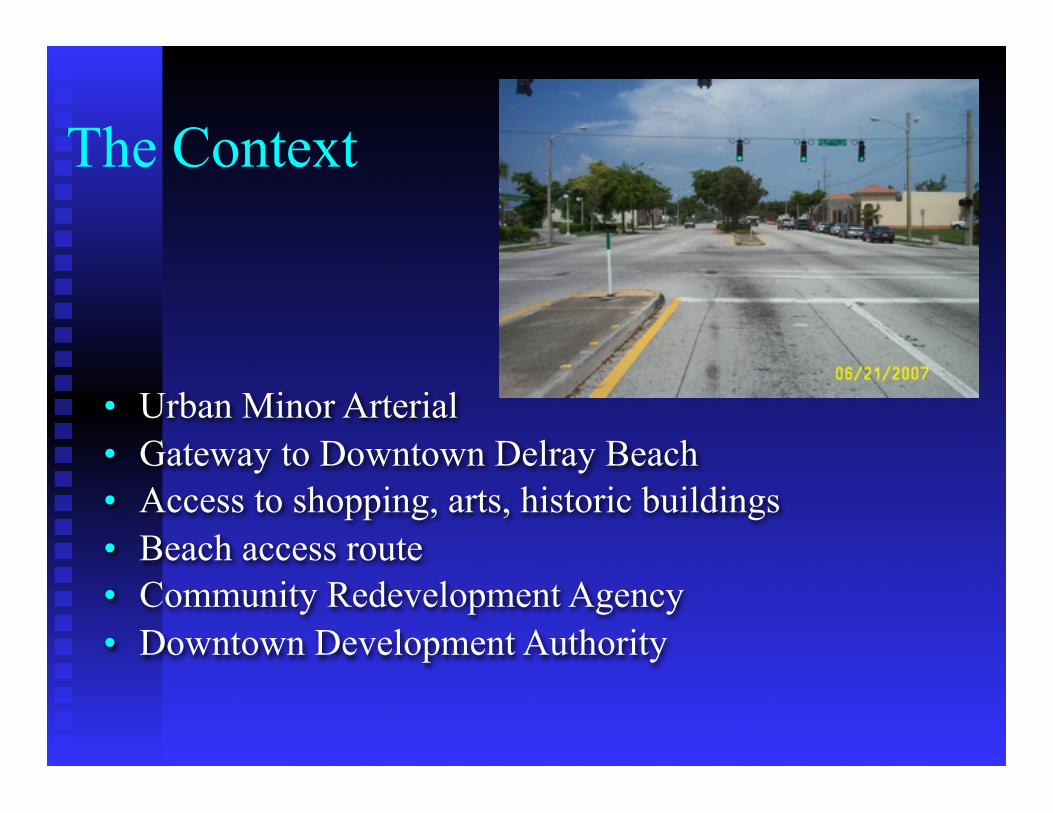
The Context
• Urban Minor Arterial• Gateway to Downtown Delray Beach• Access to shopping, arts, historic buildings• Beach access route• Community Redevelopment Agency• Downtown Development Authority
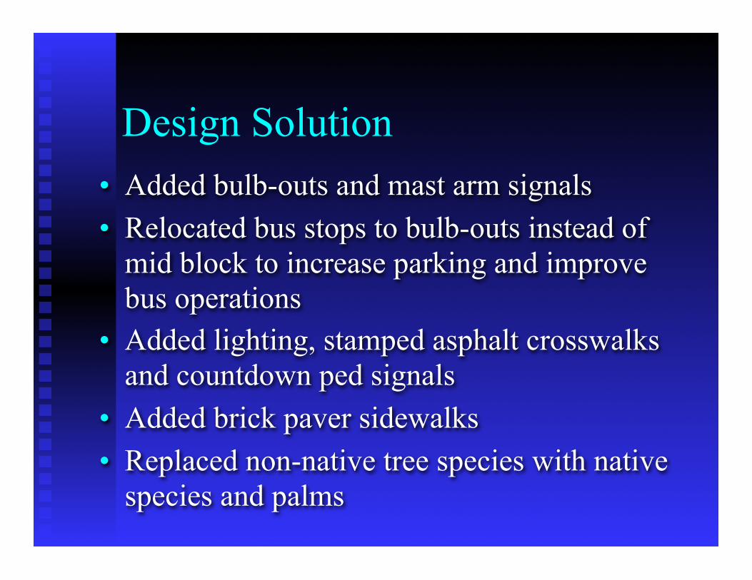
Design Solution• Added bulb-outs and mast arm signals• Relocated bus stops to bulb-outs instead of
mid block to increase parking and improve bus operations
• Added lighting, stamped asphalt crosswalks and countdown ped signals
• Added brick paver sidewalks• Replaced non-native tree species with native
species and palms
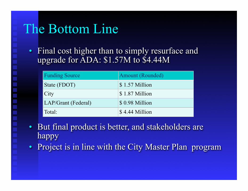
The Bottom Line• Final cost higher than to simply resurface and
upgrade for ADA: $1.57M to $4.44M
• But final product is better, and stakeholders are happy
• Project is in line with the City Master Plan program
Funding Source Amount (Rounded)
State (FDOT) $ 1.57 MillionCity $ 1.87 MillionLAP/Grant (Federal) $ 0.98 MillionTotal: $ 4.44 Million

Before & After: NW/SW 11th Avenue
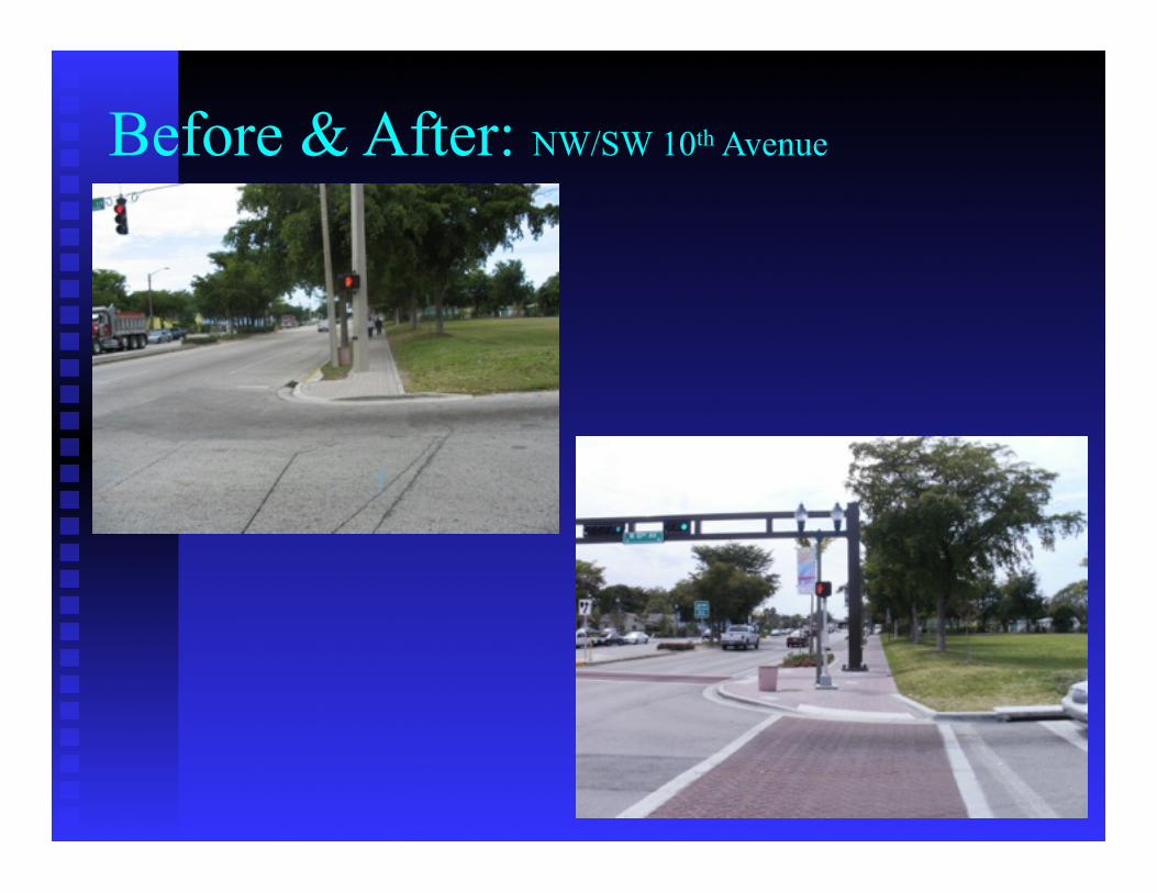
Before & After: NW/SW 10th Avenue

Other Project Photos

ConclusionTDLC features are to be considered when they are desired, appropriate and feasible.Incorporating TDLC features in a project is contingent upon the involvement of localstakeholders in the planning and project development processes.
During the initial planning and scoping phases, it is important to identify and assess thedesires and willingness of the community and stakeholders to accept all of the ramifications of TDLC, including identification of traffic impacts, funding commitments and maintenance agreements for the TDLC features included in a project.