Family in Early Mesopotamia', in E. Lipinski (ed.), 2 ha ... de... · Family in Early Mesopotamia',...
40
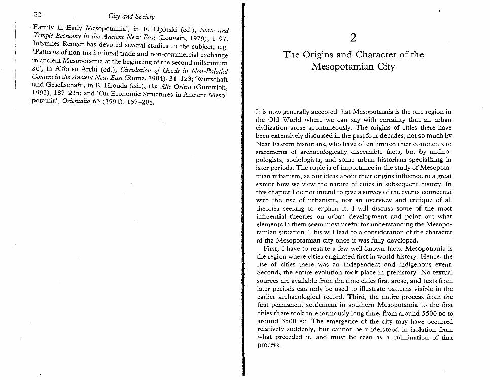
22 City and Society Family in Early Mesopotamia', in E. Lipinski (ed.), State and Temple Economy in the Ancient Near East (Louvain, 1979), 1-97: !ohannes Renger. several studies to the subject, e.g. . Patte:ns of non-mstitutional trade and non-commercial exchange III ancient Mesopotamia at the beginning of the second millennium BC', in Alfonso Archi (ed.), Circulation of Goods in Non-Palatial Context in the Ancient Near East (Rome, 1984),31-123; 'Wirtschaft und GeseIlschaft', in B. Hrouda (ed.), Der Alte Orient (Gutersloh, 1991), 187-215; and 'On Economic Structures in Ancient Meso- potamia', Orientalia 63 (1994), 157-208. 2 The Origins and Character of the Mesopotamian City It is now generaIly accepted that Mesopotamia is the one region in the Old World where we can say with certainty that an urban civilization arose spontaneously. The origins of cities there have been extensively discussed in the past four decades, not so much by Near Eastern historians, who have often limited their comments to statements of archaeologically discernible facts, but by anthro- pologists, sociologists, and some urban historians specializing in later periods. The topic is of importance in the study of Mesopota- mian urbanism, as our ideas about their origins influence to a great extent how we view the nature of cities in subsequent history. In this chapter I do not intend to give a survey of the events connected with the rise of urbanism, nor an overview and critique of all theories seeking to explain it. I will discuss some of the most influential theories on urban development and point out what elements in them seem most useful for understanding the Mesopo- tamian situation. This will lead to a consideration of the character of the Mesopotamian city once it was fuIly developed. First, I have to restate a few well-known facts. Mesopotamia is the region where cities originated first in world history. Hence, the rise of cities there was an independent and indigenous event. Second, the entire evolution took place in prehistory. No textual sources are available from the time cities first arose, and texts from later periods can only be used to illustrate patterns visible in the earlier archaeological record. Third, the entire process from the first permanent settlement in southern Mesopotamia to the first cities there took an enormously long time, from around 5500 BC to around 3500 BC. The emergence of the city may have occurred relatively suddenly, but cannot be understood in isolation from what preceded it, and must be seen as a culmination of that process.
Transcript of Family in Early Mesopotamia', in E. Lipinski (ed.), 2 ha ... de... · Family in Early Mesopotamia',...
22 City and Society
Family in Early Mesopotamia', in E. Lipinski (ed.), State andTemple Economy in the Ancient Near East (Louvain, 1979), 1-97:!ohannes Renger. ha~ d~voted several studies to the subject, e.g ..Patte:ns of non-mstitutional trade and non-commercial exchangeIII ancient Mesopotamia at the beginning of the second millenniumBC', in Alfonso Archi (ed.), Circulation of Goods in Non-PalatialContext in the Ancient Near East (Rome, 1984),31-123; 'Wirtschaftund GeseIlschaft', in B. Hrouda (ed.), Der Alte Orient (Gutersloh,1991), 187-215; and 'On Economic Structures in Ancient Mesopotamia', Orientalia 63 (1994), 157-208.
2
The Origins and Character of theMesopotamian City
It is now generaIly accepted that Mesopotamia is the one region inthe Old World where we can say with certainty that an urbancivilization arose spontaneously. The origins of cities there havebeen extensively discussed in the past four decades, not so much byNear Eastern historians, who have often limited their comments tostatements of archaeologically discernible facts, but by anthropologists, sociologists, and some urban historians specializing inlater periods. The topic is of importance in the study of Mesopotamian urbanism, as our ideas about their origins influence to a greatextent how we view the nature of cities in subsequent history. Inthis chapter I do not intend to give a survey of the events connectedwith the rise of urbanism, nor an overview and critique of alltheories seeking to explain it. I will discuss some of the mostinfluential theories on urban development and point out whatelements in them seem most useful for understanding the Mesopotamian situation. This will lead to a consideration of the characterof the Mesopotamian city once it was fuIly developed.
First, I have to restate a few well-known facts. Mesopotamia isthe region where cities originated first in world history. Hence, therise of cities there was an independent and indigenous event.Second, the entire evolution took place in prehistory. No textualsources are available from the time cities first arose, and texts fromlater periods can only be used to illustrate patterns visible in theearlier archaeological record. Third, the entire process from thefirst permanent settlement in southern Mesopotamia to the firstcities there took an enormously long time, from around 5500 BC toaround 3500 BC. The emergence of the city may have occurredrelatively suddenly, but cannot be understood in isolation fromwhat preceded it, and must be seen as a culmination of thatprocess.
24 Origins and Character Origins and Character 25
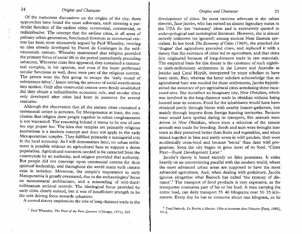
Of the numerous discussions on the origins of the city, threeapproaches have found the most adherents, each stressing a particular function of the earliest cities: ceremonial, commercial, orredistributive. The concept that the earliest cities, in ali areas ofprimary urban generation, functioned foremost as ceremonial centres has been most extensively argued by Paul Wheatley, revivingan idea already developed by Fustel de Coulanges in the midnineteenth century. Wheatley maintained that religion providedthe primary focus of social life in the period immediately precedingurbanism. Wherever cities first appeared, they contained a ceremonial complex, in his opinion, and even if the latter performedsecular functions as well, these were pan of the religious context.The priests were the first group to escape the 'daily round ofsubsistence labor', I hence setting the process of social stratificationinto motion. Only after ceremonial centres were firmly establisheddid they obtain a redistributive economic role, and secular elitesonly developed after cities had been in existence for severalcenturies.
Although the observation that all the earliest cities contained aceremonial centre is accurate, for Mesopotamia at least, the conclusion that religion drew people together in urban conglomeratesis not warranted. The reasoning behind it seems to be one of cumhoc ergo propter hoc. The idea that temples are primarily religiousinstitutions is a modem concept and does not apply to the earlyMesopotamian temples. They fulfilled primarily a managerial rolein the local economy. As I will demonstrate later, no urban settlement is possible without an agricultural base to support a densepopulation. Agricultural resources needed to be extracted from thecountryside by an authority, and religion provided that authority.But people did not converge upon ceremonial centres for theirspiritual leadership, and throughout the world many such centresexist in isolation. Moreover, the temple'simponance in earlyMesopotamia is greatly overstated, due to the archaeologists' focuson monumental architecture, and a misreading of mid-thirdmillennium archival records. The ideological focus provided byearly cities clearly existed, but it was of insufficient strength to bethe sole driving force towards urbanism.
. A second theory emphasizes the role of'Iong-distance trade in the
1 Paul Wheatley, The Pivot of the Four Quarters (Chicago, 1971), 303.
development of cities. Its most extreme advocate is the urbantheorist, Jane Jacobs, who has earned an almost legendary status inthe USA for her 'visionary' ideas and is extensively quoted inanthropological and sociological literature. However, she is almostentirely unknown (or ignored) among ancient Near Eastern specialists. In her book The Economy of Cities (1969), she attacked the'dogma' that agriculture preceded cities, and replaced it with atheory that the existence of cities led to agriculture, and that citiesfirst originated because of long-distance trade in raw materials.The empirical basis for this theory is the existence of such eighthto sixth-millennium settlements in the Levant and Anatolia asJericho and Catal Huyuk, interpreted by some scholars to havebeen cities. But, whereas the latter scholars acknowledge that anagricultural base was needed for these settlements, Jacobs hypothesized the existence of pre-agricultural cities antedating these excavated sites. She described an imaginary city, New Obsidian, whichwas involved in the long-distance trade in obsidian without beinglocated near its sources. Food for the inhabitants would have beenobtained partly through barter with nearby hunter-gatherers, butmainly through imports from foreign hunting territories. Becausemeat would have spoiled during its transport, live animals weredriven to New Obsidian, where soon a selection of the tamestanimals was made for breeding. Seeds and nuts were brought intotown as they preserved better than fruits and vegetables, and whenmixed together in bins and partly sown in wild patches, they wereaccidentally cross-bred and became 'better' than their wild progenitors. Soon the city began to grow most of its food. 'Cities
. First-Rural Development Later.'Jacobs's theory is based entirely on false premisses. It relies
heavily on an unconvincing parallel with the modem world, wherethe most advanced urban areas are supposed to have the mostadvanced agriculture. And, when dealing with prehistory, Jacobsignores altogether what Bairoch has called 'the tyranny of disranee'." The transport of food products is very expensive, as thetransporter consumes part of his or her load. A man carrying theentire load, can daily transport 35-40 kilograms over 30-35 kilometres. Every day he has to consume about one kilogram, so he
2 Paul Bairoch, De Jericho aMexico: Villes et economie dans l'histoire (Paris, 1985),33-4.
26 Origins and Character Origins and Character 27
eats his entire load in about seventeen days when he has marchedat the most 600 kilometres one way, taking into account that he hasto eat on his way back. Of course, to be able to barter the food hecannot consume all of it. An example makes this problem obvious.If a man comes a distance of 100 kilometres to obtain obsidian atNew Obsidian, he will start out with 40 kilograms offood. In threedays he will have reached his destination with 37 kilograms, and hewill be able to barter a maximum of 34 kilograms for obsidian.Those 34 kilograms will feed one inhabitant of the city for slightlymore 'than one month. For the 5,000 inhabitants of Catal Huyuk tobe supported for one year, 60,000 trips of this type would beneeded from a radius not surpassing 100 kilometres from the site.That area is only 157 square kilometres, and considering the extremely low population density in pre-agricultural times, therewere not enough people in that region to provide all the foodneeded in New Obsidian. Moreover, all these calculations arebased on the assumption that circumstances were optimal. It seemsimpossible to walk 33 kilometres a day in the region around CatalHuyuk, while rest-stops on the road would have increased theconsumption by the transporter. How long would it have taken todrive live undomesticated animals over this distance? The problems could not be alleviated by using draft animals, as Jacobs statesthat all this activity took place before the domestication of animals.Nor does river transport provide an alternative, as rivers are onlynavigable in one direction in the area of Catal Huyuk, Jacobs'stheory is thus entirely unacceptable.
Mellaart, whose work inspired Jacobs, was more careful as heacknowledged the existence of agriculture around sites such asJericho, Catal Huyuk, and others. He also stressed the role ofreligion in the creation of these settlements, referring to man as 'areligious animal' and to the fact that 'religious structures areamong the earliest remains of the homo sapiens'. 3 But still thesettlements of the eighth to sixth millennia he studied are not to beregarded as cities and certainly not as the beginnings of urbancivilization. They were highly anomalous settlements, relying onunique coincidences of very fertile surroundings and location ontrade routes, enabling and precipitating a dense habitation. No
3 James Mellaart, 'The Origins and Development of Cities in the Near East' inLouis L. Orlin (ed.), Janus: Essays in Ancient and Modern Studies (Ann Anbor,1975), 13.
social hierarchy is clear within these settlements, nor do theirhinterlands show an urban infrastructure. Moreover, they wereevolutionary 'dead-ends': after 5400 Be they disappeared and forover 1,000 years urban settlements are not to be found in the
regions.The last theory I will discuss here has gained the most popularity
in the field of ancient Near Eastern studies after it was cogentlyargued by Robert McC. Adams in his seminal book The Evolutionof Urban Society (1966). The book focuses on the societal changeswhich led to an urban civilization in two regions with primaryurbanization: southern Mesopotamia and Mesoamerica. Adamsrecognized three major stages in this evolution. First, the development of agriculture led to increased stability of residence, increasedyields, and incentives for population growth. As a result there wasgreater societal stability, and a surplus appeared in food production. Because of a specialization in food production, a mediatoryrole for the exchange of goods was needed, and the power ofredistribution was concentrated in the hands of a small groupwithin the society. Second, classes gradually replaced kin-basedgroups. Differences in access to the means of production led to asocial stratification. Individuals identified themselves more withtheir equals in social status than with their kin. But kinship affiliation did not disappear altogether, as the relationship to a real orimaginary common ancestor was used as the basis for social stratification. Third, the upper classes in the social hierarchy took holdof the administration of the by now complex society. The firstgroup to do so was a priesthood that may have justified its leadership through religion. The earliest Mesopotamian cults focusedupon fertility, and ecological instability may have led people to relyon priests to intercede on their behalf with the gods. But the mainfunction of the temple was one of economic redistribution. Increasingly large and complex temples organized the varied and multipleinteractions between different groups within the society. Thepriests relied on technological innovations such as writing andbookkeeping for their trade. Craft centres grew up to provide fortheir needs with increasing specialization, and expensive ,rawmaterials were imported by them through long-distance trade. Aphysical separation from the rest of society ensued with the templepersonnel residing in or around increasingly monumental templesin cities. Only centuries later were the powers held by the priests
28 Origins and Character Origins and Character 29
usurped by a secular and military authority, whose influencewas nurtured by increased competition between the various urbancentres.
Adams considered the rise of the city as one aspect of the rise ofthe state, i.e. a society that is hierarchically organized on politicaland territorial lines rather than on the basis of kinship or otherascriptive relationships. The political authority of the state happensto be situated in the city where a dense and socially stratifiedpopulation resides. I would agree with this viewpoint, although Ido not want to broaden the discussion here to the rise of the statein Mesopotamia. In Adams's opinion cities originated becausestates developed. Society was structured with classes, differentiated'both through wealth or access to means ofproduction, and throughoccupation which could be agricultural, pastoral, industrial, commercial, cultic, or administrative. Cities were the loci where theseclasses interacted or where the interactions between them wereregulated. In economic terms they were redistributive centres ofgoods and services produced by these classes. Adams's theory hasearned widespread support among Mesopotamian scholars, whohave elaborated on it, and indeed its argument is highly persuasive.In the present discussion I would like to stress why cities evolved insouthern Mesopotamia of all places, and to elaborate on the various aspects of their redistributive role.
It is very difficult for us to determine why cities appeared insouthern Mesopotamia, rather than in Anatolia or the Levant, forinstance. By the beginning of the fourth millennium the regionprovided the three preconditions of city life, as determined byGideon Sjoberg: a favourable ecological base, an advanced technology (relative to the pre-urban form) in both agricultural andnon-agricultural spheres, and a complex social organization, especially with regard to the power structure." But these circumstancesdo not necessarily lead to an urban society. As Ester Boserup 'hasshown there is a need for a certain level of population density, asthe aggregate food surplus produced by the agriculturalists needsto, satisfy the requirements of the non-agricultural urban population." The southern Mesopotamian countryside was certainly
4 Gideon Sjoberg, The Preindustrial City, Past and Present (Glencoe, 1960),273l.
5 Ester Boserup, Population and Technological Change: A Study of Long-TermTrends (Chicago, 1981), Parr II.
fertile enough to sustain a dense population, but there was noshortage of agricultural land that would force people to live closelytogether. So why did they decide to remain in a small geographicalzone, so that the prerequisite population density could be attained?I think we can answer this question by looking at the ecologicaldiversity of the region. Several scholars, such as Adams andLiverani, have pointed out that the Near East contains a number ofdiverse ecological zones in close contact with one another: steppe,irrigated alluvium, and mountains with forests and pastures. Thisis also true on a more microscopic scale, especially for the verysouth of Mesopotamia. All too often it is imagined that this areawas uninhabited until the arrival of irrigation farmers in the midsixth millennium. But many wild natural resources were availableto non-farmers, and were exploited by them prior to the appearance of farming: pasture for herds of sheep and goats in the rivervalleys and the steppe, and extensive fishing and hunting groundsfor fishermen and hunters in the marshes. When the technology totap water from the numerous natural channels of the Euphratesriver was introduced, large-scale farming became possible, but itdid not replace herding, fishing, and hunting. All these activitiestook place in a small area in the very south of Mesopotamia, and itis thus not surprising that the earliest cities, Dr, Eridu, and Uruk,are to be found there as well. Exchange between the different foodproducing groups became extensive and commonplace, and anorganizing institution soon developed at the same time as theintroduction of irrigation farming. Of course, exchange requiressurplus production, something many scholars assume to have originated virtually spontaneously. Such an assumption is false and theorigin of a surplus is the subject of much debate. No family willproduce more than is needed for its subsistence unless it is forcedto do so by a higher authority, or because the benefits of a surplusare obvious and indispensable. In theory, each of the specializedfood-producing groups could be self-sufficient, and perhaps onlythe desire for a less restricted diet or for products that do not fulfilelementary needs pushed them to barter part of their produce.Still, the development is not inevitable and obvious.
The focus upon a small zone in the very south of Mesopotamiaexplains, in my opinion, why that was the area of primary urbandevelopment. Once the city had become a fact of life in the verysouth, the concept spread further north along the many channels of
6 See Marc Van De Mieroop, 'The Reign of Rim-Sin', Revue d'assyriologie etd'archeologie orientale 87 (1993),47-69.
the Euphrates, which enabled easier exchange of bulky itemsalong the river. By 2800 BC we find a system of city-states stretching from the Persian Gulf to the area just south of modem-dayBaghdad. Inter-city trade ofagricultural produce remained limited,however, and each city-state was self-sustaining in its food suppliesand basic material needs until about 1800 BC when the militaryunification of Babylonia led to an integration of the agriculturaleconomy as well. 6
But this leads us too far in time, and we need to backtrack inorder to explore further what the role of the earliest cities was. Sofar, I have referred only to their functions in the economy-moreover only in certain aspects of the economy-an approach that istoo limited in its scope. The social stratification that characterizesurban life involves social power which relies on four sources, according to a theory developed by Michael Mann: economic, ideological, military, and political. With these sources of power, certainindividuals or groups attain their goals in society. In the case ofearly cities, the urban elites were closer to these sources than werethe other members of society. I would like to investigate here howthis manifested itself. By treating these four areas separately, I donot intend to indicate that they had independent identities. Theyare interacting networks, whose separate consideration I hope willlead to a clearer understanding of their nature.
The economic power of urban elites has already been discussedin part. Their role was mainly managerial: the interaction betweendifferently specialized producers of goods and services was controlled by a small segment of society. In the first cities that grouphad temple connections, and the anachronistic term priesthood iscommonly used as its designation. An unknown number of thesepriests had the knowledge of writing, the ability to record transactions permanently on bulky clay tablets. The economic powerwasnot limited to local affairs, but also extended to long-distance trade.
The importance of long-distance trade in early Mesopotamiancivilization is not as easy to assess as is often assumed. A majorityof scholars agree that southern Mesopotamia is a region lacking allraw materials but clay and reed, and that long-distance trade isneeded to obtain access to basic materials such as timber, stone,
and metals, and luxury goods such as semi-precious stones. Theneed for such materials has been used as one, or even the mostimportant, causal factor in the rise of cities in southern Mesopotamia, on the grounds that it would have necessitated the productionof a surplus for exchange purposes. This explanation is not convincing, as it fails to show why other regions of the Mesopotamianalluvium, equally lacking in resources, did not develop cities at thesame time as the South; besides, the poverty of southern Mesopotamia in raw materials has been greatly overstated. Wood and stonewere available and useable, even though they were not of the pestquality, and clay, bitumen, and reed could substitute for othermaterials. There was no necessity to acquire products from abroad,although it is clear that from the fifth millennium onwards tradecontacts between southern Mesopotamia and the surrounding areas existed. Pottery produced in southern Mesopotamia dating tothat millennium has been found along the Persian Gulf as far southas the United Arab Emirates, and in the second half of the fourthmillennium an incredible expansion of the southern Mesopotamian Uruk culture throughout the Near East may have been drivenby trade. But the economic importance of that trade remains to beassessed. A find in Saudi Arabia of a pot produced in Ur showsdirect or indirect contacts between these two places, but not howcommon these contacts were.
Be this as it may, it seems likely that long-distance trade wasoriginally controlled by the temples, and that the merchants hadtemple affiliations. This was probably caused by the fact' thatsurplus production of textiles and other tradable goods was held bythe temples. It is interesting that long-distance trade was the sectorof the economy that was privatized earlier than any other state- ortemple-controlled enterprise. Perhaps this can be explained as theresult of the merchants' need for as much neutrality as possible, inorder to avoid identification with a participant in a power struggle.Thus, we can conclude that the economic power of urban elitesoriginally included long-distance trade, but that the importance ofthis trade has been exaggerated, and that it soon was delegated toprivate entrepreneurs.
The second source of power is ideological. At the time of urbanorigins, ideology was primarily religious. Although private shrinesand ancestor cults survived throughout Mesopotamian history,urban temples grew increasingly large and the priesthood seems to
30 Origins and Character Origins and Character 31
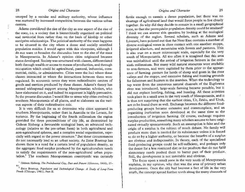
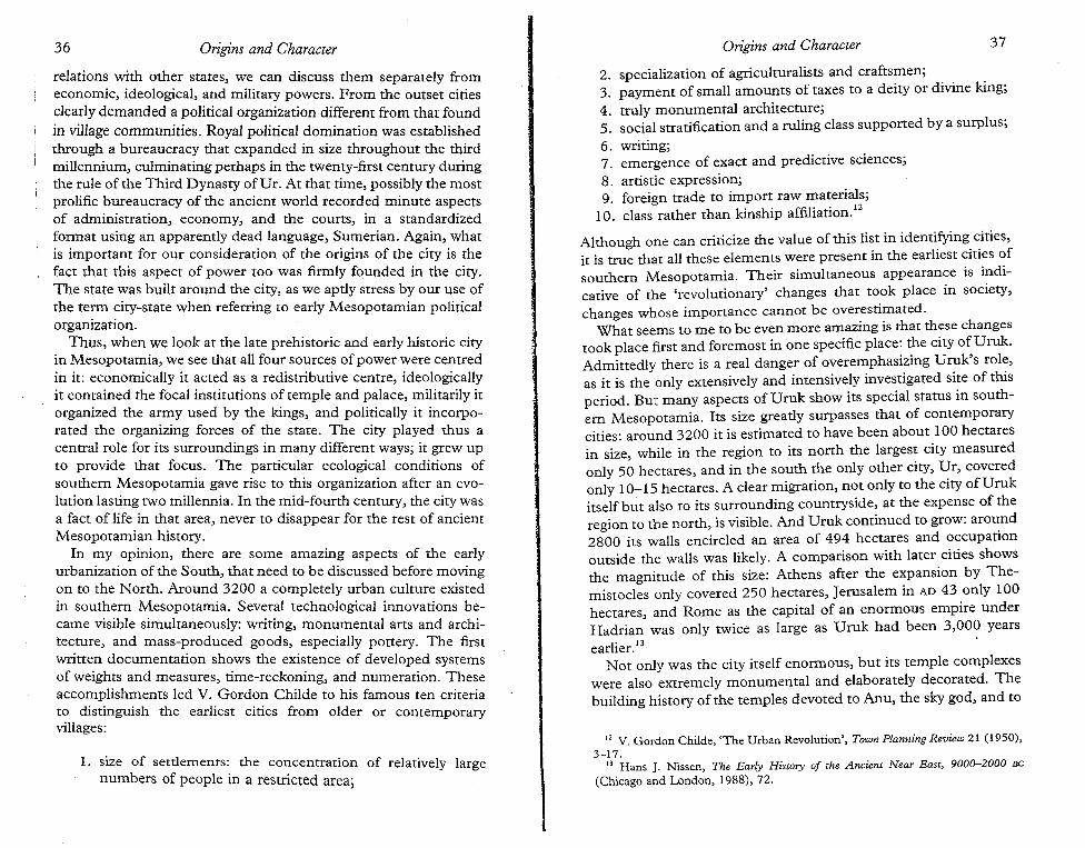
FIG. 2.1 Uruk vase with reconstruction of the image of the city ruler inthe top register
33Origins and Character
7 Stela of the Vultures, col. iv 1. IS-col. v 1. 17, Horst Steible, Die altsumerischeBau- lind Weihinschriften I (Wiesbaden, 1982), 122-3.
Inanna stood by him, and named him 'Eana-Inanna-Ibgalkaka-atum'. Sheplaced him on the good lap of Ninhursag. Ninhursag [laid him] on hergood breast. Ningirsu rejoiced over Eanatum, semen placed in the wombby Ningirsu. Ningirsu measured him with his span: (he was) five cubits andone span tall! With joy Ningirsu [gave him the kingship of Lagash].7
Similarly, the 'Sacred Marriage Rite' came to involve the king whohad intercourse with the goddess in order to assure the fertility ofthe land.
Traces of conflict between secular and religious leaders are noticeable in texts from the best documented city-state, Lagash. Inthe early twenty-fourth century the distinction between the twoseems to have been eradicated when king Uru'inimgina proclaimedan edict ostensibly placing all lands in the hand of the city-gods,but in reality taking control of all temple domains himself. Laterkings always held the position of high priest or even legitimizedtheir rule by accepting divine status. The ideology of the secularpower could thus not be separated from religion. Both temple andpalace were located in the city, and the kings always stressed theirurban background. So, here also the city acted as an ideologicalcentre for the state.
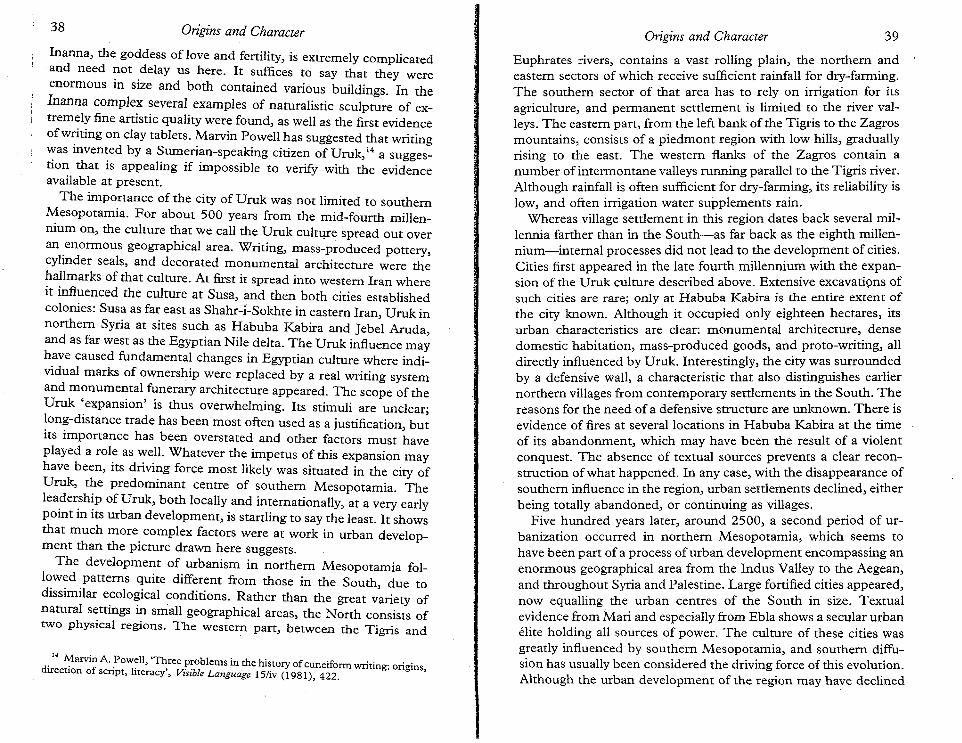
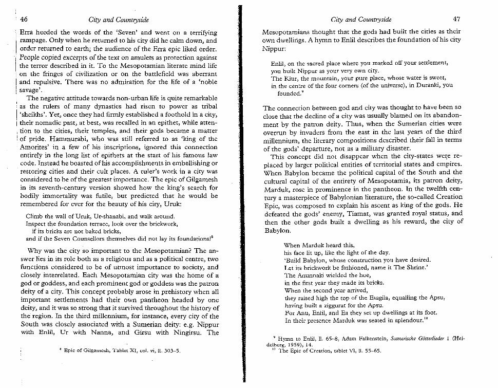
Evidence for military engagement goes back to the pictorialrepresentations of the late fourth millennium (Fig. 2.2), but itbecomes abundant only in the mid-third millennium when royalinscriptions and monuments boast about military campaigns
With the rise of kingship, a secular authority in need of anideological basis developed alongside the religious one. This basiswas provided through a combination of military and religious leadership. The latter had been provided by the priesthood, whosepowers needed to be usurped before the military commander couldclaim religious leadership as well. The king fought battles againstother city-states, but these battles allegedly were to protect theproperty of the city god. The conflict, lasting more than a century,over an agricultural area between the neighbouring city-statesUmma and Lagash is portrayed as the defence of the rights of thegod Ningirsu by successive kings of his city-state, Lagash. Oneking, Eanatum, even portrays himself as having been bred asNingirsu's champion, and nurtured by the goddess Ninhursag:
Origins and Character32
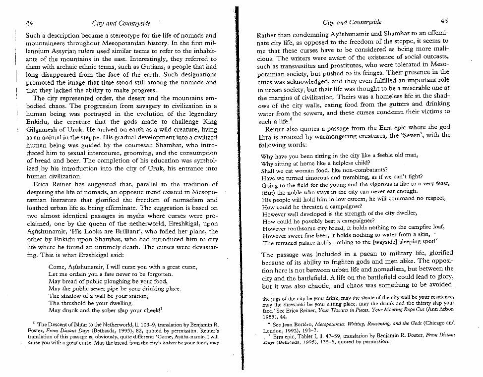
have taken the role as mediator between the people and the gods.A late fourth-millennium carving on a stone vase found at Uruk(Fig. 2.1) shows a row of naked men carrying vessels and jars ofproduce to a goddess, identified by the symbols behind her asInanna, the goddess of procreation. In front of her stands the cityruler, represented larger than his men and fully dressed in ceremonial robe, clearly acting as an intermediary. Rituals of fertilityinvolving the ruler and the goddess were common until the eighteenth century at least. It is reasonable to assume that religiousideology was used by the priesthood to extract produce from therural population, but its exact methods are not revealed to us.

8 Robert McC. Adams, Heartland of Cities (Chicago and London, 1981),81.
against neighbouring city-states or distant countries. All we knowabout the military involves such warfare, and the rise of the secularking has been convincingly related to the increased hostility between competing cities in southern Mesopotamia. Military powerwas always held by the palace located in the city, although thepriest-ruler may have held that authority in the late fourth millennium as well. Feudal-style manor lords who delivered troops to theking when he needed them, and who raided on their own account,when free to do so, did not exist. Even when states relied onmilitary levies from semi-nomadic tribes, as is documented in thetexts from Mari, the administration and command of these troopsremained an urban affair. The state's military power was thuscentrally controlled in the city.
This military power relates, however, only to the 'international'affairs of the early city-states. Was military power also used by theurban elites in order to control the rural hinterland? Adams, forinstance, has suggested that military coercion may have forced theexchange between villages and towns in the mid-fourth millennium." In the early historical periods we do not find any directevidence for such coercion, however. A standing army in the service of the king was perhaps only created in the twenty-fourthcentury by Sargon of Akkade, who claimed to have fed daily 5,400soldiers, most likely a fictitious number. These men, and theirsuccessors in the employ of later dynasties, were involved in expeditions outside the heartland of their states. Yet the twenty-firstcentury kings ofUr appointed a military hierarchy, with blood.tiesto the royal house, next to the civil bureaucracy in the core provinces. These military men seem to-have been installed to guarantee
34 Origins and Character
FIG. 2.2 Late fourth-millennium sealing with combat scene
Origins and Character 35
to the king the loyalty of the civilian administrators who had localties-not to help them extract resources from the local populations.Only in the peripheral areas of the state did the military fulfil therole of tax collectors for the kings in Ur.
Although active opposition to the king by his citizens is referredto in the omen literature," the use of the army against residents ofthe countryside is never attested, as far as I know. No installationswhere such military troops could have been housed are visible inthe archaeological record before the appearance of arsenals inAssyria of the first millennium. The collection of taxes seems tohave been taken care of by bureaucrats without threat or violentresistance. Peasant revolts are not attested in Mesopotamian history. On the other hand, these bureaucrats may have relied onsoldiers to enforce their demands. In early second-millenniumtexts, men with military titles are sometimes perceived as a threat,as can be seen from this passage of a letter from Dr:
Concerning the field, the allotment of Sin-abushu which you have takenunlawfully and have given to Ili-idinnam, Sin-abushu went and approached the king. The king gave him a soldier. Be quick! Before thesoldier of the king arrives and they make you give compensation for thefield, return the field to its owner. It is urgent! 10
The use of the military in internal affairs may thus have been morecommon than is suggested by the documentation.
The last source of power, political, is harder to define, especiallysince the military and ideological aspects have been stripped fromit, a criticism that has been expressed against Mann's model. Mannseparated political from military powers, describing as political'those of centralized, institutionalized, territorial regulation'/1 asdistinguished from decentralized, often independent, powers ofmilitary groups. If we regard politics as the actions and manoeuvresof the state, both for its internal organization and for its diplomatic
9 See J. Borrero, 'Le Pouvoir royal et ses limitations d'apres les textesdivinatoires', in A. Finet (ed.), La Voix de l'opposition en Mesopotamie (Brussels,1973), 119-65.
10 H. H. Figulla and W. J. Martin, Letters and Documents of the Old BabylonianPeriod (Ur Excavations, Texts 5; London and Philadelphia, 1953), no. 45, lines 517.
11 Michael Mann, The Sources of Social Power 1 (Cambridge, 1986), 11. Theseparation of military power from political power has been criticized, e.g. by PerryAnderson, A Zone of Engagement (London and New York, 1992), 77; and John A.Hall, Powers and Liberties (Oxford, 1985), 19 n. 13.
36 Origins and Character Origins and Character 37
relations with other states, we can discuss them separately fromeconomic, ideological, and military powers. From the outset citiesclearly demanded a political organization different from that foundin village communities. Royal political domination was establishedthrough a bureaucracy that expanded in size throughout the thirdmillennium, culminating perhaps in the twenty-first century duringthe rule of the Third Dynasty ofUr. At that time, possibly the mostprolific bureaucracy of the ancient world recorded minute aspectsof administration, economy, and the courts, in a standardizedformat using an apparently dead language, Sumerian. Again, whatis important for our consideration of the origins of the city is thefact that this aspect of power too was firmly founded in the city.The state was built around the city, as we aptly stress by our use ofthe term city-state when referring to early Mesopotamian politicalorganization.
Thus, when we look at the late prehistoric and early historic cityin Mesopotamia, we see that all four sources of power were centredin it: economically it acted as a redistributive centre, ideologicallyit contained the focal institutions of temple and palace, militarily itorganized the army used by the kings, and politically it incorporated the organizing forces of the state. The city played thus acentral role for its surroundings in many different ways; it grew upto provide that focus. The particular ecological conditions ofsouthern Mesopotamia gave rise to this organization after an evolution lasting two millennia. In the mid-fourth century, the city wasa fact of life in that area, never to disappear for the rest of ancientMesopotamian history.
In my opinion, there are some amazing aspects of the earlyurbanization of the South, that need to be discussed before movingon to the North. Around 3200 a completely urban culture existedin southern Mesopotamia. Several technological innovations became visible simultaneously: writing, monumental arts and architecture, and mass-produced goods, especially pottery. The firstwritten documentation shows the existence of developed systemsof weights and measures, time-reckoning, and numeration. Theseaccomplishments led V. Gordon Childe to his famous ten criteriato distinguish the earliest cities from older or contemporaryvillages:
1. size of settlements: the concentration of relatively largenumbers of people in a restricted area;
2. specialization of agriculturalists and craftsmen; .. .3. payment of small amounts of taxes to a deity or divine king;4. truly monumental architecture;5. social stratification and a ruling class supported by a surplus;
6. writing;7. emergence of exact and predictive sciences;8. artistic expression;9. foreign trade to import raw materials;
10. class rather than kinship affiliatiori.f
Although one can criticize the value of this list in identi.fying.~ities,it is true that all these elements were present in the earliest cities ofsouthern Mesopotamia. Their simultaneous appearance is indicative of the 'revolutionary' changes that took place in society,changes whose importance cannot be overestimated.
What seems to me to be even more amazing is that these changestook place first and foremost in one specific place: ~e city o~Uruk.Admittedly there is a real danger of overemphasizing U~k s rol~,as it is the only extensively and intensively investigated site of thisperiod. But many aspects of Uruk show its special status in southern Mesopotamia. Its size greatly surpasses that of contemporarycities: around 3200 it is estimated to have been about 100 hectaresin size while in the region to its north the largest city measuredonly 5~ hectares, and in the south the only other city, ~r, coveredonly 10-15 hectares. A clear migration, not only to the CItyofUrukitself but also to its surrounding countryside, at the expense of theregion to the north, is visible. And Uruk continued to grow: aro~nd2800 its walls encircled an area of 494 hectares and occupationoutside the walls was likely. A comparison with later cities showsthe magnitude of this size: Athens after the expansion by Themistocles only covered 250 hectares, Jerusalem in AD 43 only 100hectares, and Rome as the capital of an enormous empire underHadrian was only twice as large as Uruk had been 3,00? yearsearlier. 13
Not only was the city itself enormous, but its temple complexeswere also extremely monumental and elaborately decorated. Thebuilding history of the temples devoted to Anu, the sky god, and to
12 V. Gordon Childe, 'The Urban Revolution', Town Planning Review 21 (1950),3-17.
13 Hans J. Nissen, The Early History of the Ancient Near East, 9000-2000 Be
(Chicago and London, 1988), 72.
• 14 ~arvin A'.PoW~ll, '~ree ~~oblems in the history of cuneiform writing: origins,direction of script, hteracy, Visible Language 15/iv (1981), 422.
Inanna, the goddess of love and fertility, is extremely complicated.and need not delay us here. It suffices to say that they wereenormous in size and both contained various buildings. In thelnanna complex several examples of naturalistic sculpture of extremely fine artistic quality were found, as well as the first evidenceof writing on clay tablets. Marvin Powell has suggested that writingwas invented by a Sumerian-speaking citizen of Uruk, 14 a suggestion that is appealing if impossible to verify with the evidenceavailable at present.
The importance of the city of Uruk was not limited to southernMesopotamia. For about 500 years from the mid-fourth millennium on, the culture that we call the Uruk culture spread out overan enormous geographical area. Writing, mass-produced pottery,cylinder seals, and decorated monumental architecture were thehallmarks of that culture. At first it spread into western Iran whereit influenced the culture at Susa, and then both cities establishedcolonies: Susa as far east as Shahr-i-Sokhte in eastern Iran, Uruk innorthern Syria at sites such as Habuba Kabira and Jebel Aruda,and as far west as the Egyptian Nile delta. The Uruk influence mayhave caused fundamental changes in Egyptian culture where individual marks of ownership were replaced by a real writing systemand monumental funerary architecture appeared. The scope of theUruk 'expansion' is thus overwhelming. Its stimuli are unclear;long-distance trade has been most often used as a justification, butits importance has been overstated and other factors must haveplayed a role as well. Whatever the impetus of this expansion mayhave been, its driving force most likely was situated in the city ofUruk, the predominant centre of southern Mesopotamia. Theleadership of Uruk, both locally and internationally, at a very earlypoint in its urban development, is startling to say the least. It showsthat much more complex factors were at work in urban development than the picture drawn here suggests.
The development of urbanism in northern Mesopotamia followed patterns quite different from those in the South, due todissimilar ecological conditions. Rather than the great variety ofnatural settings in small geographical areas, the North consists oftwo physical regions. The weste~ part, between the Tigris and
Euphrates rivers, contains a vast rolling plain, the northern andeastern sectors of which receive sufficient rainfall for dry-farming.The southern sector of that area has to rely on irrigation for itsagriculture, and permanent settlement is limited to the river valleys. The eastern part, from the left bank of the Tigris to the Zagrosmountains, consists of a piedmont region with low hills, graduallyrising to the east. The western flanks of the Zagros contain anumber of intermontane valleys running parallel to the Tigris river.Although rainfall is often sufficient for dry-farming, its reliability islow, and often irrigation water supplements rain.
Whereas village settlement in this region dates back several millennia farther than in the South-as far back as the eighth millennium-internal processes did not lead to the development of cities.Cities first appeared in the late fourth millennium with the expansion ofthe Uruk culture described above. Extensive excavations ofsuch cities are rare; only at Habuba Kabira is the entire extent ofthe city known. Although it occupied only eighteen hectares, itsurban characteristics are clear: monumental architecture, densedomestic habitation, mass-produced goods, and proto-writing, alldirectly influenced by Uruk. Interestingly, the city was surroundedby a defensive wall, a characteristic that also distinguishes earliernorthern villages from contemporary settlements in the South. Thereasons for the need of a defensive structure are unknown. There isevidence of fires at several locations in Habuba Kabira at the timeof its abandonment, which may have been the result of a violentconquest. The absence of textual sources prevents a clear reconstruction of what happened. In any case, with the disappearance ofsouthern influence in the region, urban settlements declined, eitherbeing totally abandoned, or continuing as villages.
Five hundred years later, around 2500, a second period of urbanization occurred in northern Mesopotamia, which seems tohave been part of a process of urban development encompassing anenormous geographical area from the Indus Valley to the Aegean,and throughout Syria and Palestine. Large fortified cities appeared,now equalling the urban centres of the South in size. Textualevidence from Mari and especially from Ebla shows a secular urbanelite holding all sources of power. The culture of these cities wasgreatly influenced by southern Mesopotamia, and southern diffusion has usually been considered the driving force of this evolution.Although the urban development of the region may have declined
38 Origins and Character Origins and Character 39
BIBLIOGRAPHY
Of the many theories on urban origins I have only discussed a few.Paul Wheatley, The Pivot of the Four Quarters (Chicago, 1971)
around 2100, numerous cities survived in a framework of alternating political fragmentation and centralization under various powers. At the end of the Bronze Age in the fourteenth-thirteenthcenturies all the main urban centres show signs of great decline,and only in the ninth-eighth centuries did cities reappear as acommon feature throughout northern Mesopotamia. In the lateseventh century Be, when the neo-Assyrian empire collapsed, theregion suffered a total economic decline, and our knowledge of thelevel of urbanization becomes very vague.
Cities were thus not as easily maintained in the North as theywere in the South. The agricultural potential of the region permitted the self-sufficiency of village communities, obviating the needfor redistribution by cities. Only when southern powers installedcentres to organize the extraction of northern goods for their ownbenefit, or when a centralizing political force arose in the Northitself, were cities needed. Throughout the history of the region,cities were less common than in the South, and many of them owedtheir existence more to commercial, military, or political concernsthan to agricultural ones.
In conclusion, this survey of the origins of cities in Mesopotamiahas shown, I believe, that ecological conditions played an important role in their development. In the South the variety of zoneswith different agricultural potentials in close proximity to eachother encouraged the growth of points of exchange. These nodalpoints gained a central role in other aspects of the economy aswell as in religious, military, and political life. In the North, on theother hand, villages sufficed for the management of agriculturalresources, and the city was at first introduced through southerninfluences. Throughout the history of the North the nonagricultural roles of the city predominated: trade, politics, militarism, and religion. They could only appear after the state hadevolved, not before the state. The origins of urbanism in both areashad important repercussions for the characteristics of their cities,which I will explore in further detail in the following chapters.
40 Origins and Character Origins and Character 41
stresses religion. Jane Jacobs, The Economy of Cities (New York,1969), views international trade as the sole catalyst. She reliesheavily on James Mellaart's ideas, as expressed in, for instance,'The Origins and Development of Cities in the Near East', in LouisL. Orlin (ed.), Janus: Essays in Ancient and Modern Studies (1975),8-22. A similar emphasis on international trade for the rise of citiesin southern Mesopotamia is found in H. E. W. Crawford, 'Stimulitowards Urbanization in Early South Mesopotamia', in Peter J.Ucko, Ruth Tringham, and G. W. Dimbleby (eds.), Man, Settlement and Urbanism (London, 1972),761-2. Robert McC. Adams,The Evolution of Urban Society (Chicago, 1966), stresses theredistributive role of cities. His theory was further developed byCharles L. Redman, The Rise of Civilization (San Francisco, 1978).Adams's focus on cities as the prime movers towards civilizationhas been criticized by Richard T. Geruson and Dennis McGrath,Cities and Urbanization (New York, 1977). Mario Liverani,L'origine delle citta, (Rome, 1986), sees population pressure and thedecision to use surplus for communal works as the primary stimulibehind urban growth. Among the numerous other studies, GiorgioBuccellati, 'The "Urban Revolution" in a Socio-Political Perspective', Mesopotamia 12 (Turin, 1977), 19-39, provides an interesting approach to the problem, while the recent work by Jean-LouisHuot et a!', Naissance des cites (Paris, 1990), is easily accessible.
Michael Mann's theories are set forth in his The Sources ofSocialPower 1 (Cambridge, 1986). A very useful review is offered byPerry Anderson, A Zone of Engagement (London and New York,1992), 76-86.
On the city of Uruk and the Uruk culture see among manyothers Hans J. Nissen, The Early History of the Ancient Near East,9000--2000 Be (Chicago and London, 1988), ch. 4; and GuillermoAlgaze, The Uruk World System (Chicago and London, 1993).
For the origins of cities in Assyria, see Abdul jalil jawad, TheAdvent of the Era of Townships in Northern Mesopotamia (Leiden,1965); David Oates, 'The development of Assyrian towns andcities', in Peter J. Ucko, Ruth Tringham, and G. W. Dimbleby(eds.), Man, Settlement and Urbanism (London, 1972), 799-804;and Harvey Weiss (ed.), The Origins of Cities in Dry-Farming Syriaand Mesopotamia in the Third Millennium B.C. (Guilford, Conn.,1986).
43
3
City and Countryside:The Mesopotamian View
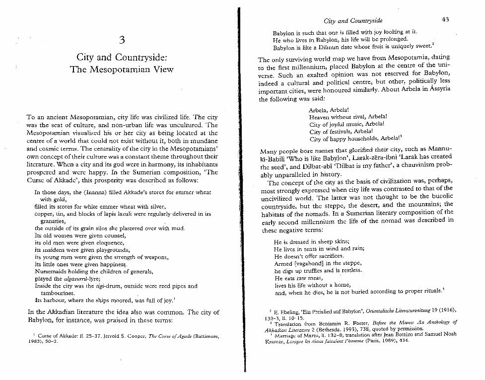
To an ancient Mesopotamian, city life was civilized life. The citywas the seat of culture, and non-urban life was uncultured. TheMesopotamian visualized his or her city as being located at thecentre of a world that could not exist without it, both in mundaneand cosmic terms. The centrality of the city in the Mesopotamians'own concept oftheir culture was a constant theme throughout theirliterature. When a city and its god were in harmony, its inhabitantsprospered and were happy. In the Sumerian composition, 'TheCurse of Akkade', this prosperity was described as follows:
In those days, she (lnanna) filled Akkade's stores for emmer wheatwith gold,
filled its stores for white ernmer wheat with silver,copper, tin, and blocks of lapis lazuli were regularly delivered in its
granaries,the outside of its grain silos she plastered over with mud.Its old women were given counsel,its old men were given eloquence,its maidens were given playgrounds,its young men were given the strength of weapons,its little ones were given happiness,Nursemaids holding the children of generals,played the algasurrti-tvre;Inside the city was the u"gi-drum, outside were reed pipes and
tambourines.Its harbour, where the ships moored, was full of joy.'
In the Akkadian literature the idea also was common. The city ofBabylon, for instance, was praised in these terms:
1 Curse of Akkade: II. 25-37. Jerrold S. Cooper, The Curse ofAgade (Baltimore,1983), 50-2.
City and Countryside
Babylon is such that one is filled with joy looking at it.He who lives in Babylon, his life will be prolonged. .Babylon is like a Dilmun date whose fruit is uniquely sweet."
The only surviving world map we have from Mesopotamia, datingto the first millennium, placed Babylon at the centre of the universe. Such an exalted opinion was not reserved for Babylon,indeed a cultural and political centre, but other, political}y lessimportant cities, were honoured similarly. About Arbela in Assyria
the following was said:
Arbela, Arbela!Heaven without rival, Arbela!City of joyful music, Arbela!City of festivals, Arbela!City of happy households, Arbela!3
Many people bore names that glorified their city, such as Mannuki-Babili 'Who is like Babylon', Larak-zera-ibni 'Larak has createdthe seed', and Dilbat-abi 'Dilbat is my father', a chauvinism prob
ably unparalleled in history.The concept of the city as the basis of civilization was, perhaps,
most strongly expressed when city life was contrasted to that of theuncivilized world. The latter was not thought to be the bucoliccountryside, but the steppe, the desert, and the mountains; thehabitats of the nomads. In a Sumerian literary composition of theearly second millennium the life of the nomad was described in
these negative terms:
He is dressed in sheep skins;He lives in tents in wind and rain;He doesn't offer sacrifices.Armed [vagabond] in the steppe,he digs up truffles and is restless.He eats raw meat,lives his life without a home,and, when he dies, he is not buried according to proper rituals!
2 E. Ebeling, 'Ein Preislied auf Babylon', Orientalische Lueraturzeitung 19 (1916),132-3,1l.1O-15.
3 Translation from Benjamin R. Foster, Before the Muses: An Anthology ofAkkadian Literature 2 (Bethesda, 1993),738, quoted by permission.
, Marriage of Manu, ll. 132-8; translation after Jean Borrero and Samuel NoahKramer, Lorsque les dieux faisaient l'homme (Paris, 1989), 434.
44 City and Countryside City and Countryside 45
Such a description became a stereotype for the life of nomads andmountaineers throughout Mesopotamian history. In the first millennium Assyrian rulers used similar terms to refer to the inhabitants of the mountains in the east. Interestingly, they referred tothem with archaic ethnic terms, such as Gutians, a people that hadlong disappeared from the face of the earth. Such designationspromoted the image that time stood still among the nomads andthat they lacked the ability to make progress.
The city represented order, the desert and the mountains embodied chaos. The progression from savagery to civilization in ahuman being was portrayed in the evolution of the legendaryEnkidu, the creature that the gods made to challenge KingGilgamesh of Uruk. He arrived on earth as a wild creature, livingas an animal in the steppe. His gradual development into a civilizedhuman being was guided by the courtesan Shamhat, who introduced him to sexual intercourse, grooming, and the consumptionof bread and beer. The completion of his education was symbolized. by his introduction into the city of Uruk, his entrance intohuman civilization.
Erica Reiner has suggested that, parallel to the tradition ofdespising the life of nomads, an opposite trend existed in Mesopotamian literature that glorified the freedom of nomadism andloathed urban life as being effeminate. The suggestion is based ontwo almost identical passages in myths where curses were proclaimed, one by the queen of the netherworld, Ereshkigal, uponAsushunamir, 'His Looks are Brilliant', who foiled her plans, theother by Enkidu upon Sharnhat, who had introduced him to citylife where he found an untimely death. The curses were devastating. This is what Ereshkigal said:
Come, Asushunamir, I will curse you with a great curse,Let me ordain you a fate never to be forgotten.May bread of public ploughing be your food,May the public sewer pipe be your drinking place.The shadow of a wall be your station,The threshold be your dwelling.May drunk and the sober slap your cheek!"
5 The DescentofIshtarto theNetherworld, II. 103-9, translation byBenjamin R.Foster, From Distant Days (Bethesda, 1995), 82, quoted by permission. Reiner'stranslation of thispassage is, obviously, quite different: 'Come, Asusu-namir, I willcurseyouwitha greatcurse.Maythebreadfrom the city'sbakers be yourfood,may
Rather than condemning Asushunamir and Shamhat to an effeminate city life, as opposed to the freedom of the steppe, it seems tome that these curses have to be considered as being more malicious. The writers were aware of the existence of social outcasts,such as transvestites and prostitutes, who were tolerated in Mesopotamian society, but pushed to its fringes. Their presence in thecities was acknowledged, and they even fulfilled an important rolein urban society, but their life was thought to be a miserable one atthe margins of civilization. Theirs was a homeless life in the shadows of the city walls, eating food from the gutters and drinkingwater from the sewers, and these curses condemn their victims to
such a life. 6
Reiner also quotes a passage from the Erra epic where the godErra is aroused by warmongering creatures, the 'Seven', with the
following words:
Why have you been sitting in the city like a feeble old man,Why sitting at home like a helpless child?Shall we eat woman food, like non-combatants?Have we turned timorous and trembling, as if we can't fight?Going to the field for the young and the vigorous is like to a very feast,(But) the noble who stays in the city can never eat enough.His people will hold him in low esteem, he will command no respect,How could he threaten a campaigner?However well developed is the strength of the city dweller,How could he possibly best a campaigner?However toothsome city bread, it holds nothing to the campfire loaf,However sweet fine beer, it holds nothing to water from a skin, .The terraced palace holds nothing to the [wayside] sleeping spot!"
The passage was included in a paean to military life, glorifiedbecause of its ability to frighten gods and men alike. The opposition here is not between urban life and nomadism, but between thecity and the battlefield. A life on the battlefield could lead to glory,but it was also chaotic, and chaos was something to be avoided.
the jugs of the citybe yourdrink, maythe shadeof the citywall be your residence,may the threshold be your sitting place, may the drunk and the thirsty slap yourface.' See EricaReiner, Your Thsoarts in Pieces. Your Mooring Rope Cur (AnnArbor,1985), 44.
6 SeeJean Bottero, Mesopotamia: Writing, Reasoning, and the Gods (Chicago andLondon, 1992), 193-7.
7 Erra epic,Tablet I, II. 47-59, translation by Benjamin R. Foster, From DistantDays (Berhesda, 1995), 135-6, quored by permission.
46 City and Countryside City and Countryside 47
Erra heeded the words of the 'Seven' and went on a terrifyingrampage. Only when he returned to his city did he calm down, andorder returned to earth; the audience of the Erra epic liked order.People copied excerpts of the text on amulets as protection againstthe terror described in it. To the Mesopotamian literate mind lifeon the fringes of civilization or on the battlefield was aberrantand repulsive. There was no admiration for the life of a 'noblesavage'.
The negative attitude towards non-urban life is quite remarkableas the rulers of many dynasties had risen to power as tribal'sheikhs'. Yet, once they had firmly established a foothold in a city,their nomadic past, at best, was recalled in an epithet, while attention to the cities, their temples, and their gods became a matterof pride. Hammurabi, who was still referred to as 'king of the
'Amorites' in a few of his inscriptions, ignored this connectionentirely in the long list of epithets at the start of his famous lawcode. Instead he boasted ofhis accomplishments in embellishing orrestoring cities and their cult places. A ruler's work in a city wasconsidered to be of the greatest importance. The epic of Gilgameshin its seventh-century version showed how the king's search forbodily immortality was futile, but predicted that he would beremembered for ever for the beauty of his city, Uruk:
Climb the wall of Uruk, Ur-shanabi, and walk around.Inspect the foundation terrace, look over the brickwork,
if its bricks are not baked bricks,and if the Seven Counsellors themselves did not lay its foundations!"
Why was the city so important to the Mesopotamian? The answer lies in its role both as a religious and as a political centre, twofunctions considered to be of utmost importance to society, andclosely interrelated. Each Mesopotamian city was the home of agod or goddess, and each prominent god or goddess was the patrondeity of a city. This concept probably arose in prehistory when allimportant settlements had their own pantheon headed by onedeity, and it was so strong that it survived throughout the history ofthe region. In the third millennium, for instance, every city of theSouth was closely associated with a Sumerian deity: e.g. Nippurwith Enlil, Dr with Nanna, and Girsu with Ningirsu. The
8 Epic of Gilgamesh, Tablet XI, col. vi, ll. 303-5.
Mesopotamians thought that the gods had built the cities as theirown dwellirigs. A hymn to Enlil describes the foundation of his cityNippur:
Enlil, on the sacred place where you marked off your settlement,you built Nippur as your very own city.The Kiur, the mountain, your pure place, whose water is sweet,in the centre of the four corners (of the universe), in Duranki, you
founded."
The connection between god and city was thought to have been soclose that the decline of a city was usually blamed on its abandonment by the patron deity. Thus, when the Sumerian cities wereoverrun by invaders from the east in the last years of the thirdmillennium, the literary compositions described their fall in termsof the gods' departure, not as a military disaster.
This concept did not disappear when the city-states were replaced by larger political entities of territorial states and empires.When Babylon became the political capital of the South and thecultural capital of the entirety of Mesopotamia, its patron deity,Marduk, rose in prominence in the pantheon. In the twelfth century a masterpiece of Babylonian literature, the so-called CreationEpic, was composed to explain his ascent as king of the gods. Hedefeated the gods' enemy, Tiamat, was granted royal status, andthen the other gods built a dwelling as his reward, the city ofBabylon.
When Marduk heard this,his face lit up, like the light of the day.'Build Babylon, whose construction you have desired.Let its brickwork be fashioned, name it The Shrine.'The Anunnaki wielded the hoe,in the first year they made its bricks.When the second year arrived,they raised high the top of the Esagila, equalling the Apsu,having built a ziggurat for the Apsu.For Anu, Enlil, and Ea they set up dwellings at its foot.In their presence Marduk was seated in splendour. 10
9 Hymn to Enlil, 11. 65-8, Adam Falkenstein, Sumensche Gotterlieder 1 (Heidelberg, 1959), 14.
10 The Epic of Creation, tablet VI, ll. 55-65.
48
relationship to only one of them. The location of political power ina city was considered to be true not only in Mesopotamia itself,but also in the other areas of the Near East with which theMesopotamians were in contact.
The origin of this concept lies in the time of the city-states,when each city truly constituted a separate political power. TheSumerian King List starts with the statement that 'when kingshipwas lowered from heaven, kingship was (first) in (the city) Eridu',and then the text goes on to list a number of cities with the namesof their rulers. It expresses the ideology that kingship could only bepresent in one city at a time, a distortion of the actual historicalsituation where the existence of several contemporaneous city dynasties was the rule rather than the exception. It may thus seemthat the Sumerian King List documents the existence of a conceptof territorial dominion. The justification of the actual territorialcontrol by one city may have been the reason for the King List'scomposition, but it is important that the text fails to define thatterritory, and instead focuses solely upon individual cities, all ofwhich have the ability to act as the centre of political power. Thesuccession of city dynasties was recorded in it from the mythological origin of kingship to the historically attested Isin dynasty(c.1800), and continued in other chronographic texts to registerthe dynasties of the cities of Larsa, Babylon, and Urukug, thuspersisting in locating political power primarily in one city. Later,when Babylonia had irreversibly developed into a territorial state,the rulers continued to refer to themselves as 'king of the city ofBabylon', rather than of the entire country.
The Assyrians applied the same ideology to the city-state ofAssur, as is expressed in the Assyrian King List. The originalpurpose of that list may have been the legitimization of ShamshiAdad's rule over the city of Assur (1813-1781). This foreign kingwas of nomadic descent, and his rule could only be explained byintegrating his ancestors within a list of local city rulers. They wereplaced at the start of the list with the special notation that they were'kings who lived in tents'. Hence, it was acknowledged that nonurban rule was possible, yet highly unusual and leading to an urbanrule. Through later expansion of the list the local dynasty of Assurwas portrayed as being continuous from the third millenniumdown to the reign of Shalmaneser V in the late eighth century. Inreality, several kings did not consider the city to be their political
City and Countryside
Whenever Marduk abandoned the city an event d . t d .. , eprc e In sev-eral literary texts, disaster ensued:
P~op1e's. corpses block the gates. Brother eats brother. Friend strikesfriend WIth a mace. Free citizens stretch out their hands to the poor (tobeg). The sce~tre grows short. Evil lies across the land. Usurpers weakenthe co~ntry. LIOns block the road. Dogs go mad and bite people. Whoeverthey bite does not live, he dies. II
~he ab~enc~ of the patron deity from his or her city caused greatdiSruptIO~S In the cult. The absence of the divinity was not alwaysm~t~phonca1: but often the result of the theft of the cult statue byraiding enemies. Divine statues were commonly carried off 1·b the vi . n wars
y e VIctors In order to weaken" the power of the defeated cities.The c~nse~uence~were so dire that the loss of the statue meritedrecording In ~e historiographic texts. When Marduk's statue wasnot. presez:t In Babylon, the New Year's festival, crucial to thee~tlre cultic ye~r, could not be celebrated. 'For [eight] years underking Sennacherib, for twelve years under king Esarhaddon, thus fortwenty years (altogether), Bel (i.e. Marduk) sjtayed] in Assur andthe New Year's festival was not celebrated.v"
Despite the existence of a national pantheon headed by the godAssur, whose name was used for the original capital and for thecoun:ry.as well, the Assyrians also maintained a strong tradition ofas.socIa~Ing gods wi~ individual cities: Assur with Assur, IshtarWIth NIneveh and WIth Arbela, Ninurta with Kalhu, and Sin withHarran. Deities of lesser rank probably were associated withsmaller urban centres. It is thus no exaggeration to say thatthrou~hout ~es.o~otamian history, cities were regarded as th~dwelhngs of individus] deities, built by these divine beings, andthat th~ fortunes of these cities were thought to depend upon thegoodwill and the presence of those tutelary divinities.!~e second crucial function of the city, closely related to its
religious role, was that of political centre The M .. . . esopotarmansalw.ays saw pol.1tlcal power as being held within a city, not within ananon or a region, Even if in reality a dynasty had fi I. . rm contro overa ternto.ry WIth many urban centres, emphasis was placed on its
11 Marduk Pro he ..K". . '. p cy, c~1. '~, 1.1. 2-11. Rykle Borger, 'Gott Marduk und Gott-~~Ig ~ulgi als Propheten, Bzbllotheca Orientalis 28 (1971), 8
Akitu Chronicle, translation after jean-jac ues Gl "mesopotamienns, (Paris, 1993), 190. q assner, Chronzques
City and Countryside 49
And indeed, the total destruction of a city was used by theMesopotamians as a military technique to instil terror in the defeated enemies, and to terminate their existence as an independentpower. Although the annals talk about the IeveIIing of cities as ifit happened all the time, it is clear that this final solution wasonly used after repeated rebellions. But then it was done witha vengeance as is shown by the destruction of Babylon :by
Sennacherib:
With their corpses I filled the city squares. I carried off alive Shuzubu(Mushezib-Marduk), king of Babylon, together with his family and (officials] into my land. The wealth of that city (Babylon)-silver, gold, precious stones, goods and valuables-I counted out into the hands of mypeople and they took it as their own. The hands of my people took hold ofthe gods' dwelling(s) there and smashed them. They took their pr?pertyand goods ... I destroyed the city and its houses, from foundation toparapet, I devastated and burned them. I razed the brick and earthenworkof the outer and inner walls, of the temples, and of the ziggurat, as muchas there was, and I dumped these into the Arahtu canal. I dug canalsthrough the midst of that city, I flooded it with water. I made its foun~adons disappear, and I destroyed it more completely than a devastatIngflood. So that in future days the site of that city and (its) temples would notbe recognized, I totally dissolved it with water and made it like inundated
land."
The sight of the earth of Babylon carried down the Euphrates anddeposited in the Persian Gulf is said to have terrified the inhabitants of Dilmun, modem-day Bahrain, to such an extent thatthey voluntarily submitted to Assur and presented Sennacheribwith their treasures." The total destruction of cities was usedby the Babylonians as well. Probably their most ignominiousact in today's opinion is the destruction of Jerusalem underNebuchadnezar, repeatedly described in the Hebrew Bible. Thisevent turned Judah into a sparsely populated state without any
political or military significance.Iconographic material also demonstrates the importance of the
city as a political centre. From the ninth century on, a crownappears in Assyria, possibly only worn by queens, which had the
50 City and Countryside
capital. Shamshi-Adad himself ruled from Shubat-Enlil in northe~ Syria, and Assur did not have a special political significance inhIS state. From the ninth century on, Kalhu was Assyria's seat ofgovernment, while Assur remained primarily a religious centre.The city dynasty of Assur was thus a fiction, and the idea wasabandoned when Sargon moved to Dur-Sharrukin after he succeeded Shalmaneser V. But even then the attention of the Assyriankings remained focused upon one town, the seat of their politicalpower, despite the fact that they ruled an empire stretching fromIran to Egypt. .
The Mesopotamians did not only conceive of their own cities asharbouring political and religious powers. They thought that thesame situation existed in the neighbouring lands that they encountered during their military campaigns. This is most obvious in theAssyrian annals where conquests of foreign lands are depicted asthe capture of a series of towns, even in regions where cities musthave been rare, if not non-existent. A few examples from theancient descriptions of Assyrian campaigns will show this clearly.When Sargon during his eighth campaign reached the mountainous region of the Mannaeans, south of Lake Urmia, his opponentMetattati was said to have abandoned all his cities. Sargon claimed,'Their twelve strong and walled cities, together with eighty-fourcities in their neighbourhood, I captured. I destroyed their walls, Iset fire to the houses inside them, I destroyed them like a flood, Iturned them into mounds of ruins."? Even in the marshes at thehead of the Persian Gulf Sennacherib asserted to have destroyednumerous cities. In the account ofhis fourth campaign, against BitJakin, he stated: 'His (Merodach-Baladan's) brothers, the seed ofhis father's house, whom he had left behind by the sea coast,together with the rest of the people ofhis land, I forced to leave BitJakin, (from) the midst of the swamps and marshes, and counted(them) as booty. I turned around. His cities I destroyed and devastated, I turned them into ruins.t'" Even if the last sentence was astock phrase, its constant appearance in the accounts of campaignsin regions with very little urbanization shows that the city was seenas the only possible seat of political power.
City and Countryside 51
13 .Fran<;ois Thureau-Dangin, Une relation de la huitieme campagne de Sargon(Pans, 1912), 16 col. i, n. 89-90.
14 D. D. Luckenbill, The Annals of Sennacherib (Chicago 1924) 35 I ... 1165-70. ' " co. Ill, .
15 Bavian Inscription. D. D. Luckenbill, The Annals of Sennacherib (Chicago,
1924), 83-4 II. 46-8, 50-4.16 See Daniel D. Luckenbill, Ancient RecordsofAssyria and Babylonia II (Chicago,
1927), 185.
Mesopotamian history, new cities were founded as well. Some ofthese were royal foundations, and we might expect that kings wereproud of their work. Yet in the ancient Mesopotamian sources wenotice an ambivalence towards the value of those endeavours andan apparent lack of pride among the founders of new cities. Mesopotamian kings are not known for their false modesty, thus thereasons for this restrained attitude deserve to be investigated. Theinscriptional record on the foundation of new cities is surprisinglylimited. Only a handful of Mesopotamian kings are known to havefounded a city. Sargon of Akkade built the seat of his new dynastyin the twenty-fourth century. However, as its actual location remains uncertain, we have no local inscriptions describing the work.The Kassite king Kurigalzu I (early fourteenth century) built DurKurigalzu, 'fortress of Kurigalzu', modem-day Aqar Quf, north ofthe traditional capital Babylon, but little is known about this city.The surviving inscriptions do not commemorate the construction·of the entire city, only that of individual buildings within it. In thelate thirteenth century T'ukulti-Ninurta moved across the riverfrom Assur to an enormous new settlement. The city, which hecalled Kar-Tukulti-Ninurta or 'Harbour of Tukulti-Ninurta", lost
52 City and Countryside
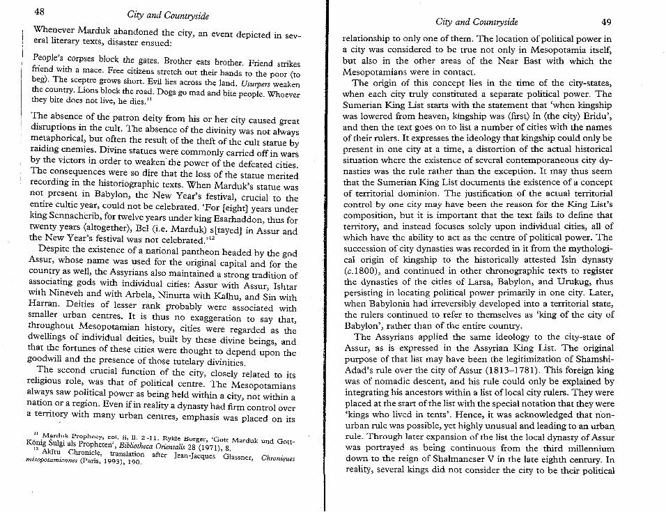
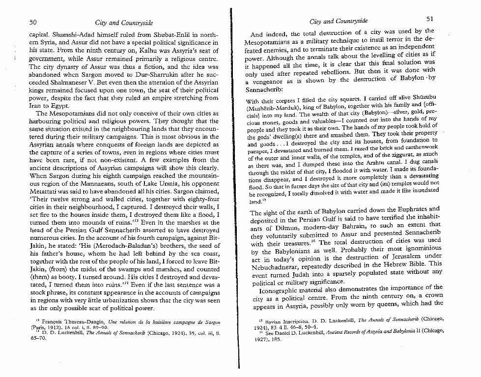
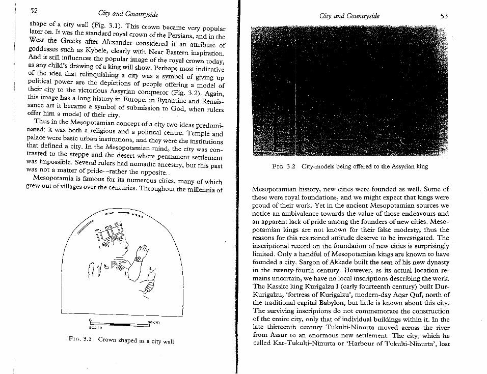
shape of a city wall (Fig. 3.1). This crown became very popularlater on. It was the standard royal crown of the Persians, and in theWest the Greeks after Alexander considered it an attribute ofgoddesses such as Kybe1e, dearly with Near Eastern inspiration.And it still influences the popular image of the royal crown today,as any child's drawing of a king will show. Perhaps most indicativeof ~e idea that relinquishing a city was a symbol of giving uppolitical power are the depictions of people offering a model ofth~i~ city to the victorious Assyrian conqueror (Fig. 3.2). Again,this Image has a long history in Europe: in Byzantine and Renaissance art it became a symbol of submission to God, when rulersoffer him a model of their city. .
Thu~ in the Mesopotamian concept of a city two ideas predominated: It was both a religious and a political centre. Temple andpalace were basic urban institutions, and they were the institutionsthat defined a city. In the Mesopotamian mind, the city was contrasted to the steppe and the desert where permanent settlementwas impossible. Several rulers had nomadic ancestry, but this pastwas not a matter of pride-rather the opposite..
Mesopotamia is famous for its numerous cities, many of whichgrew out ofvillages over the centuries. Throughout the millennia of
FIG. 3.1 Crown shaped as a city wall
Cuy and Countryside
FIG. 3.2 City-models being offered to the Assyrian king
53
17 See Gio~an.ni B. Lafranchi and Simo Parpola, The Correspondence of Sargon IIPart II (Helsinki, 1990), no. 296. '
18 Ibid. no 119, translation quoted by permission.
its special status upon his death. Assurnasirpal II's move to thenewly established Kalhu, modern-day Nimrud, in the ninth century was more successful in that this city remained Assyria's capitalfor some 150 years. After that the centre of power was movedto Sargon's new capital Dur-Sharrukin, modern-day Khorsabad.This was perhaps the only city really intended to be founded onvirgin soil in pre-Greek Mesopotamian history. However, it was leftuncompleted by Sargon's successor, Sennacherib, who rebuilt theold city of Nineveh in its entirety in order that it might function asthe state capital. We know of other settlements named after rulers,but there are no inscriptions commemorating their foundation.When we compare this record to that of Alexander of Macedonand his Hellenistic successors, who covered the Near Easterncountryside with large cities named after themselves, and usedthese as the backbone of their administration of the region, thecontrast is obvious. Alexander alone is said to have founded seventy new cities.
The work involved in the construction of the new cities musthave been enormous. Those we know archaeologically were gigantic in size and contained many monumental buildings. Very littleevidence concerning the organization of the labour and the procurement of building materials is preserved. In their commemorative inscriptions, the kings usually pointed out that conqueredpeople were set to work on the projects, and they also detailed howthey obtained in distant lands the wood and stone needed. It is notaccidental that all the builders of new capitals were highly successful in their military conquests and captured great amounts of bootyand tribute. But local resources were also needed. Sargon II'scorrespondence gives some rare insights on that aspect during thebuilding ofDur-Sharrukin. Countless bricks were produced by thelocal population of the region, seemingly with a quota set for eachvillage. I? The amounts of straw needed were apparently too greatfor the area to bear. The palace herald, Gabbu-ana-Assur, complained as follows: 'All the straw in my country is reserved for DurSharrukin, and my recruitment officers are now running after me(because) there is no straw for the pack animals. Now, what are theking my lord's instructionsrv'" And where did Sargon find the funds
to finance his project? A somewhat enigmatic letter suggests that heneeded to borrow them from his citizens.
To the king, my lord: your servant Shulmanu-[ ]. Good health to theking, my lordl The king my lord told [me]: 'Nobody will pay back yourloans until the work on Dur-Sharrukin is finished!' (Now) they haveref[unded] to the merchants (loans on) the portion of Dur-Sharrukin thathas been constructed, but nobody [has reminded] (the king) about me;570 pounds of silver with [my seal] and due this year have not been repaidas yet. When the king, my lord, sold gold and pre[cious stones] on myaccount I told the king, my lord, that my father was much in debt toHar] ], Huziru and [ ]. After my father('s death) I paid half of [hisdebts], but now their sons [are telling me]: 'Pay us the debts that [your]father owes to our fathers!' As soon as Dur-Sharrukin has been [completely]
bu[ilt], the king my lord [will ] to the house [ ] and pay the debts to[ ]. The king my lord may ask Shar[ru-emuranni]: half of [his work
ass]ignment in Dur-Sharrukin [is finished] .19
The need for funds to pay for the labour and supplies to beobtained locally must have been great, and it is not unlikely that theking had to turn to his wealthy citizens to obtain them. Unfortunately, we do not have much more information on these matters,.but it seems safe to say that the building of new cities was a
complex enterprise.If this conclusion is correct, we would expect the kings who
undertook the work to elaborate on their activities in their buildinginscriptions. Yet, when we study these texts, we find a lack ofinformation on certain aspects of the undertaking. First, the kingsmust have had a motivation for the building of these vast cities, butwhen we look at their records no reason for the work is declared.Assurnasirpal's justification for the work on Kalhu is merely asratement that the city built by his predecessor Shalmaneser hadbecome dilapidated. Divine requests are mentioned by TukultiNinurta and Sargon, yet there is no elaboration of that in theirinscriptions. Sargon seems to have been proud only of the idea thathe was able to settle a place no one else had thought of before. Hisdescription depicts him as 'civilizing' an inhospitable place:
19 Simo Parpola, The Correspondence of Sargon II, Part I (Helsinki, 1987), no. 159,translation quoted by permission. J. N. Postgate, 'The Economic Structure of theAssyrian Empire', in Mogens Trone Larsen (ed.), Power and Propaganda, (Copenhagen, 1979), 221 n. 43 states that this letter indicates that Sargon imposed amoratorium on an debts during the work on Dur-Sharrukin. This seems unlikely asthe creditors of the writer are demanding immediate repayment.
54 City and Countryside City and Countryside 55
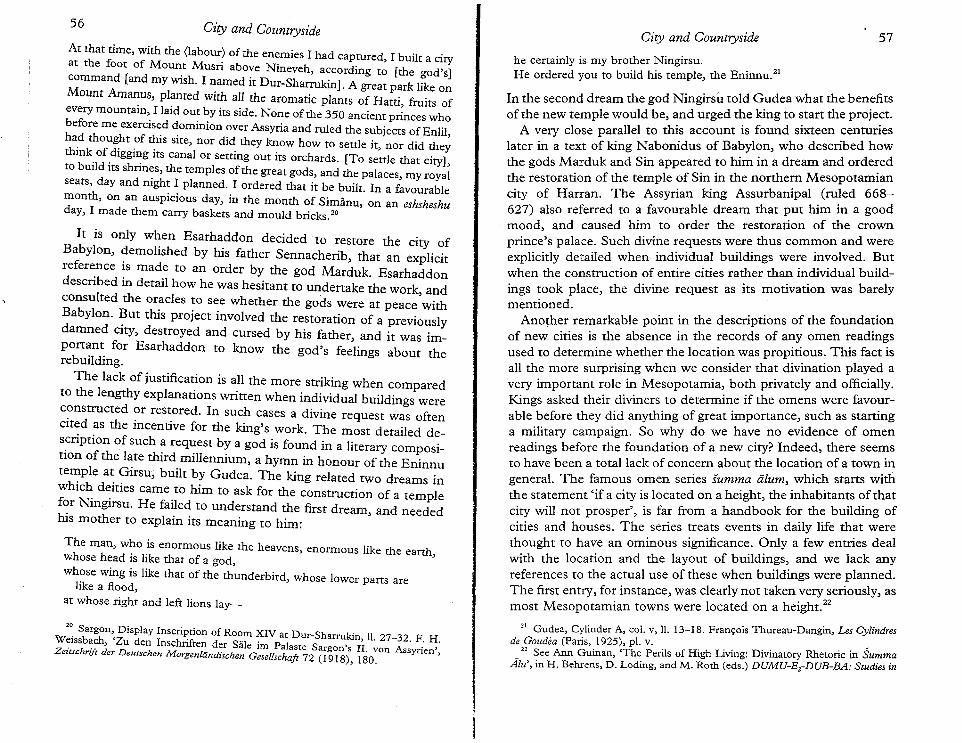
At that time, with the (labour) of the enemies I had captured, I built a cityat the foot of Mount Musri above Nineveh, according to [the god's]command [and my wish. I named it Dur-Sharrukin]. A great park like onMount Amanus, planted with all the aromatic plants of Hatti, fruits ofeverymountain, I laid out by its side. None of the 350 ancient princes whobefore me exercised dominion over Assyria and ruled the subjects of EnIiIha.d thOU~t .of this site, nor did they know how to settle it, nor did the;think of digging its canal or setting out its orchards. [To settle that city]to build its shrines, the temples of the great gods, and the palaces, my royalseats, day and night I planned. I ordered that it be built. In a favourablemonth, on an auspicious day, in the month of Simann, on an eshsheshuday, I made them carry baskets and mould bricks.20
It is only when Esarhaddon decided to restore the city ofBabylon, demolished by his father Sennacherib, that an explicitreference is made to an order by the god Marduk. Esarhaddondescribed in detail how he was hesitant to undertake the work andconsulted the oracles to see whether the gods were at peace'withBabylon. ~ut this project involved the restoration of a previouslydamned CIty, destroyed and cursed by his father, and it was important for Esarhaddon to know the god's feelings about therebuilding.
The lack of justification is all the more striking when comparedto the lengthy explanations written when individual buildings wereconstructed or restored. In such cases a divine request was oftencited as the incentive for the king's work. The most detailed des~riptionof such a request by a god is found in a literary cornposinon of the late third millennium, a hymn in honour of the Eninnutemple at Girsu, built by Gudea. The king related two dreams inwhich deities came to him to ask for the construction of a templefor Ningirsu. He failed to understand the first dream and neededhis mother to explain its meaning to him: '
The man, who is enormous like the heavens, enormous like the earthwhose head is like that of a god, 'whose wing is like that of the thunderbird, whose lower parts are
like a flood,at whose right and left lions lay-
he certainly is my brother Ningirsu.He ordered you to build his temple, the Eninnu."
In the second dream the god Ningirsu told Gudea what the benefitsof the new temple would be, and urged the king to start the project.
A very close parallel to this account is found sixteen centurieslater in a text of king Nabonidus of Babylon, who described howthe gods Marduk and Sin appeared to him in a dream and orderedthe restoration of the temple of Sin in the northern Mesopotamiancity of Harran. The Assyrian king Assurbanipal (ruled 668627) also referred to a favourable dream that put him in a goodmood, and caused him to order the restoration of the crownprince's palace. Such divine requests were thus common and wereexplicitly detailed when individual buildings were involved. Butwhen the construction of entire cities rather than individual buildings took place, the divine request as its motivation was barelymentioned.
Another remarkable point in the descriptions of the foundationof new cities is the absence in the records of any omen readingsused to determine whether the location was propitious. This fact isall the more surprising when we consider that divination played avery important role in Mesopotamia, both privately and officially.Kings asked their diviners to determine if the omens were favourable before they did anything of great importance, such as startinga military campaign. So why do we have no evidence of omenreadings before the foundation of a new city? Indeed, there seemsto have been a total lack of concern about the location of a town ingeneral. The famous omen series summa alum, which starts with.the statement 'if a city is located on a height, the inhabitants of thatcity will not prosper', is far from a handbook for the building ofcities and houses. The series treats events in daily life that werethought to have an ominous significance. Only a few entries dealwith the location and the layout of buildings, and we lack anyreferences to the actual use of these when buildings were planned.The first entry, for instance, was clearly not taken very seriously, asmost Mesopotamian towns were located on a height. 22
56 City and CountryszdeCity and Countryside 57
2~ Sargon, Display Inscri~tionof Room XIV at Dur-Sharrukin, ll. 27-32. F. H.W~lssb~ch, Zu den Inschnften der Sale im Palaste Sargorr's II. VOn Assyrien'ZezlSchrift der Deutschen Morgenlandischen Gesellschaft 72 (1918), 180. '
21 Gudea, Cylinder A, col. V, ll. 13-18. Francois Thureau-Dangin, Les Cylindresde Goudea (Paris, 1925), pl. v. •
22 See Ann Guinan, 'The Perils of High Living: Divinatory Rhetoric in SummaAi«, in H. Behrens, D. Lading, and M. Roth (eds.) DUMU-E,-DUB-BA: Studies in
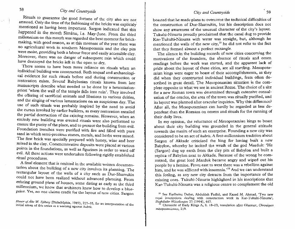
58 City and Countryside
Rituals to guarantee the good fortune of the city also are notattest.ed. Only the time of the fashioning of the bricks was explicitly'mentioned as having been important. Sargon indicated that thishappened in the month Simanu, i.e. May-June. From the thirdmillennium on this month was regarded the best moment for brickmaking, with good reason, as at this moment of the year there wasno agricultural work in southern Mesopotamia and the clay pitswere moist, providing both a labour force and easily accessible clay.Moreover, there was no danger of subsequent rain which couldhave destroyed the bricks left in the open to dry.
There seems to have been more reliance on rituals when anindividual building was constructed. Both textual and archaeological evidence for such rituals before and during construction orrestoration exists. Several Babylonian rituals known from latemanuscripts describe what needed to be done by a lamentationpriest 'when the wall of the temple falls into ruin'. They involvedthe offering of sacrificial animals and libations to various deities,and the singing of various lamentations on an auspicious day. Theuse of such rituals was probably inspired by the need to avoidthe curses invoked by earlier builders, as every restoration entailedthe partial destruction of the existing remains. However, when anentirely new building was erected rituals were also performed toensure the purity of the place, and to protect the building from evil.Foundation trenches were purified with fire and filled with puresand in which semi-precious srones.merals, and herbs were mixed.The first brick was specially prepared with honey, wine and beermixed in the clay. Commemorative deposits were placed at variouspoints in the foundations, as well as figurines in order to ward offevil. All these actions were undertaken following rigidly establishedritual procedures.
A final element that is omitted in the available written documentation about the building of a new city involves its planning. Therectangular layout of the walls of a city such as Dur-Sharrukincould not have been realized without advanced planning. Fromexisting ground plans of houses, some dating as early as the thirdmillennium, we know that architects knew how to develop a blueprint. Yet, no one claims credit for the layout of new cities. Sargon
!f0~or ofAke W SjOber? (Philadelphia, 1989),227-35, for an interpretation of theinitial omen of this series as a warning against hubris.
City and Countryside 59
boasted that he made plans to overcome the technical difficulties ofthe construction of Dur-Sharrukin, but his description does notshow any awareness of the unusual character of the city's layout.Tukulti-Ninurta proudly proclaimed that the canal dug to provideKar-Tukulti-Ninurta with water was straight, but, although hementioned the walls of the new city,23 he did not refer to the factthat they formed almost a perfect rectangle.
The silence in the building records of new cities concerning themotivations of the founders, the absence of rituals and omenreadings before the work was started, and the apparent lack ofpride about the layout of these cities, are all startling. Mesopotamian kings were eager to boast of their accomplishments, as theydid when they constructed individual buildings, feats often described in great detail. The Mesopotamian situation is the complete opposite to what we see in ancient Rome. The cho~ce of a sitefor a new Roman town was determined through extensive consultation of the oracles, the area of the town was ritually purified, andits layout was planned after oracular inquiries. Why this difference?After all the Mesopotamians can hardly be regarded as less dependent 'than the Romans on omens and rituals for the running oftheir daily lives.
In my opinion, the reluctance of Mesopotamian kings to boastabout their city building was grounded in the general attitudetowards the merits of such an enterprise. Founding a new city wasconsidered to be an act of hubris. A first-millennium tradition aboutSargon of Akkade criticized the king for having built a newBabylon, whereby he incited the wrath of the god Marduk: .'He(Sargon) dug up earth from the clay pits of Babylon and built areplica of Babylon next to Akkade. Because of the wr~ng he con:mitted, the great lord Marduk became angry and WIped out hISpeople by a famine. From east to west there was a rebellion againsthim, and he was afflicted with insomnia. ,24 And we can understandthis feeling, as any new city detracts from the importance of theexisting ones. Tukulti-Ninurta highlighted in his inscriptions thatKar-Tukulti-Ninurta was a religious centre to complement the old
23 See Karlheinz Deller, Abdulilah Fadhil, and Kazad M. Ahmad, 'Two newroyal inscriptions dealing with construction work in Kar-Tukulti-Ninurta',Baghdader Mitteilungen 25 (1994), 467.
24 Chronicle of Early Kings A, II. 18-23, translation after Glassner, Chroniquesmesoporanziennes, 219.
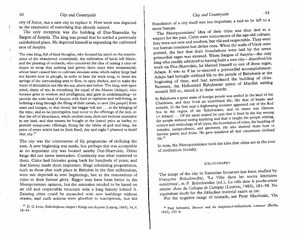
city of Assur, not a new city to replace it. New work was depictedas the expansion of something that already existed.
The only exception was the building of Dur-Sharrukin bySargon of Assyria. The king was proud that he settled a previouslyuninhabited place. He depicted himself as expanding the cultivatedarea of Assyria:
The city was the cornerstone of his programme of civilizing thearea. A new beginning was made, but perhaps this was acceptableas no important city was located nearby Dur-Sharrukin. Otherkings did not stress innovation. Continuity was what mattered tothem. Cities had histories going back for hundreds of years, andthat history made them important. Huge rebuilding programmes,such as those that took place in Babylon in the first millennium,were not depicted as new beginnings, but as the restorations ofcities to their former glory. Bigger may have been better in theMesopotamian opinion, but the extension needed to be based onan old and respectable structure with a long history behind it.Existing cities could be expanded with new buildings withoutshame, and such actions were glorified in inscriptions, but the
The wise king, full of kind thoughts, who focused his mind on the resettlement of the abandoned countryside, the cultivation of lands left fallow,and the planting of orchards, who conceived the idea of raising a crop onslopes so steep that nothing had grown there since time immemorial,whose heart caused him to cultivate desolate areas which earlier kings hadnot known how to plough, in order to hear the work song, to cause thesprings of the surrounding area to flow, to open ditches, and to make thewater of abundance rise like the sea, above and below. The king, with openmind, sharp of eye, in everything the equal of the Master (Adapa), whobecame great in wisdom and intelligence, and grew in understanding-toprovide the wide land of Assyria with food to repletion and well-being, asbefitting a king through the filling of their canals, to save (the people) fromwant and hunger, so that (even) the beggar will not ... at the bringing ofthe wine, and so no interruption may occur in the offerings ofthe sick, sothat the oil of abundance, which soothes men, does not become expensivein my land, and that sesame be bought at the (same) price as barley, toprovide sumptuous offerings, fitting for the tables of god and king, theprice of every article had its limit fixed, day and night I planned to buildthat city.25
.61
The ima e of the city in Sumerian literature has been st,:d~ed.by. g .. h.·l 'La Ville dansles textes htteralresFranS:Olse Bruse wei er, .
,. ,. F Btiischweiler (ed.), La ville dans le proche-onentsumerlens , in . 3) 181 98 Noancien: Aetes du Colloque de Cartigny (Le,:ven, .198, -.equivalent study for the Akkadian material exists as yet... ,
For the negative image of nomads, see Peter Machmlst, On
BIBLIOGRAPHY
City and Countryside
foundation of a city itself was too important a task to be left to a
mere human. . . th' d t aThe Mesopotamians' idea of their crnes was us ldtle 1 0 .
C' . re monuments of the age-o cu ture;respect for the past. ;:~:~ but old and respectable. They werethey were not new an . .' Wh th lls ofUruk were
. b t divine ones en e wanot human creatlons u .. 1 .d b the seven
. d th fact that their foundatlons were ai ypraiseo, e S f Assyria-the onlyprimordial sages was stressed. When .argon o. d ib d his
. who readily admitted to having built a new Clty- escri eking D Sh rrukin he likened himself to one of these sages,work on ur- a, . li h tAdap a It was as if he re-enacted a primordial accom
lP l~ .atth .
. . . . if th le of Baby oma at eAdapa had brought clVlhzed li e to e peop ., f ci .b . . of time and had introduced the bUllding 0 cl.tl.es.
egmnmg H 11' . d Babylonian priest of Marduk WrltmgBerossos, the e emzearound 300 Be, stated it in these words:
forei le was settled in the land of theIn Babylonia a great mass of OreIgn'p'~?pd He like that of beasts andChaldeans and they lived an uncivi ize 1, f the Red
. als I~ the first year a frightening monster appeared out 0 0amm. . . the Bab lonians, and its name was annesSea m the reglOnheo:ame anim?t he says that it lived in the day a~?ng(= Adapa) . '.' Oft. . d that it taught the people wnting,th~ people WlthhOU\ eatln~ ~~:~~g t~~ foundation of cities, the building ofSCIence and tee no ogy 0 a , H lso showed them how to
I .' prudence and geometry. ea... dtemp es, luns., kind all that constitutes CIVIlIzeharvest grains and fruits. He gave man
life."
In sum, the Mesopotamians took the idea that cities are at the root
of civilization literally.
City and Countryside60
25 D. G. Lyon, Keiischrifttexte Sargon's Kimigs von Assyrien (Leipzig, 1883), 34, II.34-43.
2. Paul Schnabel, Berossos und die babylonisch-hellenislische Literatur (Berlin,
1923), 253-4.
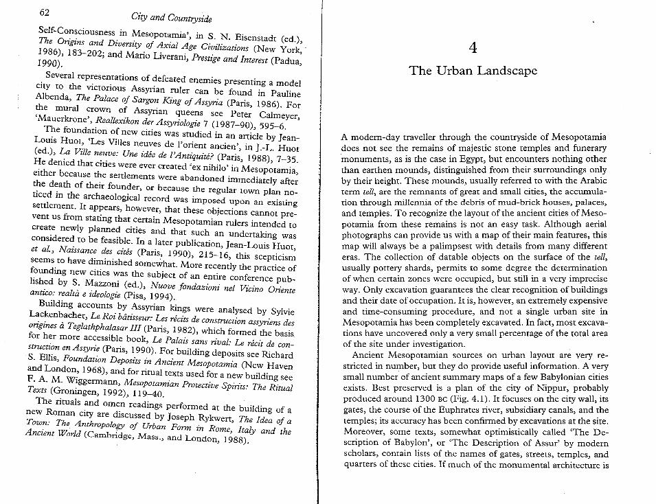
62City and COUntryside
Self-Co?~ciousness" in ~esopotamia', in S. N. Eisenstadt (ed.),The Origins and Dzverszty of Axial Age Civilizations (New York'1986), 183-202; and Mario Liverani, Prestige and Interest (Padua'1990). ,
. Several representations of defeated enemies presenting a modelCIty to the victorious Assyrian ruler can be found in PaulineAlbenda, The Palace of Sargon King of Assyria (Paris, 1986). For~e mural ~rown 0: Assyrian queens see Peter Calmeyer,Mauerkrone , Reallexzkon der Assyn"ologie 7 (1987-90), 595-6.T~e found~tion o~ new cities was studied in an anicle by Jean
LOUIS Huot~ Les Villes neuves de I'orient ancien', in l-L. Huor(ed.), ~a Vzlle n:~ve: Une idee de l'Antiquite? (Paris, 1988), 7-35.~e denied that cmes were ever created 'ex nihilo' in Mesopotamia,either because the settlements were abandoned immediately after~e d~ath of their founder, or because the regular town plan noticed m the archaeological record was imposed upon an existingsettlement. It ap~ears, however, that these objections cannot prevent us from stating that cenain Mesopotamian rulers intended tocrea~e newly planned cities and that such an undenaking wasconsldere~ to be feasible. In a later publication, Jean-Louis Huor,et al., Nazssance des cites (Paris, 1990), 215-16, this scepticismseems. to have d~~inishedsomewhat. More recently the practice of~oundmg new cmes ~as the subject of an entire conference pubhsh~d by S. Mazzoni (ed.), Nuove fondazioni nel Vicino Orienteanuco: realta e ideologz"e (Pisa, 1994).
Building accounts by Assyrian kings were analysed by Sylvie~c~en~acher, Le Roi biitisseur: Les recits de construction assyriens desongines a Teglathphalasar III (Paris, 1982), which formed the basisfor h~r more accessible book, Le Palais sans riual: Le recit de constructz~n en Assyn·~ (Paris, 1990). For building deposits see RichardS. EllIS, Foundatzon Deposits in Ancient Mesopotamia (New Havenand London~ 1968), and for ritual texts used for a new building seeF. A. M. W~ggermann,Mesopotamian Protective Spirits: The RitualTexts (Gronmgen, 1992), 119-40.
The rituals and omen readings performed at the building of anew Roman city are discussed by Joseph Rykwen, The Idea of aTow~: The Anthropology of Urban Form in Rome, Italy and theAnczent World (CaITlbridge, Mass., and London, 1988).
4
The Urban Landscape
A modem-day traveller through the countryside of Mesopotamiadoes not see the remains of majestic stone temples and funerarymonuments, as is the case in Egypt, but encounters nothing otherthan eanhen mounds, distinguished from their surroundings onlyby their height. These mounds, usually referred to with the Arabicterm tell, are the remnants of great and small cities, the accumulation through millennia of the debris of mud-brick houses, palaces,and temples. To recognize the layout of the ancient cities of Mesopotamia from these remains is not an easy task. Although aerialphotographs can provide us with a map of their main features, thismap will always be a palimpsest with details from many differenteras. The collection of datable objects on the surface of the tell,usually pottery shards, permits to some degree the determinationof when cenain zones were occupied, but still in a very impreciseway. Only excavation guarantees the clear recognition of buildingsand their date of occupation. It is, however, an extremely expensiveand time-consuming procedure, and not a single urban site inMesopotamia has been completely excavated. In fact, most excavations have uncovered only a very small percentage of the total areaof the site under investigation.
Ancient Mesopotamian sources on urban layout are very restricted in number, but they do provide useful information. A verysmall number of ancient summary maps of a few Babylonian citiesexists. Best preserved is a plan of the city of Nippur, probablyproduced around 1300 Be (Fig. 4.1). It focuses on the city wall, itsgates, the course of the Euphrates river, subsidiary canals, and thetemples; its accuracy has been confirmed by excavations at the site.Moreover, some texts, somewhat optimistically called 'The Description of Babylon', or 'The Description of Assur' by modemscholars, contain lists of the names of gates, streets, temples, andquarters of these cities. If much of the monumental architecture is
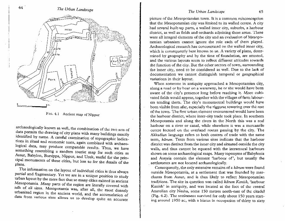
64 The Urban Landscape The Urban Landscape 65
FIG. 4.1 Ancient map of Nippur
archaeologically known as well, the combination of the two sets ofdata permits the drawing of city plans with many buildings exactlyidentified by name. A careful examination of topographic indications in ritual and economic texts, again combined with archaeological data, may produce comparable results. Thus, we havesomething resembling a modem tourist map for such cities asAssur, Babylon, Borsippa, Nippur, and Uruk, useful for the principal monuments of these cities, but less so for the details of theplans.
The information on the layout of individual cities is thus alwayspartial and fragmentary. Yet we are in a unique position to studyurban layout by the mere fact that so many cities existed in ancientMesopotamia. Many parts of the region are literally covered withtells o~ all siz~s. ~esopotamia was, after all, the most denselyurbanized region m the ancient world, and the accumulation ofdata from various sites allows us to develop quite an accurate
picture of the Mesopotamian town. It is a common misconceptionthat the Mesopotamian city was limited to its walled centre. A cityhad several built-up parts, a walled inner city, suburbs, a harbourdistrict, as well as fields and orchards adjoining these areas. Thesewere all integral elements of the city and an evaluation of Mesopotamian urbanism cannot ignore the role each of them played.Archaeological research has concentrated on the walled inner city,which is consequently best known to us. A variety of plans, determined by geography and by the time of foundation, are attested,and the various layouts seem to reflect different attitudes towardsthe function of the city. But the other sectors of town, surroundingthe inner city, need to be considered as well. Due to the lac~ ofdocumentation we cannot distinguish temporal or geographicalvariations in their layout.
When someone in antiquity approached a Mesopotamian city,along a road or by boat on a waterway, he or she would have bee~
aware of the city's presence long before reaching it. More cultivated fields would appear, together with the villages offarm labourers tending them. The city's monumental buildings would havebeen visible from afar, especially the ziggurat towering over the restof the town. The first urban element encountered would have beenthe harbour district, where inter-city trade took place. In southernMesopotamia and along the rivers in the North this was a r~al
harbour on a river or canal, while elsewhere it was a mercantilecentre located on the overland routes passing by the city. TheAkkadian language refers to both centres of trade with the sameterm, kiirum. Texts from various sites indicate that the harbourdistrict was distinct from the inner city and situated outside the citywalls and thus cannot be equated with the intramural harbours, .shown on some archaeological maps. Many toponyms ofBaby10maand Assyria contain the element 'harbour of', but usually thesettlements are not located archaeologically.
. Consequently, the only extensive remains of a karum were foundoutside Mesopotamia, at a settlement that was founded by merchants from Assur, and is thus likely to reflect Mesopotamiantraditions. The site in question was called kdrum Kanish, 'harbourKanish' in antiquity, and was located at the foot of the centralAnatolian city Nesha, some ISO metres north-east of the citadel(Fig. 4.2). The settlement survived for only about 150 years starting around 1950 Be, with a hiatus in occupation of thirty to sixty
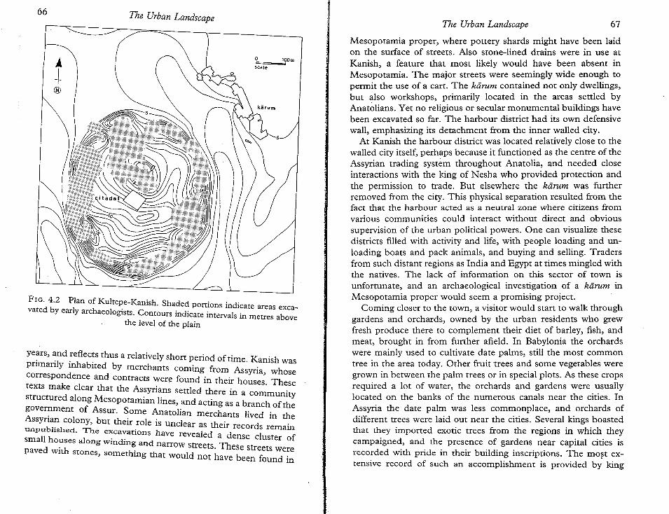
66 The Urban LandscapeThe Urban Landscape 67
FIG. 4.2 Plan of Kultepe-Kanish. Shaded portions indicate areas excavared by early archaeologists. Contours indicate intervals in metres above
the level of the plain
Mesopotamia proper, where pottery shards might have been laidon the surface of streets. Also stone-lined drains were in use atKanish, a feature that most likely would have been absent inMesopotamia. The major streets were seemingly wide enough topermit the use of a cart. The karum contained not only dwellings,but also workshops, primarily located in the areas settled byAnatolians. Yet no religious or secular monumental buildings havebeen excavated so far. The harbour district had its own defensivewall, emphasizing its detachment from the inner walled city.
At Kanish the harbour district was located relatively close to thewalled city itself, perhaps because it functioned as the centre of theAssyrian trading system throughout Anatolia, and needed closeinteractions with the king of Nesha who provided protection andthe permission to trade. But elsewhere the kdrum was furtherremoved from the city. This physical separation resulted from thefact that the harbour acted as a neutral zone where citizens fromvarious communities could interact without direct and obvioussupervision of the urban political powers. One can visualize thesedistricts filled with activity and life, with people loading and unloading boats and pack animals, and buying and selling. Tradersfrom such distant regions as India and Egypt at times mingled withthe natives. The lack of information on this sector of town isunfortunate, and an archaeological investigation of a karum inMesopotamia proper would seem a promising project.
Coming closer to the town, a visitor would start to walk throughgardens and orchards, owned by the urban residents who grewfresh produce there to complement their diet of barley, fish, andmeat, brought in from further afield. In Babylonia the orchardswere mainly used to cultivate date palms, still the most commontree in the area today. Other fruit trees and some vegetables weregrown in between the palm trees or in special plots. As these cropsrequired a lot of water, the orchards and gardens were usuallylocated on the banks of the numerous canals near the cities. InAssyria the date palm was less commonplace, and orchards ofdifferent trees were laid out near the cities. Several kings boastedthat they imported exotic trees from the regions in which theycampaigned, and the presence of gardens near capital cities isrecorded with pride in their building inscriptions. The most extensive record of such an accomplishment is provided b; king
t@
years, and reflects thus a relatively short period of time Ka . h. ilv jnhabi . illS waspnrnan y 1 abited by merchants coming from A . hd ssyna, w ose
correspon ence and Contracts were found in their houses. Thesetexts make clear that the Assyrians settled there j .ere III a communnvstructured along Mesopotamian lines, and acting as a branch of thegove~ment of Assur. Some Anatolian merchants lived in theAssyna~ colony, but their role is unclear as their records remain
:;~~~~::e~'a~~~ ::~::=ti::~have revealed a dense cluster ofpaved with stones so : thnarrow streets. These streets were
, me mg at would not have been found in·

1 A. Kirk Grayson, Assyrian Rulers of the Early First Millennium BG. I (I 114-859BG) (The Royal Inscriptions of Mesopotamia. Assyrian Periods 2; Toronto,Buffalo, and London, 1991),290, II. 36-40, 48-50.
Assurnasirpal II (ruled 883-859), who collected saplings of someforty-one types of trees on his campaigns and planted them near hiscapital city, Kalhu:
I dug a canal from the Upper Zab, cut it through a mountain top, andcalled it Patti-hegalli. I irrigated the lowlands of the Tigris and plantedorchards with all kinds of fruit trees in them. I pressed wine and offeredfirst-fruit offerings to Assur,my lord, and to the temples of my land.... (Here he lists the names of forty-one trees and bushes, many of whichcannot be identified.) The canal cascades from above into the gardens.The alleys smell sweet, brooks like the stars of heaven flow in the pleasuregarden.'
Many of these trees were, of course, not commonly found inAssyria, and the orchards around other cities were less exotic. Theorchards and gardens continued into the suburbs and even insidethe city walls. The trees furnished not only food, but also shadowand protection against the heat of the sun. In the summer theirgreenery must have provided a pleasant retreat from a parchedcountryside.
Soon the visitor would enter the city's suburbs. As is the casetoday, the distinction between satellite villages and suburbs wouldnot always have been clear, as habitation around the city walls wasfar from continuous and permanent. In contrast to the inner cities,which were almost continuously occupied for millennia, suburbswere only intermittently inhabited, when the city's population outgrew its walls, and when they would not be exposed to constantattacks and looting by armies and raiding bandits. Archaeologistsunfortunately have'not devoted much time to the areas outside citywalls, as they do not contain monumental buildings considered toproduce the most spectacular finds. The periodic settlement of thesuburbs has both a positive and a negative consequence for modemresearchers. Advantageous is the fact that, when a suburb is foundand mapped out, we are not presented with a plan that incorporates data from many different time periods, but with one of asingle period of occupation. Of course, that period may have lastedfor more than a century, and changes in the layout of the settlement must have taken place, but these changes were relatively
69The Urban Landscape
minor. On the negative side is the fact that the areas of the suburbs.are often indistinguishable from the surrounding countrysidedue to the lack of accumulation of remains; they are thus oftenploughed over by farmers or, if outside the agricultural zone, asmall amount of sand deposit can hide all traces of them.
As a result, very little information is available on subu~bs, andtheir existence has been recorded only at a few sites. In Just onecase these remains have been mapped extensively, at a site calledTell Taya, its ancient name unknown, located in the Ass'yrian plainnear Tell Afar in north-western Iraq. The most conspicuous element of the site is a high round citadel, 50 metres in diameter,situated on the left bank of the Wadi Taya. Around this citadel wasa small walled city of only 5 hectares. Tell Taya is unique so ~ar
because its extensive ruined suburbs can still be seen on the plain:stone foundations were used for the houses, and these are stillvisible on the surface due to wind erosion of other debris. Onlyone-third of the suburbs have been surveyed in detail, but theirtotal extent has been determined. Around the walled city were 65hectares of dense occupation, themselves surrounded by 90 hectares of scattered development (Fig. 4.3). Considering the -smallwalled city and the extensive suburbs, Tell Taya may have been avery unusual settlement. Yet the features of its suburbs must refi~ct
those of other cities to some extent, and can thus be used as a guide
to visualize those.Although Tell Taya's citadel was occupied inter~ittentlyfr~m
2400 to the first centuries AD, the suburbs were only in use duringits first period of occupation in the twenty-fourth century. Theremains provide ample documentation on their layout. The suburbs were located primarily to the north and the east of the walledcity. They were intersected by two small rivers, the Wadi Taya andthe East Wadi, which in antiquity must have contained more waterthan they do today. The walled inner city could be approached bytwo major roads, one to the west of the Wadi Taya, the other to ~eeast of it. Yet these road systems were, it seems, concerned WIthcommunication to the districts outside the city, rather than withproviding access to the town centre. They did not converge on thecitadel, but only led the traveller to its general area. Within theframework of larger roads was a system of small and narrow sidestreets, without any obvious pattern. A number of them led to theWadi Taya and it is clear that they were intended to give access to
The Urban Landscape68
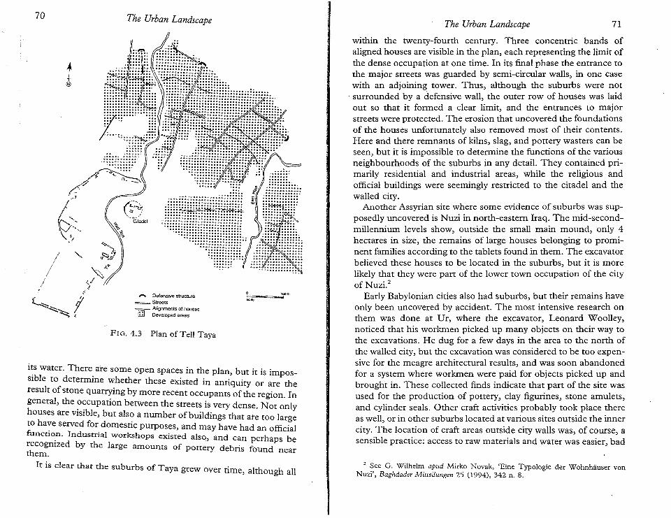
70 The Urban Landscape The Urban Landscape 71
its water. There are some open spaces in the plan, but it is impossible to determine whether these existed in antiquity or are theresult of stone quarrying by more recent occupants of the region. Ingeneral, the occupation between the streets is very dense. Not onlyhouses are visible, but also a number of buildings that ate too largeto have served for domestic purposes, and may have had an officialfunctio.n. Industrial workshops existed also, and can perhaps berecognized by the large amounts of pottery debris found nearthem.
It is clear that the suburbs of Taya grew over time, although all
t@
GO. • ..... DO'.................................• •• a r
./ t~/~' ._-/'.,G~:,-\:,ff
f"""\ DefensivestructureStreets
-- Alignments of houses(;] Developed areas
FIG. 4.3 Plan of TelI Taya
o'-
within the twenty-fourth century. Three concentric bands ofaligned houses are visible in the plan, each representing the limit ofthe dense occupation at one time. In its final phase the entrance tothe major streets was guarded by semi-circular walls, in one casewith an adjoining tower. Thus, although the suburbs were not
. surrounded by a defensive wall, the outer row of houses was laidout so that it formed a clear limit, and the entrances to majorstreets were protected. The erosion that uncovered the foundationsof the houses unfortunately also removed most of their contents.Here and there remnants of kilns, slag, and pottery wasters can beseen, but it is impossible to determine the functions of the variousneighbourhoods of the suburbs in any detail. They contained primarily residential and industrial areas, while the religious andofficial buildings were seemingly restricted to the citadel and thewalled city.
Another Assyrian site where some evidence of suburbs was supposedly uncovered is Nuzi in north-eastern Iraq. The mid-secondmillennium levels show, outside the small main mound, only 4hectares in size, the remains of large houses belonging to prominent families according to the tablets found in them. The excavatorbelieved these houses to be located in the suburbs, but it is morelikely that they were part of the lower town occupation of the cityof Nuzi."
Early Babylonian cities also had suburbs, but their remains haveonly been uncovered by accident. The most intensive research onthem was done at Dr, where the excavator, Leonard Woolley,noticed that his workmen picked up many objects on their way tothe excavations. He dug for a few days in the area to the north ofthe walled city, but the excavation was considered to be too expensive for the meagre architectural results, and was soon abandonedfor a system where workmen were paid for objects picked up andbrought in. These collected finds indicate that part of the site wasused for the production of pottery, clay figurines, stone amulets,and cylinder seals. Other craft activities probably took place thereas well, or in other suburbs located at various sites outside the innercity. The location of craft areas outside city walls was, of course, asensible practice: access to raw materials and water was easier, bad
2 See G. Wilhelm apud Mirko Novak, 'Eine Typologie der Wohnhiiuser vonNuzi', Baghdader Mitteilungen 25 (1994), 342 n. 8.
72 The Urban Landscape The Urban Landscape 73
odours were less likely to irritate citizens, and space was lessrestricted.
Freedom of space was a major reason why people settled outsidethe city walls, which would have been laid out many centuriesearlier, when the population had been much smaller. This optionwas only available when the countryside was not exposed to warfare or raids. In case of an occasional raid the suburban populationcould withdraw within the city walls, but such an arrangementcould not last for prolonged periods of time. Consequently, somecities seem to have established subsidiary walled settlementsinstead of a corona of suburbs. This led to the existence ofagglomerations of two or more cities in close proximity to oneanother. A peculiar example of such an arrangement was found onthe northern border of Babylonia, an area exposed to attacks fromAssyria and the Syrian desert, where in the early second millennium twin Sippars were located a mere 5 kilometres apart. Thus,the suburb was not the only way to deal with a population outgrowing the city walls. But suburbs were a common feature throughoutMesopotamia, and future archaeological research should devotemore attention to them.
After traversing the suburbs the Mesopotamian visitor wouldfinally reach the inner city, the centre of the urban settlement. Thissector has almost always been the sole focus of attention, both ofthe archaeologist and of the illicit digger, as it is most visible on thesurface and promises to produce the most sensational finds. It isthus best known to us, and because of our detailed knowledge weare able to distinguish different plans of the inner cities, determined by geographical circumstances and by the history of theirfoundation. Yet all inner cities of Mesopotamia had certain common characteristics; before discussing the different layouts we areable to discern, I will describe their standard features.
An inner city was always, at least partly, located on a higherelevation than the other sectors of the city. This elevation was dueto artificial terracing in the few cases of new foundations, butusually it was a result of the natural growth of the city. The innerc~ty customarily remained occupied for several millennia in antiqurty, and even more recent settlements, typically only villages, tendt:o be located on the remains of these ancient towns. There wereseveral advantages to keeping a settlement in the same location.
The accumulated collapse of the buildings of earlier occupantsprovided a height that clearly delineated the settlement and had adefensive value. Xenophon reports that the villagers of the areaaround the former city ofKalhu took refuge on top of the ziggurat'sruins when his troops passed by. Once a city wall was built, itrequired less energy to keep it in good order than to build a newone around a new settlement. Moreover, once the ground level ofthe city had risen above that of the countryside, it became impossible to irrigate its surface, and rather than settling on badly neededagricultural land, it made more sense to remain on top of the oldsite. Finally, religious sentiments dictated that temples must remain in the same location. Thus many settlements were occupiedcontinuously for several millennia starting in prehistory, and thecollapse of earlier buildings provided a natural height demarcatingthem from their surroundings.
The inner cities were also clearly distinguished by their defensivewalls. Perhaps the presence of walls was the main characteristic ofa city in the eyes of an ancient Mesopotamian: all representationsof cities prominently display walls, many kings boast of their building or repairing city walls, and even literary works sing their praise.A city without a wall might thus not have been conceivable. Of therelatively few Mesopotamian depictions of cities, Assyrian palacereliefs provide the best record. The typical image of a city consistedof one or more rings of fortification walls with numerous towers atregular intervals, which seem to indicate a walled citadel and one ormore town walls (Fig. 4.4). The same idea, with only a single wall,is shown in the city-models offered to Assyrian kings as a gesture ofsubmission, and, interestingly, also in representations of Assyrianarmy camps (Fig. 4.5). The ubiquitous emphasis on the walls iniconographic material reveals the Mesopotamian concept that theywere a crucial characteristic of the city.
That concept is also reflected in the numerous royal buildinginscriptions commemorating the construction or repair of citywalls. For instance, Tukulti-Ninurta I described his work on thewall of Assur in these terms:
At that time the ancient wall of my city, Assur, which had been built byprevious kings, had become dilapidated and old. I removed its brokendown parts, renewed and restored that wall. Around that wall I dug a large
74 The Urban Landscape The Urban Landscape 75
FIG.4.5 Assyrian representation of army camp
moat-a large moat which no previous king had ever built. Its bottom I cutinto the bedrock with copper picks. Twenty musaru down I reached thewater level. I placed my foundation inscriptions in that wall. 3
Even the literature of Mesopotamia celebrates city walls. Mostfamous is the praise of the walls of Uruk at the beginning and theend of the Epic of Gilgamesh in its first-millennium version." Andindeed, the excavated remains of this city's walls are impressive, Inantiquity they were 9.5 kilometres long and had nearly a thousandsemi-circular bastions. Much later Herodotus started his description of Babylon with an account praising the size of its walls:
It is surrounded by a broad deep moat full of water, and within the moatthere is a wall fifty cubits wide and two hundred high ... On the top of the
3 A. Kirk Grayson, Assyrian Rulers ofthe Third and Second Millennia Be. I (co 1115Be) (The Royal Inscriptions of Mesopotamia. Assyrian Periods 1; Toronto,Buffalo, and London, 1987), 267, ll. 3-10. The exact value of the musaru measureis unknown.
• See Ch. 3, p. 46.
8 SeeStephen Langdon, Die neubabylonischen Kiinigsinschriften (VorderasiatischeBibliothek 4; Leipzig, 1912), Nabonid Nr. 6.
All inner cities were characterized by the presence of monumental buildings. Palaces were always located there, as were the maincity temples. Some shrines may have been located in the suburbs,but all important temples were within the walled inner city. InBabylonian cities the temple of the patron deity was usually theoldest monumental building, hence situated in or near the centre oftown, and on a height in order to be visible from the surroundings.This elevation was not necessarily due to artificial terracing, butoften resulted from the tradition of locating temples exactly on thesame spot, a habit that originated early in prehistory. At the site ofEridu, for instance, a succession of sixteen shrines was excavated inexactly the same location, spanning a period from the sixth to thelate third millennium. The ruins of each earlier shrine werecontained within the foundations of its successor. The sequencestarted with a small one-room shrine, and the temple expandedcontinuously, culminating in a ziggurat of the twenty-first century.The exact location of the earlier temple remains was a matter ofconcern to later builders. In the sixth century, king Nabonidusrelated how the temple of Shamash at Sippar had fallen into ruin,although it had been restored just forty-five years earlier. Specialists examined the situation, and concluded that the last restorationhad been flawed because the original foundations had not beenfollowed." In order to determine exactly where the earlier templehad been, kings of this period were careful to excavate the underlying infrastructure, as failure to adhere to the original plan wasthought to lead to a weak construction.
The accumulation of the debris of earlier monumental buildingsnaturally led to a greater rise of the temple's ground level thanfor the rest of the town. But it became also a special aim of thebuilders. In the late third millennium the ziggurat was developedby creating a succession of massive platforms on top of which asmall shrine was located. This ziggurat was situated either adjacentto the main temple, or at a distance, but then connected to thetemple by a succession of courtyards. It towered over the rest of thecity, and must have presented an impressive sight, considering thatthe authors of the Biblical book of Genesis saw in Babylon'sziggurat a prime example of man's hubris.
76 The Urban Landscape
wa~l ~ey constructed, along each edge, a row of one-roomed buildingsfacing inwards with enough space between for a four-horse chariot to pass.There are ~ hundred gates in the circuit of the wall, all of bronze withbronze upnghtsand lintels.5
From this quote it is clear that a city's defences were not limitedto walls, but also included monumental gates and a moat. For the~atter, advantage was often taken of the presence of a river adjoinmg the CIty, while other sides were protected by excavatedchannel~. An Assyrian account describes the moat dug aroundDur-Iakin, an archaeologically unidentified Babylonian city conquered by Sargon. The moat was almost 100 metres wide, 9 metresdeep, a~d located .some 60 metres in front of the city wall. Bridgeswere built across It, which were cut under attack, while the armywas ~os~tioned in between the moat and the walls. Clearly thisdescription does not refer to a hastily constructed defence: thedigging of the moat had been a massive undertaking. It has beencalculated that to excavate a moat of these dimensions for amedium-sized city of 50 hectares, ten thousand men would havehad to work three and a half months. 6
Massive gates gave access to the inner cities. Some gates, like thefamous Ishtar gate at Babylon, were extensively decorated. Thelocation of ~e northern and southern palaces between that gateand the point where the Euphrates river entered the inner cityshows the need to guard these access points to the city. Althoughmany town plans show numerous gates, it is not certain that all ofthem were in use. For instance, at Dur-Sharrukin several of themwere .blocked off. Access was restricted as much as possible for~ecun~ reasons, and city gates were closed at night to protect themh.abltants~ as is revealed in an Akkadian literary tapas, describinga CIty sleeping under a starry sky:
The countryside is quiet, the land is totally still,the cattle lie down, the people are asleep,the doors are fastened, the city gates closed."
5 Herodotus, Histories, 1. 178-9. Translation by Aubrey de Selincourt (NewYork, 1983), 113.
• Marvin A: ~o~ell, 'Merodach-Baladan at Dur-Iakin: A Noteon the Defense ofBa
7bylomanCrties , Jo.umal of Cuneifonn Studies 34 (1982), 59-61.
. :'\. Leo Oppenheim, 'A New Prayer to the "Gods of the Night" A IBiblica 12 (1959),283,11. 36-8. ' na ecta
The Urban Landscape 77
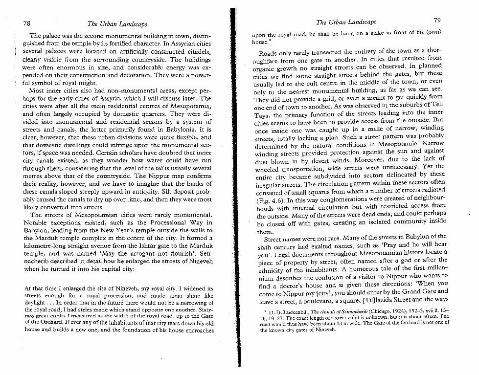
At that time I enlarged the site of Nineveh, my royal city. I widened itsstreets enough for a royal procession, and made them shine likedaylight ... In order that in the future there would not be a narrowing ofthe royal road, I had steles made which stand opposite one another. Sixtytwo great cubits I rrieasurecl as the width of the royal road, up to the Gateof the Orchard. If ever any of the inhabitants of that city tears down his oldhouse and builds a new one, and the foundation of his house encroaches
The palace was the second monumental building in town, distinguished from the temple by its fortified character. In Assyrian citiesseveral palaces were located on artificially constructed citadels,clearly visible from the surrounding countryside. The buildingswere often enormous in size, and considerable energy was expended on their construction and decoration. They were a powerful symbol of royal might.
Most inner cities also had non-monumental areas, except perhaps for the early cities of Assyria, which I will discuss later. Thecities were after all the main residential centres of Mesopotamia,and often largely occupied by domestic quarters. They were divided into monumental and residential sectors by a system ofstreets and canals, the latter primarily found in Babylonia. It isclear, however, that these urban divisions were quite flexible, andthat domestic dwellings could infringe upon the monumental sectors, if space was needed. Certain scholars have doubted that innercity canals existed, as they wonder how water could have runthrough them, considering that the level of the tell is usually severalmetres above that of the countryside. The Nippur map confirmstheir reality, however, and we have to imagine that the banks ofthese canals sloped steeply upward in antiquity. Silt deposit probably caused the canals to dry up over time, and then they were mostlikely converted into streets.
The streets of Mesopotamian cities were rarely monumental.Notable exceptions existed, such as the Processional Way inBabylon, leading from the New Year's temple outside the walls tothe Marduk temple complex in the centre of the city. It formed akilometre-long straight avenue from the Ishtar gate to the Marduktemple, and was named 'May the arrogant not flourish'. Sennacherib described in detail how he enlarged the streets ofNinevehwhen he turned it into his capital city:
upon the royal road, he shall be hung on a stake in front of his (own)house."
Roads only rarely transected the entirety of the town as a thoroughfare from one gate to another. In cities that resulted fromorganic growth no straight streets can be observed. In plannedcities we find some straight streets behind the gates, but theseusually led to the cult centre in the middle of the town, or evenonly to the nearest monumental building, as far as w~ can see.They did not provide a grid, or even a means to get quickly fromone end of town to another. As was observed in the suburbs ofTellTaya, the primary function of the streets leading into ~e innercities seems to have been to provide access from the outside. Butonce inside one was caught up in a maze of narrow, windingstreets totally lacking a plan. Such a street pattern was probablydete~ined by the natural conditions in Mesopotamia. Nar::ow
winding streets provided protection against the sun and againstdust blown in by desert winds. Moreover, due to the lack ofwheeled transportation, wide streets were unnecessary. Yet theentire city became subdivided into sectors delineated by theseirregular streets. The circulation pattern within these sectors ~ftenconsisted of small squares from which a number of streets radiated(Fig. 4.6). In this way conglomerations :vere cre~ted of neighbourhoods with internal circulation but WIth restricted access fromthe outside. Many of the streets were dead ends, and coul~ pe.rh~psbe closed off with gates, creating an isolated commumty inside
them.Street names were not rare. Many of the streets in Babylon of the
sixth century had exalted names, such as 'Pray and he will hearyou'. Legal documents throughout Mesopotamian history locate apiece of property by street, often named after a god or afte: theethnicity of the inhabitants. A humorous tale of the first millennium describes the confusion of a visitor to Nippur who wants tofind a doctor's house and is given these directions: 'When youcome to Nippur my [city], you should enter by the Grand Gate andleave a street, a boulevard, a square, [Til]lazida Street and the ways
9 D. D. Luckenbill, The Annals ofSennachenb (Chicago, 1924), 152-3, xvii ll. 1316, 19-27. The exact length of a great cubit is unknown, but it is about. 50 em. Thetoad would thus have been about 31 m wide. The Gate of the Orchard IS not one ofthe known city gates of Nineveh.
78 The Urban Landscape The Urban Landscape 79
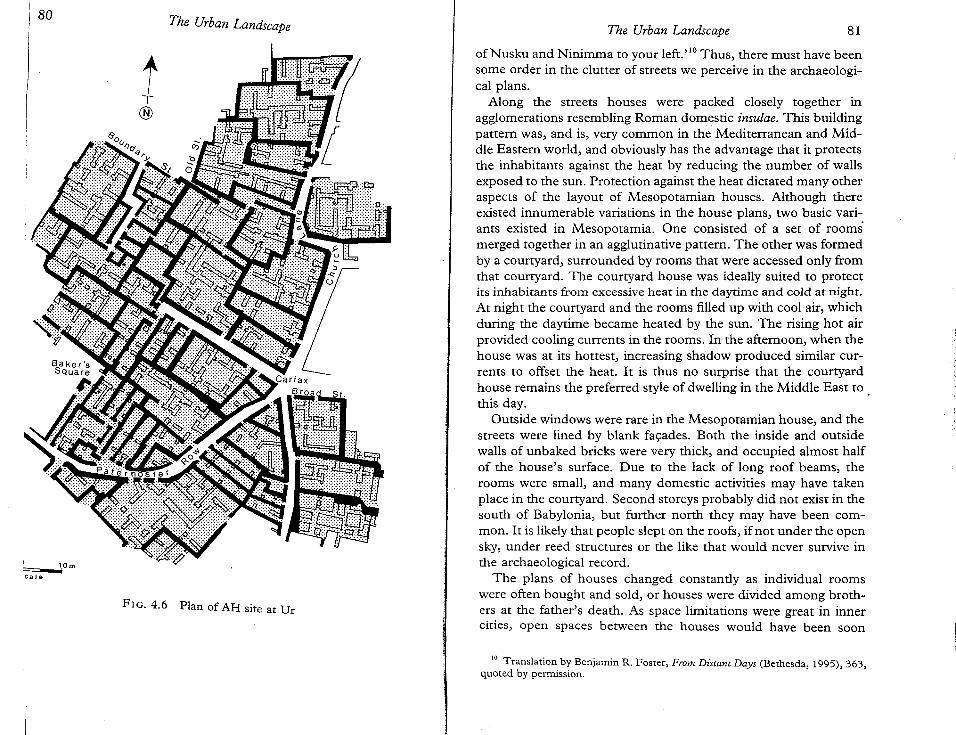
ofNusku and Ninimma to your left."? Thus, there must have beensome order in the clutter of streets we perceive in the archaeological plans.
Along the streets houses were packed closely together inagglomerations resembling Roman domestic insulae. This buildingpattern was, and is, very common in the Mediterranean and Middle Eastern world, and obviously has the advantage that it protectsthe inhabitants against the heat by reducing the number of wallsexposed to the sun. Protection against the heat dictated many otheraspects of the layout of Mesopotamian houses. Although thereexisted innumerable variations in the house plans, two basic variants existed in Mesopotamia. One consisted of a set of rooms'merged together in an agglutinative pattern. The other was formedby a courtyard, surrounded by rooms that were accessed only fromthat courtyard. The courtyard house was ideally suited to protectits inhabitants from excessive heat in the daytime and cold at night.At night the courtyard and the rooms filled up with cool air, whichduring the daytime became heated by the sun. The rising hot airprovided cooling currents in the rooms. In the afternoon, when thehouse was at its hottest, increasing shadow produced similar currents to offset the heat. It is thus no surprise that the courtyardhouse remains the preferred style of dwelling in the Middle East to .this day.
Outside windows were rare in the Mesopotamian house, and thestreets were lined by blank facades. Both the inside and outsidewalls of unbaked bricks were very thick, and occupied almost halfof the house's surface. Due to the lack of long roof beams, therooms were small, and many domestic activities may have takenplace in the courtyard. Second storeys probably did not exist in thesouth of Babylonia, but further north they may have been common. It is likely that people slept on the roofs, if not under the opensky, under reed structures or the like that would never survive inthe archaeological record.
The plans of houses changed constantly as individual roomswere often bought and sold, or houses were divided among brothers at the father's death. As space limitations were great in innercities, open spaces between the houses would have been soon
80
~Omc a Je
The Urban Landscape
t®
FIG. 4.6 . Plan of AH site at Dr
The Urban Landscape 81
10 Translation by Benjamin R. Foster, From Distant Days (Bethesda, 1995), 363,quoted by permission.
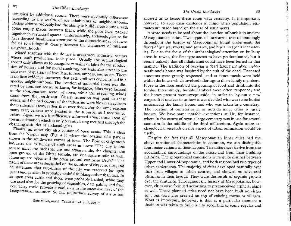
allowed us to locate these zones with certainty. It is important,however, to keep their existence in mind when population estimates are made based on the size of settlements.
A word needs to be said about the location of burials in ancientMesopotamian cities. Two types of interment existed seeminglythroughout the history of Mesopotamia: b~ri~l und~rneath thefloors of houses, streets, and squares, and burial in special ce~eteries. Due to the focus of the archaeologists' attention on bUIlt-u?areas in towns, the first type seems to have predomina:ed,. but It
seems unlikely that all inhabitants could have been buried m thatmanner. The tradition of burying a dead family member underneath one's house was inspired by the cult of the dead. Deceasedancestors were greatly respected, and at times meals were heldwithin the house which involved offerings to those family members.Pipes in the floor enabled the pouring of food and drink into thetombs. Interestingly, burial-chambers were often reopened, and,the bones present were swept aside, in order to layout a n.ewcorpse. It is unclear to us how it was decided who was to be buriedunderneath the family home, and who was taken to a cemetery.The location of cemeteries in or outside inner cities is rarelyknown. We have some notable exceptions at Ur, for instance,where in the centre of town a large cemetery was in use for severalcenturies in the middle of the third millennium. Again more archaeological research on this aspect of urban occupation would beuseful.
Despite the fact that all Mesopotamian inner cities. ~ad ~e
above-mentioned characteristics in common, we can distinguishfour major variants in their layouts. The differences deri~e fro~ ~egeographical surroundings of the cities, and ~om. ~eIr buildinghistories. The geographical conditions were quite distinct betweenUpper and Lower Mesopotamia, and both regions had two types ofurban settlements. The majority of cities developed naturally overtime from villages to urban centres, and showed no advancedplanning in their layout. They were the result of organic. growthover the centuries. Throughout the history of Mesopotamia, however cities were founded according to preconceived artificial plansas well, These planned cities need not have been built on virginsoil, but were also created on top of existing towns or villages.What is important, however, is that at a particular moment adecision was taken to build a city according to some regular and
82 The Urban Landscape
occupied by additional rooms. There were obviously differencesaccording to the wealth of the inhabitants of neighbourhoods.Richer citizens probably had the ability to build larger houses, withsome empty spaces between them, while the poor lived packedtogether in restricted spaces. Unfortunately, archaeologists so farhave devoted insufficient attention to the domestic areas of townsfor us to distinguish clearly between the characters of differentneighbourhoods.
Mixed together with the domestic areas were industrial sectorswhere craft production took place. Usually the archaeological
' record only allows us to recognize remains of kilns for the production of pottery and for metal smelting, but texts also attest to theexistence of quarters of jewellers, fullers, tanners, and so on. Thereis no firm evidence, however, that each craft was concentrated in aspecific neighbourhood. The location of industrial zones was dictated by common sense. In Larsa, for instance, kilns were locatedin the south-eastern sector of town, while the prevailing windscame from the north-east. Clearly attention was paid to thesewinds, and the bad odours of the industries were blown away fromthe residential areas, rather than over them. For the same reasonsmany craft centres were located in the suburbs, as I mentionedbefore. Again we are insufficiently informed about these areas oftowns, a situation which is only recently being rectified through thechanging attitudes of archaeologists.
Finally, an inner city also contained open areas. This is clearfrom the Nippur map (Fig. 4.1) where the location of a park isshown in the south-west corner of town. The Epic of Gilgameshindicates the existence of such areas in town: 'The city is onesquare mile, the orchards are one square mile, the claypits, theopen ground of the Ishtar temple, are one square mile as well.Fhree square miles and the open ground comprise Uruk,"!' Theixtenr of these areas depended on the number ofcity residents, andhe statement that two-thirds of the city was reserved for openpaces and gardens is probably wishful thinking rather than fact. Inhe open areas cattle and sheep were probably herded, while they/ere used also for the growing of vegetables, date palms, and fruitrees. They could provide a cool area in the excessive heat of the1esopotamian summer. So far, no surface survey of a site has
11 Epic of Gilgamesh, Tabler XI col. vi, II. 306-7.
The Urban Landscape 83
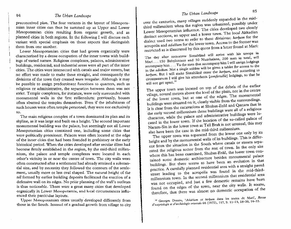
preconceived plan. The four variants in the layout of Mesopotamian inner cities can thus be summed up as Upper and LowerMesopotamian cities resulting from organic growth, and asplanned cities in both regions. In the following I will discuss eachvariant with special emphasis on those aspects that distinguishthem from one another.
Lower Mesopotamian cities that had grown organically werecharacterized by a dense occupation of the inner towns with buildings of varied nature. Religious complexes, palaces, administrativebuildings, residential, and industrial areas were all part of the innercities. The cities were intersected with canals and major streets, butno effort was made to make these straight, and consequently thedivisions of the town they created were irregular. Although it maybe possible to assign predominant functions to quarters, such asreligious or administrative, the separation between them was notstrict. Temple complexes, for instance, were only surrounded withmonumental walls in the first millennium: previously, housesoften abutted the temples themselves. Even if the inhabitants ofsuch houses were often temple personnel, they were not exclusivelyso.
The main religious complex of a town dominated its plan and itsskyline, as it was large and built on a height. The second importantmonumental building was the palace, but seemingly not all LowerMesopotamian cities contained one, including some cities thatwere politically prominent. Palaces were often located at the edgeof the inner cities that had been founded in prehistory or the earlyhistorical period. When the cities developed after secular elites hadbecome firmly established in the region, by the mid-third millennium, the palace and temple complexes were located in eachother's vicinity in or near the centre of town. The city walls wereoften constructed after a settlement had already attained a substantial size, and by necessity they followed the contours of the settlement, usually more or less oval shaped. The natural height of thetell formed by earlier building deposits facilitated the erection of adefensive wall on its edges. No prior planning of the wall's outlinesis thus noticeable. There were a great many cities that developedorganically in Lower Mesopotamia, and local circumstances influenced their particular layouts.
Upper Mesopotamian cities usually developed differently fromthose in the South. Instead of a gradual growth from village to city
8584 The Urban Landscape
The Urban Landscape
over the centuries, many villages suddenly e~panded i~ the mid-tho d millennium when the region was urbamzed, pOSSIbly under
L~~er Mesopotamian influence. The cities developed ~~:e;.rlYdistinct sections, an upper and a lower to~~..The loca Iandialect used two terms to refer to these dIVISIons: ker/;um for theaero olis and adasium for the lower town. Access to the former wa.~restJcted as is illustrated by this quote from a letter found at Man.
ftow Simahliine will arrive with his troops in
The day a er romorr . 0 men in total, willM' 150 Babylonians and 50 Numhalans, 20 .' .
an . . . h' T the men that accompany him I WIll aSSIgn lodgings
~cc=~~:~~mN~~ a ~ingle soldier will be given a tablet for acces~~o the~rhum But I' will make Simahliine enter the kerlJum, a~d accor mg t~cir~um~tances I will give his attendants (comfortable] lodgmgs, so that h
will not get upset. 12
The upper town was located on top of the debris o! the earliervillage several metres above the level of the plain, not m the centreI
, f th d es The monumentaof the lower town, but at one 0 e e g . d'
. I I . ibl from the surroun mgs,buildings were situated on It, c ear y VlSl e th .It is clear from the excavations at Shubat-Enlil and Qattara . ~t mthe early second millennium those buil~ings.were ~ll .of a rehglOu~
hhile the palace and admimstratIve bUlldmgs were 10
c aracter,WIlld 1 fcated in the lower town. If the location of the so-ca e pa ~ce 0
NSin in the lower town at Tell Brak is not unusual, this mayaram-mI. .
also have been the case in the mid-third ml1lennmm. bv iThe upper town was separated from the 10\~er one ~~y .y ItS
hei ht and by the monumental walls of its buildmgs. This IS dlffer~g the si . in the South where canals or streets sepa
ent from e siruanon I iterated the religious sector from the rest of .town. In the ::c~nwhere this has been examined, Shubat-Enhl, the lower torained some domestic architecture besides monume~tal.palacebuildings. But there seems to have been an. evolut1~n m that
t. A carefully planned residential area WIth a straight paved
prac Ice. . . th .d tho dstreet leading to the acropolis was found m e. mI.- iru-millennium town. In the second millennium that r~Sldent1al areawas not occupied, and just a few domestic ~emams have beenfound on the edges of the town, near the CIty walls'. It seems,therefore, that there was almost no domestic occupatIon of the
12 Georges Dossin, 'Adassum et kirhurn dans les textes de Marl',3 Revued'assyriologie et d'archeologie orientale 66 (1972), 117, \1. 11-13, 18-20,24- 3.
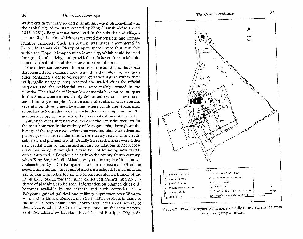
86 The Urban Landscape The Urban Landscape 87
Plan of Babylon. Solid areas are fully excavated, shaded areashave been partly excavated
walled city in the early second millennium, when Shubat-Enlil wasthe capital city of the state created by King Shamshi-Adad (ruled1813-1781). People must have lived in the suburbs and villagessurrounding the city, which was reserved for religious and administrative purposes. Such a situation was never encountered inLower Mesopotamia. Plenty of open spaces were thus availablewithin the Upper Mesopotamian lower city, which could be usedfor agricultural activity, and provided a safe haven for the inhabitants of the suburbs and their flocks in times of crisis.
The differences between those cities of the South and the Norththat resulted from organic growth are thus the following: southerncities contained a dense occupation of varied nature within theirwalls, while northern ones reserved the walled cities for officialpurposes and the residential areas were mainly located in thesuburbs. The citadels of Upper Mesopotamia have no counterpartin the South where a less clearly delineated sector of town contained the city's temples. The remains of southern cities containseveral mounds separated by gullies, where canals and streets usedto be. In the North the remains are limited to one high mound, theacropolis or upper town, while the lower city shows little relief.
Although cities that had evolved over the centuries were by farthe most common in the entirety of Mesopotamia, throughout thehistory of the region new settlements were founded with advancedplanning, or at times older ones were entirely rebuilt with a radically new and planned layout. Usually these settlements were eithernew capital cities or trading and military foundations in Mesopotamia's periphery. Although the tradition of founding new capitalcities is attested in Babylonia as early as the twenty-fourth century,when King Sargon built Akkade, only one example of it is knownarchaeologically-Dur-Kurigalzu, built in the second half of thesecond millennium, just south of modern Baghdad. It is an unusualsite in that it stretches for some 5 kilometres along a branch of theEuphrates, joining together three earlier settlements, and no evidence of planning can be seen. Information on planned cities onlybecomes available in the seventh and sixth centuries, whenBabylonia gained political and military supremacy over WesternAsia, and its kings undertook massive building projects in many ofthe ancient Babylonian cities, completely redesigning several of .them. These refurbished cities were planned on the same pattern,as is exemplified by Babylon (Fig. 4.7) and Borsippa (Fig. 4.8).
1 Summer palace
2 North Palace
3 South Palace
4 Processiona J road
5 t s nt e r Gate
6 Ziggurat
FIG. 4.7
1®
key7 Temple of Marduk
8 ees. aent t«: que r t er
9 Outer Wall
10 Inner WaJl
11 Euphrates R. (ancient course)
12 Temple of Nabu-sha-h a,G
o 50 omJ !
scale
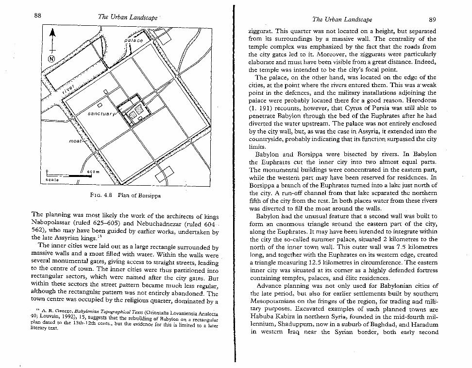
88 The Urban Landscape . The Urban Landscape 89
FIG. 4.8 Plan of Borsippa
The planning was most likely the work of the architects of kingsNabopolassar (ruled 625-605) and Nebuchadnezar (ruled 604562), who may have been guided by earlier works, undertaken bythe late Assyrian kings."
The inner cities were laid out as a large rectangle surrounded bymassive walls and a moat filled with water. Within the walls wereseveral monumental gates, giving access to straight streets, leadingto the centre of town. The inner cities were thus partitioned intorectangular sectors, which were named after the city gates. Butwithin these sectors the street pattern became much less regular,although the rectangular pattern was not entirely abandoned. Thetown centre was occupied by the religious quarter, dominated by a
:3 A. R. .George, Babylonian Topographical Texts (Orientalia Lovaniensia Analecta40, Louvain, 1992), 15, suggests that the rebuilding of Babylon on a rectangularplan dated to the 13th-12th cents., but the evidence for this is limited to a laterliterary text.
ziggurat. This quarter was not located on a height, but separatedfrom its surroundings by a massive wall. The centrality of thetemple complex was emphasized by the fact that the roads fromthe city gates led to it. Moreover, the ziggurats were particularlyelaborate and must have been visible from a great distance. Indeed,the temple was intended to be the city's focal point.
The palace, on the other hand, was located on the edge of thecities, at the point where the rivers entered them. This was a'weakpoint in the defences, and the military installations adjoining thepalace were probably located there for a good reason. Herodotus(1. 191) recounts, however, that Cyrus of Persia was still able topenetrate Babylon through the bed of the Euphrates after he haddiverted the water upstream. The palace was not entirely enclosedby the city wall, but, as was the case in Assyria, it extended into thecountryside, probably indicating that its function surpassed the citylimits.
Babylon and Borsippa were bisected by rivers. In Babylonthe Euphrates cut the inner city into two almost equal parts.The monumental buildings were concentrated in the eastern part,while the western part may have been reserved for residences. InBorsippa a branch of the Euphrates turned into a lake just north ofthe city. A run-off channel from that lake separated the northernfifth of the city from the rest. In both places water from these riverswas diverted to fill the moat around the walls.
Babylon had the unusual feature that a second wall was built toform an enormous triangle around the eastern part of the city,along the Euphrates. It may have been intended to integrate withinthe city the so-called summer palace, situated 2 kilometres to thenorth of the inner town wall. This outer wall was 7.5 kilometreslong, and together with the Euphrates on its western edge, createda triangle measuring 12.5 kilometres in circumference. The easterninner city was situated at its comer as a highly defended fortresscontaining temples, palaces, and elite residences.
Advance planning was not only used for Babylonian cities ofthe late period, but also for earlier settlements built by southernMesopotamians on the fringes of the region, for trading and military purposes. Excavated examples of such planned towns areHabuba Kabira in northern Syria, founded in the mid-fourth millennium, Shaduppum, now in a suburb of Baghdad, and Haradumin western Iraq near the Syrian border, both early second
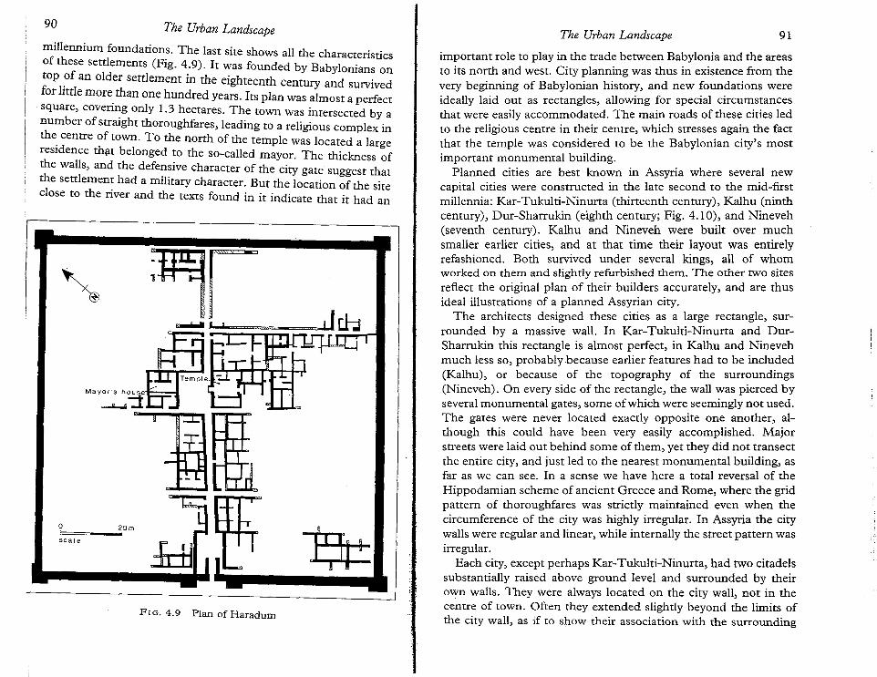
FIG. 4.9 Plan of Haradum
91The Urban Landscape
important role to play in the trade between Babylonia and the areasto its north and west. City planning was thus in existence from thevery beginning of Babylonian history, and new foundations wereideally laid out as rectangles, allowing for special circumstancesthat were easily accommodated. The main roads of these cities ledto the religious centre in their centre, which stresses again the factthat the temple was considered to be the Babylonian city's mostimportant monumental building.
Planned cities are best known in Assyria where several newcapital cities were constructed in the late second to the mid-firstmillennia: Kar-Tukulti-Ninurta (thirteenth century), Kalhu (ninthcentury), Dur-Sharrukin (eighth century; Fig. 4.10), and Nineveh(seventh century). Kalhu and Nineveh were built over muchsmaller earlier cities, and at that time their layout was entirelyrefashioned. Both survived under several kings, all of whomworked on them and slightly refurbished them. The other two sitesreflect the original plan of their builders accurately, and are thusideal illustrations of a planned Assyrian city.
The architects designed these cities as a large rectangle, surrounded by a massive wall. In Kar-Tukulti-Ninurta and DurSharrukin this rectangle is almost perfect, in Kalhu and Ninevehmuch less so, probably because earlier features had to be included(Kalhu), or because of the topography of the surroundings(Nineveh). On every side of the rectangle, the wall was pierced byseveral monumental gates, some of which were seemingly not used.The gates were never located exactly opposite one another, although this could have been very easily accomplished. Majorstreets were laid out behind some of them, yet they did not transectthe entire city, and just led to the nearest monumental building, asfar as we can see. In a sense we have here a total reversal of theHippodamian scheme of ancient Greece and Rome, where the gridpattern of thoroughfares was strictly maintained even when thecircumference of the city was highly irregular. In Assyria the citywalls were regular and linear, while internally the street pattern wasirregular.
Each city, except perhaps Kar-Tukulti-Ninurta, had two citadelssubstantially raised above ground level and surrounded by theirown walls. They were always located on the city wall, not in thecentre of town. Often they extended slightly beyond the limits ofthe city wall, as if to show their association with the surrounding
The Urban Landscape90
o 20m! !
sea Ie
millennium foundations. The last site shows all the characteristicsof these settlements (Fig. 4.9). It was founded by Babylonians ontop of an older settlement in the eighteenth century and survivedfor little more than one hundred years. Its plan was almost a perfectsquare, covering only 1.3 hectares. The town was intersected by anumber of straight thoroughfares, leading to a religious complex inthe centre of town. To the north of the temple was located a largeresidence that belonged to the so-called mayor. The thickness ofthe walls, and the defensive character of the city gate suggest thatthe settlement had a military character. But the location of the siteclose to the river and the texts found in it indicate that it had an
l~-......
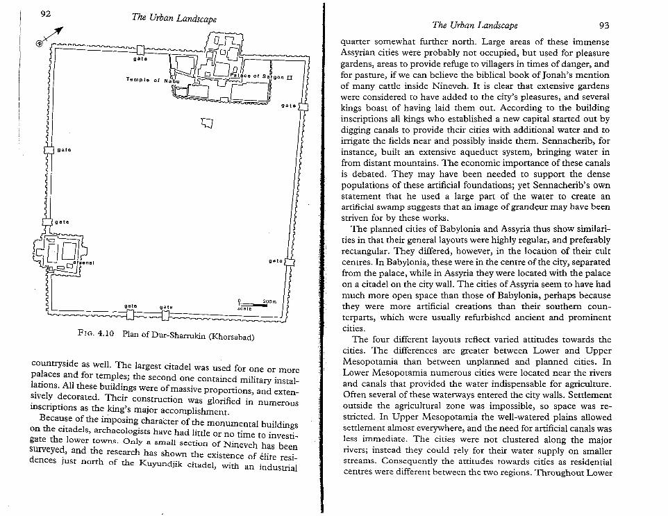
countryside as well. The largest citadel was used for one or morepa~aces and for tem?l~s; the second one contained military install~tlOns. All these bUI1dI.ngs were of massive proportions, and extensively decorated. Their construction was glorified .. " In numerousInSCnptlOns as the king's major accomplishment.Beca~se of the imposing character of the monumental buildings
on the citadels, archaeologists have had little or no time to investigate the lower towns. Only a SInal! section of Nineveh has beensurveye~, and the research has shown the existence of elit .dences rth . I e resI-
Just no of the Kuyundjik citadel, with an industrial
The Urban Landscape93The Urban Landscape
quarter somewhat further north. Large areas of these immenseAssyrian cities were probably not occupied, but used for pleasuregardens, areas to provide refuge to villagers in times of danger, andfor pasture, if we can believe the biblical book of Jonah's mentionof many cattle inside Nineveh. It is clear that extensive gardenswere considered to have added to the city's pleasures, and severalkings boast of having laid them out. According to the buildinginscriptions all kings who established a new capital started out bydigging canals to provide their cities with additional water and toirrigate the fields near and possibly inside them. Sennacherib, forinstance, built an extensive aqueduct system, bringing water infrom distant mountains. The economic importance of these canalsis debated. They may have been needed to support the densepopulations of these artificial foundations; yet Sennacherib's ownstatement that he used a large part of the water to create anartificial swamp suggests that an image of grandeur may have beenstriven for by these works.
The planned cities of Babylonia and Assyria thus show similarities in that their general layouts were highly regular, and preferablyrectangular. They differed, however, in the location of their cultcentres. In Babylonia, these were in the centre of the city, separatedfrom the palace, while in Assyria they were located with the palaceon a citadel on me city wall. The cities of Assyria seem to have hadmuch more open space than those of Babylonia, perhaps becausethey were more artificial creations than their southern counterparts, which were usually refurbished ancient and prominentcities.
The four different layouts reflect varied attitudes towards thecities. The differences are greater between Lower and UpperMesopotamia than between unplanned and planned cities. InLower Mesopotamia numerous cities were located near the riversand canals that provided the water indispensable for agriculture.Often several of these waterways entered the city walls. Settlementoutside the agricultural zone was impossible, so space was restricted. In Upper Mesopotamia the well-watered plains allowedsettlement almost everywhere, and the need for artificial canals wasless immediate. The cities were not clustered along the majorrivers; instead they could rely for their water supply on smallerstreams. Consequently the attitudes towards cities as residentialcentres were different between the two regions. Throughout Lower
? 2?Omscale
gate
gategate
FIG. 4.10 Plan of Dur-Sharrukin (Khorsabad)
gate
92
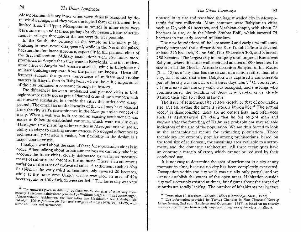
14 The numbers given in different publications for the sizes of cities vary enor~ously. I u~e here mainly those provided by Wolfram Nagel and Eva Strommenger,Altonentahsche Stadte-von der Dorfkultur zur Hochkultur seir Habubah bis
Babylon', ..~6Iner Jahrbuchfiir Vor- und Friihgeschichte 16 (1978-79), 61-75, withsome addmons and corrections.
Mes~potami~nhistory inner cities were densely occupied by domestic dwellings, and they were the logical form of settlement in alimited area. In Upper Mesopotamia houses in inner cities wereless numerous, and at times perhaps barely present, because settlement in villages throughout the countryside was possible.
In the South, the primacy of the temple as the main publicbuilding in town never disappeared, while in the North the palacebecame the dominant structure, especially in the planned cities ofthe first millennium. Military installations were also much moreprominent in Assyria than they were in Babylonia. The first millennium cities of Assyria had massive arsenals, while in Babylonia nomilitary buildings separate from the palace are known. These differences suggest the greater importance of military and secularmatters in Assyria than in Babylonia, where the cultic importanceof the city remained a constant through its history.
The differences between unplanned and planned cities in bothregions were really not so great. Planned cities show a concern withan outward regularity, but inside the cities this order soon disappeared. The emphasis on the linearity of the wall may have resultedfro~ the city wall's pre-eminence in the Mesopotamian concept ofa CIty. When a wall was built around an existing settlement it waseasier to follow its established contours, which were usually oval.Throughout the planning of inner cities in Mesopotamia we see anability to adapt to existing circumstances. No dogged adherence toarchitectural principles is visible, but flexibility in the design is amajor characteristic.
Finally, a word about the sizes of these Mesopotamian cities is inorder. When talking about urban dimensions we can only take intoaccount the inner cities, clearly delineated by walls, as measurements of suburbs are absent at the moment. There is an enormousvariation in the areas of excavated cities. A settlement such as AbuSalabikh in the early third millennium only covered 20 hectareswhile at the same time Uruk's wall surrounded an area of 49dhectares, about 400 ofwhich were settled;" The latter city was very
IS Translation H. Rackham, Aristotle: Politics (Cambridge, Mass., 1977).16 The information provided by Tertius Chandler in Four Thousand Years of
Urban Growth, 2nd edn. (Lewiston and Queensten, 1987), is based on an entirelyuncritical use of data from widely varying sources, and is therefore unreliable.
unusual in its size and remained the largest walled city in Mesopotamia for two millennia. More common were Babylonian citiessuch as Dr, with 61 hectares, and Mashkan-shapir, with about 72hectares in size, or in the North Shubat-Enlil, which covered 75hectares in the early second millennium.
The new foundations of the late second and early first millenniagreatly surpassed these dimensions: Kar-Tukulti-Ninurta coveredat least 240 hectares, Kalhu 360, Dur-Sharrukin 300, and Nineveh750 hectares. The largest city in antiquity until imperial Rome wasBabylon, where the outer wall encircled an area of 890 hectares, Itssize startled the Greeks: Aristotle describes Babylon in his Politics(3. 1. 12) as a 'city that has the circuit of a nation rather than of acity, for it is said that when Babylon was captured a considerablepart of the city was not aware of it three days later'. 15 Of course, notall the area within the city walls was occupied, and the kings whocommissioned the building of these new capital cities clearlywanted their size to reflect grandeur.
The issue of settlement size relates closely to that of populationsize, but estimating the latter is virtually impossible." The textualrecord is disappointing: there are no census lists, and referencessuch as Assurnasirpal II's claim that he fed 69,574 men andwomen after the founding of Kalhu are probably not very reliableindicators of the size of the population. We are thus forced to lookat the archaeological record for estimating populations. Threetechniques are currently popular among prehistorians, based onthe total size of settlement, the sustaining area available to a settlement, and the domestic architecture. All three techniques havean enormous margin of error, which cannot be reduced by theircombined use.
It is not easy to determine the area of settlement in a city at anymoment in time, because no city has been completely excavated.Occupation within the city walls was usually only partial, and wecannot establish the extent of the open areas. Habitation outsidecity walls certainly existed at times, but figures about the spread ofsuburbs are totally lacking. The number of inhabitants per hectare
95The Urban LandscapeThe Urban Landscape94
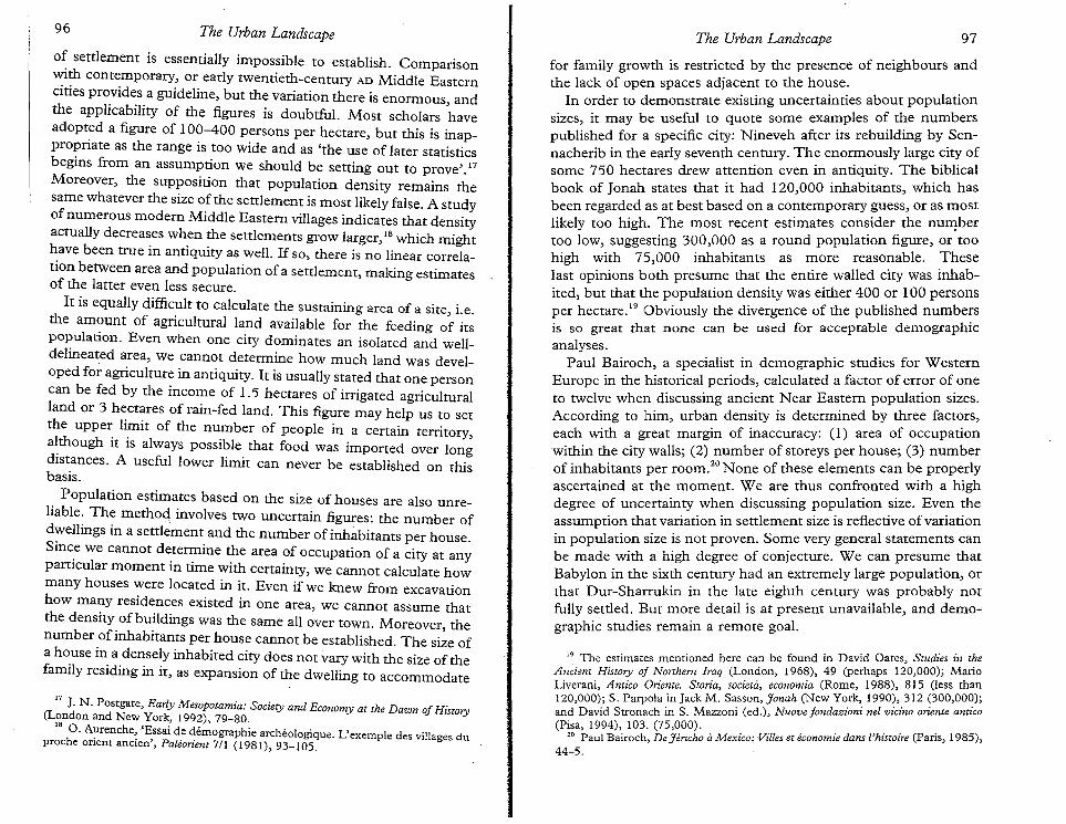
17 J. N. Postgate, Early Mesopotamia: Society and Economy at the Dawn oj History(London and New York, 1992),79-80.
18 O. Aurenche, 'Essai de demographic archeologiqus. L'exemple des villages duproche orient ancien', Paleorient 7/1 (1981),93-105.
of settlement is essentially impossible to establish. Comparisonwith contemporary, or early twentieth-century AD Middle Easterncities provides a guideline, but the variation there is enormous, andthe applicability of the figures is doubtful. Most scholars haveadopted a figure of 100-400 persons per hectare, but this is inappropriate as the range is too wide and as 'the use of later statisticsbegins from an assumption we should be setting out to prove'. 17
Moreover, the supposition that population density remains thesame whatever the size of the settlement is most likely false. A studyofnumerous modem Middle Eastern villages indicates that densityactually decreases when the settlements grow larger, 18 which mighthave been true in antiquity as well. If so, there is no linear correlation between area and population of a settlement, making estimatesof the latter even less secure.
It is equally difficult to calculate the sustaining area of a site, i.e.the amount of agricultural land available for the feeding of itspopulation. Even when one city dominates an isolated and welldelineated area, we cannot determine how much land was developed for agriculture in antiquity. It is usually stated that one personcan be fed by the income of 1.5 hectares of irrigated agriculturalland or 3 hectares of rain-fed land. This figure may help us to setthe upper limit of the number of people in a certain territory,although it is always possible that food was imported over longdistances. A useful lower limit can never be established on thisbasis.
Population estimates based on the size of houses are also unreliable. The method involves two uncertain figures: the number ofdwellings in a settlement and the number of inhabitants per house.Since we cannot determine the area of occupation of a city at anyparticular moment in time with certainty, we cannot calculate howmany houses were located in it. Even if we knew from excavationhow many residences existed in one area, we cannot assume thatthe density of buildings was the same all over town. Moreover, thenumber of inhabitants per house cannot be established. The size ofa house in a densely inhabited city does not vary with the size of thefamily residing in it, as expansion of the dwelling to accommodate
19 The estimates mentioned here can be found in David Oates, Studies in theAnciem History oj Northern Iraq (London, 1968), 49 (perhaps 120,000); MarioLiverani, Amico Oriente. Storia, societa, economia (Rome, 1988), 815 (less man120,000); S. Parpola in Jack M. Sasson, Jonah (New York, 1990),312 (300,000);and David Stronach in S. Mazzoni (ed.), Nuove Jondazioni nel vicino oriente antico(Pisa, 1994), 103. (75,000).
20 Paul Bairoch, De Jericho Ii Mexico.' Villes et economie dans l'histoire (Paris, 1985),44-5.
for family growth is restricted by the presence of neighbours andthe lack of open spaces adjacent to the house.
In order to demonstrate existing uncertainties about populationsizes, it may be useful to quote some examples of the numberspublished for a specific city: Nineveh after its rebuilding by Sennacherib in the early seventh century. The enormously large city ofsome 750 hectares drew attention even in antiquity. The biblicalbook of Jonah states that it had 120,000 inhabitants, which hasbeen regarded as at best based on a contemporary guess, or as mostlikely too high. The most recent estimates consider the numbertoo low, suggesting 300,000 as a round population figure, or toohigh with 75,000 inhabitants as more reasonable. Theselast opinions both presume that the entire walled city was inhabited, but that the population density was either 400 or 100 personsper hectare." Obviously the divergence of the published numbersis so great that none can be used for acceptable demographicanalyses.
Paul Bairoch, a specialist in demographic studies for WesternEurope in the historical periods, calculated a factor of error of oneto twelve when discussing ancient Near Eastern population sizes.According to him, urban density is determined by three factors,each with a great margin of inaccuracy: (l) area of occupationwithin the city walls; (2) number of storeys per house; (3) numberof inhabitants per room;" None of these elements can be properlyascertained at the moment. We are thus confronted with a highdegree of uncertainty when discussing population size. Even theassumption that variation in settlement size is reflective of variationin population size is not proven. Some very general statements canbe made with a high degree of conjecture. We can presume thatBabylon in the sixth century had an extremely large population, orthat Dur-Sharrukin in the late eighth century was probably notfully settled. But more detail is at present unavailable, and demographic studies remain a remote goal.
97The Urban LandscapeThe Urban Landscape96
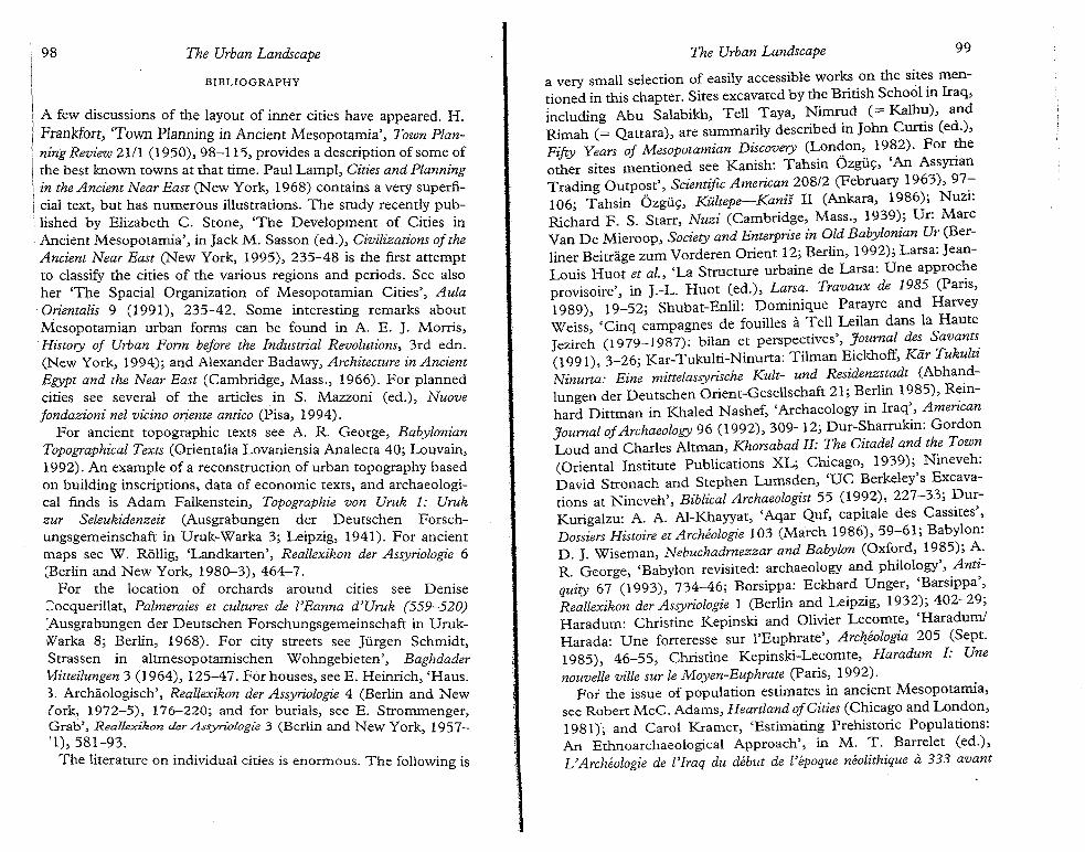
98 The Urban Landscape The Urban Landscape 99
BIBLIOGRAPHY
A few discussions of the layout of inner cities have appeared. H.Frankfort, 'Town Planning in Ancient Mesopotamia', Town Planning Review 21/1 (1950),98-115, provides a description of some ofthe best known towns at that time. Paul Lampl, Cities and Planningin the Ancient Near East (New York, 1968) contains a very superficial text, but has numerous illustrations. The study recently published by Elizabeth C. Stone, 'The Development of Cities inAncient Mesopotamia', in Jack M. Sasson (ed.), Civilizations oftheAncient Near East (New York, 1995), 235-48 is the first attemptto classify the cities of the various regions and periods. See alsoher 'The Spacial Organization of Mesoporamian Cities', AulaOrientaiis 9 (1991), 235-42. Some interesting remarks aboutMesopotamian urban forms can be found in A. E. J. Morris,History of Urban Form before the Industrial Revolutions, 3rd edn.(New York, 1994); and Alexander Badawy, Architecture in AncientEgypt and the Near East (Cambridge, Mass., 1966). For plannedcities see several of the articles in S. Mazzoni (ed.), Nuovejondazioni nel vicino oriente antico (Pisa, 1994).
For ancient topographic texts see A. R. George, BabylonianTopographical Texts (Orientalia Lovaniensia Analecta 40; Louvain,1992). An example of a reconstruction of urban topography basedon building inscriptions, data of economic texts, and archaeological finds is Adam Falkenstein, Topographic von Uruk 1: Urukzur Seleukidenzeit (Ausgrabungen der Deutschen Forschungsgemeinschaft in Uruk-Warka 3; Leipzig, 1941). For ancientmaps see W. Rollig, 'Landkarten', Reallexikon der Assyriologie 6(Berlin and New York, 1980-3),464-7.
For the location of orchards around cities see Denise::::ocquerillat, Palmeraies et cultures de l'Eanna d'Uruk (559-520):Ausgrabungen der Deutschen Forschungsgemeinschaft in UrukllVarka 8; Berlin, 1968). For city streets see jurgen Schmidt,Strassen in altmesopotamischen Wohngebieten', Baghdader'v1itteilungen 3 (1964), 125-47. For houses, see E. Heinrich, 'Haus.3. Archaologisch", Reallexikon der Assyriologie 4 (Berlin and New(ork, 1972-5), 176-220; and for burials, see E. Strommenger,Grab', Reallexikon derAssyriologie 3 (Berlin and New York 1957-'1),581-93. '
The literature on individual cities is enormous. The following is
a very small selection of easily accessible works on the sites mentioned in this chapter. Sites excavated by the British School in Iraq,including Abu Salabikh, Tell Taya, Nimrud (= Kalhu), andRimah (= Qattara), are summarily described in John Curtis (ed.),Fifty Years of Mesopotamian Discovery (Lon?on, 1982). For ~eother sites mentioned see Kanish: Tahsin Ozguc, 'An AssyrianTrading Outpost', Scientific American 208/2 (February 1963), 97-:106; Tahsin Ozguc, KiUtepe-Kanis II (Ankara, 1986); NUZI:Richard F. S. Starr, Nuzi (Cambridge, Mass., 1939); Dr: MarcVan De Mieroop, Society and Enterprise in Old Babylonian Ur (Berliner Beitrage zum Vorderen Orient 12; Berlin, 1992); Larsa: JeanLouis Huot et al., 'La Structure urbaine de Larsa: Une approcheprovisoire', in J.-L. Huot (ed.), Larsa. Travaux de 1985 (Paris,1989), 19-52; Shubat-Enlil: Dominique Parayre and HarveyWeiss, 'Cinq campagnes de fouilles a Tell Leilan dans la Hautejezireh (1979-1987): bilan et perspectives', Journal des Savants.(1991),3-26; Kar-Tukulti-Ninurta: Tilman Eickhoff, Kiir TukuluNinurta: Eine mittelassyrische Kult- und Residenzstadt (Abhandlungen der Deutschen Orient-Gesellschaft 21; Berlin 1985), Reinhard Dittman in Khaled Nashef, 'Archaeology in Iraq', AmericanJournal ofArchaeology 96 (1992),309-12; Dur-Sharrukin: GordonLoud and Charles Altman, Khorsabad II: The Citadel and the Town(Oriental Institute Publications XL; Chicago, 1939); Nineveh:David Stronach and Stephen Lumsden, 'UC Berkeley's Excavations at Nineveh', Biblical Archaeologist 55 (1992), 227-33; DurKurigalzu: A. A. AI-Khayyat, 'Aqar Quf, capitale des Cassites',Dossiers Histoire et Archeologie 103 (March 1986), 59-61; Babylon:D. J. Wiseman, Nebuchadrnezzar and Babylon (Oxford, 1985); A.R. George, 'Babylon revisited: archaeology and philology', Antiquity 67 (1993), 734-46; Borsippa: Eckhard Unger, 'Barsippa',Reallexikon der Assyriologie 1 (Berlin and Leipzig, 1932); 402-29;Haradum: Christine Kepinski and Olivier Lecomte, 'Haradum!Harada: Une forteresse sur l'Euphrate', Archeologia 205 (Sept.1985), 46-55, Christine Kepinski-Lecomte, Haradum I: Unenouvelle ville sur le Moyen-Euphrate (Paris, 1992).
For the issue of population estimates in ancient Mesopotamia,see Robert McC. Adams, Heartland ofCities (Chicago and London,1981); and Carol Kramer, 'Estimating Prehistoric Populations:An Ethnoarchaeological Approach', in M. T. Barrelet (ed.),L'Archeologie de l'Iraq du debut de l'epoque neolithique it 333 avant
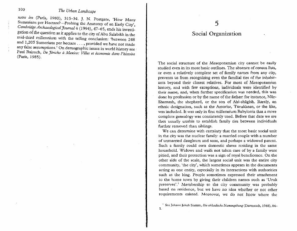
100 The Urban Landscape
notre ~re (Paris, 1980), 315-34. ]. N. Postgate, 'How ManySume~ans per Hectare?-Probing the Anatomy of an Early City',Cambndge Archaeological Tournal 4 (1994) 47-65 end hi .
. J I "s IS lllvestI-ga,tlOn ofthe question as it applies to the city ofAbu Salabikh in themid-third millennium with the telling conclusion: 'between 248and 1,205 Sumerians per hectare ... , provided we have not madeany fals~ assumptions:' On demographic issues in world history see'Paul Bairoch, De Jencho Ii Mexico: Villes et economic dans l'histoire(Paris, 1985).
5Social Organization
The social structure of the Mesopotamian city cannot be easilystudied even in its most basic outlines. The absence of census lists,or even a relatively complete set of family names from any city,prevents us from recognizing even the familial ties of the inhabitants beyond their closest relatives. For most of Mesopotamianhistory, and with few exceptions, individuals were identified bytheir name, and, when further specification was needed, this wasdone by profession or by the name of the father: for instance, NiirShamash, the shepherd, or the son of Ahi-shagish, Rarely, anethnic designation, such as the Amorite, Turukkean, or the like,was included. It was only in first millennium Babylonia that a morecomplete genealogy was consistently used. Before that date we arethus usually unable to establish family ties between individualsfurther removed than siblings.
We can determine with certainty that the most basic social unitin the city was the nuclear family: a married couple with a numberof unmarried daughters and sons, and perhaps a widowed parent.Such a family could own domestic slaves residing in the samehousehold. Widows and waifs not taken care of by a family werepitied, and their protection was a sign of royal beneficence. On theother side of the scale, the largest social unit was the entire citycommunity, 'the city', which sometimes appears in the documentsacting as one entity, especially in its interactions with authoritiessuch as the king. People sometimes expressed their attachmentto the home town by giving their children names such as 'Urukpreserves".' Membership to the city community. was probablybased on residence, but we have no idea whether or not otherrequirements existed. Moreover, we do not know where the
1 See Johann Jakob Stamm, Die akkadische Namengebung (Darmstadt, 1968),845.