Evolution or Devolution of Cartographic Education final
74
Evolution or Devolution of Cartographic Education? Aileen Buckley Cartographic Researcher, ESRI, Inc. [email protected] Transformations in Teaching Cartographic Concepts and Techniques
Transcript of Evolution or Devolution of Cartographic Education final
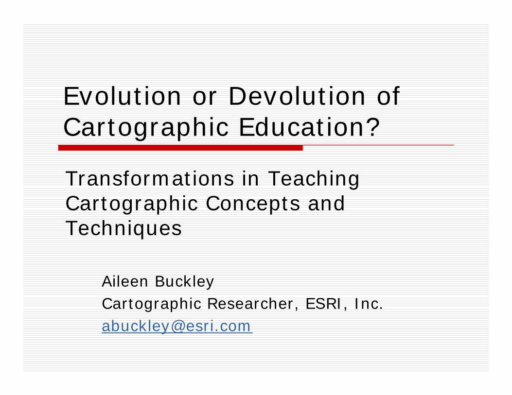
Evolution or Devolution of Cartographic Education?
Aileen BuckleyCartographic Researcher, ESRI, [email protected]
Transformations in Teaching Cartographic Concepts andTechniques
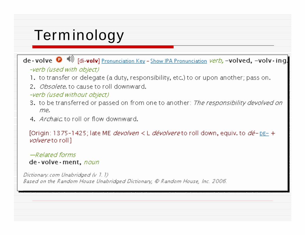
Terminology
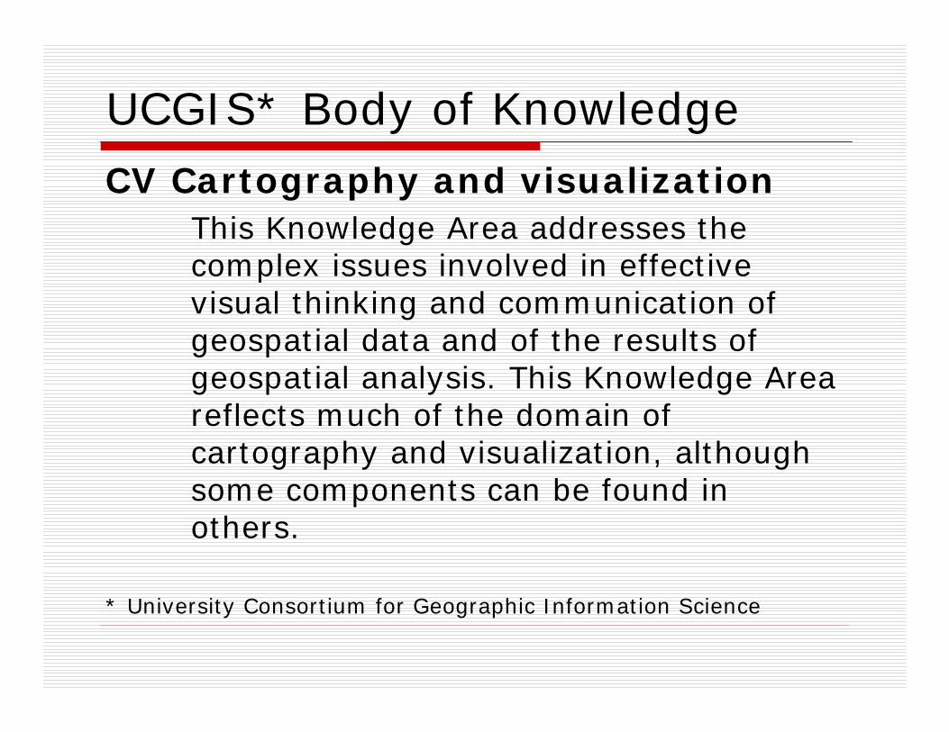
UCGIS* Body of KnowledgeCV Cartography and visualization
This Knowledge Area addresses the complex issues involved in effective visual thinking and communication of geospatial data and of the results of geospatial analysis. This Knowledge Area reflects much of the domain of cartography and visualization, although some components can be found in others.
* University Consortium for Geographic Information Science
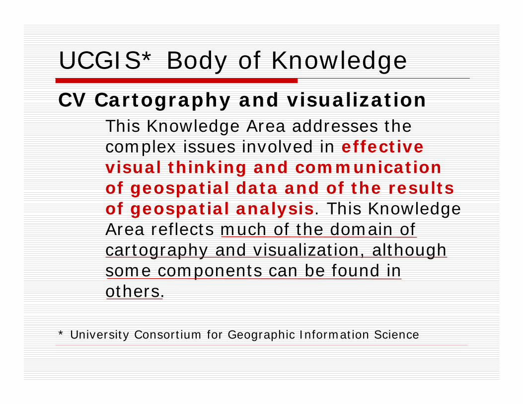
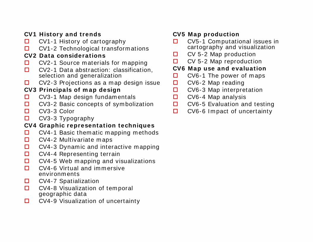
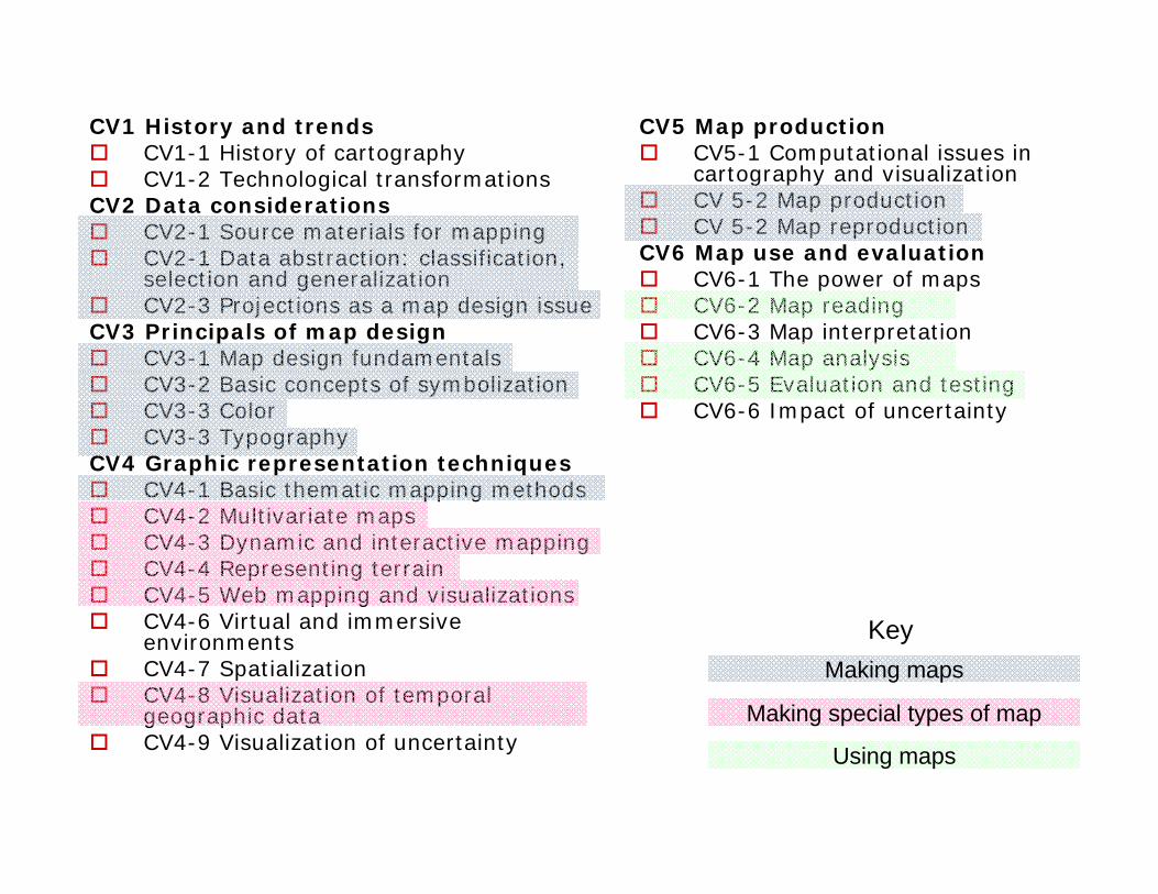
CV1 History and trendsCV1-1 History of cartographyCV1-2 Technological transformations
CV2 Data considerationsCV2-1 Source materials for mappingCV2-1 Data abstraction: classification, selection and generalizationCV2-3 Projections as a map design issue
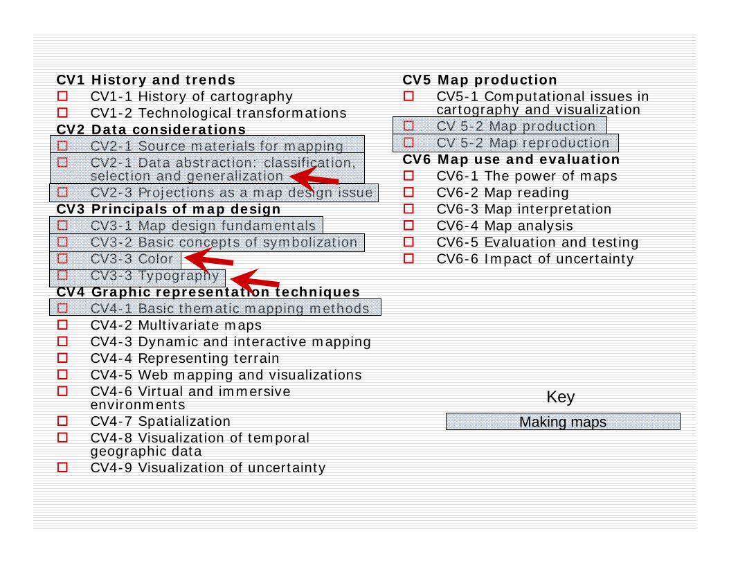
CV3 Principals of map designCV3-1 Map design fundamentalsCV3-2 Basic concepts of symbolizationCV3-3 ColorCV3-3 Typography
CV4 Graphic representation techniquesCV4-1 Basic thematic mapping methodsCV4-2 Multivariate mapsCV4-3 Dynamic and interactive mappingCV4-4 Representing terrainCV4-5 Web mapping and visualizationsCV4-6 Virtual and immersive environmentsCV4-7 SpatializationCV4-8 Visualization of temporal geographic dataCV4-9 Visualization of uncertainty
CV5 Map productionCV5-1 Computational issues in cartography and visualizationCV 5-2 Map productionCV 5-2 Map reproduction
CV6 Map use and evaluationCV6-1 The power of mapsCV6-2 Map readingCV6-3 Map interpretationCV6-4 Map analysisCV6-5 Evaluation and testingCV6-6 Impact of uncertainty
CV1 History and trendsCV1-1 History of cartographyCV1-2 Technological transformations
CV2 Data considerationsCV2-1 Source materials for mappingCV2-1 Data abstraction: classification, selection and generalizationCV2-3 Projections as a map design issue
CV3 Principals of map designCV3-1 Map design fundamentalsCV3-2 Basic concepts of symbolizationCV3-3 ColorCV3-3 Typography
CV4 Graphic representation techniquesCV4-1 Basic thematic mapping methodsCV4-2 Multivariate mapsCV4-3 Dynamic and interactive mappingCV4-4 Representing terrainCV4-5 Web mapping and visualizationsCV4-6 Virtual and immersive environmentsCV4-7 SpatializationCV4-8 Visualization of temporal geographic dataCV4-9 Visualization of uncertainty
CV5 Map productionCV5-1 Computational issues in cartography and visualizationCV 5-2 Map productionCV 5-2 Map reproduction
CV6 Map use and evaluationCV6-1 The power of mapsCV6-2 Map readingCV6-3 Map interpretationCV6-4 Map analysisCV6-5 Evaluation and testingCV6-6 Impact of uncertainty
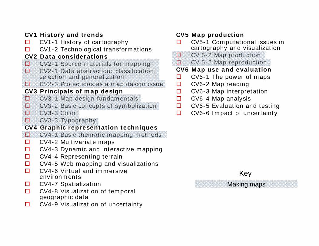
Making mapsKey

CV1 History and trendsCV1-1 History of cartographyCV1-2 Technological transformations
CV2 Data considerationsCV2-1 Source materials for mappingCV2-1 Data abstraction: classification, selection and generalizationCV2-3 Projections as a map design issue
CV3 Principals of map designCV3-1 Map design fundamentalsCV3-2 Basic concepts of symbolizationCV3-3 ColorCV3-3 Typography
CV4 Graphic representation techniquesCV4-1 Basic thematic mapping methodsCV4-2 Multivariate mapsCV4-3 Dynamic and interactive mappingCV4-4 Representing terrainCV4-5 Web mapping and visualizationsCV4-6 Virtual and immersive environmentsCV4-7 SpatializationCV4-8 Visualization of temporal geographic dataCV4-9 Visualization of uncertainty
CV5 Map productionCV5-1 Computational issues in cartography and visualizationCV 5-2 Map productionCV 5-2 Map reproduction
CV6 Map use and evaluationCV6-1 The power of mapsCV6-2 Map readingCV6-3 Map interpretationCV6-4 Map analysisCV6-5 Evaluation and testingCV6-6 Impact of uncertainty
Making maps
Making special types of map
Key

CV1 History and trendsCV1-1 History of cartographyCV1-2 Technological transformations
CV2 Data considerationsCV2-1 Source materials for mappingCV2-1 Data abstraction: classification, selection and generalizationCV2-3 Projections as a map design issue
CV3 Principals of map designCV3-1 Map design fundamentalsCV3-2 Basic concepts of symbolizationCV3-3 ColorCV3-3 Typography
CV4 Graphic representation techniquesCV4-1 Basic thematic mapping methodsCV4-2 Multivariate mapsCV4-3 Dynamic and interactive mappingCV4-4 Representing terrainCV4-5 Web mapping and visualizationsCV4-6 Virtual and immersive environmentsCV4-7 SpatializationCV4-8 Visualization of temporal geographic dataCV4-9 Visualization of uncertainty
CV5 Map productionCV5-1 Computational issues in cartography and visualizationCV 5-2 Map productionCV 5-2 Map reproduction
CV6 Map use and evaluationCV6-1 The power of mapsCV6-2 Map readingCV6-3 Map interpretationCV6-4 Map analysisCV6-5 Evaluation and testingCV6-6 Impact of uncertainty
Making maps
Making special types of map
Using maps
Key
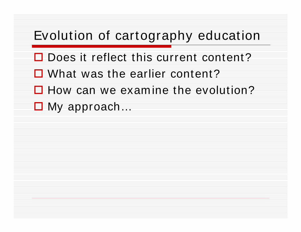
Evolution of cartography education
Does it reflect this current content?What was the earlier content?How can we examine the evolution?My approach…
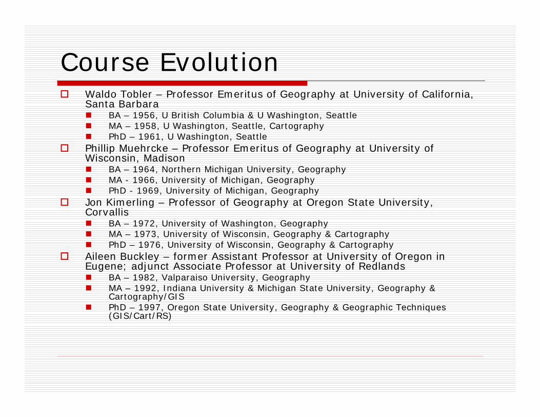
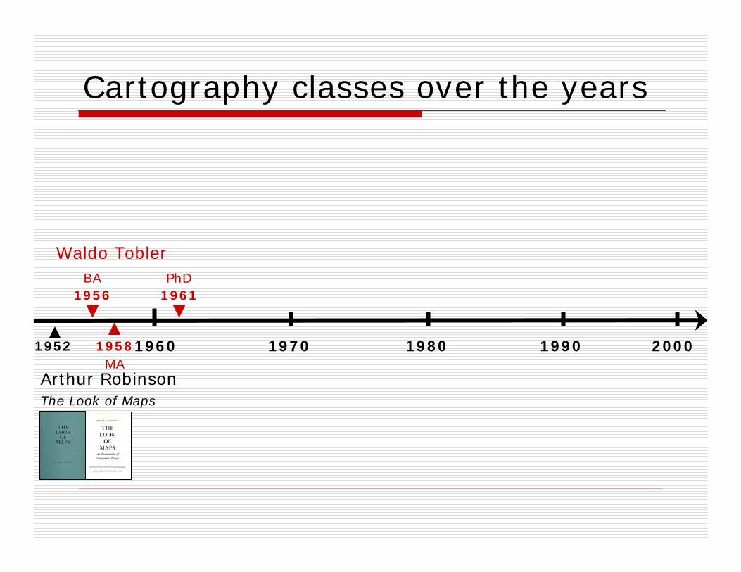
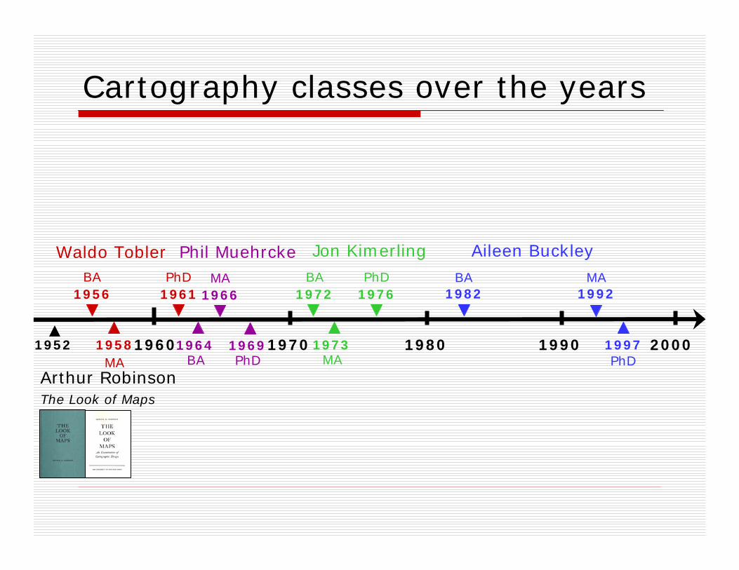
Course EvolutionWaldo Tobler – Professor Emeritus of Geography at University of California, Santa Barbara
BA – 1956, U British Columbia & U Washington, SeattleMA – 1958, U Washington, Seattle, CartographyPhD – 1961, U Washington, Seattle
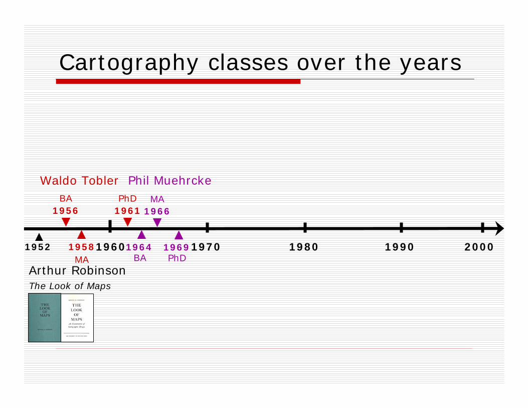
Phillip Muehrcke – Professor Emeritus of Geography at University of Wisconsin, Madison
BA – 1964, Northern Michigan University, Geography MA - 1966, University of Michigan, GeographyPhD - 1969, University of Michigan, Geography
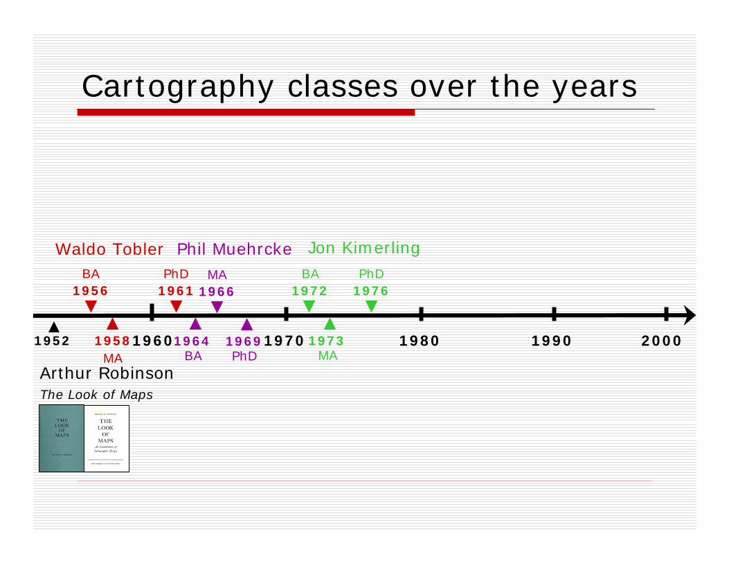
Jon Kimerling – Professor of Geography at Oregon State University, Corvallis
BA – 1972, University of Washington, GeographyMA – 1973, University of Wisconsin, Geography & CartographyPhD – 1976, University of Wisconsin, Geography & Cartography
Aileen Buckley – former Assistant Professor at University of Oregon in Eugene; adjunct Associate Professor at University of Redlands
BA – 1982, Valparaiso University, GeographyMA – 1992, Indiana University & Michigan State University, Geography & Cartography/GISPhD – 1997, Oregon State University, Geography & Geographic Techniques (GIS/Cart/RS)
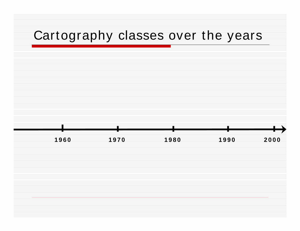
19901960 1970 1980 2000
Cartography classes over the years
19901960 1970 1980 2000
Cartography classes over the years
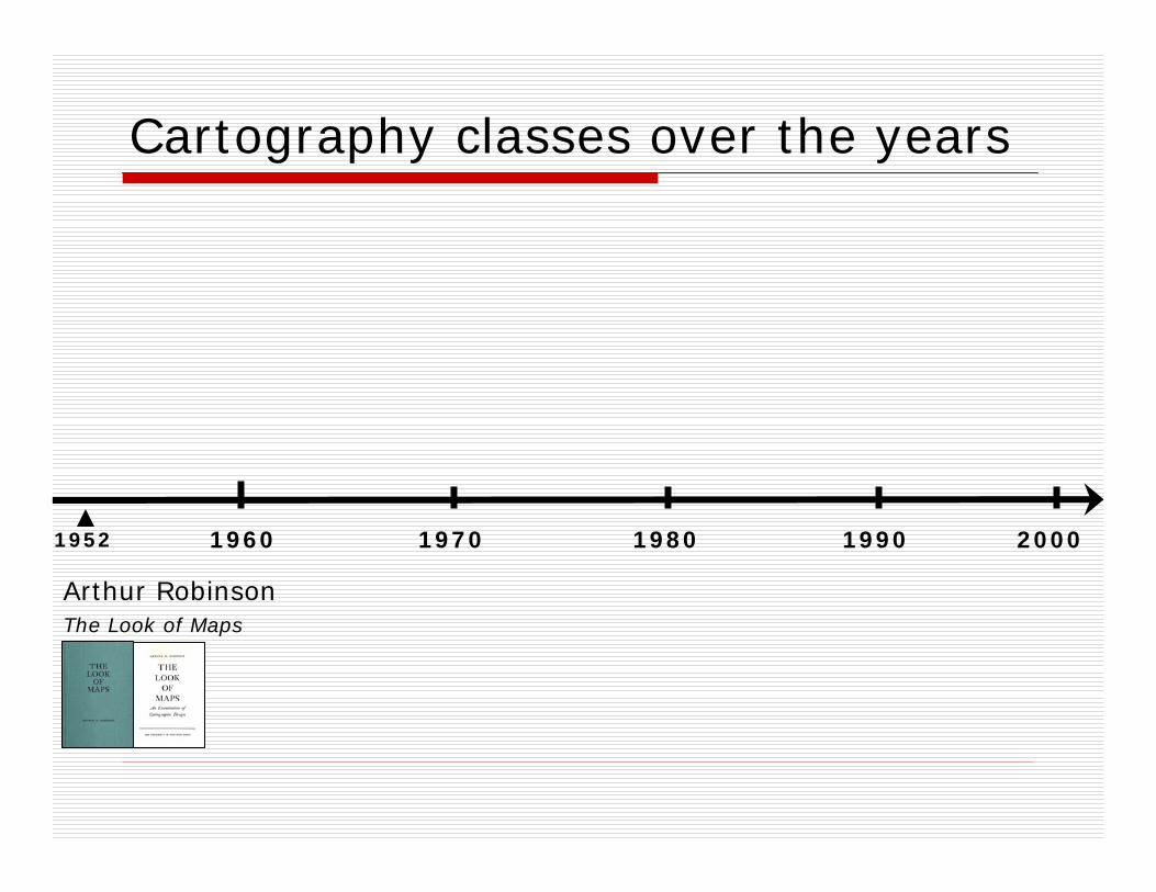
1952
The Look of Maps
Arthur Robinson
19901960 1970 1980 2000
Cartography classes over the years
Waldo Tobler
1961PhD
1956BA
1958MA
1952
The Look of Maps
Arthur Robinson
19901960 1970 1980 2000
Cartography classes over the years
Waldo Tobler
1961PhD
1956BA
1958MA
1952
The Look of Maps
Arthur Robinson
Phil Muehrcke
1966MA
1964BA
1969PhD
19901960 1970 1980 2000
Cartography classes over the years
1972
Jon KimerlingWaldo Tobler
1961
1973
1976BA
MA
PhDPhD1956
BA
1958MA
1952
The Look of Maps
Arthur Robinson
Phil Muehrcke
1966MA
1964BA
1969PhD
19901960 1970 1980 2000
Cartography classes over the years
1972
Jon Kimerling
1992MA
1982BA
Waldo Tobler
1961
1973
1976BA
MA
PhDPhD
Aileen Buckley
PhD1997
1956BA
1958MA
1952
The Look of Maps
Arthur Robinson
1966MA
Phil Muehrcke
1964BA
1969PhD
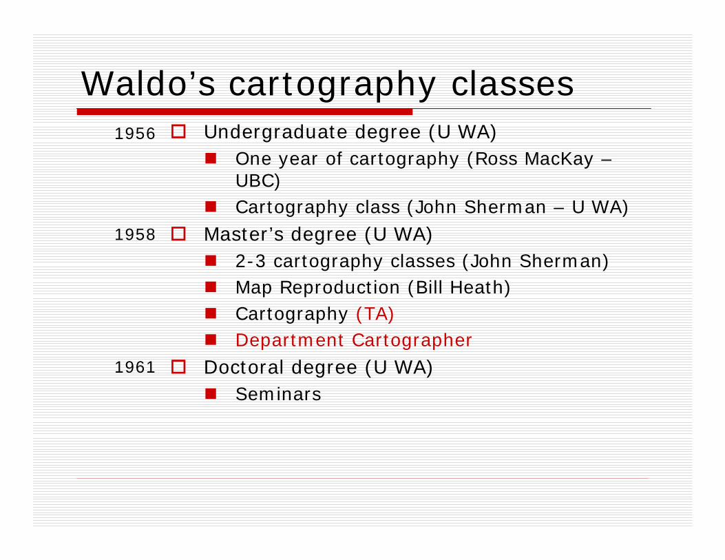
Waldo’s cartography classesUndergraduate degree (U WA)
One year of cartography (Ross MacKay –UBC)Cartography class (John Sherman – U WA)
Master’s degree (U WA)2-3 cartography classes (John Sherman)Map Reproduction (Bill Heath)Cartography (TA)Department Cartographer
Doctoral degree (U WA)Seminars
1956
1961
1958
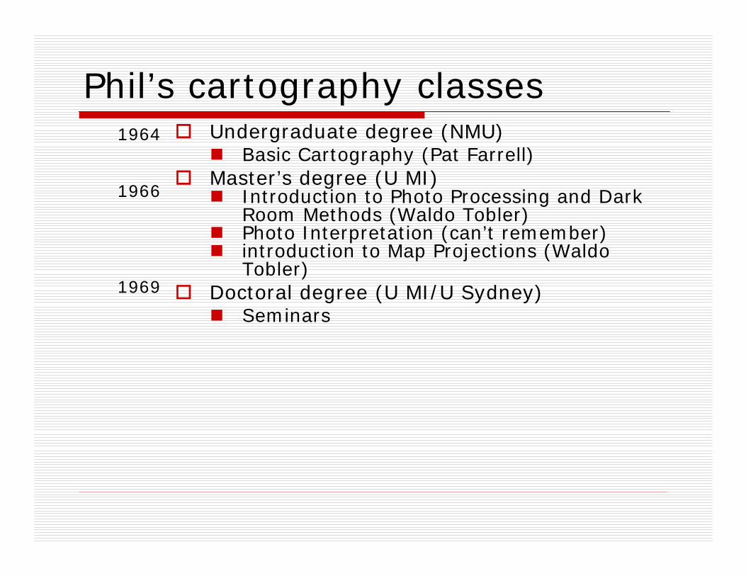
Phil’s cartography classesUndergraduate degree (NMU)
Basic Cartography (Pat Farrell)Master’s degree (U MI)
Introduction to Photo Processing and Dark Room Methods (Waldo Tobler)Photo Interpretation (can’t remember)introduction to Map Projections (Waldo Tobler)
Doctoral degree (U MI/U Sydney)Seminars
1964
1969
1966
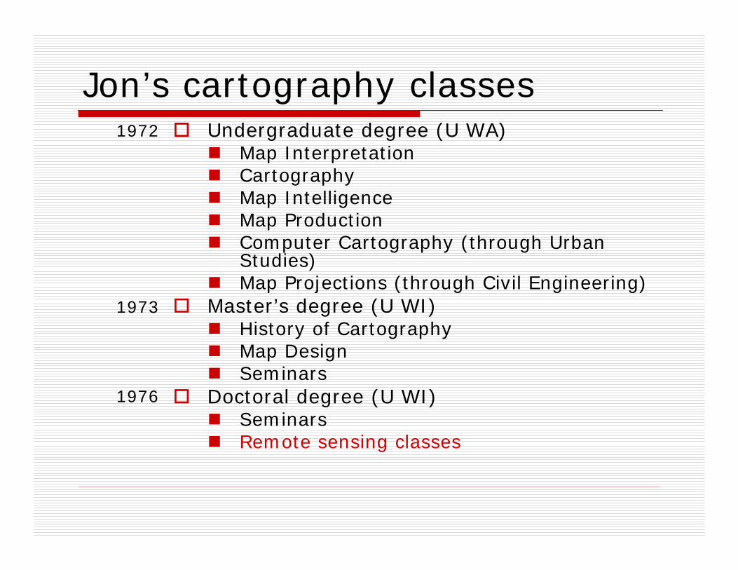
Jon’s cartography classesUndergraduate degree (U WA)
Map InterpretationCartographyMap IntelligenceMap ProductionComputer Cartography (through Urban Studies)Map Projections (through Civil Engineering)
Master’s degree (U WI)History of CartographyMap DesignSeminars
Doctoral degree (U WI)SeminarsRemote sensing classes
1972
1976
1973
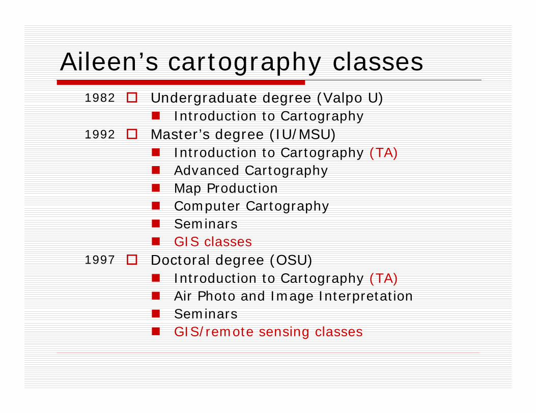
Aileen’s cartography classesUndergraduate degree (Valpo U)
Introduction to CartographyMaster’s degree (IU/MSU)
Introduction to Cartography (TA)Advanced CartographyMap ProductionComputer CartographySeminarsGIS classes
Doctoral degree (OSU)Introduction to Cartography (TA)Air Photo and Image InterpretationSeminarsGIS/remote sensing classes
1982
1997
1992
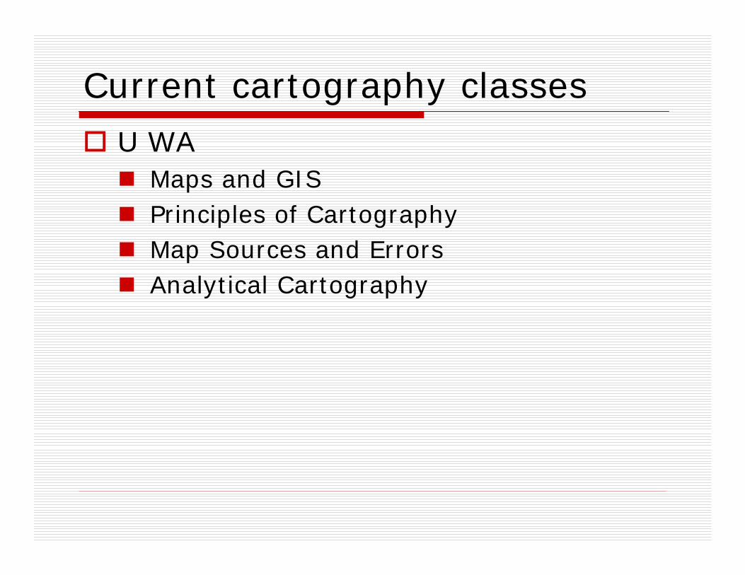
Current cartography classesU WA
Maps and GIS Principles of Cartography Map Sources and Errors Analytical Cartography
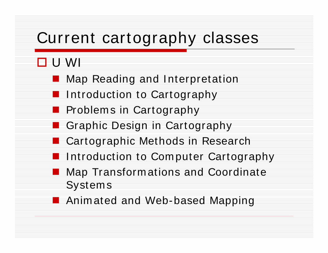
Current cartography classesU WI
Map Reading and InterpretationIntroduction to CartographyProblems in CartographyGraphic Design in CartographyCartographic Methods in ResearchIntroduction to Computer CartographyMap Transformations and Coordinate SystemsAnimated and Web-based Mapping
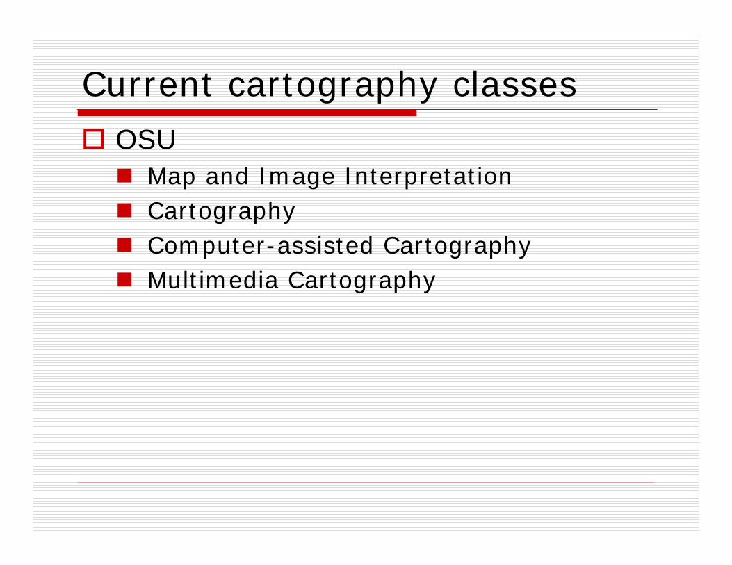
Current cartography classesOSU
Map and Image InterpretationCartographyComputer-assisted CartographyMultimedia Cartography
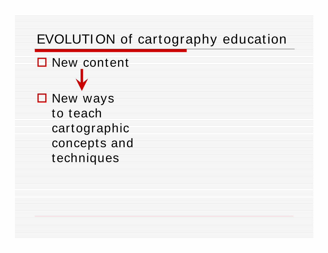
Evolution of cartography education
New content

Evolution of cartography education
New content
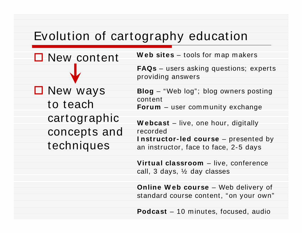
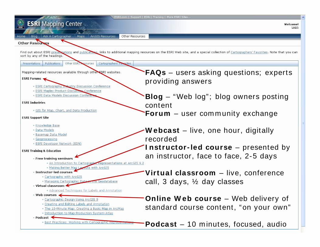
New ways to teach cartographic concepts and techniques
Evolution of cartography education
Podcast – 10 minutes, focused, audio
Virtual classroom – live, conference call, 3 days, ½ day classes
Online Web course – Web delivery of standard course content, “on your own”
Webcast – live, one hour, digitally recorded
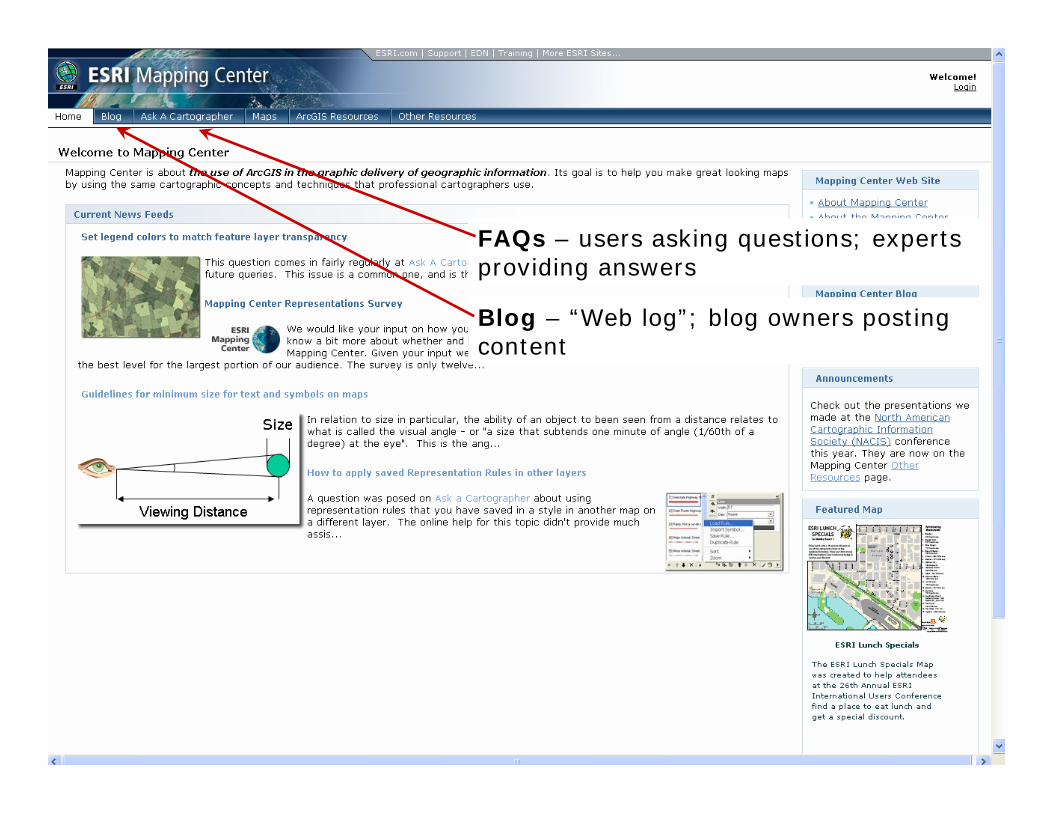
Blog – “Web log”; blog owners posting contentForum – user community exchange
Instructor-led course – presented by an instructor, face to face, 2-5 days
FAQs – users asking questions; experts providing answers
Web sites – tools for map makersNew content
New ways to teach cartographic concepts and techniques
Evolution of cartography education
Podcast – 10 minutes, focused, audio
Virtual classroom – live, conference call, 3 days, ½ day classes
Online Web course – Web delivery of standard course content, “on your own”
Webcast – live, one hour, digitally recorded
Blog – “Web log”; blog owners posting contentForum – user community exchange
Instructor-led course – presented by an instructor, face to face, 2-5 days
FAQs – users asking questions; experts providing answers
Web sites – tools for map makersNew content
New ways to teach cartographic concepts and techniques
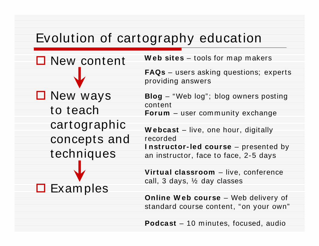
Examples
Blog – “Web log”; blog owners posting content
FAQs – users asking questions; experts providing answers
Podcast – 10 minutes, focused, audio
Virtual classroom – live, conference call, 3 days, ½ day classes
Online Web course – Web delivery of standard course content, “on your own”
Webcast – live, one hour, digitally recorded
Blog – “Web log”; blog owners posting contentForum – user community exchange
Instructor-led course – presented by an instructor, face to face, 2-5 days
FAQs – users asking questions; experts providing answers
EVOLUTION of cartography education
New content
New ways to teach cartographic concepts and techniques

DEVOLUTION of cartography education
New content
New ways to teach cartographic concepts and techniques
New teachers/ new audience

Web sitesTools for map makers
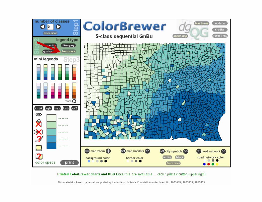
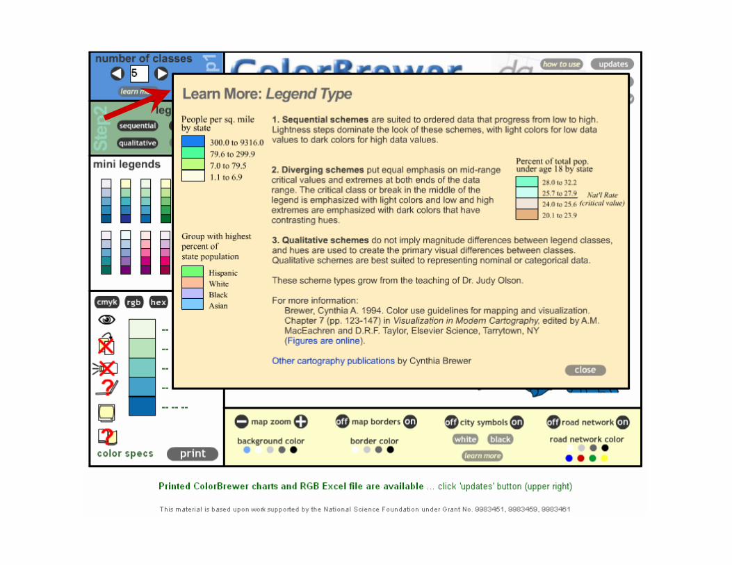
ColorBrewer.org
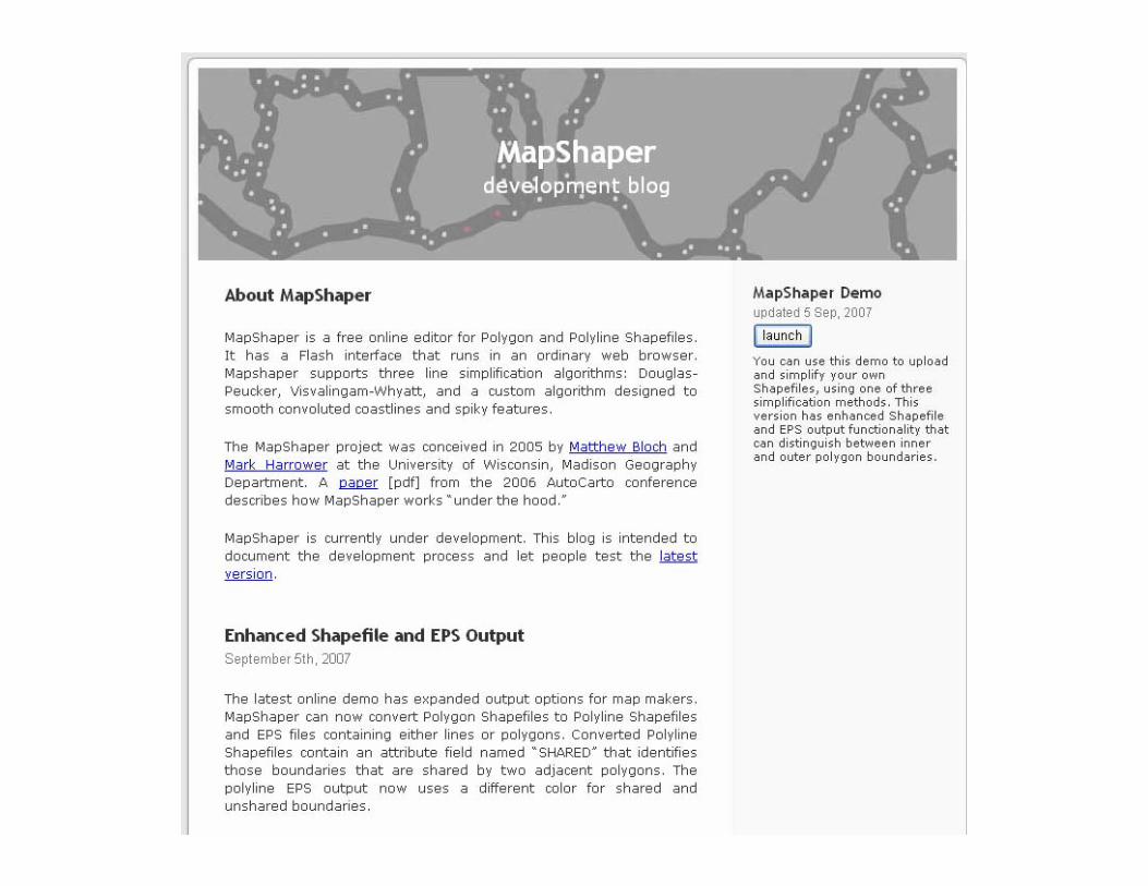
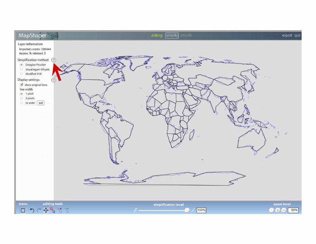
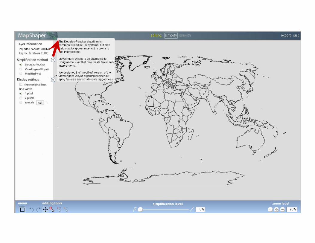
MapShaper.org
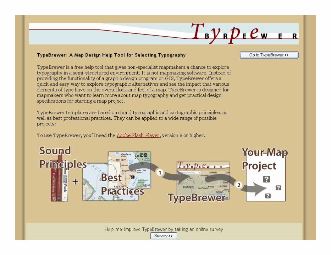
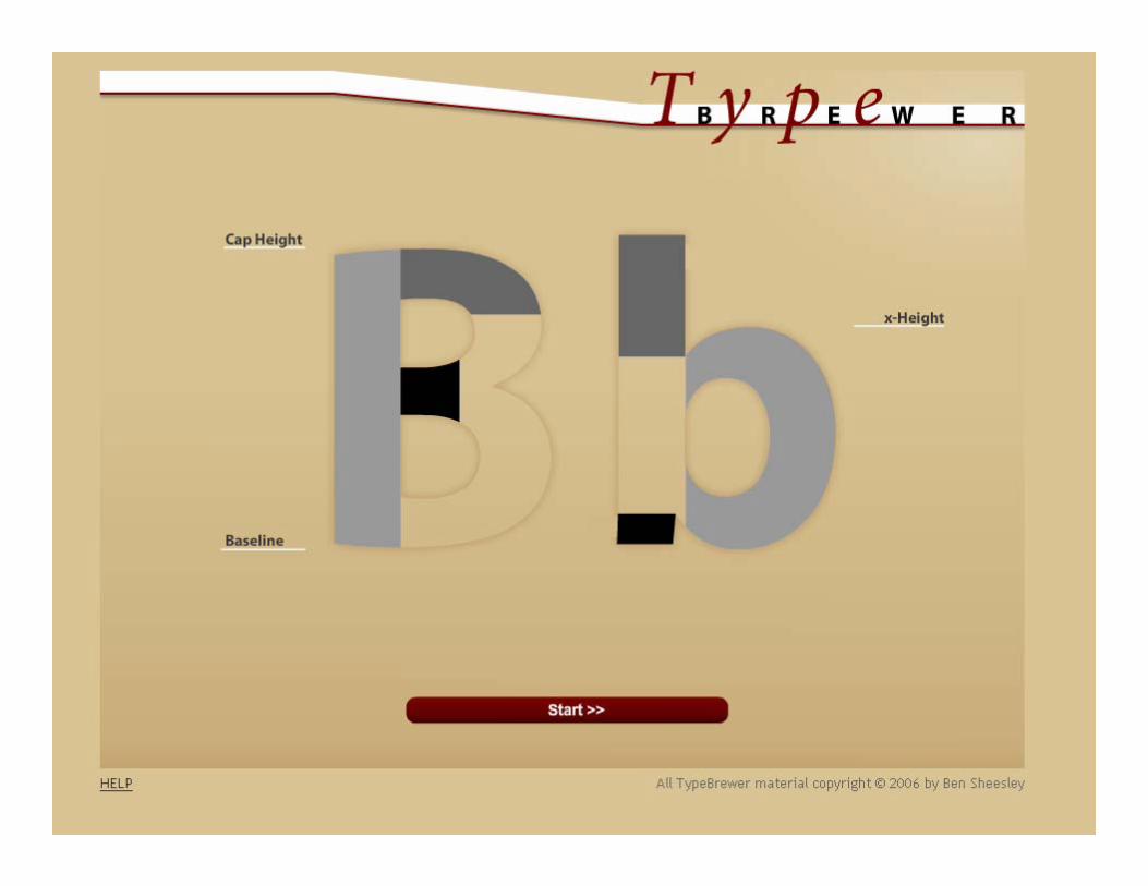
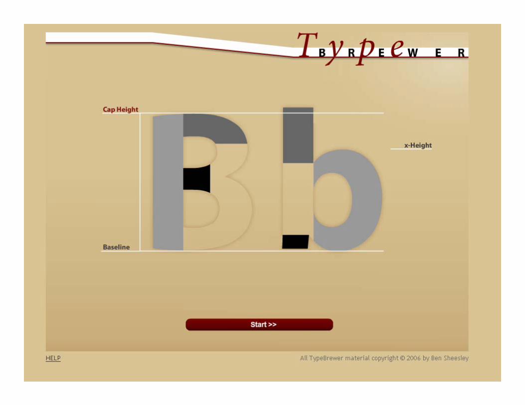
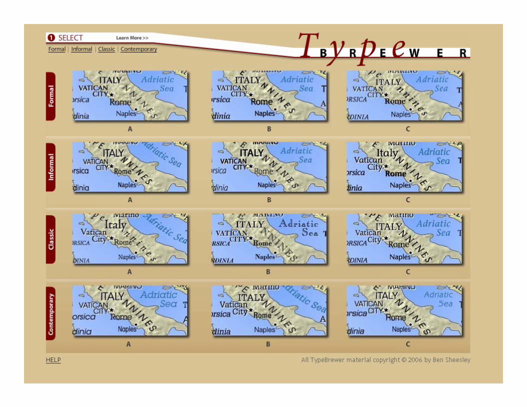
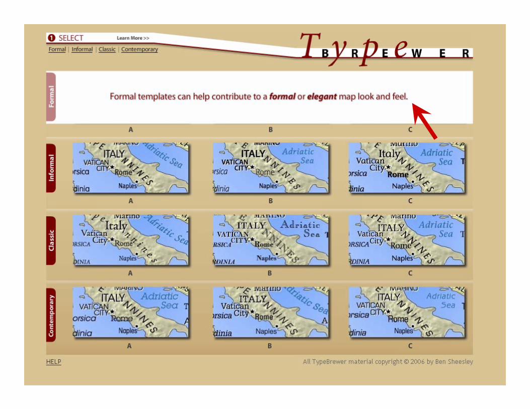
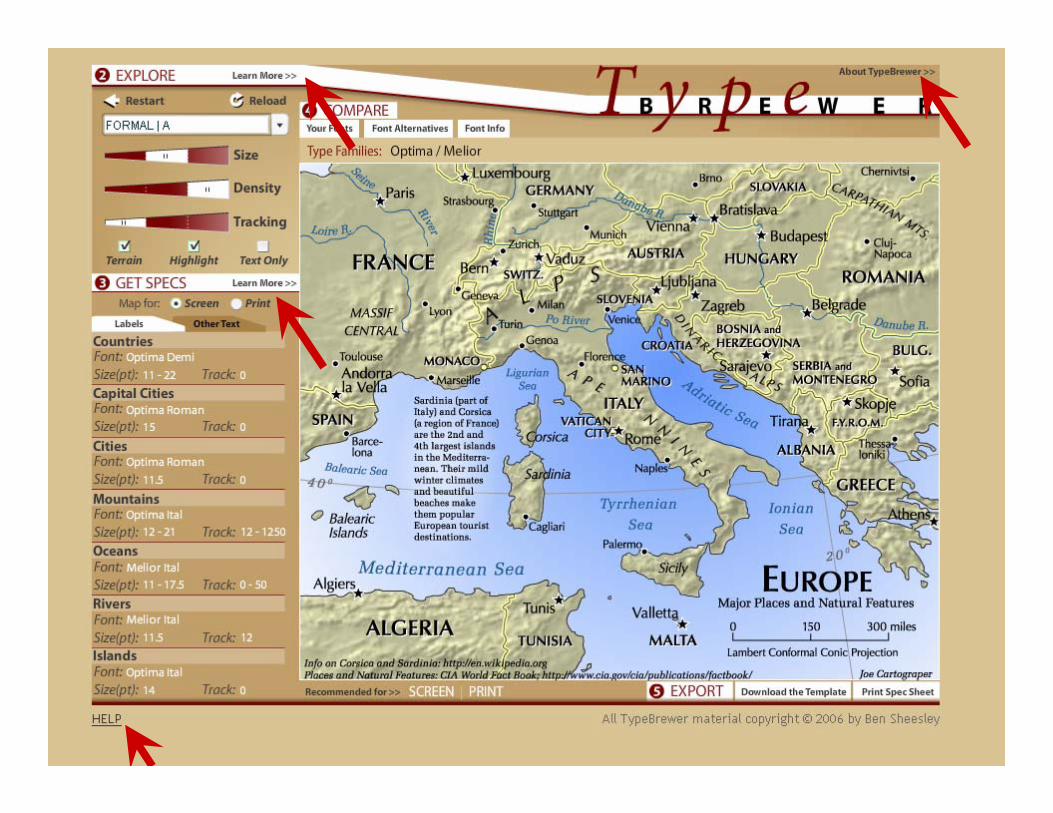
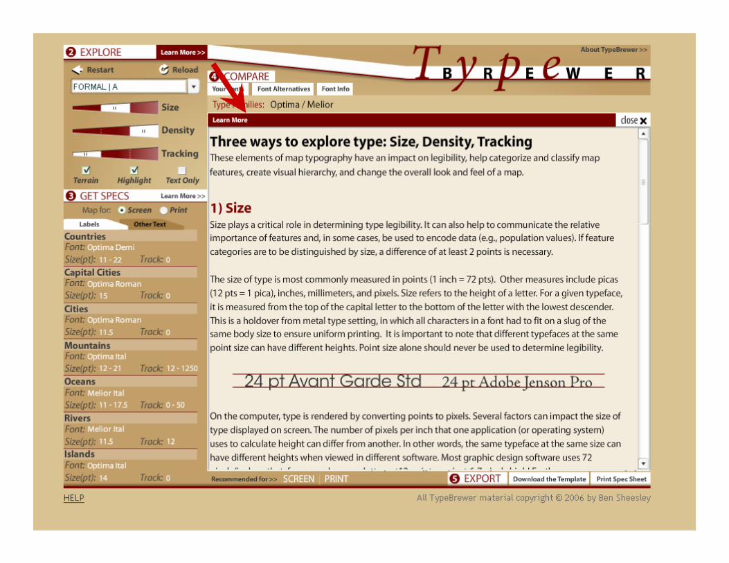
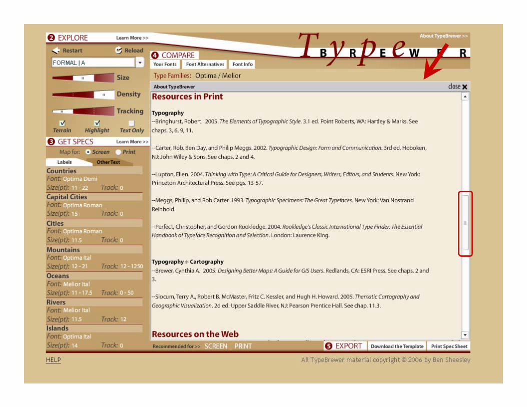
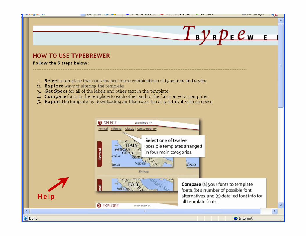
TypeBrewer.org
ForumCartoTalk.com
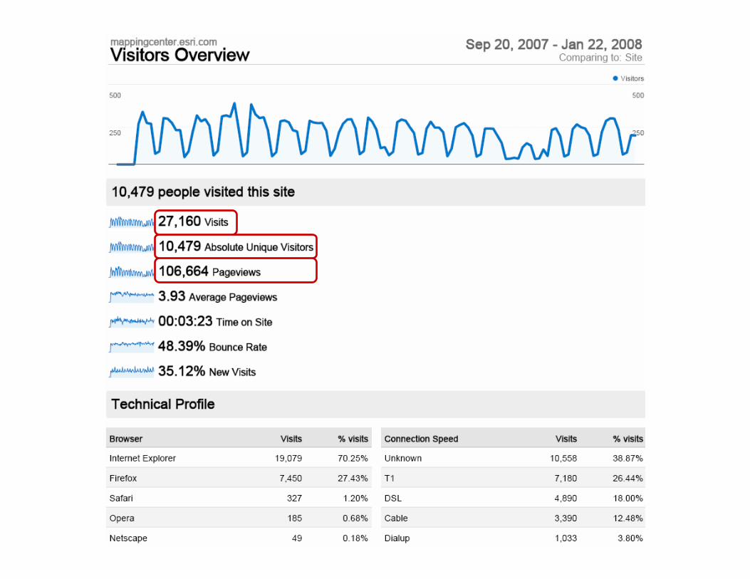
Hybrid ?MappingCenter.esri.com
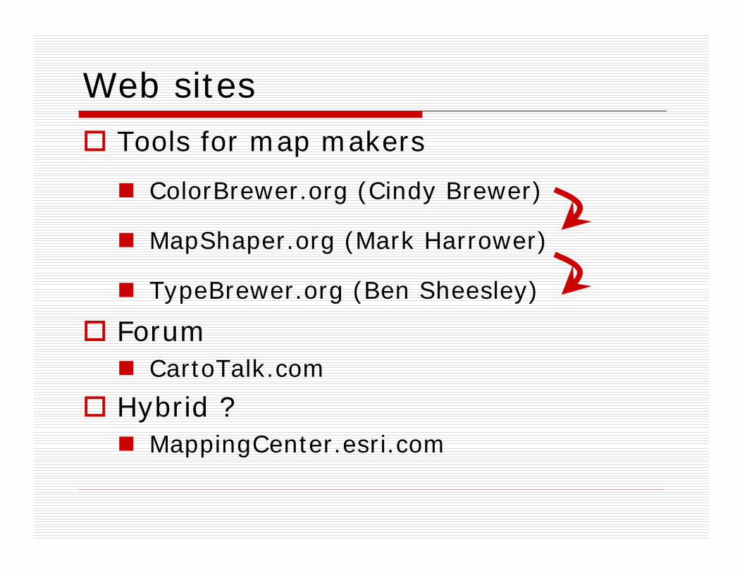
Web sitesTools for map makers
ColorBrewer.org (Cindy Brewer)
MapShaper.org (Mark Harrower)
TypeBrewer.org (Ben Sheesley)
ForumCartoTalk.com
Hybrid ?MappingCenter.esri.com

Help
CV1 History and trendsCV1-1 History of cartographyCV1-2 Technological transformations
CV2 Data considerationsCV2-1 Source materials for mappingCV2-1 Data abstraction: classification, selection and generalizationCV2-3 Projections as a map design issue
CV3 Principals of map designCV3-1 Map design fundamentalsCV3-2 Basic concepts of symbolizationCV3-3 ColorCV3-3 Typography
CV4 Graphic representation techniquesCV4-1 Basic thematic mapping methodsCV4-2 Multivariate mapsCV4-3 Dynamic and interactive mappingCV4-4 Representing terrainCV4-5 Web mapping and visualizationsCV4-6 Virtual and immersive environmentsCV4-7 SpatializationCV4-8 Visualization of temporal geographic dataCV4-9 Visualization of uncertainty
CV5 Map productionCV5-1 Computational issues in cartography and visualizationCV 5-2 Map productionCV 5-2 Map reproduction
CV6 Map use and evaluationCV6-1 The power of mapsCV6-2 Map readingCV6-3 Map interpretationCV6-4 Map analysisCV6-5 Evaluation and testingCV6-6 Impact of uncertainty
Making mapsKey
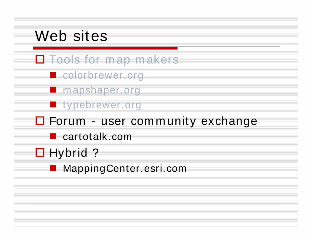
Web sitesTools for map makers
colorbrewer.orgmapshaper.orgtypebrewer.org
Forum - user community exchangecartotalk.com
Hybrid ?MappingCenter.esri.com

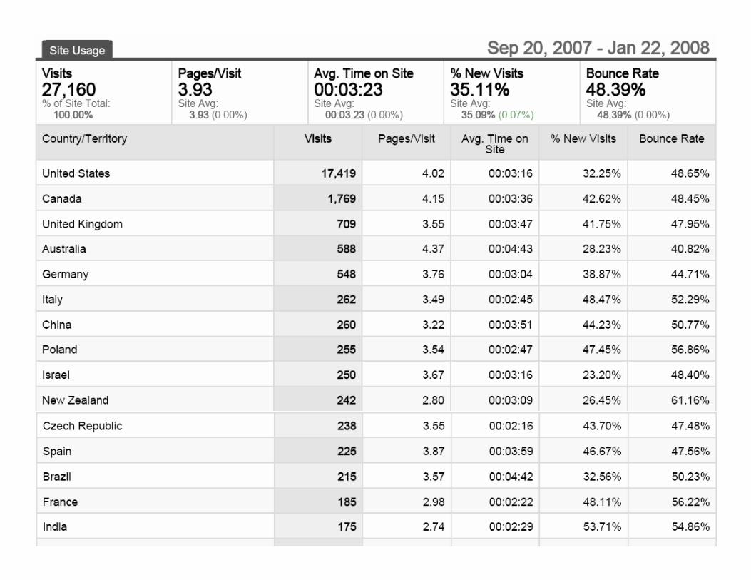
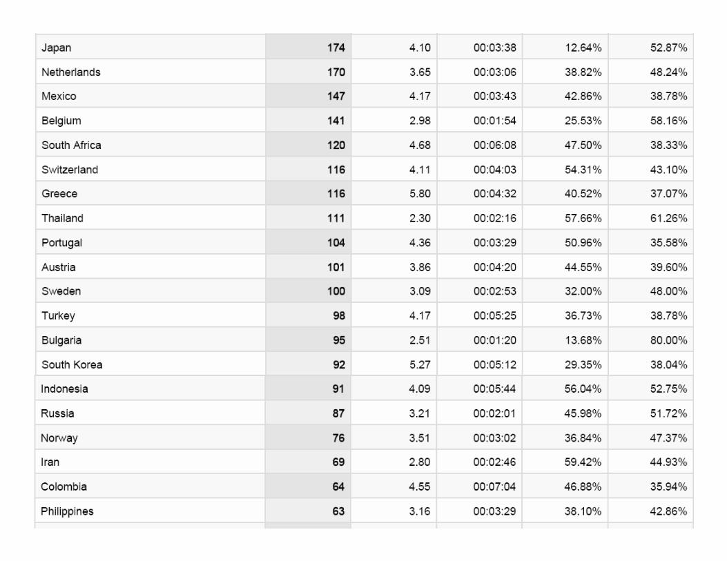
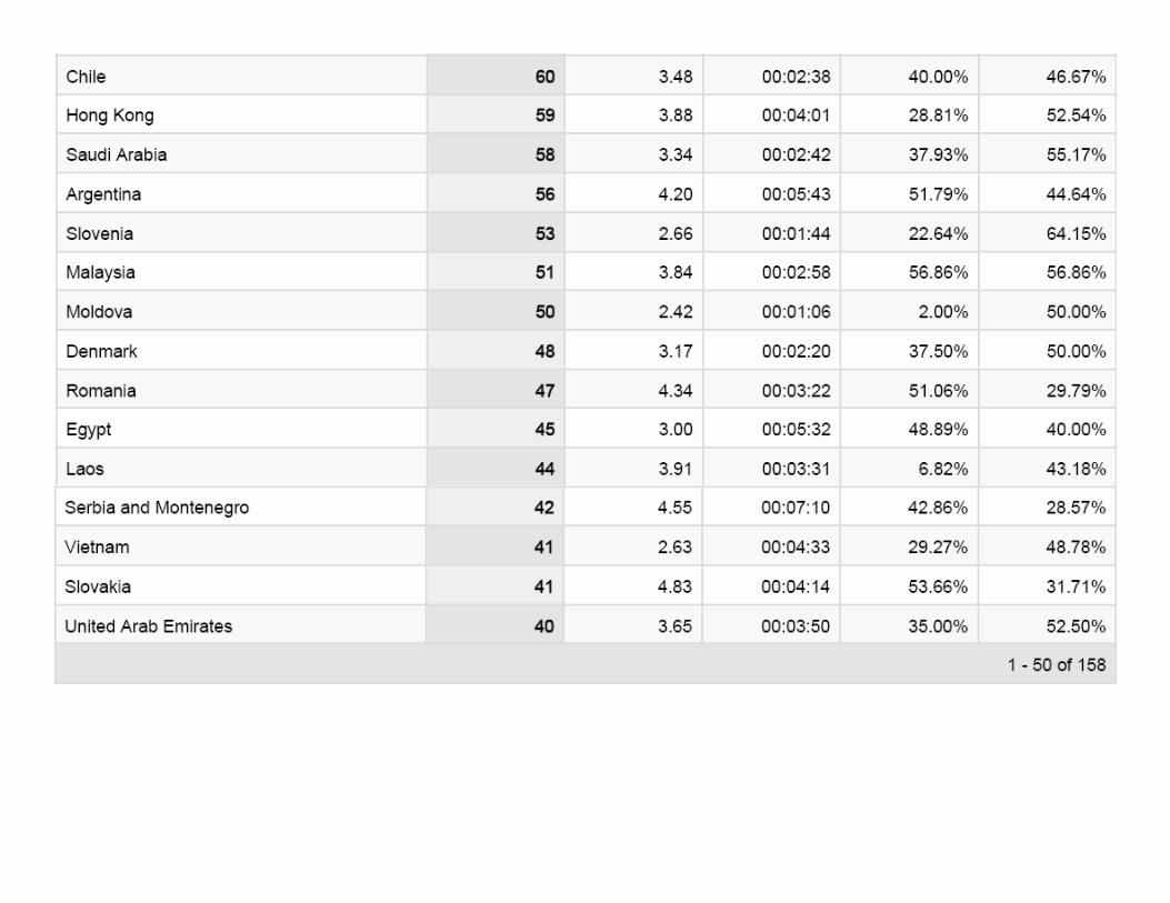
Who is the community?
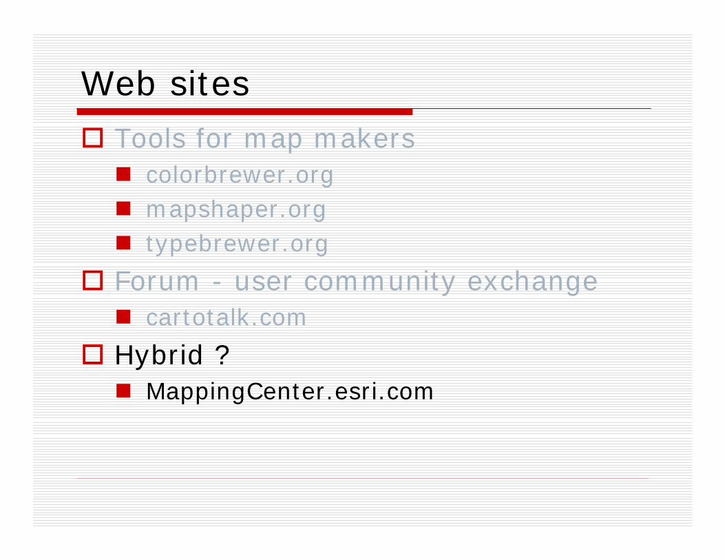
Web sitesTools for map makers
colorbrewer.orgmapshaper.orgtypebrewer.org
Forum - user community exchange cartotalk.com
Hybrid ?MappingCenter.esri.com
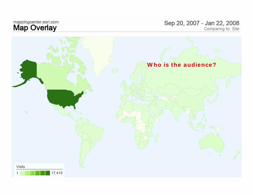
Who is the audience?
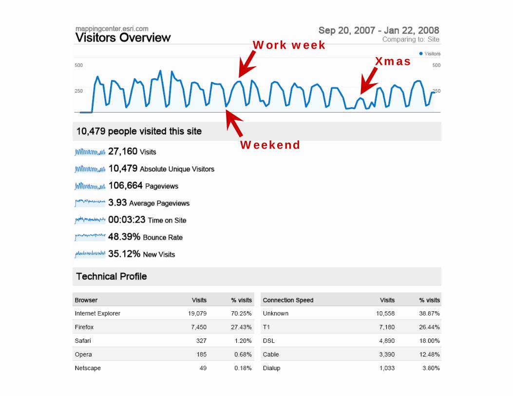
Weekend
Work weekXmas
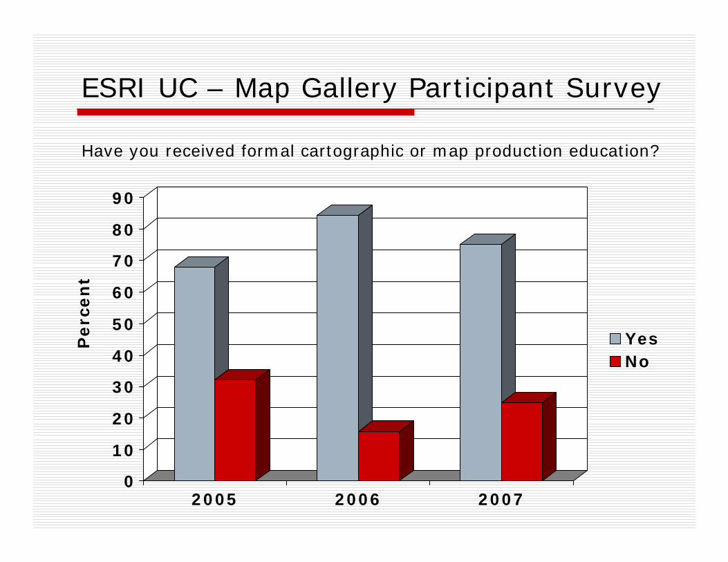
ESRI UC – Map Gallery Participant Survey
0
10
20
30
40
50
60
70
80
90
2005 2006 2007
YesNo
Have you received formal cartographic or map production education?
Perc
en
t
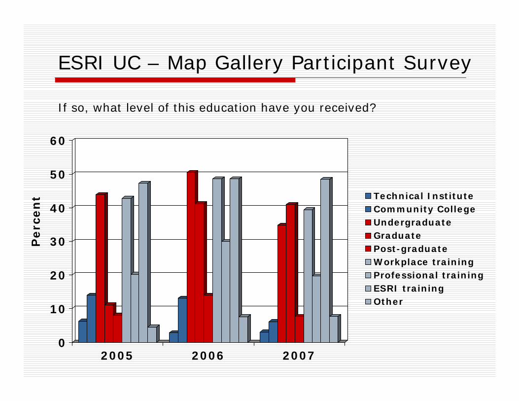
ESRI UC – Map Gallery Participant Survey
0
10
20
30
40
50
60
2005 2006 2007
Technical InstituteCommunity CollegeUndergraduateGraduatePost-graduateWorkplace trainingProfessional trainingESRI trainingOther
If so, what level of this education have you received?
Perc
en
t
CV1 History and trendsCV1-1 History of cartographyCV1-2 Technological transformations
CV2 Data considerationsCV2-1 Source materials for mappingCV2-1 Data abstraction: classification, selection and generalizationCV2-3 Projections as a map design issue
CV3 Principals of map designCV3-1 Map design fundamentalsCV3-2 Basic concepts of symbolizationCV3-3 ColorCV3-3 Typography
CV4 Graphic representation techniquesCV4-1 Basic thematic mapping methodsCV4-2 Multivariate mapsCV4-3 Dynamic and interactive mappingCV4-4 Representing terrainCV4-5 Web mapping and visualizationsCV4-6 Virtual and immersive environmentsCV4-7 SpatializationCV4-8 Visualization of temporal geographic dataCV4-9 Visualization of uncertainty
CV5 Map productionCV5-1 Computational issues in cartography and visualizationCV 5-2 Map productionCV 5-2 Map reproduction
CV6 Map use and evaluationCV6-1 The power of mapsCV6-2 Map readingCV6-3 Map interpretationCV6-4 Map analysisCV6-5 Evaluation and testingCV6-6 Impact of uncertainty
Making maps
Making special types of map
Using maps
Key
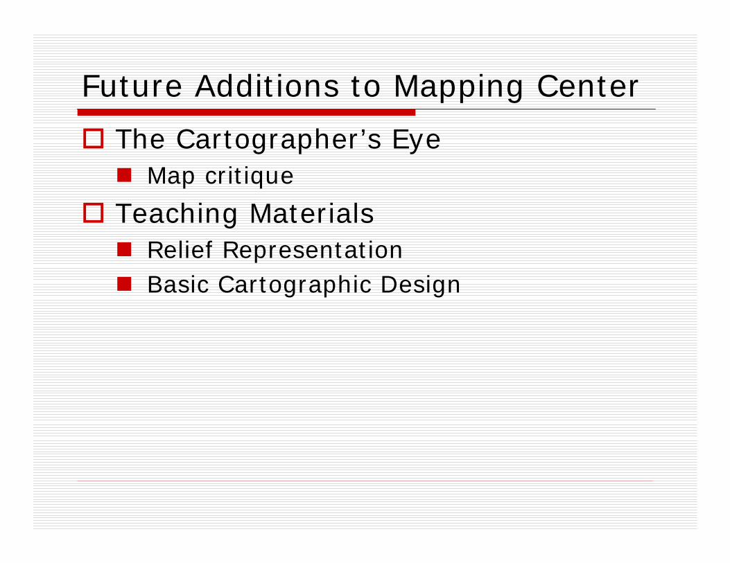
Future Additions to Mapping Center
The Cartographer’s EyeMap critique
Teaching MaterialsRelief RepresentationBasic Cartographic Design
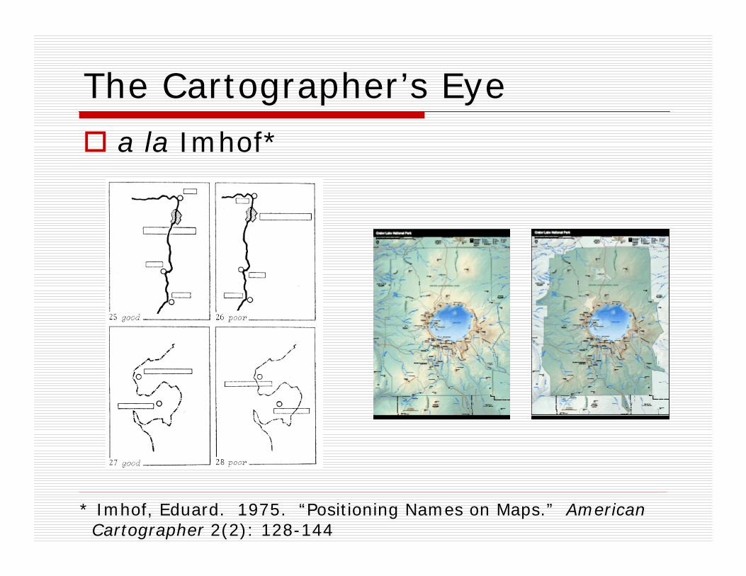
The Cartographer’s Eyea la Imhof*
* Imhof, Eduard. 1975. “Positioning Names on Maps.” AmericanCartographer 2(2): 128-144
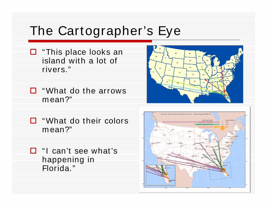
The Cartographer’s Eye
“This place looks an island with a lot of rivers.”
“What do the arrows mean?”
“What do their colors mean?”
“I can’t see what’s happening in Florida.”
Teaching MaterialsUseful to teach a one-day workshop (university or anywhere) or to teach yourself
LecturePowerPoints with bottom notes
Labs Data sets, styles, expressions, statements, .MXDs, step-by-step instructions, whatever is needed
Terrain RepresentationMorning – The Basics
DataDEM ManipulationHillshadingLayer Tinting
Afternoon - Advanced TopicsAdvanced DEM ManipulationAdvanced Hillshading TechniquesModifications to Layer TintingBump MappingVegetationIlluminated ContoursPrinting and Output
Final Project
Related readingsImhof – Relief Presentation, with attention to selected sectionsTom Patterson – selected readingsJeff Nighbert – Bump mappingKennelly and Kimerling – Tanaka’s illuminated contoursDavid Barnes – Swiss HillshadeDavid Mark – MDOW hillshade
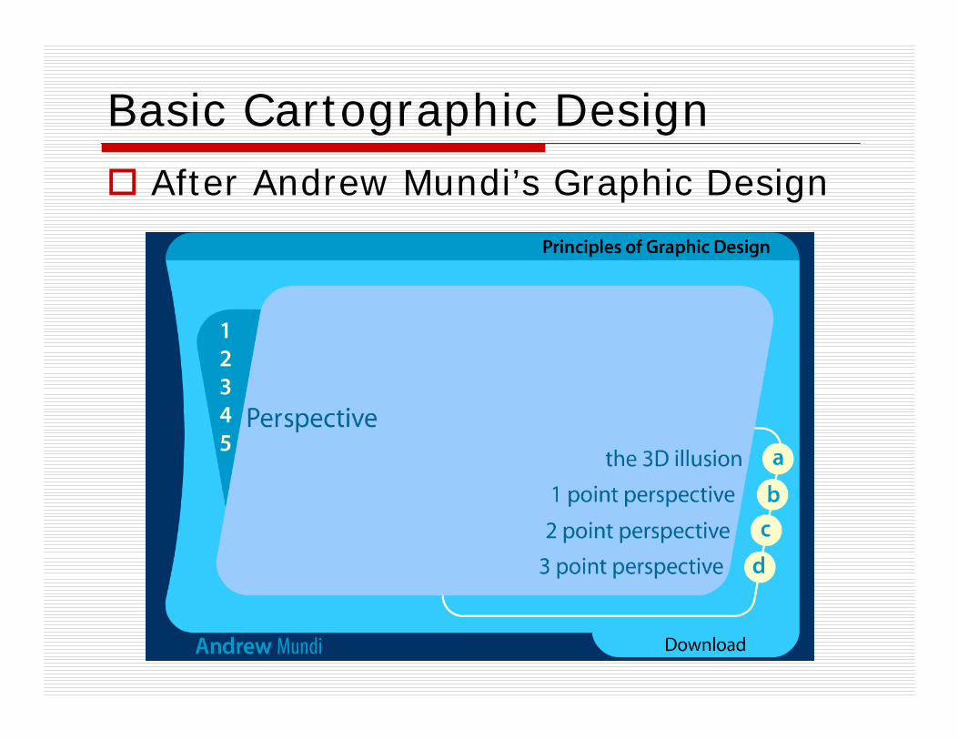
Basic Cartographic DesignAfter Andrew Mundi’s Graphic Design
Evolution or Devolution of Cartographic Education?
Transformations in Teaching Cartographic Concepts andTechniques
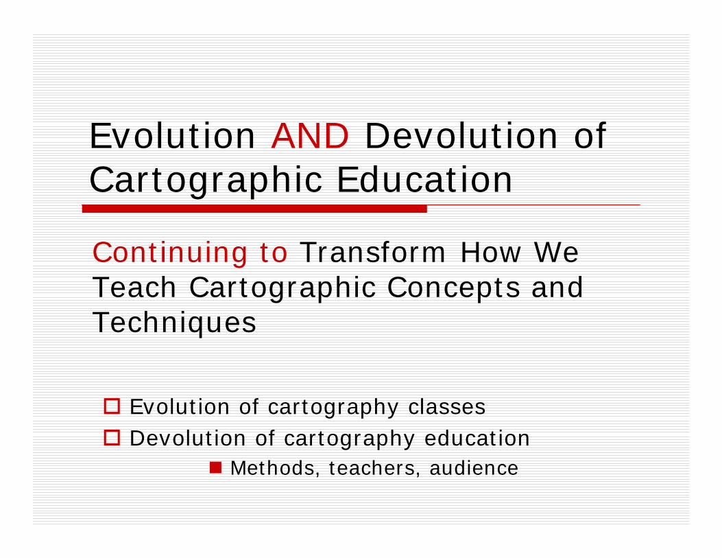
Evolution AND Devolution of Cartographic Education
Continuing to Transform How We Teach Cartographic Concepts and Techniques
Evolution AND Devolution of Cartographic Education
Continuing to Transform How We Teach Cartographic Concepts and Techniques
Evolution of cartography classesDevolution of cartography education
Methods, teachers, audience
Evolution AND Devolution of Cartographic Education
Aileen BuckleyCartographic Researcher, ESRI, [email protected]
MappingCenter.esri.com