European Location Framework data in the ArcGIS...
33
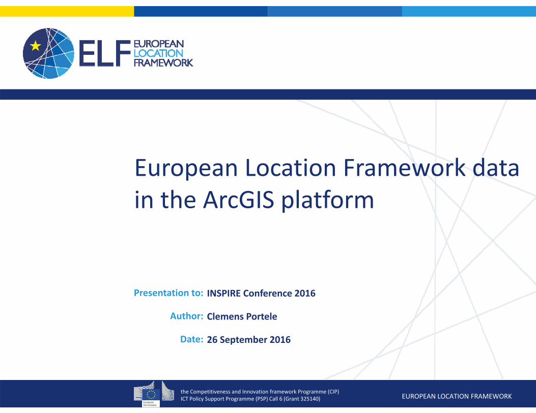
the Competitiveness and Innovation framework Programme (CIP) ICT Policy Support Programme (PSP) Call 6 (Grant 325140) EUROPEAN LOCATION FRAMEWORK Presentation to: Author: Date: INSPIRE Conference 2016 Clemens Portele 26 September 2016 European Location Framework data in the ArcGIS platform
-
Upload
trinhthuan -
Category
Documents
-
view
255 -
download
3
Transcript of European Location Framework data in the ArcGIS...
the Competitiveness and Innovation framework Programme (CIP)ICT Policy Support Programme (PSP) Call 6 (Grant 325140) EUROPEAN LOCATION FRAMEWORK
Presentation to:
Author:
Date:
INSPIRE Conference 2016
Clemens Portele
26 September 2016
European Location Framework data in the ArcGIS platform
the Competitiveness and Innovation framework Programme (CIP)ICT Policy Support Programme (PSP) Call 6 (Grant 325140) EUROPEAN LOCATION FRAMEWORK
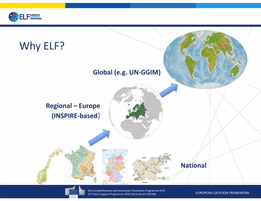
National
Regional – Europe (INSPIRE‐based)
Global (e.g. UN‐GGIM)
Why ELF?
the Competitiveness and Innovation framework Programme (CIP)ICT Policy Support Programme (PSP) Call 6 (Grant 325140) EUROPEAN LOCATION FRAMEWORK
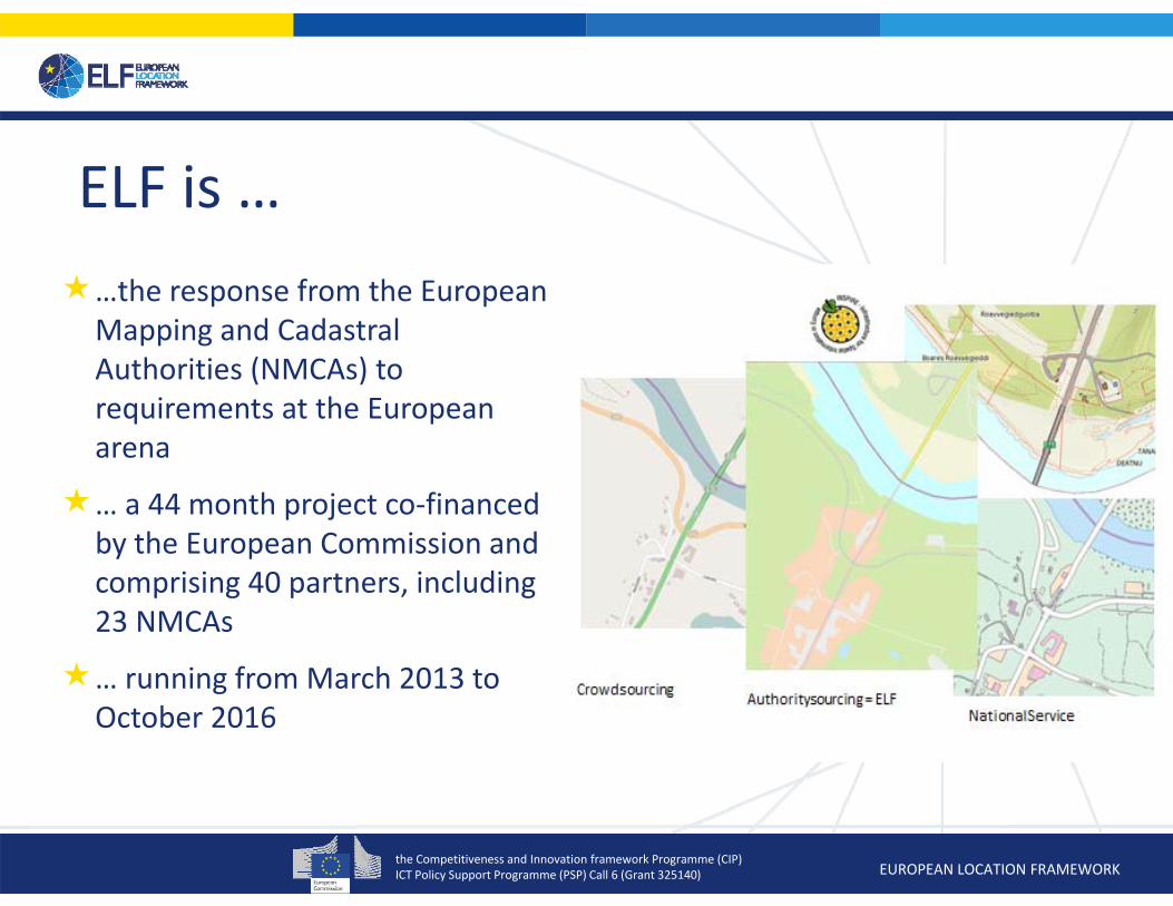
ELF is ……the response from the European
Mapping and Cadastral Authorities (NMCAs) to requirements at the European arena
… a 44 month project co‐financed by the European Commission and comprising 40 partners, including 23 NMCAs
… running from March 2013 to October 2016

the Competitiveness and Innovation framework Programme (CIP)ICT Policy Support Programme (PSP) Call 6 (Grant 325140) EUROPEAN LOCATION FRAMEWORK3 October, 2016
The overall objectives of ELF (when fully developed)
Be a unique online service for Europe that offers the only geospatial products which are Coherent, official, cross‐border,
edge‐matched, harmonised, reference data from a sustainable and reliable source
Up to date, easy accessible products at a single point with an easy to use license and prices
Increase the re‐use of official public sector spatial reference information and create opportunities for the private sector
the Competitiveness and Innovation framework Programme (CIP)ICT Policy Support Programme (PSP) Call 6 (Grant 325140) EUROPEAN LOCATION FRAMEWORK
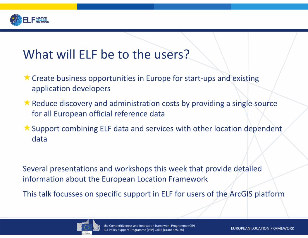
What will ELF be to the users?
Create business opportunities in Europe for start‐ups and existing application developers
Reduce discovery and administration costs by providing a single source for all European official reference data
Support combining ELF data and services with other location dependent data
Several presentations and workshops this week that provide detailed information about the European Location Framework
This talk focusses on specific support in ELF for users of the ArcGIS platform

the Competitiveness and Innovation framework Programme (CIP)ICT Policy Support Programme (PSP) Call 6 (Grant 325140) EUROPEAN LOCATION FRAMEWORK
INSPIRE is looking only at part of the dataflow
Spatial Data Set
ViewService
DownloadService
InternetInternet
Applications
INSPIRE DirectiveImplementing RulesTechnical Guidance
Limited guidance and tool support
the Competitiveness and Innovation framework Programme (CIP)ICT Policy Support Programme (PSP) Call 6 (Grant 325140) EUROPEAN LOCATION FRAMEWORK
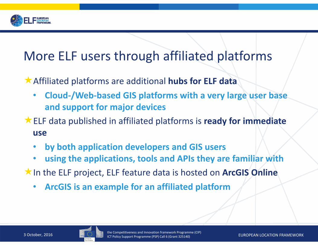
More ELF users through affiliated platforms
Affiliated platforms are additional hubs for ELF data• Cloud‐/Web‐based GIS platforms with a very large user base
and support for major devicesELF data published in affiliated platforms is ready for immediate use• by both application developers and GIS users • using the applications, tools and APIs they are familiar withIn the ELF project, ELF feature data is hosted on ArcGIS Online
• ArcGIS is an example for an affiliated platform
3 October, 2016
the Competitiveness and Innovation framework Programme (CIP)ICT Policy Support Programme (PSP) Call 6 (Grant 325140) EUROPEAN LOCATION FRAMEWORK3 October, 2016

the Competitiveness and Innovation framework Programme (CIP)ICT Policy Support Programme (PSP) Call 6 (Grant 325140) EUROPEAN LOCATION FRAMEWORK
Some key ELF Products Datasets available via Download Services
(national WFSs and cascading WFSs)• AD, AU, BU, CP, EL, GN, HY, LC, PS, SR and
TN road, rail, water, air and cable• Regional and Global data available and
supported by WMS as well ELF Topographic Basemap
• WMTS ELF Administrative Basemap
• WMS using EuroBoundaryMap ELF Cadastral Index Map
• Cascading WMS using CP, BU, AD and AU ELF Geo Locator
• Geo‐referencing API using GN, AD and AU

the Competitiveness and Innovation framework Programme (CIP)ICT Policy Support Programme (PSP) Call 6 (Grant 325140) EUROPEAN LOCATION FRAMEWORK
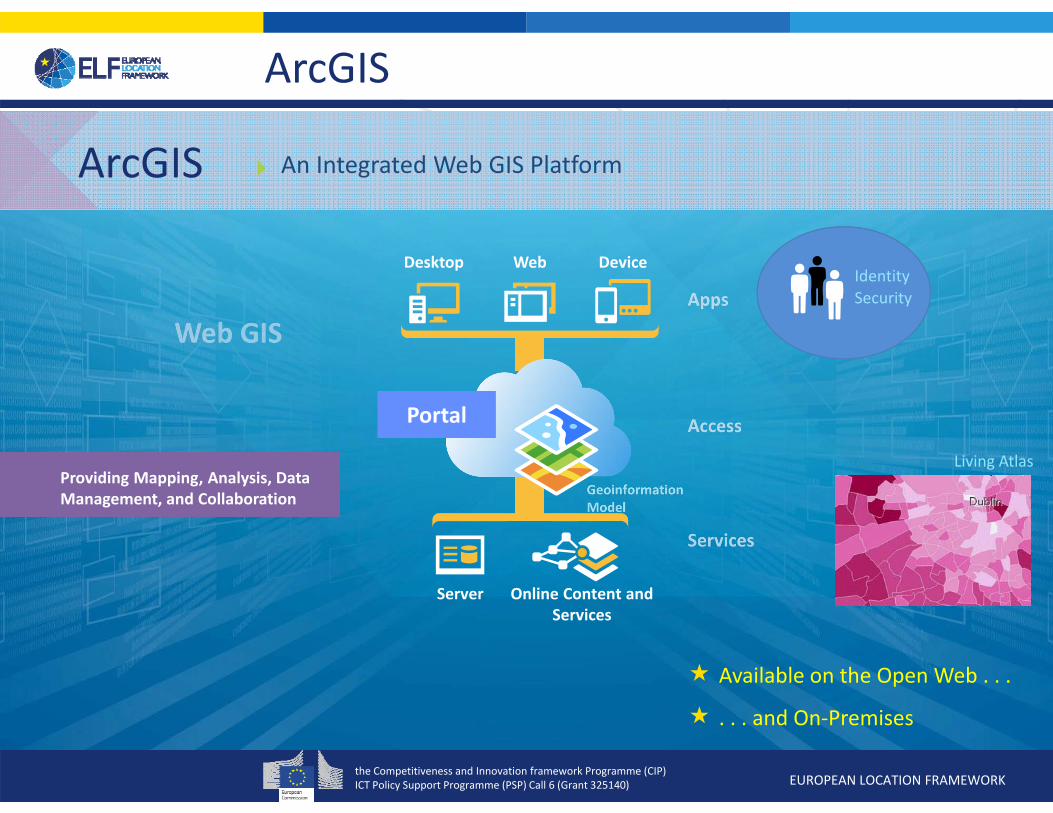
Desktop Web Device
Server Online Content and Services
Portal
ArcGIS
Available on the Open Web . . .
. . . and On‐Premises
An Integrated Web GIS Platform
Providing Mapping, Analysis, Data Management, and Collaboration
IdentitySecurity
ArcGIS
Living Atlas
the Competitiveness and Innovation framework Programme (CIP)ICT Policy Support Programme (PSP) Call 6 (Grant 325140) EUROPEAN LOCATION FRAMEWORK
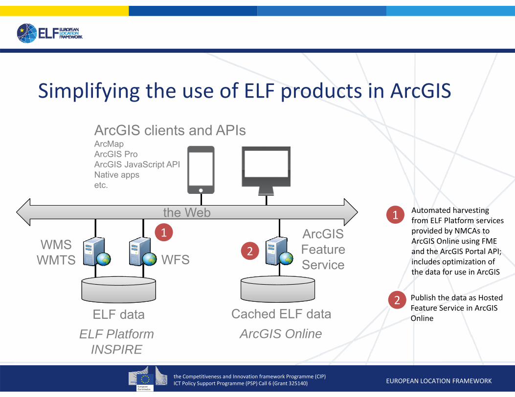
Cached ELF dataArcGIS Online
11 Automated harvesting
from ELF Platform services provided by NMCAs to ArcGIS Online using FME and the ArcGIS Portal API; includes optimization of the data for use in ArcGIS
Simplifying the use of ELF products in ArcGIS
ELF data
WMSWMTS WFS
the Webthe Web
ArcGIS clients and APIsArcMapArcGIS ProArcGIS JavaScript APINative appsetc.
ELF PlatformINSPIRE
ArcGISFeatureService
2 Publish the data as Hosted Feature Service in ArcGIS Online
2
the Competitiveness and Innovation framework Programme (CIP)ICT Policy Support Programme (PSP) Call 6 (Grant 325140) EUROPEAN LOCATION FRAMEWORK
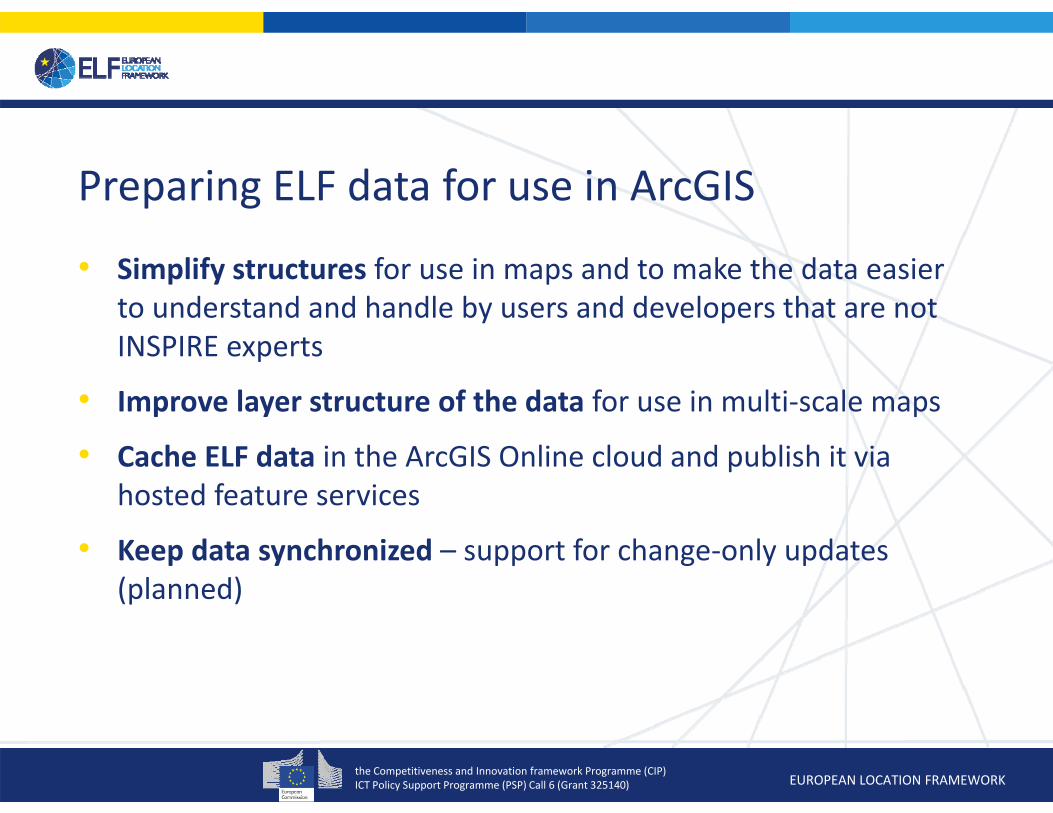
Preparing ELF data for use in ArcGIS
• Simplify structures for use in maps and to make the data easier to understand and handle by users and developers that are not INSPIRE experts
• Improve layer structure of the data for use in multi‐scale maps
• Cache ELF data in the ArcGIS Online cloud and publish it via hosted feature services
• Keep data synchronized – support for change‐only updates (planned)

the Competitiveness and Innovation framework Programme (CIP)ICT Policy Support Programme (PSP) Call 6 (Grant 325140) EUROPEAN LOCATION FRAMEWORK
Why ArcGIS Online?
We could have published the data using ArcGIS Server and ArcGIS Portal on premiseSignificant effort required to operate a reliable, scalable infrastructureAdvantages of the SaaS approach for us:Elasticity (user demands differ over time)High availability and securityManagement of the complete infrastructure by a third party (Esri)We can focus on the reference data!Important to manage resources
3 October, 2016
the Competitiveness and Innovation framework Programme (CIP)ICT Policy Support Programme (PSP) Call 6 (Grant 325140) EUROPEAN LOCATION FRAMEWORK
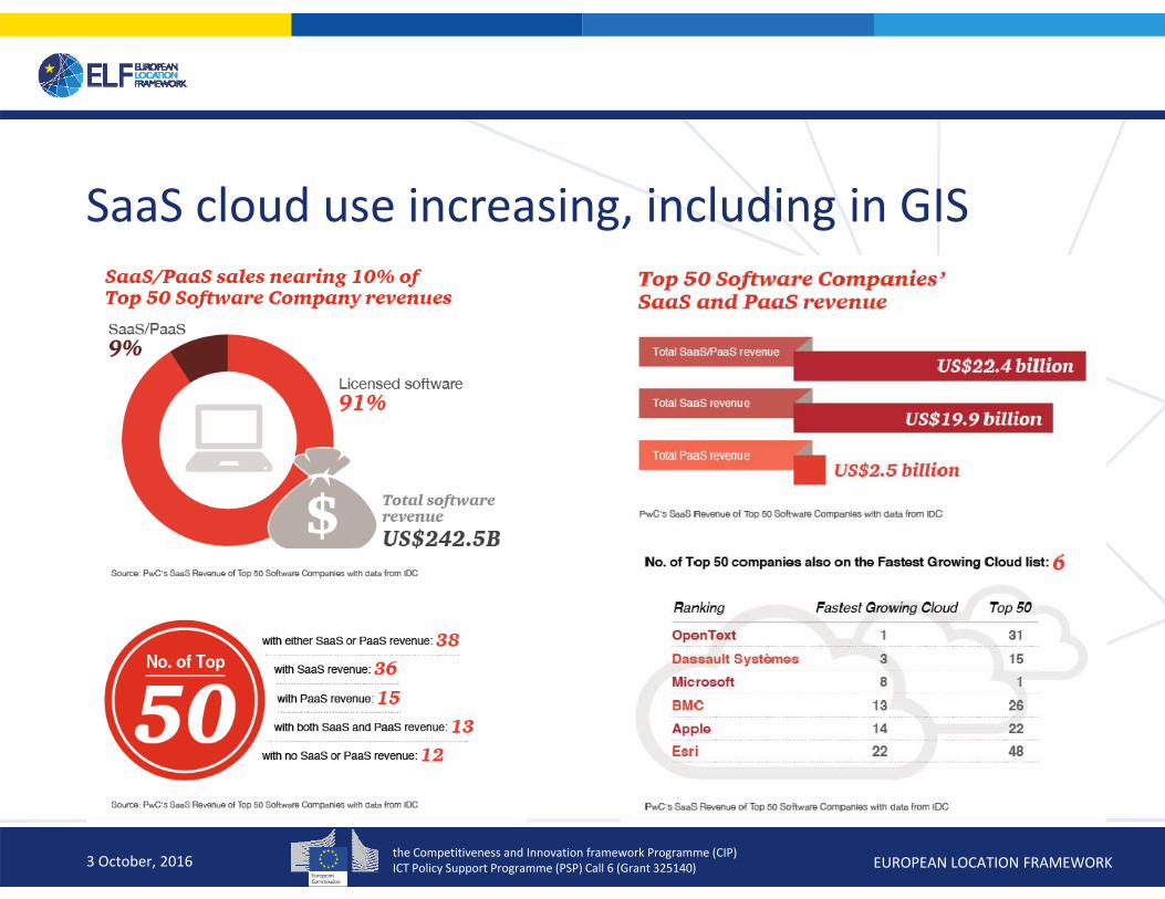
SaaS cloud use increasing, including in GIS
3 October, 2016
the Competitiveness and Innovation framework Programme (CIP)ICT Policy Support Programme (PSP) Call 6 (Grant 325140) EUROPEAN LOCATION FRAMEWORK
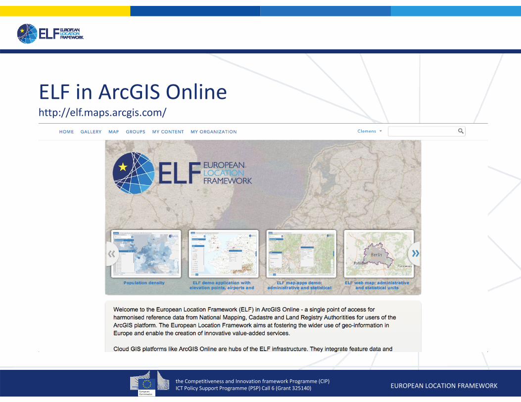
ELF in ArcGIS Onlinehttp://elf.maps.arcgis.com/

the Competitiveness and Innovation framework Programme (CIP)ICT Policy Support Programme (PSP) Call 6 (Grant 325140) EUROPEAN LOCATION FRAMEWORK
EuroGlobalMap ‐ open data(Scale level: Global)
the Competitiveness and Innovation framework Programme (CIP)ICT Policy Support Programme (PSP) Call 6 (Grant 325140) EUROPEAN LOCATION FRAMEWORK
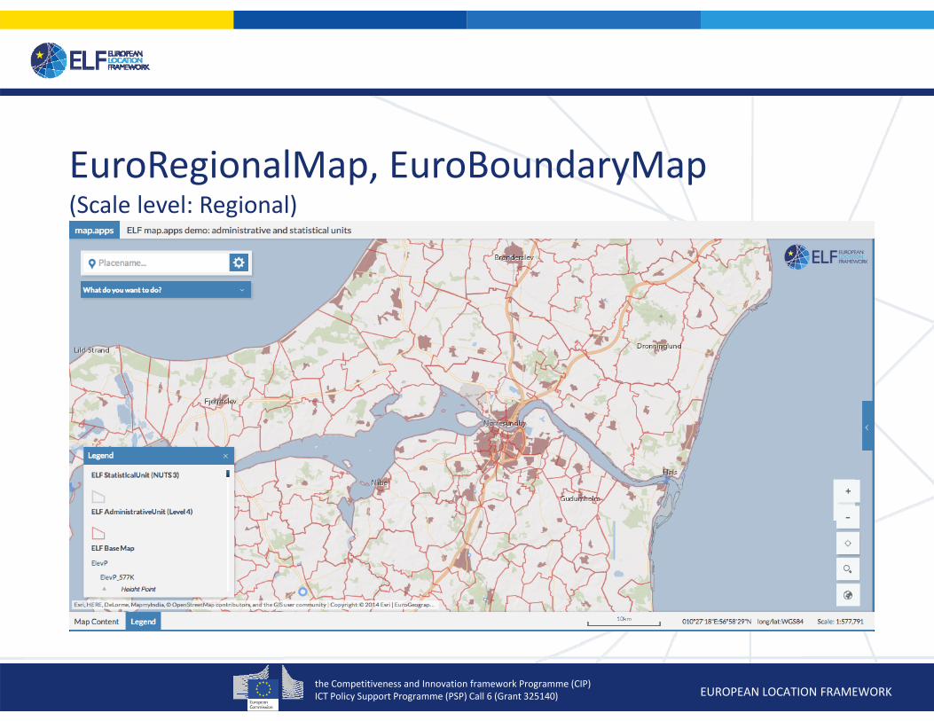
EuroRegionalMap, EuroBoundaryMap(Scale level: Regional)
the Competitiveness and Innovation framework Programme (CIP)ICT Policy Support Programme (PSP) Call 6 (Grant 325140) EUROPEAN LOCATION FRAMEWORK
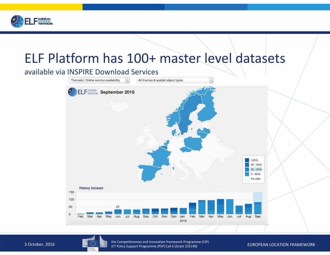
ELF Platform has 100+ master level datasets available via INSPIRE Download Services
3 October, 2016
the Competitiveness and Innovation framework Programme (CIP)ICT Policy Support Programme (PSP) Call 6 (Grant 325140) EUROPEAN LOCATION FRAMEWORK
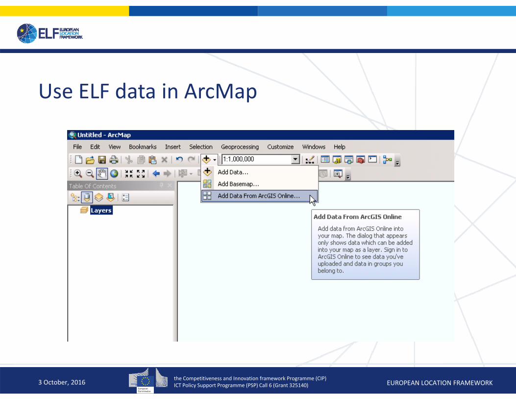
Use ELF data in ArcMap
3 October, 2016

the Competitiveness and Innovation framework Programme (CIP)ICT Policy Support Programme (PSP) Call 6 (Grant 325140) EUROPEAN LOCATION FRAMEWORK
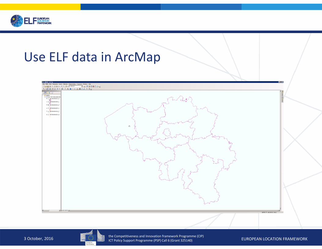
Use ELF data in ArcMap
3 October, 2016

the Competitiveness and Innovation framework Programme (CIP)ICT Policy Support Programme (PSP) Call 6 (Grant 325140) EUROPEAN LOCATION FRAMEWORK
Use ELF data in ArcMap
3 October, 2016
the Competitiveness and Innovation framework Programme (CIP)ICT Policy Support Programme (PSP) Call 6 (Grant 325140) EUROPEAN LOCATION FRAMEWORK
Use ELF data in ArcMap
3 October, 2016
the Competitiveness and Innovation framework Programme (CIP)ICT Policy Support Programme (PSP) Call 6 (Grant 325140) EUROPEAN LOCATION FRAMEWORK
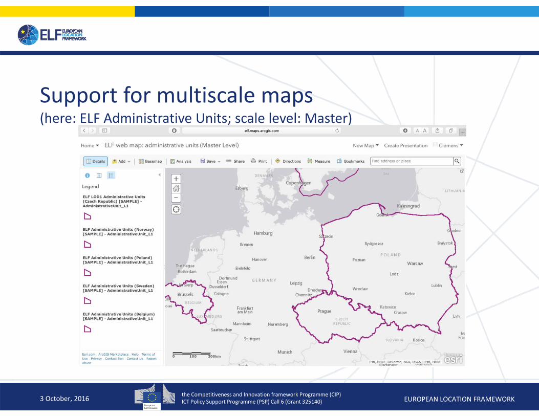
Support for multiscale maps(here: ELF Administrative Units; scale level: Master)
3 October, 2016
the Competitiveness and Innovation framework Programme (CIP)ICT Policy Support Programme (PSP) Call 6 (Grant 325140) EUROPEAN LOCATION FRAMEWORK3 October, 2016
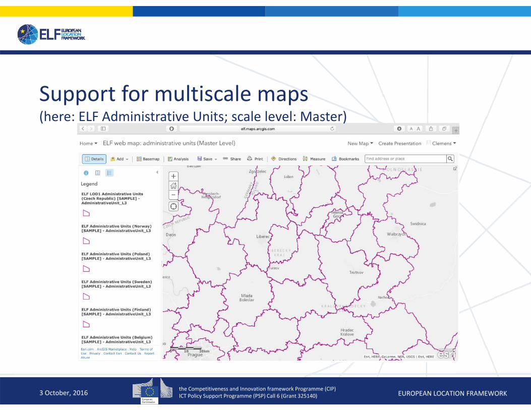
Support for multiscale maps(here: ELF Administrative Units; scale level: Master)

the Competitiveness and Innovation framework Programme (CIP)ICT Policy Support Programme (PSP) Call 6 (Grant 325140) EUROPEAN LOCATION FRAMEWORK
Simplifying INSPIRE data structures(e.g. names, denormalising data)
3 October, 2016
the Competitiveness and Innovation framework Programme (CIP)ICT Policy Support Programme (PSP) Call 6 (Grant 325140) EUROPEAN LOCATION FRAMEWORK
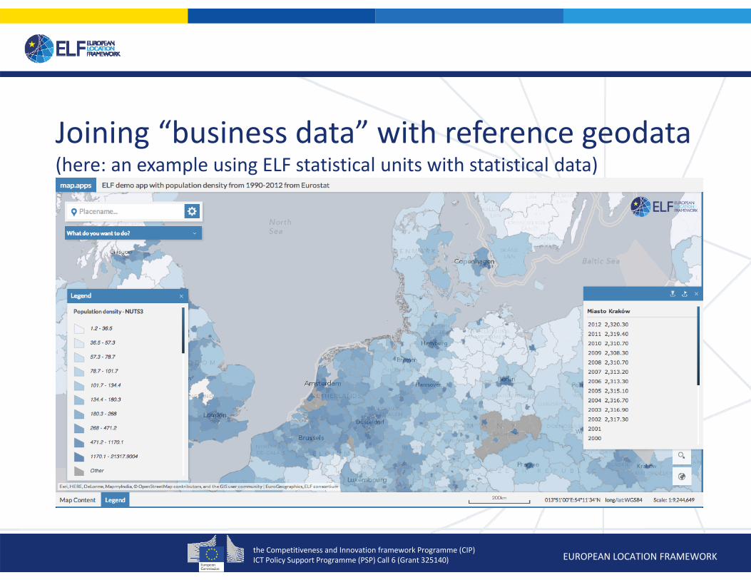
Joining “business data” with reference geodata(here: an example using ELF statistical units with statistical data)
the Competitiveness and Innovation framework Programme (CIP)ICT Policy Support Programme (PSP) Call 6 (Grant 325140) EUROPEAN LOCATION FRAMEWORK
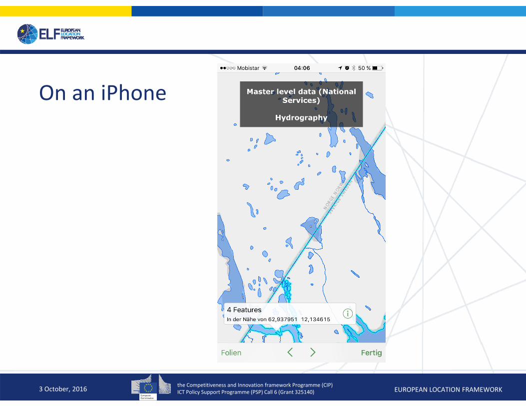
On an iPhone
3 October, 2016
the Competitiveness and Innovation framework Programme (CIP)ICT Policy Support Programme (PSP) Call 6 (Grant 325140) EUROPEAN LOCATION FRAMEWORK
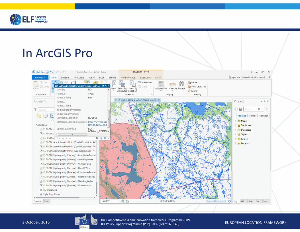
In ArcGIS Pro
3 October, 2016
the Competitiveness and Innovation framework Programme (CIP)ICT Policy Support Programme (PSP) Call 6 (Grant 325140) EUROPEAN LOCATION FRAMEWORK
Desktop Web Device
Server Online Content and Services
Portal
ArcGIS
Available on the Open Web . . .
. . . and On‐Premises
An Integrated Web GIS Platform
Providing Mapping, Analysis, Data Management, and Collaboration
IdentitySecurity
ArcGIS
Living Atlas
the Competitiveness and Innovation framework Programme (CIP)ICT Policy Support Programme (PSP) Call 6 (Grant 325140) EUROPEAN LOCATION FRAMEWORK
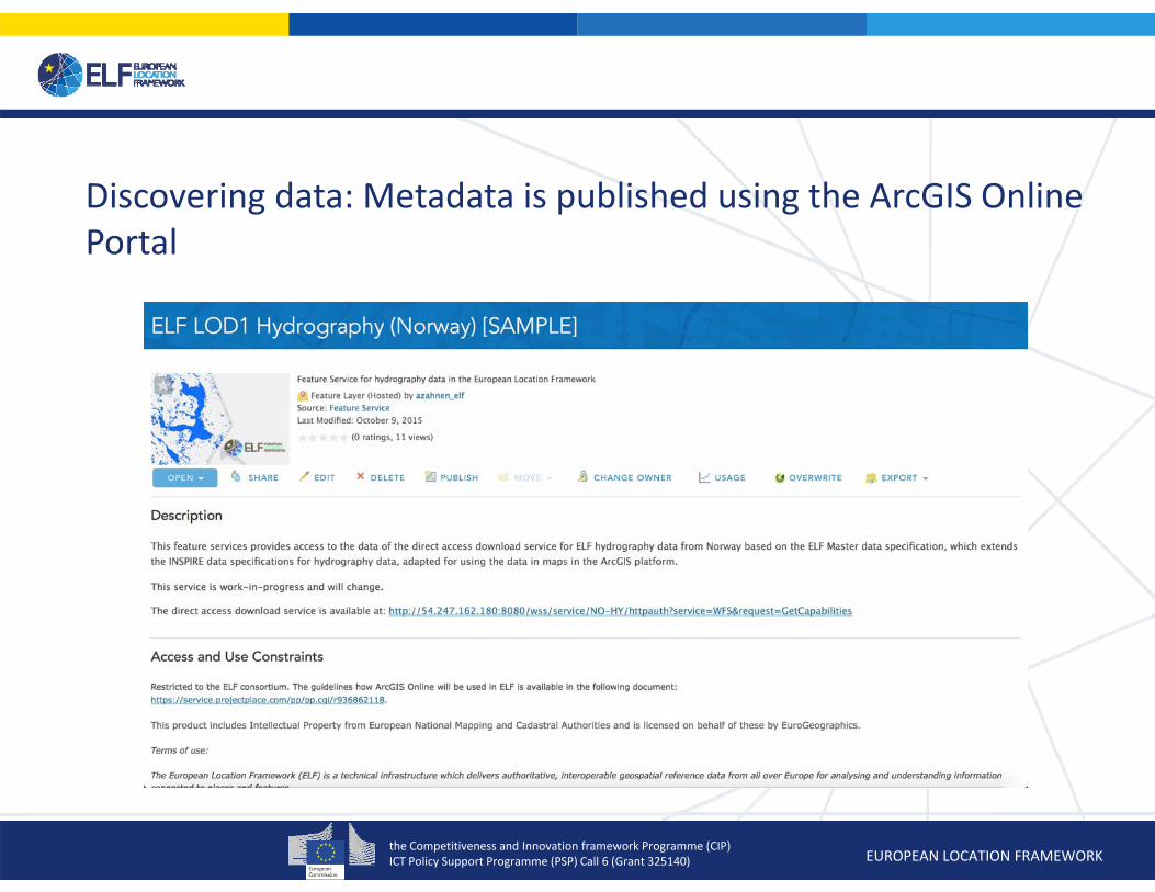
Discovering data: Metadata is published using the ArcGIS Online Portal
the Competitiveness and Innovation framework Programme (CIP)ICT Policy Support Programme (PSP) Call 6 (Grant 325140) EUROPEAN LOCATION FRAMEWORK
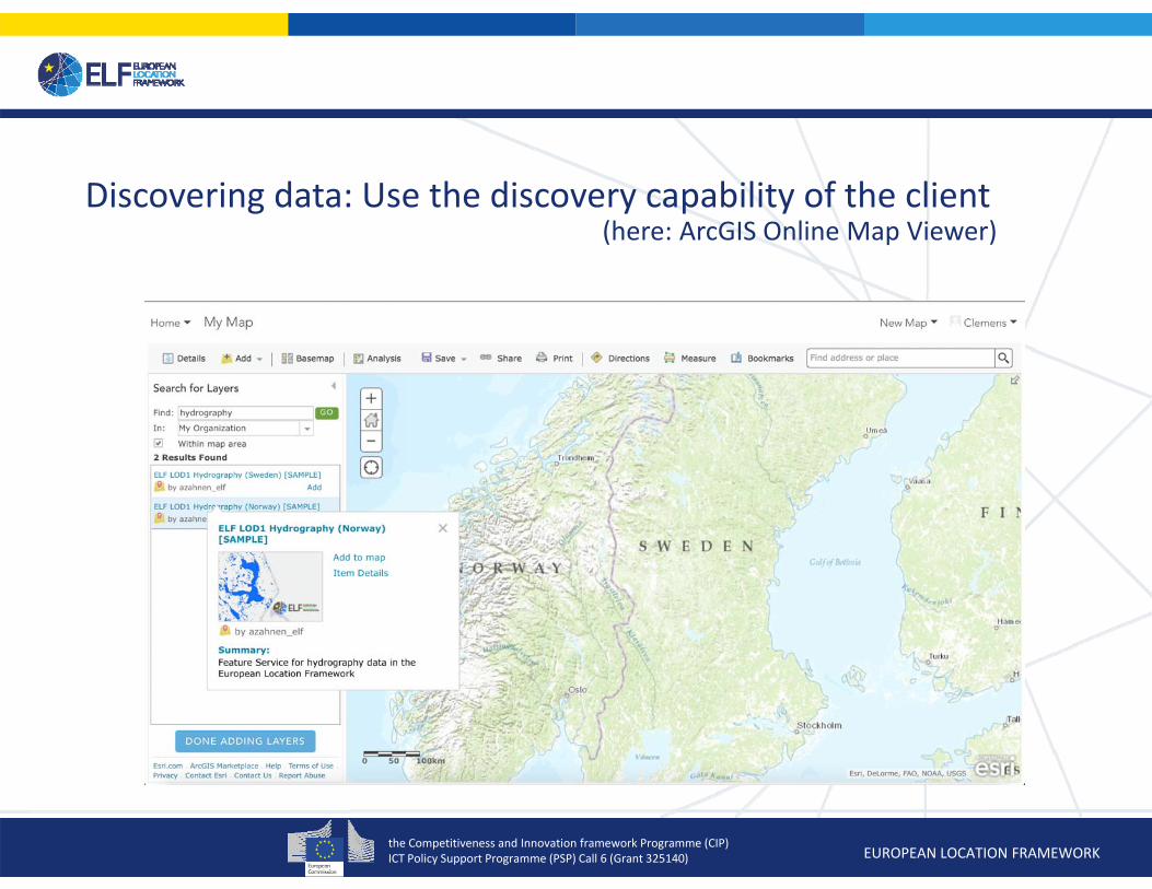
Discovering data: Use the discovery capability of the client(here: ArcGIS Online Map Viewer)

the Competitiveness and Innovation framework Programme (CIP)ICT Policy Support Programme (PSP) Call 6 (Grant 325140) EUROPEAN LOCATION FRAMEWORK
Future option could be to use the ArcGIS Marketplace(this will depend on the WP9 results)
the Competitiveness and Innovation framework Programme (CIP)ICT Policy Support Programme (PSP) Call 6 (Grant 325140) EUROPEAN LOCATION FRAMEWORK
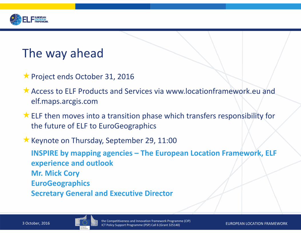
The way ahead
Project ends October 31, 2016
Access to ELF Products and Services via www.locationframework.eu and elf.maps.arcgis.com
ELF then moves into a transition phase which transfers responsibility for the future of ELF to EuroGeographics
Keynote on Thursday, September 29, 11:00INSPIRE by mapping agencies – The European Location Framework, ELF experience and outlookMr. Mick CoryEuroGeographicsSecretary General and Executive Director
3 October, 2016