ESTONIAN LAND PARCEL IDENTIFICATION SYSTEM Ahti Bleive Deputy Director Estonian Agricultural...
11
ESTONIAN LAND PARCEL IDENTIFICATION SYSTEM Ahti Bleive Deputy Director Estonian Agricultural Registers and Information Board ahti.bleive@pr ia.ee
-
date post
21-Dec-2015 -
Category
Documents
-
view
215 -
download
1
Transcript of ESTONIAN LAND PARCEL IDENTIFICATION SYSTEM Ahti Bleive Deputy Director Estonian Agricultural...

ESTONIAN LAND PARCEL IDENTIFICATION SYSTEM
Ahti BleiveDeputy Director
Estonian Agricultural Registers and Information Board
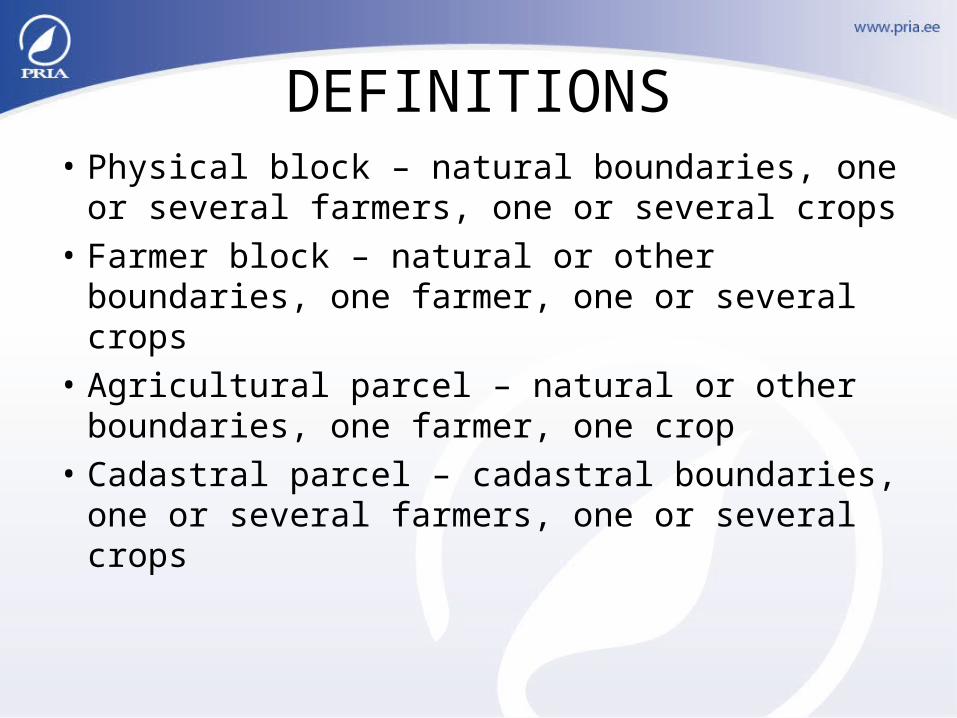
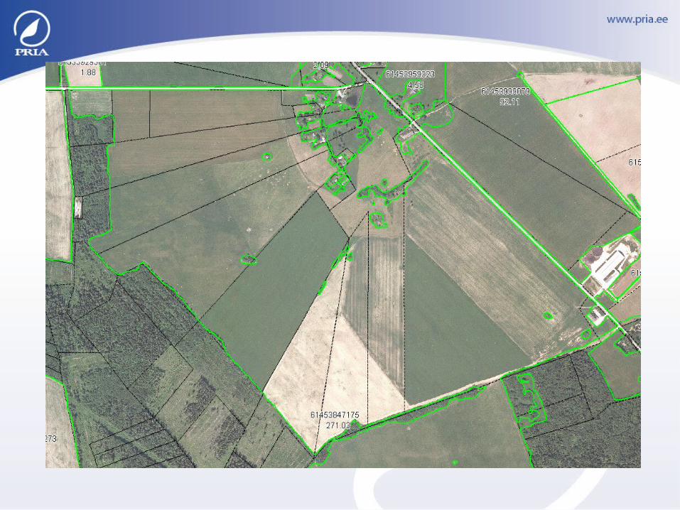
DEFINITIONS• Physical block – natural boundaries, one or
several farmers, one or several crops• Farmer block – natural or other boundaries,
one farmer, one or several crops• Agricultural parcel – natural or other
boundaries, one farmer, one crop• Cadastral parcel – cadastral boundaries,
one or several farmers, one or several crops
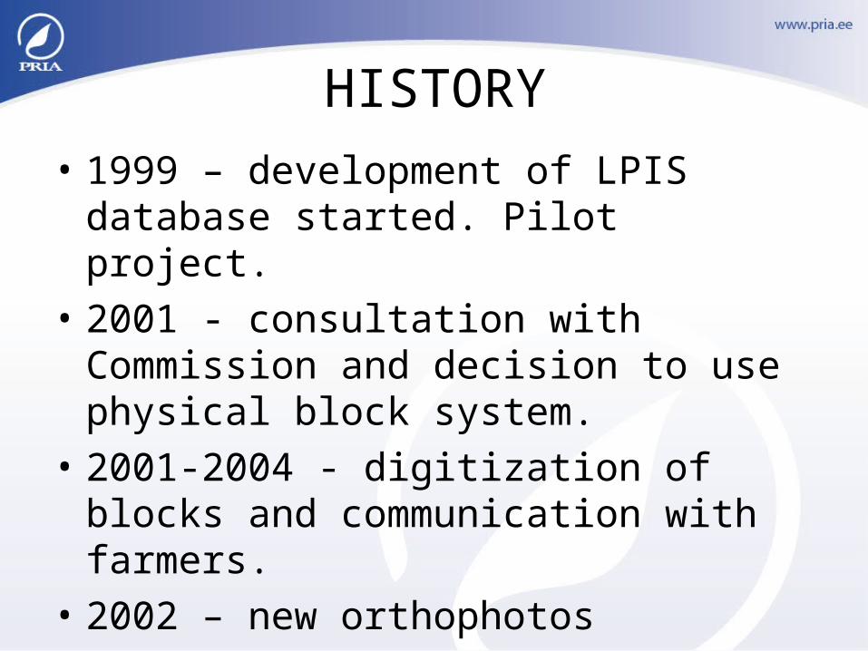
HISTORY
• 1999 – development of LPIS database started. Pilot project.
• 2001 - consultation with Commission and decision to use physical block system.
• 2001-2004 - digitization of blocks and communication with farmers.
• 2002 – new orthophotos
• 2003 – first GIS system for administrating and managing reference parcels data.
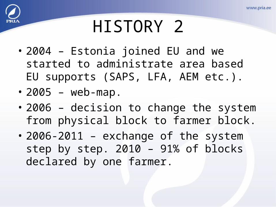
HISTORY 2• 2004 – Estonia joined EU and we started to
administrate area based EU supports (SAPS, LFA, AEM etc.).
• 2005 – web-map.• 2006 – decision to change the system from
physical block to farmer block.• 2006-2011 – exchange of the system step
by step. 2010 – 91% of blocks declared by one farmer.
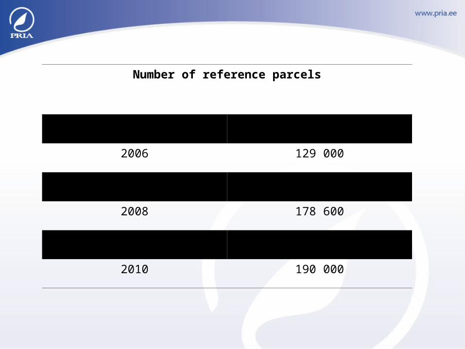
Number of reference parcels
2005 134 000
2006 129 000
2007 145 000
2008 178 600
2009 184 000
2010 190 000

USE OF REFERENCE PARCELS
• Preprinted maps of reference parcels.• Web-map for farmers (printing, measuring,
searching) - https://kls.eesti.ee/pria_avalik_kaart• E-service for farmers: digitization of parcels,
submitting applications for area based supports.• Crosschecks between reference parcel data and
aid application data.• Crosschecks of eligibility for different area
supports (LFA, SNH etc.)
STRENGHTS OF PHYSICAL BLOCK SYSTEM
• Easy to create.
• Less communication with farmers at the stage of creation and updating, compare to other systems.
• Easy to manage and update.
• Stable situation (less updates compare to other systems).
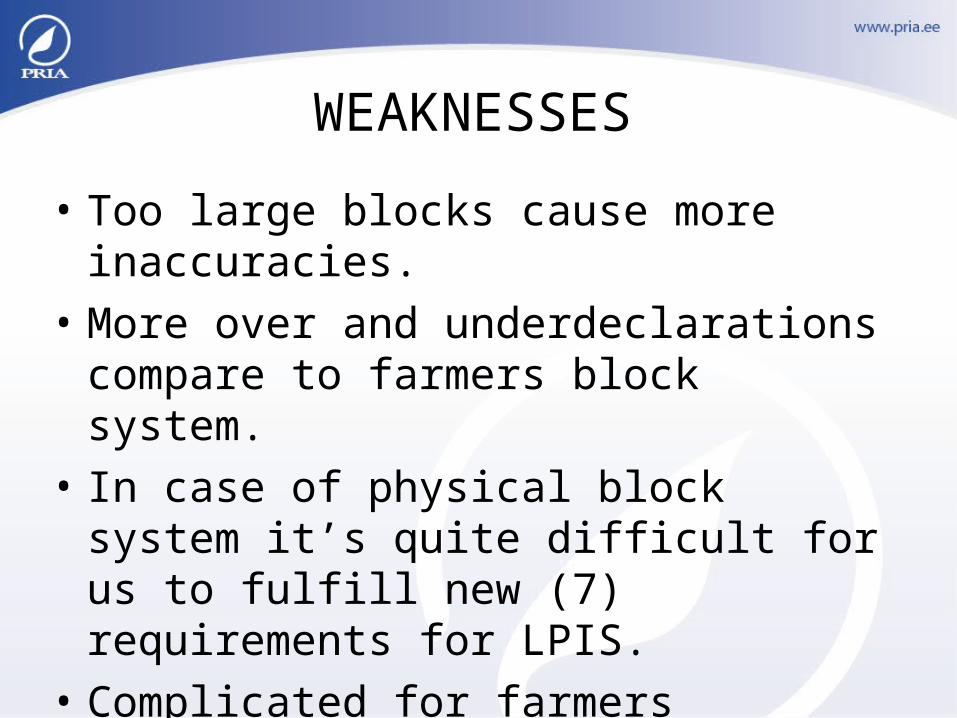
WEAKNESSES
• Too large blocks cause more inaccuracies.
• More over and underdeclarations compare to farmers block system.
• In case of physical block system it’s quite difficult for us to fulfill new (7) requirements for LPIS.
• Complicated for farmers (determination of exact area).
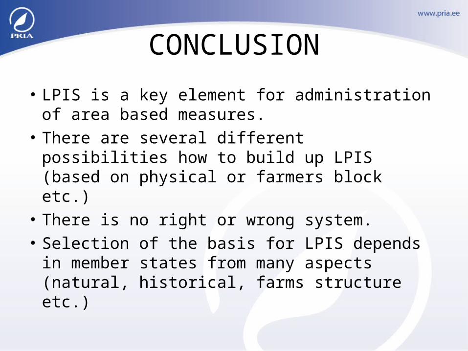
CONCLUSION
• LPIS is a key element for administration of area based measures.
• There are several different possibilities how to build up LPIS (based on physical or farmers block etc.)
• There is no right or wrong system.• Selection of the basis for LPIS depends in
member states from many aspects (natural, historical, farms structure etc.)

THANK YOU!