
Environmental Assessment Document - Rajasthanruidp.rajasthan.gov.in/IEE PDF/Water Supply Project of...
72
The initial environmental examination is a document of the borrower. The views expressed herein do not necessarily represent those of ADB’s Board of Directors, Management, or staff, and may be preliminary in nature. Initial Environmental Examination: Sikar Water Supply Subproject Project Number: 40031 November 2008 India: Rajasthan Urban Sector Development Investment Program Prepared by Local Self Government Department For the Government of Rajasthan Rajasthan Urban Infra structure Development Project Environmental Assessment Document
Transcript of Environmental Assessment Document - Rajasthanruidp.rajasthan.gov.in/IEE PDF/Water Supply Project of...

The initial environmental examination is a document of the borrower. The views expressed herein do not necessarily represent those of ADB’s Board of Directors, Management, or staff, and may be preliminary in nature.
Initial Environmental Examination: Sikar Water Supply Subproject Project Number: 40031 November 2008
India: Rajasthan Urban Sector Development Investment Program
Prepared by Local Self Government Department
For the Government of Rajasthan
Rajasthan Urban Infra structure Development Project
Environmental Assessment Document

ABBREVIATION
ADB Asian Development Bank CWR Clear Water Reservoir DSC Design and Supervision Consultancy EA Executing Agency EAC Expert Appraisal Committee FI Financial Intermediary GLSR Ground Level Service Reservoir GoI Government of India GoR Government of Rajasthan GSI Geological Survey of India IA Implementing Agency IEE Initial Environmental Examination IPMC Investment Programme Management Consultancy IPMU Investment Programme Management Unit JNNURM Jawaharlal Nehru National Urban Renewal Mission LPCD Litre Per Capita per Day LPS Litre Per Second LSGD Local Self-Government Department MFF Multitranche Financing Facility MLD Million litre Per day MoEF Ministry of Environment and Forests NAAQS National Ambient Air Quality Standards OD Outer Diameter OHSR Over Head Service Reservoir OM Operations Manual PHED Public Health Engineering Department PMU Project Management Unit RCC Reinforced Cement Concrete ROW Right of Way RPCB Rajasthan State Pollution Control Board RSPM Respirable Suspended Particulate Matter RUIDP Rajasthan Urban Infrastructure Development Project RUSDIP Rajasthan Urban Sector Development Investment Program SPM Suspended Particulate Matter STP Sewerage Treatment Plant ToR Terms of Reference UA Urban Agglomeration UIDSSMT Urban Infrastructure Development Scheme for Small and Medium Towns
uPVC Unplasitized Poly Venyl Chloride USEPA United States Environmental Protection Agency WC Water Closets

WTP Water Treatment Plant

TABLE OF CONTANTS
I. INTRODUCTION 1
A. PURPOSE OF THE REPORT 1
B. EXTENT OF THE IEE STUDY 1
II. DESCRIPTION OF THE PROJECT 3
A. TYPE, CATEGORY AND NEED 3
B. LOCATION, SIZE AND IMPLEMENTATION SCHEDULE 3
C. DESCRIPTION OF THE SUB-PROJECT 4
III. DESCRIPTION OF THE ENVIRONMENT 10
A. Physical Resources 10
B. Ecological Resources 22
C. Economic Development 23
D. Social and Cultural Resources 28
IV. ENVIRONMENTAL IMPACTS AND MITIGATION MEASURES: LOCATION AND DESIGN 30
V.POTENTIAL ENVIRONMENTAL IMPACTS AND MITIGATION MEASURES: INFRASTRUCTURE CONSTRUCTION 31
A. Screening out areas of no significant impact 31
B. Source and supply augmentation 32
C. Network improvement 34
VI. POTENTIAL ENVIRONMENTAL IMPACTS AND MITIGATION MEASURES: OPERATION AND MAINTENANCE 40
A. Screening out areas of no significant impact 40
B. Operation and maintenance of the improved water supply system 41
C. Environmental impacts and benefits of the operating system 41
VII. INSTITUTIONAL REQUIREMENTS AND ENVIRONMENTAL MONITORING PLAN 43

A. Summary of environmental impacts and mitigation measures 43
B. Institutional arrangements for project implementation 43
C. Environmental Monitoring Plan 49
D. Environmental management and monitoring costs 53
VIII. PUBLIC CONSULTATION AND INFORMATION DISCLOSURE 54
A. Project stakeholders 54
B. Consultation and disclosure to date 54
C. Future consultation and disclosure 56
IX. FINDINGS AND RECOMMENDATIONS 57
A. Findings 57
B. Recommendations 59
X. CONCLUSIONS 60
Appendix – 1 REA Checklist 61
1
I. INTRODUCTION
A. Purpose of the report
1. Rajasthan Urban Sector Development Investment Program (RUSDIP) is intended to optimize social and economic development in 15 selected towns in the State, particularly district headquarters and towns with significant tourism potential. This will be achieved through investments in urban infrastructure (water supply; sewerage and sanitation; solid waste management; urban drainage; urban transport and roads), urban community upgrading (community infrastructure; livelihood promotion) and civic infrastructure (art, culture, heritage and tourism; medical services and health; fire services; and other services). RUSDIP will also provide policy reforms to strengthen urban governance, management, and support for urban infrastructure and services. The assistance will be based on the State-level framework for urban reforms, and institutional and governance reforms recommended by the Government of India (GoI) through the Jawaharlal Nehru National Urban Renewal Mission (JNNURM) and Urban Infrastructure Development Scheme for Small and Medium Towns (UIDSSMT).
2. RUSDIP Phase II to be implemented over a seven year period beginning in 2008, and will be funded by a loan via the Multitranche Financing Facility (MFF) of the ADB. The Executing Agency (EA) is the Local Self-Government Department (LSGD) of the Government of Rajasthan (GoR); and the Implementing Agency (IA) is the Project Management Unit (PMU) of the Rajasthan Urban Infrastructure Development Project (RUIDP), which is currently in the construction stage.
3. RUSDIP will improve infrastructure through the design and implementation of a series of subprojects, each providing improvements in a particular sector (water supply, sewerage, solid waste etc) in one town. RUSDIP has been classified by ADB as environmental assessment category B (some negative impacts but less significant than category A). The impacts of subprojects prepared according to ADB Environment Policy (2002) and Environmental Assessment Guidelines (2003).
B. Extent of the IEE study
4. Indian law and ADB policy require that the environmental impacts of development projects are identified and assessed as part of the planning and design process, and that action is taken to reduce those impacts to acceptable levels. This is done through the environmental assessment process, which has become an integral part of lending operations and project development and implementation worldwide.
1. ADB Policy
5. ADB’s Environment Policy requires the consideration of environmental issues in all aspects of the Bank’s operations, and the requirements for Environmental Assessment are described in Operations Manual (OM) 20: Environmental Considerations in ADB Operations. This states that ADB requires environmental assessment of all project loans, programme loans, sector loans, sector development programme loans, financial intermediation loans and private sector investment operations.
6. The nature of the assessment required for a project depends on the significance of its environmental impacts, which are related to the type and location of the project, the sensitivity, scale, nature and magnitude of its potential impacts, and the

2
availability of cost-effective mitigation measures. Projects are screened for their expected environmental impacts and are assigned to one of the following categories:
Category A: Projects that could have significant environmental impacts. An Environmental Impact Assessment (EIA) is required.
Category B: Projects that could have some adverse environmental impacts, but of less significance than those for category A. An Initial Environmental Examination (IEE) is required to determine whether significant impacts warranting an EIA are likely. If an EIA is not needed, the IEE is regarded as the final environmental assessment report.
Category C: Projects those are unlikely to have adverse environmental impacts. No EIA or IEE is required, although environmental implications are reviewed.
Category FI: Projects that involve a credit line through a financial intermediary (FI) or an equity investment in a FI. The FI must apply an environmental management system, unless all subprojects will result in insignificant impacts.
7. The Bank has categorised this program as Category B and following normal procedure for MFF loans has determined that one Environmental Examination will be conducted for each subproject, with a subproject being the infrastructure improvements in a particular sector (water supply, sewerage, etc) in one town.
2. National Law
8. The GoI EIA Notification of 2006 (replacing the EIA Notification of 1994), sets out the requirement for Environmental Assessment in India. This states that Environmental Clearance (EC) is required for specified activities/projects, and this must be obtained before any construction work or land preparation (except land acquisition) may commence. Projects are categorised as A or B depending on the scale of the project and the nature of its impacts.
9. Categories A projects require Environmental Clearance from the National Ministry of Environment and Forests (MoEF). The proponent is required to provide preliminary details of the project in the form of a Notification, after which an Expert Appraisal Committee (EAC) of the MoEF prepares comprehensive Terms of Reference (ToR) for the EIA study, which are finalized within 60 days. On completion of the study and review of the report by the EAC, MoEF considers the recommendation of the EAC and provides the EC if appropriate.
10. Category B projects require environmental clearance from the State Environment Impact Assessment Authority (SEIAA). The State level EAC categorises the project as either B1 (requiring EIA study) or B2 (no EIA study), and prepares TOR for B1 projects within 60 days. On completion of the study and review of the report by the EAC, the SEIAA issues the EC based on the EAC recommendation. The Notification also provides that any project or activity classified as category B will be treated as category A if it is located in whole or in part within 10 km from the boundary of protected areas, notified areas or inter-state or international boundaries.
11. The only type of infrastructure provided by the RUSDIP that is specified in the EIA Notification is solid waste management, where EC is required for all Common Municipal Solid Waste Management Facilities (facilities that are shared by more than

3
one town) 1. EC is thus not required for the water supply sub-project that is the subject of this Environmental Examination.
3. Review and Approval Procedure
12. For Category B projects the Draft Environmental Status report and its summary (SIEE) are reviewed by ADB’s Regional Department sector division and Environment and Social Safeguards Division, and by the Executing Agency, and additional comments may be sought from project affected people and other stakeholders. All comments are incorporated in preparing the final documents, which are reviewed by the Executing Agency and the national environmental protection agency (MoEF in this case). The EA then officially submits the IEE and SIEE reports to ADB for consideration by the Board of Directors. Completed reports are made available worldwide by ADB, via the depository library system and the ADB website.
4. Scope of Study
13. This is the IEE report for the Sikar water supply sector subproject. It discusses the generic environmental impacts and mitigation measures relating to the location, design, construction and operation of physical works proposed under this subproject.
II. DESCRIPTION OF THE PROJECT
A. Type, Category and Need
14. This is a water supply sub-project, and as explained above it has been classified by ADB as Category B, because it is not expected to have major negative environmental impacts. Under ADB procedures such projects require an IEE to identify and mitigate the impacts, and to determine whether further study or a more detailed EIA may be required. The sub-project is needed because the present water supply infrastructure in Sikar is inadequate for the needs of the growing population.
15. The provision is also unequal, with un-served areas being mainly the slums and newly-developed areas. This is one of a series of subprojects designed by the RUSDIP that are intended to raise the standards of the municipal infrastructure and services of Sikar and the other urban centres to those expected of modern Asian towns.
B. Location, Size and Implementation Schedule
16. The sub-project is located in Sikar, the headquarters town of Sikar District, in the north eastern part of Rajasthan (Figure 2.1). Improvement of Sikar water supply scheme is already in progress, so there is limited scope of work under ADB funding. Construction of 2 overhead storage reservoirs will be considered (Figure 2.2). Other facilities like 25.5 km uPVC rising main of 110 to 160 mm for centralization of tube well to CWR and replacement of distribution main (Figure 2.2, 2.3).
1 According to the Rajasthan State Pollution Control Board, the MoEF intends to issue a clarification to the EIA Notification in due course, which will add all landfill facilities and Sewage Treatment Plants to the list of projects specified as requiring EC under the Notification. This has not yet been issued, so the text above indicates the correct legal position at the time of writing

4
C. Description of the Sub-project
Service Delivery, existing water supply arrangement
17. Sikar Water Supply is presently depending only on abstraction of ground water from well fields. The well fields are scattered in areas of Sikar. At present 183 tube wells exist, 70 are connected to the existing CWR, with average pumping hours of 20 and 113 are directly connected to the distribution system, with average pumping hours of 10. The yield of these wells varies from 6000 lps to 13500 lps.
18. In Sikar at present there are 183 tube well are under operation and producing 28.83 MLD of water. Another 20 tube well are under construction and will be completed by 2008 under another scheme named “Revised Re-organisation of Urban Water Supply Scheme Sikar” package No. XIV amounting RS.17.73 crores executed by PHED. The expected production from these well shall be 20 x 15000 x 20 =6.0 mld. After completion of these additional tube wells the total water production will be 35.48 by the end of 2008, with the view to increase daily production PHED has proposed to join 57 tube wells to CWR which are at present connected to direct distribution system. So that they can be run for additional 10 hours. The production will be increased by 57 x 13000 x10 = 7.41 MLD. Connecting tube wells in groups to nearby CWR will increase the discharge from tube wells
Table no 2.1: Details of Tube wells Sl.NO
Existing Zone (2006) no of Field Well
No. of Tube Well Average yield of each in LPH
Average Total Yield
Hours of Yield (LPH) From the Well Field
Pumping per day
In M3
Direct Supply
CWR Direct Supply
CWR Direct Supply
CWR Direct CWR Direct Supply
CWR
1 1 11 13 11955 10885
10 20 1315000 2830000 1315 2830
2 2 9 7 11444 11143
10 20 1030000 1560000 1030 1560
3 3 15 8 11733 13500
10 20 1760000 2160000 1760 2160
4 4 11 23 10091 10091
10 20 1110000 4641818 1110 4642
5 5 14 - 11107 - 10 - 1555000 1555 0 6 6 15 9 10650 1200
0 10 20
1704000 2160000 1704 2160 7 7 2 - 10750 - 10 - 215000 215 0 8 8A 6 - 11917 - 10 - 715000 715 0 9 8B 14 1 12750 - 10 - 1785000 1785 0 10 8B-1 1 - 13500 - 10 - 135000 135 011 8B-3 2 - 13500 - 10 - 270000 270 012 8C 13 9 12385 1264
310 20
1610000 2275714 1610 2276TOTAL (13204+15628)=28832 cum. 13204 15628
19. There are number of leakages from joints coupled with pipe. Termite attack on joints of AC Pipes is constant O&M problem, Leakages occur almost regularly as can be

5
identified through presence of small water pools along the rising main alignment. The distribution pipe lines of Existing zone 4 and 5 were laid in 1960, due to increase in population of the town the size of pipes have become insufficient and old. The Leakages occur almost regularly. The present water supply does not meet the essential requirement.
Sub-project description including detail scope
20. There are very limited scopes for improvement of water supply scheme under ADB funding. The detailed as follows:
o Provision for 8 nos. Chlorinator at various reservoirs. o 17,600 numbers of total household meter and rehabilitation of existing
10,270 nos. household meters; o Provision of 16 nos. electromagnetic flow meters at supplies points o Provision for replacement of 11 nos. pumps in 5 nos. existing pumps
houses at Sawa Mali road, Rohit Ji Ki Dhani, Hathi Ki Tibba, Kamila and Novelgarh road including electrification and rehabilitation of civil work
o Rehabilitation of leaking pipe lines at stretches for a total length of 1.0 Km with 200-250 mm dia uPVC pipe line and 2.6 km of DI of 300 to 400 mm dia
o Two nos. OHSR each of 1500 KL at Navalgarh road (PHED) campus and at Chejaru ki bagichi
o Provision of 25.5 km uPVC rising main of 110 to 160 mm for centralization of tube well to CWR
21. The proposed water supply systems are shown in Figures 2.2 and 2.3.
22. The Subproject is designed for a net water supply of 135 lpcd at the household end, for a design population of 2041, and with physical or system losses maintained at 20% after the completion of the project. All civil works and pipe sizing are designed to meet 2041 (projected population’s) needs, while all mechanical and electrical equipment are designed for 2026 (projected population’s) requirement.
23. Table 2.2 shows the nature and size of the various components of the subproject. There are three main elements: augmentation of the water source and supply; improvement of the distribution network; and reduction of non-revenue water (NRW). The descriptions shown in Table 2.2 are based on the present proposals, which are expected to be substantially correct, although certain details may change as development of the subproject progresses.

6
Figure 2.1: Location of Project Area

Rajasthan Urban Sector Development Investment Program
ADB TA 4814-IND
Sikar Regional Map
Govt of Rajasthan Asian Development Bank

7
Figure 2.2: Sikar water supply scheme- rising main

PTW
−11
PTW
−10
PTW
−9
146PTW
ESR
PTW
−3
PRO
P H.W
PCW
R
PTW
−11
PTW
−19
PTW
−20
PTW
−12
PTW
−10
PTW
−9
PTW
−8
PTW
−173
181
PTW
−15
PTW
−14
PTW
−172
PTW
−13
122
PTW
−17
PTW
−18PSP
PTW
−27154
PTW
−4
151
152
153
PTW
−24
PTW
−25
149
157
PTW
−10
154
153
165
159
PTW
−21
PTW
−22
PTW
−12
138
PTW
−23
PTW
−11
175
PTW
−1
PTW
−2
PTW
−145
PTW
−5168
182
167
PTW
−3
PTW
−6
PTW
−7
PTW
−3
PTW
−2
PTW
−4
179
PTW
−9
PTW
−147
PTW
−6
PTW
−5127
128PT
W5
129
PTW
−4
PTW
−7
124
132
131
130
133
125
126
PTW
117T
W−3
115
112
111
134
68
65
TW
85
E.T
.W2
72
84
SR
CW
R
88
89
91
90
82
TW
−24
8866
70
69
116
71
67
TW
68
TW
−5
92
71
74
73
T.W
94
93
85
78
77
80
E.W
−20
79T
W25
96TW
−22
50
60
53
45
45
46
4961
5958
47
48
54
52
51 57
55
TW
−41
TW
−43
TW
−62
TW
−97
PTW
−107
PTW
−98
PTW
−2104
105PT
W−2
PTW
−5
TW
−4103
108
96
106
10
109100
110
113
143148
44
PTW
−10
PSR
TW
R170
TW
−169
TW
−140
PTW
−10
PTW
−137
PTW
−8
PTW
−6150
55
TW
145
PTW
−178
TW
176
TW
21
TW
5
TW
9
SI NO
. 5A
TW
12
TW
2
TW
8
TW
24
TW
6
TW
−182
TW
−183
TW
−181
TW
−180
TW
25
TW
39
TW
40
TW
29
TW
26
TW
38
TW
28
SI NO
.31
TW
27
TW
−42
TW
−63
TW
−56
T.N
O8
SI.NO
49
T.N
O5
SI.NO
48
T.N
O4
SI.NO
52
T.N
O9
SI.NO
51
T.N
O3
SI.NO
45
T.N
O2
SI.NO
44
T.N
O15
SI.NO
92
T.N
O7
SI.NO
73
T.N
O8
SI.NO
71
T.N
O13
SI.NO
93 T.N
O11
SI.NO
95
T.N
O26
SI.NO
94
T.N
O10
SI.NO
75
T.N
O2
SI.NO
36
T.N
O6
SI.NO
35
T.N
O7
SI.NO
33
T.N
O5
SI.NO
34
T.N
O4
SI.NO
30
T.N
O3
SI.NO
32
T.N
O2
T.N
O9
SI.NO
37
SI NO
.16T
.NO
2
SI NO
.15T
.NO
22
SI NO
.161T
.NO
6 SI N
O.180
T.N
O 13
TW
171T
.NO
14
SI NO
7T
.NO
23
SI NO
.6T
.NO
8
SI NO
.9T
.NO
19
SI NO
.2T
.NO
18
SI NO
.17T
.NO
4
SI NO
.1T
.NO
17
SI NO
.04T
.NO
21
SI NO
.20T
.NO
10
SI NO
.20T
.NO
21
SI NO
.162T
.NO
1
SI NO
.163T
.NO
2
SI NO
.164T
.NO
3
SI NO
.160T
.NO
4
300MM
Ø
SI NO
.2T
.NO
10
SI NO
.PI/W−3
T.N
O 9
SI NO
.PI/W−2
T.N
O 10
SI NO
.123
SI NO
.127T
.NO
8
SI NO
.118T
.NO
7
T.N
O2
SI.NO
88T.N
O3
SI.NO
89T.N
O4
SI.NO
91
T.N
O5
T.N
O
SI.NO
81H
B1
T.N
O1
SI.NO
83
T.N
O4
SI.NO
76
TO
PAL
WA
S
T
T
T
T
T
TO
SYA
MPU
RA
TO BIKANER
TO SA
LASH
AR
M
M
M
M
M
M
T
TO
PAL
WA
S
TO
SYA
MPU
RA
10
8
4
9
56
32
35
34
33
1124
12
13
14
15
16
2322
21 26 28
27
32
38
3639
40
41
31
2029
19
17
30
25
7
37
42
43
451
44
18
ZO
NE
NO
-5
ZO
NE
NO
-1
ZONE NO-2
ZO
NE
NO
-4
ZO
NE
NO
-6
ZO
NE
NO
-7
ZO
NE
NO
-8
ZO
NE
NO
3
ZO
NE
NO
-17
ZO
NE
NO
-18
ZO
NE
NO
-19
ZO
NE
NO
-15
ZO
NE
NO
-16
ZO
NE
NO
-13
ZO
NE
NO
-14
ZO
NE
NO
-21
ZO
NE
NO
-20
ZO
NE
NO
-9
ZO
NE
NO
-11
ZO
NE
NO
-10
PLO
T’S
R A
D H
A K
I S H A
N P U
R A
RA
KL
EE
LA
MA
IDA
N
GIR
LS SC
HO
OL
DE
VIG
GO
VT
.
TO SIKAR & BIKANER BY PASS
NA
GA
R
TO
DI
KI DHANI
TO BIJARNIYOH
SCH
OO
LPR
OPO
SED
SCH
OO
L
TO RAMPURA
TO DHODH
T.W
.
A.G
. L A
N D
TO K
AN
WA
RPU
RA
.G. L
A N
D
B.T
. R O
A D
WA
TE
R
A.G. L A N D
TA
NK
GY
AN
MA
ND
IRSC
HO
OL
CO
LO
NY
KR
ISHA
NA
SHR
I
A.G
. L A
N D
A.G
. L A
N D
RA
STA
KA
TC
HA
O P E
N
T.W
.
GA
NE
SH C
OL
ON
Y
PLO
TS
PRO
POSE
D
WE
LL
AG
. L A
N D
LT
D.
CO
RPO
RA
TIO
NH
IND
UST
AN
PET
RO
LIU
M
T/W
TE
J NA
GA
R
15.0 M. W
IDE ROAD
PUB
LIC
SCH
OO
LR
AJA
STH
AN
TO
FIEL
DO
P E N
RA
J NA
GA
R
SCH
OO
L
PUB
LIC
BR
IGH
T
PLO
TS
PRO
POSE
D
SEKHAWAT NAGAR
MO
HA
LL
A
KABRISTAN
BA
GIC
HI
CO
LO
NY
HA
NU
MA
N
VY
AS JI K
I
GO
VT
. SC
HO
OL
JYO
TI N
AG
AR
HO
MY
OPA
TH
IKN
APA
YA
NSH
RI B
AD
DR
I
KI B
AG
ICH
IG
AR
IB D
AS
KA
RIG
RO
N K
A
BA
L SC
HO
OL
AD
AR
SH
T.W
.
JAT
O K
A B
AS
BID
ASA
R
PRIV
AT
E C
OL
ON
Y
TO SAWANLI
S T A
D I U
M
S.R.
(PRO
POSE
D)
SCH
OO
LB
HA
RA
TI PU
BL
ICV
IDH
YA
J A I P U R BY P A S S
MA
ND
IR SC
HO
OL
AD
AR
SH V
IDH
YA
SUR
VE
Y D
EP. SIK
AR
DY
. DIR
EC
TO
R
GU
RJA
R H
OST
EL
OF IN
DIA
FOO
D C
OR
P.
FOR
EST
DE
P.FO
RO
PEN
LA
ND
RO
OP IN
D’S
SUR
AJ G
RA
INIT
E
OPE
N L
AN
D
OPE
N L
AN
D (P) LT
D.
TR
AD
ING
RO
SHA
N
CO
MPN
YT
RA
DIN
G
IND
’SA
GA
RW
AL
RA
J IND
’S
H.M
.T. IN
D’S
PAN
NA
GR
AIN
ITE
GR
AIN
ITE
KH
ET
AN
SHR
EE
LA
L
GR
AIN
ITE
AN
UR
AG
GR
AIN
ITE
RA
HU
LG
RA
INIT
EG
RA
INIT
EO
M SH
IV
AR
EA
RIIC
O
GR
AIN
ITE
GO
MT
I
GR
AIN
ITE
K.R
.
GR
AIN
ITE
DU
RG
A
MIL
LSA
W
GR
AIN
ITE
SIDD
HA
RT
H
PASH
U A
HA
RG
AN
GO
TR
I
DE
VIPU
RA
R.S.R
.T.C
.
PET
RO
L
BU
S STA
ND
WO
RK
BH
AV
NA
N A
G A
R
DIG
AM
BE
RJA
IN M
AN
DIR
SHR
IP.H
.E.D
.
MA
KE
RB
OD
YSU
BH
ASH
R.S.E
.B.
OFFIC
E
STA
TE
O
FFICE
OF
OU
T H
EA
D
FOR
EST
DE
P.Q
TS. O
F
MA
P.L
AN
D
S.R.
S.R.
TE
MPL
EPHE
D SIK
AR
S.R.
CIR
CL
E O
FFICE
P A R
K VIB
HA
GPA
SHU
PAL
AN
DE
P. OF
HO
SPITA
LA
NIM
AL
SAT
IR
AN
I
OPE
N L
AN
DB
EE
D
T/W
T/W
P.H.E
.D. T
/W.
OF D
AIN
IK B
HA
SKA
R
SHO
P
BR
AN
CH
OFFIC
E
ASH
OK
VIH
AR
RA
NI SA
TI R
OA
D
SIND
HI C
OL
ON
Y
BA
STI
DE
EP
KA
TC
HI
BO
AR
DH
OU
SING
TA
BE
LA
MA
RK
ET
BOOK DEDOT
TAK
IJR
AJ SH
REE
PRA
SAD
STE
EL
S
MIL
LSA
W
HO
SPITA
L
RA
JEN
DR
AK
UM
AW
AT
CO
MPU
TE
RA
JEE
T
PAR
K
R.S.E
.B.
GA
TE
DU
JOD
DA
IRY
SHA
RM
A
SCH
OO
L
KA
ND
RA
GU
LA
BI
RAJEV.
BA
LA
DR
ASH
SAT
SAN
G C
OL
LE
GE
SHR
I KA
RSH
AN
A
SUC
HA
NA
PAR
K
WE
LL
GA
TE
SUR
AJ PO
L
SHA
LA
KI D
HA
RA
MD
EV
AT
IJI
POST−OFFICE
HEAD
WE
LL
SEV
AK
OC
HIN
G
IND
’SA
NSA
MC
OM
P.M
AR
KE
TIN
GU
NIC
K
SHO
WR
OO
MM
OT
OR
’S
CE
NT
ER
SHA
WIT
RI
VID
YA
MA
ND
IR‘ SH
RE
E B
AL
BH
AR
AT
I
ASIA
NM
AR
KE
TIN
GC
OM
PON
Y
S.R.
SCH
OO
LPU
BL
ICK
OH
INO
OR
P A R
K
T I L
A K
D E
V I P U
R A
R O
A D
PUM
P
PLA
ZA
KH
AT
RI
POL
ICE
LIN
E R
OA
D
HO
USE
KE
TH
AN
BOMBEY
R.S.E
.B. G
RID
AG
AR
WA
L IN
D’S
PASH
U A
HA
RG
OY
AL
IND
’ S
SIKA
R K R
I S H I V
I K A
S
SAN
GA
M
SUG
GA
R M
ILL
GA
NG
A N
AG
AR
RA
J. STA
TE
IND
’SM
ISHR
A
WE
LL
BA
L N
IKE
TN
B A
S A N
T V
I H A
R
HO
TE
L
RE
ST.
SHE
KA
WA
TC
O L
O N
Y
CO
LO
NY
SUB
HA
SH
S.T.D
.K
RISH
NA
AN
NPU
RN
A
BH
UM
ISH
AM
SHA
N
D E
V I P U
R A
K.U
.M.C
.
SCIE
NC
E C
EN
TR
E
SHEK
HA
WA
TI
GA
HA
LOT
MO
TAR’S
CORP.
FINCIAL
CO
MPA
NY
AN
UR
AG
&
STA
DIU
M
NA
GA
RB
HA
GA
T SIN
GH
HO
TEL& REST.
BA
NK
S.B.B
.J.
IND
;S
ASS−PA
SS
RAJ.
CO
NT
’SR
AJ E
NG
.
IND
’SG
AH
AL
OT
RA
J.IND
’S
I.T.I.
TRACTORS
MAHINDRA
REST.
FRIENDS
TR
AN
SPOR
TSIK
AR
DA
L MILL
SURAJ
SHO
WRO
OM
HO
ND
A
HERO PA
NIC
HA
R H
OU
SE
NA
GA
RT
RA
NSPO
RT
RE
ST.
DE
LIT
E
MO
TO
RS
SHU
BH
AM
M A
N D
I
A S H
O K
NA
GA
R
WE
LL
;
CE
NT
ER
DIG
NO
STIC
S.R.
BA
JAJ C
IRC
LE
CO
LO
NY
BA
SAN
T V
IHA
R
B.S.N
.L.
RE
NU
KA
SIKA
R
BA
NK
SAH
KA
RI
CE
NT
RE
TE
LIC
OM
DIST
.
HO
STE
LR
AJPU
T
PUB
. SCH
.B
HA
RT
IV
IDY
A
DIST
T. C
OL
LE
CT
OR
INSPE
CT
OR
OFFIC
E
SEC
. SCH
OO
LV
IDH
YA
PEE
TH
SIKA
R
HOSPITALRA
MM
AN
SHA
NAVJEEVAN
MA
HA
VID
DY
AL
SIKA
R
RA
MPU
RIY
A A
AY
UV
ED
HA
K
SHR
I PAR
SUR
AM
S.K. C
OL
LA
GE
GO
VT
. SEC
. SCH
OO
L
HO
SPITA
LM
ITA
L
POL
ICE
LIN
E
GR
OU
ND
S.K. C
OL
LA
GE
SHR
I KA
LA
YA
N
CL
UB
DIST
RIC
TG
OV
T. H
OSPIT
AL
SHR
EE
KA
LY
AN
BH
AR
AT
GA
S AG
EN
CYW
EL
L
SCH
OO
L
AG
EN
CY
PLA
YW
OO
DPR
IYA
NK
A
SCHOOLRADHA KISHAN PURI
S.R.
WE
LL
RA
DH
AK
AR
PAL
PUR
AM
OD
I KO
TH
I
SCH
OO
LN
AV
JOY
TI
CO
LO
NY
LA
LSIN
GH
JAM
IDA
RK
A M
OH
AL
A
PRIM
AR
Y SC
HO
OL
ISLA
MY
A
CO
LO
NY
PAD
YA
R
HO
USE
SAR
KH
EL
SCH
OO
LE
XC
EL
EN
RE
BU
S STA
ND
SAL
ASA
R
NE
W SH
IV
SCH
OO
LPU
BL
ICPR
INC
E
B E
E D
KATCHA
CO
LO
NY
SAR
AD
NA
GA
RPR
UPO
SED
A.G
. L A
N D
RASTA
TO B
EER
BU
SESH
O P E
NO
P E N
A.G
. L A
N D
NA
LLAH
A
MA
SJID
TA
MPL
E
TO SAKAL PURA
MO
HA
N C
OL
ON
Y
PLO
TS
WE
LL
FIEL
D
S H A S T R I N A G A R
A.G
. LA
ND
FOR
EST
TIB
AH
AT
HI
T/W
PUM
PH
OU
SE
NA
GA
R
YO
JAN
A
S.R.
S.R.
WE
LL
TA
NK
I
BRIGADE
FIRE
TA
MPL
EMA
SJID
NE
HR
U PA
RK
NA
GA
RK
UM
AW
AT
GA
YA
TR
I
NA
LL
AH
A
KU
MW
AT
NA
GA
R
T.W
.
RA
STA
KA
TC
HA
Nagar
Parishad
WE
LL
OPE
NL
AN
D
MA
HO
LL
A
GO
USH
AL
A
SAW
AM
I
KA
NT
A
DH
AR
AM
PVT
.S.R
.
RO
SHA
NM
AJISD
MA
JISDA
JUB
AR
PLA
N
TR
EA
ME
NT
PRO
POSE
D
SITA
RA
M C
OL
ON
Y
HO
USE
S
FIEL
D
FIEL
DC
OL
ON
Y
CH
AN
DR
A
NA
LL
A
OPE
N
CO
LO
NY
PRO
POSE
D
FIEL
D
PRO
POSE
D PL
OT
S
PLO
TS
PIPE FA
CT
OR
Y
FIEL
D
WE
LL
A. G
. LA
ND
SIKA
R C
IRC
LE
S.E., R
SEB
III
PRO
DU
CT
ION
A. G
. LA
ND
BA
LA
JI MA
RG
VE
GIT
ER
IAN
HO
USE
POW
ER
CO
LO
NY
R.S.E
.B. −S.E
RE
SIDE
NC
E.
POW
ER
HO
USE
PLO
ICE
POST
A. G
. LA
ND
TO FATEHPUR
A. G
. LA
ND
BISM
ILL
AH
CO
LO
NY
M I L A
T C O L O
N Y
CO
LO
NY
CIV
IL
A N A N D N A G A R
MO
SQU
EA
BA
RA
R
SCH
OO
L
BA
JAJ R
OA
D
BH
AV
AN
PASV
AN
AT
HR
AST
AK
AT
CH
A
SUB
HA
SH
TW
IDA
GA
H
KA
GIY
O K
A M
OH
AL
A
CH
OC
K
GA
RH
FAT
HPU
R G
AT
E
TE
HSIL
TE
MPL
ET
HA
NA
KO
TW
AL
IJA
IL
SCH
OO
LG
OV
T. G
IRL
S
MO
HA
LA
MA
HA
NO
KA
PLO
TS
OPE
N
BU
CH
YA
NI
SCH
OO
LT
AL
IMU
LA
MA
ND
HI
BA
KR
A
JAIN
SCH
OO
LD
IGA
MB
AR
SHR
I
SAM
AR
TC
INE
MA
TE
MPL
E
HO
SPITA
L
SCH
OO
LG
OV
T.
OPE
N
CIN
EM
ASH
IV
PUB
LIC
SCH
OO
LB
HA
RT
IV
IDH
YA
GA
YT
RI
CO
LO
NY
MA
DE
EN
ASH
ISHU
VID
HY
A M
AN
DIR
RE
STO
UR
EN
TPE
RA
DIE
S
R A
H I M
N A
G A
R
CO
LO
NY
PRO
POSE
D
AL
I NA
GE
R
SHO
PS
P.C.O
.S.T
.D.
H.P.
TA
NK
PHE
DS.R
.
GR
OU
ND
ISLA
M PU
RA
SCH
OO
LG
OV
T.
(KA
BR
ISTA
N)
MA
RT
YR
LA
ND
LA
ND
FOR
NE
W C
OL
ON
Y
KALYA
NCIR
CLE
CH
OU
DH
AR
Y
EX
CH
AN
GE
TE
LE
PHO
NE
HO
SPITAL
OFFIC
E
HO
STA
LC
OU
RT
SESSIO
ND
ISST. &
SCH
OO
LG
OV
T.L.I.C
.
STA
TIO
NPO
LIC
E
HO
TA
LSIK
AR
BO
RD
ING
PUM
PPE
TR
OL
CO
LO
R L
AB
STATIO
N R
OA
D
FHA
TA
KN
AW
AL
GA
RH
BR
IDG
EPK
AR
OF
STA
TIO
NR
AIL
WA
Y
DE
PAR
TM
EN
TA
NT
ICA
RE
PTIO
NH
OU
SEPO
WE
RP.W
.D.
OFFIC
E
MRG. RAILWAY LINE TO LUHARU
WE
LL
OPE
N
MRG. RAILWAY LINE TO CHURU
NA
GA
RH
AR
I NA
TH
NA
GA
RR
AM
VIDDLYIA RAJKIYA UCHIPRATHMIK
C H
O U
D H
A R
Y C
O L O
N Y
VIK
ASH
CO
LO
NY
CH
OU
DH
AR
Y C
OL
ON
YSC
HO
OL
PAB
LIC
APPO
LO
TA
MPL
EH
OST
EL
C.L
.E.
GA
TECH
ARA
N SIN
GH
NID
ESH
AK
SAH
AY
AK
SAM
AJ K
AL
YA
N
A.G
. LA
ND
WE
LL
CH
HA
TR
AW
AS
DU
RG
A M
AH
ILA
PVT
.S.R.
OPE
NR
AIL
WA
YL
EV
EL
NO
. 1
CO
LO
NY
HA
ZA
RA
T
LE
VE
L N
O. 198
RA
ILW
AY
OPE
N
WE
LL
PLO
TS
PRO
POSE
D
SCH
OO
LB
AL
BH
AR
TI
IND
IRA
K R
I S H N
A C
O L
O N
Y
CO
LO
NY
BH
AG
AT
SING
H
PUB
LIC
SCH
OO
LV
IDD
YA
LA
BA
LIK
A M
AD
HY
AM
IK
PAR
K
CO
LO
NY
TA
GO
RE
CO
LO
NY
PAT
EL
BH
AR
TIY
A
FAR
AM
HO
USE
SUN
DA
R V
AN
SCH
OO
LPR
ER
NA
PUB
LIC
PEE
TH
VID
HIY
AR
ISHIK
UL
PLO
T’S
PRO
POSE
D
SCH
OO
LPL
OT
’SPR
OPO
SED
CA
RT
−TR
AC
K
TO CHURU
WE
LL
WE
LL
OPE
NR
AIL
WA
YL
EV
EL
NO
. 2
TO
FIEL
D
T/W
TA
MPL
ESH
IVO
LD
SAT
IT
EM
PLE
CA
RT
−TR
AC
K
TO
VIL
L. B
HA
IRU
NPU
RA
T/W
VIL
L.− JA
GM
AL
PUR
A
K H
A T R
I C O
L O N
Y
CO
LO
NY
KH
AT
RI
T/WM
AD
RSA
TO
JAG
MA
LPU
RA
BU
S SHU
LT
ER
TO LUHARU
TO BHADWASI
A.G
. LA
ND
SHR
EE
NA
TH
HO
STE
LPO
ON
IA
AU
TO
MO
BIL
EW
OR
K SH
OP
LA
XM
I HO
TE
L
IND
’SANNPURNA
BH
AW
AN
VIB
HU
WIN
ES
KI D
HA
NILAXMI WORK SHOP
GO
VT
. SCH
OO
L
HO
USE
CIR
CU
IT
KH
ICH
AR
ON
T O J A
I P U R
St. MA
RY
S SC
HO
OL
JHUNJHUNU BY PASSTO JA
IPUR
NO
. 342
NO
. 8C
HU
NG
I CH
OW
KI
SAN
GA
M H
OT
EL
K.M
. STO
NE
GO
SWA
MI A
DA
RSH
CO
LO
NY
MA
RK
ET
AU
TO
MO
BIL
E
SCH
OO
LJA
IPUR
PUB
.
MA
ND
IR SC
HO
OL
UD
AID
ASS K
I DH
AN
I
SHIV
MA
ND
IR
NA
WO
DH
I KH
OT
HI
SCH
OO
LSH
RI R
AM
TO
FILE
D
TO
FILE
D
PUM
P HO
USE
YA
DA
V C
OL
ON
Y
YA
DA
V H
OST
AL
UD
AID
ASS K
I DH
AN
I DE
PAR
TM
EN
T SIK
AR
IRR
IGA
TIO
N
DE
PAR
TM
EN
T
KA
RA
GA
HA
MA
HIL
A
FOR
EST
R.T
.O. O
FFICE
TO JA
IPUR
KO
TH
IB
HO
R JI K
I
A.G
. L A
N D
VIL
L.− M
OT
I−WA
LI D
HA
NI
A.G
. LA
ND
SAM
AR
TH
PUR
A
WE
LL
WE
LL
WE
LL
DH
AR
AM
KA
NT
A
PVT
.S.R.
RA
DH
AK
ISHA
N PU
RA
(HO
STA
L SC
HO
OL
)G
IRL
’S SCH
OO
LSH
IKSH
AN
SAN
STH
AN
MH
AT
MA
JYO
TIB
A PH
UL
E
O P E
N
O P E
N V
ILL
AG
EG
OR
AN
A
PLO
TS
PRO
POSE
D
VE
ER
TE
TA
SR. SC
. SCH
OO
LN
AV
−PRE
RN
A
PLO
TS
PRO
POSE
DN
AG
AR
AZ
AD
MA
ND
IRV
IDD
YA
NA
GA
RA
ZA
D
A.G
. LA
ND
WE
LL
CO
LO
NY
PLO
TS
PRO
POSE
D
PLO
T’S
PRO
POSE
D
PRO
POSE
D
PLO
T’S
PRO
POSE
DSA
NST
HA
NSH
IKSH
AN
WE
LL
VIL
LA
GE
PUR
ASIN
GH
SHIV
RA
SHT
RIY
AV
IDD
YA
LA
PRA
TH
MIK
RA
JKIY
A
CIR
CL
E
O P E
N
O P E
N
JYO
TI−B
A−PH
UL
E
TO
UD
AIPU
RW
AT
I
GO
VT
. BA
NC
. SCH
OO
L
SIXA
N SA
NST
HA
NG
RA
MIN
MA
HIL
A
SIKA
R
MIE
RO
TO
WE
R
BH
AD
WA
SI
TO
VIL
LA
GE
BA
LIK
A M
AD
HY
AM
IKV
IDD
YA
LA
SIKA
R
SIKA
RJIL
A K
AR
AG
AR
PHE
D.
OFFIC
E
AD
HIK
AR
IC
HIK
ITSA
KA
RY
AL
AYSIK
AR
JILA
AB
KA
RI
KA
RY
AL
AY
A
TO JH
UN
JHU
NU
DM
B
ZON
E NO
-8A
TO
DI N
AG
AR
TO
DI N
AG
AR
MA
HA
M
AN
DH
IR
TIL
AK
NA
GA
R
KR
ISHI M
AN
DIR
NE
W SC
HIM
E PH
ED
NA
VA
LG
AR
H R
D.
VIK
AS C
OL
ON
Y
I.T.I JA
IPUR
RO
AD
ESR
SAW
MA
TI R
OA
D
ESR
S.R E
SR
BA
SAN
T V
IHA
R
CO
LO
NY
ESR
BA
LA
JI T
EM
PLE
BISA
YA
TI C
HO
CK
E
SR
PRO
HIT
JI KI D
HA
NI
ESR
PRO
HIT
JI KI
DH
AN
I
DH
OD
H R
OA
D E
SR
GA
RIB
DA
S B
AG
ICH
I ESR
VIK
AS C
OL
ON
Y E
SR
KR
ISHN
A C
OL
ON
Y
ESR
NA
VA
L G
AR
H
ESR
RA
ILW
AY
ESR
PRO
POSE
D
CO
LO
NY
ESR
KA
ME
LA
ESR
NE
AR
K
HA
TIK
AN
SC
HO
OL
ESR
SAW
AM
I ESR
BA
JAJ R
OA
D
ESR
POL
ICE
LIN
E R
OA
D
ESR
HA
TH
I TIB
A
ESR
RA
DH
A K
RISH
AN
PUR
A E
SR
65MM
Ø
65MM
Ø
75MM
Ø
100MMØ
100MMØ
100MM
Ø
100MMØ
100MMØ
100MM
Ø
100MM
Ø
100MM
Ø
100MM
Ø
50MMØ
50MM
Ø
50MM
Ø
50MM
Ø
50MM
Ø
50MMØ
50MMØ
200MM
Ø
200MM
Ø
65MM
Ø
125MM
Ø
125MM
Ø
65MMØ
75MM
Ø
75MM
Ø
75MM
Ø
75MM
Ø
75MM
Ø
100MM
Ø
100MM
Ø
50MMØ
125MM
Ø
125MM
Ø
125MM
Ø
TO
DI N
AG
AR
E
SR
CW
R I
370 KL
INSID
E C
OU
RT
C
AM
PUS E
SR
ZO
NE
NO
-12
T
T
T
T
T
BA
JAJ C
IRC
LE
M
M
M
M
M
KALYA
NCIR
CLE
M
T
CW
R I
100 KL
CW
R I
270 KL
CW
R260K
L CW
R290 K
L
CW
R350K
L
CW
R220K
L
CW
R450 K
L
CW
R600 K
L
CW
R480 K
L
CW
R120 K
L
CW
R750K
L
CW
R1280 K
L
CW
R320 K
L
CW
R300 K
L
CW
R120 K
L
200mmØ L−9825M
250mmØ L−11200M
CL
IEN
T :
JOB
:
SHE
ET
1 OF 1
RE
V.−0
DE
SIGN
& C
ON
STR
UC
TIO
N SU
PER
VISIO
N C
ON
SUL
TA
NC
Y (D
SC)
PAC
KA
GE
−II (NA
GA
UR
)
SCA
LE
:
Preliminary
Tender
Information
Approval
Construction
RE
LE
ASE
D FO
R NT
S
CH
IJAR
O K
I BA
GIC
HI
DO
LIO
KA
BA
S
R19 E
SR
1 40 MMØ
125 MMØ
160 MMØ
160 MM
Ø
ZO
NE
NO
-6
ZO
NE
NO
-3
ZO
NE
NO
-2
ZO
NE
NO
-7Z
ON
E N
O-8A
ZO
NE
NO
-8C
ZO
NE
NO
-8B(1)
ZO
NE
NO
-8B(2)
ZO
NE
NO
-8B(3)
ZO
NE
NO
-5
ZO
NE
NO
-1
ZO
NE
NO
-4
RA
1
LE
GE
ND
ZO
NE
BO
UN
DA
RY
2026
NA
ME
SYM
BO
L
WA
RD
BO
UN
DA
RY
RO
AD
WA
RD
NO
.12
EX
ISTIN
G C
WR
Proposed Rising M
ains Joining
TU
BE
WE
LL
RA
ILW
AY
TR
AC
K
TU
BE
WE
LL
N
O.126A
140.MM Ø
140.MM
Ø
1500KL
CH
IJAR
O K
I BA
STI
( YO
JNA
NA
GA
R )
Tube W
ells To C
WR
125 MMØ 125 MMØ
140 MMØ
140 MMØ
160 MM
Ø
110 MM
Ø
140 MMØ
TW
27 A160 M
M Ø
110 mm
Ø125 m
m Ø
140 mm
Ø160 m
m Ø
ZO
NE
BO
UN
DA
RY
EX
ISTIN
G
EX
ISTIN
G / 2026 Z
ON
E N
O
CW
R

8
Figure 2.3: Sikar water supply – sub project documents

PTW
−11
PTW
−10
PTW
−9
146PTW
ESR
PTW
−3
PRO
P H.W
PCW
R
PTW
−11
PTW
−19
PTW
−20
PTW
−12
PTW
−10
PTW
−9
PTW
−8
PTW
−173
181
PTW
−15
PTW
−14
PTW
−172
PTW
−13
122
PTW
−17
PTW
−18PSP
PTW
−27154
PTW
−4
151
152
153
PTW
−24
PTW
−25
149
157
PTW
−10
154
153
165
159
PTW
−21
PTW
−22
PTW
−12
138
PTW
−23
PTW
−11
175
PTW
−1
PTW
−2
PTW
−145
PTW
−5
168
182
167
PTW
−3
PTW
−6
PTW
−7
PTW
−3
PTW
−2
PTW
−4179
PTW
−9
PTW
−147
PTW
−6
PTW
−5127
128PT
W5
129
PTW
−4
PTW
−7
124
132
131
130
133
125
126
PTW
117T
W−3
115
112
111
134
68
65
TW
85
E.T
.W2
72
84
SR
CW
R
88
89
91
90
82
TW
−24
8866
70
69
116
71
67
TW
68
TW
−5
92
71
74
73
T.W
94
93
85
78
77
80
E.W
−20
79T
W25
96TW
−22
50
60
53
45
45
46
4961
5958
47
48
54
52
51 57
55
TW
−41
TW
−43
TW
−62
TW
−97
PTW
−107
PTW
−98
PTW
−2104
105PT
W−2
PTW
−5
TW
−4103108
96
106
10
109100
110
113
143148
44
PTW
−10 PSR
TW
R170
TW
−169
TW
−140
PTW
−10
PTW
−137
PTW
−8
PTW
−6150
55
TW
145
PTW
−178
TW
176
TW
21
TW
5
TW
9
SI NO
. 5A
TW
12
TW
2
TW
8
TW
24
TW
6
TW
−182
TW
−183
TW
−181
TW
−180
TW
25
TW
39
TW
40
TW
29
TW
26
TW
38
TW
28
SI NO
.31
TW
27
TW
−42
TW
−63
TW
−56
T.N
O8
SI.NO
49
T.N
O5
SI.NO
48
T.N
O4
SI.NO
52
T.N
O9
SI.NO
51
T.N
O3
SI.NO
45
T.N
O2
SI.NO
44
T.N
O15
SI.NO
92
T.N
O7
SI.NO
73
T.N
O8
SI.NO
71
T.N
O13
SI.NO
93 T.N
O11
SI.NO
95
T.N
O26
SI.NO
94
T.N
O10
SI.NO
75
T.N
O2
SI.NO
36
T.N
O6
SI.NO
35
T.N
O7
SI.NO
33
T.N
O5
SI.NO
34
T.N
O4
SI.NO
30
T.N
O3
SI.NO
32
T.N
O2
T.N
O9
SI.NO
37
SI NO
.16T
.NO
2
SI NO
.15T
.NO
22
SI NO
.161T
.NO
6 SI N
O.180
T.N
O 13
TW
171T
.NO
14
SI NO
7T
.NO
23
SI NO
.6T
.NO
8
SI NO
.9T
.NO
19
SI NO
.2T
.NO
18
SI NO
.17T
.NO
4
SI NO
.1T
.NO
17
SI NO
.04T
.NO
21
SI NO
.20T
.NO
10
SI NO
.20T
.NO
21
SI NO
.162T
.NO
1
SI NO
.163T
.NO
2
SI NO
.164T
.NO
3
SI NO
.160T
.NO
4
300MM
Ø
SI NO
.2T
.NO
10
SI NO
.PI/W−3
T.N
O 9
SI NO
.PI/W−2
T.N
O 10
SI NO
.123
SI NO
.127T
.NO
8
SI NO
.118T
.NO
7
T.N
O2
SI.NO
88T.N
O3
SI.NO
89
T.N
O4
SI.NO
91
T.N
O5
T.N
O
SI.NO
81H
B1
T.N
O1
SI.NO
83
T.N
O4
SI.NO
76
TO
PAL
WA
S
T
T
T
T
T
TO
SYA
MPU
RA
TO BIKANER
TO SA
LASH
AR
M
M
M
M
M
M
T
TO
PAL
WA
S
TO
SYA
MPU
RA
10
8
4
9
56
32
35
34
33
1124
12
13
14
15
16
2322
21 26 28
27
32
38
3639
40
41
31
2029
19
17
30
25
7
37
42
43
451
44
18
ZO
NE
NO
-5
ZO
NE
NO
-1
ZONE NO-2
ZO
NE
NO
-4
ZO
NE
NO
-6
ZO
NE
NO
-7
ZO
NE
NO
-8
ZO
NE
NO
3
ZO
NE
NO
-17
ZO
NE
NO
-18
ZO
NE
NO
-19
ZO
NE
NO
-15
ZO
NE
NO
-16
ZO
NE
NO
-13
ZO
NE
NO
-14
ZO
NE
NO
-21
ZO
NE
NO
-20
ZO
NE
NO
-9
ZO
NE
NO
-11
ZO
NE
NO
-10
PLO
T’S
R A
D H
A K
I S H A
N P U
R A
RA
KL
EE
LA
MA
IDA
N
GIR
LS SC
HO
OL
DE
VIG
GO
VT
.
TO SIKAR & BIKANER BY PASS
NA
GA
R
TO
DI
KI DHANI
TO BIJARNIYOH
SCH
OO
LPR
OPO
SED
SCH
OO
L
TO RAMPURA
TO DHODH
T.W
.
A.G
. L A
N D
TO K
AN
WA
RPU
RA
.G. L
A N
D
B.T
. R O
A D
WA
TE
R
A.G. L A N D
TA
NK
GY
AN
MA
ND
IRSC
HO
OL
CO
LO
NY
KR
ISHA
NA
SHR
I
A.G
. L A
N D
A.G
. L A
N D
RA
STA
KA
TC
HA
O P E
N
T.W
.
GA
NE
SH C
OL
ON
Y
PLO
TS
PRO
POSE
D
WE
LL
AG
. L A
N D
LT
D.
CO
RPO
RA
TIO
NH
IND
UST
AN
PET
RO
LIU
M
T/W
TE
J NA
GA
R
15.0 M. W
IDE ROAD
PUB
LIC
SCH
OO
LR
AJA
STH
AN
TO
FIEL
DO
P E N
RA
J NA
GA
R
SCH
OO
L
PUB
LIC
BR
IGH
T
PLO
TS
PRO
POSE
D
SEKHAWAT NAGAR
MO
HA
LL
A
KABRISTAN
BA
GIC
HI
CO
LO
NY
HA
NU
MA
N
VY
AS JI K
I
GO
VT
. SC
HO
OL
JYO
TI N
AG
AR
HO
MY
OPA
TH
IKN
APA
YA
NSH
RI B
AD
DR
I
KI B
AG
ICH
IG
AR
IB D
AS
KA
RIG
RO
N K
A
BA
L SC
HO
OL
AD
AR
SH
T.W
.
JAT
O K
A B
AS
BID
ASA
R
PRIV
AT
E C
OL
ON
Y
TO SAWANLI
S T A
D I U
M
S.R.
(PRO
POSE
D)
SCH
OO
LB
HA
RA
TI PU
BL
ICV
IDH
YA
J A I P U R BY P A S S
MA
ND
IR SC
HO
OL
AD
AR
SH V
IDH
YA
SUR
VE
Y D
EP. SIK
AR
DY
. DIR
EC
TO
R
GU
RJA
R H
OST
EL
OF IN
DIA
FOO
D C
OR
P.
FOR
EST
DE
P.FO
RO
PEN
LA
ND
RO
OP IN
D’S
SUR
AJ G
RA
INIT
E
OPE
N L
AN
D
OPE
N L
AN
D (P) LT
D.
TR
AD
ING
RO
SHA
N
CO
MPN
YT
RA
DIN
G
IND
’SA
GA
RW
AL
RA
J IND
’S
H.M
.T. IN
D’S
PAN
NA
GR
AIN
ITE
GR
AIN
ITE
KH
ET
AN
SHR
EE
LA
L
GR
AIN
ITE
AN
UR
AG
GR
AIN
ITE
RA
HU
LG
RA
INIT
EG
RA
INIT
EO
M SH
IV
AR
EA
RIIC
O
GR
AIN
ITE
GO
MT
I
GR
AIN
ITE
K.R
.
GR
AIN
ITE
DU
RG
A
MIL
LSA
W
GR
AIN
ITE
SIDD
HA
RT
H
PASH
U A
HA
RG
AN
GO
TR
I
DE
VIPU
RA
R.S.R
.T.C
.
PET
RO
L
BU
S STA
ND
WO
RK
BH
AV
NA
N A
G A
R
DIG
AM
BE
RJA
IN M
AN
DIR
SHR
IP.H
.E.D
.
MA
KE
RB
OD
YSU
BH
ASH
R.S.E
.B.
OFFIC
E
STA
TE
O
FFICE
OF
OU
T H
EA
D
FOR
EST
DE
P.Q
TS. O
F
MA
P.L
AN
D
S.R.
S.R.
TE
MPL
EPHE
D SIK
AR
S.R.
CIR
CL
E O
FFICE
P A R
K VIB
HA
GPA
SHU
PAL
AN
DE
P. OF
HO
SPITA
LA
NIM
AL
SAT
IR
AN
I
OPE
N L
AN
D
BE
ED
T/W
T/W
P.H.E
.D. T
/W.
OF D
AIN
IK B
HA
SKA
R
SHO
P
BR
AN
CH
OFFIC
E
ASH
OK
VIH
AR
RA
NI SA
TI R
OA
D
SIND
HI C
OL
ON
Y
BA
STI
DE
EP
KA
TC
HI
BO
AR
DH
OU
SING
TA
BE
LA
MA
RK
ET
BOOK DEDOT
TAK
IJR
AJ SH
REE
PRA
SAD
STE
EL
S
MIL
LSA
W
HO
SPITA
L
RA
JEN
DR
AK
UM
AW
AT
CO
MPU
TE
RA
JEE
T
PAR
K
R.S.E
.B.
GA
TE
DU
JOD
DA
IRY
SHA
RM
A
SCH
OO
L
KA
ND
RA
GU
LA
BI
RAJEV.
BA
LA
DR
ASH
SAT
SAN
G C
OL
LE
GE
SHR
I KA
RSH
AN
A
SUC
HA
NA
PAR
K
WE
LL
GA
TE
SUR
AJ PO
L
SHA
LA
KI D
HA
RA
MD
EV
AT
IJI
POST−OFFICE
HEAD
WE
LL
SEV
AK
OC
HIN
G
IND
’SA
NSA
MC
OM
P.M
AR
KE
TIN
GU
NIC
K
SHO
WR
OO
MM
OT
OR
’S
CE
NT
ER
SHA
WIT
RI
VID
YA
MA
ND
IR‘ SH
RE
E B
AL
BH
AR
AT
I
ASIA
NM
AR
KE
TIN
GC
OM
PON
Y
S.R.
SCH
OO
LPU
BL
ICK
OH
INO
OR
P A R
K
T I L
A K
D E
V I P U
R A
R O
A D
PUM
P
PLA
ZA
KH
AT
RI
POL
ICE
LIN
E R
OA
D
HO
USE
KE
TH
AN
BOMBEY
R.S.E
.B. G
RID
AG
AR
WA
L IN
D’S
PASH
U A
HA
RG
OY
AL
IND
’ S
SIKA
R K R
I S H I V
I K A
S
SAN
GA
M
SUG
GA
R M
ILL
GA
NG
A N
AG
AR
RA
J. STA
TE
IND
’SM
ISHR
A
WE
LL
BA
L N
IKE
TN
B A
S A N
T V
I H A
R
HO
TE
L
RE
ST.
SHE
KA
WA
TC
O L
O N
Y
CO
LO
NY
SUB
HA
SH
S.T.D
.K
RISH
NA
AN
NPU
RN
A
BH
UM
ISH
AM
SHA
N
D E
V I P U
R A
K.U
.M.C
.
SCIE
NC
E C
EN
TR
E
SHEK
HA
WA
TI
GA
HA
LOT
MO
TAR’S
CORP.
FINCIAL
CO
MPA
NY
AN
UR
AG
&
STA
DIU
M
NA
GA
RB
HA
GA
T SIN
GH
HO
TEL& REST.
BA
NK
S.B.B
.J.
IND
;S
ASS−PA
SS
RAJ.
CO
NT
’SR
AJ E
NG
.
IND
’SG
AH
AL
OT
RA
J.IND
’S
I.T.I.
TRACTORS
MAHINDRA
REST.
FRIENDS
TR
AN
SPOR
TSIK
AR
DA
L MILL
SURAJ
SHO
WRO
OM
HO
ND
A
HERO PA
NIC
HA
R H
OU
SE
NA
GA
RT
RA
NSPO
RT
RE
ST.
DE
LIT
E
MO
TO
RS
SHU
BH
AM
M A
N D
I
A S H
O K
NA
GA
R
WE
LL
;
CE
NT
ER
DIG
NO
STIC
S.R.
BA
JAJ C
IRC
LE
CO
LO
NY
BA
SAN
T V
IHA
R
B.S.N
.L.
RE
NU
KA
SIKA
R
BA
NK
SAH
KA
RI
CE
NT
RE
TE
LIC
OM
DIST
.
HO
STE
LR
AJPU
T
PUB
. SCH
.B
HA
RT
IV
IDY
A
DIST
T. C
OL
LE
CT
OR
INSPE
CT
OR
OFFIC
E
SEC
. SCH
OO
LV
IDH
YA
PEE
TH
SIKA
R
HOSPITALRA
MM
AN
SHA
NAVJEEVAN
MA
HA
VID
DY
AL
SIKA
R
RA
MPU
RIY
A A
AY
UV
ED
HA
K
SHR
I PAR
SUR
AM
S.K. C
OL
LA
GE
GO
VT
. SEC
. SCH
OO
L
HO
SPITA
LM
ITA
L
POL
ICE
LIN
E
GR
OU
ND
S.K. C
OL
LA
GE
SHR
I KA
LA
YA
N
CL
UB
DIST
RIC
TG
OV
T. H
OSPIT
AL
SHR
EE
KA
LY
AN
BH
AR
AT
GA
S AG
EN
CYW
EL
L
SCH
OO
L
AG
EN
CY
PLA
YW
OO
DPR
IYA
NK
A
SCHOOLRADHA KISHAN PURI
S.R.
WE
LL
RA
DH
AK
AR
PAL
PUR
AM
OD
I KO
TH
I
SCH
OO
LN
AV
JOY
TI
CO
LO
NY
LA
LSIN
GH
JAM
IDA
RK
A M
OH
AL
A
PRIM
AR
Y SC
HO
OL
ISLA
MY
A
CO
LO
NY
PAD
YA
R
HO
USE
SAR
KH
EL
SCH
OO
LE
XC
EL
EN
RE
BU
S STA
ND
SAL
ASA
R
NE
W SH
IV
SCH
OO
LPU
BL
ICPR
INC
E
B E
E D
KATCHA
CO
LO
NY
SAR
AD
NA
GA
RPR
UPO
SED
A.G
. L A
N D
RASTA
TO B
EER
BU
SESH
O P E
NO
P E N
A.G
. L A
N D
NA
LLAH
A
MA
SJID
TA
MPL
E
TO SAKAL PURA
MO
HA
N C
OL
ON
Y
PLO
TS
WE
LL
FIEL
D
S H A S T R I N A G A R
A.G
. LA
ND
FOR
EST
TIB
AH
AT
HI
T/W
PUM
PH
OU
SE
NA
GA
R
YO
JAN
A
S.R.
S.R.
WE
LL
TA
NK
I
BRIGADE
FIRE TA
MPL
EMA
SJID
NE
HR
U PA
RK
NA
GA
RK
UM
AW
AT
GA
YA
TR
I
NA
LL
AH
A
KU
MW
AT
NA
GA
R
T.W
.
RA
STA
KA
TC
HA
Nagar
Parishad
WE
LL
OPE
NL
AN
D
MA
HO
LL
A
GO
USH
AL
A
SAW
AM
I
KA
NT
A
DH
AR
AM
PVT
.S.R
.
RO
SHA
NM
AJISD
MA
JISDA
JUB
AR
PLA
N
TR
EA
ME
NT
PRO
POSE
D
SITA
RA
M C
OL
ON
Y
HO
USE
S
FIEL
D
FIEL
DC
OL
ON
Y
CH
AN
DR
A
NA
LL
A
OPE
N
CO
LO
NY
PRO
POSE
D
FIEL
D
PRO
POSE
D PL
OT
S
PLO
TS
PIPE FA
CT
OR
Y
FIEL
D
WE
LL
A. G
. LA
ND
SIKA
R C
IRC
LE
S.E., R
SEB
III
PRO
DU
CT
ION
A. G
. LA
ND
BA
LA
JI MA
RG
VE
GIT
ER
IAN
HO
USE
POW
ER
CO
LO
NY
R.S.E
.B. −S.E
RE
SIDE
NC
E.
POW
ER
HO
USE
PLO
ICE
POST
A. G
. LA
ND
TO FATEHPUR
A. G
. LA
ND
BISM
ILL
AH
CO
LO
NY
M I L A
T C O L O
N Y
CO
LO
NY
CIV
IL
A N A N D N A G A R
MO
SQU
EA
BA
RA
R
SCH
OO
L
BA
JAJ R
OA
D
BH
AV
AN
PASV
AN
AT
HR
AST
AK
AT
CH
A
SUB
HA
SH
TW
IDA
GA
H
KA
GIY
O K
A M
OH
AL
A
CH
OC
K
GA
RH
FAT
HPU
R G
AT
E
TE
HSIL
TE
MPL
ET
HA
NA
KO
TW
AL
IJA
IL
SCH
OO
LG
OV
T. G
IRL
S
MO
HA
LA
MA
HA
NO
KA
PLO
TS
OPE
N
BU
CH
YA
NI
SCH
OO
LT
AL
IMU
LA
MA
ND
HI
BA
KR
A
JAIN
SCH
OO
LD
IGA
MB
AR
SHR
I
SAM
AR
TC
INE
MA
TE
MPL
E
HO
SPITA
L
SCH
OO
LG
OV
T.
OPE
N
CIN
EM
ASH
IV
PUB
LIC
SCH
OO
LB
HA
RT
IV
IDH
YA
GA
YT
RI
CO
LO
NY
MA
DE
EN
ASH
ISHU
VID
HY
A M
AN
DIR
RE
STO
UR
EN
TPE
RA
DIE
S
R A
H I M
N A
G A
R
CO
LO
NY
PRO
POSE
D
AL
I NA
GE
R
SHO
PS
P.C.O
.S.T
.D.
H.P.
TA
NK
PHE
DS.R
.
GR
OU
ND
ISLA
M PU
RA
SCH
OO
LG
OV
T.
(KA
BR
ISTA
N)
MA
RT
YR
LA
ND
LA
ND
FOR
NE
W C
OL
ON
Y
KALYA
NCIR
CLE
CH
OU
DH
AR
Y
EX
CH
AN
GE
TE
LE
PHO
NE
HO
SPITAL
OFFIC
E
HO
STA
LC
OU
RT
SESSIO
ND
ISST. &
SCH
OO
LG
OV
T.L.I.C
.
STA
TIO
NPO
LIC
E
HO
TA
LSIK
AR
BO
RD
ING
PUM
PPE
TR
OL
CO
LO
R L
AB
STATIO
N R
OA
D
FHA
TA
KN
AW
AL
GA
RH
BR
IDG
EPK
AR
OF
STA
TIO
NR
AIL
WA
Y
DE
PAR
TM
EN
TA
NT
ICA
RE
PTIO
NH
OU
SEPO
WE
RP.W
.D.
OFFIC
E
MRG. RAILWAY LINE TO LUHARU
WE
LL
OPE
N
MRG. RAILWAY LINE TO CHURU
NA
GA
RH
AR
I NA
TH
NA
GA
RR
AM
VIDDLYIA RAJKIYA UCHIPRATHMIK
C H
O U
D H
A R
Y C
O L O
N Y
VIK
ASH
CO
LO
NY
CH
OU
DH
AR
Y C
OL
ON
YSC
HO
OL
PAB
LIC
APPO
LO
TA
MPL
EH
OST
EL
C.L
.E.
GA
TECH
ARA
N SIN
GH
NID
ESH
AK
SAH
AY
AK
SAM
AJ K
AL
YA
N
A.G
. LA
ND
WE
LL
CH
HA
TR
AW
AS
DU
RG
A M
AH
ILA
PVT
.S.R.
OPE
NR
AIL
WA
YL
EV
EL
NO
. 1
CO
LO
NY
HA
ZA
RA
T
LE
VE
L N
O. 198
RA
ILW
AY
OPE
N
WE
LL
PLO
TS
PRO
POSE
D
SCH
OO
LB
AL
BH
AR
TI
IND
IRA
K R
I S H N
A C
O L
O N
Y
CO
LO
NY
BH
AG
AT
SING
H
PUB
LIC
SCH
OO
LV
IDD
YA
LA
BA
LIK
A M
AD
HY
AM
IK
PAR
K
CO
LO
NY
TA
GO
RE
CO
LO
NY
PAT
EL
BH
AR
TIY
A
FAR
AM
HO
USE
SUN
DA
R V
AN
SCH
OO
LPR
ER
NA
PUB
LIC
PEE
TH
VID
HIY
AR
ISHIK
UL
PLO
T’S
PRO
POSE
D
SCH
OO
LPL
OT
’SPR
OPO
SED
CA
RT
−TR
AC
K
TO CHURU
WE
LL
WE
LL
OPE
NR
AIL
WA
YL
EV
EL
NO
. 2
TO
FIEL
D
T/W
TA
MPL
ESH
IVO
LD
SAT
IT
EM
PLE
CA
RT
−TR
AC
K
TO
VIL
L. B
HA
IRU
NPU
RA
T/W
VIL
L.− JA
GM
AL
PUR
A
K H
A T R
I C O
L O N
Y
CO
LO
NY
KH
AT
RI
T/WM
AD
RSA
TO
JAG
MA
LPU
RA
BU
S SHU
LT
ER
TO LUHARU
TO BHADWASI
A.G
. LA
ND
SHR
EE
NA
TH
HO
STE
LPO
ON
IA
AU
TO
MO
BIL
EW
OR
K SH
OP
LA
XM
I HO
TE
L
IND
’SANNPURNA
BH
AW
AN
VIB
HU
WIN
ES
KI D
HA
NILAXMI WORK SHOP
GO
VT
. SCH
OO
L
HO
USE
CIR
CU
IT
KH
ICH
AR
ON
T O J A
I P U R
St. MA
RY
S SC
HO
OL
JHUNJHUNU BY PASSTO JA
IPUR
NO
. 342
NO
. 8C
HU
NG
I CH
OW
KI
SAN
GA
M H
OT
EL
K.M
. STO
NE
GO
SWA
MI A
DA
RSH
CO
LO
NY
MA
RK
ET
AU
TO
MO
BIL
E
SCH
OO
LJA
IPUR
PUB
.
MA
ND
IR SC
HO
OL
UD
AID
ASS K
I DH
AN
I
SHIV
MA
ND
IR
NA
WO
DH
I KH
OT
HI
SCH
OO
LSH
RI R
AM
TO
FILE
D
TO
FILE
D
PUM
P HO
USE
YA
DA
V C
OL
ON
Y
YA
DA
V H
OST
AL
UD
AID
ASS K
I DH
AN
I DE
PAR
TM
EN
T SIK
AR
IRR
IGA
TIO
N
DE
PAR
TM
EN
T
KA
RA
GA
HA
MA
HIL
A
FOR
EST
R.T
.O. O
FFICE
TO JA
IPUR
KO
TH
IB
HO
R JI K
I
A.G
. L A
N D
VIL
L.− M
OT
I−WA
LI D
HA
NI
A.G
. LA
ND
SAM
AR
TH
PUR
A
WE
LL
WE
LL
WE
LL
DH
AR
AM
KA
NT
A
PVT
.S.R.
RA
DH
AK
ISHA
N PU
RA
(HO
STA
L SC
HO
OL
)G
IRL
’S SCH
OO
LSH
IKSH
AN
SAN
STH
AN
MH
AT
MA
JYO
TIB
A PH
UL
E
O P E
N
O P E
N V
ILL
AG
EG
OR
AN
A
PLO
TS
PRO
POSE
D
VE
ER
TE
TA
SR. SC
. SCH
OO
LN
AV
−PRE
RN
A
PLO
TS
PRO
POSE
DN
AG
AR
AZ
AD
MA
ND
IRV
IDD
YA
NA
GA
RA
ZA
D
A.G
. LA
ND
WE
LL
CO
LO
NY
PLO
TS
PRO
POSE
D
PLO
T’S
PRO
POSE
D
PRO
POSE
D
PLO
T’S
PRO
POSE
DSA
NST
HA
NSH
IKSH
AN
WE
LL
VIL
LA
GE
PUR
ASIN
GH
SHIV
RA
SHT
RIY
AV
IDD
YA
LA
PRA
TH
MIK
RA
JKIY
A
CIR
CL
E
O P E
N
O P E
N
JYO
TI−B
A−PH
UL
E
TO
UD
AIPU
RW
AT
I
GO
VT
. BA
NC
. SCH
OO
L
SIXA
N SA
NST
HA
NG
RA
MIN
MA
HIL
A
SIKA
R
MIE
RO
TO
WE
R
BH
AD
WA
SI
TO
VIL
LA
GE
BA
LIK
A M
AD
HY
AM
IKV
IDD
YA
LA
SIKA
R
SIKA
RJIL
A K
AR
AG
AR
PHE
D.
OFFIC
E
AD
HIK
AR
IC
HIK
ITSA
KA
RY
AL
AYSIK
AR
JILA
AB
KA
RI
KA
RY
AL
AY
A
TO JH
UN
JHU
NU
DM
B
ZON
E NO
-8A
TO
DI N
AG
AR
TO
DI N
AG
AR
MA
HA
M
AN
DH
IR
TIL
AK
NA
GA
R
KR
ISHI M
AN
DIR
NE
W SC
HIM
E PH
ED
NA
VA
LG
AR
H R
D.
VIK
AS C
OL
ON
Y
I.T.I JA
IPUR
RO
AD
ESR
SAW
MA
TI R
OA
D
ESR
S.R E
SR
BA
SAN
T V
IHA
R
CO
LO
NY
ESR
BA
LA
JI T
EM
PLE
BISA
YA
TI C
HO
CK
E
SR
PRO
HIT
JI KI D
HA
NI
ESR
PRO
HIT
JI KI
DH
AN
I
DH
OD
H R
OA
D E
SR
GA
RIB
DA
S B
AG
ICH
I ESR
VIK
AS C
OL
ON
Y E
SR
KR
ISHN
A C
OL
ON
Y
ESR
NA
VA
L G
AR
H
ESR
RA
ILW
AY
ESR
PRO
POSE
D
CO
LO
NY
ESR
KA
ME
LA
ESR
NE
AR
K
HA
TIK
AN
SC
HO
OL
ESR
SAW
AM
I ESR
BA
JAJ R
OA
D
ESR
POL
ICE
LIN
E R
OA
D
ESR
HA
TH
I TIB
A
ESR
RA
DH
A K
RISH
AN
PUR
A E
SR
65MM
Ø
65MM
Ø
75MM
Ø
100MMØ
100MMØ
100MM
Ø
100MMØ
100MMØ
100MM
Ø
100MM
Ø
100MM
Ø
100MM
Ø
50MMØ
50MM
Ø
50MM
Ø
50MM
Ø
50MM
Ø
50MMØ
50MMØ
200MM
Ø
200MM
Ø
65MM
Ø
125MM
Ø
125MM
Ø
65MMØ
75MM
Ø
75MM
Ø
75MM
Ø
75MM
Ø
75MM
Ø
100MM
Ø
100MM
Ø
50MMØ
125MM
Ø
125MM
Ø
125MM
Ø
TO
DI N
AG
AR
E
SR
900KL
225KL
440KL
960KL
380KL 500K
L
510KL
510KL
610KL
500KL
1130KL
300KL
450 KL
CW
R I
370 KL
INSID
E C
OU
RT
C
AM
PUS E
SR
ZO
NE
NO
-12
T
T
T
T
T
BA
JAJ C
IRC
LE
M
M
M
M
M
KALYA
NCIR
CLE
M
T
CW
R I
100 KL
CW
R I
270 KL
CW
R260K
L CW
R290 K
L
CW
R350K
L
CW
R220K
L
CW
R450 K
L
CW
R600 K
L
CW
R480 K
L
CW
R120 K
L
590KL
1000KL
CW
R750K
L
CW
R1280 K
L
CW
R320 K
L
CW
R300 K
L
CW
R120 K
L
200mmØ L−9825M
250mmØ L−11200M
SHE
ET
1 OF 1
RE
V.−0
DE
SIGN
& C
ON
STR
UC
TIO
N SU
PER
VISIO
N C
ON
SUL
TA
NC
Y (D
SC)
PAC
KA
GE
−II (SIKA
R)
Tender
Information
Approval
Construction
CH
IJAR
O K
I BA
GIC
HI
DO
LIO
KA
BA
S
R19 E
SR
1 40 MMØ
125 MMØ
160 MMØ
160 MM
Ø
ZO
NE
NO
-6
ZO
NE
NO
-3
ZO
NE
NO
-2
ZO
NE
NO
-7Z
ON
E N
O-8A
ZO
NE
NO
-8C
ZO
NE
NO
-8B(1)
ZO
NE
NO
-8B(2)
ZO
NE
NO
-8B(3)
ZO
NE
NO
-5
ZO
NE
NO
-1
ZO
NE
NO
-4
RA
1
LE
GE
ND
ZO
NE
BO
UN
DA
RY
2026
NA
ME
SYM
BO
L
WA
RD
BO
UN
DA
RY
RO
AD
WA
RD
NO
.12
EX
ISTIN
G E
SR
PRO
POSE
D E
SR
Proposed Rising M
ains Joining
TU
BE
WE
LL
RA
ILW
AY
TR
AC
K
TU
BE
WE
LL
N
O.126A
140.MM Ø
140.MM
Ø
FOR
SUB
PRO
JEC
T
150 MM
200 MM
350 MM
400 MM
1500KL
CH
IJAR
O K
I BA
STI
( YO
JNA
NA
GA
R )
1500KL
( To be replaced )
( To be replaced )
( To be replaced )
( To be replaced )
Tube W
ells To C
WR
125 MMØ 125 MMØ
140 MMØ
140 MMØ
160 MM
Ø
110 MM
Ø
140 MMØ
TW
27 A160 M
M Ø
110 mm
Ø125 m
m Ø
140 mm
Ø160 m
m Ø
CH
LO
RIN
AT
OR
S
BU
LK
FLO
W M
ET
ER
ZO
NE
BO
UN
DA
RY
EX
ISTIN
G
EX
ISTIN
G / 2026 Z
ON
E N
O

9
Table 2.2: Improvements in water supply infrastructure proposed in Sikar
Infrastructure Function Description Location 1. Source and Supply Augmentation Rising Main For the purpose of centralization of tube
well to CWR 25.5 km uPVC rising main of 110 to 160 mm
Tube well and CWR location
2. Expansion of Distribution Network Distribution mains Supply water to newly developed area
Replacement of Rehabilitation of leaking pipe lines at stretches for a total length of 1.0 Km with 200-250 mm dia uPVC pipe line and 2.6 km of DI of 300 to 400 mm dia.
At different parts of the city
Overhead Reservoirs Increase water supply to regulate water supply
2 nos. Provisions of 1500 KL at Navalgarh road (PHED) campus and at Chejaru ki bagichi
Chlorination Plants To supply bacteria free water to customer
8 nos. At various reservoir sites
Pump replacement To maintain the water flow Replacement of 11 nos. pumps in 5 nos. existing pumps houses - including electrification and rehabilitation of civil work
At Sawa Mali road, Rohit Ji Ki Dhani, Hathi Ki Tibba, Kamila and Novelgarh road
3. Meters and House Connections Repair and installation of household water meter
Repair leaks and increase the amount and pressure of water reaching consumers
Installation of 17,600 numbers of total household meter and rehabilitation of existing 10,270 nos. household meters
All over the city
Bulk flow meters Monitor water flow in the improved network
Provision for 16 nos. electromagnetic flow meters
Location will be finalizes after detail survey

10
III. DESCRIPTION OF THE ENVIRONMENT
A. Physical Resources
1. Location
24. The Urban Agglomeration (UA) of Sikar is situated at the foothills of the Aravalli Mountain series and is strategically located between the State capital of Jaipur and the National Capital of New Delhi. Sikar city is one of the Historical city of the Rajasthan state and it is also a Railway Junction. Historical monuments such as Victoria Diamond jubili hall Tatya Tope Samadhi,Rani Mahal Madhav Niwas are some of the places of Tourist’s attractions. This town is Origin of rich Marwaris and is known as Sekhawati Region. Colourful frescoes on the walls of Forts, Palaces Havelis, Baoris depict daily rich life & Culture, religion and Architecture.
25. The district is located in the north-eastern part of the state. It is bound in the north by Jhunjhunun District, in the north-west by Churu district, in the south-west by Nagaur district and in the south-east by Jaipur district. It also touches Mehandergarh district of Haryana on it's north-east corner.
26. Sikar is situated at the junction of National Highways (NH-11), State Highways (SH -8), & (SH -20) and, provides connectivity to Delhi via Jhunjhnu. It is also having the connectivity to Jabalpur & Bikaner,state via Jaipur state capital . District map of Sikar shown in Figure 3.1.
2. Topography, Natural hazard and Drought
27. Topography: Sikar lies between the East longitude 75o16’and North latitude 27o 30’. It is situated at the center of Sikar District at 437 meters above MSL.
28. Natural Hazards- Earthquake: Sikar town lies in Low damage risk Zone – II. The area is less prone to earthquakes as it is located on relatively stable geological plains based on evaluation of the available earthquake zone information. Figure 3.2 depicts the earthquake zones of Rajasthan. Figure 3.3 shows natural hazard zone.
29. Drought: Low rainfall coupled with erratic behavior of the monsoon in the State makes Rajasthan the most vulnerable to drought. Based upon the discussion with PHED officials the water table in the city continuously decreases by 3-4 meter on an annual basis combined with significant drawdown conditions.
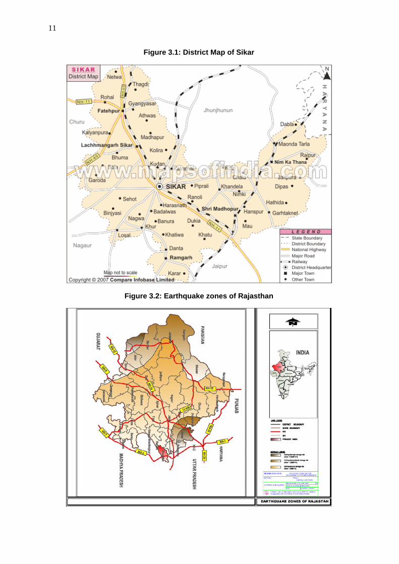
11
Figure 3.1: District Map of Sikar
Figure 3.2: Earthquake zones of Rajasthan

12
Figure 3.3: Natural Hazard map of Sikar (Source: Resource map GSI)
3. Geology, geomorphology, mineral resources and soil
30. Sikar district in northcentral of Rajasthan, covers an area of 7732 km2 . The district has six tehsils namely Fatehpur, Lachhmangarh, Sikar, Danta Ramgarh, Shri Madhopur and Nim – ka – Thana. There is network of railways and Roads in the area. Semi arid to arid climate prevails in the district. The average annual rainfall is 460mm. The district can be divided into two main topographic units the western half characterized by dunal country and
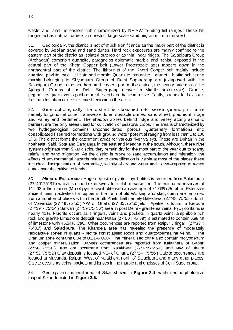
13
waste land, and the eastern half characterized by NE-SW trending hill ranges. These hill ranges act as natural barriers and restrict large scale sand migration from the west.
31. Geologically, the district is not of much significance as the major part of the district is covered by Aeolian sand and sand dunes. Hard rock exposures are mainly confined to the eastern part of the district as isolated outcrop or as thin linear ridges. The Saladipura Group (Archaean) comprisin quartzite, paragneiss dolomatic marble and schist, exposed in the central part of the Khetri Copper belt (Lower Proterozoic age) tappers down in the northcentral part of the district. The lithounits of the Khetri Copper belt mainly include quartize, phyllite, calc – silicate and marble. Quartzite, staurolite – garnet – biotite schist and marble belonging to Shyangarh Group of Delhi Supergroup are juxtaposed with the Saladipura Group in the southern and eastern part of the district, the scanty outcrops of the Ajabgarh Groups of the Delhi Supergroup (Lower to Middle proterozoic). Granite, pegmatites quartz veins gabbro are the acid and basic intrusive. Faults, shears, fold axis are the manifestation of deep- seated tectonic in the area.
32. Geomophologically the district is classified into seven geomorphic units namely longitudinal dune, transverse dune, obstacle dunes, sand sheet, piedmont, ridge and valley and pediment. The shadow zones behind ridge and valley acting as sand barriers, are the only areas used for cultivation of seasonal crops. The area is characterized by two hydrogeological domains unconsolidated porous Quaternary formations and consolidated fissured formations with ground water potential ranging from less than 1 to 100 LPS, The district forms the catchment areas for various river valleys. These are Dohan in the northeast, Sabi, Sota and Banganga in the east and Mendha in the south. Although, these river systems originate from Sikar district, they remain dry for the most part of the year due to scanty rainfall and sand migration. As the district is prone to sand accumulation and migration, the effects of environmental hazards related to desertification is visible at most of the places these includes disorganisation of river valley, salinity of ground water and over-stepping of recent dunes over the cultivated lands.
33. Mineral Resources: Huge deposit of pyrite - pyrrhotites is recorded from Saladipura (27°40’:75°31’) which is mined extensively for sulphur extraction. The estimated reserves of 111.62 million tonne (Mt) of pyrite -pyrrhotite with an average of 21.63% Sulphur. Extensive ancient mining activities for copper in the form of old Working and slag, dump are recorded from a number of places within the South Khetri Belt namely Baleshwar (27°43’:75°55’) South of Mavanda (27°48’:75°50’).NW of Ghata (27°35’:75°50’)etc. Apatite is found In Kerpura (27°39' - 75°34') Salwari (27°39’:75°36’) area In post Delhi - granite as veins. P2O5 contains is nearly 41%. Fluorite occurs as siringers, veins and pockets in quartz veins, amphibole rich rock and granite Limestone deposit near Patan (27°50’: 75°58') is estimated to contain 6.98 Mt of limestone with 46.54% CaO. Other occurrences are reported from Raipur Jhingar (27°38’ : 76°01') and Saladipura. The Khandela area has revealed the presence of moderately radioactive zones in quartz - biotite schist aplitic rocks and quartz-tourmaline veins. The Uranium zone contains 0.04 to 0.11% O3U8. The mineralised zone also contain molybdenum and copper mineralization. Barytes occurrences are reported from Kalakhera of Gaonri (27°42’:75°50’). Iron ore occurrene from Kalakhera (27°42’:75°59’) and NW of Jhalra (27°52’:75°52’) Clay deposit is located NE- of Churla (27°34’:75°56’) Calcite occurrences are located at Mavanda, Raipur. West of Kalakhera north of Saladipura and many other places' Calcite occurs as veins, pockets and lenses in the marble and gneisses of Delhi Supergroup.
34. Geology and mineral map of Sikar shown in Figure 3.4, while geomorphological map of Sikar depicted in Figure 3.5.

14
Figure 3.4: Geology and mineral map of Sikar district (Source: GSI Resource map)

15
Figure 3.5: Geomorphology of Sikar district (source: GSI Resource map)
35. Soil characteristics: Soil of the region falls within rainfall zone of 300 – 500 mm. The soil is sandy loam, sallow depth red soils in depressions. Table 3.1 shows nutrient level in the Sikar soil including area coverage of saline and sodic soil. The nutrient status of the Sikar soil is graded as low to medium level.

16
Table 3.1: Fertility status – major nutrients and problematic soils of Sikar district
Nutrient Saline
Soil(Ha) Sodic or
Alkali(Ha) N P K Status L M M 59936 30036
(Source: Vital Agricultural Statistics 2004-05, Directorate of Agriculture, Rajasthan)
4. Climate
36. The district has a hot summer, scanty rainfall, a chilly winter season and general dryness of the air except in brief monsoon season. The average maximum & minimum temperature are 46 & zero degree celsius respectively. The normal rainfall, mostly received from south-west monsoon is 46.60 cms.
37. The rainfall over Sikar is scanty and is concentrated over four month i.e. from June to September. The rains are erratic and so is the distribution of the rainfall. However agriculture and the animal wealth are dependent on rains to large extent. Seasonal Rainfall data for the recent year (2005-2006) shown in Table 3.2. Figure 3.6 shows yearly variation (1997-2007) of rainfall at Sikar.
Table 3.2: Rainfall at Sikar in recent years (2005-06)
Months Rainfall (mm) 1 June 123 2 July 229 3 August 0 4 September 81 5 October 0 6 November 0 7 December 0 8 January 0 9 February 0 10 March 18 11 April 0 12 May 80 13 Monsoon Rainfall 433 14 Non monsoon rainfall 98 15 Annual Rainfall 531
(Source: Irrigation Department, Govt. of Rajasthan)

17
Figure 3.6: Rainfall at Sikar during 1997 to 2007
.
Source: Deputy Director hydrology water resources ID and R, Jaipur
5. Air Quality
38. There are no data on ambient air quality of Sikar Town, which is not subject to monitoring by the Rajasthan State Pollution Control Board (RPCB) as there are no major industries. The nearest station is located at Jaipur (115 km from Sikar). Traffic is the only significant pollutant in Sikar, so levels of oxides of sulphur and nitrogen are likely to be well within the National Ambient Air Quality Standards (NAAQS). The ambient air quality data is depicted in Table 3.3.
Table 3.3: Ambient Air Quality in Jaipur (Annual Average, 2004; units in µg/m3)
Monitoring Station Land use SOx NOx RSPM SPMJaipur Residential, Rural and others area
Residential 5.57 29.9 106 302
NAAQ Standard Residential 60 60 60 140JaipurIndustrial area Industrial 22.69 9.32 131 300NAAQ Standard Industrial 80 80 120 360
RSPM: Respirable Suspended Particulate Matter; SPM: Suspended Particulate Matter
Source: Annual Report 2005-2006 Rajasthan State Pollution Control Board
6. Surface Water
39. There are no monitoring data on surface water quality in and around Sikar. The nearest station is located at Ghagar nadi (260 km from Sikar). The parameters as measured by Rajasthan Pollution Control Board are pH, Electrical conductivity (EC), BOD and DO. Water quality data of Ghagar river – up stream and down stream location are shown in Table 3.4 and Figures 3.7 and 3.8.

18
Table 3.4: Water quality of Ghagar River
Location
Date of Sample Collection
Dissolved Oxygen (mg/lt) PH
BOD (mg/lt) (3 days at 27o C)
Conductivity at 25o C (m-MHO)
Ghagar Nadi , Hanumangarh, up stream
7/29/2005
4.37
8.23
1.39
0.39
Ghagar Nadi , Hanumangarh, down stream
7/29/2005
4.2
8.52
1.26
0.38
Figure3.7: Variation of water quality parameters Ghagar Nadi , Hanumangarh, Up stream
Ghaghar Nadi, Hanuman Gadh
0
2
4
6
8
10
Date of Sample Collection
Conc
entra
tion
in m
g/lt
exce
pt p
H &
Con
duct
ivity Dissolved Oxygen
(mg/lt)PH
BOD (mg/lt) (3 daysat 27o C)Conductivity at 25oC (m-MHO)
Figure 3.8: Variation of water quality parameters: Ghagar Nadi , Hanumangarh, down stream
0
1
2
3
4
5
6
7
8
9
7/29/2005
Dissolved Oxygen (mg/lt)
PH
BOD (mg/lt) (3 days at 27oC)Conductivity at 25o C (m-MHO)
7. Geohydrology and Groundwater
40. Geohydrological map of the Sikar district is shown in Figure 3.9. For broadly grouping geological formations from ground water occurrence and movement considerations, the various lithological units have been classified into two groups on the basis of their degree of consolidation and related parameters. These are,
• Fairly thick regionally extensive quaternary formations

19
• Fissured formations – consolidated protereozoic formations.
41. On an average 70 % of the district area covered with Fissured formations.
Figure 3.9: Geohydrological map of Sikar (Source- GSI Resource map)
42. Groundwater in Sikar generally occurs under confined to semi confined conditions. The principal aquifers of the district are quartzite, Schist, Phyllites, Limestone and Dolomite Limestone constitute important water bearing formation in the district. The average depth of ground water in the Sikar district varies from 4.59 m below land surface to 64.50 m below

20
land surface. Town is located in Piprali Block of District. The depth of water in piprali block varies from 8.30 m to 54.65 m below ground level. The average yield of wells in this zone is 80,000 litres per day with pump and 30,000 litres per day without pump. The average discharge of water from tubewells is 11M3 / hr.in general the ground water quality is potable. This whole block is catogorised as “OVEREXPLOITED” therefore it has been recommended for future ground water development.
Table 3.5: Ground Water Potential of Piprali Block Sikar as on 31.03.2004
(Estimation of Ground Water Recharge in Monsoon period by Water Table Fluctuation Method)
Sl. No
Description Year 1999 2000 2001 2002 2003
1 Zone Area (Sq. km) 51.59 51.59 51.59 51.59 51.59
2 Water Level Fluctuation -0.96 0.30 -0.59 1.69 1.87 3 Monsoon Recharge from
Ground water Irrigation Rgw (mcm)
0.0086 0.0063 0.0093 0.0108 0.0123
4 Rainfall Recharge (mcm) - 0.5540 - 1.7414 1.9115 5 Gross Agricultural Draft
(mcm) 0.6890 0.5048 0.7440 0.8636 0.9833
6 Gross Domestic Draft (mcm0
0.6197 0.6260 0.6675 0.6883 0.7090
7 Normal Monsoon Rainfall (m)
0.4055 0.4034 0.4052 0.4023 0.4036
8 Monsoon Rainfall (m) 0.0000 0.2010 0.0000 0.1090 0.5360 9 Rainfall Monsoon 0.0000 0.0404 0.0000 0.0119 0.2873 10 Rainfall Monsoon
Recharge 0.0000 0.1114 0.0000 0.1898 10246
Source – Ground Water Board ,Sikar August 2006
Table 3.6: Ground Water Potential of Piprali Block Sikar as on 31.03.2004 (Water Recharge, Extraction & Stages of Ground Water Department)
Sl No. Description Unit 1 Block Area (Sq km) 807.66 2 Water Bearing Formation Potential
Zone Ao 3 Potential Zone Area (Sq km) 674.59 4 Net Ground Water Availability (mcm) 35.12 5 Existing Gross Ground Water Draft for Irrigation (mcm) 44.0 6 Existing Gross Ground Water Draft for Domestic & Industrial
(mcm) 6.6
7 Existing Gross Ground Water Draft for all uses (mcm) 50.74 8 Allocation for Domestic & Industrial Requirement for year
2025 (mcm0 17.5
9 Net Ground Water Availability for future Irrigation Development (mcm)
-26.4
10 Stage of Ground Water Development (%) 144.4 11 Whether Significant Decline in Pre-Monsoon Water Level Yes 12 Whether Significant Decline in Post-Monsoon Water Level Yes 13 Category Over
Exploited Source –Ground Water Board Sikar , August 2006

21
43. There are number of National Hydrographic monitoring stations of Central Ground Water Board in and around Sikar. Fluctuation of ground water level is shown in Table 3.7. In most of the cases ground water table ranged between 20 -60 m bgl.
Table 3.7: Number and Percentage of National Hydograph Network Stations at Sikar with water fluctuation range
Period
No of wells analysed
Range 0-2 m 2-5 m 5-10m 10-20m 20-60m >60 m
Min Max No % No % No % No % No % No %
Jan-06 20 3.56 63.5 0 0 1 3.57 0 0 3 10.71 22 78.57 2 7.14 Nov-05 28 2.7 62.24 0 0 1 3.57 0 0 3 10.71 23 82.14 1 3.57 Aug-05 28 2.85 66.46 0 0 1 3.57 0 0 3 10.71 21 75 3 10.71 May-05 31 4.98 61.48 0 0 1 3.23 0 0 4 12.9 25 80.65 1 3.23
Source: Ground water year book 2005-06 Rajasthan, Central Ground Water Board, Jaipur (2007)
44. The Central Ground Water Board carried out chemical testing of tube well water seasonally. The average concentrations of major constituents are shown in Table 3.8.
Table 3.8: Ground Water Quality in and around Sikar
Parameters Maximum Level
Minimum Level
Standard of Drinking water (IS: 10500: 1991) Desirable limit (mg/l)
Maximum Permissible limit (mg/l)
pH 8.7 7.56 EC (micro mhos/cm at 25°C) 4900 560 Cl (mg/l) 1250 7 250 1000 SO4(mg/l) 300 10 200 400 (if Mg does
not exceeds 30 ppm)
NO3(mg/l) 610 7.7 - 100 PO4(mg/l) 1.82 0.07 Total Hardness(mg/l) 620 60 300 600 Ca(mg/l) 72 8 75 200 Mg(mg/l) 114 10 30 100 Na(mg/l) 863 8 - - K(mg/l) 55 0.78 - - F(mg/l) 2.78 0.17 1.0 1.5 Fe(mg/l) 6.52 0.05 0.3 1.0 SiO2(mg/l) 30 5 TDS (mg/l) 3185 364 500 2000
Note: Total – 15 nos. samples
Source: Ground water year book 2005-06 Rajasthan, Central Ground Water Board, Jaipur (2007)
45. Supply water quality as measured by Public Health dept. is shown below. It is noted that ground water contains high level of total dissolved solid and nitrate.

22
Table 3.9: Present supply water quality at Sikar
Total supply per
day (lac liter)
Type of Sources Surface
/ Ground
Ground Surface
No. of
CWR
No. of SR
F- Min
F- Max
TDS Min
TDS Max
NO3-
Min NO3
-
Max
214.8 Ground 100 0 10 10 0.1 0.9 460 1390 Trace 185
46. Earlier analysis data (PHED) shows in Table 3.10
Table 3.10: Ground Water Source Details S.
No. Name of source
Existing Zone (2006)
Distance from SIKAR
In Km
No. Of working
Tube wells
Average production IN KL/DAY
Quality in PPM TDS CL FL NO3
1 1 Within Sikar 24 4145.0 650 120 BDL 25 2 2 Within Sikar 16 2590.0 1250 390 0.7 60 3 3 Within Sikar 23 3920.0 1340 300 0.2 25 4 4 Within Sikar 34 5751.8 970 130 0.1 10 5 5 Within Sikar 14 1555.0 1760 320 0.1 235 6 6 Within Sikar 24 3864.0 1480 320 0.1 115 7 7 Within Sikar 2 215.0 - - - - 8 8A Within Sikar 6 715.0 690 80 0.6 45 9 8B Within Sikar 15 1785.0 - - - - 10 8B-1 Within Sikar 1 135.0 - - - - 11 8B-3 Within Sikar 2 270.0 - - - - 12 8C Within Sikar 22 2885 - - - -
TOTAL 183 28832 28832
B. Ecological Resources
47. FLORA: The flora of the district consists of a considerable variety. In 1972, 73, 1.46 per cent of the total area of the district was classified as forests. The forest area in Sikar district may be broadly divided into four botanical divisions, some details of which are as follows.
Anogeissus pendula Type: In this type Anogeissus pendula (Dhok) usually occurs as pure stands. Its common associates are Acacia senega (Kumtha), Dischrostachys cinerea (Buiya).
Anogeissus pendula Degraded Type: The Anogeissus pendula degraded type is most commonly found on the hill slopes. Due to continuous biotic interferences, this has been reduced to a spreading and creeping form.
Throny Type: These forests are found on the marginal lands, foothills and consolidated sandy plains or sand-dunes and ravine lands.
Tree Savannah Type: This type of botany is found in plains which are sandy or which contain sandy loam soils. The specie is specially managed for grass production. The tree layer is composed of Acacia leucophloe (Ronjh) and Acacia Senegal (Kumtha ) etc.
48. FAUNA: The common mongoose and the hedge hog are seen in the entire area of the district due to their adaptability to varied surroundings. Besides, domesticated animals

23
such as cows, oxen, horses, buffaloes and camels are found everywhere in the district. Birds commonly found in the district may be listed as house sparrow, house crow, jungle crow, blue rock common teal and brahminy duck.
49. There is no protected area, forest nearby the sub-project site.
C. Economic Development
50. Economic base of a town reflects its prosperity. Sikar being district headquarter, has been functioning as administrative city with sustained growth in tertiary economic activities. The major economic activities are trade and commerce, thus it offers a number of wholesale and retail markets which act as a distribution center for near by towns and villages. Tourism income contributes very less towards economic generation of the town on the contrary household industries play a big role in providing employment and income generation. As per the master plan new town centers and community centers have been proposed .This section focuses on number of workers, their category, and occupational pattern of the town in general. Also .attempt has been made to define the market centers and industrial activities of the town .The town has look of business-hub indicating fast growth.
51. The workforce participation .rate of the city was about 25.2 percent of the total population as per 2001 census. The following table shows that out of this total workforce only about 3.5percent were employed in the primary sector (Agriculture, mining and quarrying etc) followed by 6.7 percent in secondary sector (industry and construction).It is observed that tertiary sector including commercial activities, trade and commerce and related activities dominate with about 89.7 percent workers engaged in the sector. The workforce participation ratio in Sikar (UA) and Sikar (MA) is 25.2 as per 2001 census (Table 3.11).
Table 3.11: Number of Workers, Work Force Participation Ratio and percentage of workers in Sikar Town
Economic Profile
Total Workers
WPR Primary Workers
Primary Workers
%
Secondary Workers
Secondary Workers %
Tertiary Workers
Tertiary Workers %
Sikar (MCL)
46690 25.2 1647 3.5 3149 6.7 41894 89.7
Sikar (MCL+OG)
46845 25.2 1661 3.5 3153 6.7 42031 89.7
Source: Census of India 2001
52. Rajasthan’s strong economic performance during the 80’s and the early 90’s reflected well in Sikar, However although at present Industrial Sector in Sikar is not so strong as compare to other economic sector like services, trade and commerce, construction, etc yet the recent trend have shown fast development in Industrial activities.
53. Sikar falls on the National Highway No.11 connecting Jaipur to Bikaner and has been most important trade center on this route. Sikar will therefore continue to grow as principal commercial and Distribution center. A continuous rise is expected in number of workers and this will increase population. It is therefore desirable that Industries are distributed rationally in conformity with the Infrastructure Developments of the Town .In summary to the aforementioned the following issues can be mentioned;
• All commercial nodes are too congested and overcrowded.

24
• Industrial sector in Sikar is deteriorating day by day.
• Most of the Industries that were established in beginning are declared sick today.
• Effective Planning strategy in locating various Industrial units is needed to decongest the present position.
• Proper internal roads for industries need to be planned.
• As there is no demarcated site for disposal of Industrial waste, all Industrial waste is being dumped on the Forest land without any treatment.
• Continuous disposal of Granite slurry on forest land, in Debipura block near RIICO industrial complex, is destroying vegetation / plantation on one hand and breathing problem among residents in nearby colonies on the other hand thus has become a major threat to environment in the city.
• Artesian / Household industry is creating noise, water and air pollution in the core residential area of the town.
• Tourism Industry is very much neglected and underdeveloped.
• Lack of Tourism Infrastructure.
54. Power status of the area: There is no power generation unit at Sikar. The consumption of electricity by different sectors is shown in Table below.
Table 3.12: Consumption of Electricity in Million Kwh (2003-04)
District Domestic Non-
Domestic (Commercial
)
Industrial Public Lighting
Public Water Works
District
Domestic
Small Medium Large Sikar 91.943 20.978 14.51 7.879 9.821 2.053 29.916
1. Land use
55. The Municipal council of Sikar is implementing a Master Plan which has been notified by the Government of Rajasthan on 07.03.1999. This plan is aimed at integrated and balanced development of entire notified urban area and provides guidelines for future growth of the town. It has been kept in proportion with socioeconomic need of the citizens and financial resources of the state. As per land use survey conducted in 1985 the Municipal limit of Sikar encompassed and area of about 9800 acres out of which 2680 acres was urbanized as per Master Plan 1985 -2011. The remaining land was vacant comprising of sandy area with fair cultivation. About 63% of developed urban area is under residential use, which is high in comparison to other towns in the region. This is due to lack of industrial area, parks and open spaces and other community facilities. The percentage of recreational use is only 1.6% against 3-7 percent normal in other towns. The table below shows land use area based on the survey conducted in 1985 (Table 3.13).

25
Table 3.13 Existing Land Use Sikar-1985
Sl No. Landuse Area in Acres
Percentage of Developed area
Percentage of urban area
1 Residential 1580 62.70 58.98 2 Commercial 130 5.16 4.85 3 Industrial 80 3.17 2.98 4 Governmental 50 1.98 1.86 5 Recreational 40 1.60 1.49 6 Public and Semi Public 250 9.92 9.32 7 Circulation 390 15.47 14.55
Total Developed Area 2520 100 - 8 Government Reserved 30 - 1.12 9 Agricultural 40 - 1.49
10 Vacant land 90 - 3.36 Urban Area 2680 - 100
Source – Master Plan of Sikar
Figure 3.10: Land use percentage- Sikar Urban developed area
Land use Sikar
63%5%
3%
2%
2%
10%
15%
ResidentialCommercialIndustrialGovernmentalRecreationalPublic and Semi PublicCirculation
2. Commerce, Industry and Agriculture
56. The state Government of Rajasthan Industrial Investment Corporation is providing various incentive and facilities for promoting Industrial activities. There is no large scale Industry in Sikar. Only small scale industries such as Granite industry, plywood industry, dal and oil mill industry, cattle feed industry, PVC pipe industry and Electric Transformers industry are functioning with very little workforce.(Table 3.14).
Table 3.14: Type and Number of Industrial Units
Sl No. Type of Industry No. of Units 1 Granite 40 2 Plywood 8 3 Dal and Oil Mill 8 4 Cattle Feed 10 5 PVC pipe 6 6 Electric Transformers 9
Source: DIC- Sikar August 2006

26
57. Artesian /Household Industry provides for employment to a large no. of people These Industries are mainly Tie and Dyeing of cloth and leather tanning chemicals. These Industries are causing a lot of Noise Pollution, nuisance, traffic hazards and problem of waste disposal in Residential zones.(Table 3.15)
Table 3.15: Type and Number of Artesian/Household Industries
Sl No.
Type of Household
Industry
No. of Units
Location (ward No.)
1 Leather 200 2,6,7 2 Tie and Die 200 2,6,7 3 Bangles 200 Ajmer Bus Stand (near Suraj Pole
Gate) Source: DIC- Sikar August 2006
58. In and around the Sikar city area there are about 50-60% of lands used for agricultural purpose. Crop production statistics as depicted in Table 3.16 indicates that crop production is slightly more in Kharif season in compared to Rabi season.
Table 3.16: Crop production in around Sikar
Type of Crops Under Rabi Crops 2003-04 (Prod in Tonnes)
Under Kharif Crops 2003-04 (Prod in Tonnes)
Cereals 285673 351984 Pulses 49763 40013
Food Grains 335409 391997 Oilseeds 42157 29316 Others 44135 39782 Total 421701 461095
(Source: Vital Agricultural Statistics 2004-05, Directorate of Agriculture, Rajasthan)
3. Infrastructure
59. Water supply: Water supply of Sikar is wholly drawn from local tube wells, which are situated in almost whole city i.e. around the water work compound on Harsh Road and Udaipurwati Road. Ground water is the only source of water supply in Sikar. The water supply in the town is intermittent during morning and evening only. The per capita water supply of the town is about 89 lpcd, which is merely adequate and as per the recently sanction reorganization water supply scheme of Sikar, which is under execution it would be upgraded to 135 lpcd. Tube wells are largest sources of water supply in the town. The average depth of water table in Sikar is about 54.65 mt. The supply timing is one hour i.e. morning 6-7 a.m. All the wards in the town are connected either partially or fully by piped water network. The Sikar town is firstly growing important town and its water supply projects are to be based on reliable sources of water supply. Therefore it is necessary to propose surface water sources which are perennial sources. The present water supply sources are Tube wells (146 Nos.) and open wells (34 Nos.).
60. Sewerage System: Sikar town does not have underground sewerage system. Out of the occupied residential houses only about 55% have some kind of latrines. Most of the houses have adopted the practice of providing onsite disposal by constructing water seal / bore hole latrines or by providing septic tank with effluent discharge into soak pits or open surface drains. Economically weaker section generally defecates into the open field. No

27
sewerage treatment facility is there in the town and the drains having combined drainage and sewage are having outfall discharge in open fields towards west of the town on forest land. In the absence of any sewerage facility, the major mode of disposal is through individual septic tanks and low cost sanitation.
61. The city has around five thousands population as floating population that depends of public or community toilets. In core city area, market areas there are very few public toilet for men, but there is no public toilet for females. PHED division Sikar has recently prepared a Sewerage scheme for Sikar town. Components covered in it are as follows. As per topography of the Sikar town whole area is divided into following two zones based on the ground level and feasibility of laying of sewer at required depth and are denoted as-
A North-East zone
• Area surrounding Nawalgadh Road
• Area surrounding Udaipurwati Road up to railway line
• Area surrounding Fathepur Road
• Area surrounding Bajaj Road, Bakra mandi and Kabristan
B South-West zone
• Area surrounding Jaipur Road
• Area surrounding Fathepur Bye- Pass Road
62. Sanitation: Only 50-60% of the households reportedly have septic tanks and soak well as the system of sewerage disposal. The remaining accounted for cases of open defecation which is an unacceptable and unhygienic practice. The raw settled sewage from septic tank is periodically flushed out by sanitary workers of the Municipal Board and discharge to open spaces, agricultural lands in an indiscriminate manner. Slum areas were also not equipped with requisite sanitation (LCS etc.) resulting in open defecation.
63. Drainage: The existing drainage system in Sikar is piecemeal construction of open Nallah as per local and temporary requirements without proper whole to part designs. The town has mainly open drains. The waste water along with sewage is discharged into the fields towards west of the town through open drains. Storm water drainage is expressed in terms of its coverage with respect to the total road length. Ideally length of the storm water drain should be twice that of the total road length. The open drain system in the town is irregular and mismanaged. The improper construction and maintenance of open drains cause spillage of rain water mixed with sewage and gets collected in local depressions at following core places of the town and requires pumping for several days.
64. Industrial Effluents. Small industries exist in under RIICO, which is outside the city area and small amount of effluent disposed scattered in local nallahs. As reported by the local MC, the responsibility of effluent disposal is under RIICO’s own and could not be connected to the proposed sewer network. The individual industry should treat their effluent to bring it to the required standard before final disposal.
65. Solid Waste: Sikar town spreads over 9800 acres of which 4600 acres is developed. The total waste generation in the town is about 200 T / day. Considering a population of 185,925 persons in year 2001 census, the per capita generation of waste generation is 0.92

28
kg / day. It is important to note that no initiatives has been taken till now in terms of door to door collection of solid waste in Sikar. Presently most of the city wastes are simply dumped without any treatment in depressions, ditches or by the sides of the road flank in an unscientific manner. This practice may lead to air and water pollution, releases foul smell and this situation may cause major threat to the public health. 20 Primarily, the sweeping is done by municipal staffs and collection and disposal is performed by the contractor. The garbage is collected and stored in a common point in every ward and the transportation is done by the tractor. There are 157 open points within the town demarcated by Sikar municipal council for garbage disposal in the wards. The average number of trips performed by vehicles ranges from 3-5 trips per vehicle per day and the average collection performance of 70 percent for Sikar Municipal Council, the vaccum emptier is used for gutter cleaning. Municipal Council of Sikar charges about Rs. 600 / household for cleaning the gutter per nos.
4. Transportation
66. Sikar is well connected with all the important towns of the state. It is situated on the National Highway No.11 running from Bikaner to Agra at the junction of State Highway No.20 and State Highway No.8 connecting Sikar to Salasar and Jhunjhnu respectively. It is also connected to Delhi via Jhunjhnu and Neem Ka Thana.
67. As per the Master Plan 13.80% area (755 acres) has been reserved as roads and circulation area. The road in the walled city consists of narrow road on Grid iron pattern. In the absence of ring road, these roads have become overcrowded and outdated. Mahatma Gandhi road and Jamnalal Bajaj road are two main roads, which caters most of the traffic of the town. The width of the Mahatma Gandhi road varies from 80 ft to 100 ft .while the width of Jamnalal Bajaj road is 20ft to 55ft. There are large number of road crossings on these roads, which have not been planned at all and subject to congestion and accidents. Most of the other roads are not been metalled. The type of construction of roads within Sikar Municipality is shown in Table 3.17.
Table 3.17: Roads based on type of Surface
Sl No. Type of Surface Length of Roads (KM) 1 Concrete Road 60 2 Black Topped / Bituminous 75 3 Water Bound Macadam 5 4 Earthen 0
Total 140 Source Sikar Municipality August 2006
D. Social and Cultural Resources
1. Demography
68. According to Census 2001, the population of (Sikar Municipal Council is 185323) Sikar Urban Agglomeration is 185,925 and spreads over Sikar Municipal Council` (organized into 45 wards). The total spread of the Urban Agglomeration is approximately 39.00 sq. km, Municipal Council. The UA supports an average density of 4767 persons per sq. km. Of the total population the males constitute 96,379 and females 88,944 with sex ratio of 923 females per 1000 males. The number of Schedule Castesin Sikar Municipal Area and Sikar Urban Area is 17207 & 17377 respectively. Whereas The number of Schedule Tribes in Sikar Municipal area and Sikar urban area are 1413 and 1418 respectively. Thus the percentage of vulnerable population to the total population is 10%. The UA witnessed a high growth between 1971 and 1981 on account of induced industrial

29
development, the growth rate fell during the last decade i.e. 1991-2001..this remarkable growth can be ascribed to various reasons, which includes increase due to natural growth, concentration of developmental activities like establishments of more government offices ,trade and commerce ,services and other activities , colleges and residential colonies ( Table 3.18). Population projection of Sikar town is shown in Table 3.19.
Table 3.18: Population Growth in Sikar town
Year Population Sikar town
1961 50,636 1971 70,987 1981 102,970 1991 143,900 2001 185,925 2011 240,783 2021 311,749 2031 403,811 2041 523,840
Source: Census of India, 2001.
Table 3.19: Population Projection of Sikar
Year / Stage Census Population Recommended Projected Population
1961 50,636 1971 70,987 1981 102,970 1991 143,900 2001 185,925 2007 217,136 2011 240,783 2021 311,749 2026 354,765 2041 523,840
2. Health and educational facilities
69. There are good educational facilities in Sikar district, which serve both townspeople and inhabitants of surrounding villages and towns in the hinterland. There are 1695 primary schools, 299 higher secondary schools, plus 13 general degree colleges.
Table 3.20: Educational facility of Sikar District
(Nos.)
Colleges 13
Professional Colleges 2
Higher Secondary Schools 299
Middle Schools 843
Primary School 1695
(Source: Rajdarpan, the official web portal of Rajasthan government)

30
70. As the district headquarters town, Sikar is the main centre for health facilities in the area and there is a 1 district general hospital, 1 primary health center in the Sikar town. The detail of the health facilities given in Table 3.21.
Table 3.21: Health facility Sikar Urban 2003- 04
S.No. Facilities Number 1 Hospital 1 2 Primary Health Center and Maternity Center 1 3 TB Hospital 1 4 Mother and Child Care Center 1 5 Total 4
(Source: District Statistical Hand Book 2005)
3. History, culture and tourism
71. Sikar has rich heritage sites. A detailed inventory of some important religious and tourist spots in Sikar are given below-
17th century a Fort The Painted Biyani, Murarka Bawri (Step Well) Digamber Jain Temple Somani Havelis Sagarmal Sodhani Havelis Madho Niwas Kothi The Jubilee Hall Devi Singh Cenotaph Temple of Gopinath Laxman Singh Cenotaph Raghunath Temple Madan Mohan ji Temple Shekhawati Museum Bara Talab Madhave Sagar
72. Today Sikar is the most important city of Shekhawati region of Rajasthan. Sikar city being the capital of the district, functions as the administrative city and hub of the tertiary economic activities like services, trade and commerce.
IV. ENVIRONMENTAL IMPACTS AND MITIGATION MEASURES: LOCATION AND DESIGN
73. ADB Environmental Assessment Guidelines require that an IEE should evaluate impacts due to the location, design, construction and operation of the project. Construction and operation are the two activities in which the project interacts physically with the environment, so they are the two activities during which the environmental impacts occur. In assessing the effects of these processes therefore, all potential impacts of the project are identified, and mitigation is devised for any negative impacts. This has been done in Sections V and VI below and no other impacts are expected.

31
74. In many environmental assessments there are certain effects that, although they will occur during either the construction or operation stage, should be considered as impacts primarily of the location or design of the project, as they would not occur if an alternative location or design was chosen.
75. However in the case of this subproject it is not considered that there are any impacts that are a result of the design or location. This is because:
o The project will be built at a single relatively small location and involves straightforward construction and low-maintenance operation, in an environment that is not especially sensitive, so it is unlikely that there will be major impacts;
o Most of the predicted impacts are associated with the construction process, and are produced because that processes that involve quite extensive groundwork. However the routine nature of the impacts means that most can be easily mitigated.
V. POTENTIAL ENVIRONMENTAL IMPACTS AND MITIGATION MEASURES: INFRASTRUCTURE CONSTRUCTION
A. Screening out areas of no significant impact
76. From the descriptions given in Section III, it is clear that implementation of the project will affect quite small tracts of land (due to very limited scope of work) both inside and outside the town where the rising mains will be constructed.
77. However it is not expected that the construction work will cause major negative impacts. This is mainly because:
Pipelines will be mainly located on unused ground alongside existing roads and can be constructed without causing major disruption to road users and adjacent houses, shops and other businesses;
New facilities within and outside the town (OHSRs) will be located on government-owned land that is not occupied or used for any other purpose;
Most pipeline construction will be conducted by small teams working on short lengths at a time so most impacts will be localised and short in duration;
The overall construction programme will be relatively short for a project of this nature, and is expected to be completed in 2 years.
78. As a result there are several aspects of the environment that are not expected to be affected by the construction process and these can be screened out of the assessment at this stage as required by ADB procedure. These are shown in Table 5.1, with an explanation of the reasoning in each case.
Table 5.1: Fields in which construction is not expected to have significant impacts
Field Rationale Climate Short-term production of dust is the only effect on
atmosphere Geology and seismology Excavation will not be large enough to affect these features Fisheries & aquatic biology No rivers or lakes will be affected by the construction work Wildlife and rare or There is no wildlife or rare or endangered species in the

32
endangered species town or on the government owned areas outside the town on which facilities will be built
Coastal resources Sikar is not located in a coastal area Population and communities Construction will not affect population numbers, location or
composition
79. These environmental factors have thus been screened out presently but will be assessed again before starting of the work.
80. Rapid Environmental Impact Assessment checklist is attached as Appendix 1.
B. Source and supply augmentation
1. Construction method
81. As explained above, augmentation of the water source and supply will involve construction of the following:
o Rising main of 25.5 km
2. Physical Resources
82. Excavation for rising main will generate waste soil and stone. Therefore there will be little physical changes at the construction sites, and quantity of waste not be dumped without causing further physical impacts (on air quality, topography, soil quality, etc) at the point of disposal. The work will probably be conducted in the dry season, so there is also a lot of potential for the creation of dust.
83. Action will therefore be needed to reduce physical impacts at both the construction and disposal sites, by controlling dust and reducing the amount of material to be dumped. The Contractor should therefore be required to:
• Contact the town authorities to find beneficial uses for as much waste material as possible, in construction projects, to raise the level of land prior to construction of roads or buildings, or to fill previously excavated areas, such as brickworks;
• Prevent the generation of dust (which could affect surrounding agricultural land and crops) by removing waste material as soon as it is excavated (by loading directly onto trucks), and covering with tarpaulins to prevent dust during transportation.
84. Another physical impact that is often associated with large-scale excavation is the effect on drainage and the local water table if groundwater and surface water collect in the voids. However, this should not be a problem in this case, given the low rainfall and deep water table in this area, and the fact that the Contractor will almost certainly plan excavation work to avoid the monsoon season.
3. Ecological Resources
85. There are no protected areas or locations of any ecological interest at or near any of the sites affected by these works, so it is unlikely that the construction process will have any ecological impacts. The only concern would be if trees were removed unnecessarily. To avoid this, the contractor should be required to plant and maintain three new trees for every one that is removed.

33
4. Economic Development
86. The rising main will be located on government owned land, so there should be no need to acquire land from private owners, which might affect the income and assets of owners and tenants. There should also be no effects on other features with economic implications (such as infrastructure, industry and commerce), as there are none of these facilities on these sites.
87. There could however be significant disruption of traffic, business and other activities, if trucks carrying waste material were allowed to enter Sikar town or other built-up areas. The transportation of waste will be implemented by the Contractor in liaison with the town authorities, and the following additional precautions should thus be adopted to avoid these impacts:
• Planning transportation routes so that heavy vehicles do not enter Sikar Town or other built-up areas and do not use narrow local roads, except near delivery sites;
• Scheduling the transportation of waste to avoid peak traffic periods.
5. Social and Cultural Resources
88. Rajasthan is an area with a rich and varied cultural heritage that includes many forts and palaces from the Rajput and Mughal periods, and large numbers of temples and other religious sites, so there is a risk that any work involving ground disturbance could uncover and damage archaeological and historical remains. Given that the locations proposed for these facilities are uninhabited and show no obvious signs of having been used to any extent in the past, then it could be that there is a low risk of such impacts at these sites. Nevertheless this should be ascertained by consulting the appropriate authorities, and appropriate steps should be taken according to the nature of the risk. This should involve:
• Consulting historical and archaeological authorities at both national and state level to obtain an expert assessment of the archaeological potential of all proposed sites;
• Selecting alternative sites for any work proposed in areas of medium or high risk;
• Including state and local archaeological, cultural and historical authorities and interest groups in consultation forums as project stakeholders so that their expertise can be made available to the project;
• Developing a protocol for use by the Contractor in conducting any excavation work, to ensure that any chance finds are recognised and measures are taken to ensure they are protected and conserved. This should involve:
o Having excavation observed by a person with archaeological field training;
o Stopping work immediately to allow further investigation if any finds are suspected;

34
o Calling in the state archaeological authority if a find is suspected, and taking any action they require ensuring its removal or protection in situ.
89. There are no modern-day social and cultural resources (such as schools and hospitals) on or near these sites, and no areas that are used for religious or other purposes, so there is no risk of other impacts on such community assets.
90. Finally, there could be some short-term socio-economic benefits from the construction work if local people are able to gain employment in the construction workforce. To ensure that such gains are directed towards communities most directly affected by this part of the scheme, the Contractor should be required to employ at least 50% of this labour force from communities within a radius of say 2 km from each site, if sufficient people are available.
C. Network improvement
1. Construction method
91. Distribution network will involve construction of:
Laying of distribution network
Construction of 2 overhead reservoirs
Chlorination plant located alongside the storage reservoirs
Civil work for pump houses and replacement of pumps
92. Reduction of non-revenue water will involve:
Replacement of non-functional water meters
Installation of new water meters
New Bulk meters to be installed on rising main and distribution main from SR
93. These all involve the same kinds of construction and will produce similar effects on the environment, so their impacts are considered together.
94. It is expected that the distribution mains will be buried in trenches adjacent to roads, within the ROW, at the edge of the tarmac.
95. Trenches will be dug using a backhoe digger, supplemented by manual digging where necessary. Excavated soil will be placed alongside, and the pipes (brought to site on trucks and stored on unused land nearby) will be placed in the trench by hand or using a small rig for the larger pipes. Pipes will be joined by hand, after which sand from local quarries will be shovelled into the trench beneath and around the pipe for support and protection. Soil will then be replaced manually on top of the pipe and compacted by a vibrating compressor. Where trenches are dug into an existing roadway, the bitumen or concrete surface will be broken by hand-held pneumatic drills, after which the trench will be excavated by backhoe, and the appropriate surface will be reapplied on completion.

35
96. Pipes are normally covered by 1.2 m of soil, and a clearance of 100 mm is left between the pipe and each side of the trench to allow backfilling. Trenches will be smaller for the distribution main (minimum of 1.4 m deep and 0.3 m wide). Old pipes will be replaced by new one after taken out old pipe by digging.
97. New pipes and connections to the distribution main will be provided to house connections, and these will run to individual dwellings in small hand-dug trenches, or on the surface. New consumer meters will be located outside houses, attached to a wall or set onto the ground. In slum areas water will be provided via communal taps from where people will collect their water.
98. Clear water overhead reservoirs will be built on government land at various locations in the town. The foundations for the overhead reservoirs (OR) will be excavated by backhoe, with soil being loaded onto trucks for disposal. Aggregate and concrete will be tipped into each void to create the foundations and floor, after which metal reinforcing rods will be added to create the outline of the vertical supporting pillars of the OR. Sections of reinforcing will then be encased in wooden shuttering and concrete will be poured in, and this process will be repeated to gradually create each structure from RCC, including the tank of the OR and the above-ground portion of the GR. Surfaces will be smoothed and finished where necessary by hand.
99. Small brick rooms will be built to house the chlorination plant, pump house. The foundation will be dug and aggregate and concrete poured in to create the floors, after which the brick walls and roof materials will be added by hand. Chlorine cylinders and other equipment (including flow-meters) will be brought in on trucks and offloaded and attached by hand. A small cavity for the chlorination sump and trenches for pipe-work will also be dug, and the sump will constructed from concrete and brick.
2. Physical Resources
100. Although replacement of parts at the pump house should not have noticeable environmental effects, the remainder of this component involves moderate -scale excavation, so physical impacts could be non- significant and but it will need to be mitigated.
101. If average trench dimension 1.25 x 0.6 m for the approx. 3.6 km distribution main, then trench construction will excavate around 2700 m3 of material. After construction, approximately 5% of the trench will be occupied by the pipe, 10% by backfilled sand, and 85% by excavated soil replaced on top and side of the pipe. This means that around 270 m3 of sand will be brought to site, 2295 m3 of soil will be retained for replacement in the trench, and only 405 m3 of waste material will be left over. Additional smaller quantities of waste will be produced by the other excavation work. It will thus be very important to limit physical impacts by finding beneficial uses for waste material as recommended above, and to apply additional precautions to limit the production and spread of dust. The Contractor should therefore be required to:
o Contact the town authorities to find beneficial uses for waste material, in construction projects, to raise the level of land prior to construction of roads or buildings, or to fill previously excavated areas, such as brickworks;
o Prevent the generation of dust by removing waste soil as soon as it is excavated;
o Plan the work carefully so that sand is only brought to site when it is needed;

36
o Cover or damp down sand and soil retained on site to reduce dust in windy weather;
o Use tarpaulins to cover loose material during transportation to and from the site.
102. The other important physical impact associated with excavation (effects on surface and groundwater drainage) should again be negated by the low rainfall and very low water table in this area, and the fact that the Contractor will almost certainly conduct the excavation work in the dry season.
103. Physical impacts will also be reduced by the method of working, whereby the network will probably be constructed by small teams working on short lengths at a time, so that impacts will be mainly localised and short in duration. Physical impacts are also mainly temporary as trenches will be refilled and compacted after pipes are installed, and any disturbed road surfaces will be repaired. Because of these factors and the mitigation measures proposed above, impacts on the physical environment are not expected to be of major significance.
3. Ecological Resources
104. There are no significant ecological resources in the town (protected areas or rare or important species or habitats), so the network improvements should have no ecological impacts. Roadside trees should not be removed unnecessarily to build the trenches, and to mitigate any such losses the Contractor should be required to plant and maintain three new trees (of the same species) for each one that is removed.
4. Economic Development
105. Most of this work will be conducted on government owned land in the ROW of roads, where there is no need to acquire land from private owners. It may be necessary however to acquire small amounts of land in places along the rising main route to avoid bends in the road and allow the pipeline to follow a more direct path. If this is the case, the government will purchase land through the mechanism of the Land Acquisition Act (1894), where prices are established on the basis of recent transactions. ADB policy on Involuntary Resettlement requires that the owners and users of acquired land do not suffer economically as a result of the project, and a separate Resettlement Plan and Resettlement Framework have been prepared to examine these and related issues. This establishes that no more than 10% of the land of any owner or occupant should be acquired, and that in addition to the price of the land, farmers should be compensated for any standing crops or trees they lose.
106. Although most of the work will not require land acquisition it could still have economic impacts, if the presence of trenches, excavated material, workers and machinery discourage customers from visiting shops and businesses, which lose income as a result. These losses should be short in duration as most of the pipeline work should last for only a few days at any one site. Nevertheless, the loss of income could still be significant for small traders and other businesses that exist on low profit margins. These impacts should therefore be mitigated by:
o Compensating shopkeepers and other affected businesses for lost income;
o Leaving spaces for access between mounds of excavated soil, and providing footbridges so that pedestrians can cross open trenches;

37
o Increasing the workforce in these areas to ensure that work is completed quickly;
o Consulting affected businesspeople and informing them in advance when work will occur.
107. Excavation work could damage existing infrastructure located alongside roads, such as storm drains where present, and the sewer network inside the fort area. It will be particularly important to avoid damaging existing water pipes as these are mainly manufactured from Asbestos Cement (AC), which can be carcinogenic if inhaled, so there are serious health risks for both workers and citizens (see below). It will be important therefore to avoid these impacts by:
o Obtaining details from the Municipal Board of the nature and location of all infrastructure, and planning pipeline routes (in and outside the town) to avoid any conflict;
o Integrating construction of the various Sikar subprojects (in particular water supply and sewerage) so that:
Different infrastructure is located on opposite sides of the road where feasible;
Roads and inhabitants are not subject to repeated disturbance by trenching in the same area at different times for different purposes.
108. Transport is another type of infrastructure that will be affected by some of the work, particularly construction of pipelines in the narrower streets where there is not enough space for excavated soil to be piled off the road. The road itself may also be excavated in places where there is no available land to locate pipelines alongside. Traffic will therefore be disrupted, and in some very narrow streets the whole road may need to be closed for short periods. The Contractor should therefore plan this work in conjunction with the town authorities and the police force, so that work can be carried out during periods when traffic is known to be lighter, and alternative routes and diversions can be provided where necessary. The Contractor should also increase the workforce in areas such as this, so that the work is completed in the shortest possible time.
109. It is inevitable that there will be an increase in the number of heavy vehicles in the town (particularly trucks removing waste material for disposal), and this could disrupt traffic and other activities, as well as damage fragile buildings if vibration is excessive. These impacts will therefore need to be mitigated by:
o Careful planning of transportation routes with the municipal authorities to avoid sensitive areas as far as possible, including narrow streets, congested roads, important or fragile buildings and key sites of religious, cultural or tourism importance;
o Scheduling the transportation of waste to avoid peak traffic periods, the main tourism season, and other important times.
5. Social and Cultural Resources
110. As was the case for the source and supply augmentation works, there is a significant risk that the network improvements, which involve further extensive disturbance of

38
the ground surface, could damage undiscovered remains, or even unknown sites. The risks are in fact very much higher in this case, as most of the work will be conducted in Sikar town, which has been inhabited for a long period, and where there is a greater risk of artefacts being discovered. The preventative measures described will thus need to be employed and strictly enforced. These are:
o Consulting national and state historical and archaeological authorities to assess the archaeological potential of all construction sites;
o Selecting alternative routes or sites to avoid any areas of medium or high risk;
o Including state and local archaeological, cultural and historical authorities and interest groups as project stakeholders to benefit from their expertise;
o Developing a protocol for use in conducting all excavation, to recognise, protect and conserve any chance finds.
111. The network improvements will also disturb some more modern-day social and cultural resources, such as schools, hospitals, temples, and also sites that are of tourism importance. Impacts could include noise, dust, and interrupted access for pedestrians and vehicles, and if pneumatic drills are used to break the surface of roads, there could be a risk of damage from vibration. Given the historical importance of Sikar and particularly the historical evidence, any such damage or disruption could be highly significant, so very careful mitigation will be needed to protect these resources and to enable usage by local people and visitors to continue throughout the construction work. This will be achieved through several of the measures recommended above, including:
o Consulting the town authorities to identify any buildings at risk from vibration damage and avoiding any use of pneumatic drills or heavy vehicles in the vicinity;
o Limiting dust by removing waste soil quickly, bringing sand to site only when necessary, covering and watering stockpiles, and covering soil and sand when carried on trucks;
o Increasing the workforce in sensitive areas to complete the work quickly;
o Providing wooden bridges for pedestrians and metal sheets for vehicles to allow access across open trenches where required (including access to houses);
o Using modern vehicles and machinery with standard adaptations to reduce noise and exhaust emissions, and ensuring they are maintained to manufacturers’ specifications.
In addition the Executing Agency and Contractor should:
o Consult municipal authorities, custodians of important buildings, cultural and tourism authorities, and affected communities in advance of the work to identify and address key issues, and avoid working at sensitive times, such as religious and cultural festivals.

39
112. A different but no less significant impact is the effect on people and communities if water supplies are closed down for extended periods when work is conducted on the network. This would be inconvenient in the short term, and there could be health risks if the water supply was unavailable for several successive days or longer. It will therefore be important to take the necessary measures to avoid such a situation. This will require:
o Detailed planning of the construction program to keep the cessation of water supplies to the minimum possible (in both area and duration);
o Provision of alternative potable water to affected households and businesses for the duration of the shut-down;
o Liaison with affected persons to inform them of any cessation in advance, and to ensure that they are provided with an alternative supply.
113. There is invariably a safety risk when substantial construction such as this is conducted in an urban area, and precautions will thus be needed to ensure the safety of both workers and citizens. The Contractor will be required to produce and implement a site Health and Safety Plan, and this should include such measures as:
o Excluding the public from the site;
o Ensuring that all workers are provided with and use appropriate Personal Protective Equipment;
o Health and Safety Training for all site personnel;
o Documented procedures to be followed for all site activities;
o Accident reports and records; Etc.
114. An additional, particularly acute health risk presented by this work derives from the fact that, as mentioned above, the existing water supply system comprises mainly AC pipes, so there is a risk of contact with carcinogenic material if these pipes are uncovered in the course of the work. Precautions have already been introduced into the design of the project to avoid this, of which the most important are that:
o No work is proposed on those parts of the existing system that contains AC pipes (ring, carrier and distribution mains), and these will be left in situ undisturbed, so there will be no deliberate excavation of AC pipes;
o The locations of the new network will be planned to avoid all locations of existing AC pipes so AC pipes should also not be discovered accidentally.
115. Given the dangerous nature of this material for both workers and citizens, one additional measure should be taken to protect the health of all parties in the event (however unlikely) that AC pipes are encountered. This is that, during design of the water supply system, the design consultant should develop a protocol to be applied in any instance that AC pipes are found, to ensure that appropriate action is taken. This should be based on the approach recommended by the United States

40
Environmental Protection Agency (USEPA)2, and amongst other things, should involve:
Training of all personnel (including manual labourers) to enable them to understand the dangers of AC pipes and to be able to recognise them in situ;
Reporting procedures to inform management immediately if AC pipes are encountered;
Development and application of a detailed H&S procedure to protect both workers and citizens. This should comply with national and international standards for dealing with asbestos, and should include:
o Removal of all persons to a safe distance;
o Usage of appropriate breathing apparatus and protective equipment by persons delegated to deal with the AC material;
o Procedures for the safe removal and long-term disposal of all asbestos-containing material encountered.
116. There could again be some short-term socio-economic benefits from the construction work if local people gain employment in the workforce. To ensure that these benefits are directed to communities that are affected by the work, as suggested in Section V.B.5, the Contractor should be required to employ at least 50% of his labour force from communities in the vicinity of construction sites. Creating a workforce from mainly local people will bring additional benefits by avoiding problems that can occur if workers are imported; including social difficulties in the host community and issues of health and sanitation in poorly serviced temporary camps.
VI. POTENTIAL ENVIRONMENTAL IMPACTS AND MITIGATION MEASURES: OPERATION AND MAINTENANCE
A. Screening out areas of no significant impact
117. Because a water supply system should operate without the need for major repair and maintenance (see below), there are several environmental sectors which should be unaffected once the system begins to function. These are identified in Table 6.1 below, with an explanation of the reasoning in each case. These factors are thus screened out of the impact assessment and will not be mentioned further.
Table 6.1: Fields in which operation and maintenance of the completed water supply system is not expected to have significant impacts
Field Rationale Climate Extraction and use of water from river will not affect climateFisheries & aquatic biology Intake of water do not support a significant aquatic flora or
fauna Wildlife, forests, rare species, protected areas
There are none of these features in or outside the town
2 In the USA, standards and approaches for handling asbestos are prescribed by the Occupational Health and Safety
Administration (OHSA) and the Environmental Protection Agency (EPA) and can be found at http://www.osha.gov/SLTC/asbestos

41
Field Rationale Coastal resources Sikar is not located in a coastal area Industries The water supplied by the new system will not be for
industrial use B. Operation and maintenance of the improved water supply system
118. The new source augmentation works should operate with little maintenance beyond routine actions required to keep the pumps and other equipment in working order at the WR. This will be straightforward, involving regular checking and recording of performance for signs of deterioration, servicing and replacement of parts, etc. A small number of men will be employed to operate and maintain the WR site.
119. The main requirement for maintenance of the rising main and distribution system will be for the detection and repair of leaks. The generally flat topography and the usage of good quality DI and MDPE/UPVC pipes should mean that pipeline breaks are very rare, and that leaks are mainly limited to joints between pipes. The repair of household connections and the provision of new connections to slums and developing areas to increase the number of people supplied should reduce the incidence of illegal connections, which are often a major source of leaks.
120. The bulk meters installed at storage reservoirs and pumping stations will allow amounts of water flowing through individual parts of the network to be monitored, which will pinpoint areas where there are leaks, and/or where water is being taken from the system illegally. A small Leak Detection Team will then visit these areas with audio devices to locate individual leaks, which will then be repaired in essentially the same way that the pipes were installed. Trenches will be dug to reveal the leaking area and the faulty connection will be re-fitted, or the pipe will be removed and replaced if necessary. If illegal connections are found, these will be removed and the pipe will be re-sealed, or a new connection with a meter will be provided for the household.
121. There will also be some small scale maintenance required at the new OR sites, which will involve the same sort of checking of pumps and other equipment as conducted at the CWR, plus the regular replenishment of chlorination cylinders to maintain water treatment. Two or three men will be employed at each site for this purpose.
122. Proper disposal of solid sludge, chlorine cylinder from water treatment plan are most important
C. Environmental impacts and benefits of the operating system
1. Physical Resources
123. If trenches are dug to locate and repair leaks or remove and replace lengths of pipe or illegal connections, the work will follow the same procedure as occurred when the infrastructure was improved. In this case soil and backfilled sand will be removed to expose the leaking junction or pipe, and if necessary a new pipe will be brought to site and replaced. The trench will then be refilled and re-compacted. This work should be very infrequent, and will affect individual small locations for short periods only (an average of a few hours for most repairs). Physical impacts will therefore be negligible. Work will not be conducted during rainfall so there will be no effect on drainage, and the removed material will be replaced in the trench so there will be no

42
waste. There should also be no need to cover excavated material to prevent dust as it will have been wetted by the leaking water.
2. Ecological Resources
124. There are no significant ecological resources in or around the town, so any repairs or maintenance work can be conducted without ecological impacts. As there is no significant flora and fauna in or around project site, there should also not be any ecological impacts from the increase in abstraction.
3. Economic Development
125. Although network repairs could result in shops losing some business if the work means that access is difficult for customers, any losses will be small and short-lived and will probably be at the level of normal business fluctuations. It should therefore not be necessary to compensate for such losses. Nevertheless simple steps should be taken to reduce the inconvenience of the works, including:
o Informing all residents and businesses about the nature and duration of any work well in advance so that they can make preparations if necessary;
o Requiring contractors employed to conduct these works to provide wooden walkways across trenches for pedestrians and metal sheets where vehicle access is required;
o Consulting the local police regarding any such work so that it can be planned to avoid traffic disruption as far as possible, and road diversions can be organised if necessary.
126. The provision of an improved and expanded water supply system is not expected to have direct economic benefits for business or industry, as connections will only be provided to domestic users. However businesses will almost certainly benefit from the expected improvement in the health and wellbeing of their workforce (see below) as this should result in fewer days lost through illness, and overall increased productivity.
4. Social and Cultural Resources
127. Although there is a high risk of excavation in the town discovering material of historical or archaeological importance, there will be no need to take precautions to protect such material when areas are excavated to repair leaks in the network, as all work will be conducted in trenches that have already been disturbed when the infrastructure was installed.
128. Repair work could cause some temporary disruption of activities at locations of social and cultural importance such as schools, hospitals, temples, tourist sites etc, so the same precautions as employed during the construction period should be adopted. These include:
o Consulting the town authorities to identify any buildings at risk from vibration damage and avoiding any use of pneumatic drills or heavy vehicles in the vicinity;
o Completing work in these areas quickly;

43
o Providing wooden bridges for pedestrians and metal sheets for vehicles to allow access across open trenches where required;
o Consulting municipal authorities, custodians of important buildings, cultural and tourism authorities and local communities in advance of the work to identify and address key issues, and avoid working at sensitive times, such as religious and cultural festivals.
129. The responsible authorities will employ local contractors to conduct network repairs, and contractors should be required to operate the same kinds of Health and Safety procedures as used in the construction phase (see Section V.C.5) to protect workers and the public. This should include application of the asbestos protocol if any AC pipes are encountered, and prohibition of the use of AC pipes for any repair or maintenance work.
130. The use of local contractors will provide economic benefits to the companies and the workers they employ. There is however little prospect of directing these benefits to persons affected by any maintenance or repair works as contractors will utilise their existing workforce. To provide at least some economic benefits to affected communities, persons employed to maintain the ORs and CWR should be residents of the neighbouring areas.
131. The citizens of the town will be the major beneficiaries of the improved water supply, as they will be provided with a constant supply of better quality water, piped into their homes. This should improve the social capital of the city, and individual and community health and well-being. Diseases of poor sanitation, such as diarrhoea and dysentery, should be reduced, so people should spend less on healthcare and lose fewer working days due to illness, so their economic status should also improve, as well as their overall health.
VII. INSTITUTIONAL REQUIREMENTS AND ENVIRONMENTAL MONITORING PLAN
A. Summary of environmental impacts and mitigation measures
132. Table 7.1 lists the potential adverse impacts of the Sikar water supply subproject as identified and discussed in Sections IV, V and VI, and the mitigation proposed to reduce these impacts to acceptable levels. The table also shows how the mitigation will be implemented, who will be responsible, and where and when the mitigation activities will take place. The mitigation programme is shown as the quarter of each year in which each activity will occur, which relates to the project programme described in Section II.B. The final column assesses whether the proposed action will successfully mitigate the impact (shown as 0), and indicates that some of the measures will provide an additional benefit (shown as +).
. B. Institutional arrangements for project implementation
133. The main agencies involved in managing and implementing the subproject are:
LSGD is the Executing Agency (EA) responsible for management, coordination and execution of all activities funded under the loan.
The Implementing Agency (IA) is the Project Management Unit of the ongoing RUIDP, which will be expanded to include a broader range of skills and representation from the Urban Local Bodies (ULB, the local government in each town). Assigned as the RUSDIP Investment Program Management

44
Unit (IPMU), this body will coordinate construction of subprojects across all towns, and ensure consistency of approach and performance.
The IPMU will be assisted by Investment Program Management Consultants (IPMC) who will manage the program and assure technical quality of design and construction; and Design and Supervision Consultants (DSC), who will design the infrastructure, manage tendering of Contractors and supervise the construction process.
Investment Program Implementation Units (IPIU) will be established in seven zones across the State to manage implementation of subprojects in their area. IPIUs will be staffed by professionals seconded from government departments (PHED, PWD), ULBs, and other agencies, and will be assisted by consultants from the IPMC and DSC as necessary.
The IPMU will appoint Construction Contractors (CC) to build elements of the infrastructure in a particular town. The CCs will be managed by the IPIU, and construction will be supervised by the DSC.
LSGD will be assisted by an inter-ministerial Empowered Committee (EC), to provide policy guidance and coordination across all towns and subprojects. The EC will be chaired by the Minister of Urban Development and LSG, and members will include Ministers, Directors and/or representatives of other relevant Government Ministries and Departments.
City Level Committees (CLCs) have also been established in each town, chaired by the District Collector, with members including officials of the ULB, local representatives of state government agencies, the IPIU, and local NGOs and CBOs. The CLCs will monitor project implementation in the town and provide recommendations to the IPIU where necessary.
134. Figure 7.1 shows institutional responsibility for implementation of environmental safeguard at different level.

45
Figure 7.1: Institutional Responsibly- RUSDIP
Ministry of Urban Development (MoUD), LSGD- EC
Government of Rajasthan
Rajasthan Urban Sector Development Investment Program (RUSDIP)
Project Implementation Authority (National Level)
Implementing Agency
-Investment Program Implementation Units (IA - IPMU)
Several Construction Packages for different tranche under
each IPIU
Design and Supervision Consultants
(DSC)
Construction Contractors (CC) Environmental Monitoring Specialist
(EMS) Provided by DSC
Independent Environmental Testing & Monitoring Agency (On need basis)
IMPLEMENTATION OF EMAP
ADB
Investment Program Management
Consultancy (IPMC) Appointed by RUSDIP
Environmental Expert of IPMC

46
Table 7.1: Environmental impacts and mitigation for the Sikar Water Supply Subproject (Black = continuous activity; Grey = intermittent)
Potential Negative Impacts Sig Dur Mitigation Activities and Method Responsibility
Location 2008 2009 Construction: Source Augmentation Works D D 3 4 1 2 3 Op 3 Excavation for rising main M P Find beneficial uses for waste soil in construction, land
raising and infilling of excavated areas Contractor All sites + Waste soil could create dust in windy weather M T Remove waste soil as soon as it is excavated
Contractor All sites 0
Use tarpaulins to cover dry soil when carried on trucks 0 Trees may be removed at Water Reservoir (WR) site M P Plant and maintain three trees for every one removed Contractor All sites 0 Traffic and activities may be disrupted by trucks carrying waste soil
M T Plan routes to avoid Sikar Town and narrow roads Contractor From WR
site 0
Schedule transportation to avoid peak traffic periods 0 Ground disturbance could damage archaeological and historical remains
S P Request state and local archaeological authorities to assess archaeological potential of all work sites DSC
All sites
0 Select alternatives if sites have medium-high potential DSC 0 Include state and town historical authorities as project stakeholders to benefit from their expertise LSGD 0 Develop and apply protocol to protect chance finds (excavation observed by archaeologist; stop work if finds are suspected; state authority to plan appropriate action)
DSC and Contractor
+
Economic benefits if local people are employed in Contractor’s workforce
M T Contractor should employ at least 50% of workforce from communities in vicinity of work sites Contractor All sites +
2008/2009 2010 Construction: Network Improvements D D 3 4 1 2 3 Op Trenching will produce additional amounts of waste soil M P As above: find beneficial uses in construction or infill Contractor All sites + Waste soil and imported sand may create dust M T As above: remove waste quickly, cover/spray stockpiles
Contractor Network sites
0 Only bring sand (for backfill) to site when needed 0 Cover soil and sand when transported on trucks 0
Trees may be removed along pipeline routes M P As above: avoid removing trees, plant 3 for every 1 cut Contractor Network 0 Some farm land may need to be acquired where route of transmission main diverges from alongside main road
M P *Purchase land as described in Resettlement Framework LSGD Where
necessary
0 *Avoid taking >10% of the land of any owner or tenant DSC 0 * Compensate farmers in cash for loss of crops and trees LSGD 0
Shops may lose income if customers’ access is impeded
M T *Compensate businesses for lost income LSGD Network
sites
0 Leave spaces for access between mounds of soil Contractor 0 Provide bridges to allow people & vehicles to cross trench Contractor 0
Sig = Significance of Impact (NS = Not Significant; M = Moderately Significant; S = Significant). Dur = Duration of Impact (T = Temporary; P = Permanent)
D = Detailed Design period; Op = Period when infrastructure is operating 3 This column shows impacts remaining after mitigation: 0 = zero impact (impact successfully mitigated); + = positive impact (mitigation provides a benefit)
* Mitigation of these impacts will be provided through a separate Resettlement Plan

47
Potential Negative Impacts Sig Dur Mitigation Activities and Method Responsibility
Location 2008 2009 Construction: Source Augmentation Works D D 3 4 1 2 3 Op 3
Increase workforce in these areas to finish work quickly Contractor 0 Inform shopkeepers of work in advance LSGD 0
Trenching could damage other infrastructure S P Confirm location of infrastructure and avoid these sites DSC Network sites
0 Locate water and sewer pipes on opposite sides of roads DSC 0
Roads/people may be disturbed by repeated trenching M T Integrate subprojects to conduct trenching at same time DSC/LGD Network 0 Traffic will be disrupted if lack of space means that dug soil is placed on road and/or water pipes have to be located in the road itself
M T Plan work with town authorities – work when traffic is light Contractor Network
sites
0 Ensure police provide traffic diversions when necessary 0 As above: increase workforce to finish this work quickly 0
Trucks removing waste could disrupt traffic and vibration could damage fragile buildings
M T Plan routes to avoid narrow streets, congested roads, important/fragile buildings, key religious & tourism sites Contractor Network
sites 0
Plan work to avoid peak traffic, main tourism season Contractor Network 0 Major risk that ground disturbance in town could damage archaeological and historical remains
S P As above: ask authorities to assess potential of all sites DSC
All sites
0 As above: alternative sites where risk is high/medium DSC 0 As above: include state/local authorities as stakeholders LSGD 0 As above: apply protocol to protect chance finds DSC/CC +
Sites of social/cultural importance (schools, hospitals, temples, tourism sites) may be disturbed by noise, dust, vibration and impeded access
M T Identify buildings at risk from vibration damage and avoid using pneumatic drills or heavy vehicles nearby
Contractor Network sites
0 As above: remove waste quickly, cover/spray stockpiles, imports and only when needed, cover soil/sand on trucks
0 As above: increase workforce to finish work quickly 0 As above: use bridges to allow access (people/vehicles) 0 Use modern vehicles/machinery & maintain as specified Contractor All sites 0 Consult relevant authorities, custodians of buildings, local people to address issues & avoid work at sensitive times Contractor Network
sites 0
People will be inconvenienced and their health may be at risk if water supply system is shut down for long period
M T Plan work programme to keep shutdown to minimum DSC Network
sites
0 Provide alternative water to affected residents LSGD 0 Inform communities of any shutdown in advance LSGD 0
Workers and the public are at risk from accidents on site
M T Prepare and implement a site Health and Safety Plan that includes measures to:
Contractor All sites
0 - Exclude the public from all construction sites; 0 - Ensure that workers use Personal Protective Equipment 0 - Provide Health & Safety Training (including process of transmission of HIV/AIDS) for all personnel;
0 - Follow documented procedures for all site activities; 0 - keep accident reports and records 0
Existing water supply system uses AC pipes, a material that can be carcinogenic if inhaled as dust particles
S T Design infrastructure to avoid known locations of AC pipes DSC All sites 0 Train construction personnel in dangers of asbestos and how to recognise AC pipes in situ Contractor All sites 0 Develop & apply protocol to protect workers and public if AC pipes are encountered. This should include:
DSC and Contractor Network
sites
0 - immediate reporting of any occurrence to management Contractor 0

48
Potential Negative Impacts Sig Dur Mitigation Activities and Method Responsibility
Location 2008 2009 Construction: Source Augmentation Works D D 3 4 1 2 3 Op 3
- removal of all persons to a safe distance 0 - use of appropriate breathing apparatus and protective suits by workers delegated to deal with AC material
0 - safe removal and long-term disposal of AC material +
Economic benefits for people employed in workforce S T As above: 50% of workforce from affected communities Contractor All sites + Operation and Maintenance Shops may lose small amounts of income if customers’ access is impeded by network repair works
NS T As before: inform shopkeepers of work in advance GA Network
sites
0 As before: provide walkways and bridges for vehicles OMC 0 As before: request police to divert traffic if necessary OMC 0
Sites of social/cultural importance may be disturbed by noise, dust, vibration, impeded access for short time during network repairs
NS T As before: avoid using drills/trucks near fragile buildings OMC
Network sites
0 As before: complete work quickly in sensitive areas OMC 0 As before: provide walkways/bridges for people/vehicles OMC 0 As before: consult authorities and communities, inform them of work in advance, avoid sensitive periods
GA 0 Health and safety of workers & the public could be at risk from repair work and AC pipes of old water supply system
S T Prepare and operate H&S Plan with same measures as used in construction phase
OMC All sites
0 Apply previously-developed protocol to protect all persons if AC pipes are encountered
0 Local people will benefit if employed by project S P Workers employed to maintain ORs and CWGR should be
residents of neighbouring communities GA All sites +

49
135. Resettlement issues will be coordinated centrally by a Resettlement Specialist within the IPMU/ IPMC, who will ensure consistency of approach between towns. A local Resettlement Specialist will also be appointed to IPIUs of zones in which there are resettlement impacts and they will prepare and implement local Resettlement Plans following the framework established in Tranche 1.
136. Environmental issues will be coordinated by an Environmental Specialist within the IPMU/ IPMC, who will ensure that all subprojects comply with environmental safeguards. An Environmental Monitoring Specialist (EMS) who is part of the DSC team will implement the Environmental Monitoring Plan from each IEE (see below), to ensure that mitigation measures are provided and protect the environment as intended. Domestic Environmental Consultants (DEC) will be appointed by each IPIU to update the existing IEEs in the detailed design stage, and to prepare IEEs or EIAs for new subprojects, where required to comply with national law and/or ADB procedure.
C. Environmental Monitoring Plan
137. Table 7.1 shows that most mitigation activities are the responsibility of the Construction Contractors (CC) employed to build the infrastructure during the construction stage, or the O&M Contractors employed to conduct maintenance or repair work when the system is operating. Responsibility for the relevant measures will be assigned to the Contractors via the contracts through which they are appointed (prepared by the DSC during the detailed design stage), so they will be legally required to take the necessary action. There are also some actions that need to be taken by LSGD in their role as project proponent, and some actions related to the design that will be implemented by the DSC.
138. A program of monitoring will be conducted to ensure that all parties take the specified action to provide the required mitigation, to assess whether the action has adequately protected the environment, and to determine whether any additional measures may be necessary. This will be conducted by a qualified Environmental Monitoring Specialist (EMS) from the DSC. The EMS will be responsible for all monitoring activities and reporting the results and conclusions to the IPMU, and will recommend remedial action if measures are not being provided or are not protecting the environment effectively. The EMS may be assisted by environmental specialists in particular technical fields, and junior or medium-level engineers who can make many of the routine observations on site. Post-construction monitoring will be conducted by the relevant Government Agency (GA) to whom responsibility for the infrastructure will pass once it begins to operate4.
139. Table 7.1 shows that most of the mitigation measures are fairly standard methods of minimising disturbance from building in urban areas (maintaining access, planning work to avoid sensitive times, finding uses for waste material, etc), and experienced Contractors should be familiar with most of the requirements. Monitoring of such measures normally involves making observations in the course of site visits, although some require more formal checking of records and other aspects. There will also be some surveys of residents, as most of the measures are aimed at preventing impacts on people and the human environment.
4 In the operational period some infrastructure will be the responsibility of the Municipal Boards/Councils, whilst others will be
the responsibility of the appropriate branch of the State government (such as PWD, PHED, etc)

50
140. Table 7.1 shows the proposed Environmental Monitoring Plan (EMP) for this subproject, which specifies the various monitoring activities to be conducted during all phases. Some of the measures shown in Table 7.1 have been consolidated to avoid repetition, and there has been some re-ordering to present together those measures that relate to the same activity or site. The EMP describes: (i) mitigation measures, (ii) location, (iii) measurement method, (iv) frequency of monitoring and (v) responsibility (for both mitigation and monitoring). It does not show specific parameters to be measured because as indicated above, most measures will be checked by simple observation, by checking of records, or by interviews with residents or workers.
141. Given the scale of the investment in providing the infrastructure, LSGD will also wish to conduct monitoring during the operational period to confirm the long-term benefits of the scheme. Table 7.2 shows that this will cover two elements, which will monitor:
o The chemical and bacteriological quality of water provided by the municipal system;
o The health of the population and the prevalence of diseases of poor sanitation.

51
Table 7.2: Environmental Monitoring Plan Mitigation Activities and Method Location Responsible
for Mitigation Monitoring Method Monitoring
FrequencyResponsib
le for Monitoring
CONSTRUCTION Find beneficial uses for waste soil (construction, land raising, infill) All sites Contractor Site observations; CC records Monthly EMS Remove waste soil as soon as it is excavated All sites Contractor Site observations Weekly EMS Use tarpaulins to cover dry soil and sand when carried on trucks All sites Contractor Observations on and off site Weekly EMS Cover or damp down soil and sand stockpiled on site Inhabited areas Contractor Site observations Weekly EMS Only bring sand (for backfill) to site when needed Inhabited areas Contractor Site observations; CC records Weekly EMS Leave spaces for access between mounds of soil Network sites Contractor Site observations Weekly EMS Plan truck routes to avoid Sikar Town, narrow or congested roads, important or fragile buildings, religious and tourist sites
All sites Contractor Observations off site; CC record Weekly EMS
Plan transport of waste to avoid peak traffic and tourist season All sites Contractor Observations on and off site Weekly EMS Plant and maintain three trees for every one removed All sites Contractor Observations on/off site; CC records Monthly EMS *Acquire land as described in Resettlement Framework Where required LSGD Landowner surveys; LSGD record As needed IMA5 *Avoid taking >10% of the land of any owner or tenant Where required DSC Owner/tenant surveys; DSC records As needed IMA * Compensate farmers in cash for loss of crops and trees Where required LSGD Farmer surveys; LSGD records As needed IMA *Compensate businesses for lost income Where required LSGD Shopkeeper survey; LSGD record As needed IMA Provide bridges to allow people & vehicles to cross trench Network sites Contractor Site observation; resident survey Weekly EMS Increase workforce in inhabited areas to finish work quickly Network sites Contractor Site observations; CC records Monthly EMS Inform shopkeepers and residents of work in advance Network sites LSGD Resident surveys; CC records Monthly EMS Consult town authority and avoid existing infrastructure All sites DSC Site observation; design reports Monthly EMS Locate water and sewer pipes on opposite sides of roads Network sites DSC Site observation; design reports Monthly EMS Integrate subprojects to conduct trenching at same time Network sites DSC/LSGD Site observation; design reports Monthly EMS Plan work with town authorities – work when traffic is light Network sites Contractor Site observations; CC records Monthly EMS Ensure police provide traffic diversions when necessary Network sites Contractor Site observations; CC records Monthly EMS Request archaeological authorities to assess potential of all sites All sites DSC DSC records; design reports As needed EMS Select alternatives if sites have medium or high potential All sites DSC DSC records; design reports As needed EMS Include state and town historical authorities as stakeholders All sites LSGD CC records; observations at meetings As needed EMS Develop and apply archaeological protocol to protect chance finds All sites DSC and CC DSC and CC records; site
observations Weekly EMS
Avoid using pneumatic drills near buildings at risk from vibration All sites Contractor Site observations; CC records Weekly EMS Use modern vehicles and machinery and maintain as specified All sites Contractor Site observations; CC records Monthly EMS Consult authorities, custodians of buildings, communities: address key issues, avoid working at sensitive times
Network sites Contractor Site observations; CC records; resident surveys
Monthly EMS
Plan work to minimise shutdown of water supply system All sites DSC Design reports; resident surveys Monthly EMS Provide alternative water to affected residents All sites LSGD Site observation; resident survey Weekly EMS
5 Resettlement issues (asterisked) will be monitored by an Independent Monitoring Agency (IMA) established under the Resettlement Framework

52
Mitigation Activities and Method Location Responsible for Mitigation
Monitoring Method Monitoring Frequency
Responsible for
Monitoring Inform communities of any shutdown in advance All sites LSGD Site observation; resident survey Weekly EMS Prepare and implement a site H&S Plan including personal protection from transmission of HIV/AIDS (safety of workers/public)
All sites Contractor Site observations; CC records Monthly EMS
Exclude public from the site All sites Contractor Site observations; CC records Monthly EMS Ensure that workers wear Personal Protective Equipment All sites Contractor Site observations; CC records Monthly EMS Provide Health and Safety training including process of transmission of HIV/AIDS for all personnel
All sites Contractor CC records; worker interviews Monthly EMS
Follow documented procedures for all site activities All sites Contractor Site observations; CC records Monthly EMS Keep accident reports and records All sites Contractor CC records Monthly EMS Design infrastructure to avoid known locations of AC pipes Network sites DSC DSC records; design reports As needed EMS Train all personnel in dangers and recognition of AC pipes All sites Contractor Site observations; CC records Monthly EMS Develop and apply protocol if AC pipes are encountered All sites DSC/CC DSC & CC records; site observations Weekly EMS If AC pipes are encountered, report to management immediately All sites Contractor Site observations; CC records Weekly EMS Remove all persons to safe distance All sites Contractor Site observations; CC records Weekly EMS Workers handling AC: wear breathing apparatus; protective suits All sites Contractor Site observations; CC records Weekly EMS All AC material must be removed and disposed of safely All sites Contractor Observations on and off site; CC
records As needed EMS
Employ at least 50% of workforce from communities near sites All sites Contractor CC records; worker interviews Monthly EMS OPERATION AND MAINTENANCE Inform shopkeepers and residents of work in advance Network sites GA Resident surveys Monthly Provide walkways and bridges for vehicles Network sites OM Contractor Site observation; resident survey Monthly Request police to divert traffic if necessary Network sites OM Contractor Site observations Monthly Avoid using drills or trucks near fragile buildings Network sites OM Contractor Site observations Monthly Complete work quickly in sensitive areas Network sites OM Contractor Site observations; OMC records Monthly Consult and inform authorities & people, avoid sensitive periods Network sites OM Contractor Site observation; resident survey Monthly Prepare and operate H&S plan to protect workers and citizens All sites OM Contractor Site observations; OMC records Monthly Apply AC protocol to protect all persons if AC pipes encountered All sites OM Contractor Site observations; OMC records Monthly Employ people who live nearby to maintain reservoir sites All sites GA Employer record; worker survey Monthly LONG-TERM SURVEYS Survey of chemical and bacteriological quality of municipal water Reservoir and
Domestic sites LSGD Water quality sampling and analysis Annual for
5 years Consulting laboratory
Survey of public health and incidence of water borne disease Sikar Town LSGD Hospital records; resident surveys Annual for 5 years
Social studies
consultant

53
142. An accredited laboratory will be appointed to monitor the quality of water at the intake and at the point of supply to consumers (in houses and slums), and a domestic social studies consultant will be appointed to monitor public health and the incidence of disease. These surveys will be conducted annually over the first five years of operation of the system, and require the initial collection of baseline data on pre-project conditions, during the construction period.
D. Environmental management and monitoring costs
143. Most of the mitigation measures require the contractors to adopt good site practice, which should be part of their normal procedures already, so there are unlikely to be major costs associated with compliance. Regardless of this, any costs of mitigation by the contractors (those employed to construct the infrastructure or the local companies employed to conduct O&M when the system is operating) are included in the budgets for the civil works within the CTA and do not need to be estimated separately here. Mitigation that is the responsibility of LSGD will be provided as part of their management of the project, so this also does not need to be duplicated here. Costs of acquiring land and compensating shopkeepers and farmers for loss of income (Table 7.1) are calculated separately in the budgets for the Resettlement Framework and Resettlement Plans so are also excluded from this analysis.
144. The remaining actions in the Environmental Management Plan are:
o The environmental monitoring during construction, conducted by the EMS; and
o The long-term post-construction surveys that will be commissioned by LSGD.
145. These have not been budgeted elsewhere, and their costs are shown in Table 7.3, with details of the calculations shown in footnotes beneath the table. The figures show that the total cost of environmental management and monitoring for the subproject as a whole (covering design, 2 years of construction and the first five years of operation) is INR 2.05 million, ie US$ 43,617.
Table 7.3: Environmental management and monitoring costs (INR)
Item Quantity Unit Cost Total Cost Sub-total1. Implementation of EMP (2 years) Domestic Environmental Monitoring Specialist
1 x 2 month 130,0006 260,000
Survey Expenses Lump sum 50,000 50,000 310,000.00 2. Survey of municipal water quality (6 years)
Domestic Consultant 6 x ½ month 130,000 390,000 Sample Analysis 6 x 15 4,0007 360,000 Other Expenses Lump sum 100,000 100,000 8,50,000.00 3. Survey of public health (6 years) Domestic Consultant 6 x ½ month 130,000 390,000 Other Expenses Lump sum 250,000 250,000 6,40,000.00 4. Environmental mitigation measures including greenery development
Lump sum 2,50,000.00 2,50,000.00 2,50,000.00
TOTAL 20,50,000.00
6 Unit costs of domestic consultants include fee, travel, accommodation and subsistence 7 Cost of a standard suite of drinking water quality parameters (pH, turbidity, chlorinity, alkalinity, conductivity, TDS, DO, total and
faecal coliforms, and selected metals) per sample

54
VIII. PUBLIC CONSULTATION AND INFORMATION DISCLOSURE
A. Project stakeholders
146. Most of the main stakeholders have already been identified preliminary. If any other stakeholders that are identified during project implementation will be brought into the process in the future. Primary stakeholders are:
o Residents, shopkeepers and businesspeople who live and work alongside the roads in which network improvements will be provided and near sites where facilities will be built
o Owners and users of any land that is acquired along the rising main route;
o Custodians and users of socially and culturally important buildings in affected areas;
o State and local authorities responsible for the protection and conservation of archaeological relics, historical sites and artefacts;
o State and local tourism authorities.
147. Secondary stakeholders are:
o LSGD as the Executing Agency;
o Other government institutions whose remit includes areas or issues affected by the project (state and local planning authorities, Department of Public Health Engineering, Local Government Dept, Ministry of Environment and Forests, Roads and Highways Division, etc);
o NGOs and CBOs working in the affected communities;
o Other community representatives (prominent citizens, religious leaders, elders, women’s groups);
o The beneficiary community in general; and
o The ADB, the Government of India, Ministry of Finance.
B. Consultation and disclosure to date
148. Some informal discussion was held with the local people during site visit. Issues discussed are
Awareness and extent of the project and development components
Benefits of Project for the economic and social Upliftment of Community
Labour availability in the Project area or requirement of outside labour involvement
Local disturbances due to Project Construction Work
Necessity of tree felling etc. at project sites
Water logging and drainage problem if any

55
Drinking water problem
Forest and sensitive area nearby the project site
Movement of wild animals etc.
149. Local populations are very much interested on the project and they will help project authorities in all aspects. But mitigation measures should be applied at project sites to minimise the impact on environment.
150. The public Consultation and group discussion meeting were conduct by RUIDP on Date 31 May, 2008 after advertising in Local NEWS papers. The objective of the meeting was to appraise the stakeholders about the environmental and social impacts of the proposed program and the safeguards provided in the program to mitigate the same. In the specific context of Sikar, the environmental and social impacts of the proposed subprojects under Tranche 2 in Sikar were discussed.
151. Meetings and individual interviews were held at potentially temporarily affected areas; and local informal interviews were conducted to determine the potential impacts of sub-project construction to prepare the sample Environmental Framework. A town-wise stakeholder consultation workshop was conducted which provided an overview of the Program and sub-projects to be undertaken in Sikar; and discussed the Government and ADB’s Environment policies acts and potential environment impacts of the sub-projects in Sikar. During the workshop, Hindi versions of the Environmental Framework were provided to ensure participants understood the objectives, policy principles and procedures related to Environment, English and Hindi versions of the Environmental Framework have been placed in the Urban Local Body (ULB) office and Environmental Framework will be provided later on. The NGO to be engaged to implement the Mitigation Measures will continue consultations, information dissemination, and disclosure. The Environmental Framework will be made available in the ULB office, Investment Program Project Management Unit and Implementation Unit (IPMU and IPIU) offices, and the town library. The finalized IEE containing Mitigation Measures will also be disclosed in ADB’s website, the State Government website, the local government website, and the IPMU and IPIU websites. ADB review and approval of the RP is required prior to award of civil works contracts.
Major Issues discussed during Public consultation are
(i) Proposed water supply project should ensure enough supply of drinking water in all wards of city.
(ii) Executive agency should give preference to engage internationally reputed contractor like Gammon, HCC, etc as people do not faith about the local contractors in respect of quality of works as well as timely completion of work;
(iii) Efforts should be made by government to supply drinking water round the clock;
(iv) Livelihood affected households should be given assistance in the mode of cash compensation;
(v) Local people should be employed by the contractor during construction work;
(vi) Adequate safety measures should be taken during construction work;
(vii) Mobile kiosks/vendors/hawkers have shown willingness to shift in nearby places without taking any compensation and assistance from the Executing Agency;

56
(viii) Local people have appreciated the water supply proposal of the government and they have ensured that they will cooperate with the Executing Agency during project implementation.
C. Future consultation and disclosure
152. LSGD will extend and expand the consultation and disclosure process significantly during implementation of RUSDIP. They will appoint an experienced NGO to handle this key aspect of the programme, who will conduct a wide range of activities in relation to all subprojects in each town, to ensure that the needs and concerns of stakeholders are registered, and are addressed in project design, construction or operation where appropriate. The programme of activities will be developed during the detailed design stage, and is likely to include the following:
Consultation during detailed design:
o Focus-group discussions with affected persons and other stakeholders (including women’s groups, NGOs and CBOs) to hear their views and concerns, so that these can be addressed in subproject design where necessary;
o Structured consultation meetings with the institutional stakeholders (government bodies and NGOs) to discuss and approve key aspects of the project.
Consultation during construction:
o Public meetings with affected communities to discuss and plan work programmes and allow issues to be raised and addressed once construction has started;
o Smaller-scale meetings to discuss and plan construction work with individual communities to reduce disturbance and other impacts, and provide a mechanism through which stakeholders can participate in subproject monitoring and evaluation;
Project disclosure:
o Public information campaigns (via newspaper, TV and radio) to explain the project to the wider city population and prepare them for disruption they may experience once the construction programme is underway;
o Public disclosure meetings at key project stages to inform the public of progress and future plans, and to provide copies of summary documents in Hindi;
o Formal disclosure of completed project reports by making copies available at convenient locations in the study towns, informing the public of their availability, and providing a mechanism through which comments can be made.

57
IX. FINDINGS AND RECOMMENDATIONS
A. Findings
153. The Project is designed to improve the quality of life of small town residents and enhance the small towns' roles as market, services, and manufacturing centers. . It has a strong community development focus reinforced by integrated poverty reduction, health and hygiene improvement investment projects. The towns' economies will benefit from enhanced productivity as a result of health improvement, time savings in collecting water, as well as from increased urban efficiency arising from improved roads, bridges, drainage, drinking water and sanitation. Residents in towns will also benefit from savings in health care costs.
154. During project design, community meetings were held with beneficiaries to discuss sanitation, poverty, resettlement, affordability issues, and environmental concerns. Socioeconomic surveys obtained information and individual views on current situations and future preferences. Potential environmental impacts of urban infrastructure improvements are mainly short-term during the construction period and can be minimized by the proposed mitigating measures and environmentally sound engineering and construction practices.
155. The process described in this document has assessed the environmental impacts of all elements of the infrastructure proposed under the Sikar Water Supply Subproject. Potential negative impacts were identified in relation to both construction and operation of the improved infrastructure, but no impacts were identified as being due to either the project design or location. Mitigation measures have been developed in generic way to reduce all negative impacts to acceptable levels. These were discussed with specialists responsible for the engineering aspects, and as a result some measures have already been included in the outline designs for the infrastructure.
156. This means that the number of impacts and their significance has already been reduced by amending the design.
157. Changes have also been made to the location of elements of the project to further reduce impacts. These include:
o Locating all facilities (OR) on government-owned land to avoid the need for land acquisition and relocation of people;
o Locating the distribution main in the ROW alongside a main road, to reduce the acquisition of agricultural land and impacts on livelihoods of farmers and workers.
158. Regardless of these and various other actions taken during the IEE process and in developing the project, there will still be impacts on the environment when the infrastructure is built and when it is operating. This is mainly because of the invasive nature of trenching and other excavation; because the distribution network is located in an ancient town where there are densely populated areas and sites of historical and tourism interest; and because Rajasthan is an area with a rich history, so there is a high risk that ground disturbance may uncover important remains. Because of these factors the most significant impacts are on the physical environment, the human environment, tourism, and the cultural heritage.
159. During the construction phase, impacts mainly arise from the need to dispose of large quantities of waste soil and import a similar amount of sand to support the pipes in the

58
trenches; and from the disturbance of residents, businesses, traffic and important buildings by the construction work. These are common impacts of construction in urban areas, and there are well developed methods for their mitigation. These include:
o Finding beneficial uses for waste material;
o Covering soil and sand during transportation and when stored on site;
o Planning work to minimise disruption of traffic and communities;
o Providing temporary structures to maintain access across trenches where required.
160. There could also be a need to acquire small amounts of land along the route of the distribution main, where it is impracticable for the pipeline to follow bends in the road. Such impacts are also frequently encountered and are dealt with by a combination of the legal process and additional measures required by ADB policy on Involuntary Resettlement. Actions are discussed in a separate Resettlement Plan and Resettlement Framework, and include:
o Acquisition of land through the GOI Land Acquisition Act, through which the market value is paid, based on an analysis of recent transactions;
o Ensuring that no more than 10% of the land of a single owner or tenant is acquired;
o Providing additional compensation for loss of standing crops and productive trees.
161. One field in which impacts are much less routine is archaeology, and here a series of specific measures have been developed to avoid damaging important remains. These include:
o Assessing the archaeological potential of all proposed construction sites, and selecting alternative locations to avoid any areas of medium or high risk;
o Including archaeological, cultural and historical authorities and interest groups as project stakeholders to benefit from their expertise;
o Developing a protocol for use in conducting all excavation to ensure that any chance finds are recognised, protected and conserved.
162. The use of AC pipes in the existing water distribution network presents a particular problem, as workers and the public will need to be protected from inhalation of asbestos dust, which can be carcinogenic. This will be addressed by a number of measures, including:
o Limiting network improvements to expansion of the area covered, and leaving the existing AC system (ring, carrier and distribution mains) in situ undisturbed;
o Training staff and workers to raise awareness of the dangers of AC and enable early recognition of such pipes if encountered accidentally;
o Development of a protocol based on USEPA guidelines, to protect workers and the public if AC pipes are encountered (including evacuation of the

59
immediate area, use of protective equipment by workers, and safe removal and disposal of AC material).
163. There were limited opportunities to provide environmental enhancements, but certain measures were included. For example it is proposed that the project will:
o Employ in the workforce people who live in the vicinity of construction sites to provide them with a short-term economic gain;
o Ensure that people employed in the longer term to maintain and operate the new facilities are residents of nearby communities.
164. These and the other mitigation and enhancement measures are summarised in Table 7.1, which also shows the location of the impact, the body responsible for the mitigation, and the program for its implementation.
165. Once the system is operating, most facilities will operate with routine maintenance, which should not affect the environment. Leaks in the network will need to be repaired from time to time, but environmental impacts will be much less than those of the construction period as the work will be infrequent, affecting small areas only. It will also be conducted in areas that have already been excavated, so there will be no need to protect archaeological material.
166. The main impacts of the operating water supply system will be beneficial as the citizens of Sikar will be provided with a constant supply of water, which will serve a greater proportion of the population, including slum-dwellers. This will improve the quality of life of people as well as benefiting both individual and public health as the improvements in hygiene should reduce the incidence of disease associated with poor sanitation. This should lead to economic gains as people will be away from work less and will spend less on healthcare, so their incomes should increase.
167. Table 7.1 also assesses the effectiveness of each mitigation measure in reducing each impact to an acceptable level. This is shown as the level of significance of the residual impact (remaining after the mitigation is applied). This shows that all impacts will be rendered at least neutral (successfully mitigated), and that certain measures will produce a benefit (in addition to the major benefits provided by the operating schemes).
168. Mitigation will be assured by a programme of environmental monitoring conducted during both construction and operation to ensure that all measures are provided as intended, and to determine whether the environment is protected as envisaged. This will include observations on and off site, document checks, and interviews with workers and beneficiaries, and any requirements for remedial action will be reported to the IPMU. There will also be longer-term surveys to monitor the expected improvements in the quality of domestic water and the health of the population.
B. Recommendations
169. There are two straightforward but essential recommendations that need to be followed to ensure that the environmental impacts of the project are successfully mitigated. These are that LSGD should ensure that:
o All mitigation, compensation and enhancement measures proposed in this Status report (Table 7.1) and in the Resettlement Framework for the RUSDIP are implemented in full, as described in these two documents;

60
o The Environmental Monitoring Plan proposed in Section VII of this report and the internal and external monitoring proposed in the Resettlement Framework is also implemented in full.
X. CONCLUSIONS
170. The environmental status of the proposed improvements in water supply and distribution infrastructure in Sikar Town has been assessed. Issues related to Involuntary Resettlement were assessed by a parallel process of resettlement planning and will be compensated by measures set out in detail in the Resettlement Framework for the subproject.
171. The overall conclusion of above process is that provided the mitigation, compensation and enhancement measures are implemented in full, there should be no significant negative environmental impacts as a result of location, design, construction or operation of the subproject. There should in fact be some small benefits from recommended mitigation and enhancement measures, and major improvements in quality of life and individual and public health once the scheme is in operation.
172. There are no uncertainties in the analysis, and no further studies are required to comply with ADB procedure or national law

61
Appendix – 1
RAPID ENVIRONMENTAL ASSESSMENT (REA) CHECKLIST
Country/Project Title: India/Rajasthan (Sikar) Urban Sector Development Investment Programme (Tranche-II).
Sub-Project: Water Supply Project in Sikar.
SCREENING QUESTIONS Yes No REMARKS A. Project Siting Is The Project Area…
There is no protected/environmental sensitive area along the Water Supply line.
Densely Populated?
No
Heavy with Development Activities?
No
Adjacent To or Within Any Environmentally Sensitive Areas?
No
• Cultural Heritage Site
No
• Protected Area
No
• Wetland
No
• Mangrove
No
• Estuarine
No
• Buffer Zone of Protected Area
No
• Special Area for Protecting Biodiversity
No
• Bay
No
B. Potential Environmental Impacts Will The Project Cause…
No
Pollution of raw water supply from upstream wastewater discharge from communities industries, agriculture and soil erosion runoff
No No such impact is anticipated, since in present scope of work no water intake system considered in the sub-project

62
SCREENING QUESTIONS Yes No REMARKS Impairment of historical/cultural/monuments/areas and loss/damage to these sites.
No No as such sensitive area nearby
Hazards of land subsidence caused by excessive ground water pumping.
No Tube well are the source of water supply.- not under this project
Social conflicts arising from displacement of communities.
No No as such displacement of communities. Most of the construction is within the government land. No need of R& R for this project.
Conflicts in abstraction of raw water for water supply with other beneficial water uses for surface and ground waters?
No Present sub-project consist of downstream facilities and strengthen the existing water supply system for the town.
No conflicts expected Unsatisfactory raw water supply (e.g excessive pathogens or mineral constituents)
No There will be treatment of raw water before distribution and regular water monitoring will be carried out by the line department (PHED)
Dilivery of unsafe water to distribution system.
No Raw water will be treated before distribution and this will be ensured by line department (PHED).
Inadequate protection of intake works or wells, leading to pollution of water supply.
No As said above that source of water is existing ground water source.
Over pumping of ground water, leading to salinaization and ground subsidence.
No Abstraction of ground water is not change in the scheme. No over pumping will be allowed.
Excessive alagae growth in storage reservoir.
No Water tanks will be covered and treated properly to avoid any algal growth.
Increase in production of sewrage beyond capabilities of community facility.
No No such impact is anticipated.
Inadequate disposal of sludge from water treatment plants
No There will be proper sludge disposal from water treatment plant at pre designated locations.
Inadequate buffer zone around pumping and treatment plants to alleviate noise and other possible nuisances and protect facilities.
Yes Mitigation measures will be considered through development of green buffer zone around the pumping station

63
SCREENING QUESTIONS Yes No REMARKS Impairment associated with transmission lines and access roads.
Yes Temporary impairment with access roads is anticipated. This will be mitigated through alternative arrangements.
Health hazards arising from inadequate design of facilities for receiving storing and handling chlorine cylinders.
No Chlorine gas will be used after taking precautionary measures
Health and safety hazards to workers from the management of chlorine used for disinfection and other contaminants
No Health and safety manual will be followed for handling of chlorine gas. Safety hazard rules will be complied.
Resettlement problems in areas requiring large plots of land.
No No resettlement is required for proposed project.
Noise and dust from construction activities.
Yes Short term impacts on air and noise level is expected. Proper mitigation measures should be considered.
Increased road traffic due to interference of construction activities.
Yes During construction phase application of traffic management plan will be considered at specific location
Continuing soil erosion/silt runoff from construction operations
Yes No excavation work will be allowed during monsoon. So chances of silt movement with runoff water is minimum
Delivery of unsafe water due to poor O&M treatment processes (especially mud accumulations in filters) and inadequate chlorination due to lack of adequate monitoring of chlorine residuals in distribution system.
No The line department will ensure safe water distribution. For this regular monitoring will be carried out by PHED.
Delivery of water to distribution system which is corrosive due to inadequate attention to feeding of corrective chemicals.
No The line department will ensure about non corrosiveness of distribution system before distributing this water. For this regular monitoring will be carried out by PHED.
Accidental leakage of chlorine gas. No Proper storage of chlorine gas is essential
Excessive abstraction of water affecting downstream water users.
No Sufficient water is available from tube well
Competing uses of water. No No such competition is envisaged as sufficient water is available
Increase sewerage flow due to increased water supply.
No New sewerage system has been proposed based on increased water supply estimates.

64
SCREENING QUESTIONS Yes No REMARKS Increased volume of slugage (wastewater from cooking and washing and sludge from wastewater treatment plant)
No New sewerage and drainage system has been proposed based on increased water supply and storm water.