END-TO-END GEOSPATIAL SOLUTIONS FOR MILITARY LAND OPERATIONS · version 1.0. end-to-end geospatial...
13
Version 1.0 END-TO-END GEOSPATIAL SOLUTIONS FOR MILITARY LAND OPERATIONS _ WHITE PAPER
Transcript of END-TO-END GEOSPATIAL SOLUTIONS FOR MILITARY LAND OPERATIONS · version 1.0. end-to-end geospatial...
Version 1.0
END-TO-END GEOSPATIAL SOLUTIONS FOR MILITARY LAND OPERATIONS
_ W H I T E P A P E R
2
Statement of Copyright and Confidentiality
Copyright © 2014 Luciad NVAll rights reserved
The descriptive materials and related information in this white paper are proprietary to Luciad®.
This document must not be reproduced in whole or in part, or used for tendering or manufacturing purposes, except under an agreement or with the consent in writing of Luciad and then only on the condition that this notice is included in any such reproduction. The information contained in this document is subject to change without notice.
CONTENTS
I. INTRODUCTION 3
II. GEOSPATIAL CHALLENGES FOR TODAY’S MILITARY LAND OPERATIONS 4
A. Avoid the lock-in of geodatabases 4B. Saving lives through high precision 5C. Satisfying the needs of the geo-officer, the commander, the c2 expert and the warfighter 5D. Incremental growth, maintainability and total cost of ownership 7
III. CONNECT, ANALYZE, VISUALIZE & ACT: LUCIAD AS A SINGLE MILITARY LANDOPERATIONS PLATFORM 8
A. Connect, analyze, visualize & act with luciad 8B. Luciad in the defense workflow 12C. Luciad equips your land defense organization for the api economy and for network enabled
collaboration 13
IV. USEFUL REFERENCES 13
_END-TO-END GEOSPATIAL SOLUTIONS FOR MILITARY LAND OPERATIONS
3
I. INTRODUCTION
Military Land Operations Today. Many defense organizations still manage and distribute their geospatial data, intelligence and real-time information in isolated stovepipe applications.
Command and Control systems (C4ISR) at headquarter staff level operate separately from the units’ Battle Management systems (BMS), which in turn are uncoupled from the deployed commander and dismounted warfighter (Dismounted). Sharing mission plans, mission reports and real-time information between the C4ISR, BMS and Dismounted level is often a difficult process requiring a lot of human intervention.
Deployed ground forces lack an enterprise-level solution to efficiently connect to and manage geospatial data, geospatial analytics, information products, and real-time information.
Stovepipe systems have many disadvantages. Non-interoperable systems lead to a dangerous dependency on the vendor of the system, and training on stovepipe systems is both costly on the Defense organization and burdensome on the individual military professionals concerned. Most importantly, difficult data interchange between systems slows down communication and decision-making. In end-effect this burdens or even endangers mission success.
Breaking Out The Stovepipe: Open Standards and Best-of-Breed. The use of open standards reduces risk, maximizes return on investment, and future-proofs critical Land Defense applications. In today’s world, Defense organizations do not operate on an island. They increasingly need to cooperate with coalition forces in conflict areas, and/or with governmental or non-governmental organizations to handle natural disasters. Open standards are the natural enabler of this kind of cooperation.
A logical consequence of the use of open standards is the advantage of competition and the possibility to implement a best-of-breed architecture.
→ Competition. Competition among providers of standards-based commercial off-the-shelf (COTS) products improves the quality and diversity of commercial offerings available for Defense applications.
→ Best-of-breed. Open standards allow combining different COTS products that each have their strengths. In the Land Defense area, this means for example that different products can be used on the one hand, for the creation of geospatial data (“map making” and cartographic workshops), and, on the other hand, for the management, distribution, exploitation and analysis of that same data.
The worldwide Open Geospatial Consortium (OGC) is the authoritative source for standardization of the geospatial community. Luciad is one of few Technical Members and is thereby at the source of the standardization efforts of the OGC. Luciad helped co-defining new open standards and on many occasions has been the first geospatial vendor to provide open commercial support for these standards.
The use of open standards reduces risk, maximizes return on investment,
and future-proofs critical Land Defense applications. A logical
consequence of the use of open standards is the advantage of
competition and the possibility to implement a best-of-breed
architecture.
Deployed ground forces lack an enterprise-level solution to
efficiently connect to and manage geospatial data, geospatial analytics, information products, and real-time
information.
4
_END-TO-END GEOSPATIAL SOLUTIONS FOR MILITARY LAND OPERATIONS
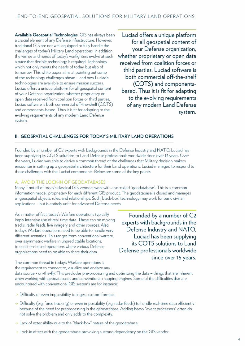
Available Geospatial Technologies. GIS has always been a crucial element of any Defense infrastructure. However, traditional GIS are not well equipped to fully handle the challenges of today’s Military Land operations. In addition the wishes and needs of today’s warfighters evolve at such a pace that flexible technology is required. Technology which not only meets the needs of today, but also of tomorrow. This white paper aims at pointing out some of the technology challenges ahead – and how Luciad’s technologies are available to ensure mission success. Luciad offers a unique platform for all geospatial content of your Defense organization, whether proprietary or open data received from coalition forces or third parties. Luciad software is both commercial off-the-shelf (COTS) and components-based. Thus it is fit for adapting to the evolving requirements of any modern Land Defense system.
II. GEOSPATIAL CHALLENGES FOR TODAY’S MILITARY LAND OPERATIONS
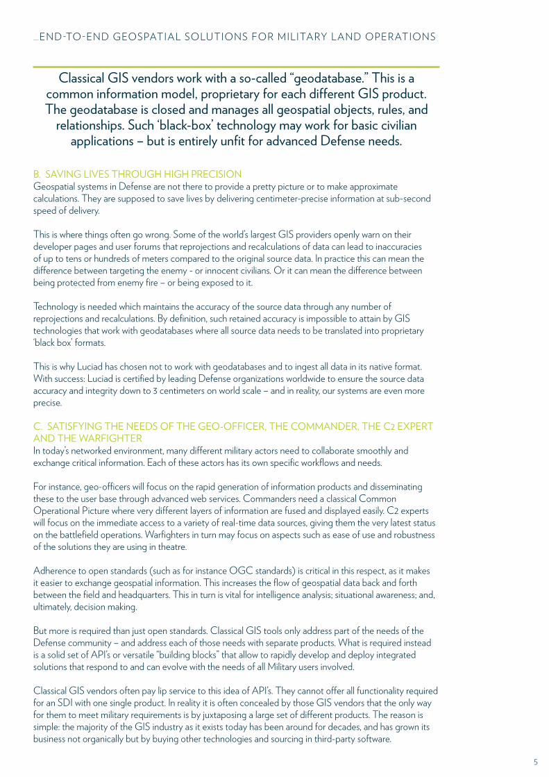
Founded by a number of C2 experts with backgrounds in the Defense Industry and NATO, Luciad has been supplying its COTS solutions to Land Defense professionals worldwide since over 15 years. Over the years, Luciad was able to derive a common thread of the challenges that Military decision makers encounter in setting up a geospatial architecture for their Land operations. Luciad managed to respond to those challenges with the Luciad components. Below are some of the key points:
A. AVOID THE LOCK-IN OF GEODATABASESMany if not all of today’s classical GIS vendors work with a so-called “geodatabase”. This is a common information model, proprietary for each different GIS product. The geodatabase is closed and manages all geospatial objects, rules, and relationships. Such ‘black-box’ technology may work for basic civilian applications – but is entirely unfit for advanced Defense needs.
As a matter of fact, today’s Warfare operations typically imply intensive use of real-time data. These can be moving tracks, radar feeds, live imagery and other sources. Also, today’s Warfare operations need to be able to handle very different scenarios. This ranges from conventional warfare, over asymmetric warfare in unpredictable locations, to coalition-based operations where various Defense organizations need to be able to share their data.
The common thread in today’s Warfare operations is the requirement to connect to, visualize and analyze any data source - on-the-fly. This precludes pre-processing and optimizing the data – things that are inherent when working with geodatabases and conventional mapping engines. Some of the difficulties that are encountered with conventional GIS systems are for instance:
→ Difficulty or even impossibility to ingest custom formats.
→ Difficulty (e.g. force tracking) or even impossibility (e.g. radar feeds) to handle real-time data efficiently because of the need for preprocessing in the geodatabase. Adding heavy “event processors” often do not solve the problem and only adds to the complexity.
→ Lack of extensibility due to the “black-box” nature of the geodatabase.
→ Lock-in effect with the geodatabase provoking a strong dependency on the GIS vendor.
Luciad offers a unique platform for all geospatial content of your Defense organization,
whether proprietary or open data received from coalition forces or
third parties. Luciad software is both commercial off-the-shelf
(COTS) and components-based. Thus it is fit for adapting
to the evolving requirements of any modern Land Defense
system.
Founded by a number of C2 experts with backgrounds in the
Defense Industry and NATO, Luciad has been supplying
its COTS solutions to Land Defense professionals worldwide
since over 15 years.
5
_END-TO-END GEOSPATIAL SOLUTIONS FOR MILITARY LAND OPERATIONS
B. SAVING LIVES THROUGH HIGH PRECISIONGeospatial systems in Defense are not there to provide a pretty picture or to make approximate calculations. They are supposed to save lives by delivering centimeter-precise information at sub-second speed of delivery.
This is where things often go wrong. Some of the world’s largest GIS providers openly warn on their developer pages and user forums that reprojections and recalculations of data can lead to inaccuracies of up to tens or hundreds of meters compared to the original source data. In practice this can mean the difference between targeting the enemy - or innocent civilians. Or it can mean the difference between being protected from enemy fire – or being exposed to it.
Technology is needed which maintains the accuracy of the source data through any number of reprojections and recalculations. By definition, such retained accuracy is impossible to attain by GIS technologies that work with geodatabases where all source data needs to be translated into proprietary ‘black box’ formats.
This is why Luciad has chosen not to work with geodatabases and to ingest all data in its native format. With success: Luciad is certified by leading Defense organizations worldwide to ensure the source data accuracy and integrity down to 3 centimeters on world scale – and in reality, our systems are even more precise.
C. SATISFYING THE NEEDS OF THE GEO-OFFICER, THE COMMANDER, THE C2 EXPERT AND THE WARFIGHTERIn today’s networked environment, many different military actors need to collaborate smoothly and exchange critical information. Each of these actors has its own specific workflows and needs.
For instance, geo-officers will focus on the rapid generation of information products and disseminating these to the user base through advanced web services. Commanders need a classical Common Operational Picture where very different layers of information are fused and displayed easily. C2 experts will focus on the immediate access to a variety of real-time data sources, giving them the very latest status on the battlefield operations. Warfighters in turn may focus on aspects such as ease of use and robustness of the solutions they are using in theatre.
Adherence to open standards (such as for instance OGC standards) is critical in this respect, as it makes it easier to exchange geospatial information. This increases the flow of geospatial data back and forth between the field and headquarters. This in turn is vital for intelligence analysis; situational awareness; and, ultimately, decision making.
But more is required than just open standards. Classical GIS tools only address part of the needs of the Defense community – and address each of those needs with separate products. What is required instead is a solid set of API’s or versatile “building blocks” that allow to rapidly develop and deploy integrated solutions that respond to and can evolve with the needs of all Military users involved.
Classical GIS vendors often pay lip service to this idea of API’s. They cannot offer all functionality required for an SDI with one single product. In reality it is often concealed by those GIS vendors that the only way for them to meet military requirements is by juxtaposing a large set of different products. The reason is simple: the majority of the GIS industry as it exists today has been around for decades, and has grown its business not organically but by buying other technologies and sourcing in third-party software.
Classical GIS vendors work with a so-called “geodatabase.” This is a common information model, proprietary for each different GIS product. The geodatabase is closed and manages all geospatial objects, rules, and
relationships. Such ‘black-box’ technology may work for basic civilian applications – but is entirely unfit for advanced Defense needs.

6
_END-TO-END GEOSPATIAL SOLUTIONS FOR MILITARY LAND OPERATIONS
As a result, GIS products are often an amalgamation of poorly or non-compatible products, each offering a piece of functionality in the patchwork of requirements. It is not uncommon for instance to find GIS solutions where an operator must change screens (or even applications) to switch from a 2D to a 3D projection, or to edit or convert data from one format to the other. In many cases, this inherent weakness of the traditional GIS industry has even become an easy way to sell more and more products to the user – leading to more expenses in purchasing, training and maintenance.
Fighting Off The Same Data - Not Off The Same Map. Integration of the existing GIS technology platforms of a Land Army can help creating a ‘single point of truth’ for operational information through the entire command chain, from the highest strategic level to the lowest tactical level. This is often referred to as the concept of “fighting off the same map.”
But for true network enabled operations, more is needed. Forces need to be “fighting off the same data”, not “off the same map”. This concept means that all Land forces indeed need to have access to the same, authoritative data for their operations. But not every Warfighter needs to have access to the same view, or the same level of informational detail. What is needed is dynamic data management, whereby operators can centrally create “themes” of geospatial data that are made available to all the actors in the Land Defense command chain. These “themes” can vary in function of the user’s profile and his operational status.
Prepare for Exponential Data and User Growth.Today Land Defense systems deal with “Geospatial Big Data” – datasets so large and complex that traditional data processing applications are inadequate. Challenges include analysis, capture, data correlation, search, sharing, storage, transfer, and visualization.
Also the number of users needing to access Land Defense systems has grown exponentially. Geospatial systems are no longer a tool of the specialist geo-officer, but are used throughout the Defense enterprise. Today every Warfighter is a potential consumer of and contributor of geospatial data – an evolution that many GIS technologies did not see coming and only responded to very late.
Support for the Military Domain. Geospatial data used to be static in nature. With the accumulation of available historical data, users now want to be able to make rapid and easy temporal comparisons between the situation “now” and “then”. How has the enemy progressed? Has critical infrastructure been destroyed? Classical GIS systems often still have trouble integrating a decent 2D and 3D picture into one single application with a seamless operational switch between the two. Whilst users have the reasonable expectation to add the temporal factor and operate in 4D.
The surge of various types of sensors (radars, UAV imagery, detectors) has also created the need for advanced real-time capabilities that can handle hundreds of thousands of moving tracks with a sub-second update rate, and live imagery at 60-frames-per-second rate.
The increasing use of point cloud technology (LIDAR) in GeoInt operations has generated the need for big-data capability able to handle millions of static points.
All this data needs to be displayed using the symbology sets to which the Military is accustomed, for
Today Land Defense systems are evolving towards “Geospatial
Big Data” – datasets so large and complex that traditional
data processing applications are inadequate.
Every warfighter is a potential consumer of and contributor of
geospatial data – an evolution that many GIS technologies did not see coming and only
responded to very late.
Users have the reasonable expectation to add the temporal factor and operate in 4D.
7
_END-TO-END GEOSPATIAL SOLUTIONS FOR MILITARY LAND OPERATIONS
instance Mil2525 or APP6.
And finally, in today’s world of coalition operations, standards for data sharing are also essential, for instance NATO Vector Graphics.
Flexibility in Design. IT visionaries and IT research firms all agree: our world is moving quickly to an “API economy”, a place where open interfaces and agile development tools allow to very quickly interweave and integrate web technologies.
In sheer contrast to today’s API economy, classical GIS technology is still conceived from the outset as a finished, commercial-off-the-shelf (COTS) end-user product.
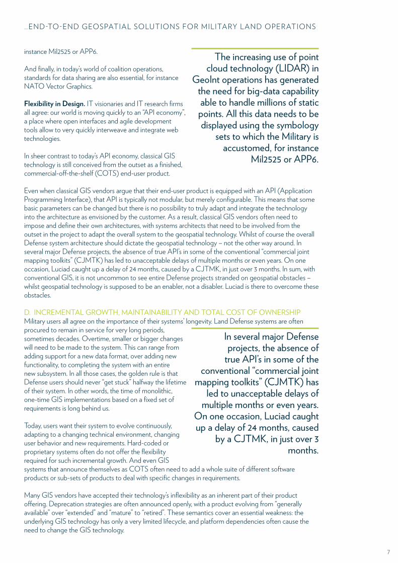
Even when classical GIS vendors argue that their end-user product is equipped with an API (Application Programming Interface), that API is typically not modular, but merely configurable. This means that some basic parameters can be changed but there is no possibility to truly adapt and integrate the technology into the architecture as envisioned by the customer. As a result, classical GIS vendors often need to impose and define their own architectures, with systems architects that need to be involved from the outset in the project to adapt the overall system to the geospatial technology. Whilst of course the overall Defense system architecture should dictate the geospatial technology – not the other way around. In several major Defense projects, the absence of true API’s in some of the conventional “commercial joint mapping toolkits” (CJMTK) has led to unacceptable delays of multiple months or even years. On one occasion, Luciad caught up a delay of 24 months, caused by a CJTMK, in just over 3 months. In sum, with conventional GIS, it is not uncommon to see entire Defense projects stranded on geospatial obstacles – whilst geospatial technology is supposed to be an enabler, not a disabler. Luciad is there to overcome these obstacles.
D. INCREMENTAL GROWTH, MAINTAINABILITY AND TOTAL COST OF OWNERSHIPMilitary users all agree on the importance of their systems’ longevity. Land Defense systems are often procured to remain in service for very long periods, sometimes decades. Overtime, smaller or bigger changes will need to be made to the system. This can range from adding support for a new data format, over adding new functionality, to completing the system with an entire new subsystem. In all those cases, the golden rule is that Defense users should never “get stuck” halfway the lifetime of their system. In other words, the time of monolithic, one-time GIS implementations based on a fixed set of requirements is long behind us.
Today, users want their system to evolve continuously, adapting to a changing technical environment, changing user behavior and new requirements. Hard-coded or proprietary systems often do not offer the flexibility required for such incremental growth. And even GIS systems that announce themselves as COTS often need to add a whole suite of different software products or sub-sets of products to deal with specific changes in requirements.
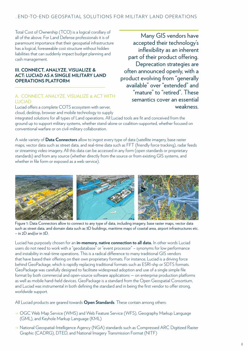
Many GIS vendors have accepted their technology’s inflexibility as an inherent part of their product offering. Deprecation strategies are often announced openly, with a product evolving from “generally available” over “extended” and “mature” to “retired”. These semantics cover an essential weakness: the underlying GIS technology has only a very limited lifecycle, and platform dependencies often cause the need to change the GIS technology.
The increasing use of point cloud technology (LIDAR) in
GeoInt operations has generated the need for big-data capability able to handle millions of static points. All this data needs to be displayed using the symbology
sets to which the Military is accustomed, for instance
Mil2525 or APP6.
In several major Defense projects, the absence of
true API’s in some of the conventional “commercial joint
mapping toolkits” (CJMTK) has led to unacceptable delays of
multiple months or even years. On one occasion, Luciad caught up a delay of 24 months, caused
by a CJTMK, in just over 3 months.
8
_END-TO-END GEOSPATIAL SOLUTIONS FOR MILITARY LAND OPERATIONS
Total Cost of Ownership (TCO) is a logical corollary of all of the above. For Land Defense professionals it is of paramount importance that their geospatial infrastructure has a logical, foreseeable cost structure without hidden liabilities that can suddenly impact budget planning and cash management.
III. CONNECT, ANALYZE, VISUALIZE & ACT: LUCIAD AS A SINGLE MILITARY LAND OPERATIONS PLATFORM
A. CONNECT, ANALYZE, VISUALIZE & ACT WITH LUCIADLuciad offers a complete COTS ecosystem with server, cloud, desktop, browser and mobile technology to supply integrated solutions for all types of Land operations. All Luciad tools are fit and conceived from the ground up to support military systems, whether stand-alone or coalition-supported, whether focused on conventional warfare or on civil-military collaboration.
A wide variety of Data Connectors allow to ingest every type of data (satellite imagery, base raster maps, vector data such as street data, and real-time data such as FFT (friendly force tracking), radar feeds or streaming video imagery. All this data can be accessed in any form (open standards or proprietary standards) and from any source (whether directly from the source or from existing GIS systems, and whether in file form or exposed as a web service).
Luciad has purposely chosen for an in-memory, native connection to all data. In other words Luciad users do not need to work with a “geodatabase” or “event processor” – synonyms for low performance and instability in real-time operations. This is a radical difference to many traditional GIS vendors that have based their offering on their own proprietary formats. For instance, Luciad is a driving force behind GeoPackage, which is rapidly replacing traditional formats such as ESRI-shp or SDTS formats. GeoPackage was carefully designed to facilitate widespread adoption and use of a single simple file format by both commercial and open-source software applications — on enterprise production platforms as well as mobile hand-held devices. GeoPackage is a standard from the Open Geospatial Consortium, and Luciad was instrumental in both defining the standard and in being the first vendor to offer strong, worldwide support.
All Luciad products are geared towards Open Standards. These contain among others:
→ OGC Web Map Service (WMS) and Web Feature Service (WFS), Geography Markup Language (GML), and Keyhole Markup Language (KML)
→ National Geospatial-Intelligence Agency (NGA) standards such as Compressed ARC Digitized Raster Graphic (CADRG), DTED, and National Imagery Transmission Format (NITF)
Many GIS vendors have accepted their technology’s
inflexibility as an inherent part of their product offering.
Deprecation strategies are often announced openly, with a
product evolving from “generally available” over “extended” and
“mature” to “retired”. These semantics cover an essential
weakness.
Figure 1: Data Connectors allow to connect to any type of data, including imagery, base raster maps, vector data such as street data, and domain data such as 3D buildings, maritime maps of coastal area, airport infrastructures etc. – in 2D and/or in 3D.
9
_END-TO-END GEOSPATIAL SOLUTIONS FOR MILITARY LAND OPERATIONS
→ North Atlantic Treaty Organization (NATO) geospatial data specifications such as Digital Geographic Information Exchange Standard (DIGEST)
→ Military symbology standards such as MIL-STD-2525C and APP-6B
→ World Wide Web Consortium (W3C) standards including HTML5
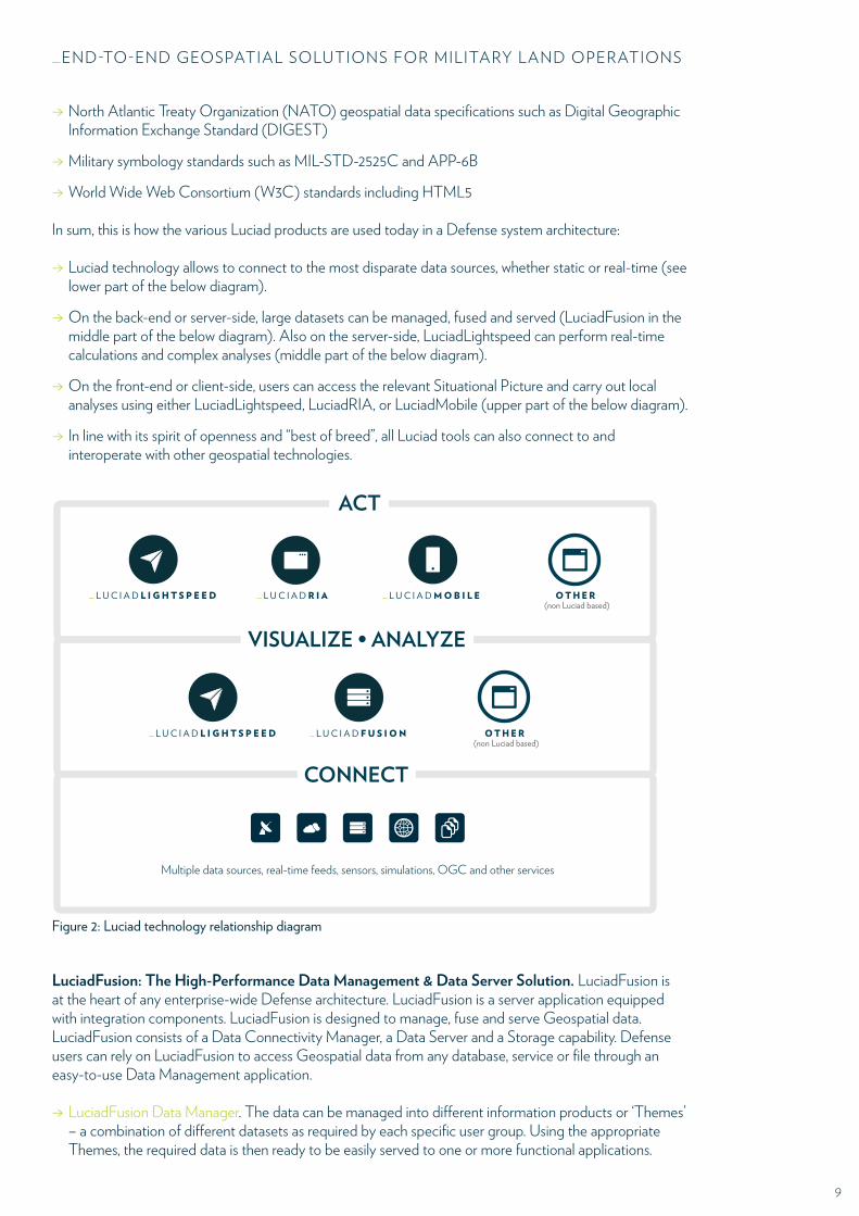
In sum, this is how the various Luciad products are used today in a Defense system architecture:
→ Luciad technology allows to connect to the most disparate data sources, whether static or real-time (see lower part of the below diagram).
→ On the back-end or server-side, large datasets can be managed, fused and served (LuciadFusion in the middle part of the below diagram). Also on the server-side, LuciadLightspeed can perform real-time calculations and complex analyses (middle part of the below diagram).
→ On the front-end or client-side, users can access the relevant Situational Picture and carry out local analyses using either LuciadLightspeed, LuciadRIA, or LuciadMobile (upper part of the below diagram).
→ In line with its spirit of openness and “best of breed”, all Luciad tools can also connect to and interoperate with other geospatial technologies.
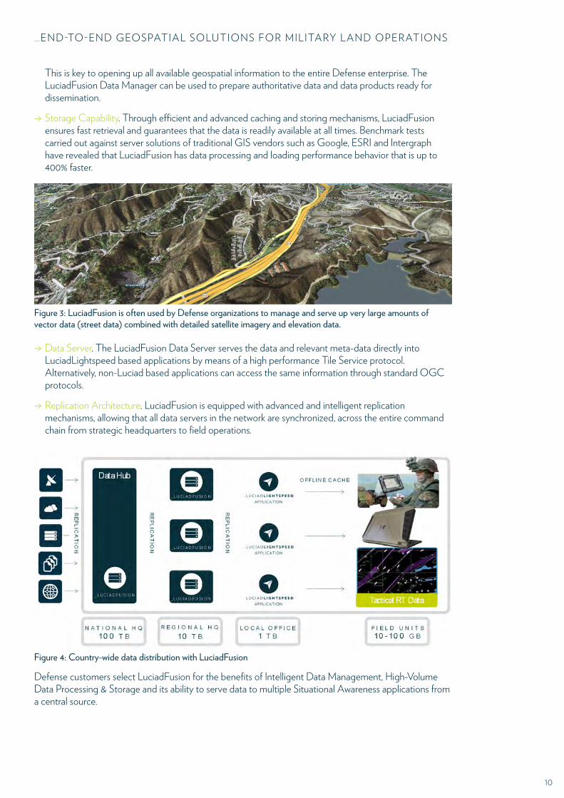
LuciadFusion: The High-Performance Data Management & Data Server Solution. LuciadFusion is at the heart of any enterprise-wide Defense architecture. LuciadFusion is a server application equipped with integration components. LuciadFusion is designed to manage, fuse and serve Geospatial data. LuciadFusion consists of a Data Connectivity Manager, a Data Server and a Storage capability. Defense users can rely on LuciadFusion to access Geospatial data from any database, service or file through an easy-to-use Data Management application.
→ LuciadFusion Data Manager. The data can be managed into different information products or ‘Themes’ – a combination of different datasets as required by each specific user group. Using the appropriate Themes, the required data is then ready to be easily served to one or more functional applications.
ACT
Multiple data sources, real-time feeds, sensors, simulations, OGC and other services
_ L U C I A D FU S ION_ L U C I A D OTHERL I GHTS P E ED(non Luciad based)
_ L U C I A D R I A OTHER(non Luciad based)
_ L U C I A D L I GHTS P E ED _ L U C I A D MOB I L E
VISUALIZE • ANALYZE
CONNECT
Figure 2: Luciad technology relationship diagram
10
_END-TO-END GEOSPATIAL SOLUTIONS FOR MILITARY LAND OPERATIONS
This is key to opening up all available geospatial information to the entire Defense enterprise. The LuciadFusion Data Manager can be used to prepare authoritative data and data products ready for dissemination.
→ Storage Capability. Through efficient and advanced caching and storing mechanisms, LuciadFusion ensures fast retrieval and guarantees that the data is readily available at all times. Benchmark tests carried out against server solutions of traditional GIS vendors such as Google, ESRI and Intergraph have revealed that LuciadFusion has data processing and loading performance behavior that is up to 400% faster.
→ Data Server. The LuciadFusion Data Server serves the data and relevant meta-data directly into LuciadLightspeed based applications by means of a high performance Tile Service protocol. Alternatively, non-Luciad based applications can access the same information through standard OGC protocols.
→ Replication Architecture. LuciadFusion is equipped with advanced and intelligent replication mechanisms, allowing that all data servers in the network are synchronized, across the entire command chain from strategic headquarters to field operations.
Defense customers select LuciadFusion for the benefits of Intelligent Data Management, High-Volume Data Processing & Storage and its ability to serve data to multiple Situational Awareness applications from a central source.
Figure 3: LuciadFusion is often used by Defense organizations to manage and serve up very large amounts of vector data (street data) combined with detailed satellite imagery and elevation data.
Figure 4: Country-wide data distribution with LuciadFusion
11
_END-TO-END GEOSPATIAL SOLUTIONS FOR MILITARY LAND OPERATIONS
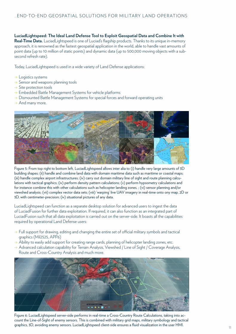
LuciadLightspeed: The Ideal Land Defense Tool to Exploit Geospatial Data and Combine It with Real-Time Data. LuciadLightspeed is one of Luciad’s flagship products. Thanks to its unique in-memory approach, it is renowned as the fastest geospatial application in the world, able to handle vast amounts of point data (up to 10 million of static points) and dynamic data (up to 500,000 moving objects with a sub-second refresh rate).
Today, LuciadLightspeed is used in a wide variety of Land Defense applications:
→ Logistics systems → Sensor and weapons planning tools → Site protection tools → Embedded Battle Management Systems for vehicle platforms → Dismounted Battle Management Systems for special forces and forward operating units → And many more.
LuciadLightspeed can function as a separate desktop solution for advanced users to ingest the data of LuciadFusion for further data exploitation. If required, it can also function as an integrated part of LuciadFusion such that all data exploitation is carried out on the server-side. It boasts all the capabilities required by operational Land Defense users:
→ Full support for drawing, editing and changing the entire set of official military symbols and tactical graphics (Mil2525, APP6)
→ Ability to easily add support for creating range cards, planning of helicopter landing zones, etc. → Advanced calculation capability for Terrain Analysis, Viewshed / Line of Sight / Coverage Analysis, Route and Cross-Country Analysis and much more.
Figure 5: From top right to bottom left, LuciadLightspeed allows inter alia to (i) handle very large amounts of 3D building shapes; (ii) handle and combine land data with domain maritime data such as maritime or coastal maps; (iii) handle complex airport infrastructures; (iv) carry out domain military line of sight and route planning calcu-lations with tactical graphics; (iv) perform density pattern calculations; (v) perform hypsometry calculations and for instance combine this with other calculations such as helicopter landing zones, ; (vi) sensor planning and/or viewshed analysis; (vii) complex vector data sets; (viii) ‘warping’ live UAV imagery in real-time onto ony map, 2D or 3D, with centimeter-precision; (iv) situational pictures of any data.
Figure 6: LuciadLightspeed server-side performs in real-time a Cross-Country Route Calculations, taking into ac-count the Line-of-Sight of enemy sensors. This is combined with military grid maps, military symbology and tactical graphics, 3D, avoiding enemy sensors. LuciadLightspeed client-side ensures a fluid visualization in the user HMI.
12
_END-TO-END GEOSPATIAL SOLUTIONS FOR MILITARY LAND OPERATIONS
As all Luciad products, LuciadLightspeed is fully web-services-enabled.
LuciadRIA: A Fully Web-based Tool for Creating Advanced Land Defense Portals. LuciadRIA follows HTML5 standards and does not require any plug-ins. It can allow tens or even hundreds of thousands of users to access an easy-to-use, intuitive Defense portal. Luciad was a forerunner in adopting the HTML5 standard and as a consequence has a technology advantage of several years onto traditional GIS vendors that very long held on to plug-in frameworks such as Microsoft Silverlight (e.g. ArcGIS).
Unlike traditional GIS portals that only deliver very limited (static) information, LuciadRIA has been designed from the ground up to deliver a “desktop-like” experience – entirely in the browser. This means in practice that LuciadRIA offers:
→ Full drawing and editing support for all Military Symbology and Tactical Graphics → Support for thousands of moving tracks and millions of point clouds → Temporal analysis capability with intuitive “time sliders” → Integrated 2D/3D visualization model (2016)
LuciadRIA has already been selected and deployed by leading international organizations such as Eurocontrol and NATO. For all its future web-based Defense systems, NATO has indicated that it will embrace the HTML-5 standard. The two first HTML5-based systems at NATO actually rely on LuciadRIA.
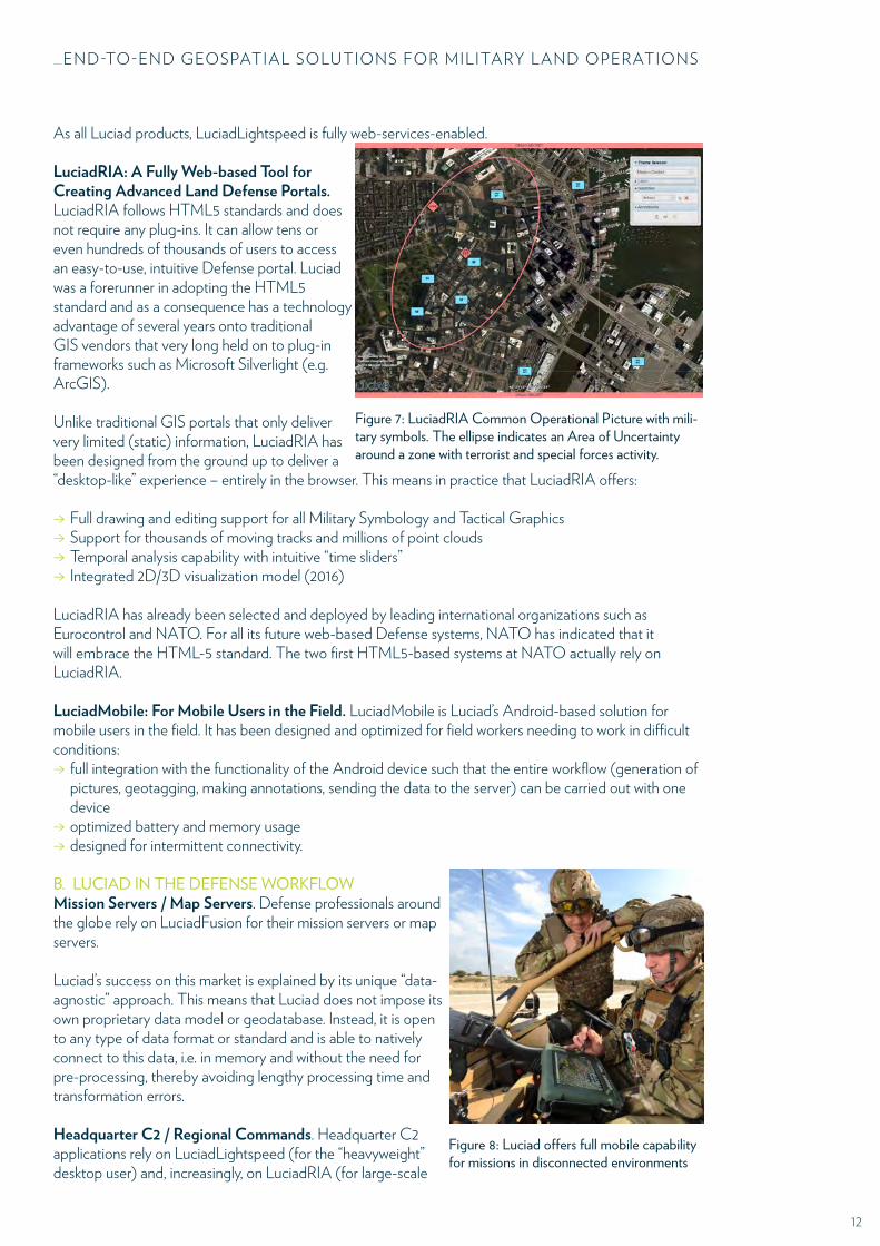
LuciadMobile: For Mobile Users in the Field. LuciadMobile is Luciad’s Android-based solution for mobile users in the field. It has been designed and optimized for field workers needing to work in difficult conditions:
→ full integration with the functionality of the Android device such that the entire workflow (generation of pictures, geotagging, making annotations, sending the data to the server) can be carried out with one device
→ optimized battery and memory usage → designed for intermittent connectivity.
B. LUCIAD IN THE DEFENSE WORKFLOWMission Servers / Map Servers. Defense professionals around the globe rely on LuciadFusion for their mission servers or map servers.
Luciad’s success on this market is explained by its unique “data-agnostic” approach. This means that Luciad does not impose its own proprietary data model or geodatabase. Instead, it is open to any type of data format or standard and is able to natively connect to this data, i.e. in memory and without the need for pre-processing, thereby avoiding lengthy processing time and transformation errors.
Headquarter C2 / Regional Commands. Headquarter C2 applications rely on LuciadLightspeed (for the “heavyweight” desktop user) and, increasingly, on LuciadRIA (for large-scale
Figure 7: LuciadRIA Common Operational Picture with mili-tary symbols. The ellipse indicates an Area of Uncertaintyaround a zone with terrorist and special forces activity.
Figure 8: Luciad offers full mobile capability for missions in disconnected environments
13
_END-TO-END GEOSPATIAL SOLUTIONS FOR MILITARY LAND OPERATIONS
portal applications). Both LuciadLightspeed and LuciadRIA allow to serve tens or even hundreds of thousands of users, giving each user access to the exact information that is needed.
Deployed Commander / Battle Management Systems for vehicle platforms. LuciadLightspeed is today a leading solution in Battle Management Systems around the globe. Luciad is rapidly evicting traditional GIS companies from these systems because of significant superiority in performance, domain support (e.g. Military Symbology and Tactical Graphics), and memory footprint.
Dismounted Soldier / Future Warfighter / Special forces. LuciadLightspeed and LuciadMobile are increasingly used for local “apps”, either Windows- or Mac-based (LuciadLightspeed) or Android-based (LuciadMobile), for laptops, smartphones and handhelds.
C. LUCIAD EQUIPS YOUR LAND DEFENSE ORGANIZATION FOR THE API ECONOMY AND FOR NETWORK ENABLED COLLABORATIONAccording to IT research firm Gartner, 50% of business-to-business collaboration will take place through Web APIs by 2017, and by 2016 75% of Fortune 1000 firms will offer public Web APIs. Military users know this trend. Network Enabled Operations are crucial to the Land Defense area, where many different systems need to interoperate and need to evolve overtime.
This is where Luciad takes over. Whilst most classical GIS companies only discovering the advent of the API Economy, it has been a reality for Luciad since the company’s inception. Luciad’s mission statement has been from the outset to deliver software components or API’s – rather than finished end user applications. This is a major difference with the traditional GIS companies. At first sight, some traditional GIS may have some useful out-of-the-box functionality. But that functionality is inflexible and hard-coded. These few lines of code are merely cosmetic and hide an essential weakness: When functionality needs to be even slightly changed to meet requirements, the lack of a true API becomes painfully apparent.
At Luciad, we have decided to do things radically differently. Luciad focuses not on cosmetics but on the foundations of its geospatial products. As a result, non-functional elements such as extreme performance and precision, maintainability and ease of use benefit the whole code base of the Luciad products and are already built-in. Adding functional requirements with Luciad is often a matter of our customers writing just a few lines of code.
This is contrary to traditional GIS that have historically put the cart before the horse. These GIS have focused on adding small functionality ‘gimmicks’ inside the COTS product – at the expense of essential requirements such as performance, precision, maintainability and ease of use. No matter how much lines of code are added to these classical GIS, those essential requirements are lost and cannot be brought back.
IV. USEFUL REFERENCES
Please contact Luciad for a selection of references in the field of Military Land environment.
MORE INFORMATION
For more technical information or to find out more about our other products and services, please contact us at [email protected].
www.luciad.com U.S. & Canada +1 202 507 5895 • Europe & Rest of World +32 16 23 95 91