ECONOMIC GEOLOGY of the SAND and SANDSTONE ... - michigan.gov · MI DEQ GSD Economic Geology of the...
31
ECONOMIC GEOLOGY of the SAND and SANDSTONE RESOURCES of MICHIGAN Geological Survey Division Report of Investigation 21 By E. William Heinrich Copyright © 2001 by the Michigan Department of Environmental Quality (DEQ) Geological Survey Division (GSD). The DEQ GSD grants permission to publish or reproduce this document, all or in part, for non-profit purposes. The contents of this electronic document (whole or in part) can be used if, and only if, additional fees are not associated with the use or distribution of this document and credit is given to the DEQ GSD and the author(s). This copyright statement must appear in any and all electronic or print documents using this file or any part thereof.
Transcript of ECONOMIC GEOLOGY of the SAND and SANDSTONE ... - michigan.gov · MI DEQ GSD Economic Geology of the...

ECONOMIC GEOLOGY of theSAND and SANDSTONE
RESOURCES of MICHIGAN
Geological Survey DivisionReport of Investigation 21
By E. William HeinrichCopyright © 2001 by the Michigan Department of Environmental Quality (DEQ) Geological Survey Division (GSD). TheDEQ GSD grants permission to publish or reproduce this document, all or in part, for non-profit purposes. The contentsof this electronic document (whole or in part) can be used if, and only if, additional fees are not associated with the useor distribution of this document and credit is given to the DEQ GSD and the author(s). This copyright statement mustappear in any and all electronic or print documents using this file or any part thereof.

MI DEQ GSD Economic Geology of the Sand and Sandstone Resources of Michigan. . .RI 21.PDF page 2 of 31
Contents of this Report
PREFACE ............................................................................4
ABSTRACT..........................................................................4
INTRODUCTION..................................................................4
MIDDLE PRECAMBRIAN QUARTZITES ...........................5General ........................................................................5
Mesnard Quartzite .......................................................5
Ajibik Quartzite ............................................................5
Summary .....................................................................6
JACOBSVILLE SANDSTONE ............................................6Building Stone .............................................................6
Disintegrated Jacobsville Sand ...................................7
MUNISING FORMATION ....................................................8
SYLVANIA SANDSTONE ...................................................8Introduction..................................................................8
Previous Studies..........................................................9
Glass Sand ..................................................................9
Geology .....................................................................10Distribution and Thickness ................................10Stratigraphic Relations ......................................10Structure ............................................................10Exposures..........................................................10Subsurface Distribution and Characteristics .....12
Geology at Rockwood ...............................................13Stratigraphy .......................................................13
Structures ..................................................................14
Petrology....................................................................15General ..............................................................15Grain Characteristics .........................................16Accessory Minerals ...........................................18
Mineralogy of the Carbonaceous Material.................18Cement ..............................................................18Chemical Composition.......................................19Economic Considerations..................................19Origin .................................................................19
MARSHALL SANDSTONE ............................................... 20Grindstone Industry................................................... 20
Napoleon Sandstone................................................. 20Previous Work................................................... 20General Geology ............................................... 21Quarries............................................................. 21Geology ............................................................. 22Napoleon Quarries ............................................ 22The Problem of the Thin Slabby Bedding ......... 23Petrography....................................................... 23Economic Potential............................................ 24
IONIA SANDSTONE ......................................................... 24
PLEISTOCENE AND RECENT SAND DEPOSITS .......... 24General...................................................................... 24
Geology..................................................................... 25
Economic Geology .................................................... 25
Pleistocene Lake Sands............................................ 26
DUNE SANDS ................................................................... 26Molding Sands .......................................................... 26
Geology..................................................................... 28
Composition .............................................................. 29
Future ........................................................................ 30
LITERATURE CITED ........................................................ 30

MI DEQ GSD Economic Geology of the Sand and Sandstone Resources of Michigan. . .RI 21.PDF page 3 of 31
IllustrationsFigure 1. Thick-bedded, uniform Ajibik Quartzite, east
side of Negaunee...........................................................6
Figure 2. Ajibik Quartzite with green ‘‘spots’’ ofchlorite, east side of Negaunee. ....................................6
Figure 3. Somewhat disintegrated Chapel RockSandstone, Munising Formation, Pictured RockPark. ..............................................................................8
Figure 4. Plant of the Ottawa Silica Co., Rockwood. ..........9
Figure 5. Face of the Ottawa Silica Co. Quarry,Rockwood. ...................................................................10
Figure 6. Operations. of the Ottawa Silica Co.,Rockwood. Blasted sand from face on center andleft. Drill on stripped, upper bench..............................12
Figure 7. Unit A, Sylvania Sandstone, Rockwood. ...........13
Figure 8. Small-scale banding, Unit A, SylvaniaSandstone, Rockwood.................................................13
Figure 9. Cross-bedding in Unit B, SylvaniaSandstone, Rockwood.................................................14
Figure 10. Well-consolidated sandstone, Unit C,Sylvania Sandstone, Rockwood. .................................14
Figure 11. Rip-up zone, Sylvania Sandstone,Rockwood. ...................................................................15
Figure 12. Sandstone bed with extensive wormburrows, Sylvania Sandstone, Rockwood. ..................15
Figure 13. Bottom view of worm-burrowed bed,showing ends of burrows (light spots) andabundance of carbonaceous debris at base oflayer, Sylvania Sandstone, Rockwood. .......................15
Figure 14. Glass-sand product of Ottawa Silica Co.,Sylvania Sandstone, Rockwood. Compare withFigure 15. Both figures approximately 60x.................17
Figure 15. Glass-sand product of Ottawa Silica Co.,St. Peter Sandstone, Ottawa, Illinois. Thissandstone is regarded as the parent of theSylvania Sandstone. ....................................................17
Figure 16. Jude’s Quarry in Napoleon Sandstone,Napoleon. ....................................................................21
Figure 17. Quarry face, Napoleon Sandstone,showing slabby separation planes, Napoleon. ............22
Figure 18. Upper slabby sandstone gradingdownward into thicker bedded sandstone,Napoleon. ....................................................................23
Figure 19. Sand dunes along Lake Michigan, GrandHaven. .........................................................................28
Tables
Table 1. Size analysis of East Dollar Bay Sand(Babcock, 1973) ............................................................ 7
Table 2. Proximate chemical analysis of East DollarBay Sand (Babcock, 1973) ........................................... 8
Table 3. Comparison of the Chapel Rock and Miner’sCastle members of the Munising Formation(adapted from Hamblin, 1958). ..................................... 8
Table 4. Compositions of soda-lime glasses. ................... 10
Table 5. Correlation of the Devonian rocks of NewYork, northern Michigan, and southeasternMichigan and northwestern Ohio (Ehlers et al.,1951). .......................................................................... 12
Table 6. Mechanical Analysis of the Sylvania Sands(Grabau and Sherzer, 1910) ....................................... 17
Table 7. Heavy and light accessory minerals of theSylvania (Enyert, 1959). .............................................. 18
Table 8. Chemical composition of SylvaniaSandstone, Grabau and Sherzer (1910);Poindexter and Newcombe (1928).............................. 19
Table 9. Genetic classification of sand deposits ofMichigan. ..................................................................... 25
Table 10. Molding sand producers in Michigan. ............... 28
Copyright © 2001 by the Michigan Department ofEnvironmental Quality (DEQ) Geological Survey Division(GSD). The DEQ GSD grants permission to publish orreproduce this document, all or in part, for non-profitpurposes. The contents of this electronic document(whole or in part) can be used if, and only if, additionalfees are not associated with the use or distribution ofthis document and credit is given to the DEQ GSD andthe author(s). This statement must appear in any andall electronic or print documents using this file orany part thereof.

MI DEQ GSD Economic Geology of the Sand and Sandstone Resources of Michigan. . .RI 21.PDF page 4 of 31
PREFACEThe writer has been concerned with the non-metallicmineral resources of Michigan for thirty years, and in detailwith mineral products obtained from sands and sandstonesfor a decade. This report presents a summary of field andlaboratory studies most of which were conducted between1967 and 1977. These data are coupled with summariesfrom both older and recent literature in an attempt topresent a complete and modern description of the economicgeology of the sand and sandstone resources of Michigan.I am indebted to several of my students and colleagues forassistance. Former students are Chris A. Drexler whostudied the Lake Michigan dune sands and Vincent DelGreco who studied the Sylvania Sandstone at Rockwood. Ihave drawn heavily on both of their Master’s studies inpresenting this summary. In addition, my colleagues,Professors L. I. Briggs, J. A. Dorr, Jr., D. F. Eschman, W. R.Farrand, and K. K. Landes have permitted me to pick theirbrains for many pieces of information. To all of these Iextend my special thanks. Laboratory studies wereconducted in the Department of Geology and Mineralogy ofthe University of Michigan.
Publication of this report by the Geological Survey Division,Department of Natural Resources would not have beenpossible without the skills of several Survey personnel.Thanks are extended to Beverly L. Champion for editing themanuscript; to Steven E. Wilson for layout and graphicdesign; and to Lois J. DeClaire for final typing of themanuscript.
E. Wm. HeinrichProfessor of MineralogyDepartment of Geology and Mineralogythe University of MichiganAnn Arbor, Michigan 48109
ABSTRACTThe extensive sand and sandstone deposits of Michiganconstitute one of the most important mineral resources ofthe State. Ranging in age from Precambrian to Recent,they supply (or have supplied) a great diversity of products:various types of dimension stone and building stone;aggregate sand for use in concrete and allied constructionmaterials; fill sand; foundry sands for molds and cores;glass sands; and abrasive and other specialty silicaproducts. Setting standards in their respective industriesare two preeminent deposits: 1) the Sylvania Sandstone(Devonian) which is one of the premier glass sands of theUnited States and 2) the Lake Michigan dune sand which isthe preferred sand (Lake sand) for molds and cores in grayiron foundries, particularly for the automotive industry.Similarly in the past grindstones and other abrasive tools,produced in Huron County, were considered the highestquality materials available in the United States (Lake Huronbluestone).
Although in general the reserve situation for both theSylvania glass sand and the Lake Michigan dune sands is
good, future production complications will result from zoningrestrictions, reservations for park land, housingdevelopment competition and ecological regulations.
INTRODUCTIONIn the field of economic geology and mining, Michigan haslong been world famous for its native copper and irondeposits. Equally or even more important, but geologicallyless spectacular, are the Michigan productions of limestone,gypsum, rock salt, glass sand, foundry sand, constructionsand and gravel and other non-metallic mineralcommodities. In terms of dollar value Michigan, in 1975,ranked high among the states in the production of a varietyof non-metallic minerals. The state ranked first inproduction of gypsum, peat and marl; second in rock salt;third in construction sand and gravel; fourth in cement; andfifth in lime, clay and shale.
Among the non-metallic raw materials of peculiar geologicalinterest are sands and sandstones, inasmuch as they areused in a wide variety of ways, based on a wide variety ofcombinations of physical and chemical properties. Theseproperties include bulk chemical composition (“purity”),grain-mineral composition, color, degree of consolidation,grain size and grain-size distribution, shape and roundnessof grains, and nature and amount of cement.
Sandstones and sands yield products that have manifoldapplications: 1) dimension stone: building stone, rip-rap,flagging; 2) aggregate: in concrete, cements, plasters,bituminous paving mix, terrazo; 3) fill sands; 4) molding andcore sands in the foundry industry; 5) abrasive: blastingsands, engine sands, whetstones; 6) metallurgical silica:silicon metal, ferrosilicon alloys; 7) glass sand; 8) fillers inpaints and bitumens; 9) sand filters; and 10) silica flour.Most of these products have been obtained from Michigansandstones and sands.
Utilization sands has passed historic periods ducts: ofMichigan sandstones and through two overlapping withcontrasting main products:
1. Nineteenth century to the end of World War I:Building stoneAbrasive wheels and scythestones;
2. Pre-World War I to date:Glass sandMolding sandConstruction sand.
Two of Michigan’s present sand products are particularlyoutstanding and preeminent in their fields of utilization.These are the Sylvania Sandstone, one of the world’s finestglass sands, and the Lake Michigan dune sands (“Lakesand”) which set the standard for molding sands in theautomotive foundry industry. Similarly in the past, theMarshall Sandstone was the source of the finestgrindstones obtainable in the United States until they weresuperseded by those from Ohio and subsequently bywheels of synthetic abrasives. Still further removed in time

MI DEQ GSD Economic Geology of the Sand and Sandstone Resources of Michigan. . .RI 21.PDF page 5 of 31
was the Jacobsville Sandstone, renowned as a handsomebuilding stone throughout eastern and central United States.It is doubtful that any other state can claim a similar recordof producing four completely different sandstone-sandproducts, each foremost in its particular application.
MIDDLE PRECAMBRIAN QUARTZITESGeneral
In the Marquette district, a number of quartzite units ofMiddle Precambrian age occur in formations belonging tothe Marquette Range Supergroup. The formations are,upward from the base, the Enchantment Lake Formation,Mesnard Quartzite, Kona Dolomite, Wewe Slate, AjibikQuartzite, Siamo Slate, and Negaunee Iron Formation.Some units in both the Mesnard and the Ajibik are thick-layered, light-colored and vitreous and resemble, at least inoutcrop, the Precambrian Lorrain quartzites that crop out onthe north shore and in the Georgian Bay areas of LakeHuron in Canada. Most of the quartzite production in thisarea of Canada goes into ferroalloys, but some is used as ametallurgical flux stone. For such uses, low iron contentsare required and, in addition, alumina must be kept withinacceptable (and low) limits. In such rocks, the iron isnormally present as secondary hematite and the alumina insericitic muscovite.
Several dozen specimens of both the Mesnard and Ajibikquartzites were collected for petrographic evaluation forpossible use as high-quality silica sources.
Mesnard QuartziteResults on two specimens of Mesnard Quartzite are:
No. 2620. Sericitic quartzite, north of Mud Lake, nearMarquette.
Hand-specimen: Gray-white, slightly schistose, withfilms of sericite, a slightly waxy texture.
Microscopic: Largely a relict sedimentary texture withlittle recrystallization. Angular to subrounded quartzgrains in a matrix of silty quartz, sericite and very fine-grained chlorite. The metamorphic character of therock is evident from the orientation of the sericite, whichis in thin, elongate streaks and “veinlets” which arelargely parallel. In crosscutting sericite “veinlets” theindividual sericite flakes also are parallel with thisorientation. This sericite orientation is at an angle ofabout 300 to relict sedimentary layering exemplified byfiner-grained bands of quartz particles. The sericitecorrodes quartz-grain margins slightly. Zircon, ilmenite,tourmaline, rutile.
Evaluation: Much too impure as a silica Source.
No. 2621. Mt. Mesnard.Hand-specimen: Gray-white, peppered by minute redspots. Some thin snow-white quartz vein lets.
Microscopic: A recrystallized granoblastic fabric. Mostgrains show some wavy extinction. Considerable grain-size variation. Local patches of finer-grained quartzhave appreciable hematite cement as thin interstitialfilms. In coarser parts, thin grain-boundary films ofsericite lie between the quartz grains. A few grains ofzircon.
Evaluation: Probably a borderline rock, with a little toomuch iron.
Ajibik QuartziteSeven specimens, representing a wide variety of Ajibikquartzites, have been evaluated petrographically.
No. 2630. North of Maas Mine, Negaunee.Hand-specimen: Light red, with thin relict (7)sedimentary (7) bands of darker red color.
Microscopic: A partly recrystallized fabric, partlygranoblastic and with grain outlines partly relict detrital.Most grains moderately undulatory in extinction.Narrow streaks of cataclastic grinding. Local marginalsericite as incomplete films on quartz grains. Hematitewidespread as very fine-grained flakes, concentrated insmall patches and as partial grain rims. Estimated tocontain ~ 1% Fe2O3. No heavy accessories noted.
Evaluation: Too much hematite.
No. 2632. North of Maas Mine, Negaunee.Hand-specimen: Medium-gray, slabby, with a sugarytexture.
Microscopic: Granoblastic, undulatory, well sorted.Very minor scattered flakes of interstitial sericite. Aslight trace of hematite; no heavies noted.
Evaluation: A very good-looking rock.
No. 5000. Harvey Quarry, Marquette; near fault.Hand-specimen: Dark gray, crisscrossed by numerous,randomly oriented fractures coated by hematite.
Microscopic: Medium- to coarse-grained granoblasticfabric with superimposed cataclastic shears. Muchmortar structure at grain margins in cataclastic zoneswhich also are rich in minute hematite flakes. Sericiticgrain-boundary films are variable from a few flakes topartial to complete.
Evaluation: Not of value, owing to hematite introductionduring shattering.
No. 5001. East side of Negaunee (Figure 1).Hand-specimen: Very uniform, gray-white,subconchoidal fracture.
Microscopic: Generally uniformly grained save for afiner-grained, folded band. Granoblastic fabric, grainsmoderately undulatory. Very subordinate and very thingrain-boundary films of sericite. A trace of zircon.

MI DEQ GSD Economic Geology of the Sand and Sandstone Resources of Michigan. . .RI 21.PDF page 6 of 31
Evaluation: A very good-looking rock, worth a chemicalanalysis.
Figure 1. Thick-bedded, uniform Ajibik Quartzite, eastside of Negaunee.
No. 5002. East side of Negaunee.Hand-specimen: Dark gray, coarse-grained, uniform.
Microscopic: An arkosic quartzite. Coarse, subangularpieces of quartz, K-feldspar-perthite and rocks(quartzose schist) in a silty matrix of quartz and sericite.Strongly bimodal. Matrix also contains much hematitein flakes and patches, and chlorite. Feldspar fragmentsstrongly sericitized.
Evaluation: Much too impure.
No. 5003. East side of Negaunee.Hand-specimen: Spotted by green avoids 2 to 10 mmlong in a green-gray matrix (Figure 2). Hematiteveinlets along fractures.
Microscopic: Granoblastic, undulatory. The spotsconsist of clusters of minute pale green chlorite flakes,pleochroic from pale tan to light green and dusted bytiny opaque specks. The chlorite alters to hematite.Hematite also along fractures.
Evaluation: Too high in Mg and Fe.
Figure 2. Ajibik Quartzite with green ‘‘spots’’ ofchlorite, east side of Negaunee.
No. 5004. East of Negaunee.Hand-specimen. Greenish white with green ovoidspots, 2 to 5 mm. Cut by numerous ramifying andcrisscrossing hematite veinlets.
Microscopic: The spots consist of ~ 10% chlorite asinterstitial flakes and grain- boundary films. Rest ofrock contains ~ 1% chlorite as scattered flakes. Tracesof sericite. Fabric is granoblastic, interlocking.
Evaluation: Too high in Fe, Mg and Al.
SummaryThe Mesnard appears unlikely to provide high-silicaquartzite. Some specimens of Ajibik appear very promising,especially Nos. 2632 and 5001. A systematic samplingprogram with chemical analyses appears to be warranted.
JACOBSVILLE SANDSTONEBuilding Stone
By 1893 building-stone quarries were operating in theJacobsville Sandstone of Lower Middle Cambrian age(Humbling, 1958) at four localities in the NorthernPeninsula. At that time the Jacobsville was referred to asthe “Upper Peninsula Sandstone” or “Lake SuperiorSandstone” and was regarded as equivalent to thePostdate. Later reports included both the Jacobsville andthe Munising in the “Lake Superior Sandstone”. Parker(1895) lists the following operating quarries and their 1892productions:
1. Portage Entry, 16 miles southeast of Houghton atPortage Entry (i.e., at Jacobsville), 226,000 cu. ft.

MI DEQ GSD Economic Geology of the Sand and Sandstone Resources of Michigan. . .RI 21.PDF page 7 of 31
2. Portage Redstone Company, same location,275,000 cu. ft.
3. Lake Superior Redstone Company, same location,10,000 cu. ft.
4. Kerber-Jacobs, same location, - ?
5. Michigan Redstone Company, Marquette, 50,000 cu.ft.
6. Rock River, 25 miles east of Marquette, 1,000 cu. ft.
In addition to being intensively employed locally in theNorthern Peninsula (especially in Marquette and Houghton-Hancock) for churches, public buildings, breweries, andresidences, the stone enjoyed a wide geographic market. Itwas shipped as far west as Kansas City, south to St. Louisand east to Cleveland, New York and Philadelphia. Duluth,Chicago and Buffalo were the lake ports utilized for inlanddistribution. The main recognized color varieties were theredstone (uniformly red) and the variegated (red streakedand mottled with white). The former sold for 9O¢ per cubicfoot delivered at any lake port, the latter for only 75¢ percubic foot. The Marquette stone (brown and purplish) wasregarded as the handsomest stone quarried, but amountswere limited. The Jacobsville Redstone, more widely used,was available as dimension stone in sizes up to 30 inchesthick. In addition to its use as ordinary building stone,surfaces of the blocks could be carved readily into intricaterelief designs.
By 1899 the value of sandstone produced for building stonein Michigan reached $102,447.00 (rough), $57,682.00(dressed). A maximum value of $136,280.00 (rough) wasreached in 1902, after which a decline set in. In 1911 therough value was only $5,682.00 (Smith, 1914). ThePortage Entry Redstone Company is, recorded as operatingat least through 1923, but ceased operations sometimebefore 1926. In 1926 the only stone quarried was producedby the City of Marquette for concrete aggregate, and thesaga of the famous Jacobsville building stones, theJacobsville Redstone, the Marquette Brownstone and thePortage Redstone had ended.
In addition to its handsome color, the stone had theadvantages of being readily workable, surface-hardeningrapidly upon exposure to air, and being fire-resistant. Asingle sample of Jacobsville from a small quarry in Section34, T52N, R33W, Baraga County tested by Makens et al.(1972) had the following properties:
Compressive strength* 12060 psiTensile strength* 440 psiModulus of rupture 919 psiPorosity (total) 13.8 %Permeability* 8.11 md.Percent absorption* 6.l8%Abrasion (% wear) 12.32 (100 rev.)
51.28 (500 rev.)Specific gravity 2.63-2.69Hardness* (scleroscopic) 33
*average value
Disintegrated Jacobsville SandBabcock (1973) discovered and reported on a potentialindustrial sand deposit on East Dollar Bay Mesa, east ofDollar Bay in Houghton County. The bulk test sample wasobtained from Section 34, T55N, R33W, center of north lineof NW ¼ of the SW ¼, Torch Lake Township, HoughtonCounty. According to Babcock the mesa is capped by well-sorted, bleached, flat-lying Jacobsville Sandstone and loosesands derived mainly from the Jacobsville. The test sampleconsisted of an off-white, friable, well-sorted sandstone.
The size analysis is given in Table 1, the chemical analysisin Table 2.
U.S. StandardMesh
WeightPercent
+20 0.30+30 1.70+40 28.39+50 53.13+70 12.63
+100 2.45+140 1.26+200 0.07-200 0.07
100.00
Table 1. Size analysis of East Dollar Bay Sand(Babcock, 1973)
The mineralogy of the sand is:>95 percent quartz grains, 40percent of which have secondary, crystallographically-oriented quartz over-growths; feldspar--several percent, tan-yellow detrital grains, some partly altered; 1 percentmicaceous species, including a kaolinitic mineral; traces ofdolomite and hematite; heavy minerals include leucoxene,tourmaline, magnetite-ilmenite, apatite and zircon with atotal of>2.96 sp. gr. fraction = 0.008 wt. percent.
From the chemical and mineralogical data, the sand is notsufficiently pure to serve as a glass sand withoutbeneficiation. Total iron is too high for flint-grade glass butis in the range specifications for amber glass. Aluminumand alkalies also are too high for a glass sand. The sizedistribution is suitable for either glass sand or for foundrysands. Possibly because of this and the presence offeldspar the material should be tested for foundry-sandpurposes. Although the deposit appears to haveconsiderable areal extent (~ 5 square miles), it seems tohave a limited thickness.
The deposit appears to represent an example of theweathering-beneficiation of a protore material (theferruginous Jacobsville) mainly by the leaching of most ofthe cementing limonite-hematite.

MI DEQ GSD Economic Geology of the Sand and Sandstone Resources of Michigan. . .RI 21.PDF page 8 of 31
Proximate Chemical Analysis of East Dollar Bay Sanda
Head Leachable TheoreticalRemainder
SiO2 b 98.76TiO2 0.045 0.034 0.011Al2O3 0.72 0.106 0.614Fe2O3 c 0.071 0.031 0.040CaO 0.021 0.012d 0.009MgO 0.036 0.016 0.020K20 0.330 0012e 0.318Na2O 0.021 0007e 0.020CO2 0.016 -- --(Total impurities) 1.260 0.210 1.032Molar RatiosCa/Mg 0.96 1.23 0.74K/Na 9.24 10.08 9.35
a dry, unprocessed, -10 mesh sand ground to -100 mesh.(Analysis not totaled because of potential rounding errorsand approximate nature of values obtained.)b SiO2 by difference. This value also includes a negligiblepercentage of water tied up in hydrous authigenic minerals.c Fe(total) as Fe2O3 .d in dolomite; inferred.e in hydromuscovite (approximately 0.14 percent).
Table 2. Proximate chemical analysis of East DollarBay Sand (Babcock, 1973)
Figure 3. Somewhat disintegrated Chapel RockSandstone, Munising Formation, Pictured Rock Park.
MUNISING FORMATIONThe Munising Formation, which unconformably overlies theJacobsville, is Upper Cambrian in age (Hamblin, 1958). Incontrast to the Jacobsville, most of which is red, theMunising, in general, is white to light colored or gray. Threelithologic units are recognized by Hamblin (1958); inascending order they are: 1) basal conglomerate, 2)Chapel Rock member, and 3) Miner’s Castle member.
The Chapel Rock member is 40 to 60 feet thick, whereasthe Miner’s Castle member constitutes the upper 140 feet ofthe Munising Formation. Other contrasts are given in Table3.
Because of its light color, high quartz content, excellentsorting and favorable location with respect to watertransportation, the Chapel Rock member has beenconsidered as a potential glass sand (Figure 3). Samplingand testing, particularly of material from Grand Island, havebeen conducted by at least one major glass company.However, the poor sorting, more variable mineralogy andlocal pyrite content are features that make the Miner’sCastle member undesirable as a glass-making raw material.
Chapel Rock Miner’s CastleMajorMinerals
98% + quartz 95-98% quartz
MinorMinerals
--- feldspar
Cement silica, uncemented toorthoquartzitic; calciteonly local, near fractures
silica, less abundant;calcite abundant in somebeds but not widespread
Coherence variable; generally morecoherent than theMiner’s Castle
generally friable andporous
Accessories
zircon.’; minortourmaline, apatite, rutile,garnet
garnet, opaques; minorzircon, tourmaline, rutile;pyrite common in middle
Sorting well-sorted poorly sorted
Table 3. Comparison of the Chapel Rock and Miner’sCastle members of the Munising Formation (adaptedfrom Hamblin, 1958).
SYLVANIA SANDSTONE(by E. Wm. Heinrich and V. Del Greco)
IntroductionThe Sylvania Sandstone represents a major geological-economic anomaly, inasmuch as it is one of the finest glasssands in the western hemisphere. Because of its structureand general character, and its overburden of glacial debris,it also is one of the most poorly exposed units of this type inthe United States. Hence, most of the information on it

MI DEQ GSD Economic Geology of the Sand and Sandstone Resources of Michigan. . .RI 21.PDF page 9 of 31
stems from a very restricted number of surface exposures,the remainder coming from drill holes.
The sandstone is presently being quarried by the OttawaSilica Company at its Rockwood Quarry about one mileeast-southeast of Rock-wood in Wayne County, Michigan,chiefly for flint-grade glass sand (Figure 4).
Previous StudiesThe Sylvania has been well established as a stratigraphicunit since 1871 (Newberry, 1871), and its general geologyhas been documented for nearly three-quarters of a century(Sherzer, 1900; Grabau and Sherzer, 1909). It wasoriginally identified in northwestern Ohio (Newberry, 1871)where all four known exposures are in Lucas County and onthe south bank of the Maumee River in Wood County. Theformation is named after the town of Sylvania in LucasCounty just across the Michigan-Ohio boundary. Thegeology of the formation in Ohio has been described indetail by Carman (1936) who also reviews the earlier historyof its study in the region around the west end of Lake Erie.An early study of the formation in Michigan was by Natress(1910).
Modern studies of the formation in Michigan were notcompleted until the 1950’s. These include studies on thepetrology by Enyert (1949), on the general geology byLandes (1951), on the stratigraphy by Ehlers et al. (1957)and on origin by Briggs (1959).
Figure 4. Plant of the Ottawa Silica Co., Rockwood.
Relatively recent studies by Hatfield et al. (1969) and byDel Greco and Heinrich (1973) have provided considerablenew detailed information on the petrology and genesis.
The formation also has been identified in the subsurface ofsouthern Ontario, close to the Detroit River (Dyer, 1929;Reavely and Winder, 1961).
Glass SandNearly all of the silica for glass arrives in some form ofquartz, except for the minor amounts that accompany thealuminum and the alkalies in feldspar and/or nepheline.Three categories of specifications apply to the silica, called“quartz sand” by the glass industry, irrespective of itsgeological mode of origin. These categories are grain-size,chemical, and mineralogical specifications and aredescribed as follows:
1. Grain-size specifications. These vary somewhat fromcompany to company. One common distribution is:
+ 30 mesh none+ 40 mesh not over- 80 mesh not over 35%
-140 mesh not overCoarse quartz grains (+30 mesh and larger) do not meltcompletely, forming a type of structural defect in glass.Very fine-grained material (-150 mesh) tends to blow out ofthe furnace batch, thus changing its composition, and tocake and clog the checkers of the furnace.
2. Chemical specifications (in weight percentage):Flint Amber
Fe2O3 not over 0.025 0.12TiO2 not over 0.030 0.10CaO not over 0.100 0.10Mg 0 not over 0.100 0.10organic tr 0.10SiO2 rest rest
There is some slight latitude in the above, depending uponthe exact composition of each of the other glassmaking rawmaterials contributed to the batch.
It can readily be appreciated that for flint-grade glass sand,the requisite extremely low iron content is commonly thecritical factor in the evaluation of the deposit. Very fewsands and sandstones contain so little iron naturally; hencethey may require beneficiation. The Sylvania is one ofthose very rare sandstones that are exceedingly low in iron,and consequently it requires no beneficiation.
FlatGlass
ContainerGlass
Si02Na2OCaOMgOA1203
72.016.59.01.51.0
73.018.07.00.51.5
100.0 100.0

MI DEQ GSD Economic Geology of the Sand and Sandstone Resources of Michigan. . .RI 21.PDF page 10 of 31
Table 4. Compositions of soda-lime glasses.
3. Mineralogical specifications: Especially undesirableare certain heavy detrital accessory minerals (“refractoryheavy minerals”, or R.H.M.) that occur in sandstones, e. g.,kyanite, sillimanite, corundum, etc. which do not melt atglassmaking temperatures and remain as “stones”. Again,because of its protracted geological history, the Sylvania isnot only essentially devoid of most R.H.M., but is very poorin all heavy detrital accessory species.
Geology
Distribution and ThicknessThe Sylvania has a very restricted outcrop, or sub-driftdistribution, appearing as a narrow northeast-southweststrip across the southeastern corner of Michigan andextending southward into northern Ohio as an evennarrower belt. South of Detroit it underlies the Detroit Riverand in the subsurface it extends barely into thesouthwestern most corner of Ontario. The shape of thenear-surface area looks like the letter “C”, open to thesoutheast. The length of the strip from its southern end inOhio to the Detroit River is about 55 miles, and the near-surface extent eastward into Ontario is about another 20miles. In Lucas County, Ohio, the formation averages about50 feet in thickness increasing northward to about 90 feet inWayne County, Michigan.
Dipping northwestward into the Michigan Basin, to thenorthwest the formation disappears beneath younger strataand thickens in this direction to a maximum thickness ofnearly 400 feet in the subsurface of the southeastern cornerof Washtenaw County, Michigan. In Ontario the maximumrecorded thickness is 125 feet.
Stratigraphic RelationsThe Sylvania is a blanket, mainly orthoquartzitic sand bodyof Lower Middle Devonian age. It forms the base of theDetroit River Group in southeastern Michigan and adjacentOhio and Ontario. In Table 5, the stratigraphic position ofthe unit and its relationship to other stratigraphic units of thearea as well as equivalency with units of other areas areshown. The Sylvania Sandstone is considered toimmediately overlie the Bois Blanc Formation insoutheastern Michigan. Above the Sylvania is the rest ofthe Detroit River Group consisting of the AmherstburgDolomite, the Lucas Dolomite and the Anderdon Limestone.An unconformity separates the top of the group from thenext formation, the famous Dundee Limestone. Thus theSylvania Sandstone is a clastic ‘break” in a major carbonatesequence, a position that can be interpreted as a hinttoward a marine site of deposition.
In northern Ohio the Sylvania rests disconformably on theRaisin River Dolomite of the Silurian Bass Islands Group.However, to the north in the Michigan subsurface, theDevonian Bois Blanc Limestone is interposed beneath theSylvania and Raisin River. Thus from north to south the
Sylvania lies on progressively older rocks. Southeastward,erosion has truncated the Sylvania.
StructureIn southeastern Michigan the Sylvania dips at a very lowangle northwestward toward the center of the basin. InOhio, it lies on the flank of the Lucas County monocline,dipping about 60 west. The strike of the beds insouthwestern Ontario is east-west, dipping at a low anglenorthward. This change in attitude of the Sylvania bedsinvolves a flexure around the nose of a broad, north-plunging anticline, probably the northern extension of theFindlay Arch.
The eastern end of the Sylvania in Ontario is deflectedsouthward along the side of the Chatham Sag, the axis ofwhich strikes northwest-southeast.
Figure 5. Face of the Ottawa Silica Co. Quarry,Rockwood.
ExposuresIn Michigan the recorded surface exposures of the Sylvaniaare known at the following localities:
1. Ottawa Silica Company, Rockwood Quarry (formerlyMichigan Silica Company), NE ¼, Section 15, T5S, R10E.About one mile east-southeast of Rockwood, WayneCounty (Figures 5, 6).
2. Maumee Stone Company Quarry, SE ¼, Section 29,T5S, R10E. Wayne County (Hatfield et al., 1968, localityB).

MI DEQ GSD Economic Geology of the Sand and Sandstone Resources of Michigan. . .RI 21.PDF page 11 of 31
3. Twin Lakes Park Section 3, T6S, (1900, p. 54). west ofMonroe, (Toll’s Pits), SE ¼, R8E. See also Sherzer About 7miles north- Monroe County.
4. Cummins Quarry, SE ¼, Section 2, T8S, R6E. About 6½ miles south-southeast of Petersburg, Monroe County,
exposed in 1948-1949 in a 2-ft deep trench in the quarryfloor.
5. Monroe County Quarry, SW ¼, Section 13, T6S, R7E,Monroe County (Hatfield et al., 1968, locality D).
Epochs Stages n New York(Generalized) n Northern Michigan n SE. Michigan and NW. Ohio
Upper Devonian
Conewango Oswayo Fm. ? ? ? ? ? ?
Cattaraugus
Cassadaqa Conneaut Group Antrim Shale Antrim Shale (SE. MI)
Chemung Chemung Ss.
Enfield Shale Ohio Shale (NW. OH)
Finger Lakes Ithaca Shale
Genundewa Ls. Squaw Bay Ls.
Middle Devonian
Geneseo Shale T
Taghanic r Thunder Bay Lm.Tully Fm.
a Potter Farm Fm.
H Moscow Fm. v
Tioughnioga a e Norway Point Fm.
m Ludlow Fm. r Four Mile Dam Fm Ten Mile Creek Dol.
i s Alpena Ls.
l Skaneateles Fm. e Newton Creek Lm.
Cazenovia t Genshaw Fm.
o Ferron Point Fm.
n Rockport Quarry Ls Silica Format ion
Bell Shale
Marcellus Rogers City Ls.
Fm. Dundee Ls. Dundee Ls.
Paraspirifer acuminatus Zone
Anderdon Ls.
Onesquethaw Detroit River Lucas Dol.
Group Amherstburg Dol.
Sylvania Ss.
Onondaga
Amphigena Zone Bois Blanc Fm. Bois Blanc Fm. (SE. MI only)
Lower Devonian
Deerpark Oriskany Ss. Garden Island
Heiderberg Helderberg Group

vi
Table 5. Correlation of the Devonian rocks of New York, northern Michigan, and southeastern Michigan andnorthwestern Ohio (Ehlers et al., 1951).
Figure 6. Operations. of the Ottawa Silica Co.,Rockwood. Blasted sand from face on center and left.Drill on stripped, upper bench.
6. Bed of the Raisin River near Grape:
a. “At ford’’
b. Opposite claim 275
(Sherzer, 1900, p. 53)
The specific Ohio localities are described by Carman(1936):
1. France Stone Company, near Silica, 3 milessouthwest of Sylvania, Lucas County.
a. W ½ Section 17, T9S, R6E.
b. NW ¼ Section 20, T9S, R6E.(Ehlers et al., 1951, Figure 1)
2. Holland Quarry of France Stone Company, center,Section 29, T2N, R10E, about 2 miles southwest ofHolland, Lucas County.
3. Metzger Ridge Quarry, 5E2, Section 1, T6N, R9E,about 8 miles southwest of Maumee, Lucas County.
4. Falls of the Maumee River, SW corner, Section 25,T6N, R9E, about 11 miles southwest of Maumee, LucasCounty.
Subsurface Distribution and CharacteristicsEnyert (1949) and Landes (1951) have shown that in thesubsurface the Sylvania forms an arcuate trough which hasa maximum depth of about 350 feet. This trough waseroded in pre-Sylvania time in a terrain developed on BoisBlanc and Bass Islands rocks.
In the subsurface of the Lake Erie environs and insoutheastern and central Michigan the Sylvania is chiefly asandstone, but dolomitic sandstone and dolomite also arepresent. In wells of five Michigan counties a persistentchert bed has been logged 20 to 50 feet above the base ofthe formation.
Along the northwest axis of the subsurface trough thicknessvariations in the Sylvania define two sub-basins. Thesouthernmost basin has its center under easternWashtenaw County where a maximum thickness of 393 feethas been logged in the Ypsilanti Development Company’sFred Voorhees No. 1 well in NE ¼ NE ¼ SE ¼ Section 32,T2S, R7E, Superior Township, Washtenaw County (StatePermit No. 3828). The northernmost has its deepest part ineastern Gladwin and western Clare Counties where at least294 feet of interlayered sandstone and sandy dolomite werepenetrated by The Pure Oil Company’s D. G. ThompsonNo. 1 well in C-N ½ NW ¼ SE ¼ Section 3, T20N, R3W,Franklin Township, Clare County (State Permit No. 9590).Landes (1951) extends the northern sub-basinnorthwestward through the Michigan basin to terminateprobably in Crawford, Kalkaska, Wexford, and LakeCounties. Briggs (1959, Figure E) presents a slightlydifferent subsurface picture. He shows the sandy facies ofthe Sylvania continuing a much shorter distancenorthwestward, to about the middle of the SouthernPeninsula. According to Briggs this sandy tongue is fringedboth on the northeast and southwest by belts of sandydolomite.
At least one tract in the “outcrop area” in Monroe Countyhas been drilled specifically for evaluation as a glass sand.In 1957, 24 holes were drilled in a tract of 420 acres inSections 19 and 20, T5S, R10E, and in April 1977 a singlenew hole was drilled in the same tract. From the logs ofthese drill holes the following major units can berecognized:
1. Overburden: clay, sand, and gravel of Pleistocene age,averaging slightly over 30 feet in thickness.
2. Dolomite and dolomitic sandstone of the AmherstburgFormation. This grades downward into the upper part of theSylvania, and the exact contact is difficult to locate

vi
precisely. On the tract much of this formation has beeneroded to varying depths, with thickness of the remnantsranging from about 4 to 20 feet. In about one-third of theholes it apparently is absent.
3. The Sylvania Formation, 20 to 70 feet thick. Theformation appears to be appreciably thicker under thewestern part of the tract. The average thickness is 40 feet.
4. Dolomite. Barely penetrated in most of the drill holes.Locally chatty.
Geology at Rockwood
StratigraphyThe Rockwood Quarry, which presents the best availableexposure of the Sylvania, has been studied in detail by DelGreco and Heinrich (1973). Four subunits which arepresent throughout the quarry exposures are readilyrecognizable in the southern pit but are less sharply definedin the northern pit. The units, from the base upward, aredescribed as follows:
Unit A: At the bottom it is an off-white, friable sandstonewhich includes lenticles of somewhat more consolidatedsandstone. Individual sand grains are subrounded andrange in size from coarse to medium. The sandstone of thisunit contains very little other than quartz and a very few pinkfeldspar grains. Individual beds are 0.05 to 0.1-foot thick,separated by at least 20 darker bands about L inch inthickness. These brownish bands represent essentially theonly visible internal structure of this unit (Figures 7, 8).
Unit B: This unit, which is 9 to 10 feet thick, is much morestrongly consolidated than Unit A and weathers to asomewhat darker brownish hue. It contains very few of thethin dark bands, and these commonly show cross-beddingand truncation (Figure 9). No accessory pink feldspargrains were noted; only clear or milky quartz grains wereseen. These are in the coarse to medium size range, andare rounded to well-rounded. Conspicuous dark,carbonaceous bands occur at the base, 4 to 5 feet abovethe base and at 7 feet above the base.
Figure 7. Unit A, Sylvania Sandstone, Rockwood.
Unit C: This unit is a very well-consolidated, hard rockcompared to the other units (Figure 10). Bands and lenseswith high carbonate cement content are common. It alsocontains numerous bands of high carbonaceous content,some of which contain an appreciable percentage of veryfine-grained sand-sized or even silt-sized particles. Thisunit contains the highest amount of carbonaceous-material.
Unit D: Unit D is almost an exact duplicate of Unit B. Itconsists of very white, friable sandstone.
Figure 8. Small-scale banding, Unit A, SylvaniaSandstone, Rockwood.

vi
At the base of Unit A an unconformity separates theSylvania from the underlying Bois Blanc Limestone. Thissurface, which is gently undulating and serves as thebottom of quarrying operations, is marked by majorconcentrations of black carbonaceous material, locally inpockets in the top of the limestone in lensoid masses overan inch thick. The carbonaceous material, which appears tobe identical with that in bands and disseminated in theSylvania itself, is black, soft, and friable, crumbling readilyinto fine flakes.
StructuresSmall-scale primary sedimentary structures areconspicuous in many of the quarry-face exposures. Theseinclude: cross-bedding (abundant), ripple marks, rip-ups,small-scale unconformities, and worm (7) burrows.Secondary structural features are vugs with crystals, crystalcasts, joints, and faults with small- scale strike-slipdisplacements.
The most conspicuous of the structures is the cross-bedding which is usually defined by thin films or layers ofblack carbonaceous detrital material. The cross-bed setsvary greatly in thickness from 0.3 foot to 3.4 feet.
Figure 9. Cross-bedding in Unit B, Sylvania Sandstone,Rockwood.
Figure 10. Well-consolidated sandstone, Unit C,Sylvania Sandstone, Rockwood.
Dips range from 50 to about 300, with an average of about200, and the preferred dip is to the northwest. Thiscoincides with the regional dip and with the direction ofthickening of the formation. In the northern part of thequarry there are many northeasterly-dipping sets. Theseinclude tangential and torrential types, but the tabular typesare most common. Torrential crossbeds are generally onan erosional base.
Common in some zones are rip-ups and pseudobrecciasrepresenting a disruptive environment (Figure 11). None ofthese disrupted zones forms a well-defined layer throughoutthe quarry. Less extensive rip-up zones and individual rip-ups are common at several levels in the unit. Disruptivecharacteristics increase in abundance to the north and east.

vi
Figure 11. Rip-up zone, Sylvania Sandstone, Rockwood.
Burrows are extremely common and widespread throughoutthe quarry (Figure 12). They are most obvious in the whiterlayers but also occur in some of the brown bands. Theburrows are more or less vertical and almost invariably havetheir upper surface at one of the black carbonaceous layers(Figure 13). Burrows cut across the cross-beds and containmaterial possessing slightly different texture and colorcompared to the sand surrounding them. A commondifference is that the amount of carbonate cement in theburrow material is somewhat greater than in its surroundingsandstone.
Vugs with calcite crystals are common in an apparentlyirregular distribution. Less common but not rare are vugscontaining both calcite and celestite crystals. Some of thecalcite occurs as “nail-head” crystals. These vugs range insize from very tiny holes to crystal-lined cavities over a footlong. A vug is recorded that measured 22 x 15 x 8 inchescontaining celestite crystals 2 ¼ x 5 inches in size(Heinrich, 1976). Vugs are most common in those sectionsof the sandstone with a high percentage of carbonatecement. Larger ones are most commonly found along oradjacent to thicker layers rich in black carbonaceousmaterial. Frequently the vugs are localized on the bottomsurface of a cross-bed set. Vugs are more common in thesouth quarry.
Figure 12. Sandstone bed with extensive wormburrows, Sylvania Sandstone, Rockwood.
Figure 13. Bottom view of worm-burrowed bed,showing ends of burrows (light spots) and abundance ofcarbonaceous debris at base of layer, SylvaniaSandstone, Rockwood.
Crystal molds, rectangular in shape and usually small, arecommon. No trace of the original mineral has ever beenfound. Stylolites are common in the more dolomitic parts ofthe sandstone.
Petrology
GeneralThe Sylvania is a supermature quartz arenite. It is weaklyto moderately cemented locally, and strongly cemented insome layers by carbonate, chiefly dolomite. In some places

vi
it is slightly orthoquartzitic; and silica becomes an importantcementing agent in some places. The chief impurity,beyond dolomite, is finely macerated carbonaceous trash.The assemblage of heavy accessory detrital minerals isseverely restricted in number of species and in totalamount.
Grain CharacteristicsThe sandstone is well sorted. Mechanical analyses byGrabau and Sherzer (1910) are presented in Table 6, andsimilar data in histogram form are given by Carman (1936)for the Sylvania in Ohio.
Grain size distribution maxima vary considerably bothvertically and horizontally. According to Hatfield et al.(1968) the modal, mean, and median sand grain sizes areeach very near 0.25 mm, and in most samples 90 to 98percent of the grains lie between 0.1 and
0.5 rim in size. Enyert (1949) found no marked generalgrain-size frequency variations along the strike. Thereappears to be a tendency for sands at any one locality to becoarser in the upper part of the sect ion when compared tothose from the lower part of the formations. He also notedthat in the well of the International Salt Co., Inc. (Parcel B-I,Private Claim 49, Melvindale, Ecorse Township, WayneCounty, Michigan), an inverse relation existed betweengrain size and percentage of carbonate cement. The higherthe percentage of carbonate, the smaller the quartz grainsize.
Grabau and Sherzer (1910), in studying grain shapes,commented (pp. 77-78) “. . . not only the corners andedges are rounded but the body of the granule approachesthe sphere or ellipsoid.” A typical sample of flint-grade glasssand is shown in Figure 14. In general the larger grains arewell rounded, whereas the smaller sizes show a tendencytoward greater angularity, a relationship that stems from thefact that the smaller-sized grains more commonly have hadtheir detrital shapes modified via secondary enlargement bysilica cement.
Grabau and Sherzer (1910, p. 78) also noted thecharacteristic surface feature of many grains: “The surfacesof the Sylvania granules, except those secondarilyenlarged, do not show the vitreous luster of quartzfragments but, under the microscope, are seen to beroughened and pitted, and to present the appearance offrosted glass.” This frosting and pitting were attributed byGrabau and Sherzer (1910) to eolian transportation andabrasion. In addition, however, Briggs (1959) observed thatsome frosted grains have a superimposed polish, animportant bit of evidence supporting the concept of agenetic duality in the sand environment. Fabric analyses byHatfield et al. (1968) show that preferred orientation of thelong axes of sand grains is within 150 of the cross-bedazimuth of the unit from which the sample was obtained (for19 out of 25 thin sections).

vi
Sand On On On On On On On Through AverageNo. 10 sieve No. 20 No. 30 No. 40 No. 50 No. 80 No. 100 No. 200 No. 200 grain1.80 mm 0.80 mm 0.50 mm 0.42 mm 0.35 mm 0.18 mm 0.16 mm 0.08 mm 0.08 mm Size �mesh Mesh Mesh Mesh Mesh Mesh Mesh Mesh meshToll's pit
1 One ft. down 0.05 0.40 3.50 9.05 58.78 16.52 9.80 1.90 0.24541 6 ft. down. 0.00 .55 9.42 9.98 51.70 6.25 6.25 4.85 0.23653 I ft. down. 0.00 0.55 2.10 18.18 65.72 7.05 4.65 1.75 0.28414 6 ft. down 0.00 0.00 3.40 29.03 61.52 1.95 2.10 2.00 0.29673 21 ft. down 0.00 0.00 2.85 6.31 76.83 8.36 1.20 1.45 0.26606 26 ft. down 0.00 1.80 1.95 4.05 42.46 31.92 13.37 4.45 0.1810
Rockwood7 4 ft. down 0.00 0.40 7.65 0.50 50.60 0.50 0.25 0.10 0.39508 3 ft. down 0.00 0.60 0.60 2.35 70.45 6.60 9.10 0.30 0.23929 20 ft. down 0.00 0.35 6.65 35.10 53.70 2.30 2.25 0.65 0.3497
Detroit salt shaft10 Near top 0.00 1.00 7.51 1.51 43.20 19.52 16.11 1.15 0.244811 440 ft. down 0.00 0.10 3.00 15.35 64.93 8.35 6.85 .40 0.251312 450 ft. down 0.00 0.65 6.90 15.95 59.70 11.10 5.30 0.40 0.307113 460 ft. down 0.00 0.85 7.55 14.45 44.90 18.70 12.20 1:35 0.276614 460 0.00 0.75 7.23 16.00 1.7.35 16.16 11.65 0.82 0.2760
� Average size of grain as determined by the aspirator method
Table 6. Mechanical Analysis of the Sylvania Sands (Grabau and Sherzer, 1910)
Figure 14. Glass-sand product of Ottawa Silica Co.,Sylvania Sandstone, Rockwood. Compare with Figure15. Both figures approximately 60x.
Throughout the Rockwood Quarry the sandstone is highlyquartzose. Whatever cement is present is most commonlydolomite and the amount tends to increase upward. Silica
Figure 15. Glass-sand product of Ottawa Silica Co., St.Peter Sandstone, Ottawa, Illinois. This sandstone isregarded as the parent of the Sylvania Sandstone.
and very minor calcite are only local cements. The quartzgrains average 0.25 mm, and at any one quarry localitythere is a tendency for the grains to become coarserupward in the section.

vi
Accessory MineralsEnyert (1949) made a detailed study of the accessoryminerals and their distribution. His data are reproduced inTable 7. Of the species he lists, celestite, anhydrite, pyrite,anatase and fluorite are authigenic, and Iimonite issupergene.
1 2 3 4 5 6 7 8Heavy Minerals
Anatase � �
Anhydrite �
Celestite � � � � � � � �
Epidote � �
Fluorite � �
Garnet � � � � � �
Hornblende � � � �
Limonite � � � � � � �
Magnetite � �
Pyrite � � � � � � � �
Rutile � � �
Tourmaline � � � � � � � �
Zircon � � � � � � � �
Light MineralsChert � �
Dolomite � � � � � � � �
Quartz � � � � � � � �
1 = International Salt Company; 2 = Rockwood Quarry;3 = Twin Lakes Park; 4 = Cummins Quarry; 5 = Silica quarries;6 = Holland Quarry; 7 = Metzger Ridge Quarry;8 = Falls of the Maumee River
� very abundant � abundant� common � trace
Table 7. Heavy and light accessory minerals of theSylvania (Enyert, 1959).
The only persistent detrital accessories are zircon andtourmaline which also were the only ones noted on thestudy of the sandstone at the Rockwood Quarry (Del Grecoand Heinrich, 1973). Hatfield et al. (1968) found onlyzircon and tourmaline.
A more varied suite is reported by Alty (1933), but,unfortunately, only three of the well cores she used are nowregarded as having penetrated the Sylvania. Alty (1933)noted some unusual colorless authigenic tourmalineovergrowths on dark detrital tourmaline grains in DetroitRiver rocks.
The total percentage of accessory minerals is small.Enyert’s data (1949) includes both the detrital andauthigenic species.
Mineralogy of the Carbonaceous MaterialThe black carbonaceous material which is concentrated asflakes in both the horizontal layers and dipping foreset
cross-beds forms relatively thick “pure’’ lenses at the basalunconformity. This material is in sufficiently large piecesthat they can be studied via the electron microprobe.Whereas the accessory mineralogy of the sandstone isrelatively simple, the mineral assemblage in thecarbonaceous lenses is unexpectedly complex. It includes:1) native sulfur: abundant; some encloses dolomite rhombs;some enclosed spheroids of 7; 2) pyrite; 3) rutile; 4)corundum; 5) dolomite; 6) apatite: one grain noted; 7)zircon; 8) tourmaline; 9) quartz; 10) potash feldspar - twotypes, one fluoresces red, the other blue-gray, 11)plagioclase: andesine?; 12) sericitic muscovite; 13) Fe- Ti-rich mica; and 14) illite.
The carbonaceous material, which serves to cement thisassemblage, could not be dissolved or dissociated byhydrochloric acid; nor were any relict organic structuresdiscernable within it.
CementWhatever cement is present is overwhelmingly dolomitic.Minor calcite occurs locally. Some pre-carbonate silicacement in oriented authigenic quartz overgrowths tend tofavor the smaller-sized quartz grains. The amount ofdolomite is highly variable, even at any one locality.Enyert’s (1949) results are:1 Rockwood Quarry 5% dolomite
(1.3 - 6.l2%)2 Twin Lakes Park 8%
(5.27 - 12.90%)3 Cummins Quarry 60.15
4 Silica Quarries 14%(8.15-22.18%
5 Holland Quarry 10%(5.81 - 14.90%)
6 Metzger Ridge Quarry 58.16%
7 Maumee River Falls 48.95%
8 International SaltCo. Well
6%(2-11%)
It would thus appear that the content of dolomite increasessouthward, but it must be pointed out that the values forlocalities 4 through 7 are based mainly on samples fromonly the upper part of the Sylvania, which, in general, ismore dolomitic than the middle and lower.
In the drilled tract the core logs report considerabledolomite, the content of which varies markedly. Heredolomite is reported as:
1) minor to subordinate cement in sandstone;
2) hybrid dolomitic sandstones; and 3) inter- layered beds ofdolomite.

vi
Chemical CompositionVery few analyses and partial analyses of the SylvaniaSandstone are available. (Table 8).
PercentCrude Washed
Si02CaCO3MgCO3Fe2O3H2S04, loss & n.d.*ignition loss
96.501.501.040.000.760.20
99.700.080.22----
*not determined
Table 8. Chemical composition of Sylvania Sandstone,Grabau and Sherzer (1910); Poindexter and Newcombe(1928).
Poindexter and Newcombe (1928) also state (p. 134) that ". . . it is possible under careful supervision to obtain carloadlots of glass sand which average 0.015 percent iron oxide,and some analyses running as low as 0.001 percent ironare reported.” In general the sand of the Sylvania has beenfamous for its very low Fe2O3 content, ranging, in washedform, from 0.02 to < 0.01.
The sand on the drilled tract also is very low in iron, lessthan 0.02 percent Fe2O3. It averages higher in dolomite, ~4 to 5 percent, than the material from the Rockwood Quarry.
Economic ConsiderationsThe Sylvania qualifies as one of the premier glass sands ofthe world because of the following factors:
1. Chemical and mineralogical composition. It isexceedingly low in Fe2O3, A1203, and alkalies and refractoryheavy minerals. Dolomite and carbonaceous material arethe chief impurities. The latter is removable by washing.Dolomite can be removed partly by washing, but somesections of the Sylvania will have to be beneficiated byflotation to bring the dolomite down to acceptable levels.
2. The deposit is favorably located with respect to glassproduction plants in Michigan, Ohio and Canada.
3. Large reserves are present.
The chief problem inhibiting long-continued production inthe area involves restriction of quarrying operations by localzoning ordinance. In addition to glass sand, other productsinclude abrasive sand and silica flour.
OriginThe paleoenvironment of the Sylvania has been discussedby Grabau and Sherzer (1910), Carman (1963), Briggs(1959), Hatfield et al. (1968) and Del Greco and Heinrich(1973). Grabau and Sherzer (1910) first developed thetheory of eolian deposition. Their model postulatedderivation of the sand from some source area to thenorthwest, probably an outcrop area of the St. Peter
Sandstone, and the wind transportation of the materialacross the then arid intervening area (now part ofMichigan). They were led to the conclusion of eoliandeposition by several features displayed by the unit insouthern Michigan, such as the exceptionally well-roundedgrains, the uniformity of grain size, extreme purity, andextremely well-developed cross-bedding. Carman (1936)pointed out that the Sylvania Sandstone in Ohio does nothave many of these eolian features. Instead, it displayssome undeniable indications of marine deposition. Theprominent bedding is replaced by the characteristic beddingof aqueous deposits. Fossils that are common in thesandstone and in the transition beds above it representmarine organisms. Only in a few local areas in Ohio isprominent cross-bedding found. This cross-bedding may bean indication that eolian processes were important in theseareas.
Carman’s (1936) interpretation is that the SylvaniaSandstone is younger in Ohio than it is in Michigan and thatit was deposited in two distinct phases or steps. First, aneolian deposit developed in southeastern Michigan andwestern Ohio. Then the advancing Detroit River seaoverran eolian sand and reworked It, later redepositing itunder marine conditions. Thus, the Sylvania wouldrepresent a deposit at the margin of an encroaching sea.Briggs (1959) gave a good generalized description of thedual origin mechanism. According to his description theSylvania is primarily a body of marginal sand at the leadingedge of a transgressing boreal sea. The sea may well havereworked the sand but its main function was to serve as anagent of immobilization. Sand was swept southeasterlyfrom Wisconsin by the wind. Water then acted as a sinkand held the sand, preventing further wind drifting.Eventually, some carbonate deposition would bind the sand.
According to Summerson and Swann (1970) the Sylvania isnot unique but is one of many such formations from theperiod ranging from the Middle Precambrian to the UpperDevonian. Under this scheme the Devonian was the lastepisode in the series before sands from another sourcewere introduced, causing an end to the closed system ofclastic sedimentation that dominated the lower Paleozoic.The same detrital material first derived from thePrecambrian rocks of the Canadian Shield and othersources had been trapped in the depositional and erosionalcycle, with very little input from outside the system. In theDevonian, Cambro-Ordovician rocks of Wisconsin wereeroded and sand was picked up by winds. Wind transportwould be relatively undisturbed until gentle upward changesin topography associated with the arches to the southeaststopped the sand movement. Dune buildups and somesheets of sand formed in front of these obstructions.Successive marine invasion immobilized the sand, causingsome reworking and mixing with carbonate. The area ofmaximum deposition would probably have been a beacharea with an oscillating shoreline. Thus the provenancearea of the sand was to the northwest and the paleoslopealso was toward the northwest (Hatfield et al., 1968). Hereis a case where direction of the source area is not indicatedby the paleoslope. Thus, the Sylvania is at least a third-

vi
cycle sandstone from reworked St. Peter Sandstone, whichaccounts for its super-maturity.
Thus, the main points in the genetic model are:
1. The environment was of high energy in a beach area (i.e., both marine waves and river currents) of a transgressivesea, with a shoreline oscillating over a zone 20-30 mileswide.
2. Much, if not most, of the sand was transported to thebeach area by winds and there reworked.
3. The paleoslope of deposition was northwestward awayfrom the Findlay Arch.
4. The source of the sand grains is believed to have beenmainly Devonian outcrops of Ordovician St. PeterSandstone to the northwest. The original source of much ofthe St. Peter sand was pre-Croixan sandstones andquartzites along the southern margin of the CanadianShield. Thus, the St. Peter is at least a second-generationsandstone, and the Sylvania is at least a third-generationsandstone.
MARSHALL SANDSTONEGrindstone Industry
Although today grindstones are collected as antiques,suitable for lawn decorations, in the late 1800’s they weregenerally and widely
used in agriculture and industry for sharpening metal tools.Grindstones from Huron County, Michigan, were soldthroughout the United States and in some foreign countries.The stones range from a five-pound “kitchen stone’’, tosomewhat larger scythe stones, to large factory ‘‘wheels’’weighing nearly 9,000 pounds and more than seven feetacross. The largest stones had faces 14 inches across.Stones shaped from the Marshal 1 sandstone (thesandstones are most likely those in the upper part of theColdwater shale) in Huron County were regarded as themost valuable found in the United States, and this ‘‘LakeHuron bluestone’’ set the standard for the abrasive-stoneindustry. Although ;n 1892 the quarries produced 10,000tons of grindstones and 12,000 gross of scythestones,demand continued to exceed the supply.
The grindstone quarry industry, one of the earlier industriesdeveloped in Huron County, was started by A. C. Peer in1850. Production in the latter part of the 19th century camemainly from two quarries: those of the Cleveland StoneCompany in Sections 24 and 25, T19N, R13E and that ofthe Huron Grindstone Company in Section 23, T19N, R13E,both at Grindstone City. However, much of the sandstonealong the shore of Lake Huron to Section 30 had beenworked over by the turn of the century, the waste stonehaving been discarded into the old workings which weresubsequently built over. Quarries near Bayport, workedbefore the 1890’s exposed several layers of fine- to coarsegrained sandstone, six to ten feet thick, of quality similar tothat at Grindstone City.
The Marshall Sandstone at Grindstone City was termed agrit owing to the angularity of its quartz grains. The mostuniform bed, in the lower part of the Marshall, was about 15feet thick, homogeneous or with obscure cross-bedding. Insome cases cross-bedding prevented production of larger-sized grindstones. The sandstone locally also containedthin conglomerate beds (“peanut conglomerate”) andscattered pebbles, the presence of both of which resulted inmuch waste stone. The stone was regarded as particularlyvaluable because it did not glaze with usage. Thisbehavioral property resulted from the fact that the sharpquartz particles were set in a cement of clay, detritalmuscovite and siderite which wore away at a rate just fastenough to prevent the rock surface from polishing.Because of this, a new crop of sharply angular grindingedges was continuously supplied to the abrasive surface.Thus, the unique character of the stone resulted from thecombination of uniform grain size, angularity of the particles,and degree of cohesion of the matrix.
Waste material also was used locally as a building stoneand for gravestones. It had a pleasing blue to bluish-graycolor. However, Lane (1900, p. 206) states, “It is a muchbetter grindstone than building stone.”
In 1912 the following grindstone producers were listed:
1. Eureka Grindstone Company, quarry at Austin;
2. John Holland, quarry at Caseville;
3. Cleveland Stone Company quarries at Grindstone Cityand Port Austin.
4. The Wallace Company, quarry at Eagle Mills.
The sandstone also was quarried on a small scale inSanilac County, in NW ¼, Section 17. T14N, 3E, wherethe rock was thin-slabby and suitable only for smallgrindstones Cleveland Stone and Wallace also continued toproduce scythestones, and in 1913 only these twocompanies continued in production of both grindstones andscythestones. Both operations continued to World War I butceased during the war. In 1923 the Cleveland StoneCompany resumed operations. At that time production wasrelatively small, Michigan ranking far behind Ohio (theleader) and West Virginia in the production of grindstones.Production apparently ceased entirely in the early 1930’s.
Napoleon Sandstone
Previous WorkThe Napoleon Sandstone was named and identified as astratigraphic unit by W. H. Taylor (1839) and was firstdescribed in detail by A. Winchell in 1861 as consisting of(descending):
I. Shaley, micaceous sandstone - 15 ft.
2. Sandstone (Napoleon Sandstone, sensu strictu), locallysaline - 78 ft.
3. Shaley, micaceous sandstone - 15 ft.
4. Shale - 10 to 64 ft.

vi
No detailed studies were made between the late 1800’s andthe 1930’s. In several Annual Reports of the MichiganGeological Survey, beginning about 1916 and continuing forseveral years, the quarrying of the sandstone is reportedwith the remark that the Marshall sandstone contains “ironcarbonate” which alters to limonite, resulting in an “unsightlyyellow color” on the building stones.
In the early 1930’s a petrographic study of the MarshallFormation (which includes the Napoleon), based on theexamination of drill cores from numerous wells, was madeby Stearns and Cook (1932) and by Stearns (1933).Stratigraphic studies were completed by Thomas (1931),Monnett (1948) and McGregor (1953, 1954). Thepaleontology of the Marshall has been documented byDriscoll (1961). Quarries in the Marshall Formation(Napoleon member) in southwestern Michigan are listedand described by Squire (1972). The peculiar discoidalsedimentary structures that occur in the Napoleon andformerly were regarded as fossils by some collectors, weredescribed and genetically identified by Dorr and Kauffman(1963) as sand-fillings of whirlpool scour cavities.
A geological and petrographical study of the NapoleonSandstone was conducted by the writer in 1976. Thepurpose of this study was to determine the economicpotential of the unit. Field work in Jackson Countyconsisted of detailed examination of quarry exposures andthe collection of a series of hand specimens, subsequentlyexamined petrographically.
General GeologyThe Napoleon Sandstone is the upper of two units in theMarshall Formation:
Marshall Formation Napoleon SandstoneMarshall Sandstone(also called Lower Marshall Sandstone)
The unit is of Early Mississippian age (Osagian). TheMarshall overlies the Coldwater Shale and, in turn, isoverlain unconformably by the Michigan Formation, whichcontains evaporite rocks, thus accounting for the salinebrines that occur locally in the Marshall. The MarshallFormation occurs mainly in central-southern Michigan andis known chiefly from subsurface occurrences. It is notpresent in southeastern Michigan.
The deposition of the marine Antrim and Coldwater shalesof Early Mississippian time was followed by a majorreduction in the seas which caused much of southernMichigan to become a near-shore and beach area, wherethe sandstones and siltstones of the Marshall Formationwere deposited. The high-energy, near-shore environmentis documented by the presence in these rocks of ripplemarks, cross-bedding and toroids.
Fine sands dominate in the lower Marshall, becomingmedium sand in the upper (Napoleon). The formationthickens toward the south.
The Napoleon, the upper member, is described as a whiteto light gray sandstone, non-fossiliferous and medium- tocoarse-grained. In contrast the lower member, the lower
Marshall Sandstone, is usually described as beingcharacteristically fossiliferous and finer grained than theNapoleon. However, as has been pointed out by Monnett(1948) and by Squire (1972) the members may be difficultto distinguish because:
1. Fossils are found from time to time locally in theNapoleon member.
2. Many strata in the Lower Marshall are unfossiliferous.
3. Many coarse-grained sandstone beds in the formationoccur below fine-grained sandstones.
For these reasons Monnett (1948) decided that thetraditional bisection of the Marshall into upper and lowermembers was inadvisable and unfeasible; nevertheless,usage of the two subdivisions has continued.
Figure 16. Jude’s Quarry in Napoleon Sandstone,Napoleon.
QuarriesThe Napoleon sandstone is exposed in the followingquarries:
1. Napoleon quarries. Two operating quarries are just eastof Napoleon in Jackson County on Austin Road. Ray’sStone Quarry, on the south side of the road is in NE ¼ NW14, Section 6, T4S, R2E, and Jude’s Quarry, north of theroad is in SW ¼ SE ¼, Section 31, T3S, R2E. (Figure 16).
2. Stoney Point Quarry, Jackson County, in NE ½, Section31, T4S, R2W, Hanover Township.
3. Hughes Quarry, Marshall, Calhoun County, in NW ¼ SE¼, Section 25, T2S, R6W, Marshall Township.
4. Quarry, Emmett Township, Calhoun County. Near linebetween NE ¼ and NW ¼, Section 22, T2S, R7W, justnorth of the Kalamazoo River.

vi
In addition, Napoleon Sandstone is exposed in a road cut atthe intersection of 11 Mile Road and D Drive North in NE ¼NE ¼, Section 26, T2S, R7W, Emmett Township, CalhounCounty (Squire, 1972).
GeologyStoney Point Quarry: A thickness of about 20 feet ofNapoleon Sandstone is exposed in beds ranging from aninch to about a foot in thickness, averaging about twoinches. Monnett (1948) studied the petrography of the rockand found 95 percent quartz grains, the rest chiefly feldsparand mica, no carbonate, but some Iimonite.
Huges Quarry: Exposed is about eight feet of green-tansandstone in two-inch layers. This is the type locality of theMarshall (Winchell, 1861).
Emmett Township Road Cut: Squire (1972, p. 13) reports ‘‘.. . a ten-foot section of tan to greenish-tan beds one-half tofour inches thick. The beds dip slightly to the northeast, andappear to be very similar to those exposed in Hughes’Quarry at Marshall’’.
Emmett Township Quarry: The quarry, 100 yards across,exposes over 25 feet of the Marshall (Squire, 1972). Theupper 15 feet consists of 1 to 2-inch layers of tan rock withsome green or gray beds. A few thicker layers displaycross-bedding. On the lower part of the exposure ‘the rockis darker and occurs in beds that range up to 30 inchesthick. As in the Napoleon quarries, these lower thicker bedsdo not split nearly as readily as the material higher in thequarry walls.
Napoleon QuarriesRay’s Stone Quarry, on the south side of the road, occupies13 acres, whereas Jude’s Quarry, on the north side, isdeveloped over 9 acres. An additional tract of 18 acres,unquarried, adjoins the northern quarry area to the north.Austin road, which separates them, runs along a ridge, andthe land slopes away gently both to the south and north.
The western segment of Ray’s Stone Quarry (west of theaccess road) has a quarry-face length of about 250 feet(east-west) and is 250 to 300 feet long (north-south). Thissection, with a face 15 to 20 feet high, has been largelyquarried out. Two quarry faces are east of the southernaccess road. The first is 400 feet along the face (east-west)and 15 to 20 feet high; the second, to the east, is 60 feetalong its face and 10 feet high. Relatively small amounts ofstone appear to remain to the present depth of the quarryfloor.
In these faces two types of sandstone can be identified. Inthe upper 12 to 15 feet the sandstone is slabby with definitestratigraphic separation surfaces at 1+- to 2-inch intervals(Figure 17). The surfaces are slightly wavy. The lower 5feet ± of the face has sandstone in units 4 inches to 2 feetthick.
Figure 17. Quarry face, Napoleon Sandstone, showingslabby separation planes, Napoleon.
In Jude’s Quarry, a small old cut lies west of the accessroad, and a large L-shaped quarry lies east and northeast ofthe access road. In addition, a bulldozer cut and a smallshallow trench occur several hundred feet northwest of thewestern segment. As in the southern quarry, two types ofsandstone are evident: I) upper 6 to 10 feet of thin-beddedflaggy sandstone; 2) lower 5 to 6 feet of thicker-bedded (8inches to 1 foot) sandstone.
The sandstone also shows distinct cross- bedding locally.The more massive lower sandstone, which displays primarybedding planes at 8 inches to over a foot, has smaller-scalelaminations (color, grain size) at 2- to 3- inch intervals,along which, however, no breaks are developed.
The main stratification of the sandstone is essentiallyhorizontal.
The sandstone varies in color from olive-gray to gray togray-buff to light buff. Limonite staining is locally prominent,as: 1) limonite-stained thin bands parallel with the bedding;2) limonite coating on bedding planes; 3) limonite coatingson joints at right angles or steep angles to the bedding; and4) disseminated patches in the sandstone. Several jointsand minor fracture zones in the western segment of thesouthern quarry are coated with clay.
The following sandstone specimens were collected:
Nap-l Northeastern corner of eastern segment of Jude’sQuarry; at base of upper slabby 6 feet.
Nap-2 Southeastern corner of face of eastern segment ofJude’s Quarry from stockpile of thicker bedded sandstone(4- to 6-inch beds).
Nap-3 Center of southern face of eastern segment ofJude’s Quarry.

vi
Nap-4 In new lower quarry (6-foot face) adjacent to andjust east of access road to Jude’s Quarry.
Nap-5 In new lower quarry (6-foot face) adjacent to andjust east of access road to Jude’s Quarry. Containsdisseminated bright green mineral as particles and fracturecoatings.
Nap-6 In old quarry west of access road to Jude’s Quarry;in lower bench.
Nap-7 Center of face of western segment of Ray’s StoneQuarry.
Nap-8 Northwest corner of eastern segment of Ray’s StoneQuarry.
Nap-9 Eastern face of eastern segment of Ray’s StoneQuarry.
Nap-10 Easternmost cut of eastern segment of Ray’sStone Quarry.
Most samples yield a distinct to strong clayey odor whenmoistened. All are highly permeable. None show anyeffervescence with HCl, indicating the absence of calcitecement.
The Problem of the Thin Slabby BeddingThe thin slabby sandstone grades downward into “thickerbedded” sandstone (Figure 18).
Figure 18. Upper slabby sandstone grading downwardinto thicker bedded sandstone, Napoleon.
This also was noted by Squire (1972) for exposures in theEmmett Township quarry. However, in the thicker beddedsandstone, the smaller-scale laminations are present, butno separation planes have been formed along them. Thethickness of the upper unit of slabby sandstone issomewhat variable, from 6 to 16 feet. Since the present
main utilization of the rock depends largely on its thin slabbycharacter, it is most important to consider the origin of theslabby separation planes. Genesis of the separation planesis a significant factor in assaying the distribution of this kindof material and the magnitude of its reserves. Threepossibilities present themselves:
1. The closely spaced separation planes are primary;i.e., a feature derived from the sedimentary process thatdeposited the sandstone.
2. The planes are secondary, developed as sheetingfrom glacial unloading.
3. The planes are secondary, developed by groundwater action from meteoric solutions, or by near-surfacefrost action.
If the first were valid, additional similar material might beexpectable at depth. If 2 or 3 is valid, the slabby rockoccurs only close to the present topographic surface.Mechanism 1 appears invalid for three reasons: 1) theupper and lower types of sandstone are petrographicallysimilar; 2) the actual bedding units appear to be the samegeneral thicknesses in both types, but only in the upper areactual separations present; and 3) the slabby type gradesinto the lower type.
Mechanism 2 is also unlikely, largely because glacialsheeting types of joints are known only in, and theoreticallyare only possible in, massive rocks such as granite.
It appears that hypothesis 3 is the most likely to be validand, if it is, reserves of this type of material can occur onlyto a maximum depth of about 15 feet below the presentsurface, and they may end at more shallow depths.Inasmuch as the road follows the topographic high crestthat separates the two quarries and the sandstone beds arehorizontal, it is possible that lesser thicknesses of theslabby rock occur as the land surface slopes away to thenorth on the unquarried “reserve’ of 18 acres. This may notbe the case if the separation process operated during thepresent hydrologic cycle. If it operated, however, inpreglacial time, then slabby material may have beenappreciably removed by postglacial erosion.
Quarrying in deeper parts of the southern quarry alsoencountered only “thick-bedded” sandstone.
This problem of near-surface “thin bedding” has previouslybeen noted, and Sherzer (1900, p. 174) states, ‘‘In all thequarries in southeastern Michigan it is found that thesurface layers are shattered and thin bedded, probably fromthe enormous pressure of the ice sheet and subsequentaction of the frost.’’
PetrographyThe Napoleon rock is a lithic arenite consisting mainly oftwo types of particles: 1) quartz grains, and 2) micro-fragments of various fine-grained rocks including sericite-quartz-phyllite and schist, biotite-quartz- schist, slate,quartzite and chert. Over 90 percent of the rock pieces areof low- to medium-grade regional metamorphic rocks ofpelitic ancestry.

vi
Feldspar, both plagioclase and some perthite, is relativelyabundant, as are detrital muscovite and biotite. Leucoxeneis very common. Pyrite occurs as cement in concretionarypods, altering to limonite.
The quartz particles are angular to subangular; roundedgrains are uncommon. Sorting is poor to fair. No calcitecement was found. The rock appears to be consolidatedsimply by packing of quartz grains. It is friable and highlypermeable. Locally limonite and even some pyrite serve ascement, as do the detrital micas.
The accessory minerals observed include: leucoxene,ilmenite, magnetite, pyrite, biotite, brookite, rutile, zircon,tourmaline, muscovite, plagioclase, perthite, andhornblende.
Other accessories reported in previous studies, but notobserved in the specimens studied, are: calcite, siderite,garnet, epidote, and actinolite.
The rock, save for minor fluctuations in the quartz-rockparticle ratio, is essentially the same in all parts of thequarry. There appear to be no differences between theslabby and thicker-bedded types.
The Napoleon sandstone is regarded as a marine deposit,formed in shallow water of the inner sublittoral zone. Theprovenance of the lithic arenite was a metamorphic terrainunderlain by low- to medium-grade regional metamorphicrocks of pelitic composition, some quartzites and probablysome granitoid bodies. The last supplied the detritalfeldspar grains.
In addition to its regular usage as flagstone and riprap, theNapoleon has been employed as aggregate in hot-mixbituminous pavements (Chritz, 1975), with satisfactoryperformances.
The sandstone is too impure to serve as a glass or abrasivesand directly and too expensive to beneficiate to the qualitynecessary for these uses. The main impurities are:
I. High iron content in secondary limonite, heavyaccessory minerals and green clay minerals (Nap-5).
2. Abundant micaceous rock fragments.
3. Relatively high feldspar content.
Economic PotentialThe rock has been tested by Makens et al. (1972) as:
Compressive strength* 20080 psiTensile strength* 1680 psiModulus of rupture 3120 psiPorosity (total) 2.3 %Permeability* 0.23 mdPercent absorption* 2.40 %Abrasion (% wear) 3.86 (100 rev.)
15.92 (500 rev.)Specific gravity 2.94Hardness* (scleroscopic) 78
*average value
No data are presently available as to grain size distributionsin this sandstone or if these would meet specifications forglass or abrasive sands. In view of the petrographicevidence of the high impurity of the sandstone, neitherchemical analyses nor grain size-distribution determinationscan be recommended.
It is amply clear, from these studies, that the onlyeconomically viable use for the sandstone is the one forwhich it is presently employed, namely as semi-shapedslabs.
This conclusion points to the absolute necessity ofdetermining how much slabby sandstone remains on theproperty. This can best be done by digging some bulldozertrenches at selected sites on the 18-acre reserve to thenorth.
In the 1890’s the Napoleon Sandstone also was quarried atWaverly near Holland in Ottawa County, supplying stone forbuildings and foundations in Holland, Muskegon, GrandRapids, South Haven and Allegan. The uniformly graystone, free of color mottling and pyrite, is silica-cementedand air-hardened upon exposure. It was described as “... asuperior stone for cutting, it being susceptible of the mostdelicate carving” (Parker, 1893, p. 84). It was locallymarketed as “Waverly stone.”
IONIA SANDSTONEThe lonia Sandstone, of Pennsylvanian age, crops outprominently along the Grand River Valley near lonia andGrand Ledge. Quarried formerly along the river just east oflonia, .it was a popular building stone in many cities of thecentral part of the Southern Peninsula. The sandstone,mottled in yellow, brown, reds and purple, is cemented byhematite. Although it crumbles rather easily upon initialexposure, it eventually air-hardens sufficiently for buildingpurposes (Poindexter et al., 1939).
PLEISTOCENE AND RECENT SANDDEPOSITS
GeneralSand and gravel deposits of glacial origin or ancestry arewidespread in Michigan. The genetic relationships betweenglacial and periglacial processes and the resulting sanddeposits have been described concisely by Lewis (1975).In addition to glacial deposits, sand and gravel also occuras stream, dune and lacustrine deposits not related directlyto glacial processes.
Sand is of economic importance in two fundamentallydifferent ways: 1) its use as aggregate for which thephysical characteristics are usually of lesser importancethan the chemical composition, and 2) its use as “industrialsand” - a conglomerate of technical applications in whichboth physical and chemical properties are closely specified.The term “industrial sand” is applied to those specialtysands that are used in glassmaking, metal casting (moldingsands), scouring (abrasive or ‘‘blasting’’), traction in rail

vi
transportation (brake sands), high-temperature furnacelinings, and manufacture of metallurgical alloys. In general,industrial sands require combinations of specific chemicalcompositions, grain size, grain-size distribution and shape.The specifications for glass sands have been described inthe section on the Sylvania Sandstone. An excellentpublication that summarizes information on thespecifications, geology, distribution, economics, mining, andprocessing of industrial sands in Michigan is Michigan’sIndustrial Sand Resources (Lewis, 1975).
Some glacial sands and gravel prove to be excellentaggregate material. Commonly the minerals in suchdeposits are chemically unweathered and the grains lacksurface coatings, both highly desirable features.Weathered, fissile, or fractured particles are quickly brokendown during freeze-thaw cycles; and particle surface-coatings can prevent the formation of strong bonds betweenthe aggregate and the cement. Particles of soft fracturedrocks commonly are absent from glacial deposits becauseof comminution and removal during ice transport. Particlesoriginally coated by clay, iron oxide, and calcite usuallyexperience enough grinding during transport to remove alltraces of these coatings.
Compositionally, however, many sand and gravel depositsfail to be pure enough for use as concrete aggregate. Theonly common, chemically deleterious constituents are somekinds of chert. Where present, the chert reacts chemicallywith the cement, causing a volume increase that oftenfractures the concrete. When such chert is present in theaggregate, its abundance must not exceed 1 percent, or theaggregate cannot be used for the manufacture of concrete.
For a detailed discussion of the problem of grading gravelfor use as concrete aggregate, see Kneller (1961).
If glacial sands are to be utilized for special industrialpurposes, they commonly must be beneficiated. SomeMichigan glacial sands have been used for molding andcore sand and for refractory purposes without beneficiation.Sands of potential glassmaking quality are known fromdunes found along the eastern shores of the Great Lakes.These sands, however, require beneficiation before theirchemical composition will satisfy the strict requirements forglass sand (see section on Dune Sands).
Often sand and gravel companies supply several differentsize grades of their product. Accordingly, it is usually totheir advantage to work deposits that have relatively poorsorting. Kames and valley train deposits commonly exhibitwide particle-size ranges, so that most of the aggregategrades can be obtained from them. Sand and graveltransported greater distances tend to be better sorted, andthus are less desirable as a source for aggregate.
An unusual and useful method of increasing the particle-size range of outwash sands in Sangamon County, Illinois,has been reported by Hester (1970). These sands providedgood “torpedo” sand for use as an aggregate in concrete.But there were insufficient fines in the deposit to profitablyproduce blend sand for asphalt. This deficiency wasovercome when examination of adjacent dunes (derivedfrom the outwash) showed that their particle-size range fell
within the limits of those for blend sand, thus providing asand source that did not require sizing.
GeologySurficial and largely unconsolidated sand deposits inMichigan are of highly diverse origin. Table 9 is a geneticclassification of these deposits.
STREAMDEPOSITS
LACUSTRINEDEPOSITS
DUNE DEPOSITS
ChannelTerraceFlood PlainAlluvial fans
DeltasBeachesNearshoreLake bottom
CostalInland
GLACIAL DEPOSITSNONSTRATIFIED STRATIFIEDGround moraineEnd moraineGlaciofluvial deposit Channel TerraceGlaciolacustrine deposit Beach and bar Lake bottom Deltas
Ice Contact deposits Kame Kame-moraine complexes Ice channel fillings Outwash conesOutwash deposits Valley train & valley fill Outwash plains
Table 9. Genetic classification of sand deposits ofMichigan.
Economic GeologyIn 1976 Michigan ranked fifth in the United States in theproduction of sand and gravel, producing almost 47 millionshort tons valued at over $76 million. Of this, nearly 5%million short tons (nearly $21 million) was industrial sand.
Important factors other than geological that influence theeconomic importance of construction sand and graveldeposits are (Gere, 1977):
1. Production fluctuates with the state of the economy,particularly with the health of the road-building and generalconstruction industries.
2. Because of the bulky nature of sand and gravel,transportation charges become a major factor in totalconstruction costs. Thus these commodities are obtained,wherever possible, from source pits closest to theconstruction site.
3. Maximum consumption of sand and gravel is in urbanareas, which are built over to the maximum extent andcomplexly zoned in patterns that preclude sand and gravelmining opera- t ions.
Gere (1977) lists all of the recorded sand and gravelproducers in Michigan, along with data on the types ofoperations and counties in which they operate. Theimportance of the construction sand and gravel miningindustry to the economic well-being of the State is indicated
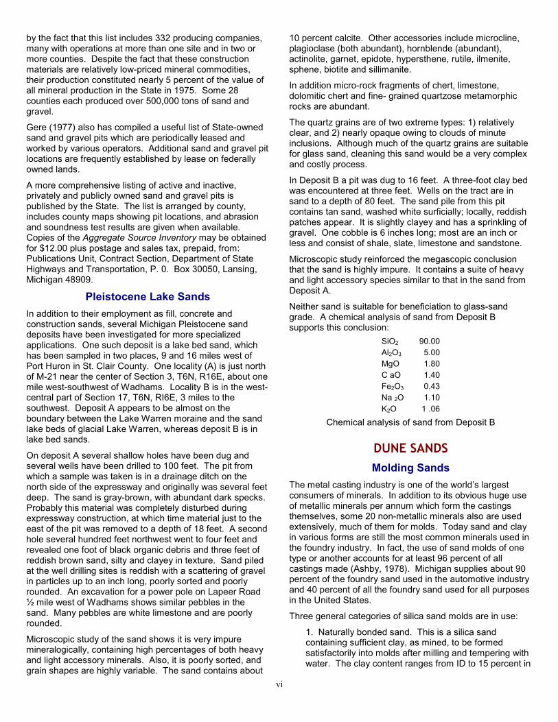
vi
by the fact that this list includes 332 producing companies,many with operations at more than one site and in two ormore counties. Despite the fact that these constructionmaterials are relatively low-priced mineral commodities,their production constituted nearly 5 percent of the value ofall mineral production in the State in 1975. Some 28counties each produced over 500,000 tons of sand andgravel.
Gere (1977) also has compiled a useful list of State-ownedsand and gravel pits which are periodically leased andworked by various operators. Additional sand and gravel pitlocations are frequently established by lease on federallyowned lands.
A more comprehensive listing of active and inactive,privately and publicly owned sand and gravel pits ispublished by the State. The list is arranged by county,includes county maps showing pit locations, and abrasionand soundness test results are given when available.Copies of the Aggregate Source Inventory may be obtainedfor $12.00 plus postage and sales tax, prepaid, from:Publications Unit, Contract Section, Department of StateHighways and Transportation, P. 0. Box 30050, Lansing,Michigan 48909.
Pleistocene Lake SandsIn addition to their employment as fill, concrete andconstruction sands, several Michigan Pleistocene sanddeposits have been investigated for more specializedapplications. One such deposit is a lake bed sand, whichhas been sampled in two places, 9 and 16 miles west ofPort Huron in St. Clair County. One locality (A) is just northof M-21 near the center of Section 3, T6N, R16E, about onemile west-southwest of Wadhams. Locality B is in the west-central part of Section 17, T6N, RI6E, 3 miles to thesouthwest. Deposit A appears to be almost on theboundary between the Lake Warren moraine and the sandlake beds of glacial Lake Warren, whereas deposit B is inlake bed sands.
On deposit A several shallow holes have been dug andseveral wells have been drilled to 100 feet. The pit fromwhich a sample was taken is in a drainage ditch on thenorth side of the expressway and originally was several feetdeep. The sand is gray-brown, with abundant dark specks.Probably this material was completely disturbed duringexpressway construction, at which time material just to theeast of the pit was removed to a depth of 18 feet. A secondhole several hundred feet northwest went to four feet andrevealed one foot of black organic debris and three feet ofreddish brown sand, silty and clayey in texture. Sand piledat the well drilling sites is reddish with a scattering of gravelin particles up to an inch long, poorly sorted and poorlyrounded. An excavation for a power pole on Lapeer Road½ mile west of Wadhams shows similar pebbles in thesand. Many pebbles are white limestone and are poorlyrounded.
Microscopic study of the sand shows it is very impuremineralogically, containing high percentages of both heavyand light accessory minerals. Also, it is poorly sorted, andgrain shapes are highly variable. The sand contains about
10 percent calcite. Other accessories include microcline,plagioclase (both abundant), hornblende (abundant),actinolite, garnet, epidote, hypersthene, rutile, ilmenite,sphene, biotite and sillimanite.
In addition micro-rock fragments of chert, limestone,dolomitic chert and fine- grained quartzose metamorphicrocks are abundant.
The quartz grains are of two extreme types: 1) relativelyclear, and 2) nearly opaque owing to clouds of minuteinclusions. Although much of the quartz grains are suitablefor glass sand, cleaning this sand would be a very complexand costly process.
In Deposit B a pit was dug to 16 feet. A three-foot clay bedwas encountered at three feet. Wells on the tract are insand to a depth of 80 feet. The sand pile from this pitcontains tan sand, washed white surficially; locally, reddishpatches appear. It is slightly clayey and has a sprinkling ofgravel. One cobble is 6 inches long; most are an inch orless and consist of shale, slate, limestone and sandstone.
Microscopic study reinforced the megascopic conclusionthat the sand is highly impure. It contains a suite of heavyand light accessory species similar to that in the sand fromDeposit A.
Neither sand is suitable for beneficiation to glass-sandgrade. A chemical analysis of sand from Deposit Bsupports this conclusion:
SiO2 90.00Al2O3 5.00MgO 1.80C aO 1.40Fe2O3 0.43Na 2O 1.10K2O 1 .06
Chemical analysis of sand from Deposit B
DUNE SANDSMolding Sands
The metal casting industry is one of the world’s largestconsumers of minerals. In addition to its obvious huge useof metallic minerals per annum which form the castingsthemselves, some 20 non-metallic minerals also are usedextensively, much of them for molds. Today sand and clayin various forms are still the most common minerals used inthe foundry industry. In fact, the use of sand molds of onetype or another accounts for at least 96 percent of allcastings made (Ashby, 1978). Michigan supplies about 90percent of the foundry sand used in the automotive industryand 40 percent of all the foundry sand used for all purposesin the United States.
Three general categories of silica sand molds are in use:
1. Naturally bonded sand. This is a silica sandcontaining sufficient clay, as mined, to be formedsatisfactorily into molds after milling and tempering withwater. The clay content ranges from ID to 15 percent in

vi
finer grained sands to 20 to 25 percent in coarsergrained ones. Generally these naturally bonded sandsare relatively low in silica, containing relatively highamounts of Fe2O3 , Al2O3, CaO and alkalies, in the formof feldspar and other accessory species. Such sandshave fusion points as low as 13000C. Thischaracteristic renders them unusable in the casting ofsteel, which is cast at ~ 16500C. However, they aresuitable for most types of iron and non-ferrousapplications. The use of naturally bonded sand hasbeen decreasing.
2. ‘‘Synthetic green sand”. This is a high-silica sand towhich a clay such as bentonite is admixed.
3. Chemically bonded sand. These are sands that arebonded in several ways: a) by sodium silicate hardenedby passing C02 gas through the mold; b) by sodiumsilicate with organic esters used as a hardening agent;and c) by several different types of resin binders andtheir catalyst systems.
Naturally bonded sand is usually recycled. Chemicallybonded sands formerly were used only once; but todaymuch of the resin-bonded sand is reclaimed. Reclamationof sodium-silicate sands is more expensive. In general theuse of both “synthetic green sand” and chemically bondedsands in place of naturally clay-bonded sands leads to avery large increase in the quantities of high-silica sand usedby the foundry industry. In turn, increasing costs oftransporting waste, difficulties in finding suitable waste-dumping sites, increasing cost of high-silica sand andenvironmental control regulations governing the discard ofphenol-impregnated sands all have led to an increase insand reclamation and recycling (Ashby, 1978).
In the United States the foundry industry utilizes two generaltypes of sands, classified as (Edwards and Rose, 1974): 1)Lake and Bank sands and 2) silica sands. The Lake andBank sands contain 92 to 94 percent SiO2 whereas silicasand has in excess of 98.5 percent SiO2 , usually washed toupgrade it to 99.5 percent or more SiO2. Included in theLake and Bank sands are some river sands that are usedchiefly for construction purposes.
The foundry industry produces three types of castings:
1. Gray iron foundries. The gray iron castings’largest market is the automotive industry in Ohio,Northern Kentucky, Indiana, Illinois and Michigan.These castings are poured at temperatures rangingfrom 24000 to 27000F. Silica sands or Lake and BankSands will satisfy the requirements for gray ironcastings. From 2.5 to 3 million tons per year of sandare shipped from the State of Michigan for gray ironcastings by the Lake and Bank sand producers.
2. Steel castings. Steel castings are used in theheavy construction industry, railroad equipment, powerequipment, mining equipment and other equipmentrequiring high- strength castings. These industries arelocated in the East, Midwest, and on the West Coast.Steel castings are poured at 27500 to 30000F. Silicasands are used for steel castings because of their
chemical purity, which enables them to better withstandthe high thermal shock. Silica sands also are desirablebecause of the higher reclamation factor.
3. Non-ferrous castings. Non-ferrous castings arebronze and aluminum castings, poured at 12000 to20000F. This industry can use either silica sands orLake and Bank sands or combinations of the two.
The term “Lake sand” applies to sand either dredged fromLake Michigan or dug from dunes bordering that lake chieflyin Michigan and Indiana, and has become a standard for theindustry. It is a curious coincidence that Michigan hasproduced two world-national “Lake” standard mineralproducts. In the early history of mining native copper on theKeweenaw Peninsula, Michigan copper metal was referredto as “Lake (Superior) copper” against which syntheticallyproduced copper metal was compared. “Bank sand” isquartz sand with up to 5 percent clay (Wilborg, 1975).
In addition to bulk chemical and mineralogicalcharacteristics, the physical characteristics of moldingsands are also important. The interrelationships of grainproperties and molding sand quality have been summarizedby Edwards and Rose (1974, p. 7-8):
The physical characteristics of sands are important tofoundrymen because the shape of the sand grain relates toits surface area. Sands are divided into the following fourgeneral shapes: 1) angular, 2) sub-angular, 3) rounded, 4)compounded.
Subangular and rounded sands are generally preferred byfoundries. The amount of surface area for any particularmesh size is increased progressively when comparingrounded, subangular, and angular sands. Thus, roundedgrain sands require the least amount of binder. However,angular sands have a certain unique characteristic and thatis, they appear to have the best thermal shock resistancedue to their packing characteristics and their interlockingstrength.
Packing characteristics of sands are as follows: 1) roundedgrain: highest density packing characteristics;
2) subangular: moderate density packing characteristics; 3)angular: least density packing characteristics, but maximuminterlocking. The so-called compounded sand grain is theleast desirable sand grain because during the mixingprocess when the binder is being applied to the sand grains,the compound grains will separate from each other andmake the bonding characteristics more difficult. Also at hightemperatures these same grains will fracture or separatethemselves thus creating fines within the foundry sandsystem, which is undesirable.
Surface area figures covering the various foundry sandsmined throughout the United States and used by thefoundries are given. The surface area figures wereobtained by using the 50 mesh sieve fraction, that is -40 +50 sand and this was done for uniformity as well as the factthat most foundries purchase a sand containing the 50mesh sieve fraction.
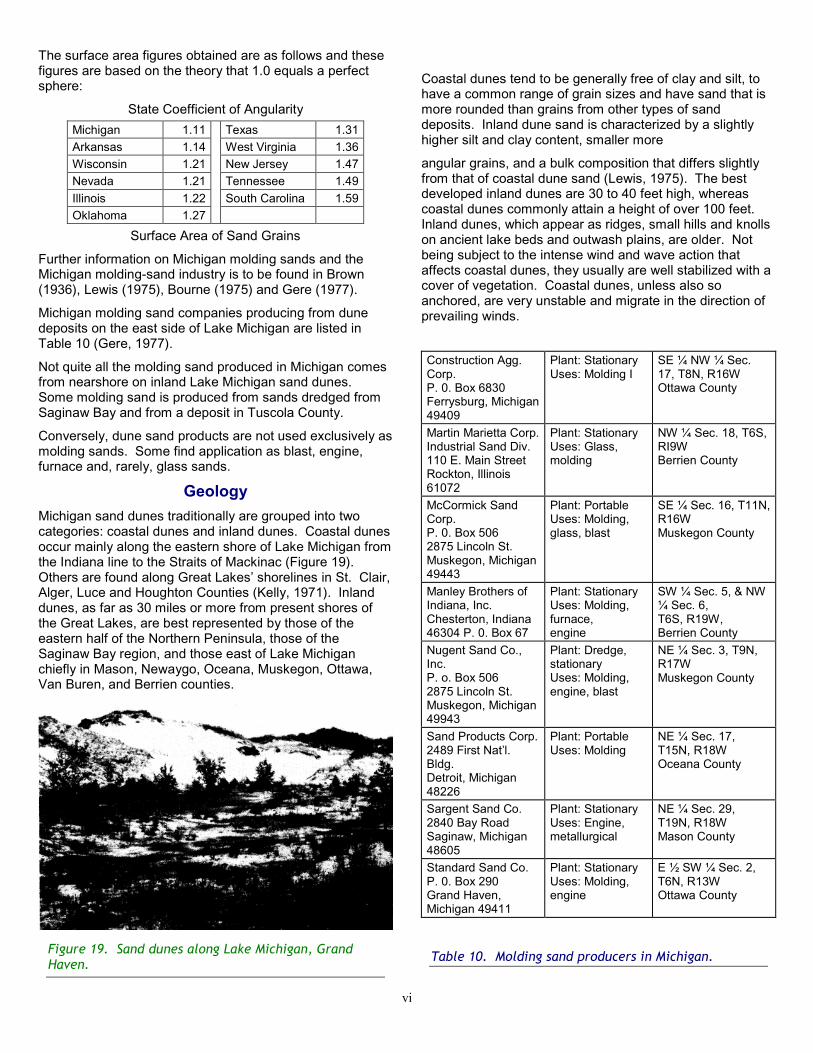
vi
The surface area figures obtained are as follows and thesefigures are based on the theory that 1.0 equals a perfectsphere:
State Coefficient of AngularityMichigan 1.11 Texas 1.31Arkansas 1.14 West Virginia 1.36Wisconsin 1.21 New Jersey 1.47Nevada 1.21 Tennessee 1.49Illinois 1.22 South Carolina 1.59Oklahoma 1.27
.
Surface Area of Sand Grains
Further information on Michigan molding sands and theMichigan molding-sand industry is to be found in Brown(1936), Lewis (1975), Bourne (1975) and Gere (1977).
Michigan molding sand companies producing from dunedeposits on the east side of Lake Michigan are listed inTable 10 (Gere, 1977).
Not quite all the molding sand produced in Michigan comesfrom nearshore on inland Lake Michigan sand dunes.Some molding sand is produced from sands dredged fromSaginaw Bay and from a deposit in Tuscola County.
Conversely, dune sand products are not used exclusively asmolding sands. Some find application as blast, engine,furnace and, rarely, glass sands.
GeologyMichigan sand dunes traditionally are grouped into twocategories: coastal dunes and inland dunes. Coastal dunesoccur mainly along the eastern shore of Lake Michigan fromthe Indiana line to the Straits of Mackinac (Figure 19).Others are found along Great Lakes’ shorelines in St. Clair,Alger, Luce and Houghton Counties (Kelly, 1971). Inlanddunes, as far as 30 miles or more from present shores ofthe Great Lakes, are best represented by those of theeastern half of the Northern Peninsula, those of theSaginaw Bay region, and those east of Lake Michiganchiefly in Mason, Newaygo, Oceana, Muskegon, Ottawa,Van Buren, and Berrien counties.
Figure 19. Sand dunes along Lake Michigan, GrandHaven.
Coastal dunes tend to be generally free of clay and silt, tohave a common range of grain sizes and have sand that ismore rounded than grains from other types of sanddeposits. Inland dune sand is characterized by a slightlyhigher silt and clay content, smaller more
angular grains, and a bulk composition that differs slightlyfrom that of coastal dune sand (Lewis, 1975). The bestdeveloped inland dunes are 30 to 40 feet high, whereascoastal dunes commonly attain a height of over 100 feet.Inland dunes, which appear as ridges, small hills and knollson ancient lake beds and outwash plains, are older. Notbeing subject to the intense wind and wave action thataffects coastal dunes, they usually are well stabilized with acover of vegetation. Coastal dunes, unless also soanchored, are very unstable and migrate in the direction ofprevailing winds.
Construction Agg.Corp.P. 0. Box 6830Ferrysburg, Michigan49409
Plant: StationaryUses: Molding I
SE ¼ NW ¼ Sec.17, T8N, R16WOttawa County
Martin Marietta Corp.Industrial Sand Div.110 E. Main StreetRockton, Illinois61072
Plant: StationaryUses: Glass,molding
NW ¼ Sec. 18, T6S,RI9WBerrien County
McCormick SandCorp.P. 0. Box 5062875 Lincoln St.Muskegon, Michigan49443
Plant: PortableUses: Molding,glass, blast
SE ¼ Sec. 16, T11N,R16WMuskegon County
Manley Brothers ofIndiana, Inc.Chesterton, Indiana46304 P. 0. Box 67
Plant: StationaryUses: Molding,furnace,engine
SW ¼ Sec. 5, & NW¼ Sec. 6,T6S, R19W,Berrien County
Nugent Sand Co.,Inc.P. o. Box 5062875 Lincoln St.Muskegon, Michigan49943
Plant: Dredge,stationaryUses: Molding,engine, blast
NE ¼ Sec. 3, T9N,R17WMuskegon County
Sand Products Corp.2489 First Nat’l.Bldg.Detroit, Michigan48226
Plant: PortableUses: Molding
NE ¼ Sec. 17,T15N, R18WOceana County
Sargent Sand Co.2840 Bay RoadSaginaw, Michigan48605
Plant: StationaryUses: Engine,metallurgical
NE ¼ Sec. 29,T19N, R18WMason County
Standard Sand Co.P. 0. Box 290Grand Haven,Michigan 49411
Plant: StationaryUses: Molding,engine
E ½ SW ¼ Sec. 2,T6N, R13WOttawa County
Table 10. Molding sand producers in Michigan.

vi
A third type of deposit, the coastal sand strip, occurs alongall of Michigan’s Great Lakes shorelines. These low, wind-formed ridges border present shorelines and locally extendinland. The youngest type of wind deposit, they areconsidered by some geologists to represent embryonicdunes. They also are silt- and clay-free but usually containhigher percentages of carbonate as limestone and dolomiteparticles (Lewis, 1975).
Sand dunes along the shore of Lake Michigan came intoexistence as the result of interaction of four fundamentalfactors: 1) an adequate sand supply, 2) current and waveaction, 3) fluctuating lake water levels, and 4) strongonshore winds (Drexler, 1969).
Headlands, generally composed of unconsolidated glacialdrift, yield material to the lake via breaker erosion. Inaddition, material may also be obtained from older glaciallake beds and minor amounts are supplied by presentrivers. The present topography of the east shore of LakeMichigan was formed during deglaciation near the end ofthe Wisconsin glacial activity. This shore is considered tobe unique among those bordering the Great Lakes in that ithas a large number of morainic headlands, a factor in theabundance of dunes along this coast (Scott, 1942).
After loose sand particles enter the shore zone, currentstransport them along the coast away from the headlands.As currents lose velocity when passing into deeper water orinto bays that are protected from waves and wind, theydeposit part of their sand load. Thus beaches grow at theheads of bays, and spits or bars extend across the mouthsof bays. With a drop in water level, bars are exposed fordrying, wind erosion and redeposition.
A beach maintains itself in equilibrium as long as theamount of sand brought in at one end exactly equals theamount removed at the opposite by the same current. Ifexcessive sand is received, the beach either must growlakeward to form a terrace, or the extra sand migrates awayfrom the shore to form dunes. According to Scott (1942)and Olson (1958) the most important process that linksshoreline sand deposition with dune growth is continued,but slight fluctuations of the lake level. As summarized byDrexler (1969) the process operates as follows (p. 8):
Lakeward of any shore line for varying distances are long,linear sags and swells in the lake bottom parallel to theshore. Waves generate these undulations which are calledlow and ball structures. If the lake level along a shore dropsfairly rapidly, or so that the lows and balls are not destroyedby breaking waves, sand may begin accumulating on thelake side of the elevated ball structures just as on anelevated bar. If the former ball structure grows high enoughbefore lake level returns to normal, the beach will shift to thelake- ward side of this barrier. Dry sand from the newbeach now blows to the crest of this linear barrier wherevegetation fixes most of it. Once distinctly capped by windblown sand, and elevated accordingly the hump acquiresthe name foredune. This dune should continue to growvertically as a long linear ridge until the vegetation thatbinds the newly added sand dies. With the vegetationremoved, blow-out depressions soon pit the windward side
of the foredune with the wind-excavated sand collecting asa small, curved dune to the lee. One method of destroyinga vegetation cover would simply require that lake level riseuntil waves could attack the foredune’s base. Repeatedforedune development and destruction extend the smallblow-out dunes landward and increase their height andvolume. When large enough and properly curved, these arecalled parabolic dunes.
Because parabolic dunes do not migrate in the strict sense,their arms always remaining attached to source shore, onesof older age can be correlated with former, now elevatedbeach levels that once fed them sand (Tague, 1946).
Foredunes have two different bedding sets: 1) on thewindward side beds dip 100 to 200 toward the winddirection; 2) to the lee of the crest beds dip 150 to 250 away
from the effective winds. Dunes lying to the lee of theforedune crest retain the windward- dipping low-angle beds,but to the lee the beds are sand-avalanche layers dipping300 to 350 toward the lee. Parabolic dunes contain onlyavalanche bedding (Olson, 1958).
CompositionMajor impurities of dunes include: soil zones, marl and peatlenses, zones of buried vegetation, thin shale plates (“flysand’’), carbonate root pipes and fulgurites. Where youngerdunes migrate onto older ones, a fossil soil layer containingorganic debris and residual limonite-hematiteconcentrations separates the two.
Because the bulk of the parent material for the dunes wasglacially derived, the accessory mineral fraction of thedunes contains fresh feldspars and ferromagnesian speciesthat normally would have decayed under a non-glacialregime. The suite of accessory minerals recorded for LakeMichigan dune sands includes: orthoclase, microcline,tourmaline, garnet, zircon, hornblende, epidote, calcite,magnetite, ilmenite, and leucoxene. The feldspar content isusually several percent and Bourne (1975, p. 4) reports “ . .. that Lake Michigan dune sands [consist] of 80 percentquartz, 18 percent feldspar and 2 percent miscellaneous”,which doubtless represents a maximum. All the accessoryspecies save calcite undergo less thermal expansion thandoes quartz, and feldspars and the other accessoriesincrease the dimensional stability of the sand attemperatures at which the molds are filled by molten metal.
Chemical analyses for the significant elements resulted inthe following representative ranges, expressedpercentages:
Compound Percent Compound PercentSiO2 87 to 94 NaO2 0.30 to 0.61Al2O3 2.6 to 6.2 KO2 0.90 to 1.8Fe2O3 0.34 to 1.40 ZrO2 0.003 to 0.009TiO2 0.06 to 0.28 Cr2O3 0.004 to 0.07MgO 0.20 to 0.80 SO3 0.01 to 0.06CaO 0.5 to 3.0 Org. mat. 0.06 to 0.70

vi
The iron is chiefly in the iron oxides and mafic silicates.Magnetic removal, chiefly of ilmenite and lesser magnetite,can reduce the Fe2O3 content by 65 percent and also willbring down the alumina content by about one-third. Withoutflotation beneficiation however, dune sands, even aftermagnetic treatment, generally still contain too much Fe2O3to be used as a glass sand, even for amber glass.Schemes for mixing magnetically beneficiated dune sandwith equal amounts of Rock wood Sylvania sand for amberglass sand have been suggested. Although lake dunesands may well be beneficiatable to glass-sand gradechemically and their grain-size distributions also are suitablefor glass sand, it is unlikely that they will ever be used on alarge scale for glassmaking raw material, largely because ofthe preeminent position they occupy in the foundry sandindustry. The uniqueness of Lake sand is that it combinesthe requisite chemical composition and mineralogicalcomposition (quartz and feldspar) with a grain-sizedistribution that does not necessitate grading of the sand.The total of the fractions for the +70 and +100 mesh sizes isas high as nearly 90 percent and is reported to averageover 50 percent. Detailed grain-size analyses of typicalMichigan dune sands are presented by Lewis (1975, Table11).
FutureAccording to Bourne (1975), foundry sand operators ownless than 5 percent of the sand dune acreage along theshoreline of Lake Michigan. Private ownership is 66percent and public ownership 29 percent. A survey by theNational Industrial Sand Association indicated that thecompanies have an estimated 20 to 30 years reserves atthe present rate of mining. Because of the intensecompetition for lake shore acreage for residential andrecreational purposes, acquisition of additional reserves isdifficult and expensive. In addition it is anticipated that theproduction rate will rise 20 percent by 1980.
Ultimately these problems will lead to increased reclamationof used foundry sand and the substitution of sand from non-dune deposits, which will require more complex (andexpensive) preparation. One possibility is to explore foroffshore sand deposits within Lake Michigan itself. Recentstudies in western Lake Michigan off the Wisconsin shorehave indicated that combinations of geological andgeophysical techniques can be used successfully inprospecting for offshore sand and gravel deposits (Nebrijaet al., 1978).
LITERATURE CITED1. Alty, S. W., 1933, Report of an Investigation of Sylvania Rocks
in Oil Wells of the Michigan Basin, Mich. Acad. Sci. Paper18, p. 289-300.
2. Ashby, G., 1978, Minerals in the Foundry Industry, Indust.Minerals. 124, p. 29-45.
3. Babcock, L. L., 1973, Preliminary Investigation of a PotentialIndustrial Sand Deposit Near Dollar Bay, Michigan, Mich.Tech. Univ. Inst. Mineral Res. Project 17851, File Rpt. 2.
4. Bourne, H. L., 1975, Economic Importance of Michigan DuneSands, A.I.M.E., Soc. Mi Eng. 1975 Ann. Mtg., Salt LakeCity, Utah, preprint 75-H-331.
5. Briggs, L. I., 1959, Physical Stratigraphy of Lower MiddleDevonian Rocks in the Michigan Basin, Michigan BasinGeol. Soc. Ann. Geol. Excursion, p. 39-58.
6. Brown, G. G., 1936, Molding Sands of Michigan and Their Uses,Mich. Geol. Survey, Pub. 41, Geol. Ser. 35.
7. Carman, J. E., 1936, Sylvania Sandstone of Northwestern Ohio,Geol. Soc. Am., Bull. 47, p. 253-266.
8. Chritz, A. P., 1975, Construction of “Napoleon Sandstone” - HotMix Bituminous Pavements, Mich. Dept. State Highwaysand Transp., Bitum. Tech. Serv. Unit Report.
9. Del Greco, V. and E. Win. Heinrich, 1973, Petrology of theSylvania Sandstone at Rockwood, Michigan (abs.), Mich.Acad. Sci. Ann. Mtg. Program.
10. Dorr, J. A., Jr. and E. G. Kauffman, 1963, Rippled Toroids fromthe Napoleon Sandstone Member (Mississippian) ofSouthern Michigan, Jour. Sed. Petrol. 33, p. 751-758.
11. Drexler, C. W., 1969, Sand Dunes Along the East Shore ofLake Michigan: Their Composition, Structure and Texture, aReview of the Available Literature, Univ. Mich. M.S. Thesis.
12. Driscoll, E.G., Jr., 1961, Dimyarian Lamellibranchs of theMississippian Marshall Sandstone of Michigan, Univ. ofMich. Ph.D. Dissert.
13. Dyer, W. 5., 1929, Sylvania Sandstone Deposit atArnherstburg, Ontario Dept. Mines 38th Ann. Rept. 38 (Pt.IV), p. 41-46.
14. Edwards, P. K. and D. C. Rose, 1974, Geology, Mining, Millingand Marketing of Silica Sands for the Foundry Industry,A.I.M.E., Soc. Mi Eng. 1974 Ann. Mtg. Dallas, Texas, pre-print 74-H-45.
15. Ehlers, G. M., E. C. Stumm and R. V. Kesling, 1951, DevonianRocks of Southeastern Michigan and Northwestern Ohio,Geol. Soc. Am., Field Trip Guide, Nov. 1951.
16. Enyert, R. L., 1949, Middle Devonian Sandstones of theMichigan Basin, Univ. Mich. Ph.D. Dissert.
17. Gere, M. A., Jr., 1977, Michigan Mineral Producers, 1976,Mich. Geol. Surv., Ann. Direct. 10.
18. Grabau, A. W. and Sherzer, W. H., 1910, The MonroeFormation of Southern Michigan and Ad.joining Regions,Mich. Geol. Survey, Pub. 2, Geol. Ser. 1.
19. Hamblin, W. K., 1958, The Cembrian Sandstones of NorthernMichigan, Mich. Geol. Survey, Pub. 51.
20. Hatfield, C. B., T. J. Rohrbacher and J. C. Floyd, 1968,Directional Properties, Paleos lope, and Source of theSylvania Sandstone (Middle Dcvonian) of SoutheasternMichigan and Northwestern Ohio, Jour. Sed. Petrol. 38, p.224-228.
21. Hester, N. C., 1970, Sand and Gravel Resources ofSangczmon County, Illinois, Ill. Geol. Survey, Circ. 452.
22. Kelly, R. W., 1971, Geologic Sketch of Michigan Sand Dunes,Mich. Geol. Survey, Pamph. 5.
23. Kneller, W. A., 1964, A Geological and Economic Study ofGravel Deposits of Washtenaw County and Vicinity, Univ.Mich. Ph.D. Dissert.
24. Landes, K. K., 1951, Detroit River Group in the MichiganBasin, U.S. Geol. Survey Circ. 133.
25. Lane, A. C., 1900, Geological Report on Huron County,Michigan, Mich. Geol. Survey, Vol. 7, Pt. 2.
26. Lewis, J. D., 1975, Michigan’s Industrial Sand Resources,Mich. Geol. Survey, Circ. 11.

vi
27. Makens, J. C., J. P. Dobell and A. D. Kennedy, 1972, Studiesof Technical and Economic Aspects of an Expanded StoneIndustry in Michigan, Mich. Tech. Univ., Inst. Mineral Res.Final Rpt. Project MOEE-23.
28. McGregor, D. J., 1953, Stratigraphic Analyses of UpperDevonian and Mississippian Rocks in the Michigan Basin,Univ. Mich. Ph.D. Dissert.
29. McGregor, D. J., 1954, Stratigraphic Analysis of UpperDevonian and Mississippian Rocks in Michigan Basin,Amer. Assoc. Petrol. Geol., Bull. 38, p. 2324-2356.
30. Monnett, V. B., 1948, Mississippian Marshall Formation ofMichigan, Amer. Assoc. Petrol. Geol., Bull. 32, p. 629-688.31. Natress, T., 1910, The Contours of the SylvaniaSandrock and Related Strata in the Detroit River Area,Mich. Acad. Sci. Rept. 12, p. 47-50.
32. Nebrija, E. L., C. J. Welkie and R. P. Mayer, 1978, Offshoresand and Gravel Exploration in Western Lake Michigan(abs.), Inst. Lake Superior Geol. 24th Ann. Mtg. Programand Abs., p. 28.
33. Newberry, J. 5., 1871, Report on the Progress of theGeological Survey of Ohio in 1869, Ohio. Geol. Surv. Rept.Progress, Pt. 1, p. 3-53.
34. Olson, J. 5., 1958, Lake Michigan Dune Development 3) Lake-level, Beach and Dune Oscillation, Jour. Geol. 66, p. 473-483.
35. Parker, R. A., 1893, Upper Peninsula Resources, I n; Michiganand its Resources, Robt. Smith & Co., Lansing, Mich., p.61-86.
36. Poindexter, 0. F., H. M. Martin and S. G. Bergquist, 1939,Rocks and Minerals of Michigan, Mich. Geol. Surv. Pub. 42.
37. Poindexter, 0. F. and R. B. Newcombe, 1928, MineralResources of Michigan, Part II. Non-metallic Minerals, Mich.Geol. Survey, Pub. 37, Geol. Ser. 31, p. 131-134.
38. Reavely, G. H. and C. G. Winder, 1961, The SylvaniaSandstone in Southwestern Ontario, Can. Mm. Metal. Bull.54, p. 139-142.
39. Scott, I. D., 1942, The Dunes of Lake Michigan and CorrelatedProblems, Mich. Acad. Sci. Rept. 44, p. 53-61.
40. Sherzer, W. H., 1900, Geological Report on Monroe County,Michigan, Mich. Geol. Survey Vol. 7, Pt. 1.
41. Smith, R. A., 1914, Non-metallic Minerals, In; MineralResources of Michigan, R. C. Allen (Comp.), Mich. Geol.Survey, Pub. 16, Geol. Ser. 13, p. 88-89.
42. Squire, G. R., 1972, A Field Guide to the Geo logy ofSouthwestern Michigan, West. Mich. Univ., Dept. Geol.Pub. ES-l.
43. Stearns, M. D., 1933, The Petrology of the Marshall Formationof Michigan, Jour. Sed. Petrol. 3, p. 99-112.
44. Stearns, M. D. and C. W. Cook, 1932, A Fetrographic Study ofthe Marshall Formation and its Relation to the Sand of theMichigan Series Formation, Mich. Acad. Sci., Papers 16, p.429 437.
45. Summerson, C. H. and Swann, D. H., 1970, Patterns ofDevonian Sand on the North American Cra ton and TheirInterpretation, Geol. Soc. Am., Bull. 81, p. 469-490.
46. Tague, G. C. 1946, The Post-glacial Geology of the GrandMarais Embayment in Berrien County, Michigan, Mich.Geol. Survey, Pub. 45, Geol. Ser. 38, Pt. 1.
47. Taylor, W. H., 1840, In; Report of the State Geologist Relativeto the Improvement of State Salt Springs, Mich. Geol.Survey, Rept. State Geol. Mich. Leg. H. R. Doc. 2.
48. Thomas, W. A., 1931, A Study of the Marshall Formation inMichigan, Mich. Acad. Sci., Papers 14, p. 487-498.
49. Wilborg, H. E., 1975, Foundry Sand, In; Industrial Minerals andRocks, 4th ed., edited by S. J. Lefond, p. 263- 270, AIMME,Inc.: New York.
50. Winchell, A., 1861, First Biennial Report of the Progress of theGeological SurveW of Michigan Embracing Observations onthe Geology, Zoology and Botany of the Lower Peninsula,Mich. Geol. Surv. 1st Bien. Rept. Prog.
Information contained inside the cover of original work
STATE OF MICHIGANWilliam G. Milliken, Governor
DEPARTMENT OF NATURAL RESOURCESHoward A. Tanner, Director
GEOLOGICAL SURVEY DIVISIONArthur E. Slaughter, Chief
and State GeologistNATURAL RESOURCES COMMISSION
Hilary F. Snell, Chairnrzn, Grand Rapids, 1971E. M. Laitala, Hancock, 1961
(Mrs.) Joan L. Wolfe, Belmont, 1973Harry H. Whiteley, Rogers City, 1961
Carl T. Johnson, Cadillac, 1963Charles G. Younglove, Allen Park, 1972John M. Robertson, Executive Assistant
Published by authority of State of Michigan CL ‘70 s.321.6 Printedby Reproduction Services Section, Office Services Division,
Department of Management and BudgetAvailable from the Information Services Center, Michigan
Department of Natural Resources, Box 30028, Lansing, Michigan48909
On deposit in public libraries, state libraries, anduniversity libraries in Michigan and other selected localities.
- - - - - // - - - - -