EAST COAST OF SOUTH AMERICA - Maritime Safety …
337
PUB. (ENROUTE) SAILING DIRECTIONS ★ ★ 2017 124 EAST COAST OF SOUTH AMERICA Prepared and published by the NATIONAL GEOSPATIAL-INTELLIGENCE AGENCY Springfield, Virginia © COPYRIGHT 2017 BY THE UNITED STATES GOVERNMENT NO COPYRIGHT CLAIMED UNDER TITLE 17 U.S.C. FIFTEENTH EDITION For sale by the Superintendent of Documents, U.S. Government Printing Office Internet: http://bookstore.gpo.gov Phone: toll free (866) 512-1800; DC area (202) 512- 1800 Fax: (202) 512-2250 Mail Stop: SSOP, Washington, DC 20402-0001
Transcript of EAST COAST OF SOUTH AMERICA - Maritime Safety …

PUB.
(ENROUTE)SAILING DIRECTIONS
★
★
2017
124
EAST COAST OF SOUTH AMERICA
Prepared and published by theNATIONAL GEOSPATIAL-INTELLIGENCE AGENCY
Springfield, Virginia
© COPYRIGHT 2017 BY THE UNITED STATES GOVERNMENTNO COPYRIGHT CLAIMED UNDER TITLE 17 U.S.C.
FIFTEENTH EDITION
For sale by the Superintendent of Documents, U.S. Government Printing Office
Internet: http://bookstore.gpo.gov Phone: toll free (866) 512-1800; DC area (202) 512-
1800Fax: (202) 512-2250 Mail Stop: SSOP, Washington, DC 20402-0001

III
Pub. 124
Preface
0.0 Pub. 124, Sailing Directions (Enroute) East Coast of SouthAmerica, Fifteenth Edition, 2017, is issued for use in conjunc-tion with Pub. 160, Sailing Directions (Planning Guide) SouthAtlantic Ocean and Indian Ocean. The companion volume isPub. 124.0.0 Digital Nautical Charts 1, 7, and 14 provide electronic chartcoverage for the area covered by this publication. 0.0 This publication has been corrected to 28 January 2017, in-cluding Notice to Mariners No. 4 of 2017. Subsequent updateshave corrected this publication to 10 April 2021, including No-tice to Mariners No. 15 of 2021.
Explanatory Remarks
0.0 Sailing Directions are published by the National Geospatial-Intelligence Agency (NGA) under the authority of Departmentof Defense Directive 5105.60, dated 29 July 2009, and pursu-ant to the authority contained in U. S. Code Title 10, Chapter22, Section 451 and Title 44, Section 1336. Sailing Directions,covering the harbors, coasts, and waters of the world, provideinformation that cannot be shown graphically on nauticalcharts and is not readily available elsewhere.0.0 Sailing Directions (Enroute) include detailed coastal andport approach information which supplements the largest scalechart produced by the National Geospatial-IntelligenceAgency. This publication is divided into geographic areascalled “Sectors.”0.0 Bearings.—Bearings are true, and are expressed in degreesfrom 000° (north) to 360°, measured clockwise. Generalbearings are expressed by the initial letters of the points of thecompass (e.g. N, NNE, NE, etc.). Adjective and adverbendings have been discarded. Wherever precise bearings areintended, degrees are used.0.0 Charts.—Reference to charts made throughout thispublication refer to both the paper chart and the DigitalNautical Chart (DNC). 0.0 Corrective Information.—Users should refer corrections,additions, and comments to NGA’s Maritime Operations Desk,as follows:
0.0 New editions of Sailing Directions are corrected through thedate of publication shown above. This publication is updated asneeded and made available as a downloadable correctedpublication on the NGA Maritime Safety Office web site.
0.0 Courses.—Courses are true, and are expressed in the samemanner as bearings. The directives “steer” and “make good” acourse mean, without exception, to proceed from a point oforigin along a track having the identical meridional angle asthe designated course. Vessels following the directives mustallow for every influence tending to cause deviation from suchtrack, and navigate so that the designated course iscontinuously being made good.0.0 Currents.—Current directions are the true directions towardwhich currents set.0.0 Distances.—Distances are expressed in nautical miles of 1minute of latitude. Distances of less than 1 mile are expressedin meters, or tenths of miles.0.0 Geographic Names.—Geographic names are generallythose used by the nation having sovereignty. Names inparentheses following another name are alternate names thatmay appear on some charts. In general, alternate names arequoted only in the principal description of the place. Diacriticalmarks, such as accents, cedillas, and circumflexes, which arerelated to specific letters in certain foreign languages, are notused in the interest of typographical simplicity.0.0 Geographic names or their spellings do not necessarilyreflect recognition of the political status of an area by theUnited States Government.0.0 Heights.—Heights are referred to the plane of referenceused for that purpose on the charts and are expressed in meters.0.0 Internet Links.—This publication provides Internet links toweb sites concerned with maritime navigational safety,including but not limited to, Federal government sites, foreignHydrographic Offices, and foreign public/private port facilities.
NGA Maritime—Contact Information
Maritime Operations Desk
Toll free 1-800-362-6289
Commercial 571-557-5455
DSN 547-5455
E-mail [email protected]
Maritime Safety Office
Commercial 571-5575409
DSN 547-5409
DNC web site https://dnc.nga.mil
Maritime Domain web site
https://msi.nga.mil
E-mail [email protected]
Maritime Quality Feedback System (MQFS)
https://marhelp.nga.mil
Mailing address Maritime Safety OfficeNational Geospatial-Intelligence AgencyMail Stop N64-SFH7500 Geoint DriveSpringfield VA 22150-7500
NGA Maritime Safety Office Web Site
https://msi.nga.mil
NGA Maritime—Contact Information

IV
Pub. 124
NGA makes no claims, promises, or guarantees concerning theaccuracy, completeness, or adequacy of the contents of theseweb sites and expressly disclaims any liability for errors andomissions in the contents of these web sites.0.0 International Ship and Port Facility Security (ISPS)Code.—The ISPS Code is a comprehensive set of measures toenhance the security of ships and port facilities developed inresponse to the perceived threats to ships and port facilities inthe wake of the 9/11 attacks in the United States. Informationon the ISPS Code can be found at the International MaritimeOrganization web site:
0.0 Lights and Fog Signals.—Lights and fog signals are notdescribed, and light sectors are not usually defined. The LightLists should be consulted for complete information.0.0 National Ocean Claims.—Information on national oceanclaims and maritime boundary disputes, which have been com-piled from the best available sources, is provided solely in theinterest of the navigational safety of shipping and in no wayconstitutes legal recognition by the United States. These non-recognized claims and requirements may include, but are notlimited to:
1. A requirement by a state for advance permission ornotification for innocent passage of warships in the territorialsea.
2. Straight baseline, internal waters, or historic watersclaims.
3. The establishment of a security zone, where a stateclaims to control activity beyond its territorial sea forsecurity reasons unrelated to that state’s police powers in itsterritory, including its territorial sea.
0.0 Radio Navigational Aids.—Radio navigational aids andradio weather services are not described in detail. PublicationNo. 117 Radio Navigational Aids and NOAA Publication,Selected Worldwide Marine Weather Broadcasts, should beconsulted.0.0 Soundings.—Soundings are referred to the datum of thecharts and are expressed in meters. 0.0 Telephone and Facsimile Numbers.—Within this publica-tion, the international telephone and facsimile numbers provid-ed as contact information contain the minimum digitsnecessary to dial. Please note that these contact numbers do notinclude additional digits or special characters, such as (0) or(+), which may be required when dialing. The necessity ofsuch digits and characters depend upon numerous factors andconditions, such as the user’s geolocation and service provider.Mariners are advised to consult their communications equip-ment and service provider manuals for guidance.
0.0 Time.—Time is normally expressed as local time unlessspecifically designated as Universal Coordinated Time (UTC). 0.0 Time Zone.—The Time Zone description(s), as well asinformation concerning the use of Daylight Savings Time, areincluded. The World Time Zone Chart is available on the Inter-net at the web site given below.
0.0 U.S. Maritime Advisory System.—The U.S. MaritimeAdvisory System is a streamlined inter-agency approach toidentifying and promulgating maritime security threats. Thesystem replaces Special Warnings to Mariners (StateDepartment), MARAD Advisories (Maritime Administration),and Marine Safety Information Bulletins (U.S. Coast Guard)and consists of the following items:
1. U.S. Maritime Alert—Provides basic information(location, incident, type, date/time) on reported maritimesecurity threats to U.S. maritime industry interests. U.S.Maritime alerts do not contain policy or recommendationsfor specific courses of information.
2. U.S. Maritime Advisory—Provides more detailedinformation, when appropriate, through a “whole-of-government” response to an identified maritime threat.
0.0 Winds.—Wind directions are the true directions from whichwinds blow.
Reference List
0.0 The principal sources examined in the preparation of thispublication were:0.0 British Hydrographic Department Sailing Directions.0.0 Argentina Sailing Directions.0.0 Brazil Sailing Directions.0.0 Various port handbooks. 0.0 Reports from United States Naval and merchant vessels andvarious shipping companies.0.0 Other U.S. Government publications, reports, and docu-ments.0.0 Charts, light lists, tide and current tables, and other docu-ments in possession of the Agency.
International Maritime Organization Home Page
http://www.imo.org
Standard Time Zone of the World Chart
https://www.cia.gov/library/publications/the-world-factbook/graphics/ref_maps/physical/pdf/
standard_time_zones_of_the_world.pdf
Maritime Administration (MARAD)—U.S. Maritime Advisory System
https://www.marad.dot.gov/environment-and-safety/office-of-security/msci
Date of Change: 10 April 2021
Notice to Mariners: 15/2021
Sector Paragraphs
Sector 1 Paragraphs 1.17 and 1.67

V
Pub. 124
Sector 2 Paragraph 2.23
Sector 4 Paragraphs 4.11, 4.14. 4.18 and 4.22
Sector 5 Paragraph 5.18
Sector 7 Paragraphs 7.12 and 7.15
Date of Change: 26 December 2020
Notice to Mariners: 52/2020
Sector Paragraphs
Sector 4 Paragraphs 4.6, 4.36, 4.41, 4.48, 4.51, and 4.72
Sector 5 Paragraphs 5.18, 5.34, and 5.36
Sector 6 Paragraphs 6.14 and 6.16
Sector 10 Paragraph 10.11
Date of Change: 25 July 2020
Notice to Mariners: 30/2020
Sector Paragraphs
Sector 1 Paragraphs 1.8, 1.9, 1.14, 1.15, 1.18, 1.20, 1.21, 1.29, 1.33, 1.48, 1.54, 1.61, 1.62, 1.63, and 1.65
Sector 2 Paragraphs 2.11, 2.23, 2.25, 2.29, 2.33, 2.38, 2.48, 2.50, 2.55, and 2.58
Sector 3 Paragraphs 3.3, 3.4, 3.5, 3.6, 3.13, 3.34, 3.35, 3.40, 3.41, 3.44, 3.53, and 3.59
Sector 4 Paragraphs 4.3, 4.5, 4.6, 4.9, 4.14, 4.20, 4.31, 4.71, and 4.73.
Sector 5 Paragraph 5.39
Sector 10 Paragraph 10.11
Date of Change: 5 October 2019
Notice to Mariners: 40/2019
Sector Paragraphs
Sector 1 Paragraph 1.6
Sector 3 Paragraph 3.6
Sector 4 Paragraph 4.5
Sector 5 Paragraphs 5.17, 5.18, 5.33, and 5.36
Date of Change: 13 April 2019
Notice to Mariners: 15/2019
Sector Paragraphs
Sector 1 Paragraphs 1.7, 1.8, 1.9, 1.11, 1.14, 1.15, 1.17, 1.20, 1.24, 1.26, 1.27, 1.30, 1.32, 1.40, 1.46, 1.47, 1.48, 1.49, 1.53, 1.59, 1.60, 1.61, 1.63, 1.64, 1.65, and 1.67
Sector 2 Paragraphs 2.9, 2.11, 2.23, 2.46, 2.48, and 2.50
Sector 3 Paragraphs 3.3 and 3.6
Sector 4 Paragraph 4.3
Sector 5 Paragraphs 5.1, 5.4, and 5.18
Date of Change: 10 April 2021
Notice to Mariners: 15/2021
Sector Paragraphs

VI Pub. 124
Date of Change: 7 July 2018
Notice to Mariners: 27/2018
Sector Paragraphs
Sector 2 Paragraph 2.58
Sector 3 Paragraphs 3.35, 3.36, 3.40, 3.41, and 3.49
Sector 4 Paragraphs 4.5, 4.14, 4.42, 4.43, 4.51, and 4.72
Sector 5 Paragraphs 5.18, 5.50, 5.52, and 5.58
Sector 6 Paragraphs 6.10, 6.11, 6.13, and 6.16
Date of Change: 7 April 2018
Notice to Mariners: 14/2018
Sector Paragraphs
Sector 8 Paragraph 8.1
Date of Change: 3 June 2017
Notice to Mariners: 22/2017
Sector Paragraphs
Sector 3 Paragraph 3.48
Sector 4 Paragraphs 4.36 and 4.51
Sector 5 Paragraph 5.18
Sector 6 Paragraphs 6.4 and 6.10
Sector 7 Paragraphs 7.4 and 7.15
Sector 9 Paragraphs 9.6 and 9.31
Sector 10 Paragraph 10.11

Pub. 124 VII
0.0SECTOR LIMITS — PUB. 124

VIII Pub. 124
Conversion Tables
Feet to MetersFeet 0 1 2 3 4 5 6 7 8 9 0 0.00 0.30 0.61 0.91 1.22 1.52 1.83 2.13 2.44 2.74 10 3.05 3.35 3.66 3.96 4.27 4.57 4.88 5.18 5.49 5.79 20 6.10 6.40 6.71 7.01 7.32 7.62 7.92 8.23 8.53 8.84 30 9.14 9.45 9.75 10.06 10.36 10.67 10.97 11.28 11.58 11.89 40 12.19 12.50 12.80 13.11 13.41 13.72 14.02 14.33 14.63 14.93 50 15.24 15.54 15.85 16.15 16.46 16.76 17.07 17.37 17.68 17.98 60 18.29 18.59 18.90 19.20 19.51 19.81 20.12 20.42 20.73 21.03 70 21.34 21.64 21.95 22.25 22.55 22.86 23.16 23.47 23.77 24.08 80 24.38 24.69 24.99 25.30 25.60 25.91 26.21 26.52 26.82 27.13 90 27.43 27.74 28.04 28.35 28.65 28.96 29.26 29.57 29.87 30.17
Fathoms to MetersFathoms 0 1 2 3 4 5 6 7 8 9
0 0.00 1.83 3.66 5.49 7.32 9.14 10.97 12.80 14.63 16.46 10 18.29 20.12 21.95 23.77 25.60 27.43 29.26 31.09 32.92 34.75 20 36.58 38.40 40.23 42.06 43.89 45.72 47.55 49.38 51.21 53.03 30 54.86 56.69 58.52 60.35 62.18 64.01 65.84 67.67 69.49 71.32 40 73.15 74.98 76.81 78.64 80.47 82.30 84.12 85.95 87.78 89.61 50 91.44 93.27 95.10 96.93 98.75 100.58 102.41 104.24 106.07 107.90 60 109.73 111.56 113.39 115.21 117.04 118.87 120.70 122.53 124.36 126.19 70 128.02 129.85 131.67 133.50 135.33 137.16 138.99 140.82 142.65 144.47 80 146.30 148.13 149.96 151.79 153.62 155.45 157.28 159.11 160.93 162.76 90 164.59 166.42 168.25 170.08 171.91 173.74 175.56 177.39 179.22 181.05
Meters to FeetMeters 0 1 2 3 4 5 6 7 8 9
0 0.00 3.28 6.56 9.84 13.12 16.40 19.68 22.97 26.25 29.53 10 32.81 36.09 39.37 42.65 45.93 49.21 52.49 55.77 59.06 62.34 20 65.62 68.90 72.18 75.46 78.74 82.02 85.30 88.58 91.86 95.14 30 98.42 101.71 104.99 108.27 111.55 114.83 118.11 121.39 124.67 127.95 40 131.23 134.51 137.80 141.08 144.36 147.64 150.92 154.20 157.48 160.76 50 164.04 167.32 170.60 173.88 177.16 180.45 183.73 187.01 190.29 193.57 60 196.85 200.13 203.41 206.69 209.97 213.25 216.54 219.82 223.10 226.38 70 229.66 232.94 236.22 239.50 242.78 246.06 249.34 252.62 255.90 259.19 80 262.47 265.75 269.03 272.31 275.59 278.87 282.15 285.43 288.71 291.99 90 295.28 298.56 301.84 305.12 308.40 311.68 314.96 318.24 321.52 324.80
Meters to FathomsMeters 0 1 2 3 4 5 6 7 8 9
0 0.00 0.55 1.09 1.64 2.19 2.73 3.28 3.83 4.37 4.92 10 5.47 6.01 6.56 7.11 7.66 8.20 8.75 9.30 9.84 10.39 20 10.94 11.48 12.03 12.58 13.12 13.67 14.22 14.76 15.31 15.86 30 16.40 16.95 17.50 18.04 18.59 19.14 19.68 20.23 20.78 21.33 40 21.87 22.42 22.97 23.51 24.06 24.61 25.15 25.70 26.25 26.79 50 27.34 27.89 28.43 28.98 29.53 30.07 30.62 31.17 31.71 32.26 60 32.81 33.36 33.90 34.45 35.00 35.54 36.09 36.64 37.18 37.73 70 38.28 38.82 39.37 39.92 40.46 41.01 41.56 42.10 42.65 43.20 80 43.74 44.29 44.84 45.38 45.93 46.48 47.03 47.57 48.12 48.67 90 49.21 49.76 50.31 50.85 51.40 51.95 52.49 53.04 53.59 54.13

Pub. 124 IX
Abbreviations
The following abbreviations may be used in the text:
Units°C degree(s) Centigrade km kilometer(s)cm centimeter(s) m meter(s)cu.m. cubic meter(s) mb millibarsdwt deadweight tons MHz megahertzFEU forty-foot equivalent units mm millimeter(s)gt gross tons nt net tonskHz kilohertz TEU twenty-foot equivalent units
DirectionsN north S southNNE northnortheast SSW southsouthwestNE northeast SW southwestENE eastnortheast WSW westsouthwestE east W westESE eastsoutheast WNW westnorthwestSE southeast NW northwestSSE southsoutheast NNW northnorthwest
Vessel typesLASH Lighter Aboard Ship Ro-ro Roll-on Roll-offLNG Liquified Natural Gas ULCC Ultra Large Crude CarrierLPG Liquified Petroleum Gas VLCC Very Large Crude CarrierOBO Ore/Bulk/Oil VLOC Very Large Ore CarrierLo-lo Lift-on Lift-off FSO Floating Storage and Offloading NGL Natural Gas Liquids FSU Floating Storage Unit
FSRU Floating Storage and Regasification Unit FPSOFloating Production Storage and Offloading
TimeETA estimated time of arrival GMT Greenwich Mean TimeETD estimated time of departure UTC Coordinated Universal Time
Water levelMSL mean sea level LWS low water springsHW high water MHWN mean high water neapsLW low water MHWS mean high water springsMHW mean high water MLWN mean low water neapsMLW mean low water MLWS mean low water springsHWN high water neaps TFW Tropical Fresh WaterHWS high water springs HAT highest astronomical tideLWN low water neaps LAT lowest astronomical tide
CommunicationsD/F direction finder MF medium frequencyR/T radiotelephone HF high frequencyGMDSS Global Maritime Distress and Safety System VHF very high frequencyLF low frequency UHF ultra high frequency
NavigationLANBY Large Automatic Navigation Buoy SBM Single Buoy MooringNAVSAT Navigation Satellite SPM Single Point MooringODAS Ocean Data Acquisition System TSS Traffic Separation SchemeCBM Conventional Buoy Mooring System VTC Vessel Traffic CenterMBM Multi-Buoy Mooring System VTS Vessel Traffic ServiceCALM Catenary Anchor Leg Mooring

X
Pub. 124
Miscellaneous
AIS Automatic Identification System MMSIMaritime Mobile Service Identity Code
COLREGS Collision Regulations No./Nos. Number/Numbers
IALAInternational Association of LighthouseAuthorities
PAPD
Position approximatePosition doubtful
IHO International Hydrographic Organization Pub. Publication
IMO International Maritime Organization SOLASInternational Convention for Safety of Life at Sea
IMDG Intermational Maritime Dangerous Goods CodeLOA length overall St./Ste. Saint/Sainte
UKC Under keel clearance ISPSInternational Ship and Port facility Security
ITCInternational Convention on the Tonnage Measurement of Ships (1969)
ECDISElectronic Chart Display and Information System
The following abbreviations may be used in the text:

Pub. XI
Contents
Preface. . . . . . . . . . . . . . . . . . . . . . . . . . . . . . . . . . . . . . . . . . . . . . . . . . . . . . . . . . . . . . . . . . . . . . . . . . . . . . . . . . . . . . . . . . . . . . . . IIIChartlet—Sector Limits . . . . . . . . . . . . . . . . . . . . . . . . . . . . . . . . . . . . . . . . . . . . . . . . . . . . . . . . . . . . . . . . . . . . . . . . . . . . . . . . . VIIConversion Tables. . . . . . . . . . . . . . . . . . . . . . . . . . . . . . . . . . . . . . . . . . . . . . . . . . . . . . . . . . . . . . . . . . . . . . . . . . . . . . . . . . . . . VIIIAbbreviations . . . . . . . . . . . . . . . . . . . . . . . . . . . . . . . . . . . . . . . . . . . . . . . . . . . . . . . . . . . . . . . . . . . . . . . . . . . . . . . . . . . . . . . . . . IX
Sector 1
Sector 1—Guyana, Suriname, French Guiana, and the North Coast of Brazil . . . . . . . . . . . . . . . . . . . . . . . . . . . . . . . . . . . . . . . . . 1
Sector 2
Sector 2—North Coast of Brazil—Ponta Curuca to Ponta de Santo Antonio . . . . . . . . . . . . . . . . . . . . . . . . . . . . . . . . . . . . . . . . . 45
Sector 3
Sector 3—East Coast of Brazil—Ponta de Santo Antonio to Cabo Frio . . . . . . . . . . . . . . . . . . . . . . . . . . . . . . . . . . . . . . . . . . . . . 83
Sector 4
Sector 4—South Coast of Brazil and East Coast of Uruguay—Cabo Frio to Punta del Este . . . . . . . . . . . . . . . . . . . . . . . . . . . . 113
Sector 5
Sector 5—The Rio de la Plata, the Rio Uruguay, the Rio Parana, and the Rio Paraguay . . . . . . . . . . . . . . . . . . . . . . . . . . . . . . . 159
Sector 6
Sector 6—Coast of Argentina—Cabo San Antonio to the Rio Negro . . . . . . . . . . . . . . . . . . . . . . . . . . . . . . . . . . . . . . . . . . . . . . 197
Sector 7
Sector 7—Coast of Argentina—The Rio Negro to Cabo Virgenes . . . . . . . . . . . . . . . . . . . . . . . . . . . . . . . . . . . . . . . . . . . . . . . . 215
Sector 8
Sector 8—Estrecho de Magallanes . . . . . . . . . . . . . . . . . . . . . . . . . . . . . . . . . . . . . . . . . . . . . . . . . . . . . . . . . . . . . . . . . . . . . . . . 239
Sector 9
Sector 9—Tierra del Fuego—Cabo Espiritu Santo to Cabo de Hornos . . . . . . . . . . . . . . . . . . . . . . . . . . . . . . . . . . . . . . . . . . . . 275
Sector 10
Sector 10—The Falkland Islands, South Georgia, and the South Sandwich Islands . . . . . . . . . . . . . . . . . . . . . . . . . . . . . . . . . . . 287
Glossaries . . . . . . . . . . . . . . . . . . . . . . . . . . . . . . . . . . . . . . . . . . . . . . . . . . . . . . . . . . . . . . . . . . . . . . . . . . . . . . . . . . . . . . . . . . . . 327
Index-Gazetteer . . . . . . . . . . . . . . . . . . . . . . . . . . . . . . . . . . . . . . . . . . . . . . . . . . . . . . . . . . . . . . . . . . . . . . . . . . . . . . . . . . . . . . . 337

1
Pub. 124
1. Sector 1—Guyana, Suriname, French Guiana, and the North Coast of Brazil
1.0Additional chart coverage may be found in NGA/DLIS Catalog of Maps, Charts, and Related Products (Unlimited Distribution).SECTOR 1 — CHART INFORMATION

3
Pub. 124
SECTOR 1
GUYANA, SURINAME, FRENCH GUIANA, AND THE NORTH COAST OF BRAZIL
1.0 Plan.—This sector describes the coasts of Guyana, Surina-me, and French Guiana, along with the N coast of Brazil. Thefirst part describes the NE coast of South America from the RioOrinoco to Cabo Orange. The sequence of coastal features isfrom W to E. 1.0 The latter part of the sector describes the N coast of Brazilfrom Cabo Orange to Ponta Curuca and is arranged in a N to Ssequence. The lower reaches of the Amazon River, the Rio Pa-ra, and the upper reaches of the Amazon River are then de-scribed in that order.
General Remarks
1.1 Winds—Weather.—The trade winds are mostlyENE, between the Rio Orinoco and Cabo Orange, in the opensea from November to July. They are strong and steady fromJanuary to April, with about 80 per cent of all winds of Beau-fort force 3 or over. Force 5 or 6 are common. From August toOctober, the prevailing winds are E to SE, but these winds areless steady than the more N winds of other months. Galesalong this coast, which is S of the hurricane belt, occur about 1per cent of the time from February to April.1.1 The main relatively dry season, which is sharply marked al-most every year, is from September to November. The wet sea-son is from May or June to August and begins earlier along thecoast to French Guiana.1.1 Fog or haze is more common on the coast. In the dry season,coastal mist or haze is often present in the forenoon, but visi-bility is usually good in the afternoon.1.1 The average air temperature along this coast is within a de-gree or two of 27°C. Temperatures above 32°C are uncommon.The sea temperatures range from 27°C to 28°C except in Feb-ruary when they may be slightly lower.1.1 Tides—Currents.—The full strength of the Guiana Currentis encountered off this coast. The great majority of sets are be-tween W and NNW in November to April and between WNWand N in May to October. The most predominant set through-out the year is at a rate of 1.25 knots. This current is quite con-stant, but occasional sets in other directions may beexperienced. Rates of up to 3 to 4 knots may occur throughoutthe year; with the latter rate in May to July and in November toJanuary with normal sets. The rates of other sets sometimesreach 1.5 knots. 1.1 The current is not felt close inshore. The band of width of thecurrent apparently fluctuates. The greatest strength of this cur-rent is from 60 to 120 miles offshore. 1.1 The inner edge has been found about 20 miles off the coastof Guyana in position 7°10'N, 58°00'W. Between the DemeraraRiver and the Suriname River, it is felt in depths of 33m.1.1 The main current circulation is affected by tidal current in-fluences as far as 30 miles offshore. The W tidal currents in-crease the rate experienced; the E tidal currents lessen therates. At the mouths of rivers, the tidal currents set S on the ris-
ing tide; however, on the falling tide, they are deflected by thecurrents to NE.1.1 Heavy rollers may be experienced along this coast from De-cember to February, particularly in December and Januarywhen the NE trades are strongest. These rollers usually are ob-served where depths decrease irregularly or in depths of about9.1m where the coastal mud and sand banks lie.1.1 The tidal currents along the N coast of Brazil are regular andtheir rates increase progressively W. The currents follow thetrend of the coast and are strongest inshore where depths areshallowest. The distances at which their effects are felt dependslargely upon the wind and the offshore depths, but in general,the tidal currents are not felt more than 6 to 8 miles offshore.1.1 The coasts of Guyana, Suriname and French Guiana aremostly low and forested with mangrove and tropical vegeta-tion. The extensive coastal banks and shoals fronting much ofthese coasts require that ships along these coasts be well off-shore outside the sight of land, except when approaching aport. Much of the charted hydrography is from old and imper-fect surveys. This fact, coupled with the estuarial nature of theriver ports and continual changing of the bar depths, requiresthe utmost prudence in navigation.1.1 Except for the anchorage at Iles du Sulut and French Guiana,there are no sheltered anchorages for large ships.1.1 Ships of moderate size and limited draft can gain access tothe ports of Georgetown and Paramaribo at favorable tidal con-ditions. 1.1 The N coast of Brazil, except for a few stretches of Estado doCeara near its E part, is low and formed of sand hills about 49to 79m high. The sand hills are similar in appearance, being in-terspersed with reddish cliffs and clumps of mangroves. Themangroves are usually observed at the mouths on the W banksof the rivers, which they serve to mark. 1.1 The entrances of the rivers along this coast are, as a rule,open to the N and are obstructed by sand banks. Many of therivers are gradually silting up and will admit only small coast-ers. Ships can anchor along the N coast in good weather; how-ever, the sea becomes rough at times during flood tides.
Guyana
1.2 The coast of Guyana between Punta Playa, the Nboundary, and Courantyne River, the S boundary, is mostly lowwith few conspicuous landmarks. The coastal bank extends upto 25 miles offshore. There are no sheltered harbors for largeships. Ships of limited draft can proceed to Georgetown on theDemerara River and to New Amsterdam on the Berbice River,but must cross the bars of these rivers and engage pilots. 1.2 The coastal bank has been reported as changing and becauseof the old and imperfect surveys the mariner must navigate thearea with the utmost care. Numerous wrecks exist along thecoast and off the entrances to the rivers. Due to the shallownessof the water, almost all are dangerous to navigation.

4 Sector 1. Guyana, Suriname, French Guiana, and the North Coast of Brazil
Pub. 124
Punta Playa to Georgetown
1.3 Punta Playa (8°33'N., 60°00'W.), low and swampy,lies near the middle of the NE side of Corocora Island on theboundary between Venezuela and Guyana. It is marked by aboundary beacon. The Waini River flows NW, parallel with thecoast. It empties into the sea W of Waini Point (8°24'N.,59°49'W.), a thickly-wooded point which can be seen at a dis-tance of about 12 miles. A light is shown from the river bar,about 5 miles N of Waini Point. A shoal, with a depth of 0.6mlies 8.5 miles N of Waini Point, and is marked by a lightedbuoy. A 4.9m patch lies approximately 13 miles N of WainiPoint, and mud flats with depths of 2m or less extend 4 milesfrom the point.1.3 The river entrance may be recognized by its position in rela-tion to the hills at Cumacka, which are about 46m high and lieabout 17 miles S of the entrance. These hills are the only onesof any elevation for miles along this coast. They are usuallyvisible at dawn and have the appearance of a knoll. 1.3 A channel, marked by lighted beacons, leads across the bar,which has a least depth of 1.8m. Vessels with a draft of 3m andwith local knowledge can enter the river at HWS. Vesselswhich are prepared to take mud have crossed the bar drawingas much as 3.7m. 1.3 Port Kaituma, on the Kaituma River, lies 66 miles fromWaini Bar Light and is used by vessels to load manganese ore.A vessel which can cross the Waini River bar should have notrouble reaching Port Kaituma, provided that caution is exer-cised on river bends and junctions, where strong eddies are tobe expected. 1.3 There is one berth at the port; it can accommodate vessels upto 3,500 dwt.1.3 Caution.—The area from 30 miles N to 35 miles E of WainiPoint is strewn with dangerous wrecks.
1.4 The mouth of the Pomeroon River (7°37'N.,58°45'W.) lies about 78 miles SE of Waini Point; its W en-trance point is marked by a light. The river can be entered byvessels with drafts of up to 2.4m between 1 hour either side ofHW. 1.4 Lights are shown from pilings about 4 miles NNE and 1.75miles NNW, respectively, of the mouth of the river and indicatethe best route to follow when entering the river. When ap-proaching from seaward, they should be kept to port in order toavoid the extensive mudflats to the E and the shallow water tothe W of the entrance. There is no channel leading to the river. 1.4 The river mouth, about 0.1 mile wide, has depths of 4m inthe entrance, but there are depths up to 18m about 15 miles up-river.1.4 The depths of water near the river mouth are subject to sea-sonal changes due to the increased flow of water during therainy season. The volume of traffic also affects the depths ofthe approaches, as it tends to plow a way through the mud. 1.4 Truchen, about 2 miles from the river mouth, stands on the Ebank and has a wharf which can accommodate small vessels upto 30m long, with drafts of less than 1.5m. 1.4 Charity, another small village, about 21 miles from the rivermouth, has a wharf for river steamers with drafts of 2.4m.
1.5 From the mouth of the Pomeroon River to the mouth
of the Essequibo River, a distance of about 45 miles to the SE,the coast is low, wooded, and without prominent features. 1.5 The chimney of a mill at Anna Regina (7°16'N., 58°29'W.)is conspicuous and visible for 15 miles on a clear day. A radiotower with lights stands close SE of the chimney. A strandedwreck, marked by a lighted buoy, lies 5.75 miles NNE of thechimney.
The Essequibo River
1.6 The Essequibo River, which is the largest river inGuyana, rises in the Acarai Mountains, in the S extremity ofthe country, and flows N for at least 600 miles, traversing theentire length of the country. 1.6 At about 45 miles from its mouth, it is joined by theMazaruni River and the Cuyuni River. The port of Barticastands at the junctions of the rivers and is used by ships of lim-ited draft.1.6 Navigation of the river is, in general, not difficult, but duringthe rainy season, frequent squalls obscure the river marks andaids. Vessels generally anchor until squalls pass over. 1.6 Tides—Currents.—The tidal currents at the mouth attainrates of up to 3 knots at springs but decrease from 2.5 to 2knots outside. The tidal rise at springs is about 2.7m at themouth and about 2.4m at Bartica. The river level changes withthe seasons, being highest in June and lowest in November. 1.6 The maximum difference in mean level may amount to over0.9m. The tidal influence in the river is felt as far as Aritaka,about 17 miles above Bartica.1.6 Depths—Limitations.—At the entrance to Ship Channel,the main entrance to the river, is a bar with a least depth in thefairway of 2.1m. A ship that can cross the bar can ascend theriver to Bartica and the Mazaruni River to D'Urban Island,about 50 miles from the sea and 1 mile below the first rapids. 1.6 The estuary of the river is encumbered by a number of is-lands from which shoals and sand banks extend from the outerislands to the 5m curve, which lies as far as 17 miles seaward. 1.6 Frequent changes in depths in the river and estuary are liableto occur owing to the shifting nature of the banks. 1.6 The sand banks on both sides of Ship Channel are fairlysteep-to and must be approached with caution.1.6 Sand banks, steep-to on their N sides, are characteristic ofthat part of the river between Mamarikuru Bank, 10 miles be-low Bartica, and Lamun Island, just above Bartica. Thesesteep-to edges are almost at right angles to the direction of thetidal currents. Tide rips occur during ebb tide at these steep-toedges.1.6 The main entrance of the river is through Ship Channel,which is entered between Leguan Island and the mainland. 1.6 The river fairway is marked in places by navigational aidswhich are changed with the shifting shoals and require localknowledge to clear them. The twin chimneys, located about 5miles SSE of the NE end of Leguan Island, are good land-marks.1.6 West Channel and Middle Channel, both N of Ship Channel,also lead into the Essequibo River. However, the use of WestChannel and Middle Channel has been discontinued. 1.6 Pilotage.—Pilotage is compulsory and can be obtainedthrough the port of Georgetown. Vessels must send their ETAoff the outermost lighted buoy of the Demerara River 24 hours

Sector 1. Guyana, Suriname, French Guiana, and the North Coast of Brazil 5
Pub. 124
in advance; the pilot boards in this location. 1.6 Anchorage.—Ships can anchor in Ship Channel. However,the tidal currents are strong and raise a confused sea, which isdangerous to small boats, especially on Bluejacket Banks, lo-cated about 5.2 miles E of the NE end of Leguan Island. 1.6 In the river, ships should anchor with bow and stern anchorsbecause with a single anchor the wind will invariably carry thevessel over its anchor at the slackening of the falling tide, thuscausing a foul anchor. It is almost impossible to find a lee inthe river, as the wind follows the line of the banks below thelevel of the forest.1.6 Caution.—Several submarine cables cross the river, and an-chorage is prohibited within 0.25 mile of either side of a cable.The landing places of the cables are marked by white diamond-shaped boards marked “CABLE” in black letters. 1.6 An obstruction, best seen on the chart, lies within the ap-proach, about 10 miles NE of the river mouth.
1.7 Bartica (6°25'N., 58°37'W.) (World Port Index No.12360) is situated on the E side of the point separating theMazaruni River from the Essequibo River. The port has no fa-cilities other than a few small timber wharves, jetties, and land-ing slips. These are generally used by coasters, river craft, andbarges. Ships handle cargo from barges at the anchorage closeoff Bartica. The anchorage has depths of up to 11.4m.
Georgetown (6°50'N., 58°10'W.)
World Port Index No. 12370
1.8 Georgetown is the capital and principal commercialcenter of Guyana. The port lies on the E bank of the DemeraraRiver, about 11 miles ESE of Ship Channel. The city has a riverfrontage of about 2 miles.1.8 Winds—Weather.—The average temperature throughoutthe year is 27°C. The heat is tempered by sea breezes from Au-gust through October. There are two rainy seasons; one is frommid-April to mid-August, with the other from mid-Novemberto mid-January.
1.8 The prevailing winds are from the NE, with a maximumspeed of 11 knots during the months of heaviest rainfall.1.8 Tides—Currents.—The MHW interval at the river mouth is4 hours. The tidal rise at MHWS is 2.9m at MLWS, 0.4m atMHWN, 2.2m; and at MLWN, 1.7m. 1.8 On the bar the tidal currents attain rates of 1.5 knots on theflood and 2.75 knots on the ebb. They are not usually experi-enced over 10 miles off the river mouth. They increase instrength within the river mouth at springs to about 3 knots andgreater during freshets.1.8 In the river, the flood current attains a rate of 2.5 knotsduring the dry season and continues to flow on the surface formore than an hour after HW. The ebb current attains a rate of3.75 knots at springs. At neaps, the maximum rate of flood andebb currents is about half of that at springs. The average dura-tion of the ebb current is 7 hours 10 minutes. 1.8 During freshets, the currents in the river may attain a rate asgreat as 7 knots. A peculiarity of the tidal currents is an occa-sional SE set, known as Scapy or Jack Tide, which crosses theharbor area from Best Groyne and usually occurs toward theend of the flood at spring tides. The effect of this current is topress ships against the piers; when this happens considerabledifficulty is occasionally experienced by departing ships.Scapies are of short duration that last an average of about 45minutes.1.8 Depths—Limitations.—The approach to the river isobstructed by a mud flat which extends about 10 miles NEfrom the entrance points. This mud flat is subject to change. 1.8 The Harbor Authority published a depth of 3.1m for thechannel on the understanding that it might vary by 0.6m. Theleast charted depth across the bar was 2.7m. It was reportedthat a ship drawing 6.7m could cross the bar at HWS. It hasbeen reported that the bar and approach channel are beingdredged to 7.4m and the channel is marked by lighted buoys.1.8 The mud on the bottom is known locally as “sling mud.” It isfrom 0.6 to 1.2m thick, and is of a very soft, almost liquid con-sistency. Ships of 10 knots or more can force a passage throughthis “sling mud” even though drawing 0.3m more than the ac-tual depth of water.
Georgetown—Berth Information
Berth Length DepthMaximum Vessel
RemarksLOA Draft Beam
Demerara Shipping Company Limited
Cargo Quay 140m — — — — General cargo.
Guyana National Industrial CO (GNIC)
GNIC Berth 233m 6.0m — — — General cargo.
John Fernandes Limited Terminal
John Fernandes Ltd. Wharf 230m — 190m 8.2m 32m General cargo.
Muneshwers Limited
Cargo Quay 155m — — — — Containers, breakbulk, and bunkers.
National Milling Company of Guyana Inc. (NAMILCO)
NAMILCO Jetty — — — — — Grain, sugar, and bunkers. Berthing length of 58m (including dolphins).

6 Sector 1. Guyana, Suriname, French Guiana, and the North Coast of Brazil
Pub. 124
TCL Guyana Inc.
Cargo Quay 215m — — — — Cement and bunkers.
Demerara Distillers Limited (DDL)
DDL Berth 16m — — — — Fruit juice.
Guyoil Service Station
Tanker Berth 31m — — — — Petroleum products. Berthing length of 70m (including dolphins).
SOL Guyana Inc.
LPG Jetty 12m — — — — LPG and bunkers.
SOL Ramsburg Terminal
Tanker Berth 28m — — — — Petroleum products.
1.8Georgetown
Georgetown—Berth Information
Berth Length DepthMaximum Vessel
RemarksLOA Draft Beam

Sector 1. Guyana, Suriname, French Guiana, and the North Coast of Brazil 7
Pub. 124
1.8 In the approach to the river within about 35 miles of land, thewater becomes discolored and patches of a dark, suspicioushue will frequently be met, but no danger has been found. Theouter limits of this discolored water will alter with the seasons. 1.8 It has been observed that during the rainy season the waterhas a reddish tinge between the Demerara River and theMaicony River, about 24 miles to the ESE. 1.8 Ships normally leave Georgetown 2 or 3 hours after HW onthe bar, depending on draft. 1.8 There are six primary cargo wharves, ranging from 127 to274m in length, with depths alongside ranging from 4.8 to7.4m at LWS; as the bottom is soft mud, vessels may safely lieaground alongside. 1.8 There are also four tanker berths, with depths of 3.1 to 6.7malongside.1.8 The Demerara Sugar Terminal is situated at the S end of theport. 1.8 A jetty for the use of inshore fisherman is situated at Hous-ton on the E bank S of Georgetown.1.8 Rome Terminal, with a wooden T-head pier about 35m inlength, is situated just S of Houston. It is used for the dischargeof petroleum products, including LPG, and has an alongsidedepth of 3.5m. It was reported that a vessel with a draft of 3.5mset aground at this berth at LW.1.8 The Demerara Harbour Bridge, located 2 miles upstreamfrom Georgetown, is a low-lying pontoon bridge with two cen-tral retraction sections that provide a 77m wide opening forpassage. The highest clearance available without retracting anysection is 7.9m. 1.8 For detailed berthing information see the table titledGeorgetown—Berth Information. 1.8 Aspect.—Georgetown Light, a 30m high white octagonaltower with red stripes, stands near the E entrance point of theDemerara River. Due to buildings in its vicinity, the lower halfof the tower may be obscured from view. A conspicuous hotelstands near the coast about 0.1 mile ENE of the light.
1.8 Saint George's Cathedral, with a conspicuous spire, standsabout 0.6 mile S of the light. The red-painted clock tower ofthe market, standing 0.3 mile SW of the cathedral, is conspicu-
ous. 1.8 A red chimney, about 6 miles E of the river mouth, is con-spicuous from the E. A beacon near the coast and about 9 milesSE of the red chimney is also conspicuous. Buoys and rangelights can best be seen on the chart. A number of wrecks lie offthe coast and near the harbor entrance, most of which aremarked by buoys or lights.1.8 Pilotage.—Pilotage is compulsory and is available 24 hours.Vessels should send their draft and ETA at the pilot boardingposition 12 hours in advance through Demerara (8RB). Pilotsboard close NE of Safe Water Pillar Lighted Buoy (6°57.0'N.,58°3.3'W.).1.8 The pilot station also provides pilotage for New Amsterdam,the Berbice River, and the Essequibo River.1.8 Regulations.—The following are extracts from the harborregulations:
1. Every application for a pilot is to be accompanied bythe draft particulars of the ship.
2. Should the draft particulars not be advised, the harborauthorities will assume, with the exception of ships proceed-ing directly to Berbice River, that the ship concerned will en-ter the port of Georgetown at or near the time of HW, and thepilot attendance will be arranged accordingly.
3. All ships are particularly requested to amend theirETA, as required by special message through the coastal ra-dio station to their agents and to the harbor authorities. Shipsin the vicinity of the port or pilot station should listen for thepilot boat on VHF channel 16.
4. A ship with an infection on board should anchor in thequarantine anchorage and await the arrival of the port healthofficer. The master should advise the harbor authorities byspecial message through the coastal radio station, in orderthat the attendance of the port health officer can be arrangedwithout delay. The customs boarding officer boards each
1.8Demerara Harbour Bridge
1.8Georgetown Light

8 Sector 1. Guyana, Suriname, French Guiana, and the North Coast of Brazil
Pub. 124
ship close seaward of the harbor entrance. 5. Masters are particularly warned that it is forbidden to
lower a boat, or to communicate with the shore or otherships, or to allow persons or things to leave the ship until thecustoms boarding officer has granted permission.
1.8 Vessels require pilotage and must provide a 36-hour noticeof ETA to the Demerara Harbour Bridge operator. Vessels arerequired to maintain communication with the bridge operatoron VHF channel 16 while transiting the bridge area. 1.8 Contact Information.—See the table titled Georgetown—Contact Information. 1.8 Anchorage.—Anchorage can be taken in the river, in 6m,abreast the berths in Georgetown and in the anchorage berthsmarked “A” through “E” on the chart. The holding ground isgood with a mud bottom.
1.8 Ships proceeding to Linden in ballast and drawing less than4.5m are anchored in the S limit of Georgetown Harbor. Shipsof more than 4.5m draft are anchored within the harbor, but to-wards the S end.1.8 The limits of the quarantine anchorage are best seen on thechart in a position about 10 miles NE of Georgetown Light.Prohibited anchorage within an area extending ENE across theriver from the ferry pier at Vreed En Hoop.
1.8 Caution.—The entrance to the Demerara River, includingGeorgetown Harbor, has numerous dangerous wrecks and issubject to silting. Less water than charted has been reported inthe approaches to Georgetown. Caution is advised as buoys andnavigational aids may shift from their charted location, be outof service, or missing.1.8 There have been reports of pirate attacks on merchants in thearea.
1.9 Linden (MacKenzie) (6°00'N., 58°18'W.) (WorldPort Index No. 12380) lies on the E bank of the Demerara Riv-er, 56 miles upriver from Georgetown and is an importantbauxite ore terminal, having a maximum depth of 6.6m.
1.9 Ships of up to 22,000 dwt are accommodated on a regularbasis. The draft is dependent on depths across the bar atGeorgetown and across the shoals in some reaches of the river. 1.9 Ships are normally loaded about 0.3m in excess of the leastdepth on the bar at Georgetown, but at this draft they must an-chor off Sand Hills, about 28 miles upriver from Georgetown,and await the following tide. Ships normally leave Linden 2hours after HW on the bar at Georgetown. 1.9 Two ships cannot pass at some river bends at the same time.Speed of ships is limited to 10 knots by regulations. Transit canbe made at night but should be avoided because of river fogand mist which occurs frequently after midnight. 1.9 A jetty for the use of inshore fisherman is situated at Hous-ton on the E bank S of Georgetown.1.9 The tidal range at the bauxite terminal is about 0.3m lessthan at Georgetown at springs and less at neaps. 1.9 Depths—Limitations.—A bauxite berth can accommodatevessels up to 140m in length with a maximum draft of 6.8m.An aluminum loading berth, lying about 1 mile N of the baux-ite berths, can accept vessels with a maximum beam of 25.9m.An oil berth with a wooden jetty is situated about 1 mile S ofthe pontoon bridge on the E bank of the river. The berth is 50mlong with a depth alongside of 3.8m. There are no facilities forhandling LPG. 1.9 The principal oil terminal for the port is situated on the Ebank of the river and consists of two tanker berths. Vessels upto 137m in length can berth at the Texaco Terminal, a small T-
Georgetown—Contact Information
Pilots
VHF VHF channels 13 and 16
Lighthouse
Call sign Lighthouse
VHF VHF channels 12 and 16
Telephone 592-226-9871
Demerara Harbor Bridge
VHF VHF channel 16
Telephone
592-233-7008 (ext. 138)
592-226-8018
592-226-8027
Maritime Administration Department
Telephone592-225-7330
592-226-3356
E-mail [email protected]
Web site http://www.marad.gov.gy
Ports and Harbors Division
Telephone
592-226-7842
592-227-1696
592-226-0329
E-mail [email protected]
Tugs
VHF VHF channel 74
1.9Linden (MacKenzie) Bauxite Terminal
Sector 1. Guyana, Suriname, French Guiana, and the North Coast of Brazil 9
Pub. 124
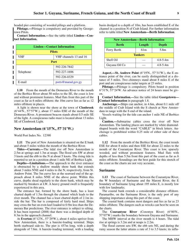
headed pier consisting of wooded pilings and a platform. 1.9 Pilotage.—Pilotage is compulsory and provided by George-town Pilots.1.9 Contact Information.—See the table titled Linden—Con-tact Information.
1.10 From the mouth of the Demerara River to the mouthof the Berbice River about 50 miles to the SE, the coast is lowand without prominent features. Mud flats front this part of thecoast as far as 6 miles offshore; the 10m curve lies as far as 12miles offshore in places. 1.10 A light is shown near the shore at the town of Clonbrook(6°44'N., 57°57'W.), about 17 miles ESE of the mouth of theDemerara River. A prominent beacon stands about 0.5 mile SEof the light. A conspicuous radio mast is located about 13 milesSE of Clonbrook Light.
New Amsterdam (6°15'N., 57°31'W.)
World Port Index No. 12390
1.11 The port of New Amsterdam is situated on the E bankand about 5 miles within the mouth of the Berbice River. 1.11 Tides—Currents.—The tidal rise off New Amsterdam is2.5m at springs and 1.3m at neaps. The flood sets SW at about3 knots and the ebb to the N at about 5 knots. The rising tide isreported to set in a position about 1 mile NE of Berbice Light.1.11 Depths—Limitations.—The approach to the river entranceis obstructed by a shallow muddy shore bank that extendsabout 3 miles NNE and 4 miles to the N, respectively, from St.Andrew Point. The 5m curve lies at the seaward end of the ap-proach about 8 miles NNE of the above point. Within thiscurve, depths shoal regularly to the shore bank, which may bemarked by breakers at LW. A heavy ground swell is frequentlyexperienced in this area.1.11 The entrance bar, formed by the shore bank, has a leastcharted depth of 1.5m through the channel which leads to theriver mouth. The channel has a least charted depth of 2.1m in-side the bar. The bar is composed of fairly hard mud. Shipsmay cross the bar on even keel loaded to 0.9m less than the De-merara Bar predictions. The river entrance is subject to silting.It has been reported (2008) that there was a dredged depth of8.3m in the approach channel.1.11 At Everton (6°12'N., 57°29'W.), about 4 miles upriver fromNew Amsterdam, there is a bauxite-loading terminal. Shipsberth starboard side-to. The pier is 457m long, with a depthalongside of 7.6m. A bauxite-loading terminal, with a loading
basin dredged to a depth of 10m, has been established E of thechannel in a position N of Crab Island. For further informationrefer to table titled New Amsterdam—Berth Information.
1.11 Aspect.—St. Andrew Point (6°19'N., 57°31'W.), the E en-trance point of the river, can be easily distinguished at a dis-tance of 5 miles. Two chimneys stand about 8 miles E of theport and are conspicuous radar targets at 23 miles.1.11 Pilotage.—Pilotage is compulsory. Pilots board in position6°31'N, 57°24'W. An advance notice of 24 hours must be giv-en. 1.11 Contact Information.—See the table titled Georgetown—Contact Information in paragraph 1.8. 1.11 Anchorage.—Ships can anchor, in 4.6m, about 0.1 mile offthe middle of Crab Island with the S church at New Amster-dam in range with the S end of the island.1.11 Vessels waiting for the tide can anchor 1 mile NE of BerbiceLight. 1.11 Caution.—Submarine cables cross the river off NewAmsterdam. The landing places are marked by white diamond-shaped boards with the word “CABLE” in block letters. An-chorage is prohibited within 0.25 mile of either side of thesecables.
1.12 From the mouth of the Berbice River, the coast trendsESE for about 8 miles and then SSE for about 22 miles to themouth of the Courantyne River. This coast is low, sparselywooded, and without prominent features. Mud flats withdepths of less than 5.5m front this part of the coast as far as 6miles offshore. Soundings are the best guide for this stretch ofthe coast as the charts are not very accurate.
Suriname
1.13 The coast of Suriname between the Courantyne River,the W boundary of Suriname and the Maroni River, the Eboundary of Suriname lying about 195 miles E, is mostly lowwith few landmarks. 1.13 The coastal bank extends a considerable distance offshore.Paramaribo, on the Suriname River, is the only port of anyshipping importance along this part of the coast. 1.13 The coastal bank contains most dangers and lies as far as 23miles offshore. The dangers such as wrecks can best be seen onthe charts.1.13 The Courantyne River (Corentyn River) (6°00'N.,57°07'W.) marks the boundary between Guyana and Suriname.1.13 The MHW interval at the river mouth is 4 hours. The tidalrise at springs is 3.2m and at neaps is 2.2m.1.13 The flood current sets SW, the ebb sets NE, and during therainy season the latter attains a rate of 3 to 3.5 knots; its influ-
Linden—Contact Information
Pilots
VHF VHF channels 13 and 16
Port
Telephone
592-226-7842
592-227-1696
592-226-0329
E-mail [email protected]
New Amsterdam—Berth Information
Berth Length Depth
Ferry Berth 61m 5.8m
Tankers
Shell Oil — 4.8-5.4m
Guyana Oil Co — 4.8-5.4m

10 Sector 1. Guyana, Suriname, French Guiana, and the North Coast of Brazil
Pub. 124
ence is felt up to a distance of 10 to 12 miles offshore. 1.13 The edge of the current is distinctly marked by discoloredwater. 1.13 The river entrance is reported to be fronted by a bar whichpartly dries. Vessels with a maximum draft of 4.7m can enter atHWS; vessels with a draft of 3.7m can enter at LWS.1.13 During December, January, and February a heavy sea fre-quently prevents ships with more than 2.7m draft from enter-ing, due to the risk of hitting bottom. 1.13 Ships that are able to enter the river can proceed to Tropica,Suriname, about 47 miles above Skeldon, which is about 4miles inside the mouth of the river. Ships seldom ascend theriver above Skeldon.1.13 The most prominent landmarks to be seen on the approach tothe river are the radio mast with obstruction lights at Skeldon,the aviation light at Nieuw Nickerie, and the chimney at Water-loo, which is 5.2 miles ESE of the river entrance.1.13 Vessels can obtain anchorage in the river off Skeldon, in 5 to6.4m. Vessels can also anchor off Springlands inside the river.
Nieuw Nickerie (5°57'N., 57°00'W.)
World Port Index No. 12405
1.14 Nieuw Nickerie lies on the S bank of the NickerieRiver, about 2 miles above the mouth of the river.1.14 Tides—Currents.—Tidal currents off the entrance to theNickerie River set SW and NE, attaining a maximum rate of 4knots at springs.1.14 Depths—Limitations.—The fairway across the bar has aleast depth of about 2.1m at LWS which controls the draft ofships proceeding upriver for 24 miles to Wageningen. The barconsists of an extended bank of soft mud. At MHW the bar ispassable for ships with a draft of 4m and a maximum length of130m. The river is navigable for vessels up to 3,000 dwt andwith a draft of 4.3m for about 30 miles above Nieuw Nickerie. 1.14 Tanker berths are located 1 mile inside the mouth of the riverand consists of three small jetties. For further information seethe table titled Nieuw Nickerie—Berth Information. 1.14 Aspect.—A light is shown from the W entrance point of theriver. Another light is shown about 0.7 mile SE of the W en-trance point of the river near the police station. A tank stands1.75 miles WSW of the river's entrance. 1.14 Regulations.—Vessels alongside must have their main en-gines ready at all times so that they can unberth at short notice.No repairs are permitted which would interfere with this re-quirement. 1.14 Pilotage.—Pilotage is compulsory for vessels over 50 gt.Requests for a pilot must be made to the harbor master at Para-
maribo at least 48 hours before arrival and corrected as neces-sary 12 hours before arrival. A pilot is available both night andday at Nieuw Nickerie. The pilot boards near the lighted buoyabout 4 miles N of the entrance of the Nickerie River. 1.14 Contact Information.—See the table titled, Nieuw Nick-erie—Contact Information.
1.14 Anchorage.—Vessels with a 4.5m draft can safely anchor 3miles NNE of the sea buoy. It is not advisable to anchor in theriver for any length of time due to the river being so narrow thatswinging room is restricted.
1.15 Paradijs (5°54'N., 56°56'W.), about 6 miles upriverfrom Nieuw Nickerie, has a pier for small ships. Just aboveParadijs are the remains of an old pier in the river which shouldbe avoided by keeping close to the right bank.1.15 Wageningen (5°46'N., 56°41'W.), a port about 24 milesupriver from Nieuw Nickerie, can be reached by vessels whichcan reach Nieuw Nickerie. The river is only 70m wide at thispoint, which restricts vessels to a maximum length of 110mand draft of 4.9m. Wageningen Berth is 118m long and canaccommodate vessels with a maximum loa of 110m and amaximum draft of 4.9m.
1.15 From the mouth of the Nickerie River to the mouth of theCoppename River, about 62 miles to the E, the coast is low,flat, and covered with mangroves and forest. Several creeksflow into the sea along this part of the coast. A radio maststands about 23 miles W of the entrance of the CoppenameRiver. A number of sand banks are contained within the 5.5mcurve which lies up to a distance of 10 miles offshore.
Nieuw Nickerie—Contact Information
Pilots
VHF VHF channels 12 and 16
Telephone 597-047-6733 (ext. 248)
Facsimile 597-047-2940
E-mail [email protected]
Port
VHF VHF channel 16
Telephone 597-047-6733
Facsimile 597-047-2940
E-mail [email protected]
Web site http://www.mas.sr
Nieuw Nickerie—Berth Information
Berth Length Depth Remarks
Nieuw Nickerie Port Terminal
Public Wharf 250m 4.5m General cargo. Vessels with a maximum loa of 108m, a maximum draft of 4.9m, and a maximum beam of 30m can be accommodated.
Staats Olie Terminal
Nickerie Oil Berth — 4.5m Floating pontoon for petroleum products.

Sector 1. Guyana, Suriname, French Guiana, and the North Coast of Brazil 11
Pub. 124
The Coppename River—The Saramacca River
1.16 These rivers have a common mouth which is easy toidentify as the coast recedes considerably from SaramaccaPunt (5°54'N., 55°58'W.), the NE entrance point of the Sara-macca River. This point is conspicuous from the E and the W.The Saramacca River, about 150 miles long, is navigable forabout 63 miles upstream for vessels that can cross the bar. Theleast depth across the bar is 1.2m. The depths gradually in-crease upriver. Numerous dangerous wrecks lie in the N and Eapproaches to the common mouth of the rivers.1.16 Coppename Punt (5°49'N., 55°55'W.) separates the two riv-ers. 1.16 The Coppename River, about 100 miles long, is navigablefor coastal vessels for 38 miles upstream. The least charteddepth in the channel over the bar is 2.1m close W of Cop-pename Punt. A conspicuous radio mast stands on the E bankof the river, about 8 miles SSE of Saramacca Punt. 1.16 The Coeswijie River is a tributary of the Coppename River,and flows into it on its E side about 4 miles below CoppenamePoint.The Wayombo River flows into the Coppename River onits W side, about 34 miles below Coppename Punt. The Cop-pename River is still navigable for small vessels up the mouthof Arawarra Kreek. The creek forms the connection betweenthe Wayombo River and the Nickerie River.1.16 Pilotage.—Pilotage on both rivers is compulsory for vesselsexceeding 50 gt. A pilot should be requested at least 24 hoursbefore arrival from the harbormaster at Paramaribo, giving theprobable time of arrival and draft.1.16 From the mouth of the Coppename River, the coast trends Efor about 45 miles to the mouth of the Suriname River. Thecoast is low, sandy, and wooded. The tree tops are visible froma distance of 15 miles offshore. Mudflats front this part of thecoast as far as 3 miles offshore; the 5m curve lies as far as 10miles offshore.
The Suriname River
1.17 The mouth of the river forms a recession in the shore-line S of Braamspunt (5°58'N., 55°10'W.), the NE entrancepoint of the river. This point is low but well defined. The en-trance to the river mouth is marked by a lighted range.1.17 The S shore of the river mouth is very low and difficult todistinguish from offshore. The port of Paramaribo lies on theW bank, about 13 miles within the mouth of the river. Ships ofmoderate draft and size can enter the river and be accommodat-ed at Paramaribo, Smalkalden, and Paranam.1.17 Caution.—Rollers occur off the river entrance between De-cember and March. It is reported (2015) that a dangerous
wreck, marked by a buoy exists 0.3 mile WNW of the “S6”buoy in the approaches to the Suriname River.
Paramaribo (5°50'N., 55°10'W.)
World Port Index No. 12410
1.18 The port of Paramaribo is located on the W bank ofthe Suriname River, about 13 miles upriver from its mouth. 1.18 The port is the capital and center of the overseas trade. 1.18 Winds—Weather.—The climate is tropical. There are tworainy seasons; a short one lasting from mid-November to mid-February, and a longer one lasting from mid-April to mid-Au-gust. The highest temperatures are in August, September, andOctober while the lowest temperatures occur in January andFebruary. 1.18 The prevailing winds are from the NE.1.18 Tides—Currents.—The MHW interval at the river mouth is4 hours. The tidal rise at springs is about 2.2m and at neaps isabout 1m.
1.18 Off the mouth of the river, the flood current sets to the W andthe ebb current sets to the E. The NW coastal current predomi-nates over the tidal current. In the river the water level recedes0.4 to 0.6m before the beginning of the ebb current in mid-channel. The tidal influence extends for a distance of about 100miles above the river mouth. 1.18 Depths—Limitations.—Arrival drafts in the port are depen-dent on depths at the outer bar near the entrance to the Surina-me River. The minimum depth at LWS is 4.6m.
1.17Paramaribo, with Goslar wreck indicated
Paramaribo—Berth Information
Berth Length DepthMaximum Vessel
RemarksLOA Draft Beam
De Molen Terminal
De Molen Jetty — 3.0m 110m 6.4m 18.2m Grain and bunkers. Berthing length of 97m (including dolphins).
Kuldipsingh Terminal

12 Sector 1. Guyana, Suriname, French Guiana, and the North Coast of Brazil
Pub. 124
1.18 It was reported that the strong current, combined with thesuction from passing ships, causes considerable strain onberthing lines.1.18 The least depths at LWS in the channel are, as follows:
1. Outer buoy to New Amsterdam—4.6m.2. New Amsterdam to Paramaribo—5.1m.3. Paramaribo to Domburg—5.2m.4. Domburg to Paranam—5.2m.
1.18 Depths in the river and its approaches are subject to changeand bars are liable to form. 1.18 Ships loaded deeper than the bar draft regularly navigatethrough these channels, as the bottom is of very soft mud andships can easily plow through. Vessels leaving the river regu-larly load to a draft of between 6.7 and 7.0m.1.18 Discolored water from the river has been observed a consid-erable distance offshore.1.18 For further information refer to table titled Paramaribo—Berth Information.1.18 Aspect.—Suriname River Light lies about 7 miles NNW ofBraams Point. The channel, marked by lighted buoys and bea-cons, begins about 2.2 miles S of the sea buoy. 1.18 Positions of the channel buoys and beacons are subject tochange without notice; many of them may be missing or extin-guished.
1.18 An entrance light is located on the S bank, about 6 miles SWof Braams Point beacons. A landfall light is shown from amast, 121m high, standing 6 miles SW of Braamspunt; threered lights, disposed vertically, are also shown from this mast.1.18 A bridge, with a vertical clearance of 40m, crosses the Suri-name River about 1 mile upstream of Paramaribo, as seen onthe chart. When vessels approach the bridge, they shall haveboth anchors cleared and crewmen standing by to employ themif needed.
1.18 Pilotage.—Pilotage is compulsory for vessels greater than50 gt. Pilots should be ordered at least 48 hours in advance.Vessels should send their ETA 36 hours, 24 hours, and 12hours prior to arrival at Approach Lighted Buoy; if necessary,the vessel should amend its ETA after the 12-hour message.The pilot will be ordered only after the 12-hour or amendedETA message is received. The pilot boards in the vicinity ofApproach Lighted Buoy.1.18 Contact Information.—See the table titled Paramaribo—Contact Information.
1.18 Anchorage.—Vessels awaiting a berth can anchor, in depths
Kuldipsingh Quay 307m 4.5m 225m 4.3m — General cargo.
SMS Ferry Terminal
Ferry Wharf 48m — — — — Closed.
Vensur Cement Terminal
Cement Wharf 25m 4.3m 119.9m 4.1m 19.2m Cement and bunkers. Berthing length of 126m (including dolphins).
Nieuwe Haven
Nieuwe Haven Wharf 600m 6.0m 220m 8.5m 30.0m General cargo.
Oil Jetty 30m — 140m — — Berthing length of 160m (including dol-phins).
SOL Terminal
SOL Jetty — 6.2m 130m 6.0m — Petroleum products. Berthing length of 152m (including dolphins).
Staatsolie Terminal
Staatsolie Jetty 28m 5.5m 300m 5.3m — Petroleum products. Berthing length of 300m (including dolphins).
Paramaribo—Berth Information
Berth Length DepthMaximum Vessel
RemarksLOA Draft Beam
Paramaribo—Contact Information
Vessel Traffic Center (VTC)
VHF VHF channels 12 and 16
Telephone
597-047-4575
597-047-6733 (ext. 221)
597-047-6733 (ext. 231)
Facsimile597-047-2940
597-047-2845
E-mail [email protected]
Port
Telephone 597-047-6733
Facsimile 597-047-2940
E-mail [email protected]
Web site http://www.mas.sr

Sector 1. Guyana, Suriname, French Guiana, and the North Coast of Brazil 13
Pub. 124
from 5 to 10m, avoiding a submarine power cable laid acrossthe river from Hoek van Meerzorg (5°49'N., 55°09'W.). 1.18 Anchorage, if waiting for a pilot, can also be obtained 8miles NW of Braanspunt, in a depth of 4.6m.1.18 Caution.—Two stranded wrecks lie 18.5 and 17 miles NNWof Braamspunt. Other wrecks which exist in the area can bestseen on the charts. Another dangerous wreck, the Goslar, liespartially exposed, in the middle of the river, NE of the contain-er port, about 0.3 mile W of Suzannasdaal (5°52'N.,55°05'W.).
The Suriname River above Paramaribo
1.19 The Saramacca Kanaal is entered just S of Paramariboand can accommodate small craft and barges not exceeding1.8m in draft and 24.3m in length. The canal joins the Surina-me River with the Saramacca River. 1.19 A lighted beacon is located abreast of Waterland on the Sara-macca River. Nickerie can be reached by way of the SaramaccaRiver, the Coppename River, and the Nickerie River about 14miles upriver from Paramaribo. It is recommended to pass N ofthe beacon.
1.19 Smalkalden (5°38'N., 55°05'W.) is a small bauxite-loadingterminal 18 miles upriver from Paramaribo. There is a wharf67m long, with 163m between the moorings, and a depth of 9malongside. It has been reported that the depth alongside the pieris only 7.5m and that the largest vessel that can be accommo-dated is 180m long, with a draft of 6.7m. 1.19 It has been reported (2013) that the port remains closed tocommercial operations.
1.20 Paranam (5°37'N., 55°05'W.) (World Port Index No.
12415) lies on the W bank of the river, about 1 mile aboveSmalkalden. Vessels up to 44,500 dwt load to outer bar draft,usually half a ship load. Vessels usually top off at Trinidad. 1.20 The least depth at loading berths is 9m. The minimum depthon the bar is 6.4m at LWS and 7.3m at HWS. The main com-modities handled here are bauxite, aluminum and bulk unload-ing. 1.20 At Paranam the river is wide enough for ships to turn. A ca-ble with a vertical clearance of 60m spans the river close up-stream of the port. Ships can anchor upstream of Paranamdirectly after the first bend. For further berthing informationsee the table titled Paranam—Berth Information.
1.20 Pilotage is compulsory for transiting the river.1.20 Regulations.—Vessels alongside must have their main en-gines ready at all times so that they can unberth at short notice.No repairs are permitted which would interfere with this re-quirement.
The Commewijne River
1.21 The Commewijne River flows into the Suriname Riv-er on its E side about 6 miles above its mouth. The banks of theriver are wooded and steep-to, with its bottom consisting most-ly of clay and mud. The river has many sharp bends and tugsare needed to assist ships in making these turns. The tidal influ-ence extends as far as Moengo, a distance of about 81 milesabove the river mouth. The tides at Moengo rise about 0.1m.1.21 The channel in the Commewijne River from its junction withthe Suriname River to Alkamar, about 6 miles upriver, has aleast depth of 5.2m. It was reported that ships 160m long, withdrafts up to 6.8m, can reach Moengo via the Commewijne Riv-er for 17 miles, the Cottica River for 53 miles, and the BovenCottica for 11 miles.1.21 Pilotage.—Pilotage is compulsory. The river pilot will boardthe vessel off Neiuw Amsterdam. Navigation of the Commewi-jne River is not permitted at night. 1.21 Anchorage.—Vessels anchor at Alkmar and in the turningbasin at Moengo.
1.18Dangerous wreck (Goslar)
Paranam—Berth Information
Berth Length DepthMaximum Vessel
LOA Beam
General/Oil 107m 9.7m — —
General Cargo 73m 13.0m 200m —
Bauxite 126m 9.7m 214m —
Alumina 361m 9.7m 220m 31.6m
Moengo—Berth Information
Berth Length DepthMaximum Vessel
RemarksLOA Beam
Traymore Dock
Main Quay 56m 4.7m 165m 20.5m General cargo
No 2 Quay 36m — 104.5m 17.0m Petroleum products

14 Sector 1. Guyana, Suriname, French Guiana, and the North Coast of Brazil
Pub. 124
1.21 Moengo (Albina) (5°38'N., 54°25'W.) (World Port IndexNo. 12420) is a bauxite port on the E bank of the BovenCottica. For further berthing information see the table titledMoengo—Berth Information.
1.22 From the mouth of the Suriname River the coasttrends to the E for about 75 miles, to the mouth of the MaroniRiver. The coastline is low and fronted with mud flats, with the5.5m curve extending as far as 12 miles offshore.1.22 Kaimans Hoofd (Kaimanshoofd) (5°50'N., 54°02'W.),about 6 miles NW of the W entrance point of the Maroni River,can be identified by a clump of high trees. Depths of less than5.5m have been reported to lie as far as 15 miles off KaaimansHoofd and many dangerous wrecks are reported to lie off thecoast. Deep drafted vessels should give this point a wide berth.
French Guiana
1.23 The coast of French Guiana between the Maroni Riv-er, the W boundary, and Fleuve Oyapock, the E boundary, 170miles SE of the Maroni River, is generally low and is seen as adark line of mangroves. A number of hills rise in the back-ground and can be seen for some distance offshore. The coastalbank extends a considerable distance offshore. 1.23 The coastal bank lies as far as 21 miles offshore. Vesselsshould proceed with caution as the coastal reef has been report-ed to extend from 1 to 9 miles farther offshore than charted. 1.23 Rocket launchings are made from Kourou Space Center(5°13'N., 52°46'W.) at intermittent announced times with im-pact areas, as follows:
1.24 The Maroni River (5°45'N., 54°00'W.) is entered be-tween Galibi (Hoek Galibi), lying 5.5 miles SSE of KaimaansHoofd, and Pointe Francaise, 2 miles E of Galibi. 1.24 Ships with drafts of 4.5m can navigate up river for 15 milesto Alpine, situated on the Suriname side of the river, and toSaint Laurent, across the river on the French Guiana side. 1.24 In 1994, the least depth in the channel as far as Saint-Laurentdu Maroni was reported to be 2.2m.1.24 At the river entrance, the spring rise is 2.6m and the neapsrise is 2.0m The tidal range at Saint Laurent is from 1.8 to3.0m; HW occurs 3 hours later than at the entrance. 1.24 On the bar, the flood current sets SW and the ebb sets towardTiger Banken, a drying bank extending N from Hoek Galibi. 1.24 In the fairway abreast Tiger Banken, the river current can at-tain a speed of 3 knots.
1.24 The seaward edge of the bar lies 6 miles NNE of the rivermouth. 1.24 An entrance channel over the bar has a minimum depth of1.2m. The bar consists of hard coarse sand. A fairly heavyswell is usually experienced on the outer part of the bar.1.24 A lighted buoy is moored 10 miles NE of the disused light-house on Hoek Galibi. Numerous wrecks, dangerous to naviga-tion, lie off the entrance and can best be seen on the chart. Thebuoyed channel is subject to frequent change. The disusedlighthouse on Hoek Galibi, a 60m high red and black metalframework tower, is an excellent landmark. From offshore, theriver entrance appears as an opening in the line of trees be-tween Hoek Galibi and Pointe Francaise. 1.24 Pilotage.—Pilotage is compulsory. Requests for a pilot, stat-ing the vessel's draft, should be made 48 hours in advance tothe pilot station at Degrad des Cannes. The pilot boards nearLighted Buoy SL. Pilotage is available during daylight hoursonly.1.24 Anchorage.—Sheltered anchorage can be taken about 0.5mile N of Pointe Panato (5°43'N., 53°58'W.), about 2 milesSSW of Pointe Francaise, in 7 to 8m, mud.
1.25 Saint Laurent (5°30'N., 54°02'W.) (World Port IndexNo. 12450) has two 120m piers with a depth of 4.5m along-side. Vessels will lie aground at LW on a soft mud bottom. Ves-sels are moored during daylight hours only.1.25 Contact Information.—See the table titled Saint Lau-rent—Contact Information.
1.25 Fleuve Mana (5°45'N., 53°55'W.) is entered between PointeFrancaise and Pointe Isere, 2.75 miles ENE. The mouth of theriver is not visible from offshore. Pointe Isere is fringed by ashallow sand spit which extends W toward the river mouth. 1.25 The coast S of Pointe Isere and E of Pointe Francaise is alsofringed by a shallow sand spit which extends N and E towardthe river mouth. The river mouth narrows to less than 0.5 milein width between the sand spits.
Kourou Space Center—Impact Areas
Area Description
No. 1
Area is bounded by the parallel 6°30'N, and the meridian 52°00'W, to 52°30'N, 50°00'W, then in a
235° direction, the coast of French Guiana, and the meridian 53°00'W.
No. 2 A circle of 120 miles radius centered in 6°16.7'N, 51°42.2'W, limited SW by a line oriented 120°
passing through 5°12.5'N, 52°43.7'W.
No. 3 A circle of 100 miles radius centered in 8°05.5'N, 49°49.8'W.
Saint Laurent—Contact Information
Pilots
Call sign Pilotage Degrad des Cannes
VHF VHF channels 12 and 16
Telephone 594-594-354520
Facsimile 594-594-354946
E-mail [email protected]
Harbormaster
VHF VHF channel 16
Telephone 594-594-354490
Facsimile 594-594-355251
Port Authority
Telephone 594-594-299660
Facsimile 594-594-299663
E-mail [email protected]

Sector 1. Guyana, Suriname, French Guiana, and the North Coast of Brazil 15
Pub. 124
1.25 The depths in the entrance range from 0.3 to 1.2m.Vesselsshould not cross the bar within 2 hours of either side of lowtide. Vessels should also avoid the S bank of the river as it isencumbered by tree trunks which are immersed at HW and aredangerous. Local knowledge is essential.1.25 The settlement of Mana lies on the W bank of the river about11 miles above its mouth. It has a landing stage with 5.8malongside. A radio mast, which gives an excellent radar return,is located on the N edge of the village.
1.26 From Pointe Isere to Pointe Charlotte (5°12'N.,52°38'W.), about 80 miles to the SE, the coast is low and cov-ered with mangroves. 1.26 Montagne du Diable, a prominent conical hill about 16 milesW of Pointe Charlotte, can be seen for a distance of about 20miles. The Riviere Organabo, the Riviere Iracoubo, the RiviereCounamana, and the Fleuve Sinnamary, all of which are shal-low, discharge into the sea along this part of the coast. 1.26 Depths of less than 5.5m lie from 4 to 9 miles offshore, butoff the mouth of the Fleuve Sinnamary these depths lie as far as11 miles offshore; therefore, give a wide berth off the coast.1.26 A number of wrecks lie within the 20m curve off this sectionof coast and can best be seen on the chart. A bank, with a leastdepth of 3.2m lies about 10 miles NNE of the W entrance pointof Riviere Iracoubo.
Iles du Salut
1.27 Iles du Salut (5°17'N., 52°35'W.), three in number,are located about 7 miles NE of Pointe Charlote. Ile du Diable,the northernmost, is 40m high. Ile Royale, 66m high, is thelargest and westernmost, while Ile Saint-Joseph, only 30mhigh, is the southernmost. 1.27 Ile du Diable and most of Ile Saint-Joseph are covered withhigh and dense vegetation. Buildings of a former prison standon Ile Royale and Ile Saint-Joseph. On a clear day, the islandsare visible at a distance of 15 miles.The current sets generallyNW. A SW current, with rates from 1 to 3 knots, and moreduring NE winds passes between Ile Royale and Ile Saint-Jo-seph, then becomes WSW and weakens S of Ile Royale. Within91m of the S side of Ile Royale, there is a weak E countercur-rent.
1.27 The flood tide flows WNW at 0.3 knot, 1 mile S of the is-lands, while the ebb tide flows NNW at 1 knot. Breakers markthe shallow depths which extend NE from Ile du Diable andENE of Ile Saint-Joseph. It is difficult to approach Ile du Dia-ble, except at the pier on its S end, and in good weather only.The passages between the islands are dangerous and are notrecommended for even small boats. A heavy sea is often expe-rienced during the wet season, from December to June.1.27 A light is shown from the W side of Ile Royale and also atthe S and SE ends of the island.1.27 Anchorage.—The anchorage at Iles du Salut is the most im-portant anchorage along the coast of the Guianas, this beingdue to the few ports along this coast capable of affording shel-ter to ships of moderate size.1.27 Anchorage can be taken in the bight formed by the S side ofIle Royale and the W side of Ile Saint-Joseph. Depending ondraft, vessels can anchor with the light on the W side of IleRoyale bearing 020°, distance 0.5 mile, in depths of about 9m
soft mud, good shelter from the swell, and good holdingground. Depths less than those charted were reported betweenpositions 0.5 mile WSW and 1 mile SSE of the light on the Wside of Ile Royale.1.27 Vessels over 1,600 gross tons transporting hydrocarbons orhazardous materials anchor in a circle with a radius of 0.5 milecentered bearing 300° from Ile Royale Light, distant at 3 miles.1.27 Caution.—Alouette Bank, covered with 4.8m of water, liesabout 1.7 miles NNW of Ile Royale. Depths of 3.5 to 5.5m liebetween Ile Royale and this bank. An isolated 6.1m shoal lies0.5 mile W of Ile Royale.
1.28 The mouth of the Fleuve Kourou (5°10'N.,52°37'W.) lies 3 miles SE of Pointe Charlotte. The river is nar-row and entry is difficult as the channel leads near many dan-gerous rocks, the positions of which are uncertain. 1.28 High water is about 50 minutes later and LW about 30 min-utes earlier than the time for Iles du Salut. Between Iles duSalut and the mouth of the river, the flood current sets SW andthe ebb current sets NW. 1.28 The bar of soft sand, which shifts continually, permits thepassage of ships with a draft equal to the height of the tide plusabout 0.1m The sea breaks on the bar in bad weather.1.28 A lighted buoy is moored about 3.7 miles SSW of Ile RoyaleLight. 1.28 The entrance channel to the river is marked by buoys, andextends to the port of Pariacabo, about 3 miles W of the rivermouth, on the N bank.1.28 It was reported (1995) that the least depth in the channel asfar as Pariacabo was 2.5m.1.28 Contact Information.—See the table titled Saint Lau-rent—Contact Information in paragraph 1.24. 1.28 Pilotage.—Pilotage is compulsory and is available duringdaylight hours only. The pilot should be requested 48 hours inadvance. Pilots board in the vicinity of Lighted Buoy KO.Ships awaiting a berth can anchor N of the sea buoy or S of Ilesdu Salut.
1.29 Pariacabo (5°08'N., 52°39'W.) is the port for the
1.27Ile Royale Light (Phare de L’ile Royale)

16 Sector 1. Guyana, Suriname, French Guiana, and the North Coast of Brazil
Pub. 124
space center at Kourou. Pariacabo Pier, 80m in length, isex-tended to a berthing length of 105m by dolphins. The pier han-dles breakbulk, ro-ro/lo-lo, and general cargo.1.29 The village of Kourou lies about 1 mile above the mouth ofthe river and buildings in the village are prominent from sea-ward.1.29 From the mouth of the Fleuve Kourou, the coast trends to theSE for about 21 miles to the mouth of the Riviere de Cayenne.The coast is wooded and marked by a few slightly salientpoints, but the coast has not been fully examined. 1.29 Several rocks and small island lie as far as 5 miles offshore.Monts La Condamine, wooded with steep slopes, lies about 6miles SSE of Pointe Charlotte, and can be seen from the off-shore. The summit of the mountain is prominent.
The Riviere de Cayenne
1.30 The river is entered W of the NW end of Ile de Cay-enne (4°56'N., 52°20'W.). Ile de Cayenne is hilly and irregular,especially in the E part and is easily identified from seaward. 1.30 The depths over the bar are subject to frequent changes.Depths over the bar vary from 0.3 to 0.7m at LW. It is recom-mended that mariners receive the latest depth information fromthe pilots before crossing the bar. It has been reported that avessel with a draft of 4.2m could cross the bar at mean HW. 1.30 Banc du Macouria, a large sandbank which dries in places,fronts the N side of Pointe de Macouria, the W entrance pointof Riviere de Cayenne.1.30 Several rocks, above and below-water, and Iles Remire, agroup of five small islands, lie as far as 5 miles off the N and Esides of Ile de Cayenne.
1.30 L'Enfant Perdu (5°02'N., 52°21'W.) is a low flat rock, lo-cated about 6 miles N of the river mouth, and shows a light. 1.30 A reef extends about 0.1 mile E and W and 14m to the S, re-spectively, from the rock. 1.30 A dangerous wreck lies 0.5 mile to the E of the rock. Heavyseas have been experienced in this vicinity. 1.30 An isolated 5.9m shoal is reported to lie about 2 miles NNEof the rock.1.30 Tides—Currents.—The mean tidal range at Cayenne isabout 2.3m at springs and about 1.2m at neaps.1.30 The current about 10 miles offshore usually sets betweenWNW and NW, and attains a wind-assisted velocity of 2 to 3knots. The offshore current is affected by the tidal current asfar out as L'Enfant Perdu where the flood current sets NW andthe ebb NNE at rates of up to 2 knots. 1.30 Off the mouth of the Riviere de Cayenne, the flood currentsets slightly towards Banc du Macouria, especially during SEwinds. The ebb current sets E towards the banks extending Nfrom Ile de Cayenne.1.30 Within the river the currents follow the channel. The ebb cur-rent attains a rate of up to 4 knots while the flood current doesnot exceed a rate of more than 2.5 knots. 1.30 Aspect.—Ile Cayenne is composed of several hills andprominent mountains, with Mont Montabo, 105m high, at its Nend. A water tower, marked by lights, stands about 2 miles S ofMont Montabo. A conspicuous hotel is also located near MontMontabo. 1.30 Pilotage.—Pilotage is compulsory and is available 24 hours.Send the ETA and draft 48 hours in advance to the pilot station
at Degrad des Cannes. 1.30 Contact the pilot vessel 1 hour before arrival on VHF chan-nel 16; the pilot boards about 0.6 mile NW of Lighted BuoyCA.1.30 Anchorage.—The only anchorage for vessels unable tocross the bar is at Ile du Salut. Vessels awaiting pilot or tide,anchor, in 6m, about 2.5 miles NE of L’Enfant Perdu. The bot-tom is mostly mud, good holding ground. A designated tankeranchorage, with a radius of 0.5 mile, is located about 5.5 milesENE of L’Enfant Perdu. Vessels bound for Cayenne and ex-pecting a long wait should anchor off Iles du Salut (see para-graph 1.26).
1.31 Cayenne (4°56'N., 52°20'W.) is situated at the NWextremity of Ile de Cayenne on the E bank of the river mouth.The port is closed to commercial traffic and is now used mainlyby fishing vessels. 1.31 Larivot (4°54'N., 52°22'W.) (World Port Index No. 12460),about 2.2 miles upriver from Cayenne, is a small port consist-ing of a few small piers of various length and is primarily usedby a small fishing fleet. The port can accommodate ships withdrafts of about 4.8m. A rock with a depth of 1.5m lies close Wof the pier. 1.31 It was reported (1995) that the minimum depth in the chan-nel as far as Larivot is equal to the height of the tide at Cay-enne.1.31 Contact Information.—See the table titled Cayenne andLarivot—Contact Information.
1.32 The Fleuve Mahury (4°52'N., 52°14'W.) flows intothe sea between Point Diamonte, the easternmost point of Ilede Cayenne and a mud flat extending NNE from Pointe Jaguar,1.5 miles further SE. 1.32 The winds are predominately from between N and E fromJanuary to April and between E and SE from April to Decem-ber.1.32 The tidal current in the river is 1.8 knots during the flood and
Cayenne and Larivot—Contact Information
Pilots
Call sign Pilotage Degrad des Cannes
VHF VHF channels 12 and 16
Telephone 594-594-354520
Facsimile 594-594-354946
E-mail [email protected]
Harbormaster
VHF VHF channel 16
Telephone 594-594-354490
Facsimile 594-594-355251
Port Authority
Telephone 594-594-299660
Facsimile 594-594-299663
Web site http://www.portdeguyane.fr

Sector 1. Guyana, Suriname, French Guiana, and the North Coast of Brazil 17
Pub. 124
2 knots during the ebb, but the currents have been known to at-tain rates of up to 4 knots.
1.32 A 120m wide channel leads from a position 1.25 miles E ofLe Pere (4°56'N., 52°12'W.) in a SSW direction for 6 milesover the bar into Fleuve Mahury and then turns W to Degrad deCannes. It has been dredged to 4.2m. 1.32 There is an occasional swell over the bar, but the bottom issoft mud, allowing ships to plow through. The entrance,marked by a lighted buoy, is located about 5 miles NE ofPointe Diamant. The channel is marked by lighted buoys andleads to the port of Degrad des Cannes, about 8 miles from theentrance buoy.
1.33 Degrad des Cannes (Grand Port Maritime de la Guy-ane) (4°51'N., 52°16'W.) (World Port Index No. 12455) is theprincipal port of French Guiana.1.33 The tidal currents may attain a rate of 4 knots.
The main wharf is 309m long, with a depth alongside of 6m.A second wharf, with facilities for ro-ro vessels, is 150m long,with depths alongside of 5m. Abreast the wharves is a 400mdiameter turning basin, best seen on the chart, that has a main-tained depth of 6m.
The port of Degrad des Cannes replaces the port of Cayenne,
to which it is connected by road. Vessels up to 160m long witha maximum draft of 5.9m can be accommodated.
For further berthing information see the table titled Degraddes Cannes—Berth Information.1.33 Pilotage is compulsory; the pilot boards in the vicinity ofLighted Buoy DC. The pilot must be requested 48 hours in ad-vance. The vessel’s draft should also be included in the requestfor a pilot. Vessels should be at the pilot station 2 hours beforeHW.1.33 A designated tanker anchorage, with a radius of 1 mile anddepths of 7 to 10m, is located 1.5 miles NW of Lighted BuoyDC. Vessels bound for Degrad des Cannes and expecting along wait should anchor off Iles du Salut (see paragraph 1.26).1.33 The Riviere Oyac joins the Fleuve Mahury about 14 milesabove Pointe Diamant. Ships proceed up the Riviere Oyac asfar as the mouth of the Riviera Orapu, about 6 miles above themouth of the Riviere Oyac, and then 4 miles up the RiviereOrapu to the settlement of Fourgassie, a timber-loading port. 1.33 At Fourgassie, ships must be prepared to push the bow intothe bank of the river in order to turn around, as the river is only90m wide. The least depth on the passage up to Fourgassie is4.3m. Ships are warped to the loading place as close as theirdrafts will allow.
1.33 The Riviere Oyac and the Riviere Orapu are only markedwith buoys at a few dangerous places; both banks of these riv-ers are thickly overgrown with trees.
From the mouth of the Fleuve Mahury, the coast trends SEfor about 50 miles to the mouth of the Fleuve Oyapock, theboundary between French Guiana and Brazil. 1.33 The coast is low and swampy between the Fleuve Mahuryand the Fleuve Approuague, about 25 miles SE. The coast be-tween the Fleuve Approuague and the Fleuve Oyapock is lowand wooded. 1.33 Prominent hilltops can be seen in the background from off-shore. Mud flats of shallow depths from the coast lie as far as10 miles offshore. Mariners are advised to give this part of thecoast a wide berth.1.33 A small military pier is situated E of Degrad des Cannes,along the N bank of the river, just before reaching the containerterminal.
1.31Larivot
Degrad des Cannes—Berth Information
Berth Length DepthMaximum Vessel
RemarksLOA Draft
Degrad des Cannes Terminal
No. 1 215m 6m 190m — General cargo.
No. 2 200m 6m 190m — General cargo.
No. 3 150m 5m 190m — General cargo.
Mineral Terminal
Mineral Jetty 18m — — 7.1m Cement, clinker, and gypsum. Berthing length of 50m (including dolphins).
Oil Terminal—Degrad De Cannes
Oil Pier — — 106.7m — Petroleum products. Maximum beam of 15.5m.

18 Sector 1. Guyana, Suriname, French Guiana, and the North Coast of Brazil
Pub. 124
1.33 Contact Information.—See the table titled Degrad desCannes—Contact Information.
1.34 Le Petit Connetable (4°48'N., 51°58'W.) lies about12 miles N of the mouth of the Fleuve Aprouague. The islandis flat, blackish in color and is barely awash at HW.
Le Grand Connetable, a bare rock about 50m high, lies about2 miles E of Le Petit Connetable and can be seen at a distanceof 25 miles in clear weather. Its SW side is steep-to and its Eside appears to extend underwater for some distance. 1.34 Ships should not pass between Le Petit Connetable and LeGrand Connetable.
1.34 Battures du Connetable (Les Battures de Connetable)(4°56'N., 51°57'W.), lying about 6 miles NNW of Le GrandConnetable, are rocky plateaus of coral and sand with a leastdepth of 1.8m. During swells the sea breaks on these shoals,but during calm weather it is only marked by the eddies of a Wcurrent. Banc Cospatrick (Haut-fond Cospatrick), 1.5 milesNNW of Les Battures, with a least depth of 4m, is the summitof a bank of soft mud.1.34 Tides—Currents.—The main current is strong and sets tothe NW in the vicinity of the Connetables during the summer,but during the winter, especially on the falling tide at springs,this current runs farther offshore. 1.34 The tidal current, the strength of which is augmented by thedischarge of the Fleuve Approuague, sets N and NNW andcauses heavy breakers at its meeting with the main currentabout 3 or 4 miles outside the Connetables. This race usuallydisappears at SW if the outer current is weak. The inner edgeof the race appears as breakers on a shoal and on its landwardside the water is muddy.1.34 Caution.—A dangerous wreck lies about 5 miles WNW ofLe Petit Connetable.1.34 It was reported (2000) there was less water between IlesRemire and the mainland on each side of the entrance to theFleuve Mahury.
The Fleuve Approuague
1.35 The Fleuve Approuague discharges between PointeBehague (4°40'N., 51°54'W.) and the coast about 6 miles W. Itis identified by its width and by Pointe Behague, which is cov-ered with mangroves. A drying mud flat extends from the Wentrance point of the river to a position 7 miles NW of PointeBehague.
1.33Degrad des Cannes Container Terminal
Degrad des Cannes—Contact Information
Pilots
See the table titled Cayenne and Larivot—ContactInformation in paragraph 1.30.
Harbormaster
Call sign Capitainerie Degrad des Cannes
VHF VHF channels 12 and 16
Telephone 594-594-354490
Facsimile 594-594-355251
Port Authority
Telephone 594-594-299660
Facsimile 594-594-299663
E-mail [email protected]
Web site http://www.portdeguyane.fr

Sector 1. Guyana, Suriname, French Guiana, and the North Coast of Brazil 19
Pub. 124
1.35 The river is navigable for about 10 miles from its mouth, butsmall craft can proceed to Regina, about 30 miles upriver. Thechannel in the river, with a depth of 5m at HW, follows the Ebank as far as Guizambourg, a small village about 10 milesfrom the river mouth. Above the village, the channel becomesnarrow and winding and often leads close to dangerous rocksand shallow sand banks.1.35 Caution.—A dangerous wreck lies about 8 miles NE ofPointe Behague.
The Fleuve Oyapock
1.36 The Fleuve Oyapock forms the boundary betweenFrench Guiana and Brazil and discharges between Mont d'Ar-gent (4°21'N., 51°39'W.) and Cabo Orange, about 10 miles E. 1.36 The river is navigable for ships drawing up to 4.0m at HWS,as far as Saint Georges, about 30 miles above the river mouth.Off the river mouth, the flood current sets WNW and the ebbcurrent sets NE, attaining a rate of up to 3 knots. The currentoffshore sets NNW and attains a rate of up to 2 knots.1.36 Baia do Oiapoque (Baie d'Oyapock), which forms the mouthof the river, is 8 miles wide between Mont d'Argent, its W en-trance point, and Cabo Orange, its E entrance point. The estu-ary of the river is encumbered with numerous shoals on whichthe sea breaks heavily in bad weather. 1.36 The river has not been completely surveyed and its naviga-tion is dangerous. In the vicinity of Mont d'Argent, the coast isbacked by several hills, which are visible from offshore. Montd'Argent can be seen for a distance of about 15 miles on a clearday.1.36 The anchorage normally used lies about 1 mile E of the SEpoint of Mont d'Argent, in depths of 4.9m, mud bottom, beingaware of the rocks that extend almost 1 mile SSE of the point. 1.36 Also, during bad weather the currents are strong and the searough.1.36 Ships drawing less than 3m can anchor off the Riviere Oua-nary, between about 0.1 mile and 0.15 mile from the foot ofMont Bruyere.1.36 Pilotage.—There are no pilots, but pilotage assistance canbe obtained from Degrad des Cannes or Belem in Brazil.
Cabo Orange to Cabo Norte
1.37 The N coast of Brazil, except for a few stretches ofEstado do Caera near its E part, is low and is formed of sandhills about 49 to 79m high. The sand hills are similar in appear-ance, being interspersed with reddish cliffs and clumps of man-groves. The mangroves are usually observed at the mouths onthe W banks of the rivers, which they serve to mark.1.37 The entrances of the rivers along this coast are as a rule opento the N and are obstructed by sand banks. Many of the riversare gradually silting up and will omit only small coasters.1.37 Ships can anchor along the N coast in good weather but thesea becomes rough at times during flood tides.1.37 Cabo Orange (4°28'N., 51°29'W.), the N extremity of theBrazilian coast, is low, but its salient position is easily identi-fied from E as the hills on the W side of the Fleuve Oyapockare visible behind it. The vegetation covering the N part of thecape is higher than at its S part and can be seen from a distanceof about 12 miles. The cape should not be approached within a
distance of 11 miles. The cape is marked by a light.The coast from Cabo Orange to Cabo Norte, about 195 miles
to the SSE, is low and covered with tropical vegetation whichcan be seen for about 12 miles. Several rivers flow into the seaalong this part of the coast. The action of these river, combinedwith the Amazon River, cause frequent changes in the coast-line. The silt carried out by these rivers forms soft mud flatswhich extend a considerable distance offshore in places. Man-groves spread rapidly during the dry seas over the mud flats butare destroyed during the rainy season.1.37 The coastal bank contains all known dangers, and lies as faras 70 miles offshore. Mariners should not approach this coastin depths of less than 18.3m as strong winds cause heavy roll-ers over the coastal bank.1.37 A depth of 16.5m was reported to lie outside the 330m curvein approximate position 3°18'N, 48°09'W.1.37 The coast between Cabo Orange and Cabo Cassipore 20miles SE, is low, subject to flooding, and is only visible about 8miles offshore. shallow bank fringes this coast and there aredepths of less than 5m as much as 12 miles offshore.1.37 Cabo Cassipore (3°54'N., 51°06'W.) is the extremity of alow promontory which forms the E entrance point of the RioCassipore. The river entrance, about 6 miles W of the cape, iswide and can be identified by the large trees on the W bank ofthe river which lie above the neighboring mangroves.1.37 The river is navigable by small coasters drawing up to 2m asfar as the town of Japa, 24 miles upstream. Small boats canreach Portel, 12 miles upriver from Japa.
1.38 The Rio Cunani (2°49'N., 50°57'W.) is entered about65 miles SSE of Cabo Cassipore and is navigable by vesselsdrawing less than 3m as far as the mouth of the river. The barshould not be crossed without the advice of local pilots or a pi-lot obtained from Belem, and only during the intervals whenthe water is above half tide.1.38 The river can be identified by Monte Cunani, 50m high, lo-cated about 4 miles S of the river mouth, which can be seen fora distance of about 16 miles. The mount is covered by vegeta-tion that stands out from the mangrove in the same vicinity.From the NE, it appears as a narrow hill; from the SE, it ap-pears more elongated and less distinctive.1.38 Anchorage may be obtained off the mouth of the river, in adepth of 5m, good holding ground of mud. Vessels should use agood scope of chain due to the strong tidal currents. Vesselswill roll heavily during the flood current.1.38 The Rio Calcoene (2°32'N., 50°45'W.) is located about 20miles SSE of the Rio Cunani, and shows a light from the Sbank of the river mouth. The river is navigable to near the set-tlement of Daniel, 15 miles from the mouth, by vessels of up to3m of draft. The mouth of the river is obstructed by dryingsandbanks. The bar can be crossed with water level above halftide, with the advice of local pilots or pilots obtained fromBelem.1.38 The Rio Amapa Grande (2°08'N., 50°41'W.), about 24miles SSE of the Rio Calcoene, is navigable by vessels draw-ing up to 3m for as far as Santa Cruz do Amapa about 6 milesfrom the river mouth, and close to the city of Amapa. The riverbar can be crossed only with local knowledge or the help of pi-lots, and only when the water level is above half-tide.1.38 An aeronautical light and a radiobeacon are located near

20 Sector 1. Guyana, Suriname, French Guiana, and the North Coast of Brazil
Pub. 124
Amapa.
1.39 Ilha de Maraca (2°05'N., 50°25'W.), divided intotwo parts by Igarape do Inferno, forms a bay which affords theonly sheltered anchorage along this part of the coast. Cabo Ra-so do Norte, the NE extremity of the N part of the island, lies28 miles SE of the mouth of the Rio Calcoene.1.39 Canal do Varador de Maraca (Canal de Carapaporis), whichseparates the W side of island from the mainland, is fairly deepand is the main approach to the anchorage. Canal Turluri, onthe S side of the island, is obstructed by a mudbank and isavailable only to vessels of shallow draft and local knowledge.1.39 Small vessels should not navigate in Canal do Varador deMaraca and in the vicinity of Igarapedo Inferno just before thetidal bore occurs.1.39 The best anchorage is with the NW extremity of the N part ofthe island bearing 338° and the S entrance point of the RioAmapa bearing 280°. 1.39 It is reported that depths are not less than 5.5m mud, and thatthe anchorage is sheltered from the tidal currents and the bore. 1.39 Greater depths are to be found farther off the island, but thetidal currents are so strong that an anchorage there would beuntenable at springs.1.39 A ship should approach the anchorage from the NNE, givingthe N part of the island a berth of at least 4 miles. The W end ofthe N part of the island can be kept close aboard. 1.39 The anchorage is plainly indicated by the opening of Igarapedo Inferno.1.39 The tide reaches its highest level in Canal de Varador de Ma-raca about 2 to 3 hours after the beginning of the flood tide. 1.39 At the equinoxes, the tide has been observed to rise 10m andtidal currents to run for a short period at a rate of 7 knots. Thisrate rapidly diminishes within four days after springs. Duringthese periods, there is a heavy sea offshore. 1.39 The difference between the level of LWS and neaps seldomexceeds 2.5m. The current always sets NW.1.39 Ilha Jipioca (1°51'N., 50°13'W.) lies about 2 miles N of theS entrance point off Canal Turluri and is inaccessible as it issurrounded by shallow mud banks.
1.40 Cabo Norte (1°41'N., 49°55'W.), the NW limit of theestuary of the Amazon River, lies 47 miles SE of Cabo Raso doNorte and 19 miles from Ilha Jipioca. The cape is low, wooded,and slightly higher than the neighboring coast.1.40 The coastal bank, with depths of less than 10m extends near-ly 60 miles NE of Cabo Norte. Depths of less than 5m extend47 miles NE of the cape. This bank is dangerous during strongwinds which cause heavy rollers over it. Vessels should not ap-proach it within depths of 20m. Shoals with depths of 10.3mand 16.6m, have been reported, lie about 145 miles NE of CaboNorte. A shoal with a depth of 11m, lies about 10 miles SW ofthat position.1.40 Several shoals, with depths from 3.7 to 6.1m, lie up to 25miles offshore between ENE and SE from Cabo Norte.
Lower Reaches of the Amazon River
1.41 The mouth of the Amazon River, together with themouth of the Rio Para, extends from Cabo Norte to PontaCuruca (0°32'S., 47°49'W.), 183 miles to the SE. Canal do
Norte and Canal do Sul, through which the two main arms ofthe Amazon River flow into the sea, encompass a number of is-lets and islands. 1.41 Ilha do Marajo, the largest in the estuary, forms the S side ofCanal do Sul and the W bank of the Rio Para from its entrancefor several miles. 1.41 These two rivers are connected by a number of navigablechannels. 1.41 A characteristic of the Amazon River is that it has no delta ofaccumulated mud extending into the sea, yet the river carriesan immense amount of mud in its waters.1.41 The Amazon River and its tributaries comprise over 13,700miles of safe river navigation. Manaus, situated more than 900miles from the sea, can be reached by ships drawing 7.3m allyear. Iquitos, Peru, nearly 2,000 miles from the sea, can bereached by ships drawing 3.6m year round and by ships draw-ing 7m during HW, which occurs from January to May.1.41 Sao Antonio is nearly 1,535 miles from the sea and is situat-ed about 697 miles up the Rio Madeira, the principal tributaryof the Amazon River, from its junction with the Amazon River,about 82 miles below Manaus. San Antonio can be reached byships drawing 5.5m for about 9 months of the year. During theremainder of the year only 1.9m drafts can be taken. 1.41 Boats and barges can be navigated most of the year betweenCiudad Bolivar, Venezuela and Manaus via the Rio Orinocoand Amazon River systems.
Winds—Weather.—In the vicinity of the Amazon River,the air is cooled by the proximity of the watercourses andlakes, coupled with the heavy and frequent rains which are ac-companied often with squalls. The difference between the dayand night temperatures is appreciable during the latter part ofthe year.1.41 The year has two seasons, winter or the rainy season andsummer or the dry season. The rainy season is between Januaryand June and the dry season is between July and December.During winter the rain falls in torrents, sometimes for an entireweek. 1.41 The level of the river and its tributaries begins to rise fromthe start of the rainy season and soon the rivers are joined, withlarge lakes which form close to their banks. As the water levelrises, trees are uprooted from islands. 1.41 The winds blow between ENE and ESE during the dry sea-son and they are considered to be the prevailing winds. Thesewinds are moderate in July and August but fresh during the restof the season when the gusts, known locally as "Marajos'' reachgreat force. 1.41 This season is the best time for ascending the river. Sailboatsdescending the river drift with the current, all sails furled.1.41 During the rainy season calms prevail, interrupted only byheavy squalls from the NE which backs through N to SW ac-companied by torrential rains.
Tides—Currents.—The waters of the Amazon River in-crease in volume during 6 months of the year and decreaseduring the other part of the year. The snow on the Andes beginsto melt during August and September, but this influence isslowly felt by the river. The river begins to rise in Novemberand the flooding in the lower parts take place from January toMay. The NE winds, which then prevail blow strongly at theriver mouth, delay the discharge of the river and contributegreatly to the inundations.

Sector 1. Guyana, Suriname, French Guiana, and the North Coast of Brazil 21
Pub. 124
1.41 The maximum rise of the river level varies from 9 to 15mleaving at times the entire basin flooded. As a result of naturalcauses, the water in the S tributaries of the Amazon River ishigh, while that of the N tributaries is low, and vice versa. Inthe Rio Madeira, a S tributary, the water attains maximumheight in April, the difference between H and LW being about15m. 1.41 Outside the river estuary, the ocean waters which are drivenW by the prevailing winds form a NW current which usuallyattains rates of 2 to 4 knots. This current being at right anglesto the current from the Amazon River deflects towards the Nand joins with the river current, attaining greater force.1.41 The muddy water of the river discolors the ocean waters forabout 70 miles from its mouth. Its limits are well-defined bythe abrupt change of color. A vessel outside the line of demar-cation, where the ocean water is of a bluish-green color, hasbeen observed to leave a wake of muddy water, in sharp con-trast with the surface water. 1.41 This phenomenon occurs in depths of up to 15m and iscaused by the lower layer of river water extending further sea-ward than the surface layer.1.41 The tides in the vicinity of the Amazon River are subject toso many variations and irregularities that it is difficult to stateprecisely what course they follow. Duration, height, andstrength of the current depend on the force of the wind, the vol-ume of rain, and the random changes in current direction.1.41 The flood current near the mouth of the Amazon River (be-tween Cabo Norte and the mouth of the Rio Para) sets to theSSW and then sets toward the SW and WSW accordingly as itmoves out from the coast, whereas the ebb current sets origi-nally to the general current.1.41 There are irregularities in the tides along this part of thecoast. One of the more remarkable irregularities is a differenceof 2 or 3 hours in the times of HW of two places in the estuaryonly 12 miles apart. Another remarkable anomaly is a rise ofonly 1.9m, 12 miles from a position where at the preceding tide8.8m high had been observed.1.41 During the rainy season near Ilha do Marajo, the water levelrises quickly as soon as the flood tide begins. The spring rise isusually about 5m, half of this rise occurs during the first 2hours of flood tide and the rate of the current is about 6 knots. 1.41 The rate of current between Cabo do Norte and the mouth ofthe Rio Araguari, about 25 miles S, varies from 8 to 10 knots.1.41 At Cabo do Norte from January to April, the flood current at-tains a rate of 8 knots at springs, and the ebb current attainsrates of from 2 to 4 knots. In May, the currents are of equalstrength and after May, the ebb current begins to be the stron-ger of the two. In August and September, the flood current isweak while the ebb current attains rates of 5 to 6 knots. In Oc-tober, the ebb current begins to decrease in strength and duringNovember, the period at which the NE winds begin to blow,both currents are again of equal strength.1.41 From this it may be concluded that the sea level is higherthan the river level when the flood current is stronger than theebb current. This occurs from December to April, a periodwhen the winds blow strongly from the NE. The sea level islower or at least equal to the river level when the ebb current isstronger than the flood current. This occurs from June to Octo-ber, a period when the winds blow from the ESE.1.41 In December, when the flood current begins to be stronger
than the ebb current, this effect is felt as far as 120 miles abovethe river mouth. Normally, the influence of the tide is felt as faras Obidos, situated about 600 miles above the river mouth.
The tidal bore phenomenon, known locally as Pororoca, oc-curs at times in the Amazon estuary prior to spring tides. Thebore consists of a wave which varies from 1.5 to 2.5m highwhose crest breaks and spreads over the shallow waters of theriver and its tributaries. The phenomenon is not felt in depthsof more than 7m so that there is no danger to ships keepingwithin the main or deep channels.1.41 The wave has a velocity of 10 to 15 knots being strongestand most dangerous from January to June, and at the equinox-es, when the wind is from the NE. It carries off everything in itscourse. When the wave passes, it leaves the river almost full.Afterwards, the flood current continues to attain rates of 8 to10 knots in the vicinity of Cabo do Norte from January to Apriland less in August and September. 1.41 Without perceptibly raising the level of the water near Cabodo Norte, the tide reaches its greatest height, reported as 12.2mwithin a period of about 10 minutes. However, off Ilha doMarajo, the bore only causes the water to reach mean level,with the tide reaching maximum level with the continuation ofthe flood. The bore, which is felt as far as 40 miles up the RioAraguari, is very violent. There is no bore in the Rio Para butin the Rio Guama, a tributary of the Rio Para, a bore is experi-enced at spring near the town of Pernambuco, situated about 25miles above Belem. This bore raises the level of the water from1.5 to 4.5m within a few minutes. A similar experience occursin the Rio Guajara, another tributary of the Rio Para whosemouth lies close S of Belem. When the bore occurs, which is atthe lowest tide, a roaring sound is heard at a distance of 3 to 6miles. This noise increases in intensity as the bore approaches.1.41 Pilotage.—Pilotage is compulsory for the Amazon Riverabove Macapa (0°02'N., 51°03'W.). Vessels should request pi-lotage, via their agent, 7 days in advance. The vessel’s ETAshould be confirmed 48 hours, 24 hours, and 8 hours in ad-vance through Belem (PPL).1.41 Pilots board in the following positions:
1.41 Vessels unfamiliar with the area should use the pilot board-ing position NNW of Salinopolis Light.1.41 Contact Information.—See the table titled Amazon RiverPilots—Contact Information.
Amazon River Pilots—Pilot Boarding Locations
No. 1 About 20 miles E of Ponta do Maruim (1°13'N., 49°34'W.).
No. 2 About 2 miles ENE of the E extremity of Ilha de Santana, in the approach to Porto de Santana
(0°04'S., 51°06'W.).
No. 3 About 7.5 miles NNW of Salinopolis Light (0°30'S., 47°23'W.).
Amazon River Pilots—Contact Information
Unipilot
VHF VHF channels 11 and 16

22 Sector 1. Guyana, Suriname, French Guiana, and the North Coast of Brazil
Pub. 124
1.41 Caution.—The buoys and channels of the Amazon Riverand its approaches are subject to constant change. Lesserdepths than charted may be found and buoys are moved asnecessary.
Barra Norte (North Bar)
1.42 This bar is located on the approaches to Canal doNorte and is formed on its W side by the mainland and by vari-ous islands along the coast between Cabo do Norte and Pontado Ceu and on its S side by the N edge of Banco Santa Rosawhich extends N and E from Ilha Janaucu and Ilha Caviana (Il-ha Caviana de Dentro). Ponta do Ceu, the SE extremity of IlhaCurua lies about 56 miles SSW of Cabo do Norte. The bar iscomposed of sand and mud. The land which borders the bar islow and marshy and is covered almost entirely with tall vegeta-tion. At the edge of some islands this vegetation appears liketrees, typical of marshy regions. 1.42 This part of the coast is visible at a distance of about 13miles from a height of 7m but this distance may be increasedby refraction. Refractory effects are common in this area, espe-cially in the afternoon.1.42 Shoals in the N part of the bar present a most varied appear-
ance when not above the water. There are times when no differ-ence is perceptible to the eye between these shoals and thechannels. At other times, the dark shadows of the shoals areclearly defined at the sides of the channels. However, the oppo-site may occur when the channels become darker and the waterover the shoals appears clearer. There are also times when thereare slight breakers over the shoals and calm water in the chan-nels as opposed to times when there is broken water in thechannels and calm water over the shoals. These shoals in gen-eral lie in a NE and SW direction forming long and narrowridges and parallel the trend of the channels. The NW and SEedges of these shoals are reported steep-to. The bottomthroughout this area consists of mud and sand.1.42 Ilha do Para Light is shown from a square framework tower30m in height, 7 miles SSW of Ilha do Bailique Light. A raconis transmitted from the light.
The least depth in the approach from NE over the bar isabout 9.2m. The bar is obstructed by numerous low islands andshoals, some of which dry at LW. There are deep but narrowchannels between them, with strong currents attaining rates ofalmost 8 knots.
1.43 Banco de Meio Norte (1°05'N., 49°39'W.), awash,lies 12 miles ENE of Ilho do Bailique Light (00°59'N.,49°57'W.). 1.43 Banco Madureira, lying 8 miles E of the same light, dries to0.3m. A large part of this shoal breaks at LW.1.43 Banco do Meio and Banco da Barra are extremely hazardousto navigation because their sides are steep-to along most oftheir entire length and they are difficult to distinguish. Bancodo Meio, extending from a point 9.5 miles ESE of Ilha do Bail-ique Light to a point 8 miles SE of the same light, dries 1.7m.Banco do Barra, close SW of Banco do Meio, dries 0.5m.1.43 The waters E of Banco Rio Bronco, an extensive bank whichdries 1.5m, lying close E of Banco do Barra, are dangerous.They are not buoyed and are entirely unfamiliar even to localpilots. All ships should avoid these waters completely.1.43 The E side of the recommended fairway through the bar isbounded by Banco de Meio Norte, Banco de Meio, and Bancode Barra. The W side of this fairway is bounded by Banco doTabaco Bom, Banco do Para, and Banco do Areiao. This fair-way is Canal Grande do Curua.1.43 Canal do Bailique lies between the shoals that form the Wsides of the recommended fairway and the islands and themainland W and dries completely.1.43 Caution.—In the vicinity of Barra Norte, the banks andchannels are subject to great changes; mariners should exerciseextreme caution.
Canal do Norte
1.44 This channel, the approach through the N arm of theAmazon River, is entered between Ponta do Ceu and Ponta doSantarem, the N point of Ilha Janaucu. A light is shown fromeach point. The channel leads to the port of Macapa, a distanceof 75 miles. The land on both sides of the N arm is low andcovered with tall vegetation, and is encumbered with severalshoals, some of which uncover partially at LW. 1.44 A 3.1m shoal lies 6.5 miles ENE of Ponta de Santarem.Shoals with a least depth of 7m lie in the channel midway be-
Telephone 55-091-322-30844
Facsimile 55-091-322-35077
E-mail [email protected]
Web site http://www.unipilot.com
Praticagem da Bacia Amazonica
Telephone 55-091-322-39377
Facsimile 55-091-322-39377
E-mail [email protected]
Web site http://www.macapapilot
Practicagem dos Rios Ocidentais da Amazonia LTDA (PROA)
Telephone
55-092-362-43649
55-092-920-77913
55-092-920-77813
55-092-362-40041
55-092-920-77048
Facsimile 55-092-362-45941
E-mail [email protected]
Web site http://www.proamanaus.com.br
Bacia Amazonica Praticos—Grupo BAP
Telephone55-091-321-29908
55-091-992-255991
E-mail [email protected]
Web site http://www.baciaamazonicapracticos.com
Amazon River Pilots—Contact Information

Sector 1. Guyana, Suriname, French Guiana, and the North Coast of Brazil 23
Pub. 124
tween Ponto do Ceu and Ponta de Santarem.1.44 Vessels entering the N arm may do so without a pilot up toMacapa if drawing no more than 9.1m. If deeper they require apilot who will board at Salinopolis (0°36'S., 47°21'W.).1.44 Ponta do Capinal (00°37'N., 50°22'W.), lying 16 miles Wof Ponta do Santarem, is the N end of Ilha Caviana. Dryingbanks extend 2.75 mile NE from this point, reducing the chan-nel width to about 4 miles.1.44 Ilhas Pedreira (00°20'N., 50°37'W.), a group of islands sub-ject to change and marked by a light, lie in the center of thechannel, about 25 miles SW of Ponta do Capinal. The islandsare tree covered. Drying banks extend about 10 miles NE of theislands. The island divides the river into two channels. The Echannel is the wider of the two and is preferred by the naviga-tor, who should avoid the shallow depths of Banco Carolina,which is marked by a lighted buoy.1.44 There are good anchorages off the Ilha Caviana anywherebetween a point 5 miles SW of Pont a do Capinal and themouth of the Rio Arrozal (00°17'N., 50°29'W.). A light isshown at the mouth of the river.
1.45 From Ponta do Pau Cavado (00°12'N., 50°48'W.),located 15 miles WSE of the Rio Arrozal, the NW shore curvesW, then SSW for 20 miles to Macapa (00°02'N., 51°03'W.).There are no known dangers off this shore.1.45 Mariners should be aware that safe transit of the AmazonRiver requires extensive local knowledge due to frequentchanges of the banks and channels and the lack of navigationalaids.1.45 To attain favorable tidal currents and maximum depths an in-bound vessel with a draft greater than 8m should cross the bar1 hour before local HW. 1.45 Although the least depth on the track in the approaches toBanco Norte and the river itself is usually 9 to 10m, the river isconstantly changing and charted depths are not to be relied up-on.1.45 It was reported that the maximum draft for ships using Canaldo Norte was 11m but soundings should be taken frequentlydue to the changing depths and shoals.
Canal do Sul
1.46 The S arm of the Amazon River should be approachedthrough Canal do Sul, the entrance channel, which lies N of Il-ha do Marajo and S of the SE part of Banco Santa Rosa, Ilhadas Flechas, Ilha Mexiana, and Ilha Caviana de Fora. 1.46 From Cabo Maguari (00°17'N., 48°22'W.), the W entrancepoint of the Rio Para, the N coast of Ilha Marajo trends W forabout 120 miles to Ponta Sao Joaquim, the NW point of the is-land. Canal do Sul is entered N of Ilha Machadinho between Il-ha Puampe, about 4 miles W of Cabo Maguari, and Ilha dasFlechas. A light is shown from Cabo Maguari.1.46 The least charted depth in the Canal is 5.8m; however, it issubject to change.1.46 Between Banco San Roque, a shallow bank extending 10miles E of Cabo Maguari, and Ilha Puampe lie several isletsand islands, of which Ilha Machadinho, marked by a light andlying about 17 miles WNW of Cabo Maguari, is the eastern-most. Between these islets and islands and Ilha Marajo lies awinding channel which leads to the S arm of the river.
1.46 Ilha das Flechas lies close with the S edge of Banco SantaRosa, which extends about 13 miles E from the islet. BancoSanta Rosa extends from the W side of Ilha das Flechas to theE side of Ilha Mexiana, about 20 miles W. This bank is shal-lowest about midway between the two islands. Its S limit is un-known.
1.46 Ilha Caviana de Fora and Ilha Mexiana form with Ilhas dasFlechas and the bank extending E and W, the N limit of the Sarm of the Amazon River. These islands are low and wooded,the N parts being flooded during heavy rains. 1.46 The channel off the S shores of Ilha Mexiana and Ilha Cavi-ana de Fora is fairly deep and clear of dangers. A group of sub-merged rocks, the exact positions of which are doubtful, lienear the middle of the channel about 8 miles E of Chaves.1.46 Chaves (00°10'S., 49°59'W.) is situated on the N shore of Il-ha do Marajo opposite Ponta da Caridade, the S extremity of Il-ha Caviana de Fora. Chaves is an important cattle-exportingcenter.1.46 The N and S arms of the Amazon River are connected byseveral channels that are formed by the many islets and islandslying off the NW side of Ilha de Marajo.1.46 Vessels can continue W in the Canal do Sul to reach Macapaby using a channel that passes N of Ilha del Pacas and W of Ar-quipelago Jurupari.1.46 The area is unsurveyed and subject to change. Vessels shouldnot attempt this passage without local knowledge.
1.47 Macapa (00°02'N., 51°03'W.) stands on the NWshore of the river at a place where the land is relatively high.The chief export of the port is manganese ore. An old fort on asmall promontory fronts the city.1.47 There are reportedly no berthing facilities for large vessels.1.47 Contact Information.—See the table titled Porto de Santa-na—Contact Information in paragraph 1.48. 1.47 Anchorage.—Vessels anchor about 0.5 mile E of the pierhead, in 11 to 12.8m. Care is necessary to avoid a 7m rockypatch about 0.6 mile E of the old fort.1.47 Ships drawing up to 3.6m can anchor about 183m off the pierhead. Care should be taken to avoid a 2.7m patch about 0.2mile SE of the pier head. This berth should be approached withthe pier head in range about 301° with a white building about0.4 mile beyond it. Good holding ground, in 20m, was reportedabout 1.75 miles E of the pier head.
1.48 Porto de Santana (00°03'S., 51°11'W.) (World PortIndex No. 12485) is located about 11 miles SW of Macapa onthe N shore of the Canal de Santana. The port's main export isalso manganese ore.1.48 Tides—Currents.—Alongside the floating pier the tide runsfor 60 minutes beyond the time computed from the table. In themiddle of the current, the delay in the change of current is 90minutes, depending upon the river flow.
Santana—Berth Information
Berth Length Depth Remarks
East Berth 200m — Wood chips.
West Quay 150m — Wood chips. Maxi-mum draft of 8.6m.

24 Sector 1. Guyana, Suriname, French Guiana, and the North Coast of Brazil
Pub. 124
1.48 Depths—Limitations.—The port lies on the N side of theriver and predominantly handles wood chips. For furtherberthing information see the table titled Santana—BerthInformation.1.48 Pilotage.—Ships bound for Porto de Santana are required totake a pilot. The pilots board in the vicinity of Fazendinha.Ships bound for either Macapa or Porto de Santana shouldrequest the latest navigational information about this channelfrom the radio station at Belem.
1.48 Ships coming from Belem carry pilots who moor and un-moor at Porto de Santana and who pilot upriver. Pilotage iscompulsory above Macapa.1.48 Pilots will be flown from Belem to Porto de Santana, provid-
ed that prior arrangements have been made, where they boardships for upriver transits.1.48 Ships neither use nor need a tug for docking or undockingbut a small boat, equipped with an outboard motor, is used forreceiving the first mooring line. 1.48 At the floating dock, ships berth starboard side-to when thetide is ebbing and port side-to when the tide is flooding. It ispreferable to berth with some current running. The slack tideperiod is short. In order to berth port side-to, ships can turnaround off the port between longitudes 51°11'W, and 51°12'W.Ships usually make the turn without the use of an anchor as thecurrent helps the maneuver. 1.48 Ships can undock at any stage of the tide. A ship berthed up-river and starboard side-to the dock can swing downriver offthe dock with the aid of the tide and mooring lines.1.48 Contact Information.—See the table titled Porto de Santa-na—Contact Information.
1.48 Anchorage.—Canal de Santana provides good anchoragealmost anywhere, over mud bottom. There is sheltered anchor-age between the mainland and Ilha de Santana. Ships usuallyanchor, in 46m, about 0.2 mile offshore. The anchorage off theport has adequate room for 5 ships. Temporary anchorage, in adepth of 22m, may be found about 2 miles ESE of the entranceto Canal de Santana.1.48 Clearance to anchor off Porto de Santana must be requestedfrom the port captain at Belem.
1.49 Munguba (00°55'S., 52°25'W.) is located 150 milesabove Porto de Santana on the Rio Jari, about 60 miles abovethe mouth.
Depths—Limitations.—The minimum depth of the river isascertained by the pilot using a hand lead while the vessel isloading. The vessel is then informed of the maximum safe de-parture draft. This depends upon the time of year; during therainy season a vessel can load to a fresh water draft of 9.3m.For further information see the table titled Munguba—BerthInformation. 1.49 Pilotage.—Pilotage is compulsory. The pilot in embarked atPorto de Santana or, at Fazendinha (00°04'S., 051°06.5'W.). A72 hours notice is required.
1.48Santana Light
Porto de Santana—Contact Information
Port Authority
Telephone 55-096-331-41200
Facsimile 55-096-331-41210
E-mail [email protected]
Web site http://www.docasdesantana.com.br
Munguba—Berth Information
Berth Length Depth Remarks
Jari Celulose Terminal
Jari Celulose 200m 12.0m Wood pulp, timber, dry bulk, sulphur, and general cargo
Cadam Terminal

Sector 1. Guyana, Suriname, French Guiana, and the North Coast of Brazil 25
Pub. 124
1.49 Contact Information.—See the table titled Munguba—Contact Information.
1.49 Anchorage.—Anchorage, in 12m, mud, can be obtained Eof the pulp berth.1.49 Caution.—Buoys have been laid by the port authority tomark the channel the pilots report that the buoys are unreliable.There are no other navigational aids. Navigation entry is onlypermitted in daylight.
The Rio Para
1.50 The mouth of the Rio Para lies between Cabo Ma-guari and Ponta Curuca, about 38 miles ESE. The land on bothsides of the river is low and cannot be seen from the bar. Theriver water is muddy for a good distance out to sea.1.50 The banks and shoals within the Rio Para are constantlychanging. Banks that formerly never reached water level havenow developed into small islands covered with vegetation dueto the accumulation of debris which has been carried down bythe river currents. Other islands have been washed away.1.50 Navigation within the river should be undertaken with ex-treme care and soundings should be taken frequently becauseof uncharted shoals. 1.50 It is also possible that depths of charted shoals may be lessthan charted.
Depths—Limitations.—The bar at the mouth of the river isencumbered with several banks and shoals. However, fairlydeep water lies between them. These dangers can be dividedinto three principal groups, including those lying near the E,central, and W parts of the bar. Most of these dangers break atLW.1.50 Baixo do Espardarte is an extensive shoal of sand lyingabout 7 miles N of Ponta da Tijoca (00°33'S., 47°53'W.).
1.50 Ponta da Tijoca, from which a light is shown, is low and endsin a flat sandy beach. Baixo do Espardarte breaks near its Epart and dries at LW in its SW part. 1.50 A wreck, marked by a light and from which a racon trans-mits, lies on the bank about 7 miles N of Ponta da Tijoca. Theposition of the wreck changes due to the force of the tidal cur-rents.
1.50 Coroa Nova, over which the sea always breaks, lies SW ofBaixo do Espardarte and about 2 miles WNW of Ponta da Tijo-ca. The contour of the NE portion of the sand bank varies con-stantly. The tidal currents attain rates of 5 to 6 knots in thevicinity of Coroa Nova.1.50 Coroa des Gaivotas, which uncovers at low tide, has its Nend lying 7 miles W of Ponta da Tajoca. A beacon marks theNW side of the shoal.
Banco Piraquembaua de Fora consists of two spits, Cabecodo Norte and Cabeco do Sul. Cabeco do Norte with a leastcharted depth of about 7m, lies about 14 miles N of PontaCuruca. Cabeco do Sul has a least charted depth of 5.4m. Bothbanks break in rough weather.1.50 Pilotage.—Pilotage is compulsory for the Rio Para. Vesselsshould request pilotage, via their agent, 7 days in advance. Thevessel’s ETA should be confirmed 48 hours, 24 hours, and 8hours in advance through Belem (PPL). Pilots board in the fol-lowing positions:
1.50 Vessels unfamiliar with the area should use the pilot board-ing position NNW of Salinopolis Light.1.50 The pilot boat has a red hull and a mast from which a redflag with a black “P” displayed.1.50 Pilotage is compulsory for all vessels bound for Belem.1.50 Vessels bound for Santana, Macapa, Manaus, and Iquitos viaOs Estreitos and for the Rio Tocantins and the Rio Madeira al-so embark a pilot at Salinopolis. Pilotage in the ports and tribu-taries of the Amazon River is compulsory above Belem.1.50 Contact Information.—See the table titled Rio Para Pi-lots—Contact Information.
Cadam 230m 12.0m Kaolin and liquid cargo
Munguba—Berth Information
Berth Length Depth Remarks
Munguba—Contact Information
CADAM Terminal
Telephone 55-093-373-66010
Facsimile 55-093-373-61140
Jari Celulose Terminal
Telephone 55-093-373-66201
Facsimile 55-093-373-61180
Web site http://www.grupojari.com.br
Amazon River Pilots—Pilot Boarding Locations
No. 1Vessels with a draft of 8m and over—About 7.5
miles NNW of Salinopolis Light (0°29.6'S., 47°23.1'W.).
No. 2Vessels with a draft of less than 8m—About 2.5
miles NW of Chapeau Virado (1°06'S., 48°29.7'W.).
No. 3Vessels arriving from the N and W, in Canal de Espadarte, about 3 miles WNW of Cabeco do
Norte (0°17'S., 47°49'W.).
No. 4Vessels arriving from the E, in Canal de
Espadarte, about 3.5 miles SSW of Cabeco do Sul (0°24.5'S., 47°46'W.).
Rio Para Pilots—Contact Information
CADAM Terminal
VHF VHF channels 6, 11, 13, and 16
Telephone 55-091-400-66550
E-mail [email protected]

26 Sector 1. Guyana, Suriname, French Guiana, and the North Coast of Brazil
Pub. 124
1.50 Banco Xingu (00°20'S., 47°54'W.) extends in a general NEto SW direction veering to the N. The shallowest part of thesand bank, being about 1m, lies about 12 miles NNW of Pontada Tijoca.1.50 Banco do Clemente, which partially dries at LW, lies about 2miles SW of Banco Xingu and about 11.2 miles NW of Pontada Tijoca. Bancos da Tijoca consist of three spits of hard sand,Cabeco do Sul, Cabeco do Meio, and Cabeco do Norte. Cabecodo Sul, the most extensive and shallowest, uncovers 0.2m atLW in a position about 9.2 miles NW of Ponta da Tijoca. Cabe-co do Meio, with a least depth of 2.5m, breaks at LW and re-quires the most care as it extends the farthest into Canal doEspadarte. Cabeco do Norte, which also breaks at LW, is thedeepest with least depths of about 4.5m. Banco Sao Joao, witha least charted depth of about 1.9m, lies about 18 miles WNWof Ponta da Tijoca. Several shoals lie between Banco Sao Joaoand Bancos da Tijoca. 1.50 Cabeco do Joca (00°26'S., 48°48'W.), lying off the W sideof Banco Sao Joao, has a least charted depth of 7.6m.1.50 Coroa de Quiriri lies close off the S end of Banco Sao Joaoand extends SW and SSW for about 22 miles. There is a depthof 1.5m at its NE end and a sand bank which dries 0.5m nearits SW end. The shoal is marked by breakers over its entirelength apart from a narrow gap close N of the drying sandbank.
Banco Maguari, with depths of less than 3.6m, extends Efrom Cabo Maguari for about 15.7 miles. Between the capeand Ponta Soure, about 29 miles farther S, Banco Maguari ex-tends up to 6.5 miles offshore tapering off to about 0.7 milefrom Ponta Soure. 1.50 The E edge of this bank off the cape is marked by breakersduring strong winds. The bank is reported to be extending tothe NE.1.50 The tidal currents in the vicinity of Banco Maguari set WSWduring flooding and ENE during ebbing.1.50 Banco Monjui, composed of mud and sand, has a least chart-ed depth of about 2.7m. The shallowest part, which is indicatedby the dark muddy-colored water lying, lies about 2.2 miles Eof Cabo Maguari. 1.50 There are several shoals, with depths of less than 10m, be-tween Banco Monjui and Banco do Clemente and betweenBanco Monjui and Banco Xingu.1.50 Caution.—The buoys and channels of the Rio Para and itstributaries are subject to constant change. Lesser depths thancharted may be found and buoys are moved as necessary.
Canal do Espadarte
1.51 Canal do Espadarte, the principal channel leading intothe Rio Para, lies between Baixo do Espadarte and Bancos daTijoca. The breakers on these banks help to mark the channel. 1.51 The channel is about 1.5 miles wide, with depths of 12 to33m, over fine white sand. Other channels are available but arenot recommended for large ships and therefore are not de-scribed.1.51 The MHW interval in Canal do Espadarte is 10 hours 40
minutes. The mean tidal range is about 2.5m, while the springrange about 3.1m. The flood current sets SW and attains ratesof 2.5 to 3.2 knots. The ebb current set NE and attains similarrates. Between Baixo de Espadarte and Coroa das Gaivotas, theflood current tends to set a vessel away from Coroa das Gaivo-tas, while the ebb currents tends to set a vessel towards theshoal.
The E shore of the Rio Para is low and covered with vegeta-tion. 1.51 From Ponta Curuca to Ponta da Tijoca, the coast trends Wabout 5 miles, then SW about 49 miles to Ponta do Chapeu Vi-rado. Ponta Curuca is more elevated than the adjacent coasts.Several rivers empty into the waters along this stretch of thecoast, dividing the coast into islands.
1.51 The land in the vicinity of Ponta Taipu, about 11.7 miles SWof Ponta da Tijoca, when seen from a position N of Baixo doEspadarte appears as a low island, but on a nearer approach itappears as two high elevations joining the land to the SW. Alight is shown about 0.7 mile SE of Ponta Taipu. Shallowdepths and dangerous rocks lie up to a distance of 2.2 miles offthe shore between Ponta Taipu and Ponta do Chapeu Virado.1.51 A light is shown close N of Ponta Maria Teresa which liesabout 10 miles SW of Ponta Taipu. A light is shown from theend of a chain of rocks lying off the village of Colares, about
Web site http://www.belempilot.com.br
Rio Para Pilots—Contact Information
1.51Taipu Light
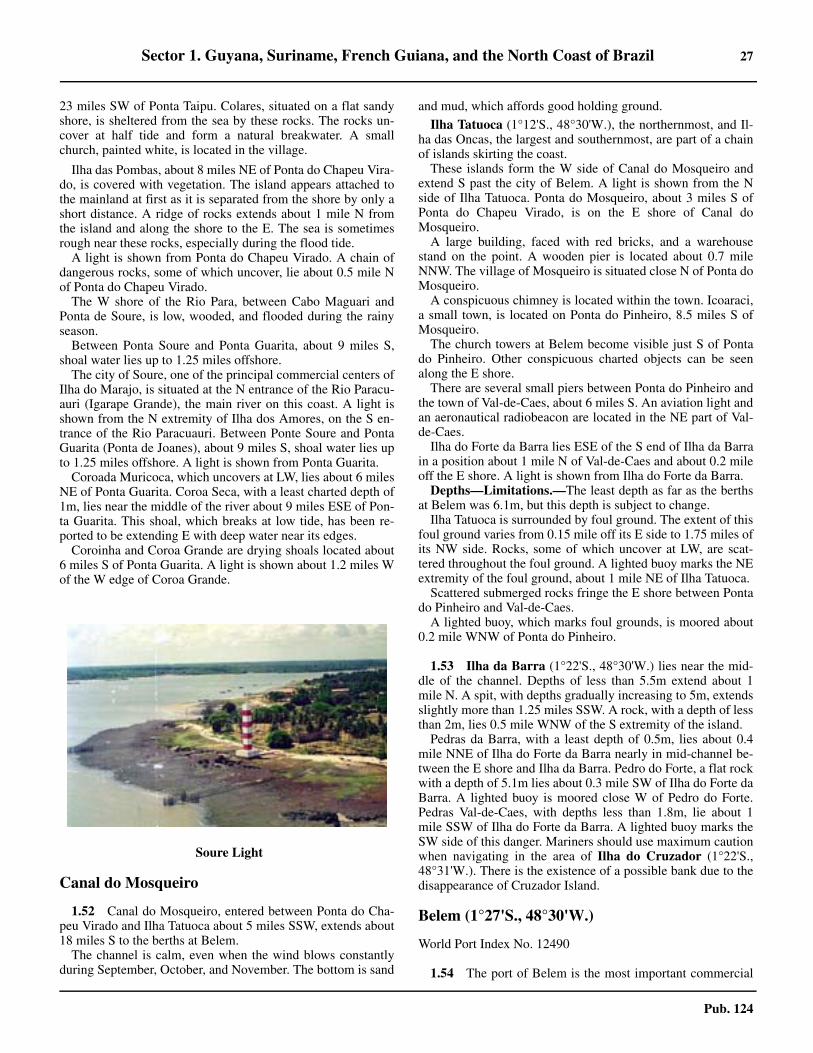
Sector 1. Guyana, Suriname, French Guiana, and the North Coast of Brazil 27
Pub. 124
23 miles SW of Ponta Taipu. Colares, situated on a flat sandyshore, is sheltered from the sea by these rocks. The rocks un-cover at half tide and form a natural breakwater. A smallchurch, painted white, is located in the village.
1.51 Ilha das Pombas, about 8 miles NE of Ponta do Chapeu Vira-do, is covered with vegetation. The island appears attached tothe mainland at first as it is separated from the shore by only ashort distance. A ridge of rocks extends about 1 mile N fromthe island and along the shore to the E. The sea is sometimesrough near these rocks, especially during the flood tide.1.51 A light is shown from Ponta do Chapeu Virado. A chain ofdangerous rocks, some of which uncover, lie about 0.5 mile Nof Ponta do Chapeu Virado.1.51 The W shore of the Rio Para, between Cabo Maguari andPonta de Soure, is low, wooded, and flooded during the rainyseason.1.51 Between Ponta Soure and Ponta Guarita, about 9 miles S,shoal water lies up to 1.25 miles offshore.1.51 The city of Soure, one of the principal commercial centers ofIlha do Marajo, is situated at the N entrance of the Rio Paracu-auri (Igarape Grande), the main river on this coast. A light isshown from the N extremity of Ilha dos Amores, on the S en-trance of the Rio Paracuauri. Between Ponte Soure and PontaGuarita (Ponta de Joanes), about 9 miles S, shoal water lies upto 1.25 miles offshore. A light is shown from Ponta Guarita.1.51 Coroada Muricoca, which uncovers at LW, lies about 6 milesNE of Ponta Guarita. Coroa Seca, with a least charted depth of1m, lies near the middle of the river about 9 miles ESE of Pon-ta Guarita. This shoal, which breaks at low tide, has been re-ported to be extending E with deep water near its edges.1.51 Coroinha and Coroa Grande are drying shoals located about6 miles S of Ponta Guarita. A light is shown about 1.2 miles Wof the W edge of Coroa Grande.
Canal do Mosqueiro
1.52 Canal do Mosqueiro, entered between Ponta do Cha-peu Virado and Ilha Tatuoca about 5 miles SSW, extends about18 miles S to the berths at Belem. 1.52 The channel is calm, even when the wind blows constantlyduring September, October, and November. The bottom is sand
and mud, which affords good holding ground.
1.52 Ilha Tatuoca (1°12'S., 48°30'W.), the northernmost, and Il-ha das Oncas, the largest and southernmost, are part of a chainof islands skirting the coast.1.52 These islands form the W side of Canal do Mosqueiro andextend S past the city of Belem. A light is shown from the Nside of Ilha Tatuoca. Ponta do Mosqueiro, about 3 miles S ofPonta do Chapeu Virado, is on the E shore of Canal doMosqueiro. 1.52 A large building, faced with red bricks, and a warehousestand on the point. A wooden pier is located about 0.7 mileNNW. The village of Mosqueiro is situated close N of Ponta doMosqueiro. 1.52 A conspicuous chimney is located within the town. Icoaraci,a small town, is located on Ponta do Pinheiro, 8.5 miles S ofMosqueiro.1.52 The church towers at Belem become visible just S of Pontado Pinheiro. Other conspicuous charted objects can be seenalong the E shore.1.52 There are several small piers between Ponta do Pinheiro andthe town of Val-de-Caes, about 6 miles S. An aviation light andan aeronautical radiobeacon are located in the NE part of Val-de-Caes.1.52 Ilha do Forte da Barra lies ESE of the S end of Ilha da Barrain a position about 1 mile N of Val-de-Caes and about 0.2 mileoff the E shore. A light is shown from Ilha do Forte da Barra.1.52 Depths—Limitations.—The least depth as far as the berthsat Belem was 6.1m, but this depth is subject to change.1.52 Ilha Tatuoca is surrounded by foul ground. The extent of thisfoul ground varies from 0.15 mile off its E side to 1.75 miles ofits NW side. Rocks, some of which uncover at LW, are scat-tered throughout the foul ground. A lighted buoy marks the NEextremity of the foul ground, about 1 mile NE of Ilha Tatuoca.1.52 Scattered submerged rocks fringe the E shore between Pontado Pinheiro and Val-de-Caes.1.52 A lighted buoy, which marks foul grounds, is moored about0.2 mile WNW of Ponta do Pinheiro.
1.53 Ilha da Barra (1°22'S., 48°30'W.) lies near the mid-dle of the channel. Depths of less than 5.5m extend about 1mile N. A spit, with depths gradually increasing to 5m, extendsslightly more than 1.25 miles SSW. A rock, with a depth of lessthan 2m, lies 0.5 mile WNW of the S extremity of the island.1.53 Pedras da Barra, with a least depth of 0.5m, lies about 0.4mile NNE of Ilha do Forte da Barra nearly in mid-channel be-tween the E shore and Ilha da Barra. Pedro do Forte, a flat rockwith a depth of 5.1m lies about 0.3 mile SW of Ilha do Forte daBarra. A lighted buoy is moored close W of Pedro do Forte.Pedras Val-de-Caes, with depths less than 1.8m, lie about 1mile SSW of Ilha do Forte da Barra. A lighted buoy marks theSW side of this danger. Mariners should use maximum cautionwhen navigating in the area of Ilha do Cruzador (1°22'S.,48°31'W.). There is the existence of a possible bank due to thedisappearance of Cruzador Island.
Belem (1°27'S., 48°30'W.)
World Port Index No. 12490
1.54 The port of Belem is the most important commercial
1.51Soure Light

28 Sector 1. Guyana, Suriname, French Guiana, and the North Coast of Brazil
Pub. 124
port on the N coast of Brazil. The port is situated on the E bankof the Rio Para about 70 miles from its mouth. Communicationis maintained with all inland Amazon ports.1.54 Winds—Weather.—The winds during the summer morn-ings are usually calm, or a light breeze blows from E to NE,changing gently to the N. Fresh winds from the NE and ENEnormally blow on summer afternoons, lasting until sunset, fol-lowed by a calm that lasts through the night. During the rainyseason from March until June, Winds are variable and some-times accompanied by squalls. 1.54 Rain falls almost daily during the rainy season and in the dryseason on an average of about 15 days, mostly in the afternoon.
1.54 Tides—Currents.—The MHW interval at Belem is 11hours 4 minutes. The spring range is about 3m and the meanrange is about 2.4m. Under normal conditions, during springtides, the flood current has a velocity of 2.6 knots and the ebbcurrent 1.4 knots. During neap tides, the flood current has a ve-locity of 2.4 knots and the ebb current has a velocity of 1.1knots. 1.54 The times of HW and the rates of the current are, however,influenced by the force and direction of the wind and by theamount of rainfall in the river basin. 1.54 Rates in excess of those stated may be experienced. The tidalcurrents set toward the berths in Belem; therefore, ships shouldlet go an anchor before mooring. 1.54 Depths—Limitations.—The approach to Belem is madethrough the Canal do Mosqueiro, previously described in para-graph 1.51. 1.54 The maneuvering room in this stretch of water is consider-ably more restricted than in the Rio Para. Approximately 1mile S of Punto do Pinheiro, the channel narrows to 1 mile.1.54 It has been reported that the port is silting up gradually forlack of dredging.
1.54 Mooring is not allowed at Berth No. 9 and Berth No. 10.1.54 A 142m long T-head tanker pier at Miramar, with depths of8.8 to 9.8m, can accept ships up to 200m long with drafts of upto 7.9m. Berthing is reported to be carried out only on andduring the flood tide. 1.54 A dredged channel (1991) leading to the oil terminal has adepth of 6.8m. 1.54 A dredged channel, 90 to 180m wide over a depth of 4.2m atLW, leads near the shore from Miramar to the berths at Belem.This channel is marked by lighted buoys. However, the chartedpositions of the buoys are not to be relied upon. The principalquay is about 2,296m long and is divided into several sections.For further information refer to table titled Belem—BerthInformation.
1.54 Aspect.—The city occupies little more than a clearing in theAmazon jungle. The highest point of the city is only 14m andthe lower sections of the city become swampy and floodedduring the rainy season.
1.54 A conspicuous water tower is located in Miramar, about 6.7miles S of Ponta do Pinheiro. 1.54 Two chimneys are located in Curro Velho, 1.25 and 1.75miles S, respectively, of the water tower in Miramar. 1.54 There is also a conspicuous building in Belem, 1 mile S ofthe S chimney in Curro Velho.
1.54Belem—Container Terminal
1.54Belem
Belem—Berth Information
Berth Length Depth Remarks
Porto de Belem Terminal
11 133m 9.0m General cargo. Continuous berth length of 400m.
12 133m 9.0m General cargo. Continuous berth length of 400m.

Sector 1. Guyana, Suriname, French Guiana, and the North Coast of Brazil 29
Pub. 124
1.54 Pilotage.—Pilotage is compulsory and is available 24 hours.Vessels should request pilotage, via their agent, 7 days inadvance. The vessel’s ETA should be confirmed 48 hours, 24hours, and 8 hours in advance through Belem (PPL). The pilotboards about 2.5 miles NW of Chapeau Virado (1°06'S.,48°30'W.).1.54 The pilot boat is a red launch with a black P painted on bothsides of the bow. It also flies a red flag with a black P. 1.54 Contact Information.—See the table titled Belem—Contact Information. 1.54 Anchorage.—There is good anchorage from Ponta doMosqueiro to the beginning of the dredged channel into Belem;however, the navigator should observe the restrictions withrespect to restricted areas and submarine cables. Ships drawingup to 9.1m can anchor and work cargo at Icoraci, off Ponta doPinheiro.1.54 A prohibited anchorage lies off Miramar and Val-de-Caes,with a naval anchorage adjoining it to the N.1.54 Ships are prohibited from anchoring in the cable areas lyingoff the E side of Ilha das Oncas between the S end of Ilha daBarra and the mouth of the Rio Guama.1.54 Anchorage is prohibited in the dredged channel about 1 mileS of the oil terminal at Miramar.
1.54 Oil tankers and gas carriers bound for the tanker pier atMiramar should use the designated tanker anchorage SE of IlhaJutuba, with depths of 6 to 7m.1.54 Temporary anchorage may be taken between the S end ofBelem Wharf and Banco de Meio, in depths of 4.9 to 11.9m.1.54 Caution.—Several incidents of piracy and armed robberyhave been reported in the vicinity of Belem.
1.55 The maximum permissible draft to Vila do Conde
Silo Berth 133m 9.0mGrain. Vessels with a maximum loa of 210, a maximum draft of 7.0m, a maximum air draft of 7.3m, and a maximum beam of 36m can be accommodated.
Marechal Hermes Dock 450m 4.8m General cargo.
Warehouse 4 240m 8.0m General cargo, passengers, and cruise vessels.
Warehouse 5 240m 8.0m General cargo, passengers, and cruise vessels.
Warehouse 6 380m 8.0m General cargo, passengers, and ro-ro.
Warehouse 7 380m 8.0m General cargo, passengers, and ro-ro.
Warehouse 8 380m 8.0m General cargo, passengers, and ro-ro.
Passenger Berth 306m — Passengers.
BNVC Terminal
BNVC Passenger Berth 72m — Passengers and ro-ro.
Miramar Terminal
Pier 01 76m 7.92m Petroleum products. Vessels with a maximum loa of 140m can be accommodated.
Pier 02 40m 7.92m Petroleum products. Vessels with a maximum loa of 210m can be accommodated.
Belem—Berth Information
Berth Length Depth Remarks
Belem—Contact Information
Pilots
See the table titled Rio Para Pilots—ContactInformation in paragraph 1.49.
Port Control
VHF VHF channel 16
Telephone 55-091-325-70808
Facsimile 55-091-325-71693
Port Captain
VHF VHF channels 9, 12, 14, and 16
Telephone 55-091-32233363
Facsimile 55-091-322-47690
E-mail [email protected]
Port Authority
Telephone
55-091-318-29088
55-091-318-29173
55-091-31829059
Facsimile 55-091-318-29030
E-mail [email protected]
Web site http://www.cdp.com.br/porto-de-belem
Belem—Contact Information

30 Sector 1. Guyana, Suriname, French Guiana, and the North Coast of Brazil
Pub. 124
(1°33'S., 48°45'W.) is governed by the fairway depth in the RioPara. For further information see the table titled Vila doConde—Berth Information.
Passo do Goiabal
1.56 Passo do Goiabal, not named on any chart, is a routefor ascending the Rio Para above Belem. It is entered between
Banco do Otelo and Ilha Mandii, about 40 miles WSW ofBelem.1.56 The passage continues S of Ilha Joroca, N of Ilha Saracurucaand Ilha Tucumanduba, between Ilha Mutumura and the islandNW of it, S of Ilha Chaves and Ilha Santo Antonio, and N of Il-ha Paqueta.1.56 Depths in this passage range from 6.2 to 26m. A bank ex-tends about 3 miles E of Ilha Joroca, the easternmost of theseislands which, when combined with the bank extending fromIlha de Marajo to the W of Ilha Mandii, reduces the width ofthe channel to about 0.5 mile. 1.56 Lights are shown from the S extremity of Ilha Joroca andfrom Ilha Jupatituba, 2 miles to the S. The narrowest part of thepass is about 7 miles W of this section in the strait just N ofIlha Mutumuru.1.56 A shoal, which dries for 0.25 mile E and W and is steep-toon its N side, with shoal ground extending about 1 mile to theW, 3.5 miles to the E, and 4.5 miles to the S from the dry part,lies about 2.7 miles E of Ilha Mandii.1.56 Several wrecks lie sunk or stranded from 2 to 7.5 miles E ofIlha Mandii. 1.56 The depths are constantly changing in the vicinity of and upto about 10 miles W of Ilha Mandii. Passo do Goiabal shouldnot be attempted at night. 1.56 Cocal (1°44'S., 49°31'W.) is a small port located near the Sextremity of Ilha Santo Antonio, about 7 miles SW of IlhaMutumuru. Deep draft vessels can moor at the port.
1.54Vila do Conde
Vila do Conde—Berth Information
Berth Length DepthMaximum Vessel
RemarksLOA Draft Beam
CONVICON Container Terminal
301 254m 20m 204.1m 13.5m 32.2m Containers.
302 244m 16m 200m — 32.2m Containers.
Imerys Rio Capim Caulim Terminal (IRCC)
IRCC Berth — — 200m 22.0m 35.0m Mineral ore and breakbulk. Berth length of 305m (including dolphins).
Ponta da Montanha Grain Terminal (TGPM)
TGPM Berth 84m — 229m 16.0m 32.2m Grain. Berth length: of 250m (including dolphins).
Terminal de Multiplo Uso (TMU1)
101 290m 20m 245m — 40.0m Bauxite and coal.
102 251m 16m 200m 12.0m 32.2m General cargo.
201 210m 20m 250m — 32.2m General cargo.
202 180m 16m 161m 12.8m 27.4m Breakbulk and livestock.
401 254m 20m 242.8m — 32.2m Containers and breakbulk.
402 254m 16m 190.6m — 32.2m Containers and breakbulk.
Terminal Portuario Graneleiro de Barcarena (TPG)
TPG Berth — — 229m — 32.2m Grain. Berth length of265m (including dolphins).

Sector 1. Guyana, Suriname, French Guiana, and the North Coast of Brazil 31
Pub. 124
Passo do Goiabal to Ilha Boiucu
1.57 West of Ilha Paqueta, the channel width increasesfrom 2 to 4 miles and remains at this width for about 65 milesto the entrance of Estreito de Breves, then it narrows to about0.2 mile. The depths in this part of the channel are between 7.3to 28m. Both banks of the river are covered with dense forest.There are a number of inlets which cut the coast into numerousislands.1.57 Curralinho (1°49'S., 49°48'W.) is located on the N bank ofthe Rio Para about 18 miles WSW of Cocal. A shoal, with adepth of less than 2m, extends about 0.5 mile S of the port.Curralinho is a port of call for most ships navigating the river.1.57 Os Estreitos refers to the various channels W of Ilha deMarajo which connects the Rio Para with the main channels ofthe Amazon River.1.57 There are two channels used by ships, both of which enterthe main channel of the Amazon River at Ponta do Vieria(1°06'S., 51°12'W.).1.57 Estreito de Boiucu is about 90 miles long and 0.2 mile to 1mile wide. This channel has a least depth of 5.3m in FuroGrande, the narrowest part, about 17 miles above its entrance.Estreito de Breves, N of Estreito de Boiucu, is about 130 mileslong and has a least depth of 7.3m. The maximum dimensionsof ships using these channels are about 8.5m draft and 137m inlength for Estreito de Breves and 6.7m draft and 183m inlength for Estreito de Boiucu.1.57 Breves (1°41'S., 50°29'W.) is located on the N side of Est-reito de Breves, about 13 miles above its entrance and 146miles from Belem. There is a pier 150m in length with analongside depth of 6.7m where timber is loaded, and severalsmaller piers for river craft.1.57 Sao Miguel (1°10'S., 50°29'W.), where there is a timberloading berth, stands on the NE bank of Furo dos Macacos, 30miles N of Breves. Vessels berth alongside the bank, headingNW in a depth of 5.4m, by securing to trees. Care is requiredapproaching the berth as there are a number of ruined pierswhich are covered at HW.1.57 Ships navigating Os Estreitos should reduce speed before ap-proaching narrow bends and sound signals to warn river traffic.1.57 Ships can anchor, in about 12.8m, about 10 miles E of IlhaBoluca Light and 0.75 mile S of Ilha das Araras Light, if theydo not desire to transit Os Estreitos at night.
Upper Reaches of the Amazon River
1.58 Ships navigating the upper reaches of the AmazonRiver can do so by way of the Rio Para via Passo do Goiabaland Os Estreitos. 1.58 Ships leaving Belem round Ilha Tatuoca and steer for Passodo Goiabal.1.58 Canal de Cotejuba also leads from Belem to Passo do Goia-bal but this passage is used only by local pilots.1.58 Ships navigating the upper reaches from Canal de Santanacan ascend the channel upriver which trends SW for about 103miles to its junction with Braco de Burupa off Ponta do Jariu-ba. The channel follows the mainland shore and lies NW of Il-ha do Para, Ilha Grande de Gurupa, and all the smaller islandsexcept Ilhas Aruans (1°05'S., 51°43'W.). The N part of IlhasAruans lies 29 miles NE of Ponta do Jariuba.1.58 Most ports on the Amazon River, excluding Manaus, do nothave berthing facilities for accommodating the larger shipstransiting the river.
1.59 From Ponta do Vieira (1°06'S., 51°12'W.), the chan-nel trends SW for 33 miles to the city of Gurupa. This stretchof the channel has an average width of 1 mile. 1.59 From Ponta do Vieira the channel follows close to the S bankfor about 5 miles until abreast of the light at Floresta (1°11'S.,51°14'W.). The channel then trends toward the N bank where itcontinues until the E end of Ilha Sao Salvador is abeam, whenit again approaches the S shore. 1.59 When crossing from one side of the river to the other, a shipmay encounter strong currents, eddies, and tide rips.1.59 Gurupa (1°24'S., 51°39'W.) stands on a rocky point 10mhigh on the SE bank of the river, about 270 miles by river fromBelem. The port is used mostly by river boats.1.59 Abreast of the city, Braco do Vieira joins with Braco de Gu-rupu. From here Braco de Gurupa trends SW for 15 miles andis joined from the S by the Rio Xingu, the first of the large trib-utaries of the Amazon River. This branch then turns to the NWfor 9 miles between Ilha Grande de Gurupa and Ilha BaixaGrande and joins the main section of the Amazon River offPonta do Jariuba.
1.60 Ponta do Jariuba (1°24'S., 51°57'W.) is the SW ex-tremity of Ilha Grande de Gurupa. Good anchorage, in 15 to25m, is available 1.5 miles SSE of this point.
Ilha das Velhas lies near the N bank of the river W of Ponta
TUP—Vila do Conde
TUP Berth — — 229m — 32.2m Grain. Berth length of 285m (including dolphins).
Terminal de Graneis Liquidos (TGL)
501 — 20m 280m — 32.2m General cargo. Berth length of 285m (including dolphins).
502 — 14m — — — Closed.
Vila do Conde—Berth Information
Berth Length DepthMaximum Vessel
RemarksLOA Draft Beam

32 Sector 1. Guyana, Suriname, French Guiana, and the North Coast of Brazil
Pub. 124
do Jariuba; Ilha de Comandai lies close W of Ilha das Velhas.From here, Serra Jutai begins to be visible. This range lies tothe N and W of the town of Almeirim. The town is near the Wend of Ilha de Comandai and about 3 miles from Belem.1.60 From the junction of Braco de Gurupa, the Amazon Rivertrends WSW for about 60 miles to the W end of Ilha Jurupari,which can be passed on either side. The channel N of this is-land is deep but narrow and the currents are strong. This chan-nel is avoided by ships transiting upriver and frequented bythose transiting downriver.1.60 Serra da Velha Pobre, about 300m high, rises almost vertical-ly from the N bank of the river abreast Ilha Jurupari, about 12miles W of Almeirim.1.60 From Serra da Velha Pobre to Ilha de Parauaquara, about 15miles W, the river is wide and deep with depths up to 55m. 1.60 The navigable channel is then narrowed by islands betweenIlha de Parauaquara and the city of Prainha, about 30 miles dis-tant. The current is strong within this part of the channel.1.60 Praina (1°48'S., 53°29'W.) stands on the N bank of the riverabout 414 miles from Belem. The port is used mostly by river-boats. The tidal range here is about 1m.1.60 A light is shown from Ponta Peregrino (1°55'S., 53°50'W.).Ponta Peregrino is the NE point of Ilha do Gurupatuba whichlies close to the N bank of the river about 23 miles WSW ofPrainha.1.60 The shoals, banks, and islands in the vicinity are constantlychanging. Islands of floating objects are often formed, only tobe washed away again.1.60 Monte Alegre (2°00'S., 54°04'W.) stands on the slopes of ahill rising from the N bank of the Rio Parana de Monte Alegre,2 miles W of the W extremity of Ilha do Gurupatuba and about457 miles by river from Belem. Serra Erere and Serra Paitunarise about 10 miles W of Monte Alegre. 1.60 Lago Monte Alegre (Lago Grande), one of the largest lakesin the vicinity of the river, lies S of these mountain ranges. 1.60 The lake increases in size during the rainy season and some-times unites with the river.1.60 From Ilha Faraday, lying 1.5 miles S of Ilha do Gurupatuba,the river trends S for about 17 miles to Ilha do Curua, whichmay be passed on either side. A dangerous shoal surrounds theSW end of the island and must be avoided.
1.60 From the SW end of Ilha do Curua, the river trends generallyW for about 39 miles to Ponta Negra, the N entrance point ofthe Rio Tapajos. Ponta Negra should be given a wide berth be-cause a shoal, with depths of less than 2m extends 1 mile Efrom this point. 1.60 Pilotage.—For Amazon River pilotage information see Pi-lotage and Contact Information in paragraph 1.40.
1.61 Santarem (2°25'S., 54°43'W.) (World Port Index No.12510) stands on the S side of the mouth of the Rio Tapajos, 1mile S of Ponta Negra, and 516 miles by river from Belem. 1.61 Tides—Currents.—During low stages of the river, tidal cur-rents are felt in the Rio Tapajos. During times of tidal influ-ence, the water appears yellow. Between Santarem and Obidos,the river banks are low. During the rainy season these banks arealmost under water except on the S side abreast of Ilha Mari-marituba which forms a cliff about 45m high.
1.61 Depths—Limitations.—An L-shaped wharf lies 1.25 milesSW of Ponta Negra. Its outer face is 200m long, with a depth ofabout 10m alongside. Small craft can berth on the 180m longinner section, which has a depth of 6m alongside. For furtherinformation see the table titled Santarem—Berth Informa-tion. 1.61 Pilotage.—Pilotage is compulsory. Pilots are embarked atBelem or Macapa. For Amazon River pilotage contact infor-mation see paragraph 1.40.1.61 Contact Information.—See the table titled Santarem—Contact Information.
1.61 Anchorage.—Vessels can obtain anchorage with goodholding ground abreast of the city, in depths of 15 to 20m.1.61 From the mouth of the Rio Tapajos, the Amazon River trendsNW for about 16 miles to the W end of Ilha des Marrecas, fromwhich a bank extends 1.5 miles NNW. The channel E and N ofthe island is the preferred channel. From the island the rivertrends W, passing S of Ilho do Marimarituba and N of Ilha doPatacha. Depths in this area are likely to change rapidly.1.61 From this point the river channel trends NW for about 35miles to the city of Obidos, passing S of Ilha do Meio and Ilhado Mamauru. This part of the river is apparently free of dan-gers but the current is strong.1.61 Near the S bank of the river between Ilho do Marimaritubaand Obidos, lies Lago Grande de Vila Franca which is joinedwith the Amazon River by several openings. 1.61 The lake is said to be navigable in the greater part of its ex-
Santarem
Santarem—Contact Information
Port Authority
VHF VHF channel 16
Telephone 55-093-351-28500
E-mail [email protected]
Web site http://www.cdp.com.br/porto-de-santarem

Sector 1. Guyana, Suriname, French Guiana, and the North Coast of Brazil 33
Pub. 124
tent.
1.62 Obidos (1°55'S., 55°31'W.) (World Port Index No.12530) stands on the N bank of the river, about 584 miles fromBelem. The town stands on a cliff 20m high overlooking theriver. The river at this point is narrow, with depths of 40 to100m and the current is extremely strong.1.62 Obidos is the farthest port upriver at which the tide is felt. Aneddy, with a rate of 2 or 3 knots, runs NW along the N bankand is felt from 0.2 to 0.4 mile offshore. The port canaccommodate vessels up to 7,000 dwt.
1.62 The port has a wharf that is used during the HW season byships of considerable tonnage. 1.62 Because of the countercurrent that forms next to the wharf, itis recommended that ships moor port side-to. The wharf hastwo berths. No. 1 is 39m in length and No. 2 is 10m in length. 1.62 Vessels can anchor, in 10 to 20m, about 45m offshore. Thebank is steep-to and consists of soft mud.1.62 Contact Information.—See the table titled Obidos—Contact Information.
1.63 Porto Trombetas (1°28'S., 56°23'W.) stands on theRio Trombetas, 60 miles above its mouth which lies 5 miles Wof Obidos. Vessels of 50,000 dwt can be handled. The port ex-ports bauxite.1.63 During HW (January through July), currents may reach aspeed of 2 knots.
1.63 Depths—Limitations.—The loading berth consists of a100m long pier, four dolphins, and four mooring buoys. The al-lowable air draft is 13.5m (minimum) in July and 19m (maxi-mum) in December. Draft is restricted to 11.3m from Januaryto July and to 11m from August to December. There is a tankerberth upstream and a general cargo wharf downstream from theterminal.1.63 The bauxite pier is 125m in length with a berthing length ex-tended to 334m by dolphins. Vessels with a maximum loa of245m, a maximum draft of 11.5m, and a maximum beam of40m can be accommodated. 1.63 Pilotage.—Pilots embark and disembark at the anchorageoff Porto de Santana (paragraph 1.47). The vessel’s ETA atBarra Norte is required 72 hours in advance. 1.63 For Amazon River pilotage contact information see para-graph 1.40. 1.63 Contact Information.—See the table titled Porto Trombe-tas—Contact Information. 1.63 Anchorage.—Vessels awaiting a berth anchor W of themouth of the Rio Trombetas, with good holding ground.Vessels may not enter the river until permission is givenbecause of restrictions on passing vessels leaving.
Santarem—Berth Information
Berth Length Depth Remarks
Cargill Terminal
Pier 300 (601) 300m — Soybeans and corn. Maximum vessel size of 65,000 dwt.
Pier 300 (602) 140m — Soybeans and corn. Used by river barges.
Port of Santarem
R6 — — Ro-ro.
Multiple Terminal Use (MTU)
Pier 100 (501) 200m 14.0m General cargo, containers, and passengers.
Pier 100 (502) 185m 14.0m Sporadically used for mooring naval vessels.
503 180m 3.0m Regional craft interstate transportation, general cargo, and passengers.
200 240m 14.0m General cargo.
Terminal de Graneis Liqidos (TGL)
T3R1 — — Ro-ro, barges, and containers.
T3 36m — Liquid bulk and LPG.
T2 33m — Liquid product and barges.
T1 — — Refueling.
Obidos—Contact Information
Telephone55-093-354-71253
55-093-988-042223 (mobile)
Web site http://www.cdp.com.br/porto-de-obidosPorto Trombetas—Contact Information
MRN (Operators)
VHF VHF channels 12 and 16
Telephone 55-091-3549-7500
Facsimile 55-091-3549-1482
DOCENAVE (Agents)

34 Sector 1. Guyana, Suriname, French Guiana, and the North Coast of Brazil
Pub. 124
1.64 From Obidos, the river channel trends WSW for 30miles to Ilha de Santa Rita. This island may be passed on eitherside. The N side has the greater depths. Silting in the S passagemakes local knowledge essential for vessels navigate thischannel.1.64 The river then trends SW for about 60 miles to the town ofParintins, passing Ilha de Juruti, Ilhas do Caldeirao (Cal-deiroes), and Ilha Parintins. The main channel is N of Ilha deJuruti and S of Ilhas do Caldeiroa. There is also a deep channelN of Ilhas do Caldeiroa. Serra de Parintins, two hills about120m high, rise on the S bank of the river E and S of Ilhas deCaldeiroa.1.64 Parintins (2°38'S., 56°44'W.) stands on cliffs on the S sideof the Amazon River about 697 miles from Belem. There is amunicipal pier where vessels can berth alongside at most timesof the year. Vessels should berth port side-to as there is a strongcountercurrent. Terminal Fluviar is a passenger terminal andhas a inner berth with a length of 100. The outer berth is 142min length. 1.64 From Parintins, the river trends W for 20 miles where it di-vides into two channels. Parana do Mocambo, the N channel,lies between the N bank of the river and Ilha do Arari and Ilhado Mocambo (Pacoval). 1.64 The S channel lies between Ilha das Oncas and the S bank ofthe river. The N channel is narrower but shorter and ships gen-erally use this channel.1.64 West of these islands, the river is about 2 miles wide andtrends NW for 10 miles. The river then turns sharply trendingSW for about 85 miles to the town of Itacoatiara. There areseveral islands and drying banks in this part of the river. Thecurrent has a rate of about 3 knots S of Ilha Grande do Serpa(Ilha do Risco) which lies about 3 miles E of Itacoatiara.
1.65 Itacoatiara (3°09'S., 58°27'W.) (World Port IndexNo. 12540) stands on the slope of a hill on the N bank of theriver, 817 miles from Belem. Vessels lie bow to the shore on asingle mooring as the current keeps them at right angles to the
bank. Vessels berth in this manner in front of the clock towersquare.1.65 Hermasa Amaggi Terminal, a floating pier, is 62m long, witha alongside depth of 12.5m. It is owned by a private companythat permits ships to moor, but this depends on the level of theriver. A tanker terminal lies SE of Hermas Amaggi Terminal. Ithas a length of 240m and handles petroleum products. 1.65 From Itacoatiara, the river trends S for 24 miles to the en-trance of the Rio Madeira. A long this stretch of the river liesIlha da Trindade, which can be passed on either side. The chan-nel S of Ilha da Trindade has greater depths near the S bank ofthe river. The S shore of Ilha da Trindade is bordered by a shoalwhich extends about 1.2 miles offshore. 1.65 The channel N of Ilha da Trindade is narrower and is avail-able only to ships of light draft as a rocky patch, with 3.7m atlow river, lies about 0.8 mile N of the W extremity of that is-land.1.65 From the entrance of the Rio Madeira, the Amazon Rivertrends WNW to the confluence of the Rio Negro, the first largetributary of the Amazon River on its N bank. The port ofManaus is on the N bank of the Rio Negro near its mouth, 108miles from Itacoatiara.1.65 About 13 miles E of Manaus, a chain of rocks extends about1 mile from the N bank of the Amazon River; between them isthe mouth of Furo do Jacare. Close W, still in front of thischain of rocks and about 0.2 mile outward, lies Pedro do Jaca-re. At this point, the S side of the channel is formed by Ilha daTerra Nova. A light is shown from Pedro do Jacare.1.65 Pedras Moronas lie S of the fairway, abreast of the above-mentioned chain of rocks, and about 1 mile NW of the W ex-tremity of Ilha da Terra Nova. A light is shown from PedrasMoronas.1.65 Pedras Lejes, a ledge of submerged rocks extending from theN bank of the Amazon River near its junction with the RioNegro, lie about 8 miles E of Manaus. A lighted buoy ismoored on the N side of Pedras do Anselmo, about 4 miles SEof Manaus. 1.65 Pedras Bom Jardin, submerged rocks extending about 1 milefrom the N bank of the Rio Negro, lie about 3 miles E ofManaus. Pedras de Belem, a rocky shoal marked by a lightedbuoy, lie about 2 miles E of Manaus, abreast of the mouth ofIgarape Educandos. Igarape Educandos flows into the Rio Ne-gro close E of Manaus.1.65 Pilotage.—For Itacoatiara pilotage information, see para-graph 1.64.1.65 Contact Information.—See the table titled Itacoatiara—Contact Information.
VHF VHF channels 12 and 16
Telephone55-091-3549-1114
55-091-3549-7238
Facsimile 55-091-3549-1148
ARENS LANGEN (Agents)
Telephone 55-096-3224-1642
Facsimile 55-091-3223-8570
Telex 38-962000
Terminal
VHF VHF channels 10, 14, and 16
Port Authority
Telephone55-093-3549-1335
55-093-3549-7785
Facsimile 55-093-3549-1482
Porto Trombetas—Contact Information
Itacoatiara—Contact Information
Hermasa Grain Terminal
Telephone
55-092-3521-8000
55-092-3521-8049
55-092-3521-8012
Facsimile 55-092-3521-8020
Port Authority
Telephone 55-092-3521-1131

Sector 1. Guyana, Suriname, French Guiana, and the North Coast of Brazil 35
Pub. 124
Manaus (3°08'S., 60°01'W.)
World Port Index No. 12560
1.66 The port of Manaus is the largest city in the AmazonBasin and the capital city of the Brazilian state of Amazonas. Itis the main transport hub for ocean-going vessels within the
Amazon and is located about 925 miles upriver from Belem.The city sprawls but the historic center stands on a slight hilloverlooking the Rio Negro, 8 miles from its confluence withthe Amazon River. The section of river abreast of the city is 1.5miles wide with depths up to 45m. The S bank is low andmarshy. Drying mud and sand banks line both sides of the river.
1.66 Winds—Weather.—Winds from the NE are predominant inthis area. The mean daily maximum temperature reaches 33°Cin September and the mean daily minimum temperature isbetween 23° and 24°C all through the year.1.66 Tides—Currents.—There is practically no current near theberths but in the middle of the river the current has rates from 1to 3 knots which varies with the seasons and periods of flood orebb tides. The season of the greatest floods occurs during Juneand July while the season of the greatest ebbs occurs duringNovember and December. The mean range of the river level is11.5m.
1.66 Depths—Limitations.—The berthing area of the port con-sists mainly of two floating pontoons, connected to the shoreby a floating roadway, bridges and overhead cables.
1.66 Petrobras Terminal lies about 6 miles downstream fromManaus and stands on the N shore of the river. Tankers up to30,000 dwt berth starboard side-to at a 50m long pontoon and
secure with an anchor and a mooring buoy ahead and twomooring buoys astern. A terminal for the discharge of aviationgas is situated 0.4 mile WSW of the oil terminal. For further in-formation see the table titled Manaus—Berth Information. 1.66 The Rio Negro Bridge, completed in 2011, is reported tohave a vertical clearance of 55m at its central span. Due to fluc-tuating water levels of the river, consult local authorities forupdated clearance.1.66 Aspect.—On the approach E of Manaus, on the N shore ofthe Amazon River, sits Lago do Aleixo, a large lagoon withsmall buildings along its shore. At the W end of Lago doAleixo is Ponta das Lajes, a popular beach and swimming area.The beach here is sandy with a large rocky outcropping thatextends SE into the river. The rocks may be partially orcompletely submerged by HW, but their location is adjacent toa 300m long pier. The beach is backed by dirt bluffs uponwhich a prominent communications tower sits.1.66 West of Ponta do Lajes is a small barge depot along the N
Manaus—Berth Information
Berth Length DepthMaximum Vessel
RemarksSize LOA Beam
Public Port
East Pontoon (Outer) 245m — — — — Local passenger vessels.
West Pontoon (Outer) 363m — — — — Containers and general cargo. 1x100t floating crane.
Manaus-Super Terminals
Floating Jetty 310m 35-40m 50,000 dwt 185m 25.0m Containers and general cargo.
Porto Chibatao Retroport-Manaus Branch
Floating Jetty 420m 35-40m — — — Containers and general cargo. 6x45t cranes.
Moageira Terminal
Floating Grain — — 40,000 dwt — —Wheat discharge. Maximum draft of 11.45m. Maximum air draft of 13.0m.
Cimentos Vencemos Terminal
Cement Jetty 12m — — 160m 24.0m
Cement discharge, T-head plus six buoy moorings. Maximum draft of 11.45m. Maximum air draft of 15.0m.
Tanker Berths
POF-1 (Upstream) 45m 15m — — — Oil products and LPG.
POF-2 (Central) 60m 8m — — — Barges, oil products, and LPG.
POF-3 (Downstream) 45m 15m — — — Oil products, LPG, and styrene.

36 Sector 1. Guyana, Suriname, French Guiana, and the North Coast of Brazil
Pub. 124
bank of the river. To the SW is a point of land where the RioNegro and Amazon River diverge.1.66 A shipyard with off-lying mooring buoys along the banks ofthe N shore of the Rio Negro borders an electrical substationwith large tanks visible ashore.1.66 Porto do Ceasa, a busy ferry terminal, sits further W of theelectrical substation and is identifiable by its large corrugated
metal roof and sloping ramp to the shoreline.1.66 A Brazilian military pier extends from the N bank of the riv-er and is often host to a sizable riverine fleet. To its immediateW is a large fuel depot and oil refinery, operated by Petrobras.This sprawling facility consists of five piers of varying lengthsand is fronted by numerous mooring buoys.1.66 About 0.5 mile SW of the Petrobras facility is Ilha do Mara-
1.66Chibatao
1.66Ponta das Lajes (at LW) 1.66Manaus Passenger and Cruise Ship Terminal
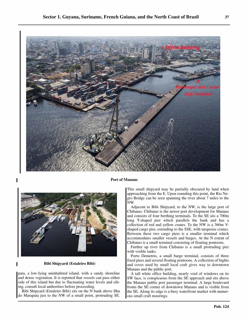
Sector 1. Guyana, Suriname, French Guiana, and the North Coast of Brazil 37
Pub. 124
pata, a low-lying uninhabited island, with a sandy shorelineand dense vegetation. It is reported that vessels can pass eitherside of this island but due to fluctuating water levels and silt-ing, consult local authorities before proceeding.1.66 Bibi Shipyard (Estaleiro Bibi) sits on the N bank above Ilhado Marapata just to the NW of a small point, protruding SE.
This small shipyard may be partially obscured by land whenapproaching from the E. Upon rounding this point, the Rio Ne-gro Bridge can be seen spanning the river about 7 miles to theNW.1.66 Adjacent to Bibi Shipyard, to the NW, is the large port ofChibatao. Chibatao is the newer port development for Manausand consists of four berthing terminals. To the SE sits a 700mlong T-shaped pier which parallels the bank and has acollection of red and yellow cranes. To the NW is a 360m V-shaped cargo pier, extending to the SSE, with turquoise cranes.Between these two cargo piers is a smaller terminal whichaccommodates smaller vessels and barges. At the N extent ofChibatao is a small terminal consisting of floating pontoons.1.66 Further up river from Chibatao is a small protruding pierwith visible tanks.1.66 Porto Demetrio, a small barge terminal, consists of threefixed piers and several floating pontoons. A collection of bightsand coves used by small local craft gives way to downtownManaus and the public port.1.66 A tall white office building, nearly void of windows on itsSW face, is conspicuous from the SE approach and sits abovethe Manaus public port passenger terminal. A large boulevardfronts the SE corner of downtown Manaus and is visible fromthe SE. Along its edge is a busy waterfront market with numer-ous small craft moorings.
1.66Port of Manaus
1.66Bibi Shipyard (Estaleiro Bibi)

38 Sector 1. Guyana, Suriname, French Guiana, and the North Coast of Brazil
Pub. 124
1.66 Pilotage.—Pilotage is compulsory. Vessels calling atManaus are served by the Pilots of the Amazon Basin; two pi-lots embark near Salinopolis Light for the round trip voyage.There is also local pilotage available at the port of Manaus. Lo-cal pilots board in the following locations:
1. Off Itacoatiara.2. Off Manaus Petrobras Terminal.
1.66 Contact Information.—See the table titled Manaus—Con-tact Information.
1.66 Anchorage.—Anchorage may be obtained anywhere off thecity, in depths from 28 to 34m, mud and sand. The current inthis vicinity averages 2 knots. The quarantine anchorage islocated in front of Ponta do Catalao, in depths of 18 to 20m.1.66 The best anchorage for ships waiting to moor at CopamTerminal is in depths of 20 to 40m, sand, below Ilha Marapatain mid-river abreast Paredao Agricultural School, which liesslightly below the terminal. 1.66 The Amazon River, known as the Rio Solimoes above itsjunction with the Rio Negro, trends WSW then WNW to thevicinity of the meridian 66°W, where the Rio Jurua flows intoit from S. In this reach the Rio Solimoes connects with the RioJapura from N and with the Rio Purus and the Rio Tefe from S.1.66 The Rio Solimoes then trends WSW to the town ofTabatinga; 5 miles W of Tabatinga is Leticia, Columbia.1.66 To the S of Leticia, on the opposite shore, is the mouth of theRio Javari, which forms the Peruvian boundary.The Rio Soli-moes trends WNW from here to Iquitos, Peru, which is 271miles from Tabatinga.1.66 The Amazon River above Tabatinga is known as the Rio Ma-ranon.
Manaus to Iquitos
1.67 Codajas (3°50'S., 62°05'W.) is about 164 miles fromManaus and stands on the N bank of the Rio Solimoes. Theport affords good anchorage, with mud bottom, in front of thecity where the current is weak. Small vessels can use the riverbank for mooring.1.67 Coari (4°07'S., 63°07'W.), located about 237 miles fromManaus and stands on the S bank of the Rio Solimoes. Vesselsmoor to the river bank in an area of about 198m with a depth of7m and very little currents. There are wooden stakes on theriver bank for attaching mooring lines. For detailed berthinginformation see the table titled Coari—Berth Information
Manaus—Contact Information
Port Captain
VHF VHF channel 16
Telephone
55-092-3241-1373
55-092-3320-3777
55-092-3320-3811
Port Operators
Telephone55-092-2123-4350
55-092-2123-4351
Facsimile 55-092-2123-4358
E-mail [email protected]
Web site http://portodemanaus.com.br
Refinery (REMAN)
Telephone55-092-3616-4010
55-092-8802-4048
Facsimile 55-092-3616-4313
Port Authority
Telephone55-092-3622-1330
55-092-3233-2689
Facsimile 55-092-3232-6253
E-mail [email protected]
Web site http://www.snph.am.gov.br
Petrobras Terminal Control
VHF VHF channel 9
Telephone 55-092-3616-4261
Facsimile 55-092-3616-4226
Petrobras Terminal Operators
Telephone55-092-3616-4014
55-092-3616-4261
Facsimile 55-092-3616-4272
Web site http://www.transpetro.com.br
Manaus Pilots
VHF VHF channel 16
Telephone55-092-3664-5728
55-092-3664-6634 (Traffic Control)
E-mail [email protected]
Web site http://www.manauspilots.com.br
PROA Pilots
VHF VHF channel 16
Telephone
55-092-3624-3649
550-92-9207-7913 (mobile)
55-092-9207-7813 (mobile)
55-092-3624-0041 (office)
55-092-9207-7048 (office mobile)
Facsimile 55-092-3624-5941
E-mail [email protected]
Web site http://www.proamanaus.com.br
Manaus—Contact Information

Sector 1. Guyana, Suriname, French Guiana, and the North Coast of Brazil 39
Pub. 124
1.67 Contact Information.—See the table titled Coari—Contact Information.
1.67 Tefe (3°22'S., 46°42'W.), located about 366 miles fromManaus and stands on the S bank of the Rio Solimoes at itsjunction with Lago Tefe. The port affords good shelteredanchorage, in a depth of 8m, with very little current.
1.67 Fonte Boa is located on the S bank of the Rio Solimoes,about 478 miles from Manaus. The port affords goodanchorage, in depths of 8 to 10m, with almost no current.Vessels can moor to the river bank.1.67 Porto Afonso (2°44'S., 66°55'W.) is situated close below themouth of the Rio Jutai, about 561 miles from Manaus. Thereare frequent severe storms, with predominating NE winds, inthis area. Small vessels can moor to the river bank in depths of3 to 5m. There is an anchorage that offers shelter from storms.1.67 Tonantins (2°47'S., 67°47'W.) is located on the N bank ofthe Rio Solimoes, close to the mouth of the Rio Tonantins,about 624 miles from Manaus. Approach to the port should bemade from the middle of the channel in order to allow the shipto head into the countercurrent which is formed by the eddy.The current in the middle of the channel is strong but weakensclose to the river bank. The anchorage is safe and sheltered.1.67 Anto Antonio do Ica (3°05'S., 67°57'W.), about 641 milesfrom Manaus, stands on the N bank of the Rio Ica nears itsjunction with the Rio Solimoes. The port has a safe anchorage,sheltered from the prevailing E wind, in depths of about 4 to7m. Vessels can moor to the river bank.1.67 Sao Paulo de Olivenca (3°27'S., 68°48'W.) on the S bank ofthe Rio Solimoes, about 723 miles from Manaus Anchorage, isafforded in front of the port, in a depth of 11m, mud bottom. Itis possible to moor to the river bank without much difficulty.
1.68 Benjamin Constant (4°22'S., 70°02'W.) lies on the Sbank of the Rio Solimoes at its junction with the lower mouthof the Rio Javari, about 870 miles from Manaus.
1.68 All ship maneuvers have to be made in the Rio Solimoessince the Rio Javari is very narrow.1.68 At the site of the anchorage, close to the bank, woodenstakes have been installed to aid in mooring.1.68 Caution should be exercised to avoid grounding during theLW season.1.68 Tabatinga (4°15'S., 69°57'W.) is located on the N bank ofthe Rio Solimoes, about 869 miles from Manaus and near theboundaries of Columbia and Peru. The port has two wharveswhich are suitable for small craft. There are two anchorage ar-eas, with depths of 8 to 10m, and very weak river current.1.68 Leticia (4°09'S., 69°57'W.) stands on the N bank of the RioMaranon, about 5 miles NW of Tabatinga. Anchoring is notrecommended in view of the strong current fronting the port,which may attain a rate of 2.3 knots.
Iquitos (3°58'S., 73°22'W.)
World Port Index No. 12570
1.69 The port of Iquitos, about 1,146 miles from Manaus,is the capital of the Peruvian Department of Loreto and thecommercial center of the region. The port stands on the N bankof the Rio Maranon between the city and a small island whichlies parallel to and about 0.5 mile from it. A strong current atthe port maintains a deep channel close off the city.1.69 The river level begins to drop in mid-May at Iquitos whereasat Manaus this occurs during the end of June. At Iquitos, therange between normal low and high river is about 7.5m, but
Coari—Contact Information
Terminal Control
VHF VHF channel 3
Telephone 55-097-3303-2683
Facsimile 55-097-3561-2255
Pier No 1
VHF VHF channels 6 and 9
Telephone 55-097-3303-2619
Pier No 2
VHF VHF channels 6 and 9
Telephone 55-097-3303-2618
Terminal Operators
Telephone55-092-3621-1800
55-097-3561-2971
Web site http://www.transpetro.com.br
Port Captain
VHF VHF channel 16
Telephone 55-092-3621-1800
Facsimile 55-092-3633-2334
Coari—Contact Information
Coari—Berth Information
Berth Length DepthMaximum Vessel
RemarksLOA Draft
Petrobras Gas Terminal
POF-140m — 185m
8.5m Oil. Length of 242m with dolphins.
POF-2 6.9m LPG. Length of 242m with dolphins.

40 Sector 1. Guyana, Suriname, French Guiana, and the North Coast of Brazil
Pub. 124
this range varies from year to year.1.69 The port can be reached by ships drawing 4.6m year round.From June through August in the HW season, ships drawing upto 7.3m can reach the port.1.69 Anchoring in the vicinity of the port is not recommended asthere are several wrecks whose positions are not accuratelyknown.1.69 Vessels berth at a floating metal pontoon dock, 240m inlength, which can accommodate two ocean-going vessels atone time. 1.69 Care is required while maneuvering along the pier so as notto break the lines, as the eddies and currents are strong. 1.69 At times the ship is pushed against the pier and at other timesthe ship is set away from the pier. Bow lines should be securedas soon as possible and the bow should not be allowed to swingaway from the pier. The current alongside the pier attains a rateof about 1 to 2 knots.1.69 Depths and Limitations.—For berthing information, seethe table titled Iquitos—Berthing Information.
1.69 It is stated that vessels drawing up to 4.3m can reach Cuidadde Yurimaguas, on the Rio Huallaga, a tributary of the Rio Ma-ranon, 354 miles above Iquitos, without difficulty.1.69 Contact Information.—See the table titled Iquitos—Con-tact Information.
Tributaries of the Amazon River
1.70 The principal tributaries on the N bank of the AmazonRiver in Brazil are the Rio Negro and its tributary of the RioBranco, the Rio Japura, and the Rio Ica.1.70 The principal tributaries on the S bank are the Rio Tocantins,the Rio Xingu, the Rio Tapajos, the Rio Madeira, the Rio Pu-
rus, and the tributaries of the Rio Acre, the Rio Tefe, the RioJurua, and the Rio Javari.1.70 Pilots for the Rio Tocantins, the Rio Madeira, and the RioPurus can be best obtained at Belem; pilots for the other tribu-taries of the Amazon River can be best obtained at Manaus.1.70 The Rio Tocantins is about 1,600 miles long, flows Nthrough Brazil, and discharges its waters by a mouth about 10miles wide into the Rio Para, about 40 miles WSW of Belem. 1.70 Although the Rio Tocantins is considered one of the tributar-ies of the Amazon River, the river does not, strictly speaking,belong to the Amazon River system. The principal tributary ofthe Rio Tocantins is the Rio Araguaia, which rises in about lat-itude 18°S.1.70 To enter the Rio Tocantins, a ship can pass on either side ofBanco do Otelo, a large drying sand bank, the NE extremity ofwhich lies about 9 miles E of Mandii Light. The channel be-tween Ilha Mandii and Banco do Otelo should not be attemptedat night.1.70 The Rio Tocantins is navigable by small craft for about 120miles above Cameta. The land is low and wooded. Its generalappearance is so uniform that it is difficult to distinguish onepart from another. Local knowledge is necessary for safe navi-gation.1.70 Anchorage can be taken, in about 14m, about 0.2 mile offCameta.1.70 Cameta (2°15'S., 49°30'W.) (World Port Index No. 12500)stands on the W bank of the Rio Tocantins, about 90 milesfrom Belem. The town is built on the river bank and is an im-portant trade center. The tidal range is about 3m; the current at-tains a rate of about 2.5 knots.
1.71 The Rio Xingu (1°32'S., 51°52'W.) is about 1,200miles long and can be navigated for about 105 miles above itsmouth to Cachoeiras de Itamaraca. It can be navigated by ves-sels with drafts of up to 2.5m during the HW season, from Feb-ruary to July.1.71 The Rio Tapajas flows into the Amazon River near Santar-em. The river is navigable for about 170 miles above the city tothe first falls.1.71 At low and middle periods of the river level, the tidal cur-rents are felt. These currents can be seen by the presence ofyellow water in the river, which is normally clear.1.71 Fordlandia (3°40'S., 55°30'W.) is located on the E bank ofthe Rio Tapajos, about 98 miles from the river mouth. There isa small pier, with depths of 3.7m at LW and 9m at HW. Theport is used mainly for the export of rubber and lumber.
1.72 The Rio Madeira (3°23'S., 58°46'W.) is the most im-portant tributary of the Amazon River. It is near the W end ofIlha da Trindade. 1.72 The river rises in the S part of Bolivia and has a total lengthof about 2,000 miles. A number of tributaries branch out fromthe Rio Ma99deira.1.72 Porto Velho (8°46'S., 63°54'W.) stands on the E bank of theRio Madeira, about 611 miles from its mouth. The port can bereached by vessels with drafts up to 6.1m at HW and 2.1m atLW. The range of the river is about 12m and the current has avelocity of 4 to 6 knots.1.72 Above Porto Velho, a stretch of the river is impassable due torapids, but above the rapids, its tributaries the Rio Mamore and
Iquitos—Berthing Information
Berth Length Remarks
Passenger Terminal
No. 23 — Fast ferry
Terminal Portuario de Iquitos
No. 1 114m Breakbulk
No. 2 72m Breakbulk
Petro Peru—Iquitos Refinery
No. 1 20mBio fuels, crude, and clean and dirty productsNo. 2
50mNo. 3
Iquitos—Contact Information
VHF VHF channel 16
Telephone51-065-251955 (Head Office)
51-065-252275 (Operations)
E-mail [email protected]
Web site http://www.enapu.com.pe

Sector 1. Guyana, Suriname, French Guiana, and the North Coast of Brazil 41
Pub. 124
the Rio Guapore, which forms the boundary between Boliviaand Brazil, are navigable by river craft for a distance of 400miles.
1.73 The Rio Negro enters the Amazon River nearManaus, about 917 miles from Belem. 1.73 The river is navigable by boats up to the town of Santa Isa-bel (00°25'S., 65°01'W.), 423 miles from Manaus. 1.73 Off Manaus, the river is about 2 miles wide. Above Manausthe river widens forming Baia de Boiucu and then narrowsagain about 60 miles farther, off Ponta da Tatuquara.1.73 Navigation along the river banks is not possible, especially atlow river, due to extensive shoals and sand flats which are oftenawash and between which the fairway winds. 1.73 Along most of the stretch from Manaus to Santa Isabel theriver banks are difficult to distinguish due to the presence ofthe great number of islands. 1.73 The river bed is rocky near Santa Isabel and during the dryseason there may be one or two passes with depths of not morethan 1m. The river level begins to rise about 2 months laterthan that of the Amazon River and has a range of between 6and 8m.
1.74 The Rio Branco is the largest and most important trib-utary of the Rio Negro and joins it 193 miles above Manaus. Itis formed by the confluence of five rivers, all of which rise nearthe Venezuelan and Guyanian borders. It has a range of 8mnear its mouth and 6m in its upper reaches. 1.74 The current averages 2 knots. It is navigable by vessels up to3.6m draft for a distance of 200 miles. 1.74 Boa Vista (2°49'N., 60°40'W.) is the principal town on theriver. The river banks are low for the greater part of the lowerreaches from its mouth with small lakes in the neighboring for-ests, even during the dry season. In the upper reaches, the river-banks are higher.1.74 The Rio Purus rises in Peru and enters the Rio Solimoesfrom the SW about 117 miles from Manaus. The river is navi-gable year round for a distance of 715 miles by vessels withdrafts of up to 2.7m. The range of the river varies from 10 to17m. The current varies from 2 to 6 knots.1.74 The Rio Acre, the main tributary of the Rio Purus, is naviga-ble at high river as far as the town of Xapuri (10°39'S.,68°31'W.), about 350 miles above its mouth and near theboundary with Bolivia.1.74 The Rio Japura enters the N bank of the Rio Solimoes fromWNW. The Rio Japura is navigable during the dry season bysmall craft drawing up to 1m. 1.74 During the rainy season, river craft can ascend for about 400miles to Vila Bittencourt. 1.74 Vila Bittencourt (1°27'S., 69°25'W.), the farthest upriverport in Brazil, stands on the N bank of the Rio Japura near theboundary with Colombia.1.74 The Rio Jurua rises in Peru and enters the S bank of the RioSolimoes, about 511 miles from Manaus. The river is navigableyear round as far as the mouth of the Rio Tarauaca for about1,198 miles from its junction with the Rio Solimoes. Duringthe rainy season, the Rio Jurua is navigable 1,030 miles fartherto the mouth of the Rio Breu.1.74 Cruzeiro do Sul (7°39'S., 72°37'W.), one of the leading
towns of Territorio do Acre, is situated on the Rio Jurua, about686 miles from the mouth of the Rio Tarauaca.1.74 The Rio Tarauaca is navigable during the rainy season as faras the city of Tarauaca, situated on the W bank.
1.75 The Rio Ica (Rio Putumayo) enters the N bank of theRio Solimoes, about 640 miles from Manaus. 1.75 The river is navigable by small craft drawing up to 1.5m asfar as Puerto Leguizamo, Colombia (00°12'S., 74°46'W.). 1.75 The Rio Ica is one of the most important tributaries of theAmazon River due to the mineral and vegetable products foundin its vicinity. The river is about 900 miles long and has severaltributaries, some of which are navigable. The river rises fromMarch to July and falls from August to February. The currentruns from 1 to 3 knots in its lowest part and from 3 to 7 knots inits upper part.1.75 The Rio Javari (Rio Yavari) enters the S bank of the Rio So-limoes near Benjamin Constant. The greater part of this riverforms the boundary between Brazil and Peru. The Rio Javari istortuous but the river is navigable by small craft during therainy season.1.75 The Rio Napo rises in Ecuador on the E slope of Volcan Co-topaxi and enters on the N bank of the Rio Maranon, about 42miles below Iquitos. The river is sluggish, with depths of about1.2m, and is navigable by river craft of light draft as far as itsjunction with the Rio Coca, about 523 miles above its mouth.The Rio Napo is swift above its junction with the Rio Cocawhere the river bed changes from shifting sand to rock. 1.75 The Rio Pastaza rises in the central part of Ecuador and en-ters on the N bank of the Rio Maranon in approximate position4°53'S, 76°20'W. The river is navigable by small river craft forabout 180 miles from its mouth during the dry season and forabout 300 miles during the rainy season. The Rio Pastaza is ob-structed by sand banks and snags; its rise and fall are rapid anduncertain.
1.76 The Rio Morona rises in Ecuador on the E slope of themain chain of the Andes and enters the Rio Maranon near thetown of Borja (4°26'S., 77°33'W.). The river is navigable bysmall river craft for about 300 miles during the rainy season.Canoes can ascend many of its branches. The Rio Moronaflows through a fertile region; gold washing takes place on itsbanks.1.76 The Rio Ucayali rises in the S part of Peru and enters the Sbank of the Rio Maranon in about longitude 73°30'W. The riveris navigable by coasters as far as its junction with the Rio Apu-rimac, about 800 miles above its mouth.
1.76 Pucallpa (8°22'S., 74°32'W.) stands on the W bank of theRio Ucayali, about 533 miles from Iquitos. The town maintainsregular river service with ships of 3,000 dwt. There is a wood-en wharf at which ships can berth at any level of the river. Thecontrolling depths at high and low river are about 9m and 2.7m,respectively.1.76 The Rio Huallaga rises in the mountains of Peru and entersthe S bank of the Rio Maranon in about latitude 5°S. The riveris navigable by river boats as far as Yurimaguas, about 96 milesfrom its mouth, and by launches as far as Chasuto, about 181miles from its mouth.

45
Pub. 124
2. Sector 2—North Coast of Brazil—Ponta Curuca to Ponta de Santo Antonio
2.0Additional chart coverage may be found in NGA/DLIS Catalog of Maps, Charts, and Related Products (Unlimited Distribution).SECTOR 2 — CHART INFORMATION

47
Pub. 124
SECTOR 2
NORTH COAST OF BRAZIL—PONTA CURUCA TO PONTA DE SANTO ANTONIO
2.0 Plan.—This sector describes the N coast of Brazil from Pon-ta Curuca to Cabo Calcanhar and the NE coast from Cabo Cal-canhar to Ponta de Santo Antonio. The N coast sequence isfrom W to E and the NE coast sequence is from N to S. 2.0 Penedos de Sao Pedro e Sao Paulo, Arquipelago de Fernan-do de Noronha, and Atol das Rocas are also described in thissector in the above order.
General Remarks
2.1 Winds—Weather.—Along the stretch of coast NE ofSalvador, the direction of the trade winds varies an average of045° during the contrary monsoons. They are E during themonths of February, March, and October, ENE during Novem-ber and December; and ESE from April to September.2.1 Other winds and weather of a local nature are discussed insequence along with related geographical features.2.1 The year has two seasons, the rainy season and the dry sea-son. The rainy season is between January and May. The dryseason is between June and December.2.1 The prevailing winds are from the NE.Weak and short-livedwinds blow from S and W during the rainy season. 2.1 At times, there are heavy rains from the NW and SW duringFebruary, March and April.2.1 In the dry season, winds are from the ENE. At times, thereare fresh N winds during the day, which weaken at night. Thereis some rain even during the dry season.2.1 In the afternoon there is a sea breeze and at night there is aland breeze.
Tides—Currents.—The tidal currents off the whole of thiscoast are very regular, with their rates increasing progressivelyto the W. The current in both directions follows the trend of thecoast, and are stronger close inshore and in shallow water, butin general their influence is not felt more than 6 to 8 miles off-shore.2.1 In the vicinity of Cabo Calcanhar (5°10'S., 35°29'W.), therate of the current never exceeds 1 knot, but between Ilhas deSao Joao and Ilha de Santana, there are usually rates from 2 to3 knots, and on a few occasions 4 to 5 knots.2.1 Off the coast between Ponta da Atalaia and Ilhas de SaoJoao, the tidal currents are sometimes felt as much as 20 milesoffshore. The SW current generally runs SW near the coast andWSW or W some distance from it. Near the land, it has a meanrate of 2.5 knots at springs and 1.75 knots at neaps, but the ratediminishes as the distance offshore increases. The NE currentruns ENE close inshore at a rate of 1.75 knots at springs and 1knot at neaps, and trends N with diminishing strength in pro-portion to the distance offshore. 2.1 The difference between the rate of the SW current and that ofthe NE current is the result of a general set W from 18 to 24miles a day during the greater part of the year; however, duringthe months of March, April, and May, the set may sometimesbe E at the same rate.2.1 Aspect.—The coast from Ponta Curuca to Ilha de Santana,
about 275 miles ESE, is low, formed by sandhills 45 to 75mhigh, and indented heavily with bights. 2.1 The indentations are so numerous along this stretch of thecoast that they may be difficult to distinguish from one another. 2.1 The coast consists of several sandhills which are also similarin appearance and which are interspersed with reddish cliffsand clumps of mangroves.2.1 This part of the coast is imperfectly surveyed and should beapproached with caution and not within the 20m curve. 2.1 Several rivers flow into the sea along this section of thecoast. The silt carried out by these rivers forms shoals whichextend, in places, as far as 20 miles from their mouths. 2.1 These shoals, taking the name of what ever geographic fea-ture is closest, form an extensive coastal bank along this entirecoast. Constant soundings should be taken when in this vicini-ty.
Caution.—The coastal bank contains most dangers alongthis part of the coast. However, depths of less than 18.3m arecharted outside the 20m curve. 2.1 The 20m curve lies as far as 13 miles offshore, except be-tween Ilhas de Sao Joao and Ilha Mangunca, where it lies as faras about 32 miles.
2.2 Banco Hylas (0°18'S., 47°18'W.) is an extensiveshoal with a bottom of rock in places. The middle of the banklies about 18 miles N of Salinopolis Light. The minimum depthon the bank is 11.2m.2.2 Banco Buckle (0°17'S., 47°00'W.), with a least depth of7.5m, is charted about 30 miles NE of Salinopolis Light. 2.2 Recife Manoel Luis (0°52'S., 44°16'W.) is a dangerousgroup of drying rocks, surrounded by shoals, on a bank withdepths of less than 10m, lying 48 miles NNE of Ilha Mangun-ca. The sea breaks over these rocks at LW. It is almost impossi-ble to see them unless they are passed nearby. 2.2 The depths and nature of the bottom near Recife Manoel Lu-is are so variable that soundings give no indication of nearnessto this danger. 2.2 Changes in depths and in the position of banks and shoalshave been observed for a long period of time along this stretchof the coast, not only close to shore, but also well offshore.
Ponta Curuca to Ilha de Santana
2.3 Ponta Curuca (0°33'S., 47°49'W.) is located on the Nextremity of Ilha de Curuca. The point is conspicuous becauseit is the highest point of land in the area. A light is shown fromthe W side of Ilha de Cajutuba, about 3 miles ESE of PontaCurca.
Ponta do Algodoal (0°35'S., 47°35'W.), the N extremity ofIlha do Algodoal, and from which a light is shown, lies about13 miles E of Ponta Curuca. The point is distinguished by asmall hummock with a notch in it and by its sandy beach andprominent sand dunes. When seen from offshore, the pointlooks like a nipple; when seen from the E the point looks like

48 Sector 2. North Coast of Brazil—Ponta Curuca to Ponta de Santo Antonio
Pub. 124
an island.2.3 Baia de Salinas is entered between Ilha do Marco and Pontada Atalaia, about 6 miles to the E. The bay affords shelter tosmall craft entering on the tide.
2.3 The town of Salinopolis is located on a wooded plain on theE side of the bay. 2.3 Salinopolis (0°37'S., 47°21'W.) is the base station for theRio Para pilots. The town stands on a red cliff. The land slopesdownward to the W of the town to a mass of tall trees. 2.3 Vessels approaching the pilot station will first sight the light,which stands in a town, then four radio towers, and then awhite church tower. Deep draft ships approaching the pilot sta-tion from the N can anchor with the light bearing 175°, distant4.5 miles, in depths of 10 to 14m, mud.2.3 Salinopolis provides pilotage for the Amazon River (seeparagraph 1.410, the Rio Para (see paragraph 1.49), and Belem(see paragraph 1.53).2.3 Ponta da Atalaia (0°36'S., 47°19'W.), located about 3 milesENE of Salinopolis Light, is the most conspicuous and easilyrecognizable point in the area. It is formed by sandy terrainwith marks of red earth. A high lookout mast stands on thepoint near the ruins of a lighthouse. 2.3 When approaching from the E, the point, when initiallysighted, gives the impression of being an island. From the samedirection, Monte Piraucu, a small hill lying 8 miles S of the
point, can be seen in clear weather rising from the surroundingland.
Ponta da Atalaia to the Rio Gurupi
2.4 The coast from Ponta da Atalaia trends ESE for about43 miles to the N end of Ilha Boiucucanga. This part of thecoast is fringed by several islands, between which are bays,formed generally of river estuaries. The entire coast is borderedby a sandbank which extends as far as 4 miles N from the is-lands. 2.4 Ponta Boiucucanga (0°48'S., 46°38'W.) is the NE extremityof the island of the same name. The point is higher and moreconspicuous than any in the area. A light is shown 0.3 mileSSE of the point.2.4 Baia do Caete is entered between Ilha Boiucucanga and IlhaCamarauacu, about 13 miles to the ESE. Ilha Camarauacu issurrounded by sandy beaches which are visible at a distance ofabout 8 miles. Ships drawing up to 2m and with local knowl-edge can reach the town of Braganca, located on the W bank ofthe Rio Caete, about 10 miles above its mouth.2.4 The coast from Ilha Camarauacu trends ESE for about 25miles to the estuary of the Rio Gurupi. 2.4 The entire coast is bordered by a sand bank extending as faras 6 miles N from the islands which fringe it. These islandsform several narrow and shallow channels which afford shelterfrom offshore winds. 2.4 Baia do Guaperoba lies between Ilha Camarauacu and Ilhado Apeu, about 10 miles to the E. The SE part of the bay is thedeepest, but local knowledge is essential as there are manyshoals within the bay. 2.4 The Rio Gurupi (1°04'S., 46°02'W.), about 389 miles long,flows into Baia do Gurupi, about 10 miles SE of Apeu Light,which is located on Cabo Gurupi. Sand banks obstruct the estu-ary and extend about 8 miles N from the mouth of the river.The river is navigable by small craft, with local knowledge andat high water, as far as Viseu, located about 20 miles above itsmouth. During the rainy season, small craft can ascend the riv-er to its source.
The Rio Gurupi to Baia de Sao Marcos
2.5 The coast from the estuary of the Rio Gurupi trendsESE for about 70 miles to Ilhas de Sao Joao. Sand banks,which break during onshore winds, extend as far as 10 miles Nfrom the islands which fringe this part of the coast. These is-lands form sheltered channels for small craft but should onlybe approached with local knowledge. 2.5 Monte Piracoaua, small but prominent, as it is the only hillalong this stretch of the coast, stands about 36 miles SE of thelight on Cabo Gurupi. 2.5 Tides off this section of the coast are semi-diurnal. Theyhave great amplitude and can reach 7m during the spring tidesclose to the equinoxes. 2.5 During January, February, July, and August, the current isfrom the W with a rate of 1.6 to 2 knots. During the rest of theyear, the current is from the WNW with a rate of 1 to 2 knots. 2.5 Baia de Turiacu (1°30'S., 45°15'W.) forms the estuary ofseveral small rivers and is encumbered with sand banks. A nar-row and sinuous channel that has frequent variations gives ac-
2.3Salinopolis Light

Sector 2. North Coast of Brazil—Ponta Curuca to Ponta de Santo Antonio 49
Pub. 124
cess to the town of Turiacu, on the W bank of the Rio Turiacu. 2.5 The channel is very dangerous and can only be entered bysmall vessels with local knowledge. 2.5 Ilhas de Sao Joao (1°19'S., 44°56'W.) consists of a group ofseven low islands, separated from each other by narrow chan-nels, located about 18 miles NE of Baia de Turiacu. 2.5 Ilha Maiau, the northernmost and largest of the group, iscovered with sand dunes and shows a light on its N side. Ilhados Lencois is the easternmost of the group and consists solelyof white sand dunes. The other islands of the group are Ilh a doGuara, Ilha Urumaru, Ilha Mirinzal, Ilha do Porto do Meio, andIlha Aracaja. There are numerous drying sandbanks betweenthe islands and the coast. Depths of less than 10m extend up to12 miles NE of Ilha Maiau and Ilha Lencois.2.5 Anchorage.—Anchorage, sheltered from all except Ewinds, may be obtained by ships with a draft of up to 5m infine sand in the bay SE of the islands, close S of the SW pointof Ilha Lencois. The bay is obstructed by sand banks beyondthis anchorage. The tidal current in the anchorage runs ENEand WSW at rates of up to 3 knots, changing direction at HWand LW.
2.6 The coast from Ilhas de Sao Joao trends SE for about60 miles to Ponta Itacolomi. Several shoals lie within and nearthe 32m curve along this part of the coast. The coastline isfringed by several islands, between which are bays, formedgenerally of river estuaries. Drying sand banks, marked bybreakers around the edges, lie up to 10 miles off the coast.2.6 Ilha Mangunca (1°36'S., 44°39'W.) is located about 24miles SE of Ilha Lencois. The island is wooded and shows alight from its E side. Close W of its S point, there is anchorage,sheltered from all winds, in depths of about 8m, sand, accessi-ble to vessels with local knowledge.2.6 Ponta de Itacolomi (2°09'S., 44°28'W.) is formed by highreddish cliffs covered with scrub. Morro Itacolomi rises to anheight of 69m, 1.5 miles SE of the point, and is visible up to 20miles in clear weather.2.6 Ponta Pirajuba (2°13'S., 44°24'W.) is a rocky steep pointwith red cliffs that are visible a good distance offshore. A lightis shown from the point, 5 miles SE of Ponta Itacolomi.
Baia de Sao Marcos
2.7 Baia de Sao Marcos (2°21'S., 44°17'W.) is enteredbetween Ponta Itacolomi and the NE extremity of Ilha do Ma-ranhao (Ilha de Sao Luis). This bay is the deepest of all alongthe N coast of Brazil. The bay is much encumbered by sand-banks, through which, however, there are channels which canbe used by deep draft vessels.2.7 Winds—Weather.—The year has two seasons, the rainyseason and dry season. The rainy season is January to May andthe dry season from June to December. 2.7 Visibility is usually good in the bay. The occurrence of fog isvery rare; however, some mist may occur, which brings a slightreduction in visibility.2.7 Heavy, but short, rain storms are common during the rainyseason. 2.7 The predominant wind is from the E most of the year, withthe exception of January and April (from N), March and Octo-ber (from SE), and August (from SW). The average wind force
in this area is 2 to 5 on the Beaufort scale. 2.7 Tides—Currents.—In Baia de Sao Marcos, the current isquite strong and can reach 6 knots between the banks. Themaximum tidal velocities occur 3 to 4 hours after HW and 2 to3 hours after LW. 2.7 Strong eddies provoked by tidal currents are observed NE ofBanco dos Almas and close to the port of Itaqui.
2.8 Ponta Pirarema (2°20'S., 44°22'W.) is located about12 miles SSE of Ponta Itacolomi and consists of high red cliffs. 2.8 On the cliffs S of the point is a very remarkable red patchwhich is most visible from seaward when bearing more than270°. A drying reef extends 0.5 mile NE from the point. 2.8 Ponta de Sao Raimundo lies 3.5 miles SSW of Ponta Pi-rarema and Ponta Tatinga lies 1.5 miles farther SW. Betweenthese two points there is a very conspicuous white sand hill.Also conspicuous is a small hill on Ponta Tatinga.2.8 Alcantara, built on a hill, is situated about 1.7 miles W ofPonta Tatinga and a light is shown close S of Alcantara.
Morro Aracagi (2°27'S., 44°09'W.), 51m high, rises on theN side of Ilha de Sao Luis and is the first land sighted when ap-proaching from the NE. A light is shown from the W side ofMorro Aracagi.
2.8Aracagi Light

50 Sector 2. North Coast of Brazil—Ponta Curuca to Ponta de Santo Antonio
Pub. 124
2.8 Ponta de Sao Marcos (2°29'S., 44°18'W.), about 9 milesWSW of Morro Aracagi, marks a sharp turn of the shore at theNW extremity of Ilha de Sao Luis. Extensive shoals extend NEof the point to a distance of almost 4 miles. A light is shownfrom a conspicuous fort which stands on the point. A danger-ous wreck lies about 0.7 mile WNW of the point.2.8 Ponta da Areia, low and sandy, lies about 2 miles SW ofPonta de Sao Marcos. The point is fronted by a sand bank, withdepths of less than 1.8m, which lies up to 1.3 miles offshore.2.8 Ilha do Medo lies about 3 miles WSW of Ponta da Areia.Rocks, above and below-water, extend about 0.6 mile NE ofthe island. Canal do Boqueirao lies between the S side of Ilhado Medo and the shoals which extend from Ilha de Sao Luis. 2.8 The canal should not be attempted without a pilot. A light isshown from the island.
2.9 Ponta da Madeira (2°34'S., 44°23'W.), the W ex-tremity of Ilha de Sao Luis, lies about 3 miles SSW of the Sside of Ilha do Medo. A disused lighthouse stands on the point.2.9 Ponta da Madeira Iron Ore Terminal (2°34'S., 44°23'W.)is situated at the end of Ponta da Madeira. 2.9 Depths—Limitations.—A berthing quay, lying N to S andabout 250m long, with three dolphins at each end, is connectedto the shore by a jetty. 2.9 It is protected by two stone breakwaters which project, re-spectively, 1,050m NW and 312m SW from the shore at eitherend of the berth. A light is shown from the end of each break-water.
2.9 Four berths are designed to accommodate vessels up to420,000 dwt, with drafts up to 23m. Berth 1 can accommodatevessels up to 365m in length, 66m beam, and 23m draft. Berth2 can accommodate vessels up to 280m in length, 50m beam,and 18m draft. Berth 3 can accommodate vessels up to 365m inlength, 65m beam, and 21m draft. Berth 4 can accommodatevessels up top 365m in length, 66m beam, and 23m draft. Aproject is underway (2010/11) to dredge and allow for a depthof 25m alongside. For further information see the table titledItaqui—Berth Information in paragraph 2.11.2.9 The breakwaters are designed to divert the tidal currents torun parallel to the quay at a maximum speed of 3 knots, whichis the limiting condition for berthing vessels over 100,000 dwt.2.9 Mooring maneuvers should be carried out against the cur-rent.2.9 Pilotage.—Pilotage is compulsory and reported available 24hours. Vessels should send their ETA 15 days (or on leavingprevious port, if nearer) and 8 days in advance, stating:
1. DWT in tropical waters.2. LOA.3. Beam.4. Maximum draft in tropical waters.5. Arrival draft and expected departure draft.6. Cargo plan and loading sequence.7. Air draft.8. Deballasting time.9. Water requirements.10. Gas-free condition.11. Details of mooring lines.12. Master's name.
2.9 Vessels should send a message 48 hours in advance (with re-quest for pilot and anchorage instructions) and 24 hours in ad-
vance (with gas-free condition and any amendments toprevious messages) through Sao Luis (PPB). Contact the termi-nal on VHF 4 hours prior to ETA to confirm the pilotage re-quest.2.9 Pilots board, as follows:
1. Vessels with a draft of 11m or less—about 4 milesWNW of Ponta do Sao Marcos Light.
2. Vessels with a draft of over 11m or over 100,000dwt—2 miles NNE of Lighted Buoy No. 19 and LightedBuoy No. 24.
2.9 Contact Information.—See the table titled Ponta da Ma-deira—Contact Information.
2.9 Directions.—With Morro Itacolomi bearing 270°, distantabout 17 miles or with Pirajuba Light bearing 257°, distant 14miles, Morro Aracagi Light will bear about 175°. 2.9 Steer a course of 212° to pass between Banco do Meio andBanco das Almas, in depths of 25 to 35m. This channel is mostfrequently used for entering Baia de Sao Marcos and is laiddown on the chart. 2.9 Vessels bound for Porto de Itaqui continue on the 212°course until Isla do Medo Light bears 139°, then change courseto 180° which leads to the anchorage and pilot boarding areaW of Ponta do Madeira. 2.9 The channel E of Banco do Meio is not recommended andshould not be attempted for entering Baia de Sao Marcos. 2.9 Caution.—All along Baia de Sao Marcos there are strongebb and flood tidal currents. These currents, which may reach 6knots, have been causing the loss of anchors of anchored ves-sels, therefore, creating great risk of running aground on the in-numerable sand banks and shoals which exist in the bay. 2.9 Banco das Almas, an extensive shoal with depths of 3.6 to9.1m, sand and shells, lies with its N extremity about 12 milesE of Ponta de Itacolomi. A 11m patch lies about 2 miles E ofthe NE extremity of Banco das Almas.2.9 Banco do Meio, a bank of fine sand 13 miles long, with
Ponta da Madeira—Contact Information
Pilots
See Itaqui Pilots in paragraph 2.11.
Terminal
VHF VHF channels 15 and 16
Telephone 55-098-3222-2816
Web site http://www.vale.com
Operations Manager
Telephone 55-098-3222-8722
General Manager
Telephone 55-098-3221-5189
Facsimile 55-098-3221-5189
Tugs
VHF VHF channel 13
Agents
VHF VHF channel s12 and 13

Sector 2. North Coast of Brazil—Ponta Curuca to Ponta de Santo Antonio 51
Pub. 124
depths of less than 10m, lies in the middle of Baia de do Mara-nhao, about 10 miles NW of Ilha de Sao Luis. The NW edge issteep-to and should be given a wide berth. 2.9 A dangerous wreck lies on the SW end of the bank. Thebank, which has a least depth of 2.1m, breaks at LW. 2.9 Ships should not approach Baia de Sao Marcos betweenBanco do Meio and the N side of Ilha de Sao Luis as severalunmarked shoals lie within this area.2.9 Banco da Cerca, a sand bank 4 miles long, lies about 2.2miles NW of Ponta da Areia. It has a least known depth of0.2m located near the middle of the shoal, but there are reportsthat rocky heads exist elsewhere on the bank. 2.9 The sea is reported to break over the whole length of thisshoal at LW. The tidal currents near the shoal attains a rate of 5knots at times.2.9 Banco de Sao Macos, a sandbank that uncovers at LW, liesfrom 1 to 3.5 miles NE of Ponta de Sao Marcos. 2.9 Banco das Almas and Banco do Meio are reported to be ex-tending to the NE. Several reefs and shoals lie between Bancode Cerca and Ilha do Medo. 2.9 Pedra do Severino, 1.3 miles NNE of Ilha do Medo Light,has a depth of 2.4m. Extensive shoals with rocks extend up to1.5 miles NE of Ilha do Medo with a minimum depth of 1.4m. 2.9 A sunken wreck, marked by a light, lies 2.5 miles W of Ilhado Medo. Cabeco Mearim, an extensive shoal with rocks, lies0.75 mile SSW of the point of Ilha do Medo. The shoal has a
depth of 4.4m and is marked by a buoy.2.9 The NE edge of a shoal with a least depth of 2.5m lies about3.2 miles SW of the light on Ilha do Medo.2.9 Ilha de Guarapira, marked by a light, lies just over 0.5 mileSSE of Ponta da Madeira Light. It lies on a rocky shoal withdepths of 3.4 to 10m. The NNW, NE. and SE ends are markedby lighted buoys. A depth of 7.7m lies just over 0.5 mile WSWof Ilha de Guarapira Light.
2.10 Sao Luis (2°32'S., 44°17'W.) (World Port Index No.12590) has silted up and has ceased to be important as a portafter the construction of the port of Itaqui. 2.10 The port of Sao Luis is used mainly by fishing boats andpleasure craft. The port has a few piers that allows mooring,but only at flood tide, to ships of 2.5 to 3.5m draft. The quaran-tine anchorage is WNW of Ponta da Areia.
2.11 Itaqui (2°34'S., 44°22'W.) (World Port Index No.12585) is located about 6 miles WSW of Sao Luis, on the is-land of San Luis in the Bay of Sao Marcos. 2.11 Depths—Limitations.—A wharf extends up to 0.3 milesfrom the shore, with a jetty extending NNW and WNW formits N end. Ilha de Guarapir which lies 0.2 miles W of the wharfhas two shoal areas with depths of 3.4m and 4m marked bylighted buoys. A light buoy marks a bank with a least depth of5.1m, extending.015 miles NNW from the island.
Itaqui—Berth Information
Berth No. Length DepthMaximum Vessel
RemarksLOA Draft Beam
Vale Terminal
105 (P2) 280m 18m 230m 17.5m 38.0m General cargo.
P1 — 23m 365m 23.0m 70.0m Iron ore. Berthing length of 442m (in-cluding dolphins).
P3 N 305m 21m 365m 17.3m 66.0m Iron ore. Berthing length of 610m (con-tinuous).
P3 S 305m 21m 365m 20.3m 66.0m Iron ore. Berthing length of 610m (con-tinuous).
Pier 4 N — 23m 365m 21.5m 66.0m Iron ore. Berthing length of 480m (in-cluding dolphins).
Pier 4 S — 23m 365m — 66.0m Iron ore. Berthing length of 495m (in-cluding dolphins).
Alumar Terminal
No. 1 260m 13m 225m 11.5m 32.3m Alumina, bauxite, and coal. Berthinglength of 480m (continuous).
No. 2 220m 13m 229m 11.5m 32.3m Alumina, bauxite, and coal. Berthinglength of 480m (continuous).
Empresa Maranhense de Administracoa Portuaria (EMAP)
102 223m 12m 200m 11.5m 32.0m General cargo.
104 200m 13m 186.4m 12.5m 40.0m General cargo.
Terminal de Graos do Maranhao (TEGRAM)
100 320m 15m 240m 14.5m — General cargo.

52 Sector 2. North Coast of Brazil—Ponta Curuca to Ponta de Santo Antonio
Pub. 124
2.11 Cargo vessels may moor day or night, depending on the tide;however, vessels with a draft greater than 7m may maneuveronly at or near slack water. Vessels that are bound for the oilberths may only berth on the rising tide during the day. Berth-ing should commence 1 hour before HW. For further berthinginformation refer to the table titled Itaqui—Berth Informa-tion. 2.11 Pilotage.—Pilotage is compulsory and should be arrangedthrough the agent giving 24 hours, 12 hours, and 6 hours noticeof ETA. 2.11 See paragraph 2.9 for pilot boarding locations.2.11 Contact Information.—See the table titled Itaqui—Con-tact Information. 2.11 Anchorage.—There are three designated outer anchorageareas. Anchorage No. 1 is for partially-loaded vessels boundfor Ponta da Madeira Terminal, with drafts greater than 11mand/or over 100,000 gt; vessels in litigation; or vessels over80,000 gt with a draft greater than 11m awaiting major repairs.Anchorage No. 2 and Anchorage No. 3 are for vessels withdrafts over 20m awaiting the tide.
2.11 Caution should be exercised due to the possible existence ofsubmarine cables W of this area.2.11 There are five anchorage areas, designated No. 4 to No. 8, inBaie de Sao Marcos. Anchorage No. 7 is for vessels of lessthan 80,000 dwt or 11m draft. Anchorage No. 8 is for vesselswith a draft of less than 11m when in quarantine or when load-ing or unloading combustibles and explosives; permission mustbe obtained from the Captain of the Port before using this an-chorage.
2.12 Porto da Alumar (2°40'S., 44°22'W.) is a new bulkterminal located about 5 miles S of Itaqui.2.12 The approach channel is entered 3 miles S of Itaqui. It leadsSSE for 1.2 miles and then S for 1.8 miles until it reaches aturning area off the wharf. The channel and the turning area are
103 270m 15m 229.2m 14.5m 38.0m General cargo.
Eneva—Itaqui Geracao de Energia
101 223m 12m 229m 11.5m 32.2m General cargo.
Petrobras
106 70m 19m 280m 18.5m 42.0m Petroleum products. Berthing length of340m (including dolphins).
108 58m 15m 245m 14.5m — Petroleum products. Berthing length of300m (including dolphins).
Itaqui—Berth Information
Berth No. Length DepthMaximum Vessel
RemarksLOA Draft Beam
Itaqui—Contact Information
APEM Pilots (Operations)
Call sign Sao Luis Pilot
VHF VHF channels 14 and16
Telephone 55 -098-3223-8586
E-mail [email protected]
APEM Pilots (Administration)
Telephone 55-098-3223-8585
E-mail [email protected]
Web site http://www.apem-ma.com.br
Maranhao Pilots
VHF VHF channels 6 and 16
Telephone
55-098-3084-3015
55-098-3275-6499
55-098-3275-6498
Port Captain
VHF VHF channel 16
Telephone 55-098-3231-1022
Port Authority
Telephone 55-098-3216-6000
Facsimile 55-098-3222-4807
Web sitehttp://www.portodoitaqui.ma.gov.br
http://www.emap.ma.gov.br
Terminal Control
VHF VHF channel 6
Telephone 55-098-3217-3271
Facsimile 55-098-3210-3251
Terminal Operators
Telephone 55-098-3217-3380
Facsimile 55-098-3217-3202
Web site http://www.transpetro.com.br
Itaqui—Contact Information

Sector 2. North Coast of Brazil—Ponta Curuca to Ponta de Santo Antonio 53
Pub. 124
dredged to 7m. Range lights lead through the channel entrance.The channel limits are marked by lighted buoys.2.12 The wharf is 251m long and has depths alongside of about13m. Vessels with a maximum length of 225m and a beam of32.3m can be accommodated.2.12 The wharf is equipped for loading aluminum and for unload-ing bulk cargo such as bauxite and coal.
2.12 Pilotage.—Pilotage is compulsory. Pilots are picked up inthe same places as the pilots for the Ponta da Madeira Iron OreTerminal. 2.12 The ETA should be given 15 days in advance, or on depar-ture from a previous port, and confirmed 5 days, 48 hours, and24 hours before arrival. 2.12 The 48-hour message should include the vessel’s ETA, cargotonnage, arrival draft, ballast tonnage, and deballasting time. 2.12 Anchorage instructions are requested 4 hours in advance.
2.12 Contact Information.—Porto da Alumar can be contacted,as follows:
2.12 Anchorage Area D (2°38.0'S., 44°22.7'W.) can be used by asingle vessel waiting to berth at Porto da Alumar.
2.12 Caution.—It has been reported (1994) that the banks anddrying banks on the W side of the channel in the approaches toPorto da Alumar are extending E into the channel.
Baia de Sao Jose
2.13 This bay, encumbered almost entirely by sand banks,occupies the E part of Baia do Maranhao. The entrance to thebay is obstructed by Coroa Grande.2.13 Coroa Grande, an extensive shoal consisting of several ridg-es with depths of less than 1.8m in places, extends about 18miles NE and 11 miles N from the NE extremity of Ilha de Saodo Maranhao. 2.13 The sea occasionally breaks over some of the ridges at LW.Coroa Grande was reported to be extending to the N andshould be given a wide berth.
Ilha de Santana to Tutoia
2.14 Ilha de Santana (2°18'S., 43°41'W.) is low and cov-ered with mangroves. The island is surrounded by reefs onwhich the sea breaks but the breakers are seldom seen until theland is well in sight. A light is shown from the NE side.2.14 Between the NE point of Ilha de Santana and Ponta dosMangues Secos, 12 miles to the SE, there is an extensive bayknown as Baia do Tubarao. 2.14 The entrance to the bay is obstructed by Banco Imperial (Re-cifes de Santana), which is largely unsurveyed. 2.14 Depths are reported uneven for about 13 miles N of BancoImperial. There are numerous banks in the area with depths ofless than 20m. The shallowest, with a depth of 11.8m, lies 11.5miles NNE of Isla de Santana Light. There is also a 9.8m patch13.5 miles ENE of the light.2.14 There is a spacious and secure anchorage, in depths from 9to 13m, 2 miles W of Ponta dos Mangues Secos. The best ap-proach to this anchorage is by way of a somewhat intricatechannel which passes 1 mile SE of Banco Cesar and then 1mile N and 2 miles W of Ponta dos Mangues Secos. 2.14 The channel has a minimum depth of 6m but local knowl-edge is essential. Tidal currents in this channel can attain aspeed of 3 to 4 knots.
2.15 Ponta dos Mangues Verdes (2°20'S., 43°22'W.) iscovered with vegetation and lies 8 miles E of Ponta dosMangues Secos. Prominent white sand dunes, extending to theE, begin at this point. From this point to Tutoia, 65 miles to theESE, the coast is fringed by banks and reefs, with depths ofless than 10m, to distances up to 9 miles offshore. 2.15 As far as the mouth of the Rio das Preguicas, depths of over20m are to be found 18 miles offshore, but then to Tutoia thereare several banks with depths from 16.7 to 19.3m lying up to25 miles offshore. The banks and reefs in this area can best beseen on the chart. 2.15 The Rio das Preguicas is located about 40 miles ESE of Pon-ta dos Mangues Verdes. 2.15 A light is reported to be shown from the W side of the mouthof the river. The river is entered by a winding channel betweentwo sand banks, which extends up to 1.5 miles off the river en-trance and on which the sea breaks. At HWS, vessels drawingup to 4.5m can enter the river and reach the inner anchorage.2.15 Anchorage.—The outer anchorage, situated about 4 miles Nof the light, has depths of 7m, sand and mud, good holdingground. The inner anchorage, located ENE of the light, hasdepths of 5.5m, mud. Local pilots are available to assist ships
2.11Itaqui
Porto da Alumar—Contact Information
VHF VHF channel 16
Telephone55-98-3218-1392
55-98-3218-1866
Facsimile 55-98-3218-1461

54 Sector 2. North Coast of Brazil—Ponta Curuca to Ponta de Santo Antonio
Pub. 124
between the outer and inner anchorage.2.15 Between the mouth of the Rio das Preguicas and Barra deTutoia, the entrance of the W branch of the Rio Parnaiba, about28 miles to the ESE, the coast consists of white sandhills andclumps of trees. Mato de Sao Cosme, lying about 11 miles SEof the mouth of the Rio das Preguicas, is the most prominent ofthese clumps, and visible for about 13 miles offshore. TutoiaLight is situated about 11 miles E of Mato de Sao Cosme.
2.16 Tutoia (2°47'S., 42°17'W.) (World Port Index No.12600) consists of an anchorage, sheltered from seaward bysand banks, where ships of medium draft load and unload fromlighters. The port lies on the N side of the Rio Comum and Wof the lighthouse on Ponta do Andreza. 2.16 Winds—Weather.—The port of Tutoia is exceptionally wellsheltered from the prevailing winds in the area, which are al-most always from the E. 2.16 Tides—Currents.—The mean tidal range is 2.9m at springsand 1.5m at neaps. The currents across the bar attain rates up to4 knots and set NE during the ebb tide and SW during the floodtide.2.16 Depths—Limitations.—There are three entrance channelsto the river. Canal das Gaivotes is the W channel and Canal
Velho is the center channel. The E channel is unnamed. Thedepths in these channels vary and whichever one has the bestdepths in it is used.
2.16 The channel is buoyed in accordance with the IALA Mari-time Buoyage System (Region B); due to the frequent changesthe position of the channel buoys are not charted and localknowledge is essential. The approach to Canal das Gaviotas ismarked by a lighted buoy. 2.16 Pilotage.—Pilotage is compulsory and indispensable forsafe navigation due to the frequent changes of the shoals,depths, and direction of the channels. 2.16 Pilots board ships near Tutoia Lighted Buoy. Pilots shouldhave at least 12 hours advance notice. Ships will not be takenin or out at night.2.16 Anchorage.—Ships awaiting a pilot may anchor, in 10m,about 6 miles NE of Barra de Tutoia Light. 2.16 The usual anchorage is in 10.9 to 14.0m, about 1.2 milesNNE of Ponta da Andreza Light.2.16 Vessels can anchor, in 5.5 to 7.5m, about 1 mile N of the Nextremity of Ilha Coroata, about 2 miles ENE of Ponta da An-dreza Light. 2.16 A least depth of 4.9m lies on the inner bar N of this anchor-age.
The Rio Parnaiba—Delta
2.17 This river rises in Serra de Tabatinga, about 450 milesinland. It flows into the sea through three main tributaries, theRio Santa Rosa, the Rio Canarias, and the Rio Igaracu. 2.17 These tributaries again divide into several others of less im-portance. The mouths of these tributaries form a delta whichextends from Barra de Tutoia to Ponta Atalaia, 40 miles E.2.17 The delta, low and wooded, has a uniform appearance, ex-cept for some sand hills, when seen from the offing. Outsidethe delta, the water is muddy and the bottom is composed ofsand and ooze. 2.17 Ships should approach this part of the coast with caution dueto the uniform aspect of the land, the heavy sea, the prevailingstrong westerly current, and the dense fogs which often occurin this vicinity.2.17 The ports of Tutoia, Luis Correia, and Parnaiba have the onlyriver entrances of any navigational importance, as the other en-trances are obstructed by sand banks. 2.17 The greater part of the delta is fringed by a chain of reefswhich extend about 2 miles from the shore. Off Ponta da Pedrado Sal, about 35 miles E of Barra de Tutoia, part of this chaindries, forming a group of rocks named Recifes da Pedra do Sal.These rocks are about 1 to 2m high. A 10.3m patch lies 9 milesNNE of Ponta da Pedra do Sal.2.17 A stranded wreck lies on Barra das Canarias, about 7 milesNW of Ponta da Pedra do Sol and a dangerous wreck has beenreported to lie about 22 miles NNE of Barra de Tutoia. 2.17 A light is shown from Ponta da Pedra do Sol. An aeronauti-cal radio beacon is located about 6 miles S of Ponta da Pedrado Sol Light. 2.17 A light is shown from the W entrance point of the Rio dasCanarias.
2.18 The Rio Igaracu (2°52'S., 41°40'W.), the easternmosttributary of the Rio Parnaiba, flows in a NE direction for about
2.14Preguicas Light

Sector 2. North Coast of Brazil—Ponta Curuca to Ponta de Santo Antonio 55
Pub. 124
17 miles and forms Barra do Igaracu at its mouth.2.18 The river is entered about 6 miles SE of Ponta da Pedro doSal Light. A channel leads to the harbor between a detachedmole extending NNE and the long arm of an L-shaped break-water to the E, projecting 1.5 miles NNE from Ponta da Ata-laia (2°52'S., 41°39'W.), the S entrance point of the harbor.Berths on the W side of the breakwater, 0.4 mile SW of its el-bow, were under construction. The least depth in the channel is0.3m. 2.18 Luis Correia (2°53'S., 41°40'W.) is a city located on the SEside of the Rio Igaracu. Pilotage is compulsory. All cargo isworked from lighters at the anchorage, which is in front of thecity, in depths from 2 to 4m.2.18 From August to December, the winds usually are strong,which makes the entrance difficult, and sometimes makes thebar impassable. 2.18 Tidal currents attain rates from 4 to 5 knots over the bar. Out-side the bar the outgoing tide sets N. 2.18 Pedras Malhadinhas are two rocky shoals with depths of lessthan 5.5m and a minimum depth of 5.2m which lies 2 to 2.5miles N of Ponta da Atalaia. A similar group with a minimumdepth of 5.4m lies about 3.7 miles NNW of the same point. 2.18 An isolated shoal with a depth of 4.6m lies midway betweenthese two groups. 2.18 Parnaiba (2°54'S., 41°47'W.) (World Port Index No. 12620)is located on the SE side of the Rio Igaracu, 10 miles above itsmouth. The port has a wharf with a depth of 1.1 alongside.2.18 Small craft and lighters move cargo from the port to Tutoiaand Luis Correia for overseas export.
Luis Correia to Camocim
2.19 The coast trends E from Luis Correia for about 48miles to Ponta do Trapia, the W entrance point of the bay at themouth of the Rio Coreau. The coast is low and sandy, withscattered inland patches of vegetation. This part of the coast isfringed with sand banks and reefs.2.19 A light is shown from Ponta de Itaque, 6 miles E of Punta daAtalaia.2.19 Several small rivers flow into the sea along this stretch of thecoast, with the Rio Coreau the only one of importance to ship-ping.2.19 Ponta das Almas (2°54'S., 41°16'W.) lies 24 miles E of LuisCorreia and shows a light. The mouth of the Rio Timonha liesimmediately S of Ponta dos Almas and is encumbered by sandbanks. Small vessels can anchor within the sand banks, indepths of 5 to 7m, good holding ground.2.19 Banco do Mergulho (2°36'S., 41°22'W.), a bank of coralwith a depth of 7.2m, lies 19 miles NNW of Ponta das AlmasLight. A detached 9.4m patch lies 6 miles WNW of the shal-lowest part of the bank. A 15.7m patch lies 30 miles NNW ofthe light; between it and Banco do Mergulho there are depthsof less than 15m. 2.19 Pedra Tourao, a rock with a depth of 1.2m, lies 3.5 miles off-shore and 8 miles ENE of Ponta das Almas Light.
2.20 Camocim (2°54'S., 40°50'W.) (World Port Index No.12630), 28 miles W of Ponta das Almas, lies on the W bank ofthe mouth of the Rio Coreau. The flood and ebb currents overthe bar average about 3 knots.
2.20 The approach to the river mouth is encumbered by sand-banks through which there is a channel navigable by vessels of4m at HW. A lighted buoy marks the approach to the channelleading into the river. The buoy is moored about 2 miles NE ofthe light on Ponta do Trapia. 2.20 From June to December, strong winds from between ENEand ESE raise a heavy sea on the bar, occasionally rendering itimpassable.2.20 At neaps, the limiting vessel dimensions are a length of 75m,a beam of 15m, and a draft of 4m. 2.20 At springs, the limiting vessel dimensions are a length of100m, a beam of 15m, and draft of 4.5m. 2.20 Pilotage.—Pilotage is compulsory and necessary due to theshifting of the sand banks. A pilot, which must be requested 24hours in advance, boards in the vicinity of Camocim EntranceLighted Buoy. Vessels awaiting a pilot can anchor, in 8m, nearthe buoy. 2.20 Vessels load cargo at an anchorage, abreast the town, in adepth of 6.4m. The port has two small piers for vessels tomoor. 2.20 Caution.—Banco Revesso, a drying bank on the E side ofthe entrance channel, was extending to the NW, with the depthson the E side of the bar over the entrance channel being lessthan charted.
Camocim to Fortaleza
2.21 The coast from Camocim, backed by sand hills of uni-form height, trends ENE for about 22 miles to Ponta de Jerico-aco area. Serra Tiaia stands about midway between the twoabove points and about 14 miles inland and can be seen for adistance of 30 miles offshore.2.21 Ponta de Jericoacoara (2°47'S., 40°30'W.) rises to a re-markable saddle-shaped hill. The E and higher part appears asan island from offshore. There is a prominent white house onthe W slope of this hill and a fishing village at the foot of theslope. A light is shown from the point, which should be given aberth of at least 1 mile.2.21 Anchorage.—There is sheltered anchorage about 2 miles Wof Ponta de Jericoacoara, in depths of 6 to 8m, sand and mud,good holding ground. The anchorage, sheltered from the pre-vailing winds, which blow from between NE and SE, and alsofrom the W current.2.21 From Ponta de Jericoacoara to Ponta de Itapage, a woodedpoint 31 miles to the E, the coast is low and sandy. 2.21 Deep-draft vessels should not approach within 30 miles ofthis coast as less water than charted has been reported. 2.21 The Rio Acarau (2°50'S., 40°08'W.) lies about 8 miles W ofPonta de Itapage. Shifting sand banks, which extend about 2miles offshore, obstruct the entrance. Small craft with a draft of2.4m can enter the river at HWS but may touch bottom in plac-es. 2.21 A wreck buoy is moored about 4 miles N of the river en-trance. The channel into the river is marked by stakes. The vil-lage of Acarau is situated on the E side of the river about 4miles above its mouth.2.21 Vessels may anchor, in about 4m, within the mouth of theriver.
2.22 Ponta de Itapage (2°51'S., 40°00'W.) is a wooded

56 Sector 2. North Coast of Brazil—Ponta Curuca to Ponta de Santo Antonio
Pub. 124
point located about 9 miles E of the mouth of the Rio Acarau.A light is shown about 4 miles ESE of the point. 2.22 The coast from Ponta de Itapage trends ESE for about 42miles to Ponta Mundau. 2.22 The coast is backed by sand hills covered with vegetationand can be seen from 12 to 14 miles offshore as far along thecoast as Ponta dos Patos, about 21 miles ESE of Ponta de Ita-page. Several fishing villages are situated along the coastline.2.22 The coast between Ponta de Itapage and Ponta dos Patos isfringed by the E part of Banco Acarau. The coast between Pon-ta dos Patos and Ponta Mundau is fringed by sand banks andreefs which extend about 0.5 mile offshore. Fishing stakes canbe found along this part of the coast.2.22 Ponta Mundau (3°11'S., 39°23'W.), formed by dunes cov-ered with low vegetation, has a prominent grove of palms on it. 2.22 Morro das Melancias is a saddle-shaped hill and is visiblefor about 20 miles in clear weather. 2.22 The W summit is covered with vegetation and is a dark col-or; the E summit is sandy and whitish. A light is shown fromPonta Mundau.2.22 Anchorage.—Anchorage may be taken 1.5 to 2 miles W ofPonta Mundau, in a depth of 7m, sand. The reefs which extendabout 0.5 mile N and W from Ponta Mund au must be given awide berth when approaching the anchorage. Anchorage canalso be taken about 4 miles NE of the point, in depths of 10 to11m, sand, protected from W, SW, and S winds.2.22 Lighted production platforms stand 21 and 27 miles ENEand 32 and 34 miles E of Ponta Mundau Light. The platformsare connected to each other by a submarine pipeline, whichcontinues on to Fortaleza.2.22 Caution.—A dangerous wreck lies about 3 miles W of thefirst platform.
2.23 Ponta Aguda (3°21'S., 39°07'W.), 18 miles SE ofPonta Mundau, is low and sandy. There are some cliffs withreddish patches W of the point. The village of Lagoinha is lo-cated about 1 mile W of the point.2.23 Ponta Paracuru (3°24'S., 39°00'W.), marked by a light, isvery conspicuous and lies about 7 miles ESE of Ponta Aguda.It can be identified by a conical wooded hill which rises 2miles inland and is visible from nearly 18 miles offshore. Themouth of the Rio Curu, with several villages in its vicinity, liesabout 5 miles WSW of the point. There is anchorage for smallcraft under the shelter of Ponta Paracuru and the mouth of theRio Curu.2.23 An L-shaped pier extends about 0.3 mile NW from the Wside of the point. Lights are shown from the pier head.
2.23 Pecem Terminal (3°32'S, 38°48'W) consists of an L-shaped pier, which extends 1.25 mile NE from the shore, before form-ing a right angle to turn NW, extending a further 1 mile. The structure contains two finger piers providing berths extending NW from the inshore segment, and a continuous berth along the leeward side of the offshore segment. All the berths are protected from the NE and SE by an L-shaped breakwater which is built into the pier.2.23 Depths—Limitations.—For berthing information see tabletitled Pecem—Berth Information. 2.23 Pilotage.—Pilotage is compulsory for all vessels. Pilots may be requested through the agent 24 hours prior to arrival. The pi-lot boards about 2 miles N of the breakwater.2.23 Contact Information.—The port may be contacted, as fol-lows:
2.23 Anchorage.—Four designated anchorages for various car-goes and quarantining vessels are located offshore of the outersegment of the breakwater. The anchorages, which can best beseen on the chart, sit roughly between 2 to 6 miles NE of thebreakwater.2.23 An additional anchorage for offshore support vessels sitsabout 1.75 miles W of the NW tip of the L-shaped pier, and canbest be seen on the chart. This anchorage is closer to shore andis slightly protected by the breakwater to the E.2.23 Directions.—The port may be approached directly from the NNE to the lighted buoy (3°28'9S, 38°48'5W). The berths are approached directly in a least depth of 15.2m. It is reported that numerous small fishing canoes and sailboats work in the area near the port.
2.24 Ponta Pecem (3°33'S., 38°49'W.), about 13 miles SEof Ponta Paracuru, is a prominent landmark because of MorrosTres Irmaos, which can be seen from 20 miles offshore. Thepoint is marked by a light; the pier and breakwater extend NE. 2.24 Pico Da Rajada (3°54'S., 38°44'W.), located in the Serra deMarnaguape, about 16 miles SW of Fortaleza, is 920m high. Itis the first point sighted in the area, due to its height.
Pecem—Contact Information
VHF VHF channels 9, 11, and 16
Telephone 55-85-3219-7555
Facsimile 55-85-3219-7555
E-mail [email protected]
Pecem—Berth Information
Berth Length DepthMaximum Vessel
RemarksLOA Draft Beam
Pier 1
01 (SW Side) 340m 13.9-14.9m 280m — 37.5m Iron ore, coal, pig iron, and scrap metal.
02 (NE Side) 340m 15.8m 300m — 47.0m General cargo.
Pier 3 Multiple Utilities Terminal (TMUT)
05 300m 16.0m 330m — 60.0m Breakbulk.

Sector 2. North Coast of Brazil—Ponta Curuca to Ponta de Santo Antonio 57
Pub. 124
2.24 Ponta de Mucuripe (3°42'S., 38°28'W.), the E entrancepoint of Enseada de Mucuripe, projects about 1 mile seawardfrom the general trend of the coast. The point is formed by achain of sand hills which rises to a height of 72m. Ponta deMucuripe Light is shown 1 mile S of the point. An auxiliarylight is shown from the old light structure close on the N end inthe event that Ponta de Mucuripe Light is not operating. 2.24 Molhe de Mucuripe, the breakwater which shelters the har-bor and Enseada de Mucuripe, extends about 1 mile WNWfrom the point. A light is shown from the seaward end.2.24 Caution.—A restricted area, used for rocket firings, is estab-lished between Ponta Pecem and Ponta de Mucuripe. It extendsfrom close offshore to approximately 35 miles NNE and 50miles NE of the coast.
Mucuripe (3°43'S., 38°29'W.)
World Port Index No. 12650
2.25 The port of Mucuripe is situated in Enseada de Mucu-ripe and is sheltered by Molhe de Mucuripe, which extendsfrom Ponta de Mucuripe. It consists of a small harbor protectedby a jetty and is situated just N of the city of Fortaleza; E ofthis lies two jetties that are about 260m long.2.25 Winds—Weather.—The port is exposed to winds from theW and N. The prevailing winds are from the E and SE. Thestrong winds that commonly blow in the area will at times
cause some difficulty in the maneuver and mooring of vessels.2.25 Tides—Currents.—The tidal range is 1.9m at springs and0.9m at neaps. During flood tide, the current runs close to thecoast and in the proximity of the wharf takes a SE directionwith a velocity of 1 knot. During ebb tide, it has a WNW direc-tion, at a rate of 0.5 knot. 2.25 Depths—Limitations.—The approach channel leads acrossthe bar in a SE direction from a position about 0.5 mile W ofthe head of the breakwater for a distance of about 1 mile andthen in a general E and ENE direction to the N extension of thewharf. The channel is marked by lighted buoys. The maximumsize of vessel for entry is a length of 210m, a beam of 40m, anda draft of 10m.2.25 Recife da Velha, with a minimum depth of 3.3m; Pedras doJustin, with a minimum depth of 7.1m; and Recife do Meireles,with a minimum depth of 1.5m, lie up to 1.75 miles offshore, Nof the old port area. Pedras do Justin and Recife do Meirelesare marked by buoys. For berthing information see the table ti-tled Fortaleza—Berth Information. 2.25 Aspect.—The old port of Fortaleza, which borders the city,is no longer in use. It stands on a plateau 20 to 30m high, ex-tending 5 miles W from Ponta de Mucuripe along the shore,and is prominent from the offing.2.25 A vessel approaching the port, when 15 or 16 miles away,will sight Mucuripe Light, a conspicuous white round masonrytower with black bands, located on a 62m high hill, 1.25 milesS of Ponta de Mucuripe.
06 300m 16.0m 330m — 60.0m Breakbulk.
07 291m 16.0m — — — Breakbulk.
Pier 3 APM Terminals Pecem
08 225m 18.0m — — — Containers and breakbulk.
09 225m 18.0m — — — Containers and breakbulk.
Pier 2 Petrobras
03 (SW Side) 398m 16.5m 290m — 42.0m LNG.
04 (NE Side) 398m 16.5m 310m — 52.0m LNG.
Pecem—Berth Information
Berth Length DepthMaximum Vessel
RemarksLOA Draft Beam
Fortaleza—Berth Information
Berth Length DepthMaximum Vessel
RemarksLOA Draft Beam
Commercial Wharf
101 220m 5.0m — — — Tugs and fishing vessels. Continuous berthinglength of 417m.102 197m 7.0m — — —
103 160m 10.5m — — —General cargo. Continuous berthing length of 580m.104 210m 10.5m — — —
105 210m 10.5m — — —

58 Sector 2. North Coast of Brazil—Ponta Curuca to Ponta de Santo Antonio
Pub. 124
2.25 The conspicuous white silos on the wharf and theconspicuous twin gray towers of the cathedral standing 3.5miles WSW of Ponta de Mucuripe will be sighted at about thesame time. 2.25 Ponta de Mucuripe, on which there is an abandonedlighthouse, will be seen when closer to the city. Televisiontowers lie 1.25 and 3 miles, respectively, SW of Ponta deMucuripe.2.25 Pilotage.—Pilotage is compulsory and should be orderedthrough the agent or Fortaleza (PPP) 2 hours in advance. Pilotsboard from a red motor launch marked “Pilots,” as follows:
1. Vessels with a draft less than 9m—at the anchorage inposition 3°41.7S, 38°29.9W.
2. Vessels with a draft of 9m and over—in position3°39.5S, 38°29.2W
2.25 Vessels can anchor within 0.3 mile of either position whileawaiting pilot. 2.25 Contact Information.—Mucuripe pilots can be contacted,as follows:
2.25 Anchorage.—There are designated anchorage areas withinEnseada de Mucuripe which are best shown on the chart. Thecharted anchorage areas are used, as follows:
1. Anchorage Area 1—Vessels with a draft greater than7m.
2. Anchorage Area 2—Vessels greater than 2,000 grosstons, including LASH vessels, with a draft of up to 7m.LASH vessels have priority for anchoring.
3. Anchorage Area 3—Vessels of 200 to 2,000 grosstons.
4. Anchorage Area 4—Harbor support craft.5. Anchorage Area 5—Fishing boats and motor boats.6. Anchorage Area 6—Non-powered fishing vessels.
2.25 Depending on vessel size and description, Anchorage Area 1and Anchorage Area 2 are also designated Quarantine andExplosives Anchorage Areas.
2.25 Caution.—Vessels coming from the E, and being overtakenby a very strong E or ENE wind, should make allowance, forthe combined effect of wind and current could set them ontothe breakwaters.2.25 Many small fishing craft may be found, during daylight, inthe vicinity of the port and up to 20 miles from it.2.25 A dangerous wreck, best seen on the chart, lies along theouter edge of the entrance fairway.
106 350m 13.0m — — — Passengers.
Fishing Wharf 210m 3.0-5.0m — — — Fishing vessels.
Petrobras Terminal
Inner Berth 90m 11.0m 160m 9.0m — Petroleum products.
Outer Berth 90m 12.0m 210m 10.0m 40m Petroleum products.
Fortaleza—Berth Information
Berth Length DepthMaximum Vessel
RemarksLOA Draft Beam
Mucuripe—Contact Information
VHF VHF channels 13 and 16
Telephone 55-85-3242-4638
Facsimile 55-85-3242-4636
E-mail [email protected]
2.25Mucuripe Light

Sector 2. North Coast of Brazil—Ponta Curuca to Ponta de Santo Antonio 59
Pub. 124
Fortaleza to Ponta do Pontal
2.26 The coast from Ponta de Mucuripe trends SE forabout 61 miles to Ponta Maceio, the W entrance point of theRio Jaguaribe. The coast is a succession of sand hills, which at-tain heights of about 91m. There is little vegetation along thispart of the coast. 2.26 Morro Pacoti (3°52'S., 38°23'W.), 40m high, marks the Eentrance of the Rio Pacoti, about 8 miles SSE of Ponta deMucuripe. Recife da Cacoeira lies up to 1.5 miles offshore, 2miles ESE of the mouth of the Rio Pacoti. The sea breaks overthe reef at LW during a fresh breeze. 2.26 Cabo Iguape (3°56'S., 38°17'W.), about 18 miles SE ofPonta de Mucuripe, is 120m high and somewhat salient. Thecape can be seen about 23 miles offshore. Reefs, which break,fringe the cape and extend a short distance from it. The 20mcurve lies about 13 miles off Cabo Iguape. A small bay, bor-dered by steep cliffs, lies W of the cape. 2.26 A gunnery firing area has been established about 4 miles NEof Cabo Iguape.2.26 The Rio Choro (4°06'S., 38°09'W.) flows into the sea about12 miles SE of Cabo Iguape. Small crafts, with drafts up to 2m,enter at HW and anchor, in 2.4m, within the bar. 2.26 Local knowledge is essential for safe navigation as access tothe river’s mouth is difficult due to the rocks and shifting sandbanks. The bar can seldom be crossed from January to July. 2.26 A dangerous wreck lies about 4 miles ESE of the mouth ofthe Rio Choro.2.26 Morro Cascavel (4°08'S., 38°16'W.) and Morro Azul(4°31'S., 38°06'W.), both about 180m high, are isolated conicalfeature which can be useful in identifying this stretch of coast.The hills rise 7.5 miles WSW and 24.5 miles S of the mouth ofthe Rio Choro, respectively.2.26 The Rio Pirangi flows into the sea about 26 miles SE of themouth of the Rio Choro. Small craft drawing 2m enter at HWand anchor, in 3m, within the bar. Local knowledge is essentialfor safe navigation as access across the bar is dangerous.2.26 Ponta Maceio (4°25'S., 37°46'W.), on which there are red-dish cliffs, lies 1.5 miles NNW of the W entrance point of theRio Jaguaribe. There are two sand hills within the mouth of the
river on its E side which appear as islets when seen for a dis-tance offshore. A dangerous wreck lies 9.5 miles NNE of PontaMaceio in 7.5m of water. A light is shown 0.5 mile S of thepoint.
2.27 Aracati (4°34'S., 37°46'W.) (World Port Index No.12660), is a small port, located on the E bank of the Rio Jagua-ribe, about 9 miles from the mouth of the river. Pilotage iscompulsory. Small vessels drawing 3m can normally cross thebar during HWS although the bottom has been touched at thisdraft. 2.27 Small vessels can anchor, in 4m, abreast the town of Fortin-ho, about 3 miles inside the mouth of the river.2.27 Larger vessels can obtain anchorage, in depths of 7 to 9m,sand and mud, with shelter from S, SW, and W winds, with thelight on Ponta Macelo bearing 242°, distant 3.5 miles. This an-chorage is very exposed to the strong winds from betweenENE and ESE, which blow from June to December.2.27 The coast from the mouth of the Rio Jaguaribe trends SE forabout 21 miles to Ponta Grossa. This part of the coast is formedby sandhills and low hills, covered with vegetation. Banco doRetiro, with depths of less than 5.5m, borders this stretch of thecoast and lies up to 5 miles offshore.
2.25Mucuripe
2.26Maceio Light

60 Sector 2. North Coast of Brazil—Ponta Curuca to Ponta de Santo Antonio
Pub. 124
2.27 Off this stretch of coast depth of less than 10m extend up to10 miles offshore. There is an 8.9m shoal 13 miles NNE ofPonta Grossa.2.27 Morro do Mandioca (4°34'S., 37°40'W.), about 10 milesSSE of the mouth of the Rio Jaguaribe, is conical in shape andappears dark due to the vegetation. The hill can be seen fromabout 20 miles offshore in clear weather. 2.27 Another hill, Morro Urubu, similar in appearance, standsabout 2 miles NW of Morro do Mandioca. A village is situatedat the foot of this hill. 2.27 The village houses stand out against the dark background ofthe hill. 2.27 A large sandal with two conical peaks stands about 5 milesSE of Morro do Mandioca. This sandal can be seen about 17miles offshore.
2.28 Ponta Grossa (4°38'S., 37°30'W.), about 100m high,is steep and salient; it stands out well against the land in its vi-cinity. The point can be seen about 21 miles offshore. 2.28 A hillock, when bearing about 240°, opens out near the baseof Ponta Grossa. 2.28 Rocks, some of which dry, lie as far as about 2 miles fromthe point. 2.28 Enseada do Retiro-Grande lies close W of Ponta Grossa. Aship entering the cove should give Ponta Grossa a berth ofabout 3 miles and should steer 215° for a hill within the SWshore of the cove. Banco do Retiro should be avoided.2.28 The coast from Ponta Grossa trends ESE for about 12 milesto Ponta Cajuais, then SSE for about 17 miles to the mouth ofthe Rio Mossoro. 2.28 Between Ponta Grossa and Ponta Cajuais, the coast appearsas two steps, the lower step being reddish and the upper gray. 2.28 A light is reported to stand about 2 miles inland from PontaCajuais.2.28 Between Ponta Cajuais and the mouth of the Rio Mossoro,the coast is higher than the preceding stretch. Banco dos Ca-juais, which dries in places, borders this stretch of the coast andhas depths of less than 5.5m up to 7 miles offshore. 2.28 Morro do Tibau (4°50'S., 37°17'W.), about 10 miles SSE ofPonta Cajuais, is a prominent reddish hill which can be seenfor about 19 miles offshore.2.28 Caution.—A group of tanker mooring buoys is situated 16miles N of Ponta Cajuais.
2.29 Ponta do Pontal (4°56'S., 37°09'W.) is the E en-trance point of Rio Mossoro. The river, about 180 miles long,rises in Serra dos Cariris-Velhos. It is navigable for small craftfor about 12 miles above its mouth.2.29 The mouth of the river is obstructed by sand banks which dryin places at LW and extend about 1.5 miles offshore. Recifesdo Joao da Cunha, which seldom dries, lies about 17 miles NEof the mouth of the river. This group of rocks is about 2 milesin extent. The sea breaks heavily over them with a NE wind,but from February to May there are seldom any breakers whichmark them.2.29 The approach to the mouth of the river and the channel with-in the bar are marked by buoys, some of which are lighted. Thebuoys are moved as necessary to conform with the changes inthe channel due to the shifting sand banks. A light is shownfrom Ponta Upanema, about 3 miles E of Ponta do Pontal.
2.29 Depths—Limitations.— For berthing information see thetable titled Ponta do Pontal—Berth Information.
2.29 Four dangerous wrecks lie between 3 and 6 miles N of thelight on Ponta Upanema.
2.30 Salineiro Terminal (4°49'S., 37°03'W.), also knownas Porto-Ilha, a salt storage island, with a walkway and convey-or bridge, leads about 0.2 mile SSE to a slowing platform andbridge shiploader. It is located on the NW side of the above-mentioned channel. 2.30 The terminal is reported to carry a stock of salt.2.30 Winds—Weather.—From January to June, winds blowfrom the NE with occasional calms. From July to October,winds blow strongly from the E, being strongest in August. 2.30 The rainy season is from January to May. From January toMay, the sea is comparatively calm, becoming moderate untilAugust; from August to December, the sea is heavy.2.30 Tides—Currents.—In the vicinity of the terminal, the cur-rent has a rate of 0.8 knots at springs in a WSW direction about4 hours before HW, and in a NE direction about 3 hours afterHW. 2.30 In the vicinity of Recifes do Joao da Cunha and the anchor-age, the flood current sets SW at a rate of up to 1 knot, whilethe ebb current sets NE at a rate of up to 1.5 knots. 2.30 Depths—Limitations.—A buoyed channel, with a leastdepth of 11m and a width varying between 400 and 1,000m, isentered about 2.2 miles ENE of the shallowest part of Recifesdo Joao da Cunha. The 9.2 mile long channel passes S of thesereefs and leads to a point about 1 mile SW of the terminal. Thearea between this point and the terminal is a maneuvering basinand has a least depth of 11m.2.30 On the SW side of the artificial island there is a quay 195mlong, with a depth of 6m alongside. This berth, used for the dis-charge of salt, can accommodate three barges. 2.30 Bulk carriers moor against three dolphins, with a span of166m, with an alongside depth of 14m. Vessels berth port side-to. No night navigation is permitted.2.30 The maximum dimensions of a vessel that can be accommo-dated are 35,000 dwt, a length of 180m, a beam of 22m, and adraft of 11m.2.30 Aspect.—The stockpile of salt at the terminal appears as alarge white mound and can be detected on radar at ranges ofover 24 miles.2.30 Pilotage.—Pilotage, which is available during daylighthours only, is compulsory from the pilot anchorage to the ter-minal or any point within the port area, for vessels greater than2,000 gt. Vessels should send their ETA at the pilot boardingposition through their agent. The pilot boarding position is best
Ponta do Pontal—Berth Information
Berth Length Depth Remarks
Porto-Ilha Terminal
Barges Pier 153m 7m Salt
Ship Dock 113m 18m Salt
NORSAL Terminal
No 01 27m — Salt

Sector 2. North Coast of Brazil—Ponta Curuca to Ponta de Santo Antonio 61
Pub. 124
seen on the chart. Vessels should establish contact with the ter-minal 10 hours in advance.2.30 Regulations.—A tug must be present during the mooring ofall vessels. Vessels larger than 10,000 dwt must employ twotugs. Mooring is not attempted when wind speed is greater than25 knots.2.30 Contact Information.—Salineiro Terminal pilots can becontacted, as follows:
2.30 Anchorage.—Large vessels awaiting a pilot or berth shouldanchor, in depths of 11 to 12m, about 3 miles ENE of the shal-lowest part of Recifes do Jao da Cunha.2.30 The inner anchorage, known as Foundeabdouro do Lamaraode Dentro is situated 2 miles NW of Ponta Upanema and has adepth of 5.5m, sand. It is used to transship salt from lightersand should not be approached without local knowledge.2.30 Areia Branca (4°57'S., 37°08'W.) stands on the E bank ofRio Mossoro, 2 miles above its mouth. There are no alongsideberths for ocean-going vessels,; all cargo is worked to and fromlighters, usually at the anchorage and Salineiro Terminal. 2.30 Caution.—A 6m shoal was reported to lie about 11 milesENE of the shallowest part of Recifes do Jao da Cunha.
Ponta do Pontal to Cabo Calcanhar
2.31 The coast from Ponta do Pontal trends E for about 17miles to Ponta do Mel then SE for about 14 miles to Pontal doAlagamar. 2.31 Ponta do Cristovao (Ponta Redonda) (4°55'S., 36°58'W.),about 10 miles E of Ponta Upanema, is an oblong-shaped bar-ren sandal. The point was reported to give good radar returns.A village is located near the point.2.31 Ponta do Mel (4°57'S., 36°53'W.), 5 miles ESE of Ponta doCristovao, has prominent reddish cliffs about 90m high that arevisible at a distance of about 20 miles. The cliffs stand outagainst the sand hills in the vicinity. From the N, Ponta do Melappears as two points, the E of which appears broader. A lightis shown 1 mile S of the point.2.31 Ponta do Alagamar (5°06'S., 36°41'W.) is a low sandypoint lying 15 miles SE of Punta do Mel and is the E entrancepoint of the Rio Acu. A light is shown about 2 miles E of thepoint. 2.31 A conspicuous water tower with obstruction lights is situatedabout 1.2 miles E of the point.2.31 The Rio Acu (Rio Piranhas) (5°06'S., 36°41'W.) is the mainbranch of the Rio Piranhas which rises in Serra dos Cariris Vel-hos. 2.31 The mouth of the Rio Acu is obstructed by shifting sandbanks, which dry in places, and extend up to 2.5 miles off-shore. 2.31 Between the sand banks, there are two bars, a N bar and a Sbar, with a channel leading over each. 2.31 The N bar channel is recommended as it is deeper and
buoyed. This bar affords access at HW for drafts up to 2.8m. 2.31 A dangerous wreck, marked on its N side by a lighted buoy,lies about 5.7 miles NW of Alagamar Light. 2.31 Pilotage is compulsory and vessels anchor in Fondeadourodo Lagamar, 5.5 miles NNW of Alagamar Light, in depths of8.8 to 9.4m, fine sand. A second wreck lies about 4 milesNNW of the light. 2.31 Macau (5°07'S., 36°38'W.) is located about 3 miles abovethe mouth of the Rio Acu. The principal export is salt which isloaded at the anchorage.
2.32 The coast trends E for about 71 miles from Pontal doAlagamar to Cabo Calcanhar. Several rivers of no importanceto navigation flow into the sea along this stretch of the coast. 2.32 Ponta do Tubarao (5°04'S., 36°30'W.), about 11 miles E ofPontal do Alagamar, is formed by sandhills. This point appearsto be higher than it actually is from the offing. 2.32 A prominent cone-shaped hill stands about 1 mile S of Pontado Tubarao. This hill stands out from the hills to the W becauseof its lighter color. A small lighthouse stands on the W side of
Salineiro Terminal Pilots—Contact Information
VHF VHF channel 16
Telephone 55-84-3332-2404
Facsimile 55-84-3332-2404
2.30Ponta do Mel Light

62 Sector 2. North Coast of Brazil—Ponta Curuca to Ponta de Santo Antonio
Pub. 124
the point.
2.32 A lighted offshore platform stands about 5 miles WNW ofPonta do Tubarao. A submarine pipeline extends in a SE direc-tion from the platform to the shore.2.32 Morro Mangue Seco (5°09'S., 36°25'W.), about 7 miles SEof Ponta do Tubarao, can be seen from about 21 miles offshorein clear weather. 2.32 Urca do Tubarao (4°51'S., 36°27'W.), the W extremity ofwhich lies about 13 miles N of Ponta do Tubarao, is composedof sand and coral heads having least depths of 4m. The reef sel-dom breaks but swells are formed during moderate winds.
2.33 Guamare Oil Terminal (4°52'4S, 36°22'4W) is anoffshore CBM situated in an oil and gas field N of Ponta Galin-hos.2.33 Tides—Currents.—A 3-knot current can be expected at the berth.2.33 Depths—Limitations.—Ubarana Heavy Oil Mooring Areahas a depth of 17m and can handle vessels with a maximum loaof 280m, a maximum draft of 14m, and a maximum beam of55m. Ubarana Light Oil Mooring Area has a depth of 15m andcan handle vessels with a maximum draft of 9m.Vessels gener-ally berth during daylight hours only. Both berths are CBMs. 2.33 Pilotage.—Pilots board in the anchorage area. The ETA should be given 72 hours, 48 hours and 24 hours prior to arriv-al.2.33 Anchorage.—Vessels can anchor within a 1 mile radius of position 4°51'S, 36°23'W, in 17m, good holding ground.2.33 Directions.—The terminal and anchorage lie about 6.5 miles WNW of Agulha Light (4°52.5'S, 36°16.2'W) and should be approached from between N and NNE.2.33 Caution.—Urca do Tubarao, a 4.1m shoal, lies 4 miles W of the anchorage. A dangerous wreck lies 29 miles WNW of Agulha Light.
2.34 Ponta de Galinhos (5°05'S., 36°18'W.), from which alight is shown, lies about 13 miles E of Ponta do Tubarao. Thepoint marks the E entrance of the Rio Guamare. The village ofGuamare is situated on the W side of the river close within itsmouth.2.34 A dangerous sunken wreck lies in 5°03'S, 36°16'W, positionapproximate, about 2.5 miles NNE of Ponta de Galinhos. Adrying patch lies 1.5 miles NW of the point. 2.34 A shoal with depths ranging from 7.8 to 10m lies 11 milesNNW of Ponta de Galinhos.
2.34 Numerous lighted oil platforms and submarine pipelines ex-ist in an area between 7 and 15 miles N of Ponta de Galinhos.An offshore oil berth with six mooring buoys, marked by alighted buoy, lies about 11 miles NNW of Ponta de Galinhos. 2.34 Caution—Attention is called to the fact that in many casesthe pipelines are not buried; charted depths may be decreasedup to 2m. Vessels should not anchor or trawl in the vicinity ofthe pipelines. 2.34 Ponta de Santo Alberto lies about 17 miles E of Ponta deGalinhos. Coconut trees, which are the easternmost growth oftrees in this vicinity and visible from 12 to 15 miles offshore,mark the point.2.34 A light is shown from Ponta Caicara, about 2 miles W ofPont a de Santo Alberto. The village of Caicara is situated near
2.35 Ponta dos Tres Irmaos (5°03'S., 35°59'W.), about 2miles E of Ponta de Santo Alberto, consists of four cliffs whichare bordered by dark rocks.
Ponta Santo Cristo, about 23 miles E of Ponta dos Tres Ir-maos, is a narrow promontory about 1 mile long. 2.35 A village is situated close SSW of Ponta Santo Cristo and achurch is situated in the village.2.35 Ilha de Cima, a hill, stands about 6 miles W of Ponta SantoCristo. The land in the vicinity is low which makes the hill ap-pear as an island from the offing. 2.35 The prominent cliffs of Sao Jose lie about 2 miles E of PontaSanto Cristo. The W part of the cliffs consists of reddish clay.The E part changes to whitish clay.
Morro Branco (5°09'S., 35°32'W.), about 60m high, standsabout 5 miles ESE of Ponta Santo Cristo. This barren hill, com-posed of white sand, is a good landmark as it is the highestpoint of land on this part of the coast. Morro Branco can beseen about 18 miles offshore. 2.35 Caution.—Several reefs with heads less than 3.6m, shoalswhich dry at LW, and dangerous wrecks, lie within the 18.3mcurve between Ponta do Tubarao and Cabo Calcanhar. Thereefs and shoals are steep-to. The bottom is composed of whitesand, coral, and gravel. 2.35 In general, the water over the shoals is green and this color is
2.34Ponta de Galinhos Light

Sector 2. North Coast of Brazil—Ponta Curuca to Ponta de Santo Antonio 63
Pub. 124
distinctive from the color of the water outside them.2.35 The current is strong and sets WNW and NW. The tidal riseover the shoals is about 3.1m at springs and 1.8m at neaps.2.35 Ships without a pilot on board should avoid these dangers bynavigating well outside the 20m curve.
Cabo Calcanhar to Natal
2.36 Cabo Calcanhar (5°10'S., 35°29'W.), from which alight is shown, is the extreme NE point of Brazil; a racon is lo-cated at the light The point is formed by sand dunes of very lit-tle height. In clear weather, the lighthouse can be seen for adistance of 38 miles. A continuous radio signal and a differen-tial GPS beacon are reported to be located at this location.
2.36 At Cabo Calcanhar, the aspects of the coast changes. To theSE of the cape there are large coconut groves and a number oftowns and villages. 2.36 A number of elevations of land stand out and are visible 10to 20 miles offshore.2.36 Cidade de Touros (5°12'S., 35°28'W.) stands on low groundat the head of Enseada de Touros, 3 miles SE of Cabo Calca-nhar. 2.36 The town church and the dark colored cliffs lying about 0.2mile NW of the town are prominent by day and the street lightsof the town are prominent at night. 2.36 Anchorage for small craft can be obtained off the town, in adepth of 3.5m, mud. 2.36 Ponta da Gameleira (5°13'S., 35°25'W.) lies 5.5 miles SEof Cabo Calcanhar and is formed by sand hills. It is the firstland sighted by vessels coming from the N. 2.36 A light, the structure of which has been reported to be diffi-cult to see during the day, is shown from the point. 2.36 Baixo do Rio do Fogo lies about 4 miles E of Ponta daGameleira. The shoal has a depth of 0.2m, over which the seabreaks. A light is shown from the center of the shoal. A wrecklies 1.5 miles NW of the light.
2.37 Risca do Zumbi (5°11'S., 35°11'W.), a rock with adepth of 5m, lies 10 miles ENE of Baixo do Rio do Fogo.
2.37 Depths of 11.9m and 10.4m lie 3 miles S and 5 miles SSW,respectively, of this rock.2.37 Ponta do Caconho, 12 miles SE of Cabo Calcanhar, consistsof light-colored sand hills which are slightly higher than thecoast to the NW. The point is surrounded by several submergedrocks.2.37 Baixo da Teresa Panca, marked by a light, and Baixo de Ma-racajau lie up to 4 miles E of Ponta do Caconho.2.37 Canal de Sao Roque is about 23 miles long and has a mini-mum depth of 4.2m. Its width is restricted to 1 mile abreastBaixo do Teresa Panca. This channel is used mainly by localvessels of shallow draft. It should not be attempted without lo-cal knowledge and good visibility. 2.37 Pilotage for Canal de Sao Roque may be obtained at Recifeand Areia Branca or at other ports in the vicinity.2.37 Cabo de Sao Roque (5°29'S., 35°16'W.) is a white sandypoint, about 55m high, with vegetation on its summit. A light isshown from a position about 0.6 mile S of the cape. The cape isreported to be a good radar target.
2.37 Rocks, with depths of less than 2m, on which the sea occa-sionally breaks, lie 1 mile E of the cape. 2.37 Between Cabo de Sao Roque and Punta de Santa Rita, 13miles SSE, the coast has no remarkable features. It is backedby hills from 35 to 60m high, which are sparsely wooded, andhas several villages and coconut groves along it. 2.37 Caution.—Shoal patches, with depths of 11.2m and 13.3m,lie about 13 miles ESE of Cabo de Sao Roque. A shoal with adepth of 8.9m lies 14.5 miles ENE of Cabo Calcanhar, another
2.36Cabo Calcanhar Light
2.37Natal Light

64 Sector 2. North Coast of Brazil—Ponta Curuca to Ponta de Santo Antonio
Pub. 124
shoal with a depth of 22m lies approximately 33 miles NNE ofthe same point.
Natal (5°47'S., 35°12'W.)
World Port Index No. 12690
2.38 The port of Natal is situated at the mouth of the RioPontengi. The river, about 100 miles long, rises in the Serra doAngico and flows into the sea through an opening in the barrierreef. The barrier reef forms a natural breakwater for the port.2.38 Winds—Weather.—The prevailing winds most of the yearare from the ENE to SE.
2.38 Tides—Currents.—The flood current attains rates up to 1.5knots. The ebb current attains rates up to 2.5 knots. The greaterrates occur during the rainy season and have been observed be-tween Baixinha and Banco das Velhas. 2.38 When offshore, due allowance should be made for the cur-rents which set very strongly onshore at times, especiallyduring SE winds, when the current is N. During NE winds, thecurrent is S. 2.38 Depths—Limitations.—The maximum safe draft for enter-ing the port is 7.3m at HW and 5.5m at LW. Other limiting di-mensions are a maximum length of 180m and a maximumbeam of 26m. 2.38 The port is entered through a gap, about 0.1 mile wide, in thebarrier reef, which forms a natural breakwater trending N to S,
abreast the mouth of the river. 2.38 The channel is led between lighted buoys, and the fairway ismarked No.1, moored at 0.2 mile NE of Cabeca de Negro reef.The channel has a least depth of 8.7m with an average width of90m, sand and mud bottom.2.38 The main commercial wharf is 540m long, with depthsalongside of 11.5m. An oil terminal, located about 0.1 mile Nof the main wharf, can handle tankers with a maximum lengthof 158.5m, a maximum beam of 21m, and a maximum draft of7m. Night berthing is possible.2.38 It has been recommended that berthing be done port side-toon the ebb tide, while unberthing be done on the flood tide. 2.38 A naval base, which has an L-shape jetty projecting 50m NE,has depths of 5m alongside and is about 2 miles upstream fromthe main wharf.2.38 A prominent cable-stayed bridge, with a vertical clearance of55m spans the river 0.5 mile from the river mouth. For furtherberthing information refer to the table titled Natal—Berth In-formation.
2.38 Aspect.—The coast near the mouth of the Rio Potengi is lowand has few prominent features. Natal Light, near Ponta MaeLuiza, is a good landmark. Morro do Pinto, about 3 miles S ofthe river mouth is another. The hill can be seen from a distanceof about 23 miles. 2.38 An old fort stands on the reef 0.3 mile S of the reef's N ex-tremity. A conspicuous water tower and a conspicuous churchstand 1.5 and 1.75 miles, respectively, S of the fort. Anotherconspicuous church situated 0.75 miles SW. 2.38 A prominent television tower stands about 2 miles SSW ofNatal Light and a conspicuous water tower is situated near thecoast, about 5 miles S of Morro do Pinto. 2.38 Pilotage.—Pilotage is compulsory and it is requested that aminimum of 2 hours notice be given prior to arrival. Pilots willboard from a red painted launch with a black “P” on each bow.Pilots meet incoming vessels in the vicinity of position5°44.8’S, 35°12W. Pilotage is available 24 hours, although ithas been reported that pilots will board vessels only betweenthe hours of 0800 and 1800. 2.38 The vessel’s ETA should be advised 48 hours and 24 hoursin advance.2.38 Regulations.—The maximum speed permitted in the RioPotengi is 8 knots. The port is open to tankers during daylighthours only. 2.38 Contact Information.—Natal pilots can be contacted, as
2.38Natal
2.38Aerial view of Natal
Natal—Berth Information
Berth Length Depth Remarks
Companhia Docas do Rio Grande do Norte
No. 1 240m 11.5m General cargo.
No. 2 195m 11.5m General cargo.
No. 3 250m 11.5m Passengers.
No. 4 250m 11.5m Passengers.
Petrobras Terminal
Dolphin Berth 10m 7.3m Fuels.

Sector 2. North Coast of Brazil—Ponta Curuca to Ponta de Santo Antonio 65
Pub. 124
follows:
2.38 Anchorage.—There are two outer anchorages.2.38 The anchorage area in position 5°45.2’S, 35°10.5’W is des-ignated for vessels awaiting pilots or a berth. This anchorage isalso used by vessels in transit, but with a 24-hour prior requestfor approval made to the Port Captain. 2.38 The quarantine anchorage area lies 0.5 mile ESE of Fortedos Reis Magos.2.38 Vessels are prohibited to anchor S of the designated areawhere submarine cables exist in the vicinity of Praia do Meio. 2.38 Caution.—In the area where access channel pass, betweenthe bar and the entrance to Gamboa Manimbu (5°45.5’S.,35°12.5W.) one vessel is allowed to make the passage at atime, vessels are not to meet end on or by pass each other.
Off-lying Islands and Rocks
2.39 Penedos de Sao Pedro e Sao Paulo (0°55'N.,29°21'W.), a group of islets and rocks, also known as St. Paul'sRocks and lying about 520 miles NE of Cabo de Sao Roque,belongs to Brazil. Charles Darwin visited the rocks during hisvoyage aboard the HMS Beagle. The highest rock is about 19mhigh and is visible from 8 to 9 miles. The rocks sometimes ap-pear as sails. 2.39 The upper part of the larger rocks are whitened by guano. Alight stands about 0.1 mile SSW of the highest rock.2.39 A manned research station is located on the largest islet inthe group.2.39 The bank on which the group lies is steep-to and is reportedto extend 0.5 mile W. A depth of 9.1m, rock, lies about 0.2mile W of the light.2.39 Penedos de Sao Pedro e Sao Paulo lie within the N limit ofthe equatorial current which sets W. The current near thisgroup generally sets WNW with rates of 1 knot to 2 knots. 2.39 Currents setting in other directions are not infrequent, espe-cially from February to July. 2.39 A ship should approach the vicinity of these rocks with cau-tion as there is nothing to indicate the approach to them. 2.39 The current must be taken into account. Southeast winds pre-vail from June to December while NE winds prevail from Janu-ary to May. 2.39 In good weather, landing can be made in a cove, which is en-tered from NW, between the two largest rocks. The cove isabout 45m wide at its entrance, 91m long, and has depths of9.1 to 12.8m. The cove provides excellent shelter for boats. 2.39 Caution.—Since this region is an active geologic formationand is subject to seismic shocks, ships passing in the vicinitymay be subject to what appears to be grounding. Such inci-dents are caused by shock waves from seismic disturbances.2.39 An obstruction is reported to lie about 10 miles SW of the
rocks.
2.40 Arquipelago de Fernando de Noronha (3°52'S.,32°26'W.) lies about 200 miles ENE of Cabo Calcanhar and isof volcanic origin. The group consists of Ilha de Fernando deNoronha, five smaller islands, and a number of islets and rocks.
Ilha de Fernando de Noronha (3°52'S., 32°26'W.), whenseen from the offing, appears rugged and mountainous. The is-land is covered with vegetation. Pico, 323m high, is the highestpeak on the island. This barren and rugged mountain stands onthe NW side of the island and can be seen in clear weathermore than 30 miles. The island gives good radar returns fromNE up to 20 miles.2.40 Much of the island is national park land and tourism is nowthe main source of income.2.40 Ponta de Santo Antonio, the NE extremity of the island, is anarrow peninsula about 0.3 mile long. Morro de Santo Anto-nio, 104m high, stands about 1 mile SW of the point. 2.40 Two radio towers are located on this part of the island. Adangerous rock lies 0.4 mile SW of Ponta de Santo Antonio.2.40 Baia de Santo Antonio indents the N portion of the island onthe W side of Ponta de Santo Antonio. A fort is located on theS shore of the bay. The fort has a signal station.2.40 Morro do Frances, 198m high, stands about 1 mile S of Pon-ta de Santo Antonio. Pontinha, the E extremity of the island,lies about 0.5 mile ESE of Morro do Frances. Between Morrodo Frances, Morro de Santo Antonio, and Pico is a plateau onwhich a village is situated. The prominent buildings of a for-mer prison comprise a large part of the village.2.40 Morro do Espinhaco, 223m high, stands on the SE part of theisland about 1 mile SSE of Pico. An airport is located betweenMorro do Espinhaco, Pico, and the hills in the SW part of theisland.2.40 An aeronautical radiobeacon is located near the SE corner ofthe airport. An aviation light is shown from Morro do Pico.
Ponta da Sapata, the SW extremity of the island, a narrowpeninsula about 0.5 mile long. There is a natural tunnel on thepeninsula. 2.40 Alto da Bandeira, 193m high and marked by a light, standsless than 1 mile E of the point. A rock, awash, lies 0.3 mile Wof Ponta da Sapata.
Natal Pilots—Contact Information
VHF VHF channels 6, 8, 10, 11, 12, 13, and 16
Telephone 55-84-3222-1613
Facsimile 55-84-3211-8483
E-mail [email protected]
2.40Fernando de Noronha Light
66 Sector 2. North Coast of Brazil—Ponta Curuca to Ponta de Santo Antonio
Pub. 124
2.40 Other rocks, awash, have been reported to lie 0.4 and 0.8mile S of Ponta da Sapata.2.40 Ilha Rata (3°49'S., 32°23'W.), the largest of the smaller is-lands, lies about 1 mile NE of Ponta de Santo Antonio. A nar-row channel with a depth of 5.2m lies between Ilha Rata andIlha do Meio, close SW. The channels between the other is-lands of the group are foul. 2.40 A light is shown near the center of Ilha Rata. Ilha Ratashould be given a wide berth to allow for the strong currents inthe vicinity.2.40 Fernando de Noronha is fringed by reefs, most of which ex-tend less than 0.3 mile from the shore. Several dangerous rockslie as far as 2 miles off the E, S, and SW sides of the island. 2.40 A 7.3m shoal, position doubtful, was reported to lie outsidethe 20m curve about 0.6 mile NNW of Pico. 2.40 Tides—Currents.—Arquipelago de Fernand o de Noronhaand Atol das Rocas lie within the equatorial current which setsW. Currents setting in other directions are not infrequent. Thewesterly currents, experienced in these areas, attain rates of upto 2 knots. Occasionally these rates are exceeded.2.40 Anchorage.—Anchorage can be taken in Baia de Santo An-tonio. The best anchorage is in 14.6 to 24.0m, sand, about 0.5mile offshore with Pico bearing 214° and the fort on the Sshore of the bay bearing 163°. 2.40 The anchorage is sheltered from the prevailing SE and Ewinds. During NE winds, ships anchor closer inshore, in 10.9to 20m. During N or NW winds, the anchorage is unsafe.2.40 The usual landing place is on a beach, abreast the village, inBaia de Santo Antonio. Landing is made by means of a raftwith a raised platform which works with guides around a haw-ser secured to a buoy. Years ago, the raft and hawser were notseen. 2.40 There is a L-shaped mole in position 3°50'S, 32°24'W. Land-ing is difficult as there is a surf on the beach. A wreck lies nearthe beach.2.40 Landing can also be made on the NW side of Fernando deNoronha in Enseada do Carreiro de Pedro, about 2 miles ENEof Ponta da Sapata.2.40 Landing on the S side of Fernando de Noronha is seldompossible. Only with favorable weather conditions can landingbe made in Baia do Sueste. This bay lies about 2.2 miles WSWof Pontinha. 2.40 Landing can be made on Praia do Leao, about 2 miles E ofAlto da Bandeira, providing the weather conditions are favor-able. A wreck lies near Praia do Leao.2.40 There is a good landing place in a cove on the SW side of Il-ha Rata.2.40 The area surrounding Ilha de Fernando de Noronha consti-tutes the Fernando de Noronha Marine National Park. 2.40 Anchorage, hunting and fishing and any disturbance of theenvironment are prohibited in this area.
2.41 Atol das Rocas (3°52'N., 33°49'W.). a coral atollabout 127 miles NE of Cabo Calcanhar, is 1.75 miles from E toW and 1.5 miles from N to S. The atoll dries about 1.8m. Ilhado Farol and Ilha do Cemiterio lie on its W side. Ilha do Farolis the N and larger of the two. At LW, the islets are joined to-gether with the reefs. 2.41 A light is shown from Ilha do Farol. The lighthouse and thebreakers over the reefs make it possible to identify the atoll.
2.41 The remains of several wrecks lie scattered on the reefs. 2.41 The 10 and 20m curves lie as far as 0.3 and 0.75 mile, re-spectively, around the atoll. Several rocks, with less than 5.5m,lie inside the 20m curve, off the W, NW, and NE sides.2.41 A bank, with depths of 16.5 to 46m, extends about 13 milesENE and E from Atoll das Rocas. The currents attain rates ofabout 1.5 to 2 knots in the anchorage.2.41 A landing place for boats is located at the SW end of Ilha doFarol. A boat passage leads between a gap in the reefs, about15m wide on the NW side of the atoll, and the landing place.The reefs open out to form a pool and the sea is calm here. Asubmerged rock lies in the middle of the passage. 2.41 Boats should pass S of this rock even though it can be passedover at higher water. 2.41 When passage through the entrance can not be made becauseof the lowest tides, a boat can moor on a reef N of the entrancebut care must be taken to avoid a drying rock which lies closeW of this landing.2.41 Another boat passage leads through a narrow gap in the Npart of the reef, but this passage can only be used in goodweather. At HW a boat can reach the landing place in Ilha doFarol but at LW it has to beach on the shore of a small lakewithin the atoll. The dangers can be avoided as the water isclear. 2.41 Atol das Rocas is an established conservation area. It is pro-hibited to anchor, disembark, dive, hunt, fish, dispose of gar-bage, or any other alteration to the environment, within theboundaries of the prohibited area.
Natal to Cabedelo
2.42 Between Natal and Cape Bacopari, about 40 milesSSE, the coast is marked by isolated conical hills. The shoreline consists of white sandy beaches. 2.42 From Cabo Bacopari to Ponta das Trincheiras, about 19miles to the S, the coast is formed by a continuous line of whitesand dunes covered by intervals of bushes. 2.42 From Ponta das Trincheiras to Ponta de Lucena, about 14miles SSE, the coast is intersected by small rivers. 2.42 Ponta da Tabatinga (6°03'S., 35°06'W.), about 18 milesSSE of Natal, is of a reddish color and marked by a light. Thehills inland are covered with vegetation. A summit 127m highrises 2 miles SSW of Ponta da Tabatinga. 2.42 Ponta dos Moleques (6°15'S., 35°03'W.), a cliff having aflat top and devoid of vegetation, is located about 11 miles SSEof Ponta da Tabatinga. Ponta da Cancela, a point which resem-bles a cask standing on end, and is visible 18 miles offshore, issituated 1 mile NNW of Ponta dos Moleques.2.42 Anchorage may be obtained by vessels with local knowledgeabout 2 miles NW of Ponta dos Moleques, in depths of 8 to10m, soft mud, sheltered from the S. 2.42 Cabo Bacopari (6°22'S., 35°00'W.) is located 8.5 miles SSEof Ponta dos Moleques and shows a light. Baia Formosa liesclose NW of the cape and appears as an extensive inlet.
2.43 Morro do Chapeu (6°23'S., 35°01'W.), a low mush-room-shaped hill, rises from the coast 1.5 miles S of the cape. 2.43 Outeiros dos Porcos, two remarkable knolls close to eachother, lie about 3 miles S of Cab o Bacopari.2.43 Vessels can anchor in Baia Formosa, about 0.4 mile off the

Sector 2. North Coast of Brazil—Ponta Curuca to Ponta de Santo Antonio 67
Pub. 124
village of Formosa, in depths of 7 to 9m, soft mud, shelteredfrom S and SE winds. 2.43 Ponta da Trincheira lies 19 miles SSE of Cabo Bacopari.Baia de Traicao indents the coast NNW of the point. A reef thatuncovers lies close E of the point, and shows a light from the Nend. The town of Traicao, which has two churches, the W ofwhich stands on the summit of a hill, lies on the S shore of Baiade Traicao. 2.43 Anchorage may be obtained in the bay, in a depth of 6m, butlocal knowledge is necessary. 2.43 Ponta de Lucena (6°54'S., 34°51'W.) is located 13.5 milesSSE of Ponta da Trincheira and is densely covered with a coco-nut grove. The point is not easily distinguished from the offing.A village with a conspicuous church is located W of the point.A light is shown from the point. About 2 miles to the E and NEof the point, the sea breaks over reefs and rocks. A wreck isvisible S of the reefs. 2.43 Ponta de Santo Antonio, lying 4 miles S of Ponta de Lucena,rises to a hill. A conspicuous church lies on this hill, about 2miles WNW of the point.
2.43 Baixo de Lucena extends up to 2.5 miles offshore betweenPonte de Lucena and Ponta de Santo Antonio. Seas break overthese shoals. A buoy marks the SE limit of these shoals.
2.44 The Rio Paraiba (6°58'2"S., 34°51'W.) rises in theJabitaca Mountains and discharges between Ponta de SantoAntonio and Ponta de Mato, about 2 miles to the E. The townof Cabedelo stands to the W of Ponta de Mato.2.44 The Rio Paraiba is divided just within its mouth, into twoforks by Ilha da Restinga. The E fork, Cabedelo Channel, leadsto the berths at Cabedelo. The W fork is known as Canal doPorto Velho. The two channels reunite at Ponta do Galego, theS extremity of the island. 2.44 Extensive breakers indicate the entrance to the river. Theyare caused by the shoals extending E from Ponta de Lucenaand by the shoals fronting the river mouth.
2.44 Pedra Seca (6°57'S., 34°49'W.), a reef from which a light isshown, lies S of the river entrance in a position about 0.7 mileNE of Ponta de Mato. From seaward it looks like a small boatunder sail.
2.42Courtesy of John Vergari
2.42Penedos de Sao Pedro e Sao Paulo Light and research station

68 Sector 2. North Coast of Brazil—Ponta Curuca to Ponta de Santo Antonio
Pub. 124
2.44 A shoal bank, contiguous with the reef and with depths ofless than 2m, extends 0.7 mile NW from the light.
Cabedelo (6°58'S., 34°50'W.)
World Port Index No. 12710
2.45 Winds—Weather.—During the summer winds aregenerally from the NE and E. During the winter, they are fromE to SW and are stronger than in the summer.2.45 Tides—Currents.—The spring range is about 2.2m and theneap range is about 1m. 2.45 During the winter months of the SE trades, the currents set tothe N or NW. During the summer months of the NE trades, thecurrents set to the S or SW. During SW winds, the current at-tains a rate of 5 to 6 knots at spring tides. 2.45 Depths—Limitations.—A single quay, 600m long withdepths alongside of 11m, is located in the port. Vessels up to200m in length and 9m draft can be accommodated. 2.45 Pedra Nova is a rocky shoal with less than 1.8m. It lies onthe N side of the entrance, about 2 miles NNW of Ponta de Ma-to.2.45 Banco do Tabuleiro, with a least depth of1m, lies close S of
the channel entrance. 2.45 Coroa da Sororoca, having depths of less than 3m, extendsup to 0.7 mile N and 1 mile NE of Ponta de Mato. Shoals ex-tend about 1.25 miles N and 1 mile E from this point.2.45 A detached 4.5m patch lies E of the entrance of the bar chan-nel in a position about 0.7 mile N of the above lighthouse. 2.45 A detached 4m patch lies W of this patch. It is marked by alighted buoy.2.45 Banco da Restinga extends N and NNE from Ilha da Resin-ga. A lighted buoy marks the N extremity of this shoal.2.45 A 5m patch lies close off the S end of the quay.2.45 For further berth information refer to the table titled Cabe-delo Terminal—Berth Information.
2.45 Aspect.—The river is approached through a gap in the barri-er reef about 2 miles wide. Within this gap, the channel leadingto the mouth of the river is narrowed by submerged rocks andsand banks. 2.45 Ponta de Mato is covered with a dense growth of coconutpalms and is the NE extremity of a spit, running N to S, that isabout 0.7 mile wide from E to W. A breakwater, marked by alight at its extremity, projects 0.1 mile N from Ponta do Molhe,the NW extremity of the spit. Two silver-colored tanks lie closeE of the root of the breakwater. 2.45 A ruined fort lies close SE of the root of the breakwater. Aconspicuous water tower stands about 1 mile SSE of the ruinedfort. An obstruction light is shown from a building close to theNE of the water tower.2.45 The light tower on Pedra Seca is frequently obscured by nu-merous small craft in the vicinity. 2.45 Pilotage.—Pilotage is compulsory and is available 24 hours.Pilots should be requested 24 hours in advance. Pilots boardabout 2 miles NNE of Pedra Seca from a red launch with theletter “P” on each bow.2.45 Regulations.—Vessels should send their ETA to their agent48 hours in advance for berthing and cargo information.2.45 Contact Information.—Cabedelo pilots and port can becontacted, as follows:
2.43Traicao Light
Cabedelo Terminal—Berth Information
Berth Length Remarks
Dock 01 175m General cargo, chemicals, crude oil, and ro-ro.
Dock 02 175m General cargo, chemicals, crude oil, and ro-ro.
Dock 03 175m General cargo, chemicals, crude oil, and ro-ro.
Dock 04 175m General cargo, chemicals, crude oil, and ro-ro.
Cabedelo—Contact Information
Port
VHF VHF channels 14 and 16
Telephone 55-83-3228-1801
Facsimile 55-83-3228-1801

Sector 2. North Coast of Brazil—Ponta Curuca to Ponta de Santo Antonio 69
Pub. 124
2.45
2.45 Anchorage.—Vessels awaiting pilot or tide anchor, in 10 to11m, about 2 miles NNE of Pedra Seca Light. The inner an-chorage, for vessels over 5,000 gt, lies about 0.5 mile SW ofthe head of the Ponta do Mol, in depths of 6 to 8m; swingingroom is limited by the proximity of the 5m depth contour. 2.45 The quarantine anchorage, also designated for vessels of lessthan 5,000 gt, is 0.2 mile S of the S end of the quay, in depthsof 5 to 6m, mud.2.45 Caution.—A dangerous wreck, with a depth of 7m, lies 7miles SSE of Ponta de Mato.
Cabedelo to Recife
2.46 From Cabedelo to Cabo Branco the coast consists ofsandy beaches backed by low ground covered with bushes. 2.46 Cabo Branco (7°09'S., 34°48'W.), located about 12 miles Sof Pedra Seca Light, is a pronounced projection of the coast,rising in sheer cliffs to a dark-colored and level summit; it isvisible at a distance of about 14 miles and is a good landmark. 2.46 A light is seen from the cape. A conspicuous yellow buildingis situated about 1 mile W of the light; a prominent yellow con-vent stands on the top of a hill about 1.2 miles S of the light. 2.46 Between Cabo Branco and Ponta de Pedras, about 30 milesto the S, the coast is mainly sandy beaches interrupted by per-pendicular red cliffs. Reefs and rocks lie up to 3 miles offshore.2.46 Ponta Tambaba is made up of brightly colored cliffs thatslope steeply to the shore and is located 10.5 miles S of CaboBranco. Barreiras de Tambaba, S of the point, are conspicuousred cliffs and the highest land in the vicinity. 2.46 Ponta Pitimbu (7°28'S., 34°48'W.), about 9 miles S ofPonta Tambaba, is a salient point covered with vegetation. Thevillage of Pitimbu is located close S of the point.2.46 Pitimbu Light is shown from the N end of a reef 0.5 mile Eof Ponta Pitimbu.2.46 Between Ponta dos Coqueiros, a salient point located about 3miles S of Pitimbu, and Ponta de Pedras, the coast is slightlyindented and intersected by the Rio Goiana and the Rio Megao.A marine reserve has been established in the area E of themouth of Rio Goiana and can best be seen on the chart.Numerous restrictions are in place and mariners are advised tocontact local authorities before proceeding.2.46 The village of Taquara is located about 2 miles W of Pontados Coqueiros.2.46 Ponta de Pedras (7°38'S., 34°48'W.), from which a light isshown, is wooded and prominent. A village with a church liesclose S of the point. The coastal reef extends about 2 milesseaward from the point. 2.46 Between Ponta de Pedras and Olinda, about 24 miles to theS, the coast is deeply indented. Ilha de Itamaraca, a largeisland, lies in the middle of this indenture.
2.46 Ilha de Itamaraca appears like a part of the coast fromoffshore. 2.46 Pilar, a village with a church, is located on the seaward sideof the island, about 8 miles S of Ponta de Pedras. An old fortstands on the SE extremity of the island.
2.47 Barra de Catuama (7°43'S., 34°48'W.) is a passagethrough the barrier reef and shoals, which gives access to theRio Catauma, the Rio Carrapicho, and Canal de Santa Cruz. 2.47 The entrance to all of which lie within 1 mile to the W ofPonta do Funil (7°41'S., 34°50'W.). The barrier reef on bothsides of the entrance is submerged, and the entrance isnarrowed by shoals lying off both ends of the reef. 2.47 Within the entrance a narrow channel with a minimum depthof 2.5m in the fairway leads to an anchorage off the mouth ofthe Rio Catauma, which has a depth of 9m. 2.47 The bar should not be approached without the aid of localknowledge. Pilotage is mandatory.2.47 Anchorage is afforded, in depths of 13 to 14m, about 4 miles
Pilots
Telephone 55-83-3250-3000
Facsimile 55-83-3250-3001
E-mail [email protected]
Cabedelo—Contact Information
2.46Ponta de Olinda Light

70 Sector 2. North Coast of Brazil—Ponta Curuca to Ponta de Santo Antonio
Pub. 124
ESE of Ponta do Funil.
2.47 Barra da Ilha, the S entrance to Canal de Santa Cruz, isformed by a break in the barrier reef, 2 miles E of the SE ex-tremity of Ilha thade Itamaraca. 2.47 The minimum depth over the bar was 2.5m, and within thebar the depth increases to 7.m, where vessels anchor off the oldfort. The bar should not be approached without the aid of localknowledge.2.47 Ponta de Janga is a low, salient point covered with palmtrees. The village of Pau Amarelo and an old fort lie to the N ofthe point. Barra do Pau Amarelo lies close offshore from thepoint. 2.47 Ponta de Olinda (8°01'S., 34°51'W.), located 6 miles S ofPonta de Janga, rises to Morro do Serapiao, a hill from which alight is shown. The town of Olinda, located on the point andhill, is prominent from offshore. A vessel approaching thepoint will first sight Nossa Senhora do Monte church, close Nof the town.
2.47 Close N of Ponta de Olinda two breakwaters parallel thecoast about 0.3 mile to seaward. One is L-shaped and projectsfrom the coast to the E and then turns NNE. The other is de-tached and extends NNE from close inshore from the head ofthe first. Development works on a partly-submerged breakwa-ter were reported in the vicinity.2.47 Baixos de Olinda, which fringes Ponta de Olinda, consists oftwo lines of reefs, the outer of which Baixo Itabaiacus, alsoknown as Baixo Olinda de Fora, lies about 1 mile offshore. 2.47 The sea breaks on the inner reefs only and then mainlyduring strong winds. The S extremity of Baixo Itabaiacus ismarked by a lighted buoy.
Recife (8°03'S., 34°52'W.)
World Port Index No. 12730
2.48 The harbor entrance is located about 2 miles SSW ofPonta de Olinda. The harbor is formed by the barrier reef andthree breakwaters. The harbor is one of the largest and busieston the NE coast of Brazil.
2.48 Winds—Weather.—During the summer months, the windsare generally from the E and NE. During the winter, fromMarch to August, the winds are from E to SW and blow withmuch more force.2.48 Tides—Currents.—The tidal range at springs is 2.1m and atneaps is 0.3m. High winds from seaward cause an additionalrise up to 0.3m.2.48 The tidal currents within the harbor attain velocities of 1 to 2knots at springs; the ebb current is always the stronger.
2.46Ponta de Pedras Light
2.47Cabo Branco Light
Port of Recife
http://www.portodorecife.pe.gov.br

Sector 2. North Coast of Brazil—Ponta Curuca to Ponta de Santo Antonio 71
Pub. 124
2.48 Depths—Limitations.—Canal de Olinda and Canal do Sulare the two approaches to the port of Recife.2.48 Canal de Olinda, the N approach to the port, should not beused by vessels having a draft of more than 4.5m. A 4.3m patchlies 0.2 mile E of the N end of the detached breakwater.2.48 Canal do Sul, the S approach to the port, is the main accessroute to Recife. It lies S and W of the breakwater built on Ban-co Ingles. Canal do Sul has charted depths of about 7.3 to12.8m. Vessels drawing over 9m regularly use the port. 2.48 The channel W of the detached breakwater has a minimumdepth of 10m over a width of 0.15 mile at high tide. The harborentrance has maintained depths of 10.2m between the break-waters; however less water due to silting may be present. Adepth of 6.7m is maintained in the entrance channel. A subma-rine pipeline lies in the vicinity of the N part of the harbor.2.48 The harbor has about 2.5 miles of quays. Berths are num-bered from N to S. The depths alongside vary from 3 to 10m.There are facilities for ro-ro, containers, tankers, and grain. 2.48 Vessels drawing over 8.8m must use tugs. Vessels are re-quired to use their own fenders.2.48 Banco Victor Pisani lies with its least depth of 7.5m about1.3 miles E of the head of the S breakwater. The bank is the Slimit of depths of less than 9.1m which lie to the S of Baixo Ita-baicus.2.48 A dangerous wreck lies close to the SE edge of Banco VictorPisani. A lighted buoy is moored close E of the wreck. 2.48 A shoal, with a least depth of 7m, lies about 1.7 miles E ofRecife Lighted Tower. 2.48 Banco Ingles, with a least depth of 3.2m, lies with its centerabout 0.5 mile ESE of the head of the S breakwater. The bank,with depths of less than 5.5m, is about 0.5 mile long, N and S,and about 0.3 mile wide. With SE winds the sea breaks heavilyon Banco Ingles.2.48 A breakwater leads across Banco Ingles. Lights are shownfrom the N and SSW ends of the breakwater. A lighted buoy ismoored off the W side of the middle of the breakwater.2.48 Banco Ituba, with a least depth of 6.8m, sand and coral, liesabout 2.7 miles SSE of the head of the S breakwater. The mini-mum depths are over the S side of the bank.2.48 Banco Tacis, with depths of 2.2 to 5.5m, lies with its N edgeabout 1.2 miles S of Recife Lighted Tower. The bank extendsabout 1 mile S and joins Banco dos Afogados. Banco Tacis,with its outer edge about 0.7 mile offshore, parallels the reefwhich fringes the shore.2.48 Banco dos Afogados is a continuation of Banco Tacis to theS; it has least depths of less than 1.4m and lies with its outeredge nearly 1 mile offshore in a position about 3.2 miles S ofRecife Lighted Tower.2.48 Cabeca de Coco, a rock which breaks at LW, lies about 0.9mile NNE of the head of the N breakwater. 2.48 Baixo Salgadinho, a shoal with a least depth of 0.8m, liesabout 0.5 mile NNE of the head of the N breakwater. Shoalswith depths of 2.2 to 4.4m lie from 1.25 to 1.5 miles NE of thehead of the same breakwater.2.48 A 5.5m patch lies about 1 mile SSE of Recife Lighted Tower. 2.48 Sunken rocks, with depths of less than 1.8m, extend about91m ESE from the head of the N breakwater. Scattered patch-es, with depths of 9.1 to 11m, lie outside the 11m curve; thechart is the best guide for locating these. 2.48 For berth information refer to table titled Cabedelo (Porto
de Recife)—Berth Information. Aspect.—The entire harbor is fronted by a 2-mile long
breakwater which extends NNE from the S, roughly parallel tothe coast. A sculpture park (Parque de las Esculturas FranciscoBrennand), indicated on the chart by a monument symbol, issituated near the middle of the breakwater. It consists of a tallcentral column resembling a torch, surrounded by smaller col-umns and figurines.
The best landmarks for a vessel approaching from the N areMorro do Serapiao, with Olinda Lighted Tower standing on it.Two gray chimneys lie 1.5 and 2 miles SW, respectively, of theOlinda Lighted Tower. Three conspicuous radio towers lie 3miles SW of Olinda Lighted Tower.2.48 For a vessel approaching from the S, the best landmarks arethe lighthouse on Cabo de Santo Agostinho, situated 18 milesSW of the harbor entrance, and Serra Selada, a saddle-shapedmountain 310m high, located 16 miles WSW of Cabo de SantoAgostinho. 2.48 A conspicuous church with twin steeples and a conspicuousgray chimney lie 6 miles and 3 miles, respectively, SW of theharbor entrance. 2.48 The harbor entrance lies between two breakwaters. On the Wside, Mohle de Olinda, 0.2 mile long, extends NW to the shore. 2.48 On the E side, the barrier reef and the breakwater which ex-tends it stretch 2 miles SSW, enclosing the harbor. A masonrywall has been built on top of the barrier reef.2.48 Lights are shown from the seaward end of each breakwater.A lighthouse lies about 0.6 mile SSW of the end of the Ebreakwater, but is difficult to distinguish during daylight hoursif white-hulled vessels are tied up at the quays. 2.48 A detached breakwater, lying in a general N to S direction,has been built about 0.5 mile E of the harbor entrance. Lightsare shown from each end of the breakwater.2.48 Pilotage.—Pilotage is compulsory for vessels of 200 tonsand over; it is available 24 hours. Pilots board from a redlaunch with a black “P” on each bow. 2.48 Vessels await pilots S of Banco Ingles breakwater. Vesselscan await pilots either 1 mile SSE or 0.5 mile NE of the de-tached breakwater. 2.48 Vessels drawing less than 7.6m may enter and leave port anytime of the day. 2.48 Vessels with a greater draft should arrive at the pilot board-ing position in daylight about 1 hour before HW so they canenter the harbor and moor during slack water.
2.48Recife—Sculpture Park

72 Sector 2. North Coast of Brazil—Ponta Curuca to Ponta de Santo Antonio
Pub. 124
2.48 Permission may be granted for ships up to 9.4m draft to sailat night during HW. 2.48 Pilots board in position 8°23'12''S, 34°56'46.2''W (OlindaChannel) and 8°04'09''S, 34°50'55.8''W (south channel of Reci-fe). 2.48 Regulations.—Vessels should send their ETA, via the agent,72 hours, 48 hours, and 4 hours in advance.2.48 Vessels should establish VHF contact with the pilot associa-tion when within range.2.48 Contact Information.—Recife pilots and port can becontacted, as follows:
2.48 Anchorage.—Ships anchor, in depths of 9.1 to 12m, 0.3mile S of the S end of Banco Ingles Breakwater, sand, withgood holding ground. Vessels can also anchor between BancoIngles Breakwater and South Breakwater, in depths of 9 to10m. 2.48 Anchorage is prohibited in the cable areas indicated on thecharts.2.48 Caution.—A shoal, with a depth of 7m, lies 0.3 mile E of
the S end of the detached breakwater.2.48 Mariners are warned that the channels within the port of Re-cife are subject to frequent change and shallower depths mayexist.2.48 It is reported a scend may be experienced by vessels withinthe harbor.
Recife to Maceio
2.49 Between Recife and Cabo de Santo Agostinho, about19 miles to the SSW, the coast is low and covered with palmgroves. Above-water and sunken reefs and rocks fringe andparallel this part of the coast to distances of 2 miles offshore.2.49 Nossa Senhora dos Prazeres (8°09'S., 34°56'W.), a churchwith two towers, is located about 7 miles SSW of RecifeLighted Tower. The church is about 2 miles inland of the coastand prominent from offshore.2.49 Barra das Jangadas, about 12 miles SSW of Recife LightedTower, is the common entrance to the Rio Jaboatao and the RioPirapama. The rivers are narrow with strong currents and are oflittle importance to navigation.2.49 Ponta das Pedras Pretas (8°18'S., 34°56'W.), about 4 milesS of Barra das Jangadas, is fringed by black rocks which arevery conspicuous from offshore. A rocky shoal extends fornearly 1 mile E from Punta das Pedras Pretas.2.49 Isolated shoals, one with a depth of 5.5m, lie up to 2 milesoff the coast between Ponta das Pedras Pretas and Cabo deSanto Agostinho. 2.49 Cabo de Santo Agostinho (8°21'S., 34°56'W.), from whicha light is shown, is a rugged projecting promontory of moder-ate height and is located about 19 miles SSW of the entrance toRecife. The cape is a good landmark and in clear weather isvisible about 24 miles. A church stands close to the light andan old fort is located on the S side of the cape. A dangerouswreck is charted close E of the cape.
Recife—Contact Information
Port
VHF VHF channels 9, 10, 13, and 16
Telephone55-81-3424-5010
55-81-3424-4963
E-mail [email protected]
Pilots
Telephone 55-81-3419-1900
Facsimile 55-81-3224-2848
E-mail [email protected]
Cabedelo (Porto de Recife)—Berth Information
Berth Length Depth Remarks
00 180m 9.6m Sugar.
01 150m 9.6m Cruise vessels and grain.
02 228m 11.1m Containers and cruise vessels.
Berths 00, 01, and 02 have a continuous berthing length of 558m.
03 163m — Grain and cruise vessels.
04 200m 11.1m Grain and cruise.
05 211m 11.1m Cruise vessels.
Berths 03, 04, and 05 have a continuous berthing length of 574m.
06 197m 9.0m Cruise vessels and bulk cargo.
07 137m 6.0m Ferries.
08 120m 6.0m Ro/ro and passengers.
09 240m 4.8m Ro/ro and passengers.
Berths 07, 08, and 09 have a continuous berthing length of 497m.

Sector 2. North Coast of Brazil—Ponta Curuca to Ponta de Santo Antonio 73
Pub. 124
2.49 From Cabo de Santo Agostinho to Ponta dos Ilhetas, about28 miles to the SSW, the coast continues low and sandy and iscovered with vegetation.
2.50 Suape (8°24'S., 34°58'W.), situated 3 miles S of Cabode Santo Agostinho, is protected by a breakwater. The break-water extends 0.5 mile ESE from the coast, then turns ENE andNNE for 0.5 mile and 0.4 mile, respectively. 2.50 South Atlantic Shipyard (Estaleiro Atlantico Sul) sits in theN part of the inner harbor. It is the largest shipyard in SouthAmerica and constructs vessels of numerous designs and func-tions. It consists of a large dry dock berth, a travel lift, and aberthing basin.2.50 Depths—Limitations.—The inner harbor quay has depthsalongside of 15.5m and can accommodate vessels up to 80,000dwt. 2.50 The maximum size vessel which can be accommodated at is266m in length, with a draft of 14.5m. The approach channelhas a width of 390m and reported depths of 16.5m. The turningbasin is 600m in diameter, with a depth of 16m. The inner har-bor is accessed through a 300m gap in the breakwaters. For fur-ther information refer to table titled Suape—BerthInformation.
2.50 Regulations.—Vessels should send their ETA, via the agent72 hours, 48 hours, and 24 hours in advance.
2.50Suape—South Atlantic Shipyard
Suape—Berth Information
Berth Length DepthMaximum Vessel
RemarksLOA Draft Beam
Altantico Sul Shipyard
EAS-1S 365m — 320m 10.2m 43.8m Project/heavy lift cargo. Continuous berthing length of 730m.EAS-2S 365m — 320m 10.4m 43.8m
Suape Internal Port
No. 04 350m — 214m 11.8m 37.5m General cargo.
No. 05 343m — 300m 12.6m 44.0m General cargo.
TECON Suape
No. 01 - Public berth 275m 15.5m 305.6m 14.4m 48.4m
General cargo. Continuous berthing length of 935m.
No. 02 - Private berth 330m 15.5m 305.6m 14.1m 48.4m
No. 03 - Private berth 330m — 305m 11.9m 42.8m
Suape Marine Terminal
CMU East 343m 14.0m 280m 13.6m — General cargo.
CMU West 343m 10.2m 160m 9.8m — General cargo.
PGL-1 East 85m 12.4m 200m 12.3m 40.0m Petroleum products. Berthing length of 194m (including dolphins).
PGL-1 West 85m 12.7m 200m 12.5m 40.0m Petroleum products. Berthing length of 194m (including dolphins).
PGL-2 East 77m 14.1m 280m 13.7m — Petroleum products. Berthing length of 305m (including dolphins).
PGL-2 West 76m 14.2m 280m 13.1m — Petroleum products. Berthing length of 300m (including dolphins).

74 Sector 2. North Coast of Brazil—Ponta Curuca to Ponta de Santo Antonio
Pub. 124
2.50 Contact Information.—Suape pilots and port can becontacted, as follows:
2.50 Anchorage.—Anchorage is available 1 mile ENE of thebreakwater head, in depths of 16 to 26m, sand, but is very ex-posed.2.50 Caution.—A rock, with a depth of 11.5m and marked by alighted buoy, lies about 0.3 mile E of the head of the breakwa-ter.
2.51 Pontal do Cupe, about 7 miles SSW of Cabo de SantoAgostinho, is a small salient point surrounded by a reef. A vil-lage marks the point. The town of Porto de Galinhas is locatednear the shore about 3 miles SSW of Pontal do Cupe.
Pedra Selada (8°25'S., 35°12'W.), 311m high, is part of theprominent Serra Selada range, and is located 16 miles WSW ofCabo de Santo Agostinho. In clear weather it is visible for bet-ter than 20 miles. 2.51 It is saddle-shaped and is an excellent landmark, being thefirst land to be sight be a vessel approaching from the E. How-ever, it is frequently covered by haze, especially in the morn-ing, when the land breeze is blowing.2.51 Ilha de Santo Aleixo (8°37'S., 35°02'W.) is located about 10miles SSW of Pontal do Cupe. The seaward side of the islandis low and almost barren. Two hills, the higher one being 23mhigh, mark the S side of the island.
2.51 A submerged reef extends to the SW from the SE side of theisland for a distance of about 0.5 mile and is marked by severalabove-water rocks on which the sea always breaks. 2.51 A rocky shelf off the W extremity of the island is separatedfrom the coastal reef by a channel with a depth of 5.5m.2.51 Anchorage.—Small vessels can anchor, in 6 to 7m, mud, offthe beach on the W side of the island. Larger vessels can an-chor, in 10 to 12m, adjacent to the sunken ledge of reefs off theS side of the island. Local knowledge is required when anchor-ing in this area. 2.51 The Rio Formoso (8°42'S., 35°05'W.) discharges about 6miles SSW of Ilha de Santo Aleixo. A conspicuous churchstands on the N side of the river mouth. Local knowledge is re-quired for small vessels to enter the river.2.51 Ponta Tamandare, lying 3.5 miles SSW of the entrance to theRio Formoso, is low and sandy. A light is shown from thepoint.
2.52 Baia de Tamandare (8°46'S., 35°06'W.) is enteredbetween Ponta Tamandare and Ponta das Ilhetas, 2.25 miles tothe SSW. The village of Tamandare stands on the beach on theN side of the bay. 2.52 A light is shown from Forte de Santo Inacio located near thevillage. The bay can be identified by the fort with the lightedtower and the buildings of a school.2.52 The barrier reef, which generally dries in the vicinity of thebay, has three gaps in it. 2.52 Barra de Tamandare, the main entrance, is about 0.5 milewide and has a minimum depth of 7.6m in the fairway, butdepths of less than 5m extend up to 0.15 mile from either side. 2.52 This entrance is obstructed by Baixa Grande, with a leastdepth of 3.4m and Baixinha, a group of shoals with a leastdepth of less than 2m. Two ledges with depths of 3.5 and 4.0mlie in mid-channel S of Baixinha. 2.52 The barrier reef on the N side of this entrance terminates inIlha do Barra, a coral formation which occasionally covers. 2.52 Anchorage may be obtained, close to the beach, off a pier atthe N end of the bay, in depths of 6 to 7m, dark mud and sand,good holding ground. This anchorage is well sheltered exceptduring SE winds which raise a sea inside the bay.
2.53 From Baia de Tamandare to Porto de Pedras, about 25miles SSW of the bay, the shoreline is low and sandy. Hillscommence to rise a few miles inland. Between the hills, thevalley in which the Rio Una flows can be identified from off-shore. The coastal reef, uncovered and broken in places, paral-lels this coast to a distance of about 0.7 mile to 2.5 milesoffshore. Sand banks and foul ground lie between the reef andthe coast. 2.53 The Rio Una discharges into the sea about 3 miles SSW of
PGL-3A 97m 12.7m 300m 12.3m 48.0m Petroleum products. Berthing length of 280m (including dolphins).
PGL-3B 98m 17.7m 300m 17.3m 48.0m Petroleum products. Berthing length of 305m (including dolphins).
Suape—Berth Information
Berth Length DepthMaximum Vessel
RemarksLOA Draft Beam
Suape—Contact Information
Pilots
VHF VHF channels 13 and 16
Telephone55-81-3424-5010
55-81-3424-4963
Facsimile 55-81-3424-5010
E-mail [email protected]
Port
Telephone 55-81-3527-5000
Facsimile 55-81-3527-5066
E-mail [email protected]
South Atlantic Shipyard
Telephone 55-81-3311-7200
Facsimile 55-81-3311-7278
E-mail http://www.estaleiroatlanticosul.com.br

Sector 2. North Coast of Brazil—Ponta Curuca to Ponta de Santo Antonio 75
Pub. 124
Ponta das Ilhetas. Caixao do Una, a break in the coastal reefabout 2 miles wide, lies off the mouth of the Rio Una. This bar
has a depth of 9.8m and leads to a small anchorage to the N,which has a depth of 7.4 to 9.0m, mud.
2.50Suape—South Atlantic Shipyard visible in upper right
2.52Maceio

76 Sector 2. North Coast of Brazil—Ponta Curuca to Ponta de Santo Antonio
Pub. 124
2.53 The anchorage affords some shelter from NE winds to smallvessels. Local knowledge is essential.2.53 From Ponta de Gravata, 2 miles S of the Rio Una, to Pontaldo Antunes, about 7 miles further SSW, the coast is uniform. Avillage stands on the coast about 2 miles SSW of Ponta de Gra-vata. The Rio Persinunga discharges about 1 mile SSW of thevillage. A church stands about 0.5 mile S of the mouth of theriver. 2.53 Barra Grande (8°59'S., 35°11'W.), a break in the coastalreef about 150m wide, has depths of 5.8m in the center of thechannel. There are two anchorages for small craft, one to the Nof the bar and one to the S. Local knowledge is essential. 2.53 About 3 miles SW of Barra Grande and near the shore, thetown of Maragogi can be seen. A church stands about 3 milesSSW of the town and is prominent from offshore.
2.54 Porto de Pedras (9°09'S., 35°18'W.) is located on theS bank of the Rio Manguaba, near its mouth, 9.5 miles SW ofMaragogi. A light is shown from high ground on the S bank ofthe river mouth, close to a prominent church.2.54 Anchorage for small craft is afforded, in 3.6m, between theextremity of the barrier reef and the inner line of reefs whichrestrict the port area. Local knowledge is required. From Portode Pedros to Ponta Verde, 39 miles to the SW, the shoreline ismostly low and sandy. 2.54 The Serra Mariquita, a low range of hills, rises about 18miles W of Porto de Pedras. The coastal reef and the rockyshelf, which fronts it, continue to parallel the coast and lie atdistances of less than about 1 mile to nearly 2 miles from theshore. The reef is uncovered and broken in many places.2.54 Barra do Camaragibe (9°20'S., 35°24'W.), nearly 1 milewide between sunken reefs, lies off the mouth of the Rio Ca-maragibe, 12.5 miles SW of Porto de Pedras. Depths inside thebar range from 6 to 7.9m. A reef encumbers the N part of theharbor. 2.54 Sheltered anchorage is afforded small craft with local knowl-edge.
2.54 Ponta do Prego (9°32'S., 35°35'W.), low, prominent, andcovered with trees, is located about 17 miles SW of Barra doCamaragibe. A village stands near the shore about 1 mile W ofthe point. A depth of 8.8m lies about 3 miles SE of Ponta doPrego.2.54 Ponta Verde (9°40'S., 35°41'W.), the NE point of Porto deMaceio, is a prominent low salient point with some conspicu-ous buildings. A light is shown from Recife da Pont a Verde,the reef which extends from and encircles the point to a dis-tance of about 0.7 mile. The sea breaks over the reefs in the vi-cinity of Ponta Verde.
Maceio (9°40'S., 35°44'W.)
World Port Index No. 12750
2.55 The port of Maceio lies in an open bay on the SW sideof Ponta Verde. It is the only port for large vessels between Re-cife and Salvador.
The city of Maceio and the town of Jaragua front the widebeach of the bay which comprises the harbor. Maceio Lightstands on a high hill, about 0.7 mile N of Jaragua.2.55 Winds—Weather.—During the summer months, theprevailing winds are from the NE during the day and from NWat night. At this time of the year the bay is generally calm andconsidered safe. During the winter months the wind isgenerally from the SE and SW and heavy swells enter the bay.
2.55 Tides—Currents.—The maximum range of tides isreported to be 2.6m.2.55 Off Maceio, the Brazil Current has been observed setting
Port of Maceio
http://www.portodemaceio.com.br
2.55Braskem Terminal
2.55Maceio

Sector 2. North Coast of Brazil—Ponta Curuca to Ponta de Santo Antonio 77
Pub. 124
parallel with the coast at a rate of 3 knots. During the wintermonths the head of the breakwater should be given a wideberth because the waters of the lagoons discharge into the Wpart of the bay and then set to the E. Throughout the year thecoastal current sets to the SW. 2.55 Depths—Limitations.—In the middle of the bay W of thehead of the breakwater there are depths of 9.1m, decreasing tothe N to 5.5m about 0.3 mile from the shore. A least depth of9.1m is found in the harbor area N of the breakwater. 2.55 Baixio do Peixe-Pau, nearly 0.5 mile in extent and with aleast depth of 3.6m, lies with its SW edge about 0.7 mile SSWof the elbow of the breakwater. The sea breaks over this dangerwith strong S winds.2.55 Rocky patches, with a least depth of 5.9m, lie about 1.2miles ESE of the elbow of the breakwater. A patch, with adepth of 8m lies about 1 mile SE of the elbow. Another rockypatch, with a least depth of 6.7m, lies about 1 mile SW of thesame position. Enseada de Pajucara, lying between PontaVerde and the breakwater 2 miles to the SW, is completely ob-structed by reefs. 2.55 A breakwater extends about 0.5 mile SSW from the W pointof Enseada de Pajacura, along the W side of the reefs, and thenturns WNW for 0.4 mile. 2.55 On the W side of the inshore part of the breakwater there is areclaimed area 0.2 mile wide, on which there are molasses stor-age tanks and sugar warehouses. 2.55 The outer leg of the breakwater is quayed on its inner side.The general cargo berth located on the inner side of the break-water is 400m long, with a depth of 10m alongside.2.55 The sugar and molasses berth is parallel to, and 0.2 mile NEof, the general cargo berth. The berth is 250m long and with adepth of 10.5m alongside.2.55 The tanker berth extends WNW from the sugar and molassesberth. It has depths alongside of 10.6m.2.55 Braskem Terminal (Maceio Maritime Terminal), an L-shaped chemical pier, projects about 0.6 mile SE from theshoreline, about 1.7 miles WSW of the general cargo berth. 2.55 A detached breakwater, 0.2 mile long, lies close seaward ofthe pier head and parallel with the coast. 2.55 A berth, on the inshore side of the pier head has a depth of
8.8m alongside. A vessel with a length of 132m and a draft of7.8m can berth alongside. 2.55 Aspect.—The most conspicuous object in the port is a silosituated 0.6 mile N of the root of the breakwater. It appears onthe horizon when Ponta de Prego is abaft of abeam. 2.55 A large shed and a tower marked with red obstruction lights,lie 0.3 mile and 1.5 miles NW, respectively of the root of thebreakwater. A prominent water tower lies 4 miles SW of theroot of the breakwater. A tank farm lies at the root of the chem-ical pier. 2.55 Pilotage.—Pilotage is compulsory for all foreign vessels andis available 24 hours. Berthing of tankers is restricted todaylight hours only. Vessels should send their ETA 24 hours inadvance. 2.55 If the ETA falls on a Saturday or Sunday, messages mustarrive by the preceding Friday. Requests for a pilot, togetherwith the vessel's ETA, should be forwarded at least 12 hours inadvance to the vessel’s agent through Olinda (PPO) orSalvador (PPA). The pilot boards about 0.4 mile SW of Baixodo Peixe-Pau Lighted Buoy in position 9°42'03''S, 35°44'22''W. 2.55 Regulations.—Vessels should send their ETA 72 hours, 48hours, and 24 hours in advance. 2.55 The maximum vessel speed permitted between the pilotpickup point and the port is 6 knots. 2.55 Contact Information—Vessels can contact Maceio pilots,as follows:
Maceio—Contact Information
Pilots
VHF VHF channels 12, 14, and 16
Telephone55-82-3311-8017
55-82-3311-8014
Facsimile55-82-3311-8016
55-82-3326-2175
E-mail [email protected]
Maceio—Berth Information
Berth Length DepthMaximum Vessel
RemarksLOA Draft
Maceio
02 200m — 200m 10.5mGeneral cargo. Continuous berthing length of 480m.03 200m — 200m 10.5m
04 80m — 200m 9.5m
05 350m — — 8.5m General cargo.
06 250m — 200m 10.5m General cargo.
TGL Terminal 18m 11.0m 210m 10.5m General cargo. Berthing length of 315m (including dolphins).
Braskem Terminal
Tanker Jetty 47m — — — Petroleum products.

78 Sector 2. North Coast of Brazil—Ponta Curuca to Ponta de Santo Antonio
Pub. 124
2.55 Anchorage.—Vessels less than 3,000 gt can anchor, in 6 to7m, about 0.5 mile WNW to W of the head of the breakwater. 2.55 Vessels greater than 3,000 gt can anchor in charted depths of9.2 to 14.5m in an area, best seen on the chart, lying SW of thehead of the breakwater.2.55 Vessels awaiting the pilot can anchor, in 13m, W of Baixo doPeixe-Pau Lighted Buoy.2.55 Vessels waiting to use Braskem Terminal anchor in an area,best seen on the chart, lying about 2 miles SE of the head of theterminal pier, in charted depths of 14.9 to 16.8m.2.55 Caution.—Fishing vessel concentrations may be encoun-tered up to 20 miles from the coast.
Maceio to Aracaju
2.56 From Maceio to the mouth of the Rio Sao Franciscodo Norte (10°31'S., 36°23'W.), about 64 miles to the SW, theshoreline for the most part, continues low and sandy. The coastis marked by red cliffs and hills in several places. 2.56 Along this stretch of coast the coastal reef, above-water andsunken, parallels the shore to distances of 2.5 miles offshore inplaces. Sunken rocks fringe various parts of the coast to a dis-tance of 1 mile, and depths of less than 3.6m lie as far as 6miles offshore. 2.56 Porto Frances (9°46'S., 35°50'W.), located on the coastabout 10 miles SW of Maceio Light, is marked by white sanddunes. The coastal reef off Porto Frances uncovers and skirtsthe coast at a distance of about 0.5 mile. The coast betweenhere and the mouth of the Rio Sao Miguel rises to high hillsand is covered with vegetation.2.56 Barra de Sao Miguel lies off the mouth of the Rio Sao Mi-guel, located about 6 miles SW of Porto Frances. A light isshown from the S side of the river mouth. A reef, the N extrem-ity of which dries occasionally, begins 1 mile E of the S en-trance point of the Rio Sao Miguel and extends SW for 2 miles. 2.56 Small vessels, with local knowledge, may obtain anchoragebetween the reef and the coast, in depths of 3 to 4m, and alsoinside the reef off the river mouth near Cidade de Santana,which stands on the N bank of the river close to its mouth.2.56 From the mouth of the Rio Sao Miguel to Pontal de Coru-ripe, about 22 miles SW, high red cliffs dominate the N part ofthe coast. Further SW, the coast becomes lower and severallakes are formed. 2.56 Lajes dos Baixos, a sunken rocky ledge, lies about 1 milefrom the shore. Depths of 9.1m and less lie to a distance of 2.5miles off shore and depths of 20.1m and less lie about 6 milesfrom this coast. 2.56 Pontal de Coruripe (10°10'S., 36°08'W.), from which alight is shown, forms into a small bay open to the SW. The vil-lage of Coruripe stands on the point. 2.56 Pontal do Peba (10°22'S., 36°17'W.), about 15 miles SW ofPontal de Coruripe, is conspicuous from offshore because veg-etation ceases in the vicinity of the point. 2.56 The village of Peba stands on the point, which is fringed bynumerous uncovered reefs for a distance of 1 mile. An open an-chorage for small craft lies N of the reefs.
2.57 The mouth of the Rio Sao Francisco do Norte(10°31'S., 36°23'W.) is located about 12 miles SW of Pontal doPeba. The river is one of the largest and most torrential in
Brazil. From its source in the mountains, the river flows about1,700 miles to the sea. Small vessels navigate the river forabout 150 miles above its mouth to the village of Piranhas. 2.57 The channel leading into the river lies between sand bankswhich extend 2 miles off both entrance points and on which thesea always breaks. Vessels with local knowledge can cross thebar. There were charted depths of 1.5 to 2.4m on the bar. Boththe sand banks and the bar are subject to continual change,especially during the high river season.
2.57 Anchorage may be obtained S of the bar, in a depth of about9m. The anchorage is exposed to prevailing winds. 2.57 Pilots for the river are embarked at Maceio. Previous noticeof a vessel’s expected time of arrival should be sent to Penedo,the principal town on the river.2.57 A drying wreck lies on the edge of a sandspit, about 2 milesSSW of Ponta Cabeco, the S entrance point of the river.2.57 From the mouth of the Rio Sao Francisco do Norte to themouth of the Rio Sergipe, the entrance to Porto de Aracaju, 46miles to the SW, the coast is formed by Praia de Santa Isabel, awhite sandy beach backed by hills covered with vegetation.2.57 A lighted platform stands about 17 miles SW of Rio SaoFrancisco do Norte Light. Depths of 6.3 and 5.1m lie 2.5 milesE and 2 miles ESE, respectively, of the platform. A depth of5.5m was reported to lie 1.5 miles E of the platform.2.57 Sailing craft should use caution along this part of coast be-cause of the strong prevailing winds and currents, which tend
2.57Sergipe Light

Sector 2. North Coast of Brazil—Ponta Curuca to Ponta de Santo Antonio 79
Pub. 124
to set them on shore. The current sets to the S with velocity of1.5 to 3 knots.
2.58 Sergipe Terminal (Terminal Maritimo Inacio Barbo-sa) (10°51'S., 36°55'W.) is a T-shaped pier situated 1.5 milesSE of Sergipe Light and approximately 10 miles NNE of Ara-caju. The terminal is associated with the Port of Aracaju (seeparagraph 2.59) and has a berth 330m in length which can ac-commodate vessels up to 30,000 dwt.2.58 Winds—Weather.—See paragraph 2.59.2.58 Tides—Currents.—See paragraph 2.59.2.58 Depths—Limitations.—The berth is 356m long, with amaximum depth alongside of 9.5m. Vessels with a maximumloa of 200m and a maximum beam of 32m can be accommo-dated.2.58 Aspect.—The 2,000m long T-shaped pier is the most con-spicuous landmark around, as the shoreline is a large sandybeach and the coast is mostly devoid of unique features. Thereis a breakwater made from boulders which protects the termi-nal to seaward.2.58 Pilotage.—Pilotage is compulsory for all vessels. Vessels ortheir agents should request pilotage and provide ETA at least24 hours in advance of arrival.2.58 Contact Information.—Sergipe (Inacio Barbosa) Terminalcan be contacted, as follows:
2.58 Anchorage.—There is no designated anchorage. Due to theexposed construction of the beachside pier, there are no naturalharbors or protected waters in its vicinity. The sandy bottom
and large swell also make for poor holding ground.
Aracaju (10°55'S., 37°03'W.)
World Port Index No. 12760
2.59 Aracaju stands 3 miles within the mouth of the RioSergripe, which is navigable as far as Cidade de Riachuelo, 20miles up river. 2.59 Winds—Weather.—From September to February, thewinds are from the N quadrants and from the S quadrants fromMarch to August. The S winds send in a heavy sea and makecrossing the bar difficult if not impossible. 2.59 Tides—Currents.—The spring range is 1.9m; the neaprange is 0.9m. During ebb tide, the current reaches a maximumvelocity of about 2 knots.2.59 Off the mouth of the river, the flood current sets S and theebb current sets N. During the ebb, the sea on the bar is gener-ally higher than during the flood.2.59 Depths—Limitations.—The mouth of the Rio Sergipe is0.75 mile wide between its entrance points, but is obstructed bysand banks, leaving only a narrow channel on the S side. Thischannel does not change position but its width varies, andshould never be entered without local knowledge. 2.59 Banco Norte and Banco Sul, on which the sea always breaks,extend 2 miles SE and 1.5 miles ESE from the N and S en-trance points of the river, respectively. 2.59 The channel is approached across a bar between the extremi-ties of these two sand banks. Depths over the bar are subject tofrequent changes and the buoys are moved as necessary. Thereis a depth of 3m at the bar. 2.59 There is a concrete wharf, 96m long, with depths alongsideof 6 to 7m. In Aracaju Terminal there is a pier, 89m long with adepth alongside of 7m. It is used for General cargo and crewtransportation. 2.59 Carmopolis Offshore Loading Berth (11°02'S., 37°01'W.) islocated about 4.5 miles SSE Aracaju Light. Six mooring buoysare situated around the terminal. A berthing master is providedto assist ships berthing; ships are normally berthed during day-light hours. There are no tugs. The berth can accommodate aship with a maximum loa of 300m and maximum draft of 14m.A ship waiting to berth should anchor 1.5 miles SE of theberth, in a depth of 24m, mud and fine sand.2.59 Guaricema Offshore Loading Berth (11°09'S., 37°04'W.),consisting of six offshore platforms and a berth between fourmooring buoys connected to shore by a submerged pipeline,lies 6 miles E of the Rio Vaza-Barris. Each platform has a tow-er with an orange daymark indicated by a number in black, alsoa fixed red light and a flashing white light is shown from thetower2.59 Aspect.—The city can be identified by Morro do Urubu,over 90m high, and by a conspicuous twin towered churchstanding on a hill 1 mile S of Morro do Urubu.2.59 Prominent objects at the mouth of the river include the Ara-caju Light and a flare stack close NW. 2.59 Pilotage.—Pilotage is compulsory. Pilotage is availableduring daylight hours for berthing and 24 hours for unberthing.Vessels are required to send their ETA 48 hours and 24 hours inadvance. The pilot boards in position 10°58'54''S, 36°59'25''W. 2.59 In bad weather, vessels are directed across the bar by signals
2.57Sergipe Terminal (Terminal Maritimo Inacio Barbosa)
Sergipe Terminal—Contact Information
VHF VHF channel 16
Telephone
21- 2166-2078
55-79-3224-2819
55-79-3211-4340
Facsimile 55-79-3211-0775
E-mail [email protected]

80 Sector 2. North Coast of Brazil—Ponta Curuca to Ponta de Santo Antonio
Pub. 124
made by the pilot from their boat and repeated by the signalstation. The signal station is located about 0.7 mile S of Araca-ju Light.2.59 Contact Information.—Aracaju pilots can be contacted, asfollows:
2.59 Anchorage.—In calm weather, vessels can anchor NE of thebar, in depths of 7 to 12m, fine sand and mud.2.59 Within the river, sheltered anchorage is afforded in depths of10 to 12m off the city. Ships should not anchor S of the channelacross the bar due to submarine oil pipelines.2.59 Caution.—Carmopolis Onshore Oil Terminal is located 3miles SW of Aracaju Light (10°58'S., 37°02'W.). Submarineoil pipelines are laid to groups of offshore oil platforms situat-ed 6 miles ENE, 9 miles E, and 10 miles S of the oil terminal. 2.59 Ships should not anchor, and are advised to avoid navigatingwithin the area between a line joining these two groups of plat-forms.
Aracaju to Ponta Itapuazinho
2.60 Barra de Sao Cristovao (11°11'S., 37°08'W.), locat-ed at the mouth of the Rio Vaza-Barris (Yasa or Vasa) and iden-tified by the Morro dos Tres Irmaos, lies 15 miles SW of Pontal
do Propria. The river entrance is obstructed by sand banks, butsmall craft with local knowledge can navigate the narrow chan-nel. The N entrance point is marked by a light.2.60 Strong winds raise a sea over the bar and sandbanks off themouth of the river. The anchorage off the bar has little shelterand poor holding ground. The current off the river entrance setsS during flood tide.2.60 Barra da Estancia (11°27'S., 37°21'W.) is located about 21miles SSW of Barra de Sao Christoavo, and is part of the com-mon mouth of the Rio Real and the Rio Piaui. A light is shownfrom a point of land close to the N side of the bar. 2.60 Some houses stand on shore on the S side of the river's en-trance near the extremity of Mangue Seco. 2.60 Breakers on the bar and sand banks which obstruct the rivermouth, are visible at a distance of about 4 miles.2.60 A narrow channel, navigable by ships with drafts of 3m,leads across the bar. The channel across the bar is reported tobe marked by unlighted buoys.2.60 Pilot service is available from Aracaju. Pilots navigate theriver as far as Crasto, 32 miles from the bar.
2.61 The Rio Itapicuru (11°44'S., 37°31'W.) is locatedabout 20 miles SSW of the mouth of the Rio Real. The mouthof the river is obstructed by sandbanks on which the sea almostalways breaks. 2.61 The town of Conde, with a conspicuous church, lies on the Sbank of the river, about 9 miles within its entrance. Small craftwith local knowledge use the river.2.61 The Rio Itariri and the Rio Inhambupe discharge about 15and 23 miles SSW, respectively, of the mouth of the Rio Itapi-curu. 2.61 Between the mouths of these two rivers, low hills, 2 to 3miles inland, are visible 15 to 20 miles offshore. A light isshown from the mouth of the Rio Itariri.2.61 Outeiro Pelador, a prominent hill, is located about 19 milesSW of the mouth of the Rio Inhambupe. 2.61 Large patches of white sand on the hill are conspicuous andcan be seen up to 18 miles offshore.
2.61 Ponta Acu da Torre (12°34'S., 38°00'W.), 17 miles SW ofOuteiro Pelador, is a low point where the coast turns and trendsSW to Ponta Itapua. Garcia d'Avila Light is shown from thepoint. 2.61 Monte Gordo, a large hill, rises prominently 5.5 miles SW ofPonta Acu da Torre. 2.61 The Rio Jacuipe and the Rio Joanes discharge 11 and 24miles, respectively, SW of Ponta Acu da Torre. Between themouths of these rivers a series of small tree-covered hills backthe low shore. A lighted tower and a conspicuous chimneystand 7.5 miles SW of the Rio Jacuipe.2.61 Ponta Itapua (12°57'S., 38°22'W.), from which a light isshown, is located about 7 miles SW of the mouth of the RioJoanes. A conspicuous building, illuminated at night, is locatedclose NW of the light on the point. An aviation light is shownfrom a position 1 mile inland of the coast and nearly 4.5 milesNE of Itapua Light.2.61 Ponta Itapuazinho (13°01'S., 38°29'W.) is located about 8miles WSW of Ponta Itapua. From here to Ponta de Santo An-tonio, nearly 4 miles to W, the coast is rocky and reef fringed. 2.61 Sunken rocks extend about 0.2 mile from the shore in manyplaces, namely around Ponta Itapuazinho and just to the W of
2.59Aracaju Light
Aracaju Pilots—Contact Information
Telephone 55-79-3211-5699
Facsimile 55-79-3211-5699
E-mail [email protected]
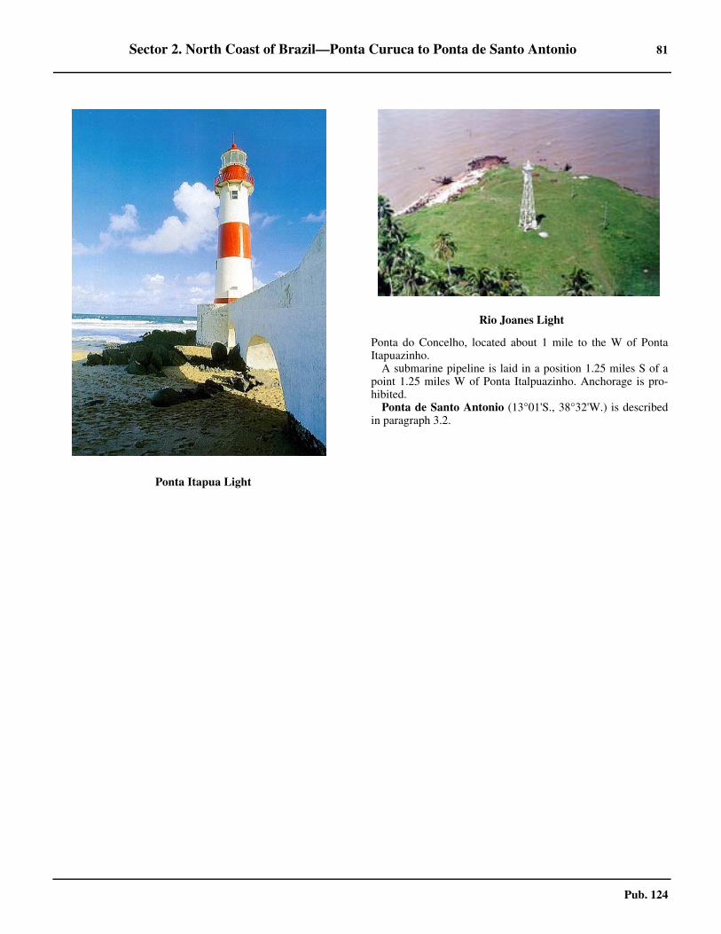
Sector 2. North Coast of Brazil—Ponta Curuca to Ponta de Santo Antonio 81
Pub. 124
Ponta do Concelho, located about 1 mile to the W of PontaItapuazinho. 2.61 A submarine pipeline is laid in a position 1.25 miles S of apoint 1.25 miles W of Ponta Italpuazinho. Anchorage is pro-hibited.
Ponta de Santo Antonio (13°01'S., 38°32'W.) is describedin paragraph 3.2.
2.61Ponta Itapua Light
2.61Rio Joanes Light

83
Pub. 124
3. Sector 3—East Coast of Brazil—Ponta de Santo Antonio to
Cabo Frio
3.0Additional chart coverage may be found in NGA/DLIS Catalog of Maps, Charts, and Related Products (Unlimited Distribution).
SECTOR 3 — CHART INFORMATION

85
Pub. 124
SECTOR 3
EAST COAST OF BRAZIL—PONTA DE SANTO ANTONIO TO CABO FRIO
3.0 Plan.—This sector describes the E coast of Brazil, fromPonta de Santo Antonio to Cabo Frio and the outlying islandsof Ilha da Trindade and Ilhas Martin Vaz. Included in this sec-tor are the ports of Salvador, Vitoria, Tubarao, Ilheus, Cama-mu, Seguro, and numerous river ports of lesser importance.The description is from N to S.
General Remarks
3.1 Winds—Weather.—Inside Baia de Todos os Santos,the winds are usually from the NE in the summer and from theSE in the winter. August is the month of S storms which arecalled Cambueiros. From April to August, winds blow fromthe E and SE; in September the NE winds begin, accompaniedby thunderstorms. March and April are calm. Bad weather doesnot last very long and is usually followed by a calm or windsfrom the E. 3.1 The winds from the S usually subside during full moon andnew moon; they sometimes blow for two or three days in suc-cession causing the waters of the interior of the bay to surge somuch that this condition lasts after the wind has ceased to blowand this usually occurs during ebb tide. Winds from the S maycause a considerable sea in the bay.3.1 From September to March, the NE winds are sometimesstrong between periods of light winds or calms. From March toSeptember NE winds are rare; during this period, SE and SWwinds prevail. They are generally stronger than the NE winds.The arrival of the SW winds, which are not the strongest, is in-dicated by a calm that follows rather strong NE winds; theshorter the period of calm the greater the intensity of the SWwinds. From March to September, SE and SW storms are pre-ceded by a sharp rise in temperature, a great calm, and a calmsea.3.1 Winds from the NE or N cause hazy condition with resultantreduced visibility.
Ponta de Santo Antonio to Ponta Corumbau
3.2 Ponta de Santo Antonio (13°01'S., 38°32'W.) is theSW point of the mainland coast which lies on the E side of theentrance of the Port of Salvador and Baia de Todos os Santos. 3.2 In the vicinity of the point, the land, covered with trees, ishigher than that to the W and is visible for about 30 miles. Alight is shown from the old fort of Santo Antonio da Barra,which stands on the extremity of Ponta de Santo Antonio. 3.2 Numerous tall buildings stand near the lighthouse making itdifficult to discern. Two conspicuous television masts are situ-ated about 2 miles ENE of Ponta de Santo Antonio.3.2 Banco de San Antonio, with depths of less than 11m, liesabout 0.3 mile S of Ponta de Santo Antonio and extends 4.5miles S. It is composed of red sand and coral and is steep-to3.2 The sea sometimes breaks on the bank during S winds. Theshoal has a minimum depth of 2.8m.3.2 Due to its narrowness and the strong currents through it, the
channel N of the bank should only be used with local knowl-edge.3.2 A wreck lies on the W side of the shoal about 2.7 miles S ofthe light. 3.2 Other dangerous wrecks lie about 2.7 miles SE and 0.2 mileWNW of the same light.3.2 Ponta de Santa Maria, on which there is an old fort, lies 0.4mile N of Ponta de Santo Antonio.3.2 Pedra de Gamboa, a rock with a depth of less than 3m, lieson the W edge of Banco da Gamboa, 1.75 miles NNE of Pontode Santo Antonio. Pedra Tira Pomba, a rocky ledge with a leastdepth of 0.7m, lies 0.2 mile SW of the S breakwater in the har-bor of Salvador.
Salvador (12°58'S., 38°31'W.)
World Port Index No. 12770
3.3 The port of Salvador, on the E side of and just withinthe entrance of the Baia de Todos os Santos, is located about 3miles NNE of Ponta de Santo Antonio. Salvador is the fourthlargest city in Brazil.3.3 The port is limited by the E-W line which passes through theSanto Antonio Light, bridging the coast of the island of Itapar-ica, and from there turning to enter the bay through the same E-W line which connects the mainland and that towards the coastN as far as the parallel of 12°50'S, and then from there going Etowards the mainland.3.3 Winds—Weather.—Winds are usually from the NE in thesummer and from the SE in the winter. August is the month ofstorms from the S, which are called Cambueiros. 3.3 Bad weather generally lasts only a few hours and is followedby a calm or winds from the E. Winds from the S may cause aconsiderable sea in Baia de Todos os Santos.
3.2Fort of Santo Antonio da Barra

86 Sector 3. East Coast of Brazil—Ponta de Santo Antonio to Cabo Frio
Pub. 124
3.3 Tides—Currents.—The MHW interval is 2 hours 54 min-utes. The spring range was 2.2m and the neap range was 0.9m.3.3 The flood current runs about 5 hours to the NNE; the ebbcurrent runs 7 hours to the SSW. 3.3 The velocity of the tidal currents is about 1.5 knots, increas-ing to between 2 and 3 knots during spring tides.3.3 Tidal currents in the anchorage N of Banco da Panela runNNE and SSW; their rate, especially that of the SSW current,is considerable. 3.3 To the W of Banco da Panela, the ebb current is reported toattain rates of 3 to 4 knots.3.3 Depths—Limitations.—Banco da Panela, a rocky bankwith a least depth of 4.4m, lies W of the S entrance to the har-bor, about 2.5 miles N of Ponta de Santo Antonio. Its positioncan best be seen on the chart. This bank is about 1 mile longand between 0.25 and 0.5 mile wide. The shallower part of thebank has extended W.3.3 Between the shoal and the S breakwater, 0.6 mile E, there isa channel with a least depth of 7.9m.3.3 A detached shoal, with a depth of 9.1m, lies 0.3 mile NNWof the head of the S breakwater.3.3 Entrance to the inner harbor can be made to the N or S of thedetached N breakwater. The N entrance is used mainly by largevessels. There are least depths of 11 and 8.1m in the N and Sentrances, respectively.
3.3 If the vessel’s draft is over 8.5m the N entrance shall be used,with berthing and unberthing take place 1 hour before HW un-til 1 hour after HW. The anchor is used for berthing. Cargo andcontainer vessels berth at anytime.3.3 An L-shaped breakwater is SW of the inner part of the mainbreakwater. For further information see the table titled Salva-dor—Berth Information. 3.3 Aspect.—The harbor is protected from the SW by a break-water which extends 0.5 mile NNW from the coast, 2.5 milesNNE of Ponta de Santo Antonio. A cylindrical fort is situatedwithin this breakwater, 0.2 mile SE of its head.A detached breakwater lies with its SW end 0.25 mile ENE ofthe head of the S breakwater and extends 0.7 mile NE.3.3 One of the most prominent landmarks in the vicinity of theentrance is a tower, 70m high, situated on a hill on the S end ofIlha de Itaparica.
3.3Salvador Harbor
3.3Salvador Terminal
Salvador—Berth Information
Berth Length DepthMaximum Vessel
RemarksLOA Draft
Commercial Quay
201 192m 8.0m — —Grain and wheat. Continuous berthing length of 384m.
202 192m 8.0m — —
203 150m 9.2m — —General cargo and ro-ro. Continuous berthing length of 300m.
204 150m 9.2m — —

Sector 3. East Coast of Brazil—Ponta de Santo Antonio to Cabo Frio 87
Pub. 124
3.3 To the N of the harbor are many cottages with red roofs. Afort stands on Ponta de Monte Serrat. 3.3 The conspicuous white church of Nosso Senhor do Bonfim,with a large tower at either corner of a southwest-facing fa-cade, is situated about 0.7 mile ENE of Ponta de Monte Serrat.3.3 Gas being burned at a refinery at Mataripe (12°42'S.,38°35'W.), 13.5 miles NNE of Ponta de Monte Serrat, showsup well at night.3.3 A white square elevator, with an iron roof, stands abreast ofthe S end of the inner harbor. 3.3 The customs house, close N of the elevator, is a conspicuouswhite building with a red roof and circular open front support-ed on pillars.3.3 Pilotage.—Pilotage is compulsory for all foreign vessels andis available day and night. Pilots board about 1.7 miles W ofPonta de Santo Antonio Light. Advance notice should be given48 hours and 24 hours prior to arrival.3.3 Contact Information.—Salvador port and pilots can becontacted, as follows:
3.3 Anchorage.—Vessels anchor in one of three areas, as fol-lows:
1. Anchorage No. 1, centered on position 12°56.1’S,38°32.0’W for vessels with drafts less than 10m, refueling,or transferring crew.
2. Anchorage No. 2, centered on position 12°57.3’S,38°32.6’W for vessels with drafts less than 10m.
3. Anchorage No. 3, centered on position 12°57.4’S,38°34.1’W for vessels carrying explosives.
4. Anchorage No. 4, centered on position 12°55.8’S,38°33.6’W for quarantine.
5. Anchorage No. 5, centered on position 13°02.0’S,38°36.0’W is free anchorage for vessels waiting for a vacan-cy of internal anchorages.
6. Anchorage No. 6, centered on position 12°54.5’S,38°36.3’W, is intended exclusively for LNG ships which op-erate regasification in the terminal.
7. Anchorage No. 7, centered on position 12°58.5’S,38°32.0’W, is intended for large yachts and recreationalships of 60m length or greater.
Care should be taken not to obstruct the passage of vesselstransiting the N entrance to the harbor. 3.3 Vessels proceeding to ports in the N part of the bay can an-chor about 0.6 mile SW of Ponta de Monte Serrat, in depths of23 to 25m, mud.3.3 Anchoring is prohibited in a area about 0.4 mile NNE of theN head of the detached breakwater.
Baia de Todas os Santos
3.4 Baie de Todas os Santos is entered between Ponta deSanto Antonio and the E coast of Ilha de Itaparica, 5 miles to
205 280m 10.0m — 8.0mGeneral cargo, wheat, grain, and ro-ro. Continuous berthing length of 780m.206 280m 10.0m — 8.0m
207 220m 10.0m — 8.0m
Tecon Salvador
300 240m 12.0m 210m 10.0m Containers.
610 210m 12.0m — — Dry bulk-and containers.
611 165m 12.0m — — Dry bulk and containers.
612 — 8.3m — — Ro-ro.
Sao Joaquim Terminal
Ferry — — — — Ferry/passengers.
Bahia Regasification Terminal
FSRU Golar Winter 300m 17.0m 315m 12.5m Berthing/unberthing during daylight hours only. Vessels berth port
side-to.
Salvador—Berth Information
Berth Length DepthMaximum Vessel
RemarksLOA Draft
Salvador—Contact Information
Port
Telephone 55-71-3320-1100
Facsimile 55-71-3242-1703
E-mail [email protected]
Pilots
VHF VHF channels 10, 11, and 16
Telephone
55-71-3241-8984
55-71-3264-2929
55-71-3241-8891
Facsimile 55-71-3241-5901
E-mail [email protected]
Salvador—Contact Information

88 Sector 3. East Coast of Brazil—Ponta de Santo Antonio to Cabo Frio
Pub. 124
the WNW. The main channel leading to the entrance of the baylies W of Banco de Santo Antonio. The channel at the entranceis about 2.5 miles wide between Ponta de Santo Antonio andPedra do Baixo Grande. The N part of the bay is known asReconcavo and contains a number of islands, rivers, and goodanchorages.3.4 Caution should be exercised at night and during poor visibil-ity when navigating the bay N of Salvador as there are oil drill-ing structures in the area. 3.4 The structures show flashing lights, but disused structuresare unmarked and at times submerged. They are temporarystructures that are not charted. Submarine cables and pipelinesare seen on the chart.3.4 Depths in the bay are irregular and reach 60m about 3 milesE of Ponta de Itaparica. Charted depths in the middle of the bayapproaches to the entrance of the marked channels which leadto Baia de Aratu and Porto de Madras de Deus, range from14.6 to 35m, with depths of 50m and 53m lying about 2.7 milesW of Ponta de Monte Serrat.3.4 Ponta da Sapoca (12°50'S., 38°29'W.) lies 6.5 miles NNEof Ponta de Monte Serrat. A pier supporting a conveyor systemextends 0.5 mile W from the point. At the head of the pier isTerminal da Usiba, comprising a jetty 120m long with flankingdolphins and five mooring buoys. A ship with a draft up to10.1m can berth at the terminal. A smaller pier, with a light atits head, extends SW from the shore 0.3 mile S of Ponta deSapoca. 3.4 A detached island quay, marked by a light at each end, standsclose N of this pier.3.4 Pilotage is compulsory. Pilots will board at the anchorageSW of Ponta de Monte Serrat.3.4 Baia do Aratu is entered 8.5 miles NNE of Ponta de MonteSerrat through a deep, but narrow and tortuous channel whichforms the lower part of the Rio Cotegipe and is about 2 mileslong. The greater part of the bay has depths of over 5m andthere are depths of over about 10m in the vicinity of the en-trance. There is a naval base in Baia do Aratu.3.4 Ponta da Mangueira (12°47'S., 38°29'W.) is on the N sideof the Rio Cotegipe, about 1.5 miles ENE of Ponta da Areia. AT-shaped jetty, with flanking dolphins, projects S from thepoint. 3.4 The jetty can accommodate ships up to 15,000 gt, with amaximum length of 170m,a maximum beam of 25m, and amaximum draft of 10.3m.
3.5 Porto de Aratu (12°47'S., 38°30'W.) (World Port In-dex No. 12772), situated N of the entrance to Baia do Aratu,consists of four jetties projecting from Ponta do Marinho andPonta Joao Pereira, N of Ponta da Areia. The maximum sizevessel that can enter the port is 100,000 dwt.3.5 At Dow Quimica Terminal, berthing and unberthing at nightauthorized with a max LOA 150m, beam 25m, and draft 8.5m.Vessels berthed starboard side alongside may be unberthed at
night with max LOA 180m, beam 30mm draft 11.0m. Duringdaylight maneuvers with vessels up to LOA 185m may bemade with the following conditions: Prior authorization fromthe port captain; time of entry at pilot’s criteria; compliancewith special safety measures. For further berthing informationrefer to table titled Aratu—Berth Information. 3.5 Pilotage is compulsory for Porto de Aratu and Baia do Aratu.Pilots are requested at least 5 hours in advance, specifying thetime of the vessel’s entry. Pilots will board at the anchorageSW of Ponta de Monte Serrat (12°56'S., 38°31'W.). Pilotage isprovided from Salvador.3.5 The channel leading from S to the entrance to Baia do Aratu,Porto de Aratu, and the fairway of the Rio Cotegipe are markedby lighted buoys. The channel is about 0.3 mile long, 0.1 milewide, and has a minimum depth of 18m. The maneuvering ba-sin has a depth of 12m. A light is shown from Ponta de Areia,the S entrance point of Baia do Aratu.3.5 Aratu port can be contacted, as follows:
3.6 Ilha do Frade (12°47'S., 38°38'W.) lies 7 miles W ofPonta de Areia. A light is shown from the S extremity of the is-land. Ilha Madre de Deus lies 0.5 mile N of Ilha do Frade.3.6 Caution.—An obstruction area, best seen on the chart, liesabout 0.3 mile of Punta da Tapera.3.6 Porto de Madre de Deus (12°45'S., 38°37'W.) (World PortIndex No. 12775), located at the SW extremity of Ilha Madrede Deus and about 0.3 mile N of the N end of Ilha do Frade.
3.5Porto de Aratu
Aratu—Contact Information
Telephone 55-71-3602-5711
Facsimile 55-71-3602-5705
E-mail [email protected]
Aratu—Berth Information
Berth Length DepthMaximum Vessel
RemarksLOA Draft
Terminal de Graneis Solidos
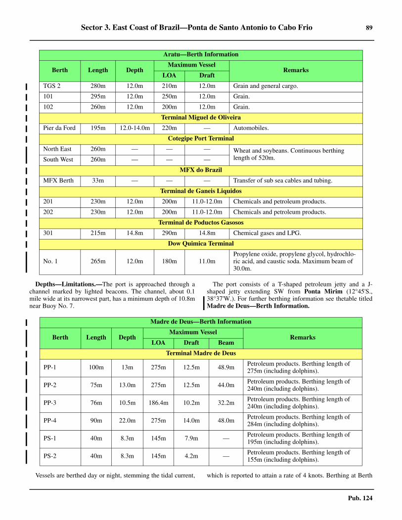
Sector 3. East Coast of Brazil—Ponta de Santo Antonio to Cabo Frio 89
Pub. 124
3.6 Depths—Limitations.—The port is approached through achannel marked by lighted beacons. The channel, about 0.1mile wide at its narrowest part, has a minimum depth of 10.8mnear Buoy No. 7.
3.6 The port consists of a T-shaped petroleum jetty and a J-shaped jetty extending SW from Ponta Mirim (12°45'S.,38°37'W.). For further berthing information see thetable titledMadre de Deus—Berth Information.
3.6 Vessels are berthed day or night, stemming the tidal current, which is reported to attain a rate of 4 knots. Berthing at Berth
TGS 2 280m 12.0m 210m 12.0m Grain and general cargo.
101 295m 12.0m 250m 12.0m Grain.
102 260m 12.0m 200m 12.0m Grain.
Terminal Miguel de Oliveira
Pier da Ford 195m 12.0-14.0m 220m — Automobiles.
Cotegipe Port Terminal
North East 260m — — — Wheat and soybeans. Continuous berthing length of 520m.South West 260m — — —
MFX do Brazil
MFX Berth 33m — — — Transfer of sub sea cables and tubing.
Terminal de Ganeis Liquidos
201 230m 12.0m 200m 11.0-12.0m Chemicals and petroleum products.
202 230m 12.0m 200m 11.0-12.0m Chemicals and petroleum products.
Terminal de Poductos Gasosos
301 215m 14.8m 290m 14.8m Chemical gases and LPG.
Dow Quimica Terminal
No. 1 265m 12.0m 180m 11.0mPropylene oxide, propylene glycol, hydrochlo-ric acid, and caustic soda. Maximum beam of 30.0m.
Aratu—Berth Information
Berth Length DepthMaximum Vessel
RemarksLOA Draft
Madre de Deus—Berth Information
Berth Length DepthMaximum Vessel
RemarksLOA Draft Beam
Terminal Madre de Deus
PP-1 100m 13m 275m 12.5m 48.9m Petroleum products. Berthing length of 275m (including dolphins).
PP-2 75m 13.0m 275m 12.5m 44.0m Petroleum products. Berthing length of 240m (including dolphins).
PP-3 76m 10.5m 186.4m 10.2m 32.2m Petroleum products. Berthing length of 240m (including dolphins).
PP-4 90m 22.0m 275m 14.0m 48.0m Petroleum products. Berthing length of 284m (including dolphins).
PS-1 40m 8.3m 145m 7.9m — Petroleum products. Berthing length of 195m (including dolphins).
PS-2 40m 8.3m 145m 4.2m — Petroleum products. Berthing length of 155m (including dolphins).

90 Sector 3. East Coast of Brazil—Ponta de Santo Antonio to Cabo Frio
Pub. 124
P1 is done 6 hours either side of HW. 3.6 Berthing at Berth P3 is done on the flood current. Vesselsberth port side-to at Berth P1, Berth P2, Berth P4, and Berth S1and starboard side-to at Berth P3 and Berth S2.3.6 A jetty projects W from the coast about 0.2 mile N of PontaMirim and has a depth of 3.3m alongside the head.3.6 The Bahia Regasification Terminal, accommodating LNGvessels, consists of two berths. One berth is occupied by thefloating storage and regasification unit Golar Winter. The ter-minal is situated 2.3 miles W of the S extremity of Ilha doFrade.3.6 Pilotage.—Pilotage is compulsory for all foreign vessels. Pi-lotage should be requested via Salvador at least 3 hours in ad-vance. Pilots board in position 12°59'S., 38°33'W.3.6 Regulations.—The following regulations were issued by theBrazilian Port Authority for the approach to Porto de Madre deDeus:
1. Vessels must not meet and pass nor overtake while inthe approach channel areas between Beacon Nos. 1, 2, 5, and6, and between Beacon Nos. 11, 13, 14, and 16.
2. Inbound vessels shall yield to outbound vessels.3. Anchoring is prohibited, except in an emergency,
within the vicinity of the oil terminal.3.6 Caution.—The existence of unlighted buoyage markerswithin the approaches indicates the position of underwaterpipelines.3.6 Dangerous submerged rocks, which can best be seen on thechart, sit N of Ponta Cavalo, on the S edge of the channel lead-ing to the T-shaped jetty.3.6 Bahia Regasification Terminal (12°49'S., 38°41'W.) is lo-cated 2.3 miles W of the S extremity of Ilha do Frade. The ter-minal, accommodating LNG vessels, consists of two berths.One berth is permanently occupied by the floating storage andregasification unit Golar Winter.
3.7 The Rio Paraguacu (12°50'S., 38°48'W.), which en-ters the bay 9 miles W of the S end of Ilha do Frade, is naviga-ble from its mouth for about 22 miles to the town of Cachoeira,located in the W part of Reconcavo. Sao Rogue do Paraguacu,from which ore is shipped, and Maragogipe, with a pier whereships with draft ts up to 4.5m can berth, are ports located on theRio Paraguacu below Cachoeira.3.7 Canal de Itaparica, which separates Ilha de Itaparica fromthe mainland to the W, is entered between Ponta Itaparica(12°53'S., 38°41'W.) and Ilha do Medo, 1.75 miles NW. Thischannel should not be attempted without local knowledge.3.7 A prohibited area exists close N and W of Ponta Itaparicaand a restricted area, in which anchoring and fishing are notpermitted and vessels should not navigate without authority,extends about 0.5 mile offshore for a distance of 2 miles S fromthe point.3.7 The Rio Jaguaribe flows into the W side of Canal de Itapari-ca close to its S end and has depths of 3.5m up to 22 milesabove its mouth.
3.8 Between Ponta Garcia, the S entrance point of Canalde Itaparica, and the W entrance point of the Rio Una, 6 milesSW, the coast forms a low sandy bay which is fringed by shoalsto a distance of 2 to 3 miles.3.8 Morro de Sao Paulo (13°22'S., 38°55'W.), the N extremity
of Ilha de Tinhare, marks the SE side of the entrance of the RioUna. It is a conspicuous mount, which falls abruptly onto thesea, on the N and W sides. When seen from a distance it showstwo peaks; the S peak has a hillside with a smooth descendingslope and the N peak hillsides have a more pronounced de-scending slope. Next to the N side, there is a masonry towerfrom which a light is shown. It is the most visible bearing forthe mariner coming from the S.
3.8 Anchorage.—The mouth of the Rio Una, W of Morre deSao Paulo, affords easy access to an anchorage known as Por-talo which provides shelter from E through SW winds. 3.8 Anchorage may be obtained, in 6 to 8m, in front of a villageabout 0.5 mile SW of the light.
3.9 The Rio Una (13°23'S., 38°56'W.) empties W ofMorre de Sao Paulo. 3.9 Banco Joao Goncalves, in the W part of the river mouth, re-stricts the width of the entrance over the bar and anchorage toabout 0.7 mile. The sea breaks over this extensive sand bankand the S part is partially dry.3.9 The E side of the channel just within Morre de Sao Paulo issteep-to, but 0.5 mile S a bank begins and borders the S shoreto a distance of about 0.1 to 0.2 mile. In the SW part of the riv-er mouth the channel trends to the N and is about 0.5 mile widebetween the bank and the low W point of the mainland. Theminimum depth in the channel is about 10m.3.9 Ilha de Tinhare (13°29'S., 38°58'W.) and Ilha de Boipebaform the coast for about 18 miles S of Monte de Sao Paulo.Channels and rivers separate the islands from each other andfrom the mainland. Small craft navigate these waters.3.9 Ponta de Castelhanos, the SE extremity of Ilha de Boipeba,is fringed with reefs and rocks, which extend out 1 mile fromthe point. A wreck, partially submerged, lies stranded about 1mile NE of Ponta Castelhanos.3.9 Ilha Quiepe (13°50'S., 38°56'W.), a small reef-fringed is-land about 0.25 mile in extent, lies on the N side of the en-
3.8Morre de Sao Paulo Light

Sector 3. East Coast of Brazil—Ponta de Santo Antonio to Cabo Frio 91
Pub. 124
trance of Porto de Camamu. The island is flat, covered bycoconut trees, and can be seen as far as 13 miles away, makingit an excellent bearing for navigation. Two houses are locatedon the N side of the island.
3.10 Porto de Camamu (13°52'S., 38°56'W.) (World PortIndex No. 12780) is the common mouth of the Rio Camamuand the Rio Marau. The port lies between Ilha Quiepe and Pon-ta Muta, about 2.5 miles S of Ilha Quiepe. The port is privatelyowned and is used exclusively to export barium ore.3.10 Winds—Weather.—Prevailing winds are NE from Septem-ber through February, S from March to August, and E duringAugust.3.10 Tides—Currents.—Tidal heights above chart datum are2.1m at MHWS and 1.6m at MHWN. The spring range is 2mand the neap range in 1m.3.10 The ebb current, increased by the waters from the riverswhich flow into the bay, is much stronger than the flood. Theaverage velocity of the ebb is 1.5 to 2 knots and it sets towardIlha Quiepe and the reefs in the vicinity of the island.3.10 Current velocities of up to 5 knots at ebb and 3 knots at floodhave been recorded.3.10 Depths—Limitations.—There is a least charted depth of9.1m in the recommended approach about 2.2 miles ESE of Il-ha Quiepe Light.3.10 A least depth of 7.6m is charted in the approach to thebuoyed channel entrance. Least depth in the buoyed channel ischarted at 7.2m. It was reported the maximum safe draft for en-tering the port was 8.5m.3.10 The ore berth is located on the E side of Ilha Grande deCamamu. It consists of a T-headed pier with a face about 80min length. There is a least depth of 5m alongside the face. 3.10 Mooring buoys are situated N and S of the pier. Vessels moorstarboard side-to the pier head.3.10 Pilotage.—Pilotage is compulsory. Pilots for the port ofCamamu are available at Salvador.3.10 Anchorage.—Vessels anchor, in 15m, sandy bottom, about0.7 mile W of Ponta Muta. 3.10 This anchorage lies between Pedras Paragonas de Baixo andPedras Guaraiubas. Vessels may also anchor, in 12.8 to 14.6m,about 0.2 mile NW of Ponta do Gaviao, located nearly 3 milesSW of Ponta Muta.
3.11 From Ponta Muta to the Port of Ilheus, a distance ofabout 55 miles, the coastline trends almost due S and is free ofdangers. The N end of this stretch of coast is low and sandy,with some patches of palm trees. The S end is high in placeswith bluff points and sheer cliffs.3.11 Cabo Tromba Grande (14°16'S., 38°59'W.) is a conspicu-ous cliff of black rocks and is located about 25 miles S of PontaMuta. The prominent summits of Serra Grande lie to the SSWof the cape.3.11 Ponta Trombinha, about 1 mile N of Cabo Tromba Grande,is equally bold but less elevated than the cape. The point marksthe N side of the entrance of the Rio das Contas. 3.11 Sand banks lie on the N side of the entrance to the river. Con-tas Islet lies close N of Ponta Trombinha and shows a light.
3.11 The Rio das Contas (14°16'S., 39°00'W.), which is about250 miles long, has depths of 2m and an average width ofabout 137m as far as Cachoeira do Funil, about 12 miles from
its mouth. The currents in the river are rapid, especially afterheavy rains.3.11 Within the entrance, the S bank is high and wooded. Cidadede Contas stands on the S bank 1 mile SW of Ponta Trombinha.In the river mouth, the ebb current attains a rate of from 3 to 4knots.3.11 When the sea is calm there is little difficulty in entering theRio das Contas, but fresh onshore winds cause breakers acrossthe mouth of the river during the ebb tide.3.11 Anchorage is afforded near the entrance of the river, in 14 to17m, with Cabo Trombe Grande bearing 185°, distance 2miles.
3.12 Ponta da Serra Grande (14°28'S., 39°01'W.) is the Eextremity of the Serra Grande, a chain of mountain rangeswhich rises to the W of the point. From offshore, the mountainsappear as cliffs running in a N and S direction for a distance of10 miles. Depths of 20m lie about 1 mile off the point.3.12 From Ponta de Serra Grande, the low sandy shore continuesS for about 18 miles to the mouth of the Rio Almada. Highland backs the greater part of this section of the coast. A widevalley lies between the Serra Grande and the hills to the S,which rise to the N of the Rio Cachoeira, the river which emp-ties into the sea at Ilheus.3.12 The village of Itaipe lies on the N side of the mouth of theRio Almada. Sand banks, about 0.2 mile offshore, encumberthe entrance of the river.
Ilheus (Malhado) (14°47'S., 39°01'W.)
World Port Index No. 12810
3.13 The port of Ilheus consists of Porto do Malhado, abreakwater with berthing on its W side and projecting NE andN from Ponta do Malhado, and Porto do Rio Cachoeira, theoriginal port of Ilheus, on the N bank of the river, 0.5 milewithin its mouth and used only by fishing boats.
3.13 Winds—Weather.—The prevailing winds are reported to befrom the SE.3.13 Tides—Currents.—Tidal heights above chart datum areMHWS 1.9m, MHWN 1.4m. The spring range is 1.7m and themean range is 1.4m.3.13 Velocities of the tidal currents are about 1 knot during theflood and 2 knots during the ebb.3.13 Depths—Limitations.—The artificial basin is formed by abreakwater 1,922m long. The first leg, aligned NE to SW, is650m long, followed by a curved section that is 162m long,leading to the last section, aligned N to S, 1,110m long. 3.13 It was reported that the breakwater was being extended, withunderwater work in progress for about 365m N from its head. 3.13 The maneuvering basin is 560m wide, with a depth of about10m. The approach channel is 1,000m long with a depth ofabout 10m.3.13 Port Ilheus consist of a quay 428m long, with an alongsidedepth of 9.3m.
Port of Ilheus
http://www.codeba.com.br/portoilheus.php

92 Sector 3. East Coast of Brazil—Ponta de Santo Antonio to Cabo Frio
Pub. 124
3.13 A 70m long wooden T-shaped pier, with a depth of 7malongside and used to transfer liquefied petroleum gas, lies atthe root of the breakwater.3.13 Porto do Rio Cachoeira consists of six piers which extendfrom the N bank of the river W of the N end of Morro de SaoSebastiao. All have depths of at least 4.1m alongside.3.13 Aspect.—Morro de Sao Sebastiao, a high hill, forms the Wentrance point to the Rio Cachoeira. A monument stands on itsS extremity known as Ponta Maria Augusta. A church, with aconspicuous dome and towers, stands 0.4 mile N of Ponta Ma-ria Augusta. A prominent church, painted gray, stands on a hill,0.35 mile farther N.3.13 Morro Pernambuco, a peninsula 30m high and covered withvegetation, forms the E entrance point of the Rio Cachoeira. Aruined fort and cross stand near the NW extremity of the penin-sula. A light is shown from the summit of Morro Pernambuco. 3.13 Lights are shown from the breakwater head at Malhado andfrom Ilheu Grande.
3.13 Pilotage.—Pilotage is compulsory for the following vessels:1. All foreign vessels.2. Tankers.3. Vessels carrying dangerous cargo.
3.13 The pilot must be requested, via the agent, 4 hours in ad-vance. Pilots board in position 14°45’S, 39°01’W for the Mal-hado Pier and about 0.6 mile NNE of Morra Pernambuca forthe piers in the Rio Cachoeira.3.13 Contact Information.—Ilheus pilots and port can be con-tacted, as follows:
3.13 Anchorage.—Vessels awaiting a pilot for Porto de Malhadoshould anchor 0.2 to 0.3 mile NNE of the breakwater head, indepths of 10 to 12m, sand.3.13 Vessels working cargo into lighters may anchor W of thebreakwater in depths of more than 8m where the sea is usuallycalm. Vessels waiting to berth at the piers at Porto do RioCachoeiro may anchor temporarily in the river off the piers,sheltered from all winds, in depths of 6 to 8m, mud.3.13 Anchorage is forbidden along the 100m stretch of the wharfand in the access channel.3.13 A quarantine anchorage has been established 1 mile NNE ofthe breakwater head.3.13 Caution.—Less water than charted was reported within the10m depth contour in the approaches to and in the maneuver-ing basin at Ilheus.3.13 The area at the head of the harbor, SE of the small breakwa-ter, is being reclaimed.
A chain of islets and reefs, nearly 2 miles long, parallels thecoast at a distance of 1 to 2 miles. Ilheu Grande is the largestand northernmost of the group. The island is always exposedand equipped with a light. It lies about 1.2 miles NE of Pontodo Malhado and is visible about 15 miles.3.13 Ilheuzinho, a group of uncovered rocks, lies about 137m SEof Ilheu Grande. Itaipins Reef, part of which uncovers, lies0.75 mile SSE of Ilheu Grande. Ilhote de Itapitanga lies nearly1.25 miles S of Ilheu Grande. Parcel dos Sororocas extendsabout 0.6 mile SSE from Ilhote de Itapitanga. The reef neveruncovers, but breaks with a small sea.3.13 Laje do Rapa, a group of three rocks which uncover at LWand on which the sea always breaks, lies nearly 0.5 mile N ofMorro Pernambuco. Coroa do Rapa, a drying sand bankmarked by breakers, extends to the E from the beach to the vi-cinity of Laje do Rapa.3.13 Vessels are cautioned not to use the channel between RecifesItaipios and the N extremity of the foul ground extending Nfrom Ilhote de Itapitanga.
Ilheus to Belmonte
3.14 The coast from Ilheus to Belmonte, 65 miles S, is highalong the N part to Barra do Una, then S it continues low toBarra de Belmonte.3.14 The coast is backed by mountain ranges, which rise from 15to 18 miles inland and are normally visible up to 30 miles off-shore. The highest range is Serra Panemosa, 620m high, andfairly isolated from the outer mountains. It has an undulatingsummit and is easily identified as the best landmark near thispart of the coast.3.14 The coast is clear of dangers except for some coral reefswhich extend 1 mile offshore in places along its N part.3.14 Olivenca (14°58'S., 39°01'W.), a small village about 10miles S of Ilheus, is situated on the summit of a hill near the
3.13Ilheus
Ilheus—Contact Information
Pilots
VHF VHF channel 16
Telephone 55-73-3634-4455
Facsimile 55-73-3634-4478
E-mail [email protected]
Port
Telephone 55-73-3231-1200
Facsimile 55-73-3231-3318
E-mail [email protected]
Ilheus—Contact Information

Sector 3. East Coast of Brazil—Ponta de Santo Antonio to Cabo Frio 93
Pub. 124
shore. The village and a church are conspicuous from offshore.3.14 Ponta Itapua (14°59'S., 38°59'W.), a low salient point cov-ered with trees, is located about 3 miles SSE of Olivenca. 3.14 The mouth of the Rio Aquipe lies about 6 miles S of thepoint. Conspicuous white cliffs stand on the S bank of the riverand are visible from offshore.3.14 The Rio Una (15°15'S., 39°00'W.) lies about 11 miles S ofthe mouth of the Rio Aquipe. The village of Pedras standsabout 2 miles SSW of the mouth of the river on its W bank.About 3 miles S of the Rio Una, the Rio Doce empties into thesea.3.14 A submerged obstruction, with a depth of 27m, lies about 8.5miles SE of the mouth of the Rio Una.
3.15 Barra das Canavieiras (15°43'S., 38°54'W.) lies atthe entrance of the common mouth of several rivers, the mostimportant of which is the Rio Pardo. 3.15 The town of Canavieiras is situated on the N bank of the RioPardo, about 3 miles within the entrance.3.15 The land in the vicinity of the bar is very low, but a whitechurch tower in the town provides a landmark from offshore.3.15 The town has four piers with depths of 3.1m at the pierheads. 3.15 Pilotage is available. The bar should only be approachedwhen using the services of a pilot.3.15 Anchorage is afforded, in 10 to 11.9m, mud, about 4 milesESE of the church tower.
3.16 The coast SSE of Barra das Canavieiras to Belmonte,a distance of about 9 miles, is low, wooded, and broken by theentrances of a lagoon. Small villages mark this section of thecoast. With the exception of the Morros de Comandatuba, visi-ble to the NW, the country is void of high land, being flat andmarshy.
3.16 Barra de Belmonte (15°50'S., 38°52'W.), 8 miles SSE ofBarra de Canavieiras, is the mouth of the Rio Belmonte(Jequitinhonha), which runs a course of about 300 miles. Theonly means of identifying the river entrance is Belmonte Light,on the S side of the river.3.16 The bar should only be approached with local knowledge orwith local available pilots. On the spring tides the depth of theaccess channel is about 2m. The sand banks close to the barvary in position at times.3.16 After prolonged rains, which usually occur from Novemberto March, the outflow of the river is considerably increased,causing strong currents over the bar. During these periods, dis-colored water can be seen up to 10 miles offshore.
3.16 Belmonte (15°51'S., 38°53'W.) is located on the S bank ofthe Rio Belmonte a little more than 1 mile from the bar. A lightstands on the S bank of the bar. It is not visible from offshorebecause it is surrounded by dense and close coconut groves. 3.16 There is a wharf, 450m long, with depths of from 3.6 to 5malongside.3.16 Anchorage may be obtained outside the reef and shoals, in10m, mud, with Belmonte Light bearing 245°, distance 4miles.3.16 After crossing the bar, anchorage may be had in the deeperwater inside the chain of shoals, but local knowledge is essen-tial.
Belmonte to Porto Seguro
3.17 From the mouth of the Rio Belmonte, the coast con-tinues in a S direction to Porto Seguro, a distance of 36 miles. 3.17 This part of the coast is rather low with some small hills in-land a few miles from the coastline. 3.17 Morro Dois Irmaos, a mountain with twin peaks, rises about20 miles inland and can be seen in clear weather.3.17 Ponta Araripe (16°10'S., 38°57'W.), marked by a light, lies18 miles S of Barra de Belmonte. Recife de Arajipe is a dryingreef which extends up to 3.5 miles E of the point.3.17 Ponta San Antonio, the S entrance point of the Rio San An-tonio, lies 3 miles SSW of Ponta Arajipe.3.17 A dangerous underwater rock lies about 15 miles ESE ofPonta San Antonio.3.17 Baio de Cabralia is entered between Ponta de Santo Antonioand Ponta de Coroa Vermelha, 7.5 miles SSW. 3.17 The shore of the bay is of moderate height and is backed bywooded hills, 30 to 35m high. The valley of the Rio Joao de Ti-ba, the mouth of which lies 4.5 miles SW of Ponta de SantoAntonio, is very prominent from seaward. The town of SantaCruz, with its prominent church, stands on the S side of the riv-er.3.17 The sandy beach forming the shore of Baia de Cabralia is in-terrupted by two lines of reefs, separated by a small gap, ex-tending 2 miles NNE from the mouth of the Rio Joao de Tiba. 3.17 These reefs dry and form a natural breakwater. A number ofreefs and rocks lie to the SSE of Baia de Cabralia and can best
3.16Belmonte Light

94 Sector 3. East Coast of Brazil—Ponta de Santo Antonio to Cabo Frio
Pub. 124
be located by the chart.3.17 Anchorage is afforded in the N part of Baia Cabralia, 0.5mile ESE of the N end of the two lines of reefs extending fromthe mouth of the Rio Joao de Tiba. 3.17 The anchorage has depths of 7m, mud, good holding ground.3.17 Vessels may also anchor in the S part of the bay, 0.7 mile Nof Ponta da Coroa Vermelha, in depths of about 7m, fine sandand mud. Small craft can anchor closer inshore towards thepoint.3.17 A vessel should anchor in the N part of the bay during windsfrom between N and E, and in the S part during SE winds. Thesea is never heavy in either part of the bay, even during SEwinds.
3.18 The Rio Joao de Tiba (16°17'S., 39°02'W.) can bereached by small craft with local knowledge via a channelabout 91m wide, on the W side of the two lines of reefs extend-ing NNE from its mouth. Pedra Baixnha, a rock with a depth of1m, lies off the entrance to this channel, 0.2 mile NE of the endof the reefs.3.18 Ponta Grande (16°22'S., 39°01'W.) is located 2.5 miles S ofPonta da Coroa Vermelha. The point is low and inconspicuousand marks the N end of Baia de Porto Seguro. 3.18 Between the two points, extensive reefs and rocks border thelow shore. A shoal, with a depth of 8.5m, lies 2.5 miles E ofPonta Grande.3.18 Baia de Porto Seguro (16°26'S., 39°03'W.) lies betweenPonta Grande and the mouth of the Rio Buranhem, about 5.7miles to the SW. A ridge of hills, with red cliffs and coconutpalms, lies parallel with the coast about 1 mile inland and isbroken by the marshy valley of the Rio Buranhem.3.18 The valley and the church of Nossa Senhora da Pena, whichstands on the N side of the river, are reported as conspicuouslandmarks. Porto Seguro Light stands close NE of the church.3.18 Recifes de Fora, nearly 3 miles long and about 1.5 mileswide, lies with its outer edge about 6 miles ENE of Porto Se-guro Light. For about 2 miles of its length this coral reef un-covers and the sea always breaks over it. Several shoal patches,with depths of 6.2 to 8.1m, lie within 2.5 miles S and SSW ofRecifes de Fora.3.18 The Rio Buranhem can be entered through a channel 0.1mile wide and a depth of 3.6m at HWS. The channel lies be-tween the N extremity of the chain of reefs and the coast. 3.18 Pilotage is available and vessels are boarded on the outsideof the bar. Their services should be requested by wire prior toarrival.3.18 A dangerous wreck, with its superstructure visible, is situat-ed about 5 miles SE of Porto Seguro Light.3.18 Anchorage is afforded, in depths from 8 to 9m, sand andmud, good holding ground, in a position about 1 mile ESE ofthe church of Nossa Senhora da Pena. The anchorage is unshel-tered from NE to SE winds. 3.18 Vessels also anchor farther offshore, in depths of about 10 to11.9m, about 2 miles ESE of Porto Seguro Light.3.18 Porto Seguro (16°27'S., 39°04'W.) (World Port Index No.12820) is situated on the N bank of the Rio Buranhem, justwithin the rivers entrance. That part of town which stands onlow ground is hidden by coconut palms, the higher part of townis visible from offshore. The port is used mostly by coastalsteamers.
Porto Seguro to Porto de Caravelas
3.19 From the mouth of the Rio Buranhem to Ponta Itaque-na, 11 miles to the S, the coast has no salient features. A shortdistance S of the river mouth, hills rise from the coast. Onemile S of the river mouth, the church of Nossa Senhora da Aju-da stands on one of the hills and is conspicuous from seaward.3.19 Barreiras Vermelhas de Porto Seguro (16°30'S.,39°04'W.), a line of red cliffs, 3.5 miles S of Porto Seguro, risesheer from the sea to heights of 40 to 50m on the S side of themouth of the Rio Taipe. They extend 3 miles S and are inter-rupted near the middle by the Rio Pitinga and can be seen from25 to 30 miles offshore.3.19 Red cliffs reappear 1.5 miles S of Barreiras de Porto Seguro,but they are lower and less prominent and decrease in heightnear Ponta Itaquena. The village of Trancoso stands betweenthe two sets of cliffs.3.19 Ponta Juacema (16°45'S., 39°08'W.), 10 miles SSW ofTrancoso, rises in white cliffs, which appear as steps on the Sslope of a hill. 3.19 Ponta Juricuara, about 2 miles farther S, is red in color. Reci-fe Juacema, with a depth of 1m, sand and coral, lies 0.5 mile Sof Ponta Juacema.3.19 Recifes de Pitiacu, with depths of less than 0.6m, lie 1 to 2miles ESE of Ponta Juricuara. There are depths of from 7 to 8mbetween these reefs and the coast. 3.19 The channel between Recifes Pitiacu and Recife Juacema isabout 0.7 mile wide and has depths of 6.4m.3.19 Anchorage may be obtained close N of Ponta Itaquena, in adepth of 10m, good holding ground, but should not be attempt-ed without local knowledge as there are reefs close off thepoint.3.19 The area W of Recife Juacema and Recifes Pitiacu is clear ofdangers and affords good anchorage to small vessels. It is wellsheltered from all winds and access is easy.3.19 Temporary anchorage may be taken in good weather, about0.7 mile SE of Ponta Juacema, in depths of from 9 to 10m,mud, with good holding ground. 3.19 During fresh winds a vessel should anchor W of Recifes Piti-acu, passing either N or S of these reefs.
3.20 Ponta de Corumbau (16°52'S., 39°07'W.) is low andsandy, and covers to a great extent at HW. A light is shownfrom the point. 3.20 To the N of the point the coast is low and covered with vege-tation as far as Barra do Graminua, 4.5 miles NW. Reefs andshoals extend 2 miles from N of the point.3.20 Monte Pascoal (16°53'S., 39°24'W.), which is prominent,rises to an elevation of 535m nearly 18 miles W of Ponta Co-rumbau, and forms part of a range trending parallel with thecoast. When seen from NE or E, it appears isolated with arounded and somewhat conical summit, but from SE it appearsto be joined to other hills.3.20 To the SW of Monte Pascoal there is Joao do Leao peak,with a greater altitude and more outstanding because of its cy-lindrical formation.3.20 Recifes Itacolomis (16°54'S., 39°04'W.) are a group of reefslying on a extensive sandy shoal which extends nearly 6 milesE from Ponta Corumbau. The reefs dry near the center of theshoal. The shoal is steep-to on the seaward side, rising abruptly

Sector 3. East Coast of Brazil—Ponta de Santo Antonio to Cabo Frio 95
Pub. 124
from depths of over 20m, and soundings give little indicationof its proximity. 3.20 Passing vessels are advised to keep in depths of over 30mwhich will give the shoal a berth of at least 6 miles.3.20 Canal dos Itacolomis, between Recifes Itacolomis and PontaCorumbau, is narrow and tortuous with depths of from 5 to 7m.The most favorable time for passing through it is at LW whenthe reefs uncover, but it should not be attempted without localknowledge.3.20 Anchorage may be obtained by vessels with local knowledgebetween the S part of Recifes Itacolomis and the coast SW ofPonta Corumbau, in a depth of 9m, sand and mud. 3.20 This anchorage is sheltered from all winds except from theS, and the holding ground is good.
3.21 Ponta Mato Grosso (16°57'S., 39°10'W.), nearly 5miles SW of Ponta Corumbau, may be identified by its con-spicuous high red cliffs. Barreira do Cai, 3.5 miles S of PontaMato Grosso, is a high extensive whitish cliff and makes agood landmark for Canal dos Itacolomis. 3.21 Barreiras de Taua, 2.5 miles S of Barreira do Cai, are smallerthan the latter and reddish in color. The village of Cumuraxati-ba is a small settlement. A white church and the chimney of afactory can be seen from the sea.3.21 A chain of detached reefs extends S from Ponta Corumbaufor 8.5 miles and lie up to three miles offshore. Several of thesereefs dry, including Recifes Patachos, the southernmost of thechain. A shoal, with a depth of 7.3m, lies 11 miles SE of PontaCorumbau.3.21 Numerous shoals, with depths of less than 20m, lie up to 35miles offshore between Ponta Cumuruxatiba and Ponta Guarat-ibas, 20 miles S. Vessels on passage off this coast are advisedto keep in depths of over 30m.3.21 Pilotage is available and vessels are boarded outside thereefs. There is a small pier used by coastal vessels.3.21 Anchorage may be obtained by small vessels with localknowledge in a cove on the N side of Ponta Cumuruxatiba,with the chain of reefs off the point. It offers good shelter evenduring fresh NE winds. The cove is entered through a break inthe reefs with a depth of about 15m. The anchorage in its Npart has a depth of about 5m, and from about 2.5 to 3m in is Spart. 3.21 A beacon stands close within the edge of the reef on the Nside of the entrance. Some of the shoals in the S part of thecove are marked by wooded perches.
3.22 Barra do Prado (17°22'S., 39°13'W.) lies about 16miles S of Ponta Cumuraxatiba at the mouth of the Rio Jucuru-cu. The bar has a dangerous approach even in good weather.Small boats navigate the river for a distance of 18 miles aboveits mouth. The town of Prado stands near the coast within theentrance to the river.3.22 Anchorage may be taken with the town of Prado bearing234°, distant 2.3 miles, in depths of 8 to 10m, sand and mud.This anchorage is sheltered from all winds except N, NE, or E.3.22 Barreiras do Prado, a series of uninterrupted conspicuous redcliffs, begin 3 miles SSW of Ponta Cumuruxatiba and mark thecoast for a distance of 9 miles to the S to within 2.5 miles of thetown of Prado. The cliffs are the best landmarks along thisstretch of the coast. A light is shown from a position on the
coast about 11 miles S of Ponta Cumuraxatiba and 3 miles N ofPrado.3.22 Recifes do Prado, about 0.7 miles in extent, lie about 4 milesESE of the church in Prado. These sand and coral dangers un-cover at LW and depths of 10.9m surround the reefs about 0.5mile off their outer edge.3.22 From Barra do Prado to Ponta Guaratibas, 4.5 miles SSE, thecoast consists of a low beach, covered with vegetation of a uni-form height.3.22 Recifes de Guaratibas (17°26'S., 39°08'W.), two dryingreefs, lie on a bank with depths of less than 3m, 3.5 miles ENEof Ponta Guaratibas. A channel, with depths of over 5m, existsbetween the bank and the coast, but should only be used withlocal knowledge. Recifes das Timbibas, an extensive group ofdrying reefs, lies 7 to 12.5 miles ESE of Ponta Guaratibas.3.22 From Ponta Guaratibas to Barra de Alcobaca, 8 miles to theSE, the coast is covered with vegetation and is visible about 12miles offshore. The only landmark is the town of Alcobaca,which is fairly prominent from offshore. A light is shown 2miles N of the church in Alcobaca.3.22 Ponta da Baleia (17°41'S., 39°08'W.), lying 8.5 miles SSWof Barra de Alobaca, is the most salient point on this coast andis covered with vegetation. Ponta da Baleia Light is situatednear the point. Caravelas Aero Light is situated 6.5 milesWNW of Ponta da Baleia.3.22 Between Ponta da Baleia and Ponta do Catoeiro, 12.5 milesSW, the coast consists of a low beach backed by scattered co-conut palms. There are two prominent groups of palms SW ofthe mouth of the Rio Caravelas. Ponta do Catoeiro is not easilydistinguished from seaward, but shows a light.3.22 Parcel das Paredes (17°49'S., 38°57'W.), an extensive shoalof coral and sand, parts of which are above-water, lies from 6.5to 19 miles SE of Ponta da Baleia, its N extremity in PedraLixa. 3.22 The reef is an excellent fishing area, and also provides goodshelter for fishing craft under the lee of its W side. The fisher-men mark the dangers and channels in this vicinity with perch-es. 3.22 A number of other reefs are reported to surround Parcel dasParedes. 3.22 The surrounding area is dangerous for navigation due to un-charted shoals. A light is shown from Coroa Vermelha, a coralreef which uncovers at LW, 16 miles SW of Parcel das Paredes.
3.23 Porto de Caravelas (17°44'S., 39°16'W.) lies 6 milesupstream from the mouth of the Rio Caravelas. There is a con-crete wharf in the port, 90m long, with a depth of 4m along-side. There are also two piers at Ponta da Areia, 2 miles E ofCaravelas, both of which can accommodate vessels drawing upto 2.6m. Local fishermen are used as pilots. The port has nocommercial value and is used mainly by fishermen.
Arquipelago dos Abrolhos
3.24 Arquipelago dos Abrolhos (17°58'S., 38°42'W.), agroup of five islands of coral formation, lies 30 miles SE ofPonta da Baleia. The islands lie in about a 1.25 square mile ar-ea and are mostly free of vegetation.3.24 Ilha de Santa Barbara, the largest of the group, is 0.75 milelong E and W, and about 0.1 mile wide. A lighthouse and two

96 Sector 3. East Coast of Brazil—Ponta de Santo Antonio to Cabo Frio
Pub. 124
radio towers situated on the summit of the island make excel-lent landmarks. The W part of the island is the larger and agroup of buildings are seen near its end. A coral reef, whichdries, extends 91m NW from the W end of the island. IlhaGuarita lies 0.25 mile NNW of the E end of Ilha de Santa Bar-bara.3.24 Ilha Redonda and Ilha Siriba, which are linked by a dryingcoral reef on which there is a narrow ridge of sand, lie W andSW of the W end of Ilha de Santa Barbara. Ilha Redonda has asmall group of coconut palms on a sand spit at the SE end ofthe island. Ilha Siriba is high on its E end and then slopes downto a beach at its W end and is covered with palm trees.
3.24 Ilha Sueste (17°59'S., 38°42'W.), 1 mile SSW of the E endof Ilha de Santa Barbara, is about 15m high with clumps oftrees near its center and is surrounded by a drying coral reef onwhich the sea usually breaks.3.24 Arquipelago dos Abrolhos is surrounded by dangers and ma-ny uncharted shoals exist in its vicinity. Extreme caution mustbe used when navigating in this area. The only approach tothese islands, which is comparatively clear of dangers, is fromthe SW.3.24 Tidal currents are regular except when influenced by theforce and direction of the wind with average rates of from 1 to1.5 knots. In the channel between the islands, they follow thedirection of the channel and attain a rate of 3 knots.3.24 Anchorage may be obtained, in depths of 10 to 12m, sandand shells, with Abrolhos Light bearing about 042°, distance0.4 mile. Vessels of light draft with local knowledge anchor Nof Santa Barbara during S winds, in depths of 10 to 12m, withthe light bearing about 145°, distance about 0.6 mile. This an-chorage is recommended only to small craft.
3.25 Parcel dos Abrolhos (17°59'S., 38°39'W.), a series ofdrying coral reefs, between which there are narrow shallowchannels, lies about 3 miles E of the light on Ilha de Santa Bar-bara. 3.25 The reefs cover about 7 miles in a N to S direction and about3 miles E to W. 3.25 A spit, with less than 10m, extends 12 miles NNW from theN extremity of the drying reefs and numerous detached shoalswith similar depths, extend up to 7 miles SE of the reefs andterminates in Recife Calafornia, a shoal with a depth of 5.9m,located 12 miles SE of Ilha de Santa Barbara Light. 3.25 A wreck lies in the middle part of Parcel dos Abrolhos. Ban-co Caladas, with a depth of 9.2m, lies about 15.5 miles NNE ofthe wreck.
3.25 The limits of Parcel dos Abrolhos are not well defined andshoals are constantly being reported outside the charted limits.Vessels should pass at least 15 miles to the E of Ilha de SantaBarbara Light.3.25 Fishing is extensively carried on in this area. Ships passingSE of Parcel dos Abrolhos often encounter fishing fleets,which are comprised of one or two larger vessels tending nu-merous rowboats. At night the rowboats exhibit a torch on thenear approach of other ships.3.25 Canal dos Abrolhos separates Arquipelago dos Abrolhos andParcel dos Abrolhos from Parcel dos Paredes. The channel isabout 10 miles wide, but there are numerous dangers. It was re-
ported that a depth of only 5.5m could be carried through it. 3.25 The channel should only be used by ships with drafts under5m. Large ships should not navigate the channel without localknowledge.
Off-lying Islands and Banks
3.26 The banks which extend into the S Atlantic from the Ecoast of Brazil, between the parallels of 16°S and 21°S, formtwo main groups. 3.26 The N group extends 220 miles E from the coast betweenPonta Corumbau and Arquipelago dos Abrolhos, and the Sgroup, which terminates in Ilhas Martin Vaz, extends 660 milesE from the coast in the vicinity of Baia de Espiritu Santo.Depths of over 1,000m approach the coast within 120 miles be-tween the two groups.
3.27 North group.—Sulfer Bank lies 84 to 120 miles E ofPonta Corumbau. Two seamounts, with their surroundingshoals, rise out of depths in excess of 2,000m. Banco Minerva,with a least depth of 13m, is composed of coral tinted with sul-fur. Banco Rodger, located ESE of Banco Minerva, has a leastdepth of 44m, although a depth of 12m, existence doubtful, hasbeen reported on the bank.3.27 Hotspur Bank (17°50'S., 35°55'W.) lies 160 miles E of Ar-quipelago dos Abrolhos and has a minimum depth of 23m.
3.28 South group—Eclaireur Bank (Sylvia Bank)(20°19'S., 37°46'W.) lies 150 miles E of Baia de EspirituSanto (20°19'S., 40°16'W.) and has a minimum depth of 77m. 3.28 Depths of 38m and 37m lie 12 miles N and 20 miles SSW,respectively, of this bank. A depth of 2.4m has been reported(1994) to lie approximately 20 miles E of this bank.3.28 Vitoria Bank is an extensive area, with depths of less than183m, lying from 110 to 175 miles E of Baia de Espiritu Santo.It has a minimum depth of 33m located in position 20°40'S,37°43'W; shoals, with depths of 27m and 34m, lie 26 milesWNW and 2 miles, respectively, NE of Vitoria Bank. 3.28 Congress Bank, with a least reported depth of 37m, lies 32miles NE.
3.25Abrolhos Light

Sector 3. East Coast of Brazil—Ponta de Santo Antonio to Cabo Frio 97
Pub. 124
3.28 Montagu Bank, lying 200 miles E of Baia de Espiritu Santo,has a minimum depth of 58m. An isolated shoal, with a depthof 53m, was reported to lie 15 miles ENE of Montagu Bank.3.28 Jaseur Bank has a minimum reported (1960) depth of 11mand lies in position 20°30'S, 36°10'W. An isolated bank, with aminimum depth of 30m, lies 20 miles ESE of the E extremityof Jaseur Bank.3.28 Davis Bank, with a least charted reported (1965) depth of20m, lies 50 miles E of Jaseur Bank.3.28 Dogaressa Bank, with known depths of 54m and 110m, lies60 miles ESE of Davis Bank.
3.29 Ilha da Trindade (20°30'S., 29°20'W.), about 3 mileslong NW to SE and up to 2 miles wide, lies approximately 600miles off the E coast of Brazil. The island is mountainous andof volcanic origin. 3.29 Pico Desejado, the highest, rises to a height of about 600mnear the center of the island, and can be seen 40 miles away inclear weather. 3.29 The island is fringed by several reefs and rocky ledges, onwhich the sea breaks heavily. 3.29 These dangers extend up to 0.2 mile from the shore. Thereare a few beaches on which landings are possible providing thewinds are favorable. Prevailing winds are E and NE
3.29 A light is occasionally shown from Ponta do Valado, about1.25 miles SE of the NW extremity of the island. 3.29 A lighted range, at the head of Ensenada dos Portugueses, onthe NE side of the island, serves as a range for the anchorage inthe bay.3.29 At the SE end of the island there is a natural tunnel whichlies under the E slope of Morro do Paredao. When the sea iscalm, an islet can be seen by looking through the S entrance ofthe tunnel.3.29 Pico Monumento, a remarkable peak in the form of a slightlyinclined cylinder, rises from the W coast of the island about 1mile SSW of Ponta Crista de Gallo, the N extremity of the is-land.3.29 Anchorage.—The usual anchorage is in Enseada dos Portu-gueses where a small settlement is located. Due to the manydangers to navigation, approach to the anchorage should be do-ne only during daylight hours. 3.29 Vessels anchor on the range about 0.2 mile off the beach, indepths of 16 to 17m. Smaller vessels can anchor, in 9m, on thesame range, about 0.1 mile from the beach.3.29 Vessels can anchor, in 49m, about 0.5 mile NNE of Pontadas Tartarugas (20°31'S., 29°18'W.).3.29 Enseada do Principle affords anchorage off the S side of theisland, 0.2 mile W of Laje do Paredao, in a depth of 22m. Pedrado Meio, on which the sea breaks, lies near the middle of thebay and should be given a wide berth.3.29 Anchoring, except for Brazilian naval vessels, is prohibitedwithin the 50m depth curve around Ilha da Trindade.3.29 Anchorage can be obtained in Enseada da Cachoeira, in31m, about 0.5 mile SSE of Ponta da Cachoeira.
3.30 Ilhas Martin Vaz (20°30'S., 28°51'W.) consists offour small barren islands of volcanic origin lying about 26miles E of Ilha da Trindade. 3.30 Ilha Martin Vaz, the largest of the group, is rocky and steep
rising to an irregular plateau with several peaks. 3.30 The highest peak reaches an elevation of 175m and lies nearthe NW end of the island. The shores of the island are strewnwith boulders and are usually surfbound. 3.30 Many years ago, a British party effected a landing on the Wside of the island about 0.1 mile from its N extremity.3.30 Ilha do Norte, 75m high, lies 0.2 mile NNW of the N end ofIlha Martin Vaz. A flat rock about 0.6m high lies off its S ex-tremity and similar rocks extend S for nearly 137m.3.30 Ilote Angulha is a flat circular rock, 60m high, lying 200moff the NW extremity of Ilha Martin Vaz. There is a sharp pin-nacle at its S end.3.30 Ilha do Sul is a rocky pinnacle, lying 1 mile S of Ilha MartinVaz. There is a depth of 35m, 0.75 mile NW of Ilha do Sul, thebottom is rocky and visible, with depths decreasing graduallytoward the island. A submerged rock has been reported to lie 1mile SW of Ilha do Sul.3.30 Laje Valhalla, a flat-topped submerged rock with a probabledepth of less than 4m, lies about 1.7 miles W of the N extremi-ty of Ilha Martin Vaz. Depths of 9.1m have been reported closeoff the rock.3.30 Anchorage can be taken, in 53m, sand, with the S end of IlhaMartin Vaz bearing 064°, distance 1.2 miles. The bottom,which was generally sandy, was found to shelve gradually NEtoward the above-mentioned bank.
Ponta do Catoeiro to the Rio Doce
3.31 From Ponta do Catoeiro to Barra de Nova Vicosa, 4.5miles to the WSW, the coast has denser and more uniform veg-etation than to the N of the point. The coast continues to have asimilar aspect as far as the mouth of the Rio Mucuri, 22 milesSW of Ponta do Catoeiro.3.31 Barra de Nova Vicosa (17°54'S., 39°21'W.), 1 mile wide, isthe mouth of the Rio Peruipe, which trends N for 1.5 milesfrom its mouth to its junction with the channel leading to theRio Caravelas and then turns W. 3.31 Vila de Nova Vicosa stands on the S bank of the Rio Peruipe,3 miles above its mouth. The entrance of Nova Vicosa is sub-ject to major changes. 3.31 Only mariners with extensive local knowledge should at-tempt sailing through it.3.31 A conspicuous chimney stands in the town and is the bestlandmark as the coast is without any prominent features. Ap-proaching from the S the chimney is visible off the mouth ofthe Rio Mucuri.3.31 Sand banks extend 2 miles SE from the mouth of the Rio Pe-ruipe and between them is a channel by which vessels of up to4m draft, and with local knowledge, can enter the river at HW.Banco do Cascalho, extending from the NE entrance point,dries up to 0.75 mile offshore. 3.31 Several detached drying sand banks, the outermost of whichis Coroa do Bagre, extend up to 1.5 miles ESE from the SWentrance point. A buoy marks the approach to the channel be-tween the sand banks and is moored 2.5 miles SE of the mouthof the river. A pilot may be obtained at Caravelas.3.31 The offshore tidal currents set N and S, with a velocity of 1.5knots. The ebb current, which sets to the S, is slightly strongerdue to the discharge of the Rio Peruipe. 3.31 Between the entrance buoy and Pontal do Sul, the ebb cur-

98 Sector 3. East Coast of Brazil—Ponta de Santo Antonio to Cabo Frio
Pub. 124
rent sets to the W toward the dangers lying on the W side of theentrance and the flood current sets to the E toward Banco doCascalho. 3.31 At spring tides, the velocities of the currents reach 4 to 5knots. 3.31 Anchorage may be obtained within the river mouth, 0.75mile N of Pontal do Sul, in depths of about 6m.3.31 Caution is necessary when approaching and entering the riv-er. The winds have little or no effect on the tidal currents in theentrance.
3.32 The Rio Mucuri (18°06'S., 39°34'W.) lies about 15.5miles SW of Barra de Nova Vicosa. The entrance to the rivercan easily be identified by a group of houses comprising thevillage of Mucuri, which stands on the N shore of the river'smouth. A large house with a yellow roof is prominent and isvisible for about 7 miles offshore.3.32 The bar at the mouth of the river has a reported depth ofabout 1m. Small craft can navigate the river for a distance of105 miles. 3.32 Anchorage is afforded 1 to 1.5 miles ESE of the bar, indepths of 5.5 to 7m, sand, good holding ground.3.32 Barreira das Velhas, 10 to 14 miles SSW of the Rio Mucuri,are reddish cliffs about 30m high and conspicuous between theadjacent sandy shores. 3.32 Ponta Lencois is 1 mile S of the cliffs and is named becauseof its white cliffs which resemble a row of white houses.
3.33 The Rio Sao Mateus (18°37'S., 39°44'W.) is locatedabout 17 miles SSW of Ponta Lencois. The entrance to the riv-er can be identified when approaching from the N by an isolat-ed group of palms which have the appearance of an islet. 3.33 When approaching from the E or S the large white sanddunes which mark the coast about 2 miles S of the river mouthaid in its identification. 3.33 These dunes are observed before the houses in the village ofCorceicao da Barra, which is located on an islet on the N sideof the river mouth.3.33 Access to the mouth of the river is dangerous because of thebreakers, the fronting shoal, and the rough sea which often runsthere. The bar has a depth of 2.5m at high water springs. Alight is shown close S of the village. 3.33 Pilotage is compulsory. Pilots board seaward of the shoalsoff the mouth of the river.3.33 The town of Sao Mateus is located 12 miles above the mouthof the river and can be reached by small craft. The town has apier 25m long with depths of 3.6m at its head.3.33 Barra Seca (19°05'S., 39°43'W.) is located about 30 miles Sof Barra do Sao Mateus. A lighted platform and mooring buoysstand 4 miles E of Barra Seca. 3.33 A submarine pipeline lies in a NW direction between theplatform and the coast. Navigation within 500m of the facilitiesis prohibited.
The Rio Doce
3.34 The Rio Doce (19°38'S., 39°49'W.), whose mouth lies64 miles S of the Rio San Mateus, is about 390 miles long andnavigated by shallow draft vessels as far as Cidade de Colati-na (19°32'S., 40°37'W.), 62 miles above its mouth. Small craft
can navigate an extra 63 miles to Vila de Figueira.3.34 The mouth of the river can be identified by its breakers andby three small hills rising a few miles to the NW of it. Aconspicuous building stands about 3 miles N of the mouth. Attimes the approach to the river is indicated by large areas ofreddish-colored river water. A light is shown near the Wentrance point of the river.3.34 Sand banks and shoals, which dry in places, front the mouthof the river and extend 3 miles SE from the E entrance point;they are continually shifting. There are heavy breakers overthese dangers. 3.34 The sea breaks up to 2 miles seaward of them, especiallyduring SE and SW winds.3.34 Lagoa Parda Terminal (Regencia Terminal) (19°41'S.,39°50'W.) consists of a submarine pipeline extending 2 milesfrom the coast 1.5 miles WSW of Rio Doce Light. The seawardend of the pipeline is equipped with a CBM and a speciallighted buoy. The terminal can handle a vessel with amaximum; loa of 200m, a maximum beam of 30m and amaximum draft of 13m. 3.34 The mooring buoys can accommodate tankers up to 30,000gt and a maximum draft of 13m.3.34 The terminal should be contacted on either 4125 kHz orVHF channel 16 when about 40 miles from the terminal. Themooring master boards about 1 mile SE of the berth.3.34 The Rio Doce can be entered by small craft with localknowledge drawing less than 1.5m. 3.34 The most favorable conditions for entering are during Nwinds, as the entrance is difficult with winds from other direc-tions. 3.34 Small vessels, with local knowledge, can anchor within themouth of the river off Vila de Regencia, in a depth of 3.7m, butshould moor head and stern as the swinging room is restricted3.34 Vessels may anchor to the S of the terminal in the designatedanchorage centered on position 19°41'S, 39°50'W.
3.35 Portocel (Barra do Riacho) (Terminal da Aracruz)(19°51'S., 40°03'W.) is situated near the mouth of the RioRiacho, about 17 miles SW of Rio Doce Light. The port is usedfor the export of cellulose from the nearby Aracruz Plant,which is prominent from seaward. There is no cargo-handlingequipment beyond vehicles; ships must load/offload cargo withtheir own cranes or other equipment.3.35 Depths—Limitations.—The access channel is approxi-mately 650m long and 159m wide, measured from its outerreaches to the pier within the basin. The channel has a depth ofapproximately 12m. The main basin is about 460m in diameterwith a depth of about 11.8m. The cargo quay is 700m in lengthand located on the N side of the harbor. The quay can handlevessels with a maximum loa of 214m, a maximum draft of11.6m, and a maximum beam of 35m. 3.35 Barro do Riacho Waterway Terminal lies on the NW side ofthe harbor. The terminal handles petroleum products on boththe N and S berths. Each berth is 41m in length and are extend-ed to a berthing length of 250m by dolphins. 3.35 The barge basin is extends NW from the NW corner of themain basin and has a depth of about 6m.3.35 Aspect.—A power station, which gives a good radar re-sponse and has been identified visually from distances of up to20 miles, is located 2 miles SW of the river mouth.

Sector 3. East Coast of Brazil—Ponta de Santo Antonio to Cabo Frio 99
Pub. 124
3.35 Portocel sits along the sandy shore and is comprised of twoadjoining basins protected by N and S breakwaters. The ap-proach is made from the E by a marked access channel whichenters between the N and S breakwaters. A light is shown closeNW of the entrance and at the head of each breakwater.3.35 Pilotage.—Pilotage is compulsory and available 24 hours.Pilots are requested from Vitoria-Tubarao and board vesselsabout 1 mile E of the harbor entrance.3.35 Regulations.—A minimum of two tugs are required for allvessel movements.
3.35 Terminal restrictions are given in the accompanying tabletitled Portocel—Restrictions.
3.35 Contact Information.—Portocel Port Authority can becontacted, as follows:
3.35 Anchorage.—Numerous anchorages are available; see thetable titled Portocel—Anchorages for detailed information.3.35 Caution.—A submarine discharge pipeline extends seawardfor 0.6 mile from the elbow of the S breakwater. Anchoring isprohibited near this pipeline and S of the S breakwater.3.35 Construction and dredging work is ongoing at Portocel andits vicinity. Mariners are advised to navigate the area with cau-
tion and consult the port authorities for the latest information.
3.36 EJA Shipyard (19°52'S., 40°03'W.), located about 1mile SW of Portocel, is a full-service shipyard operated byJurong of Singapore. The shipyard primarily serves theoffshore oil and gas industry. It has the largest crane in LatinAmerica, with a lifting capacity of 3,600 tons.3.36 Aspect.—The shipyard sits along the sandy coast and isthoroughly protected by two breakwaters. A collection of largewhite warehouses with turquoise roofing are in the SW cornerof the yard. The channel is marked by lighted port andstarboard navigational aids and enters the port basin from theNE, between the two breakwaters. A light is shown on the E tipof the N breakwater.3.36 Contact Information.—The EJA Shipyard can be contact-ed, as follows:
3.36 Anchorage.—Numerous anchorages are available. See thetable titled Portocel—Anchorages for detailed information.3.36 Caution.—Construction and dredging work is ongoing atEJA Shipyard and its vicinity. Mariners are advised to navigatethe area with caution and consult the shipyard authorities forthe latest information.
3.37 From the mouth of the Rio Riacho to Baia do Espiri-to Santo (20°18'S., 40°16'W.), a distance of 29 miles, the coasttrends SW and then SSW toward the bay. 3.37 The sandy shore becomes higher and is broken by numeroussmall reddish cliffs. Reefs extend about 1 mile offshore inplaces.3.37 Serra dos Aimores, a mountain range, backs and roughlyparallels this stretch of coast. The first summits of the range,visible from seaward, have the appearance of a series of small,conical, and slightly flattened hills.3.37 Serra do Cavalo (19°54'S., 40°21'W, with.) a wavy summitwith three peaks, is located 34 miles WSW of the mouth of theRio Doce. Morro do Feijao, a moderately-high mountain withremarkable reddish cliffs on its summit, is located about 16miles NNW of Serra do Cavalo.
Monte Mestre Alvares (20°10'S., 40°19'W.) lies about 16miles S of Serra do Cavalo and 9 miles NNW of Baia doEspirito Santo. Isolated and densely wooded, it is visible fornearly 60 miles and is the most conspicuous peak on this partof the coast.
3.37 Barra de Santa Cruz (19°57'S., 40°08'W.), 24 miles SW ofthe mouth of the Rio Doce, is the common mouth of the RioPiraque-Acu and the Rio Piraque-Mirim, which unite 1.5 milesto the W.
Portocel—Anchorages
Anchorage Position Remarks
No. 1 19°49'S, 39°58'W —
No. 2 19°51'S, 39°58'W —
No. 3 19°49'S, 40°01'W
Reserved for vessels with authorization and/or awaiting na-val, law enforcement, or health inspections.
No. 4 19°52'S, 39°59'W
Reserved for ships awaiting to berth at the shipyard termi-nal(s).
Portocel—Restrictions
Maximum length 213m
Maximum arrival draft 11.2m
Maximum departure draft 11.2m plus height of tide.
Portocel—Contact Information
Port Authority
VHF VHF channel 16
Telephone 55-27-2124-6500
Facsimile 55-27-2124-6504
E-mail [email protected]
Web site http://www.portocel.com.br
EJA Shipyard—Contact Information
Port
Telephone
55-27-3270-6900
55-27-3370-6900
55-27-2237-6900
Web site http://www.jurong.com.br
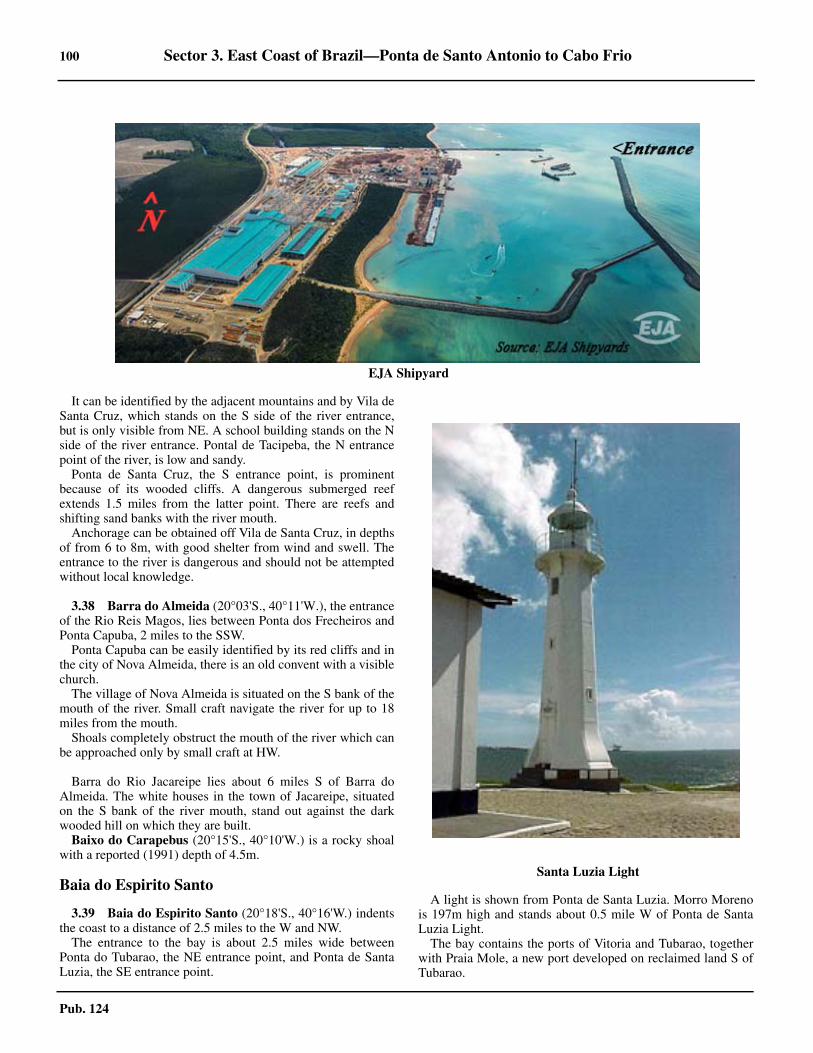
100 Sector 3. East Coast of Brazil—Ponta de Santo Antonio to Cabo Frio
Pub. 124
3.37 It can be identified by the adjacent mountains and by Vila deSanta Cruz, which stands on the S side of the river entrance,but is only visible from NE. A school building stands on the Nside of the river entrance. Pontal de Tacipeba, the N entrancepoint of the river, is low and sandy. 3.37 Ponta de Santa Cruz, the S entrance point, is prominentbecause of its wooded cliffs. A dangerous submerged reefextends 1.5 miles from the latter point. There are reefs andshifting sand banks with the river mouth.3.37 Anchorage can be obtained off Vila de Santa Cruz, in depthsof from 6 to 8m, with good shelter from wind and swell. Theentrance to the river is dangerous and should not be attemptedwithout local knowledge.
3.38 Barra do Almeida (20°03'S., 40°11'W.), the entranceof the Rio Reis Magos, lies between Ponta dos Frecheiros andPonta Capuba, 2 miles to the SSW. 3.38 Ponta Capuba can be easily identified by its red cliffs and inthe city of Nova Almeida, there is an old convent with a visiblechurch.3.38 The village of Nova Almeida is situated on the S bank of themouth of the river. Small craft navigate the river for up to 18miles from the mouth. 3.38 Shoals completely obstruct the mouth of the river which canbe approached only by small craft at HW.
3.38 Barra do Rio Jacareipe lies about 6 miles S of Barra doAlmeida. The white houses in the town of Jacareipe, situatedon the S bank of the river mouth, stand out against the darkwooded hill on which they are built.3.38 Baixo do Carapebus (20°15'S., 40°10'W.) is a rocky shoalwith a reported (1991) depth of 4.5m.
Baia do Espirito Santo
3.39 Baia do Espirito Santo (20°18'S., 40°16'W.) indentsthe coast to a distance of 2.5 miles to the W and NW. 3.39 The entrance to the bay is about 2.5 miles wide betweenPonta do Tubarao, the NE entrance point, and Ponta de SantaLuzia, the SE entrance point.
3.39 A light is shown from Ponta de Santa Luzia. Morro Morenois 197m high and stands about 0.5 mile W of Ponta de SantaLuzia Light. 3.39 The bay contains the ports of Vitoria and Tubarao, togetherwith Praia Mole, a new port developed on reclaimed land S ofTubarao.
3.37EJA Shipyard
3.37Santa Luzia Light

Sector 3. East Coast of Brazil—Ponta de Santo Antonio to Cabo Frio 101
Pub. 124
3.39 The N part of the bay is shallow and a mass of breakersduring SE winds. 3.39 Two islands, Ilha do Boi and Ilha do Frade, and several smallislets lie in the SW part of the bay, N of the entrance of the es-tuary which leads to the port of Vitoria.
3.39 The W shore of the S side of the bay is formed by Ilha doEspiritu Santo, a large island separated from the mainland bythe Rio de Passagem, a narrow shallow channel which is thesmaller outlet from a lagoon formed by the Rio de Santa Mariato the W of the island. 3.39 The main outlet from the lagoon is Estuario de Santa Maria,a channel which passes S of the island and forms the harbor ofVitoria. The Rio de Santa Marie is navigable for nearly 33miles to Cidade de Cachoeira de Santa Leopolinha.3.39 The S part of the bay, near the approach channel to Vitoria,contains a number of reefs and rocks which are marked bybeacons and buoys and can be seen on the chart. 3.39 There is a mandatory Ship Reporting System for the ports ofVitoria and Tubarao. Information on this system may be foundin paragraph 3.40 in Vitoria—Regulations.
Vitoria (20°19'S., 40°20'W.)
World Port Index No. 12850
3.40 The port of Vitoria is approached through the estuaryof the Rio Santa Maria, 4 miles long, which is entered betweenPonta do Tagano and Ilha do Boi, 0.5 mile NNW. 3.40 The channel passes between Ilha do Espiritu Santo and themainland, both of which have a number of off-lying islets.Hills rise from both sides of the channel.
3.40 Winds—Weather.—The prevailing winds are from the SE.The port area is protected from all winds.
3.40 Tides—Currents.—The tidal range at springs is 1.4m andthe range at neaps is 0.6m. The maximum draft is 11m at HWand 9.7m at LW.3.40 The velocity of the tidal current varies from 2 to 3 knots, butat times it reaches 5 knots. Abreast the port, the tidal currentswere observed to have a velocity of 4 knots at springs. About0.2 mile E of Pedras das Argolas the ebb current sets NE to-ward the wharf and the flood current sets WSW.3.40 Depths—Limitations.—All sailing is to take place on a ris-ing tide. Vessels up to 205m long can enter the port day ornight, although for vessels between 182m and 205m long, tugsare required. Vessels from 205m to 242m long can enter theport during daylight hours only, weather permitting.
3.39Entrance to Vitoria

102 Sector 3. East Coast of Brazil—Ponta de Santo Antonio to Cabo Frio
Pub. 124
3.40 Vessels of over 200m long must be assisted by three tugs,two of which must be at least 1,000 horsepower and the other
of at least 400 horsepower.
3.40 The maximum draft for the port is 10.5m at HW and 9.7m atLW. The maximum speed in the channel is 5 knots. Vesselsmay only leave port on the flood tide.3.40 The access channel, 3.5 miles long, is only 120m wide,except abreast Ilha das Bombas, where it is only 75m wide.3.40 Overhead cables, with vertical clearances of 56m, span theriver at two points. A bridge, with a vertical clearance of 58m,crosses the river 0.5 mile W of Ponta do Tagano. For further in-formation refer to table titled Vitoria—Berth Information. 3.40 Aspect.—The following landmarks are visible to the marinercoming from the N:
1. The mountains located on the N of Baia do EspiritoSanto, visible at a great distance, among which Mestre Alva-res stands out.
2. Closer to the bay appear the mountains of FradeLeopardo, Moreno and Penha, the latter with the convent ofOur Lady of Penha on its summit.
3. Ponta do Tubarao, along with the installations of the
terminals of Praia Mole and Tubarao, where there is a reser-voir and a chimney very visible.
4. Ponta do Santa Luzia with its lighthouse.5. Ilha dos Pacotes with its beacon.
3.40 When approaching the bar the mariner should navigate out-side the 20m contour. 3.40 The following landmarks are visible to the mariner comingfrom the S:
1. Ihla Escalvada, with its lighthouse.2. To the NW, the city of Guarapari, with its many build-
ings.3. To the N, in the interior, several mountains.4. The coves of Guarapari and Perocao.
3.40 Morro Moreno, 194m high, an excellent mark for identifyingthe entrance to the bay, rises 0.5 mile W of Ponta de SantaOuzia.3.40 Morro da Penha, 155m high, on the summit of which there isa ruined convent which is marked by a red obstruction light, is
Vitoria—Berth Information
Berth Length DepthMaximum Vessel
RemarksLOA Draft Beam
Commercial Quay
101 229m 7.7m 200m — 32.2m General cargo. Continuous berthing length of 458m.102 229m 7.0m 212.5m — 32.2m
Technip Terminal
Flexibras Dol-phin Berth 145m 6.71m 145m — — Closed.
Terminal de Vila Velha
203 223m 11.0m 240.7m — 32.2m General cargo. Continuous berthing length of 447m.204 224m 11.2m 238.8m — 32.2m
Capuaba Wharf
201 205m 10.7m 199.2m 10.4m 32.2m General cargo. Continuous berthing length of 407m.202 202m 10.1m 230.9m 9.3m 32.4m
Paul’s Wharf
206 260m 10.1m 232.3m 9.7m 32.2m Containers and breakbulk.
905 160m 10.4m 242m 10.1m 32.2m Multipurpose.
Prysmian Group Terminal
Main Wharf 156m — 146m — 18.5m Heavy lift and project cargo.
CPVV Terminal
CPVV Jetty 205m 10.5m — 9.1m — Berthing length of 285m (including dolphins).
Nascon—Vitoria Terminal
Atalaia Dol-phins — 9.7m 180m — — Closed.
Sao Torquato Liquid Bulk Terminal
902m 20m 6.9m 145m 6.1m — Closed.

Sector 3. East Coast of Brazil—Ponta de Santo Antonio to Cabo Frio 103
Pub. 124
surmounted by an illuminated cross, which is floodlit from2000 until 2300, 1.25 miles WSW of Ponta de Santa Luzia. Anold fort stands 0.3 mile N.
3.40 Pilotage.—Pilotage is compulsory for vessels over 200 gt
and is available 24 hours. The approximate time of arrivalshould be sent to the pilot office at least 1 hour in advance. Thepilot station is located on Ilha dos Praticos, close E of Ponta doTagano. Pilots board in position 20°21.6'S, 40°14.1'W. Pilotcontact information can be found in the table titled, Vitoria—Contact Information.3.40 Regulations.—A vessel reporting system, which is manda-tory, is in operation in Vitoria and Tubarao. Vessels must reportto Control Post (call sign: PWG 77), as follows:
1. Inbound vessels—When crossing a line between San-ta Luzia Light and the Praia Mole.
2. When anchoring.3. When leaving an anchorage.4. When changing the berth.5. Outbound vessels—Immediately before leaving the
berth.3.40 The report must include the following information:
1. Vessel name.2. International call sign.3. Flag.4. Port of origin (inbound vessels) or port of destination
(outbound vessels).5. Type of vessel.6. Anchorage or berth (inbound vessels) or estimated
date of arrival at destination (outbound vessels).7. Estimated date of departure and cruising speed (out-
bound vessels).3.40 Vessels changing berth or anchorage must report the follow-ing information:
1. Vessel name.2. International call sign.3. Previous position.4. Present position.
3.40 All communications must be made in Portuguese or English.All times are given in Universal Coordinated Time (UTC). For-eign vessels should utilize the pilot to aid in providing the in-formation to Control Post.3.40 If communications cannot be established with Control Post,the vessel should contact the Harbor master of Vitoria-Tubaraoby the quickest and most convenient means possible, with thefollowing information:
1. Vessel’s name.2. Date and time of event.3. Reason why communication has not been made.
3.40 Contact Information.—Vitoria port can be contacted, asfollows:
3.40Isla Escalvada Light
3.40Vitoria
Vitoria—Contact Information
Port
VHF VHF channel 16
Telephone 55-27-3222-1311
Facsimile 55-27-3223-5661
Web site http://www.portodevitoria.com.br
Pilots
VHF VHF channels 10, 12, 13, 14, and 16

104 Sector 3. East Coast of Brazil—Ponta de Santo Antonio to Cabo Frio
Pub. 124
3.40 Anchorage.—Vessels bound for the port of Vitoria andawaiting a pilot anchor in Anchorage No. 1, about 1 mile ESEof Ponta de Santa Luzia, in a depth of about 20m. Vesselsbound for the Praia Mole terminals in Porto de Tubarao anchorin Anchorage No. 2, centered 5 miles E of Ponta de Santa Luz-ia, in depths of 18 to 34m. Vessels bound for the iron ore termi-nal in Porto de Tubarao anchor in Anchorage No. 3, centered6.5 miles SE of Ponta de Santa Luzia, in depths of 30 to 35m.Vessels requiring inspection by the naval, health, police, ormaritime authorities anchor in Anchorage No. 4, centered 2.5miles ENE of Ponta de Santa Luzia, in depths of 20 to 28m. 3.40 Within the port of Vitoria, anchorage may be obtained be-tween Recife de Sao Joao and Pedras dos Argolas, in depths of6 to 11m, mud. This anchorage is restricted to a width of about0.1 mile.
Tubarao (20°17'S., 40°15'W.)
World Port Index No. 12855
3.41 The port of Tubarao is located on the W side of the Sextremity of Ponta do Tubarao, the NE entrance point of theBaia do Espirito Santo. The port of Tubarao has become thelargest iron ore port in the world, with an annual export of 80million tons.3.41 Tides—Currents.—The characteristic semi-diurnal tidepredominates in the port and since it is an artificial port and rel-atively open, there are no appreciable currents to be noted.
3.41 Depths—Limitations.—The channel to the buoyed ap-proach channel to the port lies about 1.5 miles ESE of Ponta deSanta Luzia. The channel is 2 miles long, with a width of280m, and is dredged to a depth of about 25m. 3.41 The maneuvering area for berthing and unberthing has awidth of 150m along the length of the quay. The maneuveringbasin has a diameter of 500m and a depth of 17m.3.41 The port consists of a breakwater, with a tanker berth on itsinner side, and two ore loading piers, 0.1 mile and 0.3 mile, re-spectively, NW of, and parallel to it. 3.41 Silting was reported between the smaller ore berth and thetanker pier. 3.41 The SE breakwater has been extended about 0.2 mile to theWSW.3.41 Praia Mole, comprising a coal and steel terminal, is ap-proached through a dredged channel which had a reported lim-iting draft of 14m. The coal terminal, lying on the S side of theharbor immediately N of the jetty.3.41 The steel products terminal, lying on the N side of the termi-nal, fronts an area used for handling and storage located on re-claimed land just S of Ponta do Tubarao. The quay, which is638m long.3.41 Lights are shown from the head of each breakwater and fromthe elbow of the SE breakwater. For berthing information seethe table titled Tubarao—Berth Information. 3.41 Pilotage.—Pilotage is compulsory for vessels over 200 gtand available 24 hours. Pilots board about 0.5 mile SSE of theentrance buoys in position 20°20.0'S, 40°14.2'W.3.41 Regulations.—A mandatory vessel reporting system is inoperation in Vitoria and Tubarao. For further information, seeparagraph 3.39 in Vitoria—Regulations.3.41 Contact Information.—For detailed contact information,see the table titled, Vitoria—Contact Information.3.41 Anchorage.—See anchorages listed under Vitoria inparagraph 3.39.3.41 Caution.—A moderate speed is reported to affect the berthsat Praia Mole. Depths in the approach channel and harbor aresubject to silting and may be less than reported.
Vitoria to Cabo de Sao Tome
3.42 The coast between Ponta de Santa Luzia and Cabo deSao Tome, 110 miles to the SW, is backed by mountainouscountry containing peaks which rise to heights of over 900mwithin 25 miles of the sea, and are remarkable for their pyrami-dal shape. These mountains are prominent in clear weather, butare frequently obscured as the low land between them and thecoast is often covered with fog or haze. They are usually mostclearly seen about sunrise.
3.42 Ilha dos Pacotes (20°21'S., 40°15'W.), a small low islandbare of vegetation, from which a light is shown, lies nearly 2miles SSE of Ponta de Santa Luzia. A reef, part of which un-covers, extends about 0.3 mile SW of the island. Breakers markthis danger.3.42 Ilha das Garcas, an islet, lies about 0.7 mile offshore and 3miles SW of Ilha dos Pacotes. A small islet lies close on its SW
Telephone 55-27-3200-3898
Facsimile 55-27-3224-3866
Web site [email protected]
3.40Tubarao
Vitoria—Contact Information

Sector 3. East Coast of Brazil—Ponta de Santo Antonio to Cabo Frio 105
Pub. 124
side.
3.42 Ilhas Jucu (20°25'S., 40°19'W.), several small islets closetogether, lie about 0.5 mile ENE of Ponta Jucu. The islets arealways visible above water. The Rio Jucu enters the sea on theN side of Ponta Jucu and the village of Jucu stands on the Sbank of the river near the point. A conspicuous white water
tower stands 1.25 miles WSW of Punta Jucu.3.42 Ponta da Fruta lies about 6 miles SSW of Ponta da Jucu andis identified by a conspicuous white church, which stands on ahillock above the point. Between Ponta Jucu and Ponta da Fru-ta, reefs extend up to 1 mile off the coast.3.42 Laje Canopus, an islet, lies about 0.3 mile SSE of Ponta daFruta and sunken rocks, over which the sea breaks, lie about0.3 mile SSW of the islet.3.42 Baixo do Una (20°33'S., 40°21'W.), a rocky shoal with adepth of 5.8m, lies about 2 miles SSE of Punta da Fruta. Thesea occasionally breaks over this shoal. Another rocky shoal,with a depth of 8.4m, lies about 2.5 miles S of the point.3.42 Ponta da Setiba (20°39'S., 40°26'W.), about 8 miles SSWof Ponta do Fruta, is marked by a 64m high hill, with sparsevegetation on its upper side.3.42 Tres Ilhas, a group of three islands, lie about 2 miles offshorein a position 3.5 miles ENE of Ponta de Setiba. The islands andother islets of less importance comprise an archipelago. Achannel about 1 mile wide lies between the coast and the archi-pelago.3.42 Ilhas Rasas (20°41'S., 40°22'W.) lie about 4.5 miles SE ofPonta de Setiba and consist of two rocky islets with a height of2m. Submerged rocks lie as far as 0.3 mile SE of the islets.3.42 Ilha Escalvada, a sandy islet, lies 2.5 miles WSW of IlhasRasas and shows a light. The islet is visible for a distance of 7miles.
Tubarao—Berth Information
Berth Length DepthMaximum Vessel
RemarksLOA Draft Beam
Terminal de Praia Mole (TPM)
Berth 1 316m 17.0m 300m 16.0m 50.0mCoal. Continuous berthing length of 716m.
Berth 2 400m 18.0m 300m 17.0m 50.0m
Terminal de Produto Siderurgico
Berth 1 214m 14.5m 300m 13.5m 62.0mSteel products. Continuous berthing length of 637m.Berth 2 201m 14.5m 300m 13.5m 62.0m
Berth 3 222m 14.5m 300m 13.5m 62.0m
Terminal de Productos Diversos (TPD)
TPD 3 190m 16.0m 280m 15.0m 43.5m Grain. Vessels with an loa over 242m must berth port side-to.
TPD 4 230m 12.5m 245m 12.0m 32.5m General cargo.
Terminal Portuario de Minerio de Ferro de Tubarao
Pier 1 N 390m 18.0m 320m 17.0m 51.0m Iron ore.
Pier 1 S 390m 17.0m 285m 16.0m 45.0m Iron ore and steel products.
Pier 2 210m 24.0m 365m 23.3m 66.0m Iron ore. Berthing length of 540m (including dol-phins).
Terminal de Graneis Liquido (TGL)
TGL 5 18m 12.5m 181m 11.35m 30.0m Petroleum products. Berthing length of 124m (in-cluding dolphins).
3.42Praia Mole

106 Sector 3. East Coast of Brazil—Ponta de Santo Antonio to Cabo Frio
Pub. 124
3.42 Ships should avoid passing between Ilhas Rasas and Ilha Es-calvada due to a wreck at a depth of 13.7m. A rock, with adepth of 9.2m, lies 4.5 miles WSW of the islet and 2 miles off-shore.
3.43 The Rio Guarapari (20°40'S., 40°30'W.) empties in-to the SW part of Enseada de Guarapari and can easily be iden-tified by its S entrance point which rises to a 21m hillock witha reddish cliff; this cliff is the first of its kind sighted when pro-ceeding from N. A conspicuous church stands on the summitof the hillock. 3.43 The town of Guarapari stands on the S bank of the river nearits mouth, but is of little importance. The village of Muquicabastands on the N bank opposite the town.3.43 Vessels with local knowledge can anchor in the W part ofEnseada de Guarapari, close E and on the N side of the rivermouth, or 0.5 mile E of the church above the S entrance point.These berths have depths of from 9 to 10m, mud, and are shel-tered from N winds. 3.43 Vessels drawing up to 4.5m can cross the bar at HWS andanchor off the town, in depths of 6.5 to 7.7m. Swinging spaceis restricted, so vessels must moor head and stern.3.43 Within the river mouth, a wharf about 76m long has a depthof less than 10m alongside. Private individual pilotage serviceis available.3.43 From the Rio Guarapari to Ponta dos Castelhanos, about 13miles to the SW, the coast consists alternately of small beachesand red cliffs. The cliffs are visible for about 10 miles. 3.43 Morro Urubu, 3.5 miles from the coast, is the most promi-nent hill and a good landmark. 3.43 The only settlements on this part of the coast is the village ofMeaipe, about 4.5 miles SSW of Guarapari, and the small vil-lage of Ubu, about 3 miles NE of Ponta dos Castelhanos.3.43 Between Guarapari and Ponta dos Castelhanos, reefs andsunken rocks lie and extend as far as 1 mile offshore. Depths ofless than 20m lie as far as 11 miles ENE, 10 miles E, and 13.5miles ESE, respectively, of Ponta dos Castelhanos.
3.44 Ponta do Ubu Ore Terminal (20°47'S., 40°35'W.) is
located about 9 miles SW of the mouth of the Rio Guarapari.When approaching the terminal, the main characteristics pointsare Escalvada Island, the mounts of Sela Grande and Urubu,and the lighthouses on Ponta do Ubu and Ponta dos Castelha-no. 3.44 Depths—Limitations.—The terminal consists of a break-water extending about 0.4 mile E and then 0.2 mile NNE fromthe shore. A jetty, 313m long, projects NNE from the breakwa-ter, parallel to, and 183m inshore of its outer leg.
3.44 Ponta Uba Ore Terminal is an iron ore facility with twoberths, as follows:
1. West Berth—Has a length of 308m with a depth of18.2m alongside. The berth can accommodate vessels with amaximum loa of 241m, a maximum draft of 16.8m, and amaximum beam of 59m.
2. East Berth—Has a length of 240m with a depth of15.2m alongside. The berth can accommodate vessels with amaximum loa of 241m, a maximum draft of 13.0m, and amaximum beam of 33m.
3.44 The jetty is approached through a channel about 0.1 milewide. The channel is maintained at a depth of 18m. Rangelights, in line bearing 270°, lead through the center of thedredged channel. Silting has been reported on the S side of thechannel and NNE of the pier head. 3.44 A light is shown from a white pyramidal tower standing onthe shore 0.5 mile N of the root of the breakwater. A conspicu-ous radio mast stands about 0.8 mile N of the root of the break-water. Lights are shown from the head of the breakwater andthe head of the jetty. 3.44 A reef, about 0.2 mile in extent, with depths of less than 2m,lies with its center 0.5 mile SSE of the elbow of the breakwater.Patches, with depths of 9.7m, lie 0.75 mile SE and ESE of theelbow of the breakwater. Barra de Maimba, with a least depthof 5.4m, lies 0.8 mile NNE of the breakwater.3.44 The West Berth can accommodate vessels up to 309m inlength with a draft of 16.8m plus the height of the tide. TheEast Berth can accommodate vessels up to 241m in length witha draft of 13m plus the height of the tide. 3.44 The cargo-handling equipment on both sides of the jetty lim-its a vessel’s vertical clearance to 18.5m.3.44 Pilotage.—Pilotage is compulsory and is available duringdaylight hours only. Pilots are provided from Vitoria-Tubarao.Vessels wait for the pilot in the anchorage area. Pilots boardabout 0.7 mile NE of the entrance to the dredged channel in vi-cinity of 20°46’S, 40°33’W.
3.42Ilhas Rasas Light
3.44Ponta do Ubu Ore Terminal

Sector 3. East Coast of Brazil—Ponta de Santo Antonio to Cabo Frio 107
Pub. 124
3.44 Regulations.—Vessels should send their ETA in advance, asfollows:
a. 15 days, or when leaving the previous port, if later.b. 5 days, with cargo tonnage required and whether ves-
sel is an ore/bulk/oil carrier or an ore/oil carrier.c. 72 hours and 48 hours, with arrival draft, ballast ton-
nage carried, and deballasting time.d. 24 hours, with details of inert system.
3.44 Contact Information.—Ponta do Ubu terminal can be con-tacted, as follows:
3.44 Anchorage.—There are four designated anchorages, as fol-lows:
1. Anchorage A (20°46.5'S., 40°32.7'W.)—Depths of 20to 26m; for vessels awaiting a pilot, health inspectors, or themaritime police.
2. Anchorage B (20°46'S., 40°31.7'W.)—Depths of 23to 26m; for platforms, special vessels, and vessels under re-pair.
3. Anchorage C (20°47'S., 40°32.7'W.)—Depths of 25to 27m; for warships and submarines.
4. Anchorage D (20°48'S., 40°29'W.)—Depths of 17 to25m; for vessels carrying inflammables, dangerous cargoes,or explosives.
3.44 Vessels should also request anchoring, berthing, and cargo-loading instructions 4 hours in advance or when within VHFrange.
3.45 Baia de Benevente (20°53'S., 40°42'W.) is an inden-tation in the coast between Ponta dos Castelhanos and Ilha doFrances, which lies about 8.7 miles SW of the point. The Npart of the bay indents the coast for about 2 miles and the RioBenevente empties into the N part of the bay. 3.45 The town of Anchieta stands on the E bank of the river nearits mouth. The town church is a prominent landmark.3.45 Depths in the bay range from 5.5 to 9.1m. Depths of lessthan 20.1m lie as far as 18.5 miles E of Ilha do Frances. 3.45 Baixo da Tiagem, a dangerous rocky shelf which dries inplaces, extends 1.25 miles from Ponta dos Castelhanos. BaixoGrande, a rock with a least depth of 0.9m, lies 2.5 miles SW.The passage between this danger and Baixo da Tiagem has adepth of 4m, but should not be used without local knowledge.3.45 The bar at the mouth of the river breaks with strong S windsand has a depth of 1.3m at LWS. The river is navigable by
small craft with local knowledge for about 13 miles.3.45 Anchorage may be obtained in the bay, in depths of 9 to15m, sand and mud bottom. Vessels are cautioned to keep clearof a dangerous wreck 3.5 miles WSW of Ponta dos Castleha-nos.3.45 Morro Aga, Ilha do Frances Light, and the church at Anchie-ta are good landmarks for clearing the dangers in the approachto the anchorage. 3.45 Ships approaching from the NE should pass S of BaixoGrande.3.45 The Rio Piuma discharges about 4.5 miles SW of the mouthof the Rio Benevente and can only be navigated by small boats. 3.45 Ilhotas de Piuma, a group of three islets, lies close off the en-trance to the river. 3.45 The village of Piuma stands on the S bank of the mouth ofthe river. A sheltered anchorage for small craft lies about 0.2mile W of the southernmost of Ilhotas de Piuma.3.45 Ilha do Frances (20°55'S., 40°45'W.), from which a light isshown, lies nearly 2 miles offshore. The island is connected tothe shore by a tongue-shaped sand bank which has depths ofless than 3m.3.45 Anchorage may be obtained with Ilha do Frances Light bear-ing 200°, distant 1.25 miles, in a depth of 9m. 3.45 A conspicuous water tower stands 2.5 miles WNW of Ilha doFrances.
3.46 Ilha Branca (21°00'S., 40°47'W.), from which a lightis shown, lies about 1 mile E of the mouth of the RioItapemirim. Rocks, which uncover, lie close to the NE and SWpoints of the island.3.46 The town of Itapemirim stands on the S bank of the river,about 3 miles within the entrance.3.46 The position of the bar is subject to change. Depth over thebar was reported to be about 1m at HW. A pilot is available up-on request by radio. The town of Itapemirim has a small pier,with depths of 1 to 2m alongside.
The mouth of the Rio Itabapoana is located about 20 milesSSW of the entrance of the Rio Itapemirim. Prominent redcliffs and wooded hills mark the coast between the two rivers.Villages on some of the hills are visible about 10 miles fromoffshore. A conspicuous house stands on Ponta do Siri, about 8miles SSW of the Rio Itapemirim. The red cliffs are prominentbetween Ponta do Siri and Ponta do Cacurucaia, 2.5 miles SWof Ponta do Siri.3.46 Ilha das Andorinhas (21°10'S., 40°53'W.) lies about 0.5mile offshore SE of Ponta do Cacurucaia. A stranded wrecklies close to shore about 0.5 mile W of Ilha das Andorinhas.
3.47 The Rio Itabapoana (21°18'S., 40°58'W.) is naviga-ble by small craft for about 35 miles from its entrance. Thetown of Itabapoana stands on the S bank of the river near itsmouth. A light is shown from the S entrance point of the river.
Ponta do Ubu—Contact Information
VHF VHF channels 13 and 16
Telephone 55-27-3361-9330
Facsimile 55-27-3361-9474
Web site [email protected]
Porto do Acu—Berth Information
Berth Length Depth Remarks
T1 Offshore
Center Pier Inner Ore Berth North 221m 19.0m Ore berth.

108 Sector 3. East Coast of Brazil—Ponta de Santo Antonio to Cabo Frio
Pub. 124
3.47 The bar can be crossed at HW by small craft with drafts of1.6m. Local knowledge is essential for approaching andentering the river. Reefs, which dry in places, lie as much as 2miles E of the river mouth. The sea breaks continuously overthe largest and most seaward of them.3.47 Vessels can anchor about 1 mile offshore, either N or S of thereefs, according to the direction of the wind, in depths of 7 to8m.3.47 Ponta do Roteiro, marked by a light, lies 3.5 miles S of themouth of the Rio Itabapoana and can be identified by its lowred cliffs. Ponta do Cacador is located 2.5 miles SSW of Pontado Retiro. Reefs extend about 1 mile offshore between the twopoints. A stranded wreck lies on the reefs about 0.7 mile NE ofPonta do Cacador.3.47 Between the mouths of the Rio Itabapoana and the RioParaiba do Sul, 19 miles to the S, depths of less than 10m lie asfar as 4.5 miles offshore. Depths of less than 20m lie as far as25 miles E of the mouth of the Rio Paraiba do Sul.
3.48 The Rio Paraiba do Sul (21°37'S., 41°01'W.), about467 miles long, empties by way of three channels at its mouth. 3.48 Ilha do Lima and Ilha da Convivencia lie in the mouth of theriver. 3.48 Gargau Channel, the northernmost channel, lies between theW side of Ilha do Lima and the mainland. It is accessible fromthe S part of Saco de Gargau and is navigable by small craft. 3.48 The middle channel, between Ilha do Lima and Ilha daConvivencia, follows a winding course in the midst of isletsand shoals. Small boats navigate this channel when prohibitedfrom using the principal entrance. 3.48 The main channel has a width of 0.2 mile between the S ex-tremity of Ilha da Convivencia and the mainland coast. Themain channel, which leads across the bar, is narrowed by sand
banks; the position of the bar is subject to change. 3.48 There is no interest to ocean navigation and its bar can onlybe approached by small vessels with through knowledge of thearea. The bar should not be attempted without localknowledge. Bar signals are displayed from a mast on the S sideof the river entrance. The bar has depths of 2.2 to 2.4m atHWS.3.48 The town of Sao Joao da Barra stands on the S bank, about2.5 within its entrance. A light is shown from the S entrance. 3.48 Anchorage is afforded in Saco de Gargau, in a depth of about10m.3.48 From the mouth of the Rio Paraiba do Sul to Barra do AcuLight, 23 miles to the S, the coast is low and sandy.
3.49 Porto do Acu (Superport Acu) (21°52'S., 41°00'W.), ,lies about 9 miles N of Barra do Acu. The port opened in 2014and is operated by Prumo Global Logistics. The port handlesiron ore, crude oil and natural gas. 3.49 Depths—Limitations.—The approach channel has anapproximate depth of 24.5m. Shoals with approximate depthsof 20.5m exist in the Terminal 1 basin. 3.49 Terminal 1 consists of a pier which extends perpendicularlyabout 1.5 miles from the coast. The pier’s extremity turns N ata 90 degree angle, forming an L-shape which acts abreakwater. This breakwater is about 1,450m in length.3.49 Terminal 2, with a least charted depth of 13.7m, consists of asizable access bracketed to the N, S, and E by two breakwaterswhich form a pincher-like entrance to a dredged basin. Vesselsenter between the two breakwaters from the NE before turningW to enter the first segment of the basin between another set ofshorter breakwaters to the N and S. This first segment is about400m wide and continues inland for about 1.7 miles beforeturning S at nearly a right angle. This second segment of the
Center Pier Inner Ore Berth South 221m 19.0m Ore berth.
Center Pier Outer Ore Berth North 221m 19.0m Ore berth.
Center Pier Outer Ore Berth South 221m 19.0m Ore berth.
Outer Pier North 368m 19.0m Oil berth.
Outer Pier South 368m 19.0m Oil berth.
Outer Pier Middle 368m 19.0m Oil berth.
Inner Pier West — — Oil berth.
Inner Pier East — — Oil berth.
T2 Onshore—Edison Chouest, Petrobras, Technip, Varco, InterMoor
Quay 860m 14.5m Oil and gas industry supplies and services. Off-shore supply vessels, tugs, and service craft.
TMult
Quay 500m 14.5m Bauxite, coke, dry bulk, and general cargo.
OSX
Quay 450m 14.5mOil and gas industry supplies and services. Off-shore supply vessels, new build vessels, and plat-forms.
Porto do Acu—Berth Information
Berth Length Depth Remarks

Sector 3. East Coast of Brazil—Ponta de Santo Antonio to Cabo Frio 109
Pub. 124
basin is about 300m wide and about 2 miles in length,terminating at a small triangular turning area. It is lined withvarious marine terminals which are described in the table titledPorto do Acu—Berth Information.
3.49 Aspect.—The port’s two terminals sit along a sandy beach.The shore and background are void of distinguishable features.The most prominent landmarks consist of the port terminalinfrastructure itself.3.49 The approach channels are marked with lighted navigationalaids.
3.49 Pilotage.—Pilotage is compulsory. Vessels are required toreport 6 hours prior to arrival. Pilots board at position 21°50’S,40°53’W for Terminal 1 and position 21°51’S, 40°55’W forTerminal 2.3.49 Contact Information.—Porto do Acu can be contacted, asfollows:
3.49 Anchorage.—An FPSO is located at position 21°51’S,40°57’W. There are also nine additional anchorages for Sup-ply, T-Multi, Quarantine, T-Oil/Ferroport, NFX Tankers, T-Ore, Emergency, and Repairs. Anchorages are best seen onchart. 3.49 Caution.—The port is under expansion and has numerousprojects which have and may continue to alter the aspect,approaches, depths, and navigational aids. Mariners areadvised to navigate with caution and consult the port web siteand local authorities for the latest information.
Cabo de Sao Tome to Ponta Imbetiba
3.50 Cabo de Sao Tome (22°00'S., 40°59'W.) is formed bya gradual change in direction of the coast, from S to WSW. Thelight towers and the radiobeacon tower are the only landmarksvisible from seaward. From a distance of 3 miles, the lowsweeping cape resembles a long line of breakers. 3.50 Acu Light is shown from the E side of the cape, about 6miles NE of Cabo de Sao Tome Light, which is shown from theSW side of the cape.3.50 Banco de Sao Tome, with depths of less 11m, extends 15miles E from Cabo de Sao Tome Light. Depths of less than5.5m extend 6.25 miles offshore on the inner part of the bank. 3.50 Depths of less than 18m extend 17 miles E of Acu Light.Submerged wrecks, with depths of 1.7m, lie up to 6.7 miles Eof Cabo de Sao Tome Light.3.50 The sea breaks heavily over the bank during S winds and thebank is subject to continual change. The sea breaks over the Wend of the bank during fresh NE winds. The sea in this area isalways discolored.3.50 Canal de Sao Tome, between the S side of the cape and theinner end of the bank is navigable by vessels drawing up to 4m,but is not safe during S winds. 3.50 Anchorage may be obtained by small craft during N windsabout 0.3 mile SE of Cabo de Sao Tome Light, in depths ofabout 5m, mud.3.50 During strong head winds, a vessel may find it advantageousto give the cape a wide berth, as it has been ascertained that thestrength of the current often increases as the depth decreasestowards the shore.3.50 Pampo Oil Field (Campos Basin) (22°30'S., 40°30'W.) liesabout 40 miles SE of Cabo de Sao Tome and is surrounded by arestricted area best seen on the chart. Numerous platforms,
3.49Sao Tome Light
3.49Sao Joao Light
Porto do Acu—Contact Information
VHF VHF channels 10 and 16
Telephone 55-22-21331100

110 Sector 3. East Coast of Brazil—Ponta de Santo Antonio to Cabo Frio
Pub. 124
submarine pipelines, mooring buoys, floating storage and/orproduction vessels, and other support vessels are located in thisoil field. Vessels should not navigate in the restricted area.Tankers should send their ETA in the oil field to their agent inMacae when departing their last port of call. When 10 milesfrom their destination, tankers should contact their destinationterminal on VHF channel 16 or on 4125 kHz, stating their ETAand requesting instructions from the mooring master. Themooring master will advise vessels of the date, time, and loca-tion of boarding.3.50 From Cabo de Sao Tome to Ponta Imbetiba, about 50 milesto the WSW, the coast is extremely low and sandy with scat-tered patches of vegetation. Pico do Frade, about 20 miles NWof Ponta Imbitiba, is very prominent, but it is frequently ob-scured by clouds.3.50 Barra do Furado (22°06'S., 41°08'W.), about 5 miles SWof Cabo de Sao Tome Light, has several houses and greatpalms around it. Canal Ubatuba, about 10 miles WSW of Barrado Furado, connects the sea with Lagoa Feia. The Rio Macaeempties into Enseada de Macae about 1 mile NNW of PontaImbetiba.
3.51 Ilhas de Santana (22°25'S., 41°42'W.), a group offive islets, lie about 4 miles ESE of Ponta Imbetiba. Ilha deSantana, near the middle of the group shows a light and is thelargest islet of the group.3.51 The passage between the islets and the mainland to the NWis obstructed by a bank with a depth of less than 8.m. 3.51 Pedra do Hermes, a rock with a least depth of 2.2m, lies 4miles N of the light on Ilhas de Sonata. The sea does not breakover this rock. Numerous rocks, with depths between 7m and10m, lie between 1 and 3 miles ENE of Pedra do Hermes. 3.51 Rocks, with depths of 5m and 6.2m, lie about 0.8 mile and1.5 miles SW, respectively, of Pedra do Hermes.3.51 Anchorage may be obtained off a sandy beach on the NWside of Ilha de Santana, in a depth of 12m, mud. Vessels shouldanchor 0.7 mile off the beach to avoid the submerged ledgewhich lies out side the line joining the entrance points. 3.51 This anchorage is open to NE and SW winds, which do notraise much sea. A vessel approaching the anchorage shouldpass SW of the islets which is clear of danger on that side.3.51 Ilha dos Papagaios, from which a light is shown, lies about0.5 mile ENE of Ponta Imbetiba. The islet is 22m high andwooded.3.51 Pedra dos Moleques, a rock awash lies a little more than 0.5mile E of Ilha dos Papagaios. The rock has the appearance of abuoy and can only be seen from a short distance. A reef, withthree heads that have depths of 1m, extends 91m S from Pedrados Moleques. 3.51 Pedra da Mula, with depths of less than 1m, lies 0.75 mileESE and is marked by a lighted buoy on its S side. The seabreaks over the rock and it uncovers at LWS. The passage be-tween Ilha dos Papagaios and Pedra da Mula should not be at-tempted. 3.51 Caution.—A lighted tanker mooring buoy lies about 3.2miles ENE of the S extremity of Ilha de Santana. 3.51 Submerged gas and oil pipelines in the area may best be seenon the chart.
3.52 Baia de Imbetiba (22°23'S., 41°46'W.) is entered be-
tween Ponta Imbetiba and Ponta do Forte, 0.6 mile to the N.3.52 A prominent house is reported to stand on the summit ofPonta Imbetiba.3.52 A ruined wharf on Ponta Imbetiba cannot be approached ow-ing to submerged obstructions. There are depths of 4.7m be-tween this point and Ponta do Forte.3.52 The Rio Macae can be entered by ships with drafts to 2.7m,but local knowledge is required. The river is navigable by smallcraft for about 30 miles. 3.52 At times, the outflow from the river discolors the sea forsome distance from its mouth, giving the appearance of sandyshoals. 3.52 Rocks and a depth of 0.4m exist close S of the N entrancepoint of the river.
3.53 Macae (22°22'S., 41°46'W.) stands on a plain on theS bank of the river near its mouth. There is an offshore oilfieldsupply base located in Baia de Imbetiba. Three piers, protectedby a breakwater. For berthing information see the table titledMacae—Berth Information. The approach channel W of Ilhados Papagaios is marked by buoys.
3.53 Anchorage may be obtained 0.25 mile N of Ponta do Forte,in a depth of 4m, sand. Anchorage for larger vessels may beobtained 0.8 mile NE of Ilha dos Papagaios Light, in a depth of8.2m.3.53 Caution.—Pedra dos Moleques, a rock awash, with a belowwater rock close S, lies about 0.5 mile E of Ilha dos Papagaios.3.53 Pedra da Mula, with a depth of 1m, lies 1.25 miles E of Pon-ta de Imbetiba. Breakers occur over this rock when there is anysea running. The S side of Pedra da Mula is marked by a light-ed buoy.
Ponta Imbetiba to Cabo Frio
3.54 The coast between Ponta Imbetiba and Cabo dos Buz-ios, about 22 miles to the SSW, is indented about 9 miles to theW by a large bay. 3.54 This coast, for the most part, is regular, low, sandy, and bro-
Macae—Berth Information
Berth Length Maximum Draft Remarks
Petrobras Terminal
A1 Pier 90m 5.7m Chemicals and proj-ect cargo.
A2 Pier 90m 5.7m Chemicals and proj-ect cargo.
B1 Pier 90m 5.7m Chemicals and proj-ect cargo.
B2 Pier 90m 5.7m Chemicals and proj-ect cargo.
C1 Pier 90m 5.7m Chemicals and proj-ect cargo.
C2 Pier 90m 5.7m Chemicals and proj-ect cargo.

Sector 3. East Coast of Brazil—Ponta de Santo Antonio to Cabo Frio 111
Pub. 124
ken in a few places, namely in the vicinity of Ponta Itapebucu,Cabo dos Buzios, and Barra de Sao Joao, located about mid-way between the point and cape. Sunken rocks and reefs fringea great part of the coast and in places they extend about 1 mileoffshore. 3.54 Sunken and above-water rocks lie as far as 3.5 miles offshorein places.
3.54 Numerous islets also lie off this part of the coast. The chart isthe best guide for locating these islets and dangers.3.54 Between Ponta Imbetiba and Cabo dos Buzios, several hillsand mountains are prominent from offshore. The most conspic-uous is Monte Grande (Pico de Sao Joao), with its slightly flat-tened summit, located about 4 miles inland. The mountain isisolated and visible about 40 miles. It is the principal landmarkfor this part of the coast. 3.54 Pedra do Amorim and Pedra Alta, two rocks with depths of9.8m and 9.5m, respectively, lie 1.5 and 3 miles ESE, respec-tively, of Ponta dos Ostras (22°32'S., 41°56'W.). 3.54 Small vessels, drawing up to 4m with local knowledge, cananchor in the mouth of the Rio Ostras with good shelter.
3.55 Barra de Sao Joao (22°36'S., 41°59'W.), 5 miles SWof Ponta dos Ostras, has depths from 3.5 to 4m over the bar andsimilar depths within the mouth of the river. The town of SaoJoao da Barra stands near the mouth of the river. Ilha de TrintaReis lies nearly 0.5 mile E of the river mouth. There are twoother islets off and to the S of the river mouth.3.55 Anchorage may be obtained 0.5 mile SSW of Ilha de TrintaReis, in depths of from about 8 to 10m, sand and mud. 3.55 Ilha Branca (22°43'S., 41°53'W.), from which a light isshown, lies about 10 miles SSE of Barra de Sao Joao and isclose N of Cabo Buzios. Ilha Raza lies 4 miles WSW of IlhaBranca. Numerous above-water rocks and sunken reefs androcks, some of which uncover, lie near Ilha Raza.3.55 Caution.—Shoal patches, with depths of 15.8m and 17.6m,lie 0.9 mile NNW and ENE, respectively, from the light on IlhaBranca.
3.56 Cabo Buzios (22°45'S., 41°52'W.) is the extremity ofa peninsula which is much indented and extends 3.5 miles NEfrom a low isthmus 0.5 mile wide. Enseada de Buzios is en-tered between Ponta da Matadeira and Ponta da Cruz. The vil-lage of Buzios, with a church, stands on the E shore of the bay.3.56 Anchorage may be obtained in Enseada de Buzios about 0.3mile WSW of Ponta da Matadeira, in depth of about 11m, shel-tered from all except NE winds. Vessels are advised to ap-proach this berth passing N of Ilha Branca giving the island aberth of at least 0.5 mile. 3.56 Ilha Ancora (22°46'S., 41°47'W.) lies 4.75 miles ESE ofCabo Buzios and is visible at a distance of more than 20 miles.Ilha Gravata lies about 2 miles W of Ilha Ancora. Two isletsnamed Filhote lie about 0.5 miles SSW of Ilha Gravata. 3.56 The islands and islets are steep-to and depths greater than37m lie between them and in mid-channel between Ilha Grava-ta and the coast. A shoal patch, with a depth of 17.6m, lies 1mile NE of Ilha Gravata.
3.57 Ponta Emerencia (22°49'S., 41°56'W.), bold andprominent, is located about 5.5 miles SW of Cabo Buzios. 3.57 Two islets lie within 0.5 mile ESE of the point, and twoabove-water rocks lie E of the islets.3.57 A 6-mile long chain of islands and islets lies in a NE to SWdirection about 1 to 3 miles off the coast between Ponta Emer-encia and Ponta Lajinha. Commencing at the NE end of thechain, Ilha do Breu lies about 2.5 miles SE of Ponta Emeren-cia. Continuing to the SW are Ilha de Pargos; Ilha dos Capoes;Ilha Comprida, which is the largest; Ilha Redonda; Ilha dos Ir-maos; and Ilha dos Papagaios. 3.57 The larger islands are covered with trees, but are difficult todistinguish as they blend with coastal features, which are simi-lar in aspect.3.57 The islands and islets are all steep-to, except for Ilha Com-prida, where sunken rocks lie about 0.2 mile E of its NE end.Depths greater than 20m lie to within 0.25 mile of the seawardside of the chain islands.3.57 Canal de Papagaios (22°51'S., 41°57'W.), the channel be-tween the above chain of islands and the mainland, is clear ofdangers with the exception of Laje do Pero, a rock with a depthof less than 2m, lying close E of Ponta do Pero. There is alwayssmooth water in this channel, even during fresh winds, andthere is good anchorage under the lee of the islands.3.57 The coast SW of Ponta do Pero to Ponta Lajinha, on the Eside of Barra Nova de Cabo Frio, is high and bold. A light isshown from Ponta Lajinha. An aeronautical radiobeacon trans-mits from a position near Pedro de Aldeia, 6.75 miles NW ofPonta Lajinha.
3.58 Barra Nova de Cabo Frios (22°53'S., 42°00'W.) liesin the mouth of the Rio Italpuru which drains the large Lagoade Araruama. The lagoon extends nearly parallel with the coastfor 21 miles W of Cabo Frio. 3.58 The Rio Itajuru is narrow and sinuous. Vessels drawing up to4m can enter at HW. The bar should only be approached withthe service of a pilot. 3.58 Anchorage is afforded within the river mouth to small craft,but swinging room is restricted. Anchorage is also affordedclose off the bar, in depths of 14 to 18m. This anchorage is ex-posed to winds from SE to SW.
3.53Macae Light

112 Sector 3. East Coast of Brazil—Ponta de Santo Antonio to Cabo Frio
Pub. 124
3.58 Cabo Frio (23°01'S., 42°00'W.), marked by a light, standson the S extremity of Ilha do Cabo Frio. The area near the pointis notable for its sheer cliffs. 3.58 Enseada do Cabo Frio lies between Ilha do Cabo Frio andthe mainland coast. An extensive sand bank separates the inletinto two parts. The N part is the larger of the two and affordsgood anchorage. 3.58 Enseada do Forno and Enseada dos Anjos indent the main-land coast off the W side of the N part of Enseada do CaboFrio. 3.58 The NE entrance to the bay is clear, wide, and deep. Boque-irao, the narrow SW entrance to the bay, lies between the Wextremity of Ilha do Cabo Frio and the mainland coast; it isspanned by an overhead cable.
3.58 The town of Arraial do Cabo is situated on the W shore ofEnseada dos Anjos.3.58 The sand bank which divides the inlet extends ENE from themainland to about the middle of the NW side of Ilha do CaboFrio. With NE winds, the sea breaks heavily on the sand bank. 3.58 A narrow channel, with a minimum depth of 3.5m, leadsover the E end of the sand bank, but local knowledge is essen-tial to its use.
3.59 Porto do Forno (22°58'S., 42°01'W.) (World Port In-dex No. 12910) lies along the N shore of Enseada dos Anjosand is a shipping point for the area’s alkali and salt production.
Depths—Limitations.—Forno Terminal consists of a quay200m long with an alongside depth of 9.1m.
Commercial Quay can accommodate vessels with a maxi-mum loa of 200m and a maximum draft of 9.6m. It also con-sists of a walkway that is 100m long with an alongside depth of9.6m. This pier is used only for repairs and has a maximum loarequirement of 140m. 3.59 East of the quay a pier, with three dolphins off its W side, ex-tends about 0.1 mile S from the shore. A light is shown fromthe pier head. The depth alongside the dolphins was reported tobe about 10m. 3.59 Aspect.—A conspicuous tank is situated about 0.1 mileNNW of the pier and a conspicuous chimney stands about 1.2miles NW of the pier.3.59 Pilotage.—Pilotage is compulsory. Pilots should be request-ed through Rio de Janeiro by radio at least 24 hours to arrival.Pilots board only during daylight hours about 2nm offshore atposition 22°58’S, 42°00’W.3.59 Anchorage.—There is anchorage, in a depth of 16.5m, 0.2mile ESE of Ponta do Forte.3.59 In the S part of Enseada do Cabo Frio, anchorage is affordedin a cove on the W end of Ilha do Cabo Frio, close within theBoqueirao entrance, in depths of 6 to 9m. 3.59 This anchorage is reported to be exposed to winds from theNE and SW. With strong NE winds, it is advisable to moor,with an open hawse-hole to the E.
3.58Cabo Frio Light

113
Pub. 124
4. Sector 4—South Coast of Brazil and East Coast of Uruguay—Cabo Frio to Pun-
ta del Este
4.0Additional chart coverage may be found in NGA/DLIS Catalog of Maps, Charts, and Related Products (Unlimited Distribution).SECTOR 4 — CHART INFORMATION

115
Pub. 124
SECTOR 4
SOUTH COAST OF BRAZIL AND EAST COAST OF URUGUAY—CABO FRIO TO PUNTA DEL ESTE
4.0 Plan.—This sector describes the E coast of Brazil from Ca-bo Frio to Punta del Este, the N entrance to the Rio de la Platain Uruguay. The descriptive sequence is from N to S.
General Remarks
4.1 Winds—Weather.—In Baia de Guanabara localwinds which vary from NE depending on the location, blowduring the night and part of the morning. They descend fromthe mountains near the coast and spread up to 6 to 9 miles fromthe coast. They subside in the morning and are followed by aperiod of calm which lasts until about noon. 4.1 The sea breeze then begins and subsides at sunset. It is re-ported to be weak when it enters the bay, but immediately be-comes stronger. 4.1 The regularity of the variation of these breezes ceases only inthe event of bad weather. In this event usually from June to Oc-tober, the winds blow from the SW or S. During this period SEwinds usually cause a confused sea breaking in Enseada deBotafogo and Enseada de Flamengo.4.1 Strong thunderstorms form in the interior of the bay on veryhot days during January, February, and March, and generallywhen the sea breeze either lags or does not blow. They are ac-companied by short but violent winds and heavy rains. 4.1 These thunderstorms are even stronger when clouds gatherover Serra dos Orgaos, N of the bay, with winds from N, butthis rarely occurs.4.1 During bad weather, it will clear if the wind shifts from SWto N, passing through E. If the contrary occurs, the weatherwill continue to be bad.4.1 In the morning during May, June, and July there is generallydense fog which disappears in the late morning.4.1 The winds in Canal de Santa Catarina generally follow thedirection of the channel. They are seldom strong, although theshort choppy seas are dangerous for small boats. 4.1 From March to September, cold fronts accompanied by verystrong winds from S to WSW move through the area; they car-ry continuous precipitation which can last up to 6 days.4.1 During October, the winds shift to E and N, and the follow-ing six months are the hottest of the year. During this season,there are frequent storms from N around by E to W. 4.1 Winds from SE are accompanied by heavy rain. In general,the heaviest rain fall in August and September, but some yearsthese months are dry.4.1 During August at dawn, the area is frequently covered by adense fog which fades away about noon.
Aspect.—This part of the coast of Brazil is dominated bySerra do Mar, which extends almost uninterrupted to near the Sboundary of Brazil. 4.1 The mountains which make up Serra do Mar in most placesconsist of several ranges lying parallel with the coast, with thehighest ranges being farthest from the coast. 4.1 North of latitude 30°S, the mountainous terrain reaches the
sea in many places, cutting into segments and pockets thefringe of lowland that fronts the foot of the mountains. 4.1 South of latitude 30°S, where Serra do Mar abruptly turns W,the coast consists of hilly uplands fronted by a broad area ofsand dunes, lagoons, and swamps.4.1 The offshore approaches are fronted by islands, islets, androcks, most of which are separated by wide and clear channels.
Cabo Frio to Baia de Guanabara
4.2 Cabo Frio (23°01'S., 42°00'W.), the S extremity ofIlha do Cabo Frio, ends S in the narrow Focinho do Cabo. Theisland, covered with vegetation, is visible in clear weather forabout 4 miles. The area near the point is notable for its sheercliffs. When seen from the SW, the island appears as an undu-lating plateau with three peaks, of which the middle peak is thehighest. A disused lighthouse, 390m high and is usually cloudcovered, stands on the middle peak.4.2 Cabo Frio Light is shown very close to the N of Focinho doCabo. Good radar returns have been reported from Cabo Frio,distant of about 26 miles.4.2 Caution.—A rock, with a depth of 3.3m, lies close S of Fo-chinho do Cabo.
4.2 Between Cabo Frio and Baia de Guanabara, about 63 milesto the W, the coast is low and consists of a uniformed barrensandy beach as far as Ponta Negra. The mountains of the interi-or gradually close the coast toward the entrance of Baia deGuanabara where they rise from the sea in almost sheer granitecliffs. The mountains within the E part of this coast are far in-land and cannot be identified from seaward.
A measured mile is situated about 12.5 miles W of Ilha doCabo Frio. It is marked by two pairs of beacons aligned on abearing of 092°. The towers, visible at 4 miles, are made ofbrick and concrete with the front one being white with a blackstripe and the rear one being black with a white stripe. 4.2 Ilhas dos Franceses, about 3 miles NW of Cabo Frio and 0.1mile offshore, consist of two rocky islets, the highest of whichis 44m high. 4.2 Ponta de Saquarema (22°56'S., 42°30'W.), about 28 milesW of Cabo Frio, is a small hill surrounded by a convent. Thisconvent is conspicuous and visible 6 miles. Laje de Itauna is agroup of above-water rocks lying up to 0.5 mile off Ponta deSaquarema and should be given a wide berth. 4.2 Ponta Negra (22°58'S., 42°41'W.), about 11 miles W ofPonta de Saquarema, is the extremity of a spur of the moun-tains projecting about 1 mile from the coast. This dark bluffforms the W limits of Praia de Macambaba and is easily recog-nized. Radar returns from the point have been reported up to 18miles. Laje Ponta Negra, a rock with a depth of 1.3m, liesabout 0.5 miles S of the point and the sea breaks almost contin-uously on it. A light is shown from Ponta Negra. 4.2 Ilhas Maricas (23°01'S., 42°55'W.) consist of two islets and

116 Sector 4. South Coast of Brazil and East Coast of Uruguay—Cabo Frio to Punta del Este
Pub. 124
lies 13 miles WSW of Ponta Negra. Two above-water rocks, onwhich the sea breaks heavily, lie close off the N extremity ofthe N islet. 4.2 Two small rocks lie close off the S end of the S islet. A lightis shown from the N islet. 4.2 A rock, with a depth of 14m, lies 1.5 miles NE of the N islet.Good radar returns from the islets have been reported up to 12miles.
Baia de Guanabara
4.3 Baia de Guanabara (22°57'S., 43°08'W.) is one ofthe finest and best-sheltered natural harbors in the world. It isabout 16 miles long, gradually widening from about 1 mile atthe entrance to 15 miles at the head. 4.3 It contains many islands and islets, and is surrounded byhigh wooded mountains which slope gently to its shores.
4.3 The shores of the bay are sandy beaches, separated by slight-ly projecting points covered with vegetation. Several riversempty into the head of the bay.4.3 The bay is approached between Ponta de Itaipu, about 20miles W of Ponta Negra, and Ponta do Arpoador, about 8 milesfarther to the W. The entrance to the bay lies between Ponta deSanta Cruz, about 6 miles WNW of Ponta de Itaipu and Pontade Sao Joao, about 0.9 mile to the W. 4.3 Porto do Rio de Janeiro occupies the S and W parts of thebay. Ilha do Governador, the principal oil terminal, is in the Npart of the bay and Niteroi, a shipbuilding center, occupiesmost of the E part of the bay.
Winds—Weather.—In Baia de Guanabara, local windsblow with great regularity. The regularity of the variation ofthese winds ceases only in the event of bad weather. In thisevent, usually from June to October, the winds blow from theSW or S.
4.2Rio de Janerio—Christ Statue on Pico do Corcovado
Guanabara Bay Terminal—Berth Information
Berth Length DepthMaximum Vessel
RemarksLOA Draft
DTSE/GEGUA Terminal
Barge Pier-PB 115m — 115m 5.8m Bunkering. Barges only.

Sector 4. South Coast of Brazil and East Coast of Uruguay—Cabo Frio to Punta del Este 117
Pub. 124
4.3 During this period, SE winds cause a confused breaking seain Enseada de Botafogo and Enseada de Flamengo. Strongthunderstorms form in the interior of the bay on very hot daysfrom January to March, and generally when the sea breeze ei-ther lags or does not blow. They are accompanied by short, butviolent, winds and heavy rains.4.3 During bad weather, it will clear if the wind shifts from SWto N passing through E. If the contrary occurs, the weather willcontinue to be bad. In the morning during May, June, and Julythere is generally a dense fog which disappears around 1000.4.3 Tides—Currents.—Close to Cabo Frio, with winds fromthe S, the current tends to the N; with winds from the NE, thecurrent usually tends to the W. A counter current, which formsin this area and can be felt up to 10 miles W of the cape, tendsto move vessels closer to shore. 4.3 In the vicinity of Baie de Guanabara, from October toMarch, when the wind is from the NE, the current tends to theW; from March to October, when the wind blows from the SE,the current tends to the N. At Guanabara Bay Terminal the av-erage tide is 1.1m, spring tides 1.6m. 4.3 Depths—Limitations.—The Baia de Guanabara entrancechannel, which extends SSW from the mouth of the bay, isdredged to a depth of 17.3m. Within the bay there is GuanabaraBay Terminals. The terminal is operated by Petrobras. It iscomprised of 7 berths. The Main Pier has two berths. Second-ary Pier has two berths, and Ilha Redonada has two berths. Forfurther information refer to table titled Guanabara Bay Ter-minal—Berth Information. 4.3 Aspect.—The entrance of Baia de Guanabara can be identi-fied by several prominent mountains in its immediate vicinity. 4.3 On the E side, Falso Pao de Acucar (22°58'S., 43°02'W.)rises from the sea in almost sheer granite cliffs and is the most
conspicuous. On the W side, Pao de Acucar is prominent. Thepeak, 395m high, has the shape of a sugarloaf and is so named.A large pavilion stands on the summit and is lighted until about2200.4.3 Pico do Corcovado, about 3 miles W of Pao de Acucar, isconspicuous by the lighted statue of Christ on its summit, al-though it is frequently obstructed by clouds and haze. 4.3 Pedra da Gavea, about 5 miles SW of Pico do Corcovado, re-sembles a square sail. It is visible for about 50 miles in all di-rections and cannot be mistaken for any other peak in thevicinity. At night the loom of the lights of Rio de Janeiro canbe seen for great distances, especially when there are cloudsover the city reflecting it.4.3 Pilotage.—Requests for pilotage service may be made eitherto the Harbor Pilots Working Cooperative (Pilot Station),which can be contacted on VHF channels 16 and 12.4.3 For tankers larger than 100,000 dwt, pilots usually boardvessels outside the main channel entrance. This will occur ifweather conditions permit and in daylight only. 4.3 In certain cases and at the discretion of the pilot according tothe prevailing conditions ships will use this channel with adraft up to 12.5m. 4.3 Pilotage for Guanabara Bay Terminal is compulsory for allforeign and national ships carrying hazardous or inflammablecargo maneuvering within the port. Pilot requests should besent 24 hours in advance.4.3 For detailed pilotage and contact information, see Rio de Ja-neiro (paragraph 4.5).4.3 Directions.—The islands in the approach to Baia de Guana-bara are steep-to, and may be approached safely. The passagebetween Ilha Rasa and Ilha do Pai is the widest, and is the onegenerally used by vessels approaching from the E.
Ilha Redonda Pier (IR) 200m 9.5m 215m 8.5m LPG and chemical gases.
Ilha Comprida (ICOMP) 235m 8.5m 210m 8.5m LPG and chemical gases.
Main Pier-PP-2 310m 13.0m — 12.8m Petroleum and by-products, alcohol, and chemicals.
Main Pier-PP-1 310m 17.0m — 15.8m Petroleum and by-products, alcohol, and chemicals.
Secondary Pier-PS-2 300m 8.5m 175m 8.5m Petroleum and by-products, alcohol, and chemicals.
Secondary Pier-PS-1 300m 12.8m — 12.0m Petroleum and by-products, alcohol, and chemicals.
Guanabara Bay LNG Terminal
LNG Berth PG-1(East) 365m 16.0m 235m 12.0m LNG.
LNG Berth PG-2(West) 365m — 300m 12.0mFSRU Experience moored and sup-plies LNG regasification. LNG and CNG.
Polibrasil
Maritime Terminal 144m 9.5m — 8.5m LPG and chemical gases.
Guanabara Bay Terminal—Berth Information
Berth Length DepthMaximum Vessel
RemarksLOA Draft
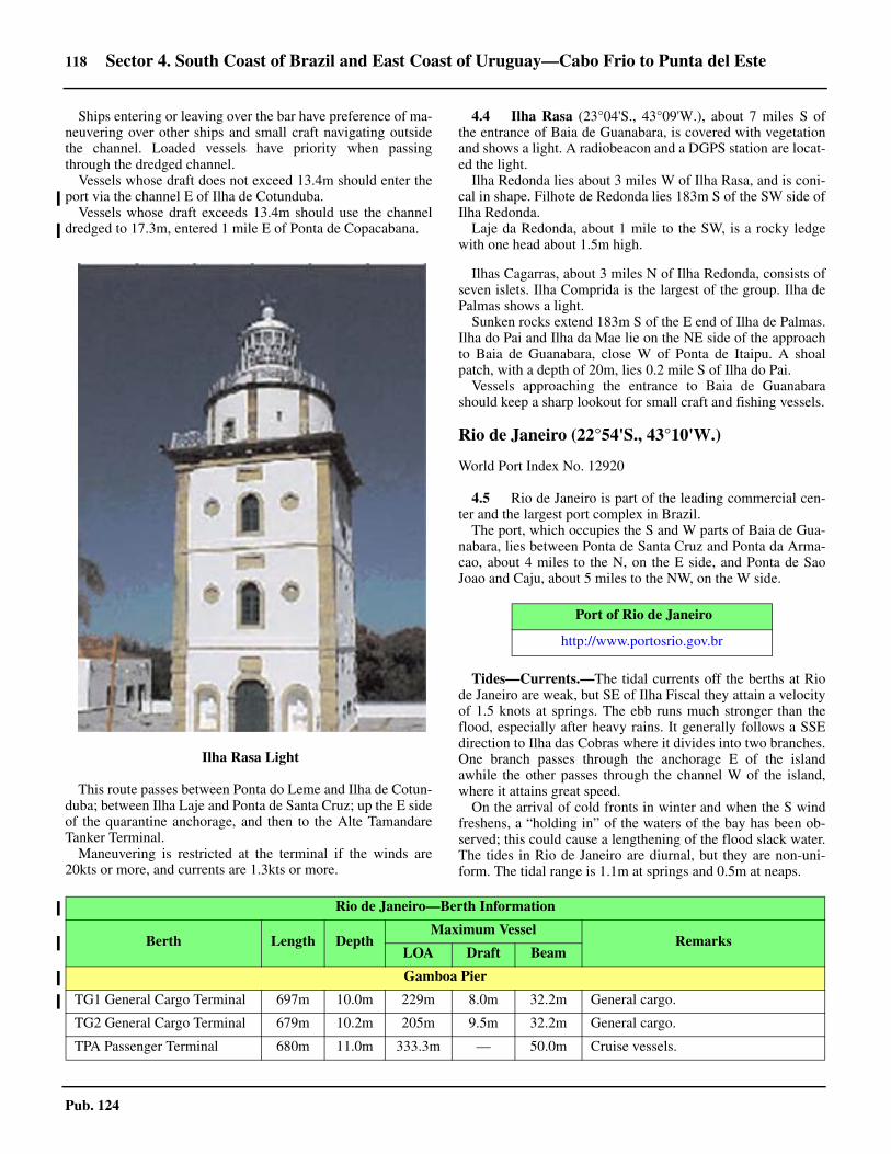
118 Sector 4. South Coast of Brazil and East Coast of Uruguay—Cabo Frio to Punta del Este
Pub. 124
4.3 Ships entering or leaving over the bar have preference of ma-neuvering over other ships and small craft navigating outsidethe channel. Loaded vessels have priority when passingthrough the dredged channel.4.3 Vessels whose draft does not exceed 13.4m should enter theport via the channel E of Ilha de Cotunduba. 4.3 Vessels whose draft exceeds 13.4m should use the channeldredged to 17.3m, entered 1 mile E of Ponta de Copacabana.
4.3 This route passes between Ponta do Leme and Ilha de Cotun-duba; between Ilha Laje and Ponta de Santa Cruz; up the E sideof the quarantine anchorage, and then to the Alte TamandareTanker Terminal.4.3 Maneuvering is restricted at the terminal if the winds are20kts or more, and currents are 1.3kts or more.
4.4 Ilha Rasa (23°04'S., 43°09'W.), about 7 miles S ofthe entrance of Baia de Guanabara, is covered with vegetationand shows a light. A radiobeacon and a DGPS station are locat-ed the light.4.4 Ilha Redonda lies about 3 miles W of Ilha Rasa, and is coni-cal in shape. Filhote de Redonda lies 183m S of the SW side ofIlha Redonda. 4.4 Laje da Redonda, about 1 mile to the SW, is a rocky ledgewith one head about 1.5m high.
4.4 Ilhas Cagarras, about 3 miles N of Ilha Redonda, consists ofseven islets. Ilha Comprida is the largest of the group. Ilha dePalmas shows a light. 4.4 Sunken rocks extend 183m S of the E end of Ilha de Palmas.Ilha do Pai and Ilha da Mae lie on the NE side of the approachto Baia de Guanabara, close W of Ponta de Itaipu. A shoalpatch, with a depth of 20m, lies 0.2 mile S of Ilha do Pai. 4.4 Vessels approaching the entrance to Baia de Guanabarashould keep a sharp lookout for small craft and fishing vessels.
Rio de Janeiro (22°54'S., 43°10'W.)
World Port Index No. 12920
4.5 Rio de Janeiro is part of the leading commercial cen-ter and the largest port complex in Brazil. 4.5 The port, which occupies the S and W parts of Baia de Gua-nabara, lies between Ponta de Santa Cruz and Ponta da Arma-cao, about 4 miles to the N, on the E side, and Ponta de SaoJoao and Caju, about 5 miles to the NW, on the W side.
4.5 Tides—Currents.—The tidal currents off the berths at Riode Janeiro are weak, but SE of Ilha Fiscal they attain a velocityof 1.5 knots at springs. The ebb runs much stronger than theflood, especially after heavy rains. It generally follows a SSEdirection to Ilha das Cobras where it divides into two branches.One branch passes through the anchorage E of the islandawhile the other passes through the channel W of the island,where it attains great speed.4.5 On the arrival of cold fronts in winter and when the S windfreshens, a “holding in” of the waters of the bay has been ob-served; this could cause a lengthening of the flood slack water.The tides in Rio de Janeiro are diurnal, but they are non-uni-form. The tidal range is 1.1m at springs and 0.5m at neaps.
4.3Ilha Rasa Light
Port of Rio de Janeiro
http://www.portosrio.gov.br
Rio de Janeiro—Berth Information
Berth Length DepthMaximum Vessel
RemarksLOA Draft Beam
Gamboa Pier
TG1 General Cargo Terminal 697m 10.0m 229m 8.0m 32.2m General cargo.
TG2 General Cargo Terminal 679m 10.2m 205m 9.5m 32.2m General cargo.
TPA Passenger Terminal 680m 11.0m 333.3m — 50.0m Cruise vessels.

Sector 4. South Coast of Brazil and East Coast of Uruguay—Cabo Frio to Punta del Este 119
Pub. 124
4.5 Depths—Limitations.—The main channel is swept to 17m.The channel to the container terminal and ore docks is 10mdeep. The channel to Gamboa Quay and Sao Cristovao Quayvaries from 6 to 12m deep. The channel to Caju Quay is 5.8mdeep.4.5 The Presidente Costa E Silva Bridge crosses Baia Guanabarabetween the NW entrance point of the commercial harbor andIlha de Moncangue of Niteroi. Passage under the main span isrestricted to vessels of more than 50,000 dwt or with a draftgreater than 12.2m. 4.5 The main span of the bridge, between Pier 100 and Pier 101,has a vertical clearance of 60m above mean sea level and a hor-izontal clearance of 269m.4.5 A racon is located in the middle of the central span.4.5 Other vessels should pass under the span adjacent to themain span, as follows:
1. Southbound vessels—between Pier 99 and Pier 100.2. Northbound vessels—between Pier 101 and Pier 102.
4.5 The two adjacent spans have a vertical clearance of 60mabove mean sea level and a horizontal clearance of 170.5m.4.5 There are about 4 miles of quayage in the commercial harborof Rio de Janeiro. Ships usually moor and unmoor at any hourexcept when an unexpected event arises, such as breakdownand inclement weather. For further berthing information referto table titled Rio de Janeiro—Berth Information. 4.5 Pilotage.—Pilotage is compulsory for all foreign vessels andall vessels carrying petroleum, propane, or explosives. Pilotage
is available 24 hours.4.5 Vessels should send an ETA, via the agent, 72 hours, 48hours, and 24 hours in advance. The pilot should be confirmed,via the agent or the pilot’s association, 12 hours and 3.5 hoursin advance.4.5 The pilot boat displays a red flag with a black “P.” Pilotsboard, as follows:
1. Vessels approaching from the E—about 1.5 mile SWof Ilha do Pai, by request.
2. Vessels approaching from the S or entering thedredged channel—about 2 miles SSE of Ilha de Cotunduba.
3. Vessels entering the Santa Cruz channel with a draftless than 12.5m—about 0.3 mile SW of Ponta de Santa Cruz.
4.5 Vessels of over 10m draft usually embark a pilot at the outerstation. Pilots will not bring a vessel to the quarantine anchor-age at night if its draft exceeds 11m.4.5 Regulations.—Vessels with a draft of 13.4m or more mustuse the 17m dredged channel, which begins in the vicinity ofPonta de Copacabana. There is a speed limit of 8 knots in thechannel, reducing to 5 knots in the harbor between Ilha da BoaViagem and Ilha do Manuel Joao. The limit is 6 knots in theapproach channels S to the berths located S of the bridge.4.5 A vessel reporting system, which is mandatory for vessels 20gt and over, is in operation in Rio de Janeiro. Vessels must re-port to Control Post (PWZ 88), as follows:
1. When entering Baia Guanabara—on the Lage-SantaCruz alignment.
TPP Terminal 250m 10.2m 190m — 32.2m Breakbulk.
TSG Terminal Steel Products 304m 10.2m 205m — 32.2m Steel products and breakbulk.
TT1 Terminal 1 150m 10.2m 142.7m — 18.2m Breakbulk.
Sao Cristovao Quay
TGS General Cargo Terminal 390m 13.5m 182.2m — 32.0m General cargo.
TPS Steel Products Terminal 436m 9.5m 144.2m 7.5m 24.2m Steel products.
Cosan Ilha do Governador (RJ) Terminal
Products Berth 25m 10.0m 186.4m 8.0m 32.2m Chemical products. Berthing length of 270m (including dolphins).
Manguinhos Oil Refinery
MBM — — 220m 13.0m 45.0m Closed.
Shell Terminal
Products Berth 64m 9.1m 185m 7.6m 30.4m Chemicals.
Caju Pier
TCO (T1 Container Terminal) — 15.0m 300m 13/0m 48.2m General cargo. Berthing length of 545m (continuous).
TCO (T2 Container Terminal) — 15.0m 300m 14.2m 48.4m Containers. Berthing length of 533m (continuous).
TRR Ro-Ro Terminal — 13.5m 231m 12.6m 32.2m General cargo. Berthing length of 917m (continuous).
Rio de Janeiro—Berth Information
Berth Length DepthMaximum Vessel
RemarksLOA Draft Beam

120 Sector 4. South Coast of Brazil and East Coast of Uruguay—Cabo Frio to Punta del Este
Pub. 124
2. When leaving the port of Rio de Janeiro—passingabeam of Ilha Fiscal.
3. When changing berth or anchorage.4.5 The report must include the following information:
1. Vessel name.2. Flag.3. International call sign.4. Type of vessel.5. Type of cargo (general, bulk, containers, chemicals,
etc.).6. Port of origin (inbound vessels) or port of destination
(outbound vessels).7. Anchorage or berth (inbound vessels) or estimated
date of arrival at destination (outbound vessels).8. Estimated date of departure (inbound vessels) or
cruising speed (outbound vessels).4.5 Vessels changing berth or anchorage must report the follow-ing information:
1. Vessel name.2. Flag.3. International call sign.4. Present position.5. Intended position.6. Type of cargo on board.
4.5 All communications must be made in Portuguese or English,with the pilot assisting in the reporting for foreign vessels. All
times are given in Universal Coordinated Time (UTC). Foreignvessels should utilize the pilot to aid in providing the informa-tion to Control Post.4.5 If communications cannot be established with Control Post,the vessel should contact the Captain of the Port of Rio deJaniero, by the quickest and most convenient means possible,with the following information:
1. Vessel name.2. Date and time of event.3. Reason why communication has not been made.
4.5 Signals.—Storm and weather signals are shown from thesignal stations about 0.1 mile W of Ponta de Copacabana andnear the middle of Ilha dos Cobras. Another signal station is onthe S end of Ilha do Mocangue in the approach to Niteroi. Thesignals are, as follows:
1. A white flag—Good weather.2. A blue flag—Threatening or bad weather.3. A white and blue flag—Unsettled weather.
4.5 When these flags are displayed alone, it also signifies thatthe temperature will remain stable. 4.5 A black pendant, displayed above or below the flag,indicates that the temperature will rise or fall, respectively.Should a large rise or fall in temperature be expected, thependant will be replaced by a white flag with a red or blackrectangular center, respectively.
4.5Courtesy of Jorge Andrade
4.5Rio de Janeiro Harbor

Sector 4. South Coast of Brazil and East Coast of Uruguay—Cabo Frio to Punta del Este 121
Pub. 124
4.5 At night, the following signals are exhibited at themeteorological observatory and on a building in Cidade do Riode Janeiro:
1. A white light—good weather.2. A blue light—threatening or bad weather.3. A red light—unsettled weather, with or without rain.
4.5 Contact Information.—The Rio de Janeiro pilots can becontacted, as follows:
4.5 Anchorage.—Vessels which have to anchor outside the har-bor due to congestion at the inner anchoring grounds, or whichare constrained by their draft, shall anchor 2 miles N of IlhaRasa, in a depth of about 32m. 4.5 Vessels that use this anchoring area must communicate withthe harbormaster’s office as soon as they reach the area. Theymay communicate by VHF radio or by fax, or their agent canreport in person to the Division of Naval Police, as part ofclearance, and at the State Offices at any time, including week-ends.4.5 Vessels may not anchor in the aforementioned anchorage
without informing the harbormaster’s office. A vessel’s stay islimited to 48 hours.4.5 This anchorage area is subject to strong S winds and groundswell.4.5 For anchorage in Baia Guanabara, vessels must use a localpilot and have permission and clearance. Inner anchorages canbe best seen on the chart.4.5 For detailed anchorage information and locations, see the ta-ble titled Rio de Janeiro—Designated Anchorages. 4.5 Caution.—A number of wrecks and obstructions are situat-ed within these anchorage areas.4.5 Numerous submarine cables from many directions land be-tween Ponta de Copacabana and Ponta do Leme, at the city ofRio de Janeiro, a marine farm is located at position 26°45.0'S,48°37.0'W. Any vessels anchoring outside the bar of Baia Gua-nabara must use the anchorage 2 miles N of Ilha Rasa.4.5 An obstruction, lying at a depth of 2.9m, has been reportedin position 22°53'51''S, 43°10'03''W. Mariners are advised tonavigate with caution in the vicinity of the reported obstruc-tion. 4.5 A dangerous wreck lies close E of Parcel das Feiticeiras.
Baia de Guanabara—North Part
4.6 Niteroi (22°53'S., 43°07'W.) (World Port Index No.12930) stands on the opposite side of Baia de Guanabara,across from Rio de Janeiro. The port is situated in Enseada deSao Lourenco and can be approached either by passing be-tween Ponta do Toque-Toque and Ilha do Mocangue Grande,or between the latter island and Ilha do Viana.
4.6 The vertical clearance of the bridge between Pier 126 andPier 130 is 19m. 4.6 Enseada de Sao Lourenco is entered by a narrow channel,with a least depth of 5.4m, between Ilha Caju and Ponta daAreia, 183m to the SW.
Rio de Janeiro—Contact Information
Port Authority
VHF VHF channel 16
Telephone 55-21-2533-4522
Facsimile 55-21-2233-2064
E-mail [email protected]
Pilots
VHF VHF channels 12 and 16
Telephone 55-21-2516-1336
Facsimile 55-21-2233-9738
E-mail [email protected]
Rio de Janeiro—Designated Anchorages
Anchorage Number Type Location
No. 1 Quarantine and Customs 22°53.05'S, 43°08.85'W
No. 1A Platforms 22°54.01'S, 43°08.63'W
No. 2 (Area 1) Naval vessels 22°54.49'S, 43°09.19'W
No. 2 (Area 2) Naval vessels 22°53.57'S, 43°09.43'W
No. 2 (Area 3) Naval vessels 22°51.67'S, 43°08.64'W
No. 3 Barges, container vessels, and refueling 22°52.73'S, 43°09.83'W
No. 4 Cargo working 22°52.68'S, 43°10.81'W
No. 5 LASH barges 22°53.04'S, 43°10.84'W
No. 6 Cargo working and vessels under repair 22°51.13'S, 43°11.23'W
No. 6A Vessels under repair 22°49.97'S, 43°08.21'W
No. 7 Dangerous cargo 22°49.45'S, 43°07.28'W
No. 8 Vessels for liquid bulk terminals 22°48.87'S, 43°08.36'W
No. 9 Vessels for liquid bulk terminals 22°47.97'S, 43°07.98'W

122 Sector 4. South Coast of Brazil and East Coast of Uruguay—Cabo Frio to Punta del Este
Pub. 124
4.6 The maneuvering basin in the channel of Niteroi is 430mlong, 250m wide, and has a depth of 6m.4.6 The quay at Niteroi, which is 429m long, lies on the S shoreof Enseada de Sao Lourenco and has a depth of 7.5m along-side. A floating dock is moored at the E end of the quay. 4.6 A pier, with a light shown from its head, extends 100m Wand SW from the W extremity of Ilha da Conceicao. 4.6 An L-shaped pier projects W, then about 450m N from theNW extremity of Ilha do Mocangue, with a second pier pro-jecting 300m N from its root. A wreck, with a depth of 8.3m,lies close N of this pier head. A third pier is reported to projectabout 100m NW from the NE extremity of lha do Mocangue.A light is exhibited from the head of each pier. 4.6 Pilotage is compulsory; pilots board at the quarantine an-chorage. Before entering the port vessels must clear with portauthorities at the quarantine anchorage.
4.7 The bay N of Rio de Janeiro is generally shallow andfoul. The main channel, swept to a depth of 17m and describedin paragraph 4.5, leads from the quarantine anchorage to about1 mile E of Ilha d'Agua, about 0.7 mile off the E side of Ilha doGovernador. 4.7 There are several maritime terminals for the loading and dis-charging of oil in the N part of Baia de Guanabara. 4.7 The principal terminals are, as follows:
1. Almirante Tamandare Terminals 1 and 2, about 0.5mile ENE of Ponta da Ribeira and 0.8 mile NE of Ilhad’Agua, respectively.
2. The terminals at Ponta da Ribeira.3. The terminals near Ponta da Cousa, Ilha Comprida,
and Ilha Redonda, ENE of Ilha Comprida.4.7 Almirante Tamandare Terminal 1 has a length of 320m andcan accommodate two tankers up to 135,000 gt, one on eachside, in depths of at least 17m. The maximum draft permitted is15.8m. 4.7 Almirante Tamandare Terminal 2, of similar construction toTerminal 1, can accommodate vessels up to 35,000 dwt with amaximum draft of 10.4m. 4.7 The other terminals can accommodate tankers with lengthsup to 200m and drafts up to 9.0m. 4.7 There are numerous oil pipelines in the N part of the bay andcan best be seen on the charts. Vessels are cautioned not to an-chor in the vicinity of these pipelines.4.7 Caution.—When using the applicable navigation chart, donot use objects on both sides of the channel concurrently to fixthe vessel’s position. The two sides of the bay were surveyedindependently and may not exactly match.
Baia de Guanabara to Baia de Sepetiba
4.8 Between Ponta do Arpoador and Cabo da Gavea,about 6 miles to the WSW, the coast is backed by the continua-
tion of the mountains that surround Rio de Janeiro. 4.8 Ponta dos Dois Irmaos, about midway along this stretch, ishigh and steep and rises to Pico Dois Irmaos, about 0.5 mile in-land. 4.8 Cabo da Gavea (23°01'S., 43°18'W.) is the SW extremity ofa rocky promontory. Pico da Tijuca, a conspicuous peak, standsabout 4 miles N of the cape. A dangerous rock, with a depth of2.5m, lies about 0.2 mile offshore and nearly 0.75 mile WSWoff the cape.4.8 Ilhas Tijucas, consisting of three islets and several rockswhose least known depth is 2m, and are located about 1 mile Sand SE of Cabo da Gavea.4.8 Mariners are advised to navigate in depths no lower than the20m curve when transiting this area.4.8 A channel runs between the islets and the coast. Vessels us-ing this channel should keep near Cabo da Gavea, which issteep-to.
4.9 Pontal de Sernambitiba (23°02'S., 43°28'W.), a lowislet joined to the coast by a drying sand ridge, is located al-most 10 miles W of Cabo da Gavea. Ilha Urupira lies 2.5 milesSW of Pontal de Sernambitiba, and between it and the main-land is Ilha das Pecas. 4.9 Caution.—Submarine cables extend from the coast just E ofPontal de Sernambitiba.
4.9 Ponta de Guaratiba (23°05'S., 43°34'W.) is the SW extrem-ity of a promontory which is about 1 mile wide. It rises to aconical peak, 354m high, and is the SW end of a chain ofmountains surrounding Rio de Janeiro. A small low islet liesclose W of Ponta de Guaratiba. 4.9 Ilha Rasa da Guaratiba, close S of Ponta de Guaratiba, is32m high and covered with low vegetation. An above-waterrock lies about 0.1 mile WSW of the island. The passage be-tween the island and the coast is obstructed by submergedrocks. A light is shown from the island.
4.9 Laje da Marambaia (23°07'S., 43°51'W.), about 15 milesW of Ponta de Guaratiba and 2.75 miles offshore, is 18m highand barren. From the S this steep-to rocky islet appears coneshaped. A light is shown from Laje da Marambaia. A shoalwith a depth of 7.3m and one with a depth of 7.6m lie 0.8 mileand 1 mile W, respectively, of the light. 4.9 Restinga de Marambaia, a tongue of land which extendsnearly 25 miles W from the foot of Morro de Guaratiba, is sep-arated from the mainland at its E end by a narrow channel. It ismostly sandy with some low vegetation.4.9 Ilha de Marambaia, which forms the W end of this peninsu-la, rises to a height of 641m. 4.9 Areas prohibited to anchoring or fishing are located alongthe S coast of Restinga da Marambaia.
No. 10 Vessels carrying LNG 22°47.34'S, 43°07.60'W
No. 11 Platforms 22°54.56'S, 43°08.38'W
No. 12 Vessels for Suzano Petrochemical Terminal 22°46.02'S, 43°08.98'W
Rio de Janeiro—Designated Anchorages
Anchorage Number Type Location

Sector 4. South Coast of Brazil and East Coast of Uruguay—Cabo Frio to Punta del Este 123
Pub. 124
Baia de Sepetiba
4.10 Baia de Sepetiba, N of Restinga de Marambaia, isabout 20 miles long and up to 8 miles wide. The W part of thebay has numerous islands and rocks, with deep water and goodanchorage between them. The E part of the bay, with fewer is-lets and dangers, is shallower, but does not afford good anchor-age. The N shore of the bay is low and intersected by severalrivers and drainage canals navigable by small craft. 4.10 The bay, approached W of Ilha do Marambaia, is entered be-tween Ponta do Sino (23°05'S., 44°01'W.) and Ponta do Bis-po, about 6 miles to the NNW.
Guaiba Island Terminal (23°01'S., 44°02'W.)
World Port Index No. 12935
4.11 Guaiba Island Terminall da Ilha Guaiba) consisting ofa 470m long deep-water pier, is situated off the SE end of IlhaGuaiba, about 7 miles due N of the bay entrance. The terminalserves as an iron ore export facility. 4.11 Tides—Currents.—The current runs about 2 knots at timesoff the pier. A heavy swell sometimes runs into the bay and itmay be necessary for a vessel to leave the berth and anchor offit.4.11 Depths—Limitations.—A channel, marked by lightedbuoys and dredged to 22.5m, leads in a 328°30' direction fornearly 5 miles from a position about 3 miles SW of Ponta doSino. 4.11 The channel then turns to the E and leads in a 069° directionfor about 5 miles to a position abreast the ore pier off the S sideof Ilha Guaiba. Range lights and a racon mark the two legs ofthe channel. The distance from the entrance at the bar to theport is 14 miles. The dredged depth of 22.5m is carried as far asthe maneuvering basin in front of the quay, which has a leastdepth of 20.4m.4.11 The South Berth (Outer Berth) has a depth of 22.5m along-side; the North Berth (Inner Berth) has a depth of 19m along-side. A mooring dolphin at the W end of the pier provides anoverall mooring length of 470m alongside the S berth. Vesselsup to 21.6m draft and 350,000 dwt can be accommodated.There is an air draft restriction at both berths of 19m. 4.11 Pilotage.—Pilotage is compulsory and is provided by Rio deJaneiro. The pilot boards about 3 miles ENE of the Ponta dosCastelhanos light, at the extreme E point of Ilha Grande.4.11 Regulations.—Vessels should send their ETA 6 days, 48hours, and 24 hours in advance, with any changes sent at least8 hours in advance, through either Rio de Janeiro or directly tothe terminal when within VHF range.4.11 Vessels should request anchoring and berthing instructions 4hours in advance or when within VHF range.4.11 Anchorage.—Anchorage can be taken in the vicinity of thepilot boarding area, in a depth of 23m, sand and shell. Ships
should not proceed beyond this point unless a pilot is aboardand instructions for mooring have been received. 4.11 Large ships can anchor about 2 miles NE of Ponta dos Cas-telhanos or about 3 miles NW of Ponta do Sino while awaitingberth to load ore. 4.11 Caution.—Less water than charted has been reported on the328.5° entrance channel.
4.12 Ilha Guaibinha (22°59'S., 44°02'W.) lies about 0.5mile N of Ilha Guaiba. Anchorage is afforded in the middle ofthe channel between the two islands, in depths of 13 to 14m. 4.12 A shoal, with depths of less than 5.5m, extends about 0.7mile E and 1.25 miles NE from Ilha Guaibinha. 4.12 Laje Preta de Fora, above-water and showing a light, lies atthe NE end of this shoal. 4.12 Ilha Jurubaiba (22°58'S., 43°57'W.) lies 5 miles NE of IlhaGuaiba and shows a light from its W side. A light is shownfrom Laje do Cabrito, a submerged rock located 3 miles W ofIlha Jurubaiba. The island is flat and elongated in a E to W di-rection, 32m high with rocky slopes.4.12 Ilha de Jaguanum (23°00'S., 43°56'W.) lies about 2 milesNE of Ponta Mangona, the N extremity of Ilha da Marambaia. 4.12 The island shows two elevations of the same altitude separat-ed by a depression. It is covered by intense vegetation, withrocky slopes.4.12 Anchorage is afforded off the NW side of Ilha de Jaguanum,in a depth of about 9.1m. The best anchorage for small craft isNE of the island, in depths of 10 to 20m, but care should betaken to keep clear of the spit extending NW from Ilha Bonita.
4.13 Ilha de Itacuruca (22°57'S., 43°53'W.), the largestand highest island in Baia de Sepetiba, lies about 2 miles NE ofIlha de Jaguanum, and is separated from the coast by Canal deItacuruca on its N side. 4.13 The island is flat on its N part and high on the S part, withdense vegetation, rocky slopes with beaches, and many isolatedhouses which is the village of Itacuruca that stands near themainland near the W entrance to the canal. 4.13 A pier in the village can accommodate vessels of up to 3mdraft. The canal has a minimum depth of 4.6m in the fairway. 4.13 Anchorage may be obtained 183m S of the pier at Itacuruca,in depths of 7 to 8m, mud, with good shelter from all except Wand SW winds. The E part of Baia de Sepetiba is shallowerthan the W part and there are fewer islets and dangers in it. 4.13 The NE part of the bay is low and backed by mangroves andit is broken by the mouths of several rivers and canals whichare navigable by small craft. 4.13 The villages of Sepetiba and Pedra stand on this part of thebay. Anchorage may be obtained by small vessels about 1 mileoff Sepetiba, in a depth of 4m, mud.4.13 Caution.—Several mooring buoys are located in Canal deItacuruca.
Sepetiba (Itaguai)—Berth Information
Berth Length DepthMaximum Vessel
RemarksLOA Draft Beam
Companhia Portuaria Baia de Sepetiba (CPBS)

124 Sector 4. South Coast of Brazil and East Coast of Uruguay—Cabo Frio to Punta del Este
Pub. 124
4.14 Porto de Sepetiba (Itaguai) (22°56'S., 43°50'W.)consists of three main terminals. Coal and aluminum areimported and iron ore is exported. Containers are also handled.
Depths—Limitations.—An L-shaped jetty, with a berthinglength of 540m, extending S from the S point of Ilha daMadeira, is the largest pier. The N face of the pier canaccommodate two vessels of 45,000 dwt. The S face of the piercan accommodate two vessels of up to 130,000 dwt.
The Mineral Terminal, a T-head pier, extends S from theshore close E of the main pier. For further berthing informationrefer to table titled Sepetiba (Itaguai)—Berth Information. 4.14 The approach channel to the Mineral Terminal (TPS) wasreported (2004) dredged to 17.1m; the approaches to the S sideof the TECAR Jetty and the container terminal have beendredged to a depth of 13.4m.4.14 Pilotage.—Pilotage is compulsory and is provided by Rio deJaneiro. The pilot boards about 3 miles ENE of the Ponta dosCastelhanos light, at the extreme E point of Ilha Grande.4.14 Porto Sepetiba pilots can be contacted, as follows:
1. Call sign: Pilot Sepetiba (Praticagem Sepetiba)2. VHF: VHF channels 11, 12, 13, and 16
4.14 Regulations.—Vessels should send their ETA 6 days, 48hours, and 24 hours in advance, with any changes sent at least8 hours in advance, through either Rio de Janeiro or directly tothe terminal when within VHF range.4.14 Vessels should request anchoring and berthing instructions 4hours in advance or when within VHF range.4.14 An alternative fairway channel, passing S of Ilha do Martinsand marked by lighted buoys and a lighted beacon, is used byoutgoing vessels after unloading at Sepetiba.4.14 A restricted area of spoil ground, in which entry isprohibited, is located about 2 miles SE of the containerterminal. The area is marked by buoys, and can also be seen onthe chart.4.14 Contact Information.—See the table titled Porto Sepeti-ba—Contact Information.4.14 Caution.—The buoyed channel passing W and N of Ilha doMartins is now known as Secondary Channel. Main Channel,formerly the alternative channel for departures, is also buoyedand passes S of Ilha do Martins.4.14 It is reported (2015) that changes to the approach channelbuoyage have been recently effected.
401 143m 20.0m 315m 18.1m 50.0m Iron ore. Berthing length of 370m (including dolphins).
TECAR Terminal
101 270m 20.3m 300m 19.8m 52.0m Coal and petcoke. Berthing length of 540m (continuous).
102 270m 20.3m 300m 19.8m 52.0m Iron ore. Berthing length of 342m (including dolphins).
202 270m 11.1m 300m 10.6m 50.0m Iron ore. Berthing length of 342m (including dolphins).
Sepetiba TECON
301 270m 13.5m 340m 13.0m 45.2m General cargo.
302 270m 15.2m 334m 14.7m 48.4m Containers. Berthing length of 810m (continuous).
303 265m 15.2m 330m 14.7m 48.4m General cargo. Berthing length of 300m (including dolphins)
Terminal Ternium
01 413m 17.0m 256m 14.0m 43.0m Coal and steel. Berthing length of 700m (continuous).
02 287m 17.0m 256m 14.0m 36.0m Steel products. Berthing length of 700m (continuous).
Porto Sudeste
B1 383m 20.0m 300m 17.8m 50.0m Iron ore.
B2 383m 20.0m 300m 17.8m 50.0m Iron ore.
TGS 3
201 253m 11.1m — 10.6m — Closed.
Sepetiba (Itaguai)—Berth Information
Berth Length DepthMaximum Vessel
RemarksLOA Draft Beam
Porto Sepetiba—Contact Information
TECAR Coal Terminal TECON Container Terminal
Telephone 55-21-2688-933455-21-2688-9369
55-21-2688-9368 55-21-2688-938855-21-2688-9603
Facsimile 55-21-2688-9209 55- 21-2688-9211

Sector 4. South Coast of Brazil and East Coast of Uruguay—Cabo Frio to Punta del Este 125
Pub. 124
4.14 Depths less than charted have been reported (2018). Themariner is advised to navigate with caution and obtaininformation about aids to navigation and depths in theapproach channels and the turning basin from the localauthorities.
Ilha Grande
4.15 Ilha Grande (23°09'S., 44°13'W.), lying in the en-trance of Baia da Ilha Grande, is about 16 miles long and 7miles wide. The island is mountainous and covered with thickvegetation to the water's edge. 4.15 Pedra d’Agua, the summit of the island, is 1,035m high; Picoda Papagaio, about 2 miles ESE, is 982m high and resembles aparrot's beak. 4.15 Ponta dos Castelhanos, the E extremity of the island, shows alight. 4.15 The S coast of Ilha Grande is formed by several bays andcoves, two of which are located between Ponta de LopesMendes and Ponta da Andorinha, 2.5 and 6 miles WSW, re-spectively, of Ponta de Castelhanos. The buildings of a penalcolony stand on the W side of the bay. 4.15 Ponta dos Meros (23°14'S., 44°21'W.) is the SW extremityof Ilha Grande. Ilha dos Meros lies 1 mile NW of the point androcks awash lie 0.25 mile NE of the island.
Baia da Ilha Grande
4.16 The entrance to Baia de Ilha Grande lies between Ilhade Marambaia and Ponta de Juatinga (23°18'S., 44°30'W.),30 miles to the WSW. The bay is extensive and its shores aredeeply indented.4.16 The two channels of Grande Island Bay are easily recog-nized by the elevations of Marambaia Island, on the E bank,and from Juatinga point, on the W bank, and Grande Island isbetween them, also with outstanding mountains.4.16 Approaching the E and W channels does not present any dif-ficulty up to the places of pilot boarding and disembarkation;however, navigation in the vicinity of Marabbaia spit has re-strictions which are best shown on the chart.4.16 There are numerous islands, islets, and rocks throughout thebay. There are good anchorage areas in most parts of the bay.4.16 Caution.—The government of Brazil has established restrict-ed areas throughout Baia da Ilha Grande and Baia da Ribeira.These areas encircle the twenty nine islands, islets, and rockswithin the bays from the HW line to 1,000m offshore. Entry in-to these restricted areas is prohibited except for educationalpurposes.
Baia da Ilha Grande—East Part
4.17 The E part of the bay, lying W of Baia de Sepetiba, isformed by the NE side of Ilha Grande and the coast to the N
and is entered between Ilha da Marambaia and Ponta de Cas-telhanos (23°10'S., 44°06'W.). 4.17 The bays and coves on the NE coast of Ilha Grande affordexcellent anchorage, but those on the mainland coast are gener-ally exposed to winds from SE through SW, and to the swellscaused by these winds.4.17 Enseada das Palmas (23°08'S., 44°07'W.) lies 2.5 milesNW of Ponta de Castelhanos. The bay is separated into twosmall coves by Pontinha.4.17 Anchorage can be obtained in the SE part of the bay indepths of about 11m, and small craft may anchor off the headof the S cove, in a depth of about 7m.4.17 Ilha Pau a Pino is located about 3 miles N of Enseada dasPalmas and rises sheer from the sea. The island has little vege-tation, but shows a light. A rocky ledge extends about 0.2 mileSW from the island.4.17 Enseada do Abraao (23°08'S., 44°09'W.) lies about 2 milesNW of Enseada das Palmas. On the W shore of the bay are thelarge buildings of a disused quarantine station and a smalllanding pier. 4.17 Abraao, a small fishing village, stands at the head of the bay.Vessels drawing up to 3m can berth at the pier at HW. 4.17 Anchorage may be obtained in any part of the bay accordingto draft. It is the best anchorage in the E part of Baia de IlhaGrande, and is sheltered from all winds. 4.17 Enseada da Estrela is located about 2 miles WNW of Ensea-da do Abraao. 4.17 Anchorage is available in all parts of the bay over a bottomof sand and mud, but the swell sometimes runs into it. 4.17 Saco do Ceu, a landlocked cove, lies in the NW corner of thebay. Small craft can anchor in Saco do Ceu, in depths of 6 to9m. A depth of 2.2m exists near the middle of the entrance tothe cove, about 183m N of the S entrance point.4.17 Ilha de Macacos (23°05'S., 44°14'W.) is separated from IlhaGrande by a narrow passage which is encumbered with rocksand can be used by small boats at HW. 4.17 Ponta Maria Albardo is the N extremity of the island and ashoal patch, with a depth of 13.1m, lies 0.3 mile N.
Baia de Ilha Grande—North Shore
4.18 Baia de Mangaratiba (22°58'S., 44°04'W.) is enteredbetween Ponta do Bispo and Ponta da Cruz, about 0.5 mileWSW. This shallow bay is exposed to the sea, which breaksheavily on its NW shore. The town of Mangaratiba stands onthe E side of the bay and has a small concrete pier.4.18 Laje de Mangaratiba, low, dark-colored, and steep-to, lies inthe approach to Baia de Mangaratiba.4.18 Between Laje de Mangaratiba and Ponta do Leme, about 10miles to the WSW, the coast is fringed by off-lying islets andindented by small bays, which can best be seen on the chart.
TEBIG Oil Terminal (23°04'S., 44°14'W.), a concrete pierextending 1,280m from Ponta do Leme, has a berthing length
E-mail [email protected] [email protected]
Web site http://www.csn.com.br
Porto Sepetiba—Contact Information
TECAR Coal Terminal TECON Container Terminal

126 Sector 4. South Coast of Brazil and East Coast of Uruguay—Cabo Frio to Punta del Este
Pub. 124
of 570m. It accommodates tankers from 350,000 to 500,000dwt, in depths of 30m on the S side of the pier and 36m on theN side of the pier.4.18 Vessels approach the terminal through a channel marked bylighted buoys. The channel, which is 9.2 miles long, 0.2 milewide, and has a least depth of 25m, begins about 3 miles N ofthe W extremity of Ilha Grande.4.18 Pilotage.—Pilotage for the channel and berths is compulso-ry. The arrival time of vessel should be sent 72 hours in ad-vance and should be confirmed 48 hours and 24 hours beforearrival. The pilot boards about 3 miles ENE of the Ponta dosCastelhanos light, at the extreme E point of Ilha Grande. Ves-sels can be berthed day or night.
Ilha Grande—Northwest Coast
4.19 The NW coast of Ilha Grande trends generally NEfrom Ponta Acaia (23°10'S., 44°23'W.) to the N extremity ofthe island.4.19 Enseada de Aracatiba (23°09'S., 44°20'W.) is entered be-tween Ponta Grande, 2.5 miles ENE of Ponta Acaia, and IlhaLonga, 1 mile NE and close offshore. Anchorage is available inthe bay, with good shelter, about 0.4 mile S of the W end of Il-ha Longa, in a depth of 21m, mud.4.19 Enseada de Sitio Forte is entered between Ponta Grossa deSitio Forte, about 2 miles NE of Ilha Longa, and Ponta Aripe-ba, about 1 mile farther E. The head of the bay is formed by asmall cove, the W side of which is foul. 4.19 Anchorage, sheltered from all winds, and the best on thiscoast, may be obtained in the bay. A good berth is situated 1mile SSE of Ponta Grossa de Sitio Forte, in a depth of 17m,mud. 4.19 Saco do Bananal (23°06'S., 44°15'W.) is entered betweenPonta Aripeba and Ponta do Bananal, about 1 miles to the NE. 4.19 Laje Matariz de Fora, a rock with a depth of 5.3m, lies al-most midway between the entrance points of the bay. Laje Ma-tariz de Dentro, a rock with a depth of 0.5m, lies 183m SE ofthe above danger.
Baia da Ilha Grande—Central Part
4.20 The central part of the bay is formed by the NW sideof Ilha Grande and the much indented coast to the N. Numer-ous islands, islets, and dangers encumber this part of the bay.The principal inlets on the mainland are Baia de Jacuacanga,Porto de Angra dos Reis, and Baia da Ribeira. 4.20 The smaller islets and dangers in this area can best be seenon the chart. 4.20 Two anchorages lie tNW of Ilha Grande W of the channelentrance to TEBIG Oil Terminal. 4.20 Ilha da Gipoia (Ilha da Jiboia) (23°03'S., 44°22'W.), about 8miles N of Ponta Acaia, is the largest and highest island front-ing the principal inlets on the mainland. 4.20 The coves on the N and E banks offer the best anchorage forrecreational boats, with depths from 3 to 10m, sheltered fromthe S and SW winds; however, the ones on the E bank are re-stricted. There is a submarine pipeline between their points. 4.20 Ilha de Porcos Grande, about 2 miles E of the SE side of Ilhada Gipoia, is the largest of a group of three islets, and is cov-ered with dark vegetation. Ilha de Porcos Pequena, the small-
est, lies about 183m S of Ilha de Porcos Grande, and Ilha dePorcos Pequenos lies 0.15 mile off its N side. 4.20 Laje Preta (23°03'S., 44°18'W.) lies about 0.2 mile NE ofIlha de Porcos Pequena. It is dark in color with sparse vegeta-tion and shows a light. Laje do Miguel, a rock with a depth of7.6m, lies abot 0.3 mile NW of Laje Preta.4.20 Ilha Saracura (23°03'S., 44°16'W.), about 2 miles ESE ofLaje Preta, lies on the E side of the approach to Baia de Jacua-canga. It is rather low and shows little vegetation. A light isshown from its W side.4.20 Shoals extend ENE from Ilha Saracura, with a least depth of6.2m lying 0.35 mile NE of the island. A passage betweenthese shoals and Ponta de Leste, 1 mile ENE, is marked on itsE side by a buoy moored 0.25 mile W of the point. 4.20 Laje de Saracura, a rock with a depth of 7.2m, lies 0.4 mileSW of Ilha Saracura. A 10.6m patch lies 0.4 mile W of the is-land, while an 11.7m patch lies 0.6 mile S of the island.4.20 Laje dos Homens (23°02'S., 44°18'W.), a cluster of low andbare black rocks, lies about 2 miles WNW of Ilha Saracura,and shows a light.
Baia de Jacuacanga
4.21 Baia de Jacuacanga (23°02'S., 44°15'W.) is enteredbetween Ponta de Leste (23°03'S., 44°15'W.) and Ponta doPeregrino, about 3 miles to the NW. Several islets, rocks, andshoals lie in the bay. A monument stands at an elevation of70m about 0.2 mile NE of Ponta de Leste. Submarine pipelinesare laid on the E side of the bay. 4.21 The SE side of the bay is exposed to SW winds but is com-paratively free from dangers. The only dangers lying more than0.5 mile offshore are Laje das Duas Irmas, situated 1 mile NWof Ponta de Leste and marked on its N side by a lighted buoy,and Laje do Bernardo, about 0.7 mile NNW of the same point. 4.21 The NW side of the bay is fringed to a distance of about 1mile by islets and dangers, which include Ilhas das Duas Irmas,two islets lying 0.75 mile and 1 mile, respectively, SSE of Pon-ta do Peregrino and Lajes Brancas, a prominent group of whit-ish-colored bare rocks lying almost 0.75 mile ESE of the samepoint. 4.21 Lajes Pretas, a group of dark-colored, bare, above-water anddrying rocks lie 1 mile E of the point. Laje Grande, a group ofblack above-water rocks, showing a light, lying about 2 milesENE of the point. 4.21 In the N corner of the bay, a modern shipyard with four drydocks and 600m of quayage for vessels drawing up to 7m,stands near the town of Boa Vista. 4.21 Anchorage is available in most parts of Baia de Jacuacanga,but the whole of the E part is exposed to SW winds. The bestAnchorage for small craft are Enseada da Mombaca and En-seada de Camorim, situated on the W side of the bay.4.21 Caution.—Anchorage is prohibited in the charted pipelinearea.
4.22 Angra dos Reis (23°01'S., 44°19'W.) (World Port In-dex No. 12940) is entered between Ponta da Cidade and Pontado Calafate, about 2 miles to the W. The town is located on theNW side of the bay. A conspicuous yellow silo stands on thewharf at the town. The buildings of a school stand at the headof Enseada Batista das Neves, about 0.7 mile NE of Ponta do

Sector 4. South Coast of Brazil and East Coast of Uruguay—Cabo Frio to Punta del Este 127
Pub. 124
Calafate. 4.22 Tides—Currents.—The tidal currents in Porto de Angrados Reis are very weak.4.22 Depths—Limitations.—The Port of Angara do Reis Termi-nal consists of 2 berths. Berth No1 and No2 are 200m in lengthwith and alongside depth of 7.5m. These berths handle steelproducts, grain and general cargo. 4.22 Pilotage.—Pilotage is compulsory and is provided by Rio deJaneiro. The pilot boards about 3 miles ENE of the Ponta dosCastelhanos light, at the extreme E point of Ilha Grande.4.22 Anchorage.—Anchorage can be taken, in 7.8m, mud, withthe conspicuous silo on the pier bearing about 280°, distant 0.4mile. This anchorage is sheltered from all winds except fromthe SW, which raises a sea and causes a strong set toward thehead of the harbor. 4.22 An outer anchorage lies with the silo bearing 015°, distance1.25 miles, in a depth of 12m.4.22 Designated anchorages lie in the center of the bay, about 6miles NW of Ponta Acaia, and can best be seen on the chart.
4.23 Parcel da Ilha do Calombo (23°02'S., 44°19'W.), asubmerged reef with one drying head, lies about 0.1 mile W ofthe S end of Ilha do Calombo. The island has low vegetationand is surrounded by rocks. A light is shown from Parcel da Il-ha do Calombo.4.23 A 3.8m patch, marked by a buoy on its W side, lies about0.15 mile S of Parcel da Ilha do Calombo. A shoal patch, witha depth of 2.5m and a lighted buoy moored close W, lies 0.3mile N of the N end of Ilha do Calombo. 4.23 Ilha do Maia is located on the W side of the harbor, about0.25 mile ESE of Ponta do Calafate. Ilha Francisco lies 0.75mile NE of Ilha do Maia. A building stands on the highestpoint of the island.4.23 Laje das Enchovas, with a least depth of 2.8m and markedclose NE by a buoy, lies about 0.2 mile NE of Ilha Francisco.4.23 The numerous other dangers in the harbor can best be seenon the chart.
Baia da Ribeira
4.24 Baia da Ribeira (23°00'S., 44°23'W.) is entered be-tween Ponta da Maresia, the W extremity of Ilha da Gipoia,and Ponta do Coqueirao, on the mainland about 3 miles to theWNW. 4.24 The bay, extending about 8 miles NE, is thickly studded withislands and outlying sunken rocks extending from both sides.These dangers narrow the bay to about 1 mile in the center.Some of these dangers are marked by beacons and buoys andcan best be seen on the chart.4.24 The principal inlets in the bay are Enseada da Japuiba, on theE side; Enseada do Ariro, at the head; and Enseada de Bracuhy,on the NW side. 4.24 Vessels entering the bay should proceed with caution andshould not attempt to enter any of its inlets without localknowledge.4.24 Canal da Gipoia (23°02'S., 44°21'W.) leads N of Ilha da Gi-poia and is one of the approaches to Baia de Ribeira. It has aleast width of 0.4 mile and general depths of 12.8m, with theexception of a 7.3m patch in mid-channel. A rocky patch, witha depth of 3.2m, lies about 0.7 mile ESE of Ponta do Adolfo.
4.24 A submarine cable is laid across the channel and is markedby lighted beacons on each side of the channel. A light isshown from Laje da Figueira at the NW end of the canal.
Baia da Ilha Grande—West Part
4.25 The W part of the bay lies between Ponta de Juatinga,its SW entrance and Ponta da Coqueirao, about 17 miles to theNNE. 4.25 Ponta de Juatinga (23°18'S., 44°30'W.), which shows alight, is the S extremity of a high peninsula about 0.6 milelong. Morro Cairucu, about 5 miles W of Ponta de Juatinga,has twin peaks. Radar returns of 21 miles from Ponta de Juatin-ga have been reported. 4.25 Enseada do Pouso is entered between Ponta da Mesa, 2.5miles NW of Ponta de Juatinga, and Ponta Cajaiba (23°13'S.,44°33'W.), 2.5 miles further NNW. The bay is clear of dangers,but is open to all except SW winds.4.25 Anchorage may be obtained near the middle of the bay, 1.25miles WNW of Ponta da Mesa, in a depth of about 17m, mud.4.25 Baia de Mamangua (23°14'S., 44°36'W.) and Enseada deParati Mirim have a common entrance between Ponta Cajaibaand Ilha do Algodao, about 2 miles to the NW. 4.25 Baia de Mamangua, the SE inlet, is 4.5 miles long and liesbetween two mountain ranges; it affords little shelter from SWwinds which blow through a gap in the mountains. Enseada deParati Mirim, the NW inlet, is landlocked and sheltered. 4.25 Baia de Parati is entered between Ponta Grossa de Parati(23°11'S., 44°39'W.) and Ilha do Araujo, about 3 miles to theNW. The bay is encumbered with numerous islets and shoals,but is accessible to small craft. The town of Parati stands nearthe head of the bay. 4.25 There is a small wooden pier in town which can accommo-date vessels with drafts up to 2.4m at HW.4.25 A channel, with depths of over 5m, follows the SE shore ofBaia de Parati, passing SE of Ilha de Bexiga, located 3.25 milesSW of Ponta Grossa de Parati, and the chain of islets and rockswhich extends 1.25 miles NE from this islet. 4.25 Laje de Tapera, with a depth of 4.6m, encroaches on the SEside of this channel, 2.5 miles SW of Ponta Grossa de Parati,and is marked on its NE side by a black buoy. 4.25 The channel may be entered passing either side of Ilha deMantimento. The remainder of Baia de Parati has depths ofless than 5m.4.25 Anchorage is available for small craft SW of Ilha da Bexiga,in depths of from 5 to 6m, mud, and sheltered from all winds. 4.25 Ilha Rapada (23°10'S., 44°40'W.), 48m high, rocky withlow vegetation, and surrounded by submerged and dryingrocks. The island lies in the entrance to Baia de Parati, about 2miles NW of Ponta Grossa de Parati. The island shows a light. 4.25 Paracel dos Meros, an outlying drying shoal marked by abuoy, lies 7 miles ENE of Ilha Rapada.4.25 From the vicinity of Ilha do Araujo, the shore of Baia de IlhaGrande trends N for 6 miles and then E for 13 miles to Pontado Coqueirao, and is fringed by numerous islets and sub-merged rocks lying up to 2 miles offshore. 4.25 Vessels should not proceed within 3 miles of this shore with-out local knowledge. 4.25 Anchorage is available to vessels with local knowledge offthe NW side of Ilha Sandri (23°03'S., 44°30'W.), in depths of

128 Sector 4. South Coast of Brazil and East Coast of Uruguay—Cabo Frio to Punta del Este
Pub. 124
8 to 12m, mud, good shelter from swells.
Ponta de Juatinga to Ilha de Sao Sebastiao
4.26 Between Ponta de Juatinga and Ponta Negra, about 7miles to the SW, the coast is mountainous. Between Ponta Ne-gra and Ponta da Trindade, about 7 miles farther W, the coast isindented and forms several inlets all opening to the S.4.26 Between Ponta da Trindade and Ponta da Cruz, about 7 milesto the W, there is a small inlet entered between Ponta do Com-buri and Ponta Brava. 4.26 Parcel do Camburi, which has a depth of 10m, lies about 3miles SW of Ponta da Trindade. During heavy SW seas, theshoal breaks at times. 4.26 Enseada de Picinguaba and Enseada de Ubatumirim, both ofwhich are opened to the SW and afford no shelter, lie within 6miles to the W of Ponta da Cruz. Numerous islets and dangerslie within 2 miles of these bays. 4.26 Caution.—A dangerous wreck lies 0.5 mile W of Ponta Ne-gra.
4.27 Ilha das Couves (23°25'S., 44°51'W.) lies about 2miles SSW of Ponta da Cruz. Ilha Comprida lies about 0.3 mileN of Ilha das Couves and has depths of 10.4m in the fairwaybetween the two islets.4.27 Ilha Rapada (23°26'S., 44°54'W.) lies about 2 miles W ofIlha das Couves. 4.27 Parcel da Rapada, a rock with a depth of 10.3m, lies about0.2 mile S of Ilha Rapada.4.27 Parcel Grande da Rapada, with a depth of 14.6m, and Parceldo Meio, with a depth of 14m, lie about 2 miles SE and 1.75miles ESE, respectively, of Ilha Rapada. Laje Grande, with twoabove-water rocks, lies about 2 miles WNW of Ilha Rapada.4.27 Enseada de Ubatuba (23°26'S., 45°03'W.) lies about 7miles W of Ilha Rapada, and is entered between Ponta Grossaand Ponta de Respingador. 4.27 The town of Ubatuba lies at the head of the bay and is of lit-tle importance commercially. 4.27 A small T-headed pier, with a berthing length of 20m and adepth of 3.7m alongside, is situated about 2 miles WNW ofPonta Grossa, which shows a light. 4.27 Laje Patieiros, with a depth of 4.3m, lies about 0.1 mile N ofPonta Grossa. The sea nearly always breaks over this shoal. 4.27 Anchorage is available on the S side of Baia de Ubatuba, in adepth of 6.4m, mud, 0.5 mile W of Ponta Surutuya, which lies1.25 miles NW of Ponta Grossa.
4.28 Ilha Anchieta (Ilha dos Porcos) (23°32'S., 45°04'W.),about 5 miles SSW of Ponta Grossa, is separated from themainland by a channel 0.3 mile wide. The island is completelycovered with trees, but is hard to distinguish against the highmainland. Ilha das Palmas lies about 1 miles off the E side ofIlha Anchieta. 4.28 Enseada das Palmas is entered between the NW extremity ofIlha Anchieta and Ponta Norte, 1 mile to the E. The bay affordsanchorage, in depths of 5 to 7.5m, with shelter from all windsexcept from those between NE and E. A prison stands on the Sshore of the bay.4.28 Between Ponta Espaia and Ponta Grossa (23°35'S.,45°13'W.), 8 miles to the WSW, the coast is formed by Ensea-
da do Flamengo, Enseada da Fortaleza, and Ensea da do MarVirado, three bays which afford temporary anchorage. 4.28 Small craft can anchor in Enseada do Flamengo, in a depthof 6m, with good shelter in the NW part of the bay. 4.28 Between Ponta Aguda and Ponta Massaguacu, 3 and 9 milesWSW, respectively, of Ponta Grossa, there is a bay, the E partof which is shallow. Ilha do Tamandua is 1 mile W of PontaAguda. The passage between it and the mainland is obstructedby rocks, awash. 4.28 Enseada de Caraguatatuba (23°40'S., 45°23'W.) is enteredbetween Ponta Martim de Sa, 1 mile W of Ponta Massaguassa(Ponta Massaguacu), and Ponta Arpoar, 5.5 miles S. It is filledby a bank of sand with depths of less than 5.5m. 4.28 Caraguatatuba (23°37'S., 45°25'W.), a fruit-exporting cen-ter, is situated at the N corner of the bay. A light is shown fromPonta Massaguassa; a tower stands on a hill located about 0.1mile N of Ponta Martim de Sa. 4.28 Ilha do Mar Virado (23°34'S., 45°10'W.) lies about 3 milesENE of Ponta Grossa. Between the N end of the island and themainland, a number of islets and dangers restrict passage be-tween the two.
4.29 Ilha da Vitoria (23°45'S., 45°01'W.) lies about 11miles SSE of Ilha dos Porcos and shows a light from its E side. 4.29 Ilha dos Pescadores and Ilhote das Cabras lie off the N endof Ilha da Vitoria. 4.29 Ilha dos Buzios (23°48'S., 45°08'W.) lies about 6 milesWSW of Ilha da Vitoria and Ilha Sumitica lies about 0.7 mileSW of the S extremity of Ilha dos Buzios. An above-water rockand a rock, awash, lie midway between the two islands.
Ilha de Sao Sebastiao
4.30 Ilha de Sao Sebastiao (23°50'S., 45°20'W.), moun-tainous and wooded, is separated from the mainland by Canalde Sao Sebastiao. Pico do Sao Sebastiao, its summit, stands onthe SW part of the island. In clear weather the island can beseen for about 45 miles. 4.30 A light, with a racon, is shown from Ponta do Boi, the S ex-tremity of the island; a light is also shown from Ponta Pirabura,about 2 miles NE of Ponta do Boi.4.30 Baia de Castelhanos, on the E side of the island, is exposedto SE sea and winds. Saco do Sombrio is on the S extremity ofBaia de Castelhanos, and affords complete sheltered anchorageto small craft, in depths of 10 to 20m.4.30 Anchorage can also be taken in the S part of Baia de Castel-hanos, in depths of about 20m mud, and sheltered to all windsexcept NE and E winds.4.30 Caution.—Dense fog has been reported in the vicinity of Il-ha de Sao Sebastiao.
Canal de Sao Sebastiao
4.31 Canal de Sao Sebastiao (23°48'S., 45°24'W.) lies be-tween the mainland and the W coast of Ilha de Sao Sebastiao.The canal is entered from the N between Ponta das Canas(23°44'S., 45°21'W.), and Ponta do Arpoar, 3 miles to the W,and from the S between Ponta da Sela, the W extremity of Ilhade Sao Sebastiao, and Ponta Toque-Toque (23°50'S.,45°31'W.).

Sector 4. South Coast of Brazil and East Coast of Uruguay—Cabo Frio to Punta del Este 129
Pub. 124
4.31 Winds—Weather.—The winds during the day blow nearlyalways from N, NE, or SSW following the direction of the ca-nal, but are frequently interrupted by calms. At night, the landwind is variable. 4.31 Tides—Currents.—The tidal currents are irregular and fol-low the general direction of the winds, and almost always pro-ceeding them. They have a velocity of 1 to 2 knots, andsometimes with strong winds, reach a velocity of 3 to 4 knots. 4.31 The height of the tide in the port varies from 0.2m at LW and1.5m at HW, having a average level of 0.7m. The tide runs ei-ther N into the channel or S with characteristics of permanentflowing as if it was a river following the orientation as given bythe channel. 4.31 The current attains considerable speeds which might impairmaneuvering of vessels in the channel, especially at times ofentrance of a cold front when winds attain a significant force.4.31 Depths—Limitations.—The channel to the port of Sao Se-bastiao is 12.3 miles long. South Bar Channel is dredged to24m, although depths of 19m have been reported. It is 300mwide at its narrowest part, allowing entrance and sailing of ves-sels drawing up to 23m. North Bar Channel has a depth of 18mand is 550m wide at its narrowest part, allowing entrance andsailing of vessels drawing up to 10m.4.31 A shoal, with a depth of less than 9m, extends 1.5 miles Nfrom Ponta das Canas.4.31 A shoal of sand and mud, with depths of less than 5.5m, ex-tends about 2 miles E from Ponta Arpoar. It then graduallycloses the coast to the S and ends at Ponta Araca, about 1 mileS of Sao Sebastiao. A depth of 9.4m was reported about 3miles NE of Sao Sebastiao Light.4.31 Laje dos Moleques, is a cluster of low and bare rocks resem-bling parts of a sunken wreck, and lies about 0.6 mile SW ofPonta Araca and 0.2 mile offshore. 4.31 Vessels not bound for the port or terminal at São Sebastiãoare prohibited from navigating in Canal de São Sebastião. 4.31 Vessels must keep in mid-channel as it was reported that lesswater than charted was found about 0.2 mile S of Laje dos Mo-leques. 4.31 Pilotage.—Pilotage, which is available 24 hours, is compul-sory for the following vessels:
1. Foreign vessels, tankers, gas carriers, and all vesselstransporting explosives.
2. All vessels over 500 gt bound for Terminal MaritimoAlmirante Barroso.
4.31 Pilots board, as follows:4.31 Vessels should send their ETA and request for pilotage 48hours and 24 hours in advance. Vessels should also establishVHF contact with the pilot station to confirm their ETA 3 hoursprior to arrival.
1. North approach—1.5 miles NNW of Ponta das Canas.2. South approach—1.5 miles WSW of Ponta da Sela.
4.32 Sao Sebastiao (23°48'S., 45°24'W.) (World PortIndex No. 12960) has an L-shaped pier situated on the SE sideof the town The outer commercial quay has a length of 150m,with a depth of 8.2m alongside. The inner berth is 90m longwith a depth alongside of 5m. Tug assistance is required in
mooring at all berths.
4.32 Terminal Maritimo Almirante Barroso (23°48'S.,45°23'W.) is located on the W edge of the channel between theshore and the island. Safe access for large tankers is possiblethrough the S entrance, but smaller tankers with drafts of 7.6mor less may enter through the N channel entrance.4.32 The head of the T-shaped jetty is 1,690m from the shore. TheN arm is 395m long and can accommodate a vessel of 150,000dwt at the outside berth. The maximum permitted drafts along-side are 13m at the inside berth and 19m at the outside. The Sarm is 510m long and can accommodate vessels up to 300,000dwt at the outside berth. The maximum permitted drafts are18m at the inside berth and 23m at the outside berth. 4.32 Regulations.—Vessels should send their ETA 48 hours and24 hours in advance through Rio de Janiero and establish VHFcontact with the terminal when within range.4.32 Contact Information.—Terminal Maritimo Almirante Bar-roso can be contacted, as follows:
4.32 Anchorage.—There are designated anchorage areas withinCanal de Sao Sebastiao which are best shown on the chart.4.32 A prohibited anchorage area exists 0.25 mile S of Ilhabelaextending to the opposite shore. This is a submarine cable areaand is marked by blue lights on each shore.
Ilha de Sao Sebastiao to Baia de Santos
4.33 Between Ponta Toque-Toque and Ponta Munduba, theE entrance point of Baia de Santos, 44 miles to the WSW, thecoast forms a wide bay, the shores of which consists of sandybeaches separated by small rocky points. Serra do Mar contin-ues to back the coast, but presents no prominent features.4.33 Ilha das Couves (23°48'S., 45°43'W.) lies 11.5 miles WNWof Ponta Toque-Toque. As Ilhas, two islets, lie about 0.5 mileNE of Ilha das Couves. 4.33 The passage between As Ilhas and Ilha das Couves is foul.Baixo Pequeno and Baixo Grande, each with a least depth of2.4m, lie 0.4 mile S and 0.9 mile SW of Ilha das Couves. Ilhado Gatos lies about 1 miles E of Ilha das Couves.4.33 Anchorage, sheltered from S and SE winds, is available for
Sao Sebastiao—Contact Information
Pilots
VHF VHF channels 10, 13, and 16
Telephone 55-12-3892-1332
Facsimile 55-12-3452-1762
E-mail [email protected]
Terminal Maritimo Almirante Barroso—Contact Information
VHF VHF channel 14
Telephone 55-12-3891-4113
Facsimile 55-12-3891-4210
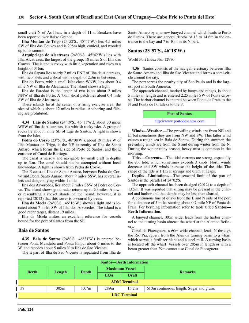
130 Sector 4. South Coast of Brazil and East Coast of Uruguay—Cabo Frio to Punta del Este
Pub. 124
small craft N of As Ilhas, in a depth of 11m. Breakers havebeen reported over Baixo Grande. 4.33 Ilha Montao de Trigo (23°52'S., 45°47'W.) lies 4.5 milesSW of Ilha das Couves and is 298m high, conical, and woodedup to its summit. 4.33 Arquipelago de Alcatrazes (24°06'S., 45°42'W.) lies withIlha Alcatrazes, the largest of the group, 18 miles S of Ilha dasCouves. The island is rocky with little vegetation and rises to aheight of 316m.4.33 Ilha da Sapata lies nearly 2 miles ENE of Ilha de Alcatrazas,with two islets and a shoal with a depth of 2.3m in between.4.33 Ilha do Porto, with a small islet close WNW, lies about 0.4mile NW of Ilha de Alcatrazas. The island shows a light. 4.33 Ilha do Paredao is the larger of two islets about 2 milesNNW of Ilha do Porto. A 7.6m shoal patch lies about 0.4 mileSW of Ilha de Alcatrazes. 4.33 These islands lie at the center of a firing exercise area, thesize of which is about 12 miles in radius. Anchoring and fish-ing are prohibited.
4.34 Laje de Santos (24°19'S., 46°11'W.), about 30 milesWSW of Ilha de Alcatrazas, is a whitish rocky islet. A group ofrocks lie about 1 mile SE of Laje de Santos. A light is shownfrom the islet.4.34 Pedra do Corvo (23°51'S., 46°08'W.), about 19 miles W ofIlha Montao de Trigo, is the NE extremity of Ilha de SantoAmaro, which forms the E side of Porto de Santos, and the Eentrance of Canal de Bertioga. 4.34 The canal is narrow and navigable by small craft in depthsup to 3.m. The canal should not be attempted without localknowledge. A light is shown from Pedra do Corvo. 4.34 The E coast of Ilha de Santo Amaro, between Pedra do Cor-vo and Ponta Santo Amaro, about 9 miles SSW, has several is-lets and dangers lying within 1 mile.4.34 Ilha dos Arvoredos, lies about 7 miles SSW of Pedra do Cor-vo. The island shows good radar returns up to 20 miles. A tow-er resembling a rocket stands on the island, however, it isreported (2012) that this tower is obscured by trees. 4.34 Ilha da Moela (24°03'S., 46°16'W.) shows a light and is lo-cated about 7 miles SW of Ilha dos Arvoredos. The island is agood radar target, distant 19 miles. 4.34 Ilha da Moela makes an excellent reference for vesselsbound for the port of Santos from the SE.
Baia de Santos
4.35 Baia de Santos (24°0'S., 46°21'W.) is entered be-tween Ponta Munduba and Ponta Itaipu, about 6 miles to theW, and recedes about 5 miles N to Ilha de Sao Vicente. 4.35 The E part of Ilha de Sao Vicente is separated from Ilha de
Santo Amaro by a narrow buoyed channel which leads to Portode Santos. There are general depths of 13 to 14.6m in the en-trance to the bay and 7 to 10m in its N part.
Santos (23°57'S., 46°18'W.)
World Port Index No. 12970
4.36 Santos consists of the navigable estuary between Ilhade Santo Amaro and Ilha do Sao Vicente and forms a semi-cir-cle around the city. 4.36 The port serves the nearby city of Sao Paulo and is the larg-est port in South America.4.36 The approach channel, marked by buoys and ranges, is about5 miles in length and is entered 2.25 miles SW of Ponta Gros-sa. The harbor channel is entered between Ponta da Praia to theN and Ponta de Fortaleza to the S.
4.36 Winds—Weather.—The prevailing winds are from NE andE, but sometimes they are from NW and SW. This latter windcauses a rough sea in Baia de Santos. During the summer, theprevailing winds are from the S and during winter from the N.During the winter rainy season, heavy mist is common in themorning.4.36 Tides—Currents.—The tidal currents are strong, especiallythe ebb tide, which sometimes exceeds 3 knots. North windsdecrease and SW winds increase the height of the tide. Therange of the tide is 1.1m at springs and 0.3m at neaps.4.36 Depths—Limitations.—The seaward limit of the port ofSantos is the parallel of 24°02'S.4.36 The approach channel has been dredged (2012) to a depth of13.5m. It was reported that silting may be present in the chan-nel and harbor and that depths may be less than charted. 4.36 A continuous line of quays front the E and N side of the portfor a distance of 5 miles starting about 0.7 mile NE of Ponta daPraia. For berthing information refer to table titled Santos—Berth Information. 4.36 A buoyed channel, 100m wide, leads from the harbor chan-nel to the turning basin abreast the wharf at the Alemoa Refin-ery. 4.36 Canal de Piacaguera, a 60m wide channel, leads N throughthe Rio Piacaguera from the Alemoa turning basin to a wharfwhich serves a fertilizer plant and a steel mill. A turning basinis located off the wharf. Vessels over 205m in length or with abeam greater than 29m cannot use Canal de Piacaguera.
Port of Santos
http://www.portodesantos.com
Santos—Berth Information
Berth Length DepthMaximum Vessel
RemarksLOA Draft
ADM Terminal
39 305m 13.7m 289m 13.2m 610m continuous length. Sugar and grain.
LDC Terminal

Sector 4. South Coast of Brazil and East Coast of Uruguay—Cabo Frio to Punta del Este 131
Pub. 124
38 305m 13.7m 270m 13.2m General cargo, grain, and soybeans.
Cereal Sul Terminal
13 — — — — Grain and salt.
NST Terminal
30 and 31 400m — — — 2,000m continuous length. Wood pulp.
Libra Terminals
36/37 376m 12.5m 374m —Containers and breakbulk. Reported to be CLOSED (2019).34-35 770m 13.5m 354m 13.2m
33/34 600m 11.7m 200m —
Fibria Terminal
32 300m — — 11.5m Wood pulp.
T-Grao Cargo Terminal de Graneis
26 236m 13.0m 210m 11.0m Malt, wheat, soya, and maize.
Concais Passenger Ferry Terminal
25 350m — — 13.2m Cruise and breakbulk.
Perola Terminal de Graneis
22/23 250m — — 10.0m 1,721m continuous length. Potassium chloride.
TAC
20/21 261m — 225m 12.1m Sugar.
Rumo Logistica Terminal
14/15 230m 11.5m — 11.5m
Grain and agricultural products. 16/17 270m 13.0m265m 12.2m
19 270m 13.0m
Terminal 12A (COFCO)
12A 260m 12.2m 290m 10.8m Sugar, wheat, corn, and soy.
Brasil Terminal Portuario (BTP)
1 to 3 1,108m (continuous ) 15.0m 300m 13.6m Containers.
Embraport
1 and 2 653m 16.0m — 14m Containers and multipurpose.
TEV Terminal
Vehicle Wharf 310m — — — 1,300m continuous length. Project and heavy cargo.
Tecon Santos Container Terminal
1
245m — — 15.0m 1,300m continuous length. Containers. 2
3
4
TGG Terminal
Santos—Berth Information
Berth Length DepthMaximum Vessel
RemarksLOA Draft

132 Sector 4. South Coast of Brazil and East Coast of Uruguay—Cabo Frio to Punta del Este
Pub. 124
Pier 1 276m 13.1m — 12.8m Soya and grain.
TEAG/Cargill Terminal
Pier 1168m — 220m 12.8m
Sugar.
Pier 2 Grain.
Usiminas - Terminal Maritimo Privativo de Cubatao
1200m
12.0m—
9.0m
Coal and iron ore products.
2
Steel products and breakbulk.3172m
4
5 302m 205m Petcoke, coal, and bunkers.
Decimar Terminal
Quay 225m — — — 750m continuous length. PCC.
Ecoporto Santos (Tecondi) Container Terminal
New Quay 320m
12.2m — 9m Containers and project/heavy cargo. North200m
North East
TMV—Terminal Maritimo do Valongo
Quay 225m — — — Containers and heavy project cargo.
Citrovita
27 212m — — 8.3m Refrigerated cargo.
Wharf Area 28
28 213m — — — Cruise
Citrosuco
29 198m — 295m 13.2m Refrigerated cargo.
Sucocitrico Cutrale Terminal
Cutrale Pier 199m 13.3m 198m 12.1m Refrigerated cargo and cereals.
TERMAG - Terminal Maritimo do Guaruja
TERMAG Pier 276m — 225m 12.4m Sulfur and fertilizer.
NST Terminal
30 and 31 400m — — — Wood pulp and liquid bulk.
TIPLAM Terminal (Terminal Integrador Portuario Luiz Antonio Mesquita)
Main Sulfur and Fertilizer Pier
177m 10.3m 225m
—
Chemical gas, LPG, fertilizer, and others.
2 and 3 295m— —
590m continuous length. Sugar, grain, and fertilizer.
4 — Sugar, grain, and fertilizer.
Alemoa Tanker Terminal
Santos—Berth Information
Berth Length DepthMaximum Vessel
RemarksLOA Draft

Sector 4. South Coast of Brazil and East Coast of Uruguay—Cabo Frio to Punta del Este 133
Pub. 124
4.36 The channel has reported dredged depths of about 10m.4.36 The limiting draft for vessels with a length of greater than185m is 9m at HW and 8.3m at LW. The limiting draft forvessels with a length of greater than 195m is 8.7m at HW and8m at LW. 4.36 Vessels may transit the canal only during daylight hours andmust be assisted by tugs.4.36 A shoal, with less than 1.8m and marked on its SE side by abuoy, lies close to the dredged channel WSW of the W extrem-ity of Ilha Barnabe. 4.36 Water pipelines and submarine cables are laid in the vicinityof the approach and harbor and can best be seen on the chart. 4.36 Overhead cables, with a vertical clearance of 81m, cross theharbor channel 1 mile N of the container terminal.
Aspect.—Ponta Munduba and Ponta Itaipu, the entrancepoints of Baia de Santos, are both high and covered with dark-colored vegetation. Ponta dos Limoes, 3 miles NW of PontaMunduba, rises to high land and can be identified at a distance.4.36 A light is shown from Ilha das Palmas, about 1 mile SSW ofPonta dos Limoes. 4.36 Monte Serrat (23°56'S., 46°20'W.), lying almost 3.5 milesNNW of Ponta dos Limoes, attains a height of 165m. A churchand a large building stand on its summit, while a conspicuouspipeline runs in a NE direction from the summit. A church,standing at a height of 208m, 1.75 miles SW of Monte Serrat isalso prominent. 4.36 Two pairs of range lights and a sector light indicate the ap-proach and entrance to the harbor. The outer pair, in line bear-ing 021.5°, leads into the dredged channel. The middle is asector light. The inner pair is in line, bearing 094°, but has beenreported to be difficult to distinguish.
4.36 Pilotage.—Pilotage is compulsory for the following vesselswhen entering the Santos Fairway area and the Santos inner an-chorage:
1. All foreign vessels.2. All vessels carrying dangerous cargo.3. All Brazilian vessels over 2,000 dwt.
4.36 Pilotage is also required for shifting berths or changing an-chorage positions.4.36 Vessels should send their ETA 2 hours in advance; this mes-sage should also include the vessel’s draft and the pilotage re-quest.4.36 The pilot boards about 0.6 mile W of Ilha das Palmas. Deep-draft vessels are boarded either 0.9 mile W of Ponta Grossa oras directed by the pilot station.
P-1 56m — — — Dirty products. Used by barges.
P-1A 95m 12.0m 250m 11m Clean products, dirty products, crude, bunkers, and LPG.
P-2 30m — — — Dirty products. Used by barges.
P-2A 95m
12.0m
250m 11m Clean products, dirty products, crude, bunkers, and LPG.
P-3A120m 240m
— Clean products, aviation fuel, chemical gases, chemicals, crude, bunkers, LPG, and vegetable oils. P-4A 9.7m
Ilha Barnabe Terminal
Sp Pier No1 (Sao Paulo)
151m—
215m9m
Clean products, aviation fuel, chemicals, crude, bunkers, LPG, and vegetable oils. Bc Pier No2
(Bocaina) 9.8m
Pier AGEO 130m — — Chemicals.
Dow Brasil Sudeste Industrial Ltda (Terminal Maritimo DOW)
Products Berth 30m — 180m 11m Chemicals and bunkers.
Santos—Berth Information
Berth Length DepthMaximum Vessel
RemarksLOA Draft
4.36
4.36Ilha da Moela from SE

134 Sector 4. South Coast of Brazil and East Coast of Uruguay—Cabo Frio to Punta del Este
Pub. 124
4.36 The pilot boat flies a red flag with a black “P” on it. In badweather, the pilot will direct vessels from the pilot boat to asheltered position in order to board vessel. 4.36 The ship must not proceed N of the pilot station until a pilothas been embarked. The pilot station and pilot boat areequipped with VHF radiotelephone.4.36 Regulations.—A vessel reporting system, which is manda-tory for vessels 20 gross tons and over, is in operation in San-tos. Vessels must report to Control Post (PWS 88), as follows:
1. When anchoring.2. When leaving an anchorage.3. Inbound vessels—When abreast of Ilha das Palmas.4. Outbound vessels—Immediately before leaving the
berth.4.36 The report must include the following information:
1. Vessel name.2. International call sign.3. Flag.4. Port of origin (inbound vessels) or port of destination
(outbound vessels).
5. Type of vessel.6. Anchorage or berth (inbound vessels) or estimated
date of arrival at destination (outbound vessels).7. Estimated date of departure and cruising speed (out-
bound vessels).4.36 Vessels changing berth or anchorage must report the follow-ing information:
1. Vessel name.2. International call sign.3. Previous position.4. Present position.
4.36 All communications must be made in Portuguese or English.All times are given in Universal Coordinated Time (UTC). For-eign vessels should utilize the pilot to aid in providing the in-formation to Control Post.4.36 If communications cannot be established with Control Post,the vessel should contact the Captain of the Port of the State ofSao Paulo by the quickest and most convenient means possible,with the following information:
1. Vessel’s name.2. Date and time of event.3. Reason why communication has not been made.
4.36 The Inspectorate has decided that, in view of the possibilityof the transmission by mosquito carriers of yellow fever andcertain types of malaria non-existent in Brazil, vessels havingSantos as the first Brazilian port of call, and having calledduring the voyage at the ports mentioned below, will be inter-dicted prior to entering the Santos Estuary, in order that an in-spection may be carried out at an opportune moment toeliminate such mosquito carriers if they should be found on-board.4.36 The characteristics of the Santos, in the interior of an estuaryreached through a narrow channel, where mosquitoes may eas-ily reach land on either side, makes such inspection necessarybefore the entrance of vessels, therefore, an official detailed tocarry out this job will accompany the pilot when he boards thevessel at the bar.4.36 Vessels arriving from such ports will no longer be grantedfree pratique requested by radio. This will be given on the oc-casion of the regular Sanitary Visit against presentation by theCaptain of the document supplied by the official proving thatthe inspection was carried out.4.36 Non-compliance with these regulations will be considered asinfraction of the law and subject to legal penalties.4.36 Vessels arriving from the following ports will be subject tothe above-mentioned inspection at the bar:
1. Ports of Mexico and the United States situated in theGulf of Mexico.
2. Ports of the Antilles. 3. Ports of Central America.4. Ports of Colombia, Venezuela, and the Guianas. 5. Ports of intertropical Africa.
4.36 Contact Information.—Santos pilots and port can be con-tacted, as follows:
4.36Aerial view of Santos
4.36Santos
Santos—Contact Information
Pilots
VHF VHF channels 11 and 16

Sector 4. South Coast of Brazil and East Coast of Uruguay—Cabo Frio to Punta del Este 135
Pub. 124
4.36 Anchorage.—Designated anchorage areas and requirementsfor using them are shown on the chart.4.36 Caution.—Anchorage is prohibited outside the designatedareas or in the dredged channel. In addition, vessels are advisedto avoid the submarine cables laid across the S approach toBaia de Santos. 4.36 The maximum speed permitted in the harbor is reported tobe 6 knots.4.36 The harbor and entrance channel require continuous dredg-ing due to silting and the depths may be less than stated, espe-cially in the turning basins.
Baia de Santos to Baia de Paranagua
4.37 Between Ponta de Itaipu, the W entrance of Baia deSantos, and the mouth of Rio Itanhaem, about 23 miles to theWSW, the coast is generally low. 4.37 It is backed by a range of mountains from 5 to 12 miles in-land. Some hills, appearing as islands from a distance, standbetween the mountain range and the coast.4.37 The Rio Itanhaem (24°11'S., 46°48'W.) can be entered bysmall craft at HW, but local knowledge is necessary. 4.37 The town of Conceicao de Itanhaem stands on a hill on the Nside of the mouth of the river. 4.37 Between the mouth of the Rio Itanhaem and the mouth of theRio Peruibe, about 14 miles SW, the coast continues low andsandy. From the mouth of the Rio Peruibe to Ponta ParanapuaGuassu, about 4 miles to the S, the coast is steep.4.37 Ilha de Peruibe (24°22'S., 46°59'W.) lies about 2 miles SSEof the mouth of the Rio Peruibe and 1 mile offshore. Ilha doGuarau lies about 1 mile S of Ilha de Peruibe. A strandedwreck lies about 0.3 mile N of this islet. A number of islets androcks lie N and S of Ilha do Guarau Light.
4.38 Laje de Conceicao (24°14'S., 46°41'W.), a bareabove-water rock, lies about 6 miles ESE of the mouth of theRio Itanhaem. The islet shows a light. Laje Pedro Segundo,with a least depth of 1.7m, lies about 8 miles ESE of Laje deConceicao. The sea breaks on this steep-to shoal during badweather.
4.38 Parcel da Conceicao (24°18'S., 46°47'W.), with a leastdepth of 4m, lies about 6 miles SW of Laje de Conceicao. Thesea breaks over this rocky shoal during fresh onshore winds. 4.38 Parcel das Reis, with a depth of 13.1m, lies about 8 miles SE
of Laje de Conceicao.4.38 Ilha Queimada Grande (24°30'S., 46°40'W.), almost bar-ren, lies about 15 miles S of Laje de Conceicao. The roundedsummit, which is in its SW part, appears to have twin peakswhen seen from E or S. Parcel de Sueste, a 2.3m patch, liesclose SE of the islet. 4.38 The islet shows a light from its N extremity. Good radar re-turns have been reported from the islet at 17 miles.4.38 Ilha Queimada Pequena (24°23'S., 46°48'W.) lies about 10miles NW of Ilha Queimada Grande. This conical islet is visi-ble for about 20 miles. 4.38 Laje Noite Escura, with a depth of 11m, lies about 0.5 mile Sof the islet. Parcel do Una, with a depth of 5.8m, lies about 16miles SW of the islet.4.38 Between Ponta do Una (24°25'S., 47°01'W.) and Barra deIcapara, about 27 miles to the SW, the Rio Comprido and theRio Ribeira de Iguape empty into the sea. Ponta da Jurea liesmidway between these two rivers. Barra de Icapara, entered 3miles SW of the Rio Ribeira de Iguape, is narrowed by twosand banks on which the sea nearly always breaks. 4.38 Small craft with local knowledge can cross the bar in goodweather. A dangerous wreck lies about 10 miles E of Barra deIcapara.4.38 Between Barra de Icapara and Barra de Cananeia, about 34miles to the SW, the coast is formed by Ilha Comprida. 4.38 This low island, separated from the mainland by MarPequeno, is covered with mangroves on its NW and centralpart. It has a greatest width of about 3 miles and is visible ashort distance.4.38 Mar Pequeno, navigable by vessels with drafts up to 3m, hassharp bends and an average width of 0.4 mile. It is encumberedby many islets and sand banks, which are covered with man-groves. 4.38 About 12 miles NNE of Barra de Cananeia, Mar Pequeno di-vides into two arms. Mar do Cubatao, the W arm, leads SW in-to Baia do Trapande; Ilha de Cananeia is formed between thesetwo arms.4.38 Iguape (24°42'S., 47°33'W.) is situated on the NW shore ofMar Pequeno, about 7 miles W of Barra de Icapara. A churchin the town, with two tall towers, is prominent from seaward. 4.38 On the W side of the town is Canal Valo-Grande, an artificialchannel leading N to join the Rio Ribeira de Iguape. 4.38 There are two piers for small craft at the town. Pilots can beobtained at Cananeia at the SW end of Mar Pequeno.
4.39 Ilha de Bom Abrigo (25°07'S., 47°52'W.) lies 4miles SSE of Barra de Cananeia and is saddle-shaped andwooded. A small rugged islet, 130m high with some vegeta-tion, lies 0.25 mile to the SE, with an above-water rock and arock awash close to it. Ilha de Bom Abrigo shows a light. 4.39 Pilotage can be obtained at Cananeia. If previous notice isgiven, they will board vessels at the anchorage off Ilha de BomAbrigo.4.39 Barra de Ararapia lies about 16 miles SW of Ilha de BomAbrigo Light. Small craft should enter only during goodweather and with local knowledge. Ilha do Castilho, 7 milesENE of Barra de Ararapira, has two summits and resembles acastle at a distance. Ilha Figueira lies about 7 miles SW of IlhaCastilho and is steep, rocky, and almost bare.4.39 Anchorage is available, with good shelter, about 0.2 mile off
Telephone55-13-3269-4050
55-13-3269-4051
Facsimile 55-13-3261-1990
E-mail [email protected]
Port
VHF VHF channel 16
Telephone 55-13-3221-3454 (extension 210)
Facsimile 55-13-3222-3188
E-mail [email protected]
Santos—Contact Information

136 Sector 4. South Coast of Brazil and East Coast of Uruguay—Cabo Frio to Punta del Este
Pub. 124
the NW side of Ilha de Bom Abrigo, in depths of 6 to 9m, sand,but care must be taken to avoid a shoal, with a depth of 4.8m,located 0.3 mile NW of Ilha de Bom Abrigo Light. 4.39 The bar at Barra de Cananeia is bounded by banks which ex-tend from the S end of Ilha Comprida and from the coast 3miles S, but these can be seen as the sea always breaks overtheir extremities. The entrance is narrow, but vessels drawingup to 2.5m can enter in calm weather. 4.39 The banks at the bar are subject to frequent change and theentrance should not be attempted without up-to-date localknowledge. Within the bar, depths increase to about 18m.
Baia de Paranagua
4.40 Baia de Paranagua (25°29'S., 48°30'W.) is enteredbetween Ponta Inacio Dias and Pontal do Sul, about 10 miles tothe SW. The bay extends to the N and W, and contains many is-lands and islets. 4.40 Baia das Laranjeiras, the N branch of the bay, is enteredabout 7 miles W of Ponta Inacio Dias and is almost entirely ob-structed by mud banks. It should not be entered without localknowledge. 4.40 The W branch of the bay extends about 21 miles from Pontaldo Sul. Porto de Paranagua and Porto de Antonina lie on the Sside of the W branch about 15 and 26 miles, respectively, fromthe entrance to Canal da Galheta.4.40 Ilha do Mel (25°31'S., 48°20'W.) lies in the middle of theentrance of the bay and divides it into two channels. The islandconsists of two parts connected by a narrow isthmus. The Npart is low and the SE part hilly.4.40 Canal Norte and Canal Sueste cross Barra de Paranagua andlead N of Ilha do Mel.
Tides—Currents.—Seaward of the bar, the tidal currentssets NE and SE at velocities of 1 to 2 knots.
4.40 With strong E winds, the SW current runs from 2 to 3 hourslonger than the NE current, and attains a velocity of about 3knots.4.40 In Canal Norte, the flood current sets to the NW and the ebbsets SE, at a rate of 2 knots. With S to SE winds or spring tides,the ebb can reach a rate of about 5 knots.4.40 In Canal Sueste, the flood current sets WNW at a rate of 1knot to 2 knots, and the ebb sets S at a velocity of 2 knots. WithS or SE winds or spring tides, the flood can attain 3 knots andthe ebb 4 knots.
4.41 Banco do Superagui (25°29'S., 48°14'W.), withdepths of less than 5.5m and on which the sea breaks, extendsabout 2 miles SW from Ponta Inacio Dias. Then its S edge,which forms the N side of Canal Norte, extends W to the S ex-tremity of Ilha das Pecas.4.41 Ilhas das Palmas, consisting of two islets, lie about 1 mileNNE of Ponta das Conchas, the E extremity of Ilha do Mel. 4.41 A number of rocks and shoals lie to the W and N of Ilhas dasPalmas and can best be seen on the chart. 4.41 Banco dos Ciganos, with depths less than 5.5m, and Bancodas Palmas, with depths of less then 1.8m, lie on the S side ofCanal Norte. The sea almost always breaks over the bank whenthere is a breeze. 4.41 In the entrance of Canal Sueste, two wrecks lie on the W sideof the channel. The northernmost wreck lies about 2 miles SEof Ponta do Joaquim and is marked by a buoy. The secondwreck lies about 0.3 mile SE of the buoy. 4.41 A dangerous wreck, marked by a buoy, lies 0.75 mile WSWof Ilhas das Palmas.4.41 Banco da Galheta, on the S side of Ilha do Mel, is a circularshaped sand bank on which the sea breaks. 4.41 Canal da Galheta, the deep buoyed channel to Porto de Para-nagua, passes through the NE part of Banco da Galheta.
Depths—Limitations.—Canal da Galheta has been dredgedto a depth of 11.5m. Inshore of Ilha da Galheta the channel wasdredged (2003) to a depth of 12m. It is reported (2014) dredg-ing is in progress in Canal da Galheta. 4.41 The channel is 200m wide from seaward to 0.75 mile wideSE of Ilha da Galheta, then 150m wide to Porto de Paranagua,with a widening to 250m at the bend N of Rasa de Cotinga. 4.41 The seaward end of the channel is marked by buoys mooredabout 4 miles SE of Ilha de Galheta.4.41 Canal da Galheta is subject to silting and depths may be lessthan stated.4.41 Two channels, Canal Sueste and Canal Norte, are located NEof Canal da Galheta. Both channels give access to the entranceof the bay where they merge together between Ponta das Pecasand Ponta do Bicho. 4.41 Neither Canal Sueste or Canal Norte should be used by deepdraft vessels when a heavy sea is running nor should they be at-tempted without a pilot.
4.40Ponta das Conchas Light
Paranagua—Berth Information
Berth Length DepthMaximum Vessel
RemarksLOA Draft Beam
Soceppar Terminal

Sector 4. South Coast of Brazil and East Coast of Uruguay—Cabo Frio to Punta del Este 137
Pub. 124
201 285m 12.5m 225m 11.3m 36.0m Grains, bran, bulk sugar, and mineral ores.
Bunge Terminal
206 183m 10.6m 225m 10.0m 35.0m Grain, bran, and bulk sugar.
Main Quay
202183m
10.6m— — — General cargo, passengers, breakbulk sugar, and
salt.208 8.8m
TEAPAR Terminal
205 183m 10.5m — — — Breakbulk, bunkers, and reefer.
Technint (Porto Pontal Parana)
Main Quay 300m 16m — 14.0m — Containers, offshore, project/heavy, steel products, and breakbulk.
Commercial Quay
209232m 10.6m 200m
9.7m— Grains, breakbulk, bunkers, ro-ro/lo-lo, and solid
bulk.211 —
Export Corridor
212
232m 12.5m229m
12.3m
38.0m
Grain, bunkers, and sugar.21335.0m
214 245m
Pasa Terminal
204 183m 12.5m 225m 11.2m 34.0m Sugar, containers, breakbulk, and bunkers.
Terminal de Conteineres de Paranagua (TCP) (TEVECON)
215227m
12.0m 330m — 48.0m Containers, bunkers, reefer, and PCC.216
217 315m
218 200m
Fospar (Mosaic) Terminal
External Pier 257m 12.3m 250m — 40.0mFertilizer and bunkers.
Internal Pier 255m 10.6m 210m 8.6m 27.0m
Tanker Berths
Cattalini Terminal
External Pier 250m 12.3m 235m—
40.0mChemicals, bunkers, and vegetable oils.
Internal Pier 244m 10m 190m 35.0m
Tepar Terminal
Paranagua—Berth Information
Berth Length DepthMaximum Vessel
RemarksLOA Draft Beam

138 Sector 4. South Coast of Brazil and East Coast of Uruguay—Cabo Frio to Punta del Este
Pub. 124
4.41 Canal Sueste is about 20 miles long with depths of 10 to20m. The approach is made between Ilha do Mel and Ilhas dasPalmas. A buoy marks its seaward entrance. 4.41 Canal Norte passes between Banco Superagui to the N andBanco dos Ciganos and Banco das Palmas to the S. Thischannel is unmarked and should not be attempted without localknowledge.
Pilotage.—Pilotage is compulsory. Pilots board vessels 5.5miles SE of Ilha da Galheta. A pilot should be requested 24hours, and confirmed 3 hours, before a ship’s ETA. A pilot isalways on duty at the old pilot station at Ponta das Conchas incase of emergency. The pilot station can be contacted on VHFchannels 6 and 16.4.41 Regulations.—Ships of less than 20m in length and sailingships must not interfere with the movement of other shipswithin the narrow channel of Canal de Galheta. 4.41 Vessels engaged in fishing must not interfere with any othership navigating in Canal de Galheta or its access.4.41 Ships are forbidden to cross the channel or its access if suchcrossing interferes with the safe passage of another ship withinthe channel or its access. 4.41 Ships should not overtake in the channel and ships shouldavoid anchoring in the channel. Vessels proceeding with thetidal current have the right of way. 4.41 Entry and exit of Canal de Galheta will be permitted at allstages of the tide during daylight hours only. Tug assistance inthe channel is mandatory for all vessels drawing more than9.4m.
4.42 Porto de Paranagua (25°30'S., 48°31'W.) (WorldPort Index No. 12980) lies in the W part of the bay about 12miles WNW of Ponta das Conchas. Vessels arriving, approachthe bar and embark a pilot at the waiting buoy. The distancefrom the bar to the docks is 18 miles. 4.42 Tides—Currents.—At spring tides, the flood current attainsa velocity of 0.75 knot, the ebb a velocity of 2.4 knots. At neaptides, the flood and ebb currents attain a velocity of about 0.75knot. 4.42 Depths—Limitations.—Two channels enter the harbor. TheN channel, used by coasters and fishing craft. The SE channel,known as Galheta Canal, has a depth of 11.5m, is 4,500m longand 150m wide, and is used by ocean-going vessels. The maxi-mum official draft for crossing the bar is 9.5m during springtide and 8.8m during neap tide. 4.42 Vessels can enter at any time, except those vessels with a
draft over 10.7m. The maneuvering basin is 700m wide and 8.5to 11.9m deep. For further berthing information refer to tabletitled Paranagua—Berth Information.4.42 Pilotage.—Pilotage is compulsory and is available 24 hours.Pilots should be requested 24 hours and 3 hours in advance. Pi-lots board about 1.6 mile SE of Canal de Galheta at position25°38’S, 48°15’W. Pilotage is also provided for Porto de An-tonina.4.42 Contact Information.—Paranagua pilots and port can becontacted, as follows:
4.42 Anchorage.—Anchorage in the outer roads is available, indepths of 15 to 20m, and in the inner roads, in a depth of 14m. 4.42 Other designated areas have been established off Porto deParanagua and are best seen on the chart. 4.42 Caution.—Vessels should obtain updated local informationon depths in channels and basins due to the accumulation ofsand.4.42 The dredged approach channels are not safe for navigationwhen there are high winds.
4.43 Porto de Antonina (25°26'S., 48°42'W.) (World PortIndex No. 12990), is situated in an inlet at the head of the Wbranch of Baia de Paranagua, 10 miles WNW of Porto de Para-nagua. It is reached through a narrow channel between sand
PP-1 (Main Pier External)
196m 11.5m 200m
—
32.0mChemicals, clean products, dirty products, LPG, vegetable oils, and bunkers.
PP-2 (Main Pier Internal) 186m 10.0m 190m 25.0m
PS - Secondary Pier
80m 5.8m — — Dirty products and bunkers.
Paranagua—Berth Information
Berth Length DepthMaximum Vessel
RemarksLOA Draft Beam
Sao Sebastiao—Contact Information
Pilots
VHF VHF channels 12, 14, and 16
Telephone55-41-3423-1332
55-41-3422-4711
Facsimile 55-41-3423-1404
E-mail [email protected]
Port
VHF VHF channel 16
Telephone 55-41-3422-3033
Facsimile 55-41-3420-1566
E-mail [email protected]
Web site http://www.portodoparana.pr.gov.br
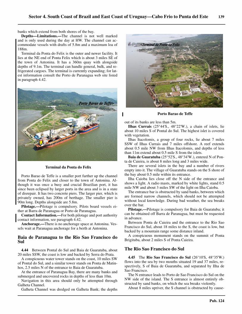
Sector 4. South Coast of Brazil and East Coast of Uruguay—Cabo Frio to Punta del Este 139
Pub. 124
banks which extend from both shores of the bay. 4.43 Depths—Limitations.—The channel is not well markedand is only used during the day at HW. The channel can ac-commodate vessels with drafts of 5.8m and a maximum loa of188m. 4.43 Terminal da Ponta do Felix is the outer and newer facility. Itlies at the NE end of Ponta Felix which is about 3 miles SE ofthe town of Antonina. It has a 360m quay with alongsidedepths of 9.1m. The terminal can handle general, bulk, and re-frigerated cargoes. The terminal is currently expanding; for lat-est information consult the Porto de Paranagua web site listedin paragraph 4.42.
4.43 Porto Barao de Teffe is a smaller port further up the channelfrom Ponta do Felix and closer to the town of Antonina. Al-though it was once a busy and crucial Brazilian port, it hassince been eclipsed by larger ports in the area and is in a stateof disrepair. It has two concrete piers. The larger pier, which isprivately owned, has 200m of berthage. The smaller pier is90m long. Depths alongside are 5.8m.4.43 Pilotage.—Pilotage is compulsory. Pilots board vessels ei-ther at Barra de Paranagua or Porto de Paranagua. 4.43 Contact Information.—For both pilotage and port authoritycontact information, see paragraph 4.42.4.43 Anchorage.—There is no anchorage space at Antonina. Ves-sels wait at Paranagua anchorage for a berth at Antonina.
Baia de Paranagua to the Rio Sao Francisco doSul
4.44 Between Pontal do Sul and Baia de Guaratuba, about20 miles SSW, the coast is low and backed by Serra do Prata. 4.44 A conspicuous water tower stands on the coast, 10 miles SWof Pontal do Sul, and a similar tower stands on Ponta de Matin-hos, 2.5 miles N of the entrance to Baia de Guaratuba. 4.44 At the entrance of Paranagua Bay, there are many banks andsubmerged and uncovered rocks in depths of less than 10m. 4.44 Navigation in this area should only be attempted throughGalheta Channel. 4.44 Galheta Channel was dredged on Galheta Bank; the depths
out of its banks are less than 5m. 4.44 Ilhas Currais (25°44'S., 48°22'W.), a chain of islets, lieabout 10 miles S of Pontal do Sul. The highest islet is coveredwith vegetation. 4.44 Ilhas Itacolomis, a group of four rocks, lie about 7 milesSSW of Ilhas Currais and 7 miles offshore. A reef extendsabout 0.5 mile NW from Ilhas Itacolomis, and depths of lessthan 11m extend about 0.5 mile S from the islets.4.44 Baia de Guaratuba (25°52'S., 48°34'W.), entered N of Pon-ta de Caieira, is about 8 miles long and 3 miles wide. 4.44 There are several islets in the bay and a number of riversempty into it. The village of Guaratuba stands on the S shore ofthe bay about 0.5 mile within its entrance. 4.44 Ilha Caioba lies close off the N side of the entrance andshows a light. A radio masts, marked by white lights, stand 0.5mile NW and about 3 miles SW of the light on Ilha Caioba. 4.44 The entrance bar is obstructed by sand banks, between whichare formed narrow channels, which should not be attemptedwithout local knowledge. During bad weather, the sea breaksover the bar.4.44 Pilotage.—Pilotage is compulsory for Baia de Guaratuba; itcan be obtained off Barra de Paranagua, but must be requestedin advance. 4.44 Between Ponta de Caieira and the entrance to the Rio SaoFrancisco do Sul, about 18 miles to the S, the coast is low, butbacked by a mountain range some distance inland. 4.44 A conspicuous monument stands on the summit of PontaBrigituba, about 2 miles S of Ponta Caieira.
The Rio Sao Francisco do Sul
4.45 The Rio Sao Francisco do Sul (26°10'S, 48°35'W.)flows into the sea by two mouths situated 19 and 37 miles, re-spectively, S of Baia de Guaratuba, and separated by Ilha deSao Francisco. 4.45 The N entrance leads to Porto de Sao Francisco do Sul on theNW side of the island. The S entrance is almost entirely ob-structed by sand banks, on which the sea breaks violently. 4.45 About 8 miles upriver, the S channel is obstructed by cause-
4.43Terminal da Ponta do Felix
4.43Porto Barao de Teffe
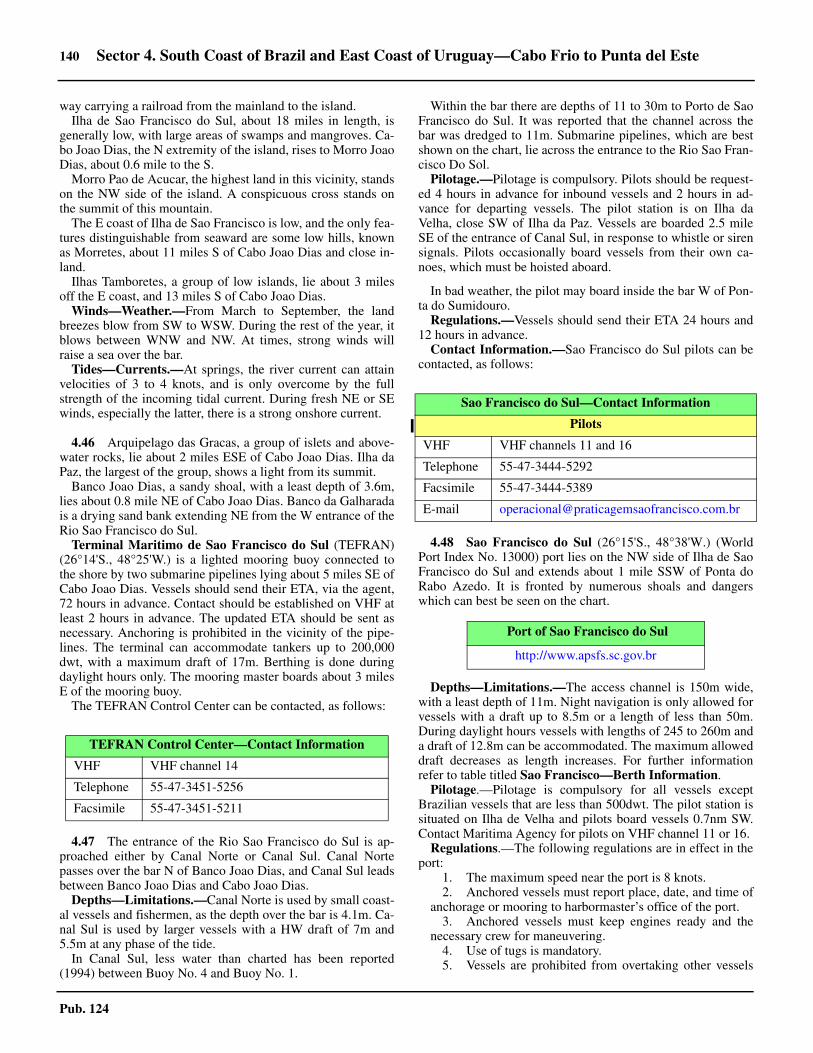
140 Sector 4. South Coast of Brazil and East Coast of Uruguay—Cabo Frio to Punta del Este
Pub. 124
way carrying a railroad from the mainland to the island.4.45 Ilha de Sao Francisco do Sul, about 18 miles in length, isgenerally low, with large areas of swamps and mangroves. Ca-bo Joao Dias, the N extremity of the island, rises to Morro JoaoDias, about 0.6 mile to the S. 4.45 Morro Pao de Acucar, the highest land in this vicinity, standson the NW side of the island. A conspicuous cross stands onthe summit of this mountain.4.45 The E coast of Ilha de Sao Francisco is low, and the only fea-tures distinguishable from seaward are some low hills, knownas Morretes, about 11 miles S of Cabo Joao Dias and close in-land. 4.45 Ilhas Tamboretes, a group of low islands, lie about 3 milesoff the E coast, and 13 miles S of Cabo Joao Dias. 4.45 Winds—Weather.—From March to September, the landbreezes blow from SW to WSW. During the rest of the year, itblows between WNW and NW. At times, strong winds willraise a sea over the bar.4.45 Tides—Currents.—At springs, the river current can attainvelocities of 3 to 4 knots, and is only overcome by the fullstrength of the incoming tidal current. During fresh NE or SEwinds, especially the latter, there is a strong onshore current.
4.46 Arquipelago das Gracas, a group of islets and above-water rocks, lie about 2 miles ESE of Cabo Joao Dias. Ilha daPaz, the largest of the group, shows a light from its summit. 4.46 Banco Joao Dias, a sandy shoal, with a least depth of 3.6m,lies about 0.8 mile NE of Cabo Joao Dias. Banco da Galharadais a drying sand bank extending NE from the W entrance of theRio Sao Francisco do Sul.4.46 Terminal Maritimo de Sao Francisco do Sul (TEFRAN)(26°14'S., 48°25'W.) is a lighted mooring buoy connected tothe shore by two submarine pipelines lying about 5 miles SE ofCabo Joao Dias. Vessels should send their ETA, via the agent,72 hours in advance. Contact should be established on VHF atleast 2 hours in advance. The updated ETA should be sent asnecessary. Anchoring is prohibited in the vicinity of the pipe-lines. The terminal can accommodate tankers up to 200,000dwt, with a maximum draft of 17m. Berthing is done duringdaylight hours only. The mooring master boards about 3 milesE of the mooring buoy.4.46 The TEFRAN Control Center can be contacted, as follows:
4.47 The entrance of the Rio Sao Francisco do Sul is ap-proached either by Canal Norte or Canal Sul. Canal Nortepasses over the bar N of Banco Joao Dias, and Canal Sul leadsbetween Banco Joao Dias and Cabo Joao Dias. 4.47 Depths—Limitations.—Canal Norte is used by small coast-al vessels and fishermen, as the depth over the bar is 4.1m. Ca-nal Sul is used by larger vessels with a HW draft of 7m and5.5m at any phase of the tide. 4.47 In Canal Sul, less water than charted has been reported(1994) between Buoy No. 4 and Buoy No. 1.
4.47 Within the bar there are depths of 11 to 30m to Porto de SaoFrancisco do Sul. It was reported that the channel across thebar was dredged to 11m. Submarine pipelines, which are bestshown on the chart, lie across the entrance to the Rio Sao Fran-cisco Do Sol.4.47 Pilotage.—Pilotage is compulsory. Pilots should be request-ed 4 hours in advance for inbound vessels and 2 hours in ad-vance for departing vessels. The pilot station is on Ilha daVelha, close SW of Ilha da Paz. Vessels are boarded 2.5 mileSE of the entrance of Canal Sul, in response to whistle or sirensignals. Pilots occasionally board vessels from their own ca-noes, which must be hoisted aboard.
4.47 In bad weather, the pilot may board inside the bar W of Pon-ta do Sumidouro.4.47 Regulations.—Vessels should send their ETA 24 hours and12 hours in advance.4.47 Contact Information.—Sao Francisco do Sul pilots can becontacted, as follows:
4.48 Sao Francisco do Sul (26°15'S., 48°38'W.) (WorldPort Index No. 13000) port lies on the NW side of Ilha de SaoFrancisco do Sul and extends about 1 mile SSW of Ponta doRabo Azedo. It is fronted by numerous shoals and dangerswhich can best be seen on the chart.
4.48 Depths—Limitations.—The access channel is 150m wide,with a least depth of 11m. Night navigation is only allowed forvessels with a draft up to 8.5m or a length of less than 50m.During daylight hours vessels with lengths of 245 to 260m anda draft of 12.8m can be accommodated. The maximum alloweddraft decreases as length increases. For further informationrefer to table titled Sao Francisco—Berth Information. 4.48 Pilotage.—Pilotage is compulsory for all vessels exceptBrazilian vessels that are less than 500dwt. The pilot station issituated on Ilha de Velha and pilots board vessels 0.7nm SW.Contact Maritima Agency for pilots on VHF channel 11 or 16. 4.48 Regulations.—The following regulations are in effect in theport:
1. The maximum speed near the port is 8 knots.2. Anchored vessels must report place, date, and time of
anchorage or mooring to harbormaster’s office of the port.3. Anchored vessels must keep engines ready and the
necessary crew for maneuvering.4. Use of tugs is mandatory.5. Vessels are prohibited from overtaking other vessels
TEFRAN Control Center—Contact Information
VHF VHF channel 14
Telephone 55-47-3451-5256
Facsimile 55-47-3451-5211
Sao Francisco do Sul—Contact Information
Pilots
VHF VHF channels 11 and 16
Telephone 55-47-3444-5292
Facsimile 55-47-3444-5389
E-mail [email protected]
Port of Sao Francisco do Sul
http://www.apsfs.sc.gov.br

Sector 4. South Coast of Brazil and East Coast of Uruguay—Cabo Frio to Punta del Este 141
Pub. 124
or crossing lanes in the marked channel of the bar.6. Vessel size restrictions are 260m in length, 40m in
width, and a draft of 9.39m, including adjustment for tides.7. Disabled vessels may only remain at anchor for a lim-
ited time. Vessels must have tug made fast and ready for tow.
4.48 Anchorage.—There is an anchorage, in depths of 12.8 to15.8m, close to the pilot boarding place. Caution is necessaryas a shoal patch with a depth of 7.9m lies 0.25 mile SW of thatposition.
4.48 There are six designated anchorages, as follows:1. No. 1—Vessels drawing up to 7.8m and up to 215m in
length, centered on position 26°14.2'S, 48°39.0'W2. No. 2—Small vessels, yachts and sailing vessels, cen-
tered on position 26°14.7'S, 48°38.6'W.3. No. 3—Vessels over 150m in length and 8m draft,
centered on position 26°12.5'S, 48°37.7'W.4. No. 4—Vessels less than 8m draft, centered in position
26°12.6'S, 48°37.0'W.5. No. 5 and no. 6—Vessels with a draft over 10m, cen-
tered in positions 26°11.0'S, 48°35.0'W and 26°10.4'S,48°34.0'W, respectively.
4.48 There are three designated outer anchorages, as follows:1. No. 7—Vessels of less than 16m draft awaiting
entrance to Baia da Babitonga, in ballast or awaiting repairs,centered in position 26°11.0'S, 48°26.0'W
2. No. 8—Loaded vessels with a draft between 16 and18m, centered in position 26°12.6'S, 48°25.2'W.
3. No. 9—Vessels carrying explosives, dangerous goods,or under quarantine, centered in position 26°9.0'S,48°25.1'W.
4.48 Caution.—Southern right whales are protected by law and
frequent this coastal region between May and November. Ves-sels are advised to keep a good lookout to avoid whales.
4.49 Joinville (26°19'S., 48°51'W.) lies about 13 miles SWof Sao Francisco do Sul, on the S bank of the Rio Cachoeira. 4.49 The channel leading to the port is marked by beacons andbuoys, some of which are lighted. Vessels drawing less than2m can reach the port.
The Rio Sao Francisco do Sul to Porto de Itajai
4.50 Between the Rio Araquari, the S channel of the RioSao Francisco do Sul, and Porto de Itajai, about 28 miles to theS, the coast is high and backed by mountains, some of whichare near the coast and can be seen for about 45 miles. 4.50 Morro Bau, with a flat summit, is the highest of these moun-tains and stands about 16 miles WNW of Itajai. It can be seenfrom about 20 miles offshore. 4.50 Several islets and submerged rocks lie on the shoal area ex-tending E from the mouth of the Rio Araquari. Ilha dos Lobosand Ilha Tipitinga lie about 4 and 2.5 miles SE of the mouth ofthe river.
4.50 Enseada de Itapocoroi (26°47'S., 48°37'W.), entered W ofPonta do Vigia, affords anchorage, in about 8m, sand and mud,but care must be used as the holding ground is poor. 4.50 The village of Itapocoroia is situated on the SE shore of thebay. A light is shown 1 mile SE of Ponta do Vigia from Pontado Varrido.4.50 Ilhas Itacolomis, about 4 miles NNW of Ponta do Vigia, con-sists of two islets. A shoal, with a depth of 1.2m, extends about183m SSE from the islets. 4.50 Ilha Feia (26°45'S., 48°38'W.), about 2 miles SSW of IlhasItacolomis, is 75m high. A reef, with some drying heads, ex-tends about 0.3 mile E of the islet.4.50 Between Ponta do Vigia and Ponta Negra, about 3 miles tothe S, the coast rises to a chain of mountains, the highest ofwhich is Morro do Gravata. Good radar returns have been re-ported from Ponta Negra at about 10 miles.4.50 Between Ponta Negra and Ponta Cabecudas, 6 miles S, thecoast is formed by Praia de Itajai, a sandy beach at the S end ofwhich is the mouth of the Rio Itajai-Acu.
Itajai (26°55'S., 48°38'W.)
World Port Index No. 13020
4.51 Itajai lies about 2 miles within the mouth of the RioItajai-Acu, and is entered between the heads of two moleswhich lie 1 mile NW of Ponta das Cabecudas, which is a goodradar target for better than 20 miles.
4.48Sao Francisco Pier
Sao Francisco—Berth Information
Berth Length DepthMaximum Vessel
RemarksLOA Draft DWT
Administracao do Porto de Sao Francisco do Sul (APSFS)

142 Sector 4. South Coast of Brazil and East Coast of Uruguay—Cabo Frio to Punta del Este
Pub. 124
4.51 Winds—Weather.—From March until September, theprevailing winds are from SW to WSW. During the rest of theyear, they are from WNW to NW. 4.51 Tides—Currents.—The range of the tide is 0.9m at springsand 0.2m at neaps. The ebb current normally attains a velocityof 2.5 knots, but after heavy rains the current may attain a ve-locity up to 5 knots.4.51 Depths—Limitations.—The N and S moles, which extendabout 0.5 mile offshore, are about 183m apart, but the naviga-ble channel between them is less than 91m wide. The baracross the entrance is formed by a shoal extending to the S andE from the head of the N mole. The depth at the bar is 10m. 4.51 The access channel has a width of 100m, with a depth ofabout 12.7m. 4.51 The maneuvering basin, 750m long and 400m wide, has adepth of 12.6m. The maximum allowed length of a vessel toenter the port is 286m.
4.51 Vessels can enter or sail at any stage of the tide with amaximum draft of 10m. Tanker movements can be made indaylight hours only.4.51 There is a speed limit of 5 knots reported in the accesschannel. For further berthing information refer to table titledItajai—Berth Information.4.51 Aspect.—The buildings of the city, a white church with twotowers, and a water tower and hospital near the church are allconspicuous and visible from seaward. Another water tower,standing about 1 miles NW of the harbor, is also conspicuous. 4.51 Pilotage.—Pilotage is compulsory. Pilots should be request-ed through the agent and require 6 hours notice prior to arrival.Pilots board vessels from a red launch. 4.51 The boarding area lies about 2.5 miles ENE of Ponta dasCabecudas Light (26°56'S., 48°37'W.) at position 26°55’S,48°35’W. Vessels moor and unmoor during daylight hoursonly. 4.51 Regulations.—The following regulations are in effect in theport:
1. Vessels larger than 235m long are only allowed accessto the commercial quay during daylight hours.
2. The petroleum and chemical terminals can only be ac-cessed at HW. The maximum permitted draft at the petro-leum terminal is 6.25m; the maximum permitted draft at the chemical terminal is 5.94m.
3. Vessels maneuvering in the canal and anchoring grounds must use international sound signals.
4. Vessels should moor port side-to. If the vessel is moored starboard side-to, mooring lines must be doubled, with extra stern lines.
4.51 Contact Information.—Itajai pilots can be contacted, asfollows:
No. 102 210m
—
230m11.0m
75,249 dwt Containers, ro-ro, reefer, and breakbulk.No. 103 160m 200m 64,043 dwt
No. 201 272m 225m 10.0m 74,768 dwt Steel products, breakbulk, and general cargo.
Terminal Portuario Santa Catarina
No 300-301 380m — 190m 10.5m 55,650 dwt Containers and general cargo.
No. 302 180m — 200m 7.0m 63,500 dwt Ro-ro/lo-lo, project/heavy cargo, steel products, and breakbulk.
Bunge Alimentos
No 101 225m — 200m 7.0m 63,500 dwt Vegetable oils, grain, and bunkers.
Sao Francisco—Berth Information
Berth Length DepthMaximum Vessel
RemarksLOA Draft DWT
Port of Itajai
http://www.portoitajai.com.br
4.51Itajai Harbor, with Navegantes visible on the left
Itajai—Contact Information
Pilots
VHF VHF channels 12, 14, and 16
Telephone 55-47-3247-3200

Sector 4. South Coast of Brazil and East Coast of Uruguay—Cabo Frio to Punta del Este 143
Pub. 124
4.51 Anchorage.—Small vessels or vessels with suitable draftsmay anchor in Enseada das Cabecudas, in a depth of about 7m,mud and sand. The quarantine anchorage is situated E and SEof Ponta das Cabecudas.4.51 Anchorage is prohibited in the channel or the turning basin,except when required for maneuvering requirements, to avoidclose quarter situation or emergency.
4.51 Caution.—Pedra de Santa Teresa, a rock with a depth of 4mand marked by a buoy, lies about 0.3 mile NW of Ponta dasCabecudas. 4.51 Numerous changes to depths have been identified at Porto deItajai. Depths in the approaches to the buoyed channel leadingto Porto de Itajai depth shallows up to 2m more than charted.Depths within the channel leading to the Container Terminal atNavegantes are significantly deeper than charted, with a depthof 13.3m. The least depth within the basin S of the terminal is12.4m.
Porto de Itajai to Ilha de Santa Catarina
4.52 Between Ponta das Cabecudas and Ponta de Bombas,about 16 miles to the SE, the coast continues high and backedby mountains inland. Along this part there are several pointswhich form bays open to the NW.4.52 Enseada de Camboriu (26°59'S., 48°36'W.), about 4 milesSSE of Ponta das Cabecudas, is entered W of Ponta das Laran-jeiras. The bay is open to the NE, but sheltered from all otherwinds. A river, with a narrow and obstructed bar, empties intothe SE part of the bay. A small village stands near the mouth ofthe river. 4.52 A submerged rocky ledge extends about 0.2 mile E fromPonta das Laranjeiras. 4.52 A dangerous group of rocks, with a depth of 1m, lies about0.6 mile W of the same point; with a calm sea and the windblowing off the land there are rarely breakers reported overthese rocks. 4.52 A dangerous wreck lies 4 miles SSE of Ponta das Laranjei-ras. 4.52 Anchorage is available in Enseada de Camboriu, about 0.3mile off the SE shore of the bay, with the village churchbearing 170°, distant about 0.7 mile, in depths of from 8 to 9m. 4.52 The anchorage consists of sand and mud with good holdingground, but it is exposed to winds between N and ENE.
Facsimile 55-47-3247-3212
E-mail [email protected]
Itajai—Contact Information
Itajai—Berth Information
Berth Length DepthMaximum Vessel
RemarksLOA Draft Beam
AMP Terminals Itajai
1 and 2 556m (continuous) 12.5m 299m 11.6m 48.0m
Containers and reefer.3 and 4 200m
(continuous) 12.5m — — —
Barra do Rio Terminal
Berth 1 220m — — — — Containers and breakbulk.
Braskarne Terminal
Braskarne Wharf 150m 9.2m 179m 8.7m 29.0m Container, breakbulk, and reefer.
Cruise Terminal
Guiherme Asseburg Pier 80m — — — — Passengers.
Teporti Terminal
Teporti Wharf 150m — 150m 8.6m 24.0m Containers and breakbulk.
Terminals Portuarios de Navegantes (Portonave)
Main Wharf 900m (continuous) — 300m 11.5m 48.0m Containers and reefer.
Poly Terminals
Poly Berth 150m — 180m 8.5m 48.0m Chemicals, containers, break-bulk, and multipurpose.

144 Sector 4. South Coast of Brazil and East Coast of Uruguay—Cabo Frio to Punta del Este
Pub. 124
4.52 Enseada de Porto Belo, about 8 miles S of Ponta dasLaranjeiras, is entered between Ponta da Ilhota (27°05'S.,48°35'W.) and Ponta de Porto Belo, 0.7 miles to the ESE. 4.52 Ilha Joao da Cunha lies about 3 miles SW of Ponta de PortoBelo and forms a natural breakwater for a small cove. The vil-lage of Porto Belo stands on the S shore of this cove.4.52 Anchorage may be obtained about 0.7 mile NNW of the Nextremity of Ilha Joao da Cunha, in depths of 11 to 13m, mudand gravel. This anchorage is exposed to winds from betweenN and NNE. There is an anchorage for small vessels midwaybetween the SW end of the island and Ponta do Vieira, about0.6 mile to the SW, in a depth of 5.5m, sand and mud.
4.53 Ponta de Bombas (27°9'S., 48°28'W.), about 3 milesSE of Ponta de Porto Belo, is the E extremity of a peninsulawhich separates Enseada de Porto Belo from Baia das Tijucas. 4.53 Ponta Zimbros, about 5 miles SSW of Ponta de Bombas, isthe S extremity of the peninsula. 4.53 Baia das Tijucas is entered between Ponta Zimbros and Pon-ta de Ganchos, about 0.7 miles SSW. 4.53 The Rio Tijucas empties into the W part of the bay, and thevillage of Tijucas stands on the N entrance of the river. Depthsof less than 5.5m lie within about 2 miles of the W shore of thebay.4.53 Enseada de Ganchos, the S part of Baia de Tijucas is indent-ed by several coves off which small vessels can anchor, indepths of 5 to 6m, soft mud. 4.53 A vessel approaching these anchorages should take care toavoid the dangers off Ponta de Ganchos. Morro de Ganchos,about 3 miles SW of Ponta de Ganchos, is a good landmark.
4.54 Ilha da Gale (27°11'S., 48°24'W.), rocky and coveredwith vegetation, lies about 4 miles SE of Ponta de Bombas.Two islets lie close off the NE end of the island. A light isshown from Ilha da Gale.4.54 Pedra Nocetti, with a depth of 10m, lies about 2 miles SE ofIlha da Gale. Ilhado Amendoim lies about 3 miles WSW of Il-ha da Gale. 4.54 Pedra das Cinzas, with a depth of 10m, and Pedra da Iris,with a depth of 4m, lie about 2 miles and 0.5 mile, respectively,ENE of Ilha do Amendoim. 4.54 Calhau de Sao Pedro (27°15'S., 48°25'W.), two bare above-water rocks near the center of a submerged reef about 0.5 milelong, lies about 4 miles S of Ilha da Gale. Some heads on thisreef dry. A light is shown near the E end of Calhau de Sao Pe-dro. 4.54 Ilha dos Arvoredos (27°17'S., 48°22'W.) quite high andcovered with vegetation, lies about 5 miles SSE of Ilha daGale. The island is the best mark in the approach to Canal deSanta Catarina. A light is shown from the S end of Ilha do Ar-voredo. 4.54 Two above-water rocks lie about 0.4 mile ENE of the S endof the island. A light is shown from the SE extremity of the is-land.4.54 Anchorage is available about 0.1 mile off the SW side of theisland in Baia Mansa, in a depth of about 12m. 4.54 Ihla Deserta lies almost 1.5 miles E of Ilha do Arvoredo. It iscovered with dark vegetation and has some above-water rocksup to 0.1 mile off its N and S ends.
Ilha de Santa Catarina
4.55 Ilha de Santa Catarina (27°37'S., 48°30'W.) is sepa-rated from the mainland by the narrow Canal de Santa Catari-na, is about 29 miles long. The island is prominent from the E,although the mountains on the mainland are higher. 4.55 Lagoa da Conceicao, about 8 miles long, lies close to andparallel with the E side of the island, and forms a large depres-sion which is conspicuous from seaward. Its entrance, main-tained by dredging, lies about 12 miles S of the N extremity ofthe island. 4.55 A number of islands, islets, rocks, and shoals lie close off theE coast of the island and can best be seen on the chart. 4.55 Ilhas das Tres Irmas (27°50'S., 48°31'W.) lies from 1.5 to 3miles E of Ponta do Frade, the S extremity of Ilha de Santa Ca-tarina. Ilha Irma de Fora is the furthest E and the highest; a 7mshoal patch lies 1 mile S of this island. 4.55 Ilhas dos Moleques do Sul (27°51'S., 48°26'W.) consist ofthree whitish islets lying about 1 mile E of Ilha Irma de Fora. 4.55 They are prominent and their sides appear steep when seenfrom the SE. Laje Moleques do Sul is an above-water rock ly-ing 0.6 mile SW of the islets; a 6.6m shoal patch lies about 1.1mile WNW of Laje Moleques do Sul.
4.55Ilha dos Arvoredos Light

Sector 4. South Coast of Brazil and East Coast of Uruguay—Cabo Frio to Punta del Este 145
Pub. 124
Canal de Santa Catarina
4.56 Canal de Santa Catarina (27°32'S., 48°34'W.), lyingbetween Ilha de Santa Catarina and the mainland, is about 0.2mile wide at its narrowest part at Florianopolis. Two bridgesspan the channel W of Florianopolis. Numerous sand banksand mud flats narrow the channel throughout its length. The Nand S parts are named Canal Norte and Canal Sul, respectively.4.56 Tides—Currents.—The tidal currents in Canal de Santa Ca-tarina are fairly regular. They enter from N and S at the sametime and meet off Florianopolis. 4.56 The strength of the tidal currents seldom exceeds 0.5 knot,but near spring tides it sometimes attains velocities of 1.5 to 5knots. The tidal currents are somewhat influenced by thewinds.
4.57 Approaching Canal de Santa Catarina from the N,vessels usually pass between Ponta do Rapa and Ilha do Ar-voredo, but passage between Ilha do Arvoredo and Calhau deSao Pedro is also free of dangers. 4.57 Ilha Anhatomirim, showing a light, and close off the main-land, should then be identified, and after passing about midwaybetween it and Ponta Grossa, the NW extremity of Ilha de San-ta Catarina, alter course for the entrance of the marked channelto Florianopolis.4.57 Numerous islets, rocks, and shoals lay on both sides off themarked channel and can best be seen on the chart. Localknowledge is required.4.57 Pilotage.—There is no pilotage service. 4.57 Anchorage.—A vessel drawing up to 6m can easily reach aposition about 1 mile NE of Ilha Anhatomirim and anchorthere in a depth of about 7m. 4.57 With NE winds, vessels anchor, in 5.8 to 7m, soft mud, about1 mile N of Ilha Ratao Grande. 4.57 Vessels awaiting the tide usually anchor in this position.
4.58 Canal Sul is entered between Ponta dos Naufraga-dos (27°50'S., 48°34'W.), the SW extremity of Ilha de SantaCatarina, and Ilha de Aracatuba, about 0.3 mile to the SSW. Apartly marked narrow and winding channel leads through thenumerous sand banks and shoals to Florianopolis. 4.58 Vessels drawing up to 3m at LW and 4.3m at HW, can reachthe anchorage off Florianopolis, but local knowledge is essen-tial. 4.58 Numerous islets, rock, and shoals lie between Ponta dosNaufragados and Florianopolis and are seen on the chart.
4.59 Banco dos Naufragados (27°51'S., 48°33'W.), with aleast depth of 1.8m, and on which the sea nearly always breaks,lies in the SE entrance to Canal Sul, about 0.45 mile S of Pontado Frade. There is a clear passage on either side of this danger.4.59 Pilotage.—There is no pilotage service.4.59 Anchorage.—Vessels awaiting the tide can anchor about 0.4mile WNW of Ponta dos Naufragados, in a depth of 14m. Thebottom is hard sand; therefore, a long scope of chain should beused. 4.59 There is a more sheltered anchorage about 0.5 mile SE of Il-ha dos Cardos, in depths from 7 to 8m, sand. 4.59 The anchorage affords shelter from E winds only, therefore,caution is necessary during strong winds from any direction, as
space is restricted by sand banks and shoals.
4.60 Porto de Florianopolis (27°36'S., 48°33'W.) (WorldPort Index No. 13030) lies on both sides of Canal de Santa Ca-tarina at its narrowest part, which is spanned by two bridges.The N bridge has a vertical clearance of 28m; the S bridge hasa vertical clearance of 17m. 4.60 Depths of 5.5 to 22m lie between the S end of the markedchannel and the N bridge, and 5.5 to 30m between Laje Tipitin-ga and the S bridge.4.60 Three piers on the W side of the channel can accommodatevessels of up to 3.6m drafts; one pier is for vessels with draftsup to 1.8m. The berths on the E side of the channel are usedonly by fishing vessels and small craft.4.60 There is a tanker berth at mooring buoys off Ponta do Leal, 1mile NNW of the N bridge. 4.60 Anchorage.—Vessels can anchor on the E side of the chan-nel, 0.3 mile S of the S bridge, in a depth of 7m, mud. 4.60 Caution is necessary, as there are depths of less than 3m only183m E of this anchorage. There is anchorage 0.5 mile N of theE end of the N bridge, in depths from 5 to 8m, mud.
Ilha de Santa Catarina to Cabo de Santa Marta Grande
4.61 Between Ilha de Santa Catarina and Cabo de SantaMarta Grande, about 50 miles SSW, the coast is high, wooded,and indented. During clear weather, the mountains in the interi-or can be seen from about 36 miles offshore.4.61 Ilha de Coral (27°56'S., 48°33'W.) lies about 6 miles SSEof Ponta dos Naufragados, and is high and wooded. The islandshows a light, and when seen from the N or S, appears to berounded. Two detached patches lie about 0.6 mile SSW of theisland.4.61 Ponta de Galeao lies 6 miles SSW of Ilha do Coral. A reef onwhich the sea always breaks extends N from the point.4.61 Enseada de Imbituba (28°13'S., 48°39'W.) is entered be-tween Ponta de Imbituba, 19 miles SSW of Ilha do Coral, andPonta do Catalao, 1.5 miles to the NW. Lights are shown fromboth points. Porto de Imbituba is in the S part of the bay and isprotected by a breakwater. 4.61 There are two conspicuous TV towers on a hill 2.5 miles Wof Ponta de Imbituba; a prominent tower stands in the town.All of these towers show obstruction lights. Good radar returnshave been reported from Ponta de Imbituba. 4.61 Pedras do Aracaju, with a least depth of 6.9m, and Pedras deImbituba, with a least depth of 8.7m, lie about 0.8 and 1.1miles, respectively, N of Ponta de Imbituba.
4.62 Porto de Imbituba (28°14'S., 48°40'W.) (World PortIndex No. 13040), a coal-shipping port, lies on the SW side ofthe bay. The port consists of an artificial basin open to theNNW and protected by a breakwater on its E side which proj-ects about 850m NNW from Ponta de Imbituba. 4.62 There are no major restrictions with regard to length of ves-sel. Depth at the entrance of the port is 12m. The maneuveringbasin inside the port is 315m wide with a depth of 10m. A lightis shown from the breakwater head.4.62 Depths—Limitations.—Berths No.1 and No. 2 are each330m long with 15.0m depths alongside, and are used for the

146 Sector 4. South Coast of Brazil and East Coast of Uruguay—Cabo Frio to Punta del Este
Pub. 124
shipment of coal and general cargo. 4.62 Berth No. 3 has a length of 245m with an alongsidedepth12.0m. Bulk and general cargo is the primary usage.Berth No. 4, a Ro-Ro container berth, has a length of 370m andan alongside depth of 7.5m 4.62 There are two entrance channels. The N channel has a depth10m; the S channel has a depth of 12m.4.62 The maneuvering basin inside the port is 315m wide, with adepth of 10m. The largest vessel to enter the port was 200m inlength with a draft of 9.5m.4.62 It was reported (2012) that a new wharf is under constructionand dredging is planned for the approaches and berths. 4.62 Pilotage.—Pilotage is compulsory. Pilots board vessels atthe anchorage off the port in response to two long blasts. Pilotsboard vessels 0.9 mile E of Ponta do Cataloa at position28°13’S, 48°39’W. The pilot should be given notice at least 24hours before arrival and confirmation 12 hours before arrival.
4.62 Contact Information.—Imbituba pilots and port can becontacted, in the Imbituba—Contact Information table.4.62 Anchorage.—Vessels anchor off the port about 0.7 mile E ofPonta do Catalao, in a depth of 12.7m, but it is exposed towinds from between NE and E. During these winds, smallvessels can anchor off Ilha de Santana de Fora.
4.63 Between Ponta de Imbituba and Porto de Laguna,about 16 miles SSW, the coast is low and separates the seafrom three lagoons which lie parallel to the coast and about 1mile inland.4.63 Ilhas das Araras (28°19'S., 48°39'W.), lies about 5 miles Sof Ponta de Imbituba and 2.75 miles offshore. The island has alight and rises in sheer cliffs and is covered with vegetation.4.63 Ilha Tacami lies about 3 miles SE of Ilha das Araras and con-sists of a rounded mass of rock. A small reef, with some above-water heads, extends SW from the islet. Close NE of the isletthe sea breaks. A 14.5m patch lies about 0.7 mile N of Ilha Ta-cami. 4.63 Ilha dos Lobos (28°27'S., 48°42'W.) lies about 4 miles NEof Barra de Laguna and 2 miles offshore. A light is shown fromthe island.
4.64 Porto de Laguna (28°30'S., 48°47'W.) (World PortIndex No. 13050), accessed via Barra de Laguna, is entered be-tween two breakwaters situated 0.2 mile N of Ponta do Tambo-rete. The entrance between the two breakwaters is about 137mwide. The port is situated about 1 mile W of the breakwater en-trance. The port is mostly used for fishing vessels.4.64 Winds—Weather.—Southeast and S winds prevail duringthe winter; NE winds prevail the rest of the year. 4.64 Tides—Currents.—Tidal currents generally have a velocityof 1 knot to 1.5 knots, but sometimes attain a velocity of 2 to 3knots.4.64 Depths—Limitations.—The depths in the entrance are con-stantly changing. Inside the bar, the depths decrease during Nwinds, and increase during S winds. The entrance is impracti-cable during strong SE winds.4.64 There are heavy breakers over the shoal extending from thehead of the S breakwater. Local knowledge is essential.4.64 The main wharf is 300m long with depths from 3 to 5malongside. 4.64 There is also a 500m long wharf at the town, on the E side ofthe channel, 1 mile NW of the main wharf which can accom-modate vessels up to 2.5m drafts. 4.64 Aspect.—Morro da Gloria stands on the N side of the en-
4.61Ponta do Catalao Light
Imbituba—Contact Information
Pilots
VHF VHF channel 16
Telephone 55-48-3255-1334
Facsimile 55-48-3255-1534
E-mail [email protected]
Port
Telephone 55-48-3255-0257
Facsimile 55-48-3255-0080
E-mail [email protected]
Imbituba—Contact Information

Sector 4. South Coast of Brazil and East Coast of Uruguay—Cabo Frio to Punta del Este 147
Pub. 124
trance, about 2 miles WNW of Ponta do Tamborete. A conspic-uous monument stands on its summit and is a good landmark inthe approach. The monument is floodlit at night. 4.64 Anchorage.—Vessels can anchor, in about 5.5m, 0.25 mileN of the N breakwater. Within the port, only small vessels ofless than 100 gt can anchor.
4.65 Cabo de Santa Marta Grande (28°36'S., 48°49'W.),about 8 miles SSW of Barra de Laguna, is conspicuous andeasy to identify. It is the ends of a range of mountains whichback the coast to the N. The cape is dark and its summit hassome white patches which resemble houses at a distance.
4.65 From 10 to 12 miles NE, the cape appears as an island slop-ing SE and ending in low sandy ground. Good radar returnshave been reported from the cape up to 22 miles distant. A lightis shown from the cape and a racon transmits from the light. ADGPS station is also located at the light.
Cabo de Santa Marta Grande to Porto do Rio Grande
4.66 Between Cabo de Santa Marta Grande and Porto doRio Grande, about 275 miles SW, the coast consists of a lowwhite sandy beach, with a few small sand hills with tufts ofvegetation. 4.66 The current along this coast sets to the S, attaining a velocityof about 1.7 knots during NE winds. It is doubtful whether thewind influences the current to any great extent along this coast.It is possible, however, that after prolonged S or SW winds, theS current slows or even ceases. 4.66 With SE winds, the sea becomes rough and the current al-ways sets toward the coast.
4.67 Pedra do Campo Bom (28°45'S., 49°00'W.), with adepth of less than 1.8m, lies about 12 miles SW of Cabo deSanta Marta Grande and 3 miles offshore. When the wind isfresh, the sea breaks. A similar rock lies 1 mile farther SW. 4.67 The Rio Ararangua (28°55'S., 49°20'W.), which flows intothe sea 34 miles SW of Cabo de Santa Marta Grande, can beentered by small craft drawing up to 3m, with the help of localknowledge. A light is shown from Morros dos Conventos,about 2 miles SW of the entrance of the Rio Ararangua.4.67 Torres (29°20'S., 49°44'W.) is a small town lying 32 milesSW of the Rio Ararangua. It is near the mouth of the Rio Mam-bituba. Entrance to the river should not be attempted withoutlocal knowledge. A light is shown on the coast near the S end
of the town. 4.67 Anchorage may be obtained by small vessels in the rivernear the town. 4.67 Capao da Canoa (29°46'S., 50°01'W.) lies 29 miles SSW ofTorres and shows a light. Prominent water tanks stand N and Sof the light. A small pier projects from the coast about 2 milesS of the light.4.67 Caution.—A dangerous sunken wreck lies about 27 milesENE of Torres. 4.67 Recife das Torres, awash and on which the sea alwaysbreaks, lies about 1 mile SE of Torres. A stranded wreck lies onthe NE part of the reef.
4.68 Tramandai (29°59'S., 50°08'W.) (World Port IndexNo. 13055), with the neighboring town of Imbe, is locatedabout 14 miles SSW of Capao da Canoa and appears as onefrom offshore. A church and several prominent water towersare good landmarks. Three prominent water towers stand onthe coast within six miles SSW of Capao da Canoa Light.4.68 Barra de Tramandai, which separates the towns of Tramand-ai and Imbe and gives access to a lagoon, can be entered bysmall craft with local knowledge. 4.68 A light is shown 2 miles S of Barra Tramandai. A lightedbuoy, moored about 2 miles ESE of the light, marks the sea-ward end of a submerged pipeline. A dangerous wreck liesabout 2 miles NNW of the lighted buoy.
4.65Cabo de Santa Marta Grande Light
4.68Tramandai Light

148 Sector 4. South Coast of Brazil and East Coast of Uruguay—Cabo Frio to Punta del Este
Pub. 124
4.69 Tramandai Maritime Terminal (Almirante SoaresDutra) (30°01'S., 50°06'W.) is situated about 3 miles S of Tra-mandai and consists of two lighted mooring buoys for tankers.Buoy No. 2 is situated about 0.5 mile SE of Buoy No. 1. BuoyNo. 2 permits the mooring of tankers up to 200,000 dwt, withdrafts up to 18m. Buoy No. 1 permits the mooring of tankersup to 105,000 dwt, with drafts up to 16m.4.69 Berthing is carried out by a mooring master who boards ves-sels 2 miles E of the SBMs. Vessels waiting for a mooring mas-ter should anchor, as follows:
1. Vessels with a draft of 15m or less—1.5 miles NE ofBuoy No. 1, in a depth of 20m.
2. Vessels with a draft of over 15m— 2 to 2.5 miles NEof Buoy No. 2, in a depth of 24m
4.69 Berthing is only carried out by day, but vessels may unberthat any time. Sea pilots are not required.4.69 Vessels should send their ETA direct to the Petrobas RadioStation and Rio de Janeiro Radio, 72 hours and 48 hours priorto arrival and be confirmed at least 24 hours in advance.
4.69 Contact Information.—Tramandai Maritime Terminalcontrol can be contacted in the table titled TramandaiMaritime Terminal—Contact Information.
4.69 Caution.—There are submarine oil pipelines between Tra-mandai Light and the monobuoys of the maritime terminal ofTramandai. A restricted area, best seen on the chart, has beenestablished around the terminal, buoys and pipelines.
4.70 Between Barra de Tramandai and Porto do RioGrande, about 167 miles to the SW, the coast consists of exten-sive areas of undulating sand, covered with low vegetationwhich decreases toward its SW end. 4.70 Inland, there are several scattered dunes also covered withlow vegetation. Several towns and villages stand along thiscoast, but they are only visible in clear weather from about 3 to4 miles offshore. 4.70 Cidreira (30°10'S., 50°12'W.), a small village, lies about 11miles SSW of Tramandai. A light is shown from the village. 4.70 A conspicuous water tank stands about 6 miles NNE of thelight. A second water tank stands 6 miles SSW of the light.4.70 Banco da Berta, with depths of less than 15.8m, extendsabout 4 miles offshore, about 20 miles SSW of Cidreira. 4.70 A wreck lies stranded on the coast about 19 miles SSW ofCidreira. A second stranded wreck lies about 7 miles fartherSSW.
4.70 Solidao (30°42'S., 50°29'W.), showing a light, lies about 36miles SSW of Cidreira. A light is shown at Mostardas, about39 miles SSW of Solidao. Another light, with a racon, is shownat Conceicao, about 42 miles farther SW. 4.70 Numerous shoals, with depths of less than 20.1m, lie within25 miles of the coast between Mostardas and the entrance ofPorto do Rio Grande. Banco Minuano, with a depth of 13.7m,lies about 21 miles ENE of Barra do Rio Grande and 10.25miles offshore. 4.70 Parcel do Carpinteiro, with a depth of 14.1m, lies about 16miles ESE of Barra do Rio Grande and 13 miles SSW of BancoMinuano.4.70 A dangerous wreck is reported to lie lies about 2 miles W ofBanco Minuano.4.70 Caution.—Surveys of years ago indicate that the shorelinebetween Mostardas and Barra do Rio Grande lies approximate-ly 3 miles W of its charted position. Mariners are advised touse caution when navigating in this area.
Rio Grande (32°03'S., 52°05'W.)
World Port Index No. 13060
4.71 Rio Grande lies about 9 miles N of Barra do RioGrande, which is the entrance to the channel. This channel isthe outlet of Lagoa dos Patos and Lagoa Mirim. 4.71 The former extends NE for about 130 miles, and the latter
4.68Solidao Light
Tramandai Maritime Terminal—Contact Information
VHF VHF channels 9, 11, 14, and 16
Telephone55-51-9951-9079 (SBM 1)
55-51-9913-4812 (SBM 2)
Facsimile 55-51-3684-9528
E-mail [email protected]
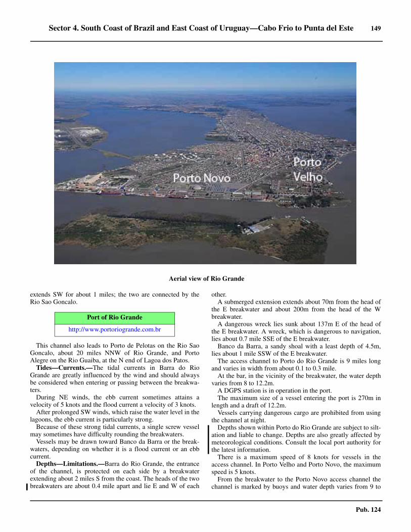
Sector 4. South Coast of Brazil and East Coast of Uruguay—Cabo Frio to Punta del Este 149
Pub. 124
extends SW for about 1 miles; the two are connected by theRio Sao Goncalo.
4.71 This channel also leads to Porto de Pelotas on the Rio SaoGoncalo, about 20 miles NNW of Rio Grande, and PortoAlegre on the Rio Guaiba, at the N end of Lagoa dos Patos.4.71 Tides—Currents.—The tidal currents in Barra do RioGrande are greatly influenced by the wind and should alwaysbe considered when entering or passing between the breakwa-ters. 4.71 During NE winds, the ebb current sometimes attains avelocity of 5 knots and the flood current a velocity of 3 knots. 4.71 After prolonged SW winds, which raise the water level in thelagoons, the ebb current is particularly strong.4.71 Because of these strong tidal currents, a single screw vesselmay sometimes have difficulty rounding the breakwaters. 4.71 Vessels may be drawn toward Banco da Barra or the break-waters, depending on whether it is a flood current or an ebbcurrent.4.71 Depths—Limitations.—Barra do Rio Grande, the entranceof the channel, is protected on each side by a breakwaterextending about 2 miles S from the coast. The heads of the twobreakwaters are about 0.4 mile apart and lie E and W of each
other. 4.71 A submerged extension extends about 70m from the head ofthe E breakwater and about 200m from the head of the Wbreakwater. 4.71 A dangerous wreck lies sunk about 137m E of the head ofthe E breakwater. A wreck, which is dangerous to navigation,lies about 0.7 mile SSE of the E breakwater.4.71 Banco da Barra, a sandy shoal with a least depth of 4.5m,lies about 1 mile SSW of the E breakwater. 4.71 The access channel to Porto do Rio Grande is 9 miles longand varies in width from about 0.1 to 0.3 mile. 4.71 At the bar, in the vicinity of the breakwater, the water depthvaries from 8 to 12.2m. 4.71 A DGPS station is in operation in the port.4.71 The maximum size of a vessel entering the port is 270m inlength and a draft of 12.2m. 4.71 Vessels carrying dangerous cargo are prohibited from usingthe channel at night.4.71 Depths shown within Porto do Rio Grande are subject to silt-ation and liable to change. Depths are also greatly affected bymeteorological conditions. Consult the local port authority forthe latest information. 4.71 There is a maximum speed of 8 knots for vessels in theaccess channel. In Porto Velho and Porto Novo, the maximumspeed is 5 knots.4.71 From the breakwater to the Porto Novo access channel thechannel is marked by buoys and water depth varies from 9 to
4.70Aerial view of Rio Grande
Port of Rio Grande
http://www.portoriogrande.com.br

150 Sector 4. South Coast of Brazil and East Coast of Uruguay—Cabo Frio to Punta del Este
Pub. 124
17m. The port is divided into three major areas. 4.71 Porto Novo is formed by a 1.5 mile long channel located be-tween the E end of the peninsula on which the city of RioGrande stands, and a low, sandy islet which has been reclaimedfrom part of an extensive sand bank about 0.1 to 0.3 mile E ofthe city.4.71 Porto Velho lies along the N side of this peninsula and is ap-proached through Porto Novo.4.71 Superporto is located on the left side of the approach to RioGrande, between the entrance breakwaters and the entrance toSaco da Mangueira (32°03'S., 52°05'W.). 4.71 The access channel to Superporto is dredged (2001) to13.8m between Buoy No. 1 and Buoy No. 2 and Cotrijul Ter-minal. For berthing information see the table titled RioGrande—Berth Information. 4.71 Aspect.—A round tower, 67m high at Porto Novo, is themost conspicuous object in the area. Also visible is the cathe-dral, with two towers, and a conspicuous silo, 0.3 mile ENEand 1 mile E, respectively, of the round tower. A conspicuoustower stands on the coast, 2.75 miles WNW of the entrance.The silo at the grain terminal, 0.5 mile N of the head of the Wbreakwater, is easily identified from seaward.4.71 The former pilot lookout, a white square masonry tower witha mast and yards, stands close S of Banco de Barra Light; it isabout half the height of the light but larger in bulk.
4.71 Pilotage.—Pilotage is compulsory for all Brazilian vesselsover 500 gross tons, all foreign vessels, and all vessels carryingdangerous cargo. Pilotage is available 24 hours. Pilots boardabout 5 miles SE of the dredged channel; the pilot boat is redwith a black “P” on either bow.4.71 Vessels should send their ETA 24 hours in advance, with aconfirmation sent 12 hours in advance. The pilot should be re-quested, via the agent, 4 hours in advance.4.71 When anchored and awaiting the pilot, vessels should reporttheir name, last port of call, and time of anchoring.
4.71 Should weather conditions prevent the pilot from boarding,vessels will be guided by the pilot boat into the marked channelwhere, once inside the breakwaters, the pilot will board.
4.71 Contact Information.—Rio Grande pilots and port can becontacted, as follows:
4.71 Anchorage.—Various designated anchorage are located be-tween the Barra do Rio Grande and Porto Novo. Anchorage lo-cations can best be seen on the chart. For anchorageinformation see the table titled Rio Grande—Anchorage In-formation.
4.71Porto Novo
4.71Rio Grande Container Terminal
Rio Grande—Contact Information
Pilots
VHF VHF channels 9, 14, and 16
Telephone
55-53-3232-4233
55-53-3232-4740
55-53-3232-4868
Facsimile 55-53-3232-4758
E-mail [email protected]
Port Captain
VHF VHF channel 16
Telephone 55-53-3233-6119
Rio Grande—Anchorage Information
Anchorage Type
AFor vessels bunkering. Daylight use only. Emergency anchorage is located in Anchorage A.
B, C, D, and F
All vessels in a precarious condition. Under control of the port superinten-dent and with the approval of the port authority.
E Vessels carrying dangerous cargo.

Sector 4. South Coast of Brazil and East Coast of Uruguay—Cabo Frio to Punta del Este 151
Pub. 124
4.71 Caution.—It should be noted that the water in the port mayvary in the course of a few hours, from completely fresh tonearly the density of sea water, depending on the direction ofthe wind. 4.71 It is prudent to reckon safe draft for entry and loading as if in
fresh water.
4.71 It has been reported that the strong SW current at the break-waters causes the channel buoys to be set to the SW.4.71 Piracy and armed robberies have been reported in the area ofRio Grande.
4.71 An overhead power cable crosses the channel in the vicinityof Ponta dos Pescadores. It has a minimum vertical clearanceof 70m.
G1, G2, and G3 All vessels.
Rio Grande—Anchorage Information
Anchorage Type
Rio Grande—Berth Information
Berth Length DepthMaximum Vessel
RemarksLOA Draft Beam
Porto Velho Wharf 620m 5m — — — Fishing vessels.
Porto Novo
General Cargo Quay 295m
9.1m
250m 8.8m
—
PCC, offshore vessels, project/heavy cargo, and livestock.
Naval Quay (North) 255m
— —
Grain, offshore vessels, project/heavy cargo, breakbulk, and naval.
Naval Quay (South) 210m Breakbulk.
No. 1 200m
250m 8.8m PCC, containers, breakbulk, livestock, off-shore vessels, fertilizer, cruise, and cement.
No. 2250m
No. 3
No. 4 350m
Ro-Ro Quay 250m
Terminal Tecon Rio Grande
Tecon Termi-nal 900m 14.5m — 12.8m — Containers, breakbulk, and reefer.
Superporto
Bianchini Terminal 186m 12.1m 260m
12.8m
42.0m
Vegetable oils, grain, wood chips, multipurpose, and bunkers.
Bunge Ali-mentos 412m 12.19m 260m 36.0m
Tegrasa Ter-minal (North)
205m
12.2m
225m 34.0mTegrasa Ter-minal (South)
Termasa Ter-minal 200m 230m 32.0m Grain, wheat, corn, rice, and soya.
Yara Termi-nal North Quay
—
210m 10.9m
—
Chemicals, fertilizer, and multipurpose.
Yara Termi-nal South Quay
240m 12.1m Fertilizer.

152 Sector 4. South Coast of Brazil and East Coast of Uruguay—Cabo Frio to Punta del Este
Pub. 124
Lagoa dos Patos
4.72 Lagoa dos Patos, the largest lake in Brazil, extendsabout 130 miles NE from Porto do Rio Grande and is separatedfrom the sea by a peninsula from 6 to 20 miles wide. 4.72 Numerous rivers empty into the lake, the largest being theRio Guaiba at its NE end and the Rio Sao Goncalo at its SWend. 4.72 Except for the dredged channels at each end, Lagoa dos Pa-tos has general depths of 5.5 to 7.3m. 4.72 Winds—Weather.—Northeast and SE winds cause a lower-ing of the water level on the E shore of Lagoa dos Patos andswells on the W shore. NW and SW winds cause an increase ofthe water level on the E shore and a lowering on the W shore.4.72 Southwest winds, which usually accompany cold fronts inwinter, are violent and long lasting. They cause damming onBarra do Rio Grande, which raises the entire level of Lagoa dosPatos. This may even occur some days before the SW windreaches the Rio Grande. 4.72 Northeast winds, which usually occur in spring and at the be-ginning of autumn, cause an outflow through Barra do RioGrande and lower the level of the lake.4.72 Tides—Currents.—The currents in the lake follow the di-rection of the wind and, during strong winds, may attain a ve-locity of 2 knots in the dredged channels in the SW part of thelake. During S and SW winds, a current in the dredged chan-nels may drive vessels toward the N shore.4.72 Between Sao Jose do Norte and Ponta da Feitoria, about 20miles N, an intricate channel leads through the shallow SWpart of the lake. This channel has a project depth of 6m over awidth of 80m; however, at times depths are less. It is marked bybeacons and buoys, most of which are lighted.4.72 Between Ponta da Feitoria and Ponta de Itapua, the E en-trance of the Rio Guaiba, about 94 miles NE, the fairway lies
near the E shore of the lake. It is marked by lights and lightedbuoys.4.72 Between Ponta de Itapua and Porto Alegre, about 22 milesNNW, another intricate channel leads up the Rio Guaiba. Thischannel has a project depth of 6m; however, at times depths areless. It is marked by beacons and buoys, some of which arelighted. 4.72 Navigation in Canal da Feitoria at night is prohibited formerchant vessels carrying dangerous cargo.4.72 Pilotage.—Pilotage is compulsory and is available onlyduring daylight hours. Pilots can be obtained at the RioGrande.4.72 Contact Information.—Lagoa pilots can be contacted, asfollows:
4.72 Anchorage.—The anchorage established to the N of Canalde Feitoria in the S portion of Lagoa dos Patos is a reserved an-chorage with mandatory usage for vessels which cannot navi-gate the Canal de Feitoria at night. This anchorage can best beseen on the chart. 4.72 Caution.—Due to frequent changes in the width and depthsof the channels, local knowledge is required. Small craftshould keep clear of larger ships in narrow channels as eddiesand abnormal water effects can cause boats to collide with
EBR Shipyard
EBR Auxilia-ry Quay 100m 5.0m
— — — Offshore vessels, project/heavy cargo, and steel products.EBR Main
Quay 780m 12.0m
Estaleiro Rio Grande Shipyard
ERG Main Quay 360m — — — — Offshore vessels, project/heavy cargo, break-
bulk, and steel products.
Braskem Maritime Terminal - Rio Grande
Products Berth 75m — — 9.7m — Chemicals, clean products, and LPG.
Petrobras Transportes - Rio Grande Waterway Terminal
Barge Pier 20m10.6m
100m10.0m
20.0mClean products, dirty products, chemicals, crude, and bunkers.North Point 100m 140m 25.0m
South Point 30m 13.7m 225m 12.1m 35.0m
Rio Grande—Berth Information
Berth Length DepthMaximum Vessel
RemarksLOA Draft Beam
Lagoa—Contact Information
Pilots
VHF VHF channel 16
Telephone 55-53-3231-1105
Facsimile 55-53-3232-6577
E-mail [email protected]

Sector 4. South Coast of Brazil and East Coast of Uruguay—Cabo Frio to Punta del Este 153
Pub. 124
ships’ propellers. Fish stakes, some of which are located in thechannels, constitute a danger.4.72 Depths less than charted have been reported (2018) in themarked channel which bypasses Rio Grande to the E of Ilha doTerrapleno de Leste and leads further N into Lagoa dos Patos.Mariners should consult local pilotage and navigate with cau-tion.
4.73 Porto Alegre (30°02'S., 51°14'W.) (World Port IndexNo. 13080) lies on the E bank of the Rio Guaiba, about 25miles from its mouth. It is built on a rocky promontory and isreported to be about 30m high. The government palace and thecathedral stand on this summit.
4.73 Several rivers empty into the Rio Guaiba in the vicinity ofthe port. Some of these rivers are navigable by small craft up to200 miles during the flood season.4.73 Winds—Weather.—From November to April, the prevail-ing winds are E and SE. From May to August, the winds arevariable, and from September to October, the winds are S andESE.4.73 Depths—Limitations.—There are three main sectors ofquays in Porto Alegre. Maua Quay is 3,240m long, with along-side depths of 4 to 6m. The Cais dos Navegantes Section is2,500m long, with alongside depths of 5 to 6m. The Cais Mar-cilio Dias Section is 2,260m long, with alongside depths of 4 to
5m. 4.73 There are four tanker berths in the Rio Gravatai, which dis-charges through the E bank close N of the N end of Cais dosNavegantes. The berths can accommodate tankers of 1,600 gtand not exceeding 5.2m in draft and 100m in length. 4.73 It is not recommended that vessels longer than 245m or witha draft of 5.2m attempt to reach Porto Alegre. A ro-ro berth,with 300m of quay, is located at the port.4.73 The Rio Guaiba is spanned above Porto Alegre by the Getu-lio Vargas Bridge. The bridge has a vertical clearance of 10.1m(closed position) and 36.6m (open position).
4.73 The bridge may be opened for shipping, Monday throughFriday, inclusive, during the following periods:
a. 0600 to 0700 (summer only).b. 0900 to 1130.c. 1330 to 1700.d. 1930 to 2030 (summer only).
4.73 During weekends and holidays, special arrangements are re-quired.4.73 Vessels approaching the bridge should reduce speed and beprepared to stop immediately if circumstances require.4.73 When vessels are approaching the bridge from opposing di-rections, the vessel proceeding downstream will be given prior-ity.4.73 Signals.—Signals associated with the operation of thebridge are summarized in the table titled Getulio VargasBridge—Signals. 4.73 Pilotage.—Pilotage is compulsory. A pilot is picked up atRio Grande. Pilots will not take vessels through the approachchannels to Porto Alegre at night. Pilotage should be requested,via the agent, 24 hours in advance. 4.73 Regulations.—Vessels of over 12 knots may leave the RioGrande for Porto Alegre, or vice versa, not later than 1700 insummer, or 1500 in winter; those of less speed leave 1 hourearlier. 4.73 This means that vessels entering from the ocean and boundfor Porto Alegre directly must enter the Rio Grande at least 3hours before the time indicated to allow for delays in gettingclearance at the Rio Grande and changing pilots.
4.73 In summer months, vessels of 14 knots may leave at day-break and complete the transit in the day, otherwise, vesselsmust anchor overnight at either end of Lagoa dos Patos.4.73 The maximum speed in the port and terminal area is 5 knots
4.73Porto Alegre
Getulio Vargas Bridge—Signals
Day signal Night signal Sound signal
To request bridge be opened — — Two prolonged blasts (by ves-sel)
To indicate bridge may not be opened — — Three prolonged blasts (by bridge operator)
To indicate an emergency at bridge — — Five short and rapid blasts (by bridge operator)
To indicate bridge is closed Red flag waved horizontally Two red lights —
To indicate bridge is open Green flag waved vertically Two green lights —

154 Sector 4. South Coast of Brazil and East Coast of Uruguay—Cabo Frio to Punta del Este
Pub. 124
4.73 Anchorage.—Vessels awaiting berthing anchor 0.2 mile offthe center part of Maua Quay, in a depth of 7m. Anchorage iscompulsory for vessels carrying dangerous cargo and requiringinspection by the port authority, or for vessels awaiting theopening of the Getulio Vargas Bridge. Such vessels arepermitted to anchor for a maximum of 6 hours; other vesselsmay also use the anchorage for a maximum of 12 hours. In allcases permission must be obtained from the Porto Alegre PortAuthority.4.73 Caution.—Submarine cables lie between Guaiba and Pontado Dionizio and can best be seen on the chart.
4.73 Santa Clara Terminal (29°54'S., 51°22'W.) is on the RioJacui, about 17 miles N of Porto Alegre. Pilotage, which iscompulsory, is available during daylight hours only.
4.74 Porto de Pelotas (31°47'S., 52°20'W.) (World PortIndex No. 13070) is located about 20 miles NNW of the RioGrande and 5 miles W of the mouth of the Rio Sao Goncalo. 4.74 The channel over the bar at the entrance of the Rio Sao Gon-calo has been dredged to a depth of 5.5m over a width of 80m,but continual silting makes the channel shallower than thecharted depth. The port is accessible to vessels with a draft of2m.4.74 The Rio Sao Goncalo is marked by beacons and buoys, someof which are lighted.
4.74 Pilotage—Pilotage is the same as Lagoa dos Patos. Pilotsboard at Rio Grande or Porto Alegre.4.74 There is 500m of quayage, with a maximum depth of 5.1malongside.
Lagoa Mirim
4.75 Lagoa Mirim extends about 97 miles SW from theSW entrance of the Rio Sao Goncalo, and is separated from thesea by a low and sandy peninsula from 10 to 30 miles wide and
partially inundated. 4.75 Numerous rivers empty into the lake, with the principal onebeing the Rio Jaguarao (32°39'S., 53°11'W.). This river flowsinto the NW side of Lagoa Mirim and forms part of the bound-ary between Brazil and Uruguay.4.75 Numerous navigational aids, some of which are lighted, arelocated throughout Lagoa Mirim. Local knowledge is essentialin the lake.
Barra do Rio Grande to Caba Polonio
4.76 Between Barra do Rio Grande and the mouth of Arro-io Chui, about 115 miles SSW, the coast is a low sandy strip,backed by the peninsula which separates Lagoa Mirim fromthe sea. This very low coast is inconspicuous on the radarscreen, the echoes obtained usually coming from dunes locatedfrom 1 to 2 miles inland. The light structures are easily identi-fied, and are visible up to 7 miles offshore by day.4.76 Lights are shown from the coast at Sarita, Verga, Albardao,and Chui, about 32, 53, 68, and 115 miles, respectively, SSWof Barra do Rio Grande.
4.76 Between Barra do Rio Grande and Arroio Chui, depths ofless than 18.3m lie within about 27 miles of the coast. Depthsof less than 9.1m lie within about 1 to 3 miles of this coast.Vessels in this area should keep well off the coast.4.76 Banco do Albardao, which is composed of rock covered byfine sand, with depths of less than 10m and a minimum depthof 6.6m, extends from 4 to 15 miles SSE from Verga Light. 4.76 Canal da Verga, the channel between this bank and the coast,has a minimum depth of 12m in the fairway.
Caution.—The coast of Uruguay from Arroio Chui to Puntadel Este is covered by the Maritime Movement Control and In-formation System. For further information, see Pub. 160, Sail-ing Directions (Planning Guide) Indian Ocean and SouthAtlantic Ocean.
To indicate traffic interrupted in both directions — One orange light —
Getulio Vargas Bridge—Signals
Day signal Night signal Sound signal
4.74Porto de Pelotas
4.76Albardao Light

Sector 4. South Coast of Brazil and East Coast of Uruguay—Cabo Frio to Punta del Este 155
Pub. 124
4.77 Southwest of Arroio Chui, the first prominent featureis the rocky Punta Coronilla, a distance of about 13 miles. 4.77 Isla Verde, the largest of several islets, surrounded by above-water rocks and submerged rocks, lies about 2 miles ESE ofPunta Coronilla. 4.77 A rock, awash, lies 0.5 mile E of these islets. A fort stands ona hill about 3 miles SW of Punta Coronilla.4.77 Anchorage is available 0.25 mile S of Isla Verde, in a depthof 11m.4.77 Between Punta Palmar, about 9 miles S of Punta Coronilla,and Cabo Castillo, about 21 miles farther S, the coast consistsof a flat sandy beach. A light is shown from Punta Palmar.4.77 Cabo Castillo (34°21'S., 53°46'W.) is a rocky promontorywhich rises to Cerro Bueno Vista, about 0.2 mile inland. 4.77 The cape is a good landmark because of its isolated positionand distinctive shape. Good radar returns have been reportedfrom the cape, distant 16 miles. 4.77 Punta del Diabolo, the NE extremity of Cabo Castillo, is awhite sheer cliff, rounded in shape, with some dark-coloredpatches of bushes. 4.77 Punta Aguda, the E extremity of Cabo Castillo, lies 0.75mile SSE of Punta del Diabolo.
4.78 Islas de Castillo Grande (34°21'S., 53°44'W.) con-sists of Isla del Marco and Isla Seca lying 1 mile ENE andabout 0.3 mile N, respectively, of Punta Aguda. Depths of 9 to15m lie between the two islets. A white, steep rocky cliffstands on the SE side of Isla del Marco and is visible 10 to 12miles.4.78 Anchorage.—Small vessels with local knowledge can an-chor between Isla Seca and Cabo Castillo, about 0.2 mile offthe cape, in depths of 3.5 to 4.5m, fine sand. 4.78 Vessels anchor in Bahia Castillo, NW of the summit of CerroBuena Vista, nearly 0.5 mile from the cape, in a depth of 4.5m.Before anchoring, care should be taken to ascertain the natureof the bottom, as it is rocky in places. 4.78 These anchorages afford good shelter from the pamperos,but a vessel should immediately put to sea if the wind shifts tothe NE, as it raises a heavy sea. 4.78 Caution.—The existence of a local magnetic anomaly hasbeen reported in the vicinity of Cabo Castillo but this reporthas not been verified.
Cabo Polonio to Punta del Este
4.79 Cabo Polonio (34°24'S., 53°47'W.) is a steep rockypromontory rising to a greenish cone-shaped hill. When firstseen from NE or SW, it appears as an island. A light is shownfrom the highest part of the cape. 4.79 Good radar returns have been reported from the cape out to adistance of about 16 miles. 4.79 Anchorage is afforded in the bay N of Cabo Polonio, in adepth of 10m, 0.6 mile NNE of Cabo Polonio Light. 4.79 During offshore winds, vessels can anchor, in a depth of9.1m, about 0.5 mile off the beach extending N from Cabo Po-lonio. Vessels can also anchor about 1 mile off this beach, indepths from 9 to 15m, sand and mud.4.79 A number of prominent mountain peaks are located to the Wand N of Cabo Polonio and can best be seen on the chart.4.79 Islas de Torres, consisting if three arid and rocky islets, lie up
4.76Chui Light
4.76Sarita Light

156 Sector 4. South Coast of Brazil and East Coast of Uruguay—Cabo Frio to Punta del Este
Pub. 124
to 1.25 miles E of Cabo Polonio. A rocky patch, with a depthof less than 1.8m, lies about 0.3 mile W of the easternmost is-let. Narrow passages lie on either side of the above patch andbetween the inner islets and Cabo Polonio, but they should notbe used without local knowledge.4.79 Bajo Polonio (34°26'S., 53°48'W.) is a dangerous rockyshoal, with a least depth of 3m, lying about 2 miles SW of Ca-bo Polonio; the sea often breaks over it.
4.79 A shoal, with a depth of 14.3m and a bottom of hard gravel,has been reported to lie 18 miles ENE of Cabo Polonio. Muchdiscolored water was observed in the vicinity; caution is neces-sary as shallower depths may exist. 4.79 An explosives dumping area is centered about 4 miles ENEof Cabo Polonio.
4.80 Between Cabo Polonio and Cabo Santa Maria, about24 miles to the SW, the coast consists of a beach, backed bysand hills. There is a heavy surf on this beach, making landingsdangerous and sometimes impossible. Some huts, generallysurrounded by trees, are scattered along this beach, but vegeta-tion is very scarce. 4.80 Punta Rubia, about 5 miles NNE of Cabo Santa Maria, is theonly break along this beach. It appears as an islet from sea-ward. A high hill with a reddish patch rises from Punta Rubiaand is the only one of its color in this area. 4.80 Bajo la Pedrera, with a depth of 8.2m, lies about 0.5 mile SEof Punta Rubia. 4.80 Cabo Santa Maria (34°40'S., 54°09'W.), located 24 milesSW of Cabo Polonio, is low with a rocky reef extending about0.15 mile to the S. A light is shown from a hillock on the cape.Good radar returns have been reported from the cape, distant15 miles.4.80 Anchorage is available W of Cabo Santa Maria, 0.75 mileoffshore, in depths of 10.9 to 12.8m.
4.81 Banco La Plata, with depths of 18.3 to 37m, lies in theN approach to the Rio de la Plata between the meridians ofabout 52°30'W and 55°20'W. It extends parallel with the Ncoast, from 20 to 50 miles offshore, and is composed of finesand and broken shells.4.81 Pozos de Fango, a depression of the ocean bed with depthsfrom 36 to 82m, lies between Banco La Plata and the coast tothe N. It begins about 15 miles E of Isla de Lobos and extendsabout 80 miles ENE, and is about 15 miles wide at its E end. 4.81 The bottom is mud of the consistency of sticky clay, with thecolor varying from lead to bluish black.4.81 Bajo Speedwell (34°40'S., 54°07'W.), with a depth of 9.7m,lies about 2 miles E of Cabo Santa Maria. Banco Laplace, adangerous sand bar, the existence of which is doubtful, was re-ported to lie about 2 miles S of Cabo Santa Maria.4.81 A 10m patch lies about 10 miles E of Cabo Santa Maria; a15m patch lies about 6 miles SE of the same cape.
4.82 Puerto de la Paloma (34°39'S., 54°09'W.) (WorldPort Index No. 13100) lies on either side of a low peninsula,joined to the coast by a narrow sandy isthmus, about 1 mile NEof Cabo Santa Maria. 4.82 Puerto Nuevo, accessible to vessels drawing up to 3m, isformed by a rubble breakwater about 0.6 mile long, projectingNW from the end of the peninsula. Rocks, awash, extend about0.3 mile E from the E end of the peninsula. 4.82 Puerto Viejo is S of the peninsula; Puerto Nuevo is to the Nof the peninsula. 4.82 Puerto Vieio, with depths of 1.2 to 3.9m, is entered betweenthe reefs extending S from the peninsula and Isla de la Tuna,about 0.4 mile NE of Cabo Santa Maria and close offshore. 4.82 The entrance, about 0.1 mile wide, is dangerous and localknowledge is essential.4.82 A 3m patch lies about 0.4 mile NE of the same point. A pierat the S end of Puerto Nuevo has a depth of about 5m alongsideits head, which is 15m long. A light is shown from the head ofthe pier.
Bajo Falkland (34°38'S., 54°07'W.), a rock awash, liesabout 1 miles NE of the head of the breakwater. A strandedwreck lies on this rock. A 3.6m shoal lies about 0.2 mile W ofBajo Falkland.4.82 Bajo 18 de Julio, with a least depth of 4.2m, lies about 0.6mile ENE of the head of the breakwater.
4.83 The coast between Cabo Santa Maria and Punta JoseIgnacio, about 26 miles to the WSW, is backed by sand hills,but has no conspicuous features. Gaps in these sand hills indi-cate Laguna de Rocha and Laguna Garzon, lying close inland.4.83 Punta Jose Ignacio (34°51'S., 54°38'W.) extends about 1mile from the general coastline and rises to a hill. This pointhas a frontage of rocks, about 0.6 mile long in an E and W di-rection. It is fringed by a reef which extends about 0.5 mile Eand 183m S. A small cove for boats is on each side of PuntaJose Ignacio. A light is shown from the point. 4.83 An SBM for oil tankers is moored SW from Punta Jose Igna-cio. The mooring buoy is located about 4 miles SW of PuntaJose Ignacio, in a depth of 18.m. Vessels should contact Puntadel Este Control on VHF channel 16 when within range. 4.83 A floating hose, 270m long, painted black with orange bandsand marked by a light, extends from the buoy. A prohibited ar-
4.79Isla de Lobos Light

Sector 4. South Coast of Brazil and East Coast of Uruguay—Cabo Frio to Punta del Este 157
Pub. 124
ea, shown on the chart, surrounds the SBM. 4.83 Only vessels under pilotage navigating to and from the oilterminal may enter this area. A berthing master, available to as-sist ships securing to the buoy, will board in position 34°59'S,54°46'W. 4.83 The vessel’s ETA should be signaled 48 hours in advanceand be confirmed 24 hours and 12 hours before arrival. Themaximum permissible draft is 16.7m. 4.83 Vessels may anchor clear of the approach buoys, but notcloser than 0.5 mile. 4.83 Bajo Ladas (34°52'S., 54°38'W.), with a depth of 5.2m, liesabout 1 mile S of Punta Jose Ignacio. Bajo Didy, with a depthof 0.1m, lies about 0.4 mile SE of the above point. A shoal,
with a depth of 7m, lies about 3 miles SE of Punta Jose Igna-cio.4.83 A stranded wreck lies on shore about 4 miles W of PuntaJose Ignacio. An obstruction lies about 11 miles SSW of thesame point.4.83 Between Ponta Jose Ignacio and Punta del Este, about 17miles to the WSW, the coast consists of a sandy beach, free ofoff-lying dangers. 4.83 A small river empties into the sea about 12 miles WSW ofPunta Jose Ignacio.4.83 Punta del Este (34°58'S., 54°57'W.) is described in para-graph 5.7.

159
Pub. 124
5. Sector 5—The Rio de la Plata, the Rio Uruguay, the Rio Para-
na, and the Rio Paraguay
5.0Additional chart coverage may be found in NGA/DLIS Catalog of Maps, Charts, and Related Products (Unlimited Distribution).
SECTOR 5 — CHART INFORMATION

161
Pub. 124
SECTOR 5
THE RIO DE LA PLATA, THE RIO URUGUAY, THE RIO PARANA, AND THE RIO PARAGUAY
5.0 Plan.—This sector begins with a description of the N shoreof the Rio de la Plata and includes the port of Montevideo;then, the S shore is described and includes the port of BuenosAires. The Rio Uruguay, the Rio Parana, and the Rio Paraguayare then described in that order as far N as Puerto de Salto, Por-to Mendes, and Porto Cuiaba, respectively.
General Remarks
5.1 Winds—Weather.—In the basins the Rio Uruguay,the Rio Parana, and the Rio Paraguay are rather variable inspeed and direction. In general, winds from between the N andS through E predominate. Gusts of gale force may also developduring thunderstorms. 5.1 The air is clear along the river to Parana and beyond. Mirageeffects are frequently reported. Dust haze develops during dryspells and bad visibility occurs during heavy rainstorms.5.1 Heavy rainfalls to the N, at the source of the river and theirtributaries, cause periodic rise of water level.5.1 Day temperatures are higher inland in summer and cooler atnight.
The estuary of the Rio de la Plata has frequent and rapidchanges of weather characteristic of temperate climates. Al-though NE winds are frequent over this region, they are notpredominate at any season and wind directions might be betterclassified as variable most of the year.
The Rio de la Plata is subject to two regional phenomenon:Pamperos and Sudestadas.5.1 Pamperos winds are cold squally winds from between S andW which follow the passage of a frontal trough. With a Pampe-ro, pressure falls slowly and the wind is N for a few days withhigh temperature and humidity. Then the wind becomes NE,strong and gusty; the regular land and sea breezes are interrupt-ed and conditions become very oppressive. Shortly before thearrival of the cold front, the wind may fall calm. 5.1 The onset of the SW wind is preceded by a roll of cumulusclouds followed by an extensive cumulonimbus cloud. 5.1 As the cloud arrives overhead, there is a heavy sometimes vi-olent squall from between the W and S. After a period of se-vere gustiness, the main current of cold air arrives, pressurerises, and temperature falls. There is usually a short period oftorrential rain with thunder and lightning. 5.1 The general gloom is intensified by clouds of dust if thesquall arrives from a W point. The maximum wind speed usu-ally occurs at the preliminary squall. 5.1 Some of the more severe squalls occur in the summer, but theS wind following the frontal passage is stronger in winter andmay persist for a few days. This strong S to SW wind, withmainly clear skies, is known locally as Pampero limpio.5.1 About 20 Pamperos a year occur in the Rio de la Plata, 12 atBuenos Aires, and 16 at Montevideo. The hazard to navigationis due to the sudden onset of the squall with gusts of 70 knotsor more; a gust of 107 knots was recorded at Montevideo in Ju-ly, and a Pampero gust of 96 knots from NW in January, 1925,
with considerable damage on both occasions.5.1 Between 80 and 100 cold fronts cross the Rio de la Plataeach year with a sudden change of wind from N to S. The inter-vals between the fronts varies from 1 to 15 days, and they varya great deal in intensity and duration. Occasionally the frontpasses with little evidence other than the wind change.5.1 Another danger to navigation in this area is the strong SEwind (Sudestada) which develops when depressions from theParana basin deepen rapidly near the coast before moving SEover the sea. Occasionally the wind reaches gale force withrough seas, rain, and bad visibility. 5.1 During one of these storms in July, 1923, the SE wind aver-aged 62 knots over an hour and reached 86 knots in gusts. Be-tween 5 and 8 Sudestadas occur each year.5.1 Sudestadas may develop during relatively high pressure withan average frequency of 3 per year at Montevideo. These SEwinds may persist for a day or two to cause heavy seas and anappreciable rise the level of the Rio de la Plata.5.1 Winds in the basins of the Rio Uruguay, the Rio Parana, andthe Rio Paraguay are rather variable in speed and direction. Ingeneral, winds from between N and S through E predominate.Gusts of gale force may develop during thunderstorms.5.1 The percentage frequency of gales reaches a maximum of 5per cent in July and August near the coast. Most of these highwinds are occasions of Pamperos and Sudestadas. The numberof gales increases steadily to S and E of the sea area to reach 10per cent in the extreme SE of the zone in summer and up to 20per cent in winter.5.1 Average cloud amount is rather constant at about half coverthroughout the year in most of the zone. Relatively short peri-ods of overcast skies occur during the passage of frontaltroughs and long periods of almost clear skies are enjoyedduring W winds in the S of the zone near the coast. Cloudamount exceeds 0.6 for most of year in the SE.5.1 In this zone the rain is more evenly distributed throughoutthe year with no marked seasonal change. 5.1 Heavy showers account for most of the total, but periods ofmore prolonged rain are not uncommon. Amounts are higherinland along the river basins in summer due to the increase inshowers over the hot land during the afternoon. 5.1 There is a gradual decrease in the annual total amount of rainfrom about 1,300mm near Porto Alegre to the N of the Rio dela Plata to about 650mm at Bahia Blanca to the S. The rain isevenly distributed, with no marked seasonal change. 5.1 The maximum frequency of fog occurs in winter and reaches10 per cent along the coast from Montevideo to Porto Alegre,but in the extreme S of this zone there is more fog during Octo-ber to February. Most of the fogs in the Rio de la Plata occurwith light E or NE winds. 5.1 Radiation fog on clear winter nights may obscure the riverbanks around dawn while the central parts of the river remainsfree of fog; these land fogs disperse by mid-morning. The air isclear along the river to Parana and beyond. 5.1 However, mirage effects have been quite frequently reported.

162 Sector 5. The Rio de la Plata, the Rio Uruguay, the Rio Parana, and the Rio Paraguay
Pub. 124
Dust haze develops during dry spells and bad visibility occursduring heavy rainstorms.5.1 The variations over the sea follow the pattern of the sea sur-face temperature. Sharp changes in temperature occur alongthis coastline during sudden wind changes. Winds from the N,known locally as Sondo, are hot and oppressive in summerwhile S and W winds are relatively cool and bracing. 5.1 A sudden drop of 10°C is not uncommon at the onset of aPampero, but the subsequent rise with the return to N winds ismore gradual. Day temperatures are higher inland in summerand cooler at night.5.1 There is a greater range of humidity in this zone than in thelower latitudes. Values are rather high in the N due to the prev-alence of onshore winds, but further S the frequency of windsoff the land brings drier air over the coastal waters and the hu-midity falls to 40 per cent or below during much of the day.There is the usual rise to 90 per cent or more around dawn onquiet clear nights along the coast.
Tides—Currents.—Because of the large body of waterbrought down by the rivers and the fact that the general move-ment of the water is greatly influenced by the wind, the tidalcurrents and currents are variable. 5.1 The normal range of the tide is small, and during light winds,the tidal currents are regular. During strong winds, the currentin the outer part of estuary flows in the direction of the wind,but in the inner part the currents caused by such winds followthe normal directions of the tidal currents, according to wheth-er the effect of the wind raises or lowers the water level.5.1 Because of the small range of the tide, the rates of the tidalcurrents in the estuary are normally low. In general, the ratedoes not exceed 0.75 knot in the outer zone and over Banco Or-tiz, but in the main channel the rate may reach 2 knots.5.1 During strong winds, the tidal currents may attain a rate of1.5 knots. In the outer zone, the direction of the current will beaffected, but in the inner zone the direction is not usually af-fected.
5.1 The normal range of the tide is very small, being about 0.7moff Cabo San Antonio (36°18'S., 56°47'W.) and off BuenosAires, 0.4m at Montevideo, and 0.7m at Colonia. 5.1 It is greatly influenced by the wind, which can multiply thisrange as much as six times. The chart datum in the Rio de laPlata is about 0.4m below MLW; at HW, during S and SEwinds, the depths may be 1.2m or more greater than thosecharted; whereas at LW, during N or NW winds, the depthsmay be less than those charted.5.1 In the area between Punta Piedras and Buenos Aires, thewinds have the following effect: those from between W andNE through N, lower the water level, the greatest effect beingcaused by those between NW and N; those from between E andSW through S, raise the water level, those between SE and Sproducing the greatest effect. 5.1 Winds from between NE and E and from between SW andW have little effect.5.1 The effect of the wind on the water level is almost immedi-ate, both when the wind begins to blow, or changes in direc-tion.5.1 A wind from between N and NW, with a force of from 4 to 5,will lower the water level by 0.5m, and if such a wind shouldsuddenly change direction to between S and SE and blow withthe same force, the water level will rise 0.9m in the space of 1
hour. 5.1 During the rise or fall of the tide, winds of force 2 from NWor SE, respectively, will be sufficient to arrest the tide or evento reverse its action.5.1 Several zones have been established in the approaches to theRio de la Plata in which ships can discharge cargo in order toreduce their draft before proceeding to Montevideo or in CanalGeneral. The limits of these zones are shown on the charts.5.1 Pilotage.—Pilotage is compulsory in the estuary, except forcoasting vessels. A vessel entering the estuary may proceed asfar as Rada de Montevideo or Practicos Recalada Light Vesselwithout a pilot. Vessels bound for Uruguayan ports board pilotsin the vicinity of the Km 9.35 Lighted Buoy (35°00'S.,56°14'W), or further E, as directed, for vessels with drafts ex-ceeding 8.8m. Vessels bound for Argentinian ports board pilotsat Practicos Recalada Light Vessel (35°06'S., 55°58'W.) or, inthe vicinity of position 35°03'S, 55°51'W, from a pilot boat op-erating from Montevideo.5.1 All vessels proceeding further into the estuary must obtain apilot from Practicos Recalada Light Vessel, to which they arerequired to give 48 hours notice of the ETA; the ETA should beconfirmed 24 hours in advance. The pilot boards about 1.8miles N of Practicos Recalada Light Vessel. 5.1 Recalada pilots can be contacted on VHF channels 12, 14,and 16.5.1 The light vessel has recently been replaced with a convertedoil tanker. 5.1 The pilot conducts a vessel to the roadstead off Puerto LaPlata (34°47'S., 57°51'W.) where he is relieved if the vessel isbound for Buenos Aires or up the rivers. Vessels with drafts ex-ceeding 8.8m, or vessels that cannot complete the transit in 8hours, will be required to embark two pilots (2002). 5.1 Vessels entering the Rio de la Plata must use pilots of the na-tionality of their port of destination, and when leaving must usepilots of the nationality of the port which they leave. 5.1 Caution.—Because of the frequent changes in the weather,the irregularities of the currents, and the lack of landmarks,vessels should exercise great caution when navigating in theestuary. In some places, the banks and shoals are steep-to andthe channels are narrow so that soundings may give little warn-ing. 5.1 When soundings show a bottom of mud only, the vessel willbe in the channel, but the more this mud is mixed with sand, orthe bottom becomes harder, the nearer will be the shoal depths.The bottom near the banks and shoals is generally a mixture ofblack mud and sand, overlying stiff clayish mud.5.1 Ongoing long-term dredging projects are present throughoutthe Rio Plata and the Rio Parana and may pose a hazard to nav-igation. Mariners are advised to consult local authorities on thelatest updates and locations of dredging operations.5.1 For the most up to date local information, it is recommendedthat in the Rio de la Plata and in the Rio Uruguay receive Nau-tical Radio Notices from Uruguay and Argentina.5.1 The latest depths in the channels and rivers covered by thissector are promulgated in the Boletin Fluvial published by theArgentine Government.
Boletin Fluvial
http://www.sspyvn.gov.ar/boletinfluvial.html

Sector 5. The Rio de la Plata, the Rio Uruguay, the Rio Parana, and the Rio Paraguay 163
Pub. 124
5.1 A submarine gas pipeline crosses the Rio de la Plata, fromabout 3 miles W of Isla Santiago passing about 1 mile upriverof Km 46 Lighted Buoy, and coming ashore near Muelle Plate-ro, 3 miles W of Punto Artilleros, as best seen on the chart. An-choring and trawling within 1,000m of the pipeline isprohibited.5.1 Many wrecks are charted in the estuary of the Rio de la Pla-ta, and because of the shallowness of the water, almost all ofthem are dangers to navigation. The majority, particularlythose near the routes leading to the ports in the estuary, aremarked by lighted buoys or buoys, and in some cases by both.5.1 In addition to the wrecks mentioned above, there are manylost anchors and cables on the bottom, most of these in vicinityof the anchorages in the estuary, where they are liable to foulthe anchors of subsequent arrivals.
The Rio de la Plata
5.2 The Rio de la Plata (35°30'S., 56°00'W.) is an exten-sive estuary formed by the confluence of the Rio Uruguay. It isentered between Punta del Este and Cabo San Antonio, about140 miles SW and extends in a NNW direction for about 140miles.5.2 The N shore and its approach, which comprises the entirecoastline of Uruguay, is comparatively high and rocky, withsheer cliffs and sand dunes. 5.2 The whole of the S shore, which is entirely Argentine, is lowand uniform in character and is bordered by an extensive shal-low bank.5.2 The estuary is remarkably shallow. To the W of Banco Ingles(English Bank), located 50 miles WSW of Punta del Este, thereare no depths over 10m and much of the area has depths lessthan 5m; the ports of Montevideo, Buenos Aires, and La Plataare reached through dredged channels. 5.2 The nature of the bottom is varied. On the banks, it is veryfine hard sand, but in the deeper parts it is soft mud of a neutraltint and of a sticky nature.5.2 The seaward limit of fresh water is in the vicinity of a linejoining the mouth of the Rio Santa Lucia, 12 miles WNW ofMontevideo (34°55'S., 56°11'W.), and Punta Piedras, 50 milesSW. 5.2 The estuary can be divided into an outer, middle, and innerzone.5.2 The outer zone, which lies seaward of the line joining Mon-tevideo and Punta Piedras, has three channels with depths vary-ing from 20 to 5.5m. 5.2 The N channel follows the coast of Uruguay, passing N ofBanco Ingles and Banco Arquimedes; the middle channel leadsbetween these shoals and Banco Rouen to the S; and the Schannel lies between the latter shoal and the SW shore.5.2 The middle zone lies between the outer zone and a line join-ing the Port of La Plata (34°50'S., 57°56'W.), 80 miles W ofMontevideo, and the port of Colonia, 24 miles N of it. 5.2 It has three navigable channels. The N channel follows theUruguayan coast, passing N of Banco Oritz and has depths of3.4 to 6.7m in the fairway. The middle channel follows the Sedge of Banco Ortiz and is separated from the S channel byBanco Magdalena, Banco Chico, and other smaller banks; ithas natural depths of 7.9 to 10m, but the dredged channel lead-ing to Buenos Aires and La Plata passes through it. The S
channel follows the Argentine shore and has a minimum depthof about 5.8m in the fairway.5.2 The inner zone extends from the W limit of the middle zoneto the head of the estuary, about 35 miles NW. This zone con-tains the two channels giving access to the port of Buenos Ai-res, Canal Costanero, which leads to the Rio Parana, andCanales a Martin Garcia which lead to the Rio Uruguay. 5.2 Playa Honda, with depths of less than 5.5m, extends about30 miles SE from the head of the estuary separating the two lat-ter routes.
In the approaches to the Rio de la Plata, discolored water,caused by the outflow of the rivers, will be found about 75miles seaward of a line joining Punta Espinillo (34°50'S.,56°26'W.) and Punta Piedras, 50 miles SW. 5.2 Directions.—A good guide, when the land is not in sight, isthe fact that the bed of the estuary is hard on all the banks andsoft in the channels.5.2 Making the land at the mouth of the Rio de la Plata does notpresent any great difficulty. The only difficulty is caused by thesuddenness and frequency of the changes in weather, which isa characteristic of the climate of the estuary.5.2 In clear weather, for a vessel approaching from N during aNE wind, the high land and islets near Cabo Castillo, and thelight structures at Cabo Polonio and Cabo Santa Maria, are suf-ficient to identify the coast.
Banco La Plata is a large bank, with depths of 18 to 36m,which extends ENE from the N side of the estuary trendingparallel with the N shore from 20 to 50 miles off it. It is com-posed of fine sand and broken shells.
Pozo de Fango (34°45'S., 53°30'W.) is a mud well whichseparates the E part of Banco de La Plata from the coastalbank. It is a marked depression in the ocean bed with depths ofabout 36 to 82m. Its bottom is mud with the consistency ofsticky clay. 5.2 When the weather is not clear, a good parallel for making theentrance is that of Isla de Lobos (35°02'S., 54°53'W.). 5.2 A vessel approaching in this latitude will encounter BancoLa Plata, which is about 10 miles wide in this vicinity, in aboutlongitude 53°10'W, in depths of 22 to 36m. The mud well, inwhich depths are more than 36m, will then be reached. 5.2 After Pozos de Fango has been crossed on a course converg-ing on the N shore and about 10 miles off, the nature of the bot-tom will change. First, mud and sandy grit will be encountered,changing over to mud and shell, and finally, sand and shell willbe found. The sand, becoming quite coarse, changes color andis mixed with gravel or pebbles and colored shells as the shoreis neared, while the soundings decrease somewhat regularly to26m and 22m about 4 miles offshore. 5.2 In thick weather or when the land is not plainly visible fromthat distance, the depths should not be shoaled to less than28m.5.2 When across the mud well, steer to pass well S of Isla Lobos,the bottom being mud. This island can easily be identified, aswell as Punta del Este and the coastal hills NW, and also Sierrade las Animas, nearly in the same direction. 5.2 There are no off-lying dangers at a distance of 5 miles off-shore, and it is only on rare occasions that the weather is sothick that the land cannot be seen.5.2 In poor visibility, pay attention to the soundings over BancoLa Plata and the mud well and do not enter the estuary unless

164 Sector 5. The Rio de la Plata, the Rio Uruguay, the Rio Parana, and the Rio Paraguay
Pub. 124
Isla Lobos or the land in its vicinity has been sighted.5.2 To the W of Isla Lobos, the bottom continues to be very soft,blue mud and the decrease in the soundings indicate the ap-proach to Isla de Flores. 5.2 Make allowance for the current according to the wind, bear-ing in mind that the current sets strongly towards the shoreduring SE winds. 5.2 A vessel entering the Rio de la Plata S of Banco Ingelesshould be certain of its latitude. 5.2 The estuary should be approached either on the parallel of35°35'S, which leads N of Banco Rouen, or on the parallel of36°10'S, passing S of this shoal, taking into account the state ofthe wind and the consequent current. 5.2 East of both shoals, the bottom is sand, mixed in some placeswith shells; while W of them and on the meridian of Montevi-deo, the bottom is mud, except off Punta Piedras, where it is tu-fa and on Banco Ortiz, where it is sand.5.2 West of Banco Rouen, course should be shaped for the de-sired port according to position because, due to the absence ofmarks, the depths and the nature of the bottom are the onlyguides.
The Rio de la Plata Estuary—North Part
5.3 The coast on the N side of the Rio de la Plata, be-tween Punta del Este and Punta San Pedro, about 147 milesWNW, is comparatively high and rocky, with sheer cliffs andsand dunes. The N shore recedes N for a distance of about 11miles between Punta del Este and Punta Brava, about 60 milesW.5.3 Sierra de la Ballena (34°50'S., 55°01'W.), a range of rockyblackish hills, extends N from Punta Ballena; a large patch ofwhite sand, which is prominent at a great distance from sea-ward, lies on the S slope of one of the hills about 7 miles NWof Punta del Este.5.3 Cerro Pan de Azucar (34°48'S., 55°16'W.) and Cerro delas Animas (34°43'S., 55°28'W.), the highest and most promi-nent summits near the coast in this vicinity, rise about 18 and22 miles NW, respectively, of Punta del Este. 5.3 The former is an almost regular cone, 423m high, and has aconspicuous cross, 32m high, on its summit. The latter is 500mhigh, and has a flattened summit with a slight depression in theform of a saddle. It is visible when bearing about 295°.5.3 Montevideo, the capital of Uruguay and the largest seaport inthe country, is located about 60 miles W of Punta del Este. 5.3 The N shore recedes N for a distance of about 13 miles be-tween Punta Brava and Punta San Pedro, about 89 milesWNW.5.3 Depths—Limitations.—Depths along the N side of the Riode la Plata decrease gradually from about 33m about 8 milesoffshore in the vicinity of Punta del Este (34°58'S., 54°57'W.)to 18.3m about 28 miles W, then to 9.1m about 5 miles off-shore S of the port of Montevideo, then to 5.5m about 2 milesoffshore in Canal del Norte (Paso Norte) (34°28'S.,57°52'W.).5.3 A depth of 3.6m is available about 3 miles offshore on the Npart of Banco Ortiz as far as the E approach to the port of Colo-nia where the depths increase to more than 5.5m within about 2miles offshore. Canal Punta Indio affords greater depths be-tween Montevideo and the port of Colonia.
Isla de Lobos is about 5 miles SE of Punta del Este and ex-tends 0.5 mile S. It is rugged, barren, and 23m high. The islandhas been reported to be a good radar target at 14 miles. The on-ly landing place is a small sandy cove on the N side of the is-land. 5.3 Shoal depths of 18.3m or less extend 1 mile E, about 2 milesNW, and more than 0.75 mile W of the island. 5.3 The E side of the island is rendered unsafe for a distance ofnearly 1 mile by Bajo de Lobos, a detached reef with a largeabove-water rock and Bajo del Sargo, detached rocks withdepths of less than 1.8m. 5.3 A wreck, partly above-water, is on the E end of Bajo de Lo-bos. The S side of the island is comparatively steep-to; the Wside less so, and there are depths of 10.9m at 0.6 mile. 5.3 The N side has depths of less than 10.9m for a distance of0.5 mile, with a wreck, partly above-water, about 0.2 mile off-shore. 5.3 Anchorage.—Anchorage has been obtained, in a depth of11m, about 0.5 mile from the lighthouse, with the lighthousebearing 314°.5.3 Canal de Lobos, the passage between Isla de Lobos and themainland NW, is about 4 miles wide, with depths of from 18.3to 25m in the fairway. 5.3 The bottom is mud in the middle but changes to sand, coral,and rocks near the island and to small shells close off Punta delEste. The tidal currents in the passage are stronger than those Sof the island.5.3 Caution.—An obstruction, with a depth of 5.5m, has beenreported about 15 miles S of Isla de Lobos. A 17.3m shoalpatch is E of this shoal.5.3 A dangerous wreck lies 8.7 miles S of Isla de Lobos.5.3 A shoal, with a depth of 13m, has been reported about 11miles S of Isla de Lobos, but surveys have failed to find it.5.3 An 11m shoal has been reported about 7 miles S of Isla deLobos. A dangerous wreck lies close E of the shoal.5.3 Banco Ready is a reef, with depths of 12 to 15m, about 7.2miles W of Isla de Lobos.5.3 A charted obstruction (position approximate) is about 18miles WSW of Isla de Lobos.5.3 Because other unknown dangers may exist in the vicinity ofIsla de Lobos, caution is advised and soundings should be tak-en frequently. 5.3 Dangerous wrecks lie about 12 miles and 8 miles WNW, and9 miles WSW of the light on Punta del Este. The latter wreck ismarked with a lighted buoy.
5.4 Isla de Flores (34°57'S., 55°56'W.), which is a goodlandfall, lies about 6 miles offshore in a position about 48 milesW of Punta del Este. The island is about 1 mile long in a NE toSW direction and has maximum elevation of 17m; near the SEend it is divided into three parts by a reef with a causeway on it.A chimney on the NE end of this island is conspicuous. A lightis shown from the SW and highest part of the island. A signalstation stands near the light structure.5.4 The SW part of the island is used as a quarantine station, thebuildings being near its SW end; on its N side there is a pier,where vessels drawing up to 3m can berth alongside. A lifeboatis stationed at the island.5.4 A restricted zone is established SE of Isla de Flores Lightand may best be seen on the chart. Anchoring and fishing are

Sector 5. The Rio de la Plata, the Rio Uruguay, the Rio Parana, and the Rio Paraguay 165
Pub. 124
prohibited in this zone.5.4 There is good anchorage about 0.3 mile N of the pier, in adepth of about 7.3m, mud, but the tidal currents have been ob-served to run at a rate of 3 knots in this position. 5.4 Vessels can also anchor in suitable depths near the island, butcare must be taken to avoid the vicinity of the submarine cablesindicated on the chart.
Bajo Cumberland (34°57'S., 55°57'W.), with a least depthof 5.5m, is about 0.5 mile WSW of the island.5.4 A reef extends about 0.5 mile N from the NE end of Isla deFlores.5.4 Canal de Buceo, the passage between Isla de Flores and themainland NW, is much encumbered by the dangers off PuntaManso. A vessel using this passage should pass about 1.5 milesN of the island and then keep nearer to it than to the mainland. 5.4 The tidal currents in the passage are stronger and more irreg-ular than those S of the island, and the latter route is preferable.The height of the tide is influenced by the wind.
5.4 A sunken wreck, dangerous to navigation, lies on the edge ofthe 20m curve about 36 miles ESE of the light on Isla deFlores. An obstruction (position approximate) lies about 6.7miles SSW of the light on Isla de Flores.
Banco Ingles, a dangerous shoal, is 16 miles long. The Nend, which is well defined, lies about 48 miles WSW of Puntadel Este and about 11 miles S of Isla de Flores. The shoal iscomposed of black sand except for its SW part, where there arestones in a depth of 5.5m.5.4 A ridge on the N part of the shoal is about 4 miles long in aN-S direction and has a least depth of 0.9m, over which the seasometimes breaks.5.4 There are depths of 10.9m and 12.8m close off the N end ofBanco Ingles; the E side of the bank has a more gradual slope. 5.4 The approach to the bank is indicated by soundings. In thechannel N of the bank the bottom is very soft mud and depthsare more than 10.9m until W of the bank.5.4 If a vessel anchors near Banco Ingles for too long, there maybe some difficulty in breaking out the anchor because of thestiff nature of the bottom.5.4 Lighted buoys, lying well off Banco Ingles, mark the generalarea of the bank. The slope of Banco Ingles is subject tochange.5.4 A dangerous wreck, marked close N by a buoy, lies 2.25miles SSW of Practicos Recalada Light Vessel.
5.5 Banco Arquimedes (35°13'S., 56°06'W.), with aleast depth of 4.5m, is a small sandy shoal lying from 16.5 to19.2 miles SSW of Isla de Flores. 5.5 About 8 miles W of the N of it, the depths increase regularlyover a bottom of mud. It should not be approached, unless in avessel of light draft, in depth less than 9.1m.5.5 The bank is marked by lighted buoys to the N and W; but be-cause they are exposed to strong S winds their position is notalways reliable and caution is advised.5.5 The tidal currents in the vicinity of Banco Ingles have beenobserved to run in all directions, but generally more E and Wthan N or S; the greatest rate observed did not exceed 1.5knots.
Banco Ortiz borders the coast E of Punta San Pedro(34°38'S., 57°51'W.) for about 40 miles and, with an averagewidth of 18 miles, projects another 40 miles SE down the mid-dle of the estuary nearly to a line of bearing between Montevi-deo and Punta Piedras.5.5 The SE part of the bank is separated from Banco Piedras bya channel about 8 miles wide, with a least depth of 5.8m, form-ing the bar of the Rio de la Plata through which Canal PuntaIndio has been dredged.5.5 The N half of the bank has general depths of 2.1 to 3.6m; theS half is nearly a fathom deeper. The nature of the bottom issand and mud, but there is some hard bottom and rock near theN shore between the Rio Rosario and Rocas de las Pipas.5.5 Banco Ortiz can be approached on all sides by sounding, asthe depths decrease gradually and the muddy bottom, which isfound in the channels, becomes mixed with sand. 5.5 A vessel should not proceed into depths of less than about5.5m.5.5 Quebrada del Banco Ortiz, a channel for light draft vessels,leads across the S part of Banco Ortiz in about 34°52'S. 5.5 Lighted buoys are moored near the E and W ends of thechannel. An obstruction, marked by a small white buoy, liesabout 1 mile W of East Lighted Buoy.5.5 Aeronautical radiobeacons, of use to shipping, transmit frompositions about 10 miles NW and 54 miles WNW, respectively,
5.4Isla de Flores Light

166 Sector 5. The Rio de la Plata, the Rio Uruguay, the Rio Parana, and the Rio Paraguay
Pub. 124
of Punta del Este.
5.6 Canal del Norte lies parallel with the N shore of theRio de la Plata, between it and Banco Ortiz. This channel isfrequented only by coastal and other vessels of light draft, asthere are depths of only 3.6m off the mouth of Arroyo Cufreand near Rocas de las Pipas when the river level is low.5.6 A vessel proceeding from Montevideo through Canal delNorte, after passing La Panela Light and Banco Santa LuciaLighted Buoy, should steer NW and keep about 5 miles off-shore, so as to pass S of Banco Jesus Maria Lighted Buoy.Then course should be altered to pass about 1 mile SW of Ban-co Arazati Lighted Buoy, when the depths will decrease gradu-ally to about 3.6m.5.6 From a position 1.5 to 2 miles SW of the mouth of ArroyoCufre, the channel turns W. After passing Banco Cufre Light-ed Buoy (34°28'S., 57°10'W.), a vessel should keep near theshore and then steer to pass S of Piedras del Sauce LightedBuoy. From Punta Artilleros Lighted Buoy, course should beshaped so as to pass S of Rocas de las Pipas and Roca Barriles,giving these rocks a wide berth, when the least depth will againbe about 3.6m.5.6 When past Roca Barriles, a vessel can close the shore towithin 0.5 mile and follow it to the roadstead at the Port of Co-lonia, passing S of the breakwater at Puerto Franco. Punta SanPedro should be rounded at a distance of about 0.2 mile, bear-ing in mind that the tidal currents are set on to this point.5.6 Vessels of less than 2.7m draft can proceed from Montevideoto Buenos Aires through Quebrada del Banco Ortiz, whichleads across Banco Ortiz in an almost direct line, but vessels ofgreater draft must use Canal Punta Indio.
Tides—Currents.—During the rising tide, the tidal currentE of Banco Ingles sets N. Between Isla de Flores and the Nshore of the estuary, the tidal current sets W inclining WSWparallel with the shore; between Isla de Flores and N end ofBanco Ingles, it sets W inclining WNW. 5.6 These two currents unite W of Isla de Flores and set throughthe outer roadstead at Montevideo in a NW direction. OverBanco Ingles and E of its ridge, the current sets between SSWand SW, sweeping W around the SW part of this shoal and thenNW toward Banco Arquimedes. 5.6 Near La Panela and the N shore, the tidal current sets be-tween NW and W. About 15 miles N of Banco Arquimedes,the currents set ENE and ESE in a contrary direction to thebranch which enters S of Isla de Flores, and deflects thatbranch WNW of Banco Ingles. Over the S and central parts ofBanco Ortiz it sets NW, and near the N shore it sets W. 5.6 During the falling tide, the current sets between ESE and SEover Banco Ortiz. Banco Ingles divides the current into twobranches, one setting SE and the other SW. 5.6 Abreast Montevideo, the current sets ESE and maintains thisdirection in the passage between Isla de Flores and Banco In-gles. Between Isla de Flores and the N shore of the estuary, thecurrent sets SW and then turns to join the current setting be-tween ESE and SE, S of that island.
Punta del Este to Montevideo
5.7 Punta del Este (34°58'S., 54°57'W.) is the S extremi-ty of a promontory which projects about 2 miles SW from the
general line of the coast and is bordered by some sand dunes.About 0.3 mile N is a dark hill, about 18m high, from which alight is shown. The promontory is fringed by above-water andsunken rocks extending as far as 183m offshore in places.
Caution.—The coast of Uruguay from Punta del Este to Co-lonia, including the port of Montevideo, and the Rio UruguayN of Colonia, is covered by the Maritime Movement Controland Information System. For further information, see Pub. 160,Sailing Directions (Planning Guide) Indian Ocean and SouthAtlantic Ocean.
Dumping hydrocarbons by washing tanks, by pumping bilgeor ballast, or any other action that discharges contaminatedcontents, is prohibited within the zone bounded by the follow-ing points:
a. Punta del Este.b. 36°14’S, 55°23'W.c. 37°32’S, 55°23'W.d. Punta Rasa.
5.8 The mountains Pan de Azucar and Sierra del a Balle-na are visible in clear weather NW of Punta del Este before it issighted at 8 to 10 miles offshore. 5.8 The point has been reported to give good radar returns as faras 10 miles.
5.6Punta del Este Light

Sector 5. The Rio de la Plata, the Rio Uruguay, the Rio Parana, and the Rio Paraguay 167
Pub. 124
5.8 A conspicuous chimney, which is tall and light brown in col-or, is about 3 miles NNE of Punta del Este. There is a promi-nent hotel about 1 mile NE of the point.5.8 A signal station is close N of the light structure on Punta delEste. A number of submarine cables, the routes of which arebest seen on the chart, are landed nearly 1 mile NE of the point.
Banco Silvia, with a least depth of 12.5m and composed ofsand and rock, lies about 2 miles SW of Punta del Este.5.8 Bajo Nuevo, a shoal with a least depth of 6.8m, lies about 1mile WSW of Punta del Este. The bottom near this shoal isrocky and uneven and the depths vary from 12.8 to 21.9m.5.8 Bajo del Este, with a rock awash in its center, lies about 0.3mile to 0.5 mile W of the S extremity of Punta del Este, and thesea always breaks over it. 5.8 A dangerous wreck lies on the W part of this reef. The nar-row passage between Bajo del Este and Punta del Este has adepth of about 7.3m.5.8 Isla de Lobos and Banco Ready, about 5 miles SE and 4.75miles SW of Punta del Este, have already been described inparagraph 5.3. Within a distance of about 9 miles SE of Isla deLobos, the light on Punta del Este is obscured by the summiton that island when bearing about 315°.
5.9 Bahia de Maldonado (34°56'S., 55°00'W.) is enteredbetween Punta del Este and Punta Ballena (34°55'S.,55°03'W.), and it is exposed to SW winds which raise a heavysea. Part of the bay is sheltered from these winds by Isla Gorri-ti, located 1.25 miles NW of Punta del Este and described inparagraph 5.10, but the tidal currents in the two entrancesformed by the island cause much inconvenience.5.9 A prominent building is near the root of a ruined pier about3.2 miles NNW of Punta del Este. The cathedral of Ciudad deMaldonado, with a cupola and two square towers, stands 1 mileNE, but is screened by trees on some bearings.5.9 Punta Ballena, which has the appearance of a whale, is the Send of a range of rocky hills, one of which has a prominentpatch of white. There are some caves in the point. 5.9 There are some above-water rocks off Punta Ballena, and anunderwater ledge extends 0.3 mile S from it. A detached rock,with a depth of 4.3m, lies about 0.4 mile SSW of the point andshould not be approached within 0.5 mile.5.9 Tides—Currents.—The tides in Bahia de Maldonado areaffected by the wind. Fresh S winds raise the water level attimes as much as 1.8m, and N winds lower it. 5.9 Generally, this action takes place before the arrival of suchwinds in the bay, and they can be forecast to a certain extent. 5.9 Another indication is that the temperature of the water risesduring N and falls during S winds.5.9 During a rising tide, the tidal stream usually enters the bayW of Isla Gorriti and runs out E of the island. Winds from theW cause a strong current to run E and S around Isla Gorriti(34°57'S., 54°58'W.), WSW of the point.
5.10 Punta del Chileno (34°55'S., 55°01'W.) is rocky withan underwater ledge extending 0.25 mile S. 5.10 The remainder of the shore of the bay is clear of dangers andis backed by dunes, those SE of Ciudad de Maldonado beinghigher than those NW of the town.5.10 Laguna del Diario lies a short distance NE of Punta delChileno. In times of flood, this lagoon forces a channel through
5.10 Isla Gorriti (34°57'S., 54°58'W.), in the SE part of Bahia deMaldonado, is low, densely wooded, and composed of sandand rock. There is a cove with a sandy beach on its W side. Abank of sand with occasional below-water rocks extends up toabout 0.3 mile off the island. 5.10 There are two piers on the E side of the island situated closeto each other about 0.3 mile N of the SE point of the island. 5.10 Another pier is situated at the head of a small bay on the Nside of the island. The island is marked by a light on its SEpoint which is only visible between bearings of 097° and 357°.5.10 Bajo Mostyn, with a least depth of 4m, is 0.3 mile E of Gor-riti Light (34°58'S., 54°58'W.).5.10 Bajo del Monarca, a rocky shoal with depths from 5.2 to8.8m, lies with its shallowest part about 0.8 mile NNW of Pun-ta Britos, the NW extremity of Isla Gorriti. It is marked on itsNW side by a lighted buoy. The passage between this rock andthe island should not be used.5.10 There are depths of 4.6m and 5.2m up to about 0.3 mile N ofIsla Gorriti.5.10 Bancos los Banquitos, a group of sandy shoals with a leastdepth of 3m, lie up to about 0.8 mile E of the NE point of IslaGorriti. They are marked on the NE side by a lighted buoy.5.10 Anchorage in Bahia de Maldonado is recommended aboutmidway between the N end of Isla Gorriti and the shore, indepths of 8 to 9m, sand over hard mud, with Punta Ballenabearing 290° and Punta Britos bearing between 199° and 232°. 5.10 This anchorage, known as Puerto de la Pastora, is protectedfrom S winds which sometimes blow with great violence andthe holding ground is very good. Because the anchor soon be-comes foul, a vessel intending to remain for any length of timeshould moor with two anchors on a SW heading.5.10 Anchorage is available for small craft near the entrance toPuerto de Punta del Este, 137m from the breakwater head, in adepth of 6m, hard sand. 5.10 This anchorage is sheltered from all winds except those frombetween W and SW, but winds from NW may raise a moderatesea.5.10 These anchorages are used by vessels unable to berth along-side at Puerto de Punta del Este to work cargo into lighters.
Directions.—When approaching Bahia de Maldonado from
5.10Punta del Este beyond Isla Gorriti

168 Sector 5. The Rio de la Plata, the Rio Uruguay, the Rio Parana, and the Rio Paraguay
Pub. 124
E, pass on either side of Isla de Lobos, avoiding the dangers offit. Punta del Este can be easily identified by the light tower.From a position S of this island, Ciudad de Maldonado will besighted. 5.10 Also prominent is a 50m high building and 2 water tanks ly-ing 1 mile and 0.7 mile, respectively, NE of Punta del Este. 5.10 In addition, Monte Pan de Azucar and Sierra de las Animas,to the NW, will probably be visible.5.10 The channel between Isla Gorriti and Punta del Este is re-stricted by Bajo del Este, Bajo Mostyn, and Banco los Baquitosand is dangerous due to the strong tidal currents runningthrough it. Between the NE end of Isla Gorriti and the main-land, the depths are very uneven, but the channel NE of Bancoslos Banquitos is about 0.2 mile wide, with depths of from 6.5to 10m. 5.10 It can be used in fine weather by small craft with localknowledge. During fresh S winds, the sea breaks right acrossthe channel. Small craft with local knowledge sometimes usethe passage between Bajo del Este and Punta del Este; but thetidal streams run very strongly here, and this passage should beavoided by strangers even in good weather.5.10 Having passed Isla de Lobos, steer W and do not bring Puntadel Este Light Tower to bear more than 045° until Punta Britosbears 020°, so as to clear Banco Silvia and Bajo Nuevo. WhenPunta Britos has reached the above bearing, alter course N,passing NW of Bajo del Monarca Lighted Buoy, and continueuntil Punta Ballena bears 282°, then steer for the anchorage.5.10 Avoid anchoring within 0.4 mile of the ruined pier N of IslaGorriti.
5.11 Puerto de Punta del Este (34°58'S., 54°57'W.) is aseaside resort harbor with hotels and beaches on the NW sideof Punta del Este. The port is approached through Bahia deMaldonado. Pilots board 1.5 miles WSW of Isla Gorriti. Theport is protected by a 0.25 mile long breakwater on its W side,consist of a wooden pier with a concrete head, which hasdepths of 4m alongside. Depths decrease rapidly on the W sideof the pier. 5.11 There are quays for small craft on both sides of the root ofthe pier and several mooring buoys for small craft in the har-bor. The customs house, a large stone building, stands at theroot of the pier.5.11 The port is marked by a light at the head of the breakwater.There is a lifesaving station at the port.5.11 Punta del Este Light has been reported to be hard to identifyagainst the shore lights.
Punta Ballena to Punta Manso
5.12 Ensenada del Portrero (34°55'S., 55°08'W.) is en-tered between Punta Ballena and Punta Rasa (34°54'S.,55°13'W.), 9.5 miles W. Laguna del Sauce lies within the bayand has an outlet into it, and its vicinity is subject to inunda-tion. The bay is clear of dangers and is easily identified by itsbeach of white sand.5.12 Anchorage is recommended in the bay during offshorewinds, in depths of 9 to 11m, hard sand, 0.3 mile to 1.2 milesoffshore. A berth, with good shelter from strong E winds, is sit-uated 1.25 miles NNW of Punta Ballena and 0.5 mile offshore,in depths of 9 to 13m.
5.12 Capitan Curbelo Aero Light is occasionally shown from awhite square stone tower and dwelling, 15m high, 4.75 milesNW of Punta Ballena.5.12 Punta Negra and Punta Iman lie 1 mile W, and 2.5 milesWNW, respectively, of Punta Rasa, the three points togetherforming a cape. They are steep and rocky with sandy coves be-tween them, and rise to high land which is joined by MontePan de Azucar. 5.12 Punta Negra is marked by a light. A dangerous wreck lies 20miles S of Punta Negra.5.12 Montevideo Maritime Movement Control System is in oper-ation W of the meridian of 55°30'W; vessels are required to re-port on crossing this meridian and when abeam of Isla deFlores.
Ensenada de Piriapolis lies between Punta Iman and Puntade los Burros, 2.5 miles NNW. The latter point is low andfringed by a reef. The shore of the bay is composed of finecompact sand. The seaside resort of Piriapolis (34°52'S.,55°15'W.) stands behind the S part of the bay.5.12 A small white chapel, which is cylindrical and looks like atank from afar, stands at an elevation of about 130m on thesummit of Cerro del Ingles, 0.75 mile NE of Punta Iman; it canbe seen at a distance of about 10 miles offshore. There is alarge and prominent hotel in Piriapolis, 1.5 miles N of PuntaIman.5.12 Puerto de Piriapolis is formed by a breakwater extendingabout 0.1 mile NW from the SE shore of the bay. On its NEside there is a wharf 35m long with a depth of 4m alongside. 5.12 Vessels drawing up to 4.3m can anchor under the shelter ofthis breakwater.5.12 Caution.—High speed ferries operate between Piriapolis,Montevideo, and Buenos Aires
5.13 From Punta de los Burros, the coast trends WNW for5.5 miles to Punta Animas which is fringed by underwaterrocks to a distance of 1 mile.5.13 Cerro Pan de Azucar and Cerro de las Animas, the highestand most prominent summits near the coast in this vicinity, arelocated 3.5 miles NE and 6.5 miles N, respectively, of Punta delos Burros. See paragraph 5.3 for a full description.5.13 From Punta Animas to Punta Piedras de Afilar (34°48'S.,55°32'W.), 7 miles W, the coast is backed by two hills, alsoknown as Piedras de Afilar. The N and higher of these hills is103m high and rises 5 miles NNW of the point. The slope ofthe S hill forms the point itself which is fringed by steep rocks. 5.13 Arroyo Solis Grande flows into the sea 0.75 mile NW ofPunta Animas. Its mouth, which is about 150m wide, is ob-structed by a sand bank and can only be entered by boats.5.13 Bajo Solis, parts of which are above water, is 4.5 milesWSW of Punta Animas and 1 to 2 miles offshore. The sea al-ways breaks over it. 5.13 The passage between this danger and the coast has depths of5.5m, coarse sand and mud.5.13 Islotes las Toscas (34°49'S., 55°34'W.) are two groups of is-lets and rocks which dry 2 miles SSW and WSW of Punta Pie-dras de Afilar. The W group lies 1 mile offshore. 5.13 There are depths of 5.5m between these groups. Large num-bers of gulls nest on the islets.
5.14 Punta Pedro Lopez (34°47'S., 55°38'W.), which is

Sector 5. The Rio de la Plata, the Rio Uruguay, the Rio Parana, and the Rio Paraguay 169
Pub. 124
divided into two points and fringed by reefs, lies 6 miles W ofPunta Piedras de Afilar. 5.14 Punta Piedras Negras, off which a rocky bank extends 0.75mile, lies 5.5 miles farther W. 5.14 The mouth of Arroyo Solis Chico lies 2 miles WNW of Pun-ta Pedro Lopez. In times of drought, it is completely closed bysand banks, but after rains, the river breaks through these bankswith great force and produces a noise which can be heard in thedistance.5.14 Anchorage may be obtained during offshore winds, in depthsof 4 to 5.5m, mud, in Bahia de Santa Rosa, situated close W ofPunta Piedras Negras. The beach in the bay is steep-to andcomposed of hard sand.5.14 Between Punta Piedras Negras and the mouth of Arroyo Car-rasco, 15 miles WSW, the coast consists of Playa de Santa Ro-sa, an extensive beach of coarse sand backed by dunes 3 to 5mhigh. There are depths of 4.6m, 0.25 mile offshore. 5.14 The sea breaks heavily on the beach during winds from be-tween the E and S; the strong currents which then prevail tendto set a vessel onshore. 5.14 Arroyo Pando flows into the sea through this beach, 6 milesWSW from Punta Piedras Negras (34°47'S., 55°46'W.)
5.14 Playa Carrasco, a continuation of Playa de Santa Rosa and ofsimilar formation, extends from the mouth of Arroyo Carrascoto Punta Manso, 2.75 miles WSW. There is a conspicuous hotelNE of the point.5.14 Carrasco Aerobeacon is shown from the control tower 21min height, situated at this airport, 4 miles NE of Punta Manso.5.14 Bajo Sara (Sara Bank), a rocky patch with a least depth of2.7m, lies 3 miles SE of Punta Manso (34°54'S., 56°04'W.)5.14 Bajo Bump, a rocky patch with a least depth of 0.9m, lies 2.5miles ESE of Punta Manso. The sea seldom breaks over it. 5.14 The passage between this shoal and Bajo Sara to the S has a
depth of 7m.5.14 Rocas Las Pipas (Islotes Las Pipas) (34°54'S., 56°02'W.), agroup of rocks about 3m high, lie from 1.75 to 2.25 miles E ofPunta Manso. 5.14 They are surrounded by a rocky bank, with depths of 1.8 to4.6m. Roca Mark, the easternmost of the group, is visible forabout 3 miles and shows up well against the white beach.5.14 Bajo Forest-King, which dries, lies 1.25 miles SE of PuntaManso; it rises abruptly from depths of 6.7m where the bottomis mud. There is a small shoal, with a depth of 4m, 0.2 mile SWof this danger.5.14 Isla de la Luz, about 1.5m high, is the largest of a group ofislets surrounded by rocky and uneven ground, 0.4 mile SE ofPunta Manso.5.14 Isla de Flores, Banco Ingles, Banco Arquimides, and otheroff-lying dangers have been discussed previously in paragraphs5.4 and 5.5.
Punta Manso to Punta Santa Teresa
5.15 Punta Gorda (34°54'S., 56°05'W.), 0.75 miles W ofPunta Manso, is low and rocky. It is backed by a high ridgewhich serves to identify it.5.15 From Punta Gorda to Punta Brava, 4.5 miles SW, the coastforms a bay indented by a number of points and coves. 5.15 Isla de las Gaviotas lies within the bay, close S of Punta Des-canso, which is located about 1 mile to the W of Punta Gorda. 5.15 The passage between this islet and Punta Descanso can beused by small craft drawing less than 1.8m.5.15 Puerto del Buceo (34°54'S., 56°08'W.) is a small port con-sisting of a bay enclosed by breakwaters. 5.15 It is a yachting center and there are usually a large number ofyachts at anchor. A large part of the bay is kept dredged to adepth of about 3m. The bottom is muddy sand. 5.15 There are two wharves on the inner side of the W breakwaterwith depths of 2.4m alongside. The yacht club, which has atower, stands near the root of the W breakwater with a marinaclose by it.5.15 Lights are shown from the heads of both breakwaters andfrom the tower of the yacht club.5.15 Bajo Coquimbo, a rock, with a depth of 1.2m, is about 0.2miles ESE of the head of the E breakwater at Puerto del Buceo.Bajo Flores, awash, is about 0.1 mile ENE of the same point.5.15 Rocas Buen Viaje, with depths of less than 1.8m, lie 1.5miles E of Punta Brava. It is circular in shape and is about 0.3mile in diameter. There is an above-water rock in the middle ofthis reef. The passage between these rocks and the mainlandhas a maximum depth of 4.6m in the fairway. A wreck isstranded on these rocks.
5.16 Ensenada de la Pocitos (Playa de los Pocitos)(34°55'S., 56°09'W.) is a cove entered NE of Punta Trouville, arocky point 1.25 miles NE of Punta Brava. Small craft drawingup to 2.7m can anchor in the cove in a fine sand bottom. Alighted radio mast is on Punta Trouville.5.16 Punta Brava (34°56'S., 56°10'W.), marked by a light, is lowand fringed by above and below-water rocks which extendSSW from it. The rising ground within the point is covered bybuildings which form part of Ciudad de Montevideo. A con-spicuous hospital stands 2.75 miles N of the point. The light on
5.13Punta Piedras Light

170 Sector 5. The Rio de la Plata, the Rio Uruguay, the Rio Parana, and the Rio Paraguay
Pub. 124
the point is not easily distinguished from the S.5.16 From Punta Brava to Punta Santa Teresa, 2.75 miles WNW,the coast is rocky but clear of dangers. A tall chimney standson the latter point. Dique Maua (Dique Mava), a dry dock witha tower close to it, is 0.6 mile E of Punta Santa Teresa.5.16 A spoil ground, marked by a lighted buoy, is 2.25 milesWSW of Punta Brava.5.16 A sewer outfall, marked by lighted buoys, extends 1.5 milesS from Punta Brava. A prohibited entry area, best seen on thechart, surrounds the outfall.
Bahia de Montevideo
5.17 Bahia de Montevideo (34°54'S., 56°14'W.) is enteredbetween Punta Santa Teresa and Punta Lobos, 2 miles W. Thebay is sheltered from winds from W through N to SE. 5.17 The bay is very shallow, with depths averaging less than 3min areas not dredged. Silting is common and depths may be lessthan charted. Numerous charted dangers are scattered through-out the bay.
Montevideo (34°54'S., 56°13'W.)
World Port Index No. 13120
5.18 Montevideo is the port of Ciudad de Montevideo, thecapital of the Republic of Uruguay.5.18 Winds—Weather.—The climate of Montevideo is health-ful. The average temperature for the winter is about 11°C; for
spring, 18°C; for summer 22°C; and for autumn 16°C. The ex-treme maximum is 36°C and the extreme minimum is 1°C.5.18 The prevailing wind direction is N from April to August andE during the rest of the year. Winds of up to 60 knots canspring up suddenly from the SW, especially in the early morn-ing hours.5.18 Rain occurs throughout the year, with the heaviest precipita-tion in May and October.5.18 Tides—Currents.—The mean HW interval at Montevideois 4 hours 2 minutes; springs rise 1m and neaps rise 0.7m.5.18 Winds from E, SE, and SW raise the water level in the bay;the increase is generally from 1.2 to 1.8m and occasionally2.4m, but has been known to reach 4.4m. 5.18 Winds from the opposite quarters lower the water level,which sometimes falls as much as 1m in the Rio de la Plata. 5.18 There is at times a considerable difference in level on oppo-site sides of the estuary. The rise in level is less noticeable atMontevideo than farther out in the Rio de la Plata.5.18 Tidal currents are only felt in Rada de Montevideo, wherethey run E on the ebb and W on the flood at a mean rate of 1knot.5.18 Strong S winds force much water into the bay; 3 or 4 hoursafter the wind has risen, the water begins to flow out of it andcauses a countercurrent to run outward round Punta Sarandi. 5.18 A vessel leaving the bay on its E side after a Pampero shouldproceed with caution, as this wind causes a strong SE currentwhich is felt immediately after passing Punta Sarandi. 5.18 Cross currents of up to 2 knots have been experienced in thedredged channel. 5.18 Depths—Limitations.—For detailed berthing information,see the table titled Montevideo—Berth Information. 5.18 The marked approach channel begins about 22 miles ESE ofPunta Lobos. The channel leads about 18.5 miles WNW beforeturning N and leading 5 miles to the breakwater at the harborentrance.5.18 A dangerous wreck with exposed masts is marked by buoysand lies close W of the channel between Km 4 and Km 6.5. Ex-tensive shoaling has been reported in its vicinity. 5.18 Puerto de Montevideo consists of several distinct areas, asfollows:
1. The Outer Port (Antepuerto), is dredged to 11m andcontains The Cuenca del Plata Terminal and the Fluvial Ba-sin (Darsena Fluvial).
2. The Fluvial Basin has a maintained depth of 5m and isutilized by the Buenos Aires ferry, which docks at Pier A.
3. The Inner Port, which is sheltered from the N byDique de Cintura, has a maintained depth of 10.5m. The In-ner Port consists of Docking Basin 1, Docking Basin 2, theCoaster Harbor (Zona de Cabotage), and Pier Florida. Dock-ing Basin 1 and Docking 2 each have a maintained depth of10m. Pier Florida and the interior basin of the Coaster Har-bor have depths ranging between 1m and 3.8m. The CoasterHarbor is highly subjected to silting and depths may be lessthan charted.
5.18Docking Basin 1 and Docking Basin 2 are divided by PierB, with Basin 1 lying between Pier A and Pier B and Basin 2lying E of Pier B. Pier A is about 375m long on its W sideand 300m long on its E side. Pier B is about 290m longon itsW side and 325m long on its E side. Both piers have along-side depths of 10m.
5.16Punta Brava Light

Sector 5. The Rio de la Plata, the Rio Uruguay, the Rio Parana, and the Rio Paraguay 171
Pub. 124
5.18 The Granary Berth (Terminal de Graneles Montevideo) liesN of the Coaster Harbor and consists of a 315m long berthingpier projecting SW from the silo area into the inner port basin.The Granary Berth has an alongside depth of 13m.5.18 It is common for vessels to anchor N of the Fluvial Basin onthe other side of the Dique de Cintura breakwater to work car-go from lighters. 5.18 The Cuenca del Plata Terminal consists of Pier Escala(Muelle Escala) and Pier Fluvial (Muelle Fluvial). Pier Escala,which is exposed to the N, has a quay length of about 638mand an alongside depth of 11m. Pier Fluvial, which forms theNE head of Pier Escala, has a quay length of about 350m andan alongside depth of 5m.5.18 A berth where tankers, including those carrying vegetableoils, can discharge is located at Muelle Florida at the E end ofthis basin. A refrigerated warehouse is located along the quayat Basin 2.5.18 La Teja Docking Basin (Darsena La Teja), which serves theANCAP Oil Terminal, sits along the N shore of the bay be-tween the mouths of Arroyo Pantanoso and Arroyo Miguelete.La Teja Basin is approached via a marked channel, which ex-
tends NNW from the NE corner of the Outer Port, near the Wend of Dique de Cintura. Both La Teja Basin and the approachchannel are dredged to 6m.5.18 Numerous small piers and docks are scattered around the rimof the bay. Their alongside depths are less than 3m.
Aspect.—Ciudad de Montevideo stands on the E shore ofBahia de Montevideo and Villa del Cerro on the W side of thebay on the slopes of Cerro de Montevideo which rises to anelevation of 140m. This hill, which is conical and prominent, isthe best mark in the vicinity for making a landfall. FortalezaGeneral Artigas, a colonial-era fort, stands on the summit. Thefort is painted white and displays a light. A navy drydock lieson the peninsula S of the hill. 5.18 The old city center occupies the S peninsula of the bay,fronts the main inner port, and has several prominent colonial-era buildings. Palacio Salvo, which stands about 0.7 miles ENEfrom Punta Santa Teresa, is identified by its elaborate tower,which looms above many surrounding structures. 5.18 On the N side of the old city, near the base of Pier A, lies theold Customs (Aduana) House. It can easily identified by itstower, which sits in the center of the building’s W side.
Montevideo—Berth Information
Berth Length DepthMaximum Vessel
RemarksLOA Size Beam
Cuenca del Plata Terminal (TCP)
Escala Quay 638m 14.5m 340m 134,869 dwt 48.0m Containers. Maximum vessel draft of 14.5m.
Cabotage Basin
Muelle Fluvial 353m5.0m
— — —
Naval base.
Rinconada Darsena Fluvial 87m —
Muelle Maciel (Inner) 81m —
Cruise vessels, ro-pax, and ro-ro/lo-lo.Muelle Maciel (Outer) 120m 5m.0
Basin 1
Cabecera Muelle A 50m
10m— — —
—
Cabecera Muelle B 148m Containers and breakbulk.
Nos. 1-2 303m 232m 61,377 dwt 32.0m —
Basin 2
No. 10-11 392m 5.0m 214m 57,070 dwt 37.0m Ro-ro/lo-lo and breakbulk.
Muelle Florida 53m 5.0m — — — Fishing vessels.
Montecon Terminal
Muelle C 560m 5.0m — — — Containers and breakbulk,

172 Sector 5. The Rio de la Plata, the Rio Uruguay, the Rio Parana, and the Rio Paraguay
Pub. 124
5.18 Other prominent objects are two chimneys of the oil refineryin the N part of the bay, one of which burns a flare which issometimes visible for 25 miles, and a group of six chimneys,painted red and white in bands, at the power station situated onthe E shore of the bay 1.75 miles NE of Punta Sarandi(34°54'S., 56°13'W.). 5.18 A television tower, 127m high, the upper part of which ispainted red and white, stands 1.75 miles E of the same point; ared obstruction light is shown from the top of the tower. 5.18 Pilotage.—Pilotage is compulsory except for vessels flyingthe Uruguayan flag. Pilots board from a red launch or from atug, as follows:
1. Boarding Position A (35°01.6’S., 56°13.0'W.)—Ves-sels with a draft less than 7.9m.
2. Boarding Position B (35°01.6'S., 56°10.0'W.)—Ves-sels with a draft between 7.9m and 9m.
3. Boarding Position C (35°02.6'S., 56°06.0'W.)—Ves-sels with a draft between 9m and 10m.
4. Boarding Position D (35°04.0'S., 55°59.0'W.)—Ves-sels with a draft between 10m and 11m.
5. Boarding Position E (35°04.5’S., 55°51.0”W.)—Ves-sels with a draft of greater than 11m.
5.18 Vessels should inform the port authority through their agentsof their expected time of arrival 72 hours in advance, and con-firmed 24 hours advance notice. The pilot station is equippedwith radiotelephone.5.18 Montevideo is located in the SW zone of the Uruguay VesselTraffic System which extends NE to the Brazilian border, with
Nos. 3-4492m
10.5m
334m117,293 dwt 48.0m
Containers and ro-ro/lo-lo.
No. 5 334m Containers and ro-ro/lo-lo.
Nos. 6-7 295m 277m 80,115 dwt 42.0m Containers, fishing vessels, and breakbulk.
Nos. 8-9 327m 304m 110,800 dwt 48.0m Containers and ro-ro/lo-lo.
Inner Port
Muella 1 Sur 102m
5.0m
— — —
Fishing vessels and small craft.
Muella 1 Oeste 16m
Muella 1 Norte 96m
Muella de Pesca Oeste 217m
Muella de Pesca Norte 60m
Muella 5 Sur 46m
Muella 5 Oeste 16m
Muella 5 Norte 107m
Muella 6 Sur 103m
Muella 6 Oeste 16m
Muella 6 Norte 108m Mooring fishing vessels, small craft, and drydocks.
Muella 10 Sur 103m
3.5m Fishing vessels and small craft. Muella 10 Oeste 16m
Muella 10 Norte 106m
Ancap Refinery
La Teja Oil Norte 96m 6.8m 195m 40,345 dwt 31.0m —
La Teja Oil Sur 248m—
105m 5,733 dwt 17.5m LPG and crude.
La Teja Oil Oeste 146m 104m 3,226 dwt 17.5m Mooring tanker vessels.
Terminal de Graneles Montevideo (TGM) - (Grain Terminal)
Grain Berth 315m 13.0m 230m — 32m Grain.
Montevideo—Berth Information
Berth Length DepthMaximum Vessel
RemarksLOA Size Beam

Sector 5. The Rio de la Plata, the Rio Uruguay, the Rio Parana, and the Rio Paraguay 173
Pub. 124
surveillance radar coverage reaching up to 24 miles offshore.The other two zones are Ponta del Este and La Paloma.
Regulations.—The coast of Uruguay from Punta del Este toColonia, including the port of Montevideo, and the Rio Uru-guay N of Colonia, is covered by the Maritime MovementControl and Information System. For further information, seePub. 160, Sailing Directions (Planning Guide) Indian Oceanand South Atlantic Ocean.5.18 The speed of vessels must not exceed 8 knots in the dredgedchannel, 6 knots in the Antepuerto (34°54'S., 56°13'W.), and4 knots in the inner harbor. Towing assistance is compulsoryfor sailing and for other vessels unable to maneuver at thesespeeds.5.18 Vessels arriving must display their national flag and thequarantine flag until pratique is given.5.18 The roadstead comprises the waters inside the line joiningPunta Brava and Punta Yeguas, about 8 miles WNW.5.18 The port comprises the waters inside the artificial harborworks.5.18 Vessels with explosives or inflammables on board shoulddisplay flag B of the International Code of Signals by day andexhibit one red light at night and if required by the port author-ities, must discharge their cargo in the Antepuerto or in RadaExterior.5.18 Vessels arriving with damaged hulls may not enter port untilafter an examination by the port officials.5.18 Vessels anchoring temporarily, and not requiring the visit ofthe sanitary officer, must display their national flag and theirsignal letters in the International Code of Signals for 4 hoursduring daylight; the remainder of the hours due at sunset beingmade up after sunrise on the following day.5.18 During fog or thick weather, vessels must anchor in the road-stead until weather clears.5.18 If the daytime wind speed gets over 38 knots, or 32 knots at night, the port is closed to all vessel movements.5.18 A restricted area, best seen on the chart, is established 2miles SE of Isla de Flores, where anchoring and fishing areprohibited.
5.18 Vessels entering Puerto de Montevideo should display the
quarantine flag of the Health officer before communicatingwith the shore or shipping. 5.18 If from a port where contagious diseases exist, a vessel willavoid delay by anchoring off Isla Flores (34°57'S., 55°56'W.)before proceeding to an anchorage off Montevideo, as fumiga-tion is carried out there before pratique is granted. 5.18 Pratique may be requested by radio, not less than 24 hoursbefore arrival.5.18 Signals.—All vessels passing through the channel, when at adistance of about 0.1 mile from a dredge, must stop and soundone blast on the whistle or siren, and then await the signal toproceed.5.18 The dredge will indicate to a vessel that the passage is clearby displaying flag “P” of the International Code at the foreyardon the side on which the vessel should pass. 5.18 At night, in addition to exhibiting the lights of a vessel notunder command, the dredge will exhibit the following signalsat the signal yard:
1. Leave dredge to port—three red lights.2. Leave dredge to starboard—three white lights.
5.18Fortaleza General Artigas and Light
5.18Tower of Palacio Salvo
5.18Customs (Aduana) House

174 Sector 5. The Rio de la Plata, the Rio Uruguay, the Rio Parana, and the Rio Paraguay
Pub. 124
5.18 Weather signals are displayed from the mast of the Meteoro-logical Station situated on top of one of the university buildingson Punta Sarandi (34°54'S., 56°13'W.). 5.18 Weather information, including a forecast for the following24 hours, is signaled from this station daily at 1600. The heightof the barometer (in millimeters), the temperature, and theforce of the wind are made in International Code by the stationif requested. The barometer is located at a height of 25m abovemean sea level. 5.18 Contact Information.—The Montevideo pilots and harbor-master can be contacted, as follows:
5.18 Anchorages.—An outer anchorage, the Cabotage Zone, liesin the approaches to Montevideo, about 4 miles SW of the har-bor entrance, as seen on the chart.5.18 Bravo Zone is located in the vicinity of 35°30'S, between themeridians of 56°30'W, and 56°36'W for incoming vessels witha maximum draft of 12m to await clearance and free pratique.5.18 Charlie Zone covers in the area bound between 35°59'S to36°05'W and 56°30'W to 56°38'W for vessels with a maximumdraft of 15.25m in brackish water. This anchorage is for vesselsrequiring lightening operations prior to a port entry. 5.18 Delta Zone is located in 35°04'S to 35°06'S and 55°11'W to55°16'W and used by tankers of 15m draft in salt water forlightening before entering the port of Buenos Aires, La Plata,and Campana ports. Bravo Zone and Charlie Zone are mainlyused for lightening of tankers before a port entry. 5.18 A vessel navigating in Bravo Zone should report anchoringor weighing anchor in Montevideo Roads or elsewhere or with-in the zone, on passing the stranded wreck on the W side of theapproach channel, on passing the breakwaters, on anchoring inAntepuerto, on berthing or unberthing in the basins, and on an-choring or weighing anchor in the zone.5.18 In these zones, vessels should inform the Control Center ofany accident, damage or fire, of any assistance rendered to avessel in difficulties, the sighting of any unmarked navigationalhazard, and of any significant reduction in visibility.5.18 All vessels must obtain permission, which is valid for 15minutes only, from the Control Center before berthing, un-berthing, or anchoring.5.18 Notices to Mariners and Weather Reports are broadcast at in-
tervals by the Control Center. Vessels may request informationat any time.5.18 Anchorage in Rada Exterior, the outer roadstead S of a linebetween Punta Brava and Punta Yeguas (34°54'S., 56°19'W.),has depths of 8 to 10m, soft mud, and the holding ground ispoor. Because of the risk of dragging, vessels should anchorwell clear of other vessels.5.18 Rada Interior, the inner roadstead, between Rada Exteriorand a line between the N end of the W breakwater and Puntadel Rodeo, has depths of up to 4.6m. This is a more convenientanchorage than Rada Exterior and affords better shelter. ThePampero blows with greatest force from this quarter.5.18 Both of the above anchorages are very exposed and commu-nication with the shore is sometimes interrupted for days. Ves-sels are advised, if possible, to enter the harbor.5.18 Because the N and NW of the dredged portion of the outerharbor is used as an anchorage for vessels working cargo an-chorage may be limited.5.18 Anchorage is prohibited within 0.5 mile of the breakwater orof any lighted buoys marking the dredged channels.5.18 Because of submarine cables, vessels are prohibited from an-choring E of a line extending due S from Punta Teresa.5.18 Anchorage is not advised W of a line due S from Punta Say-ago, because of submarine cables.5.18 Caution.—High speed ferries operate between Piriapolis,Montevideo, and Buenos Aires.5.18 Silting is prevalent in the harbor channels, basins, and berthsand depths may be less than charted. Mariners are advised toproceed with caution within the port and contact the local au-thorities for the latest information. 5.18 It is common for barges and other vessels to anchor insidethe harbor, and are often crowded along the edge of the chan-nel.
5.19 Punta Lobos (34°54'S., 56°15'W.) is the site of a na-val dockyard which includes Dique National, the largest drydock in the port. It is 143.4m long with a 137.2m long floor,with a width of 18.6m, and can accommodate a vessel with adraft of 3.8m. 5.19 Another dry dock and two floating cranes up to 80-ton ca-pacity is available. Divers are available.5.19 The entrance to the dry dock is protected on its S side by amole which extends 91m ESE from the SE side of the point. 5.19 A rocky shoal, on which there are several heads with depthsof 1.2 to 1.8m, are from 0.1 to 0.3 mile E of the entrance. ItsSW side is marked by a beacon.5.19 Dique National can be approached either N or S of the aboveshoal. The S approach is deeper, but the bottom is hard and thecurrent sets across it from S, especially during S winds, whenthe rate may exceed 2 knots. This approach is not recommend-ed.5.19 The N approach has a bottom of soft mud. It is marked by a254° range. Vessels with explosives or inflammables on boardare prohibited from using the dry dock.
Punta Yeguas (34°54'S., 56°19'W.) is 2.75 miles W of PuntaLobos. Punta Sayago and Punta Tigre are 0.75 mile and 1.25miles, respectively, ENE of Punta Lobos. All these points arelow and rocky and are separated by small coves. 5.19 There are many rocks in the westernmost of these coves. Afreezing plant stands on Punta Sayago; there are two piers on
Montevideo—Contact Information
Pilots
VHF VHF channels 11, 12, 16, and 77
Telephone598-2-9151586
598-2-9152429
Facsimile 598-2-9150727
E-mail [email protected]
Harbormaster
VHF VHF channel 9
Telephone 598-2-9161715
Facsimile 598-2-9161715
E-mail [email protected]

Sector 5. The Rio de la Plata, the Rio Uruguay, the Rio Parana, and the Rio Paraguay 175
Pub. 124
the W side of the point.5.19 Pedra Dellazoppa, with a depth of 1.5m, is about 0.4 mile Sof Punta Tigre.5.19 Punta Espinillo, low and rocky, is 7.5 miles NW of PuntaYeguas. A reef extends 0.3 mile W.5.19 An aero light, 182m high, is 3 miles NW of Punta Yeguasand 0.3 mile inland. Three vertical obstruction lights are shownbelow the light.5.19 Bajo La Panela (34°55'S., 56°27'W.), a group of four rockswhich dry, are marked by a light. They lie 5 miles S of PuntaEspinillo. A dangerous wreck, marked close N by a lightedbuoy, lies about 1 mile W of the light on Bajo La Panela.5.19 Submarine cables are laid from Punta Sayago to Punta Ata-laya on the S shore of the Rio de la Plata. Others are laid fromPunta Yeguas, following the line of the N shore and about 5miles off it to Puerto de Colonia.5.19 The Rio Santa Lucia is entered between Punta Espinillo andthe coast 4 miles N. Its mouth, which is encumbered by banks,is divided into two channels by Isla Del Tigre, located 3 milesNE of the point. Small craft, with local knowledge, can use theS channel which is about 0.1 mile wide, between the island andPunta Pajonal, situated 2.75 miles NE of Punta Espinillo,which is marked by buoys and lighted buoys. The holdingground off the river mouth is good.5.19 The approach to the S channel of the river is marked by alight 2 miles NNE of Punta Espinillo. There is a lifesaving sta-tion on the Rio Santa Lucia.
5.20 Banco Santa Lucia (34°48'S., 56°30'W.), a sandbank with depths of less than 5.5m formed by silt from the RioSanta Lucia, extends 5 miles S from Punta Tigre (34°46'S.,56°34'W.). Depths of less than 1.8m extend up to 3.75 miles Sfrom the point. The S extremity of the bank is marked by alighted buoy. 5.20 An area where sand is dredged in the vicinity of the sandbank is marked by four buoys.5.20 From Punta Tigre to Punta San Gregorio (34°41'S.,56°50'W.), a dark bluff about 30m high, on which stand severalhouses, 14 miles WNW, the coast consists of sandy cliffs 20 to30m high, forming a continuation of Barranca Santa Lucia, areE of Punta Tigre. 5.20 Between this point and the mouth of Arroyo de San Mauri-cio, 7 miles WNW, these cliffs are known as Barrancas de SanMauricio. To the W of river mouth they are known as Barran-cas de San Gregorio.5.20 From Punta San Gregorio to Punta Jesus Maria, 4 milesWNW, the coast consists of a beach of coarse sand backed bydunes from 6 to 11m high. 5.20 Arroyo San Gregorio flows into the Rio del a Plata throughthis beach, 1.25 miles NW of the former point.5.20 Banco Jesus Maria, on a sand bank with depths of less than5.5m, extends 4 miles SSE from Punta Jesus Maria. 5.20 The minimum depth of 1.2m on the bank is 1.25 miles S ofthe point. The SW side of the bank is marked by a lighted buoy.A dangerous wreck with a visible mast is located 1 mile WSWof this lighted buoy.5.20 From Punta Jesus Maria to Punta Pavon (34°32'S.,57°04'W.), 11 miles NW, the coast consists of a sandy beachbacked by dunes from 9 to 30m high. 5.20 The mouth of the Rio San Miguel, 2 miles NW of the former
point, can be easily identified at a distance of 7 or 8 miles bythe trees and dark brush near it, which show up clearly againstthe sand hills in the vicinity. 5.20 A jetty, 600m long, on the outer end of which is a silo, proj-ects SW from Punta Pavon.5.20 Banco Arazati Lighted Buoy, moored 1.5 miles S of PuntaPavon, marks the edge of the coastal bank with depths of lessthan 5.5m extending from the point.5.20 Between Punta Pavon and the mouth of Arroyo Cufre, aswift stream 6.5 miles NW, the coast forms Rincon de Cufre, abay backed by remarkable high dunes which rise to an eleva-tion of 40m.5.20 Abreast Punta Pavon is the NW end of the relatively deepchannel between the coast and the NE edge of Banco Ortiz,which joins the coast here. There is a rather exposed anchoragein the NW end of this channel, in a depth of 6.4m. Paso Nortefollows the coast W to Colonia.5.20 A lighted buoy marks the bend in Paso Norte, 1.5 miles SWof the mouth of Arroyo Cufre.
5.21 Punta Rosario (34°27'S., 57°21'W.), 9.5 miles W ofArroyo Cufre, is low, rocky, and difficult to identify. A reef ex-tends 2 miles WSW of the point; a 1.2m shoal patch is near theend.5.21 A lighted buoy, which also marks Paso Norte, is 1.75 milesSE of Punta Rosario.5.21 Arroyo del Rosario flows into the Rio de la Plata on the NWside of Punta Rosario. A channel, dredged to a depth of 3m,leads to the mouth of the river and is about 46m wide. 5.21 The outer reach of this channel leads in a 049° direction forabout 0.8 mile; the inner reach leads then in a 067° directionfor about 0.3 mile to the river mouth. The entrance channel ismarked.5.21 The river is navigable by small craft for a distance of 15miles; a channel has been dredged to a depth of 2.7m as far asCiudad de Rosario, 7.5 miles from the river mouth.
5.22 Puerto Sauce (34°26'S., 57°27'W.) (World Port IndexNo. 13130) is on the NW side of Punta Sauce, 4.5 miles W ofPunta Rosario.5.22 It is the port for Ciudad de Rosario. Punta Sauce can easilybe identified by the buildings and factory chimneys of PuebloJuan Lacaze, which stand near it. Sand dunes, 32m high, rise1.5 miles N of the point.5.22 A sand bank, with depths of less than 3m and on which thereare a number of above-water rocks, extends 1.5 miles S fromPunta Sauce and from the coast to the E of that point.5.22 A lighted buoy is about 1 miles SSE of the port and alsomarks Paso Norte.5.22 The port is sheltered from the S by a breakwater extending720m W from Punta Sauce. A channel, with a least depth of3.3m, runs parallel to and about 183m N of the breakwater. 5.22 It leads to a wooden pier at its root which has a depth 4malongside. A light marks the end of the breakwater.5.22 Between Punta Sauce and Punta Artilleros, 4.5 miles W, thecoast forms a bay. The river mouth of Arroyo Sauce enters thebay about 2 miles NW of Punta Sauce.
5.23 Punta Artilleros (34°27'S., 57°32'W.), 50m high, isfringed by drying rocks extending about 0.5 mile S. A lighted

176 Sector 5. The Rio de la Plata, the Rio Uruguay, the Rio Parana, and the Rio Paraguay
Pub. 124
buoy is 1.25 miles S of the point and marks Paso Norte.5.23 Ensenada de los Artilleros is entered between Punta Artille-ros and a point 6 miles W. Arroyo Artilleros, a small stream,flows into its head 3.5 miles NW of the former point. 5.23 A village, which is visible from the offing, stands 3 miles Wof its mouth.5.23 Underwater rocks extend 1 mile offshore, 5 miles W of Pun-ta Artilleros. Muelle Platero, a small pier, projects from theshore abreast of these rocks.5.23 Punta Riachuelo (34°28'S., 57°44'W.), 9.5 miles W of Pun-ta Artilleros, is rocky. Rocks, awash and underwater, extendabout 0.1 mile W.
Rocas de las Pipas (34°29'S., 57°41'W.) consist of twogroups of rocks which dry. Pipas de Afuera, the outer group, is2.75 miles ESE of Punta Riachuelo, and Pipas de Adentro, theinner group, lie 3.5 miles E of the point. A lighted buoy isabout 0.7 mile SW of Pipas de Afuera.5.23 Roca Barriles, with a depth of 2.4m, is 2 miles WSW of Pip-as de Afuera.5.23 Arroyo Riachuelo flows into the Rio de la Plata, 0.5 mileNW of Punta Riachuelo and is navigable by ships of shallowdraft. The entrance is protected on each side by a breakwater. Achannel about 0.3 mile long leads in a N direction to the en-trance between the breakwaters and is dredged to 4m. 5.23 A light is shown from a black tower on piles, situated on theW bank of the river 0.3 mile N of the head of the E breakwater;a lighted buoy is at the S end of the approach channel to theriver.5.23 From Punta Negra to Punta San Pedro (34°28.5'S.,57°51.2'W.), the W extremity of the promontory on whichstands Ciudad de Colonia, the coast is fringed by rocks withdepths of less than 1.8m, extending up to 183m offshore, PuntaSan Pedro is high and steep on its S side.5.23 Muelle General Rivera, a concrete pier with depths of 4.6malongside its head, is situated 0.75 mile WNW of Punta Negraand is about 183m long. There is a ruined pier 1.25 miles far-ther W, 0.2 mile W of the mouth of Arroyo de la Caballada.5.23 Caution.—Banco de las Pescadores, which is the NW ex-tremity of Banco Ortiz, is strewn with dangerous wrecks lyingwithin about 7 miles from the Uruguayan coast between PuntaArtilleros and Rada de Colonia.5.23 Punta Negra is 3 miles WSW of Punta Riachuelo and isrocky. A rocky shoal, with a depth of 0.9m, lies 0.25 mileWSW of the point.
Paso Norte
5.24 Paso Norte is parallel with the N shore of the Rio de laPlata, between it and Banco Ortiz. It is frequented only bycoastal vessels and other craft of shallow draft as it has depthsof only 3.7m off the mouth of Arroyo Cufre and near Rocas delas Pipas when the river is low.5.24 If proceeding from Montevideo through Paso Norte, afterpassing Bajio La Panela (34°55'S., 56°27'W.) and Banco deSanta Lucia Lighted Buoy, steer NW and keep 5 miles off-shore, so as to pass S of San Gregorio Lighted Buoy. 5.24 Then alter course to pass about 1 mile SW of Banco ArazatiLighted Buoy, 1.5 miles S of Punta Pavon, when the depthswill decrease gradually to 3.7m.5.24 From a position about 2 miles SW of the mouth of Arroyo
Cufre, the channel turns W. After passing Banco Cufre LightedBuoy, keep near the shore and then steer to pass S of Piedrasdel Sauce Lighted Buoy. 5.24 From Punta Artilleros Lighted Buoy, shape course so as topass S of Rocas de las Pipas and Roca Barriles, giving theserocks a wide berth, when the depth will again be about 3.7m.
Punta Santa Rita (34°28'S., 57°51'W.) lies about 0.2 mile Nof Punta San Pedro. Between Punta Santa Rita and Punta SanCarlos, 2.5 miles NW, the coast forms a bay, the shore of whichconsists of a sandy beach backed by dunes. 5.24 From Punta San Carlos to Punta Hornos (34°26'S.,57°54'W.), 0.75 miles farther NW, the coast is low and marshy.A pier which serves Pueblo Real de San Carlos projects fromthe shore 1.75 miles NW of Punta Santa Rita. It has a depth of3.7m at its head.5.24 There are cliffs, 40 to 50m high, close behind the beach inthe SE part of the bay, but they diverge from it to the NW andare 0.6 mile inland abreast of Punta San Carlos. 5.24 Punta Hornos is low and is fringed by a bank of stones, withdepths of less than 1.8m, which extends 0.7 mile W from it.
5.25 Isla Farallon (34°29'S., 57°55'W.), marked by alight, is 3.25 miles WSW of Punta San Pedro. It is 2.7m high,rocky, and wooded, and is surrounded by a reef with depths ofless than 1.8m. A group of rocks, awash, lies 0.4 mile NNE ofthe islet. 5.25 Banco de los Pescadores, with depths of less than 2.5m, andconsisting of sand, forms the NW part of Banco Ortiz. Thebank has a least depth of 1.8m, 2.5 miles SE of Punta San Pe-dro; a 2.1m shoal lies close within the N edge of the bank 1mile S of the point. A lighted buoy, moored 1.5 miles WSW ofPunta San Pedro, marks the NW extremity of the bank.5.25 Isla San Gabriel (34°27'S., 57°54'W.), low and coveredwith brushwood, is 1.5 miles W of Punta San Pedro. It is sur-rounded by rocks and a reef, parts of which are awash and ex-tend 0.3 mile W. A lighted buoy is moored 0.3 mile S of theSW extremity of the islet. 5.25 Bajo Garnet, a rock with a depth of 4.4m, is 0.5 mile S of theextremity of Isla San Gabriel. It is marked on its W side by alighted buoy. Bajo Ruby, with a depth of 3.5m, is 0.25 mile Sof the NE extremity of Isla San Gabriel.5.25 Bajo La Laja, the E end of which dries, is about 0.6 mile Wof Punta San Pedro. It is marked on its SE side and on its Nside by lighted buoys.5.25 Roca Anita, with a depth of 0.6m, is 0.5 mile W of Punta SanPedro; a buoy is moored 183m N of this rock.5.25 Barra de Colonia, between the NW extremity of Banco delos Pescadores and Isla San Gabriel, is composed of hard sandand rock, with soft mud on either side of it. When the dryingportion of Bajo La Laje is just visible, there are depths of 4.9mover this bar.5.25 Canal San Gabriel, the channel which passes S of Isla SanGabriel, is the usual approach to Puerto de Colonia from SW.Lighted buoys mark the sides of the channel.
5.26 Islas de Hornos, extending 1.5 miles WNW fromPunta de Hornos (34°26'S., 57°54'W.), are three low and part-ly wooded islets. Isla Hornos del Oeste and Isla Hornos delMedio, the two W islets, which lie on a bank with depths ofless than 1.8m, are separated from Isla Hornos del Este, which
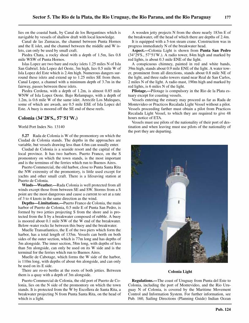
Sector 5. The Rio de la Plata, the Rio Uruguay, the Rio Parana, and the Rio Paraguay 177
Pub. 124
lies on the coastal bank, by Canal de los Bergantines which isnavigable by vessels of shallow draft with local knowledge. 5.26 Canal de las Zumacas, the channel between Punta Hornosand the E islet, and the channel between the middle and W is-lets, can only be used by small craft.5.26 Piedra Chata, a rocky shoal with a depth of 1.5m, lies 0.8mile WSW of Punta Hornos.5.26 Islas Lopez are two bare and rocky islets 1.25 miles N of IslaSan Gabriel. Isla Lopez del Oeste, 3m high, lies 0.5 mile W ofIsla Lopez del Este which is 2.4m high. Numerous dangers sur-round these islets and extend up to 1.25 miles SE from them.Canal Lopez, a channel with a minimum depth of 3.7m in thefairway, passes between these islets.5.26 Piedra Cerdena, with a depth of 1.2m, is almost 0.85 mileWNW of Isla Lopez Oeste. Bajo Relampago, with a depth of1.2m, is 0.6 mile W of the same islet. Arrecife Los Muleques,some of which are awash, are 0.5 mile ESE of Isla Lopez delEste. A buoy is moored off the SE end of these reefs.
Colonia (34°28'S., 57°51'W.)
World Port Index No. 13140
5.27 Rada de Colonia is W of the promontory on which theCiudad de Colonia stands. The depths in the approaches arevariable, but vessels drawing less than 4.6m can usually enter.5.27 Ciudad de Colonia is a seaside resort and the capital of thelocal province. It has two harbors. Puerto Franco, on the Spromontory on which the town stands, is the most importantand is the terminus of the ferries which run to Buenos Aires. 5.27 Puerto Commercial, the old harbor, close to Punta Santa Ritathe NW extremity of the promontory, is little used except foryachts and other small craft. There is a lifesaving station atPuerto de Colonia.5.27 Winds—Weather.—Rada Colonia is well protected from allwinds except those from between SE and SW. Storms from a Spoint are the most dangerous and cause a current to set at a rateof 3 to 4 knots in the same direction as the wind.5.27 Depths—Limitations.—Puerto Franco de Colonia, the mainharbor of Puerto de Colonia, 0.5 mile E of Punta San Pedro, isformed by two jetties projecting S from the shore and is pro-tected from the S by a breakwater composed of rubble. A buoyis moored about 0.1 mile NW of the W end of the breakwater.Below-water rocks lie between this buoy and the breakwater.5.27 Muelle Transatlantico, the E of the two piers which form theharbor, has a total length of 135m. Vessels can berth on bothsides of the outer section, which is 77m long and has depths of5m alongside. The inner section, 58m long, with depths of lessthan 5m alongside, can only be used on its W side and is theterminal for the ferries which run to Buenos Aires.5.27 Muelle de Cabotage, which forms the W side of the harbor,is 110m long, with depths of about 4m alongside, and can onlybe used on its E side.5.27 There are ro-ro berths at the roots of both jetties. Betweenthem is a quay with a depth of 3m alongside.
5.27 Puerto Commercial de Colonia, the old port of Puerto de Co-lonia, lies on the N side of the promontory on which the townstands. It is protected from the W by Escollera de Santa Rita, abreakwater projecting N from Punta Santa Rita, on the head ofwhich is a light.
5.27 A wooden jetty projects N from the shore nearly 183m E ofthe breakwater, off the head of which there are depths of 2.4m. 5.27 It is equipped with a 5-ton steam crane. Construction was inprogress immediately N of the breakwater head.5.27 Aspect.—Colonia Light is shown from Punta San Pedro(34°29'S., 57°51'W.). A radio tower, 84m high and marked byred lights, is about 0.3 mile ENE of the light.5.27 A conspicuous chimney, painted in red and white bands,39m high, stands about 0.9 mile ENE of the light. A water tow-er, prominent from all directions, stands about 0.8 mile NE ofthe light, and three radio towers stand near Real de San Carlos,2 miles N of the light. A radio mast, 190m high and marked byred lights, is 6 miles N of the light.5.27 Pilotage.—Pilotage is compulsory in the Rio de la Plata es-tuary except for coasting vessels.5.27 Vessels entering the estuary may proceed as far as Rada deMontevideo or Practicos Recalada Light Vessel without a pilot.Vessels proceeding farther must obtain a pilot from PracticosRecalada Light Vessel, to which they are required to give 48hours notice of ETA. 5.27 Vessels must use pilots of the nationality of their port of des-tination and when leaving must use pilots of the nationality ofthe port they are departing.
Regulations.—The coast of Uruguay from Punta del Este toColonia, including the port of Montevideo, and the Rio Uru-guay N of Colonia, is covered by the Maritime MovementControl and Information System. For further information, seePub. 160, Sailing Directions (Planning Guide) Indian Ocean
5.27Colonia Light

178 Sector 5. The Rio de la Plata, the Rio Uruguay, the Rio Parana, and the Rio Paraguay
Pub. 124
and South Atlantic Ocean.Contact Information.—Colonia port can be contacted, as
follows:
5.27 Anchorage.—The best anchorage in Rada de Colonia isabout 0.5 mile WNW of Punta San Pedro (34°29'S.,57°51'W.), in a depth of 7.3m, stiff mud, with holding ground. 5.27 It is on the alignments of Farallon Light Tower, with the Sextremity of Isla San Gabriel bearing about 250°, and the Wextremity of Isla Lopez del Este in line with the E extremity ofIsla Hornos del Medio, bearing about 319°. 5.27 If necessary, ships should moor with open hawse SW. Ves-sels of shallow draft can anchor nearer Ciudad de Colonia. 5.27 Coasting vessels often anchor NW of Isla San Gabriel in badweather.5.27 Fondeadero de Lopez is about 0.2 mile N of Isla Lopez delEste. It affords good shelter to small vessels during strong Swinds, in depths of about 5.5m, mud.5.27 Fondeadero de las Islas de Hornos affords good shelterduring winds from between SE and SW. 5.27 Winds from a W direction are the strongest at this anchorage,but do not raise such a heavy sea as those from the SE and aretherefore not so dangerous. 5.27 Vessels can anchor about 0.3 mile N of Isla Hornos del Me-dio and Isla Hornos del Oeste, in depths of from 3.4 to 5.5m,mud.5.27 Directions.—When approaching Puerto de Colonia fromSW, follow the dredged channel through Barra del Farallon anddo not leave it until Colonia Light Tower bears 068°. 5.27 Then alter course to maintain this bearing which leads overthe bank joining Isla Farallon to Banco Ortiz in a least depth of4m, and passes 0.25 mile S of the reef extending from this isletand about 0.1 mile N of a stranded wreck marked by a lightedbuoy. 5.27 When clear of this bank steer towards Isla San Gabriel, thenalter course to the E to pass between Lighted Buoy No. 1 andLighted Buoy No. 2, and approach the port through Canal SanGabriel.5.27 Give Punta San Pedro (34°29'S., 57°51'W.) a wide berth,particularly during the S tidal current, which sets towards thepoint at rates of from 1 to 2.5 knots.5.27 If approaching Colonia from the E by way of Paso Norte,having passed Roca Barriles, follow the land which can beclosed to within 0.5 mile to Rada de Colonia, passing S of thebreakwater at Puerto Franco de Colonia. Punta San Pedroshould be rounded at a distance of at least 0.25 mile, bearing inmind that the tidal streams are stated to set onto this point.5.27 To proceed from Colonia by the channels to the N, steer topass midway between Islas Lopez. When about 0.4 mile NE ofIsla Lopez del Oeste, shape course for the W extremity of IslaHornos del Oeste, passing at least 183m SW of Piedra Chata.
5.27 Then alter course so as to enter the S end of Barra de San Pe-dro. The least depth on this route is 2.7m near Piedra Chata.5.27 Caution.—Submarine cables, indicated on the chart, extendS and E from Punta San Pedro.
Cabo San Antonio to Buenos Aires
5.28 The S shore of the Rio de la Plata is low and uniform,being the seaward edge of the Pampas of Provincia de BuenosAires immense and monotonous plains which extend to the Se-irras Centrales, 420 miles W. Owing to the lack of landmarks,and also to the banks by which this shore is fringed, navigationnear it is difficult. 5.28 Banco Rouen lies with its shallowest part in the vicinity ofposition 35°45'S, 56°01'W, and 39 miles NE of Cabo San An-tonio, the SW entrance point of the Rio de la Plata. This shoalhas a least depth of 7.6m near its NW end. It is composedmainly of coarse sand, but there are some rocks on its shallow-est part.5.28 Off-lying shoals, with depths of 17.8 and 40m, are 68 and105 miles ESE, respectively, of Cabo Antonio.5.28 Cabo San Antonio (36°20'S., 56°45'W.) is the N and lowerend of Medanos del Chato, a chain of sand hills visible up toabout 10 miles offshore which back the coast to the S. 5.28 The part of the chain near the cape is known as Fronton delCabo. 5.28 The NW extremity of the cape is Punta Rasa (36°18'S.,56°47'W.), a low and sandy tongue of land which is subject toinundation as far as the walled area surrounding the light struc-ture and adjacent buildings, which with a neighboring planta-tion of trees are very prominent from seaward. A beacon hasbeen established at the edge of Punta Rasa.5.28 There is an anchorage for small vessels in this area. The out-er berth is 0.6 mile N of Punta Rasa, chalky bottom, in 4.5m,and the inner berth is 0.4 mile W of the point, in 2m, soft mud.5.28 Several charted banks, on which the sea breaks and withdepths of less than 1.8m, are N of Punta Rasa. 5.28 Vessels should approach San Antonio Light on a course of201° until it is distant 2 miles; a course of 250° then leads tothe outer anchorage.5.28 Tidal currents off Cabo San Antonio are affected by thewind. In calm weather the tides are regular, but during freshwinds from between E and S, the water level rises 1m or moreabove mean HW springs. During winds from W and NE thetide does not rise to its usual level.5.28 In the outer anchorage of Fondeadero San Clemente, thegeneral directions of the flood and ebb tidal currents are NWand SE, respectively. Both normally attain a rate of 1.5 knots,but may reach 4 knots during gales.5.28 Currents off Cabo San Antonio depend greatly on the wind,running N or S at rates of 1 to 3 knots. Rates of 5 or 6 knotshave been reported being caused by abnormal floods in the riv-ers.5.28 Bahia Samborombon is entered between Punta Rasa andPunta Piedras, 54 miles NNW.
5.29 Bahia San Clemente (36°18'S., 56°47'W.) is formedby the W side of Cabo San Antonio. Arroyo San Clementeflows into the head of this small bay 1.75 miles S of Punta Ra-sa. The entrance to the river is used quite often as a fishing har-
Colonia—Contact Information
Port
VHF VHF channels 11, 13, and 16
Telephone 598-4-522-2022
Facsimile 598-4-522-2037

Sector 5. The Rio de la Plata, the Rio Uruguay, the Rio Parana, and the Rio Paraguay 179
Pub. 124
bor.5.29 From the mouth of Arroyo San Clemente to the mouth of theRio de Ajo, 6 miles W, the coast increases in height gradually.The bar of the Rio de Ajo is about 2 miles in extent and almostdries, but there are depths of more than 3.7m within it. The Riode Ajo is reported to be marked by a light off its entrance.5.29 Pueblo General Lavalle stands on the E bank of the river 4.5miles SSW of its mouth.5.29 Between the mouth of the Rio de Ajo and the entrance to Ca-nal 1, 10 miles WNW, the coast is devoid of vegetation butsome distance inland there are ranches with clumps of treeswhich appear as islands when seen from 8 or 9 miles offshore.5.29 Between the entrance to Canal 1 and that of Canal 9, about12.5 miles NW, the shore is low and devoid of vegetation, butthere are some fishermen's huts on it.5.29 From the entrance to Canal 9, the shore of the bay trendsNNW for 11 miles to the entrance to Canal 15. 5.29 The clumps of trees at Estancias Las Viboras, Santa Maura,and La Portena, 8 miles SW and 9 and 11 miles NW, respec-tively, of the former entrance are good landmarks.5.29 From the entrance to Canal 15 to the mouth of the Rio Sala-do (35°45'S., 57°21'W.), 13.5 miles W, the coast rises gradual-ly, with several prominent clumps of trees.5.29 A group of sheds and buildings, forming a good landmark,are on the S bank of the Rio Salado, the entrance of which ismarked by a light.5.29 A dangerous wreck is reported to lie 17 miles SSE of the RioSalado.5.29 The Rio Samborombon, with a drying bar at its mouth, canbe identified by a white house on the S bank and a group ofwillow trees on the N banks.5.29 Clumps of trees are 3 miles NW and 6 miles N, respectively,of the mouth of the Rio Samborombon. They are both goodlandmarks, the latter being the most prominent mark in the bay. 5.29 Monte San Jeronimo, 7 miles SW of Punta Piedras(35°27'S., 57°08'W.), can be seen at a distance of 7 or 8 miles. 5.29 A windmill and a tank form a good mark. Towards PuntaPiedras, the coast increases in height.5.29 Tides—Currents.—Almost anywhere within about 4 milesof the coast the tidal current follow the general direction of theshore of Bahia Samborombon at rates of 0.25 to 1.5 knots. 5.29 Winds between W and N increase the duration of the S cur-rent and reduce the height of the tide. Winds between SE andSW increase the duration of the N current and increase theheight of the tide. The configuration of the shore and the banksoff it cause variations in the rate and direction of the tidal cur-rent, even in places quite close to each other.5.29 Anchorage.—The best anchorage in Bahia Samborombon isabout 5 miles offshore between the entrances to Canal 9 andthe Rio Salado, in a depth of 5.5m, firm clay and sand, verygood holding ground. 5.29 The swell here is not dangerous even during SE winds, but instorms from this direction there is a better berth about 8 milesoffshore E of the entrance to Canal 9 in a depth of 6m.5.29 Small craft can anchor close inshore anywhere between Ca-bo San Antonio and Monte San Jeronimo, as the swell is al-most spent here even during E winds.5.29 The bottom is mud nearly everywhere in the bay; it is softerclose inshore than farther seaward, and is almost liquid in someplaces.
5.29 In a few areas, the bottom is composed of sand or of sandwith shells and mud; off Monte San Jeronimo, there is rock indepths of less 3.6m. 5.29 A dangerous wreck reported to lie about 14 miles NE of theentrance to Canal 9.
5.30 Punta Piedras (35°26'S., 57°07'W.) is low and inde-terminate. It is composed of tufa, a species of compact and fri-able sandstone, looking like hardened clay. This material,locally known as “tosca,” is found in various places on thecoastal bank between this point and Puerto de Buenos Aires,80 miles NW. A light is shown 0.7 mile W of the point.5.30 Banco Piedras, with depths of less than 5.5m, extends 20miles ENE from Punta Piedras. It is composed of tufa, gravel,and coarse sand.5.30 Punta Indio (35°16'S., 57°14'W.), also low and indetermi-nate, lies 13 miles NNW of Punta Piedras. It can be identifiedby Monte Casares, a large clump of trees 1.5 mile S. 5.30 This clump is visible at a distance of about 15 miles, atwhich distance it resembles an island. 5.30 Close NW of Monte Casares is a smaller group of trees, inwhich stand the buildings of Estancia Santa Rita. A whitehouse with a red roof can be identified easily at 15 miles. A na-val air station is situated inland from the point.5.30 From Punta Indio to Punta Atalaya, 20 miles NW, the coastis at first a uniform height and covered with scrub, but near thetown of Magdalena, 3.5 miles S of the latter point, the groundrises slightly. 5.30 The mouth of Arroyo Juan Blanco, which affords shelter tocoastal craft, lies 12.5 miles NW of Punta Indio. Monte de laPrimevera, a dense clump of trees about 1 mile in extent, lies 2miles W of the mouth of Arroyo Juan Blanco. It surrounds aranch of the same name, with a red tower at its E end, which isa good landmark.
5.31 Magdalena (35°05'S., 57°31'W.) is a town which canbe seen above the scattered trees in its vicinity. The two towersof the church are visible at a great distance, but are obscured bythe trees on certain bearings.5.31 Punta Atalaya (35°02'S., 57°32'W.), marked by a light, islow and covered by trees. A red brick building, with a promi-nent chimney visible at a distance of 10 miles, is situated nearthe point.5.31 Arroyo Atalaya, 0.5 mile W of the point, can be entered bysmall craft drawing up to 1.5m.5.31 From Punta Atalya to Punta Blanca, steep and covered withtrees, situated 8.5 miles WNW, the coast is fringed by a bank ofvery hard tufa out to a depth of 3.7m. A sandy shoal, with adepth of 1.8m, lies on the coastal bank 2.5 miles N of the latterpoint.5.31 A prominent factory stands on the coast 8.75 miles WNW ofPunta Blanca. The entrance to Puerto La Plata lies 3.25 milesfarther WNW.5.31 Caution.—Visual estimation of the distance of a vessel offthis coast may be considerably in error, due to the effects ormirage and abnormal refraction, which cause objects near thehorizon to have a false elevation.5.31 Submarine cables, which are charted, are laid from Punta At-alaya to the N shore of the Rio de la Plata, about 1 mile W ofBahia de Montevideo.

180 Sector 5. The Rio de la Plata, the Rio Uruguay, the Rio Parana, and the Rio Paraguay
Pub. 124
5.31 Other submarine cables, also indicated on the chart, are laidfrom a position on the coast about 4 miles SE of the mouth ofCanal Santiago (34°50'S., 57°53'W.), in an E direction paral-lel to the coast.
Off-lying Banks
5.32 Banco Ortiz, which covers a large area with depths ofless than 5.5m, extends 50 miles SE from the N shore of theRio de la Plata between Punta Pavon (34°32'S., 57°03'W.) andPunta San Pedro, 40 miles WNW. 5.32 The S extremity is joined to Banco Piedras forming the barof the Rio de la Plata, over which passes the main approach tothe ports of La Plata and Buenos Aires. 5.32 El Codillo (35°08'S., 56°59'W.), with a least depth of 4.9m,lies at the SE end of Banco Ortiz, about 20 miles N of PuntaPiedras. It is composed of sand and mud, with patches of hardsand in places.5.32 Canal General, which comprises Canal Punta Indio and Ca-nal Intermedio and is described in paragraph 5.33, is dredgedthrough this bar.5.32 A chain of shoals, with depths of less than 3m, lies along theSW edge of Banco Ortiz; a similar shoal of considerable extentlies 10 miles WSW of Punta Pavon. Banco de los Pescadoresforms the NW extremity of the bank.5.32 Quebrada del Banco Ortiz is a channel across the S end ofBanco Ortiz, through which a depth of 4.5m can be carried. 5.32 The E and W ends of the channel are marked, as are a wreckand obstruction. This channel is used by the ferries which runbetween Buenos Aires and Montevideo.5.32 Banco Magdalena, with depths of less than 3m, lies 7 milesNE of Punta Atalaya and is joined to the coastal bank in thatvicinity. It is marked on its SW side by a lighted buoy.5.32 Canal de la Magdalena, a channel used by coasting vessels,passes SW of Banco de la Magdalena. The tidal streams in itare somewhat stronger than in the main channel and can beused by vessels with a draft of less than 4.9m.5.32 Banco Chico, with depths of less than 5.5m, lies N of BancoMagdalena and extends NW from it. It has a least depth of2.2m near its middle. Two wrecks, with masts showing, lie onthe bank.
Canal General
5.33 Canal General is the channel forming the main ap-proach to the ports of La Plata and Buenos Aires. 5.33 The first section of the channel leads from Km 239.1 LightedBuoy, 2 miles NW of Practicos Recalada Light Vessel(35°06'S., 55°59'W.), then SW for about 14 miles to Km 213,then W for about 36 miles to a bend called Vuelta El Codillo,and then NW for about 12 miles; it is called Canal Punta Indio.Practicos Recalada Light Vessel is a manned light ship and pi-lot station. The vessel is a red-hulled re-purposed oil tanker. 5.33 At this point, in position 35°01'S, 57°11'W, the second sec-tion of the channel, called Canal Intermedio, begins and con-tinues to Km 87 Lighted Buoy (34°49'S., 57°27'W.), which lies15 miles NNE of Punta Atalaya and abreast the middle of Ban-co Chico. 5.33 Beyond the point, the channel merges into Paso Banco Chi-co, a natural channel passing N of the NW end of Banco Chico
and then into the area of comparatively deep water which liesoff the entrances to the dredged channels leading to the ports ofLa Plata and Buenos Aires.5.33 Canal General is only maintained by continual dredging andthe depths in it are considerably affected by meteorologicalconditions; no depth is therefore guaranteed in the channel, butthe responsible authority endeavors to maintain a minimumdepth of 8.2m at normal MLLW. 5.33 In 2010, the depths in Canal Punta Indio were maintained toapproximately 10.4m. The latest information regarding depthin the channel is published fortnightly in Argentine Notices toMariners and is also broadcast from Argentine radio stations. 5.33 Pilotage is compulsory, as discussed previously in paragraph5.1.5.33 Canal General is marked in accordance with the Argentinesystem by lighted buoys. For the first 25 miles from PracticosRecalada Light Vessel, they are moored in pairs, alternatelywith single lighted buoys moored on the S side of the channel,spaced from 1 to 2.5 miles apart; then for the remainder of Ca-nal Indio, they are placed in pairs only. 5.33 The lighted buoys are numbered by their distance in kilome-ters from Buenos Aires, starting at Km 239.1.5.33 Canal Intermedio and Paso Banco Chico are marked by sin-gle lighted buoys, the first three of which are numbered 31, 32,and 33; thereafter, they are marked with their distance from theentrance to Darsena Norte at Buenos Aires in kilometers, start-ing at Km 99 and ending at Km 57, which shows a racon.There is a pair of lighted buoys at Km 60.5.33 There are numerous uncharted lighted buoys, painted white,in the vicinity of Canal General which are used for dredgingpurposes.5.33 Tides—Currents.—Some of the lighted buoys marking Ca-nal General are fitted with rudders which cause them to swingto the tidal current and have white arrows painted on their sideswhich indicate the direction in which it is going. 5.33 They are also fitted with auxiliary lights that reported ontheir sides. When facing the buoy from its downstream side, ared light is shown on the left side of the buoy and a white lighton the right side. These lights each show over a sector of 60°
5.33Practicos Recalada Light Vessel

Sector 5. The Rio de la Plata, the Rio Uruguay, the Rio Parana, and the Rio Paraguay 181
Pub. 124
and are separated by two sectors of 120° in which these are ob-scured.5.33 There is a tide gauge close E of Lighted Buoy No. 32, 14miles ENE of Punta Atalaya. Tide gauges are also located atKm 99 and Km 180 in Canal Punta Indio.
Regulations.—The following are extracted from special reg-ulations applying to Canal Punta Indio and the “PrivilegeZone,” which covers Canal Intermedio and Paso Banco Chico,from Practicos Recalada Light Vessel to Km 57 Lighted Buoy,off Rada de la Plata.5.33 The Privilege Zone includes that part of Canal General of theRio de la Plata which extends about 0.2 mile on either side ofthe Lighted Buoy No. 31 and Lighted Buoy No. 33 and those atKm 99 to 57, all of which are to be considered to be in mid-channel, except the pair at Km 60. Vessels navigating in thiszone have the same privileges as those navigating in CanalPunta Indio.5.33 Canal Punta Indio includes that part of the main channel ofthe Rio de la Plata between Practicos Recalada Light Vesseland No. 30 pair of lighted buoys, and extending about 0.1 mileoutside each line of lighted buoys.
5.33 Vessels drawing more than 7.3m and outbound should enterthe Privilege Zone at Km 57 Lighted Buoy and, if its draft per-mits, should pass S of the line of lighted buoys marking themid-channel far as No. 30 pair of lighted buoys marking the in-ner end of Canal Punta Indio. Similar vessels inbound, havingleft No. 30 pair of lighted buoys, if their draft permits, shouldpass N of the line of lighted buoys.5.33 Vessels drawing more than 7.3m navigating in the Rio de laPlata must proceed through the whole of Canal Punta Indio andthe Privilege Zone, except in special circumstances.5.33 Vessels, with drafts of 6.4 to 7.3m, must similarly follow themain channel through Canal Punta Indio and the PrivilegeZone, according to the depth of the river.5.33 Vessels drawing 5.8m and up, but less than 6.4m must followthe main channel and the Privilege Zone, but they may only useCanal Punta Indio itself between No. 19 and No. 23 pairs oflighted buoys when the depth of the river makes it advisable.
5.33 Vessels drawing less than 5.8m, navigating in the Rio de laPlata, should proceed through the Privilege Zone. They areprohibited from passing through Canal Punta Indio.5.33 Two vessels proceeding in opposite directions in the channelshould alter course to starboard in plenty of time.5.33 Vessels proceeding in the same direction are forbidden fromovertaking unless the difference in their speeds is at least 3knots; the overtaking vessel will sound one long blast. The ves-sel to be overtaken will acknowledge this signal by soundingthe same signal if she is about to alter course to starboard, or bytwo short blasts if she is about to alter course to port. This ma-neuver will be executed when the vessel to be overtaken com-plies with the request of the other vessel. The vessel to beovertaken will reduce speed as much as possible in order tolessen the time taken in passing.5.33 Overtaking is prohibited between Lighted Buoy No. 15 andLighted Buoy No. 23.5.33 Should two vessels, proceeding in opposite directions, belikely to meet abreast the pair of Lighted Buoys No. 21(35°10'S., 57°00'W.), the outbound vessel will reduce speed inorder to allow the inbound vessel to pass these lighted buoys
first.5.33 Two vessels, proceeding in opposite directions, shall, whenat a distance of not less than 1 mile from one another, altercourse to starboard. 5.33 The vessel having the current on her starboard bow shall passclose along the line of lighted buoys on its side in order to al-low the other vessel plenty of room.5.33 Should one of the vessels not be completely under control,she should display the appropriate signal and the other vesselshould maneuver so as to facilitate her passage.5.33 Sailing vessels, whatever their draft, can only use the chan-nel by day and when in tow. If a sailing vessel navigating in thevicinity of the channel should have to cross it, whether to workto windward or for any other reason, she should do so withoutinterfering with vessels navigating in the channel.5.33 Tugs which have one or more small vessels in tow may notuse the channel.5.33 Any vessels or dredge navigating in the channel shall haveright of way over any other vessel which is outside the channelor about to enter it.5.33 Anchorage is prohibited within the channel and the PrivilegeZone. Any vessel anchored in the vicinity of Canal Punta Indioor the Privilege Zone must display, by day, a black ball 0.6m indiameter visible from all directions and in a position corre-sponding to that of a vessel’s riding light when at anchor. Thissignal is also obligatory for all vessels anchored in Rada Exte-rior del Puerto de Buenos Aires.5.33 A vessel aground may not work its engines when anothervessel is passing.5.33 With the purpose of avoiding accidents, any vessels navigat-ing in the channel or the Privilege Zone and obliged to heave-toon account of fog, squalls, etc., should immediately broadcastby radio an urgent signal giving name and position.5.33 Vessels entering the channel from seaward should pass N ofthe light vessel, and those leaving should pass S of it.5.33 In case of bad weather, a vessel embarking or disembarkinga pilot should take up the most convenient position in order toreduce the risk of transportation.5.33 Any vessel approaching a dredge working in the channelshould proceed without altering course or speed provided thatshe allows the dredge sufficient time to leave the channel. Noballast, clinkers, nor generally speaking, any article that willnot float, may be thrown overboard when in the channel. 5.33 These regulations should be strictly complied with, except inspecial circumstances, such as fog, risk of collision, fire, dam-age to machinery, sailing vessel in the channel, etc., when avessel should comply with the Regulations for Preventing Col-lisions at sea.5.33 Signals.—Suction dredges display flag “W” of the Interna-tional Code of Signals in a conspicuous position between theirmasts.5.33 Caution.—The pairs of lighted buoys described above markthe limits of the dredged channel in Canal General, but themariner should bear in mind that its cross section is usually V-shaped and that its maximum depth does not extend for its fulland entire width.5.33 Between No. 1 and No. 20 pairs of lighted buoys, the deepestwater lies S of the center line of the channel. Vessels with cir-culating water intakes set low in the hull, if drawing more than7m, should have regard to the possibility of their intakes be-

182 Sector 5. The Rio de la Plata, the Rio Uruguay, the Rio Parana, and the Rio Paraguay
Pub. 124
coming choked with mud.5.33 Navigation between Buoy No. 15 and Buoy No. 25 is haz-ardous because of the tendency to ground on the edge of thechannel. Years ago, a ship drawing 10m grounded in this partof the channel.5.33 It is reported that an obstruction exists near Canal Intermedioabout 0.5 mile E of the KM 93 buoy. 5.33 Numerous dangerous wrecks lie scattered along the ap-proaches and can best be seen on the chart.
Puerto de La Plata (34°50'S., 57°53'W.)
World Port Index No. 13770
5.34 La Plata comprises Puerto de la Plata, Ciudad de laPlata, a provincial capital 4 miles SW of the port, and thetowns of Berisso and Ensenada, close E and W, respectively, ofthe port. 5.34 The port consists of a roadstead, an entrance protected bymoles, narrow finger-like harbor areas formed by the Rio San-tiago and several canals, and a turning basin. 5.34 Anchoring and berthing accommodations are available fordeep-draft vessels. The port may be temporarily closed duringthe spring and fall seasons due to gale force winds.5.34 The main local industry is the preparation and export of fro-zen meat. The port is also the site of a large oil refinery, a steelmill, and the main base and training establishment of the Ar-gentine Navy.5.34 Tides—Currents.—The mean HW interval at the port is 3hours 52m. Spring tides rise 1.2m and neaps rise 1.1m.5.34 The time of HW is regular, but the height of the mean levelof HW is so affected by the winds that the vertical movementof the tide is sometimes almost negligible. Southwest windscause the level of water to rise and NW winds lower it. 5.34 In extreme cases, such winds raise or lower the level as muchas 2.4m above or below the chart datum.5.34 The mean level of the estuary is highest in December andJanuary, and lowest in June and July, with the difference beingabout 0.3m.5.34 The mean monthly tidal range is about 1m in December andJanuary, when it is greatest, and 0.7m in June and July, when itis least. 5.34 Depths—Limitations.—Regulations limit vessel length,beam, and draft to 215m, 30m, and 7.97m, respectively. 5.34 Access to the port is by a channel which leaves the main en-trance channel to Buenos Aires 30 miles NW. This channel wasreported (2014) to have depths of about 8.7m. The latest depthsin the channel are promulgated in the Boletin Fluvial publishedby the Argentine Government. 5.34 La Plata Roads extends for 3.5 miles from the moles. 5.34 The port is made up of the Rio Santiago, Grand Dock, andthe Propulsoria Berth, about 2.7 miles up the Rio Santiago,which is also known as Port Ingeniero. For more information
refer to table titled La Plata—Berth Information. 5.34 A turning basin lies at the head of the dock; however, be-cause it is only about 228m wide, large vessels are unable touse it and are turned outside the entrance channel, entering thedock stern first.5.34 Porto Ingeniero Rocca is the site of a cold-rolling steel mill.The single berth here is 154m long, but can handle vessels upto 215m long. The berth is reached through a channel dredgedto a depth of 9m through the W part of the Rio Santiago. Thepier has a depth of 9m alongside.5.34 Aspect.—Prominent objects in the vicinity of Puerto de LaPlata include the semaphore tower and mast, 38m high near theroot of the E mole protecting the approach channel to the port;a tower surrounded by a sphere painted orange and white, 62mhigh, standing 3.25 miles WSW of the semaphore tower; ahammerhead crane, 45m high, about 1.7 miles SW of thesemaphore tower; and the building of the Jockey Club on PuntaLara, 7 miles WNW of the water tower.5.34 Pilotage.—The harbor pilot takes over in Rada de La Plata,and boards about 1 mile off the end of the access channel. 5.34 Their services should be requested through the ship's agentbefore 1700 on the day before the ship's arrival.
5.34Puerto de la Plata—Gran Dock—Santia Canal
La Plata—Berth Information
Berth Length DepthMaximum Vessel
RemarksLOA Draft Beam
TecPlata Container Terminal

Sector 5. The Rio de la Plata, the Rio Uruguay, the Rio Parana, and the Rio Paraguay 183
Pub. 124
5.34 The agent is responsible for transporting the pilot to theroadstead. Pilotage is compulsory.5.34 Coming from sea or Montevideo, the Recalada or Uruguayanpilot will take the vessel to La Plata Roads where the La Plataport pilot comes aboard.5.34 Regulations.—Vessels navigating in the entrance channelhave precedence over vessels in the Rio Santiago.5.34 Vessels longer than 60m, or with a beam wider than 9m or adraft of greater than 6.1m, may not cross or overtake in theentrance channel. Vessels getting underway from Gran Dockwill not depart when another vessel is inbound.5.34 On a flood tide, the vessel's draft must not exceed the mini-mum channel depth. On an ebb tide, the vessel must have anunderkeel clearance of at least 0.5m.5.34 Vessels greater than 200m long can maneuver in daylight on-ly, with a minimum visibility of 0.8 mile and a wind speed ofless than 10 knots.5.34 Vessels over 140m long or with a draft greater than 7.3mmay use the Rio Santiago in daylight hours only. Vessels with abeam of over 11m may not pass or overtake in the RioSantiago.5.34 Except for the following, the same port regulations as thosein force at Buenos Aires apply to Puerto de La Plata:
1. Tugs are compulsory for all ocean-going vessels andfor coastal vessels exceeding 300 gt.
2. Powered vessels entering the port must employ onetug as far as the Rio Santiago (34°51'S., 57°53'W.) and twotugs, bow and stern, beyond that.
3. Movements of vessels in the port are effected by
means of two tugs, bow and stern. Vessels which can turn inGran Dock are permitted to do so, with the aid of two tugs,without having to proceed to the turning basin.
4. Towage is not compulsory for vessels shifting berthfor a short distance along a wharf.
5. Vessels of less than 300 gt are permitted to maneuverin the interior of the port with 1 tug only. Towage is not com-pulsory for such vessels proceeding to Dique de Cabotaje.
5.34 Signals.—Daytime tidal information is transmitted at 5 min-utes past each hour on VHF channel 5.5.34 At night, the following signals, each signal with a period of30 seconds, are shown from the semaphore tower at the root ofthe E mole:
1. One long white flash denotes that the tide is rising.2. Two short white flashes denote that the tide is falling.3. One long red flash is shown for each meter above ze-
ro; each 10cm is indicated by one short red flash.4. One long green flash is shown for each meter below
zero; each 10cm is indicated by one short green flash.5. One short red flash followed by one short green flash
indicates zero.5.34 The following traffic signals are displayed from the signalstation:
1. A black square flag at the W yardarm—A vessel hasbeen sighted.
2. A yellow flag at the E yardarm, at the dip—A vesselis entering; a similar flag at the W yardarm, at the dip, de-notes that a vessel is leaving.
3. A red flag at the E yardarm—A vessel requires assis-
Container Berth — 10.9m 340m — — Containers and reefer.
Puerto Ingeniero Rocca
Puerto Ingeniero Rocca Berth 154m 5.5m 215m — — Steel products.
Grand Dock
Berth No. 9 270m 8.5m 215m — 30.0m Breakbulk.
Copetro Petcoke Terminal
Berth No. 7— 8.5m
215m7.9m
30.0mPetcoke and bunkers.
Berth No. 8 187m 28.6m
YPF Terminal
No. 11 230m7.9m
228m 7.8m32.0m Chemicals and clean products.
No. 12 189m 183m 6.8m
No. 14 181m
8.5m
151m 8.3m 23.0m Clean products, condensate, and dirty products.
No. 15 207m 228m 8.2m 40.0m Aviation fuel, clean products, crude, and dirty products.
No. 17 173m 151m 8.3m 23.0m Clean and dirty products.
No. 18 510m (continuous) 6.7m — — — Closed. Clean products, condensate,
crude, and dirty products.No. 19
La Plata—Berth Information
Berth Length DepthMaximum Vessel
RemarksLOA Draft Beam

184 Sector 5. The Rio de la Plata, the Rio Uruguay, the Rio Parana, and the Rio Paraguay
Pub. 124
tance. 4. A red flag at the W yardarm, at the dip—The channel
is blocked.5.34 The signals with regard to dredges at Puerto La Plata are thesame as those at Buenos Aires, which is discussed in paragraph5.36.5.34 Contact Information.—Puerto de La Plata can be contact-ed, as follows:
5.34 Anchorage.—Anchorage is in Rada de La Plata, an areawith depths of 5 to 10m extending up to 5 miles from the headsof the moles protecting the approach channel. 5.34 An area, indicated on the chart, in its SE part is reserved forships of the Argentine Navy. There are berths near the heads ofthe moles in depths of 8.5 to 9m, very soft mud, but the holdingis not good, especially during strong SW winds.5.34 A Lightening Zone and Waiting Area for embarking and dis-embarking pilots have been established N of the port entranceand are best shown on the chart.5.34 Directions.—A vessel approaching from the E, havingcleared Banco Chico, should steer about 270° until the moleheads bear about 210°, and should then steer for them. Itshould be borne in mind that the tidal streams always set acrossthe entrance, sometimes attaining a rate of 3.5 knots.5.34 Caution.—Numerous wrecks and foul ground areas, bestshown on the chart, are in the vicinity of the Lightening Zone.
Puerto de la Plata to Buenos Aires
5.35 Ensenada de Barrangan is entered between the mouthof Canal Santiago and Punta Lara (34°47'S., 58°00'W.), lowand indeterminate, situated 6.5 miles WNW. The Rio Santiago,the mouth of which has been almost completely blocked byspoil dredged from the channels in Puerto de La Plata, flowsinto the head of the bay. It is joined by Arroyo Zanjon before itreaches the bay. 5.35 The W part of the shore of the bay is backed by a holiday re-sort which includes the prominent building of the Jockey Club,previously mentioned in paragraph 5.34.5.35 From Punta Lara to Puerto de Buenos Aires, 20 miles WNW,the coast is low and covered with pasture and scrub; parts of itare subject to inundation. 5.35 Suburbs of Buenos Aires stand near the railway, 1 to 2 milesback from the coast.5.35 Punta Colorado, low and indeterminate, is 5.5 miles WNWof Punta Lara. Punta Quilmes, a similar point, lies 5.5 milesfarther WNW.5.35 Quilmes, an important industrial suburb which extends fromthe railway to the coast, lies close W of Punta Quilmes.5.35 The Communication Service for the Safety of Navigation(SECOSENA) is in effect for the Argentine waters of the Riode la Plata and approaches, bounded on the E by 56°W and onthe S by 36°30'S, and is mandatory for foreign vessels over24m in length.
5.35 When entering the area, vessels must report the name of ves-sel, flag, call sign, length, breadth, draft, speed, port of depar-ture, destination, navigational plan, and ETAs at points listed inthe CONTRASE system below (see paragraph 5.36), as appro-priate. 5.35 When leaving the area, vessel must report their name, flag,and call sign.
Buenos Aires (34°36'S., 58°22'W.)
World Port Index No. 13760
5.36 Buenos Aires is on the S bank of the Rio de la Plata,about 126 miles NW of Cabo San Antonio and about 168 milesW of Punta del Este. It consists of a roadstead, dredged chan-nels, an elongated artificial harbor, and extensive facilities forocean-going vessels.5.36 Ciudad de Buenos Aires, capital of the Argentine Republic,is the largest city in the S hemisphere and the seventh largest inthe world. In addition to being the political capital of the coun-try, Buenos Aires is its industrial and cultural center.5.36 The city stands on the NE edge of the Pampa, a vast plainwhich extends up to 300 miles SW, and which, in the vicinityof the city, is only 9 to 12m above sea level.
5.36 Tides—Currents.—The time of HW is regular, but theheight of the mean level of the water is so affected by the windsthat the vertical movement of the tide is sometimes almost neg-ligible. 5.36 The flood current runs for 5 hours 20 minutes, and the ebbcurrent runs for 7 hours 5 minutes, at rates of 1 to 2 knots.Winds from the SE cause the level of the water to rise andthose from NW depress it. In extreme cases, such winds raiseor lower the level as much as 2.4m above or below chart datum. 5.36 The mean level of the estuary is highest in December andJanuary, and lowest in June and July, with the difference beingabout 0.3m.5.36 The mean monthly tidal range is about 0.9m in Decemberand January, when it is greatest, and 0.8m in June and July,when it is the least.5.36 The tidal currents set across both Canal Norte and Canal Sur,meeting the former at an angle of 50° and the latter at an angleof 70°. They run strongly across the inner end of Canal Norte,but may hardly be felt farther seaward. 5.36 It should be noted that the flood current continues to flow af-ter HW, and the ebb current after LW. 5.36 The only reliable guides to the direction of the current arethe current indicating buoys.5.36 Depths—Limitations.—The access channel to the port ofBuenos Aires, which is marked by lighted AIS buoys, isentered between a pair of buoys at Km 37 in position 34°41'S,57°58'W, about 20 miles ESE of the port. 5.36 A dangerous wreck, marked close S by a lighted buoy, andan obstruction lie, respectively, on the N and S sides of thechannel about 0.6 mile WNW. These hazards reduced thenavigable width of the channel to 100m. Overtaking in this
Puerto de La Plata—Contact Information
Telephone 54-221-460-0233
Facsimile [email protected]
Port of Buenos Aires
http://www.puertobuenosaires.gov.ar

Sector 5. The Rio de la Plata, the Rio Uruguay, the Rio Parana, and the Rio Paraguay 185
Pub. 124
section of the channel is prohibited.5.36 This channel leads in a WNW direction for 13.5 miles whereat Km 12, Canal Emilio Mitre (described in paragraph 5.51)branches to the NW. At Km 8.2, the channel divides again.Canal Norte, the N fork, leads in a WNW direction for 5 milesto Puerto Nuevo, the N part of Buenos Aires. 5.36 Canal Sul, the S fork, leads in a WSW direction to the Sentrance of the port.5.36 Canal de Accesso, Canal Norte, and Canal Surare aredredged to depths of 10.0m, 10.3m, and 10.0m, respectively.These channels are highly subject to silting and depths may beless than charted. 5.36 The actual depth depends on channel condition, stage of tide,
and weather conditions. 5.36 When large passenger liners, LASH, or liquefied gas carriersare entering or leaving, it is possible that the access channelwill be closed for a period of 4 hours because of thenarrowness of the dredged channel.5.36 Vessels with a draft up to 9.7m have used the main channelsafely.5.36 The harbor consists of many basins and docks. They aredescribed from S to N, starting with the W end of Canal Sur.5.36 Darsena Propaneros lies on the S side of Canal Sur andconsists of a 356m long central pier with dolphins. It is used byliquefied gas carriers and has a depth alongside both sides of10m. Only two vessels can use this facility at the same time.
Buenos Aires—Berth Information
Berth Length Depth Maximum Vessel LOA Remarks
Terminales Rio de la Plata (TRP) - Terminals 1, 2, and 3
Basin A, South 365m
9.8m
305mGeneral cargo, project cargo, feeder vessels, containers, and cruise.Basin A, North
Basin B, South 465m Containers and cruise.
Basin B, North 430m340m
Containers, cruise, ro-ro, transhipment, general cargo, and project/heavy cargo.
Basin C, South 680m Containers.
APM Terminals Buenos Aires - Terminal 4
APMT Main Dock (Basin Dock C North) 500m
10.0m —Mainly containers but also handles machinery, steel pipes, steel plates, heavy lifts, fruits, pa-per, livestock, bulk, and project cargo. APMT Secondary Dock (Basin C
West) 175m
Terminal Buenos Aires S.A. (TERBASA)
Pier Head 4 300m 9.4m — Discharge of bulk fertilizers and ship-craned containers.
Basin D South (Berths 1 and 2) — 6.6m 250m Grain and containers.
BACTSSA - Terminal 5
Basin D West 190m 8.5m
— Containers.Basin D North 495m9.7m
Basin D Pier Head 200m
Dock Sud - Section 2
Nos. 8 - 12 710m
8m 175mPetroleum by-products, petrochemicals, general cargo, fruit, bulk cargo, grain, and general car-go.
No. 13 120m
No. 14 160m
Puerto Dock Sud
H 16m 8.4m 230m Dry bulk.
Terminal Puerto Nuevo I
Basin E North No. 1 200m — 200m Bulk liquid storage.
Terminal Puerto Nuevo II
Basin E West — 200m Under construction. Bulk liquid storage.

186 Sector 5. The Rio de la Plata, the Rio Uruguay, the Rio Parana, and the Rio Paraguay
Pub. 124
Central Puerto
Basin E Pier Head North 245m
— —
General cargo, breakbulk, and containers.
Basin E North No. 2 295m Fuel for power plants, general cargo, and con-tainers.
Basin E South 585m Multipurpose.
Basin E Pier Head South 332m Petroleum products, bulk cargo, and cruise.
Colonia Express
Colonia Express Berth 355m — — Ferries and passengers.
Comando de Transportes Navales
Naval Berth 335m — — Naval and general cargo.
Exolgan Container Terminal
No. 1 490m
10m
300m
Containers, breakbulk, and project cargo.No. 2350m 334m
No. 3
Feeder Berth 140m — Feeder vessels.
Prefectura Naval Argentina Autoridad Maritima
810 - 814 385m— — Naval and multipurpose.
815 150m
Tanker Berths—Puerto Dock Sud
South Dock C16m
8.5m
230m Petroleum products and chemicals.
South Dock D
South Dock E 18m
South Dock F 17m8.4m
South Dock G 20m
Antivari S.A.
Private Dock 240m — 235m Hydrocarbons.
YPF Terminal Dock Sud
Pier C 25m
8.5m230m
Clean and crude products.Pier D 11m
Pier F 18m
LPG Berth 32m 9.1m LPG and clean products.
Shell Terminal
Pier A (North)46m
8m 254mPetroleum products, chemicals, and crude.
Pier A (South)7m
210m
Pier B 33m 200m Petroleum products, chemicals, crude, and avia-tion fuel.
Central Costanera Power Station
Costanera Berth 119m — 230m Petroleum products.
DAPSA Argentina Oil Distillery
Buenos Aires—Berth Information
Berth Length Depth Maximum Vessel LOA Remarks
Sector 5. The Rio de la Plata, the Rio Uruguay, the Rio Parana, and the Rio Paraguay 187
Pub. 124
5.36 An overhead power cable, with a vertical clearance of 59m,crosses the dredged channel close E of Darsena Propaneros.5.36 Darsena de Inflamables lies close within the S entrance tothe port and consists of seven piers for the exclusive use oftankers. The entrance is 50m wide. There is a depth of 7.6m in-side the basin. Tankers discharge at the piers on the W side ofthe basin.5.36 Darsena del Este lies on the N side of Canal Sur and is usedfor harbor service craft. It is divided into two basins. Basin No.1, the westernmost, has depth of 7.3m at its center, but only4.9m at its entrance. Basin No. 2 has a depth of 7.3m at its cen-ter, but only 4.3m at its entrance. 5.36 Extending E from Basin No. 2 is a 260m long mole used bytankers discharging fuel for the power plant located adjacent tothis mole.5.36 South Outer Harbor lies at the W end of Canal Sur and givesaccess to Dock Sud, Puerto Riachuelo, and Darsena Sud.5.36 Dock Sud consists of two sections divided by a turning ba-sin. It is reported to be dredged to 8.2m but is subject to silting.The N section, which is 130m wide, has a quay, 1,109m longon its E side, while the W side has a 911m long quay, with adepth of only 3.6m alongside. The S section, 90m wide, has a1,000m long quay used for discharging sand located on its Wside, and 8 jetties used for discharging petroleum products lo-cated on its E side. 5.36 When loading and the vessel draft reaches 7.1m, the vesselmust shift to Porto Nuevo.5.36 Puerto Riachuelo is located on the river which extends SWfrom the South Outer Harbor. The mid-channel depth is about6.2m. There is a total of almost 4 miles of berthing space, withdepths of 5.2 to 5.8m, used mainly by coasting vessels. 5.36 A vertical lift bridge, with a vertical clearance of 20.6m inthe closed position and 42.6m in the open position, lies close tothe mouth of the river. A fixed highway bridge, with a verticalclearance of 28m, is located close W of the lift bridge.5.36 Darsena Sur extends NW from the South Outer Harbor andis used by various vessels, including passenger ferries, ro-rovessels, and tankers. 5.36 The harbor authority tries to maintain a depth of 7.3m, butthe area is subject to silting and depths of less than 4.3m havebeen reported. 5.36 The basin is 1,029m long with a minimum width of about100m.5.36 Puerto Madero extends N for about 3 miles from DarsenaSud and consists of four docks connected by locks. 5.36 Swing bridges are located across all the locks. During theweek they are opened on request from 0600 to 2000. On Satur-days, Sundays, and holidays, they can be opened by a requestthrough the vessel's agent.5.36 Puerto Nuevo is entered at its S end from Canal Norte via theNorth Outer Harbor. It consists of five basins used by ocean-going vessels and is reported to have been dredged to a depth
of 10m, but is subject to silting. A sixth basin, inaccessible toocean-going vessels and is used only by local river craft, liesNW of Puerto Nuevo and is entered from the N. Depths in thebasins are subject to variation and are published in local bulle-tins. The facilities are, as follows:
1. Jetty No. 1, which is 100m long, separates Darsena Afrom the North Outer Harbor and is used mainly by rivercraft.
2. Darsena A, which is 365m long and 140m wide, has869m of berthing space. The N side can accommodate 2 me-dium-sized vessels. The W side is reserved for use by the Ar-gentine Navy. At the passenger terminal on the SW side ofthe basin, there is room for one vessel.
3. Jetty No. 2, which is 202m long, separates Darsena Afrom Darsena B and is used by large passenger vessels.
4. Darsena B, which is 464m long on its S side and525m long on its N side, is 151m wide and has 1,165m ofberthing space. The basin can accommodate seven vessels.
5. Jetty No. 3, which separates Darsena C from DarsenaB, has a total length of 236m.
6. Darsena C, which is 495m long on its N side and585m long on its S side, is about 175m wide, with a totalberthing length of 1,284m. Grain is handled at the S side ofthe basin. The basin can accommodate seven vessels.
7. Jetty No. 4, which separates Darsena D from DarsenaC, is 295m long and can load two grain vessels simultane-ously. The jetty has a radar station (S1) on its N side about100m from the end.
8. Darsena D, which is 495m long on its N side and585m long on its S side, is 194m wide. The basin has a totalberthing length of 1,300m. Grain is reportedly handled onthe S side of the basin. Containers are handled on the N sideof the basin.
9. Jetty No. 5, which separates Darsena E from DarsenaD, is 523m long, of which 240m is for unloading coal for thepower plant located here.
10. Darsena E has the same dimensions as Darsena D andis used to handle coal and oil for the power plant.
11. Jetty No. 6, used for the unloading of coal, is 310mlong and can only accommodate one vessel.
12. Darsena F, which faces N, is very shallow and is onlyused by barges unloading sand.
5.36 Pilotage.—Pilotage is compulsory for all vessels over 1,000gt. A vessel requiring a pilot should display flag “P” of the In-ternational Code of Signals at the foremasthead until a pilot ar-rives on board. Pilots are picked up at Puerto de la Plata.
Regulations.—Any vessel may enter the port, by day or atnight, provided it complies with the regulations.5.36 Anchorage is prohibited in the channels or within about 0.1mile of their sides.5.36 During thick fog, entry and departure is prohibited withoutspecial permission from the port authorities.
Pier E 24m 8.5m 186m Crude, clean products, light fuels, heavy fuels, and basic oils.
Buenos Aires—Berth Information
Berth Length Depth Maximum Vessel LOA Remarks
188 Sector 5. The Rio de la Plata, the Rio Uruguay, the Rio Parana, and the Rio Paraguay
Pub. 124
5.36 Vessels proceeding in opposite directions meeting in chan-nels should alter course to starboard in plenty of time andshould reduce speed while passing each other.5.36 Vessels overtaking others are not allowed to pass them andmust keep at a distance of 0.1 mile from coasters and about 0.5mile from other vessels.5.36 No vessel is allowed to enter the channels unless the tidal in-formation gives a depth equal to the vessel’s draft on a risingtide, or 0.5m more than her draft on a falling tide.5.36 A vessel drawing more than 6.7m must have a tug ahead be-tween Km 8 and the entrance to the port in each channel and al-so one astern between Km 4 and the entrances.5.36 A vessel drawing less than 6.7m must have a tug ahead be-tween Km 5 and the entrances and also one astern between Km1 and the entrances, in each channel.5.36 Between Km 15 and the port, the maximum speed allowed is8 knots; within the port the maximum speed allowed is 3 knots.Speed should be reduced as much as possible when passingdredges working in the channels.5.36 Before shifting berth within the port, a vessel must obtainpermission from the port authorities; such movements will besupervised by a port official. 5.36 Power vessels may leave the port at any time of the day ornight, with previous notice having been given to port and cus-toms authorities.5.36 Vessels must discharge all explosives and inflammable mate-rials before entering the docks. Except for this purpose, work-ing cargo in the roadstead is only permitted for vessels of suchdraft that they cannot enter or leave the port fully laden.5.36 The Traffic Control and Safety System (CONTRASE) is ineffect for Buenos Aires. It is mandatory for foreign vesselsover 24m in length, as follows:
1. If anchoring outside the port, report vessel's name,flag, and call sign with the time and location.
2. Vessels should report their ETA at destination whenpassing the following Reporting Points:
a. Report along the Canal Punta Indio/Canal Interme-dio using VHF channel 12:
i. Near Practicos Recalada Light Vessel.ii. Near paired Lighted Buoys No. 1.iii. Near paired Lighted Buoys No. 5.iv. Near paired Lighted Buoys No 23.v. Near paired Lighted Buoys No. 30.vi. Near Km 57 Lighted Buoy.
b. Report along the Canal de Acceso al Puerto de Bue-nos Aires using VHF channel 9:
i. Near Km 37 Lighted Buoy.ii. Near Km 12 Lighted Buoy.
c. Report along the Canal Emilio Mitre using VHFchannel 72:
i. Near Km 12 Lighted Buoy.ii. Near Km 18.5 Lighted Buoy.iii. Near Km 40.5 Lighted Buoy.iv. Near Km 56.1 Lighted Buoy.
d. Report along the Canal Costanero using VHF chan-nel 72.
e. Report at the approaches to the Rio Parana Guazuand the Rio Uruguay (Barra del Farallon to Canal Princi-pal) using VHF channel 14 or 81:
i. Near Km 38 Lighted Buoy.
ii. At the N end of Barra de San Pedro.iii. Near Punta Martin Chico.iv. Near Km 121.5 Lighted Buoy.
f. Upon entering Puerto de la Plata, report to LaPlata Prefectura Naval (L5F) on VHF channel 9. 3. In Rada Plata pilot boarding area, report the time of
arrival or departure from it on VHF channel 70. Departuretime is followed by reporting of ETAs at:
a. Km 37 Lighted Buoy (vessel bound for Canal deAcceso at Puerto de Buenos Aires).
b. Km 38 Lighted Buoy (vessel bound for Barra delFarallon).
c. Km 57 Lighted Buoy (vessel bound for Paso BancoChico).
d. At the entrance to Puerto de la Plata.4. When entering port, report the vessel’s name, call
sign, and ETA at berthing place.5. Before shifting anchorage, changing berths, or mov-
ing within the port, obtain permission, stating vessel’s name,flag, call sign, and destination. Permission normally remainsvalid for 15 minutes.
6. Before leaving port, obtain permission, stating ves-sel's name, flag, call sign, length, breadth, draft, speed, desti-nation, course, type of cargo, and whether there is a doctoron board. Permission normally remains valid for 15 minutes.
5.36 Tidal prediction broadcasts are made daily for the Rio de laPlata Exterior at 1000, 1600, and 2200. Tidal queries for otherareas are also made available by contacting Hidrografia Naval.5.36 Signals.—Tidal information is transmitted at 5 minutes pasteach hour on VHF channel 15.5.36 A vessel wishing to pass a dredge must stop and sound onelong blast and three short blasts on the siren or whistle. 5.36 Permission to pass will be given by a similar signal from thedredge. “Passage obstructed” will be indicated by the dredgesounding two long blasts and three short blasts, and by display-ing three balls or exhibiting three vertical red lights. In thiscase, the vessel must anchor.5.36 Dredges will indicate the side that a vessel should pass bydisplaying a red and white checkered metal flag, or by exhibit-ing three lights, red, green, and white, disposed vertically. Hop-per barges exhibit two white lights amidships, and one red lightat each end.5.36 Traffic through the basins in Puerto Madero is governed bythe following signals shown from each end of the channel:
1. A red disc by day or a red light by night indicates thatentrance on that side is prohibited to all vessels.
2. A white disc by day or a green light by night indicatesthat passage on that side is allowed for ocean-going vesselsonly.
3. A disc on its side indicates only tugs or small craftmay pass.
5.36 Contact Information.—The port can be contact as follows:
Buenos Aires—Contact Information
Port
Telephone 54-11-4342-1727
Facsimile 54-11-4342-6836

Sector 5. The Rio de la Plata, the Rio Uruguay, the Rio Parana, and the Rio Paraguay 189
Pub. 124
5.36 Anchorage.—Rada Exterior del Puerto de Buenos Aires liesbetween the lighted buoys at Km 25 and 37, and clear of thedredged channel. It has depths of 5.8 to 7.9m. The holdingground, which consists of soft mud, is not good, and vesselsmay drag their anchors in strong winds. 5.36 Winds from the S produce much swell. When good weatheris expected, a vessel with good ground tackle may anchor withsafety in a depth of 0.6m greater than its draft.5.36 Caution.—Dangerous obstructions lie in and around the ap-proaches to Puerto Nuevo and Buenos Aires and can best beseen on the chart. 5.36 High speed ferries operate between Buenos Aires, Montevi-deo, and Piriapolis through Canal Sur, Canal Acceso, Canal In-termedio, and the Montevideo Access Channel.
The Rio Uruguay and the Rio Parana
5.37 The Rio Uruguay is approached W of Puerto de Colo-nia and Isla de Hornos and E of Playa Honda. This route maybe used as an approach to the Rio Parana, but this river has adelta and can be approached through several mouths which areW of Playa Honda, the deepest and most direct of which is Ca-nal Emilio Mitre, which leads across the W side of Playa Hon-da.5.37 Pilotage.—Pilotage is compulsory for all vessels enteringthe Rio de la Plata estuary except for coasting vessels. Vesselsmay proceed as far as Rada de Montevideo or Practicos Reca-lada without a pilot, but at this point must obtain a pilot to pro-ceed farther. 5.37 A 48-hour ETA should be given to the pilot station. This pi-lot conducts the vessel to the roadstead off Puerto La Plata,where the pilot is relieved if the vessel is bound for Buenos Ai-res or up the rivers.5.37 Vessels must use pilots of the nationality of their port of des-tination and, when leaving, must use pilots of the nationality ofthe port they are leaving.5.37 Caution.—As in other parts of the Rio de la Plata, the heightof the water level depends largely on the force and direction ofthe wind. Winds from the SE or S raise the level as much as1.5m or 1.8m, and winds from the opposite directions lower it.A vessel at anchor will lie heading upriver.
5.38 From Punta Hornos to Punta Martin Chico(34°10'S., 58°12'W.), about 22 miles NW, the coast is slightlyelevated, rising to hills 30 to 36m high. 5.38 The most distinctive features are the mouth of Arroyo SanPedro, 6 miles NNW of Punta Hornos; the mouth of the RioSan Juan, 4.5 miles farther NW; Torre Anchorena, 69m high,standing on the spit which forms the S side of the mouth of theRio San Juan; Punta Francesca, at which there is a pier 3 milesNW of the mouth of the Rio San Juan; Punta Pereyra, 1.5 milesfarther NW; and Cerros de San Juan, three peaks of the samehill, 107 to 137m high, which rise 7 miles ENE of Punta Perey-ra and are the highest land around forming a useful mark forvessels navigating in this part of the estuary.5.38 Puerto de Conchillas (34°12'S., 58°04'W.) has a pier with
3m alongside.A series of channels, named from the S entrance at Km 39
Buoy (34°39'S., 57°58'W.) are Barra Farallon, Paso del Faral-lon, and Barra de San Pedro, leading to Km 70 Buoy(34°23'S., 58°00'W.). 5.38 At this point the channel divides into two. The E and mainchannel passes through Pozos de San Juan, Canal Nuevo, andE and N of Isla Martin Garcia in Canal Infierno, to Buoy Km109.5 (34°08'S., 58°19'W.), where it rejoins Canal Martin Gar-cia. The minimum depths in this main channel is promulgatedin the Argentine Notices to Mariners; in recent years it hasranged between 6.7 to 7.5m.5.38 Canal Martin Garcia, the channel that branched off to the W,is used only by shallow draft vessels.5.38 Piedra Diamante Light (34°25'S., 57°58'W.) has a tidegauge. 5.38 Regulations.—Vessels whose draft exceeds 7.9m are pro-hibited from entering Canales a Martin Garcia between Km 39and Km 93. 5.38 A vessel drawing more than 7.3m is similarly prohibited, un-less capable of exceeding a speed of 10 knots.5.38 Vessels drawing more than 4.6m are prohibited from passingeach other in Bara del Farallon between Km 47 and Km 51.5,in Barra de San Pedro between Km 53.5 and Km 71.3, and inCanal Nuevo between Km 84 and 86 as well as between Km 92and Km 93.5. 5.38 In order to avoid passing, the vessel proceeding upstreamshould reduce speed in plenty of time, or should anchor untilthe other vessel has passed.5.38 Playa Honda is an extensive bank formed by the sand andmud brought down by the Rio Uruguay and the Rio Parana anddeposited over the whole of the NW part of the Rio de la Plata.Its S edge is bounded roughly by the parallel of Buenos Aires,where it has depths of 3.6 to 6.4m, and it shoals gradually up tothe delta of the Rio Parana.5.38 Ruta Playa Honda, a more direct route from Puerto de Bue-nos Aires to the Rio Parana and the Rio Uruguay for vesselsdrawing less than 2.7m, leads across Playa Honda, with a leastdepth that has varied from 2.6 to 3.4m in recent years, but is nolonger buoyed.5.38 Anchorage.—An emergency anchorage for Canal del Infier-no , with a depth of about 10m, is located NE of the dredgedchannel, SSW of Punta Martín Chico.
5.39 Isla Martin Garcia (34°11'S., 58°15'W.) lies 2 milesWSW of Punta Martin Chico. It is a mass of granite in the formof a flattened cone, 27m high. Most of the island is wooded.5.39 A wharf extends 60m from the SW side of the island. It has adepth of 1.4m alongside and exhibits a light.5.39 Daytime tidal information is transmitted at 5 minutes pasteach hour on VHF channel 15.5.39 Night tidal signals, shown from a mast at the signal stationsituated 0.3 mile NE of the wharf, are made in accordance withthe system as shown below. The system is automatic and is re-peated every 30 seconds:
1. River rising—one long (2.5 second) white flash.2. River falling—two short (0.6 second) white flashes.3. River stationary—no white signals.
5.39 The signals given for river levels are, as follows:1. Above zero—one long red flash for every 1m, fol-
E-mail [email protected]
Buenos Aires—Contact Information

190 Sector 5. The Rio de la Plata, the Rio Uruguay, the Rio Parana, and the Rio Paraguay
Pub. 124
lowed by one short red flash for every 0.1m.2. Below zero—one long green flash for every 1m, fol-
lowed by one short green flash for every 0.1m.3. At zero—one short green flash, followed by one short
red flash.5.39 Canal Santo Domingo, with a least depth of 3m, branches Nfrom Canal del Inferno off Punta Martin Chico and leads toPuerto de Carmelo. The W side of the channel is marked.5.39 The port can also be reached by a channel with a least depthof 0.8m leading E from Canal Principal and passing N of IslaSola.5.39 Puerto de Carmelo has depths of about 3m alongside itscommercial quays and is a yachting center.5.39 Canal Principal leads from the junction of Canal del Este andCanal Martin Garcia at Km 109.5 to the mouth of the Rio Uru-guay at Punta Gorda, 14 miles NW. 5.39 It has a general width of more than 0.5 mile and a least depthof 10.3m. It is marked by lighted buoys.5.39 The mouths of the Rio Parana Guazu and the Rio Sauce(both described in paragraph 5.54) are on the W side of CanalPrincipal, 5.5 and 1.5 miles, respectively, S of Punta Gorda(33°55'S., 58°25'W.).
5.40 From the limit of Puerto Nuevo, the NW part of Puer-to de Buenos Aires, to the mouth of the Rio Lujan, 10 milesNW, the coast is low with beaches of fine dark sand and out-crops of tufa, one of which, 19m high and known as Las Bar-rancas, provides the only outstanding feature of the coast. 5.40 From seaward, it presents an unbroken line of buildingsformed by the suburbs of Buenos Aires, which include Vincen-te Lopez, Olivos, Anchorena, Las Barrancas, San Isidro, PuntaChica, and San Fernando, the last named, stands on the rightbank of the Rio Lujan at its mouth. 5.40 Buenos Aires Airport is on the coast immediately NW ofPuerto Nuevo.5.40 From the mouth of the Rio Lujan to the mouth of the Rio Pa-rana Brava, located 2 miles NW of Punta Gorda and at the headof the estuary of the Rio de la Plata, the coast is formed by thedelta of the Rio Parana, which has six principal mouths, and isdescribed later in paragraph 5.50.5.40 The coast between the river mouths is low and fringed withscrub and reeds, but it is well wooded inland.5.40 Canal Costanero (34°33'S., 58°25'W.), with depths of 2.4to 3m depending on state of dredging, leads from the NW endof Puerto Neuvo to the mouth of the Rio Lujan. It is markedand is about 0.5 mile offshore. It serves small vessels in thesand and gravel trade and some yachts.5.40 Caution.—It was reported that dredged depths were not be-ing maintained and that depths of less than 2m existed in someareas. A partially submerged wreck lies in approximate posi-tion 34°27'S, 58°30'W.
The Rio Uruguay
5.41 Regulations.—The coast of Uruguay from Punta delEste to Colonia, including the port of Montevideo, and the RioUruguay N of Colonia, is covered by the Maritime MovementControl and Information System. For further information, seePub. 160, Sailing Directions (Planning Guide) Indian Oceanand South Atlantic Ocean.
The Rio Uruguay can be divided into three parts by the con-ditions of navigation, the formation of its banks, and by itsdepths and currents, as follows:
1. The Rio Uruguay Inferior extends from Puerto NuevaPalmira, situated 2.5 miles N of Punta Gorda, to Puerto Con-cepcion del Uruguay, 99 miles upriver. It has a minimumdepth in the fairway of 5.2m below local datum. It is consid-ered to be accessible to ocean-going vessels and is tidal.
2. The Rio Uruguay Medio lies between Concepcion delUruguay and Concordia, 79 miles farther upriver. From theformer port to Puerto Fabrica Colon, 23 miles upriver, theminimum depth in the fairway is 3.3m below local datum.Above Puerto Fabrica Colon, the river is only accessible tosmall craft with a maximum draft of 1.8m at LW.
3. The Rio Alto Uruguay (Uruguay Superior) extendsfrom Concordia to the mouth of the Rio Pepiri Guazu(27°10'S., 53°50'W.), which forms the boundary between theArgentine province of Misiones and the Brazilian state ofSanta Catarina.
5.41 Depths in the Rio Uruguay are subject to change. Those giv-en above, and elsewhere in the description of the river, shouldbe regarded as approximate. The latest information regardingdepths in the river is promulgated in “Boletin Fluvial,” pub-lished by the Argentine Ministry of Works.5.41 Pilotage is compulsory in the Rio Uruguay for all ocean-go-ing vessels without exception. 5.41 Pilots for Argentine ports can be obtained at La Plata for theupriver journey and at Concepcion del Uruguay (32°29'S.,58°14'W.) for the return. Pilots for Uruguayan ports can be ob-tained at Montevideo.5.41 The regulations for vessels wishing to pass a dredge are thesame as those for the dredged channels to Buenos Aires previ-ously discussed in paragraph 5.36.5.41 The river is buoyed in accordance with the Argentine Sys-tem. Most of the buoys below Puerto Paysandu, and manyabove that port, are lighted. Argentine buoys have their dis-tance, in kilometers, from the confluence of the Rio ParanaBravo and the Rio Uruguay, near Nueva Palmira, painted onthem.5.41 Range beacons for the passes are usually iron towers withsquare topmarks painted black and white. Beacons on the Uru-guayan bank are wooden framework structures painted red andwhite.5.41 Lights are shown at certain places. 5.41 The river is subject to periodical rises, mainly occasioned bythe great rains in Brazil, where it takes its source. It should benoted that this rainfall can be very heavy in almost any monthof the year.5.41 In the Rio Alto Uruguay, the floods are caused only by therainfall and are considerable. The river is low during the firstpart of the year until April, rises temporarily in June, and thenrises to its highest level in September and October. 5.41 At Barra Concepcion, 297 miles above Concordia, the high-est known rise is 18m. The height of the floods decreasesdownstream. Near Concordia, the highest known rise is 16mabove local zero. 5.41 Irregularities in the river level may be produced at times byflood water from its more important tributaries.5.41 In the Rio Uruguay Medio, the rise in the river level causedby floods is much less, and the effect of the tides and winds of

Sector 5. The Rio de la Plata, the Rio Uruguay, the Rio Parana, and the Rio Paraguay 191
Pub. 124
the Rio de la Plata begins to be felt, but the general characteris-tics are the same as for the Rio Alto Uruguay.5.41 The Rio Uruguay river levels.—From January to March,the river level at Concepcion del Uruguay is 1.2 to 1.8m. AtFabrica Colon, the level is 1.5m and at Concordia, 1.8 to 3m.5.41 From April to June, the river level at Concepcion del Uru-guay is 2.1m, Fabrica Colon, 2.7m, and at Concordia, 3.7 to4.9m. From June to August, the river levels are slightly lowerin all places.5.41 From September to October, Concepcion del Uruguay is2.4m, Fabrica Colon, 3m, and at Concordia 5.8m.5.41 The greatest height recorded in recent years at Concepciondel Uruguay was 10.2m, caused by winds from SW blowingalong the Uruguay Medio.5.41 In the Rio Uruguay Inferior, the effect of the floods becomesless and the influence of the tides and winds of the Rio de laPlata is more apparent. 5.41 Except when the current in the river is very strong, the tide isfelt as far upriver as Concepcion del Uruguay. 5.41 At all times, it is felt as far as Puerto de Fray Bentos, about50 miles from the mouth of the river, though its range is onlyfrom 0.3 to 0.6m.
5.41 Fresh S or SE winds may raise the level as much as 3m;storms from these directions have caused the level to rise asmuch as 4.6m at the mouth of the Rio Gualeguaychu(33°05'S., 58°24'W.), located W of Fray Bentos.5.41 From January to April, the level at the mouth of the RioGualeguaychu usually remains between 0.9 and 1.2m abovezero. It is rarely lower than 0.5m above zero, and even then,soon rises again. From May to November, the level usually re-mains at about 2.1m above zero, the maximum and minimumlevels being about 2.4m and 1.7m, respectively.5.41 The following gives the relation between the correspondingrises in the level of the river above local datum at various plac-es. Thus, if the rise at one place is known, then the correspond-ing rise at other places can be estimated. The levels thusobtained should be regarded as approximate only.
5.41 Gauges are at the various ports and dredged channels. Thesegauges are graduated in meters, indicating the height of the riv-er level above local zero, which is the lowest level to which theriver falls at each place. 5.41 Those at the dredged channels are also graduated in meters,indicating the least depth in the channel at the time.5.41 The currents in the Rio Uruguay depend upon the tide andthe height of the river level. Normally the rate does not exceed
1.75 to 2 knots, but it may reach 3.5 knots when the level isvery high. The rate increases upriver. In the lower reaches, thecurrent depends upon the tide and may run in either direction,its rate being between 0.5 and 1.75 knots.5.41 The currents are also affected by the wind, especially in thelower reaches. Winds from SW may arrest or even change thedirection of the current, especially when the river is low. 5.41 This action is increased by such winds causing a rise in thewater level in the Rio de la Plata, and its effect is immediateand almost always felt. 5.41 Winds from the N, which lower the level in the Rio de la Pla-ta, also affect the Rio Uruguay causing an increase in the rateof the current down river.
The Rio Uruguay Inferior
5.42 The Rio Uruguay Inferior is entered between PuntaGorda (33°55'S., 58°25'W.), a wooded bluff 26m high, and theN part of the delta of the Rio Parana 1.25 miles W. A whiteobelisk is on Punta Gorda. 5.42 From Punta Chaparro (33°49'S., 58°26'W.), 5 miles N ofPunta Gorda, to Puerto de Fray Bentos, 45 miles further N, theriver is 1.25 to 6 miles wide and the bottom is mud and finesand. There are no islands, but there are extensive sand bankswhich dry at low river. Between them lies the main channelwhich is wide and deep and is buoyed throughout its length.5.42 The Argentine or W bank is very low and covered with densevegetation, but the Uruguayan or E bank is generally high andsandy with little vegetation.5.42 Between Fray Bentos and Puerto Concepcion del Uruguay(32°29'S., 58°14'W.), the river divides into numerous branches,separated by islands which are subject to inundation and arecovered with high and dense vegetation.5.42 The “Pasos,” or shallow passes, in this part of the river arefew and of small extent, and are dredged from time to time. 5.42 They are well marked by lighted buoys and, since the bottomis mud or fine sand, present no danger to navigation.5.42 Rada de Nueva Palmira comprises the reach of the Rio Uru-guay lying W of the coast between Nueva Palmira and PuntaChaparro. Depths in it vary between 14m and 20m over a widthof 0.5 to 0.8 miles, shoal water extending for a considerabledistance off both banks.5.42 Restinga de Palmira, a rocky ledge with a depth of 1m, is 0.2mile off the E bank of the river; it is marked by a buoy close Wand is covered by the red sector of the light on the S end of thewharf at Nuevo Palmira. The bottom of the roadstead W of thisdanger is rocky.
5.43 Puerto de Nueva Palmira (33°53'S., 58°25'W.)(World Port Index No. 13150) has three alongside berths.Meulle Ontur, the northernmost, consists of an L-shaped pierand a quay, with depths alongside of 4m. Muelle Norte, thecenter pier, is 300m long, with depths alongside of 6.4m.Muelle Sur, the S pier, is 230m long, with depths alongside of7.3m.5.43 After passing between Punta Chaparro and Punta Carbon,1.25 miles SW, the river widens considerably and reaches awidth of about 6 miles at Arenal Grande (33°41'S.,58°26'W.), a point on the E side 8.5 miles N.
The Rio Uruguay—Comparative Levels
Fray Bentos
Concep-cion del Uruguay
Colon Nueva Escocia Concordia
1.5m 1.8m 2.1m 3.3m 4.5m
2.0m 3.2m 4.1m 6.8m 9.0m
2.5m 4.2m 5.1m 8.2m 0.7m
3.0m 4.6m 5.7m 8.5m 0.8m
3.5m 6.9m 8.5m 11.5m 14.2m

192 Sector 5. The Rio de la Plata, the Rio Uruguay, the Rio Parana, and the Rio Paraguay
Pub. 124
5.43 Nueva Palmira port can be contacted, as follows:
5.43 Anchorage may be obtained by deep-draft vessels in Fond-eadero del Arenal Grande, a pool extending N from the mainchannel close N of Arenal Grande where there is good holdingground. Depths in the anchorage range from 9.1 to 13.7m.5.43 Vessels of shallow draft usually anchor near the E shore be-tween Estancia Casa Blanca and the mouth of Arroyo La Agra-ciada.5.43 For a distance of 7 miles N of the mouth of the Rio San Sal-vador (33°28'S., 58°24'W.), the E bank of the Rio Uruguay isformed by the delta of the Rio Negro. The Rio Negro is naviga-ble by small craft, but only vessels registered in Uruguay arepermitted to proceed to the interior ports of Uruguay.5.43 Punta Laguna (33°04'S., 58°21'W.) is on the W bank of theRio Uruguay. A channel, about 1 mile N of the point, leads intothe mouth of the Rio Gualeguaychu and to the Argentine townof Puerto Gualeguaychu. Depths of 2.7m are available to thetown. Permission to enter is obtained at the Coast Guard stationat the river mouth.
5.44 Puerto Fray Bentos (33°07'S., 58°19'W.) (WorldPort Index No. 13160) is on the E bank of the Rio Uruguay, Eof Punta Laguna and 126 miles from Buenos Aires. The port isa meat-packing center.5.44 The berth for ocean-going vessels is 325m long. The outerside of the wharf, which has a berth 125m long and depthsalongside of 7 to 7.9m, is used by ocean-going vessels. On theinner side of the wharf is 250m of berthing space for coastingvessels; there is a depth alongside of 4 to 6m.5.44 Close W of this wharf is the railroad pier. The pier has adepth alongside of 7.9m and is used for the discharge of coal.5.44 The Anglo Pier, the westernmost pier, is owned by a meat-packing company. It is 180m long at its head, with an alongsidedepth of 7.9m.5.44 A bridge crosses the Rio Uruguay at Km 101.2, 3 milesabove Fray Bentos. The navigable width is 201m betweenspans; the vertical clearance is 43m.5.44 Between Fray Bentos and Concepcion del Uruguay, 47 milesupriver, there are numerous islands. 5.44 For the first 25 miles, as far as Paso Roman (32°49'S.,58°08'W.), the main channel, which is indicated on the chart,winds through these islands, but then passes between them andthe E shore.5.44 Anchorage, with good holding in a depth of 8.2m, is in mid-channel abreast the N pier at Nueva Berlin, which is on the Ebank of the river 15 miles above Fray Bentos. 5.44 Anchorage can be obtained by small craft near the piers atthe port or in the bay close W. Ocean-going vessels should an-chor near the Argentine shore.
5.45 Puerto Concepcion del Uruguay (32°29'S.,58°14'W.) (World Port Index No. 13740), an Argentine port onthe W bank of the Rio Uruguay, 173 miles above Buenos Ai-res, is a departmental capital and the center of a large grain-growing area. 5.45 Access to the port is by a channel 1,000m long, with a widthof 60m wide and a depth of 6.1m; however, it is recommendedthat a maximum safe draft of 5.2m be used. The largest vesselto enter the port had a length of 220m.5.45 There is 1,500m of quayage at the port, of which 1,100m,with a depth alongside of 5m, is for ocean-going vessels. Theremaining 400m is for use by river craft. There are berths fortankers at the S end of the port.5.45 Pilots are reported to be available here or board at BuenosAires. 5.45 Anchorage is available in the roadstead clear of the mainchannel and preferably on its W side.
The Rio Uruguay Medio
5.46 The Rio Uruguay Medio is from 0.6 to 0.8 mile wide;the bottom is stones and sand, with isolated reefs in places.Both banks are low, particularly on the W or Argentine side,and there are numerous large islands. The channels in the nar-rowest reaches have a width of 80m and a sandy bottom. 5.46 The few reefs which exist are marked by light vessels duringthe low river season, but they are no longer necessary and areremoved when the river reaches a level of 4m above datum. 5.46 The principal reefs are Restinga del Hervidero and Restingade Coralito, at the passes of the same names, 12 and 2 miles,respectively, down river from Puerto de Concordia (31°24'S.,58°00'W.).5.46 Puerto Fabrica Colon, 23 miles above Concepcion del Uru-guay, can be reached at low river by vessels drawing up to3.4m. From Fabrica Colon to Concordia and Salto, navigationis only possible for small vessels. 5.46 At low river, those drawing up to 2.7m can reach Concordia,and those drawing up to 1.8m can reach Salto, but by takingadvantage of the frequent rises in the river level, vessels draw-ing up to 3m can reach both these ports.5.46 Between Concepcion del Uruguay and Puerto Paysandu, 12miles upriver, the channel is constricted by Paso Almiron Chi-co and Paso Almiron Grande located 5 and 6 miles, respective-ly, above the former port. 5.46 Both passes have a channel about 100m wide, with a depthof 3.4m.
5.47 Paysandu (32°19'S., 58°04'W.) (World Port IndexNo. 13170), on the E bank of the Rio Uruguay 12 miles aboveConcepcion del Uruguay, is an industrial town and the centerof a cattle-raising district.5.47 Navigation to Paysandu is controlled by the depth in thepasses leading to it. Because river conditions vary seasonably,agents should be consulted beforehand regarding availabledraft at anytime. 5.47 There is a grain elevator berth, with an alongside depth of6.1m and a length of 100m, for ocean-going vessels. 5.47 A coastal berth is also available, with a length of 300m andan alongside depth of 3.4m.5.47 Rada de Paysandu, which has depths of 7 to 21m in the fair-
Nueva Palmira—Contact Information
Port
VHF VHF channel 9
Telephone 598-4-5446102
Facsimile 598-4-5446014

Sector 5. The Rio de la Plata, the Rio Uruguay, the Rio Parana, and the Rio Paraguay 193
Pub. 124
way, extends across the whole width of the main branch of theriver abreast the port, but a bank extends about 183m from theW side at its N end. 5.47 Small craft can shelter from S gales in a small bay locatedbetween the wharves and the railway sidings close to the powerstation.5.47 Between Paysandu and Puerto Colon, 6 miles upriver, theleast depth is in Paso San Francisco, which lies between IslaSan Francisco and the W bank a short distance below the latterport. This pass has a channel 80m wide with a minimum depthof 3m; the bottom is sand and stones.5.47 A bridge crosses the Rio Uruguay at Km 209.5, about 3miles N of Paysandu. The vertical clearance is 31m, with awidth of 120m between the bridge piers. The navigable chan-nel is marked by lights.5.47 A power cable with a vertical clearance of 26m crosses theriver at the S end of Paysandu.
5.48 Colon (32°13'S., 58°08'W.) (World Port Index No.13730), on the W bank of the Rio Uruguay about 5 miles abovePaysandu, has a three-sectioned wharf. Each section is 53mlong and has a different height in order to facilitate workingcargo at different river stages. There used to be a southernmostsection with depths of 3.7m alongside, however, it ha beens re-ported (2013) this wharf has been removed. 5.48 Puerto Fabrica Colon, 5 miles above Colon and on the Wbank of the Rio Uruguay, is a private port serving a large meat-packing plant.5.48 The S wharf has a berthing length of 24m, with depths of 4.3to 4.6m alongside.5.48 The central wharf, which is the only one used by ocean-go-ing vessels, is 40m long and has depths of 8.2 to 8.5m along-side. 5.48 The N wharf has a berthing depth of 10m and depths of 6.7to 7m alongside.5.48 Between Fabrica Colon and Puerto Concordia, 57 miles up-river, the minimum depth in the passes is 2.7m. The worstreach is at Paso Coralito, 2 miles below Concordia, where thewhole river is obstructed by a series of reefs. 5.48 There is a buoyed channel through these reefs which cansafely be used by day, but no vessel should attempt it by nightwithout local knowledge. 5.48 When the river level is 5m above datum at Concordia, ves-sels drawing up to 3m can proceed through this pass by keep-ing close to the vegetation on the E bank, where the current isnot felt so strongly.5.48 Between Concordia and Puerto de Salto, 1.5 miles upriver,the channel is obstructed by a reef which extends from the Wbank leaving only Paso de la Cabadalla, a narrow channel be-tween it and the E bank. Local knowledge is essential for thischannel.5.48 Puerto Nuevo Escolia and Puerto Yerua are small ports onthe W bank of the Rio Uruguay, 37 and 45 miles, respectively,above Fabrica Colon.
The Rio Alto Uruguay
5.49 Concordia (31°24'S., 58°02'W.), on the W bank ofthe Rio Uruguay, is the center of a stock-raising and agricultur-al region. The passenger wharf is 50m long, with a depth of
2.7m alongside. There is a 181m long wharf, with a depth of2.1m alongside, for use by river craft.
Salto (31°23'S., 57°58'W.), the second-largest city in Uru-guay, is an agricultural and stock raising center. The wharfhere, 140m long, has depths of 3 to 4.3m alongside.5.49 Navigation above Salto is by small craft only.
The Rio Parana
5.50 The Rio Parana discharges into the W side of the headof the Rio de la Plata by many mouths between the parallels of33°53'S, and 34°27'S. Of the branches which form the delta,only the Rio Parana de las Palmas, the Rio Parana Guazu, theRio Sauce, and the Rio Parana Bravo are of any importance toocean-going vessels. The delta extends to the junction of theRio Parana de las Palmas and the Rio Parana Guazu, about 67miles above the mouth of the former branch.5.50 Tides—Currents.—The level of the Rio Parana undergoes aregular annual change caused by the periodic rainfall in thetropical regions of the river basin. Because of this, the level ishighest in March and lowest in September.5.50 Rises in level are also caused by the irregular rains in themore southerly regions of the river basin. These cause a rise inlevel from May to July and also in November and December.In general, the river is lowest in September, but it may remainlow until December, or in exceptional years, until January.5.50 In the lower reaches of the river, the level is affected bychanges in level in the Rio de la Plata, the tides of which maybe felt, at low river, as far as Rosario.5.50 In the navigable part of the river, the rate of the current isgenerally about 2 knots at low river and 3 knots at high river,but these rates are frequently exceeded in the narrow parts.5.50 In the Rio Parana Medio, the maximum rate of the current is4.5 knots and the minimum rate is about 2 knots. 5.50 Depths—Limitations.—From its mouth to Bella Vista(32°41'S., 60°44'W.), the river has a minimum depth of 7.6mwhich is maintained by dredging. From Bella Vista to Parana,the limit of navigation for ocean-going vessels, the depths aresimilarly maintained at not less than 5.8m.5.50 The depths given above, and elsewhere in the description ofthe river, are subject to continual change and must be regardedas approximate. 5.50 The Argentine Ministry of Public Works produces “BoletinFluvial,” a weekly publication which gives the depths in themain and secondary channels of the Rio Parana. Informationregarding depths is also broadcast from certain Argentine radiostations.5.50 Aspect.—The Rio Parana is marked by buoys in accordancewith the Argentine system as far as Posadas, with most of thebuoys below Corrientes being lighted. There are also leadingbeacons, lights, and tide gauges.5.50 Pilotage.— Pilotage is compulsory for all ocean-going ves-sels. Pilots are obtained at Buenos Aires and at Puerto de LaPlata. These pilots only conduct vessels as far as Santa Fe.5.50 Regulations.—The regulations for vessels wishing to pass adredge are the same as those for the dredged channels to Bue-nos Aires and are described in paragraph 5.36.5.50 Caution.— It is reported (2018) the Rio Parana channel hasmoved approximately 200m to the N and E of its charted loca-tion between position 33°10'S, 60°23'W and position 33°08'S,

194 Sector 5. The Rio de la Plata, the Rio Uruguay, the Rio Parana, and the Rio Paraguay
Pub. 124
60°26'W. Mariners are advised to navigate with caution andcontact the local authorities to obtain the latest information. 5.50 Detached clumps of grass and weeds, many of considerablesize, are continually floating down the river a nd are liable tofoul the lighted buoys, which may then be capsized and theirlights extinguished. 5.50 It was reported that many buoys have been destroyed byfloating debris carried by flood waters and that depths in theriver have been reduced by considerable silting.5.50 Vessels lying at anchor in the river are recommended to keeptheir hawse pipes covered as a precaution against snakes crawl-ing up the cables from these clumps when foul of the cable.
5.51 The Rio Lujan (34°26'S., 58°31'W.), the S branch ofthe delta of the Rio Parana, is approached from Buenos Airesvia Canal Costanero, which has been described previously inparagraph 5.40. It is connected to the Rio Parana de las Palmasto the N by various channels navigable by small craft with lo-cal knowledge.5.51 Puerto San Fernando and Puerto Tigre, on the Rio Lujan, aresmall-craft ports with boat building and repair facilities.5.51 The Rio Parana de las Palmas (34°20'S., 58°27'W.) is thesouthernmost principal entrance to the Rio Parana.5.51 Canal Emilio Mitre, the access to the Rio Parana de las Pal-mas for ocean-going vessels, is 140m wide and was dredged(1997) to a depth of 10m. This dredged channel leads from Km12 of Canalde Acceso al Buenos Aires, across the W side ofPlaya Honda and into the mouth of the river. The channel iswell marked.
5.52 Puerto Campana (34°09'S., 58°58'W.) (World PortIndex No. 13710) is on the SW bank of the Rio Parana de lasPalmas and 25 miles above that river’s mouth.5.52 The approach to the river is not usually undertaken at night,and at certain times of the year there is fog almost daily. Thenavigable part of the channel at the port is wide and deep andships can maneuver easily.5.52 Tankers up to 25,000 dwt and 200m long visit the port regu-larly. There are eight berths in the port having depths in freshwater 6.7 to 9m alongside. A general cargo berth is 116m longwith depths of 6m alongside.5.52 Berth H takes tankers with a draft of up to 5.8m.5.52 Berth E is for chemical tankers with a draft of up to 8.2m.5.52 Berth A is used by tankers with a draft of up to 6m for tankcleaning.5.52 Berth C is for vessels up to 250m long, in a depth of 12malongside.5.52 Berth G is for vessels up to 100m long, in a depth of 5.5malongside. 5.52 About 1.2 miles upstream from Campana is a new wharf,which is 185m long, with a depth of 10.6m alongside. Thewharf is used for the discharge of iron ore.5.52 Anchorage.—Ships awaiting a berth usually anchor about 1mile downstream from the tanker berths, in depths of 12 to21m, mud and sand. 5.52 Caution.—A wreck, marked by a buoy. has been reportednear position 33°52'S, 58°57'W.
5.53 Puerto Zarate (34°05'S., 59°02'W.) (World Port In-dex No. 13700), 5 miles above Puerto Campana, exports grain
and frozen meat. It was reported that a new container terminalhas been built at this site (2002).5.53 The navigable channel at the port is wide and deep, with amaximum depth of 8.2m.5.53 Berths can provide depths up to 10m by fendering off aslight distance.5.53 Wharves used by the Argentine Navy should not be ap-proached closer than 50m without permission.5.53 A railroad bridge, with a vertical clearance of 49m, crossesthe river at Zarate.
Puerto Atucha (33°58'S., 59°16'W.) lies 15 miles upriverfrom Puerto Zarate and consists of a wharf, 33m long, with adepth alongside of 12.2m, which serves an nuclear powerplant.5.53 Zanja Mercadel, a channel 3.5 miles long and with a depth of4m, connects the Rio Parana de las Palmas with the Rio ParanaGuazu and begins about 26 miles above Zarate.
5.54 The Rio Parana Mini (34°14'S., 58°23'W.), about 6miles NE of the entrance to the Rio Parana de las Palmas, has adepth of 1m over the bar. 5.54 The Rio Barca Grande (34°10'S., 58°23'W.), 5 miles far-ther NNE, has a depth of 4m over the bar. 5.54 Neither is marked and both lead into the Rio Parana Guazu11 miles above its mouth. Both are used only by shallow-draftvessels.5.54 The Rio Parana Guazu (34°01'S., 58°25'W.), about 19miles NNW of the entrance to the Rio Barca Grande, is 58miles long and extends to the Rio Parana Bajo at Km 230. Thispassage is narrow and should not be used by vessels drawingmore than 5.2m.5.54 A bridge, with a vertical clearance of 50m, spans the river 1mile SE of the junction of the Rio Parana Guazu and Pasaje Ta-larera. Pontoons protect the upstream side of the bridge sup-ports. The navigable width between the pontoons is 240m.
The Rio Sauce (33°57'S., 58°27'W.), 4.5 miles NNW of themouth of the Rio Parana Guazu, is 7 miles long and joins RioParana. This branch usually has a depth of 6m and the mini-mum width is about 91m. 5.54 The Rio Parana Bravo (33°54'S., 58°27'W.), 3 miles N ofthe Rio Sauce and to the W of Nueva Palmira, is 17.5 mileslong and usually has depth of 10.4m. 5.54 It is the entrance most used by ocean-going vessels proceed-ing to the upper reaches of the Rio Parana.
5.55 Puerto Ibicuy (33°45'S., 59°11'W.) (World Port In-dex No. 13690) is on the E bank of the Rio Parana, about 52miles above the mouth of the Rio Parana Guaza. 5.55 There is a tanker berth with 7.6m alongside, and other berthswith depths of 5.5m alongside. 5.55 The Rio Parana Bajo is the section of the Rio Parana whichextends from the junction of the Rio Parana de las Palmas withthe Rio Parana Guazu (33°44'S., 59°11'W.) to a point about20 miles above Puerto Rosario, 121 miles upriver. 5.55 It has least depths in the passes at low river of 7.6m whichare maintained by dredging. Pilotage is compulsory. River pi-lots berth the vessels.
5.56 Puerto San Pedro (33°35'S., 59°49'W.) (World PortIndex No. 13670), 23 miles up the Rio Parana Bajo on the SW

Sector 5. The Rio de la Plata, the Rio Uruguay, the Rio Parana, and the Rio Paraguay 195
Pub. 124
side of the river, is a cereal exporting port. 5.56 Vessels with drafts up to 7.3m can be accommodated at twowharfs, each with a berth 75m long at its head. 5.56 It is reported that on the S side of the S wharf there is a berth218m long and dredged to 9m.5.56 Puerto Obligato, a former grain port no longer in use, is 11miles above Puerto San Pedro.
5.57 Puerto Ramallo (33°29'S., 60°01'W.) (World Port In-dex No. 13660), on the SW river bank 14 miles above PuertoObligato, is a grain port. The maximum permissible draft forvessels entering the port is 5.5m with a length of 150m.5.57 The grain mole can accommodate one vessel with a maxi-mum length of 145m. Muelle Nacional, 100m long with 3.7malongside, handles sand barges and other river craft. The tankerberth has a depth of 7.5m alongside.Access is gained throughthe general channel which has a depth of 7.3m.5.57 Water and provisions are available, and medical assistancecan be had.5.57 A column, illuminated by mercury vapor lights, is on the wa-terfront in the middle of the port.5.57 The currents in the vicinity of the port are strong, and shipsalongside may roll even in light winds. There are mooringbuoys off the wharves to hold vessels off because of these cur-rents and strong mooring lines should be used.5.57 An anchorage marked at its corners is in midstream off theport.
5.57 Islands again divide the channel between Puerto Ramillo andPuerto San Nicolas, 11 miles upriver.
5.58 Puerto San Nicolas (33°20'S., 60°14'W.) (World PortIndex No. 13650), on the SW bank of the river 11 miles abovePuerto Ramallo, is the port of an industrial town. The port isentered by an access channel. The maximum depth of the chan-nel is 9.4m.5.58 The port is divided into two parts. Embarcaderos, the oldestpart of the port, lies abreast the city. 5.58 Puerto Nuevo, 1.5 miles downstream from the city, consistsof a concrete mole 537m long and a grain berth that is 220mlong. A 200m long coal discharge pier is located here has a
depth of 7m alongside.5.58 Puerto Buitagro is about 2 miles downstream from PuertoNuevo. The general mole is 320m long and handles generalcargo. The Somisa Wharf, used by lighters discharging coaland iron ore, consists of four dolphin wharves forming a con-tinuous structure 100m long. 5.58 The bulk wharf, close S of the Somisa Wharf, is 680m longwith a depth alongside of 7.9m. The wharf can handle four ves-sels of up to 22,000 dwt.5.58 In the event of high winds, tugs can be ordered from PuertoVilla Constitucion.5.58 Anchorage.— Vessels may anchor in the designated anchor-age about 3 miles downriver from Puerto Nuevo. Depths rangefrom 7 to 21m. Mariners are advised that obstructions are pres-ent within the anchorage.
5.59 Puerto Villa Constitucion (33°14'S., 60°20'W.)(World Port Index No. 13640) is on the SW bank of the river, 9miles above Puerto San Nicolas. The port is entered by an ac-cess channel. The maximum depth of the channel is 7.3m.5.59 The Elevator Terminal, a pier projecting ESE from the shore,can berth two grain vessels simultaneously in a depth of 8.2m.5.59 Puerto Acevedo, about 1 mile S of the port, has a 111m longmole, with a depth of 8.8m alongside, serving a large steel mill.The PASE wharf, serving an electric smelting plant, is 170mlong and accommodates ore carriers up to 35,000 dwt.5.59 A conspicuous water tower, marked by obstruction lights,lies close S of the steel mill wharf.5.59 Anchorage for vessels waiting to berth is at Puerto Acevado,1 mile SE of the harbor. Towage is compulsory for all move-ments within the harbor.5.59 From 7 to 18 miles above Puerto Villa Constitucion, the riverwidens and is divided by many islands. The main channel pass-es between these islands and the SW bank of the river.
5.60 Puerto Rosario (32°57'S., 60°38'W.) (World Port In-dex No. 13630.), on the SW bank of the river, is 26 miles aboveVilla Constitucion. It is the principal port on the river and thesecond most important port in Argentina. Nearly half of the ce-reals in the country are shipped from here.5.60 The port is used for grain, vegetable oils, fuel, timber, meats,etc., and there is specialized cargo-handling equipment. The
5.57Puerto San Nicolas
5.59Puerto San Lorenzo

196 Sector 5. The Rio de la Plata, the Rio Uruguay, the Rio Parana, and the Rio Paraguay
Pub. 124
channel of the river, within the limits of the port, are dredged toa minimum of 7.6m. There are two tanker berths, each 152mlong, with a depth of 8.2m alongside.5.60 The main channel in the river between Puerto Rosario andPuerto San Lorenzo, 11 miles upriver, is kept dredged to 7.6m.By way of the Rio Parana de las Palmas and Canal Emilio Mi-tre (paragraph 5.51), vessels can sail from port with a draft of9m.
5.61 Puerto San Lorenzo (32°45'S., 60°44'W.) (WorldPort Index No. 13610) was originally a port for the export ofgrain only, but its trade now includes chemical products, vege-table oils, and petroleum products. It is situated on the rightbank of the Rio Parana, about 16 miles N of Rosario, and 238miles of river passage from Buenos Aires.5.61 The port has several wharves equipped for handling grain,and four tanker berths, all of which can accommodate ocean-going vessels.5.61 Pilotage is compulsory for all vessels.5.61 There is an anchorage, marked by buoys, close downriverfrom the port, where vessels can lie while waiting to berthalongside.
5.62 Puerto San Martin (32°43'S., 60°44'W.) (World PortIndex No. 13600), close upriver from San Lorenzo, haswharves for handling grain, liquid gas, vegetable oils, and gen-eral cargo. All can accommodate ocean-going vessels. The portis approached through a 75m wide channel, with a depth of6.1m.5.62 The Rio Parana Bajo joins the Rio Parana Medio at a pointabout 6 miles above Puerto San Martin.
5.63 Puerto Diamante (32°04'S., 60°39'W.) (World PortIndex No. 13580.) is on the E bank of the river about 43 milesabove Puerto San Martin.5.63 Vessels drawing up to 7.6m can use the port, but the con-trolling depth is on the bar at Isla de los Pajaros, 28 miles downriver and is subject to variation. A grain-loading wharf at theport has a depth of 7.5m alongside.
5.64 Puerto Santa Fe (31°39'S., 60°42'W.) (World PortIndex No. 13560), 90 miles above Puerto Rosario, is in a richagricultural region and exports cereals, cotton, minerals, andsugar.5.64 Depths—Limitations.—Dock 1 has stone wharves, with564m of frontage on the E side and 672m of frontage on the Wside. It is 120m wide, has a depth of 7.3m, and can accommo-date four vessels. Grain can be handled at a 240m long berth atthe S side of the W end of the dock.5.64 Dock No. 2, parallel to Dock No. 1, is no longer in use byvessels. It is also 120m wide and has a depth of 6.7m.5.64 Derivation Channel, extending W of Dock No. 2, is 2,178mlong and is used for handling inflammables.
5.64 The Coasting Wharf, 810m long with a depth of 7.3m along-side, is a continuation of the W side of Dock No. 1. It is usedmainly by river craft.5.64 Pilotage.—A harbor pilot takes over from the river pilot atthe anchorage. The pilot arrives with the tug or tugs, which as-sist in berthing, the use of which is compulsory.5.64 Canal Acceso, giving access to the port, is an artificial chan-nel 40m wide and dredged to a depth of 5.5m. Ocean-goingvessels may not pass any other vessel in the channel, but rivercraft and other small vessels may pass each other. 5.64 The maximum speed in the entrance channel is 5 knots; how-ever, the pilot can advise on other speeds. Movement by nightis possible, but usually pilots will not take a vessel out after1500. During periods of fog, entering or departing is prohibitedwithout special permission.5.64 Regulations.—Within the port, passenger vessels are limitedto a speed of 4.5 knots; other vessels are limited to a speed of3.5 knots.5.64 Signals.—Traffic through Canal Acceso is regulated by thefollowing signals, which are displayed from signal stations atboth ends of the channel by day and from the inner station onlyby night:
1. Free entry for ocean-going vessels is signified by awhite ball by day and white flashes at night.
2. Free exit for ocean-going vessels is signified by a redcone by day and red flashes at night.
3. Free entry and exit for river craft is signified by agreen cone point up by day and green flashes by night.
4. Entry and exit for river craft with precautions is signi-fied by a yellow cone point down by day and red and greenflashes by night.
5.64 Anchorage.—Vessels waiting to enter the port may anchor Sof the outer entrance to Canal Acceso near Km 483, where thechannel is wide enough to permit several vessels to lie at an-chor and still leave a channel wide enough for navigation.
5.65 Puerto Parana (31°43'S., 60°32'W.) (World Port In-dex No. 13570) is obstructed by a bar with a minimum depth of3.9m and is therefore only accessible to ocean-going vessels atperiods of very high river. In the port there are wharves withdepths up to 4.6m alongside.
Puerto Corrientes (27°29'S., 58°50'W.) (World Port IndexNo. 13370), lies about 328 miles above Puerto Parana.5.65 About 18 miles above Puerto Corrientes, the river forks tobecome the Rio Paraguay and the Rio Alto Parana.
5.65 Puerto de Asuncion (25°16'S., 57°41'W.) (World Port IndexNo. 13250) is the capital of Paraguay.5.65 There are some minor river ports along the Rio Alto Paranaas far as the Rapides de Apipe (27°29'S., 56°43'W.), whichare about 141 miles above Puerto Corrientes and are the limitof navigation for small vessels and tows.

197
Pub. 124
6. Sector 6—Coast of Argentina—Cabo San Antonio to the Rio Negro
6.0Additional chart coverage may be found in NGA/DLIS Catalog of Maps, Charts, and Related Products (Unlimited Distribution).SECTOR 6 — CHART INFORMATION

199
Pub. 124
SECTOR 6
COAST OF ARGENTINA—CABO SAN ANTONIO TO THE RIO NEGRO
6.0 Plan.—This sector describes the coast of Argentina fromCabo San Antonio (36°20'S., 56°45'W.) as it trends S, then Wto Bahia Blanca. The ports of Mar del Plata and PuertoQuequen, which are on this section of coast, are described. 6.0 Next described are El Rincon and Bahia Blanca, with its col-lective ports of Puerto Rosales, Puerto Belgrano, IngenieroWhite, Puerto Nacional, and Puerto Galvan. 6.0 Finally, the coast from Bahia Blanca is described as it trendsS to Punta Rasa, then SW to the Rio Negro (41°02'S.,62°47'W.). Bahia Anegada, Bahia Union, and the Rio Negroare ports in this last section.
General Remarks
6.1 Winds—Weather.—The wind direction along thissection of Argentine coast differs from the usual NW and SWone might expect at these latitudes, in that almost 50 per centof the winds are W. The average velocity away from shore is 15to 17 knots, with about 11 knots near the coast. Wind velocitiesof 31 knots or more occur on an average of 57 days a year.6.1 There is a mean annual temperature at Puerto Belgrano of16°C. Mean monthly temperatures at the same place are 24°Cin January and 8°C in June. The port has had a maximum of43°C in February and 38°C or higher in other months from No-vember to March. Extreme low temperatures of -8°C have oc-curred in June and August.6.1 South of the Rio de la Plata, there are no well-marked wetand dry seasons so characteristic of tropical South America,but there are some irregular modifications in rainfall amountsat different periods. 6.1 At Puerto Belgrano, for example, the warm half of the yearreceives about twice as much rain as the cool half. 6.1 The average annual rainfall is 510mm. The average numberof days of rainfall is 53 annually, with 3 days each in wintermonths and 4 to 6 days in other months.6.1 The highest percentages of relative humidity occur in thecolder months. Saturation is highest around sunrise and lowestabout 1400 to 1500. The mean annual relative humidity isabout 60 per cent at Puerto Belgno, with the range being from49 per cent in December to 74 per cent in June.6.1 Puerto Belgrano has an annual average of 24 days with fog,with 5 days in June and none in April.6.1 The annual average number of thunderstorms at Puerto Bel-grano is 16, ranging from three in December to a scattered fewin June.6.1 Tides—Currents.—Along the almost unbroken coast ex-tending from Cabo Corrientes (38°01'S., 57°32'W.) to BahiaBlanca, 215 miles W, the tidal currents are very weak, thoughthe range of the tide is about 3m.6.1 Close inshore, between the dangerous banks of Bahia Blancaand Bahia San Blas, 100 miles S, the tidal currents run N and Sat rates of 1 to 4 knots according to the wind and the age of themoon. 6.1 Between the latter banks and the mouth of the Rio Negro, 35
miles SW, the tidal currents are semidiurnal and regular, if notaffected by the wind, and attain rates of 1 to 5 knots; thesestrong and dangerous tidal currents are scarcely felt 15 milesoffshore.6.1 Between Bahia San Blas and the entrance to Golfo San Ma-tias, the tidal currents run NW with a rising tide and ESE witha failing tide at rates of 2 to 3 knots. Vessels crossing the mouthof the gulf should expect to experience a lateral drift andshould exercise caution when approaching the land. 6.1 Within the gulf, the tidal currents are generally weak, al-though the tidal range is from 4.6 to 9.1m. 6.1 Between Punta Rasa (40°52'S., 62°19'W.) and Punta SanAndres, 120 miles SSW, there is a strong N current before andduring S winds. Its rate varies from 1 to 3 knots. During Nwinds, there is a weaker S current. 6.1 Aspect.—The SW part of the coast, which forms Golfo SanMatias, is bolder and there are heights of up to 180m within 5miles of the coast. Sierras de San Antonio, which lie 15 milesinland from the head of the gulf, rise to a height of over 500m.6.1 This stretch of the coast includes the ports of Mar del Plata,Quequen, and the group of ports which comprise Bahia Blanca,all of which are of medium size, and the minor ports of PuertoSan Blas, Rio Negro, and Puerto San Antonio, which are usedonly by coasting vessels and fishing craft. 6.1 Caution.—Firing danger areas exist in the vicinity of PuertoBelgrano. There is a submarine exercise area off Mar del Plata.6.1 The following offshore dangers exist off this section ofcoast:
1. Depths of 12m lying 18 miles E and 15 miles ESE, re-spectively, from Cabo San Antonio.
2. Depths of less than 18m extending up to 20 miles off-shore between Cabo San Antonio and Mar del Plata(38°02'S., 57°32'W.)
3. Depths of less than 9m extending up to 7 miles off-shore between Punta Medanos and Mar del Plata.
Cabo San Antonio to Mar del Plata
6.2 From the NW extremity of Cabo San Antonio(36°20'S., 56°45'W.), which is marked by a light, to PuntaMedanos, 36 miles S, the coast consists of a low light-coloredsandy beach, backed by a chain of dunes covered with vegeta-tion, which increase in height to 20 to 30m near the latter point.6.2 A hill, with village, is 11 miles N of Punta Medanos(36°53'S., 56°40'W.) and is visible from 15 miles at sea. 6.2 A hill, which is a good radar target, lies 26 miles SW of Pun-ta Medanos and a conspicuous 45m high hill, which is conical,is located 13 miles SW of Punta Medanos.6.2 Costa Atlantida Argentina is the local name for the coast be-tween Cabo San Antonio and Balneario Mar Chiquita, about92 miles to the SSW. Along it there are the hotels and buildingsof a series of seaside resorts, between which are scatteredclumps of scrub. 6.2 In clear weather, this coast can be seen at 8 to 10 miles. At
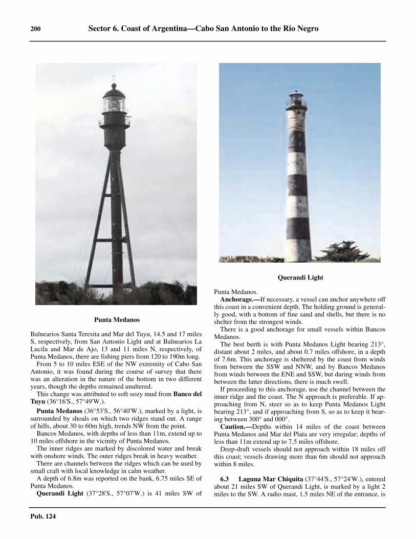
200 Sector 6. Coast of Argentina—Cabo San Antonio to the Rio Negro
Pub. 124
Balnearios Santa Teresita and Mar del Tuyu, 14.5 and 17 milesS, respectively, from San Antonio Light and at Balnearios LaLucila and Mar de Ajo, 13 and 11 miles N, respectively, ofPunta Medanos, there are fishing piers from 120 to 190m long. 6.2 From 5 to 10 miles ESE of the NW extremity of Cabo SanAntonio, it was found during the course of survey that therewas an alteration in the nature of the bottom in two differentyears, though the depths remained unaltered. 6.2 This change was attributed to soft oozy mud from Banco delTuyu (36°16'S., 57°49'W.).
6.2 Punta Medanos (36°53'S., 56°40'W.), marked by a light, issurrounded by shoals on which two ridges stand out. A rangeof hills, about 30 to 60m high, trends NW from the point.6.2 Bancos Medanos, with depths of less than 11m, extend up to10 miles offshore in the vicinity of Punta Medanos. 6.2 The inner ridges are marked by discolored water and breakwith onshore winds. The outer ridges break in heavy weather. 6.2 There are channels between the ridges which can be used bysmall craft with local knowledge in calm weather. 6.2 A depth of 6.8m was reported on the bank, 6.75 miles SE ofPunta Medanos. 6.2 Querandi Light (37°28'S., 57°07'W.) is 41 miles SW of
Punta Medanos. 6.2 Anchorage.—If necessary, a vessel can anchor anywhere offthis coast in a convenient depth. The holding ground is general-ly good, with a bottom of fine sand and shells, but there is noshelter from the strongest winds. 6.2 There is a good anchorage for small vessels within BancosMedanos. 6.2 The best berth is with Punta Medanos Light bearing 213°,distant about 2 miles, and about 0.7 miles offshore, in a depthof 7.6m. This anchorage is sheltered by the coast from windsfrom between the SSW and NNW, and by Bancos Medanosfrom winds between the ENE and SSW, but during winds frombetween the latter directions, there is much swell. 6.2 If proceeding to this anchorage, use the channel between theinner ridge and the coast. The N approach is preferable. If ap-proaching from N, steer so as to keep Punta Medanos Lightbearing 213°, and if approaching from S, so as to keep it bear-ing between 300° and 000°.6.2 Caution.—Depths within 14 miles of the coast betweenPunta Medanos and Mar del Plata are very irregular; depths ofless than 11m extend up to 7.5 miles offshore. 6.2 Deep-draft vessels should not approach within 18 miles offthis coast; vessels drawing more than 6m should not approachwithin 8 miles.
6.3 Laguna Mar Chiquita (37°44'S., 57°24'W.), enteredabout 21 miles SW of Querandi Light, is marked by a light 2miles to the SW. A radio mast, 1.5 miles NE of the entrance, is
6.2Punta Medanos
6.2Querandi Light

Sector 6. Coast of Argentina—Cabo San Antonio to the Rio Negro 201
Pub. 124
prominent. The outflow from the lagoon sometimes discolorsthe sea 7 miles seaward of the entrance.6.3 From Mar Chiquita to Cabo Corrientes, 15 miles SSW, thecoast loses its sandy nature and rises to low cliffs 6 to 9m high,which are broken by the mouths of a few streams. 6.3 Much of the land within this coast is covered by groups oftrees surrounding the ranches. A conspicuous clump of trees is2 miles SW of Mar Chiquita. From seaward, it resembles alarge cone with a very wide base. The cone appears to be divid-ed into two parts when seen from the E.6.3 A good mark for vessels approaching from the N is a whitewater tower standing on a cliff about 8 miles SSW of MarChiquita. There is a radio mast near the tower.6.3 Anchorage may be obtained anywhere, the holding groundbeing generally good. Close inshore, especially within 10 milesof Cabo Corrientes. The bottom is tufa, covered with a layer offine sand and shells. Landing is only possible when the wind isoffshore and there is no swell. There is no anchorage thatwould offer shelter when the most violent winds blow, that is,those from the NNE to SW.6.3 Punta Iglesia (38°00'S., 57°32'W.), 1.25 miles NW of CaboCorrientes, is formed by a rocky cliff about 9m high. 6.3 Between this point and Punta Gruta, 0.75 mile SSE, is Ram-bla Bristol, a bay with a smooth sandy beach in which there aresome piers. Punta Gruta is rocky, about 15m high, and steep-to.Between it and Cabo Corrientes is a bay with a beach backedby sheer cliffs up to about 50m high.6.3 Cabo Corrientes (38°01'S., 57°32'W.), marked by a light,rises to an elevation of 44m, and is the SE extremity of a rangeextending to the W. These hills decrease gradually in height to-ward the sea where they end in a rocky coast, which is clear ofdangers.6.3 Between Cabo Corrientes and Punta Cantera, about 3.7 milesto the S, the coast forms a bay, the N part of which is occupiedby Puerto de Mar del Plata, described below. Within it aresome isolated hillocks from 30 to 50m high. Rocks, awash atLW, extend 0.5 mile E from Punta Cantera.
6.4 Mar del Plata (38°02'S., 57°32'W.) (World Port In-dex No. 13780) is primarily a resort town, but its port also has acereal and frozen meat export trade and timber is imported.The commercial port occupies the SW part of the area; the re-maining area toward the N is reserved for the Argentina Navyand a fishing fleet center.6.4 The Traffic Control and Safety System (CONTRASE) is ineffect for Mar del Plata and is mandatory for all foreign ves-sels:
1. When 30 miles off, report the vessel's name, flag, callsign, length, breadth, draft, speed, port of departure, destina-tion, and navigational plan, as well as the vessel’s ETA at thepoints listed below:
a. When 3 miles off the end of the S breakwater. b. At the waiting area.c. Inside the Antepuerto.
2. If anchoring outside the port, report the vessel's name,flag, and call sign with the time and location of anchoring.
3. When 3 miles off the end of the S breakwater, reportwith ETA at destination and ask “canal libre?” (channelclear?).
4. At the waiting area, report with ETA.
5. Inside of the Antepuerto, report “canal liberado”(channel cleared).
6. Before shifting anchorage, berth, or moving within theport, obtain permission giving the vessel's name, flag, callsign, and destination. Permission normally remains valid for15 minutes.
7. Before leaving port, obtain permission, giving the ves-sel's name, flag, call sign, length, breadth, draft, speed, desti-nation, course, type of cargo, and whether there is a doctoron board. Permission remains valid for 15 minutes.
8. On departure, the following must be done:a. In the Antepuerto, ask “canal libre?” (channel
clear?).b. In the waiting area, report “canal liberado” (channel
cleared).c. When 30 miles off, report the vessel's name, flag,
and call sign.6.4 Tides—Currents.—Within 10 miles of Mar del Plata, thetidal currents run N and S, changing direction 3 hours after lowand high water by the shore. Their velocities are about 0.7knot. During strong SW winds, a current sets NE at a rate ofmore than 1 knot. The average tidal range is about 0.9m.6.4 Depths—Limitations.—The entrance has a depth of 9.1m,but this is subject to continual change. When calculating thedepth in the entrance, an allowance of 0.5 to 1m should bemade for the swell.6.4 The N and S jetties constitute the shelter structure insidewhich, piers, bounded by the walls of wharves, have been built.The N jetty, which is straight, is oriented on a bearing of 127°and is 1,100m long; the S jetty is 2,750m long, pushing out to-ward the NE, extending beyond the N jetty and marking the en-trance to the port. 6.4 With the rising tide and winds from NNE, one can observepowerful breakers on the S jetty.6.4 Muelle Escollera Norte, a quay on the inner side of the Nbreakwater, with a berthing length of 220m and depths of 9.1malongside, is used occasionally by cruise liners. 6.4 Vessels using this berth must moor bow to the S, laying outtheir starboard anchor.6.4 A stranded wreck lies alongside the NE end of EscolleraNorte. 6.4 The Commercial Basin (Ultramar Basin) has a length of300m along its N face and 470m along its S face. Depths in thebasin range from 5.5 to 8m. 6.4 The coastal basin, used by coasting vessels, lies S of theCommercial Basin and has depths up to 5.2m.6.4 The head of the pier, between the coastal basin and commer-cial basin, has a length of 178m and a depth of 9m alongside. 6.4 The tanker pier, located E of the coastal basin, extends 0.14mile NNE from the S breakwater and has a depth alongside of6.7m. A small quay with two dolphins stands just N for the dis-charge of butane and propane to tanks inland.6.4 Aspect.—The port is enclosed by two breakwaters, eachmarked at its end by a light.6.4 A wide and conspicuous hospital surmounted by a cupolastands near the coast about 3 miles NNW of Cabo Corrientes. 6.4 A conspicuous tower, 89m high, stands 1.5 miles S of thehospital. 6.4 A prominent gray and white building, which attains an eleva-tion of 116m, stands 0.3 mile SSE of the tower. A conspicuous

202 Sector 6. Coast of Argentina—Cabo San Antonio to the Rio Negro
Pub. 124
white hotel, situated about 0.7 mile SW of the light on PuntaMogotes (see paragraph 6.5), is a good mark for vessels ap-proaching from the S.6.4 Pilotage.—Pilotage is compulsory for vessels over 75m loaand 4.9m draft. Pilots board 2 miles E of Cape Corrientes. Ves-sels can enter or leave any time day or night. Vessels over2,000 gt must use two tugs. Pilots should be requested throughthe agent 12 hours in advance.6.4 Contact Information.—Mar del Plata pilots can be contact-ed, as follows:
6.4 Anchorage.—It is safer to lie outside in 10.9 to 12.8m ifawaiting a berth in the anteport. The best anchorage bears 191°on the S breakwater light and 313° on Cape Corrientes Buoy,or even farther out. 6.4 The holding ground is good and winds can be ridden out,even with a swell. 6.4 It has been reported that the continuous SE swell during thesummer months makes anchoring outside the breakwaters very
dangerous.6.4 Caution.—Care must be taken to avoid the bank extending0.2 mile N of the S breakwater light since it is subject to silting.6.4 Due to silting, it has been reported (2007) that vessels shoulduse the entrance range line, in line bearing 217.5°, as a SWsafety bearing. A semicanal is reported established above theNW side of the entrance range line, with a minimum depth of9.1m and a bottom width of 70m. 6.4 A charted submarine exercise area is reported to be off Mardel Plata. 6.4 In addition, submarines operate submerged, in depths of 30to 55m, in the area between the latitudes of Querandi Light andQuequen Light. 6.4 Mariners should proceed with caution on sighting a vesseldisplaying the signal NE2, which indicates the presence of asubmerged submarine, or if an aircraft is observed to dive overa position near them, which has the same signification. 6.4 A smoke bomb or flare on the surface of the sea indicatesthat a submarine will surface in its vicinity.
Mar del Plata to Puerto Quequen
6.5 Punta Mogotes (38°06'S., 57°33'W.), 1 mile SW ofPunta Cantera, marked by a light 0.5 mile N, is about 34mhigh, barren and sandy. The point gets its name from severalsand hills nearby, some of which are peaked and higher thanthe others and resemble cornstalks. 6.5 Caution.—A dangerous spit of rock and sand, with depthsof less than 5.5m, extends 2 miles SE of Punta Mogotes.
6.4Mar del Plata
Mar del Plata—Contact Information
Pilots
Telephone54-11-46543164
54-226-2420482

Sector 6. Coast of Argentina—Cabo San Antonio to the Rio Negro 203
Pub. 124
6.5 Banco Pescadores, with a least depth of 3m, is 2.5 miles SEof Punta Mogotes; depths less than 11m extend 1 mile fartherSE. The bank is made up of tufa with an obstruction.
6.5 Ensenada Mogotes (38°07'S., 57°35'W.) is entered betweenPunta Mogotes and Punta Martinez de Hoz, 4.5 miles SW. 6.5 Close W of Punta Mogotes, the coast is formed by bare andshifting sand dunes, but farther W it rises in steep cliffs 20 to30m high and partly covered with sand. This bay affords agood anchorage, in depths of 18 to 22m, when the wind is off-shore and there is little swell.6.5 The cliffs continue, with elevations of about 20m, as far asPunta San Andres, 3.5 miles SW of Punta Martinez de Hoz,where they terminate. 6.5 Between Punta San Andres (38°12'S., 57°40'W.) and PuntaHermengo, 10 miles WSW, the coast is rugged, sandy and bar-ren, with a few patches of vegetation; its elevation varies from6 to 9m, except for some isolated cliffs which are separated bygaps caused by the mouths of streams. 6.5 Four miles SW of Punta San Andres, one of these cliffs is22m high. This coast is moderately steep-to, with depths of9.1m about 0.5 mile offshore. 6.5 Arroyo del Durazno flows into Enseanda de Miramar 1 mileNNE of Punta Hermengo.
6.6 Miramar (38°16'S., 57°51'W.) is a seaside resort thathas two jetties; the S jetty, which is the principal jetty, has alength of 1,192m and the N jetty has a length of 551m. 6.6 Between the jetties there is a 195m wide passage with a100m wide navigable channel. 6.6 The depth of the channel is variable, therefore is reported bi-weekly in the Argentina Notice to Mariners; advance informa-tion is broadcast through the radio notices. 6.6 A light, located 0.5 mile N of Punta Hermango, marks thetown. A white church steeple rising among the red roofs of the
tower, a water tower, and a concrete tank are conspicuous. 6.6 Anchorage off Miramar has good holding ground of chalkoverlying tufa.
6.5Punta Mogotes
6.5Punta Mogotes Light
6.5Miramar

204 Sector 6. Coast of Argentina—Cabo San Antonio to the Rio Negro
Pub. 124
6.6 Caution is necessary when weighing anchor off this coast be-cause the bottom of hard tufa is full of holes and liable to partthe anchor cable.6.6 From Punta Hermengo to Quequen, 44 miles WSW, thecoast is at first backed by cliffs for a distance of about 1 mile,and then by a line of sand dunes which reach elevations of 30to 40m in places. The coastline is broken by the mouths of anumber of streams and there are occasional patches of bushes,but it is uniform and monotonous in appearance and only re-lieved by a few farm houses. 6.6 At Mar del Sur, 8 miles WSW of Punta Hermengo, there is alarge and prominent yellow building with a dark-colored roof. 6.6 The sand dunes continue for 10 miles, with elevations of 15to 25m, and are followed by a line of sheer cliffs about 5 mileslong, beyond which there are more sand dunes.6.6 Medano Miercoles (38°32'S., 58°30'W.), on the coast about35 miles WSW of Punta Hermengo, is a sand hill, 40m high, inthe form of a truncated cone which can easily be identified.From here to the mouth of the Rio Quequen Grande, 11 milesfurther WSW, the sand dunes vary in elevation from 20 to 30m.They are fronted by a beach consisting of hard tufa.6.6 A shoal, with a depth of 7.3m, is 10 miles ESE of MedanoMiercoles and 4.5 miles offshore.
6.7 Puerto Quequen (38°35'S., 58°42'W.) (World PortIndex No. 13790) and the adjacent and larger town of Neco-chea are on the left and right banks, respectively, of the RioQuequen Grande. The main trade of the port is the export ofgrain and vegetable oils. 6.7 Winds—Weather.—During strong winds from between theSE and SW, breakers form at the entrance and sometimes per-sist up to 48 hours after the wind has fallen, making it difficultand at times, impossible to enter. Because of the surge, goodfenders, at least 1m thick, are often needed in the port. 6.7 Tides—Currents.—The combined effect of the S or SWwinds and the greater strength of the E tidal current cause an Eset along the coast. 6.7 Offshore, the currents rarely attain rates of more than 0.5 to 1knot; during light winds they are scarcely perceptible, but closeinshore they are stronger. 6.7 In the mouth of the Rio Quequen Grande, the last of the out-going currents has been observed to attain a rate of up to 2knots.6.7 Depths—Limitations.—Puerto Quequen is entered througha dredged channel about 120m wide. The designed depth of thechannel is 13.7m in the outer parts, and 13m in the inner partsand berthing areas, but local agents should be contacted for lat-est information; it is continually being dredged. 6.7 The following limitations are in force regarding the lengthand draft of vessels entering the port:
1. Length up to 175m—Draft must not exceed 8.2m.2. Length up to 220m—Draft must not exceed 5.5m.
6.7 Vessels over 175m in length must obtain a special permitfrom the Maritime Prefecture before entering. The maximumvessel length admitted is 230m; vessels over 210m in lengthshould use the channel in daylight only.6.7 An underkeel clearance of 0.8m is recommended; this mar-gin may be increased, depending on the height of the groundswell.6.7 Vessels should not enter or leave the port with a ground swell
in excess of 2m. 6.7 Loaded vessels should not enter the port with a ground swellin excess of 1.8m. Vessels should not enter or leave the portwith wind speeds in excess of 20 knots.6.7 When within the port, vessels should berth with their bows toseaward.6.7 Overhead cables, with a vertical clearance of 41.8m, span thechannel 1 mile above the harbor entrance.6.7 Vessels cannot enter or sail at night. Two vessels cannot usethe entrance channel simultaneously. There are no mooringbuoys inside the breakwater, therefore it is safer for vesselswaiting for a berth to remain outside.6.7 Berths for ocean-going vessels have depths of up to 12malongside.6.7 Aspect.—A white grain elevator, over 1 mile NW of thehead of the S breakwater, gives a good radar response at a dis-tance of 20 miles. The church towers of Quequen and Necochialie 1 mile and 2.75 miles NW, respectively, of the S breakwaterhead; both are visible at about 12 miles from seaward.6.7 At night, the first lights to be sighted will be the numerousred obstruction lights shown, at elevations of about 40 to 70m,from the grain elevator and the buildings surrounding it.6.7 Range lights lead between the breakwaters through the en-trance channel.
6.7 Pilotage.—Pilotage and the use of two tugs are compulsoryfor vessels over 2,000 gt. The tugs have insufficient power foranything other than work within the port.6.7 The pilot boards in position 38°35.7'S, 58°40.0'W, about 2
6.7Arroyo Claromeco Light

Sector 6. Coast of Argentina—Cabo San Antonio to the Rio Negro 205
Pub. 124
miles SE of the head of the S breakwater.6.7 Signals.—Three vertical red lights displayed from the rootof the N breakwater indicate the port is closed.6.7 Contact Information.—Puerto Quequen can be contacted,as follows:
6.7 Anchorage.—The port authorities recommend that vesselsanchor at least 5 miles offshore and do not deballast while atanchor.6.7 Caution.—Numerous obstructions exist in an area of foulground extending up to 3 miles offshore. When entering theport a restricted area of 100m exists centered on position38°35.4’S, 58°41.6’W located SW of Escollera Sur Light.
Puerto Quequen to El Rincon
6.8 From Puerto Quequen to Punta Asuncion (38°57'S.,60°39'W.), 94 miles WSW, the coast is formed by monotonousand featureless sand hills 15 to 24m high and similar to those Eof Puerto Quequen, and is broken by several streams.6.8 Punta Negra (38°38'S., 58°49'W.), 6.5 miles WSW andPunta Desnudez (38°50'S., 59°46'W.), 53 miles WSW, re-spectively, from Puerto Quequen are both hard to identify.
6.8 Arroyo Claromeco (38°52'S., 60°04'W.), 13 miles W ofPunta Desnudez, is marked by a light 1 mile to the E, whichhas a signal station. 6.8 Caution.—Unexploded ordnance lies about 11 miles ESE ofthe light on Arroyo Claromeco.6.8 Punta Asuncion, 30 miles W of Arroyo Claromeco Light,rises to a sand hill about 37m high, but it is difficult to identify.6.8 Sierra de la Ventana, 75 miles NW of Punta Asuncion, risesto an elevation of about 1,240m. Near its summit is a hole re-sembling a window. When seen from SE, the summit appearspeaked, but from S it appears rather square with a notch in themiddle.
El Rincon
6.9 El Rincon is the bight formed by the sudden change indirection of the coast E and S of the head of Bahia Blanca, 75miles W of Punta Asuncion. On the N side of this bight, W ofPunta Asuncion, shoals, with depths of less than 11m, are up to12 miles offshore as far S as the parallel of 39°12'S. 6.9 Inshore, the nature of the bottom is gray and black sand andshells, with tufa on some of the shoals. 6.9 For about 20 miles seaward of the shoals, the bottom is com-posed of mud, covered with a layer of fine sand. The holdingground is good everywhere. The nature of the bottom gives lit-tle indication of a vessel’s position.6.9 Currents are strong and under normal circumstances semi-di-urnal, but they are much affected by the wind. Within 10 milesof the shoals, they attain rates of up to 4 knots, and between 10and 20 miles seaward of the outer limit of the shoals, their rates
are from 1.5 to 2 knots.6.9 Off Punta Asuncion, the N tidal current divides into twobranches, one running W towards Bahia Blanca and the otherrunning E along the coast. The currents converge from the op-posite directions during the S current.6.9 On the N shore of El Rincon, from Punta Asuncion to MonteHermoso, a rounded hill 35m high, 47 miles W of Punta Asun-cion, the coast is of the same character as it is E of Punta Asun-cion.6.9 Recalada Light (39°00'S., 61°16'W.), 28 miles W of PuntaAsuncion, is 67m high and has a radiobeacon and a signal sta-tion. 6.9 Rada de Monte Hermoso (38°59'S., 61°41'W.) lies 20miles W of Recalada Light.
Bahia Blanca
6.10 Bahia Blanca (38°47'S., 62°16'W.), a narrow arm ofthe sea in the NW part of El Rincon, is entered between MonteHermoso and Punta Lobos, 17 miles SSW. It extends 40 milesNW and is obstructed by banks and shoals. 6.10 Within the bay and in order from seaward are the ports ofPuerto Rosales, Puerto Belgrano, and the Puerto Bahia BlancaComplex, consisting of Puerto Ingeniero White, Puerto Nacio-nal, and Puerto Galvan. These ports are described in detail be-ginning in paragraph 6.11. Puerto Cuatereros, further up thechannel, was historically a commercially-viable pier, but hassince been eclipsed by the nearby Puerto Bahia Blanca, andnow exists as a dilapidated dock being used by local fisherman.
Puerto Quequen—Contact Information
Telephone 54-2262-450006
E-mail [email protected]
6.9Recalada Light

206 Sector 6. Coast of Argentina—Cabo San Antonio to the Rio Negro
Pub. 124
Wind—Weather.—Prevailing winds are from the N, NW,and W. Annual rainfall averages 558mm, with March havingthe highest amount. Fog occurs on an average of 27 times an-nually.
Tides—Currents.—The flood tidal current runs for 5 hours45 minutes; the ebb current runs for 5 hours 30 minutes. Thenormal rate is less than 2 knots, but this may be increased to 4knots by the action of the wind.6.10 The tidal currents set across the outer part of Canal Principal,and caution is necessary. In the narrow part of this channel, be-tween the two parts of Banco del Este, the tidal currents arevery strong, but here and in the inner part of the channel theyfollow the trend of the channel.
6.10 The greatest rates, up to 2.5 knots, are found in the vicinityof Punta Ancla. They occur about 3 hours 30 minutes after HWand LW at Puerto Belgrano.6.10 Off Puerto Belgrano, the beginning of the flood current isstronger on the S side of the roadstead, and the beginning ofthe ebb current is stronger on the N side.6.10 The water level in Bahia Blanca varies frequently from thepredicted tidal level. In general, strong winds from the WNWthrough N to NNE lower the water level, while those from theE through S to W raise the level. With gale force winds the lev-el may be raised or lowered as much as 1.5m. 6.10 The full effect may be experienced at any interval up to 5hours after the start of the gale, the average interval beingabout 3 hours.
Depths—Limitations.—The middle of Bahia Blanca is en-cumbered with numerous sand banks, which include Banco delNorte, Banco Nuevo, and Banco del Medio, lying near the en-trance to the bay; and Banco Largo, Banco del Oeste, Bancodel Sur, Banco del Toro, Banco Redondo, and Banco Cuchillo,lying farther in. These banks are composed of very hard blacksand, with fine sand and mud in the channels between them. 6.10 The outer banks have depths of 3 to 5.5m; the inner banksdry in patches. The sea sometimes breaks over the edges ofthese banks, but at other times there is little indication of them.6.10 Canal Principal, the main route into Bahia Blanca, is well-marked and leads from about position 39°24'S, 61°29'W to apoint abeam Buoy No. 12, where it turns NW and becomes Ca-nal del Toro, then continuing to about 2 miles W of Puerto Ro-sales, where the channel becomes Canal Ingeniero White. Thecontrolling depths in Canal Principal and Canal del Toro are12.8m, while the controlling depth in Canal Ingeniero White is12.2m.6.10 Caution should be exercised as the buoys may be unlit andout of position.6.10 Canal Auxilar, branching N from Canal Principal and pass-ing between Banco del Norte and Banco del Oeste, has a depthof about 3.4m. It is no longer dredged and its use is not recom-mended except for small shallow-draft vessels.6.10 Canal del Sur, branching W from Canal Principal and pass-ing SW of Banco del Sur, Banco Redondo, and Banco Cuchil-lo, has depths of about 3.6m, but it is not recommendedbecause it is unmarked and has not been surveyed recently.
Aspect.—Punta Tejada (38°59'S., 61°49'W.), 6 miles W ofMonte Hermoso, is marked by a light.
Between Monte Hermoso and the entrance to Puerto Ro-
sales, 18.5 miles W, the shore of Bahia Blanca consists of lowsand hills which are partly covered with bushes and coarsegrass.6.10 Chica Light is 4 miles W of Punta Tejada. Tripode Beacon is6 miles WNW of Punta Tejada. A charted degaussing range is1.5 miles SW of Tripode Beacon and only Argentine Navalvessels may navigate vessels near the buoy marking range.Merchant ships must pass SW of the range.6.10 Water towers stand 0.6 mile NW and 1.75 miles WNW, re-spectively, from Tripode Beacon.6.10 Punta Ancla, a poorly-defined point, lies about 3 milesWNW of Tripode Beacon. Many uncharted beacons used bythe Argentine Navy are also along this stretch of coast.6.10 The most prominent hummocks W of Punta Hermoso lie 1mile ENE of Punta Ancla Beacon. There are also some groupsof trees, flag staffs, and windmills in this vicinity.
The S side of the seaward part of Bahia Blanca is formed byIsla Trinidad, which extends 14.5 miles NW from Punta Lobos,and by Isla Bermejo and Islas del Embudo NW of it. These is-lands are low and subject to inundation, and are difficult toidentify from the offshore. 6.10 Isla Trinidad and Isla Bermejo are separated by Canal Ber-mejo, which is navigable by small craft with local knowledgefor a distance of about 20 miles. Isla Bermejo and Islas del Em-budo are separated by Arroyo Labrode; Canal del Embudo sep-arates the latter islands from the mainland. 6.10 Recalada Light, Punta Lobos Beacon, and Sierra de la Venta-na are good marks in clear weather. 6.10 Pilotage.—Pilotage is compulsory for all foreign-flaggedvessels. Pilots board vessels near Lighted Buoy No. 11, 8.2miles SW of Monte Hermoso, and are available 24 hours.6.10 Pilots should be requested at least 8 hours in advance. Re-quests for a pilot should include the vessel's name, nationalityand identification signal, number of passengers and crew, thetype and quantity of cargo, and information regarding thehealth of passengers and crew.6.10 A vessel requiring a pilot can communicate with the Subpre-fectura Maritime at one of the above-mentioned ports throughBahia Blanca radio station or by radio with the pilot vessel on-ly when away from its base. The pilot vessel, an Argentine Na-val tug based at Puerto Belgrano, does not leave that portunless a vessel is expected. 6.10 Regulations.—Vessels drawing over 10.7m should not over-take or pass other vessels anywhere in the channel. Vesselsdrawing between 9.2 and 10.7m should not overtake other ves-sels between Buoy 13 and Buoy 16, or upstream of Buoy 26 inposition 38°53.3'S, 62°10.9'W.6.10 Vessels traveling with the current have the right-of-way overother vessels; if there is no current, outbound vessels have theright-of-way over inbound vessels. Speed in the channel shouldnot exceed 12 knots.6.10 There is a Traffic Control and Safety System (CONTRASE)in place for Bahia Blanca. It is mandatory for all foreign ves-sels. It operates 24 hours on VHF channel 73. The followingreporting requirements are in effect:
1. When approaching Rincon Lighted Buoy on entry,vessels must report the following information:
a. Vessel name.b. Flag.c. Call sign.

Sector 6. Coast of Argentina—Cabo San Antonio to the Rio Negro 207
Pub. 124
d. Length.e. Breadth.f. Draft.g. Speed.h. Port of departure.i. Destination.j. Navigational plan.k. The ETA at the points listed below in paragraph 2.
Vessels must also report any later changes to these ETAs.2. Vessels report their ETA at their destination when
reaching the following locations:a. Rincon Lighted Buoyb. Lighted Buoy No. 4.c. Lighted Buoy No. 11.d. Lighted Buoy No. 17.e. Lighted Buoy No. 22.f. Lighted Buoy No. 25.g. Beacon No. 2 (Canal Ingeniero White).h. The roadstead (departing vessels may omit the road-
stead report).3. Before shifting anchorage, berth, or moving within
the port, vessels must obtain permission, stating the vessel'sname, flag, call sign, and destination. Permission normallyremains valid for 15 minutes.
4. Before casting off on leaving port, vessels must obtainpermission, stating the vessel's name, flag, call sign, length,breadth, draft, speed, destination, course, type of cargo, andwhether there is a doctor on board. Permission normally re-mains valid for 15 minutes.
5. If anchoring outside the port, report the vessel's name,flag, and call sign with the time and location of anchoring.
6.10 Contact Information.—VTS Bahia Blanca can be contact-ed, as follows:
1. VHF: VHF channels 12 and 732. Telephone: 54-291-457-32133. E-mail: [email protected]
6.10 Bahia Blanca pilots can be contacted, as follows:1. VHF: VHF channels 12 and 162. Telephone: 54-291-457-13343. E-mail: [email protected]. Web site: http://www.esempilots.com.ar
6.10 Bahia Blanca Port Authority can be contacted, as follows:
6.10 Anchorage.—There are numerous and successive anchorag-es in the approach channel to Puerto Bahia Blanca. They canbest be viewed on the chart. Specific anchorage informationand regulations can be found in the table titled Bahia Blan-ca—Anchorages.6.10 Vessels in quarantine should anchor in the roadstead to theW of the Naval Anchorage, or off Punta Pipas Beacon.6.10 Rada de Puerto Belgrano, the roadstead NW of the merchantships anchorage and to the S of the port of that name, is re-served for the use of the Argentine Navy. 6.10 Vessels proceeding only to Puerto Rosales or Puerto Belgra-no, or in cases of emergency, may anchor in a position 1.5miles SSE of Punta Ciguena, provided notice is given by radioand by flag signals of their name, nationality, destination, andport of departure. 6.10 A prohibited area, the limits of which are shown on the chart,extends ESE about 9 miles from the vicinity of Punta Tejada. 6.10 The coast between Chica Light and Punta Ciguena and be-tween Puerto Rosales and a point 7.25 miles NW is a militaryarea and landing on this stretch of coast is prohibited.6.10 Directions.—If approaching from the E, steer for the en-trance of the buoyed Canal Principal. 6.10 Sound continuously and do not proceed into depths of lessthan 18m, as the shoals and banks are extensive and steep-to,the tidal currents are sometimes strong and affected by thewind, and the coast is low. 6.10 If bound from the S, make a landfall between Recalada Lightand Monte Hermoso Beacon, thereby sighting the buoy mark-ing the Canal Principal entrance. 6.10 The best times for entering is the beginning of the flood cur-rent, because the edges of the banks are then most clearly dis-tinguished. 6.10 By following the track indicated on the chart and being guid-ed by the lighted buoys, no great difficulty should be experi-enced. It should be observed that SE winds cause a heavy sea.At such times or during fog or poor visibility, either anchor orstand off.6.10 Caution.—Silting is common in the delta-like bay due to thenumerous tributaries that feed into it. Depths may be shallowerthan charted. Mariners are advised to navigate with caution andrequest the latest depth information from the local authorities.6.10 Caution should be exercised to avoid anchoring or navigat-ing in the area W of Anchorage Zone C during an artillerypractice in the Rada De Monte Hermoso area; dates and time ofsuch exercises are promulgated Argentine Coast Guard.
1. Telephone: 54-291-457-3213
54-291-457-3214
54-291-457-3215
2. Facsimile: 54-11-4342-6836
54-291-457-3214
54-291-457-3215
3. E-mail: [email protected]
4. Web site: http://www.puertobahiablancacom.ar
Bahia Blanca—Anchorages
Anchorage Depths Remarks
A 6.106-17m Reserved for vessels with drafts greater than 10m awaiting departure. Foul ground is present in the anchorage.
B 6.104-18m Reserved for vessels with drafts greater than10m awaiting departure. an obstruction is present in the SE of the anchorage.

208 Sector 6. Coast of Argentina—Cabo San Antonio to the Rio Negro
Pub. 124
6.10 A seaplane harbor, enclosed by breakwaters, is close N ofthe Puerto Belgrano dockyard. An area reserved for the use ofseaplanes landing or maneuvering extends 1.75 miles offshoreand 2.5 miles NNW of the dockyard. Passage through the areais prohibited without the permission of the Officer Command-ing the Fleet Airbase through the Servicio de Puerto.
6.11 Puerto Rosales (38°55'S., 62°04'W.) (World Port In-dex No. 13800), a former grain port no longer used as such, isbeing converted into a fishing port which will have depths of6.1m alongside.
Oiltanking Ebytem SA (38°57'S., 62°02'W.) consists of anSBM in about 18m of water with an associated submarinepipeline and is located 1.25 miles SE of the head of the PuertoRosales breakwater.
6.12 Puerto Belgrano (38°53'S., 62°06'W.) (World PortIndex No. 13810) is primarily an Argentine Naval Base, but thedrydocks can be used by merchant vessels.6.12 The largest drydock is 234m long, 34.2m wide, and 13.1mdeep. The Argentine Hydrographic Department is located here.6.12 Depths—Limitations.—The port is approached through achannel 0.8 mile WNW of Puerto Rosales Light. The minimumwidth of the channel at its inner end is 75m. Significant shoal-ing has been reported in the channel. Mariners are advised touse caution and consult with local authorities.
6.12 The basin between Muelle B and Muelle C has depths of 3.7to 7m alongside its quays. The inner basin, enclosed by MuelleA and Muelle B, has depths of 5.8 to 9.4m, except along thequay at its SE corner, where there are depths alongside of only2.4 to 4.6m. 6.12 Aspect.—A signal station, a large building with a clock tow-er and flag staff on a hillock on the E side of the port, is aprominent landmark visible at 15 miles in clear weather.6.12 It is reported (2013) the capsized wreck of a warship liesalongside in the harbor.6.12 Pilotage.—Pilotage, which is compulsory, is by military pi-lots who take over from civilian pilots at Lighted Buoy No. 21.6.12 Signals.—Day signals, indicating the movement of shipping,are displayed from a mast with a yard, situated on the head ofMuelle C are listed in the table titled Puerto Belgrano—DaySignals.
6.12 Night signals shown from the signal station are listed in thetable titled Puerto Belgrano—Night Signals.
6.12 Regulations.—Except by special authority, large vessels arenot allowed to enter at night. All vessels entering or leavingmust, when abreast of Puerto Belgrano, display their numbersby the International Code of Signals.6.12 The following signals are displayed at the Fleet Air base flagstaff when aircraft are operating:
1. By day—Two “Y” flags.2. By night—Vertical red, white, red lights.
Puerto Bahia Blanca Complex
6.13 The inner group of ports in Bahia Blanca is made upof Puerto Ingeniero White, Puerto National, and Puerto Gal-van, all on the N side of the channel between 10 to 12 milesNW of Puerto Belgrano. Each of these ports are specificallydescribed in the following paragraphs.6.13 This inner group of ports is approached through Canal Inge-niero White, a continuation of Canal Principal, a marked chan-nel dredged to 10m.
C 10-21mN and S limits of the anchorage are marked by lighted buoys. Foul ground is present in the anchorage. A dangerous wreck between Anchorages C and D is marked by a lighted buoy.
D 11-16mReserved for loaded oil tankers with drafts greater than10m, waiting to berth and vessels with drafts greater than 10m unable to cross Canal del Toro in foul weather. Foul ground is present in the anchorage.
E 12-19m Foul ground is present in the anchorage.
Bahia Blanca—Anchorages
Anchorage Depths Remarks
Puerto Belgrano—Day Signals
Signal Meaning
Black flag at W yardarm Vessel in sight.
Flag “L” at the dip, at W yardarm Vessel entering.
Flag “K” at the dip, at W yardarm Vessel leaving.
Red flag at the dip, at W yardarm Entry prohibited.
Red flag at E yardarm Vessel is in need of assistance.
Black flag at the dip, at E yardarm Departure prohibited.
Puerto Belgrano—Night Signals
Signal Meaning
One intense green light Entry prohibited.
Two intense lights, vertical-ly disposed, white over green
Departure prohibited.
Two intense green lights, vertically disposed
Entry and departure prohib-ited.
Puerto Belgrano—Day Signals
Signal Meaning

Sector 6. Coast of Argentina—Cabo San Antonio to the Rio Negro 209
Pub. 124
6.13 Rada Ingeniero White is the part of the fairway between themouth of Arroya Naposta (38°47'S., 62°14'W.) and the wharfat Puerto Galvan. It is dredged to a depth of 12m.6.13 Tidal currents in Canal Ingeniero White have rates of 1 to 3knots and follow the trend of the channel. 6.13 Pilotage.—Pilotage is compulsory for foreign flagged ves-sels. For detailed pilot information, see Pilotage under para-
graph 6.10, Bahia Blanca.6.13 Regulations.—Vessels should send ETA 5 days in advanceat Lighted Buoy No. 11, with a confirmation sent 24 hoursprior to arrival. Additional regulations can be found underparagraph 6.10.6.13 Contact Information.—See paragraph 6.10.
Puerto Galvan, Bahia Blanca Complex
Puerto Ingeniero White, Bahia Blanca Complex

210 Sector 6. Coast of Argentina—Cabo San Antonio to the Rio Negro
Pub. 124
6.13 Anchorage.—See paragraph 6.10.6.13 Caution.—See paragraph 6.10.
6.14 Puerto Ingeniero White (38°48'S., 62°16'W.)(World Port Index No. 13820) is an important grain-exportingport, but also has facilities for handling general cargo. It canhandle vessels up to 13.7m draft when dredged, but may silt.6.14 A foul area extends 0.25 mile SE. It has been reported thatMuelle de Hierro has been removed and the area dredged to10m.6.14 Terminal Bahia Blanca and Muelle de Servicios, each withfour berths for ocean-going vessels, project SSE from theshore; both piers are equipped for loading grain. The twoberths at the E face have silted up and are no longer in use. 6.14 Muelle Piedra Buena, a tanker pier, has a face 260m long anddepths alongside of 12.2m.
6.15 Puerto Nacional (38°48'S., 62°17'W.) (World PortIndex No. 13830), which is state-owned, is close W of PuertoIngeniero White and used mainly for the export of fruit. Theport consists of a basin with about 600m of quayage, havingdepths alongside up to 7.3m. Services are much the same as atPuerto Ingeniero White as described in paragraph 6.14.6.15 A newer port area on reclaimed land between PuertoNacional and Puerto Galvan has three berths with depthsalongside of 13.7m. These newer terminals are described in theBerth Information tables below.
6.16 Puerto Galvan (38°47'S., 62°18'W.) (World PortIndex No. 13840), mainly used for the import of oil, alsohandles grain and lies 1.5 miles W of Puerto Ingeniero White. 6.16 The main wharf, an irregularly-shaped structure whichprojects 0.7 mile SSE from the shore, has nine berths. Theouter berths, numbered 2 through 6, have depths alongside of3.4 to 6.3m, but the inner berths have less water.
Puerto Galvan, Bahia Blanca Complex—Berth Information
Berth Length DepthMaximum Vessel
RemarksLOA DWT Beam
Oiltanking Terminal
Punta Ancla —13.7m 228m
69,950 dwt 32.0mCrude and bunkers.
Punta Ciguena — 74,908 dwt 40.0m
Glencore/Oleaginosa Moreno Hermanos
Nos. 2/3 200m 11.5m 230m 92,700 dwt 38.0m Vegetable oils, grain, multipurpose, and bunkers.
No. 4 69m 7.6m 225m — — Closed.
Louis Dreyfus Terminal
Dreyfus Pier — 12.2m 270m 100,000 dwt 38.0m General cargo.
Puerto Galvan
No. 5 212m 8.8m 210m 73,296 dwt 36.0m Grain, container, and breakbulk.
Compania Mega Terminal
Tango FLNG 270m 13.7m 284m 77,822 dwt 43.0m LNG and bunkers.
Flammables Terminal
No. 1137m 12.1m 250m
72,829 dwt 32.0m Aviation fuel, chemicals, clean prod-ucts, crude, dirty products, and bunkers.
No. 2 54,901 dwt 36.0m Chemicals, clean products, dirty prod-ucts, and LPG.
No. 3 — 12.1m — — — Dirty products.
Puerto Ingeniero White, Bahia Blanca Complex—Berth Information
Berth Length DepthMaximum Vessel
RemarksLOA DWT Beam
ADM Agro Terminal
Piedra Buena 200m 13.2m 275m 150,000dwt 32.0m Grain.
ADM Agro Dock 147m 13.7m 229m 93,353dwt 38.0m Grain.

Sector 6. Coast of Argentina—Cabo San Antonio to the Rio Negro 211
Pub. 124
6.16 Two T-shaped tanker piers project SW from the root of themain pier and consist of three berths. These berths weredredged to a depth of 12m, but were reported more recently tohave a depths of 8.8m alongside. Mariners should request thelatest depths from the port authority. 6.16 Lights are shown from each end of the pier. 6.16 Ciudad de Bahia Blanca (38°44'S., 62°16'W.) is inland, 3miles N of Puerto Ingeniero White. It is the most importantArgentine city S of Buenos Aires.
Bahia Blanca to the Rio Negro
6.17 Costa Laberinto lies SW of Isla Trinidad and extendsto Punta Laberinto, 15 miles SSW of Punta Lobos (39°14'S.,61°52'W.). It includes Bahia Falsa, Bahia Verde, PeninsulaVerde, Celeta Brightman, and various islands. It is fringed to adistance of 7 miles by numerous banks and shoals which areintersected by navigable channels. 6.17 Navigation precautions and tidal currents in this area havebeen discussed previously under Bahia Blanca in paragraph6.10. 6.17 El Rincon Light (39°24'S., 62°01'W.), 62m high andequipped with a radiobeacon, is on the E end of PeninsulaVerde, 11 miles S of Punta Lobos.6.17 Bahia Falsa separates Isla Trinidad from Isla Ariadna and Is-la Wood, which lie SW. It is entered between Punta Lobos andthe bank extending E from Isla Ariadna, 5 miles S, and extends15 miles NNW. This inlet affords excellent anchorage, withprotection from all except SE winds, which raise a sea, but lo-cal knowledge is essential for entering it because no landmarksare visible until a vessel is within the banks which encumberthe entrance. 6.17 Bahia Verde, entered between the bank extending E from Is-la Ariadna and the NE extremity of Peninsula Verde, extends10 miles WNW. 6.17 Local knowledge is essential because the entrance is encum-bered by banks.6.17 Bancos Lobos, with depths of less than 5.5m, extend 8 miles
SSE from Punta Lobos. Depths are very irregular and they dryin parts. 6.17 Bancos La Paz, with depths of 1.2 to 5.5m, are from 6 to 13miles S of Punta Lobos. Because the coast of Peninsula Verdeis visible from the vicinity of these banks, they are more easilyavoided than Bancos Lobos.6.17 The E sides of all the above banks are shelving and their Wsides are steep-to.
6.17 Bajos del Laberinto, which dry in places, are between the Eends of Bahia Falsa and Peninsula Verde, obstructing the en-trance to Bahia Verde; they extend 6 miles ESE from Isla Ari-adna (39°15'S., 62°01'W.).
There are two channels into Bahia Falsa. Canal del Este, be-tween Bancos Lobos and Bancos La Paz, has a least depth ofabout 3.6m in the fairway. 6.17 Canal Patagonia, which is 1 mile wide, leads W of BancosLa Paz and Bancos Lobos and E of Bancos Patagonia, whichfringe the coast of Peninsula Verde. It has a least depth of 9.8min the fairway in the S part, and of about 5m at its N end, whereit turns E into Canal del Este, 6 miles NE of El Rincon Light.6.17 The entrance to Bahia Falsa is narrowed by a shoal, with aleast depth of 0.6m, which forms the NW end of Bancos Lo-bos. 6.17 This passage is about 0.5 mile wide, with depths from 4.9 to5.2m. A buoy marks the channel 1.75 miles WSW of Punta Lo-bos.
6.18 Caleta Brightman (39°26'S., 62°02'W.), an inlet be-tween the S end of Peninsula Verde and Punta Laberinto, has anarrow channel with depths of 3m, but should only be enteredwith local knowledge.6.18 Currents run parallel with the coast outside the entrance.Within the inlet, they attain rates of 4 to 5 knots. The water lev-el is much affected by SE and NW winds.6.18 If approaching this inlet, do not proceed N of 39°30'S, as thedangerous banks are N of that parallel, while the coast to the Sis clear of dangers.
Terminal Puerto Bahia Blanca
Nos. 05/06330m 8.8m
245m 32,417dwt 28.0m Grain.
Nos. 07/08 200m — — Closed. Grain.
No. 09 156m 15.2m 250m 95,308dwt 38.0m Grain.
No. 21 270m 13.7m 228m 73,296dwt 36.0m Containers, breakbulk, and reefer.
Cargill SACI Terminal
Cargill Pier — 13.7m 250m 98,697dwt 38.0m Vegetable oils, grain, and multi-purpose.
Profertil S.A.
Profertil Pier 200m 13.7m 235m 51,371dwt 32.0m Chemicals, fertilizer, and multi-purpose.
Puerto Ingeniero White, Bahia Blanca Complex—Berth Information
Berth Length DepthMaximum Vessel
RemarksLOA DWT Beam

212 Sector 6. Coast of Argentina—Cabo San Antonio to the Rio Negro
Pub. 124
6.18 Anchorage may be obtained, in a depth of 6m, about 1 mileNNE of Punta Laberinto. 6.18 Vessels can also anchor near the SW coast of PeninsulaVerde, in a depth of 10m, soft sandy mud.
From Punta Laberinto to the mouth of the S and main branchof the Rio Colorado, 25 miles S, the W coast of El Rincon con-sists of a low sandy beach, backed by a chain of sand hills, 9 to12m high, which end at this river mouth. 6.18 The Rio Colorado flows into the sea by two branches whichdivide 18 miles inland. The mouth of the N branch is located10 miles S of Punta Laberinto. 6.18 A bank of sand and mud dries up to 1 mile off this shore andthe depths of it decrease gradually; the sea breaks on it heavily,making landing difficult. 6.18 Bahia Anegada, between Isla Margarita (39°52'S.,62°07'W.) and Punta Rubia, 50 miles to the S, is filled mostlyby drying banks with channels and inlets in between which arenavigable only by small craft with local knowledge. There aremany low islands and islets in the bay, all with the same ap-pearance.
6.19 Bahia Union (39°58'S., 62°08'W.), in the N part ofBahia Anegada, is entered through the banks 15 miles SSE ofIsla Margarita. The entrance is 0.7 mile wide with 4.6m overthe bar. Bahia Union affords good anchorage with completeprotection once inside for vessels drawing up to 6m and is thebase of a fishing fleet. 6.19 At the entrance of Bahia Union, the flood current runs N
across the banks at about 2 knots, and the ebb currents at firstrun directly out of the inlet at about 2.5 to 3 knots and then turnS as it clears Banco Perro. 6.19 Winds from N decrease the rate of the flood currents and in-crease the rate of the ebb currents. South winds have the oppo-site effect.6.19 Islote Morro Indio, N of Bahia Union Inlet, is 6m high andeasily identified because the land in the vicinity is barely abovesea level at HW. Three sand hills 2 miles NNW of Islote MorroIndio are good landmarks. 6.19 Directions.—If bound into Bahia Union, make for the landin the vicinity of Isla Margarita, where there are no off-lyingdangers and soundings will give a good indication of the dis-tance offshore. The beacon on Isla Margarita and the three sandhills mentioned above are all good marks, but because the tidalcurrents sometimes set across the channel, do not attempt toenter the channel without local knowledge.6.19 Anchorage may be obtained with Islote Morro Indio bearing347°, distant 0.75 miles, in a depth of 7.3m, mud and pebbles.
Sandy banks and shoals extend up to 15 miles seaward of theislands in Bahia Anegada. Some of them dry as much as about2.4m. 6.19 At HW, very little dry land can be distinguished from sea-ward of these dangers. They should be given a wide berth, es-pecially by ships bound N, because the N tidal current sets NWtowards them at rates of 1 to 3 knots.6.19 The shoals are formed in ridges, lying parallel with the coast,with depths of 2.7 to 11m; depths of 14.6 to 22m lie betweenthe ridges. In calm weather, in addition to soundings, the onlyindications of these shoals are a slight rippling or an unusualsmoothness and some difference in the color of the water.When there is much swell, the sea breaks over nearly all theseshoals, even those with as much as 7 or 9m.6.19 Currents off the above-mentioned dangers run NNW andSSE at rates of 1 to 2 knots; over the dangers, they run NW andSE at the same rates. Between the dangers, the current followthe directions of the channels and the rates increase from 1.5 to3 knots. 6.19 Winds from between the SE and SW raise the water leveland increase the rate and duration of the N current. Winds frombetween the NW and N have the opposite effect.
6.20 Puerto San Blas (40°34'S., 62°14'W.) (World PortIndex No. 13860) is a small fishing village on Bahia San Blasat the S end of Bahia Anegada. The entrance to the bay andport is almost closed by extensive banks which cause tidal cur-rents in the channels between them. 6.20 Inside the entrance there is a sheltered harbor for small ves-sels able to enter. The tower of a church, 12m high, is promi-nent.6.20 From the entrance to Bahia San Blas to Punta Rasa(40°52'S., 62°18'W.), 18 miles SSW, the coast consists of anarrow sandy beach, backed by low and uniform sand hills,with sparse vegetation consisting of coarse grass and a fewbushes. 6.20 The only prominent feature is Cerro de la Torre, a conicalsand hill near Punta Rubia. Segunda Barranca Light, nearlymidway between it and Punta Rasa, is difficult to distinguish. 6.20 Segunda Barranca Light (40°47'S., 62°16'W.) is 34m high.A radiobeacon is at the light.
6.17Punta Lobos Light

Sector 6. Coast of Argentina—Cabo San Antonio to the Rio Negro 213
Pub. 124
6.20 A bank of tufa, with irregular depths of less than 5.5m, ex-tends up to 1.5 miles off the coast between Segunda BarrancaLight and Punta Rasa. In calm weather, its edge is marked bytide rips. 6.20 Anchorage, sheltered from offshore winds, may be obtained3 miles NE of Segunda Barranca Light.
6.21 Punta Rasa (40°52'S., 62°18'W.) rises to a roundedsandy hillock, 8m high. In its vicinity are sand hills, whichchange shape under the influence of strong winds.6.21 From Punta Rasa, the coast trends WSW for 21 miles to Bar-ranca Norte, and is visible about 11 miles offshore in clearweather. It is of uniform aspect and formed by shifting sanddunes covered with vegetation. 6.21 Barranca Norte (41°01'S., 62°41'W.), about 20m high, isprominent from the E, but is difficult to identify from any otherdirection because it is seen against a background of mountains. 6.21 There are no known dangers off this part of the coast andvessels can anchor anywhere off it. 6.21 From Barranca Norte to Punta Redonda, the E entrance pointof the Rio Negro, 7 miles WSW, the coastal sand dunes arebare and become lower. 6.21 Between Punta Rubia (40°44'S., 62°14'W.) and Bahia Ro-sas (41°09'S., 63°23'W.), 60 miles to the WSW, currents runparallel with the coast. They attain rates of 1 to 3 knots be-tween Punta Rubia and Punta Rasa. These currents area affect-
ed in strength, and to a certain extent in direction, by strongwinds.6.21 Heavy overfalls, which can be dangerous to small craft, arelikely to be encountered near the coast between Punta Rasa andthe mouth of the Rio Negro, when the current sets against thewind at a certain angle.
6.22 The Rio Negro (41°02'S., 62°47'W.), entered be-tween Punta Redonda and Punta Medano 1.25 miles WNW, isnavigable by vessels of shallow draft with local knowledge asfar as Puerto Carmen de Patagones, a fishing port, 17 milesabove its mouth. Above this port, the depths become irregularand the river is navigable only by boats. The tides are felt about25 miles above the port. 6.22 The mouth of the river is easily identified by Barranca Norteand Barranca Sur. Its banks are from 9 to 15m high. Duringfloods, discolored water extends as much as 8 miles offshore inthe vicinity of the river mouth.
6.23 Punta Redonda (41°02'S., 62°46'W.) rises to a coni-cal sand hill, 8m high, which appears from the E to have threesummits partly covered with vegetation. About 0.5 mile NW ofit, the sand hills are about 15m high. 6.23 Punta Medano, the SW entrance point of the river, lies al-most 1.5 miles WNW of Punta Redonda and is bare and sandy.It is inundated during floods, when the entrance appears threetimes its normal width. The point is steep-to on its NE side.
6.19Segunda Barranca Light6.21Rio Negro Light

214 Sector 6. Coast of Argentina—Cabo San Antonio to the Rio Negro
Pub. 124
6.23 Rio Negro Light, 16m high, is 2.75 miles SW of Punta Med-ano. 6.23 Banks, which dry in parts, extend up to 1.75 miles off thecoast E of Punta Redonda and join the SE end of Banco Mi-guel, a drying bank forming a bar across the mouth of the RioNegro. These banks, composed of fine sand and shells, are con-tinually changing. Their edges are nearly always indicated bybroken water.6.23 The bar can be crossed by vessels drawing less than 2.4m atHWS. A vessel entering with a greater draft is liable to be de-tained in the river for several weeks before being able to re-cross the bar. 6.23 The bar is dangerous during onshore winds, which whenstrong, may make passage over it impossible. With any swell,there are breakers over the whole of it and in the channel with-in. Smooth water is rare on this exposed coast. A shoal, com-posed of tufa with depths of less than 5.5m, extends up to 1.5miles offshore, 3 miles SW of Rio Negro Light. 6.23 Less water than charted was reported in the approaches tothe Rio Negro.
6.23 There are depths of about 13m about 5 miles S of Rio NegroLight.6.23 Pilotage.—No pilots were reported available.
6.23 Anchorage.—Anchorage can be obtained with Rio NegroLight bearing 310°, distant 2.5 miles, in 14m, fine sand. 6.23 While this is a good anchorage with winds from the W to N,it should be vacated as soon as the winds threaten to blowstrongly from E or S. 6.23 No attempt should be made to anchor in depths of less than9m, or with the light bearing more than 000°, because the bot-tom is tufa and is poor holding ground. Winds from the S raisethe sea and cause a NE current.6.23 An obstruction, consisting of a lost anchor and cable, liesabout 0.5 mile NNW of this anchorage.
6.23 Puerto Carmen de Patagones (40°48'S., 62°59'W.) (WorldPort Index No. 13870) is used almost entirely by fishing craftand other small vessels with local knowledge. There is a hospi-tal in the town.

215
Pub. 124
7. Sector 7—Coast of Argentina—The Rio Negro to Cabo Vir-
genes
7.0Additional chart coverage may be found in NGA/DLIS Catalog of Maps, Charts, and Related Products (Unlimited Distribution).
SECTOR 7 — CHART INFORMATION

217
Pub. 124
SECTOR 7
COAST OF ARGENTINA—THE RIO NEGRO TO CABO VIRGENES
7.0 Plan.—This sector describes the coast of Argentina from theRio Negro S to Cabo Virgenes.
General Remarks
7.1 Winds—Weather.—Between 50°W and the coastthere is a decrease in the W prevalence. Wind in the 5° oceansquare adjoining Argentina the annual winds are of almostequal frequency from the 8 principal compass points, exceptthe N and NW directions which are slightly most predominant. 7.1 South of the 40th parallel to latitude 0°, some 60 to 70 percent of the winds have a W component, while 10 to 15 per centor more of the remaining winds are from the N, and 6 to 10 percent or more from the S.7.1 South of the Rio Negro valley, the prevailing wind circula-tion on the coast is W, but there, as over the neighboring sea,the winds may blow from any point between SW and NW. Atthe E entrance of the Estrecho de Magallanes, W is the mostfrequent direction, but it changes more to NW late in winter. 7.1 Southwest winds tend to bring fair and NW winds, cloudyweather, with snow or rain. Summer is the stormiest season ofthe year, as it is at some other high latitude points. For exam-ple, at Port Gallegos, N of the Strait, and at Port Madryn, muchfarther N, the worst weather is that of summer, with heavygales of greater frequency and duration than even in the middleof winter.7.1 A vessel S of latitude 40°S should keep a good lookout foricebergs and loose ice. The mean ice limit for this region trendsNE from Cabo De Hornos, through latitude 50°S, longitude52°W, as far as latitude 40°S, longitude 35°W. 7.1 However, in the spring, icebergs are met, NW of this limit, asfar as latitude 45°S, longitude 60°W.7.1 Numerous icebergs and extensive ice fields have been seen,at different times, in the space SE of the above limit.7.1 The part of the ocean lying within the belt of W winds, as inall similar latitudes, is one of much storminess. 7.1 This is a region of passing cyclones, and it lies along the ex-tensive slope of pressure that normally falls toward the pole;both of these circumstances contribute to the probabilities ofhigh wind occurrence.7.1 Along the stretch of coast lying between the S valley of theRio de la Plata and the tip of Tierra del Fuego there is a 20°range in mean annual temperature, or from 16°C at Buenos Ai-res to 5°C at Isla Ano Nuevo. 7.1 The temperature change, however, between these points isfar from constant. From Buenos Aires to Mar del Plata there isa drop to 13°C. There is a rise to 16°C at Puerto Belgrano (Ba-hia Blanca) and Patagones. There is then a rapid fall to 8°C atSan Martin, approximately at 43°S latitude. 7.1 Near 48°S latitude, at Deseado, below the projection of CaboBlanco, there is another local rise to 10°C. 7.1 At Punta Arenas, in the Estrecho De Magallanes, the meanfalls to 7°C.7.1 The highest and lowest monthly mean temperatures usually
occur in January and July, though sometimes June or Augusthas as low an average as July. Along the continental strip theJanuary temperatures show a range from 2°C at Puerto Belgra-no to 13°C at Puerto Gallegos, 11°C at Punta Arenas in thestrait, and 8°C at Isla Ano Nuevo. 7.1 The winter means range from 8°C at Puerto Belgrano in Juneand July to 1°C at Puerto Gallegos in the same months. 7.1 At Carmen de Patagones and San Martin, the highest andlowest monthly means show a decided difference for stationsthat are only about 2° in latitude apart. The January mean atCarmine de Pathogens is 23°C and 15°C at San Martin whilethe June and July mean at the two stations is 8°C and 1°C, re-spectively.7.1 Extreme temperatures of 38°C or higher occur in summer atmost points along the N and middle coastlines of Argentina; asfar S as Deseado, a maximum of 39°C has been recorded inJanuary.
Golfo San Matias
7.2 Golfo San Matias (41°30'S., 64°00'W.), about 64miles wide between Bermeja, 15 miles WSW of the mouth ofthe Rio Negro, and Punta Norte, recedes more than 80 milesand is very deep in its S and W parts. A heavy sea is quicklyraised in the gulf by winds from any direction.7.2 Shallows, quite often can be located by their distinctive colorcontrast to the usual sea blue characteristics in this gulf.7.2 Tides—Currents.—Vessels proceeding across the entranceof Golfo San Matias may experience tidal currents setting themtowards or away from the shore. Great caution is necessary.7.2 The tidal current comes up the coast from the S and roundsPeninsula Valdes, resulting in a current which has a velocity of2 to 4 knots. At Punta Norte, the current causes violent anddangerous overfalls.7.2 The current divides here, with one branch heading WSW andthe other branch continuing to the NNW.7.2 On the S side of the gulf the current divides into two branch-es. One enters Golfo San Jose with velocities of up to 8 knotsbetween the entrance points; the other sets along the shore witha velocity of 3 knots.7.2 The current which sets N along the W shore of the bay di-minishes in velocity until in the vicinity of Puerto San Antonio,when it increases in strength and attains a velocity of 3 knots.7.2 The current which sets NNW from Punta Norte sets towardthe N shore of the bay with variable velocities of 1.5 to 2 knots,and in front of Bahia Rosas it branches to the E and W and fol-lows the shore in both cases. Tide rips indicate the positionwhere the current separates and usually extends about 2 milesfrom the coast in a N and S direction.7.2 The ebb current runs contrary to the flood with about thesame velocity. 7.2 At the center of the gulf the current is 2 to 3 knots, headingNW on the flood and ESE on the ebb.7.2 Caution.—An anchorage area is located off the SW shore of

218 Sector 7. Coast of Argentina—The Rio Negro to Cabo Virgenes
Pub. 124
the gulf in the vicinity of position 42°00'S, 65°00'W. It is usedby VLCC-type vessels for lightering operations.
7.3 Punta Bermeja (41°09'S., 63°04'W.) is an excellentpoint to make when approaching the Rio Negro, Puerto SanBlas, Golfo San Jose, or Puerto San Antonio from the S. Theland is about 61m high in the vicinity of the point. A 15.2mshoal has been reported about 4.7 miles from Bermeja Point,bearing 229°; breakers extending perpendicularly to the coasthave been observed.7.3 Near the head are hummocks and irregular hills nearly cov-ered with vegetation. At the NE part of these are two verysmall peaks, which show distinctly when seen from the E. 7.3 They stand nearly over two peculiar cliffs, which so resem-ble the Dos Hermanas, located to the W of Punta Bermeja thatthey are known as Falsas Hermanas.7.3 Promontorio Belen (41°09'S., 63°51'W.) lies about 36miles W of Punta Bermeja. Sand hills extend W from PuntaBermeja to Promontorio Belem, attaining elevations from 70 to100m and about 150m in the vicinity of Promontorio Belen. 7.3 There is a break in these sand hills near Bahia Rosas(41°09'S., 63°23'W.), a slight indentation from 10 to 15 milesW of Punta Bermeja.7.3 From Promontorio Belen to Punta Villarino, 50 miles WNW,the coast is cliffy for the first 7 miles, but then becomes low. 7.3 Caleta de los Loros, a small drying bay, is entered E of Pun-ta Mejillon (41°01'S., 64°08'W.), which lies 13 miles WNWof Promontorio Belen.7.3 From Punta Mejillon to Barranca Final, 14 miles WNW, thecoast is steep. From Barranca Final to Punta Villarino, a dis-tance of 22 miles, the land is low. A few sand hills, partiallycovered with grass and stunted bushes, rise about the shingle orsandy beach.
7.4 Puerto San Antonio Este (40°48'S., 64°53'W.) issheltered from all winds, but its entrance is open to winds fromthe SE; for this reason vessels should not approach the entranceunless there is sufficient tide to enable them to reach the port.7.4 Tides—Currents.—Winds have very little influence on thetimes and amplitudes of the tides.7.4 Tidal currents to the S of the entrance are weak, no morethan 1 knot. The maximum velocity of the current W of BancoPalisa is 1.5 knots to the NE. Current velocity increases rapidlynear Banco Lobos to about 4 knots in the narrows formed byPunta Villarino and Banco Reparo. 7.4 The velocity of the flood current in the channel close NE ofPunta Villarino is a maximum of 2 knots; the maximum veloci-ty of the ebb current is 1.5 knots. The tidal range is 9m.7.4 Depths—Limitations.—The least depth in the channel overthe bar is 1.8m, but inside the depths are very irregular andvary from about 5.9m to more than 32.9m.7.4 On each side of the entrance is a bank, partly dry at LW andsteep-to at the edges. 7.4 Banco Lobos, on the E side, extends S about 5 miles fromPunta Villarino, dries over 3.5 miles from the shore, and issteep-to on its W and S sides. 7.4 The sea breaks with great violence over the S part of thisbank about 2 hours before LW. Banco Reparo, a large portionof which uncovers, is located on the W side of the entrance andextends about 7 miles SSW from Punta Delgado, the W en-
trance point to the port. Banco Palisa, which dries up to 1.5min places, lies in the entrance between the S extremities of Ban-cos Lobos and Reparo.7.4 The pier is built on the S side of the entrance, about 1.7 milesENE of Punta Villarino. The pier is L-shaped and extends NWfrom the shore. The outer mooring face is 200m long, withdepths alongside of 12.2m. Vessels up to 170m in length can beaccommodated. The inner face is 190m long, with depthsalongside of 12.2m. A floating pontoon with four berths anddepths of 7.3 to 10m alongside extends from the pier. All theberths on this pontoon can accommodate vessels up to 75m inlength. Lights are shown from the end of the pier and from theelbow of the pier.7.4 Aspect.—Punta Villarino is about 34m in height and is easi-ly recognized by its bare sand dunes, which are higher than therest of the peninsula of which the point is a part. 7.4 Cerro Direccion, with three small hummocks close togetheron its summit, and Cerro Fuerte Argentino, 94m high, gray,and resembling a fortification on the NW shore of the GolfoSan Matias, will be seen before any of the low land can bemade out. 7.4 Approaching from the S, Cerro Fuerte Argentino is seensooner than Cerro Direccion; if from the E, the reverse is true.Cerro Nipple, 183m high and the highest land in its vicinity, ison a range of hills N of the port, with a small hummock on itssummit.7.4 Three sets of range lights are available to guide vessels intothe harbor.7.4 Pilotage.—Pilotage is compulsory and must be requestedfrom Puerto Madryn (see paragraph 7.15) at least 48 hours inadvance. Pilots board about 5.5 miles SSW of Punta Villarinoin position 40°54'S, 64°57'W. 7.4 Contact Information.—Puerto San Antonio Este can becontacted, as follows:
1. Telephone: 54-2934-4920232. Facsimile: 54-2934-4920353. E-mail: [email protected]
7.4 Anchorage.—The outer anchorage is good, in depths of 9.1to 27.4m, between the end of Banco Lobos and Cerro FuerteArgentino, as well as to the S and E of the bank. The bottom isquite clear, either a fine sand or a soft greenish sandy mud. 7.4 The shelter is good, except with SE winds which do not of-ten blow, and usually are not strong. A rock, with a depth ofless than 1.8m, lies 2 miles offshore about 3.5 miles NE of Cer-ro Fuerte Argentino.7.4 Anchorage can be taken in the inner harbor, in 9.1 or 11m,soft sand and shell bottom. The anchorage is sheltered from allwinds except those from the SW and WNW.7.4 Almost the entire inner portion of the port is filled withbanks, the greater part of which are covered at HW. Some ofthe banks show more than 6.1m above water at low tide.7.4 Caution.—In approaching the port, vessels should steer forCerro Direccion, bearing 310°, in order to avoid the S extremi-ty of Banco Lobos.7.4 When following the outer channel, vessels should guardagainst the action of the tidal currents, as the flood sets W andthe ebb sets E. The ebb current sometimes attains a velocity ofmore than 4 knots in the channel.7.4 Local assistance is advisable due to the shifting nature of thebanks.

Sector 7. Coast of Argentina—The Rio Negro to Cabo Virgenes 219
Pub. 124
7.4 A night approach is not recommended. Some radar sets willnot receive a good return from Punta Villarino.
7.5 From Puerto San Antonio, the shore trends in a gener-al S direction for about 78 miles. All this shore is bold, ex-posed, and steep-to. 7.5 From Punta Sierra (41°31'S., 64°59'W.), low and not easilyrecognized, the coast S is chiefly cliffy, but with intervals oflow land. The cliffs, about 30 to 61m high and nearly perpen-dicular, are composed of loose earth mixed with shingle andvast quantities of fossil shells. The shore is sandy and fringedby LW rocks. 7.5 There are no known dangers more than 1 mile offshore ex-cept the rocky reef, extending about 1.5 miles off, on whichstands Islote Lobos, about 6 miles NNW of Punta Sierra, andthe water is deep to within a few miles of the shore.7.5 Pico Rivadavia (41°37'S., 65°21'W.), about 518m high andthe highest peak of Sierras de San Antonio, lies about 31 milesSSW of Cerro Fuerte Argentino. Pico Rivadavia is prominentand visible to 30 miles from seaward.7.5 Punta Pozos (41°35'S., 65°00'W.), lying 4 miles S of PuntaSierra, is formed by a low islet lying close offshore. A narrowridge of stones that dry extends about 0.1 mile E from the islet,and also connects it with the mainland to the W. 7.5 Hills, surmounted by rocky cones, stand at the angle formedby the mouth of Arroyo Salado and Punta Pozos. The mouth ofArroyo Salado is reported to give a good radar return.
7.6 Punta Colorada (41°42'S., 65°01'W.) lies about 7.5miles S of Punta Pozos, and extends 0.2 mile from shore. Aprominent pelletization plant stands near the head of the penin-sula. A jetty projects 0.5 mile from the peninsula. 7.6 Winds—Weather.—Prevailing winds are from the W, butstrong winds frequently blow parallel to the coast from the Nand S. Onshore winds, mainly from the SE, also occur.7.6 Tides—Currents.—The tidal range is 6.7m at springs and4.5m at neaps. The currents are weak and have no effect on theapproach to the port or when berthing.7.6 Depths—Limitations.—At its head there are four berthingdolphins and six mooring buoys, and a radial loader, therebyallowing a ship to berth on six headings to wind and sea: W,NW, N, E, SE, or S.7.6 Vessels up to 210m long can be accommodated. The depth atthe berth is 12.8m.7.6 It is recommended that the approach be made from the N.range marks are shown from the N face of the loader.7.6 Pilotage.—Pilotage is compulsory. Harbor pilots are avail-able and must be requested from Puerto Madryn at least 72hours in advance. 7.6 Anchorage.—Anchorage can be taken about 1.5 and 3 milesE of the NE extremity of Colorado Point, with good holdingground of sand and mud. The anchorage is sheltered against allwinds, except those from the NE to S.
7.7 Punta Porfido (41°46'S., 65°00'W.) lies about 4miles S of Punta Colorada. This point should be given a berthof at least 2 miles. 7.7 Several spits extend from the coast, from close N of PuntaPorfido S to Arroyo Verde (42°00'S., 65°05'W.).7.7 Anchorage.—Anchorage can be taken about 0.5 mile off-
shore, in 11m, fine sand, with two storehouses on the beachnear the mouth of Arroyo Verde bearing 315°. 7.7 In an emergency, anchorage can be taken about 1 mile off-shore anywhere off the W or SW shores of the gulf, in 21.9 to37m, stones, shells, and sand. There are extensive patches oftufa in places.
7.8 The coast from Arroyo Verde to 64°56'W is low, witha coarse sand and fine shingle beach which covers at HW.Chains of grayish yellow hills, covered with some vegetation,descend to the coast between 64°56'W and 64°40'W. The coastis cliffy from 64°40'W continuing E to Punta Quiroga, the Wentrance to Golfo San Jose. 7.8 The grayish-yellow cliffs have no vegetation and in someplaces attain a height of 80m. There are many fissures and deepravines along this section of coast.7.8 There is an unexploded device located in position 41°56.5'S,64°41.6'W which is a hazard to navigation and fishing opera-tions. It is recommended that vessels give this hazard at least a2 mile radius.
7.9 Golfo San Jose (42°14'S., 64°26'W.) is entered be-tween Punta Quiroga and Punta Buenos Aires, bold cliffyheadlands 30 to 46m high, located 4 miles to the E of PuntaQuiroga. Lights are shown from both points.7.9 Shoals extend W for a distance of 1.8 miles from Punta Bue-nos Aires and E for a distance of 1.4 miles from Punta Quiroga,leaving a passage between them only about 0.5 mile wide, with3.9m patches and a 5.5m patch in mid-channel.7.9 The passage provides access to the gulf. It runs exactlythrough the center of the mouth and facilitates entry with thehelp of radar. Soundings will confirm a vessel's position bothday and night without the use of bearings. Local knowledge isessential.7.9 When the wind opposes the tidal current, heavy rips arecaused. The entrance has an unpleasant appearance owing tothe rocky ledge over which the water ripples so much that astranger would hardly think it safe to enter. The depths insidethe gulf increase rapidly outside the shoal depths near theshore.7.9 The entry points are clearly distinguished and the contoursare easily detected by radar.7.9 Tides—Currents.—In the entrance to Golfo San Jose andoff the N shore of Peninsula Valdes strong tidal races are en-countered. Under certain conditions the waves are so strongand so high that small vessels encountering them may sufferloss of control.7.9 The shores of the gulf are bordered by cliffs about 50 to 60min height. Cerro San Jose, 14 miles SE of Punta Quiroga, is114m high and the highest point on the shores of the gulf.
7.10 Punta Tehuelche (42°24'S., 64°18'W.), about 1.7miles N of Cerro San Jose, is prominent and marked by a whitepatch. The top of Cerro El Monticulo, about 6.5 miles E ofCerro San Jose, resembles a truncated cone.
Anchorage.—Fondeadero La Argentina, in the SW cornerof Golfo San Jose, affords very good anchorage, sheltered fromwinds from the S and W, but it is not protected from windsfrom the NE quadrant, which cause a heavy sea. 7.10 Vessels anchor, in about 23.8 to 32.9m, sand, inside the line

220 Sector 7. Coast of Argentina—The Rio Negro to Cabo Virgenes
Pub. 124
of the most salient points near the anchorage.7.10 Fondeadero Pueyrredon, in the SE corner of the gulf, affordsanchorage, in about 25.6m, fine sand bottom, about 2 milesfrom shore. The anchorage is good, but the sea is heavy duringwinds from the NW quadrant.7.10 Fondeadero Sarmiento, situated about 12 miles E of PuntaBuenos Aires, in the NE corner of the gulf, is the best anchor-age. The quality of the bottom is good and the depths increasegradually from shore. The usual anchorage is in 20m, with abottom of mud, sand, and small shells.7.10 Fondeadero San Roman, on the N side of the gulf, about 5miles E of Punta Buenos Aires, is sheltered from winds fromthe NE and NW.7.10 From Punta Buenos Aires to Punta Norte, 29 miles ENE,there is a continuous cliff with an average height of about 61m.This coast is fringed by spits extending about 0.7 mile seaward.Punta Norte is lower than the adjacent cliffs.
Peninsula Valdes
7.11 Punta Norte (42°04'S., 63°46'W.) is the N extremityof Peninsula Valdes, which does not differ from the pampas ofthe mainland. The land is sparsely covered with grass andthorny stunted bushes, with long stretches of shallow wave-likedepressions which give the impression of the greatest unifor-mity and barrenness.7.11 Off the E coast of Peninsula Valdes, the tidal races attain avelocity of up to 8 knots, depending upon the strength of thewind and tide. Vessels should stay at least 4.5 miles off thiscoast. It is also advised to stay at least 25 miles off this coast toavoid the possibility of being forced into the sometimes violentrips.
7.11 A shoal, with a depth of 7.3m, lies 17 miles E of Punta Norteand a shoal, with a depth of 5.7m, was reported to lie 19 milesESE of Punta Norte. Several shoals have been reported in thevicinity of the former shoal with violent overfalls.7.11 From Punta Norte to Punta Cantor, about 27 miles SSE, thecoast is lower than that W of Punta Norte and consists of shin-gle beach with a few low sand dunes; it is fronted by breakerswith shallow irregular depths extending 3 miles offshore.7.11 A group of houses, with red roofs and white fronts, are situ-ated at Varni, about 3 miles S of Punta Norte and is visibleabout 8 miles.7.11 There are numerous shoals and reefs offshore of Punta Ba-jos (42°23'S., 63°37'W.) lying N and S of the point. Some ofthem uncover and are dangerous. 7.11 Violent choppy seas and eddies are observed 8 miles fromthe coast and between the parallel of 42°12'S, and Bajos Point. 7.11 Depths of 3.1m and 4.2m lie 18 and 23 miles NE, respective-ly of Punta Bajos. A depth of about 4m lies about 11 milesENE of the same point.
7.11 The entrance to Caleta Valdes (42°30'S., 63°36'W.) opensup between the narrow and low spit of broken stones projectingfrom Cantor Point toward the N, about 0.2 mile, and CeroPoint, the S end of the stony spit that starts to the N of BajosPoint. The entrance is 130m wide, with depths between 4.3 and4.9m. The speed of the tides are great during the second andthird quarters of the flood and ebb tide. 7.11 The tides attain up to 4 knots in almost the entire area and upto 8 knots in the area where choppy waters are observed.During the first and last quarters of the flood and ebb tides,speeds decrease to zero during phase change time.
7.11 Tidal currents at the entrance run E and W at 4 to 6 knots.7.11 Punta Cantor, 37m high, is the end of a chain of cliffs thatextend S to Punta Hercules.7.11 Anchorage.—Anchorage is available off the inlet and 1 mileaway, in a depth of 10 to 15m, with good holding ground ofsand and broken stones.7.11 Caution.—The entrance to Caleta Valdez may change itsposition by as much as 1 mile after an E gale. Only vesselswith local knowledge should enter Caleta Valdez.7.11 A conspicuous wreck lies on the shore about midway be-tween Punta Cantor and Punta Hercules.
7.9Punta Tehuelche Light

Sector 7. Coast of Argentina—The Rio Negro to Cabo Virgenes 221
Pub. 124
7.12 Punta Hercules (42°37'S., 63°35'W.), 6 miles S ofPunta Cantor, is a white cliff 69m high. When first seen it ap-pears perpendicular, or rather overhanging. Close N are twoperpendicular cliffs of the same height, off which a shoal ledgeof limestone extends 2 miles seaward and 3 miles along shore.Punta Hercules is reported to give a good radar return.
Punta Delgada (42°46'S., 63°38'W.), about 9.5 miles SSWof Punta Hercules, is sloping and green and 50m high. A lime-stone ledge extends 1.5 miles to the S and E. A prominent lightis shown from Punta Delgada.7.12 During winds from the SE quadrant, vessels should avoid aclose approach to this point, owing to a strong current. The cur-rent pulls parallel to the coast with speeds up to 4 knots.7.12 From Punta Delgada, the coast trends WSW for a distance ofabout 25 miles to Morro Nuevo and consists of steep cliffs, 50to 59m high, fringed by reefs for a distance of about 0.5 mileoffshore. When seen from the S at a distance over 3 miles thiscoast has the appearance of a vertical cliff of uniform height. 7.12 The only breaks in the line of the cliff are Lobo Peak, Saya-go Peak, and Bravo Peak. Lobo Peak appears to be a doublepeak when approached from the S. 7.12 A conspicuous wreck lies on a spit about 1.7 miles SW ofPunta Delgada.
Golfo Nuevo
7.13 Golfo Nuevo (42°40'S., 64°30'W.) is entered betweensteep Morro Nuevo and Punta Ninfas, about 9 miles SW. Thegulf is used by submarines for submerged training. It is recom-mended that merchant vessels avoid the area when the Interna-tional Code Signal NE 2 is displayed for this exercise.
7.13 Morro Nuevo (42°51'S., 64°09'W.) marked with a light, ris-
es to an elevation of 103m and is steep-to. The land to the N ofit is sandy and covered in places with grass and bushes of a yel-lowish-gray color.7.13 Punta Ninfas (42°57'S., 64°20'W.) appears as a doublepoint that is bare and yellowish-red in color. Reefs that uncoverat LW extend about 0.5 mile NE of the point. The tidal currentsrun with a velocity of 4 or 5 knots over the reefs; with windsfrom the W, strong eddies are formed. It is advisable to givethis point a berth of 2.5 to 3 miles.7.13 It is reported the entrance to the gulf is easily recognized asthe entrance points are well outlined. The entrance is reportedto give a good radar return. 7.13 Caution is advised as the radar return from the SW entrancewill probably be the SE extremity of the headland and not Pun-ta Ninfas.7.13 The E shore of the gulf, from Morro Nuevo NW to CerroCormoranes, a rounded and conspicuous 105m high hill, is uni-form with high cliffs continuing a short distance beyond CerroCormoranes.7.13 Puerto Piramide (42°36'S., 64°18'W.) lies between PuntaPardelas, a difficult to identify point lying 9 miles N of CerroCormoranes, and Punta Piramide, 2.5 miles NW of PuntaParde las Cerro Piramide, on Punta Piramide, is a pyramidalhill, 64m high, and although lower than other hills in the vicin-ity, is conspicuous. 7.13 Cerro Frigio, 93m high, is located about 0.5 mile NE of Cer-ro Piramide. The port affords shelter in all but S winds, when itis unsafe.
7.14 Piramide (42°35'S., 64°17'W.) is a small village witha post office and daily bus service to Puerto Madryn. The towncaters primarily to tourists. A small mole is located at Pira-mide.7.14 Two range beacons, for a measured distance course on the Nshore of the gulf, in line bearing 095°, are located at Puerto Pi-ramide. The front beacon stands on Punta Piramide; the rearbeacon stands on the E shore of Puerto Piramide. The 22mhigh beacons are equipped with a trapezium-shaped screenwith a red triangle, point up on the front beacon and pointdown on the rear.7.14 Anchorage.—The best anchorage is in 11m, sand and mud,with Cerro Piramide bearing 270° and a charted lighted beaconbearing 022°. Depths closer inshore shallow rapidly and thebottom is rocky.7.14 A measured distance marked by three pairs of range beaconsis located on the N shore of Golfo Nuevo, WNW of Punta Pira-mide. The W and central ranges are located, with their frontbeacons, about 13 and 11 miles, respectively, WNW of PuntaPiramides. The E range is located with the front beacon about10 miles NW of the same point.7.14 The distance between the E beacon and the central beacon isabout 1,741m; the distance between the W beacon and the cen-tral beacons the distance is about 4,434m.7.14 Caution.—Unexploded ordnance is situated on the bottomalong the track used for the measured distance.7.14 A whale/dolphin-avoidance corridor has been established inGolfo Nuevo due to the periodic presence of Southern RightWhales. This corridor is in effect from 1 June until 30 Novem-ber every year. During this period vessels are requested to takeprecautions to avoid collisions with whales and dolphins and
7.13Punta Ninfas Light

222 Sector 7. Coast of Argentina—The Rio Negro to Cabo Virgenes
Pub. 124
report any sightings to Puerto Madryn Prefectura Naval. Thelimits of this corridor are as follows:
1. North Limit—Lines joining the following positions:a. 42°53'S, 64°10'W.b. 42°44'S, 64°56'W.c. 42°44'S, 65°00'W.
2. South Limit—Lines joining the following positions:a. 42°46'S, 65°00'W.b. 42°46'S, 64°56'W.c. 42°55'S, 64°18'W.
Puerto Madryn (42°46'S., 65°02'W.)
World Port Index No. 13900
7.15 Puerto Madryn is located on the W side of Golfo Nue-vo, is surrounded by a range of hills about 90m in height. Theport is one of the safest and best protected natural ports in Ar-gentina.
7.15 Winds—Weather.—The prevailing winds blow offshore; Ewinds are rare and raise little sea. During the day, W winds be-come strong. In winter, stormy squalls can blow up in as littleas 15 minutes.7.15 Tides—Currents.—The average tidal range is over 5m.7.15 Depths—Limitations.—Depths off the coast between Puer-to Madryn and Punta Loma, 7 miles ESE, are very irregular. Abank, with depths of less than 9.1m, and a minimum depth of3m near its extremity, extends 2 miles N from Punta Loma. 7.15 A similar bank, with a depth of 6.4m near its extremity, ex-tends 2 miles N from Punta Este. Depths of less than 5.5m ex-tend 1 mile NE of Punta Cuevas.7.15 Muelle Luis Piedra Buena, a pier about 1,000m in length, issituated at Puerto Madryn. The outer part of the pier has depthsof 2.0 to 7.0m alongside. Vessels with a draft of 6.1m, haveberthed at HW along the N side, but are subject to grounding atLW on the S side. An extension to the pier creates two berthsfor passenger vessels, accommodating ships up to 120m inlength, with depths alongside of 10 to 17m.7.15 Muelle Almirante Storni, a concrete pier about 1,130m long,extends E from the shore about 1.5 miles N of the steel pier.The pier has six berths ranging from 142 to 217m long, withdepths alongside of 4.2 to 16.7m. The deepest berth is intendedfor loading aluminum but can be used by other vessels.7.15 Aspect.—Puerto Madryn is surrounded by a range of hillsabout 90m in height. Between these hills and the shore are san-dy hills, 6 to 12m high, that are thinly covered with brush. Inseveral places the shore is formed by white cliffs, 12 to 15mhigh. 7.15 Punta Cuevas and Punta Estes, on the S side of the port, withheights of 24 and 22m, respectively, are conspicuous becauseof their yellowish cliffs. A small red house and a mast stand onthe summit of Punta Cuevas. The buildings of the naval stationlocated about 0.3 mile SE of Punta Cuevas are conspicuous. 7.15 Punta Loma and Cerro Avanzado, 3.25 and 4.25 miles SE,respectively, of Punta Este, are also conspicuous. Cerro Avan-
zado is yellowish and round in shape. It is the end of a series ofcliffs which advance toward the coast. A black slatted ironskeleton beacon, 15.8m high, stands on its summit.7.15 A conspicuous sewage plant tank stands about 0.6 mileWNW of the steel pier.7.15 Behind the town of Madryn there is a conspicuous white cliffabout 136m high.7.15 Del Norte Beacon, a red slated iron skeleton, 15.8m high,stands about 3 miles NNW of the steel pier at Puerto Madryn.
7.15 Pantalla Norte Beacon, 7.3m high, consisting of four tripodssupporting a white cross on a black background, stands about2.7 miles N of the steel pier.7.15 Pantalla Sur Beacon, 7.3m high, consisting of four tripodssupporting a white cross on a red background, stands about 2miles NNW of the steel pier. There are several windmills about2 miles WNW of the town.7.15 Pilotage.—Pilotage is compulsory for all vessels. The pilotmust be requested through the vessel's agents in Buenos Airesat least 72 hours in advance. 7.15 Pilots board at the anchorage 1.5 miles SSE of Muelle LuisPiedra Buena. 7.15 Contact Information.—Puerto Madryn pilots can be con-tacted, as follows:
1. VHF: VHF channels 9, 10, and 162. Telephone: 54-2965-450500
54-2965-4567003. E-mail: [email protected]
[email protected] Puerto Madryn can be contacted, as follows:
1. VHF: VHF channels 9, 12, 14, and 162. Facsimile: 54-2965-4555213. E-mail: [email protected]
7.15 Anchorage.—Anchorage can be taken, in 18m, mud, about0.5 mile E of the head of the steel pier. A dangerous wreck lies0.25 mile SE of the head of the pier. The anchorage is shelteredas E winds are rare and when they do blow they raise little sea,however, W winds become strong during the day and in winterstormy squalls can blow up in 15 minutes. 7.15 There is an anchorage, in 30 to 40m, 1.5 miles SSE from thehead of the concrete pier and a temporary anchorage 0.75 mileNE of the head of the concrete pier. 7.15 There is also a good anchorage, in depths of about 14m, 1.25miles E of Punta Cuevas. A large mooring buoy is mooredclose SW of this anchorage.7.15 Caution.—A dangerous wreck and a stranded wreck lie 0.25mile ESE and 0.7 mile SSE, respectively, of the head of thesteel pier.7.15 An obstruction lies about 0.4 mile S of the head of the con-crete pier.7.15 An underwater park is situated 0.2nm S of Muelle Luis Pie-dra Buena (42°45.8'S., 65°01.6'W.). A circular area, with a ra-dius of 0.5 mile, is centered on a mooring buoy in the center ofthe bay and is reserved for use by the Argentine Navy.
7.16 The coast from Cerro Avanzado SE to Punta Crack-er (42°56'S., 64°33'W.) presents the aspect of a cliff of uniformheight. Other hazards to navigation are best seen on the chart.7.16 Fondeadero Cracker (42°56'S., 64°29'W.) lies between twowhite cliffs. Rocky ledges extend about 0.3 mile drying at LW,and are the only dangers in approaching the bay. There is a
Puerto Madryn Home Page
http://www.appm.com.ar

Sector 7. Coast of Argentina—The Rio Negro to Cabo Virgenes 223
Pub. 124
large ranch in the valley close to the E cliff.7.16 Anchorage.—The depths here decrease very rapidly towardthe shore, and it is advisable for vessels to anchor, in a depth ofabout 24m on the line of the charted range beacons. 7.16 This anchorage is well protected against winds from the SEand from the W, but offers no protection against winds fromother directions. The bottom provides good holding.
Punta Ninfas to Punta Roja
7.17 From Punta Ninfas to Punta Leon, about 10 miles SW,the coast consists of a high, sheer cliff. There are occasionaldeep ravines. It is bordered by a spit, 0.1 to 0.15 mile wide,which dries. Punta Leon can be recognized by a small hillockon its top. From E, the point appears as the S end of the firstland to be seen. From S, it appears as the highest part of thecoast.7.17 A sunken wreck is reported to lie about 6.5 miles SE of Pun-ta Ninfas Light.
7.17 Bahia Engano (43°20'S., 65°00'W.) lies between BarrancaNorte and Punta Castro, 8.5 miles SSW. The land is low andsandy, with many sand hummocks near the beach. The water isshallower than near the higher land. 7.17 To the S of the Rio Chubut there is a range of tableland,about 19.8m high, ending in white chalky looking cliffs. PuntaCastro is the NE end of the tableland.7.17 The shore of the bay is fringed with reefs and the 5.5m curveis about 0.3 to 1.2 miles from shore.7.17 The Rio Chubut (43°21'S., 65°03'W.) is very shallow, butcan be entered by small craft with local knowledge. There arealways breakers on the bar. 7.17 A breakwater extends about 0.4 mile ESE from the N en-trance point of the river. The S breakwater is nearly covered atHW. The ebb tidal current is strong.7.17 A group of bathing huts stands about 1.7 miles NNE of themouth of the river. A conspicuous masonry tower, 30m high,with a red tile roof stands with the huts.7.17 Anchorage.—Anchorage, with good holding ground, can betaken off the entrance to the river. The bottom N of the en-trance is fine sand, mud and shingle with a gentle slope. To theS it consists of rock, tosca, or chalk, with some patches of sand.The anchorage is open to winds from the S, E, and NE whichraise heavy seas. 7.17 After a storm passes, there will be high swells which maymake a vessel roll heavily, as its head will be into the currentwhich runs almost parallel to the coast. 7.17 A dangerous wreck lies about 5 miles NE of the entrance tothe Rio Chubut. 7.17 A dangerous wreck with a mast showing lies close NE of theanchorage, about 2 miles E of the entrance to the Rio Chubut.7.17 The climate in this area, while somewhat harsh in the winter,is dry and healthy. The prevailing winds are W and SW. Rain israre along the coast.
7.18 From Bahia Engano to Punta Delfin (43°32'S.,65°11'W.), the coast is almost a straight line with an elevationof about 15m. There is a sharp rise to 177m close to the point. 7.18 A small conical, conspicuous, hummock, 160m high, with anarrow white stripe from top to bottom, stands on the tableland
N of the point.7.18 From Punta Delfin to Punta Lobos, about 16 miles SSW, thecoast is high and bold. 7.18 Sharp white cliffs, with several ravines, extend from close Sof Punta Delfin to close S of Punta Lobos and are visible up to25 miles away.7.18 Isla Escondida (43°43'S., 65°17'W.), a small island about80m long in a E-W direction, lies 4.5 miles NNW of Punta Lo-bos. A spit circles the island and extends E about 150m. The is-land is difficult to see because of its small size and lowelevation at HW. A ravine on the coast opposite the island isconspicuous.
7.19 Punta Clara (43°58'S., 65°14'W.), 11 miles SSE ofPunta Lobos, is a rocky projection is fringed by reefs which ex-tend 50 to 183m off the point. It is of a dark-reddish color.7.19 A rock, with 1.2m of water, lies about 2.5 miles NW of Pun-ta Clara. The rock is not visible at HW as it is covered withkelp. Occasionally, the sea breaks over this rock.7.19 Bahia Janssen lies between Punta Clara and Punta Tombo,about 4 miles SE. It is divided into two parts by Punta Tapera.The N portion is Fondeadero Janssen and the S portion is Fon-deadero Homero. 7.19 A reef, with a depth of 0.3m at its seaward end, extendsabout 0.7 mile to the NE from Punta Tapera. Except duringcalm seas, breakers are reported to occur on the reef. The reefis covered with kelp which is not visible at HW.
7.17Chubut Light

224 Sector 7. Coast of Argentina—The Rio Negro to Cabo Virgenes
Pub. 124
7.19 Punta Tombo (44°02'S., 65°11'W.) is about 1.5 miles inlength and has an average width of about 0.2 mile. Drying reefsextend about 0.15 mile NE of the extremity of the point. 7.19 Tide rips extend about 1 mile NE of the point. Heavy over-falls, which are dangerous to small craft, occur over a 9.4mrocky shoal about 2 miles E of Punta Tombo. 7.19 From the N, the point appears to be white except for the ex-tremity which is dark rock. From the E or S, the entire pointappears dark-colored.7.19 Islote Chato lies about 0.7 mile WNW of Punta Tombo. It isabout 73m long in a NE-SW direction, 30m wide, very low,and bordered by a spit up to about 0.1 mile wide. A submergedrock, with 3m of water, lies about 0.3 mile E of this islet. Therock breaks at mean tide and tide rips have been seen around it.7.19 Anchorage.—Anchorage can be taken, in 18m, good hold-ing ground, either in Fondeadero Janssen or FondeaderoHomero, the former being protected from all winds exceptthose from between NNE and SSE and the latter is protectedfrom all winds except those from between N and SE.
7.20 Punta Atlas (44°08'S., 65°13'W.), 6 miles S of PuntaTombo, is about 20m high, sloping gently to a low rocky point.When approached from the E it appears as a rough escarpmentof rock. A 4.9m rocky shoal, that often breaks, lies about 1.2miles SSE of the point.7.20 Anchorage.—Anchorage is available opposite the pointwith good holding ground, in depths of 6.7 to 7.3m, sand andbroken stone.7.20 Monte Triste (44°04'S., 65°21'W.) is 91m high and conspic-uous. Monte Triste is the SE of two similar hills which appearclose together when seen from NE and it appears roundedwhen seen from E.7.20 Bahia Vera (44°12'S., 65°15'W.) lies between Punta Atlasand Cabo Raso, about 12 miles S. Arrecife Somoza, about 1.7miles WSW of Punta Atlas, is the drying portion of the shoalwhich extends S from the N shore of the bay. It is about 0.4mile long NE-SW and about 0.1 mile wide. The sea alwaysbreaks over it.7.20 Anchorage.—Fondeadero Atlas, located at the N end of Ba-hia Vera, is W of Arrecife Somoza and provides anchorage forsmall vessels, in depths of 4.6 to 5.5m, poor holding ground,with a bottom of sand and shingle. Anchorage can also be tak-en, in 14.6m, about 2.5 miles SW of Punta Atlas.7.20 With a strong wind from SE, a sea may be thrown into thissection of the bay, over and around Arrecife Somoza, the natu-ral breakwater, from the beginning of the last quarter flood tothe end of the first quarter ebb, during which time the reef iscovered. The beach, however, does not show the effects ofmuch sea. The tidal currents set through between the reef andthe shore with a velocity of about 1 knot.7.20 Several above and below-water rocks, reefs, and islets lie upto 3 miles off of Punta Loberia (44°17'S., 65°16'W.), whichlies 8 miles SSW of Punta Atlas. Breakers and tide rips occurfrequently in this area.7.20 Caleta Raso (44°20'S., 65°14'W.) lies between Punta Pes-cadero and Cabo Raso, and is protected from all winds exceptthose from the NNW, N, NE, and E.7.20 Anchorage.—Anchorage can be taken, in 11m, good hold-ing ground of shingle, fine sand, and small shells, on the line ofrange beacons, with the light structure on Cabo Raso bearing
157°. Strong currents may be encountered while approachingthe anchorage.
7.21 Cabo Raso (44°20'S., 65°14'W.), level and ratherlow, is rock covered with sand and shingle; there are a fewrocks close to its extremity. The coast can easily be identifiedby radar because of the well-defined geographic features.7.21 Bahia Cruz, about 8 miles in width between Cabo Raso andPeninsula Betbeder, is open to winds from the NE and SE andis fringed by rocks. 7.21 In this bay there are two coves, Caleta Juan Jose Paso andPuerto Larrea. The latter is a poor anchorage.7.21 Rocas Gutierrez consist of two shoals, 5.5m and 1.8m, about3.5 miles S of Cabo Raso. These rocks are marked by kelp andbreakers. Vessels are cautioned not to pass between the rocksand the shore.7.21 Roca Salaverria, a drying rock, lies about 5 miles E of RocasGutierrez.7.21 Rocas Cordova consist of three rocky heads about 8 milesSSW of Cabo Raso. The southernmost head covers when thetide has risen 0.33 its height. Tide rips occur in this area.7.21 Roca Oyarvide, consisting of two rocky heads, lies about 1mile NE of Cabo San Jose. This shoal covers when the tide hasrisen to 0.75 its height. 7.21 Breakers occur on the rock during flood tide and seas out ofthe E. Breakers can be seen on a shoal that lies about 91m E ofthe S end of the rock.7.21 Roca Clarizza, which lies 1.75 miles N of Cabo San Jose,covers when the tide has risen 0.75 of its height. Breakers oc-cur to the WNW because of shoals in the area.
7.22 Monte San Jose (44°31'S., 65°17'W.), located nearthe SE extremity of Peninsula Betbeder, is 76m high, has a red-dish color, and is steep. It is easily recognized. Cabo San Jose,the E extremity of Peninsula Betbeder, is 78m high, sheer gran-ite rock, and conspicuous.7.22 Roca Salaverria, two conical rocks which dry and occasion-ally break, lies about 7 miles SE of Cabo Raso. An 11m shoallies about 0.5 mile N of the rock.7.22 When the wind is opposite to the tidal current, there is a lineof tide rips between Roca Salaverria and Cabo Raso.7.22 Puerto Santa Elena (44°32'S., 65°12'W.) is about 1.7 mileswide between Cerro San Fulgencio, 63m high on its W side,and Punta Acertada, 33m high on the E. Cerro Inciarte, 83mhigh, and Cerro Serrano, 187m high, are conspicuous rock hillslocated at the head of the bay.7.22 Arrecife Del Florido, which covers at three-quarters flood,lies about 0.7 mile W of Punta Acertada. Shoal depths of 3 to5.5m extend about 0.2 mile WNW.7.22 Anchorage.—Anchorage can be taken in the NW corner ofthe port about 0.4 mile SW of Santa Elena Light, in depths of10 to 11.9m, sand and mud, good holding ground. 7.22 Vessels should not anchor near the shore, for when the sea isheavy, the ground swell breaks for some distance off. This an-chorage is uncomfortable with winds from the S to SE.7.22 Anchorage can also be taken in 11m, mud and gravel, about0.5 mile N of Arrecife Del Florido. Good anchorage can alsobe taken, in 14.6m, mud and fine sand, a little over 0.5 mileNNE of Cerro San Fulgencio.7.22 Puerto Concepcion (44°33'S., 65°22'W.) lies between Cer-

Sector 7. Coast of Argentina—The Rio Negro to Cabo Virgenes 225
Pub. 124
ro San Fulgencio and Punta Roja, about 2 miles S. 7.22 Anchorage can be taken, in 11m, sand and shell. It is protect-ed from winds from the NW and SW. The bay is penetrated bythe swell which sweeps round the entrance points.
Punta Roja to Cabo Dos Bahias
7.23 Bahia Camarones (44°45'S., 65°35'W.) lies betweenPunta Roja and Cabo Dos Bahias, a distance of 22 miles to theSSW. Its S part is extensive and affords good anchorage. Theshore of the bay is rocky as far as Punta Fabian, about 10 milesSW of Punta Roja, where it changes to shingle. About 15 milesNW of Punta Fabian is Cerro Mesa, flat-topped and conspicu-ous when seen from the SE.7.23 Bahia San Sebastian (44°35'S., 65°26'W.) is nearly 3 mileswide at the entrance between Punta Loberia, on the E, and Pun-ta Guanaco, on the W. 7.23 Shoal depths lie within 0.6 mile of Punta Loberia and a 1.8mrock lies 1.25 miles, bearing 140° from Punta Guanaco. 7.23 The rock will generally break at mean tide level in windsfrom E, W, and S and in swells. It generally will not break in Nwinds and is dangerous at HW, when it can not be seen.7.23 Punta Loberia, when seen from E or W at HW, appears asseveral islets. The point should be given a wide berth.7.23 The bay is protected from winds from the NE, through N, toSW. Anchorage can be taken, in 16.5m, sand, in the N part ofthe bay. A 3.7m shoal lies about 4.5 miles SW of Punta Guana-co. A 9.1m shoal of stones lies 2.5 miles further SW.
7.24 Islas Blancas (44°47'S., 65°40'W.), at the head of Ba-hia Camarones, is a rocky island about 27m high, with twolower and smaller ones to the NE. They are covered with gua-no. Shoals exist in the vicinity of the islands.7.24 A dangerous wreck lies in 11m, about 0.3 mile SE of PuntaAlbatross (44°48'S., 65°42'W.). Another obstruction, appar-ently a wreck, lies in 20.1m about 1 mile SSE of the point. Ves-sels with a draft greater than 5.5m should not approach within1.5 miles of Punta Albatross.7.24 Roca Hermelo, with 5.8m of water and which very seldombreaks, lies about 3 miles S of Islas Blancas. A shoal, with adepth of 7.6m, lies 0.3 mile W of the rock.7.24 A concrete quay, 30m long, with about 5m alongside, is situ-ated at the town of Camarones (44°48'S., 65°43'W.).7.24 Tides—Currents.—In Bahia Camarones, the tidal currentsset along the shore and especially off the headlands, with ve-locities of 1 to 3 knots. Their direction is about NNE and SSW.7.24 Anchorage.—Good anchorage can be taken, in 11m, bottomof sand and mud, S of the town of Camarones. The stay at theanchorage is hazardous due to the waves which enter freely andcause a rolling motion. There is good holding ground 0.5 mileSE of Gaviota Point, in a depth of 8.2m, muddy sand. An areawhere the bottom is fouled by scrap iron is located about 0.5mile SW of Punta Albatross.
Cabo Dos Bahias to Puerto Comodoro Rivadavia
7.25 Cabo Dos Bahias (44°55'S., 65°31'W.) is a roundedrocky conspicuous point. Its E extremity ends in a low tongueof rock without a spit. A ledge of rocks extends nearly 0.5 mileN from the cape. Isla Moreno, 1.3 mile NW of the extremity of
the cape and 183m offshore, is high on its N side, rocky, and ofa dark color.7.25 The coast between Cabo Dos Bahias and Cabo de Matas,6.75 miles SW, is high, cliffy, and broken.7.25 Isla Arce (45°00'S., 65°29'W.), 4.5 miles SSE of Cabo DosBahias, is rocky but in many places is covered with grass. It issurrounded by deep water, there being 55m at a distance of 0.5mile. A rock awash about 0.1 mile E of the N extremity of theisland. 7.25 The pass, which is about 3 miles wide, between this islandand Isla Leones is clear but the current is strong.7.25 Isla Sola, about 3 miles S of Cabo Dos Bahias, is low, black,and difficult to recognize from eastward. There is no passagebetween this island and the mainland.7.25 Islotes Aguilon del Norte and Aguilon del Sud are two lowislets which lie about 4 miles S of Cabo Dos Bahias. IsloteAguilon del Norte is about 0.5 mile from the mainland, butthere is no passage between. Islote Aguilon del Sud, when seenfrom NE, appears as three islets. Both these islets are yellowishin color, with their sides darkened by the action of the sea.7.25 Bahia San Gregorio (45°01'S., 65°36'W.) is exposed towinds from the NE to SE and their accompanying seas. Thisbay is about 1.3 miles wide at the entrance and indents thecoast about 1.5 miles.7.25 The tidal currents off the entrance to the bay run strongly NEand WSW; the anchorage should therefore be approached withcaution.7.25 The promontory which forms the N side of the bay can easi-ly be identified from the NE by the numerous hillocks on it.The inner port of the bay is fringed by a wide band of kelp.7.25 Anchorage.—Anchorage can be taken, in 16m, bottom ofsand, shell, and gravel, at the intersection of the lines of therange beacons, two white staffs, in range bearing 294°, situatedat the W side of the bay. 7.25 The front staff has a triangular top mark and the rear staff hasa rectangular board at its top and another at its middle. 7.25 Two white staffs, in range bearing 013°, are situated on the Nside of the bay. The front staff has a cross topmark and standson a spit. The rear staff has a diamond topmark and stands on ahillock.7.25 The beacons are small and surrounded by shrubs. In the af-ternoon the sun can make the beacons very difficult to identify,with many large rocks reported on the bottom. 7.25 Isla Rasa (45°06'S., 65°24'W.), lying 11.5 miles SSE of Ca-bo Dos Bahias and marked by a light, is a gray, rocky islandwhich is separated into two parts at HW by a very narrowchannel. It is about 0.4 mile long, 137m wide, and 16.7m high.7.25 A reef, on which there are three rocks that dry, extends about1.7 miles SE from the SE extremity of the island.7.25 A shoal, with a depth of 25.6m, lies 4.4 miles NNE of IslaRasa. Tide rips have been reported on all sides of the islet.
7.26 Golfo San Jorge, between Cabo Dos Bahias and CaboTres Puntas, is 132 miles wide and recedes about 80 miles tothe W. The N shore is generally steep and has a number ofbays, islands, and shoals. On the S side of the bay there are afew small indentations that are completely open.7.26 Isla Leones (45°03'S., 65°36'W.), off the NE point of theGolfo San Jorge, is 79m high, 2 miles long E and W, 1.5 mileswide, and is covered with brushwood. A reef, on which the sea

226 Sector 7. Coast of Argentina—The Rio Negro to Cabo Virgenes
Pub. 124
always breaks, lies about 0.5 mile SE of the SE extremity ofPeninsula Lanaud, the SE extremity of the island. The isthmusbetween the island and the peninsula is covered at half tide. 7.26 A rocky bank, with a depth of 18.3m, lies a little over 1.5miles SW of the same point. The N shore of the island isfringed by rocks and shoals that extend 0.2 mile offshore.7.26 Isla Sud Oeste is low, rocky, and connected to the SW side ofIsla Leones by a reef which is covered at half tide.7.26 Isla Buque, also low and rocky, is located close off the Wside of Isla Leones.7.26 A rock, with a depth of 6.7m, lies about 0.5 mile WSW ofthe N extremity of Isla Buque.7.26 Canal Leones, between Isla Leones and the mainland, isabout 0.4 mile wide. The depths in the fairway are about 12.8to 33m. Strong currents, with velocities of 3 to 5 knots, exist inCanal Leones and cause overfalls and eddies off the variouspoints.7.26 Caution.—Large quantities of kelp may be encountered inCanal Leones.
7.27 Punta San Roque (45°03'S., 65°39'W.), on the main-land about 1 mile W of Isla Leones, is 39m high and rockywith a hummock. A black rock named Cabeza Negra, coveredat HW, lies about 183m SW of the point. 7.27 While the flood current is running, a vessel should give it agood berth; the set is towards the rock, at velocities of 3 to 5knots.7.27 Bahia Gil, between Punta San Roque and Peninsula San An-tonio about 2 miles W, is about 1.2 miles wide and 1 mile long.Arrecife Bassin, in the middle of the bay, is rocky, black, about0.2 mile long E-W, and covered at HW. The reef always breaks.7.27 Anchorage.—The best anchorage in Bahia Gil is in 14.6m,pebbles, 0.25 mile NW of the W extremity of Arrecife Bassin. 7.27 Winds from between ESE and S are reported to send in aheavy swell. 7.27 Bahia Gil is reported to be preferable to Bahia Huevo as ananchorage, the bottom being mud, the space less limited, andthe access easier.7.27 Peninsula San Antonio, 88m high, is joined to the mainlandby a gravel isthmus about 0.3 mile long and 128m wide. 7.27 A steep-to islet lies near the W side of Cabo del Sud, the Sextremity of Peninsula San Antonio.7.27 A 9.6m shoal is reported to lie about 0.3 mile WSW of Cabodel Sud.7.27 Bahia Huevo (45°03'S., 65°43'W.) lies between PeninsulaSan Antonio and Isla Valdes. The latter is nearly 1 mile long,NW and SE, nearly 0.5 mile wide, and 66m high. 7.27 The bay is sheltered from all but SE through W winds and isone of the best harbors on the coast. The entrance is E of IslaValdes. Vessels can steer by eye, as there is no hidden danger. 7.27 The entrance is about 0.2 mile wide, with general depths of14.6 and 16.5m; about 183m from the E extremity of Isla Val-des is an 8.7m depth. South winds send a swell into the bay.7.27 There is a small reef, which is covered at high tide, close-toand W of Cape Sur at the end of Peninsula San Antonio.7.27 Tides—Currents.—The flood current sets through the har-bor from W to E and SE, with a velocity of about 1 knot. Theebb is scarcely felt.7.27 Los Frailes, a group of five rocks, lie about 1.2 miles WSWof Isla Valdes. Only three of the rocks show at HW, but all five
show at LW. A 4.9m rocky patch lies about 0.9 mile NE of thisgroup; it is very small and the sea does not break.7.27 A rock, with a depth of 5m, lies about 0.8 mile W of the Nextremity of Isla Valdes.7.27 Anchorage.—The best anchorage in Bahia Huevo is in thecenter of the port, in about 8.2m, pebbles and fine sand, withthe N extremity of Isla Valdes bearing 262° and the SE point ofthe same island bearing about 167°. 7.27 Due to the abrupt changes in the quality of the bottom, it isrecommended that the anchorage be checked before anchoring.
7.28 Bahia Cayetano (45°02'S., 65°45'W.), 2 miles to theW of Bahia Huevo, is partially protected from S winds by IslasCayetano, a group of reddish-color rocks which have a maxi-mum height of 53m. The islands extend about 0.7 mile in an E-W direction.7.28 The S entrance to the bay, between the easternmost of the Is-las Cayetano and Punta Guanacos (45°02'S., 65°44'W.), is0.33 mile in width and has depths of 14.6 to 20.1m. The en-trance N of Islas Cayetano has a charted depth of 6.4m.7.28 Isla Pan de Azucar, 2.25 miles SW of Islas Cayetano, is 54mhigh, conical, rocky, and steep. It has a cairn on its summit, anislet off its N side, two islets off its W side, and two islets offits E side. This island does not appear as a sugarloaf as itsname would indicate.7.28 The islet lying to the NW is very small and at HW only asmall portion of it is visible. A reef which extends to the NWof this islet ends in a rock which uncovers.7.28 North of the two E islets are four rocks, which at extremeLW appear as two.7.28 Islote Spur is a pointed white rock about 0.7 mile N of IslaPan de Azucar. A reef, marked by kelp, extends about 183m Eof the rock.7.28 Anchorage.—Vessels can anchor, in a depth of 6.4 to 8.2m,gravel, about 0.1 mile N of the E end of Catetano Island. 7.28 This anchorage is not sheltered and should only be used tem-porarily.
7.29 Puerto Melo (45°02'S., 65°51'W.), about 2.2 mileswide at the entrance, recedes about 2.2 miles and has a numberof islands and islets in its entrance. 7.29 The W half of the bay is shallow and has many drying parts,but the E portion has depths of about 11 to 12.8m in the deep-est part near the entrance. Local knowledge is essential.7.29 A beacon stands on Punta Picachos, the S extremity of thepeninsula that forms the E side of Puerto Melo. A beaconstands on the NE shore of the bay.7.29 Tides—Currents.—Tidal currents off this part of the coastare strong and set along the shore with velocities of 2 or 3knots. 7.29 Off the projecting points and in confined passages thestrength is, of course, increased and causes heavy tide ripswhen opposed to the wind. 7.29 Within Puerto Melo the flood current attains a velocity ofabout 0.5 knot, while the ebb current is scarcely perceptible.7.29 Anchorage.—Anchorage can be taken in the middle of theentrance to Puerto Melo, in about 11m, sand. The holdingground is good. West winds raise little sea.
7.30 Roca Racial, which shows only at very low tide and

Sector 7. Coast of Argentina—The Rio Negro to Cabo Virgenes 227
Pub. 124
which seldom breaks, lies about 1.2 miles W of Isla Pan deAzucar.7.30 Roca Bergara, a small drying rock which breaks at half tide,lies about 0.7 mile WNW of Roca Racial. About 0.1 mile ESEof Roca Bergara is a rock which does not uncover.7.30 Roca Flora, which dries and which breaks at half tide, liesabout 1.7 miles WSW of Isla Pan de Azucar.7.30 Rocas San Pascual, two black rocks which seldom cover, lienearly 4 miles W of Isla Pan De Azucar.7.30 Islote Cangrejos, which lies about 0.7 mile N of Rocas SanPascual is a low black islet, circular in shape, about 60m in di-ameter and conspicuous.7.30 A 0.4m rocky shoal, marked by kelp, lies about 1.2 milesWSW of Islote Cangrejos.7.30 Between Punta Castillos (45°03'S., 65°56'W.), and PuntaTafor, about 17 miles to the W, there are various coves suitableonly for small vessels. Several small islands lie W of PuntaCastillos.
7.31 Isla Tova (45°06'S., 66°00'W.) is 50m high, coveredwith vegetation, and extends about 3 miles in a WNW and ESEdirection. The SW shore is difficult to approach and off it are anumber of islands and shoals. A cairn beacon, about 1.8m high,stands close S of Punta Norte, the NW extremity of the island.The N shore is accessible and has two anchorages.7.31 Roca Leon Marino, about 0.7 mile NE of Punta Norte, cov-ers at HW, is dark, and the sea always breaks.7.31 Isla Tovita lies close E of the SE extremity of Isla Tova. Itextends about 1.2 miles in a NW and SE direction and is joinedto Isla Tova at LW. 7.31 A 9.1m shoal lies about 1 mile NNE of the NE extremity ofIsla Tovita. Isla Este lies about 0.1 mile E of the SE extremityof Isla Tovita and is only about 0.2 mile in extent.7.31 Isla Gaviota, low and rocky, lies about 0.2 mile N of the NWend of Isla Tovita and is about 1 mile in length in a N and S di-rection. A drying reef connects the two islands.7.31 About 0.7 mile E of Isla Este is a dangerous reef which cov-ers at HW. Between this reef and the islet is a deep channel inwhich the current is strong. Breakers occur E of the reef.7.31 Rocas Medrano, which lie about 3 miles SSE of Isla Este,uncover at low tide. The sea usually breaks heavily except in acalm. Roca Pinguino, which dries about 0.3m, lies 0.25 mile Nof Punta Este, the NE extremity of Isla Tova.7.31 Anchorage.—Anchorage can be taken in Bahia Del Fond-eadero, located between Isla Gaviota and the NE shore of IslaTova, in 11m, sand, good holding ground. The anchorage isprotected from all winds except from the NNW, N, and NNE,but they do not raise heavy seas. The heaviest squalls are fromthe SW, which batter the N shore of Golfo San Jorge and caus-es a heavy surf to roll S into the anchorage.7.31 A rock, awash, lies 2.25 miles WNW of Punta Norte. Asunken rock lies about 0.2 mile E of the above rock and anothersunken rock lies about 0.1 mile to the W. Kelp marks the vicin-ity of these rocks. A rock, with 5.9m and marked by kelp, liesabout 1 mile W of the rock awash.
7.32 Islote Gran Robredo, located about 2.5 miles SW ofIsla Tova, is a rock with a reef lying off its NE extremity and asmall island lying close off its S extremity. Islote Pequeno Ro-bredo lies about 1 mile WNW of Islote Gran Robredo.
7.32 About 1 mile NE of Islote Pequeno Robredo is a drying rock.About 1 mile NE of Islote Pequeno Robredo is a rock with lessthan 1.8m. Numerous rocks and islets lie close to the SW sideof Isla Tova. A drying rock lies about 3 miles W of IslotePequeno Robredo.7.32 Caution.—The area in the vicinity of Punta Tafor(45°03'S., 66°17'W.) is reported to not agree with the chart.7.32 Islas Lobos, located about 1.8 miles SW of Tafor Point andextending to the SW, are of a dark color and are fringed withrocks.
7.33 Bahia Bustamante (45°08'S., 66°24'W.) lies betweenPunta Ezquerra and Punta Ulloa, the E extremity of PeninsulaGravina, 6.5 miles to the SW.7.33 The land around the bay has a number of small hills whichobscure the high pampa behind, the most conspicuous of whichare Tetas De Pineda, two hills lying E and W of each other inlatitude 45°06'S, which can be easily recognized from S andSE; from the E they appear as a single hill. 7.33 The shore consists of rugged rock cliffs, interspersed bystony beaches.7.33 The bay contains many islets, rocks, and shoals which arehazards to navigation.7.33 Several conspicuous buildings are located close W of PuntaUlloa. A light is shown about 0.6 mile W of the point. A lightis shown from the W shore of the bay about 3 miles WNW ofthe point.7.33 Islas Viana (45°11'S., 66°24'W.), a group of islands lying3.5 miles SE of Punta Ulloa. The N island is the largest and offits E side a reef projects about 0.4 mile to the E. The S island isthe lowest and has three pointed black hillocks. 7.33 A beacon, 9m high on a black tripod, is shown from the Sside of the N island. A sunken wreck lies about 0.6 mile SSE ofthe light structure.7.33 Isla Cevallos, about 3 miles NNE of Islas Viana, is low, dark.and devoid of vegetation. The sea breaks heavily on it and it isdifficult to recognize against the mainland. 7.33 About 0.7 mile NNW of the islet lies a rock, with a depth ofless than 1.8m, located on the end of a rocky bank marked bykelp extending from the islet.7.33 Roca Azopardo, a black and pointed rock located about 2miles ENE of Islas Viana, uncovers at LW. The kelp on thisrock is not usually visible, but the sea breaks over it except incalm weather.7.33 Paso Sud, between Islas Viana and Peninsula Aristizabal, isthe best approach to Bahia Bustamante as it is wide, clear, andstraight and has depths of more than 11m. It is the only passrecommended at night.7.33 Anchorage.—The holding ground is good everywhere in thebay, but the depths and bottom vary greatly.7.33 The best anchorage is in about 9.1m, sand, shell and mudabout 1.5 miles NW of Punta Ulloa. The anchorage is good inN and W winds which raise a slight sea. Winds from the SWand S bring in a heavy ground swell which place a strain on theanchor.
7.34 Cabo Aristizabal (45°13'S., 66°31'W.), the SE ex-tremity of Peninsula Aristizabal, lies 5 miles SW of PuntaUlloa and appears yellowish. A light is shown from the cape. 7.34 From Cabo Aristizabal to Isla Quintano, about 8 miles W,

228 Sector 7. Coast of Argentina—The Rio Negro to Cabo Virgenes
Pub. 124
the coast is low. About 4.3 miles W of the cape there is a groupof rocks, one of which shows above-water, extending S fromthe shore for a distance of nearly 1 mile. They are marked bykelp.7.34 Isla Quintano (45°15'S., 66°42'W.), located about 8 milesW of Aristizabal Point and 1.5 miles from the coast, is low andof yellowish color; a reef, upon which are two small islets, ex-tends 0.3 mile E from its S end. 7.34 A group of sunken rocks, which break at half tide, lies about1 mile E of Isla Quintano and another rock, which is above-wa-ter, lies about 0.5 mile NNW of the same island. Passage N ofthe island is not recommended.7.34 From Isla Quintano to Caleta Cordova, a distance of about40 miles, the coast is cliffy.7.34 An unmarked anchor lies about 11 miles to the S of IslaQuintano.7.34 Bahia Solano (45°39'S., 67°16'W.) is about 10 miles wide Nof Punta Novales. In the N and S parts of the bay, shoal depthsof less than 5.5m extend about 2.2 miles offshore.7.34 Falso Salamanca, located about 15 miles N of Punta Nova-les, is conical in shape. 7.34 When seen bearing less than 270°, it appears as a perfectcone; when bearing more than 270°, its summit begins to ap-pear to lean to the N. When bearing more than 341°, the peak ishidden by high tableland.7.34 Pico Salamanca, located about 9 miles N of Punta Novales,is conical in shape. About halfway up is a yellowish horizontal
stripe which makes it conspicuous.7.34 Shoal depths extend 1.5 miles off Punta Novales. RestingaNovales, the outer portion of the shoal, uncovers at half tide.
7.35 Caleta Cordova (45°46'S., 67°20'W.), entered be-tween Punta Novales and Punta Pando, is 2 miles wide and re-cedes about 1 mile. The holding ground in the cove is said to begood. A disused oil terminal, marked by a beacon, is locatedabout 0.7 mile NNE of Punta Pando. Anchorage can be ob-tained about 1 mile SSW of Punta Novales, in a depth of12.8m.7.35 Numerous structures of a petroleum facility stand on PuntaPando. On Cerro Loma Blanca, on the W side of the cove,there is a conspicuous white conical shape structure.7.35 Southeastern storms are dangerous and vessels may have toget underway.7.35 Caleta Olivares (45°46'S., 67°21'W.) lies between PuntaPando and Cabo San Jorge, 1.5 miles SSW. Drying reefs, bor-dered by kelp, fringe Cabo San Jorge to distances of up to 0.7mile. The coasts surrounding the cove are high and sheer ex-cept to the SW, where there is a small beach.7.35 Petrolera Caleta Cordova Terminal (45°46'S., 67°19W.),an SBM used to load oil tankers, lies about 2 miles ESE ofPunta Pando in about 23m of water. Pilotage is compulsory.The terminal requires an ETA 7 days, 72 hours, 48 hours, and24 hours prior to arrival. The terminal is located within a re-stricted area; instructions, regulations, and signals used whenloading are obtained from the terminal. 7.35 Caleta Cordova terminal can be contacted, as follows:
1. VHF: VHF channels 9, 16, and 682. Telephone: 54-297-4590138
7.35 An anchorage for loading tankers is located 4 miles SE ofPunta Pando. Another anchorage, in a depth of 12.8m, liesabout 1 mile SE of Punta Pando, but caution is necessary whenusing this anchorage as overfalls occur on a bank lying about0.5 mile ESE of the anchorage. 7.35 Caution.—Two lost anchors and cables lie about 1 and 1.5miles SE of Cabo San Jorge. There have been many reports oflost anchors, some with lengthy cables, in the offshore anchor-age area, the positions of which are indicated by foul areas onthe chart.7.35 Restinga Ali, a reef, extends from the coast 3 miles SW ofPunta San Jorge (45°47'S., 67°22'W.); another reef, RestingaSur, extends E from Punta Borja, 3.5 miles farther SW.
7.36 Puerto Comodoro Rivadavia (45°52'S., 67°28'W.)(World Port Index No. 13920) lies on the shores of an open bayroadstead between Restinga Ali and Punta Borja. Alongsideberthing is only suitable for coasters; however, the port servesas a center for the oil field in the area. 7.36 Winds—Weather.—The port is open to NE and E windswith no protection. The climate is characterized by a windyseason with dry weather and pleasant temperatures from No-vember to April. Vessels should be prepared to leave the portwhen fresh easterlies occur.7.36 The winter season is also windy, but with cold and dryweather accompanied by snow. Offshore winds prevail most ofthe time, particularly in the summer. These winds are oftenstrong and gusty, raising quite a sea. Strong and gusty windsout of the SW to NW will make it impossible to moor in the
7.34Cabo Aristizabal Light

Sector 7. Coast of Argentina—The Rio Negro to Cabo Virgenes 229
Pub. 124
harbor or to the oil-loading platforms.7.36 Tides—Currents.—The tidal currents are weak in the vicin-ity of the coast and run parallel to it. Outside, the currents at-tain a maximum velocity of 1.25 knots. The tidal range is from2.2 to 5.9m.7.36 Depths—Limitations.—A breakwater extends E from Pun-ta Borja. Cargo is usually offloaded into lighters. Muelle de Ul-tramar, the main berth, is 216m long with reported depthsalongside of 10m. A large pontoon lies sunk about 41m off theend of the breakwater. The berths alongside the town pier aremostly for coasters. 7.36 There are piers on the N side with alongside depths up to7.1m. However, vessels up to 46m in length can go alongside asection of the wharf with a 4.5m depth, but should not stayalongside overnight.7.36 The port should be entered at HW during daylight hours on-ly.
There are three offshore oil-loading facilities located withinthe formation of three bights between the drying reefs extend-ing offshore. The northernmost bight is between Restinga Aliand Restinga del Medio. The middle bight is between Restingadel Medio and Restinga Coronel. The southernmost bight, be-tween Restinga Coronel and Punta Borja, is used as the landingplace. The shore of the bay is composed of low cliffs of regularheight and is backed by hills scored by ravines. The port isopen to NE and E winds with no protection. The climate ischaracterized by a windy season with dry weather and pleasanttemperatures from November to April.7.36 Aspect.—The port can be identified by three hills separatedby deep glens. Cerro Hermitte (45°49.6'S., 67°28.4'W.) has abeacon on its summit and a steep face on the NE. A tank is vis-ible 25 miles offshore from another summit that lies 1.7 milesW of Cerro Hermitte.7.36 Pilotage.—Pilotage is compulsory and 48 hour advance no-tice is required. Pilots come from Puerto Madryn or Puerto De-seado.
7.36 Contact Information.—Puerto Comodoro Rivadavia can becontacted, as follows:
7.36 Anchorage.—Vessels can anchor anywhere off the port, indepths of 7.3 to 11m, sand and mud, good holding ground, ex-cept within the limits of the prohibited anchorage area.7.36 Directions.—The port can be approached directly from SWby keeping clear of Restinga Ali, Restinga Sur, Restinga delMedio, and Restinga Coronel.7.36 Caution.—Sand waves have been reported about 2 milesENE of the breakwater.7.36 There are many foul berths due to the loss of anchors and thepresence of cables in the vicinity of the offshore area and nearthe head of the oil pier.
Puerto Comodoro Rivadavia to Cabo Tres Puntas
7.37 Punta Marques (45°57'S., 67°32'W.), 50m high andeasily identified by its sheer yellow cliffs, lies 6 miles SSW ofPunta Borja. It is the E extremity of a rugged yellowish ridgewhich has a steep NE slope and rises to an elevation of 164mabout 0.5 mile W of the point. 7.37 From Punta Marques to Bahia Sanguineto, 95 miles SE, alarge part of the coast will afford shelter from the land winds,the holding ground being good and of mud, but the SE and Ewinds cause heavy seas. 7.37 Rada Tilly (45°56'S., 67°33'W.) is open to winds from theNE and SE quadrants, especially those from W which blowwith considerable force. The ground swell from the SE entersthe roadstead but is not severe. 7.37 Anchorage.—Anchorage can be taken about 0.7 mile N ofPunta Marques, in 9.1 to 12.8m, fine sand, good holdingground.7.37 Caleta del Fondo, a slight indentation in the coast about 2miles in extent, lies 7 miles S of Punta Marques. A beaconstands on the N entrance point. The cove is exposed to windsfrom the N to S through E.7.37 Anchorage can be taken about 1 mile SE of the beacon, in14.6m, fine sand, good holding ground.7.37 Caution.—An oil well head lies about 10 miles E of PuntaMarques.
7.38 Caleta Olivia (46°26'S., 67°31'W.), 23 miles S ofCaleta del Fondo, is formed by two reefs which enclose a well-protected beach. Tres Picos, about 8 miles NW and 5 miles in-land, is conspicuous. 7.38 An SBM, at which tankers can load, is situated 1.5 miles NEof Olivia Light. Submarine pipelines are laid between the SBMand the shore. There is a depth of 42m at the SBM. Vessels upto 150,000 dwt can be accommodated. 7.38 Caleta Paula (46°28'S., 67°30'W.) lies about 2 miles S ofCaleta Olivia. A pier, 453m long with an alongside depth of9m, can accommodate ocean-going vessels up to 140m long. Asecond pier, 170m long, can accommodate fishing vessels orother small craft up to 70m long.
7.36Puerto Comodoro Rivadavia
1. VHF: VHF channels 10, 12, and 16
2. Telephone: 54-297-4473096
3. E-mail: administracion@puertocomodororivadavia

230 Sector 7. Coast of Argentina—The Rio Negro to Cabo Virgenes
Pub. 124
7.39 From Caleta Olivia to Punta Murphy, 15 miles SE, thecoast is high, steep, and rocky.7.39 From Punta Murphy (46°39'S., 67°18'W.), the W extremityof Bahia Langara, to Punta Casamayor, about 20 miles SE, thecoast is steep and inaccessible. At Punta Casamayor, the landrises to steep yellow hills, known as Alturas De Espinosa, andfor a distance of about 42 miles ESE, continues moderatelyhigh as far as Pan de Azucar near Cabo Tres Puntas. 7.39 There are two wrecks showing above the water in Bahia Lan-gara and one off Punta Murphy, which is completely exposedat low tide.
7.39 Fondeadero Mazarredo (47°02'S., 66°42'W.) is open to theN and E. 7.39 Anchorage can be taken, in about 8 to 18.3m. Pico Coloradois one of two red hills on the W side of the harbor. It is the Emost of the two and conspicuous, despite being lower than thenearby cliff.7.39 Monte Loaysa, about 18 miles E of Fondeadero Mazarredo,projects above some cliffs and is conspicuous because it is san-dy and has no vegetation.7.39 Bahia Sanguineto (47°06'S., 66°06'W.) provides protectionfrom S winds.7.39 Between Bahia Sanguineto and Cabo Tres Puntas, 9 miles tothe E, the coast is fringed by reefs and is inaccessible. The seabreaks on it heavily.
Cabo Tres Puntas to Puerto Deseado
7.40 Cabo Tres Puntas (47°06'S., 65°52'W.) may be rec-ognized from seaward as the end of a long range of tablelandtrending N and S. The cape shows three distinct upright headsof a light-colored earthy cliff. 7.40 Off these heads, ledges of rock extend 0.75 mile seaward andover them the tidal currents, which run parallel to coast at ratesof 1 to 2 knots, rush and ripple with violence.
7.40 Pan de Azucar, 132m in height, and conspicuous because ofits conical shape, lies about 4 miles W of the cape.7.40 From Cabo Tres Puntas to Cabo Blanco, 8 miles to the SE,the coast is low, rocky, and fringed with kelp, with tableland in-shore. The whitish aspect of the coast is broken at intervals bypatches of trees and vegetation.
7.41 Cabo Blanco (47°12'S., 65°45'W.) is formed by threedistinct masses of rugged rock, about 44m high and whitenedby guano, which are connected to the mainland by a low, nar-row isthmus and appear as islands when first sighted. 7.41 On each side of the isthmus is a small cove. A pole beaconstands on the S extremity of Cabo Blanco about 0.5 mile S ofthe light structure.7.41 There are numerous rocks in the vicinity of the cape. One ofthe rocks dries and lies about 0.4 mile NE of the light structure.7.41 Tides—Currents.—In the vicinity of Cabo Blanco, the tidalcurrents set along the coast with velocities of 1 to 2 knots. Be-tween the banks the currents are less regular and producebreakers. Around Cabo Tres Puntas, the tidal currents runalong the coast with velocities of 1 to 2 knots and also causebreakers.7.41 From Cabo Blanco to Puerto Deseado, a distance of about 35miles, the coast is low with deep water close-to.
7.41 About 4 miles SW of Punta Guzman, which is about 8 milesS of Cabo Blanco, is Falso Pico de los Rios, so called becauseit is sometimes confused with Pico de los Rios.7.41 A shoal bank, with dangerous overfalls and a least depth of10.3m, lies about 8 miles SE of Punta Guzman.7.41 Pico de Los Rios, about 10 miles SW of Punta Guzman, isseen from seaward only when bearing between 250° and 300°.7.41 Within 3 miles of the Rio Deseado the land becomes highand cliffy.7.41 A shoal, with a depth of 9.1m, lies 5 miles offshore and 11miles NE of Peninsula Foca, the N entrance point of Ria De-seado.7.41 Aspect.—A black, triangular iron framework beacon withstaff and globe top mark stands on the mainland about 2.7miles N of Peninsula Foca. The beacon is 10.9m high; the up-per section of the seaward side is faced with horizontal slats. 7.41 Roca Sorrel, which dries, lies about 2.7 miles NE of Penin-sula Foca; the passage between Roca Sorrel and the coastshould not be used.7.41 Anchorage.—Caleta Cabo Blanco (Caleta Sur), on the Sside of Cabo Blanco, is sheltered from winds from NE, throughW, to SW. 7.41 The best anchorage is at the center of the cove, in 10m, goodsand bottom with the light on Cabo Blanco bearing 031° andthe beacon bearing 090°. Small vessels will find good shelter inthe NE corner of the bay, close to the kelp.7.41 Several shoal banks and reefs, with depths of as little as 0.9mand best seen on the chart, lie up to 9 miles E and SE of CaboBlanco.7.41 Caution.—Vessels navigating in the vicinity of the capeshould make allowance for the tidal currents, as they run withconsiderable force. 7.41 Breakers have been reported 12 miles ESE of Cabo Blancoand extensive well-defined patches of discolored water havebeen seen in the vicinity.7.41 Navigation is prohibited inside the area bounded by the fol-lowing positions:
a. 47°45'18.5"S, 65°54'48.3"W.
7.40Cabo Blanco Light

Sector 7. Coast of Argentina—The Rio Negro to Cabo Virgenes 231
Pub. 124
b. 47°45'19.8"S, 65°54'47.2"W.c. 47°45'20.4"S, 65°54'48.6"W.d. 47°45'19.3"S, 65°54'49.8"W.
Puerto Deseado (47°45'S., 65°54'W.)
World Port Index No. 13930
7.42 Puerto Deseado is situated on the N side of the mouthof the Rio Deseado, which is 1.5 miles wide between PeninsulaFoca and Restinga Chaffers.7.42 Fish is processed and frozen here for export. Vessels moorstarboard side-to using the port anchor. The best time for enter-ing is on the ebb and sailing is on the flood. Berthing is bestwithin the hour of high tide. In some berths, large fenders arenecessary as some portions of the wharf are built on rockwhich projects from its face in places.7.42 Winds—Weather.—The prevailing winds are from the SWto NW. Sudden heavy gales appear to be prevalent, rising with-out warning.7.42 The SW winds generally die out during the night, but theNW winds continue to blow for days. Southeast winds are un-common and bring strong but short-lived gales.7.42 When strong W winds blow, there may be dust storms whichimpede visibility; in such cases it is advisable to keep positionby radar and stand off or anchor until the visibility improves.7.42 The amount of rainfall is low, averaging 74 days per year.7.42 Tides—Currents.—The tidal currents set in and out of theport with regularity. At neap tides the tidal current flows from 3to 4 knots and at spring tides from 5 to 6 knots. The interval ofslack water is only about 5 minutes.7.42 Depths—Limitations.—The least reported depth in the har-bor was 7.5m. The Fiscal Wharf, a dog-leg pier, with a totallength of 740m, has a depth of 11m alongside.7.42 Aspect.—Cerros Direccion, located about 5 miles to the NWof the entrance, are about 142 and 149m high and are conspicu-ous.7.42 Roca El Torreon (El Torreon) stands on the S side of the en-trance. It has the appearance of an isolated tower and is easilyrecognized from seaward. 7.42 Cerro Clayrac, about 1.5 miles W of Roca El Torreon, is30m high and is visible from seaward.7.42 Two conspicuous chimneys and a steeple are located in thetown of Puerto Deseado. A radio tower, 50m high, stands N ofthe town.7.42 Pilotage.—Pilotage is compulsory and should be requestedat least 48 hours in advance. If not already embarked, the pilotwill board in the outer anchorage; in foul weather the pilot willboard on the second range. 7.42 Anchorage.—Ships awaiting entry or berthing can anchor,in 15m, on the entrance range, about 1.7 miles SSE of Peninsu-la Foca. The recommended waiting anchorage is about 1.5miles further to the SE. 7.42 When waiting for a short period, a vessel may use the inneranchorage which is located about 0.4 mile W of Punta Cascajo,in a depth of 11m.7.42 Caution.—Do not confuse the portal cranes with the en-trance beacons, which lead over the bar on a bearing of283.75°. An anchor with 50m of chain has been reported to lie1.25 miles SE of Cavendish Point.
Puerto Deseado to Puerto San Julian
7.43 From Punta Guanacos (47°48'S., 65°53'W.), 3 milesS of Puerto Deseado, the coast trends S for 5.5 miles and thenE for nearly 4 miles to Punta Norte. This stretch of coast isclosely backed by high land and is bordered by kelp. Vesselsshould not approach the coast closer than 3 miles.
7.43 Isla Pinguino (47°55'S., 65°43'W.) is about 49m high. Its Sside is steep and can be approached close-to. Between the is-land and the mainland are several islets and numerous rocks.Many of the rocks are submerged at all stages of the tide andthe S side of the islet is marked by a light.7.43 Two shoal patches, with rocks on them, lie about 0.3 and 0.8mile N of Isla Pinguino. There is a rock, awash at LW, whichlies about 0.4 mile NE of the N extremity of the island.7.43 A shoal, with a depth of 7.9m, lies about 2.2 miles N of IslaPinguino. Overfalls extend about 2 miles N from the island.7.43 Anchorage.—Anchorage can be taken off the NW side ofthe island, in 11m, shells. Vessels should not remain in this an-chorage at night, as NW winds are frequent and it is then diffi-cult to leave. The anchorage should be approached withcaution due to the strong tidal currents. 7.43 Vessels can anchor further N of the island with the lightstructure bearing 170°, distant about 2.7 miles, in 27m, pebbles
7.43Isla Pinguino Light

232 Sector 7. Coast of Argentina—The Rio Negro to Cabo Virgenes
Pub. 124
and shells, good holding ground. 7.43 Care is necessary to avoid a 11.6m patch which was reportedto lie about 2.2 miles N of the light.
7.44 Bahia Oso Marino (47°56'S., 65°46'W.) is 1.5 mileswide between Punta Norte and Punta Pozos, and recedes about1.2 miles. It is one of the best anchorages on this coast. PuntaPozos is high and conspicuous. A reef extends about 0.6 mileSE. There are tide rips off the outer end of this reef.7.44 Arrecife Mayo lies about 0.7 mile NNE of Punta Pozos. Atlow tide an area about 183m in extent uncovers and has the ap-pearance of an islet surrounded by breakers. At high tide thesea seldom breaks over this reef. Two submerged rocks lieabout 0.1 mile NE of the reef.7.44 Two anchors, one with 247m and the other with 275m ofchain, lie about 2 miles NE of Punta Pozos.7.44 A shoal patch, with a depth of 7.8m, lies about 0.4 mile NEof Arrecife Mayo. Two rocks, which never break, lie 1 milebearing 114° from Punta Norte. Between the rocks and thepoint there are several shoal patches.7.44 At the N side of Isla Chata, the largest island between IslaPinguino and Punta Norte, there is a wreck which is entirelyuncovered at LW.7.44 The best anchorage is in 12.8m, sand and mud, about half-way between Arrecife Mayo and Punta Azoparado, to the W. 7.44 The anchorage for small vessels is in 6m, close S of the lineof Punta Pozos and Punta Azoparado.7.44 With a fresh breeze from the N, it is advisable to anchor clos-er to Punta Norte. The anchorage is good, but is exposed to allbut W winds and is subject to heavy seas.7.44 Tides—Currents.—The tidal currents off the entrance arerapid and form strong tide rips even in a calm, while in a breezethey are very dangerous for vessels of any size. The flood setsto the NNE and has been observed to attain a velocity of 3knots against a strong N wind. 7.44 The ebb sets nearly in the opposite direction with about thesame velocity. Off Isla Pinguino the N current ceases about 4hours after HW by the shore. The tidal currents set strongly on-to Punta Pozos.
7.45 Bahia de los Nodales (48°01'S., 65°52'W.) is about10 miles wide between Punta Pozos and Punta Medanosa andrecedes about 5 miles.7.45 With the exception of the NW portion of the bay, the shoresare fouled by reefs and rocks. 7.45 These dangers project in places to about 1 mile off the Nshore and 2.75 miles off the W and S shores. Many of the shal-low patches are marked by kelp.7.45 Punta Lobos, on the bay's N shore, is high with rock towersand is conspicuous. Between Punta Lobos and Punta MedanosNegros, about 3.7 miles SW, the shore of the bay recedes andforms an inner bay.7.45 Arrecife Burgos, which is composed of a group of shoalpatches, lies about 1.7 miles ESE of Punta Medanos Negros.Isla Guano lies on this reef. Shoal patches, with depths of lessthan 3.7m, lie up to 0.75 mile SE of the reef.7.45 Reefs, on which Isla Schwars lies, extend 4 miles NE of Pun-ta Medanosa; the N group is named Arrecife Schwars.7.45 Tides—Currents.—Inside the bay, the tidal currents runweak, but in the vicinity of Punta Lobos and N of Arrecife
Schwars, as well as between the islands and rocks which com-pose it, the currents run with considerable force and producebreakers.
7.46 Punta Medanosa (48°06'S., 65°55'W.), the S point ofBahia de los Nodales, is high and surrounded by dangerousrocks and reefs; on the shores to the S are many wrecks whichmay indicate that the current here sets toward the shore.7.46 Isla Liebres (48°06'S., 65°54'W.) is a rocky islet lying closeoff the NE point of Punta Medanosa. Isla Shag, a whitish barerock about 7m high, lies about 1 mile E of Punta Medanosa. 7.46 About 1 mile SW of the islet are three black above-waterrocks.7.46 The coast from Punta Medanosa to Cabo Guardian, a dis-tance of about 22 miles to the SW, is foul and is for the greaterpart fringed with kelp. In places the foul ground extends off-shore for distances of about 3 miles.7.46 Bahia Desvelos (48°19'S., 66°16'W.) is about 7 miles widebetween Cabo Guardian on the S and Islote Cabo, a reddishrock, 6m high, on the N. A reef, on which there are severalrocks above-water, extends about 1 mile offshore at the centerof the head of the bay.7.46 Anchorage.—Anchorage can be taken, in 18 to 21.9m, finesand bottom, with Cabo Guardian Light bearing 225° and therocks on the reef at the head of the bay bearing 320°. DuringSW winds, the sea sets in from SE.
7.47 Cabo Guardian (48°21'S., 66°20'W.), 10m high, isof a reddish color and surrounded by reefs and rocks for a dis-tance of about 3 miles to the E and 4.5 miles to the SE. 7.47 The shoal area around the cape is marked by kelp and usual-ly breaks at low tide. Survival equipment is stowed at the lightstructure, a black square metal framework tower, 36m high, lo-cated on the SE side of the cape.7.47 Roca Bellaco (48°30'S., 66°11'W.) dries about 0.6m. It is ofblackish color, pointed in form and about 32m in extent. At lowtide and during ordinary weather, the rock has been seen from adistance of 10 miles. Tide rips extend SE of this rock; duringstrong winds tide rips also extend to the NW.7.47 Frequent calms are experienced in this area and during suchtimes the sea does not break over the rock at high tide. It is rec-ommended that vessels pass E of this rock.7.47 An area, with a depth of 10m, lies 5.25 miles W of Roca Bel-laco and the existence of lesser depths is possible.
7.48 Bahia Laura (48°23'S., 66°25'W.) is 5 miles widebetween Cabo Guardian and Punta Mercedes. On the NE ex-tremity of Punta Mercedes is a remarkable flat-topped rock ofreddish color named Morro Campana. To the N of Morro Cam-pana shoals extend off the W shore of the bay to a distance ofabout 0.7 mile.7.48 Reefs which lie from 2.75 to 3.5 miles ESE of Morro Cam-pagna are marked by kelp; the sea almost always breaks overthem.7.48 Anchorage can be taken in the NW part of the bay, in depthsof more than 9.1m. Temporary anchorage can be taken, in 16m,sand and shell, about 0.4 mile E of Morro Campana.7.48 From Punta Mercedes to Cabo Vigia, a distance of 20 miles,the land increases in height and the coast is safer, but shoalswhich seldom break and which are sometimes marked by kelp,

Sector 7. Coast of Argentina—The Rio Negro to Cabo Virgenes 233
Pub. 124
extend about 3 miles E of Cabo Vigia, a low round point. 7.48 In advancing S, the land still rises until it attains a height ofover 183m, and is then remarkable for its horizontal outline.
7.48 Isla Chato and Isla Parajo, about 11 miles SW of Cabo Vigia,though low, are too near the land to be dangerous to vesselsthat keep a fair offing.7.48 About 9 miles SSW of Isla Chato and off the high tablelandof Cabo Danoso, a dangerous reef, which breaks at LW and ismarked by kelp, projects 3 miles SE from the shore, but doesnot appear to be steep-to; then about 29 miles to Port San Juliathere are no known dangers.
7.49 Roca Santa Cruz (48°48'S., 66°14'W.), a rocky shoalwith a least depth of 4m, lies 18.5 miles S of Roca Bellaco. Theshoal extends about 39.6m in a NW to SE direction, and about19.8m in a NE-SW direction. 7.49 It is steep-to on its W side, but there are depths of less than18.3m as far as 183m E. Tide rips have been observed closeSW of the shoals; its position may also be indicated by herds ofseals, which are usually to be found in its vicinity. 7.49 Tidal currents in the vicinity of this shoal run NE and SW,varying between 0.5 and 3 knots.
Cabo Danoso (48°50'S., 67°13'W.) is low and composed ofshingle. Within it rises a tableland with some detached hills,which appear conical from some directions. A light is shown 2miles N of the cape.
7.49 A radio tower, 110m high, painted in wide white and orangestripes, stands 17 miles SW of Cabo Danoso. Lights are notshown from the tower.7.49 Cabo Curioso (49°11'S., 67°36'W.), 25 miles SSW of CaboDanoso, is formed by stratified cliffs, of which the lower layersare darker in color than the upper layers. A light is shown fromthe cape. A reef fringes the cape and extends about 0.3 mileoffshore.
Puerto San Julian (49°19'S., 67°42'W.)
World Port Index No. 13940
7.50 Puerto San Julian is a deep entrance of the sea open-ing up between Cape Curioso and Desengano Point, terminatedby a wide sound which is almost completely dry at low tide. 7.50 Tides—Currents.—The port is well buoyed, however, ves-sels must wait for high tide to enter. The current can reach aspeed of 3 knots and can cause a ship at anchor to drift towardsthe shore. It changes direction about 2 hours after HW and LW.At a position 2 miles E of Banco Ferreyra, this change occurs 1hour after HW and LW. 7.50 In the port the change occurs at about the same time that thetide changes. In the vicinity of the quay, the flood current runsfrom 30 minutes after LW until 15 minutes after HW. 7.50 The ebb runs parallel to the quay from 30 minutes after HWto 30 minutes after LW. There is no current at the quay from 10to 30 minutes after HW.7.50 Overfalls occur, especially at spring tides, in the vicinity ofPunta Pena and on a reef NE of the town.7.50 Depths—Limitations.—Banco Ferreyra, a part of whichdries 3.3m, is composed of gravel and lies in the middle of theentrance. A channel exists on either side of the bank. 7.50 The channel on the N side has a depth of 1.2m. The channelfrom the bank up to the town is narrowed in places by shoalsand banks and has a least depth of 3.6m.7.50 There is a concrete quay, about 181m long, with dolphinsstanding off each end. Depths of about 6.2m are available. 7.50 This natural port can accommodate ships with a maximumdraft of 9.1m.7.50 Aspect.—Punta Desengano, about 30m high, is of a cleargray color. A rocky spit extends about 0.7 mile NE from thepoint and ends in several drying rocks.7.50 Monte Wood and Monte Sholl, both with flat summits about4 miles NNW of San Julian and the radio tower at San Julian,are conspicuous. The 95m high radio tower has white andinternational orange stripes.7.50 Range lights and range beacons lead through the channelsand up to the town.7.50 Pilotage.—Pilotage is compulsory and must be requested atleast 48 hours in advance as they must travel from Buenos Ai-res. Vessels from N may arrange to board pilots off PuertoMadryn.7.50 Contact Information.—Puerto San Julian can be contacted,as follows:
1. VHF: VHF channels 10, 12, and 16.2. Telephone: 54-2962-4526123. Facsimile: 54-2962-452069
7.50 Anchorage.—The anchorage for large vessels is E of SanJulian, in 7m, sand bottom, with Pueblo Beacon, located at the
7.49Cabo Danoso Light

234 Sector 7. Coast of Argentina—The Rio Negro to Cabo Virgenes
Pub. 124
S part of the town, bearing 293° distance 0.3 mile. The currentsometimes attains a velocity of 3 knots at this anchorage. 7.50 Vessels should not anchor off the lighter pier, W of Punta Pe-na, due to the strong tidal currents and eddies in that vicinity.7.50 A wreck, hazardous to vessels anchoring E of San Julian, liessunk about 0.4 mile 048° from Pueblo Beacon.7.50 Caution.—Foul ground, consisting of an anchor and a fath-om of chain, lies about 1.8 miles 126° from Cabo Curioso.
Puerto San Julian to Puerto Santa Cruz
7.51 South of Puerto San Julian the coast is low, coveredby scrubby bushes, and fronted by a shingle beach. 7.51 About 10 or 12 miles S of the port a small flat hill is seenover the low coastal hills.7.51 About 15 miles to the S of Punta Desengano the character ofthe coast changes with a range of steep white clay cliffs, the av-erage height about 96m. They rise like a wall from the sea,which at HW nearly washes their base, but at LW uncovers alarge extent of shingle and mud beach.
7.51 Some short rocky ledges, which break at half tide, lie off sev-eral parts of this range, but none of them extends more than 1.5miles from the shore. In latitude 49°58'S, the range of steepwhite cliffs begins gradually to diminish in height, and 9 milesfarther S ends in Punta Norte, 23m high, on the N side of the
entrance to Puerto Santa Cruz.7.51 Anchorage.—All this stretch of coast is clear and offersgood anchorage during offshore winds, at 1 to 2 miles from thebeach, in 16 to 20m, good holding ground.7.51 A shoal, which breaks, is reported to extend from the coastabout 18 miles SSW of Cabo San Francisco de Paula(49°45'S., 67°43'W.).7.51 A triangular iron framework beacon, with staff and ball top-mark, stands almost 2 miles ENE of Punta Norte. The uppersection of this beacon is crossed by horizontal slats.
Puerto Santa Cruz (50°01'S., 68°31'W.)
World Port Index No. 13950
7.52 Puerto Santa Cruz is the estuary which receives thewaters of the Rio Santa Cruz and the Rio Chico. It is about 16miles long, NW to SE, and about 1 mile wide at the entrance,but broadens to a width of 2.5 to 3.5 miles inside.7.52 Tides—Currents.—South winds increase and N winds de-crease the range of tide; a range of 13.7m has been recorded atPunta Reparo. 7.52 The rise of the tide is very rapid during the first 3 hours,during which time it attains 70 per cent of the total rise. A sim-ilar phenomenon is observed during the ebb.7.52 Outside the bar, the general direction of the tidal currents areNE on the flood tide and SW to S on the ebb tide. The ebb cur-rent from the entrance of the estuary runs SE over the bar.7.52 In Canal Norte, the flood current sets NW toward the Nshore, but nearer the entrance it sets towards the S shore.7.52 In Canal Sur, the flood current runs N from 1.5 to 5 knotswhile the ebb current sets to the S at 1.25 to 4 knots.7.52 In the entrance, the flood current can attain a rate of 6.4knots, which is reached 3 hours before the time of HW at PuntaQuilla. The ebb current can attain a rate of 6.8 knots, 3 hoursafter HW at Punta Quilla.7.52 The best time for incoming vessels to cross the bar is about 1hour before HW at Santa Cruz, which is about the time of HWat Punta Quilla. Thus they arrive off the town well after HWand ensure a good ebb tide for anchoring. 7.52 Departing vessels should cross the bar about 30 minutes be-fore the time of HW at Punta Quiila.7.52 Heavy tide rips occur at the junction of Canal Norte and Ca-nal Sur.7.52 It has been reported that one can feel the effect of the ebbtide as far as 20 miles off the port, which produces a drift of 3°to 5° to the shore.7.52 Depths—Limitations.—About 4 to 5 miles E of Punta En-trada, a bar composed of mud and gravel obstructs the entranceto the river at low tide. 7.52 At LW, a part of the bank dries 0.6 to 1.8m, and at extremeLW other portions of the bank dry. Strong NE and SE windscause heavy breakers on the bar.7.52 Two ranges lead over the bar. However, considerable shoal-ing has taken place recently and they are no longer safe. Theport authority or local pilots should be contacted for the latestinformation. 7.52 A quay is located at Punta Quilla about 2.2 miles within theentrance. The quay is 158m long and has dolphins off each endextending the length of the outer berth to 258m.
7.51Cabo Curioso Light

Sector 7. Coast of Argentina—The Rio Negro to Cabo Virgenes 235
Pub. 124
7.52 Vessels of 27,000 dwt, with drafts up to 9.5m, can be han-dled. The quay face is reported to be on an alignment of 307°to 127°. The tidal current runs parallel to the quay face. Theouter berth has depths of 10.3 to 11m alongside and the innerberth 8 to 9m. A catwalk connects the quay to the shore.7.52 Vessels must use caution when entering due to the changingbar. 7.52 Aspect.—The entrance to Puerto Santa Cruz lies betweenPunta Cascajo, on the N and Punta Entrada, on the S, and iseasily recognized. From Punta Norte, the cliffs gradually di-minish in height until, at Punta Cascajo, they are only 9.1mhigh.7.52 The E shore of the port is low, but the W shore from MonteEntrada to Morro Weddell is bordered by cliffs 108 to 126mhigh.7.52 It has been reported that vessels entering the port by the Sentrance should keep to the E of the range line when enteringthe bar.7.52 Monte Entrada stands about 0.7 mile S of Punta Entrada, andthe shoreline to the S of it is bordered by cliffs which reach aheight of 153m. 7.52 When seen from the N, Monte Entrada appears as a conicalpeak; from the S it appears flat, falling sharply to the low landof the point; and from the SE it is confused with the cliffs.7.52 A monument, consisting of a masonry tower surmountedwith a cross, stands about 1 mile NW of Monte Entrada.7.52 A 43m high, triangular radio tower with white and interna-tional orange stripes, 6m wide, stands at the town of SantaCruz.
7.52 Pilotage.—Pilotage is compulsory for foreign vessels. Pilotsshould be requested 48 hours in advance. Vessels from the Ncan arrange to embark pilots at Puerto Madryn.7.52 Anchorage.—Vessels waiting for favorable tide can anchoroutside the bar, in depths of 12 to 15m, E of Monte Entradaand, in 15 to 18m, ESE of Monte Entrada. Generally, the betterholding ground is found nearer to the bar.7.52 Anchorage can be taken between Puntas Entrada and Quillaand N of a line between the two points, in 18.3 to 21.9m. Thisanchorage has good holding ground and is protected from Swinds. Plenty of chain should be used.7.52 The anchorage off the town is in 9.1 to 10.9m, with goodholding ground of sand, mud, and gravel.7.52 Caution.—A wreck is located about 1 mile E of Punta En-trada Light, close NE of the 303° entrance range. Dangerouswrecks lie about 2 miles and 6 miles ESE of Santa Cruz Light.7.52 Caution is necessary when entering because the flood currentsets strongly toward the shore. The banks in the entrance aresubject to change.
Puerto Santa Cruz to Puerto Gallegos
7.53 Between Puerto Santa Cruz and Ria Coig, 58 miles tothe SW, the coast consists of a succession of cliffs and lowbeaches. It is fronted by a ledge of rocks, which at half tide areeither dry or shown by a line of breakers. They extend in someplaces 3 miles from the shore. This coast should not be ap-proached within 5 miles. 7.53 A radio mast, 75m high, stands about 23 miles WSW of San-ta Cruz Light and about 5 miles inland.7.53 Ria Coig (50°57'S., 69°08'W.) is conspicuous, as it is the on-ly part of the coast between Puerto Santa Cruz and Cabo BuenTiempo which has the appearance of an islet. 7.53 It is a shoal basin, about 5 miles wide at HW, between PuntaNorte and Punta Sur and is filled with drying banks. There is anarrow winding channel leading from the bar at the entrancewith a least depth of 0.9m.7.53 A shoal, with a least depth of 1.8m, lies 3.5 miles ESE ofPunta Norte.7.53 Anchorage can be taken, in 11m, with Punta Estancia, whichis located about 3 miles SW of Punta Norte, bearing 305° dis-tance 7 miles.7.53 From Ria Coig to Cabo Buen Tiempo, the coast is similar tothat N of the inlet, but with fewer rocky ledges, and good an-chorage may be obtained 3 to 6 miles offshore, in depths of 9to 25.6m, mud, with the water shoaling gradually to the shore. 7.53 The beach is of shingle to HW mark, and then of hard clay tojust beyond the LW limit, where a green muddy bottom begins.The outer edge of the clay is bounded by a ledge of rocks onwhich the sea breaks, which extends for some distance parallelwith the coast.7.53 Monte Tigre, a 111m high hill with a distinctive summit,stands on the shore about 22 miles S of Ria Coig and is con-spicuous.
7.54 Cabo Buen Tiempo (51°33'S., 68°57'W.) is the S ex-tremity of the long range of clay cliffs, 91 to 122m high, thatextends from Ria Coig. The interior is formed by several openplains of undulating country, covered with grass and plants, butentirely destitute of trees.
7.52Punta Santa Cruz Light

236 Sector 7. Coast of Argentina—The Rio Negro to Cabo Virgenes
Pub. 124
7.54 From a distance, with the low land to the S below the hori-zon, the cape has been mistaken for Cabo Virgenes at the en-trance of Estrecho de Magallanes, notwithstanding thedifference of more than 45 miles in the latitude of the twoheadlands. In fine weather, Los Frailes and Los Conventos willassist in identifying the coast.7.54 Cabo Buen Tiempo is reported to give a good radar return;the cape is marked by a light.7.54 Caution.—An anchor, with 192m of chain, lies about 5miles NE of the light.7.54 From Cabo Buen Tiempo, the coast trends S for a distance ofabout 3 miles to the mouth of the Rio Gallegos. South of thecape the cliffs, which border the shore, decrease in height andend in a 27m elevation; from there a low tongue of gravel, withsome stunted vegetation on it, extends about 0.6 mile SW andforms Punta Bustamante, 32m high, the N entrance point ofPuerto Gallegos.
Puerto Gallegos (Rio Gallegos) (51°37'S., 68°58'W.)
World Port Index No. 13960
7.55 Puerto Gallegos (Rio Gallegos), which is located in-side the mouth of the river, is entered between Punta Busta-mante and Punta Loyola, 1.75 miles to the S. Punta Loyola islow.7.55 For a distance of 3 miles W of Punta Bustamante, the Nshore of the port is a line of cliffs which terminates in a cone
53m high. To the W of the cone the N shore is low. 7.55 The S shore of the port is formed by low lands of gravel for-mations. To the W of Gallegos the shore is low, but the N shoreis high.7.55 Southwest of Punta Loyola and from 10 to 15 miles backfrom the coast there is a series of hills of volcanic origin whichform three groups of hills named Los Frailes, Los Conventos,and Colinas del Norte, which are good landmarks for ap-proaching the port.7.55 Winds—Weather.—The climate is cold but healthy. It is dryin summer and damp, with occasional snow flurries in thespring, autumn, and winter. The temperature in the latter sea-sons varies from 0° to 16°C. There are constant winds fromSW and W.7.55 Tides—Currents.—The tides are not greatly affected by thewinds. The tidal currents run with velocities of 2 to 8 knots. InCanal Norte, when the banks are covered, the tidal currents setacross the channel, but in Canal Sur they set directly through. 7.55 The tidal range has been reported to be as large as 12mduring springs.7.55 Depths—Limitations.—Extensive changes have occurredto the depths from W of Punta Loyola to the town. Mariners areadvised to use extreme caution when in this area.7.55 Canal Norte, with a least depth of 2m, is the channel present-ly in use to enter the harbor.7.55 A large T-shaped coal and oil jetty is located on PuntaLoyola. The jetty is 420m long and 20m wide.
7.55 Vessels up to 224m in length and a draft of up to 13.3m mayberth alongside at certain stages of the tide, although there isonly 6.1m of water normally alongside.7.55 All the piers in the town dry or nearly dry at LW and the bot-tom alongside is sandy mud with pebbles. 7.55 Small vessels lie alongside, aground, to work cargo. Largervessels remain at the anchorage.7.55 Aspect.—A cylindrical, checked tank, on a tripod, elevation49.3m, stands on a hill about 2 miles S of the charted positionof Poblacion Beacon, the E beacon in the port. A tank stands ata hospital about 0.9 mile bearing 242° from the beacon. 7.55 A black tank stands about 1.5 miles WNW of the beacon. Aconspicuous chimney stands by a refrigeration plant about 0.5mile SSW of the beacon. A radio tower, 60m high, with whiteand orange stripes 6m wide, stands in the town.7.55 Pilotage.—Pilotage is compulsory. Vessels should requestpilots and send their ETA 5 days in advance. The pilot is nor-mally embarked offshore at Puerto Deseado.7.55 Contact Information.—Puerto Gallegos can be contacted,as follows:
1. VHF: VHF channels 10, 12, and 16.2. Telephone: 54-2966-4223523. Facsimile: 54-2966-429013
7.55 Anchorage.—A good anchorage for awaiting tide is inabout 10m on the range line for Canal Sur, with Banco Lightbearing 288°. This anchorage is sheltered from W and SWwinds. Vessels awaiting the tide to enter Canal Norte can an-chor 5 miles E of Cabo Buen Tiempo, in a depth of about 5.5m,sand, good holding ground, and sheltered from offshore winds.7.55 Numerous anchors and lengths of chain have been lost insideand outside the harbor.
7.53Cabo Buen Tiempo Light

Sector 7. Coast of Argentina—The Rio Negro to Cabo Virgenes 237
Pub. 124
Puerto Gallegos to Cabo Virgenes
7.56 From Puerto Gallegos to Cabo Virgenes, the coasttrends SE for about 48 miles and at first is formed by a lowshelving shore, invisible at a few miles seaward. After this lowshore the cliffs again begin, and continue to Cabo Virgenes,with only three breaks. 7.56 Anchorage.—There is good anchorage along the wholecoast between Puerto Gallegos and Cabo Virgenes, 2 to 5 milesfrom the shore, but the bottom is of boulders of stones.7.56 An anchorage, sheltered from winds between S and NW, can
be taken, in depths of 14 to 16m, about 2 miles from the coast,with Cabo Virgenes bearing 197°. 7.56 Caution should be observed in approaching this anchorageon account of reported off-lying rocks.7.56 A shoal, the position and existence of which is doubtful, wasreported to lie with a depth of 3.7m about 7 miles E of CondorCliff (52°17'S., 68°24'W.).7.56 Caution.—Throughout the area S of the Rio Gallegos, nu-merous flares at oil wells may be seen; these are constantlychanging.

239
Pub. 124
8. Sector 8—Estrecho de Magallanes
8.0Additional chart coverage may be found in NGA/DLIS Catalog of Maps, Charts, and Related Products (Unlimited Distribution).SECTOR 8 — CHART INFORMATION

241
Pub. 124
SECTOR 8
ESTRECHO DE MAGALLANES
8.0 Plan.—This sector describes the Estrecho de Magallanes(Strait of Magellan), from its E entrance between PuntaDungeness and Cabo Espiritu Santo, W to its W entrance be-tween Cabo Victoria and Cabo Pilar, 28 miles SSE. The dis-tance between the E and W entrances of the strait, through thevarious channels, is 310 miles.8.0 Bays and anchorages are described in the order in which theyare approached from E to W.
General Remarks
8.1 Winds—Weather.—In the vicinity of the E entranceto Estrecho de Magallanes some 60 to 70 per cent of the windshave a W component, while 10 to 15 per cent or more are fromthe N and 6 to 10 per cent or more are from the S. The meanvelocity in this area is 15 knots.8.1 In this area gales of Beaufort force 8 (34 knots) and higherhave been reported on 7 per cent of the observations for theyear, and there is little change in expectancy from winter tosummer. The gale winds are variable, covering all points be-tween S through W to NE. In summer and autumn, those fromSW and W are the most common.8.1 Sustained gales are found in that part of Estrecho de Ma-gallanes immediately W of Cabo Froward and in the larger ex-panses of water between the cape and Cabo Virgenes. Ingeneral gales here are less steady in direction than those of theopen ocean.8.1 At the Pacific entrance to Estrecho de Magallanes, the pre-vailing winds are NW and frequently stormy. Easterly windsusually bring fair weather but are infrequent.8.1 At Los Evangelistas more than 50 per cent of the winds arefrom W and NW, while nearly 30 per cent are from S and SW. 8.1 The mean wind velocity is 16 to 17 knots it has been report-ed to attain a speed of 100 knots.8.1 After a strong blow from NW a sudden shift to W with in-creased intensity, squalls and rain is likely, accompanied incoastal waters by a high cross sea. Then they may shift to S andmoderate. But here the S winds are rather uncommon and likethe still rarer E winds, are accompanied by rising pressure andfine weather. North gales gives ample warning of their ap-proach through light winds, an overcast sky, exceptionallygood visibility, and a falling barometer.
When passing through the strait, an entire change in the fea-tures of the country and probably in the weather will be experi-enced in its various parts.8.1 From its E entrance to Cabo Porpesse, 100 miles WSW, theland is comparatively low and covered with grass, but no treesare visible.8.1 All over this E portion of the strait the most remarkable dif-ference takes place in the appearance of the land according tothe conditions of the light in which it is seen.8.1 In the vicinity of Cabo Porpesse, the land becomes woodedand its elevation gradually increases. 8.1 The forest becomes more dense and the mountains more
lofty as Cabo Froward is approached. These characteristicscontinue as far as the E part of Paso Largo. 8.1 From here, though the mountains still border the strait, thetrees become smaller, until towards the W entrance of the straitthe shores are bare and rocky, only the ravines showing a stunt-ed, though dense, vegetation.8.1 East of Cabo Froward, the land is comparatively level com-pared to that W of the cape where there are steep mountains,bare on the upper parts, but covered with thick moss or denseforest on the lower slopes.8.1 The passage through Estrecho de Magallanes is safe, but vig-ilance and caution are necessary. The difficulties and dangersin navigating the strait in either direction are the same that areexperienced in narrow channels and close harbors of the samelatitude elsewhere. 8.1 If the weather is thick, as is likely to be the case for most pe-riods, the passage is rendered more difficult because of incom-plete surveys, the lack of aids to navigation, the distancebetween anchorages, the lack of good anchorages, the strongcurrents, and in some cases the narrow limit for maneuvering.8.1 The difference in the duration of daylight in summer andwinter forms an important consideration. In December, there isdaylight from 0230 until 2030, while in June, daylight will belimited from 0800 to 1600. 8.1 For some, night is preferred to daylight for navigating Prime-ra Angostura and Segunda Angostura, as the lights are morediscernible than the beacons and other marks on land.8.1 Paso Tortuoso is navigated day and night by all regular trad-ing vessels. Without local knowledge there is some risk inpassing through this part of the strait because of the strong tidalcurrents and the probability of thick weather, either in the formof snow or rain. 8.1 Anchorage should be found before nightfall, but large ves-sels bound W, with good radar, can safely remain underway inPaso Anchor during night and await daylight for the passage ofPaso Tortuoso.
Violent and unpredictable squalls are frequent all over thestrait. Sustained gales are seldom encountered except in thewidest entrances and passages.8.1 In many of the countless narrow passages, the wind followsthe run of the passage and has only two possible directions. Itmay be reversed abruptly when there has been a large shift ofwind direction over the open sea.8.1 The most dangerous winds are the violent and unpredictablesqualls. The occurrence of one or more of these in successionfrom the same direction is no indication that the next will notbe from some widely different direction. Moreover, of two pos-sible anchorages a few miles apart, the more open may be lesssubject to these squalls. 8.1 These squalls depend largely, if not entirely, on the existenceof strong winds or gales at sea or at a height of several thou-sand meters over land. 8.1 As these winds strike the rugged mountains of the archipela-gos, they set up eddies of varying size and intensity. In a shel-

242 Sector 8. Estrecho de Magallanes
Pub. 124
tered inlet, even where the general slope of the ground is fairlyregular, the wind often changes greatly in speed and directionfrom minute to minute; such changes are generally due to cir-cular eddies of distant origin. 8.1 The strong high level winds may disappear for a few dayswhen an anticyclone forms, and there is little respite from theviolent squalls, but near the W entrance the return to normalweather may be quite sudden.8.1 During the strongest squalls, which occur most often W ofCabo Froward and near the main coastline adjoining the storm-iest region at sea, the wind almost certainly exceeds 100 knots.The squalls may not last more than a few minutes, but for atime visibility may become very poor in rain, sleet, or snow,and it may suddenly become dark, even though the sun hasbeen shining brightly.8.1 In the E part of the region, the WSW or SW winds blow withgreat force and commonly exceed 50 knots. These winds blowfrom mid-September to the end of March, reaching their great-est force in October and November. 8.1 They commence in the early hours of the morning and reachtheir maximum strength between 1400 and 1600, then decreas-ing gradually as the sun goes down. 8.1 Working cargo with ships at anchor in Rada de Punta Arenasoften has to be suspended during daylight hours and carried outduring the night.8.1 Sea fog is not frequent in this area, but the lowest clouds of-ten lie about 91m above sea level and sometimes have theirbases on the sea surface; the identification of nearby landmarksmay become difficult. Even when the cloud base is over about152m, there may be rain squalls, drizzle, and at times thicksnow, often associated with masses of cloud so dense as tocause semi-darkness in the middle of the day, with visibilitypractically nil. 8.1 It is a noticeable feature of this area that the worst conditionsmay be replaced in the course of a few minutes by a cloudlesssky and exceptionally good visibility at all levels, mountainpeaks becoming clearly visible at a distance of 100 miles ormore. Such a change is nearly always coincident with the arriv-al of drier and cooler air from higher latitudes.
Tides—Currents.—The character of the tides in the Atlan-tic Ocean and the Pacific Ocean differ considerably. 8.1 As Estrecho De Magallanes forms a narrow channel linkingthe two oceans, strong tidal currents run through the strait,reaching a rate of 8 knots in the narrows at springs. Inland, thetidal currents vary in strength; details will be found in the ap-propriate parts of the sector.8.1 The directions in which the tidal current is running is import-ant, especially when navigating the E part of Estrecho de Ma-gallanes. The charts show the rate of the current at ordinarysprings and its direction at different anchorages.8.1 The tides are fairly regular, with two in 24 hours, except incertain bays, where slight variations may be met due to localfactors. Between Punta Dungeness and Primera Angostura therange of the tide is great, being as much as 12m at springs. 8.1 The range quickly is reported to decrease towards a SW di-rection. In Segunda Angostura, the range is 6m, while at Radade Punta Arenas, the range is only 2m.8.1 It should be noted that the W and E currents continue to runin the channel for 3 hours after HW and LW, respectively; thereare however, some exceptions to this rule.
8.1 The wind in the wide parts of the strait and between the nar-rows seems to have some effect on these times, especially atneaps; but for practical purposes 3 hours may be taken.8.1 The great range of the tide means that a large volume of wa-ter is periodically transferred from the ocean to the strait andvice-versa. This movement causes the strong current in this ar-ea; the narrower the channel, the stronger the current. Thus, atthe entrance to the strait, the strength of the tidal current isfrom 2 to 4 knots; in Primera Angostura it reaches 6 to 8 knots,decreasing as the narrows trend SW. 8.1 It should be the aim of vessels proceeding W through thestrait to arrive off the approach to Primera Angostura on thelast of the E current, so as to gain the full force of the W cur-rent through the narrows as soon as it begins. 8.1 Conversely, vessels proceeding E should approach the W en-trance to Segunda Angostura as the E current is starting.8.1 Through both Primera Angostura and Segunda Angostura,the current runs straight, but at each entrance, the pent-up wa-ter seeks to spread out, and consequently causes a strong set to-ward the banks on either side after leaving the narrows, with acorresponding in draft at the other end. 8.1 Thus, a vessel going with the current should endeavor to stayin the axis or suffer a set toward the N or S shore. Care must betaken when approaching Primera Angostura as the E currentsets towards Banco Orange to S of the channel. Very little setwill be found from Punta Gracia into Paso Real.8.1 Strong tide rips will be seen in many places where no dan-gers exist, especially the W end of Primera Angostura, off Ca-bo San Vicente, in Bahia Lee, between Isla Isabel and IslaSanta Magdalena, and on both sides of Banco Walker.8.1 Mariners are advised that tidal currents significantly strongerthan predicted have been reported in Primera Angostura. Also,subsurface countercurrents which may affect the navigation ofdeep-draft vessels have been reported in Bahia Posesion(52°16'S., 69°11'W.).
Pilotage.—Pilotage is obligatory for all vessels when enter-ing and leaving ports and/or sailing in internal Chilean water-ways. Chilean vessels are exempt when the Master has the“Sea Pilot Exemption for route navigation” qualification.8.1 It has been reported that pilotage has two designations:
1. “Port Pilotage” is performed by the harbor pilots.2. “Sea Pilotage” is performed in the waterways and
fjords. 8.1 In the Strait of Magellan, pilotage is compulsory for all ves-sels. There is an exception for those vessels traveling betweenFelix and Punta Arenas which are crossing the strait fromocean to ocean and have not and/or will not make calls to portsin internal waters. Even with this exemption, it is highly rec-ommended for cruise ships and vessels carrying flammablecargo to utilize pilot services. 8.1 It has been reported that Chilean pilots are available with 72hours notice for vessels making the E to W passage of Estrechode Magallanes. However, VLCCs must send ETA 7 days, 72hours, 24 hours, and 12 hours prior to arrival at the pilot stationoff Bahia Posesion, where they embark. The pilot boat isequipped with VHF channel 16 and 2182 kHz.8.1 Westbound vessels normally embark pilots off Bahia Pose-sion; by special arrangement and subject to weather conditions,pilots may be embarked off Punta Delgada.8.1 It has been reported that on the W end of the strait, depend-

Sector 8. Estrecho de Magallanes 243
Pub. 124
ing upon the weather, pilots will disembark at Bahia Felix ingood weather or Isla Shelter in bad weather. 8.1 The pilots are only required to take vessels to Punta Arenas,should pilots be retained on board and are unable to disem-barked at Laitec, on Chiloe Island (43°20'S., 73°35'W.).8.1 Pilots for eastbound vessels board about 4 miles S of Laitec.8.1 Navigational advice for the area of Estrecho de Magallanes,between Banco Triton and the E entrance, can be requestedfrom Punta Delgada or Punta Arenas radio stations.
Regulations.—The annual traffic is now well over 1,500ships, composed of all types such as cargo vessels, ore carriers,large tankers, and LPG carriers.8.1 Vessels with drafts of up to 13.7m are authorized to transitthe strait. Vessels over 13.7m and up to 21.3m must obtain aspecial clearance from the Chilean Coast Guard and MerchantMarine Bureau. 8.1 The least charted depths, 28m on the main route, lie betweenthe W end of Primera Angostura and Banco Triton. 8.1 The channel is 1 mile wide between the 20m depth contoursin this area; many adjacent dangers are unmarked.8.1 The Chilean Navy issues the necessary provisions regulatingthe passage. They stipulate that transit of Primera Angostura bedone in daylight, under good visibility, and under the supervi-sion of a pilot. It has been reported that the transit may be donein daylight or darkness under any visibility conditions.8.1 By reason of the growing increase of maritime traffic, thesizes attained by certain ships, especially VLCC, and in orderto increase the safety of navigation, especially in confined pas-sages, the Chilean authorities have taken certain measures con-cerning, at present, the Primera and Segunda Angostura, andthe Paso Tortuoso. 8.1 Ships with lengths over 200m will have priority when tran-siting the narrows. The Chilean Maritime Authority will notifyall traffic in the area when such vessels are present.8.1 Argentine authorities state that all vessels passing throughArgentine territorial waters, to enter or leave Estrecho de Ma-gallanes, are required to call Trinidad Naval Radio Station, sit-uated at Cabo Virgenes Light, on VHF channels 16 and 67,giving the following information:
1. Call sign.2. Nationality.3. Cargo.4. Port of origin.5. Destination.6. Other information that may be requested.
8.1 Weather forecasts are provided on request.8.1 All vessels taking the Primera Angostura and Segunda An-gostura must inform the maritime authorities at Punta Arenasof their ETA at the entrance to Estrecho de Magallanes 12
hours in advance, giving the following additional information:1. Vessel name and call sign.2. ETA at the mouth of the strait.3. Length.4. Maximum draft.5. Gross registered tons.6. Port of destination.7. ETA at pilot station or waiting area.
8.1 Vessels 20 miles from entering the Straits must contact PuntaDungeness Light or Cabo Espiritu Santo Light and request in-structions.8.1 When 1 hour from entering the straits, vessels shall broad-cast a securite message in English and Spanish; then, whenabeam of the Traffic Control Stations at Islotes Evangelistas,Bahia Felix, or Punta Dungeness Light, advise the station oftheir entry or departure.8.1 Vessels transiting Paso Tortuoso must send their plannedETA abeam Crosstide Light to the Maritime Traffic ControlStation. In addition, 1 hour prior to, and every 15 minutesduring, the passage through Paso Tortuoso, vessels shall broad-cast on VHF channel 16 the vessel name, crossing direction,position, and ETA abeam Crosstide Light. This messageshould be given in English and Spanish8.1 Vessels must maintain constant watch on VHF channel 16and 2182 kHz during passage. Vessels must inform the Mari-time Authority in Punta Arenas when entering or leaving Estre-cho de Magallanes, when passing Punta Dungeness Light,Punta Anxious Light, and Isla Tamar or Cabo Pilar, as appro-priate.8.1 During the passage, vessels must report their position andspeed every 4 hours if not carrying a pilot, or at 0800 and 2000if carrying a pilot. This position report (CHILREP) is sent tothe Maritime Authority and should include the following infor-mation:
1. Vessel name and call sign.2. Date and local time.3. Position.4. Course.5. Speed.6. Remarks, if any.
8.1 To enable the Maritime Authority in Punta Arenas to controltraffic in Primera and Segunda Angostura and to check the suit-ability of vessels intending to transit the narrows, Traffic Con-trol Waiting Areas have been established at Cabo Posesion,Bahia Felipe, and Punta Arenas. 8.1 Vessels without a pilot must anchor in these areas for the lo-cal maritime authority to check vessel’s certificate of safety,suitability for navigation, and its equipment. This check takesplace on a vessel’s first transit and every 12 months thereafter.
Station Type of Report Frequencies and Times
Evangelistas Island CBF 59 (Forecast for W section)A3 on 2738 kHz at 0245, 0845, 1445, and 2040
A3 on 6395 kHz at 0240, 0840, 1440, and 2040
Punta Dungeness CBF 67 (Forecast for E section)A3 on 2738 kHz at 0545, 1145, 1745, and 2345
A3 on 6395 kHz at 0540, 1400, 1740, and 2340

244 Sector 8. Estrecho de Magallanes
Pub. 124
8.1 It is recommended to wait for high tide in Bahia de Santiagoin order to navigate in the proximity of the Banco Satelite, andof the Banco Triton, it's understood that any vessel (exceptwith special restrictions for VLCC-type vessels, hereafter indi-cated) can navigate in these waters at any moment of the tide,but they must take all possible precautions due to the violentcurrents which occur in the Primera Angostura and SegundaAngostura, the shoals which dot the strait, especially to the SWof Primera Angostura, and the difficulties of maneuvering aVLCC. 8.1 The vessels of this type must not enter into the strait having adraft in excess of 21.3m without prior authorization by the Di-reccion General del Territorio Maritimoy Marina Mercante(General Department of the Maritime Territory and MerchantMarine), which will establish the safety measures to be ob-served. 8.1 These vessels also must pass Primera Angostura and Segun-da Angostura only during daytime, must not navigate to the ap-proaches of the Banco Satelite and of the Banco Triton unlessaround the time of high tide at Bahia de Santiago, and must bemaneuvered by a captain or by a pilot having extensive experi-ence.8.1 Great importance is attached to Radio Services; the stationslisted in the accompanying table provide a constant flow ofweather forecasts and regional Notices to Mariners. All trans-missions are in Spanish. All times are in UTC.8.1 Broadcasts are given 1 hour earlier during the period of Day-light Savings Time. In Chile, Daylight Savings Time com-mences the Saturday before the second Saturday in Octoberand ends the Saturday before the second Sunday in March.8.1 Vessels requiring radar assistance while in the area betweenBanco Triton (52°37'S., 69°55'W.) and the E approach to Es-trecho de Magallanes should report in as follows:8.1 For vessels that are bound E, report to Magallanes on VHFchannel 16, when abeam of Punta Arenas. 8.1 When 20 miles from Punta Baxa (52°35'S., 69°36'W.), re-port to Punta Delgada on VHF channels 11, or 13, or 68.8.1 The stations at Magallanes and Punta Delgada will apply in-formation concerning marine traffic, positions of oil platforms,navigational warnings, weather, tides, and the status of the pilotand anchorage waiting areas.
Contact Information.—Pilots for Estrecho de Magallanescan be contacted, as follows:
1. Telephone: 56-32-220-845156-32-223-4254 (Channel Pilots)
2. Facsimile: 56-32-220-849756-32-223-4254 (Channel Pilots)
3. E-mail: [email protected]
[email protected] (Channel Pilots)8.1 The Chilean Maritime Authority can be contacted, as fol-lows:
1. Facsimile: 56-32-220-86622. E-mail: [email protected]
[email protected] 8.1 Directions.—Vessels with a draft of more than 13.7m shouldpass well S of the S end of Banco Sarmiento, at least 20 milesSE of Punta Dungeness, and approach the coast S of Cabo Es-piritu Santa on a course of 270°. 8.1 When about 9 miles from Punta Dungeness, the recommend-ed route and pilot embarkation point are best seen on the chartup to the E approach to Premera Angostura.8.1 When 7 miles E of Cerro Direction Light, alter course to228° and keep in the middle of the channel, passing 1.2 milesoff Punta Delgada Light and the same distance off Punta Men-dez Light. 8.1 When the latter light is abeam, alter course to 212° to pass1.25 miles off Bajo Satelite Light and then pass through a posi-tion bearing 157°, 1.5 miles from that light. 8.1 When approaching or leaving the narrows, care must be tak-en against the strong sets toward the shoals on each side of thechannel. 8.1 From a position bearing 157°, 1.5 miles from Bajo SateliteLight, steer 247° to pass through the unmarked channel, about0.75 mile wide, between the 20m depth contours, giving dueregard to tidal currents.
8.1 On reaching a position 112.5° about 1.7 miles from BancoTriton Light, alter course towards Segunda Angostura, withPunta Mendez Light astern bearing 060° and Segunda Angos-tura Light ahead bearing 240°, to a position bearing 104°, 7miles from Cabo Gregorio.8.1 Vessels of lesser draft should conform to the above direc-tions. Eastbound vessels should follow the reverse track.8.1 When approaching Primera Angostura from the SW, the firstland visible S of the narrows will be Cerro Dixon. 8.1 Care should be taken when entering Primera Angostura fromthe SW, as the ebb current sets strongly on to Bajo Satelite.8.1 Caution.—Oil and gas production platforms, along withtheir associated underwater pipelines, lie in the entrance to theEstrecho de Magallanes S of Banco Sarmiento and are bestseen on the chart.8.1 A protected marine and coastal area has been established inthe area from Estrecho de Magallanes and adjacent fjords to Is-la Carlos III. Masters of vessels are requested to navigate withcare as this is a seasonal feeding of the humpback whale be-tween January and April. Information is best seen on the chart.
Magallanes
CCM (Forecast for area from Isla San Pedro to 0'S)
A1 on 464 kHz, 2067.5 kHz, 4256 kHz, and 8510 kHz at 1400 and 2200
Synopsis for Isla San Pedro and Diego Ramirez
A1 on 2067.5 kHz, 4256 kHz, and 85100 kHz at 0255, 0555, 1155, 1455, 1755, 2055, and 2355
Reports from meteorological observation stations A3 on 4390 kHz and 8773 kHz at 1330 and 2130
Navigation warnings A1 on 464 kHz, 2067.5 kHz, 4256 kHz, and 8510 kHz at 1430 and 2215
Station Type of Report Frequencies and Times

Sector 8. Estrecho de Magallanes 245
Pub. 124
East Entrance to Primera Angostura
8.2 Cabo Virgenes (Cape Virgins) (52°20'S., 68°21'W.),which is 41m high, is the best land fall for vessels making Es-rtecho de Magallanes (Strait of Magellan) from the N or E, andis usually the first land seen. 8.2 In clear weather the cape is visible from a distance of 25miles. Several houses and a lighthouse stand on the cape.8.2 Vessels approaching from the N may obtain temporary an-chorage, in a depth of 12.5m, with Cabo Virgenes Light bear-ing 202°, 2 miles distant. It is reported that the cape can bepicked up on radar at about 29 miles.8.2 Shoal water, marked with kelp, lies within the 10m curve andextends about 2 miles E and 5 miles SE of Cabo Virgenes. 8.2 Roca Virgen (52°20'S., 68°20'W.), awash, is located on thisshoal, about 0.8 mile ESE of Cabo Virgenes.8.2 The E approach to Estrecho de Magallanes should be madewith care. The variability of the direction and the velocity ofthe tidal currents make steering along an intended track uncer-tain in the approach.
8.2 Reports have been made of vessels striking bottom outsidethe limits of the dangers charted E of Cabo Virgenes, but thereis no evidence, as the accidents occurred at night and no bear-ings could be given.
8.3 Roca Cleopatra (52°16'S., 68°12'W.), with a depthof 3.7m, is charted in a position 7 miles ENE of Cabo Vir-genes. Its existence is doubtful.8.3 An area of discolored water was reported to lie about 7 milesE of Cabo Virgenes.8.3 Banco Sarmiento, contained within a 20m curve, extendsabout 20 miles SE from Cabo Virgenes. Deep-draft vesselsshould give this bank a wide berth due to the possibility ofshoaling.8.3 Roca Nassau (52°22'S., 68°16'W.), a small pinnacle with adepth of 0.9m, lies 3.75 miles ESE of Cabo Virgenes Light,near the N extremity of Banco Sarmiento. Except in gales, therock does not break until LW.8.3 An isolated 20m patch lies 1.25 miles E of the S extremity ofBanco Sarmiento.
8.4 From Cabo Virgenes, the coast trends SSW 5 miles toPunta Dungeness, then trends in a general WNW directionabout 20 miles to Cabo Posession.8.4 Punta Dungeness (52°24'S., 68°26'W.), the N entrancepoint of the strait, is the extremity of a low spit of gravel andsand which projects 3.5 miles S from the foot of a low range ofhills, between Cabo Virgenes and Monte Dinero. The spit has ashingle beach on each side. 8.4 Above the HW mark, it is covered with long coarse grass anda thick undergrowth of scrub, forming a network with the longkelp which is blown up by the heavy gales and dried in thesummer sun. 8.4 From the quantity of kelp which covers the spit, as well asfrom the large pieces of wreckage found, sometimes as muchas 1 mile from either beach, it seems evident that at times thesea must break over its whole extent.8.4 A light situated on Punta Dungeness is shown from a roundmetal tower, 25m high. There is a signal station connected bytelephone to Punta Arenas. The light is equipped with a ra-diobeacon and racon.8.4 Tides—Currents.—The spring range of tide at PuntaDungeness is 9.1m; the mean range is 7.2m.8.4 From Punta Dungeness, the coast trends WNW 5.75 miles toPunta Wreck. Cerro Cliff, 82m high, is located 1.75 miles ENEof Punta Wreck and Monte Dinero, 85m high, rises 1.25 milesNW of the same point. A beacon, marking the border betweenArgentina and Chile, is located on Monte Dinero.8.4 Punta Daniel lies 8.25 miles WNW of Punta Wreck, then thecoast trends 6.75 miles farther WNW to Cabo Posesion. 8.4 Cabo Posesion (Cape Possession) is a bold sheer headland,112m high. The land NE of the cape is so much lower that,from a distance of 15 miles E, the cape appears as an island. 8.4 A light is shown from a square masonry tower, 11m high, sit-uated 0.6 mile WNW of the summit of the cape.8.4 Along this section of the coast, the 20m curve lies 183m offPunta Dungeness, 1 mile S of Punta Wreck, 2 miles S of PuntaDaniel, and about 0.6 mile S of Cabo Posesion. 8.4 There are isolated patches, with depths of less than 20m,charted along this coast. Bajo Wallis (Wallis Shoal), with a
8.1Cabo Virgenes Light

246 Sector 8. Estrecho de Magallanes
Pub. 124
least depth of 2m and consisting of sand, lies 2.5 miles offshoreabout midway between Punta Wreck and Punta Daniel. It isjoined to the coast by a ridge, with depths of less than 6m,which vessels should not attempt to cross.8.4 Anchorage.—There is a convenient anchorage on either sideof Punta Dungeness; the bottom is stiff mud which, on the E,has a thin layer of stones.8.4 The anchorage on the E side of the spit is the better duringstrong WSW winds; there is no sea here until the wind draws Sof SW, though the squalls over the spit are heavy. 8.4 The best berth is in a depth of 18m, with Punta DungenessLight bearing 240° at a distance of 2 miles and with Cabo Vir-genes Light bearing 019°. The anchorage extends 1 mile far-ther E in more shallow water, about 12m.8.4 The anchorage in the bay on the W side of the spit is pre-ferred if there is no strong W wind, as the curve of the bay en-ables a vessel to anchor well under the N shore, andconsequently out of the strength of the tidal currents. 8.4 A large vessel should not pass N of a line joining Monte Din-ero and Punta Dungeness Light. There is anchorage in 22m,with Punta Dungeness Light bearing 115°, distant 2 miles. 8.4 Anchorage may be taken farther N of this position accordingto draft. Submarine pipelines are laid in these waters and canbest be seen on the chart. 8.4 Anchorage is prohibited within 1 mile of either side of thegas pipelines which cross the entrance between Punta Dunge-ness and Cabo Espiritu Santo. Vessels should also keep clear ofthe several gas production platforms situated within 4 miles ofPunta Dungeness.8.4 Caution.—It is reported (2010) numerous oil platforms inthe E entrance to the Strait of Magellan can make visual identi-fication of aids to navigation difficult during periods of dark-ness.
8.5 Bahia Posesion (Possession Bay) (52°16'S.,69°11'W.) is entered between Cabo Posesion and an unnamedpoint 20 miles SW. Cerro Direccion, 67m high, is located 2.25miles N of the W entrance point of the bay. This hill and anoth-er S of it appear as islands when approached from the E. 8.5 A light is shown from a metal tower, 17m high, from thesummit of Cerro Direccion; a racon is situated at the light.Lighted offshore oil production platforms, situated from 4.5miles WSW to 14 miles SSW of Cabo Posesion, may best beseen on the chart.8.5 Monte Aymond (52°09'S., 69°29'W.), 261m high, rises 12miles N of Cerro Direccion. There are four sharp rocky sum-mits 2 miles WNW of it. This hill is an excellent mark whenapproaching Primera Angostura from the E, and it is also visi-ble for some distance SW.8.5 Vessels anchor in Bahia Posesion, in a depth of about 22m,with Cabo Posesion Light bearing 103° and Cerro DireccionLight bearing about 245°.8.5 The pilot transfer area, with a least charted depth of 28m, islocated 2.5 miles SW of Cabo Posesion. An area for the trans-fer of pilots underway is located 4 miles farther SW. 8.5 A Traffic Control Waiting Area is established 3 miles SSE ofCabo Posesion. The spring range of tide in this anchorage is10.2m; the mean range is 8.3m. 8.5 Anchoring is prohibited between the meridians of 68°43'Wand 69°08'W, except in the designated anchorage areas.
8.5 Banco Narrow, in the W part of Bahia Posesion, lies 6 to 10miles ENE of Cerro Direccion. It has a least depth of about 5m.The tidal current runs strongly across this bank. A light isshown from the W end of the bank, about 7 miles ENE of Cer-ro Direccion.8.5 Banco Plumper, midway between Banco Narrow and thecoast to the W, consists of fine sand and dries. There is a chan-nel 0.5 mile wide, with a least depth of 11m, between the twobanks.
8.6 Cabo Espiritu Santo (52°40'S., 68°36'W.), the S en-trance point of the E entrance to Estrecho de Magallanes, is asteep white cliff about 58m high. It is the seaward end of arange of hills extending SW across Tierra del Fuego. The capeis not easily distinguished except from the strait. 8.6 When seen from seaward, it appears as other cliffs in the vi-cinity, although it is the highest. The cliffs end 3 miles NW ofthe cape and the land is much lower.8.6 The spring range of tide at Cabo Espiritu Santo is 11.9m; themean range is 9.3m.8.6 Two lights are shown at Cabo Espiritu Santo. One is shownfrom a white round tower at an elevation of 63m, about 1.2miles SE of the cape. The other is shown at an elevation of 49mfrom a yellow metal tower with black bands about 0.5 mile fur-ther SE.8.6 It was reported that Cabo Espiritu Santo could be picked upon radar at approximately 37 miles.8.6 A coastal bank, which dries, extends 1 mile from the cape,while 2.5 miles further N, it extends 1.5 miles offshore. 8.6 A shoal, with a depth of about 8.5m, lies about 8 miles NNEof the cape.
8.7 From Cabo Espiritu Santo, the coast trends NNW, 9miles to Punta Catalina, which is similar in appearance to Pun-ta Dungeness. 8.7 Punta Catalina is the extremity of a low spit of sand andgravel that appears low at HW, but with a change of level atLW, the appearance must not be forgotten when taking bear-ings. A shoal, with a depths of 10.2m, lies 5 miles E of PuntaCatalina. The spring rise in tide at Punta Catalina is 9m.8.7 Bahia Lomas (Lomas Bay) (52°33'S., 69°00'W.), enteredbetween Punta Catalina and Cabo Orange, 23 miles W, is al-most entirely filled by drying banks consisting of fine darksand. Two lighted offshore oil production platforms, standingclose together, lie 4.5 miles WNW of Punta Catalina.8.7 Banco Lomas extends 3 miles WNW from Punta Catalinaand from 4 to 6 miles off the SE shore of the bay, with depthsof less than 5m; it is predominantly filled with a sand bank.8.7 Banco Orange extends up to 11 miles off the SW shore of thebay with depths of less than 5m. The NW edge of the bank ex-tends 9 miles NE from Punta Anegada. This edge of the bank issteep-to, due to the strength of the tidal current through the nar-rows.8.7 Cabo Orange (52°28'S., 69°23'W.), 2 miles SE of PuntaAnegada, is a sharp-pointed conical hill, 57m high; it is unmis-takable. As the cape is approached from the E, a remarkablewhite patch will be seen on its E side. 8.7 A light is shown from a green metal, tripod structure stand-ing on the N edge of Banco Orange, 3.5 miles NNE of CaboOrange.
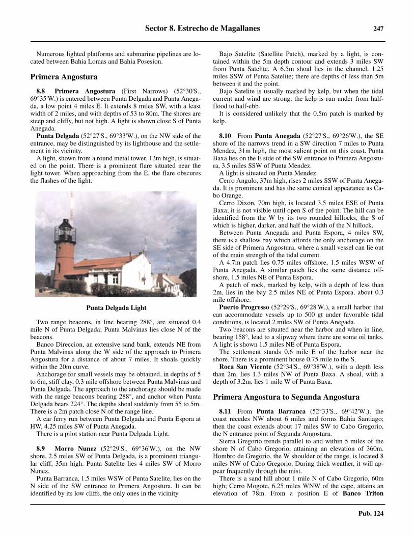
Sector 8. Estrecho de Magallanes 247
Pub. 124
8.7 Numerous lighted platforms and submarine pipelines are lo-cated between Bahia Lomas and Bahia Posesion.
Primera Angostura
8.8 Primera Angostura (First Narrows) (52°30'S.,69°35'W.) is entered between Punta Delgada and Punta Anega-da, a low point 4 miles E. It extends 8 miles SW, with a leastwidth of 2 miles, and with depths of 53 to 80m. The shores aresteep and cliffy, but not high. A light is shown close S of PuntaAnegada.8.8 Punta Delgada (52°27'S., 69°33'W.), on the NW side of theentrance, may be distinguished by its lighthouse and the settle-ment in its vicinity. 8.8 A light, shown from a round metal tower, 12m high, is situat-ed on the point. There is a prominent flare situated near thelight tower. When approaching from the E, the flare obscuresthe flashes of the light.
8.8 Two range beacons, in line bearing 288°, are situated 0.4mile N of Punta Delgada; Punta Malvinas lies close N of thebeacons.8.8 Banco Direccion, an extensive sand bank, extends NE fromPunta Malvinas along the W side of the approach to PrimeraAngostura for a distance of about 7 miles. It shoals quicklywithin the 20m curve.8.8 Anchorage for small vessels may be obtained, in depths of 5to 6m, stiff clay, 0.3 mile offshore between Punta Malvinas andPunta Delgada. The approach to the anchorage should be madewith the range beacons bearing 288°, and anchor when PuntaDelgada bears 224°. The depths shoal suddenly from 55 to 5m.There is a 2m patch close N of the range line.8.8 A car ferry run between Punta Delgada and Punta Espora atHW, 4.25 miles SW of Punta Anegada.8.8 There is a pilot station near Punta Delgada Light.
8.9 Morro Nunez (52°29'S., 69°36'W.), on the NWshore, 2.5 miles SW of Punta Delgada, is a prominent triangu-lar cliff, 35m high. Punta Satelite lies 4 miles SW of MorroNunez.8.9 Punta Barranca, 1.5 miles WSW of Punta Satelite, lies on theN side of the SW entrance to Primera Angostura. It can beidentified by its low cliffs, the only ones in the vicinity.
8.9 Bajo Satelite (Satellite Patch), marked by a light, is con-tained within the 5m depth contour and extends 3 miles SWfrom Punta Satelite. A 6.5m shoal lies in the channel, 1.25miles SSW of Punta Satelite; there are depths of less than 5mbetween it and the point.8.9 Bajo Satelite is usually marked by kelp, but when the tidalcurrent and wind are strong, the kelp is run under from half-flood to half-ebb.8.9 It is considered unlikely that the 0.5m patch is marked bykelp.
8.10 From Punta Anegada (52°27'S., 69°26'W.), the SEshore of the narrows trend in a SW direction 7 miles to PuntaMendez, 31m high, the most salient point on this coast. PuntaBaxa lies on the E side of the SW entrance to Primera Angostu-ra, 3.5 miles SSW of Punta Mendez. 8.10 A light is situated on Punta Mendez.8.10 Cerro Angulo, 37m high, rises 2 miles SSW of Punta Anega-da. It is prominent and has the same conical appearance as Ca-bo Orange.8.10 Cerro Dixon, 70m high, is located 3.5 miles ESE of PuntaBaxa; it is not visible until open S of the point. The hill can beidentified from the W by its two rounded hillocks, the S ofwhich is higher, darker, and half the width of the N hillock.8.10 Between Punta Anegada and Punta Espora, 4 miles SW,there is a shallow bay which affords the only anchorage on theSE side of Primera Angostura, where a small vessel can lie outof the main strength of the tidal current.8.10 A 4.7m patch lies 0.75 miles offshore, 1.5 miles WSW ofPunta Anegada. A similar patch lies the same distance off-shore, 1.5 miles NE of Punta Espora. 8.10 A patch of rock, marked by kelp, with a depth of less than2m, lies in the bay 2.5 miles NE of Punta Espora, about 0.3mile offshore.8.10 Puerto Progresso (52°29'S., 69°28'W.), a small harbor thatcan accommodate vessels up to 500 gt under favorable tidalconditions, is located 2 miles SW of Punta Anegada. 8.10 Two beacons are situated near the harbor and when in line,bearing 158°, lead to a slipway where there are some oil tanks.A light is shown 1.5 miles NE of Punta Espora.8.10 The settlement stands 0.6 mile E of the harbor near theshore. There is a prominent house 0.75 mile to the S.8.10 Roca San Vicente (52°34'S., 69°38'W.), with a depth lessthan 2m, lies 1.3 miles NW of Punta Baxa. A shoal, with adepth of 3.2m, lies 1 mile W of Punta Baxa.
Primera Angostura to Segunda Angostura
8.11 From Punta Barranca (52°33'S., 69°42'W.), thecoast recedes NW about 6 miles and forms Bahia Santiago;then the coast extends about 17 miles SW to Cabo Gregorio,the N entrance point of Segunda Angostura.8.11 Sierra Gregorio trends parallel to and within 5 miles of theshore N of Cabo Gregorio, attaining an elevation of 360m.Hombro de Gregorio, the W shoulder of the range, is located 8miles NW of Cabo Gregorio. During thick weather, it will ap-pear frequently through the mist.8.11 There is a sand hill about 1 mile N of Cabo Gregorio, 60mhigh; Cerro Mogote, 6.25 miles WNW of the cape, attains anelevation of 78m. From a position E of Banco Triton
8.8Punta Delgada Light
248 Sector 8. Estrecho de Magallanes
Pub. 124
(52°37'S., 69°55'W.), these two hills and Cabo Gregorio ap-pear as islands.8.11 Cerro Sutlej (52°23'S., 69°45'W.), 152m high, rises 9 milesWNW of Punta Delgada. It becomes clear of the range at theback, forming a good mark when a vessel is abreast of BancoTriton. In some conditions of visibility Cerro Util, 12 miles Wof Punta Barranca, will be seen as a small double hill close toshore over Punta Valle, the W entrance point of Bahia Santia-go.8.11 From Punta Barranca to Cabo Gregorio, the 20m curve is ir-regularly shaped, but lies as much as 6.25 miles offshore in thevicinity of Banco Triton.8.11 Banco Triton (52°37'S., 69°55'W.), with a least depth of5.5m and marked by a lighted buoy, lies 9 miles WSW of PuntaBarranca. The bank is composed of sand. 8.11 Tidal currents run strongly over the bank and usually formripples near its shallowest part. The bank is reported to be ex-tending S.
8.12 Bahia Santiago (52°32'S., 69°52'W.) is entered be-tween Punta Barranca and Punta Valle, 11.5 miles WSW. Ban-co Barranca extends from the shore W of Bajo Satelite andoccupies the NE part of the bay. The depths over the bank varyfrom 5 to 9m. A detached 8.5m shoal lies 4 miles E of PuntaValle.8.12 Anchorage, in depths of 10 to 20m, may be obtained in Ba-hia Santiago. 8.12 During E winds, the best anchorage is off the SW end ofBanco Barranca, 4.5 miles E of Punta Valle, where the kelpforms a breakwater leaving calm water on the lee side. 8.12 During W winds, the best anchorages are closer to PuntaValle or in Bahia Gregorio, 10 miles SW.8.12 Bahia Gregorio (52°37'S., 70°08'W.) lies between PuntaValle and Cabo Gregorio, 8.75 miles SW. Cabo Gregorio issandy and ends in a small cliff, 4m high. 8.12 Although the cape is free of dangers, it should be given awide berth as the tidal current sweeps round it at rates of 4 to 5knots towards the shoals to the SW. A radio mast stands 1 mileN of the cape.8.12 Banco Tribuna has a least depth of 6.7m located 3.5 miles Eof Cabo Gregorio. There is a narrow bank, with a least depth of19.7m, 4 miles ESE of the shallowest part of Banco Tribuna.
8.13 Puerto Sara (52°38'S., 70°12'W.) (World Port IndexNo. 14090), 1.75 miles NNE of Cabo Gregorio, has an oil ter-minal from which crude oil is exported. 8.13 A pier, about 400m long, extends SE, but has been reportedin a bad state of repair; berthing alongside its head was imprac-ticable. Near its root there is a cold storage plant and a group ofhouses. 8.13 A pipeline is laid from the root of the pier in a SE directionto a number of mooring buoys which lie about 0.2 mile SE ofthe head of the pier, in depths of about 25 to 28m. 8.13 Vessels are berthed at the beginning of HW slack in daylighthours only. Tankers up to 75,000 gt and 14.9m draft can be ac-commodated.8.13 Pilotage is compulsory; the pilots come from Punta Arenas.The boarding place is about 1 mile SE of the oil terminal.8.13 Vessels approaching Puerto Sara from the E should pass S of
Banco Tribuna and not steer for Puerto Sara until the rangelights align on bearing 334°. 8.13 The port anchor should be let go when from the bow of thevessel the lighted beacons 0.5 mile N of Cabo Gregorio are inrange bearing 265°, veer 220m of chain, then let go the star-board anchor, securing to the berth heading 230°. 8.13 Tugs are available to assist in berthing and to run all moor-ings to the buoys.8.13 It should be noted that the holding ground where the port an-chor is let go is good, but the starboard anchor is let go on rockand pebbles. Care must be taken not to drag or foul this anchor.8.13 Anchorage is available off Puerto Sara, in Bahia Gregorio, ina depth of 20m, with the light on the pier bearing 240°, distant1.5 miles.8.13 The tidal currents in the anchorage area have a rate of 2 to 3knots and the tidal range is about 5.5m at springs.
8.14 The S shore, between Punta Baxa, the SE entrance toPrimera Angostura, and Punta San Isidro, the NE entrance toSegunda Angostura, is low and fringed by a chain of low hillswith few landmarks. Cerro Negro rises near the coast 5 miles Sof Punta Baxa. 8.14 Cerro Doble Pico is located 8.25 miles S of Punta San Isidro,and Pico Gap, 291m high, lies 21 miles SE of the same point.8.14 Bahia Felipe occupies all of this S shore. There are severalanchorages in the bay, but they are exposed to the prevailingwinds.8.14 An extensive bank of irregular shape, with depths of 8.3 to19.3m, about 4 miles N to S and a similar distance E-W, lies inthe SW approach to Primera Angostura, SE of the recommend-ed track.8.14 The 20m curve lies up to 4.5 miles offshore in Bahia Felipe,but the water N of Punta San Isidro is steep-to, with a depth of76m charted about 0.3 mile NE of the point.8.14 Arrecife Barnacle (52°45'S., 70°02'W.) has a least depth of5m which is located 2 to 4 miles E of Punta San Isidro. This isthe only rocky ledge between the two narrows.8.14 Anchorage.—In the NE part of Bahia Felipe, anchoragesheltered from SE winds may be obtained, in 9.5m, with PuntaBaxa bearing 021°, 3.5 miles, or farther S in 12m, with thepoint bearing 024° and Cerro Negro bearing 090°. When leav-ing this latter berth for the W with a W current, steer for Hom-bro de Gregorio until well out in the strait to avoid being setonto the shoal at the head of the bay.8.14 A Traffic Control Waiting Area is established in Bahia Fe-lipe, about 5 miles ESE of Punta San Isidro. 8.14 Good anchorage may also be obtained in the W part of BahiaFelipe, well sheltered from SW winds, midway between PuntaSan Isidro and Punta Piedra, 11.5 miles ESE. 8.14 This anchorage should be approached with Cerro Doble Picobearing 210°, which leads over the E end of Arrecife Barnacle;the anchor should be let go when Cerro Cono (52°40'S.,70°23'W.), on the N shore of Segunda Angostura, bears 290°,in a depth of 25m, sand and shells.8.14 Another good berth, nearer to Punta San Isodro, is in a depthof 20m, with the point bearing 298° at a distance of 1.25 miles.Care is necessary when using this anchorage, as the shallowcoastal bank extending E from the point is steep-to and the Wcurrent runs over it strongly.
Sector 8. Estrecho de Magallanes 249
Pub. 124
Segunda Angostura
8.15 Segunda Angostura (Second Narrows) is about 12miles long, NE-SW, and 4 to 6 miles wide. The narrows are en-tered from the E between Cabo Gregorio (52°39'S., 70°13'W.)and Punta San Isidro, 5.75 miles SSE.8.15 Cerro Cono, 6.5 miles W of Cabo Gregorio, is a distinctivehill, 41m high. A light on its summit is shown from a roundtower, 10m high.8.15 Punta Gracia (52°44'S., 70°32'W.), 6.25 miles WSW ofCerro Cono, is the N entrance point of the W end of SegundaAngostura. It is a cliffy point, 53m high.8.15 The N shore recedes between Cabo Gregorio and Punta Gra-cia and is bordered by a bank with shoal water extending outabout 0.5 mile from a line joining the cape and the point. 8.15 These shoals consist of a drying sand bank, 1.3 miles long,with its E end 1.5 miles WSW of the cape, while 6 miles WSWof the cape is Bajo Halfway, 1.25 miles long, with a least depthof 5.5m on it. East of Punta Gracia, the bank extends about 1mile off the shore and is steep-to.
8.16 The S shore of Segunda Angostura is higher than theN shore; it is cliffy and steep-to.8.16 From Punta San Isidro (52°44'S., 70°08'W.), the shoretrends WSW 7.5 miles to Cabo San Simon which is 68m high,then curves gradually WSW 4.5 miles to Cabo San Vicente,56m high, the S entrance point of the W end of Segunda An-gostura.8.16 Cerro Agudo, 6 miles WSW of Punta San Isidro, appears asa remarkable conical peak which makes a good mark until Ca-bo San Simon is raised. Promontorio Sweepstakes, on the coast4.25 miles W of Cerro Agudo, 50m high, is a good landmarkfor anchoring in Bahia Gregorio.8.16 Segunda Angostura Light (52°44'S., 70°11'W.), 2 miles Wof Punta San Isidro, is shown from an octagonal concrete tow-er, 6m high. The lighthouse is equipped with a racon.8.16 Directions.—From a position 7.5 miles ESE of Cabo Grego-rio, steer 257° to pass 2 miles N of Segunda Angostura Light.When Cabo San Vicente Light bears 180°, steer 215° to a posi-tion 1.75 miles W of Cabo San Vicente Light, then steer 182°to enter Paso Nuevo. Vessels bound E steer reciprocal courses.
Segunda Angostura to Paso Ancho
8.17 From Punta Gracia (52°44'S., 70°32'W.) to PuntaGente, about 18 miles SSE on the E shore, both the E and Wsides of the strait are indented with bays.8.17 From Segunda Angostura, there are three routes leading S toPaso Ancho. Paso Nuevo, E of Isla Marta and Isla Magdalena,is the recommended and most generally used route. 8.17 The others are Paso Reina, the middle route; and the channelthrough Paso Real and Paso Pelicano, between Isla Isabel andthe W shore. The last mentioned channel is available to vesselswith a draft up to 5.5m.
Bahia Whitsand (52°43'S., 70°36'W.) is entered betweenPunta Gracia and Punta Low, 6 miles WSW. It is shelteredfrom all winds N of SW and is free from the influence of thetidal currents. 8.17 Good anchorage may be obtained, in a depth of 10.7m, mud,with Punta Gracia bearing 082° and Punta Silvestre, the NE ex-
tremity of Isla Isabel, bearing 171°.Ensenada Oazy is enteredfrom the NE corner of Bahia Whitsand, between Punta Shep-herd on the E and Punta John, 1 mile W. 8.17 The entrance is about 1 mile wide, but it narrows quickly andis unsuitable for an anchorage. 8.17 Kelp extends 0.3 mile offshore between Punta Gracia andEnsenada Oazy.
8.18 Puerto Zenteno is entered between Punta Perno andPunta Puno, 1.25 miles SSW and 2.75 miles SSW, respectively,of Punta Low. It widens within the entrance, and is completelysheltered, but during W winds a sea rises quickly and is dan-gerous for boats. No vessel without local knowledge should en-ter this bay.8.18 A detached shoal, with a depth of 7.7m and surrounded bykelp, lies in the approach to Puerto Zenteno, 1.5 miles SE ofPunta Perno.8.18 An isolated 6.2m shoal, also surrounded by kelp, lies 1.5miles ESE of Punta Zenteno, a point 0.6 mile SE of Punta Pu-no.8.18 Puerto Zenteno is almost entirely filled with a shallow bank.The entrance lies between Punta Puno and Isla Plaid, 25 mileto the N. The navigable channel lies between a rock, awash,183m SSW of Isla Plaid, and Punta Puno which is a steep-tosand spit. The channel is 183m wide with depths of 10m.8.18 Islote Pitcher lies on the N side of the channel, about 0.5mile W of Punta Puno.8.18 Laguna Cabeza del Mar, a large shallow lake 7 miles W ofPunta Zenteno, may be reached by passing through Puerto Ze-nteno, Canal Tortuoso, and Laguna Baja.8.18 Anchorage may be obtained outside the entrance to PuertoZenteno, in depths of 11 to 13m, about 1 mile SE of Punta Ze-nteno.8.18 Isla Isabel (52°52'S., 70°42'W.) lies 5 miles SE of PuertoZenteno; it extends 7.5 miles in a NE to SW direction and is 2miles wide. Ranges of hills extend in ridges along its length. 8.18 The greatest elevation, 54m, is near the SW end. Punta Sil-vestre, the NE extremity of the island, is very low and steep-to.It is composed of sand, shells, and shingle. 8.18 A bank, with a least depth of 3.7m, extends 1 mile WSWfrom a position 1 mile S of Punta Tern, the SE extremity.
8.19 Paso Real lies between Isla Isabel and the mainland tothe W. Paso Pelicano is the S portion of Paso Real between Ca-bo Thorax and the mainland to the SW.8.19 Bajo del Medio (52°48'S., 70°40'W.), with a least depth of4.5m, lies in the N entrance to Paso Real, 2.75 miles ESE ofPunta Zenteno; it is joined to the NW extremity of Isla Isabelby a bank with a least depth of 4.5m. A shoal, with a depth of2.7m, lies 1.75 miles WNW of Punta Silvestre.8.19 Punta Ana, a low sandy point, is located 2 miles SW of PuntaZenteno. Dangers covered by kelp, which is usually visible, lieup to 2 miles E and 1.5 miles SE of the point.8.19 Punta Rosa (52°51'S., 70°48'W.) is located 2.75 miles SSWof Punta Ana. The 5m curve lies 0.25 mile E of Punta Rosa andthe 10m curve lies about 1 mile E of the same point.8.19 Paso Pelicano is entered from the N between Punta Rosa andPunta Hook, 2.5 miles SE on Isla Isabel. Its S entrance is be-tween Cabo Thorax, on Isla Isabel, and Cabo Porpesse, 1.5miles S. A light is shown from Cabo Thorax.

250 Sector 8. Estrecho de Magallanes
Pub. 124
8.19 Tidal currents in Paso Real run at a rate of 1 knot. In PasoPelicano their rates are from 1.5 to 2 knots. 8.19 Anchorage for a vessel of moderate draft may be obtained, ina depth of 13m, on the E side of Paso Real, with the N extrem-ity of Isla Isabel bearing 123° and Punta Gracia bearing 035°.Attention should be given to the shoal water about 0.5 milesNE and 0.5 mile W of the anchorage. 8.19 Vessels may also anchor N of Isla Isabel, with Punta Silves-tre bearing 154° and Punta Gracia bearing 029°, in a depth of18m.
8.20 Cabo Negro Gas Terminal (52°56'S., 70°48'W.),consisting of a 36m long T-shaped concrete jetty, with a depthof 14m alongside, stands 0.4 mile WNW of Cabo Porpesse. Itcan accommodate vessels up to 96,000 dwt, with a maximumlength of 241m and a maximum draft of 12.8m. A mooringbuoy, dolphins, and mooring posts lie off the head of the jetty.8.20 The port limits of the terminal are the parallel of Cabo Tho-rax and the meridian joining Cabo Thorax and Cabo Porpesse.8.20 Pilots will berth and unberth vessels at slack water. Berthingis only carried out in daylight during slack water. Lights inrange bearing 270°, lead to the pier head. 8.20 Anchoring within about 0.1 mile of the head of the jetty orrange line is prohibited. The terminal should only be ap-proached from the S through Paso Pelicano.8.20 There is anchorage NW of the jetty, 0.25 mile offshore, indepths of 10m, sand, but during prevailing winds from the W toN, Bahia Laredo is preferable.8.20 Directions.—A vessel of moderate size, proceeding throughPaso Real and Paso Pelicano, can pass S of Bajo del Medio,keeping at a distance of not less than 0.5 mile off the NW sideof Isla Isabel, until the point 1.25 miles N of Cabo Thorax isabeam, then steer course 190° until the light on Cabo Thoraxbears 060°. The S entrance to Paso Pelicano will now be openand a course of 122° should be made good to clear the shoalwater SSE of Isla Isabel and the bank, with depths of less than9m, that extends 1 mile E from Cabo Porpesse. 8.20 Care should be exercised to pass E of the shoal patches offthe NW extremity of Isla Isabel.8.20 When the wind and current are opposed to each other a raceensues, which is dangerous for boats, in Paso Pelicano S of Ca-bo Thorax.
8.21 Banco Marta (52°49'S., 70°33'W.), steep-to andmarked by kelp, and with a least depth of 3m, lies with its Nend 3.5 miles S of Segunda Angostura and 3 miles ENE ofPunta Silvestre. The bank extends about 5.2 miles SSW fromthis position and has an average width of about 0.7 mile. 8.21 Isla Marta, lying near the middle of Banco Marta, rises insheer cliffs to an height of 18m. It has a flat summit, and slopesslightly to the E. A reef, which dries, extends 0.25 mile NEfrom the island.8.21 Isla Magdalena (52°55'S., 70°35'W.), 1 mile long NE toSW, lies 4 miles S of Isla Marta. It is 34m high at its W end,where it rises vertically from the sea. 8.21 Shoal water extends about 1 mile NE from the NE extremityof the island. The edge of this shoal is usually well-marked bykelp and tide rips. 8.21 A below-water rock, whose position is doubtful, is reportedto lie 1 mile N of the light tower situated near the center of the
island. A 6.5m shoal lies 1.75 miles ESE of the light tower.Other dangers, best seen on the chart, lie up to 2.8 miles ENEof the light tower.
8.22 Paso Reina (52°53'S., 70°40'W.) lies between the is-lands and bank described above and the SE coast of Isla Isabel. 8.22 There is a navigable width of about 0.7 mile between theshoals to the SE and the coastal bank extending off the SEcoast of Isla Isabel.8.22 Banco Walker, with depths of less than 20m, extends for 5miles in a NE to SW direction in the approach to Paso Pelicanofrom E. The shallowest part of the bank, with a charted depthof 6.3m, lies 5 miles ENE of Cabo Porpesse.8.22 In Paso Reina, the tidal rates are between 2 and 3 knots; be-tween Isla Magdalena and Banco Walker, they run at rates of 3to 5 knots.8.22 Anchorage.—Anchorage in Paso Reina may be obtained outof the strength of the tidal current, with Punta Silvestre bearing023°, distant 1.25 miles, in a depth of 14m, coarse sand andshell.8.22 Directions.—Follow the suggested course for Segunda An-gostura and when the light on Cabo San Vicente bears 130°,steer for the N extremity of Isla Isabel which shows as a bluff,bearing 236°. When Punta Silvestre is in line with Punta Alfre-do, 2.25 miles SSW, bearing 218°, steer to keep in the middleof the channel between the banks which extend off Isla Isabeland the shoals off Banco Marta and Banco Walker.8.22 Caution.—It is possible that rocks exist between Isla Martaand Isla Magdalena, and between Isla Magdalena and BancoWalker therefore, the passage between the islands, and be-tween Isla Magdalena and the bank should not be used.8.22 Paso Nuevo is the best and most frequently used of the threeroutes from Segunda Angostura to Paso Ancho. It lies E of IslaMarta and Isla Magdalena, and its E shore extends from CaboSan Vicente to Punta Gente, 14 miles S.
8.23 Bahia Lee (52°50'S., 70°20'W.) is formed betweenCabo San Vicente and Punta Zegers.8.23 Cerro Spiteful is located close to the NE shore of the bay,4.25 miles E of cape.8.23 Banco Nuevo, with depths of 0 to 10m, extends about 5miles S from a position 1.5 miles SSE of the light on Cabo SanVicente. The bank lies close E of the 20m curve and is reportedto be extending to the NE.8.23 Tidal currents, with rates up to 6 knots, have been experi-enced in the N end of Paso Nuevo at the time of HW. 8.23 The flood current sets E onto Banco Nuevo and the ebb setsW out of Bahia Lee. Heavy overfalls occur S of Cabo San Vi-cente when strong W and NW winds meet the ebb current.8.23 Anchorage, which should only be used in an emergency andnever at night, may be obtained, in a depth of 15 to 20m, 1.5miles ESE of Cabo San Vicente. 8.23 Although the anchorage is fairly sheltered from N and NWwinds, these winds may suddenly shift to SW, or SW galesmay spring up from calms without warning.8.23 Anchoring is prohibited in a 1-mile wide band stretching be-tween Punta Zegers W to Cabo Porpesse, and passing S of IslaMagdalena, due to the presence of a submerged gas pipeline.8.23 Bahia Gente Grande (52°59'S., 70°13'W.) is entered be-tween Punta Zegers and Punta Paulo, 3.5 miles S. Its shores are

Sector 8. Estrecho de Magallanes 251
Pub. 124
low and bordered by shallow banks. 8.23 Cerro Doble Pico, previously described in paragraph 8.14,lying 0.75 miles ENE of Punta Zegers, is a good mark.8.23 Banco Middleton, with depths of 2 to 4m, extends about 0.8mile SSE of Punta Zegers. The 5m curve lies up to 0.75 mileoff the shore along the N side of the bay and in places about thesame distance off the SE and SW shores of the bay.8.23 Isla Contramaestre (52°57'S., 70°21'W.), in the entrance toBahia Gente Grande, lies 2 to 3.5 miles SW of Punta Zegers.Banco Almeida, with a depth of 5m, lies near the middle of theN entrance to the bay, 0.9 mile N of the N extremity of IslaContramaestre. 8.23 Banco Serpiente, which partially dries on its W end and hasa least depth of 3m on its E end, extends 1.25 miles E of thesame point. The bank was reported extending E and SE.8.23 Banco Middleton, with depths from 2 to 5m, extends 1 mileSE from Punta Zegers.8.23 Banco Perez, with a minimum depth of 4.4m on its N edge,lies on the SE side of the S entrance channel, 1 mile NNE ofPunta Paulo. The bank is marked by kelp.8.23 Directions.—There are two entrances to Bahia GenteGrande.8.23 The passage N of Isla Contramaestre is wider, but is not rec-ommended except for small vessels with shallow draft. Thepassage is shallow, the rate and direction of the tidal current isirregular, but usually sets across the channel, and BancoAlmeida lies in the middle.8.23 The channel S of the island has a least depth of 10m and aleast navigable width of 0.4 mile.8.23 To enter Bahia Gente Grande by the S channel, make good acourse of 055° to pass midway between the two lighted buoyssituated about 1 mile and 1.25 miles, respectively, NNW ofPunta Paulo. As soon as the light on Isla Contramaestre bears267°, alter course to 087° keeping that light astern, passing Nof Banco Perez Lighted Buoy until Punta Zegers is in rangewith Cabo San Vicente bearing 328°. Then steer as desired forselected berth.
8.24 Caleta Percy (52°53'S., 70°14'W.) is a small cove Nof Punta Vergara, about 2 miles within the N entrance point ofBahia Gente Grande.8.24 On the S side of the cove there is a pier 160m in length, witha depth of 2.7m at its outer end. About 0.2 mile N, there is an-other pier of the same length. A light is occasionally shownfrom the head of each pier.8.24 Submarine pipelines extend about 1 mile SE from a positionon shore 0.25 mile NNE of the S pier head. A berth for tankersup to 10,000 gt, in a depth of 11m, is situated at the seawardend of the pipelines, where there are four mooring buoys. 8.24 The maximum draft that can be accommodated here is about9.1m. The maximum length handled is 122m. Except for ves-sels using the berth, anchoring is prohibited within 0.6 mileand on the range line in the approach to it.8.24 Pilots and Customs Officers are available, but a reliable ad-vance notice of ETA must be sent from the vessel.8.24 Berthing at the tanker berth or piers should be done, if possi-ble, at early dawn when the winds are moderate; this is consid-ered practical in winds up to force 6 or 7. 8.24 With SW winds, the sea runs into the cove, making the S pierunusable.
8.24 This port is normally used for local shipments only. Berthingis done during daylight hours only.8.24 The port limits of the terminal are the parallel of 52°55.7'Sand the meridians of 70°14'W and 70°18'W.8.24 Caleta Clarencia (52°54'S., 70°08'W.), which forms the NEextremity of Bahia Gente Grande, lies 6 miles ENE of PuntaZegers. It is exposed to the prevailing SW wind.8.24 A submarine pipeline extends about 0.7 mile SSE from a po-sition on shore near the oil tanks. Mooring buoys at the sea-ward end of the pipeline will accommodate a tanker up to75,000 gt, with a draft of 11m. 8.24 However, the entrance to Bahia Gente Grande has a limitingdraft of 10m and vessels may be required to complete loadingat Puerto Sara. The maximum vessel length that can be accom-modated is 250m.8.24 A berthing pilot must be used by vessels that are using thisberth. Vessels lie on a 255° heading with both anchors out andwith mooring lines to the buoys, about 120m in length.8.24 Anchorage.—Anchorage may be taken, in depths of 9 to12m, about 1.75 miles NE of Punta Searle, which is located inthe SW part of Bahia Gente Grande, about 4 miles S of PuntaPaulo.
8.25 Caleta Hobbs (53°03'S., 70°20'W.), formed betweenPunta Searle and Punta Hobbs, 2 miles SE, lies in the extremeSW corner of Bahia Gente Grande. The general depths withinCaleta Hobbs are 1 to 4.5m. There are some buildings situatedon the shore of a small bight close W of Caleta Hobbs.8.25 From Punta Paulo, the shore of the S approach to Bahia Gen-te Grande trends 4.5 miles SSW to Punta Gente (53°00'S.,70°25'W.), a point, 22m high. Cerro Huemul rises to 28m, 1.75miles NE of Punta Gente.8.25 Tidal currents along this shore are strong and the vicinity ofPunta Gente should be avoided.
Paso Ancho
8.26 Paso Ancho is that part of Estrecho de Magallanesthat lies between Punta Gente and Bahia Laredo on the N, andthe entrance to Paso del Hambre about 40 miles S.8.26 Cabo Negro (52°57'S., 70°48'W.), a dark cliff, 40m high, islocated about 0.9 mile SSW of Cabo Porpesse.8.26 Bahia Laredo is entered between Cabo Negro and a point 2.5miles SSW. Foul ground lies off the S entrance point of the bay,and the 5m curve lies about 1 miles NNW of the same point. A4.2m patch lies about 1 mile S of Cabo Negro.8.26 A jetty extends 120m SE from the coast about 1.2 miles SWof Cabo Negro. There is a depth of 4.5m alongside the jettyhead.8.26 There is good anchorage in Bahia Laredo, in depths of 10 to12m, sand and mud, SW of Cabo Negro.8.26 Tidal currents in the bay are of no consequence inside BahiaLaredo. South of the bay they are hardly felt, but N they arestrong. Between Cabo Negro and Isla Contramaestre on the Eshore, is the W limit of strong tidal currents in the strait.8.26 Small vessels can obtain anchorage in Caleta Chabunco, offthe mouth of Estero Chabunco, about 4.2 miles S of Cabo Ne-gro.8.26 A beacon, 16m high, is situated on a hill about 2 miles SSWof the mouth of Estero Chabunco.
252 Sector 8. Estrecho de Magallanes
Pub. 124
8.27 The mouth of the Estero Rio Seco, about 3 miles S ofEstero Chabunco, can be identified by buildings which can beseen at a considerable distance. 8.27 There is a cold storage plant, with two chimneys in line bear-ing 285°, and a pier, 100m long, with a depth of 3m at its head,situated close NE of the E chimney; it is used by local craft forloading chilled meat.8.27 There is anchorage here, in a depth of 22m, with the twochimneys in line and the beacon bearing 355°. This berth isconvenient for vessels working cargo and is free of kelp.8.27 Bahia Catalina lies between the mouth of the Estero Rio Se-co and Punta Arenas (Punta Arenosa) (53°08'S., 70°51'W.), 4miles S. There is a prominent white patch on the cliffs, 2.5miles NNE of Punta Arenas. When seen from the N, in somelight conditions, it resembles a ship under sail.8.27 Tres Puentes, a large refrigeration plant, is situated about 0.7NNW of Punta Arenas. There are two small piers situated here.The obstruction lights of the four radio towers are more notice-able than the lights of the town.8.27 There are two conspicuous aircraft hangars situated 0.3 mileNW of Punta Arenas; a similar hangar is situated 0.3 mileWNW of the same point.8.27 Muelle Mardones, an L-shaped pier, is situated about 0.3mile NW of Punta Arenosa. The pier has a depth of about 20malong its outer face and has a lighted beacon near the end. Adesignated anchorage lies about 0.7 mile NE of the MuelleMardones pier. The bay is very open and only protected fromW winds. The holding ground in this area is reported to bepoor.8.27 Punta Arenas is a projection of low land, consisting of sandand gravel covered with grass and bushes. The point sticks outabout 1 mile from the general run of the coast. 8.27 The point is steep-to on its NE side, but on the SSE side asandbank, with depths less than 5.5m, extends 1 mile offshore.This sandbank is said to be extending seaward.8.27 Punta del Rio, the N entrance to Rada de Puntas Arenas, islocated about 2 miles SSW of Punta Arenas, close N of themouth of the Rio Las Minas.
Rada de Punta Arenas (53°10'S., 70°54'W.)
World Port Index No. 14100
8.28 Rada de Puntas Arenas is an open roadstead situatedabout 1 mile SW of Punta del Rio. It is the first port of entry forEstrecho de Magallanes, and consists of the city, berthing, andanchoring facilities and two tanker berths. The city of PuntaArenas, which backs the roadstead, is a modern city with allamenities. It is the capital of the province of Magallanes.
8.28 Winds—Weather.—The predominant winds are from theNW and, although it blows on occasion with great violence, itdoes not lift the sea. They are dangerous only to small vessels. 8.28 The “Panteonero,” a local wind which comes up in the springor summer, is a WNW wind reaching a force of 12 on theBeaufort Scale.
8.28 On occasions winds blow from the SW, but without much in-tensity. However, they cause the tides to rise and occur as tem-pest in Punta Arenas.8.28 There are sporadic E winds that are dangerous, as the bay isopen in this direction. These winds have damaged smallerships and caused larger vessels to drag anchor.8.28 When winds occur from the E or SW, ships moored at thepier should leave and anchor in the bay in case the tide shouldrise.8.28 The most favorable months are those of winter, when thewinds diminish in intensity and there are frequent calm days. 8.28 On the contrary, spring and summer present strong windsfrom the W, blowing for long periods of time; calm days arescarce.8.28 Tides—Currents.—The spring range is 1.4m, while theneap range is 0.6m.8.28 The current of the flood tide flows from the NE to SW, con-trary to the ebb current. Without other factors, the change in di-rection of the current is produced by the tides. Currents have amaximum speed of 1 knot.8.28 With strong W winds, the current constantly flows towardthe E without any effect from the tidal currents.8.28 Depths—Limitations.—Muelle Prat is the primary pier inthe port; it has 542m of berthing. The limiting dimensions atthe berths are, as follows:
1. Berth 1N can accommodate a vessel with a maximumlength of 176m and a maximum draft of 9m. Berth 1S canaccommodate a vessel with a maximum length of 176m anda maximum draft of 8.9m.
2. Berth 2N can accommodate a vessel with a maximumlength of 151m and a maximum draft of 5.2m. Berth 2S canaccommodate a vessel with a maximum length of 151m anda maximum draft of 5.2m.
3. Berth 3N and Berth 3S are both reported to accommo-date a maximum draft of 1.8m.
4. The Inshore Berth is for small craft only.8.28 Shoaling in the vicinity is continuous and dredging in theberths alongside is in progress.8.28 In calm weather, vessels up to 165m in length can moorstern-to the head of Muelle Prat, riding to the starboard anchoron seven shackles of cable.8.28 Vessels berth with bows to shore due to shoal patches about40m off each side of the pier.8.28 Mooring at the pier is somewhat dangerous due to the influ-ence of the wind, the currents, and the state of the tide. Priorknowledge of these factors is required in order to consider theireffect.8.28 It is not recommended that vessels over 1,000 gt moor at thepier in winds above force 4.8.28 Muelle Santos Mardones lies 0.3 mile NW of Punta Areno-sa. The pier is L-shaped, and has a berthing face 336m long.Vessels with a maximum length of 230m and a maximum draftof 14m can be accommodated.8.28 Aspect.—In order to facilitate mooring at night, there aretwo pairs of leading beacons on each side of the pier; the bea-cons are 50m apart, enabling vessels to make a safe approach.Both pairs of beacons are aligned bearing 334°, the ones on theN side of the pier have green lights and the ones on the S sidered lights. Request for lighting these beacons should be coordi-nated via VHF with “EMPORCHI.”
Rada de Punta Arenas
http://www.australport.co.cl

Sector 8. Estrecho de Magallanes 253
Pub. 124
8.28 A yellow square building and a square white building with aflat roof are situated 0.5 mile and 0.45 mile N and NNW, re-spectively, from the head of Muelle Prat. 8.28 Don Bosco Church, about 0.9 mile NNE of the pier head, isconspicuous. There are two radio masts, marked by obstructionlights, situated 0.3 mile NNE of the pier whose lights are seenfrom seaward above all the lights of the city.8.28 A television mast, showing an obstruction light, situated onMonte Fenton, 4.75 miles WNW of the head of Muelle Prat, isprominent and may be seen at night at a distance of 30 miles.8.28 A brown oil tank is situated on shore at the head of the pipe-line; two radio towers are situated about 0.2 mile NW of the oiltank.8.28 Pilotage.—Pilotage is compulsory for anchoring in the bayand for mooring to the pier or mooring buoys. The request for apilot and the vessel’s ETA should be sent by radio 5 days in ad-vance and then daily at 0800. Port pilots embark about 1 mileoff the end of Muelle Prat. If there are strong winds or heavyseas, vessels are advised to have a gangway lowered halfway,with a jumping ladder on the end.8.28 Signals.—Weather signals are shown between the two radiomasts N of the pier and also on the Maritime Governor’s offic-es at the root of the pier. Signals are listed in the table titledRada de Punta Arenas—Signals.
8.28 When the variable signal is hoisted, moorings must bechecked and reinforced. With bad weather, they are againchecked and all small boat movement ceases. With storm sig-nals, the port is closed to all movement and work.8.28 Contact Information.—Punta Arenas port can be contact-ed, as follows:
1. VHF: VHF channels 16, 9, and 142. Telephone: 56-61-2201100
56-61-22011053. Facsimile: 56-61-2201196
8.28 Anchorage.—Rada de Punta Arenas affords anchorage pro-tected from prevailing W winds, but is exposed to the E. Pilotstake vessels to one of the several designated anchorage berthsoff Muelle Prat. Vessels should be ready to quit the anchoragein the event of bad weather from the E, or on orders from theCaptain of the Port.8.28 Anchorage is prohibited within an area extending about 0.2mile E and W of the pier and about 0.3 mile S of the pier head,best seen on the chart.
8.28 Vessels must inform authorities of Punta Arenas of their ar-rival 24 hours in advance and request anchorage at the berth. 8.28 The anchorage berths are given in the table titled Rada dePunta Arenas—Anchorages.8.28 Directions.—When approaching from the N, keep well E ofPunta Arenas (Arenosa). 8.28 Observe the Traffic Separation Scheme in the approaches tothe port, which is best seen on the chart.8.28 Rio los Ciervos Oil Terminal is situated 1.75 miles SW ofMuelle Prat. A submerged pipeline extends 0.3 mile SE fromshore and several mooring buoys situated at the seaward end ofthe pipeline form an oil berth. There are charted depths of 12.8to 14.6m in the area of the buoys.8.28 It is recommended that vessels should moor at slack water inwinds less than 10 knots.
8.28 In winds from the N or NE, force 3 or more, and flood cur-rent (flowing S), mooring should not be attempted. On landthere is a leading line that indicates the direction of the pipe-line; it should be used to avoid dropping the anchor on it or an-choring the vessel above it. 8.28 Also, there are two fixed range lights, the lighting of whichshould be requested when mooring to the buoys at night. A pi-lot from Punta Arenas must be aboard for berthing.
8.29 From Rada de Punta Arenas, the W shore of Paso An-cho extends 12 miles S to Punta Santa Maria (53°21'S.,70°57'W.), an easily-recognized point with a high cliff and twopatches bare of trees.8.29 Caleta Agua Fresca, an open bay, is entered S of Punta SantaMaria. Between Caleta Agua Fresca and Punta Carrer as, about11 miles S, the shore is bold; Punta Carreras is a low point. TheN side of the bay is quite foul and should not be penetrated inthat direction beyond the point where soundings indicatedepths of 11 to 14m. 8.29 On the S side. the depths decrease gradually toward the backof the bay; there is a small valley through which runs a stream.8.29 Anchorage may be taken anywhere between Rada de PuntaArenas and Punta Santa Maria, in depths of 18 to 22m, sandand shell over clay, 0.75 mile offshore.
Paso Ancho
8.30 The E shore extends from Punta Gente (53°00'S.,70°25'W.) to Cabo Monmouth, 22 miles S. It is free of all dan-gers outside the 20m curve, which lies about 1 mile off thiscoast. The only break is at Bahia Porvenir, about 19 miles S ofPunta Gente.8.30 Bahia Porvenir (53°18'S., 70°22'W.) is entered betweenPunta Palo and a point about 0.5 mile SSE. It is suitable for
Rada de Punta Arenas—Signals
Day Signal Night Signal Meaning
Black ball One green light Variable weather
Flag “M” One red light Bad weather
Flag “R” Two red lights Storm
Rada de Punta Arenas—Anchorages
Berth Bearing and Distance from Muelle Prat
Berth A 175° and 0.55 mile
Berth B 132° and 0.55 mile
Berth C 099° and 0.7 mile
Berth E 131° and 1.0 mile
Berth F 110° and 1.1 miles
Berth G 093° and 1.2 miles
Rada de Punta Arenas—Anchorages
Berth Bearing and Distance from Muelle Prat

254 Sector 8. Estrecho de Magallanes
Pub. 124
small vessels with local knowledge up to 45m in length andwith a maximum draft of 2m. The pier lies at the head of thebay. Since the improvement of the roads, the importance of theport is declining. 8.30 Pilotage for vessels entering Bahia Porvenir is reported to becompulsory.8.30 A wreck, with a depth of 1.3m, lies 0.2 mile SW of Punta Pa-lo. Less water than charted has been reported in the bay. 8.30 Cabo Monmouth (53°22'S., 70°26'W.), 3 miles S of BahiaPorvenir, is low; the land rises gradually from it. The cape isprominent only from the N, when it shows up as the end of theland.8.30 Cabo Boqueron (53°29'S., 70°12'W.) is a precipitous head-land formed by the abrupt termination of high land extendingENE. Cabo Boqueron is located 10 miles SE of Cabo Mon-mouth.
Inlets and Passages Southeast of Paso Ancho
8.31 The inlets and channels SE and S of Paso Ancho areentered through Paso Boqueron, which lies between Cabo Bo-queron and Punta Arska, the N extremity of Isla Dawson,which lies 0.5 mile SW of Cabo Boqueron.8.31 Bahia Inutil (Bahia Useless) (53°30'S., 69°45'W.) is enteredbetween Cabo Boqueron and Cabo Nose, 16 miles S. The bayrecedes about 32 miles to the E. It has no sheltered anchorageand is exposed to W and SW winds which raise a heavy sea.8.31 The N shore is high and cliffy, but declines as the head of thebay is approached. The S shore is also high, but is lower thanthe N shore. The head of the bay is low with lagoons. 8.31 Caleta Esperanza, Caleta Discordia, and Caleta Josefina lieon the N shore of the bay 8.5, 14, and 21 miles, respectively,ENE of Cabo Boqueron and a landing can be effected at each.8.31 In fine weather, small vessels can anchor at Caleta Discor-dia (53°23'S., 69°50'W.), 0.15 mile offshore in a depth of 8m,sand. A shoal bank extends 1 mile S from shore at Caleta Espe-ranza and was reported to be extending farther S. BetweenCaleta Josefina and Puerto Nuevo a shoal bank extends 2.3miles S.8.31 A vessel should not approach the shores of the bay within adistance of 4 miles unless bound for one of the coves.8.31 Puerto Nuevo, in the NE end of the bay, 14 miles E of CaletaDiscordia, has a jetty 200m long with a depth of 3m at its head.Anchorage may be taken 1.5 miles offshore, in a depth of 10m,sand and stones, with the head of the pier bearing 355°, but theholding ground is poor. There are several rocks lying near thepier and boats should approach with care.
8.32 Cabo Nose (53°45'S., 70°08'W.), the S entrance pointof Bahia Inutil, is the end of a range of hills covered with vege-tation. It is clear of dangers. Pico Nose, 9 miles SSE of thecape, rise to an elevation of 832m.8.32 Punta Cameron, the most salient point in the bay, projectsfrom the S shore 9 miles NE of Cabo Nose. The land rises to aheight of 148m, 1.75 miles SSE of the point. Caleta MacKlel-land lies 9.5 miles E of Punta Cameron. 8.32 Small vessels may anchor off the cove, 0.2 mile from shore,in a depth of 6m, sand, good holding ground.
Canal Whiteside is a broad channel that separates Isla Daw-son from Tierra de Fuego, and extends from its N entrance be-
tween Punta Arska and Cabo Nose to the entrance of SenoAlmirantazgo, about 40 miles SSE of Punta Arska. The fair-way is deep and clear of dangers. The W side can be safely ap-proached within 0.25 mile, but shoals extend up to 1.5 milesoffshore on the E side.
8.33 Puerto Yartou (53°53'S., 70°08'W.), 8.5 miles S ofCabo Nose, is formed between Punta Chown on the N and Pun-ta Yartou, 1.5 miles farther S. 8.33 A chain of islets extends 2 miles NW from Punta Yartou; arocky shoal with a depth of 4.9m lies at the NW extremity ofthese islets. A rock awash lies about 0.3 mile NW of the W is-let.8.33 Puerto Yartou is open to W and NW winds which cause aheavy swell. The bottom is generally rocky, with sand and shellin places. 8.33 Anchorage, in a depth of 15m, may be obtained 0.5 mile S ofPunta Crown.8.33 Two pyramids, each 2m high, stand 6.75 miles SSW of PuntaYartou. These beacons indicate the parallel of 54°S.8.33 Puerto Arturo is located on the N side of Punta Carukinca(54°04'S., 70°04'W.), a low point located 10.5 miles SSE ofPunta Yartou. The port is open to winds between the N and W,which cause a heavy swell.8.33 Isla Carukinca lies 0.75 mile S of Punta Carukinca. Shoalwater, with a depth of 10m, extends from Isla Carukinca SE toa point of land about 0.9 mile distant. The islet is steep-to, ex-cept for a smaller islet lose W of Isla Carukinca.
8.34 Punta Kelp (53°48'S., 70°24'W.), the most salientpoint on the W side of the channel, lies 14 miles SSE of PuntaArska.8.34 Isla Offing, 2 miles SSE of Punta Kelp, is a small islet, 44mhigh, covered with vegetation. It is good mark for identifyingBahia Willes and Bahia Harris. A light is shown from the Nend of the island.8.34 Bahia Willes (53°49'S., 70°26'W.) is entered between PuntaKelp and Punta Tern, 2 miles SSW. Good anchorage may beobtained in the bay, in a depth of 27m, mud and shells, bestseen on chart.8.34 Bahia Harris lies W of Punta Tern and affords good anchor-age at the head of the bay, in depths of from 33 to 40m, rockand mud, 183m S of an L-shaped pier, with an oil tank bearing334° and a water tank bearing 258°.8.34 Punta Arbolada (53°52'S., 70°24'W.) is located 1.75 milesSSE of Punta Tern, and Punta Huinche lies 0.5 mile fartherSSE.8.34 Bahia Fox is entered WSW of Punta Huinche. A shoal, witha depth of 5.9m, whose existence is doubtful, lies 0.4 mile SEof Punta Huinche. 8.34 The Rio Fox, the largest river on Isla Dawson, has formed anextensive sand bank that extends nearly 0.4 mile offshore at thehead of the bay. A hill that rises to a height of 178m is located0.25 mile NW of Punta Huinche.8.34 Large vessels may obtain anchorage, in a depth of 20m, sandand shells, with the hill NW of Punta Huinche bearing 028°and the mouth of the Rio Fox bearing 311°. Less water thanshown on the chart was reported in Bahia Fox.8.34 Bahia No Entres, a small cove 6.5 miles S of Bahia Fox, isabout 0.6 mile wide and recedes about 0.7 mile. A shallow

Sector 8. Estrecho de Magallanes 255
Pub. 124
rocky bank, covered in part by sand and mud, extends 0.25mile from the head of the bay. 8.34 Vessels with local knowledge may obtain anchorage, indepths of 25m, just within a line joining the two entrancepoints.
8.35 Isla Wickham (54°06'S., 70°23'W.) lies with its Nextremity 3.5 miles S of Bahia No Entres. It is about 8 mileslong E to W and is about 7 miles wide N to S. The island risesto a height of 790m, 2.25 miles S of its N extremity. 8.35 In its S part are remarkable sharp-pointed hill, 704m high,can be seen in clear weather from Puerto del Hambre, about 36miles NNW.8.35 Canal Meskem, N of Isla Wickham, has a least width of 0.2mile abreast Isla Tell, 6 miles W of the N extremity of IslaWickham. The fairway passes N of Isla Tell, and is deep andfree of dangers, except for a patch of kelp 0.3 mile N of the Nextremity of Isla Wickham which should be given a wide berth.A rock, which dries, lies close off the N shore NE of PuntaHuapi, a point located 2 miles SW of the channel’s N entrancepoint.8.35 Puerto Meskem (54°03'S., 70°25'W.), on the N side of Ca-nal Meskem, is entered 1.5 miles W of Punta Huapi. PuntaCannon, the S entrance point of the cove, lies 1.75 miles SW ofPunta Huapi. A prominent islet, covered with vegetation, lies0.4 mile NE of Punta Cannon. 8.35 A rock, which covers at HW, lies about 0.2 mile S of the isletand is marked by a beacon.8.35 There is good anchorage in Puerto Meskem, in a depth of29m, firm mud, with the islet bearing 133°. The anchorage issheltered from NW to NE winds. 8.35 Little protection is afforded from SE to SW winds, and al-though strong winds blow from the SW, no sea is raised.8.35 Vessels should not attempt passage between the kelp-ob-structed channel that lies between Punta Cannon and the isletNE.
8.36 Seno Owen (Fiordo Owen) (54°00'S., 70°34'W.),about 8 miles long in a NW to SE direction, is 2 miles wide. Ithas moderate depths over a mud bottom. The head of the inletis narrow and shoal, the depths decreasing gradually.8.36 Seno Owen is entered NW of Isla Wickham, where CanalMeskem and Canal Anica unite. Several islets and dangers en-cumber the entrance. Shoals extend about 2 miles NW from theislands and there is much kelp in the bay. 8.36 Vessels with local knowledge can obtain anchorage any-where in Seno Owen, clear of the kelp and shoals in moderatedepths, mud bottom.8.36 Seno Brenton (54°09'S., 70°25'W.) located between IslaWickham and the S part of Isla Dawson. It extends about 9miles W where it joins Canal Anica off the W side of IslaWickham. Islas Tuckers are several islets that lie in the SE en-trance to Seno Brenton; there is a beacon on the largest islet.8.36 Puerto Choisel (54°07'S., 70°33'W.) located at the NW endof Seno Brenton on the W side, 11 miles from the beacon onIslas Tuckers. The outer part of the cove affords anchorage tovessels with local knowledge, in a depth of 20m, mud andsand. The anchorage is protected from NW to NE winds, but isexposed to S and SW winds which are accompanied by violentsqualls.
8.36 Vessels should moor with their anchors laid out in the direc-tion of the prevailing wind. 8.36 There are two prominent islets that lie in the approach toPuerto Choisel. Punta Mahay is the N entrance point of thecove.8.36 Canal Anica (54°05'S., 70°30'W.) is a continuation of SenoBrenton that extends NNW from Punta Mahay. It has a leastnavigable width of 0.5 mile and the fairway is deep and clear ofdangers. There is a rock, awash, marked by kelp, about 0.8mile NE of Punta Mahay, and there are islets and foul groundabout 2 miles NNE of the same point. 8.36 Vessels may anchor anywhere in Canal Anica, which has abottom of mud and sand.
8.37 Seno Almirantazgo (54°18'S., 69°30'W.), 23 miles Sof Bahia Inutil, has not been fully surveyed. The bay is enteredbetween Punta Carukinca and Cabo Rowlett, 11 miles S. It ex-tends 43 miles SE into the island of Tierra del Fuego. 8.37 The N side of the bay has a straight shoreline, but the S sidehas three deep inlets from W to E, named Bahia Brookes, Ba-hia Ainsworth, and Bahia Parry. The sound end in Bahia Azo-pardo.8.37 Bahia Brookes (54°20'S., 69°50'W.) is entered 7 miles ESEof Cabo Rowlett. It extends 19 miles SSE and there are severalcoves on its W side where small vessels with local knowledgecan obtain anchorage.8.37 Isla Alta, which is wooded, lies in the entrance to BahiaBrookes, 4.5 miles ESE of Cabo Rowlett. Punta Esperanza lies2 miles S of Isla Alta.8.37 Caleta Gomez, an anchorage, is entered 1.5 miles SW ofPunta Esperanza. Other anchorages are Puerto Hernandez andCaleta Palma which lie 4.5 and 6.5 miles SSE, respectively, ofPunta Esperanza. The depths in these anchorages are from 16to 24m.8.37 Bahia Guerroro, at the head of the bay, is liable to be encum-bered by icebergs and is not recommended.8.37 Islotes Corkhill, a group of four islets, lie near the middle ofSeno Almirantazgo, 18 miles from the entrance. Vessels canpass either side of this group, but not through it.8.37 Bahia Ainsworth (54°22'S., 69°35'W.) opens SSE of IslotesCorkhill. It lies 11 miles E of Bahia Brookes. This bay is filledwith icebergs from a large glacier which extends from themountains at the head of the bay. There is a reduced anchorageon the W shore, 3 miles inside the mouth, in a depth of 25m.8.37 Puerto Toto is about 5 miles ESE of the E entrance to BahiaAinsworth. It appears to be free of dangers and is deep. Thecove is covered by kelp, with only a small channel near the Ncoast. The cove is entered around a low point of red land on theW side; do not round this point until the houses at the head ofthe cove are clearly seen.8.37 Bahia Parry is entered E of Punta Morro, about 9 miles SE ofPuerto Toto. There is anchorage for small vessels with localknowledge in a cove on the S side of Punta Morro, in a depth of25m.8.37 Anchorage, protected from SW through NW winds, may betaken, in a depth of 24m.8.37 Caleta La Paciencia (54°25'S., 69°04'W.) lies on the N sideof Seno Almirantazgo, 5 miles NNE of Punta Morro. There arethe remains of a jetty and the ruins of a sawmill. Anchoragemay be obtained, in 12m, SE of the jetty.

256 Sector 8. Estrecho de Magallanes
Pub. 124
8.37 Isla Tres Mogotes lies near the middle of the bay, 4 miles Eof Punta Morro. A beacon is situated in the middle of the Nside of the island. Vessels can pass either side of the island.8.37 Bahia Azopardo (54°28'S., 69°00'W.) forms the head of Se-no Almirantazgo, 2.5 miles ESE of Isla Tres Mogotes. There isa disused sawmill and a ruined jetty, 200m long with a depth of5m at its head. 8.37 Anchorage.—The anchorage, known as Caleta Benavente,is in a depth of 20m with the jetty bearing 200°, distant about0.3 mile.
Paso del Hambre
8.38 Paso del Hambre (Famine Reach) (53°44'S.,70°50'W.) is the continuation of the strait S of Paso Ancho andextends about 19 miles SSW. It is entered between Punta Car-reras (53°35'S., 70°55'W.) and Cabo Valentin, the NW ex-tremity of Isla Dawson, 14.5 miles E.
Isla Dawson (53°55'S., 70°33'W.), on the E side of Paso delHambre, is divided into two parts by an isthmus between BahiaLomos and Seno Owen. The N part of the island is of moderateelevation with gentle slopes. 8.38 Cerro Graves, 449m high, is located in this part, 11 milesSSW of Cabo Valentin. The S part of the island is mountainousand of wild aspect, with deep wooded valleys. It attains an ele-vation of 944m, 29 miles SSW of Cabo Valentin.8.38 Cabo Valentin (53°34'S., 70°31'W.), the NW extremity ofIsla Dawson, is low with a small hummock, 61m high, nearby. 8.38 A bank, with depths of 2.7 to 5.5m, extends 2.5 miles N ofthe cape. The tidal currents run strongly over this bank causingoverfalls in a contrary wind which are dangerous to boats.8.38 Punta Stubenrauch lies 10 miles SSW of Cabo Valentin. Tworocks lie 1.25 miles SW of Punta Stubenrauch. They are steep-to on their W side and are about 3m high.8.38 Bahia Lomos (53°50'S., 70°42'W.), entered 5 miles S ofPunta Stubenrauch, has not been surveyed. It is sufficientlysheltered from SW, but is exposed to W and NW winds.8.38 From the W entrance point of Bahia Lomos, the shore trendsW for about 3 miles to Punta Joaquin. Bahia Amigo, which isopen and unsheltered, is entered about 1 mile S of Punta Joa-quin.8.38 Cabo San Antonio (53°53'S., 70°54'W.), 2 miles SW of Ba-hia Amigo, is the W extremity of Isla Dawson. There are anumber of islets lying SSW of Cabo San Antonio; Puerto SanAntonio is formed by the channel between these islets and IslaDawson to the NE. The channel is barely 0.3 mile wide. Thereare several small islets and rocks in it, especially at the NWend. Although Puerto San Antonio appears to be sheltered, it issubject to violent squalls and is not recommended.8.38 Puerto Valdes is entered N of Punta Valdes, which lies 2.5miles SSE of Cabo San Antonio. From the apparent violence ofthe frequent squalls, it is not advisable to enter the port.8.38 From Punta Valdes, the coast of Isla Dawson trends SSE toPunta Zig Zag (54°04'S., 70°53'W.), 8.5 miles distant. Itforms the E entrance to Canal Magdalena. Punta Cono lies 3.5miles SSE of Punta Zig Zag. 8.38 Punta Cono forms the N entrance point of the W end of Ca-nal Gabriel.
8.39 Bahia Carreras (53°36'S., 70°56'W.) is entered be-
tween Punta Carreras, which is low, and a prominent bluff 1.5miles S.8.39 Arrecife Georgia extends 1.25 miles SE of Punta Carreras,with depths of less than 9m. It dries in places up to 0.325 milefrom the point, and is marked by kelp at its seaward end.8.39 Anchorage, though confined, may be obtained about 0.3mile SW of Punta Carreras, 183m offshore, in a depth of 25m,mud and sand. Care should be taken to anchor as soon as thatdepth is obtained.8.39 Punta Santa Ana (53°38'S., 70°55'W.), 2.5 miles S of PuntaCarreras, is the extremity of a narrow promontory which proj-ects SE. A light shown from a square concrete tower, 5m high,situated 0.2 mile WNW of the point.
8.40 Puerto San Juan de la Posesion (Puerto del Hambre)(53°38'S., 70°56'W.) is entered between Punta Santa Ana andPunta San Juan, 1.5 miles SW. The bay recedes 1.5 miles fromthe entrance, but shoal depths extend more than halfway fromits head. A stream flows into the head of the bay and the RioSan Juan flows into the bay close N of Punta San Juan. It isfronted by a bar which dries.8.40 A shoal area lies between 0.2 mile and 0.6 mile SE of PuntaSanta Ana. There is a depth of 9m at its N end.8.40 Anchorage.—Vessels anchor in the middle of the bay, in adepth of 15m, stiff clay, occasionally overlaid by sand, bearing232°, about 0.5 mile from the lighthouse.8.40 Bahia Voces is entered 3 miles SSW of Punta Santa Ana.From Bahia Voces S to Punta Arbol, about 5 miles, the coast iscliffy and depths are too great for anchoring.8.40 Anchorage may be obtained, in depths of 13 to 16m, off themouth of a river which flows into the head of the bay.8.40 Cabo San Isidro (53°47'S., 70°58'W.), 2 miles S of PuntaArbol, has a low, but conspicuous rounded hillock at its ex-tremity. The cape is covered with trees and forms a ridge whichextends NNW about 3 miles to Monte Tarn, 818m high, themost conspicuous mountain in the vicinity. A light is shownfrom a cylindrical tower on Cabo San Isidro.8.40 A rocky shoal, covered with kelp, extends 0.2 mile off thecape, and has a rock, awash, at HW at its outer end. 8.40 A shoal, with a depth of about 20m, lies 2 miles SSW of thecape.8.40 Caleta Aguila (53°58'S., 70°59'W.) is entered between Ca-bo San Isidro and a point 0.7 mile SW. A small reef, with an is-let, extends 183m SE from the SW entrance point. 8.40 Anchorage for small vessels may be obtained at the head ofthe bay, in depths of 18 to 22m, sand and stone. Squalls attimes are violent, but the holding ground is good.8.40 From Caleta Aguila to Punta Glascott, 5.5 miles SW, thereare several small bays which offer protection, in depths of 13 to22m, for vessels with local knowledge.8.40 Bahia San Nicolas (53°51'S., 71°06'W.) is entered close NEof Punta Glascott. A small wooded islet, 7m high, lies in themiddle of the bay 0.4 mile SE of the mouth of a river that flowsinto the head of the bay. 8.40 Anchorage.—The best anchorage for a large vessel is mid-way between Punta Glascott and the wooded islet in a depth of20m, mud or clay. Small vessels can anchor closer inshore.8.40 Punta Glascott (53°51'S., 71°06'W.) is the extremity of arange of mountains with several sharp peaks extending NW in-to the interior. The most prominent summit is Pico Nodoles,

Sector 8. Estrecho de Magallanes 257
Pub. 124
766m high, about 2.2 miles WNW of the point.
Inlets and Passages South of Paso Froward
8.41 The inlets and passages S of the E entrance to PasoFroward are entered W of Punta Zig Zag (54°04'S.,70°53'W.), on the SW coast of Isla Dawson.8.41 The passages S of Isla Dawson will be discussed and thenthe canals and passages that lead S into Tierra del Fuego.8.41 Canal Gabriel is entered from Canal Magdalena and is theNW part of the channel which separates the S side of Isla Daw-son from Tierra del Fuego. It is merely a ravine of slate forma-tion and extends precisely in the direction of the strata, withalmost parallel shores about 25 miles long. 8.41 The channel is 0.5 to 1.5 miles wide, except in the narrowswhere it is about 183m wide, with a least depth of 10.9m.8.41 Tidal currents in the channel have been estimated to run at arate of 4 to 5 knots.8.41 The SE end of Canal Gabriel, which is known as Canal Cas-cada, divides, with one part leading N into Seno Almirantazgo,and the other opening into Bahia Fitton. Seno Almirantazgohas been previously described in paragraph 8.37.8.41 Bahia Fitton may be entered through Canal Cascada, or fromN through Canal Whiteside, passing between Cabo Rowlettand Cabo Expectacion (54°14'S., 70°12'W.), 4 miles WNW,then SW of Punta Carda, which lies 5.75 miles SSW of CaboRowlett. Bahia Fitton extends about 7 miles SE and divides in-to two arms. 8.41 Good anchorage, sheltered from prevailing winds, may beobtained in the cove on the S side of the bay, 3 miles S of PuntaCarda. Foul ground extends 0.3 mile offshore and 1.25 miles Nof Punta Carda, and a rock, marked by kelp with a depth of lessthan 2m, lies 1.5 miles NW of the point.
Canal Magdalena
8.42 Canal Magdalena extends S from Estrecho de Ma-gallanes to Canal Cockburn. It is entered between Punta Anx-ious (54°07'S., 70°55'W.) and the NE part of Isla CapitanAracena, 2 miles W. Precipitous mountains rise from bothshores, especially on the E side. 8.42 Punta Anxious is a low, narrow tongue of land, with deepwater close inshore. A group of islets lie close NW of PuntaAnxious. The W, and largest islet, is marked by a light tower.8.42 The W entrance of the channel is backed by a steep mountain1,158m high, which has a remarkable lump on its summit. 8.42 There is a large white patch on the mountain which can beseen at a great distance. Monte Hurt, 1,064m high, rises at thehead of Seno Peje, 6.5 miles SSE of Punta Anxious.8.42 Seno Peje, a sound which is deep and whose shore is steep-to, extends 3.5 miles SE from its entrance, which lies betweenPunta Anxious and Punta Peje, 2.5 miles SSW. 8.42 There is a small islet 0.25 mile NW from Punta Peje and nu-merous rocks lie between the two.8.42 Islote Jumbo lies 2.25 miles S of Punta Peje, 0.3 mile off-shore. Three smaller islets and a number of rocks lie betweenIslote Jumbo and the E shore.
8.43 Fiordo Keats (54°18'S., 70°43'W.), on the E side ofthe channel, is entered between a point 5.25 miles SSE of Pun-
ta Peje and Punta Ernesto, 5 miles farther S. An islet lies 1.75miles ESE of the N entrance point, and rocks fringe the coastNW and SE of the islet. A rock, with a depth of less than 2m,lies in mid-channel 3 miles SE of the islet.8.43 Fiordo Keats extends 32 miles ESE; about halfway along itdivides into two branches, with Seno Contra Almirante Marti-nez leading SSW and Fiordo Agostini leading SE. 8.43 The coasts are mountainous and the waters are apparentlydeep, presenting no difficulty in navigation, with the exceptionof the submerged rock located in the middle of the fjord to theSE about 4 miles from Punta Antonio. 8.43 Pilotage is compulsory for vessels entering Fiordo Keats.The request for pilots should be sent to Punta Arenas in ad-vance, where they can be embarked.8.43 Fiordo Agostini is entered between Punta Final (54°24'S.,70°32'W.) and Punta Elsa, 1.5 miles NE. The fjord runs be-tween the mountains from which numerous glaciers descendand is renowned for its beauty. About 10 miles SE from the en-trance it divides into two arms at Punta Divide, with Seno Hy-att to N and Seno Serrano to S.8.43 A group of islets, surrounded by reefs, lies off the S side ofFiordo Agostini, 3 miles WNW of Punta Divide.8.43 Seno Hyatt, the N arm of Fiordo Agostini, is 7 miles long;near its head are two bays. The N bay is deep, but it is unsafe toapproach the glacier nearer than 0.5 mile due to the high wavesproduced by the falling ice. In the S bay there is a smaller gla-cier. The S bay has a bar with a depth of 4m. There is good an-chorage in a cove halfway along the N shore of Seno Hyatt, ina depth of 35m, sand.
Seno Contra Almirante Martinez, the SSW arm of FiordoKeats, is entered W of Punta Final, and extends for a distanceof 16 miles. This inlet has not been fully surveyed, but it wouldappear to have a deep even bottom free of dangers. The head ofthe inlet divides into two arms. 8.43 Due to the abundance of kelp and the rocky bottom, it is notrecommended to anchor in the SE arm. The S arm has an aver-age depth of 30 to 40m. The E coast is fringed with kelp and alarge number of rocks. The coastline throughout is lined withnumerous waterfalls.8.43 Anchorage may be obtained in the middle of Caleta Escan-dallo, 6 miles within the entrance of Seno Contra AlmiranteMartinez, on the W side, in a depth of 33m, hard mud. The an-chorage is with the N entrance point of the cove bearing 299°,about 0.3 mile. The anchorage is sheltered from all winds.8.43 Punta Queta (54°20'S., 70°43'W.) is located on the S shoreof Fiordo Keats, 5.5 miles E of Punta Ernesto. 8.43 Bahia Queta, entered E of Punta Queta, affords anchorage, ina depth of 15m, sand, 0.2 mile S of the E entrance point. Thebay has not been surveyed.8.43 The E side of Canal Magdalena continues SW from PuntaErnesto to Punta Pajarito (54°21'S., 70°54'W.), 1.5 miles dis-tant and marked by a light, then in a general S direction for 5.5miles to Punta Gruesa. 8.43 This coast is deep and free of dangers. Two glaciers descendfrom Monte Sarmiento, which rises to a height of 2,234m, 4miles E of Punta Gruesa.
8.44 Monte Sarmiento (54°27'S., 70°50'W.) rises from abroad base; when seen from the N, the two peaks of its summitappears much like the crater of a volcano, but from the W the

258 Sector 8. Estrecho de Magallanes
Pub. 124
two peaks are in line and the volcanic resemblance ceases. It isthe most remarkable mountain in the strait. It is covered withperpetual snow and is nearly always enveloped in cloud. 8.44 During E winds, when the sky is cloudless and with a lowtemperature, it can be seen clearly from Punta Arenas, 77 milesN.8.44 Monte Buckland (54°27'S., 70°10'W.), about 21 miles E ofMonte Sarmiento, is a pyramidal shaped block, 2,042m high,that is covered with snow. Between these mountains the sum-mit is occupied by an extensive glacier.8.44 Seno Magallanes (54°29'S., 70°54'W.), entered betweenPunta Gruesa and Punta Entrada, 1 mile SW, provides good an-chorage for small vessels on its W shore, 3.25 miles S of theentrance. Its coasts are high and steep and its waters deep andsafe. Due to its orientation, winds from the N or S are boxed inand gain great intensity, but do not stir up swells. The depth inthe anchorage is 27m, hard mud.8.44 From Seno Magallanes, the E coast of Canal Magdalenaturns WNW for a distance of 5 miles to Punta Piramide(54°26'S., 71°07'W.), the S entrance point of the E entrance toCanal Cockburn. The point is marked by a light.8.44 There is anchorage in Puerto Imprevisto, a cove located 3.75miles W of Seno Magallanes, for medium-sized vessels, indepths of 17 to 30m, mud, rock, and shells, in the middle of thecove. It is surrounded by high and steep hills that protect itfrom all winds, except from the N. 8.44 The harbor is reported as safe. However, there is kelp nearthe coast and at the entrance, but they do not appear to indicatedangers. There is a watering place in the inner bay but the coastis foul and full of kelp.
8.45 Puerto Hope (54°08'S., 71°00'W.) is a cove on the Wshore of Canal Magdalena opposite Punta Anxious. A rock,marked by kelp and with a depth of less than 1.8m, lies nearlyin the middle of the outer part of the cove. Kelp extends N fromthis rock to the shore. 8.45 Anchorage.—Vessels up to 80m long can obtain emergencyanchorage 0.2 mile ESE of the rock, in a depth of 20m, sand.8.45 Ensenada Stokes is entered N of Punta Chubascosa(54°10'S., 70°58'W.), about 2 miles S of Puerto Hope. 8.45 Islotes Rees, three low wooded islets, lie in the entrance tothe bay which extends 4.5 miles SSW. 8.45 Due to its deep water and violent squalls which descendfrom the high land surrounding it, no anchorages are recom-mended.8.45 Bahia Morris (54°15'S., 71°00'W.), 5 miles S of Punta Chu-basosa, is 1.5 miles wide at its entrance and recedes about 2miles to the W. It is the best anchorage in Canals Magdalenaand Cockburn. Islotes Entrada, 3m high, lie 1 mile S of the Nentrance point. A 14.6m patch lies about 0.3 mile N of the is-lands. Kelp extends from the patch to the islets. An isolated is-let, 14m high, lies 0.7 mile W of the islets.8.45 Bajo Norte, with a depth of 8.8m, lies 0.5 mile ENE of the Nentrance to Bahia Morris.8.45 Bajo Sur, which dries and is marked by kelp, lies about 0.5mile E of Punta Ariadne, the S entrance point of Bahia Morris.8.45 The kelp attached to both Bajo Norte and Bajo Sur is usuallysubmerged by the tidal currents, and is only visible at slack wa-ter.8.45 Anchorage.—The recommended anchorage in Bahia Morris
is in depths of 31 to 36m, mud and clay, in a position about 0.7mile WSW of the N entrance point. 8.45 Small vessels can anchor in the basin at the head of the bay,in depths of 11 to 35m. Squalls are frequent and violent, but theholding ground is good.8.45 Vessels entering the bay should pass between Bajo Norte andIslotes Entrada, keeping about 0.5 mile N of the islets to clearthe 14.6m patch which lies in this passage. The passages W ofthe shoals can not be recommended.
8.46 Islote Cenaria (54°18'S., 70°56'W.), 9m high andmarked by a light, lies 2.5 miles SE of Punta Ariadne near themiddle of Canal Magdalena. A reef extends SW from the islet;a 5m shoal, with deep water all around, lies about 1.7 miles SEof the islet. 8.46 Vessels navigating Canal Magdalena should pass E of IsloteCenaria. The islet should be given a safe berth of 0.5 mile. Theislet is marked by a light.8.46 Isla Laberinto lies 1.5 miles SW of Islote Cenaria, on the Wside of Canal Magdalena. Isla Jane lies 1.25 miles farther SW. 8.46 There are various rocks and islets between these two islands.Bahia Drew is a small bay entered W of these two islands. It isencumbered by numerous rocks and islets. 8.46 Small craft with local knowledge can enter the bay either Nof Isla Laberinto or S of Isla Jane.8.46 Bahia Transicion (54°20'S., 71°06'W.) is entered betweentwo points 2.5 miles SW of Isla Jane. It extends about 4 milesNW and would appear to be deep and clear of dangers. It hasnot been surveyed.8.46 Cabo Pena, 2.5 miles S of Bahia Transicion, is surroundedby kelp.8.46 Cabo Turn (54°24'S., 71°07'W.), low and fronted by kelp,lies 1.25 miles SSW of Cabo Pena. This cape forms the N en-trance point of Canal Cockburn, which is discussed in Pub.125, Sailing Directions (Enroute) West Coast of South Ameri-ca.8.46 A shoal, with a least depth of 10m and surrounded by eddies,lies 1.5 miles E of Cabo Turn.
Cabo Froward to Western Entrance
8.47 A vessel proceeding W through Estrecho de Ma-gallanes, after rounding Cabo Froward, may expect adversegales, heavy squalls, thick weather, and an absence of good an-chorages due to their depths.8.47 None of the harbors in the region can be considered good, al-though there are two or three suitable for large vessels. 8.47 Between Paso Largo, 60 miles WNW of Cabo Froward, andCabo Pilar, at the W entrance of the strait, there are many har-bors on each side of the strait. Some are difficult to access, oth-ers are so deep as to be of little use as an anchorage; and inothers the squalls frequently blow with such violence and fromdifferent directions as to make the anchorage untenable.8.47 Usually the anchorage space is restricted and the bottom un-even and rocky. At other times pebbles and stones predomi-nate. In each case the holding ground is poor. It is wise toanchor at the deepest point of the anchorage, where there is noshoal or reef nearby. 8.47 Whenever kelp is seen, the bottom is probably rocky with nomud, and more uneven than usual.

Sector 8. Estrecho de Magallanes 259
Pub. 124
8.47 The most open anchorages, which appear to be least protect-ed from the prevailing winds, often prove to have the best hold-ing ground, and best suited to ride out heavy squalls.
Paso Froward
8.48 Paso Froward is the continuation of the strait from Pa-so del Hambre to Paso Ingles which is entered S of Cabo Gal-lant. Paso Froward extends WSW from Punta Glascott to CaboFroward, a distance of 7 miles, then WNW about 28 miles toCabo Gallant.8.48 The N shore of the pass is bound by Peninsula de Bruns-wick,; the S shore is bound by Isla Capitan Aracena, Isla Clar-ence, and Isla Cayetano, in that order from E to W.
Cabo Froward (53°54'S., 71°18'W.), the S extremity of thecontinent, lies nearly in the center of Estrecho de Magallanes.The cape rises abruptly to an elevation of 360m. Monte Victo-ria, located 2.5 miles NNW of the cape, rises to a height of877m. 8.48 A light is shown from a white concrete tower, 2.7m high, sit-uated on the cape. Cruz de los Mares, a prominent white metalcross 24m high, stands on the summit of Cabo Froward.8.48 From Cabo Froward to Cabo Holland, 16 miles WNW, theshore is high and steep-to. The only anchorages along thiscoast are Bahia Snug and Bahia Woods.8.48 Bahia Snug (53°51'S., 71°26'W.), about 5 miles WNW ofCabo Froward, affords an excellent berth although the anchor-age is open. Islote Lambert, 12m high, and the rocks locatedNNW of the islet, provide shelter from any sea that may get up.There is ample room and no squalls are experienced.8.48 The best berth for anchoring is with Islote Lambert bearing259°, 0.2 mile distant, in a depth of 14m, mud. There is space,with good holding ground, farther E. The islet is a good guidefor anchoring, but the outer edge of the shore bank is steep-to.8.48 The ebb current, running E, is strong at the anchorage duringW winds.8.48 From Bahia Snug to Bahia Woods, a distance of about 7miles WNW, the shore is straight and steep-to. 8.48 Bahia Woods is a cove at the SE end of Cabo Holland(53°49'S., 71°38'W.), a bold, high, conspicuous headland. 8.48 Foul ground extends 183m S and SE of the E extremity ofCabo Holland. Roca Esk, which dries, lies on the SE edge ofthe foul ground.8.48 The Rio San Jose flows into the strait about 1 mile ENE ofCabo Holland. A rock, which dries, lies 0.25 mile E of the capeon the edge of the bank extending from the mouth of the river.8.48 Anchorage may be taken, in 15 to 20m, with Cabo Hollandbearing 320°, at a distance of 0.3 to 0.5 mile. 8.48 Anchorage for smaller vessels may be taken, in depths of 11to 14m, with the cape bearing 315°, distant about 0.2 mile, orin 30m with the cape bearing 250°, 0.14 mile distant.8.48 Tidal currents off Cabo Holland are often strong, and there isan eddy E of the point.8.48 Bahia Andres, 5 miles WNW of Bahia Wood, affords an-chorage at the NW end of Cabo Holland, but it is exposed tothe prevailing winds and should only be used in fine weather.
8.49 Cabo Coventry (53°45'S., 71°51'W.), 2.75 miles NWof Bahia Andres, is 81m high. Monte de Tres Picos is a de-tached mountain rising to a height of 1,127m, 5.75 miles NW
of Cabo Coventry. There is a depth of 31m about 2 miles S ofCabo Coventry.8.49 Bahia Cordes (53°43'S., 71°54'W.) is entered between Pun-ta West and Islote Mussel, 0.65 mile E. The islet is joined tothe E shore by a chain of above and below-water rocks. The en-trance can be identified by Monte de Tres Picos and IsloteMussel, which is a bright green-colored islet, 8m high.8.49 Anchorage.—Temporary anchorage can be taken, in 13m,with Islote Mussel bearing 056° and Punta West bearing 311°. 8.49 Bahia Fortescue (53°41'S., 72°00'W.) is entered betweenPunta Peterel, 2 miles NW of Bahia Cordes, and Punta SurWest, 1.5 miles W. It is one of the best anchorages in the strait.The bay is spacious, sheltered, easy of access, and has moder-ate depths. A light, shown from a 5m high white pillar that isdifficult to see from seaward, is exhibited close NE of PuntaSur West.8.49 Isla Wigwam, 12m high, lies at the head of the bay. IsloteCross, close S of the island, is 2.1m high.8.49 A shoal, composed of rocks and shells with a depth of 11m,lies 0.8 mile E of Bahia Fortescue Light.8.49 The best anchorage in the bay is with Islote Cross bearingbetween 334° and 053°, distant about 0.1 to 0.2 mile, in depthsof 10 to 15m. It is recommended not to anchor close to the Wshore as the squalls are more uncertain in their direction andthe holding ground is not as good.8.49 Care is necessary when entering Bahia Fortescue duringsprings, as the W tidal current sets strongly toward Cabo Gal-lant, and the tidal current running E sets directly toward andaround Punta Peterel.8.49 Caleta Gallant is a sheltered basin entered E of Isla Wigwam.It is entered by a narrow channel with a depth of 5m and af-fords an excellent anchorage to small vessels with local knowl-edge, in a depth of 6m, mud.8.49 Cabo Gallant (53°42'S., 72°02'W.), a massive steep-to cape,25m high, is located about 0.3 mile WSW of Punta Sur Westand is very prominent from the E.
8.50 From Canal Magdalena, the S shore of Paso Froward,which extends WNW about 45 miles to Cabo Edgeworth, is ir-regularly shaped and much indented by numerous channels andbays.8.50 Caleta Beaubasin (54°05'S., 71°03'W.), entered 1.5 milesNW of the NE extremity of Isla Capitan Aracena, may be rec-ognized by Islote Periagua, a small, rocky islet 1.25 milesNNW of the entrance, and by the mountain 2.5 miles SSW ofthe inlet. The entrance is narrow with a least depth of 5m. In-side there are depths of 9m. The cove provides anchorage forsmall vessels entering or leaving Canal Magdalena.8.50 Isla Peak and Isla Harrison lie 3 miles WNW and 5.5 milesW, respectively, of the entrance to Caleta Beaubasin. These is-lands lie in the entrance to Bahia Inman and Ensenada Staples.Two islets lie at the head of Bahia Inman, 4.5 miles S of IslaPeak. 8.50 Anchorage may be obtained N of these islets, in a depth of29m, mud. Ensenada Staples lies 2 miles W of Bahia Inman. Itshould only be entered by vessels with local knowledge, as ithas not been surveyed.8.50 Seno Lyell is entered W of a point 5.5 mile NW of PuntaCrown, the N extremity of Isla Harrison. Islotes Dos Her-manos, two prominent islets, lie in the middle of the entrance

260 Sector 8. Estrecho de Magallanes
Pub. 124
to the bay.8.50 Puerto Kempe, on the W side of Seno Lyell, 2 miles SSW ofIslotes Dos Hermanos, is difficult of access but affords anchor-age to vessels with local knowledge. It can be easily recog-nized by the waterfall at its head.
8.51 Punta Hetterley (53°57'S., 71°26'W.) is the W en-trance point to Seno Lyell. Punta Olvido lies 3 miles W of Pun-ta Hetterley, on the W side of Ensenada Petite.8.51 Seno Pedro, entered 6 miles W of Punta Hetterley, is the Npart of Canal Acwalisnan, which separates Isla Capitan Arace-na from Isla Clarence. 8.51 Canal Acwalisnan, with a depth of 9m in the narrows, leadsinto Seno Dyneley. A rock, awash, lies in the middle of thechannel, 7 miles within the entrance to Seno Pedro.8.51 Bahia Bell is entered W of Punta Taylor, 6 miles WNW ofCanal Acwalisnan. 8.51 Caleta Bradley, on the W side of Bahia Bell, is a convenientanchorage to a vessel with local knowledge. It bears WSW ofPunta Taylor and may be recognized by a small, round, greenhill forming the N point of the cove. The anchorage is in 31m.
8.52 Monte Pond (53°52'S., 71°55'W.), 766m high, is aconspicuous double-peaked hill, located 1.75 miles S of CaboInglefield, the N extremity of Isla Clarence. One of the sum-mits is visible from the E as soon as it opens Cabo Froward.8.52 Bahia Simon, entered between Cabo Inglefield and Punta El-vira, 4 miles WNW, separates the E side of Isla Cayetano fromIsla Clarence. It extends 6 miles SSW and is studded with is-lands, islets, and rocks. Isla Castellano, 199m high, lies in themiddle of the outer part of the bay.8.52 Isla Burgess, at the head of Bahia Simon, has a narrow chan-nel on either side, giving access to the head of Canal de SanMiguel. This canal leads 5 miles WNW along the S side of IslaCayetano into Canal Barbara. The channel W of Isla Cayetanois preferred to the channel E of the island.8.52 Puerto Langara, 3.25 miles S of Punta Elvira, on the E coastof Isla Cayetano, trends in a NW direction. 8.52 Anchorage for small vessels with local knowledge may betaken, in 14m, at the head of the inlet or, in a depth of 9m, in acove on the N side of the inlet.8.52 Canal Barbara (53°50'S., 72°11'W.) is entered between IslaCayetano and Cabo Edgeworth, about 2 miles NW. It separatesIsla Cayetano from Isla Santa Ines and leads S to Canal Cock-burn. For further details, see Pub. 125, Sailing Directions (En-route) West Coast of South America.
Paso Ingles
8.53 Paso Ingles is a continuation of the strait between Ca-bo Gallant and Punta Arauz (53°32'S., 72°21'W.), about 15miles NW.8.53 The weather in this part is unstable due to two air masses ofdifferent characteristics meeting, one from the main strait andthe other coming from the NNW down Canal Jeronimo. Vio-lent squalls with heavy rain and low clouds may reduce visibil-ity to zero.8.53 The tidal currents increase as the channel narrows and attaina rate of 2 knots. These, combined with the winds, tend to set avessel S onto Isla Carlos III. Therefore, special care must be
taken at night and during heavy squalls. 8.53 Regulations.—The following regulations apply to vesselstransiting Paso Ingles and Paso Tortuoso:
1. One hour before approaching Cabo Crosstide(53°34'S., 72°25'W.), vessels must report their position onVHF channel 16 and 2182 kHz and continue reporting at 15-minute intervals.
2. Vessels should navigate, whenever possible, on thestarboard side of the centerline of the channel.
3. Vessels over 200m long and all VLCCs have the right-of-way. The passage of these vessels will be transmitted bythe Maritime Authority.
4. Navigation lights should be shown at all times.
8.54 The coast between Cabo Gallant and Canal Jeronimo,15 miles NW, is backed by towering mountains. Monte Cross,736m high, located 1.75 miles NNW of Cabo Gallant, is themost prominent. A large portion of the coast is fringed withkelp and should not be approached closer than 0.3 mile.8.54 From Cabo Gallant, the coast trends in a NW direction about8 miles to Punta Pasaje (53°38'S., 72°12'W.). A shoal, with adepth of 4.5m and marked by kelp, lies about 0.3 WSW of thepoint. A rock, with a depth of 3.7m, lies 0.25 mile SSE of thepoint.8.54 Bahia Isabel is entered N of Punta Pasaje. The bay extendson either side of a stream that flows out at its head. 8.54 Anchorage may be obtained, in depths of 24 to 29m, 0.75mile NNW of Punta Pasaje. It is a good anchorage in E winds,but is exposed to winds from the W.8.54 The dangers off Punta Pasaje are reported to project fartherinto the strait than charted. The point should be given a wideberth.8.54 Punta York (53°35'S., 72°17'W.) is located 4.5 miles NW ofPunta Pasaje; shoals and kelp extend 0.5 mile ESE of the point.8.54 Bahia Albuquerque is located on the SE of Punta York and isencumbered by the shoal described above. There is a 3.5mshoal spot marked by kelp near the head of the bay.8.54 Rada York is situated off the mouth of the Rio Batchelor,1.25 miles NNW of Punta York. 8.54 A rock, awash and marked by kelp, lies about 0.5 mile SSEof the river mouth, 183m offshore. 8.54 As the tidal currents run strongly through Paso Tortuoso andCanal Jeronimo, a vessel lying in this roadstead, even duringlight winds, will sheer uncomfortably. It is exposed to the pre-vailing W winds and is subject to violent squalls coming fromW. 8.54 Rocas Craster, with a depth of 6m, lie 0.7 mile W of themouth of the Rio Batchelor. They consist of two steep-to rocks,about 0.1 mile apart.8.54 Islote Cohorn (53°33'S., 72°20'W.), 6m high, lies on acoastal bank about 0.6 mile NNW of Rocas Craster. A light,shown from a cylindrical tower 8m high, is situated on the islet.A depth of 19.5m lies about 0.8 mile WSW of Islote CohornLight.8.54 Punta Arauz (53°32'S., 72°21'W.), a low point with rocksand foul ground extending 0.3 mile NW from it, is located justover 1 mile NW of Islote Cohorn.
8.55 The SW side of Paso Ingles is formed by islands andislets that are described in order from SE to NW. There are

Sector 8. Estrecho de Magallanes 261
Pub. 124
passes between these islands that will be described later.8.55 Islas Charles (53°44'S., 72°07'W.), midway between CaboGallant and Cabo Edgeworth, 6.75 miles SSW, consists ofthree islands with several islets off their SE side. 8.55 Punta Jacquinot, 2.5 miles SW of Cabo Gallant, is the N ex-tremity of the E island. Marca Wallis (Wallis Mark), a conspic-uous white patch, is located 0.5 mile SE of Punta Jacquinot.The islets and rocks off the E extremity of the E island rise ashigh as 85m.8.55 The three main islands of Islas Charles are separated by PasoNorte, Paso Sureste, and Paso Oeste.8.55 A shoal, with a depth of 3m, lies in the middle of Paso Norte.It lies on the E edge of a bank extending from the W island.8.55 Bahia Tres Pasos is located at the junction of the three chan-nels, about 1 mile SSW of Punta Jacquinot. It may be used forshelter in an emergency. Vessels enter by Paso Norte or PasoOeste. Paso Sureste is too narrow.8.55 Isla Monmouth (53°42'S., 72°11'W.), 40m high, lies 5.5miles W of Cabo Gallant. Isla James is the N of two islets lo-cated 0.5 mile W of Isla Monmouth. A shoal, marked by kelp,lies about 0.9 mile WSW of Isla James.8.55 Rocas Rupert (53°40'S., 72°11'W.), 1.5 miles N of IslaMonmouth, are two rocks. The NE rock is 19m high.8.55 Isla Rupert (53°40'S., 72°12'W.), 102m high, lies about 0.6mile NW of Rocas Rupert. 8.55 Foul ground extends 0.25 mile NW from the island; an iso-lated rock, with a depth of less than 2m and marked by kelp,lies about 0.3 mile S of the island. 8.55 A light shown from a cylindrical tower, 2.1m high, is situat-ed on the NE extremity of the island.8.55 Two dangerous rocks have been reported to lie 0.75 mileNW of Isla Rupert.8.55 A bank, with depths of 25m, extends NW from Isla Rupert toIsla Carlos III, 1.25 miles distant. 8.55 The bank is steep-to and the tidal currents set across it a rateof 3 knots.8.55 Isla Carlos III (53°37'S., 72°20'W.), a wooded islet 8.75miles long in a NW-SE direction, is about 4 miles wide andabout 540m in height. Punta Ballena is its SE extremity andCabo Crosstide is the NW extremity. The island is separatedfrom Peninsula Ulloa by Canal David, which has a least widthof about 0.3 mile.8.55 Bahia Mussel, on the N coast of Isla Carlos III, is entered Wof Cabo Middleton, about 3 miles N of Punta Ballena. RocasDessant, marked by kelp with a least depth of 1.7m, lie in theentrance to the bay, about 0.6 mile NW of Cabo Middleton.8.55 Bahia Mussel is deep and sheltered, but the bottom is stonyand uneven. It is not recommended as an anchorage.
8.56 Isla el Bonete (53°35'S., 72°21'W.), 49m high, liesabout 0.2 mile offshore, 2.25 miles NW of Bahia Mussel. 8.56 Islote el Bonetito, 24m high, lies 0.3 mile farther NW. Thedepths are great and the tidal currents are strong nearby.8.56 Bahia Tilly is entered between Punta Rowe, 1.25 milesWNW of Islote el Bonetito, and Punta Merrill, 0.25 mile far-ther WNW. The bay extends nearly 1 mile SW. 8.56 A moderate-sized vessel may anchor in the middle of the bayor a little farther in, where depths of 32 to 36m, mud, will befound. When entering the bay, particular attention must be paidto the steering of the vessel, for the tidal currents run strongly
across the entrance.8.56 Cabo Crosstide (53°34'S., 72°25'W.), 1.25 miles NW ofPunta Merrill, is massive and steep, with deep water all aroundit. The currents here, at the NW extremity of Isla Carlos III, arequite strong. They produce violent seas, choppiness, and whirl-pools. A light, shown from a tower 5.5m high, is situated onCabo Crosstide.8.56 The time of the turn of tidal currents in this stretch of thestrait is irregular because of the meeting of the current fromCanal Jeronimo with those of Paso Ingles and Paso Tortuoso. 8.56 Strong overfalls and tide rips are produced and the currentsattain a rate of 3.5 knots. On the N side of Paso Ingles, there isan eddy setting W during the time of ebb, which sets E.
Cabo Edgeworth to Mogete del Morrion
8.57 From Cabo Edgeworth (53°48'S., 72°09'W.), thecoast extends in a NW direction for 17 miles to Mogote delMorrion. This coast along the NE side of Isla Santa Ines is in-dented by numerous bays and inlets, of which only one affordsan anchorage.8.57 Bahia Choiseul and Bahia Nash lie 4.5 and 9 miles NW, re-spectively, of Cabo Edgeworth. Bahia Choiseul is a large shoalbay full of islets and rocks. It has not been fully examined. Ba-hia Nash is similarly impeded with islets and rocks; neither ofthe bays afford an anchorage.8.57 Seno Ballena, on the S side of Peninsula Ulloa, is entered be-tween Bahia Nash and the SE end of Canal David. It is flankedby mountains and extends 7 miles W. A valley, with a large gla-cier, lies at its head. 8.57 Anchorage may be obtained on the W side of the entrance byvessels with local knowledge, in a depth of 25m, off a smallcove with a sandy beach.8.57 Canal David, between Isla Carlos III and Peninsula Ulloa,joins Paso Tortuoso between Cabo Crosstide and Mogote delMorrion. Although the channel is deep, it is considered danger-ous and should only be used with local knowledge.8.57 Bahia Galiano and Bahia Ponce are entered 3.25 and 4 miles,respectively, NW of Seno Ballena; they lie on the SW side ofCanal David. 8.57 The mouth of each of these bays is encumbered with rocksand islets; neither have been examined. An isolated rock, witha depth of 3.5m, lies in Canal David, 0.5 mile N of the E en-trance point of Bahia Galiano.8.57 Mogote del Morrion (53°35'S., 72°27'W.) lies close off-shore about 0.75 mile N of Bahia Ponce. This islet lies on ashoal bank on the W side of the N entrance to Canal David.
Paso Tortuoso
8.58 Paso Tortuoso is a continuation of the strait from PasoIngles to Paso Largo, a distance of about 9 miles WNW. 8.58 The N shore of the channel extends from Punta Arauz(53°32'S., 72°21'W.) to Cabo False Quod, 8 miles WNW. Reg-ulations for vessels transiting Paso Ingles and Paso Tortuosoare given beginning in paragraph 8.53.8.58 Canal Jeronimo, entered between Punta Arauz and PuntaSan Jeronimo, 1.25 miles W, leads to Seno Otway. 8.58 Punta San Jeronimo is the SE extremity of Peninsula Cordo-va and Isla Riesco.

262 Sector 8. Estrecho de Magallanes
Pub. 124
8.58 From Punta San Jeronimo, the coast trends 3.25 miles W toPunta Isabel then WNW to Bahia Borja. Roca Anson, with adepth of 3.5m, lies on the N side of the channel, 1 mile SW ofPunta San Jeronimo. The kelp on this rock only shows at slackwater as it is run under by the tidal currents. The rock ismarked by a buoy.8.58 Bahia Borja (53°32'S., 72°30'W.) may be identified by IslaBorja Grande, 28m high, located 0.75 mile SW of Punta Isabel.Islote Borja Chica, surrounded by kelp, lies 0.19 mile SW ofIsla Borja Grande. There is foul ground between the two islets.Islotes Ortiz lie between Isla Borja Grande and Punta Rosario,0.35 mile N. The entire area between the islet and point is foul.8.58 Bahia Borja anchorage, one of best in the strait, is shelteredfrom W and SW gales which usually prevail, but is open to SEwinds, which rarely blow here. The anchorage should be ap-proached with the head of the bay bearing 325° and the anchoris let go when Islote Borja Chica bears 201°, in a depth of 25 to30m, sand and shells.8.58 Roca Crooked (53°33'S., 72°31'W.), with a depth of lessthan 2m and marked by kelp, lies 0.5 mile offshore, 0.7 mileWSW of Islot Borja Chica. A lighted buoy lies close S of therock.8.58 Cabo Quod (53°32'S., 72°33'W.), 2 miles W of Isla BorjaGrande, 244m high, is unmistakable to vessels coming fromthe E as it appears to have a cut in its summit. Islote Beware,8m high, lies 0.35 mile W of Cabo Quod.8.58 Cabo Falso Quod, 275m high, is located 1.5 miles NW ofCabo Quod. When approaching from the W at night or in thickweather, care is necessary to avoid confusing the two capes,which are similar. Cabo Quod can be identified by Islote Be-ware, which lies close W.8.58 Bahia Barcelo, entered between Cabo Quod and Cabo FalsoQuod, extends 2 miles NNE from its entrance. The bay is filledwith islets and kelp and does not afford safe anchorage.
8.59 From Mogote del Morrion, the coast trends in aWNW direction 8.5 miles to Isla Spider, along the N shore ofPeninsula Ulloa. 8.59 is a remarkable promontory, 337m high, located 2.75 milesWNW of Mogote del Morrion. The outer face is perpendicular,bare, and of a light clay color with a large white patch. It formsan excellent landmark.Cerro el Morrion (53°34'S., 72°32'W.)8.59 Bahia Riders is a cove entered 1.75 miles WNW of Mogotedel Morrion. There are islets and foul ground close off the Eentrance; it does not appear to offer an anchorage.8.59 Bahia Butler, accessible to small craft with local knowledge,is entered 0.75 miles W of Cerro el Morrion. There is a shel-tered anchorage on the W side over a bottom of rock, partiallycovered with mud. There is a waterfall on the S shore of thecove.8.59 Bahia Chance is entered close W of Bahia Butler; BahiaMass is entered 2 miles farther NW. These two bays are unsuit-able for anchorage.8.59 Caleta White, close NW of Bahia Mass, affords anchorage tovessels with local knowledge, in a depth of 27m, mud.8.59 Isla Spider (53°32'S., 72°41'W.) lies off the NW extremityof Peninsula Ulloa, 1.75 miles NW of Caleta White. Foulground extends about 0.6 mile WSW from the island into theentrance of Seno de las Nieve.
Paso Largo
8.60 Paso Largo is a continuation of the strait and extendsfrom the NW extremity of Peninsula Ulloa to Cabo Lunes, adistance of about 34 miles. The N side of the reach is formedby Peninsula Cordova; the S shore is formed by Isla Santa Inesand Isla Desolation.8.60 The weather in this reach is frequently so thick that, althoughit is only 2 or 3 miles wide, one shore can not be seen from theother because of the mist. Rain squalls often blow along theland while it is comparatively clear in the middle of the reach.8.60 There is less rain with the wind from the SW quarter thanwhen it is from the NW, but it is very capricious. A clear brightmorning is usually followed by a stormy and wet day, thechange generally setting in before noon.
8.61 From Cabo Falso Quod (53°31'S., 72°35'W.), thecoast trends 14.5 miles NW to Fondeadero Field. The coast isindented with numerous small coves and various bays. Few ofthese inlets have value as an anchorage.8.61 Bahia Osorno, entered N of Cabo Falso Quod, is exposed toW winds and does not afford an anchorage. Islotes Osorno lie 1mile NW of Cabo Falso Quod and 0.25 to 0.35 mile offshore.The W islet of these two is 4.5m high. 8.61 Bahia Langara is entered close N of Islotes Osorno and is notrecommended even as a temporary anchorage. Seno del Leonis a narrow inlet, 2.5 miles long. It lies 1 mile NW of BahiaLangara.8.61 Bahia Arce, Bahia Good Luck, and Caleta Villena lie 1.25, 2,and 4 miles NW, respectively, of Seno del Leon.8.61 Bahia Guirior (53°25'S., 72°47'W.) is entered close W ofCaleta Villena and extends 2 miles N from the strait. A rock,with a depth of 1.8m and covered with kelp, lies 1.75 mileswithin the entrance. A small vessel with local knowledge cananchor, in a depth of 3.6m, mud and shells, 0.2 mile SW of therock.8.61 Cabo Notch (53°26'S., 72°47'W.), a conspicuous rock risingperpendicularly from the sea to a height of 119m, forms the ex-tremity of the peninsula that separates Bahia Guirior from Ba-hia Paulina.8.61 Islotes Skinner, 1.5 miles NW of Cabo Notch, is little morethan rocks, 8m high, lying 0.25 mile offshore. A sunken rock,marked by kelp, lies 0.2 mile W of them. A light is shown fromthe S islet.8.61 Bahia Paulina, on the W side of Cabo Notch, is entered be-tween Islotes Skinner and Punta Hill, 4 miles WNW. CaletaNotch lies within the bay. Islote Chope, covered with moss andgrass and always appearing green, lies in the middle of the bay,1.75 miles NW of Islotes Skinner.8.61 Bahia Paulina is partially encumbered with islets and rocks;although there are considerable depths on its W side, it is sofoul that it is not considered safe to anchor there.8.61 Caleta Notch is entered from the NE part of Bahia Paulina. Itis an excellent harbor, but the approach to the anchorage is in-tricate and passes over a shoal, with a depth of 3.4m, that liesbetween two islets, which are about 115m apart.8.61 Bahia Ventisquero is entered 0.5 mile NNW of Punta Hill,which is steep and bold and rises to a height of 579m. The bayextends 1.75 miles ENE.

Sector 8. Estrecho de Magallanes 263
Pub. 124
8.62 Fondeadero Field (53°22'S., 72°55'W.) is situated inthe middle of the outer bay of Bahia Ventisquero, S of severalislets. Isla Rock, with a summit that rises to 162m, lies in themiddle of the bay. 8.62 Punta Little, on the island, lies 0.4 mile WSW of its summit.Islote Sombrero, 12m high, lies nearly 0.3 mile W of Punta Lit-tle, and Isla Aris is the farthest S of the islets in the bay. Its Npart lies about 0.1 mile W of Islote Sombrero. 8.62 The anchorage, only recommended for vessels up to 70m inlength, may be approached with Punta Little and the peak of Is-la Rock in line bearing 073°. 8.62 When anchoring here in heavy weather, a vessel shouldmoor; the port anchor should be let go with Isla Aris abeam,followed by the starboard anchor, as convenient. The holdingground is excellent, in depths of 11 to 22m, sand and mud.
8.63 From Isla Spider, the coast extends 13 miles NW toIslote Stella. It is indented by two sounds and several small in-lets that extend S into Isla Desolacion.8.63 Seno de Las Nieves is entered between Isla Spider(53°32'S., 72°41'W.) and a point 1.5 miles WNW. The soundhas not been examined in detail and should only be entered byvessels with local knowledge. Caleta Basin, 1.25 miles withinthe W entrance and Puerto Black Mud, 0.75 mile farther S, af-ford anchorage as does a cove, with a depth of 16m, stones,which lies at the N end of a small peninsula S of Puerto BlackMud. A fourth cove lies on the E side of the sound, 3 milesfrom its head, and has depths of 16 to 22m, stones.8.63 Bahia Swallow (53°30'S., 72°46'W.), which may be used incase of an emergency, is entered 2.5 miles NW of Isla Spider.Islotes Wallis lie 0.175 mile NNW of the E entrance point ofthe bay. Isla Carteret lies on the W side of the bay and sepa-rates Bahia Swallow from Bahia Condesa. 8.63 A group of rocks, marked by kelp, lies close SE of the E ex-tremity of Isla Carteret. These rocks can be passed on eitherside. A 12.8m shoal, marked by kelp, lies about 0.3 mile SW ofthe group of rocks.8.63 Anchorage for medium-sized vessels may be obtained about0.1 mile SW of the group of rocks, in a depth of 31m. The bayshould only be entered by vessels with local knowledge.8.63 Bahia Condesa is entered W of Isla Carteret; Bahia Stewartlies 1 mile NW of Bahia Condesa. These bays should only beentered by small vessels with local knowledge.
8.64 Cabo Hunter (53°27'S., 72°52'W.), 3.25 miles NWof Bahia Stewart, is the E entrance point of Seno Nevado. It ris-es steeply to a height of 112m. There is a sunken rock, markedby kelp, close N of the cape.8.64 Seno Nevado is entered W of Cabo Hunter. It extends 13miles S into Isla Santa Ines, and is quite deep. The shores ofthe sound, as far as they have been examined, are clear ofknown dangers.8.64 Bahia Havergal, on the W side of the sound, is entered 2.75miles SSW of Cabo Hunter. The bay extends 3.25 miles SSWfrom its entrance. Its outer part is divided into 2 parts by IslaArthur, which is about 2 miles long in a NNE-SSW direction.The position of the bay is marked by a large glacier that de-scends from Monte Wharton, which attains an elevation of1,327m, 6 miles SSW of Cabo Hunter. Cerro Moraine rises to aheight of 162m at the head of the arm.
8.64 Bahia Havergal Occidental, W of Isla Arthur, affords anchor-age to medium-sized vessels with local knowledge, in a depthof about 16m, muddy sand over loose stones, poor holdingground.8.64 Bahia Yacht, a cove on the W side of Bahia Havergal Occi-dental, is suitable only for small craft. Punta Let-Go, on the Sside of the cove 0.25 mile within the entrance, is a convenientmark for vessels anchoring in Bahia Havergal Oriental.8.64 Bahia Havergal Oriental (53°30'S., 72°55'W.), on the Eside of Isla Arthur, provides anchorage for a vessel not morethan 60m in length, in a depth of 40m, stiff black mud, withCerro Moraine bearing 212° and Punta Let-Go, seen over theisthmus in the middle of Isla Arthur, bearing 304°. 8.64 The wind always blows either in or out of this arm, andthough the squalls change their direction from N to S, they arenot as violent as those in the W arm.8.64 Caleta Humphrey lies 2.75 miles NW of Cabo Hunter, andIslote Stella (53°24'S., 72°58'W.) lies on a shoal bank, 2.5miles farther NW.
8.65 The N shore of Paso Largo continues in a NW direc-tion from Fondeadero Field to Punta Havannah, a distance of19 miles. The mountain range that backs this part of the coastis covered with snow and is the highest on Peninsula Cordova.Monte Wyndham, on this range, rises to a height of 1,183m, 3miles N of the head of Bahia Ventisquero.8.65 Caleta Ginn, about 4 miles NNW of Fondeadero Field, issmall and unsheltered. 8.65 A deep ravine extends into the hills from the cove, up to thelower part of a huge glacier.8.65 Caleta Playa Parda, 1.25 miles NW of Caleta Ginn, has a ba-sin at its head approached through a narrow passage. The innerbasin is landlocked and sheltered, although very restricted.Vessels under 50m in length, with local knowledge, may an-chor in the cove.8.65 Isla Shelter (53°19'S., 73°02'W.) is a well-defined steep-toisland that rises to a height of 119m. It lies about 0.2 mile S ofthe W entrance point of Caleta Playa Parda, but this channelhas not been closely examined. 8.65 An above-water rock lies about 0.2 mile off the NE side ofthe island; a rock, with a depth of less than 2m, lies 0.3 mileWNW of the NW side of the island.8.65 Estero Playa Parda, entered N of Isla Shelter, extends 2 milesNNW. It is deep to within 91m of its head where there is a san-dy beach backed by flat ground.8.65 Caleta Marion, a deep cove with an irregular rocky bottom,is entered 1.5 miles NNW of Isla Shelter. Islote Beagle, 18mhigh, lies close off the W entrance point of the cove.8.65 Caleta Estrella, 1.5 miles WNW of Caleta Marion, is encum-bered by rocks. Caleta Pollard, entered 3 miles farther WNW,is too deep and narrow for anchoring.
8.66 Cabo Cooper Key (53°15'S., 73°13'W.), just W ofCaleta Pollard, is rounded and difficult to recognize from theW, but from the E it appears as a bold headland. After roundingCabo Quod, it will be visible in clear weather and appears to bethe termination of Paso Largo. A light is situated on the capeand is shown from a cylindrical iron tower, 2m high.8.66 Bahia Campana, entered 3.25 miles NW of Cabo CooperKey, recedes 2.25 miles ESE. It is surrounded by bare gray

264 Sector 8. Estrecho de Magallanes
Pub. 124
hills and affords no anchorage, as the depths are too great andthe bottom is rocky. 8.66 Bahia Hannant, entered close N of Bahia Campana, has deepwater throughout. Monte Oscuro, a crag 319m high, is located0.5 mile E of the bay. It is distinctly darker than the other rockysummits nearby, the general color is light gray.8.66 Roca Negra, awash, lies 0.25 mile S of the NW entrancepoint to Bahia Hannant; it is steep-to and marked by kelp.8.66 Punta Havannah (Punta Habana) (53°10'S., 73°19'W.), 2.5miles NW of Roca Negra and 7.25 miles NW of Cabo CooperKey, is a sloping projection of bare white rocks. It is the W lim-it of Paso Largo on the N side and is also the extremity of Pen-insula Cordova.
8.67 Cabo Lunes, situated about 11 miles NW of IsloteStella, is a bold cape that forms the W limit of Paso Largo. Theinlets and passages on this coast are discussed, in order, fromSE to NW.8.67 Bahia Arathoon (53°25'S., 73°00'W.), entered 0.75 mile Wof Islote Stella, divides into two arms 1.25 miles within the en-trance. The W arm is too deep for anchoring. The E arm ex-tends 5 miles to Puerto Marsh, at the head of the bay, and isalso deep.8.67 Punta Doyle, 1.75 miles within the entrance of Bahia Arat-hoon, is the E extremity of the peninsula which separates thearms of the bay. A rock, with a depth of less than 2m in themiddle of the E arm, lies 0.2 mile E of Punta Doyle.8.67 Puerto Marsh (53°28'S., 73°00'W.) is entered 2.5 miles Sfrom the head of the E arm. 8.67 Punta Drew, located on the E arm 2 miles S of Punta Doyle,is the entrance point to Puerto Marsh. Punta Henry lies 0.4 mileS of Punta Drew. 8.67 Islote Steele is located near the head of the bay, 1.5 milesSSE of Punta Henry. Rocas Blancas, 1.5m high, lie close offthe E shore of the outer basin, 0.8 mile SSE of Punta Henry.8.67 Anchorage may be obtained in the outer basin by a vessel ofmoderate size, in a depth of 18m, muddy sand over rock, withIslote Steele bearing 148° and Rocas Blancas bearing 096°. 8.67 Caleta Bates (53°23'S., 73°02'W.), about 1 mile NW of Ba-hia Arathoon, is too narrow to be of service to vessels.8.67 Canal Abra, 1 mile NW of Caleta Bates, connects Estrechode Magallanes with Bahia Otway and the Pacific Ocean. An in-complete examination has shown it to be a fine navigable pas-sage, but no anchorages were found. 8.67 Isla Abra, which stands in the center of the entrance, is 94mhigh and covered with vegetation. The entrance is 2 mileswide, but it quickly narrows to 0.75 mile. There are several is-lands in the channel. One of them, Isla Maycock, lies about 6miles within the entrance. A rock, with a depth of less than 2m,lies in the fairway 0.75 mile SE of Isla Maycock.8.67 Punta Aldea (53°21'S., 73°05'W.), the NW entrance pointof Canal Abra, is a bold headland 183m high, which rises to468m about 1.25 miles farther WSW.8.67 Estero Rocalloso, entered 3.75 miles WNW of Punta Aldea,is narrow and recedes in a SW direction from the S part of abay formed by the projection of Punta Casper. 8.67 Punta Harry, 0.8 mile SW of Punta Casper, is the NW en-trance point. Islote Ellen, which is small and rocky, lies about0.5 mile S of Punta Casper. There are two rocks, awash, 0.6mile ESE of the islet.
8.67 Bahia Underhill, 3.5 miles NW of Punta Casper, affords noanchorage.
8.68 Islotes Pritchard (53°15'S., 73°18'W.) are located2.25 miles NNW from the mouth of Bahia Underhill. IslaWellard lies in the entrance to Estero Cormorant close S of Is-lotes Pritchard.8.68 Estero Cormorant, entered S of Isla Wellard, extends SWthen WNW for a distance of 3 miles. It is a deep body of water.8.68 Bahia Lewis is entered W of Islotes Pritchard and runs NWunder Monte Posesion, which is 502m high.8.68 Puerto Angosto (53°13'S., 73°21'W.) is entered S of IsloteEntry, which is 9m high. A rock awash, marked by kelp, lies91m SE of the islet. The best mark for identifying the bay isMonte Posesion, which usually stands out well.8.68 Punta Wise, the S entrance point of Puerto Angosto, liesabout 0.1 mile S of Islote Entry, and is fringed with kelp. IslaPasaje lies close off the N shore of the bay, 0.5 mile within theentrance, and Punta Hoy projects from the S shore, about 0.8mile W of Punta Wise. A shoal spot, with a depth of 11m, liesin mid-channel about 91m N of Punta Hoy.8.68 Anchorage for vessels of moderate size may be obtained inthe middle of the basin at the head of Puerto Angosto, in adepth of 27m, with Punta Hoy, distant about 0.1 mile, in linewith the S extremity of Isla Pasaje, bearing 078°. The bottom isrocky and uneven with clay, in which the anchor holds well.8.68 Caleta Half Port is a small indentation 1 mile NW of PuertoAngosto.8.68 Estero Canoa, close NW of Caleta Half Port, is very deep fora distance of 1.5 miles WSW to an island that nearly blocks thepassage.8.68 Punta Davis, N of Estero Canoa, has a conical-shaped mossyhill, 38m high at its extremity. A rock, awash and surroundedby kelp, lies about 183m NE of the point.8.68 Estero Indio extends 2 miles W from Punta Davis. It is deepand of no value to navigation.8.68 Caleta Byron lies between Estero Indio and Cabo Lunes. It istoo confined for other than small vessels.8.68 Cabo Monday (Cabo Lunes) (53°11'S., 73°24'W.), 289mhigh, has a flat summit which drops abruptly to the sea. It is theNW limit of Paso Largo on the S side of the strait.
Paso del Mar
8.69 Paso del Mar is the continuation of Estrecho de Ma-gallanes from Paso Largo and forms the W portion of the strait.From Cabo Monday, on the S shore, it extends 55 miles NW toCabo Pilar. This portion of the strait lies between Isla Desola-cion on the S and the islands SW and W of Peninsula MunozGamero on the mainland. On the N shore, it opens into CanalSmyth and then by other channels into Golfo de Penas.8.69 In a heavy gale or strong breeze a short sea may be experi-enced in the wider part of the strait, especially W of Cabo Fro-ward, but on reaching Paso del Mar, a heavy swell will be metcoming from the Pacific Ocean. This will be found to a certainextent even on the calmest days, and with strong W winds itbecomes a serious drawback, giving a good indication of whatmay be expected outside.
Isla Blaxland (53°09'S., 72°20'W.), a small rocky island,30m high, partly covered with moss, lies 0.75 mile NW of Pun-
Sector 8. Estrecho de Magallanes 265
Pub. 124
ta Havannah. A 7.2m patch, marked by kelp, lies about 183m Eof the island.8.69 Grupo Santa Ana, consisting of five small islands, lies 1.5miles N of Punta Havannah in the entrance to Golfo Xaultegua.The group will be discussed with Golfo Xaultegua in para-graph 8.100. Isla Pillolco, the farthest W of the group, lies 2.25miles N of Punta Havannah.8.69 Peninsula Munoz Gamero forms the N shore of Paso delMar. It presents a succession of high, jagged peaks over1,585m high, with deep ravines and precipitous cliffs. Thereare several inlets, but all are too deep and narrow to be of anyservice.8.69 Bahia Clift, Bahia Thomas, and Bahia Corkscrew lie 5, 6.5,and 7.5 miles, respectively, NNW of Punta Havannah. 8.69 All three bays are narrow and too deep to be used as anchor-ages. There is a large glacier at the head of Bahia Clift.
8.70 Isla Richardson (53°03'S., 73°27'W.) lies close offthe mainland, 8 miles NNW of Punta Havannah. The island ismostly low, but has two hills.
The S hill is 99m high and appears conical from E. The Nhill, 100m high, has a square flat summit. Islets and rocks,marked by kelp, extend up to 1 mile SE, S, and SW of the is-land.8.70 Canal Cripples is the passage between Isla Richardson andthe mainland. It has several kelp patches and a shoal with aleast depth of 3.7m. Punta Cummins on the N side of the NWentrance is steep-to.8.70 Islotes Maze lie in the entrance to Seno Northbrook, 1.5 to2.75 miles NW of Isla Richardson. A conical hill rises to aheight of 67m on the S island. 8.70 The remaining islets of the group are low, especially those inthe NW which terminate in Punta Brown. A below-water rocklies about 0.2 mile N of Punta Brown.8.70 Banco Providencia (53°01'S., 73°33'W.), a rocky shoal witha depth of less than 2m at its S end, lies 1.5 miles SW of PuntaBrown.8.70 To pass S of Banco Providencia, Pico Jones on Isla Tamar(52°54'S., 73°49'W.) must be kept bearing 312° or more.8.70 To pass E of Banco Providencia, keep Punta Brown in rangewith Cerro York (52°58'S., 73°30'W.) on Isla Providencia,bearing 017° until Cabo Providencia bears 292°, when coursecan be altered to clear Punta Brown.
8.71 The inshore passage is recommended for vessels of upto 1,000 gt who wish to avoid the heavy seas that may be expe-rienced in Paso del Mar. 8.71 This passage, N of Canal Cripples, passes between Isla Pike(53°00'S., 73°29'W.), 0.5 mile NE of Islotes Maze, and IslaVince, 0.5 mile farther NE. 8.71 There is a rock about 73m off the W extremity of Isla Vince;otherwise the passage, about 0.4 mile wide, is deep and clear.8.71 Seno Northbrook, a deep fjord entered N of Isla Vince, ex-tends 10 miles ENE and ends in a basin. It has not been sur-veyed and no anchorage has been found.8.71 Canal Sylvia, a continuation of the inshore route, is the pas-sage between Isla Providencia and Isla Emiliano Figueroa. Thefairway is deep throughout, and is about 0.1 mile wide at thenarrows.8.71 The E entrance is partly blocked by Islotes Pasaje. There is a
deep channel N of them. Isla Entrada, located close NE of thehighest islet, is the E islet of Islotes Pasaje; it is steep-to.8.71 Roca Coombes (52°57'S., 73°30'W.), a small rounded knobof granite, 0.6m high, located on the S shore 1.5 miles NW ofIsla Entrada, lies 137m offshore and is surrounded by kelp andshoal water extending 137m N. A mid-channel course willclear these dangers.8.71 Punta Poulter, close NW of Roca Coombes, and PuntaHayes, on the N shore, are the W entrance points to Canal Syl-via. A 3.5m shoal, marked by kelp, lies off the W entrance tothe channel, 0.3 mile NW of Punta Hayes.8.71 Pico Channel, 3.5 miles NW of Punta Hayes, is a conspicu-ous peak, 469m high. There is another mountain, 679m highand similar in shape, 1.75 miles NE.8.71 Isla Ward (52°56'S., 73°34'W.), 0.5 mile NW of the N ex-tremity of Isla Providencia, is 18m high and is covered withmoss and stunted trees. A group of rocks lie close NW of IslaWard; islets extend SE of the island to Isla Providencia.8.71 Roca Sullen (52°56'S., 73°35'W.), located 0.4 mile W of Is-la Ward, is awash. It is marked by kelp and is an impediment tothe free navigation of Canal Sylvia. 8.71 Roca Steed, with a depth of 2.4m, lies just over 1 mile SSWof Roca Sullens.8.71 Anchorage may be taken in Canal Sylvia, in a depth of 27m,gravel, mud, and stones, with Roca Coombes bearing 156°,distant about 0.2 mile. If the weather is clear, Pico Channelshould be seen a little open of Punta Poulter. A waterfall, onthe SW shore, bears 216° from the anchorage.8.71 The track for vessels transiting Canal Cripple and Canal Syl-via may be seen on the chart. After a vessel has rounded IslaWard and the rocks off it, a vessel can pass either E or W ofRoca Sullens and Roca Steed, but it is advisable to keep E, es-pecially in thick weather.8.71 In Canal Sylvia, the current usually runs strongly to the SE,but in calm weather the tidal current asserts itself and some-times runs NW. The turning of the current does not coincidewith the time of HW, and it is much affected by winds blowingin the main strait.
8.72 Isla Providencia (52°58'S., 73°32'W.) lies with its Sextremity 4.25 miles WNW of Isla Richardson. It extends 4.25miles NE and is separated from Isla Emiliano Figueroa by Ca-nal Sylvia. The island is mountainous and, when seen from thestrait, appears as an undulating ridge with several peaks. CerroYork rises to 304m in the E part of the island.8.72 Cabo Providencia, the S extremity of the island, is a boldheadland which is steep-to on its E side.8.72 Punta Byron (52°56'S., 73°44'W.), 7.5 miles NW of CaboProvidencia, is the E entrance point of Puerto Tamar. 8.72 Arrecife Percival, with a depth of 3.4m, lies 0.75 mile SE ofPunta Bryon. 8.72 Isla Dolphin, 0.3 mile S of Punta Bryon, is a bare rock, 6mhigh. Islas Mouat lie 0.45 mile W of Isla Dolphin and extendW about 0.5 mile to within 183m of the shore near Cabo Tam-ar. 8.72 Roca Sunk, which has a depth of 4m, is located 110m S ofthe E islet of the group.8.72 A shoal, with a depth of 4m and marked by kelp, lies aboutmidway between Islas Mouat and Punta Bryon.8.72 Cabo Tamar (52°56'S., 73°47'W.) is the W entrance point

266 Sector 8. Estrecho de Magallanes
Pub. 124
of Puerto Tamar. A hill close N of the cape is 155m high, and arounded hill, 250m high, rises 0.5 mile NW of the cape.8.72 Isla Sentry, 3m high, lies about 0.1 mile S of Cabo Tamar.Shoal depths, marked by kelp, extend about 0.1 mile SW of theisland.8.72 Puerto Tamar (52°56'S., 73°46'W.) is entered between Pun-ta Byron and Cabo Tamar, 0.9 mile WSW. It is backed by Altu-ras Beloe, a range of hills with several hummocks that have ahighest elevation of 225m. 8.72 A prominent white mark, like a tombstone, is located 0.3 ofthe way up the side of the hill, 0.4 mile N of Cabo Tamar.8.72 Islas Spencer are two small islands in the middle of the bay,0.2 mile N of the highest of Islas Mouat.8.72 It is not recommended to use Puerto Tamar as an anchorageif it is at all possible to reach a more sheltered anchorage. Thebest anchorage is about 0.2 mile E of Islas Spencer, in a depthof 27m, rocky, uneven bottom with stiff clay in the hollows be-tween the rocks. 8.72 The approach to Puerto Tamar should be made with the E is-let of Islas Mouat in line with the white mark bearing 310°. 8.72 When the left hand tangent of the point, about 0.1 mile NWof Punta Bryon, bears 010°, course should be altered to main-tain this bearing, which leads W of Isla Dolphin and E of the4m shoal which is clearly marked by kelp. After passing thisshoal, the vessel can steer for the anchorage.8.72 The E flood current may attain a rate of 1.5 knots. The ebbcurrent is not so strong, but, when running to windward, causesoverfalls and tide rips S of Cabo Tamar. In the entrance toPuerto Tamar, the currents run at rates from 1 to 2 knots, withvarying direction, according to the wind.
8.73 Paso Roda is entered W of Cabo Roda (52°56'S.,73°49'W.), about 1 mile W of Cabo Tamar. The pass separatesIsla Emiliano Figueroa from Isla Tamar and extends 3.25 milesNNE to Punta Grup on the E shore. The channel is used bysmall vessels bound N for Canal Smyth.8.73 Isla Tamar lies 0.8 mile N of Cabo Roda. It rises to twopeaks. Pico Taylor, the S peak, is 421m high, square, and flat-topped. Pico Jones, 0.5 mile NNW, is 428m high and has asharp summit.8.73 Rocks and islets skirt the shores of Isla Tamar for 1.25 milesto the SW and 0.5 mile W. Isla Falgate, the highest, is markedby a light on its E side and is 18m above-water.8.73 An anchorage has been tested by Chilean authorities, bearing079°, about 1,040m from Isla Falgate Light.8.73 Roca Astree (52°56'S., 73°51'W.), the outermost dangerSSW of Isla Tamar, has a depth of 4.5m, marked by kelp. It lies0.7 mile SW of Isla Falgate.8.73 A patch of kelp lies 2 miles W of the W extremity of IslaTamar.8.73 Islotes Direccion consist of two islets that lie 0.1 and 0.4mile E of Isla Falgate and two above-water rocks lying 0.5 mileNW of Cabo Roda. A beacon stands on the E of the two rocks.8.73 Roca Estribor and Roca Babor lie about 0.4 mile N and 0.5mile NNW, respectively, of Cabo Roda.8.73 There are two narrows in Paso Roda. The first narrow, 1.3miles N of Cabo Roda, is about 0.1 mile wide with a leastdepth of 11m. At the N entrance, close W of Punta Grup(52°53'S., 73°46'W.), the channel is about 0.1 mile wide be-tween the dangers with a least depth of 10.1m.
8.73 Islotes Carabantes are located in the entrance to Bahia Sarga-za, 2.3 miles NNE of Cabo Roda.8.73 Roca Carabantes, awash, lies on the E side of the fairway,about 0.6 mile SSW of Punta Grup, a rock, awash, lies on theW side of the fairway 0.4 mile WSW of Roca Carabantes.8.73 A rock, awash, lies about 0.1 mile SW of Punta Grup, and agroup of islets lie between this rock and the point.8.73 A chain of islets and rocks lies about 0.2 mile W of PuntaGrup and extends 0.7 mile SW to the NE extremity of IslaTamar. A beacon is situated on the NE rock in this group.8.73 Outside Paso Roda, a rock, awash, lies about 0.3 mile NNW;there are breakers about 0.3 mile WNW of Punta Grup.8.73 Directions.—A vessel approaching Paso Roda from the Sshould pass 0.4 mile WSW of Cabo Roda, steering to pass 0.15mile E of the beacon on Islotes Direccion and between RocaBabor and Roca Estribor. 8.73 A mid-channel course should be steered through S narrows,and when clear, a vessel should steer for the beacon 0.2 mile Wof Punta Grup until clear of Roca Carabantes. 8.73 Then steer to pass midway between the rock, awash, that liesabout 0.1 mile SW of Punta Grup and the beacon.8.73 Caution.—There are numerous tide rips in the vicinity ofthe S entrance.
8.74 From Cabo Monday (53°11'S., 73°24'W.), the coasttrends in a NW direction about 9 miles to Cabo Upright, thenWNW 11.5 miles to the entrance to Puerto Churruca. Thiscoast is indented by numerous bays and sounds which are rela-tively deep, but afford few anchorages.8.74 Caleta Medal is a small indentation about 0.1 mile in diame-ter, 1 mile NW of Cabo Lunes. Its entrance is encumbered by asmall islet.8.74 Isla Cordova (53°08'S., 73°30'W.), 4 miles NW of CaboLunes, rises to a height of 217m in its S part. Monte Conway,on the N of the island, is a remarkable hillock. Cerro del Castil-lo rises to a height of 162m, 0.5 mile farther W.8.74 Caleta Luis is a two-armed bight located on the N shore ofIsla Cordova. Monte Conway forms its W entrance point.8.74 Paso Cordova, between Isla Cordova and the coast SE, is 0.5mile wide at the entrance and narrows to 0.25 mile at its S end.8.74 A small islet lies E of mid-channel and some rocks lie nearthe E shore at the narrowest part. Kelp lies off the S point of Is-la Cordova, but there is 11m in mid-channel. 8.74 Estero Cordova is entered NW of Isla Cordova and extends10 miles S. The inlet divides into several small arms, but it isdeep and affords no good anchorages. It has not been examinedS of Bahia Williwaw, which lies 4.5 miles within the entranceon the W side.8.74 Bahia Upright is entered W of Estero Cordova. It should beavoided. The bottom is rocky and uneven. There are several be-low-water rocks marked by kelp in the entrance.
8.75 Cabo Upright (53°05'S., 73°36'W.), a flat-topped,square-faced headland, 268m high, is the termination of apromontory which separates Estero Cordova from Seno Wallis.Several islets and rocks lie close off the cape.8.75 Isla Centinela, 16m high, is small and rocky; it lies about 0.3mile E of Cabo Upright. Foul ground extends 0.25 mile fromthe islet. A light, shown from a round concrete tower, 6m high,is situated on the summit of the islet.

Sector 8. Estrecho de Magallanes 267
Pub. 124
8.75 Bahia Ildefonso is an indentation on the N face of the prom-ontory W of Cabo Upright. A line of rocks runs out from itscenter, terminating in Roca Midge (53°05'S., 73°37'W.), about0.3 mile outside the W entrance point of the bay.8.75 Islotes Coughtry lie 1 mile W of Roca Midge. The islets,which have rocks, awash, off their N sides, are mostly low, butthe largest islet rises in a rounded hill to an elevation of 50m.8.75 Seno Wallis is entered W of Islotes Coughtry and has notbeen properly examined. It extends 6.5 miles S and has twobays on its W side, close to the entrance; these bays have rockybottoms and are too deep for anchoring.8.75 Bahia Alquilqua is entered E of Punta Santa Casilda. CaletaUriarte lies in the SW part. 8.75 Islas Chapman front Caleta Uriarte and lie from 1.25 to 2.75miles E of Punta Santa Casilda.8.75 Outside, in the strait off Islas Chapman, as well as off IslotesCoughtry, the tidal currents and wind raise a heavy sea withfierce tide rips. This, combined with the fact that the wind gen-erally blows in towards the shore, unless from the SW, makes itan undesirable locality which should be avoided.8.75 Punta Santa Casilda (53°03'S., 73°48'W.) is the NE ex-tremity of a peninsula which separates Bahia Alquilqua fromEstero Puchachailgua. It is low, but is immediately backed by asteep mountain, 411m high.8.75 Estero Puchachailgua is entered close W of Punta SantaCasilda. It is a long narrow inlet, which extends 4.25 milesSSE. Two islets almost fill the entrance.8.75 Punta Echenique, the W entrance point to Estero Puchachail-gua, is backed by precipitous mountains.8.75 Caleta Santa Monica, a small bay with a narrow entrance,lies 0.75 mile WNW of Punta Echenique.
8.76 Puerto Churruca (53°02'S., 73°56'W.) is entered be-tween Punta Buti, 2 miles WNW of Punta Echenique, and IslaDiaz, 1.25 mile W of Punta Buti. The port is small and is onlyappropriate for small vessels up to 130m long with localknowledge.8.76 There are some notable mountains in the vicinity of the inletwhich are bare and slate-colored, with precipitous sides. 8.76 Monte Cunningham, 750m high, is located on the E side, 1mile SSE of Punta Buti. It is sharp and prominent when seenfrom E or N. A peak, 765m high, is located 1.25 miles SE ofMonte Cunningham. 8.76 Monte Campbell, a sharp peak 775m high, is located nearthe head of the inlet, 2.5 miles SW of Punta Buti. 8.76 Monte Hart-Dyke, the highest summit in the vicinity, rises toan elevation of 1,373m, 2.5 miles WNW of Monte Campbell. Itis covered with a sheet of ice, and in clear weather one of itsglaciers can be seen from the strait, high up over one of the Warms of Puerto Churruca. All these peaks are almost continual-ly enveloped by clouds.
8.77 Between Isla Tamar and Cabo Phillip (52°45'S.,73°55'W.), the S extremity of Isla Manuel Rodrigues, 8.5 milesNNW, are the approaches to Bahia Beaufort and Canal Smyth.8.77 Bahia Beaufort lies between Isla Tamar and Peninsula Meri-no, 6.5 miles NE. It recedes more than 25 miles NE, and is di-vided into Seno Glacier and Seno Icy. The bay is full of hiddendangers, and should not be used even by light-draft vessels.8.77 Cabo Phillip is the W entrance point to Canal Smyth.
Isla Parker (52°42'S., 74°10'W.), 8.5 miles NW of CaboPhillip, attains an elevation of 320m near its NE side.8.77 Bahia Parker, entered between Cabo Phillip and Isla Parker,has numerous rocks and islets marked by kelp. Several inletsand channels lead off the bay.8.77 Bahia Lecky, a small bay on the SE side of Isla Parker, is en-tered between Punta Woolcott (52°43'S., 74°10'W.), the S ex-tremity of the island, and a point 1 mile NE. 8.77 An above-water rock lies 0.4 mile ESE of Punta Woolcott,and a large patch of kelp extends 1 mile ESE.8.77 Cabo Parker is the SW extremity of Isla Parker. An islandsurrounded by shoal water lies about 0.2 mile SW of the cape.A rock awash, which generally breaks, lies 3.5 miles WNW ofthe cape.8.77 Isla Westminster (52°36'S., 74°24'W.), a precipitous massof granite, 342m high, lies at the S end of a group of islets, 8.75miles NW from Cabo Parker. This islet has a remarkable ap-pearance when viewed from any direction. 8.77 Grupo Narborough extends about 10 miles NNW of IslaWestminster. They are a chain of two large islands and a num-ber of small islets and rocks. The coasts of this group, and thecoasts of those that run as far as Cabo Victoria, 18 miles NW,are dangerous due to the large number of rocks over which thesea always breaks and the currents which generally set over theedges of the line of shoals.8.77 Rocas Buena Esperanza lie 5 miles S, 8 miles SW and 8miles NW of the principal island of Grupo Narborough. Thisarea should be avoided. Not only are there numerous rocks, onwhich the sea breaks heavily, but also the tidal currents set to-ward them near the edges of the shoals.
8.78 Isla King (52°22'S., 74°40'W.), located 18 milesNNW of Isla Westminster, rises to a height of 710m. It is thehighest land in this area. A group of islets, rocks, and shoalslies up to 2 miles W of Cabo King, the SW extremity of the is-land, and are separated from the island by Paso King.8.78 Grupo Cuarenta Dias, located about 2.5 to 5.7 miles NW ofCabo King, consists of two principal islands and several isletsand rocks.8.78 Roca Ballenato (52°24'S., 74°49'W.), which dries, lies 4.5miles W of Cabo King. Another rock, awash, lies 3.75 miles Wof Roca Ballenato, and Rocas Duble, two rocks awash, 0.45mile apart, lie 1 mile farther WNW. A shoal, with a depth of9m, is reported to lie 2.25 miles SW of Roca Tortuga.8.78 Puerto Cuarenta Dias lies on the E side of an island, in agroup of islands by that name, 4.5 miles NW of Cabo King. Itis frequently visited by the vessel which carries supplies toGrupo Evangelistas Light.8.78 Cabo Victoria (52°17'S., 74°56'W.), the N point of the Wentrance to Estrecho de Magallanes, is a small, cliffy islet100m high, close off the W end of Isla Victoria, 11 miles NNWof Cabo King. Isla Victoria is rugged, precipitous, and rises toa height of 375m; it is surrounded by rocks.8.78 Grupo Evangelistas (52°23'S., 75°06'W.), consisting offour rugged rocky islets and some detached rocks, above andbelow-water, lies 9.5 miles SW of Cabo Victoria. The W islet,which is the largest of the group, rises to a height of 60m. 8.78 A reef, with two rocks which dry, lie 1 mile E of the W rock;the reef extends about 1 mile SSE from this position.8.78 The W islet may be seen from a distance of 15 miles in fairly

268 Sector 8. Estrecho de Magallanes
Pub. 124
clear weather. A light is shown from a white circular tower,11m high, with a dwelling alongside, situated on the summit ofthe W islet; a racon is located at the light.8.78 Tidal currents in the vicinity of Grupo Evangelistas are vari-able and sometimes set toward the SW rocks of Grupo Narbor-ough and Grupo Cuarenta Dias.
8.79 The S side of the strait continues in a NW directionfrom Puerto Churruca to Cabo Pilar, a distance of about 33miles, and is formed by Isla Desolacion. This coast is indentedby several bays and coves, with few satisfactory anchorages.8.79 Caleta Darby (53°01'S., 73°56'W.) is entered about 0.7 mileW of Puerto Churruca. It appears to have a rocky bottom asthere are large quantities of kelp.8.79 Between Caleta Darby and Bahia Wodsworth, 3 milesWNW, there is a succession of small bays between low rockypoints; none of the bays afford shelter to large vessels.8.79 Bajo Magallanes (52°57'S., 73°55'W.) is a rocky bank, witha least charted depth of 19.8m, located near mid-channel 3miles N of Caleta Darby. The bank is steep-to and a heavy searises on it during strong W gales.8.79 A shoal depth of 42m was reported to exist close to the rec-ommended track about 8 miles NW of Bajo Magallanes.
Bahia Wodsworth (52°59'S., 74°02'W.) is entered betweenPunta Oeste and Punta Este, about 0.75 mile SE. It divides intothree arms and is generally deep and easy of access.8.79 Bajo Carlos, with a depth of 7m and marked by kelp, liesnear the middle of the N of the two W arms, 0.5 mile SSW ofPunta Oeste.8.79 Anchorage may be taken in the SE arm, in a depth of 29m,mud, where the arm is about 0.2 mile wide. Particular care isrequired in NW winds which often gust at 70 knots.8.79 The coast W of Bahia Wodsworth is fronted by islets androcks for 2 miles. A rock lies on foul ground 0.5 mile offshore,1 mile NNW of Punta Oeste.8.79 A light is shown from a circular metal tower 14m high, situ-ated on the E islet of a group, about 2 miles NW of Punta Oes-te.8.79 Bahia Felix is entered about 1 mile W of the light. It has arocky bottom with much kelp, and is exposed to the prevailingwinds. It is unsuitable as an anchorage.
8.80 Punta Felix (52°57'S., 74°08'W.), the NW entrancepoint of Bahia Felix, forms a peninsula. The point is prominentand appears as a ridge with two peaks on it. The N peak is192m high; the S peak is 359m high. Rocks and foul groundextend 0.2 mile from the coast.8.80 On the SW side of Punta Felix there is an extensive unsur-veyed bay.8.80 The coast between Punta Felix and Cabo Valentine, 6 milesWNW, has not been surveyed and should be given a wideberth.8.80 Bahia Valentine lies between Cabo Valentine and a small is-let 0.5 mile S. It has a narrow entrance between the rocks.8.80 Cabo Cuevas (52°52'S., 74°21'W.) lies 3 miles NW of CaboValentine. It is 137m high. Bahia Trujillo, about 2.7 miles W ofCabo Cuevas, is sheltered but has deep water rather near theshore.8.80 Bahia Tuesday (52°50'S., 74°28'W.) is entered close S ofCabo Cortado, about 3 miles NW of Cabo Cuevas.
8.80 There is passage on either side of Islas Nodales, a clustersurrounded by foul ground in the middle of the entrance, butthe N one is 137m wide and is preferred.8.80 Roca Quartermaster, on which the sea always breaks, liesclose E of the N entrance point of Bahia Tuesday.8.80 There are dangerous rocks charted 183m off the N shore,0.75 mile W of Roca Quartermaster.8.80 There is anchorage in Bahia Tuesday, in depths of 36 to 40m,with Punta Nose bearing 142°, distant 0.3 mile, or with PuntaNose bearing 052°, distant about 0.2 mile, in a depth of about36m, mud and rock.
8.81 Cabo Cortado (52°51'S., 74°25'W.) is a perpendicu-lar rock, 61m high. This cape is easily recognized by vessels intransit along the shore, and if a vessel is well out in the strait, itmay be recognized by a needle mountain that rises over BahiaTuesday.8.81 From Cabo Cortado to Cabo Pilar, 12 miles to the NW, thecoast is foul and dangerous.8.81 Surgidero Skyring is located 4 miles NW of Cabo Cortado,and Roca Santiago lies 2.5 miles farther NW.8.81 Roca Volpe (52°45'S., 74°34'W.), with a depth of less than2m, lies 1.5 miles offshore 1.5 miles NNW of Roca Santiago.Depths of 27.4m lie 2.25 miles NNE and ENE of Roca Volpe.8.81 Puerto Misericordia lies 1.25 miles S of Roca Volpe. Thissmall bay is encumbered with rocks and patches of kelp, andshould be avoided at all costs.8.81 Cabo Pilar (52°44'S., 74°41'W.) is the S entrance point ofthe W entrance to Estrecho de Magallanes. It lies 4.5 miles NWof Puerto Misericordia and 25 miles SE of Grupo Evangelistas.The sides of the cape are sheer and it is backed by two moun-tains which form a high and remarkable promontory. Whenviewed from the E, the cape appears to have a double-peakedsummit. The W peak is shaped like a tower and rises to a heightof 522m. The E peak, 1 mile SE of the cape, is 561m high. 8.81 In addition to the peaks inside the strait and on the coast, twoother peaks are seen. The S one is the highest.8.81 The high tableland SSW of Cabo Pilar slopes abruptly nearlyto the sea and falls off to the S and W, forming a long spit. Twoor three prominent detached rocks lie off this spit.8.81 Lanchas Espanolas are several small, but steep islets closeoff Cabo Pillar. The largest, 93m high, is clearly seen as aprominent detached islet from E. Shoal water is reported to lie2 miles NW of Cabo Pilar.8.81 Caution.—It is recommended that Cabo Pilar be passed indaylight hours only.
Approach to Estrecho de Magallanes
8.82 When approaching from N, toward the W entrance ofEstrecho de Magallanes, do not pass less than 9 miles W of Is-la Duque de York (50°38'S., 75°20'W.), about 91 miles NNWof Grupo Evangelistas, and the same distance W of Isla Diegode Almagro (51°30'S., 75°10'W.), whose N extremity is about27 miles SSE of Isla Duque de York. 8.82 If possible, Cabo Santa Lucia or Cabo Jorge, the W and S ex-tremities of Isla Diego de Almagro, respectively, should besighted. Then steer to pass at least 9 miles W of Grupo Evange-listas, to ensure safely passing Roca Galicia, and the shoaldepths of 24, 25, and 32m charted 16 miles NW, 7 miles
Sector 8. Estrecho de Magallanes 269
Pub. 124
WNW, and 5 miles W, respectively, of Grupo Evangelistas. 8.82 A course of 151°, passing 10 miles W of Grupo Evangelis-tas, leads W of the 100m contour. In bad weather, the swellcauses a rough sea inside the 100m contour.8.82 After rounding Grupo Evangelistas, steer to pass 4 milesNNE of Cabo Pilar, then steer as required to maintain the rec-ommended charted track.8.82 The current in the vicinity of Grupo Evangelistas runs be-tween SE and ESE into the straits, but a portion deviates S andW of Cabo Pilar to run along the W side of Isla Desolacion.Care should be taken to make good the course set betweenGrupo Evangelistas and Cabo Pilar. Usually a vessel is set Sand E of its assumed position.
Passages North of Estrecho de Magallanes
8.83 Isla Riesco extends 70 miles ENE from Estrecho deMagallanes and is 30 miles wide. Peninsula Cordova, its SWpart, forms the shores of Paso Tortuoso and Paso Largo. The is-land is separated from Peninsula Brunswick to the SE by Senode Otway, which is approached through Canal Jeronimo. 8.83 Canal Fitzroy connects the N end of Seno de Otway with theE end of Seno Skyring. Seno Skyring lies N of Isla Riesco andis joined to the strait by Canal Gajardo and Golfo Xaultegua,which lie W and SW, respectively, of Isla Riesco.
Canal Jeronimo
8.84 Canal Jeronimo leads from the W end of Paso Ingles,between Punta Arauz (53°32'S., 72°21'W.) and Punta San Je-ronimo 1.25 miles W, to a position 9 miles NNW, then extends12 miles NNE where it joins Seno de Otway.8.84 In the S half, Canal Jeronimo has an average width of 0.75mile, but NE of Fiordo Condor it gradually widens; in this partof its course are several small islands with clear shores.8.84 Tides—Currents.—The tides are regular in Canal Jeroni-mo, and have a range of 1.4m. In the S end of the channel, theflood current sometimes reaches a velocity of 8 knots, and theebb 6 knots; but these velocities decrease rapidly towards theN. Slack water is of short duration, not exceeding 20 minutes atHW and 10 minutes at LW.8.84 Vessels should guard against being set off their course by thestrong tidal current when in this channel.8.84 Vessels are required to maintain a listening watch on VHFchannel 16 from 1 hour before their ETA of Islotes Teran.During this period, the ETA should be broadcast every 10 min-utes.8.84 Punta San Carlos (53°30'S., 72°24'W.), about 2 miles NWof Punta Arauz, is cliffy. A light is shown from a position about0.2 mile WNW of the point.
8.85 Caleta Real (53°26'S., 72°27'W.), on the E shoreabout 5.2 miles NNW of Punta San Carlos, is entered N ofPunta San Miguel. Anchorage may be obtained in depths of 18to 22m, sand, good holding ground, but exposed to W winds.8.85 When entering Caleta Real do not pass more than 0.3 mileoff Punta San Miguel, in order to clear the dangers extendingSSE from Islotes Teran.8.85 Islotes Teran (53°25'S., 72°29'W.) are two islets, 9m high,located in mid-channel 1.5 miles NNW of Punta San Miguel.
8.85 A bank marked by kelp extends 0.9 mile SSE of the S islet; a7.9m patch lies about 0.2 mile farther SSE. A similar bank ex-tends 0.75 mile NNW from the N islet. Vessels should pass Wof these islets. A light is shown from the N islet.8.85 Cabo Viejo (53°24'S., 72°29'W.) lies 0.5 miles N of IslotesTeran, on the E side of the canal. Here the channel leads to theNE.8.85 Estero Condor is entered between Cabo Forty-Five, which ishigh and steep-to, 2 miles W of Cabo Viejo, and Punta Condor,which is 2.25 miles NNE and marked by a light. The cove ex-tends 6 miles WNW and has a least width of 0.4 mile. 8.85 It is clear of charted dangers except for Bajo Yavar, a shoalwith less than 2m, near its head.8.85 Strong squalls descend from the heights which border theshores. There are heavy tide rips and overfalls 1 mile within theentrance of Fiordo Condor.8.85 Puerto Henry (53°25'S., 72°37'W.), entered W of Punta ElMorro, 1 mile WNW of Cabo Forty-Five, affords anchorage, indepths of 33 to 36m, sand and shells, good holding ground,about 0.3 mile SSW of Punta Piedras, which is a small prom-ontory projecting well out from the W shore 1.5 miles SSW ofPunta El Morro.8.85 Puerto Condor (53°21'S., 72°39'W.), at the head of FiordoCondor, affords anchorage, in 27m, sand and mud, midway be-tween Isla Dagnimo and the shore 0.25 mile NE. 8.85 Vessels approaching the anchorage should pass between Ba-jo Yavar and Isla Dagnimo and pass W of the island.
8.86 Islas Cutter (53°22'S., 72°29'W.), on the E side ofCanal Jeronimo, are two islets 1.5 miles N of Cabo Viejo. TheW islet, very small and grassy, is 7m high. Midway between itand the shore is a larger islet, which is 30m high.8.86 Puerto Cutter, 1 mile E of Islas Cutter, affords good anchor-age, in depths of 14 to 18m, mud and shell, in the N part of theharbor; strong squalls sweep across the harbor.8.86 Between Puerto Cutter and Cabo Charles, 8 miles NE, themountains are high and rugged. Monte Condor, 936m, MonteMcIntosh, 949m and Monte Muela, 1,220m lie, respectively, 3miles NE, 6.75 miles NE, and 8.5 miles E, of Puerto Cutter. 8.86 Islotes Tree (53°18'S., 72°24'W.) are two islets close off theE shore lying 2 miles NE of Punta Limit (53°19'S., 72°26'W.),a low and fairly prominent point. Rocks and kelp extend 183mW from the islets.
8.86 Isla Guzman (53°20'S., 72°30'W.) rises to a height of 491mon the W side of Canal Jeronimo, 3.25 miles NNW of CaboViejo. On the NE side of the island there is a conspicuous blackpatch with parallel sides and a dome-shaped top. This land-mark can be seen from a considerable distance to the NE.8.86 Cabo One, which ends in an outcrop of rocks, lies 4.5 milesNE of Isla Guzman. Fiordo Sullivan is entered N of Cabo One,but affords no anchorage.8.86 Islas Corona, a group of three islands, lie off the entrance ofFiordo Sullivan. Isla Pan de Azucar, lies 2 miles E of CaboOne. It is 38m high, conical in shape, wooded, and marked by alight. Isla Corona, also marked by light, is saddle-shaped and is45m high. It lies close off the N shore and is very hard to dis-tinguish from the S. 8.86 Isla Ward, the W island, is 24m high and lies 1.25 miles ENEof Cabo One.

270 Sector 8. Estrecho de Magallanes
Pub. 124
8.87 Cabo Charles (53°16'S., 72°17'W.) lies on the E sideof Canal Jeronimo at the entrance to Seno de Otway. The capecan be identified by three sharp summits in line, decreasing inelevation progressively towards the channel. 8.87 At the foot of these heights, there is a hillock covered withreddish-yellow moss, which shows as a patch amongst the veg-etation in the vicinity.8.87 Punta Manning (53°14'S., 72°18'W.), 4 miles ENE of CaboOne, slopes gradually to the sea, with two small islets close Nof it. This point, with Cabo Charles 1.5 miles SSE, marks theNE end of Canal Jeronimo.8.87 Directions.—Vessels entering Canal Jeronimo should keepnearer the W shore to avoid the rocks extending from PuntaArauz. After passing this point, steer in mid-channel until 2miles SSE of Islotes Teran, then keep close to the W shore untilthese islets and banks have been passed. 8.87 When abreast Cabo Forty-Five, steer for Cabo One and,when nearing it, steer to pass between Isla Pan de Azucar andIsla Corona. A mid-channel course should be steered from hereinto Seno de Otway.
Seno de Otway
8.88 Seno de Otway extends 49 miles NE from its entrancebetween Cabo Charles and Punta Manning. It opens out to awidth of 16 miles. There are charted depths of 602m in the Wpart of the sound, but the depths gradually lessen toward theNE end.8.88 The SW part of the sound is surrounded by high steep hills,covered with dense forest, with steep shores and small beacheshere and there. In the E part, the hills decrease gradually inheight. The shores are low and fronted by beaches which affordlanding in fine weather. The tidal currents are imperceptible inthe open part of the sound.
The NW shore rises gradually to a range of many hills. Thereis a dense forest between Punta Manning (53°14'S.,72°18'W.) and Punta Grimal, 33 miles NE. Estero Bending isentered close E of Punta Manning.
Punta Islote, located 4 miles NE of Punta Manning, is lowand rocky, with a small promontory at its end. Rocks and kelpextend 0.5 mile off the point which should be given a berth ofat least 1 mile.
8.89 Punta Solitaria (53°12'S., 72°11'W.) is located 0.5mile NE of Punta Islote. Estuario Fanny is entered betweenPunta Solitaria and Punta Villiers, 6 miles NE. The bay dividesinto 2 arms, 3.5 miles within the entrance which extend 6.5miles NW and 13.5 miles WNW. It is surrounded by highmountains rising to a height of 1,240m on the N, and 1,019mon the S side.8.89 Between Punta Villiers and Punta Martin (53°06'S.,71°58'W.), 4 miles NE, several islets and detached rocks lieclose offshore.8.89 Caleta Toro, a small cove surrounded by comparatively lowwooded hills, is entered 1 mile SW of Punta Martin.8.89 Monte Toro, 994m high, and Monte Hamond, 509m high, lie5.5 miles NW and 3 miles W, respectively, of Punta Martin.8.89 There is an anchorage in Caleta Toro near the head of thecove, in a depth of 14m, sand and shells, abreast the extremityof a prominent cliff on the S shore.
8.89 Caleta Eros is located close N of Islotes Eros, which lie 1.75miles NNE of Punta Martin. There is a shoal in the center ofthe cove, with a least depth of 2m, marked by kelp. There is ananchorage SW of this shoal near the W shore, in a depth of20m, with good holding ground.8.89 Isla Englefield and Isla Vivian, 106m and 123m high, re-spectively, are two flat-topped wooded islands lying close to-gether, 4 miles E of Punta Martin. A light is shown from the SEextremity of Isla Vivian. Isla Diaz, 20m high, is located 1 mileE of the passage between these two islands. The passage is notnavigable.8.89 A bank, with a least depth of 18m, lies 1.5 miles SE of IslaVivian Light. Vessels bound for Pecket Mine Terminal shouldpass S of Isla Vivian.8.89 Puerto Ward, off the E side of Isla Vivian, affords a tempo-rary anchorage, in a depth of 30m, sand and shells, 137m off-shore.8.89 A bank, with a least depth of 18m, extends 1.5 miles SEfrom the S extremity of Isla Vivian.8.89 Punta Sunshine (53°02'S., 71°55'W.), 4.75 miles NNE ofPunta Martin, is low, sandy, and covered with vegetation. Thewater around the point is deep and clear of dangers.8.89 Caleta Alonso lies N of Punta Sunshine. There is a jettywhere a vessel with a draft up to 3.7m may moor. 8.89 Anchorage may be obtained 91m off the jetty, in a depth of23m. A course of 270°, with the jetty ahead, leads clear of dan-gers to the anchorage.8.89 Punta Grimal (52°54'S., 71°35'W.), 15 miles NE of PuntaSunshine, is a low distinctive point with a clump of trees. 8.89 At this point, the dense forest which covers the NW shore ofSeno de Otway begins to diminish, and farther E it is only seenin patches.8.89 Ensenada del Indio lies close W of Punta Grimal. A rockyridge extends 0.2 mile SW of the point; 0.5 mile SW a reef ex-tends NW to the coast. 8.89 Anchorage for vessels of moderate size, with local knowl-edge, may be obtained between the ridge and the reef.
8.90 Caleta Ocasion (53°16'S., 72°15'W.) is entered 1.75miles E of Cabo Charles. Anchorage may be obtained, shel-tered from SW winds, 0.3 mile from the head of the cove, indepths of to 25m, sand and shells.8.90 Puerto Pomar (53°16'S., 72°09'W.), 3 miles E of Caleta Oc-asion, affords good anchorage, in a depth of 28m, mud andshells. When making this port, vessels should give Punta Luis,the W entrance point, a berth of at least 0.5 mile, pass 0.2 to 0.3mile E of Isla Roa and then steer to the anchorage about 0.45mile S of Punta Luis.8.90 Fiordo Wickham is entered E of Cabo Stokes which lies 1.25miles E of Isla Roa. The inlet trends S and SW for 16 miles.The N part is deep and clear of dangers in the fairway, but the Spart contains many islets and rocks and requires careful navi-gation. 8.90 There are two anchorages; one is where the inlet bends SW,in 14.6m, mud, while the other at the head of the inlet, in 9m.These anchorages are for vessels with local knowledge.8.90 Cabo Flinn (53°14'S., 71°51'W.) is located 7.5 miles E ofFiordo Wickham. It is the W entrance point of Fiordo SilvaPalma. Punta Entrada, 4.5 miles farther E, is the E entrancepoint of the inlet which extends S and SW for 29 miles.

Sector 8. Estrecho de Magallanes 271
Pub. 124
8.90 There is an anchorage near the E shore, 8 miles within theentrance, in a depth of 20m, mud, and another near the Wshore, 3 miles farther in, in a depth of 4.6m. 8.90 East of the latter anchorage is a shoal extending from the Eshore to mid-channel.
8.91 Cabo Camden (53°12'S., 71°40'W.), 2.5 miles E ofPunta Entrada, is the W entrance point of Caleta Camden.Caleta Camden is open, but affords good anchorage, in a depthof 12m, mud, near the E shore.8.91 From Caleta Camden, the coast trends NE 27 miles to PuntaEspolon (52°49'S., 71°12'W.) at the head of the bay. 8.91 Arrecife Las Piedras, 9 miles SSE of Punta Espolon, lies upto 1 mile offshore. A reef, marked by kelp, extends 2.75 milesNE from Arrecife Las Piedras. 8.91 Pecket Marine Terminal (52°57'S., 71°12'W.) consisting ofa conveyor belt leading to a slewing ship-loader, is situated 1.5miles NE of Arrecife Las Piedras and about 0.5 mile offshore.It serves a nearby coal mine.8.91 The pier is 1,800m in length, oriented toward the WNW,supported by steel piles and with 4 dolphins.8.91 The mooring should then be approached on a heading of212°. Two floating lighted beacons mark this course; an inflat-able rubber float marks the anchorage point for the starboardanchor. Casting off should be started with a slight flood cur-rent.8.91 Medium and strong winds from the SW and NW should betaken into account, as these create a choppy and persistentswell. It has also been determined that the ebb current pushesvessels against the pier.8.91 Ensenada Torino (52°49'S., 71°16'W.), midway betweenPunta Espolon and Punta Jorge, the E entrance point of CanalFitz Roy, 5 miles W, affords anchorage 1 mile offshore, in adepth of 14.9m, sand and shells. The bay is open S and SW,and is foul with rocks and kelp.
8.92 Canal Fitz Roy extends NNW from Seno de Otway toSeno Skyring, a distance of 13 miles. This channel separatesIsla Riesco from the mainland to the E. There are least naviga-ble depths of 7.6 to 9.1m in the S entrance. 8.92 The fairway, through the wider parts of the channel, is re-stricted by banks which extend from both shores, sometimes tomid-channel, making navigation difficult. This problem is in-creased by the tidal currents which run through the channel atan average rate of 4 knots. 8.92 In the entrance, when wind and tide oppose each other,strong tide rips and a short high sea may be met. 8.92 Slack water, which is considered the best time to passthrough, occurs 2 hours after the time of HW or LW at PuertoCurtze.8.92 The E shore is about 12m high and sloping. The W is lowwith the exception of Punta Fenton, 5.2 miles N of Punta Hall.8.92 Punta Hall (52°50'S., 71°25'W.), the W entrance point, is asandy spit with a conical white beacon, 10m high, lying 6.75miles ENE of Punta Grimal.8.92 Punta Jorge, the E entrance point, is low and not easilyrecognizable, but a beacon stands on the point.8.92 Punta Titus (52°48'S., 71°23'W.), a steep-to sandy spit, lies2.5 miles NNE of Punta Hall. A beacon stands on the point. A4.6m shoal lies about 0.6 mile offshore 1.5 miles NE of Punta
Hall. Between Punta Hall and Punta Titus, a bank of sand,shells, and stones, with a depth of 2.7m, extends 0.5 mile off-shore.8.92 Puerto Curtze, on the W side of the channel, W of Punta Ti-tus, affords the best anchorage in Canal Fitz Roy. Anchor in10m, mud, with the beacon on Punta Titus bearing 095°. 8.92 This anchorage is sheltered from W winds and is out of thetidal currents. A stranded wreck lies at the head of Puerto Cur-tze, about 0.5 mile SW of Punta Titus.8.92 Punta Arnott, 1 mile NNW of Punta Titus, is a prominentsand spit which can be approached to within 183m. A beaconstands near the point.8.92 Ensenada Kelway is located on the W coast 1.75 miles NNWof Punta Arnott and Punta Fenton, 23m high, is located on theW side, 0.8 mile farther NNE.8.92 A cable, with a vertical clearance of 8.5m at HW, spans thenarrows 0.2 mile N of Punta Fenton.
8.93 Punta Rivera (52°48'S., 71°23'W.), located on the Eside of the channel 0.75 mile NE of Punta Titus, is low and flat,with a small cliff S of it. Punta Reynard, a low stony point, lies2 miles NNW of Punta Rivera. 8.93 Bajo Reynard, with depths of less than 3.2m, lies at the Nend of a bank that extends between Punta Rivera and PuntaReynard, and up to 0.4 mile offshore.8.93 Angostura Santa Cruz is the narrows that is entered betweenPunta Reynard and Punta Fenton; it extends 2 miles N to PuntaTurn, on the E coast, and has a least width of 0.2 mile. 8.93 The fairway is clear of dangers, but kelp extends from eithershore. The current attains a velocity of 5 knots, causing over-falls when it is running at its greatest strength.8.93 Bahia Palomares, on the E side of the narrows, affords an-chorage, in 14m, sand and shells, but the tidal currents arestrong.8.93 Punta Turn (52°43'S., 71°24'W.) is fringed with kelp, butdeep water can be found 91m offshore.8.93 Punta Meric is located on the E shore, 1.5 miles NNW ofPunta Turn; two yellow boulders lie close to the point. 8.93 There is a jetty located 183m E of the point; anchorage maybe taken off the jetty, in a depth of 15m, sand and shells. Thereare some houses, one with a prominent red roof, close E of thejetty. Range beacons stand E of the point.8.93 Quebra da Uribe is a ravine which stands on the W shore, 0.7mile WNW of Punta Meric.8.93 The channel is about 183m wide between the shore banksSW of Punta Meric.8.93 Punta Canuto (52°41'S., 71°27'W.) is on the W shore, about0.4 mile NNW of Quebrada Uribe. A detached shoal, with adepth of 4m, lies 0.2 mile NE of Punta Canuto.8.93 Punta Stokes, 1.75 miles NNW of Punta Canuto, is backedby a hill, 94m high.
8.94 Punta Bennet (52°39'S., 71°28'W.), the W entrancepoint at the N end of Canal Fitz Roy, is low; there are somehouses on it. A depth of 5.3m lies 0.2 mile NW of the point.8.94 On the E side of the channel between Punta Meric and Pun-ta Crossover (52°41'S., 71°26'W.), 0.6 mile NW, a bank withdepths of less than 2.5m, marked by kelp, extends 0.2 mile off-shore.8.94 Quebrada Vives lies at the head of a bight, 0.5 mile N of

272 Sector 8. Estrecho de Magallanes
Pub. 124
Punta Crossover. A beacon stands 0.2 mile NW of the ravine.8.94 Caleta de los Amigos is a small settlement on the E shore,0.25 mile ENE of Punta Stokes.8.94 Punta Wapshot (52°38'S., 71°30'W.), the NE entrance pointof the N end of Canal Fitz Roy is precipitous and fairly high. Itis located 1 mile NNW of Punta Bennet.8.94 Directions.—Vessels from S steer to a position 2 miles E ofPunta Hall and enter Canal Fitz Roy on a course of 331°. Thiscourse should be steered until within 0.5 mile of Punta Titus,when course should be changed to the N and pass 0.2 mile E ofthat point. 8.94 Then keep in mid-channel, passing 0.2 mile E of Punta Ar-nott, keeping to the W side to clear Bajo Reynard. 8.94 When SW of Punta Reynard, and after the bank has beencleared, course may be altered for the entrance to AngosturaSanta Cruz, steering to pass 183m E of Punta Fenton. A mid-channel course should then be steered through the narrows.8.94 After passing Punta Turn, steer with the range beacons onPunta Meric bearing 343°, until about 0.3 mile off the frontbeacon, then steer 290° with Quebrada Uribe ahead.8.94 Hold this course until about 0.1 mile off Quebrada Uribe,then steer for the beacon NW of Quebrada Vives, bearing 000°.When 0.3 mile S of this beacon, keep a mid-channel course tothe N entrance.
Seno Skyring
8.95 Seno Skyring, which is bound by Isla Riesco on the Sand the mainland of Chile on the N, is about 50 miles long E toW and has a width of 8 miles near its W end. The sound is en-tered from the E through Canal Fitz Roy and from the Wthrough Canal Gajardo, which connects the sound with GolfoXaultegua.8.95 The E part of the sound has moderate and regular depths,open shores, and is bordered by low and undulating land withfew trees.8.95 The W part of the sound is indented by many bays, inlets,and numerous islands. The shores are rocky and precipitous,the water deep, and the sounding irregular. 8.95 The land rises to lofty rugged mountains enclosing narrowvalleys or tortuous channels
8.96 Morro Hopper (52°36'S., 71°31'W.), 2.5 miles NNWof Punta Wapshot, is a black cliffy projection, in contrast to theneighboring coast, which is grassland. A rock, with a depth ofless than 2m, lies 2.5 miles W of Morro Hopper.8.96 From Punta Harvey, about 1.2 miles S, a reef extends 0.5mile SW. 8.96 Ensenada Lorca is formed between Morro Hopper and Pun-ta Isabella (52°34'S., 71°44'W.), about 8 miles WNW in theNE corner of the sound.8.96 Caleta Las Minas is entered between Punta Hurtada, 2.5miles WNW of Punta Isabella, and Punta Julio (Punta Julia),0.55 mile further WNW. 8.96 Anchorage, exposed to the prevailing wind, may be taken, ina depth of 14m, with Punta Julio bearing 320°, about 0.3 miledistant.8.96 Cabo Graves (52°33'S., 71°56'W.) lies 3.75 miles WSW ofPunta Julio. Shoal depths extend 1 mile E of the cape.8.96 Puerto Altamirano (52°33'S., 71°59'W.), 2 miles W of Ca-
bo Graves, is entered between Punta Malogro and Punta Eulo-gio, a high treeless yellowish-colored point. 8.96 Anchorage may be obtained, in a depth of 17m, soft mud,0.3 mile NW of Punta Adelina, located on the E side 0.25 mileNW of Punta Malogro. Care should be taken to avoid the reefswhich extend 0.5 mile SE of Punta Eulogio and 0.5 mile S ofPunta Malogro.
8.97 Puerto Williams (52°32'S., 72°05'W.), 0.75 milesNW of Punta Eulogio, affords sheltered anchorage with goodholding ground, in a depth of 12.8m, about 0.7 mile from the Nshore.8.97 Isla Juan, about 1 mile long in a N to S direction, lies off thepeninsula that forms the E side of Puerto Williams. A shoal,with a depth of 3.2m, lies close off the S extremity of the is-land. Rocks fringe the W coast of the island up to a distance ofabout 0.1 mile.
Ensenada Ponsonby lies on the S shore of Seno Skyring, be-tween Punta Bennet and Punta Rocallosa Este, 17 miles W.Thecoast is low, with marshes and lagoons in many places. Thebeaches are strewn with boulders.8.97 Punta Elias (52°39'S., 71°33'W.) is located about 2 miles Wof Punta Bennet. Punta Greive lies about 2 miles farther WSW. 8.97 A large white boulder stands on shore midway between thesetwo points. Kelp extends 0.7 mile offshore between these twopoints.
8.98 Caleta Mina Elena (52°41'S., 71°54'W.) (World PortIndex No. 14175) is located in the SW part of Ensenada Pon-sonby, 12 miles SW of Punta Greive. A pier extends 183m Nfrom the shore. The pier was reported to be derelict. Anchoragemay be obtained, in a depth of 9m, about 183m offshore.8.98 Punta Rocallosa Este (52°38'S., 71°58'W.) is bare andlight-colored, contrasting with the woods that surround it. It isthe W extremity of Ensenada Ponsonby.8.98 Punta Rocallosa Weste, 1 mile W of Punta Rocallosa Este,along with that point, form the most conspicuous projectionson the S coast of Seno Skyring. Shoals extend 183m N fromboth points.8.98 Caleta Lenka, 2 miles WSW of Punta Rocallosa Weste, af-fords good anchorage, in 22m, sand and mud, and is shelteredfrom the prevailing winds. Two small islets mark the E limit ofthe cove.
8.96Porto Altamirano

Sector 8. Estrecho de Magallanes 273
Pub. 124
8.98 Puerto Garay (52°39'S., 72°03'W.) is formed between apoint on the W and a group of islets and islands on the N and E,close W of Caleta Lenka.8.98 Grupo Guzman, 4 miles WNW of Punta Rocallosas Weste,consists of two large and several small islets. Roca Negra liesclose N of the group. Roca Blanca lies close S of the group;both rocks are very distinctive.8.98 Punta Adelaida (52°38'S., 72°08'W.) is the NW extremityof a large promontory located 2.25 miles SW from Grupo Guz-man.8.98 Bahia Leon is entered between Punta Adelaida and Cabo Le-on 2 miles SSW. It is deep but affords no shelter and is not rec-ommended as an anchorage.
8.99 The configuration of the W part of Seno Skyring canbest be seen on the chart.8.99 Caleta Jara is entered between Punta Onofre (52°32'S.,72°09'W.) and Punta Pinto, 2.25 miles WSW. It is free of kelpand the bottom is mud, but it is not a good anchorage as it isvery open.8.99 Bahia Pinto (52°32'S., 72°15'W.), entered W of Punta Pinto,is located on the N shore about 5.5 miles to the W of Isla Juan.Although protected, it is subject to strong winds from the S andSW.8.99 Punta Laura, the S extremity of a peninsula, lies 10 milesSW of Bahia Pinto.8.99 Estuario La Pera, on the NW side of the peninsula, is enteredbetween Punta Spoorer, 6 miles NW of Punta Laura, and PuntaMarshal, 1 mile N. There is good anchorage at the head of thebay, in depths of from 15 to 30m, mud and sand, for vesselswith local knowledge.
8.99 Estero Navarro (52°50'S., 72°39'W.) on the S side of SenoSkyring, 18 miles SW of Cabo Leon, is deep and sometimesfreezes over. It and other inlets to the E are of no value to navi-gation.8.99 Canal Gajardo (53°00'S., 72°57'W.) is the passage betweenthe SW part of Seno Skyring and the NE part of Golfo Xault-egua. It is about 30 miles long and has a width of 0.65 mile forthe greater part of its length.8.99 It is generally deep and clear, but about 15 miles from the Nentrance it bends at a right angle to the SE and contracts toabout 91m. This narrow is obstructed by large rocks whichleave a passage only 20m wide. 8.99 The depth here is not more than 2 to 3m, and the tidal cur-rents, which attain a rate of 8 knots, make navigation difficultand dangerous. In winter, ice accumulates here and is draggedaway by the current.
Golfo Xaultegua
8.100 Golfo Xaultegua extends 23 miles E of Estrecho deMagallanes, between the N side of Peninsula Cordova and Pen-insula Munoz Gamero. It is entered between Bahia Clift(53°05'S., 73°20'W.) and Grupo Santa Ana, 2.5 miles S; theentrance is 1.5 miles wide. 8.100 The gulf is deep and clear of dangers except for a few points.Most of these dangers are marked by kelp which is always vis-ible. The bottom is mostly mud, but in the W and E ends thereis also rock in places.
8.100 The mountains which surround this gulf are high andscarped, and approach nearly to the water’s edge. They givegood shelter to the bays and inlets from the prevailing Wwinds, but squalls descend into the valleys rendering some an-chorages unsafe.8.100 The tides in the gulf are regular and the range is small. Ingeneral, they produce no appreciable tidal currents except insome inlets.
Grupo Santa Ana (53°08'S., 73°17'W.) is comprised of fivesmall islands, bare and of white granite, on the S side of the en-trance to the gulf. The islands are steep-to, and, so far as exam-ined, appear to be free of dangers on the S and SW sides, butthere are shoals off the NE side.
The summit of Isla Santa Ana, the largest island, is 270mhigh, 1.75 miles NNE of Punta Habana. Isla Pillolco, the W is-land, is 146m high; Isla Lagartija, the N island, is 37m high.
8.101 Estuario Portaluppi is entered between Punta Alfre-do (53°06'S., 73°10'W.), 6.5 miles ESE of Bahia Clift, andPunta Este, 0.75 mile farther E. 8.101 Grupo Soto lies 2 miles SW of Punta Alfredo; the passagebetween these islands and the land to the N is foul and shouldnot be attempted. Grupo Arturo extends 1 mile S of Punta Este. 8.101 A mid-channel course should be maintained between GruposSoto and Arturo, taking care to avoid the rocky bank extendingESE from Punta Alfredo.8.101 Anchorage may be taken by vessels with local knowledge atthe head of the inlet, in a depth of 25m. It is exposed to Wsqualls. 8.101 A number of islands and rocks lie 2 to 6 miles ENE of GrupoArturo. From W to E they are Isla Anderson, Isla Esfinge, IslaCampamento, and Grupo Altamirano.8.101 Puerto Guzman is situated on the N shore, 4.75 miles ENEof Estuario Portaluppi. Punta Quidora is located 1.25 miles Eof Puerto Guzman. It forms the W entrance point of the S endof Canal Gajardo.
The S coast of Golfo Xaultegua has not been properly exam-ined; it trends E from Punta Havannah, and, in general, is cliffyand fairly broken with sparse, stunted vegetation.8.101 Surgidero Meteoro lies 3.5 miles ESE of Punta Havannah,and Punta Oberreuter (53°11'S., 73°06'W.) lies 5 miles E ofSurgidero Meteoro. Ensenada Tucapel and Ensenada Colocololie, respectively, 2 and 4 miles E of Punta Oberreuter.8.101 Punta Vogel lies 5.25 miles E of Punta Oberreuter, and takentogether with the islets NW, is the most salient point of the Scoast.
8.102 Puerto Bobillier (53°12'S., 72°55'W.), 2 miles SE ofPunta Vogel, affords good anchorage inside the entrancepoints, in about 30m, mud.8.102 Estuario Perez de Arce, located in the SE extremity of thegulf, is entered 4 miles ESE of Punta Vogel.
The head of the gulf is entered between Punta Fronton, the Nentrance point of Estuario Perez de Arce, and Punta Hope, 2miles N. It extends 6 miles E and divides into several smallarms. Below-water rocks lie up to 0.5 mile off Punta Hope.8.102 The coast between Punta Hope and Punta Spoerer(53°07'S., 72°59'W.), 5.5 miles NW, is high and cliffy. Thereare shoals and rocks extending up to 0.75 mile off this coast,making it necessary to give them a wide berth.

274 Sector 8. Estrecho de Magallanes
Pub. 124
8.102 The S entrance to Canal Gajardo is between Punta Spoererand Punta Quidora, 2 miles N, in the NE corner of Golfo Xault-egua.8.102 Puerto Gomez (52°59'S., 72°58'W.), located on the W side
of Canal Gajardo, about 6 miles within the S entrance, is wellsheltered and easy of access. 8.102 The port offers anchorage to vessels up to 150m in length, ina depth of 18.3m, hard mud.
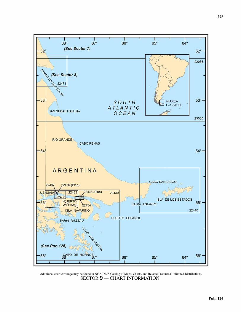
275
Pub. 124
9. Sector 9—Tierra del Fuego—Cabo Espiritu Santo to Cabo de
Hornos
9.0Additional chart coverage may be found in NGA/DLIS Catalog of Maps, Charts, and Related Products (Unlimited Distribution).
SECTOR 9 — CHART INFORMATION

277
Pub. 124
SECTOR 9
TIERRA DEL FUEGO—CABO ESPIRITU SANTO TO CABO DE HORNOS
9.0 Plan.—This sector describes the coastal waters of Tierra delFuego that are fronted by the South Atlantic Ocean.9.0 The description is from Cabo Espiritu Santo, the S point ofthe E entrance to Estrecho de Magallanes, SE to Cabo San Di-ego then SSW to Cabo Buen Suceso. From this position thecoast trends WSW to Cabo San Pio.9.0 The ports, off-lying islands, and channels are discussed inorder of appearance with the coastal features.
General Remarks
9.1 Winds—Weather.—The prevailing winds of theSouth Atlantic Ocean are from the W. Generally speaking thevelocity of the winds increases, through irregularly, toward theS. Between 50° and 55°S, the mean velocity is about 18 knotsexcept toward the coast where it falls to 15 knots. The highestmonthly velocities occur, for the most part, during colder sea-sons.9.1 In coastal area from 50° to 55°S, W of 65°W, winds of Beau-fort force 8 or higher, were reported on 7 per cent of the obser-vations for the year, and there is little change in expectancyfrom winter to summer.9.1 South of Tierra del Fuego, however, in the historicallystormy region about and to the S of Cape Horn (Cabos de Hor-nos), there is a sharp rise in gale occurrence. 9.1 Within the area 55° to 60°S, and 65° to 70°W, where nearly70 per cent of the winds are from the W, gales are recorded in20 per cent of the annual observations, with monthly percent-ages ranging from 30 in October and 11 in December and Jan-uary. 9.1 Except in these two summer months, some 90 per cent ormore of the gales have a W component, with about 25 per centof them from the W alone. Squalls are frequent and severegales from the E direction sometimes occur in connection withcyclones passing to the N.9.1 South of Tierra del Fuego, in the area 55° to 60°S, and 65° to70°W, 4 per cent of the annual observations show fog, with amaximum of 5 per cent in December and a minimum of 2 percent in May, June, and August.
The E coast of Tierra del Fuego (Isla Grande de Tierra delFuego) from Cabo Espiritu Santo to Cabo San Diego, 185miles SE, forms a large area open to the NE. 9.1 There are few irregularities in the coastline except the Bahiade San Sebastian, about 37 miles SSE of Cabo Espiritu Santo.Proceeding S, yellow cliffs, backed by a few low mountainranges, change gradually as signs of vegetation appear. 9.1 Numerous rivers and streams flow out from this coast, themost important being the Rio Grande. The area S of Cabo Pe-nas is wooded and the beaches give way to a rocky coastlinebacked by mountain ranges.9.1 Along the coast of Tierra del Fuego from Cabo San Diego toCabo Buen Suceso, then W to Cabo San Pio, about 39 milesdistant, the coast is indented by several small bays. 9.1 There are several hills along the coast while the mountain
ranges from NE of Cabo San Pio, about 10 miles, and extendW along the archipelago.9.1 Isla de los Estados lies 22 miles offshore ENE of Cabo BuenSuceso, and the island group Islas Hermite lies 60 miles SSWof Cabo San Pio.
The winds in this sector are predominantly from the W, withabout 10 to 15 per cent of the winds from the N and 6 to 10 percent from the S.9.1 Generally speaking, the mean velocity along the coastal areais 15 knots. The highest monthly velocities occur, for the mostpart, during the colder season, but the available observationsshow a variability as to the month of greatest force. 9.1 There is an average difference of about 6 knots between thehighest and lowest mean monthly velocities. In the coastal wa-ters the range is less than farther out at sea.9.1 In Tierra del Fuego and adjacent islands, snow is rather fre-quent and small amounts may fall even in summer. At PuntaArenas, the mean annual snowfall is 800mm, with an averagemaximum monthly fall of 120mm in July. At sea near the SEcoast, and at Cabo de Hornos, snow is rather frequent except inthe summer.
Tides—Currents.—The current passing S of Tierra delFuego is known as the Cape Horn Current. From Isla DiegoRamirez, 60 miles SW of Cabo de Hornos, the current setsENE toward Estrecho de le Maire. The Cape Horn Currentpasses finally into the Falkland Current.9.1 The current between Cabo de Hornos and Isla de los Estadoshas been observed to exceed 22 miles per day. 9.1 Drifts of 8 or 9 miles a day are not uncommon, while occa-sionally a set with a W component is encountered.
Caution.—Ice in the form of bergs and floes is to be foundthroughout the year in the S part of the South Atlantic Ocean. Itis impossible to give any distinct idea of where ice may be ex-pected. 9.1 It frequently happens that one or more years may elapseduring which the route around Cabo de Hornos will apparentlybe free from ice. 9.1 No rule can be laid down to insure safe navigation, as the po-sition of the ice and the quantity met with, differs so greatly indifferent seasons. Vigilance is urged when crossing the icebergregion.
Tierra del Fuego—Northeast Coast
9.2 From Cabo Espiritu Santo, the coast trends 22 milesSSE to Cabo Nombre (52°58'S., 68°17'W.), and is composedof cliffs about 30 to 90m high, with but few breaks. 9.2 Inland the land is irregularly rounded and has no trees and,except for it being more green, resembles the coast N of Estre-cho de Magallanes. 9.2 A radio tower, 100m high, stands about 11 miles SSE of Ca-bo Espiritu Santo.9.2 Rio Cullen Marine Terminal (52°49'S., 68°13'W.) handlescrude oil exports from the Hidra Oil Field. The oil field con-

278 Sector 9. Tierra del Fuego—Cabo Espiritu Santo to Cabo de Hornos
Pub. 124
sists of fixed production platforms and sub-sea production fa-cilities; exports are handled through an SBM.9.2 Depths—Limitations.—A lighted SBM is moored about 7miles offshore in a depth of 35m. Vessels of 20,000 to 150,000dwt can be accommodated.9.2 Pilotage.—Pilotage is compulsory. The mooring master willboard in a position agreed upon with the vessel. Berthing isnormally undertaken in daylight only, but night berthing maybe permitted in special circumstances.9.2 Regulations.—The oil field is enclosed within a restrictedarea, best seen on the chart, within which anchoring is prohibit-ed. Additionally, within the restricted area, the production fa-cilities and the SBM are enclosed within areas where entry isprohibited to all vessels except those using the terminal.9.2 Anchorage.—Arriving tankers may be required to anchor orwait in a position to be agreed upon between the vessel and theterminal. The recommended location is S of the restricted areasurrounding the terminal, in approximate position 52°54'S,68°10'W, in 20m. During adverse weather shelter may be takenin Bahia San Sebastian.9.2 To the N and to the S of the prohibited anchorage area, goodanchorage can be found, in depths of 10 and 20m, respectively.The bottom consists of silt and clay; both anchorages are pro-tected from winds from the NW to SW passing through W.9.2 Caution.—Terminal operations may be suspended if themaximum wave height exceeds 2m or the maximum sustainedwind speed exceeds 25 knots.
9.3 Cabo Nombre is the end of a range of hills. From thiscape to Cabo San Sebastian, 22 miles S, the land is low. A tow-er (oil derrick) is located 1.5 miles W of Cabo Nombre. The in-shore coast between Cabo Espiritu Santo and Cabo Nombre isinadequately surveyed.9.3 From Cabo Nombre, a narrow shingle ridge, 3m high, ex-tends 12 miles SSE, ending in Punta de Arenas (53°09'S.,68°13'W.). This point, the N entrance to Bahia de San Sebas-tian, is steep-to and free of dangers.9.3 A light shown from a metal framework tower, 17m high, issituated close N of Punta de Arenas.9.3 Caution.—Shoals, with depths of 12.5 and 8.7m, lie, respec-tively, 12.5 miles SE of Cabo Espirito Santo and 6.5 milesNNE of Punta Arenas. Both shoals lie about 1.5 miles offshore.9.3 Two shoals, each with a depth of 8.5m, lie 3 miles and 6.5miles NNE, respectively, of Cabo Nombre. 9.3 Another shoal with a depth of 8.5m, lies 7 miles NE from thelight on Punta de Arenas. A patch of kelp is found 18 miles SEof the light.
9.4 Bahia de San Sebastian (53°14'S., 68°15'W.) is en-tered between Punta de Arenas and Cabo San Sebastian(53°20'S., 68°10'W.), situated 11 miles S. The bay is shelteredfrom all except E winds, which seldom blow with any force.9.4 Cabo San Sebastian is a bold and cliffy headland 60m high,and dark in color. A range of mountains 13 miles W of the caperises to a height of 290m. A light is shown from a circular con-crete tower 11m in height, situated on the cape. A mast, paintedwith red and white bands, and 100m high, lies 4 miles W ofCabo San Sebastian.9.4 The N side of the bay is clear of dangers, but on the S side, astony bank, with depths of less than 5.5m for the first 4 miles,
and of less than 9.1m over the remainder, extends 11 milesNNE from Cabo San Sebastian. There is no kelp on this bank,which is fairly steep-to on its W side.9.4 Tides—Currents.—The spring range of tide in Bahia deSan Sebastian is 8.5m and the mean range is 7m. The ebb tideflows from the bay with a velocity of 2 knots, and tide ripsform over the bank extending NNE from Cabo San Sebastian.
Depths—Limitations.—Two submarine pipelines extendabout 1.5 miles N from the S shore of the bay. 9.4 Berth No. 2, the E berth, is near the intersection of RangeNo. 4 and Range No. 6 and can accommodate tankers up to40,000 dwt and 15.5m draft; Berth No. 1, the W berth, is nearthe intersection of Range No. 1 and Range No. 3 and can ac-commodate tankers up to 20,000 dwt and 9.7m draft.9.4 An oil terminal with several tanks is located on the shore ofthe pipeline. An antenna, 100m high, painted with red andwhite stripes, stands near the tanks.9.4 Aspect.—Range No. 4, consisting of beacons in line bearing250°, is situated about 8 miles W of the light on Cabo San Se-bastian.9.4 The front range light of Range No. 1 is situated 0.8 mile ESEof Range No. 4 front beacon. The lights are in line bearing238.5°.9.4 There are four other lighted range beacons, with a commonrear range light situated 1.75 miles WNW from Cabo San Se-bastian light. From E to W they are Range No. 5, in line bear-ing 161°; Range No. 6, in line bearing 155°; Range No. 2, inline bearing 121°; and Range No. 3, in line bearing 126°.9.4 Pilotage.—Pilotage is compulsory for all foreign vesselsberthing at San Sebastian.9.4 Anchorage.—Anchorage may be taken, in a depth of 10.4m,at the intersection of Range No. 1 and Range No. 2.9.4 Directions.—Vessels should remain at least 10 miles off-shore when approaching Bahia de San Sebastian, until the lighton Punta Arenas bears 258°; this course should then be steeredwith the light structure directly ahead. 9.4 When the light structure on Cabo San Sebastian bears 189°,a course of 201° should be steered until Range No. 4 can beheaded for on a bearing of 250°.9.4 Caution.—Caution should be exercised not to get S of the250° range line when approaching the inner berth because thedepths shoal rapidly.
9.5 Between Cabo San Sebastian and a small cliff 5 milesSSE, the coast is low. Foul ground, with rocks awash at its out-er end, extends 2 miles seaward from this cliff. 9.5 From this cliff to Cabo Domingo (53°41'S., 67°51'W.) 19miles farther SSE, the coast is low, but hilly inland, and frontedby a sand beach. 9.5 Cabo Domingo is a prominent, sheer headland of reddishcolor, 80m high, with a light. A reef which dries, extends 0.5mile off the cape, and extends 25 miles SSE. A shoal, whoseposition is doubtful, lies 5 miles ESE of Cabo Domingo.9.5 Caleta La Mision, about 1.2 miles SE of Cabo Domingo, isformed by a bight in the reef. It is sheltered from S and SWwinds. Two range lights, which are lit on request, are shown atthe head of the bight, in range 211°. 9.5 La Mision, about 3 miles SSE, may be identified by a promi-nent white church and a conspicuous cross. A port constructionproject is currently underway at La Mision (2001). Work in-

Sector 9. Tierra del Fuego—Cabo Espiritu Santo to Cabo de Hornos 279
Pub. 124
cludes construction of a 740m causeway and jetty. A 30m highcrane can be seen at the end of the causeway.9.5 The Cruz del Sur Oil Terminal has been constructed. The ter-minal consists of an SBM situated about 4.5 miles NW of CaboSan Sebastian Light, with a submarine pipeline running SSWto shore.9.5 Anchorage may be taken on this range with the prominentwhite cross at La Mision (Mission) bearing 166°, and the lighton Cabo Domingo bearing 278°, in a depth of 10m, mud. 9.5 A shoal, with a depth of about 4.6m lies close E of this an-chorage. A stranded wreck lies on the range about 0.3 milefrom the shore.
9.6 The Rio Grande (53°47'S., 67°41'W.) (World PortIndex No. 13970), 7 miles SE of Cabo Domingo, divides thepampas region from the wooded region S. The E side of the en-trance is a stony peninsula ending in Punta Popper. 9.6 Tides—Currents.—The mean range of tide in the river is5.9m. The tidal currents in the river run at a rate of 3 to 6 knots.9.6 Depths—Limitations.—Puerto Rio Grande is situated 2miles within the river’s entrance. There was a least reporteddepth of 0.3m on the range lines and a least width of 91m as faras the port. 9.6 The port is available for vessels with local knowledge havinga draft not exceeding 3.7m, which can be increased to 4.3m atsprings, but should only be entered during the last hour of therising tides. It was reported that the port was closed to com-
mercial traffic and is for small craft only. 9.6 Caleta la Mision Port, a new port area for Porto Rio Grande,is being constructed NW of the city. 9.6 Pilotage.—Pilotage is reported to be compulsory.9.6 Anchorage.—Anchorage can be taken, in a depth of 16m,mud, 2.5 miles NE of Punta Popper, with the front beacon ofthe outer range bearing 259°, and Cabo Penas Light bearing155°.
9.7 Cabo Penas (53°50'S., 67°33'W.), 5.5 miles SE of theRio Grande, is 30m high.9.7 The sea nearly always breaks over the rocks which extend 2miles E of the cape. The cape should be given a wide berth, es-pecially at night and in bad weather, as soundings give no indi-cations of its proximity. 9.7 A light, shown from a pyramidal iron framework structure13m high, is situated on Cabo Penas.
Cabo Santa Ines (54°07'S., 67°09'W.) lies 21 miles SE ofCabo Penas. The hills in the vicinity of Cabo Penas are highand partially wooded. 9.7 A radio tower, 65m high, stands about 9 miles SW of CaboPenas.9.7 Roca Comodoro, a rock awash, 7 miles SE of Cabo Penasand 3 miles offshore, has no kelp, and should be given a wideberth. A dangerous submerged wreck is reported in the vicinityof the rock.9.7 From Cabo Santa Ines to Cabo San Pablo, 17 miles SE, thecoast is high and bold, and is fronted by cliffs 60 to 90m high. 9.7 Roca Champion, with a depth of 2.4m, and steep-to on itsseaward side, lies 1 mile offshore, 5.5 miles NW of Cabo SanPablo.
9.5Cabo Domingo Light
9.6Cabo Penas Light

280 Sector 9. Tierra del Fuego—Cabo Espiritu Santo to Cabo de Hornos
Pub. 124
Cabo San Pablo (54°17'S., 66°44'W.) is an isolated hill thatprotrudes from the line of the coast. Its rounded form makes itconspicuous. A light is shown from the summit of the hill. Onthe E coast of the cape is a sunken wreck.9.7 From Cabo San Pablo to Cabo San Diego, the E extremity ofTierra del Fuego, 61 miles ESE, the coast is lower. The depthsoff the coast are moderate, affording anchorage during W andS gales. 9.7 Cabo Campo del Medio, 30m high, lies 11.5 miles SE of Ca-bo San Pablo.9.7 Meseta de Orozco, a distinctive table-topped hill, rises to aheight of 250m, 23 miles SE of Cabo Campo del Medio. 9.7 Tres Hermanos, three hills that from W to E are 380m,510m, and 420m high, respectively. They are situated 19 milesE of Meseta de Orozco. The W hill of this group is similar toMeseta de Orozco. They form an excellent landmark for ves-sels proceeding to Estrecho de le Maire.
9.8 Cabo San Vicente (54°37'S., 65°15'W.), situated 5miles WNW of Cabo San Diego, is a low, dark gray point,backed by wooded hills 60 to 90m high. 9.8 Rocks and foul ground, marked by kelp, extend 0.5 milefrom the cape.9.8 Bahia Thetis is located on the E side of Cabo San Vicente,and might be useful as a temporary anchorage for vesselsbound through Estrecho de le Maire; it is a safe refuge duringstrong winds from between S and W. 9.8 The tidal currents, with rates of 1 to 3 knots, set stronglyacross the entrance. When the wind opposes or crosses the tidalcurrent, a great sea rolls into the bay.9.8 Two beacons in line 252.5° lead to an anchorage in BahiaThetis. Temporary anchorage may be obtained, with goodholding ground, on the range line, 0.75 mile from the frontrange, in a depth of 11m, sand and mud. Bad holding groundcomposed of stone is to be found off the range line. 9.8 Two shoals, with a depth of 4.9 and 4.3m, lie 183m S of therange line, 1.25 miles and 0.9 mile, respectively, E of the frontrange beacon.
9.9 Cabo San Diego (54°39'S., 65°07'W.) ends in a smallsandy promontory, which rises to a height of 132m, nearly 2miles W. A reef extends about 0.2 mile E of the cape. A lightshown from a prominent white square concrete frameworkstructure 13m high, is situated on the cape.9.9 Meseta de Orozco and Tres Hermanos are easily seen terrainreliefs when navigating in sight of the coast.9.9 Caution.—A heavy and dangerous tidal race, with irregulardepths in the middle, extends 5 or 6 miles off Cabo San Diego.At times this race reaches a rate of 8 to 10 knots near the coast.Vessels are warned to give the cape a berth of at least 6 miles.
Estrecho de le Maire
9.10 Estrecho de le Maire, which is 16 miles wide, sepa-rates Isla de los Estados from the E side of Tierra del Fuego. 9.10 The W side of the strait extends from Cabo San Diego to Ca-bo Buen Suceso, about 20 miles SSW.9.10 The depths through the central part of the channel are be-tween 55 and 183m; however, a rock with a depth of 4.6m,whose position is doubtful, lies 1.5 miles SE of Cabo San Di-
ego Light.9.10 Tides—Currents.—On the axis of the strait the maximumflood current sets N and the ebb current sets S, at 3 knots, butmay attain 3.5 knots at springs.9.10 Tidal currents in the strait are regular, but occasionally set ina direction other than expected, especially on the ebb. Thiswould seem to be caused by continuous E and SE winds. 9.10 It is recommended that vessels entering the strait from Nshould wait until 1 hour after HW to avoid the heavy race andfoul tidal current.9.10 In addition to the heavy tide rips off Cabo San Diego, heavytide rips are found off the W coast of Isla de los Estados. 9.10 In the approaches to Estrecho de le Maire from the N, Isla delos Estados will be difficult to see in reduced visibility and de-termining position by soundings may provide no aid. Undersuch conditions radar returns from the peaks of Cabo San An-tonio and Cabo Galeano (54°47.'S., 64°41.5'W.) are easily rec-ognized on the screen. Visual recognition of Cabo San Diego isalso difficult during poor visibility, because of the low coastalstretch, and that also may easily cause a misleading identity forCabo San Vincente. In 1989, it was reported that Cabo San Di-ego Light was not visible until it bore W at a distance of 10miles. 9.10 Caleta San Mauricio (54°45'S., 65°13'W.) is situated 6miles SSW of Cabo San Diego.9.10 Anchorage may be obtained with the center of the beachbearing 270°, 0.75 mile distant, in 20m, where there is shelterfrom SW winds, or vessels can anchor farther out, in 27m. Thefirst anchorage leaves little room to maneuver, and the outeranchorage is uncomfortable.
9.11 Bahia Buen Suceso (54°48'S., 65°13'W.) is a smallbay entered about 3 miles SSW of Caleta San Mauricio. 9.11 The entrance is easy to recognize by the deep canyon,formed in the coast, and by the surrounding mountains whichrise to an elevation of 360m, and are the highest in the area.Unless covered with snow, the mountains appear bare andblack.9.11 Good anchorage may be taken, in 15m, fine sand, 0.85 mile
9.9Cabo San Diego Light

Sector 9. Tierra del Fuego—Cabo Espiritu Santo to Cabo de Hornos 281
Pub. 124
from the head of the bay. Vessels should not anchor farther inas a heavy swell with dangerous rollers run in during SE gales. 9.11 Squalls are frequent during strong winds and are violentduring W gales.9.11 A light structure that is difficult to see by day is situated onthe S entrance point of Bahia Buen Suceso. Another light isshown from the center of the shore at the head of the bay.9.11 Ensenada Patagones lies midway between Bahia Buen Suce-so and Cabo Buen Suceso. It affords a good anchorage duringoffshore winds, in 26m, with Islote Veleros bearing 199°, andthe center of the small sandy beach at the head of the bay bear-ing 282°.9.11 Cabo Buen Suceso (54°56'S., 65°24'W.) is high and steep.Rocks, which dry, lie close off the cape. Islote Veleros, a rockyislet which resembles a boat under sail, is situated about 0.5mile offshore, 2 miles NE of the cape.
Isla de los Estados
9.12 Isla de los Estados (54°50'S., 64°15'W.), off the SEextremity of Tierra del Fuego, is 34 miles long in an E to W di-rection and about 9 miles wide; the island is deeply indented bybays. It is mountainous, and its peaked summits, rising to aheight of 823m, are covered with snow throughout most of theyear. The harbors are a continuation of the valleys, and are sur-rounded by high land, with the water in them deepening towardthe center. 9.12 The coast of the island consists of rocky cliffs, varying inheight from 61 to 152m.9.12 The best harbors are on the N side of the island. All the an-chorages, though well protected, are difficult to enter due to theforce of the tidal currents setting across the mouths of the in-lets, the great depth of water, and the inconstant wind, whichfinds its way down the ravines of the mountains from variousdirections.
The W coast of the island from Cabo San Antonio(54°43'S., 64°33'W.) to Cabo San Bartolome, 12.5 miles SW,forms the E shore of Estrecho de le Maire. It is high, rugged,and deeply indented by the Bahia Flinders, Bahia Crossley, andBahia Franklin. These bays are open to the prevailing winds,afford little protection from the sea, and are not recommended.9.12 The N tidal current has rates of 5 to 7 knots. Heavy tide ripsoccur off Cabo San Antonio and off the W coast of the islandto Cabo San Bartolome.9.12 Caution.—The area of Isla de los Estados has been declareda National Preserve for all kinds of wildlife by the Governmentof the Province of Tierra del Fuego, Antarctic, and the Islandsof the South Atlantic. This decree restricts access to the area,except for scientific research. Vessels or individuals specifical-ly engaged in scientific research must first obtain authorizationfrom the Secretary of Development and Planning for the prov-ince.
9.13 Bahia Flinders (54°45'S., 64°35'W.) is entered be-tween Cabo San Antonio, 150m high, and Cabo Beaulieu, 4.5miles SW; it recedes about 3 miles. The bay is fronted by cliffs,except in the SE corner, and the ground rises sharply behindthe cliffs.
Monte Spegazzini, 741m high, is situated 2 miles SE of thehead of the bay.
9.13 Islote Tripode lies in the S corner of the bay; a beacon 12mhigh is situated on the island. Two rocky patches with leastdepths of 9.4 and 10.1m, marked by kelp, lie midway betweenCabo San Antonio and Cabo Beaulieu. 9.13 A large patch of kelp extends about 1 mile N from PuntaRollheiser, at the head of the bay, about 1.5 miles NE of IsloteTripode. There are general depths of 18 to 46m in the bay.9.13 Anchorage may be taken, in 44m, fine sand, with the beaconon Islote Tripode bearing 158°, 0.7 mile distant.9.13 Bahia Crossley is entered between Cabo Galeano (54°47'S.,64°42'W.), 144m high, located 1.75 miles W of Cabo Beaulieu,and Cabo Le Maire, 0.8 mile SW.9.13 A light, which is difficult to see, is shown from an iron struc-ture 3m high, situated on an islet about 0.1 mile N of Cabo LeMaire.9.13 Anchorage in Bahia Crossley can be obtained by small ves-sels with local knowledge, about 0.2 and 0.4 mile SE of thelight. Entry into the bay is not difficult, but under certain condi-tions of sea, wind, and tide, small but fierce tide rips form inthe entrance.
9.14 Punta Cuchillo (54°50'S., 64°46'W.), the W extremi-ty of Isla de los Estados, lies 3 miles SSW from Cabo LeMaire.9.14 Islote Los Tres Garcia (54°50'S., 64°47'W.), with above-water rocks close SW and SE of it, lies 0.8 mile W of PuntaCuchillo.9.14 Bahia Franklin lies between Cabo Sur and Cabo San Bar-tolome (54°55'S., 64°42'W.), 60m high, the SW extremity ofthe island, 4 miles SSE. Cabo Setabense is a hilly peninsulawhich separates Bahias Crossley and Franklin.9.14 A rock, whose position is doubtful, lies 4 miles SSW fromCabo San Bartolome, and dangerous rocks are charted 1 and1.5 miles SSE from the same cape.
From Cabo San Bartolome, the coast trends ENE 33 miles toCabo San Juan, the NE extremity of the island. It is indented bynumerous bays and inlets. Tide rips are found S of Cabo SanBartolome and E of Cabo San Juan.9.14 Islotes 350 Pies (54°55'S., 64°37'W.) lie 3 miles E of CaboSan Bartolome, from 0.5 to 1 mile offshore. The islets androcks are steep-to. The largest is 107m high. 9.14 A rock, awash and marked by breakers, lies about 0.5 mile Sof the islets. A 16m patch lies 2.5 miles E of the islets.
9.15 Bahia Capitan Canepa (Bahia Canepa) (54°52'S.,64°30'W.) is entered 4 miles NE of Islotes 350 Pies, and CaboKempe (54°52'S., 64°22'W.) is situated 2 miles farther NE. 9.15 There are a number of small islets lying close offshore alongthis coast.9.15 A local magnetic anomaly is reported to exist in the bay.9.15 Punta Menzies is situated 4 miles NE from Cabo Kempe.Bahia York is entered between Punta Menzies and Cabo Web-ster, 5 miles ESE. Islas Menzies, a group of islets, lie 1 mile SEof Punta Menzies. There are two above-water rocks 0.7 mile Sof this point. 9.15 A rocky shoal, with a depth of 4.6m, lies 0.25 mile E of IslasMenzies. 9.15 In the middle of Bahia York, 2.75 miles NW of Cabo Web-ster, there are some above-water rocks. Near the E shore of thebay stands a rock 61m high.

282 Sector 9. Tierra del Fuego—Cabo Espiritu Santo to Cabo de Hornos
Pub. 124
9.15 Puerto Celular, a cove in the NW corner of Bahia York, af-fords anchorage for vessels up to 800 gt, in 29m, sand. 9.15 There are no dangers in the fairway, and it is sheltered fromS and SW winds, but a heavy swell enters with SE winds.9.15 Between Cabo Webster and Cabo Kendall (54°50'S.,64°07'W.), 4 miles ENE, there are three small bays, open to theS.9.15 Islas Dampier, from 150 to 245m high, lie 2 miles SE and Eof Cabo Webster. The coasts of the islets are sheer and freefrom dangers.
9.16 Puerto Vancouver (54°48'S., 64°04'W.) is enteredbetween Punta Rinoceronte, 2 miles NE of Cabo Kendall, andPunta Gilbert, 1.5 miles farther E. In the W arm of the bay avessel not longer than 60m may anchor in 24 to 27m, sand. 9.16 A reef extends some distance from the S entrance point ofthe W arm. To avoid this reef a vessel should not alter coursefor the anchorage until a prominent white ravine, on the Sshore of the W arm, is visible.9.16 Bahia Blossom (54°47'S., 63°59'W.), entered between PuntaGilbert and Punta Ventana, 2.75 miles ESE, recedes about 3miles. Puerto Back is situated 2.5 miles NE of Punta Ventana.9.16 Punta Fallows (54°47'S., 63°51'W.), the SE extremity of Is-la de los Estados, is situated 1.25 miles E of Puerto Back. Thepoint is easily distinguished by its round shape with a nipple ontop.
9.17 Cabo San Juan (54°43'S., 63°48'W.), the NE extrem-ity of the island, is situated 4.25 miles NNE of Punta Fallows.The cape is high and steep. 9.17 Isla San Juan, 183m N of Cabo San Juan, is covered withguano and visible at a distance of about 10 miles.9.17 Caution.—Off Cabo San Juan, a heavy tide rip extends for adistance of 5 or 6 miles or more to seaward. When the wind isstrong and opposed to the tidal current the overfalls are over-whelming and dangerous; they have been reported to extend 18miles E of the island. Mariners must use every precaution toavoid this area.
The N coast from Cabo San Juan to Cabo San Antonio, 25miles W, is much indented, with few off-lying rocks or islands.9.17 Puerto San Juan del Salvamento is approached between Ca-bo San Juan and Cabo Furneaux, 2 miles W. It may be easilyidentified from a distance by Monte Richardson, 678m high,situated at the head of the inlet. 9.17 When nearing the entrance, Barranca Paleta, a remarkablecliff like a painter's palette, is visible on the E shore, which ishigh and steep. This cliff is formed by the slope of a smallmountain, 260m high.9.17 The entrance to the inlet is E of Punta Lasserre (54°43'S.,63°51'W.), about 1 mile SE of Cabo Furneaux. 9.17 Here the inlet is 0.25 mile wide and deep in the fairway, butnear the head of the inlet depths decrease gradually to thebeach. 9.17 The shores are bold and fringed with kelp giving an indica-tion of a shallow bank, mostly near the shore. There is a sub-merged rock a short distance off Punta Lasserre.9.17 A vessel can anchor within the line joining Cabo Furneauxand Cabo San Juan, in 36 to 55m. A small bay close S of PuntaLasserre affords anchorage, in 18m. A more sheltered berth is2 miles within the entrance, in 30m; a rock, covering 11m, is
located about 0.1 mile W of this anchorage.9.17 Vessels entering this inlet should steer a mid-channel courseto the anchorage.9.17 Tidal currents run strongly across the entrance to the inletbut within the line joining Cabo San Juan and Cabo Furneauxthey are weaker.
9.18 Puerto Cook (54°45'S., 64°02'W.) is situated 5 milesW of Cabo Furneaux. Caleta Cinco de Eneri and Caleta SanLuis indent this coast. Puerto Cook is entered between PuntaPickersgill and Punta Bayly, 1.5 miles WSW.9.18 Islote Pleamar, light-colored, has no vegetation. It lies closeoff the E shore of the inlet, 0.6 mile SSE of Punta Bayly. Thisislet restricts the inlet to a width of about 0.1 mile.9.18 Two rocks, awash and marked by kelp, lie 0.6 mile W and0.5 mile SW of Punta Pickersgill.9.18 Puerto Ano Nuevo is situated 2.5 miles W of Puerto Cookand Puerto Basil Hall is situated 2.75 miles farther W. CaboCooper is the N extremity of a peninsula that separates thesetwo inlets.9.18 Islas Ano Nuevo, consisting of five islands, lies from 2 to 4miles offshore, NW to N of Cabo Cooper. They afford someprotection from W winds. The S island of the group is joined toIsla de los Estados, 4 miles W of Cabo Cooper, by kelp andfoul ground.9.18 Puerto Cook is considered the best harbor in the island for avessel seeking anchorage. The recommended anchorage is atthe head of the inlet, in 22 to 27m, sand. There is a depth of8.5m about 0.2 mile SSW of Islote Pleamar.
9.19 Isla Observatorio (54°40'S., 64°08'W.), about 61mhigh, is similar in appearance to the land near Cabo San Juan. 9.19 A light, shown from a circular iron tower, 23m high, is situ-ated on the island. A beacon is situated about 0.1 mile E of thelight structure. 9.19 Anchorage may be taken in the lee of the island, in a depth of14.6m, sand, with the light and beacon in range bearing 280.5°,about 0.3 mile offshore. Because of the velocity of the tidalcurrents, the uncertainty of the eddies, it is advised not to usethis berth except in cases of necessity.
Bahia Colnett lies between the foul ground which joins theSW Islas Ano Nuevo to Isla de los Estados, and Cabo Colnett(54°43'S., 64°21'W.). This bay should be avoided.9.19 Bahia San Antonio is entered between Cabo Colnett and Ca-bo San Antonio, 7 miles W. Puerto Parry and Puerto Hoppnerlie at the head of the bay on its E side. 9.19 Anchorage may be obtained in the SW corner of Bahia SanAntonio, in depths of 15 to 27m, over a bottom of sand andpebbles, sheltered from S and W winds, but N winds bring in aheavy sea.
Tierra del Fuego—South Coast
9.20 Cabo San Pio (55°03'S., 66°32'W.) is situated 39miles WSW of Cabo Buen Suceso and is marked by a lightshown from a conical stone beacon, 7.9m high. The interven-ing coast is indented by three principal bays. There are moun-tain peaks close inland. 9.20 The 200m curve lies about 4 to 5 miles offshore to PuntaKinnaird, 20 miles W of Cabo Buen Suceso, then falls off

Sector 9. Tierra del Fuego—Cabo Espiritu Santo to Cabo de Hornos 283
Pub. 124
quickly to the S.9.20 Bajo Loyola, with a least depth of 36.6m, lies 7.5 miles SSEof Cabo Buen Suceso, but its position is approximate only; itrises abruptly from depths of over 183m.
9.21 Between Cabo Buen Suceso and Cabo Hall(54°58'S., 65°43'W.), 11 miles W, the coast is high and cliffy. Itis fringed with rocks, some of which dry. Cabo Hall is fringedwith a reef. 9.21 Up to a distance of 1 mile or more, E of Cabo Buen Suceso,the bottom is irregular with depths of less than 18.3m, andthere are probably underwater rocks in this area. 9.21 It is therefore imprudent to close the cape to less than 2miles, and should it be necessary to approach more closely, thisshould be done from the S, but never to within 1 mile. A cur-rent runs E at a rate of 3 knots.9.21 Monte Campana, 800m high, is situated 4.75 miles NE ofCabo Hall. It resembles a large bell and is prominent. Thismountain is often the last remarkable object visible beforeweather thickens preceding a storm.9.21 Bahia Aguirre is entered between Cabo Hall and Punta Kin-naird, 9 miles W, a small peninsula forming the SE extremityof Cabo San Gonzalo. 9.21 Rocks, which dry, lie up to 0.6 mile S of Punta Kinnaird, andthere is a below-water rock 0.3 mile ENE of the point.9.21 Bahia Valentin, on the W side of Cabo Buen Suceso, affordsanchorage, in 20m, sand, in its NE corner, for vessels with lo-cal knowledge.9.21 Puerto Espanol (54°55'S., 65°57'W.), the NW arm of BahiaAguirre, is entered between Punta Pique, 2 miles N of PuntaKinnaird, and Punta de la Pena, 2 miles NE of Punta Pique. 9.21 Islote Elizalde, high, rugged, and dark colored, lies 0.5 mileSW of Punta de la Pena. Shoal ground extends 0.5 mile S, SE,and SW from the point enclosing the islet.9.21 Breakers, extending up to 0.5 mile from the coast, have beenobserved between Punta de la Pena and Punta Colmillo 3 milesE, and were reported 1 mile W of Islote Elizalde.9.21 There is good anchorage, in 11m, fine sand, 1.25 miles W of
Islote Elizalde; it is protected from all winds except those fromNE to SSE. The light structures in the vicinity and Islote Eliz-alde are good anchorage marks.
9.22 Bahia Sloggett (55°00'S., 66°18'W.) is entered E ofPunta Jesse, 15 miles WSW of Punta Kinnaird. Punta Jesse islow, cliffy, and bordered by foul ground. It should be given awide berth. The bay gives no shelter from winds between E andS and only very temporary anchorage with winds from otherdirections.9.22 Islote San Martin de Tours is situated in the middle of BahiaSloggett, 2.5 miles NE of Punta Jesse. A submerged rock,marked by breakers and kelp, lies 1.75 miles SSE of the islet.9.22 Monte Tres Picos, the most prominent summit in the area,rises to three flat peaks 6 miles NE of Punta Jesse.9.22 From Punta Jesse, the coast trends 2 miles WSW to PuntaFalsa, and then 2.5 miles W to Cabo San Pio.9.22 Anchorage, in 20m, sand and pebbles, can be taken about 0.4mile S of the light structure. A sea is raised by SW winds.9.22 Caution.—A rock, awash, lies about 0.2 mile SE of CaboSan Pio Light, and a breaker has been reported about 183m SEof the rock. Islote Blanco is situated 0.75 mile SW of Cabo SanPio. Uncharted shoals have been discovered between the isletand the cape.
Isla Nueva and Isla Lennox
9.23 Isla Nueva (55°14'S., 66°33'W.) lies 7 miles S of Ca-bo San Pio. It extends 7 miles S, and is 8 miles long from E toW. It is hilly and wooded; the summits are more apparent fromthe E than any other direction. 9.23 Cerro Orejas de Burro, 310m high, is situated in the NE ex-tremity of the island. It is the only well-defined summit and re-sembles the ears of a burro.9.23 Punta Waller (55°10'S., 66°34'W.) is the N extremity of theisland. Caleta Carlos, Caleta Pescado, and Caleta Orejas deBurro are small inlets that lie 0.75, 1.25, and 4 miles, respec-tively, E of Punta Waller.9.23 Caleta Orejas de Burro can be identified by two islets whichlie 183m off the entrance points. There is a prominent waterfallin the center of the beach on the SE side of the cove. 9.23 The E coast of Isla Nueva between Caleta Orejas de Burroand Cabo Graham, 5.5 miles SSW and marked by a light, af-fords no shelter. 9.23 Foul ground extends E from Punta Oriental, the E point ofthe island. It should be given a wide berth.9.23 Anchorage may be obtained in the middle of the cove, in15m, sand, about 0.3 mile offshore.9.23 Punta Fifty (Punta Cincuenta) (55°17'S., 66°38'W.), the SWextremity of the island, lies 4.5 miles W of Cabo Graham. Areef, which seldom breaks, extends some distance W of thepoint.9.23 Punta Chihuau is situated 1 mile NNW of Punta Fifty. IslaAugusto (Isla Augustus) lies about 0.9 mile W of Punta Chihu-au. 9.23 Anchorage may be obtained outside the kelp, in a depth of12m, with Punta Chihuau bearing 182°, distant 0.3 mile.9.23 A shoal with 8.5m, marked by kelp, lies 2.25 miles NNW ofPunta Fifty. A bank of kelp, 3 miles in extent, was reported tolie NW of Isla Augustus.
9.19Cabo San Pio Light

284 Sector 9. Tierra del Fuego—Cabo Espiritu Santo to Cabo de Hornos
Pub. 124
9.23 Punta Jorge (55°12'S., 66°39'W.), the NW extremity of IslaNueva, lies 5 miles N of Punta Fifty. Kelp extends NW fromthis point to Cabo Maria, the SE extremity of Isla Picton, 7.5miles distant. A 6.4m shoal lies 4.25 miles NW of Punta Jorge.
9.24 Isla Lennox (55°17'S., 66°57'W.), about 6 miles W ofIsla Nueva, is almost round in shape, and 7.5 miles across. It isseparated from Isla Nueva by Paso Richmond and from the SEend of Isla Navarino, 3.5 miles W, by Paso Goree. It is frontedon the N by Bahia Oglander (Paso Oglander). This island, andothers in the vicinity, can be approached with safety by takingsoundings and keeping a lookout for kelp. Kelp extends up to 1mile off the S coast of Isla Lennox.9.24 From Punta Raquel (55°13'S., 66°52'W.), the NE extremityof Isla Lennox, the coast trends S for about 8 miles to CaboCarolina.9.24 Isla Raquel lies 0.8 mile SE of Punta Raquel. Rocks markedby kelp exist in an area 0.5 mile E of the islet, which should begiven a wide berth.9.24 Isla Luff (Isla Gratil) lies 0.75 mile offshore, 5 miles SSE ofPunta Raquel. The island is 123m high, and 1 mile long.9.24 Punta Maria (Punta Mary), the SW extremity of Isla Lennox,lies 5 miles WNW of Cabo Carolina, and Punta Medio, the Wextremity of the island, lies 3.75 miles N of Punta Maria.9.24 Isla Medio lies about 1.7 miles WSW of Punta Medio.9.24 Anchorage may be taken off Caleta Lennox, near the centerof the E coast of Isla Lennox, in a depth of 15m, and off CaletaCutter, 2 miles SW of Isla Gratil, in a depth of 18m, sand.9.24 Caution.—A 9.6m patch lies about midway between PuntaMedio and Isla Medio. A depth of 11.8m lies 1.5 miles S ofPunta Maria.
9.25 Isla Terhalten (55°27'S., 67°03'W.) is a small, highisland about 6 miles S of Isla Lennox; Isla Sesambre, also high,lies 1 mile farther SE. 9.25 A reef marked by kelp lies 0.5 mile SE of Isla Sesambre;there is another rock situated 0.5 mile farther S.9.25 Islas Evout (55°34'S., 66°47'W.) lie from 10 to 11 miles SEof Isla Sesambre, in the middle of the E entrance to Bahia Nas-sau.
Islas Wollaston
9.26 The principal islands of this group are, from N to S,Isla Grevy, Isla Bayly, Isla Wollaston, and Isla Freycinet. 9.26 The group lies with Cabo Ross (55°34'S., 67°21'W.), the Nextremity of Isla Wollaston, 17.5 miles SW of Isla Lennox. 9.26 The islands are all mountainous. Monte Hyde, 674m high, issituated in the SW part of Isla Wollaston.9.26 The channels between these islands are narrow and mostlydeep. All the known rocks in them are above-water, or thicklycovered with kelp. There are deep passages N and W of thisgroup.
Bahia Gretton is entered between Punta Dillon (55°30'S.,67°39'W.), the N extremity of Isla Grevy, and Cabo Ross, 11miles ESE. It affords anchorage in convenient depths, but is ex-posed to N winds. A drying bank lies 1 mile WNW of Cabo deRoss.9.26 Banco Banner, with a least depth of 3.3m, marked by kelp,lies 3.5 miles SE of Punta Dillon, 0.5 mile offshore.
9.26 Rocas Hazeltine, which have depths of 4.8 to 8m, lie 4 milesENE of Punta Dillon.
9.27 Isla Daedalos (55°29'S., 67°37'W.) is the E islet of agroup of islets extending 2 miles NE of Punta Dillon. RocaDaedalos, with a depth of 0.9m, steep-to, and marked by kelp,lies 0.4 mile NE of Isla Daedalos.9.27 Rada Norte, off the NE side of Isla Grevy, close SE of PuntaDillon, is a temporary anchorage, easy of access, with depthsof 14 to 18m. It is sheltered from NW, but care is required toavoid Rocas Hazeltine.9.27 Anchorage.—There is an anchorage at the head of BahiaGretton, close W of the Islas Otter, in a depth of 25m. A depthof 5m is charted 0.5 mile W of the anchorage.9.27 Cabo Coquille is the SW extremity of Isla Grevy. BahiaBeaufort lies between Cabo Coquille and Isla Bayly. It has notbeen examined. A depth of 12.5m, the charted position beingapproximate, lies 5.25 miles S of Cabo Coquille.9.27 Canal Washington separates the W extremity of Isla Wol-laston from Isla Bayly, and connects Bahia Gretton with CanalFranklin. The canal is narrow and not very deep.
9.28 Caleta Alsina (Bahia Alsina) (55°38'S., 67°20'W.),situated on the NE coast of Isla Wollaston, 4 miles SSE of Ca-bo Ross, has general depths of 16 to 18m. 9.28 Anchorage may be obtained, in 20m, sand, where there areno known dangers; however, there is a line of kelp at the en-trance to the bay.9.28 Isla Freycinet, the SE island of the Islas Wollaston, attains anelevation of 335m and is separated from the SE extremity of Is-la Wollaston by Canal Bravo. 9.28 Canal Bravo is narrow; near its center there is a rock awash.In its SW entrance is a small conical islet which can be passedto the W.9.28 Cabo Scourfield (55°47'S., 67°10'W.) is the E extremity ofIsla Freycinet. Puerto Colon lies in Bahia Arquistade, 1.5 milesWSW of Cabo Scourfield. The harbor is spacious and well-sheltered from the prevailing winds. 9.28 Anchorage.—There is good anchorage in the middle, in 30to 45m, sand and shells.9.28 Canal Franklin, which has only been cursorily surveyed, isthe inner portion of the channel between Islas Wollaston andIslas Hermite to the S; its least width is 0.5 mile. It is enteredfrom the E through Bahia Arquistade, which separates IslaFreycinet from Isla Deceit, 2.5 miles to the SE. 9.28 The W entrance to the canal is through Seno Franklin, whichis entered between Cabo Coquille and Cabo West, the W ex-tremity of Isla Hermite, 13 miles SSW. 9.28 Canal Franklin is apparently free of known dangers, butthere is a small islet charted 1.75 miles WSW of the W extrem-ity of Isla Freycinet, and a shoal with a depth of 10.7m is chart-ed 1.5 miles farther WNW. 9.28 A rock, awash, is charted 0.5 mile offshore, off the SW ex-tremity of Isla Wollaston.
Islas Hermite
9.29 Islas Hermite consist of four principal islands andseveral smaller ones. The principal islands are Isla Deceit, IslaHerschel, Isla Hermite, and Isla Hornos, which lies 2 miles S

Sector 9. Tierra del Fuego—Cabo Espiritu Santo to Cabo de Hornos 285
Pub. 124
of Isla Herschel. 9.29 The shores of the islands are bold and steep-to; the moun-tains are pointed, with steep ascents, and are thickly overgrownwith shrubs and evergreen trees to about 91m of their summits.9.29 Isla Hermite, the largest and farthest W, is 516m high, andrugged in the E part, but slopes toward Cabo West, which islow.9.29 Isla Deceit is 441m high. Cabo Austin is the N extremity ofthe island; Cabo Deceit, 6 miles S, is the S extremity of the is-land. Rocas Deceit, a group of islets and rocks, lies close offCabo Deceit. A detached group of pinnacle rocks, 9 to 12mhigh, lies 2 miles further SE.9.29 Caleta Wilfredo, on the E side of the island 2.5 miles NNWof Cabo Deceit, affords anchorage to small vessels, in 34m,sand and mud. 9.29 Larger vessels can anchor outside the cove taking care toavoid the numerous patches of kelp close offshore.9.29 Paso Mar del Sur separates Isla Deceit from Isla Herschel, 1mile W. It is encumbered by a group of barren islets markedwith a lighted beacon.9.29 Isla Barnevelt (55°50'S., 66°48'W.) lies 8.5 miles E of IslaDeceit. It is nearly 1 mile long and rises to a height of 57m. 9.29 Detached islets lie 0.5 mile N and 2.5 miles W of the mainisland. There are numerous rocks around the islet.
9.30 Isla Hornos (55°57'S., 67°17'W.), about 3.5 mileslong N to S, lies 2 miles S of Isla Herschel.9.30 Cabo de Hornos (Cape Horn) (55°59'S., 67°16'W.) is the S
extremity of Isla Hornos. It is 425m high and presents a re-markable appearance when seen close-to, showing high blackcliffs to the S, but is not so striking when seen from a distance.A light is shown from a tower, 4m high, situated on Cabo deHornos.9.30 Barranco Cloven is the SW extremity of the island, 2 milesNW of the cape; it ends in two summits resembling towersrather than horns. 9.30 There are two rocks, above-water, 0.2 mile off Barranco Clo-ven, and another rock about 0.8 mile SW of the same point.There are also small rocks, above-water, off the SE extremityof Isla Hornos. 9.30 Anchorage can be taken, in 20m, sand, 0.3 mile from the NEside of Isla Hornos, 1.5 miles NW of the E extremity of the is-land.9.30 Boarding places for Chilean pilots are established about 1.5miles NE and 1.5 miles S of Isla Hornos.9.30 A Chilean naval observation station established on the E spurof Isla Hornos; passing vessels are requested to pass details ofnationality, port of destination, speed, etc., on VHF channel 16.The station, comprising two aluminum-roofed huts and a radiomast, is conspicuous.9.30 Roca Bascunan and Roca Robinson, marked by breakers, lie1.5 miles W and 2 miles WNW of Cabo de Hornos respective-ly.
9.31 Isla Hermite (55°51'S., 67°40'W.), the largest islandof the group, lies with Cabo Spencer, its S extremity, 12.5
9.28Courtesy of Liam Quinn
9.28Cabo de Hornos (Cape Horn)

286 Sector 9. Tierra del Fuego—Cabo Espiritu Santo to Cabo de Hornos
Pub. 124
miles NW of Cabo de Hornos. Isla Hermite is 12 miles long inan E-W direction.9.31 Bahia San Francisco is entered between Cabo de Hornos andCabo Spencer. Isla Hall lies nearly in its center. The bay shouldnot be entered without local knowledge.9.31 Caleta San Martin is entered between two points about 2.5miles N of Cabo Seal, the SE extremity of Isla Hermite; IslaChanticleer lies 1.5 miles E of the S entrance point. 9.31 In the direction of Isla Chanticleer there are no known sub-merged dangers except for some rocks, awash, which extend0.2 mile SE from the islet; otherwise the cove is of easy access. 9.31 Vessels can anchor, in 29m, sand, in the middle of the cove,0.3 mile from its head. This anchorage is safe with good hold-ing ground, although the squalls during W winds blow from alldirections and are severe. The shores are steep and fringed bykelp.
Isla Jerdan (55°50'S., 67°28'W.), close off the NE end of Is-la Hermite, is separated from Isla Herschel, to the E, by a pas-sage 1.75 miles wide. 9.31 A rock, awash and marked by breakers, lies in the middle ofthis passage. Rocks, marked by kelp, extend 0.4 mile W fromthe NW extremity of Isla Herschel.9.31 Puerto Maxwell (55°49'S., 67°30'W.), a good harbor with asecure anchorage free from squalls, lies 12 miles E of CaboWest. It is formed by the NE end of Isla Hermite and Isla Jer-dan, Isla Saddle, and Isla Maxwell.
9.31 Anchorage.—The best anchorage is in 29m, sand, in themiddle of the harbor, with the E extremity of Isla Maxwellbearing 348°, distant about 0.3 mile.9.31 The best entrance to the anchorage is through Paso Norte,between Islas Maxwell and Saddle. Local knowledge is re-quired.
9.32 Isla Maxwell (55°49'S., 67°31'W.), on the W side ofPaso Norte, is crowned by an isolated rock 160m high. IslaSaddle, 0.6 mile E of Isla Maxwell, is 59m high. 9.32 A rock with a depth of 0.9m lies 0.35 mile E of the NE ex-tremity of Isla Maxwell. A rock, awash, lies 0.6 mile ENE ofthis rock, with another rock, with a depth of 0.9m, lying about0.3 mile further NE. 9.32 Another rock, with a depth of 5.8m, lies near the middle ofPaso Norte, 0.3 mile E of the E extremity of Isla Maxwell. Oth-er dangers are noted in the pass.9.32 Caleta Martial (55°50'S., 67°17'W.) is situated on the NEside of Isla Herschel, 6.75 miles W of Cabo Austin, the N ex-tremity of Isla Deceit. 9.32 Anchorage.—There is good anchorage in the middle of thecove, in 11m, sand and mud, with good holding ground, shel-tered from all directions except from E. The N and S shores arefringed with masses of kelp.9.32 For islands and passages W, see Pub. 125, Sailing Directions(Enroute) West Coast of South America.

287
Pub. 124
10. Sector 10—The Falkland Islands, South Georgia, and the South Sandwich Islands
10.0Additional chart coverage may be found in NGA/DLIS Catalog of Maps, Charts, and Related Products (Unlimited Distribution).SECTOR 10 — CHART INFORMATION

289
Pub. 124
SECTOR 10
THE FALKLAND ISLANDS, SOUTH GEORGIA, AND THE SOUTH SANDWICH ISLANDS
10.0 Plan.—This sector describes the Falkland Islands, as well asSouth Georgia and the South Sandwich Islands. The narrativebegins with East Falkland Island, followed by descriptions ofthe Falkland Sound and the West Falkland Island, and finallySouth Georgia and the South Sandwich Islands.
General Remarks
10.1 Winds—Weather.—In the vicinity of the FalklandIslands, strong winds between NW and SW predominate andgales are reported to be less frequent than on the Pacific Coastof South America. Squalls are common and occasionally vio-lent.10.1 In the vicinity of South Georgia, any anchorage close to highground is subject to very violent katabatic winds or williwawswhen a strong wind is blowing from shore. Small vessels canoften find areas of comparative calm close under the steepcoast. Main valleys frequently accelerate winds blowing alongthem into fierce squalls. 10.1 Vessels visiting South Georgia should be prepared for strongwinds from any direction at the various harbors, as these windsmay be purely local and depend entirely on the land forma-tions.10.1 Vessels S of 40°S should keep a good lookout for icebergsand loose ice.10.1 Most of the ice encountered on the open sea comes from theice shelves surrounding the Antarctic continent and, after ini-tially drifting N and W, later become involved in the S OceanCurrent. On the Atlantic Ocean side of the continent, the gener-al NE drift through Drake Passage becomes N towards theFalkland Islands and the Rio de la Plata, and takes with it occa-sional icebergs.10.1 Wherever there is a risk of icebergs, vessels should proceedwith caution, keeping a good lookout both for bergs and for thesmaller pieces of ice which may sometimes serve as a warningof the proximity of larger icebergs. The number and size of ice-bergs varies greatly from year to year so that the experience ofone or two voyages should not be relied on for future occa-sions.10.1 There is little evidence of icebergs of Antarctic origin beingencountered in the channel and inlets of Patagonia; most ofthem are free of ice throughout the year. 10.1 There are, however, a number of glaciers which occupy thevalleys at the heads of some of the more landlocked inlets.Most of these do not reach the sea, but some provide a localsource of icebergs which, from time to time affect certain chan-nels.10.1 South Georgia lies between the mean and extreme limits ofthe packs of ice throughout the year. 10.1 Off the N coast, watch should be kept for growlers which arecontinually breaking off from the numerous glaciers during thesummer and drifting out to sea. They are frequently of a darkgreen color, and difficult to distinguish.10.1 Tides—Currents.—The Falklands Current flows NE on the
W side of the Falkland Islands and continues toward the Rio dela Plata. This current may be regarded as occupying the E halfof the passage between the Falkland Islands and the coast ofArgentina. Farther W, it weakens and becomes more variable;between 20 and 50 miles from the coast, where the movementsare in part tidal. It has been reported that S sets are stronger andrun longer than those setting to N. 10.1 Strong winds may cause appreciable currents in this area. Astrong NW set in January has been reported between Estrechode le Maire and the Falkland Islands.10.1 The average strengths of the currents in this whole area aremoderate rather than strong, but due to the unsettled andstormy character of the region, strong currents may be expect-ed well in excess of the average values quoted. 10.1 The average rate of the current over most of the area is lessthan 0.5 knots; it is highest in the Cape Horn Current and in theS to SE current within 60 miles of the W and S coast of Chile,S of 51°S.10.1 The tidal currents, in different parts of the Falkland Islands,differ much with regard to strength and direction. The floodcomes from SE and splits off Lively Island; one part runs N,with the other part running SW past the Sea Islands, at a rate of1 to 2 knots near the coast. 10.1 Along the S, W, and N coast, it increases in strength towardsthe Jason Islands, off the NW coast, where it runs at a rate of 6knots and causes heavy and dangerous races.10.1 The flood enters Falkland Sound at both ends, meeting nearSwan Island, and causing a double HW.10.1 During and after lengthy SE gales, with a heavy sea whichrolls in on the S and SE coasts of the Falkland Islands, a strongNW set has been experienced. This set has been attributed tothe loss of several vessels in the vicinity of Bull Point.
Aspect.—The Falkland Islands, which are a Crown Colonyof Great Britain, comprise the only notable group in the SouthAtlantic. The Falkland Islands form a group of over 100 islandsthat lie nearly 300 miles E of the entrance to Estrecho de Ma-gallanes.10.1 South Georgia and the South Sandwich Islands were consid-ered to be Falkland Island dependencies and, as such, weresubject to the authority thereof. Now known as the South Geor-gia and South Sandwich Islands, they are a United KingdomOverseas Territory. The Governor of the Falkland Islands actsas the Commissioner of the Territory. Many years ago, SouthGeorgia and Southern Thule were the only islands of SouthGeorgia and the South Sandwich Islands permanently inhabit-ed by small scientific staffs at King Edward Point and Fergu-son Bay.10.1 East Falkland Island and West Falkland Island are separatedby Falkland Sound, the width of which varies from about 2 to12 miles. The entire group takes up an area of about 4,700square miles and is indented by sounds and bays which formexcellent harbors. Stanley is the principal port.10.1 South Georgia, barren and mountainous, lies about 700 milesESE of the Falkland Islands and has an area of 1,450 square

290 Sector 10. The Falkland Islands, South Georgia, and the South Sandwich Islands
Pub. 124
miles. The South Sandwich Islands are comprised of an archi-pelago of islands connected by a low submarine ledge. Za-vodovski, the northernmost island of these, lies about 297miles ESE of South Georgia.
For the most part, the appearance of the Falkland Islands isnot striking. There are ridges of rocky hills, more than 300mhigh, which traverse extensive tracts of moor land. These tree-less areas are bound by a low, rocky coast. 10.1 The hills on the N part of East Falkland Island rise to a con-siderable height while the S part is low and can barely be seenat a distance of 5 miles. Wickham Heights, the main range ofhills, stretch E and W, and end in Mount Usborne, 684m high.10.1 West Falkland Island is slightly greater in elevation than EastFalkland Island. The highest peak, Mount Adam, rises to aheight of 698m in the N part of the island. On the W face, andon some of the adjoining islets, are some steep cliffs exposed tothe fury of the W seas. The rugged summits of the hills andmountains end in points and ridges.10.1 South Georgia is high and consists of very steep glacier-cov-ered mountains; it presents the features of a deeply dissectedupland. Mount Paget, the summit of the Allardyce Range, risesto 2,934m near the center of the island.10.1 In summer, the lower hills near the coast appear to be a lightbrown color, being free from snow and in most cases coveredwith tussock and moss. There is but little flat land and the is-land, except for the tussock, is almost entirely barren, the SWside, except for Fanning Ridge (paragraph 10.86) and theNunez Peninsula (paragraph 10.87), being permanently ice-covered.10.1 The coasts, especially the N, are deeply indented, reducingthe island in places at the W end to a few hundred meters inwidth. Large quantity of loose ice in the bay renders them in-convenient during a great part of the year for a vessel to lie inon account of the calving of large parts of the ice cliffs, whichbreak off and float to sea. 10.1 The second largest glacier in the island is the NordenskjoldGlacier, in Cumberland East Bay; the largest is the EsmarkGlacier, in Holmestrand. The summer is the worst time as theheat of the sun causes large pieces to break off the glaciers. Thelarger icebergs, however, originate from the Antarctic main-land, but they are of too great a draft to penetrate far into thebays.10.1 Most of the South Sandwich Islands are of a volcanic nature,with some being active. Snow and poor visibility are frequent,making the islands difficult to approach. All of these islandsare uninhabited. 10.1 Kelp grows on just about every danger with a rocky bottom;no vessel should pass through it unless the spot has been care-fully examined and sounded. Many dangers, however, are notmarked by kelp. A heavy sea sometimes tears the weed fromthe rock or a moderate tidal stream or current draws it under-water and out of sight. 10.1 Kelp can grow, in some places, from depth of 55m; in manyparts of the coast thick beds of weed exist without having adepth of less than 10m near it. Growing kelp should invariablybe considered as a sign of danger. It forms long streamers, levelor just beneath the surface of the sea, and shows an occasionalleaf. 10.1 Never pass through growing kelp if it can be avoided andgive it a wide berth if passing on the upstream side. A clear
patch of water in the middle of a thick growth of kelp often in-dicates the position of least depths over the danger. 10.1 Dead kelp, which has broken away from the bottom, floats incurled masses, with leaves showing above the surface. It some-times drifts in long lines. It is reported that kelp often gives astrong radar echo, particularly at LW.10.1 Steam vessels are warned that condensers will foul withsmall marine life in the vicinity of the Falkland Islands. Thefouling can be reduced by limiting the use of deck lights atnight.
Regulations.—A Marine Protected Area has been estab-lished within a radius of 200 miles around South Georgia andthe South Sandwich Islands. This area has been created in or-der to protect and manage the flora and fauna native to the re-gion. 10.1 The following restrictions are in effect within the ProtectedArea:
1. Commercial bottom trawling is prohibited. 2. Other fishing activity is closely regulated and only
permitted subject to licenses issued by the Government of South Georgia and South Sandwich Islands.
3. Disposal of plastic, fishing material and inorganic waste is prohibited.
4. Fishing is prohibited S of 60°S latitude.10.1 The following fishing activities are permitted within the Pro-tected Area, subject to licensing:
1. Bottom fishing with longlines in depths in excess of 700m.
2. Pelagic trawling for certain species of fish and krill.3. Research bottom trawling in certain areas.
10.1 Additional information and regulations on the Marine Pro-tected Area including no-take zones and licensing procedurescan be obtained from the Government of South Georgia andSouth Sandwich Islands at the following location:
10.1 In addition to the above regulations, all vessels entering theMaritime Zone around South Georgia Island are directed tocontact the Government Officer, based at King Edward Point inCumberland East Bay. The vessel’s name, call sign, vesseltype, ETA at King Edward Point, and purpose of visit are allincluded in this message. The King Edward Point GovernmentOfficer can be contacted, as follows:
1. Telephone: 00870-382-359-0330044-1223-221781
2. Facsimile: 00870-382-359-0343. E-mail: [email protected]
10.1 Unless previously granted permission in writing, vesselsmust make their first port call in South Georgia at King EdwardPoint.
Directions.—Vessels approaching from N at about 60°Wlongitude can, in thick weather, get a good check on their lon-gitude utilizing the edge of a bank lying off the E coast of Ar-gentina. On this bank, the depths decrease from more than 183to 110m, with a sandy bottom, over a distance of 10 miles.When at latitude 49°30'S, the vessel will have reached the edgeof the bank N of the islands.
Government of South Georgia Home Page
http://www.sgisland.gs

Sector 10. The Falkland Islands, South Georgia, and the South Sandwich Islands 291
Pub. 124
10.1 On the outer part of this bank there are depths of 145 to155m, over fine dark sand. The edge of the bank, about 50miles NE of Cape Carysfort (51°25'S., 57°50'W.), shows uprather distinctly on a fathometer trace.
10.2 Burdwood Bank (55°00'S., 60°00'W.), which liesabout 90 miles S of the Falkland Islands, has a bottom which ismostly coral and is steep-to on its N and S sides. This bank,which is best seen on the chart, has depths from about 43 to144m and is 200 miles long. 10.2 Off the Falkland Islands, penguins may be encountered 300miles from land; therefore, they need not cause alarm. One signwell worth noting is the presence of the cormorant, which israrely seen more than 10 miles off the land. 10.2 Eddystone Rock, situated in the N entrance to the NorthFalkland Sound, should be seen from N, with a clear horizonon a dark night before a vessel would run into danger, as it issteep-to. However, if not sure of the longitude, vessels shouldnot, at night, proceed within depths than 100m.10.2 The first appearance of the land is very unfavorable. This as-pect is due to the rugged hills, whose summits are stony andvery light colored, which gives the notion that the highland isalways covered with snow. However, snow is rarely presentfrom October to May, though patches sometimes remain in thehollows until November.10.2 Vessels approaching from S at night or thick weather willfind soundings to be of little help. 10.2 Beauchene Island (52°55'S., 59°12'W.) should be passed tothe E, then a course of 038° should be steered for about 60miles, having due regard for currents. See paragraph 10.28 formore details about Beauchene Island.10.2 Vessels approaching South Georgia should keep in mind thatmost of the approaches and offshore areas, particularly on theSW side, are inadequately surveyed, and caution should be ex-ercised.10.2 Caution.—Mine clearance work within the Falkland Islandscoastal waters has been completed and hazards to shippinghave been marked; restrictions on vessels entering these watersimposed during the past hostilities have, therefore, been lifted,with the exception of special arrangements for Argentine regis-tered vessels wishing to enter a zone 150 nautical miles aroundthe islands. However, the possibility remains of discoveringhazards to navigation in the future. 10.2 Mariners wishing to transit these waters or to enter FalklandIsland harbors are advised to contact the Queen's Harbormas-ter, Stanley, on VHF channel 16.
East Falkland Island
10.3 Cape Dolphin (51°14'S., 58°58'W.) is the NW tip ofthe island and is shaped like a rounded finger pointing to Eddy-stone Rock. Cape Dolphin is the tip of a peninsula that rises toa height of 55m. The peninsula ends at the cape in cliffs about21.3m high. Cerro Montevideo, which has a rounded summitthat rises to a height of 291m, is located about 17 miles S by Eof Cape Dolphin. This peak is visible over the promontory andprovides a good landmark for vessels approaching FalklandSound from E or NE.10.3 Eddystone Rock (51°12'S., 59°02'W.) is conspicuous andrises to a height of 44m. At a distance of about 8 miles this
rock looks like a vessel under sail and appears to have a smallstone cairn on its peak. This islet is radar conspicuous and isapparently steep-to. 10.3 Caution.—Vessels should give Eddystone Rock a berth of atleast 0.5 miles as it has not been closely examined.10.3 A shoal with a depth of 13.6m lies about 2 miles SE of Eddy-stone Rock. Shallower depths may exist nearby. 10.3 A turbulent race, that lies between Cape Dolphin and Eddys-tone Rock, is dangerous to small vessels. With N winds, aheavy sea prevails along the coast from Cape Carysfort to CapeDolphin.10.3 A shoal area marked by kelp lies about 0.7 mile WSW ofCape Dolphin. A rocky ledge, marked by kelp, projects about0.2 mile NW of the above cape. The channel between the kelpmarking the shoal and the kelp marking the ledge has a leastdepth of 17.1m, and provides safe passage for small vesselswith local knowledge.
10.4 Cape Bougainville (51°18'S., 58°28'W.) lies 19 milesESE of Cape Dolphin, and between these capes the coast re-cedes, into which a indraft has been observed.10.4 Lion Point lies about 4 miles W of Cape Bougainville. About4 miles off Lion Point there are depths of 73.2 to 82.3m, overfine greenish sand with small black specks, decreasing gradual-ly to 21.9m close inshore. Concordia Rock, 15m high, liesabout 1 mile WNW of Lion Point.10.4 Sea Lion Point (51°21'S., 58°19'W.) lies 5.75 miles SE ofCape Bougainville; kelp extends up to 0.7 mile NE from thepoint. An islet lies 0.2 mile E of Sea Lion Point.10.4 Port Salvador Passage is entered about 9 miles E of CapeBougainville between Shag Island and Hut Point (51°24'S.,58°17'W.). The depths in this channel range from 24.7 and34.7m. The bottom here is sand and shell with bare patches orrock, providing poor holding ground. 10.4 This inlet is difficult to enter due to the narrow entrance andto the strong tidal currents which sweep the kelp underwaterand cause races in many sections.10.4 There is a rocky shelf, with a depth of 14.9m, that projectsabout 1.1 miles NNW of Hut Point. A depth of 11.8m lies 0.7mile NNW of Hut Point. Mid Rock, which dries 0.6m, lies inthe center of the entrance channel 1.5 miles SW of Hut Point. 10.4 Center Islet and Rat Islet lie, respectively, 2.25 and 3.75miles SSW of Hut Point. Both above islets are tussock-coveredand steep-sided above the HW mark. The surrounding land ofthe inlet is, for the most part, rough and grass-covered, withsome sandy beaches. Mostly all the coastline and reefs in thisvicinity are kelp-fringed. 10.4 Within the inlet are four primary settlements. A wool shed,with a jetty with 3.7m alongside, lies on the N side of the en-trance of Rincon del Moro Creek at Douglas Station, about 5miles NW of Big Point (51°28'S., 58°25'W.).10.4 A settlement with a boat jetty lies on the S side of Teal Inlet,about 5 miles S of Big Point. A wool shed with a jetty is locat-ed on the E side of Foam Creek about 6 miles SSW of HutPoint. Salvador Settlement, with a jetty that dries, lies in asmall creek about 4 miles SW of Hut Point. 10.4 A radio mast is reported to stand in the settlement of Salva-dore, about 4.5 miles SW of Huty Point.10.4 Tides—Currents.—Currents off the entrance to Port Salva-dor run at a rate of about 2 knots, with the ebb current being

292 Sector 10. The Falkland Islands, South Georgia, and the South Sandwich Islands
Pub. 124
slightly stronger than the flood. There is a race which runs Non the ebb, 0.3 mile E of Big Shag Island. 10.4 In the channel W of Centre Island, the ebb attains a rate of5.5 knots at springs; the flood attains a rate of 4.5 knots. In thechannel E of the above island, the currents are somewhat less.The ebb current causes a violent race N of the island.10.4 For the most part, the tidal current changes approximately 1hour after HW and LW, but this may be altered considerably byweather conditions. There is relatively little slack water. Strongeddies may be met along the edges of the channel. 10.4 Inside the inlet, the tidal currents are weak, except betweensome of the islands, where they seldom exceed 1.5 to 2 knots.10.4 Anchorage.—Having cleared the entrance channel, goodand secure anchorage is found all over the harbor outside thelimits of the kelp. Nearly all the dangers are visible. 10.4 A secure anchorage is situated about 0.6 mile SW of the jettyat Salvador Settlement, in about 7m, mud.10.4 Directions.—The best time to enter Port Salvador is 0.5hour after LW, with the last of the ebb current still running. 10.4 The best time for departure is about 1 hour after LW, whenthe flood is just commencing. At these times the kelp on thedangers will be visible.10.4 Vessels from N should pass about 0.4 mile E of Big Shag Is-land (51°24'S., 58°19'W.). A course should then be shaped topass W of both Mid Rock and Centre Island and then E of RatIsland. 10.4 The channel E of Centre Island is not recommended becauseof shallower depths; the dangers are not all marked by kelp.
10.5 Cape Frehel (51°23'S., 58°12'W.) lies about 3 milesENE of Hut Point. Armantine Rocks, comprised of two areaswhich dry, lie about 1 mile N of Cape Frehel. 10.5 Due to the foul ground which projects SE from these rocks,vessels should remain at least 1.5 miles offshore to clear thesedangers.10.5 Macbride Head (51°22'S., 57°59'W.) is a cliffy point. CapeCarysfort, also cliffy, lies about 6 miles SE of Macbride Head,and can be passed safely at a distance of 1 mile. Cow Bay liesclose S of Cape Carysfort and may be recognized by its whitesandy beach and bluff land around the cape. 10.5 Foul ground projects 0.7 mile offshore from Cape Carysfortalmost to the head of the bay, and also 0.6 mile off the S en-trance point of the bay. 10.5 Vessels may find anchorage, open to the E, in Cow Bay, indepths of 12.8 to 14.6m, sand.10.5 Volunteer Point (51°31'S., 57°44'W.) has an archipelago ofrocky islets extending 1 mile ESE. 10.5 Uranie Rock, awash, lies 1.5 miles E of the point. It is notmarked by kelp; the sea seldom breaks on the rock during Wwinds. The point is marked by a light. 10.5 Directions.—To pass about 2 miles to seaward of UranieRock, vessels should keep Cape Carysfort bearing less than305° until Mount Low (51°38'S., 57°50'W.) bears 228°, or atnight, with Cape Pembroke Light bearing more than 198°. 10.5 Vessels can then begin to change course to bring Mount Lowahead.10.5 Mount Low is the easternmost hill on East Falkland Island;on a clear night the hill may be easily seen from N of VolunteerPoint. This hill’s summit rises to a height of 265m, and formstwo peaks.
10.6 Berkeley Sound (51°35'S., 57°45'W.) is entered be-tween Eagle Point on the N and Kidney Island on the S. Thissound has four excellent anchorages in its W part, namely, Ura-nie Bay, Johnson Harbor, Stag Road, and Port Louis Harbor. 10.6 Johnson Harbor is situated in the NW part of BerkeleySound and is entered E of Duclos Point (51°32'S., 58°01'W.). 10.6 Sea Lion Rocks, and a rock marked by kelp, with a depth of4.6m, lie respectively, about 1 mile ESE and 1 mile SSW ofDuclos Point. The shores of Johnson Harbor are bordered by arocky bank.10.6 Banks of kelp project out to depths of 11m and reduce thenavigable width of the entrance channel to Johnson Harbor toabout 0.65 mile. The passage between Duclos Point and SeaLion Rocks, is shallow. 10.6 A patch of foul ground, marked by kelp, lies near the centerof the harbor. The kelp, which projects from the above foulground, and that from Lamarche Point, narrows the passage be-tween to about 0.3 mile. 10.6 Chabot Creek is situated in the NW corner of Johnson Har-bor and is shallow. Johnson Harbor settlement, with a jetty,stands on the NE shore of the creek. A 2.1m patch lies 0.8 mileSE of Chabot Point, the SW entrance point to the creek.10.6 Magellan Cove forms the NE corner of the harbor. An un-charted patch, marked by kelp, was reported to lie in MagellanCove. 10.6 There is an anchorage, as charted, about 0.9 mile NW of La-marche Point, in a depth of 11m, mud. 10.6 Directions.—Vessels heading for Johnson Harbor or ChabotCreek should steer for a position 0.5 mile S of Monkey Point.Vessels then head NW, keeping 0.5 mile offshore until La-marche Point is abeam. Course may then be changed for Ma-gellan Point. 10.6 When clear of the foul ground in the center of Johnson Har-bor, vessels may anchor as above. 10.6 Reporting requirements are reported to be in effect forBerkeley Sound. See paragraph 10.11 “Stanley Harbor—Regu-lations” for details.
10.7 Stag Road (51°32'S., 58°05'W.) is entered betweenDuclos Point and Peat Islet, 1.75 miles WSW. Shoals projectup to 0.4 mile offshore between Duclos Point and Grave Point,about 0.6 mile W. 10.7 A dangerous rock lies about 0.5 mile W of Grave Point; an-other dangerous rock lies about 0.3 mile NNW of Peat Islet. 10.7 Numerous dangers marked by kelp, and best seen on thechart, lie in close proximity to Peat Islet.10.7 Stag Road provides a better anchorage for large vessels thanJohnson Harbor. For the most part, vessels can anchor, ascharted, in depths of 8 to 11m. The best berth is between HogIsland and the N shore.10.7 During daylight the approach to Stag Road may be madewithout difficulty. Vessels should steer to pass 0.6 mile S ofDuclos Point and then to the anchorage. Dangers on both sidesare marked by kelp.10.7 Port Louis Harbor (51°33'S., 58°08'W.), situated at the Wend of Berkeley Sound, is entered S of Peat Island and Hog Is-land, and N of Long Island. 10.7 A rocky patch, nearly in mid-channel, and a rocky islet 0.4mile NNE of the W end of Long Island, narrow the main pas-sage to a width of about 183m.

Sector 10. The Falkland Islands, South Georgia, and the South Sandwich Islands 293
Pub. 124
10.7 Celery Island (Round Island) lies about 0.75 mile NNE ofthe W tip of Long Island. A rocky shoal, parts of which areabove-water, lies 1.5 miles W of Celery Island. 10.7 Green Patch Settlement, where there is a jetty, is locatedabout 2 miles WSW of Round Island. There is a derelict jetty0.75 mile W of the settlement.10.7 The Careenage is a round lagoon located on the N side ofPort Louis. It has depths of 0.9m and is entered by a channel91m wide. 10.7 Deputy Harbor is located on the S side of Port Louis. Thisnarrow inlet is entered about 1.25 miles SSW of Round Islandvia a channel 91m wide and has depths from 1 to 5m.10.7 Small vessels can anchor, as charted, about 0.2 miles S ofThe Careenage, in a depth of 5m. 10.7 Directions.—Vessels heading for Port Louis steer to passmidway between the 4.6m rock, situated 0.9 mile SSW of Du-clos Point, and a 7.3m rocky shoal, 0.4 mile further SSW. Bothof these dangers are marked by kelp and are often radar con-spicuous.10.7 Vessels should then head to pass midway between the N tipof Long Island and the rocky islets S of Hog Island. Then passabout 0.1 mile N of Round Island, anchoring as directed above.
10.8 Long Island (51°33'S., 58°05'W.) is situated about1.5 miles SSW of Duclos Point. Between its E tip and theabove 4.6m rock is a rocky shoal, marked by kelp, with depthsof 7.3 to 11m. The W end of the island is joined to the S shoreby a narrow sandy ridge 0.5 mile long. 10.8 Uranie Bay is situated at the W end of Berkeley Sound, S ofLong Island. 10.8 Although this bay is open E, it is sheltered from S and W byrugged coastline and thin hills. It is encumbered by kelp to theS and E, but the bay is clear in the center. There is good hold-ing ground and shelter in the center of Uranie Bay. MargaretHill is a conspicuous peak situated about 2.6 miles SSE of theE tip of Long Island. 10.8 Mount Round, 157m high, with a cairn on its summit, lies 1mile E of Margaret Hill. Long Island House, also conspicuous,lies about 2 miles SW of the E tip of Long Island.
10.9 Port William (51°40'S., 57°42'W.), which also pro-vides access to Stanley Harbor, is entered between MengearyPoint and Cape Pembroke, 2.25 miles S. 10.9 Port William affords good anchorage with shelter from theprevailing W wind, but NE gales send in a heavy sea. 10.9 Mengeary Point (51°39'S., 57°43'W.) is the low rocky tip ofthe long narrow tongue of land which separates BerkeleySound from Port William. A light tower marks the point.10.9 Kidney Cove, 1.25 miles NW of Mengeary Point, offersgood sheltered anchorage for small vessels with local knowl-edge off the sandy beach on the SW side of Kidney Island,which is 32m high and lies 0.2 mile offshore. Cochon Island,31m high, lies 0.25 miles NW of Kidney Island. 10.9 Hutchison Shoal, with 10.9m, lies 1 mile ENE of MengearyPoint. Except at slack water, this rocky shoal is clearly markedby tide rips. A rocky shoal, with a depth of 9.4m, lies almost 3miles ESE of Mengeary Point. 10.9 Charles Point lies on the N shore of Port William, about 1.8miles WSW of Mengeary Point. High Rock, 10m high andprominent from SW, lies close off the E side of Charles Point.
10.9 Sparrow Cove, on the N side of the inlet, is entered betweenArrow Point, about 0.5 mile W of Charles Point, and SparrowPoint, about, 0.3 mile further W. Sparrow Cove affords goodanchorage to vessels in all weathers.10.9 Caution.—There is danger from semi-buoyant plastic landmines on the beaches of Port William. Tidal actions may trans-port the mines as far Port Harriet (paragraph 10.12). 10.9 Mariners considering beach landings should first contact theshore authorities or up to date information on mine clearance(see the “Caution” section of paragraph 10.1).10.9 Reporting requirements are in effect for Port William. Seeparagraph 10.11 “Stanley Harbor—Regulations” for details.
10.10 Cape Pembroke (51°41'S., 57°43'W.), the S entrancepoint to Port William, is the tip of a lengthy white isthmuswhich makes up the S side of the inlet.10.10 Due to a rocky ledge extending from the cape, it should begiven a berth of at least 1 mile. Seal Rocks lie about 1 mileENE of Cape Pembroke, and are steep-to on all sides. A shoal,with a depth of 9m, lies 0.25 mile E of Seal Rocks.10.10 Billy Rock, which dries 1.6m, lies 0.4 mile NE of Cape Pem-broke. There is a little kelp close around and deep water isclose to its E side. 10.10 The Tussac Islands, which lie about 0.5 mile off the S shoreof Port William, are comprised of islets that are steep-to be-yond the kelp. The Viper, a rock which dries 1.6m, lies close Eand a rock, awash, close W of the E islet. 10.10 Fripp Rock, with a depth of 13.8m lies 1.25 miles NW ofCape Pembroke. Kelly Rocks, which are above-water, lie W ofthe Tussac Islands.10.10 A conspicuous radar scanner stands near Stanley Airport. Abuoy moored about 0.4 mile NW of Yorke Point marks the sea-ward end of a submarine pipeline. All vessels should pass N ofthis buoy.10.10 Tides—Currents.—Off the SE side of Falkland Islands, thetidal currents are weak. A current, with rates of 0.5 to 1 knot,will generally be found setting with the wind. After passing NE
10.9Cape Pembroke Light

294 Sector 10. The Falkland Islands, South Georgia, and the South Sandwich Islands
Pub. 124
of the entrance to Port Harriet, a strong tidal current begins tobe felt. Having passed Wolf Rock, the current setting NE be-comes stronger as it approaches Cape Pembroke, round whichit runs at a rate of 2 to 3 knots. Then it runs directly N past SealRocks to Volunteer Point, very little current being felt in eitherPort William or Berkeley Sound. The S current is equallystrong and, during strong winds, a heavy tide rip extends 2miles off Cape Pembroke.10.10 Anchorage.—Shelter from NW or NE gales can be foundoff the N shore of Port William, good holding ground. The bot-tom consists of soft sand E of Doctor Point (51°39'S.,57°49'W.) and of soft mud W of Doctor Point. Vessels shouldavoid anchoring S of Sparrow Cove, as the depths drop quicklyto 12.2m forming a bar, and in NE gales the sea becomes acontinuous roller. The best berth for a vessel of deep draft canbe found SW of Doctor Point.10.10 Directions.—For the most part, entry into Port Williamshould present no problem; however, vessels should avoid kelp.Between Yorke Point (51°41'S., 57°47'W.) and Arrow Point,0.7 mile N, the edges of the kelp banks are a sure guide. 10.10 The only dangers not marked by kelp are the 9.4m shoal, 3miles ESE of Mengeary Point, and Fripp Rock.10.10 Vessels approaching from N should, after rounding UranieRock, steer for the lighthouse on Cape Pembroke until PortWilliam opens up. Some white sand hills will then be seenahead, close to Kidney Island; at the same time Seal Rocks willbe on the horizon clear of Cape Pembroke. 10.10 From S, vessels should keep Mount Low (51°38'S.,57°50'W.) bearing 010°, which leads towards the coast S of theentrance to Port Harriet. Wolf Rock and Cape Pembroke willthen be seen and course can be made for Port William. 10.10 With a flood current vessels should guard against being settowards Cape Pembroke or Seal Rocks. 10.10 A vessel leaving Port William with the outgoing tidal currentand intending to pass between Billy Rock and Seal Rocksshould guard against being set onto the former. 10.10 No tidal current will be felt until the vicinity of Billy Rock isreached, when a strong S current outside the inlet will be met,which has the effect of setting the vessel on to it
10.11 Stanley Harbor (51°42'S., 57°50'W.) (World Port In-dex No. 14000), a landlocked basin, is entered between Engi-neer Point, on the E, and Navy Point, on the W. A submarinecable lies between these two points. The town of Stanley standson the slopes of Murray Heights on the S shore. 10.11 Tides—Currents.—Under normal conditions, the tidal cur-rents in the entrance to Stanley Harbor attain rates of 0.5 knotat springs, but may be increased up to 3 knots.10.11 Depths—Limitations.—This excellent harbor has generaldepths from 6 to 10m, gray mud, with shoal depths, marked bykelp, bordering its shores. A rock, with a depth of 6m, was re-ported to lie about 0.5 mile NW of Navy Point.
10.11 Vessels with a draft up to 8.2m can enter the inner harbor be-tween Navy Point and Engineer Point. 10.11 A number of partially-ruined jetties exist on the S side of theharbor. The only usable ones are the Falkland Island Compa-ny's East Jetty, with a depth of 3.7m alongside its head; thePublic Jetty, with a depth of 3.6m alongside its head; and theGovernment Jetty, with a depth of 3.1m alongside its head.
10.10Stanley Harbor
10.10Stanley Harbor Wreck
Stanley—Berth Information
Berth Length Depth Remarks
Port Stanley
Noble Frontier 114m — Mooring offshore support vessels.

Sector 10. The Falkland Islands, South Georgia, and the South Sandwich Islands 295
Pub. 124
10.11 The oil jetty, situated on the N side of the harbor 0.5 mile Wof Navy Point, has a depth of 3.3m alongside. An immobilevessel was berthed there, enabling others to lie outboard of it,in depths of at least 4.3m. 10.11 The Falkland Interim Port and Storage System (FIPASS), a305m long floating quay, is located at the SE end of StanleyHarbor, 0.5 mile SSE of Engineer Point. It comprises six pon-toon barges secured by mooring dolphins and linked togetherto provide quay and storage facilities. It is connected to theshore via a seventh barge and a 235m long causeway. There arecharted depths of 5.7 to 7m alongside. For further berthing in-formation refer to the table titled Stanley—Berth Informa-tion. 10.11 Aspect.—There is a conspicuous spire of a cathedral situat-ed about 1.2 miles WSW of Navy Point. Government House,situated 0.5 mile W of the cathedral is prominent. 10.11 A rotating radar scanner is at the airport, about 2 miles E ofNavy Point. The wreck of the Lady Elizabeth, a three-mastedsailing vessel, lies in Whalebone Cove, about 0.5 mile ENE ofthe FIPASS facility. 10.11 Four prominent tanks stand 0.2 mile SSE of the GovernmentHouse. 10.11 A prominent pavilion stands 0.5 mile SW of the GovernmentHouse. also, there are a number of conspicuous radio mastspainted red and white, 0.75 mile ESE of the cathedral. The hos-pital, a gray building with a green roof, stands about 0.1 mileSW of the Government Jetty. 10.11 A conspicuous white satellite dish aerial stands close to theNW corner of Government House.10.11 Lights are shown from Navy Point and Engineer Point.Range lights, in line bearing 185.75°, stand on the S side of theharbor and lead between Navy Point and Engineer Point.
10.11 Pilotage.—Pilotage is not compulsory, but can be arrangedthrough the agent. 10.11 Regulations.—Vessels carrying more than 50 tons of explo-sives, or more than 1 ton of explosives if laden with coal, petro-leum, or other inflammable cargo, may not enter StanleyHarbor until such explosives have been discharged.10.11 Vessels are advised to send in their ETA 24 hours in advance.10.11 Vessel Traffic Service.—All vessels entering or leavingBerkeley Sound, Port William, or Stanley Harbor are requiredto report to Stanley Port Control on VHF channel 10 or 16when passing the Reporting Line. 10.11 The Reporting Line joins Volunteer Point (51°31'S.,57°44'W.) and Cape Pembroke (51°41'S., 57°43'W.). Thisline forms the outer limit of Berkeley Sound and Port William. 10.11 The inbound Entry Report should state the vessel’s name,call sign, type of vessel, number of persons on board, name oflocal agent, date of entry, local time of entry, intentions, loca-tion of intentions, and type and amount of fuel aboard. 10.11 The outbound Exit Report should state the vessel’s name,call sign, type of vessel, number of persons on board, date ofexit, local time of exit, intentions, and place of departure. 10.11 Vessels entering Stanley Harbor should also report their esti-mated time at the Narrows.10.11 All vessels at anchor within Falkland waters should maintaina continuous listening watch on VHF channel 16.10.11 All vessels within Stanley Harbor intending to get underwayshould first request permission via VHF from the harbor. 10.11 A tug will stand by all vessels entering the harbor. Speed islimited to 10 knots within the harbor. 10.11 Contact Information.—Stanley Harbor Port Authority canbe contacted, as follows:
1. VHF: VHF channels 10 and 16
Public Jetty (N) 20m3.7m Public use.
Public Jetty (E) 45m
S.A.M.S Marina (E) 26m2.5m Mooring vessels.
S.A.M.S Marina (S) 24m
Government Jetty 22m — Not in use.
Oiling Jetty 63m 3.3m Refueling vessels.
Falkland Island Company
East Jetty 45m 3.7m Mooring vessels. Fresh water available.
Mare Harbor (Royal Navy)
Patrol Jetty 27m — Mooring Naval vessels HMS Clyde.
Mare Harbor Jetty 135m 9.4m Freight, ro-ro, containers, project/heavy cargo, naval, and break bulk. Maximum vessel draft of 9m.
SPM — 16.5m Refueling. Vessels up to 45,000 dwt can be accommodated.
FIPASS (Falkland Interim Port and Storage System)
FIPASS (E) 45m — Mooring small craft.
FIPASS (N)300m 6.2m Cargo, fuel, marine gas oil, fishing vessels, military vessels, and
passenger vessels. Fresh water available. FIPASS (S)
Stanley—Berth Information
Berth Length Depth Remarks

296 Sector 10. The Falkland Islands, South Georgia, and the South Sandwich Islands
Pub. 124
2. Telephone: 500-272603. Facsimile: 500-27265
10.11 The FIPASS Manager can be contacted, as follows:1. VHF: VHF channel 92. Telephone: 500-226713. Facsimile: 500-22673
10.11 Anchorage.—Designated anchorage lie in the W part of theharbor and can best be seen on the chart.10.11 The best time to leave is before 0800 or after 1800, unlessthere is a widespread area of bad weather over the islands. TheW wind, which is local, is seldom strong between these abovehours.10.11 The bottom of the harbor is soft mud overlying stiff mud, ex-cellent holding ground. Due to the nature of the bottom, vesselsmay experience some difficulty retrieving the anchor. 10.11 Directions.—Vessels bound for Stanley Harbor should pro-ceed through Port William until the harbor range beacons comeinto line bearing 185.75°. This course maintained will lead20m W of the middle of the entrance. Navy Point Light is ob-scured when bearing less than 204°. 10.11 A vessel leaving Stanley Harbor should keep the beacon Wof Doctor Point bearing 005.75°, ahead, until Yorke Pointopens N of Ordnance Point, before altering course E.10.11 Caution.—Restricted areas, in which diving and anchoringare prohibited except for emergency situations, are located atthe following points:
1. Within 1,000m of Billy Rock (51°40.5'S., 57°42.7'W.).2. Blanco Bay (51°40S., 57°50.6'W.).3. Doctor Point (51°40.0'S., 57°49.0'W.).
10.12 The S coast of East Falkland from Cape Pembrokeleads SW for 4.75 miles to Horse Point. 10.12 Young Rock (51°42'S., 57°44'W.), with a depth of 5.7m, lies1.25 miles SW of Cape Pembroke. Wolf Rock, 4.3m high, lies3 miles SSW of Cape Pembroke. 10.12 Dangerous ground, on which are some rocks, projects up to0.5 mile from Wolf Rock.10.12 Maggie Elliot Rock (51°43'S., 58°00'W.), with a depth ofless than 2m and which breaks in heavy weather, lies 1.75miles ENE of Horse Point. A shoal, with a depth of 6.4m, lies0.25 mile WSW of the rock. There is no passage between thesedangers and the coast. 10.12 Kelp projects nearly 1 mile offshore along the middle sectionof this stretch of coast.10.12 Port Harriet (51°44'S., 57°54'W.) is entered between HorsePoint and Seal Point, 1.5 miles SW. Mount William, a promi-nent peak 244m high, lies about 4.7 miles WNW of HorsePoint. 10.12 Seal Point, the end of a long thin promontory, is in the shapeof a low mound. Foul ground, marked by kelp, extends 1 mileE of Seal Point; on it are some rocks, awash. A 5.5m shoal,marked by kelp, lies 0.3 mile NW of Seal Point. 10.12 The N shore of the port rises to the range of hills which sep-arates this port from Stanley Harbor. Both shores are swampy.Lake Point, which lies 1.5 miles WNW of Seal Point, has asmall detached rock close off its end. 10.12 A bar projects across the inlet from Lake Point to the Sshore. 10.12 There are depths over this bar of 5.5m, with a bottom of finesand in mid-channel, shoaling gradually to depths of 3.7m
close to the kelp on either side. 10.12 Within the bar depths increase quickly from 7.3 to 12.8m,the bottom changing from sand to mud.10.12 Anchorage.—Vessels may find anchorage outside the bar, indepths of 6.4 to 12.8m. Occasionally, winds between ENE andSE raise a sea at the entrance. Port Harriet affords good anchor-age up to a distance of 3 miles W of the bar. 10.12 Most dangers are marked by kelp, except for a sand bankwhich projects 183m from the S shore halfway up the inlet.Vessels anchor in mid-channel, in depths of 9.1 to 14.6m, softblack mud.
10.13 Bold Point (51°46'S., 58°04'W.) lies about 8 miles Wof Seal Point; the coast between is bold, rocky, and almoststraight. Halfway between these points is Beach Point, onwhose NE side is a cove with a white beach, open to the E. 10.13 A detached 13m shoal, marked by kelp, lies 1.5 miles SSE ofBeach Point; a bank, with a least depth of 7.3m, rock, lies 1mile SSW of the same point. Depths are irregular in the vicini-ty of both these shoals.10.13 North of Bold Point is a bay open to E, which has a dryingrock, surrounded by kelp, near its center. A narrow inlet on theN side of the bay leads to the shallow North Basin about 0.75mile inland.10.13 Port Fitzroy is entered between Bold Point and East Island, 1mile S. A rocky kelp-covered patch with a least depth of 6.4mlies from 0.75 to 1.5 miles E of the E tip of East Island. 10.13 Some dangerous rocks lie about 0.2 mile E of the above-mentioned point and 0.3 mile S of the same point is Little EastIsland.10.13 There is a bar which projects across the inlet from the Nshore to the W tip of East Island. The deeper water lies close tothe S edge of the kelp patch on the N side of the bar, wherethere are depths of 5.1m. North of the kelp patch is a narrowpassage with depths of 4.3m.
10.14 White Point (51°46'S., 58°09'W.) lies about 4 milesW of Bold Point. A sandy spit with depths less than 2m proj-ects 0.25 mile S from White Point. While this danger is notmarked by kelp, it is readily made out as the water over it ap-pears white. 10.14 The W end of Port Fitzroy is divided into two arms by Tus-sac Island (51°47'S., 58°12'W.). The S arm forms ShallowCove, which is nearly filled with kelp. The old part of FitzroySettlement is situated on the S side of this cove, 1 mile WSWof Tussac Island.10.14 On the N side of the inlet, 0.35 mile NW of White Point, isthe entrance to a narrow channel, 0.5 mile in length, withdepths of 2.7 to 3.7m. This channel leads through a remarkablegorge in the ridge of low hills and opens into a shallow basinnamed Bluff Cove. Fitz Cove, a smaller basin, is entered 0.75mile further W.10.14 Near Garden Point, which lies about 2 miles W of WhitePoint, and off the point 0.45 mile further W on the oppositeshore, there are rocks that dry. 10.14 Kelp projects beyond these rocks, leaving a fairway 0.2 milewide, with a least depth of 2.8m. On the E side of Rock Point,about 1 mile WNW of Garden Point, there is a narrow passagespanned by Fitzroy Bridge, beyond which navigation is notpossible.

Sector 10. The Falkland Islands, South Georgia, and the South Sandwich Islands 297
Pub. 124
10.14 North East Point lies 2 miles WSW of Bold Point; betweenNorth East Point and South East Point, about 0.6 mile SW, isLoafers Cove. Several islets and rocks lie between the cove andEast Island. A narrow winding channel, relatively deep, leadsthrough the above to Port Fitzroy. Within its central section thechannel widens to form East Roads, where small vessels, withlocal knowledge, can anchor.10.14 Tides—Currents.—In Port Fitzroy, the tidal currents arescarcely felt. However, in the entrance to East Road, they runabout 1.5 knots and rather stronger nearer the head. 10.14 Anchorage.—Port Fitzroy provides good anchorage insidethe bar, in depths of 8 to 12m. Small vessels with local knowl-edge anchor, in a depth of 4.6m, soft mud, 0.2 mile SE of Gar-den Point.10.14 Directions.—Vessels entering Port Fitzroy from the Eshould keep a good lookout for kelp and steer to avoid kelppatches between East Island and Beach Point. When abeam ofEast Island, the vessel should keep towards the N side of thechannel, passing close S of the large kelp patch NW of the bar. 10.14 A vessel approaching from SE or S will see a range of moun-tains, N of Port Fitzroy, with three peaks close together. Themiddle peak has a broad, flat summit; the W and highest peakrises to an elevation of 468m. 10.14 This peak, bearing 303°, will lead directly to the extremity ofthe kelp E of East Island, and when clear the vessel shouldsteer W to enter Port Fitzroy as described above.
10.15 Port Pleasant (51°48'S., 58°10'W.), close S of PortFitzroy, is entered between South East Point and Pleasant Point2 miles WSW. Lawson Bank, with a depth of 24m, lies 5 milesESE of Pleasant Point. Snaiths Twins, two above-water rocks,lie 0.75 mile ESE of South East Point and several islets androcks extend up to 1 mile ESE of the same point. 10.15 Poole Rocks, covered by kelp, lie 0.5 mile E of PleasantPoint; kelp extends up to 0.7 mile E of the rocks. 10.15 Pleasant Island lies about 1 mile NW of Pleasant Point anddivides the inlet into two channels, each of which is crossed bya bar. Foul ground, covered with kelp, on which there are sev-eral islets and rocks, awash, projects 0.5 mile N and 2 miles Eof Pleasant Island. Kelp extends 0.75 mile further E.10.15 Depths—Limitations.—The bar in the N channel lies 1.5miles W of South East Point and has a greatest depth of 5.4m. 10.15 The bar in the S channel lies between the E part of PleasantIsland and the S shore, having a greatest depth of 5.1m on theN side of the bar. 10.15 Vessels up to 2m draft should have no difficulty crossing ei-ther bar; however, vessels of greater draft should not attempt tocross without local knowledge.10.15 The N channel, 0.4 mile W of the bar, is steep-to, with adepth of 13.5m, and is narrowed to 91m by an islet. West of theabove narrow passage, the channel expands to a width of 0.5mile and continues so until it connects with the S channel offthe W tip of Pleasant Island. 10.15 Turn Point is located on the S shore of the inlet about 1 mileW of Pleasant Island. 10.15 From Turn Point, a narrow and torturous channel, withdepths of 5.3 to 7.3m, leads SW for 2.5 miles to a basin calledIsland Harbor. Island Harbor is shallow except for its E end andalmost dries 1 mile from its head.10.15 Tides—Currents.—In both the N and S channels into Port
Pleasant, currents only attain a rate of 1 knot at springs; howev-er, in the narrow section of the N passage currents attain a rateof almost 2 knots.10.15 Directions.—The entrance to Port Pleasant and Port Fitzroyare hard to make out from seaward. This is due to the surround-ing land being low and indistinguishable until almost up on it.The best guide is the high range of hills N of Port Fitzroy, withthree peaks near together; the middle peak shows a broad flatsummit. 10.15 Mount Kent (51°42'S., 58°11'W.), 468m high, is the west-ernmost and highest peak; on a bearing of 336°, Mount Kentwill lead directly to the entrance of Port Pleasant and clear ofthe large kelp field S of Pleasant Road. The same hill bearing303° will lead direct to the end of the kelp off East Island. 10.15 Anchorage.—Anchorage may be secured by vessels withlocal knowledge in the N channel of Port Pleasant, in a depthof about 10m, between the bar and the narrow passage W. 10.15 In addition, vessels with local knowledge can anchor virtual-ly anywhere in this channel N of Pleasant Island and W of thenarrow passage, in depths of 11 to 18.3m, soft mud.
10.16 Pleasant Road (51°50'S., 58°11'W.) is a bay shel-tered from S and SE by a bed of kelp, and lies close S of Pleas-ant Point. The Kelp Islands, comprised of three islets and somerocks, awash, lie in this kelp. Boat Rock lies near the edge ofthe kelp about 0.3 mile E of Boat Point (51°51'S., 58°13'W.). 10.16 Kelp Lagoon, SW of Pleasant Road, is shallow and both ofits entrances are blocked by kelp. 10.16 Anchorage.—Vessels may secure anchorage exposed to in-frequent NE gales in Pleasant Road, 0.7 mile N of Boat Point,in a depth of 8m, good holding ground of sand over stiff clay.10.16 It was reported that over a 14-day period, despite continualW winds, a significant swell from between SSE and E predom-inated in Pleasant Roads.
10.17 Choiseul Sound (51°56'S., 58°31'W.) is entered be-tween Fox Point (51°55'S., 58°23'W.) and Dangerous Point,5.5 miles SSE. This sound leads about 23 miles WNW from itsentrance, narrowing gradually towards Darwin Harbor at itshead. Most of the known dangers, which are marked by kelp,and the numerous islands and islets can be best seen on thechart. The islands, creeks, and coves afford good anchorage tosmall vessels. 10.17 Large vessels can generally anchor in any part of ChoiseulSound, in depths of from 21.9 to 32.9m. The bottom of thesound is mud, covered with shells and weed, which give it thecharacteristics of a rocky bottom.10.17 Aspect.—The shores of Choiseul Sound are low and inter-rupted by valleys with small streams in them. From E, vesselscan identify the sounds entrance by a long white sandy beachprojecting NE from Fox Point. 10.17 Direction Islet, which lies 2.25 miles NE of Fox Point, issmall, dark and conspicuous against the white background. 10.17 A prominent radio tower stands 6 miles NNW of Fox Point;a conspicuous hanger stands 0.5 mile further NNW.10.17 The entrance to the sound is divided into two channels byMiddle Island (51°57'S., 58°28'W.). Kelp projects 2.25 milesE from Middle Island. There are two islets in the W part of thekelp and a large black above-water rock in its E part. 10.17 A shoal, with a depth of 11.5m and marked by kelp, lies

298 Sector 10. The Falkland Islands, South Georgia, and the South Sandwich Islands
Pub. 124
about 3 miles E of Middle Island. 10.17 The main channel into the sound lies N of Middle Island, be-tween that island and Black Rocks; three above-water rocks lie0.5 mile off the N shore. There are patches of kelp extending1.75 miles E and 1.5 miles W from these rocks. 10.17 The W part of this kelp grows over Choiseul Sound Shoal,with a least depth of 1.3m, lying 1.1 miles W of the W extrem-ity of Black Rocks, and marked by a lighted buoy. 10.17 Centre Island, 9m high and conspicuous, is situated 2.75miles WNW of Middle Island and appears ahead when ap-proaching the sound. 10.17 The main channel S of Black Rocks is 1 mile wide; patchesof kelp can be seen clearly on its N and S sides.10.17 The passage N of Black Rocks has a least depth of 6.4m butis not recommended except for small vessels with local knowl-edge. The channel S of Middle Island is full of kelp patches.Green Island lies in this channel about 0.7 mile SW of the Wend of Middle Island.10.17 Directions.—Vessels with local knowledge should not expe-rience much trouble navigating Choiseul Sound in daylight.The sound can be approached from E, or through LivelySound, from S.10.17 From E, after identifying the entrance, vessels should head topass between the kelp and islets projecting E from Middle Is-land and Black Rocks to the N, being careful to avoid all patch-es of kelp.
10.18 White Bluff (51°54'S., 58°44'W.), a bare rock facecovered with guano, on a grass-covered bluff, is conspicuousahead. The channel then passes between two kelp reefs. 10.18 The N reef lies 0.5 mile ESE of White Bluff. The S reef lies0.7 mile E of Button Island (51°55'S., 58°44'W.).10.18 A vessel with a draft of 4.3m, reportedly entered DarwinHarbor via the route described below. 10.18 From a position E of Scott Island (51°51'S., 58°56'W.),course was made for the 5m high islet about 0.3 mile SSW ofSquib Point (51°51'S., 58°55'W.). 10.18 When 0.3 mile from this islet, course was altered toward the15m high islet 0.3 mile NW of Squib Point, keeping to the Wside of the channel which is marked by kelp, and passing W ofthe rock with 5.5m. 10.18 Course was then altered N into the harbor, keeping towardsthe E side of the narrows until course could be altered NW to-wards Goose Green Jetty, keeping 0.2 mile NE of the SeccombIslands and 0.2 mile S of the small islet situated 0.4 mile NE ofthe settlement. 10.18 Lights on this jetty, when approaching at night, may be mis-leading, and a searchlight in conjunction with radar is recom-mended to assist in establishing the vessel's position, especiallyif the wind is strong.10.18 Darwin Narrows are easily navigated during daylight, butthis is not considered advisable at night unless there is a brightmoon or much snow is lying. Speed should be reduced whenpassing through the narrows in either direction with strong fa-vorable winds or tidal currents.
10.19 Mare Harbor (51°53'S., 58°29'W.) is entered be-tween Pandora Point, 2.5 miles W of Fox Point and JohnsonsIsland (Seal Island), 1.75 miles WNW. The W part of the en-trance is obstructed by Sniper Island, 0.3 mile off the SW ex-
tremity of Johnsons Island and an area of shoal water ending inJohnsons Island Shoal, 0.6 mile NNE of Sniper Island. WhalerReef lies in the center of the entrance and shoals extend 0.2mile N and 0.5 mile WSW. 10.19 Mare Harbor is a military port. A deep but tortuous channelleads into Mare Harbor, passing close S and E of Sniper Island,but it is not recommended. The main channel entrance E ofWhaler Reef is 0.3 mile wide and clear of danger. 10.19 The approach to the harbor either through Choiseul Sound orLively Sound is clear with the exception of Choiseul SoundShoal, lying 1.1 miles W of the W extremity of Black Rocks,with a least depth of 1.3m. There is an area of kelp on an 11.2mshoal 0.8 mile WSW of Choiseul Sound Shoal, but this doesnot present any danger to vessels entering the harbor. 10.19 A light is shown at an elevation of 29m from a beacon with awhite and fluorescent orange daymark, situated on the EastFalkland Island shore about 0.35 mile N of Arrow Head. Thewhite sector of this light, bearing between 011° and 017°, indi-cates the buoyed channel. The least depth in the entrance is11.5m. 10.19 The maximum recommended draft for vessels entering MareHarbor is 10m.10.19 Prominent Point and Arrow Head are located 0.5 mile NNWand 0.9 mile N, respectively of Pandora Point.10.19 Boot Head is situated 0.8 mile NW of Arrow Head andforms the NE side of Mare Harbor. A submarine oil pipeline islaid from Boot Head WSW for 0.6 mile and ends in a lightedSBM. The SBM can accommodate tankers up to 35,000 dwt.10.19 Pilotage.— Pilotage for Mare Harbor is compulsory for allvessels with a length over 50m. It is also available upon re-quest. For further information, see East Cove (paragraph10.20). 10.19 Anchoring is prohibited within 300m of the SBM and within100m of the pipeline.10.19 Anvil Point lies 0.6 mile WNW of Boot Head. A light isshown 0.2 mile NE of Anvil Point. Mare Harbor Shoal, with adepth of 1.8m, lies 0.25 SW of Anvil Point and is marked by alighted buoy. 10.19 An orange spherical buoy is moored 0.2 mile SE of AnvilPoint; when a tanker is present in Mare Harbor, a pollutioncontrol boom is secured to this buoy. 10.19 A prominent tank farm is situated about 1 mile ESE of BootHead. Lattice masts, each about 35m high, are situated about0.3mile WSW of Providence Head and 183m W of the root ofthe terminal jetty in East Cove.10.19 Caution.—There is a wind turbine farm centered on 51°53S,58°29'W, mariners are advised to use caution when navigatingthis area.
10.20 East Cove (51°54'S., 58°27'W.) is another deep waterharbor branching E from Mare Harbor. Hecate Channel, lead-ing from Mare Harbor into East Cove, is entered 1 mile N ofPandora Point. It is 91m wide between buoys marking the edgeof shoal water. The least depth is 10.5m. 10.20 A vessel with a draft of 9m can safely transit the channel atall states of the tide. 10.20 Depths—Limitations.—Main Jetty, T-shaped and with a ro-ro terminal at its W end, is situated on the N shore of the cove,about 0.7 mile E of Camp Bay, an indentation at the NW end ofEast Cove. A dolphin stands off the E end of the jetty; four dol-

Sector 10. The Falkland Islands, South Georgia, and the South Sandwich Islands 299
Pub. 124
phins stand off the W side of the jetty. Main Jetty has depthsalongside up to 9.4m.10.20 West Jetty, with a dolphin at each end and a depth alongsideof 9m, is situated on the N shore, between Camp Bay and thero-ro terminal.10.20 Pilotage.—Pilotage for East Cove is compulsory for all ves-sels with a length over 50m. It is also available upon request.Pilots board in the Choiseul Sound, as follows:
1. From the E—Position 51°56'S, 58°26'W.2. From the E—Position 51°56'S, 58°31'W.
10.20 Regulations.—Vessels should report their ETA at PandoraPoint to Port Operations, on VHF channel 12, when withinrange. Port Operations should be informed of any vessel move-ments within the harbor and ETD.10.20 Contact Information.—Mare Harbor can be contacted, asfollows:
1. VHF: VHF channels 12 and 162. Telephone: 500-77003
10.20 Anchorage.—Anchorage can be obtained either in MareHarbor or in East Cove. Vessels should keep clear of the SBM,the pipeline, and the mooring buoys. The bottom is silty mudcontaining a high amount of peat. The holding ground is poorbut is reported to be better in Mare Harbor than in East Cove. 10.20 The anchorage in Mare Harbor is exposed to S and SWwinds. East Cove affords more shelter; West Cove affords goodanchorage to small vessels.
10.21 Mackinnon Creek (51°54'S., 58°41'W.), whose en-trance lies about 8 miles W of Mare Harbor, affords an anchor-age 0.5 mile within the entrance, in depths of 11 to 16.5m. 10.21 Bluff Creek lies about 1.5 miles W of Mackinnon Creek.White Bluff, SW of the entrance to Bluff Creek, is a bare rockface whitened with guano on a grass-covered bluff that isprominent in sunny weather. 10.21 Button Island (51°55'S., 58°45'W.), about 0.7 mile S ofWhite Bluff, is also prominent. There is a bay on the W side ofJohn Point, 4.5 miles WNW of Mackinnon Creek, that has arocky bottom and is an unsafe anchorage. A depth of 10m liesin the channel about 1 mile WSW of John Point. 10.21 Tides—Currents.—Tidal currents are negligible in Choi-seul Sound except in the entrances to the creeks and betweenthe islands. 10.21 Off the entrance to Mare Harbor, the currents attain a rate ofless than 1 knot, while in Hecate Channel, a maximum rate of0.5 knot, in an E-W direction, can be expected. 10.21 At the entrance to Choiseul Sound, the general NE flood cur-rent runs E, but can barely be felt.
10.22 Darwin Harbor (51°51'S., 58°56'W.) comprises theN part of the head of the sound and is entered through DarwinNarrows, close W of Squib Point (51°51'S., 58°55'W.). 10.22 A rock, with a depth of 5.5m, lies in mid-channel 183m W ofSquib Point. Kelp and rocky ground with depths less than 5.5mextend 0.4 mile S and SE of Squib Point. 10.22 Kelp projects about 0.1 mile N of the N side of Hare Island,0.8 mile NW of Squib Point. A stranded wreck lies on the Eshore close N of Squib Point. Goose Green Settlement lies onthe W shore of the harbor about 2 miles NW of Squib Point. 10.22 The chimney of a canning factory is a very conspicuousmark. About 0.1 mile WNW of the settlement is a T-headed
pier with a depth of 2.7m alongside.10.22 Darwin Settlement lies on the W shore of the harbor, about2.2 miles NNW of Squib Point. There is a flagstaff whichstands on the summit of a hill close to Darwin. 10.22 There is a boat jetty on the S entrance point of a small inletabout 0.1 mile NW of Darwin.10.22 Anchorage.—In Darwin Harbor, the best anchorage, forvessels with local knowledge, is about 0.2 mile NNE of HareIsland, in a depth of 7m, stiff mud. A small patch of kelp lies Sof a small islet located 0.4 mile NE of Goose Green Settlement.For the most part, there appears to be depths of 4.6m up to183m from the islet.
10.23 Arrow Harbor is situated between the SW shore ofChoiseul Sound and the Arrow Islands. A rocky shoal, with aleast depth of 4.9m, lies in the E entrance to Arrow Harbor. 10.23 Vessels with local knowledge can find anchorage in ArrowHarbor, in depths of 7.3 to 12.8m mud, avoiding the aboverocky shoal which lies in the entrance. 10.23 Victoria Harbor (51°55'S., 58°52'W.) can be approached byvessels with local knowledge either E or W of Sea Lion Island.The passage E of the island is preferred by local vessels as theW is narrowed by a kelp reef projecting 0.5 mile ENE of RockPoint. 10.23 The entrance of the harbor lies S of Gull Island (51°57'S.,58°45'W.) and N of Little Island, the latter surrounded by kelp. 10.23 A jetty with a depth of 3m at its head serves Walker CreekSettlement and is located 0.4 mile W of Little Island. There is aconspicuous building near the root of this jetty.10.23 The Samuel Islands and Sea Lion Island lie halfway up Cho-iseul Sound, NE and NW, respectively, of Low Point(51°57'S., 58°41'W.). 10.23 The passages between Big Samuel Island and Little SamuelIsland, and between the Samuel Islands and the mainland arefor small vessels with local knowledge.10.23 Anchorage.—Good anchorage for vessels with local knowl-edge is found in Choiseul Sound E of Sea Lion Island. Anchor-age may be obtained by small vessels 0.5 mile E of Low Point,in 13m, mud. The area S of Sea Lion Island has good holdingground but is more exposed. 10.23 There is an anchorage exposed to W winds in Victoria Har-bor, for those vessels with local knowledge, between the en-trance and Heifer Point, 2.5 miles WNW, in depths of 9 to18m. More sheltered anchorage may be found in the approach-es to Walker Creek about 2 miles SW of the center of Sea LionIsland, in a depth of about 13m. 10.23 Directions.—Vessels with local knowledge approachingVictoria Harbor via the channel E of Sea Lion Island shouldpass 0.35 mile off the prominent NE tip of that island. Vesselsshould then steer a SW course to clear the kelp reefs on eitherside. This track passes over a 6.2m shoal. When through thepassage, vessels should steer towards Gull Island to clear thekelp which lies off Low Point and off the entrance to FalseCreek. The buildings of the settlement are conspicuous fromthe approach.
10.24 Hamond Cove (51°58'S., 58°37'W.), situated on theS side of the sound, provides anchorage to small vessels withlocal knowledge in the entrance.
Lively Island (52°02'S., 58°29'W.), 37m high, is located on

300 Sector 10. The Falkland Islands, South Georgia, and the South Sandwich Islands
Pub. 124
the S side of the entrance to Choiseul Sound. 10.24 Lively Sound separates Lively Island from East Falkland Is-land and has a least width of 1.25 miles between Enderby Pointand Pyramid Point, about 2 miles WNW. The sound is enteredfrom S between Reef Point, the S tip of Lively Island, and Mot-ley Island, 6 miles WSW. Reefs project up to 2 miles off ReefPoint, and kelp, with an islet in it, projects 0.5 mile SE fromMotley Island. 10.24 The passage between Motley Island and the shore NW is notnavigable. Vessels may find a good temporary anchorage N ofMotley Island. A heavy swell rolls into Lively Sound withstrong SW or SE winds. 10.24 Sal Point, from which a shallow spit extends 1.75 miles W,lies about 3 miles NW of Reef Point. Seal Island lies on the Wside of the sound about 3 miles NW of Sal Point. 10.24 A reef, marked by kelp, extends 0.5 mile SE of Seal Islandand W to the mainland of East Falkland Island. Another reef,marked by kelp, extends W from a position 1 mile S of Seal Is-land. The channel, between the above reefs off Seal Island andthe shallow spit projecting W from Sal Point, is about 1 milewide. A white house stands on the SW side of Lively Islandabout 1 mile ENE of Sal Point. 10.24 Seal Cove is entered N of Seal Island. The edge of the kelp Nof Seal Island is steep-to, and kelp-covered reefs project fromit. 10.24 Caution.—A restricted area, 4 miles in diameter, containingunexploded ordnance, lies centered 2 miles SE of Reef Point.
10.25 Pyramid Point (52°01'S., 58°35'W.), from whichkelp extends 0.7 mile SSW, lies N of Seal Cove. Pyramid Coveis the next cove N of Seal Cove. 10.25 Reefs extend S and E of Knob Point (51°59'S., 58°36'W.)and off Island Point, 0.5 mile N. A continuous belt of kelp con-nects these reefs.10.25 Kelp Bay, located off the NW coast of Lively Island, is en-tered N of Kidney Island (52°00'S., 58°31'W.). 10.25 Shallow Harbor, on the N coast of Lively Island, is entered Sof Reef Island and Philimore Island (51°59'S., 58°28'W.).There is a settlement with a T-shaped jetty within Shallow Har-bor on the N side of Lively Island, 2.5 miles WNW of SandHills Point.10.25 Tides—Currents.—During springs, tidal currents reach arate of 2 knots in both directions in Lively Sound. Duringstrong winds they cause a tide rip off Pyramid Point.10.25 Anchorage.—There is a good anchorage for vessels with lo-cal knowledge in Seal Cove, sheltered from all winds, in adepth of 6m, mud and sand. Pyramid Cove affords good an-chorage, in depths from 9 to 20m, sand over stiff clay. 10.25 A vessel of 2,641 tons anchored SE of Knob Point(51°59'S., 58°36'W.); this anchorage is recommended for usewhen the prevailing W winds are blowing. 10.25 This same vessel anchored 0.6 mile SSW of Reef Island(51°59'S., 58°29'W.), but this anchorage is not recommendedwhen winds are from the W.10.25 Directions.—To make Lively Sound, vessels should steer335° with the W edge of Seal Island ahead. This course willtake a vessel into the passage between the reefs off that islandand the spit extending off Sal Point. 10.25 From this position, a course of 010° will take a vesselthrough the narrows to the main channel of Choiseul Sound NE
of Centre Island (51°56'S., 58°34'W.), which is 9m high andconspicuous. 10.25 A 13.6m shoal is reported to lie about 2 miles NNE of Pyra-mid Point. 10.25 A dangerous rock, in a patch of kelp, lies 0.65 mile W ofCentre Island. A depth of 7.9m lies 0.2 mile SE of Centre Is-land.
10.26 Low Bay (52°06'S., 58°48'W.) is entered W of theTriste Islands, a rocky group 1.5 miles W of Motley Island. 10.26 Although the shores of Low Bay are indented by severalcoves, this bay doesn't afford good anchorage, as the ground isrocky and foul in places and a heavy swell rolls in with S gales.There are tidal currents of 1 knot at the entrance to Low Bay.The least reported depth in the entrance to the bay is 23.7m. 10.26 The most conspicuous landmark in Low Bay is Bluff Head(52°05'S., 58°51'W.), a dark bluff cliff, 18m high. There is asmall islet close off Bluff Head. 10.26 The only known dangers in Low Bay are some kelp-fringedrocks that dry, lying halfway between Turn Islet and BluffHead, 3 miles NE.10.26 Shag Rock (52°13'S., 58°39'W.) lies about 5 miles off theentrance to Low Bay. This rock is an excellent unique mark forthose vessels bound for Lively Sound or Adventure Soundfrom the S. The low land of East Falkland Island is so uniformthat it is almost impossible for one unfamiliar with the area topositively recognize the landfall, particularly as the high rangeof hills is seldom visible from so far S. 10.26 The Sea Lion Islands or Shag Rock, once distinguished, willgreatly assist the navigator. Several below-water rocks lie up to0.75 mile NE and 2 miles SW of Shag Rock. 10.26 A shoal with depths of 14.5 and 13.1m were reported to lie1.5 miles W and 1.75 miles NNE of Shag Rock. It was also re-ported that there was less water than charted lying to the W ofthe rocks. There may be several ridges running off Shag Rock;vessels should give this area wide berth.10.26 Bleaker Island (52°13'S., 58°53'W.) is a long low narrow is-land at the entrance to Adventure Sound. The passage betweenits SW end, Cassard Point, and Driftwood Point, 1 mile SW, isobstructed by a rocky reef named Bleaker Jump. 10.26 The land in this vicinity is featureless, making identificationdifficult.; the channel, with depths from 4.8 to 6.5m, is naviga-ble by small vessels with local knowledge. 10.26 Kelp projects across the width of the passage. Its effect onvessels is lessened at high tide. 10.26 Vessels should stay in the middle of the channel through thenarrows. There is a 4.8m shoal, unmarked by kelp, 2.5 milesNE of Cassard Point.
10.27 Sandy Bay Island (52°11'S., 58°48'W.) is located offthe E coast of Bleaker Island. A reef extends off the SE tip ofBleaker Island to a position 1.5 miles S of Sandy Bay Island. 10.27 A rock, whose existence is doubtful, was reported to lie 1.5miles SE of Sandy Bay Island.10.27 Anchorage.—Sheltered anchorage, from most winds can befound in a bay on the E side of Bleaker Island, 1 mile NW ofSandy Bay Island, in a depth of 21.9m.
Adventure Sound is entered from Low Bay between Turn Is-let and the N tip of Bleaker Island. This sound has within itsconfines several fine harbors, the main ones being Adventure

Sector 10. The Falkland Islands, South Georgia, and the South Sandwich Islands 301
Pub. 124
Harbor and Moffit Bay. Both harbors lie in the S part of thesound. Situated on the SW side of the sound are the harbors ofBarrow, Fox, and Sullivan. 10.27 North Point Island lies 0.5 mile W of the N tip of Bleaker Is-land; between them is a passage with depths of 9 to 11m, suit-able only for small vessels. Halt Island is situated about 3 milesS of North Point Island. A kelp spit projects 1 mile N of HaltIsland. 10.27 Small vessels with local knowledge can find anchorage in abay E of Halt Island, in depths of 11 to 12.8m. Bleaker Settle-ment Jetty is situated 1.25 miles SE of Halt Island. 10.27 Moffit Bay lies in the S corner of Adventure Sound; it is noteasy of access, but provides anchorage, in depths of 12.8 to18.3m. 10.27 Moffit Bay is entered SE of The Sisters, a chain of rockswhich lies NE of the entrance of the bay.10.27 Adventure Harbor lies about 4.2 miles N of Driftwood Point.This harbor, which is spacious and easy of access, can accom-modate vessels of virtually any size. 10.27 In Adventure Sound currents are negligible, except in WestArm at the head of the sound, where the ebb current is strong.10.27 Anchorage may be taken in Adventure Harbor, in depths of 9to 21.9m, stiff mud. Barrow Harbor, separated from AdventureHarbor by a promontory, is entered N of Large Island(52°08'S., 59°00'W.). Little Island, a small dark mound of tus-sac grass, lies 0.5 mile off Large Island's E side. 10.27 A steep-to kelp patch lies 1.25 miles SSE of Little Island.Kelp Islet, whose N side is steep-to lies 1 mile W of the N tipof Large Island. Barrow Harbor affords anchorage, in depths of7.3 to 18.3m, good holding ground.10.27 Fox Harbor, entered S of Low Point (52°05'S., 59°05'W.),provides a good harbor for small craft. Great Island lies about0.4 mile E of Low Point, and the passage between has a depthof 5.5m, but can only be used by small craft. A rocky spit,which partly dries, projects 0.5 mile N, with depths of 7.3mclose to the kelp. A patch of kelp with depths of less than 2m atits E end lies 0.5 mile SE of Great Island. 10.27 Button Island, which is small and round, lies 0.5 mile E ofGreat Island. A patch of kelp, marking a rock, depth of lessthan 2m, lies halfway between Button Island and Shell Island. 10.27 Sullivan Harbor, entered N of a promontory about 3 miles Nof Low Point, is kelp-fringed and accessible only by small ves-sels.10.27 Anchorage in good holding ground, mud and peat, may beobtained 1.5 miles E of Button Island, in a depth of about 22m. 10.27 Sheltered anchorage may be obtained 0.7 mile NE of BurntIsland (52°02'S., 59°11'W.), stiff mud, good holding ground.
10.28 The Sea Lion Islands (52°25'S., 59°00'W.), a groupof one large and four small islets, lie about 11 miles S ofBleaker Island. The large island lies 18 miles SW of ShagRock. 10.28 A reef, with the three small islets and several below-waterrocks, projects 2 to 6 miles E from the E tip of the large island.A detached reef lies 2.5 miles further ENE.10.28 The channel between the E tip of the large island and BrandyIsland, the W most islet on the reef, has a least reported depthof 7.8m. 10.28 However, a reef on which the sea breaks projects 3 miles Sfrom the large island, and vessels from S intending to use this
channel should keep a good lookout. It was reported that thisreef extended further S than charted. A wool shed stands on theN side of the large island and a house near its E end. A shoal,with a depth of 18m, lies 9.5 miles WSW of the island. 10.28 A 23.5m shoal lies 1.5 miles NW of the W end of the Sea Li-on Islands. Lesser depths possibly exist between it and the is-lands. A bank, marked by kelp and with a least depth of 17.9m,lies about 10 miles WSW of the W end of the largest of the SeaLion Islands.10.28 Beauchene Island (52°55'S., 59°12'W.) lies about 27 milesS of the Sea Lion Islands. The N point rises to a green mound82.6m high, and the S end, which is less than half that height,is rocky. The S and E sides form high cliffs, and the W sideslopes down to the sea. There are no known dangers beyond0.25 mile offshore. 10.28 It was reported that a shoal or below-water rock was believedto exist about 4 miles WNW of Whirlwind Point the N point ofBeauchene Island. 10.28 Mintay Rock was reported to lie 3.5 miles SW of BeaucheneIsland. However, while the existence of this sunken rock isdoubtful, vessels should exercise caution when passing S ofBeauchene Island.
10.29 Bay of Harbors (52°17'S., 59°11'W.) is entered be-tween Driftwood Point and Porpoise Point, about 12 milesWSW. This bay, which is much indented by coves and inlets,has upon its shores hills which rarely exceed 55m in height,and that present a regular appearance from the offing.10.29 Rocks, which are below-water, project 1 mile off DriftwoodPoint. A shoal, with a depth of 23m, lies about 2.2 miles SW. 10.29 Cassies Island and Driftwood Island lie, respectively, close Sand 0.6 mile SE of Driftwood Point. 10.29 Porpoise Point (52°21'S., 59°18'W.), the SW entrance pointof Bay of Harbors, has two kelp patches 1.5 miles SE, andkelp, in which there are some rocks awash, 0.5 mile SE. 10.29 Bull Point lies 1.25 miles NE of Porpoise Point. A depth of20m lies 1.5 miles WNW of Bull Point. A depth of 19m lies0.75 mile NE of Bull Point. 10.29 The point is reported to be marked by a light from which aracon transmits.10.29 Tides—Currents.—The flood current runs W along the Scoast of East Falkland Island at a rate of 1 to 2 knots. Off Por-poise Point the current attains a rate of almost 3 knots andforms a strong race during W gales.10.29 Bull Road lies in the SW part of Bay of Harbors, and is en-tered between Bull Point and Bull Islet, 3 miles NW. This roadis the most convenient anchorage in the S part of East FalklandIsland. Bull Cove is entered 1 mile WSW of Bull Point.10.29 Anchorage.—Vessels with local knowledge can anchor, in12.8 to 18.3m, good bottom, 0.5 mile NNW of the entrance toBull Cove. The large kelp reefs, NW of Bull Point, providegood shelter from E winds.10.29 Middle Shoal has a depth of 11.2m and lies 3.5 miles NE ofBull Point. A rock, awash, whose existence is doubtful, lies 0.3mile NE of the shoal.10.29 The Fanny Islands and the Harbor Islands, 0.5 mile E, lie in abank of kelp on the W side of the bay, 4.5 miles N of BullPoint. 10.29 Little Harbor Island lies on a bank of kelp 1 mile E of the Sharbor island. A detached patch of kelp, marking a rock with a

302 Sector 10. The Falkland Islands, South Georgia, and the South Sandwich Islands
Pub. 124
depth of less than 2m, lies 0.6 mile NE of the N Fanny Island. 10.29 Fanny Road is entered N of the Fanny Islands, between themand West Point (Devil's Point), 1.5 miles NW. Vessels with lo-cal knowledge can find secure anchorage, in Fanny Road, indepths of 9.1 to 29.3m, sand and mud. Snug Cove is entered3.5 miles NW of West Point. 10.29 There is a good anchorage, as charted, W of the three kelppatches and S of the cliffy point forming Snug Cove, in 14.6 to27.4m, sand and mud.10.29 North Arm and Northwest Arm provide secure anchorage tovessels of moderate tonnage in the inlets at the head of the bay.There is a large settlement at the head of the E creek of NorthArm. This settlement is not visible from a distance until NorthArm is entered. 10.29 There is a pier, with a depth of 2.3m alongside, but the pas-sage to it is narrow, and requires local knowledge. GardenPoint, the point separating the W and E inlets of North Arm,has a sheep corral which can be identified. The Round Islets lieabout 4 miles NW of West Point. 10.29 A vessel of 2,641 gt obtained good anchorage with excellentholding ground, in a depth of 8.2m, sand and mud, 1.5 milesNNE of the Round Islets. However, the anchorage is restrictedand streamers of kelp were observed. 10.29 Anchorage has also been obtained 0.5 mile SE of GardenPoint, in 18m, soft gray mud, good holding ground.10.29 Eagle Passage is situated between the SW end of East Falk-land Island and Barren Island, George Island, and SpeedwellIsland. This passage is entered between a point about 3 milesWSW of Porpoise Point and the S tip of Barren Island, 11.5miles W. It passage extends 18 miles NNW and has a leastwidth of 1 mile in the N section, E of Speedwell Island.
10.30 Barren Island (52°22'S., 59°41'W.), from which foulground is reported to extend up to 5 miles E and 4 miles SEfrom the S tip, forms the SW side of Eagle Passage. 10.30 Two parallel reefs project 2 miles NE from the NE coast ofBarren Island. These reefs were reported to extend further NEthan charted. Below-water rocks surrounded by kelp are situat-ed 2 miles N of Tea Point, the N tip of Barren Island. 10.30 Owen Road is located between the NW side of Barren Islandand the E side of George Island. The passage at the head ofOwen Road between George Island and Barren Island is re-ported to be foul and only 0.3 mile wide. 10.30 Winds—Weather.—During SW gales, the water is quitesmooth in Owen Road. During SE gales, which cause theheaviest seas on the coast, smooth water will be found whenthe N tip of Barren Island bears less than 100°.10.30 Anchorage.—Vessels with local knowledge can find an-chorage in Owen Road. A good berth lies close off George Is-land, 3.5 miles NNW of the S tip of Barren Island in depthsfrom 14.6 to 18.3m, stiff clay, covered with broken shell. 10.30 Vessels will see stems of kelp which are reported to be of noconsequence. A 5.6m shoal was reported to lie about 1.7 milesWNW of Tea Point. 10.30 There is a below-water reef to be avoided when utilizing thisanchorage. This reef projects nearly 1.5 miles ENE into themiddle of the road from the S part of the E side of George Is-land. There is a house and a jetty at the head of a small bay onthe E side of George Island and a house on the N side of theSW part of Barren Island.
10.30 Directions.—Vessels entering Eagle Pass from SE shouldavoid the foul ground that projects about 4 to 5 miles SE and Efrom Barren Island and Barren Reefs, which extend 2 miles ormore NE from the NE tip of Barren Island. 10.30 Those vessels intending to change course for anchorage inOwen Road should not do so until the passage between BarrenIsland and George Island is open, or until in a position fromwhich the N tip of Barren Island bears 225°, and the NE tip ofGeorge Island bears 293°. Vessels can then alter course to245°, which will lead to the anchorage. 10.30 The passage which is recommended lies N of the N end ofBarren Reefs and S of the below-water rocks lying 2 miles N ofTea Point, and the dangers off the SE side of George Islet; it is1 mile wide and clear of dangers. 10.30 If bound for Owen Road from N, vessels should steer to pass0.5 mile E of the NE tip of George Island. Then course shouldbe shaped to pass midway between the two islets 1.25 miles Sof the NE tip of George Island and the below-water rocks 1mile E, then to the anchorage.
10.31 Speedwell Island (52°11'S., 59°42'W.) represents thelargest of the three islands on the W side of Eagle Passage.Speedwell Passage lies between Georgel Island and SpeedwellIsland and should not be attempted without local knowledge asthere are strong tidal currents within, and a lack of soundingsto the W.
Annie Island, 2 miles N of George Island, is fringed withkelp and reefs up to 0.25 mile offshore. A reef of below-waterrocks extends from the W end of Annie Island 1 mile NW tothe shore of George Island.10.31 Anchorage.—Speedwell Island has two good anchoragesfor those small vessels with local knowledge on its NE side.Halfway Cove is entered N of the E tip of Speedwell Island. 10.31 This cove offers a restricted anchorage, in depths of 9 to14.6m, good holding ground, N of the S entrance point. 10.31 The other anchorage is about 2 miles SE of Phillips Point(52°07'S., 59°46'W.), the NW tip of Speedwell Island. This an-chorage, in the first sandy bay when standing along the islandto the S, should be approached with care as shoal water proj-ects 0.75 mile from the NE part of Speedwell Island. 10.31 Stinker Island, a small kelp-fringed islet, lies 1 mile NW ofPhillips Point. 10.31 Elephant Cays, lying off the NW end of Speedwell Island,are low sandy islets surrounded by reefs and kelp. Shoals proj-ect 3.25 miles NNW from the N end of these islets. 10.31 Golden Knob is a conspicuous cone-shaped islet, 23m high,situated in the center of Elephant Cays, 2 miles WSW of Phil-lips Point. There is a passage about 0.5 mile wide between Ele-phant Cays and Speedwell Island. This channel is relativelyfree of dangers except for a 9.1m patch 0.5 mile S of the Cays. 10.31 Depths of 11 to 12.8m have been reported 2 miles NW of El-ephant Cays; a 15m shoal patch lies 2.75 miles NW and a rock,marked by a patch of kelp, on which the sea occasionallybreaks, lies 1 mile SW of Elephant Cays, and should be given awide berth. 10.31 Heavy breakers were reported in the area between 0.5 mileand 1 mile W of Elephant Cays. Kelp was reported to extend 2miles NW of Elephant Cays.10.31 Caution.—The area N of Elephant Cays has not been ade-quately surveyed, and depths less than charted may exist and

Sector 10. The Falkland Islands, South Georgia, and the South Sandwich Islands 303
Pub. 124
vessels should therefore keep to the deep channel.
10.32 Blind Island (52°16'S., 59°33'W.) lies on the E sideof Eagle Passage about 5 miles ENE of the NE tip of GeorgeIsland. Detached shoal patches, marked by kelp, of which theshallowest has a depth of 12.8m, lie 1.75 miles W of the N tipof Blind Island. 10.32 Mid Island, 15m high, lies 3 miles NW of Blind Island. Areef, which dries, projects 0.25 mile NW of Mid Island. Ladril-lo Island lies 2 miles N of Mid Island. A conspicuous wrecklies inshore of Ladrillo Island. A detached rock, with a depth of6m, lies 0.5 miles N of Phillips Point. 10.32 A reef, which is marked by kelp, is situated 1 mile W of theW extremity of Ruggles Island and extends to within 0.5 mileof the detached 6m rock. Depths of less than 6m may exist inthis area.10.32 Tides—Currents.—Tidal currents within Eagle Passage, in-fluenced by the winds, attain rates of 2 to 3 knots. The floodcurrent runs N; the ebb current runs S.10.32 Directions.—Vessels with local knowledge proceedingthrough Eagle Passage should pass W of the 12.8m patch 1.75miles W of Blind Island and W of Mid Island. The channel Nof Mid Island is narrow but clear of dangers.10.32 Vessels entering Eagle Passage from N, with local knowl-edge, should remain at least 2 miles NE of Elephant Cays andwell clear of the kelp off Stinker Island. 10.32 Caution is required to avoid the detached rock 3.5 miles N ofPhillips Point, and also the reef which projects 2.5 miles WNWfrom the S end of Ruggles Island. 10.32 The areas W of George Island and Speedwell Island have notbeen adequately surveyed; vessels should exercise extremecaution when navigating in these waters.
Falkland Sound
10.33 Falkland Sound, which divides East Falkland Islandfrom West Falkland Island, is about 50 miles long. Directionsfor the passage through Falkland Sound are given at the con-clusion of the narrative in paragraph 10.42. 10.33 Tides—Currents.—Off Race Point, the tidal currents attaina rate of 4 knots. In Grantham Sound it diminishes to 1.5 knots.In both entrances to the sound and between the islands, the tid-al currents attain rates of 3 to 5 knots at springs. In the widerparts, they are moderate. 10.33 Among the islands in the SE part of the sound, the currentsare very irregular in direction and rate. 10.33 The flood currents enter both entrances to the sound andmeet near the N end of Swan Island (51°44'S., 59°28'W.).They appear to turn at about half tide, but they have not beenfully investigated. In the N entrance, the incoming flood cur-rent begins 3 hours before HW by the shore.10.33 Aspect.—At the S end of the sound there are many flat is-lands and some shoals. 10.33 The dangers, as far as is known, are generally visible. Due tothe smooth nature of the water and the rarity of thick weather,navigation of the sound is normally easy by day. However, it isnot considered prudent to navigate the sound at night unlessequipped with good radar. 10.33 To vessels entering from N, the E side of the sound, S of theNorthwest Islets and Grantham Sound, changes its aspect and
is low, with gentle undulating hills that seldom exceed 46m inheight, maintaining this character to the S end of the sound. 10.33 This E shore is pocked with good harbors offering good shel-ter.10.33 The W side of the sound is high, bold and formed by a ridge,90 to 180m high, running almost the length of the sound. Thereare several breaks in this ridge where harbors are formed. Thegaps or fissures in the S part of the sound are excellent guidesto the harbors and islands on the opposite side. Immediatelybehind the above mentioned ridge are the Hornby Mountains.This group, 549 to 610m high, project in a parallel line as far asHill Gap, where they head W. 10.33 Mount Maria, the highest summit near the sound, rises to aheight of 669m, 5 miles WNW of Bold Point.
10.34 Foul Bay, which forms the E side of North FalklandSound, is entered between Cape Dolphin, previously describedin paragraph 10.3, and Middle Point, about 9 miles S. This bayis reported to be encumbered by many rocks and shoals. 10.34 Elephant Beach forms the head of Foul Bay and is reportedlyfronted by foul ground 2 miles off and extending. 10.34 The N shore of Foul Bay rises gradually to cliffs, attaining anelevation of 38m. A stone cairn, with a height of 36m, lies 4miles SSE of Cape Dolphin. The S shore of the bay is distin-guished by rugged cliffs, about 48m high, broken only by themouths of two streams.10.34 Middle Bay is entered between Middle Point and Race Point(51°25'S., 59°06'W.), 4 miles WSW.10.34 The shores of this bay are cliffy and kelp fringes the SWshore. Smylie Creek, used only by small craft, is entered closeS of a sharp bluff 2.25 miles SSW of Middle Point. There arethree prominent hills on the S side of Smylie Creek, namedRincon de los Tres Picos. These hills range in height from 158to 168m. 10.34 Vessels without local knowledge should not navigate withinlines joining the entrance points of Foul Bay and Middle Bay. 10.34 Rocks and patches of shoal water are known to exist in FoulBay and may exist in Middle Bay, although the latter bay ap-pears to be free of dangers.10.34 Race Point, the NE entrance point of Falkland Sound, con-sists of steep cliffs that rise abruptly from the water to heightsof 46m.10.34 Sunk Rock, over which the depth is not known, lies nearmid-channel between White Point Rock and Race Point. Thekelp which marks this danger is only visible at slack water.Tide Rock, 2 miles WSW of Race Point, is 1.5m high; a rock,awash, lies close S. Tide Rock is nearly always awash at HW. 10.34 This rock is almost steep-to and is a useful mark for the mid-dle of the channel; vessels usually pass E of it, and it is safe todo so within 183m of the kelp, which is visible at all times. 10.34 The kelp-fringed coast 3.5 miles SSW, from Race Point toFanning Head, is notable for its sheer cliffs which rise to aheight of 107m. These cliffs are broken midway by a wide san-dy beach. 10.34 Fanning Head has two summits and is prominent and high.The NE, and higher, summit rises to a height of 234m about 0.5mile inland and has a conspicuous cairn on its top.10.34 Fanning Harbor lies on the N side of Fanning Island, 2 milesSE of Fanning Head. Good anchorage, for vessels with localknowledge, may be found, in depths of 12.8 to 25.6m, mud.

304 Sector 10. The Falkland Islands, South Georgia, and the South Sandwich Islands
Pub. 124
10.34 Foul ground projects about 183m W from the W end of Fan-ning Island. The E end of the island is joined to the mainlandby a rocky bank that dries. 10.34 Port San Carlos and San Carlos Water are both approachedbetween Fanning Head and Chancho Point, about 2 miles SSE.
10.35 Port San Carlos (51°30'S., 59°00'W.) is large, se-cure, and mostly free of dangers. Careening Cove lies on the Nside of the head of Port San Carlos. There is a T-head jetty atPort San Carlos. It is 9m long and can handle a vessel with alength of 51m and a draft of 3.5m.
10.35 Anchorage.—Small vessels with local knowledge mightfind anchorage off the jetty at Careening Cove, in depths of21.9 to 27.4m, the shores at the head of the inlet being steep-to.However, due to a sand and rock bottom, a depth of 25m, andpoor holding ground, vessels should only use it as a temporaryanchorage. 10.35 Directions.—Vessels entering the inner section of Port SanCarlos should heed the limited maneuvering space and thespeed at which the weather deteriorates.
San Carlos Water is reported to project about 7 miles SEfrom Chancho Point (51°30'S., 59°08'W.). At the head of theinlet are two shallow creeks, between which stands a largeprominent white house. In the main part of the inlet there areno known dangers within 0.2 mile offshore. However, within 1mile of the head of the inlet the depths are less than 5.5m. 10.35 A kelp-fringed rock, which dries 1.5m, lies about 0.2 milefrom the W shore, 1 mile from the head of the inlet.10.35 Caution.—A wreck, with a depth of 7.6m and marked by abuoy close N, lies in the middle of San Carlos Water, about 0.4mile E of Red Point (51°33'S., 59°04'W.). The area within100m of any part of the wreck is designated a prohibited area.
10.36 Ajax Bay lies on the W side of the inlet 4.5 miles SSEof Chancho Point. There is a settlement and a disused refriger-ation plant at Ajax Bay.
Bonners Bay, with depths less than 5.5m, lies on the E shoreabout 2 miles SE of Ajax Bay. There is a pier, which dries atLW, at Bonners Bay, that is used by small craft.
10.36 Anchorage.—Vessels with local knowledge can obtain an-chorage in San Carlos Water, in depths of 7.3 to 25.6m. 10.36 Cat Island lies 2.5 miles SSW of Chancho Point. This islandlies in a large area of kelp that has not been closely examined,and should be given a wide berth.10.36 The Northwest Islets, which are connected to East FalklandIsland by foul ground, lie 5.5 miles SSW of Chancho Point.10.36 Caution.—A wreck, with a depth of 18m, lies 0.6 mile SWof the Northwest Islets. The area within 100m of any part ofthe wreck is designated a prohibited area.
10.36 Rookery Island (51°37'S., 59°08'W.) lies about 0.7 mile offthe N shore of Grantham Sound and is encompassed by rocks.A chain of rocks extends E to the coast from a position 1.25miles S of Rookery Island.10.36 Port Sussex, entered on the NE side of Grantham Sound,provides a good harbor for small vessels. There is a small kelppatch with a depth of 5.2m that lies near the middle of the en-trance. There is a prominent house which is located on the Nshore of the inlet 1.5 miles E of the entrance. 10.36 Vessels with local knowledge can find anchorage beyond aflat stony point on the S side of the inlet 1.5 miles inside theentrance, in depths of 7.3 to 9.1m, stiff mud.10.36 Brenton Loch is entered about 2 miles to the S of Port Sus-sex. However, due to a narrow entrance and strong tidal cur-rents its use is reported to be restricted to small craft with localknowledge.
10.36 New Haven lies on the S side of Grantham Sound 7 miles Sof the Northwest Islands. This small port affords good anchor-age; although open NW, little sea sets in. 10.36 Small vessels with local knowledge can find anchorage to-wards the W side of New Haven Inlet, 1 mile from the en-trance, in depths from 7.3 to 11m, stiff clay under a layer ofsand. There is a group of below-water rocks that lies 2.5 milesWSW of the entrance to New Haven Inlet. 10.36 A depth of 14.4m lies 4.25 miles WNW of the W entrancepoint of New Haven Inlet. Kelp Harbor is situated 5 miles SWof New Haven Inlet.
10.37 Egg Harbor (51°50'S., 59°23'W.), about 15 milesSW of the Northwest Islets, is entered between Long Point andJohn Strong Island, which is covered with tussock grass andabout 3 miles NNE.10.37 Garden Point is situated 1.5 miles SSE of Long Point. Park-er Shoal, with a depth of 4.8m, lies 1.25 miles N; a below-wa-ter rock lies about 0.6 mile ENE of Long Point. Parker Shoal isnot marked well by kelp and is only visible in calm conditions.10.37 A dilapidated jetty, awash at HWS, with depth of 2m at itshead, is located on the SW side of a creek at the head of theharbor. A range, marked by cairns, in line bearing 187.5°, maybe used to enter the harbor; it was reported that these cairnswere difficult to see.10.37 High Cliff Island (51°48'S., 59°28'W.) is the highest islandin the sound, rising to a height of 30m. This island is conspicu-ous for a prominent white cliff discolored by birds. 10.37 High Cliff Island is connected to the shore to the S by foulground. High Cliff Island East lies 0.75 mile S of High Cliff Is-land; High Cliff Island West lies 1.5 miles SW of the same is-land.
10.35Port San Carlos

Sector 10. The Falkland Islands, South Georgia, and the South Sandwich Islands 305
Pub. 124
10.37 Main Passage lies W of High Cliff Island West; between itand the SE tip of Swan Island the passage is 2 miles wide,deep, and clear of dangers. However, a 12.8m patch, located 2to 3 miles NNE of the SE end of Swan Island, has not been ad-equately examined and depths less than charted may exist.10.37 The Tyssen Islands lie about 7 miles SW of High Cliff Is-land. A rock, existence doubtful, with a depth of less than 2m,lies 0.5 mile N of North Tyssen and a ridge, terminating in ashoal of 12m extends 1.25 miles NNE of the charted positionof the rock. 10.37 Another ridge, which has not been closely examined, butwith charted depths between 13 and 20m, lies parallel with,and about 2 miles NW of the Tyssen Islands. 10.37 Depths less than charted may exist on this ridge. TyssenPatch is a rocky kelp-fringed shoal that lies 1 mile WNW of theS tip of the SW Tyssen Island. A kelp-marked shoal with aleast depth of 6.6m lies in the fairway 1.5 miles NW of TyssenPatch. Sandbar Island is connected to the SW Tyssen Island byfoul ground, on which are some islets and rocks.10.37 Cygnet Harbor is entered 4.75 miles SSW of High Cliff Is-land. Though encumbered by several kelp patches, this harboroffers good shelter for small vessels.10.37 Port King, Wharton Harbor, and Findlay Harbor, entered 3.5miles ENE, 1.5 miles SSE, and 3 miles SSW, respectively, ofSandbar Island, all afford good secure anchorages and are al-most clear of dangers. 10.37 An obstruction, with a depth of 8m, and a wreck close SE ofit, lie in the entrance to Port King. 10.37 Great Island lies about 1.2 miles WSW of Sandbar Island. Inthe channel between Great Island and the SW entrance point toFindlay Harbor is an islet joined to the point by foul ground. 10.37 Tickle Pass, with a least known depth of 10.3m, is the chan-nel between the islet and Great Island. This passage can onlybe used by small vessels with local knowledge as it is narrowand subject to strong current.10.37 A shoal, marked by kelp, with a depth of 9.4m, lies 2.75miles WSW of the N tip of Great Island. Off the NW side ofGreat Island, depths less than charted may exist.10.37 Vessels with local knowledge may obtain good anchorage inAnchorage Bay. This cove lies on the E side of Great Islandand has depths of 21.9 to 27.4m.10.37 Directions.—The passage E of the Tyssen Islands, whichleads to Port King, Wharton Harbor, and Findlay Harbor, ismostly free of dangers except for a 12.8m shoal 0.5 mile SE ofthe northernmost Tyssen Island. The kelp on the reef projecting0.4 mile S of Sandbar Island is frequently run under by tidalcurrents. 10.37 Ruggles Island (52°03'S., 59°42'W.) fronts the SW part ofRuggles Bay. Clump Islet and Wolf Island lie, respectively,1.75 miles NE and 1.5 miles NW of the N tip of Ruggles Is-land. Rocks, awash, and patches of kelp, lie halfway betweenClump Islet and Great Island, 2.5 miles NE. A rock with adepth of 1.8m lies 0.5 mile ESE of the N tip Ruggles Island. 10.37 A patch of rocks with depths less than 2m lies 1.25 milesWSW of the same point. Rocks project 1.25 miles WNW and adetached rock, with a depth of 2m lies 1.75 miles W of the SWend of Ruggles Island. 10.37 Ruggles Bay lies E of Ruggles Island and is entered betweenthat island and Wolf Island, 1 mile NE. Moffittt Harbor andDanson Harbor are coves at the head of the bay. Robinson's
Patch, a shoal with a depth of 7.7m, lies about 183m NW of thepeninsula separating the two harbors. 10.37 Anchorage.—Vessels with local knowledge may find goodanchorage in Ruggles Bay. The best berth can be found in theSE corner of the bay as the bottom is hard near the entrance. 10.37 Calista Island (52°01'S., 59°50'W.) lies in the S entrance toFalkland Sound. Wedge Islet and other islets, rocks, and kelppatches form an archipelago stretching 4 miles NE to within 1mile of Great Island. 10.37 A shoal, with a least known depth of 8.2m, lies 2 miles S ofCalista Island. Depths less than charted may exist on the shoal.
10.38 White Rock Point (51°24'S., 59°10'W.), 34m high,comprises the NW entrance point to Falkland Sound. WhiteRock, conspicuous, haystack-shaped and whitened by lichen,lies at the end of a rocky ledge that projects some 0.2 mile NEfrom White Rock Point and rises to a height of about 26m.10.38 Rocks, awash and marked by kelp, lie 0.75 mile ENE ofWhite Rock. The kelp on these rocks is only visible at slackwater. The passage between these rocks and White Rock has aleast depth of 12.8m. However, the passage can only be used ingood weather by vessels with local knowledge.10.38 White Rock Bay is entered between White Rock Point andJersey Point, 2 miles S. Jersey Point is long, thin, and steep-to,and rises from a height of 40m at its seaward tip to 120m nearthe head of the bay. Jersey Harbor is formed by two coves inthe S part of the head of the bay.10.38 Small vessels with local knowledge awaiting fair weather ortide can find anchorage in White Rock Bay sheltered from Wand SW winds. Although the head of the bay has not been sur-veyed, it is known to provide good shelter. Most of the dangersare marked by kelp. 10.38 The kelp-fringed coast between Jersey Point and Many-Branch Harbor, about 8 miles SW, is mostly steep-to and con-sists of cliffs, 30 to 60m high. Mount Rosalie, 425m high andprominent, lies about 3 miles N of the Many-Branch Harborentrance. 10.38 Many-Branch Harbor lies between two cliffy headlands andis a good harbor whose entrance is tortuous and narrow. Theharbor should not be entered without local knowledge as it hasnot been examined. Bold Cove, 7.5 miles SW of Many-BranchHarbor, offers good anchorage, in 14.6 to 15.8m, mud.
10.39 Port Howard (51°39'S., 59°32'W.) lies 11 miles SWof Many-Branch Harbor and is narrow, but very secure. Westwinds are often stronger in Port Howard than in the sound out-side, with squalls that are violent off its W shore. 10.39 Winds, locally named “Woollies” are funneled by the sur-rounding hills. The N part of the inlet is covered by kelpstreamers which may block condenser inlets. Kelp marks theshoal water on either side.10.39 A settlement lies on the W side of the head of a creek locatedat the N part of Port Howard, 2 miles NNE of the entrance. Sit-uated on the W side of the creek is a T-headed pier, 9m long,with depths of 3m alongside its head, utilized by vessels up to30m long.10.39 Anchorage.—Good anchorage, for vessels with localknowledge, may be found just inside the heads, in depths of 7to 8.9m, with soft mud. Moreover, anchorage further N is notrecommended as the swinging room is restricted and there are

306 Sector 10. The Falkland Islands, South Georgia, and the South Sandwich Islands
Pub. 124
many patches of kelp. 10.39 There is additional anchorage available in a small cove out-side Port Howard, 0.8 mile S of the entrance.
10.40 Shag Harbor (51°44'S., 59°35'W.) lies 6 miles SWof Port Howard and is suitable only for small craft. A kelp-cov-ered reef extends 0.3 mile NE from the S entrance point;depths up to 18m exist in the harbor. 10.40 Holding ground is excellent but anchoring is not recom-mended as W winds cause violent squalls to blow down the ra-vine. 10.40 There is a good anchorage off the entrance to Snug Harbor,taking care to avoid a line of below-water rocks and shoals ex-tending NE from West Swan Island and lying about 0.7 mileoff the entrance. This danger may reach as far NE as the reefs Sof Port Howard.10.40 The Swan Islands are comprised of North Swan Island, SwanIsland, and West Swan Island, which all lie off the entrance toSnug Harbor. For the most part the islands are low, flat andgrass-covered; their coasts are formed by cliff up to 10m high.10.40 Patches, with depths of 13 and 17.7m, lie 5.5 and 3.75 milesNE of North Swan Island. A wreck, with a depth of 14.8m, lies0.9 mile E of the extremity of the same island. A kelp-coveredshoal, with a depth of 8.7m, lies 0.5 mile N of the N extremityof the same island. A shoal, with a least known depth of 11.8m,lies 1 mile E of Swan Island.North Swan is connected to Swanby a rocky bank through which there is no passage. A 13mpatch lies 5.25 miles NE of North Swan. Swan Passage, be-tween Swan Island and West Swan Island, is narrowed by areef extending from both islands and has not been fully sur-veyed. 10.40 The least known depth in the center of the channel is 8m, buta reef, with a least depth of 1.9m at its outer end, extends about0.3 mile W from the W extremity of Swan Island. Kelp marksthe edges of the channel. Swan Passage should be used only bysmall vessels with local knowledge.
10.40 The narrow channel W of West Swan Island is not recom-mended as it is blocked at its SW end by shoals. An anchorage,which is not recommended during N and W winds, for vesselswith local knowledge, lies 0.5 mile N of a foul cove on the Nside of North Swan, in a depth of 14m. 10.40 The headland which forms the E side of this foul cove maybe identified by a prominent house and shearing shed with aboat jetty. 10.40 Caution.—Tidal currents attain rates of 2.5 knots betweenSwan Island and North Swan Island, and 3 knots in Swan Pas-sage. A large standing wave forms at the S end of Swan Pas-sage during S gales.
10.41 Oberon Patch (51°49'S., 59°41'W.), which is markedby kelp and almost dries, lies 2 miles SW of the S tip of WestSwan Island. This patch has depths of 10m close around it. An8m shoal, marked by kelp, lies 1.5 miles ESE of the center ofOberon Patch. 10.41 Depths less than charted may exist SW, NE, and E of OberonPatch, off the N entrance to Hill Gap Cove. A rock, awash atHW, lies 0.75 mile WNW of Oberon Patch. 10.41 Hill Gap Cove (51°48'S., 59°44'W.), which is entered about4 miles WSW of the W tip of Swan Island, affords anchoragefor small vessels with local knowledge, in general depths of11m. The Hill Gap Islands, lying 0.5 mile offshore, project 5miles SW of Hill Gap Cove. Passage between these islands andWest Falkland Island is not recommended.10.41 West Island (51°58'S., 59°49'W.) is small and surroundedby rocks. The channel between West Island and the point 1mile NW, though deep, is narrowed by a rocky shoal withrocks, the largest of which dries 1.5m, projecting from thepoint. 10.41 East Head lies 6.5 miles WSW of West Islet, and representsthe NW entrance point of the S entrance to Falkland Sound.10.41 Directions.—Deep draft vessels intending to transit Falk-land Sound are advised to do so by daylight only. Vesselsshould endeavor to identify Eddystone Rock and Cape Dolphinprior approaching the N entrance. 10.41 On the E and W sides of the N entrance to Falkland Sound,Fanning Head and Goat Hill, respectively, are easily identified,especially the former. 10.41 As the entrance to the sound is approached, Tide Rock, Jer-sey Point, and White Rock can usually be made out.10.41 When approaching Falkland Sound from N, head for thehigh double summit of Fanning Head or, if this is obscured,make good a course of 186° from a position 1.5 miles W of Ed-dystone Rock, until 2 miles off Race Point. Then steer to passE of Tide Rock. Tide Rock bearing more than 190° leads E ofSunk Rock. 10.41 The depths between Eddystone Rock and the entrance to thesound are fairly regular, over fine black speckled sand. A ledgeextends 0.2 mile off Race Point, then to Fanning Head, the Eshore is clear of dangers. Vessels entering the inner part of PortSan Carlos should not proceed E of Hospital Point, 1.5 milesSE of the E tip of Fanning Island, without local knowledge. 10.41 From off Fanning Head, a vessel with local knowledgebound for San Carlos Water should alter course to keep theprominent rocky outcrop near the extremity of Jersey Point(51°26'S., 59°11'W.) bearing 314°, astern. This leads towardsthe entrance to San Carlos Water, clear of all dangers.
10.38Port Howard

Sector 10. The Falkland Islands, South Georgia, and the South Sandwich Islands 307
Pub. 124
10.41 When the conspicuous white house at the head of San CarlosWater bears 159° alter course to that bearing which will leadabreast of Ajax Bay. 10.41 Vessels continuing SW through Falkland Sound from abeamof Fanning Head (51°28'S., 59°08'W.) follow the fairway to-wards the entrance to Main Passage, which lies between HighCliff Island and the Swan Islands. Through main passage, afterrounding Swan Island, vessels steer with the SE tip of that is-land astern bearing 062°. 10.41 When NW of the 5.5m patch, marked by kelp, which lies 2.5miles W of the N end of West Tyssen, change course SSW topass 1 mile E of West Islet, then SE to pass NW of Calista Is-land and the islets and rocks projecting NE from it. 10.41 A shoal depth of 9.1m was reported to lie 0.5 mile NE ofWest Islet.10.41 Vessels entering Falkland Sound from S, should avoid thereef, marked by kelp, extending SW from the W tip of GeorgeIsland. After passing Wood Shoal, the directions describedabove should be followed in reverse order.
West Falkland Island
10.42 Pebble Island (51°17'S., 59°41'W.), whose E tip liesabout 10 miles WNW of White Rock Point, is separated fromthe mainland by Tamar Pass. Cape Tamar, the N tip of PebbleIsland, is a steep and cliffy promontory. Close off the cape arethree or four sharply pointed rocks.10.42 The peaks of Pebble Island are conspicuous when approach-ing from N, and are the best marks for identifying this sectionof coast.
Tamar Pass (51°20'S., 59°24'W.), which separates the E endof Pebble Island from the mainland of West Falkland Island,leads into Ship Harbor (Tamar Harbor) and Inner Pass, 1.5miles SW. Tamar Pass is narrowed by a reef that projects half-way across it from the W side. 10.42 The kelp on this reef is run under by the strong tidal currents,and the eddies are very dangerous. Ship Harbor (Tamar Har-bor) affords the first shelter W of Falkland Sound, but it shouldnot be entered without local knowledge. 10.42 A rock, with a depth of 2m, and a 2m shoal, both coveredwith kelp, lie in the fairway between Tamar Pass and InnerPass. This shoal has not been examined.10.42 Tides—Currents.—One part of the flood current, runningW along the N coast of West Falkland Island, runs S throughTamar Pass, where it attains a rate of 6 to 10 knots. The otherpart sweeps round Government Islet and enters Keppel Sound,SW of Pebble Island.10.42 Directions.—Tamar Pass should only be used by vesselswith local knowledge. Reportedly this pass is not difficult tonavigate during slack water when kelp may help to mark dan-gers. 10.42 A vessel with a draft of 4.3m entered Pebble Sound from seaby passing about 0.1 mile W of the E entrance point to TamarPass, then 0.4 mile W of a prominent point 0.7 mile S, then 0.3mile N of an island lying close N of the E entrance point of in-ner pass, and finally into Pebble Sound. 10.42 When proceeding NE through Inner Pass and Tamar Pass,enter Inner Pass, keeping in mid-channel. When the island situ-ated close N of the E entrance point of Inner Pass is abeam tostarboard, alter course towards the prominent point 1 mile ENE
of the island. 10.42 When 0.4 mile from this prominent point, alter course to portto pass 0.15 mile off the E entrance point of Tamar Pass. Donot pass closer than 0.15 mile from the E entrance a rock lyingoff the point which may not show and on to which current sets.10.42 A shoal depth of 6.4m reported lies 0.8 mile N of the E en-trance point of Tamar Pass; this shoal has not been examined.
10.43 Elephant Bay (51°17'S., 59°34'W.) indents the Nshore of Pebble Island about 6 miles NW of Tamar Pass. Thereis no good anchorage on the N side of Pebble Island, but withoffshore winds temporary anchorage may be found by vesselswith local knowledge on the W side of this bay.10.43 There is a settlement on the S side of the narrow isthmus thatforms the SW side of the bay. The approach to the settlementthrough Elephant Bay is not recommended.10.43 Government Island (51°13'S., 59°54'W.), with an elevationof 30m, is long and cliffy. Government Island lies on a bank ofkelp-covered rocks, the passage between being foul with kelp. 10.43 Shoal depths of 9 and 8.5m lie 0.8 mile and 1.5 miles W, re-spectively, of the W end of Government Island.10.43 Port Egmont Cays are comprised of two small islets, 30mhigh, and lie between 3.5 and 4.5 miles WNW of GovernmentIsland. The main islands lie in an area of kelp in which thereare some above-water rocks. 10.43 A rock, with a depth of 2m or less, and which sometimeshows in heavy seas at LW, lies 0.5 mile E of the SE islet, justwithin the kelp area.10.43 Wreck Island (51°09'S., 60°14'W.) lies about 9 milesWNW of Port Egmont Cays, and a reef projects 1 mile E and Nfrom it. From N, Wreck Island first appears as 3 low islets, andactually it is very low, little more than a reef. 10.43 The area between Wreck Island and Sedge Island, 4 miles W,is full of kelp-covered rocks visible at half-tide. Sedge Islandconsists of flat layers of rocks, the tops of which are coveredwith tussac grass. The N coast of this island is cliffy and from 5to 10m high. 10.43 Vessels with local knowledge can find temporary anchorageoff the W cove on the S coast of the island, in a depth of 33m,and. It was reported that Sedge Island lay 0.5 mile N of itscharted position. 10.43 A rock, awash, has been reported to lie approximately 1 mileoff the S shore of Sedge Island. Sollis Rock lies 1.5 miles S ofSedge Island. Also, it was reported that a patch of kelp is about4 miles SW of the W end of Sedge Island.
10.44 Pebble Sound (51°22'S., 59°30'W.), lying betweenPebble Island and the mainland, is encumbered by many is-lands and shoals. This sound provides good anchorages forsmall vessels with local knowledge. Pebble Sound is enteredfrom E through Tamar Pass and from W through North WestPassage, Anxious Passage, and an unnamed passage.10.44 North West Passage is located 1 mile SW of Rabbit Point(51°18'S., 59°42'W.). Sea Lion Islet, 3m high, lies on the NEside of the passage, close S of Rabbit Island. Paul Islet, low andgrassy, and Horseshoe Island lie on its SW side. This channelshould only be used by those vessels with local knowledge.10.44 Caution.—Range lights leading through this channel havebeen reported missing (2001). Without the range, the passageis unsafe, even at slack water.
308 Sector 10. The Falkland Islands, South Georgia, and the South Sandwich Islands
Pub. 124
10.44 To the NE of Horseshoe Island, the channel is constricted toa width of about 0.1 mile, within the 4m depth contour, by spitsextending NE from that island and SW from Rabbit Island.10.44 Tides—Currents.—The tidal currents in North West Pas-sage may exceed 5 knots, and the channel should only be usedat or near slack water. This flow continues to sweep through apart of Pebble Sound and meets that current that has enteredfrom Tamar Pass, causing whirlpools and eddies. Slack water isonly of short duration, and then the opposite current begins torun with equal strength.
10.45 Anxious Passage (51°22'S., 59°48'W.) lies betweenthe SW tip of Golding Island and Passage Island, and leads toRock Harbor. Another passage, which is very narrow, alsoleads to Rock Harbor. Both above passages are intricate andcan only be used by small vessels with local knowledge and arenot recommended. Port Purvis is entered via a narrow entrancesituated near the E end of Pebble Sound.10.45 Keppel Sound lies between Keppel Island and the W end ofPebble Island, 4.5 miles ENE. This sound, which is entered be-tween North Point and Keppel Islet, 2.25 miles ENE, is con-nected to Pebble Sound by North West Passage.10.45 Cove Hill, 233m high, is a prominent cone-shaped peakwhich is located on the NE part of Keppel Island. A reef, onwhich are some rocks awash, and marked by kelp, projects 0.7mile NE from North Point. 10.45 Another reef, also kelp-covered, projects 1.5 miles NE fromReef Point. Reef Point lies 2.75 miles SE of North Point. Kelpextends between Keppel Islet and a 2.7m shoal, 1 mile W.10.45 Committee Bay (51°20'S., 59°54'W.), on the E side of Kep-pel Island, is entered between Lancaster Point and GascoignePoint, 0.6 mile S. The settlement is located on the W side of thebay. The main house of the settlement, which is the nearestbuilding to the shore, is white and visible to ships entering thebay on a clear day. 10.45 Close behind the main building are the ruins of the old mis-sion, which are not prominent from seaward. 10.45 An anchorage for vessels with local knowledge lies about 0.5mile E of the settlement, in a depth of 3.7m. Vessels with draftsgreater than 4.3m should not proceed W of a line joining thetwo entrance points of the bay. A kelp-covered reef, whichpartly dries, extends 183m NE of Gascoigne Point.10.45 Bold Rocks, which are located 2 miles SSW of Reef Point,form a prominent circle of drying rocks. Two rocks, namedEast Bold Rocks, lie 0.5 mile NE of Bold Rocks. 10.45 There is an anchorage, for vessels with local knowledge, onthe S side of the passage between Bold Point and Bold Rocks,in a depth of 11m. 10.45 Directions.—Vessels with local knowledge and intending toenter Keppel Sound from N should try to identify MountHarston (51°17'S., 60°18'W.). This peak, 433m high, will beseen in clear weather, before Sedge Island and Wreck Island,though its summit is not well-defined. There is a clear channelon either side of Port Egmont Cays. 10.45 The fairway into Keppel Sound is about 1 mile wide betweenthe reef projecting NE from North Point and the kelp project-ing from Keppel Islet. Vessels approaching from W enter NorthWest passage at or near slack water.
10.46 Elephant Point (51°15'S., 60°18'W.) is the NW tip of
Saunders Island. A group of below-water rocks lies 4.5 milesWNW of this point, and any kelp which marks this obstructionis usually swept under by the tidal currents. Race Rocks lie1.25 miles NW of Elephant Point. There is a rocky patch with adepth of 6.1m, usually marked by a tide rip, that lies 0.75 mileN of Race Rocks.10.46 Port Egmont (51°21'S., 60°00'W.) is formed by the SWcoast of Keppel Island, the SE coast of Saunders Island, andthe N coast of West Falkland Island. Port Egmont providesgood anchorage for those vessels with local knowledge. Thetidal currents are not strong. The N, and usual entrance, be-tween Saunders Island and Keppel Island, is about 0.7 milewide and free of dangers. 10.46 A small patch, marked by kelp, with a least depth of 11.6m,which is not always visible, lies 1.25 miles NW of Gull Point,the W tip of Keppel Island. 10.46 A below-water reef, marked by kelp, projects 0.5 mile NNWfrom Gull Point. Island Channel, with a least depth of 7.1m,leads to Port Egmont from Keppel Island. Small vessels withlocal knowledge can utilize Reef Channel, located at the SWend of Port Egmont between West Falkland Island and the SEcoast of Saunders Island. This channel, which leads to BurntHarbor and then to Byron Sound, is narrow, tortuous, and en-cumbered with rocks and kelp patches. 10.46 Tides—Currents.—Currents attain a rate of up to 5 knotsand the kelp is clearly visible at LW.10.46 Anchorage.—Vessels with local knowledge can utilize aberth 0.2 mile off Settlement Cove, 3 miles S of Gull Point, in adepth of 11m, sand and shells. 10.46 Anchorage may be found further SW in Sealers Cove, in adepth of 12.8m, mud and sand, which is better sheltered from Swinds. It is considered unwise for any vessel to anchor closerthan 0.25 off this cove owing to the very thick kelp. 10.46 The stern post of a wooden wreck lies close inshore in theNW part of Sealers Cove and is visible at LW. The settlement issituated 0.2 mile S of its charted position. The largest whitehouse in its center, bearing 267°, leads into the anchorage.10.46 Directions.—Vessels with local knowledge bound for PortEgmont from N should, as above, strive to identify MountHarston. The entrance to Port Egmont is easily seen from thepassage between Wreck Island and Port Egmont Cays. 10.46 Island Channel, with a least depth of 7.1m, leads to PortEgmont from Keppel Sound.
10.47 Carcass Island (51°16'S., 60°33'W.) is the largest ofa chain of islets that projects about 16 miles NW from the SWtip of Saunders Island. This island is prominent for a doublepeak, 220m high, in its center. Off the NW end of Carcass Is-land lie The Twins, the outermost of the chain of islets. Thesetwo islets rise steeply to a height of 17m. 10.47 Off the SE end of Carcass Island are the steep-to NeedlesRocks. Carcass Reef lies off the SW side of the island. 10.47 Port Pattison (51°18'S., 60°33'W.) lies within a bay off theSW side of Carcass Island; on the N shore is Carcass Islandsettlement. Kelp abounds in the bay and unless in possession oflocal knowledge vessels should keep outside the line joiningthe two entrance points. A rocky islet lies between these head-lands.10.47 Anchorage.—Anchorage, with good holding ground, can al-so be found in a bay on the SE side of the island. The only kelp

Sector 10. The Falkland Islands, South Georgia, and the South Sandwich Islands 309
Pub. 124
here can clearly be seen off the N entrance point of the bay.Vessels should not pass between Carcass Island and NeedlesRocks.10.47 Low Island and Dunbar Island lie 2 and 5 miles SE, respec-tively, of Carcass Island. A large shoal, with a least depth of11.9m, lies 1.5 miles NE of Low Island. A kelp reef, with aleast depth of 2.4m, extends nearly 1.5 miles E from the N endof Low Island.10.47 A group of drying rocks lies 1.75 miles N of Dunbar Islandwhile another drying rock lies 1.25 miles E of the E end ofDunbar Island. Button Islet, a hummock off the SE end of LowIsland, is reported to be a good mark for the passage W of Dun-bar Island. Rocky outcrops lie about 0.5 mile W and SW ofLow Island.10.47 Directions.—The recommended route for vessels with localknowledge into Byron Sound from N is that channel betweenNeedles Rocks and Low Island, keeping 0.5 mile E of NeedlesRocks. Due to the many dangers, passage between Button Isletand Dunbar Island is dangerous.
10.48 Byron Sound (51°25'S., 60°17'W.) is much exposedto W gales that send a heavy sea up to its head. Sloop Rock,which lies close to the shore near the NW end of the sound, iswhite and very prominent. The land S of Byron Sound ismountainous. 10.48 Mount Adam (51°36'S., 59°55'W.), the highest in the Falk-land Islands, rises to a height of 700m about 9 miles SE of HillCove (51°29'S., 60°05'W.).10.48 Burnt Harbor is situated on the N shore of Byron Sound be-tween Saunders Island and Burnt Island. This harbor affordsthe only good anchorage at the head of Byron Sound. 10.48 Fairway Reef in the W entrance, which dries up to 1.5m,forms two narrow channels suitable only for small vessels withlocal knowledge. The N channel is about 0.1 mile wide andsteep-to; the S channel is 0.2 mile wide but shoals on its S side.Both channels are marked by kelp. Kelp Passage, the channelSE of Burnt Island, is very narrow and can only be used byboats. 10.48 The anchorage lies about 1.2 miles inside the W entrance, indepths of 7 to 10.8m, mud. 10.48 Westpoint Island (51°21'S., 60°41'W.) is situated about 0.5mile W of the tip of the peninsula that comprises the SW shoreof Byron Sound. Gibraltar Reef projects 8.25 miles WNW ofthe NW tip of West Point Island. This kelp-covered reef hasconsiderable tide rips except at slack water. 10.48 Gibraltar Rock, which is very prominent, is located on Gi-braltar Reef, about 2 miles from Cape Terrible, the NW tip ofWest Point Island. White Rock, 6.1m high and pink in color,lies on the NW part of Gibraltar Reef. 10.48 Tides—Currents.—The flood current sets to the W alongthe N side of West Falkland Island for about 2 hours after it isHW in Port Egmont. At springs it runs at a rate of almost 3knots off the points and around the islets, causing strong tiderips in heavy weather. 10.48 The flood current sets strongly around the W end of CarcassIsland toward Gibraltar Reef and also through all the passagesinto Byron Sound. There is little tidal current in that sound un-til as far W as Carcass Reef, where the flood gets strongly to-wards Hope Harbor and through it to the S. It attains a rate of 7knots at springs; during the flood current there is a weak N ed-
dy close under the E shore of West Point Pass. 10.48 The ebb or E current sets from Hope Harbor towards bothends of Carcass Island and through the channel E of the islandto the N. Again, this current is scarcely felt in Bryon Sound.The tidal currents run directly across Gibraltar Reef at a rate of5 knots. 10.48 The flood current runs S, after passing the NW point ofSaunders Island, between Carcass Island and the islets near it,and through all the channels between West Point Island and theseveral Jason Islands. In this area, the last 4 hours of the floodand the first 2 hours of the ebb run to the N.
10.49 Hope Harbor (51°20'S., 60°40'W.) is entered W ofHope Point and is formed by a cove on the E side of West PointIsland. 10.49 Directions.—Westpoint Pass, known locally as Wooley Gut,is the channel that leads into Hope Harbor from S. For vesselswith local knowledge this passage is relatively simple to navi-gate, but tidal currents are strong. 10.49 Squalls have been known to descend from West Point Islandduring SW and W winds. These squalls form small water-spouts which rarely last for more than a few seconds.10.49 Vessels with local knowledge heading, from N, for HopeHarbor or other harbors S of it should avoid passing W of Car-cass Island. From Sedge Island or Wreck Island to the E end ofCarcass Island, the only known dangers are Sollis Rock whichdries 2m, an 11.4m shoal 4 miles WSW of Sollis Rock, the7.3m rocky patch 0.75 mile NNW of Race Rocks, and the be-low-water rocks 3.5 miles WNW of them. 10.49 A race projects 1 mile W from the 7.3m patch during strongwinds, and it should be given a berth of 1 mile. From this posi-tion course can be made for Needles Rocks. The channel E ofNeedles Rocks is the preferred one, and then to the entrance toHope Harbor, where the only danger is the 5.7m shoal 0.4 mileNNW of Hope Point.10.49 Vessels entering Hope Harbor should not pass Hope Pointnearer than 183m because kelp is under run by tidal currents. 10.49 The ebb current sets strongly to the E off the point. A tidalrace exists between Hope Point and West Point Island, intensi-fied on the flood during springs with SW or S winds.10.49 Should it be necessary to pass to the W of Carcass Island,which is not recommended, the best passage is 1 mile W ofThe Twins and 1 mile E of the rock that breaks, 2.5 milesNNW of Carcass Island. West of this rock are some reefs, thekelp on which shows only at slack water. 10.49 Vessels should exercise caution to avoid these reefs, as noclearing marks can be given.10.49 Anchorage.—Vessels with local knowledge can find an-chorage, although restricted, in the cove on the E side of WestPoint Island. This anchorage has been used by a vessel of 2,641gt and 92m long. There is a large patch of kelp off the entrance,with a least depth of 12m. 10.49 This is the best anchorage for a long stay as it is not exposedto the heavy squalls from West Point Island.10.49 Caution.—Vessels should take care not to mistake the lowisthmus E of Hope Point for the harbor entrance in poor visibil-ity. Hope Point, the NW tip of West Falkland Island ends in alow knob that is higher than the narrow isthmus close E of it.From N the entrance is not easily made out. It lies between thehigh ground of West Point Island and the lower ground E.

310 Sector 10. The Falkland Islands, South Georgia, and the South Sandwich Islands
Pub. 124
10.49 A shoal, with a least depth of 5.7m lies about 0.4 mile NNWof Hope Point. A ridge, with a least depth of 5.5m, projects Sacross Hope Harbor from a position ESE of Hope Point.
10.50 The Jason Islands (51°00'S., 61°15'W.) form an ar-chipelago of islands that projects about 40 miles NW from Car-cass Island. Jason West Cay, located at the extremity of thechain and Jason East Cay, 5 miles E, are similar in nature, thatis, low and small.10.50 A patch of kelp, position doubtful, has been reported 6.5miles N of Jason East Cay. There are several shoal patches andreported shoals lying within an area up to 12 miles NE, N, andNW from Jason East Cay. They may best be seen on the chart. 10.50 The shallowest known depth lying off the Jason Islands is a9.8m patch lying 12 miles NNW of Jason East Cay. 10.50 Steeple Jason, 1.5 miles SE of Jason East Cay, consists oftwo parts, which rise to elevations of 263 and 290m, joined bya low, narrow isthmus. 10.50 Grand Jason, the largest and highest of the group, rises to anelevation of 361m. The only possible anchorage off the JasonIslands exists in a cove off the NE side of Grand Jason. 10.50 A vessel of 1,600 gt approaching from NE found depths ofmore than 55m until within 0.5 mile of the shore and anchoredin this cove, in 36m, rock. Also, a vessel of a similar size an-chored in the cove, in 25m, rock, with reasonable shelter froma SW gale. This vessel reported no signs of dragging in windsup to force 10. 10.50 Tidal currents are reported to run viciously through the JasonIslands, attaining rates of up to 8 knots at springs.10.50 The Fridays (51°03'S., 60°57'W.) and Flat Jason, 3 milesSE, are moderately low. A strong race with heavy overfalls hasbeen observed on either side of The Fridays. A shoal with adepth of 22m lies 0.7 mile SE of The Fridays. A reef was re-ported to extend up to 1 mile NE of the islets. A reef was re-ported to extend up to 1 mile N and NNW of Flat Jason.10.50 Seal Rocks, with North Fur Island 1 mile ESE, are low andbarren. A reef, with rocks, awash, extends 1.25 miles WNWfrom Seal Rocks.10.50 Elephant Jason and South Jason, close SW, lie between FlatJason and South Fur Island (51°15'S., 50°81'W.); they aresteep-to and attain elevations of 208 and 288m, respectively. 10.50 A shoal, with a depth of 15.3m, located 5 miles WSW ofSouth Jason, should be avoided.10.50 Lindblad Reef, lying 1.5 miles S of South Jason, and extend-ing over 2 miles WSW to ENE, has several drying rocks on itand often breaks. The area NE of this reef is unsurveyed. 10.50 Hope Reef projects 4.25 miles ENE from the NE tip ofSouth Jason (51°12'S., 60°52'W.). The passage E of this reef,between North Fur Island and Carcass Island is encumberedwith reefs and kelp patches with tide rips. 10.50 Hunt Rock, 4.5 miles S of North Fur Island, has a depth of7.8m but has not been examined. Goodwin Reef 6 miles ESEof North Fur Island, has a depth of 6.8m. 10.50 The passages between the Jason Islands are generally clearof dangers, although tidal currents run strongly through them. 10.50 Gammon Channel leads between Flat Jason and Elephant Ja-son. Hecate Passage, the channel between Elephant Jason andSouth Jason, has been sonar swept to a least depth of 28m, al-though a shoal with a depth of 25.5m charted 1.25 miles S ofNorth Fur Island has not been disproved.
10.50 There are many dangers between South Jason and WestpointIsland, and the tidal currents run strongly. 10.50 Forrest Gap leads between South Jason and Lindblad Reef.
10.51 King George Bay (51°31'S., 60°39'W.), SW of By-ron Sound, is entered between Death’s Head and DunnoseHead, 15 miles S. In almost the center of the entrance lies SplitIsland, 155m high. The passage into the bay on either side ofthe island is wide, deep and clear. 10.51 Port North, a deep bight on the N shore of King George Bay,is exposed to W and SW gales, and has depths from 18.3 to29.3m Cliff Island, with a rock, awash, and an islet close NE,lies off the entrance to Port North. 10.51 Bense Harbor, between the two Bense Islands and the S en-trance point of Port North, affords anchorage for small vessels.A clear passage runs through the harbor. 10.51 Rabbit Island (51°33'S., 60°29'W.), whose W side is highand prominent, lies about 5 miles SE of Cliff Island. Rocks, lo-cally known as the Lion Islets, lie close S of the island. A patchof kelp lies 1.75 miles W of the S end of Rabbit Island.10.51 Hummock Island (51°37'S., 60°26'W.) is the best guide fora vessel heading up King George Bay. The peak forms a cliffon the N side and slopes S. 10.51 There are a chain of small islets between Rabbit Island andHummock Island, through which there are three good passag-es. One of the passages is close to the S tip of Rabbit Island,;the other two lie on each side of an islet nearest to HummockIsland. 10.51 These passages are clear of known dangers and, as tidal cur-rents set rapidly through them, vessels should endeavor to re-main in the middle of these passages.
10.52 Whaler Bay (51°33'S., 60°27'W.) affords good an-chorage for vessels with local knowledge 0.5 mile ENE ofRabbit Island except during winds from the SE. 10.52 The narrow channel between Rabbit Island and the mainlandN is scarcely available for even the smallest vessels, as the cur-rents are strong. Roy Cove is a secure inlet entered 3 miles E ofRabbit Island. 10.52 There is an important settlement here and a pier with analongside depth of 4.5m. There is swinging room for small ves-sels up to 60m in length.10.52 Middle Island lies 2 miles ESE of Hummock Island; Gid'sIsland lies 1 mile further ESE. There is good anchorage off theE side of both of these islands.10.52 Christmas Harbor (51°39'S., 60°15'W.) is located withinan inlet at the head of King George Bay and entered betweenBrown Point and Town Point, 2 miles S. There is an importantsettlement situated on the N shore of the Chartres River, whichflows into the head of the harbor. 10.52 The approach to this settlement is restricted by a sand bar SEof Tide Islet (51°40'S., 60°10'W.) and by shoaling in the finalreaches. This sand bar is liable to shift and may reach further Sthan charted.
10.53 Brown Point (51°37'S., 60°15'W.), from a positionon either side of Hummock Island, has the appearance, to avessel approaching, of a somewhat bold promontory that endsin 9.1m cliffs. Town Point, about 2 miles S, has a sandy aspect,though much of it is covered by tussock grass.

Sector 10. The Falkland Islands, South Georgia, and the South Sandwich Islands 311
Pub. 124
10.53 The entrance is obstructed by foul ground that projects 0.3mile NW of Town Point. A narrow patch of kelp, 0.75 mileslong, lies in the middle of the outer part of the estuary, with itsNW extremity 1.25 miles ENE of Town Point. The passage SWof this patch can only be used by small boats. 10.53 The passage to the NE is clear of known dangers and hasdepths of 6.7m as far as Tide Islet. Nearly 1 mile SE of Tide Is-let, the estuary widens, but a bar, with depths of 4m near the Sshore, projects across it. This bar, which in mid-channel and tothe N, dries in places, is not marked by kelp due to a sandy bot-tom. 10.53 Low Point (51°41'S., 60°08'W.) lies 2 miles SE of Tide Is-let; kelp-covered foul ground projects 0.3 mile W of a small is-let SW of the point. Another area of kelp-covered foul groundis situated 0.7 mile ESE of this small islet, named Half-Tide Is-let. Shallow Bay, whose entrance lies about 1 mile SW of LowPoint, is foul. 10.53 Tides—Currents.—Tidal currents reach a maximum rate of3 knots S of Tide Islet, and 3.5 knots in the narrows W of thesettlement. The ebb is generally stronger than the flood. Else-where in the estuary the tidal currents are not as strong.10.53 Anchorage.—Vessels with local knowledge can find a goodanchorage abreast of Tide Islet, in depths of 8.8 to 14m. 10.53 To avoid the strong tidal currents. vessels with local knowl-edge can find better shelter with more swinging room, in simi-lar depths, in an area S and SE of Half-Tide Islet.10.53 Directions.—The following directions were used by a vesselwith a draft of 3.7m. Vessels with local knowledge bound forChristmas Harbor should head to pass at least 0.3 mile offBrown Point. Then steer to keep 0.2 mile off the N shore,which will lead N of the narrow patch of kelp in the middle ofthe outer section of the estuary. This patch generally is radarconspicuous when within 0.3 mile of it. 10.53 When clear of the kelp patch course should be changed topass 0.15 mile SW of Tide Island and steer 151° for a conspic-uous fence that lies in a valley 1.5 miles SSE of Tide Island.The beach end of the fence is radar conspicuous. 10.53 When about 1 mile from the fence change course to 119° tobring the N edge of the S shore just open of a prominent whitebunkhouse at Chartres Settlement and stay S of the shallowestpart of the bar 0.5 mile N of the fence. 10.53 When clear of the bar, change course to 107°, heading forShallop Point (51°42'S., 60°05.3'W.) and anchoring as conve-nient.
10.54 The Passage Islands (51°36'S., 60°45'W.) are a groupof islands that project about 11 miles NW of Dunnose Head,and separate King George Bay from Queen Charlotte Bay tothe S. East Passage, off Dunnose Head, and Whale Passage, be-tween First Island and Second Island, are clear of dangers. 10.54 West Passage is narrow; False Passage, between Third Islandand Fourth Island, is totally blocked by kelp. 10.54 Round Islet and Sail Rock, lying close off the SE tip of Sec-ond Island, are good marks for Whale Passage, the widest pas-sage between the islands. A kelp patch, on which there is a tiderip during strong breezes, lies 0.75 mile NW of Fourth Island. 10.54 Two rocks, awash, lie close NW of Fourth Island. Anotherrock, awash, the existence of which is doubtful, was reported tolie in Whale Passage, about 0.5 mile SE of Round Islet. 10.54 Tidal currents set directly through the passages, turning at
about half flood and ebb by the shore. The flood current setsSW. 10.54 Queen Charlotte Bay (51°43'S., 60°44'W.) is entered be-tween Dunnose Head and Swan Point, the NE tip of WeddellIsland. This bay is mostly clear of dangers, and has within itsconfines many fine harbors. A depth of 17.3m lies 3.25 milesNE of Swan Point. A shoal depth of 10.1m lies 9 miles SSE ofSwan Point. 10.54 Philomel Road, in the E part of the bay, is entered betweenGreen Islet and Black Rock, 1.25 miles SSE. A vessel enteringPhilomel Road can pass close to the S side of Green Islet andalter course directly into the roadstead. The chart and a lookoutfor kelp will be better guides than any directions. 10.54 A narrow passage lies N from the islet and almost joins thekelp off Dick Point.10.54 Shallow Harbor is positioned in the NW corner of PhilomelRoad and is entered on either side of an islet located 1.5 milesNE of Dick Point. Vessels passing W of the islet should give awide berth to Shallow Point. Shallow Point lies about 0.7 mileW of the above islet; foul ground projects 183m outside of thekelp off this point. 10.54 Vessels with local knowledge can obtain good anchorage inShallow Harbor, in depths of 5.5 to 9.1m, mud.
10.55 Port Philomel (51°44'S., 60°13'W.) is entered viaPhilomel Pass, a narrow channel from the NE end of PhilomelRoad. Port Philomel is a harbor comprised of two arms; PortPhilomel projects 7 miles ENE while Symonds Harbor projects6 miles S. 10.55 There is a small bay on the N side of Halfway Cove, whichaffords good anchorage out of the tidal currents for those ves-sels with local knowledge. 10.55 Tides—Currents.—Currents in Philomel Pass run at a rateof 8 to 10 knots. These currents are particularly strong betweenthe two islets in the narrows at the E end. 10.55 Within the inlet at Port Philomel, HW occurs 2.75 hours af-ter HW in Philomel Road and Shallow Harbor. Also, the tiderise is 6m less.10.55 Port Philomel affords good anchorage to those vessels withlocal knowledge in all parts, in depths from 12.8 to 18.3m. Ves-sels with local knowledge entering Philomel Pass from SWkeep within 0.2 or 0.3 mile off the shore SW of Tide Point, theS entrance point of the pass. This avoids the reef projecting SWfrom the N side of the entrance. 10.55 Once inside the pass a mid-channel course avoids all dangersas far as the anchorage off Halfway Cove; however, a dryingledge was observed to extend from the N shore N of TidePoint. 10.55 Vessels proceeding through Philomel Pass, even on the in-coming current, should anchor off Halfway Cove and awaitslack water to pass through the narrows at the E end. Knowndangers in Port Philomel are marked by kelp. 10.55 Port Richards lies in the SE part of Queen Charlotte Bay andis entered to the S of Queen Point (Penguin Point) (51°57'S.,60°38'W.). 10.55 Vessels with local knowledge can secure anchorage in a coveon the N side of the inlet about 6 miles E of Queen Point. 10.55 Double Creek lies on the S side of Port Richard about 5miles SE of Queen Point. This creek separates into two armsclose within its entrance.

312 Sector 10. The Falkland Islands, South Georgia, and the South Sandwich Islands
Pub. 124
10.55 A house is reported to be standing very near the head of theE arm. The entrance itself is narrowed by some islets and rocksleaving passage to the W of them. Small vessels with localknowledge can secure anchorage S of the islets.10.55 Carew Harbor and Anthony Creek are two small but shel-tered inlets on the S side of Queen Charlotte Bay. These inlets,both backed by high land, are entered on the E and W side, re-spectively of a point 3 miles SSW of Queen Point. 10.55 Small vessels with local knowledge may find anchorage inCarew Harbor, in depths from 22 to 35m, and also in AnthonyCreek. The S coves of both of these inlets offer anchorages, indepths of 7.3 to 12.8m. 10.55 Those vessels needing to anchor in Queen Charlotte Baywould do better to anchor in Carew Harbor or Anthony Creekas opposed to Port Richards. 10.55 Anthony Creek is the preferred anchorage as the water is notso deep; depths of 18.3 to 21.9m may be found off a cove onthe W side, 1 mile inside the entrance.
10.56 Weddell Island (51°54'S., 61°00'W.), whose E shoreforms the W side of Queen Charlotte Bay, is the SE and largestof a group of islands. Mount Weddell is the summit of the is-land and rises to a height of 381m. Weddell Island is separatedfrom West Falkland Island by Smylie Channel.10.56 Gull Harbor (51°53'S., 60°51'W.), situated on the E side ofWeddell Island, is an excellent harbor. However, it has been re-ported that a heavy sea or swell sets in to this harbor during andafter SE gales. There is a settlement in the NW part of the har-bor with a small pier usable only by boats. A shoal, with adepth of 1m, lies 3.5 miles ESE of Mark Point. 10.56 Chatham Harbor is situated on the N side of Weddell Islandand is entered E of Bald Island (51°46'S., 60°56'W.). All theknown dangers within the harbor are marked by kelp.10.56 Beacon Point (51°46'S., 60°57'W.) lies close SW of BaldPoint, and is backed by a hill 83m high. 10.56 The channel between this point and Bald Island, small andround-topped with a high cliff on its W side, is clear of knowndangers and has depths of 9.1m. Bald Road lies W of ChathamHarbor and affords good anchorage for vessels with localknowledge. This anchorage is approached via the above chan-nel between Beacon Point and Bald Island. 10.56 Those vessels intending to pass E of Bald Island should giveit a wide berth to avoid a patch of kelp lying NE. 10.56 Anchorage may then be taken in Bald Road or further up inChatham Harbor. Elephant Cove, lying 2.5 miles S of BeaconPoint, on the W side, affords the best anchorage in ChathamHarbor.
10.57 New Island (51°42'S., 61°17'W.), which forms the Nside of Grey Channel, is a good mark for vessels bound intoany part of King George or Charlotte Bays. The lofty cliffs ofthe N and W coasts of this island are notable. 10.57 To vessels coming from SW these high cliffs will be seen asthe extremity of the land. From W, two small but high islands,North and Saddle, will be open N of New Island. 10.57 Between these islands and New Island is a narrow passagethat is clear with much kelp.10.57 The SE side of New Island is indented by North Harbor, ShipHarbor, and South Harbor. North Harbor is free from reporteddangers. Kelp extends from the N shore and covers a shoal,
with a depth of 3.7m, lying 0.3 mile S of the N entrance point.There is shelter from all but E and SE gales.10.57 Ship Harbor is located N of Beef Island, 55m high; Ship Is-land located in the NW part of the harbor. There are depths ofat least 30m S and E of Ship Island, where holding ground, finesand, is reported good. There is shelter from all but SE gales. 10.57 South Harbor is situated SW of Beef Island and is furtherprotected by Coffin Island, 122m high. Both islands are steep-to, with deep water to within 183m.10.57 Anchorage.—Vessels with local knowledge can secure an-chorage close to the head of South Harbor, abreast a peninsulaclose off its W shore, in a depth of 21.9m, stiff sand and mud.The holding ground here is good with ample swinging room.The alignment of the N extremity of Coffin Island with the Send of Beef Island, bearing 113°, astern, leads to the anchor-age. 10.57 Anchorage has also been obtained 0.4 mile SW of the S endof Beef Island, in 31m, good holding ground. Shelter from Egales is obtained by anchoring in the lee of Coffin Island. 10.57 Within Ship Harbor vessels with local knowledge can obtainsecure anchorage inside Ship Islet, located off the head of theharbor. The kelp is steep-to in every part of the harbor. 10.57 Vessels bound for Ship Harbor round Bold Point (51°40'S.,61°12'W.) and pass close SE of Cliff Island, about 2.2 milesSSW. From this position steer for Ship Islet at the head of theharbor. 10.57 Grey Channel divides New Island from Beaver Island andthe islands to the E of it. This channel is clear of all dangers oneither side of Seal Rocks, which lie in its SW and narrowestsection, with the exception of a rock lying 0.35 mile NE of theNW extremity of Beaver Island.10.57 Tides—Currents.—The tidal currents in Grey Channel at-tain a rate of 4 knots in a W direction and 6 knots in an E direc-tion, at springs. Tidal currents of up to 1.5 knots may beexperienced off the W coast of New Island; the N current isstronger than the S current.10.57 Beaver Island (51°51'S., 61°16'W.) lies W of Weddell Is-land; between them are many islands and anchorages. 10.57 Caution.—Tide rips have been observed about 1 mile N ofCape Percival, the W extremity of Beaver Island, when the tid-al current is setting W against the prevailing W winds.10.57 Vessels are advised to pass N of New Island and not useGrey Channel unless conditions are favorable.
10.58 Beaver Harbor (51°49'S., 61°13'W.) is situated onthe E side of Beaver Island, and provides the best of the an-chorages between the two islands. The harbor can be ap-proached by vessels with local knowledge N or S of BeaverIsland. 10.58 The N approach to Beaver Harbor from Grey Channel is be-tween the E coast of Beaver Island and the Channel Islets, 0.5mile E. This approach can be identified by two notable rocks,named The Colliers, which lie in the middle of the entrance.These rocks, which from some directions resemble a vessel un-der sail, can be passed close on either side. 10.58 From S of the Channel Islets the approach to Beaver Settle-ment lies 0.25 mile S of the narrow islet S of Peak Point(51°48'S., 61°11'W.) and 0.25 mile S of Rookery Island, whichlies 1.25 miles SW of Peak Point. 10.58 Vessels then pass between Rookery Island and a small islet

Sector 10. The Falkland Islands, South Georgia, and the South Sandwich Islands 313
Pub. 124
0.3 mile S. Fish Creek is entered N of this islet. A settlement,with a jetty and a flagstaff, stands near its head. 10.58 Vessels with local knowledge can obtain anchorage in FishCreek close within the line joining the entrance points, 1 milefrom the settlement, in a depth of 12.8m, clay, with good hold-ing ground.10.58 Vessels approaching Beaver Harbor from S do so throughGovernor Channel, between the S part of Beaver Island andStaats Island. There is a depth of 12m in the channel 0.6 mileSW of the E extremity of Governor Island; the channel can beused during all but the heaviest gales. 10.58 Vessels continuing through Governor Channel to BeaverHarbor then pass E or W of Governor Island (51°51'S.,61°10'W.). The channel W, suitable only for small craft withlocal knowledge, has a least depth of 3.7m. 10.58 The channel E of Governor Island, known locally as “Stickin the Mud Passage,” is reported to be clear of dangers but un-predictable eddies may occur at the S end of the passage.
10.59 Staats Island (51°54'S., 61°11'W.) comprises the Sside of Governor Channel and is remarkable for Staats Bluff, adetached cliff, 138m high, at its SW end.10.59 Tea Channel (Tea Island Passage) is the passage on the Eside of Tea Island (51°53'S., 61°09'W.). 10.59 There are several above-water rocks grouped close togetherSW of Weddell Point (51°53'S., 61°07'W.). Within the kelpthat stretches across the entrance, there is a least depth of 11m,but it only shows at slack water. There is a heavy race acrossthe entrance with a S gale. Horse Block, a conspicuous needle-shaped rock, 67m high, lies 2.5 miles SSE of Weddell Pointand provides a good mark for making out Tea Channel from S. 10.59 French Harbor (51°50'S., 61°05'W.) lies E of the junctionof Governor Channel and Tea Channel; though the channel isnarrow, it is free of dangers.10.59 Anchorage.—Vessels with local knowledge can find goodanchorages sheltered from all winds off the NE point of StaatsIsland, in depths of 27.4 to 32.9m. Additionally, anchoragemay be taken in French Harbor in the S part of the head of theinlet, in depths of 9.1 to 12.8m. 10.59 There are other channels too intricate to be used by vesselswithout extensive local knowledge. The tidal currents setstrongly through them and at times form a heavy race.10.59 Caution.—A shoal depth of 10.6m was reported in a posi-tion about 0.2 mile E of Horse Block; lesser depths may existin the vicinity.
10.60 Smylie Channel (51°59'S., 61°00'W.), lying betweenthe S end of Weddell Island and the SW end of West FalklandIsland, is the entrance to Queen Charlotte Bay from SW. Thischannel is entered between Cape Orford and a point 2.5 milesNNE.10.60 Cape Orford (52°00'S., 61°03'W.) comprises the W cliffytip of a small isthmus. 10.60 Sea Dog Island, 42m high, lies about 0.5 mile NW of thecape. Sea Dog Passage, between Sea Dog Island and Cape Or-ford, is 0.5 mile wide. 10.60 Rock ledges extend 183m from the E side and 0.25 from theW side, the latter terminating in a depth of 7.9m. Kelp extendscompletely cross the passage. Vessels should keep 0.2 milefrom the E side of the passage, where depths exceed 11m.
10.61 Race Point (51°59'S., 60°59'W.) is the S tip of Wed-dell Island and lies 2.75 miles ENE of Cape Orford; kelp marksdepths of 5m which extend 0.3 mile S of the point, while nu-merous rocks, some awash, extend 0.15 mile offshore betweenthe point and Stop Island, 1.25 miles E. 10.61 A bank of kelp, containing numerous shoals, some awash, atits outer end, extends 0.75 mile W and NW from Barren Head,the N extremity of Black West Island, situated 1 mile S of RacePoint. The outer shoal, lying about 0.4 mile NW of BarrenHead, has a depth of 3.9m, another shoal, lying 0.4 mile N ofthe head, has a depth of 3.2m. The fairway through the reef, be-tween these shoals and those S of Race Point, is 0.25 milewide, with depths of 7.1 to 8.8m and a rock bottom. 10.61 Tides—Currents.—The tidal currents attain rates in thefairway of 6.5 knots. Kelp stretches completely across thechannel, but is generally run under, even at slack water, by ed-dies and overfalls. There is a race to the W of Race Reef duringthe W current. On calm days, a standing wave up to 1.5m mayform, the height doubling during W winds. 10.61 During the E current, series of boils and eddies forms E ofRace Reef, without a standing wave.10.61 Off Race Point two openings will be noticed, one on eitherside of Dyke Island. The S opening leads to South Harbor. Ves-sels can obtain anchorage in all parts of South Harbor. 10.61 Anchorage.—Good anchorage may be found in Stop Cove,entered N of Stop Islet, 1.25 miles NE of Race Point. 10.61 Stop Islet, which is a low, green tussac islet, is joined toWeddell Island by a sand spit which covers at HWS. Stop Coveis the best anchorage in Smylie Channel. 10.61 The opening N of Dyke Island is the continuation of SmylieChannel into Queen Charlotte Bay. Smylie Rock, 1.5m high,lies in mid-channel, 3.5 miles NW of Stop Islet, and can bepassed on either side. 10.61 The main channel, to the W, has depths of 24 to 44m. RockPassage, to the E between the rock and Rock Point, the N ex-tremity of Dyke Island, has depths of 11 to 13.8m about 0.3mile N of Rock Point. A rock, which dries 0.5m, lies 0.4 mileN of Smylie Rock and a rock, awash, lies 183m S. Kelp andtide rips extend between this rock and Rock Point.10.61 New Year Cove, an excellent harbor providing good anchor-age, is entered 0.75 mile NNW of Smylie Rock; the cove issubject to strong squalls during W gales. 10.61 Circum Island, lying in the NE entrance of Smylie Channel,can be passed on either side. The main channel, to the E, hasdepths of 17 to 46m while Circum Passage to the W, has a leastdepth of 10.2m in the center. 10.61 Directions.—Entering from the W, a vessel should pass 0.35mile S of Race Point, steering 103° with the S extremity ofDyke Island ahead on that bearing until Stop Island is abeam;then alter course NE to steer 052° with Smylie Rock ahead onthat bearing, passing 0.3 mile NW of South West Point onDyke Island. 10.61 When 0.6 mile from Smylie Rock, course should be alteredNNE to steer 025° on the SE extremity of Circum Island. 10.61 When 0.5 mile from Circum Island course should be alteredENE to 058° with Hadassah Point, the S entrance point of NewYear Cove, astern, bearing 238°, into Queen Charlotte Bay. 10.61 Caution.—The channel should be navigated with caution asthe kelp, especially on the S side, is always run under, except atslack water. A vessel entering the channel from the W should

314 Sector 10. The Falkland Islands, South Georgia, and the South Sandwich Islands
Pub. 124
note that the kelp on both sides of the narrows S of Race Pointis visible only at slack water.
10.62 Rodney Cove (52°03'S., 60°59'W.) is a secure andsafe anchorage for small vessels with local knowledge. Thekelp projects almost across the entrance leaving a small lane ofclear water near the middle. Vessels can anchor in any part ofthe cove, within the kelp, in depths of 5.5 to 14.6m.10.62 Castle Rock, 52m high, lies 1.75 miles WNW of StephensBluff (52°11'S., 60°44'W.). Both Stephens Bluff and CastleRock appear similar from WNW and W, that is, steep-to.10.62 Port Stephens (52°12'S., 60°42'W.) is approached betweenStephens Bluff and a point 2 miles E. Three Crowns, a notablehill with three summits of bare rock, attains a height of 146m0.5 mile E of the point. Stephens Bluff is conspicuous and isthe S end of an island connected to West Falkland Island by ashallow spit.10.62 The entrance, which is 0.3 mile wide and is easily recog-nized, lies between Pea Point (52°10'S., 60°42'W.) and the Wend of Cross Island, both cliffy and 18 to 21m high. Streamersof kelp will be seen in the approach, but there are ampledepths.10.62 Kits Creek lies SE of Cross Island and has an entrance 0.15mile wide. Vessels with local knowledge can find good anchor-age here, in depths of 11 to 31.1m. 10.62 Anchor Inlet is entered 1 mile NE of Pea Point and affordsgood anchorage to those vessels with local knowledge, off asandy beach on the E side, 0.5 mile within the entrance, indepths of 16.5 to 23.8m, sand and mud. 10.62 At the head of the cove at the NW end of Port Stephens is asettlement comprised of some red-roofed houses and a flag-staff. A wool shed and a boat jetty are situated near the settle-ment on the N side of this cove. A stone cairn is located on thepoint 0.75 mile SE of the settlement. 10.62 Anchorage.—Vessels with local knowledge anchoring forthe night will find a convenient place about 1 mile SW of PeaPoint, in depths of 11 to 18.3m, sand and mud. 10.62 Vessels with local knowledge can find good anchorage in theNW part of Port Stephens, in a depth of 25.6m, with StephensPeak (52°07'S., 60°50'W.) bearing 205°, distant 1.7 miles.This is a sheltered berth with a bottom consisting of a thin layerof mud rock.10.62 Directions.—Vessels with local knowledge should have lit-tle trouble entering Port Stephens, keeping in mind that S andSW winds cause a heavy swell in the entrance. 10.62 The approach from W passes well off Castle Rock and Ste-phens Bluff. 10.62 However, if much swell from SW or S is present, open up theentrance well before standing in. From a position abreast ofStephens Bluff head E until the W tip of Cross Island bears012°, and then alter course towards the entrance. Kelp stream-ers may be seen, but, these can be avoided by keeping a little Eof this line. 10.62 When within the entrance, pass midway between the isletsNE of Pea Point and the reef about 0.2 mile WNW, then shap-ing a course for Anchor Inlet or the settlement in the NW sec-tion of Port Stephens.
10.63 Cape Meredith (52°15'S., 60°39'W.) lies about 4miles SE of the entrance of Port Stephens. There is a heavy
race off the cape with S winds; tidal currents attain a rate of 3knots. A shoal, with a depth of 12.8m, position approximate,was reported to lie about 0.5 mile S of the cape.10.63 Several reported depths of between 25 and 52m lie between1.5 and 3 miles SW of the cape; shallower depths may exist inthis vicinity.10.63 The Arch Islands (52°13'S., 60°27'W.), which lie 7 milesNE of Cape Meredith, are distinguished by their rugged ap-pearance and sheer light-colored cliffs. The arch, from whichthese islands take their name, lies at the W end of the SW is-land. 10.63 The Clump Islets lie 0.2 mile W of the Arch Islands. CleggRock, with a least depth of 3.7m, lies 1 mile S of the Clump Is-lets. This kelp-marked shoal breaks in heavy weather and maybe run under by tidal currents. 10.63 Arch Road, an anchorage for small craft, is entered E of theClump Islets and between it and the SW end of the Arch Is-lands.10.63 This anchorage is preferred to that of Port Albemarle be-cause of more convenient depths. Vessels lie in Arch Road wellsheltered from the swell, but exposed to the full force of thewind.10.63 Albemarle Rock (52°13'S., 60°23'W.), 73m high, is saddle-shaped at the top and whitened by birds on its sides. Thisprominent sheer rock is a good guide for making Port Albe-marle. A shoal depth of 8.9m lies close W of the S end of Albe-marle Rock; another 7.9m shoal lies 0.2 mile NNE of the N endof Albemarle Rock.10.63 Port Albemarle (52°11'S., 60°26'W.) is entered eitherthrough Arch Road or between the NE tip of the Arch Islandsand Lucas Point, 2 miles NE. The depths within this harbor aretoo great for anchoring. Lucas Bay lies N of Port Albemarleand is entered E of Lucas Reef. Good anchorage may be foundin Lucas Bay.10.63 Albemarle Harbor lies 5 miles NW of the road at the head ofthe narrow North West Arm. 10.63 Anchorage can be obtained, in depths of from 18 to 21m.West Arm is clear of all dangers except for a sandy spit on theS side of the entrance.10.63 Vessels with local knowledge can take anchorage shelteredfrom all but winds from ESE, in 14.6 to 18.2m sand, about 0.5mile SE of the entrance to West Arm. 10.63 Chaffers Gullet is entered close NE of Lucas Point and itsbranches of water project several miles inland. However, it istoo narrow to call for a more detailed description and shouldonly be used by small vessels with local knowledge.10.63 Wood Shoal, over 4 miles in extent, lies 8.5 miles ENE ofLucas Point. There are several isolated heads with less than2m. However, the sea has been known to break during severe Sgales and therefore may be shallower and should be avoided. 10.63 Wood Shoal is marked by kelp, extending up to 1.5 milesWSW, that might not be visible. 10.63 A patch of kelp, 2 miles SW of Wood Shoal, covers a depthof about 21m.
10.64 Port Edgar (52°00'S., 60°14'W.) is entered betweenSouth Head, the N extremity of Edgar Ridge, and North Head,137m NE. South Head rises to a height of 127m. North Headrises to a height of 171m about 1 mile NE. Both these bluffheadlands are easily made out after making Cape Meredith and

Sector 10. The Falkland Islands, South Georgia, and the South Sandwich Islands 315
Pub. 124
the Arch Islands. The kelp-fringed rocks on both sides of theentrance are steep-to. 10.64 The tidal currents in the entrance are weak, and a heavyswell continues to run for sometime after a S gale.10.64 Gull Point is situated on the NW shore of Port Edgar, 1.5miles NW of North Head. A reef projects 91m E of the point,with a rock at its outer end from which foul ground projects183m NE.10.64 There is a settlement about 3 miles SSW of South Head. Anarrow tongue of land called Settlement Spit projects about 0.5mile N abreast the settlement, forming the E side of SettlementCreek. 10.64 Anchorage.—Vessels with local knowledge can anchor any-where in the S arm of Port Edgar, off Edgar Ridge, in depths of11 to 31m, sand or mud. 10.64 A good berth lies in the middle of this arm 0.2 mile E of thepier that lies on the E side of the S end of Settlement Spit, in adepth of 12.8m, mud.
10.65 Fox Bay (51°59'S., 60°01'W.) is entered betweenWest Head and East Head, 2.5 miles E. Fox Bay is exposedduring S winds to a heavy sea. However, small vessels with lo-cal knowledge, if caught here, can find good anchorage inNorth Arm at the W end of the head of the bay. 10.65 There are settlements on both sides of North Arm, about 0.5mile above the first flat island. Both settlements have T-shapedjetties usable only by local craft. Fox Bay East Settlement isthe port of entry to West Falkland Island for vessels over 15 gt.Vessels under 15 gt should report to Stanley for clearance. 10.65 Anchorage.—Within North Arm, vessels with local knowl-edge can find good anchorage, in depths of 5.5 to 7.3m, stiffmud, with Flat Islet bearing 190° distant 0.3 mile. 10.65 Flat Islet lies close within the entrance of North Arm off theW shore. 10.65 Directions.—Vessels with local knowledge can approachNorth Arm via a channel between Knob Islet and the kelp E.This kelp projects WSW from Kelp Point, which lies at thehead of the bay 2 miles NW of East Head, to within 0.35 mileof Knob Islet. The kelp on either side marks the channel. 10.65 A small detached patch of kelp lies in the channel 0.7 mileENE of Knob Islet.
South Georgia and the South Sandwich Islands
10.66 Shag Rocks (Rocas Cormoran) (53°32'S., 42°02'W.)are comprised of six main rocks which appear to be arranged intwo groups of three. Shag Rocks are covered with guano givingthem a light brown appearance. The main rock is 70m high.Black Rock, 3m high, lies 10 miles SE of Shag Rocks. A rock,over which the sea breaks heavily, lies 0.5 mile E of BlackRock. 10.66 Shag Rocks and Black Rock have been reported to lie 5.5miles S and 0.5 mile E, respectively, of their charted positions.10.66 South Georgia (54°15'S., 36°45'W.), a dependency of theFalkland Islands, is barren, mountainous and lies about 700miles ESE of the Falkland Islands. For information on aspect,weather, ice, etc., see paragraph 10.1.10.66 Directions.—The following represents general directions formaking the NW end of South Georgia from NW.10.66 In clear weather, the bearing of the Willis Islands and Bird
Island will give a good position and Cape North will be easilymade out. However, should the weather be thick, vesselsshould try to make the land at Cape Buller to order to avoidpassing W of the island. Cape Buller, because of its elevationand rugged nature, is easily identified. 10.66 The Welcome Islets and small rocks that lie W of the capeare the only off-lying islands on this section of coast and theyserve to also serve to render it unmistakable.10.66 The Fortuna Glacier, about 15 miles ESE of the Bay of Is-lets, is very conspicuous when viewed from NE. After makingCape Buller the coast E is easily followed, the Bay of Isles, be-ing readily apparent, has within it several glaciers. From theBay of Isles, course should be changed to pass Cape Saunders,which can usually be made out if close in, but Larsen Point,farther E and also low lying, is generally easier to distinguish. 10.66 Cape George, 16 miles SE of Cape Saunders, is cone-shapedand stands out well from the land with some off-lying rocks.The coast between Cape Buller and Cape George appears to befree of all dangers beyond about 3 miles from the land. 10.66 The Nordenskjold Glacier is a good mark for approachingCumberland Bay. If the weather is clear, Mount Paget, thehighest peak on South Georgia, brought to bear 197° will leadtowards Cumberland Bay. This mountain is snow-covered andsaddle-shaped. The bottom in this vicinity is very irregular andis not a reliable indicator of the nearness of land.10.66 For the most part, the holding ground at most of the anchor-ages is poor and gales come up with little or no warning.
10.67 The Willis Islands (54°00'S., 38°13'W.) are the outergroup of a chain of islands and rocks that projects 10 miles Wof Cape Alexandra (54°00'S., 38°01'W.), the NW tip of themainland of South Georgia. 10.67 Bird Island forms the main group, which is separated fromthe Willis Islands by Stewart Strait. The Willis Islands arecomprised of seven tussock-covered islands and a number ofrocks. 10.67 Main Island, the largest of the group, is steep-sided androcky, with a cone-shaped summit near its E side that rises to aheight of 550m. The top is frequently overhung with cloudswhen other peaks are clear. 10.67 Acorn Rock, with an elevation of 20m, lies 0.4 mile off theNW side of Main Island. 10.67 Ramp Rocks are made up of three barren rocks, the highestof which is 32m. These rocks lie 2.5 miles WNW of Main Is-land. Tiger Rocks, the highest of which is in 23m high, lies 0.7mile E of Ramp Rock. 10.67 Holgate Shoal, with 11m, lies 0.8 mile ENE of Tiger Rock.Bryde Rocks, the highest being 17.7m, lie 1 mile WSW of Jo-hannesen Point, the SW point of Main Island.10.67 The triangle created by Ramp Rock, Main Island and BrydeRocks has within it a region of confused sea and tidal distur-bance; this area should be approached with caution. 10.67 Pugh Shoal, with a depth of 10m, lies 2.25 miles S of MainIsland. This shoal breaks in any but calm weather. Shoal patch-es lie 0.8 mile W. 10.67 Vaughan Island (54°00'S., 38°11'W.), with a prominentcone-shaped peak 145m high, is separated W from Main Islandby a boat passage.10.67 Proud Island, which forms part of the W side of StewartStrait, is tussock-covered and a good landmark because of a

316 Sector 10. The Falkland Islands, South Georgia, and the South Sandwich Islands
Pub. 124
vertical rock face, 95m high at the NE tip.
10.68 Stewart Strait (54°00'S., 38°06'W.), almost 2 mileswide at its narrowest part, lies between Proud Island and BirdIsland. The navigation of Stewart Strait requires extensive localknowledge as there are many dangers. Also, the bottom is ex-tremely irregular causing tidal eddies and even in calm weath-er, the swell is noticeable.10.68 Owen Shoals, with depths of 9.8 and 9.1m at the W and Eends, lies 3 miles NNE of Proud Island. Elliot Rock, which al-ways breaks, lies about 0.3 mile W of Bird Island; a 12.8mshoal lies 0.5 mile N of the central N extremity of Bird Island. 10.68 Vessels with extensive local knowledge usually pass throughthe strait on a course of 360° or 180° passing 0.45 mile W ofElliot Rock.10.68 Bird Island, forming the E side of Stewart Strait, has as itsNE tip, Farewell Point, a tussock-covered promontory that isnot conspicuous unless the sun is shining upon it. 10.68 Roche Peak is the highest point of Bird Island, rising to anelevation of 365m, 0.75 mile W of Farewell Point.10.68 Stejneger Peak lies in the NW part of Bird Island and rises toa height of 186m. This peak, which has a dome-shaped top ofwhite stone and tussock-covered lower slopes, is a useful land-mark, as it is prominent from many angles.10.68 Johnson Cove, on the SW tip of Bird Island, affords tempo-rary anchorage to small vessels with local knowledge, but isexposed to the prevailing SW winds.10.68 Gony Point is the conspicuous promontory of Black Cliffs,35m high, which forms the SE point of Bird Island.10.68 Bird Sound lies between Bird Island and Cape Alexandra,and is about 0.3 mile wide at its narrowest point between GonyPoint and Pillar Rock, a conspicuous rock stack. 10.68 This sound, which is much encumbered by shoals, is danger-ous in any but calm weather and local knowledge is essential.Tidal currents flood SW in Bird Sound and there is a prevailingN current. 10.68 Hornaday Rock, which dries 1.5m, lies 0.2 mile S of GonyPoint, in the center of Bird Sound. 10.68 There are no satisfactory anchorages in the bay SW of BirdSound, although temporary shelter has been found at times.
10.69 Elsehul Harbor (54°01'S., 37°58'W.) is a small portthat is entered between Post Rock (54°01'S., 37°59'W.) andCape Pride, 0.5 mile NE. 10.69 Vessels with local knowledge can find adequate anchoragehere in all but NW winds subject to an occasional swell, thesize of which depends on the direction of the wind. 10.69 The approaches from N appear mostly clear except for areef, with a least depth of 7m, and a shoal, with a least depth of14.6m, 0.6 mile ESE and E, respectively, of Cape Alexandra.Also, a rock with a depth of 18.3m lies 0.35 mile NNW of PostRock.10.69 The Knob is a conspicuous promontory on the W side of thebay, and rises to 58m, 0.3 mile from the head. Stina Rock, 33mhigh, is prominent from N and lies on the E side of the bayclose NW of Cape Pride. 10.69 Fairway Patch, with a least depth of 9.4m, lies almost in themiddle of the entrance, about 0.3 mile SSW of Cape Pride. Ashoal patch lies in the middle of the harbor between FairwayPatch and Middle Ground, a shoal in the entrance to inner bay.
All these shoals are marked by kelp.10.69 Anchorage.—Vessels with local knowledge can find tempo-rary anchorage in the outer harbor, in a depth of 25m, about 0.2mile SW of Stima Rock. Restricted anchorage can be found inInner Bay, in 10m, sand, SE of The Knob. 10.69 Sorn (53°59'S., 37°55'W.), 73m high, is the N of two rockyislets, situated 2 miles ENE of Cape Pride. This islet, whichlies close offshore, has a sharp pointed top, conspicuous fromE or W.
10.70 Right Whale Bay (54°00'S., 37°40'W.) is entered be-tween Nameless Point and Craigie Point, 1.5 miles SE. 10.70 Except for a moraine beach at its W end this bay's coast islargely steep and reef-fringed. An unexamined patch, whichbreaks during E gales, lies 0.5 mile W of Craigie Point. 10.70 Vessels with local knowledge can obtain anchorage shelteredfrom all but E winds in the inner bay. However, W winds blowwith considerable strength down the moraine and across thebeach. The anchorage is not safe when E winds raise a swell.Exposed anchorage can be taken, in a depth of 20m, good hold-ing ground 0.35 mile NW of Bluff Point. Bluff Point lies 0.7mile WSW of Craigie Point.10.70 Cape Buller (53°59'S., 37°22'W.) lies about 10 miles E ofCraigie Point, and its summit, Pyramid Peak, is 473m high. 10.70 The cape is easily made out for its height and rugged appear-ance. The Welcome Islets lie 4.5 miles W of Cape Buller andare the only off-lying islets off this part of coast. 10.70 These islets range in height from 70 to 88m high; throughone of which is a natural arch. Sky Rock, 3m high, lies 0.75mile S of the main rocks, the space between being foul by kelp,with a narrow channel between. Kelp lies 0.5 mile S of SkyRock. High Rock, 29m high, lies N of the Welcome Islets. 10.70 Three isolated shoal patches, with depths of 26m, 29m, and19m, lie up to 3.5 miles NW of the Welcome Islets. 10.70 A rock with a depth less than 1.8m lies 1.5 miles W of HighRock. 10.70 Anchorage.—Vessels with local knowledge can find tempo-rary anchorage, in depths of 18 to 27m, in a small bay situated1 mile W of Cape Buller, named Sitka Bay. 10.70 Sitka Bay, though sheltered from W and SW, is too restrictedin size to be comfortable in strong and shifting gusts.
10.71 The Bay of Isles (54°00'S., 37°20'W.) is entered be-tween Cape Buller and Cape Wilson, nearly 8 miles ESE. Theshores of this bay are barren and glaciated while the off-lyingislands are well covered with tussock and surrounded by kelp.10.71 Barlas Bank, with a depth of 27m reported to lies 1.5 miles Eof Cape Buller. A steep sea runs over this bank when a heavyswell is running. Within the bay are a W and E group of islandswhich are best shown on the chart.10.71 Rescue Rock, with a depth of 3.1m and surrounded by kelp,lies 1 mile NE of Skua Island. In a big swell the sea breaksover this rock. In the channel between Rescue Rock and SkuaIsland, 1 mile SW, there is a least depth of 28m. There are sev-eral coves in the Bay of Isles but there are few adequate an-chorages.10.71 Koppervik, a small cove 1.75 miles SW of Cape Buller, af-fords anchorage for small vessels, in a depth of 21m, sand, butit is exposed to winds from the S. 10.71 Rosita Harbor (54°01'S., 37°26'W.) has general depths

Sector 10. The Falkland Islands, South Georgia, and the South Sandwich Islands 317
Pub. 124
from 16.6 to 51m, shoaling gradually to its head. Vessels haveregularly found anchorage here, in a depth of 44m, mud, goodholding ground, with Ram Head, the S entrance point, bearing170°, distance 0.4 mile. 10.71 A shoal depth of 22m lies in the S approaches to Rosita Har-bor, about 0.5 mile E of Ram Head. Camp Bay, situated close Sof Rosita Harbor, affords anchorage, in a depth of 55m, sand,with Shag Point, the S entrance point bearing 159°, distant 0.45mile. A swell frequently sets into this bay. 10.71 Kelp Bank, with a least known depth of 16.5m, lies 3 milesNE of Cape Wilson. 10.71 During a heavy swell, the sea breaks over this bank and itshould be avoided.10.71 Cape Crewe (54°02'S., 37°08'W.) is the N entrance point ofCook Bay. A conspicuous white gallows stands 137m SW ofthe cape. Crewe Rock, 0.3m high, and surrounded by kelp, lies91m E of Cape Crewe. Olav Rocks, 6m high, lie about 0.6 mileESE of the same cape.
10.72 Prince Olav Harbor (54°02'S., 37°09'W.) (WorldPort Index No. 14020), in the inner part of Cook Bay, is en-tered between Point Abrahamsen and Sheep Point, 0.5 mile S.A tower stands on Sheep Point. This harbor has within it threebays, namely, North Bay, South Bay, and East Bay.10.72 North Bay offers shelter on its S side, safe in almost allwinds, there being no swell except during E gales. There is a6.4m patch in the middle of North Bay about 183m NW of PigPoint. 10.72 Within North Bay, SW winds attain hurricane force at times,but winds from other directions are scarcely felt. A formerwhaling station, reported dismantled, derelict, and deserted, issituated at the head of North Bay.10.72 It is forbidden to approach within 200m of the whaling sta-tion.10.72 South Bay is protected from swell by Brutus Island, thoughsubject to occasional violent SW winds. 10.72 Vessels may find shelter here subject to the above winds, indepths of 26 to 40m, mud, good holding ground. 10.72 Directions.—Vessels heading to Prince Olav Harbor shouldmake Cape Crewe, taking care to avoid all the above-men-tioned dangers. 10.72 Both Crewe Rock and Olav Rock should be given a wideberth, also staying clear of an 11m patch about 0.2 E of PortAbrahamsen. Pig Point, marked by a prominent building closeto the water’s edge, bearing 266°, will lead in mid-channel toNorth Bay N of Brutus Island. Vessels going to South Bay headmidway between Brutus Island and Restitution Point.10.72 Possession Bay, entered SE of Black Head (54°04'S.,37°06'W.), is the windiest place in South Georgia. WaterfallBay, close NE of Possession Bay, is notable for a waterfall thatis conspicuous from the NW.
10.73 Cape Constance (54°03'S., 36°59'W.) is situatedabout 5 miles E of Black Head. This cape is separated into twofairly low tussock-covered spurs; the E spur is known as Ant-arctic Point. Between the spurs is Tornquist Bay, which is notrecommended. 10.73 Blue Whale Harbor (54°04'S., 37°01'W.), which lies 1 mileSW of Cape Constance, is an excellent sheltered, though re-stricted, anchorage. A good berth lies in the NW part of the
harbor, in a depth of 12.8m; another lies in the S part, in adepth of 22m, mud and sand, S of the kelp.10.73 Directions.—Passing through the entrance, vessels shouldfavor the W side, remaining fairly close off Shelter Point. Ves-sels can then anchor under the lee of this point or continue fur-ther in, passing W of the central patch of kelp, through anarrow, deep channel anchoring SW of Clear Point, on the Eside of the harbor.10.73 Antarctic Bay, entered about 2 miles SE of Cape Constance,affords indifferent anchorage in deep water subject to violentwinds off the glaciers and ice. 10.73 The Fortuna Glacier, a very conspicuous landmark when ap-proaching South Georgia from NE, lies just W of Cape Best(54°05'S., 36°49'W.). Two tussock-covered islets, named TheGuides, are 21 and 9m high, and lie 1.75 miles NW of CapeBest. A rock, with a depth less than 3.4m, was reported to lie0.75 mile NNE of Cape Best.10.73 Fortuna Bay (54°05'S., 36°46'W.) lies between Cape Bestand Robertson Point, 1.5 miles SE. For the most part, this bayis very deep and steep-to, with the exception of AnchorageBay. Within Anchorage Bay, on the W side, there is good an-chorage, in depths of 27 to 37m, mud and sand. There is an oc-casional swell with N winds and at times the wind blows withsome violence from the SW. This bay is partially protected byFortuna Rocks.10.73 Stromness Bay lies between Cape Saunders (54°08'S.,36°38'W.) and Busen Point, about 3.2 miles SE. Within the bayon the W side are Leith Harbor, Stromness Harbor, and HusvikHarbor. 10.73 Black Rocks, one of which is 4.6m high, lies about 0.3 mileESE of Framnaes Point. The southwesternmost of these rocksis awash. 10.73 A rock, which dries, and surrounded by kelp, lies about 0.5mile NNE of Framnaes Point. 10.73 The passage between Framnaes Point and Black Rocks wasformerly used by whalers but it is not the preferred channel.10.73 Middle Ground Rock lies 1.5 miles SE of Cape Saunders,and is kelp-covered, with depths of 3.7 to 5.5m. With a heavyNE swell the sea breaks on this rock. A patch with a depth of12.8m lies 0.75 mile farther ESE. 10.73 Foul ground projects about 0.6 mile to the NW from BusenPoint. The preferred channel lies between Black Rocks andMiddle Ground Rock. 10.73 Leith Harbor (54°08'S., 36°41'W.), on the NW side ofStromness Bay, is the sight of an abandoned whaling station onits NW side. The land rises steeply W of this station to moun-tains 610m high. The harbor affords good anchorage, but NWwinds blow with great strength. The harbor in the vicinity ofthe whaling station was choked with kelp. A dangerous wrecklies close S of the main jetty.10.73 It is forbidden to approach within 200m of the whaling sta-tion.
10.74 Stromness Harbor (54°09'S., 36°42'W.) (World PortIndex No. 14040), situated on the W side of the bay, has anabandoned whaling station with two floating dry docks, whichare submerged, at its head. Grass Island lies at the entrance tothe harbor, and rises to a height of 75m. 10.74 It is forbidden to approach within 200m of the whaling sta-tion.

318 Sector 10. The Falkland Islands, South Georgia, and the South Sandwich Islands
Pub. 124
10.74 Bill Rock, 4.6m high, lies 0.3 mile NNW of Tonsberg Point,the SE entrance point of this harbor. Foul ground projects Eand ENE from Bill Rock; many shoals are charted between itand Tonsberg Point. 10.74 Anchorage.—Anchorage may be found, in a depth of 55m,off the whaling station, but the depths increase rapidly E andgales blow offshore with hurricane force. 10.74 Near Harbor Point (54°09'S., 36°41'W.), the NW entrancepoint of Stromness Harbor, excellent anchorage can be found,in depths of 37 to 46m. A vessel can lie here at single anchor inrelatively calm weather while a gale is blowing in Leith Harborand Stromness Harbor.
10.75 Husvik Harbor (54°10'S., 36°39'W.) lies in the SWpart of Stromness Bay between Tonsberg Point and Kelp Point,0.75 mile SE. The inner portion of this harbor, which is enteredbetween Point Purvis and Kanin Point, 0.75 mile SW, is front-ed and protected by Bar Rocks. 10.75 There are two primary channels which lead into the innerpart of this harbor. Main Channel, the S one, has a least depthof 16.5m, and leads between Bar Rocks and the reef projecting137m N from Kanin Point. Whaler Channel lies about 0.1 mileNNE of Bar Rocks and has a least depth of 11m. The other twosecondary channels are narrow and seldom used. 10.75 It is forbidden to approach within 200m of the whaling sta-tion.10.75 Directions.—Vessels bound for Stromness Bay head forTonsberg Point bearing 225°. This course will lead betweenBlack Rocks and Middle Ground Rock. Vessels continuing toLeith Harbor or Stromness Harbor head for Harbor Point bear-ing 270°, when the SW edge of Black Rocks is abeam.10.75 Vessels bound for Husvik Harbor should proceed as aboveuntil passed Middle Ground Rock and then steer so to pass0.25 mile off Tonsberg Point. Tonsberg Point is not easily madeout against its backdrop unless snow is apparent. 10.75 Tonsberg Point can be identified by its slightly domed sum-mit and sheer sides, with rocks at its base. After passing Tons-berg Point, steer a SW course for the anchorage about 0.3 mileNE of Kanin Point.
10.76 Jason Island (54°11'S., 36°30'W.) is kelp-fringed andlies 2.25 miles ESE of Busen Point. This island should be giv-en a berth of 1 mile. A saddle hill, named The Crutch, lies 1mile W of Jason Island, and is an excellent mark.10.76 Cumberland Bay is entered between Larsen Point and BarffPoint, 4 miles SE. This bay is divided into two parts known asCumberland West Bay and Cumberland East Bay. 10.76 Barff Point (54°14'S., 36°24'W.) is dark in color and forbid-ding.10.76 Right Whale Rocks lie 0.25 mile N of Barff Point and arecovered with tussock grass with kelp projecting off them. Aconspicuous hut with a red roof stands on the W rock. A dis-used lighthouse stands on the N part of the E rock.10.76 Merton Passage lies between Right Whale Rocks and a rock,awash, between them and Barff Point; this passage has notbeen fully surveyed and except for small vessels with localknowledge it is not recommended. 10.76 A shoal, with a depth of 9m, lies about 0.1 mile NW of RightWhale Rocks. A patch of kelp, with a least known depth of8.8m, lies 0.75 mile SW of Barff Point.
10.76 Cumberland West Bay is entered between Larsen Point andSappho Point, 3 miles S. Sappho Point is the NE tip of theheadland that separates Cumberland West from CumberlandEast Bay. Glaciers spill into the head of Cumberland West Bayfilling it with brash ice. Jason Harbor, on the NW shore ofCumberland West Bay, affords anchorage, in about 18 to 46m,mud, but it is not sheltered. 10.76 During SW gales, the harbor may fill up with ice from theglaciers at the head of the bay. A swell sets in with strong SEwinds. Maiviken is a bay on the S side of Cumberland WestBay, entered 1.25 miles WNW of Sappho Point. 10.76 Anchorage.—This bay affords good anchorage, in depths of24 to 47m, mud, sheltered from SW and W winds. GeorgeRock, on the W side of this bay, lies about 0.2 mile SSW ofRocky Point. 10.76 Cumberland East Bay is entered between Sappho Point andBarff Point, 2.5 miles E. This bay appears to be deep through-out, with no dangers more than 0.5 mile from its shores. 10.76 The glacier at the head of this bay is constantly calving intothe bay. This glacier front is about 21m high and there is adepth of 115m close off it. 10.76 At about the middle of the W side of the bay is the entranceto Moraine Fjord, which is blocked by a reef, making it uselessfor navigation; the sea breaks on this reef in all but the calmestweather. Dartmouth Point, the E entrance point of MoraineFjord, is low and tussock-covered, with a stony beach.10.76 Small vessels with local knowledge can obtain anchorage, indepths of 13 to 30m, in a cove on the E side of CumberlandEast Bay close S of Barff Point. However, within this cove, it isfoul in spots and there is a lot of kelp. Sandebugten, a cove 4miles S of Barff Point, is fairly sheltered except from NW.10.76 Caution.—This bay is, at times, subject to violent SW windswhich come up without warning. Growlers and brash, from theglacier at the head, are always present.
10.77 King Edward Cove (54°17'S., 36°29'W.) lies about2.33 miles S of Sappho Point, and is entered between HopePoint and Hobart Rock.10.77 Hope Point (54°17'S., 36°30'W.) is a rocky bluff, 15m high,that is covered with tussock grass. Upon this point is a conspic-uous monument, comprised of a stone cairn surmounted by awhite cross, 1.5m high. A conspicuous dark green building issituated 183m WNW of Hope Point. 10.77 Hobart Rock, which lies on the S side of the approach to thecove, is 0.5m high, and is surrounded by banks of kelp whichextend from the rock to the coast about 0.2 WSW.10.77 King Edward Point (54°17'S., 36°30'W.) is a low promon-tory on the N side of the cove. It is the only permanently-inhab-ited place on the island. King Edward Cove is the only port ofentry for the island of South Georgia. 10.77 The controlling depth for entry into the cove is 13.4m. Themaximum draft at the berth is 7.8m alongside the jetty on theW side of King Edward Point. The jetty head is 25m long andvessels up to 125m long can be accommodated. 10.77 The cove occasionally freezes over. The local weather is un-predictable and changes rapidly. 10.77 King Edward Cove is free of hidden dangers. Numerousstranded wrecks litter the shore line. Kelp, which extends asmuch as 183m from the S shore, marks the shoal areas aroundthe edges of the cove. Both the N and S shores of the cove are

Sector 10. The Falkland Islands, South Georgia, and the South Sandwich Islands 319
Pub. 124
foul within the kelp line.
10.77 King Edward Point Light stands close E of the SW extremityof the point. Close N and 100m ENE of the light tower are tworadio masts, 28 and 32m high.10.77 Two range lines have been established; the outer line leadsthrough the approaches and the inner line leads within thecove. The outer range beacons, located on the S side of thecove, are in range bearing 282°. The inner range beacons, lo-cated at the head of the cove, are in range bearing 304.5°. Therecommended track into the cove is to steer 282° along the out-er range line between Hope Point and Hobart Rock, turning tostarboard as required to berth at King Edward Point jetty. 10.77 If bound for Grytviken, course should be altered S of KingEdward Point to steer 304.5° along the inner leading line. 10.77 Anchorage.—Anchorage outside the cove can be found, in30m, 0.3 mile ESE of Shackleton Cross, with mud bottom andgood holding ground. A second anchorage is available 0.5 mileNE of Dartmouth Point, in 25m.
10.77 In E winds, ice may prove troublesome to vessels anchoredoutside the cove. 10.77 Caution.—A heavy chain is reported to lie on the bottomabout 0.1 mile WNW of the jetty.
10.78 Grytviken (54°16'S., 36°30'W.) (World Port IndexNo. 14060) is situated at the head of King Edward Cove and isthe site of the former principal settlement in South Georgia. 10.78 There are two wharves at Grytviken, both reported to be inpoor repair. Grytviken North can accommodate a vessel with adraft of 6 9m and a length of 75m. Grytviken South can accom-modate a draft of 5.8m and a length of 90m. 10.78 An alternative track into King Edward Cove is to steer 288°on the mast of the conspicuous stranded wreck lying S of Gryt-viken. Then steer 308° with the Grytviken church spire ahead.Kelp marks the shoal areas around the edges of the cove.
10.79 Skrap Skerries (54°15'S., 36°19'W.), comprised ofEast Skerry and West Skerry, lie 2.5 and 3.5 miles, respective-ly, ESE of Barff Point. Alert Rock, which is awash, lies about 1mile W of West Skerry. Patches of kelp, over which the seabreaks in heavy weather, lie within 1.25 miles N of West Sker-ry.10.79 Cobblers Cove (54°16'S., 36°18'W.) is entered 0.5 mile Wof Long Point. Vessels with local knowledge can find good, butrestricted, anchorage, in depths of 12 to 20m, sand. Babe Islandlies on the W side of the channel and is separated from themainland W by a narrow rock-encumbered channel. The en-trance to the cove is narrow, deep and clear of dangers. 10.79 Godthul Bay (54°17'S., 36°17'W.) is entered between LongPoint and Cape George (54°17'S., 36°15'W.). This bay affordsgood anchorage, in depths of 33 to 37m, mud, in its SE part.While this berth is sheltered from S and SW winds the rest ofthe bay is almost always subject to a heavy swell.10.79 A rock, whose charted position is approximate, and whichonly shows in a heavy sea, lies 1 mile ENE of Cape George.Breakers have been reported about 1 mile NNE of CapeGeorge. 10.79 It was reported that the coastline between Cape George andCape Charlotte, 20 miles SE, differs considerably from thatshown on the chart. The salient points along this stretch pro-vide a reasonable fix, but other headlands and bays cannot berelied upon.10.79 Nansen Banks (Nansen Reef) is a rocky steep-to ridge whichlies from 2.5 to 4 miles ESE of Cape George. There are depthsless than 1.8m E end; the sea breaks upon it when there is aheavy swell.
10.80 Ocean Harbor (54°20'S., 36°14'W.) is entered 3miles SSE of Cape George and provides good anchorage, forthose vessels with local knowledge, in the central part, indepths of 14.6 to 18.3m, mud. This berth is sheltered from allwinds, but a heavy E swell sets in at times, causing a groundswell 91m from the head of the bay. The mostly intact (2014)wreck of a large three-masted vessel lies at the head of the har-bor. 10.80 Penguin Bay, the S entrance point of which is Tijuca Point(54°20'S., 36°12'W.) is entered S of Ocean Harbor; it is kelp-infested and provides no anchorage. It was reported that apatch of kelp, attached to the sea bed in a position about 2.2
10.77Grytviken
10.77Grytviken

320 Sector 10. The Falkland Islands, South Georgia, and the South Sandwich Islands
Pub. 124
miles E of Tijuca Point, suggested the existence of a possiblydangerous shoal.10.80 Hound Bay is entered about 5 miles SSE of Cape George.Rolf Rock, 4m high, lies 1.25 miles W of Cape Vakop, the Sentrance point of this bay. Vessels with local knowledge canobtain sheltered anchorage in this bay, in depths of 18 to 27m. 10.80 Cape Vakop (54°22'S., 36°10'W.) is the tip of at thin tus-sock-covered headland with a height of 102m. A ridge of rocksprojects NE of the cape and terminates in a massive tussock-topped stack, 61m high. 10.80 Calf Head (54°28'S., 36°04'W.), lies about 7 miles SE ofCape Vakop, reported to lie about 0.5 mile NE of its chartedposition. 10.80 Cape Harcourt (54°30'S., 36°00'W.), low and tussock-cov-ered, is the E extremity of Harcourt Island, which lies close offthe head of a promontory about 3 miles SE of Calf Head.
10.81 Royal Bay (54°30'S., 35°55'W.) is entered between
Cape Harcourt and Cape Charlotte, 4.5 miles SE. This bay isnot well sheltered and is subject to frequent violent winds thatblow out of this bay. Foul ground lies on the N side of the bay 1mile ESE, and between 0.5 and 2 miles SW of Cape Harcourt. 10.81 Moltke Harbor is a small cove on the NW side of Royal Bayentered between Pirner Point and Koppen Point 1.75 miles NE.This harbor is difficult to distinguish because of the low landon the N side.10.81 Off the entrance, two glaciers will be observed in the bight;between them is a black rock, 24m above HW, that stands outwell against the snow-covered mountains. The harbor is notimmediately identifiable from the entrance to Royal Bay.10.81 Vessels can secure anchorage, in depths of 14 to 27m, mud,in the middle of the bay. This berth is sheltered from WSW,through N to ENE. However, it is open to other quarters, espe-cially ENE to ESE. 10.81 Strong W winds blow here, with squalls of hurricane vio-lence, setting in from SW and shifting to NW. Southeast winds
10.78Ocean Harbor

Sector 10. The Falkland Islands, South Georgia, and the South Sandwich Islands 321
Pub. 124
send a heavy sea into the bay, and when these winds blow (usu-ally of less than 24 hours duration), it is recommended thatvessels put to sea. 10.81 In calm weather, with an E swell, drifting ice is brought intothe bay by the flood current. The tidal rise is much influencedby the wind. The currents set fairly in and out of the bay, with avelocity of 0.5 knot. 10.81 In the offing, the current has been observed to set NE at arate of 0.5 to 1 knot; close to the coast it sets ESE.10.81 Directions.—Vessels with local knowledge approachingfrom NW steer to keep Cape Charlotte bearing 180° until the Sedge of the Ross Glacier, at the head of Royal Bay, bears 245°,changing course to that heading. 10.81 When the N edge of the Ross Glacier bears 268°, changecourse to that heading. Change course to 310° to keep thetongue of land in the center of Moltke Harbor.
10.82 Cape Vahsel (54°45'S., 35°48'W.) lies about 14 milesSSE of Cape Charlotte; the coast between is broken exposedand largely unsurveyed. 10.82 Filchner Rocks, which are submerged as well as above-wa-ter, lie 3 to 4 miles NNE of Cape Vahsel. 10.82 Adequate anchorage has been found, in a depth of 33m,about 1.5 miles S of Cape Vahsel.10.82 Gold Harbor (54°37'S., 35°56'W.) is entered between GoldPoint, about 10 miles SSW of Cape Charlotte, and a point 1.25miles SSW. Small craft can obtain good sheltered anchorage,in a depth of 14.6m, fairly close inshore. Larger vessels canfind a sheltered anchorage, in about 25m, 0.6 mile S of GoldPoint.10.82 Cooper Sound (54°48'S., 35°49'W.) is situated between
Cooper Island and the entrance to Cooper Bay, S of Cape Vah-sel. A 14m patch lies 2 miles E of Cooper Island and foulground extends W from the same island. Indifferent anchoragemay be obtained by small vessels with local knowledge in theSW part of Cooper Bay.10.82 Clerke Rocks (55°01'S., 34°42'W.), which lie from 35 to 40miles ESE of Cooper Island, consist of two groups. The Wgroup includes three large rocks, one of which is about 244mhigh. The E group, one of which is large, includes The OfficeBoys, which attain an elevation of 82m, and Nobby Rock. 10.82 A shoal, with a depth of 31m, lies 5.5 miles SW of ClerkeRocks. A patch of kelp, the position of which is approximate,has been reported to lie 4 miles ESE of Nobby Rock.
10.83 Drygalski Fjord (54°50'S., 35°55'W.), which indentsthe SE tip of South Georgia, is entered between the SW en-trance point of Hamilton Bay and Nattriss Head, 3 miles SW.This fjord is notable for a steep rocky ridge on its NE side thatis overlooked by the high peaks of the Salvesen Range. TheSW side is reported to be less precipitous, with two minor gla-ciers.10.83 Larsen Harbor (54°50'S., 36°00'W.) is entered on the Sside of Dygalski Fjord, and is well sheltered. Squalls occasion-ally blow down the valley at the head with great force. 10.83 Fairway Rock, with a depth of 2.4m, lies in the middle of theharbor, 1 mile within the entrance. Vessels passing this rockshould maintain about 91m off the N shore, where the depth is3.1m.10.83 Anchorage.—Small vessels with local knowledge can findanchorage in the E part of the harbor, in depths of 7 to 14m, or,in depths of 14.6 to 20m, in its W section.
10.80Larsen Harbor

322 Sector 10. The Falkland Islands, South Georgia, and the South Sandwich Islands
Pub. 124
10.83 Esbensen Bay (54°52'S., 35°58'W.) is entered between the Spoint of Nattriss Head (54°51'S., 35°56'W.) and ShannonPoint, 1 mile SW. Vessels with local knowledge can find an-chorage in this bay. Doubtful Bay, 2 miles WSW of EsbensenBay, is a good harbor for small craft, with depths of about 64m. 10.83 Rocks, awash, are situated in the 0.5 mile wide entrance, andit should not be entered without local knowledge.10.83 Smaaland Cove is entered about 2 miles W of Doubtful Bayand affords good anchorage within for small craft.
10.84 The SW coast of South Georgia, from Cape Disap-pointment to Cape Nunez, about 60 miles NW, is not as wellknown as the rest of the island. Steep heavily-crevassed gla-ciers and precipitous black headlands appear in a regular alter-nating pattern.10.84 From Cape Nunez to Cape Paryadin, 24 miles NW, the coastis indented by several harbors. 10.84 The Kupriyanov Islands (54°45'S., 36°19'W.) lie about 10miles NW of Cape Disappointment. Dias Cove, close N of theislands, may afford anchorage, but due to its recent discoveryand unexamined status, it is not recommended. The approachesto the cove are encumbered with islets and rock.10.84 Novosilski Bay (54°39'S., 36°22'W.), into which a large gla-cier flows, is 6.5 miles NNW of the Kupriyanov Islands. NilsenIsland, 30m high, lies 2 miles W. Jonassen Rocks, 3m high, lie1 mile SW of Novosilski Bay.10.84 Between Novosilski Bay and Leon Head, 12 miles NW, thereare two below-water rocks, over each of which the sea break.The rocks lie 0.75 mile offshore, 5.5 miles NW and about 3miles WNW of Mount Fraser (54°38'S., 36°21'W.), respec-tively.
10.85 Undine South Harbor (54°32'S., 36°33'W.) is en-tered between Leon Head and Ducloz Point, 5 miles NW. Thislarge bay, which is broken up by Austin Head, a conspicuousdark promontory, does not afford any shelter. A below-waterrock lies in the middle of the harbor.10.85 Rocky Bay (54°30'S., 36°40'W.) is entered N of DuclozHead. While this bay could afford anchorage to those vesselswith local knowledge, the approaches are encumbered byrocks. Breakers project up to 2 miles offshore.
10.85 Hauge Strait is a deep channel 1.5 miles wide that lies be-tween Hauge Reef and the rocks that extend W from CapeDarnley (54°27'S., 36°49'W.). This strait is frequently used byvessels of the British Antarctic Survey that should have localknowledge. 10.85 Annenkov Island (54°30'S., 37°04'W.) lies about 10 milesWSW of Cape Darnley. Vessels of the British Antarctic Surveyhave found anchorage with the E tip of Annenkov Island bear-ing 190°, distance 1.4 miles, in a depth of 22m. 10.85 Tussock Island lies close to the coast of Annenkov Island,NE of Mislaid Rock. A patch of kelp was reported to lie 4.5miles NW of Mislaid Rocks. 10.85 Low Reef extends ENE from the E tip of Annenkov Islandjoining Hauge Reef. Pillow Rock, which stands near the ENEtip of Hauge Reef, is comprised of pillowed lavas.10.85 Theodor Rock, which breaks when there is any swell, lies 7miles S of Annenkov Island. The Pickersgill Islands, the high-est of which is 146m, lie 11.5 miles SE of Annenkov Islandand 7.5 miles offshore. A shoal, with a depth of 19.2m, was re-ported to lie 2 miles ENE of the Pickersgill Islands.
10.86 Fanning Ridge (54°20'S., 37°03'W.) lies about 11miles NW of Cape Darnley. 10.86 Aspasia Point (54°19'S., 37°06'W.) is a very prominentsteep headland that marks the W end of Fanning Ridge. Fan-ning Ridge, dark, precipitous, and rocky, is from 610 to 915mhigh with a serrated skyline. 10.86 During the summer months, Fanning Ridge is the best andonly unmistakable long distance landmark on the SW coast ofSouth Georgia. It is as recognizable from a distance of about50 miles as it is from a distance of 15 miles. The appearance ofthis feature during winter months is undetermined. 10.86 Breakers have been reported about 1 mile offshore, midwaybetween the above headland and Newark Bay.
10.87 Cape Nunez (54°16'S., 37°25'W.) is the SW tip of thelarge rocky and relatively snow-free Nunez Peninsula. 10.87 Vessels with local knowledge can obtain good anchorage inHolmestrand, a bay on the S side of the Nunez Peninsula, 6miles E of Cape Nunez. This berth is in depths of 14.6 to18.3m, mud. This bay is sheltered, but, in E and SE winds thebay fills up with ice from the large glacier which lies on its Eside.10.87 The approach to this bay, which is encumbered with rocksand breakers, is via a narrow channel that leads N towards aconspicuous black rock located in front of the glaciers. 10.87 Vessels are advised to anchor close up to the NW corner ofthe bay and not more than 183m off the glacier face, which in Egales provides a convenient lee. There is a possibility of hurri-cane force squalls when the wind blows off the land.10.87 Queen Maud Bay is entered N of Cape Nunez and is bound-ed by the steeply rising N side of the Nunez Peninsula on the Sand the spiky summits of the Cape Rosa Peninsula on the N.Three towering black dolomites lie close E of Shallop Cove.10.87 Vessels with local knowledge can obtain good anchoragehere, in 22m, at its head 0.35 mile NW of the S entrance pointto Shallop Cove. This berth is sheltered from all but the stron-gest SW winds, when a heavy swell enters the bay. 10.87 King Haakon Bay is entered N of Cape Rosa (54°11'S.,37°25'W.) and affords good anchorage for those vessels with
10.82Cooper Bay

Sector 10. The Falkland Islands, South Georgia, and the South Sandwich Islands 323
Pub. 124
local knowledge. McNeish Island, McCarthy Island, and theVincent Islands lie, respectively, 2.75 miles NW, 1 mile NNW,and 5.25 miles ENE of Cape Rosa. Rocks lie between 1.25 and2.5 miles WNW of Cape Rosa. A large patch of kelp lies be-tween these rocks and McNeish Island. 10.87 The best approach to the head of the bay, where anchoragecan be taken, is along the N coast N of McNeish Island, withdepths of 22 to 53m, and N of McCarthy Island. There is a pas-sage close N of Cape Rosa but it should be navigated with cau-tion.10.87 Caution.—A rock pinnacle, with a depth of about 6.8m, wasreported (2004) to lie about 1.5 miles WNW of Cape Rosa.
10.88 Klutschak Point (54°10'S., 37°41'W.) is the NW en-trance point of the large bight which contains King HaakonBay and Queen Maud Bay. A kelp-covered shoal, whose posi-tion is approximate, with a depth of 8.2m, lies 4 miles SE ofKlutschak Point, and 2 miles offshore.10.88 Cape Demidov (54°09'S., 37°44'W.), 0.5 miles NW ofKlutschak Point, is steep and rocky, with many off-lying isletsand rocks radiating from it. Anvil Stacks, two prominent tus-sock-covered islets, lie about 2 miles SE of Cape Demidov. 10.88 Wilson Harbor, entered between Cape Demidov and KadePoint, 2 miles N, affords anchorage to those vessels with localknowledge in its NE corner. This berth, in a depth of 20m, mudand sand, is sheltered from most winds. However, SE winds ofgreat intensity occasionally blow off the Schrader Glacier, situ-ated at the head of the harbor. 10.88 A shoal, with a depth of 18m, was reported to lie 7 milesWSW of Kade Point. Also, a rock on which the sea breaks, lies0.75 mile WNW of Kade Point. 10.88 The harbor and the middle of the entrance between KadePoint and Saddle Island appears to be clear of dangers. There isa 91m wide channel between Saddle Island and Cape Demidovthat also appears to be clear.10.88 Ice Fjord is entered between Kade Point and Weddell Point,4 miles NW. Vessels with local knowledge can find good an-chorage here about 1 mile from the head of the fjord, in 18m,on a gently shelving bottom.10.88 Schlieper Bay, entered about 1.2 miles W of Weddell Point,affords good anchorage, in a depth of 18m, but the entrance isreported to be foul. 10.88 Coal Harbor (54°03'S., 37°53'W.) lies about 7 miles NW ofCape Demidov. It has good anchorage for small vessels withlocal knowledge, in 16.5m. There is a reef across the entranceand the passage between this and the land on the S side is clearbut narrow. Vessels must keep close to the kelp on the southside when entering the harbor. 10.88 The approaches to this harbor are encumbered by reefswhich may not be marked by kelp, owing to their being clearedby stranded ice.
10.89 Undine Harbor (54°02'S., 37°57'W.) lies abut 0.75mile W of Coal Harbor. The harbor is protected from all windsexcept those from the SW and S. 10.89 Vessels with local knowledge can obtain anchorage, indepths from 14 to 29m. The bottom on the E side of the an-chorage is sand and the W side is mud. The entrance is partial-ly blocked by kelp and is about 0.1 mile wide.10.89 Johan Harbor is entered 1 mile SW of Undine Harbor. Ves-
sels with local knowledge can obtain anchorage, in a depth of27m, sand and pebbles. However, the holding ground here isnot good and not recommended with winds between SE andNE.10.89 Directions.—From the vicinity of Stewart Strait vessels withlocal knowledge bound for Johann Harbor, Undine Harbor, orCoal Harbor should remain at least 0.5 mile SW of Jomfruene(54°04'S., 38°03'W.) and 1 mile SW of Cape Paryadin(54°04'S., 38°01'W.). 10.89 Vessels can then pass 0.5 mile S of Olsen Rock and headENE, giving a wide berth to the rock. Olsen Rock, positiondoubtful, is 1 mile E of Cape Paryadin. However, it was report-ed that this rock was clearly visible and appeared to lie about183m SW of its charted position. 10.89 When Johann Harbor can be approached on a heading of345°, this course should be steered passing about 0.1 mile E ofLaurie Island. 10.89 Caution.—Vessels should exercise caution in the approach-es to these harbors as they have not been completely surveyedand require local knowledge for entry.
The South Sandwich Islands
10.90 Winds—Weather.—The prevailing SW winds aredeflected in the vicinity of the islands into a circular motionaround the islands. 10.90 The general weather patterns in the group are cloudy withfog or snow, and clear and cloudless days are rare. Mountainsummits are almost always hidden by low clouds.10.90 Tides—Currents.—The prevailing set of the current is tothe NE. In Nelson Strait, the Candlemas Islands, DouglasStrait, and the South Thule Islands, a S set of about 1 knot wasexperienced. 10.90 Aspect.—The South Sandwich Islands consist of an archi-pelago of islands, most of which are volcanic. The N island,Zavodovski Island, is situated about 297 miles ESE of SouthGeorgia. All of these islands are uninhabited and snow and badvisibility are frequent, making the approaches difficult. 10.90 The South Sandwich Islands are completely surrounded bypack ice from the Weddell Sea during the late winter andspring. During summer, conditions vary; the N islands shouldbe free of ice about the end of November and the more S is-lands a few weeks later. Many tabular, weathered, black/whitebergs, sometimes grounded, will be seen around the islands. 10.90 Anchorage.—These islands are without harbors, but manyof them offer anchorage areas where a vessel could find shelter.Ferguson Bay, in Southern Thule, affords the best anchorage,but because of its location it will often be unavailable due toice. The next best anchorages are in Nelson Strait in the Can-dlemas Islands. 10.90 This strait affords shelter from most winds and may be freeof ice for a slightly longer period than Ferguson Bay.
10.91 Zavodovski Island (56°20'S., 27°35'W.) is formed byMount Curry, a volcanic cone about 550m high. The W shoreis precipitous, with sheer cliffs falling abruptly to the sea. Fromthe N to the SE side of the island, there is a low-lying plateaurising to the base of the cone. 10.91 This plateau is for the most part free of snow, except forsome patches near its seaward limit; the plateau ends in low,

324 Sector 10. The Falkland Islands, South Georgia, and the South Sandwich Islands
Pub. 124
black cliffs, 9 to 12m high. The crater is constantly erupting.The shore line is cliffy, but there are two sandy beaches ofblack sand or lava.10.91 Close inshore of the island, W and NW, are depths from 91to 183m. On the E and SE sides there are depths of 26 to 37mless than 1 mile from shore, good holding ground of scoria andboulders. The swell carries around the island, making it neces-sary to shift berth as the wind changes. 10.91 A shoal, with a least known depth of 27m, was reported to lie27 miles NW of Zavodovski Island.
10.92 Visokoi Island (56°43'S., 27°09'W.) is located about25 miles SSE of Zavodovski Island, and is also a single volca-nic cone. The summit, Mount Hodson, is 1,005m high and isgenerally obscured by smoke or steam. 10.92 From most directions, this glacier-covered island appears arounded mass with a steep coast. The largest offshore rock,Coffin Rock, lies about 1 mile SE of Finger Point, the N tip ofthe island. The most conspicuous rock is a pinnacle rock off theNW side of the island. 10.92 There are possible anchorages N or S of Irving Point, but theswell carries around and no good protection is afforded.
10.92 Leskov Island (56°40'S., 28°08'W.), which lies 30 miles Wof Visokoi Island, has a flat summit and is precipitous. A prom-inent cone-shaped rock, 114m high, is located at the SE tip. 10.92 Crater Bay, on the NE side of this crescent-shaped island, isflanked by sheer walls of rock falling almost straight downfrom the summit to the sea. Since Leskov Island is steep-to onall sides, there is no place where a vessel might anchor.
10.93 The Candlemas Islands (57°05'S., 26°44'W.), com-prised of two islands separated by Nelson Channel, lie about23 miles SE of Visokoi Island. The E island is known as Can-dlemas Island; the W island is known as Vindication Island.10.93 Candlemas Island, whose S end is buried into a glacier, risesto two peaks, Mount Andromeda, 549m high, and Mount Per-seus, close N. The N part of the island is comprised of lava, andrises to Lucifer Hill, a 235m high volcanic cone. 10.93 The N and S parts of the island are joined by a wide stretchof low-lying land. Demon Point is the NE tip of the island and
the E entrance of Kraken Cove. Within this cove is a steeplyshelving beach of black sand and boulders. 10.93 Black Rock, 24m high, lies 0.6 mile off the NE side of the is-land. The NW coast is bordered by basalt cliffs about 9 to 12mhigh.
Vindication Island (57°06'S., 26°47'W.), the W island, risesto a height of 427m in its SW part. Crosscut Point, on the NWcoast, ends in a row of pointed rocks. 10.93 Buddha Rock, a prominent rock, 37m high, lies 0.3 milefrom Knob Point, the W tip of the island. 10.93 A bank, with a depth of 108m, lies 3 miles S of Knob Point.Saw Rock and Santa Rock, both conspicuous, lie, respectively,1 and 1.5 miles NNW of Crosscut Point. 10.93 A reef projects NE to about midway across Nelson Channelfrom Low Point, the NE tip of Vindication Island. Cook Rockand Trousers Rock, both arched, stand on the reef. 10.93 Nelson Channel should only be navigated by vessels with lo-cal knowledge. The least depth that has yet been found in thefairway is 11m. It has been reported that there are greaterdepths closer to the reef extending NE from Low Point. 10.93 Anchorage.—The best berth, for vessels with local knowl-edge, lies off the E side of Vindication Island between CookRock and Rocky Point, the SE tip of Vindication Island, in adepth of 20m, good holding ground. 10.93 There is good anchorage S of Candlemas Island during Nwinds, and NE of Vindication Island, 0.4 mile ENE of CrosscutPoint, during S winds.
10.94 Saunders Island (57°47'S., 26°27'W.), crescent-shaped, lies with Harpers Point, its N tip, about 41 miles S ofCandlemas Island. Mount Michel, 990m high, is located in thecenter of the island. On the SE corner of the island is a prom-ontory comprised of bare hills. On the S side of these hills is anotable half section of a crater, scored with radial grooves.When approaching from S, this crater is a conspicuous mark. 10.94 Off the NE side of Cordelia Bay, which forms the NE side ofthe island, are several rocks, the highest being Brothers Rocks.These rocks lie in the vicinity of three reefs, with foul groundand breakers that close the N entrance to the bay.10.94 Vessels with local knowledge can obtain good anchorage Wof a group of rocks near Nattriss Point. This berth, in depths of24 to 26m, is sheltered from NW, through S to SW, and liesclose inshore in the S part of the bay.10.94 The bottom shelves steeply around the island except outsidethe reefs fronting the bay where there is a larger area withdepths of less than 37m.
10.95 Montagu Island (58°25'S., 26°22'W.) is the largest ofthe South Sandwich Islands. It lies 34 miles S of Saunders Is-land and is reported to be larger than charted. 10.95 Mount Belinda, 1,371m high, is the summit of the island andis heavily glaciated. Recent volcanic activity is evident, indi-cated by ash plumes and lava flows, with one flow reaching thesea on the N shore. Allen Point is the tip of the headland thatforms the SE point of the island; it rises to Mount Oceanite, acone-shaped hill, 914m high. 10.95 A rock, awash, lies close off the E side of the headland, 0.5mile N of Allen Point. Between Allen Point and Scarlett Point,2.75 miles WNW, is Phyllis Bay.10.95 Anchorage.—Vessels with local knowledge can secure good
10.91Zavodovski Island

Sector 10. The Falkland Islands, South Georgia, and the South Sandwich Islands 325
Pub. 124
anchorage, in depths of 36m or less, on either side of AllenPoint. The anchorage to the N of the point affords protectionfrom NW to SW, and that in Phyllis Bay, from NW to N to SW.Allen Point stops the swell from following round. 10.95 To the NE of the island, shallow water reportedly extends forsome distance seaward.
10.96 Bristol Island (59°03'S., 26°34'W.), which is glaciat-ed, lies 32 miles S by W of Montagu Island, and is reported tobe larger than charted. Mount Darnley 1,097m high, lies S ofits center. The S side of the island, the S tip of which is HarkerPoint, rises steeply in a great rocky bluff 580m high.10.96 Three rocky islets with a bold appearance lie W of the island.The outermost islet, lying 3 miles W of Bristol Island, is re-markable for a towering pillar rock, 305m high, and a lessersummit, 190m high. This rocky islet was the landfall CaptainCook made when he discovered the South Sandwich Islands. Itis now known as Freezland Rock. The middle inner rocks,named Wilson Rock and Grindle Rock, are 183m and 213mhigh, respectively. 10.96 It is possible to anchor, with good holding ground and pro-tection from wind, anywhere off the N and E sides of BristolIsland. However, due to the shape of this island the swell fol-lows round, whatever its direction. There are navigable passag-es between Grindle Rock and Wilson Rock, and betweenWilson Rock and Freezland Rock. 10.96 Between Grindle Rock and Bristol Island, there is a continu-ous breaking reef.
10.97 Southern Thule (59°27'S., 27°17'W.), about 27 milesSW of Bristol Island and separated from it by Forsters Passage,is comprised of three islands.10.97 Bellingshausen Island is the easternmost and smallest of thegroup. This island is separated from Cook Island by MauriceChannel, which is 1.5 miles wide, with depths in the center of25 to 31m. Bellingshausen Island has upon it a single volcaniccone which ends abruptly in the ragged edges of a crater, andreaches a height of 253m on its N part.10.97 Cook Island, the largest and highest of the group, has upon it
three ice-capped peaks, of which Mount Harmer is the highest,reaching an elevation of 1,077m. The shores are precipitous,alternating between steep rugged cliffs with glaciers hangingabove them and glaciers reaching the water’s edge.
Thule Island (59°27'S., 27°23'W.), the W island of thegroup, is buried beneath an ice cap, but a jagged ridge of blackrock sticks through the ice in the center of its SW side at WaspPoint. The SE part of Thule Island is made up of a low plateauending S in Hewison Point. 10.97 Ferguson Bay, the best anchorage in the South Sandwich Is-lands, is entered between Hewison Point and Herd Point, about0.5 mile W. It has been reported that this berth lies about 0.3mile WNW of the E entrance point, and affords good holdingground, with shelter from all winds except from S. A metalbeacon stands on Herd Point. The Argentine scientific stationis located at the head of Ferguson Bay. A refuge hut lies 0.5mile W of the lighted beacon. A wood beacon painted in redand white stripes marks the hut. 10.97 Twitcher Rock, 55m high and conspicuous, lies 0.5 mile E ofHewison Point. The channel between this rock and the point isfoul.
10.98 Douglas Strait (59°28'S., 26°17'W.) is situated be-tween Cook Island and Thule Island. 10.98 This strait, which requires local knowledge for use, hasdepths in its central part of over 731m, but its N and S entranc-es have depths of less than 37m. 10.98 The N entrance is closed for a great part of its breadth by areef with sunken rocks extending E from Beach Point, the NEextremity of Thule Island, with a 13m patch close off its outerend; a 9.1m patch was reported to lie close SE of the 13mpatch. 10.98 The S entrance is narrower and lies between the end of therocks off Reef Point, the SW extremity of Cook Island, andTwitcher Rock, from which shoal water extends toward ThuleIsland. A S current of about 1 knot sets through the strait. 10.98 Caution.—A bank, with a least charted depth of 84m, theposition of which is approximate, lies about 28 miles SW ofthe W extremity of Thule Island.

Pub. 124
Glossaries 327Glossaries
Dutch
DUTCH English
A
aan....................................................................... at, near, on
B
baak........................................................................... beaconberg ................................................................ mountain, hillbinnen........................................................................... innerblauwe............................................................................bluebocht............................................................. bay, bend, lightbosch ............................................................................forestboschje .................................................... small wood, brushboom ...............................................................................treebol ...................................................................................ballbreed.............................................................................broadbrug ............................................................................ bridgebuiten ........................................................................... outerbult ...............................................................................hump
D
dam............................................................. dam, breakwaterde, den..............................................................................thediep................................................................................ deepdijk .................................................................................dikedorp ............................................................................villagedraaikalk........................................................................eddydrempel ............................................................................bardric ................................................................................threedrichoek ................................................................... triangledroogte ......................................................................... shoalduin ...............................................................................dunedwars...........................................................................across
E
eiland........................................................................... island
F
friesche....................................................................... frisian
G
gat............................................................................. channelgeul...............................................................narrow channelgroei .............................................................................greengronden ....................................................................groundsgroot ..............................................................................great
H
haven .......................................................................... harborhelft ................................................................................ halfhet.....................................................................................theheuvel.............................................................................. hillhoek..................................................................... cape, pointhoofd ............................................................................. headhoog ...............................................................................highhout ................................................................. wood, timber
K
kaap................................................................................capekake............................................................................... quaykegel.............................................................................. conekil ............................................................................. channelklein ............................................................................. smallklip .................................................................................rockkop ................................................................................ headkreek ............................................................................ creekkromme.................................................................... crookedkust ...............................................................................coast
L
laag, lage......................................................................... lowlang ................................................................................longlicht ................................................................................lightloods ..............................................................................pilotloodswezen .............................................................. pilotage
M
meer ......................................................................inland seamiddel, midden ..........................................................middlemodder ...........................................................................mudmolen ............................................................................. mill
N
nauw ........................................................................ narrowsnieuw ............................................................................. newnoord............................................................................ northnoorder.................................................................... northern
O
oost .................................................................................eastoud ...................................................................................old
P
peilschaal ............................................................... tide gageplaat ............................................................................. shoalplaatje .................................................................small shoalplat ...................................................................................flatpolder ............................................................ reclaimed landpunt ...............................................................................point
R
rak ............................................................................ channelrechthoekig ......................................................... rectangularreddingboot...............................................................lifeboatrede ........................................................................roadsteadrode, rood.........................................................................redrots ............................................................................... rocksrug.................................................................................ridgeruitvormig .................................................. diamond-shaped
DUTCH English

Pub. 124
328 Glossaries
S
schaar ....................................................................... channelschor............................................................................. shoalschutsluis........................................................................lockscherm........................................................................ screenseinen .........................................................................signalssluis ................................................................................locksmal........................................................................... narrowspits, spitse ................................................................pointedspoorweg...................................................................railwaystad ................................................................................townsteen ............................................................................. stonesteiger.....................................................................jetty, piersteile ............................................................................. steepstrand.................................................................beach, shorestroom ...........................................................current, stream
T
toegang....................................................................... accesstramweg ..................................................................tramway
U
uit .....................................................................................out
V
vaarwater.................................................................. fairway
DUTCH English
vaart ............................................................................. canalvalsch ............................................................................ falsevan .....................................................................................ofveerboot ........................................................................ ferryverklikker........................................................ warning lightvliegtuigen ................................................................ aircraft
W
wad.................................................................... coastal bankwal ................................................................................. wallwaterweg............................................................... waterwaywatergetijden .................................................... tidal currentweg................................................................................. waywerk ..............................................................................workwester....................................................................... westernwit, witte ......................................................................whitewrak ............................................................................ wreck
Z
zand................................................................................sandzee....................................................................................seazeegat ........................................................................ estuaryzuid .............................................................................. southzuider ...................................................................... southernzwart ............................................................................ black
DUTCH English

Pub. 124
Glossaries 329
French
FRENCH English
A
anse ..................................................................... bay, creekarchipel .............................................................. archipelagoarriere port ............................................................ inner portavant port .............................................................outer port
B
baie .........................................................................bay, gulfbalise ........................................................................ beaconbanc ..............................................................................bankbarre .................................................................................barbasse............................................................................. shoalbassin .......................................................................... basinblanc.............................................................................whitebois ..............................................................................woodbouche ....................................................................... mouth
C
canal ..............................................................channel, canalcap ................................................................cape, headlandchaloupe .................................................................... launchchalutier ................................................................... trawlerchateau .........................................................................castlechaussee .......................................................................bankchenal ....................................................................... channelclocher .......................................................................steeplecolline.............................................................................. hillcouvent .................................................................... conventcrique .......................................................................... creek
D
digue .........................................................mole, breakwater
E
ecluse ............................................. lock of a canal or basineglise .........................................................................churchest .................................................................................. eastetang............................................................................... lake
F
falaise ............................................................................ clifffaux ............................................................................... falsefleuve ........................................................................... riverfosse .............................................................................ditch
G
golfe .............................................................................. gulfgoulet .........................................................narrow entrancegrande ...........................................................................great
I
ile ............................................................................... islandilot ................................................................................. islet
J
jetee ...............................................................................jetty
L
lac ................................................................................. lakelagune ....................................................................... lagoon
M
maison .........................................................................housemamelles........................................................................papsmenhir ................................................... a large raised stonemilieu ........................................................................middlemole .....................................................................mole, piermont ......................................................................mountainmouillage ............................................................ anchoragemoulin ........................................................................... mill
N
noir .............................................................................. blacknord ............................................................................. north
O
occidentale .............................................................. westernorientale ....................................................................easternouest ..............................................................................west
P
passe ....................................................................... channelpertuis ........................................................opening or straitpetit ............................................................................. smallpic ................................................................................ peakpierre............................................................................ stonepiton ............................................................. mountain peakplateau .........................................................tableland or flatpointe ...........................................................................pointpont ............................................................................bridgeport .................................................................... port, harborpresqu'ile ...............................................................peninsula
Q
quai ................................................................... quay, wharf
R
rade .......................................................................roadsteadrecif ................................................................................reefreviere .......................................................................... riverroche .............................................................................rockrocher ...........................................rock, usually above-waterrouge ...............................................................................red
S
sable ..............................................................................sandsommet ....................................................................summitsud ............................................................................... south
FRENCH English

Pub. 124
330 Glossaries
T
tour ..............................................................................tower
FRENCH English
V
vert .............................................................................. greenville .............................................................................. town
FRENCH English

Pub. 124
Glossaries 331
Portuguese
PORTUGUESE English
A
a, as ...................................................................... the (fem.)aldeia .........................................................................hamletalto, s ............................................................ height, heightsaltura, s ......................................................... height, heightsamarclo ......................................................................yellowancordouro .......................................................... anchorageangra .......................................................... inlet, bight, coveaquario ..................................................................aquariumareia .............................................................................. sandarquipelago ........................................................ archipelagoatalaia ...................................................................... lookoutazul ................................................................................blue
B
bacia ............................................................................ basinbaia .................................................................................baybaixia ........................................................................... shoalbaixio ...................................................................... shallowbaliza......................................................................... beaconbanco.............................................................................bankbarra ................................................................................barbasilica .................................................................... basilicabateria ........................................................................batteryboca.............................................................mouth, entrancebranco, .........................................................................white
C
cabeca ........................................... summit of a hill or shoalcabo .............................................................................. capecais ....................................................................quay, wharfcala .......................................... creek, channel, narrow inletcalheta ...........................................................................inletcanal ........................................................................ channelcapela ........................................................................ chapelcarreira ..........................................narrow channel, slipwaycasa ............................................................................. housecasal ....................................................................farmhousecastelo .........................................................................castlecatedral .................................................................. cathedralcemiterio ............................................................... cemeterychale ........................................................................... chaletcidade .......................................................... city, large towncidadela ..................................................................... citadelcinzento .........................................................................greycolina .............................................................................. hillcolonia .....................................................colony, settlementconcha .......................................................................... coveconvento .................................................................. conventcoroa ...................................................................sandy headcruz .............................................................................. cross
D
de dentro ..................................................................... inner
desembarcadouro ..................................................... landingdoca .............................................................................. dockduna ............................................................................. dune
E
enseada .......................................................bay, bight, coveentrada .....................................................................fairwayermida ..................................................................hermitageespigao ....................................................... projecting pointesporao.......................................................................groyneestacada ................................... pier, projecting wharf, moleestaleiro .................................................................. shipyardeste ................................................................... east, easternesteiro ......................................................................... creekestreito .......................................................... strait, narrowsestuario .................................................................... estuary
F
fabrica .......................................................................factoryfarillhao .................................. stack, steep-sided rocky isletfora ...............................................................................outerfortaleza ................................................................... fortressforte ................................................................................ fortfoz .............................................................. mouth of a riverfundeadouro ........................................................ anchorage
G
grande .......................................................................... largegolfo .............................................................................. gulf
H
hotel ..............................................................................hotel
I
igreja .......................................................................... churchilha ............................................................................. islandilheu, ilhota ................................................................... isletistmo ........................................................................ isthmus
L
lago ...................................................................... lake, locklagoa ........................................................small lake, marshlaguna ........................................................................ lagoonlaje ............................................................. flat-topped rocklugar ................................................................hamlet, place
M
mar ..................................................................................seamata .................................................... forest, wood, thicketmeridional .............................................................. southernmoinho .......................................................................... millmolhe ...................................................................mole, piermontanha ..............................................................mountainmonte .........................................................................mountmorro ................................................................... hill, knoll
PORTUGUESE English

Pub. 124
332 Glossaries
N
note .............................................................................. north
O
o, os .................................................................... the (masc.)occidental ................................................................. westernoeste .............................................................................. westoriental ..................................................................... eastern
P
palheiros ........................................................fishing villageparedao ....................................................................sea wallpedra ..............................................................................rockpena ................................................................... rocky, peakpenedo................................................................. rocky peakpeninsula ............................................................. peninsularpequeno ....................................................................... smallpico ............................................................................... peakpinhal ..................................................................pine woodponta ..............................................................point (of land)pontal ................................................................promontoryponte .................................................................. bridge, pierpontecais .............................................................. pier, jettyportinho ................................................small port or harborporto ..................................................................port, harborpovoa ...................................................................large townpovoacao ...................................................................villagepovoado .....................................................................villagepraia ........................................................................... beachpreto ............................................................................blackpromontorio .......................................................promontory
Q
quebramar ..........................................................breakwater
PORTUGUESE English
quebrada .................................................cut, gap, precipice
R
rampa ...........................................................................ramprestinga ..................................................................spit, reefria .........................................estuary, lagoon, sunken valleyribeiro .........................................................................brookrio ................................................................................. riverrocha .............................................................................rockrochedo ............................................................. rocky placerocher ....................................................... rock, rocky place
S
santo.............................................................................. saintsanatorio ............................................................ sanatoriumsepentrional ............................................................ northernserra ............................................................mountain rangeserro ....................................................... rocky reef or ridgesul ............................................................................... south
T
terra ............................................................................... landtorre ............................................................................. tower
V
vale ............................................................................. valleyvaradouro .................................................................. landingverde ........................................................................... greenvermelho .........................................................................redvigia .........................................................................lookoutvila ......................................................... town, village, villa
PORTUGUESE English

Pub. 124
Glossaries 333
Spanish
SPANISH English
A
abra........................................... cove, creek, haven, openingacantilados ................................................................... cliffsadentro .............................................................. inner, insideafuera .............................................................. outer, outsideaguada ........................................................... watering placeagudo.............................................................. sharp, pointedaguja........................................................................... needlealbufera ............................................................lagoon, pondaldea ...........................................................................villagealto ......................................................................... tall, highaltos........................................................................... heightsalturas........................................................................ heightsamarillo ......................................................................yellowancho..................................................................wide, broadancladero.............................................................. anchorageanclaje .................................................................. anchorageancon................................................. open bay or roadsteadangostura..................................................................narrowsarchipielago........................................................ archipelagoarena.............................................................................. sandarenal................................................. extensive area of sandarrecife ........................................................................... reefarroyito........................................................................ brookarroyo .............................................................. steam, rivuletastillero.................................................................... shipyardatalaya ...................................... watchtower, high viewpointazul.................................................................................blue
B
bahia................................................................................baybajio ............................................................................. shoalbajo............................................................................... shoalbaliza......................................................................... beaconbalneario.......................................................... seaside resortbanco......................................................................sandbankbancha ...........................................................................bankbarlovento .............................................................windwardbarra .................................................................................barbarranco ..................................................... precipice, ravinebarrera ........................................................................ barrierbarrio............................................................... ward, sectionbateria.........................................................................batteryblanco...........................................................................whiteboca............................................................................ mouthbodega..................................................................storehouseboqueron ..........................wide mouth, opening or entranceboquete................................................ narrow entrance, gapbrava........................................ beach exposed to heavy seasbravo ..................................................................coast, shorebrazo............................................................... arm of the sea
C
cabeza...................................................................shoal head
cabezo ......................................................... summit of a hillcabo................................................................................capecadena .......................................................................... chaincala............................narrow cove or creek with steep sidescaleta............................................................................. covecaleton...................................................................large covecampo ................................................... any tract of countrycanada ............................................................................ glencanal......................................................................... channelcanalizo..............................narrow channel between islandscano.............................................................................. creekcanto ............................................................................. bluffcapilla ........................................................................ chapelcargardero ............................... shore-ship loading appliancecarrera ........................................ narrow channel or passagecasa ..............................................................................housecascada....................................................................waterfallcaserio............................................ hamlet, group of housescastillo..........................................................................castlecastro....................... headland, hillock surmounted by ruinscatedral .................................................................. cathedralcayo................................................................................. caycerrito.........................................................................hillockcerro ................................................................... hill, hillockchico ............................................................................ smallchubasco ..................................................................... squallcima ................................................................ summit, crestciudad ................................................................... city, townciudadela.................................................................... citadelco .............................................................. rocky shoal, rockcolina ................................................................. hill, hillockcollado ...................................................... hillock, elevationcolonia .....................................................colony, settlementcolorado .......................................................reddish in colorcomarca.......................................................................regionconcha................................................................ bay or covecono .............................................................................. coneconvento................................................................... conventcordillera......................................................mountain rangecorona ........................................................... crown, summitcortadura .............................................. very narrow channelcosta ..............................................................................coastcoto ...........................................................................summitcruz ...............................................................................crosscuartel ..................................................................... barrackscuesta ....................................... sloping ground, hill, hillockcueva ..............................................................................cavecumbre .......................................................................... peakcuna............................................................................ wedgecuspide ......................................................................summit
D
darsena................................................................basin, dockdelta .............................................................................. deltadepartamento ......................................................department
SPANISH English

Pub. 124
334 Glossaries
desembarcadero .............................................. landing placedesembocadura............................................mouth of a riverdesierto........................................................................ desertdique...................................mole, dock, embankment, leveedistrito ........................................................................districtdoble...........................................................................doubleduna...............................................................................dune
E
el........................................................definite article (masc.)embocadura................................................................ mouthensenada..........................................................................bayentrada..................................................................... entranceermita ....................................................................hermitageescollera ..............................................................breakwaterescollo ........................................... shallow rock, reef awashespigon ........................................................... arm of a moleestacion ...................................................................... stationestancia................................................ ranch, country estateeste ................................................................................. eastestero...................................................................creek, inletestrecho ........................................................ straits, narrowsestuario...................................................................... estuaryexterior ........................................................... outer, exterior
F
farallon ................................................................. rocky isletfaro ....................................................................... lighthousefondeadero ........................................................... anchoragefortaleza ....................................................................fortressfraile ...............................................................................friarfreo ................................................................................straitfreu ....................narrow strait between island and mainlandfronton.............................................................wall-like clifffuerte ...............................................................................fort
G
garganta.............................narrow restricted passage, soundgarita ................................................sentry box, hut lookoutgolfo ............................................................................... gulfgrande...........................................................large, great, biggris .................................................................................graygrupo ........................................................................... group
H
hacienda ...................................................... farm, plantationhaciendo ................................................................plantationherradura ........................................... horseshoe-shaped bay
I
iglesia .........................................................................churchinsua .........................................................small islet or rockinterior.......................................................................... innerisla............................................................................... islandislita...........................................................small island, isletislote.................................................................. islet, skerryislotillo ...................................................... small barren islet
SPANISH English
istmo ........................................................................ isthmus
L
la, las...................................................definite article (fem.)lago ................................................................................ lakelaguna .............................................................. lagoon, pondlaja .......................................................................... flat rocklargo ...............................................................................longlastra .................................................................. rocky ledgelaxe.................................................................................rocklevante........................................................................easternloma .................................................................hillock, knolllomo..............................................................................ridgelos .....................................................definite article (masc.)lugar .................................................................village, placelugarejo ...................................................................... hamletllana ..............................................................................plainllano .......................................................................plain, flatllanura ...........................................................................plain
M
malecon............................................................... quay, molemar ...................................................................................seamargen ......................................................................... shoremarisma ...................................................................... marshmedano .......................................................... dune, sandhillmedio .........................................................................middlemeridional............................................................... southernmesa....................................................................... tablelandmeseta ....................................................................... plateaumogote ..................................................................hummockmolino............................................................................ millmonasterio ........................................................... monasterymontana .................................................................mountainmonticulo ......................................................................knollmonte .........................................................mountain, mountmonte ...........................................................................forestmoreno........................................................................brownmorro ........................... headland, bluff, head of breakwatermuelle .......................................................... pier, jetty, molemuralla .................................................. a wall of mountains
N
negro ............................................................................ blacknorte ............................................................................. northnuevo.............................................................................. new
O
obscuro ..........................................................................darkoscuro ............................................................................darkoccidental................................................................. westernoeste ...............................................................................westoriental .......................................................................easternoriente .............................................................................eastorilla........................................shore, edge, bank (of a river)
SPANISH English

Pub. 124
Glossaries 335
P
palacio........................................................................ palacepan de azucar ........................................................sugar loafpantano...........................................................swamp, marshpardo ..............................................................................grayparque.............................................................................parkpasco ......................................................promenade, avenuepasaje ....................................................................... passagepaso ................................................................................passpedregal................................................ stony or rocky patchpeninsula ............................................................... peninsulapena................................................................................rockpenasco...............................................................a large rockpenon........................................................... rocky mountainpequeno........................................................................ smallpeton................................................................pinnacle rockpicacho ................................................................ sharp peakpico................................................................................ peakpiedra .................................................................. stone, rockplacer............................................................................ shoalplaya............................................................................ beachpoblacion.......................................................................townpoblado.......................................................................villageponiente.................................................................... westernpozo.................................well, deep hole in river or sea bedpresa ..........................................................................barragepromontorio .......................................................promontoryprovincia .................................................................provincepuebla.........................................................................villagepueblecito............................................... small town, villagepueblito ......................................................................hamletpuente......................................................................... bridgepuerto .................................................................port, harborpunta............................................................................. pointpuntal ............................................................... narrow point
Q
quebrada........................................................... ravine, gully
R
rada........................................................................ roadsteadredondo ....................................................................... roundregato ............................................................ torrent, streamrestinga........................................................................... reefreventazones............................................................ breakersria ......................................... sunken valley forming estuary
SPANISH English
riachuelo ................................................................... riverletribera.......................................................... shore, river bankrincon................................................................ a small coverio.................................................................................. riverroca ................................................................................rockrocalloso ..........................................................pebbly, stonyrochel ................................................................. rocky patchrodal ............................................................................. shoalrojo...................................................................................redrompeolas ........................................................... breakwaterrompientes .............................................................. breakersroquerio.............................................................. rocky shoal
S
salinas ...................................................................... saltpanssan, santo ...................................................................... saintseco ..................................................................................dryseno................................................................... bight, soundseptentrional ........................................................... northernsierra ............................................................mountain rangesilla .............................................................................saddlesotavento .................................................................. leewardsucio............................................................................... foulsud, sur......................................................................... southsurgidero .............................................................. anchorage
T
tenedero .....................................holding ground, anchoragetetas........................................................................... nipplesteton ................................................................... large nippletierra............................................................................... landtorre.............................................................................. towertouza ..............................................................................rock
V
vado ............................................................................... fordvalle ............................................................................ valleyvega...............................................................................plainverde ............................................................................ greenviejo .................................................................................oldvigia ..........................................................................lookoutvilla ...................................................................... town, villavolcan....................................................................... volcanovuelta ....................................................................bend, turn
Z
zona............................................................................... zone
SPANISH English

337
Pub. 124
How to use the Index—Gazetteer
Geographic names of navigational features are generally those used by the nation having sovereignty and are listedalphabetically. Diacritical marks, such as accents, cedillas, and circumflexes, which are related to specific letters in certain foreignlanguages, are not used in the interest of typographical simplicity.
Geographic names or their spellings do not necessarily reflect recognition of the political status of an area by the United StatesGovernment. Positions are approximate and are intended merely as locators to facilitate reference to the charts.
To use as a Gazetteer note the position and Sector number of the feature and refer to the Chart Information diagram for theSector. Plot the approximate position of the feature on this diagram and note the approximate chart number.
To use as an Index of features described in the text note the paragraph number at the right. To locate this feature on the bestscale chart use the Gazetteer procedure above.
Index—Gazetteer
Position° ' ° '
Position° ' ° '
Sec.Para
Sec.Para
AALBEMARLE ROCK 52 13 S 60 23 W 10.63ALBINA 5 38 N 54 25 W 1.21ALMIRANTE SOARES DUTRA 30 01 S 50 06 W 4.69ANGRA DOS REIS 23 01 S 44 19 W 4.22ANNA REGINA 7 16 N 58 29 W 1.5ANNENKOV ISLAND 54 30 S 37 04 W 10.85ANTO ANTONIO DO ICA 3 05 S 67 57 W 1.67ANXIOUS PASSAGE 51 22 S 59 48 W 10.45ARACATI 4 34 S 37 46 W 2.27ARCH ISLANDS 52 13 S 60 27 W 10.63AREIA BRANCA 4 57 S 37 08 W 2.30ARENAL GRANDE 33 41 S 58 26 W 5.43ARQUIPELAGO DE ALCATRAZES 24 06 S 45 42 W 4.33ARQUIPELAGO DOS ABROLHOS 17 58 S 38 42 W 3.24ARRECIFE BARNACLE 52 45 S 70 02 W 8.14ARROYA NAPOSTA 38 47 S 62 14 W 6.13ARROYO CLAROMECO 38 52 S 60 04 W 6.8ARROYO VERDE 42 00 S 65 05 W 7.7ASPASIA POINT 54 19 S 37 06 W 10.86ATOL DAS ROCAS 3 52 S 33 49 W 2.41
BBAHIA AINSWORTH 54 22 S 69 35 W 8.37BAHIA ALSINA 55 38 S 67 20 W 9.28BAHIA ARATHOON 53 25 S 73 00 W 8.67BAHIA AZOPARDO 54 28 S 69 00 W 8.37BAHIA BLANCA 38 47 S 62 16 W 6.10BAHIA BLOSSOM 54 47 S 63 59 W 9.16BAHIA BORJA 53 32 S 72 30 W 8.58BAHIA BROOKES 54 20 S 69 50 W 8.37BAHIA BUEN SUCESO 54 48 S 65 13 W 9.11BAHIA BUSTAMANTE 45 08 S 66 24 W 7.33BAHIA CAMARONES 44 45 S 65 35 W 7.23BAHIA CANEPA 54 52 S 64 30 W 9.15BAHIA CAPITAN CANEPA 54 52 S 64 30 W 9.15BAHIA CARRERAS 53 36 S 70 56 W 8.39BAHIA CAYETANO 45 02 S 65 45 W 7.28BAHIA CLIFT 53 05 S 73 20 W 8.100BAHIA CORDES 53 43 S 71 54 W 8.49BAHIA DE LOS NODALES 48 01 S 65 52 W 7.45BAHIA DE MALDONADO 34 56 S 55 00 W 5.9BAHIA DE MONTEVIDEO 34 54 S 56 14 W 5.17BAHIA DE SAN SEBASTIAN 53 14 S 68 15 W 9.4BAHIA DESVELOS 48 19 S 66 16 W 7.46BAHIA ENGANO 43 20 S 65 00 W 7.17BAHIA FLINDERS 54 45 S 64 35 W 9.13BAHIA FORTESCUE 53 41 S 72 00 W 8.49BAHIA GENTE GRANDE 52 59 S 70 13 W 8.23BAHIA GREGORIO 52 37 S 70 08 W 8.12BAHIA GUIRIOR 53 25 S 72 47 W 8.61BAHIA HAVERGAL ORIENTAL 53 30 S 72 55 W 8.64BAHIA HUEVO 45 03 S 65 43 W 7.27BAHIA INUTIL 53 30 S 69 45 W 8.31BAHIA LAURA 48 23 S 66 25 W 7.48BAHIA LEE 52 50 S 70 20 W 8.23
BAHIA LOMAS 52 33 S 69 00 W 8.7BAHIA LOMOS 53 50 S 70 42 W 8.38BAHIA MORRIS 54 15 S 71 00 W 8.45BAHIA OSO MARINO 47 56 S 65 46 W 7.44BAHIA PINTO 52 32 S 72 15 W 8.99BAHIA PORVENIR 53 18 S 70 22 W 8.30BAHIA POSESION 52 16 S 69 11 W 8.5BAHIA REGASIFICATION TERMINAL 12 49 S 38 41 W 3.6BAHIA ROSAS 41 09 S 63 23 W 7.3BAHIA SAN CLEMENTE 36 18 S 56 47 W 5.29BAHIA SAN GREGORIO 45 01 S 65 36 W 7.25BAHIA SAN NICOLAS 53 51 S 71 06 W 8.40BAHIA SAN SEBASTIAN 44 35 S 65 26 W 7.23BAHIA SANGUINETO 47 06 S 66 06 W 7.39BAHIA SANTIAGO 52 32 S 69 52 W 8.12BAHIA SLOGGETT 55 00 S 66 18 W 9.22BAHIA SNUG 53 51 S 71 26 W 8.48BAHIA SOLANO 45 39 S 67 16 W 7.34BAHIA SWALLOW 53 30 S 72 46 W 8.63BAHIA TRANSICION 54 20 S 71 06 W 8.46BAHIA TUESDAY 52 50 S 74 28 W 8.80BAHIA UNION 39 58 S 62 08 W 6.19BAHIA USELESS 53 30 S 69 45 W 8.31BAHIA VERA 44 12 S 65 15 W 7.20BAHIA WHITSAND 52 43 S 70 36 W 8.17BAHIA WILLES 53 49 S 70 26 W 8.34BAHIA WODSWORTH 52 59 S 74 02 W 8.79BAIA DE BENEVENTE 20 53 S 40 42 W 3.45BAIA DE ESPIRITU SANTO 20 19 S 40 16 W 3.28BAIA DE GUANABARA 22 57 S 43 08 W 4.3BAIA DE GUARATUBA 25 52 S 48 34 W 4.44BAIA DE IMBETIBA 22 23 S 41 46 W 3.52BAIA DE JACUACANGA 23 02 S 44 15 W 4.21BAIA DE MAMANGUA 23 14 S 44 36 W 4.25BAIA DE MANGARATIBA 22 58 S 44 04 W 4.18BAIA DE PORTO SEGURO 16 26 S 39 03 W 3.18BAIA DE SANTOS 24 01 S 46 21 W 4.35BAIA DE SAO MARCOS 2 21 S 44 17 W 2.7BAIA DE TAMANDARE 8 46 S 35 06 W 2.52BAIA DE TURIACU 1 30 S 45 15 W 2.5BAIA DO ESPIRITO SANTO 20 18 S 40 16 W 3.37BAIXO DO CARAPEBUS 20 15 S 40 10 W 3.38BAIXO DO UNA 20 33 S 40 21 W 3.42BAJIO LA PANELA 34 55 S 56 27 W 5.24BAJO CUMBERLAND 34 57 S 55 57 W 5.4BAJO DEL MEDIO 52 48 S 70 40 W 8.19BAJO FALKLAND 34 38 S 54 07 W 4.82BAJO LA PANELA 34 55 S 56 27 W 5.19BAJO LADAS 34 52 S 54 38 W 4.83BAJO MAGALLANES 52 57 S 73 55 W 8.79BAJO POLONIO 34 26 S 53 48 W 4.79BAJO SPEEDWELL 34 40 S 54 07 W 4.81BALD ISLAND 51 46 S 60 56 W 10.56BANCO ARQUIMEDES 35 13 S 56 06 W 5.5BANCO BUCKLE 0 17 S 47 00 W 2.2BANCO DE MEIO NORTE 1 05 N 49 39 W 1.43BANCO DEL TUYU 36 16 S 57 49 W 6.2BANCO DO MERGULHO 2 36 S 41 22 W 2.19BANCO DO SUPERAGUI 25 29 S 48 14 W 4.41

338 Index—Gazetteer
Pub. 124
Position° ' ° '
Position° ' ° '
Sec.Para
Sec.Para
BANCO DOS NAUFRAGADOS 27 51 S 48 33 W 4.59BANCO HYLAS 0 18 S 47 18 W 2.2BANCO MARTA 52 49 S 70 33 W 8.21BANCO PROVIDENCIA 53 01 S 73 33 W 8.70BANCO SANTA LUCIA 34 48 S 56 30 W 5.20BANCO TRITON 52 37 S 69 55 W 8.11BANCO XINGU 0 20 S 47 54 W 1.50BARFF POINT 54 14 S 36 24 W 10.76BARRA DA ESTANCIA 11 27 S 37 21 W 2.60BARRA DAS CANAVIEIRAS 15 43 S 38 54 W 3.15BARRA DE BELMONTE 15 50 S 38 52 W 3.16BARRA DE CATUAMA 7 43 S 34 48 W 2.47BARRA DE NOVA VICOSA 17 54 S 39 21 W 3.31BARRA DE SANTA CRUZ 19 57 S 40 08 W 3.37BARRA DE SAO CRISTOVAO 11 11 S 37 08 W 2.60BARRA DE SAO JOAO 22 36 S 41 59 W 3.55BARRA DO ALMEIDA 20 03 S 40 11 W 3.38BARRA DO CAMARAGIBE 9 20 S 35 24 W 2.54BARRA DO FURADO 22 06 S 41 08 W 3.50BARRA DO PRADO 17 22 S 39 13 W 3.22BARRA GRANDE 8 59 S 35 11 W 2.53BARRA NOVA DE CABO FRIOS 22 53 S 42 00 W 3.58BARRA SECA 19 05 S 39 43 W 3.33BARRANCA NORTE 41 01 S 62 41 W 6.21BARREIRAS VERMELHAS 16 30 S 39 04 W 3.19BARREN ISLAND 52 22 S 59 41 W 10.30BARTICA 6 25 N 58 37 W 1.7BATTURES DU CONNETABLE 4 56 N 51 57 W 1.34BAY OF HARBORS 52 17 S 59 11 W 10.29BAY OF ISLES 54 00 S 37 20 W 10.71BEACON POINT 51 46 S 60 57 W 10.56BEAUCHENE ISLAND 52 55 S 59 12 W 10.28BEAVER HARBOR 51 49 S 61 13 W 10.58BEAVER ISLAND 51 51 S 61 16 W 10.57BELEM 1 27 S 8 30 W 1.54BELLA VISTA 32 41 S 60 44 W 5.50BELMONTE 15 51 S 38 53 W 3.16BENJAMIN CONSTANT 4 22 S 70 02 W 1.68BERKELEY SOUND 51 35 S 57 45 W 10.6BETWEEN PONTA DO UNA 24 25 S 47 01 W 4.38BIG POINT 51 28 S 58 25 W 10.4BIG SHAG ISLAND 51 24 S 58 19 W 10.4BLACK HEAD 54 04 S 37 06 W 10.72BLEAKER ISLAND 52 13 S 58 53 W 10.26BLIND ISLAND 52 16 S 59 33 W 10.32BLUE WHALE HARBOR 54 04 S 37 01 W 10.73BLUFF HEAD 52 05 S 58 51 W 10.26BOA VISTA 2 49 N 60 40 W 1.74BOAT POINT 51 51 S 58 13 W 10.16BOLD POINT 51 40 S 61 12 W 10.57BOLD POINT 51 46 S 58 04 W 10.13BORJA 4 26 S 77 33 W 1.76BRAAMSPUNT 5 58 N 55 10 W 1.17BREVES 1 41 S 50 29 W 1.57BRISTOL ISLAND 59 03 S 26 34 W 10.96BROWN POINT 51 37 S 60 15 W 10.53BUENOS AIRES 34 36 S 58 22 W 5.36BURDWOOD BANK 55 00 S 60 00 W 10.2BURNT ISLAND 52 02 S 59 11 W 10.27BUTTON ISLAND 51 55 S 58 44 W 10.18BYRON SOUND 51 25 S 60 17 W 10.48
CCABECO DO JOCA 0 26 S 48 48 W 1.50CABEDELO 6 58 S 34 50 W 2.45CABO ARISTIZABAL 45 13 S 66 31 W 7.34CABO BACOPARI 6 22 S 35 00 W 2.42CABO BLANCO 47 12 S 65 45 W 7.41CABO BOQUERON 53 29 S 70 12 W 8.30CABO BRANCO 7 09 S 34 48 W 2.46CABO BUEN SUCESO 54 56 S 65 24 W 9.11CABO BUEN TIEMPO 51 33 S 68 57 W 7.54CABO BUZIOS 22 45 S 41 52 W 3.56CABO CALCANHAR 5 10 S 35 29 W 2.36CABO CAMDEN 53 12 S 71 40 W 8.91CABO CASSIPORE 3 54 N 51 06 W 1.37CABO CASTILLO 34 21 S 53 46 W 4.77CABO CHARLES 53 16 S 72 17 W 8.87CABO COLNETT 54 43 S 64 21 W 9.19CABO COOPER KEY 53 15 S 73 13 W 8.66
CABO CORRIENTES 38 01 S 57 32 W 6.3CABO CORTADO 52 51 S 74 25 W 8.81CABO COVENTRY 53 45 S 71 51 W 8.49CABO CROSSTIDE 53 34 S 72 25 W 8.56CABO CUEVAS 52 52 S 74 21 W 8.80CABO CURIOSO 49 11 S 67 36 W 7.49CABO DA GAVEA 23 01 S 43 18 W 4.8CABO DANOSO 48 50 S 67 13 W 7.49CABO DE HORNOS 55 59 S 67 16 W 9.30CABO DE SANTA MARTA GRANDE 28 36 S 48 49 W 4.65CABO DE SANTO AGOSTINHO 8 21 S 34 56 W 2.49CABO DE SAO ROQUE 5 29 S 35 16 W 2.37CABO DE SAO TOME 22 00 S 40 59 W 3.50CABO DOMINGO 53 41 S 67 51 W 9.5CABO DOS BAHIAS 44 55 S 65 31 W 7.25CABO EDGEWORTH 53 48 S 72 09 W 8.57CABO ESPIRITU SANTO 52 40 S 68 36 W 8.6CABO EXPECTACION 54 14 S 70 12 W 8.41CABO FALSO QUOD 53 31 S 72 35 W 8.61CABO FLINN 53 14 S 71 51 W 8.90CABO FRIO 23 01 S 42 00 W 4.2CABO FROWARD 53 54 S 71 18 W 8.48CABO GALEANO 54 47 S 64 42 W 9.13CABO GALLANT 53 42 S 72 02 W 8.49CABO GRAVES 52 33 S 71 56 W 8.96CABO GREGORIO 52 39 S 70 13 W 8.15CABO GUARDIAN 48 21 S 66 20 W 7.47CABO HALL 54 58 S 65 43 W 9.21CABO HOLLAND 53 49 S 71 38 W 8.48CABO HUNTER 53 27 S 72 52 W 8.64CABO IGUAPE 3 56 S 38 17 W 2.26CABO KEMPE 54 52 S 64 22 W 9.15CABO KENDALL 54 50 S 64 07 W 9.15CABO LUNES 53 11 S 73 24 W 8.68CABO MAGUARI 00 17 N 48 22 W 1.46CABO MONDAY 53 11 S 73 24 W 8.68CABO MONMOUTH 53 22 S 70 26 W 8.30CABO NEGRO 52 57 S 70 48 W 8.26CABO NEGRO GAS TERMINAL 52 56 S 70 48 W 8.20CABO NOMBRE 52 58 S 68 17 W 9.2CABO NORTE 1 41 N 49 55 W 1.40CABO NOSE 53 45 S 70 08 W 8.32CABO NOTCH 53 26 S 72 47 W 8.61CABO ORANGE 4 28 N 51 29 W 1.37CABO ORANGE 52 28 S 69 23 W 8.7CABO PENAS 53 50 S 67 33 W 9.7CABO PHILLIP 52 45 S 73 55 W 8.77CABO PILAR 52 44 S 74 41 W 8.81CABO POLONIO 34 24 S 53 47 W 4.79CABO QUOD 53 32 S 72 33 W 8.58CABO RASO 44 20 S 65 14 W 7.21CABO RODA 52 56 S 73 49 W 8.73CABO ROSS 55 34 S 67 21 W 9.26CABO SAN ANTONIO 36 20 S 56 45 W 5.28CABO SAN ANTONIO 53 53 S 70 54 W 8.38CABO SAN ANTONIO 54 43 S 64 33 W 9.12CABO SAN BARTOLOME 54 55 S 64 42 W 9.14CABO SAN DIEGO 54 39 S 65 07 W 9.9CABO SAN FRANCISCO DE PAULA 49 45 S 67 43 W 7.51CABO SAN ISIDRO 53 47 S 70 58 W 8.40CABO SAN JUAN 54 43 S 63 48 W 9.17CABO SAN PABLO 54 17 S 66 44 W 9.7CABO SAN SEBASTIAN 53 20 S 68 10 W 9.4CABO SAN VICENTE 54 37 S 65 15 W 9.8CABO SANTA INES 54 07 S 67 09 W 9.7CABO SANTA MARIA 34 40 S 54 09 W 4.80CABO SCOURFIELD 55 47 S 67 10 W 9.28CABO TAMAR 52 56 S 73 47 W 8.72CABO TRES PUNTAS 47 06 S 65 52 W 7.40CABO TROMBA GRANDE 14 16 S 38 59 W 3.11CABO TURN 54 24 S 71 07 W 8.46CABO UPRIGHT 53 05 S 73 36 W 8.75CABO VALENTIN 53 34 S 70 31 W 8.38CABO VICTORIA 52 17 S 74 56 W 8.78CABO VIEJO 53 24 S 72 29 W 8.85CABO VIRGENES 52 20 S 68 21 W 8.2CALETA AGUILA 53 58 S 70 59 W 8.40CALETA ALSINA 55 38 S 67 20 W 9.28CALETA BATES 53 23 S 73 02 W 8.67CALETA BEAUBASIN 54 05 S 71 03 W 8.50CALETA BRIGHTMAN 39 26 S 62 02 W 6.18CALETA CLARENCIA 52 54 S 70 08 W 8.24

Index—Gazetteer 339
Pub. 124
Position° ' ° '
Position° ' ° '
Sec.Para
Sec.Para
CALETA CORDOVA 45 44 S 67 21 W 7.35CALETA DARBY 53 01 S 73 56 W 8.79CALETA DISCORDIA 53 23 S 69 50 W 8.31CALETA HOBBS 53 03 S 70 20 W 8.25CALETA LA PACIENCIA 54 25 S 69 04 W 8.37CALETA MARTIAL 55 50 S 67 17 W 9.32CALETA MINA ELENA 52 41 S 71 54 W 8.98CALETA OCASION 53 16 S 72 15 W 8.90CALETA OLIVIA 46 26 S 67 31 W 7.36CALETA PERCY 52 53 S 70 14 W 8.24CALETA RASO 44 20 S 65 14 W 7.20CALETA REAL 53 26 S 72 27 W 8.85CALETA SAN MAURICIO 54 45 S 65 13 W 9.10CALETA VALDES 42 30 S 63 36 W 7.11CALF HEAD 54 28 S 36 04 W 10.80CALHAU DE SAO PEDRO 27 15 S 48 25 W 4.54CALISTA ISLAND 52 01 S 59 50 W 10.37CAMARONES 44 48 S 65 43 W 7.24CAMETA 2 15 S 49 30 W 1.70CAMOCIM 2 54 S 40 50 W 2.20CANAL ANICA 54 05 S 70 30 W 8.36CANAL BARBARA 53 50 S 72 11 W 8.52CANAL COSTANERO 34 33 S 58 25 W 5.40CANAL DA GIPOIA 23 02 S 44 21 W 4.24CANAL DE PAPAGAIOS 22 51 S 41 57 W 3.57CANAL DE SAO SEBASTIAO 23 48 S 45 24 W 4.31CANAL DEL NORTE 34 28 S 57 52 W 5.3CANAL GAJARDO 53 00 S 72 57 W 8.99CANAL SANTIAGO 34 50 S 57 53 W 5.31CANDLEMAS ISLANDS 57 05 S 26 44 W 10.93CAPAO DA CANOA 29 46 S 50 01 W 4.67CAPE ALEXANDRA 54 00 S 38 01 W 10.67CAPE BEST 54 05 S 36 49 W 10.73CAPE BOUGAINVILLE 51 18 S 58 28 W 10.4CAPE BULLER 53 59 S 37 22 W 10.70CAPE CARYSFORT 51 25 S 57 50 W 10.1CAPE CONSTANCE 54 03 S 36 59 W 10.73CAPE CREWE 54 02 S 37 08 W 10.71CAPE DARNLEY 54 27 S 36 49 W 10.85CAPE DEMIDOV 54 09 S 37 44 W 10.88CAPE DOLPHIN 51 14 S 58 58 W 10.3CAPE FREHEL 51 23 S 58 12 W 10.5CAPE GEORGE 54 17 S 36 15 W 10.79CAPE HARCOURT 54 30 S 36 00 W 10.80CAPE HORN 55 59 S 67 16 W 9.30CAPE MEREDITH 52 15 S 60 39 W 10.63CAPE NUNEZ 54 16 S 37 25 W 10.87CAPE ORFORD 52 00 S 61 03 W 10.60CAPE PARYADIN 54 04 S 38 01 W 10.89CAPE PEMBROKE 51 41 S 57 43 W 10.10CAPE ROSA 54 11 S 37 25 W 10.87CAPE SAUNDERS 54 08 S 36 38 W 10.73CAPE VAHSEL 54 45 S 35 48 W 10.82CAPE VAKOP 54 22 S 36 10 W 10.80CAPE VIRGINS 52 20 S 68 21 W 8.2CARAGUATATUBA 23 37 S 45 25 W 4.28CARCASS ISLAND 51 16 S 60 33 W 10.47CAYENNE 4 56 N 52 20 W 1.31CENTRE ISLAND 51 56 S 58 34 W 10.25CERRO CONO 52 40 S 70 23 W 8.14CERRO EL MORRION 53 34 S 72 32 W 8.59CERRO SUTLEJ 52 23 S 69 45 W 8.11CERRO YORK 52 58 S 73 30 W 8.70CHANCHO POINT 51 30 S 59 08 W 10.35CHAVES 00 10 S 49 59 W 1.46CHILOE ISLAND 43 20 S 73 35 W 8.1CHOISEUL SOUND 51 56 S 58 31 W 10.17CHRISTMAS HARBOR 51 39 S 60 15 W 10.52CIDADE DE COLATINA 19 32 S 40 37 W 3.34CIDADE DE TOUROS 5 12 S 35 28 W 2.36CIDREIRA 30 10 S 50 12 W 4.70CIGUENA OIL TERMINAL 38 57 S 62 02 W 6.11CIUDAD DE BAHIA BLANCA 38 44 S 62 16 W 6.16CLERKE ROCKS 55 01 S 34 42 W 10.82CLONBROOK 6 44 N 57 57 W 1.10COAL HARBOR 54 03 S 37 53 W 10.88COARI 4 07 S 63 07 W 1.67COBBLERS COVE 54 16 S 36 18 W 10.79COCAL 1 44 S 49 31 W 1.56CODAJAS 3 50 S 62 05 W 1.67COLON 32 13 S 58 08 W 5.48COLONIA 34 28 S 57 51 W 5.27
COMMITTEE BAY 51 20 S 59 54 W 10.45CONCEPCION DEL URUGUAY 32 29 S 58 14 W 5.41CONCORDIA 31 24 S 58 02 W 5.49CONDOR CLIFF 52 17 S 68 24 W 7.56COOPER SOUND 54 48 S 35 49 W 10.82COPPENAME PUNT 5 49 N 55 55 W 1.16CORENTYN RIVER 6 00 N 57 07 W 1.13COURANTYNE RIVER 6 00 N 57 07 W 1.13CRUZEIRO DO SUL 7 39 S 72 37 W 1.74CURRALINHO 1 49 S 49 48 W 1.57
DDARWIN HARBOR 51 51 S 58 56 W 10.22DEGRAD DES CANNES 4 51 N 52 16 W 1.33DOCTOR POINT 51 39 S 57 49 W 10.10DOUGLAS STRAIT 59 28 S 26 17 W 10.98DRYGALSKI FJORD 54 50 S 35 55 W 10.83DUCLOS POINT 51 32 S 58 01 W 10.6
EEAST COVE 51 54 S 58 27 W 10.20ECLAIREUR BANK 20 19 S 37 46 W 3.28EDDYSTONE ROCK 51 12 S 59 02 W 10.3EGG HARBOR 51 50 S 59 23 W 10.37EL CADILLO 35 08 S 56 59 W 5.32EL RINCON LIGHT 39 24 S 62 01 W 6.17ELEPHANT BAY 51 17 S 59 34 W 10.43ELEPHANT POINT 51 15 S 60 18 W 10.46ELSEHUL HARBOR 54 01 S 37 58 W 10.69ENSEADA DAS PALMAS 23 08 S 44 07 W 4.17ENSEADA DE ARACATIBA 23 09 S 44 20 W 4.19ENSEADA DE CAMBORIU 26 59 S 48 36 W 4.52ENSEADA DE CARAGUATATUBA 23 40 S 45 23 W 4.28ENSEADA DE IMBITUBA 28 13 S 48 39 W 4.61ENSEADA DE ITAPOCOROI 26 47 S 48 37 W 4.50ENSEADA DE UBATUBA 23 26 S 45 03 W 4.27ENSEADA DO ABRAAO 23 08 S 44 09 W 4.17ENSENADA DE LA POCITOS 34 55 S 56 09 W 5.16ENSENADA DEL PORTRERO 34 55 S 55 08 W 5.12ENSENADA MOGOTES 38 07 S 57 35 W 6.5ENSENADA TORINO 52 49 S 71 16 W 8.91ESBENSEN BAY 54 52 S 35 58 W 10.83ESTERO NAVARRO 52 50 S 72 39 W 8.99EVERTON 6 12 N 57 29 W 1.11
FFALSO PAO DE ACUCAR 22 58 S 43 02 W 4.3FAMINE REACH 53 44 S 70 50 W 8.38FANNING HEAD 51 28 S 59 08 W 10.41FANNING RIDGE 54 20 S 37 03 W 10.86FIORDO KEATS 54 18 S 70 43 W 8.43FIORDO OWEN 54 00 S 70 34 W 8.36FIRST NARROWS 52 30 S 69 35 W 8.8FLEUVE KOUROU 5 10 N 52 37 W 1.28FLEUVE MANA 5 45 N 53 55 W 1.25FLORESTA 1 11 S 51 14 W 1.59FONDEADERO CRACKER 42 56 S 64 29 W 7.16FONDEADERO FIELD 53 22 S 72 55 W 8.62FONDEADERO MAZARREDO 47 02 S 66 42 W 7.39FORDLANDIA 3 40 S 55 30 W 1.71FORTUNA BAY 54 05 S 36 46 W 10.73FOX BAY 51 59 S 60 01 W 10.65FOX POINT 51 55 S 58 23 W 10.17FRENCH HARBOR 51 50 S 61 05 W 10.59
GGEORGETOWN 6 50 N 58 10 W 1.8GODTHUL BAY 54 17 S 36 17 W 10.79GOLD HARBOR 54 37 S 35 56 W 10.82GOLFO NUEVO 42 40 S 64 30 W 7.13GOLFO SAN JOSE 42 14 S 64 26 W 7.9GOLFO SAN MATIAS 41 30 S 64 00 W 7.2GORRITI LIGHT 34 58 S 54 58 W 5.10GOVERNMENT ISLAND 51 13 S 59 54 W 10.43

340 Index—Gazetteer
Pub. 124
Position° ' ° '
Position° ' ° '
Sec.Para
Sec.Para
GOVERNOR ISLAND 51 51 S 61 10 W 10.58GRUPO EVANGELISTAS 52 23 S 75 06 W 8.78GRUPO SANTA ANA 53 08 S 73 17 W 8.100GRYTVIKEN 54 16 S 36 30 W 10.78GUAIBA ISLAND TERMINAL 23 01 S 44 02 W 4.11GULL HARBOR 51 53 S 60 51 W 10.56GULL ISLAND 51 57 S 58 45 W 10.23GURUPA 1 24 S 51 39 W 1.59
HHAMOND COVE 51 58 S 58 37 W 10.24HARBOR POINT 54 09 S 36 41 W 10.74HIGH CLIFF ISLAND 51 48 S 59 28 W 10.37HILL COVE 51 29 S 60 05 W 10.48HILL GAP COVE 51 48 S 59 44 W 10.41HOEK VAN MEERZORG 5 49 N 55 09 W 1.18HOPE HARBOR 51 20 S 60 40 W 10.49HOPE POINT 54 17 S 36 30 W 10.77HOTSPUR BANK 17 50 S 35 55 W 3.27HUMMOCK ISLAND 51 37 S 60 26 W 10.51HUSVIK HARBOR 54 10 S 36 39 W 10.75HUT POINT 51 24 S 58 17 W 10.4
IIGUAPE 24 42 S 47 33 W 4.38ILE DE CAYENNE 4 56 N 52 20 W 1.30ILHA ANCHIETA 23 32 S 45 04 W 4.28ILHA ANCORA 22 46 S 41 47 W 3.56ILHA BRANCA 21 00 S 40 47 W 3.46ILHA BRANCA 22 43 S 41 53 W 3.55ILHA DA BARRA 1 22 S 48 30 W 1.53ILHA DA GALE 27 11 S 48 24 W 4.54ILHA DA GIPOIA 23 03 S 44 22 W 4.20ILHA DA JIBOIA 23 03 S 44 22 W 4.20ILHA DA MOELA 24 03 S 46 16 W 4.34ILHA DA TRINDADE 20 30 S 29 20 W 3.29ILHA DA VITORIA 23 45 S 45 01 W 4.29ILHA DAS ANDORINHAS 21 10 S 40 53 W 3.46ILHA DAS ARARAS 28 19 S 48 39 W 4.63ILHA DAS COUVES 23 25 S 44 51 W 4.27ILHA DAS COUVES 23 48 S 45 43 W 4.33ILHA DE BOM ABRIGO 25 07 S 47 52 W 4.39ILHA DE CORAL 27 56 S 48 33 W 4.61ILHA DE FERNANDO DE NORONHA 3 52 S 32 26 W 2.40ILHA DE ITACURUCA 22 57 S 43 53 W 4.13ILHA DE JAGUANUM 23 00 S 43 56 W 4.12ILHA DE MACACOS 23 05 S 44 14 W 4.17ILHA DE MARACA 2 05 N 50 25 W 1.39ILHA DE PERUIBE 24 22 S 46 59 W 4.37ILHA DE SANTA CATARINA 27 37 S 48 30 W 4.55ILHA DE SANTANA 2 18 S 43 41 W 2.14ILHA DE SANTO ALEIXO 8 37 S 35 02 W 2.51ILHA DE TINHARE 13 29 S 38 58 W 3.9ILHA DO CRUZADOR 1 22 S 48 31 W 1.53ILHA DO FRADE 12 47 S 38 38 W 3.6ILHA DO FRANCES 20 55 S 40 45 W 3.45ILHA DO MAR VIRADO 23 34 S 45 10 W 4.28ILHA DO MEL 25 31 S 48 20 W 4.40ILHA DOS ARVOREDOS 27 17 S 48 22 W 4.54ILHA DOS BUZIOS 23 48 S 45 08 W 4.29ILHA DOS LOBOS 28 27 S 48 42 W 4.63ILHA DOS PACOTES 20 21 S 40 15 W 3.42ILHA DOS PORCOS 23 48 S 45 04 W 4.28ILHA FEIA 26 45 S 48 38 W 4.50ILHA GRANDE 23 09 S 44 13 W 4.15ILHA GUAIBINHA 22 59 S 44 02 W 4.12ILHA JIPIOCA 1 51 N 50 13 W 1.39ILHA JURUBAIBA 22 58 S 43 57 W 4.12ILHA MANGUNCA 1 36 S 44 39 W 2.6ILHA MONTAO DE TRIGO 23 52 S 45 47 W 4.33ILHA QUEIMADA GRANDE 24 30 S 46 40 W 4.38ILHA QUEIMADA PEQUENA 24 23 S 46 48 W 4.38ILHA QUIEPE 13 50 S 38 56 W 3.9ILHA RAPADA 23 10 S 44 40 W 4.25ILHA RAPADA 23 26 S 44 54 W 4.27ILHA RATA 3 49 S 32 23 W 2.40ILHA RAZA 23 04 S 43 09 W 4.4ILHA SANDRI 23 03 S 44 30 W 4.25
ILHA SARACURA 23 03 S 44 16 W 4.20ILHA SUESTE 17 59 S 38 42 W 3.24ILHA TATUOCA 1 12 S 48 30 W 1.52ILHAS ARUANS 1 05 S 51 43 W 1.58ILHAS CURRAIS 25 44 S 48 22 W 4.44ILHAS DAS TRES IRMAS 27 50 S 48 31 W 4.55ILHAS DE SANTANA 22 25 S 41 42 W 3.51ILHAS DE SAO JOAO 1 19 S 44 56 W 2.5ILHAS DOS MOLEQUES DO SUL 27 51 S 48 26 W 4.55ILHAS JUCU 20 25 S 40 19 W 3.42ILHAS MARICAS 23 01 S 42 55 W 4.2ILHAS MARTIN VAZ 20 30 S 28 51 W 3.30ILHAS PEDREIRA 0 20 N 50 37 W 1.44ILHAS RASAS 20 41 S 40 22 W 3.42ILHO DO BAILIQUE LIGHT 0 59 N 49 57 W 1.43IQUITOS 3 58 S 73 22 W 1.69ISLA ARCE 45 00 S 65 29 W 7.25ISLA ARIADNA 39 15 S 62 01 W 6.17ISLA BARNEVELT 55 50 S 66 48 W 9.29ISLA BLAXLAND 53 09 S 72 20 W 8.69ISLA CARLOS III 53 37 S 72 20 W 8.55ISLA CONTRAMAESTRE 52 57 S 70 21 W 8.23ISLA CORDOVA 53 08 S 73 30 W 8.74ISLA DAEDALOS 55 29 S 67 37 W 9.27ISLA DAWSON 53 55 S 70 33 W 8.38ISLA DE FLORES 34 57 S 55 56 W 5.4ISLA DE LOBOS 35 02 S 54 53 W 5.2ISLA DE LOS ESTADOS 54 50 S 64 15 W 9.12ISLA DIEGO DE ALMAGRO 51 30 S 75 10 W 8.82ISLA DUQUE DE YORK 50 38 S 75 20 W 8.82ISLA EL BONETE 53 35 S 72 21 W 8.56ISLA ESCONDIDA 43 43 S 65 17 W 7.18ISLA FARALLON 34 29 S 57 55 W 5.25ISLA FLORES 34 57 S 55 56 W 5.18ISLA GORRITI 34 57 S 54 58 W 5.10ISLA GUZMAN 53 20 S 72 30 W 8.86ISLA HERMITE 55 51 S 67 40 W 9.31ISLA HORNOS 55 57 S 67 17 W 9.30ISLA ISABEL 52 52 S 70 42 W 8.18ISLA JERDAN 55 50 S 67 28 W 9.31ISLA KING 52 22 S 74 40 W 8.78ISLA LENNOX 55 17 S 66 57 W 9.24ISLA LEONES 45 03 S 65 36 W 7.26ISLA LIEBRES 48 06 S 65 54 W 7.46ISLA MAGDALENA 52 55 S 70 35 W 8.21ISLA MARGARITA 39 52 S 62 07 W 6.18ISLA MARTIN GARCIA 34 11 S 58 15 W 5.39ISLA MAXWELL 55 49 S 67 31 W 9.32ISLA MONMOUTH 53 42 S 72 11 W 8.55ISLA NUEVA 55 14 S 66 33 W 9.23ISLA OBSERVATORIO 54 40 S 64 08 W 9.19ISLA PARKER 52 42 S 74 10 W 8.77ISLA PIKE 53 00 S 73 29 W 8.71ISLA PINGUINO 47 55 S 65 43 W 7.43ISLA PROVIDENCIA 52 58 S 73 32 W 8.72ISLA QUINTANO 45 15 S 66 42 W 7.34ISLA RASA 45 06 S 65 24 W 7.25ISLA RICHARDSON 53 03 S 73 27 W 8.70ISLA RUPERT 53 40 S 72 12 W 8.55ISLA SAN GABRIEL 34 27 S 57 54 W 5.25ISLA SHELTER 53 19 S 73 02 W 8.65ISLA SPIDER 53 32 S 72 41 W 8.59ISLA TAMAR 52 54 S 73 49 W 8.70ISLA TERHALTEN 55 27 S 67 03 W 9.25ISLA TOVA 45 06 S 66 00 W 7.31ISLA WARD 52 56 S 73 34 W 8.71ISLA WESTMINSTER 52 36 S 74 24 W 8.77ISLA WICKHAM 54 06 S 70 23 W 8.35ISLAS BLANCAS 44 47 S 65 40 W 7.24ISLAS CHARLES 53 44 S 72 07 W 8.55ISLAS CUTTER 53 22 S 72 29 W 8.86ISLAS DE CASTILLO GRANDE 34 21 S 53 44 W 4.78ISLAS EVOUT 55 34 S 66 47 W 9.25ISLAS VIANA 45 11 S 66 24 W 7.33ISLOTE CENARIA 54 18 S 70 56 W 8.46ISLOTE COHORN 53 33 S 72 20 W 8.54ISLOTE LOS TRES GARCIA 54 50 S 64 47 W 9.14ISLOTE STELLA 53 24 S 72 58 W 8.64ISLOTES 350 PIES 54 55 S 64 37 W 9.14ISLOTES LAS TOSCAS 34 49 S 55 34 W 5.13ISLOTES PRITCHARD 53 15 S 73 18 W 8.68ISLOTES TERAN 53 25 S 72 29 W 8.85

Index—Gazetteer 341
Pub. 124
Position° ' ° '
Position° ' ° '
Sec.Para
Sec.Para
ISLOTES TREE 53 18 S 72 24 W 8.86ITACOATIARA 3 09 S 58 27 W 1.65ITAJAI 26 55 S 8 38 W 4.51ITAQUI 2 34 S 44 22 W 2.11
JJASON ISLAND 54 11 S 36 30 W 10.76JASON ISLANDS 51 00 S 61 15 W 10.50JERSEY POINT 51 26 S 59 11 W 10.41JOINVILLE 26 19 S 48 51 W 4.49JOMFRUENE 54 04 S 38 03 W 10.89
KKAIMANS HOOFD 5 50 N 54 02 W 1.22KAIMANSHOOFD 5 50 N 54 02 W 1.22KAUROW SPACE CENTER 5 09 N 52 39 W 1.23KIDNEY ISLAND 52 00 S 58 31 W 10.25KING EDWARD COVE 54 17 S 36 29 W 10.77KING EDWARD POINT 54 17 S 36 30 W 10.77KING GEORGE BAY 51 31 S 60 39 W 10.51KLUTSCHAK POINT 54 10 S 37 41 W 10.88KM 109.5 BUOY 34 08 S 58 19 W 5.38KM 39 BUOY 34 39 S 57 58 W 5.38KM 70 BUOY 34 23 S 58 00 W 5.38KNOB POINT 51 59 S 58 36 W 10.25KUPRIYANOV ISLANDS 54 45 S 36 19 W 10.84
LL'ENFANT PERDU 5 02 N 52 21 W 1.30LAGUNA MAR CHIQUITA 37 44 S 57 24 W 6.3LAJE DA MARAMBAIA 23 07 S 43 51 W 4.9LAJE DE CONCEICAO 24 14 S 46 41 W 4.38LAJE DE SANTOS 24 19 S 46 11 W 4.34LAJE DOS HOMENS 23 02 S 44 18 W 4.20LAJE PRETA 23 03 S 44 18 W 4.20LARGE ISLAND 52 08 S 59 00 W 10.27LARIVOT 4 54 N 52 22 W 1.31LARSEN HARBOR 54 50 S 36 00 W 10.83LE PERE 4 56 N 52 12 W 1.32LE PETIT CONNETABLE 4 48 N 51 58 W 1.34LEITH HARBOR 54 08 S 36 41 W 10.73LES BATTURES DE CONNETABLE 4 56 N 51 57 W 1.34LESKOV ISLAND 56 40 S 28 08 W 10.92LETICIA 4 09 S 69 57 W 1.68LIGHTED BUOYS NO. 21 35 10 S 57 00 W 5.33LINDEN 6 00 N 58 18 W 1.9LIVELY ISLAND 52 02 S 58 29 W 10.24LOMAS BAY 52 33 S 69 00 W 8.7LONG ISLAND 51 33 S 58 05 W 10.8LOW BAY 52 06 S 58 48 W 10.26LOW POINT 51 41 S 60 08 W 10.53LOW POINT 51 57 S 58 41 W 10.23LOW POINT 52 05 S 59 05 W 10.27LUIS CORREIA 2 53 S 41 40 W 2.18
MMACAE 22 22 S 41 46 W 3.53MACAPA 0 02 N 51 03 W 1.47MACAU 5 07 S 36 38 W 2.31MACBRIDE HEAD 51 22 S 57 59 W 10.5MACKENZIE 6 00 N 58 18 W 1.9MACKINNON CREEK 51 54 S 58 41 W 10.21MAGDALENA 35 05 S 57 31 W 5.31MAGGIE ELLIOT ROCK 51 43 S 58 00 W 10.12MALHADO 14 47 S 9 01 W 3.13MAR DEL PLATA 38 02 S 57 32 W 6.4MARE HARBOR 51 53 S 58 29 W 10.19MATARIPE 12 42 S 38 35 W 3.3MEDANO MIERCOLES 38 32 S 58 30 W 6.6MENGEARY POINT 51 39 S 57 43 W 10.9MIDDLE ISLAND 51 57 S 58 28 W 10.17MIRAMAR 38 16 S 57 51 W 6.6MOENGO 5 38 N 54 25 W 1.21MOGOTE DEL MORRION 53 35 S 72 27 W 8.57
MONT D'ARGENT 4 21 N 51 39 W 1.36MONTAGU ISLAND 58 25 S 26 22 W 10.95MONTE ALEGRE 2 00 S 54 04 W 1.60MONTE AYMOND 52 09 S 69 29 W 8.5MONTE BUCKLAND 54 27 S 70 10 W 8.44MONTE MESTRE ALVARES 20 10 S 40 19 W 3.37MONTE PAN DE AZUCAR 34 48 S 55 16 W 5.3MONTE PASCOAL 16 53 S 39 24 W 3.20MONTE POND 53 52 S 71 55 W 8.52MONTE SAN JOSE 44 31 S 65 17 W 7.22MONTE SARMIENTO 54 27 S 70 50 W 8.44MONTE SERRAT 23 56 S 46 20 W 4.36MONTE TRISTE 44 04 S 65 21 W 7.20MONTEVIDEO 34 55 S 56 11 W 5.2MORRO ARACAGI 2 27 S 44 09 W 2.8MORRO AZUL 4 31 S 38 06 W 2.26MORRO BRANCO 5 09 S 35 32 W 2.35MORRO CASCAVEL 4 08 S 38 16 W 2.26MORRO DE SAO PAULO 13 22 S 38 55 W 3.8MORRO DO CHAPEU 6 23 S 35 01 W 2.43MORRO DO MANDIOCA 4 34 S 37 40 W 2.27MORRO DO TIBAU 4 50 S 37 17 W 2.28MORRO HOPPER 52 36 S 71 31 W 8.96MORRO MANGUE SECO 5 09 S 36 25 W 2.32MORRO NUEVO 42 51 S 64 09 W 7.13MORRO NUNEZ 52 29 S 69 36 W 8.9MORRO PACOTI 3 52 S 38 23 W 2.26MOUNT ADAM 51 36 S 59 55 W 10.48MOUNT FRASER 54 38 S 36 21 W 10.84MOUNT HARSTON 51 17 S 60 18 W 10.45MOUNT KENT 51 42 S 58 11 W 10.15MOUNT LOW 51 38 S 57 50 W 10.10MUCURIPE 3 43 S 38 29 W 2.25MUNGUBA 0 55 S 52 25 W 1.49
NNATAL 5 47 S 35 12 W 2.38NATTRISS HEAD 54 51 S 35 56 W 10.83NEW AMSTERDAM 6 15 N 57 31 W 1.11NEW ISLAND 51 42 S 61 17 W 10.57NIEUW NICKERIE 5 57 N 57 00 W 1.14NITEROI 22 53 S 43 07 W 4.6NOSSA SENHORA DOS PRAZERES 8 09 S 34 56 W 2.49NOVOSILSKI BAY 54 39 S 36 22 W 10.84
OOBERON PATCH 51 49 S 59 41 W 10.41OBIDOS 1 55 S 55 31 W 1.62OCEAN HARBOR 54 20 S 36 14 W 10.80OLIVENCA 14 58 S 39 01 W 3.14
PPARADIJS 5 54 N 56 56 W 1.15PARAMARIBO 5 50 N 55 10 W 1.18PARANAM 5 37 N 55 05 W 1.20PARCEL DA CONCEICAO 24 18 S 46 47 W 4.38PARCEL DA ILHA DO CALOMBO 23 02 S 44 19 W 4.23PARCEL DAS PAREDES 17 49 S 38 57 W 3.22PARCEL DOS ABROLHOS 17 59 S 38 39 W 3.25PARIACABO 5 08 N 52 39 W 1.29PARINTINS 2 38 S 56 44 W 1.64PARNAIBA 2 54 S 41 47 W 2.18PASO DEL HAMBRE 53 44 S 70 50 W 8.38PASO NORTE 34 28 S 57 52 E 5.3PASO REINA 52 53 S 70 40 W 8.22PASO ROMAN 32 49 S 58 08 W 5.44PASSAGE ISLANDS 51 36 S 60 45 W 10.54PAYSANDU 32 19 S 58 04 W 5.47PEA POINT 52 10 S 60 42 W 10.62PEAK POINT 51 48 S 61 11 W 10.58PEBBLE ISLAND 51 17 S 59 41 W 10.42PEBBLE SOUND 51 22 S 59 30 W 10.44PECKET MARINE TERMINAL 52 57 S 71 12 W 8.91PEDRA DO CAMPO BOM 28 45 S 49 00 W 4.67PEDRA DO CORVO 23 51 S 46 08 W 4.34PEDRA SECA 6 57 S 34 49 W 2.44

342 Index—Gazetteer
Pub. 124
Position° ' ° '
Position° ' ° '
Sec.Para
Sec.Para
PEDRA SELADA 8 25 S 35 12 W 2.51PENEDOS DE SAO PEDRO 0 55 N 29 21 W 2.39PENGUIN POINT 51 57 S 60 38 W 10.55PHILIMORE ISLAND 51 59 S 58 28 W 10.25PHILLIPS POINT 52 07 S 59 46 W 10.31PICO DA RAJADA 3 54 S 38 44 W 2.24PICO RIVADAVIA 41 37 S 65 21 W 7.5PIEDRA DIAMANTE LIGHT 34 25 S 57 58 W 5.38PIEDRAS DE AFILAR 34 48 S 55 32 W 5.13PIRAMIDE 42 35 S 64 17 W 7.14PIRIAPOLIS 34 52 S 55 15 W 5.12PLAYA DE LOS POCITOS 34 55 S 56 09 W 5.16PLEASANT ROAD 51 50 S 58 11 W 10.16POINTE BEHAGUE 4 40 N 51 54 W 1.35POINTE CHARLOTTE 5 12 N 52 38 W 1.26POINTE PANATO 5 43 N 53 58 W 1.24POMEROON RIVER 7 37 N 58 45 W 1.4PONTA ACAIA 23 10 S 44 23 W 4.19PONTA ACU DA TORRE 12 34 S 38 00 W 2.61PONTA AGUDA 3 21 S 39 07 W 2.23PONTA ARARIPE 16 10 S 38 57 W 3.17PONTA BOIUCUCANGA 0 48 S 46 38 W 2.4PONTA CAJAIBA 23 13 S 44 33 W 4.25PONTA CURUCA 0 32 S 47 49 W 1.41PONTA CURUCA 0 33 S 47 49 W 2.3PONTA DA ATALAIA 0 36 S 47 19 W 2.3PONTA DA ATALAIA 2 52 S 41 39 W 2.18PONTA DA BALEIA 17 41 S 39 08 W 3.22PONTA DA GAMELEIRA 5 13 S 35 25 W 2.36PONTA DA ILHOTA 27 05 S 48 35 W 4.52PONTA DA MADEIRA 2 34 S 44 23 W 2.9PONTA DA MADEIRA ORE TERM. 2 34 S 44 23 W 2.9PONTA DA MANGUEIRA 12 47 S 38 29 W 3.4PONTA DA SAPOCA 12 50 S 38 29 W 3.4PONTA DA SERRA GRANDE 14 28 S 39 01 W 3.12PONTA DA SETIBA 20 39 S 40 26 W 3.42PONTA DA TABATINGA 6 03 S 35 06 W 2.42PONTA DA TIJOCA 00 33 S 47 53 W 1.50PONTA DAS ALMAS 2 54 S 41 16 W 2.19PONTA DAS CANAS 23 44 S 45 21 W 4.31PONTA DAS PEDRAS PRETAS 8 18 S 34 56 W 2.49PONTA DE BOMBAS 27 9 S 48 28 W 4.53PONTA DE CASTELHANOS 23 10 S 44 06 W 4.17PONTA DE CORUMBAU 16 52 S 39 07 W 3.20PONTA DE GALINHOS 5 05 S 36 18 W 2.34PONTA DE GUARATIBA 23 05 S 43 34 W 4.9PONTA DE ITACOLOMI 2 09 S 44 28 W 2.6PONTA DE ITAPAGE 2 51 S 40 00 W 2.22PONTA DE JERICOACOARA 2 47 S 40 30 W 2.21PONTA DE JUATINGA 23 18 S 44 30 W 4.25PONTA DE LESTE 23 03 S 44 15 W 4.21PONTA DE LUCENA 6 54 S 34 51 W 2.43PONTA DE MUCURIPE 3 42 S 38 28 W 2.24PONTA DE OLINDA 8 01 S 34 51 W 2.47PONTA DE PEDRAS 7 38 S 34 48 W 2.46PONTA DE SANTO ANTONIO 13 01 S 38 32 W 3.2PONTA DE SAO MARCOS 2 29 S 44 18 W 2.8PONTA DE SAQUAREMA 22 56 S 42 30 W 4.2PONTA DO ALAGAMAR 5 06 S 36 41 W 2.31PONTA DO ALGODOAL 0 35 S 47 35 W 2.3PONTA DO CAPINAL 0 37 N 50 22 W 1.44PONTA DO CRISTOVAO 4 55 S 36 58 W 2.31PONTA DO JARIUBA 1 24 S 51 57 W 1.60PONTA DO MEL 4 57 S 36 53 W 2.31PONTA DO PAU CAVADO 0 12 N 50 48 W 1.45PONTA DO PONTAL 4 56 S 37 09 W 2.29PONTA DO PREGO 9 32 S 35 35 W 2.54PONTA DO SINO 23 05 S 44 01 W 4.10PONTA DO TUBARAO 5 04 S 36 30 W 2.32PONTA DO VIEIRA 1 06 S 51 12 W 1.59PONTA DO VIERA 1 06 S 51 12 W 1.57PONTA DOS MANGUES VERDES 2 20 S 43 22 W 2.15PONTA DOS MEROS 23 14 S 44 21 W 4.15PONTA DOS MOLEQUES 6 15 S 35 03 W 2.42PONTA DOS NAUFRAGADOS 27 50 S 48 34 W 4.58PONTA DOS OSTRAS 22 32 S 41 56 W 3.54PONTA DOS TRES IRMAOS 5 03 S 35 59 W 2.35PONTA EMERENCIA 22 49 S 41 56 W 3.57PONTA GRANDE 16 22 S 39 01 W 3.18PONTA GROSSA 23 35 S 45 13 W 4.28PONTA GROSSA 4 38 S 37 30 W 2.28PONTA GROSSA DE PARATI 23 11 S 44 39 W 4.25
PONTA ITAPARICA 12 53 S 38 41 W 3.7PONTA ITAPUA 12 57 S 38 22 W 2.61PONTA ITAPUA 14 59 S 38 59 W 3.14PONTA ITAPUAZINHO 13 01 S 38 29 W 2.61PONTA JUACEMA 16 45 S 39 08 W 3.19PONTA MACEIO 4 25 S 37 46 W 2.26PONTA MATO GROSSO 16 57 S 39 10 W 3.21PONTA MIRIM 12 44 S 38 37 W 3.6PONTA MUNDAU 3 11 S 39 23 W 2.22PONTA NEGRA 22 58 S 42 41 W 4.2PONTA PARACURU 3 24 S 39 00 W 2.23PONTA PECEM 3 33 S 38 49 W 2.24PONTA PEREGRINO 1 55 S 53 50 W 1.60PONTA PIRAJUBA 2 13 S 44 24 W 2.6PONTA PIRAREMA 2 20 S 44 22 W 2.8PONTA PITIMBU 7 28 S 34 48 W 2.46PONTA REDONDA 4 55 S 36 58 W 2.31PONTA TOQUE-TOQUE 23 50 S 45 31 W 4.31PONTA VERDE 9 40 S 35 41 W 2.54PONTAL DE CORURIPE 10 10 S 36 08 W 2.56PONTAL DE SERNAMBITIBA 23 02 S 43 28 W 4.9PONTAL DO PEBA 10 22 S 36 17 W 2.56PORPOISE POINT 52 21 S 59 18 W 10.29PORT ALBEMARLE 52 11 S 60 26 W 10.63PORT EDGAR 52 00 S 60 14 W 10.64PORT EGMONT 51 21 S 60 00 W 10.46PORT HARRIET 51 44 S 57 54 W 10.12PORT HOWARD 51 39 S 59 32 W 10.39PORT LOUIS HARBOR 51 33 S 58 08 W 10.7PORT OF ILHEUS 14 47 S 39 01 W 3.13PORT OF LA PLATA 34 50 S 57 56 W 5.2PORT OF SALVADOR 12 58 S 38 31 W 3.3PORT PATTISON 51 18 S 60 33 W 10.47PORT PHILOMEL 51 44 S 60 13 W 10.55PORT PLEASANT 51 48 S 58 10 W 10.15PORT STEPHENS 52 12 S 60 42 W 10.62PORT WILLIAM 51 40 S 57 42 W 10.9PORTO AFONSO 2 44 S 66 55 W 1.67PORTO ALEGRE 30 02 S 51 14 W 4.73PORTO DA ALUMAR 2 40 S 44 22 W 2.12PORTO DE ANTONINA 25 26 S 48 42 W 4.43PORTO DE ARACAJU 10 55 S 37 03 W 2.59PORTO DE ARATU 12 47 S 38 30 W 3.5PORTO DE CAMAMU 13 52 S 38 56 W 3.10PORTO DE CARAVELAS 17 44 S 39 16 W 3.23PORTO DE FLORIANOPOLIS 27 36 S 48 33 W 4.60PORTO DE IMBITUBA 28 14 S 48 40 W 4.62PORTO DE LAGUNA 28 30 S 48 47 W 4.64PORTO DE MACEIO 9 40 S 35 44 W 2.55PORTO DE MADRE DE DEUS 12 45 S 38 37 W 3.6PORTO DE PARANAGUA 25 30 S 48 31 W 4.42PORTO DE PEDRAS 9 09 S 35 18 W 2.54PORTO DE PELOTAS 31 47 S 52 20 W 4.74PORTO DE SANTANA 00 03 S 51 11 W 1.48PORTO DE SEPETIBA 22 56 S 43 50 W 4.14PORTO DO ACU 21 52 S 41 00 W 3.49PORTO DO FORNO 22 58 S 42 01 W 3.59PORTO FRANCES 9 46 S 35 50 W 2.56PORTO SEGURO 16 27 S 39 04 W 3.18PORTO TROMBETAS 1 28 S 56 23 W 1.63PORTO VELHO 8 46 S 63 54 W 1.72PORTO VITORIA 20 19 S 40 20 W 3.40POSSESSION BAY 52 16 S 69 11 W 8.5POST ROCK 54 01 S 37 59 W 10.69POZO DE FANGO 34 45 S 53 30 W 5.2PRAINA 1 48 S 53 29 W 1.60PRIMERA ANGOSTURA 52 30 S 69 35 W 8.8PRINCE OLAV HARBOR 54 02 S 37 09 W 10.72PROMONTORIO BELEN 41 09 S 63 51 W 7.3PUCALLPA 8 22 S 74 32 W 1.76PUERTO ALTAMIRANO 52 33 S 71 59 W 8.96PUERTO ANGOSTO 53 13 S 73 21 W 8.68PUERTO ATUCHA 33 58 S 59 16 W 5.53PUERTO BELGRANO 38 53 S 62 06 W 6.12PUERTO BOBILLIER 53 12 S 72 55 W 8.102PUERTO CAMPANA 34 09 S 58 58 W 5.52PUERTO CARMEN DE PATAGONES 40 48 S 62 59 W 6.23PUERTO CHOISEL 54 07 S 70 33 W 8.36PUERTO CHURRUCA 53 02 S 73 56 W 8.76PUERTO CONCEPCION 32 29 S 58 14 W 5.45PUERTO CONCEPCION 44 33 S 65 22 W 7.22PUERTO CONDOR 53 21 S 72 39 W 8.85

Index—Gazetteer 343
Pub. 124
Position° ' ° '
Position° ' ° '
Sec.Para
Sec.Para
PUERTO COOK 54 45 S 64 02 W 9.18PUERTO CORRIENTES 27 29 S 58 50 W 5.65PUERTO DE ASUNCION 25 16 S 57 41 W 5.65PUERTO DE CONCHILLAS 34 12 S 58 12 W 5.38PUERTO DE CONCORDIA 31 24 S 58 00 W 5.46PUERTO DE LA PALOMA 34 39 S 54 09 W 4.82PUERTO DE LA PLATA 34 50 S 57 53 W 5.34PUERTO DE MONTEVIDEO 34 54 S 57 13 W 5.17PUERTO DE NUEVO PALMIRA 33 53 S 58 25 W 5.43PUERTO DE PUNTA DEL ESTE 34 51 S 54 57 W 5.11PUERTO DEL BUCEO 34 54 S 56 08 W 5.15PUERTO DEL HAMBRE 53 38 S 70 56 W 8.40PUERTO DESEADO 47 45 S 65 54 W 7.42PUERTO DIAMANTE 32 04 S 60 39 W 5.63PUERTO ESPANOL 54 55 S 65 57 W 9.21PUERTO FRAY BENTOS 33 07 S 58 19 W 5.44PUERTO GALLEGOS 51 37 S 68 58 W 7.55PUERTO GALVAN 38 47 S 62 18 W 6.16PUERTO GARAY 52 39 S 72 03 W 8.98PUERTO GOMEZ 52 59 S 72 58 W 8.102PUERTO HENRY 53 25 S 72 37 W 8.85PUERTO HOPE 54 08 S 71 00 W 8.45PUERTO IBICUY 33 45 S 59 11 W 5.55PUERTO INGENIERO WHITE 38 48 S 62 16 W 6.14PUERTO LA PLATA 34 47 S 57 51 W 5.1PUERTO LEGUIZAMO, COLOMBIA 00 12 S 74 46 W 1.75PUERTO MADRYN 42 46 S 65 02 W 7.15PUERTO MARSH 53 28 S 73 00 W 8.67PUERTO MAXWELL 55 49 S 67 30 W 9.31PUERTO MELO 45 02 S 65 51 W 7.29PUERTO MESKEM 54 03 S 70 25 W 8.35PUERTO NACIONAL 38 48 S 62 17 W 6.15PUERTO PARANA 31 43 S 60 32 W 5.65PUERTO PIRAMIDE 42 36 S 64 18 W 7.13PUERTO POMAR 53 16 S 72 09 W 8.90PUERTO PROGRESO 52 29 S 69 28 W 8.10PUERTO QUEQUEN 38 35 S 58 42 W 6.7PUERTO RAMALLO 33 29 S 60 01 W 5.57PUERTO ROSALES 38 55 S 62 04 W 6.11PUERTO ROSARIO 32 57 S 60 38 W 5.60PUERTO SAN ANTONIO ESTE 40 48 S 64 53 W 7.4PUERTO SAN BLAS 40 34 S 62 14 W 6.20PUERTO SAN JUAN DE LA POSESION 53 38 S 70 56 W 8.40PUERTO SAN JULIAN 49 19 S 67 42 W 7.50PUERTO SAN LORENZO 32 45 S 60 44 W 5.61PUERTO SAN MARTIN 32 43 S 60 44 W 5.62PUERTO SAN NICOLA 33 20 S 60 14 W 5.58PUERTO SAN PEDRO 33 35 S 59 49 W 5.56PUERTO SANTA CRUZ 50 01 S 68 31 W 7.52PUERTO SANTA ELENA 44 32 S 65 12 W 7.22PUERTO SANTA FE 31 39 S 60 42 W 5.64PUERTO SARA 52 38 S 70 12 W 8.13PUERTO SAUCE 34 26 S 57 27 W 5.22PUERTO TAMAR 52 56 S 73 46 W 8.72PUERTO VANCOUVER 54 48 S 64 04 W 9.16PUERTO VILLA CONSTITUCION 33 14 S 60 20 W 5.59PUERTO WILLIAMS 52 32 S 72 05 W 8.97PUERTO YARTOU 53 53 S 70 08 W 8.33PUERTO ZARATE 34 05 S 59 02 W 5.53PUNTA ADELAIDA 52 38 S 72 08 W 8.98PUNTA ALBATROSS 44 48 S 65 42 W 7.24PUNTA ALDEA 53 21 S 73 05 W 8.67PUNTA ALFREDO 53 06 S 73 10 W 8.101PUNTA ANEGADA 52 27 S 69 26 W 8.10PUNTA ANXIOUS 54 07 S 70 55 W 8.42PUNTA ARAUZ 53 32 S 72 21 W 8.54PUNTA ARBOLADA 53 52 S 70 24 W 8.34PUNTA ARENAS 53 08 S 70 51 W 8.27PUNTA ARENOSA 53 08 S 70 51 W 8.27PUNTA ARTILLEROS 34 27 S 57 32 W 5.23PUNTA ASUNCION 38 57 S 60 39 W 6.8PUNTA ATALAYA 35 02 S 57 32 W 5.31PUNTA ATLAS 44 08 S 65 13 W 7.20PUNTA BAJOS 42 23 S 63 37 W 7.11PUNTA BALLENA 34 55 S 55 03 W 5.9PUNTA BARRANCA 52 33 S 69 42 W 8.11PUNTA BAXA 52 35 S 69 36 W 8.1PUNTA BENNET 52 39 S 71 28 W 8.94PUNTA BERMEJA 41 09 S 63 04 W 7.3PUNTA BRAVA 34 56 S 56 10 W 5.16PUNTA BYRON 52 56 S 73 44 W 8.72PUNTA CANUTO 52 41 S 71 27 W 8.93
PUNTA CARRERAS 53 35 S 70 55 W 8.38PUNTA CARUKINCA 54 04 S 70 04 W 8.33PUNTA CASTILLOS 45 03 S 65 56 W 7.30PUNTA CHAPARRO 33 49 S 58 26 W 5.42PUNTA CHUBASCOSA 54 10 S 70 58 W 8.45PUNTA CINCUENTA 55 17 S 66 38 W 9.23PUNTA CLARA 43 58 S 65 14 W 7.19PUNTA COLORADA 41 42 S 65 01 W 7.6PUNTA CRACKER 42 56 S 64 33 W 7.16PUNTA CROSSOVER 52 41 S 71 26 W 8.94PUNTA CUCHILLO 54 50 S 64 46 W 9.14PUNTA DE ARENAS 52 49 S 68 13 W 9.2PUNTA DE ARENAS 53 09 S 68 13 W 9.3PUNTA DE HORNOS 34 26 S 57 54 W 5.26PUNTA DEL CHILENO 34 55 S 55 01 W 5.10PUNTA DEL ESTE 34 58 S 54 57 W 5.7PUNTA DELFIN 43 32 S 65 11 W 7.18PUNTA DELGADA 42 46 S 63 38 W 7.12PUNTA DELGADA 52 27 S 69 33 W 8.8PUNTA DESNUDEZ 38 50 S 59 46 W 6.8PUNTA DILLON 55 30 S 67 39 W 9.26PUNTA DUNGENESS 52 24 S 68 26 W 8.4PUNTA ELIAS 52 39 S 71 33 W 8.97PUNTA ESPINILLO 34 50 S 56 26 W 5.2PUNTA ESPOLON 52 49 S 71 12 W 8.91PUNTA FALLOWS 54 47 S 63 51 W 9.16PUNTA FELIX 52 57 S 74 08 W 8.80PUNTA FIFTY 55 17 S 66 38 W 9.23PUNTA FINAL 54 24 S 70 32 W 8.43PUNTA GENTE 53 00 S 70 25 W 8.25PUNTA GLASCOTT 53 51 S 71 06 W 8.40PUNTA GORDA 33 55 S 58 25 W 5.42PUNTA GORDA 34 54 S 56 05 W 5.15PUNTA GRACIA 52 44 S 70 32 W 8.15PUNTA GRIMAL 52 54 S 71 35 W 8.89PUNTA GRUP 52 53 S 73 46 W 8.73PUNTA GUANACOS 45 02 S 65 44 W 7.28PUNTA GUANACOS 47 48 S 65 53 W 7.43PUNTA HABANA 53 10 S 73 19 W 8.66PUNTA HALL 52 50 S 71 25 W 8.92PUNTA HAVANNAH 53 10 S 73 19 W 8.66PUNTA HERCULES 42 37 S 63 35 W 7.12PUNTA HETTERLEY 53 57 S 71 26 W 8.51PUNTA HORNOS 34 26 S 57 54 W 5.24PUNTA IGLESIA 38 00 S 57 32 W 6.3PUNTA INDIO 35 16 S 57 14 W 5.30PUNTA ISABELLA 52 34 S 71 44 W 8.96PUNTA JORGE 55 12 S 66 39 W 9.23PUNTA JOSE IGNACIO 34 51 S 54 38 W 4.83PUNTA KELP 53 48 S 70 24 W 8.34PUNTA LAGUNA 33 04 S 58 21 W 5.43PUNTA LARA 34 47 S 58 00 W 5.35PUNTA LASSERRE 54 43 S 63 51 W 9.17PUNTA LIMIT 53 19 S 72 26 W 8.86PUNTA LOBERIA 44 17 S 65 16 W 7.20PUNTA LOBOS 34 54 S 56 15 W 5.19PUNTA LOBOS 39 14 S 61 52 W 6.17PUNTA MANNING 53 14 S 72 18 W 8.87PUNTA MANSO 34 54 S 56 04 W 5.14PUNTA MARTIN 53 06 S 71 58 W 8.89PUNTA MARTIN CHICO 34 10 S 58 12 W 5.38PUNTA MEDANOS 36 53 S 56 40 W 6.2PUNTA MEDANOSA 48 06 S 65 55 W 7.46PUNTA MEJILLON 41 01 S 64 08 W 7.3PUNTA MOGOTES 38 06 S 57 33 W 6.5PUNTA MURPHY 46 39 S 67 18 W 7.39PUNTA NEGRA 38 38 S 58 49 W 6.8PUNTA NINFAS 42 57 S 64 20 W 7.13PUNTA NORTE 42 04 S 63 46 W 7.11PUNTA OBERREUTER 53 11 S 73 06 W 8.101PUNTA ONOFRE 52 32 S 72 09 W 8.99PUNTA PAJARITO 54 21 S 70 54 W 8.43PUNTA PASAJE 53 38 S 72 12 W 8.54PUNTA PAVON 34 32 S 57 04 W 5.20PUNTA PEDRO LOPEZ 34 47 S 55 38 W 5.14PUNTA PIEDRAS 35 27 S 57 08 W 5.29PUNTA PIEDRAS NEGRAS 34 47 S 55 46 W 5.14PUNTA PIRAMIDE 54 26 S 71 07 W 8.44PUNTA PLAYA 8 33 N 60 00 W 1.3PUNTA PORFIDO 41 46 S 65 00 W 7.7PUNTA POZOS 41 35 S 65 00 W 7.5PUNTA QUETA 54 20 S 70 43 W 8.43

344 Index—Gazetteer
Pub. 124
Position° ' ° '
Position° ' ° '
Sec.Para
Sec.Para
PUNTA RAQUEL 55 13 S 66 52 W 9.24PUNTA RASA 34 54 S 55 13 W 5.12PUNTA RASA 36 18 S 56 47 W 5.28PUNTA RASA 40 52 S 62 18 W 6.21PUNTA RASA 40 52 S 62 19 W 6.20PUNTA REDONDA 41 02 S 62 46 W 6.23PUNTA RIACHUELO 34 28 S 57 44 W 5.23PUNTA RIVERA 52 48 S 71 23 W 8.93PUNTA ROCALLOSA ESTE 52 38 S 71 58 W 8.98PUNTA ROSA 52 51 S 70 48 W 8.19PUNTA ROSARIO 34 27 S 57 21 W 5.21PUNTA RUBIA 40 44 S 62 14 W 6.21PUNTA SAN ANDRES 38 12 S 57 40 W 6.5PUNTA SAN CARLOS 53 30 S 72 24 W 8.84PUNTA SAN GREGORIO 34 41 S 56 50 W 5.20PUNTA SAN ISIDRO 52 44 S 70 08 W 8.16PUNTA SAN PEDRO 34 28 S 57 51 W 5.23PUNTA SAN PEDRO 34 29 S 57 51 W 5.27PUNTA SAN ROQUE 45 03 S 65 39 W 7.27PUNTA SANTA ANA 53 38 S 70 55 W 8.39PUNTA SANTA CASILDA 53 03 S 73 48 W 8.75PUNTA SANTA MARIA 53 21 S 70 57 W 8.29PUNTA SANTA RITA 34 28 S 57 51 W 5.24PUNTA SARANDI 34 54 S 56 13 W 5.18PUNTA SIERRA 41 31 S 64 59 W 7.5PUNTA SOLITARIA 53 12 S 72 11 W 8.89PUNTA SPOERER 53 07 S 72 59 W 8.102PUNTA SUNSHINE 53 02 S 71 55 W 8.89PUNTA TAFOR 45 03 S 66 17 W 7.32PUNTA TEHUELCHE 42 24 S 64 18 W 7.10PUNTA TEJADA 38 59 S 61 49 W 6.10PUNTA TIGRE 34 46 S 56 34 W 5.20PUNTA TITUS 52 48 S 71 23 W 8.92PUNTA TOMBO 44 02 S 65 11 W 7.19PUNTA TURN 52 43 S 71 24 W 8.93PUNTA WALLER 55 10 S 66 34 W 9.23PUNTA WAPSHOT 52 38 S 71 30 W 8.94PUNTA WOOLCOTT 52 43 S 74 10 W 8.77PUNTA YEGUAS 34 54 S 56 19 W 5.19PUNTA YORK 53 35 S 72 17 W 8.54PUNTA ZIG ZAG 54 04 S 70 53 W 8.38PYRAMID POINT 52 01 S 58 35 W 10.25
QQUEEN CHARLOTTE BAY 51 43 S 60 44 W 10.54QUEEN POINT 51 57 S 60 38 W 10.55QUERANDI LIGHT 37 28 S 57 07 W 6.2
RRABBIT ISLAND 51 33 S 60 29 W 10.51RABBIT POINT 51 18 S 59 42 W 10.44RACE POINT 51 25 S 59 06 W 10.34RACE POINT 51 59 S 60 59 W 10.61RADA DE MONTE HERMOSO 38 59 S 61 41 W 6.9RADA DE PUNTA ARENAS 53 10 S 70 54 W 8.28RAPIDES DE APIPE 27 29 S 56 43 W 5.65RECALADA LIGHT 39 00 S 61 16 W 6.9RECIFE 8 03 S 34 52 W 2.48RECIFE MANOEL LUIS 0 52 S 44 16 W 2.2RECIFES DE GUARATIBAS 17 26 S 39 08 W 3.22RECIFES ITACOLOMIS 16 54 S 39 04 W 3.20RED POINT 51 33 S 59 04 W 10.35REEF ISLAND 51 59 S 58 29 W 10.25RIA COIG 50 57 S 69 08 W 7.53RIGHT WHALE BAY 54 00 S 37 40 W 10.70RIO ACARAU 2 50 S 40 08 W 2.21RIO ACU 5 06 S 36 41 W 2.31RIO AMAPA GRANDE 2 08 N 50 41 W 1.38RIO ARARANGUA 28 55 S 49 20 W 4.67RIO ARROZAL 00 17 N 50 29 W 1.44RIO BARCA GRANDE 34 10 S 58 23 W 5.54RIO CALCOENE 2 32 N 50 45 W 1.38RIO CHORO 4 06 S 38 09 W 2.26RIO CHUBUT 43 21 S 65 03 W 7.17RIO CUNANI 2 49 N 50 57 W 1.38RIO DAS CONTAS 14 16 S 39 00 W 3.11RIO DE JANEIRO 22 54 S 43 10 W 4.5RIO DE LA PLATA 35 30 S 56 00 W 5.2
RIO DOCE 19 38 S 39 49 W 3.34RIO FORMOSO 8 42 S 35 05 W 2.51RIO GALLEGOS 51 37 S 8 58 W 7.55RIO GRANDE 32 03 S 52 05 W 4.71RIO GRANDE 53 47 S 67 41 W 9.6RIO GUALEGUAYCHU 33 05 S 58 24 W 5.41RIO GUARAPARI 20 40 S 40 30 W 3.43RIO GURUPI 1 04 S 46 02 W 2.4RIO IGARACU 2 52 S 41 40 W 2.18RIO ITABAPOANA 21 18 S 40 58 W 3.47RIO ITANHAEM 24 11 S 46 48 W 4.37RIO ITAPICURU 11 44 S 37 31 W 2.61RIO JAGUARAO 32 39 S 53 11 W 4.75RIO JOAO DE TIBA 16 17 S 39 02 W 3.18RIO LUJAN 34 26 S 58 31 W 5.51RIO MADEIRA 3 23 S 58 46 W 1.72RIO MUCURI 18 06 S 39 34 W 3.32RIO NEGRO 41 02 S 62 47 W 6.22RIO PARAGUACU 12 50 S 38 48 W 3.7RIO PARAIBA 6 58 S 34 51 W 2.44RIO PARAIBA DO SUL 21 37 S 41 01 W 3.48RIO PARANA BRAVO 33 54 S 58 27 W 5.54RIO PARANA DE LAS PALMAS 34 20 S 58 27 W 5.51RIO PARANA GUAZU 33 44 S 59 11 W 5.55RIO PARANA GUAZU 34 01 S 58 25 W 5.52,
5.54RIO PARANA MINI 34 14 S 58 23 W 5.54RIO PIRANHAS 5 06 S 36 41 W 2.31RIO SALADO 35 45 S 57 21 W 5.29RIO SAN SALVADOR 33 28 S 58 24 W 5.43RIO SAO FRANCISCO DO NORTE 10 31 S 36 23 W 2.56RIO SAO FRANCISCO DO SUL 26 10 S 48 35 W 4.45RIO SAO MATEUS 18 37 S 39 44 W 3.33RIO SAUCE 33 57 S 58 27 W 5.54RIO UNA 13 23 S 38 56 W 3.9RIO UNA 15 15 S 39 00 W 3.14RIO XINGU 1 32 S 51 52 W 1.71RISCA DO ZUMBI 5 11 S 35 11 W 2.37ROCA ASTREE 52 56 S 73 51 W 8.73ROCA BALLENATO 52 24 S 74 49 W 8.78ROCA BELLACO 48 30 S 66 11 W 7.47ROCA CLEOPATRA 52 16 S 68 12 W 8.3ROCA COOMBES 52 57 S 73 30 W 8.71ROCA CROOKED 53 33 S 72 31 W 8.58ROCA DE LAS PIPAS 34 54 S 56 02 W 5.14ROCA MIDGE 53 05 S 73 37 W 8.75ROCA NASSAU 52 22 S 68 16 W 8.3ROCA SAN VICENTE 52 34 S 69 38 W 8.10ROCA SANTA CRUZ 48 48 S 66 14 W 7.49ROCA SULLENS 52 56 S 73 35 W 8.71ROCA VIRGEN 52 20 S 68 20 W 8.2ROCA VOLPE 52 45 S 74 34 W 8.81ROCAS CORMORAN 53 32.5 S 42 01.7 W 10.66ROCAS DE LAS PIPAS 34 29 S 57 41 W 5.23ROCAS RUPERT 53 40 S 72 11 W 8.55ROCKY BAY 54 30 S 36 40 W 10.85RODNEY COVE 52 03 S 60 59 W 10.62ROOKERY ISLAND 51 37 S 59 08 W 10.36ROSITA HARBOR 54 01 S 37 26 W 10.71ROYAL BAY 54 30 S 35 55 W 10.81RUGGLES ISLAND 52 03 S 59 42 W 10.37
SSACO DA MANGUEIRA 32 03 S 52 05 W 4.71SACO DO BANANAL 23 06 S 44 15 W 4.19SAINT LAURENT 5 30 N 54 02 W 1.25SALINOPOLIS 0 37 S 47 21 W 2.3SALTO 31 23 S 57 58 W 5.49SAN CARLOS 51 30 S 59 00 W 10.35SANDY BAY ISLAND 52 11 S 58 48 W 10.27SANTA ISABEL 0 25 S 65 01 W 1.73SANTAREM 2 25 S 54 43 W 1.61SANTOS 23 57 S 46 18 W 4.36SAO FRANCISCO DO SUL 26 15 S 48 38 W 4.48SAO LUIS 2 32 S 44 17 W 2.10SAO MIGUEL 1 10 S 50 29 W 1.57SAO PAULO DE OLIVENCA 3 27 S 68 48 W 1.67SAO SEBASTIAO 23 48 S 45 24 W 4.32SARAMACCA PUNT 5 54 N 55 58 W 1.16SAUNDERS ISLAND 57 47 S 26 27 W 10.94

Index—Gazetteer 345
Pub. 124
Position° ' ° '
Position° ' ° '
Sec.Para
Sec.Para
SCOTT ISLAND 51 51 S 58 56 W 10.18SEA LION ISLANDS 52 25 S 59 00 W 10.28SEA LION POINT 51 21 S 58 19 W 10.4SEGUNDA ANGOSTURA LIGHT 52 44 S 70 11 W 8.16SEGUNDA BARRANCA LIGHT 40 47 S 62 16 W 6.20SENO ALMIRANTAZGO 54 18 S 69 30 W 8.37SENO BRENTON 54 09 S 70 25 W 8.36SENO MAGALLANES 54 29 S 70 54 W 8.44SENO OWEN 54 00 S 70 34 W 8.36SERGIPE TERMINAL 10 51 S 36 55 W 2.58SERRA DO CAVALO 19 54 S 40 21 W 3.37SHAG HARBOR 51 44 S 59 35 W 10.40SHAG ROCK 52 13 S 58 39 W 10.26SHAG ROCKS 53 32 S 42 02 W 10.66SHALLOP POINT 51 42 S 60 05 W 10.53SIERRA DE LA BALLENA 34 50 S 55 01 W 5.3SIERRA DEL AS ANIMAS 34 43 S 55 28 W 5.3SKRAP SKERRIES 54 15 S 36 19 W 10.79SMALKALDEN 5 38 N 55 05 W 1.19SMYLIE CHANNEL 51 59 S 61 00 W 10.60SOLIDAO 30 42 S 50 29 W 4.70SORN 53 59 S 37 55 W 10.69SOUTH FUR ISLAND 51 15 S 50 81 W 10.50SOUTH GEORGIA 54 15 S 36 45 W 10.66SOUTH JASON 51 12 S 60 52 W 10.50SOUTHERN THULE 59 27 S 27 17 W 10.97SPEEDWELL ISLAND 52 11 S 59 42 W 10.31SQUIB POINT 51 51 S 58 55 W 10.18ST. ANDREW POINT 6 19 N 57 31 W 1.11STAATS ISLAND 51 54 S 61 11 W 10.59STAG ROAD 51 32 S 58 05 W 10.7STANLEY HARBOR 51 42 S 57 50 W 10.11STEPHENS BLUFF 52 11 S 60 44 W 10.62STEPHENS PEAK 52 07 S 60 50 W 10.62STEWART STRAIT 54 00 S 38 06 W 10.68STROMNESS HARBOR 54 09 S 36 42 W 10.74SUAPE 8 24 S 34 58 W 2.50SUZANNASDAAL 5 52 N 55 05 W 1.18SWAN ISLAND 51 44 S 59 28 W 10.33SYLVIA BANK 20 19 S 37 46 W 3.28
TTABATINGA 4 15 S 69 57 W 1.68TAMAR PASS 51 20 S 59 24 W 10.42TARTARUGAS 20 31 S 29 18 W 3.29TEA ISLAND 51 53 S 61 09 W 10.59TEBIG OIL TERMINAL 23 04 S 44 14 W 4.18TEFE 3 22 S 46 42 W 1.67TERM. MAR. ALMIRANTE BARROSO 23 48 S 45 23 W 4.32TERMINAL DA ARACRUZ 19 51 S 40 03 W 3.36TERMISA OFFSHORE TERMINAL 4 49 S 37 03 W 2.30THE FLEUVE MAHURY 4 52 N 52 14 W 1.32THE FRIDAYS 51 03 S 60 57 W 10.50THE MARONI RIVER 5 45 N 54 00 W 1.24THULE ISLAND 59 27 S 27 23 W 10.97TIDE ISLET 51 40 S 60 10 W 10.52
TIJUCA POINT 54 20 S 36 12 W 10.80TONANTINS 2 47 S 67 47 W 1.67TORRES 29 20 S 49 44 W 4.67TRAMADAI MARITIME TERMINAL 30 01 S 50 06 W 4.69TRAMANDAI 29 59 S 50 08 W 4.68TUBARAO 20 17 S 40 15 W 3.41TUSSAC ISLAND 51 47 S 58 12 W 10.14TUTOIA 2 47 S 42 17 W 2.16
UUNDINE HARBOR 54 02 S 37 57 W 10.89UNDINE SOUTH HARBOR 54 32 S 36 33 W 10.85URCA DO TUBARAO 4 51 S 36 27 W 2.32
VVAUGHAN ISLAND 54 00 S 38 11 W 10.67VICTORIA HARBOR 51 55 S 58 52 W 10.23VILA BITTENCOURT 1 27 S 69 25 W 1.74VILA DO CONDE 1 33 S 48 45 W 1.55VINDICATION ISLAND 57 06 S 26 47 W 10.93VISOKOI ISLAND 56 43 S 27 09 W 10.92VOLUNTEER POINT 51 31 S 57 44 W 10.5
WWAGENINGEN 5 46 N 56 41 W 1.15WAINI POINT 8 24 N 59 49 W 1.3WEDDELL ISLAND 51 54 S 61 00 W 10.56WEDDELL POINT 51 53 S 61 07 W 10.59WEST ISLAND 51 58 S 59 49 W 10.41WESTPOINT ISLAND 51 21 S 60 41 W 10.48WHALER BAY 51 33 S 60 27 W 10.52WHITE BLUFF 51 54 S 58 44 W 10.18WHITE POINT 51 46 S 58 09 W 10.14WHITE ROCK POINT 51 24 S 59 10 W 10.38WILLIS ISLANDS 54 00 S 38 13 W 10.67WRECK ISLAND 51 09 S 60 14 W 10.43
XXAPURI 10 39 S 68 31 W 1.74
YYORKE POINT 51 41 S 57 47 W 10.10YOUNG ROCK 51 42 S 57 44 W 10.12
ZZAVODOVSKI ISLAND 56 20 S 27 35 W 10.91