EARTH SCIENCE Directions: Read each slide use the RED ... · PDF fileOcean Water S6E3. Obtain,...
33
EARTH SCIENCE Directions: Read each slide use the RED underlined words to complete the organizer. Tarbuck Lutgens
Transcript of EARTH SCIENCE Directions: Read each slide use the RED ... · PDF fileOcean Water S6E3. Obtain,...
EARTH SCIENCEDirections: Read each slide use the RED underlined words to complete the organizer.
Tarbuck Lutgens

Directions: READ each slide then
decide what is important to record (Use the RED & or underlined words). Some slides are just FACTS (Read them) others you will need to use for the organizer.

Chapter
13Ocean Water
S6E3. Obtain, evaluate, and communicate information to recognize
the significant role of water in Earth processes.
c. Ask questions to identify and communicate, using graphs and maps,
the composition, location, and subsurface topography of the world’s
oceans.
Learning Target: I can tell about underneath the ocean, the Earth has plains, mountains, and valleys, what the ocean is made up of, and where the oceans are located.
Guiding Question
• Is the ocean the same everywhere?
• How many oceans are there?
•What is the composition of ocean
water?
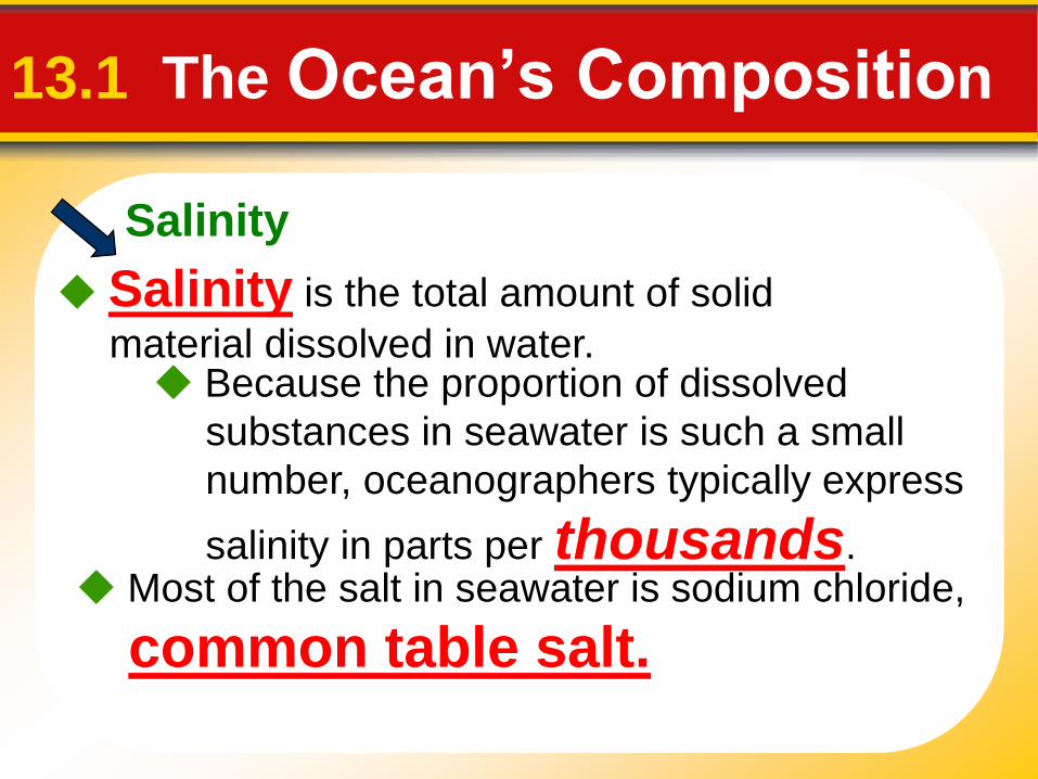
Salinity
13.1 The Ocean’s Composition
Salinity is the total amount of solid
material dissolved in water. Because the proportion of dissolved
substances in seawater is such a small
number, oceanographers typically express
salinity in parts per thousands. Most of the salt in seawater is sodium chloride,
common table salt.

Salinity
Where does the Salt come from?
Sources of Sea Salt
a. Chemical weathering of rocks on the
continents is one source of elements found in
seawater.
b. The second major source of elementsfound in seawater is from Earth’s interior.
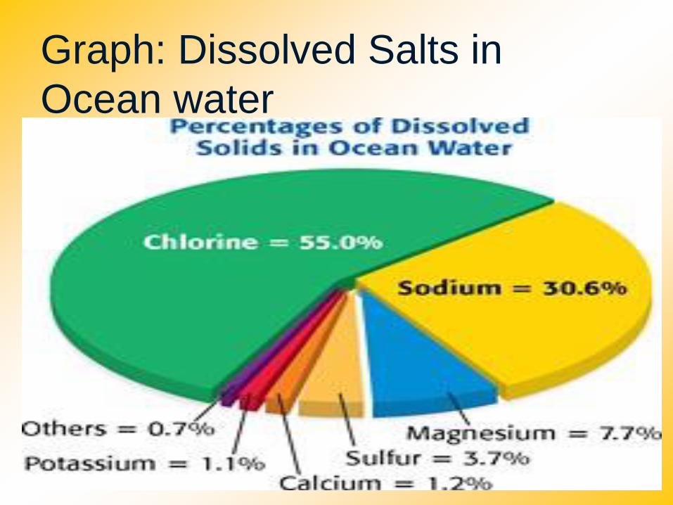
Graph: Dissolved Salts in
Ocean water
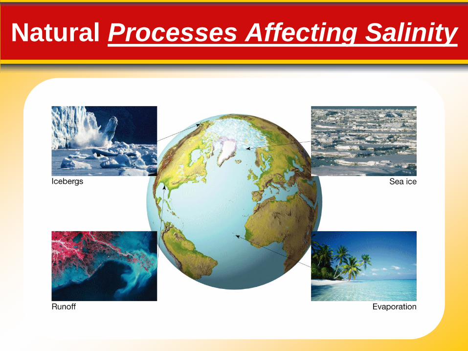
Natural Processes Affecting Salinity
Salinity
Processes Affecting Salinity
Processes Affecting Salinity
• Processes that decrease salinity:
• Processes that increase salinity:
- Precipitation
- Runoff from land
- Icebergs melting
- Ice melting
- Evaporation
- Formation of sea ice

Ocean Temperature Variation The ocean’s surface water temperature
varies with the amount of solar radiation
received, which is primarily a function of
latitude.
13.1 Seawater
• The thermocline is the layer of ocean water
between about 300 meters and 1000 meters where
there is a rapid change of temperature with depth.
Temperature Variation with Depth
• The thermocline is a very important structure
because it creates a barrier to marine life.
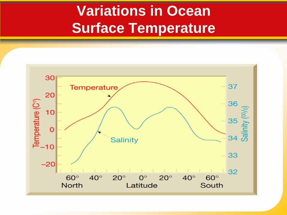
Variations in Ocean
Surface Temperature

Variations in Ocean
Water Temperature
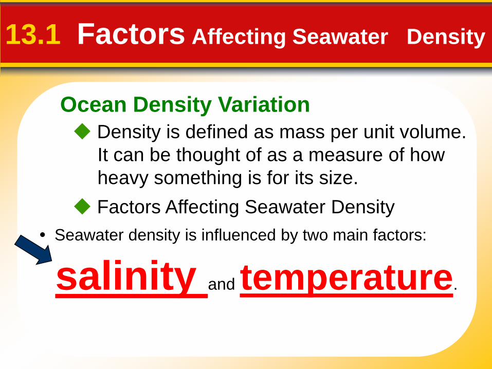
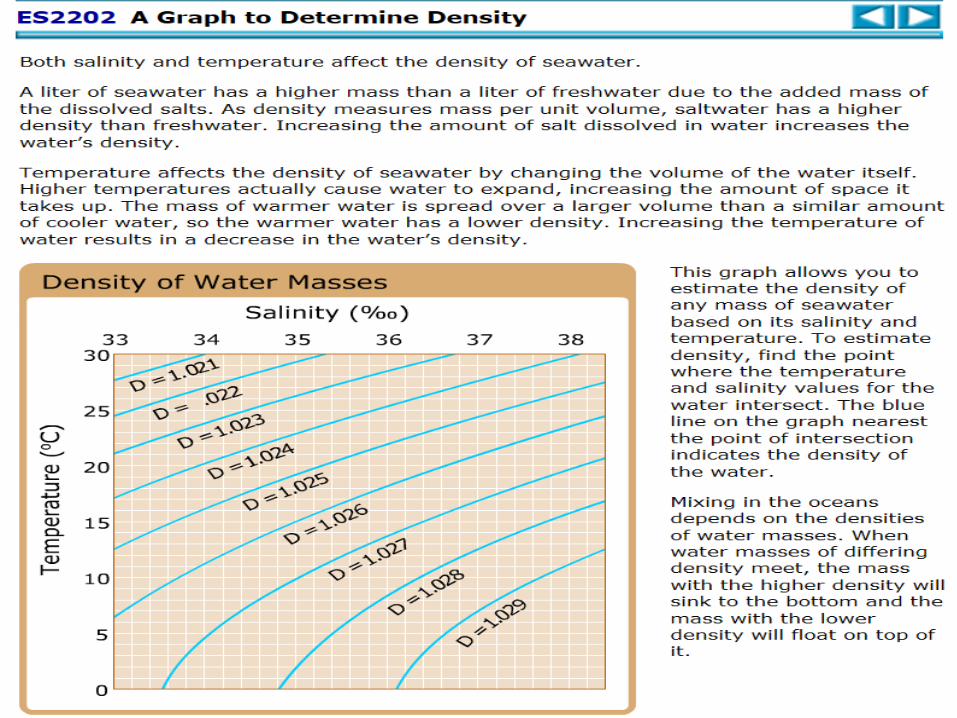
Ocean Density Variation
Density is defined as mass per unit volume.
It can be thought of as a measure of how
heavy something is for its size.
13.1 Factors Affecting Seawater Density
• Seawater density is influenced by two main factors:
salinity and temperature.
Factors Affecting Seawater Density

Salinity map showing areas of high salinity (36 o/oo) in green,
medium salinity in blue (35 o/oo), and low salinity (34 o/oo) in
purple. Salinity is rather stable but areas in the North Atlantic,
South Atlantic, South Pacific, Indian Ocean, Arabian Sea, Red Sea,
and Mediterranean Sea tend to be a little high (green). Areas near
Antarctica, the Arctic Ocean, Southeast Asia, and the West Coast
of North and Central America tend to be a little low (purple).
http://www.biosbcc.net/ocean/marinesci/02ocean/swcomposition.htm
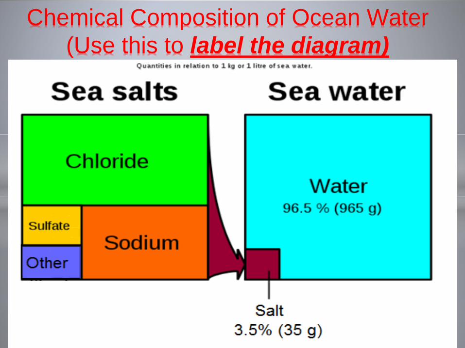
Chemical Composition of Ocean Water
(Use this to label the diagram)

Making connections
Read the next sides when you are finished go
to Classzone and explore salinity and the
ocean

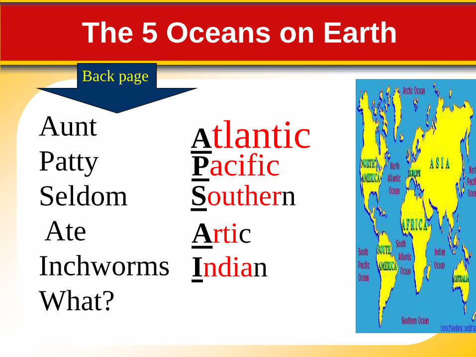
Aunt
Patty
Seldom
Ate
Inchworms
What?
The 5 Oceans on Earth
Atlantic
Southern
Artic
Indian
Pacific
Back page

The 5 Oceans on Earth
• The continents divide the 5 major oceans
and the equator subdivides these oceans
into the North Atlantic Ocean and South
Pacific Ocean
On average, the Atlantic is the saltiest of
the world's major oceans; but the Pacific is the
largest ocean
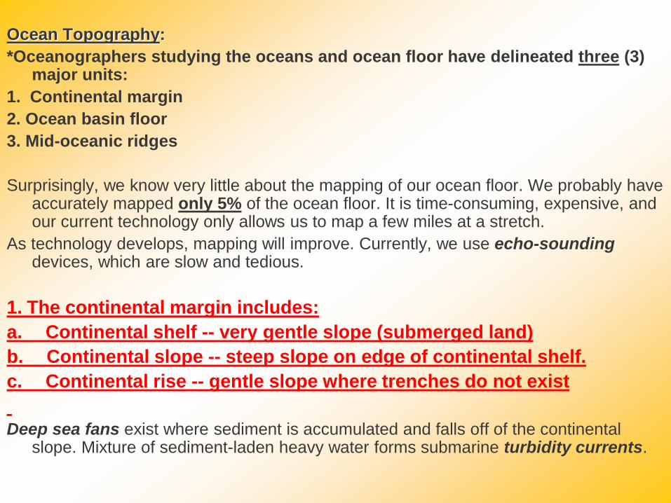
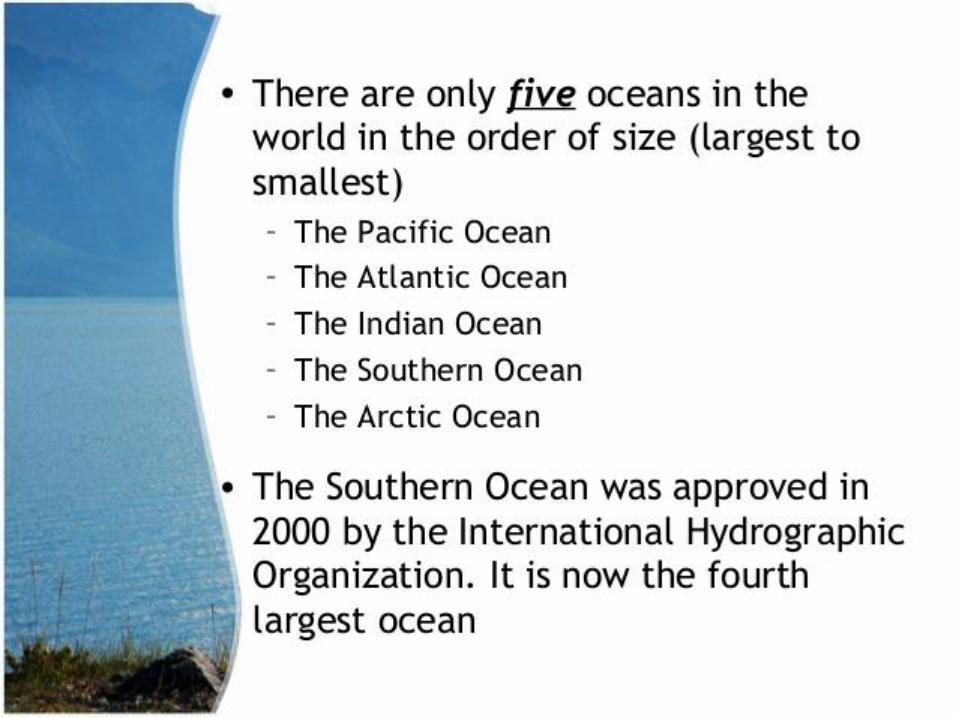
Ocean Topography:
*Oceanographers studying the oceans and ocean floor have delineated three (3) major units:
1. Continental margin
2. Ocean basin floor
3. Mid-oceanic ridges
Surprisingly, we know very little about the mapping of our ocean floor. We probably have accurately mapped only 5% of the ocean floor. It is time-consuming, expensive, and our current technology only allows us to map a few miles at a stretch.
As technology develops, mapping will improve. Currently, we use echo-soundingdevices, which are slow and tedious.
1. The continental margin includes:
a. Continental shelf -- very gentle slope (submerged land)
b. Continental slope -- steep slope on edge of continental shelf.
c. Continental rise -- gentle slope where trenches do not exist
Deep sea fans exist where sediment is accumulated and falls off of the continental slope. Mixture of sediment-laden heavy water forms submarine turbidity currents.
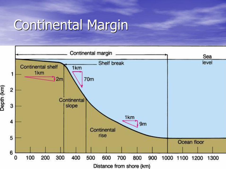
Continental Margin

2. The Deep Sea includes:
a. Deep ocean trenches (deepest part of ocean) some as deep as 36,000 feet; The Marianas Trench is 7 km below the adjacent Pacific Ocean floor. Typically, the deepest part of a trench is given a separate name. Ex. the Challenger Deep is the deepest part of the Marianas Trench with a maximum-known depth of about 11.03 kilometres (6.85 mi)
Ocean trenches are also associated with earthquakes, high heat flow, and volcanic activity.
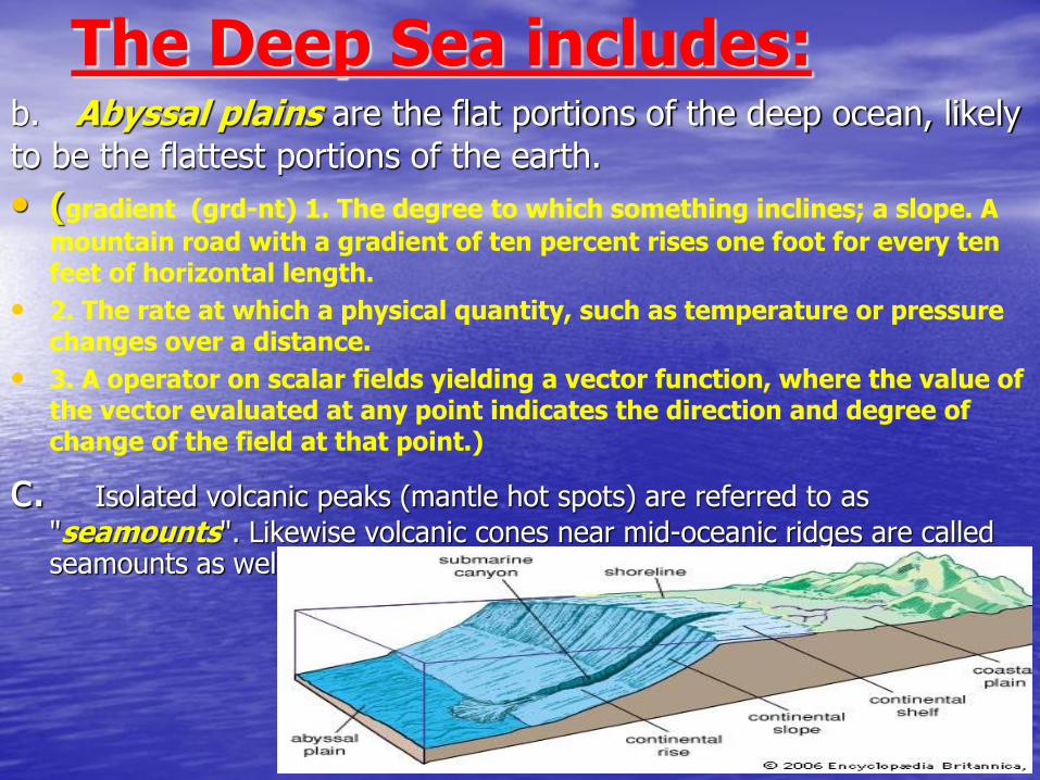
The Deep Sea includes:b. Abyssal plains are the flat portions of the deep ocean, likely
to be the flattest portions of the earth.
• (gradient (grd-nt) 1. The degree to which something inclines; a slope. A
mountain road with a gradient of ten percent rises one foot for every ten feet of horizontal length.
• 2. The rate at which a physical quantity, such as temperature or pressure changes over a distance.
• 3. A operator on scalar fields yielding a vector function, where the value of the vector evaluated at any point indicates the direction and degree of change of the field at that point.)
c. Isolated volcanic peaks (mantle hot spots) are referred to as
"seamounts". Likewise volcanic cones near mid-oceanic ridges are called seamounts as well. Harry Hess called these “guyots”.

Examples of mid-ocean ridges
Slow spreading ridges like
the Mid-Atlantic Ridgegenerally have large, wide rift valleys, sometimes as big as 10–20 km (6.2–12 mi) wide and very rugged terrain at the ridge crest that can have relief of up to a 1,000 m (3,300 ft). By contrast, fast spreading
ridges like the East Pacific Rise are
narrow, sharp incisions surrounded by generally flat topography that slopes away from the ridge over many hundreds of miles.

Technology: Exploring the
Ocean Floor1. How can scientists study the ocean floor?
2. What did they find?
3. With state of the art technology, scientists
have discovered a wide variety of landforms
and sea life on the ocean floor.
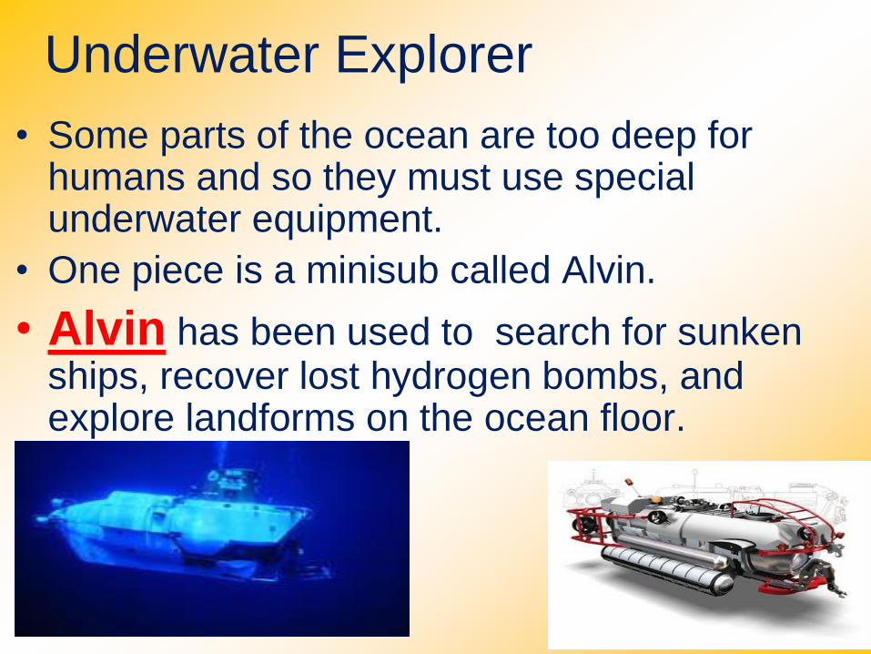
Underwater Explorer
• Some parts of the ocean are too deep for humans and so they must use special underwater equipment.
• One piece is a minisub called Alvin.
• Alvin has been used to search for sunken ships, recover lost hydrogen bombs, and explore landforms on the ocean floor.
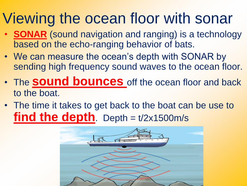
Viewing the ocean floor with sonar• SONAR (sound navigation and ranging) is a technology
based on the echo-ranging behavior of bats.
• We can measure the ocean’s depth with SONAR by sending high frequency sound waves to the ocean floor.
• The sound bounces off the ocean floor and back to the boat.
• The time it takes to get back to the boat can be use to
find the depth. Depth = t/2x1500m/s
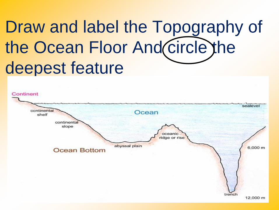
Draw and label the Topography of
the Ocean Floor And circle the
deepest feature

Go back to ikeepbookmarks
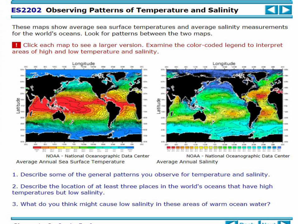
Classzone. How Do
Temperature and Salinity
Affect Mixing in the Oceans?
or the BLOG
or USATESTPREP
Review any concept
• Congratulation Oceanographer
– Job well done!