DROUGHT 2009 India - ewh.ieee.orgewh.ieee.org/r10/gujarat/htccon/presentations/HTCCON_G...
19
DROUGHT 2009 India DROUGHT 2009 India
Transcript of DROUGHT 2009 India - ewh.ieee.orgewh.ieee.org/r10/gujarat/htccon/presentations/HTCCON_G...
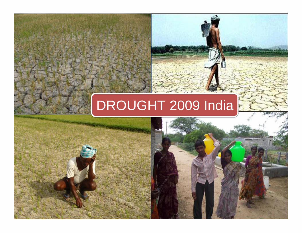
DROUGHT 2009 IndiaDROUGHT 2009 India
Disaster Preparedness using IT Tools: Case Studies on the use of ICT and GIS Derived tools for Micro-Level
Drought Preparedness
G Sreedhar1,2, R Nagarajan2, V Ramnaresh Kumar1, N Lavanya1, Asil Gerard Sylvester1 and V. Balaji1
1International Crops Research Institute for the Semi-arid Tropics, Patancheru, Hyderabad.2Indian Institute of Technology, Bombay.
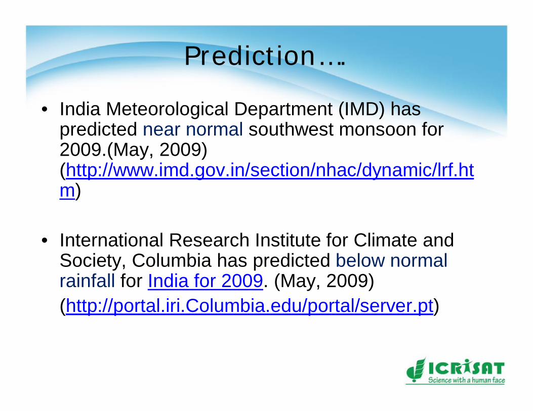
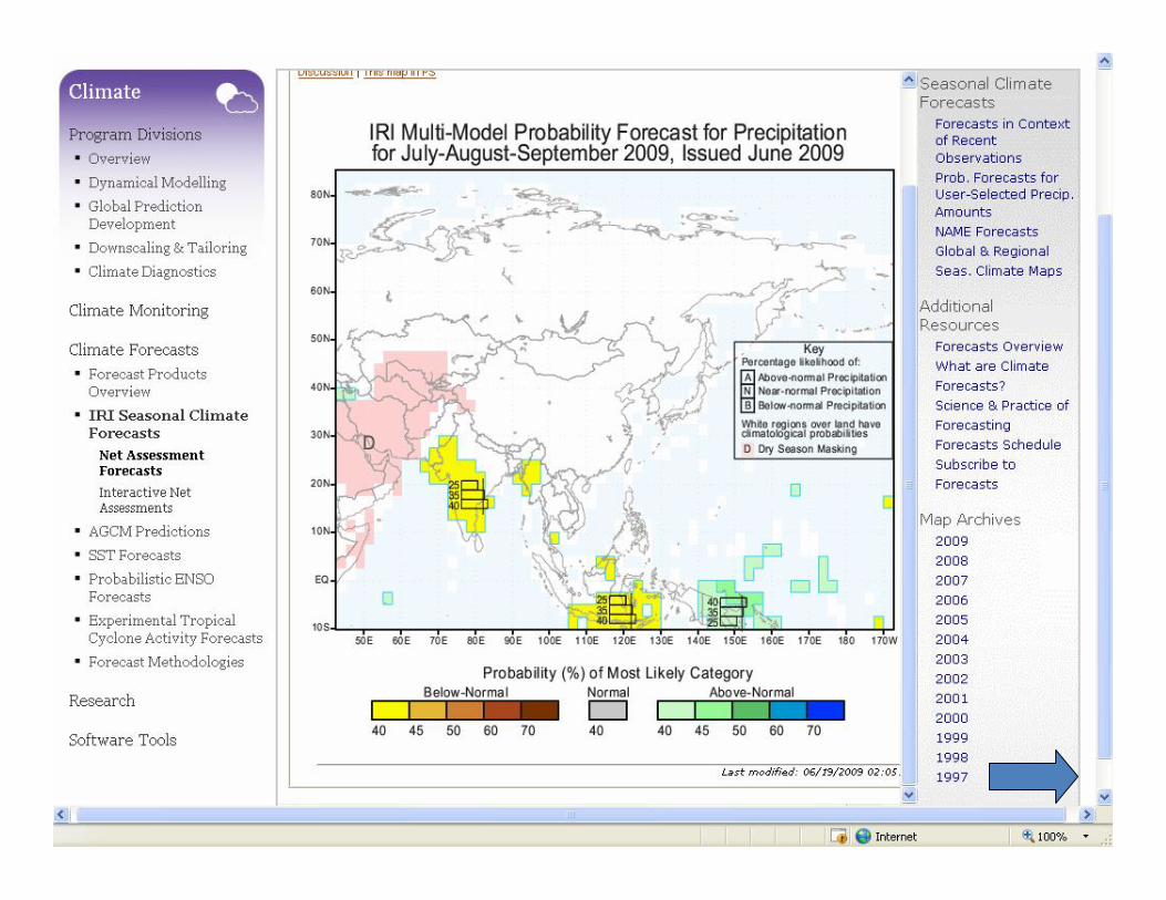
Prediction….
• India Meteorological Department (IMD) has predicted near normal southwest monsoon for 2009.(May, 2009) (http://www.imd.gov.in/section/nhac/dynamic/lrf.htm)
• International Research Institute for Climate and Society, Columbia has predicted below normal rainfall for India for 2009. (May, 2009)(http://portal.iri.Columbia.edu/portal/server.pt)
• Based on this, a below normal rainfall (400 mm) was predicted for addakal block, Mahaboobnagar.
• ICRISAT also recommends growing an array of crops together with livestock along with other income-generating activities that can lessen the risks of total crop failure and enhance farm income. (http://www.hindu.com/2009/07/05/stories/2009070555380900.htm)
Drought Vulnerability and Agroadvisary
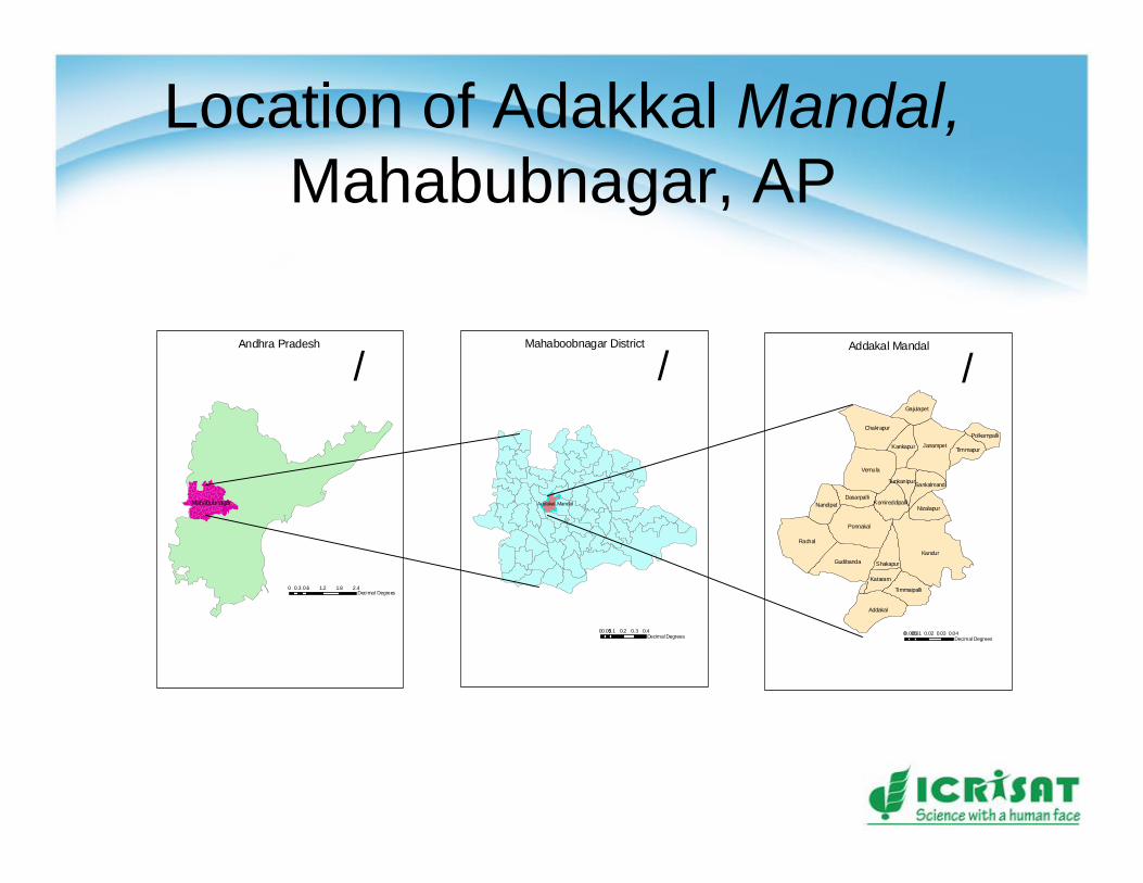
Location of Adakkal Mandal, Mahabubnagar, AP
Andhra Pradesh
/
0 0.6 1.2 1.8 2.40.3Decimal Degrees
Mahabubnagar
Mahaboobnagar District
/
0 0.1 0.2 0.3 0.40.05Decimal Degrees
Addakal Mandal
Kandur
Rachal
Vemula
Ponnakal
Janampet
Addakal
Chakrapur
Gudibanda
Nandipet
Gajulapet
Timmaipalli
Nizalapur
Kankapur
Shakapur
Timmapur
Kataram
DasarpalliKomireddipalli
Sankalmandi
Polkampalli
Tunkanipur
Addakal Mandal
/
0 0.01 0.02 0.03 0.040.005Decimal Degrees
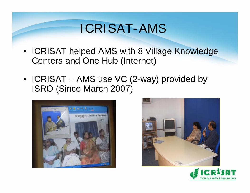
ICRISAT-AMS
• ICRISAT helped AMS with 8 Village Knowledge Centers and One Hub (Internet)
• ICRISAT – AMS use VC (2-way) provided by ISRO (Since March 2007)
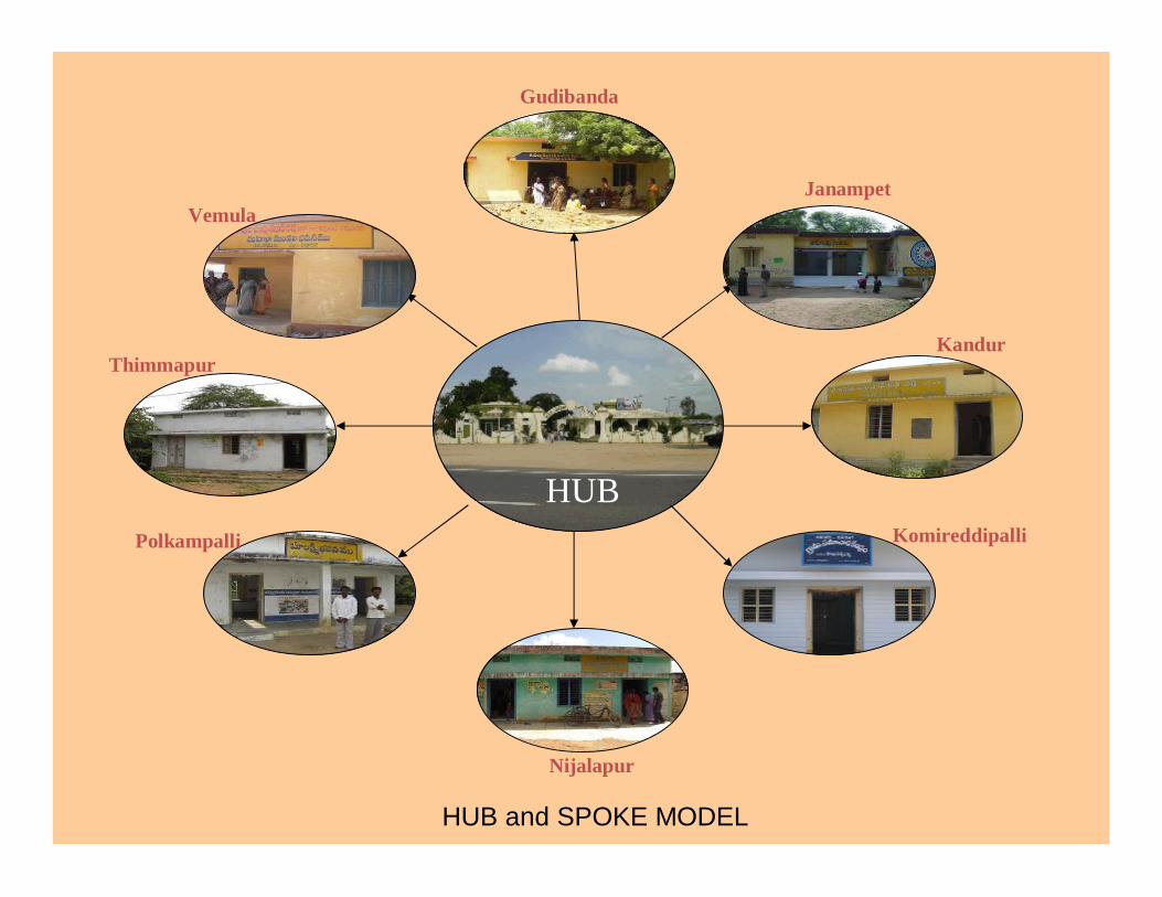
HUB
Gudibanda
Janampet
Kandur
Komireddipalli
Nijalapur
Polkampalli
Thimmapur
Vemula
HUB and SPOKE MODEL
Drought Vulnerability Assessment Framework
• ICRISAT adopted a method developed at IIT Bombay.
• Water deficit \ surplus information• demand• available from rainfall-runoff
• Cadastral maps – ArcGIS Software.• Choropleth Maps à Color coded maps

Seasonal Prediction of Rainfall for the Year 2009 at Adakkal
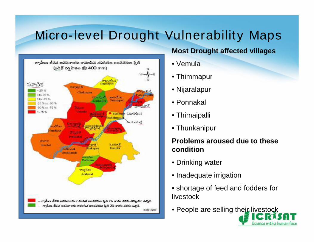
Micro-level Drought Vulnerability MapsMost Drought affected villages
• Vemula
• Thimmapur
• Nijaralapur
• Ponnakal
• Thimaipalli
• Thunkanipur
Problems aroused due to these condition
• Drinking water
• Inadequate irrigation
• shortage of feed and fodders for livestock
• People are selling their livestock
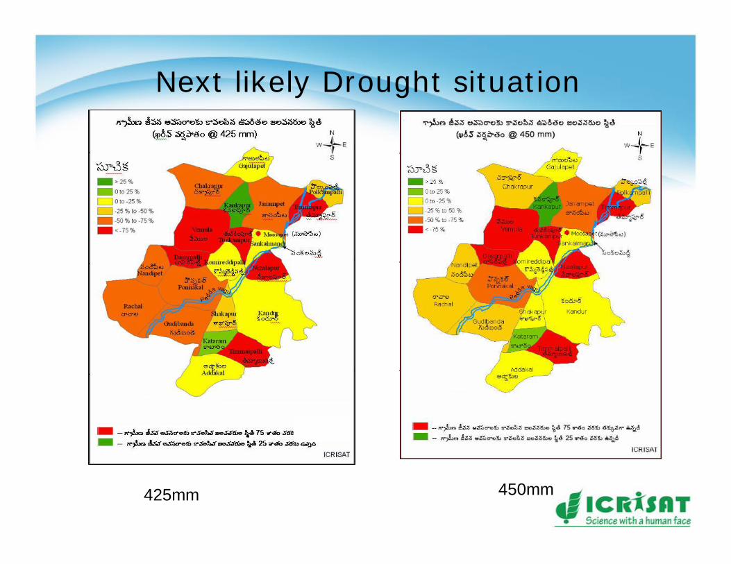
Next likely Drought situation
425mm 450mm
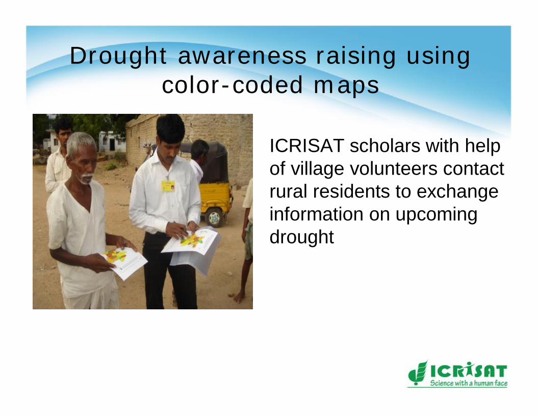
Drought awareness raising using color-coded maps
ICRISAT scholars with help of village volunteers contact rural residents to exchange information on upcoming drought
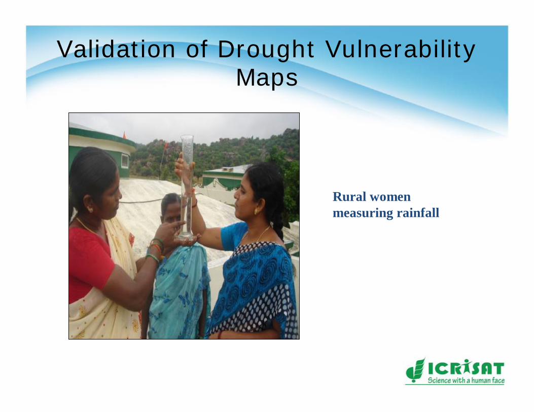
Validation of Drought Vulnerability Maps
Rural women measuring rainfall
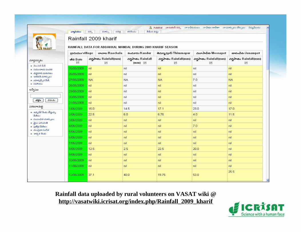
Rainfall data uploaded by rural volunteers on VASAT wiki @ http://vasatwiki.icrisat.org/index.php/Rainfall_2009_kharif
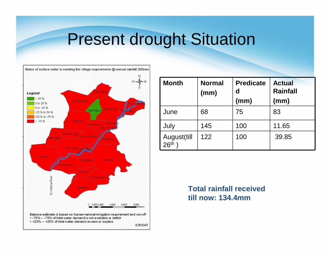
Present drought Situation
Month Normal(mm)
Predicated(mm)
Actual Rainfall (mm)
June 68 75 83
July 145 100 11.65August(till 26th )
122 100 39.85
Total rainfall received till now: 134.4mm
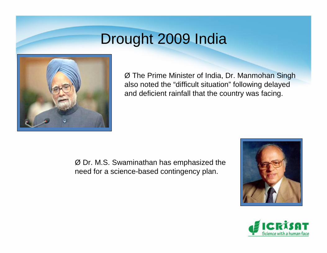
Drought 2009 India
Ø The Prime Minister of India, Dr. Manmohan Singh also noted the “difficult situation” following delayed and deficient rainfall that the country was facing.
Ø Dr. M.S. Swaminathan has emphasized the need for a science-based contingency plan.
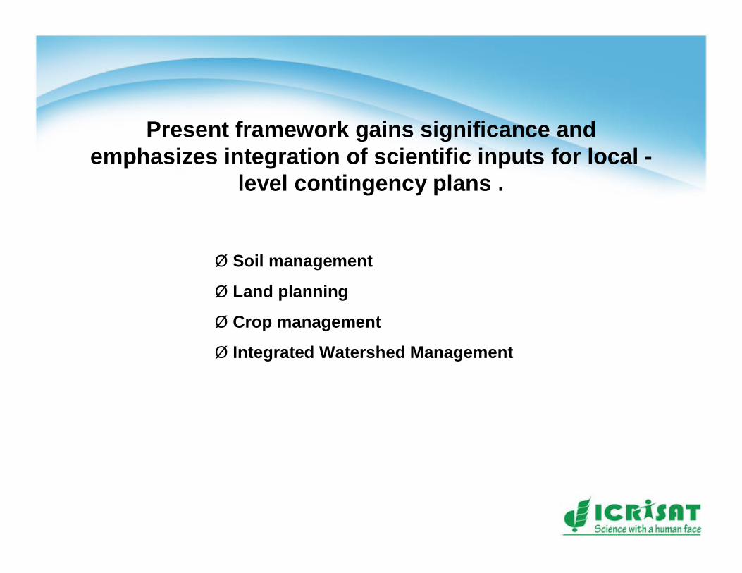
Present framework gains significance and emphasizes integration of scientific inputs for local -
level contingency plans .
Ø Soil management
Ø Land planning
Ø Crop management
Ø Integrated Watershed Management

Thank you