Dr HjTahir Bin Aris Director -...
22
Dr HjTahir Bin Aris Director Institute for Public Health Centre for Epidemiological Survey Research
Transcript of Dr HjTahir Bin Aris Director -...
Dr Hj Tahir Bin Aris
Director
Institute for Public Health Centre for Epidemiological Survey Research

• Public health management needs information on variousaspects like the prevalence of diseases, facilities that areavailable in order to take decisions on either creatinginfrastructure facilities or for taking immediate action tohandle the situation and so on.
• GIS is becoming a vital tool in healthcare applicationscovering database management, planning, risk assessment,service area mapping, location idetifications etc.
• Further, GIS would assist us in better linking ofenvironmental, demographic and temporal factors with thehealth issues to understand causes for such health hazards.

GIS & related spatial analysis
Describing & understanding the changing spatial organization of
health care
Examining its relationship to
health outcomes and access
Exploring how the delivery of
healthcare can be improved

Determining geographic distribution of diseases Analysing
spatial and temporal
trends
Mapping populations
at risk
Stratifying risk factors
Assessing resource
allocation
Planning and targeting
interventions
Monitoring diseases and
interventions over time

• Healthcare researchers and policy makers will depend on access to
– integrated spatial data on health services utilization and outcomes and
– data that cut across human services utilization and outcomes and data
• Need to understand better the spatial behaviors health care providers & consumers in the rapidly changing healthcare landscape and how GIS affects this dynamics relationship
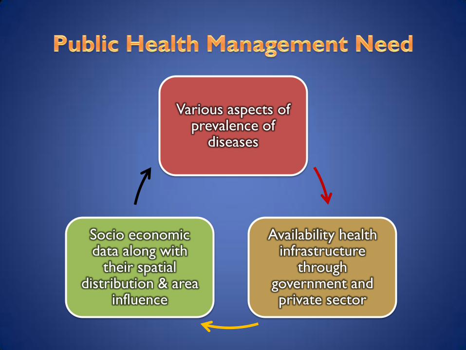
Various aspects of prevalence of
diseases
Availability health infrastructure
through government and private sector
Socio economic data along with
their spatial distribution & area
influence

• Data related to public health covering a
particular region is voluminous, difficult to
understand & organize the real content
• Data needs to presented in a manner that the
temporal & spatial nature of the problem can
be focused
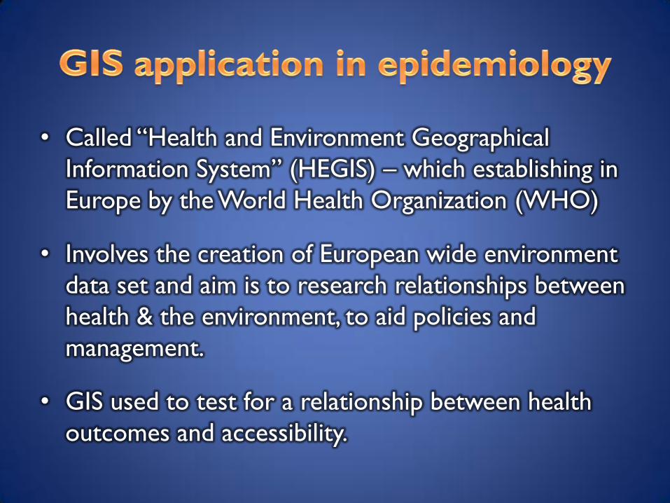
• Called “Health and Environment Geographical
Information System” (HEGIS) – which establishing in
Europe by the World Health Organization (WHO)
• Involves the creation of European wide environment
data set and aim is to research relationships between
health & the environment, to aid policies and
management.
• GIS used to test for a relationship between health
outcomes and accessibility.

• Managers using GIS can easily evaluate both the performance and distribution of services through map
• Time series maps can show whether health in area has improved, remained constant, or deteriorated for a given time period
• Finding the best location for a health facility is considered as one of the Ministry of Health task in order to optimize resources.

• The best location for a facility can be
identified using for example location –
allocation model that area now been
integrated to the modern GIS software
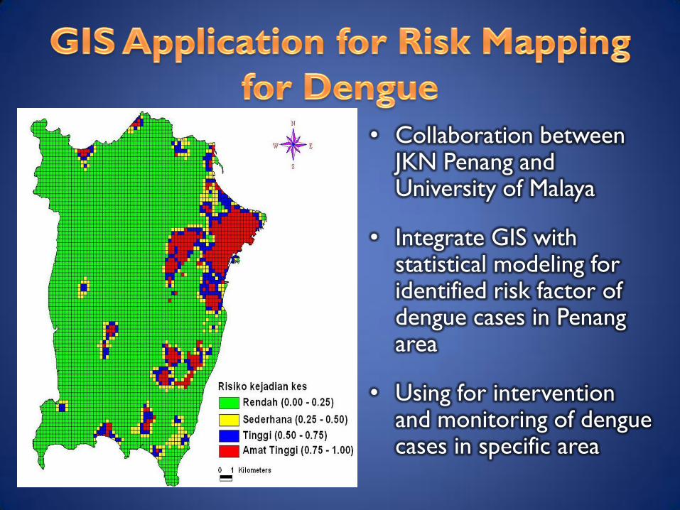
• Collaboration between JKN Penang and University of Malaya
• Integrate GIS with statistical modeling for identified risk factor of dengue cases in Penang area
• Using for intervention and monitoring of dengue cases in specific area

• The study from Vector Unit,
MOH collaborated with Remote
Sensing that land surface
temperature is highly correlated
with the distribution of dengue
cases that occurred within the
study area..
• The information derived from
this study became useful in
assisting the Ministry of Health
Malaysia to identify and control
dispersions of dengue outbreak
in the country.

• Malnutrition in Children
in Perlis
• The result of the study will
be beneficial for the
Ministry of Health
especially in the
implementation of food
basket program.
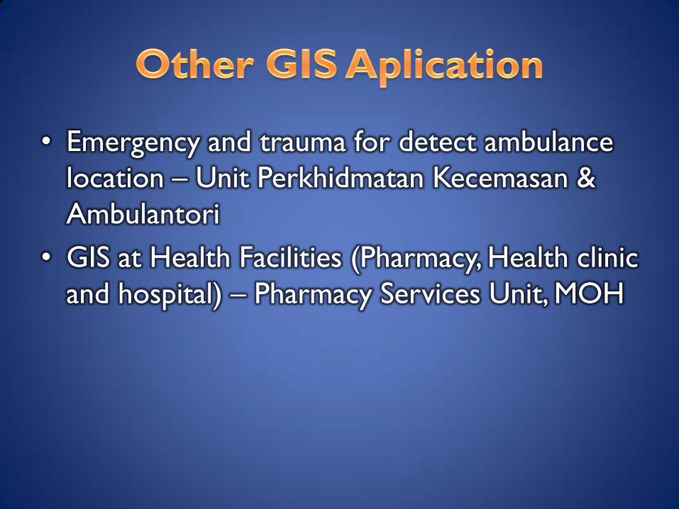
• Emergency and trauma for detect ambulance
location – Unit Perkhidmatan Kecemasan &
Ambulantori
• GIS at Health Facilities (Pharmacy, Health clinic
and hospital) – Pharmacy Services Unit, MOH


To establish the spatial database for healthcare
facilities in Malaysia

1. To map all healthcare facilities in the country.
2. To profile the population characteristic in
term of income, work category, ethnicity, etc
3. To assist allocation and distribution of
healthcare provider to population in
implementation of 1Care.
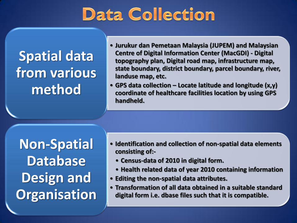
• Jurukur dan Pemetaan Malaysia (JUPEM) and Malaysian Centre of Digital Information Center (MacGDI) - Digital topography plan, Digital road map, infrastructure map, state boundary, district boundary, parcel boundary, river, landuse map, etc.
• GPS data collection – Locate latitude and longitude (x,y) coordinate of healthcare facilities location by using GPS handheld.
Spatial data from various
method
• Identification and collection of non-spatial data elements consisting of:-
• Census-data of 2010 in digital form.
• Health related data of year 2010 containing information
• Editing the non-spatial data attributes.
• Transformation of all data obtained in a suitable standard digital form i.e. dbase files such that it is compatible.
Non-Spatial Database
Design and Organisation
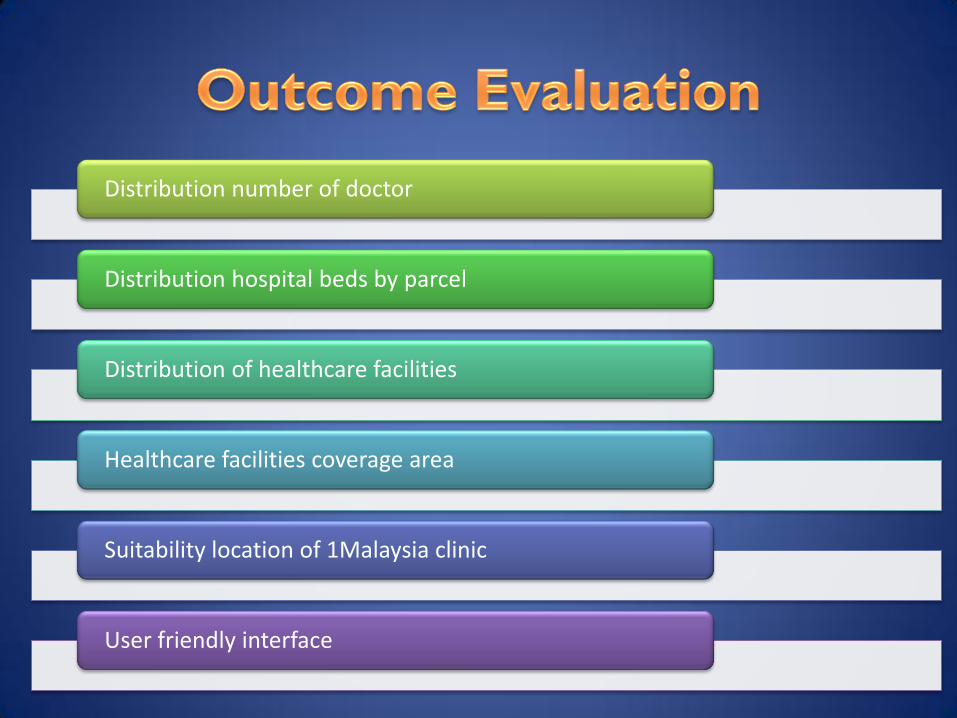
Distribution number of doctor
Distribution hospital beds by parcel
Distribution of healthcare facilities
Healthcare facilities coverage area
Suitability location of 1Malaysia clinic
User friendly interface