Reconfiguring Academic Collections: Stewardship, Sustainability and Shared Infrastructure
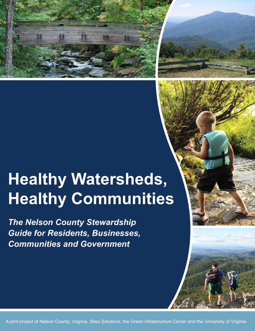
Healthy Watersheds, Healthy CommunitiesThe Nelson County Stewardship Guide for Residents, Businesses, Communities and Government
A joint project of Nelson County, Virginia, Skeo Solutions, the Green Infrastructure Center and the University of Virginia
Peter Stutts
Peter Stutts

FORESTSNelson County has more large, intact areas of forest than most counties in the Virginia Piedmont.
Forested land constitutes 80 percent of its land area. More than 249,000 of these acres are ranked by the Virginia Department of Conservation and Recreation as “outstanding to very high quality” for wildlife
and water quality protection. Nelson County’s forests contribute $3 million annually to the local economy.
WATERNelson County’s water resources include ground water aquifers and 2,220 miles of waterways, including
the Buffalo, James, Piney, Rockfish and Tye Rivers, that extend across nine watersheds. The county’s water resources provide drinking water for most county residents and businesses.
SOILS AND AGRICULTUREFarmland constitutes approximately one quarter of Nelson County’s land area – 73,149 acres. County soils where terrain is flat and rolling are characterized as “good to moderate.” There are relatively few prime agricultural soils in the county. However, the county’s steep slopes and “poor” quality soils are actually well-suited to orchards and vineyards. In 2007, the value of all agricultural products sold by Nelson County farmers was $12.5 million.
HERITAGE AND RECREATIONThe county’s assets include its cultural resources, historic buildings, districts and towns, rural landscapes, recreation areas and natural beauty. The county’s heritage is integrally linked with its rural landscapes: plantations, country stores and early settlements. Today, Nelson County’s economy encompasses agriculture and forestry as well as industry and services, with recreation and tourism as significant driving forces. Heritage tourists stay longer, visit more sites and tend to spend up to 2.5 times more than other visitors.
Nelson County’s watershed resources – the county’s air, forests, ground water, soils, waterways and wildlife habitat – are closely intertwined with its culture, history and recreation opportunities. Together, these resources provide vital, irreplaceable services integral to citizens’ quality of life, public health and the economy of Nelson County. These resources also cross county boundaries and provide regional benefits.
This stewardship guide provides Nelson County’s residents, businesses, communities and government with information on how they can use and manage local land resources to maintain, protect and restore local water quality and healthy watersheds.
2 Nelson County Healthy Watershed Guide
Nelson County’s Natural Resources & Watershed Health
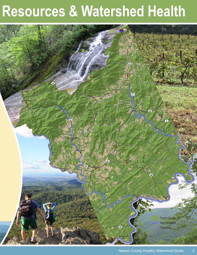
Nelson County’s Natural Resources & Watershed Health
Piney River
Tye River
Tye River
Buffalo River
James River
Rockfish River
Nelson County Healthy Watershed Guide 3
Forest CanopyMajor StreamsTributaries

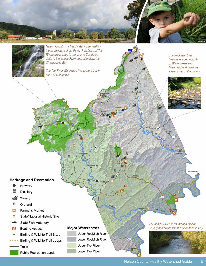
Nelson County hosts an abundance of cultural and recreational opportunities that enhance the quality of life for residents and contribute to the local economy. Many of these opportunities are closely linked to the county’s scenic rural setting, including its mountains, forests and rivers. For example, fishing, swimming and boating rely on healthy rivers. Other activities, such as hiking, biking and agritourism, depend on maintaining a scenic, healthy landscape. Protecting Nelson County’s waterways and forests can help ensure these opportunities are sustained for citizens and the local economy. This section highlights the location of many of these recreational opportunities in relation to the watersheds of Nelson County.
Nelson County contains two major watersheds that drain to the James River and, ultimately, the Chesapeake Bay. The Tye River headwaters begin just above Montebello and drain south, forming part of the southwestern
county boundary. The Rockfish River headwaters begin north of Wintergreen and Greenfield and drain the eastern half of the county. Portions of seven other watersheds are also located in the county.
Nelson County WatershedsThe county’s watersheds include several key components. These components – uplands, riparian zones, wetlands,
and surface waters and ground water – are interconnected and contribute to the health of the watersheds and the well-being of Nelson County residents.
Uplands include all areas that ultimately drain to the county’s rivers, including forests, farm land and developed areas. Each of these land uses can be managed in a way that benefits or degrades the watersheds. Maintaining healthy vegetation
in the uplands helps slow and cleanse the water that drains to the rivers, wetlands and ground water. In addition, residents, business owners and farmers can adopt land stewardship practices that keep pollutants out of the rivers and ground water.
Riparian zones are the buffer areas along the banks of waterways. Maintaining vegetated riparian zones helps filter pollutants and keeps the water cool. Vegetated riparian zones also enhance fish habitat and serve as wildlife corridors.
Wetlands, swamps and marshes slow and temporarily store water before releasing it downstream. Wetland vegetation helps to settle sediment and removes pollutants, improving water quality. Healthy wetlands also provide prime habitat for birds and other animals.
Surface waters and groundwater collect in underground water reservoirs called aquifers. As rainwater is absorbed into the ground, it percolates down and collects in these reservoirs, which are the county’s primary source of drinking water. Land areas that contribute to these subsurface flows are called recharge areas. Protecting these areas ensures citizens have access to high-quality drinking water.
4 Nelson County Healthy Watershed Guide
Healthy Watersheds, Healthy Communities
“The water in this region is an integral part of the success of our brewery process.”
Taylor Smack, Owner, Blue Ridge Mountain Brewery
Peter Stutts
USFWS
USFWS
!¡
!¡
!¡
!¡
!¡
"
UV151
UV29
UV6
UV56
UV56
UV56
UV151
UV29
UV60
UV6
UV48
UV250
Faber
Afton
Norwood Wingina
Shipman
Colleen
Roseland
Schuyler
Arrington
Gladstone
Lovingston
Montebello
Nellysford
Greenfield
Piney River
Beech Grove
Massies Mill
Wintergreen Resort
§̈¦64
Howardsville
Heritage and RecreationBrewery
Distillery
Winery
} Orchard
!³ Farmer's Market
!Z State/National Historic Site
State Fish Hatchery
!¡ Boating Access
Birding & Wildlife Trail Sites
Birding & Wildlife Trail Loops
Trails
Public Recreation Lands
Major WatershedsUpper Rockfish River
Lower Rockfish River
Upper Tye River
Lower Tye River
Nelson County Healthy Watershed Guide 5
Nelson County is a headwater community – the headwaters of the Piney, Rockfish and Tye Rivers are located in the county. The rivers drain to the James River and, ultimately, the Chesapeake Bay.
The Tye River Watershed headwaters begin north of Montebello.
The Rockfish River headwaters begin north of Wintergreen and Greenfield and drain the eastern half of the county.
The James River flows through Nelson County and drains into the Chesapeake Bay.
Piney River
Tye River
Tye River James River
Rockfish River
Peter Stutts USFWS
!¡
!¡
!¡
!¡
!¡
"
UV151
UV29
UV6
UV56
UV56
UV56
UV151
UV29
UV60
UV6
UV48
UV250
Faber
Afton
Norwood Wingina
Shipman
Colleen
Roseland
Schuyler
Arrington
Gladstone
Lovingston
Montebello
Nellysford
Greenfield
Piney River
Beech Grove
Massies Mill
Wintergreen Resort
§̈¦64
Howardsville
Heritage and RecreationBrewery
Distillery
Winery
} Orchard
!³ Farmer's Market
!Z State/National Historic Site
State Fish Hatchery
!¡ Boating Access
Birding & Wildlife Trail Sites
Birding & Wildlife Trail Loops
Trails
Public Recreation Lands
Major WatershedsUpper Rockfish River
Lower Rockfish River
Upper Tye River
Lower Tye River
!¡
!¡
!¡
!¡
!¡
"
UV151
UV29
UV6
UV56
UV56
UV56
UV151
UV29
UV60
UV6
UV48
UV250
Faber
Afton
Norwood Wingina
Shipman
Colleen
Roseland
Schuyler
Arrington
Gladstone
Lovingston
Montebello
Nellysford
Greenfield
Piney River
Beech Grove
Massies Mill
Wintergreen Resort
§̈¦64
Howardsville
Heritage and RecreationBrewery
Distillery
Winery
} Orchard
!³ Farmer's Market
!Z State/National Historic Site
State Fish Hatchery
!¡ Boating Access
Birding & Wildlife Trail Sites
Birding & Wildlife Trail Loops
Trails
Public Recreation Lands
Major WatershedsUpper Rockfish River
Lower Rockfish River
Upper Tye River
Lower Tye River
}
Crabtree Falls
UV56 UV56
UV48
UV60
UV29
UV56
UV151
UV250
UV11
UV6
UV340
UV26
UV240
§̈¦64
Howardsville
Faber
Afton
NorwoodWingina
Shipman
Colleen
Roseland
Schuyler
Arrington
Gladstone
Lovingston
Montebello
Nellysford
Greenfield
Piney River
Beech Grove
Massies Mill
Wintergreen Resort
F0 2.5 51.25Miles
Connected Intact Landscapes
Forest Canopy
Open lands (such as fields and yards)
Lands with some level of protection
Streams
Roads
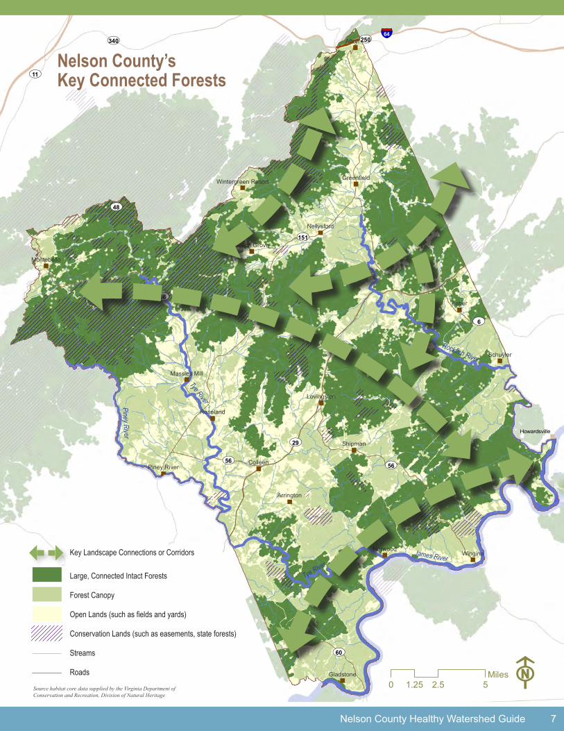
The term “green infrastructure” is another way to describe the natural resources and working lands that provide Nelson County’s
clean water and air, ensure citizens’ quality of life, and sustain the local economy.
Green infrastructure planning connects intact habitat areas (cores) through a network of corridors to allow wildlife and plants to move across the landscape. Knowing the location of key green infrastructure resources allows for better decision-making regarding the location and design of grey infrastructure, such as roads and utilities, to support development.
Maintaining intact, connected natural landscapes is essential for basic ecosystem and watershed services. These services provide county residents and businesses with clean air and water, raw materials, recreation opportunities and protection against the impacts of natural disasters. For local citizens and visitors, these connected landscapes – or corridors – are also valued recreation resources and provide scenic views. Without green infrastructure planning, high-value natural resources can become fragmented over time, limiting the services they provide.
The Virginia Department of Conservation and Recreation’s Natural Heritage Program has developed the Virginia Natural Landscape Assessment (VaNLA) for identifying, prioritizing and linking natural resource areas in Virginia. These natural resource areas, or cores, are biologically diverse, part of a larger network and contribute to water quality enhancement.
Combined with local information, these cores form the basis for mapping green infrastructure resources in Nelson County (see the map on the following page).
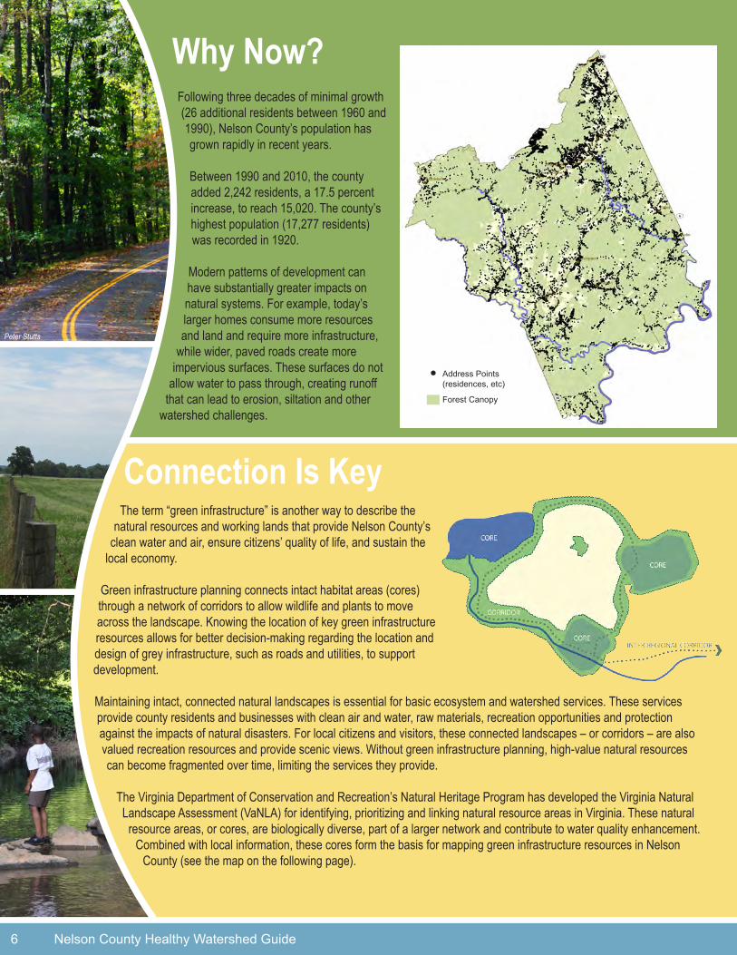
Following three decades of minimal growth (26 additional residents between 1960 and 1990), Nelson County’s population has grown rapidly in recent years.
Between 1990 and 2010, the county added 2,242 residents, a 17.5 percent increase, to reach 15,020. The county’s highest population (17,277 residents) was recorded in 1920.
Modern patterns of development can have substantially greater impacts on natural systems. For example, today’s larger homes consume more resources and land and require more infrastructure,
while wider, paved roads create more impervious surfaces. These surfaces do not
allow water to pass through, creating runoff that can lead to erosion, siltation and other
watershed challenges.
Why Now?
Connection Is Key
6 Nelson County Healthy Watershed Guide
Peter Stutts
Address Points (residences, etc)
Forest Canopy
UV56 UV56
UV48
UV60
UV29
UV56
UV151
UV250
UV11
UV6
UV340
UV26
UV240
§̈¦64
Howardsville
Faber
Afton
NorwoodWingina
Shipman
Colleen
Roseland
Schuyler
Arrington
Gladstone
Lovingston
Montebello
Nellysford
Greenfield
Piney River
Beech Grove
Massies Mill
Wintergreen Resort
F0 2.5 51.25Miles
Connected Intact Landscapes
Forest Canopy
Open lands (such as fields and yards)
Lands with some level of protection
Streams
Roads
Why Now?
Nelson County Healthy Watershed Guide 7
UV56 UV56
UV48
UV60
UV29
UV56
UV151
UV250
UV11
UV6
UV340
UV26
UV240
§̈¦64
Howardsville
Faber
Afton
NorwoodWingina
Shipman
Colleen
Roseland
Schuyler
Arrington
Gladstone
Lovingston
Montebello
Nellysford
Greenfield
Piney River
Beech Grove
Massies Mill
Wintergreen Resort
F0 2.5 51.25Miles
Connected Intact Landscapes
Forest Canopy
Open lands (such as fields and yards)
Lands with some level of protection
Streams
Roads
Key Landscape Connections or Corridors
Large, Connected Intact Forests
Forest Canopy
Open Lands (such as fields and yards)
Conservation Lands (such as easements, state forests)
Streams
Roads
Piney River
Tye River
Tye RiverJames River
Rockfish River
Source habitat core data supplied by the Virginia Department ofConservation and Recreation, Division of Natural Heritage
Nelson County’s Key Connected Forests

8 Nelson County Healthy Watershed Guide
Guiding Principles for Community Stewardship
Protect High-Quality ForestsHigh-quality forests support diverse plant and animal species, replenish drinking water resources through enhanced water infiltration, recharge ground water, abate stormwater runoff in more developed areas and enable a healthy, long-term forest economy. Forest
fragmentation – caused by roads, infrastructure and development – limits the capacity of forests to provide ecological and economic benefits and contribute to clean water and healthy watersheds. Development, particularly in the northern part of the Nelson County, can impact the county’s extensive and high-quality forest cover. To ensure that local forests continue to provide these benefits, the county’s highest-value forest areas – both larger intact parcels and the connections between them – need to be protected and restored.
Ensure Clean, Healthy WaterClean water resources support healthy ecosystems, facilitate economic development, provide recreation opportunities and protect public health. Impaired water bodies affect public health and healthy watersheds, posing a threat to drinking water supplies, ecological
systems and wildlife habitat. Adequate water flow and good water quality are also essential for fishing, boating and recreation. As of 2010, there are 14 waterways in Nelson County that the Virginia Department of Environmental Quality has listed as impaired, eight of which are impaired by fecal coliform and E. coli bacteria. To learn more about Nelson County’s impaired waters or restoration efforts, please visit: www.deq.state.va.us/tmdl/homepage.html
Restoring county watersheds, preventing impairments in the future and ensuring adequate water flows are vital to ensuring safe water supplies, recreation opportunities and the ecological integrity of the Piedmont Region.
Sustain Agriculture and Working FarmsLocal soils have long sustained the county’s agricultural heritage, including cropland, grazing, orchards and vineyards. Farmland also provides habitat and movement corridors for wildlife.
New residential subdivisions, offices and shopping centers provide homes, jobs and tax revenues. However, the conversion of farmland into these uses can take valuable agricultural soils out of use, impacting Nelson County’s agricultural heritage, and take away the ecological and economic benefits provided by working farms. Advancing agriculture in the county and guiding growth to designated growth areas can help sustain the county’s rural economy.
Celebrate Heritage and RecreationNelson County’s natural resources and scenic rural character are closely intertwined with the county’s
culture and history and recreation opportunities. The county’s forests, soils, mountains and rivers
provide clean water and healthy watersheds, tell the story of the county’s history and enable wide-ranging
recreation opportunities, from scenic drives to hunting and fishing, from winery tours and beer tastings
to canoeing, birding and hiking. Stewardship of the county’s natural resources recognizes and
celebrates local culture, history and recreation and sustains overall quality of life for Nelson
County’s residents at the same time.

Nelson County Healthy Watershed Guide 9
Stewardship and Community Planning: Sharing Your Perspective
Nelson County is a headwater community – many of its waterways originate locally and connect all the way to the Chesapeake Bay. Citizens can lend their voices and expertise to inform initiatives led by community organizations and county government to help insure and protect these waterways and clean, healthy water. Examples of stewardship tools used by communities, organizations and local governments in Virginia are listed below.
Comprehensive Planning identifies current community conditions, including key natural resources, and community priorities and goals for the future. The county’s Comprehensive Plan, currently being updated, is implemented through an official map, a capital improvements program, a zoning map and zoning ordinance, and a subdivision ordinance. Community input is vital to the comprehensive planning process, which includes regular updates to these implementation tools. For more information: www.nelsoncounty.com/planning.
Zoning is the fundamental tool used by local governments to regulate land use over time. A zoning map divides land areas within a government’s jurisdiction into different districts, and a zoning ordinance regulates permitted land uses, development density, and the dimensions and placement of particular uses in those districts. For more information: www.cbf.org/Document.Doc?id=150. Examples of conservation measures that could be part of county planning activities include:
• A Cluster Development Ordinance concentrates development on parts of sites, allowing remaining land to be used for open space, recreation and preservation of environmentally sensitive features.
• A Steep Slope Ordinance restricts certain types of development on slopes greater than 20 percent, ensuring that erosion does not impact farmland or natural resources and water quality.
• Agricultural Zoning can be managed to both sustain rural economies and provide stewardship for natural resources. Key areas suitable for farms can be identified in the Comprehensive Plan. In these areas, larger lots can be required to maintain agricultural uses. For example, 20-acre minimum lot sizes help to ensure that farmland is not developed, while also providing habitat and movement corridors for wildlife.
• Low-Impact Development (LID) Standards promote development approaches such as the infiltration and cleaning of runoff that take watershed conditions into account to help ensure long-term watershed health. For more information: www.lowimpactdevelopment.org.
Overlay and Special Use Districts are layered on top of existing zoning to provide additional guidance regarding appropriate future uses and resource management. These districts are commonly used to protect sensitive or unique areas, such as floodplains, agricultural resources, historic properties, aquifers, road corridors, downtowns and scenic views.
• Riparian Overlay Districts protect valued natural riparian-area resources such as headwater streams.• Entrance Corridor Overlay Districts protect scenic resources essential to rural character, working landscapes
and tourism by providing guidance for roadside signage, cell tower locations and design guidelines for buildings along major roads.
Proffers are designed to offset development impacts. For example, the owner of a new development that causes more runoff from impervious surfaces may offer to restore a riparian area or wetland as a donation. This donation is known as a “proffer.” For more information: www.dhcd.virginia.gov/CommissiononLocalGovernment/pages/cashproffersurvey.htm.
For more information, contact Nelson County’s Department of Planning and Zoning: www.nelsoncounty.com/planning.

The stewardship of Nelson County’s natural resources depends on the actions of citizens, communities, businesses and government. Tools such as the county’s Comprehensive Plan guide land use management and decision-making, while thousands of everyday choices made by county residents can make a big difference.
The tools presented on these pages can be used to help insure and protect the county’s natural resources and clean water. The list was generated based on input from local citizens.
Riparian Buffers Riparian areas are the important ecosystems located along the banks of rivers, lakes and other bodies
of water. Expanding the width of these areas, known as “buffers,” improves water quality, protects aquatic ecosystems and provides wildlife corridors. Federal, state and local programs provide landowners with technical,
financial and educational assistance to help establish and maintain riparian buffers. For more information: www.dof.virginia.gov/mgt/rfb/index.htm. Expanding riparian buffers is also a core element of Virginia’s 2010 Watershed
Implementation Plan to clean up the Chesapeake Bay (www.dcr.virginia.gov/vabaytmdl/documents/vatmdlwip.pdf).
Adopt a Stream and Stream MonitoringStream stewardship programs enable citizens to take an active role in assuring the well-being of local water resources.
Programs are designed for community organizations, volunteer groups, youth organizations and teachers to collect information about local waterways and put it to work. For more information, visit: www.dcr.virginia.gov/stormwater_management/adopt.shtml and www.deq.state.va.us/cmonitor. Also, contact local organizations like the Friends of the
Rockfish Watershed (www.forwatershed.org) and the Rockfish Valley Foundation (www.rockfishvalley.org).
Natural Resource Education The Virginia Master Naturalist Program is a statewide corps of volunteers providing education, outreach and service dedicated to the beneficial management of natural resources and natural areas within their communities. Interested Virginians become Master Naturalists through training and volunteer service. For information, contact the Central Blue Ridge Master Naturalist Chapter, hosted by the Nelson County Extension Office: www.centralblueridge-vmn.org/default.html. For state-wide program information: www.virginiamasternaturalist.org. Also, The Wintergreen Nature Foundation encourages the understanding, appreciation, and conservation of the natural and cultural resources of the Blue Ridge mountains of Virginia. They offer both education and opportunities to volunteer. For more information: www.twnf.org.
Conservation Easements Voluntary agreements that create financial incentives for preserving land by providing tax benefits to landowners who preserve farmland or forest. Lands under easement can remain in active use for agriculture, forestry and other purposes. For more information: www.virginiaoutdoorsfoundation.org. The Thomas Jefferson Soil and Water Conservation District holds easements for riparian areas to protect water quality. For more information: www.tjswcd.org/Easement.html. The
Virginia Department of Forestry (www.dof.virginia.gov/land/index.shtml) and The Nature Conservancy (434-295-6106) also hold easements.
What You Can Do:Stewardship Opportunities for Nelson County Residents
10 Nelson County Healthy Watershed Guide
USFWS
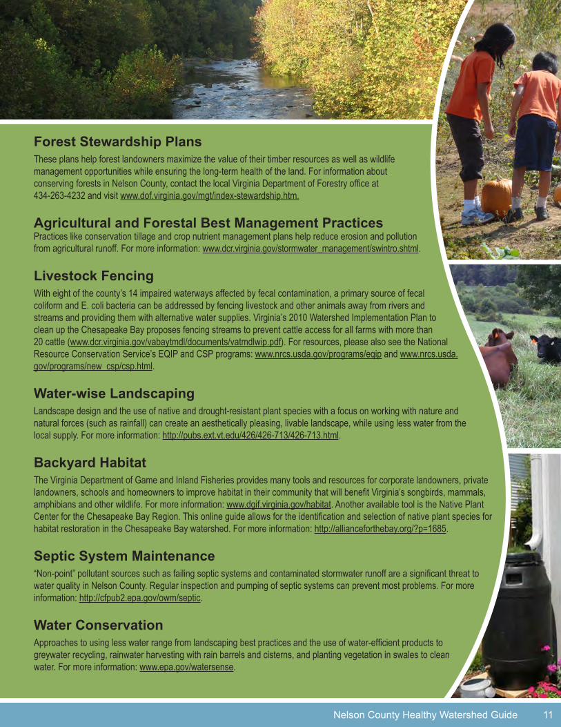
Forest Stewardship Plans These plans help forest landowners maximize the value of their timber resources as well as wildlife management opportunities while ensuring the long-term health of the land. For information about conserving forests in Nelson County, contact the local Virginia Department of Forestry office at 434-263-4232 and visit www.dof.virginia.gov/mgt/index-stewardship.htm.
Agricultural and Forestal Best Management Practices Practices like conservation tillage and crop nutrient management plans help reduce erosion and pollution from agricultural runoff. For more information: www.dcr.virginia.gov/stormwater_management/swintro.shtml.
Livestock Fencing With eight of the county’s 14 impaired waterways affected by fecal contamination, a primary source of fecal coliform and E. coli bacteria can be addressed by fencing livestock and other animals away from rivers and streams and providing them with alternative water supplies. Virginia’s 2010 Watershed Implementation Plan to clean up the Chesapeake Bay proposes fencing streams to prevent cattle access for all farms with more than 20 cattle (www.dcr.virginia.gov/vabaytmdl/documents/vatmdlwip.pdf). For resources, please also see the National Resource Conservation Service’s EQIP and CSP programs: www.nrcs.usda.gov/programs/eqip and www.nrcs.usda.gov/programs/new_csp/csp.html.
Water-wise Landscaping Landscape design and the use of native and drought-resistant plant species with a focus on working with nature and natural forces (such as rainfall) can create an aesthetically pleasing, livable landscape, while using less water from the local supply. For more information: http://pubs.ext.vt.edu/426/426-713/426-713.html.
Backyard HabitatThe Virginia Department of Game and Inland Fisheries provides many tools and resources for corporate landowners, private landowners, schools and homeowners to improve habitat in their community that will benefit Virginia’s songbirds, mammals, amphibians and other wildlife. For more information: www.dgif.virginia.gov/habitat. Another available tool is the Native Plant Center for the Chesapeake Bay Region. This online guide allows for the identification and selection of native plant species for habitat restoration in the Chesapeake Bay watershed. For more information: http://allianceforthebay.org/?p=1685.
Septic System Maintenance “Non-point” pollutant sources such as failing septic systems and contaminated stormwater runoff are a significant threat to water quality in Nelson County. Regular inspection and pumping of septic systems can prevent most problems. For more information: http://cfpub2.epa.gov/owm/septic.
Water Conservation Approaches to using less water range from landscaping best practices and the use of water-efficient products to greywater recycling, rainwater harvesting with rain barrels and cisterns, and planting vegetation in swales to clean water. For more information: www.epa.gov/watersense.
Nelson County Healthy Watershed Guide 11
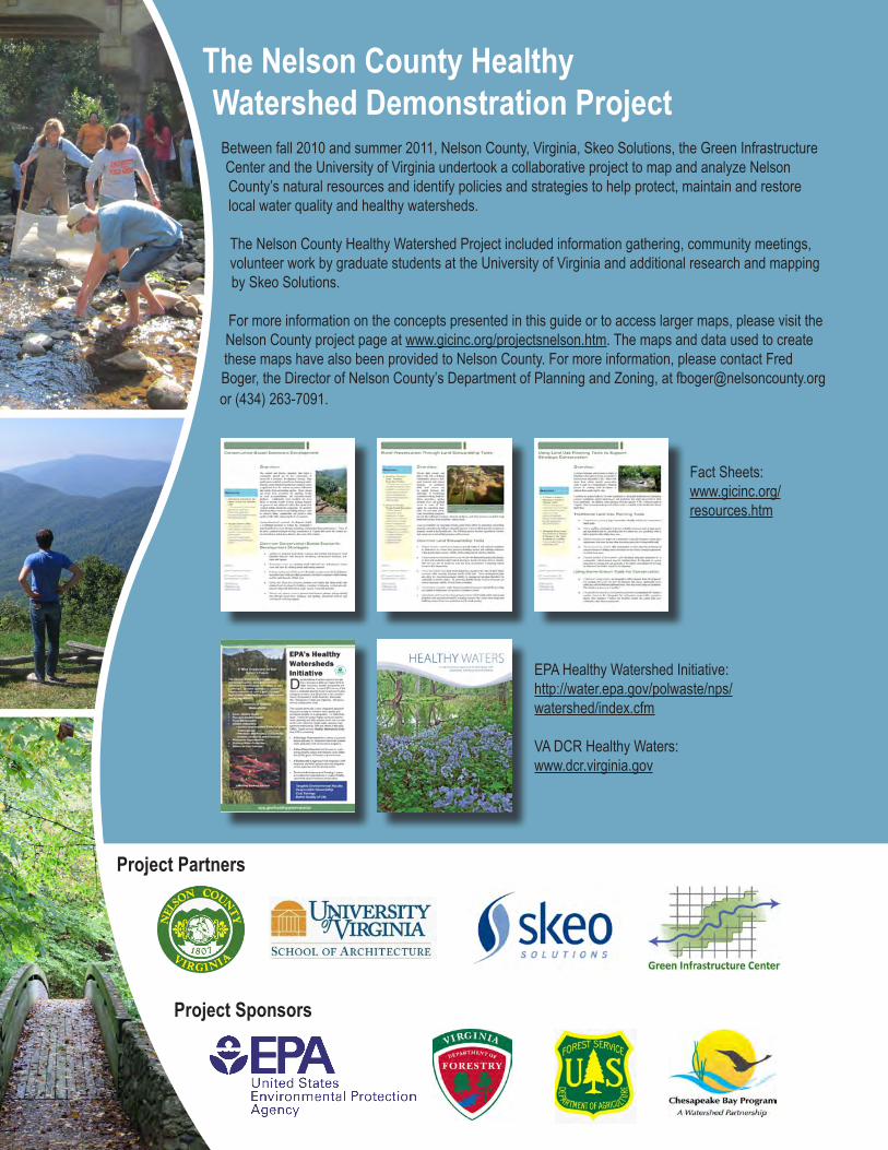
The Nelson County Healthy Watershed Demonstration Project
Between fall 2010 and summer 2011, Nelson County, Virginia, Skeo Solutions, the Green Infrastructure Center and the University of Virginia undertook a collaborative project to map and analyze Nelson County’s natural resources and identify policies and strategies to help protect, maintain and restore local water quality and healthy watersheds.
The Nelson County Healthy Watershed Project included information gathering, community meetings, volunteer work by graduate students at the University of Virginia and additional research and mapping by Skeo Solutions.
For more information on the concepts presented in this guide or to access larger maps, please visit the Nelson County project page at www.gicinc.org/projectsnelson.htm. The maps and data used to create these maps have also been provided to Nelson County. For more information, please contact Fred Boger, the Director of Nelson County’s Department of Planning and Zoning, at [email protected] or (434) 263-7091.
Project Partners
Project Sponsors
EPA Healthy Watershed Initiative:http://water.epa.gov/polwaste/nps/watershed/index.cfm
VA DCR Healthy Waters:www.dcr.virginia.gov
Fact Sheets:www.gicinc.org/resources.htm