Documentation of ILRI/JIRCAS/ICRISAT Fakara data sets ...
359
Documentation of ILRI/JIRCAS/ICRISAT Fakara data sets JIRCAS Commissioned Research Final report submitted by ICRISAT - February 2007 \
Transcript of Documentation of ILRI/JIRCAS/ICRISAT Fakara data sets ...

Documentation of ILRI/JIRCAS/ICRISAT Fakara data sets
JIRCAS Commissioned Research
Final report submitted by ICRISAT - February 2007 \


Cover: Detail of a Spot 5 panchromatic scene over the Fakara , 24 Sept 2004


TABLE OF CONTENT
1. Background_____________________________________________________________________1
2. Objectives of the commissioned research _____________________________________________2
3. Calendar of activities _____________________________________________________________2
4. Products delivered at the end of the contracted research _________________________________3
5. What’s next (future activities) ______________________________________________________3
6. ICRISAT human resources contribution______________________________________________4
7. Access to the online Fakara metadata ________________________________________________4
Annexe 1: Learnings from the Fakara case study, and recommendations for research data documentation at ICRISAT __________________________________________________________9
Annexe 2: Power Point Presentations _________________________________________________13
Annexe 3. Participant list to the Niamey Workshop (20-26 September 2006) __________________23
Annexe 4: A quick guide to M3Cat ___________________________________________________27
Annexe 5: Metadata in text format ___________________________________________________65
Data Set Number 133: Geomorphology map, Niger 1996 ________________________________66
Data Set Number 166: Actual situation of land use for Jerma household: Fakara, Niger 2003-200572
Data Set Number 172: area_cropped by sedentary Fulani(HS): Fakara, Niger 2005-2006 _______78
Data Set Number 173: Transhumance and corralling by sedentary Fulani: Fakara, Niger 2004-2005-2006 _________________________________________________________________________84
Data Set Number 174: Land use in 2004 obtained from segmentation of Spot 5 image _________90
Data Set Number 127: Daily rainfall measurements at landscape scale with a network of raingauges in 2000 (Fakara/Niger) ___________________________________________________________96
Data Set Number 128: Daily rainfall measurements at landscape scale with a network of raingauges in 2001 (Fakara/Niger) __________________________________________________________100
Data Set Number 129: Daily rainfall measurements at landscape scale with a network of raingauges in 2002 (Fakara/Niger) __________________________________________________________104
Data Set Number 130: Daily rainfall measurements at landscape scale with a network of raingauges in 2003 (Fakara/Niger) __________________________________________________________108
Data Set Number 131: Daily rainfall measurements at landscape scale with a network of raingauges in 2004 (Fakara/Niger) __________________________________________________________112
Data Set Number 132: Daily rainfall measurements at landscape scale with a network of raingauges in 2005 (Fakara/Niger) __________________________________________________________116
Data Set Number 193: Katanga AWS weather data 2000 Daily Output (Fakara, Niger) ________120
Data Set Number 194: Katanga AWS weather data 2000 hourly Output (Fakara, Niger) _______125
Data Set Number 195: Katanga AWS weather data 2001 Daily Output (Fakara, Niger) ________130
Data Set Number 196: Katanga AWS weather data 2001 hourly Output (Fakara, Niger) _______135
Data Set Number 197: Katanga AWS weather data 2001 Rainfall_________________________139
Data Set Number 198: AWS weather data 2001 Wind Speed (Fakara, Niger)________________143
Data Set Number 134: Katanga AWS weather data 2002 Daily Output (Fakara, Niger) ________147
Data Set Number 135: Katanga AWS weather data 2002 hourly Output (Fakara, Niger) _______147
Data Set Number 136: Katanga AWS weather data 2002 Rainfall_________________________147
Data Set Number 137: AWS weather data 2002 Wind Speed (Fakara, Niger)________________147
Data Set Number 138: Katanga AWS weather data 2003 Daily Output (Fakara, Niger) ________147

Data Set Number 139: Katanga AWS weather data 2003 hourly Output (Fakara, Niger) _______147
Data Set Number 140: Katanga AWS weather data 2003 Rainfall_________________________147
Data Set Number 141: AWS weather data 2003 Wind Speed (Fakara, Niger)________________147
Data Set Number 142: Katanga AWS weather data 2004 Daily Output (Fakara, Niger) ________147
Data Set Number 143: Katanga AWS weather data 2004 hourly Output (Fakara, Niger) _______148
Data Set Number 144: Katanga AWS weather data 2004 Rainfall_________________________148
Data Set Number 145: AWS weather data 2004 Wind Speed (Fakara, Niger)________________148
Data Set Number 146: Katanga AWS weather data 2005 Daily Output (Fakara, Niger) ________148
Data Set Number 147: Katanga AWS weather data 2005 hourly Output (Fakara, Niger) _______148
Data Set Number 148: Katanga AWS weather data 2005 Rainfall_________________________148
Data Set Number 149: AWS weather data 2005 Wind Speed (Fakara, Niger)________________148
Data Set Number 175: Land use in the Fakara in the year 1950___________________________149
Data Set Number 177: Land use in the Fakara in the year 1975___________________________153
Data Set Number 178: Land use in the Fakara in the year 1992___________________________157
Data Set Number 179: Land use in the Fakara in the year 1994___________________________161
Data Set Number 180: Land use in the Fakara in the year 1995___________________________165
Data Set Number 181: Land use in the Fakara in the year 1996___________________________169
Data Set Number 185: Land use in the Fakara in the year 1965___________________________173
Data Set Number 188: Satellite image map of the Fakara at 1/30000 scale (map A)___________177
Data Set Number 200: Panchromatic Spot 5 Imagery of the Fakara taken on 28 September 2004 181
Data Set Number 199: Multispectral Spot 5 Imagery of the Fakara taken on 28 September 2004 Level 1B _____________________________________________________________________184
Data Set Number 49: Satellite image of ASTER on 19/9/04 _____________________________187
Data Set Number 209: True color Ikonos image of the Fakara ___________________________191
Data Set Number 208: False color Ikonos Image of the Fakara ___________________________196
Data Set Number 202: Pan-sharpened true color Landsat 7 image for Path192 Row 051 taken on 09 November 1999 _______________________________________________________________202
Data Set Number 201: Pan-sharpened false color IR Landsat 7 image for Path192 Row 051 taken on 09 November 1999 _____________________________________________________________206
Data Set Number 205: Georeferenced Corona Image of the Fakara-1 (Niger, 1965)___________210
Data Set Number 206: Georeferenced Corona Image of the Fakara-2 (Niger, 1965)___________215
Data Set Number 207: 3 arc second (90 meter) Digitial Elevation Model from Shuttle Radar Topography Mission (SRTM) for Path192 Row 052 ___________________________________221
Data Set Number 101: Effect of corralling on millet production __________________________227
Data Set Number 15: Indigenous ecological knowledge in southewestern Niger (Ethnobotanical survey) ______________________________________________________________________231
Data Set Number 14: Exhaustive land tenure map accompanied by household survey _________237
Data Set Number 150: Answers of individual interviewed farmers to selections of the questions: Fakara, Niger 2004-2005 ________________________________________________________239
Data Set Number 151: Answers of individual interviewed farmers to the questions about cropping patternsystem: Fakara, Niger 2004-2005 ____________________________________________251
Data Set Number 152: Answers of individual interviewed farmers to the questions about the reasons for cowpea cultivation __________________________________________________________258

Data Set Number 153 : Narrative answers of individual interviewed farmers to the questions: Fakara, Niger 2004-2005 ________________________________________________________264
Data Set Number 167: Household Characteristics in Fakara_Expense: Fakara Niger 2005______269
Data Set Number 168: Household Characteristics in Fakara_Identification _________________277
Data Set Number 169: Household Characteristics in Fakara_Income ______________________283
Data Set Number 170: Household Characteristics in Fakara_Livestock ____________________287
Data Set Number 171: Household Characteristics in Fakara_Number of persons _____________292
Data Set Number 51: Household Risk Management ___________________________________297
Data Set Number 160: Indigenous Knowledge description of sampling of Area ______________300
Data Set Number 161: Questionnaire on inidgineous soil knowledge ______________________305
Data Set Number 162: Soil Color of Indigenous Knowledge Soil in Fakara/Niger 2002-2003 ___310
Data Set Number 163: Soil Fertility (Corg TN brayP) of Indigenous Knowledge Soil _________314
Data Set Number 158: Estimation of nutrient removal through crop production of three villages in Fakara/Niger 2004-2005_________________________________________________________319
Data Set Number 159: Quantity and quality of materials used for recycling system of three villages in Fakara/Niger 2004-2005_______________________________________________________326
Data Set Number 154: On farm survey on the cowpea cultivation/Fakara, Niger 2003_________333
Data Set Number 183: Layout of the multilocational multifactorial (genotype, mineral fertilizer, manure) experiment conducted in 2003, 2004, 2005 (Niger) _____________________________339
Data Set Number 184: Position of neutron probe access tubes placed in 2003 in the Fakara multilocation experiment (Niger) __________________________________________________344
Data Set Number 48: Monitoring grazing route by sedentary Fulani_______________________348


1
Documentation of ILRI/JIRCAS/ICRISAT Fakara data sets JIRCAS Commissioned Research
By Bruno Gerard, Pierre Sibiry Traore, Adamou Laouali, Binta Ndiaye, Dougbedji Fatondji February 2007
1. Background From the early 1990s, the Fakara region, located 60 km east of Niamey, has been a privileged area for a series of studies at the landscape scale. Earlier work has been initiated by an ILRI team lead by Pierre Hiernaux and Matthew Turner with the general objective of studying livestock mediated nutrient cycling in typical South-Sahelian crop-livestock systems. The approach followed by ILRI scientists was holistic and lead to intensive data collects from 1994 to 2001. Characterisation performed over an area of 500 km2 has been very detailed and included bio-physical and socio-economic data, some of them spatially explicit and encoded in a GIS. In the early 2000’s some ICRISAT scientists, willing to capitalize on the characterization work and research outcome of ILRI’s research, implemented and monitored a series of on-farm demonstrations (2000-2002) in collaboration with FAO Projet Intrants with the objectives of understanding better the response of pearl millet to improve fertility management (organic and inorganic) under a range of bio-physical and climatic conditions. Since then a network of more than 60 rain gauges have monitored the spatial and temporal distribution of rainfall, accompanied by an automated weather station recording important agro-climatic parameter on an hourly and daily basis. The demonstrations have been followed by a large multi-location three-year experiment aiming at understanding site-specificities and complex interaction between water and nutrients. Aware of the benefit of having access to and capitalizing on a large spatial data set, several special research projects have, in the recent years, selected the Fakara as one of their benchmark research site (JIRCAS-ICRISAT collaborative project, ICRISAT DGDC, DMP, ICRISAT-Agrhymet Climate Change) and have contributed to the enrichment of the database. In addition of the data collected by the three partners1 (JIRCAS, ILRI, ICRISAT) several other actors were or are still involved in specific researches over the Fakara. Major secondary data sets belong to the IRD/CNES/CESBIO lead HAPEX-Sahel project (Hydrological and Atmospheric Pilot Experiment in the Sahel; see http://www.ird.fr/hapex/) that collected data between 1990-1992 and the on going AMMA project2 African Monsoon Multidisciplinary Analysis; see http://amma-international.org/).
1 In this context, we will call Primary Data, data directly collected by JIRCAS, ILRI or ICRISAT and Secondary Data, data collected by other institutions. 2 ICRISAT has recently signed a Data Agreement with AMMA/IRD allowing access to several data sets and satellite images collected within the AMMA project.

2
The Fakara date base thus constituted a unique opportunity for further systems research and better understanding of complex processes and dynamics at the village and landscape scale. In addition, very good interaction with development bodies and farmer groups coupled with a good understanding of bio-physical and socio-economic environments permits rationale upscaling/outscaling exercises. The Fakara Data collected by the institutions, vary in their attributes and formats and have been partially accumulated in the different databases. Therefore, JIRCAS, ICRISAT and ILRI desire to document the Fakara Data and integrate them into a metadatabase with contents in order to facilitate the exchange and effective utilization of the Fakara Data collected and stored by the three institutions. To achieve this JIRCAS has contracted ICRISAT for a commissioned research. 2. Objectives of the commissioned research The objective of this commissioned research was to document Fakara Data collected in the Fakara area by ILRI, ICRISAT and JIRCAS, according to recognized standards with the use of the ArcCatalog software for spatial data and other appropriate tools. 3. Calendar of activities 3.1 Preparatory work Preparatory work was initiated by early September to review/evaluate existing metadata tools/software and elaborate the program of a workshop. 3.2 Niamey workshop The workshop was organized at the ICRISAT Sahelian Center form 20 to 25 September 2006. Twenty-two participants from ICRISAT, JIRCAS, Kyoto University, ILRI, INRAN, IRD, and AGRHYMET attended the sessions. It had the following specific objectives:
- Complete the inventory of bio-physical, socio-economic data sets (spatially explicit or not) collected over the Fakara region by the three institutions (JIRCAS, ICRISAT, ILRI)
- Refine guidelines for metadabase creation and data sharing (procedure, tools, sharing rules)
- Share past on going research objectives protocols and results and future research plans for better integration of research of the three institutions and future data requirements
- Establish clear protocols between ICRISAT staff responsible for metadata encoding and data owners (scientists) to facilitate metadata collection/encoding during the period October-November 2006.
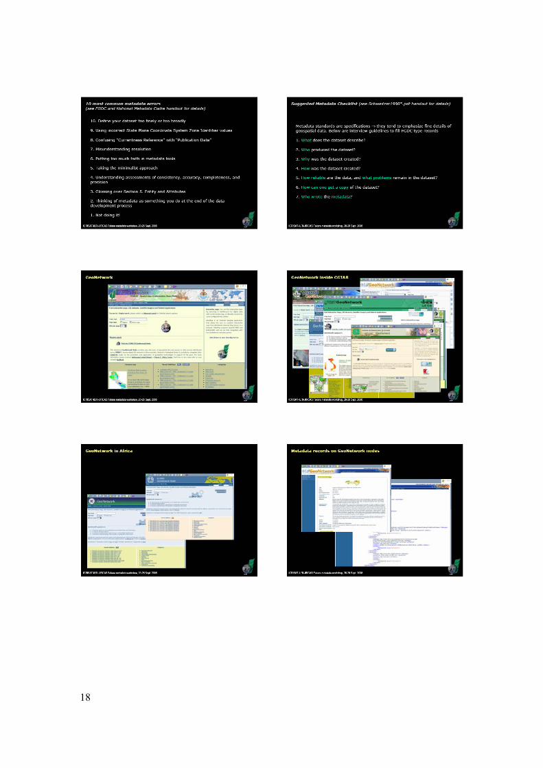
It was initially decided to use ArcCatalog as the main metadata encoding software. An alternate solution using another interface was identified and discussed during the Niamey workshop. M3Cat open-source metadata editor was evaluated and we decided to use it at the data entry interface for involved scientists. M3Cat was installed on the Sadoré LAN and is since available online on the ICRISAT website for secure access from all locations through the Internet (http://icrisatsc.cgiar.org/m3cat/).

3
This tool facilitated interactions between scientists/data holders and metadata encoders and pave the way for .XML metadata record posting on a GeoNetwork node
3.3 Metadata encoding More than 90 datasets were identified as part of the exercise, and prioritized for metadata encoding (see table 1). During the period October-December, encoding of metadata was performed jointly by the scientists and Laouali Amadou (contracted for the task). The entire process has been summarize in a flowchart (Figure 1). During the Bamako meeting in January 2007, final data encoding was performed and validation procedures were defined. Since all the metadata have been validated online on the USGS web site (http://geo-nsdi.er.usgs.gov/validate.php) 4. Products delivered at the end of the contracted research The following products are delivered to JIRCAS at the end of the project period (mi-february 2007):
The present report in a electronic form (pdf) sent as mail attachement to Dr. Satoshi Tobita (JIRCAS) and copied to Drs. Keiichi Hayashi, Ryoichi Matsunaga (JIRCAS), Saidou Koala, Dyno Keatinge, Steve Twomlow (ICRISAT)
Four hard copies of the present report sent to Dr. Satoshi Tobita at the following address: JIRCAS Ohwashi, Tsukuba, 305-8686, Japan
Four copies of a DVD, send with the hard copies of the report to Dr. Satoshi Tobita, containing:
o the metadata in MS Access format (M3Cat compatible format); o M3Cat installation file; o several datasets which were considered as public domain with no
access/use restrictions; o Power presentations prepared for the Niamey; o Series of MS and PhD theses related to research work in the Fakara; o Various background documents on metadata.
5. What’s next (future activities) The end of this contracted research is far from being the end of our joint documentation efforts. JIRCAS financial support allowed an initial boost to the task but metadata as data in general are dynamic so continuous efforts are needed to upgrade and update them. This exercise being also very important for ICRISAT we update the product delivered to JIRCAS on a regular basis within the next year. For that matter ICRISAT has decided to extent the contract of Laouali Amadou until the end of December under DGDC/ICRISAT funds. Because of the dynamic nature of metadata, we envisage continuing using M3Cat as an online tool to access, search, update and validate our metadata according to the

4
process developed (see flowchart) during this contracted research. However it is highly desirable to find an alternate host to Sadore server, JIRCAS or ICRISAT India being considered to host the database in the near future. The documentation of ICRISAT other datasets (outside of the Fakara) will also follow the same procedure. Within the next few months, publication of the metadata and and selected datasets on a geoportal will need require further consideration and should be done with the approval of the three institutions involved. A follow-up report will be deliverd to JIRCAS by the end of 2007. 6. ICRISAT human resources contribution Bruno Gerard: Coordinator, supervision Pierre Sibiry Traore: Technical backstopping, development/identification of appropriate tools, quality control. Binta Ndiaye: Metadata expertise, quality control Laouali Abdou: Contracted agent for metadata collect and encoding Harou Rabe: IT support for on-line availability of M3Cat interface. The coordination wish to thank all the JIRCAS scientists involved for their availability and their very positive and productive attitude during the first phase of this contracted research. 7. Access to the online Fakara metadata Current version of the metadata can be access online in browsing mode only using M3Cat interface (see guide in Annexe 1) at the following web address:
http://icrisatsc.cgiar.org/m3cat/ With the following login: Username : user Password: user

5
Table 1. Datasets identified for documentation during the Niamey workshop Dataset documented Scientists
custodian 1-Answers of individual interviewed farmers to selections of the questions 2-Answers of individual interviewed farmers to the questions about cropping pattern system 3-Answers of individual interviewed farmers to the questions about the reasons for cowpea cultivation 4-Narrative answers of individual interviewed farmers to the questions 5-On farm survey on the cowpea cultivation
Ryoichi Matsunaga (JIRCAS)
1- Actual situation of land use for Jerma household 2- Agricultural production and soil fertility status in differently managed farms in fakara 3- Estimation of nutrient removal through crop production of three villages in Fakara 4- Indigenous Knowledge description of sampling of Area 5- Quantity and quality of materials used for recycling system of three villages in Fakara 6- Questionnaire 7- Soil Color of Indigenous Knowledge Soil in Fakara 8- Soil Fertility (Corg TN brayP) of Indigenous Knowledge Soil 9- Effect of corralling on millet production 10- Optimal timing for the application of fertilizer and its optimal timing of application in corralling 11- Survey on corralling activities
Keiichi Hayashi (JIRCAS)
1- Household characteristics in fakara_expense 2- Household Characteristics in Fakara_identification 3- Household characteristics in fakara_income 4- Household characteristics in fakara_livestock 5- Household characteristics in fakara_number of persons
Tahirou Abdoulaye (JIRCAS)
1- Area_cropped by sedentary Fulani (HS) 2- Transhumance and corralling by sedentary Fulani 3- Monitoring grazing route by sedentary Fulnai
Hitoshi Shinjo (JIRCAS)
1-Household risk management in Fakara Uru Tanaka (JIRCAS)
1- Daily rainfall measurements at landscape scale with a network of rain gauges in 2004 2- Daily rainfall measurements at landscape scale with a network of rain gauges in 2005 3- Daily rainfall measurements at landscape scale with a network of raingauges in 2000 4- Daily rainfall measurements at landscape scale with a network of raingauges in 2001 5- Daily rainfall measurements at landscape scale with a network of raingauges in 2002 6- Daily rainfall measurements at landscape scale with a network of raingauges in 2003 7- Layout of the multilocational multifactorial (genotype, mineral fertilizer, manure) experiment conducted in 2003, 2004, 2005 8- Position of neutron probe access tubes placed in 2003 in the fakara
Bruno Gérard ICRISAT

6
multilocation experiment 9- Land use cover in 2004 obtained from segmentation of spot 5 image 10 – Satellite-image map of the Fakara A (Banizoumbou) 11- Satellite-image map of the Fakara B (Tigo) 12- Satellite-image map of the Fakara C (Baboussay) 13- Satellite-image map of the Fakara D (Dantiandou) 14- Satellite-image map of the Fakara E (Kodey) 15- Pan-sharpened false color IR Landsat 7 image 16- Pan-sharpened true color Landsat 7 image 17- Multispectral Spot 5 Imagery of the Fakara taken on 28 September 2004 Level 1B Imagery .TIF
1- Fakara Geomorphology map 2- Land use in the Fakara in the year 1950 3- Land use in the Fakara in the year 1965 4- Land use in the Fakara in the year 1975 5- Land use in the Fakara in the year 1992 6- Land use in the Fakara in the year 1994 7- Land use in the Fakara in the year 1995 8- Land use in the Fakara in the year 1996
Pierre Hiernaux (ILRI) Documented by Bruno Gerard
1- Katanga AWS weather data 2000 Daily Output 2- Katanga AWS weather data 2000 Hourly Output 3- Katanga AWS weather data 2001 Daily Output 4- Katanga AWS weather data 2001 Hourly Output 5- Katanga AWS weather data 2001 Rainfall 6- Katanga AWS weather data 2001 Wind Speed 7-Katanga AWS weather data 2002 Daily Output 8- Katanga AWS weather data 2002 Hourly Output 9- Katanga AWS weather data 2002 Rainfall 10- Katanga AWS weather data 2002 Wind Speed 11- Katanga AWS weather data 2003 Wind Speed 12- Katanga AWS weather data 2003 Rainfall 13- Katanga AWS weather data 2003 Hourly Output 14- Katanga AWS weather data 2003 Daily Output 15-Katanga AWS weather data 2004 Daily Output 16- Katanga AWS weather data 2004 Hourly Output 17- Katanga AWS weather data 2004 Rainfall 18- Katanga AWS weather data 2004 Wind Speed 19-Katanga AWS weather data 2005 Daily Output 20- Katanga AWS weather data 2005 Hourly Output 21- Katanga AWS weather data 2005 Rainfall 22- Katanga AWS weather data 2005 Wind Speed
Fatondji Dougbedji (ICRISAT)
1-Ethno-botanical_survey Auguistine Ayantunde (ILRI)

7
Figure 1: Fowchart for the documentation process of the Fakara database.

8
Flowchart legend
Definition phase a. In the Fakara metadatabase case, data included a variety of formats, sources, topics and disciplines. Metadata creation was not restricted to geospatial data and included references for datasets that were not georeferenced a priori. Geographical extent was bound by the limits of the Fakara region. b. c. See Table 1. d. Priority was given to encoding tools that helped simplify interactions with participating scientists (free, customizable, network-based) and met the wide-spread Content Standard for Digital Geospatial Metadata (CSDGM): M3Cat v. 1.5. For higher-level editing, ArcCatalog v. 9.0 was used. Links to other popular choices are at: http://www.csi.cgiar.org/metadata/Metadata_Tools.asp. With help from IT department, M3Cat was installed on the Sadoré local area network and made visible from the internet at: http://icrisatsc.cgiar.org/M3Cat. Appropriate security restrictions were applied for each of xx individual users. e. Participating scientists received initial exposure to the CSDGM metadata file structure during the introductory M3Cat software demonstration session. f. The creation of templates and standard values by the technical team allowed for automatic filling of repetitive metadata (e.g., data holder contact information) and masking out inappropriate levels of detail to facilitate inputs by scientists and accelerate metadata encoding. Main iterative loop
1. The kernel record includes the title of the dataset (as provided during the inception meeting), and repetitive details such as scientific (data holder) and technical (metadata encoder) contact information.
2. Initial request sent by personal email.
3. The encoding technician visited Sadoré-based scientists in their offices to train them in the use of M3Cat online.
4. Using M3Cat online, individual scientists / data holders encoded CSDGM sections on…
5. Upon completion of scientist input, all M3Cat edits are stored in an online, password-protected Microsoft Access .MDB database containing individual metadata records. 7. Encoding technician visited the scientist to jointly review metadata sections 1,2 using M3Cat online tool. 7’. Bounding coordinates for the Fakara region, see a/ above. 14. Encoding technician visited the scientist to jointly review metadata sections 3,4,5 using M3Cat online tool. 17. A description of the USGS metadata parser, error reporting and online version are available at: http://geology.usgs.gov/tools/metadata/tools/doc/mp.html. 19’. This step involved individual verification of metadata record printouts for content discrepancies and errors. Packaging and delivery 26. Color quicklook images were generated in ArcGIS9.0.

9
Annexe 1: Learnings from the Fakara case study, and recommendations for research data documentation at ICRISAT
Let us briefly review the major incentives of metadata creation. They can be summarized in six categories: i/ help potential users retrieve data and evaluate fitness, ii/ help data producers publicize and support use of data, iii/ increase the value of data as potential users are more likely to retrieve information about it and make proper use of it, iv/ protect an organization’s investment in data throughout the years, v/ limit loss of value that affects undocumented data with staff changes, and vi/ reduce duplication of datasets arising from lack of confidence in existing data. The various advantages associated with the efficient and effective production of relevant metadata are hardly disputable: proper research data documentation is very important and an enabling environment is required. However, the potential high burden of metadata creation calls for special attention when devising dedicated institutional mechanisms. Learnings from the Fakara case study have been compiled below with synthetic recommendations for data documentation at ICRISAT: 1. Dedicated human resources are mandatory. At the technical level, metadata creation cannot be done without encoders, who play a role comparable to genebank technicians or librarians. They sort, clean and store metadata records and maintain the integrity and security of the metadatabase under the supervision of a data manager (equivalent of the chief librarian). The complex nature of metadata edition requires dedicated time which is not available in most scientists schedules, and specialized skills which are seldom found in many research assistants. 2. Resources should be shared, but tied to projects. There is a danger in creating ‘datacratic’ positions which would be disjoint from project needs and objectives. One reasonable option could be to hire one data manager per region (ESA, SEA, WCA) for proximal coordination and backstopping. Local encoding skills would be developed at the country level, either through one IT and/or GIS technician availed part-time to a suite of projects, or through capacity building within existing project staff. Oversight and commitment of project leaders should be sought. 3. Raising awareness among scientists is essential. Of particular importance is the need to build trust, by explaining that i/ sharing metadata is not about releasing one’s data in the wild, and that ii/ appropriate restrictions can be easily controlled by scientists for adequate data security. Building trust in the process of data documentation will also be achieved by sensible use of scientists’ limited time. This in turn requires good interpersonal skills in metadata encoders in addition to their technical capacity. 4. Software solutions are generally not a constraint, but they vary in complexity and across scientific disciplines as do metadata standards and formats. There is no one-size-fits-all metadata editor or utility, which substantiates the need for dedicated, conversant staff. Some software (e.g. M3Cat) allow for quick learning and direct use by non-specialists (e.g. project leaders). Many are network-based, accessible through web

10
browser interfaces, and open-source, hence easing procurement, deployment and scientists’ input. 5. Targeted investments can efficiently document past data. Altough a posteriori metadata encoding requires additional efforts (resources), limited investments can go a long way when areas of interest have been identified by donor partners. One successful approach to priority setting is to pinpoint geographical areas of project overlap, as in the Fakara region. A list of similar benchmark sites (Kenya: Machakos, Zimbabwe: Tsholotsho, etc.) can be assembled and showcased to potential donors as low risk, high return investments for past data salvage – especially when built in project proposals by scientists. 6. Reliable network connectivity is important when working with a large group of data producers in a decentralized structure. Network-based tools, open-source or commercial, can significantly decrease the time and costs of data documentation, (meta-)database synchronization, versioning, and internal consistency. The Fakara exercise has demonstrated that connectivity in ICRISAT-Sadoré (Niger) is not adequate with insufficient bandwidths. Other ICRISAT locations probably face similar constraints (e.g. ICRISAT-Matopos, Zimbabwe). Close interactions with IT personnel is critical for the successful implementation of distributed (meta-) databases. 7. A (meta-) data management policy is needed. Inter alia, it should define ICRISAT’s data lifecycles (data sharing timeline), obligations for data producers from a data documentation perspective (building metadata creation within projects, metadata sharing timeline, compliance with accepted standards and formats, etc.). It should emphasize the need (obligation?) to plan for metadatabase creation upfront at the time of project inception. In addition to future datasets, it should also cater for past data, which is by far the biggest burden facing an organization as many data creators have left. 8. A visioning workshop on data management is recommended. It should be trans-disciplinary and involve data-intensive and less intensive groups; field and laboratory data producers; genetic (e.g. bioinformatics) and environmental (e.g. GIS) groups; IT, library services, management. It should not focus on the definition of minimum metadatasets (done in the 1990s), should marginally address the issue of metadata standards/contents (mostly for information purposes), and should mainly concentrate on finalizing an Institute-wide (meta-) data policy with enabling/enforcing mechanisms: resources, rules and tools to facilitate (meta-) data flow. 9. A technical (meta-) data management task force is advisable. It would strive to facilitate the exchange of information and software solutions to customize and automate the process of research data documentation. It should foster an enhanced level of interactions between IT staff and the different research teams, that reaches beyond traditional hardware and networking issues to address specific programmation and computing needs: interfacing software from different disciplines, improving the basic

11
‘batching and scripting’ ability of research staff, etc. in pursuit of enhanced, coordinated institute-wide data management. 10. Online serving of (meta-) data is the ultimate goal. However efficient and effective the sharing of information is within a group, a project team, or the Institute, the largest benefits of (meta-) data creation are reaped when the latter is published before a wider audience of existing and potential partners (with appropriate security restrictions, e.g. through granularity). In the CGIAR terminology, the concept of (meta-) data serving is intimately tied to that of International Public Goods (IPGs). It is important to realize that documenting existing and past data can prove a cost and time effective way of posting IPGs. To that purpose, more attention can be directed to developing resources such as the ICT-KM program and associated tools, such as the CSI-sponsored GeoNetwork (an FAO-born open-source solution for networked, georeferenced (meta-) data serving). The Fakara metadatabase will need to be visible shortly on the ICRISAT GeoNetwork node. 11. Georeferencing field data should be mandatory. The value of numerous field data (trials, experiments) can significantly decrease when their spatial location is not adequately consigned. While there are ways to georeference ground data a posteriori (e.g. using village names and gazetteers), the recovery process almost always involves some loss of precision and usability. In the era of cheap GPS, GPS-patched PDAs and other navigational gadgets it is not acceptable to gather ground data without geographical coordinates. There are many electronic data collection tools to plan and facilitate the collection process, some better than others. Paper survey sheets should be a thing of the past. Advanced expertise in the design and use of electronic data forms with GPS-enabled field computers is available from ICRISAT GIS staff, along with high-precision georeferencing solutions for field-scale processes.

12

13
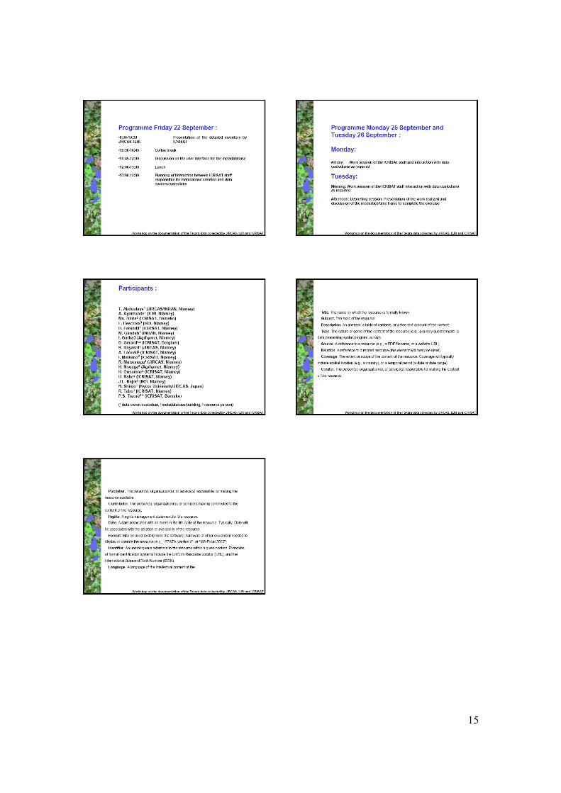
Annexe 2: Power Point Presentations

14
15

16
17
18
19

20

21

22

23
Annexe 3. Participant list to the Niamey Workshop (20-26 September 2006) Abdoulaye Tahirou Economiste JIRCAS BP: 12404, Niamey Tel: 227 20722626 E-mail: [email protected] Ado Saley Senior Associate Administration ICRISAT – Niamey B.P. 12404, Niamey Tel : +227 20 72 26 26 Cel : +227 96 29 71 95 Fax : +227 20 73 43 29 E-mail : [email protected] Amadou M. Lawali Consultant ICRISAT BP: 12404, Niamey Tel: 227 96887470 E-mail: [email protected] Amadou Sodja Technicien de recherche JIRCAS BP: 12404, Niamey Tel: 227 20722529 / 96576143 Ayantunde A. Augustine Animal Scientist ILRI/ICRISAT BP: 12404, Niamey Tel: +227 20722529 Fax: 20752804 E-mail: [email protected]
Bruno Gérard International Crops Research Institute for the Semi-Arid Tropics (ICRISAT) Chercheur visiteur Faculté d'Ingénierie Biologique, Agronomique et Environnementale Université catholique de Louvain Croix du Sud, 2 bte 16 B-1348 Louvain-la-Neuve (Belgique) Tel. 32 (0) 10 47 92 57 Fax 32 (0) 10 47 88 98 E-mail: [email protected]; [email protected] Descroix Luc Chercheur IRD BP: 11416, Niamey Tel: 20752610 Fax: 20752804 E-mail: [email protected] Fatondji Dougbedji Senior Scientific Officer ICRISAT BP: 12404 Niamey Tel: 227 20722529 E-mail: [email protected]; [email protected] Gandah Mahamadou Directeur Scientifique INRAN BP: 429, Niamey Tel: 227 20725389 E-mail: [email protected] [email protected]

24
Garba Issa SIG/TDT AGRHYMET BP: 11011, Niamey Tel: 00227 93803859 E-mail: [email protected] Hayashi Keiichi Spécial Projet Scientist JIRCAS BP: 12404, Niamey Tel: 20722529 Fax: 20734329 E-mail: [email protected] Hitoshi Shinjo Assistant professor KYOTO UNIV BP: Lgaboratory of soil science, Graduate School of Agriculture, Kyoto 606-8502, JAPAN Tel: +81757536101 Fax: +81757536103 E-mail: [email protected] Maikano Ibrah Senior Associate GIS ICRISAT BP: 12404, Niamey Tel: 227 96263026 E-mail: [email protected] Maman Bachir Magagi Scientific Officier JIRCAS BP: 12404, ICRISAT/Niamey Tel: 227 20722626 / 96884467 E-mail: [email protected] Matsunaga Ryoichi Chercheur JIRCAS BP: 114116, Niamey Fax: 20752804 E-mail: [email protected]
N’Diaye Binta GIS Officer ICRISAT BP: 320, Bamako Tel: 223 224 23 71 Fax: 223 222 86 83 E-mail: [email protected] N’Djafa Ouaga Hubest Expert Changement climatique Centre Régional AGRHYMET BP: 11011, Niamey Tel: 20315316 Fax: 20315436 E-mail: [email protected] [email protected] Rajot Jean-Louis Chercheur IRD BP: 114116, Niamey Tel: 20753115 Fax: 20752804 E-mail: [email protected] Ramier David Chercheur IRD BP: 114116, Niamey, IRD Avenue de Maradi Tel: 96059712 E-mail: [email protected] Tahirou Saley Research Technician ICRISAT – Niamey B.P. 12404, Niamey Tel : +227 20 72 26 26 Cel : +227 93 23 19 12
25
Ousmane Hassane Senior Scientific officier ICRISAT/GIS BP: 12404, Niamey Tel: 227 20722626 E-mail: [email protected] Pierre C. Sibiry Traoré Head, GIS ICRISAT P.O. Box 320, Bamako MaliTel: +223 – 224 2371 Fax: +223 – 222 8683 E-mail: p.s.traoré@cgiar.org Tabo Ramadjita Régional Coordonator-DMP ICRISAT BP: 12404, Niamey Tel: 227 20722626 / 20722529 Fax: 20752804 E-mail: [email protected]

26

27
Annexe 4: A quick guide to M3Cat (Compiled from M3Cat help menus)
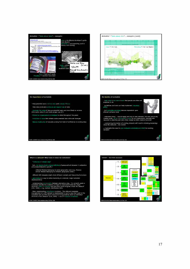
What is ? M3Cat is a tool that assist users in entering and managing metadata about geospatial data sets. Metadata consist of information that characterises data. Metadata are used to provide documentation for data. In essence, metadata answer who, what, when, where, why, and how about every facet of the data that are being documented. Online systems for handling metadata need to rely on their being predictable in both form and content. Predictability is assured only by conformance to standards. There are many standards for metadata such as the FGDC http://www.fgdc.gov/metadata/contstan.html Content Standard for Digital Geospatial Metadata, the GILS standard (http://www.gils.net/), the NBII standard (http://www.nbii.gov/datainfo/metadata/standards/) and the ISO/TC211 metadata standard. Organisations also tend to define a template of metadata for their own applications, encompassing validation rules and customisation which take into account their particularities .
What is particular about ?
M3Cat allows users to enter metadata using any standard (Multistandard) and any language (Multilingual). It is provided with the FGDC, GILS, NBII and ISO 19115 metadata standards and in English and French. Functions are available to add other standards and/or languages.
What are the main concepts behind ?
Users that document metadata in M3Cat must use a standard. M3Cat is delivered with 4 metadata standards: FGDC, GILS, NBII and ISO/TC211, but others can be developed. For a specific standard, an organisation uses a profile. A profile adds the cultural aspect to a standard, in particular a language and other particularities. While an organisation cannot change the standard it can modify its profile using the label management functions. Data managers can also define templates for specific types of data sets. For example a template for raster data set will only include the metadata elements relevant to this type of data set. A template can also add the particularities, or rules, that the organisation wants their metadata elements to follow. A template may include specific mandatory fields.
What are the main features?
M3Cat provides the necessary features to easily enter and update metadata. It also provides the following features :
• A Help menu, a guided tour, as well as the ability to obtain the significance of each metadata element.
• Online validation of metadata elements according to each profile. An offline validation that verifies metadata completeness (mandatory fields) and an approval process that can be performed by a supervisor.
• The capability to translate the metadata elements into another language. Translation is a two step process : the first step

28
automatically translates standards values into their equivalences in the new language, the second step presents the text values not translated and allows the user to edit them. Once the process completed, the user can change the status of the translation flag to completed.
• A Thesaurus function that manages keywords. • The capability to store standard values (parameters) in pick lists, such
as information about an organisation, reference systems, etc. These pick-lists can be defined and modified by the user.
• The capability to store metadata on different levels (parent and child) of data sets (granularity) such as at data base, map sheet, layer or entity levels with the capability for childs data sets to inherit the metadata values of their parent. Parent and child data sets must use the same metadata standard.
• A Map interface to assist in entering data sets bounding co-ordinates by panning and zooming on a map.
• The capability to make the metadata a clearinghouse node using either ISITE or MetaManager as a Z39.50 server.
• The capability to import or export metadata. Import and export files are in ASCII formats.
What is an access level for a data set?
M3Cat allows user to define an access level for a data set. This access level which is controlled by a number from 1 to 9, it allows user to restrict the access to the data set metadata.
What are users preferences?
M3Cat allows users to define their preferences when using the tool. Preferences include default language, metadata standard and template.
What are user privileges?
When login in, a user is assigned a privilege. This privilege identifies the functions the user can perform. Privileges are assigned by the Admin/users function. They include browsing, catalogiung, approval or administration privileges.
Technologies: What do I need to run ?
M3Cat works within a browser, Microsoft Internet Explorer version 3 and after or Netscape Navigator version 4.0 or after.
What do I need to install ?
You need Internet Information Server under Windows NT, 95 or 98. Metadata elements are stored in either Access or Oracle.
Does allow multiple users?
M3Cat can be used in standalone or multiple users mode.

29
What is the cost of ?
M3Cat is available for free. How do I obtain a copy of ?
M3Cat is available on Intelec’s Web site at http://www.intelec.ca Alternatively a copy of M3Cat is provided on the DVD that accompanies this report

30
Description of available functionalities in M³Cat
Manage sessions Start a session Terminate a session Change preferences
Manage data sets
Browse a data set characteristics Create a data set Edit a data set Delete a data set Search a data set Approve a data set Export a data set Import a data set Translate a data set
Manage metadata
Browse metadata of a data set Enter/Edit metadata of a data set Copy metadata of a data set Import lists values Select graphically the spatial extent of a data set
Manage users
Add a user Modify a user Delete a user
Manage profiles
Add a cultural profile Modify a cultural profile Delete a cultural profile
Manage templates
Add a template Modify a template Delete a template
Manage thesauri

31
Add a thesaurus Modify a thesaurus Delete a thesaurus Import keywords
Manage standard values
Add standard values Modify standard values Delete standard values
Manage labels
Add labels Modify labels Delete labels
Using the help
Description of concepts Description of functions Definition of metadata Frequently Asked Questions (FAQ)
Guided Tour
FAQ
Contact us !
About M³Cat
MANAGE SESSION
Start a session
After entering a login and password, a user can access the M³Cat menu.

32
Preferences are assigned to each user and the functions he has access to depend on its role (access privileges).
Notes :
• To modify a user access privileges, a user must have "administrator" privileges.
Related Subjects : Data Sets Access Levels Preferences Access Privileges Users
Terminate a session
To terminate a session :
Click on on the top screen menu. If a data set is being modified, M³Cat will ask the user whether he wishes to save its work.
Change Preferences
Preferences include cultural profile and template.
To change user preferences :
1. Select from the main menu or from the top screen menu.
2. Select a cultural profile from the list. 3. Select a template from the list. 4. Click on
Note :

33
• allows the user to exit the function without modifying the preferences.
Related Subjects : Templatess Preferences Access Privileges Cultural Profiles
MANAGE DATA SETS
Browse the characteristics of a data set
1. Select from the home page to access the data set page. OR Move to the data set page.
2. Click on a data set in the left part of the screen. 3. The characteristics of the data set are displayed on the right part of the screen.
Notes :
• To display child data sets, click on the "+" displayed to the left of a parent data set.
Related Subjects :
Data sets

34
Create a data set
This function can only be accesed by users with an administration, approval or
cataloguing privilege. To create a data set :
1. Select from the main menu or from the top-menu.
2. Select the parent data set from the tree list (optional). 3. Enter a title. 4. Select a template from the list. 5. Select a cultural profile from the list. 6. Select an access level from the list. 7. Click on
After the screen refresh, the new data set title will appear on the left screen tree stucture.
Hint :
• allows the user to cancel the selected parent data set without modifying the other parameters selected or entered.
Notes :
• Each title-template pair must be unique in M³Cat. • The user name and creation date are stored with the data set characteristics. • allows the user to exit the function without saving the
modifications. • allows the user to restore the default values (template, cultural
profile and access levels) and to erase the "Title" field. It does not change the selected parent data set.
Related Subjects :
Templates Data sets (and characteristics) Access Levels Access Privileges Cultural Profiles

35
Edit a data set
This function can only be accesed by users with an administration, approval or
cataloguing privilege. To edit a data set :
1. Display the data set (see function "Browse the characteristics of a data set"). 2. Click on 3. If required, select the parent data set from the data set tree structure. 4. Modify the appropriate fields. 5. Click on
Notes :
• Each data set-template pair must be unique. • The user name and modification date are stored in the data set characteristics. • If the completion status is modified to "completed", M³Cat will verify that
metadata elements exist for each mandatory field of the data set template. • allows the user to exit the function without saving any
modifications. • allows the user to restore the default values (template, cultural
pofile) and to restore the data set "Title". "It does not modify the selected parent data set.
Related Subjects :
Data sets
Delete a data set
This function can only be accesed by users with an administration, approval or
cataloguing privilege To delete a data set :
1. Select the desired data set from the tree list. 2. At the data set characteristics screen click 3. Click to confirm the selection.
36
Notes :
• allows the user to cancel the operation. • All the metadata related to the data sets will be deleted. • If a data set exist in more than one language, each one will be considered
independently.
Related Subjects :
Data Sets
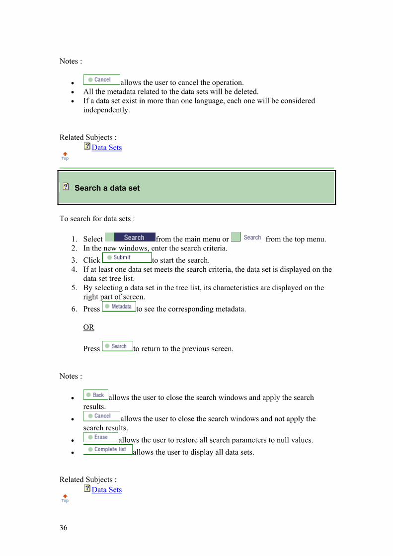
Search a data set
To search for data sets :
1. Select from the main menu or from the top menu. 2. In the new windows, enter the search criteria. 3. Click to start the search. 4. If at least one data set meets the search criteria, the data set is displayed on the
data set tree list. 5. By selecting a data set in the tree list, its characteristics are displayed on the
right part of screen. 6. Press to see the corresponding metadata.
OR
Press to return to the previous screen.
Notes :
• allows the user to close the search windows and apply the search results.
• allows the user to close the search windows and not apply the search results.
• allows the user to restore all search parameters to null values. • allows the user to display all data sets.
Related Subjects :
Data Sets

37
Approve a data set
This function can only be accesed by users with an administration, approval or
cataloguing privilege To approve a data set :
1. Display the data set for approval (see function "Browse the characteristics of a data set").
2. Click
Notes :
• To approve a data set, its completion status must be "completed". • The user name and approval date are entered with the data set characteristics.
Related Subjects :
Data sets
Exporte a data set
To export a data set :
1. Select fom the main menu or from the top menu.
2. Press "OK" to export data set(s) in XML format or "CANCEL" to export data set(s) in ASCII format.
3. Select the data set(s) to be exported from the tree list. Once the selection completed, click on to export the data set(s).
4. Once the export process completed, M³Cat displays an hyperlink to each exported data set with the related statistics.
5. Activate the hyperlink to display the corresponding exported ASCII or XML file.
6. Click to return to the pevious screen 7. Click to close the Windows.
Notes :

38
• The ASCII file produced by the "Export" function contains the name of each metadata element and its value. The metadata are exported according to the template used.
Related Subjects :
Data Sets
Import a data set
This function can only be used by an administrator.
To import a data set :
1. Select from the top menu to access the "Administation" menu. 2. Select from the "Administation" menu. 3. Press "OK" to import XML file(s) or "CANCEL" to import ASCII file(s).
• If you import XML file(s) : 1. Select the cultural profile of the data set to be imported. 2. Select the standard of the data set to be imported. For this version, only
FGDC and ISO template is accepted. 3. Select parent data set. 4. Click to select the XML or ZIP file containing the data
set(s) to be imported. 5. Click to import the data set. 6. A log report displays the result of the importation. 7. Click to return to the previous screen.
• If you import ASCII file(s) : 1. Select the cultural profile of the data set to be imported. 2. Select the template of the data set to be imported. 3. Select parent data set. 4. Click to select the ASCII or ZIP file containing the data
set(s) to be imported. 5. Click to import the data set. 6. A log report displays the result of the importation. 7. Click to return to the previous screen.
Notes :
• By default, the data set name is the name of the file.
39
• The function validates that the data set name does not already exist and that the metadata elements names and values are valid.
• If you use XML format, the file must be well-formed and valid according the DTD.
o FGDC (fgdc-std-001-1998.dtd) o ISO (iso-min-19115.dtd)
• allows the user to exit the function. • allows the user to restore the default values.
Related Subjects :
Data Sets
Translate a data set
This function can only be accessed by users with an administration, approval or
cataloguing privilege. To translate a data set :
1. Select the data set from the tree list 2. Clic on
• If the translation status is "completed" : 1. Enter the title of the new data set and select the target cultural profile
for translation. 2. Clic on 3. The standard metadata values and their corresponding translated values
in the target cultural profile appear side by side. 4. Clic on to proceed with the transaltion.
For values that do not have corresponding translations, M³Cat displays the source values. The translated data set will then appear in the tree list, its translation status will be changed to "in progress".
• If the translation status is "in progress" : 1. All metadata elements not translated are displayed with their original
values. 2. The user can perform the appropriate modifications. 3. Clic
The translation status will be changed to "completed".

40
Notes :
• The translation function uses the template of the source data set. • will exit the function. • allows the user to restore the default values.
Related Subjects :
Data Sets
MANAGE MATADATA
Browse the metadata of a data set
To browse the metadata of a data set :
1. Select from the home page to access the "data set" page. OR Move to the "data set" page.
2. Click on a data set on the left screen tree structure. 3. The data set characteristics are displayed. 4. Click on on the top right screen. 5. Select the "metadata" to browse on the left screen tree stucture.
Notes :
• Only metadata with values are displayed in M³Cat.
Related Subjects :

41
Metadata Data Sets
Enter/Edit the metadata of a data set
This function can only be accessed by users with a cataloguing, approval or
administration privilege. To edit metadata :
1. Display the "metadata" of the data set (see function "Browse the metadata of a data set").
2. Click on on the screen upper-right corner. 3. Enter new values for metadata elements by first identifying the metadata
element goup on the left screen tree stucture and then entering the appropriate values.
4. Click on
Notes :
• The "R" button to the left of a metadata element indicates the possibility to enter recursive metadata. It allows the user to display a new block of metadata linked to the current block.
• The "+" button to the left of a metadata element allows the user to enter multiple occurences of the same metadata (one to many relationship).
• The "-" button to the left of a metadata element allows the user to delete a block of recursive metadata.
• The "-" button in pair with the "+" button, to the left of a metadata element allows the user to delete this metadata element occurence (when a one to many relationship has been defined).
• The list of values to the right of a block of metadata elements are associated with "standard values".
• Radio-buttons allow the user to select an option for blocks of metadata elements. If a radio-button option was previously used, the metadata values associated with the block will be deleted.
• allows the user to restore all fields to their default values. • allows the user to exit the function without making modifications.
Related Subjects :
Data sets Standard Values

42
Copy the metadata from a data set
To copy the metadata of a data set :
1. Display the "metadata" of the data set (see function "Browse the metadata of a data set").
2. Click on on the screen upper-right corner. 3. Select a source "data set" on the left screen tree structure. A search may be
used to identify the source data set. • Enter search criteria. • Click on . • Repeat, until the source data set is identified.
4. Click on 5. Click on
Notes :
• This operation is normally used when first entering metadata for a data set but can be used at anytime. In all cases the existing metadata are replaced.
• The "template" of the source data set can be different from the "template" of the target data set.
• Both the source "template" and the target "template" must belong to the same standard.
• M³Cat will copy all metadata values from the source data set that exist in the target data set.
• allows the user to restore all fields to their default values. • allows the user to exit the function without making modifications.
Related Subjects :
Metadata Data Sets Templates
Import lists values
To import a value list :
1. Select from the top menu to access the "Administration" menu.

43
2. Select from the "Administration" menu.
3. Click on 4. Select a template from the list. 5. Enter the path and file name of the import file or click or to select
the file. 6. Click on
Notes :
• Each line of the import text file corresponds to a list of values to be imported. The first word is the metadata element name and the rest of the fields are the values separated by semicolons.
• The number of values that can be imported is limited to 500. • allows the user to empty the text field when a bad file name is
selected. • allows the user to exit the function without making modifications.
Related Subjects :
Data sets
Select graphically the spatial extent of a data set
This function can only be accessed by users with a cataloguing, approval or
administration privilege. To select graphically the spatial extent of a data set :
1. Display metadata elements allowing the entry of spatial extent (see function "Browse the metadata of a data set).
2. Click on on the top right screen.
3. Click on 4. To identify the region of interest,
use zooms and pans on the map. OR use the search by toponym function.
1. Enter a, or part of a, toponym in then corresponding field.

44
2. Click on to start searching. 3. Select the desired toponym from the list. 4. Click on to display the toponym location on the map.
5. Once the region of interest identified, click on to enter graphically the area coordinates.
6. Enter the first point and then the second (diagonal). M³Cat will draw a rectangle and display the minimum and maximum coordinates on the screen.
7. Repeat operations 4 to 6 to enter additional areas. 8. Click on to return to the metadata page and apply the area
selection. 9. The selected coordinates are entered in the appropriate metadata elements
fields. 10. Click on to save the metadata.
Hints :
• Click on to display a point coordinates.
Notes :
• Depending on the cataloguing template, when a second area is selected, M³Cat will ask the user whether the new area is an area of inclusion or exclusion of the previously selected area. If the area is an excusion, M³Cat will require an identification number.
• To center the map, click on the map at the desired location. • Clck on to return to the metadata page without applying the area
selection.
Related Subjects :
Metadata
MANAGE USERS

45
Add a user
This function can only be accessed by a user with administration privilege.
To add a user :
1. Select from the top menu to access the "Administration" menu. 2. Select from the "Administration" menu.
3. Click on 4. Enter a "User name" in the designated field.
(15 characters maximum.). 5. Enter the user "Complete Name" in the designated field.
(50 characters maximum.). 6. Enter a "Password" in the designated field.
(8 characters maximum.). 7. Select a "Role" (Access privileges) from the list according to the user
requirements. 8. Select a "Cultural profile" from the list. 9. Select a "Template" from the list. 10. Click on
Notes :
• The selected cultural profile and template will be assigned by default to the user. The user will then be able to change them by modifying the preferences.
• allows the user to restore the user characteristics to their default values.
• allows the user to exit the function without performing any modifications.
Related Subjects :
Templates Access Privileges Cultural profiles Users

46
Modify a user
This function can only be accessed by a user with administration privilege.
To modify a user :
1. Select from the top menu to access the "Administration" menu. 2. Select from the "Administration" menu.
3. Click on 4. Select a user name from the list. 5. Make the appropriate modifications of the user charcteristics (name, password,
access priivileges, cultual profile and template). 6. Click on
Notes :
• allows the user to restore the user characteristics to their oiginal values.
• allows the user to exit the function without performing any modifications.
Related Subjects :
Templates Access Privileges Cultural Profiles Users
Delete a user
This function can only be accessed by a user with administration privilege.
To delete a user :
1. Select from the top menu to access the "Administration" menu. 2. Select from the "Administration" menu.
3. Click on 4. Select a user name from the list.
47
5. Click on
Notes :
• allows the user to cancel the function and return to the "Administration" menu.
Related Subjects :
Users
MANAGE PROFILES
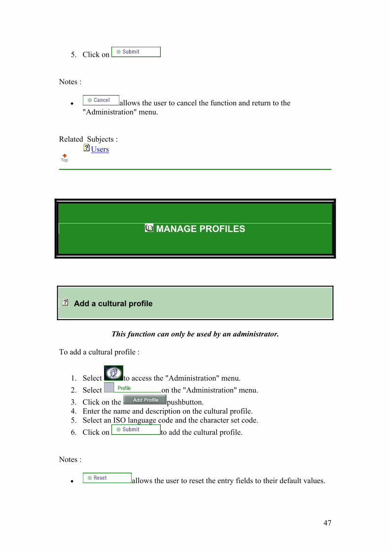
Add a cultural profile
This function can only be used by an administrator.
To add a cultural profile :
1. Select to access the "Administration" menu. 2. Select on the "Administration" menu. 3. Click on the pushbutton. 4. Enter the name and description on the cultural profile. 5. Select an ISO language code and the character set code. 6. Click on to add the cultural profile.
Notes :
• allows the user to reset the entry fields to their default values.

48
• allows the user to exit the function without performing any modification.
Related Subjects :
Cultural Profiles
Modify a cultural profile
This function can only be used by an administrator.
To modify a cultural profile :
1. Select to access the "Administration" menu. 2. Select on the "Administration" menu. 3. Click on the pushbutton. 4. Select the profile from the list. 5. Modify, as needed, the name or description of the cultural profile. 6. Click to apply the modifications.
Notes :
• allows the user to reset the entry fields to their default values. • allows the user to exit the function without performing any
modification. • Only the name and description can be modified.
Related Subjects :
Cultural Profiles
Delete a cultural profile
This function can only be used by an administrator.
To delete a cultural profile :

49
1. Select to access the "Administration" menu. 2. Select on the "Administration" menu. 3. Click on the pushbutton. 4. Select the profile from the list. 5. Once the profile displayed, click 6. Click on "OK" to confirm or "Cancel" to cancel.
Notes :
• allows the user to cancel the function and return to the "Administration" menu.
• M³Cat does not allow a cultural profile to be deleted if it is used by a user or a data set.
• Deleting a cultural pofile will delete all its labels.
Related Subjects :
Cultural Profiles
MANAGE TEMPLATES
Add a template
This function can only be accessed by a user with administration privilege.
To add a template :
1. Select from the top menu to access the "Administration" menu. 2. Select from the "Administration" menu.
3. Click on

50
4. Select a source "template" from the list. 5. Enter a "Template Name" in the field.
(50 characters max). 6. Click on
Notes :
• allows the user to restore all enty fields to their default values. • allows the user to exit the function without making modifications.
Related Subjects :
Template
Modify a template
This function can only be accessed by a user with administration privilege.
To modify a template :
1. Select from the top menu to access the "Administration" menu. 2. Select from the "Administration" menu.
3. Click 4. Select a "Template Name" (from the list). 5. Click on the metadata element to modify in the tree list. 6. Perform the modifications on the right part of the screen (importance of
element or text field size). 7. Click
Hints :
• Perform all the required modifications for a template before pressing on
Notes :
• For text metadata elements, the number of characters (more or less than 250) that the field will allow can be modified.

51
• The reference (Standard) for metadata element importance is the reference from the published standard.
• When a metadata element becomes "not visible", all its indented (child) metadata elements also become not visible. .
• When the importance of a "not visible" metadata element is modified, all the parent metadata elements will adopt the same importance.
Related Subjects :
Template
Delete a template
This function can only be accessed by a user with administration privilege.
To delete a template :
1. Select from the top menu to access the "Administration" menu. 2. Select from the "Administration" menu.
3. Click on 4. Select the "Template Name" (from the list). 5. Click
Notes :
• A template used by a data set or used as a preference cannot be deleted. • allows the user to exit the function without making modifications.
Related Subjects :
Template
MANAGE THESAURI

52
Add a thesaurus
This function can only be accessed by a user with administration privilege.
To add a thesaurus :
1. Select from the top menu to access the "Administration" menu. 2. Select from the "Administration" menu. 3. Click on 4. Select a "template" from the list. 5. Select a "thesaurus" type from the list that conforms to the selected template. 6. Select a "cultural profile" from the list. 7. Ensure that no thesaurus is selected in the list of thesauri. 8. Enter a "Thesaurus Name" in the field
(50 characters max). 9. Click on " + " to add the thesaurus to the list. 10. Click
To add a keyword :
1. Ensure that no keywords are selected in the list. 2. Enter a "keyword" in the keywod field.
(255 characters max). 3. Click on " + " to add the keyword to the list. 4. Click on
Notes :
• allows the user to restore all fields to their default values.
Related Subjects :
Standard Thesaurus Cultural Profile Keyword

53
Modify a thesaurus
This function can only be accessed by a user with administration privilege.
To modify a thesaurus :
1. Select from the top menu to access the "Administration" menu. 2. Select from the "Administration" menu. 3. Click on 4. Select a "template" from the list. 5. Select a "thesaurus" type from the list. 6. Perform modifications in the "thesaurus" list. 7. Click on " + " to add the thesaurus to the existing list. 8. Click on
To modify a keyword :
1. Select a "keyword" from the list. 2. Perform modifications in the "keyword" field. 3. Click on " + " to modify the keyword in the list. 4. Click on
Notes :
• allows the user to restore all fields to their default values.
Related Subjects :
Thesaurus
Delete a thesaurus
This function can only be accessed by a user with administration privilege.
To delete a thesaurus :
1. Select from the top menu to access the "Administration" menu". 2. Select from the "Administration" menu.

54
3. Click on 4. Select a "template" from the list. 5. Select a "thesaurus" type from the list. 6. Click on " - " to delete the thesaurus from the existing list. 7. Click on
To delete a keyword :
1. Select a "keyword" from the list. 2. Click on " - " to delete the keyword from the list. 3. Click on
Notes :
• allows the user to restore the default values.
Related Subjects :
Standard Thesaurus Keyword
Import keywords
This function can only be accessed by a user with administration privilege.
To import keywords :
1. Select from the top menu to access the "Administration" menu. 2. Select from the "Administration" menu. 3. Click on 4. Select a "thesaurus" from the list. 5. Click on "Browse..." to select the "keywords" ASCII file. 6. Click on
Notes :
• To import keywords into a new thesaurus, add the new thesaurus first using the function.
• allows the user to restore all fields to their default values.
55
• allows the user to exit withount saving modifications.
Related Subjects :
Thesaurus Keywords
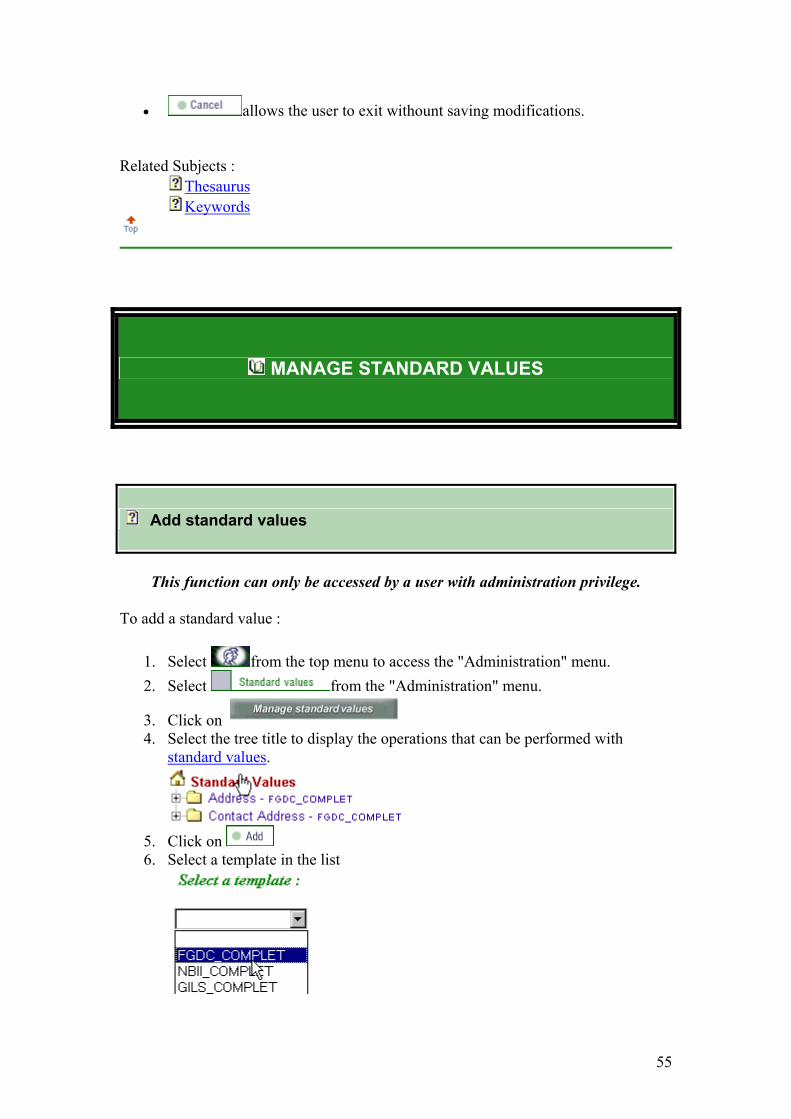
MANAGE STANDARD VALUES
Add standard values
This function can only be accessed by a user with administration privilege.
To add a standard value :
1. Select from the top menu to access the "Administration" menu. 2. Select from the "Administration" menu.
3. Click on 4. Select the tree title to display the operations that can be performed with
standard values.
5. Click on 6. Select a template in the list
56
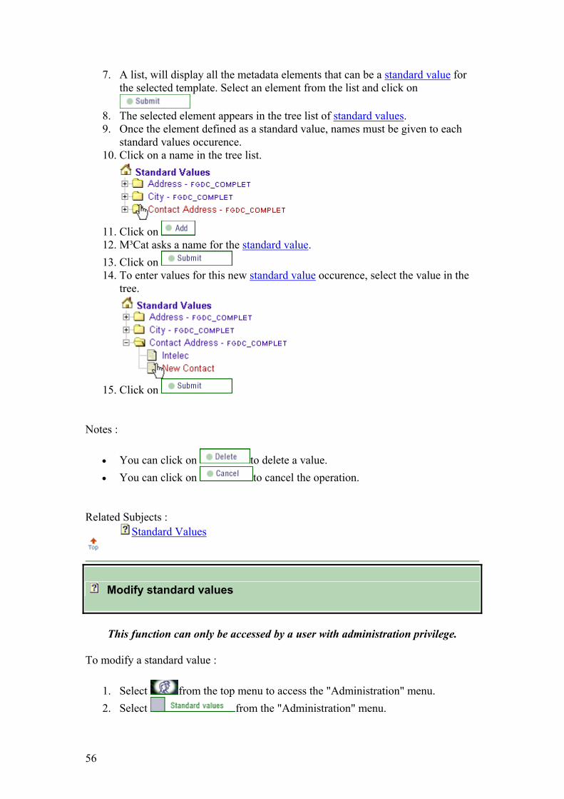
7. A list, will display all the metadata elements that can be a standard value for the selected template. Select an element from the list and click on
8. The selected element appears in the tree list of standard values. 9. Once the element defined as a standard value, names must be given to each
standard values occurence. 10. Click on a name in the tree list.
11. Click on 12. M³Cat asks a name for the standard value. 13. Click on 14. To enter values for this new standard value occurence, select the value in the
tree.
15. Click on
Notes :
• You can click on to delete a value. • You can click on to cancel the operation.
Related Subjects :
Standard Values
Modify standard values
This function can only be accessed by a user with administration privilege.
To modify a standard value :
1. Select from the top menu to access the "Administration" menu. 2. Select from the "Administration" menu.

57
3. Click on 4. Select a standard value from the list of existing values :
5. Click on the values associated with the standard value. 6. Click on 7. If the value is not used in a data set, the value is modified and
Steps 8 to 10 do not apply. 8. If the value is used by one (or many) data set (s), the data sets are displayed.
Select the data set (s) where the values must be modified and click on
9. If the user selects "all", the modifications are made to the standard value and
to each data set. Step 10 does not apply.
10. If the user only selects specific data sets, M³Cat requires a new name for the modified standard value occurence.
The modification will only apply to the selected data sets. Click on
The modifications are applied to the standard value and to the seelected data sets.
Notes :
• allows the user to cancel the operations and return to the standard values main menu.
• allows the user to restore all fields to their default values.
Related Subjects :
Standard Values

58
Delete standard values
This function can only be accessed by a user with administration privilege.
To delete a standard value :
1. Select from the top menu to access the "Administration" menu. 2. Select from the "Administration" menu.
3. Click on 4. There are two manners to delete a standard value :
• A user can delete all the standard values associated with an element.
Select the tree title to display the operations that can be performed on standard values.
Click on Select a standard value in the list click on M³Cat will then ask for confirmation of the deleted standard value click on
to cancel the operation, click on
Warning, all the values for this standard value as well as the ones used by data sets deleted.
• A user can delete one standard value a the time.
Select a specific value in the tree.
Click on to delete the data set.

59
There is no confirmation message
Contrary to the first case only the selected value is deleted.
Notes :
• The user can click on to cancel the operation.
Related Subjects :
Standard Values
MANAGE LABELS
Add labels
This function can only be accessed by a user with administration privilege.
To add labels :
1. Select from the top menu to access the "Administration" menu. 2. Select from the "Administration" menu. 3. Select a source "cultural profile" from the list. 4. Select a target "cultural profile" from the list. 5. Select a "label type" from the list. 6. Select a "template" from the list. 7. From the source side, select from the list the name of the label. 8. Click on " + " to add the label to the existing list of target labels. 9. Click on
Hints :

60
• Perform all the required modifications for a target profile before pressing
Notes :
• For the labels types "message" and "code", a template is not selected. • For the labels types "standard values" and "code", an element must be selected
from the list before a label type is selected. • Be patient, the various selections often require long waiting time. • allows all free text fields to be restored to their default values.
Related Subjects :
Cultural Profile Label Template
Modify labels
This function can only be accessed by a user with administration privilege.
To modify labels :
1. Select from the top menu to access the "Administration" menu. 2. Select from the "Administration" menu. 3. Select a source "cultural profile" from the list. 4. Select a target "cultural profile" different from the source, from the list. 5. Select a "label type" from the list. 6. Select a "gabarit" from the list. 7. On the target side, select the label name from the list. 8. On the target side, perform the modifications in the label field. 9. Click on " + " to modify the label. 10. Click on
Hints :
• Perform all the required modifications for a target profile before pressing .
Notes :

61
• For the labels types "message" and "code", a template is not selected. • For the labels types "standard values" and "code", an element must be selected
from the list before a label type is selected. • Be patient, the various selections often require long waiting time. • allows all free text fields to be restored to their default values.
Related Subjects :
Cultural Profile Label Template
Delete labels
This function can only be accessed by a user with administration privilege.
To delete labels :
1. Select from the top menu to access the "Administration" menu. 2. Select from the "Administration" menu. 3. Select a source "cultural profile" from the list. 4. Select a target "cultural profile" from the list. 5. Select a "label type" from the list. 6. Select a "template" from the list. 7. On the target side, select the label name from the list. 8. Click on " - " to delete the label from the existing target label list. 9. Click on
Hints :
• Perform all the required modifications for a target profile before pressing
Notes :
• For the labels types "message" and "code", a template is not selected. • For the labels types "standard values" and "code", an element must be selected
from the list before a label type is selected. • Be patient, the various selections often require long waiting time. • allows all free text fields to be restored to their default values.

62
Related Subjects :
Cultural Profile Label Template
USING THE HELP
Description of concepts
The option of the Help menu presents a list of concepts used or mentioned in M³Cat .
A short description and, in some cases, examples allow the user to understand the meanings used in M³Cat.
The user can access the Concepts option fom the Help menu or from links in the Functions option of the Help menu.
Description of functions
The option of the Help menu displays the list of available functions in M³Cat.
Each group combines related functions, and a help document is available for each one. The help document is stuctured as follows:

63
Using the function : The detailed operations necessary to perform the function.
Hints : Hints to save time, reduce errors and make metadata cataloguing easier !
Notes : Comments or additional infomation.
Related Subjects : Links to Concepts realted to the function.
Definition of metadata
When metadata are displayed, the user can obtain the definition of a metadata element by pressing on the pushbutton.
Frequently Asked Questions (FAQ)
The FAQ answers the most common questions asked by users.
You have questions ? Contact us !
About M³Cat

64
About M³Cat
Version 1.5 Copyright 2000-2004, Intelec Geomatics.
Sponsored by the GeoConnections Program.

65
Annexe 5: Metadata in text format (Exported from M3Cat database on 2/14/2004, metadata are subjected to changes)

66
Data Set Number 133: Geomorphology map, Niger 1996 Identification_Information: Citation: Citation_Information: Originator: Pierre Hiernaux Publication_Date: 1996 Title: Fakara Geomorphology map, Niger 1996 Edition: ver1 Geospatial_Data_Presentation_Form: vector digital data Publication_Information: Publication_Place: ILRI Niamey Publisher: ILRI Description: Abstract: To help the assessment of the roles of livestock in the management of natural resources and agriculture performances, the soils and the land use were mapped over 500km2 (latitude North 130 20' - 130 35' ; longitude East 20 35' -20 52' ) using existing aerial photography. Land use was also mapped in 1994, 1995 and 1996 using low altitude aerial photography done with a plain 24x36 camera from a small aircraft flying at 1200m altitude. Land use maps was systematically verified during the exhaustive field survey of forage resources repeated three times a year from 1994 to 1996 and once a year in 1997 and 1998. The soil map has not been systematically checked on the ground. However, the map was used to stratify sample field sites used in the monitoring of resources and in which soil have been described. Other soil data from experiments (Delabre, Rockström, Sangaré, Gandah, ) and surveys (Tropsoil, Chapell, d'Herbes, Loireau, de Row) conducted in the same village lands have been used to complete soil characterisation. Purpose: help the assessment of the roles of livestock in the management of natural resources and agriculture performances Time_Period_of_Content: Time_Period_Information: Single_Date/Time: Calendar_Date: 1996 Currentness_Reference: publication date Status: Progress: Complete Maintenance_and_Update_Frequency: None planned Spatial_Domain: Bounding_Coordinates: West_Bounding_Coordinate: 2.555843 East_Bounding_Coordinate: 2.886761 North_Bounding_Coordinate: 13.596402 South_Bounding_Coordinate: 13.326810 Keywords: Theme: Theme_Keyword_Thesaurus: GCMD Theme_Keyword: EARTH SCIENCE > Agriculture > Soils > Soil Classification Theme_Keyword: EARTH SCIENCE > Agriculture > Soils > Soil Fertility Theme_Keyword: EARTH SCIENCE > Agriculture > Soils > Soil Productivity Theme_Keyword: EARTH SCIENCE > Land Surface > Geomorphology

67
Place: Place_Keyword_Thesaurus: none Place_Keyword: Fakara Place_Keyword: Niger Place_Keyword: West Africa Access_Constraints: Access on request Use_Constraints: Cite Pierre Hiernaux/ILRI when used Point_of_Contact: Contact_Information: Contact_Organization_Primary: Contact_Organization: Centre d'Etudes Spatiales de la Biosphère, CESBIO Contact_Person: PIERRE HIERNAUX Contact_Position: Scientist Contact_Address: Address_Type: mailing and physical City: TOULOUSE Country: FRANCE Contact_Voice_Telephone: + 33 (0) 5 61 55 85 37; + 33 (0) 5 61 55 76 24 Contact_Electronic_Mail_Address: [email protected]; [email protected] Native_Data_Set_Environment: Microsoft Windows XP Version 5.1 (Build 2600) Service Pack 2; ESRI ArcCatalog 9.2.0.1324 Data_Quality_Information: Lineage: Process_Step: Process_Description: Soils have been mapped along three criteria: the topographical position, the land form and the soil defined by the depth and the texture of the loose soil. Four main topographical situations have been distinguished: plateau and iron pan flats, up-slope, mid and down slopes, valley). Some land forms such as 'fossil dune' or 'thin sand deposits' are found in different topographic situations, others are specific to one situation such as for the alluvial plains, levees banks and channels only found in the valley. A type of texture is associated to each of these land forms allowing to establish a correspondence with the field soil classification. Spatial_Data_Organization_Information: Direct_Spatial_Reference_Method: Vector Point_and_Vector_Object_Information: SDTS_Terms_Description: SDTS_Point_and_Vector_Object_Type: G-polygon Point_and_Vector_Object_Count: 1089 Spatial_Reference_Information: Horizontal_Coordinate_System_Definition: Planar: Grid_Coordinate_System: Grid_Coordinate_System_Name: Universal Transverse Mercator Universal_Transverse_Mercator: UTM_Zone_Number: 31 Transverse_Mercator: Scale_Factor_at_Central_Meridian: 0.999600 Longitude_of_Central_Meridian: 3.000000 Latitude_of_Projection_Origin: 0.000000 False_Easting: 500000.000000 False_Northing: 0.000000 Planar_Coordinate_Information:

68
Planar_Coordinate_Encoding_Method: coordinate pair Coordinate_Representation: Abscissa_Resolution: 0.000000 Ordinate_Resolution: 0.000000 Planar_Distance_Units: meters Geodetic_Model: Horizontal_Datum_Name: D_WGS_1984 Ellipsoid_Name: WGS_1984 Semi-major_Axis: 6378137.000000 Denominator_of_Flattening_Ratio: 298.257224 Entity_and_Attribute_Information: Detailed_Description: Entity_Type: Entity_Type_Label: geoutmattr Entity_Type_Definition_Source: Pierre Hiernaux ILRI Attribute: Attribute_Label: FID Attribute_Definition: Internal feature number. Attribute_Definition_Source: ESRI Attribute_Domain_Values: Attribute: Attribute_Label: Shape Attribute_Definition: Feature geometry. Attribute_Definition_Source: ESRI Attribute_Domain_Values: Unrepresentable_Domain: Coordinates defining the features. Attribute: Attribute_Label: AREA Attribute_Definition: Area Attribute_Definition_Source: Bruno Gerard Attribute: Attribute_Label: PERIMETER Attribute_Definition: Perimeter Attribute_Definition_Source: Bruno Gerard Attribute: Attribute_Label: GEOUTM_ Attribute_Definition: Internal indexing Attribute_Definition_Source: Bruno Gerard Attribute: Attribute_Label: GEOUTM_ID Attribute_Definition: Internal indexing Attribute_Definition_Source: Bruno Gerard Attribute: Attribute_Label: GEOM_P Attribute_Definition: Geomorphology class Attribute_Definition_Source: Pierre Hiernaux Attribute: Attribute_Label: MOSAIC Attribute_Definition: Combination of geomorphology class per geographic unit Attribute_Definition_Source: Bruno Gerard Attribute: Attribute_Label: DOMINENT Attribute_Definition: Dominent geomorphology class per geographic unit Attribute: Attribute_Label: TOPO

69
Attribute_Definition: Toposequence Attribute_Definition_Source: Bruno Gerard Attribute: Attribute_Label: TEXTURE Attribute_Definition: Texture Attribute_Definition_Source: Soil texture Attribute: Attribute_Label: APTITUDE Attribute_Definition: Procuctivity of the geographic unit (combination of internal drainage and Attribute: Attribute_Label: TOPO_1 Attribute_Definition: Place in toposequence Attribute_Definition_Source: Bruno Gerard Attribute: Attribute_Label: LAND_FORM Attribute_Definition: Land form Attribute_Definition_Source: Bruno Gerard Attribute: Attribute_Label: SOIL_TEXTU Attribute_Definition: Soil texture Attribute_Definition_Source: Bruno Gerard Attribute: Attribute_Label: SOIL_TYPE Attribute_Definition: Soil classification FAO Attribute: Attribute_Label: JERMA Attribute_Definition: Classification in Jerma language Attribute: Attribute_Label: FULFULDE Attribute_Definition: Classification in Fulfulde language Overview_Description: Entity_and_Attribute_Overview: - Soil types: The geology, topography and geomorpholgy settings - Internal drainage classes - Farmers classification and perception: Soil classification in the two main languages spoken in the village studied Jerma and Fulfulde ethnic groups. The soil agronomic aptitudes: The soil types defined on the base of topography, land form and top soil texture are grouped by level of agronomic aptitude. For this purpose the soil types have been ranked along a soil chemical fertility gradient in considering CEC, pH and organic matter content, and a soil infiltration gradient considering depth, topographical position, texture and crusting. The two gradients are combined in a matrix (Table 10). This empirical ranking allowed the grouping of soil types into five categories of soil aptitude to crop: The loamy sands and clayed loams in colluvial and alluvial depression (Tv, Rv, Vv) they constitute the 'rich' soil group. These soils offer the highest potential for cropping, however because of their down position these soils are susceptible to flood rich can ruin the crop and the relatively fine texture of the soil render them more difficult to till. (Hiernaux 1996). The thick sandy soils moderately leached (Pd, Td, Rd, Vr, Vd), they constitute the 'fair' soil group. These soils are very easy to

70
till and offer a fair potential to crop millet and cowpea providing either manure imputs or regular fallowing. The thick sandy soils highly leached (Rd, Vr, Vd), they constitute the 'poor' soil group. These soils are very easy to till but offer a poor potential for cropping because of the poor inherent fertility of their very sandy material. The shallow sandy and loamy sand soils, and the highly leached alluvial sandy soils (Pl, Rl, Tr; Rr, Pe, Re, Ve), they constitute the 'marginal' soil group. These soils offer a marginal cropping potential, they are very susceptible to erosion. The indurated and rocky soils (Pg, Pr) they constitute the 'nil' soil group. These soils are normally not arable. Entity_and_Attribute_Detail_Citation: See Word Document by Pierre Hiernaux, 1996. Distribution_Information: Distributor: Contact_Information: Contact_Person_Primary: Contact_Organization: ICRISAT - ILRI Contact_Address: Address_Type: mailing address City: Niamey Country: Niger Contact_Voice_Telephone: +0022720722626 Contact_Facsimile_Telephone: +22720734329 Contact_Electronic_Mail_Address: icrisatsc Hours_of_Service: 8h00-16h00 pm z+1 Contact_Instructions: Contact by mailing address Resource_Description: Fakara Geomorphology map, Niger 1996 Distribution_Liability: Restricted data, Please contact ILRI by [email protected] for getting authorization Standard_Order_Process: Digital_Form: Digital_Transfer_Information: Format_Name: shp Transfer_Size: 1.792 Metadata_Reference_Information: Metadata_Contact: Contact_Information: Contact_Organization_Primary: Contact_Organization: ICRISAT Contact_Person: AMADOU M.Laouali Contact_Address: Address_Type: [email protected] City: Niamey Country: Niger Contact_Voice_Telephone: +22720722626 Contact_Facsimile_Telephone: +22720734329 Contact_Electronic_Mail_Address: [email protected] Hours_of_Service: 8h00-16h00 pm z+1 Contact_Instructions: Prefer contact by email Metadata_Standard_Name: FGDC Content Standards for Digital Geospatial Metadata Metadata_Standard_Version: FGDC-STD-001-1998

71
Metadata_Time_Convention: local time Metadata_Security_Information: Metadata_Security_Classification: Unclassified Metadata_Extensions: Online_Linkage: http://www.esri.com/metadata/esriprof80.html Profile_Name: ESRI Metadata Profile

72
Data Set Number 166: Actual situation of land use for Jerma household: Fakara, Niger 2003-2005 Identification_Information: Citation: Citation_Information: Originator: Keiichi Hayashi Publication_Date: 2005 Title: Actual situation of land use for Jerma household: Fakara, Niger 2003-2005 Edition: vr. 1 Geospatial_Data_Presentation_Form: tabular digital data Online_Linkage: \\Isc-svr01\GeoNetwork\fakaradatabase\h.keiishi\actual situation of land use for jerma household\Actual situation of land use for Jerma household.dbf Description: Abstract: 38 farms were measured by GPS (Garmin Etrex) for 13 Jerma households in Tchigo Tegui and cultivated and non cultivated (fallow) area was identified. At the same time, a questionnaire was conducted to each household in order to estimate inputs and outputs of each surveyed farm. Purpose: To obtain quantitative information on actual ratio of fallow and cultivated area at household level To measure quantitatively a capacity of food supply from actually cultivated area Time_Period_of_Content: Time_Period_Information: Range_of_Dates/Times: Beginning_Date: 2003 Ending_Date: 2005 Currentness_Reference: ground condition Status: Progress: Complete Maintenance_and_Update_Frequency: Unknown Spatial_Domain: Bounding_Coordinates: West_Bounding_Coordinate: 2.583333 East_Bounding_Coordinate: 2.866667 North_Bounding_Coordinate: 13.583333 South_Bounding_Coordinate: 13.333333 Data_Set_G-Polygon: Data_Set_G-Polygon_Outer_G-Ring: G-Ring_Point: G-Ring_Latitude: 13.50950 G-Ring_Longitude: 2.77607 Keywords: Theme: Theme_Keyword_Thesaurus: none Theme_Keyword: millet production Theme_Keyword: self sufficiency Theme_Keyword: Jerma household Place: Place_Keyword: Fakara

73
Place_Keyword: Datiandou Place_Keyword: Niger Place_Keyword: West Africa Place_Keyword: Sahel Access_Constraints: Restricted Use_Constraints: Restricted Point_of_Contact: Contact_Information: Contact_Person_Primary: Contact_Person: Keiichi Hayashi Contact_Organization: JIRCAS Contact_Address: Address_Type: mailing and physical City: 1-1 Ohwashi, Tsukuba State_or_Province: Ibaraki Postal_Code: 305-8686 Country: Japan Contact_Voice_Telephone: +81-29-838-6355 Contact_Electronic_Mail_Address: [email protected] Hours_of_Service: 8:00-17:00 (JST) Contact_Instructions: E-mail Data_Set_Credit: Amadou Soja (JIRCAS/ICRISAT), Tahirou Abdoulaye (JIRCAS/INRAN) Security_Information: Security_Classification: Restricted Native_Data_Set_Environment: Microsoft Excel; dbase ; ESRI ArcCatalog 9.0.0.535 Cross_Reference: Citation_Information: Originator: Elias T. Ayuk Publication_Date: 2001 Title: Social, economic and policy dimensions of soil organic matter Series_Information: Series_Name: Nutrient Cycling in Agroecosystems Issue_Identification: 61: 183195 Publication_Information: Publication_Place: Netherlands Publisher: Kluwer Academic Cross_Reference: Citation_Information: Originator: Ndjeunga, J., Bationo, A. Publication_Date: 2005 Title: Stochastic dominance analysis of soil fertility restoration options on sandy Sahelian soils in southwest Niger. Series_Information: Series_Name: Explimental Agriculture Issue_Identification: 41; 227244 Publication_Information: Publication_Place: United Kingdom Data_Quality_Information: Attribute_Accuracy: Attribute_Accuracy_Report: 38 farms of 13 Jerma households in Tchigo Tegui Quantitative_Attribute_Accuracy_Assessment: Attribute_Accuracy_Value: Number of farm

74
Attribute_Accuracy_Explanation: 4 farms (TTF21), 3 farms (TTF23), 2 farms (TTF46), 2 farms (TTF13), 1 farms (TTF34), 2 farms (TTF37), 7 farms (TTF8), 2 farms (TTF88), 5 farms (TTF77), 3 farms (TTF22), 3 farms (TTF54), 1 farm (T7), 3 farms (T48) Lineage: Process_Step: Process_Description: Data were collected through an interview by questionnaire in Tchigo Tegui and were input into spreadsheet of Excel and processed by Excel Process_Date: Not complete Process_Contact: Contact_Information: Contact_Person_Primary: Contact_Person: Keiuichi Hayashi Contact_Organization: JIRCAS Spatial_Data_Organization_Information: Direct_Spatial_Reference_Method: Point Point_and_Vector_Object_Information: SDTS_Terms_Description: SDTS_Point_and_Vector_Object_Type: Area point Entity_and_Attribute_Information: Detailed_Description: Entity_Type: Entity_Type_Label: Actual situation of land use for Jerma household Attribute: Attribute_Label: OID Attribute_Definition: Internal feature number. Attribute_Definition_Source: ESRI Attribute_Domain_Values: Unrepresentable_Domain: Sequential unique whole numbers that are automatically generated. Attribute: Attribute_Label: C1 Attribute_Definition: Name1 Attribute_Definition_Source: Keiichi Hayashi Attribute: Attribute_Label: C2 Attribute_Definition: Name 2 Attribute_Definition_Source: Keiichi Hayashi Attribute: Attribute_Label: C3 Attribute_Definition: Household number Attribute_Definition_Source: Keiichi Hayashi Attribute: Attribute_Label: C4 Attribute_Definition: Code Attribute_Definition_Source: Keiichi Hayashi Attribute: Attribute_Label: C5 Attribute_Definition: Idendification Attribute_Definition_Source: Keiichi Hayashi Attribute: Attribute_Label: C6 Attribute_Definition: Terroire (sojya) Attribute_Definition_Source: Keiichi Hayashi

75
Attribute: Attribute_Label: C7 Attribute_Definition: Terroire (Arcview) Attribute_Definition_Source: Keiichi Hayashi Attribute: Attribute_Label: C8 Attribute_Definition: Number of farm Attribute_Definition_Source: Keiichi Hayashi Attribute: Attribute_Label: C9 Attribute_Definition: Production Attribute_Definition_Source: Keiichi Hayashi Attribute: Attribute_Label: C10 Attribute_Definition: Members of family Attribute_Definition_Source: Keiichi Hayashi Attribute: Attribute_Label: C11 Attribute_Definition: Number of persons who work on field Attribute_Definition_Source: Keiichi Hayashi Attribute: Attribute_Label: C12 Attribute_Definition: measured distance between house to field (m) Attribute_Definition_Source: Keiichi Hayashi Attribute: Attribute_Label: C13 Attribute_Definition: Distance according farmers feeling Attribute_Definition_Source: Keiichi Hayashi Attribute: Attribute_Label: C14 Attribute_Definition: estimed time (mn) Attribute_Definition_Source: Keiichi Hayashi Attribute: Attribute_Label: C15 Attribute_Definition: Indigenous knowledge (local name) of Main Soil type Attribute_Definition_Source: Keiichi Hayashi Attribute: Attribute_Label: C16 Attribute_Definition: Land management Attribute_Definition_Source: Keiichi Hayashi Attribute: Attribute_Label: C17 Attribute_Definition: Indigenous knowledge (local name) in land management Attribute_Definition_Source: Keiichi Hayashi Attribute: Attribute_Label: C18 Attribute_Definition: Affiliation of animal Attribute_Definition_Source: Keiichi Hayashi Attribute: Attribute_Label: C19 Attribute_Definition: Length of fallow (year) Attribute_Definition_Source: Keiichi Hayashi Attribute: Attribute_Label: C20
76
Attribute_Definition: Length of cultivation (year) Attribute_Definition_Source: Keiichi Hayashi Attribute: Attribute_Label: C21 Attribute_Definition: Crop Attribute_Definition_Source: Keiichi Hayashi Attribute: Attribute_Label: C22 Attribute_Definition: Other crop Attribute_Definition_Source: Keiichi Hayashi Attribute: Attribute_Label: C23 Attribute_Definition: Category Attribute_Definition_Source: Keiichi Hayashi Attribute: Attribute_Label: C24 Attribute_Definition: Management Attribute_Definition_Source: Keiichi Hayashi Overview_Description: Entity_and_Attribute_Overview: The data set contains several attributes that are described as follow: Teroire (sojya) Teroire (ArcView) Number of farm Prod04 Family Labor Distance(m) Distance(feeling) Time (min) IK (Main soil type): Indigenous knowledge (local name) of Main Soil type Land management IK Land management: Indigenous knowledge (local name) in land management Affiriation of animal Length of fallow (year) Length of cultivation (year) Crop Other crop Category Management Distribution_Information: Distributor: Contact_Information: Contact_Organization_Primary: Contact_Organization: JIRCAS Contact_Address: Address_Type: mailing and physical Address: Japan International Research Center for Agricultural Sciences City: 1-1, Ohwashi, Tsukuba, Ibaraki, Postal_Code: 305 8686 Country: JAPAN Contact_Voice_Telephone: +81 29 838 6330 Contact_Facsimile_Telephone: +81 29 838 6316

77
Contact_Electronic_Mail_Address: [email protected] Contact_Electronic_Mail_Address: [email protected] Hours_of_Service: 8:00-17:00 (JST) Contact_Instructions: http://www.jircas.affrc.go.jp Resource_Description: Actual situation of land use for Jerma household Distribution_Liability: Data are restricted. Users who need the data should explore the metadata file and should contact JIRCAS via his physical or mailing address Standard_Order_Process: Digital_Form: Digital_Transfer_Information: Format_Name: dBase Format_Version_Number: 4 Transfer_Size: 0.025 Metadata_Reference_Information: Metadata_Date: 20070117 Metadata_Contact: Contact_Information: Contact_Organization_Primary: Contact_Organization: ICRISATSC Contact_Person: AMADOU M.Laouali Contact_Position: Consultant Contact_Address: Address_Type: mailing and physical address Address: BP: 12404 City: Niamey Country: Niamey Contact_Voice_Telephone: 0022720722529 Contact_Facsimile_Telephone: 0022720734329 Contact_Electronic_Mail_Address: [email protected] Hours_of_Service: 8h00am - 16h00pm z+1 Contact_Instructions: Email address Metadata_Standard_Name: FGDC Content Standards for Digital Geospatial Metadata Metadata_Standard_Version: FGDC-STD-001-1998 Metadata_Time_Convention: local time Metadata_Access_Constraints: Restricted Metadata_Security_Information: Metadata_Security_Classification: Unclassified Metadata_Extensions: Online_Linkage: http://www.esri.com/metadata/esriprof80.html Profile_Name: ESRI Metadata Profile

78
Data Set Number 172: area_cropped by sedentary Fulani(HS): Fakara, Niger 2005-2006 Identification_Information: Citation: Citation_Information: Originator: Hitoshi Shinjo Originator: Keiichi Hayashi Publication_Date: Unpublished material Title: area_cropped by sedentary Fulani(HS): Fakara, Niger 2005-2006 Geospatial_Data_Presentation_Form: tabular digital data Online_Linkage: \\Isc-svr01\GeoNetwork\fakaradatabase\h.shinjo\area_cropped by sedentary fulani (hs)\area_cropped by sedentary Fulani(HS).dbf Description: Abstract: Area of cropping and corralling was investigated for 36 Fulani housholds settling in Fakara region. These housholds were selected to represent the whole households in this region in terms of number of livestock and millet yield. The boundaries for each land use was traced with hand-held GPS to estimate the area at the end of the dry seasons in 2005 and 2006. It was found that the average rate of corralling was about 3 Mg ha-1. The newly settled households tended to spread the manure in the more extensive area. Purpose: To understand the actual situation of corralling in the Fakara region to suggest realistic option for soil fertility improvement. Time_Period_of_Content: Time_Period_Information: Multiple_Dates/Times: Single_Date/Time: Calendar_Date: May 2005 Single_Date/Time: Calendar_Date: May 2006 Currentness_Reference: ground condition Status: Progress: Complete Maintenance_and_Update_Frequency: None planned Spatial_Domain: Bounding_Coordinates: West_Bounding_Coordinate: 2.583333 East_Bounding_Coordinate: 2.866667 North_Bounding_Coordinate: 13.583333 South_Bounding_Coordinate: 13.333333 Data_Set_G-Polygon: Data_Set_G-Polygon_Outer_G-Ring: G-Ring_Point: G-Ring_Latitude: 13.52775 G-Ring_Longitude: 2.66024 G-Ring_Point: G-Ring_Latitude: 13.37954 G-Ring_Longitude: 2.84407 G-Ring_Point: G-Ring_Latitude: 13.50950 G-Ring_Longitude: 2.77607 Keywords:

79
Theme: Theme_Keyword_Thesaurus: GCMD Theme_Keyword: EARTH SCIENCE > Agriculture > Animal Science > Animal Management Systems Theme_Keyword: EARTH SCIENCE > Agriculture > Soils > Soil Fertility Place: Place_Keyword_Thesaurus: Geographic Names Information System Place_Keyword: Niger Place_Keyword: Fakara Temporal: Temporal_Keyword_Thesaurus: none Temporal_Keyword: 2005 Temporal_Keyword: 2006 Access_Constraints: Within project of JIRCAS/ICRISAT Use_Constraints: Not allowed Point_of_Contact: Contact_Information: Contact_Organization_Primary: Contact_Organization: KYOTO UNIV Contact_Person: HITOSHI SHINJO Contact_Position: Assistant professor Contact_Address: Address_Type: mailing and physical City: KYOTO Country: JAPAN Contact_Voice_Telephone: +81757536101 Contact_Electronic_Mail_Address: [email protected] Hours_of_Service: 9:00-17:00(UTC+9) Native_Data_Set_Environment: Microsoft Excel; dBase; ESRI ArcCatalog 9.0.0.535 Data_Quality_Information: Attribute_Accuracy: Attribute_Accuracy_Report: Interview was made by Mr Amadou Sodja, JIRCAS technical assistant and H. Shinjo. Mr Sodja translated my question in French into Fulani and the answer of Fulani back into French. Translation may lose some nuance. Positional_Accuracy: Horizontal_Positional_Accuracy: Horizontal_Positional_Accuracy_Report: For tracing the boundaries, a Garmin GPS was used. Positional accuracy was no better than 5 m. Vertical_Positional_Accuracy: Vertical_Positional_Accuracy_Report: NA Lineage: Process_Step: Process_Description: Interview to Fulani households in three villages of Fakara area and input the data into speadsheet of Excel and processed them by Excel Entity_and_Attribute_Information: Detailed_Description: Entity_Type: Entity_Type_Label: area_cropped by sedentary Fulani(HS) Attribute: Attribute_Label: OID Attribute_Definition: Internal feature number.

80
Attribute_Definition_Source: ESRI Attribute_Domain_Values: Unrepresentable_Domain: Sequential unique whole numbers that are automatically generated. Attribute: Attribute_Label: C1 Attribute_Definition: Year for cropping area Attribute_Definition_Source: Hitoshi Shinjo Attribute: Attribute_Label: C2 Attribute_Definition: Name of Village Attribute_Definition_Source: Hitoshi Shinjo Attribute: Attribute_Label: C3 Attribute_Definition: Code of Farmers Attribute_Definition_Source: ILRI Attribute: Attribute_Label: C4 Attribute_Definition: Total area Attribute_Definition_Source: Hitoshi Shinjo Attribute: Attribute_Label: C5 Attribute_Definition: Total cropping area Attribute_Definition_Source: Hitoshi Shinjo Attribute: Attribute_Label: C6 Attribute_Definition: Area corralled in the dry season Attribute_Definition_Source: Hitoshi Shinjo Attribute: Attribute_Label: C7 Attribute_Definition: Corralling period (month) Attribute_Definition_Source: Hitoshi Shinjo Attribute: Attribute_Label: C8 Attribute_Definition: Transhumance (TH) Attribute_Definition_Source: Hitoshi Shinjo Attribute: Attribute_Label: C9 Attribute_Definition: Contract corrall Attribute_Definition_Source: Hitoshi Shinjo Attribute: Attribute_Label: C10 Attribute_Definition: Contracted cows Attribute_Definition_Source: Hitoshi Shinjo Attribute: Attribute_Label: C11 Attribute_Definition: Owned cows in KH 04, 0505 Attribute_Definition_Source: Hitoshi Shinjo Attribute: Attribute_Label: C12 Attribute_Definition: Contracted cows in 0505 Attribute_Definition_Source: Hitoshi Shinjo Attribute: Attribute_Label: C13 Attribute_Definition: Entrusted Cows in 0505 Attribute_Definition_Source: Hitoshi Shinjo Attribute:

81
Attribute_Label: C14 Attribute_Definition: Total Cows in 0505 Attribute_Definition_Source: Hitoshi Shinjo Attribute: Attribute_Label: C15 Attribute_Definition: Owned SR in KH 04, 050 Attribute_Definition_Source: Hitoshi Shinjo Attribute: Attribute_Label: C16 Attribute_Definition: Contracted SR 0505 Attribute_Definition_Source: Hitoshi Shinjo Attribute: Attribute_Label: C17 Attribute_Definition: Entrusted SR in 0505 Attribute_Definition_Source: Hitoshi Shinjo Attribute: Attribute_Label: C18 Attribute_Definition: Total SR in 0505 Attribute_Definition_Source: Hitoshi Shinjo Attribute: Attribute_Label: C19 Attribute_Definition: Cows manure input in 0505(t DM) Attribute_Definition_Source: Hitoshi Shinjo Attribute: Attribute_Label: C20 Attribute_Definition: Cows manure input per ha in 0505 Attribute_Definition_Source: Hitoshi Shinjo Attribute: Attribute_Label: C21 Attribute_Definition: % of Cows corralled in 0505 Attribute_Definition_Source: Hitoshi Shinjo Attribute: Attribute_Label: C22 Attribute_Definition: Area corralled in the dry season in 0605 Attribute_Definition_Source: Hitoshi Shinjo Attribute: Attribute_Label: C23 Attribute_Definition: Corralling period (month) Attribute_Definition_Source: Hitoshi Shinjo Attribute: Attribute_Label: C24 Attribute_Definition: Owned Cows in 0605 Attribute_Definition_Source: Hitoshi Shinjo Attribute: Attribute_Label: C25 Attribute_Definition: Contracted Cows in 0605 Attribute_Definition_Source: Hitoshi Shinjo Attribute: Attribute_Label: C26 Attribute_Definition: Entrusted Cows 0605 Attribute_Definition_Source: Hitoshi Shinjo Attribute: Attribute_Label: C27 Attribute_Definition: Total Cows in 0605 Attribute_Definition_Source: Hitoshi Shinjo Attribute: Attribute_Label: C28

82
Attribute_Definition: Owned Sheep in 0605 Attribute_Definition_Source: Hitoshi Shinjo Attribute: Attribute_Label: C29 Attribute_Definition: Contracted Sheep in 0605 Attribute_Definition_Source: Hitoshi Shinjo Attribute: Attribute_Label: C30 Attribute_Definition: Entrusted Sheep in 0605 Attribute_Definition_Source: Hitoshi Shinjo Attribute: Attribute_Label: C31 Attribute_Definition: Owned Goat in 0605 Attribute_Definition_Source: Hitoshi Shinjo Attribute: Attribute_Label: C32 Attribute_Definition: Contracted Goat in 0605 Attribute_Definition_Source: Hitoshi Shinjo Attribute: Attribute_Label: C33 Attribute_Definition: Entrusted Goat in 0605 Attribute_Definition_Source: Hitoshi Shinjo Attribute: Attribute_Label: C34 Attribute_Definition: Total SR in 0605 Attribute_Definition_Source: Hitoshi Shinjo Attribute: Attribute_Label: C35 Attribute_Definition: Cows manure input (DM) in 0605 Attribute_Definition_Source: Hitoshi Shinjo Attribute: Attribute_Label: C36 Attribute_Definition: Cows manure input per ha in 0605 Attribute_Definition_Source: Hitoshi Shinjo Attribute: Attribute_Label: C37 Attribute_Definition: % of Cows corralled Attribute_Definition_Source: Hitoshi Shinjo Distribution_Information: Distributor: Contact_Information: Contact_Organization_Primary: Contact_Organization: JIRCAS Contact_Address: Address_Type: mailing and physical Address: Japan International Research Center for Agricultural Sciences (JIRCAS) City: Ohwashi, Tsukuba, Ibaraki Postal_Code: 305 8686 Country: JAPAN Contact_Voice_Telephone: +81 29 838 6330 Contact_Facsimile_Telephone: +81 29 838 6316 Contact_Electronic_Mail_Address: [email protected] Resource_Description: Downloadable Data Standard_Order_Process: Digital_Form: Digital_Transfer_Information:

83
Transfer_Size: 0.023 Metadata_Reference_Information: Metadata_Date: 20070117 Metadata_Contact: Contact_Information: Contact_Organization_Primary: Contact_Organization: ICRISATSC Contact_Person: AMADOU M.Laouali Contact_Address: Address_Type: mailing and physical address Address: BP : 12404 City: Niamey Country: Niger Contact_Voice_Telephone: 0022720722529 Contact_Facsimile_Telephone: 0022720734329 Contact_Electronic_Mail_Address: [email protected] Metadata_Standard_Name: FGDC Content Standards for Digital Geospatial Metadata Metadata_Standard_Version: FGDC-STD-001-1998 Metadata_Time_Convention: local time Metadata_Access_Constraints: Restricted Metadata_Security_Information: Metadata_Security_Classification: Unclassified Metadata_Extensions: Online_Linkage: http://www.esri.com/metadata/esriprof80.html Profile_Name: ESRI Metadata Profile

84
Data Set Number 173: Transhumance and corralling by sedentary Fulani: Fakara, Niger 2004-2005-2006 Identification_Information: Citation: Citation_Information: Originator: Hitoshi Shinjo Originator: Keiichi Hayashi Publication_Date: Unpublished material Title: Transhumance and corralling by sedentary Fulani: Fakara, Niger 2004-2005-2006 Edition: 1 Geospatial_Data_Presentation_Form: tabular digital data Online_Linkage: \\Isc-svr01\GeoNetwork\fakaradatabase\h.shinjo\transhumance and corralling by sedentary fulani\Transhumance and corralling by sedentary Fulaniv2.dbf Description: Abstract: Thirty six Fulani housholds settling in Fakara region were interviewed on transhumance, corralling, number of livestock, land tenure, etc. These housholds were selected to represent the whole households in this region in terms of number of livestock and millet yield. The interview was carried out for several times since November 2004. It was found that transhumance was essential for the Fulani in Kodey and Thigo Tegui, where most land was cropped, while the Fulani in Banizoumbou did not transhumance. Three quarters of the households interviewed did not corral at the field of the Zarma farmers. This observations strongly suggest that the Zarma farmer should seek for another option to maintain or improve soil fertility. Purpose: To understand the actual situation of corralling in the Fakara region to suggest realistic option for soil fertility improvement. Time_Period_of_Content: Time_Period_Information: Multiple_Dates/Times: Single_Date/Time: Calendar_Date: November 2004 Single_Date/Time: Calendar_Date: May 2005 Single_Date/Time: Calendar_Date: May 2006 Currentness_Reference: ground condition Status: Progress: Complete Maintenance_and_Update_Frequency: None planned Spatial_Domain: Bounding_Coordinates: West_Bounding_Coordinate: 2.583333 East_Bounding_Coordinate: 2.866667 North_Bounding_Coordinate: 13.583333 South_Bounding_Coordinate: 13.333333 Data_Set_G-Polygon: Data_Set_G-Polygon_Outer_G-Ring: G-Ring_Point: G-Ring_Latitude: 13.52775 G-Ring_Longitude: 2.66024 G-Ring_Point:

85
G-Ring_Latitude: 13.37954 G-Ring_Longitude: 2.84407 G-Ring_Point: G-Ring_Latitude: 13.50950 G-Ring_Longitude: 2.77607 Keywords: Theme: Theme_Keyword_Thesaurus: None Theme_Keyword: Fulani Theme_Keyword: household Theme_Keyword: corralling Theme_Keyword: transhumance Place: Place_Keyword_Thesaurus: None Place_Keyword: Niger Place_Keyword: Fakara Place_Keyword: Kodey Place_Keyword: Tchigo Tegui Place_Keyword: Katanga Place_Keyword: Banizoumbou Temporal: Temporal_Keyword_Thesaurus: none Temporal_Keyword: 2004 Temporal_Keyword: 2005 Temporal_Keyword: 2006 Access_Constraints: Within project of JIRCAS/ICRISAT Use_Constraints: Not allowed Point_of_Contact: Contact_Information: Contact_Organization_Primary: Contact_Organization: KYOTO UNIV Contact_Person: HITOSHI SHINJO Contact_Position: Assistant professor Contact_Address: Address_Type: mailing and physical City: KYOTO Country: JAPAN Contact_Voice_Telephone: +81757536101 Contact_Electronic_Mail_Address: [email protected] Hours_of_Service: 9:00-17:00(UTC+9) Data_Set_Credit: K. Hayashi, Amadou Sodja, ICRISAT, JIRCAS Security_Information: Security_Classification: Restricted Native_Data_Set_Environment: Microsoft Excel; dBASE; ESRI ArcCatalog 9.0.0.535 Data_Quality_Information: Attribute_Accuracy: Attribute_Accuracy_Report: Interview was made by Mr Amadou Sodja, JIRCAS technical assistant and H. Shinjo. Mr Sodja translated my question in French into Fulani and the answer of Fulani back into French. Translation may lose some nuance. Lineage: Source_Information: Source_Citation: Citation_Information: Originator: Pierre Hiernaux

86
Originator: Augustine Ayatunde Publication_Date: Unknown Process_Step: Process_Description: Interview to Fulani households in three villages of Fakara area and input the data into speadsheet of Excel and processed them by Excel Spatial_Data_Organization_Information: Direct_Spatial_Reference_Method: Point Point_and_Vector_Object_Information: SDTS_Terms_Description: SDTS_Point_and_Vector_Object_Type: Area point Entity_and_Attribute_Information: Detailed_Description: Entity_Type: Entity_Type_Label: Transhumance and corralling by sedentary Fulaniv2 Attribute: Attribute_Label: OID Attribute_Definition: Internal feature number. Attribute_Definition_Source: ESRI Attribute_Domain_Values: Unrepresentable_Domain: Sequential unique whole numbers that are automatically generated. Attribute: Attribute_Label: C1 Attribute_Definition: Date Attribute_Definition_Source: Hitoshi Shinjo Attribute: Attribute_Label: C2 Attribute_Definition: Name of village Attribute_Definition_Source: Hitoshi Shinjo Attribute: Attribute_Label: C3 Attribute_Definition: Code of Household Attribute_Definition_Source: Hitoshi Shinjo Attribute: Attribute_Label: C4 Attribute_Definition: Lacation of houses Attribute_Definition_Source: Hitoshi Shinjo Attribute: Attribute_Label: C5 Attribute_Definition: Location of houses Attribute_Definition_Source: Hitoshi Shinjo Attribute: Attribute_Label: C6 Attribute_Definition: Grazing area Attribute_Definition_Source: Hitoshi Shinjo Attribute: Attribute_Label: C7 Attribute_Definition: Corralling Attribute_Definition_Source: Hitoshi Shinjo Attribute: Attribute_Label: C8 Attribute_Definition: Supplementation Attribute_Definition_Source: Hitoshi Shinjo Attribute: Attribute_Label: C9

87
Attribute_Definition: Crops Attribute_Definition_Source: Hitoshi Shinjo Attribute: Attribute_Label: C10 Attribute_Definition: Note Attribute_Definition_Source: Hitoshi Shinjo Attribute: Attribute_Label: C11 Attribute_Definition: Thranshumance in 2004 Attribute_Definition_Source: Hitoshi Shinjo Attribute: Attribute_Label: C12 Attribute_Definition: Contract corrall between 04-05 Attribute_Definition_Source: Hitoshi Shinjo Attribute: Attribute_Label: C13 Attribute_Definition: Contracted Cows between 04-05 Attribute_Definition_Source: Hitoshi Shinjo Attribute: Attribute_Label: C14 Attribute_Definition: Owned Cows Attribute_Definition_Source: Hitoshi Shinjo Attribute: Attribute_Label: C15 Attribute_Definition: Contracted Cows Attribute_Definition_Source: Hitoshi Shinjo Attribute: Attribute_Label: C16 Attribute_Definition: Entrusted Cows Attribute_Definition_Source: Hitoshi Shinjo Attribute: Attribute_Label: C17 Attribute_Definition: Owned Small Ruminants Attribute_Definition_Source: Hitoshi Shinjo Attribute: Attribute_Label: C18 Attribute_Definition: Contracted Small Ruminants Attribute_Definition_Source: Hitoshi Shinjo Attribute: Attribute_Label: C19 Attribute_Definition: Entrusted Small Ruminants Attribute_Definition_Source: Hitoshi Shinjo Attribute: Attribute_Label: C20 Attribute_Definition: Transhumance in 2005 Attribute_Definition_Source: Hitoshi Shinjo Attribute: Attribute_Label: C21 Attribute_Definition: Contract corrall between 05-06 Attribute_Definition_Source: Hitoshi Shinjo Attribute: Attribute_Label: C22 Attribute_Definition: Contracted cows between 05-06 Attribute_Definition_Source: Hitoshi Shinjo Attribute: Attribute_Label: C23 Attribute_Definition: Owned Cows

88
Attribute_Definition_Source: Hitoshi Shinjo Attribute: Attribute_Label: C24 Attribute_Definition: Contracted Cows Attribute_Definition_Source: Hitoshi Shinjo Attribute: Attribute_Label: C25 Attribute_Definition: Entrusted Cows Attribute_Definition_Source: Hitoshi Shinjo Attribute: Attribute_Label: C26 Attribute_Definition: Owned Sheep Attribute_Definition_Source: Hitoshi Shinjo Attribute: Attribute_Label: C27 Attribute_Definition: Contracted Sheep Attribute_Definition_Source: Hitoshi Shinjo Attribute: Attribute_Label: C28 Attribute_Definition: Entrusted Sheep Attribute_Definition_Source: Hitoshi Shinjo Attribute: Attribute_Label: C29 Attribute_Definition: Owned Goat Attribute_Definition_Source: Hitoshi Shinjo Attribute: Attribute_Label: C30 Attribute_Definition: Contracted Goat Attribute_Definition_Source: Hitoshi Shinjo Attribute: Attribute_Label: C31 Attribute_Definition: Entrusted Goat Attribute_Definition_Source: Hitoshi Shinjo Overview_Description: Entity_and_Attribute_Overview: The data set summarize the transhumance, corralling, number of livestock and land tenure of Fulani housholds settling in Fakara region in 2004, 2005 and 2006. three villages of Fakara was concerned: Banizoumbou, Tigo Tegui and Kodey. The variables collected are structured as follow: - Date: the date of interview - Terre: name of village - code - Location of houses (geographic position): UTM X and UTM Y - Grazing area - Corralling - Supplementation - Crop cultivated - transhumance system - types of land tenure Distribution_Information: Distributor: Contact_Information: Contact_Organization_Primary: Contact_Organization: JIRCAS Contact_Address: Address_Type: mailing and physical

89
Address: Japan International Research Center for Agricultural Sciences (JIRCAS) City: Ohwashi, Tsukuba, Ibaraki Postal_Code: 305 8686 Country: JAPAN Contact_Voice_Telephone: +81 29 838 6330 Contact_Facsimile_Telephone: +81 29 838 6316 Contact_Electronic_Mail_Address: [email protected] Resource_Description: Transhumance and corralling by sedentary Fulani Standard_Order_Process: Digital_Form: Digital_Transfer_Information: Transfer_Size: 0.039 Metadata_Reference_Information: Metadata_Date: 20070117 Metadata_Contact: Contact_Information: Contact_Organization_Primary: Contact_Organization: ICRISATSC Contact_Person: AMADOU M.Laouali Contact_Position: Consultant Contact_Address: Address_Type: mailing and physical address Address: BP: 12404 City: Niamey Country: Niger Contact_Voice_Telephone: 0022720722626 Contact_Electronic_Mail_Address: [email protected] Hours_of_Service: 8h00am - 16h00pm z+1 Contact_Instructions: prefer to be contact by email Metadata_Standard_Name: FGDC Content Standards for Digital Geospatial Metadata Metadata_Standard_Version: FGDC-STD-001-1998 Metadata_Time_Convention: local time Metadata_Access_Constraints: Not define for instance Metadata_Security_Information: Metadata_Security_Classification: Unclassified Metadata_Extensions: Online_Linkage: http://www.esri.com/metadata/esriprof80.html Profile_Name: ESRI Metadata Profile

90
Data Set Number 174: Land use in 2004 obtained from segmentation of Spot 5 image Identification_Information: Citation: Citation_Information: Originator: Christophe Coq Publication_Date: September 2005 Title: Land use cover in 2004 obtained from segmentation of Spot 5 image Geospatial_Data_Presentation_Form: vector digital data Online_Linkage: \\ENGE-FROUFROU\F\metadata_fakara\Data Set Land Use\Lu2004\Lu2004UCL.shp Description: Abstract: Land use vectorial information was obtained in 2004 from the segmentation and object-based classification of a pansharpened orthorectified Spot 5 image taken at the end of the rainy season (28 Sept 2004). The classification used the Land Cover Classification System (LCCS) developped by FAO Purpose: Production of continuous coverage for multitemporal overlaying of historical (1950, 1965, 1975) and recent (1994, 1995, 1996, 2002, 2004) land use cover Time_Period_of_Content: Time_Period_Information: Single_Date/Time: Calendar_Date: 20040928 Time_of_Day: 10:28:53 Currentness_Reference: ground condition Status: Progress: Complete Maintenance_and_Update_Frequency: None planned Keywords: Theme: Theme_Keyword_Thesaurus: none Theme_Keyword: Land use Theme_Keyword: Spot 5 Theme_Keyword: LCCS Place: Place_Keyword_Thesaurus: none Place_Keyword: Fakara Place_Keyword: Niger Place_Keyword: West Africa Temporal: Temporal_Keyword_Thesaurus: none Temporal_Keyword: 2004 Access_Constraints: Available on request Use_Constraints: Cite when used Point_of_Contact: Contact_Information: Contact_Organization_Primary: Contact_Organization: Catholic University of Louvain Contact_Person: BRUNO GERARD Contact_Position: Visitor Scientist Contact_Address: Address_Type: mailing and physical

91
Address: Faculty of Biological, Agronomic and Environmental Engineering Catholic university of Louvain Croix du Sud, 2 bte 16 B-1348 Louvain-la-Neuve (Belgium) Fax 32 (0) 10 47 88 98 City: Louvain-la-Neuve Country: Belgique Contact_Voice_Telephone: 32 (0) 10 47 92 57 Contact_Electronic_Mail_Address: [email protected]; [email protected] Data_Set_Credit: Christophe Coq, Pierre Defourny, Bruno Gerard (UCL, ICRISAT) Native_Data_Set_Environment: Microsoft Windows XP Version 5.1 (Build 2600) Service Pack 2; ESRI ArcCatalog 9.2.0.1324 Data_Quality_Information: Positional_Accuracy: Horizontal_Positional_Accuracy: Horizontal_Positional_Accuracy_Report: Spot 5 was orthorectified using GCP surveyed with a differential GPS and SRTM DEM giving on RMSE < 5 m Vertical_Positional_Accuracy: Vertical_Positional_Accuracy_Report: not relevant Lineage: Source_Information: Source_Citation: Citation_Information: Originator: Spot Image Publication_Date: 20041029 Publication_Time: 09:33:31 Title: Panchromatic scene 5 062-323 04/09/28 10:28:53 1 A and multispectral scene 062-323/0 04/09/28 10:28:55 1 J Geospatial_Data_Presentation_Form: remote-sensing image Online_Linkage: http://www.spotimage.fr Type_of_Source_Media: CD-ROM Source_Time_Period_of_Content: Time_Period_Information: Single_Date/Time: Calendar_Date: 20040928 Time_of_Day: 10:33 Source_Currentness_Reference: ground condition Process_Step: Process_Description: 1) Orthorectification of pan and multispectral scenes using SRTM MNT and GCP surveyed with differential GPS 2) Pansharpening data fusion to produce multispectral scene wit 5 m ground resolution 3) Multiscale segementation of the image 4) Object based classification using epxert knowledge for ground cover condition and using LCCS classification scheme Process_Date: 2005 Spatial_Data_Organization_Information: Direct_Spatial_Reference_Method: Vector Point_and_Vector_Object_Information: SDTS_Terms_Description: SDTS_Point_and_Vector_Object_Type: G-polygon

92
Point_and_Vector_Object_Count: 117938 Spatial_Reference_Information: Horizontal_Coordinate_System_Definition: Planar: Grid_Coordinate_System: Grid_Coordinate_System_Name: Universal Transverse Mercator Universal_Transverse_Mercator: UTM_Zone_Number: 31 Transverse_Mercator: Scale_Factor_at_Central_Meridian: 0.999600 Longitude_of_Central_Meridian: 3.000000 Latitude_of_Projection_Origin: 0.000000 False_Easting: 500000.000000 False_Northing: 0.000000 Planar_Coordinate_Information: Planar_Coordinate_Encoding_Method: coordinate pair Coordinate_Representation: Abscissa_Resolution: 0.000000 Ordinate_Resolution: 0.000000 Planar_Distance_Units: meters Geodetic_Model: Horizontal_Datum_Name: D_WGS_1984 Ellipsoid_Name: WGS_1984 Semi-major_Axis: 6378137.000000 Denominator_of_Flattening_Ratio: 298.257224 Entity_and_Attribute_Information: Detailed_Description: Entity_Type: Entity_Type_Label: Lu2004UCL Entity_Type_Definition: Land Cover Classification System (LCCS) Entity_Type_Definition_Source: FAO Attribute: Attribute_Label: FID Attribute_Definition: Internal feature number. Attribute_Definition_Source: ESRI Attribute_Domain_Values: Unrepresentable_Domain: Sequential unique whole numbers that are automatically generated. Attribute: Attribute_Label: Shape Attribute_Definition: Feature geometry. Attribute_Definition_Source: ESRI Attribute_Domain_Values: Unrepresentable_Domain: Coordinates defining the features. Attribute: Attribute_Label: ID Attribute: Attribute_Label: GRIDCODE Attribute: Attribute_Label: GRIDCODE_1 Attribute: Attribute_Label: OCCUPATION Attribute_Definition: Occupation Attribute_Definition_Source: FAO LCCS Attribute_Domain_Values: Enumerated_Domain: Enumerated_Domain_Value: Plateau ferreux/Croûte latéritique
93
Enumerated_Domain: Enumerated_Domain_Value: Croûte arbustive fermée (fourre) et fragmentée Enumerated_Domain: Enumerated_Domain_Value: Végétation herbacée ouverte ((70%-60%)-40%) Enumerated_Domain: Enumerated_Domain_Value: Sable délié et mouvant Enumerated_Domain: Enumerated_Domain_Value: Champ éparpillé et isolé de culture herbacée Enumerated_Domain: Enumerated_Domain_Value: Champ éparpillé en amas de culture herbacée Enumerated_Domain: Enumerated_Domain_Value: Champ continu de culture herbacée Enumerated_Domain: Enumerated_Domain_Value: Zone bâtie Enumerated_Domain: Enumerated_Domain_Value: Surface d'eau naturelle Enumerated_Domain: Enumerated_Domain_Value: Surface d'eau naturelle non permanente (en mouvement) Enumerated_Domain: Enumerated_Domain_Value: Pas de données Attribute: Attribute_Label: LANDCOVER Attribute_Definition: Land Cover Attribute_Definition_Source: FAO LCCS Attribute_Domain_Values: Enumerated_Domain: Enumerated_Domain_Value: Ironpan/Laterie crust Enumerated_Domain: Enumerated_Domain_Value: Fragmented (tripped) closed shrubland (thicket) Enumerated_Domain: Enumerated_Domain_Value: Herbaceous open (70%-60%)-40%) vegetation Enumerated_Domain: Enumerated_Domain_Value: Loose and shifting sand Enumerated_Domain: Enumerated_Domain_Value: Scattered and isolated field of herbaceous crop Enumerated_Domain: Enumerated_Domain_Value: Scattered clusterd field of herbaceous crop Enumerated_Domain: Enumerated_Domain_Value: Conitnous herbaceous crop Enumerated_Domain: Enumerated_Domain_Value: Urban area Enumerated_Domain: Enumerated_Domain_Value: Natural waterbody Enumerated_Domain: Enumerated_Domain_Value: Non-perenial natural waterbody (flowing) Enumerated_Domain: Enumerated_Domain_Value: No data

94
Attribute: Attribute_Label: UTIL Attribute_Definition: Utilisation Attribute_Definition_Source: FAO LCCS Attribute_Domain_Values: Enumerated_Domain: Enumerated_Domain_Value: Pâturage très extensif Enumerated_Domain: Enumerated_Domain_Value: Terre non cultivable Enumerated_Domain: Enumerated_Domain_Value: Jachère Enumerated_Domain: Enumerated_Domain_Value: Champ sur sol dégradé Enumerated_Domain: Enumerated_Domain_Value: Champ sur sol non fumé Enumerated_Domain: Enumerated_Domain_Value: Champ sur sol fumé Enumerated_Domain: Enumerated_Domain_Value: Zone bâtie Enumerated_Domain: Enumerated_Domain_Value: Surface d'eau naturelle Enumerated_Domain: Enumerated_Domain_Value: Surface d'eau naturelle non permanente (en mouvement) Enumerated_Domain: Enumerated_Domain_Value: Pas de données Attribute: Attribute_Label: USE Attribute_Definition: LAnd use Attribute_Definition_Source: FAO LCCS Attribute_Domain_Values: Enumerated_Domain: Enumerated_Domain_Value: Very extensive pasture land Enumerated_Domain: Enumerated_Domain_Value: Unsuitable for cultivation soil Enumerated_Domain: Enumerated_Domain_Value: Fallow Enumerated_Domain: Enumerated_Domain_Value: Unsuitable for cultivation soil Enumerated_Domain: Enumerated_Domain_Value: Field on damage soil Enumerated_Domain: Enumerated_Domain_Value: Unmanure field Enumerated_Domain: Enumerated_Domain_Value: Manure field Enumerated_Domain: Enumerated_Domain_Value: Urban area Enumerated_Domain: Enumerated_Domain_Value: Natural waterbody Enumerated_Domain: Enumerated_Domain_Value: Non-perenial natural waterbody (flow Enumerated_Domain: Enumerated_Domain_Value: No data Overview_Description: Entity_and_Attribute_Overview: The data set summarize the transhumance, corralling, number of livestock and land tenureof Fulani housholds settling in Fakara region in 2004, 2005 and 2006. three

95
villages of Fakara was concerned: Banizoumbou, Tigo Tegui and Kodey. the attributes are structured as follow: - Date: the date of interview - Terre: name of village - code - Location of houses: UTM X and UTM Y - Grazing area - Corralling - transhumance - types of land tenure Distribution_Information: Distributor: Contact_Information: Contact_Person_Primary: Contact_Organization: ICRISATSC Contact_Voice_Telephone: +22720722626 Contact_Facsimile_Telephone: +22720734329 Contact_Electronic_Mail_Address: [email protected] Resource_Description: Land use cover in 2004 obtained from segmentation of Spot 5 image Distribution_Liability: Restricted data Standard_Order_Process: Digital_Form: Digital_Transfer_Information: Transfer_Size: 69.633 Metadata_Reference_Information: Metadata_Date: 20070122 Metadata_Contact: Contact_Information: Contact_Organization_Primary: Contact_Organization: ICRISATSC Contact_Person: AMADOU M.Laouali Contact_Address: Address_Type: mailing and physical address City: Niamey Country: Niamey Contact_Voice_Telephone: +22720722626 Contact_Facsimile_Telephone: +22720734329 Contact_Electronic_Mail_Address: [email protected] Hours_of_Service: 8h00-16h00 pm z+1 Contact_Instructions: Prefer mailing contact Metadata_Standard_Name: FGDC Content Standards for Digital Geospatial Metadata Metadata_Standard_Version: FGDC-STD-001-1998 Metadata_Time_Convention: local time Metadata_Access_Constraints: Free acces on Geonetwork Metadata_Extensions: Online_Linkage: http://www.esri.com/metadata/esriprof80.html Profile_Name: ESRI Metadata Profile

96
Data Set Number 127: Daily rainfall measurements at landscape scale with a network of raingauges in 2000 (Fakara/Niger) Identification_Information: Citation: Citation_Information: Originator: Bruno Gerard Publication_Date: 2000 Title: Daily rainfall measurements at landscape scale with a network of raingauges in 2000 (Fakara/Niger) Edition: version 1 Geospatial_Data_Presentation_Form: vector digital data Description: Abstract: Shape file for daily rainfall measurements over the Fakara region obtained for 49 raingauges. Rainfall readings have been performed by individual farmers throughout the rainy season Purpose: Obtain spatio-temporal distribution of rainfall over the Fakara Time_Period_of_Content: Time_Period_Information: Range_of_Dates/Times: Beginning_Date: 20000601 Ending_Date: 20001001 Currentness_Reference: ground condition Status: Progress: Complete Maintenance_and_Update_Frequency: Daily Spatial_Domain: Bounding_Coordinates: West_Bounding_Coordinate: 2.579792 East_Bounding_Coordinate: 2.881674 North_Bounding_Coordinate: 13.589260 South_Bounding_Coordinate: 13.337560 Keywords: Theme: Theme_Keyword_Thesaurus: none Theme_Keyword: precipitation Theme_Keyword: rainfall Theme_Keyword: moisture Theme_Keyword: water balance Place: Place_Keyword_Thesaurus: none Place_Keyword: Fakara Place_Keyword: Niger Place_Keyword: West Africa Temporal: Temporal_Keyword_Thesaurus: none Temporal_Keyword: 2000 Access_Constraints: Free access Use_Constraints: Cite when used Point_of_Contact: Contact_Information: Contact_Organization_Primary: Contact_Organization: ICRISAT Contact_Address:

97
Address_Type: mailing and physical address Address: BP: 12404 City: Niamey Country: Niger Contact_Voice_Telephone: +22720722626 Contact_Facsimile_Telephone: +22720734329 Contact_Electronic_Mail_Address: [email protected] Contact_Electronic_Mail_Address: [email protected] Contact_Instructions: Prefer mailing contact Data_Set_Credit: Bruno Gerard, ICRISAT Security_Information: Security_Classification: Unclassified Native_Data_Set_Environment: Microsoft Windows XP Version 5.1 (Build 2600) Service Pack 2; ESRI ArcCatalog 9.2.0.1324 Data_Quality_Information: Lineage: Process_Step: Process_Description: Data were collected from rain gauge of each village of Fakara area and were input and processed into Excel Spatial_Data_Organization_Information: Direct_Spatial_Reference_Method: Vector Point_and_Vector_Object_Information: SDTS_Terms_Description: SDTS_Point_and_Vector_Object_Type: Entity point Point_and_Vector_Object_Count: 49 Spatial_Reference_Information: Horizontal_Coordinate_System_Definition: Planar: Grid_Coordinate_System: Grid_Coordinate_System_Name: Universal Transverse Mercator Universal_Transverse_Mercator: UTM_Zone_Number: 31 Transverse_Mercator: Scale_Factor_at_Central_Meridian: 0.999600 Longitude_of_Central_Meridian: 3.000000 Latitude_of_Projection_Origin: 0.000000 False_Easting: 500000.000000 False_Northing: 0.000000 Planar_Coordinate_Information: Planar_Coordinate_Encoding_Method: coordinate pair Coordinate_Representation: Abscissa_Resolution: 0.000000 Ordinate_Resolution: 0.000000 Planar_Distance_Units: meters Geodetic_Model: Horizontal_Datum_Name: D_WGS_1984 Ellipsoid_Name: WGS_1984 Semi-major_Axis: 6378137.000000 Denominator_of_Flattening_Ratio: 298.257224 Entity_and_Attribute_Information: Detailed_Description: Entity_Type: Entity_Type_Label: fakara_rain_2000 Attribute: Attribute_Label: FID Attribute_Definition: Internal feature number. Attribute_Definition_Source: ESRI

98
Attribute_Domain_Values: Unrepresentable_Domain: Sequential unique whole numbers that are automatically generated. Attribute: Attribute_Label: Shape Attribute_Definition: Feature geometry. Attribute_Definition_Source: ESRI Attribute_Domain_Values: Unrepresentable_Domain: Coordinates defining the features. Attribute: Attribute_Label: Village Attribute_Definition: Village in which the raingauge stands Attribute_Definition_Source: Bruno Gerard Attribute: Attribute_Label: X_coord Attribute_Definition: Longitude in UTM31N Attribute_Definition_Source: Bruno Gerard Attribute: Attribute_Label: Y_coord Attribute_Definition: Latitude in UTM31N Attribute_Definition_Source: Bruno Gerard Attribute: Attribute_Label: Pluvio Attribute_Definition: Raingauge ID Number Attribute_Definition_Source: Bruno Gerard Attribute: Attribute_Label: DOY152 Attribute_Definition: Rainfall for specific day i.e DOY 152 (the first june), All subsequent columns (From DOY152 to DOY274) are daily rainfall for given day. Attribute_Definition_Source: Bruno Gerard Attribute: Attribute_Label: DOY274 Attribute_Definition: Rainfall for specific day i.e DOY 152 (the first june), All subsequent columns (From DOY152 to DOY274) are daily rainfall for given day. Attribute_Definition_Source: Bruno Gerard Distribution_Information: Distributor: Contact_Information: Contact_Organization_Primary: Contact_Organization: ICRISAT Contact_Address: Address_Type: mailing and physical address Address: PB: 12404 City: Niamey Country: Niger Contact_Voice_Telephone: +22720722626 Contact_Facsimile_Telephone: +22720734329 Contact_Electronic_Mail_Address: [email protected] Resource_Description: Daily rainfall measurements at landscape scale with a network of raingauges in 2000 Distribution_Liability: Public domain, For all need, contact the following address: [email protected] Standard_Order_Process: Digital_Form: Digital_Transfer_Information:

99
Transfer_Size: 0.001 Fees: Free Ordering_Instructions: Contact Bruno Gerard at [email protected] Metadata_Reference_Information: Metadata_Date: 20070129 Metadata_Contact: Contact_Information: Contact_Organization_Primary: Contact_Organization: ICRISAT Contact_Person: AMADOU M.Laouali Contact_Address: Address_Type: mailing and physical address Address: BP: 12404 City: Niamey Country: Niger Contact_Voice_Telephone: +22720722626 Contact_Facsimile_Telephone: +22720734329 Contact_Electronic_Mail_Address: [email protected] Metadata_Standard_Name: FGDC Content Standards for Digital Geospatial Metadata Metadata_Standard_Version: FGDC-STD-001-1998 Metadata_Time_Convention: local time Metadata_Access_Constraints: None Metadata_Use_Constraints: Cite when used Metadata_Security_Information: Metadata_Security_Classification: Unclassified Metadata_Extensions: Online_Linkage: http://www.esri.com/metadata/esriprof80.html Profile_Name: ESRI Metadata Profile

100
Data Set Number 128: Daily rainfall measurements at landscape scale with a network of raingauges in 2001 (Fakara/Niger) Identification_Information: Citation: Citation_Information: Originator: Bruno Gerard Publication_Date: 2001 Title: Daily rainfall measurements at landscape scale with a network of raingauges in 2001(Fakara/Niger) Edition: version 1 Geospatial_Data_Presentation_Form: vector digital data Description: Abstract: Shape file for daily rainfall measurements over the Fakara region obtained for 53 raingauges. Rainfall readings have been performed by individual farmers throughout the rainy season Purpose: Obtain spatio-temporal distribution of rainfall over the Fakara Time_Period_of_Content: Time_Period_Information: Range_of_Dates/Times: Beginning_Date: 20010521 Ending_Date: 20011011 Currentness_Reference: ground condition Status: Progress: Complete Maintenance_and_Update_Frequency: Daily Spatial_Domain: Bounding_Coordinates: West_Bounding_Coordinate: 2.557954 East_Bounding_Coordinate: 2.889899 North_Bounding_Coordinate: 13.589263 South_Bounding_Coordinate: 13.337523 Keywords: Theme: Theme_Keyword_Thesaurus: none Theme_Keyword: precipitation Theme_Keyword: rainfall Theme_Keyword: moisture Theme_Keyword: water balance Place: Place_Keyword_Thesaurus: none Place_Keyword: Fakara Place_Keyword: Niger Place_Keyword: West Africa Temporal: Temporal_Keyword_Thesaurus: none Temporal_Keyword: 2001 Access_Constraints: Free access Use_Constraints: Cite when used Point_of_Contact: Contact_Information: Contact_Organization_Primary: Contact_Organization: ICRISAT Contact_Address:

101
Address_Type: mailing and physical address Address: BP: 12404 City: Niamey Country: Niger Contact_Voice_Telephone: +22720722626 Contact_Facsimile_Telephone: +22720734329 Contact_Electronic_Mail_Address: [email protected] Contact_Electronic_Mail_Address: [email protected] Data_Set_Credit: Bruno Gerard, ICRISAT Native_Data_Set_Environment: Microsoft Windows XP Version 5.1 (Build 2600) Service Pack 2; ESRI ArcCatalog 9.2.0.1324 Data_Quality_Information: Lineage: Process_Step: Process_Description: Data were collected from rain gauge of each village of Fakara area and were input and processed into Excel Spatial_Data_Organization_Information: Direct_Spatial_Reference_Method: Vector Point_and_Vector_Object_Information: SDTS_Terms_Description: SDTS_Point_and_Vector_Object_Type: Entity point Point_and_Vector_Object_Count: 53 Spatial_Reference_Information: Horizontal_Coordinate_System_Definition: Planar: Grid_Coordinate_System: Grid_Coordinate_System_Name: Universal Transverse Mercator Universal_Transverse_Mercator: UTM_Zone_Number: 31 Transverse_Mercator: Scale_Factor_at_Central_Meridian: 0.999600 Longitude_of_Central_Meridian: 3.000000 Latitude_of_Projection_Origin: 0.000000 False_Easting: 500000.000000 False_Northing: 0.000000 Planar_Coordinate_Information: Planar_Coordinate_Encoding_Method: coordinate pair Coordinate_Representation: Abscissa_Resolution: 0.000000 Ordinate_Resolution: 0.000000 Planar_Distance_Units: meters Geodetic_Model: Horizontal_Datum_Name: D_WGS_1984 Ellipsoid_Name: WGS_1984 Semi-major_Axis: 6378137.000000 Denominator_of_Flattening_Ratio: 298.257224 Entity_and_Attribute_Information: Detailed_Description: Entity_Type: Entity_Type_Label: fakara_rain_2001 Attribute: Attribute_Label: FID Attribute_Definition: Internal feature number. Attribute_Definition_Source: ESRI Attribute_Domain_Values: Unrepresentable_Domain: Sequential unique whole numbers that are automatically generated.

102
Attribute: Attribute_Label: Shape Attribute_Definition: Feature geometry. Attribute_Definition_Source: ESRI Attribute_Domain_Values: Unrepresentable_Domain: Coordinates defining the features. Attribute: Attribute_Label: Village Attribute_Definition: Village in which the raingauge stands Attribute_Definition_Source: Bruno Gerard Attribute: Attribute_Label: X_coord Attribute_Definition: Longitude in UTM31N Attribute_Definition_Source: Bruno Gerard Attribute: Attribute_Label: Y_coord Attribute_Definition: Latitude in UTM31N Attribute_Definition_Source: Bruno Gerard Attribute: Attribute_Label: DOY246 Attribute_Definition: Rainfall for specific day i.e DOY 140 (20 May), All subsequent columns (From DOY140 to DOY283) are daily rainfall for given day. Attribute_Definition_Source: Bruno Gerard Distribution_Information: Distributor: Contact_Information: Contact_Person_Primary: Contact_Organization: ICRISAT Contact_Address: Address_Type: mailing and physical address Address: BP: 12404 City: Niamey Country: NIger Contact_Voice_Telephone: +22720722626 Contact_Facsimile_Telephone: +22720734329 Contact_Electronic_Mail_Address: [email protected] Resource_Description: Downloadable Data Standard_Order_Process: Digital_Form: Digital_Transfer_Information: Transfer_Size: 0.002 Fees: Free Ordering_Instructions: Contact Bruno Gerard at [email protected] Metadata_Reference_Information: Metadata_Date: 20070129 Metadata_Contact: Contact_Information: Contact_Organization_Primary: Contact_Organization: ICRISAT Contact_Person: AMADOU M.Laouali Contact_Address: Address_Type: mailing and physical address Address: BP: 12404 City: Niamey Country: Niger Contact_Voice_Telephone: +22720722626

103
Contact_Facsimile_Telephone: +22720734329 Contact_Electronic_Mail_Address: [email protected] Metadata_Standard_Name: FGDC Content Standards for Digital Geospatial Metadata Metadata_Standard_Version: FGDC-STD-001-1998 Metadata_Time_Convention: local time Metadata_Access_Constraints: None Metadata_Use_Constraints: Cite when used Metadata_Security_Information: Metadata_Security_Classification: Unclassified Metadata_Extensions: Online_Linkage: http://www.esri.com/metadata/esriprof80.html Profile_Name: ESRI Metadata Profile

104
Data Set Number 129: Daily rainfall measurements at landscape scale with a network of raingauges in 2002 (Fakara/Niger) Identification_Information: Citation: Citation_Information: Originator: Bruno Gerard Publication_Date: 2002 Title: Daily rainfall measurements at landscape scale with a network of raingauges in 2002 (Fakara/Niger) Edition: version 1 Geospatial_Data_Presentation_Form: vector digital data Description: Abstract: Shape file for daily rainfall measurements over the Fakara region obtained for 62 raingauges. Rainfall readings have been performed by individual farmers throughout the rainy season Purpose: Obtain spatio-temporal distribution of rainfall over the Fakara Time_Period_of_Content: Time_Period_Information: Range_of_Dates/Times: Beginning_Date: 20020523 Ending_Date: 20021008 Currentness_Reference: ground condition Status: Progress: Complete Maintenance_and_Update_Frequency: Daily Spatial_Domain: Bounding_Coordinates: West_Bounding_Coordinate: 2.557954 East_Bounding_Coordinate: 2.889923 North_Bounding_Coordinate: 13.589263 South_Bounding_Coordinate: 13.285846 Keywords: Theme: Theme_Keyword_Thesaurus: none Theme_Keyword: precipitation Theme_Keyword: rainfall Theme_Keyword: moisture Theme_Keyword: water balance Place: Place_Keyword_Thesaurus: none Place_Keyword: Fakara Place_Keyword: Niger Place_Keyword: West Africa Temporal: Temporal_Keyword_Thesaurus: none Temporal_Keyword: 2002 Access_Constraints: Free access Use_Constraints: Cite when used Point_of_Contact: Contact_Information: Contact_Organization_Primary: Contact_Organization: ICRISAT Contact_Address: Address_Type: mailing and physical address

105
Address: BP: 12404 City: Niamey Country: Niger Contact_Voice_Telephone: +22720722626 Contact_Facsimile_Telephone: +22720734329 Contact_Electronic_Mail_Address: [email protected] Contact_Electronic_Mail_Address: [email protected] Data_Set_Credit: Bruno Gerard, ICRISAT Native_Data_Set_Environment: Microsoft Windows XP Version 5.1 (Build 2600) Service Pack 2; ESRI ArcCatalog 9.2.0.1324 Data_Quality_Information: Lineage: Process_Step: Process_Description: Data were collected from rain gauge of each village of Fakara area and were input and processed into Excel Spatial_Data_Organization_Information: Direct_Spatial_Reference_Method: Vector Point_and_Vector_Object_Information: SDTS_Terms_Description: SDTS_Point_and_Vector_Object_Type: Entity point Point_and_Vector_Object_Count: 62 Spatial_Reference_Information: Horizontal_Coordinate_System_Definition: Planar: Grid_Coordinate_System: Grid_Coordinate_System_Name: Universal Transverse Mercator Universal_Transverse_Mercator: UTM_Zone_Number: 31 Transverse_Mercator: Scale_Factor_at_Central_Meridian: 0.999600 Longitude_of_Central_Meridian: 3.000000 Latitude_of_Projection_Origin: 0.000000 False_Easting: 500000.000000 False_Northing: 0.000000 Planar_Coordinate_Information: Planar_Coordinate_Encoding_Method: coordinate pair Coordinate_Representation: Abscissa_Resolution: 0.000000 Ordinate_Resolution: 0.000000 Planar_Distance_Units: meters Geodetic_Model: Horizontal_Datum_Name: D_WGS_1984 Ellipsoid_Name: WGS_1984 Semi-major_Axis: 6378137.000000 Denominator_of_Flattening_Ratio: 298.257224 Entity_and_Attribute_Information: Detailed_Description: Entity_Type: Entity_Type_Label: fakara_rain_2002 Attribute: Attribute_Label: FID Attribute_Definition: Internal feature number. Attribute_Definition_Source: ESRI Attribute_Domain_Values: Unrepresentable_Domain: Sequential unique whole numbers that are automatically generated. Attribute:

106
Attribute_Label: Shape Attribute_Definition: Feature geometry. Attribute_Definition_Source: ESRI Attribute_Domain_Values: Unrepresentable_Domain: Coordinates defining the features. Attribute: Attribute_Label: Village Attribute_Definition: Village in which the raingauge stands Attribute_Definition_Source: Bruno Gerard Attribute: Attribute_Label: X_coord Attribute_Definition: Longitude in UTM31N Attribute_Definition_Source: Bruno Gerard Attribute: Attribute_Label: Pluvio_ID Attribute_Definition: Number of rain gauge in the village Attribute_Definition_Source: Bruno Gerard Attribute: Attribute_Label: DOY142 Attribute_Definition: Rainfall for specific day i.e DOY 142 (22 May), All subsequent columns (From DOY139 to DOY280) are daily rainfall for given day. Attribute_Definition_Source: Bruno Gerard Distribution_Information: Distributor: Contact_Information: Contact_Organization_Primary: Contact_Organization: ICRISAT Contact_Address: Address_Type: mailing and physical address Address: BP: 12404 City: Niamey Country: Niger Contact_Voice_Telephone: +22720722626 Contact_Facsimile_Telephone: +22720734329 Contact_Electronic_Mail_Address: [email protected] Resource_Description: Daily rainfall measurements at landscape scale with a network of raingauges in 2002 Distribution_Liability: Data are Public domain, contact [email protected] Standard_Order_Process: Digital_Form: Digital_Transfer_Information: Transfer_Size: 0.002 Fees: Free Ordering_Instructions: Contact Bruno Gerard at [email protected] Metadata_Reference_Information: Metadata_Date: 20070129 Metadata_Contact: Contact_Information: Contact_Organization_Primary: Contact_Organization: ICRISAT Contact_Person: AMADOU M.Laouali Contact_Address: Address_Type: mailing and physical address Address: BP: 12404 City: Niamey
107
Country: Niamey Contact_Voice_Telephone: +22720722626 Contact_Facsimile_Telephone: +22720734329 Contact_Electronic_Mail_Address: [email protected] Contact_Instructions: Prefer mailing contact Metadata_Standard_Name: FGDC Content Standards for Digital Geospatial Metadata Metadata_Standard_Version: FGDC-STD-001-1998 Metadata_Time_Convention: local time Metadata_Access_Constraints: None Metadata_Use_Constraints: Cite when used Metadata_Security_Information: Metadata_Security_Classification: Unclassified Metadata_Extensions: Online_Linkage: http://www.esri.com/metadata/esriprof80.html Profile_Name: ESRI Metadata Profile

108
Data Set Number 130: Daily rainfall measurements at landscape scale with a network of raingauges in 2003 (Fakara/Niger) Identification_Information: Citation: Citation_Information: Originator: Bruno Gerard Publication_Date: 2003 Title: Daily rainfall measurements at landscape scale with a network of raingauges in 2003 (Fakara/Niger) Edition: version 1 Geospatial_Data_Presentation_Form: vector digital data Description: Abstract: Shape file for daily rainfall measurements over the Fakara region obtained for 62 raingauges. Rainfall readings have been performed by individual farmers throughout the rainy season Purpose: Obtain spatio-temporal distribution of rainfall over the Fakara Time_Period_of_Content: Time_Period_Information: Range_of_Dates/Times: Beginning_Date: 20030603 Ending_Date: 20061026 Currentness_Reference: ground condition Status: Progress: Complete Maintenance_and_Update_Frequency: Daily Spatial_Domain: Bounding_Coordinates: West_Bounding_Coordinate: 2.557954 East_Bounding_Coordinate: 2.889923 North_Bounding_Coordinate: 13.589263 South_Bounding_Coordinate: 13.285846 Keywords: Theme: Theme_Keyword_Thesaurus: none Theme_Keyword: precipitation Theme_Keyword: rainfall Theme_Keyword: moisture Theme_Keyword: water balance Place: Place_Keyword_Thesaurus: none Place_Keyword: Fakara Place_Keyword: Niger Place_Keyword: West Africa Temporal: Temporal_Keyword_Thesaurus: none Temporal_Keyword: 2003 Access_Constraints: Free access Use_Constraints: Cite when used Point_of_Contact: Contact_Information: Contact_Organization_Primary: Contact_Organization: ICRISAT Contact_Address:

109
Address_Type: mailing and physical address Address: BP: 12404 City: Niamey Country: Niger Contact_Voice_Telephone: +22720722626 Contact_Facsimile_Telephone: +22720734329 Contact_Electronic_Mail_Address: [email protected] Contact_Electronic_Mail_Address: [email protected] Contact_Instructions: Prefer mailing contact Data_Set_Credit: Bruno Gerard, ICRISAT Native_Data_Set_Environment: Microsoft Windows XP Version 5.1 (Build 2600) Service Pack 2; ESRI ArcCatalog 9.2.0.1324 Data_Quality_Information: Lineage: Process_Step: Process_Description: Data were collected from rain gauge of each village of Fakara area and were input and processed into Excel Spatial_Data_Organization_Information: Direct_Spatial_Reference_Method: Vector Point_and_Vector_Object_Information: SDTS_Terms_Description: SDTS_Point_and_Vector_Object_Type: Entity point Point_and_Vector_Object_Count: 62 Spatial_Reference_Information: Horizontal_Coordinate_System_Definition: Planar: Grid_Coordinate_System: Grid_Coordinate_System_Name: Universal Transverse Mercator Universal_Transverse_Mercator: UTM_Zone_Number: 31 Transverse_Mercator: Scale_Factor_at_Central_Meridian: 0.999600 Longitude_of_Central_Meridian: 3.000000 Latitude_of_Projection_Origin: 0.000000 False_Easting: 500000.000000 False_Northing: 0.000000 Planar_Coordinate_Information: Planar_Coordinate_Encoding_Method: coordinate pair Coordinate_Representation: Abscissa_Resolution: 0.000000 Ordinate_Resolution: 0.000000 Planar_Distance_Units: meters Geodetic_Model: Horizontal_Datum_Name: D_WGS_1984 Ellipsoid_Name: WGS_1984 Semi-major_Axis: 6378137.000000 Denominator_of_Flattening_Ratio: 298.257224 Entity_and_Attribute_Information: Detailed_Description: Entity_Type: Entity_Type_Label: fakara_rain_2003 Attribute: Attribute_Label: FID Attribute_Definition: Internal feature number. Attribute_Definition_Source: ESRI Attribute_Domain_Values:

110
Unrepresentable_Domain: Sequential unique whole numbers that are automatically generated. Attribute: Attribute_Label: Shape Attribute_Definition: Feature geometry. Attribute_Definition_Source: ESRI Attribute_Domain_Values: Unrepresentable_Domain: Coordinates defining the features. Attribute: Attribute_Label: Village Attribute_Definition: Village in which the raingauge stands Attribute_Definition_Source: Bruno Gerard Attribute: Attribute_Label: X_coord Attribute_Definition: Longitude in UTM31N Attribute_Definition_Source: Bruno Gerard Attribute: Attribute_Label: Y_coord Attribute_Definition: Latitude in UTM31N Attribute_Definition_Source: Bruno Gerard Attribute: Attribute_Label: DOY153 Attribute_Definition: Rainfall for specific day i.e DOY 153 (2 June), All subsequent columns (From DOY153 to DOY298) are daily rainfall for given day Attribute_Definition_Source: Bruno Gerard Distribution_Information: Distributor: Contact_Information: Contact_Organization_Primary: Contact_Organization: ICRISAT Contact_Address: Address_Type: mailing and physical address Address: BP: 12404 City: Niamey Country: Niger Contact_Voice_Telephone: +22720722626 Contact_Facsimile_Telephone: +22720734329 Contact_Electronic_Mail_Address: [email protected] Hours_of_Service: 8H00-16H00 pm z+1 Contact_Instructions: Prefer mailing contact Resource_Description: Daily rainfall measurements at landscape scale with a network of raingauges in 2003 Distribution_Liability: Standard_Order_Process: Digital_Form: Digital_Transfer_Information: Transfer_Size: 0.002 Fees: Free Ordering_Instructions: Contact Bruno Gerard at [email protected] Metadata_Reference_Information: Metadata_Date: 20070129 Metadata_Contact: Contact_Information: Contact_Organization_Primary: Contact_Organization: ICRISAT Contact_Person: AMADOU M.Laouali

111
Contact_Address: Address_Type: mailing and physical address Address: BP: 12404 City: Niamey Country: Niger Contact_Voice_Telephone: +22720722626 Contact_Facsimile_Telephone: +22720734329 Contact_Electronic_Mail_Address: [email protected] Metadata_Standard_Name: FGDC Content Standards for Digital Geospatial Metadata Metadata_Standard_Version: FGDC-STD-001-1998 Metadata_Time_Convention: local time Metadata_Access_Constraints: None Metadata_Use_Constraints: Cite when used Metadata_Security_Information: Metadata_Security_Classification: Unclassified Metadata_Extensions: Online_Linkage: http://www.esri.com/metadata/esriprof80.html Profile_Name: ESRI Metadata Profile

112
Data Set Number 131: Daily rainfall measurements at landscape scale with a network of raingauges in 2004 (Fakara/Niger) Identification_Information: Citation: Citation_Information: Originator: Bruno Gerard Publication_Date: 2004 Title: Daily rainfall measurements at landscape scale with a network of rain gauges in 2004 (Fakara/Niger) Edition: version 1 Geospatial_Data_Presentation_Form: vector digital data Description: Abstract: Shape file for daily rainfall measurements over the Fakara region obtained for 56 raingauges. Rainfall readings have been performed by individual farmers throughout the rainy season Purpose: Obtain spatio-temporal distribution of rainfall over the Fakara Time_Period_of_Content: Time_Period_Information: Range_of_Dates/Times: Beginning_Date: 20040519 Ending_Date: 20040922 Currentness_Reference: ground condition Status: Progress: Complete Maintenance_and_Update_Frequency: Daily Spatial_Domain: Bounding_Coordinates: West_Bounding_Coordinate: 2.579792 East_Bounding_Coordinate: 2.889918 North_Bounding_Coordinate: 13.589263 South_Bounding_Coordinate: 13.296257 Keywords: Theme: Theme_Keyword_Thesaurus: none Theme_Keyword: precipitation Theme_Keyword: rainfall Theme_Keyword: moisture Theme_Keyword: water balance Place: Place_Keyword_Thesaurus: none Place_Keyword: Fakara Place_Keyword: Niger Place_Keyword: West Africa Temporal: Temporal_Keyword_Thesaurus: none Temporal_Keyword: 2004 Access_Constraints: Free access Use_Constraints: Cite when used Point_of_Contact: Contact_Information: Contact_Organization_Primary: Contact_Organization: ICRISAT Contact_Voice_Telephone: +22720722626

113
Contact_Facsimile_Telephone: +22720734329 Contact_Electronic_Mail_Address: [email protected] Contact_Electronic_Mail_Address: [email protected] Contact_Instructions: Prefer mailing contact Data_Set_Credit: Bruno Gerard, ICRISAT Native_Data_Set_Environment: Microsoft Windows XP Version 5.1 (Build 2600) Service Pack 2; ESRI ArcCatalog 9.0.0.535 Data_Quality_Information: Lineage: Process_Step: Process_Description: Data were collected from rain gauge of each village of Fakara area and were input and processed into Excel Spatial_Data_Organization_Information: Direct_Spatial_Reference_Method: Vector Point_and_Vector_Object_Information: SDTS_Terms_Description: SDTS_Point_and_Vector_Object_Type: Entity point Point_and_Vector_Object_Count: 56 Spatial_Reference_Information: Horizontal_Coordinate_System_Definition: Planar: Grid_Coordinate_System: Grid_Coordinate_System_Name: Universal Transverse Mercator Universal_Transverse_Mercator: UTM_Zone_Number: 31 Transverse_Mercator: Scale_Factor_at_Central_Meridian: 0.999600 Longitude_of_Central_Meridian: 3.000000 Latitude_of_Projection_Origin: 0.000000 False_Easting: 500000.000000 False_Northing: 0.000000 Planar_Coordinate_Information: Planar_Coordinate_Encoding_Method: coordinate pair Coordinate_Representation: Abscissa_Resolution: 0.000064 Ordinate_Resolution: 0.000064 Planar_Distance_Units: meters Geodetic_Model: Horizontal_Datum_Name: D_WGS_1984 Ellipsoid_Name: WGS_1984 Semi-major_Axis: 6378137.000000 Denominator_of_Flattening_Ratio: 298.257224 Entity_and_Attribute_Information: Detailed_Description: Entity_Type: Entity_Type_Label: fakara_rain_2004 Attribute: Attribute_Label: FID Attribute_Definition: Internal feature number. Attribute_Definition_Source: ESRI Attribute_Domain_Values: Unrepresentable_Domain: Sequential unique whole numbers that are automatically generated. Attribute: Attribute_Label: Shape Attribute_Definition: Feature geometry. Attribute_Definition_Source: ESRI

114
Attribute_Domain_Values: Unrepresentable_Domain: Coordinates defining the features. Attribute: Attribute_Label: Village Attribute_Definition: Village in which the raingauge stands Attribute_Definition_Source: Bruno Gerard Attribute: Attribute_Label: X_coord Attribute_Definition: Longitude in UTM31N Attribute_Definition_Source: Bruno Gerard Attribute: Attribute_Label: Pluvio_ID Attribute: Attribute_Label: DOY139 Attribute_Definition: Rainfall for specific day i.e DOY 139 (19 May), All subsequent columns (From DOY139 to DOY265) are daily rainfall for given day Attribute_Definition_Source: Bruno Gerard Attribute: Attribute_Label: Y_coord Attribute_Definition: Latitude in UTM31N Attribute_Definition_Source: Bruno Gerard Distribution_Information: Distributor: Contact_Information: Contact_Organization_Primary: Contact_Organization: ICRISATSC Contact_Address: Address_Type: mailing and physical address Address: BP: 12404 City: Niamey Country: Niger Contact_Voice_Telephone: +22720722626 Contact_Facsimile_Telephone: +22720734329 Contact_Electronic_Mail_Address: [email protected] Contact_Instructions: Prefer mailing contact Resource_Description: Daily rainfall measurements at landscape scale with a network of rain gauges in 2004 Distribution_Liability: Standard_Order_Process: Digital_Form: Digital_Transfer_Information: Transfer_Size: 0.002 Fees: Free Ordering_Instructions: Contact Bruno Gerard at [email protected] Metadata_Reference_Information: Metadata_Date: 20070129 Metadata_Contact: Contact_Information: Contact_Organization_Primary: Contact_Organization: ICRISAT Contact_Person: AMADOU M.Laouali Contact_Address: Address_Type: mailing and physical address City: Niamey Country: Niger Contact_Voice_Telephone: +22720722626

115
Contact_Facsimile_Telephone: +22720734329 Contact_Electronic_Mail_Address: [email protected] Contact_Instructions: Prefer mailing contact Metadata_Standard_Name: FGDC Content Standards for Digital Geospatial Metadata Metadata_Standard_Version: FGDC-STD-001-1998 Metadata_Time_Convention: local time Metadata_Access_Constraints: None Metadata_Use_Constraints: Cite when used Metadata_Security_Information: Metadata_Security_Classification: Unclassified Metadata_Extensions: Online_Linkage: http://www.esri.com/metadata/esriprof80.html Profile_Name: ESRI Metadata Profile
116
Data Set Number 132: Daily rainfall measurements at landscape scale with a network of raingauges in 2005 (Fakara/Niger) Identification_Information: Citation: Citation_Information: Originator: Bruno Gerard Publication_Date: 2005 Title: Daily rainfall measurements at landscape scale with a network of rain gauges in 2005 (Fakara/Niger) Edition: Version 1 Geospatial_Data_Presentation_Form: vector digital data Description: Abstract: Shape file for daily rainfall measurements over the Fakara region obtained for 61 raingauges. Rainfall readings have been performed by individual farmers throughout the rainy season Purpose: Obtain spatio-temporal distribution of rainfall over the Fakara Time_Period_of_Content: Time_Period_Information: Range_of_Dates/Times: Beginning_Date: 20050429 Ending_Date: 20051014 Currentness_Reference: ground condition Status: Progress: Complete Maintenance_and_Update_Frequency: Daily Spatial_Domain: Bounding_Coordinates: West_Bounding_Coordinate: 2.557954 East_Bounding_Coordinate: 2.889923 North_Bounding_Coordinate: 13.589263 South_Bounding_Coordinate: 13.285846 Keywords: Theme: Theme_Keyword_Thesaurus: none Theme_Keyword: precipitation Theme_Keyword: rainfall Theme_Keyword: moisture Theme_Keyword: water balance Place: Place_Keyword_Thesaurus: none Place_Keyword: Fakara Place_Keyword: Niger Place_Keyword: West Africa Stratum: Temporal: Temporal_Keyword_Thesaurus: none Temporal_Keyword: 2005 Access_Constraints: Free access Use_Constraints: Cite when used Point_of_Contact: Contact_Information: Contact_Organization_Primary: Contact_Organization: ICRISATSC

117
Contact_Address: Address_Type: mailing and physical address Address: BP: 12404 City: Niamey Country: Niger Contact_Voice_Telephone: +22720722626 Contact_Facsimile_Telephone: +22720734329 Contact_Electronic_Mail_Address: [email protected] Contact_Electronic_Mail_Address: [email protected] Hours_of_Service: 8h00-16h00 pm z+1 Contact_Instructions: Prefer mailing contact Data_Set_Credit: Bruno Gerard, ICRISAT Security_Information: Security_Classification: Unclassified Native_Data_Set_Environment: Microsoft Windows XP Version 5.1 (Build 2600) Service Pack 2; ESRI ArcCatalog 9.2.0.1324 Data_Quality_Information: Lineage: Process_Step: Process_Description: Data were collected from pluviometer of each village of Fakara area and were input and processed into Excel Spatial_Data_Organization_Information: Direct_Spatial_Reference_Method: Vector Point_and_Vector_Object_Information: SDTS_Terms_Description: SDTS_Point_and_Vector_Object_Type: Entity point Point_and_Vector_Object_Count: 61 Spatial_Reference_Information: Horizontal_Coordinate_System_Definition: Planar: Grid_Coordinate_System: Grid_Coordinate_System_Name: Universal Transverse Mercator Universal_Transverse_Mercator: UTM_Zone_Number: 31 Transverse_Mercator: Scale_Factor_at_Central_Meridian: 0.999600 Longitude_of_Central_Meridian: 3.000000 Latitude_of_Projection_Origin: 0.000000 False_Easting: 500000.000000 False_Northing: 0.000000 Planar_Coordinate_Information: Planar_Coordinate_Encoding_Method: coordinate pair Coordinate_Representation: Planar_Distance_Units: meters Geodetic_Model: Horizontal_Datum_Name: D_WGS_1984 Ellipsoid_Name: WGS_1984 Semi-major_Axis: 6378137.000000 Denominator_of_Flattening_Ratio: 298.257224 Entity_and_Attribute_Information: Detailed_Description: Entity_Type: Entity_Type_Label: fakara_rain_2005 Attribute: Attribute_Label: FID Attribute_Definition: Internal feature number. Attribute_Definition_Source: ESRI

118
Attribute_Domain_Values: Unrepresentable_Domain: Sequential unique whole numbers that are automatically generated. Attribute: Attribute_Label: Shape Attribute_Definition: Feature geometry. Attribute_Definition_Source: ESRI Attribute_Domain_Values: Unrepresentable_Domain: Coordinates defining the features. Attribute: Attribute_Label: Village Attribute_Definition: Village in which the raingauge stands Attribute_Definition_Source: Bruno Gerard Attribute: Attribute_Label: X_coord Attribute_Definition: Longitude in UTM31N Attribute_Definition_Source: Bruno Gerard Attribute: Attribute_Label: Pluvio_ID Attribute_Definition: Number of rain gauge in the village Attribute_Definition_Source: Bruno Gerard Attribute: Attribute_Label: DOY118 Attribute_Definition: Rainfall for specific day i.e DOY 118 (the 118th Day Of Year), All subsequent columns (From DOY118 to DOY286) are daily rainfall for given day. Attribute_Definition_Source: Bruno Gerard Attribute: Attribute_Label: Y_coord Attribute_Definition: Latitude in UTM31N Attribute_Definition_Source: Bruno Gerard Attribute: Attribute_Label: DOY286 Attribute_Definition: Rainfall for specific day i.e DOY 118 (the 118th Day Of Year), All subsequent columns (From DOY118 to DOY286) are daily rainfall for given day. Attribute_Definition_Source: Bruno Gerard Distribution_Information: Distributor: Contact_Information: Contact_Organization_Primary: Contact_Organization: ICRISAT Contact_Address: Address_Type: mailing and physical address Address: BP: 12404 City: Niamey Country: Niger Contact_Voice_Telephone: +22720722626 Contact_Facsimile_Telephone: +22720734329 Contact_Electronic_Mail_Address: [email protected] Hours_of_Service: 8h00-16h00 pm z+1 Contact_Instructions: Prefer mailing contact Resource_Description: Daily rainfall measurements at landscape scale with a network of rain gauges in 2005 Standard_Order_Process: Digital_Form: Digital_Transfer_Information:

119
Transfer_Size: 0.002 Fees: Free Ordering_Instructions: Contact Bruno Gerard at [email protected] Metadata_Reference_Information: Metadata_Date: 20070129 Metadata_Contact: Contact_Information: Contact_Organization_Primary: Contact_Organization: ICRISAT Contact_Person: AMADOU M.Laouali Contact_Address: Address_Type: mailing and physical address Address: BP: 12404 City: Niamey Country: Niger Contact_Voice_Telephone: +22720722626 Contact_Facsimile_Telephone: +22720734329 Contact_Electronic_Mail_Address: [email protected] Hours_of_Service: 8H00-16H00 PM Z+1 Contact_Instructions: Prefer mailing contact Metadata_Standard_Name: FGDC Content Standards for Digital Geospatial Metadata Metadata_Standard_Version: FGDC-STD-001-1998 Metadata_Time_Convention: local time Metadata_Access_Constraints: None Metadata_Use_Constraints: Cite when used Metadata_Security_Information: Metadata_Security_Classification: Unclassified Metadata_Extensions: Online_Linkage: http://www.esri.com/metadata/esriprof80.html Profile_Name: ESRI Metadata Profile
120
Data Set Number 193: Katanga AWS weather data 2000 Daily Output (Fakara, Niger) Identification_Information: Citation: Citation_Information: Originator: ICRISAT Publication_Date: 20010101 Title: Katanga AWS weather data 2000 Daily Output (Fakara, Niger) Edition: 1 Geospatial_Data_Presentation_Form: tabular digital data Online_Linkage: \\Isc-svr01\GeoNetwork\fakaradatabase\d.fatondji\2000\katanga aws weather data 2000 daily output\Katanga AWS weather data 2000 Daily Output.dbf Description: Abstract: The Kantaga weather station was installed for the first in 2000 when ICRISAT activities started in the Fakara in the form of demonstration of the strategic placement of mineral fertilizer - microdose. The station collect the following information: 1. Total rainfall (mm) 2. Rainfall intensity (mm/s) to be checked 3. Total solar radiation (mj/m2) 4. Air temperature (mini, maxi, average) 5. Air relative humidity (%) 6. Wind direction 7. Wind speed Purpose: Make available for scientific purpose, relevant weather data to scientist. Time_Period_of_Content: Time_Period_Information: Range_of_Dates/Times: Beginning_Date: 20000601 Ending_Date: 20001231 Currentness_Reference: ground condition Status: Progress: Complete Maintenance_and_Update_Frequency: As needed Spatial_Domain: Bounding_Coordinates: West_Bounding_Coordinate: 2.583333 East_Bounding_Coordinate: 2.866667 North_Bounding_Coordinate: 13.583333 South_Bounding_Coordinate: 13.333333 Data_Set_G-Polygon: Data_Set_G-Polygon_Outer_G-Ring: G-Ring_Point: G-Ring_Latitude: 13.53656 G-Ring_Longitude: 2.81533 Keywords: Theme: Theme_Keyword_Thesaurus: None Theme_Keyword: Weather Theme_Keyword: air temperature Theme_Keyword: climate Theme_Keyword: rain Place:

121
Place_Keyword_Thesaurus: None Place_Keyword: West Africa Place_Keyword: Niger Place_Keyword: Fakara Place_Keyword: Katanga Temporal: Temporal_Keyword_Thesaurus: none Temporal_Keyword: 2000 Access_Constraints: Public domain Use_Constraints: None Point_of_Contact: Contact_Information: Contact_Organization_Primary: Contact_Organization: ICRISAT Contact_Person: DOUGBEDJI FATONDJI Contact_Position: Senior Scientific Officer Contact_Address: Address_Type: mailing and physical Address: BP: 12404 Niamey City: NIAMEY Country: NIGER Contact_Voice_Telephone: 00227 20722529 Contact_Facsimile_Telephone: 0022720734329 Contact_Electronic_Mail_Address: [email protected] Contact_Electronic_Mail_Address: [email protected] Hours_of_Service: Monday to Friday, From 8H am to 16H pm z+1 Contact_Instructions: Prefer contact by email address Data_Set_Credit: Bruno Gerard ICRISAT Sahelian Center, PO BOx 12404 Native_Data_Set_Environment: Microsoft Excel; dBASE; Text; ESRI ArcCatalog 9.0.0.535 Data_Quality_Information: Attribute_Accuracy: Attribute_Accuracy_Report: Automatic data collection with Campbell Scientific weather station Quantitative_Attribute_Accuracy_Assessment: Attribute_Accuracy_Explanation: The data are collected with sensors that are mounted on the station. They generate signals that are converted into numbers through a Campbell Scientifc data logger Lineage: Process_Step: Process_Description: Every three months, Data are loaded from weather station to computer which has Datalogger program. Data are stored in tables such as listed in Dataset Overview. The data files are compatible to both txt and excel extentions Spatial_Data_Organization_Information: Direct_Spatial_Reference_Method: Point Point_and_Vector_Object_Information: SDTS_Terms_Description: SDTS_Point_and_Vector_Object_Type: Point Entity_and_Attribute_Information: Detailed_Description: Entity_Type: Entity_Type_Label: Katanga AWS weather data 2000 Daily Output Attribute: Attribute_Label: OID Attribute_Definition: Internal feature number. Attribute_Definition_Source: ESRI

122
Attribute_Domain_Values: Attribute: Attribute_Label: Code Attribute_Definition: Array Id 139 Attribute_Definition_Source: DOUGBEDJI FATONDJI Attribute: Attribute_Label: Year Attribute_Definition: Year Attribute_Definition_Source: DOUGBEDJI FATONDJI Attribute: Attribute_Label: Jday Attribute_Definition: Day of Year Attribute_Definition_Source: DOUGBEDJI FATONDJI Attribute: Attribute_Label: H Attribute_Definition: Hour Minute Attribute_Definition_Source: DOUGBEDJI FATONDJI Attribute: Attribute_Label: Tavg Attribute_Definition: Average Air Temperature C Attribute_Definition_Source: DOUGBEDJI FATONDJI Attribute: Attribute_Label: TMAX Attribute_Definition: Max Air Temperature C Attribute_Definition_Source: DOUGBEDJI FATONDJI Attribute: Attribute_Label: TMIN Attribute_Definition: Min Air Temperature C Attribute_Definition_Source: DOUGBEDJI FATONDJI Attribute: Attribute_Label: VPAVG Attribute_Definition: Average Vapor Pressure (kPa) Attribute_Definition_Source: DOUGBEDJI FATONDJI Attribute: Attribute_Label: VPMAX Attribute_Definition: Max Vapor Pressure (kPa) Attribute_Definition_Source: DOUGBEDJI FATONDJI Attribute: Attribute_Label: VPMIN Attribute_Definition: Min Vapor Pressure (kPa) Attribute_Definition_Source: DOUGBEDJI FATONDJI Attribute: Attribute_Label: RA Attribute_Definition: Total Solar (MJ/m2) Attribute_Definition_Source: DOUGBEDJI FATONDJI Attribute: Attribute_Label: ET Attribute_Definition: ETo - (mm/day) Attribute_Definition_Source: DOUGBEDJI FATONDJI Attribute: Attribute_Label: WSMAX Attribute_Definition: Max Wind Speed m/s Attribute_Definition_Source: DOUGBEDJI FATONDJI Attribute: Attribute_Label: WSAVG Attribute_Definition: Average Wind Speed m/s Attribute_Definition_Source: DOUGBEDJI FATONDJI

123
Attribute: Attribute_Label: RAIN Attribute_Definition: Total Rain Fall mm Attribute_Definition_Source: DOUGBEDJI FATONDJI Attribute: Attribute_Label: MAXBAT Attribute_Definition: Max Battery Voltage Attribute_Definition_Source: DOUGBEDJI FATONDJI Attribute: Attribute_Label: MINBAT Attribute_Definition: Min Battery Voltage Attribute_Definition_Source: DOUGBEDJI FATONDJI Attribute: Attribute_Label: MAXCRT Attribute_Definition: Max CR10 Temp C Attribute_Definition_Source: DOUGBEDJI FATONDJI Attribute: Attribute_Label: MINCRT Attribute_Definition: Min CR10 Temp C Attribute_Definition_Source: DOUGBEDJI FATONDJI Attribute: Attribute_Label: PROGSIGN Attribute_Definition: CR10 Program Signature Attribute_Definition_Source: DOUGBEDJI FATONDJI Overview_Description: Entity_and_Attribute_Overview: The dataset is known and identified by: ''1440 Minute Output (Code 139)'' and contains the following attributes: Code: Array Id 139 Year: Year Jday: Day of Year H: Hour Minute Tavg: Average Air Temperature C Tmax: Max Air Temperature C Tmin: Min Air Temperature C Vpavg: Average Vapor Pressure (kPa) Vpmax: Max Vapor Pressure (kPa) Vpmin: Min Vapor Pressure (kPa) Ra: Total Solar (MJ/m2) ET: ETo - (mm/day) Wsmax: Max Wind Speed m/s Wsavg: Average Wind Speed m/s Rain: Total Rain Fall ? mm MaxBat: Max Battery Voltage MinBat: Min Battery Voltage MaxCRT: Max CR10 Temp C MinCRT: Min CR10 Temp C Prosign: CR10 Program Signature Distribution_Information: Distributor: Contact_Information: Contact_Position: ICRISAT SAHELIAN CENTER Contact_Address: Address_Type: mailing and physical City: NIAMEY Country: NIGER Contact_Voice_Telephone: 0022720722529

124
Contact_Voice_Telephone: 0022720722626 Contact_Facsimile_Telephone: 0022720734329 Contact_Electronic_Mail_Address: [email protected] Contact_Electronic_Mail_Address: [email protected] Contact_Electronic_Mail_Address: [email protected] Hours_of_Service: 8h00am - 16h00pm z+1 Contact_Instructions: Prefer Email contact Resource_Description: 1440 Minute Output (Code 139) Distribution_Liability: Data are public domain. However, Users who need the data should contact ICRISAT via his physical or mailing address. Standard_Order_Process: Digital_Form: Digital_Transfer_Information: Format_Name: dbf Format_Version_Number: 4 Transfer_Size: 0.048 Metadata_Reference_Information: Metadata_Date: 20070205 Metadata_Contact: Contact_Information: Contact_Organization_Primary: Contact_Organization: ICRISATSC Contact_Person: AMADOU M. Laouali Contact_Position: Consultant Contact_Address: Address_Type: mailing and physical address Address: BP: 12404 City: NIAMEY Country: NIGER Contact_Voice_Telephone: 0022720722529 Contact_Facsimile_Telephone: 0022720734329 Contact_Electronic_Mail_Address: [email protected] Hours_of_Service: 8h00am - 16hpm z+1 Contact_Instructions: Email contact Metadata_Standard_Name: FGDC Content Standards for Digital Geospatial Metadata Metadata_Standard_Version: FGDC-STD-001-1998 Metadata_Time_Convention: local time Metadata_Access_Constraints: Restricted Metadata_Security_Information: Metadata_Security_Classification: Unclassified Metadata_Extensions: Online_Linkage: http://www.esri.com/metadata/esriprof80.html Profile_Name: ESRI Metadata Profile

125
Data Set Number 194: Katanga AWS weather data 2000 hourly Output (Fakara, Niger) Identification_Information: Citation: Citation_Information: Originator: ICRISAT Publication_Date: 20010101 Title: Katanga AWS weather data 2000 Hourly Output (Fakara, Niger) Edition: 1 Geospatial_Data_Presentation_Form: tabular digital data Online_Linkage: \\Isc-svr01\GeoNetwork\fakaradatabase\d.fatondji\2000\katanga aws weather data 2000 hourly output\Katanga AWS weather data 2000 Hourly Output.dbf Description: Abstract: The Kantaga weather station was installed for the first in 2000 when ICRISAT activities started in the Fakara in the form of demonstration of the strategic placement of mineral fertilizer - microdose. The station collect the following information: 1. Total rainfall (mm) 2. Rainfall intensity (mm/s) to be checked 3. Total solar radiation (mj/m2) 4. Air temperature (mini, maxi, average) 5. Air relative humidity (%) 6. Wind direction 7. Wind speed Purpose: Make available for scientific purpose, relevant weather data to scientist. Time_Period_of_Content: Time_Period_Information: Range_of_Dates/Times: Beginning_Date: 20000601 Ending_Date: 20001231 Currentness_Reference: ground condition Status: Progress: Complete Maintenance_and_Update_Frequency: As needed Spatial_Domain: Bounding_Coordinates: West_Bounding_Coordinate: 2.583333 East_Bounding_Coordinate: 2.866667 North_Bounding_Coordinate: 13.583333 South_Bounding_Coordinate: 13.333333 Data_Set_G-Polygon: Data_Set_G-Polygon_Outer_G-Ring: G-Ring_Point: G-Ring_Latitude: 13.53656 G-Ring_Longitude: 2.81533 Keywords: Theme: Theme_Keyword_Thesaurus: None Theme_Keyword: Weather Theme_Keyword: air temperature

126
Theme_Keyword: climate Theme_Keyword: rain Place: Place_Keyword_Thesaurus: None Place_Keyword: West Africa Place_Keyword: Niger Place_Keyword: Fakara Place_Keyword: Katanga Temporal: Temporal_Keyword_Thesaurus: none Temporal_Keyword: 2000 Access_Constraints: Public domain Use_Constraints: None Point_of_Contact: Contact_Information: Contact_Organization_Primary: Contact_Organization: ICRISAT Contact_Person: DOUGBEDJI FATONDJI Contact_Position: Senior Scientific Officer Contact_Address: Address_Type: mailing and physical Address: BP: 12404 Niamey City: NIAMEY Country: NIGER Contact_Voice_Telephone: 00227 20722529 Contact_Facsimile_Telephone: 0022720734329 Contact_Electronic_Mail_Address: [email protected] Contact_Electronic_Mail_Address: [email protected] Hours_of_Service: Monday to Friday, From 8H am to 16H pm z+1 Contact_Instructions: Prefer contact by email address Data_Set_Credit: Bruno Gerard ICRISAT Sahelian Center, PO BOx 12404 Native_Data_Set_Environment: Microsoft Excel; dBASE; Text; ESRI ArcCatalog 9.0.0.535 Data_Quality_Information: Attribute_Accuracy: Attribute_Accuracy_Report: Automatic data collection with Campbell Scientific weather station Quantitative_Attribute_Accuracy_Assessment: Attribute_Accuracy_Explanation: The data are collected with sensors that are mounted on the station. They generate signals that are converted into numbers through a Campbell Scientifc data logger Lineage: Process_Step: Process_Description: Every three months, Data are loaded from weather station to computer which has Datalogger program. Data are stored in tables such as listed in Dataset Overview. The data files are compatible to both txt and excel extentions Spatial_Data_Organization_Information: Direct_Spatial_Reference_Method: Point Point_and_Vector_Object_Information: SDTS_Terms_Description: SDTS_Point_and_Vector_Object_Type: Point Entity_and_Attribute_Information: Detailed_Description: Entity_Type: Entity_Type_Label: Katanga AWS weather data 2000 Hourly Output Attribute:
127
Attribute_Label: OID Attribute_Definition: Internal feature number. Attribute_Definition_Source: ESRI Attribute_Domain_Values: Attribute: Attribute_Label: DATACODE Attribute_Definition: Array Id 129 Attribute_Definition_Source: DOUGBEDJI FATONDJI Attribute: Attribute_Label: YEAR Attribute_Definition: Year Attribute_Definition_Source: DOUGBEDJI FATONDJI Attribute: Attribute_Label: JDAY Attribute_Definition: Day of Year Attribute_Definition_Source: DOUGBEDJI FATONDJI Attribute: Attribute_Label: H Attribute_Definition: Hour Minute Attribute_Definition_Source: DOUGBEDJI FATONDJI Attribute: Attribute_Label: TAVG Attribute_Definition: Average Air Temperature C Attribute_Definition_Source: DOUGBEDJI FATONDJI Attribute: Attribute_Label: RH Attribute_Definition: Sample %RH Attribute_Definition_Source: DOUGBEDJI FATONDJI Attribute: Attribute_Label: VPAVG Attribute_Definition: Average Vapor Pressure (kPa) Attribute_Definition_Source: DOUGBEDJI FATONDJI Attribute: Attribute_Label: RA Attribute_Definition: Total Solar (kJ/m2) Attribute_Definition_Source: DOUGBEDJI FATONDJI Attribute: Attribute_Label: ET Attribute_Definition: ETo (mm/hr) Attribute_Definition_Source: DOUGBEDJI FATONDJI Attribute: Attribute_Label: WS Attribute_Definition: Average Wind Speed (m/s) Attribute_Definition_Source: DOUGBEDJI FATONDJI Attribute: Attribute_Label: WD Attribute_Definition: Average Wind Direction Attribute_Definition_Source: DOUGBEDJI FATONDJI Attribute: Attribute_Label: WDSTD Attribute_Definition: Standard Dev. of Wind Direction Attribute_Definition_Source: DOUGBEDJI FATONDJI Overview_Description: Entity_and_Attribute_Overview: The dataset is known and identified by ''60 Minute Output (Code 129)'' and contains the following attributes: DataCode: Array Id 129
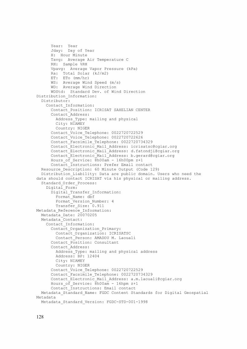
128
Year: Year Jday: Day of Year H: Hour Minute Tavg: Average Air Temperature C RH: Sample %RH Vpavg: Average Vapor Pressure (kPa) Ra: Total Solar (kJ/m2) ET: ETo (mm/hr) WS: Average Wind Speed (m/s) WD: Average Wind Direction WDStd: Standard Dev. of Wind Direction Distribution_Information: Distributor: Contact_Information: Contact_Position: ICRISAT SAHELIAN CENTER Contact_Address: Address_Type: mailing and physical City: NIAMEY Country: NIGER Contact_Voice_Telephone: 0022720722529 Contact_Voice_Telephone: 0022720722626 Contact_Facsimile_Telephone: 0022720734329 Contact_Electronic_Mail_Address: [email protected] Contact_Electronic_Mail_Address: [email protected] Contact_Electronic_Mail_Address: [email protected] Hours_of_Service: 8h00am - 16h00pm z+1 Contact_Instructions: Prefer Email contact Resource_Description: 60 Minute Output (Code 129) Distribution_Liability: Data are public domain. Users who need the data should contact ICRISAT via his physical or mailing address. Standard_Order_Process: Digital_Form: Digital_Transfer_Information: Format_Name: dbf Format_Version_Number: 4 Transfer_Size: 0.911 Metadata_Reference_Information: Metadata_Date: 20070205 Metadata_Contact: Contact_Information: Contact_Organization_Primary: Contact_Organization: ICRISATSC Contact_Person: AMADOU M. Laouali Contact_Position: Consultant Contact_Address: Address_Type: mailing and physical address Address: BP: 12404 City: NIAMEY Country: NIGER Contact_Voice_Telephone: 0022720722529 Contact_Facsimile_Telephone: 0022720734329 Contact_Electronic_Mail_Address: [email protected] Hours_of_Service: 8h00am - 16hpm z+1 Contact_Instructions: Email contact Metadata_Standard_Name: FGDC Content Standards for Digital Geospatial Metadata Metadata_Standard_Version: FGDC-STD-001-1998

129
Metadata_Time_Convention: local time Metadata_Access_Constraints: Restricted Metadata_Security_Information: Metadata_Security_Classification: Unclassified Metadata_Extensions: Online_Linkage: http://www.esri.com/metadata/esriprof80.html Profile_Name: ESRI Metadata Profile

130
Data Set Number 195: Katanga AWS weather data 2001 Daily Output (Fakara, Niger) Identification_Information: Citation: Citation_Information: Originator: ICRISAT Publication_Date: 20020101 Title: Katanga AWS weather data 2001 Daily Output (Fakara, Niger) Edition: 1 Geospatial_Data_Presentation_Form: tabular digital data Online_Linkage: \\Isc-svr01\GeoNetwork\fakaradatabase\d.fatondji\2001\katanga aws weather data 2001 daily output\Katanga AWS weather data 2001 Daily Output.dbf Description: Abstract: The Kantaga weather station was installed for the first in 2000 when ICRISAT activities started in the Fakara in the form of demonstration of the strategic placement of mineral fertilizer - microdose. The station collect the following information: 1. Total rainfall (mm) 2. Rainfall intensity (mm/s) to be checked 3. Total solar radiation (mj/m2) 4. Air temperature (mini, maxi, average) 5. Air relative humidity (%) 6. Wind direction 7. Wind speed Purpose: Make available for scientific purpose, relevant weather data to scientist. Time_Period_of_Content: Time_Period_Information: Range_of_Dates/Times: Beginning_Date: 20010101 Ending_Date: 20011231 Currentness_Reference: ground condition Status: Progress: Complete Maintenance_and_Update_Frequency: As needed Spatial_Domain: Bounding_Coordinates: West_Bounding_Coordinate: 2.583333 East_Bounding_Coordinate: 2.866667 North_Bounding_Coordinate: 13.583333 South_Bounding_Coordinate: 13.333333 Data_Set_G-Polygon: Data_Set_G-Polygon_Outer_G-Ring: G-Ring_Point: G-Ring_Latitude: 13.53656 G-Ring_Longitude: 2.81533 Keywords: Theme: Theme_Keyword_Thesaurus: None Theme_Keyword: Weather Theme_Keyword: air temperature Theme_Keyword: climate Theme_Keyword: rain

131
Place: Place_Keyword_Thesaurus: None Place_Keyword: West Africa Place_Keyword: Niger Place_Keyword: Fakara Place_Keyword: Katanga Stratum: Stratum_Keyword_Thesaurus: none Stratum_Keyword: 2001 Access_Constraints: Public domain Use_Constraints: None Point_of_Contact: Contact_Information: Contact_Organization_Primary: Contact_Organization: ICRISAT Contact_Person: DOUGBEDJI FATONDJI Contact_Position: Senior Scientific Officer Contact_Address: Address_Type: mailing and physical Address: BP: 12404 Niamey City: NIAMEY Country: NIGER Contact_Voice_Telephone: 00227 20722529 Contact_Facsimile_Telephone: 0022720734329 Contact_Electronic_Mail_Address: [email protected] Contact_Electronic_Mail_Address: [email protected] Hours_of_Service: Monday to Friday, From 8H am to 16H pm z+1 Contact_Instructions: Prefer contact by email address Data_Set_Credit: Bruno Gerard ICRISAT Sahelian Center, PO BOx 12404 Native_Data_Set_Environment: Microsoft Excel; dBASE; Text; ESRI ArcCatalog 9.0.0.535 Data_Quality_Information: Attribute_Accuracy: Attribute_Accuracy_Report: Automatic data collection with Campbell Scientific weather station Quantitative_Attribute_Accuracy_Assessment: Attribute_Accuracy_Explanation: The data are collected with sensors that are mounted on the station. They generate signals that are converted into numbers through a Campbell Scientifc data logger Lineage: Process_Step: Process_Description: Every three months, Data are loaded from weather station to computer which has Datalogger program. Data are stored in tables such as listed in Dataset Overview. The data files are compatible to both txt and excel extentions Spatial_Data_Organization_Information: Direct_Spatial_Reference_Method: Point Point_and_Vector_Object_Information: SDTS_Terms_Description: SDTS_Point_and_Vector_Object_Type: Point Entity_and_Attribute_Information: Detailed_Description: Entity_Type: Entity_Type_Label: Katanga AWS weather data 2001 Daily Output Attribute: Attribute_Label: OID Attribute_Definition: Internal feature number.

132
Attribute_Definition_Source: ESRI Attribute_Domain_Values: Attribute: Attribute_Label: Code Attribute_Definition: Array Id 139 Attribute_Definition_Source: DOUGBEDJI FATONDJI Attribute: Attribute_Label: Year Attribute_Definition: Year Attribute_Definition_Source: DOUGBEDJI FATONDJI Attribute: Attribute_Label: Jday Attribute_Definition: Day of Year Attribute_Definition_Source: DOUGBEDJI FATONDJI Attribute: Attribute_Label: H Attribute_Definition: Hour Minute Attribute_Definition_Source: DOUGBEDJI FATONDJI Attribute: Attribute_Label: Tavg Attribute_Definition: Average Air Temperature C Attribute_Definition_Source: DOUGBEDJI FATONDJI Attribute: Attribute_Label: TMAX Attribute_Definition: Max Air Temperature C Attribute_Definition_Source: DOUGBEDJI FATONDJI Attribute: Attribute_Label: TMIN Attribute_Definition: Min Air Temperature C Attribute_Definition_Source: DOUGBEDJI FATONDJI Attribute: Attribute_Label: VPAVG Attribute_Definition: Average Vapor Pressure (kPa) Attribute_Definition_Source: DOUGBEDJI FATONDJI Attribute: Attribute_Label: VPMAX Attribute_Definition: Max Vapor Pressure (kPa) Attribute_Definition_Source: DOUGBEDJI FATONDJI Attribute: Attribute_Label: VPMIN Attribute_Definition: Min Vapor Pressure (kPa) Attribute_Definition_Source: DOUGBEDJI FATONDJI Attribute: Attribute_Label: RA Attribute_Definition: Total Solar (MJ/m2) Attribute_Definition_Source: DOUGBEDJI FATONDJI Attribute: Attribute_Label: ET Attribute_Definition: ETo - (mm/day) Attribute_Definition_Source: DOUGBEDJI FATONDJI Attribute: Attribute_Label: WSMAX Attribute_Definition: Max Wind Speed m/s Attribute_Definition_Source: DOUGBEDJI FATONDJI Attribute: Attribute_Label: WSAVG Attribute_Definition: Average Wind Speed m/s

133
Attribute_Definition_Source: DOUGBEDJI FATONDJI Attribute: Attribute_Label: RAIN Attribute_Definition: Total Rain Fall mm Attribute_Definition_Source: DOUGBEDJI FATONDJI Attribute: Attribute_Label: MAXBAT Attribute_Definition: Max Battery Voltage Attribute_Definition_Source: DOUGBEDJI FATONDJI Attribute: Attribute_Label: MINBAT Attribute_Definition: Min Battery Voltage Attribute_Definition_Source: DOUGBEDJI FATONDJI Attribute: Attribute_Label: MAXCRT Attribute_Definition: Max CR10 Temp C Attribute_Definition_Source: DOUGBEDJI FATONDJI Attribute: Attribute_Label: MINCRT Attribute_Definition: Min CR10 Temp C Attribute_Definition_Source: DOUGBEDJI FATONDJI Attribute: Attribute_Label: PROGSIGN Attribute_Definition: CR10 Program Signature Attribute_Definition_Source: DOUGBEDJI FATONDJI Overview_Description: Entity_and_Attribute_Overview: The dataset is known and identified by: ''1440 Minute Output (Code 139)'' and contains the following attributes: Code: Array Id 139 Year: Year Jday: Day of Year H: Hour Minute Tavg: Average Air Temperature C Tmax: Max Air Temperature C Tmin: Min Air Temperature C Vpavg: Average Vapor Pressure (kPa) Vpmax: Max Vapor Pressure (kPa) Vpmin: Min Vapor Pressure (kPa) Ra: Total Solar (MJ/m2) ET: ETo - (mm/day) Wsmax: Max Wind Speed m/s Wsavg: Average Wind Speed m/s Rain: Total Rain Fall ? mm MaxBat: Max Battery Voltage MinBat: Min Battery Voltage MaxCRT: Max CR10 Temp C MinCRT: Min CR10 Temp C Prosign: CR10 Program Signature Distribution_Information: Distributor: Contact_Information: Contact_Position: ICRISAT SAHELIAN CENTER Contact_Address: Address_Type: mailing and physical City: NIAMEY Country: NIGER

134
Contact_Voice_Telephone: 0022720722529 Contact_Voice_Telephone: 0022720722626 Contact_Facsimile_Telephone: 0022720734329 Contact_Electronic_Mail_Address: [email protected] Contact_Electronic_Mail_Address: [email protected] Contact_Electronic_Mail_Address: [email protected] Hours_of_Service: 8h00am - 16h00pm z+1 Contact_Instructions: Prefer Email contact Resource_Description: 1440 Minute Output (Code 139) Distribution_Liability: Data are public domain. However, Users who need the data should contact ICRISAT via his physical or mailing address. Standard_Order_Process: Digital_Form: Digital_Transfer_Information: Format_Name: dbf Format_Version_Number: 4 Transfer_Size: 0.048 Metadata_Reference_Information: Metadata_Date: 20070205 Metadata_Contact: Contact_Information: Contact_Organization_Primary: Contact_Organization: ICRISATSC Contact_Person: AMADOU M. Laouali Contact_Position: Consultant Contact_Address: Address_Type: mailing and physical address Address: BP: 12404 City: NIAMEY Country: NIGER Contact_Voice_Telephone: 0022720722529 Contact_Facsimile_Telephone: 0022720734329 Contact_Electronic_Mail_Address: [email protected] Hours_of_Service: 8h00am - 16hpm z+1 Contact_Instructions: Email contact Metadata_Standard_Name: FGDC Content Standards for Digital Geospatial Metadata Metadata_Standard_Version: FGDC-STD-001-1998 Metadata_Time_Convention: local time Metadata_Access_Constraints: Restricted Metadata_Security_Information: Metadata_Security_Classification: Unclassified Metadata_Extensions: Online_Linkage: http://www.esri.com/metadata/esriprof80.html Profile_Name: ESRI Metadata Profile

135
Data Set Number 196: Katanga AWS weather data 2001 hourly Output (Fakara, Niger) Identification_Information: Citation: Citation_Information: Originator: ICRISAT Publication_Date: 20020101 Title: Katanga AWS weather data 2001 Hourly Output (Fakara, Niger) Edition: 1 Geospatial_Data_Presentation_Form: tabular digital data Online_Linkage: \\Isc-svr01\GeoNetwork\fakaradatabase\d.fatondji\2001\katanga aws weather data 2001 hourly output\Katanga AWS weather data 2001 Hourly Output.dbf Description: Abstract: The Kantaga weather station was installed for the first in 2000 when ICRISAT activities started in the Fakara in the form of demonstration of the strategic placement of mineral fertilizer - microdose. The station collect the following information: 1. Total rainfall (mm) 2. Rainfall intensity (mm/s) to be checked 3. Total solar radiation (mj/m2) 4. Air temperature (mini, maxi, average) 5. Air relative humidity (%) 6. Wind direction 7. Wind speed Purpose: Make available for scientific purpose, relevant weather data to scientist. Time_Period_of_Content: Time_Period_Information: Range_of_Dates/Times: Beginning_Date: 20010101 Ending_Date: 20011231 Currentness_Reference: ground condition Status: Progress: Complete Maintenance_and_Update_Frequency: As needed Spatial_Domain: Bounding_Coordinates: West_Bounding_Coordinate: 2.583333 East_Bounding_Coordinate: 2.866667 North_Bounding_Coordinate: 13.583333 South_Bounding_Coordinate: 13.333333 Data_Set_G-Polygon: Data_Set_G-Polygon_Outer_G-Ring: G-Ring_Point: G-Ring_Latitude: 13.53656 G-Ring_Longitude: 2.81533 Keywords: Theme: Theme_Keyword_Thesaurus: None Theme_Keyword: Weather Theme_Keyword: air temperature

136
Theme_Keyword: climate Theme_Keyword: rain Place: Place_Keyword_Thesaurus: None Place_Keyword: West Africa Place_Keyword: Niger Place_Keyword: Fakara Place_Keyword: Katanga Temporal: Temporal_Keyword_Thesaurus: none Temporal_Keyword: 2001 Access_Constraints: Public domain Use_Constraints: None Point_of_Contact: Contact_Information: Contact_Organization_Primary: Contact_Organization: ICRISAT Contact_Person: DOUGBEDJI FATONDJI Contact_Position: Senior Scientific Officer Contact_Address: Address_Type: mailing and physical Address: BP: 12404 Niamey City: NIAMEY Country: NIGER Contact_Voice_Telephone: 00227 20722529 Contact_Facsimile_Telephone: 0022720734329 Contact_Electronic_Mail_Address: [email protected] Contact_Electronic_Mail_Address: [email protected] Hours_of_Service: Monday to Friday, From 8H am to 16H pm z+1 Contact_Instructions: Prefer contact by email address Data_Set_Credit: Bruno Gerard ICRISAT Sahelian Center, PO BOx 12404 Native_Data_Set_Environment: Microsoft Excel; dBASE; Text; ESRI ArcCatalog 9.0.0.535 Data_Quality_Information: Attribute_Accuracy: Attribute_Accuracy_Report: Automatic data collection with Campbell Scientific weather station Quantitative_Attribute_Accuracy_Assessment: Attribute_Accuracy_Explanation: The data are collected with sensors that are mounted on the station. They generate signals that are converted into numbers through a Campbell Scientifc data logger Lineage: Process_Step: Process_Description: Every three months, Data are loaded from weather station to computer which has Datalogger program. Data are stored in tables such as listed in Dataset Overview. The data files are compatible to both txt and excel extentions Spatial_Data_Organization_Information: Direct_Spatial_Reference_Method: Point Point_and_Vector_Object_Information: SDTS_Terms_Description: SDTS_Point_and_Vector_Object_Type: Point Entity_and_Attribute_Information: Detailed_Description: Entity_Type: Entity_Type_Label: Katanga AWS weather data 2001 Hourly Output Attribute:

137
Attribute_Label: OID Attribute_Definition: Internal feature number. Attribute_Definition_Source: ESRI Attribute_Domain_Values: Attribute: Attribute_Label: DATACODE Attribute_Definition: Array Id 129 Attribute_Definition_Source: DOUGBEDJI FATONDJI Attribute: Attribute_Label: YEAR Attribute_Definition: Year Attribute_Definition_Source: DOUGBEDJI FATONDJI Attribute: Attribute_Label: JDAY Attribute_Definition: Day of Year Attribute_Definition_Source: DOUGBEDJI FATONDJI Attribute: Attribute_Label: H Attribute_Definition: Hour Minute Attribute_Definition_Source: DOUGBEDJI FATONDJI Attribute: Attribute_Label: TAVG Attribute_Definition: Average Air Temperature C Attribute_Definition_Source: DOUGBEDJI FATONDJI Attribute: Attribute_Label: RH Attribute_Definition: Sample %RH Attribute_Definition_Source: DOUGBEDJI FATONDJI Attribute: Attribute_Label: VPAVG Attribute_Definition: Average Vapor Pressure (kPa) Attribute_Definition_Source: DOUGBEDJI FATONDJI Attribute: Attribute_Label: RA Attribute_Definition: Total Solar (kJ/m2) Attribute_Definition_Source: DOUGBEDJI FATONDJI Attribute: Attribute_Label: ET Attribute_Definition: ETo (mm/hr) Attribute_Definition_Source: DOUGBEDJI FATONDJI Attribute: Attribute_Label: WS Attribute_Definition: Average Wind Speed (m/s) Attribute_Definition_Source: DOUGBEDJI FATONDJI Attribute: Attribute_Label: WD Attribute_Definition: Average Wind Direction Attribute_Definition_Source: DOUGBEDJI FATONDJI Attribute: Attribute_Label: WDSTD Attribute_Definition: Standard Dev. of Wind Direction Attribute_Definition_Source: DOUGBEDJI FATONDJI Overview_Description: Entity_and_Attribute_Overview: The dataset is known and identified by ''60 Minute Output (Code 129)'' and contains the following attributes: DataCode: Array Id 129

138
Year: Year Jday: Day of Year

139
Data Set Number 197: Katanga AWS weather data 2001 Rainfall Identification_Information: Citation: Citation_Information: Originator: ICRISAT Publication_Date: 20020101 Title: Katanga AWS weather data 2001 Rainfall Edition: 1 Geospatial_Data_Presentation_Form: tabular digital data Online_Linkage: \\Isc-svr01\GeoNetwork\fakaradatabase\d.fatondji\2001\katanga aws weather data 2001 rainfall\Katanga AWS weather data 2001 Rainfall.dbf Description: Abstract: The Kantaga weather station was installed for the first in 2000 when ICRISAT activities started in the Fakara in the form of demonstration of the strategic placement of mineral fertilizer - microdose. The station collect the following information: 1. Total rainfall (mm) 2. Rainfall intensity (mm/s) to be checked 3. Total solar radiation (mj/m2) 4. Air temperature (mini, maxi, average) 5. Air relative humidity (%) 6. Wind direction 7. Wind speed Purpose: Make available for scientific purpose, relevant weather data to scientist. Time_Period_of_Content: Time_Period_Information: Range_of_Dates/Times: Beginning_Date: 20010101 Ending_Date: 20011231 Currentness_Reference: ground condition Status: Progress: In work Maintenance_and_Update_Frequency: Every three months Spatial_Domain: Bounding_Coordinates: West_Bounding_Coordinate: 2.583333 East_Bounding_Coordinate: 2.866667 North_Bounding_Coordinate: 13.583333 South_Bounding_Coordinate: 13.333333 Data_Set_G-Polygon: Data_Set_G-Polygon_Outer_G-Ring: G-Ring_Point: G-Ring_Latitude: 13.53656 G-Ring_Longitude: 2.81533 Keywords: Theme: Theme_Keyword_Thesaurus: None Theme_Keyword: Weather Theme_Keyword: air temperature Theme_Keyword: climate

140
Theme_Keyword: rain Place: Place_Keyword_Thesaurus: None Place_Keyword: West Africa Place_Keyword: Niger Place_Keyword: Fakara Place_Keyword: Katanga Temporal: Temporal_Keyword_Thesaurus: none Temporal_Keyword: 2001 Access_Constraints: Public domain Use_Constraints: None Point_of_Contact: Contact_Information: Contact_Organization_Primary: Contact_Organization: ICRISAT Contact_Person: DOUGBEDJI FATONDJI Contact_Position: Senior Scientific Officer Contact_Address: Address_Type: mailing and physical Address: City: NIAMEY Country: NIGER Contact_Voice_Telephone: 00227 20722529 Contact_Facsimile_Telephone: 0022720734329 Contact_Electronic_Mail_Address: [email protected] Contact_Electronic_Mail_Address: [email protected] Hours_of_Service: Contact_Instructions: Data_Set_Credit: Bruno Gerard ICRISAT Sahelian Center, PO BOx 12404 Native_Data_Set_Environment: Microsoft Windows XP Version 5.1 (Build 2600) ; ESRI ArcCatalog 9.0.0.535 Data_Quality_Information: Attribute_Accuracy: Attribute_Accuracy_Report: Automatic data collection with Campbell Scientific weather station Quantitative_Attribute_Accuracy_Assessment: Attribute_Accuracy_Explanation: The data are collected with sensors that are mounted on the station. They generate signals that are converted into numbers through a Campbell Scientifc data logger Lineage: Process_Step: Process_Description: Every three months, Data are loaded from weather station to computer which has Datalogger program. Data are stored in tables such as listed in Dataset Overview. The data files are compatible to both txt and excel extentions Spatial_Data_Organization_Information: Direct_Spatial_Reference_Method: Point Point_and_Vector_Object_Information: SDTS_Terms_Description: SDTS_Point_and_Vector_Object_Type: Point Entity_and_Attribute_Information: Detailed_Description: Entity_Type: Entity_Type_Label: Katanga AWS weather data 2001 Rainfall Attribute: Attribute_Label: OID

141
Attribute_Definition: Internal feature number. Attribute_Definition_Source: ESRI Attribute_Domain_Values: Unrepresentable_Domain: Sequential unique whole numbers that are automatically generated. Attribute: Attribute_Label: DATACODE Attribute_Definition: Array Id 109 Attribute_Definition_Source: DOUGBEDJI FATONDJI Attribute: Attribute_Label: YEAR Attribute_Definition: Year Attribute_Definition_Source: DOUGBEDJI FATONDJI Attribute: Attribute_Label: JDAY Attribute_Definition: Day of Year Attribute_Definition_Source: DOUGBEDJI FATONDJI Attribute: Attribute_Label: TIME Attribute_Definition: Hour Minute Attribute_Definition_Source: DOUGBEDJI FATONDJI Attribute: Attribute_Label: RAININT Attribute_Definition: Total Rainfall Last Minute ? mm Attribute_Definition_Source: DOUGBEDJI FATONDJI Overview_Description: Entity_and_Attribute_Overview: The dataset is Known and identified by : ''1 Minute Rainfall Intensity Output (Code 109)'' and contains the following attributes: DataCode: Array Id 109 Year: Year Jday: Day of Year Time: Hour Minute Rainlnt: Total Rainfall Last Minute ? mm Distribution_Information: Distributor: Contact_Information: Contact_Position: ICRISAT SAHELIAN CENTER Contact_Address: Address_Type: mailing and physical City: NIAMEY Country: NIGER Contact_Voice_Telephone: 0022720722529 Contact_Voice_Telephone: 0022720722626 Contact_Facsimile_Telephone: 0022720734329 Contact_Electronic_Mail_Address: [email protected] Contact_Electronic_Mail_Address: [email protected] Contact_Electronic_Mail_Address: [email protected] Hours_of_Service: 8h00am - 16h00pm z+1 Contact_Instructions: Prefer Email contact Resource_Description: 1 Minute Rainfall Intensity Output (Code 109) Distribution_Liability: Data are public domain. However Users who need the data should contact ICRISAT via his physical or mailing address. Standard_Order_Process: Digital_Form: Digital_Transfer_Information:

142
Transfer_Size: 0.048 Metadata_Reference_Information: Metadata_Date: 20070205 Metadata_Contact: Contact_Information: Contact_Organization_Primary: Contact_Organization: ICRISATSC Contact_Person: AMADOU M. Laouali Contact_Position: Consultant Contact_Address: Address_Type: mailing and physical address Address: BP: 12404 City: NIAMEY State_or_Province: REQUIRED: The state or province of the address. Postal_Code: REQUIRED: The ZIP or other postal code of the address. Country: NIGER Contact_Voice_Telephone: 0022720722529 Contact_Facsimile_Telephone: 0022720734329 Contact_Electronic_Mail_Address: [email protected] Hours_of_Service: 8h00am - 16hpm z+1 Contact_Instructions: Email contact Metadata_Standard_Name: FGDC Content Standards for Digital Geospatial Metadata Metadata_Standard_Version: FGDC-STD-001-1998 Metadata_Time_Convention: local time Metadata_Access_Constraints: Restricted Metadata_Security_Information: Metadata_Security_Classification: Unclassified Metadata_Extensions: Online_Linkage: http://www.esri.com/metadata/esriprof80.html Profile_Name: ESRI Metadata Profile

143
Data Set Number 198: AWS weather data 2001 Wind Speed (Fakara, Niger) Identification_Information: Citation: Citation_Information: Originator: ICRISAT Publication_Date: 20020101 Title: Katanga AWS weather data 2001 Wind Speed (Fakara, Niger) Edition: 1 Geospatial_Data_Presentation_Form: tabular digital data Online_Linkage: \\Isc-svr01\GeoNetwork\fakaradatabase\d.fatondji\2001\katanga aws weather data 2001 wind speed\Katanga AWS weather data 2001 Wind Speed.dbf Description: Abstract: The Kantaga weather station was installed for the first in 2000 when ICRISAT activities started in the Fakara in the form of demonstration of the strategic placement of mineral fertilizer - microdose. The station collect the following information: 1. Total rainfall (mm) 2. Rainfall intensity (mm/s) to be checked 3. Total solar radiation (mj/m2) 4. Air temperature (mini, maxi, average) 5. Air relative humidity (%) 6. Wind direction 7. Wind speed Purpose: Make available for scientific purpose, relevant weather data to scientist. Time_Period_of_Content: Time_Period_Information: Range_of_Dates/Times: Beginning_Date: 20010101 Ending_Date: 20011231 Currentness_Reference: ground condition Status: Progress: In work Maintenance_and_Update_Frequency: Every three months Spatial_Domain: Bounding_Coordinates: West_Bounding_Coordinate: 2.583333 East_Bounding_Coordinate: 2.866667 North_Bounding_Coordinate: 13.583333 South_Bounding_Coordinate: 13.333333 Data_Set_G-Polygon: Data_Set_G-Polygon_Outer_G-Ring: G-Ring_Point: G-Ring_Latitude: 13.53656 G-Ring_Longitude: 2.81533 Keywords: Theme: Theme_Keyword_Thesaurus: None Theme_Keyword: Weather Theme_Keyword: air temperature Theme_Keyword: climate Theme_Keyword: rain
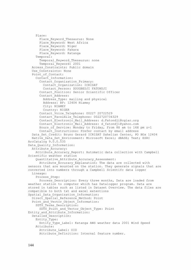
144
Place: Place_Keyword_Thesaurus: None Place_Keyword: West Africa Place_Keyword: Niger Place_Keyword: Fakara Place_Keyword: Katanga Temporal: Temporal_Keyword_Thesaurus: none Temporal_Keyword: 2001 Access_Constraints: Public domain Use_Constraints: None Point_of_Contact: Contact_Information: Contact_Organization_Primary: Contact_Organization: ICRISAT Contact_Person: DOUGBEDJI FATONDJI Contact_Position: Senior Scientific Officer Contact_Address: Address_Type: mailing and physical Address: BP: 12404 Niamey City: NIAMEY Country: NIGER Contact_Voice_Telephone: 00227 20722529 Contact_Facsimile_Telephone: 0022720734329 Contact_Electronic_Mail_Address: [email protected] Contact_Electronic_Mail_Address: [email protected] Hours_of_Service: Monday to Friday, From 8H am to 16H pm z+1 Contact_Instructions: Prefer contact by email address Data_Set_Credit: Bruno Gerard ICRISAT Sahelian Center, PO BOx 12404 Native_Data_Set_Environment: Microsoft Excel; dBASE; Text; ESRI ArcCatalog 9.0.0.535 Data_Quality_Information: Attribute_Accuracy: Attribute_Accuracy_Report: Automatic data collection with Campbell Scientific weather station Quantitative_Attribute_Accuracy_Assessment: Attribute_Accuracy_Explanation: The data are collected with sensors that are mounted on the station. They generate signals that are converted into numbers through a Campbell Scientifc data logger Lineage: Process_Step: Process_Description: Every three months, Data are loaded from weather station to computer which has Datalogger program. Data are stored in tables such as listed in Dataset Overview. The data files are compatible to both txt and excel extentions Spatial_Data_Organization_Information: Direct_Spatial_Reference_Method: Point Point_and_Vector_Object_Information: SDTS_Terms_Description: SDTS_Point_and_Vector_Object_Type: Point Entity_and_Attribute_Information: Detailed_Description: Entity_Type: Entity_Type_Label: Katanga AWS weather data 2001 Wind Speed Attribute: Attribute_Label: OID Attribute_Definition: Internal feature number.

145
Attribute_Definition_Source: ESRI Attribute_Domain_Values: Attribute: Attribute_Label: DATACODE Attribute_Definition: Array Id 119 Attribute_Definition_Source: DOUGBEDJI FATONDJI Attribute: Attribute_Label: YEAR Attribute_Definition: Year Attribute_Definition_Source: DOUGBEDJI FATONDJI Attribute: Attribute_Label: JDAY Attribute_Definition: Day of Year Attribute_Definition_Source: DOUGBEDJI FATONDJI Attribute: Attribute_Label: TIME Attribute_Definition: Hour Minute Attribute_Definition_Source: DOUGBEDJI FATONDJI Attribute: Attribute_Label: WINDSPEED Attribute_Definition: Average Wind Speed - meters/second Attribute_Definition_Source: DOUGBEDJI FATONDJI Overview_Description: Entity_and_Attribute_Overview: The dataset is known and identified by : ''1 Minute Average Wind >= 5 m/s Output (Code 119)'' and contains the following attributes: DataCode: Array Id 119 Year: Year Jday: Day of Year H: Hour Minute WindSpeed: Average Wind Speed - meters/second Distribution_Information: Distributor: Contact_Information: Contact_Position: ICRISAT SAHELIAN CENTER Contact_Address: Address_Type: mailing and physical City: NIAMEY Country: NIGER Contact_Voice_Telephone: 0022720722529 Contact_Voice_Telephone: 0022720722626 Contact_Facsimile_Telephone: 0022720734329 Contact_Electronic_Mail_Address: [email protected] Contact_Electronic_Mail_Address: [email protected] Contact_Electronic_Mail_Address: [email protected] Hours_of_Service: 8h00am - 16h00pm z+1 Contact_Instructions: Prefer Email contact Resource_Description: 1 Minute Average Wind >= 5 m/s Output (Code 119) Distribution_Liability: Data are public domain. However Users who need the data should contact ICRISAT via his physical or mailing address. Standard_Order_Process: Digital_Form: Digital_Transfer_Information: Format_Name: dbf Format_Version_Number: 4

146
Transfer_Size: 0.031 Metadata_Reference_Information: Metadata_Date: 20070205 Metadata_Contact: Contact_Information: Contact_Organization_Primary: Contact_Organization: ICRISATSC Contact_Person: AMADOU M. Laouali Contact_Position: Consultant Contact_Address: Address_Type: mailing and physical address Address: BP: 12404 City: NIAMEY Country: NIGER Contact_Voice_Telephone: 0022720722529 Contact_Facsimile_Telephone: 0022720734329 Contact_Electronic_Mail_Address: [email protected] Hours_of_Service: 8h00am - 16hpm z+1 Contact_Instructions: Email contact Metadata_Standard_Name: FGDC Content Standards for Digital Geospatial Metadata Metadata_Standard_Version: FGDC-STD-001-1998 Metadata_Time_Convention: local time Metadata_Access_Constraints: Restricted Metadata_Security_Information: Metadata_Security_Classification: Unclassified Metadata_Extensions: Online_Linkage: http://www.esri.com/metadata/esriprof80.html Profile_Name: ESRI Metadata Profile

147
Data Set Number 134: Katanga AWS weather data 2002 Daily Output (Fakara, Niger) Similar to 2001 metadata
Data Set Number 135: Katanga AWS weather data 2002 hourly Output (Fakara, Niger) Similar to 2001 metadata
Data Set Number 136: Katanga AWS weather data 2002 Rainfall Similar to 2001 metadata
Data Set Number 137: AWS weather data 2002 Wind Speed (Fakara, Niger) Similar to 2001 metadata
Data Set Number 138: Katanga AWS weather data 2003 Daily Output (Fakara, Niger) Similar to 2001 metadata
Data Set Number 139: Katanga AWS weather data 2003 hourly Output (Fakara, Niger) Similar to 2001 metadata
Data Set Number 140: Katanga AWS weather data 2003 Rainfall Similar to 2001 metadata
Data Set Number 141: AWS weather data 2003 Wind Speed (Fakara, Niger) Similar to 2001 metadata
Data Set Number 142: Katanga AWS weather data 2004 Daily Output (Fakara, Niger)

148
Similar to 2001 metadata
Data Set Number 143: Katanga AWS weather data 2004 hourly Output (Fakara, Niger) Similar to 2001 metadata
Data Set Number 144: Katanga AWS weather data 2004 Rainfall Similar to 2001 metadata
Data Set Number 145: AWS weather data 2004 Wind Speed (Fakara, Niger) Similar to 2001 metadata
Data Set Number 146: Katanga AWS weather data 2005 Daily Output (Fakara, Niger) Similar to 2001 metadata
Data Set Number 147: Katanga AWS weather data 2005 hourly Output (Fakara, Niger) Similar to 2001 metadata
Data Set Number 148: Katanga AWS weather data 2005 Rainfall Similar to 2001 metadata
Data Set Number 149: AWS weather data 2005 Wind Speed (Fakara, Niger) Similar to 2001 metadata

149
Data Set Number 175: Land use in the Fakara in the year 1950 Identification_Information: Citation: Citation_Information: Originator: ILRI Publication_Date: Unpublished Material Title: Land use in the Fakara in the year 1950 Geospatial_Data_Presentation_Form: vector digital data Description: Abstract: This GIS layer, given land use in 1950 is derived from 1:50000? historical aerial photographs to contribute to the spatial budgeting and modelling work accomplished by ILRI from 1994. Since 2000, land use has been updated and used by ICRISAT under a range of special research project (DGCD Decision Support, DMP, Agrhymet Climate Change) Purpose: Production of continuous coverage from discontinuous aerial coverage to produce clear readable maps of different spatial scales necessary for unit-referenced data collection to act as a base map for multitemporal overlaying of historical (1950, 1965, 1975) and recent (1994, 1995, 1996, 2002, 2004) land use cover Time_Period_of_Content: Time_Period_Information: Single_Date/Time: Calendar_Date: 1950 Currentness_Reference: ground condition Status: Progress: Complete Maintenance_and_Update_Frequency: None planned Spatial_Domain: Bounding_Coordinates: West_Bounding_Coordinate: 2.567137 East_Bounding_Coordinate: 2.883726 North_Bounding_Coordinate: 13.589355 South_Bounding_Coordinate: 13.332611 Keywords: Theme: Theme_Keyword_Thesaurus: none Theme_Keyword: Land use Place: Place_Keyword_Thesaurus: none Place_Keyword: Fakara Place_Keyword: Niger Place_Keyword: West Africa Place_Keyword: Sahel Temporal: Temporal_Keyword_Thesaurus: none Temporal_Keyword: 1950 Access_Constraints: Request to be made to ILRI Use_Constraints: Cite when used Data_Set_Credit: Pierre Hiernaux and Matthieu Turner Security_Information: Security_Classification: Restricted Security_Handling_Description: Can only be used with specific authorization of ILRI

150
Native_Data_Set_Environment: Microsoft Windows XP Version 5.1 (Build 2600) Service Pack 2; ESRI ArcCatalog 9.2.0.1324 Cross_Reference: Citation_Information: Geospatial_Data_Presentation_Form: document Data_Quality_Information: Lineage: Process_Step: Process_Description: 1) Photos interpretations was performed stereoscopically by Pierre Hiernaux. To facilitate the completion of the work, alternating photos were used in the interpretation, rather than using the central portion of each photo, usually done to reduce parallax-related distortion. 2) Ground-control Points In order to geometrically correct individual map files prior to merging, GPS readings were taken in at least ten locations within the area covered by each aerial photo (exception being photo 273 where ground-control points were not taken). Points were at locations identifiable on the aerial photo interpretations as well as on the ground. These points most commonly were at intersections of line features of the aerial interpretations including paths, livestock paths, field boundary hedges, wadis but also at well-defined point features such as isolated trees, and wells. Every attempt was made for points to be as evenly distributed across the photo area as possible. At least 150 GPS readings were taken at each point using a Trimble Pathfinder Basic Plus GPS Receiver. GPS data for ground-control points were collected on the following dates: 21/3/94, 24/3/94, 05/4/94, 29/7/94, 5/8/94, 16/8/94, 17/8/94, 5/9/94, 13/9/94, 27/9/94, and 28/9/94. 3) Each acetate overleaf was digitized using ATLAS-GIS for DOS software with the assistance of Moussa Mahamane and Aboubacar Maman. The land-use interpretations were digitized into separate files with the feature types of each assigned to separate layers. The land-use files were merged together using the above-mentioned corner points as common reference points. 4) In 2000 Atlas GIS layer was converted to ESRI shape file in ArcView 3 by Bruno Gerard 5) In 2006, proper projection was added to the shape file using 'define projection' in the ArcToolbox (ArcMap 9.1) Source_Used_Citation_Abbreviation: Process_Date: Unknown Spatial_Data_Organization_Information: Direct_Spatial_Reference_Method: Vector Point_and_Vector_Object_Information: SDTS_Terms_Description: SDTS_Point_and_Vector_Object_Type: G-polygon Point_and_Vector_Object_Count: 1005 Spatial_Reference_Information: Horizontal_Coordinate_System_Definition: Planar: Grid_Coordinate_System: Grid_Coordinate_System_Name: Universal Transverse Mercator Universal_Transverse_Mercator: UTM_Zone_Number: 31 Transverse_Mercator: Scale_Factor_at_Central_Meridian: 0.999600
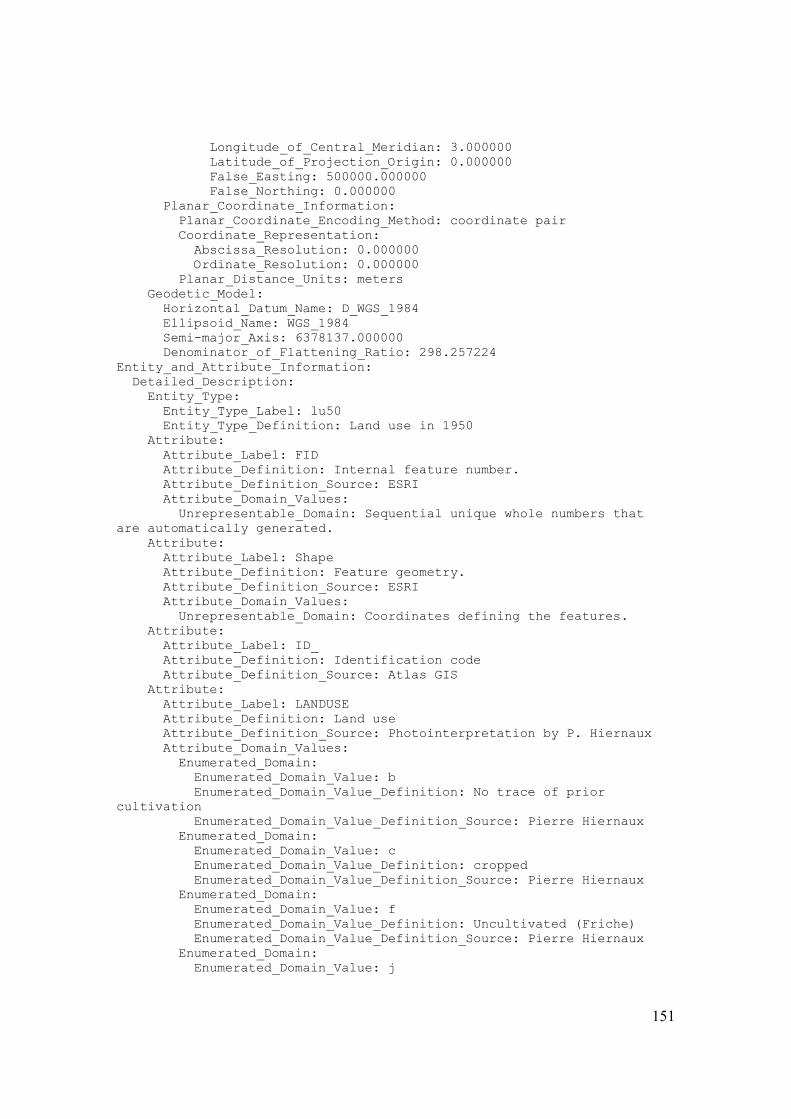
151
Longitude_of_Central_Meridian: 3.000000 Latitude_of_Projection_Origin: 0.000000 False_Easting: 500000.000000 False_Northing: 0.000000 Planar_Coordinate_Information: Planar_Coordinate_Encoding_Method: coordinate pair Coordinate_Representation: Abscissa_Resolution: 0.000000 Ordinate_Resolution: 0.000000 Planar_Distance_Units: meters Geodetic_Model: Horizontal_Datum_Name: D_WGS_1984 Ellipsoid_Name: WGS_1984 Semi-major_Axis: 6378137.000000 Denominator_of_Flattening_Ratio: 298.257224 Entity_and_Attribute_Information: Detailed_Description: Entity_Type: Entity_Type_Label: lu50 Entity_Type_Definition: Land use in 1950 Attribute: Attribute_Label: FID Attribute_Definition: Internal feature number. Attribute_Definition_Source: ESRI Attribute_Domain_Values: Unrepresentable_Domain: Sequential unique whole numbers that are automatically generated. Attribute: Attribute_Label: Shape Attribute_Definition: Feature geometry. Attribute_Definition_Source: ESRI Attribute_Domain_Values: Unrepresentable_Domain: Coordinates defining the features. Attribute: Attribute_Label: ID_ Attribute_Definition: Identification code Attribute_Definition_Source: Atlas GIS Attribute: Attribute_Label: LANDUSE Attribute_Definition: Land use Attribute_Definition_Source: Photointerpretation by P. Hiernaux Attribute_Domain_Values: Enumerated_Domain: Enumerated_Domain_Value: b Enumerated_Domain_Value_Definition: No trace of prior cultivation Enumerated_Domain_Value_Definition_Source: Pierre Hiernaux Enumerated_Domain: Enumerated_Domain_Value: c Enumerated_Domain_Value_Definition: cropped Enumerated_Domain_Value_Definition_Source: Pierre Hiernaux Enumerated_Domain: Enumerated_Domain_Value: f Enumerated_Domain_Value_Definition: Uncultivated (Friche) Enumerated_Domain_Value_Definition_Source: Pierre Hiernaux Enumerated_Domain: Enumerated_Domain_Value: j
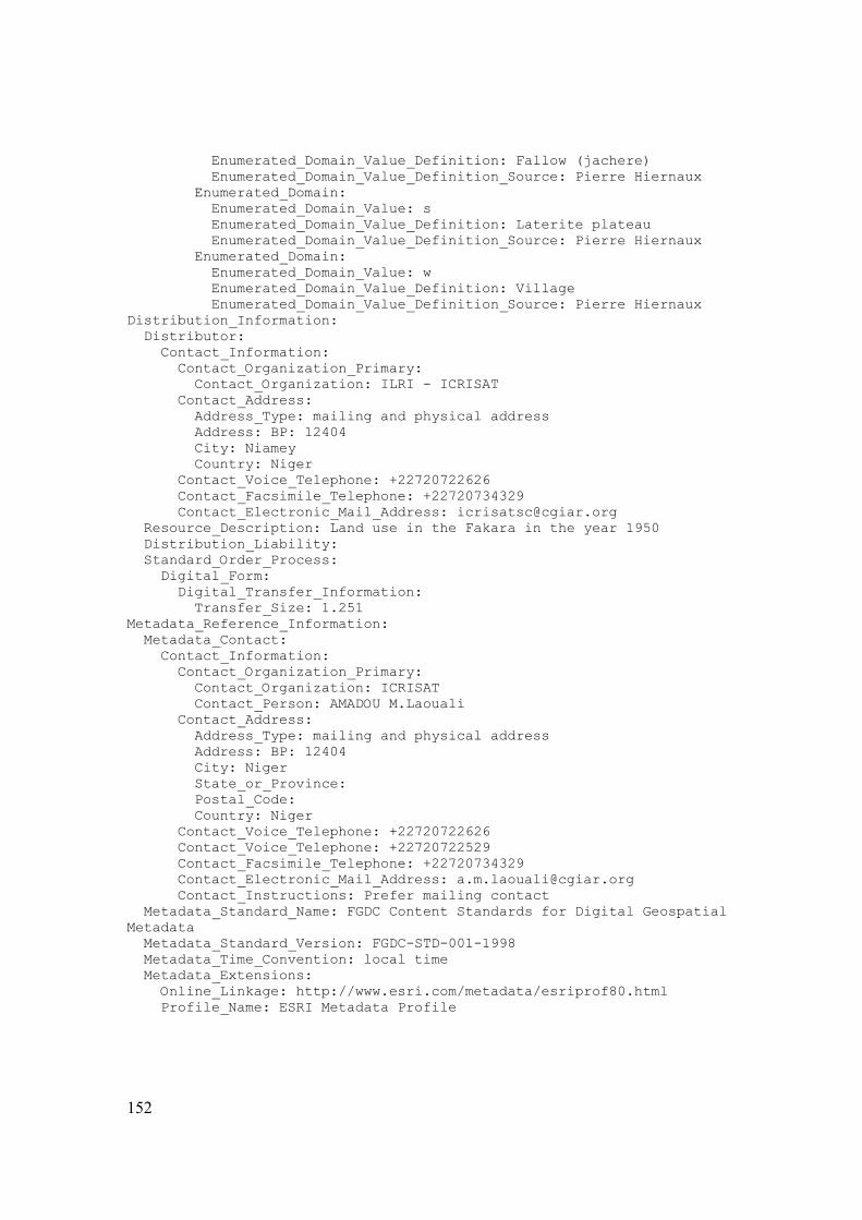
152
Enumerated_Domain_Value_Definition: Fallow (jachere) Enumerated_Domain_Value_Definition_Source: Pierre Hiernaux Enumerated_Domain: Enumerated_Domain_Value: s Enumerated_Domain_Value_Definition: Laterite plateau Enumerated_Domain_Value_Definition_Source: Pierre Hiernaux Enumerated_Domain: Enumerated_Domain_Value: w Enumerated_Domain_Value_Definition: Village Enumerated_Domain_Value_Definition_Source: Pierre Hiernaux Distribution_Information: Distributor: Contact_Information: Contact_Organization_Primary: Contact_Organization: ILRI - ICRISAT Contact_Address: Address_Type: mailing and physical address Address: BP: 12404 City: Niamey Country: Niger Contact_Voice_Telephone: +22720722626 Contact_Facsimile_Telephone: +22720734329 Contact_Electronic_Mail_Address: [email protected] Resource_Description: Land use in the Fakara in the year 1950 Distribution_Liability: Standard_Order_Process: Digital_Form: Digital_Transfer_Information: Transfer_Size: 1.251 Metadata_Reference_Information: Metadata_Contact: Contact_Information: Contact_Organization_Primary: Contact_Organization: ICRISAT Contact_Person: AMADOU M.Laouali Contact_Address: Address_Type: mailing and physical address Address: BP: 12404 City: Niger State_or_Province: Postal_Code: Country: Niger Contact_Voice_Telephone: +22720722626 Contact_Voice_Telephone: +22720722529 Contact_Facsimile_Telephone: +22720734329 Contact_Electronic_Mail_Address: [email protected] Contact_Instructions: Prefer mailing contact Metadata_Standard_Name: FGDC Content Standards for Digital Geospatial Metadata Metadata_Standard_Version: FGDC-STD-001-1998 Metadata_Time_Convention: local time Metadata_Extensions: Online_Linkage: http://www.esri.com/metadata/esriprof80.html Profile_Name: ESRI Metadata Profile

153
Data Set Number 177: Land use in the Fakara in the year 1975 Identification_Information: Citation: Citation_Information: Originator: ILRI Publication_Date: Unpublished Material Title: Land use in the Fakara in the year 1975 Geospatial_Data_Presentation_Form: vector digital data Description: Abstract: This GIS layer, given land use in 1975 is derived from 1:30000? historical aerial photographs to contribute to the spatial budgeting and modelling work accomplished by ILRI from 1994. Since 2000, land use has been updated and used by ICRISAT under a range of special research project (DGCD Decision Support, DMP, Agrhymet Climate Change) Purpose: Production of continuous coverage from discontinuous aerial coverage to produce clear readable maps of different spatial scales necessary for unit-referenced data collection to act as a base map for multitemporal overlaying of historical (1950, 1965, 1975) and recent (1994, 1995, 1996, 2002, 2004) land use cover Time_Period_of_Content: Time_Period_Information: Single_Date/Time: Calendar_Date: 1975 Currentness_Reference: ground condition Status: Progress: Complete Maintenance_and_Update_Frequency: None planned Spatial_Domain: Bounding_Coordinates: West_Bounding_Coordinate: 2.567137 East_Bounding_Coordinate: 2.883726 North_Bounding_Coordinate: 13.589355 South_Bounding_Coordinate: 13.332611 Keywords: Theme: Theme_Keyword_Thesaurus: none Theme_Keyword: Land use Place: Place_Keyword_Thesaurus: none Place_Keyword: Fakara Place_Keyword: Niger Place_Keyword: West Africa Place_Keyword: Sahel Temporal: Temporal_Keyword_Thesaurus: none Temporal_Keyword: 1975 Access_Constraints: Request to be made to ILRI Use_Constraints: Cite when used Data_Set_Credit: Pierre Hiernaux and Matthieu Turner Security_Information: Security_Classification: Restricted Security_Handling_Description: Can only be used with specific authorization of ILRI

154
Native_Data_Set_Environment: Microsoft Windows XP Version 5.1 (Build 2600) Service Pack 2; ESRI ArcCatalog 9.2.0.1324 Cross_Reference: Citation_Information: Geospatial_Data_Presentation_Form: document Data_Quality_Information: Lineage: Process_Step: Process_Description: 1) Photos interpretations was performed stereoscopically by Pierre Hiernaux. To facilitate the completion of the work, alternating photos were used in the interpretation, rather than using the central portion of each photo, usually done to reduce parallax-related distortion. 2) Ground-control Points In order to geometrically correct individual map files prior to merging, GPS readings were taken in at least ten locations within the area covered by each aerial photo (exception being photo 273 where ground-control points were not taken). Points were at locations identifiable on the aerial photo interpretations as well as on the ground. These points most commonly were at intersections of line features of the aerial interpretations including paths, livestock paths, field boundary hedges, wadis but also at well-defined point features such as isolated trees, and wells. Every attempt was made for points to be as evenly distributed across the photo area as possible. At least 150 GPS readings were taken at each point using a Trimble Pathfinder Basic Plus GPS Receiver. GPS data for ground-control points were collected on the following dates: 21/3/94, 24/3/94, 05/4/94, 29/7/94, 5/8/94, 16/8/94, 17/8/94, 5/9/94, 13/9/94, 27/9/94, and 28/9/94. 3) Each acetate overleaf was digitized using ATLAS-GIS for DOS software with the assistance of Moussa Mahamane and Aboubacar Maman. The land-use interpretations were digitized into separate files with the feature types of each assigned to separate layers. The land-use files were merged together using the above-mentioned corner points as common reference points. 4) In 2000 Atlas GIS layer was converted to ESRI shape file in ArcView 3 by Bruno Gerard 5) In 2006, proper projection was added to the shape file using 'define projection' in the ArcToolbox (ArcMap 9.1) Process_Date: Unknown Spatial_Data_Organization_Information: Direct_Spatial_Reference_Method: Vector Point_and_Vector_Object_Information: SDTS_Terms_Description: SDTS_Point_and_Vector_Object_Type: G-polygon Point_and_Vector_Object_Count: 963 Spatial_Reference_Information: Horizontal_Coordinate_System_Definition: Planar: Grid_Coordinate_System: Grid_Coordinate_System_Name: Universal Transverse Mercator Universal_Transverse_Mercator: UTM_Zone_Number: 31 Transverse_Mercator: Scale_Factor_at_Central_Meridian: 0.999600 Longitude_of_Central_Meridian: 3.000000

155
Latitude_of_Projection_Origin: 0.000000 False_Easting: 500000.000000 False_Northing: 0.000000 Planar_Coordinate_Information: Planar_Coordinate_Encoding_Method: coordinate pair Coordinate_Representation: Abscissa_Resolution: 0.000000 Ordinate_Resolution: 0.000000 Planar_Distance_Units: meters Geodetic_Model: Horizontal_Datum_Name: D_WGS_1984 Ellipsoid_Name: WGS_1984 Semi-major_Axis: 6378137.000000 Denominator_of_Flattening_Ratio: 298.257224 Entity_and_Attribute_Information: Detailed_Description: Entity_Type: Entity_Type_Label: lu75 Entity_Type_Definition: Land use in 1950 Attribute: Attribute_Label: FID Attribute_Definition: Internal feature number. Attribute_Definition_Source: ESRI Attribute_Domain_Values: Unrepresentable_Domain: Sequential unique whole numbers that are automatically generated. Attribute: Attribute_Label: Shape Attribute_Definition: Feature geometry. Attribute_Definition_Source: ESRI Attribute_Domain_Values: Unrepresentable_Domain: Coordinates defining the features. Attribute: Attribute_Label: ID_ Attribute_Definition: Identification code Attribute_Definition_Source: Atlas GIS Attribute: Attribute_Label: LANDUSE Attribute_Definition: Land use Attribute_Definition_Source: Photointerpretation by P. Hiernaux Attribute_Domain_Values: Enumerated_Domain: Enumerated_Domain_Value: b Enumerated_Domain_Value_Definition: No trace of prior cultivation Enumerated_Domain_Value_Definition_Source: Pierre Hiernaux Enumerated_Domain: Enumerated_Domain_Value: c Enumerated_Domain_Value_Definition: cropped Enumerated_Domain_Value_Definition_Source: Pierre Hiernaux Enumerated_Domain: Enumerated_Domain_Value: f Enumerated_Domain_Value_Definition: Uncultivated (Friche) Enumerated_Domain_Value_Definition_Source: Pierre Hiernaux Enumerated_Domain: Enumerated_Domain_Value: j Enumerated_Domain_Value_Definition: Fallow (jachere)

156
Enumerated_Domain_Value_Definition_Source: Pierre Hiernaux Enumerated_Domain: Enumerated_Domain_Value: s Enumerated_Domain_Value_Definition: Laterite plateau Enumerated_Domain_Value_Definition_Source: Pierre Hiernaux Enumerated_Domain: Enumerated_Domain_Value: w Enumerated_Domain_Value_Definition: Village Enumerated_Domain_Value_Definition_Source: Pierre Hiernaux Distribution_Information: Distributor: Contact_Information: Contact_Organization_Primary: Contact_Organization: ICRISAT - ILRI Contact_Address: Address_Type: mailing and physical address Address: BP: 12404 City: Niamey Country: Niger Contact_Voice_Telephone: +22720722626 Contact_Facsimile_Telephone: +22720734329 Contact_Electronic_Mail_Address: [email protected] Resource_Description: Land use in the Fakara in the year 1975 Distribution_Liability: Standard_Order_Process: Digital_Form: Digital_Transfer_Information: Transfer_Size: 1.251 Metadata_Reference_Information: Metadata_Contact: Contact_Information: Contact_Organization_Primary: Contact_Organization: ICRISAT Contact_Person: AMADOU M.Laouali Contact_Address: Address_Type: mailing and physical address Address: BP: 12404 City: Niamey Country: Niger Contact_Voice_Telephone: +22720722626 Contact_Facsimile_Telephone: +22720734329 Contact_Electronic_Mail_Address: [email protected] Hours_of_Service: 8h00-16h00 pm z+1 Contact_Instructions: Prefer mailing contact Metadata_Standard_Name: FGDC Content Standards for Digital Geospatial Metadata Metadata_Standard_Version: FGDC-STD-001-1998 Metadata_Time_Convention: local time Metadata_Extensions: Online_Linkage: http://www.esri.com/metadata/esriprof80.html Profile_Name: ESRI Metadata Profile

157
Data Set Number 178: Land use in the Fakara in the year 1992 Identification_Information: Citation: Citation_Information: Originator: ILRI Publication_Date: Unpublished Material Title: Land use in the Fakara in the year 1992 Geospatial_Data_Presentation_Form: vector digital data Description: Abstract: This GIS layer, given land use in 1992 is derived from 1:20000? aerial photographs to contribute to the spatial budgeting and modelling work accomplished by ILRI from 1994. Since 2000, land use has been updated and used by ICRISAT under a range of special research project (DGCD Decision Support, DMP, Agrhymet Climate Change) Purpose: Production of continuous coverage from discontinuous aerial coverage to produce clear readable maps of different spatial scales necessary for unit-referenced data collection to act as a base map for multitemporal overlaying of historical (1950, 1965, 1975) and recent (1994, 1995, 1996, 2002, 2004) land use cover Time_Period_of_Content: Time_Period_Information: Single_Date/Time: Calendar_Date: 1992 Currentness_Reference: ground condition Status: Progress: Complete Maintenance_and_Update_Frequency: None planned Spatial_Domain: Bounding_Coordinates: West_Bounding_Coordinate: 2.555843 East_Bounding_Coordinate: 2.882185 North_Bounding_Coordinate: 13.596163 South_Bounding_Coordinate: 13.334754 Keywords: Theme: Theme_Keyword_Thesaurus: none Theme_Keyword: Land use Place: Place_Keyword_Thesaurus: none Place_Keyword: Fakara Place_Keyword: Niger Place_Keyword: West Africa Place_Keyword: Sahel Temporal: Temporal_Keyword_Thesaurus: none Temporal_Keyword: 1992 Access_Constraints: Request to be made to ILRI Use_Constraints: Cite when used Data_Set_Credit: Pierre Hiernaux and Matthieu Turner Security_Information: Security_Classification: Restricted Security_Handling_Description: Can only be used with specific authorization of ILRI

158
Native_Data_Set_Environment: Microsoft Windows XP Version 5.1 (Build 2600) Service Pack 2; ESRI ArcCatalog 9.2.0.1324 Cross_Reference: Citation_Information: Geospatial_Data_Presentation_Form: document Data_Quality_Information: Lineage: Process_Step: Process_Description: 1) Photos interpretations was performed stereoscopically by Pierre Hiernaux. To facilitate the completion of the work, alternating photos were used in the interpretation, rather than using the central portion of each photo, usually done to reduce parallax-related distortion. 2) Ground-control Points In order to geometrically correct individual map files prior to merging, GPS readings were taken in at least ten locations within the area covered by each aerial photo (exception being photo 273 where ground-control points were not taken). Points were at locations identifiable on the aerial photo interpretations as well as on the ground. These points most commonly were at intersections of line features of the aerial interpretations including paths, livestock paths, field boundary hedges, wadis but also at well-defined point features such as isolated trees, and wells. Every attempt was made for points to be as evenly distributed across the photo area as possible. At least 150 GPS readings were taken at each point using a Trimble Pathfinder Basic Plus GPS Receiver. GPS data for ground-control points were collected on the following dates: 21/3/94, 24/3/94, 05/4/94, 29/7/94, 5/8/94, 16/8/94, 17/8/94, 5/9/94, 13/9/94, 27/9/94, and 28/9/94. 3) Each acetate overleaf was digitized using ATLAS-GIS for DOS software with the assistance of Moussa Mahamane and Aboubacar Maman. The land-use interpretations were digitized into separate files with the feature types of each assigned to separate layers. The land-use files were merged together using the above-mentioned corner points as common reference points. 4) In 2000 Atlas GIS layer was converted to ESRI shape file in ArcView 3 by Bruno Gerard 5) In 2006, proper projection was added to the shape file using 'define projection' in the ArcToolbox (ArcMap 9.1) Process_Date: Unknown Spatial_Data_Organization_Information: Direct_Spatial_Reference_Method: Vector Point_and_Vector_Object_Information: SDTS_Terms_Description: SDTS_Point_and_Vector_Object_Type: G-polygon Point_and_Vector_Object_Count: 2359 Spatial_Reference_Information: Horizontal_Coordinate_System_Definition: Planar: Grid_Coordinate_System: Grid_Coordinate_System_Name: Universal Transverse Mercator Universal_Transverse_Mercator: UTM_Zone_Number: 31 Transverse_Mercator: Scale_Factor_at_Central_Meridian: 0.999600 Longitude_of_Central_Meridian: 3.000000

159
Latitude_of_Projection_Origin: 0.000000 False_Easting: 500000.000000 False_Northing: 0.000000 Planar_Coordinate_Information: Planar_Coordinate_Encoding_Method: coordinate pair Coordinate_Representation: Abscissa_Resolution: 0.000000 Ordinate_Resolution: 0.000000 Planar_Distance_Units: meters Geodetic_Model: Horizontal_Datum_Name: D_WGS_1984 Ellipsoid_Name: WGS_1984 Semi-major_Axis: 6378137.000000 Denominator_of_Flattening_Ratio: 298.257224 Entity_and_Attribute_Information: Detailed_Description: Entity_Type: Entity_Type_Label: lu92 Entity_Type_Definition: Land use in 1950 Attribute: Attribute_Label: FID Attribute_Definition: Internal feature number. Attribute_Definition_Source: ESRI Attribute_Domain_Values: Unrepresentable_Domain: Sequential unique whole numbers that are automatically generated. Attribute: Attribute_Label: Shape Attribute_Definition: Feature geometry. Attribute_Definition_Source: ESRI Attribute_Domain_Values: Unrepresentable_Domain: Coordinates defining the features. Attribute: Attribute_Label: LU92 Attribute_Definition: Land use in 1992 Attribute_Definition_Source: Pierre Hiernaux Attribute_Domain_Values: Enumerated_Domain: Enumerated_Domain_Value: C Enumerated_Domain_Value_Definition: Cropped field Enumerated_Domain_Value_Definition_Source: Pierre Hiernaux Enumerated_Domain: Enumerated_Domain_Value: CV Enumerated_Domain_Value_Definition: Manure field Enumerated_Domain_Value_Definition_Source: Pierre Hiernaux Enumerated_Domain: Enumerated_Domain_Value: F Enumerated_Domain_Value_Definition: Friche (uncropped land) Enumerated_Domain_Value_Definition_Source: Pierre Hiernaux Enumerated_Domain: Enumerated_Domain_Value: J Enumerated_Domain_Value_Definition: Fallow field Enumerated_Domain_Value_Definition_Source: Pierre Hiernaux Enumerated_Domain: Enumerated_Domain_Value: S Enumerated_Domain_Value_Definition: Plateau Enumerated_Domain_Value_Definition_Source: Pierre Hiernaux

160
Enumerated_Domain: Enumerated_Domain_Value: VL Enumerated_Domain_Value_Definition: Village Enumerated_Domain_Value_Definition_Source: Pierre Hiernaux Distribution_Information: Distributor: Contact_Information: Contact_Organization_Primary: Contact_Organization: ICRISAT - ILRI Contact_Address: Address_Type: mailing and physical address Address: BP: 12404 City: Niamey Country: Niger Contact_Voice_Telephone: +22720722626 Contact_Facsimile_Telephone: +22720734329 Contact_Electronic_Mail_Address: [email protected] Resource_Description: Land use in the Fakara in the year 1992 Standard_Order_Process: Digital_Form: Digital_Transfer_Information: Transfer_Size: 1.251 Metadata_Reference_Information: Metadata_Contact: Contact_Information: Contact_Organization_Primary: Contact_Organization: ICRISAT Contact_Person: AMADOU M.Laouali Contact_Address: Address_Type: mailing and physical address City: Niamey Country: Niger Contact_Voice_Telephone: +22720722626 Contact_Facsimile_Telephone: +22720734329 Contact_Electronic_Mail_Address: [email protected] Contact_Instructions: Prefer mailing contact Metadata_Standard_Name: FGDC Content Standards for Digital Geospatial Metadata Metadata_Standard_Version: FGDC-STD-001-1998 Metadata_Time_Convention: local time Metadata_Extensions: Online_Linkage: http://www.esri.com/metadata/esriprof80.html Profile_Name: ESRI Metadata Profile

161
Data Set Number 179: Land use in the Fakara in the year 1994 dentification_Information: Citation: Citation_Information: Originator: ILRI Publication_Date: Unpublished Material Title: Land use in the Fakara in the year 1994 Geospatial_Data_Presentation_Form: vector digital data Description: Abstract: This GIS layer, given land use in 1994 is derived from 1/20000? aerial photographs to contribute to the spatial budgeting and modelling work accomplished by ILRI from 1994. Since 2000, land use has been updated and used by ICRISAT under a range of special research project (DGCD Decision Support, DMP, Agrhymet Climate Change) Purpose: Production of continuous coverage from discontinuous aerial coverage to produce clear readable maps of different spatial scales necessary for unit-referenced data collection to act as a base map for multitemporal overlaying of historical (1950, 1965, 1975) and recent (1994, 1995, 1996, 2002, 2004) land use cover Time_Period_of_Content: Time_Period_Information: Single_Date/Time: Calendar_Date: 1994 Currentness_Reference: ground condition Status: Progress: Complete Maintenance_and_Update_Frequency: None planned Spatial_Domain: Bounding_Coordinates: West_Bounding_Coordinate: 2.573233 East_Bounding_Coordinate: 2.882184 North_Bounding_Coordinate: 13.596154 South_Bounding_Coordinate: 13.335020 Keywords: Theme: Theme_Keyword_Thesaurus: none Theme_Keyword: Land use Place: Place_Keyword_Thesaurus: none Place_Keyword: Fakara Place_Keyword: Niger Place_Keyword: West Africa Place_Keyword: Sahel Temporal: Temporal_Keyword_Thesaurus: none Temporal_Keyword: 1994 Access_Constraints: Request to be made to ILRI Use_Constraints: Cite when used Data_Set_Credit: Pierre Hiernaux and Matthieu Turner Security_Information: Security_Classification: Restricted Security_Handling_Description: Can only be used with specific authorization of ILRI

162
Native_Data_Set_Environment: Microsoft Windows XP Version 5.1 (Build 2600) Service Pack 2; ESRI ArcCatalog 9.2.0.1324 Cross_Reference: Citation_Information: Geospatial_Data_Presentation_Form: document Data_Quality_Information: Lineage: Process_Step: Process_Description: 1) Photos interpretations was performed stereoscopically by Pierre Hiernaux. To facilitate the completion of the work, alternating photos were used in the interpretation, rather than using the central portion of each photo, usually done to reduce parallax-related distortion. 2) Ground-control Points In order to geometrically correct individual map files prior to merging, GPS readings were taken in at least ten locations within the area covered by each aerial photo (exception being photo 273 where ground-control points were not taken). Points were at locations identifiable on the aerial photo interpretations as well as on the ground. These points most commonly were at intersections of line features of the aerial interpretations including paths, livestock paths, field boundary hedges, wadis but also at well-defined point features such as isolated trees, and wells. Every attempt was made for points to be as evenly distributed across the photo area as possible. At least 150 GPS readings were taken at each point using a Trimble Pathfinder Basic Plus GPS Receiver. GPS data for ground-control points were collected on the following dates: 21/3/94, 24/3/94, 05/4/94, 29/7/94, 5/8/94, 16/8/94, 17/8/94, 5/9/94, 13/9/94, 27/9/94, and 28/9/94. 3) Each acetate overleaf was digitized using ATLAS-GIS for DOS software with the assistance of Moussa Mahamane and Aboubacar Maman. The land-use interpretations were digitized into separate files with the feature types of each assigned to separate layers. The land-use files were merged together using the above-mentioned corner points as common reference points. 4) In 2000 Atlas GIS layer was converted to ESRI shape file in ArcView 3 by Bruno Gerard 5) In 2006, proper projection was added to the shape file using 'define projection' in the ArcToolbox (ArcMap 9.1) Process_Date: Unknown Spatial_Data_Organization_Information: Direct_Spatial_Reference_Method: Vector Point_and_Vector_Object_Information: SDTS_Terms_Description: SDTS_Point_and_Vector_Object_Type: G-polygon Point_and_Vector_Object_Count: 3325 Spatial_Reference_Information: Horizontal_Coordinate_System_Definition: Planar: Grid_Coordinate_System: Grid_Coordinate_System_Name: Universal Transverse Mercator Universal_Transverse_Mercator: UTM_Zone_Number: 31 Transverse_Mercator: Scale_Factor_at_Central_Meridian: 0.999600 Longitude_of_Central_Meridian: 3.000000

163
Latitude_of_Projection_Origin: 0.000000 False_Easting: 500000.000000 False_Northing: 0.000000 Planar_Coordinate_Information: Planar_Coordinate_Encoding_Method: coordinate pair Coordinate_Representation: Abscissa_Resolution: 0.000000 Ordinate_Resolution: 0.000000 Planar_Distance_Units: meters Geodetic_Model: Horizontal_Datum_Name: D_WGS_1984 Ellipsoid_Name: WGS_1984 Semi-major_Axis: 6378137.000000 Denominator_of_Flattening_Ratio: 298.257224 Entity_and_Attribute_Information: Detailed_Description: Entity_Type: Entity_Type_Label: lu94 Entity_Type_Definition: Land use in 1994 Attribute: Attribute_Label: FID Attribute_Definition: Internal feature number. Attribute_Definition_Source: ESRI Attribute_Domain_Values: Unrepresentable_Domain: Sequential unique whole numbers that are automatically generated. Attribute: Attribute_Label: Shape Attribute_Definition: Feature geometry. Attribute_Definition_Source: ESRI Attribute_Domain_Values: Unrepresentable_Domain: Coordinates defining the features. Attribute: Attribute_Label: LANDUSE Attribute_Definition: Land use in 1994 Attribute_Definition_Source: Photointerpretation by P. Hiernaux Attribute_Domain_Values: Enumerated_Domain: Enumerated_Domain_Value: c Enumerated_Domain_Value_Definition: cropped Enumerated_Domain_Value_Definition_Source: Pierre Hiernaux Enumerated_Domain: Enumerated_Domain_Value: f Enumerated_Domain_Value_Definition: Uncultivated (Friche) Enumerated_Domain_Value_Definition_Source: Pierre Hiernaux Enumerated_Domain: Enumerated_Domain_Value: j Enumerated_Domain_Value_Definition: Fallow (jachere) Enumerated_Domain_Value_Definition_Source: Pierre Hiernaux Enumerated_Domain: Enumerated_Domain_Value: s Enumerated_Domain_Value_Definition: Laterite plateau Enumerated_Domain_Value_Definition_Source: Pierre Hiernaux Enumerated_Domain: Enumerated_Domain_Value: w Enumerated_Domain_Value_Definition: Village Enumerated_Domain_Value_Definition_Source: Pierre Hiernaux

164
Attribute: Attribute_Label: Area Attribute_Definition: Area Attribute_Definition_Source: Photointerpretation by P. Hiernaux Attribute: Attribute_Label: Perimeter Attribute_Definition: Perimeter Attribute_Definition_Source: Photointerpretation by P. Hiernaux Distribution_Information: Distributor: Contact_Information: Contact_Organization_Primary: Contact_Organization: ICRISAT - ILRI Contact_Address: Address_Type: mailing and physical address Address: BP: 12404 City: Niamey Country: Niger Contact_Voice_Telephone: +22720722626 Contact_Facsimile_Telephone: +22720734329 Contact_Electronic_Mail_Address: [email protected] Resource_Description: Land use in the Fakara in the year 1994 Standard_Order_Process: Digital_Form: Digital_Transfer_Information: Transfer_Size: 1.251 Metadata_Reference_Information: Metadata_Contact: Contact_Information: Contact_Organization_Primary: Contact_Organization: ICRISAT Contact_Person: AMADOU M.Laouali Contact_Address: Address_Type: mailing and physical address Address: BP: 12404 City: Niamey Country: Niger Contact_Voice_Telephone: +22720722626 Contact_Facsimile_Telephone: +227720734329 Contact_Electronic_Mail_Address: [email protected] Contact_Instructions: Prefer mailing contact Metadata_Standard_Name: FGDC Content Standards for Digital Geospatial Metadata Metadata_Standard_Version: FGDC-STD-001-1998 Metadata_Time_Convention: local time Metadata_Extensions: Online_Linkage: http://www.esri.com/metadata/esriprof80.html Profile_Name: ESRI Metadata Profile

165
Data Set Number 180: Land use in the Fakara in the year 1995 Identification_Information: Citation: Citation_Information: Originator: ILRI Publication_Date: Unpublished Material Title: Land use in the Fakara in the year 1995 Geospatial_Data_Presentation_Form: vector digital data Description: Abstract: This GIS layer, given land use in 1995 is derived from 1:20000 aerial photographs to contribute to the spatial budgeting and modelling work accomplished by ILRI from 1994. Since 2000, land use has been updated and used by ICRISAT under a range of special research project (DGCD Decision Support, DMP, Agrhymet Climate Change) Purpose: Production of continuous coverage from discontinuous aerial coverage to produce clear readable maps of different spatial scales necessary for unit-referenced data collection to act as a base map for multitemporal overlaying of historical (1950, 1965, 1975) and recent (1994, 1995, 1996, 2002, 2004) land use cover Time_Period_of_Content: Time_Period_Information: Single_Date/Time: Calendar_Date: 1995 Currentness_Reference: ground condition Status: Progress: Complete Maintenance_and_Update_Frequency: None planned Spatial_Domain: Bounding_Coordinates: West_Bounding_Coordinate: 2.568252 East_Bounding_Coordinate: 2.882270 North_Bounding_Coordinate: 13.593594 South_Bounding_Coordinate: 13.334661 Keywords: Theme: Theme_Keyword_Thesaurus: none Theme_Keyword: Land use Place: Place_Keyword_Thesaurus: none Place_Keyword: Fakara Place_Keyword: Niger Place_Keyword: West Africa Place_Keyword: Sahel Temporal: Temporal_Keyword_Thesaurus: none Temporal_Keyword: 1995 Access_Constraints: Request to be made to ILRI Use_Constraints: Cite when used Data_Set_Credit: Pierre Hiernaux and Matthieu Turner Security_Information: Security_Classification: Restricted Security_Handling_Description: Can only be used with specific authorization of ILRI

166
Native_Data_Set_Environment: Microsoft Windows XP Version 5.1 (Build 2600) Service Pack 2; ESRI ArcCatalog 9.2.0.1324 Cross_Reference: Citation_Information: Geospatial_Data_Presentation_Form: document Data_Quality_Information: Lineage: Process_Step: Process_Description: 1) Photos interpretations was performed stereoscopically by Pierre Hiernaux. To facilitate the completion of the work, alternating photos were used in the interpretation, rather than using the central portion of each photo, usually done to reduce parallax-related distortion. 2) Ground-control Points In order to geometrically correct individual map files prior to merging, GPS readings were taken in at least ten locations within the area covered by each aerial photo (exception being photo 273 where ground-control points were not taken). Points were at locations identifiable on the aerial photo interpretations as well as on the ground. These points most commonly were at intersections of line features of the aerial interpretations including paths, livestock paths, field boundary hedges, wadis but also at well-defined point features such as isolated trees, and wells. Every attempt was made for points to be as evenly distributed across the photo area as possible. At least 150 GPS readings were taken at each point using a Trimble Pathfinder Basic Plus GPS Receiver. GPS data for ground-control points were collected on the following dates: 21/3/94, 24/3/94, 05/4/94, 29/7/94, 5/8/94, 16/8/94, 17/8/94, 5/9/94, 13/9/94, 27/9/94, and 28/9/94. 3) Each acetate overleaf was digitized using ATLAS-GIS for DOS software with the assistance of Moussa Mahamane and Aboubacar Maman. The land-use interpretations were digitized into separate files with the feature types of each assigned to separate layers. The land-use files were merged together using the above-mentioned corner points as common reference points. 4) In 2000 Atlas GIS layer was converted to ESRI shape file in ArcView 3 by Bruno Gerard 5) In 2006, proper projection was added to the shape file using 'define projection' in the ArcToolbox (ArcMap 9.1) Process_Date: Unknown Spatial_Data_Organization_Information: Direct_Spatial_Reference_Method: Vector Point_and_Vector_Object_Information: SDTS_Terms_Description: SDTS_Point_and_Vector_Object_Type: G-polygon Point_and_Vector_Object_Count: 4217 Spatial_Reference_Information: Horizontal_Coordinate_System_Definition: Planar: Grid_Coordinate_System: Grid_Coordinate_System_Name: Universal Transverse Mercator Universal_Transverse_Mercator: UTM_Zone_Number: 31 Transverse_Mercator: Scale_Factor_at_Central_Meridian: 0.999600 Longitude_of_Central_Meridian: 3.000000

167
Latitude_of_Projection_Origin: 0.000000 False_Easting: 500000.000000 False_Northing: 0.000000 Planar_Coordinate_Information: Planar_Coordinate_Encoding_Method: coordinate pair Coordinate_Representation: Abscissa_Resolution: 0.000000 Ordinate_Resolution: 0.000000 Planar_Distance_Units: meters Geodetic_Model: Horizontal_Datum_Name: D_WGS_1984 Ellipsoid_Name: WGS_1984 Semi-major_Axis: 6378137.000000 Denominator_of_Flattening_Ratio: 298.257224 Entity_and_Attribute_Information: Detailed_Description: Entity_Type: Entity_Type_Label: lu95 Entity_Type_Definition: Land use in 1950 Attribute: Attribute_Label: FID Attribute_Definition: Internal feature number. Attribute_Definition_Source: ESRI Attribute_Domain_Values: Unrepresentable_Domain: Sequential unique whole numbers that are automatically generated. Attribute: Attribute_Label: Shape Attribute_Definition: Feature geometry. Attribute_Definition_Source: ESRI Attribute_Domain_Values: Unrepresentable_Domain: Coordinates defining the features. Attribute: Attribute_Label: LANDUSE Attribute_Definition: Land use Attribute_Definition_Source: Photointerpretation by P. Hiernaux Attribute_Domain_Values: Enumerated_Domain: Enumerated_Domain_Value: c Enumerated_Domain_Value_Definition: cropped Enumerated_Domain_Value_Definition_Source: Pierre Hiernaux Enumerated_Domain: Enumerated_Domain_Value: f Enumerated_Domain_Value_Definition: Uncultivated (Friche) Enumerated_Domain_Value_Definition_Source: Pierre Hiernaux Enumerated_Domain: Enumerated_Domain_Value: j Enumerated_Domain_Value_Definition: Fallow (jachere) Enumerated_Domain_Value_Definition_Source: Pierre Hiernaux Enumerated_Domain: Enumerated_Domain_Value: s Enumerated_Domain_Value_Definition: Laterite plateau Enumerated_Domain_Value_Definition_Source: Pierre Hiernaux Enumerated_Domain: Enumerated_Domain_Value: vl Enumerated_Domain_Value_Definition: Village Enumerated_Domain_Value_Definition_Source: Pierre Hiernaux

168
Distribution_Information: Distributor: Contact_Information: Contact_Organization_Primary: Contact_Organization: ICRISAT - ILRI Contact_Voice_Telephone: +22720722626 Contact_Facsimile_Telephone: +22720734329 Contact_Electronic_Mail_Address: [email protected] Resource_Description: Land use in Fakara in the year 1995 Standard_Order_Process: Digital_Form: Digital_Transfer_Information: Transfer_Size: 1.251 Metadata_Reference_Information: Metadata_Contact: Contact_Information: Contact_Organization_Primary: Contact_Organization: ICRISAT Contact_Person: AMADOU M.Laouali Contact_Address: Address_Type: mailing and physical address Address: BP: 12404 City: Niamey Country: Niger Contact_Voice_Telephone: +22720722626 Contact_Facsimile_Telephone: +22720734329 Contact_Electronic_Mail_Address: [email protected] Contact_Instructions: Prefer mailing contact Metadata_Standard_Name: FGDC Content Standards for Digital Geospatial Metadata Metadata_Standard_Version: FGDC-STD-001-1998 Metadata_Time_Convention: local time Metadata_Security_Information: Metadata_Security_Classification: Unclassified Metadata_Extensions: Online_Linkage: http://www.esri.com/metadata/esriprof80.html Profile_Name: ESRI Metadata Profile Metadata_Extensions: Online_Linkage: http://www.esri.com/metadata/esriprof80.html Profile_Name: ESRI Metadata Profile
169
Data Set Number 181: Land use in the Fakara in the year 1996 Identification_Information: Citation: Citation_Information: Originator: ILRI Publication_Date: Unpublished Material Title: Land use in the Fakara in the year 1996 Geospatial_Data_Presentation_Form: vector digital data Description: Abstract: This GIS layer, given land use in 1996 is derived from digital photo mosaique (ILRI photographic mission) to contribute to the spatial budgeting and modelling work accomplished by ILRI from 1994. Since 2000, land use has been updated and used by ICRISAT under a range of special research project (DGCD Decision Support, DMP, Agrhymet Climate Change) Purpose: Production of continuous coverage from discontinuous aerial coverage to produce clear readable maps of different spatial scales necessary for unit-referenced data collection to act as a base map for multitemporal overlaying of historical (1950, 1965, 1975) and recent (1994, 1995, 1996, 2002, 2004) land use cover Time_Period_of_Content: Time_Period_Information: Single_Date/Time: Calendar_Date: 1996 Currentness_Reference: ground condition Status: Progress: Complete Maintenance_and_Update_Frequency: None planned Spatial_Domain: Bounding_Coordinates: West_Bounding_Coordinate: 2.563927 East_Bounding_Coordinate: 2.887283 North_Bounding_Coordinate: 13.592817 South_Bounding_Coordinate: 13.337918 Keywords: Theme: Theme_Keyword_Thesaurus: none Theme_Keyword: Land use Place: Place_Keyword_Thesaurus: none Place_Keyword: Fakara Place_Keyword: Niger Place_Keyword: West Africa Place_Keyword: Sahel Temporal: Temporal_Keyword_Thesaurus: none Temporal_Keyword: 1996 Access_Constraints: Request to be made to ILRI Use_Constraints: Cite when used Data_Set_Credit: Pierre Hiernaux, Bruno Gerard and Matthieu Turner Security_Information: Security_Classification: Restricted Security_Handling_Description: Can only be used with specific authorization of ILRI

170
Native_Data_Set_Environment: Microsoft Windows XP Version 5.1 (Build 2600) Service Pack 2; ESRI ArcCatalog 9.2.0.1324 Cross_Reference: Citation_Information: Geospatial_Data_Presentation_Form: document Data_Quality_Information: Lineage: Process_Step: Process_Description: 1) Photos interpretations was performed stereoscopically by Pierre Hiernaux. To facilitate the completion of the work, alternating photos were used in the interpretation, rather than using the central portion of each photo, usually done to reduce parallax-related distortion. 2) Ground-control Points In order to geometrically correct individual map files prior to merging, GPS readings were taken in at least ten locations within the area covered by each aerial photo (exception being photo 273 where ground-control points were not taken). Points were at locations identifiable on the aerial photo interpretations as well as on the ground. These points most commonly were at intersections of line features of the aerial interpretations including paths, livestock paths, field boundary hedges, wadis but also at well-defined point features such as isolated trees, and wells. Every attempt was made for points to be as evenly distributed across the photo area as possible. At least 150 GPS readings were taken at each point using a Trimble Pathfinder Basic Plus GPS Receiver. GPS data for ground-control points were collected on the following dates: 21/3/94, 24/3/94, 05/4/94, 29/7/94, 5/8/94, 16/8/94, 17/8/94, 5/9/94, 13/9/94, 27/9/94, and 28/9/94. 3) Each acetate overleaf was digitized using ATLAS-GIS for DOS software with the assistance of Moussa Mahamane and Aboubacar Maman. The land-use interpretations were digitized into separate files with the feature types of each assigned to separate layers. The land-use files were merged together using the above-mentioned corner points as common reference points. 4) In 2000 Atlas GIS layer was converted to ESRI shape file in ArcView 3 by Bruno Gerard 5) In 2006, proper projection was added to the shape file using 'define projection' in the ArcToolbox (ArcMap 9.1) Process_Date: Unknown Spatial_Data_Organization_Information: Direct_Spatial_Reference_Method: Vector Point_and_Vector_Object_Information: SDTS_Terms_Description: SDTS_Point_and_Vector_Object_Type: G-polygon Point_and_Vector_Object_Count: 9812 Spatial_Reference_Information: Horizontal_Coordinate_System_Definition: Planar: Grid_Coordinate_System: Grid_Coordinate_System_Name: Universal Transverse Mercator Universal_Transverse_Mercator: UTM_Zone_Number: 31 Transverse_Mercator: Scale_Factor_at_Central_Meridian: 0.999600 Longitude_of_Central_Meridian: 3.000000

171
Latitude_of_Projection_Origin: 0.000000 False_Easting: 500000.000000 False_Northing: 0.000000 Planar_Coordinate_Information: Planar_Coordinate_Encoding_Method: coordinate pair Coordinate_Representation: Abscissa_Resolution: 0.000000 Ordinate_Resolution: 0.000000 Planar_Distance_Units: meters Geodetic_Model: Horizontal_Datum_Name: D_WGS_1984 Ellipsoid_Name: WGS_1984 Semi-major_Axis: 6378137.000000 Denominator_of_Flattening_Ratio: 298.257224 Entity_and_Attribute_Information: Detailed_Description: Entity_Type: Entity_Type_Label: LU96 Entity_Type_Definition: Land use in 1950 Attribute: Attribute_Label: FID Attribute_Definition: Internal feature number. Attribute_Definition_Source: ESRI Attribute_Domain_Values: Unrepresentable_Domain: Sequential unique whole numbers that are automatically generated. Attribute: Attribute_Label: Shape Attribute_Definition: Feature geometry. Attribute_Definition_Source: ESRI Attribute_Domain_Values: Unrepresentable_Domain: Coordinates defining the features. Attribute: Attribute_Label: OS96 Attribute_Definition: Land use in 1996 Attribute_Definition_Source: Pierre Hiernaux and Bruno Gerard Attribute_Domain_Values: Enumerated_Domain: Enumerated_Domain_Value: c Enumerated_Domain_Value_Definition: cropped Enumerated_Domain_Value_Definition_Source: Pierre Hiernaux and Bruno Gerard Enumerated_Domain: Enumerated_Domain_Value: cv Enumerated_Domain_Value_Definition: Manure field Enumerated_Domain_Value_Definition_Source: Pierre Hiernaux and Bruno Gerard Enumerated_Domain: Enumerated_Domain_Value: f Enumerated_Domain_Value_Definition: Friche (uncropped land) Enumerated_Domain_Value_Definition_Source: Pierre Hiernaux and Bruno Gerard Enumerated_Domain: Enumerated_Domain_Value: j Enumerated_Domain_Value_Definition: Fallow field Enumerated_Domain_Value_Definition_Source: Pierre Hiernaux and Bruno Gerard
172
Enumerated_Domain: Enumerated_Domain_Value: s Enumerated_Domain_Value_Definition: plateau Enumerated_Domain_Value_Definition_Source: Pierre Hiernaux and Bruno Gerard Enumerated_Domain: Enumerated_Domain_Value: vl Enumerated_Domain_Value_Definition: village Enumerated_Domain_Value_Definition_Source: Pierre Hiernaux and Bruno Gerard Distribution_Information: Distributor: Contact_Information: Contact_Organization_Primary: Contact_Organization: ICRISAT - ILRI Contact_Address: Address_Type: mailing and physical address Address: BP: 12404 City: Niamey Country: Niger Contact_Voice_Telephone: +22720722626 Contact_Facsimile_Telephone: +22720734329 Contact_Electronic_Mail_Address: [email protected] Hours_of_Service: 8h00-16h00 pm z+1 Contact_Instructions: Prefer mailing contact Resource_Description: Land use in Fakara in the year 1996 Standard_Order_Process: Digital_Form: Digital_Transfer_Information: Transfer_Size: 1.251 Metadata_Reference_Information: Metadata_Contact: Contact_Information: Contact_Organization_Primary: Contact_Organization: ICRISATSC Contact_Person: AMADOU M.Laouali Contact_Address: Address_Type: mailing and physical address Address: BP: 12404 City: Niamey Country: Niger Contact_Voice_Telephone: +22720722626 Contact_Facsimile_Telephone: +22720734329 Hours_of_Service: 8h00-16h00 pm z+1 Contact_Instructions: Prefer mailing contact Metadata_Standard_Name: FGDC Content Standards for Digital Geospatial Metadata Metadata_Standard_Version: FGDC-STD-001-1998 Metadata_Time_Convention: local time Metadata_Extensions: Online_Linkage: http://www.esri.com/metadata/esriprof80.html Profile_Name: ESRI Metadata Profile

173
Data Set Number 185: Land use in the Fakara in the year 1965 Identification_Information: Citation: Citation_Information: Originator: ILRI Publication_Date: Unpublished Material Title: Land use in the Fakara in the year 1965 Geospatial_Data_Presentation_Form: vector digital data Description: Abstract: This GIS layer contains polygons for cropped area in 1965 and is derived from unclassified corona images georeferenced with a Spot 5 orthorectified image. Since 2000, land use has been updated and used by ICRISAT under a range of special research project (DGCD Decision Support, DMP, Agrhymet Climate Change) Purpose: Production of continuous coverage from discontinuous aerial coverage to produce clear readable maps of different spatial scales necessary for unit-referenced data collection to act as a base map for multitemporal overlaying of historical (1950, 1965, 1975) and recent (1994, 1995, 1996, 2002, 2004) land use cover Time_Period_of_Content: Time_Period_Information: Single_Date/Time: Calendar_Date: 1965 Currentness_Reference: ground condition Status: Progress: Complete Maintenance_and_Update_Frequency: None planned Spatial_Domain: Bounding_Coordinates: West_Bounding_Coordinate: 2.508749 East_Bounding_Coordinate: 2.915250 North_Bounding_Coordinate: 13.716895 South_Bounding_Coordinate: 13.335738 Keywords: Theme: Theme_Keyword_Thesaurus: none Theme_Keyword: Land use Place: Place_Keyword_Thesaurus: none Place_Keyword: Fakara Place_Keyword: Niger Place_Keyword: West Africa Place_Keyword: Sahel Temporal: Temporal_Keyword_Thesaurus: none Temporal_Keyword: 1965 Access_Constraints: Request to be made to ILRI Use_Constraints: Cite when used Data_Set_Credit: Bruno Gerard and Djaby Bakary Security_Information: Security_Classification: Restricted Security_Handling_Description: Can only be used with specific authorization of ILRI

174
Native_Data_Set_Environment: Microsoft Windows XP Version 5.1 (Build 2600) Service Pack 2; ESRI ArcCatalog 9.2.0.1324 Cross_Reference: Citation_Information: Geospatial_Data_Presentation_Form: document Data_Quality_Information: Lineage: Process_Step: Process_Description: 1) Corona images in digital format (Tif) were received from Agrhymet with approximate georeferencing 2) Georeferencing was improved by using GCP of an orthorectified spot 5 pansharpened image (RMS < 5m) in ArcGIS 3) Segmentation and object-based classification in e-cognition to identify cropped area 4) Export of object from e-cognition in shp file format Process_Date: 2005 Process_Contact: Contact_Information: Contact_Person_Primary: Contact_Person: Bruno Gerard Contact_Address: Address: BP: 12404 City: Niamey Country: Niger Contact_Voice_Telephone: +22720722626 Contact_Facsimile_Telephone: +22720734329 Contact_Electronic_Mail_Address: [email protected] Contact_Electronic_Mail_Address: [email protected] Spatial_Data_Organization_Information: Direct_Spatial_Reference_Method: Vector Point_and_Vector_Object_Information: SDTS_Terms_Description: SDTS_Point_and_Vector_Object_Type: G-polygon Point_and_Vector_Object_Count: 15736 Spatial_Reference_Information: Horizontal_Coordinate_System_Definition: Planar: Grid_Coordinate_System: Grid_Coordinate_System_Name: Universal Transverse Mercator Universal_Transverse_Mercator: UTM_Zone_Number: 31 Transverse_Mercator: Scale_Factor_at_Central_Meridian: 0.999600 Longitude_of_Central_Meridian: 3.000000 Latitude_of_Projection_Origin: 0.000000 False_Easting: 500000.000000 False_Northing: 0.000000 Planar_Coordinate_Information: Planar_Coordinate_Encoding_Method: coordinate pair Coordinate_Representation: Abscissa_Resolution: 0.000000 Ordinate_Resolution: 0.000000 Planar_Distance_Units: meters Geodetic_Model: Horizontal_Datum_Name: D_WGS_1984 Ellipsoid_Name: WGS_1984

175
Semi-major_Axis: 6378137.000000 Denominator_of_Flattening_Ratio: 298.257224 Entity_and_Attribute_Information: Detailed_Description: Entity_Type: Entity_Type_Label: lu1965 Entity_Type_Definition: Land use in 1950 Attribute: Attribute_Label: FID Attribute_Definition: Internal feature number. Attribute_Definition_Source: ESRI Attribute_Domain_Values: Unrepresentable_Domain: Sequential unique whole numbers that are automatically generated. Attribute: Attribute_Label: Shape Attribute_Definition: Feature geometry. Attribute_Definition_Source: ESRI Attribute_Domain_Values: Unrepresentable_Domain: Coordinates defining the features. Attribute: Attribute_Label: ID Attribute_Definition: Identification code Attribute_Definition_Source: Bruno Gerard Attribute: Attribute_Label: Class Attribute_Definition: Classification Attribute_Definition_Source: Bruno Gerard Attribute_Domain_Values: Enumerated_Domain: Enumerated_Domain_Value: cropped Enumerated_Domain_Value_Definition: Field cropped in 1965 Enumerated_Domain_Value_Definition_Source: Bruno Gerard Attribute: Attribute_Label: Color Attribute_Definition: Class Color Attribute_Definition_Source: Bruno Gerard Distribution_Information: Distributor: Contact_Information: Contact_Person_Primary: Contact_Person: ILRI - ICRISAT Contact_Address: Address_Type: mailing and physical address Address: BP: 12404 City: Niamey Country: Niger Contact_Voice_Telephone: +22720722626 Contact_Facsimile_Telephone: +22720734329 Contact_Electronic_Mail_Address: [email protected] Resource_Description: Land use in the Fakara in the year 1965 Distribution_Liability: Standard_Order_Process: Digital_Form: Digital_Transfer_Information: Transfer_Size: 1.251 Metadata_Reference_Information:

176
Metadata_Date: 20070130 Metadata_Contact: Contact_Information: Contact_Organization_Primary: Contact_Organization: ICRISAT Contact_Person: AMADOU M.Laouali Contact_Address: Address_Type: mailing and physical address City: Niamey Country: Niger Contact_Voice_Telephone: +22720722626 Contact_Facsimile_Telephone: +22720734329 Contact_Electronic_Mail_Address: [email protected] Metadata_Standard_Name: FGDC Content Standards for Digital Geospatial Metadata Metadata_Standard_Version: FGDC-STD-001-1998 Metadata_Time_Convention: local time Metadata_Extensions: Online_Linkage: http://www.esri.com/metadata/esriprof80.html Profile_Name: ESRI Metadata Profile
177
Data Set Number 188: Satellite image map of the Fakara at 1/30000 scale (map A) Identification_Information: Space map of the Fakara (Banizoumbou) area at 1/30000 (Niger 2004) Citation: Citation_Information: Originator: Bruno Gerard Publication_Date: 20060901 Title: Space map of the Fakara (Banizoumbou) area at 1/30000 (Niger 2004) Geospatial_Data_Presentation_Form: vector digital data Description: Abstract: Maps of the Fakara region at 1/30000 scale have been elaborated from the pansharpened orthorectified Spot 5 imagery to serve as detailled maps for field work and field activities of various partners of the ICRISAT Decision Support Project. A total of 5 maps covering the Fakara have been produced. They are created as JPEG files and supposed to be printed in a digital photolab in 50x75 cm format. Similar maps have been produced for the project two other sites: South Maradi; North East Zinder. For the impression, the Pixaco site was tested and makes it possible to obtain the space maps in high quality on scale 1/30.000 at a reasonable price (+ / - 9 euro by map). According to your country use the following addresses: For France: www.pixaco.fr For Belgium: www.pixaco.be (site only in Dutch!) For Germany: www.pixaco.de For Switzerland: www.pixaco.ch Purpose: Produce up-to-date spatial information of the Fakara region for the various ICRISAT partners working in the area. Time_Period_of_Content: Time_Period_Information: Single_Date/Time: Calendar_Date: 20040928 Time_of_Day: 10:31 Currentness_Reference: ground condition Status: Progress: Complete Maintenance_and_Update_Frequency: None planned Spatial_Domain: Bounding_Coordinates: West_Bounding_Coordinate: 2.553543 East_Bounding_Coordinate: 2.711714 North_Bounding_Coordinate: 13.594354 South_Bounding_Coordinate: 13.468407 Keywords: Theme: Theme_Keyword_Thesaurus: none Theme_Keyword: Map Theme_Keyword: Spot 5 Theme_Keyword: Imagery Theme_Keyword: Remote sensing Place: Place_Keyword_Thesaurus: none

178
Place_Keyword: Fakara Place_Keyword: Niger Place_Keyword: West Africa Access_Constraints: Free Use_Constraints: Cite when used Point_of_Contact: Contact_Information: Contact_Organization_Primary: Contact_Organization: Catholic University of Louvain Contact_Person: BRUNO GERARD Contact_Position: Visitor Scientist Contact_Address: Address_Type: mailing and physical Address: Faculty of Biological, Agronomic and Environmental Engineering Catholic university of Louvain Croix du Sud, 2 bte 16 B-1348 Louvain-la-Neuve (Belgium) Fax 32 (0) 10 47 88 98 City: Louvain-la-Neuve Country: Belgique Contact_Voice_Telephone: 32 (0) 10 47 92 57 Contact_Electronic_Mail_Address: [email protected]; [email protected] Browse_Graphic: Browse_Graphic_File_Name: Fakara_A_quicklook.jpg Browse_Graphic_File_Type: JPEG Data_Set_Credit: Bruno Gerard, Jean-Francois Peckel, and Christophe Coq Native_Data_Set_Environment: Microsoft Windows XP Version 5.1 (Build 2600) Service Pack 2; ESRI ArcCatalog 9.2.0.1324 Data_Quality_Information: Lineage: Process_Step: Process_Description: Maps of the Fakara region at 1/30000 scale have been elaborated from the pansharpened orthorectified Spot 5 imagery to serve as detailled maps for field work and field activities. Maps were created as JPEG files and printed. Spatial_Data_Organization_Information: Direct_Spatial_Reference_Method: Raster Point_and_Vector_Object_Information: SDTS_Terms_Description: SDTS_Point_and_Vector_Object_Type: G-polygon Point_and_Vector_Object_Count: 1 Spatial_Reference_Information: Horizontal_Coordinate_System_Definition: Planar: Grid_Coordinate_System: Grid_Coordinate_System_Name: Universal Transverse Mercator Universal_Transverse_Mercator: UTM_Zone_Number: 31 Transverse_Mercator: Scale_Factor_at_Central_Meridian: 0.999600 Longitude_of_Central_Meridian: 3.000000 Latitude_of_Projection_Origin: 0.000000 False_Easting: 500000.000000
179
False_Northing: 0.000000 Planar_Coordinate_Information: Planar_Coordinate_Encoding_Method: coordinate pair Coordinate_Representation: Abscissa_Resolution: 0.000000 Ordinate_Resolution: 0.000000 Planar_Distance_Units: meters Geodetic_Model: Horizontal_Datum_Name: D_WGS_1984 Ellipsoid_Name: WGS_1984 Semi-major_Axis: 6378137.000000 Denominator_of_Flattening_Ratio: 298.257224 Entity_and_Attribute_Information: Detailed_Description: Entity_Type: Entity_Type_Label: Fakara_A Attribute: Attribute_Label: FID Attribute_Definition: Internal feature number. Attribute_Definition_Source: ESRI Attribute_Domain_Values: Unrepresentable_Domain: Sequential unique whole numbers that are automatically generated. Attribute: Attribute_Label: Shape Attribute_Definition: Feature geometry. Attribute_Definition_Source: ESRI Attribute_Domain_Values: Unrepresentable_Domain: Coordinates defining the features. Attribute: Attribute_Label: Id Attribute_Definition: Identification classes Attribute_Definition_Source: Bruno Gerard Attribute_Domain_Values: Enumerated_Domain: Enumerated_Domain_Value: classe 1 Enumerated_Domain_Value_Definition: Village Enumerated_Domain_Value_Definition_Source: Bruno Gerard Enumerated_Domain: Enumerated_Domain_Value: classe 2 Enumerated_Domain_Value_Definition: Crops Enumerated_Domain_Value_Definition_Source: Bruno Gerard Enumerated_Domain: Enumerated_Domain_Value: classe 3 Enumerated_Domain_Value_Definition: Fallow Enumerated_Domain_Value_Definition_Source: Bruno Gerard Enumerated_Domain: Enumerated_Domain_Value: classe 4 Enumerated_Domain_Value_Definition: Animal track Enumerated_Domain_Value_Definition_Source: Bruno Gerard Enumerated_Domain: Enumerated_Domain_Value: classe 5 Enumerated_Domain_Value_Definition: shrub lands ''Brousse tigrée'' Enumerated_Domain_Value_Definition_Source: Bruno Gerard Enumerated_Domain: Enumerated_Domain_Value: classe 6

180
Enumerated_Domain_Value_Definition: Water Enumerated_Domain_Value_Definition_Source: Bruno Gerard Distribution_Information: Distributor: Contact_Information: Contact_Organization_Primary: Contact_Organization: ICRISAT Contact_Voice_Telephone: +22720722626 Contact_Facsimile_Telephone: +22720734329 Contact_Electronic_Mail_Address: [email protected] Resource_Description: Saptio Carte de la Region du Fakara au 1/30000 Planche A Distribution_Liability: For all needs, email to Bruno Gerard at [email protected] Standard_Order_Process: Digital_Form: Digital_Transfer_Information: Transfer_Size: 0.000 Metadata_Reference_Information: Metadata_Date: 20070202 Metadata_Contact: Contact_Information: Contact_Organization_Primary: Contact_Organization: ICRISAT Contact_Person: AMADOU M.Laouali Contact_Address: Address_Type: mailing and physical address City: Niamey Country: Niger Contact_Voice_Telephone: +22720722626 Contact_Facsimile_Telephone: +22720734329 Contact_Electronic_Mail_Address: [email protected] Contact_Instructions: Prefer mailing contact Metadata_Standard_Name: FGDC Content Standards for Digital Geospatial Metadata Metadata_Standard_Version: FGDC-STD-001-1998 Metadata_Time_Convention: local time Metadata_Extensions: Online_Linkage: http://www.esri.com/metadata/esriprof80.html Profile_Name: ESRI Metadata Profile

181
Data Set Number 200: Panchromatic Spot 5 Imagery of the Fakara taken on 28 September 2004 Identification_Information: Citation: Citation_Information: Originator: CNES Publication_Date: 20041029 Publication_Time: 10:28:51 Title: Panchromatic Spot 5 Imagery of the Fakara taken on 28 September 2004 Geospatial_Data_Presentation_Form: remote-sensing image Online_Linkage: \\ENGE-FROUFROU\LACIE (F)\metadata_fakara\Spot\Spot2004\panchro\IMAGERY.TIF Description: Abstract: Panchromatic Spot 5 image acquired over the Fakara on 28 September 2004 (SCENE 5 062-323 04/09/28 10:28:53 1A) Purpose: Land use land cover mapping Time_Period_of_Content: Time_Period_Information: Single_Date/Time: Calendar_Date: 20040928 Time_of_Day: 10:28:55 Currentness_Reference: ground condition Status: Progress: Complete Maintenance_and_Update_Frequency: None planned Spatial_Domain: Bounding_Coordinates: West_Bounding_Coordinate: 434729.067153 East_Bounding_Coordinate: 506268.997699 North_Bounding_Coordinate: 1530724.465343 South_Bounding_Coordinate: 1458815.412988 Keywords: Theme: Theme_Keyword_Thesaurus: None Theme_Keyword: SPOT 5 Theme_Keyword: SPOT Theme_Keyword: CNES Theme_Keyword: SPOT IMAGE Theme_Keyword: PANCHROMATIC Theme_Keyword: IR Theme_Keyword: INFRARED Theme_Keyword: HIGH RESOLUTION Theme_Keyword: SATELLITE Place: Place_Keyword_Thesaurus: none Place_Keyword: FAKARA Place_Keyword: NIGER Place_Keyword: SAHEL Place_Keyword: WEST AFRICA Place_Keyword: AFRICA Temporal: Temporal_Keyword_Thesaurus: None Temporal_Keyword: 2004 Access_Constraints: Copyrighted CNES Spot Image

182
Use_Constraints: Some derived products can be used Point_of_Contact: Contact_Information: Contact_Organization_Primary: Contact_Organization: Catholic University of Louvain Contact_Person: BRUNO GERARD Contact_Position: Visitor Scientist Contact_Address: Address_Type: mailing and physical Address: Faculty of Biological, Agronomic and Environmental Engineering Catholic university of Louvain Croix du Sud, 2 bte 16 B-1348 Louvain-la-Neuve (Belgium) Fax 32 (0) 10 47 88 98 City: Louvain-la-Neuve Country: Belgique Contact_Voice_Telephone: 32 (0) 10 47 92 57 Contact_Electronic_Mail_Address: [email protected] Contact_Electronic_Mail_Address: [email protected] Data_Set_Credit: Spot Image Security_Information: Security_Classification: Unclassified Native_Data_Set_Environment: Microsoft Windows XP Version 5.1 (Build 2600) Service Pack 2; ESRI ArcCatalog 9.2.0.1324 Data_Quality_Information: Positional_Accuracy: Horizontal_Positional_Accuracy: Horizontal_Positional_Accuracy_Report: Level 1B Lineage: Process_Step: Process_Description: 1) Orthorectification of pan and multispectral scenes using SRTM MNT and GCP surveyed with differential GPS 2) Pansharpening data fusion to produce multispectral scene wit 5 m ground resolution 3) Multiscale segementation of the image 4) Object based classification using epxert knowledge for ground cover condition and using LCCS classification scheme Cloud_Cover: 0 Spatial_Data_Organization_Information: Direct_Spatial_Reference_Method: Raster Raster_Object_Information: Raster_Object_Type: Pixel Row_Count: 12041 Column_Count: 11940 Vertical_Count: 1 Spatial_Reference_Information: Horizontal_Coordinate_System_Definition: Geographic: Latitude_Resolution: 0.000000 Longitude_Resolution: 0.000000 Geographic_Coordinate_Units: Decimal degrees Geodetic_Model: Horizontal_Datum_Name: D_WGS_1984 Ellipsoid_Name: WGS_1984

183
Semi-major_Axis: 6378137.000000 Denominator_of_Flattening_Ratio: 298.257224 Distribution_Information: Distributor: Contact_Information: Contact_Person_Primary: Contact_Person: Bruno Gerard Contact_Organization: ICRISAT Contact_Address: Address_Type: mailing and physical address Address: BP: 12404 City: Niamey Country: Niger Contact_Voice_Telephone: +22720722626 Contact_Facsimile_Telephone: +22720734329 Contact_Electronic_Mail_Address: [email protected] Contact_Electronic_Mail_Address: [email protected] Contact_Instructions: http://www.icrisat.org/ Resource_Description: Panchromatic Spot 5 Imagery of the Fakara taken on 28 September 2004 Distribution_Liability: Standard_Order_Process: Digital_Form: Digital_Transfer_Information: Transfer_Size: 0.000 Metadata_Reference_Information: Metadata_Date: 20070206 Metadata_Contact: Contact_Information: Contact_Organization_Primary: Contact_Organization: ICRISAT Contact_Person: AMADOU M.Laouali Contact_Address: Address_Type: mailing and physical address City: Niamey State_or_Province: Postal_Code: Country: Niger Contact_Voice_Telephone: +22720722626 Contact_Facsimile_Telephone: +22720734329 Contact_Electronic_Mail_Address: [email protected] Contact_Instructions: http://www.icrisat.org/ Metadata_Standard_Name: FGDC Content Standards for Digital Geospatial Metadata Metadata_Standard_Version: FGDC-STD-001-1998 Metadata_Time_Convention: local time Metadata_Extensions: Online_Linkage: http://www.esri.com/metadata/esriprof80.html Profile_Name: ESRI Metadata Profile

184
Data Set Number 199: Multispectral Spot 5 Imagery of the Fakara taken on 28 September 2004 Level 1B Identification_Information: Citation: Citation_Information: Originator: CNES Publication_Date: 20041029 Publication_Time: 10:28:51 Title: Multispectral Spot 5 Imagery of the Fakara taken on 28 September 2004 Level 1B Geospatial_Data_Presentation_Form: remote-sensing image Online_Linkage: \\ENGE-FROUFROU\LACIE (F)\metadata_fakara\Spot\Spot2004\multi\IMAGERY.TIF Description: Abstract: Multispectral Spot 5 image acquired over the Fakara on 28 September 2004 (SCENE 5 062-323/0 04/09/28 10:28:55 1 J) Purpose: Land use land cover mapping Time_Period_of_Content: Time_Period_Information: Single_Date/Time: Calendar_Date: 20040928 Time_of_Day: 10:28:55 Currentness_Reference: ground condition Status: Progress: Complete Maintenance_and_Update_Frequency: None planned Spatial_Domain: Bounding_Coordinates: West_Bounding_Coordinate: 2.396548 East_Bounding_Coordinate: 3.057893 North_Bounding_Coordinate: 13.845693 South_Bounding_Coordinate: 13.195663 Keywords: Theme: Theme_Keyword_Thesaurus: None Theme_Keyword: SPOT 5 Theme_Keyword: SPOT Theme_Keyword: CNES Theme_Keyword: SPOT IMAGE Theme_Keyword: MULTISPECTRAL Theme_Keyword: IR Theme_Keyword: INFRARED Theme_Keyword: HIGH RESOLUTION Theme_Keyword: SATELLITE Place: Place_Keyword_Thesaurus: none Place_Keyword: FAKARA Place_Keyword: NIGER Place_Keyword: SAHEL Place_Keyword: WEST AFRICA Place_Keyword: AFRICA Temporal: Temporal_Keyword_Thesaurus: none Temporal_Keyword: 2004 Access_Constraints: Copyrighted CNES Spot Image

185
Use_Constraints: Some derived products can be used Point_of_Contact: Contact_Information: Contact_Organization_Primary: Contact_Organization: Catholic University of Louvain Contact_Person: BRUNO GERARD Contact_Position: Visitor Scientist Contact_Address: Address_Type: mailing and physical Address: Faculty of Biological, Agronomic and Environmental Engineering Catholic university of Louvain Croix du Sud, 2 bte 16 B-1348 Louvain-la-Neuve (Belgium) Fax 32 (0) 10 47 88 98 City: Louvain-la-Neuve Country: Belgique Contact_Voice_Telephone: 32 (0) 10 47 92 57 Contact_Electronic_Mail_Address: [email protected] Contact_Electronic_Mail_Address: [email protected] Data_Set_Credit: Spot Image Security_Information: Security_Classification: Unclassified Native_Data_Set_Environment: Microsoft Windows XP Version 5.1 (Build 2600) Service Pack 2; ESRI ArcCatalog 9.2.0.1324 Data_Quality_Information: Positional_Accuracy: Horizontal_Positional_Accuracy: Horizontal_Positional_Accuracy_Report: Level 1B Lineage: Process_Step: Process_Description: 1) Orthorectification of pan and multispectral scenes using SRTM MNT and GCP surveyed with differential GPS 2) Pansharpening data fusion to produce multispectral scene wit 5 m ground resolution 3) Multiscale segementation of the image 4) Object based classification using epxert knowledge for ground cover condition and using LCCS classification scheme Process_Contact: Contact_Information: Contact_Person_Primary: Contact_Person: Bruno Gerard Contact_Organization: ICRISAT Cloud_Cover: 0 Spatial_Data_Organization_Information: Direct_Spatial_Reference_Method: Raster Raster_Object_Information: Raster_Object_Type: Pixel Row_Count: 6022 Column_Count: 5970 Vertical_Count: 1 Spatial_Reference_Information: Horizontal_Coordinate_System_Definition: Geographic: Latitude_Resolution: 0.000000

186
Longitude_Resolution: 0.000000 Geographic_Coordinate_Units: Decimal degrees Geodetic_Model: Horizontal_Datum_Name: D_WGS_1984 Ellipsoid_Name: WGS_1984 Semi-major_Axis: 6378137.000000 Denominator_of_Flattening_Ratio: 298.257224 Distribution_Information: Distributor: Contact_Information: Contact_Person_Primary: Contact_Person: Bruno Gerard Contact_Organization: ICRISAT Contact_Address: Address_Type: mailing and physical address Address: BP: 12404 City: Niamey Country: Niger Contact_Voice_Telephone: +22720722626 Contact_Facsimile_Telephone: +22720734329 Contact_Electronic_Mail_Address: [email protected] Contact_Electronic_Mail_Address: [email protected] Contact_Instructions: http://www.icrisat.org/ Resource_Description: Multispectral Spot 5 Imagery of the Fakara taken on 28 September 2004 Level 1B Distribution_Liability: Standard_Order_Process: Digital_Form: Digital_Transfer_Information: Transfer_Size: 0.000 Metadata_Reference_Information: Metadata_Date: 20070206 Metadata_Contact: Contact_Information: Contact_Organization_Primary: Contact_Organization: ICRISAT Contact_Person: AMADOU M.Laouali Contact_Address: Address_Type: mailing and physical address City: Niamey State_or_Province: address. Country: Niger Contact_Voice_Telephone: +22720722626 Contact_Facsimile_Telephone: +22720734329 Contact_Electronic_Mail_Address: [email protected] Contact_Instructions: http://www.icrisat.org/ Metadata_Standard_Name: FGDC Content Standards for Digital Geospatial Metadata Metadata_Standard_Version: FGDC-STD-001-1998 Metadata_Time_Convention: local time Metadata_Extensions: Online_Linkage: http://www.esri.com/metadata/esriprof80.html Profile_Name: ESRI Metadata Profile

187
Data Set Number 49: Satellite image of ASTER on 19/9/04 Identification_Information: Citation: Citation_Information: Originator: Hitoshi Shinjo Publication_Date: 20040919 Title: Satellite image of ASTER on 19/9/04 Edition: 1 Geospatial_Data_Presentation_Form: remote-sensing image Description: Abstract: ASTER image was acquired from ERSDAC(Earth Remote Sensing Data Analysis Center), Japan. It covers the region of Fakara with some cloud coverage. It has three radiometers; VNIR, SWIR and TIR. VNIR has the three bands ( G,R, NIR) with 15 m resolution. SWIR has the 6 bands in the short wave infrared (1.6 -2.43 um) with 30 m resolution. TIR has 5 bands in thermal infrared (8.125-11.65 um) with 90 m resolution. Purpose: To evaluate the status of soil and vegetation. Time_Period_of_Content: Time_Period_Information: Multiple_Dates/Times: Single_Date/Time: Calendar_Date: 20040919 Time_of_Day: 6:59:06 Status: Progress: Complete Spatial_Domain: Bounding_Coordinates: West_Bounding_Coordinate: 2.352623 East_Bounding_Coordinate: 2.951402 North_Bounding_Coordinate: 13.686003 South_Bounding_Coordinate: 13.219931 Data_Set_G-Polygon: Data_Set_G-Polygon_Outer_G-Ring: G-Ring_Point: G-Ring_Latitude: 13.52775 G-Ring_Longitude: 2.66024 G-Ring_Point: G-Ring_Latitude: 13.37954 G-Ring_Longitude: 2.84407 G-Ring_Point: G-Ring_Latitude: 13.50950 G-Ring_Longitude: 2.77607 Keywords: Theme: Theme_Keyword_Thesaurus: None Theme_Keyword: ASTER Theme_Keyword: Satellite Theme_Keyword: NDVI Place: Place_Keyword_Thesaurus: None Place_Keyword: Niger Place_Keyword: Fakara Place_Keyword: Kodey Place_Keyword: Tchigo Tegui Place_Keyword: Katanga

188
Place_Keyword: Banizoumbou Temporal: Temporal_Keyword_Thesaurus: none Temporal_Keyword: 2004 Access_Constraints: Within project of JIRCAS/ICRISAT Use_Constraints: Not allowed Point_of_Contact: Contact_Information: Contact_Organization_Primary: Contact_Organization: KYOTO UNIV Contact_Person: HITOSHI SHINJO Contact_Position: Assistant professor Contact_Address: Address_Type: mailing and physical City: KYOTO Country: JAPAN Contact_Voice_Telephone: +81757536101 Contact_Electronic_Mail_Address: [email protected] Hours_of_Service: 9:00-17:00(UTC+9) Security_Information: Security_Classification: Restricted Data_Quality_Information: Attribute_Accuracy: Attribute_Accuracy_Report: Attributes were obtained as byte values, 0-255 for each band. Positional_Accuracy: Horizontal_Positional_Accuracy: Horizontal_Positional_Accuracy_Report: less than 20 m Vertical_Positional_Accuracy: Vertical_Positional_Accuracy_Report: NA Lineage: Source_Information: Source_Citation: Citation_Information: Originator: Pierre Hiernaux (ILRI) Originator: Augustine Ayatunde (ILRI) Publication_Date: Unknown Process_Step: Process_Description: The results of interview were input to the digital format of Excel. Cloud_Cover: 0 Spatial_Data_Organization_Information: Direct_Spatial_Reference_Method: Raster Raster_Object_Information: Raster_Object_Type: Pixel Entity_and_Attribute_Information: Detailed_Description: Entity_Type: Entity_Type_Label: ASTER image dated 19 September 2004 Attribute: Attribute_Label: OID Attribute_Definition: Internal feature number Attribute_Definition_Source: ESRI Attribute_Domain_Values: Unrepresentable_Domain: Sequential unique whole numbers that are automatically generated. Attribute:

189
Attribute_Label: Date Attribute_Definition: the date of interview Attribute_Definition_Source: Hitoshi Shinjo Attribute: Attribute_Label: Terre Attribute_Definition: name of village Attribute_Definition_Source: Hitoshi Shinjo Attribute: Attribute_Label: code Attribute_Definition: Identification code Attribute_Definition_Source: Hitoshi Shinjo Attribute: Attribute_Label: Location of houses Attribute_Definition: UTM X and UTM Y Attribute_Definition_Source: Hitoshi Shinjo Attribute: Attribute_Label: Grazing area Attribute_Definition: Grazing area Attribute_Definition_Source: Hitoshi Shinjo Attribute: Attribute_Label: Corralling Attribute_Definition: Corraling Attribute_Definition_Source: Hitoshi Shinjo Attribute: Attribute_Label: transhumance Attribute_Definition: Transhumance Attribute_Definition_Source: Hitoshi Shinjo Attribute: Attribute_Label: type of land tenure Attribute_Definition: Types of land tenure Attribute_Definition_Source: Hitoshi Shinjo Overview_Description: Entity_and_Attribute_Overview: The data set summarize the transhumance, corralling, number of livestock and land tenure of Fulani housholds settling in Fakara region in 2004, 2005 and 2006. three villages of Fakara was concerned: Banizoumbou, Tigo Tegui and Kodey. the attributes are structured as follow: - Date: the date of interview - Terre: name of village - code - Location of houses: UTM X and UTM Y - Grazing area - Corralling - transhumance - types of land tenure Distribution_Information: Distributor: Contact_Information: Contact_Organization_Primary: Contact_Organization: JIRCAS Contact_Address: Address_Type: mailing and physical Address: Japan International Research Center for Agricultural Sciences (JIRCAS) City: Ohwashi, Tsukuba, Ibaraki

190
Postal_Code: 305 8686 Country: JAPAN Contact_Voice_Telephone: +81 29 838 6330 Contact_Facsimile_Telephone: +81 29 838 6316 Contact_Electronic_Mail_Address: [email protected] Resource_Description: ASTER image dated 20040919 Metadata_Reference_Information: Metadata_Date: 20061017 Metadata_Contact: Contact_Information: Contact_Organization_Primary: Contact_Organization: ICRISATSC Contact_Person: AMADOU M.Laouali Contact_Position: Consultant Contact_Address: Address_Type: mailing and physical Address: BP: 12404 City: Niamey Country: Niger Contact_Voice_Telephone: 0022720722626 Contact_Electronic_Mail_Address: [email protected] Hours_of_Service: 8h00am - 16h00pm z+1 Contact_Instructions: prefer to be contact by email Metadata_Standard_Name: FGDC Content Standard for Digital Geospatial Metadata Metadata_Standard_Version: FGDC-STD-001-1998 Metadata_Time_Convention: local time Metadata_Access_Constraints: Not define for instance Metadata_Security_Information: Metadata_Security_Classification_System: None Metadata_Security_Classification: Unclassified Metadata_Security_Handling_Description: None Metadata_Extensions: Online_Linkage: http://www.esri.com/metadata/esriprof80.html Profile_Name: ESRI Metadata Profile

191
Data Set Number 209: True color Ikonos image of the Fakara Identification_Information: Citation: Citation_Information: Originator: Space Imaging (2000) Publication_Date: 20000101 Title: True color Ikonos image of the Fakara Geospatial_Data_Presentation_Form: remote-sensing image Other_Citation_Details: Download via Restricted Access Online_Linkage: \\ENGE-FROUFROU\LACIE (F)\metadata_fakara\Ikonos\po_49488_tc.tif Description: Abstract: High Resolution Ikonos true color image of an are of 11x11 km covering Tigo-Tegui, Bagoua in the Fakara Niger taken on 11 September 2000 Purpose: Land use mapping Supplemental_Information: Metadata from Space Imaging text file: Product Order Number: 49488 Customer Project Name: 1007Niamey_Niger Product Order Area (Geographic Coordinates) Number of Coordinates: 4 Coordinate: 1 Latitude: 13.46893000 degrees Longitude: 2.73634000 degrees Coordinate: 2 Latitude: 13.56831000 degrees Longitude: 2.73634000 degrees Coordinate: 3 Latitude: 13.56831000 degrees Longitude: 2.83795000 degrees Coordinate: 4 Latitude: 13.46893000 degrees Longitude: 2.83795000 degrees Product Order Area (Map Coordinates) Coordinate: 1 Map X (Easting): 471474.72 meters Map Y (Northing): 1499999.77 meters Coordinate: 2 Map X (Easting): 482467.90 meters Map Y (Northing): 1499990.19 meters Coordinate: 3 Map X (Easting): 482460.63 meters Map Y (Northing): 1488999.65 meters Coordinate: 4 Map X (Easting): 471462.89 meters Map Y (Northing): 1489009.16 meters Sensor Type: Satellite Processing Level: Standard Geometrically Corrected Image Type: MSI Interpolator Method: Bicubic Multispectral Algorithm: None Stereo: Mono Mosaic: No

192
Map Projection: Universal Transverse Mercator UTM Specific Parameters Hemisphere: N Zone Number: 31 Datum: WGS84 Product Order Pixel Size: 4.00 meters MTFC Applied: Yes DRA Applied: No Media: CD File Format: GeoTIFF TIFF Tiled: No Bits per Pixel per Band: 8 bits per pixel Multispectral Files: Separate Files Special Instructions: NA ============================================================== Source Image Metadata Number of Source Images: 1 Source Image ID: 2000091110103070000011607393 Product Image ID: 000 Sensor: IKONOS-2 Acquired Nominal GSD Cross Scan: 1.04 meters Along Scan: 1.31 meters Scan Direction: 0 degrees Nominal Collection Azimuth: 12.6339 degrees Nominal Collection Elevation: 50.78595 degrees Sun Angle Azimuth: 108.9467 degrees Sun Angle Elevation: 64.84592 degrees Acquisition Date/Time: 2000-09-11 10:10 ============================================================== Product Space Metadata Number of Image Tiles: 1 X Tiles: 1 Y Tiles: 1 Product MBR Geographic Coordinates Number of Coordinates: 4 Coordinate: 1 Latitude: 13.56830988 degrees Longitude: 2.73623072 degrees Coordinate: 2 Latitude: 13.56839665 degrees Longitude: 2.83796835 degrees Coordinate: 3 Latitude: 13.46890407 degrees Longitude: 2.83803556 degrees Coordinate: 4 Latitude: 13.46881797 degrees Longitude: 2.73634012 degrees Product Map Coordinates UL Map X (Easting): 471464.39 meters UL Map Y (Northing): 1499998.27 meters

193
Pixel Size X: 4.00 meters Pixel Size Y: 4.00 meters Columns: 2752 pixels Rows: 2751 pixels ============================================================== Product Component Metadata Number of Components: 1 Tile ID: 0000000 Product Image ID: 000 Tile File Name: po_49488_red_0000000.tif po_49488_grn_0000000.tif po_49488_blu_0000000.tif po_49488_nir_0000000.tif Tile Geographic Corner Coordinates Number of Coordinates: 4 Coordinate: 1 Latitude: 13.56830988 degrees Longitude: 2.73623072 degrees Coordinate: 2 Latitude: 13.56839665 degrees Longitude: 2.83796835 degrees Coordinate: 3 Latitude: 13.46890407 degrees Longitude: 2.83803556 degrees Coordinate: 4 Latitude: 13.46881797 degrees Longitude: 2.73634012 degrees Tile Map Coordinates UL Map X (Easting): 471464.39 meters UL Map Y (Northing): 1499998.27 meters Pixel Size X: 4.00 meters Pixel Size Y: 4.00 meters Columns: 2752 pixels Rows: 2751 pixels ============================================================== Time_Period_of_Content: Time_Period_Information: Single_Date/Time: Calendar_Date: 20000911 Time_of_Day: 10:10 Currentness_Reference: ground condition Status: Progress: Complete Maintenance_and_Update_Frequency: None planned Spatial_Domain: Bounding_Coordinates: West_Bounding_Coordinate: 2.736226 East_Bounding_Coordinate: 2.838040 North_Bounding_Coordinate: 13.568401 South_Bounding_Coordinate: 13.468813 Keywords: Theme: Theme_Keyword_Thesaurus: None. Theme_Keyword: Ikonos Theme_Keyword: High resolution imagery

194
Theme_Keyword: True color Theme_Keyword: infrared Theme_Keyword: vegetation Place: Place_Keyword_Thesaurus: None Place_Keyword: Fakara Place_Keyword: Niger Place_Keyword: Sahel Place_Keyword: West Africa Place_Keyword: Africa Temporal: Temporal_Keyword_Thesaurus: None Temporal_Keyword: 2000 Access_Constraints: Restricted to ICRISAT (Copyright) Use_Constraints: Restricted to ICRISAT (Copyright) Point_of_Contact: Contact_Information: Contact_Organization_Primary: Contact_Organization: Space Imaging Contact_Address: Address_Type: mailing address Address: 12076 Grant Street City: Thornton State_or_Province: Colorado Postal_Code: 80241 Country: USA Contact_Voice_Telephone: (U.S.A.): 1.800.232.9037 Contact_Voice_Telephone: (World Wide): 301.552.0537 Contact_Facsimile_Telephone: 301.552.376 Hours_of_Service: Monday - Friday, 7:00am - 11:00pm Eastern Standard Time Data_Set_Credit: Ikonos Space Imaging Security_Information: Security_Classification: Unclassified Native_Data_Set_Environment: Microsoft Windows XP Version 5.1 (Build 2600) Service Pack 2; ESRI ArcCatalog 9.2.0.1324 Data_Quality_Information: Lineage: Process_Step: Process_Description: Color compositing realized in Envi software from original IR, red and green band received from Space Imaging Process_Contact: Contact_Information: Contact_Person_Primary: Contact_Person: Bruno Gerard Contact_Organization: ICRISAT Contact_Position: Senior Scientist Contact_Electronic_Mail_Address: [email protected] Contact_Electronic_Mail_Address: [email protected] Spatial_Data_Organization_Information: Direct_Spatial_Reference_Method: Raster Raster_Object_Information: Raster_Object_Type: Pixel Row_Count: 2751 Column_Count: 2752 Vertical_Count: 1 Spatial_Reference_Information:

195
Horizontal_Coordinate_System_Definition: Planar: Grid_Coordinate_System: Grid_Coordinate_System_Name: Universal Transverse Mercator Universal_Transverse_Mercator: UTM_Zone_Number: 31 Transverse_Mercator: Scale_Factor_at_Central_Meridian: 0.999600 Longitude_of_Central_Meridian: 3.000000 Latitude_of_Projection_Origin: 0.000000 False_Easting: 500000.000000 False_Northing: 0.000000 Planar_Coordinate_Information: Planar_Coordinate_Encoding_Method: row and column Coordinate_Representation: Abscissa_Resolution: 4.000000 Ordinate_Resolution: 4.000000 Planar_Distance_Units: meters Geodetic_Model: Horizontal_Datum_Name: D_WGS_1984 Ellipsoid_Name: WGS_1984 Semi-major_Axis: 6378137.000000 Denominator_of_Flattening_Ratio: 298.257224 Distribution_Information: Resource_Description: IKONOS Imagery Distribution_Liability: Standard_Order_Process: Digital_Form: Digital_Transfer_Information: Transfer_Size: 0.000 Metadata_Reference_Information: Metadata_Date: 20070208 Metadata_Contact: Contact_Information: Contact_Organization_Primary: Contact_Organization: ICRISAT Contact_Address: Address_Type: mailing and physical address Address: BP: 12404 City: Niamey Country: Niger Contact_Voice_Telephone: +22720722626 Contact_Electronic_Mail_Address: [email protected] Contact_Instructions: http://www.icrisat.org/ Metadata_Standard_Name: FGDC Content Standards for Digital Geospatial Metadata Metadata_Standard_Version: FGDC-STD-001-1998 Metadata_Time_Convention: local time Metadata_Extensions: Online_Linkage: http://www.esri.com/metadata/esriprof80.html Profile_Name: ESRI Metadata Profile

196
Data Set Number 208: False color Ikonos Image of the Fakara Identification_Information: Citation: Citation_Information: Originator: Space Imaging (2000) Publication_Date: 20000101 Title: False color Ikonos Image of the Fakara Geospatial_Data_Presentation_Form: remote-sensing image Online_Linkage: \\ENGE-FROUFROU\LACIE (F)\metadata_fakara\Ikonos\po_49488_fc.tif Description: Abstract: High Resolution Ikonos false color IR image of an are of 11x11 km covering Tigo-Tegui, Bagoua in the Fakara Niger taken on 11 September 2000 Purpose: Land use mapping Supplemental_Information: Metadata from Space Imaging text file: Product Order Number: 49488 Customer Project Name: 1007Niamey_Niger Product Order Area (Geographic Coordinates) Number of Coordinates: 4 Coordinate: 1 Latitude: 13.46893000 degrees Longitude: 2.73634000 degrees Coordinate: 2 Latitude: 13.56831000 degrees Longitude: 2.73634000 degrees Coordinate: 3 Latitude: 13.56831000 degrees Longitude: 2.83795000 degrees Coordinate: 4 Latitude: 13.46893000 degrees Longitude: 2.83795000 degrees Product Order Area (Map Coordinates) Coordinate: 1 Map X (Easting): 471474.72 meters Map Y (Northing): 1499999.77 meters Coordinate: 2 Map X (Easting): 482467.90 meters Map Y (Northing): 1499990.19 meters Coordinate: 3 Map X (Easting): 482460.63 meters Map Y (Northing): 1488999.65 meters Coordinate: 4 Map X (Easting): 471462.89 meters Map Y (Northing): 1489009.16 meters Sensor Type: Satellite Processing Level: Standard Geometrically Corrected Image Type: MSI Interpolator Method: Bicubic Multispectral Algorithm: None Stereo: Mono Mosaic: No Map Projection: Universal Transverse Mercator

197
UTM Specific Parameters Hemisphere: N Zone Number: 31 Datum: WGS84 Product Order Pixel Size: 4.00 meters MTFC Applied: Yes DRA Applied: No Media: CD File Format: GeoTIFF TIFF Tiled: No Bits per Pixel per Band: 8 bits per pixel Multispectral Files: Separate Files Special Instructions: NA ============================================================== Source Image Metadata Number of Source Images: 1 Source Image ID: 2000091110103070000011607393 Product Image ID: 000 Sensor: IKONOS-2 Acquired Nominal GSD Cross Scan: 1.04 meters Along Scan: 1.31 meters Scan Direction: 0 degrees Nominal Collection Azimuth: 12.6339 degrees Nominal Collection Elevation: 50.78595 degrees Sun Angle Azimuth: 108.9467 degrees Sun Angle Elevation: 64.84592 degrees Acquisition Date/Time: 2000-09-11 10:10 ============================================================== Product Space Metadata Number of Image Tiles: 1 X Tiles: 1 Y Tiles: 1 Product MBR Geographic Coordinates Number of Coordinates: 4 Coordinate: 1 Latitude: 13.56830988 degrees Longitude: 2.73623072 degrees Coordinate: 2 Latitude: 13.56839665 degrees Longitude: 2.83796835 degrees Coordinate: 3 Latitude: 13.46890407 degrees Longitude: 2.83803556 degrees Coordinate: 4 Latitude: 13.46881797 degrees Longitude: 2.73634012 degrees Product Map Coordinates UL Map X (Easting): 471464.39 meters UL Map Y (Northing): 1499998.27 meters Pixel Size X: 4.00 meters

198
Pixel Size Y: 4.00 meters Columns: 2752 pixels Rows: 2751 pixels ============================================================== Product Component Metadata Number of Components: 1 Tile ID: 0000000 Product Image ID: 000 Tile File Name: po_49488_red_0000000.tif po_49488_grn_0000000.tif po_49488_blu_0000000.tif po_49488_nir_0000000.tif Tile Geographic Corner Coordinates Number of Coordinates: 4 Coordinate: 1 Latitude: 13.56830988 degrees Longitude: 2.73623072 degrees Coordinate: 2 Latitude: 13.56839665 degrees Longitude: 2.83796835 degrees Coordinate: 3 Latitude: 13.46890407 degrees Longitude: 2.83803556 degrees Coordinate: 4 Latitude: 13.46881797 degrees Longitude: 2.73634012 degrees Tile Map Coordinates UL Map X (Easting): 471464.39 meters UL Map Y (Northing): 1499998.27 meters Pixel Size X: 4.00 meters Pixel Size Y: 4.00 meters Columns: 2752 pixels Rows: 2751 pixels ============================================================== Time_Period_of_Content: Time_Period_Information: Single_Date/Time: Calendar_Date: 20000911 Time_of_Day: 10:10 Currentness_Reference: ground condition Status: Progress: Complete Maintenance_and_Update_Frequency: None planned Spatial_Domain: Bounding_Coordinates: West_Bounding_Coordinate: 2.736226 East_Bounding_Coordinate: 2.838040 North_Bounding_Coordinate: 13.568401 South_Bounding_Coordinate: 13.468813 Keywords: Theme: Theme_Keyword_Thesaurus: None Theme_Keyword: Ikonos Theme_Keyword: High resolution imagery Theme_Keyword: IR

199
Theme_Keyword: infrared Theme_Keyword: vegetation Place: Place_Keyword_Thesaurus: None Place_Keyword: Fakara Place_Keyword: Niger Place_Keyword: Sahel Place_Keyword: West Africa Place_Keyword: Africa Temporal: Temporal_Keyword_Thesaurus: None Temporal_Keyword: 2000 Access_Constraints: Restricted to ICRISAT (Copyright) Use_Constraints: Restricted to ICRISAT (Copyright) Point_of_Contact: Contact_Information: Contact_Organization_Primary: Contact_Organization: Space Imaging Contact_Address: Address_Type: mailing address Address: 12076 Grant Street City: Thornton State_or_Province: Colorado Postal_Code: 80241 Country: USA Contact_Voice_Telephone: (U.S.A.): 1.800.232.9037 Contact_Voice_Telephone: (World Wide): 301.552.0537 Contact_Facsimile_Telephone: 301.552.376 Hours_of_Service: Monday - Friday, 7:00am - 11:00pm Eastern Standard Time Data_Set_Credit: Ikonos Space Imaging Security_Information: Security_Classification: Unclassified Native_Data_Set_Environment: Microsoft Windows XP Version 5.1 (Build 2600) Service Pack 2; ESRI ArcCatalog 9.2.0.1324 Cross_Reference: Citation_Information: Originator: Thornton, CO Publication_Date: 20001130 Title: IKONOS scene po-37836, Level Standard Geometrically Corrected, Space Imaging/GeoEye, Geospatial_Data_Presentation_Form: raster digital data Other_Citation_Details: GeoEye owns all IKONOS imagery. Access is provided here for education or research purposes only. Users must credit GeoEye when using this imagery. Online_Linkage: http://glcf.umiacs.umd.edu/data/ikonos/index.shtml Data_Quality_Information: Lineage: Process_Step: Process_Description: Color compositing realized in Envi software from original IR, red and green band received from Space Imaging Process_Contact: Contact_Information: Contact_Person_Primary: Contact_Person: Bruno Gerard Contact_Organization: ICRISAT

200
Contact_Position: Senior Scientist Contact_Electronic_Mail_Address: [email protected] Contact_Electronic_Mail_Address: [email protected] Spatial_Data_Organization_Information: Direct_Spatial_Reference_Method: Raster Raster_Object_Information: Raster_Object_Type: Pixel Row_Count: 2751 Column_Count: 2752 Vertical_Count: 1 Spatial_Reference_Information: Horizontal_Coordinate_System_Definition: Planar: Grid_Coordinate_System: Grid_Coordinate_System_Name: Universal Transverse Mercator Universal_Transverse_Mercator: UTM_Zone_Number: 31 Transverse_Mercator: Scale_Factor_at_Central_Meridian: 0.999600 Longitude_of_Central_Meridian: 3.000000 Latitude_of_Projection_Origin: 0.000000 False_Easting: 500000.000000 False_Northing: 0.000000 Planar_Coordinate_Information: Planar_Coordinate_Encoding_Method: row and column Coordinate_Representation: Abscissa_Resolution: 4.000000 Ordinate_Resolution: 4.000000 Planar_Distance_Units: meters Geodetic_Model: Horizontal_Datum_Name: D_WGS_1984 Ellipsoid_Name: WGS_1984 Semi-major_Axis: 6378137.000000 Denominator_of_Flattening_Ratio: 298.257224 Distribution_Information: Resource_Description: IKONOS Imagery Distribution_Liability: Standard_Order_Process: Digital_Form: Digital_Transfer_Information: Transfer_Size: 0.000 Metadata_Reference_Information: Metadata_Date: 20070208 Metadata_Contact: Contact_Information: Contact_Organization_Primary: Contact_Organization: ICRISAT Contact_Address: Address_Type: mailing and physical address Address: BP: 12404 City: Niamey Country: Niger Contact_Voice_Telephone: +22720722626 Contact_Electronic_Mail_Address: [email protected] Contact_Instructions: http://www.icrisat.org/ Metadata_Standard_Name: FGDC Content Standards for Digital Geospatial Metadata

201
Metadata_Standard_Version: FGDC-STD-001-1998 Metadata_Time_Convention: local time Metadata_Extensions: Online_Linkage: http://www.esri.com/metadata/esriprof80.html Profile_Name: ESRI Metadata Profile

202
Data Set Number 202: Pan-sharpened true color Landsat 7 image for Path192 Row 051 taken on 09 November 1999 Identification_Information: Citation: Citation_Information: Originator: U.S. Geological Survey Publication_Date: 1999 Title: Pan-sharpened true color Landsat 7 image for Path192 Row 051 taken on 09 November 1999 Geospatial_Data_Presentation_Form: remote-sensing image Online_Linkage: \\ENGE-FROUFROU\LACIE (F)\metadata_fakara\landsat\1999\p192r051_7p19991109_z31_tc_psA.tif Description: Abstract: This data set is a pan-sharpened true color image of Landsat 7 ETM-EarthSat Orthorectified scene taken over the Niamey-Fakara region Purpose: Enhance multispectal resolution using panchromatic scene (15 meter resolution) Time_Period_of_Content: Time_Period_Information: Single_Date/Time: Calendar_Date: 19991109 Currentness_Reference: ground condition Status: Progress: Complete Maintenance_and_Update_Frequency: None planned Spatial_Domain: Bounding_Coordinates: West_Bounding_Coordinate: 1.938093 East_Bounding_Coordinate: 4.229655 North_Bounding_Coordinate: 13.992028 South_Bounding_Coordinate: 12.038444 Keywords: Theme: Theme_Keyword_Thesaurus: GCMD Theme_Keyword: EARTH SCIENCE > RADIANCE OR IMAGERY > Infrared Wavelengths > Infrared Imagery Theme_Keyword: EARTH SCIENCE > RADIANCE OR IMAGERY > Visible Wavelengths > Visible Imagery Theme_Keyword: EARTH SCIENCE > LAND SURFACE > Surface Radiative Properties > Reflectance Theme_Keyword: EARTH SCIENCE > LAND SURFACE > Land Use/Land Cover > Land Classes Theme_Keyword: EARTH SCIENCE > LAND SURFACE > Landscape > Landscape Pattern Theme_Keyword: Pan-sharpen Place: Place_Keyword_Thesaurus: none Place_Keyword: Niamey Place_Keyword: Fakara Place_Keyword: Niger Place_Keyword: Sahel Place_Keyword: West Africa Temporal: Temporal_Keyword_Thesaurus: none

203
Temporal_Keyword: 1999 Access_Constraints: None Use_Constraints: Cite: NASA Landsat Program, 2003, Landsat ETM+ scene L71008058_05820031026, SLC-Off, USGS, Sioux Falls, 10/26/2003 + pan-sharpening by B.Gerard Point_of_Contact: Contact_Information: Contact_Organization_Primary: Contact_Organization: Catholic University of Louvain Contact_Person: BRUNO GERARD Contact_Position: Visitor Scientist Contact_Address: Address_Type: mailing and physical Address: Faculty of Biological, Agronomic and Environmental Engineering Catholic university of Louvain Croix du Sud, 2 bte 16 B-1348 Louvain-la-Neuve (Belgium) Fax 32 (0) 10 47 88 98 City: Louvain-la-Neuve Country: Belgique Contact_Voice_Telephone: 32 (0) 10 47 92 57 Contact_Electronic_Mail_Address: [email protected] Contact_Electronic_Mail_Address: [email protected] Data_Set_Credit: The Landsat Program, as defined by Congress in 1992 and amended by Presidential Decision Directive/NSTC-3 in May 1994, is managed cooperatively by the National Aeronautics and Space Administration (NASA), and the USGS. Responsibility for construction of the spacecraft and instrument lies with NASA. The Landsat Program is part of NASA's Earth Observing System global change initiative administered by NASA's Earth Science Enterprise. Data processing, archiving, and distribution are performed by the USGS. The primary ground station, the data handling facility and archive are located at the USGS EROS Data Center in Sioux Falls, SD. NASA will manage flight operations from the control center at the Goddard Space Flight Center until October 1, 2000, when responsibility for flight operations transfers to the USGS. The ground system will be able to distribute raw ETM+ data within 24 hours of its reception at the EROS Data Center. These functions are executed in coordination with the EDC Distributed Active Archive Center (EDC DAAC) of NASA's Earth Observing System Data and Information System. Security_Information: Security_Classification_System: none Security_Classification: Unclassified Security_Handling_Description: none Native_Data_Set_Environment: Microsoft Windows XP Version 5.1 (Build 2600) Service Pack 2; ESRI ArcCatalog 9.2.0.1324 Cross_Reference: Citation_Information: Originator: U.S. Geological Survey Title: Landsat Thematic Mapper Imagery (Landsat TM) Online_Linkage: http://earthexplorer.cr.usgs.gov/ Data_Quality_Information: Lineage: Process_Step: Process_Description:

204
Pan-sharpening using HSV algorithm and nearest-neighbour resampling The HSV sharpening transforms an RGB image to HSV color space, replace the value band with the high-resolution image, automatically resample the hue and saturation bands to the high-resolution pixel size using a nearest neighbor, bilinear, or cubic convolution technique, and finally transform the image back to RGB color space. The output RGB images have the pixel size of the input high-resolution data. Process_Contact: Contact_Information: Contact_Person_Primary: Contact_Person: Bruno Gerard Contact_Organization: ICRISAT Contact_Address: Address_Type: mailing and physical address Address: BP: 12404 City: Niamey Country: Niger Contact_Voice_Telephone: +22720722626 Contact_Voice_Telephone: +22720722529 Contact_Facsimile_Telephone: +22720734329 Contact_Electronic_Mail_Address: [email protected] Contact_Electronic_Mail_Address: [email protected] Contact_Instructions: http://www.icrisat.org/ Spatial_Data_Organization_Information: Direct_Spatial_Reference_Method: Raster Raster_Object_Information: Raster_Object_Type: Pixel Row_Count: 15140 Column_Count: 17368 Vertical_Count: 1 Spatial_Reference_Information: Horizontal_Coordinate_System_Definition: Planar: Grid_Coordinate_System: Grid_Coordinate_System_Name: Universal Transverse Mercator Universal_Transverse_Mercator: UTM_Zone_Number: 31 Transverse_Mercator: Scale_Factor_at_Central_Meridian: 0.999600 Longitude_of_Central_Meridian: 3.000000 Latitude_of_Projection_Origin: 0.000000 False_Easting: 500000.000000 False_Northing: 0.000000 Planar_Coordinate_Information: Planar_Coordinate_Encoding_Method: row and column Coordinate_Representation: Abscissa_Resolution: 14.250000 Ordinate_Resolution: 14.250000 Planar_Distance_Units: meters Geodetic_Model: Horizontal_Datum_Name: D_WGS_1984 Ellipsoid_Name: WGS_1984 Semi-major_Axis: 6378137.000000 Denominator_of_Flattening_Ratio: 298.257224 Distribution_Information: Distributor:

205
Contact_Information: Contact_Organization_Primary: Contact_Organization: U.S. Geological Survey Contact_Address: Address_Type: mailing and physical address Address: Service, EROS, 800-252-4547 Contact_Electronic_Mail_Address: [email protected] Contact_Instructions: Resource_Description: Pan-sharpened true color Landsat 7 image for Path192 Row 051 taken on 09 November 1999 Distribution_Liability: Standard_Order_Process: Digital_Form: Digital_Transfer_Information: Transfer_Size: 0.000 Metadata_Reference_Information: Metadata_Date: 20070206 Metadata_Contact: Contact_Information: Contact_Organization_Primary: Contact_Organization: ICRISAT Contact_Person: AMADOU M.Laouali Contact_Address: Address_Type: mailing and physical address Address: BP: 12404 City: Niamey State_or_Province: Postal_Code: Country: Niger Contact_Voice_Telephone: +22720722626 Contact_Facsimile_Telephone: +22720734329 Contact_Electronic_Mail_Address: [email protected] Contact_Instructions: http://www.icrisat.org Metadata_Standard_Name: FGDC Content Standards for Digital Geospatial Metadata Metadata_Standard_Version: FGDC-STD-001-1998 Metadata_Time_Convention: local time Metadata_Extensions: Online_Linkage: http://www.esri.com/metadata/esriprof80.html Profile_Name: ESRI Metadata Profile

206
Data Set Number 201: Pan-sharpened false color IR Landsat 7 image for Path192 Row 051 taken on 09 November 1999 Identification_Information: Citation: Citation_Information: Originator: U.S. Geological Survey Publication_Date: 1999 Title: Pan-sharpened false color IR Landsat 7 image for Path192 Row 051 taken on 09 November 1999 Geospatial_Data_Presentation_Form: remote-sensing image Online_Linkage: \\ENGE-FROUFROU\LACIE (F)\metadata_fakara\landsat\1999\p192r051_7p19991109_z31_fcir_psA.tif Description: Abstract: This data set is a pan-sharpened false colour IR image of Landsat 7 ETM-EarthSat Orthorectified scene taken over the Niamey-Fakara region Purpose: Enhance multispectral resolution using panchromatic scene (15 meter resolution) Time_Period_of_Content: Time_Period_Information: Single_Date/Time: Calendar_Date: 19991109 Currentness_Reference: ground condition Status: Progress: Complete Maintenance_and_Update_Frequency: None planned Spatial_Domain: Bounding_Coordinates: West_Bounding_Coordinate: 1.938093 East_Bounding_Coordinate: 4.229655 North_Bounding_Coordinate: 13.992028 South_Bounding_Coordinate: 12.038444 Keywords: Theme: Theme_Keyword_Thesaurus: GCMD Theme_Keyword: EARTH SCIENCE > RADIANCE OR IMAGERY > Infrared Wavelengths > Infrared Imagery Theme_Keyword: EARTH SCIENCE > RADIANCE OR IMAGERY > Visible Wavelengths > Visible Imagery Theme_Keyword: EARTH SCIENCE > LAND SURFACE > Surface Radiative Properties > Reflectance Theme_Keyword: EARTH SCIENCE > LAND SURFACE > Land Use/Land Cover > Land Classes Theme_Keyword: EARTH SCIENCE > LAND SURFACE > Landscape > Landscape Pattern Theme_Keyword: Pan-sharpen Place: Place_Keyword_Thesaurus: none Place_Keyword: Niamey Place_Keyword: Fakara Place_Keyword: Niger Place_Keyword: Sahel Place_Keyword: West Africa Temporal: Temporal_Keyword_Thesaurus: none

207
Temporal_Keyword: 1999 Access_Constraints: None Use_Constraints: Cite: NASA Landsat Program, 2003, Landsat ETM+ scene L71008058_05820031026, SLC-Off, USGS, Sioux Falls, 10/26/2003 + pan-sharpening by B.Gerard Point_of_Contact: Contact_Information: Contact_Organization_Primary: Contact_Organization: Catholic University of Louvain Contact_Person: BRUNO GERARD Contact_Position: Visitor Scientist Contact_Address: Address_Type: mailing and physical Address: Faculty of Biological, Agronomic and Environmental Engineering Catholic university of Louvain Croix du Sud, 2 bte 16 B-1348 Louvain-la-Neuve (Belgium) Fax 32 (0) 10 47 88 98 City: Louvain-la-Neuve Country: Belgique Contact_Voice_Telephone: 32 (0) 10 47 92 57 Contact_Electronic_Mail_Address: [email protected] Contact_Electronic_Mail_Address: [email protected] Data_Set_Credit: The Landsat Program, as defined by Congress in 1992 and amended by Presidential Decision Directive/NSTC-3 in May 1994, is managed cooperatively by the National Aeronautics and Space Administration (NASA), and the USGS. Responsibility for construction of the spacecraft and instrument lies with NASA. The Landsat Program is part of NASA's Earth Observing System global change initiative administered by NASA's Earth Science Enterprise. Data processing, archiving, and distribution are performed by the USGS. The primary ground station, the data handling facility and archive are located at the USGS EROS Data Center in Sioux Falls, SD. NASA will manage flight operations from the control center at the Goddard Space Flight Center until October 1, 2000, when responsibility for flight operations transfers to the USGS. The ground system will be able to distribute raw ETM+ data within 24 hours of its reception at the EROS Data Center. These functions are executed in coordination with the EDC Distributed Active Archive Center (EDC DAAC) of NASA's Earth Observing System Data and Information System. Security_Information: Security_Classification_System: none Security_Classification: Unclassified Security_Handling_Description: none Native_Data_Set_Environment: Microsoft Windows XP Version 5.1 (Build 2600) Service Pack 2; ESRI ArcCatalog 9.2.0.1324 Cross_Reference: Citation_Information: Originator: U.S. Geological Survey Title: Landsat Thematic Mapper Imagery (Landsat TM) Online_Linkage: http://earthexplorer.cr.usgs.gov/ Data_Quality_Information: Lineage: Process_Step: Process_Description:

208
Pan-sharpening using HSV algorithm and nearest-neighbour resampling The HSV sharpening transforms an RGB image to HSV color space, replace the value band with the high-resolution image, automatically resample the hue and saturation bands to the high-resolution pixel size using a nearest neighbor, bilinear, or cubic convolution technique, and finally transform the image back to RGB color space. The output RGB images have the pixel size of the input high-resolution data. Process_Contact: Contact_Information: Contact_Person_Primary: Contact_Person: Bruno Gerard Contact_Organization: ICRISAT Spatial_Data_Organization_Information: Direct_Spatial_Reference_Method: Raster Raster_Object_Information: Raster_Object_Type: Pixel Row_Count: 15140 Column_Count: 17368 Vertical_Count: 1 Spatial_Reference_Information: Horizontal_Coordinate_System_Definition: Planar: Grid_Coordinate_System: Grid_Coordinate_System_Name: Universal Transverse Mercator Universal_Transverse_Mercator: UTM_Zone_Number: 31 Transverse_Mercator: Scale_Factor_at_Central_Meridian: 0.999600 Longitude_of_Central_Meridian: 3.000000 Latitude_of_Projection_Origin: 0.000000 False_Easting: 500000.000000 False_Northing: 0.000000 Planar_Coordinate_Information: Planar_Coordinate_Encoding_Method: row and column Coordinate_Representation: Abscissa_Resolution: 14.250000 Ordinate_Resolution: 14.250000 Planar_Distance_Units: meters Geodetic_Model: Horizontal_Datum_Name: D_WGS_1984 Ellipsoid_Name: WGS_1984 Semi-major_Axis: 6378137.000000 Denominator_of_Flattening_Ratio: 298.257224 Distribution_Information: Distributor: Contact_Information: Contact_Person_Primary: Contact_Organization: U.S. Geological Survey Contact_Address: Address_Type: mailing and physical address Address: Service, EROS, 800-252-4547 Contact_Electronic_Mail_Address: [email protected] Contact_Instructions: Resource_Description: Pan-sharpened false color IR Landsat 7 image for Path192 Row 051 taken on 09 November 1999 Distribution_Liability:

209
Standard_Order_Process: Digital_Form: Digital_Transfer_Information: Transfer_Size: 0.000 Metadata_Reference_Information: Metadata_Date: 20070206 Metadata_Contact: Contact_Information: Contact_Organization_Primary: Contact_Organization: ICRISAT Contact_Person: AMADOU M.Laouali Contact_Address: Address_Type: mailing and physical address City: Niamey State_or_Province: Postal_Code: Country: Niamey Contact_Voice_Telephone: +22720722626 Contact_Facsimile_Telephone: +22720734329 Contact_Electronic_Mail_Address: [email protected] Contact_Instructions: http://www.icrisat.org Metadata_Standard_Name: FGDC Content Standards for Digital Geospatial Metadata Metadata_Standard_Version: FGDC-STD-001-1998 Metadata_Time_Convention: local time Metadata_Security_Information: Metadata_Security_Classification: Unclassified Metadata_Extensions: Online_Linkage: http://www.esri.com/metadata/esriprof80.html Profile_Name: ESRI Metadata Profile

210
Data Set Number 205: Georeferenced Corona Image of the Fakara-1 (Niger, 1965) Identification_Information: Citation: Citation_Information: Originator: USGS National Center for Earth Resources Observation & Science (EROS) Publication_Date: 19950101 Title: Georeference Corona Image of the Fakara (Niger, 1995) Geospatial_Data_Presentation_Form: remote-sensing image Publication_Information: Publication_Place: Sioux Falls, South Dakota, USA Publisher: USGS National Center for Earth Resources Observation & Science (EROS) Online_Linkage: \\ENGE-FROUFROU\F\metadata_fakara\Corrona\corona_fakara_ds1018_51.tif Description: Abstract: On February 24, 1995, President Clinton signed an Executive Order, directing the declassification of intelligence imagery acquired by the first generation of United States photo-reconnaissance satellites, including the systems code-named CORONA, ARGON, and LANYARD. More than 860,000 images of Earth's surface, collected between 1960 and 1972, were declassified with the issuance of this Executive Order. The National Archives and Records Administration (NARA) was given the responsibility for the original film and provide access to a duplicate copy for public viewing of the film. The USGS was also provided a dupe copy to support science products. Both NARA and the USGS provide access and product support for Declass-1 collection. Online requests for these data can be placed via the Earth Explorer interactive query system. Image was scanned at Agrhymet and georeferenced by D. Bakary and B. Gerard Purpose: Use in this context to estimate landuse pattern in 1965 The Declassified Image collection was driven, in part, by the need to confirm purported developments in then-Soviet strategic missile capabilities. The images also were used to produce maps and charts for the Department of Defense and for other Federal Government mapping programs. The CORONA system provided a cost effective method to map the earth from space with stereo-optical images. CORONA demonstrated that the ability to adapt rapidly to a changing world is critical to the success of U.S. intelligence. This need to adapt grows even more acute as the pace of technological advancement increases. Data provided by CORONA offers beneficial information for environmentalists, scientists, scholars, and historians. Supplemental_Information: In addition to the images, documents and reports (collateral information) are available, pertaining to frame ephemeris data, orbital ephemeris data, and mission performance. Document availability varies by mission; documentation was not produced for unsuccessful missions.

211
Corner coordinate data is a critical component of the index information. Accuracy in locating corner coordinates varies according to how coordinates were derived and according to the accuracy of information used for the derivation. As a general rule, metadata corner points have errors less than 10 miles from their actual ground positions for the CORONA and LANYARD systems, and less than 50 miles for the ARGON system. After a search of the metadata, the user should inspect the browse image and its immediate neighbors in the image series for the point of interest before placing an order. For example, each CORONA image is about 10 miles wide and looking at three consecutive images in a series will compensate for 10 mile errors in cornerpoint locations. Also, the use of browse imagery allows the user to review a reduced resolution image to determine whether or not a specific site is contained in the selected frame. Check the following links for further information: Declassified Satellite Imagery - 1 Fact Sheet Time_Period_of_Content: Time_Period_Information: Single_Date/Time: Calendar_Date: 19650329 Currentness_Reference: ground condition Status: Progress: Complete Maintenance_and_Update_Frequency: None planned Spatial_Domain: Bounding_Coordinates: West_Bounding_Coordinate: 2.307410 East_Bounding_Coordinate: 2.921364 North_Bounding_Coordinate: 13.746900 South_Bounding_Coordinate: 13.494524 Keywords: Theme: Theme_Keyword_Thesaurus: None Theme_Keyword: DECLASSIFIED Theme_Keyword: PANORAMIC CAMERA Theme_Keyword: PHOTOGRAPHY Theme_Keyword: ARGON Theme_Keyword: ENVIRONMENTAL Theme_Keyword: LANYARD Theme_Keyword: USGS Theme_Keyword: SATELLITE Theme_Keyword: EDC Theme_Keyword: EROS Theme_Keyword: PHOTOGRAPHS Theme_Keyword: CARTOGRAPHIC CAMERA Theme_Keyword: PHOTO-RECONNAISSANCE Theme_Keyword: Visible Imagery Theme_Keyword: Infrared Imagery Theme_Keyword: CORONA Theme_Keyword: IMAGERY Theme_Keyword: Visible Theme_Keyword: Infrared

212
Theme_Keyword: Wavelengths Place: Place_Keyword_Thesaurus: None Place_Keyword: FAKARA Place_Keyword: NIGER Place_Keyword: SAHEL Place_Keyword: WEST AFRICA Place_Keyword: AFRICA Temporal: Temporal_Keyword_Thesaurus: none Temporal_Keyword: 1965 Access_Constraints: None Use_Constraints: None Point_of_Contact: Contact_Information: Contact_Organization_Primary: Contact_Organization: USGS National Center for Earth Resources Observation & Science (EROS) Browse_Graphic: Browse_Graphic_File_Type: JPEG Security_Information: Security_Classification_System: none Security_Classification: Unclassified Security_Handling_Description: none Native_Data_Set_Environment: Microsoft Windows XP Version 5.1 (Build 2600) Service Pack 2; ESRI ArcCatalog 9.2.0.1324 Data_Quality_Information: Logical_Consistency_Report: Not available Completeness_Report: These images were retrieved under rigid quality control and product specifications. Lineage: Source_Information: Source_Citation: Citation_Information: Originator: U.S. Geological Survey Publication_Date: 19650329 Title: DECLASSIFIED SATELLITE PHOTOGRAPHY: DS1018-1059DA051 Geospatial_Data_Presentation_Form: Remote-sensing image Publication_Information: Publication_Place: Sioux Falls, South Dakota, USA Publisher: U.S. Geological Survey Online_Linkage: http://earthexplorer.usgs.gov Source_Time_Period_of_Content: Source_Currentness_Reference: ground condition Source_Citation_Abbreviation: Declass-1 Process_Step: Process_Description: This image collection was produced under strict military guidelines and initally used to produce maps and charts, providing stereo-optical coverage of selected areas, for the U.S. Department of Defense. Process_Date: Unknown Process_Step: Process_Description: Film scanned at Agrhymet and image georeferenced. Further rubbersheeting was performed using orthorectified pan-sharpened Spot 5 image

213
Process_Step: Process_Description: Metadata imported from USGS web site and edited Process_Contact: Contact_Information: Contact_Person_Primary: Contact_Person: Bruno Gerard Contact_Organization: ICRISAT Cloud_Cover: 40 Spatial_Data_Organization_Information: Direct_Spatial_Reference_Method: Raster Raster_Object_Information: Raster_Object_Type: Pixel Row_Count: 6788 Column_Count: 16201 Vertical_Count: 1 Spatial_Reference_Information: Horizontal_Coordinate_System_Definition: Planar: Grid_Coordinate_System: Grid_Coordinate_System_Name: Universal Transverse Mercator Universal_Transverse_Mercator: UTM_Zone_Number: 31 Transverse_Mercator: Scale_Factor_at_Central_Meridian: 0.999600 Longitude_of_Central_Meridian: 3.000000 Latitude_of_Projection_Origin: 0.000000 False_Easting: 500000.000000 False_Northing: 0.000000 Planar_Coordinate_Information: Planar_Coordinate_Encoding_Method: row and column Coordinate_Representation: Abscissa_Resolution: 4.096429 Ordinate_Resolution: 4.096429 Planar_Distance_Units: meters Geodetic_Model: Horizontal_Datum_Name: D_WGS_1984 Ellipsoid_Name: WGS_1984 Semi-major_Axis: 6378137.000000 Denominator_of_Flattening_Ratio: 298.257224 Distribution_Information: Distributor: Contact_Information: Contact_Organization_Primary: Contact_Person: Service Coordinator Contact_Position: Service Coordinator Contact_Address: Address_Type: mailing and physical address City: Sioux Falls State_or_Province: SD Postal_Code: 57198-0001 Country: USA Contact_Voice_Telephone: +001 605-594-6151 or U.S. toll free: 1-800-252-4547 Contact_Facsimile_Telephone: +001 605-594-6589 Contact_Electronic_Mail_Address: [email protected] Hours_of_Service: 0800 - 1600 CT, M-F, -6 h GMT

214
Resource_Description: Georeference Corona Image of the Fakara (Niger, 1995) Distribution_Liability: Although these data have been processed successfully on a computer system at the USGS, no warranty expressed or implied is made by the USGS regarding the use of the data on any other system, nor does the act of distribution constitute any such warran Standard_Order_Process: Non/digital_Form: Mission-specific reports (collateral information) of varied length Fees: Product media formats, pricing and shipping information are available at: <http://edcsns17.cr.usgs.gov/helpdocs/prices.html> Ordering_Instructions: Online Ordering: Once you have selected the image of your choice via the EarthExplorer system at <http://earthexplorer.usgs.gov> , Contact Customer Services at the USGS National Center for Earth Resources Observation & Science (EROS) at <http://edc.u Turnaround: Delivery Times Metadata_Reference_Information: Metadata_Date: 20070207 Metadata_Contact: Contact_Information: Contact_Organization_Primary: Contact_Organization: USGS National Center for Earth Resources Observation & Science (EROS) Contact_Position: Archive Management Contact_Address: Address_Type: mailing and physical address Address: Archive Management, USGS National Center for Earth Resources Observation & Science (EROS) City: Sioux Falls State_or_Province: SD Postal_Code: 57198-0001 Country: USA Contact_Voice_Telephone: +001 605-594-6594 or U.S. toll free: 1-800-252-4547 Contact_Facsimile_Telephone: +001 605-594-6953 Contact_Electronic_Mail_Address: [email protected] Hours_of_Service: 0800 - 1600 CT, M-F, -6 h GMT Metadata_Standard_Name: FGDC Content Standards for Digital Geospatial Metadata Metadata_Standard_Version: FGDC-STD-001-1998 Metadata_Time_Convention: local time Metadata_Access_Constraints: None Metadata_Use_Constraints: None Metadata_Security_Information: Metadata_Security_Classification_System: None Metadata_Security_Classification: Declassified Metadata_Security_Handling_Description: None Metadata_Extensions: Online_Linkage: http://www.esri.com/metadata/esriprof80.html Profile_Name: ESRI Metadata Profile

215
Data Set Number 206: Georeferenced Corona Image of the Fakara-2 (Niger, 1965) Identification_Information: Citation: Citation_Information: Originator: USGS National Center for Earth Resources Observation & Science (EROS) Publication_Date: 19950101 Title: Georeference Corona Image of the Fakara (Niger, 1995) Geospatial_Data_Presentation_Form: remote-sensing image Publication_Information: Publication_Place: Sioux Falls, South Dakota, USA Publisher: USGS National Center for Earth Resources Observation & Science (EROS) Online_Linkage: \\ENGE-FROUFROU\F\metadata_fakara\Corrona\corona_fakara_ds1018_52.tif Description: Abstract: On February 24, 1995, President Clinton signed an Executive Order, directing the declassification of intelligence imagery acquired by the first generation of United States photo-reconnaissance satellites, including the systems code-named CORONA, ARGON, and LANYARD. More than 860,000 images of Earth's surface, collected between 1960 and 1972, were declassified with the issuance of this Executive Order. The National Archives and Records Administration (NARA) was given the responsibility for the original film and provide access to a duplicate copy for public viewing of the film. The USGS was also provided a dupe copy to support science products. Both NARA and the USGS provide access and product support for Declass-1 collection. Online requests for these data can be placed via the Earth Explorer interactive query system. Image was scanned at Agrhymet and georeferenced by D. Bakary and B. Gerard Purpose: Use in this context to estimate landuse pattern in 1965 The Declassified Image collection was driven, in part, by the need to confirm purported developments in then-Soviet strategic missile capabilities. The images also were used to produce maps and charts for the Department of Defense and for other Federal Government mapping programs. The CORONA system provided a cost effective method to map the earth from space with stereo-optical images. CORONA demonstrated that the ability to adapt rapidly to a changing world is critical to the success of U.S. intelligence. This need to adapt grows even more acute as the pace of technological advancement increases. Data provided by CORONA offers beneficial information for environmentalists, scientists, scholars, and historians. Supplemental_Information: In addition to the images, documents and reports (collateral information) are available, pertaining to frame ephemeris data, orbital ephemeris data, and mission performance. Document availability varies by mission; documentation was not produced for unsuccessful missions.

216
Corner coordinate data is a critical component of the index information. Accuracy in locating corner coordinates varies according to how coordinates were derived and according to the accuracy of information used for the derivation. As a general rule, metadata corner points have errors less than 10 miles from their actual ground positions for the CORONA and LANYARD systems, and less than 50 miles for the ARGON system. After a search of the metadata, the user should inspect the browse image and its immediate neighbors in the image series for the point of interest before placing an order. For example, each CORONA image is about 10 miles wide and looking at three consecutive images in a series will compensate for 10 mile errors in cornerpoint locations. Also, the use of browse imagery allows the user to review a reduced resolution image to determine whether or not a specific site is contained in the selected frame. Check the following links for further information: Declassified Satellite Imagery - 1 Fact Sheet Time_Period_of_Content: Time_Period_Information: Single_Date/Time: Calendar_Date: 19650329 Currentness_Reference: ground condition Status: Progress: Complete Maintenance_and_Update_Frequency: None planned Spatial_Domain: Bounding_Coordinates: West_Bounding_Coordinate: 2.292472 East_Bounding_Coordinate: 2.921116 North_Bounding_Coordinate: 13.614442 South_Bounding_Coordinate: 13.321138 Keywords: Theme: Theme_Keyword_Thesaurus: None Theme_Keyword: DECLASSIFIED Theme_Keyword: PANORAMIC CAMERA Theme_Keyword: PHOTOGRAPHY Theme_Keyword: ARGON Theme_Keyword: ENVIRONMENTAL Theme_Keyword: LANYARD Theme_Keyword: USGS Theme_Keyword: SATELLITE Theme_Keyword: EDC Theme_Keyword: EROS Theme_Keyword: PHOTOGRAPHS Theme_Keyword: CARTOGRAPHIC CAMERA Theme_Keyword: PHOTO-RECONNAISSANCE Theme_Keyword: Visible Imagery Theme_Keyword: Infrared Imagery Theme_Keyword: CORONA Theme_Keyword: IMAGERY Theme_Keyword: Wavelengths Place:

217
Place_Keyword_Thesaurus: None Place_Keyword: FAKARA Place_Keyword: NIGER Place_Keyword: SAHEL Place_Keyword: WEST AFRICA Place_Keyword: AFRICA Temporal: Temporal_Keyword_Thesaurus: None Temporal_Keyword: 1995 Access_Constraints: None Use_Constraints: None Point_of_Contact: Contact_Information: Contact_Person_Primary: Contact_Organization: Browse_Graphic: Browse_Graphic_File_Type: JPEG Security_Information: Security_Classification_System: none Security_Classification: Unclassified Security_Handling_Description: none Native_Data_Set_Environment: Microsoft Windows XP Version 5.1 (Build 2600) Service Pack 2; ESRI ArcCatalog 9.2.0.1324 Data_Quality_Information: Logical_Consistency_Report: Not available Completeness_Report: These images were retrieved under rigid quality control and product specifications. Lineage: Source_Information: Source_Citation: Citation_Information: Originator: U.S. Geological Survey Publication_Date: 19650329 Title: DECLASSIFIED SATELLITE PHOTOGRAPHY: DS1018-1059DA051 Geospatial_Data_Presentation_Form: Remote-sensing image Publication_Information: Publication_Place: Sioux Falls, South Dakota, USA Publisher: U.S. Geological Survey Online_Linkage: http://earthexplorer.usgs.gov Source_Time_Period_of_Content: Source_Currentness_Reference: ground condition Source_Citation_Abbreviation: Declass-1 Process_Step: Process_Description: This image collection was produced under strict military guidelines and initally used to produce maps and charts, providing stereo-optical coverage of selected areas, for the U.S. Department of Defense. Process_Date: Unknown Process_Step: Process_Description: Film scanned at Agrhymet and image georeferenced. Further rubbersheeting was performed using orthorectified pan-sharpened Spot 5 image Process_Step: Process_Description: Metadata imported from USGS web site and edited

218
Process_Contact: Contact_Information: Contact_Person_Primary: Contact_Person: Bruno Gerard Contact_Organization: ICRISAT Cloud_Cover: 40 Spatial_Data_Organization_Information: Direct_Spatial_Reference_Method: Raster Raster_Object_Information: Raster_Object_Type: Pixel Row_Count: 8236 Column_Count: 17321 Vertical_Count: 1 Spatial_Reference_Information: Horizontal_Coordinate_System_Definition: Planar: Grid_Coordinate_System: Grid_Coordinate_System_Name: Universal Transverse Mercator Universal_Transverse_Mercator: UTM_Zone_Number: 31 Transverse_Mercator: Scale_Factor_at_Central_Meridian: 0.999600 Longitude_of_Central_Meridian: 3.000000 Latitude_of_Projection_Origin: 0.000000 False_Easting: 500000.000000 False_Northing: 0.000000 Planar_Coordinate_Information: Planar_Coordinate_Encoding_Method: row and column Coordinate_Representation: Abscissa_Resolution: 3.925354 Ordinate_Resolution: 3.925354 Planar_Distance_Units: meters Geodetic_Model: Horizontal_Datum_Name: D_WGS_1984 Ellipsoid_Name: WGS_1984 Semi-major_Axis: 6378137.000000 Denominator_of_Flattening_Ratio: 298.257224 Distribution_Information: Distributor: Contact_Information: Contact_Organization_Primary: Contact_Organization: USGS National Center for Earth Resources Observation & Science (EROS) Contact_Person: Service Coordinator Contact_Position: Service Coordinator Contact_Address: Address_Type: mailing and physical address Address: Customer Services, USGS National Center for Earth Resources Observation & Science (EROS) City: Sioux Falls State_or_Province: SD Postal_Code: 57198-0001 Country: USA Contact_Voice_Telephone: +001 605-594-6151 or U.S. toll free: 1-800-252-4547 Contact_Facsimile_Telephone: +001 605-594-6589 Contact_Electronic_Mail_Address: [email protected]

219
Hours_of_Service: 0800 - 1600 CT, M-F, -6 h GMT Contact_Instructions: Online Ordering: Once you have selected the image of your choice online via the EarthExplorer system at <http://earthexplorer.usgs.gov> , Contact Customer Services at the USGS National Center for Earth Resources Observation & Science (EROS) <http://e Resource_Description: Georeference Corona Image of the Fakara (Niger, 1995) Distribution_Liability: Although these data have been processed successfully on a computer system at the USGS, no warranty expressed or implied is made by the USGS regarding the use of the data on any other system, nor does the act of distribution constitute any such warran Standard_Order_Process: Digital_Form: Digital_Transfer_Information: Transfer_Size: 0.000 Fees: Product media formats, pricing and shipping information are available at: <http://edcsns17.cr.usgs.gov/helpdocs/prices.html> Ordering_Instructions: Online Ordering: Once you have selected the image of your choice via the EarthExplorer system at <http://earthexplorer.usgs.gov> , Contact Customer Services at the USGS National Center for Earth Resources Observation Turnaround: Delivery Times Custom_Order_Process: You may also order directly from this site. Technical_Prerequisites: Adequate computer capability is the only technical prerequisite for viewing data in digital form. Metadata_Reference_Information: Metadata_Date: 20070207 Metadata_Contact: Contact_Information: Contact_Organization_Primary: Contact_Organization: USGS National Center for Earth Resources Observation & Science (EROS) Contact_Position: Archive Management Contact_Address: Address_Type: mailing and physical address Address: Archive Management, USGS National Center for Earth Resources Observation & Science (EROS) City: Sioux Falls State_or_Province: SD Postal_Code: 57198-0001 Country: USA Contact_Voice_Telephone: +001 605-594-6594 or U.S. toll free: 1-800-252-4547 Contact_Facsimile_Telephone: +001 605-594-6953 Contact_Electronic_Mail_Address: [email protected] Hours_of_Service: 0800 - 1600 CT, M-F, -6 h GMT Metadata_Standard_Name: FGDC Content Standards for Digital Geospatial Metadata Metadata_Standard_Version: FGDC-STD-001-1998 Metadata_Time_Convention: local time Metadata_Access_Constraints: None Metadata_Use_Constraints: None Metadata_Security_Information: Metadata_Security_Classification_System: None Metadata_Security_Classification: Declassified Metadata_Security_Handling_Description: None

220
Metadata_Extensions: Online_Linkage: http://www.esri.com/metadata/esriprof80.html Profile_Name: ESRI Metadata Profile

221
Data Set Number 207: 3 arc second (90 meter) Digitial Elevation Model from Shuttle Radar Topography Mission (SRTM) for Path192 Row 052 Identification_Information: Citation: Citation_Information: Originator: USGS National Center for Earth Resources Observation & Science (EROS) Publication_Date: 19950101 Title: Georeference Corona Image of the Fakara (Niger, 1995) Geospatial_Data_Presentation_Form: remote-sensing image Publication_Information: Publication_Place: Sioux Falls, South Dakota, USA Publisher: USGS National Center for Earth Resources Observation & Science (EROS) Online_Linkage: \\ENGE-FROUFROU\F\metadata_fakara\Corrona\corona_fakara_ds1018_52.tif Description: Abstract: On February 24, 1995, President Clinton signed an Executive Order, directing the declassification of intelligence imagery acquired by the first generation of United States photo-reconnaissance satellites, including the systems code-named CORONA, ARGON, and LANYARD. More than 860,000 images of Earth's surface, collected between 1960 and 1972, were declassified with the issuance of this Executive Order. The National Archives and Records Administration (NARA) was given the responsibility for the original film and provide access to a duplicate copy for public viewing of the film. The USGS was also provided a dupe copy to support science products. Both NARA and the USGS provide access and product support for Declass-1 collection. Online requests for these data can be placed via the Earth Explorer interactive query system. Image was scanned at Agrhymet and georeferenced by D. Bakary and B. Gerard Purpose: Use in this context to estimate landuse pattern in 1965 The Declassified Image collection was driven, in part, by the need to confirm purported developments in then-Soviet strategic missile capabilities. The images also were used to produce maps and charts for the Department of Defense and for other Federal Government mapping programs. The CORONA system provided a cost effective method to map the earth from space with stereo-optical images. CORONA demonstrated that the ability to adapt rapidly to a changing world is critical to the success of U.S. intelligence. This need to adapt grows even more acute as the pace of technological advancement increases. Data provided by CORONA offers beneficial information for environmentalists, scientists, scholars, and historians. Supplemental_Information: In addition to the images, documents and reports (collateral information) are available, pertaining to frame ephemeris data, orbital ephemeris data, and mission performance. Document availability varies by mission;

222
documentation was not produced for unsuccessful missions. Corner coordinate data is a critical component of the index information. Accuracy in locating corner coordinates varies according to how coordinates were derived and according to the accuracy of information used for the derivation. As a general rule, metadata corner points have errors less than 10 miles from their actual ground positions for the CORONA and LANYARD systems, and less than 50 miles for the ARGON system. After a search of the metadata, the user should inspect the browse image and its immediate neighbors in the image series for the point of interest before placing an order. For example, each CORONA image is about 10 miles wide and looking at three consecutive images in a series will compensate for 10 mile errors in cornerpoint locations. Also, the use of browse imagery allows the user to review a reduced resolution image to determine whether or not a specific site is contained in the selected frame. Check the following links for further information: Declassified Satellite Imagery - 1 Fact Sheet Time_Period_of_Content: Time_Period_Information: Single_Date/Time: Calendar_Date: 19650329 Currentness_Reference: ground condition Status: Progress: Complete Maintenance_and_Update_Frequency: None planned Spatial_Domain: Bounding_Coordinates: West_Bounding_Coordinate: 2.292472 East_Bounding_Coordinate: 2.921116 North_Bounding_Coordinate: 13.614442 South_Bounding_Coordinate: 13.321138 Keywords: Theme: Theme_Keyword_Thesaurus: None Theme_Keyword: DECLASSIFIED Theme_Keyword: PANORAMIC CAMERA Theme_Keyword: PHOTOGRAPHY Theme_Keyword: ARGON Theme_Keyword: ENVIRONMENTAL Theme_Keyword: LANYARD Theme_Keyword: USGS Theme_Keyword: SATELLITE Theme_Keyword: EDC Theme_Keyword: EROS Theme_Keyword: PHOTOGRAPHS Theme_Keyword: CARTOGRAPHIC CAMERA Theme_Keyword: PHOTO-RECONNAISSANCE Theme_Keyword: Visible Imagery Theme_Keyword: Infrared Imagery Theme_Keyword: CORONA Theme_Keyword: IMAGERY Theme_Keyword: Wavelengths

223
Place: Place_Keyword_Thesaurus: None Place_Keyword: FAKARA Place_Keyword: NIGER Place_Keyword: SAHEL Place_Keyword: WEST AFRICA Place_Keyword: AFRICA Temporal: Temporal_Keyword_Thesaurus: None Temporal_Keyword: 1995 Access_Constraints: None Use_Constraints: None Point_of_Contact: Contact_Information: Contact_Person_Primary: Contact_Organization: Browse_Graphic: Browse_Graphic_File_Type: JPEG Security_Information: Security_Classification_System: none Security_Classification: Unclassified Security_Handling_Description: none Native_Data_Set_Environment: Microsoft Windows XP Version 5.1 (Build 2600) Service Pack 2; ESRI ArcCatalog 9.2.0.1324 Data_Quality_Information: Logical_Consistency_Report: Not available Completeness_Report: These images were retrieved under rigid quality control and product specifications. Lineage: Source_Information: Source_Citation: Citation_Information: Originator: U.S. Geological Survey Publication_Date: 19650329 Title: DECLASSIFIED SATELLITE PHOTOGRAPHY: DS1018-1059DA051 Geospatial_Data_Presentation_Form: Remote-sensing image Publication_Information: Publication_Place: Sioux Falls, South Dakota, USA Publisher: U.S. Geological Survey Online_Linkage: http://earthexplorer.usgs.gov Source_Time_Period_of_Content: Source_Currentness_Reference: ground condition Source_Citation_Abbreviation: Declass-1 Process_Step: Process_Description: This image collection was produced under strict military guidelines and initally used to produce maps and charts, providing stereo-optical coverage of selected areas, for the U.S. Department of Defense. Process_Date: Unknown Process_Step: Process_Description: Film scanned at Agrhymet and image georeferenced. Further rubbersheeting was performed using orthorectified pan-sharpened Spot 5 image Process_Step:

224
Process_Description: Metadata imported from USGS web site and edited Process_Contact: Contact_Information: Contact_Person_Primary: Contact_Person: Bruno Gerard Contact_Organization: ICRISAT Cloud_Cover: 40 Spatial_Data_Organization_Information: Direct_Spatial_Reference_Method: Raster Raster_Object_Information: Raster_Object_Type: Pixel Row_Count: 8236 Column_Count: 17321 Vertical_Count: 1 Spatial_Reference_Information: Horizontal_Coordinate_System_Definition: Planar: Grid_Coordinate_System: Grid_Coordinate_System_Name: Universal Transverse Mercator Universal_Transverse_Mercator: UTM_Zone_Number: 31 Transverse_Mercator: Scale_Factor_at_Central_Meridian: 0.999600 Longitude_of_Central_Meridian: 3.000000 Latitude_of_Projection_Origin: 0.000000 False_Easting: 500000.000000 False_Northing: 0.000000 Planar_Coordinate_Information: Planar_Coordinate_Encoding_Method: row and column Coordinate_Representation: Abscissa_Resolution: 3.925354 Ordinate_Resolution: 3.925354 Planar_Distance_Units: meters Geodetic_Model: Horizontal_Datum_Name: D_WGS_1984 Ellipsoid_Name: WGS_1984 Semi-major_Axis: 6378137.000000 Denominator_of_Flattening_Ratio: 298.257224 Distribution_Information: Distributor: Contact_Information: Contact_Organization_Primary: Contact_Organization: USGS National Center for Earth Resources Observation & Science (EROS) Contact_Person: Service Coordinator Contact_Position: Service Coordinator Contact_Address: Address_Type: mailing and physical address Address: Customer Services, USGS National Center for Earth Resources Observation & Science (EROS) City: Sioux Falls State_or_Province: SD Postal_Code: 57198-0001 Country: USA Contact_Voice_Telephone: +001 605-594-6151 or U.S. toll free: 1-800-252-4547

225
Contact_Facsimile_Telephone: +001 605-594-6589 Contact_Electronic_Mail_Address: [email protected] Hours_of_Service: 0800 - 1600 CT, M-F, -6 h GMT Contact_Instructions: Online Ordering: Once you have selected the image of your choice online via the EarthExplorer system at <http://earthexplorer.usgs.gov> , Contact Customer Services at the USGS National Center for Earth Resources Observation & Science (EROS) <http://e Resource_Description: Georeference Corona Image of the Fakara (Niger, 1995) Distribution_Liability: Although these data have been processed successfully on a computer system at the USGS, no warranty expressed or implied is made by the USGS regarding the use of the data on any other system, nor does the act of distribution constitute any such warran Standard_Order_Process: Digital_Form: Digital_Transfer_Information: Transfer_Size: 0.000 Fees: Product media formats, pricing and shipping information are available at: <http://edcsns17.cr.usgs.gov/helpdocs/prices.html> Ordering_Instructions: Online Ordering: Once you have selected the image of your choice via the EarthExplorer system at <http://earthexplorer.usgs.gov> , Contact Customer Services at the USGS National Center for Earth Resources Observation Turnaround: Delivery Times Custom_Order_Process: You may also order directly from this site. Technical_Prerequisites: Adequate computer capability is the only technical prerequisite for viewing data in digital form. Metadata_Reference_Information: Metadata_Date: 20070207 Metadata_Contact: Contact_Information: Contact_Organization_Primary: Contact_Organization: USGS National Center for Earth Resources Observation & Science (EROS) Contact_Position: Archive Management Contact_Address: Address_Type: mailing and physical address Address: Archive Management, USGS National Center for Earth Resources Observation & Science (EROS) City: Sioux Falls State_or_Province: SD Postal_Code: 57198-0001 Country: USA Contact_Voice_Telephone: +001 605-594-6594 or U.S. toll free: 1-800-252-4547 Contact_Facsimile_Telephone: +001 605-594-6953 Contact_Electronic_Mail_Address: [email protected] Hours_of_Service: 0800 - 1600 CT, M-F, -6 h GMT Metadata_Standard_Name: FGDC Content Standards for Digital Geospatial Metadata Metadata_Standard_Version: FGDC-STD-001-1998 Metadata_Time_Convention: local time Metadata_Access_Constraints: None Metadata_Use_Constraints: None Metadata_Security_Information: Metadata_Security_Classification_System: None

226
Metadata_Security_Classification: Declassified Metadata_Security_Handling_Description: None Metadata_Extensions: Online_Linkage: http://www.esri.com/metadata/esriprof80.html Profile_Name: ESRI Metadata Profile

227
Data Set Number 101: Effect of corralling on millet production Identification_Information: Citation: Citation_Information: Originator: Keiichi Hayashi Publication_Date: 23 October 2006 Title: ; Effect of corralling on millet production Edition: version 1 Geospatial_Data_Presentation_Form: spreadsheet Description: Abstract: In order to obtain quantitative information on corralling, wide area survey with 155 Fulani households (36 Fulani in Banizoumbou, 57 in Tchigo Tegui and 62 in Kodey) was carried out in terms of household capacity for corralling as well as agricultural production. The parameter was on number of family, number of livestock, millet production and quantity for the compensation to landowner. Obtained information was analyzed through cluster analysis to identify the characteristics of Fulani household. Based on the result from analysis, majority group was assigned for detailed survey on corralling practice in terms of area and duration of corralling. According to the result through cluster analysis on Fulani, 6 or 7 groups in each village were identified and its characteristics on corralling as well as agricultural production were obtained. First and third group in Banizoumbou occupied 41.4% and 34.5%, respectively. The Fulani in these groups showed fewer numbers of family and lower productions than other groups. They possessed diversified livestock species but more number in cow and goat. Second and third group in Tchigo Tegui occupied 43.9% and 26.8%, respectively. These groups showed also fewer numbers of family and lower productions than others. Main types of livestock in these groups were cow and goat. Possession of each type was lower than other groups. Second and fourth group in Kodey occupied 38.5% and 29.8%, respectively. Second group showed relatively higher number of family and it possessed only cow. On the other hand, fourth group showed lower numbers of family and diversified type of livestock. However, small ruminant was dominant of the group. Purpose: Obtain quantitative information on the productivity in Fulani households in order to evaluate actual situation of agricultural production in Fakara Time_Period_of_Content: Time_Period_Information: Multiple_Dates/Times: Single_Date/Time: Calendar_Date: June 2003 Single_Date/Time: Calendar_Date: October 2005 Spatial_Domain: Bounding_Coordinates: West_Bounding_Coordinate: 2.583333 East_Bounding_Coordinate: 2.866667 North_Bounding_Coordinate: 13.583333 South_Bounding_Coordinate: 13.333333 Keywords: Theme: Theme_Keyword_Thesaurus: None Theme_Keyword: agricultural production

228
Theme_Keyword: Fulani households Theme_Keyword: corralling Place: Place_Keyword_Thesaurus: None Place_Keyword: West Africa Place_Keyword: Niger Place_Keyword: Fakara Place_Keyword: Katanga Place_Keyword: Gourou Yena Point_of_Contact: Contact_Information: Contact_Organization_Primary: Contact_Organization: JIRCAS Contact_Person: HAYASHI KEIICHI Contact_Position: Special Project Scientist Contact_Address: Address_Type: mailing and physical Address: BP: 12404 Fax: 20734329 City: NIAMEY Country: NIGER Contact_Voice_Telephone: Tel: 20722529 Contact_Electronic_Mail_Address: [email protected] Hours_of_Service: Monday to Friday 8H AM to 16H PM Z+1 Cross_Reference: Citation_Information: Originator: Mamadou Sangare, Salvador Fernandez-Rivera, Pierre Hiernaux, Andre Bationo, Vijay Pandey Publication_Date: 2002 Title: Influence of dry season supplementation for cattle on soil fertility and millet (Pennisetum glaucum L.) yield in a mixed crop/livestock production system of the Sahel Series_Information: Series_Name: Nutrient Cycling in Agroecosystems Issue_Identification: 62: 209-217 Publication_Information: Publication_Place: Netherlands Publisher: Kluwer Academic Publishers Data_Quality_Information: Attribute_Accuracy: Attribute_Accuracy_Report: 3 sites in Katanga and 1 site in Gourou Yena Quantitative_Attribute_Accuracy_Assessment: Attribute_Accuracy_Explanation: 3x3 factorial split plot design, main plot; fertilizer application (number of night for corralling with or without inorganic fertilizer), sub plot; supplement for livestock (0 g day-1, 360 g day-1, 720 g day-1 of millet bran) Lineage: Source_Information: Source_Citation: Citation_Information: Originator: Keiichi Hayashi Publication_Date: 2005 Title: Obtaining quantitative information of IK for evaluation of fertility level in sandy soils in the study site

229
Series_Information: Series_Name: JIRCAS-ICRISAT intermediate evaluation meeting Issue_Identification: September 12, 2005 Publication_Information: Publication_Place: Niamey Publisher: JIRCAS Process_Step: Process_Description: Iinterview of 155 households in three villages of Fakara area (Banizoumbou, Tigo tegui et Kodey) and input the raw data into spreadsheet of Excel and processed them by Excel Process_Date: Unknown Spatial_Data_Organization_Information: Direct_Spatial_Reference_Method: Point Point_and_Vector_Object_Information: SDTS_Terms_Description: SDTS_Point_and_Vector_Object_Type: Area point Entity_and_Attribute_Information: Detailed_Description: Entity_Type: Entity_Type_Label: Yield and biomass production for cropping 2003 (KA1, KA2, KA4, GY5) Attribute: Attribute_Label: OID Attribute_Definition: Internal feature number. Attribute_Definition_Source: ESRI Attribute: Attribute_Label: CHAMP Attribute_Definition: Code of Field Attribute_Definition_Source: Keiichi Hayashi Attribute: Attribute_Label: PLOT Attribute_Definition: Name of Plot Attribute_Definition_Source: Keiichi Hayashi Attribute: Attribute_Label: LEAVE_FRES Attribute_Definition: fresh weight of leaves Attribute_Definition_Source: Keiichi Hayashi Attribute: Attribute_Label: LEAVE_DRIE Attribute_Definition: Dry weight of leaves Attribute_Definition_Source: Keiichi Hayashi Attribute: Attribute_Label: GRAIN Attribute_Definition: Weight of grain Attribute_Definition_Source: Keiichi Hayashi Attribute: Attribute_Label: STEM Attribute_Definition: weight of stem Attribute_Definition_Source: Keiichi Hayashi Attribute: Attribute_Label: NO._OF_HIL Attribute_Definition: number of hill Attribute_Definition_Source: Keiichi Hayashi Distribution_Information: Distributor: Contact_Information:

230
Contact_Address: Address_Type: mailing and physical Address: Japan International Research Center for Agricultural Sciences (JIRCAS) City: Ohwashi, Tsukuba, Ibaraki Country: JAPAN Contact_Voice_Telephone: +81 29 838 6330 Contact_Facsimile_Telephone: +81 29 838 6316 Contact_Electronic_Mail_Address: [email protected] Contact_Instructions: http://www.jircas.affrc.go.jp Resource_Description: Yield and biomass production for cropping 2003 (KA1, KA2, KA4, GY5) Distribution_Liability: Users who need the data should explore the metadata files and should contact JIRCAS via his physical or mailing address Metadata_Reference_Information: Metadata_Date: 20061211 Metadata_Contact: Contact_Information: Contact_Person_Primary: Contact_Person: AMADOU M.Laouali Contact_Organization: ICRISATSC Contact_Address: Address_Type: mailing and physical Address: BP: 12404 City: Niamey Country: Niger Contact_Voice_Telephone: 0022720722626 Contact_Facsimile_Telephone: 0022720734329 Contact_Electronic_Mail_Address: [email protected] Metadata_Standard_Name: FGDC Content Standard for Digital Geospatial Metadata Metadata_Standard_Version: FGDC-STD-001-1998 Metadata_Time_Convention: local time Metadata_Access_Constraints: Metadata available on Icrisat server until the final decision of the project about data and their metadata Metadata_Security_Information: Metadata_Security_Classification: Unclassified
231
Data Set Number 15: Indigenous ecological knowledge in southewestern Niger (Ethnobotanical survey) Identification_Information: Citation: Citation_Information: Publication_Date: Unpublished material Title: Indigenous ecological knowledge in southewestern Niger Edition: first version Geospatial_Data_Presentation_Form: spreadsheet Description: Purpose: The survey was carried out to document indigenous ecological knowledge specifically the different uses of the herbaceous and woody plant species, and strategies for conservation. Supplemental_Information: This is still a raw data that is yet to be analysed talkless of being published Time_Period_of_Content: Time_Period_Information: Range_of_Dates/Times: Beginning_Date: April 2005 Ending_Date: December 2005 Status: Progress: In work Maintenance_and_Update_Frequency: Irregular Keywords: Theme: Theme_Keyword: Indigenous knowledge Theme_Keyword: plant genetic resources Place: Place_Keyword: Sahel Place_Keyword: Western Niger Place_Keyword: Fakara Access_Constraints: The data is not yet analysed and is therefore not available until publication Point_of_Contact: Contact_Information: Contact_Organization_Primary: Contact_Organization: ILRI/ICRISAT Contact_Person: AYANTUNDE A. AUGUSTINE Contact_Position: Animal Scientist Contact_Address: Address_Type: mailing and physical Address: BP: 12404, Niamey Fax: 20752804 City: NIAMEY Country: NIGER Contact_Voice_Telephone: Tel: +227 20722529 Contact_Electronic_Mail_Address: [email protected] Hours_of_Service: Monday to Friday, From 8H am to 16H pm Data_Set_Credit: The survey was partially funded by Desert Margins Programs (DMP). The dataset belongs to ILRI. Native_Data_Set_Environment: Microsoft Excel Data_Quality_Information: Attribute_Accuracy:

232
Attribute_Accuracy_Report: About 200 farmers and herders of two ethnic groups - Djerma and Peulh - were interviewd on their knowledge of the herbaceous and woody plant species in Fakara. Lineage: Process_Step: Process_Description: Data collected from the survey were entered by an assistant using Microsoft Excel. Preliminary statistical analysis of the data will be performed using SAS. Process_Date: Not complete Entity_and_Attribute_Information: Detailed_Description: Entity_Type: Entity_Type_Label: Ethno-botanical survey Entity_Type_Definition: Explanation of codes for survey on ethnobotany conducted in Fakara (April – Dec 2005) Entity_Type_Definition_Source: Ayantunde A. Augustine Attribute: Attribute_Label: ENQUET Attribute_Definition: Enumerator who conducted the interview (1 to 3 for the 3 enumerators) Attribute_Definition_Source: Ayantunde A. Augustine Attribute: Attribute_Label: RESID Attribute_Definition: Identification number of the respondent (1 to 209) Attribute_Definition_Source: Ayantunde A. Augustine Attribute: Attribute_Label: GENDER Attribute_Definition: Gender of the respondent (Male = 1; Female = 2) Attribute_Definition_Source: Ayantunde A. Augustine Attribute: Attribute_Label: MARSTAT Attribute_Definition: Marital status of the respondent (Married = 1; Single = 2) Attribute_Definition_Source: Ayantunde A. Augustine Attribute: Attribute_Label: ETHNIE Attribute_Definition: Ethnicity of the respondent (Djerma = 1; Peulh = 2) Attribute_Definition_Source: Ayantunde A. Augustine Attribute: Attribute_Label: OCCUPA Attribute_Definition: Occupation of the respondent (Farmer = 1; Household worker = 2; Herder = 3; bricklayer = 4; Others = 5) Attribute_Definition_Source: Ayantunde A. Augustine Attribute: Attribute_Label: TERROIR Attribute_Definition: Village territory (Banizoumbou = 1; Tchigo = 2; Kodey = 3) Attribute_Definition_Source: Ayantunde A. Augustine Attribute: Attribute_Label: VILLAGE Attribute_Definition: Village of the respondent (Banizoumbou = 1; Yelloua = 2; Boundou = 3; Tchigo Tegui = 4; Katanga = 5; Kodey = 6; Gorou Yena = 7) Attribute_Definition_Source: Ayantunde A. Augustine

233
Attribute: Attribute_Label: AGE Attribute_Definition: Age of the respondent Attribute_Definition_Source: Ayantunde A. Augustine Attribute: Attribute_Label: EDULEV Attribute_Definition: Education level of the respondent (Illiterate = 1; Primary = 2; Secondary = 3; Arabic education = 4; Higher education = 5) Attribute_Definition_Source: Ayantunde A. Augustine Attribute: Attribute_Label: GROUP Attribute_Definition: Survey group of the respondent (Adult Djerma male = 1; Young Djerma male = 2; Adult Djerma female = 3; Young Djerma female = 4; Adult Peulh male = 5; Young Peulh male = 6; Adult Peulh female = 7; Young Peulh female = 8) Attribute_Definition_Source: Ayantunde A. Augustine Attribute: Attribute_Label: PLANT Attribute_Definition: Plant species number (1 to 123) Attribute_Definition_Source: Ayantunde A. Augustine Attribute: Attribute_Label: MEDUSE Attribute_Definition: of the plant species for medicine (Yes or No) Attribute_Definition_Source: Ayantunde A. Augustine Attribute: Attribute_Label: MEDPART Attribute_Definition: Plant part being used for medicine (E = Bark;G = Fruits;F = Leaves; L = Flowers; R = Root; T = Stem; S = Sap; J = Young plant ; P = whole plant) Attribute_Definition_Source: Ayantunde A. Augustine Attribute: Attribute_Label: MEDHA Attribute_Definition: Use for medicine by Man (H) or animal (A) Attribute_Definition_Source: Ayantunde A. Augustine Attribute: Attribute_Label: MEDHA Attribute_Definition: Use for medicine by Man (H) or animal (A) Attribute_Definition_Source: Ayantunde A. Augustine Attribute: Attribute_Label: MEDMAL Attribute_Definition: Disease being used to treat Attribute_Definition_Source: Ayantunde A. Augustine Attribute: Attribute_Label: FOODUSE Attribute_Definition: Use of plant species for food (Yes or No) Attribute_Definition_Source: Ayantunde A. Augustine Attribute: Attribute_Label: FOODPAR Attribute_Definition: Plant part being used for food (see MEDPART for codes) Attribute_Definition_Source: Ayantunde A. Augustine Attribute: Attribute_Label: FEEDUSE Attribute_Definition: Use of plant species as feed for animal (Yes or No)

234
Attribute_Definition_Source: Ayantunde A. Augustine Attribute: Attribute_Label: FEEDPAR Attribute_Definition: – Plant part being used as feed (codes the same as MEDPART) Attribute_Definition_Source: Ayantunde A. Augustine Attribute: Attribute_Label: FEEDPAL Attribute_Definition: Palatability of the plant species (Refuse by animals = 1; Consume by the animals when there is nothing to eat = 2; Generally eaten by the animals = 3; Highly preferred by the animals = 4) Attribute_Definition_Source: Ayantunde A. Augustine Attribute: Attribute_Label: FEEDANI Attribute_Definition: Animal species that consume the plant (Cattle = B; Sheep = M; Goat = C; Donkey = A; Horse = E; Camel = H; Poultry = V; All species = T) Attribute_Definition_Source: Ayantunde A. Augustine Attribute: Attribute_Label: CONSUSE Attribute_Definition: Use of plant species for construction (Yes or No) Attribute_Definition_Source: Ayantunde A. Augustine Attribute: Attribute_Label: CONSPAR Attribute_Definition: Plant part being used for construction (codes the same as MEDPART) Attribute_Definition_Source: Ayantunde A. Augustine Attribute: Attribute_Label: COMBUSE Attribute_Definition: Use of plant species as fuel wood (Yes or No) Attribute_Definition_Source: Ayantunde A. Augustine Attribute: Attribute_Label: COMBPAR Attribute_Definition: Plant part being used for household cooking (codes the same as MEDPART) Attribute_Definition_Source: Ayantunde A. Augustine Attribute: Attribute_Label: TIMBUSE Attribute_Definition: Use of plant species for timber (Yes or No) Attribute_Definition_Source: Ayantunde A. Augustine Attribute: Attribute_Label: TIMBPAR Attribute_Definition: Part being used as timber (codes the same as MEDPART) Attribute_Definition_Source: Ayantunde A. Augustine Attribute: Attribute_Label: OTHEUSE Attribute_Definition: Usage of plant species for other purpose than mentioned above (Yes or No) Attribute_Definition_Source: Ayantunde A. Augustine Attribute: Attribute_Label: OTHEPAR Attribute_Definition: Plant part being used (codes the same as MEDPART)

235
Attribute_Definition_Source: Ayantunde A. Augustine Attribute: Attribute_Label: HABITAT Attribute_Definition: Habitat where the plant is normally found (D: Sand dunes; M: Marshes or waterlogged area; U: Understorey; P: Plateau; V: Valley; A: Around the village; T: Everywhere) Attribute_Definition_Source: Ayantunde A. Augustine Attribute: Attribute_Label: SOILTYP Attribute_Definition: Soil type where the plant species is normally found (S: Sandy soil; C: Clay soil; L: Loamy soil; T: Everywhere) Attribute_Definition_Source: Ayantunde A. Augustine Attribute: Attribute_Label: SOLEFF Attribute_Definition: Effect of the plant species on soil fertility (Positive = P; Negative = M; Neutral = E) Attribute_Definition_Source: Ayantunde A. Augustine Attribute: Attribute_Label: TOXIC Attribute_Definition: Toxicity of the plant species to man or animal (Not toxic = N; Toxic to animal = A; Toxic to man = H; Toxic to both man and animal = E) Attribute_Definition_Source: Ayantunde A. Augustine Attribute: Attribute_Label: POPPRE Attribute_Definition: Present population of the plant species (A: Abundant; B: Moderately available; C: Rare; D: Not available) Attribute_Definition_Source: Ayantunde A. Augustine Attribute: Attribute_Label: POPPAST Attribute_Definition: Past population of the plant species compared to the present population (Increase = A; Decrease = D; No change = N; Disappeared = I) Attribute_Definition_Source: Ayantunde A. Augustine Attribute: Attribute_Label: TOLEDRO Attribute_Definition: Tolerance of the plant species to drought (A: Not tolerant; B: Marginally tolerant; C: Moderately tolerant; H: Highly tolerant) Attribute_Definition_Source: Ayantunde A. Augustine Attribute: Attribute_Label: MARKSTA Attribute_Definition: Market value of the plant species (1. Readily marketable (that is there is a ready market for it); 2. Seasonally marketable (there is a season when it is marketable) Attribute_Definition_Source: Ayantunde A. Augustine Attribute: Attribute_Label: MARKPAR Attribute_Definition: Plant part being sold in the market (codes the same as MEDPART) Attribute_Definition_Source: Ayantunde A. Augustine Distribution_Information: Distributor: Contact_Information: Contact_Person_Primary: Contact_Person: Ayantunde A. Augustine

236
Contact_Organization: ILRI/ICRISAT Contact_Position: Animal Scientist Contact_Address: Address_Type: mailing and physical Address: BP: 12404, Niamey City: Niamey Country: Niger Contact_Voice_Telephone: +227 20722529 Contact_Facsimile_Telephone: 20752804 Contact_Electronic_Mail_Address: [email protected] Resource_Description: Ethno-botanical survey Distribution_Liability: Restricted data. Metadata_Reference_Information: Metadata_Date: 20070115 Metadata_Contact: Contact_Information: Contact_Person_Primary: Contact_Person: AMADOU M.Laouali Contact_Organization: ICRISATSC Contact_Address: Address_Type: mailing and physical Address: BP: 12404, Niamey City: Niamey Country: Niger Contact_Voice_Telephone: 0022720722626 Contact_Facsimile_Telephone: 0022720734329 Contact_Electronic_Mail_Address: [email protected]

237
Data Set Number 14: Exhaustive land tenure map accompanied by household survey Identification_Information: Citation: Citation_Information: Originator: Pierre Hiernaux Publication_Date: 1996 Title: Exhaustive land tenure map accompanied by household survey Description: Abstract: The extensive farm database was developed between 1994 and 2000 in the framework of a research project on crop–livestock interactions in semi-arid zones of West Africa, by scientists from the International Livestock Research Institute (ILRI) in collaboration with the National Research Institute of Agriculture in Niger (INRAN) and the International Crops Research Institute for the Semi-Arid Tropics (ICRISAT). That database included information on the composition and activities of households on farm assets, land rights and management, livestock owned and managed, and equipment, documented for 542 farms from the three neighbouring sites (Powell et al., 1996; Hiernaux et al., 1998a,b; Turner and Hiernaux, 2002). The dataset also includes spatial information on land tenure Purpose: Household characterization and typology and tenure for range of integrated studies Time_Period_of_Content: Time_Period_Information: Single_Date/Time: Calendar_Date: 1996 Status: Progress: Complete Maintenance_and_Update_Frequency: As needed Keywords: Theme: Theme_Keyword_Thesaurus: GCMD Theme_Keyword: EARTH SCIENCE > Human Dimensions > Land Use/Land Cover > Land Tenure Theme_Keyword: EARTH SCIENCE > Human Dimensions > Land Use/Land Cover > Land Management Theme_Keyword: household survey Place: Place_Keyword: Fakara Place_Keyword: Niger Place_Keyword: West Africa Access_Constraints: Restricted. Precise request needed Point_of_Contact: Contact_Information: Contact_Organization_Primary: Contact_Organization: Centre d'Etudes Spatiales de la Biosphère, CESBIO

238
Contact_Person: PIERRE HIERNAUX Contact_Position: Scientist Contact_Address: Address_Type: mailing and physical Address: 18 avenue Edouard Belin, bpi 2801, F-31041 Toulouse, cedex 4 City: TOULOUSE Country: FRANCE Contact_Voice_Telephone: + 33 (0) 5 61 55 85 37; + 33 (0) 5 61 55 76 24 Contact_Electronic_Mail_Address: [email protected]; [email protected]

239
Data Set Number 150: Answers of individual interviewed farmers to selections of the questions: Fakara, Niger 2004-2005 Identification_Information: Citation: Citation_Information: Originator: Ryoichi Matsunaga Publication_Date: 20061201 Publication_Time: Unknown Title: Answers of individual interviewed farmers to selections of the questions: Fakara, Niger 2004-2005 Edition: 1st Version Geospatial_Data_Presentation_Form: tabular digital data Publication_Information: Publication_Place: Japan Publisher: Japanese Society for Tropical Agriculture Online_Linkage: \\Isc-svr01\GeoNetwork\fakaradatabase\r. matsunaga\answers of individual interviewed farmers to selections of the questions\Answers of individual interviewed farmers to selections of the questions.dbf Description: Abstract: Cowpea is mostly planted as an intercrop between pearl millet (Pennisetum glaucum) rows around two weeks after planting of millet and weed control was the most important practice during the cropping season. The farmers prefer dual purpose cowpea varieties with desired proportion of grain and fodder yields rather than mainly grain type and fodder type varieties.�@About two third of the farmers purchase cowpea seeds at the time of planting from the local market, due to strong demand of domestic consumption, sales in the local market for cash after the harvest and poor harvest of cowpea grains. Purpose: collect latest information about cropping systems, cultural practices, production constraints and farmers�f preference in three typical villages in the Sahel. Time_Period_of_Content: Time_Period_Information: Range_of_Dates/Times: Beginning_Date: Jan.8, 2004 Beginning_Time: unknown Ending_Date: March 31 2005 Ending_Time: unknown Currentness_Reference: ground condition Status: Progress: Complete Maintenance_and_Update_Frequency: Unknown Spatial_Domain: Bounding_Coordinates: West_Bounding_Coordinate: 2.583333 East_Bounding_Coordinate: 2.866667 North_Bounding_Coordinate: 13.583333 South_Bounding_Coordinate: 13.333333 Data_Set_G-Polygon: Data_Set_G-Polygon_Outer_G-Ring: G-Ring_Point: G-Ring_Latitude: 13.52775 G-Ring_Longitude: 2.66024 G-Ring_Point:

240
G-Ring_Latitude: 13.37954 G-Ring_Longitude: 2.84407 G-Ring_Point: G-Ring_Latitude: 13.50950 G-Ring_Longitude: 2.77607 Keywords: Theme: Theme_Keyword_Thesaurus: None Theme_Keyword: cowpea Theme_Keyword: Vigna unguiculata Theme_Keyword: production Theme_Keyword: on farm survey Place: Place_Keyword_Thesaurus: None Place_Keyword: Fakara Place_Keyword: Sahel Place_Keyword: West Africa Temporal: Temporal_Keyword_Thesaurus: none Temporal_Keyword: 2004 Temporal_Keyword: 2005 Access_Constraints: Only the case authorized by originator Use_Constraints: Only the case authorized by originator Point_of_Contact: Contact_Information: Contact_Organization_Primary: Contact_Organization: JIRCAS Contact_Person: Ryoichi Matsunaga Contact_Position: Senior Researcher Contact_Address: Address_Type: mailing and physical City: Tsukuba Postal_Code: 305-8686 Country: Japan Contact_Voice_Telephone: +81-29-838-6352 Contact_Electronic_Mail_Address: [email protected] Hours_of_Service: 9:00am - 18:00pm Contact_Instructions: Prefer to contact by mailing address Browse_Graphic: Browse_Graphic_File_Name: non Data_Set_Credit: Soja Amadou, ICRISAT-Niamey Native_Data_Set_Environment: Microsoft Excel; dBase; ESRI ArcCatalog 9.0.0.535 Data_Quality_Information: Attribute_Accuracy: Attribute_Accuracy_Report: About 15-16% of households (57 households) in the three villages were interviewed Quantitative_Attribute_Accuracy_Assessment: Attribute_Accuracy_Value: Number of interviewed farmers Attribute_Accuracy_Explanation: Around twenty farmers in each three villages (Bani Zoumbou, Kodey, and Tchigo Tegui). The total number of households was 145, 135 and 100 in Bani Zoumbou, Kodey, and Tchigo Tegui, respectively. Lineage: Process_Step:

241
Process_Description: interview to the cowpea farmers in three villages of Fakara area and input the data into speadsheet of Excel and processed them by Excel Process_Date: Unknown Spatial_Data_Organization_Information: Direct_Spatial_Reference_Method: Point Point_and_Vector_Object_Information: SDTS_Terms_Description: SDTS_Point_and_Vector_Object_Type: Area point Entity_and_Attribute_Information: Detailed_Description: Entity_Type: Entity_Type_Label: Answers of individual interviewed farmers to selections of the questions Attribute: Attribute_Label: OID Attribute_Definition: Internal feature number. Attribute_Definition_Source: ESRI Attribute_Domain_Values: Unrepresentable_Domain: Sequential unique whole numbers that are automatically generated. Attribute: Attribute_Label: C1 Attribute_Definition: Number of farmer Attribute_Definition_Source: Ryoichi Matsunaga Attribute: Attribute_Label: C2 Attribute_Definition: Name of Farmer Attribute_Definition_Source: Ryoichi Matsunaga Attribute: Attribute_Label: C3 Attribute_Definition: Age of farmer Attribute_Definition_Source: Ryoichi Matsunaga Attribute: Attribute_Label: C4 Attribute_Definition: Name of village Attribute_Definition_Source: Ryoichi Matsunaga Attribute: Attribute_Label: C5 Attribute_Definition: Longitude of the village Attribute_Definition_Source: None Attribute: Attribute_Label: C6 Attribute_Definition: Latitude of village Attribute_Definition_Source: None Attribute: Attribute_Label: C7 Attribute_Definition: Mono or Intercropping system with Millet Attribute_Definition_Source: Ryoichi Matsunaga Attribute: Attribute_Label: C8 Attribute_Definition: Mono or Intercropping system with Sorghum Attribute_Definition_Source: Ryoichi Matsunaga Attribute: Attribute_Label: C9 Attribute_Definition: Mono or Intercropping system with Cowpea Attribute_Definition_Source: Ryoichi Matsunaga
242
Attribute: Attribute_Label: C10 Attribute_Definition: Mono or Intercropping system with Groudnut Attribute_Definition_Source: Ryoichi Matsunaga Attribute: Attribute_Label: C11 Attribute_Definition: Mono or Intercropping system with Banbara Attribute_Definition_Source: Ryoichi Matsunaga Attribute: Attribute_Label: C12 Attribute_Definition: Mono or Intercropping system with Sesami Attribute_Definition_Source: Ryoichi Matsunaga Attribute: Attribute_Label: C13 Attribute_Definition: Mono or Intercropping system with Hiviscus Attribute_Definition_Source: Ryoichi Matsunaga Attribute: Attribute_Label: C14 Attribute: Attribute_Label: C15 Attribute_Definition: Meanings of rotation Attribute_Definition_Source: Ryoichi Matsunaga Attribute: Attribute_Label: C16 Attribute_Definition: Rotation between Cereal/Leg Attribute_Definition_Source: Ryoichi Matsunaga Attribute: Attribute_Label: C17 Attribute_Definition: Order of Rotation Attribute_Definition_Source: Ryoichi Matsunaga Attribute: Attribute_Label: C18 Attribute_Definition: Fallow period (year) Attribute_Definition_Source: Ryoichi Matsunaga Attribute: Attribute_Label: C19 Attribute_Definition: Reasons for the cultivation by mention Attribute_Definition_Source: Ryoichi Matsunaga Attribute: Attribute_Label: C20 Attribute_Definition: Reasons for the cultivation by Grain Attribute_Definition_Source: Ryoichi Matsunaga Attribute: Attribute_Label: C21 Attribute_Definition: Reasons for the cultivation by Vegetable Attribute_Definition_Source: Ryoichi Matsunaga Attribute: Attribute_Label: C22 Attribute_Definition: Reasons for the cultivation by Soil fertility Attribute_Definition_Source: Ryoichi Matsunaga Attribute: Attribute_Label: C23 Attribute_Definition: Others raisons Attribute_Definition_Source: Ryoichi Matsunaga Attribute: Attribute_Label: C24

243
Attribute_Definition: Reasons for the cultivation by fodder importance Attribute_Definition_Source: Ryoichi Matsunaga Attribute: Attribute_Label: C25 Attribute_Definition: Reasons for the cultivation by Grain importance Attribute_Definition_Source: Ryoichi Matsunaga Attribute: Attribute_Label: C26 Attribute_Definition: Reasons for the cultivation by Vegetable importance Attribute_Definition_Source: Ryoichi Matsunaga Attribute: Attribute_Label: C27 Attribute_Definition: Reasons for the cultivation by Soil fertility importance Attribute_Definition_Source: Ryoichi Matsunaga Attribute: Attribute_Label: C28 Attribute_Definition: Reasons for the cultivation by Striger importance Attribute_Definition_Source: Ryoichi Matsunaga Attribute: Attribute_Label: C29 Attribute_Definition: Utilization of cowpea: Fodder Sale or Home Attribute_Definition_Source: Ryoichi Matsunaga Attribute: Attribute_Label: C30 Attribute_Definition: Utilization of cowpea : Fodder Sale or Home Attribute_Definition_Source: Ryoichi Matsunaga Attribute: Attribute_Label: C31 Attribute_Definition: Price of Fodder Sale Attribute_Definition_Source: Ryoichi Matsunaga Attribute: Attribute_Label: C32 Attribute_Definition: Utilization of cowpea: Grain Sale or Home Attribute_Definition_Source: Ryoichi Matsunaga Attribute: Attribute_Label: C33 Attribute_Definition: Utilization of cowpea: Grain Sale or Home Attribute_Definition_Source: Ryoichi Matsunaga Attribute: Attribute_Label: C34 Attribute_Definition: Price of Grain Sale Attribute_Definition_Source: Ryoichi Matsunaga Attribute: Attribute_Label: C35 Attribute_Definition: Utilization of cowpea: Vegetable Sale or Home Attribute_Definition_Source: Ryoichi Matsunaga Attribute: Attribute_Label: C36 Attribute_Definition: Utilization of cowpea: Vegetable Sale or Home Attribute_Definition_Source: Ryoichi Matsunaga

244
Attribute: Attribute_Label: C37 Attribute_Definition: Price of Vegetable Sale Attribute_Definition_Source: Ryoichi Matsunaga Attribute: Attribute_Label: C38 Attribute_Definition: importance of Cowpea in Soil fertility Attribute_Definition_Source: Ryoichi Matsunaga Attribute: Attribute_Label: C39 Attribute_Definition: Local name of Cowpea variety Attribute_Definition_Source: Ryoichi Matsunaga Attribute: Attribute_Label: C40 Attribute_Definition: Local name of cowpea improved variety Attribute_Definition_Source: Ryoichi Matsunaga Attribute: Attribute_Label: C41 Attribute_Definition: Local name of cowpea variety Attribute_Definition_Source: Ryoichi Matsunaga Attribute: Attribute_Label: C42 Attribute_Definition: How to get seeds? by Market? Attribute_Definition_Source: Ryoichi Matsunaga Attribute: Attribute_Label: C43 Attribute_Definition: How to get seeds? By Self? Attribute_Definition_Source: Ryoichi Matsunaga Attribute: Attribute_Label: C44 Attribute_Definition: How to get seeds? By Others/farmers? Attribute_Definition_Source: Ryoichi Matsunaga Attribute: Attribute_Label: C45 Attribute_Definition: How to get seeds? by organization? Attribute_Definition_Source: Ryoichi Matsunaga Attribute: Attribute_Label: C46 Attribute_Definition: How to get seeds? Others Attribute_Definition_Source: Ryoichi Matsunaga Attribute: Attribute_Label: C47 Attribute_Definition: Sowing date: Monocrop 03 Attribute_Definition_Source: Ryoichi Matsunaga Attribute: Attribute_Label: C48 Attribute: Attribute_Label: C49 Attribute_Definition: Sowing Monocrop 02 Attribute_Definition_Source: Ryoichi Matsunaga Attribute: Attribute_Label: C50 Attribute: Attribute_Label: C51 Attribute_Definition: Intercropping date of Millet 03 Attribute_Definition_Source: Ryoichi Matsunaga Attribute:

245
Attribute_Label: C52 Attribute_Definition: Intercropping date of Millet 03 Attribute_Definition_Source: Ryoichi Matsunaga Attribute: Attribute_Label: C53 Attribute_Definition: Intercropping date of Millet 02 Attribute_Definition_Source: Ryoichi Matsunaga Attribute: Attribute_Label: C54 Attribute: Attribute_Label: C55 Attribute_Definition: Intercropping date of Sorghum 03 Attribute_Definition_Source: Ryoichi Matsunaga Attribute: Attribute_Label: C56 Attribute_Definition: Intercropping date of Sorghum 03 Attribute_Definition_Source: Ryoichi Matsunaga Attribute: Attribute_Label: C57 Attribute_Definition: Intercropping date of Sorghum 02 Attribute_Definition_Source: Ryoichi Matsunaga Attribute: Attribute_Label: C58 Attribute: Attribute_Label: C59 Attribute_Definition: Intercropping date of Cowpea 03 Attribute_Definition_Source: Ryoichi Matsunaga Attribute: Attribute_Label: C60 Attribute_Definition: Intercropping date of Sorghum 03 Attribute_Definition_Source: Ryoichi Matsunaga Attribute: Attribute_Label: C61 Attribute_Definition: Intercropping date of Sorghum 02 Attribute_Definition_Source: Ryoichi Matsunaga Attribute: Attribute_Label: C62 Attribute: Attribute_Label: C63 Attribute_Definition: Intercropping date of Hibiscus 03 Attribute_Definition_Source: Ryoichi Matsunaga Attribute: Attribute_Label: C64 Attribute_Definition: Intercropping date of Hibiscus 03 Attribute_Definition_Source: Ryoichi Matsunaga Attribute: Attribute_Label: C65 Attribute_Definition: Intercropping date of Hibiscus 02 Attribute_Definition_Source: Ryoichi Matsunaga Attribute: Attribute_Label: C66 Attribute: Attribute_Label: C67 Attribute_Definition: Intercropping date of Groundnut 02 Attribute_Definition_Source: Ryoichi Matsunaga Attribute: Attribute_Label: C68
246
Attribute: Attribute_Label: C69 Attribute_Definition: Intercropping date of Groundnut 02 Attribute_Definition_Source: Ryoichi Matsunaga Attribute: Attribute_Label: C70 Attribute: Attribute_Label: C71 Attribute_Definition: Amount of seeds in Monocropping Attribute_Definition_Source: Ryoichi Matsunaga Attribute: Attribute_Label: C72 Attribute_Definition: Amount of seeds in Millet Intercropping Attribute_Definition_Source: Ryoichi Matsunaga Attribute: Attribute_Label: C73 Attribute_Definition: Amount of seeds in Sorghum Intercropping Attribute_Definition_Source: Ryoichi Matsunaga Attribute: Attribute_Label: C74 Attribute_Definition: Amount of seeds in Cowpea Intercropping Attribute_Definition_Source: Ryoichi Matsunaga Attribute: Attribute_Label: C75 Attribute_Definition: Amount of seeds in Hibiscus Intercropping Attribute_Definition_Source: Ryoichi Matsunaga Attribute: Attribute_Label: C76 Attribute_Definition: Amount of seeds in Others crops Intercropping Attribute_Definition_Source: Ryoichi Matsunaga Attribute: Attribute_Label: C77 Attribute_Definition: Planting patterns for Millet Attribute_Definition_Source: Ryoichi Matsunaga Attribute: Attribute_Label: C78 Attribute_Definition: Planting patterns for Cowpea Attribute_Definition_Source: Ryoichi Matsunaga Attribute: Attribute_Label: C79 Attribute_Definition: Planting patterns for Hibiscus Attribute_Definition_Source: Ryoichi Matsunaga Attribute: Attribute_Label: C80 Attribute_Definition: Planting patterns for Sorghum Attribute_Definition_Source: Ryoichi Matsunaga Attribute: Attribute_Label: C81 Attribute_Definition: Planting patterns for others crops Attribute_Definition_Source: Ryoichi Matsunaga Attribute: Attribute_Label: C82 Attribute_Definition: Harvesting date for Green pods Attribute_Definition_Source: Ryoichi Matsunaga Attribute: Attribute_Label: C83

247
Attribute_Definition: Harvesting time for green pods Attribute_Definition_Source: Ryoichi Matsunaga Attribute: Attribute_Label: C84 Attribute_Definition: Harvesting date for Grains Attribute_Definition_Source: Ryoichi Matsunaga Attribute: Attribute_Label: C85 Attribute_Definition: Harvesting time for Grains Attribute_Definition_Source: Ryoichi Matsunaga Attribute: Attribute_Label: C86 Attribute_Definition: Harvesting time for Grains Attribute_Definition_Source: Ryoichi Matsunaga Attribute: Attribute_Label: C87 Attribute_Definition: Harvesting date for Fodder Attribute_Definition_Source: Ryoichi Matsunaga Attribute: Attribute_Label: C88 Attribute_Definition: Harvesting time for Fodder Attribute_Definition_Source: Ryoichi Matsunaga Attribute: Attribute_Label: C89 Attribute_Definition: Utilization of Chemical Fertilization Attribute_Definition_Source: Ryoichi Matsunaga Attribute: Attribute_Label: C90 Attribute_Definition: Quantity and time of Chemical Fertilization Attribute_Definition_Source: Ryoichi Matsunaga Attribute: Attribute_Label: C91 Attribute_Definition: Utilization of Manure Attribute_Definition_Source: Ryoichi Matsunaga Attribute: Attribute_Label: C92 Attribute_Definition: Quantity of Manure used Attribute_Definition_Source: Ryoichi Matsunaga Attribute: Attribute_Label: C93 Attribute_Definition: Corraling Attribute_Definition_Source: Ryoichi Matsunaga Attribute: Attribute_Label: C94 Attribute_Definition: years Attribute_Definition_Source: Ryoichi Matsunaga Attribute: Attribute_Label: C95 Attribute_Definition: Weeding practices Attribute_Definition_Source: Ryoichi Matsunaga Attribute: Attribute_Label: C96 Attribute_Definition: First labor x day Attribute_Definition_Source: Ryoichi Matsunaga Attribute: Attribute_Label: C97 Attribute_Definition: second labor x day
248
Attribute_Definition_Source: Ryoichi Matsunaga Attribute: Attribute_Label: C98 Attribute_Definition: Fungicides used Attribute_Definition_Source: Ryoichi Matsunaga Attribute: Attribute_Label: C99 Attribute_Definition: Quantity of fungicide used Attribute_Definition_Source: Ryoichi Matsunaga Attribute: Attribute_Label: C100 Attribute_Definition: Pesticide used Attribute_Definition_Source: Ryoichi Matsunaga Attribute: Attribute_Label: C101 Attribute_Definition: Quantity of pesticide Attribute_Definition_Source: Ryoichi Matsunaga Attribute: Attribute_Label: C102 Attribute_Definition: Constrains in mention: Diseases Attribute_Definition_Source: Ryoichi Matsunaga Attribute: Attribute_Label: C103 Attribute_Definition: Constrains in mention: Pest Attribute_Definition_Source: Ryoichi Matsunaga Attribute: Attribute_Label: C104 Attribute_Definition: Constrains in mention: Drought Attribute_Definition_Source: Ryoichi Matsunaga Attribute: Attribute_Label: C105 Attribute_Definition: Constrains in mention: Standing Attribute_Definition_Source: Ryoichi Matsunaga Attribute: Attribute_Label: C106 Attribute_Definition: Constrains in mention: Soil fertility Attribute_Definition_Source: Ryoichi Matsunaga Attribute: Attribute_Label: C107 Attribute_Definition: Constrains in mention: others1 Attribute_Definition_Source: Ryoichi Matsunaga Attribute: Attribute_Label: C108 Attribute_Definition: Constrains in mention: others2 Attribute_Definition_Source: Ryoichi Matsunaga Attribute: Attribute_Label: C109 Attribute_Definition: Constrains in mention: others 3 Attribute_Definition_Source: Ryoichi Matsunaga Attribute: Attribute_Label: C110 Attribute_Definition: Constrains in importance: Disease Attribute_Definition_Source: Ryoichi Matsunaga Attribute: Attribute_Label: C111 Attribute_Definition: Constrains in importance: Pest Attribute_Definition_Source: Ryoichi Matsunaga
249
Attribute: Attribute_Label: C112 Attribute_Definition: Constrains in importance: drought Attribute_Definition_Source: Ryoichi Matsunaga Attribute: Attribute_Label: C113 Attribute_Definition: Constrains in importance: Standing Attribute_Definition_Source: Ryoichi Matsunaga Attribute: Attribute_Label: C114 Attribute_Definition: Constrains in importance: Soil fertility Attribute_Definition_Source: Ryoichi Matsunaga Attribute: Attribute_Label: C115 Attribute_Definition: Constrains in importance: others1 Attribute_Definition_Source: Ryoichi Matsunaga Attribute: Attribute_Label: C116 Attribute_Definition: Constrains in importance: others2 Attribute_Definition_Source: Ryoichi Matsunaga Attribute: Attribute_Label: C117 Attribute_Definition: Constrains in importance: others3 Attribute_Definition_Source: Ryoichi Matsunaga Overview_Description: Entity_and_Attribute_Overview: The data set contains several attributes that are summarized in the follow sections: 0. Answering farmer, a. Mono or Intercropping system, b. Meanings of rotaion, c. Fallow period d1. Reasons for the cultivation by mention between Fodder, Grain Vegetable or Soil Fertility d2. Reasons for the cultivation by importance e.Utilization of cowpea f. Soil fertility g. Name of variety h. Questions about How to get seeds i. Sowing date, Intercropping date, j. Amount of seeds and Intercropping k. Planting patterns l. Harvesting date m. Questions about practises used, n1. Contrains in mention, n2. Constrains in importance concerning diseases, drought, soil fertility, and the utilization of pesticides and fertilizers. Distribution_Information: Distributor: Contact_Information: Contact_Organization_Primary: Contact_Organization: JIRCAS Contact_Address: Address_Type: mailing and physical Address: Japan International Research Center for Agricultural Sciences City: Ohwashi, Tsukuba, Ibaraki,

250
Postal_Code: 305 8686 Country: JAPAN Contact_Voice_Telephone: +81 29 838 6330 Contact_Facsimile_Telephone: +81 29 838 6316 Contact_Electronic_Mail_Address: [email protected] Resource_Description: Downloadable Data Standard_Order_Process: Digital_Form: Digital_Transfer_Information: Transfer_Size: 0.141 Metadata_Reference_Information: Metadata_Date: 20070117 Metadata_Contact: Contact_Information: Contact_Organization_Primary: Contact_Organization: ICRISATSC Contact_Person: AMADOU M.Laouali Contact_Position: Consultant Contact_Address: Address_Type: mailing and physical address Address: PB: 12404 City: Niamey Country: Niger Contact_Voice_Telephone: 0022720722529 Contact_Electronic_Mail_Address: [email protected] Hours_of_Service: 8h00am - 16h00pm z+1 Contact_Instructions: email contact Metadata_Standard_Name: FGDC Content Standards for Digital Geospatial Metadata Metadata_Standard_Version: FGDC-STD-001-1998 Metadata_Time_Convention: local time Metadata_Access_Constraints: Restricted Metadata_Security_Information: Metadata_Security_Classification: Unclassified Metadata_Extensions: Online_Linkage: http://www.esri.com/metadata/esriprof80.html Profile_Name: ESRI Metadata Profile

251
Data Set Number 151: Answers of individual interviewed farmers to the questions about cropping patternsystem: Fakara, Niger 2004-2005 Identification_Information: Citation: Citation_Information: Originator: Ryoichi Matsunaga Publication_Date: 20061201 Publication_Time: Unknown Title: Answers of individual interviewed farmers to the questions about cropping patternsystem: Fakara, Niger 2004-2005 Edition: 1st Version Geospatial_Data_Presentation_Form: tabular digital data Publication_Information: Publication_Place: Japan Publisher: Japanese Society for Tropical Agriculture Online_Linkage: \\Isc-svr01\GeoNetwork\fakaradatabase\r. matsunaga\answers of individual interviewed farmers to the questions about cropping patternsystem\Answers of individual interviewed farmers to the questions about cropping patternsystem.dbf Description: Abstract: Cowpea is mostly planted as an intercrop between pearl millet (Pennisetum glaucum) rows around two weeks after planting of millet and weed control was the most important practice during the cropping season. The farmers prefer dual purpose cowpea varieties with desired proportion of grain and fodder yields rather than mainly grain type and fodder type varieties.�@About two third of the farmers purchase cowpea seeds at the time of planting from the local market, due to strong demand of domestic consumption, sales in the local market for cash after the harvest and poor harvest of cowpea grains. Purpose: collect latest information about cropping systems, cultural practices, production constraints and farmers�f preference in three typical villages in the Sahel. Time_Period_of_Content: Time_Period_Information: Range_of_Dates/Times: Beginning_Date: Jan.8, 2004 Beginning_Time: unknown Ending_Date: March 31 2005 Ending_Time: unknown Currentness_Reference: ground condition Status: Progress: Complete Maintenance_and_Update_Frequency: Unknown Spatial_Domain: Bounding_Coordinates: West_Bounding_Coordinate: 2.583333 East_Bounding_Coordinate: 2.866667 North_Bounding_Coordinate: 13.583333 South_Bounding_Coordinate: 13.333333 Data_Set_G-Polygon: Data_Set_G-Polygon_Outer_G-Ring: G-Ring_Point: G-Ring_Latitude: 13.52775 G-Ring_Longitude: 2.66024 G-Ring_Point:

252
G-Ring_Latitude: 13.37954 G-Ring_Longitude: 2.84407 G-Ring_Point: G-Ring_Latitude: 13.50950 G-Ring_Longitude: 2.77607 Keywords: Theme: Theme_Keyword_Thesaurus: None Theme_Keyword: cowpea Theme_Keyword: Vigna unguiculata Theme_Keyword: production Theme_Keyword: on farm survey Place: Place_Keyword_Thesaurus: None Place_Keyword: Fakara Place_Keyword: Sahel Place_Keyword: West Africa Temporal: Temporal_Keyword_Thesaurus: none Temporal_Keyword: 2004 Temporal_Keyword: 2005 Access_Constraints: Only the case authorized by originator Use_Constraints: Only the case authorized by originator Point_of_Contact: Contact_Information: Contact_Organization_Primary: Contact_Organization: JIRCAS Contact_Person: Ryoichi Matsunaga Contact_Position: Senior Researcher Contact_Address: Address_Type: mailing and physical City: Tsukuba Postal_Code: 305-8686 Country: Japan Contact_Voice_Telephone: +81-29-838-6352 Contact_Electronic_Mail_Address: [email protected] Hours_of_Service: 9:00am - 18:00pm Contact_Instructions: Prefer to contact by mailing address Data_Set_Credit: Soja Amadou, ICRISAT-Niamey Native_Data_Set_Environment: Microsoft Excel; dBase; ESRI ArcCatalog 9.0.0.535 Cross_Reference: Citation_Information: Originator: Unknown Data_Quality_Information: Attribute_Accuracy: Attribute_Accuracy_Report: About 15-16% of households (57 households) in the three villages were interviewed Quantitative_Attribute_Accuracy_Assessment: Attribute_Accuracy_Value: Number of interviewed farmers Attribute_Accuracy_Explanation: Around twenty farmers in each three villages (Bani Zoumbou, Kodey, and Tchigo Tegui). The total number of households was 145, 135 and 100 in Bani Zoumbou, Kodey, and Tchigo Tegui, respectively. Lineage:

253
Process_Step: Process_Description: Interview to the cowpea farmers in three villages of Fakara area and input the data into speadsheet of Excel and processed them by Excel Process_Date: Unknown Spatial_Data_Organization_Information: Direct_Spatial_Reference_Method: Point Point_and_Vector_Object_Information: SDTS_Terms_Description: SDTS_Point_and_Vector_Object_Type: Area point Entity_and_Attribute_Information: Detailed_Description: Entity_Type: Entity_Type_Label: Answers of individual interviewed farmers to the questions about cropping patternsystem Attribute: Attribute_Label: OID Attribute_Definition: Internal feature number. Attribute_Definition_Source: ESRI Attribute_Domain_Values: Unrepresentable_Domain: Sequential unique whole numbers that are automatically generated. Attribute: Attribute_Label: C1 Attribute_Definition: Number of interviewed farmers Attribute_Definition_Source: Ryoichi Matsunaga Attribute: Attribute_Label: C2 Attribute_Definition: Mono or Intercropping system in Millet field Attribute_Definition_Source: Ryoichi Matsunaga Attribute: Attribute_Label: C3 Attribute_Definition: Mono or Intercropping system in Cowpea field Attribute_Definition_Source: Ryoichi Matsunaga Attribute: Attribute_Label: C4 Attribute_Definition: Mono or Intercropping system in Groudnut field Attribute_Definition_Source: Ryoichi Matsunaga Attribute: Attribute_Label: C5 Attribute_Definition: Mono or Intercropping system in Banbara field Attribute_Definition_Source: Ryoichi Matsunaga Attribute: Attribute_Label: C10 Attribute_Definition: Planting date of Intercropping of Millet 03 Attribute_Definition_Source: Ryoichi Matsunaga Attribute: Attribute_Label: C11 Attribute_Definition: Planting date of Intercropping of Cowpea 03 Attribute_Definition_Source: Ryoichi Matsunaga Attribute: Attribute_Label: C12

254
Attribute_Definition: Difference of planting date between millet03 and cowpea03 Attribute_Definition_Source: Ryoichi Matsunaga Attribute: Attribute_Label: C14 Attribute_Definition: Planting date of Intercropping of millet 02 Attribute_Definition_Source: Ryoichi Matsunaga Attribute: Attribute_Label: C15 Attribute_Definition: Planting date of Intercropping cowpea 02 Attribute_Definition_Source: Ryoichi Matsunaga Attribute: Attribute_Label: C16 Attribute_Definition: Difference of planting date between millet02 and cowpea02 Attribute_Definition_Source: Ryoichi Matsunaga Attribute: Attribute_Label: C17 Attribute: Attribute_Label: C18 Attribute_Definition: Planting pattern: number of Coepea rows Attribute_Definition_Source: Ryoichi Matsunaga Attribute: Attribute_Label: C19 Attribute_Definition: Planting pattern: number of Millet rows Attribute_Definition_Source: Ryoichi Matsunaga Attribute: Attribute_Label: C20 Attribute: Attribute_Label: C21 Attribute: Attribute_Label: C22 Attribute_Definition: Harvesting date of Green pods Attribute_Definition_Source: Ryoichi Matsunaga Attribute: Attribute_Label: C23 Attribute_Definition: Harvesting date of Green pods: Duration Attribute_Definition_Source: Ryoichi Matsunaga Attribute: Attribute_Label: C24 Attribute_Definition: Harvesting date of Grains Attribute_Definition_Source: Ryoichi Matsunaga Attribute: Attribute_Label: C25 Attribute_Definition: Harvesting date of Grains: Duration Attribute_Definition_Source: Ryoichi Matsunaga Attribute: Attribute_Label: C26 Attribute_Definition: Harvesting date of Fodder Attribute_Definition_Source: Ryoichi Matsunaga Attribute: Attribute_Label: C27 Attribute_Definition: Harvesting date of Fodder:Duration Attribute_Definition_Source: Ryoichi Matsunaga Attribute: Attribute_Label: C28 Attribute:

255
Attribute_Label: C29 Attribute_Definition: Practices about Chemical fertilization Attribute_Definition_Source: Ryoichi Matsunaga Attribute: Attribute_Label: C30 Attribute: Attribute_Label: C31 Attribute_Definition: Practices about Manure fertilization Attribute_Definition_Source: Ryoichi Matsunaga Attribute: Attribute_Label: C32 Attribute_Definition: Practices about Corraling Attribute_Definition_Source: Ryoichi Matsunaga Attribute: Attribute_Label: C33 Attribute_Definition: Practices about Weeding Attribute_Definition_Source: Ryoichi Matsunaga Attribute: Attribute_Label: C34 Attribute_Definition: Practices about Fungicide Attribute_Definition_Source: Ryoichi Matsunaga Attribute: Attribute_Label: C35 Attribute_Definition: Practices about Pesticide Attribute_Definition_Source: Ryoichi Matsunaga Attribute: Attribute_Label: N36 Overview_Description: Entity_and_Attribute_Overview: The data set contains some attributes which are sammarizing in the following sections: a. Mono or Intercropping system concerning Millet, Cowpea, Groundnut, Banbara, b. Planting date of Intercropping system c. Planting pattern d.Harvesting date e. Practices: Informations about input utilization like Manure, Corraling, Weeding, Fungicide and Pesticide Entity_and_Attribute_Detail_Citation: The number of available answers differ according to the requested informations: - For Mono or intercropping systems: The interview was done on 57 farmers among which 55 farmers gave available answers: 2 farmers for monocropping and 53 farmers for intercropping (17 farmers for millet and 36 farmers for millet/Hiv) - For Planting date of Intercropping: 57 farmers among which 54 gave available answer ( 17 June and 30 June for Millet 03 and Cowpea 03 respectively). Always for the planting date we have 49 available answer on 57 farmers : Millet 02 and Cowpea 02 were planted in 13 June and 27 June respectively - Planting pattern: 56 available answers in a total of 57 farmers: Mil rows: 2.4; Cowpea rows: 1 - Harvesting date; 49 available answers: Green pods: 65.5, 4 Sept;

256
Grains : 94.4, 2 Oct; Fodder: 95.4, 3 Oct; - Practices: 57 available answer : Chemical F: 13 or 23%; Manure: 40 or 70%; Corraling: 8 or 14%; Weeding: 56 or 98%; Fongicide: 0 or 0%; Pesticide: 0 or 0% Distribution_Information: Distributor: Contact_Information: Contact_Organization_Primary: Contact_Organization: JIRCAS Contact_Address: Address_Type: mailing and physical Address: Japan International Research Center for Agricultural Sciences City: Ohwashi, Tsukuba, Ibaraki, Postal_Code: 305 8686 Country: JAPAN Contact_Voice_Telephone: +81 29 838 6330 Contact_Facsimile_Telephone: +81 29 838 6316 Contact_Electronic_Mail_Address: [email protected] Resource_Description: Downloadable Data Standard_Order_Process: Digital_Form: Digital_Transfer_Information: Format_Name: dBase Format_Version_Number: 4 Transfer_Size: 0.034 Metadata_Reference_Information: Metadata_Date: 20070117 Metadata_Contact: Contact_Information: Contact_Organization_Primary: Contact_Organization: ICRISATSC Contact_Person: AMADOU M.Laouali Contact_Position: Consultant Contact_Address: Address_Type: mailing and physical address City: Niamey Country: Niger Contact_Voice_Telephone: 0022720722529 Contact_Electronic_Mail_Address: [email protected] Hours_of_Service: 8h00am - 16h00pm z+1 Contact_Instructions: email contact Metadata_Standard_Name: FGDC Content Standards for Digital Geospatial Metadata Metadata_Standard_Version: FGDC-STD-001-1998 Metadata_Time_Convention: local time Metadata_Access_Constraints: Restricted Metadata_Use_Constraints: Restricted Metadata_Security_Information: Metadata_Security_Classification: Unclassified Metadata_Extensions: Online_Linkage: http://www.esri.com/metadata/esriprof80.html

257
Profile_Name: ESRI Metadata Profile

258
Data Set Number 152: Answers of individual interviewed farmers to the questions about the reasons for cowpea cultivation Identification_Information: Citation: Citation_Information: Originator: Ryoichi Matsunaga Publication_Date: 1 Dec., 2006 Publication_Time: Unknown Title: Answers of individual interviewed farmers to the questions about the reasons for cowpea cultivation Edition: 1st Version Geospatial_Data_Presentation_Form: tabular digital data Publication_Information: Publication_Place: Japan Publisher: Japanese Society for Tropical Agriculture Online_Linkage: \\Isc-svr01\GeoNetwork\fakaradatabase\r. matsunaga\answers of individual interviewed farmers to the questions about the reasons for cowpea cultivation\Answers of individual interviewed farmers to the questions about the reasons for cowpea cultivation.dbf Description: Abstract: Cowpea is mostly planted as an intercrop between pearl millet (Pennisetum glaucum) rows around two weeks after planting of millet and weed control was the most important practice during the cropping season. The farmers prefer dual purpose cowpea varieties with desired proportion of grain and fodder yields rather than mainly grain type and fodder type varieties.�@About two third of the farmers purchase cowpea seeds at the time of planting from the local market, due to strong demand of domestic consumption, sales in the local market for cash after the harvest and poor harvest of cowpea grains. Purpose: collect latest information about cropping systems, cultural practices, production constraints and farmers�f preference in three typical villages in the Sahel. Time_Period_of_Content: Time_Period_Information: Range_of_Dates/Times: Beginning_Date: 20040108 Ending_Date: 20050331 Currentness_Reference: ground condition Status: Progress: Complete Maintenance_and_Update_Frequency: Unknown Spatial_Domain: Bounding_Coordinates: West_Bounding_Coordinate: 2.583333 East_Bounding_Coordinate: 2.866667 North_Bounding_Coordinate: 13.583333 South_Bounding_Coordinate: 13.333333 Data_Set_G-Polygon: Data_Set_G-Polygon_Outer_G-Ring: G-Ring_Point: G-Ring_Latitude: 13.52775 G-Ring_Longitude: 2.66024 G-Ring_Point: G-Ring_Latitude: 13.37954

259
G-Ring_Longitude: 2.84407 G-Ring_Point: G-Ring_Latitude: 13.50950 G-Ring_Longitude: 2.77607 Keywords: Theme: Theme_Keyword_Thesaurus: None Theme_Keyword: cowpea Theme_Keyword: Vigna unguiculata Theme_Keyword: production Theme_Keyword: on farm survey Place: Place_Keyword_Thesaurus: None Place_Keyword: Fakara Place_Keyword: Sahel Place_Keyword: West Africa Temporal: Temporal_Keyword_Thesaurus: none Temporal_Keyword: 2004 Temporal_Keyword: 2005 Access_Constraints: Only the case authorized by originator Use_Constraints: Only the case authorized by originator Point_of_Contact: Contact_Information: Contact_Organization_Primary: Contact_Organization: JIRCAS Contact_Person: Ryoichi Matsunaga Contact_Position: Senior Researcher Contact_Address: Address_Type: mailing and physical City: Tsukuba Postal_Code: 305-8686 Country: Japan Contact_Voice_Telephone: +81-29-838-6352 Contact_Electronic_Mail_Address: [email protected] Hours_of_Service: 9:00am - 18:00pm Contact_Instructions: Prefer to contact by mailing address Data_Set_Credit: Soja Amadou, ICRISAT-Niamey Native_Data_Set_Environment: Microsoft Excel; dBase ; ESRI ArcCatalog 9.0.0.535 Data_Quality_Information: Attribute_Accuracy: Attribute_Accuracy_Report: About 15-16% of households (57 households) in the three villages were interviewed Quantitative_Attribute_Accuracy_Assessment: Attribute_Accuracy_Value: Number of interviewed farmers Attribute_Accuracy_Explanation: Around twenty farmers in each three villages (Bani Zoumbou, Kodey, and Tchigo Tegui). The total number of households was 145, 135 and 100 in Bani Zoumbou, Kodey, and Tchigo Tegui, respectively. Lineage: Process_Step: Process_Description: interview to the cowpea farmers in three villages of Fakara area and input the data into speadsheet of Excel and processed them by Excel Process_Date: Unknown

260
Spatial_Data_Organization_Information: Direct_Spatial_Reference_Method: Point Point_and_Vector_Object_Information: SDTS_Terms_Description: SDTS_Point_and_Vector_Object_Type: Area point Entity_and_Attribute_Information: Detailed_Description: Entity_Type: Entity_Type_Label: Answers of individual interviewed farmers to the questions about the reasons for cowpea cultivation Attribute: Attribute_Label: OID Attribute_Definition: Internal feature number. Attribute_Definition_Source: ESRI Attribute_Domain_Values: Unrepresentable_Domain: Sequential unique whole numbers that are automatically generated. Attribute: Attribute_Label: C0 Attribute_Definition: Household number Attribute_Definition_Source: Ryoichi Matsunaga Attribute: Attribute_Label: C1 Attribute_Definition: Importance of Fodder Attribute_Definition_Source: Ryoichi Matsunaga Attribute: Attribute_Label: C2 Attribute_Definition: Importance of Grain Attribute_Definition_Source: Ryoichi Matsunaga Attribute: Attribute_Label: C3 Attribute_Definition: Importance of Vegetable Attribute_Definition_Source: Ryoichi Matsunaga Attribute: Attribute_Label: C4 Attribute_Definition: Importance of Soil fertility Attribute_Definition_Source: Ryoichi Matsunaga Attribute: Attribute_Label: C5 Attribute_Definition: Importance of Striga Attribute_Definition_Source: Ryoichi Matsunaga Attribute: Attribute_Label: C6 Attribute_Definition: Utilization of cowpea: Fodder sale Attribute_Definition_Source: Ryoichi Matsunaga Attribute: Attribute_Label: C7 Attribute_Definition: Utilization of cowpea: Grain sale Attribute_Definition_Source: Ryoichi Matsunaga Attribute: Attribute_Label: C8 Attribute_Definition: Utilization of cowpea: Vegetable sale Attribute_Definition_Source: Ryoichi Matsunaga Attribute: Attribute_Label: C9 Attribute_Definition: Effects of Cowpea soil fertility Attribute_Definition_Source: Ryoichi Matsunaga

261
Attribute: Attribute_Label: C10 Attribute_Definition: Source of seeds: Market Attribute_Definition_Source: Ryoichi Matsunaga Attribute: Attribute_Label: C11 Attribute_Definition: Source of seeds: Self Attribute_Definition_Source: Ryoichi Matsunaga Attribute: Attribute_Label: C12 Attribute_Definition: Source of seeds: Others or farmers Attribute_Definition_Source: Ryoichi Matsunaga Attribute: Attribute_Label: C13 Attribute_Definition: Source of seeds: Organization Attribute_Definition_Source: Ryoichi Matsunaga Attribute: Attribute_Label: C14 Attribute_Definition: Pest as constrains of Cowpea cultivation Attribute_Definition_Source: Ryoichi Matsunaga Attribute: Attribute_Label: C15 Attribute_Definition: Diseases as constrains of cowpea cultivation Attribute_Definition_Source: Ryoichi Matsunaga Attribute: Attribute_Label: C16 Attribute_Definition: Drought as constrains of cowpea cultivation Attribute_Definition_Source: Ryoichi Matsunaga Attribute: Attribute_Label: C17 Attribute_Definition: Standing as constrains of cowpea cultivation Attribute_Definition_Source: Ryoichi Matsunaga Attribute: Attribute_Label: C18 Attribute_Definition: Soil fertility as constrains of cowpea cultivation Attribute_Definition_Source: Ryoichi Matsunaga Attribute: Attribute_Label: C19 Attribute_Definition: Heavy Rain as constrains of cowpea cultivation Attribute_Definition_Source: Ryoichi Matsunaga Attribute: Attribute_Label: C20 Attribute_Definition: Wind as constrains of cowpea cultivation Attribute_Definition_Source: Ryoichi Matsunaga Attribute: Attribute_Label: C21 Attribute_Definition: Sowing as constrains of cowpea cultivation Attribute_Definition_Source: Ryoichi Matsunaga Overview_Description: Entity_and_Attribute_Overview: The data set conatains attributes which are grouped by the following sections : a. Importance

262
b. Utilization of Cowpea c. Soil fertility d. Questions on possibilities ( Market, Self, others farmers or Organization) to farmers to get seeds e. Constrains in importance concerning Pest, Diseases, Drought, Standing, Soil fertility, Heavy Rain, Wind and Sowing. Data set overview: a. Importance Fodder Grain Vegetable Soil ferility Striga 2 1 4 3 3 1 2 4 2 1 4 3 2 1 4 3 2 1 3 4 5 2 1 5 4 3 3 1 4 2 5 Distribution_Information: Distributor: Contact_Information: Contact_Organization_Primary: Contact_Organization: ICRISAT SAHELIAN CENTER Contact_Address: Address_Type: mailing and physical Address: PB: 12404 City: Niamey Country: Niger Contact_Voice_Telephone: 00227722626 Contact_Facsimile_Telephone: 0022720734329 Contact_Electronic_Mail_Address: [email protected] Hours_of_Service: 8h00am - 16h00pm z+1 Resource_Description: Downloadable Data Standard_Order_Process: Digital_Form: Digital_Transfer_Information: Transfer_Size: 0.014 Distribution_Information: Distributor: Contact_Information: Contact_Organization_Primary: Contact_Organization: JIRCAS Contact_Address: Address_Type: mailing and physical Address: Japan International Research Center for Agricultural Sciences City: Ohwashi, Tsukuba, Ibaraki Postal_Code: 305 8686 Country: JAPAN Contact_Voice_Telephone: +81 29 838 6330 Contact_Facsimile_Telephone: +81 29 838 6316 Contact_Electronic_Mail_Address: [email protected] Resource_Description: Downloadable Data
263
Distribution_Liability: Data are restricted. Users who need the data should explore the metadata file and should contact JIRCAS via his physical or mailing address Standard_Order_Process: Digital_Form: Digital_Transfer_Information: Transfer_Size: 0.014 Metadata_Reference_Information: Metadata_Date: 20061221 Metadata_Contact: Contact_Information: Contact_Organization_Primary: Contact_Organization: ICRISATSC Contact_Person: AMADOU M.Laouali Contact_Position: Consultant Contact_Address: Address_Type: mailing and physical address Address: BP: 12404 City: Niamey Country: Niger Contact_Voice_Telephone: 0022720722529 Contact_Electronic_Mail_Address: [email protected] Hours_of_Service: 8h00am - 16h00pm z+1 Contact_Instructions: Email contact Metadata_Standard_Name: FGDC Content Standards for Digital Geospatial Metadata Metadata_Standard_Version: FGDC-STD-001-1998 Metadata_Time_Convention: local time Metadata_Access_Constraints: Restricted Metadata_Security_Information: Metadata_Security_Classification: Unclassified Metadata_Extensions: Online_Linkage: http://www.esri.com/metadata/esriprof80.html Profile_Name: ESRI Metadata Profile

264
Data Set Number 153 : Narrative answers of individual interviewed farmers to the questions: Fakara, Niger 2004-2005 Identification_Information: Citation: Citation_Information: Originator: Ryoichi Matsunaga Publication_Date: 20061201 Publication_Time: Unknown Title: Narrative answers of individual interviewed farmers to the questions: Fakara, Niger 2004-2005 Edition: 1st Version Geospatial_Data_Presentation_Form: tabular digital data Publication_Information: Publication_Place: Japan Publisher: Japanese Society for Tropical Agriculture Online_Linkage: \\Isc-svr01\GeoNetwork\fakaradatabase\r. matsunaga\narrative answers of individual interviewed farmers to the questions\Narrative answers of individual interviewed farmers to the questions.dbf Description: Abstract: Cowpea is mostly planted as an intercrop between pearl millet (Pennisetum glaucum) rows around two weeks after planting of millet and weed control was the most important practice during the cropping season. The farmers prefer dual purpose cowpea varieties with desired proportion of grain and fodder yields rather than mainly grain type and fodder type varieties.�@About two third of the farmers purchase cowpea seeds at the time of planting from the local market, due to strong demand of domestic consumption, sales in the local market for cash after the harvest and poor harvest of cowpea grains. Purpose: collect latest information about cropping systems, cultural practices, production constraints and farmers�f preference in three typical villages in the Sahel. Time_Period_of_Content: Time_Period_Information: Range_of_Dates/Times: Beginning_Date: Jan.8, 2004 Ending_Date: March 31 2005 Currentness_Reference: ground condition Status: Progress: Complete Maintenance_and_Update_Frequency: Unknown Spatial_Domain: Bounding_Coordinates: West_Bounding_Coordinate: 2.583333 East_Bounding_Coordinate: 2.866667 North_Bounding_Coordinate: 13.583333 South_Bounding_Coordinate: 13.333333 Data_Set_G-Polygon: Data_Set_G-Polygon_Outer_G-Ring: G-Ring_Point: G-Ring_Latitude: 13.52775 G-Ring_Longitude: 2.66024 G-Ring_Point: G-Ring_Latitude: 13.50950 G-Ring_Longitude: 2.77607

265
G-Ring_Point: G-Ring_Latitude: 13.50219 G-Ring_Longitude: 2.63092 Keywords: Theme: Theme_Keyword_Thesaurus: None Theme_Keyword: cowpea Theme_Keyword: Vigna unguiculata Theme_Keyword: production Theme_Keyword: on farm survey Place: Place_Keyword_Thesaurus: None Place_Keyword: West Africa Place_Keyword: Sahel Place_Keyword: Fakara Temporal: Temporal_Keyword_Thesaurus: none Temporal_Keyword: 2004 Temporal_Keyword: 2005 Access_Constraints: Only the case authorized by originator Use_Constraints: Only the case authorized by originator Point_of_Contact: Contact_Information: Contact_Organization_Primary: Contact_Organization: JIRCAS Contact_Person: Ryoichi Matsunaga Contact_Position: Senior Researcher Contact_Address: Address_Type: mailing and physical City: Tsukuba Postal_Code: 305-8686 Country: Japan Contact_Voice_Telephone: +81-29-838-6352 Contact_Electronic_Mail_Address: [email protected] Hours_of_Service: 9:00am - 18:00pm Contact_Instructions: Prefer to contact by mailing address Data_Set_Credit: Soja Amadou, ICRISAT-Niamey Native_Data_Set_Environment: Microsoft Excel; dBase; ESRI ArcCatalog 9.0.0.535 Data_Quality_Information: Attribute_Accuracy: Attribute_Accuracy_Report: About 15-16% of households (57 households) in the three villages were interviewed Quantitative_Attribute_Accuracy_Assessment: Attribute_Accuracy_Value: Number of interviewed farmers Attribute_Accuracy_Explanation: Around twenty farmers in each three villages (Bani Zoumbou, Kodey, and Tchigo Tegui). The total number of households was 145, 135 and 100 in Bani Zoumbou, Kodey, and Tchigo Tegui, respectively. Lineage: Process_Step: Process_Description: interview to the cowpea farmers in three villages of Fakara area and input the data into speadsheet of Excel and processed them by Excel Process_Date: Unknown Spatial_Data_Organization_Information:

266
Direct_Spatial_Reference_Method: Point Point_and_Vector_Object_Information: SDTS_Terms_Description: SDTS_Point_and_Vector_Object_Type: Area point Entity_and_Attribute_Information: Detailed_Description: Entity_Type: Entity_Type_Label: Narrative answers of individual interviewed farmers to the questions Attribute: Attribute_Label: OID Attribute_Definition: Internal feature number. Attribute_Definition_Source: ESRI Attribute_Domain_Values: Unrepresentable_Domain: Sequential unique whole numbers that are automatically generated. Attribute: Attribute_Label: VILLAGE Attribute_Definition: Name of village Attribute_Definition_Source: Ryoichi Matsunaga Attribute: Attribute_Label: X_COORD Attribute_Definition: Longitude of village Attribute_Definition_Source: None Attribute: Attribute_Label: Y_COORD Attribute_Definition: Latitude of village Attribute_Definition_Source: None Attribute: Attribute_Label: ROLE Attribute_Definition: Role of Cowpea Attribute_Definition_Source: Ryoichi Matsunaga Attribute: Attribute_Label: CONSTRAINS Attribute_Definition: difficulties of Cowpea cultivation Attribute_Definition_Source: Ryoichi Matsunaga Attribute: Attribute_Label: OTHERS Attribute_Definition: Others constrains Attribute_Definition_Source: Ryoichi Matsunaga Overview_Description: Entity_and_Attribute_Overview: The data set contains a narrattive answers of individual interviewed farmers to the questions in the three villages. the table contains four attributes as follow: - Name of villages - Role of cowpea to soil fertility - Contrains and others problems due to Rains, wind, diseases Distribution_Information: Distributor: Contact_Information: Contact_Organization_Primary: Contact_Organization: ICRISAT SAHELIAN CENTER Contact_Address: Address_Type: mailing and physical Address: BP: 12404 City: Niamey

267
Country: Niger Contact_Voice_Telephone: 0022720722529 Contact_Facsimile_Telephone: 00227207334329 Contact_Electronic_Mail_Address: [email protected] Hours_of_Service: 8h00am - 16h00pm z+1 Resource_Description: Downloadable Data Standard_Order_Process: Digital_Form: Digital_Transfer_Information: Format_Name: dBase Format_Version_Number: 4 Transfer_Size: 0.024 Distribution_Information: Distributor: Contact_Information: Contact_Organization_Primary: Contact_Organization: JIRCAS Contact_Address: Address_Type: mailing and physical Address: Japan International Research Center for Agricultural Sciences (JIRCAS) City: Ohwashi, Tsukuba, Ibaraki Postal_Code: 305 8686 Country: JAPAN Contact_Voice_Telephone: +81 29 838 6330 Contact_Facsimile_Telephone: +81 29 838 6316 Contact_Electronic_Mail_Address: [email protected] Resource_Description: Downloadable Data Standard_Order_Process: Digital_Form: Digital_Transfer_Information: Transfer_Size: 0.024 Metadata_Reference_Information: Metadata_Date: 20070117 Metadata_Contact: Contact_Information: Contact_Organization_Primary: Contact_Organization: ICRISATSC Contact_Person: AMADOU M.Laouali Contact_Position: Consultant Contact_Address: Address_Type: mailing and physical address Address: BP: 12404 City: Niamey Country: Niger Contact_Voice_Telephone: 0022720722529 Contact_Electronic_Mail_Address: [email protected] Hours_of_Service: 8h00am - 16h00pm z+1 Contact_Instructions: Email contact Metadata_Standard_Name: FGDC Content Standards for Digital Geospatial Metadata Metadata_Standard_Version: FGDC-STD-001-1998 Metadata_Time_Convention: local time Metadata_Access_Constraints: Restricted Metadata_Security_Information: Metadata_Security_Classification: Unclassified Metadata_Extensions:

268
Online_Linkage: http://www.esri.com/metadata/esriprof80.html Profile_Name: ESRI Metadata Profile

269
Data Set Number 167: Household Characteristics in Fakara_Expense: Fakara Niger 2005 Identification_Information: Citation: Citation_Information: Originator: Tahirou Abdoulaye Originator: Keishi Hayashi Publication_Date: Unpublished material Title: Household Characteristics in Fakara_Expense: Fakara Niger 2005 Geospatial_Data_Presentation_Form: tabular digital data Online_Linkage: \\DELL_LAT-D505\C$\metadatabase project\fakaradatabase\a.tahirou\household characteristics in fakara_expense\Household Characteristics in Fakara_Expense.dbf Description: Abstract: This database contains information on 120 households in 3 villages (Ko Dey, Tchigo Tegui and Banizoumbou)of the Fakara. Data collected include, household size (number of prson and crop fields), crop production, crop field management, income sources, income levels..... Purpose: The main purpose of this survey was to better understand farmers production system in order to identify the suitability of technologies developped in the JIRCAS project. Time_Period_of_Content: Time_Period_Information: Single_Date/Time: Calendar_Date: October, 2005 Currentness_Reference: ground condition Status: Progress: In work Maintenance_and_Update_Frequency: Weekly Spatial_Domain: Bounding_Coordinates: West_Bounding_Coordinate: 2.583333 East_Bounding_Coordinate: 2.866667 North_Bounding_Coordinate: 13.583333 South_Bounding_Coordinate: 13.333333 Data_Set_G-Polygon: Data_Set_G-Polygon_Outer_G-Ring: G-Ring_Point: G-Ring_Latitude: 13.52775 G-Ring_Longitude: 2.66024 G-Ring_Point: G-Ring_Latitude: 13.37954 G-Ring_Longitude: 2.84407 G-Ring_Point: G-Ring_Latitude: 13.50950 G-Ring_Longitude: 2.77607 Keywords: Theme: Theme_Keyword_Thesaurus: None Theme_Keyword: Household Theme_Keyword: Charaterization Theme_Keyword: Expense Place:

270
Place_Keyword_Thesaurus: None Place_Keyword: Niger Place_Keyword: Fakara Place_Keyword: West Africa Access_Constraints: None Use_Constraints: Restricted Point_of_Contact: Contact_Information: Contact_Organization_Primary: Contact_Organization: JIRCAS Contact_Person: Abdoulaye Tahirou Contact_Position: Economist Contact_Address: Address_Type: mailing and physical Address: BP: 12404, Niamey City: Niamey Country: Niger Contact_Voice_Telephone: 00227 20722626 Contact_Electronic_Mail_Address: [email protected] Hours_of_Service: 8h00am-16h00pm z+1 Contact_Instructions: Prefer contact by mail Data_Set_Credit: Amadou Sodja, JIRCAS Amadou Gouzaye, INRAN Security_Information: Security_Classification: Unclassified Native_Data_Set_Environment: Microsoft Excel; dBase; ESRI ArcCatalog 9.0.0.535 Data_Quality_Information: Attribute_Accuracy: Quantitative_Attribute_Accuracy_Assessment: Attribute_Accuracy_Explanation: 120 households were ramdomly drawn in 3 villages. Lineage: Process_Step: Process_Description: Interview about Household Characteristics in three villages of Fakara area, Input of the data into speadsheet of Excel, Process of data by Excel. Process_Date: Not complete Process_Contact: Contact_Information: Contact_Person_Primary: Contact_Person: Tahirou Abdoulaye Contact_Organization: JIRCAS Contact_Position: JIRCAS Contact_Address: Address_Type: mailing Address: B. P. 12404 City: Niamey Country: Niger Contact_Voice_Telephone: 227 722626 Contact_Electronic_Mail_Address: [email protected] Hours_of_Service: 8:00 am-5:30 pm Spatial_Data_Organization_Information: Direct_Spatial_Reference_Method: Point

271
Point_and_Vector_Object_Information: SDTS_Terms_Description: SDTS_Point_and_Vector_Object_Type: Area point Entity_and_Attribute_Information: Detailed_Description: Entity_Type: Entity_Type_Label: Household Characteristics in Fakara_Expense Attribute: Attribute_Label: OID Attribute_Definition: Internal feature number. Attribute_Definition_Source: ESRI Attribute_Domain_Values: Unrepresentable_Domain: Sequential unique whole numbers that are automatically generated. Attribute: Attribute_Label: C1 Attribute_Definition: Name of farmer Attribute_Definition_Source: Tahirou Abdoulaye Attribute: Attribute_Label: C2 Attribute_Definition: Number of farmer Attribute_Definition_Source: Tahirou Abdoulaye Attribute: Attribute_Label: C3 Attribute_Definition: Code of village Attribute_Definition_Source: Tahirou Abdoulaye Attribute: Attribute_Label: C4 Attribute_Definition: Longitude Attribute_Definition_Source: none Attribute: Attribute_Label: C5 Attribute_Definition: Latitude Attribute_Definition_Source: none Attribute: Attribute_Label: C6 Attribute_Definition: Expense at the last harvest Attribute_Definition_Source: Tahirou Abdoulaye Attribute: Attribute_Label: C7 Attribute_Definition: Product sale as source of capital Attribute_Definition_Source: Tahirou Abdoulaye Attribute: Attribute_Label: C8 Attribute_Definition: Livestock sale as source of capital Attribute_Definition_Source: Tahirou Abdoulaye Attribute: Attribute_Label: C9 Attribute_Definition: Poultry sale as source of capital Attribute_Definition_Source: Tahirou Abdoulaye Attribute: Attribute_Label: C10 Attribute_Definition: Trade and cottage industry as source of capital (%) Attribute_Definition_Source: Tahirou Abdoulaye Attribute: Attribute_Label: C11
272
Attribute_Definition: exodus as source of capital (%) Attribute_Definition_Source: Tahirou Abdoulaye Attribute: Attribute_Label: C12 Attribute_Definition: borrow as source of capital (%) Attribute_Definition_Source: Tahirou Abdoulaye Attribute: Attribute_Label: C13 Attribute_Definition: Familly and friend as source of capital (%) Attribute_Definition_Source: Tahirou Abdoulaye Attribute: Attribute_Label: C14 Attribute_Definition: Spiritual consultation as source of capital (%) Attribute_Definition_Source: Tahirou Abdoulaye Attribute: Attribute_Label: C15 Attribute_Definition: Income from Crops Attribute_Definition_Source: Tahirou Abdoulaye Attribute: Attribute_Label: C16 Attribute_Definition: Income from Livestock Attribute_Definition_Source: Tahirou Abdoulaye Attribute: Attribute_Label: C17 Attribute_Definition: Income from Others members Attribute_Definition_Source: Tahirou Abdoulaye Attribute: Attribute_Label: C18 Attribute_Definition: Income from Families friends Attribute_Definition_Source: Tahirou Abdoulaye Attribute: Attribute_Label: C19 Attribute_Definition: others Attribute_Definition_Source: Tahirou Abdoulaye Attribute: Attribute_Label: C20 Attribute_Definition: Total Income Attribute_Definition_Source: Tahirou Abdoulaye Attribute: Attribute_Label: C21 Attribute: Attribute_Label: C22 Attribute_Definition: Investment in Livestock Attribute_Definition_Source: Tahirou Abdoulaye Attribute: Attribute_Label: C23 Attribute_Definition: Investment in Exodus Attribute_Definition_Source: Tahirou Abdoulaye Attribute: Attribute_Label: C24 Attribute_Definition: Investment in Gifts Attribute_Definition_Source: Tahirou Abdoulaye Attribute: Attribute_Label: C25 Attribute_Definition: Investment in Marriage-baptism Attribute_Definition_Source: Tahirou Abdoulaye
273
Attribute: Attribute_Label: C26 Attribute_Definition: Investment in fertilizer Attribute_Definition_Source: Tahirou Abdoulaye Attribute: Attribute_Label: C27 Attribute_Definition: Investment in Seeds Attribute_Definition_Source: Tahirou Abdoulaye Attribute: Attribute_Label: C28 Attribute_Definition: Investment in Construction Attribute_Definition_Source: Tahirou Abdoulaye Attribute: Attribute_Label: C29 Attribute_Definition: Investment in Clothing Attribute_Definition_Source: Tahirou Abdoulaye Attribute: Attribute_Label: C30 Attribute_Definition: Investment in Weeding Attribute_Definition_Source: Tahirou Abdoulaye Attribute: Attribute_Label: C31 Attribute_Definition: Investment in Taxes payment Attribute_Definition_Source: Tahirou Abdoulaye Attribute: Attribute_Label: C32 Attribute_Definition: Manure from Owns animals Attribute_Definition_Source: Tahirou Abdoulaye Attribute: Attribute_Label: C33 Attribute_Definition: Manure from nomads Attribute_Definition_Source: Tahirou Abdoulaye Attribute: Attribute_Label: C34 Attribute_Definition: Manure from families friends Animals Attribute_Definition_Source: Tahirou Abdoulaye Attribute: Attribute_Label: C35 Attribute_Definition: Manure from Buying (cost/unity) Attribute_Definition_Source: Tahirou Abdoulaye Attribute: Attribute_Label: C36 Attribute_Definition: Manure from Others sources Attribute_Definition_Source: Tahirou Abdoulaye Attribute: Attribute_Label: C37 Attribute_Definition: Utilisation of fertilizer Attribute_Definition_Source: Tahirou Abdoulaye Attribute: Attribute_Label: C38 Attribute_Definition: Utilisation of fertilizer Attribute_Definition_Source: Tahirou Abdoulaye Attribute: Attribute_Label: C39 Attribute_Definition: Utilisation of fertilizer Attribute_Definition_Source: Tahirou Abdoulaye Attribute:

274
Attribute_Label: C40 Attribute_Definition: Utilisation by the neighbour Attribute_Definition_Source: Tahirou Abdoulaye Attribute: Attribute_Label: C41 Attribute_Definition: performance appreciation Attribute_Definition_Source: Tahirou Abdoulaye Attribute: Attribute_Label: C42 Attribute_Definition: performance appreciation Attribute_Definition_Source: Tahirou Abdoulaye Attribute: Attribute_Label: C43 Attribute_Definition: performance appreciation Attribute_Definition_Source: Tahirou Abdoulaye Attribute: Attribute_Label: C44 Attribute_Definition: performance appreciation Attribute_Definition_Source: Tahirou Abdoulaye Attribute: Attribute_Label: C45 Attribute_Definition: Utilisation by the neighbour Attribute_Definition_Source: Tahirou Abdoulaye Attribute: Attribute_Label: C46 Attribute_Definition: Visit of test experiment Attribute_Definition_Source: Tahirou Abdoulaye Attribute: Attribute_Label: C47 Attribute_Definition: Visit of test experiment Attribute_Definition_Source: Tahirou Abdoulaye Attribute: Attribute_Label: C48 Attribute_Definition: Participate to a test experiment Attribute_Definition_Source: Tahirou Abdoulaye Attribute: Attribute_Label: C49 Attribute_Definition: Participate to a test experiment Attribute_Definition_Source: Tahirou Abdoulaye Attribute: Attribute_Label: C50 Attribute_Definition: Total quantity in kg Attribute_Definition_Source: Tahirou Abdoulaye Attribute: Attribute_Label: C57 Attribute_Definition: Is it the quantity needed Attribute_Definition_Source: Tahirou Abdoulaye Attribute: Attribute_Label: C58 Attribute_Definition: Is it the quantity needed Attribute_Definition_Source: Tahirou Abdoulaye Attribute: Attribute_Label: C59 Attribute_Definition: if no why Attribute_Definition_Source: Tahirou Abdoulaye Attribute: Attribute_Label: C60

275
Attribute_Definition: Lack of means Attribute_Definition_Source: Tahirou Abdoulaye Overview_Description: Entity_and_Attribute_Overview: the dataset is one of four dataset about Household Characteristics in Fakara/Expense. This dataset contains informations concerning: - Expense at the last harvest - Source of capital - Income draw form activities - Investment of income last year - Sources of manure - Utilization of fertilizer - Utilisation by the neighbour - Visit a test experiment - Participate to a test experiment Distribution_Information: Distributor: Contact_Information: Contact_Organization_Primary: Contact_Organization: JIRCAS Contact_Address: Address_Type: mailing and physical Address: Japan International Research Center for Agricultural Sciences (JIRCAS) City: Ohwashi, Tsukuba, Ibaraki Postal_Code: , 305 8686 Country: JAPAN Contact_Voice_Telephone: +81 29 838 6330 Contact_Facsimile_Telephone: +81 29 838 6316 Contact_Electronic_Mail_Address: [email protected] Contact_Instructions: http://www.jircas.affrc.go.jp Resource_Description: Household Characteristics in Fakara_Expense Standard_Order_Process: Digital_Form: Digital_Transfer_Information: Format_Name: dbf Format_Version_Number: 4 Transfer_Size: 0.087 Metadata_Reference_Information: Metadata_Date: 20070117 Metadata_Contact: Contact_Information: Contact_Organization_Primary: Contact_Organization: ICRISATSC Contact_Person: AMADOU M.Laouali Contact_Address: Address_Type: mailing and physical address Address: BP:12404 City: Niamey Country: Niger Contact_Voice_Telephone: 0022720722529 Contact_Electronic_Mail_Address: [email protected] Metadata_Standard_Name: FGDC Content Standards for Digital Geospatial Metadata Metadata_Standard_Version: FGDC-STD-001-1998 Metadata_Time_Convention: local time

276
Metadata_Access_Constraints: Restricted Metadata_Security_Information: Metadata_Security_Classification: Unclassified Metadata_Extensions: Online_Linkage: http://www.esri.com/metadata/esriprof80.html Profile_Name: ESRI Metadata Profile
277
Data Set Number 168: Household Characteristics in Fakara_Identification Identification_Information: Citation: Citation_Information: Originator: Tahirou Abdoulaye Originator: Keishi Hayashi Publication_Date: Unpublished material Title: Household Characteristics in Fakara_identification: Fakara, Niger 2005 Geospatial_Data_Presentation_Form: tabular digital data Online_Linkage: \\Isc-svr01\GeoNetwork\fakaradatabase\a.tahirou\household characteristics in fakara_identification\Household Characteristics in Fakara_identificationv2.dbf Description: Abstract: This database contains information on 120 households in 3 villages (Ko Dey, Tchigo Tegui and Banizoumbou)of the Fakara. Data collected include, household size (number of prson and crop fields), crop production, crop field management, income sources, income levels..... Purpose: The main purpose of this survey was to better understand farmers production system in order to identify the suitability of technologies developped in the JIRCAS project. Time_Period_of_Content: Time_Period_Information: Single_Date/Time: Calendar_Date: October, 2005 Currentness_Reference: ground condition Status: Progress: In work Maintenance_and_Update_Frequency: Weekly Spatial_Domain: Bounding_Coordinates: West_Bounding_Coordinate: 2.583333 East_Bounding_Coordinate: 2.866667 North_Bounding_Coordinate: 13.583333 South_Bounding_Coordinate: 13.333333 Data_Set_G-Polygon: Data_Set_G-Polygon_Outer_G-Ring: G-Ring_Point: G-Ring_Latitude: 13.52775 G-Ring_Longitude: 2.66024 G-Ring_Point: G-Ring_Latitude: 13.37954 G-Ring_Longitude: 2.84407 G-Ring_Point: G-Ring_Latitude: 13.50950 G-Ring_Longitude: 2.77607 Keywords: Theme: Theme_Keyword_Thesaurus: None Theme_Keyword: Household Theme_Keyword: Charaterization Place: Place_Keyword_Thesaurus: None

278
Place_Keyword: Niger Place_Keyword: Fakara Place_Keyword: West Africa Access_Constraints: None Use_Constraints: Restricted Point_of_Contact: Contact_Information: Contact_Organization_Primary: Contact_Organization: JIRCAS Contact_Person: Abdoulaye Tahirou Contact_Position: Economist Contact_Address: Address_Type: mailing and physical Address: BP: 12404, Niamey City: Niamey Country: Niger Contact_Voice_Telephone: 00227 20722626 Contact_Electronic_Mail_Address: [email protected] Hours_of_Service: 8h00am-16h00pm z+1 Contact_Instructions: Prefer contact by mail Data_Set_Credit: Amadou Sodja, JIRCAS Amadou Gouzaye, INRAN Security_Information: Security_Classification: Unclassified Native_Data_Set_Environment: Microsoft Excel; dBase ; ESRI ArcCatalog 9.0.0.535 Data_Quality_Information: Attribute_Accuracy: Quantitative_Attribute_Accuracy_Assessment: Attribute_Accuracy_Explanation: 120 households were ramdomly drawn in 3 villages. Lineage: Process_Step: Process_Description: Interview to 120 households in 3 villages (Ko Dey, Tchigo Tegui and Banizoumbou)of the Fakara area and input the data into speadsheet of Excel and processed them by Excel Process_Date: Not complete Process_Contact: Contact_Information: Contact_Person_Primary: Contact_Person: Tahirou Abdoulaye Contact_Organization: JIRCAS Contact_Position: JIRCAS Contact_Address: Address_Type: mailing Address: B. P. 12404 City: Niamey Country: Niger Contact_Voice_Telephone: 227 722626 Contact_Electronic_Mail_Address: [email protected] Hours_of_Service: 8:00 am-5:30 pm Spatial_Data_Organization_Information: Direct_Spatial_Reference_Method: Point Point_and_Vector_Object_Information: SDTS_Terms_Description: SDTS_Point_and_Vector_Object_Type: Area point

279
Entity_and_Attribute_Information: Detailed_Description: Entity_Type: Entity_Type_Label: Household Characteristics in Fakara_identificationv2 Attribute: Attribute_Label: OID Attribute_Definition: Internal feature number. Attribute_Definition_Source: ESRI Attribute_Domain_Values: Unrepresentable_Domain: Sequential unique whole numbers that are automatically generated. Attribute: Attribute_Label: VILLAGE Attribute_Definition: Code of village Attribute_Definition_Source: Tahirou Abdoulaye Attribute: Attribute_Label: FARMER Attribute_Definition: Name of the farmer Attribute_Definition_Source: Tahirou Abdoulaye Attribute: Attribute_Label: NUMBER Attribute_Definition: code of the farmer Attribute_Definition_Source: ILRI Attribute: Attribute_Label: MILLET Attribute_Definition: Pourcentage of millet in the field Attribute_Definition_Source: Tahirou Abdoulaye Attribute: Attribute_Label: SORGHUM Attribute_Definition: Pourcentage of sorghum in the field Attribute_Definition_Source: Tahirou Abdoulaye Attribute: Attribute_Label: COWPEA Attribute_Definition: Pourcentage of cowpea in the field Attribute_Definition_Source: Tahirou Abdoulaye Attribute: Attribute_Label: OSEILLE Attribute_Definition: Pourcentage of roselle in the field Attribute_Definition_Source: Tahirou Abdoulaye Attribute: Attribute_Label: GROUNDNUT Attribute_Definition: Pourcentage of groundnut in the field Attribute_Definition_Source: Tahirou Abdoulaye Attribute: Attribute_Label: BAMBARA Attribute_Definition: Pourcentage of bambara in the field Attribute_Definition_Source: Tahirou Abdoulaye Attribute: Attribute_Label: CORN Attribute_Definition: Pourcentage of corn in the field Attribute_Definition_Source: Tahirou Abdoulaye Attribute: Attribute_Label: SESAME Attribute_Definition: Pourcentage of sesame in the field Attribute_Definition_Source: Tahirou Abdoulaye Attribute:

280
Attribute_Label: FIELD Attribute_Definition: Local name of the field Attribute_Definition_Source: Farmers Attribute: Attribute_Label: TYPEOFSOIL Attribute_Definition: type of soil Attribute_Definition_Source: Farmers Attribute: Attribute_Label: EARLIERMIL Attribute_Definition: Number of earlier millet field in 2004 Attribute_Definition_Source: Tahirou Abdoulaye Attribute: Attribute_Label: LATEMILLET Attribute_Definition: Number of late millet field in 2004 Attribute_Definition_Source: Tahirou Abdoulaye Attribute: Attribute_Label: COWPEA04 Attribute_Definition: Number of cowpea field in 2004 Attribute_Definition_Source: Tahirou Abdoulaye Attribute: Attribute_Label: GROUDNUT04 Attribute_Definition: Number of groundnut field in 2004 Attribute_Definition_Source: Tahirou Abdoulaye Attribute: Attribute_Label: SORGHUM04 Attribute_Definition: Number of sorghum field in 2004 Attribute_Definition_Source: Tahirou Abdoulaye Attribute: Attribute_Label: OSEILLE04 Attribute_Definition: Number of roselle field in 2004 Attribute_Definition_Source: Tahirou Abdoulaye Attribute: Attribute_Label: BAMBARA04 Attribute_Definition: Number of bambara field in 2004 Attribute_Definition_Source: Tahirou Abdoulaye Attribute: Attribute_Label: CORN04 Attribute_Definition: Number of corn field in 2004 Attribute_Definition_Source: Tahirou Abdoulaye Attribute: Attribute_Label: SESAME04 Attribute_Definition: Number of sesame field in 2004 Attribute_Definition_Source: Tahirou Abdoulaye Attribute: Attribute_Label: NUMBERCA Attribute_Definition: number of camel in the household Attribute_Definition_Source: Tahirou Abdoulaye Attribute: Attribute_Label: LIVESTOCKC Attribute_Definition: camel livestock system in the household Attribute_Definition_Source: Tahirou Abdoulaye Attribute: Attribute_Label: NUMBERSH Attribute_Definition: number of sheep in the household Attribute_Definition_Source: Tahirou Abdoulaye Attribute: Attribute_Label: LIVESTOCKS

281
Attribute_Definition: sheep livestock system in the household Attribute_Definition_Source: Tahirou Abdoulaye Attribute: Attribute_Label: NUMBERDB Attribute_Definition: number draft bulls in the household Attribute_Definition_Source: Tahirou Abdoulaye Attribute: Attribute_Label: LIVESTOCKD Attribute_Definition: draft bulls livestock system in the household Attribute_Definition_Source: Tahirou Abdoulaye Attribute: Attribute_Label: NUMBERBO Attribute_Definition: number of bovines in the household Attribute_Definition_Source: Tahirou Abdoulaye Attribute: Attribute_Label: LIVESTOCKB Attribute_Definition: bovines livestock system in the household Attribute_Definition_Source: Tahirou Abdoulaye Attribute: Attribute_Label: NUMBERCA_1 Attribute_Definition: number of caprines in the household Attribute_Definition_Source: Tahirou Abdoulaye Attribute: Attribute_Label: LIVESTOC_1 Attribute_Definition: caprines livestock sytem in the household Attribute_Definition_Source: Tahirou Abdoulaye Attribute: Attribute_Label: NUMBERAS Attribute_Definition: number of asins in the household Attribute_Definition_Source: Tahirou Abdoulaye Attribute: Attribute_Label: LIVESTOCKA Attribute_Definition: asins livestock system in he household Attribute_Definition_Source: Tahirou Abdoulaye Attribute: Attribute_Label: ANSWER Attribute_Definition: true or faulse answer Attribute_Definition_Source: Tahirou Abdoulaye Attribute: Attribute_Label: ANSWER_1 Attribute_Definition: number of true or false answer Attribute_Definition_Source: Tahirou Abdoulaye Distribution_Information: Distributor: Contact_Information: Contact_Organization_Primary: Contact_Organization: JIRCAS Contact_Address: Address: Japan International Research Center for Agricultural Sciences (JIRCAS) City: Ohwashi, Tsukuba, Ibaraki Postal_Code: 305 8686 Country: JAPAN Contact_Voice_Telephone: +81 29 838 6330 Contact_Facsimile_Telephone: +81 29 838 6316 Contact_Electronic_Mail_Address: [email protected]

282
Resource_Description: Household Characteristics in Fakara_identification Distribution_Liability: Data are under JIRCAS responsibility and stored on ICRISAT server, however, users who need these data can write to the originator of these data for acquisition. Standard_Order_Process: Digital_Form: Digital_Transfer_Information: Format_Name: dBase Format_Version_Number: 4 Transfer_Size: 0.127 Metadata_Reference_Information: Metadata_Date: 20070117 Metadata_Contact: Contact_Information: Contact_Organization_Primary: Contact_Organization: ICRISATSC Contact_Person: AMADOU M.Laouali Contact_Address: Address_Type: mailing and physical address Address: BP:12404 City: Niamey Country: Niger Contact_Voice_Telephone: 0022720722529 Contact_Electronic_Mail_Address: [email protected] Hours_of_Service: 8h00 to 16h00 z+1 Contact_Instructions: Prefer contact by Email Metadata_Standard_Name: FGDC Content Standards for Digital Geospatial Metadata Metadata_Standard_Version: FGDC-STD-001-1998 Metadata_Time_Convention: local time Metadata_Access_Constraints: Restricted Metadata_Security_Information: Metadata_Security_Classification: Unclassified Metadata_Extensions: Online_Linkage: http://www.esri.com/metadata/esriprof80.html Profile_Name: ESRI Metadata Profile

283
Data Set Number 169: Household Characteristics in Fakara_Income Identification_Information: Citation: Citation_Information: Originator: Tahirou Abdoulaye Originator: Keishi Hayashi Publication_Date: Unpublished material Title: Household Characteristics in Fakara_Income: Fakara, Niger 2005 Geospatial_Data_Presentation_Form: tabular digital data Online_Linkage: \\Isc-svr01\GeoNetwork\fakaradatabase\a.tahirou\Household Characteristics in Fakara_Income.dbf Description: Abstract: This database contains information on 120 households in 3 villages (Ko Dey, Tchigo Tegui and Banizoumbou)of the Fakara. Data collected include, household size (number of prson and crop fields), crop production, crop field management, income sources, income levels..... Purpose: The main purpose of this survey was to better understand farmers production system in order to identify the suitability of technologies developped in the JIRCAS project. Time_Period_of_Content: Time_Period_Information: Single_Date/Time: Calendar_Date: October, 2005 Currentness_Reference: ground condition Status: Progress: In work Maintenance_and_Update_Frequency: Weekly Spatial_Domain: Bounding_Coordinates: West_Bounding_Coordinate: 2.583333 East_Bounding_Coordinate: 2.866667 North_Bounding_Coordinate: 13.583333 South_Bounding_Coordinate: 13.333333 Data_Set_G-Polygon: Data_Set_G-Polygon_Outer_G-Ring: G-Ring_Point: G-Ring_Latitude: 13.52775 G-Ring_Longitude: 2.66024 G-Ring_Point: G-Ring_Latitude: 13.37954 G-Ring_Longitude: 2.84407 G-Ring_Point: G-Ring_Latitude: 13.50950 G-Ring_Longitude: 2.77607 Keywords: Theme: Theme_Keyword_Thesaurus: None Theme_Keyword: Household Theme_Keyword: Charaterization Theme_Keyword: Income Place: Place_Keyword_Thesaurus: None

284
Place_Keyword: Niger Place_Keyword: Fakara Place_Keyword: West Africa Access_Constraints: None Use_Constraints: Restricted Point_of_Contact: Contact_Information: Contact_Organization_Primary: Contact_Organization: JIRCAS Contact_Person: Abdoulaye Tahirou Contact_Position: Economist Contact_Address: Address_Type: mailing and physical Address: BP: 12404, Niamey City: Niamey Country: Niger Contact_Voice_Telephone: 00227 20722626 Contact_Electronic_Mail_Address: [email protected] Hours_of_Service: 8h00am-16h00pm z+1 Contact_Instructions: Prefer contact by mail Data_Set_Credit: Amadou Sodja, JIRCAS Amadou Gouzaye, INRAN Security_Information: Security_Classification: Unclassified Native_Data_Set_Environment: Microsoft Excel; dBase; ESRI ArcCatalog 9.0.0.535 Data_Quality_Information: Attribute_Accuracy: Quantitative_Attribute_Accuracy_Assessment: Attribute_Accuracy_Explanation: 120 households were ramdomly drawn in 3 villages. Lineage: Process_Step: Process_Description: Interview about household income in three villages of Fakara area Input of the data into speadsheet of Excel Process of data by Excel Process_Date: Not complete Process_Contact: Contact_Information: Contact_Person_Primary: Contact_Person: Tahirou Abdoulaye Contact_Organization: JIRCAS Contact_Position: JIRCAS Contact_Address: Address_Type: mailing Address: B. P. 12404 City: Niamey Country: Niger Contact_Voice_Telephone: 227 722626 Contact_Electronic_Mail_Address: [email protected] Hours_of_Service: 8:00 am-5:30 pm Spatial_Data_Organization_Information: Direct_Spatial_Reference_Method: Point Point_and_Vector_Object_Information:
285
SDTS_Terms_Description: SDTS_Point_and_Vector_Object_Type: Area point Entity_and_Attribute_Information: Detailed_Description: Entity_Type: Entity_Type_Label: Household Characteristics in Fakara_Income Attribute: Attribute_Label: OID Attribute_Definition: Internal feature number. Attribute_Definition_Source: ESRI Attribute_Domain_Values: Unrepresentable_Domain: Sequential unique whole numbers that are automatically generated. Attribute: Attribute_Label: C1 Attribute_Definition: Number of farmer Attribute_Definition_Source: Tahirou Abdoulaye Attribute: Attribute_Label: C2 Attribute_Definition: code of Village Attribute_Definition_Source: Tahirou Abdoulaye Attribute: Attribute_Label: C3 Attribute_Definition: Longitude Attribute_Definition_Source: none Attribute: Attribute_Label: C4 Attribute_Definition: Latitude Attribute_Definition_Source: none Attribute: Attribute_Label: C5 Attribute_Definition: Name of farmer Attribute_Definition_Source: Farmer Attribute: Attribute_Label: C6 Attribute_Definition: Farmer code Attribute_Definition_Source: ILRI Attribute: Attribute_Label: C7 Attribute_Definition: Total Income Attribute_Definition_Source: Tahirou Abdoulaye Attribute: Attribute_Label: C8 Attribute_Definition: Number of person by family Attribute_Definition_Source: Tahirou Abdoulaye Attribute: Attribute_Label: C9 Attribute_Definition: Income by person Attribute_Definition_Source: Tahirou Abdoulaye Attribute: Attribute_Label: C10 Attribute_Definition: Production Attribute_Definition_Source: Tahirou Abdoulaye Attribute: Attribute_Label: C11 Attribute_Definition: off-farm Attribute_Definition_Source: Tahirou Abdoulaye

286
Overview_Description: Entity_and_Attribute_Overview: The dataset contains informations about household income in Fakara. the following attibutes were collected: Total incomes; Number of persons by families; Income by person; production and off-farm. Distribution_Information: Distributor: Contact_Information: Contact_Organization_Primary: Contact_Organization: JIRCAS Contact_Address: Address_Type: mailing and physical Address: Japan International Research Center for Agricultural Sciences (JIRCAS) City: Ohwashi, Tsukuba, Ibaraki Postal_Code: 305 8686 Country: JAPAN Contact_Voice_Telephone: +81 29 838 6330 Contact_Facsimile_Telephone: +81 29 838 6316 Contact_Electronic_Mail_Address: [email protected] Contact_Instructions: http://www.jircas.affrc.go.jp Resource_Description: Household Characteristics in Fakara_Incomes Standard_Order_Process: Digital_Form: Digital_Transfer_Information: Format_Name: dBase Format_Version_Number: 4 Transfer_Size: 0.015 Metadata_Reference_Information: Metadata_Date: 20070117 Metadata_Contact: Contact_Information: Contact_Organization_Primary: Contact_Organization: ICRISATSC Contact_Person: AMADOU M.Laouali Contact_Address: Address_Type: mailing and physical address Address: BP:12404 City: Niamey Country: Niger Contact_Voice_Telephone: 0022720722529 Contact_Electronic_Mail_Address: [email protected] Metadata_Standard_Name: FGDC Content Standards for Digital Geospatial Metadata Metadata_Standard_Version: FGDC-STD-001-1998 Metadata_Time_Convention: local time Metadata_Access_Constraints: Restricted Metadata_Security_Information: Metadata_Security_Classification: Unclassified Metadata_Extensions: Online_Linkage: http://www.esri.com/metadata/esriprof80.html Profile_Name: ESRI Metadata Profile

287
Data Set Number 170: Household Characteristics in Fakara_Livestock Identification_Information: Citation: Citation_Information: Originator: Tahirou Abdoulaye Originator: Keishi Hayashi Publication_Date: Unpublished material Title: Household Characteristics in Fakara_Livestock: Fakara, Niger 2005 Geospatial_Data_Presentation_Form: tabular digital data Online_Linkage: \\Isc-svr01\GeoNetwork\fakaradatabase\a.tahirou\Household Characteristics in Fakara_Livestock.dbf Description: Abstract: This database contains information on 120 households in 3 villages (Ko Dey, Tchigo Tegui and Banizoumbou)of the Fakara. Data collected include, household size (number of prson and crop fields), crop production, crop field management, income sources, income levels..... Purpose: The main purpose of this survey was to better understand farmers production system in order to identify the suitability of technologies developped in the JIRCAS project. Time_Period_of_Content: Time_Period_Information: Single_Date/Time: Calendar_Date: October, 2005 Currentness_Reference: ground condition Status: Progress: In work Maintenance_and_Update_Frequency: Weekly Spatial_Domain: Bounding_Coordinates: West_Bounding_Coordinate: 2.583333 East_Bounding_Coordinate: 2.866667 North_Bounding_Coordinate: 13.583333 South_Bounding_Coordinate: 13.333333 Data_Set_G-Polygon: Data_Set_G-Polygon_Outer_G-Ring: G-Ring_Point: G-Ring_Latitude: 13.52775 G-Ring_Longitude: 2.66024 G-Ring_Point: G-Ring_Latitude: 13.37954 G-Ring_Longitude: 2.84407 G-Ring_Point: G-Ring_Latitude: 13.50950 G-Ring_Longitude: 2.77607 Keywords: Theme: Theme_Keyword_Thesaurus: None Theme_Keyword: Household Theme_Keyword: Charaterization Place: Place_Keyword_Thesaurus: None Place_Keyword: Niger

288
Place_Keyword: Fakara Place_Keyword: West Africa Access_Constraints: None Use_Constraints: Restricted Point_of_Contact: Contact_Information: Contact_Organization_Primary: Contact_Organization: JIRCAS Contact_Person: Abdoulaye Tahirou Contact_Position: Economist Contact_Address: Address_Type: mailing and physical Address: BP: 12404, Niamey City: Niamey Country: Niger Contact_Voice_Telephone: 00227 20722626 Contact_Electronic_Mail_Address: [email protected] Hours_of_Service: 8h00am-16h00pm z+1 Contact_Instructions: Prefer contact by mail Data_Set_Credit: Amadou Sodja, JIRCAS Amadou Gouzaye, INRAN Security_Information: Security_Classification: Unclassified Native_Data_Set_Environment: Microsoft Excel; dBase ; ESRI ArcCatalog 9.0.0.535 Data_Quality_Information: Attribute_Accuracy: Quantitative_Attribute_Accuracy_Assessment: Attribute_Accuracy_Explanation: 120 households were ramdomly drawn in 3 villages. Lineage: Process_Step: Process_Description: Interview about Livestock information by household in three villages of Fakara area, Input of the data into speadsheet of Excel, Process of data by Excel. Process_Date: Not complete Process_Contact: Contact_Information: Contact_Person_Primary: Contact_Person: Tahirou Abdoulaye Contact_Organization: JIRCAS Contact_Position: JIRCAS Contact_Address: Address_Type: mailing Address: B. P. 12404 City: Niamey Country: Niger Contact_Voice_Telephone: 227 722626 Contact_Electronic_Mail_Address: [email protected] Hours_of_Service: 8:00 am-5:30 pm Spatial_Data_Organization_Information: Direct_Spatial_Reference_Method: Point Point_and_Vector_Object_Information: SDTS_Terms_Description:

289
SDTS_Point_and_Vector_Object_Type: Area point Entity_and_Attribute_Information: Detailed_Description: Entity_Type: Entity_Type_Label: Household Characteristics in Fakara_Livestock Entity_Type_Definition: Number of Animal species by household Attribute: Attribute_Label: OID Attribute_Definition: Internal feature number. Attribute_Definition_Source: ESRI Attribute_Domain_Values: Unrepresentable_Domain: Sequential unique whole numbers that are automatically generated. Attribute: Attribute_Label: NUMERO Attribute_Definition: identification of household Attribute_Definition_Source: Tahirou Abdoulaye Attribute: Attribute_Label: VILLAGE Attribute_Definition: code of village Attribute_Definition_Source: Tahirou Abdoulaye Attribute: Attribute_Label: X_COORD Attribute_Definition: Longitude of village Attribute_Definition_Source: none Attribute: Attribute_Label: Y_COORD Attribute_Definition: Latitude of village Attribute_Definition_Source: none Attribute: Attribute_Label: NAME Attribute_Definition: Name of farmer Attribute_Definition_Source: Farmer Attribute: Attribute_Label: CODE Attribute_Definition: Household code Attribute_Definition_Source: ILRI Attribute: Attribute_Label: CAMEL Attribute_Definition: Number of Camel by household Attribute_Definition_Source: Tahirou Abdoulaye Attribute: Attribute_Label: SHEEP Attribute_Definition: Number of Ovines by household Attribute_Definition_Source: Tahirou Abdoulaye Attribute: Attribute_Label: DRAFTBULL Attribute_Definition: Number of Draftbull by household Attribute_Definition_Source: Tahirou Abdoulaye Attribute: Attribute_Label: BOVINES Attribute_Definition: Number of Bovine by household Attribute_Definition_Source: Tahirou Abdoulaye Attribute: Attribute_Label: CAPRINES Attribute_Definition: Number of Caprines by household Attribute_Definition_Source: Tahirou Abdoulaye

290
Attribute: Attribute_Label: ASININES Attribute_Definition: Number of Asinnes by household Attribute_Definition_Source: Tahirou Abdoulaye Overview_Description: Entity_and_Attribute_Overview: The dataset contains livestock information by household. Attributes: Camel Ovines Draft Bulls Bovines Caprines Asinines Distribution_Information: Distributor: Contact_Information: Contact_Organization_Primary: Contact_Organization: JIRCAS Contact_Address: Address_Type: mailing and physical Address: Japan International Research Center for Agricultural Sciences (JIRCAS) City: Ohwashi, Tsukuba, Ibaraki Postal_Code: 305 8686 Country: JAPAN Contact_Voice_Telephone: +81 29 838 6330 Contact_Facsimile_Telephone: +81 29 838 6316 Contact_Electronic_Mail_Address: [email protected] Contact_Instructions: http://www.jircas.affrc.go.jp Resource_Description: Household Characteristics in Fakara_Livestock Standard_Order_Process: Digital_Form: Digital_Transfer_Information: Format_Name: dBase Format_Version_Number: 4 Transfer_Size: 0.016 Metadata_Reference_Information: Metadata_Date: 20070117 Metadata_Contact: Contact_Information: Contact_Organization_Primary: Contact_Organization: ICRISATSC Contact_Person: AMADOU M.Laouali Contact_Address: Address_Type: mailing and physical address Address: BP:12404 City: Niamey Country: Niger Contact_Voice_Telephone: 0022720722529 Contact_Electronic_Mail_Address: [email protected] Metadata_Standard_Name: FGDC Content Standards for Digital Geospatial Metadata Metadata_Standard_Version: FGDC-STD-001-1998 Metadata_Time_Convention: local time Metadata_Access_Constraints: Restricted Metadata_Security_Information:

291
Metadata_Security_Classification: Unclassified Metadata_Extensions: Online_Linkage: http://www.esri.com/metadata/esriprof80.html Profile_Name: ESRI Metadata Profile

292
Data Set Number 171: Household Characteristics in Fakara_Number of persons Identification_Information: Citation: Citation_Information: Originator: Tahirou Abdoulaye Originator: Keishi Hayashi Publication_Date: Unpublished material Title: Household Characteristics in Fakara_Number of persons: Fakara, Niger 2005 Geospatial_Data_Presentation_Form: tabular digital data Online_Linkage: \\Isc-svr01\GeoNetwork\fakaradatabase\a.tahirou\Household Characteristics in Fakara_Number of persons.dbf Description: Abstract: This database contains information on 120 households in 3 villages (Ko Dey, Tchigo Tegui and Banizoumbou)of the Fakara. Data collected include, household size (number of prson and crop fields), crop production, crop field management, income sources, income levels..... Purpose: The main purpose of this survey was to better understand farmers production system in order to identify the suitability of technologies developped in the JIRCAS project. Time_Period_of_Content: Time_Period_Information: Single_Date/Time: Calendar_Date: October, 2005 Currentness_Reference: ground condition Status: Progress: In work Maintenance_and_Update_Frequency: Weekly Spatial_Domain: Bounding_Coordinates: West_Bounding_Coordinate: 2.583333 East_Bounding_Coordinate: 2.866667 North_Bounding_Coordinate: 13.583333 South_Bounding_Coordinate: 13.333333 Data_Set_G-Polygon: Data_Set_G-Polygon_Outer_G-Ring: G-Ring_Point: G-Ring_Latitude: 13.52775 G-Ring_Longitude: 2.66024 G-Ring_Point: G-Ring_Latitude: 13.37954 G-Ring_Longitude: 2.84407 G-Ring_Point: G-Ring_Latitude: 13.50950 G-Ring_Longitude: 2.77607 Keywords: Theme: Theme_Keyword_Thesaurus: None Theme_Keyword: Household Theme_Keyword: Charaterization Place: Place_Keyword_Thesaurus: None Place_Keyword: Niger

293
Place_Keyword: Fakara Place_Keyword: West Africa Access_Constraints: None Use_Constraints: Restricted Point_of_Contact: Contact_Information: Contact_Organization_Primary: Contact_Organization: JIRCAS Contact_Person: Abdoulaye Tahirou Contact_Position: Economist Contact_Address: Address_Type: mailing and physical Address: BP: 12404, Niamey City: Niamey Country: Niger Contact_Voice_Telephone: 00227 20722626 Contact_Electronic_Mail_Address: [email protected] Hours_of_Service: 8h00am-16h00pm z+1 Contact_Instructions: Prefer contact by mail Data_Set_Credit: Amadou Sodja, JIRCAS Amadou Gouzaye, INRAN Security_Information: Security_Classification: Unclassified Native_Data_Set_Environment: Microsoft Excel; dBase; ESRI ArcCatalog 9.0.0.535 Data_Quality_Information: Attribute_Accuracy: Quantitative_Attribute_Accuracy_Assessment: Attribute_Accuracy_Explanation: 120 households were ramdomly drawn in 3 villages. Lineage: Process_Step: Process_Description: Interview about the number and categories of persons by household in three villages of Fakara area, Input of the data into speadsheet of Excel, Process of data by Excel. Process_Date: Not complete Process_Contact: Contact_Information: Contact_Person_Primary: Contact_Person: Tahirou Abdoulaye Contact_Organization: JIRCAS Contact_Position: JIRCAS Contact_Address: Address_Type: mailing Address: B. P. 12404 City: Niamey Country: Niger Contact_Voice_Telephone: 227 722626 Contact_Electronic_Mail_Address: [email protected] Hours_of_Service: 8:00 am-5:30 pm Spatial_Data_Organization_Information: Direct_Spatial_Reference_Method: Point Point_and_Vector_Object_Information: SDTS_Terms_Description:

294
SDTS_Point_and_Vector_Object_Type: Area point Entity_and_Attribute_Information: Detailed_Description: Entity_Type: Entity_Type_Label: Household Characteristics in Fakara_Number of persons Entity_Type_Definition: Number of person by household Entity_Type_Definition_Source: none Attribute: Attribute_Label: OID Attribute_Definition: Internal feature number. Attribute_Definition_Source: ESRI Attribute_Domain_Values: Unrepresentable_Domain: Sequential unique whole numbers that are automatically generated. Attribute: Attribute_Label: C1 Attribute_Definition: identification Attribute_Definition_Source: Tahirou Abdoulaye Attribute: Attribute_Label: C2 Attribute_Definition: Name of farmer Attribute_Definition_Source: Farmer Attribute: Attribute_Label: C3 Attribute_Definition: Farmer code Attribute_Definition_Source: ILRI Attribute: Attribute_Label: C4 Attribute_Definition: Number of adult male by household Attribute_Definition_Source: Tahirou Abdoulaye Attribute: Attribute_Label: C5 Attribute_Definition: Number of adult female by household Attribute_Definition_Source: Tahirou Abdoulaye Attribute: Attribute_Label: C6 Attribute_Definition: Number of boys by household Attribute_Definition_Source: Tahirou Abdoulaye Attribute: Attribute_Label: C7 Attribute_Definition: Number of girls by household Attribute_Definition_Source: Tahirou Abdoulaye Attribute: Attribute_Label: C8 Attribute_Definition: Total number of person in the household Attribute_Definition_Source: Tahirou Abdoulaye Overview_Description: Entity_and_Attribute_Overview: The dataset contains the number and categories of persons by household. --------------------------------------------------------------------------- Dataset Overview: Number of adult male Number of adult female Number of boys Number of girls Total

295
1 1 2 2 6 5 3 3 1 12 1 2 3 4 10 1 1 2 3 8 1 1 1 3 Distribution_Information: Distributor: Contact_Information: Contact_Organization_Primary: Contact_Organization: JIRCAS Contact_Address: Address_Type: mailing and physical Address: Japan International Research Center for Agricultural Sciences (JIRCAS) City: Ohwashi, Tsukuba, Ibaraki Postal_Code: 305 8686 Country: JAPAN Contact_Voice_Telephone: +81 29 838 6330 Contact_Facsimile_Telephone: +81 29 838 6316 Contact_Electronic_Mail_Address: [email protected] Contact_Instructions: http://www.jircas.affrc.go.jp Resource_Description: Household Characteristics in Fakara_Number of person Standard_Order_Process: Digital_Form: Digital_Transfer_Information: Format_Name: dBase Format_Version_Number: 4 Transfer_Size: 0.013 Metadata_Reference_Information: Metadata_Date: 20070117 Metadata_Contact: Contact_Information: Contact_Organization_Primary: Contact_Organization: ICRISATSC Contact_Person: AMADOU M.Laouali Contact_Address: Address_Type: mailing and physical address Address: BP:12404 City: Niamey Country: Niger Contact_Voice_Telephone: 0022720722529 Contact_Electronic_Mail_Address: [email protected] Metadata_Standard_Name: FGDC Content Standards for Digital Geospatial Metadata Metadata_Standard_Version: FGDC-STD-001-1998 Metadata_Time_Convention: local time

296
Metadata_Access_Constraints: Restricted Metadata_Security_Information: Metadata_Security_Classification: Unclassified Metadata_Extensions: Online_Linkage: http://www.esri.com/metadata/esriprof80.html Profile_Name: ESRI Metadata Profile

297
Data Set Number 51: Household Risk Management Identification_Information: Citation: Citation_Information: Originator: Uru Tanaka Originator: Tahirou Abdoulaye Originator: : Keishi Hayashi Title: Household Risk Management Geospatial_Data_Presentation_Form: spreadsheet Description: Abstract: The data set contains coping strategies of Fakara households with drought and food deficit years. Purpose: The purpose of the study was to evaluate how the Fakara households deal with risk of food shortages Time_Period_of_Content: Time_Period_Information: Single_Date/Time: Calendar_Date: : 10/05 Currentness_Reference: ground condition Status: Progress: Complete Maintenance_and_Update_Frequency: As needed Spatial_Domain: Bounding_Coordinates: West_Bounding_Coordinate: 2.583333 East_Bounding_Coordinate: 2.866667 North_Bounding_Coordinate: 13.583333 South_Bounding_Coordinate: 13.333333 Data_Set_G-Polygon: Data_Set_G-Polygon_Outer_G-Ring: G-Ring_Point: G-Ring_Latitude: 13.52775 G-Ring_Longitude: 2.66024 G-Ring_Point: G-Ring_Latitude: 13.50950 G-Ring_Longitude: 2.77607 G-Ring_Point: G-Ring_Latitude: 13.50219 G-Ring_Longitude: 2.63092 Keywords: Theme: Theme_Keyword_Thesaurus: None Theme_Keyword: Household Theme_Keyword: Risk management Theme_Keyword: Strategies Place: Place_Keyword_Thesaurus: None Place_Keyword: West Africa Place_Keyword: Sahel Place_Keyword: Niger Place_Keyword: Fakara Place_Keyword: Banizoumbou Place_Keyword: Kodey Place_Keyword: Tigo Tegui Access_Constraints: Access only allowed by originator

298
Security_Information: Security_Classification: Restricted Native_Data_Set_Environment: Microsoft Word Data_Quality_Information: Attribute_Accuracy: Attribute_Accuracy_Report: Number of Household: 27 Number of Villages: 3 Spatial_Data_Organization_Information: Direct_Spatial_Reference_Method: Point Point_and_Vector_Object_Information: SDTS_Terms_Description: SDTS_Point_and_Vector_Object_Type: Area point Entity_and_Attribute_Information: Overview_Description: Entity_and_Attribute_Overview: The dataset are in Microsoft Word Environment. the collected informations are structured in 10 sections. each section contains some elements which explain the title of the section. the following sections are: - Member of the family: informations about all members of family concerning their number, sex, education, matrimonial situation, Incomes - Residence: informations about Birthplace of the head of family, Year of camping in the place, Reason of the camping, Numbers and materials of the house - Situation of the fields: informations about fields concerning their location, surface, history, use, type of filed, type of crop - Fields rented to others: - Livestosk : informations about Animals concerning their number, output and utilization of manure in fields fertilization - Social network : informations about others members of family concerning where they live, and their link with family - Crop plants :informations about types of crop, place and periode of production and utilization - Useful plants collect : informations about other plants in addition to crop plants concerning place and periode of the harvest and their utilisation - Incomes & Markets : Sources of incomes and place of sale of the products - Emergency action over the year (s): Particular events that caused some damage in the past and the undertaking actions to maintain family economy Distribution_Information: Distributor: Contact_Information: Contact_Organization_Primary: Contact_Organization: JIRCAS Contact_Address: Address_Type: mailing and physical Address: Japan International Research Center for Agricultural Sciences (JIRCAS) City: Ohwashi, Tsukuba, Ibaraki Postal_Code: 305 8686 Country: JAPAN Contact_Voice_Telephone: +81 29 838 6330 Contact_Facsimile_Telephone: +81 29 838 6316 Contact_Electronic_Mail_Address: +81 29 838 6316 Contact_Instructions: http://www.jircas.affrc.go.jp

299
Resource_Description: Household risk management in Fakara Metadata_Reference_Information: Metadata_Date: 20061124 Metadata_Contact: Contact_Information: Contact_Organization_Primary: Contact_Organization: ICRISATSC Contact_Person: AMADOU M.Laouali Contact_Address: Address_Type: mailing and physical Address: BP: 12404 City: Niamey Country: Niger Contact_Voice_Telephone: 0022720722529 Contact_Electronic_Mail_Address: [email protected] Metadata_Standard_Name: FGDC Content Standard for Digital Geospatial Metadata Metadata_Standard_Version: FGDC-STD-001-1998 Metadata_Time_Convention: local time Metadata_Security_Information: Metadata_Security_Classification: Unclassified

300
Data Set Number 160: Indigenous Knowledge description of sampling of Area Identification_Information: Citation: Citation_Information: Originator: Keiichi Hayashi Publication_Date: 2005 Title: Indigenous Knowledge description of sampling of Area: Fakara, Niger 2002-2003 Geospatial_Data_Presentation_Form: tabular digital data Series_Information: Series_Name: JAICAF Expert Bulletin (in Japanese) Issue_Identification: 25 (6): 12-26 Publication_Information: Publication_Place: Japan Publisher: JAICAF Online_Linkage: \\Isc-svr01\GeoNetwork\fakaradatabase\h.keiishi\indigenous knowledge description of sampling of area\Indigenous Knowledge description of sampling of Area.dbf Description: Abstract: The objective of this study was to evaluate indigenous knowledge on soil and land In field surveys on indigenous knowledge (IK), different land based classifications are found, especially when fallow systems are concerned. Soil classifications, which are normally based on texture and colour, can differ from these land based classes. The farmers in this survey identified each land based class on years of cultivation after fallow. For instance, there was ?farey-zeno?, meaning fallow land and ?sakara?, ?lali-banda?, ?kwari-kwari?, noted as lands of first year, 2nd year, and 3rd year of cultivation, respectively. ?kwari-zeno? means a field that has been cultivated for 4 or more years. The most common soil type in the study area was a sandy soil called ?labu-tjirey?, meaning redish sandy soil. Soil analysis showed a fertility reduction with the number of years of cultivation after fallow. Total nitrogen in kwari-zeno soils was 152 mg/kg, which was 33 mg/kg lower than that of sakara soils. Therefore, soil fertility restoration in a fallow system is quite important for sustainable agricultural production. As to fertility level of fallow land, a short fallow of 2 years showed lower fertility levels than a 4 years fallow. However, these latter soils are still less fertile than sakara soils, which are ?first year fields? that have been under fallow for more than 4 years. This indicates that soil fertility can not be restored sufficiently through a short time fallow system of less then 4 years. Purpose: To obtain quantitative information of indigenous knowledge on soil fertility and soil fertility management practice Time_Period_of_Content: Time_Period_Information: Multiple_Dates/Times: Single_Date/Time: Calendar_Date: September 2002 Single_Date/Time: Calendar_Date: February 2003 Single_Date/Time: Calendar_Date: May 2003

301
Currentness_Reference: ground condition Status: Progress: Complete Maintenance_and_Update_Frequency: None planned Spatial_Domain: Bounding_Coordinates: West_Bounding_Coordinate: 2.583333 East_Bounding_Coordinate: 2.866667 North_Bounding_Coordinate: 13.583333 South_Bounding_Coordinate: 13.333333 Data_Set_G-Polygon: Data_Set_G-Polygon_Outer_G-Ring: G-Ring_Point: G-Ring_Latitude: 13.52775 G-Ring_Longitude: 2.66024 G-Ring_Point: G-Ring_Latitude: 13.50950 G-Ring_Longitude: 2.77607 G-Ring_Point: G-Ring_Latitude: 13.50219 G-Ring_Longitude: 2.63092 Keywords: Theme: Theme_Keyword_Thesaurus: None Theme_Keyword: Indigenous knowledge Theme_Keyword: Soil fertility management Theme_Keyword: classification Place: Place_Keyword_Thesaurus: None Place_Keyword: Sahel Place_Keyword: West Africa Place_Keyword: Niger Place_Keyword: Fakara Place_Keyword: Ko Dey Place_Keyword: Tchigo Tegui Place_Keyword: Banizoumbou Access_Constraints: Restriceted Use_Constraints: Restriceted Point_of_Contact: Contact_Information: Contact_Person_Primary: Contact_Person: Keiichi Hayashi Contact_Organization: JIRCAS Contact_Address: Address_Type: mailing and physical City: 1-1 Ohwashi, Tsukuba State_or_Province: Ibaraki Postal_Code: 305-8686 Country: Japan Contact_Voice_Telephone: +81-29-838-6355 Contact_Voice_Telephone: +227-20-722529/ 722626 Contact_Electronic_Mail_Address: [email protected] Contact_Electronic_Mail_Address: [email protected] Native_Data_Set_Environment: Microsoft Excel; dBase ; ESRI ArcCatalog 9.0.0.535 Cross_Reference: Citation_Information:

302
Originator: Eva Schlechta, Andreas Buerkert Publication_Date: 2004 Title: Organic inputs and farmers? management strategies in millet fields of western Niger Series_Information: Series_Name: Geoderma Issue_Identification: 121 (2004) 271289 Publication_Information: Publisher: Elsevier Data_Quality_Information: Attribute_Accuracy: Attribute_Accuracy_Report: 348 points of 24 farms in three villages Quantitative_Attribute_Accuracy_Assessment: Attribute_Accuracy_Value: number of farms and soil sample Lineage: Process_Step: Process_Description: Field surveys on Indigenous Knowledge: Collecte of Raw data Input of data in Excel spreadsheets process in Excel Spatial_Data_Organization_Information: Direct_Spatial_Reference_Method: Point Point_and_Vector_Object_Information: SDTS_Terms_Description: SDTS_Point_and_Vector_Object_Type: Area point Entity_and_Attribute_Information: Detailed_Description: Entity_Type: Entity_Type_Label: Indigenous Knowledge description of sampling of Area Attribute: Attribute_Label: OID Attribute_Definition: Internal feature number. Attribute_Definition_Source: ESRI Attribute_Domain_Values: Unrepresentable_Domain: Sequential unique whole numbers that are automatically generated. Attribute: Attribute_Label: C1 Attribute_Definition: Name of Village: TT (Tigi teguey); BZ (Banizoumbou); KK (Kodey) Attribute_Definition_Source: Keiichi Hayashi Attribute: Attribute_Label: C2 Attribute_Definition: Longitude of the place Attribute_Definition_Source: none Attribute: Attribute_Label: C3 Attribute_Definition: Latitude Attribute_Definition_Source: None Attribute: Attribute_Label: C4 Attribute_Definition: Site Code Attribute_Definition_Source: Keiichi Hayashi Attribute: Attribute_Label: C5

303
Attribute_Definition: Depth (cm) Attribute_Definition_Source: Keiichi Hayashi Attribute: Attribute_Label: C6 Attribute_Definition: Land classification in local name Attribute_Definition_Source: Keiichi Hayashi Attribute: Attribute_Label: C7 Attribute_Definition: Soil type in local name Attribute_Definition_Source: Keiichi Hayashi Attribute: Attribute_Label: C8 Attribute_Definition: Crop Attribute_Definition_Source: Keiichi Hayashi Attribute: Attribute_Label: C9 Attribute_Definition: Weed Attribute_Definition_Source: Keiichi Hayashi Attribute: Attribute_Label: C10 Attribute_Definition: Shrub Attribute_Definition_Source: Keiichi Hayashi Attribute: Attribute_Label: C11 Attribute_Definition: Note Attribute_Definition_Source: Keiichi Hayashi Overview_Description: Entity_and_Attribute_Overview: The dataset contains the descriptive information about the indigenous knowledge of Fakara inhabitant concerning the following attributes: TERRITORY : Name of the village SITECODE : Site Code DEPTH(CM) : The Soil depth (Cm) LAND_CLASS : Land classification SOIL_TYPE : Soil type Type of plant between CROP, WEED and SHRUB Dataset Overview: Site code Depth (cm) Land classification Soil type Crop GY1-25 5 Kwari-kwari Labu-tjirey millet, cowpea 20 Kwari-kwari Labu-tjirey millet, cowpea 35 Kwari-kwari Labu-tjirey millet, cowpea GY1-50 5 Kwari-kwari Labu-tjirey millet, cowpea 20 Kwari-kwari Labu-tjirey millet, cowpea 35 Kwari-kwari Labu-tjirey millet, cowpea GY1-75 5 Kwari-kwari Labu-tjirey millet, cowpea 20 Kwari-kwari Labu-tjirey millet, cowpea
304
35 Kwari-kwari Labu-tjirey millet, cowpea Distribution_Information: Distributor: Contact_Information: Contact_Organization_Primary: Contact_Organization: JIRCAS Contact_Address: Address_Type: mailing and physical Address: Japan International Research Center for Agricultural Sciences (JIRCAS) City: Ohwashi, Tsukuba, Ibaraki Postal_Code: 305 8686 Country: JAPAN Contact_Voice_Telephone: +81 29 838 6330 Contact_Facsimile_Telephone: +81 29 838 6316 Contact_Electronic_Mail_Address: [email protected] Contact_Instructions: http://www.jircas.affrc.go.jp Resource_Description: Indigenous knowledge on soil fertility management in Fakara Distribution_Liability: Data are restricted. Users who need the data should explore the metadata file and should contact JIRCAS via his physical or mailing address Standard_Order_Process: Digital_Form: Digital_Transfer_Information: Format_Name: dBase Format_Version_Number: 4 Transfer_Size: 0.082 Metadata_Reference_Information: Metadata_Date: 20070117 Metadata_Contact: Contact_Information: Contact_Organization_Primary: Contact_Organization: ICRISATSC Contact_Person: AMADOU M.Laouali Contact_Position: Consultant Contact_Address: Address_Type: mailing and physical address Address: BP: 12404 City: Niamey Country: Niger Contact_Voice_Telephone: 0022720722529 Contact_Electronic_Mail_Address: [email protected] Hours_of_Service: 8h00am - 16h00pm z+1 Contact_Instructions: Email contact Metadata_Standard_Name: FGDC Content Standards for Digital Geospatial Metadata Metadata_Standard_Version: FGDC-STD-001-1998 Metadata_Time_Convention: local time Metadata_Access_Constraints: Restricted to Metadata project Scientists Metadata_Security_Information: Metadata_Security_Classification: Unclassified Metadata_Extensions: Online_Linkage: http://www.esri.com/metadata/esriprof80.html Profile_Name: ESRI Metadata Profile

305
Data Set Number 161: Questionnaire on inidgineous soil knowledge Identification_Information: Citation: Citation_Information: Originator: Keiichi Hayashi Publication_Date: 2005 Title: Questionnaire: Fakara, Niger 2002-2003 Geospatial_Data_Presentation_Form: tabular digital data Series_Information: Series_Name: JAICAF Expert Bulletin (in Japanese) Issue_Identification: 25 (6): 12-26 Publication_Information: Publication_Place: Japan Publisher: JAICAF Online_Linkage: \\Isc-svr01\GeoNetwork\fakaradatabase\h.keiishi\questionnaire\Questionnaire.dbf Description: Abstract: The objective of this study was to evaluate indigenous knowledge on soil and land In field surveys on indigenous knowledge (IK), different land based classifications are found, especially when fallow systems are concerned. Soil classifications, which are normally based on texture and colour, can differ from these land based classes. The farmers in this survey identified each land based class on years of cultivation after fallow. For instance, there was ?farey-zeno?, meaning fallow land and ?sakara?, ?lali-banda?, ?kwari-kwari?, noted as lands of first year, 2nd year, and 3rd year of cultivation, respectively. ?kwari-zeno? means a field that has been cultivated for 4 or more years. The most common soil type in the study area was a sandy soil called ?labu-tjirey?, meaning redish sandy soil. Soil analysis showed a fertility reduction with the number of years of cultivation after fallow. Total nitrogen in kwari-zeno soils was 152 mg/kg, which was 33 mg/kg lower than that of sakara soils. Therefore, soil fertility restoration in a fallow system is quite important for sustainable agricultural production. As to fertility level of fallow land, a short fallow of 2 years showed lower fertility levels than a 4 years fallow. However, these latter soils are still less fertile than sakara soils, which are ?first year fields? that have been under fallow for more than 4 years. This indicates that soil fertility can not be restored sufficiently through a short time fallow system of less then 4 years. Purpose: To obtain quantitative information of indigenous knowledge on soil fertility and soil fertility management practice Time_Period_of_Content: Time_Period_Information: Multiple_Dates/Times: Single_Date/Time: Calendar_Date: September 2002 Single_Date/Time: Calendar_Date: February 2003 Single_Date/Time: Calendar_Date: May 2003 Currentness_Reference: ground condition Status: Progress: Complete

306
Maintenance_and_Update_Frequency: None planned Spatial_Domain: Bounding_Coordinates: West_Bounding_Coordinate: 2.583333 East_Bounding_Coordinate: 2.866667 North_Bounding_Coordinate: 13.583333 South_Bounding_Coordinate: 13.333333 Data_Set_G-Polygon: Data_Set_G-Polygon_Outer_G-Ring: G-Ring_Point: G-Ring_Latitude: 13.52775 G-Ring_Longitude: 2.66024 G-Ring_Point: G-Ring_Latitude: 13.50950 G-Ring_Longitude: 2.77607 G-Ring_Point: G-Ring_Latitude: 13.50219 G-Ring_Longitude: 2.63092 Keywords: Theme: Theme_Keyword_Thesaurus: None Theme_Keyword: Indigenous knowledge Theme_Keyword: Soil fertility management Theme_Keyword: classification Place: Place_Keyword_Thesaurus: None Place_Keyword: Sahel Place_Keyword: West Africa Place_Keyword: Niger Place_Keyword: Fakara Place_Keyword: Ko Dey Place_Keyword: Tchigo Tegui Place_Keyword: Banizoumbou Access_Constraints: Restriceted Use_Constraints: Restriceted Point_of_Contact: Contact_Information: Contact_Person_Primary: Contact_Person: Keiichi Hayashi Contact_Organization: JIRCAS Contact_Address: Address_Type: mailing and physical City: 1-1 Ohwashi, Tsukuba State_or_Province: Ibaraki Postal_Code: 305-8686 Country: Japan Contact_Voice_Telephone: +81-29-838-6355 Contact_Voice_Telephone: +227-20-722529/ 722626 Contact_Electronic_Mail_Address: [email protected] Contact_Electronic_Mail_Address: [email protected] Native_Data_Set_Environment: Microsoft Excel; dBase Table; ESRI ArcCatalog 9.0.0.535 Cross_Reference: Citation_Information: Originator: Eva Schlechta, Andreas Buerkert Publication_Date: 2004

307
Title: Organic inputs and farmers? management strategies in millet fields of western Niger Series_Information: Series_Name: Geoderma Issue_Identification: 121 (2004) 271289 Publication_Information: Publisher: Elsevier Data_Quality_Information: Attribute_Accuracy: Attribute_Accuracy_Report: 348 points of 24 farms in three villages Quantitative_Attribute_Accuracy_Assessment: Attribute_Accuracy_Value: number of farms and soil sample Lineage: Process_Step: Process_Description: No process step; this is the questionnaire which was used to collect informations about Indigenous Knowledge description of sampling of Area in three indicated villages Entity_and_Attribute_Information: Detailed_Description: Entity_Type: Entity_Type_Label: Questionnaire Attribute: Attribute_Label: OID Attribute_Definition: Internal feature number. Attribute_Definition_Source: ESRI Attribute_Domain_Values: Unrepresentable_Domain: Sequential unique whole numbers that are automatically generated. Attribute: Attribute_Label: CATEGOLIES Attribute_Definition: Categories of different information collected: Soil type; level fertility; Fallow; Land utilization Attribute_Definition_Source: Keiichi Hayashi Attribute: Attribute_Label: INFORMANT1 Attribute_Definition: Person who give the answer. we have 10 Informants by questionnaire Attribute_Definition_Source: Keiichi Hayashi Attribute: Attribute_Label: NAME Attribute_Definition: Name of the concerned Informant Attribute_Definition_Source: Keiichi Hayashi Attribute: Attribute_Label: VILLAGE Attribute_Definition: Name of village of the Informant Attribute_Definition_Source: Keiichi Hayashi Attribute: Attribute_Label: AGE Attribute_Definition: Age of the Informant Attribute_Definition_Source: Keiichi Hayashi Attribute: Attribute_Label: LANDSIZE Attribute_Definition: Size of concerned Land Attribute_Definition_Source: Keiichi Hayashi Overview_Description: Entity_and_Attribute_Overview:

308
This dataset is a template that was used to collecte data which are contained in the following dataset: - Soil color of Indigenous knowledge on soil in Fakara - Indigenous knowledge description of sampling area - Soil fertility of Indigenous knownledge soil. This survey form was administrated to farmers (informants) by age categorie ( 20, 30, 40, 50 and farmers who have more than 50 years ) Dataset Overview: CATEGOLI INFORMANT INFORMANT2 INFORMANT3 INFORMANT4 1. Soil types Gangani Tassi Tjirey (Labu Tjirey Tassi Kwarey (Labu Kwarey) Tassi Bi (Labu Bi) Botogo Tjirey Botogo Kwarey (Gri) Botogo Bi 2. Niveau de fertilite Farey Birgui Farey Kwaratje Ga Zeno Birgui Nougou Fissi Nougou Fagou Balanga Gah Bongo Jinde 3. Fallow Farey Zeno Sakara Lali Banda Kwari Kwari Kwari Zeno Labu Farga Bossey Bouloungou 4. Land utilization Farey Konou Farey Mafe Farey Kware Farey Djibo Distribution_Information: Distributor: Contact_Information: Contact_Organization_Primary: Contact_Organization: JIRCAS Contact_Address: Address_Type: mailing and physical Address: Japan International Research Center for Agricultural Sciences (JIRCAS) City: Ohwashi, Tsukuba, Ibaraki Postal_Code: 305 8686

309
Country: JAPAN Contact_Voice_Telephone: +81 29 838 6330 Contact_Facsimile_Telephone: +81 29 838 6316 Contact_Electronic_Mail_Address: [email protected] Contact_Instructions: http://www.jircas.affrc.go.jp Resource_Description: Downloadable Data Distribution_Liability: Data are restricted. Users who need the data should explore the metadata file and should contact JIRCAS via his physical or mailing address Standard_Order_Process: Digital_Form: Digital_Transfer_Information: Format_Name: dBase Format_Version_Number: 4 Transfer_Size: 0.007 Metadata_Reference_Information: Metadata_Date: 20070117 Metadata_Contact: Contact_Information: Contact_Organization_Primary: Contact_Organization: ICRISATSC Contact_Person: AMADOU M.Laouali Contact_Position: Consultant Contact_Address: Address_Type: mailing and physical address Address: BP: 12404 City: Niamey Country: Niger Contact_Voice_Telephone: 0022720722529 Contact_Electronic_Mail_Address: [email protected] Hours_of_Service: 8h00am - 16h00pm z+1 Contact_Instructions: Email contact Metadata_Standard_Name: FGDC Content Standards for Digital Geospatial Metadata Metadata_Standard_Version: FGDC-STD-001-1998 Metadata_Time_Convention: local time Metadata_Access_Constraints: Restricted to Metadata project Scientists Metadata_Security_Information: Metadata_Security_Classification: Unclassified Metadata_Extensions: Online_Linkage: http://www.esri.com/metadata/esriprof80.html Profile_Name: ESRI Metadata Profile

310
Data Set Number 162: Soil Color of Indigenous Knowledge Soil in Fakara/Niger 2002-2003 Identification_Information: Citation: Citation_Information: Originator: Keiichi Hayashi Publication_Date: 2005 Title: Soil Color of Indigenous Knowledge Soil in Fakara/Niger 2002-2003 Geospatial_Data_Presentation_Form: tabular digital data Series_Information: Series_Name: JAICAF Expert Bulletin (in Japanese) Issue_Identification: 25 (6): 12-26 Publication_Information: Publication_Place: Japan Publisher: JAICAF Online_Linkage: \\Isc-svr01\GeoNetwork\fakaradatabase\h.keiishi\soil color of indigenous knowledge soil in fakara\Soil Color of Indigenous Knowledge Soil in Fakara.dbf Description: Abstract: The objective of this study was to evaluate indigenous knowledge on soil and land In field surveys on indigenous knowledge (IK), different land based classifications are found, especially when fallow systems are concerned. Soil classifications, which are normally based on texture and colour, can differ from these land based classes. The farmers in this survey identified each land based class on years of cultivation after fallow. For instance, there was ?farey-zeno?, meaning fallow land and ?sakara?, ?lali-banda?, ?kwari-kwari?, noted as lands of first year, 2nd year, and 3rd year of cultivation, respectively. ?kwari-zeno? means a field that has been cultivated for 4 or more years. The most common soil type in the study area was a sandy soil called ?labu-tjirey?, meaning redish sandy soil. Soil analysis showed a fertility reduction with the number of years of cultivation after fallow. Total nitrogen in kwari-zeno soils was 152 mg/kg, which was 33 mg/kg lower than that of sakara soils. Therefore, soil fertility restoration in a fallow system is quite important for sustainable agricultural production. As to fertility level of fallow land, a short fallow of 2 years showed lower fertility levels than a 4 years fallow. However, these latter soils are still less fertile than sakara soils, which are ?first year fields? that have been under fallow for more than 4 years. This indicates that soil fertility can not be restored sufficiently through a short time fallow system of less then 4 years. Purpose: To obtain quantitative information of indigenous knowledge on soil fertility and soil fertility management practice Time_Period_of_Content: Time_Period_Information: Multiple_Dates/Times: Single_Date/Time: Calendar_Date: September 2002 Single_Date/Time: Calendar_Date: February 2003 Single_Date/Time:

311
Calendar_Date: May 2003 Currentness_Reference: REQUIRED: The basis on which the time period of content information is determined. Status: Progress: Complete Maintenance_and_Update_Frequency: None planned Spatial_Domain: Bounding_Coordinates: West_Bounding_Coordinate: 2.583333 East_Bounding_Coordinate: 2.866667 North_Bounding_Coordinate: 13.583333 South_Bounding_Coordinate: 13.333333 Data_Set_G-Polygon: Data_Set_G-Polygon_Outer_G-Ring: G-Ring_Point: G-Ring_Latitude: 13.52775 G-Ring_Longitude: 2.66024 G-Ring_Point: G-Ring_Latitude: 13.50950 G-Ring_Longitude: 2.77607 G-Ring_Point: G-Ring_Latitude: 13.50219 G-Ring_Longitude: 2.63092 Keywords: Theme: Theme_Keyword_Thesaurus: None Theme_Keyword: Indigenous knowledge Theme_Keyword: Soil fertility management Theme_Keyword: classification Place: Place_Keyword_Thesaurus: None Place_Keyword: Sahel Place_Keyword: West Africa Place_Keyword: Niger Place_Keyword: Fakara Place_Keyword: Ko Dey Place_Keyword: Tchigo Tegui Place_Keyword: Banizoumbou Access_Constraints: Restriceted Use_Constraints: Restriceted Point_of_Contact: Contact_Information: Contact_Person_Primary: Contact_Person: Keiichi Hayashi Contact_Organization: JIRCAS Contact_Address: Address_Type: mailing and physical City: 1-1 Ohwashi, Tsukuba State_or_Province: Ibaraki Postal_Code: 305-8686 Country: Japan Contact_Voice_Telephone: +81-29-838-6355 Contact_Voice_Telephone: +227-20-722529/ 722626 Contact_Electronic_Mail_Address: [email protected] Contact_Electronic_Mail_Address: [email protected] Native_Data_Set_Environment: Microsoft Excel; dBase ; ESRI ArcCatalog 9.0.0.535

312
Cross_Reference: Citation_Information: Originator: Eva Schlechta, Andreas Buerkert Publication_Date: 2004 Title: Organic inputs and farmers? management strategies in millet fields of western Niger Series_Information: Series_Name: Geoderma Issue_Identification: 121 (2004) 271289 Publication_Information: Publisher: Elsevier Data_Quality_Information: Attribute_Accuracy: Attribute_Accuracy_Report: 348 points of 24 farms in three villages Quantitative_Attribute_Accuracy_Assessment: Attribute_Accuracy_Value: number of farms and soil sample Lineage: Process_Step: Process_Description: Collecte of data using soil sample Input of data in Excel spreadsheets and Processed in Excel Spatial_Data_Organization_Information: Direct_Spatial_Reference_Method: Point Point_and_Vector_Object_Information: SDTS_Terms_Description: SDTS_Point_and_Vector_Object_Type: Area point Entity_and_Attribute_Information: Detailed_Description: Entity_Type: Entity_Type_Label: Soil Color of Indigenous Knowledge Soil in Fakara Attribute: Attribute_Label: OID Attribute_Definition: Internal feature number. Attribute_Definition_Source: ESRI Attribute_Domain_Values: Unrepresentable_Domain: Sequential unique whole numbers that are automatically generated. Attribute: Attribute_Label: TERRITORY Attribute_Definition: Name of the village Attribute_Definition_Source: Keiichi Hayashi Attribute: Attribute_Label: X_COORD Attribute_Definition: Longitude Attribute_Definition_Source: None Attribute: Attribute_Label: Y_COORD Attribute_Definition: Latitude Attribute_Definition_Source: None Attribute: Attribute_Label: SITECODE Attribute_Definition: Code of the site Attribute_Definition_Source: Keiichi Hayashi Attribute: Attribute_Label: DEPTH(CM)

313
Attribute_Definition: Depth of soil horizon in cm Attribute_Definition_Source: Keiichi Hayashi Distribution_Information: Distributor: Contact_Information: Contact_Organization_Primary: Contact_Organization: JIRCAS Contact_Address: Address_Type: mailing and physical Address: Japan International Research Center for Agricultural Sciences (JIRCAS) City: Ohwashi, Tsukuba, Ibaraki Postal_Code: 305 8686 Country: JAPAN Contact_Voice_Telephone: +81 29 838 6330 Contact_Facsimile_Telephone: +81 29 838 6316 Contact_Electronic_Mail_Address: [email protected] Contact_Instructions: http://www.jircas.affrc.go.jp Resource_Description: Soil color of Indigenous knowledge soil in Fakara Distribution_Liability: Data are restricted. Users who need the data should explore the metadata file and should contact JIRCAS via his physical or mailing address Standard_Order_Process: Digital_Form: Digital_Transfer_Information: Format_Name: dBase Format_Version_Number: 4 Transfer_Size: 0.136 Metadata_Reference_Information: Metadata_Date: 20070117 Metadata_Contact: Contact_Information: Contact_Organization_Primary: Contact_Organization: ICRISATSC Contact_Person: AMADOU M.Laouali Contact_Position: Consultant Contact_Address: Address_Type: mailing and physical address Address: BP: 12404 City: Niamey Country: Niger Contact_Voice_Telephone: 0022720722529 Contact_Electronic_Mail_Address: [email protected] Hours_of_Service: 8h00am - 16h00pm z+1 Contact_Instructions: Email contact Metadata_Standard_Name: FGDC Content Standards for Digital Geospatial Metadata Metadata_Standard_Version: FGDC-STD-001-1998 Metadata_Time_Convention: local time Metadata_Access_Constraints: Restricted to Metadata project Scientists Metadata_Security_Information: Metadata_Security_Classification: Unclassified Metadata_Extensions: Online_Linkage: http://www.esri.com/metadata/esriprof80.html Profile_Name: ESRI Metadata Profile
314
Data Set Number 163: Soil Fertility (Corg TN brayP) of Indigenous Knowledge Soil Identification_Information: Citation: Citation_Information: Originator: Keiichi Hayashi Publication_Date: 2005 Title: Soil Fertility (Corg TN brayP) of Indigenous Knowledge Soil: Fakara, Niger 2002-2003 Geospatial_Data_Presentation_Form: tabular digital data Series_Information: Series_Name: JAICAF Expert Bulletin (in Japanese) Issue_Identification: 25 (6): 12-26 Publication_Information: Publication_Place: Japan Publisher: JAICAF Online_Linkage: \\Isc-svr01\GeoNetwork\fakaradatabase\h.keiishi\soil fertility (corg tn brayp) of indigenous knowledge soil\Soil Fertility (Corg TN brayP) of Indigenous Knowledge Soil.dbf Description: Abstract: The objective of this study was to evaluate indigenous knowledge on soil and land In field surveys on indigenous knowledge (IK), different land based classifications are found, especially when fallow systems are concerned. Soil classifications, which are normally based on texture and colour, can differ from these land based classes. The farmers in this survey identified each land based class on years of cultivation after fallow. For instance, there was ?farey-zeno?, meaning fallow land and ?sakara?, ?lali-banda?, ?kwari-kwari?, noted as lands of first year, 2nd year, and 3rd year of cultivation, respectively. ?kwari-zeno? means a field that has been cultivated for 4 or more years. The most common soil type in the study area was a sandy soil called ?labu-tjirey?, meaning redish sandy soil. Soil analysis showed a fertility reduction with the number of years of cultivation after fallow. Total nitrogen in kwari-zeno soils was 152 mg/kg, which was 33 mg/kg lower than that of sakara soils. Therefore, soil fertility restoration in a fallow system is quite important for sustainable agricultural production. As to fertility level of fallow land, a short fallow of 2 years showed lower fertility levels than a 4 years fallow. However, these latter soils are still less fertile than sakara soils, which are ?first year fields? that have been under fallow for more than 4 years. This indicates that soil fertility can not be restored sufficiently through a short time fallow system of less then 4 years. Purpose: To obtain quantitative information of indigenous knowledge on soil fertility and soil fertility management practice Time_Period_of_Content: Time_Period_Information: Multiple_Dates/Times: Single_Date/Time: Calendar_Date: September 2002 Single_Date/Time: Calendar_Date: February 2003 Single_Date/Time: Calendar_Date: May 2003 Currentness_Reference: ground condition
315
Status: Progress: Complete Maintenance_and_Update_Frequency: None planned Spatial_Domain: Bounding_Coordinates: West_Bounding_Coordinate: 2.583333 East_Bounding_Coordinate: 2.866667 North_Bounding_Coordinate: 13.583333 South_Bounding_Coordinate: 13.333333 Data_Set_G-Polygon: Data_Set_G-Polygon_Outer_G-Ring: G-Ring_Point: G-Ring_Latitude: 13.52775 G-Ring_Longitude: 2.66024 G-Ring_Point: G-Ring_Latitude: 13.50950 G-Ring_Longitude: 2.77607 G-Ring_Point: G-Ring_Latitude: 13.50219 G-Ring_Longitude: 2.63092 Keywords: Theme: Theme_Keyword_Thesaurus: None Theme_Keyword: Indigenous knowledge Theme_Keyword: Soil fertility management Theme_Keyword: classification Place: Place_Keyword_Thesaurus: None Place_Keyword: Sahel Place_Keyword: West Africa Place_Keyword: Niger Place_Keyword: Fakara Place_Keyword: Ko Dey Place_Keyword: Tchigo Tegui Place_Keyword: Banizoumbou Access_Constraints: Restriceted Use_Constraints: Restriceted Point_of_Contact: Contact_Information: Contact_Person_Primary: Contact_Person: Keiichi Hayashi Contact_Organization: JIRCAS Contact_Address: Address_Type: mailing and physical City: 1-1 Ohwashi, Tsukuba State_or_Province: Ibaraki Postal_Code: 305-8686 Country: Japan Contact_Voice_Telephone: +81-29-838-6355 Contact_Voice_Telephone: +227-20-722529/ 722626 Contact_Electronic_Mail_Address: [email protected] Contact_Electronic_Mail_Address: [email protected] Native_Data_Set_Environment: Microsoft Excel; dBase ; ESRI ArcCatalog 9.0.0.535 Cross_Reference: Citation_Information: Originator: Eva Schlechta, Andreas Buerkert
316
Publication_Date: 2004 Title: Organic inputs and farmers? management strategies in millet fields of western Niger Series_Information: Series_Name: Geoderma Issue_Identification: 121 (2004) 271289 Publication_Information: Publisher: Elsevier Data_Quality_Information: Attribute_Accuracy: Attribute_Accuracy_Report: 348 points of 24 farms in three villages Quantitative_Attribute_Accuracy_Assessment: Attribute_Accuracy_Value: number of farms and soil sample Lineage: Process_Step: Process_Description: Sample of soil Collecte of data by soil horizon Input of data in Excel spreadsheets Spatial_Data_Organization_Information: Direct_Spatial_Reference_Method: Point Point_and_Vector_Object_Information: SDTS_Terms_Description: SDTS_Point_and_Vector_Object_Type: Area point Entity_and_Attribute_Information: Detailed_Description: Entity_Type: Entity_Type_Label: Soil Fertility (Corg TN brayP) of Indigenous Knowledge Soil Attribute: Attribute_Label: OID Attribute_Definition: Internal feature number. Attribute_Definition_Source: ESRI Attribute_Domain_Values: Unrepresentable_Domain: Sequential unique whole numbers that are automatically generated. Attribute: Attribute_Label: TERRITORY Attribute_Definition: Name of the village Attribute_Definition_Source: Keiichi Hayashi Attribute: Attribute_Label: X_COORD Attribute_Definition: Longitude Attribute_Definition_Source: none Attribute: Attribute_Label: Y_COORD Attribute_Definition: Latitude Attribute_Definition_Source: none Attribute: Attribute_Label: SITECODE Attribute_Definition: Code of the site Attribute_Definition_Source: Keiichi Hayashi Attribute: Attribute_Label: DEPTH(CM) Attribute_Definition: Depth of soil horizon (cm) Attribute_Definition_Source: Keiichi Hayashi Attribute:

317
Attribute_Label: CORG(%) Attribute_Definition: Values of organic carbone in % Attribute_Definition_Source: Keiichi Hayashi Attribute: Attribute_Label: NT(MG/KG) Attribute_Definition: values of total nitrogene (Mg/kg) Attribute_Definition_Source: Keiichi Hayashi Attribute: Attribute_Label: B_P1(MG/KG Attribute_Definition: Values Phosphorus (Mg/kg) Attribute_Definition_Source: Keiichi Hayashi Overview_Description: Entity_and_Attribute_Overview: The data set contains the soil depth and the values of differents elements that indicate quantitative information on soil fertility: Organique Carbone, Total Nitrogene and Phosphorus Dataset Overview: Terr X_COORD Y_COORD CODE DEPTH(CM) CORG(%) NT B/P1 TT 2.77607 13.50950 GY1-25 TT 2.77607 13.50950 GY1-25 TT 2.77607 13.50950 GY1-25 TT 2.77607 13.50950 GY1-50 TT 2.77607 13.50950 GY1-50 TT 2.77607 13.50950 GY1-50 TT 2.77607 13.50950 GY1-75 TT 2.77607 13.50950 GY1-75 TT 2.77607 13.50950 GY1-75 TT 2.77607 13.50950 GY13-50Distribution_Information: Distributor: Contact_Information: Contact_Organization_Primary: Contact_Organization: JIRCAS Contact_Address: Address_Type: mailing and physical Address: Japan International Research Center for Agricultural Sciences (JIRCAS) City: Ohwashi, Tsukuba, Ibaraki Postal_Code: 305 8686 Country: JAPAN Contact_Voice_Telephone: +81 29 838 6330 Contact_Facsimile_Telephone: +81 29 838 6316 Contact_Electronic_Mail_Address: [email protected] Contact_Instructions: http://www.jircas.affrc.go.jp Resource_Description: Soil fertility (Corg TN BrayP) of Indigenous knowledge soil Distribution_Liability: Data are restricted. Users who need the data should explore the metadata file and should contact JIRCAS via his physical or mailing address Standard_Order_Process: Digital_Form: Digital_Transfer_Information: Format_Name: dBase Format_Version_Number: 4 Transfer_Size: 0.037 Metadata_Reference_Information:

318
Metadata_Date: 20070117 Metadata_Contact: Contact_Information: Contact_Organization_Primary: Contact_Organization: ICRISATSC Contact_Person: AMADOU M.Laouali Contact_Position: Consultant Contact_Address: Address_Type: mailing and physical address Address: BP: 12404 City: Niamey Country: Niger Contact_Voice_Telephone: 0022720722529 Contact_Electronic_Mail_Address: [email protected] Hours_of_Service: 8h00am - 16h00pm z+1 Contact_Instructions: Email contact Metadata_Standard_Name: FGDC Content Standards for Digital Geospatial Metadata Metadata_Standard_Version: FGDC-STD-001-1998 Metadata_Time_Convention: local time Metadata_Access_Constraints: Restricted to Metadata project Scientists Metadata_Security_Information: Metadata_Security_Classification: Unclassified Metadata_Extensions: Online_Linkage: http://www.esri.com/metadata/esriprof80.html Profile_Name: ESRI Metadata Profile

319
Data Set Number 158: Estimation of nutrient removal through crop production of three villages in Fakara/Niger 2004-2005 Identification_Information: Citation: Citation_Information: Originator: Keiichi Hayashi Publication_Date: 20050912 Title: Estimation of nutrient removal through crop production of three villages in Fakara/Niger 2004-2005 Geospatial_Data_Presentation_Form: tabular digital data Series_Information: Series_Name: Report of Intermediate Evaluation Meeting for JIRCAS-ICRISAT collaborative Project Issue_Identification: pp24-31 Publication_Information: Publication_Place: Japan Publisher: JIRCAS Online_Linkage: \\Isc-svr01\GeoNetwork\fakaradatabase\h.keiishi\estimation of nutrient removal through crop production of three villages in fakara\Estimation of nutrient removal through crop production of three villages in Fakara.dbf Description: Abstract: 5 households in Banizoumbou, Tchigo Tegui and Ko Dey of Fakara were taken in order to conduct the survey and we surveyed 17 farms in terms of recycling activity. Mean of transport, frequency, sort of sources, quantity were determined. Quantity of recycled materials was estimated based on the information and its quality is being determined through labo analysis. Results showed tha the frequency of application was 222times in average and applied amount as well as applied area was 1215m3/ha, 0.41 ha, respectively. However, the content of transported manure was occupied largely by sand (47%) and 20% was occupied by low and not decomposable materials. Only 33% of whole materials were occupied by cow dung. This should be also taken into account for the quality improvement on this management. Purpose: To obtain quantitative information on recycling system in order to evaluate organic resource mobilization in agriculture Time_Period_of_Content: Time_Period_Information: Range_of_Dates/Times: Beginning_Date: 2004 Ending_Date: 2005 Currentness_Reference: ground condition Status: Progress: Complete Maintenance_and_Update_Frequency: None planned Spatial_Domain: Bounding_Coordinates: West_Bounding_Coordinate: 2.583333 East_Bounding_Coordinate: 2.866667 North_Bounding_Coordinate: 13.583333 South_Bounding_Coordinate: 13.333333 Data_Set_G-Polygon: Data_Set_G-Polygon_Outer_G-Ring: G-Ring_Point:

320
G-Ring_Latitude: 13.52775 G-Ring_Longitude: 2.66024 G-Ring_Point: G-Ring_Latitude: 13.50950 G-Ring_Longitude: 2.77607 G-Ring_Point: G-Ring_Latitude: 13.50219 G-Ring_Longitude: 2.63092 Keywords: Theme: Theme_Keyword_Thesaurus: None Theme_Keyword: Local soil fertility management Theme_Keyword: Recycling system Theme_Keyword: Millet production Place: Place_Keyword_Thesaurus: None Place_Keyword: Banizoumbou Place_Keyword: Tchigo Tegui Place_Keyword: Ko Dey Place_Keyword: Fakara Place_Keyword: Niger Place_Keyword: West Africa Access_Constraints: Restricted Use_Constraints: Restricted Point_of_Contact: Contact_Information: Contact_Person_Primary: Contact_Person: Keiichi Hayashi Contact_Organization: JIRCAS Contact_Address: Address_Type: mailing Address: City: 1-1 Ohwashi, Tsukuba State_or_Province: Ibaraki Postal_Code: 305-8686 Country: Japan Contact_Voice_Telephone: +81-29-838-6355 Contact_Voice_Telephone: +227-20722529/ 20722626 Contact_Electronic_Mail_Address: [email protected] Contact_Electronic_Mail_Address: [email protected] Hours_of_Service: Contact_Instructions: Prefer contact by email address Native_Data_Set_Environment: Microsoft Excel; dBase; ESRI ArcCatalog 9.0.0.535 Cross_Reference: Citation_Information: Originator: Gandah, M., Brouwer,J., Hiernaux, P. and Van Duivenbooden, N Publication_Date: 2003 Title: Fertility management and landscape position: farmers? use of nutrient sources in western Niger and possible improvements Series_Information: Series_Name: Nutrient Cycling in Agroecosystems Issue_Identification: 67: 55-66 Publication_Information: Publication_Place: Netherlands Publisher: Springer

321
Cross_Reference: Citation_Information: Originator: Williams T.O., J.M. Powell & S. Fernández-Rivera Publication_Date: 1995 Title: Manure availability in relation to sustainable food crop production in Semi-Arid West Africa: evidence from Niger. Series_Information: Series_Name: Quaterly J. Int. Agr. Issue_Identification: 34: 248258 Data_Quality_Information: Attribute_Accuracy: Attribute_Accuracy_Report: 19 farms of 15 Jerma households in three villages Quantitative_Attribute_Accuracy_Assessment: Attribute_Accuracy_Value: Number of household, farm and sample of transported manure Attribute_Accuracy_Explanation: Banizoumbou vilage; 1 farm (BBZ9) with 1 sample, 1 farm (BBZ39) with 1 sample, 1 farm (BBZ23) with 1 sample, 1 farm (BBZ70) with 1 sample, 1 farm (BBZ67) with 1 sample Tchigo Tegui village; 2 farms (TTF3) with 1 sample, 1 farm (TTF6) with 1 sample, 1 farm (TTF70) with 1 sample, 1 farm (T7) with 1 sample, 1 farm (TTF8) with 1 sample Ko Dey village; 2 farms (KK61) with 1 sample, 1 farm (KK46) with 1 sample, 3 famrs (K122) with 1 sample, 1 famr (KK15) with 1 sample, 1 farm (KK31) with 1 sample Lineage: Source_Information: Source_Citation: Citation_Information: Originator: Bationo et al Publication_Date: 1995 Title: A critical review of crop-residue use as soil amendement in the West AfricaIn; Powell JM, Fernandez-Riveras S, Williams TO and Renard C (Eds) Livestock and nutrient cycling in mixed farming systems of sub-saharan Africa Edition: unknown Process_Step: Process_Description: Data were collected through an interview by questionnaire in three villages and were input into spreadsheet of Excel and processed by Excel Process_Contact: Contact_Information: Contact_Person_Primary: Contact_Person: Keiichi Hayashi Contact_Organization: JIRCAS Contact_Address: Address_Type: mailing and physical Address: Japan International Research Center for Agricultural Sciences City: 1-1 Ohwashi Tsukuba Postal_Code: 305-8686 Country: Japan Contact_Voice_Telephone: +81-29-838-6355 Contact_Voice_Telephone: +227-20-722529 Contact_Electronic_Mail_Address: [email protected] Contact_Electronic_Mail_Address: [email protected]

322
Spatial_Data_Organization_Information: Direct_Spatial_Reference_Method: Point Point_and_Vector_Object_Information: SDTS_Terms_Description: SDTS_Point_and_Vector_Object_Type: Area point Entity_and_Attribute_Information: Detailed_Description: Entity_Type: Entity_Type_Label: Estimation of nutrient removal through crop production of three villages in Fakara Attribute: Attribute_Label: OID Attribute_Definition: Internal feature number. Attribute_Definition_Source: ESRI Attribute_Domain_Values: Unrepresentable_Domain: Sequential unique whole numbers that are automatically generated. Attribute: Attribute_Label: C1 Attribute_Definition: First Farmer name Attribute_Definition_Source: Keiichi Hayashi Attribute: Attribute_Label: C2 Attribute_Definition: Second farmer Name Attribute_Definition_Source: Keiichi Hayashi Attribute: Attribute_Label: C3 Attribute_Definition: Household number Attribute_Definition_Source: Keiichi Hayashi Attribute: Attribute_Label: C4 Attribute_Definition: Code of village Attribute_Definition_Source: Keiichi Hayashi Attribute: Attribute_Label: C5 Attribute_Definition: Identification Attribute_Definition_Source: Keiichi Hayashi Attribute: Attribute_Label: C6 Attribute: Attribute_Label: C7 Attribute_Definition: mgt Attribute_Definition_Source: Keiichi Hayashi Attribute: Attribute_Label: C8 Attribute_Definition: Distance Attribute_Definition_Source: Keiichi Hayashi Attribute: Attribute_Label: C9 Attribute_Definition: mgt** Attribute_Definition_Source: Keiichi Hayashi Attribute: Attribute_Label: C10 Attribute_Definition: Whole area (ha) Attribute_Definition_Source: Keiichi Hayashi Attribute: Attribute_Label: C11

323
Attribute_Definition: Non cultivated area 05 (ha) Attribute_Definition_Source: Keiichi Hayashi Attribute: Attribute_Label: C12 Attribute_Definition: Cultivated area 05 (ha) Attribute_Definition_Source: Keiichi Hayashi Attribute: Attribute_Label: C13 Attribute_Definition: Number of head Bundle Attribute_Definition_Source: Keiichi Hayashi Attribute: Attribute_Label: C14 Attribute_Definition: Number of stem bundle Attribute_Definition_Source: Keiichi Hayashi Attribute: Attribute_Label: C15 Attribute_Definition: Production of millet head (kg) Attribute_Definition_Source: Keiichi Hayashi Attribute: Attribute_Label: C16 Attribute_Definition: Production of millet (kg) Attribute_Definition_Source: Keiichi Hayashi Attribute: Attribute_Label: C17 Attribute_Definition: Estimate of millet stem prod # (kg ha-1) Attribute_Definition_Source: Keiichi Hayashi Attribute: Attribute_Label: C18 Attribute_Definition: Removal of tige* (kg) Attribute_Definition_Source: Keiichi Hayashi Attribute: Attribute_Label: C19 Attribute_Definition: Remained tige in the field (kg) Attribute_Definition_Source: Keiichi Hayashi Attribute: Attribute_Label: C20 Attribute_Definition: Total dry matter removed* (kg) Attribute_Definition_Source: Keiichi Hayashi Attribute: Attribute_Label: C21 Attribute_Definition: N removal* (7.87g/1kg DM) kg Attribute_Definition_Source: Keiichi Hayashi Attribute: Attribute_Label: C22 Attribute_Definition: P removal *(0.84g/1kg DM) kg Attribute_Definition_Source: Keiichi Hayashi Attribute: Attribute_Label: C23 Attribute_Definition: N remained* (7.87g/1kg DM) kg Attribute_Definition_Source: Keiichi Hayashi Attribute: Attribute_Label: C24 Attribute_Definition: P remained *(0.84g/kg DM) kg Attribute_Definition_Source: Keiichi Hayashi Attribute: Attribute_Label: C25 Attribute_Definition: Total dry matter removed* (kg)

324
Attribute_Definition_Source: Keiichi Hayashi Attribute: Attribute_Label: C26 Attribute_Definition: N removal* (7.87g/1kg DM) kg Attribute_Definition_Source: Keiichi Hayashi Attribute: Attribute_Label: C27 Attribute_Definition: P removal *(0.84g/1kg DM) kg Attribute_Definition_Source: Keiichi Hayashi Overview_Description: Entity_and_Attribute_Overview: the table contains attributes as listed below about the area, the biomass, production and the recycling system of mineral element: Whole area*** (ha) Non cultivated area 05 (ha) Cultivated are 05 (ha) No. botte epi 05 No. botte tige 05 Production of millet head (kg) Production of millet(kg) Estimate of millet stem prod # (kg ha-1) Removal of tige* (kg) Remained tige in the field (kg) Total dry matter removed* (kg) N removal* (7.87g/1kg DM) kg P removal *(0.84g/1kg DM) kg N remained* (7.87g/1kg DM) kg P remained *(0.84g/kg DM) kg Total dry matter removed* (kg) N removal* (7.87g/1kg DM) kg P removal *(0.84g/1kg DM) kg Entity_and_Attribute_Detail_Citation: The dataset contains superficies of cultivated and non cultivated area, the number of Epis and stem; Production of millet; the estimate of millet stem production; Removal of tige. we has also the transfer of organics matter in the fields based on survey. Distribution_Information: Distributor: Contact_Information: Contact_Organization_Primary: Contact_Organization: Japan International Research Center for Agricultural Sciences (JIRCAS) Contact_Address: Address_Type: mailing and physical Address: Ohwashi, Tsukuba, Ibaraki, 305 8686 JAPAN Country: JAPAN Contact_Voice_Telephone: +81 29 838 6330 Contact_Facsimile_Telephone: +81 29 838 6316 Contact_Electronic_Mail_Address: [email protected] Hours_of_Service: 9:00am to 6:00pm j+8 Contact_Instructions: http://www.jircas.affrc.go.jp Resource_Description: Downloadable Data Standard_Order_Process: Digital_Form: Digital_Transfer_Information: Format_Name: dBase Format_Version_Number: 4

325
Transfer_Size: 0.041 Metadata_Reference_Information: Metadata_Date: 20070117 Metadata_Contact: Contact_Information: Contact_Organization_Primary: Contact_Organization: ICRISATSC Contact_Person: AMADOU M.Laouali Contact_Position: Consultant Contact_Address: Address_Type: mailing and physical address Address: BP: 12404 City: Niamey Country: Niger Contact_Voice_Telephone: 0022720722626 Contact_Electronic_Mail_Address: [email protected] Hours_of_Service: 8h00 am - 16h00 pm z+1 Contact_Instructions: prefer to be contact by email address Metadata_Standard_Name: FGDC Content Standards for Digital Geospatial Metadata Metadata_Standard_Version: FGDC-STD-001-1998 Metadata_Time_Convention: local time Metadata_Access_Constraints: Restricted Metadata_Use_Constraints: Restricted Metadata_Security_Information: Metadata_Security_Classification_System: none Metadata_Security_Classification: Unclassified Metadata_Security_Handling_Description: none Metadata_Extensions: Online_Linkage: http://www.esri.com/metadata/esriprof80.html Profile_Name: ESRI Metadata Profile

326
Data Set Number 159: Quantity and quality of materials used for recycling system of three villages in Fakara/Niger 2004-2005 Identification_Information: Citation: Citation_Information: Originator: Keiichi Hayashi Publication_Date: 20050912 Title: Quantity and quality of materials used for recycling system of three villages in Fakara/Niger 2004-2005 Geospatial_Data_Presentation_Form: tabular digital data Series_Information: Series_Name: Report of Intermediate Evaluation Meeting for JIRCAS-ICRISAT collaborative Project Issue_Identification: pp24-31 Publication_Information: Publication_Place: Japan Publisher: JIRCAS Online_Linkage: \\Isc-svr01\GeoNetwork\fakaradatabase\h.keiishi\quantity and quality of materials used for recycling system of three villages in fakara\Quantity and quality of materials used for recycling system of three villages in Fakara.dbf Description: Abstract: 5 households in Banizoumbou, Tchigo Tegui and Ko Dey of Fakara were taken in order to conduct the survey and we surveyed 17 farms in terms of recycling activity. Mean of transport, frequency, sort of sources, quantity were determined. Quantity of recycled materials was estimated based on the information and its quality is being determined through labo analysis. Results showed tha the frequency of application was 222times in average and applied amount as well as applied area was 1215m3/ha, 0.41 ha, respectively. However, the content of transported manure was occupied largely by sand (47%) and 20% was occupied by low and not decomposable materials. Only 33% of whole materials were occupied by cow dung. This should be also taken into account for the quality improvement on this management. Purpose: To obtain quantitative information on recycling system in order to evaluate organic resource mobilization in agriculture Time_Period_of_Content: Time_Period_Information: Range_of_Dates/Times: Beginning_Date: 2004 Ending_Date: 2005 Currentness_Reference: ground condition Status: Progress: Complete Maintenance_and_Update_Frequency: None planned Spatial_Domain: Bounding_Coordinates: West_Bounding_Coordinate: 2.583333 East_Bounding_Coordinate: 2.866667 North_Bounding_Coordinate: 13.583333 South_Bounding_Coordinate: 13.333333 Data_Set_G-Polygon: Data_Set_G-Polygon_Outer_G-Ring: G-Ring_Point:

327
G-Ring_Latitude: 13.52775 G-Ring_Longitude: 2.66024 G-Ring_Point: G-Ring_Latitude: 13.50950 G-Ring_Longitude: 2.77607 G-Ring_Point: G-Ring_Latitude: 13.50219 G-Ring_Longitude: 2.63092 Keywords: Theme: Theme_Keyword_Thesaurus: None Theme_Keyword: Local soil fertility management Theme_Keyword: Recycling system Theme_Keyword: Millet production Place: Place_Keyword_Thesaurus: None Place_Keyword: Banizoumbou Place_Keyword: Tchigo Tegui Place_Keyword: Ko Dey Place_Keyword: Fakara Place_Keyword: Niger Place_Keyword: West Africa Access_Constraints: Restricted Use_Constraints: Restricted Point_of_Contact: Contact_Information: Contact_Person_Primary: Contact_Person: Keiichi Hayashi Contact_Organization: JIRCAS Contact_Address: Address_Type: mailing and physical City: 1-1 Ohwashi, Tsukuba State_or_Province: Ibaraki Postal_Code: 305-8686 Country: Japan Contact_Voice_Telephone: +81-29-838-6355 Contact_Voice_Telephone: +227-20722529/ 20722626 Contact_Electronic_Mail_Address: [email protected] Contact_Electronic_Mail_Address: [email protected] Hours_of_Service: 9:00am to 6:00pm j+8 Contact_Instructions: Prefer contact by email address Native_Data_Set_Environment: Microsoft Excel; dBase ; ESRI ArcCatalog 9.0.0.535 Cross_Reference: Citation_Information: Originator: Gandah, M., Brouwer,J., Hiernaux, P. and Van Duivenbooden, N Publication_Date: 2003 Title: Fertility management and landscape position: farmers? use of nutrient sources in western Niger and possible improvements Series_Information: Series_Name: Nutrient Cycling in Agroecosystems Issue_Identification: 67: 55-66 Publication_Information: Publication_Place: Netherlands Publisher: Springer Cross_Reference:

328
Citation_Information: Originator: Williams T.O., J.M. Powell & S. Fernández-Rivera Publication_Date: 1995 Title: Manure availability in relation to sustainable food crop production in Semi-Arid West Africa: evidence from Niger. Series_Information: Series_Name: Quaterly J. Int. Agr. Issue_Identification: 34: 248258 Data_Quality_Information: Attribute_Accuracy: Attribute_Accuracy_Report: 19 farms of 15 Jerma households in three villages Quantitative_Attribute_Accuracy_Assessment: Attribute_Accuracy_Value: Number of household, farm and sample of transported manure Attribute_Accuracy_Explanation: Banizoumbou vilage; 1 farm (BBZ9) with 1 sample, 1 farm (BBZ39) with 1 sample, 1 farm (BBZ23) with 1 sample, 1 farm (BBZ70) with 1 sample, 1 farm (BBZ67) with 1 sample Tchigo Tegui village; 2 farms (TTF3) with 1 sample, 1 farm (TTF6) with 1 sample, 1 farm (TTF70) with 1 sample, 1 farm (T7) with 1 sample, 1 farm (TTF8) with 1 sample Ko Dey village; 2 farms (KK61) with 1 sample, 1 farm (KK46) with 1 sample, 3 famrs (K122) with 1 sample, 1 famr (KK15) with 1 sample, 1 farm (KK31) with 1 sample Lineage: Process_Step: Process_Description: Data were collected through an interview by questionnaire in three villages and were input into spreadsheet of Excel and processed by Excel Process_Contact: Contact_Information: Contact_Person_Primary: Contact_Person: Keiichi Hayashi Contact_Organization: JIRCAS Contact_Address: Address_Type: mailing and physical Address: Japan International Research Center for Agricultural Sciences City: 1-1 Ohwashi Tsukuba Postal_Code: 305-8686 Country: Japan Contact_Voice_Telephone: +81-29-838-6355 Contact_Voice_Telephone: +227-20-722529 Contact_Electronic_Mail_Address: [email protected] Contact_Electronic_Mail_Address: [email protected] Spatial_Data_Organization_Information: Direct_Spatial_Reference_Method: Point Point_and_Vector_Object_Information: SDTS_Terms_Description: SDTS_Point_and_Vector_Object_Type: Area point Entity_and_Attribute_Information: Detailed_Description: Entity_Type: Entity_Type_Label: Quantity and quality of materials used for recycling system of three villages in Fakara Attribute:

329
Attribute_Label: OID Attribute_Definition: Internal feature number. Attribute_Definition_Source: ESRI Attribute_Domain_Values: Unrepresentable_Domain: Sequential unique whole numbers that are automatically generated. Attribute: Attribute_Label: C1 Attribute_Definition: First name of the farmer Attribute_Definition_Source: Keiichi Hayashi Attribute: Attribute_Label: C2 Attribute_Definition: Second name of the farmer Attribute_Definition_Source: Keiichi Hayashi Attribute: Attribute_Label: C3 Attribute_Definition: Name of the village: BZ (Banizoumbou); TT (Tigo teguey) KK (Kodey) Attribute_Definition_Source: Keiichi Hayashi Attribute: Attribute_Label: C4 Attribute_Definition: Longitude of the place Attribute_Definition_Source: None Attribute: Attribute_Label: C5 Attribute_Definition: Latitude Attribute_Definition_Source: None Attribute: Attribute_Label: C6 Attribute_Definition: Type of manure transported on Field Attribute_Definition_Source: Keiichi Hayashi Attribute: Attribute_Label: C7 Attribute_Definition: Soil quantity Attribute_Definition_Source: Keiichi Hayashi Attribute: Attribute_Label: C8 Attribute_Definition: Manure quantity Attribute_Definition_Source: Keiichi Hayashi Attribute: Attribute_Label: C9 Attribute_Definition: Soft organic matter quantity Attribute_Definition_Source: Keiichi Hayashi Attribute: Attribute_Label: C10 Attribute_Definition: Hard organic matter quantity Attribute_Definition_Source: Keiichi Hayashi Attribute: Attribute_Label: C11 Attribute_Definition: Others materiels quantity Attribute_Definition_Source: Keiichi Hayashi Attribute: Attribute_Label: C12 Attribute_Definition: Quantity of all materiels Attribute_Definition_Source: Keiichi Hayashi Attribute: Attribute_Label: C13

330
Attribute_Definition: Total Nitrogen proportion in Soil Attribute_Definition_Source: Keiichi Hayashi Attribute: Attribute_Label: C14 Attribute_Definition: Total Phosphorus proportion in Soil Attribute_Definition_Source: Keiichi Hayashi Attribute: Attribute_Label: C15 Attribute_Definition: Total organic Carbone proportion in Soil Attribute_Definition_Source: Keiichi Hayashi Attribute: Attribute_Label: C16 Attribute_Definition: Total Nitrogen proportion in Manure Attribute_Definition_Source: Keiichi Hayashi Attribute: Attribute_Label: C17 Attribute_Definition: Total Phosphorus proportion in Manure Attribute_Definition_Source: Keiichi Hayashi Attribute: Attribute_Label: C18 Attribute_Definition: Total organic Carbone proportion in Manure Attribute_Definition_Source: Keiichi Hayashi Attribute: Attribute_Label: C19 Attribute_Definition: Total Nitrogen proportion in Soft organic matter Attribute_Definition_Source: Keiichi Hayashi Attribute: Attribute_Label: C20 Attribute_Definition: Total Phosphorus proportion in Soft organic matter Attribute_Definition_Source: Keiichi Hayashi Attribute: Attribute_Label: C21 Attribute_Definition: Total organic Carbone proportion in Soft organic matter Attribute_Definition_Source: Keiichi Hayashi Attribute: Attribute_Label: C22 Attribute_Definition: Total Nitrogen proportion in Total Attribute_Definition_Source: Keiichi Hayashi Attribute: Attribute_Label: C23 Attribute_Definition: Total Phosphorus proportion in Total Attribute_Definition_Source: Keiichi Hayashi Attribute: Attribute_Label: C24 Attribute_Definition: Total Carbone proportion in Total Attribute_Definition_Source: Keiichi Hayashi Overview_Description: Entity_and_Attribute_Overview: the table contains the name of farmers, the coordinate of the villages , and values of soil, Manureand organic matter. At the end of the table we have four repetions of ''T-N; TP and C org;'' that come respectively in the same order of Soil, Manure, Organic Matter (OM), and total.

331
For the Soil,Organics Matter (OM), and Total attribute, we have only the results concerning Nitrogene (N) For the Manure, we have the results concerning Nitrogene (N) and Phosphorus (P) Dataset Overviw: Type Soil Manure OM(soft) Cow feces 23000 5324.49 2971.58 Cow feces +rubbish 24720 4240 2368.03 Rubbish 1281.9 5180 4880 Cow feces+rubbish 41580 9480 8900 Cow feces 20000 10360 4900 Ptt ruminnt+rubbish 23800 20000 1842 Distribution_Information: Distributor: Contact_Information: Contact_Organization_Primary: Contact_Organization: Japan International Research Center for Agricultural Sciences (JIRCAS) Contact_Address: Address_Type: mailing and physical Address: 305 8686 JAPAN City: Ohwashi, Tsukuba, Ibaraki Country: JAPAN Contact_Voice_Telephone: +81 29 838 6330 Contact_Facsimile_Telephone: +81 29 838 6316 Contact_Electronic_Mail_Address: [email protected] Hours_of_Service: 9:00am to 6:00pm j+8 Contact_Instructions: http://www.jircas.affrc.go.jp Resource_Description: Downloadable Data Standard_Order_Process: Digital_Form: Digital_Transfer_Information: Format_Name: dBase Format_Version_Number: 4 Transfer_Size: 0.011 Metadata_Reference_Information: Metadata_Date: 20070117 Metadata_Contact: Contact_Information: Contact_Organization_Primary: Contact_Organization: ICRISATSC Contact_Person: AMADOU M.Laouali Contact_Position: Consultant Contact_Address: Address_Type: mailing and physical address Address: BP: 12404 City: Niamey Country: Niger Contact_Voice_Telephone: 0022720722626

332
Contact_Electronic_Mail_Address: [email protected] Hours_of_Service: 8h00 am - 16h00 pm z+1 Contact_Instructions: prefer to be contact by email address Metadata_Standard_Name: FGDC Content Standards for Digital Geospatial Metadata Metadata_Standard_Version: FGDC-STD-001-1998 Metadata_Time_Convention: local time Metadata_Access_Constraints: Restricted Metadata_Use_Constraints: Restricted Metadata_Security_Information: Metadata_Security_Classification_System: none Metadata_Security_Classification: Unclassified Metadata_Security_Handling_Description: none Metadata_Extensions: Online_Linkage: http://www.esri.com/metadata/esriprof80.html Profile_Name: ESRI Metadata Profile
333
Data Set Number 154: On farm survey on the cowpea cultivation/Fakara, Niger 2003 Identification_Information: Citation: Citation_Information: Originator: Ryoichi Matsunaga Publication_Date: 20061201 Title: On farm survey on the cowpea cultivation/Fakara, Niger 2003 Edition: 1st version Geospatial_Data_Presentation_Form: tabular digital data Publication_Information: Publication_Place: Japan Publisher: Japanese Society for Tropical Agriculture Online_Linkage: \\Isc-svr01\GeoNetwork\fakaradatabase\r. matsunaga\on farm survey on the cowpea cultivation\On farm survey on the cowpea cultivation.dbf Description: Abstract: The local varieties had common traits such as indeterminate spreading growth habit and white seeds with black eye. We found that insect-pests and low plant density should be the major constraints in cowpea production in the study area. Purpose: The objectice is to understand the stresses constraining performance of the local varieties in order to select and disseminate new cowpea varieties which are adaptable to the local environments and to adoptable to the local farmer in the Sahel. Time_Period_of_Content: Time_Period_Information: Range_of_Dates/Times: Beginning_Date: 30 Sept 2003 Beginning_Time: unknown Ending_Date: 1 Oct 2003 Ending_Time: unknown Currentness_Reference: publication date Status: Progress: Complete Maintenance_and_Update_Frequency: None planned Spatial_Domain: Bounding_Coordinates: West_Bounding_Coordinate: 2.583333 East_Bounding_Coordinate: 2.866667 North_Bounding_Coordinate: 13.583333 South_Bounding_Coordinate: 13.333333 Data_Set_G-Polygon: Data_Set_G-Polygon_Outer_G-Ring: G-Ring_Point: G-Ring_Latitude: 13.52775 G-Ring_Longitude: 2.66024 G-Ring_Point: G-Ring_Latitude: 13.37954 G-Ring_Longitude: 2.84407 G-Ring_Point: G-Ring_Latitude: 13.50950 G-Ring_Longitude: 2.77607 Keywords: Theme:

334
Theme_Keyword_Thesaurus: None Theme_Keyword: Cowpea Theme_Keyword: Vigna unguiculata Theme_Keyword: Field survey Theme_Keyword: Local variety Theme_Keyword: Diseases Place: Place_Keyword_Thesaurus: None Place_Keyword: Sahel Place_Keyword: Fakara Place_Keyword: Bani Zoumbou Place_Keyword: Kody Place_Keyword: Tchigo Tégui Access_Constraints: Restricted Use_Constraints: Restricted Point_of_Contact: Contact_Information: Contact_Organization_Primary: Contact_Organization: JIRCAS Contact_Person: Ryoichi Matsunaga Contact_Position: Senior Researcher Contact_Address: Address_Type: mailing and physical City: Tsukuba Postal_Code: 305-8686 Country: Japan Contact_Voice_Telephone: +81-29-838-6352 Contact_Electronic_Mail_Address: [email protected] Hours_of_Service: 9:00am to 6:00pm j+8 Contact_Instructions: Prefer to contact by mailing address Data_Set_Credit: Soja Amadou, ICRISAT-NIamey Maman Bachir Magagi, ICRISAT-NIamey Native_Data_Set_Environment: Microsoft Excel; dBase; ESRI ArcCatalog 9.0.0.535 Data_Quality_Information: Attribute_Accuracy: Quantitative_Attribute_Accuracy_Assessment: Attribute_Accuracy_Value: number of surveyed fields Attribute_Accuracy_Explanation: 20 cowpea fields around each three villages (Bani Zoumbou, Kodey, and Tchigo Tegui) in Fakara Lineage: Process_Step: Process_Description: Agronomic traits of local varieties were descrived The incidence of diseases (cercospora leaf spot and golden virus) in the surveyed fields was visually scored following a 0 to 5 scale. All of the data were input into spreadsheet of Excel and processed by Excel. Process_Date: Unknown Process_Contact: Contact_Information: Contact_Person_Primary: Contact_Person: Ryoichi Matsunaga Contact_Organization: JIRCAS Contact_Address:

335
Address_Type: mailing and physical Address: JIRCAS, 1-1 Ohwashi, Ibaraki 305-8686, Japan City: Tsukuba Postal_Code: 305-8686 Country: Hapan Contact_Voice_Telephone: +81-29-838-6352 Spatial_Data_Organization_Information: Direct_Spatial_Reference_Method: Point Point_and_Vector_Object_Information: SDTS_Terms_Description: SDTS_Point_and_Vector_Object_Type: Area point Entity_and_Attribute_Information: Detailed_Description: Entity_Type: Entity_Type_Label: On farm survey on the cowpea cultivation Attribute: Attribute_Label: OID Attribute_Definition: Internal feature number. Attribute_Definition_Source: ESRI Attribute_Domain_Values: Unrepresentable_Domain: Sequential unique whole numbers that are automatically generated. Attribute: Attribute_Label: C1 Attribute_Definition: Number of Cowpea field Attribute_Definition_Source: Ryoichi Matsunaga Attribute: Attribute_Label: C2 Attribute_Definition: Latitude North Attribute_Definition_Source: None Attribute: Attribute_Label: C5 Attribute_Definition: Longitude Est Attribute_Definition_Source: None Attribute: Attribute_Label: C8 Attribute_Definition: Leaf Shape Attribute_Definition_Source: Ryoichi Matsunaga Attribute: Attribute_Label: C9 Attribute_Definition: Plant type Attribute_Definition_Source: Ryoichi Matsunaga Attribute: Attribute_Label: C10 Attribute_Definition: Maturity Attribute_Definition_Source: Ryoichi Matsunaga Attribute: Attribute_Label: C11 Attribute_Definition: Podding Stage Attribute_Definition_Source: Ryoichi Matsunaga Attribute: Attribute_Label: C12 Attribute_Definition: Podding setting Attribute_Definition_Source: Ryoichi Matsunaga Attribute: Attribute_Label: C13 Attribute_Definition: Importance of Cowpea Deseases

336
Attribute_Definition_Source: Ryoichi Matsunaga Attribute: Attribute_Label: C14 Attribute_Definition: Importance of Cowpea Virus Attribute_Definition_Source: Ryoichi Matsunaga Attribute: Attribute_Label: C15 Attribute_Definition: Color of cowpea seeds Attribute_Definition_Source: Ryoichi Matsunaga Attribute: Attribute_Label: C16 Attribute_Definition: Soil fertility Attribute_Definition_Source: Ryoichi Matsunaga Attribute: Attribute_Label: C17 Attribute_Definition: Row ratio of Millet Attribute_Definition_Source: Ryoichi Matsunaga Attribute: Attribute_Label: C18 Attribute_Definition: Inter-row of Cowpea Attribute_Definition_Source: Ryoichi Matsunaga Attribute: Attribute_Label: C19 Attribute_Definition: Intra-row of Cowpea Attribute_Definition_Source: Ryoichi Matsunaga Attribute: Attribute_Label: C20 Attribute_Definition: density of Cowpea plant Attribute_Definition_Source: Ryoichi Matsunaga Attribute: Attribute_Label: C21 Attribute_Definition: Inter-row of Millet Attribute_Definition_Source: Ryoichi Matsunaga Attribute: Attribute_Label: C22 Attribute_Definition: Intra-row of Millet Attribute_Definition_Source: Ryoichi Matsunaga Attribute: Attribute_Label: C23 Attribute_Definition: Density of Millet plant Attribute_Definition_Source: Ryoichi Matsunaga Attribute: Attribute_Label: C24 Overview_Description: Entity_and_Attribute_Overview: the Data set contains to types of data : qualitaive and quantitative data: the quantitative data concercent the eight last attributes on crop (millet and cowpea)informations. the qualitative data are codified and relate to attributes like: - Leaf Shape, - Attribute Plant type, - Attribute Maturity Gp, - Attribute Podding Stage, - Attribute Pd setting, - Attribute Deseases, - Attribute Virus,

337
- Attribute Sd Color, - Soil fertility, Data set overview: row ratio inter-row intra-row Pt density Millet Cowpea Cowpea Cowpea 1 1.6 1.5 4167 2 4.1 1.8 1355 2 2.2 1.4 3247 2 2.9 1.5 2299 2 2.6 1.7 2262 2 2.9 2.7 1277 3 3.5 1.6 1786 1.3 0.9 8547 2 2.8 2.5 1429 Distribution_Information: Distributor: Contact_Information: Contact_Organization_Primary: Contact_Organization: JIRCAS Contact_Address: Address_Type: mailing and physical Address: Japan International Research Center for Agricultural Sciences City: Ohwashi, Tsukuba, Ibaraki Postal_Code: 305 8686 Country: JAPAN Contact_Electronic_Mail_Address: [email protected] Contact_Instructions: http://www.jircas.affrc.go.jp Resource_Description: On farm survey on the cowpea cultivation in the Sahelian zone Standard_Order_Process: Digital_Form: Digital_Transfer_Information: Format_Name: dBase Format_Version_Number: 4 Transfer_Size: 0.019 Metadata_Reference_Information: Metadata_Date: 20070117 Metadata_Contact: Contact_Information: Contact_Organization_Primary: Contact_Organization: ICRISAT Contact_Person: AMADOU M.Laouali Contact_Position: Consultant Contact_Address:

338
Address_Type: mailing and physical address Address: PB: 12404 City: Niamey Country: Niger Contact_Voice_Telephone: 0022720722626 Contact_Electronic_Mail_Address: [email protected] Hours_of_Service: From 8h00am to 16h00pm z+1 Contact_Instructions: Contact by email address Metadata_Standard_Name: FGDC Content Standards for Digital Geospatial Metadata Metadata_Standard_Version: FGDC-STD-001-1998 Metadata_Time_Convention: local time Metadata_Security_Information: Metadata_Security_Classification: Unclassified Metadata_Extensions: Online_Linkage: http://www.esri.com/metadata/esriprof80.html Profile_Name: ESRI Metadata Profile

339
Data Set Number 183: Layout of the multilocational multifactorial (genotype, mineral fertilizer, manure) experiment conducted in 2003, 2004, 2005 (Niger) Identification_Information: Citation: Citation_Information: Originator: ICRISAT Publication_Date: 2005 Title: Layout of the multilocational multifactorial (genotype, mineral fertilizer, manure) experiment conducted in 2003, 2004, 2005 (Niger) Geospatial_Data_Presentation_Form: vector digital data Publication_Information: Publication_Place: ICRISAT Niamey Description: Abstract: Field layout of multilocational experiments 2003-2005. The field layout was surveyed for the three sites with a Trimble differential GPS. No mapping update was performed for the manure blocks added in 2004 et 2005. Purpose: Mapping of the field layout and extract spatial information from other layers at the experiment, block or plot scale. Georeference soil samples at the plot scale Supplemental_Information: Attributes missing for Kodey site Time_Period_of_Content: Time_Period_Information: Single_Date/Time: Calendar_Date: 2003 Currentness_Reference: ground condition Status: Progress: Complete Maintenance_and_Update_Frequency: None planned Spatial_Domain: Bounding_Coordinates: West_Bounding_Coordinate: 2.645041 East_Bounding_Coordinate: 2.855856 North_Bounding_Coordinate: 13.521589 South_Bounding_Coordinate: 13.379592 Keywords: Theme: Theme_Keyword_Thesaurus: none Theme_Keyword: Microdose Theme_Keyword: Mineral fertilizer Theme_Keyword: NPK Theme_Keyword: DAP Theme_Keyword: Transported manure Theme_Keyword: Organic manure Theme_Keyword: Plot layout Place: Place_Keyword_Thesaurus: none Place_Keyword: Fakara Place_Keyword: Dantchandou Place_Keyword: Bagoua Place_Keyword: Kodey Place_Keyword: Banizoumbou Place_Keyword: Niger Place_Keyword: West Africa

340
Temporal: Temporal_Keyword_Thesaurus: none Temporal_Keyword: 2003 Access_Constraints: Free distribution Use_Constraints: Cite when used Point_of_Contact: Contact_Information: Contact_Person_Primary: Contact_Person: Bruno Gerard Contact_Organization: ICRISAT, Universite Catholique de Louvain Contact_Position: Principal scientist Contact_Address: Address_Type: mailing Address: [email protected] Address: [email protected] Address: [email protected] City: Louvain la Neuve Country: Belgium Data_Set_Credit: Bruno Gerard, Dougbedji Fatondji, and Comfort Manayame Security_Information: Security_Classification: Unclassified Native_Data_Set_Environment: Microsoft Windows XP Version 5.1 (Build 2600) Service Pack 2; ESRI ArcCatalog 9.2.0.1324 Data_Quality_Information: Positional_Accuracy: Horizontal_Positional_Accuracy: Horizontal_Positional_Accuracy_Report: Mapping error < 0.5 m Lineage: Process_Step: Process_Description: Metadata imported. Spatial_Data_Organization_Information: Direct_Spatial_Reference_Method: Vector Point_and_Vector_Object_Information: SDTS_Terms_Description: SDTS_Point_and_Vector_Object_Type: G-polygon Point_and_Vector_Object_Count: 513 Spatial_Reference_Information: Horizontal_Coordinate_System_Definition: Planar: Grid_Coordinate_System: Grid_Coordinate_System_Name: Universal Transverse Mercator Universal_Transverse_Mercator: UTM_Zone_Number: 31 Transverse_Mercator: Scale_Factor_at_Central_Meridian: 0.999600 Longitude_of_Central_Meridian: 3.000000 Latitude_of_Projection_Origin: 0.000000 False_Easting: 500000.000000 False_Northing: 0.000000 Planar_Coordinate_Information: Planar_Coordinate_Encoding_Method: coordinate pair Coordinate_Representation: Abscissa_Resolution: 0.000000 Ordinate_Resolution: 0.000000 Planar_Distance_Units: meters Geodetic_Model:

341
Horizontal_Datum_Name: D_WGS_1984 Ellipsoid_Name: WGS_1984 Semi-major_Axis: 6378137.000000 Denominator_of_Flattening_Ratio: 298.257224 Entity_and_Attribute_Information: Detailed_Description: Entity_Type: Entity_Type_Label: Fakara_exp_layout2003 Attribute: Attribute_Label: FID Attribute_Definition: Internal feature number. Attribute_Definition_Source: ESRI Attribute_Domain_Values: Unrepresentable_Domain: Sequential unique whole numbers that are automatically generated. Attribute: Attribute_Label: Shape Attribute_Definition: Feature geometry. Attribute_Definition_Source: ESRI Attribute_Domain_Values: Unrepresentable_Domain: Coordinates defining the features. Attribute: Attribute_Label: ID Attribute_Definition: Identification field Attribute_Definition_Source: Bruno Gerard Attribute: Attribute_Label: BLOCK Attribute_Definition: Manuring block Attribute_Definition_Source: Bruno Gerard Attribute_Domain_Values: Enumerated_Domain: Enumerated_Domain_Value: Corralled 2001 Enumerated_Domain_Value_Definition: Plots where manure was applied in 2001 Enumerated_Domain_Value_Definition_Source: Bruno Gerard Enumerated_Domain: Enumerated_Domain_Value: TM Enumerated_Domain_Value_Definition: Transported manure in 2003 Enumerated_Domain_Value_Definition_Source: Bruno Gerard Enumerated_Domain: Enumerated_Domain_Value: Corralled 2002 Enumerated_Domain_Value_Definition: Plots where manure was applied in 2002 Enumerated_Domain_Value_Definition_Source: Bruno Gerard Enumerated_Domain: Enumerated_Domain_Value: Corralled 2003 Enumerated_Domain_Value_Definition: Plots where manure was applied in 2003 Enumerated_Domain_Value_Definition_Source: Bruno Gerard Enumerated_Domain: Enumerated_Domain_Value: NM Enumerated_Domain_Value_Definition: Plots which did not received any manure Enumerated_Domain_Value_Definition_Source: Bruno Gerard Attribute: Attribute_Label: VILLAGE

342
Attribute_Definition: Village in which the experiment was conducted Attribute_Definition_Source: Bruno Gerard Attribute_Domain_Values: Enumerated_Domain: Enumerated_Domain_Value: Banizoumoubou Enumerated_Domain_Value_Definition: Village of Banizoubou Enumerated_Domain_Value_Definition_Source: Bruno Gerard Enumerated_Domain: Enumerated_Domain_Value: Kodey Enumerated_Domain_Value_Definition: Village of Kodey Enumerated_Domain_Value_Definition_Source: Bruno Gerard Enumerated_Domain: Enumerated_Domain_Value: Bagoua Enumerated_Domain_Value_Definition: Village of Bagoua Enumerated_Domain_Value_Definition_Source: Bruno Gerard Attribute: Attribute_Label: TREATMENT Attribute_Definition: Combination of Fertilizer and Genotype factor levels Attribute_Definition_Source: Bruno Gerard Attribute_Domain_Values: Enumerated_Domain: Enumerated_Domain_Value: DAP Enumerated_Domain_Value_Definition: Diamonium phosphate applied at 2 g/hill at planting Enumerated_Domain_Value_Definition_Source: Bruno Gerard Enumerated_Domain: Enumerated_Domain_Value: DAP+U Enumerated_Domain_Value_Definition: Diamonium phosphate applied at 2 g/hill at planting and urea applied at 1 g/hill at tillering Enumerated_Domain_Value_Definition_Source: Bruno Gerard Enumerated_Domain: Enumerated_Domain_Value: NF Enumerated_Domain_Value_Definition: No mineral fertilizer applied Enumerated_Domain_Value_Definition_Source: Bruno Gerard Enumerated_Domain: Enumerated_Domain_Value: Local Enumerated_Domain_Value_Definition: Millet landrace Enumerated_Domain: Enumerated_Domain_Value: ICMV89305 Enumerated_Domain_Value_Definition: Millet improved cultivar ICMV89305 Enumerated_Domain_Value_Definition_Source: Bruno Gerard Enumerated_Domain: Enumerated_Domain_Value: Zatib Enumerated_Domain_Value_Definition: Millet improved cultivar Zatib Enumerated_Domain_Value_Definition_Source: Bruno Gerard Distribution_Information: Distributor: Contact_Information: Contact_Organization_Primary: Contact_Organization: ICRISAT Contact_Person: Bruno Gerard

343
Contact_Position: Principal Scientist Contact_Address: Address: Unite de recherche en Environnement et Geomatique; Universite Catholique de Louvain City: Louvain-la-Neuve State_or_Province: Brussels Country: Belgium Contact_Voice_Telephone: +32477203899 Contact_Electronic_Mail_Address: [email protected] Contact_Electronic_Mail_Address: [email protected] Resource_Description: Layout of the multilocational multifactorial (genotype, mineral fertilizer, manure) experiment conducted in 2003, 2004, 2005 Standard_Order_Process: Digital_Form: Digital_Transfer_Information: Format_Name: Microsoft Office Excel Transfer_Size: 0.067 Metadata_Reference_Information: Metadata_Date: 20070130 Metadata_Contact: Contact_Information: Contact_Organization_Primary: Contact_Organization: REQUIRED: The organization responsible for the metadata information. Contact_Person: REQUIRED: The person responsible for the metadata information. Contact_Address: Address_Type: REQUIRED: The mailing and/or physical address for the organization or individual. City: REQUIRED: The city of the address. State_or_Province: REQUIRED: The state or province of the address. Postal_Code: REQUIRED: The ZIP or other postal code of the address. Contact_Voice_Telephone: REQUIRED: The telephone number by which individuals can speak to the organization or individual. Metadata_Standard_Name: FGDC Content Standards for Digital Geospatial Metadata Metadata_Standard_Version: FGDC-STD-001-1998 Metadata_Time_Convention: local time Metadata_Extensions: Online_Linkage: http://www.esri.com/metadata/esriprof80.html Profile_Name: ESRI Metadata Profile

344
Data Set Number 184: Position of neutron probe access tubes placed in 2003 in the Fakara multilocation experiment (Niger) Identification_Information: Citation: Citation_Information: Originator: ICRISAT Publication_Date: 2005 Title: Position of neutron probe access tubes placed in 2003 in the Fakara multilocation experiment (Niger) Geospatial_Data_Presentation_Form: vector digital data Publication_Information: Publication_Place: ICRISAT Niamey Description: Abstract: Position of access tubes placed in 2003 for soil moisture measurements on weekly basis with neutron probe Purpose: Locate soil moisture measurements Supplemental_Information: No tube placed in Kodey in 2003. Subsequent years not mapped but access tubes can be localized by the plot id of the experiment Time_Period_of_Content: Time_Period_Information: Range_of_Dates/Times: Beginning_Date: 2003 Ending_Date: 2005 Currentness_Reference: ground condition Status: Progress: Complete Maintenance_and_Update_Frequency: None planned Spatial_Domain: Bounding_Coordinates: West_Bounding_Coordinate: 2.645102 East_Bounding_Coordinate: 2.773013 North_Bounding_Coordinate: 13.521467 South_Bounding_Coordinate: 13.495916 Keywords: Theme: Theme_Keyword_Thesaurus: none Theme_Keyword: Soil moisture Theme_Keyword: Neutron probe Theme_Keyword: Water balance Place: Place_Keyword_Thesaurus: none Place_Keyword: Fakara Place_Keyword: Dantchandou Place_Keyword: Bagoua Place_Keyword: Banizoumbou Place_Keyword: Fakara Place_Keyword: Niger Place_Keyword: West Africa Temporal: Temporal_Keyword_Thesaurus: none Temporal_Keyword: 2003 Access_Constraints: None Use_Constraints: Cited when used Point_of_Contact:

345
Contact_Information: Contact_Person_Primary: Contact_Person: Bruno Gerard Contact_Organization: ICRISAT, Universite Catholique de Louvain Contact_Position: Principal scientist Contact_Address: Address_Type: mailing address Address: [email protected] Address: [email protected] Address: [email protected] City: Louvain la Neuve Country: Belgium Contact_Voice_Telephone: +22720722626 Contact_Facsimile_Telephone: +22720734329 Contact_Electronic_Mail_Address: [email protected] Contact_Electronic_Mail_Address: [email protected] Contact_Instructions: Prefer to be contacted by Email Data_Set_Credit: Bruno Gerard, Dougbedji Fatondji and Comfort Manayame Native_Data_Set_Environment: Microsoft Windows XP Version 5.1 (Build 2600) Service Pack 2; ESRI ArcCatalog 9.2.0.1324 Data_Quality_Information: Positional_Accuracy: Horizontal_Positional_Accuracy: Horizontal_Positional_Accuracy_Report: Reported as attribute in the table Vertical_Positional_Accuracy: Vertical_Positional_Accuracy_Report: Reported as attribute in the table Lineage: Process_Step: Process_Description: Trimble files were differentially corrected and imported as shape files Projected in UTM31 Process_Date: 2003 Spatial_Data_Organization_Information: Direct_Spatial_Reference_Method: Vector Point_and_Vector_Object_Information: SDTS_Terms_Description: SDTS_Point_and_Vector_Object_Type: Entity point Point_and_Vector_Object_Count: 251 Spatial_Reference_Information: Horizontal_Coordinate_System_Definition: Planar: Grid_Coordinate_System: Grid_Coordinate_System_Name: Universal Transverse Mercator Universal_Transverse_Mercator: UTM_Zone_Number: 31 Transverse_Mercator: Scale_Factor_at_Central_Meridian: 0.999600 Longitude_of_Central_Meridian: 3.000000 Latitude_of_Projection_Origin: 0.000000 False_Easting: 500000.000000 False_Northing: 0.000000 Planar_Coordinate_Information: Planar_Coordinate_Encoding_Method: coordinate pair

346
Coordinate_Representation: Abscissa_Resolution: 0.000000 Ordinate_Resolution: 0.000000 Planar_Distance_Units: meters Geodetic_Model: Horizontal_Datum_Name: D_WGS_1984 Ellipsoid_Name: WGS_1984 Semi-major_Axis: 6378137.000000 Denominator_of_Flattening_Ratio: 298.257224 Entity_and_Attribute_Information: Detailed_Description: Entity_Type: Entity_Type_Label: accesstubes2003 Attribute: Attribute_Label: FID Attribute_Definition: Internal feature number. Attribute_Definition_Source: ESRI Attribute_Domain_Values: Unrepresentable_Domain: Sequential unique whole numbers that are automatically generated. Attribute: Attribute_Label: Shape Attribute_Definition: Feature geometry. Attribute_Definition_Source: ESRI Attribute_Domain_Values: Unrepresentable_Domain: Coordinates defining the features. Attribute: Attribute_Label: COMMENT Attribute_Definition: treatement Attribute_Definition_Source: Dougbedji Fatondji Attribute: Attribute_Label: GPS_DATE Attribute_Definition: Date of taking GPS data Attribute_Definition_Source: Dougbedji Fatondji Attribute: Attribute_Label: FEAT_NAME Attribute_Definition: Feature name Attribute_Definition_Source: Dougbedji Fatondji Attribute: Attribute_Label: GPS_HEIGHT Attribute_Definition: Height of GPS position Attribute_Definition_Source: Dougbedji Fatondji Attribute: Attribute_Label: HORZ_PREC Attribute: Attribute_Label: VERT_PREC Distribution_Information: Distributor: Contact_Information: Contact_Organization_Primary: Contact_Organization: ICRISAT Contact_Person: Bruno Gerard Contact_Position: Principal Scientist Contact_Address: Address: Unite de recherche en Environnement et Geomatique; Universite Catholique de Louvain City: Louvain-la-Neuve

347
State_or_Province: Brussels Country: Belgium Contact_Voice_Telephone: +32477203899 Contact_Electronic_Mail_Address: [email protected] Contact_Instructions: Prefer mailing contact Resource_Description: Position of neutron probe access tubes placed in 2003 in the Fakara multilocation experiment Standard_Order_Process: Digital_Form: Digital_Transfer_Information: Format_Name: Microsoft Office Excel Transfer_Size: 0.007 Metadata_Reference_Information: Metadata_Date: 20070130 Metadata_Contact: Contact_Information: Contact_Person_Primary: Contact_Person: AMADOU M.Laouali Contact_Organization: ICRISAT Contact_Address: Address_Type: mailing and physical address Address: BP: 12404 City: Niamey State_or_Province: Postal_Code: Country: Niger Contact_Voice_Telephone: +22720722626 Contact_Facsimile_Telephone: +22720734329 Contact_Instructions: Prefer to be contacted by Email Metadata_Standard_Name: FGDC Content Standards for Digital Geospatial Metadata Metadata_Standard_Version: FGDC-STD-001-1998 Metadata_Time_Convention: local time Metadata_Security_Information: Metadata_Security_Classification: Unclassified Metadata_Extensions: Online_Linkage: http://www.esri.com/metadata/esriprof80.html Profile_Name: ESRI Metadata Profile

348
Data Set Number 48: Monitoring grazing route by sedentary Fulani Identification_Information: Citation: Citation_Information: Originator: Hitoshi Shinjo Originator: Keiichi Hayashi Publication_Date: Unpublished material Title: Monitoring grazing route by sedentary Fulnai Description: Abstract: For natural resource management in the Sahel, the grazing in the mosaic of cropland and rangeland should be well understood. Three Fulani households were selected from Banizoumbou, Katanga and Taguey villages to monitor the grazing route monthly since December 2004. Purpose: To understand the actual situation of grazing in the Fakara region to suggest realistic option for soil fertility improvement. Time_Period_of_Content: Time_Period_Information: Range_of_Dates/Times: Beginning_Date: December 2004 Ending_Date: not yet finished Currentness_Reference: ground condition Status: Progress: In work Maintenance_and_Update_Frequency: Monthly Spatial_Domain: Bounding_Coordinates: West_Bounding_Coordinate: 2.583333 East_Bounding_Coordinate: 2.866667 North_Bounding_Coordinate: 13.583333 South_Bounding_Coordinate: 13.333333 Data_Set_G-Polygon: Data_Set_G-Polygon_Outer_G-Ring: G-Ring_Point: G-Ring_Latitude: 13.52775 G-Ring_Longitude: 2.66024 G-Ring_Point: G-Ring_Latitude: 13.53656 G-Ring_Longitude: 2.81533 G-Ring_Point: G-Ring_Latitude: 13.5095 G-Ring_Longitude: 2.77607 Keywords: Theme: Theme_Keyword: Fulani Theme_Keyword: Grazing Place: Place_Keyword_Thesaurus: Geographic Names Information System Place_Keyword: Niger Place_Keyword: Fakara Access_Constraints: Within project of JIRCAS/ICRISAT Use_Constraints: Not allowed Point_of_Contact: Contact_Information:

349
Contact_Organization_Primary: Contact_Organization: KYOTO UNIV Contact_Person: HITOSHI SHINJO Contact_Position: Assistant professor Contact_Address: Address_Type: mailing and physical Address: City: KYOTO Country: JAPAN Contact_Voice_Telephone: +81757536101 Contact_Electronic_Mail_Address: [email protected] Hours_of_Service: 9:00-17:00(UTC+9) Contact_Instructions: Data_Quality_Information: Attribute_Accuracy: Attribute_Accuracy_Report: In monthly investigation of grazing route, one hired assistanct or the shepherd of the herd followed the target herd. Thus, the route recorded may be somewhat different from the center of the herd. Positional_Accuracy: Horizontal_Positional_Accuracy: Horizontal_Positional_Accuracy_Report: For following the herd, a Garmin GPS was used. Positional accuracy was no better than 5 m. Vertical_Positional_Accuracy: Vertical_Positional_Accuracy_Report: NA Entity_and_Attribute_Information: Detailed_Description: Entity_Type: Entity_Type_Label: Monitoring grazing route by sedentary Fulnai Entity_Type_Definition_Source: Hitoshi SHINJO Attribute: Attribute_Label: Village Attribute_Definition: name of village Attribute_Definition_Source: Hitoshi SHINJO Attribute: Attribute_Label: Alt Attribute_Definition: altitude Attribute_Definition_Source: Hitoshi SHINJO Attribute: Attribute_Label: Date Attribute_Definition: Date Attribute_Definition_Source: Hitoshi SHINJO Attribute: Attribute_Label: Lat_Deg Attribute_Definition: Latitude in degrees Attribute_Definition_Source: Hitoshi SHINJO Attribute: Attribute_Label: Lon_Deg Attribute_Definition: Longitude in degress Attribute_Definition_Source: Hitoshi SHINJO Attribute: Attribute_Label: Hour-Niger Attribute_Definition: Hour in time zone of Niger Attribute_Definition_Source: Hitoshi SHINJO Attribute: Attribute_Label: Min-Niger Attribute_Definition: Minute in time zone of Niger

350
Attribute_Definition_Source: Hitoshi SHINJO Distribution_Information: Distributor: Contact_Information: Contact_Organization_Primary: Contact_Organization: Japan International Research Center for Agricultural Sciences (JIRCAS) Contact_Person: Hitoshi SHINJO Contact_Position: Scientist Contact_Address: Address_Type: mailing and physical Address: 305 8686 JAPAN City: Ohwashi, Tsukuba, Ibaraki Country: JAPAN Contact_Voice_Telephone: +81 29 838 6330 Contact_Facsimile_Telephone: +81 29 838 6316 Contact_Electronic_Mail_Address: [email protected] Contact_Electronic_Mail_Address: [email protected] Contact_Electronic_Mail_Address: [email protected] Hours_of_Service: 9:00am to 6:00pm j+8 Contact_Instructions: http://www.jircas.affrc.go.jp Resource_Description: Monitoring grazing route by sedentary Fulnai Distribution_Liability: Contact one of the three mailing addresses for authorization Metadata_Reference_Information: Metadata_Date: 20070117 Metadata_Contact: Contact_Information: Contact_Person_Primary: Contact_Person: AMADOU M.Laouali Contact_Organization: ICRISAT Contact_Address: Address_Type: mailing and physical Address: BP: 12404 City: Niamey Country: Niger Contact_Voice_Telephone: +22720722626 Contact_Facsimile_Telephone: +22720734329 Contact_Electronic_Mail_Address: [email protected] Metadata_Standard_Name: FGDC Content Standard for Digital Geospatial Metadata Metadata_Standard_Version: FGDC-STD-001-1998 Metadata_Time_Convention: local time Metadata_Security_Information: Metadata_Security_Classification: Unclassified Metadata_Extensions: Online_Linkage: http://www.esri.com/metadata/esriprof80.html Profile_Name: ESRI Metadata Profile

351