Diane E. Wickland NASA Headquarters, Earth Science Division December 2, 2009 NASA and GTOS.
18
Diane E. Wickland NASA Headquarters, Earth Science Division December 2, 2009 NASA and GTOS
Transcript of Diane E. Wickland NASA Headquarters, Earth Science Division December 2, 2009 NASA and GTOS.
Diane E. WicklandNASA Headquarters, Earth Science DivisionDecember 2, 2009
NASA and GTOS

U.S. Global Change Research Program (USGCRP)
3
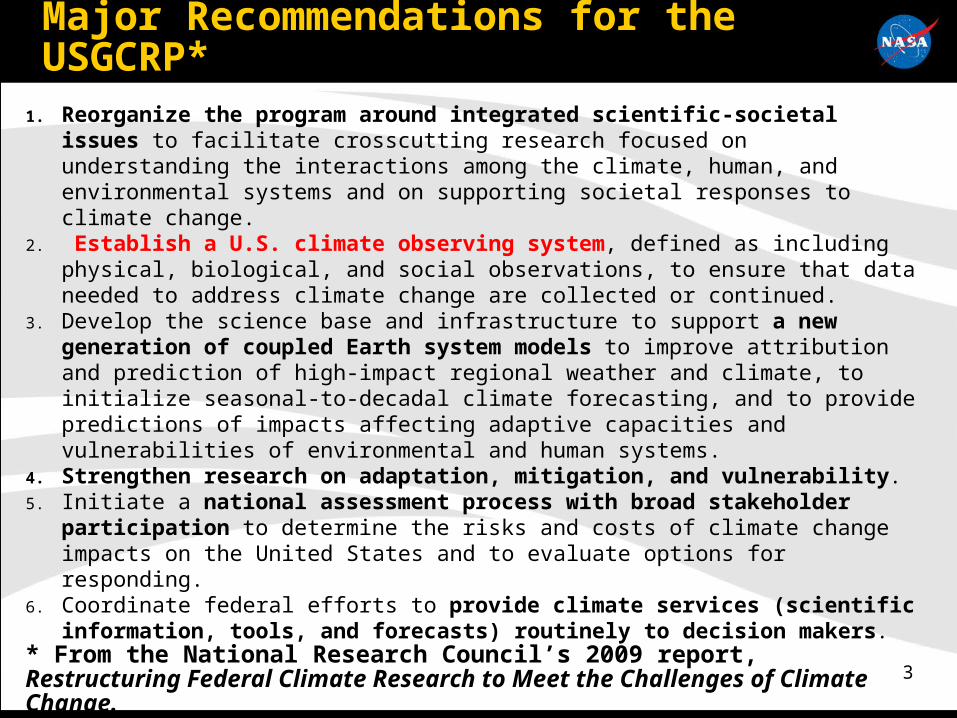
Major Recommendations for the USGCRP*
1. Reorganize the program around integrated scientific-societal issues to facilitate crosscutting research focused on understanding the interactions among the climate, human, and environmental systems and on supporting societal responses to climate change.
2. Establish a U.S. climate observing system, defined as including physical, biological, and social observations, to ensure that data needed to address climate change are collected or continued.
3. Develop the science base and infrastructure to support a new generation of coupled Earth system models to improve attribution and prediction of high-impact regional weather and climate, to initialize seasonal-to-decadal climate forecasting, and to provide predictions of impacts affecting adaptive capacities and vulnerabilities of environmental and human systems.
4. Strengthen research on adaptation, mitigation, and vulnerability.5. Initiate a national assessment process with broad stakeholder participation to
determine the risks and costs of climate change impacts on the United States and to evaluate options for responding.
6. Coordinate federal efforts to provide climate services (scientific information, tools, and forecasts) routinely to decision makers.
* From the National Research Council’s 2009 report, Restructuring Federal Climate Research to Meet the Challenges of Climate Change.
NASA Earth System Science

5
50 Years of Earth Observations from Space
The U.S. National Research Council (NRC) reviewed U.S. accomplishments in Earth remote sensing from space and concluded (summarized):
• The daily synoptic view of Earth from space has revolutionized Earth studies and helped society manage environment and resources
• Long time series are required and the value of data sets increases with time
• Scientific advances result from science-technology synergy, and societal benefit of measurements increases with increasing accuracy
• Have indisputable benefit of multiple synergistic observations (satellite and non-satellite) linked with models
• To achieve full benefit of observations, need infrastructure (models, computing, ground networks, personnel)
• Full and open access to global data capitalizes on investment• Space observations have catalyzed interdisciplinary science and can be
expected to lead to remarkable discoveries in the future

66
Ground, sea, air and in-situ measurements augment space-based observations to help understand Earth
system functioning and global environmental change
Research Balloons
Ground Stations
Space-based: Sensors & Data Relay
Ground Networks
Uninhabited Aerial VehiclesAirborne Sensors
Field Campaigns
Research Balloons
Research VesselsGround Stations
Buoys
End-to-end Observations for a Globally Integrated Program

7
20 Years of Earth System Science• We have learned many things about the Earth system and our understanding:
• We have documented and quantified variability, trends, and change in the Earth system
• High-quality observations reveal new phenomena and processes• We have learned in some cases that our understanding was inadequate – or wrong
• We have developed advanced capabilities to:• Handle and process large volumes of data• Create multi-sensor, multi-satellite data products and time series data products• Conduct inter- and multi-disciplinary science• Improve component models and advance toward Earth System models
• There are new phenomena and problems to be addressed, for example:• The ice is melting faster than predicted• The ocean is becoming more acid, with potential large impacts on ecosystems• There are concerns about increases in the frequency and intensity of extreme events --
especially with respect to their impacts in built-up areas with large human populations• Our successes in documenting change are leading to new demands for scientific
assistance in the development and implementation of policies to address climate change
• Decision support is becoming an increasing important element within the USGCRP• Observations are needed for monitoring and assessing efficacy of mitigation
actions (with significant implications for accuracy, reliability, etc.)
NASA’s Missions for New and Continuing Observations

9
The U.S. NRC’s Decadal Survey for ~2010-2020
• In 2007, the Space Studies Board of the National Research Council (NRC) of the U.S. National Academies of Science, Engineering, and Medicine released a community assessment and strategy for the future entitled:
Earth Science and Applications from Space: National Imperatives for the Next Decade and Beyond (aka the “Decadal Survey”)
• The Decadal Survey, in combination with the NRC’s reports on the USGCRP and other related activities, provides guidance for NASA’s future Earth Science program
10
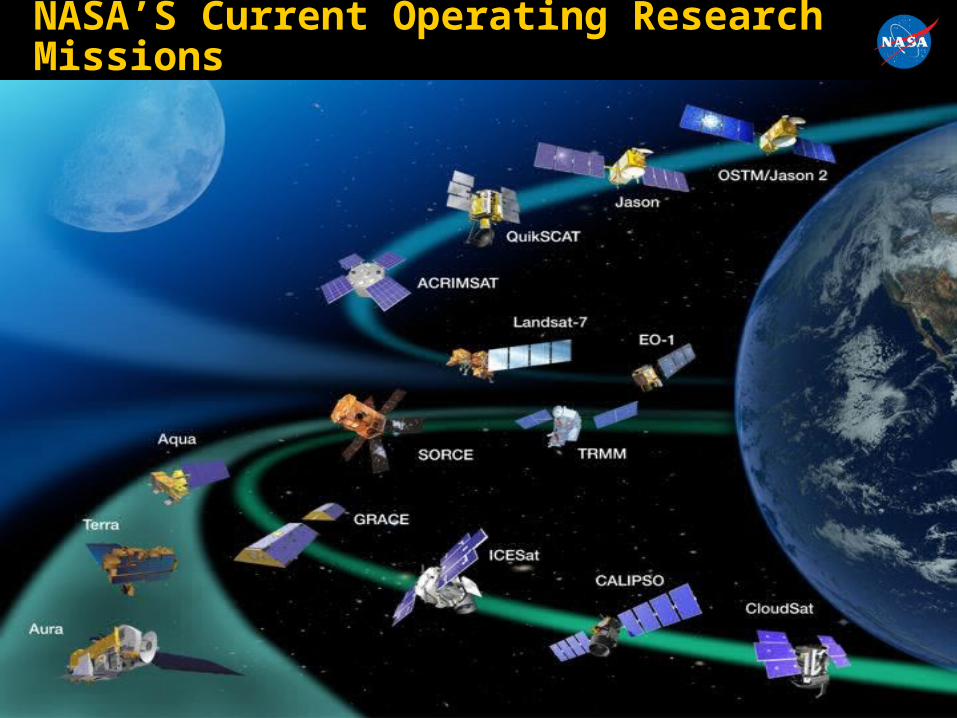
NASA’S Current Operating Research Missions
11
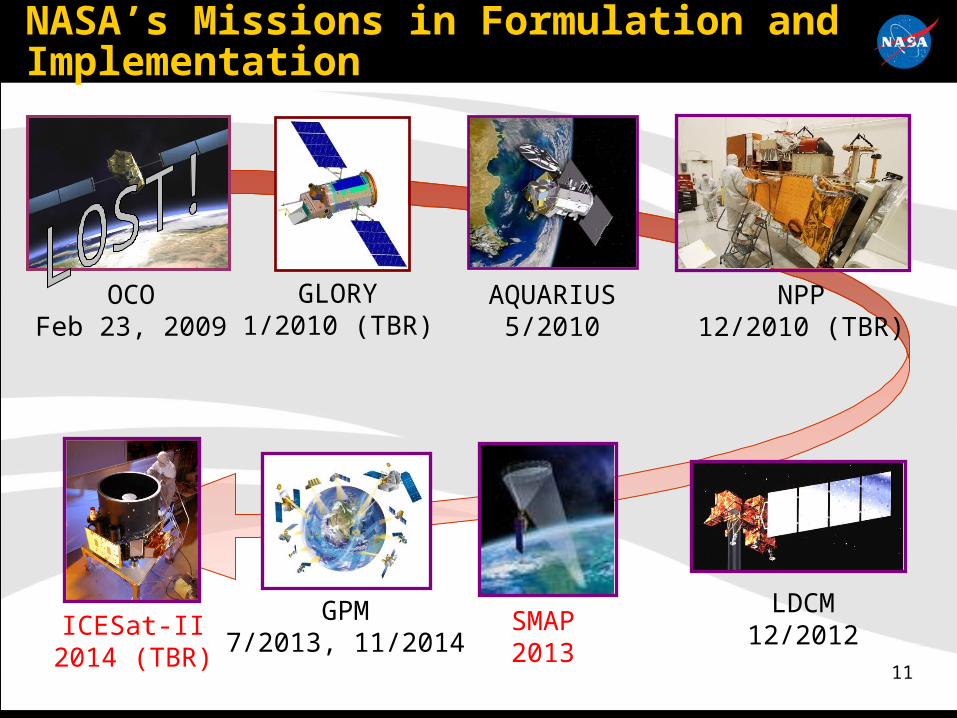
NASA’s Missions in Formulation and Implementation
OCOFeb 23, 2009
GLORY1/2010 (TBR)
NPP12/2010 (TBR)
AQUARIUS5/2010
LDCM12/2012
GPM7/2013, 11/2014
SMAP2013
ICESat-II2014 (TBR)

12

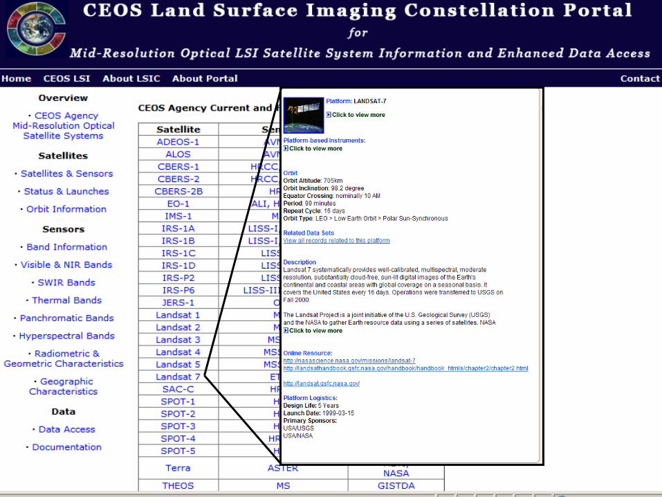
Land Surface Imaging Constellation
1414
15
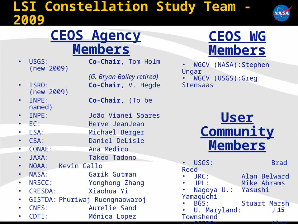
LSI Constellation Study Team - 2009
CEOS Agency Members• USGS: Co-Chair, Tom Holm (new
2009) (G. Bryan Bailey retired)
• ISRO: Co-Chair, V. Hegde (new 2009)• INPE: Co-Chair, (To be named) • INPE: João Vianei Soares• EC: Herve JeanJean• ESA: Michael Berger• CSA: Daniel DeLisle• CONAE: Ana Medico• JAXA: Takeo Tadono• NOAA: Kevin Gallo• NASA: Garik Gutman• NRSCC: Yonghong Zhang• CRESDA: Xiaohua Yi• GISTDA: Phuriwaj Ruengnaowaroj• CNES: Aurelie Sand• CDTI: Mónica Lopez
CEOS WG Members
• WGCV (NASA): Stephen Ungar• WGCV (USGS): Greg Stensaas
User Community Members
• USGS: Brad Reed• JRC: Alan Belward• JPL: Mike Abrams• Nagoya U.: Yasushi Yamaguchi• BGS: Stuart Marsh• U. Maryland: J. Townshend• CSIRO: Alex Held

16
LSI Portal: Potential enhancements in cooperation with CEOS Working Group on Information Systems and Services (WGISS).
Options under consideration: Addition of new data types or descriptive information Expand functionality to include cross-system, granule-level, search and
data retrieval Complete development of web-based services and/or freeware
(INPE) Image format converter tool to GeoTIFF Ortho-rectification tool for Level 1 mid-resolution data
Working Group on Radar (WGR) – not yet a formal sub-group of LSI, although terms of reference established.
LSI Mid-Resolution Optical Guidelines Document Working Group on Regional Data Set Compilation (WGRDSC)
Currently working to assemble initial data sets for GLS 2010 LSI Constellation is currently evaluating combining data
requirements with the GEO Forest Carbon Tracking task
Status of Activities and Future Plans

17
Summary requirement for all optical satellites:
Acquisition preferably close to nadir for all National Demonstrators Cloud free observations (< 20 % cloud coverage for individual scenes – total
cloud removal by multiple scenes) All available spectral bands Time window – yearly during dry season (long term vision)
Satellite Spectral Bands Geometric Resolution
Swath Width
Repeat Cycle
Landsat 5, 7 VNIR, SWIR, TIR 30 m / 120 m (TIR)
185 km 16 days
IRS: AWiFS VNIR, SWIR 56 m 740 km 4 days
IRS: LISS-III VNIR, SWIR 23 m 140 km 24 days
CBERS 2b: CCD, VNIR 20 m 114 km 26 days
AVNIR-2 VNIR 10 m 70 km 46 days
SPOT 4, 5 VNIR, SWIR 20 m / 10 m 60 km 26 days
Kompsat-2 VNIR 1 m / 4 m 15 km 28 days
Forest Carbon Tracking – LSI Support

Thank You!


![REVISED Terrestrial Ecology Agenda 8:30 AM Welcome – Logistics, Agenda [Peter Griffith, NASA GSFC/Sigma; Diane Wickland, NASA HQ] 8:40 AM Terrestrial Ecology.](https://static.fdocuments.in/doc/165x107/56649d605503460f94a41d22/revised-terrestrial-ecology-agenda-830-am-welcome-logistics-agenda-peter.jpg)