Development of M2 methodology and check list
118
November, 2006 FINAL REPORT FOR UNDP/GEF DANUBE REGION PROJECT DEVELOPMENT OF M2 METHODOLOGY / CHECKLIST
Transcript of Development of M2 methodology and check list

November, 2006
FINAL REPORT FOR
UNDP/GEF DANUBE REGION PROJECT
DEVELOPMENT OF
M2 METHODOLOGY / CHECKLIST

AUTHOR
PREPARED BY:
Federal Environment Agency Ltd., Austria
(Umweltbundesamt)
AUTHOR:
Hermine Weber
Federal Environment Agency Ltd., Austria, Umweltbundesamt GmbH Spittelauer Lände 5 A 1090 Vienna

PREFACE The Federal Environment Agency ltd., Austria was instructed to perform services “Development of M2 methodology / checklist” (Project No. RER/03/G31/A/1G/31) as specified in the small contract for services by UNDP/GEF Danube Regional Project of 31 March 2005.


Final Report, M2 methodology / checklist
page 5
UNDP/GEF DANUBE REGIONAL PROJECT
TABLE OF CONTENTS
1 Description of Required Services ......................................................................... 13 2 Inception Report/Progress Reports ...................................................................... 15 3 M1 methodology ............................................................................................... 17
3.1 Problem to be solved ..................................................................................... 17 3.2 Goals........................................................................................................... 17 3.3 Description of the methodology ....................................................................... 17 3.4 Conclusions:................................................................................................. 20
4 Task 1: Development of M2 methodology ............................................................. 21 4.1 Factors for M2 methodology............................................................................ 21 4.2 Classification system for M2 methodology ......................................................... 22
5 Task 2: Revised ranking of contaminated sites using M2 methodology ...................... 23 5.1 Existing data set ........................................................................................... 23 5.2 Output of the data set.................................................................................... 24
5.2.1 Contaminated deposit sites: ........................................................................ 26 5.2.2 Output of the data set regarding the considered countries: .............................. 30 5.2.3 Contaminated industrial and/or abandoned industrial sites: ............................. 31
5.3 Summary:.................................................................................................... 33 5.3.1 Deposit sites:............................................................................................ 33 5.3.2 Industrial and/or abandoned industrial sites: ................................................. 34
5.4 Solution/recommendations to the ICPDR: ......................................................... 34 6 Task 3: Revised checklist for site investigation ...................................................... 35
6.1 Checklist for the investigation and risk assessment of contaminated sites in flood risk areas .......................................................................................................... 35
6.2 Recommendations ......................................................................................... 38 7 Meetings.......................................................................................................... 41
7.1 31st APC-EG meeting in Bratislava (7th and 8th April 2005)................................... 41 7.2 Meeting in Vienna (29th July 2005)................................................................... 41 7.3 32nd APC-EG meeting in Berlin (23rd, 24th September 2005)................................. 41 7.4 Workshop on M2 methodology and refineries pilot project (17. July 2006 and 1st AP
Task Group Meeting in Constanta, Rumania (20.-21. July 2006) .......................... 42 8 Recommended Solutions .................................................................................... 47 9 Literature ........................................................................................................ 49

Final Report, M2 methodology / checklist
page 6
UMWELTBUNDESAMT / WEBER HERMINE
LIST OF APPENDIX AND ANNEXES
Appendix 1 Working list of reported contaminated sites (data set)
Table (a): All reported deposit and industrial/abandoned sites (97 records)
Table (b): All reported deposit and industrial/abandoned sites (97 records) (coloured)
Table (c): Reported deposit sites, Slovakia (18 records)
Table (d): Reported deposit sites, Hungary (32 records)
Table (e): Reported deposit sites, Romania (25 records)
Table (f): Reported deposit and industrial sites, Austria (5 deposit sites, 11 industrial sites)
Table (g): Reported deposit sites, Germany (2 records)
Table (h): Reported deposit sites, Ukraine (3 records)
Table (i): Reported deposit sites, Czech Republic (1 record)
Table (j): Reported deposit sites (Igor Liska, Version 13.06.2005) (98 records)
Appendix 2: Checklist for the Investigation and Risk Assessment of Contaminated Sites in Flood Risk Areas
Annex 1: Questionnaire of Contaminates Sites in Flood Risk Areas
Annex 2: Branch Catalogue of Germany
Annex 3: European Waste Catalogue

FINAL REPORT, M2 METHODOLOGY - TITLE
page 7
UNDP/GEF DANUBE REGIONAL PROJECT
LIST OF TABLES Table 1 and Table 2 Excerpt from the European Waste Catalogue and from the Branch
Catalogue of Germany ...................................................................................19 Table 3 Factors for “flooding potential” (FP) .................................................................21 Table 4 Factors for “safety measures” (SM) .................................................................21 Table 5 Classification system – priority classes .............................................................22 Table 6 Results of the M1 methodology for deposit sites ................................................26 Table 7 Overview of reported information regarding “flooding potential” and “safety
measures” and output of M2 methodology for deposit sites .................................28 Table 8 Determined contaminated deposit sites with an M2-value ≥ 50............................29 Table 9 Overview of reported information regarding “flooding potential” and “safety
measures” and output of M2 methodology for industrial sites ..............................32 Table 10 Determined contaminated industrial sites with an M2-value ≥ 50.........................33 Table 11 Evaluation table for deposit sites.....................................................................44
LIST OF PICTURES AND GRAPHS Figure 1 and Figure 2 Evaluation tables with extended size classes ...................................20 Figure 3 Total reported contaminated sites ...................................................................25 Figure 4 Reported deposit sites and industrial sites ........................................................26 Figure 5 (a, b, c, d) Contribution of the relevant contaminated deposit sites (M1 methodology)
..................................................................................................27 Figure 6 (a, b, c, d) Contribution of the relevant contaminated deposit sites (M2 methodology)
..................................................................................................31 Figure 7 Contribution of the relevant contaminated deposit sites (M2 methodology)............33 Figure 8 Flowchart of the assessment of contaminated sites in flood risk areas...................37
Picture 1 Map from Rompetrol, Navodari, Rumania, 20th July 2006 ....................................42 Picture 2 Participants of the workshop at Rompetrol (in front of the main-entrance of
Rompetrol), 20th July 2006.............................................................................43 Picture 3 Contaminated deposit site (oil sludge pond), 20th July 2006 ................................43 Picture 4 Participants of the “workshop on M2 mehtodology” at Rompetrol, 20th July 2006...45

Final Report, M2 methodology / checklist
page 8
UMWELTBUNDESAMT / WEBER HERMINE
ABBREVIATIONS
DRB Danube River Basin
DRP Danube Regional Project
EG Expert Group
EU European Union
ICPDR International Commission for the Protection of the Danube River
UNDP United Nations Development Programme
CS Contaminated Sites
WGI Working Group Inventory
APC EG Accident Prevent and Control Expert Group

Final Report, M2 methodology / checklist
page 9
UNDP/GEF DANUBE REGIONAL PROJECT
EXECUTIVE SUMMARY PURPOSE OF THE PROJECT The aim of this project was to develop methodologies for assessment and ranking of the risks from contaminated sites in potential flood risk areas within the Danube River Basin and to develop Checklists for site inspections of high risk contaminated sites.
The “M2 methodology” will be an enhancement of an approach already developed within the region known as “M1 methodology”.
In a further step the ranking of contaminated sites in the Danube River Basin by using the existing data sets prepared under the M1 assessment of contaminated sites (about 100 contaminated sites in flood risk areas are listed within the Danube River Basin) needs to be revised, in accordance with the safety measures and the risk of flooding at the site.
BACKGROUND INFORMATION The Danube Regional Project (DRP) has been established to contribute to the sustainable human development in the Danube River Basin (DRB) through reinforcing the capacities in the basin to develop effective co-operation in order to ensure the protection of the Danube River. The objective of the DRP is to complete the activities of the International Commission for the Protection of the Danube River (ICPDR), to provide a regional approach to the development of national policies, legislation and the definition of actions for nutrient reduction and pollution control in the DRB.
The tasks of the ICPDR are mandated by the “Convention on Cooperation for the Protection and Sustainable Use of the Danube River” (Danube River Protection Convention, DRPC). From this Convention also derive the responsibilities of the ICPDR directed towards ensuring its implementation and to enhancing the cooperation of the Contracting Parties fulfilling their respective obligations.
The ICPDR and its Expert Group on Accident Prevention and Control (APC EG) have established a methodology (referred to as M1 methodology) for the pre-assessment of contaminated sites in flood risk areas. The DRP working with the APC EG, has supported the development of a checklist assessment of at-risk contaminated sites. A more detailed assessment and ranking of the potential risks of contaminated sites in flood risk areas was required, necessitating the development of a more precise ranking system and revised checklist for the assessment of the higher risk contaminated sites.
The APC EG and its Working Group on Inventories (WGI) have developed and applied an initial screening of contaminated sites using the M1 methodology. This has been a desk-based assessment based of:
• Identification of contaminated sites above a specified size (including landfills, industrial, military sites etc.) in potential flood areas;
• A pre-assessment using evaluation tables agreed by the APC EG;
• Development of factors based on the size of the contaminated site and waste type;
• A risk value, which dictated if further investigation was required.

Final Report, M2 methodology / checklist
page 10
UMWELTBUNDESAMT / WEBER HERMINE
The M2 methodology will use the M1 evaluations as an initial starting point for the revised assessment. This assessment and ranking will be refined by the inclusion of a “flooding potential factor” (FP) and an evaluation of “safety measures” (SM) available at the site (see chapter 4, Task 1: Development of M2 methodology).
It was expected that the operational use of the M2 methodology assessment will involve a site inspection. To facilitate the site inspection, a checklist was further elaborated in this assignment (see chapter 7.4 and Appendix 2).
This assignment is an activity (referred to as Accident Emergency Response – DRP Output 2.3) within the DRP overall programme under its objective 2 – Capacity Building and Transboundary Co-operation.
Outputs of the Phase 1 of the DRP are available from the DRP´s web site – www.undp-drp.org and the activities of the APC EG (and the WGE) are available from the ICPDR´s web site – www.icpdr.org.
SUMMARY Development of M2 methodology
One aim of this project was to develop the M2 methodology for assessment and ranking of the risks from contaminated sites in flood risk areas within the Danube River Basin.
The M2 methodology will use the M1 evaluation as an initial starting point and a further enhancement by the factor FP (flooding potential) (see Table 3) and the factor SM (set safety measures at the site) (see Table 4). The M2-value can be calculated by the formula
M2 = M1 * FP * SM
The M2-value can be classified into 4 priority classes (see Table 5). For each priority class 1, 2, 3 and 4 the necessity for the need for further measures to be established at the contaminated site to improve the safety of contaminated site in flood risk areas and to reduce the risk of contamination related on waters is proposed. This was discussed and agreed by the members of the APC-EG in July 2006 in Constanta (Rumania).
Revised data-sets (working list)
A further task of this contract was to revise the existing data set (working list) prepared under the M1 assessment of contaminated sites and to refine the ranking of these sites in accordance with the safety measures (SM) and the risk of flooding (FP) (M2 methodology).
13 countries of the Danube River Basin (Slovakia, Hungary, Romania, Austria, Germany, Ukraine, Czech Republic, Slovenia, Bosnia&Herzegovina, Croatia, Moldova, Bulgaria and Serbia) were ask to report their contaminated sites (deposit sites and industrial and/or abandoned industrial sites) to the APC-EG. 7 countries (Slovakia, Hungary, Romania, Austria, Germany, Ukraine and Czech Republic) reported in total 97 contaminated sites (86 deposit sites, 11 industrial sites and/or abandoned industrial sites).
Deposit sites:
The paper “Methodology for the Pre-Assessment of Suspected Contaminated Sites in the Danube River Basin (M1 methodology), September 2004” propose a minimum-size for deposit sites to be investigated from about 100.000 m³. The consultant however recommends for deposit sites a minimum-volume of about 10.000 m³. This was agreed with the UNDP and ICPDR in October 2006
Final Report, M2 methodology / checklist
page 11
UNDP/GEF DANUBE REGIONAL PROJECT
76 deposit sites (out of reported 86 deposit sites) have a volume higher or equal 10.000 m³ (10 sites are smaller 10.000 m³) (see Table 6).
After applying the M1 methodology (by using the evaluation tables) 43 deposit sites show an M1-value higher or equal 47 that mean, that further investigations (by taking into account the flooding potential (FP) and the safety measures (SM)) are necessary. For one site no information about the type of waste was reported, therefore no evaluation of the M1-value could be made. The remaining 42 of the investigated deposit sites (out of 86 deposit sites) show an M1-value smaller than 47 this sites can be sorted out and are no longer relevant (unless the suspicion is not totally excluded) for the M2 methodology.
43 contaminated sites show an M1-value ≥ 47, but for only 23 sites sufficient information about the “flooding potential” and “safety measures” is given. After the run of the M2 methodology 12 contaminated deposit sites (out of 23) show an M2-value higher or equal 47. For those contaminated sites further “short-, middle- and long-term-measures” are necessary.
For approximately 50 % (12 contaminated deposit site out of 23 contaminated deposit sites with all relevant information) of the reported contaminated deposit sites “short-, middle- and long-term-measures” are recommended.
Industrial and/or abandoned industrial sites:
Regarding contaminated industrial and/or abandoned industrial sites the information is poor. Only Austria reported sufficient information (11 contaminated industrial and/or abandoned industrial sites) about the present situation of contaminated industrial sites in their countries. Germany reported no relevant industrial and/or abandoned industrial site within the Danube River Basin.
All reported 11 contaminated industrial sites from Austria deliver an M1-value higher 50. After applying the M2 methodology (by taking into account the “flooding potential” and “safety measures”) 3 contaminated industrial sites show an M2-value higher 50. For those 3 sites “short-, middle- and long-term-measures” are necessary.
For approximately 27 % (3 contaminated industrial site out of 11 contaminated industrial sites) of the reported contaminated industrial sites “short-, middle- and long-term-measures” are necessary.
Solution/recommendations to the ICPDR:
Because of the lack of reported contaminated sites within the Danube River Basin, the Umweltbundesamt Vienna will recommend to the ICPDR for future activities following steps (request from the APC-EG, 32nd APC-EG-meeting):
• statistical extrapolation of the estimated number of contaminated sites in flood risk areas (basis data from Austria) to get an idea how many contaminated sites (deposit sites and industrial sites) can be expected within the Danube River Basin
• support for the Danube-countries in collecting contaminated sites (deposit sites and industrial and/or abandoned industrial sites)
• providing of financial funds for the Danube Countries to built up a national collecting system of contaminated sites for selected countries
• support with technical experts if necessary
• continue of collecting contaminated sites in flood risk areas within the Danube River Basin
• set prevention measures and remediation activities (for contaminated sites with an M2-value ≥ 50).

Final Report, M2 methodology / checklist
page 12
UMWELTBUNDESAMT / WEBER HERMINE
Checklist:
The third main-task was to rework the 4th draft of the “Checklist for the Investigation and Risk Assessment of Contaminated Sites in Flood Risk Areas” (delivered by the International Commission of the protection of the Danube River, APC-EG).
The reworked checklist will serve as a hand guide for a desk-study and for a first visit of sites, suspected to be contaminated by substances hazardous to water.
The incorporated M1 and M2 methodology will allow the competent authorities to classify the contaminated sites in flood risk areas into the 4 priority classes. The checklist includes also general information for proposed safety measures (short, middle and long term measures) and recommendations which will allow the authorities to reduce the risk at a contaminated site in flood risk areas and to increase public safety and to protect the environment in the Danube River Basin.
The purpose of a fist desk-study and site visit is to find out:
where highly contaminated zones are suspected and located within flood risk areas
whether immediate action is needed
The checklist covers contaminated sites as follows:
deposit sites (minimum volume: 10.000 m³) (e.g. old, unsorted landfills, waste deposals),
industrial sites and/or abandoned industrial sites (minimum area: 5.000 m²) (e.g. closed down industrial sites, mining sites, sewage sludge/water treatment, or other sources of contamination (past incidents, leakages, operational losses))
Contaminated sites with radioactive substances are excluded.
The reworked checklist “Checklist for the Investigation and Risk Assessment of Contaminated Sites in Flood Risk Areas” was tested in July 2006 in Constanta Rumania at a contaminated site (Rompetrol in Navodari, Constanta, Rumania (see Appendix 1, Table 1, item 97)).
The checklist was discussed and agreed by the members of the seminar “workshop on M2 methodology and refineries pilot project”(20th, 21st July 2006). Comments on the tested checklist were incorporated into the checklist by the author.

Final Report, M2 methodology / checklist
page 13
UNDP/GEF DANUBE REGIONAL PROJECT
1 DESCRIPTION OF REQUIRED SERVICES
The consultant was expected to participate in a site visit by the WGI to test the Checklist and to incorporate any necessary changes. Further more, to attend up to two APC EG meetings (location of the meetings within the Danube River Basin).
Additionally the Consultant was expected to undertake the following tasks:
• Develop a methodology and classification system for the ranking of contaminated sites in flood risk areas and to propose an approach for using this methodology (M2 methodology). This should be discussed and agreed in a meeting of the WGI (Working Group of Inventories).
• Using the existing data sets prepared under the M1 assessment of contaminated sites, to refine the ranking of these sites in accordance with the safety measures at the site and the risk of flooding. This will result in the identification of the highest priority sites needing action.
• Develop checklist for site inspections of high risk contaminated sites


Final Report, M2 methodology / checklist
page 15
UNDP/GEF DANUBE REGIONAL PROJECT
2 INCEPTION REPORT/PROGRESS REPORTS
The Consultant was expected to start with an Inception Report and to provide brief reports every 2 months, indicating work completed and on-going, any problems and solutions recommended.
The Contractor calculated five Progress Reports for this project. Within this duration time (March 2005 until May 2006) 7 Progress Reports were carried out.
• Inception Report, April 2005
• 1st Progress Report, May 2005
• 2nd Progress Report, July 2005
• 3rd Progress Report, September 2005
• 4th Progress Report, November 2005
• 5th Progress Report, January 2006
• 6th Progress Report, March 2006
• 7th Progress Report, May 2006
The Inception Report and all Progress Reports you will find at the CD (delivered with the Final Report, November 2006).


Final Report, M2 methodology / checklist
page 17
UNDP/GEF DANUBE REGIONAL PROJECT
3 M1 METHODOLOGY
Excerpt from “Methodology for the Pre-Assessment of Suspected Contaminated Sites in the Danube River Basin (M1 methodology)”, September 2004:
Contaminated sites generated by former industrial activities pose a potential danger for the environment. This refers in particular to contaminated sites containing hazardous substances, which could lead to a significant contamination of water bodies, in case the substances are mobilized (e.g. by flood). During recent years dramatic floods on the Elbe, the Danube and the Oder have shown that the toxic impact of those contaminated sites could cause a significant threat to water bodies in Europe. For that reason the ICPDR decided to draw up a basin wide inventory of contaminated sites (CS) in flood risk areas in the Danube River Basin.
3.1 Problem to be solved
For the Danube River Basin recommendations are necessary, which would enable the competent authorities of the riparian countries to perform the following activities:
• Establishment of a methodology for a preliminary risk assessment of the CS reported in the inventory of the Danube countries
• Drawing up the recommendations for respective safety measures which could serve as regulatory guidelines.
• Drafting a Measure Catalogue as a handbook for the implementation of these safety guidelines.
3.2 Goals
The major goal was to develop in a first step a methodology for an initial risk assessment of contaminated sites in flood risk areas, based on the data from the inventory of contaminated sites in the Danube River Basin. However, in principle, the M1 methodology is applicable to the pre-assessment of any contaminated sites. The reported sites where a high risk potential is assumed should be screened by a preliminary assessment. This methodology will serve as a guide for the elaboration of safety recommendations and a concrete measure catalogue in the next steps.
In the next step the detailed analysis of the priority hot spots will lead to the elaboration of safety recommendations for contaminated sites. Together with a detailed measure catalogue these recommendations will serve for a checklist which will allow the competent authorities to improve the safety of the contaminated sites and to reduce the risk of contamination of surface waters.
3.3 Description of the methodology
The methodology allows the initial risk assessment of contaminated sites by applying the following parameters:
• The toxic potential of soil or waste (it depends on the harmful substances to be expected in a type of waste or in a specific industrial branch and it is expressed as a risk value).
• The volume of an old deposit or the area of an old industrial site.

Final Report, M2 methodology / checklist
page 18
UMWELTBUNDESAMT / WEBER HERMINE
For each waste type of the EUROPEAN WASTE CATALOGUE (examples given in Table 1) and for each branch of the BRANCH CATALOGUE OF GERMANY (examples given in Table 1) a risk-value r0 was proposed in classes from 1 to 5. This risk factor r0 is derived by experience gained in several German Federal States (e.g. Saxony) and it takes into account the toxic potential of soil or waste that can be expected from a branch or waste specific contamination.
For a concrete waste type or industrial branch a range of risk is given (e.g. r0 from 3-5). The first figure corresponds to the lowest class of risk to be expected, the higher figure indicates the highest class of risk to be expected (“worst case scenario”). This opens up the possibility for an expert judgement to adjust the r0 value if further information about the site is available (e.g. if the contaminants are known). In this case the liability of the assessment is improved. In the other cases, the average risk value is calculated and rounded up. The risk values r0 should be between 1 and 5.
The risk values are linked with the site magnitude (specified in case of old deposits as volume [m³] or in case of old industrial sites as surface area classes [m²]) to an “initial risk factor” m1, which gives an information about the potential risk of each site (see example in Figure 1).
For example:
A site with a contaminated volume of 200.000 m³ with a risk value of 5 receives an M1-value of 55.
A site with a contaminated area of 15.000 m2 with a risk value of 4 receives an M1-value of 51.
To select the sites with a high priority the assessment was concentrated only at those sites, which are potentially impacted by floods. Additionally only those sites should be investigated, which include more than 100.000 m³ of contaminated volume or cover an area larger than 5.000 m².
The consultant however recommends all sites which include more than 10.000 m³ of contaminated volume (deposit sites, landfills) to be investigated. The evaluation table for contaminated volume lager or equal 10.000 m³ shows M1-values higher 50 (see Figure 1), which are relevant for the next investigation (M2 methodology).
This matter was discussed agreed by UNDP (Mr. P. Whalley) and ICPDR (Mrs. M. Popovici) in October 2006.

Final Report, M2 methodology / checklist
page 19
UNDP/GEF DANUBE REGIONAL PROJECT
Table 1 and Table 2 Excerpt from the European Waste Catalogue and from the Branch Catalogue of Germany
Table 1:
List of wastes pursuant to Article 1 (a) of Council Directive 75/442/EEC on waste (EUROPEAN WASTE CATALOGUE).
e.g.
The r0 values “5” and “6” are both considered as being “5”.
Table 2:
Branch related hazard classifying of Industries (BRANCH CATALOGUE OF GERMANY)
e.g.

Final Report, M2 methodology / checklist
page 20
UMWELTBUNDESAMT / WEBER HERMINE
Figure 1 and Figure 2 Evaluation tables with extended size classes
3.4 Conclusions:
The presented evaluation tables serve for the pre-assessment of the contaminated sites (waste deposits and abandoned industrial sites). The tables should be looked upon as a first screening of those sites, which have to be preferably visited and further investigated. A finer ranking is not possible at this investigation stage, because the inaccuracy of the data is very high. All sites with an initial risk value equal or higher 50 should be inspected to perform a risk assessment by using the checklists. For a better differentiation of the m1-ranked sites the criterion of flood probability should be applied (M2 methodology).

Final Report, M2 methodology / checklist
page 21
UNDP/GEF DANUBE REGIONAL PROJECT
4 TASK 1: DEVELOPMENT OF M2 METHODOLOGY
The consultant was expected to develop a methodology and classification system for the ranking of contaminated sites subject to flood risks and to propose an approach for using the methodology.
To refine the ranking of the sites prepared under the m1 assessment of contaminated sites an enhanced methodology (i.e. M2 methodology) has to be developed taking into account the safety measures (SM) at the site and the risk of flooding (FP).
In Table 3 and Table 4 the factors for “safety measures” and “flooding potential” are listed. These factors have been agreed upon by the participants of the Accident Prevention and Control Expert Group (APC EG).
4.1 Factors for M2 methodology
In the following tables the relevant factors for the M2 methodology is given.
Table 3 Factors for “flooding potential” (FP)
Flooding potential Flood-frequency (years) Factor of flooding potential (FP)
Low > 100 0
Medium ≤ 100 1
High < 30 3
Very high < 10 10
Table 4 Factors for “safety measures” (SM)
Level of set safety measures (MS) is/are
Description Factor for safety measures (SM)
Low No safety measures are set 3
Medium Safety measures are set partly 2
High Necessary safety measures are set 1
For the “flooding potential” (FP) a score from 0 to 10 (e.g. water flooding occurs once in 10 years factor FP = 10), and for the “safety measures” (SM) a score from 1 to 3 (e.g. all required safety measures are implemented on a specific site factor SM = 1) has been set.
For example:
The factor of safety measures is 1 when the level of set safety measures and/or preventive measures to lower the risk at the site is high.

Final Report, M2 methodology / checklist
page 22
UMWELTBUNDESAMT / WEBER HERMINE
The factor of safety measures is 3 when the level of set safety measures and/or preventive measures to lower the risk at the site is low.
To receive the M2-values for m2 assessment the formula is as follows:
FP … factor flooding potential; SM … factor safety measures;
M1 … M1-value from evaluation tables taking into account the volume/area and risk potential from a specific contaminated deposit/industrial- and/or abandoned site.
4.2 Classification system for M2 methodology
In a further step the contaminated sites will be classified into priority classes (by considering the determined M2-value). For all contaminated sites within the priority classes 1, 2 or 3 preventive and/or remediation measures have to be set at the sites to improve the safety of the contaminated site and to reduce the risk of contamination related on waters (see Table 5).
This proposal was discussed and agreed by the members of the APC-EG in July 2006 in Constanta.
Table 5 Classification system – priority classes
Priority class for remediation
M2-values Need for further measures to be established at
the site
1 ≥1000 – 1.800 Very high
2 ≥250 - <1000 High
3 ≥50 - <250 Relevant
4 <50 Low
M2 = M1 x FP x SM

Final Report, M2 methodology / checklist
page 23
UNDP/GEF DANUBE REGIONAL PROJECT
5 TASK 2: REVISED RANKING OF CONTAMINATED SITES USING M2 METHODOLOGY
5.1 Existing data set
A further main task of this contract was to revise the existing data set (working list) prepared under the M1 assessment of contaminated sites and to refine the ranking of these sites in accordance with the safety measures (SM) and the risk of flooding (FP) (M2 methodology).
The consultant (Hermine Weber) received several documents (existing data set, working-list) (listed below) from Mr. Igor Liska (ICPDR) (13th June 2005):
• The existing data set with the reported data (Version 6th April 2004)
• Correspondence from the countries regarding the information of the data set
The countries of the Danube River Basin were ask to report old contaminated sites in flood risk areas within the Danube River basin, i.e. old deposit sites and old industrial and/or abandoned industrial sites (also military sites). Sites contaminated with radio active substances were excluded.
The version of the data set from 6th April 2004 contains 98 recorded contaminated sites reported from 7 countries (Slovakia, Hungary, Romania, Germany, Austria, Ukraine and Czech Republic). From Slovenia, Bosnia & Herzegovina, Croatia, Moldova, Bulgaria and Serbia no contaminated sites were recorded.
The consultant tried to receive more information about contaminated sites (especially industrial sites) from the riparian countries, because the lack of information was remarkable.
On 2nd August 2005 the consultant sent a mail to the members of the APC-EG with the request to check the 98 reported contaminated sites and to give – if necessary – more information on the factors “flooding potential” and “safety measures” (see mail below).
Dear members of the APC EG, Regarding the OCS (old contaminated sites) within the Danube catchment area the "Umweltbundesamt Vienna" revised the existing data sets (prepared under M1 assessment) taking into account the factors for "flooding potential" and "safety measures". I would like to ask you all to check your reported sites for any changes or faults and to respond your comments until the latest until middle of September – 16th Sept. 2005. Please find enclosed the refined data sets (excel-file) and a brief summary (given below). Thank you for your cooperation, Best regards Hermine Weber
Only a few countries reported more information about the situation regarding contaminated sites in their countries:
15.09.2005: Hungary: no further comments
19.09.2005: Slovakia: after a revaluation of the contaminated sites in Slovakia two sites could be taken out of the working list: (1) (Skadka odpadov OFZ Siroke - Bezmenný creek) and (2), Teplaren, Povazska Bystrica - Ziar (in tube)) (see
Final Report, M2 methodology / checklist
page 24
UMWELTBUNDESAMT / WEBER HERMINE
Appendix 1, Table (j): Reported deposit sites (Igor Liska, Version: 13.06.2005), Nr. 19 and Nr. 51).
21.9.2005: Germany: 2 comments: (1) there are no industrial sites relevant for Germany and (2) r0-Value for Deponie Peterswöhrd is 3.5 instead of 5 (see Appendix 1, Table (j): Reported deposit sites (Igor Liska, Version: 13.06.2005), Nr. 10).
According the minutes of the 32nd APC-EG-meeting in Berlin, the countries reported problems of collecting data of contaminated sites in flood risk areas within the Danube River Basin.
The major reason is because of the missing legislative basis and financial support.
Other reasons might be:
• No or insufficient collection system of contaminated sites
• Lack of financial funds
• Lack of technical experts
After a site visit in Constanta Rumania (20th July 2006) to test the proposed “Checklist for the Investigation and Risk Assessment of Contaminated Sites in Flood Risk Areas” the consultant extended the working list (data sets) with one more contaminated deposit site “Rompetrol in Navodari, Constanta, Romania, oil sludge pond, industrial deposit” (see Appendix 1, Table (a), item 97).
5.2 Output of the data set
The revised data set (July 2006) (working list) contains 97 contaminated sites (see Figure 3 and Appendix 1, Table (a)):
Slovakia: 18 contaminated sites
Hungary: 32 “
Romania: 25 “
Austria: 16 “
Germany: 2 “
Ukraine: 3 “
Czech Republic: 1 contaminated site
Total: 97 contaminated sites

Final Report, M2 methodology / checklist
page 25
UNDP/GEF DANUBE REGIONAL PROJECT
Figure 3 Total reported contaminated sites
total reported contaminated sites
18
32
25
16
2 31 0 0 0 0 0 0
0
5
10
15
20
25
30
35
Slovak
ia
Hunga
ry
Roman
ia
Austria
German
y
Ukraine
Czech
Rep
ublic
Sloven
ia
Bosnia
&Herzeg
owina
Croatia
Moldov
a
Bulgari
a
Serbia
country
n
Seven countries (Slovakia, Hungary, Romania, Germany, Austria, Ukraine and Czech Republic) reported deposit sites in flood risk areas. But only 4 countries (Hungary, Romania, Austria and Germany) reported additional information about the flooding situation and the safety measures set at a contaminated site (see Table 7).
Reported deposit sites and industrial sites (see Figure 4 and Appendix 1, Table (b)):
Slovakia: deposit sites: 18; industrial sites: no information
Hungary: deposit sites: 32; industrial sites: no information
Romania: deposit sites: 25; industrial sites: no information
Austria: deposit sites: 5; industrial sites: 11
Germany: deposit sites: 2; industrial sites: 0 (no relevant ind. Sites)
Ukraine: deposit sites: 3; industrial sites: no information
Czech Rep.: deposit sites: 1; industrial sites: no information
all other countries: dep.sites and industrial sites: no information
Total: deposit sites: 86; industrial sites: 11; Σ 97

Final Report, M2 methodology / checklist
page 26
UMWELTBUNDESAMT / WEBER HERMINE
Figure 4 Reported deposit sites and industrial sites
reported deposit sites and industrial sites
18
32
25
52 3 1 0 0 0 0 0 00 0 0
11
0 0 0 0 0 0 0 0 005
101520253035
Slovak
ia
Hunga
ry
Roman
ia
Austria
German
y
Ukraine
Czech
Rep
ublic
Sloven
ia
Bosnia
&Herzeg
owina
Croatia
Moldov
a
Bulgari
a
Serbia
country
n
dep.sitesind.sites
5.2.1 Contaminated deposit sites:
For one site in Romania (item 1: Tulcea, Turcoaia, sterile pond) no information about the type of waste is given, therefore no evaluation of the M1-value could be made.
After the first evaluation of the M1-value (M1 methodology) by using the evaluation tables (see Figure 1 and Figure 1) the out-put can be sown as follows:
Table 6 Results of the M1 methodology for deposit sites
country CS in total
deposit sites
dep.sites ≥
100.000 m³
dep.sites ≥ 10.000
m³
dep.sites < 10.000
m³
M1 ≥ 50
M1 ≥ 47
M1 < 47
Slovakia 18 18 15 18 0 4 14 4
Hungary 32 32 27 31 1 6 10 22
Romania 25 25 16 17 8 8 12 12
Austria 16 5 5 5 0 3 3 2
Germany 2 2 2 2 0 0 1 1
Ukraine 3 3 1 3 0 2 2 1
Czech Republic 1 1 0 0 1 0 1 0
Slovenia no
data no data no data no data no data
no data
no data
no data
Bosnia&
Herzegovina
no data
no data no data no data no data no
data no
data no
data
Croatia no
data no data no data no data no data
no data
no data
no data

Final Report, M2 methodology / checklist
page 27
UNDP/GEF DANUBE REGIONAL PROJECT
country CS in total
deposit sites
dep.sites ≥
100.000 m³
dep.sites ≥ 10.000
m³
dep.sites < 10.000
m³
M1 ≥ 50
M1 ≥ 47
M1 < 47
Moldova no
data no data no data no data no data
no data
no data
no data
Bulgaria no
data no data no data no data no data
no data
no data
no data
Serbia no
data no data no data no data no data
no data
no data
no data
Total 97 86 66 76 10 23 43 42
The cut-off value for the calculation of the M2-value is M1≥50.
By using a buffer-zone the following determination of the M2-value considers all contaminated deposit sites with an M1-value higher or equal 47 (M1≥47).
In Figure 5 (a, b, c, d) the relevant contaminated deposit sites (according the M1 methodology) for the countries Slovakia, Hungary, Romania and Austria are shown.
Figure 5 (a, b, c, d) Contribution of the relevant contaminated deposit sites (M1 methodology)
Slovakia: relevant for M1 methodology (dep.sites)
4; 22%
14; 78%
M1 ≥ 47M1 < 47
Hungary: relevant for M1 methodology (dep.sites)
22; 69%
10; 31%
M1 ≥ 47M1 < 47
(a) (b)
Romania: relevant for M1 methodology (dep.sites)
12; 50% 12; 50%
M1 ≥ 47M1 < 47
Austria: relevant for M1 methodology (dep.sites)
3; 60%
2; 40%
M1 ≥ 47M1 < 47
(c) (d)

Final Report, M2 methodology / checklist
page 28
UMWELTBUNDESAMT / WEBER HERMINE
The next table (see Table 7) gives information about “flooding potential” and “safety measures” and the about the output of the M2 methodology.
Table 7 Overview of reported information regarding “flooding potential” and “safety measures” and output of M2 methodology for deposit sites
country CS in total
deposit sites
M1 ≥ 47
M1 < 47
FP available
SM available
M2 ≥ 50 M2 < 50
Slovakia 18 18 14 4 yes no data no data for SM
no data for SM
Hungary 32 32 10 22 yes yes 2 8
Romania 25 25 1) 12 12 yes partly 9 2) -
Austria 16 5 3 2 yes yes 0 3
Germany 2 2 1 1 yes yes 1 0
Ukraine 3 3 2 1 no data no data no data for FP,SM
no data for FP,SM
Czech Republic 1 1 1 0 no data no data no data for FP,SM
no data for FP,SM
Slovenia no data
no data
no data no data
no data no data no data no data
Bosnia&Herzegovina no data
no data
no data no data
no data no data no data no data
Croatia no data
no data
no data no data
no data no data no data no data
Moldova no data
no data
no data no data
no data no data no data no data
Bulgaria no data
no data
no data no data
no data no data no data no data
Serbia no data
no data
no data no data
no data no data no data no data
Total 97 86 43 42 - - 12 11
FP … flooding potential; SM … safety measures
1) … including one site in Romania (Tulcea, Turcoaia, (see Appendix 1, Table (b), item: 1): no waste-information given
2) … for 3 deposit sites no data for SM
For 43 contaminated sites (out of 86 reported contaminated deposit sites) an M1-value ≥ 47 could be determined, but only for 23 deposit sites (Hungary 10, Romania 9, Austria 3 and Germany 1) with an M1-value ≥ 47 a further investigation (by applying the M2 methodology) could be made. For the remaining 20 contaminated sites with an M1-value ≥ 47 (Slovakia 14, Romania 3, Ukraine 2 and Czech Republic 1) insufficient information about the “flooding

Final Report, M2 methodology / checklist
page 29
UNDP/GEF DANUBE REGIONAL PROJECT
potential” (FP) and/or the “safety measures” (SM) is given. From the countries Slovenia, Bosnia & Herzegovina, Croatia, Moldova, Bulgaria and Serbia no data for contaminated sites and/or information about “flooding potential” and “safety measures” are reported.
After applying the M2 methodology 12 contaminated deposit sites show an M2-value higher or equal 50 that means, that for those sites further “short, middle and long-term measures” are necessary.
Table 8 represents the relevant contaminated deposit sites after applying the M2 methodology and their classification in priority classes (see Appendix 1, Table (b)).
Table 8 Determined contaminated deposit sites with an M2-value ≥ 50
n Item-Nr.
Country Name M2-value
Priority class
1 13 Romania Sibiu, Copsa Mica, slags from primary and secondary melting
114 3
2 14 Romania
Hunedoara, Calan, not processed slag, lining and refractory waste materials, furnace slag, foundry shapes containing organic ligands, wastes from mixture preparation previously thermic processing, other tars
171 3
3 15 Romania See 14 (double?) 171 3
4 26 Romania Bacau, Letea Veche, Fuel burning 318 2
5 31 Hungary Middle Tisa, Environmental Inspectorales Area, Szolnok, Beghin-Say Cukorgyar Inc., waste water sludge in lake
50 3
6 32 Romania Teleorman, Tumu Magurele, Pyrite ash pond, not specified (wastes containing metals)
100 3
7 33 Romania Sibiu, Copsa Mica, Tarnave Mare River, Visa brook, industrial waste, slags from primary and secondary melting
100 3
8 37 Romania Dolj, Calafat, slag and ash pond from coal burning
98 3
9 46 Germany Dillingen, Hühnerwörth, old deposit, municipal waste
141 3
10 50 Romania Dolj, Calafat, industrial waste, wastes from sugar beet processing
141 3
11 52 Hungary
Middle Danube Environmental Inspectorates area, Budapest, Csepel-island Nord, abandon sewage, sludge depots, heavy metal and hydrocarbon polluted organic compounds
141 3
12 97 Romania Rompetrol in Navodari, Constanta. Oil sludge pund
330 2
Final Report, M2 methodology / checklist
page 30
UMWELTBUNDESAMT / WEBER HERMINE
5.2.2 Output of the data set regarding the considered countries:
Hungary:
Hungary reported 32 deposit sites. One deposit site shows a volume smaller 10.000 m³ and is no longer relevant for the M1 methodology. For 10 contaminated deposit sites (out of 31) an M1-value higher or equal 47 could be determined. Sufficient information about “flooding potential” and “safety measures” is given. After running the M2 methodology 2 sites show an M2-value equal or higher 50. For this 2 deposit sites (see Table 8 and Figure 6 (a)) “short-, middle- and long-term-measures are necessary.
The reported deposit sites are listed in Appendix 1, Table (d).
Romania:
Romania reported 25 deposit sites. For one site no information about the type of waste is given (Appendix1, Table (b), Item Nr. 1). 12 contaminated deposit sites show an M1-value higher or equal 47, but only for 9 contaminated deposit sites the M2 Methodology could be applied. For the remaining 3 sites (Appendix 1, Table (b), Item Nr. 39, 53 and 54) less information about the “safety measures” is given.
For all 9 contaminated deposit sites (M2 methodology) an M2-value higher or equal 50 can be shown. That means that for all those 9 deposit sites (see Table 8 and Figure 6 (b)) “short-, middle- and long-term-measures are necessary. The reported deposit sites are listed in Appendix 1, Table (e).
Austria:
Austria reported 5 deposit sites. 3 (out of 5) are relevant for the M2 methodology. But no deposit sites show an M2-value higher or equal 50 (see Table 8 and Figure 6 (c)). The reported deposit sites are listed in Appendix 1, Table (f).
Germany:
From the two reported contaminated deposit sites in Germany only one site is relevant for the M2 methodology. This site shows an M2-value higher 50 (see Table 8 and Figure 6 (d)), that means “short-, middle- and long-term-measures are necessary. The reported deposit sites are listed in Appendix 1, Table (g).

Final Report, M2 methodology / checklist
page 31
UNDP/GEF DANUBE REGIONAL PROJECT
Figure 6 (a, b, c, d) Contribution of the relevant contaminated deposit sites (M2 methodology)
Hungary: contribution of m2- values (10 dep.sites relevant for M2)
8; 80%
2; 20%
M2 ≥ 50M2 < 50
Romania: contribution of m2- values (9 dep.sites relevant for M2)
0; 0%
9; 100%
M2 ≥ 50M2 < 50
(a) (b)
Austria: contribution of m2- values (3 dep.sites relevant for M2)
0; 0%
3; 100%
M2 ≥ 50M2 < 50
Germany: contribution of m2- values (1 dep.site relevant for M2)
0; 0%
1; 100%
M2 ≥ 50M2 < 50
(c) (d)
Slovakia, Ukraine and Czech Republic reported contaminated deposit sites but insufficient or no information about the “flooding potential” (FP) and/or “safety measures” (SM) (see Table 7). The reported deposit sites are listed in Appendix 1, Table (c), (h) and (i).
From Slovenia, Bosnia & Herzegovina, Croatia, Moldova, Bulgaria and Serbia no data sets were reported (see Table 7).
5.2.3 Contaminated industrial and/or abandoned industrial sites:
Only the countries Austria and Germany reported information about industrial and/or abandoned industrial sites within the Danube River Basin. Austria reported 11 contaminated industrial and/or abandoned industrial sites and Germany reported no relevant industrial sites within flood risk areas.

Final Report, M2 methodology / checklist
page 32
UMWELTBUNDESAMT / WEBER HERMINE
Table 9 Overview of reported information regarding “flooding potential” and “safety measures” and output of M2 methodology for industrial sites
n country
CS in
total
indust.
sites
ind.sites ≥
5.000 m²
ind.sites < 5.000
m²
M1 ≥ 47
M1 < 47
FP available
SM available
M2 ≥ 50
M2 < 50
1 Slovakia 18 no
data no data no data
no data
no data no data no data no data no data
2 Hungary 32 no
data no data no data
no data
no data no data no data no data no data
3 Romania 25 no
data no data no data
no data
no data no data no data no data no data
4 Austria 16 11 11 0 11 0 yes yes 3 8
5 Germany 2 0 0 0 0 0 - - 0 0
6 Ukraine 3 no
data no data no data
no data
no data no data no data no data no data
7 Czech
Republic 1
no data
no data no data no
data no data no data no data
no data for
FP,SM
no data for
FP,SM
8 Slovenia no
data no
data no data no data
no data
no data no data no data no data no data
9
Bosnia&
Herzego-
vina
no data
no data
no data no data no
data no data no data no data no data no data
10 Croatia no
data no
data no data no data
no data
no data no data no data no data no data
11 Moldova no
data no
data no data no data
no data
no data no data no data no data no data
12 Bulgaria no
data no
data no data no data
no data
no data no data no data no data no data
13 Serbia no
data no
data no data no data
no data
no data no data no data no data no data
13 Total 97 11 11 0 11 0 0 0 3 8
For all reported 11 contaminated industrial sites (Austria 11 ind. sites ≥ 5.000 m²) the m1- and the M2 Methodology could be applied.
Final Report, M2 methodology / checklist
page 33
UNDP/GEF DANUBE REGIONAL PROJECT
After applying the m1- and the M2 methodology (by taking into account the flooding potential (FP) and the safety measures (SM)) three industrial sites show a necessity for further “short-, middle- and long-term-measures”. These three industrial sites are shown in Table 10 and Figure 7).
Table 10 Determined contaminated industrial sites with an M2-value ≥ 50
Nr. Item-Nr.
Country Name M2-value
Priority class
1 8 Austria Lower-Austria, Korneuburg Shpyard, metals, hydrocarbon oil
513 2
2 16 Austria Carintia, Sankt Veit an der Glan, Brückl, Trichlorethen, Tetrachlorethen, Hexachlorbutadien
112 3
3 29 Austria Lower-Austria, Korneuburg, Tankfarm Mare, mineral oil depot
306 2
Figure 7 Contribution of the relevant contaminated deposit sites (M2 methodology)
Austria: contribution of m2- values (11 reported ind.sites)
3; 27%
8; 73%
M2 ≥ 50
M2 < 50
5.3 Summary:
13 countries of the Danube River Basin (Slovakia, Hungary, Romania, Austria, Germany, Ukraine, Czech Republic, Slovenia, Bosnia & Herzegovina, Croatia, Moldova, Bulgaria and Serbia) were ask to report their contaminated sites (deposit sites and industrial and/or abandoned industrial sites) to the APC-EG. 7 countries (Slovakia, Hungary, Romania, Austria, Germany, Ukraine and Czech Republic) reported in total 97 contaminated sites (86 deposit sites, 11 industrial sites and/or abandoned industrial sites).
5.3.1 Deposit sites:
The “Methodology for the Pre-Assessment of Suspected Contaminated Sites in the Danube River Basin (M1 methodology), September 2004” propose a minimum-size for deposit sites to be investigated of 100.000 m³. The consultant however recommends for deposit sites a minimum-volume of 10.000 m³. This was discussed and agreed with UNDP and ICPDR in October 2006.
76 deposit sites (out of reported 86 deposit sites) have a volume higher or equal 10.000 m³ (10 sites are smaller 10.000 m³) (see Table 6).

Final Report, M2 methodology / checklist
page 34
UMWELTBUNDESAMT / WEBER HERMINE
After applying the M1 methodology (by using the evaluation tables) 43 deposit sites show an M1-value higher or equal 47 that mean, that further investigations (by taking into account the flooding potential (FP) and the safety measures (SM)) are necessary. For one site no information about the type of waste was reported, therefore no evaluation of the M1-value could be made. The remaining 42 of the investigated deposit sites show an M1-value smaller than 47 this sites can be sorted out and are no longer relevant (unless the suspicion is not totally excluded) for the M2 methodology.
43 contaminated sites show an M1-value ≥ 47, but for only 23 sites sufficient information about the “flooding potential” and “safety measures” is given. After the run of the M2 methodology 12 contaminated deposit sites (out of 23) show an M2-value higher or equal 47. For those contaminated sites further “short-, middle- and long-term-measures” are necessary.
For approximately 50 % (12 contaminated deposit site out of 23 contaminated deposit sites with all relevant information) of the reported contaminated deposit sites “short-, middle- and long-term-measures” are necessary.
5.3.2 Industrial and/or abandoned industrial sites:
Regarding contaminated industrial and/or abandoned industrial sites the information is very poor. Only Austria reported sufficient information (11 contaminated industrial and/or abandoned industrial sites) of the present situation of contaminated industrial sites in their countries. Germany reported no relevant industrial and/or abandoned industrial site within the Danube River Basin.
All reported 11 contaminated industrial sites from Austria deliver an M1-value higher 50. After applying the M2 methodology (by taking into account the “flooding potential” and “safety measures”) 3 contaminated industrial sites show an M2-value higher 50. For those 3 sites “short-, middle- and long-term-measures” are necessary.
For approximately 27 % (3 contaminated industrial site out of 11 contaminated industrial sites) of the reported contaminated industrial sites “short-, middle- and long-term-measures” are necessary.
5.4 Solution/recommendations to the ICPDR:
Because of the lack of reported contaminated sites within the Danube River Basin, the Umweltbundesamt Vienna will recommend to the ICPDR for future activities following steps (request from the APC-EG, 32nd APC-EG-meeting):
• statistical extrapolation of the estimated number of contaminated sites in flood risk areas (basis data from Austria) to get an idea how many contaminated sites (deposit sites and industrial sites) can be expected within the Danube River Basin
• support for the Danube-countries in collecting contaminated sites (deposit sites and industrial and/or abandoned industrial sites)
• providing of financial funds for the Danube Countries to built up a national collecting system of contaminated sites for selected countries
• support with technical experts if necessary
• continue of collecting contaminated sites in flood risk areas within the Danube River Basin
• set prevention measures and remediation activities (for contaminated sites with an M2-value ≥ 50).

Final Report, M2 methodology / checklist
page 35
UNDP/GEF DANUBE REGIONAL PROJECT
6 TASK 3: REVISED CHECKLIST FOR SITE INVESTIGATION
A further main task of this contract was to develop a checklist for site inspections of high risk contaminated sites in flood risk areas.
6.1 Checklist for the investigation and risk assessment of contaminated sites in flood risk areas
All necessary information of a contaminated site will be collected by using the proposed checklist. The checklist will also include general information for proposed safety measures, which will allow the competent authorities to reduce the risk at a contaminated site in flood risk areas and to increase public safety and to protect the environment in the Danube River Basin.
This checklist will serve as a hand guide for a desk-study and for a first visit of sites, suspected to be contaminated by substances hazardous to water.
The purpose of this first desk-study and site visit is to find out:
• where highly contaminated zones are suspected and located within flood risk areas
• whether immediate action is needed
The data collected by making use of the checklist deliver the basis to assess if further steps are necessary to enhance the safety level of contaminated sites in flood risk areas.
The checklist includes the following information:
• General data, which providing information about location, extension type, ownership structure of the site and about any precedent investigations
• Hydrological data to estimate whether the contaminated site is endangered by flooding (flooding potential)
• Evaluation of the hazard situation answering the following questions:
o Is there an indication of potential hazards at the site?
o Is the site assessment with regard to the site’s risk potential completed or is it necessary to record further data?
o Which additional information is already available and can be used for the assessment?
o Is an assessment possible or is a further data record or investigation necessary?
The checklist applies to all properties containing suspected contaminated sites in flood risk areas.
The following sites in flood risk areas are covered by the scope of the checklist:
• Sites suspected to have high potential for posing a hazard to water,
• Sites contaminated as a result of former industrial activities and former waste disposal operations, and
• closed-down plants and plant components containing water endangering substances, which are not effectively secured and might present a hazard to water in case of flooding.
Radioactively contaminated sites do not fall within the scope of this checklist, nor do sites presenting a potential hazard due to genetically modified organisms.

Final Report, M2 methodology / checklist
page 36
UMWELTBUNDESAMT / WEBER HERMINE
Former military sites and former military production sites are usually regarded as former industrial sites.
Only those sites have to be investigated under this checklist, which
• include more than 10.000 m³ of contaminated volume (former waste disposal sites, landfills)
• cover an area larger than 5.000 m² of a contaminated area (former industrial sites, closed-down plants)
In certain cases a further investigation of the property (smaller than 10.000 m³ and/or smaller than 5.000 m²) is still necessary if the suspicion of contamination for contaminated sites cannot be totally excluded.
Facilities covered by this checklist include, for example:
• Former waste disposal sites
• Industrial and/or abandoned industrial sites
• Components of closed-down plants
• Underground installations
• Surface facilities
• Above-ground storage systems within buildings
• Sewage sludge/waste-water treatment facilities
The proposed checklist consists of five parts which include the following templates:
(1) Preliminary investigation (basic study) of contaminated sites in flood risk areas
(2) Pre-assessment of contaminated sites in flood risk areas according to the M1 methodology
(3) Further investigations of contaminated sites in flood risk areas according to the M2 methodology
(4) Assessment and classification system – priority classes – of M2-values of high risk contaminated sites in flood risk areas
(5) Measure catalogue (short, medium and long term measures)
Final Report, M2 methodology / checklist
page 37
UNDP/GEF DANUBE REGIONAL PROJECT
Figure 8 Flowchart of the assessment of contaminated sites in flood risk areas

Final Report, M2 methodology / checklist
page 38
UMWELTBUNDESAMT / WEBER HERMINE
Please find the “Checklist for the Investigation and Risk Assessment of Contaminated Sites in Flood Risk Areas” in Appendix 2.
6.2 Recommendations
The Recommendation applies to all contaminated sites, which are prone to flooding and contaminated by substances hazardous to water. The case of flooding includes, besides flooding,
• backflow from water bodies or sewer systems or
• a rise of the groundwater table as a result of long-term flood events.
The following sites are covered by the scope of the recommendation:
• Sites suspected to have high potential for posing a hazard to water,
• sites contaminated as a result of former industrial activities and former waste disposal operations, and
• closed-down plants and plant components containing water endangering substances, which are not effectively secured and might present a hazard to water in case of flooding.
Radioactively contaminated sites do not fall within the scope of these requirements, nor do sites presenting a potential hazard due to genetically modified organisms.
Facilities covered by this recommendation include, for example:
• Underground installations
• Surface facilities
• Above-ground storage systems within buildings
• Components of closed-down plants
• Former waste disposal sites
Safety requirements:
Administrative requirements:
• Potentially contaminated sites should be recorded in appropriate database (e.g. land registry).
• In general the “Polluter Pays Principle” has to be applied
o in investigations necessary to determine the contamination situation of sites suspected of being contaminated and further necessary measures and
o when formulation proposals for remedial actions and in their implementation.
• The financing of investigations and remediation should be ensured, e.g. through national agreements or funds, especially in cases where the polluter cannot be held liable.
• Authorities should be enabled to:
o carry out the monitoring of contaminated sites and sites suspected of being contaminated
o order monitoring measures and/or remedial measures

Final Report, M2 methodology / checklist
page 39
UNDP/GEF DANUBE REGIONAL PROJECT
• Enabled authorities are responsible for ensuring that identified suspected sites are investigated and, if necessary, remedial measures are implemented.
Requirements of risk estimation:
• Site identification: All abandoned industrial and waste disposal sites located in flood-risk areas are suspected of being hazardous to water bodies in case of flooding. The following measures should be carried out in an initial survey to determine whether suspect sites are hazardous or non hazardous to water in case of flooding:
o Initial estimation of the risk by classifying the water endangering potential of the former use (type of industrial branch or type of waste disposed of).
o Priorisation of suspect sites according to the estimated water endangering potential.
o Estimation of the flood risk at the site.
• Sites for which a safety risk has been identified should be investigated in more detail. A first proposal for immediate measures should be formulated if there are obvious safety risks.
• Further site investigations: They serve to generate additional information for a more precise characterisation of the hazard situation of the investigated site.
• This information should cover the following points
o a description of the contamination situation,
o the determination of any assets that would be endangered in case of flooding, and
o a proposal for further measures to enhance the safety of the site, if necessary.
• Detailed investigations Based on detailed investigations and the identification of highly contaminated zones a list of measures should be drawn up to serve as a basis for the selection of specific remedial measures.
• Results of each investigation step should be documented in a database.
Technical requirements:
Preventive measures:
Preventive measures include:
• Controlling the stability and necessary static design and capacity of dams,
• Regular supervision and control of sites with a high risk potential,
• Increasing the retention time through:
o storage basins for heavy rainfall and snowmelt water
o building of reservoirs
o renaturation and/or protection of floodplain forests
• Construction of dams at sites with a high flood risk.

Final Report, M2 methodology / checklist
page 40
UMWELTBUNDESAMT / WEBER HERMINE
Requirements for the remediation of contaminated sites:
Different decontamination methods are available for contaminated sites in flood-risk areas:
• removal of soil and disposal in safe landfills,
• removal of barrels and tanks, or
• decontamination by chemical, physical or biological methods
In addition to conventional decontamination measures, containment measures, designed to permanently prevent the spread of pollutants, can be considered. Such measures include for example:
• Encapsulating of contaminated bodies of soil
• Sealing of surfaces
Investigations should be performed to select the optimal treatment for each site.
If immediate action is necessary because human health is threatened, appropriate protective or restrictive measures should be carried out (e.g. restriction of access).
Advices for utilization of contaminated sites:
In the area of the contaminated site and in its immediate vicinity, at least the following points have to be taken into consideration:
• Possible change of use should neither result in environmental impairment (e.g. additional mobilization of contaminants) nor generate additional potential danger.
• As elevated concentrations of methane and carbon dioxide may occur in the area of deposition, deep construction workings (e.g. subsurface running of pipelines and conduits, construction of cellars) should generally be carried out, taking appropriate safety measures (e.g. use of a gas detector)
• Generally, in the course of construction work, the presence of landfill gas in possibly major concentrations should be considered.
• During the technical design of permanent subsurface installations (e.g. conduits and shafts, cellars) an appropriate gas discharge (e.g. gas drainage) or adequate gas impermeability should be assured.
• Related to possible future construction works and the sealing of surfaces, the mode for run-off of precipitation has to be investigated carefully. An elevated mobilization of contaminants and an elevated entry of contaminants into the groundwater through seepage have to be excluded.
• Waste excavated from deep construction workings has to be treated and deposited according to current legislation.
• Based on investigation results so far, it can be assumed that part of the deposit does not comply with the regulations of the landfill directive for rubble, therefore higher costs have to be anticipated accordingly at the disposal of larger volumes of excavated material.

Final Report, M2 methodology / checklist
page 41
UNDP/GEF DANUBE REGIONAL PROJECT
7 MEETINGS
The Consultant was expected to participate at a site visit by the WGI to test the checklist and to incorporate necessary changes into the checklist, further to attend one WGI meeting and up to two APC EG meetings.
7.1 31st APC-EG meeting in Bratislava (7th and 8th April 2005)
At the 31st APC-EG meeting (7th, 8th April 2005 in Bratislava) all countries were asked to report on the following missing data by the end of May 2005:
• Factor flooding potential (FP);
• Factor safety measures (SM);
• Industrial and abandoned industrial sites
7.2 Meeting in Vienna (29th July 2005)
On the 29th July 2005 a meeting was held in Vienna (UNDP/GEF) with Mr. Peter Whalley, Mr. Aurel Varduca, Mr. Igor Liska, Mr. Gerd Winkelmann-Oei and Mrs. Hermine Weber regarding the next WGI meeting in Romania, to clarify responsibilities.
In this meeting the following points were discussed:
• Next WGI meeting envisaged in Romania
• For the 32nd APC-EG meeting in Berlin (September 2005) the participation of Ms. Hermine Weber is not required.
• Responsibilities WGI meeting (coordinating, organization)
7.3 32nd APC-EG meeting in Berlin (23rd, 24th September 2005)
The 32nd meeting of the APC-Expert Group was held from 23rd to 24th Sept. 2005 in Berlin. The participation of the Umweltbundesamt Vienna was not necessary. A short presentation on the work completed by the Umweltbundesamt Vienna was given by Mr. Peter Whalley (UNDP/GEF).
According to the minutes of the 32nd APC-EG meeting the countries reported problems in collecting the necessary data, the major reason being the missing legislative basis. This “working list” of contaminated sites (deposit sites and industrial and/or abandoned industrial sites) in flood risk areas should continue in its preparation as it will be relevant for the future programme of measures.
The countries Bosnia & Herzegovina, Bulgaria, Moldova and Serbia were asked to send information on plans regarding the collection of data on deposit sites by October 2005.
The Umweltbundesamt Vienna was asked to report on the reasons for missing information on the contaminated sites in flood risk areas and to give an expert judgement and recommendations on future perspectives and activities.
M2 methodology (2nd Progress Report, July 2005) will be discussed at the meeting of the Working Group in Inventories (WGI), which was envisaged February/March 2006.

Final Report, M2 methodology / checklist
page 42
UMWELTBUNDESAMT / WEBER HERMINE
7.4 Workshop on M2 methodology and refineries pilot project (17. July 2006 and 1st AP Task Group Meeting in Constanta, Rumania (20.-21. July 2006)
From 18. – 21. July 2006 the seminar “Activities for Accident Prevention – Pilot Project – Refineries was held in Constanta, Rumania. During this seminar the workshop “workshop on M2 methodology and refineries pilot project” was implemented. A working group meeting “1st Task Group Meeting” was held afterwards (20. - 21. July 2006, Constanta, Rumania).
Output of the meeting/workshop:
The checklist “Checklist for the Investigation and Risk Assessment of Contaminated Sites in Flood Risk Areas” was tested on a site visit on 20th July 2006. Contaminated deposit site (see Appendix 1, Table 1, item 97): Rompetrol in Navodari, Constanta, Rumania (see Picture 1, Picture 2, Picture 3 and Picture 4).
The checklist was discussed and agreed by the members of the seminar “workshop on M2 methodology and refineries pilot project”(20th, 21st July 2006). Comments on the tested checklist were incorporated into the checklist by the author.
Picture 1 Map from Rompetrol, Navodari, Rumania, 20th July 2006

Final Report, M2 methodology / checklist
page 43
UNDP/GEF DANUBE REGIONAL PROJECT
Picture 2 Participants of the workshop at Rompetrol (in front of the main-entrance of Rompetrol), 20th July 2006
Short description of the contaminated deposit site:
Picture 3 Contaminated deposit site (oil sludge pond), 20th July 2006
• Oil sludge pond, r0 = 5
• Volume: 130.000 m³
• Factor of flooding potential (FP): 3
• Factor of safety measures (SM): 2
M1-value: 55
M2-value: 333

Final Report, M2 methodology / checklist
page 44
UMWELTBUNDESAMT / WEBER HERMINE
See Table 11 evaluation table for deposit sites (see also Appendix 2, Table 4)
Table 11 Evaluation table for deposit sites
According the M2 methodology further investigations are necessary by taking into account the factor of “flooding potential” (FP) and the factor of “safety measures” (SM).
M2 = M1 x FP x SM = 55 x 3 x 2 = 333
Assessment and classification system for M2 = 333 priority class: 2; need for further measures to be established at the site: high
Planned measures at the site within the next 4 years:
• Remove/excavate the hole deposit site and contaminated underground and dispose it secure
• Decontamination of the soil/area
• Decontamination of groundwater
M2 = M1 x FP x SM

Final Report, M2 methodology / checklist
page 45
UNDP/GEF DANUBE REGIONAL PROJECT
Picture 4 Participants of the “workshop on M2 mehtodology” at Rompetrol, 20th July 2006


Final Report, M2 methodology / checklist
page 47
UNDP/GEF DANUBE REGIONAL PROJECT
8 RECOMMENDED SOLUTIONS
Six countries reported relevant deposit sites in flood risk areas (in total 86 deposit sites within the Danube River Basin). But only four countries submitted additional necessary information about the flooding situation and the safety measures taken at the contaminated site. For 20 contaminated sites (out of 38 reported deposit sites with an M1-value ≥ 47) an M2-value could be calculated.
Regarding contaminated industrial sites and/or abandoned industrial sites the information is limited. Only Austria reported 11 contaminated industrial sites in flood risk areas in their country. Germany reported no relevant industrial and/or abandoned industrial site within the Danube River Basin.
Because of the lack of reported contaminated sites within the Danube River Basin, the Umweltbundesamt Vienna will recommend the following to the ICPDR for future activities (request from the APC-EG, 32nd APC-EG meeting):
• Statistical extrapolation of the estimated number of contaminated sites in flood risk areas (basic data from Austria) to get an idea of how many contaminated sites (deposit sites and industrial sites) can be expected within the Danube River Basin.
• Support for the Danube countries in recording contaminated sites (deposit sites and industrial and/or abandoned industrial sites)
• providing financial funds for the Danube Countries to build up a national recording system of contaminated sites for selected countries;
• support from technical experts, if necessary.
• Continue recording contaminated sites in flood risk areas within the Danube River Basin.
• Take preventative measures and remediation activities (for contaminated sites with an M2-value ≥ 50)


Final Report, M2 methodology / checklist
page 49
UNDP/GEF DANUBE REGIONAL PROJECT
9 LITERATURE
• ICPDR APC Expert Group, Recommendation “Safety Requirements for Contaminated Sites in Flood-risk Areas
• ICPDR, Methodology for the Pre-Assessment of Suspected Contaminated Sites in the Danube River Basin (M1 methodology), September 2004
• Outputs of the Phase 1 of the DRP are available from the DRP´s web site www.undp-drp.org
• Activities of the APC EG (and the WGE) are available from the ICPDR´s web site www.icpdr.org


Final Report, M2 methodology / checklist – Appendixes & Annexes
page 51
UNDP/GEF DANUBE REGIONAL PROJECT
APPENDIXES & ANNEXES
APPENDIX 1 Working list of reported contaminated sites (data set)
Table (a): All reported deposit and industrial/abandoned sites (97 records)
Table (b): All reported deposit and industrial/abandoned sites (97 records) (colored)
Table (c): Reported deposit sites, Slovakia (18 records)
Table (d): Reported deposit sites, Hungary (32 records)
Table (e): Reported deposit sites, Romania (25 records)
Table (f): Reported deposit and industrial sites, Austria (5 deposit sites, 11 industrial sites)
Table (g): Reported deposit sites, Ukraine (3 records
Table (h): Reported deposit sites, Ukraine (3 records)
Table (i): Reported deposit sites, Czech Republic (1 record)
Table (j): Reported deposit sites (Igor Liska, Version: 13.06.2005) (98 records)
APPENDIX 2 Checklist for the Investigation and Risk Assessment of Contaminated Sites in Flood Risk Areas
Annex 1: Questionnaire of Contaminates Sites in Flood Risk Areas
Annex 2: Branch Catalogue of Germany
Annex 3: European Waste Catalogue


Final Report, M2 methodology / checklist – Annexes
UNDP/GEF DANUBE REGIONAL PROJECT
APPENDIX 1
WORKING LIST OF REPORTED CONTAMINATED SITES (DATA SET) Table (a): All reported deposit and industrial/abandoned sites (97 records)
Table (b): All reported deposit and industrial/abandoned sites (97 records) (colored)
Table (c): Reported deposit sites, Slovakia (18 records)
Table (d): Reported deposit sites, Hungary (32 records)
Table (e): Reported deposit sites, Romania (25 records)
Table (f): Reported deposit and industrial sites, Austria (5 deposit sites, 11 industrial sites)
Table (g): Reported deposit sites, Ukraine (3 records
Table (h): Reported deposit sites, Ukraine (3 records)
Table (i): Reported deposit sites, Czech Republic (1 record)
Table (j): Reported deposit sites (Igor Liska, Version: 13.06.2005) (98 records)


Appendix 1, Table (a): All reported deposit and industrial/abandoned sites (97 records) (30.07.2006):n.d. … not determinable
Item Nr. Country Region county community
location/ name
Registry No
Grid system
Endangered by
Floods, Flood fre-
quency
height difference to water
level
distance in m river
old deposit or
old industrial
site
branch branch No.
deposit type
in use since/ in
the timeframe
hazardous substance
s
mass of hazardous substance
in kg
waste waste code
area in sqm
capacity in m³
mass of wastes in
t
Risk value r0
Risk Potential
according old m1
Risk Potential
according old m2
Risk Potential
according old m3
Risk Potential
according old m4
Risk Potential
according new m1
relevant for m2
factor flood
potential (FP)
factor safety
measures (SM)
m2-value / or
comments
classification
system 1,2,3,4.
1 Romania Tulcea Turcoaia #WERT! 45_07_18_N 28_11_05_E 5000 Old Danube-
Macin Arm sterile pond not specified not specified 440.000 n.e. #BEZUG! #BEZUG! waste not specified 3 3 no data for
waste type n.d.
2 Austria Wien 22. Donaustadt Wien Tankfarm
Lobau W12M34, x=
5337100, y= 13000
1 Danube industrial siteTanklager für Mineralölpro
dukte1950-1992
Mineralöl, Kohlenwasse
rstoffe100100 1.000.000 5,0 55 #BEZUG! #BEZUG! 59 ind.site 0 1 0 4
3 Austria Wien 11. Simmering Wien Gas works
Simmering W18M34, x=
5338402, y= 6854
1 Danube industrial site Gaswerk 1973 - 1989
PAK, Cyanid, Mineralöl,
Phenole,Ammonium,
Sulfat
325.000 5,0 55 #BEZUG! #BEZUG! 58 ind.site 0 3 0 4
4 Austria Wien 11. Simmering Wien EBS-BP-TKV W1
M34, x= 5337400, y=
100001 Danube industrial site
Mineralöllagerung,
Tierkörperverwertung
0050 seit 1942 Mineralöl, CKW 070100 200.000 5,0 55 #BEZUG! #BEZUG! 58 ind.site 0 2 0 4
5 Austria Wien 23. Liesing Wien Siebenhirten W8M34, x=
5333000, y= -2800
1 Liesing industrial siteChemische Grundstoffin
dustrie
1923-1960/61
Cyanid, Kohlenwasse
rstoffe, Phenol,
Ammonium, Nitrit, Sulfat
150.000 5,0 50 #BEZUG! #BEZUG! 58 ind.site 0 3 0 4
6 Austria Wien 11. Simmering Wien
Teerag-Asdag-
SimmeringW21
M34, x= 5338000, y=
86001 Danube industrial site Teerverarbeit
ung 1926-1981PAK,
Phenole, BTX
170701 130.000 5,0 50 #BEZUG! #BEZUG! 58 ind.site 0 2 0 4
7 Austria Niederöstereich Korneuburg Korneuburg
refinery Tuttendorfer
BreiteN16
M34, x= 5355250, y=
2501 Danube industrial site Mineralöl-
Raffinerie 0050 seit 1882 Mineralöl, CKW 180.000 4,5 50 #BEZUG! #BEZUG! 58 ind.site 0 3 0 4
8 Austria Niederöstereich Korneuburg Korneuburg Shipyard
Korneuburg N33M34, x=
5356050, y= -1100
3 Danube industrial site Schiffbau 0420 1920-1960 Metalle, Mineralöl 200.000 4,0 50 #BEZUG! #BEZUG! 57 ind.site 3 3 513 2
9 Hungary
Central Transdanubian Environmental Iinspectorates
Area
Dunaújváros Dunaferr Inc. #WERT!X=642 735 Y=174 625 2 Danube industrial
deposit
industrial sewage sludge
190200 190804 1.500.000 1.500.000 5 55 57 0 3 0 4
10 Germany Stadt Straubing
Stadt Straubing
Deponie Peterswöhrd
R: 4543249H: 5417000 2 200 Danube old deposit 1946 until
1977
municipal waste,
accompanied by
construction waste and industrial
waste
1.450.000 3,5 46 46 (m1 < 47)
3 1 m1 < 47 n.d.
11 Austria Niederöstereich Mödling Vösendorf refinery
Vösendorf N20M34, x=
5331650, y= -1200
1 Petersbach industrial site Mineralöl-Raffinerie 0670 1845-1994 Mineralöl,
PAK 145.000 4,5 50 #BEZUG! #BEZUG! 57 ind.site 0 3 0 4
12 Austria Kärnten Klagenfurt KlagenfurtLeather factory Neuner
K22M31, x=
5166094, y= 75848
1 Glan industrial site Lederverarbeitung 2070 1930-1990 Chrom 120.000 4,5 50 #BEZUG! #BEZUG! 57 ind.site 0 3 0 4
13 Romania Sibiu Copsa Mica #WERT! 46_06_35_N 24_14_27_E 0 50
2
Tamava Mare River Visa Brook
industrial waste
slags from primary and secondary melting,
(other not specified inorganic
wastes other inorganic
matters from thermic
processes as suspensions or dust, iron and steel)
100501, 060199, 100504, 170405, 170701
1.350.000 5 55 57 1 2 114 3
14 Romania Hunedoara Calan #WERT! 0 3500 Strei River slag and ash pond
not processed slag, lining
and refractory
waste materials,
furnace slag, foundry shapes
containing organic ligands,
wastes from mixture
preparation previously thermic
processing, other tars
100202 100206 100903 101003 050603 100901 101001
1.300.000 5 55 57 1 3 171 3
15 Romania Hunedoara Calan 15 45_43_54_N 22_59_35_E 0 3500 Strei River deposit slag and ash
pond
not processed slag, lining
and refractory
waste materials,
furnace slag, foundry shapes
containing organic
ligands,wastes from mixture
preparation previously thermic
processing, other tars
100202, 100206, 100903, 101003, 050603, 100901, 101001
1300000 5 55 57 1 3 171 3

Nr. Country Region county community
location/ name
Registry No
Grid system
Endangered by
Floods, Flood fre-
quency
height difference to water
level
distance in m river
old deposit or
old industrial
site
branch branch No.
deposit type
in use since/ in
the timeframe
hazardous substance
s
mass of hazardous substance
in kg
waste waste code
area in sqm
capacity in m³
mass of wastes in
t
Risk value r0
Risk Potential
according old m1
Risk Potential
according old m2
Risk Potential
according old m3
Risk Potential
according old m4
Risk Potential
according new m1
relevant for m2
factor flood
potential (FP)
factor safety
measures (SM)
m2-value
classification
system 1,2,3.
16 Austria Kärnten Sankt Veit an der Glan Brückl
Donau Chemie Brückl
K5M31, x=
5177850, y= 91450
2 Gurk industrial siteChemische Grundstoffin
dustrie0050 seit 1909
CKW, Trichlorethen
, Tetrachloreth
en, Hexachlorbut
adien
50.000 5,0 50 #BEZUG! #BEZUG! 56 ind.site 1 2 112 3
17 Slovakia ZSNP, Ziar n./Hronom 4 Hron 125,3
r.km Hron
red-sludge bed, danger
waste deposit
alkaline water since 1957 200115 1000000 5 55 #BEZUG! #BEZUG! 55 0 no data no data for
SM n.d.
18 Slovakia A.S.A. Zohor 3 Malina 6,0 r.km Morava
deposit of danger
waste, oil waste
deposit of mixed
danger wastesince 1996 130000 350000 5 55 #BEZUG! #BEZUG! 55 3 no data no data for
SM n.d.
19 Ukraine
The Odessa area Izmail Cellulose cardboard combine
Storehouse CaCl + Na2O 200.000 5 55 55 no data no data no data for
FP and SM n.d.
20 Ukraine
The Odessa area Izmail Cellulose cardboard combine
cleaning contructions
23300 per day 4 55 53 no data no data no data for
FP and SM n.d.
21 Austria Kärnten Sankt Veit an der Glan Althofen Landfill
Roßwiese K7M31, x=
5192050, y= 85950
1 Gurk deposit 0840 Industriemüll seit 1922Metalle,
Mineralisierung
500.000 5,0 50 55 0 2 0 4
22 Austria Kärnten Sankt Veit an der Glan Brückl lime dump
site Brückl I/II K20M31, x=
5178385, y= 91658
1 Gurk deposit 0420
Industrieabfälle,
Bauschutt, Aushubmater
ial
seit 1930
CKW (Tetrachloret
hen, Trichlorethen
, Hexachlorbut
adien)
250.000 4,5 50 #BEZUG! #BEZUG! 51 0 3 0 4
23 Austria Tirol Schwaz Pill, Weer Landfill Pill T7M31, x=
5243100, y= 10100
1 Inn deposit 2070
Hausmüll, Bauschutt, Industrie-
/Gewerbemüll
erhöhte Mineralisieru
ng, reduzierende Verhältnisse
1.000.000 4,0 50 #BEZUG! #BEZUG! 50 0 3 0 4
24 Austria Niederöstereich Tulln Tulln Landfill Tulln N49
M34, x= 5356960, y= -
204203 Danube deposit 2070
Hausmüll, Bauschutt, Industrie-
/Gewerbemüll
seit 1934
reduzierende Verhältnisse,
erhöhte Mineralisieru
ng
200.000 3,5 50 #BEZUG! #BEZUG! 42 (m1 < 47)
3 3 m1 < 47 m1 < 47
25 Hungary
Central Transdanubian Environmental Iinspectorates
Area
Ajka Bakonyi Erőmű Inc. 1 0 Torna industrial
deposit gray sludge 190101 15.000.000 15.000.000 4 49 53 0 1 0 4
26 Romania Bacau Letea Veche 2 46_33_12_n 26_56_51_E 0 1,5 Siret River slag and ash
pond fuel burning 100100 13.150.000 4 49 53 3 2 318 2
27 Hungary
Middle Danube Environmental Inspectorates
area
Lőrinci Fixon Bt.-Humiron Ltd. 3 0 Zagyva old industrial
siteOld mining
tailingslag and dust
ash190101 190103 5.000.000 4 49 53 0 3 0 4
28 Slovakia BUCINA, Horny Sturec 4 Zolna 1,5
r.km Hron
deposit of liqued
waste,fenole,formaldehyd
e
industrial liquid waste since 1950 190106 20000 5 51 #BEZUG! #BEZUG! 51 0 no data no data for
SM n.d.
29 Austria Niederöstereich Korneuburg Korneuburg Tankfarm
Mare N46M34, x=
5328350, y= -1250
3 Danube industrial site Mineralöllager 0010 1900-1975 Mineralöl 10.000 4,0 50 #BEZUG! #BEZUG! 51 ind.site 3 2 306 2
30 Hungary
North Hungarian
Environmental Inspectorate
Area
Tiszaújváros
AES borsodi Energetikai
Ltd Tiszapalkonyai Hőerőmű
1 x=800 150 y=286 711 2 Tisa (483) old mining
tailing
sludgewater and slag-dust-ash
100100 1.400.000 800.000 and 1.400.000 4 49 50 0 2 0 4
31 Hungary
Middle Tisa Environmental Inspectorates
Area
Szolnok
Béghin-Say Cukorgyár
Inc.(technology waste-
water thickerer)
2X=734 750 Y=200 250 2 Tisa (330) industrial
depositwaste water sludgein lake
waste water sludge
contaminated surface
water1.300.000 4 49 50 1 1 50 3
32 Romania Teleorman Tumu Magurele 1 43_43_50_N
24_52_05_E 0 150 Danube pyrite ash pond
not specified (wastes
containing metals)
060400 1.900.000 4 49 50 1 2 100 3
33 Romania Sibiu Copsa Mica 18 0 50; 2
Tarnava Mare
River;Visa brook
deposit industrial wastes
slags from primary and secondary
melting, other not specified
inorganic wastes, other
inorganic matters from
thermic processes as
susspenssions or dust,iron and steel)
100501, 060199, 100504, 170405, 170701
1350000 4 49 50 1 2 100 3
34 Slovakia CHEMKO, Strazske 3 Ondava 16,2
rkm Bodrog deposit - industrial
leach out during flood since 1955 190202 800000 4 49 #BEZUG! #BEZUG! 49 0 no data no data for
SM n.d.
35 Slovakia DUSLO, Šala 3 Vah 54 r.km Vah DUSLO Sala sludge bed since 1980 190804 750000 4 49 #BEZUG! #BEZUG! 49 0 no data no data for SM n.d.
36 Slovakia CHEMKO, Strazske 3 Ondava 43,2
rkm Bodrog
sludge deposit - sludge
reservoir
leach out during flood since 1959 190202 600000 4 49 #BEZUG! #BEZUG! 49 0 no data no data for
SM n.d.
37 Romania Dolj Calafat 1 0 3000 Danube slag and ash pond
Slag and ashes from coal burning
100100 655.000 4 49 49 1 2 98 3

Nr. Country Region county community
location/ name
Registry No
Grid system
Endangered by
Floods, Flood fre-
quency
height difference to water
level
distance in m river
old deposit or
old industrial
site
branch branch No.
deposit type
in use since/ in
the timeframe
hazardous substance
s
mass of hazardous substance
in kg
waste waste code
area in sqm
capacity in m³
mass of wastes in
t
Risk value r0
Risk Potential
according old m1
Risk Potential
according old m2
Risk Potential
according old m3
Risk Potential
according old m4
Risk Potential
according new m1
relevant for m2
factor flood
potential (FP)
factor safety
measures (SM)
m2-value
classification
system 1,2,3.
38 Hungary
Middle Tisa Environmental Inspectorates
Area
Heves
BERVA Inc.( chemical pollution ) #WERT!
X=744 160 Y=251 350 0
Forrós-belwatercanal (8) Hanyi-ér
(16) Tisa (388)
industrial deposit
polluted earth hydrocarbon
contaminated soil and
groundwater
10.500 and 5.000 5 51,0 #WERT! #WERT! 51 0 3 0 4
39 Romania Dambovita Targoviste 23 0 200 Ialomita River deposit slag and ash
pond
not specified (wastes from
ferrous pieces
foundry, some of
them might be
dangerous)
100900 12000 5 51 51 0 no data no data for SM n.d.
40 Slovakia Bucina, Horny Sturec
deposit of liqued
waste,fenole,formaldehyd
e
Zolna 1,5 r.km
industrial deposit 190106 20.000 5 51 #BEZUG! #BEZUG! 51 0 no data no data for
SM n.d.
41 Czech Republic Sumperk 0 Desna river
(river km 6)industrial deposit
Sludge lagoons in the waste
water treatment
plant
heavy metals sludge 6.000 5 49 #BEZUG! #BEZUG! 49
(m³ too small)
0 no datam³ too small, no data for
SMn.d.
42 Slovakia PETROCHEMA, Predajna 4 Hron 208
r.km Hron
deposit of gudrons
PETROCHEMA
overspill by heavy raining since 1964 190202 120000 4 47 #BEZUG! #BEZUG! 47 0 no data no data for
SM n.d.
43 SlovakiaENO,
Zemianske Kostolany
3 Nitra 128 r.km Nitra
ENO Zemianske Kostolany
deposit of fly-ash since 1965 190103 300000 4 47 #BEZUG! #BEZUG! 47 0 no data no data for
SM n.d.
44 Slovakia KOVOHUTY, Krompachy 3 Hornad
186,0 rkm Hornad sludge deposit
leach out during flood since 1967 190202 285000 4 47 #BEZUG! #BEZUG! 47 10 no data no data for
SM n.d.
45 SlovakiaBUKOCEL,
Vranov n.Toplou
3 Ondava 48,7 rkm Bodrog
sludge deposit -
links bank meander
leach out during flood since 1983 190202 153000 4 47 #BEZUG! #BEZUG! 47 1 no data no data for
SM n.d.
46 Germany Dillingen Dillingen Hühnerwörth R: 4390858H: 5382545 2 200 Danube old deposit 1960 until
1977municipal
waste 470.000 4,0 47 47 3 1 141 3
47 Hungary
Central Transdanubian Environmental Iinspectorates
Area
Dunaújváros Dunapack Inc. 1
X=642 735 Y=174 625 2 Danube
(1573)industrial deposit mix sludge 190100 212.000 212.000 4 47 47 0 3 0 4
48 Hungary
North Hungarian
Environmental Inspectorate
Area
Tiszaújváros
Tisa Chemical
Self-contained
plant
2x=798 042 Y=287 515 2 Tisa (484) industrial
deposit
industry sewage
–earth dam190100 211.000 4 47 47 0 2 0 4
49 SlovakiaSkladka
TKO, Turzovka
2 Semetes /in tube/ Vah
deposit of common and
industrial waste
leaking tube line 1968-2000 190202 105000 4 47 #BEZUG! #BEZUG! 47 3 no data no data for
SM 4
50 Romania Dolj Calafat 43_59_20_N 22_56_30_E 0 250 Danube industrial
waste
Wastes from sugar beet processing
020400 435.000 4 47 47 1 3 141 3
51 Hungary
North Hungarian
Environmental Inspectorate
Area
Mezőkövesd Airport
Mezőkövesd – „B” area Old Fuel
depot1
x=768 200 Y=274 000 0
Hór Brook (2) Kánya Brook
(14) Rima Brook (8) Tisa (434)
old military site
hydrocarbon polluted soil
and groundwater
300.000 and 60.000 ? 4 47 #WERT! #WERT! 47 0 3 0 4
52 Hungary
Middle Danube Environmental Inspectorates
area
Budapest, Csepel-
island Nord2 0 Danube deposit
Abandon sewage sludge depots
heavy metal and
hydrocarbon (CH) polluted
organic compounds
060405 300.000 300.000 4 47 47 1 3 141 3
53 Romania Dambovita Targoviste 3 0 1500 Ilfov Brook hazardous waste
not specified (waste
solutions and muds
containing chromium but without cyanides
110103 3.028 5 47 #BEZUG! #BEZUG! 100 47
(m³ too small)
0 no datam³ too small
m³ too small
54 Romania Giurgiu Giurgiu 3 0 3000 Danube deposit industrial wastes
organic solvents, washing
liquids and mother
solutions
070104 3000 5 47 #BEZUG! #BEZUG! 47
(m³ too small)
0 no datam³ too small
m³ too small
55 Slovakia A.S.A. Zohor
deposit of danger
waste, oil waste
Malina 6,0 r.km
industrial deposit
premixed waste 190202 350.000 cca 350000 4 47 #BEZUG! #BEZUG! 47 3 no data no data for
SM n.d.
56 Slovakia Predajna
deposit of gudrons
PETROCHEMA
Hron 208 r.km
industrial deposit
overspill by heavy raining 050100 120.000 4 47 #BEZUG! #BEZUG! 47 0 no data no data for
SM n.d.
57 Austria Kärnten Villach Land Ferndorf
Industrial deposit
Heraklithwerke Ferndorf
K21M31, x=
5177019, y= 22827
1 Drau deposit 1030 Industrieabfälle seit 1914 Magnesium,
Sulfat 500.000 3,5 42 #BEZUG! #BEZUG! 42 (m1 < 47)
0 3 m1 < 47 m1 < 47
58 Slovakia NCHZ, Novaky 4 Nitra 123
r.km Nitra NCHZ Novaky
deposit of calc-sludge since 1968 20402 12000000 3 40 #BEZUG! #BEZUG! 45
(m1 < 47)0 no data m1 < 47, no
data for SM m1 < 47
59 Hungary
Upper Danube Environmental Inspectorates
area
Almásfüzitő 03/29,30,31 1
X=592 500 Y=265 000 2 industrial site Old mining
tailing
VII. Reservoir for
red-drossred dross 010303 3.250.000 3 40 45
(m1 < 47)no data no data
m1 < 47, no data for FP
and SMm1 < 47
60 Romania Dambovita Gaesti 6 0 1100 Arges River deposit hazardous wastes
not specified (muds from industrial
waste water treatment)
190804 30.6 5 45 #BEZUG! #BEZUG! 45 (m1 < 47)
no data no data
m³ too small, m1 < 47, no
data for FP and SM
m³ too small

Nr. Country Region county community
location/ name
Registry No
Grid system
Endangered by
Floods, Flood fre-
quency
height difference to water
level
distance in m river
old deposit or
old industrial
site
branch branch No.
deposit type
in use since/ in
the timeframe
hazardous substance
s
mass of hazardous substance
in kg
waste waste code
area in sqm
capacity in m³
mass of wastes in
t
Risk value r0
Risk Potential
according old m1
Risk Potential
according old m2
Risk Potential
according old m3
Risk Potential
according old m4
Risk Potential
according new m1
relevant for m2
factor flood
potential (FP)
factor safety
measures (SM)
m2-value
classification
system 1,2,3.
61 Romania Dambovita Targoviste 4 0 not specified deposit hazardous wastes
not specified (waste
solutions and cyanuric
muds (alkalines) with heavy
metals others than chromium,
wastes solutions and
muds containing chromium but without cyanides)
110101, 110103 10.5 5 45 #BEZUG! #BEZUG! 45
(m1 < 47)no data no data
m³ too small, m1 < 47, no
data for FP and SM
m³ too small
62 Hungary
Central Transdanubian Environmental Iinspectorates
Area
AjkaMAL Inc. I-VIII. store, reclaimed
5 x=534 000 y=194 000 0
Torna (52) Marcal (97,8)
Rába ( 204,6)
industrial deposit
red dross settlements 010303 29.000.000 29.000.000 3 40 45
(m1 < 47)no data no data
m1 < 47, no data for FP and SM
m1 < 47
63 Romania Hunedoara Mintia 13 45_53_47_N 22_53_28_E 0 500 Mures River deposit slag and ash
pond fireplace ash 100101 9700000 3 40 #BEZUG! #BEZUG! 45 (m1 < 47)
1 3 m1 < 47 m1 < 47
64 Romania Iasi Blagesti 14 47_15_10_N 26_45_32_E 0 500 Siret River industrial
waste
Wastes from sugar
processing020400 100.000 4 45 #BEZUG! #BEZUG! 45
(m1 < 47)1 2 m1 < 47 m1 < 47
65 Romania Dambovita Fieni 15 0 180 Lalomita River
hazardous waste
not specified (waste
solutions and muds
containing chromium but without cyanides
110103 20 5 45 #BEZUG! #BEZUG! 45 (m1 < 47)
no data no data
m³ too small, m1 < 47, no
data for FP and SM
m³ too small
66 Romania Dambovita Targoviste 0 not specified hazardous waste
not specified ( waste
solutions and cyanuric
muds (alkalines) with heavy
metals other than
chromium, waste
solutions and muds
containing chromium but without cyanides)
110101 110103 11 5 45 #BEZUG! #BEZUG! 45
(m1 < 47)no data no data
m³ too small, m1 < 47, no
data for FP and SM
m³ too small
67 Romania Dambovita Targoviste 0 800 Ilfov Brook hazardous waste
not specified (waste
solutions and cyanuric
muds (alkalines) with heavy
metals others than chromium)
110101 6 5 45 #BEZUG! #BEZUG! 45 (m1 < 47)
no data no data
m³ too small, m1 < 47, no
data for FP and SM
m³ too small
68 Romania Dambovita Targoviste 1 0 800 Ilfov brook deposit hazardous wastes
not specified (waste
solutions and cyanuric
muds (alkalines) with heavy
metals others than chromium)
110101 6 5 45 #BEZUG! #BEZUG! 45 (m1 < 47)
no data no data
m³ too small, m1 < 47, no
data for FP and SM
m³ too small
69 Romania Bacau Bacau 17 0 3000 Bistrita River deposit industrial wastes
wood processing not specified 40000 4 43 #BEZUG! #BEZUG! 43
(m1 < 47)no data no data
m1 < 47, no data for FP and SM
m1 < 47
70 Ukrainevillage of town type Perechin
the forest "Zatova”, str/ Budivelnikov,
1
0 600 Uzh industrial deposit wastes Solid wastes 1.48.21 30.000 4 43 #BEZUG! #BEZUG! 43
(m1 < 47)no data no data
m1 < 47, no data for FP and SM
m1 < 47
71 Slovakia PETROCHEMA area
deposit of gudrons
Hron 206 r.km
industrial deposit
washed up during flood 050100 50.000 4 43 #BEZUG! #BEZUG! 43
(m1 < 47)0 no data
m1 < 47, no data
SMm1 < 47
72 Hungary
Upper Danube Environmental Inspectorates
area
Almásfüzitő 06/8 #WERT! 2 industrial site Old mining
tailing
VI. Reservoir for
red-drossred dross 010303 1.800.000 3 40 42
(m1 < 47)no data no data
m1 < 47, no data for FP and SM
m1 < 47
73 Hungary
Middle Tisa Environmental Inspectorates
Area
Kunmadaras Military Airport #WERT!
X=781 755 Y=232 001 0
Üllő-Laposi (7) Német-éri
(13) Hortobágy-
Berettyó (82) Hármas-
Körös (61) Tisa (243)
old military site
Old Soviet Military Airport
polluted earth hydrocarbon contaminate
d soil 14.500 ? 4 41 #BEZUG! #BEZUG! 41 (m1 < 47)
no data no datam1 < 47,
no data for FP and SM
m1 < 47
74 Hungary
Middle Danube Environmental Inspectorates
area
Kiskunlacháza #WERT! 0 Danube old military
site
Former Soviet military airport
hydrocarbon (CH)
aviation kerosine pollution
9.000 ? 4 41 #BEZUG! #BEZUG! 41
(m1 < 47) volume too
small
no data no data
m³ too small, m1 < 47, no
data for FP and SM
m³ too small
75 Hungary
Upper Danube Environmental Inspectorates
area
Neszmély 0125 #WERT!
X= 600 871 Y=264 058 2 industrial site Old mining
tailing
VIII. Reservoir for
red-drossred dross 010303 5.000.000 3 40 40
(m1 < 47)no data no data
m1 < 47, no data for FP and SM
m1 < 47

Nr. Country Region county community
location/ name
Registry No
Grid system
Endangered by
Floods, Flood fre-
quency
height difference to water
level
distance in m river
old deposit or
old industrial
site
branch branch No.
deposit type
in use since/ in
the timeframe
hazardous substance
s
mass of hazardous substance
in kg
waste waste code
area in sqm
capacity in m³
mass of wastes in
t
Risk value r0
Risk Potential
according old m1
Risk Potential
according old m2
Risk Potential
according old m3
Risk Potential
according old m4
Risk Potential
according new m1
relevant for m2
factor flood
potential (FP)
factor safety
measures (SM)
m2-value
classification
system 1,2,3.
76 Hungary
Upper Danube Environmental Inspectorates
area
Almásfüzitő 118 #WERT! x=590 300
y=265 600 2 industrial site Old mining tailing
III. Reservoir for
red-drossred dross 010303 1.000.000 3 40 40
(m1 < 47)no data no data
m1 < 47, no data for FP and SM
m1 < 47
77 Hungary
Upper Danube Environmental Inspectorates
area
Almásfüzitő 06/10 #WERT! 2 industrial site Old mining
tailing
V. Reservoir for
red-drossred dross 010303 800.000 3 40 40
(m1 < 47)no data no data
m1 < 47, no data for FP and SM
m1 < 47
78 Hungary
Upper Danube Environmental Inspectorates
area
Almásfüzitő 06/12 #WERT! 2 industrial site Old mining
tailing
IV. Reservoir for
red-drossred dross 010303 600.000 3 40 40
(m1 < 47)no data no data
m1 < 47, no data for FP and SM
m1 < 47
79 Hungary
Middle Tisa Environmental Inspectorates
Area
Szolnok
TVM Inc. (waste of chemical industry)
#WERT!X=732 950 Y=199 716 2 Tisa (332) industrial
depositpolluted
earthcontaminate
d soil 200202 600.000 3 40,0 40 (m1 < 47)
no data no datam1 < 47,
no data for FP and SM
m1 < 47
80 Hungary
Körös Environmental Inspectorates
Area
BékéscsabaEstablishme
n organic waste
#WERT! X=806 600 Y=148 550 0 Nádas canal
communal waste
storage
reclaimed waste
storage780.000 3 40 #BEZUG! #BEZUG! 40
(m1 < 47)no data no data
m1 < 47, no data for FP and SM
m1 < 47
81 Hungary
Middle Danube Environmental Inspectorates
area
Budapest, XXII.
Harangozó u.
Metallochemia #WERT! 0 Danube
(1479,4)old industrial
siteOld mining
tailing metalslag Pb, Zn, Cu, Cd 010400 650.000 650.000 3 40 40
(m1 < 47)no data no data
m1 < 47, no data for FP and SM
m1 < 47
82 Slovakia DROTOVNE, Hlohovec 3 Vah 97 r.km Vah Drotovna
HlohovecFe- sludge
bed since 1962 190102 160000 3 37 #BEZUG! #BEZUG! 37 (m1 < 47)
0 no datam1 < 47,
no data for FP and SM
m1 < 47
83 Hungary
Upper Danube Environmental Inspectorates
area
Almásfüzitő 119/11 Hrsz 1 x=590 327
y=265 665 2 Danube 1749-1761 km industrial site Old mining
tailing
I-II Reservoir for
red-drossred dross 010303 450.000 3 37 37
(m1 < 47)no data no data
m1 < 47, no data for FP and SM
m1 < 47
84 SlovakiaTKO,
Kysucke Nove Mesto
2 Kysuca Vah
deposit of common and
industrial waste
closed deposit of
fouling industrial sludge
1960-1998 190601 150000 3 37 #WERT! #WERT! 100 37 (m1 < 47)
0 no datam1 < 47,
no data for SM
m1 < 47
85 Hungary
North Hungarian
Environmental Inspectorate
Area
Tarnaszentm
ária
MH – Tarnaszentm
ária Fuel depot
1x=736 250 Y=281 850 0
Tarna (49) Zagyva (58) Tisa (335
old military site
hydrocarbon polluted soil
and groundwater
69.000 and 69.000 ? 4 37 #WERT! #WERT! 37
(m1 < 47)no data no data
m1 < 47, no data for FP and SM
m1 < 47
86 Hungary
North Hungarian
Environmental Inspectorate
Area
Mezőkövesd Hrsz: 0456/2
MH – Mezőkövesd Fuel depot „K” area
2 x=762 425 Y=272 900 0
Kánya Brook (14) Rima Brook (8) Tisa (434)
old military site
hydrocarbon polluted soil
and groundwater
52.500 and 67.500 ? 4 37 #WERT! #WERT! 37
(m1 < 47)no data no data
m1 < 47, no data for FP and SM
m1 < 47
87 Hungary
Middle Danube Environmental Inspectorates
area
Tököl 3 0 Danube old military site
Former military airport
hydrocarbon (CH) polluted
soil and groundwater
308000 and 209.900 ? 3 37 37
(m1 < 47)no data no data
m1 < 47, no data for FP and SM
m1 < 47
88 Romania Dambovita Doicesti 4 44_59_15_N 25_24_02_E 0 50 Lalomita
Riverslag and ash
pond
not specified (fireplace
ash)100101 500.000 3 37 #BEZUG! #BEZUG! 37
(m1 < 47)1 3 m1 < 47 m1 < 47
89 Romania Tulcea Turcoaia 20 0 5000 Old Danube-Macin Arm deposit sterile pond not specified not specified 440000 3 37 #BEZUG! #BEZUG! 37
(m1 < 47)3 3 m1 < 47 m1 < 47
90 Romania Dolj Calafat 11 0 250 Danube deposit industrial wastes
Wastes from sugar beet processing
435000 3 37 #BEZUG! #BEZUG! 37 (m1 < 47)
1 3 m1 < 47 m1 < 47
91 Hungary
South Transdanubian Environmental Inspectorates
Area
Mohács 12X=622 150 Y= 74 880 0 Danube
(1445)
Communal organic dump
settlement waste
Communal organic dump
200301 370.000 3 37 37 (m1 < 47)
no data no datam1 < 47,
no data for FP and SM
m1 < 47
92 Hungary
South Transdanubian Environmental Inspectorates
Area
Barcs 13X=529 650 Y= 70 890 0 Drava (153)
Communal organic dump
settlement waste
Communal organic dump
300.000 3 37 #BEZUG! #BEZUG! 37 (m1 < 47)
no data no datam1 < 47,
no data for FP and SM
m1 < 47
93 Hungary
Körös Environmental Inspectorates
Area
GyulaEstablishme
n organic waste
14 X=818 000 Y=146 100 0 White Körös
communal waste
storage200301 273.773 273.773 3 37 37
(m1 < 47)no data no data
m1 < 47, no data for FP and SM
m1 < 47
94 Hungary
Middle Tisa Environmental Inspectorates
Area
Jászberény
ELEKTROLUX - LEHEL Ltd WDS-1
(waste of chemical industry )
15X=711 216 Y=237 746 0 Zagyva (67)
Tisa (336)industrial deposit
polluted earth
contaminated soil 200202 155.000 3 37,0 37
(m1 < 47)no data no data
m1 < 47, no data for FP and SM
m1 < 47
95 Hungary
South Transdanubian Environmental Inspectorates
Area
Harkány 16X=585 860 Y= 56 330 0 Drava (72)
Communal organic dump
settlement waste
Communal organic dump
114.000 3 37 #BEZUG! #BEZUG! 37 (m1 < 47)
no data no datam1 < 47,
no data for FP and SM
m1 < 47
96 Hungary
South Transdanubian Environmental Inspectorates
Area
Siklós 16X=590 640 Y= 53 770 0 Drava (65)
Communal organic dump
settlement waste
Communal organic dump
112.000 3 37 #BEZUG! #BEZUG! 37 (m1 < 47)
no data no datam1 < 47,
no data for FP and SM
m1 < 47
97 Romania Navodari Constanta Rompetrol in Navodari
Danube, black sea
industrial deposit
oil sludge pond
industrial deposit 130.000 55 3 2 330 2

Appendix 1, Table (b): All reported deposit and industrial/abandoned sites (97 records) (coloured) (30.07.2006):deposit sitesindustrial sites n.d. … not determinable
Item Nr. Country Region county community
location/ name
Registry No
Grid system
Endangered by
Floods, Flood fre-
quency
height difference to water
level
distance in m river
old deposit or
old industrial
site
branch branch No.
deposit type
in use since/ in
the timeframe
hazardous substance
s
mass of hazardous substance
in kg
waste waste code
area in sqm
capacity in m³
mass of wastes in
t
Risk value r0 m1-value relevant
for m2
factor flood
potential (FP)
factor safety
measures (SM)
m2-value / or comments
classification
system 1,2,3,4.
1 Romania Tulcea Turcoaia #WERT! 45_07_18_N 28_11_05_E 5000 Old Danube-
Macin Arm sterile pond not specified not specified 440.000 waste not specified 3 3 no data for waste
type n.d.
2 Austria Wien 22. Donaustadt Wien Tankfarm
Lobau W12M34, x=
5337100, y= 13000
1 Danube industrial siteTanklager für Mineralölpro
dukte1950-1992
Mineralöl, Kohlenwasse
rstoffe100100 1.000.000 5,0 59 ind.site 0 1 0 4
3 Austria Wien 11. Simmering Wien Gas works
Simmering W18M34, x=
5338402, y= 6854
1 Danube industrial site Gaswerk 1973 - 1989
PAK, Cyanid, Mineralöl,
Phenole,Ammonium,
Sulfat
325.000 5,0 58 ind.site 0 3 0 4
4 Austria Wien 11. Simmering Wien EBS-BP-TKV W1
M34, x= 5337400, y=
100001 Danube industrial site
Mineralöllagerung,
Tierkörperverwertung
0050 seit 1942 Mineralöl, CKW 070100 200.000 5,0 58 ind.site 0 2 0 4
5 Austria Wien 23. Liesing Wien Siebenhirten W8M34, x=
5333000, y= -2800
1 Liesing industrial siteChemische Grundstoffin
dustrie
1923-1960/61
Cyanid, Kohlenwasse
rstoffe, Phenol,
Ammonium, Nitrit, Sulfat
150.000 5,0 58 ind.site 0 3 0 4
6 Austria Wien 11. Simmering Wien
Teerag-Asdag-
SimmeringW21
M34, x= 5338000, y=
86001 Danube industrial site Teerverarbeit
ung 1926-1981PAK,
Phenole, BTX
170701 130.000 5,0 58 ind.site 0 2 0 4
7 Austria Niederöstereich Korneuburg Korneuburg
refinery Tuttendorfer
BreiteN16
M34, x= 5355250, y=
2501 Danube industrial site Mineralöl-
Raffinerie 0050 seit 1882 Mineralöl, CKW 180.000 4,5 58 ind.site 0 3 0 4
8 Austria Niederöstereich Korneuburg Korneuburg Shipyard
Korneuburg N33M34, x=
5356050, y= -1100
3 Danube industrial site Schiffbau 0420 1920-1960 Metalle, Mineralöl 200.000 4,0 57 ind.site 3 3 513 2
9 Hungary
Central Transdanubian Environmental Iinspectorates
Area
Dunaújváros Dunaferr Inc. #WERT!X=642 735 Y=174 625 2 Danube industrial
deposit
industrial sewage sludge
190200 190804 1.500.000 1.500.000 5 57 0 3 0 4
10 Germany Stadt Straubing
Stadt Straubing
Deponie Peterswöhrd
R: 4543249H: 5417000 2 200 Danube old deposit 1946 until
1977
municipal waste,
accompanied by
construction waste and industrial
waste
1.450.000 3,5 46 (m1 < 47)
3 1 m1 < 47 n.d.
11 Austria Niederöstereich Mödling Vösendorf refinery
Vösendorf N20M34, x=
5331650, y= -1200
1 Petersbach industrial site Mineralöl-Raffinerie 0670 1845-1994 Mineralöl,
PAK 145.000 4,5 57 ind.site 0 3 0 4
12 Austria Kärnten Klagenfurt KlagenfurtLeather factory Neuner
K22M31, x=
5166094, y= 75848
1 Glan industrial site Lederverarbeitung 2070 1930-1990 Chrom 120.000 4,5 57 ind.site 0 3 0 4
13 Romania Sibiu Copsa Mica #WERT! 46_06_35_N 24_14_27_E 0 50
2
Tamava Mare River Visa Brook
industrial waste
slags from primary and secondary melting,
(other not specified inorganic
wastes other inorganic
matters from thermic
processes as suspensions or dust, iron and steel)
100501, 060199, 100504, 170405, 170701
1.350.000 5 57 1 2 114 3
14 Romania Hunedoara Calan #WERT! 0 3500 Strei River slag and ash pond
not processed slag, lining
and refractory
waste materials,
furnace slag, foundry shapes
containing organic ligands,
wastes from mixture
preparation previously thermic
processing, other tars
100202 100206 100903 101003 050603 100901 101001
1.300.000 5 57 1 3 171 3
15 Romania Hunedoara Calan 15 45_43_54_N 22_59_35_E 0 3500 Strei River deposit slag and ash
pond
not processed slag, lining
and refractory
waste materials,
furnace slag, foundry shapes
containing organic
ligands,wastes from mixture
preparation previously thermic
processing, other tars
100202, 100206, 100903, 101003, 050603, 100901, 101001
1300000 5 57 1 3 171 3

Nr. Country Region county community
location/ name
Registry No
Grid system
Endangered by
Floods, Flood fre-
quency
height difference to water
level
distance in m river
old deposit or
old industrial
site
branch branch No.
deposit type
in use since/ in
the timeframe
hazardous substance
s
mass of hazardous substance
in kg
waste waste code
area in sqm
capacity in m³
mass of wastes in
t
Risk value r0 m1-value relevant
for m2
factor flood
potential (FP)
factor safety
measures (SM)
m2-value
classification
system 1,2,3.
16 Austria Kärnten Sankt Veit an der Glan Brückl
Donau Chemie Brückl
K5M31, x=
5177850, y= 91450
2 Gurk industrial siteChemische Grundstoffin
dustrie0050 seit 1909
CKW, Trichlorethen
, Tetrachloreth
en, Hexachlorbut
adien
50.000 5,0 56 ind.site 1 2 112 3
17 Slovakia ZSNP, Ziar n./Hronom 4 Hron 125,3
r.km Hron
red-sludge bed, danger
waste deposit
alkaline water since 1957 200115 1000000 5 55 0 no data no data for SM n.d.
18 Slovakia A.S.A. Zohor 3 Malina 6,0 r.km Morava
deposit of danger
waste, oil waste
deposit of mixed
danger wastesince 1996 130000 350000 5 55 3 no data no data for SM n.d.
19 Ukraine
The Odessa area Izmail Cellulose cardboard combine
Storehouse CaCl + Na2O 200.000 5 55 no data no data no data for FP and
SM n.d.
20 Ukraine
The Odessa area Izmail Cellulose cardboard combine
cleaning contructions 23300 per day 4 53 no data no data no data for FP and
SM n.d.
21 Austria Kärnten Sankt Veit an der Glan Althofen Landfill
Roßwiese K7M31, x=
5192050, y= 85950
1 Gurk deposit 0840 Industriemüll seit 1922Metalle,
Mineralisierung
500.000 5,0 55 0 2 0 4
22 Austria Kärnten Sankt Veit an der Glan Brückl lime dump
site Brückl I/II K20M31, x=
5178385, y= 91658
1 Gurk deposit 0420
Industrieabfälle,
Bauschutt, Aushubmater
ial
seit 1930
CKW (Tetrachloret
hen, Trichlorethen
, Hexachlorbut
adien)
250.000 4,5 51 0 3 0 4
23 Austria Tirol Schwaz Pill, Weer Landfill Pill T7M31, x=
5243100, y= 10100
1 Inn deposit 2070
Hausmüll, Bauschutt, Industrie-
/Gewerbemüll
erhöhte Mineralisieru
ng, reduzierende Verhältnisse
1.000.000 4,0 50 0 3 0 4
24 Austria Niederöstereich Tulln Tulln Landfill Tulln N49
M34, x= 5356960, y= -
204203 Danube deposit 2070
Hausmüll, Bauschutt, Industrie-
/Gewerbemüll
seit 1934
reduzierende Verhältnisse,
erhöhte Mineralisieru
ng
200.000 3,5 42 (m1 < 47)
3 3 m1 < 47 m1 < 47
25 Hungary
Central Transdanubian Environmental Iinspectorates
Area
Ajka Bakonyi Erőmű Inc. 1 0 Torna industrial
deposit gray sludge 190101 15.000.000 15.000.000 4 53 0 1 0 4
26 Romania Bacau Letea Veche 2 46_33_12_n 26_56_51_E 0 1,5 Siret River slag and ash
pond fuel burning 100100 13.150.000 4 53 3 2 318 2
27 Hungary
Middle Danube Environmental Inspectorates
area
Lőrinci Fixon Bt.-Humiron Ltd. 3 0 Zagyva old industrial
siteOld mining
tailingslag and dust
ash190101 190103 5.000.000 4 53 0 3 0 4
28 Slovakia BUCINA, Horny Sturec 4 Zolna 1,5
r.km Hron
deposit of liqued
waste,fenole,formaldehyd
e
industrial liquid waste since 1950 190106 20000 5 51 0 no data no data for SM n.d.
29 Austria Niederöstereich Korneuburg Korneuburg Tankfarm
Mare N46M34, x=
5328350, y= -1250
3 Danube industrial site Mineralöllager 0010 1900-1975 Mineralöl 10.000 4,0 51 ind.site 3 2 306 2
30 Hungary
North Hungarian
Environmental Inspectorate
Area
Tiszaújváros
AES borsodi Energetikai
Ltd Tiszapalkonyai Hőerőmű
1 x=800 150 y=286 711 2 Tisa (483) old mining
tailing
sludgewater and slag-dust-ash
100100 1.400.000 800.000 and 1.400.000 4 50 0 2 0 4
31 Hungary
Middle Tisa Environmental Inspectorates
Area
Szolnok
Béghin-Say Cukorgyár
Inc.(technology waste-
water thickerer)
2X=734 750 Y=200 250 2 Tisa (330) industrial
depositwaste water sludgein lake
waste water sludge
contaminated surface
water1.300.000 4 50 1 1 50 3
32 Romania Teleorman Tumu Magurele 1 43_43_50_N
24_52_05_E 0 150 Danube pyrite ash pond
not specified (wastes
containing metals)
060400 1.900.000 4 50 1 2 100 3
33 Romania Sibiu Copsa Mica 18 0 50; 2
Tarnava Mare
River;Visa brook
deposit industrial wastes
slags from primary and secondary
melting, other not specified
inorganic wastes, other
inorganic matters from
thermic processes as
susspenssions or dust,iron and steel)
100501, 060199, 100504, 170405, 170701
1350000 4 50 1 2 100 3
34 Slovakia CHEMKO, Strazske 3 Ondava 16,2
rkm Bodrog deposit - industrial
leach out during flood since 1955 190202 800000 4 49 0 no data no data for SM n.d.
35 Slovakia DUSLO, Šala 3 Vah 54 r.km Vah DUSLO Sala sludge bed since 1980 190804 750000 4 49 0 no data no data for SM n.d.
36 Slovakia CHEMKO, Strazske 3 Ondava 43,2
rkm Bodrog
sludge deposit - sludge
reservoir
leach out during flood since 1959 190202 600000 4 49 0 no data no data for SM n.d.
37 Romania Dolj Calafat 1 0 3000 Danube slag and ash pond
Slag and ashes from coal burning
100100 655.000 4 49 1 2 98 3

Nr. Country Region county community
location/ name
Registry No
Grid system
Endangered by
Floods, Flood fre-
quency
height difference to water
level
distance in m river
old deposit or
old industrial
site
branch branch No.
deposit type
in use since/ in
the timeframe
hazardous substance
s
mass of hazardous substance
in kg
waste waste code
area in sqm
capacity in m³
mass of wastes in
t
Risk value r0 m1-value relevant
for m2
factor flood
potential (FP)
factor safety
measures (SM)
m2-value
classification
system 1,2,3.
38 Hungary
Middle Tisa Environmental Inspectorates
Area
Heves
BERVA Inc.( chemical pollution ) #WERT!
X=744 160 Y=251 350 0
Forrós-belwatercanal (8) Hanyi-ér
(16) Tisa (388)
industrial deposit
polluted earth hydrocarbon
contaminated soil and
groundwater
10.500 and 5.000 5 51 0 3 0 4
39 Romania Dambovita Targoviste 23 0 200 Ialomita River deposit slag and ash
pond
not specified (wastes from
ferrous pieces
foundry, some of
them might be
dangerous)
100900 12000 5 51 0 no data no data for SM n.d.
40 Slovakia Bucina, Horny Sturec
deposit of liqued
waste,fenole,formaldehyd
e
Zolna 1,5 r.km
industrial deposit 190106 20.000 5 51 0 no data no data for SM n.d.
41 Czech Republic Sumperk 0 Desna river
(river km 6)industrial deposit
Sludge lagoons in the waste
water treatment
plant
heavy metals sludge 6.000 5 49
(m³ too small)
0 no data m³ too small, no data for SM n.d.
42 Slovakia PETROCHEMA, Predajna 4 Hron 208
r.km Hron
deposit of gudrons
PETROCHEMA
overspill by heavy raining since 1964 190202 120000 4 47 0 no data no data for SM n.d.
43 SlovakiaENO,
Zemianske Kostolany
3 Nitra 128 r.km Nitra
ENO Zemianske Kostolany
deposit of fly-ash since 1965 190103 300000 4 47 0 no data no data for SM n.d.
44 Slovakia KOVOHUTY, Krompachy 3 Hornad
186,0 rkm Hornad sludge deposit
leach out during flood since 1967 190202 285000 4 47 10 no data no data for SM n.d.
45 SlovakiaBUKOCEL,
Vranov n.Toplou
3 Ondava 48,7 rkm Bodrog
sludge deposit -
links bank meander
leach out during flood since 1983 190202 153000 4 47 1 no data no data for SM n.d.
46 Germany Dillingen Dillingen Hühnerwörth R: 4390858H: 5382545 2 200 Danube old deposit 1960 until
1977municipal
waste 470.000 4,0 47 3 1 141 3
47 Hungary
Central Transdanubian Environmental Iinspectorates
Area
Dunaújváros Dunapack Inc. 1
X=642 735 Y=174 625 2 Danube
(1573)industrial deposit mix sludge 190100 212.000 212.000 4 47 0 3 0 4
48 Hungary
North Hungarian
Environmental Inspectorate
Area
Tiszaújváros
Tisa Chemical
Self-contained
plant
2x=798 042 Y=287 515 2 Tisa (484) industrial
deposit
industry sewage
–earth dam190100 211.000 4 47 0 2 0 4
49 SlovakiaSkladka
TKO, Turzovka
2 Semetes /in tube/ Vah
deposit of common and
industrial waste
leaking tube line 1968-2000 190202 105000 4 47 3 no data no data for SM 4
50 Romania Dolj Calafat 43_59_20_N 22_56_30_E 0 250 Danube industrial
waste
Wastes from sugar beet processing
020400 435.000 4 47 1 3 141 3
51 Hungary
North Hungarian
Environmental Inspectorate
Area
Mezőkövesd Airport
Mezőkövesd – „B” area Old Fuel
depot1
x=768 200 Y=274 000 0
Hór Brook (2) Kánya Brook
(14) Rima Brook (8) Tisa (434)
old military site
hydrocarbon polluted soil
and groundwater
300.000 and 60.000 ? 4 47 0 3 0 4
52 Hungary
Middle Danube Environmental Inspectorates
area
Budapest, Csepel-
island Nord2 0 Danube deposit
Abandon sewage sludge depots
heavy metal and
hydrocarbon (CH) polluted
organic compounds
060405 300.000 300.000 4 47 1 3 141 3
53 Romania Dambovita Targoviste 3 0 1500 Ilfov Brook hazardous waste
not specified (waste
solutions and muds
containing chromium but without cyanides
110103 3.028 5 47
(m³ too small)
0 no data m³ too small m³ too small
54 Romania Giurgiu Giurgiu 3 0 3000 Danube deposit industrial wastes
organic solvents, washing
liquids and mother
solutions
070104 3000 5 47
(m³ too small)
0 no data m³ too small m³ too small
55 Slovakia A.S.A. Zohor
deposit of danger
waste, oil waste
Malina 6,0 r.km
industrial deposit
premixed waste 190202 350.000 cca 350000 4 47 3 no data no data for SM n.d.
56 Slovakia Predajna
deposit of gudrons
PETROCHEMA
Hron 208 r.km
industrial deposit
overspill by heavy raining 050100 120.000 4 47 0 no data no data for SM n.d.
57 Austria Kärnten Villach Land Ferndorf
Industrial deposit
Heraklithwerke Ferndorf
K21M31, x=
5177019, y= 22827
1 Drau deposit 1030 Industrieabfälle seit 1914 Magnesium,
Sulfat 500.000 3,5 42 (m1 < 47)
0 3 m1 < 47 m1 < 47
58 Slovakia NCHZ, Novaky 4 Nitra 123
r.km Nitra NCHZ Novaky
deposit of calc-sludge since 1968 20402 12000000 3 45
(m1 < 47)0 no data m1 < 47, no data
for SM m1 < 47
59 Hungary
Upper Danube Environmental Inspectorates
area
Almásfüzitő 03/29,30,31 1
X=592 500 Y=265 000 2 industrial site Old mining
tailing
VII. Reservoir for
red-drossred dross 010303 3.250.000 3 45
(m1 < 47)no data no data m1 < 47, no data
for FP and SM m1 < 47
60 Romania Dambovita Gaesti 6 0 1100 Arges River deposit hazardous wastes
not specified (muds from industrial
waste water treatment)
190804 30.6 5 45 (m1 < 47)
no data no data
m³ too small, m1 < 47, no
data for FP and SM
m³ too small

Nr. Country Region county community
location/ name
Registry No
Grid system
Endangered by
Floods, Flood fre-
quency
height difference to water
level
distance in m river
old deposit or
old industrial
site
branch branch No.
deposit type
in use since/ in
the timeframe
hazardous substance
s
mass of hazardous substance
in kg
waste waste code
area in sqm
capacity in m³
mass of wastes in
t
Risk value r0 m1-value relevant
for m2
factor flood
potential (FP)
factor safety
measures (SM)
m2-value
classification
system 1,2,3.
61 Romania Dambovita Targoviste 4 0 not specified deposit hazardous wastes
not specified (waste
solutions and cyanuric
muds (alkalines) with heavy
metals others than chromium,
wastes solutions and
muds containing chromium but without cyanides)
110101, 110103 10.5 5 45
(m1 < 47)no data no data
m³ too small, m1 < 47, no
data for FP and SM
m³ too small
62 Hungary
Central Transdanubian Environmental Iinspectorates
Area
AjkaMAL Inc. I-VIII. store, reclaimed
5 x=534 000 y=194 000 0
Torna (52) Marcal (97,8)
Rába ( 204,6)
industrial deposit
red dross settlements 010303 29.000.000 29.000.000 3 45
(m1 < 47)no data no data
m1 < 47, no data for FP and
SMm1 < 47
63 Romania Hunedoara Mintia 13 45_53_47_N 22_53_28_E 0 500 Mures River deposit slag and ash
pond fireplace ash 100101 9700000 3 45 (m1 < 47)
1 3 m1 < 47 m1 < 47
64 Romania Iasi Blagesti 14 47_15_10_N 26_45_32_E 0 500 Siret River industrial
waste
Wastes from sugar
processing020400 100.000 4 45
(m1 < 47)1 2 m1 < 47 m1 < 47
65 Romania Dambovita Fieni 15 0 180 Lalomita River
hazardous waste
not specified (waste
solutions and muds
containing chromium but without cyanides
110103 20 5 45 (m1 < 47)
no data no data
m³ too small, m1 < 47, no
data for FP and SM
m³ too small
66 Romania Dambovita Targoviste 0 not specified hazardous waste
not specified ( waste
solutions and cyanuric
muds (alkalines) with heavy
metals other than
chromium, waste
solutions and muds
containing chromium but without cyanides)
110101 110103 11 5 45
(m1 < 47)no data no data
m³ too small, m1 < 47, no
data for FP and SM
m³ too small
67 Romania Dambovita Targoviste 0 800 Ilfov Brook hazardous waste
not specified (waste
solutions and cyanuric
muds (alkalines) with heavy
metals others than chromium)
110101 6 5 45 (m1 < 47)
no data no data
m³ too small, m1 < 47, no
data for FP and SM
m³ too small
68 Romania Dambovita Targoviste 1 0 800 Ilfov brook deposit hazardous wastes
not specified (waste
solutions and cyanuric
muds (alkalines) with heavy
metals others than chromium)
110101 6 5 45 (m1 < 47)
no data no data
m³ too small, m1 < 47, no
data for FP and SM
m³ too small
69 Romania Bacau Bacau 17 0 3000 Bistrita River deposit industrial wastes
wood processing not specified 40000 4 43
(m1 < 47)no data no data
m1 < 47, no data for FP and
SMm1 < 47
70 Ukrainevillage of town type Perechin
the forest "Zatova”, str/ Budivelnikov,
1
0 600 Uzh industrial deposit wastes Solid wastes 1.48.21 30.000 4 43
(m1 < 47)no data no data
m1 < 47, no data for FP and
SMm1 < 47
71 Slovakia PETROCHEMA area
deposit of gudrons
Hron 206 r.km
industrial deposit
washed up during flood 050100 50.000 4 43
(m1 < 47)0 no data
m1 < 47, no data SM m1 < 47
72 Hungary
Upper Danube Environmental Inspectorates
area
Almásfüzitő 06/8 #WERT! 2 industrial site Old mining
tailing
VI. Reservoir for
red-drossred dross 010303 1.800.000 3 42
(m1 < 47)no data no data
m1 < 47, no data for FP and
SMm1 < 47
73 Hungary
Middle Tisa Environmental Inspectorates
Area
Kunmadaras Military Airport #WERT!
X=781 755 Y=232 001 0
Üllő-Laposi (7) Német-éri
(13) Hortobágy-
Berettyó (82) Hármas-
Körös (61) Tisa (243)
old military site
Old Soviet Military Airport
polluted earth hydrocarbon contaminate
d soil 14.500 ? 4 41 (m1 < 47)
no data no datam1 < 47, no
data for FP and SM
m1 < 47
74 Hungary
Middle Danube Environmental Inspectorates
area
Kiskunlacháza #WERT! 0 Danube old military
site
Former Soviet military airport
hydrocarbon (CH)
aviation kerosine pollution
9.000 ? 4 41
(m1 < 47) volume too
small
no data no data
m³ too small, m1 < 47, no
data for FP and SM
m³ too small
75 Hungary
Upper Danube Environmental Inspectorates
area
Neszmély 0125 #WERT!
X= 600 871 Y=264 058 2 industrial site Old mining
tailing
VIII. Reservoir for
red-drossred dross 010303 5.000.000 3 40
(m1 < 47)no data no data
m1 < 47, no data for FP and
SMm1 < 47
76 Hungary
Upper Danube Environmental Inspectorates
area
Almásfüzitő 118 #WERT! x=590 300
y=265 600 2 industrial site Old mining tailing
III. Reservoir for
red-drossred dross 010303 1.000.000 3 40
(m1 < 47)no data no data
m1 < 47, no data for FP and
SMm1 < 47

Nr. Country Region county community
location/ name
Registry No
Grid system
Endangered by
Floods, Flood fre-
quency
height difference to water
level
distance in m river
old deposit or
old industrial
site
branch branch No.
deposit type
in use since/ in
the timeframe
hazardous substance
s
mass of hazardous substance
in kg
waste waste code
area in sqm
capacity in m³
mass of wastes in
t
Risk value r0 m1-value relevant
for m2
factor flood
potential (FP)
factor safety
measures (SM)
m2-value
classification
system 1,2,3.
77 Hungary
Upper Danube Environmental Inspectorates
area
Almásfüzitő 06/10 #WERT! 2 industrial site Old mining
tailing
V. Reservoir for
red-drossred dross 010303 800.000 3 40
(m1 < 47)no data no data
m1 < 47, no data for FP and
SMm1 < 47
78 Hungary
Upper Danube Environmental Inspectorates
area
Almásfüzitő 06/12 #WERT! 2 industrial site Old mining
tailing
IV. Reservoir for
red-drossred dross 010303 600.000 3 40
(m1 < 47)no data no data
m1 < 47, no data for FP and
SMm1 < 47
79 Hungary
Middle Tisa Environmental Inspectorates
Area
Szolnok
TVM Inc. (waste of chemical industry)
#WERT!X=732 950 Y=199 716 2 Tisa (332) industrial
depositpolluted
earthcontaminate
d soil 200202 600.000 3 40 (m1 < 47)
no data no datam1 < 47, no
data for FP and SM
m1 < 47
80 Hungary
Körös Environmental Inspectorates
Area
BékéscsabaEstablishme
n organic waste
#WERT! X=806 600 Y=148 550 0 Nádas canal
communal waste
storage
reclaimed waste
storage780.000 3 40
(m1 < 47)no data no data
m1 < 47, no data for FP and
SMm1 < 47
81 Hungary
Middle Danube Environmental Inspectorates
area
Budapest, XXII.
Harangozó u.
Metallochemia #WERT! 0 Danube
(1479,4)old industrial
siteOld mining
tailing metalslag Pb, Zn, Cu, Cd 010400 650.000 650.000 3 40
(m1 < 47)no data no data
m1 < 47, no data for FP and
SMm1 < 47
82 Slovakia DROTOVNE, Hlohovec 3 Vah 97 r.km Vah Drotovna
HlohovecFe- sludge
bed since 1962 190102 160000 3 37 (m1 < 47)
0 no datam1 < 47, no
data for FP and SM
m1 < 47
83 Hungary
Upper Danube Environmental Inspectorates
area
Almásfüzitő 119/11 Hrsz 1 x=590 327
y=265 665 2 Danube 1749-1761 km industrial site Old mining
tailing
I-II Reservoir for
red-drossred dross 010303 450.000 3 37
(m1 < 47)no data no data
m1 < 47, no data for FP and
SMm1 < 47
84 SlovakiaTKO,
Kysucke Nove Mesto
2 Kysuca Vah
deposit of common and
industrial waste
closed deposit of
fouling industrial sludge
1960-1998 190601 150000 3 37 (m1 < 47)
0 no datam1 < 47, no data for SM m1 < 47
85 Hungary
North Hungarian
Environmental Inspectorate
Area
Tarnaszentm
ária
MH – Tarnaszentm
ária Fuel depot
1x=736 250 Y=281 850 0
Tarna (49) Zagyva (58) Tisa (335
old military site
hydrocarbon polluted soil
and groundwater
69.000 and 69.000 ? 4 37
(m1 < 47)no data no data
m1 < 47, no data for FP and
SMm1 < 47
86 Hungary
North Hungarian
Environmental Inspectorate
Area
Mezőkövesd Hrsz: 0456/2
MH – Mezőkövesd Fuel depot „K” area
2 x=762 425 Y=272 900 0
Kánya Brook (14) Rima Brook (8) Tisa (434)
old military site
hydrocarbon polluted soil
and groundwater
52.500 and 67.500 ? 4 37
(m1 < 47)no data no data
m1 < 47, no data for FP and
SMm1 < 47
87 Hungary
Middle Danube Environmental Inspectorates
area
Tököl 3 0 Danube old military site
Former military airport
hydrocarbon (CH) polluted
soil and groundwater
308000 and 209.900 ? 3 37
(m1 < 47)no data no data
m1 < 47, no data for FP and
SMm1 < 47
88 Romania Dambovita Doicesti 4 44_59_15_N 25_24_02_E 0 50 Lalomita
Riverslag and ash
pond
not specified (fireplace
ash)100101 500.000 3 37
(m1 < 47)1 3 m1 < 47 m1 < 47
89 Romania Tulcea Turcoaia 20 0 5000 Old Danube-Macin Arm deposit sterile pond not specified not specified 440000 3 37
(m1 < 47)3 3 m1 < 47 m1 < 47
90 Romania Dolj Calafat 11 0 250 Danube deposit industrial wastes
Wastes from sugar beet processing
435000 3 37 (m1 < 47)
1 3 m1 < 47 m1 < 47
91 Hungary
South Transdanubian Environmental Inspectorates
Area
Mohács 12X=622 150 Y= 74 880 0 Danube
(1445)
Communal organic dump
settlement waste
Communal organic dump
200301 370.000 3 37 (m1 < 47)
no data no datam1 < 47, no
data for FP and SM
m1 < 47
92 Hungary
South Transdanubian Environmental Inspectorates
Area
Barcs 13X=529 650 Y= 70 890 0 Drava (153)
Communal organic dump
settlement waste
Communal organic dump
300.000 3 37 (m1 < 47)
no data no datam1 < 47, no
data for FP and SM
m1 < 47
93 Hungary
Körös Environmental Inspectorates
Area
GyulaEstablishme
n organic waste
14 X=818 000 Y=146 100 0 White Körös
communal waste
storage200301 273.773 273.773 3 37
(m1 < 47)no data no data
m1 < 47, no data for FP and
SMm1 < 47
94 Hungary
Middle Tisa Environmental Inspectorates
Area
Jászberény
ELEKTROLUX - LEHEL Ltd WDS-1
(waste of chemical industry )
15X=711 216 Y=237 746 0 Zagyva (67)
Tisa (336)industrial deposit
polluted earth
contaminated soil 200202 155.000 3 37
(m1 < 47)no data no data
m1 < 47, no data for FP and
SMm1 < 47
95 Hungary
South Transdanubian Environmental Inspectorates
Area
Harkány 16X=585 860 Y= 56 330 0 Drava (72)
Communal organic dump
settlement waste
Communal organic dump
114.000 3 37 (m1 < 47)
no data no datam1 < 47, no
data for FP and SM
m1 < 47
96 Hungary
South Transdanubian Environmental Inspectorates
Area
Siklós 16X=590 640 Y= 53 770 0 Drava (65)
Communal organic dump
settlement waste
Communal organic dump
112.000 3 37 (m1 < 47)
no data no datam1 < 47, no
data for FP and SM
m1 < 47
97 Romania Navodari Constanta Rompetrol in Navodari
Danube, black sea
industrial deposit
oil sludge pond
industrial deposit 130.000 55 3 2 330 2

Appendix 1, Table (c): Reported deposit sites, Slovakia (18 records) (30.07.2006):n.d. … not determinable
Item Nr. Country Region county community
location/ name
Registry No
Grid system
Endangered by
Floods, Flood fre-
quency
height difference to water
level
distance in m river
old deposit or
old industrial
site
branch branch No.
deposit type
in use since/ in
the timeframe
hazardous
substances
mass of hazardou
s substance
in kg
waste waste code
area in sqm
capacity in m³
mass of wastes in
t
Risk value r0 m1-value relevant
for m2
factor flood
potential (FP)
factor safety
measures (SM)
m2-value / or
comments
classification
system 1,2,3,4.
1
17 Slovakia ZSNP, Ziar n./Hronom 4 Hron 125,3
r.km Hronred-sludge bed, danger
waste depositalkaline water since 1957 200115 1000000 5 55 0 no data no data for
SM n.d.
2
18 Slovakia A.S.A. Zohor 3 Malina 6,0 r.km Morava
deposit of danger
waste, oil waste
deposit of mixed danger
wastesince 1996 130000 350000 5 55 3 no data no data for
SM n.d.
3
28 Slovakia BUCINA, Horny Sturec 4 Zolna 1,5
r.km Hron
deposit of liqued
waste,fenole,formaldehyde
industrial liquid waste since 1950 190106 20000 5 51 0 no data no data for
SM n.d.
4 34 Slovakia CHEMKO, Strazske 3 Ondava 16,2
rkm Bodrog deposit - industrial
leach out during flood since 1955 190202 800000 4 49 0 no data no data for
SM n.d.
5 35 Slovakia DUSLO, Šala 3 Vah 54 r.km Vah DUSLO Sala sludge bed since 1980 190804 750000 4 49 0 no data no data for SM n.d.
6
36 Slovakia CHEMKO, Strazske 3 Ondava 43,2
rkm Bodrog
sludge deposit - sludge
reservoir
leach out during flood since 1959 190202 600000 4 49 0 no data no data for
SM n.d.
7
40 Slovakia Bucina, Horny Sturec
deposit of liqued
waste,fenole,formaldehyde
Zolna 1,5 r.km
industrial deposit 190106 20.000 5 51 0 no data no data for
SM n.d.
8
42 Slovakia PETROCHEMA, Predajna 4 Hron 208
r.km Hron
deposit of gudrons
PETROCHEMA
overspill by heavy raining since 1964 190202 120000 4 47 0 no data no data for
SM n.d.
943 Slovakia
ENO, Zemianske Kostolany
3 Nitra 128 r.km Nitra
ENO Zemianske Kostolany
deposit of fly-ash since 1965 190103 300000 4 47 0 no data no data for
SM n.d.
1044 Slovakia KOVOHUTY,
Krompachy 3 Hornad 186,0rkm Hornad sludge
deposit leach out
during flood since 1967 190202 285000 4 47 10 no data no data for SM n.d.
11
45 SlovakiaBUKOCEL,
Vranov n.Toplou
3 Ondava 48,7 rkm Bodrog
sludge deposit -
links bank meander
leach out during flood since 1983 190202 153000 4 47 1 no data no data for
SM n.d.
12
49 SlovakiaSkladka TKO,
Turzovka2 Semetes /in
tube/ Vah
deposit of common and
industrial waste
leaking tube line 1968-2000 190202 105000 4 47 3 no data no data for
SM 4
13
55 Slovakia A.S.A. Zohor
deposit of danger
waste, oil waste
Malina 6,0 r.km
industrial deposit
premixed waste 190202 350.000 cca 350000 4 47 3 no data no data for
SM n.d.
14
56 Slovakia Predajna
deposit of gudrons
PETROCHEMA
Hron 208 r.km
industrial deposit
overspill by heavy raining 050100 120.000 4 47 0 no data no data for
SM n.d.
1558 Slovakia NCHZ,
Novaky 4 Nitra 123 r.km Nitra NCHZ
Novakydeposit of
calc-sludge since 1968 20402 12000000 3 45 (m1 < 47)
0 no data m1 < 47, no data for SM m1 < 47
1671 Slovakia PETROCHE
MA areadeposit of gudrons
Hron 206 r.km
industrial deposit
washed up during flood 050100 50.000 4 43
(m1 < 47)0 no data
m1 < 47, no data
SMm1 < 47
17
82 Slovakia DROTOVNE, Hlohovec 3 Vah 97 r.km Vah Drotovna
HlohovecFe- sludge
bed since 1962 190102 160000 3 37 (m1 < 47)
0 no data
m1 < 47, no data for
FP and SM
m1 < 47
18
84 SlovakiaTKO,
Kysucke Nove Mesto
2 Kysuca Vah
deposit of common and
industrial waste
closed deposit of
fouling industrial sludge
1960-1998 190601 150000 3 37 (m1 < 47)
0 no datam1 < 47,
no data for SM
m1 < 47

Appendix 1, Table (d): Reported deposit sites, Hungary (32 records) (30.07.2006):n.d. … not determinable
Item Nr. Country Region county community
location/ name
Registry No
Grid system
Endangered by
Floods, Flood fre-
quency
height difference to water
level
distance in m river
old deposit or
old industrial
site
branch branch No.
deposit type
in use since/ in
the timeframe
hazardous
substances
mass of hazardou
s substance
in kg
waste waste code
area in sqm
capacity in m³
mass of wastes in
t
Risk value r0 m1-value relevant
for m2
factor flood
potential (FP)
factor safety
measures (SM)
m2-value / or
comments
classification
system 1,2,3,4.
1
9 Hungary
Central Transdanubia
n Environmental Iinspectorates
Area
Dunaújváros Dunaferr Inc. #WERT!X=642 735 Y=174 625 2 Danube industrial
deposit
industrial sewage sludge
190200 190804 1.500.000 1.500.000 5 57 0 3 0 4
2
25 Hungary
Central Transdanubia
n Environmental Iinspectorates
Area
Ajka Bakonyi Erőmű Inc. 1 0 Torna industrial
deposit gray sludge 190101 15.000.000 15.000.000 4 53 0 1 0 4
3
27 Hungary
Middle Danube
Environmental Inspectorates
area
Lőrinci Fixon Bt.-Humiron Ltd. 3 0 Zagyva old industrial
siteOld mining
tailingslag and dust
ash190101 190103 5.000.000 4 53 0 3 0 4
4
30 Hungary
North Hungarian
Environmental Inspectorate
Area
Tiszaújváros
AES borsodi Energetikai
Ltd Tiszapalkonyai Hőerőmű
1 x=800 150 y=286 711 2 Tisa (483) old mining
tailing
sludgewater and slag-dust
ash100100 1.400.000 800.000 and
1.400.000 4 50 0 2 0 4
5
31 Hungary
Middle Tisa Environmental Inspectorates
Area
Szolnok
Béghin-Say Cukorgyár
Inc.(technology waste-
water thickerer)
2X=734 750 Y=200 250 2 Tisa (330) industrial
depositwaste water sludgein lake
waste water sludge
contaminatedsurface water 1.300.000 4 50 1 1 50 3
6
38 Hungary
Middle Tisa Environmental Inspectorates
Area
Heves
BERVA Inc.( chemical pollution ) #WERT!
X=744 160 Y=251 350 0
Forrós-belwatercana(8) Hanyi-ér
(16) Tisa (388)
industrial deposit polluted earth hydrocarbon
contaminatedsoil and
groundwater
10.500 and 5.000 5 51 0 3 0 4
7
47 Hungary
Central Transdanubia
n Environmental Iinspectorates
Area
Dunaújváros Dunapack Inc. 1
X=642 735 Y=174 625 2 Danube
(1573)industrial deposit mix sludge 190100 212.000 212.000 4 47 0 3 0 4
8
48 Hungary
North Hungarian
Environmental Inspectorate
Area
Tiszaújváros
Tisa Chemical
Self-contained
plant
2x=798 042 Y=287 515 2 Tisa (484) industrial
deposit
industry sewage
–earth dam190100 211.000 4 47 0 2 0 4
9
51 Hungary
North Hungarian
Environmental Inspectorate
Area
Mezőkövesd Airport
Mezőkövesd – „B” area Old Fuel
depot1
x=768 200 Y=274 000 0
Hór Brook (2)Kánya Brook
(14) Rima Brook (8) Tisa (434)
old military site
hydrocarbon polluted soil
and groundwater
300.000 and 60.000 ? 4 47 0 3 0 4
10
52 Hungary
Middle Danube
Environmental Inspectorates
area
Budapest, Csepel-island
Nord2 0 Danube deposit
Abandon sewage sludge depots
heavy metal and
hydrocarbon (CH) polluted
organic compounds
060405 300.000 300.000 4 47 1 3 141 3
11
59 Hungary
Upper Danube Environmental Inspectorates
area
Almásfüzitő 03/29,30,31 1
X=592 500 Y=265 000 2 industrial site Old mining
tailing
VII. Reservoir for
red-drossred dross 010303 3.250.000 3 45
(m1 < 47)no data no data
m1 < 47, no data for FP
and SMm1 < 47
12
62 Hungary
Central Transdanubia
n Environmental Iinspectorates
Area
AjkaMAL Inc. I-VIII. store, reclaimed
5 x=534 000 y=194 000 0
Torna (52) Marcal (97,8)
Rába ( 204,6)
industrial deposit
red dross settlements 010303 29.000.000 29.000.000 3 45
(m1 < 47)no data no data
m1 < 47, no data for
FP and SM
m1 < 47
13
72 Hungary
Upper Danube Environmental Inspectorates
area
Almásfüzitő 06/8 #WERT! 2 industrial site Old mining
tailing
VI. Reservoir for
red-drossred dross 010303 1.800.000 3 42
(m1 < 47)no data no data
m1 < 47, no data for
FP and SM
m1 < 47
14
73 Hungary
Middle Tisa Environmental Inspectorates
Area
Kunmadaras Military Airport #WERT!
X=781 755 Y=232 001 0
Üllő-Laposi (7) Német-éri
(13) Hortobágy-
Berettyó (82) Hármas-
Körös (61) Tisa (243)
old military site
Old Soviet Military Airport
polluted earth hydrocarbon contaminatedsoil 14.500 ? 4 41
(m1 < 47)no data no data
m1 < 47, no data for
FP and SM
m1 < 47
15
74 Hungary
Middle Danube
Environmental Inspectorates
area
Kiskunlacháza #WERT! 0 Danube old military
site
Former Soviet military airport
hydrocarbon (CH) aviation
kerosine pollution
9.000 ? 4 41
(m1 < 47) volume too
small
no data no data
m³ too small, m1 < 47, no data for FP and
SM
m³ too small

Nr. Country Region county community
location/ name
Registry No
Grid system
Endangered by
Floods, Flood fre-
quency
height difference to water
level
distance in m river
old deposit or
old industrial
site
branch branch No.
deposit type
in use since/ in
the timeframe
hazardous
substances
mass of hazardou
s substance
in kg
waste waste code
area in sqm
capacity in m³
mass of wastes in
t
Risk value r0 m1-value relevant
for m2
factor flood
potential (FP)
factor safety
measures (SM)
m2-value
classification
system 1,2,3.
16
75 Hungary
Upper Danube Environmental Inspectorates
area
Neszmély 0125 #WERT!
X= 600 871 Y=264 058 2 industrial site Old mining
tailing
VIII. Reservoir for
red-drossred dross 010303 5.000.000 3 40
(m1 < 47)no data no data
m1 < 47, no data for
FP and SM
m1 < 47
17
76 Hungary
Upper Danube Environmental Inspectorates
area
Almásfüzitő 118 #WERT! x=590 300
y=265 600 2 industrial site Old mining tailing
III. Reservoir for
red-drossred dross 010303 1.000.000 3 40
(m1 < 47)no data no data
m1 < 47, no data for
FP and SM
m1 < 47
18
77 Hungary
Upper Danube Environmental Inspectorates
area
Almásfüzitő 06/10 #WERT! 2 industrial site Old mining
tailing
V. Reservoir for
red-drossred dross 010303 800.000 3 40
(m1 < 47)no data no data
m1 < 47, no data for
FP and SM
m1 < 47
19
78 Hungary
Upper Danube Environmental Inspectorates
area
Almásfüzitő 06/12 #WERT! 2 industrial site Old mining
tailing
IV. Reservoir for
red-drossred dross 010303 600.000 3 40
(m1 < 47)no data no data
m1 < 47, no data for
FP and SM
m1 < 47
20
79 Hungary
Middle Tisa Environmental Inspectorates
Area
Szolnok
TVM Inc. (waste of chemical industry)
#WERT!X=732 950 Y=199 716 2 Tisa (332) industrial
deposit polluted earth contaminatedsoil 200202 600.000 3 40
(m1 < 47)no data no data
m1 < 47, no data for
FP and SM
m1 < 47
21
80 Hungary
Körös Environmental Inspectorates
Area
BékéscsabaEstablishmen
organic waste
#WERT! X=806 600 Y=148 550 0 Nádas canal
communal waste
storage
reclaimed waste
storage780.000 3 40
(m1 < 47)no data no data
m1 < 47, no data for
FP and SM
m1 < 47
22
81 Hungary
Middle Danube
Environmental Inspectorates
area
Budapest, XXII.
Harangozó u.
Metallochemia #WERT! 0 Danube
(1479,4)old industrial
siteOld mining
tailing metalslag Pb, Zn, Cu, Cd 010400 650.000 650.000 3 40
(m1 < 47)no data no data
m1 < 47, no data for
FP and SM
m1 < 47
23
83 Hungary
Upper Danube Environmental Inspectorates
area
Almásfüzitő 119/11 Hrsz 1 x=590 327
y=265 665 2 Danube 17491761 km industrial site Old mining
tailing
I-II Reservoir for
red-drossred dross 010303 450.000 3 37
(m1 < 47)no data no data
m1 < 47, no data for
FP and SM
m1 < 47
24
85 Hungary
North Hungarian
Environmental Inspectorate
Area
Tarnaszentm
ária
MH – Tarnaszentm
ária Fuel depot
1x=736 250 Y=281 850 0
Tarna (49) Zagyva (58) Tisa (335
old military site
hydrocarbon polluted soil
and groundwater
69.000 and 69.000 ? 4 37
(m1 < 47)no data no data
m1 < 47, no data for
FP and SM
m1 < 47
25
86 Hungary
North Hungarian
Environmental Inspectorate
Area
Mezőkövesd Hrsz: 0456/2
MH – Mezőkövesd Fuel depot „K” area
2 x=762 425 Y=272 900 0
Kánya Brook (14) Rima Brook (8) Tisa (434)
old military site
hydrocarbon polluted soil
and groundwater
52.500 and 67.500 ? 4 37
(m1 < 47)no data no data
m1 < 47, no data for
FP and SM
m1 < 47
26
87 Hungary
Middle Danube
Environmental Inspectorates
area
Tököl 3 0 Danube old military site
Former military airport
hydrocarbon (CH) polluted
soil and groundwater
308000 and 209.900 ? 3 37
(m1 < 47)no data no data
m1 < 47, no data for
FP and SM
m1 < 47
27
91 Hungary
South Transdanubia
n Environmental Inspectorates
Area
Mohács 12X=622 150 Y= 74 880 0 Danube
(1445)Communal
organic dumpsettlement
wasteCommunal
organic dump 200301 370.000 3 37 (m1 < 47)
no data no data
m1 < 47, no data for
FP and SM
m1 < 47
28
92 Hungary
South Transdanubia
n Environmental Inspectorates
Area
Barcs 13X=529 650 Y= 70 890 0 Drava (153) Communal
organic dumpsettlement
wasteCommunal
organic dump 300.000 3 37 (m1 < 47)
no data no data
m1 < 47, no data for
FP and SM
m1 < 47
29
93 Hungary
Körös Environmental Inspectorates
Area
GyulaEstablishmen
organic waste
14 X=818 000 Y=146 100 0 White Körös
communal waste
storage200301 273.773 273.773 3 37
(m1 < 47)no data no data
m1 < 47, no data for
FP and SM
m1 < 47
30
94 Hungary
Middle Tisa Environmental Inspectorates
Area
Jászberény
ELEKTROLUX - LEHEL Ltd WDS-1
(waste of chemical industry )
15X=711 216 Y=237 746 0 Zagyva (67)
Tisa (336)industrial deposit polluted earth contaminated
soil 200202 155.000 3 37 (m1 < 47)
no data no data
m1 < 47, no data for
FP and SM
m1 < 47
31
95 Hungary
South Transdanubia
n Environmental Inspectorates
Area
Harkány 16X=585 860 Y= 56 330 0 Drava (72) Communal
organic dumpsettlement
wasteCommunal
organic dump 114.000 3 37 (m1 < 47)
no data no data
m1 < 47, no data for
FP and SM
m1 < 47
32
96 Hungary
South Transdanubia
n Environmental Inspectorates
Area
Siklós 16X=590 640 Y= 53 770 0 Drava (65) Communal
organic dumpsettlement
wasteCommunal
organic dump 112.000 3 37 (m1 < 47)
no data no data
m1 < 47, no data for
FP and SM
m1 < 47

Appendix 1, Table (e): Reported deposit sites, Romania (25 records) (30.07.2006):n.d. … not determinable
Item Nr. Country Region county community
location/ name
Registry No
Grid system
Endangered by
Floods, Flood fre-
quency
height difference to water
level
distance in m river
old deposit or
old industrial
site
branch branch No.
deposit type
in use since/ in
the timeframe
hazardous
substances
mass of hazardou
s substance
in kg
waste waste code
area in sqm
capacity in m³
mass of wastes in
t
Risk value r0 m1-value relevant
for m2
factor flood
potential (FP)
factor safety
measures (SM)
m2-value / or
comments
classification
system 1,2,3,4.
1 1 Romania Tulcea Turcoaia #WERT! 45_07_18_N 28_11_05_E 5000 Old Danube-
Macin Arm sterile pond not specified not specified 440.000 waste not specified 3 3 no data for
waste type n.d.
2
13 Romania Sibiu Copsa Mica #WERT! 46_06_35_N 24_14_27_E 0 50
2
Tamava MareRiver
Visa Brook
industrial waste
slags from primaryand secondary
melting, (other notspecified inorganic
wastes other inorganic matters
from thermic processes as
suspensions or dust, iron and
steel)
100501, 060199, 100504, 170405, 170701
1.350.000 5 57 1 2 114 3
3
14 Romania Hunedoara Calan #WERT! 0 3500 Strei River slag and ash pond
not processed slag, lining and refractory waste
materials, furnace slag, foundry
shapes containingorganic ligands,
wastes from mixture
preparation previously thermicprocessing, other
tars
100202 100206 100903 101003 050603 100901 101001
1.300.000 5 57 1 3 171 3
4
15 Romania Hunedoara Calan 15 45_43_54_N 22_59_35_E 0 3500 Strei River deposit slag and ash
pond
not processed slag, lining and refractory waste
materials, furnace slag, foundry
shapes containingorganic
ligands,wastes from mixture preparation
previously thermicprocessing, other
tars
100202, 100206, 100903, 101003, 050603, 100901, 101001
1300000 5 57 1 3 171 3
5 26 Romania Bacau Letea Veche 2 46_33_12_n 26_56_51_E 0 1,5 Siret River slag and ash
pond fuel burning 100100 13.150.000 4 53 3 2 318 2
6
32 Romania Teleorman Tumu Magurele 1 43_43_50_N
24_52_05_E 0 150 Danube pyrite ash pond
not specified (wastes containing
metals)060400 1.900.000 4 50 1 2 100 3
7
33 Romania Sibiu Copsa Mica 18 0 50; 2
Tarnava Mare
River;Visa brook
deposit industrial wastes
slags from primary and secondary
melting, other not specified inorganic
wastes, other inorganic matters
from thermic processes as
susspenssions or dust,iron and steel)
100501, 060199, 100504, 170405, 170701
1350000 4 50 1 2 100 3
8 37 Romania Dolj Calafat 1 0 3000 Danube slag and ash pond
Slag and ashes from coal burning 100100 655.000 4 49 1 2 98 3
9
39 Romania Dambovita Targoviste 23 0 200 Ialomita River deposit slag and ash pond
not specified (wastes from ferrous pieces
foundry, some of them might be
dangerous)
100900 12000 5 51 0 no data no data for SM n.d.
1050 Romania Dolj Calafat 43_59_20_N
22_56_30_E 0 250 Danube industrial waste
Wastes from sugar beet processing
020400 435.000 4 47 1 3 141 3
Nr. Country Region county community
location/ name
Registry No
Grid system
Endangered by
Floods, Flood fre-
quency
height difference to water
level
distance in m river
old deposit or
old industrial
site
branch branch No.
deposit type
in use since/ in
the timeframe
hazardous
substances
mass of hazardou
s substance
in kg
waste waste code
area in sqm
capacity in m³
mass of wastes in
t
Risk value r0 m1-value relevant
for m2
factor flood
potential (FP)
factor safety
measures (SM)
m2-value
classification
system 1,2,3.
11
53 Romania Dambovita Targoviste 3 0 1500 Ilfov Brook hazardous waste
not specified (waste solutions
and muds containing
chromium but without cyanides
110103 3.028 5 47
(m³ too small)
0 no datam³ too small
m³ too small
12
54 Romania Giurgiu Giurgiu 3 0 3000 Danube deposit industrial wastes
organic solvents, washing liquids
and mother solutions
070104 3000 5 47
(m³ too small)
0 no datam³ too small
m³ too small
13
60 Romania Dambovita Gaesti 6 0 1100 Arges River deposit hazardous wastes
not specified (muds from
industrial waste water treatment)
190804 30.6 5 45 (m1 < 47)
no data no data
m³ too small, m1 < 47, no
data for FP and SM
m³ too small

14
61 Romania Dambovita Targoviste 4 0 not specified deposit hazardous wastes
not specified (waste solutions
and cyanuric muds (alkalines) with heavy metals
others than chromium, wastes
solutions and muds containing
chromium but without cyanides)
110101, 110103 10.5 5 45
(m1 < 47)no data no data
m³ too small, m1 < 47, no
data for FP and SM
m³ too small
1563 Romania Hunedoara Mintia 13 45_53_47_N
22_53_28_E 0 500 Mures River deposit slag and ash pond fireplace ash 100101 9700000 3 45
(m1 < 47)1 3 m1 < 47 m1 < 47
1664 Romania Iasi Blagesti 14 47_15_10_N
26_45_32_E 0 500 Siret River industrial waste
Wastes from sugar processing 020400 100.000 4 45
(m1 < 47)1 2 m1 < 47 m1 < 47
17
65 Romania Dambovita Fieni 15 0 180 Lalomita River
hazardous waste
not specified (waste solutions
and muds containing
chromium but without cyanides
110103 20 5 45 (m1 < 47)
no data no data
m³ too small, m1 < 47, no
data for FP and SM
m³ too small
18
66 Romania Dambovita Targoviste 0 not specified hazardous waste
not specified ( waste solutions
and cyanuric muds (alkalines) with heavy metals
other than chromium, waste
solutions and muds containing
chromium but without cyanides)
110101 110103 11 5 45
(m1 < 47)no data no data
m³ too small, m1 < 47, no
data for FP and SM
m³ too small
19
67 Romania Dambovita Targoviste 0 800 Ilfov Brook hazardous waste
not specified (waste solutions
and cyanuric muds (alkalines) with heavy metals
others than chromium)
110101 6 5 45 (m1 < 47)
no data no data
m³ too small, m1 < 47, no
data for FP and SM
m³ too small
20
68 Romania Dambovita Targoviste 1 0 800 Ilfov brook deposit hazardous wastes
not specified (waste solutions
and cyanuric muds (alkalines) with heavy metals
others than chromium)
110101 6 5 45 (m1 < 47)
no data no data
m³ too small, m1 < 47, no
data for FP and SM
m³ too small
21
69 Romania Bacau Bacau 17 0 3000 Bistrita River deposit industrial wastes wood processing not specified 40000 4 43
(m1 < 47)no data no data
m1 < 47, no data for FP and SM
m1 < 47
2288 Romania Dambovita Doicesti 4 44_59_15_N
25_24_02_E 0 50 Lalomita River
slag and ash pond
not specified (fireplace ash) 100101 500.000 3 37
(m1 < 47)1 3 m1 < 47 m1 < 47
2389 Romania Tulcea Turcoaia 20 0 5000 Old Danube-
Macin Arm deposit sterile pond not specified not specified 440000 3 37 (m1 < 47)
3 3 m1 < 47 m1 < 47
2490 Romania Dolj Calafat 11 0 250 Danube deposit industrial
wastesWastes from sugar
beet processing 435000 3 37 (m1 < 47)
1 3 m1 < 47 m1 < 47
25 97 Romania Navodari Constanta Rompetrol in Navodari
Danube, black sea
industrial deposit
oil sludge pond industrial deposit 130.000 55 3 2 330 2

Appendix 1, Table (f): Reported deposit and industrial sites, Austria (5 deposit sites, 11 industrial sites) (30.07.2006):n.d. … not determinabledeposit sites:
Item Nr. Country Region county community
location/ name
Registry No
Grid system
Endangered by
Floods, Flood fre-
quency
height difference to water
level
distance in m river
old deposit or
old industrial
site
branch branch No.
deposit type
in use since/ in
the timeframe
hazardous
substances
mass of hazardou
s substance
in kg
waste waste code
area in sqm
capacity in m³
mass of wastes in
t
Risk value r0 m1-value relevant
for m2
factor flood
potential (FP)
factor safety
measures (SM)
m2-value / or
comments
classification
system 1,2,3,4.
121 Austria Kärnten Sankt Veit an
der Glan Althofen Landfill Roßwiese K7
M31, x= 5192050, y=
859501 Gurk deposit 0840 Industriemüll seit 1922
Metalle, Mineralisieru
ng500.000 5,0 55 0 2 0 4
2
22 Austria Kärnten Sankt Veit ander Glan Brückl lime dump
site Brückl I/II K20M31, x=
5178385, y= 91658
1 Gurk deposit 0420
Industrieabfälle,
Bauschutt, Aushubmater
ial
seit 1930
CKW (Tetrachloret
hen, Trichlorethen
, Hexachlorbut
adien)
250.000 4,5 51 0 3 0 4
3
23 Austria Tirol Schwaz Pill, Weer Landfill Pill T7M31, x=
5243100, y= 10100
1 Inn deposit 2070
Hausmüll, Bauschutt, Industrie-
/Gewerbemüll
erhöhte Mineralisieru
ng, reduzierende Verhältnisse
1.000.000 4,0 50 0 3 0 4
4
24 Austria Niederöstereich Tulln Tulln Landfill Tulln N49
M34, x= 5356960, y= -
204203 Danube deposit 2070
Hausmüll, Bauschutt, Industrie-
/Gewerbemüll
seit 1934
reduzierende Verhältnisse,
erhöhte Mineralisieru
ng
200.000 3,5 42 (m1 < 47)
3 3 m1 < 47 m1 < 47
5
57 Austria Kärnten Villach Land Ferndorf
Industrial deposit
Heraklithwerke Ferndorf
K21M31, x=
5177019, y= 22827
1 Drau deposit 1030 Industrieabfälle seit 1914 Magnesium,
Sulfat 500.000 3,5 42 (m1 < 47)
0 3 m1 < 47 m1 < 47
industrial sites:
Item Nr. Country Region county community
location/ name
Registry No
Grid system
Endangered by
Floods, Flood fre-
quency
height difference to water
level
distance in m river
old deposit or
old industrial
site
branch branch No.
deposit type
in use since/ in
the timeframe
hazardous
substances
mass of hazardou
s substance
in kg
waste waste code
area in sqm
capacity in m³
mass of wastes in
t
Risk value r0 m1-value relevant
for m2
factor flood
potential (FP)
factor safety
measures (SM)
m2-value / or
comments
classification
system 1,2,3,4.
1
2 Austria Wien 22. Donaustadt Wien Tankfarm
Lobau W12M34, x=
5337100, y= 13000
1 Danube industrial siteTanklager für Mineralölprod
ukte1950-1992
Mineralöl, Kohlenwasse
rstoffe100100 1.000.000 5,0 59 ind.site 0 1 0 4
2
3 Austria Wien 11. Simmering Wien Gas works
Simmering W18M34, x=
5338402, y= 6854
1 Danube industrial site Gaswerk 1973 - 1989
PAK, Cyanid, Mineralöl,
Phenole,Ammonium,
Sulfat
325.000 5,0 58 ind.site 0 3 0 4
3
4 Austria Wien 11. Simmering Wien EBS-BP-
TKV W1M34, x=
5337400, y= 10000
1 Danube industrial site
Mineralöllagerung,
Tierkörperverwertung
0050 seit 1942 Mineralöl, CKW 070100 200.000 5,0 58 ind.site 0 2 0 4
4
5 Austria Wien 23. Liesing Wien Siebenhirten W8M34, x=
5333000, y= -2800
1 Liesing industrial siteChemische Grundstoffin
dustrie
1923-1960/61
Cyanid, Kohlenwasse
rstoffe, Phenol,
Ammonium, Nitrit, Sulfat
150.000 5,0 58 ind.site 0 3 0 4
56 Austria Wien 11.
Simmering WienTeerag-Asdag-
SimmeringW21
M34, x= 5338000, y=
86001 Danube industrial site Teerverarbeit
ung 1926-1981PAK,
Phenole, BTX
170701 130.000 5,0 58 ind.site 0 2 0 4
67 Austria Niederöstereic
h Korneuburg Korneuburgrefinery
Tuttendorfer Breite
N16M34, x=
5355250, y= 250
1 Danube industrial site Mineralöl-Raffinerie 0050 seit 1882 Mineralöl,
CKW 180.000 4,5 58 ind.site 0 3 0 4
78 Austria Niederöstereic
h Korneuburg Korneuburg Shipyard Korneuburg N33
M34, x= 5356050, y= -
11003 Danube industrial site Schiffbau 0420 1920-1960 Metalle,
Mineralöl 200.000 4,0 57 ind.site 3 3 513 2
811 Austria Niederöstereic
h Mödling Vösendorf refinery Vösendorf N20
M34, x= 5331650, y= -
12001 Petersbach industrial site Mineralöl-
Raffinerie 0670 1845-1994 Mineralöl, PAK 145.000 4,5 57 ind.site 0 3 0 4
912 Austria Kärnten Klagenfurt Klagenfurt
Leather factory Neuner
K22M31, x=
5166094, y= 75848
1 Glan industrial site Lederverarbeitung 2070 1930-1990 Chrom 120.000 4,5 57 ind.site 0 3 0 4
10
16 Austria Kärnten Sankt Veit ander Glan Brückl
Donau Chemie Brückl
K5M31, x=
5177850, y= 91450
2 Gurk industrial siteChemische Grundstoffin
dustrie0050 seit 1909
CKW, Trichlorethen
, Tetrachloreth
en, Hexachlorbut
adien
50.000 5,0 56 ind.site 1 2 112 3
1129 Austria Niederöstereic
h Korneuburg Korneuburg Tankfarm Mare N46
M34, x= 5328350, y= -
12503 Danube industrial site Mineralöllage
r 0010 1900-1975 Mineralöl 10.000 4,0 51 ind.site 3 2 306 2

Appendix 1, Table (g): Reported deposit sites, Germany (2 records) (30.07.2006):n.d. … not determinable
Item Nr. Country Region county community
location/ name
Registry No
Grid system
Endangered by
Floods, Flood fre-
quency
height difference to water
level
distance in m river
old deposit or
old industrial
site
branch branch No.
deposit type
in use since/ in
the timeframe
hazardous
substances
mass of hazardou
s substance
in kg
waste waste code
area in sqm
capacity in m³
mass of wastes in
t
Risk value r0 m1-value relevant
for m2
factor flood
potential (FP)
factor safety
measures (SM)
m2-value / or
comments
classification
system 1,2,3,4.
1
10 Germany Stadt Straubing
Stadt Straubing
Deponie Peterswöhrd
R: 4543249H: 5417000 2 200 Danube old deposit 1946 until
1977
municipal waste,
accompaniedby
construction waste and industrial
waste
1.450.000 3,5 46 (m1 < 47)
3 1 m1 < 47 n.d.
2 46 Germany Dillingen Dillingen Hühnerwörth R: 4390858H: 5382545 2 200 Danube old deposit 1960 until
1977municipal
waste 470.000 4,0 47 3 1 141 3

Appendix 1, Table (h): Reported deposit sites, Ukraine (3 records) (30.07.2006):n.d. … not determinable
Item Nr. Country Region county community
location/ name
Registry No
Grid system
Endangered by
Floods, Flood fre-
quency
height difference to water
level
distance in m river
old deposit or
old industrial
site
branch branch No.
deposit type
in use since/ in
the timeframe
hazardous
substances
mass of hazardou
s substance
in kg
waste waste code
area in sqm
capacity in m³
mass of wastes in
t
Risk value r0 m1-value relevant
for m2
factor flood
potential (FP)
factor safety
measures (SM)
m2-value / or
comments
classification
system 1,2,3,4.
1
19 Ukraine
The Odessa area Izmail Cellulose cardboard combine
Storehouse CaCl + Na2O 200.000 5 55 no data no data no data for
FP and SM n.d.
2
20 Ukraine
The Odessa area Izmail Cellulose cardboard combine
cleaning contructions
23300 per day 4 53 no data no data no data for
FP and SM n.d.
3
70 Ukrainevillage of town type Perechin
the forest "Zatova”, str/ Budivelnikov,
1
0 600 Uzh industrial deposit wastes Solid wastes 1.48.21 30.000 4 43
(m1 < 47)no data no data
m1 < 47, no data for
FP and SM
m1 < 47

Appendix 1, Table (i): Reported deposit sites, Czech Republic (1 record) (30.07.2006):n.d. … not determinable
Item Nr. Country Region county community
location/ name
Registry No
Grid system
Endangered by
Floods, Flood fre-
quency
height difference to water
level
distance in m river
old deposit or
old industrial
site
branch branch No.
deposit type
in use since/ in
the timeframe
hazardous
substances
mass of hazardou
s substance
in kg
waste waste code
area in sqm
capacity in m³
mass of wastes in
t
Risk value r0 m1-value relevant
for m2
factor flood
potential (FP)
factor safety
measures (SM)
m2-value / or
comments
classification
system 1,2,3,4.
1
41 Czech Republic Sumperk 0 Desna river
(river km 6)industrial deposit
Sludge lagoons in the waste
water treatment
plant
heavy metals sludge 6.000 5 49
(m³ too small)
0 no datam³ too small, no data for
SMn.d.

Appendix 1, Table (j): Reported deposit sites (Igor Liska, Version: 13.06.2005):
Nr. Country Region county community location/ name
Registry No
Grid system
Endangered by
Floods, Flood fre-
quency
height difference to water
level
distance in m river
old deposit or
old industrial
site
branch branch No.
deposit type
in use since/ in
the timeframe
hazardous substance
s
mass of hazardous substance
in kg
waste waste code
area in sqm
capacity in m³
mass of wastes in
t
Risk value r0
Risk Potential
according old m1
Risk Potential
according old m2
Risk Potential
according old m3
Risk Potential
according old m4
Risk Potential
according new m1
relevant for m2
factor flood
potential (FP)
factor safety
measures (SM)
Risk Potential
according m2
1 Romania Tulcea Turcoaia #WERT! 45_07_18_N 28_11_05_E 5000 Old Danube-
Macin Arm sterile pond not specified not specified 440.000 n.e. #BEZUG! #BEZUG! waste not specified 3 3 no data
2 Austria Wien 22. Donaustadt Wien Tankfarm
Lobau W12M34, x=
5337100, y= 13000
1 Danube industrial siteTanklager für Mineralölpro
dukte1950-1992
Mineralöl, Kohlenwasse
rstoffe100100 1.000.000 5,0 55 #BEZUG! #BEZUG! 59,00 ind.site 0 1 0
3 Austria Wien 11. Simmering Wien Gas works
Simmering W18M34, x=
5338402, y= 6854
1 Danube industrial site Gaswerk 1973 - 1989
PAK, Cyanid, Mineralöl,
Phenole,Ammonium,
Sulfat
325.000 5,0 55 #BEZUG! #BEZUG! 58,00 ind.site 0 3 0
4 Austria Wien 11. Simmering Wien EBS-BP-TKV W1
M34, x= 5337400, y=
100001 Danube industrial site
Mineralöllagerung,
Tierkörperverwertung
0050 seit 1942 Mineralöl, CKW 070100 200.000 5,0 55 #BEZUG! #BEZUG! 58,00 ind.site 0 2 0
5 Austria Wien 23. Liesing Wien Siebenhirten W8M34, x=
5333000, y= -2800
1 Liesing industrial siteChemische Grundstoffin
dustrie1923-1960/61
Cyanid, Kohlenwasse
rstoffe, Phenol,
Ammonium, Nitrit, Sulfat
150.000 5,0 50 #BEZUG! #BEZUG! 58,00 ind.site 0 3 0
6 Austria Wien 11. Simmering Wien
Teerag-Asdag-
SimmeringW21
M34, x= 5338000, y=
86001 Danube industrial site Teerverarbeit
ung 1926-1981PAK,
Phenole, BTX
170701 130.000 5,0 50 #BEZUG! #BEZUG! 58,00 ind.site 0 2 0
7 Austria Niederöstereich Korneuburg Korneuburg
refinery Tuttendorfer
BreiteN16
M34, x= 5355250, y=
2501 Danube industrial site Mineralöl-
Raffinerie 0050 seit 1882 Mineralöl, CKW 180.000 4,5 50 #BEZUG! #BEZUG! 58,00 ind.site 0 3 0
8 Austria Niederöstereich Korneuburg Korneuburg Shipyard
Korneuburg N33M34, x=
5356050, y= -1100
3 Danube industrial site Schiffbau 0420 1920-1960 Metalle, Mineralöl 200.000 4,0 50 #BEZUG! #BEZUG! 57,00 ind.site 3 3 513
9 Hungary
Central Transdanubian Environmental Iinspectorates
Area
Dunaújváros Dunaferr Inc. #WERT!X=642 735 Y=174 625 2 Danube industrial
deposit
industrial sewage sludge
190200 190804 1.500.000 1.500.000 5 55 57 0 3 0
10 Germany Stadt Straubing
Stadt Straubing
Deponie Peterswöhrd
R: 4543249H: 5417000 2 200 Danube old deposit 1946 until 1977
municipal waste,
accompanied by
construction waste and industrial
waste
1.450.000 5,0 55 57 3 1 171
11 Austria Niederöstereich Mödling Vösendorf refinery
Vösendorf N20M34, x=
5331650, y= -1200
1 Petersbach industrial site Mineralöl-Raffinerie 0670 1845-1994 Mineralöl,
PAK 145.000 4,5 50 #BEZUG! #BEZUG! 57 ind.site 0 3 0
12 Austria Kärnten Klagenfurt KlagenfurtLeather factory Neuner
K22M31, x=
5166094, y= 75848
1 Glan industrial site Lederverarbeitung 2070 1930-1990 Chrom 120.000 4,5 50 #BEZUG! #BEZUG! 57 ind.site 0 3 0
13 Romania Sibiu Copsa Mica #WERT! 46_06_35_N 24_14_27_E 0 50
2
Tamava Mare River Visa Brook
industrial waste
slags from primary and secondary melting,
(other not specified inorganic
wastes other inorganic
matters from thermic
processes as suspensions or dust, iron and steel)
100501, 060199, 100504, 170405, 170701
1.350.000 5 55 57 1 2 114
14 Romania Hunedoara Calan #WERT! 0 3500 Strei River slag and ash pond
not processed slag, lining
and refractory
waste materials,
furnace slag, foundry shapes
containing organic ligands,
wastes from mixture
preparation previously thermic
processing, other tars
100202 100206 100903 101003 050603 100901 101001
1.300.000 5 55 57 1 3 171
15 Romania Hunedoara Calan 15 45_43_54_N 22_59_35_E 0 3500 Strei River deposit slag and ash
pond
not processed slag, lining
and refractory
waste materials,
furnace slag, foundry shapes
containing organic
ligands,wastes from mixture
preparation previously thermic
processing, other tars
100202, 100206, 100903, 101003, 050603, 100901, 101001
1300000 5 55 57 1 3 171
16 Austria Kärnten Sankt Veit an der Glan Brückl
Donau Chemie Brückl
K5M31, x=
5177850, y= 91450
2 Gurk industrial siteChemische Grundstoffin
dustrie0050 seit 1909
CKW, Trichlorethen
, Tetrachloreth
en, Hexachlorbut
adien
50.000 5,0 50 #BEZUG! #BEZUG! 56 ind.site 1 2 112

Nr. Country Region county community location/ name
Registry No
Grid system
Endangered by
Floods, Flood fre-
quency
height difference to water
level
distance in m river
old deposit or
old industrial
site
branch branch No.
deposit type
in use since/ in
the timeframe
hazardous substance
s
mass of hazardous substance
in kg
waste waste code
area in sqm
capacity in m³
mass of wastes in
t
Risk value r0
Risk Potential
according old m1
Risk Potential
according old m2
Risk Potential
according old m3
Risk Potential
according old m4
Risk Potential
according new m1
relevant for m2
factor flood
potential (FP)
factor safety
measures (SM)
Risk Potential
according m2
17 Slovakia ZSNP, Ziar n./Hronom 4 Hron 125,3
r.km Hron
red-sludge bed, danger
waste deposit
alkaline water since 1957 200115 1000000 5 55 #BEZUG! #BEZUG! 55 0 no data no data
18 Slovakia A.S.A. Zohor 3 Malina 6,0 r.km Morava
deposit of danger
waste, oil waste
deposit of mixed
danger wastesince 1996 130000 350000 5 55 #BEZUG! #BEZUG! 55 3 no data no data
19 SlovakiaSkladka odpadov
OFZ, Siroka1 Bezmenny
creek Vahindustrial
waste deposit
deposit of industrial arsenical
waste
since 1965 60403 600000 5 55 #BEZUG! #BEZUG! 55 0 no data no data
20 Ukraine
The Odessa area Izmail Cellulose cardboard combine
Storehouse CaCl + Na2O 200.000 5 55 55 no data no data no data
21 Ukraine
The Odessa area Izmail Cellulose cardboard combine
cleaning contructions
23300 per day 4 55 53 no data no data no data
22 Austria Kärnten Sankt Veit an der Glan Althofen Landfill
Roßwiese K7M31, x=
5192050, y= 85950
1 Gurk deposit 0840 Industriemüll seit 1922Metalle,
Mineralisierung
500.000 5,0 50 55 0 2 0
23 Austria Kärnten Sankt Veit an der Glan Brückl lime dump
site Brückl I/II K20M31, x=
5178385, y= 91658
1 Gurk deposit 0420
Industrieabfälle,
Bauschutt, Aushubmater
ial
seit 1930
CKW (Tetrachloret
hen, Trichlorethen
, Hexachlorbut
adien)
250.000 4,5 50 #BEZUG! #BEZUG! 51 0 3 0
24 Austria Tirol Schwaz Pill, Weer Landfill Pill T7M31, x=
5243100, y= 10100
1 Inn deposit 2070
Hausmüll, Bauschutt, Industrie-
/Gewerbemüll
erhöhte Mineralisieru
ng, reduzierende Verhältnisse
1.000.000 4,0 50 #BEZUG! #BEZUG! 50 0 3 0
25 Austria Niederöstereich Tulln Tulln Landfill Tulln N49
M34, x= 5356960, y= -
204203 Danube deposit 2070
Hausmüll, Bauschutt, Industrie-
/Gewerbemüll
seit 1934
reduzierende Verhältnisse,
erhöhte Mineralisieru
ng
200.000 3,5 50 #BEZUG! #BEZUG! 42 (m1 < 47)
3 3 378
26 Hungary
Central Transdanubian Environmental Iinspectorates
Area
Ajka Bakonyi Erőmű Inc. 1 0 Torna industrial
deposit gray sludge 190101 15.000.000 15.000.000 4 49 53 0 1 0
27 Romania Bacau Letea Veche 2 46_33_12_n 26_56_51_E 0 1,5 Siret River slag and ash
pond fuel burning 100100 13.150.000 4 49 53 3 2 318
28 Hungary
Middle Danube Environmental Inspectorates
area
Lőrinci Fixon Bt.-Humiron Ltd. 3 0 Zagyva old industrial
siteOld mining
tailingslag and dust
ash190101 190103 5.000.000 4 49 53 0 3 0
29 Slovakia BUCINA, Horny Sturec 4 Zolna 1,5
r.km Hron
deposit of liqued
waste,fenole,formaldehyd
e
industrial liquid waste since 1950 190106 20000 5 51 #BEZUG! #BEZUG! 51
(m³ too small)
0 no data no data
30 Austria Niederöstereich Korneuburg Korneuburg Tankfarm
Mare N46M34, x=
5328350, y= -1250
3 Danube industrial site Mineralöllager 0010 1900-1975 Mineralöl 10.000 4,0 50 #BEZUG! #BEZUG! 51 ind.site 3 2 306
31 Hungary
North Hungarian
Environmental Inspectorate
Area
Tiszaújváros
AES borsodi Energetikai
Ltd Tiszapalkonyai Hőerőmű
1 x=800 150 y=286 711 2 Tisa (483) old mining
tailing
sludgewater and slag-dust-ash
100100 1.400.000 800.000 and 1.400.000 4 49 50 0 2 0
32 Hungary
Middle Tisa Environmental Inspectorates
Area
Szolnok
Béghin-Say Cukorgyár
Inc.(technology waste-
water thickerer)
2X=734 750 Y=200 250 2 Tisa (330) industrial
depositwaste water sludgein lake
waste water sludge
contaminated surface
water1.300.000 4 49 50 1 1 50
33 Romania Teleorman Tumu Magurele 1 43_43_50_N
24_52_05_E 0 150 Danube pyrite ash pond
not specified (wastes
containing metals)
060400 1.900.000 4 49 50 1 2 100
34 Romania Sibiu Copsa Mica 18 0 50; 2
Tarnava Mare
River;Visa brook
deposit industrial wastes
slags from primary and secondary
melting, other not specified
inorganic wastes, other
inorganic matters from
thermic processes as
susspenssions or dust,iron and steel)
100501, 060199, 100504, 170405, 170701
1350000 4 49 50 1 2 100
35 Slovakia CHEMKO, Strazske 3 Ondava 16,2
rkm Bodrog deposit - industrial
leach out during flood since 1955 190202 800000 4 49 #BEZUG! #BEZUG! 49 0 no data no data
36 Slovakia DUSLO, Šala 3 Vah 54 r.km Vah DUSLO Sala sludge bed since 1980 190804 750000 4 49 #BEZUG! #BEZUG! 49 0 no data no data
37 Slovakia CHEMKO, Strazske 3 Ondava 43,2
rkm Bodrog
sludge deposit - sludge
reservoir
leach out during flood since 1959 190202 600000 4 49 #BEZUG! #BEZUG! 49 0 no data no data
38 Romania Dolj Calafat 1 0 3000 Danube slag and ash pond
Slag and ashes from coal burning
100100 655.000 4 49 49 1 2 98
39 Hungary
Middle Tisa Environmental Inspectorates
Area
Heves
BERVA Inc.( chemical pollution ) #WERT!
X=744 160 Y=251 350 0
Forrós-belwatercanal (8) Hanyi-ér
(16) Tisa (388)
industrial deposit
polluted earth hydrocarbon
contaminated soil and
groundwater
10.500 and 5.000 5 51,0 #WERT! #WERT! 51
(m³ too small)
0 3 0

Nr. Country Region county community location/ name
Registry No
Grid system
Endangered by
Floods, Flood fre-
quency
height difference to water
level
distance in m river
old deposit or
old industrial
site
branch branch No.
deposit type
in use since/ in
the timeframe
hazardous substance
s
mass of hazardous substance
in kg
waste waste code
area in sqm
capacity in m³
mass of wastes in
t
Risk value r0
Risk Potential
according old m1
Risk Potential
according old m2
Risk Potential
according old m3
Risk Potential
according old m4
Risk Potential
according new m1
relevant for m2
factor flood
potential (FP)
factor safety
measures (SM)
Risk Potential
according m2
40 Romania Dambovita Targoviste 23 0 200 Ialomita River deposit slag and ash
pond
not specified (wastes from
ferrous pieces
foundry, some of
them might be
dangerous)
100900 12000 5 51 51
(m³ too small)
0 no data no data
41 Slovakia Bucina, Horny Sturec
deposit of liqued
waste,fenole,formaldehyd
e
Zolna 1,5 r.km
industrial deposit 190106 20.000 5 51 #BEZUG! #BEZUG! 51
(m³ too small)
0 no data no data
42 Czech Republic Sumperk 0 Desna river
(river km 6)industrial deposit
Sludge lagoons in the waste
water treatment
plant
heavy metals sludge 6.000 5 49 #BEZUG! #BEZUG! 49
(m³ too small)
0 no data no data
43 Slovakia PETROCHEMA, Predajna 4 Hron 208
r.km Hron
deposit of gudrons
PETROCHEMA
overspill by heavy raining since 1964 190202 120000 4 47 #BEZUG! #BEZUG! 47 0 no data no data
44 SlovakiaENO,
Zemianske Kostolany
3 Nitra 128 r.km Nitra
ENO Zemianske Kostolany
deposit of fly-ash since 1965 190103 300000 4 47 #BEZUG! #BEZUG! 47 0 no data no data
45 Slovakia KOVOHUTY, Krompachy 3 Hornad
186,0 rkm Hornad sludge deposit
leach out during flood since 1967 190202 285000 4 47 #BEZUG! #BEZUG! 47 10 no data no data
46 SlovakiaBUKOCEL,
Vranov n.Toplou
3 Ondava 48,7 rkm Bodrog
sludge deposit -
links bank meander
leach out during flood since 1983 190202 153000 4 47 #BEZUG! #BEZUG! 47 1 no data no data
47 Germany Dillingen Dillingen Hühnerwörth R: 4390858H: 5382545 2 200 Danube old deposit 1960 until 1977 municipal waste 470.000 4,0 47 47 3 1 141
48 Hungary
Central Transdanubian Environmental Iinspectorates
Area
Dunaújváros Dunapack Inc. 1
X=642 735 Y=174 625 2 Danube
(1573)industrial deposit mix sludge 190100 212.000 212.000 4 47 47 0 3 0
49 Hungary
North Hungarian
Environmental Inspectorate
Area
Tiszaújváros
Tisa Chemical
Self-contained
plant
2x=798 042 Y=287 515 2 Tisa (484) industrial
deposit
industry sewage
–earth dam190100 211.000 4 47 47 0 2 0
50 SlovakiaSkladka
TKO, Turzovka
2 Semetes /in tube/ Vah
deposit of common and
industrial waste
leaking tube line 1968-2000 190202 105000 4 47 #BEZUG! #BEZUG! 47 3 no data no data
51 SlovakiaTeplaren, Povazska Bystrica
1 Ziar /in tube/ Vahindustrial
waste deposit
closed deposit of fly-ash of refuse inicinerating
plant
1978-2000 190103 345000 4 47 #BEZUG! #BEZUG! 47 0 no data no data
52 Romania Dolj Calafat #BEZUG! 43_59_20_N 22_56_30_E 0 250 Danube industrial
waste
Wastes from sugar beet processing
020400 435.000 4 47 47 1 3 141
53 Hungary
North Hungarian
Environmental Inspectorate
Area
Mezőkövesd Airp
Mezőkövesd – „B” area Old Fuel
depot#BEZUG!
x=768 200 Y=274 000 0
Hór Brook (2) Kánya Brook
(14) Rima Brook (8) Tisa (434)
old military site
hydrocarbon polluted soil
and groundwater
300.000 and 60.000 4 47 #WERT! #WERT! 47 0 3 0
54 Hungary
Middle Danube Environmental Inspectorates
area
Budapest, Csepel-
island Nord#BEZUG! 0 Danube deposit
Abandon sewage sludge depots
heavy metal and
hydrocarbon (CH) polluted
organic compounds
060405 300.000 300.000 4 47 47 1 3 141
55 Romania Dambovita Targoviste #BEZUG! 0 1500 Ilfov Brook hazardous waste
not specified (waste
solutions and muds
containing chromium but without cyanides
110103 3.028 5 47 #BEZUG! #BEZUG! 100 47
(m³ too small)
0 no data no data
56 Romania Giurgiu Giurgiu 3 0 3000 Danube deposit industrial wastes
organic solvents, washing
liquids and mother
solutions
070104 3000 5 47 #BEZUG! #BEZUG! 47
(m³ too small)
0 no data no data
57 Slovakia A.S.A. Zohor
deposit of danger
waste, oil waste
Malina 6,0 r.km
industrial deposit premixed waste 190202 350.000 cca 350000 4 47 #BEZUG! #BEZUG! 47 3 no data no data
58 Slovakia Predajna
deposit of gudrons
PETROCHEMA
Hron 208 r.km
industrial deposit
overspill by heavy raining 050100 120.000 4 47 #BEZUG! #BEZUG! 47 0 no data no data
59 Austria Kärnten Villach Land Ferndorf
Industrial deposit
Heraklithwerke Ferndorf
K21M31, x=
5177019, y= 22827
1 Drau deposit 1030 Industrieabfälle seit 1914 Magnesium,
Sulfat 500.000 3,5 42 #BEZUG! #BEZUG! 42 (m1 < 47)
0 3 0
60 Slovakia NCHZ, Novaky 4 Nitra 123
r.km Nitra NCHZ Novaky
deposit of calc-sludge since 1968 20402 12000000 3 40 #BEZUG! #BEZUG! 45
(m1 < 47)0 no data no data
61 Hungary
Upper Danube Environmental Inspectorates
area
Almásfüzitő 03/29,30,31 1
X=592 500 Y=265 000 2 industrial site Old mining
tailing
VII. Reservoir for
red-drossred dross 010303 3.250.000 3 40 45
(m1 < 47)no data no data no data
62 Romania Dambovita Gaesti 6 0 1100 Arges River deposit hazardous wastes
not specified (muds from industrial
waste water treatment)
190804 30.6 5 45 #BEZUG! #BEZUG! 45 (m1 < 47)
no data no data no data

Nr. Country Region county community location/ name
Registry No
Grid system
Endangered by
Floods, Flood fre-
quency
height difference to water
level
distance in m river
old deposit or
old industrial
site
branch branch No.
deposit type
in use since/ in
the timeframe
hazardous substance
s
mass of hazardous substance
in kg
waste waste code
area in sqm
capacity in m³
mass of wastes in
t
Risk value r0
Risk Potential
according old m1
Risk Potential
according old m2
Risk Potential
according old m3
Risk Potential
according old m4
Risk Potential
according new m1
relevant for m2
factor flood
potential (FP)
factor safety
measures (SM)
Risk Potential
according m2
63 Romania Dambovita Targoviste 4 0 not specified deposit hazardous wastes
not specified (waste
solutions and cyanuric
muds (alkalines) with heavy
metals others than chromium,
wastes solutions and
muds containing chromium but without cyanides)
110101, 110103 10.5 5 45 #BEZUG! #BEZUG! 45
(m1 < 47)no data no data no data
64 Hungary
Central Transdanubian Environmental Iinspectorates
Area
AjkaMAL Inc. I-VIII. store, reclaimed
5 x=534 000 y=194 000 0
Torna (52) Marcal (97,8)
Rába ( 204,6)
industrial deposit
red dross settlements 010303 29.000.000 29.000.000 3 40 45
(m1 < 47)no data no data no data
65 Romania Hunedoara Mintia 13 45_53_47_N 22_53_28_E 0 500 Mures River deposit slag and ash
pond fireplace ash 100101 9700000 3 40 #BEZUG! #BEZUG! 45 (m1 < 47)
1 3 135
66 Romania Iasi Blagesti 14 47_15_10_N 26_45_32_E 0 500 Siret River industrial
waste
Wastes from sugar
processing020400 100.000 4 45 #BEZUG! #BEZUG! 45
(m1 < 47)1 2 90
67 Romania Dambovita Fieni 15 0 180 Lalomita River
hazardous waste
not specified (waste
solutions and muds
containing chromium but without cyanides
110103 20 5 45 #BEZUG! #BEZUG! 45 (m1 < 47)
no data no data no data
68 Romania Dambovita Targoviste 0 not specified hazardous waste
not specified ( waste
solutions and cyanuric
muds (alkalines) with heavy
metals other than
chromium, waste
solutions and muds
containing chromium but without cyanides)
110101 110103 11 5 45 #BEZUG! #BEZUG! 45
(m1 < 47)no data no data no data
69 Romania Dambovita Targoviste 0 800 Ilfov Brook hazardous waste
not specified (waste
solutions and cyanuric
muds (alkalines) with heavy
metals others than chromium)
110101 6 5 45 #BEZUG! #BEZUG! 45 (m1 < 47)
no data no data no data
70 Romania Dambovita Targoviste 1 0 800 Ilfov brook deposit hazardous wastes
not specified (waste
solutions and cyanuric
muds (alkalines) with heavy
metals others than chromium)
110101 6 5 45 #BEZUG! #BEZUG! 45 (m1 < 47)
no data no data no data
71 Romania Bacau Bacau 17 0 3000 Bistrita River deposit industrial wastes
wood processing not specified 40000 4 43 #BEZUG! #BEZUG! 43
(m1 < 47)no data no data no data
72 Ukrainevillage of town type Perechin
the forest "Zatova”, str/ Budivelnikov,
1
0 600 Uzh industrial deposit wastes Solid wastes 1.48.21 30.000 4 43 #BEZUG! #BEZUG! 43
(m1 < 47)no data no data no data
73 Slovakia PETROCHEMA area
deposit of gudrons
Hron 206 r.km
industrial deposit washed up during f 050100 50.000 4 43 #BEZUG! #BEZUG! 43
(m1 < 47)0 no data no data
74 Hungary
Upper Danube Environmental Inspectorates
area
Almásfüzitő 06/8 #WERT! 2 industrial site Old mining
tailing
VI. Reservoir for
red-drossred dross 010303 1.800.000 3 40 42
(m1 < 47)no data no data no data
75 Hungary
Middle Tisa Environmental Inspectorates
Area
Kunmadaras Military Airport #WERT!
X=781 755 Y=232 001 0
Üllő-Laposi (7) Német-éri
(13) Hortobágy-
Berettyó (82) Hármas-
Körös (61) Tisa (243)
old military site
Old Soviet Military Airport
polluted earth hydrocarbon contaminate
d soil 14.500 4 41 #BEZUG! #BEZUG! 41 (m1 < 47)
no data no data no data
76 Hungary
Middle Danube Environmental Inspectorates
area
Kiskunlacháza #WERT! 0 Danube old military
site
Former Soviet military airport
hydrocarbon (CH)
aviation kerosine pollution
9.000 4 41 #BEZUG! #BEZUG! 41 (m1 < 47)
no data no data no data
77 Hungary
Upper Danube Environmental Inspectorates
area
Neszmély 0125 #WERT!
X= 600 871 Y=264 058 2 industrial site Old mining
tailing
VIII. Reservoir for
red-drossred dross 010303 5.000.000 3 40 40
(m1 < 47)no data no data no data
78 Hungary
Upper Danube Environmental Inspectorates
area
Almásfüzitő 118 #WERT! x=590 300
y=265 600 2 industrial site Old mining tailing
III. Reservoir for
red-drossred dross 010303 1.000.000 3 40 40
(m1 < 47)no data no data no data

Nr. Country Region county community location/ name
Registry No
Grid system
Endangered by
Floods, Flood fre-
quency
height difference to water
level
distance in m river
old deposit or
old industrial
site
branch branch No.
deposit type
in use since/ in
the timeframe
hazardous substance
s
mass of hazardous substance
in kg
waste waste code
area in sqm
capacity in m³
mass of wastes in
t
Risk value r0
Risk Potential
according old m1
Risk Potential
according old m2
Risk Potential
according old m3
Risk Potential
according old m4
Risk Potential
according new m1
relevant for m2
factor flood
potential (FP)
factor safety
measures (SM)
Risk Potential
according m2
79 Hungary
Upper Danube Environmental Inspectorates
area
Almásfüzitő 06/10 #WERT! 2 industrial site Old mining
tailing
V. Reservoir for
red-drossred dross 010303 800.000 3 40 40
(m1 < 47)no data no data no data
80 Hungary
Upper Danube Environmental Inspectorates
area
Almásfüzitő 06/12 #WERT! 2 industrial site Old mining
tailing
IV. Reservoir for
red-drossred dross 010303 600.000 3 40 40
(m1 < 47)no data no data no data
81 Hungary
Middle Tisa Environmental Inspectorates
Area
Szolnok
TVM Inc. (waste of chemical industry)
#WERT!X=732 950 Y=199 716 2 Tisa (332) industrial
depositpolluted
earthcontaminate
d soil 200202 600.000 3 40,0 40 (m1 < 47)
no data no data no data
82 Hungary
Körös Environmental Inspectorates
Area
BékéscsabaEstablishme
n organic waste
#WERT! X=806 600 Y=148 550 0 Nádas canal
communal waste
storage
reclaimed waste
storage780.000 3 40 #BEZUG! #BEZUG! 40
(m1 < 47)no data no data no data
83 Hungary
Middle Danube Environmental Inspectorates
area
Budapest, XXII.
Harangozó u.
Metallochemia #WERT! 0 Danube
(1479,4)old industrial
siteOld mining
tailing metalslag Pb, Zn, Cu, Cd 010400 650.000 650.000 3 40 40
(m1 < 47)no data no data no data
84 Slovakia DROTOVNE, Hlohovec 3 Vah 97 r.km Vah Drotovna
HlohovecFe- sludge
bed since 1962 190102 160000 3 37 #BEZUG! #BEZUG! 37 (m1 < 47)
0 no data no data
85 Hungary
Upper Danube Environmental Inspectorates
area
Almásfüzitő 119/11 Hrsz 1 x=590 327
y=265 665 2 Danube 1749-1761 km industrial site Old mining
tailing
I-II Reservoir for
red-drossred dross 010303 450.000 3 37 37
(m1 < 47)no data no data no data
86 SlovakiaTKO,
Kysucke Nove Mesto
2 Kysuca Vah
deposit of common and
industrial waste
closed deposit of
fouling industrial sludge
1960-1998 190601 150000 3 37 #BEZUG! #BEZUG! 100 37 (m1 < 47)
0
87 Hungary
North Hungarian
Environmental Inspectorate
Area
Tarnaszentm
ária
MH – Tarnaszentm
ária Fuel depot
1x=736 250 Y=281 850 0
Tarna (49) Zagyva (58) Tisa (335
old military site
hydrocarbon polluted soil
and groundwater
69.000 and 69.000 4 37 #WERT! #WERT! 37
(m1 < 47)no data no data no data
88 Hungary
North Hungarian
Environmental Inspectorate
Area
Mezőkövesd Hrsz: 0456/2
MH – Mezőkövesd Fuel depot „K” area
2 x=762 425 Y=272 900 0
Kánya Brook (14) Rima Brook (8) Tisa (434)
old military site
hydrocarbon polluted soil
and groundwater
52.500 and 67.500 4 37 #WERT! #WERT! 37
(m1 < 47)no data no data no data
89 Hungary
Middle Danube Environmental Inspectorates
area
Tököl 3 0 Danube old military site
Former military airport
hydrocarbon (CH) polluted
soil and groundwater
308000 and 209.900 3 37 37
(m1 < 47)no data no data no data
90 Romania Dambovita Doicesti 4 44_59_15_N 25_24_02_E 0 50 Lalomita
Riverslag and ash
pond
not specified (fireplace
ash)100101 500.000 3 37 #BEZUG! #BEZUG! 37
(m1 < 47)1 3 111
91 Romania Tulcea Turcoaia 20 0 5000 Old Danube-Macin Arm deposit sterile pond not specified not specified 440000 3 37 #BEZUG! #BEZUG! 37
(m1 < 47)3 3 333
92 Romania Dolj Calafat 11 0 250 Danube deposit industrial wastes
Wastes from sugar beet processing
435000 3 37 #BEZUG! #BEZUG! 37 (m1 < 47)
1 3 111
93 Hungary
South Transdanubian Environmental Inspectorates
Area
Mohács 12X=622 150 Y= 74 880 0 Danube
(1445)
Communal organic dump
settlement waste
Communal organic dump
200301 370.000 3 37 37 (m1 < 47)
no data no data no data
94 Hungary
South Transdanubian Environmental Inspectorates
Area
Barcs 13X=529 650 Y= 70 890 0 Drava (153)
Communal organic dump
settlement waste
Communal organic dump
300.000 3 37 #BEZUG! #BEZUG! 37 (m1 < 47)
no data no data no data
95 Hungary
Körös Environmental Inspectorates
Area
GyulaEstablishme
n organic waste
14 X=818 000 Y=146 100 0 White Körös
communal waste
storage200301 273.773 273.773 3 37 37
(m1 < 47)no data no data no data
96 Hungary
Middle Tisa Environmental Inspectorates
Area
Jászberény
ELEKTROLUX - LEHEL Ltd WDS-1
(waste of chemical industry )
15X=711 216 Y=237 746 0 Zagyva (67)
Tisa (336)industrial deposit
polluted earth
contaminated soil 200202 155.000 3 37,0 37
(m1 < 47)no data no data no data
97 Hungary
South Transdanubian Environmental Inspectorates
Area
Harkány 16X=585 860 Y= 56 330 0 Drava (72)
Communal organic dump
settlement waste
Communal organic dump
114.000 3 37 #BEZUG! #BEZUG! 37 (m1 < 47)
no data no data no data
98 Hungary
South Transdanubian Environmental Inspectorates
Area
Siklós 17X=590 640 Y= 53 770 0 Drava (65)
Communal organic dump
settlement waste
Communal organic dump
112.000 3 37 #BEZUG! #BEZUG! 37 (m1 < 47)
no data no data no data

Final Report, M2 methodology / checklist – Annexes
UNDP/GEF DANUBE REGIONAL PROJECT
APPENDIX 2
CHECKLIST FOR THE INVESTIGATION AND RISK ASSESSMENT OF CONTAMINATED SITES IN FLOOD RISK AREAS
Annex 1: Questionnaire of Contaminates Sites in Flood Risk Areas
Annex 2: Branch Catalogue of Germany
Annex 3: European Waste Catalogue

Final Report, M2 methodology / checklist – Annexes
UNDP/GEF DANUBE REGIONAL PROJECT
APPENDIX 2
CHECKLIST FOR THE INVESTIGATION AND RISK ASSESSMENT OF CONTAMINATED SITES IN FLOOD RISK AREAS
ANNEX 1: QUESTIONNAIRE OF CONTAMINATED SITES IN FLOOD RISK AREAS


Questinonnaire of Contaminated Sites in Flood Risk Areas Annex 1
- 1 -
Questionnaire of General Information about Contaminated Sites in Flood Risk Areas
The collection of general information is aimed to be a basic study (desk study), which provides information about the investigated property in flood risk areas which may consist of several items given below:
• General data • Hydro-geological situation • Location of the site and land-use • Source of contamination • History of the property use • Status of the property • Information about flooding potential • Information about remediation and/or preventive measures • Mobility and solubility of hazard contaminant • Former investigations of the property
1 General data of the suspected contaminated site in flood risk areas
Name of the property: ___________________________________________
Address: ___________________________________________
___________________________________________
___________________________________________
Coordinates (centre of the site) ___________________________________________
Source of information has to be listed according to table 1:

Questinonnaire of Contaminated Sites in Flood Risk Areas Annex 1
- 2 -
Table 1: List of sources of information (fill in if information is known)
Source Contact person
Address/ Telephone/Telefax/E-mail
Present site owner
Responsible polluter
Local authorities
Contemporary Witness
Further
2 Description of hydro-geological situation at the site
Geological setting
_________________________________________________________________
_________________________________________________________________
_________________________________________________________________
Hydrological setting (e.g. aquifer type, flow regime, groundwater table, aquifer thickness, hydraulic conductivity, direction of groundwater flow…)
_________________________________________________________________
_________________________________________________________________
_________________________________________________________________
_________________________________________________________________
Comments
_________________________________________________________________
_________________________________________________________________
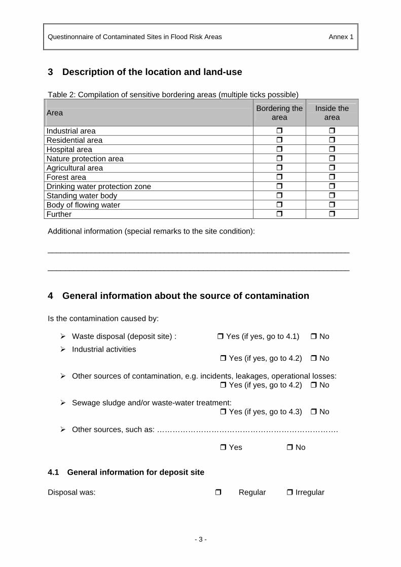
Questinonnaire of Contaminated Sites in Flood Risk Areas Annex 1
- 3 -
3 Description of the location and land-use Table 2: Compilation of sensitive bordering areas (multiple ticks possible) Area
Bordering the area
Inside the area
Industrial area Residential area Hospital area Nature protection area Agricultural area Forest area Drinking water protection zone Standing water body Body of flowing water Further Additional information (special remarks to the site condition): ______________________________________________________________________ ______________________________________________________________________
4 General information about the source of contamination Is the contamination caused by:
Waste disposal (deposit site) : Yes (if yes, go to 4.1) No
Industrial activities Yes (if yes, go to 4.2) No
Other sources of contamination, e.g. incidents, leakages, operational losses: Yes (if yes, go to 4.2) No
Sewage sludge and/or waste-water treatment:
Yes (if yes, go to 4.3) No
Other sources, such as: …………………………………………………………….
Yes No
4.1 General information for deposit site Disposal was: Regular Irregular

Questinonnaire of Contaminated Sites in Flood Risk Areas Annex 1
- 4 -
Waste was disposed in (multiple ticks possible): Landfills Disordered deposit Combustion residues Communal deposits Filling of pits Filling of depressions Combination Others ______________________________ Other relevant information: _________________________________________________ _______________________________________________________________________ _______________________________________________________________________ _______________________________________________________________________
4.2 General information for industrial site and/or abandoned industrial site or other sources of contamination, e.g. incidents, leakages, operational losses
Short description of surface and subsurface installations (e.g. pipes, vessels, tanks), which can cause a hazard potential for the environment: ______________________________________________________________________ ______________________________________________________________________ ______________________________________________________________________
Please list the installations in the following tab. 3:
Table 3: List of installations Installation is built Installation is
Installation
Volume in m³
(if known)
Abo
ve
grou
nd
Und
er-
grou
nd
On
wat
er
surfa
ce
Em
ptie
d
save
d ag
ains
t up
-drif
t
save
d ag
ains
t le
akag
e
seal
ed

Questinonnaire of Contaminated Sites in Flood Risk Areas Annex 1
- 5 -
Is the subsurface of the installation affected by pollution? (proof according to organoleptic test)
Yes No not sure Did incidents occur? Yes No Year of incident(s): ______________________________________ Type of substances/chemicals set free: ______________________________________ Amount of substances/chemicals set free: ______________________________________ Other relevant information: ______________________________________ _______________________________________________________________________ _______________________________________________________________________
4.3 General information for sewage sludge and/or waste-water treatment Type of treatment: ______________________________________ The treatment plant was constructed in the year: ________________________________ Capacity of the treatment plant: ________________________________ Condition of the sewerage system is:
Good Insufficient Unpredictable Condition of the sewage system is:
Good Insufficient Unpredictable Sewage sludge is/ was disposed/treated
On-site Off-site Other relevant information: ______________________________________ _______________________________________________________________________ _______________________________________________________________________

Questinonnaire of Contaminated Sites in Flood Risk Areas Annex 1
- 6 -
5 History of the property use The information about former land-use of the property indicates possible contamination at the site. The former land-use has to be filled in chronological order in table 4.
Table 4: List of former use of the site
Time frame Former use Confirmed Not confirmed
Probable contamination
6 Status of the property The table 5 refers to information about the present situation of the property and the present activities at a site. Table 5: Status of activities at the property Status
Yes No
Closed-down Closed-down with official consent Operating Operating with permit Listed for control Others:
7 General information about the flooding potential Is the contaminated site safe against flood events?
Yes No Unpredictable

Questinonnaire of Contaminated Sites in Flood Risk Areas Annex 1
- 7 -
Is the whole contaminated site endangered by flooding or only parts?
Whole site Parts
Reasons for flooding:
Rain event Yes No
By back pressure from water bodies or canals: Yes No
By rising groundwater levels as a result of extended periods of high water
Yes No
Which data confirmed the danger of flooding?
Monitoring data Yes No
Hydrological surveys Yes No
Contemporary witness Yes Yes
Others: Specify: ____________________________________________________
8 General information about remediation measures and/or preventive measures set at a contaminated site
Are remediation measures and/or preventive measures already implemented to lower the risk of flooding at a contaminated site?
Yes No
If yes which measures are set?
Excavation of contaminated soil Appropriate relocation and disposal of waste Relocation and intermediate storage of waste Drainage and intermediate storage of leachates Technical measures against flooding
Others ________________________________________________
Remediation/decontamination of contaminated sectors
Bioremediation Soil washing Thermal treatment Leachates drainage and treatment
Others ________________________________________________

Questinonnaire of Contaminated Sites in Flood Risk Areas Annex 1
- 8 -
Protective and restrictive measures Sealing of surface Encapsulation of contaminated volume Encapsulation of tanks and vessels Building of retention basin Restoration of retention basin Building of safety dams Restoration of safety dams Leachate collector system Leachate treated Cover system Liner system Monitoring and control of the landfill body Monitoring and control of safety systems Restricted use of the property Prohibition to access Closure of the property Others ________________________________________________
9 General information about the mobility of hazard contaminants Danger arising from the emission of contaminants hazardous to water in case of flooding depends on the mobility of the contaminant and the solubility of the harmful substance.
This chapter gives information whether the contaminants are mobile in case of flooding or not.
The mobility of hazard substances is caused by:
Human error Yes No
Shockwave Yes No
Heavy rain events Yes No
High water Yes No
Human error is mainly characterized through activities which lead to contaminants loss caused by improper locking or fixing of installations (e.g. if a sludge treatment facility is not locked early enough since the flood occurs).
Shockwave could cause significant destruction on dams, retention basins and installations or even a flush away of deposits or dumps, which will lead to a contaminant discharge if they are insufficiently saved. Shockwave appear predominantly in narrow valleys.
Heavy rain events could cause an instability of constructions, which lead to a less function ability of safety installations (e.g. safety dams, groundings or retention basins).
High water could cause a raising and destruction of underground storage facilities, an instability of constructions and a mobilizing of contaminants in unsaturated contaminated volume.

Questinonnaire of Contaminated Sites in Flood Risk Areas Annex 1
- 9 -
Hazard substances (please fill in table 6):
Table 6: Estimation of the mobility of hazard substances
Mobility is Hazard
substance High Medium Low Unpredictable
10 Former Investigations of the property Has the property already been investigated with regard to the hazard potential?
Yes No If yes, which investigation:
Historical investigation Preliminary investigation Detailed investigation
Description of the investigation: _______________________________________________________________________ _____________________________________________________________________________________________________________________________________________________________________________________________________________________ Source of information of the investigation: _____________________________________________________________________________________________________________________________________________________________________________________________________________________
Were contaminated area(s) identified?
Yes No
If no, a detailed investigation has to be started if the suspicion of contamination cannot be excluded.

Questinonnaire of Contaminated Sites in Flood Risk Areas Annex 1
- 10 -
If yes, were remedy measures already taken to prevent hazards in case of flooding?
Yes
No If no, plan for remedy action needs to be be started
If yes, which measures? Description of the remediation measurements (see also chapter 3.2.): ____________________________________________________________________________________________________________________________________________________________________________________________________________________________________________________________________________________
Short-term measures: • Is no conclusive data available, data research has to be started. Contact to
meteorological network agencies is necessary • If no data is available about the mobility potential of contaminants in case of
flooding, a hydro-geological investigation has to be started. • To avoid impacts on the environment abandoned installations have to be cleared
and/or removed • Prove the stability of dams and the dimension of retention basins (whether they
are sufficiently dimensioned and constructed for shock wave events or heavy rain events).
• Prove if mobilising of contaminants caused by high water could be avoided by sealing of contaminated volume or locking of installations
Medium and long term measures
• To avoid impacts on the environment abandoned installations have to be sealed.
• Build sufficiently dimensioned dams and retention basins to mitigate the impact of shockwave and heavy rain events.
• To avoid the impact of shockwave remove installations and contaminated volume from the flood risk area
• If the investigation does not affirm an adequate dimensioning start to reconstruct old safety installations or build new safety installations

Final Report, M2 methodology / checklist – Annexes
UNDP/GEF DANUBE REGIONAL PROJECT
APPENDIX 2
CHECKLIST FOR THE INVESTIGATION AND RISK ASSESSMENT OF CONTAMINATED SITES IN FLOOD RISK AREAS
ANNEX 2: BRANCH CATALOGUE OF GERMANY


Branch Catalogue of Germany Annex 2
- 1 -

Branch Catalogue of Germany Annex 2
- 2 -

Branch Catalogue of Germany Annex 2
- 3 -

Branch Catalogue of Germany Annex 2
- 4 -

Branch Catalogue of Germany Annex 2
- 5 -

APPENDIX 2
CHECKLIST FOR THE INVESTIGATION AND RISK ASSESSMENT OF CONTAMINATED SITES IN FLOOD RISK AREAS
ANNEX 3: EUROPEAN WASTE CATALOGUE


European Waste Catalogue Annex 3
- 1 -

European Waste Catalogue Annex 3
- 2 -

European Waste Catalogue Annex 3
- 3 -

European Waste Catalogue Annex 3
- 4 -

European Waste Catalogue Annex 3
- 5 -

European Waste Catalogue Annex 3
- 6 -

European Waste Catalogue Annex 3
- 7 -

European Waste Catalogue Annex 3
- 8 -

European Waste Catalogue Annex 3
- 9 -

European Waste Catalogue Annex 3
- 10 -

European Waste Catalogue Annex 3
- 11 -

European Waste Catalogue Annex 3
- 12 -

European Waste Catalogue Annex 3
- 13 -

European Waste Catalogue Annex 3
- 14 -

European Waste Catalogue Annex 3
- 15 -

European Waste Catalogue Annex 3
- 16 -