Designing Cross-country pipelines for Saudi...
23
Designing Cross-country pipelines for Saudi Aramco using GIS Prepared by: Eyad A. Hawari
Transcript of Designing Cross-country pipelines for Saudi...

Designing Cross-country pipelines for Saudi Aramco using GIS
Prepared by: Eyad A. Hawari

Outline
• Introduction
• Project
• Case study
• Research
• Summary

Introduction
• Presently over 275 individual pipelines, totaling approximately 22,000 kilometers of pipe, carry a wide variety of crude oil, gas, and hydrocarbon products between GOSP’s and downstream processing and terminal facilities.
• These pipelines have diameters that vary from 6” to 56” and range in age from new to over 70 years.
• Existing pipeline corridors are congested with pipelines and it is a challenge to construct a new one.

Project
• The project is to identify the layers and factors affecting route of cross-country pipelines which going to be used in GIS to help in designing new pipelines.
• The project will be limited to:
• Saudi Arabia
• Designing standards of Saudi Aramco
Case Study
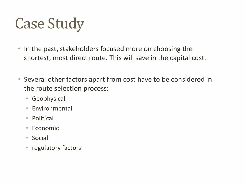
• In the past, stakeholders focused more on choosing the shortest, most direct route. This will save in the capital cost.
• Several other factors apart from cost have to be considered in the route selection process:
• Geophysical
• Environmental
• Political
• Economic
• Social
• regulatory factors

Case Study
• Some of the commonly used variables include the following:
• Shortest distance from Source to Market
• Least grading (removal of tress etc)
• Cost associated with right of way
• Slope of terrain
• Number of stream, road, and railroad crossings
• Substrate (rock, soils etc)
• Existing laws and regulations (wetlands)
• Proximity to Population centers
• Utilization of existing utility corridors and easements
• Other engineering factors

Case Study

Research
• Focused areas will be:
• Type of layers should be constructed to be used in GIS application.
• Saudi Aramco engineering standards related to cross-country pipeline design.

Pipeline network in northern area
This map shows Pipelines network in northern area (by Saudi Aramco)

Overall Map
This map shows the area from Al-Saffaniyah to Ras Tanura

Berri Area
This plan shows Berri Gas Plant and Berri Junction

Berri Junction
This map shows the congested crossing at Berri junction

Ju’emah Juction
This map shows the congested crossing at Ju’emah junction near Ras Tanura

KRT corridor at Ras Tanura
This map shows Raheemah neighborhood at Ras Tanura

RC pipe racks corridor
This map shows the RC pipe Racks corridor going from Jubail 1 to Jubail 2

Saffaniyah Area
This map shows cemetery next to pipeline corridor

Area Classification
• Based on population concentration, the area classification will be determined.

Spacing between parallel pipelines & overhead power lines
• There are minimum horizontal spacing between any pipeline and overhead power line.
• Based on the power line voltage the minimum spacing will be determined.
• Minimum vertical spacing is not less than 9 m.

Pipeline crossing overhead power lines
• Minimum crossing angle is between 45 and 135 degrees.
• Minimum spacing between power line poles and any pipeline not less than 15 m.

Sectionalizing Valves Location
• Based on the product and area classification the location and the number of sectionalizing valves will be determined.

Emergency Isolation Valves
• Location of EIV will be located at both ends of any pipeline.
• EIV shall be located based on population index
classification.
Summary
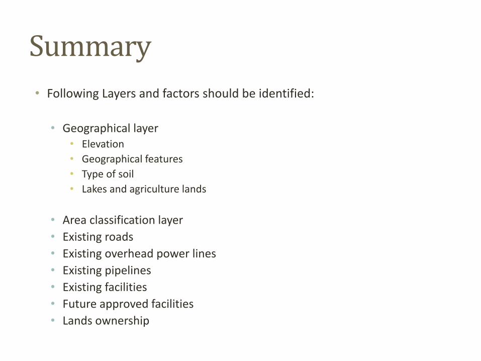
• Following Layers and factors should be identified:
• Geographical layer • Elevation
• Geographical features
• Type of soil
• Lakes and agriculture lands
• Area classification layer
• Existing roads
• Existing overhead power lines
• Existing pipelines
• Existing facilities
• Future approved facilities
• Lands ownership

Thanks