Designing and Implementing Mobile Learning Geography Lessons @Labrador Park Ms Elissa Goh Email:...
34
Designing and Implementing Mobil e Learning Geography Lessons @Labrador Park Ms Elissa Goh Email: [email protected] Mr Mohamad Khirsyaban Iskandar Email: [email protected]
-
Upload
keila-stoughton -
Category
Documents
-
view
217 -
download
1
Transcript of Designing and Implementing Mobile Learning Geography Lessons @Labrador Park Ms Elissa Goh Email:...

Designing and Implementing Mobile Learning Geography
Lessons @Labrador Park Ms Elissa Goh
Email: [email protected] Mohamad Khirsyaban Iskandar
Email: [email protected]

Programme
• Approach and trail activities
• Development route map and operational challenges
• Learning points and reflections

Welcome to Labrador Park!


Station A: Wonders of the WindStage 1: Creating a need to knowStudents are to observe their surrounding and postulate a hypothesis for the closing of the rocky shore and jetty
Stage 2: Gathering dataStudents have to mark out the human features onto a map
Stage 3: Exercising ReasoningStudents will craft possible reasons for stage 1 through observation of the environment


Station A: Wonders of the Wind
Why is the jetty closed?
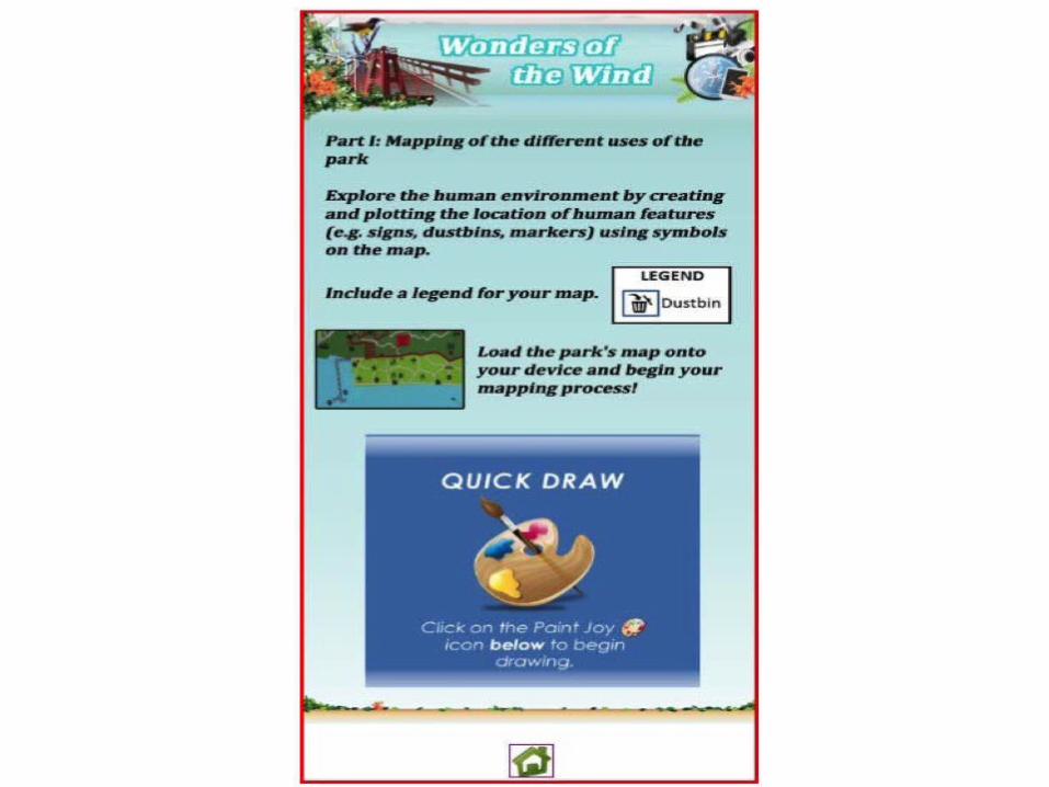

Station A: Wonders of the WindMapping human
features

Station B: Red BeaconStage 1: Creating a need to knowStudents use their five senses to explore the environment and pose a question about their observations
Stage 2: Gathering dataa. Students sketch the view of Sentosa Island and its surroundingsb. Students make observations about the various types of economic, social and environmental features/activities in the landscapec. Students interview park users on their interactions with the environment
Stage 3: Exercising ReasoningStudents will craft a possible hypothesis on the key question 'why protect the coast at Labrador Park' after finding out more informaiton in Stage 2


Station B: Red Beacon
Representing Labrador Park


Station B: Red BeaconField Sketching
(diagnostic)

Station C: Lookout DeckStage 1: Creating a need to knowStudents are to use their sense of touch, smell, taste and hearing to identify elements of the physical and natural environment
Stage 2: Gathering dataStudents have to carry out a bipolar survey based on their assessment of the environment
Stage 3: Exercising ReasoningStudents will explain differences between the photograph given and the scenery around them

Station C: Lookout DeckUsing their five senses


Station D: Berlayer CreekStage 1: Creating a need to knowStudents observe their surroundings to spot animals in the mangrove area
Stage 2: Gathering dataStudents map the distribution of different species of mangroves along the river
Stage 3: Exercising ReasoningStudents come up with a general description of the distribution of different types of plants in the mangrove area

Observation skills: Identify and describe features and patterns

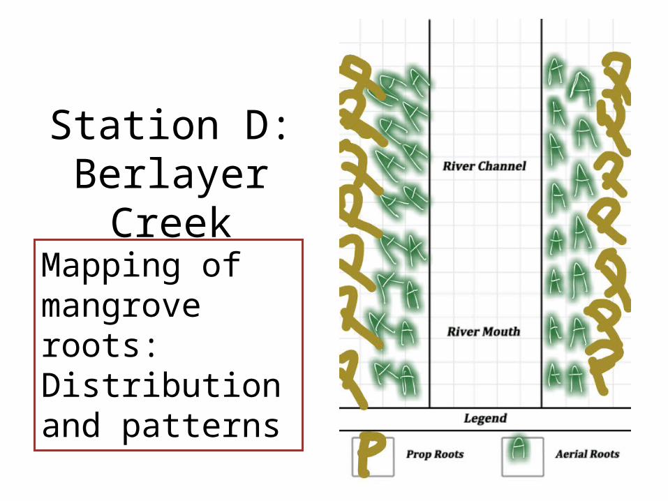
Station D: Berlayer Creek
Mapping of mangrove roots: Distribution and patterns
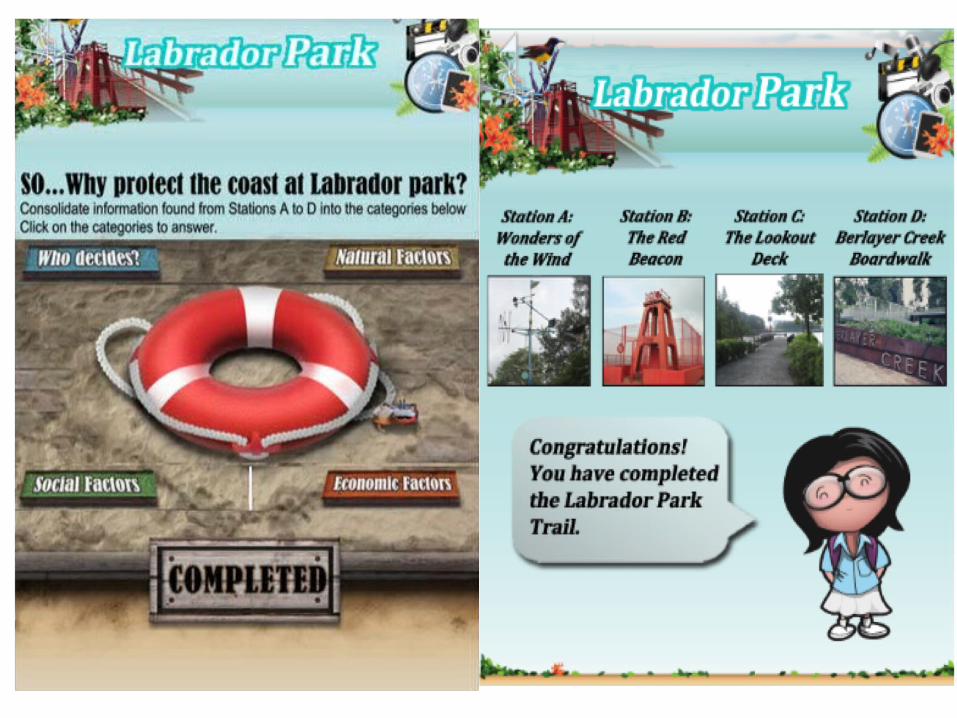

Image Recognition:Station A: Wonders of the Wind
Why is the jetty closed?


Image Recognition:Station A: Wonders of the Wind
Why is the jetty closed?

Labrador Park Trail Route Map from paper to screen
Dec-Jan
2011
•Develop aims for engaging ICT
•Consideration of curriculum needs and departmental focus (Outdoor Classroom Experiences)
•Discussions with HODs and Subject Teachers
Jan – Feb
2012
•Application for funding
•Discussions with LDR (prior working relationship BTNR trail)
Feb-July
2012
•Discussions with LDR: Content and Technical manifestations
•‘Walk-the-ground’ and customization
•Delivery of trail on 19 & 20 July

Results• Students are engaged especially with the use of mobile
devices during the lesson: 75% engagement rate.• The students are able to articulate their ideas to provide
quality responses to the trail activities as they can relate to their direct experience in the field.
• Students were able to relate their field observations to content learnt/prior knowledge.
• Direct experience allowed students to explore their questions on any cognitive dissonance between theory learnt and the actual processes observed.

Learning points and more• There is still value in doing some of the activities using
traditional ‘pen-and-paper’ method instead of on the device, for example, sketching due to the level of affordance of the mobile device.
• A blended learning approach could be used to maximise students’ learning in fieldwork in terms of facilitate the ease of collecting data.
• Follow-up sessions are crucial to provide feedback for learning: address any misconceptions and explore content learnt.
• Following trails could explore the possibilities for self-directed learning and collaborative learning (on and offline)

QUESTION & ANSWER SECTION

THANK YOU
Ms Elissa Goh Email: [email protected]
Mr Mohamad Khirsyaban IskandarEmail: [email protected]