Design and Implementation of Global Navigation Satellite System (GNSS)...
28
Design and Implementation of Global Navigation Satellite System (GNSS) Receiver Final Presentation
Transcript of Design and Implementation of Global Navigation Satellite System (GNSS)...
Design and Implementation of Global Navigation Satellite System
(GNSS) Receiver
Final Presentation

Introduction
• Emerging applications of location based solutions – automobiles, location based ads, emergency services, national security.
• Current operational systems – GPS, GLONASS. Future – Galileo, Compass, IRNSS
• Working principle – Position calculation by trilateration from distances to four satellites.
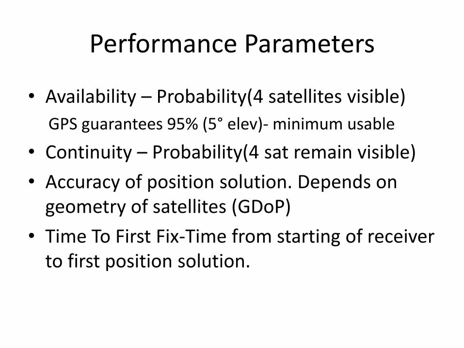
Performance Parameters
• Availability – Probability(4 satellites visible)
GPS guarantees 95% (5° elev)- minimum usable
• Continuity – Probability(4 sat remain visible)
• Accuracy of position solution. Depends on geometry of satellites (GDoP)
• Time To First Fix-Time from starting of receiver to first position solution.

Motivation
Less availability of satellites at high elevation angles in urban areas. Current solutions – QZSS, hybrid receiver.Disadvantages - Cost, limited area Proposed solution – integrated receiver : multiple satellites; more availability, global system.
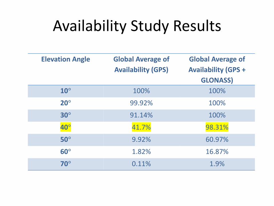
Availability Study Results
Elevation Angle Global Average of
Availability (GPS)
Global Average of
Availability (GPS +
GLONASS)
10° 100% 100%
20° 99.92% 100%
30° 91.14% 100%
40° 41.7% 98.31%
50° 9.92% 60.97%
60° 1.82% 16.87%
70° 0.11% 1.9%

Availability Map at 40° Elevation
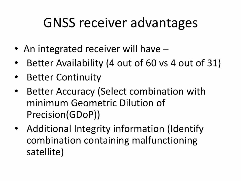
GNSS receiver advantages
• An integrated receiver will have –
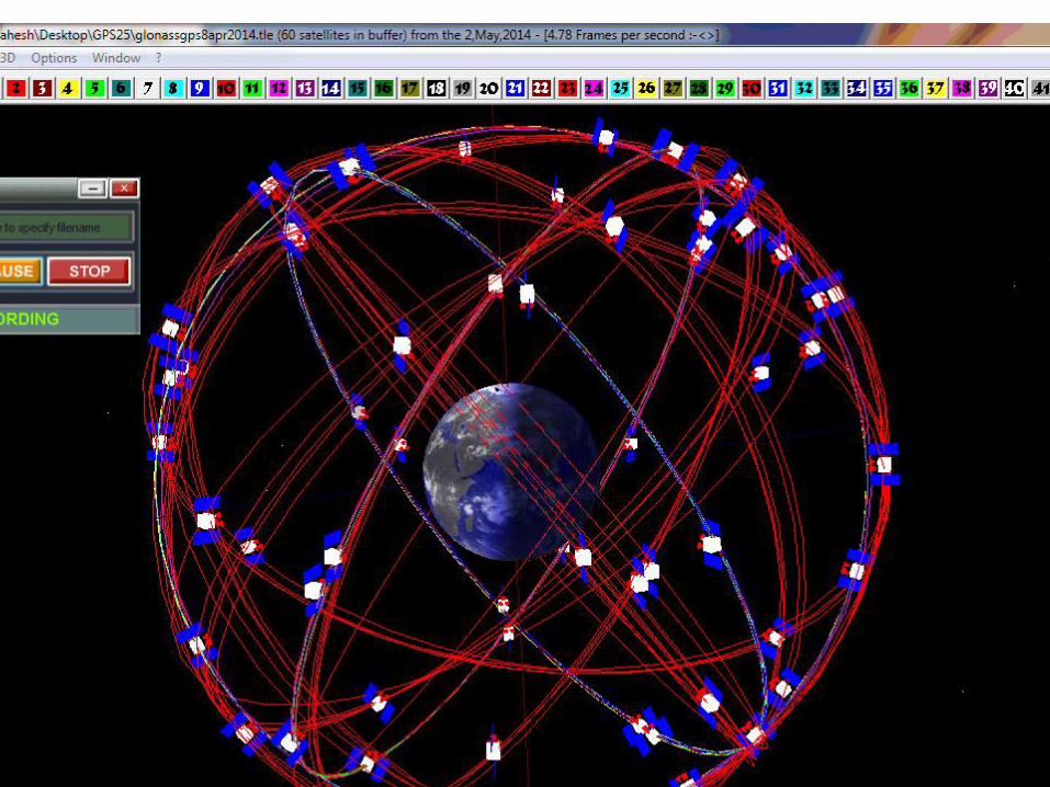
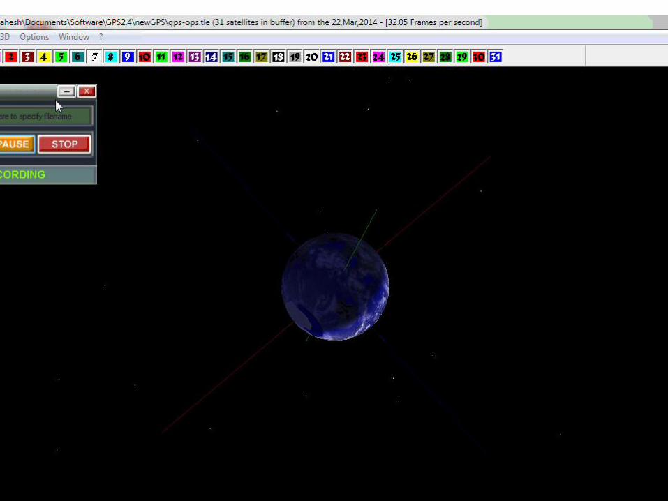
• Better Availability (4 out of 60 vs 4 out of 31)
• Better Continuity
• Better Accuracy (Select combination with minimum Geometric Dilution of Precision(GDoP))
• Additional Integrity information (Identify combination containing malfunctioning satellite)
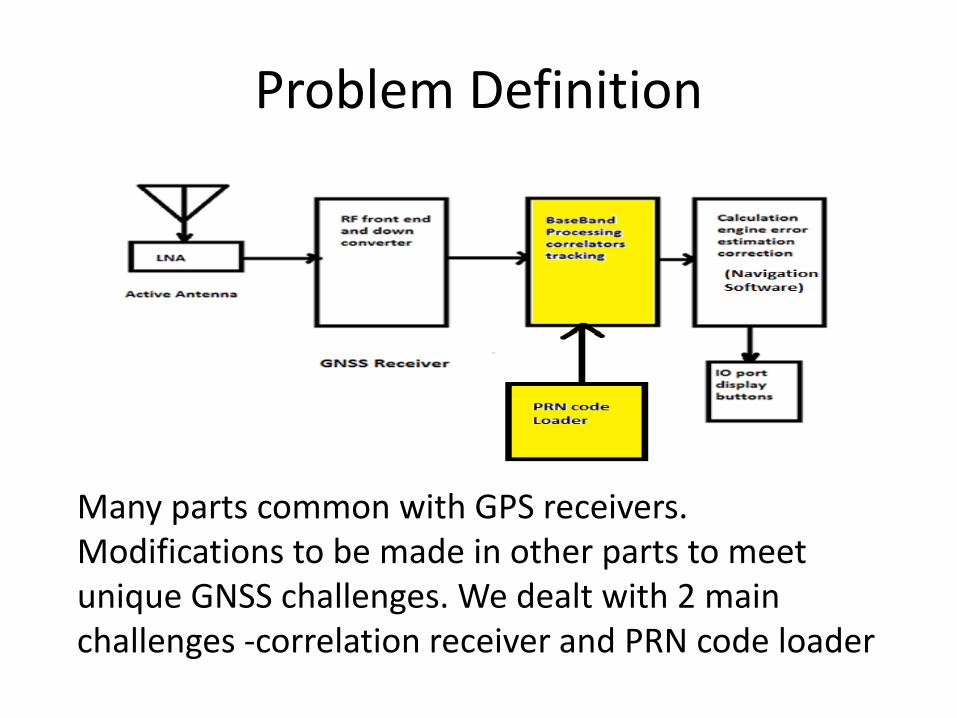
Problem Definition
Many parts common with GPS receivers. Modifications to be made in other parts to meet unique GNSS challenges. We dealt with 2 main challenges -correlation receiver and PRN code loader
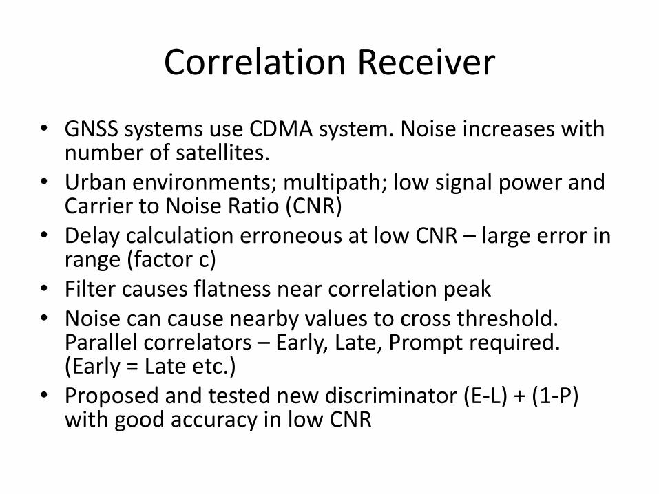
Correlation Receiver
• GNSS systems use CDMA system. Noise increases with number of satellites.
• Urban environments; multipath; low signal power and Carrier to Noise Ratio (CNR)
• Delay calculation erroneous at low CNR – large error in range (factor c)
• Filter causes flatness near correlation peak• Noise can cause nearby values to cross threshold.
Parallel correlators – Early, Late, Prompt required. (Early = Late etc.)
• Proposed and tested new discriminator (E-L) + (1-P) with good accuracy in low CNR
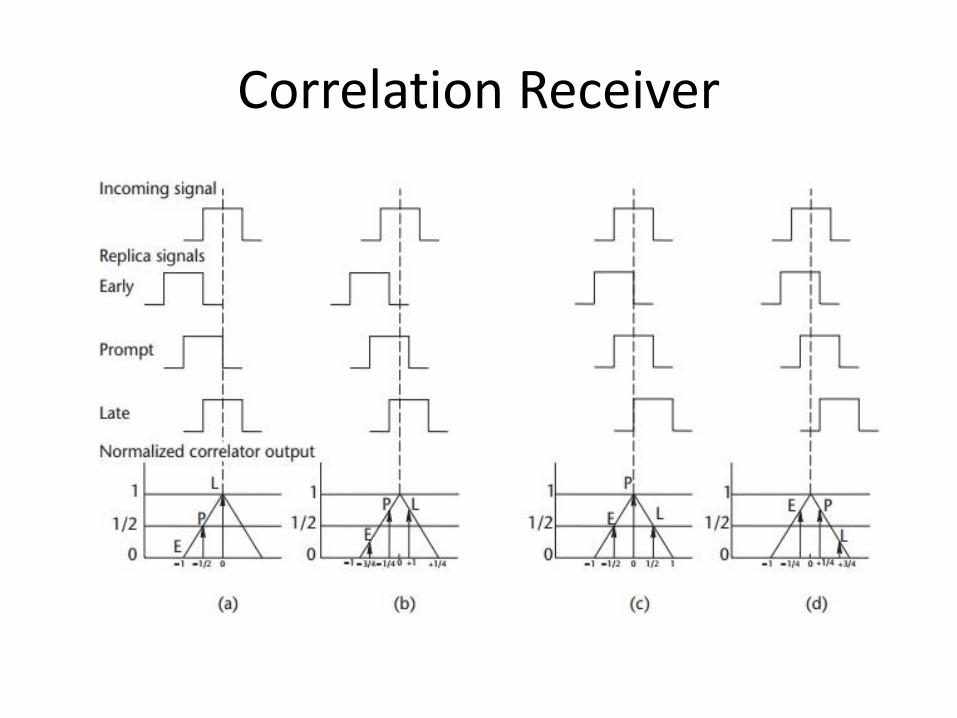
Correlation Receiver
Correlation Receiver
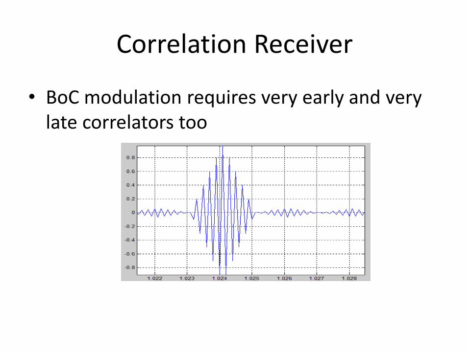
• BoC modulation requires very early and very late correlators too
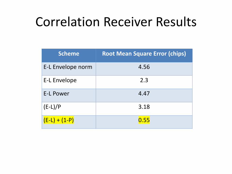
Correlation Receiver Results
Scheme Root Mean Square Error (chips)
E-L Envelope norm 4.56
E-L Envelope 2.3
E-L Power 4.47
(E-L)/P 3.18
(E-L) + (1-P) 0.55
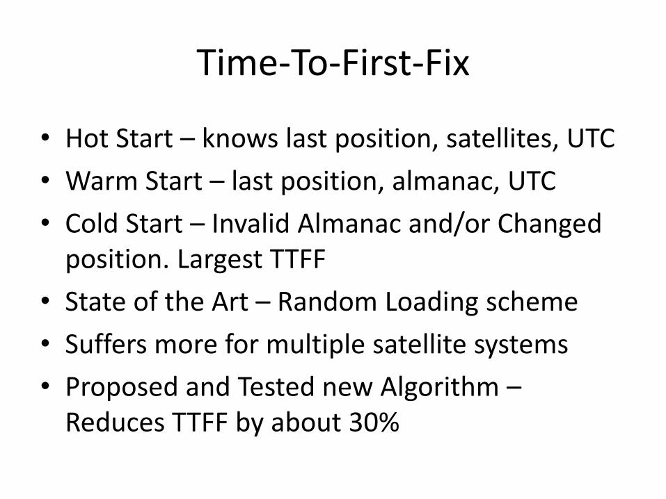
Time-To-First-Fix
• Hot Start – knows last position, satellites, UTC
• Warm Start – last position, almanac, UTC
• Cold Start – Invalid Almanac and/or Changed position. Largest TTFF
• State of the Art – Random Loading scheme
• Suffers more for multiple satellite systems
• Proposed and Tested new Algorithm –Reduces TTFF by about 30%
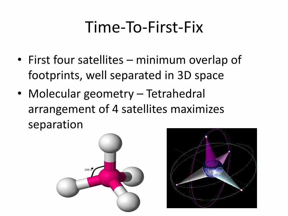
Time-To-First-Fix
• First four satellites – minimum overlap of footprints, well separated in 3D space
• Molecular geometry – Tetrahedral arrangement of 4 satellites maximizes separation
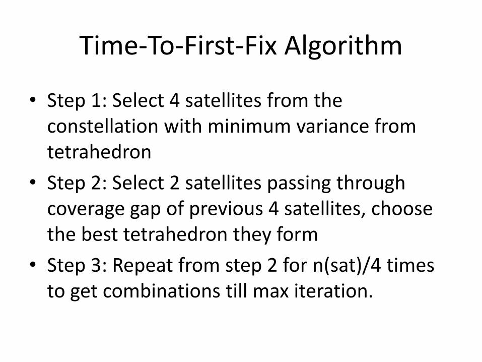
Time-To-First-Fix Algorithm
• Step 1: Select 4 satellites from the constellation with minimum variance from tetrahedron
• Step 2: Select 2 satellites passing through coverage gap of previous 4 satellites, choose the best tetrahedron they form
• Step 3: Repeat from step 2 for n(sat)/4 times to get combinations till max iteration.

Coverage Map Iteration 1
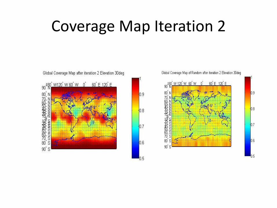
Coverage Map Iteration 2

Iterations Required
Number of Iterations required to reach 95% conditional
probability
Elevation
Angle
Algorithm
It
Random It Reduction
(%)
GPS 10 1 2 50
20 2 3 33.33
30 3 4 25
40 3 4 25
(GPS +
GLONASS)
10 1 2 50
20 2 3 33.33
30 3 4 25
40 5 6 16.66
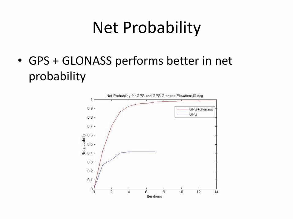
Net Probability
• GPS + GLONASS performs better in net probability
Conclusions
• Quantitative results support the fact that including GLONASS increases availability at higher elevation angles
• Proposed and successfully tested new discriminator for accurate delay estimation in low CNR scenario
• Proposed and successfully tested new algorithm for reduced time to first fix in cold start
Future Directions
• Correction for ionospheric errors exploiting multi system constellation.
• GDoP minimization by optimum satellite geometry
• Inclusion of other systems – Galileo, Compass
References
• GPS/GLONASS Interface Control Documents
• IS-GPS-200G
• IS-GPS-705C
• IS-GPS-800C
• ICD-GLONASS-5.1-(2008)
References
• Papers
• Satellite Orbits Based Sky Search by MaristellaMusso, Gianluca Gera and Carlo S. Regazzoni.
• Propagating PZ 90 to WGS 84 Transformation Parameters by Yuri A. Bazlov, Viktor F Galazin, Boris L. Kaplan, Valery G Maksimov, Vladimir P Rogozin
References
• Websites• http://www.movingsatellites.com/e_gps.html• Professor Wolfgang Soll’s website, containing the
GPS 25 software• http://www.celestrak.com/NORAD/elements/• NORAD Two Line Element Sets for GPS, GLONASS
and other systems • Books• Understanding GPS: Principles and Applications
byE.D Kaplan and C.J Hegarty