DEPARTMENT OF MINERALS AND ENERGY 0123,38 · PDF fileReport on overseas visit August-December...
30
I I I I, 'I <I 'I I I I I DEPARTMENT OF MINERALS AND ENERGY 0123,38 BUREAU OF RESOURCES, GEOLOGY AND BMR Record 1974/46 c.3 Record 1974/46 REMOTE SENSING STUDY IN FRANCE AND BRAZIL Report on overseas visit August-December 1973 by Co Maffi The information contained in this report has been obtained by the Department of Minerals and Energy as part of the policy of the Australian Government to assist in the exploration and development of mineral resources. It may not be published in any form or used in a company prospectus or statement withoutthe permission in writing.Qfthe Director. Bureau of Mineral Resources. Geology and Geophysics. o
Transcript of DEPARTMENT OF MINERALS AND ENERGY 0123,38 · PDF fileReport on overseas visit August-December...

I I I
I, 'I <I
'I I I I I
DEPARTMENT OF MINERALS AND ENERGY
0123,38
BUREAU OF M~NERAl RESOURCES, GEOLOGY AND GEOPHYS~CS
BMR Record 1974/46
c.3
Record 1974/46
REMOTE SENSING STUDY IN FRANCE AND BRAZIL Report on overseas visit August-December 1973
by
Co Maffi
The information contained in this report has been obtained by the Department of Minerals and Energy as part of the policy of the Australian Government to assist in the exploration and development of mineral resources. It may not be published in any form or used in a company prospectus or statement withoutthe permission in writing.Qfthe Director. Bureau of Mineral Resources. Geology and Geophysics.
o

I I I I I I I I I I I I I I I I I I I I
Record 1974/46
REMOTE SENSING STUDY IN FRANCE AND BRAZIL
Report on overseas visit August-December 1973
by
C. Maffi

I I I I I I I I I I I I I I I I I I I I
1.
2.
3.
4.
5.
6.
7.
SUMMARY INTRODUCTION
CONTENTS
THE SUMMER SCHOOL ON REMOTE SENSING OF NATURAL RESOURCES
PROGRAM OF THE COURSE
Remote Sensing systems Potential applications of Remote
Sensing Data acquisition Data processing techniques Data exploitation Legal aspects Visits Working groups
COMMENTS
Program Textbook Teachers Participants
THE FEDERAL UNIVERSITY OF BAHIA
THE BRAZILIAN INSTITUTE FOR SPACE RESEARCH (INPE)
GENERAL INFORMATION
DIRECT RECEIVING FACILITY FOR ERTS DATA
CATALOGS OF ERTS DATA
AUTOMATIC INTERPRETATION
THE RADAM PROJECT
GENERAL INFORMATION
METHODS
General method Geology Geomorphology Soil Vegetation Potential Uses
CONCLUSIONS AND RECOMMENDATIONS
REFERENCES
APPENDIX: SUMMER SCHOOL ON REMOTE SENSING OF NATURAL RESOURCES List of participants
Page
1
2
2
2 2
2 3 5 7 7 7
7
7 8 8 8
9
9
9
10
10
11
12
12
12
12 12 13 14 14 14
14
15
I I I I I I I I I I I I I I I I I I I I
Figure
Figure
Figure
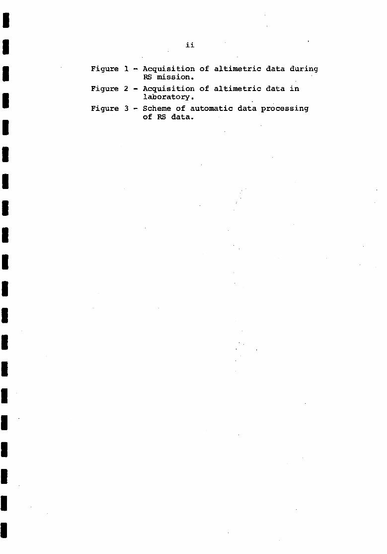
ii
1 - Acquisition of altimetric data during RS mission.
2 - Acquisition of altimetric data in laboratory.
3 - Scheme of automatic data processing of RS data.
I I I I I I I I I I I I I I I I I I I I
SUMMARY " \
From 21 August to 21 September 1973, I attended the Summer School on Remote Sensing of Natural Resources at Tarbes, France. Then, on leave without pay from the Department, I worked for two months with the UNESCO mission in Salvador, Brazil. On my way back to Aust~a1ia I visited the Brazilian Institute for Space Research at Sao Jose dos Campos, State of Sao Paulo, and the Headquarters of the Radam Project for the development of the Amazon region at Be1em, State of Para.
This report contains a detailed description of the program and some comments on the organization of the Summer School; and all the information gathered at Sao Jose and Be1em.
If a Summer School on Remote Sensing is organized in Australia, the program could be similar to that of the Tarbes school, but the course should "be more oriented towards practical applications.
A resources particularly coverage and
direct receiving facility for data satellites is scientifically to disciplines which require
readily available data.
from Earth valuable,
repetitive
The potential land uses of unexplored regions can be assessed by remote sensing methods. Side-looking radar imagery is valuable in the reconnaissance mapping of large areas, particularly in the tropics.
According to interpretation of remote geomorphology is feasible. investigating.
a Brazilian expert, automatic sensing data for geology and
This technique may be worth
..... :~
I I I I I I I I I I I I I I I I I I I I
1. INTRODUCTION
Remote Sensing (RS) can be defined as the complex of methods for obtaining information on a target without physical contact with it.
Research on some areas of RS has been carried out at BMR since 1967 by the Photogeological Section. This work has been limited to methods wh!Sh use electromagnetic energy in the wavelength range 4 x 10- cm t04 cm (visible light, photographic infrared, thermal. energy, microwaves) and to the application of such methods to geological mapping.
To gain experience on RS, officers of the section have attended meetings and visited several overseas organizations (for example Maffi, 1972, and Simpson, 1973). But until August 1973 none of them had been specifically trained on RS methods other than photogeology. Early in 1973 the French National Centre for Space Studies (Centre National d'Etudes Spatiales - CNES) organized a Summer School on RS of National Resources under the sponsorship of the United Nations. Attendance of this course provided an opportunity for one of the Section's officers to receive a more formal and thorough training than had been possible before, on techniques which are undergoing rapid development. A further advantage was the possibility of using the experience for the organization of a proposed similar School in Australia.
In 1970, on leave without pay from the Department, I spent ten months in Brazil as a member of the UNESCO team, organ1z1ng undergraduate and postgraduate courses on photogeology at the Federal University of Bahia in Salvador. Early in 1973, UNESCO invited me to give a refresher course at the same University and the Department granted me two months' leave without pay.
It France on my to Australia in RS.
was therefore decided that I should go to way to Brazil, and that during my return trip
I should visit some Brazilian centres engaged
The itinerary of my trip was:
21/8 to 21/9 : Attend the Summer School on RS of Natural Resources at Tarbes, France.
24/9 to 23/11: Work with the UNESCO mission at the Federal University of Bahia, Salvador, Brazil.
26/11 to 30/11: Visit the Brazilian National Space Research (Instituto Pesquisas Espaciais - INPE) at Campos, Brazil.
Institute for Nacional de Sao Jose dos
3/12 to 6/12: Visit the Headquarters of the Radam Project at Belem, Brazil.

-2-
2. THE SUMMER SCHOOL ON REMOTE SENSING OF NATURAL RESOURCES
PROGRAM OF THE COURSE
Remote sensing systems
General introduction: Definition of RS - Physical limitations - Practical limitations.
Review of fundamental physical principles: Electromagnetic waves - Sources of electromagnetic radiation - Interactions with objects - Interfering media.
Potential application of remote sensing
Inventory of natural resources:
Types of resources: Mineral resources -Renewable biological resources - Non-renewable biological resources.
Methods of representation of the inventory: Choice of scale - Cartographic methods - Statistical methods.
Limitations ·of the inventory: Time limitations -Accuracy limitations - Equipment limitations.
Balance of natural resources:
Variations in space: Surfaces - Volumes - Specific and selective aspects of RS.
Variations in time: Instantaneous variations Short term variations - Long term variations.
Dynamics of regeneration: Regeneration speedRepetitive RS.
Management of natural management - Management Management and RS.
Data acquisition
Ground data:
resQurces: Concept of and implementation -
Choice and preparation of test sites: PurposeCriteria for choice - Space and time analysis -Preparation and setting.
I I I I I I I I I I I I I I I I I I I I

I I I I I I I I I I I I I I I I I I I I
-3-
Acquisition of data: Parameters to be measured -Instruments - Laboratory measurements - Field measurements - Data cor~elation •
. Vehicles:
Aircraft and helicopters: Choice of vehicleSensors installation - Operational problems.
Balloons: Technology - Operational Payload.
problems -
Satelli tes: Elements of . orbit mechanics-Technology - Present and future programs.
Sensors:
A system approach for obtaining Earth resources information.
Photography: Photographic optics - Black and white emulsions - Colour photography - Comparison of various photographic .methods.
Mechanical scanners: Principles and general outline - Scanning geometry - Radiometer ·techniques - Examples of scanning systems.
Sensors for millimetre and centimetre properties of microwave Instrumentation - Investigation atmosphere and terrestrial surface radiometry.
bands: Basic radiation -of the
by microwave
(Note: The section on Sensors for millimetre and centimetre bands was not presented. It was partly replaced by a lecture on Side-Looking Airborne Radar - SLAR).
Data processing techniques
Analog processing:
Photographic processing: Monochromatic iso-densities - Colour iso-densities - Colour composites of monochromatic images -Multispectral colour iso-densities - Comparison of various processes.
Coherent optical filtering of airphotos: Principles of Optical Fourier Transforms - Properties of OFTs· useful in airphoto analysis - Optical filtering of airphotos - Autocorrelation (analysis of spatial periodicities)-Holography - Pattern recognition.

-4-
Electronic data processing:
Processing of magnetic tape data: Reconstruction and visualization on film or cathode ray tube - Image enhancement by signal transformation (Iso-densities, Contours).
Processing of photographic data: Photo digitizing systems - Possibilities.
, Digital processing:
Geometrical image enhancement:
From photographic records: Elements of photogrammetry - Introduction photogrammetry.
to automatic
From electronic records: Mechanical scanners -Radars - Cathode ray tubes~
Image digitization:
Purpose: Widening of investigation fieldImprovement in accuracy - Possibility of correlation between unlimited number of parameters.
Methods: Flying Spot Analyser - Analysers associated wi th optical·. and electronic microscopes - Microdensitometers.
Principles of densitometry: Physical principles - Microdensitometric systems -Causes of error in microdensitometry.
Example of experimental work.
Data compression and visualization:
Compression: By sampling - By using mathematical transforms - Applications -Comparison of different methods.
Visualization: When should be used - Display equipment (Printers, Screen-and-display consolles, TV Methods - Examples - Limitations.
Spectral signature analysis:
Plotters, screens) -
Theoretical approach: Radiance measurementsAtmospheric effects.
I I I I I I I I I I I I I I I I I I I I

I I I I I I I I I I I I I I I I I I I I
-5-
Practical approach: Data acquisition -Computer techniques - Examples.
General problems of digital interpretation: Intuitive definition of pattern, structure and texture - Mathematical definition of pattern and digital processing - Coding, recognition, and classification of patterns -Choice of a recognition operator (concepts of decision theory).
Analysis and recognition procedures: concept of artificial learning - Concept of
intelligence.
Present programs.
Data exploitation
Exploitation methods:
Limitations: Technical limitations - Climatic and meteorological limitations.
Interpretation Concept of model.
rules: texture
Types of interpretationand structure - Concept of
Exploitation according to field of :~pplication:
Vegetation:
Importance of vegetation cover: Concept of ecosystem - Vegetation and space - Vegetation and time.
~xploitation of vegetation: Principles of tele-identification - Principles of tele-interpretation - Significant syntheses.
Geology: Past, present, and future of photogeology and RS - Strategy of geological interpretation -Possible applications of RS to structural and lithological interpretations - Limitations.
Natural fluids: Terrestrial fluids - Fluid properties versus electromagnetic radiationGaseous, liquid, and solid matters associated with natural fluids ~ RS of gaseous matter - RS of liquid matter - Indirect RS methods applied to groundwater problems.

-6-
Bioclimatology:
Introduction: Definition and scope -' Importance of the concepts of. time and space scales -Permanent and transitory states in nature -Why use RS in bioclimatology.
Fundamental analytical features:
Descriptive studies: Relationship between spectral reflection and, physiological condition of vegetation -Thermal emdssion and energy balance. .
Analytical and explanatory studies: Spectral reflection - State of.health and function of vegetation - Structural analysis of vegetation. . .
Practical synthetic features:
Short term: Empirical applications based on the study of soil c'over, state of health of vegetation, irrigation, frost.
Long term: Applications based on the analytical study of metabolism of water and evapotranspiration - Rate of reaction of vegetation to fluctuating environmental changes - Vegetation structure and leaf indexes - Effects of wind-breaks.
Pollution:
Water pollution: Different. aspects - Available methods for detection - Examples.
Atmospheric pollution: Methods for direct detection.
Case histories.
Different aspects -detection - Indirect
Role of RS in detecting pollution in large areas,
Human action:
Human action phases: Hypopbietic civilizations - Isopoietic civilizations - Hyperpoietic civilizations.
I I I I I I I I I I I I I I I I I I I I

I I I I I I I I I I I I I I I I I I I I
-7-
Organization of management: Pollution control -Resources management - Expected regeneration rate.
Legal aspects
Introduction: Definition of RS -Expected benefits of RS from space.
Legal principles· for the use of RS from space:
RS satellites and international law: The principle of freedom in outer space activities - The principle of national sovereignty.
Need of specific regulations for the use of RS satellites: Role of the UN bodies - Principles of an international regulation.
Set up of legal systems concerning the use of RS satellites: The bilateral framework - The multilateral framework - Example of ERTS system.
Visits
The program included: attendance at the launching of a stratospheric RS balloon at Air-Sur-I'Adour; a visit to Lourdes Airport where aircraft equipped for RS missions were on display; a visit to the Biological Laboratory of Lac D'Aumar in the Pyrenees; a visit to the National Centre for Space Research in Toulouse.
Working groups
No practical work had been programmed and only a few practical applications were shown during lectures. To rectify this the participants proposed, and the course Director accepted, that they organize working groups in the various disciplines. However, the material supplied to the groups to work on was inadequate and of poor quality, so that exchange of information became the main activity of the groups. At a meeting of the working group on geology, I presented and commented on slides of the New Guinea and Mount Isa radar imagery.
COMMENTS
Program
The program covered all phases of RS investigation in the various disciplines.

-8-
Data Acquisition and Data Processing were the most interesting parts for my work because the mathematical-physical principles, the methods, and the instruments that were described are applicable to geological investigations, as well as to other disciplines. Data Exploitation was biased in favour. of vegetation and agriculture applications; geological applications were only briefly outlined.
The character of the course was mainly theoretical, with a strong emphasis placed on the analytical and philosophical aspects of RS. The inclusion of practical sessions, in which the participants could work on specific problems under teacher supervision, would have been a great advantage.
Textbook
The course textbook is still in ,preparation and probably will be mailed to the participants in the near future. During the course the participants had to learn from their own notes; a considerable amount of information went unrecorded.
Teachers
Most lecturers were selected among the best French specialists of the various disciplines, but many of them had little didactic experience.
Information was sometimes provided at such a speed that the participants could not assimilate it or take notes. Many scripts written on the blackboard or projected were not readable beyond the third row of desks; some were not readable at all.
Participants
76 participants from 32 countries attended the course. 30 participants were from France, 13 from other European countries, 13 from Africa, 11 from Asia, 7 from the Americas and 1 each from Australia and USSR. A list of the participants' names and addresses is given in the Appendix.
There were excessive differences in experience and interests among participants. Those with a large experience found many lectures uninteresting. Those without sound bases in mathematics and physics could understand only a minor part of the course. Those who were interested in a single discipline felt that they were wasting their time when other disciplines were extensively covered.
I I I I I I I I I I I I I I I I I I I I

I I I I I I I I I I I I I I I I I I I I
-9-
A more uniform group could have advantage of the course.
taken more
3. THE FEDERAL UNIVERSITY OF nAHIA
According to the original plan, I should have given a refesher course in photogeology to students who had attended my previous course in 1970. On my arrival it was decided instead that I should use the experience gained in France to give a full course on remOte sensing to staff members of the Institute of Geosciences.
I based the course on a simplified version of the Tarbes program, with the addition of practical sessions on the interpretation of airphotos and of thermal, radar, and satellite images. The preparation of the lectures gave me the opportunity of revising the notes taken at Tarbes.
I also assisted some of the research personnel of the Institute with photo and radar-interpretation, and trained two Technical Assistants in the use of simple photogrammetric instruments.
4. THE BRAZILIAN INSTITUTE FOR SPACE RESEARCH (INPE)
General information
INPE is engaged in research projects in several fields, such as radio communications, meteorology, and remote sensing (Maffi, 1972).
The Remote Sensing Group six Branches: Soil Resources, Oceanography, Geography, Data
(SERE) is divided into Mineral Resources, Processing, and
Technical-logistical Support. Each Branch closely collaborates with the others.
At present the Group is working almost exclusively on the interpretation of images from the Earth Resources Technology Satellite (ERTS-l)0 Conventional photo-interpretation techniques are used. Each interpreted image, together with a brief report, is sent to the Brazilian Commission for Space Activities . (Commissao Brazileira Actividades Espaciais, COBAE), which is responsible for the preparation of official reports to NASA.
INPE runs Masters Degree courses on RS for its own staff members. The program is flexible and depends on work requirements and on the availability of teachers. PhD courses will be offered in the near future.

-10-
Direct receiving facility for ERTS data
A receiving facility for direct readout of ERTS data has been set up at Cuiaba in western Brazil, near the geometrical centre of South America.
. At Cuiaba the ERTS data are recorded on computer-compatible tapes (CCTs) in real time, thus avoiding the necessity of using the tape r.ecorders aboard the satellite. From the CCTs the data are processed to geometrically uncontrolled 'quick-look' images at 1:3 369 000 scale, which are used for a preliminary assessment.
In November 1973, when my visit took place, the CCTs had to be sent to the NASA Goddard Space Centre at Maryland, USA, for processing into 1:1 000 000 or larger scale images. Meanwhile the Brazilians were setting up their own processing facility which was expected to become operational early in 19740 The processing facility should be able to handle images for all South .American countries.
The cost to Brazil for setting up the receiving facility was about A$850 000. The main advantages are:
(a) Images obtained from direct readout of satellite data have better resolution. and contrast than those obtained from data that have been stored on the satellite tape recorders until the satellite overflies the United States (i.e. data that were acquired over nations without a direct receiving facility).
(b) Data are received even when the on-board tape recorders are not operating.
(c) Images can be available for study a few hours after data acquisition by the satellite. .(The normal delay for NASA-processed images received at BMR is 8 to 10 weeks).
(d) The CCTs are immediately available for electronic data analysis. (A CCT requested from NASA by CSIRO had not yet been received 3 months after request).
Catalogs of ERTS data
INPE produces two types of catalogs of ERTS data. One of them is a computer listing which contains, for each image, information on date, cloud cover, sun angle and azimuth, image quality, and product type available 0 The entry is by identification number or by Principal Point co':"'ordinates.
I I I I I I I I I I I I I I I I I I I I

I I I I I I I I I I I I I I I I I I I I
-11-
The other catalog is a pictorial index. The base is a map of.Brazil at 1:3 369 000 scale on which the calculated centre-points of the images were plotted. On this map, 70-mm positive prints of the images are appended. In the case of multiple coverage, the im~ge with the least cloud cover and the best quality is used.
Automatic interpretation
At INPE, I had discussions with Professor De Vita, a specialist in electronic data processing. His opinion is that image analysis by means of microdensitometers does not provide reliable data for automatic interpretation because of the many spurious factors contained in the image. Satisfactory results can be obtained by electronically processing data recorded on magnetic tapes from multispectral scanners. In agricultural studies, Professor De Vita reckons that this method could allow the interpreter to identify crops with 100 percent reliability, provided that a sufficient number of channels were flown at a suitable altitude, and that suitable electronic software is available.
According to Professor De Vita, automatic interpretation of RS data for geology. and geomorphology should be possible, provided that, in addition to normal RS data, continuous altimetric data are also fed into a computer which has been trained to identify typical landforms. The altimetric data can be obtained either during the RS mission or, if stereoscopic airphotos are available, in the laboratory.
During the RS mission (Fig. 1) a radar altimeter mounted on a scanning device can be used to record the profile of the terrain overflown. In the laboratory (Fig. 2) twin TV cameras can be used to scan stero-pairs of the airphotos; parallax differences, and thus relative altitudes of the terrain at any point, can be obtained by comparing the signals from the two cameras.
The altimetric data should be introduced into the data processing system (Fig. 3) during the preprocessing stage.
This seems to be a relieving the photogeologist work, thus speeding up the maps. It may be worth while
pro~s1ng technique, capable of of a considerable amount of production of photogeological to investigate its feasibility.

-12-
5. THERADAM PROJECT
General information
Within the Brazilian program for the development of the Amazon Region and nearby areas, the Radam Project has the responsibility of supplying by RS methods basic information on the potential uses of the area. The project is by far the biggest of its type in the world: thi initial plan involved the mapping of 1.5 ,million km (Maffi, 1922); then the Project was exZended to cover 3.7 million km and finally to 5 million km •
About 200 personnel work on the Project; 95 of them are professional staff. They are divided into five sections: Geology, Geomorphology, Soil, Vegetation, and Potential Land Use. The first four ,sections collaborate with each other in the interpretation of RS data and supply information to the fifth section.
The ,area has been entirely covered with Side-Looking Airborne Radar (SLAR). Every 4th SLAR strip was also partly covered with metric camera, multispectral camera, and TV camera pictures. SLAR was used as principal sensor because of its all-weather capability and because it emphasizes terrain features by producing a low-sun-angle effect.
Methods
General method. The entire area was divided into blocks of up to sixteen 1:250 000 sheets, the peripheral blocks being the smallest. Each block is assigned to a team of interpreters, of which at least one is familiar with the region.
The interpretation is done almost entirely on SLAR mosaics at 1:250 000 scale. Airphotos and TV displays are used occasionally in problem areas.
Geology. The work is carried out in consecutive stages:
(a) Gathering and plotting existing information on half-tone radar mosaics.
(b) Annotation, on the same mosaics, of information, such as roads, navigable towns, and airstrips.
(c) Preliminary interpretation.
logistic rivers,
(d) Integration of interpretation within block and with contiguous blocks.
\lo

RADAR ALTIMETER
FIG. 1- ACQUISITION OF ALTIMETRIC. DATA DURING AIRBORNE MISSION
~~~;O~~ 7 t \ I STEREOPAIR TWIN TV CAMERAS
:~;;o~~rLJ I I ~7 \
SIGNALS FROM
TV CAMERAS
PARALLAX DIFFERENCE
FIG.2 - ACQUISITION OF ALTIMETRIC DATA IN LABORATORY
M (G)(423·

I
I I I I I I I I I I I I I I I I I
PRE- PROCESSING
~ PROCESSING
tt ~ . ~~~""YT::rT'> {StatistiCS.
. ~ Contours .
~ ~ --... ~ Densitometric maps a .' Inference values
AMT = Analog Magnetic Tape
AT R = Analog Tape Recorder (playback)
D = Digitizer
I = Interface
AD = Altimetric Data
C = Computer
PP = Processing Program
DTR = Digital Tape Recorder
CCT = Computer Com'patible Tope
I P : Interpretation Program
FIG. 3 - SCHEME OF AUTOMATIC IMAGE PROCESSING
To accompany Record 1974/46M(G) 424

I
I I
I I I I I I' I I I I
(e)
( f)
(g)
(h)
(i)
(j)
(k)
(1)
Planning of locations.
-13-
field check~ Choice of sample
Logistic planning of field check in collaboration with other Sections.
Field check: all Sections to~ether.
Final interpretation.
Integration of final interpretation within block and with contiguous blocks.
Preparation of dye-line maps· at 1:250 000 scale.
Preparation of final maps at 1:250 000, 1:500 000, and 1:1 000 000 scales.
. Report writing.
The preliminary interpretation is done in three steps: first a drainage overlay is prepared; then, on a second overlay superimposed on the first; possible lithological' units are separated by drawing boundaries around areas having uniform drainage pattern; finally structural information is added to the second overlay.
The planning of the field check is done on half-tone mosaics. Before the start of each ,field season, logistic support teams are sent into the area: they are winched to the ground from helicopters on the preselected locations to prepare helipads, bush trails, and camp sites.
The field check is done almost entirely by means of overflights'with light aircraft or helicopters and by spot-landing. Foot traverses are carried out only on problem areas, and kept to a minimum.
In this way a group of 25 to 30 been able to map an average of one 1:250 000 The geological maps produced so far reconnaissance maps, having the purpose o~ of possible mineral interest.
geologists has sheet per week.
are regional isolating areas
Geomorphology. The purpose of the Geomorphology Section is to provide the Potential Land Use Section with information on the general configuration of the land surface. .
On radar mosaics the area is divided into relief units; then these units are further divided into sub-units according to the stage of dissection.
.I..

-14-
Generally the sub-units correspond fairly well with lithological units.
~. For each block the Soil Section prepares radar interpretation keys, after a considerable amount of field sampling. By using these keys and taking into account information on lithology, morphology, and climate, the Section prepares maps of soil type associations.
Vegetation. A preliminary inte~retation of the radar mosaics is done to separate rnorphological-hydrological-climatic un~ts. Then a field check is carried out by overflights _ at altitudes of 20 to 30 m above tree tops and by forest sampling, to relate vegetation associations with the interpreted units. After final interpretation, maps of vegetation associations are prepared.
Potential land uses. The Potential Land Use Section prepares maps which show in different colours the possibility of exploitation in: agriculture and improved pastures, timber, products of natural vegetation, natural pastures, mineral resources. Each Potential Land Use Map is obtained by combining relevant information provided by the other sections, also taking into account climate, accessibility, and conservation problems.
6. CONCLUS IONS AND RECOMMENDATIONS
The Summer School on Remote Sensing of natural resources at Tarbes provided the participants with comprehensive information on the theory of RS methods. Some practical applications were shown to the participants, but no practical work was done.
If a Summer School on RS is to be organized in Australia, the program could be set up using the Tarbes program as a guideline, but the course should be oriented towards practical applications and should include. practical sessions in which the participants could be trained on specific problems chosen within their field of interest. The following recommendations may also be useful:
The organizers should take measures to see that the background of the participants and the level of the course are compatible.
The teachers should be selected from apecialists with at least some didactic experience. If this is impossible, they should be briefed on elementary lecturing techniques.
I I I I I I I I I I I I I I I I I I I I

I I I-I I I I I I I I I I I I I 1 I I I
-15-
The textbook of the course should be distributed before or during the course.
A direct rece~v~ng facility for. satellite data is scientifically valuable for an ERTS-using nation. The justification for the installation of such a facility in Australia depends on the value of ERTS data to disciplines such as agriculture, forestry, land management and fisheries, which can take advantage of repetitive data and of the availability of such data immediately after their acquisition by the satellite.
The feasibility of automatic interpretation of RS data for geological and geomorphological appiications should be investigated.
The potential land uses of unexplored regions can be assessed by RS methods. SLAR is a valuable tool in the reconnaissance mapping of large areas, particularly those with a tropical climate.
7. REFERENCES
MAFFI, C., 1972 - The United Nations panel meeting on the establishment and implementation of research programmes in remote sensing - Brazil, November-December 1971 - Bur. Miner. Resour. Aust. Rec. 1972/15 (unpubl.).
SIMPSON, C.J., 1973 - Observations on interpretation of data from the Earth Resources Technology Satellite ERTS-l - Report on overseas visit to the U.S.A., Canada and U.K., 27 September-5 December 1972. Bur. Miner. Resour. Aust. Rec. 1973/90 (unpubl.).

APPENDIX
SUMMER SCHOOL ON RmOTE SmSING OF NATURAL RESOURCES
Name
ABIODUN ADIGu/'l
ADRIEN JOSEPH
, AGHASSI ASDOL.VAHID
ALLY RAYMONDE.
AMEVOH ZOMAVI
BARBI ERI·PALESTINO
CARL.OS
BARRESI GIANGRANDE
BEAUCOURT DANIEL.,
LIST OF PARTICIPANTS
Nation
HA'i'r I ENNE
IRANIENNIC
CANADIENNE
TOGOL.AISE
ITAL.I ENNE
Professional Address
DEPARTMENT OF AGRI~UL.TURAL. ENGINItERING
UNIVERSITY OF IFE
ILE-IFE (NIGERIA)
LASORATOIRE 0': CHIMI,It
DEPARTIliMENT DE L.AGRICUL.TURIt
SERVICE Dlt9 SOL.S
PORT .AU.PRINCE. HAI'TI (GRANDEs ANTIL.L.Ee)
INSTITUT HYDROL.OGIQUIt
64, AVItNUIt GHADESSI
NORD BoULEVA~D ELIZASETH
TEHERAN (IRAN)
ECOL.1t POL.YTECHNIQUE
DfpARTEMENT DE GENIE GEO~OGIQUE 2500 MARIE GUVARD
MONTREAL 250 - PROVINCE ~U QUEBEC (CANADA)
SORAD
DIVISION Ge;NIE RURAL.
DAPANGO (ToGO]
INSTITUTO DE PESQUISAS ESPACIAI9
AIo!ENIDA DOS ASTRONAUTAS, 1758 CAIXA POSTAL. 515 12200 SAO JOSE DOS CAMPOS - SAO PAUL.O (BRASIL)
COMPAGNIA INDUSTRIAL.E AEROSPAZIALE S. P. A.
VIALE 01 VIL.LA GRAZIOL.I, 23 00198 ROMA (ITA ... IA)
MINISTERE DU PL.AN ET DES AIDES EXTEFHEURES
DIRECTION DU PLAN ET DU DEVEI.OPPEMENT
B. P. N" 286 FORT-LAMY (TCHAD)
·VV

BECKEr~ F"","~"'S FRAN<fAIt;E
BENDERITTER YVI:S FRANt;iAISa:
BLAMONT DENIS F RAN'iAI6E
BOUMA MAURICE, GABONAISE
BROSSE J EAH-M H;;H~L. - F RAN'iAII5E
BRUNEAU M'CHe:L. FRAN'iAISE
CAILLOCE PAUL. FRAN'iAISE
CAIRO t-AURENT FRAN'iAISE
CHEVREL M'CHCL.E F RAN'iAI SE
CID BALLARIN MARIA, ESPAGNOL.E
COURTOIS M,c>:EL., FRAN'iAISE
DAGNAC JosePH. FRAN'iAISE
CENTRE NATIONAL DE L.A RECHERCHE SCIENTIFIQUE
LABORATOIIIE UE MErcol<oLOGIE DVNAMIQUE
'. PL.ACE ARI5TIDE-BRIAND
92190 MEUOON-BELLEVUE (FRANCE)
CENTRE DE REC.HERCHES GEOPHVSIQUES
GARCHV
58150 POUILLY-SU~-LOIRE (FRANCE)
UNIVERSITE DE PARIS IV
2
UNITE D.EN6EIGNEMENT ET DE RECHERCHE DE GEOGRAPHIE
191, RUE SAINT-JACQUES
75005 PARIS (FRANCE)
UNIVER'SITE NATIONAL.E OU GASON
FACUL.TE DES SCIENCES
B.P. Nog" LIBREVILLE (GABON)
BUREAU De: RECHERCHES GEOLOGIQUES itT MINI ERE6
B. P. l'l06009 45 - ORLEANS 02 (FRANCE)
CENTRe: NAnoNAL DE LA RECHERCHE SCJI[NTIFIQUE
CENTRE O.ET\-lDES DE GEOGRAPHIE TROPICAL.IE
DOMAINE UNIVERSITAIRE
33405 TALENCE (FRANCE)
BUREAU POUR L.E DEVEL.OPPEMENT DE
LA PRODUCTION AGRICOL.E
202, ItUE DE L.A CROIX-N,VER-T
75015 PARIS (FRANCE)
GROUPE DE RECHERCHES IONOSPHERIQUES
4, AVENUE DE NEPTUNE
94100 SAINT -MAUR (FRANCE)
CENTRE NATIONAL. D.ETU~E6 SPATIAL.ES
CENTRE SPATIAL. DE BRETIGNV
B. P. NO 4 91220 BRETIGNY-SUR-ORGE (FR.-NeE)
BUREAU DE RECHERCHES GEOL.OGIQUES ET M'NIERE6
B.P. NO 6009 45 - ORLEANS 02 (FRANCE)
CENTRE NATIONAL. D.ETUDES SPATIAL.ES
CENTRE SPATIAL. DE TOUL.oUSE
18. AVENUE EDOUARO BELIN
31055 TOULOUSE CEDEX (FRANCE)
CENTRE NATIONAL. DE: LA RECHERCHE SCIENTIFIQUE
SERVICE DE LA CARTE DE LA VEGETATION
B. P. N° 4009 31055 TOULOUSE CEDEX (FRANCE)
(1...1'1-,
.f
J!
,I 'I i
I.
IT i

I DESCHAMPS PI!;;H-H ... Y.VES
I I DESGRANGES LIONEL.
I DESRUISSEAUX MARC CANADIENNE
I I DIAGNE BOUBACAR SENEGALAISE
I DURDEYTE PAUL
I FRAN'iAISE
."
I I
FERREIRO VICENTE ARGENTINE
I FLOUZAT Guv
I I FORESTIER ANNIE FRAN<iAISE
I I FOURNIER PHILIPPE
I I GASSIT A SERGE GABONAISE
I I GHOSH MADHAB INDIENNE
I
UNIVERSITE DES. SCIENCES ET TECHNIQUES DE LILLE
LABORATOIRE D.OPTIQUE ATMOSPHERIQUE
B. P. NO 36
59650 VILLENEUVE D.ASCQ (FRANCE)
B. P. NO 224 ADZOPE (COTE D,JVOIRE)
MINISTERE DES RICHESSES NATURELLES
SERV·ICE DE L.HvDROMETRIE
1640, BOULEVARD DE L.ENTENTE
QUEBEC - PROVINCE DU QUEBEC (CANADA G1A 1P1)
. UNIVERSITE DE DAKAR - F ACULTE DES SCIENCES
DfpARTEMENT DE GEOLOGIE
DAKAR (SENEGAL)
ORGANISATION EUROPEENNE DE RECHERCHES SPATIALES
CIi:NTRE EUROPEEN DE RECHERCHES ET DE TECHNOLOGIE
SPATIALES
OOMEINWEG
NOORDWIJK/ZEE (PAvs-BAS)
UNIVERSITE LOUIS PASTEUR
CENTRE DE GEOGRAPHIE ApPLIQUEE
43, RUE GoETHE
67000 STRASBOURG (FRANCE)
CENTRE NATIONAL DE LA RECHERCHE SCIENTIFIQUE
SERVICE DE ~ CARTE DE LA VEGETATION
B. P. NO 4009
31055 TOULOUSE CEDEX (FRANCE)
UNIVERSITE D.ORLEANS
LAB()RATOIRE D.EcOLOGIE
B. P. NO 6005
45018 ORLEANS CEDEX (FRANCE)
MINISTERE DE L.AGRICULTURE
SERVICE CENTRAL DES ENQUETES ET
ETUDES STATISTIQUES
DIVISION PRODUCTION VEGETALE
5, RUE SCRIBE
75436 PARISCEDEX 09 (FRANCE)
MINISTERE DES MINES, DE L.INDUSTRIE, DE L.ENERGIE
ET DES RESSOURCES HVDRAULIQUES
DIRECTION DES RESSOURCES HVDRAULIQUES
B. P. NO 1137
LIBREVILLE (GABON)
DEPARTMENT OF SCIENCE AND TECHNOLOGV
BOTANICAL SURVEV OF INDIA
ECOLOGV SECTION
76, ACHARVA J. C. BOSE ROAD
CALCUTTA 700014 (INDIA)

GILG JO:AN-PALJL
HAMZA MOHSEN TUNISIENNE
HARHASH IBR .... HI ....
• HIEZ GER .... RO
HING UN
INTHAVONG SO .... PH .... V .... N LAOTlCNNI:
ITIER BERNARO
KNOLL GERHARD ALLE .... ANDI:
LADOV PHILIPPE
LAMBOLEZ BERN .... RD
• LAWSON DAKU TETE TOGOLAISC
ECOLE. PRATIQUE UES HAU'IE5 E'LJOES - Vlc .... E SlCI"ION
L .... eoHAToIRE DE CARTOGRAPHIE ET CENTIlE O,ANALY~£
OES ESI'ACES RUHAUX ET URUA"~S
131. BOULEVARO SA,NT-M,C>IEL
75005 PARIS (FRANCE)
MINISTEHE DE L·AGRICULTURE
DIRECTION DES RESJiOURCES EN EAU ET EN SOL
DIVISION DES SOLS
AVENUE DE LA RfpUBLIQUE
TUNIS-PORT (TUNISIE)
MINISTRY 0 ... WATER AND ELECTRICITY
HYDRO-AGRICULTURAL SURVEYS PROJECT
P. O. Box 1967 DOHA (QATAR)
·O ...... ICE DE' LA RECHERCHE SCIENTI ... IQUE ET TECHNIQUE
OUTRE-MER
SERVICE HVDROLOGIQUE
19. RUE EUGENE CARRIER~
75018 PARIS (FRANCE)
CO .... ITE DU MEKONG
ECAFE
SALA SANTITHA ....
BANGKOK (TH~rLANDE)
CO .... ITE DU MEKONG
ECAFE
SALA SANTITHA ....
BANGKOK (T HArLANDE)
INIITITUT NATIONAL DE LA RECHERCHE AGRONOMIQUE
CENTRE NATIONAL DE RECHERCHES AGRONO .... IQUES
STATION' DE BIOCLIMATOLOGIE
ETOILE DE CHOISY - ROUTE DE SAINT-CYR
78000 VERSAILLES (FRANCE)
ARSItITSGRUPPI!: FUR PHVSIKALISCHIt WI£LTRAU ....... ORSCHUNG
KRONENSTRASSI!: 13 78 FREIBURG (R. F. A.)
MfTEOROLOGIE NATIONALE
ETABLISSEMENT D.ETUDES ET DE RECHERCHES
MfTEOROLOGIQUES
196. RUE DE L,UNIVERSITE
75007 PARIS (FRANCE)
BUREAU DE RECHERCHES GfOLOGIQUES ET Mlr-IIERES
B. P. NO 6009 45 - ORLEANS 02 (FRANCE)
BUREAU NATIONAL DE RECHERCHES MINII1REB
B. P. NO 948 LOME (TOGO)
I I I I I I I I I I
·1 I I I I I I
.1
I I I

I I
MAcLAUGHLIN MARY
I I
MADHAVAN UNNI
I NEDUMTHURUTHI
I MAFFI CARLO
I I
MAJD ALI REzA
I I MAKHINE GUEORGEI V.
I I MARTIN JACQUES
I MEHU DANIEL
I I MEKLER YURI
I MIGNOT PATRICK
I I
OUEDRAOGO VICTOR
I I
JAMArQUAINE
INDIENNE
AUSTRALIENNE
IRANIENNE
SOVIETIQUE
FRANcrAISE
FRANcrAISE
.ISRAELIENNE
FRANcrAISE
VOLTA)'QUE
MINISTRY OF MINING.AND NATU'RAL RESOURCES
MINES AND GEOLOGY DIVISION
REMOTE SENSING LABORATORY
P. O. Box 191 189 KINGSTON 6 ~ JAMAICA (WEST INDIES)
INDIAN SPACE RESEARCH ORGANISATION
SPACE ApPLICATIONS CENTRE
REMOTE SENSING AND METEOROLOGY
ApPLICATIONS DIVISION
AHMEDABAD 15 - GUJARAT (INDIA)
BUREAU OF MI'NERAL RESOURCES~ GEOLOGY AND
GEOPHYSICS
P. O. Box 378 CANBERRA CITY. A. C. T. 2601 (AUSTRALIA)
FORESTRY AND RANGE ORGANIZATION
RANGE TECHNICAL BUREAU
ELIZABETH II BOULEVARD
TEHRAN (IRAN)
MINISTRY OF GEpLOGY
BOLSHAJA GRUSINSKAJA, 4/6 MOSCOW 123242 (U. S. S. R. )
INSTITUT DES SCIENCES NATURELLES
LABORATOIRE DE GEOLOGIE
PLACE LECLERC
25000 BESANCON (FRANCE)
AGENCE FINA~CIERE DE BASSIN "SEINE NORMANDI E"
10, 12, RUE DU CAPITAINE MENARD
75015 PARIS (FRANCE)
TEL-AvIV UNIVERSITY
DEPARTMENT OF ENVIRONMENTAL SCI ENCES
TEL-AVIV (I SRAEL)
UNIVERSITE D,ORL~ANS
LABORATOIRE D,ELECTRONIQUE ET DE GENIE PHYSIQUE
UNITE D,ENSEIGNEMENT ET DE RECHERCHE DE
SCIENCES FONDAMENTALES ET ApPLIQUEES
45045 ORLEANS CEDEX (FRANCE)
DIRECTION DE L,HYDRAULIQUE ET DE L,EQUI PEMENT
RURAL
B. P. NO 330 OUAGADOUGOU (HAUTE-VOLTA)
5

OLJO[3A DIAIIOUMUIGA
Pf>.NAREDA CLOPES
JOSE
PlllGSERVER ROIG
MIGUEL
ROY JACKY
SAMUEL AMAZIS
SARRAT DIDIER
SHIN YONG HWA
SOENARJO CHRISTIAN
SOLIMENE UMBERTO
SUPORNRUTANA
SOMSAK
ESPAGNOLE
FRAN');AI SE
'30U DANAISE
. F RAN'iAI SE
INDONESIENNE
ITALIENNE
THArLANOAISE
DIRECTION DES EAIIX FoT FOflETS
SERVICE DE D~UOISEMENT ET DE SYLVICULTUHE
B. P. NO 7044 OUAGADOUGOU (HAUI'E-VOLTA)
UNIVERSITE OE BAF<CE'LONE
FACULTE DE PHILOSOPHIE ET OES LETTRES
DE;P .... RTIi:MENT DE G~OGRAPHIE
PLAZA DE LA UNIVERSIDAD
BARCELONE 7 (ESPAGNE)
UNIVERSITE DE BARCELONE
FACULTE DES SCIENCES
DEPARTEMENT DE PHYSIOLOGIE VEGETALE ET
PEDOLOGIE
PLAZA DE LA UNIVERs,nAD
BARCELONE 7 (ESPAGNa:)
UNIVERSITE DE GflENOBLE
INSTITUT DOLOMIElJ
LASORATOIRE DE .GEoLOGIE . . RUE MAURICI!:,-GIGNOUX
38 - GRENOBLE (FRANCE)
M'INISTRY OF INDUSTRY AND MINING
GEOLOGICAL AND MINERAL RESOURCES DEPARTMENT
P. O. Box 410 KHARTOUM (SUDAN)
ECOLE NATIONALE SUPERIEURE DES TELECOMMUNICATIONS
46, RUE BARRAULT
75634 PARIS CEDEX 13 (FRANCE)
INSTITUTE OFPLANT ENVIRONMENT
OFFICE OF RURAL DEVELOPMENT
SOIL SURVEY DIVISION
34-5, HWASEO-DdNG
SUWEON (COREA)
LAPAN
(INDONEsIAN NATIONAL AERONAUTICS AND SPACE
INSTITUTE)
JALAN PEMUOA 'NO 1 P. O. Box 3048 JAKARTA (INDONESIA)
UNIVERSITA DIMILANO
CENTRO 01 RICERCHE 01 BIOCLIMATOLOGIA MEDICA
VIA VANVITELLI, 32 20129 MILANO (lTALlA)
ApPLIED SCIENTIFIC RESEARCH CORPORATION OF THAILAND
196, PHAHONYOTHIN ROAD, BANGKHEN
BANGKOK (THAILAND)
I
I I I I I I I I I I I I I I I I I I

I TALVITIE JOUKO FINLANDAISE
I I TAPSOBA PIERRE
I TOMASZEWSKI EDWARD POLONAISE
I I
TRAUTMANN JEAN FRANCj~ISE
I I TREBAOL JEAN-YVES FRANCjAISE
I I TREZZI PAOLO ITALIENNE
I VALLESTEROS EDUARDO PHILIPPINE
I I VALVERDE GONZALO
ANGEL
ESPAGNOLE
I VAN DEN DRIESSCHE BELGE I RAYMOND
I VAN GENDEREN JOHAN AUSTRALIENNii:
I I VENTO DOMENICO hALIENNE
I I VUILLAUME YVES FRANCjAISE;
UNIVERSITY OF OULU.
DEPARTMENT OF GEOPHYSICS
SF -90100 OULU·lO (FINLAND)
DIRECTION DE LA GEOLOGIE ET DES MINES
B. P. NO 601
OUAGADOUGOU '(HAUTE-VOLTA)
UNIVERSITY OF WROCV-AW
GEOGRAPHICAL INSTITUTE
LABORATORY OF PHOTOINTERPRETATION
PL. UNIWERSYTECKI 1
50-137 WROC)'...AW {POLAND)
UNivERSITE LOUIS PASTEUR
CENTRE DE GEOGRAPHIE ApPLIQUEE
43, RUE GoETHE
61000 STRASBOURG (FRANCE)
CENTRE NATIONAL Dt ETUDES SPATIALES
CENTRE SPATIAL DE BRETIGNY
B. P.~' N° 4 91220 BRETIGNY-SUR-ORGE (FRANCE)
UNIVERSITA 01 MILANO
CENTRO 01 RICERCHE 01 BIOCLIMATOLOGIA MEDICA
VIA VANVITELLI. 32
20129 MILANO (hALIA)
BUREAU OF MINES
HERRAN STREET -'P. O. Box 1595
MANILA (PHILIPPINES)
ESCUELA T. S. INGENIEROS AGRONOMOS
FOTOINTERPRETACION
C. UNIVERSITARIA
MADRID 3 (ESPANA)
OFFICE DE LA RECHERCHE SCIENTIFIQUE ET
TECHNIQUE OUTRE-MER
SERVICES SCIENTIFIQUES CENTRAUX
10, ROUTE D.AuLN,-.Y
93140 BONDY (FRANCE)
THE UNIVERSITY
DEPARTMENT OF GEOGRAPHY
SHEFFIELD S10 2TN (GREAT-BRITAIN)
UFFICIO CENTRALE 01 ECOLOGIA AGRARIA
7
E DIFESA DELLE PlANTE COLTIVATE CALLE AVVERSITA
METEORICHE
VIA DEL CARAVITA. 7-A
00186 ROMA (hALIA)
BUREAU DE RECHERCHES GEOLOGIQUE.5 ET MINIERES
B. P. NO 6009
4 - ORLEANS 02 (FRANCE

WALCH JEAN-JACQUES
YOUNES HUSSEIN EGYPTIENNE
UNIVERSITE DE STRASBOURG I
INSTITUT DE PHYSIQUE DU GLOBE
5, RUE RENE DESCARTES
67084 STRASBOURG CEDEX (FRANCE)
CENTRE NATIONAL. DES RECHERCHES
DiZPARTEMENT DES SOLS
RUE TAHRIR, DOKKI
LE CAIRE (EGYPT E)
I I I I I I I I I I I I I I I I I I I