Department of Economics MapInfo Projects I. GIS Workstation II. Regional Economics III. Hudson River...
12
Department of Economics MapInfo Projects I. GIS Workstation II. Regional Economics III.Hudson River Foundation Grant IV. Other Projects
-
Upload
edwin-houston -
Category
Documents
-
view
215 -
download
1
Transcript of Department of Economics MapInfo Projects I. GIS Workstation II. Regional Economics III. Hudson River...

Department of EconomicsMapInfo Projects
I. GIS Workstation
II. Regional Economics
III. Hudson River Foundation Grant
IV. Other Projects

I. GIS Workstation
MapInfo Professional on 6 desktops TargetPro and Street works New York State socioeconomic
database 1998 census projections for all counties,
zips, census blocks, census tracts, MSAs, etc.
1998 cluster code data

II. Regional Economics
Course developed in Fall of 1999 with Rensselaer Strategic Investment grant
Studied capital district economies1. GIS characterization of county economy
2. Input-Output model of study counties, using IMPLAN database (1995, 1997)
3. Scenario analysis

Student projects: Core-Periphery model of regional dev. State Museum in Downtown Albany Proposed Albany Canal Development Local vs. Export Industry Base Ethic Concentration in Saratoga Cty. Employment Multipliers and Volatility Aging Population of Saratoga County N.Y. Thruway Impact on Housing Walmart, Leak Plugging, and Quality of Life Expanding the Arts in Troy Central Place Theory, Troy City Infrastructure and Urban Renewal

III. Hudson River Foundation
Economy(SAM)
Land-usecharacter-
istics (GIS)
Ecosystemhealth orintegrity
Driving forces (a focus of this study)
Inputs to production (traditional)

Input-Output Sub-Model
Intermediate Production
Final Demand
Total
Output
+
Value Added
=
Total Input
+
=
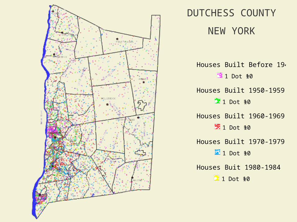
DUTCHESS COUNTY
NEW YORK
Houses Buit 1980-1984
1 Dot = 10
Houses Built 1970-1979
1 Dot = 10
Houses Built 1960-1969
1 Dot = 10
Houses Built 1950-1959
1 Dot = 10
Houses Built Before 1949
1 Dot = 10

DUTCHESS COUNTY
NEW YORK
Wetlands outlined in green

Socio-Economic Sub-Model
GIS Land-Use Sub-Model
EcosystemSub-Model
Sectoral_Economic_Decline
Land_Demand
Growth
Land_Reclamation
Ecosystem_Impact
Scenerios
Scenerios
Land_Biophysical_Characteristics
Land_Use_Location
Land_Use_Type Land_Biophysical_Characteristics
Land_Development_Loading Aquatic_Dynamics
Physicochemical_Parameters
Biotic_Integrity Functional_Integretity
Ecosystem_Impact
Storm_Events Water_Flow
Building
Land_Built
Land_Demand
Sectoral_Economic_Growth
SAM_Multipliers
Scenerios
Loss
Population
Land_Use_Location
Land_Use_Type
Buildable_Land
Land_Use_Zoning
Geophysical_Attibutes
Real_Estate_Attributes
Total_Land_Inventory

IV. Other Projects
Waterfront development in Albany Land-use planning in the Catskill
Mountains Core-Periphery model of urban growth Regional Economics – Fall 2001