Definitions - University of the West Indies Folder/7. Runoff.pdf · Definitions Streamflow ......
14
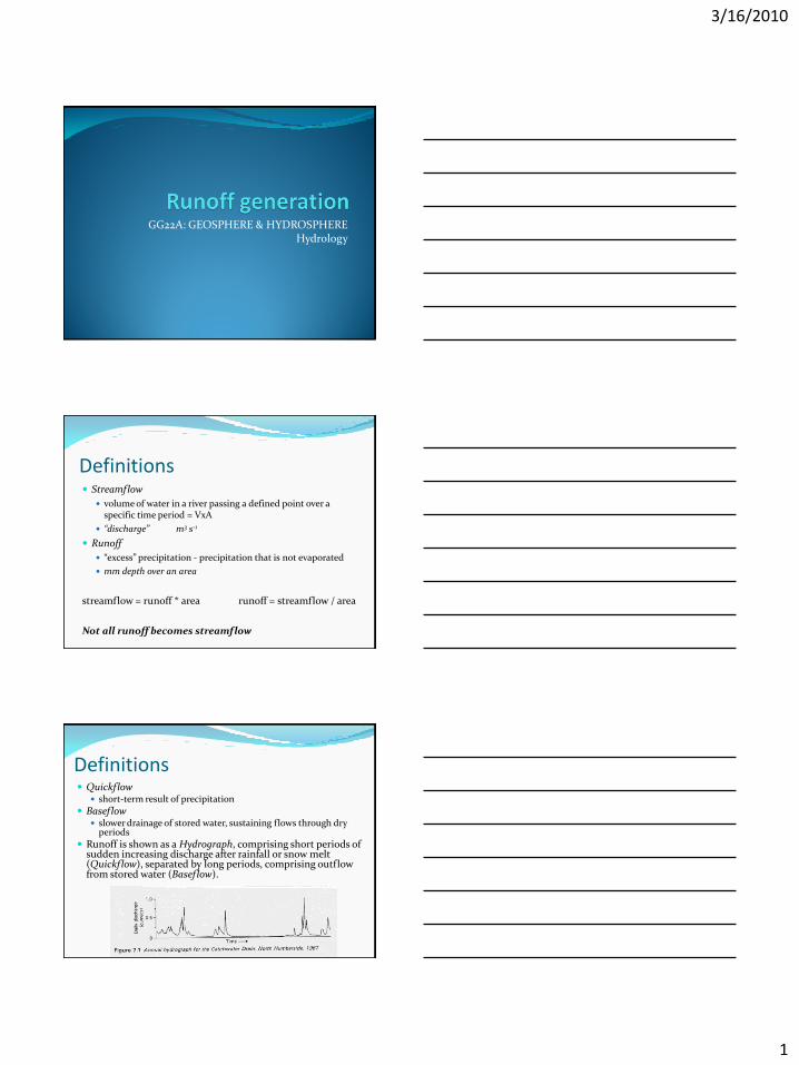
3/16/2010 1 GG22A: GEOSPHERE & HYDROSPHERE Hydrology Definitions Streamflow volume of water in a river passing a defined point over a specific time period = VxA “discharge” m 3 s -1 Runoff “excess” precipitation - precipitation that is not evaporated mm depth over an area streamflow = runoff * area runoff = streamflow / area Not all runoff becomes streamflow Definitions Quickflow short-term result of precipitation Baseflow slower drainage of stored water, sustaining flows through dry periods Runoff is shown as a Hydrograph, comprising short periods of sudden increasing discharge after rainfall or snow melt (Quickflow), separated by long periods, comprising outflow from stored water (Baseflow).
Transcript of Definitions - University of the West Indies Folder/7. Runoff.pdf · Definitions Streamflow ......
3/16/2010
1
GG22A: GEOSPHERE & HYDROSPHEREHydrology
Definitions Streamflow
volume of water in a river passing a defined point over a specific time period = VxA
“discharge” m3 s-1
Runoff
“excess” precipitation - precipitation that is not evaporated
mm depth over an area
streamflow = runoff * area runoff = streamflow / area
Not all runoff becomes streamflow
Definitions Quickflow
short-term result of precipitation
Baseflow slower drainage of stored water, sustaining flows through dry
periods
Runoff is shown as a Hydrograph, comprising short periods of sudden increasing discharge after rainfall or snow melt (Quickflow), separated by long periods, comprising outflow from stored water (Baseflow).
3/16/2010
2
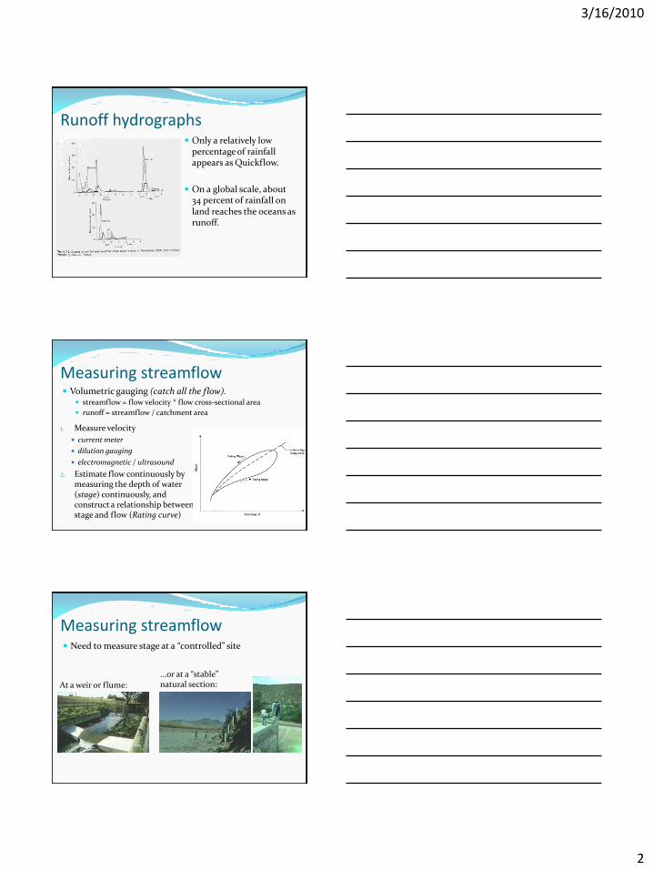
Runoff hydrographs Only a relatively low
percentage of rainfall appears as Quickflow.
On a global scale, about 34 percent of rainfall on land reaches the oceans as runoff.
Measuring streamflow
1. Measure velocity
current meter
dilution gauging
electromagnetic / ultrasound
2. Estimate flow continuously by measuring the depth of water (stage) continuously, and construct a relationship between stage and flow (Rating curve)
Volumetric gauging (catch all the flow). streamflow = flow velocity * flow cross-sectional area
runoff = streamflow / catchment area
Measuring streamflow Need to measure stage at a “controlled” site
...or at a “stable” natural section:At a weir or flume:
3/16/2010
3
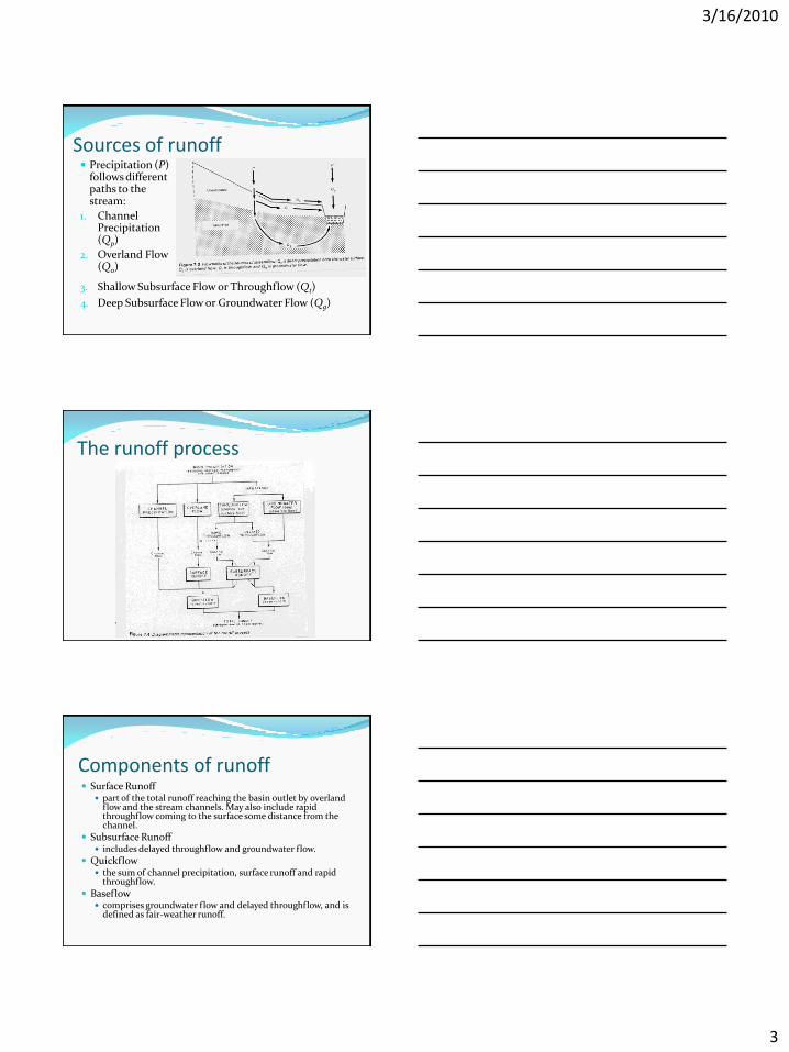
Sources of runoff
3. Shallow Subsurface Flow or Throughflow (Qt)
4. Deep Subsurface Flow or Groundwater Flow (Qg)
Precipitation (P) follows different paths to the stream:
1. Channel Precipitation (Qp)
2. Overland Flow (Qo)
The runoff process
Components of runoff Surface Runoff
part of the total runoff reaching the basin outlet by overland flow and the stream channels. May also include rapid throughflow coming to the surface some distance from the channel.
Subsurface Runoff includes delayed throughflow and groundwater flow.
Quickflow the sum of channel precipitation, surface runoff and rapid
throughflow.
Baseflow comprises groundwater flow and delayed throughflow, and is
defined as fair-weather runoff.

3/16/2010
4
Sources of runoff
Channel Precipitation (Qp): not all that significant
may be more important during a prolonged storm, or if the catchment contains lakes and swamps.
Sources of runoff
Overland Flow (Qo): water that flows on the surface as sheetflow or in
trickles. Generally uncommon as most vegetation surfaces
have high infiltration capacities. Occurs if the ground is saturated, frozen,
consolidated, or where rainfall intensity exceeds infiltration capacity.
Sources of runoff
Throughflow (Qt): water infiltrating and moving laterally as shallow
subsurface flow – through the soil, above the water table.
Can be unsaturated flow, but may be shallow perched saturated flow.
Preferential flow: rapid throughflow through pipes, highly permeable layers or boundaries within the soil

3/16/2010
5
Sources of runoff Throughflow is favoured where lateral conductivity being
greater than vertical conductivity. common in perched saturated flow, when water enters the
soil more rapidly than it can percolate downwards, leading to lateral escape in the direction of greater conductivity.
Some throughflow rates are rapid, others are delayed. Some throughflow may not discharge directly into the
stream, but comes to the surface some distance upslope, where it may contribute to overland flow and surface runoff.
Throughflow is the most important source and component of runoff: it may account up to 85 percent of total runoff.
Sources of runoff Groundwater Flow (Qg):
lags behind precipitation, it is a slow flow which tends to be regular, representing the discharge from a slowly changing reservoir of moisture in the saturated zone.
Groundwater flow represents the long-term component of total runoff and is important during dry spells.
Base flow is proportional to groundwater storage
Humid temperate environments Deep soils Relatively low rainfall
intensities Infiltration excess
overland flow is rare Area of saturation is
important
Saturation excess overland flow
Saturated throughflow Pipeflow Increased drainage
network
3/16/2010
6
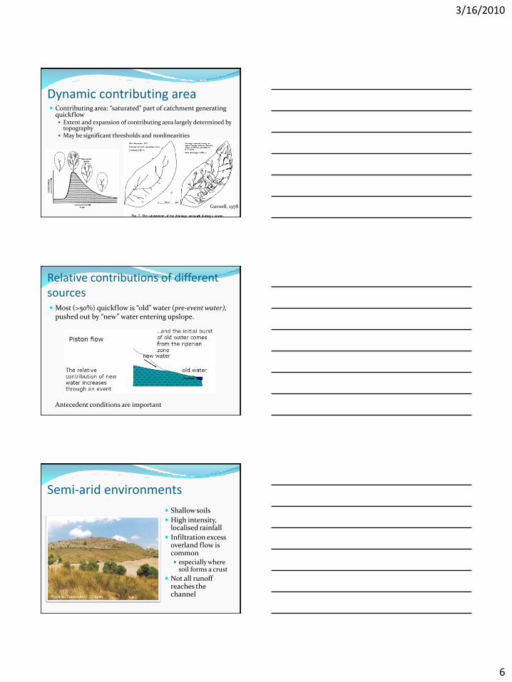
Dynamic contributing area Contributing area: “saturated” part of catchment generating
quickflow Extent and expansion of contributing area largely determined by
topography May be significant thresholds and nonlinearities
Gurnell, 1978
Relative contributions of different sources Most (>50%) quickflow is “old” water (pre-event water),
pushed out by “new” water entering upslope.
Antecedent conditions are important
Semi-arid environments
Shallow soils
High intensity, localised rainfall
Infiltration excess overland flow is common especially where
soil forms a crust
Not all runoff reaches the channel
3/16/2010
7
Semi-arid environments
Where infiltration capacity is: Low - runoff depends
on rainfall intensity
High - runoff depends on rainfall volume
Antecedent conditions not important But proportion of
rainfall going to runoff depends on location of rainfall relative to different surface characteristics
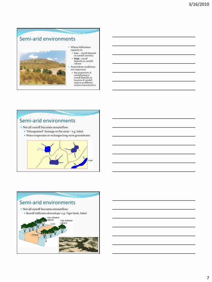
Semi-arid environments Not all runoff becomes streamflow:
“Disorganised” drainage in flat areas – e.g. Sahel
Water evaporates or recharges long-term groundwater
Semi-arid environments Not all runoff becomes streamflow:
Runoff infiltrates downslope: e.g. Tiger bush, Sahel
3/16/2010
8
Semi-arid environments Water recharges groundwater along the river bed
“Transmission loss”
At the extreme, rivers may disappear completely
Snow-dominated environments Precipitation stored as
snow during winter
Water released as snowmelt
Either infiltrates or runs off
Partly dependent on whether the soil is frozen
Water table may rise into snowpack and cause rapid melting
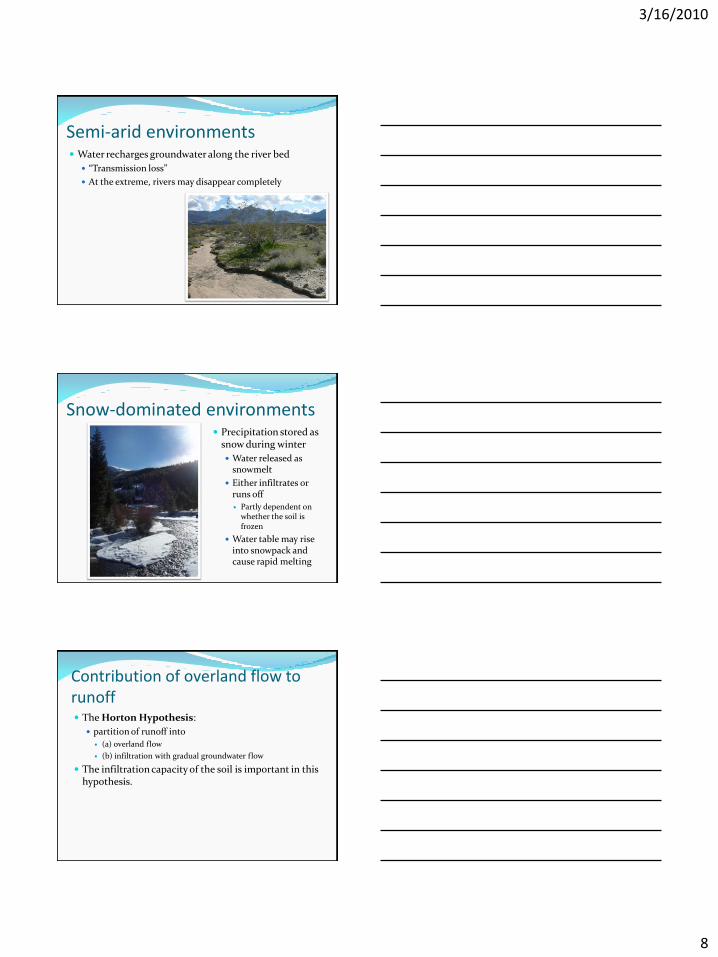
Contribution of overland flow to runoff The Horton Hypothesis:
partition of runoff into
(a) overland flow
(b) infiltration with gradual groundwater flow
The infiltration capacity of the soil is important in this hypothesis.

3/16/2010
9
The Horton Hypothesis During the part of a storm (t) when rainfall intensity (i)
exceeds infiltration capacity (f), there will be an excess of precipitation (Pe) which will flow as overland flow (Qo).
If the rainfall intensity does not exceed infiltration capacity of the soil, there will be no overland flow.
This type of overland flow resulting from high rainfall intensity has been referred to as Hortonian Overland Flow.
The Horton Hypothesis It has been suggested that infiltration capacity (f)
would pass through a cycle for each storm:
Infiltration capacity is greatest at the start of a storm.
It decreases rapidly after the first hour and the declines only very slowly for the remainder of the storm.
Infiltration capacity then recovers slowly after the end of the storm.
The Horton Hypothesis If rainfall intensity is…
High: may exceed infiltration capacity and generate overland flow relatively quickly.
Moderate: may not generate overland flow early on, but does so after infiltration capacity has declined.
Low: may not generate Hortonian Overland Flow at all.
In the Horton Model, it is likely that in a sequence of closely-spaced storms, only the later ones may generate overland flow (and therefore more Quickflow) compared to the early storms.
3/16/2010
10
The Horton Hypothesis The rainfall intensity has to exceed infiltration
capacity.
Lower infiltration capacities, such as from compact soil, favours Hortonian Overland Flow.
The Horton Model is most likely to apply to conditions of sparse vegetation cover, especially in arid and semi-arid environments, where crusts develop at or near to the surface.
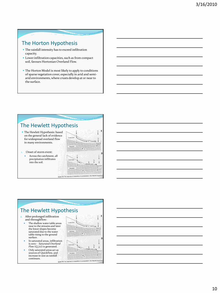
The Hewlett Hypothesis
1. Onset of storm event:
Across the catchment, all precipitation infiltrates into the soil.
The Hewlett Hypothesis: based on the general lack of evidence for widespread overland flow in many environments.
1
2
The Hewlett Hypothesis2. After prolonged infiltration
and throughflow: The shallow water table areas
near to the streams and later the lower slopes become saturated due to the water table rising to the ground surface.
In saturated areas, infiltration is zero - Saturated Overland Flow (Qo(s)) is generated.
Only saturated areas act as sources of Quickflow, and increase in size as rainfall continues.
1
2

3/16/2010
11
The Hewlett Hypothesis The original model implied that the saturated areas
would be connected to the stream channels.
Other areas in a catchment (in addition to contiguous channel side areas) may also have saturated overland flow, such as areas of throughflow convergence.
Do these areas also contribute to Quickflow?
The Hewlett Hypothesis1. Slope Concavities in
Plan:
convergence leads to rates of flow being greater than the transmission capacity of the soil
leads to flow emergence at the surface in the centre of concavities.
The Hewlett Hypothesis2. Slope Concavities in
Section:
Subsurface flow rates are proportional to the hydraulic gradient.
If the hydraulic conductivity of the material is uniform, water will enter a concavity faster than it can leave.
Water emerges at the surface.

3/16/2010
12
The Hewlett Hypothesis3. Areas of Thinner Soil:
where water holding and transmission capacities are low.
The Hewlett Hypothesis4. Perched Water Tables:
layers of temporary saturation due to reduced hydraulic conductivity with depth.
Mostly removed as throughflow, but it could reach the surface.
The Hewlett Hypothesis Concavities, areas of thinner soil and perched water
table build up may provide a source of quickflow.
Other routes may be through animal burrows, root channels and other soil pipes.
3/16/2010
13
The Hewlett Hypothesis No overland flow, all rainfall
infiltrates.
In the upslope areas of a catchment, rainfall recharges the soil moisture store for future baseflow.
In the lower slope, throughflow and, to a lesser extent, channel precipitation provide most of the quickflow.
The Hewlett Hypothesis The role of groundwater in storage and storm runoff:
In flat drainage basins, groundwater is a major component of total storage.
In steeper basins, soil moisture is the larger storage zone.
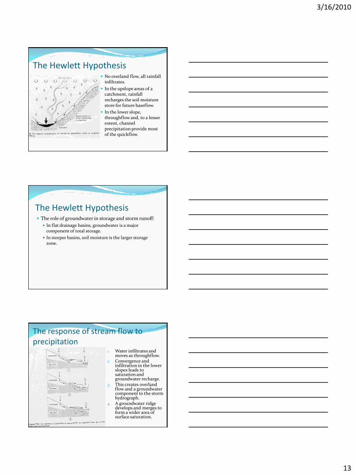
The response of stream flow to precipitation
1. Water infiltrates and moves as throughflow.
2. Convergence and infiltration in the lower slopes leads to saturation and groundwater recharge.
3. This creates overland flow and a groundwater component to the storm hydrograph.
4. A groundwater ridge develops and merges to form a wider area of surface saturation.

3/16/2010
14
The Horton Model vs. the Hewlett Model The Hewlett Model accommodates a broad range of
field observations of runoff.
Precipitation is generally able to infiltrate, but where slope material or vegetation has been altered, widespread overland flow may occur during high-intensity storms.
Hortonian Overland Flow does occur in certain environments, especially in semi-arid and arid climates.