Cuzco, Historia en Inglés
32
PROYECTO DE INGLÉS: “CUZCO”
-
Upload
instituto-juan-bosco -
Category
Education
-
view
2.045 -
download
3
Transcript of Cuzco, Historia en Inglés
PROYECTO DE INGLÉS:“CUZCO”
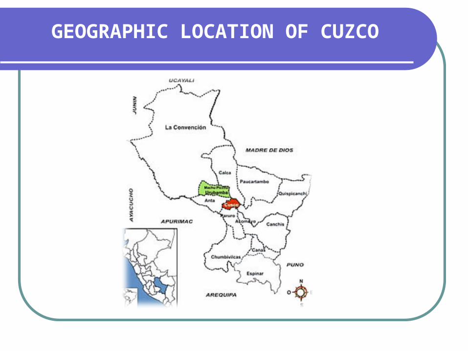
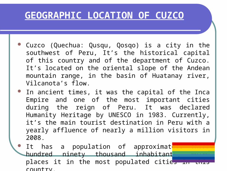
GEOGRAPHIC LOCATION OF CUZCO
GEOGRAPHIC LOCATION OF CUZCO
Cuzco (Quechua: Qusqu, Qosqo) is a city in the southwest of Peru, It’s the historical capital of this country and of the department of Cuzco. It’s located on the oriental slope of the Andean mountain range, in the basin of Huatanay river, Vilcanota’s flow.
In ancient times, it was the capital of the Inca Empire and one of the most important cities during the reign of Peru. It was declared Humanity Heritage by UNESCO in 1983. Currently, it’s the main tourist destination in Peru with a yearly affluence of nearly a million visitors in 2008.
It has a population of approximately three hundred ninety thousand inhabitants, which places it in the most populated cities in this country.

Map of Cusco
It is one of the broadest cities in this country. Cusco possesses a landscape of strong contrasts, where high mountain ranges combine with the dilated Altiplanos and soft-relief plateaus as well as deep valleys and canyons.
Two of the most important highlands are: Vilcabamba, which encloses the Cuzco valley and whose main top or summit, is Huanacaure and the mountains of Cuzco to the north whose highest peak is Pachatusan.
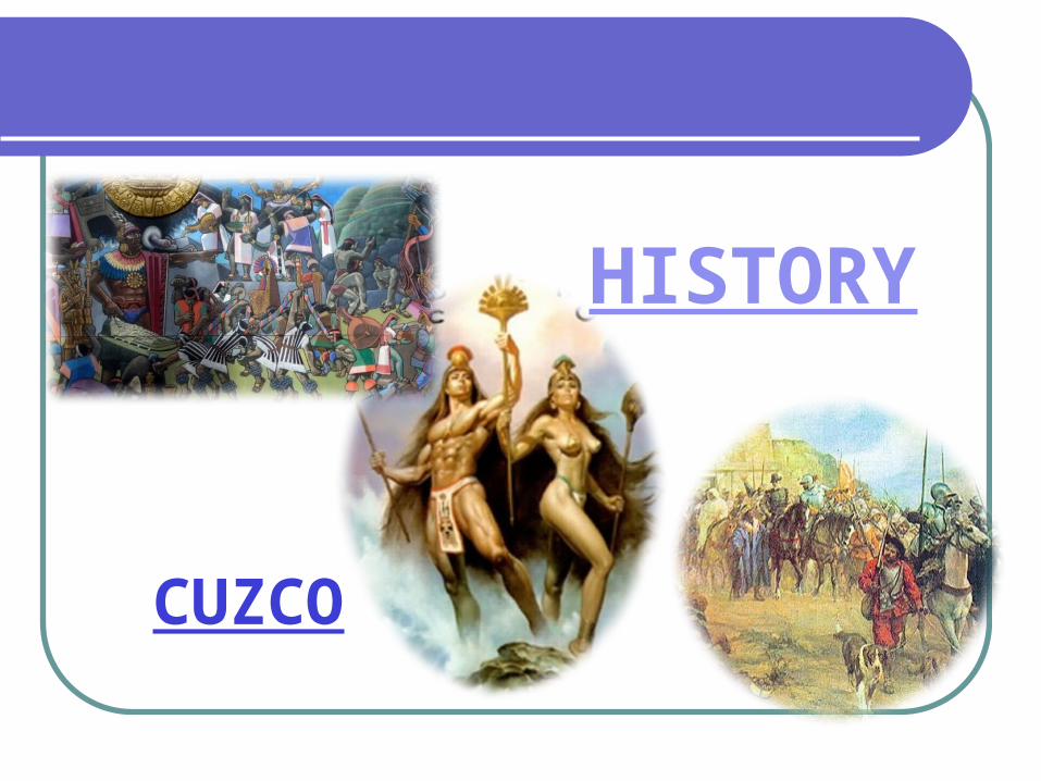
CUZCO
HISTORY

HISTORY
Two Inca legends ascribe its foundation to its first head of state, a legendary figure named Manco Capac, with his sister and consort Mama Huaco. In both states that the site was revealed by the god sun (Inti) to the founders started after a pilgrimage south of Valle Sagrado de los Incas.
For archaeological and anthropological data has been studying the actual process of occupation of Cuzco. The consensus that due to the collapse of the kingdom of Tiahuanaco was the migration of its people. This group of about 500 men would have been gradually established in the river valley Huatanay, a process that culminated in the founding of Cuzco.

Pachacutec
Pachacutec came to power in 1438, and he and his son Tupac Yupanqui dedicated five decades to the organization and reconciliation of the different tribal groups under their control, including Lupaca and Colla.
Tupac Yupanqui

The Incas organized their administrative division, so that the boundaries of The four regions of the empire coincided in the main square of Cuzco.
Next Francisco Pizarro conquest of Cuzco.

ECONOMY
ECONOMY
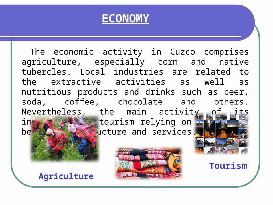
The economic activity in Cuzco comprises agriculture, especially corn and native tubercles. Local industries are related to the extractive activities as well as nutritious products and drinks such as beer, soda, coffee, chocolate and others. Nevertheless, the main activity of its inhabitants is tourism relying on better and better infrastructure and services.
Agriculture Tourism


TURIST SIDE
San Blas
This focus area where artisans, workshops and craft shops, is one of the most scenic spots in the city.
Its steep, narrow streets with old houses built by the Spanish over important Inca foundations. It has an attractive courtyard and the oldest parish church in Cuzco, which has a carved wooden pulpit regarded as the ultimate expression of colonial Cuzco.
The Quechua name of this district is to Toq'ocachi which means the hole of Salt.
San Blas

Stone of twelve angles
Calle Hatun Rumiyuq
This is the most visited by tourists. On the street Hatum Rumiyoq ( "Of the Rock Mayor") was the palace of Inca Roca,currently owned by the Archbishop's Palace.
On this street that runs from the Plaza de Armas to the district of San Blas, one can see the stone of twelve angles.
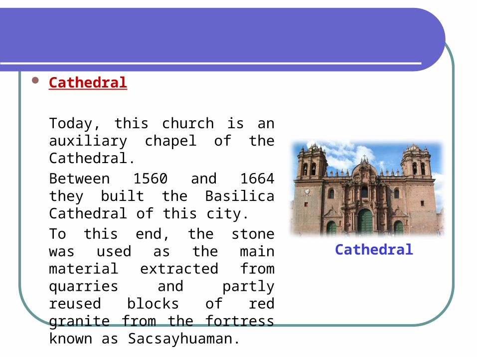
Cathedral
Cathedral
Today, this church is an auxiliary chapel of the Cathedral.
Between 1560 and 1664 they built the Basilica Cathedral of this city.
To this end, the stone was used as the main material extracted from quarries and partly reused blocks of red granite from the fortress known as Sacsayhuaman.
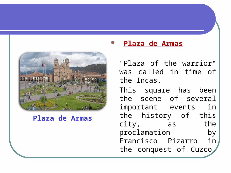
Plaza de Armas
Plaza de Armas
"Plaza of the warrior" was called in time of the Incas.
This square has been the scene of several important events in the history of this city, as the proclamation by Francisco Pizarro in the conquest of Cuzco.


Machu Picchu (Old Mountain)
Is the current given name to an ancient wooden-made inca population built in the meridians of the XV century on the headland that joins the Machu Picchu and Huayna Picchu mountains just on the oriental slope of the central Andes to the south of Peru.
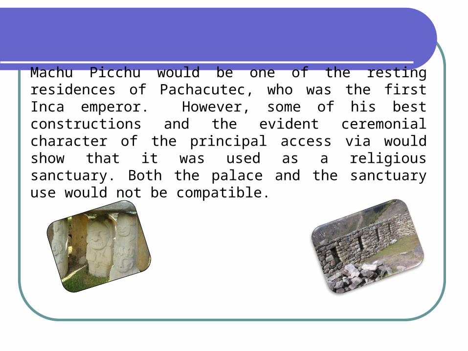
Machu Picchu would be one of the resting residences of Pachacutec, who was the first Inca emperor. However, some of his best constructions and the evident ceremonial character of the principal access via would show that it was used as a religious sanctuary. Both the palace and the sanctuary use would not be compatible.

Some experts, on the other hand, seem to have discarded, a supposed military character, which is why the popular adjectives “fortress” or “citadel” could have been improved.
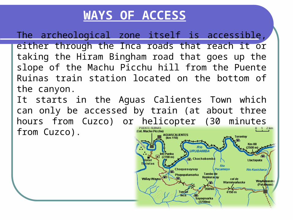
WAYS OF ACCESS
The archeological zone itself is accessible, either through the Inca roads that reach it or taking the Hiram Bingham road that goes up the slope of the Machu Picchu hill from the Puente Ruinas train station located on the bottom of the canyon.It starts in the Aguas Calientes Town which can only be accessed by train (at about three hours from Cuzco) or helicopter (30 minutes from Cuzco).

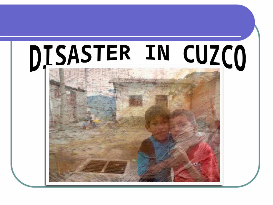
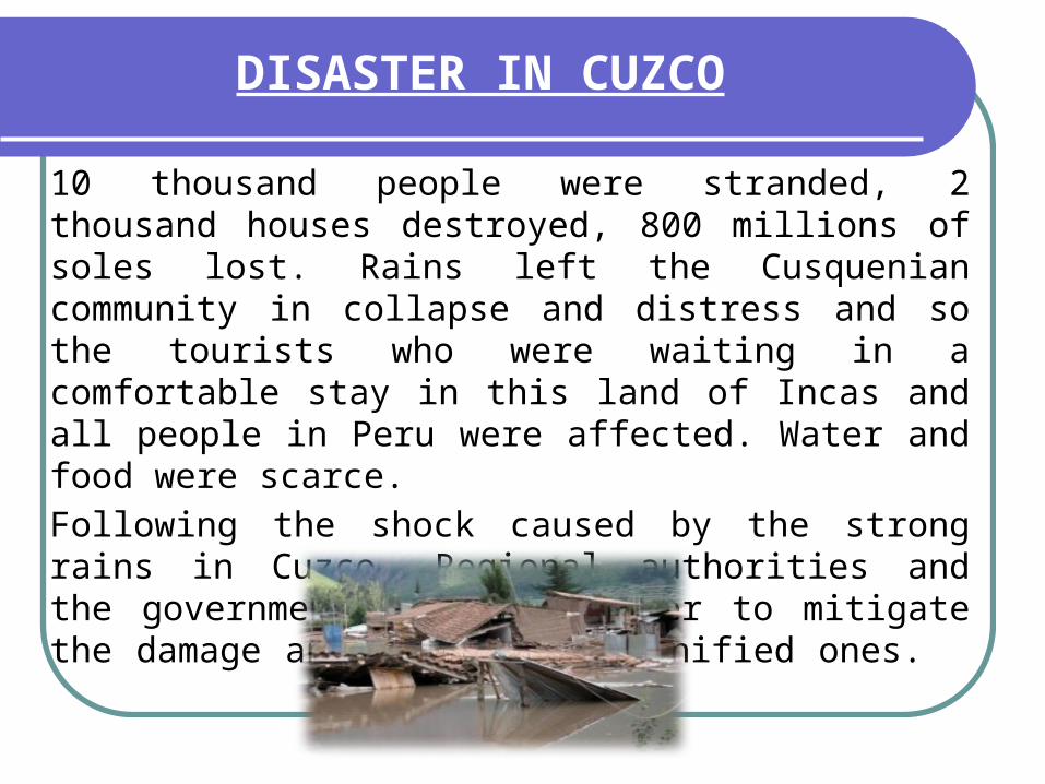
DISASTER IN CUZCO
10 thousand people were stranded, 2 thousand houses destroyed, 800 millions of soles lost. Rains left the Cusquenian community in collapse and distress and so the tourists who were waiting in a comfortable stay in this land of Incas and all people in Peru were affected. Water and food were scarce.
Following the shock caused by the strong rains in Cuzco, Regional authorities and the government worked together to mitigate the damage and assist the damnified ones.

Level of damage is so big that the Cuzquenian parishioners have decided to walk the “Lord of Temblors” around the streets and offer it masses to ask it to cease this “divine punishment”.
It was said that in this part of the country, they haven’t seen rains lash with such magnitude reaching up to 135 liters per square meter.
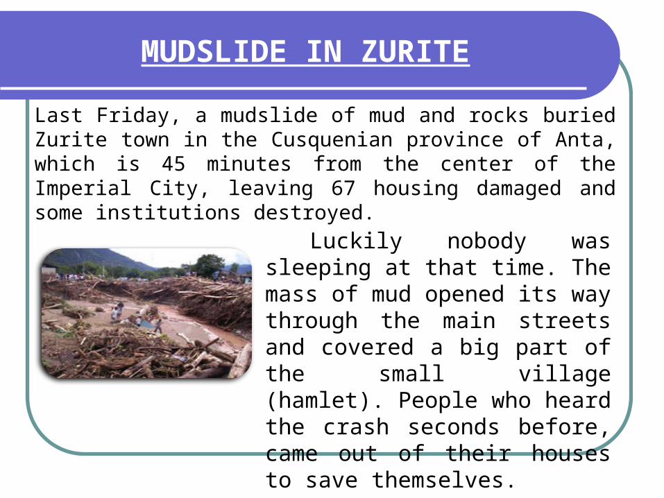
MUDSLIDE IN ZURITE
Last Friday, a mudslide of mud and rocks buried Zurite town in the Cusquenian province of Anta, which is 45 minutes from the center of the Imperial City, leaving 67 housing damaged and some institutions destroyed.
Luckily nobody was sleeping at that time. The mass of mud opened its way through the main streets and covered a big part of the small village (hamlet). People who heard the crash seconds before, came out of their houses to save themselves.

Last January 28th there has been seen the first mudslide, which motivated them evacuate to the safest zones.
Also cattle were put into safe places, food was put away and preventing actions were executed. House doors were covered with bags containing sand; but, the avalanche wiped everything out.

DISASTER IN AGUAS CALIENTES
After the Argentine tourist's death, serious flooding in the tourist zone Machu Picchu keep on complicating over 500 compatriots.
One hundred twenty Argentineans were able to be saved in a new rescue working day of the stranded tourists in Aguas Calientes , near Machu Picchu , after the landslide which caused the death of seven people, among them the tourist Bonaerence.

STILL STRANDED
There remains 500 Argentineans and 800 tourists of other nationalities still waiting to be rescued although Peruvian authorities affirm that rescue may delay due to the instability of the ground caused for the heavy rains.
A good deal of tourists reported that help operation is a chaos and that the protocol of rescue ( which establishes that the first ones to be rescued are: the kids, the pregnant women and elders over 60) is not being respected. And that the North American people are being given priority to get on helicopters.

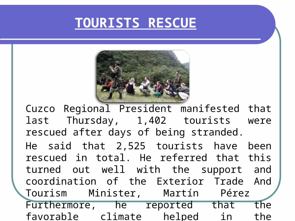
TOURISTS RESCUE
Cuzco Regional President manifested that last Thursday, 1,402 tourists were rescued after days of being stranded.
He said that 2,525 tourists have been rescued in total. He referred that this turned out well with the support and coordination of the Exterior Trade And Tourism Minister, Martín Pérez Furthermore, he reported that the favorable climate helped in the evacuation tasks.

He added that he relies that the agrarian insurance with a fund of 7 million 600 thousand soles will be able to cover the losses of cultivation hectares.
For his part, Cuzco's provincial mayor, Luis Flores, said on RPP that this year's rains surpassed the infrastructure installed to face disasters in the zone.

He, likewise, maintained that there was idleness from ex - municipal authorities and the inhabitants at the time of building their housings without licenses neither urban preparation omitting the civil defense recommendations.
He indicated that about one hundred families require to be relocated out of the urban historic center, and that hundred of tourists are stranded at Aguas Calientes Train Station.


![[Libro] Evelyn Underhill - Jacopone da Todi, a Spiritual biography [Poemas en Italiano e Inglés; Historia y Fuentes de los Zelanti]](https://static.fdocuments.in/doc/165x107/55720f17497959fc0b8c8a2e/libro-evelyn-underhill-jacopone-da-todi-a-spiritual-biography-poemas-en-italiano-e-ingles-historia-y-fuentes-de-los-zelanti.jpg)