Curriculum Vitae – Andrew Curtis · Web viewCurtis, A., Leitner, M. and C. Hanlon (2002) Using...
29
Curriculum Vitae – Andrew Curtis Andrew J. Curtis Associate Professor of the Practice of American Studies and Ethnicity University of Southern California EDUCATION Ph.D. Geography, State University New York Buffalo (Advisor: A S. Fotheringham) 1995 M.A. Geography, State University New York Buffalo 1991 Post Graduate Certificate Education (Geography) Oxford University 1988 B.A. Honors Geography and Economics, Portsmouth Polytechnic, UK 1987 ACADEMIC APPOINTMENT University of Southern California Associate Professor of the Practice of American Studies and Ethnicity 2010-- present Visiting Associate Professor Department of Geography 2007 – 2010 Affiliated faculty American Studies and Ethnicity 2009 – 2010 Center for Premature Infant Health and Development, USC 2007 – 2010 Louisiana State University Assistant Professor Department of Geography and Anthropology 2001 – 2007 Adjunct faculty, Department of Environmental Studies 2003 -- 2007 Associate Director CADGIS Computer Lab 2002 -- 2007 Instructor, Department of Geography and Anthropology 1999 – 2001 Morehead State University Assistant Professor, Department of Geography, Government and History 1996 – 1999 Instructor, Department of Geography, Government and History 1995 -- 1996 RESEARCH HIGHLIGHTS 1. Recipient of the 2007 Meredith F. Burrill Award (the AAG’s award was to honor individuals or groups that have completed work of exceptional merit and quality that lies at or near the intersection of basic research in geography on the one hand, and practical applications or policy implications on the other) for the LSU GIS Clearinghouse Cooperative (group also includes Jackie Mills, Michael Leitner, Barrett Kennedy, John Pine). 1
Transcript of Curriculum Vitae – Andrew Curtis · Web viewCurtis, A., Leitner, M. and C. Hanlon (2002) Using...
Curriculum Vitae – Andrew Curtis
Andrew J. CurtisAssociate Professor of the Practice of American Studies and Ethnicity
University of Southern California
EDUCATION
Ph.D. Geography, State University New York Buffalo (Advisor: A S. Fotheringham) 1995 M.A. Geography, State University New York Buffalo 1991 Post Graduate Certificate Education (Geography) Oxford University 1988 B.A. Honors Geography and Economics, Portsmouth Polytechnic, UK 1987
ACADEMIC APPOINTMENT
University of Southern California
Associate Professor of the Practice of American Studies and Ethnicity 2010-- present Visiting Associate Professor Department of Geography 2007 – 2010 Affiliated faculty American Studies and Ethnicity 2009 – 2010 Center for Premature Infant Health and Development, USC 2007 – 2010
Louisiana State University
Assistant Professor Department of Geography and Anthropology 2001 – 2007 Adjunct faculty, Department of Environmental Studies 2003 --2007 Associate Director CADGIS Computer Lab 2002 -- 2007 Instructor, Department of Geography and Anthropology 1999 – 2001
Morehead State University
Assistant Professor, Department of Geography, Government and History 1996 – 1999 Instructor, Department of Geography, Government and History 1995 -- 1996
RESEARCH HIGHLIGHTS
1. Recipient of the 2007 Meredith F. Burrill Award (the AAG’s award was to honor individuals or groups that have completed work of exceptional merit and quality that lies at or near the intersection of basic research in geography on the one hand, and practical applications or policy implications on the other) for the LSU GIS Clearinghouse Cooperative (group also includes Jackie Mills, Michael Leitner, Barrett Kennedy, John Pine).
2. Los Angeles County Enhanced Comprehensive HIV Prevention Planning (ECHPP) scientific advisory committee member.
3. Editorial Advisory Board of the journal Cartography and Geographic Information Science4. Spatial confidentiality consultant for the North American Association of Central Cancer Registries5. Popular media: New York Times, “The changing landscape of the Lower Ninth Ward” 8/27/2010 For the
interactive spatial video application see: http://www.nytimes.com/interactive/2010/08/27/us/lower9th-5year-anniversary.html?ref=us
6. Panel Member of the National Institute Health RFA: Effects of the Social Environment on Health: Measurement, Method, and Mechanisms 2012
7. Panel Member of the National Science Foundation’s Geography and Spatial Sciences Doctoral Dissertation Research Improvement Award 2010 – 2012
8. Panel member: Hazards and Disasters, Linking social science data and environmental data for climate change research, The National Academies, Washington DC December 2009.
9. Panel member of the National Science Foundation’s Cyber-Enabled Discovery and Innovation (CDI) preliminary proposal review, February 23-24, 2009, Arlington, VA
1

Curriculum Vitae – Andrew Curtis
10. Director (and previously Deputy Director) of the World Health Organization Collaborating Center for Remote Sensing and GIS for Public Health, located at Louisiana State University (2001 – 2007)
PUBLICATIONS
Articles in Refereed Journals
1. Mills, J.W., Curtis, A., and J. Upperman forthcoming Using a Geographic Information System (GIS) to Assess Pediatric Surge Potential after an Earthquake Disaster Medicine and Public Health Preparedness
2. Guerrero, E.G., Pan, K. B., Curtis, A., and E. L. Lizano (2011) Availability of substance abuse treatment services in Spanish: A GIS analysis of Latino communities in Los Angeles County, California Substance Abuse Treatment, Prevention, and Policy 6:21
3. Lentz, JA., Blackburn, J.K. and A Curtis (2011) Evaluating Patterns of a White-band Disease (WBD)Outbreak in Acropora palmata Using Spatial Analysis: A Comparison of Transect and Colony Clustering, PLoS ONE 6(7): e21830. doi:10.1371/journal.pone.0021830
4. Curtis, A., and J.W. Mills (2011) Spatial video data collection in a post-disaster landscape: The Tuscaloosa Tornado of April 28th 2011 Applied Geography 32 393-400
5. Curtis, A., and J.W. Mills (2011) Crime in urban post-disaster environments: A methodological framework from New Orleans Urban Geography 32 (4) 488-510
6. Curtis, A., Mills, J.W., L. Augustin and M. Cockburn (2011) Confidentiality Risks in Fine Scale Aggregations of Health Data Computers, Environment and Urban Systems 35 57-64
7. Curtis, A., Pine, J., Marx, B., Li, B. and J. Mills (2011) A Multiple Additive Regression Tree Analysis of Three Exposure Measures during Hurricane Katrina: Implications for Recovery in Orleans Parish Disasters: The Journal of Disaster Studies, Policy and Management 35(1) 19-35
8. Mills, J.W., A.J. Curtis, B. Kennedy, S.W. Kennedy, and J. Edwards. (2010) Geospatial video for field data collection. Applied Geography 30(4) 533-547
9. Curtis, A. (2010) Chronic disease as an evacuation impediment: using a Geographic Information System and 911 call data after Katrina to determine neighborhood scale health vulnerability Risk, Hazards & Crisis in Public Policy 1(3) Article 5
10. Curtis, A and W A Lee (2010) Spatial patterns of diabetes related health problems for vulnerable populations in Los Angeles International Journal of Health Geographics 9:43
11. Blackburn, J.K., Curtis, A., Hadfield, T.L., O’Shea, B., Mitchell, M.A., and M.E. Hugh-Jones (2010) Confirmation of Bacillus anthracis from Flesh Eating Flies Collected During a West Texas Anthrax Season Journal of Wildlife Diseases 46(3) 918-922
12. Blackburn, J.K., Mitchell, M.A., Holley Blackburn, M.C, Curtis, A., and B.A. Thompson (2010) Evidence of antibiotic resistance in free-swimming top-level marine predatory fishes Journal of Zoo and Wildlife Medicine 41(1) 7-16
13. Curtis, A., Duval-Diop, D.,and J. Novak (2010) Identifying spatial patterns of recovery and abandonment in the Post-Katrina Holy Cross neighborhood of New Orleans Cartography and Geographic Information Science 37(1): 45-56
14. Duval-Diop, D., Curtis, A., and A. Clark (2010) Enhancing Equity with Public Participatory GIS in Hurricane Rebuilding: Faith Based Organizations, Community Mapping, and Policy Advocacy Journal of Community Development Society 41(1): 32-49
15. Boulos, K. M.N., Curtis, A. and P. AbdelMalik (2009) Musings on privacy issues in health research involving disaggregate geographic data about individuals International Journal of Health Geographics 8:46
16. Curtis, A (2008) Three-dimensional visualization of cultural clusters in the 1878 yellow fever epidemic of New Orleans International Journal Health Geographics 7:47.
17. Curtis, A (2008) From Healthy Start to Hurricane Katrina: using GIS to eliminate disparities in perinatal health Statistics in Medicine 27(20): 3984-3997.
18. Mills, J.W., Curtis, A., Pine, J., Kennedy, B., Jones, F., Ramani, R. and D. Bausch. (2008) The clearinghouse concept: a model for geospatial data centralization and dissemination in a disaster Disasters: The Journal of Disaster Studies, Policy and Management 32(3): 467-479
2
Curriculum Vitae – Andrew Curtis
19. Blackburn, J.K., Curtis, A., Currin Mujica, F., Jones, F., Dorn, P. and R. Coates (2008) The development of the Chagas’ Online Data Entry System (CODES-GIS), Transactions in GIS 12(2): 249-265.
20. Mills, J.W. and A. Curtis (2008) Geospatial approaches for disease risk communication in marginalized communities. Progress in Community Health Partnerships Research, Education and Action 2 (1): 61-72.
21. Blackburn, J., McNyset, K., Curtis, A. and M. Hugh-Jones (2007) Modeling the geographic distribution of bacillus anthracis, the causative agent of anthrax disease, for the contiguous united states using predictive ecological niche modeling American Journal of Tropical Medicine & Hygiene 77(6): 1103-1110.
22. Curtis, A., Mills, J.W., Kennedy, B., Fotheringham, S. and T. McCarthy (2007) Understanding the geography of post-traumatic stress: an academic justification for using a spatial video acquisition system in the response to Hurricane Katrina Journal of Contingencies & Crisis Management 15(4): 208-219.
23. Curtis, A., Mills, J.W. and J. Blackburn (2007) A spatial variant of the basic reproduction number for the New Orleans yellow fever epidemic of 1878 The Professional Geographer 59(4): 492-502.
24. Curtis, A., Mills, J.W. and M. Leitner (2007) Katrina and vulnerability: the geography of stress Journal of Health Care for the Poor and Underserved 18(2): 315—330.
25. Leitner, M., Mills, J. and A. Curtis (2007) Can novices to geospatial technology compromise spatial confidentiality? Kartographische Nachrichten (‘Cartographic News’) 57(2): 78-84.
26. Dorn, P.L., Monroy, C. and A. Curtis (2007) Triatoma dimidiata (Latreille, 1811): A review of its diversity across its geographic range and the relationship among populations Infection, Genetics and Evolution 7(2): 343-352.
27. Curtis, A., Mills, J.W., Blackburn, J.K. and J.C. Pine (2006) Louisiana State University geographic information system support of hurricane Katrina recovery operations International Journal Mass Emergencies and Disasters 24(2): 203–221.
28. Curtis, A., Mills, J.W., and M. Leitner (2006) Spatial confidentiality and GIS: re-engineering mortality locations from published maps about Hurricane Katrina International Journal of Health Geographics 5:44.
29. Leitner, M. and A. Curtis (2006) A first step towards a framework for presenting the location of confidential point data on maps - results of an empirical perceptual study International Journal of Geographical Information Science 20(7):797-811.
30. Hinman, S., Blackburn, J. and A. Curtis (2006) Spatial and temporal structure of typhoid outbreaks in Washington DC 1906-1909: evaluating local clustering with the Gi* statistic International Journal of Health Geographics 5:13.
31. Kent, J., Leitner, M. and A. Curtis (2006) Evaluating the usefulness of functional distance measures when calibrating journey-to-crime distance decay algorithms Computers, Environment and Urban Systems 30(2): 181-200.
32. DeLyser, D., Sheehan, R. and A. Curtis (2004) e-Bay and research in historical geography: some thoughts and experiences Journal of Historical Geography 30(4): 764-782.
33. Leitner, M. and A. Curtis (2004) Cartographic guidelines for geographically masking the location of confidential point data Cartographic Perspectives 49: 22-39.
34. Curtis, A (1999) Using a spatial filter and a geographic information system to improve rabies surveillance data Journal of Emerging Infectious Disease 5(5): 603-606.
35. Fotheringham, A.S. and A. Curtis (1999). Regularities in spatial information processing: implications for modeling destination choice The Professional Geographer 51(2): 227-239.
36. Curtis, A (1998) Comparisons in the spatial knowledge surfaces of subjects from Canada and the United States Canadian Geographer 42(1): 53-61.
37. Mitchelson, R., Pitts, T., Curtis, A. and K. Calhoun (1997) The changing South : transportation and communication since 1947 Southeastern Geographer 37(2): 268-294.
38. Curtis, A. and A.D. MacPherson (1996). The zone definition problem in survey research: an empirical example from New York State, The Professional Geographer 48(3): 310-320.
39. Fotheringham, A.S., Densham, P.J. and A. Curtis (1995) The zone definition problem and location-allocation modeling Geographical Analysis 27(1): 60-77.
40. Curtis, A. and A.S. Fotheringham (1995) Large-scale information surfaces: an analysis of city-name recalls in the united states Geoforum 26(1): 75-87.
3

Curriculum Vitae – Andrew Curtis
Books and Monographs
1. Curtis, A. and J. Mills (2009) GIS, Human Geography and Disasters University Readers2. Antipova, A. and A. Curtis (2007) Public Health and Disasters: The Relationship Between Pregnancy
Outcomes and Hurricane Andrew VDM Verlag Dr. Muller e. K (VDM Publishing House) Saarbrucken, Germany.
3. Curtis, A. and M. Leitner (2006) Geographical Information Systems and Public Health: Eliminating Perinatal Disparity IGP/INFOSCI/IRM Press Hershey-London-Melbourne-Singapore-Beijing.
Book Chapters
1. Aubrecht, C., S. Freire, C. Neuhold, A. Curtis, K. Steinnocher (2010) Introducing a temporal component in spatial vulnerability analysis. Spatial Assessment and Analysis of Vulnerability. Routledge Publications, Taylor & Francis. In press.
2. Curtis, A., Mills, J.W. and M. Leitner (2009) Katrina and vulnerability: the geography of stress in V.M. Brennan (ed.) Natural Disasters and Public Health The Johns Hopkins University Press
3. Curtis, A., Mills, J.W., McCarthy, T., Fotheringham, A.S and W. F. Fagan (2009) Space and Time Changes in Neighborhood Recovery after a Disaster Using a Spatial Video Acquisition System in Showalter, P and Y. Lu (eds.) Geospatial Technologies in Urban Hazard and Disaster Analysis, Springer, 373-392
4. Curtis, A., Blackburn, J.K. and Y. Sansyzbayev (2007) Using a geographic information system to spatially investigate infectious disease, in Tibayrenc, M (ed.) Encyclopedia of Infectious Diseases: Modern Methodologies, Wiley & Sons, 405-422.
5. Curtis, A., Heath, S. and M. Hugh-Jones (2005) GIS investigations of epizootics: the limitations of surveillance data In Majumdar, S.K., Huffman, J., Brenner, F., and I.A. Panah (eds.) Wildlife Diseases: Landscape Epidemiology. Spatial Distribution and Utilization of Remote Sensing Technology, The Pennsylvania Academy of Science, Easton, PA, pp. 459-474.
6. Leitner, M. and A. Curtis (2002) Modeling infant mortality risk factors in Baton Rouge. In Wohlschlägl, H., Leitner, M., and N. Weixlbaumer (eds.) Geographischer Jahresbericht aus Österreich, Vol. 59, Department of Geography and Regional Research, University of Vienna, 45-57.
7. Curtis, A., Leitner, M. and C. Hanlon (2002) Using hierarchical nearest neighbor analysis and animation to investigate the spatial and temporal patterns of raccoon rabies in West Virginia. In Khan, O. A., and R. Skinner (eds.) Geographic Information Systems & Health Applications Idea Group Publishing, 155-171.
8. Curtis, A (2001) Identifying spatial holes in a rabies surveillance surface: comparing results from cartographic visualization to spatial filter analysis in A. Flahault., Toubiana, L., and A.J. Valleron (eds.) Geography and Medicine, Editions scientifiques et medicales Elsevier SAS, 40-48.
9. Fotheringham, A.S. and A. Curtis. (1992). Encoding spatial information: the evidence for hierarchical processing, A.V. Frank, Campari, I. and V.Formentini (eds.) Theories and Methods of Spatio-Temporal Reasoning in Geographic Space, Lecture notes in Computer Science 639: 269-287.
Other Significant Publications
1. Curtis, A., Mills, J.W. and M. Leitner (2006) Keeping an eye on privacy issues with geospatial data. Nature 441: 7090 p150.
Book Reviews
2. Curtis, A. (2006) America’s Forgotten Pandemic: The Influenza of 1918, Alfred W Crosby, Second Edition, Cambridge, Cambridge University Press, 2003. Historical Geography, Special Issues: Historical Medical Geography, 34: 195-199.
4

Curriculum Vitae – Andrew Curtis
Proceedings and Medical Abstracts
3. Lee, WA and A Curtis, (2010) Evaluating the Use of Geographic Information Systems (GIS) with a Novel Grid Methodology To Map Diabetes Case Level Data That Preserves the Integrity of Spatial Meaning without Violating Patient Confidentiality, Diabetes supplement ADA 70th Scientific Sessions Abstract Book, Publication Number 2334-PO.
4. Lee, WA and A Curtis, (2010) Utilizing Modern Geographic Information System Methods To Investigate the Relationship between the Los Angeles County Environment and the Metabolic Disease Burden in the Underserved, Predominantly Hispanic LA County Community. The Endocrine Society’s 92st Annual Meeting Annual Meeting Program and Abstract Book ,June 21, 2010. Publication number: P3-497.
5. McCarthy, T., Farrell, R., Curtis, A. and A. S. Fotheringham (2008) Integrated remotely sensed datasets for disaster management SPIE Europe Vol 7110, Cardiff
6. Blackburn, J., McNyset, K., Hugh-Jones, M., Mitchell, M. and A. Curtis (2007) Predicting the geographic distribution of bacillus anthracis, the causative agent of anthrax, in Mexico using ecological niche modeling and outbreak data from the United States of America, Proceedings V Congreso Internacional de Epidemiología, Mexico.
7. Leitner, M. and A. Curtis (2004) Visualizing the location of confidential crime data. The Seventh Annual International Crime Mapping Research Conference, Boston, MA, March 31-April 3 2004. (http://www.ojp.usdoj.gov/nij/maps/boston2004/index.html).
8. Arthold, M., Leitner, M. and A. Curtis (2004) local spatial variation of (very) low birth weight infants and their risk factors. In Strobl, J., Blaschke, T., and G. Griesebner (eds.) Applied Geographic Information Technology XVI. Herbert Wichmann Verlag, Heidelberg, 29-34.
9. Leitner, M. and A. Curtis (2003) Cartographic guidelines for the visualization of confidential data using geographic masking 21st International Cartographic Conference, Durban, SA, 101-110.
10. Curtis, A (2001) Using GIS to reduce Infant Mortality in Baton Rouge, combining spatial analysis and community outreach from the Association of American Geographers, NYC 2001, Abstract published in the January 2001 edition of the CDC’s electronic journal Public Health GIS News and Information.
11. Curtis, A (1991) An investigation into the hierarchical processing of spatial information, Proceedings 24 Mid-States A.A.G.
Reports
12. Mills, J.W., Curtis, A., Fagan, W. and C. Core (2008) The spatial video acquisition system as an approach to capturing damage and recovery data after a disaster: A case study from the Super Tuesday Tornadoes Quick Response Research Report Boulder, CO: University of Colorado Natural Hazards Center. http://www.colorado.edu/hazards/research/qr/qrpubs.html#2000.
13. Mills, J.W. and A. Curtis.(2006) Technology to empower the impacted: some routes to recovery White Paper for the Rebuilding New Orleans Conference New Orleans, Louisiana. Available online: http://rebuildingneworleans.ce.gatech.edu/docs/Rebuilding%20New%20Orleans%20by%20jwm%20and%20ac.pdf
14. Curtis, A., Mills, J.W., Blackburn, J.K. and J.C. Pine (2006) Hurricane Katrina: GIS response for a major metropolitan area Quick Response Research Report 180 Boulder, CO: University of Colorado Natural Hazards Center. http://www.colorado.edu/hazards/qr/qr180/qr180.html.
PARTICIPATION AT PROFESSIONAL MEETINGS AND CONFERENCES
Workshops Organized Innovations in Community Mapping: an Interactive Workshop, hosted with UC Davis Center for
Regional Change and the Pacific Institute UC Davis, January 2010.
5

Curriculum Vitae – Andrew Curtis
Protecting privacy and confidentiality of geographic data in health research, URISA GIS in Public Health Conference, Providence, June 2009 (co-organized with Ellen Cromley)
Introduction to geographic information systems for eliminating health disparities CDC & ATSDR 11th Biennial Symposium on Statistical Methods Atlanta, April 2007
Invited and Keynote Presentations
1. Eliminating Disparities in Health Using a GIS: Quantitative and Qualitative Solutions, Center for the Study of Immigrant Integration faculty seminar, January 2011.
2. Geography, GIS and Health vulnerability in Los Angeles: Case studies of Sexually Transmitted Infections and Diabetes California State University at Long Beach Department of Geography Colloquium, April 2011
3. Using geospatial approaches to identify neighborhood scale health disparities Maternal, Child & Adolescent Center for Infectious Disease and Virology, USC Health Sciences, March 2011
4. Geographic Data and Confidentiality Issues California Cancer Registry CR Scientific Conference Sacramento May, 2010
5. Working Group 2 short presentation – Technology to Increase Societal and Infrastructure Resiliency when Exposed to Major Natural Hazards US-Taiwan Workshop on the Advancement of Societal Responses to Mega-Disasters Afflicting Mega-Cities Taipei, Taiwan, May 2010
6. Mapping Racial Disparities in Health from Katrina to Southern California American Studies and Ethnicity Colloquium, University of Southern California, March 2010.
7. GIS, Geospatial Technologies and Health: Updating John Snow (with J. Mills) university lecture series, Ohio Northern University, January 2010.
8. Hurricane Katrina, GIS, Geospatial Technologies and Spatial Analysis -- implications for Public Health Research Southern California Permanente Medical Group, Pasadena, CA September 2009
9. Combining geospatial technology and community collaboration to reduce disparities in health, Environmental Justice and Climate Change Workshop, University of Southern California, June 2009
10. Geographic approaches to reducing health disparities: learning from Katrina Cities and Climate Change Conference, University of Southern California, April 2009
11. Health vulnerability and disasters California State University at Fullerton Department of Geography Brown Bag seminar, October 2008
12. Mapping Katrina Sustainable Dialogues III International Symposium, Architecture and Design Museum, Los Angeles, June 2008.
13. GIS and public health: clusters, confidentiality and Katrina Southern California Environmental Health Sciences Center seminar series, Health Sciences Campus University of Southern California, June 2008.
14. Using GIS to reveal spatial patterns in the 1878 yellow fever epidemic of New Orleans Biennial GIS Symposium: Sustaining the Future & Understanding the Past, Case Western Reserve University April 2008.
15. Community-based evaluation and intervention strategies to eliminate the black infant mortality crisis The Pasadena Birthing Project and the USC Center for Premature Infant Health and Development public forum December Pasadena, California, December 2007.
16. Geospatial Technology for response and recovery in Hurricanes Katrina and Rita: bridging government and community applications in a disaster presentation (with J Mills) California Post-Earthquake Clearinghouse group Los Alamitos, California, October 2007.
17. Public data, public access, privacy and security: us law and policy (with Mary Tsui) special session at URISA's GIS in Public Health Conference, New Orleans, May 2007.
18. GIS & Katrina ACE Social and Economic Stability, Louisiana State University and Southern University AgCenter Annual Conference, Baton Rouge, December 2006.
19. Vulnerable populations, community GIS and confidentiality – the US perspective GIS and Health Symposium, National Center for Geocomputation, National University of Ireland, Maynooth (NUIM) June 2006.
6
Curriculum Vitae – Andrew Curtis
20. Public health & disasters: preserving spatial confidentiality Protection, Privacy and Public GIS, Geomatics Atlantic Conference, Dalhousie University, Halifax, Nova Scotia, June 2006.
21. Medical geography: Using GIS for analysis of public health concerns Geographic Information Systems: The technical, legal and ethical implications of the integration of Information systems for animal and human health symposium Consortium on Law and Values in Health, Environment & the Life Sciences, Center for Animal Health and Food Safety and the College of Veterinary Medicine, University of Minnesota, May 2006.
22. After Katrina: Using a geographic information system to respond and recover Biology Research Seminar Series, Loyola University, March 2006.
23. GIS and Emergency Management GIS in practice Symposium, National Center for Geocomputation, National University of Ireland, Maynooth (NUIM) January 2006. See http://ncg.nuim.ie/ncg/events/20060125/
24. The LSU GIS response to Hurricane Katrina Department of Geography, Government and History Colloquium Morehead State University, November 2005.
25. Chagas Disease in Mexico: using the WebMapper Laboratory of Applied Entomology and Parasitology at Lenap, Guatemala, August 2005.
26. Curtis, A., Leitner, M. and F. Jones. Using GIS to eliminate disparities in African American infant mortality, Congressional Breakfast, UCGIS Winter Meeting, Sen. Hillary Rodham Clinton & Rep. Carolyn Maloney, Sponsors Hart Senate Office Building, February 2005.
27. The 1878 yellow fever epidemic Department of Tropical Medicine Colloquium, Tulane University, October2004
28. Using GIS to reduce infant mortality in Baton Rouge Department of Geography and Anthropology Applied Geography Conference, Louisiana State University, March 2001.
29. Improving rabies surveillance data using a GIS and a spatial filter Department of Biology Colloquium, Morehead State University, January 1999.
30. A spatial approach to filling in the gaps in reportable disease data: the case of rabies in Kentucky Department of Geography and Anthropology Colloquium, Louisiana State University, November 1997.
31. Disease implications of El Nino Department of Geography, Government and History Colloquium, Morehead State University, October 1997.
32. An information system for Histoplasmosis identification in Kentucky, gathering of state agencies, Frankfort May 1997.
33. Locational variations in macro scale knowledge (clusters, hierarchies, and hockey teams) Department of Geography Colloquium, State University of New York at Buffalo, August 1994.
Papers Presented
1. A fine scale multi-time period methodological framework to compare crimes with building characteristics in post-Katrina New Orleans National Institute of Justice Crime Mapping Research Conference, Miami, October 2011.
2. Health vulnerability and Hazard Assessment International Society for Integrated Disaster Risk Management “Reframing disasters and reflecting on risk governance deficits” USC, Los Angeles 2011
3. Crime in post-Katrina New Orleans: challenges and solutions to a constantly changing geography Association of American Geographers, Washington DC, April 2010
4. Chronic disease as an evacuation impediment: Using a Geographic Information System and 911 call data after Katrina to determine neighborhood scale health vulnerability National Evacuation Conference, New Orleans, February 2010.
5. Community mapping: new methods of data collection & confidentiality consideration (J. Mills co-author) Innovations in Community Mapping: an Interactive Workshop, UC Davis, January 2010
6. The relationship between crime and the built environment in post-Katrina New Orleans National Institute of Justice Crime Mapping Research Conference, New Orleans, August 2009.
7. Preserving spatial confidentiality, protecting privacy and confidentiality of geographic data in health research URISA GIS in Public Health Conference, Providence, June 2009
7
Curriculum Vitae – Andrew Curtis
8. The relationship between crime and the built environment in post-Katrina New Orleans National Institutes Justice Conference, Arlington, July 2008.
9. Spatial confidentiality and GIS: re-engineering mortality locations from published maps about Hurricane Katrina (J. Mills & M Leitner co-author) URISA's GIS in Public Health Conference, New Orleans, May 2007.
10. A GIS analysis of the New Orleans yellow fever epidemic of 1878 URISA's GIS in Public Health Conference, New Orleans, May 2007.Katrina and vulnerability: the geography of stress, in the session: Response, Recovery, and Geography: LSU Geographers Confront the Aftermath of Hurricane Katrina and Rita Association of American Geographers, San Francisco, April 2007.
11. From Healthy Start to Hurricane Katrina: six years of using GIS to eliminate disparities in perinatal health, CDC & ATSDR 11th Biennial Symposium on Statistical Methods, Atlanta, April 2007.
12. Using GIS to identify the spatial origins of epidemic in New Orleans Association of American Geographers, Philadelphia, March 2004.
13. A real time GIS in a Healthy Start initiative Louisiana State Wide Maternal Child Health Bureau Meeting, New Orleans, December 2003.
14. Reconstructing the New Orleans yellow fever epidemic of 1878: spatially analyzing and visualizing disease spread with a GIS (J. Anderson co-author) North American Cartographic Information Society, Jacksonville, October 2003.
15. Incorporating a geographic information system into a Healthy Start initiative Healthy Start Grantee Meeting, Washington DC, September 2003.
16. Animating and spatially analyzing the New Orleans yellow fever epidemic of 1878 (J. Anderson co-author) American Studies Association Meeting, Houston, November 2002.
17. Infant mortality in Baton Rouge, combining spatial filter and geographically weighted regression Association of American Geographers, Los Angeles 2002.
18. Using GIS to reduce infant mortality in Baton Rouge, combining spatial analysis and community outreach Association of American Geographers, NYC 2001. Special session organized by C. Croner from the CDC and including G. Rushton, S & G. Thrall, A. Getis, P. Rogerson.
19. Identifying data “holes” in a surveillance surface : comparisons using cartographic visualization, a spatial filter in a GIS, and a local spatial autocorrelation measure Second International Health Geographics Conference, Washington DC, March 2000.
20. Temporal variations in rabies surveillance in Kentucky and Tennessee Applied Geography Conference, Charlotte, 1999.
21. Using a proximity filter to improve rabies surveillance data Geographic Information Systems in Public Health, 3rd National Conference, San Diego, 1998.
22. Using a proximity filter to improve rabies surveillance data Applied Geography Conference, Louisville, 1998.
23. The spatial and seasonal distribution of rabies in Kentucky Association of American Geographers, Fort Worth, 1997.
24. The stability of recall data in investigations into spatial knowledge Association of American Geographers, Charlotte, 1996.
25. A GIS to identify clusters in geographic spatial knowledge recalls Association of American Geographers, Chicago, 1995.
26. Variations in spatial knowledge cluster formations, 2nd Annual Mac/UB Conference, Hamilton, Ontario, 1994.
27. Spatial knowledge cluster formation and the relationship with hierarchical processing of spatial information Association of American Geographers, San Francisco, 1994.
28. The identification of clusters within spatial hierarchies Association of American Geographers, Atlanta, 1993.
29. Location specific variations in the encoding of spatial knowledge Association of American Geographers, Mid-States Meeting, Syracuse University, 1992
30. An investigation into the hierarchical processing of spatial information Association of American Geographers, Mid-States Meeting, Penn State University, 1991.
Sessions Organized at Professional Meetings
8

Curriculum Vitae – Andrew Curtis
Social vulnerability: A multifaceted and interdisciplinary concept – Definitions, needs and recent examples of geospatial applications (co-organized with Christoph Aubrecht) 2nd Conference of the International Society for Integrated Disaster Risk Management “Reframing disasters and reflecting on risk governance deficits” USC, Los Angeles 2011
Variations in the perceptions of geographic / environmental space Association of American Geographers, Chicago, 1995.
Spatial choice: modeling, spatial cognition and information hierarchies Association of American Geographers, San Francisco, 1994.
Joint Papers Presented by Other Author
Curtis, A. and J. Mills Mapping Hurricane Recovery in Nine New Orleans Neighborhoods for the Panel: “Community Recovery in New Orleans since Hurricane Katrina: Current Research” Southern Sociological Society Annual Meeting, New Orleans, April 2009
Goldberg, D.W., Curtis, A.J. and M. G. Cockburn Facilitating GIS Usage with Open Source Web-Based API’s and Services URISA Annual Meeting New Orleans LA, October 2008
Curtis, A. and J. Mills GIS: A Spatial Risk Analysis Tool Pediatric Disaster & Emergency Services National Summit, Los Angeles September 2008
McCarthy, T., Farrell, R., Curtis, A. and A.S. Fotheringham Integrated remotely sensed datasets for disaster management SPIE Europe, Cardiff September 2008
Lentz, J., Curtis, A. and P. Sammarco Designing a methodology for the identification of significant coral disease clusters Association of Island Marine Laboratories of the Caribbean (AIMLC) 33rd Scientific Conference St. Thomas, US Virgin Islands June 2007
Hinman, S. and A. Curtis Applying geographic information systems techniques to the exploration of historical urban health concerns: typhoid fever in Washington, DC. URISA's GIS in Public Health Conference, New Orleans, May 2007.
Hinman, S. and A. Curtis Creating a geographic information system of consecutive typhoid fever seasons in Washington, D.C., 1906-1909 Association of American Geographers, San Francisco, April 2007.
Mills, J. and A. Curtis The clearinghouse concept: applications of spatial data for law enforcement and public safety The Ninth Crime Mapping Research Conference, National Institute of Justice, Pittsburgh, March 2007.
Leitner, M., Mills, J.W. and A. Curtis Can reverse address matching violate individual privacy? North American Cartographic Information Society (NACIS) Madison, WI, Oct 2006.
Wilkie, B. Global Disease Music (sonification created and performed by Brian Willkie), in Global Music – The world by ear – a concert of sonficiations based on sociological global data at the Institute of Contemporary Arts in London, as part of the International Conference on Auditory Display, Queen Mary, University of London.
Blackburn, J., Currin, F., Cruz, A. and A. Curtis Near real-time GIS analysis as a tool in field epidemiology, Association of American Geographers, Denver, 2005.
Arthold, M., Leitner, M. and A.Curtis. Local spatial variation of (very) low birth weight infants and their risk factors. Applied Geographic Information Technology XVI. Salzburg, Austria. 2004.
Anderson, J. and A. Curtis. (Re) Animating the dead: issues in converting historical cartographic and text information for a GIS for disease spread analysis North American Cartographic Information Society, Jacksonville, October 2003.
Leitner, M. and A. Curtis Cartographic guidelines for the visualization of confidential data using geographic masking 21st International Cartographic Conference (ICC), Durban, South Africa, August 2003.
Leitner, M. and A. Curtis Modeling infant mortality risk factors in Baton Rouge. The Association of American Geographers 98th Annual Meeting, Los Angeles, CA. 2002.
Leitner, M. and A. Curtis Modeling infant mortality risk factors in Baton Rouge.” 18th Annual Remote Sensing and GIS Workshop, Baton Rouge, LA, April, 2002.
9

Curriculum Vitae – Andrew Curtis
Leitner, M. and A. Curtis Investigating infant mortality in Baton Rouge: an exercise in exploratory spatial data analysis. Annual Meeting, Southwest Division Association of American Geographers, Fort Worth, TX, October 2001.
Pitts, T. and A. Curtis Further evidence of directional variation in the perception of distance, Association of American Geographers, Chicago, 1995.
Leitner, M. and A. Curtis The cognition of super and subordinate clusters in geographic space. The Association of American Geographers 91st Annual Meeting, Chicago, IL. 1995.
Fotheringham, A.S., Curtis, A. and T. Pitts, Empirical evidence from spatial choice supporting hierarchical information processing, Association of American Geographers, San Francisco, 1994.
Curtis, A. and R. Rozensky Developing a cognitive spatial clustering algorithm in Arc Info, 14th Annual ESRI Conference, Palm Springs, 1994.
Fotheringham, A.S., Curtis, A. and P.J. Densham The zone definition problem in location-allocation modeling, Regional Science Association, Houston, 1993.
Fotheringham, A.S., Densham, P.J. and A. Curtis, Aggregation problems in location-allocation modeling, 8th European Theoretical and Quantitative Geographical Colloquium, Budapest, Hungary, 1993.
Fotheringham, A.S. and A. Curtis, Encoding spatial information: the evidence for hierarchical processing, International Conference GIS - From Space to Territory: Theories and Methods of Spatio-Temporal Reasoning, Pisa, Italy, 1992.
Poster Presentations
1. Mills, J., Curtis, A., Tubbesing, S., Greene, G., Mulford, G. and B Witherspoon III Field Data Collection in a Post-Disaster Environment:Using the EERI Field Tool to Create a Clearinghouse Resource for Researchers and Practitioners 34th Annual Natural Hazards Research and Applications, Boulder, Colorado July 2009
2. Curtis, A. and J. Mills The spatial complexity of health vulnerability: temporary trailer homes in the post-Katrina landscape 33rd Annual Natural Hazards Research and Applications, Boulder, Colorado July, 2008.
3. Dorn, P.L, Curtis, A., Sefton, B. and C. Monroy Sequence analysis of Its2 divides Southern Mexico and Central American isolates of Triatoma Dimidiata into two clades Annual Meeting for the American Society of Tropical Medicine and Hygiene, Washington, DC. December, 2005
4. Gettys, V., Chasnoff, I., Curtis, A. and C. M. Landreneau . Perinatal substance use screening and brief intervention in a maternity clinic and WIC clinic American Public Health Association Annual Meeting and Exposition, Philadelphia Dec. 10-14, 2005.
5. Blackburn, J.K, Hugh-Jones, M.E., Dorrell, D., Parkinson, R., Sansyzbayev, Y., Aikimbayev, A.M. and A. Curtis A preliminary analysis of the spatial ecology of anthrax in North America and Kazakhstan Bacillus ACT Conference 2005. Santa Fe, September 2005.
6. Hinman, S., Blackburn, J.K. and A. Curtis. Detecting hotspots in a historic dataset: A case study of typhoid reports from Washington, DC, 1906-1908. Association of American Geographers, Denver, 2005.
7. Curtis, A. Cartographic animation and spatial analysis of foot and mouth disease in South America, 1972-2001. Hemispheric Conference on the Eradication of Foot-And-Mouth Disease, Houston March 2004.
8. Blackburn, J.K., Curtis, A,, Holley, M.C., Mitchell, M.A. and B.A. Thompson. 2004. Characterizing spatially explicit patterns of antibiotic resistance in the marine environment using top-level marine predators. Poster presentation Association of American Geographers, Annual Meeting, Philadelphia, March 2004.
9. Curtis, A. Utilizing GIS, spatial analysis and a real-time pregnancy surveillance system to identify and serve at risk populations during a bioterrorism event International Conference on Emerging Infectious Diseases CDC Atlanta, March 2004.
10. Baton Rouge CityMatCH team using a geographic information system to reduce infant mortality CityMatCH workshop, Colorado, 2000.
10

Curriculum Vitae – Andrew Curtis
Invited Participation
The National Science Foundation CyberGIS Project workshop participatory process Washington DC February 2011
Center for the Study of Immigrant Integration (CSII) Faculty Seminar (present “Eliminating disparities in health using a GIS) January 2011
US-Taiwan Workshop on the Advancement of Societal Responses to Mega-Disasters Afflicting Mega-Cities Taipei, Taiwan, May 2010 (part of the four person US geography contingent including Richard Church, Susan Cutter & Michael Goodchild).
Moderate Session viruses and the Environment URISA GIS in Public Health Conference, Providence, June 2009
Chair Session on geographic dimension of drug treatment and prevention, at the Symposium on Geography and Drug Addiction, Chicago, Funded invitation from the National Institute on Drug Abuse, March 2006
Mapping the displaced families of New Orleans: a research agenda. The Offices of the Poverty & Race Research Action Council and the Center for Law & Social Policy, Washington DC, March 2006
AAG Representative (along with Doug Richardson and Nina Lam) presenting the future role of Geography in illegal substance use analysis. National Institute on Drug Abuse (NIDA), NIH, Washington, DC, May 2005
13th Inter-American Meeting at the Ministerial Level on Health and Agriculture PAHO Washington DC, April 2003.
IX Meeting of the Hemispheric Committee for the Eradication of Foot-and-Mouth Disease PANAFTOSA Washington, DC, April 2003.
Second International Workshop on Geography and Medicine, Paris, France. 1999. GIS and Spatial Analysis, NCGIA Research meeting, San Diego, CA.1992.
Workshop Participation
Environmental Justice Climate Change Workshop, USC PERE Program for Environmental & Regional Equity, October 2008.
Hemispheric Conference on the Eradication of Foot-And-Mouth Disease, Houston, March 2004. Evaluators Workshop for Maternal Child Health, Washington, DC.2003. FEMA Course Development Workshop “Hazard Mapping and Modeling” Washington, DC. 2003. Perinatal Periods of Risk Approach in U.S. cities, Healthy Start section of Maternal Child Health Bureau,
New Orleans, June, 2002
GRANTS AND CONTRACTS
1. USC Course Continuity in a Crisis August 2011 Using a spatial video and Google Street View to perform damage assessment ($5,000) – autonomous module developed for use in a university closing disaster
2. Project Connect (County of Los Angeles Department of Public Health) August 2010 GIS analysis of Sexually Transmitted Diseases in Los Angeles County 2005 to 2009 ($12,298.23)
11

Curriculum Vitae – Andrew Curtis
3. USC SURF July 2010 Monitoring recovery in New Orleans after Katrina – organized three undergraduates to successfully apply for this funding source as a research team ($7,500).
4. USC Undergraduate Research Associates Program 2010—2011 GIS recovery of New Orleans after Katrina ($6,600)
5. Haynes Foundation 2010-2011 The disproportionate burden of diabetes in East Los Angeles: Using Social Science to identify neighborhood variation ($12,000)
12

Curriculum Vitae – Andrew Curtis
6. University of Colorado, Natural Hazards Center 2009 Using a Spatial Video Acquisition System for Data Collection in a Post-Disaster Environment: A First Step to Identifying Areas of Health Vulnerability during Recovery ($2,880)
7. National Cancer Institute SEER RFP No. N01-PC-85013-20 2008—2010 Evaluating Methods for Preserving Confidentiality During the Release of Records Incorporating address or other GeoData (Co-PI) Myles Cockburn (PI) ($127,993)
8. USC Undergraduate Research Associates Program 2009—2010 GIS recovery of New Orleans after Katrina ($6,000)
9. USC SURF July 2009 Monitoring recovery in New Orleans after Katrina – organized two undergraduates to successfully apply for this funding source as a research team ($4,000)
10. Earthquake Engineering Research Institute (EERI) 2008—2009 Post-Disaster Data Management (PI $36,000)
11. Children’s Hospital Los Angeles July--August 2008 Census-Based Pediatric Vulnerability Assessment (PI $36,020)
12. USC SURF June 2008 Monitoring recovery in New Orleans after Katrina – organized three undergraduates to successfully apply for this funding source as a research team ($7,500).
13. USC Advancing Scholarship in the Humanities and Social Sciences 2008—2009 Spatial Patterns of Neighborhood Recovery after Katrina in Orleans and St Bernard Parishes (PI $25,000).
14. National Science Foundation 2008—2009 SGER: Spatial Patterns of Post-Wildfire Neighborhood Recovery NSF 0807462 (PI $51,314).
15. Louisiana State University Student Technology Fee 2006 Network Servers for Geospatial and Graphics-Intensive Computing (Co-PI $24,000).
16. Healthy Start in Baton Rouge 2005--2006 Pi. Evaluation of: Eliminating Disparities in Perinatal Health (PI. $13,772). US Army Medical & Research Command 2005 -- 2006 Modeling the natural distribution and forecasting disease spread of pathogens with known potential for use as biowarfare agents (Co-PI $1,294,151).
17. U.S. Civilian Research and Development Foundation 2005 Ecological and Socio-Economic Factors of Anthrax Foci Activity and Improvement of its Diagnosis and Prophylaxis in Kazakhstan (PI $88,200).
18. U.S. Civilian Research and Development Foundation 2004 Ecological and Socio-Economic Factors of Anthrax Foci Activity and Improvement of its Diagnosis and Prophylaxis in Kazakhstan (Co-PI $82,800).
19. Louisiana Economic Development Assistantship (EDA) 2004 Using GIS to Identify Low Birth Weight Delivery Hotspots in Louisiana (PI $100,000).
20. Louisiana State University Faculty Research Grant (FRG) Program 2004 A Cultural and Geographic Epidemiological Study of Chagas Disease in the Los Tuxtla region of Vera Cruz, Mexico, Louisiana State University (PI $9999).
21. Louisiana State University Faculty Travel Program 2004 Utilizing GIS, Spatial Analysis and a Real-Time Pregnancy Surveillance System to Identify and Serve At Risk Populations During a Bioterrorism Event (PI $750.00).
22. Louisiana Department of Wildlife and Fisheries 2004 Wildlife & Fisheries Identification of Habitat Sites for the Ornate Box Turtle,Caracara, & Burrowing Owl Using GIS Capabilities. (PI $8,906).
23. Louisiana State University Student Technology Fee 2004 CADGIS computing upgrade (Co-PI $45,000).24. Louisiana State University Regents Faculty Research Award 2003 An Analysis of the Mobility of At-
Risk Mothers in Baton Rouge (PI $5594).25. Junior Faculty Travel Program 2003 Meeting with Pan American Health Organization in Washington
DC. (PI $500.00).26. Louisiana State University CAPITAL 2002-03A proposal to enhance research and instruction in
geographic information science at LSU (Co-PI $100,000).
13

Curriculum Vitae – Andrew Curtis
27. Louisiana State University Student Technology Fee 2002 Upgrading technical facilities in the Department of Geography and Anthropology (PI $47,342).
28. The Robert Wood Johnson Foundation 2002 Active Living Policy and Environmental Studies (ALPES), Environmental Characteristics of Recreational Areas (Co PI $100,000)
29. Louisiana State University COR Summer Stipend Program 2002 Using a Geographic Information System and Spatial Analysis to Reduce Racial Disparities in Infant Mortality – Identifying Trends During the 1990’s. (PI $5000).
30. Louisiana State University Junior Faculty Travel Program 2002 Using GIS to Reduce Infant Mortality in Baton Rouge. (PI $650.00).
31. Healthy Start in Baton Rouge Grant 2000 --2005 Evaluation of: Eliminating Disparities in Perinatal Health as part of Healthy Start in Baton Rouge Grant. (PI $125,312). Curtis also co-wrote the original Family Road of Baton Rouge proposal “Eliminating Disparities in Perinatal Health” to HRSA/Maternal and Child Healthy Bureau, $2,800,000.
32. DEFE Program of the Louisiana Board of Regents 2000 Using Geographic Information System and Spatial Analysis to Reduce Racial Disparities in Infant Mortality (PI $9,911.40).
33. Morehead State University Research Grant 1999 The Impact of the Influenza Pandemic on Kentucky (PI $550).
34. University of Kentucky NSF EPSCoR 1999 Using a Spatial Filter and a GIS to Identify Statistically Significant Holes in a Point Data Surface (PI $24,863).
35. Morehead State University Research Grant 1998 Using a Spatial Filter to Identify Omissions in Reportable Disease Data (PI $3597).
36. Morehead State University Research Grant 1998 Using a Spatial Filter to Improve Rabies Surveillance in Kentucky (PI $5000).
37. Morehead State University Summer Stipend 1997 Creating a Histoplasmosis Information System (PI $500).
38. Morehead State University Research Grant 1996 The Spatial Investigation of Reportable Diseases in Kentucky (PI $3155).
TEACHING
Courses Taught
University of Southern CaliforniaSpecial Topics (Introduction to Geographic Information Systems for American Studies) (AMST 599)Natural Hazards (GEOG- 260Lg)Environment and Health (GEOG-419)Principles of Geographic Information Science (GEOG- 482Lg)Research Seminar (geographic professionalization) (GEOG-502)Special Topics – Geographic Methods (GEOG – 599)Advanced Research Seminar (Geography and Health) (GEOG – 695)
Louisiana State UniversityComputer Cartography (4044) – joint Graduate (approx 90%) and Undergraduate (approx 10%)Geographic Information Systems (4047) joint Graduate (65%) and Undergraduate (approx 35%)Methods of Spatial Analysis (4048) joint Graduate (90%) and Undergraduate (approx 10%)Special Class: Medical Geography (4998)Selected Topics in Geography: Medical Geography (7911)Quantitative Methods for Geographical Analysis (7935)
Morehead State UniversityPhysical Geography (101)
14

Curriculum Vitae – Andrew Curtis
Fundamentals of Geography (100)Computer Cartography (349) Medical Geography (399)Disasters (399)
State University of New York at BuffaloUrban Geography (366)
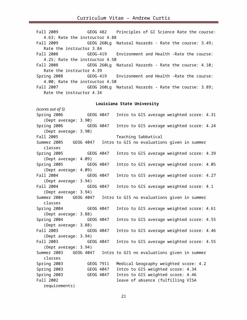
Teaching Evaluations
USC(scores out of 5)Fall 2010 GEOG 482 Principles of GI Science Rate the course: 4.63; Rate the instructor 4.50Fall 2010 GEOG 260Lg Natural Hazards - Rate the course: 3.31; Rate the instructor 3.80Fall 2009 GEOG 482 Principles of GI Science Rate the course: 4.63; Rate the instructor 4.88Fall 2009 GEOG 260Lg Natural Hazards - Rate the course: 3.49; Rate the instructor 3.84Fall 2008 GEOG-419 Environment and Health -Rate the course: 4.25; Rate the instructor 4.50Fall 2008 GEOG 260Lg Natural Hazards - Rate the course: 4.10; Rate the instructor 4.39Spring 2008 GEOG-419 Environment and Health -Rate the course: 4.00; Rate the instructor 4.50Fall 2007 GEOG 260Lg Natural Hazards - Rate the course: 3.89; Rate the instructor 4.34
Louisiana State University(scores out of 5)Spring 2006 GEOG 4047 Intro to GIS average weighted score: 4.31 (Dept average: 3.90)Spring 2006 GEOG 4047 Intro to GIS average weighted score: 4.24 (Dept average: 3.90)Fall 2005 Teaching Sabbatical Summer 2005 GEOG 4047 Intro to GIS no evaluations given in summer classesSpring 2005 GEOG 4047 Intro to GIS average weighted score: 4.39 (Dept average: 4.09) Spring 2005 GEOG 4047 Intro to GIS average weighted score: 4.05 (Dept average: 4.09)Fall 2004 GEOG 4047 Intro to GIS average weighted score: 4.27 (Dept average: 3.94)Fall 2004 GEOG 4047 Intro to GIS average weighted score: 4.1 (Dept average: 3.94)Summer 2004 GEOG 4047 Intro to GIS no evaluations given in summer classesSpring 2004 GEOG 4047 Intro to GIS average weighted score: 4.61 (Dept average: 3.88)Spring 2004 GEOG 4047 Intro to GIS average weighted score: 4.55 (Dept average: 3.88)Fall 2003 GEOG 4047 Intro to GIS average weighted score: 4.46 (Dept average: 3.94)Fall 2003 GEOG 4047 Intro to GIS average weighted score: 4.55 (Dept average: 3.94)Summer 2003 GEOG 4047 Intro to GIS no evaluations given in summer classesSpring 2003 GEOG 7911 Medical Geography weighted score: 4.2Spring 2003 GEOG 4047 Intro to GIS weighted score: 4.34Spring 2003 GEOG 4047 Intro to GIS weighted score: 4.46Fall 2002 leave of absence (fulfilling VISA requirements)Summer 2002 GEOG 4047 Intro to GIS no evaluations given in summer classes(scores out of 4)Spring 2002 GEOG 7911 Medical Geography weighted score: 3.96 Spring 2002 GEOG 4047 Intro to GIS weighted score: 3.77Fall 2001 GEOG 4048 Intro to Statistics weighted score: 3.6 Fall 2001 GEOG 4047 Intro to GIS weighted score: 3.23Summer 2002 GEOG 4047 Intro to GIS no evaluations given in summer classesSpring 2001 GEOG 4998 Medical Geography weighted score: 3.8 Spring 2001 GEOG 4047 Intro to GIS weighted score: 3.39
15
Curriculum Vitae – Andrew Curtis
Dissertations and Theses Directed
University of Southern California
1. Jenny Wrye Novak, PhD. Geography (in progress)2. Brice Burkett, MS, Geographic Information Science & Technology (2011)
Louisiana State University
3. Sarah Hinman, Ph.D. HGIS (2007) Title: Spatial Patterns of Typhoid in Washington DC from 1880 to 1911. Currently faculty at Idaho State University
4. Harry Wilson, Ph.D. HGIS (2007) Title: Neighborhood Development Patterns in Historic Pensacola. Currently faculty at Ohio Northern University
5. Frances Currin, Ph.D. Medical Geography (2007) Title: Chagas in culture and place: A mixed methods approach to a new medical geography of Chagas disease in Los Tuxlas, Mexico
6. David Dorrell, Ph.D. Medical Geography (2007) Title: Spatial Bias in Rabies Surveillance During the Raccoon Rabies Epizootic Currently faculty at Nicholls State University
7. Kate Streva, M.N.S., Hazards Geography (2007) Title: Hurricane modeling in GIS: An investigation of threshold storm events affecting special medical needs populations in coastal Louisiana
8. Anzhelika Antipova, M.S., Medical Geography (2007) Title: Hurricane Andrew and pregnancies in Louisiana
9. Gerardo Boquin, M. S., Medical Geography (2007) Title: Spatial Patterns of T. Dimidiata reinfestation in Guatemala
10. Jason Blackburn, Ph.D. Medical Geography (2006) Title: Evaluating the Spatial Ecology of Anthrax in North America: Examining the Epidemiological Components Across Multiple Geographic Scales Using a GIS-Based Approach. Currently faculty at the University of Florida
11. William Arden, M.S., Medical Geography (2005) Title: Urban yellow fever diffusion patterns and the role of micro-environmental factors in disease dissemination: a temporal-spatial analysis of the Memphis epidemic of 1878
12. Ann- Marie Cain, M.A., Medical Geography(2004) Title: A spatial analysis of the smallpox epidemic in Sheffield, United Kingdom, 1887-1888
13. Jason Blackburn, M.S., Medical Geography (2003).Title: Characterizing spatially explicit patterns of Antibiotic Resistance in the marine environment using top-level marine predators
14. Sait Ahmet Binselam, M.N.S. (2001) A Comparison of Point Pattern Analyses
Dissertations and Theses as Committee Member
California State University Long Beach (external committee member)
1. Sheridan Kennedy, MA Geography (2011)
University of Southern California
2. Julienne Gard, Ph.D. Geography (in progress)3. Laura Harjo, Ph.D. Geography (in progress)4. Analena Hassberg, Ph.D. American Studies & Ethnicity (in progress)5. Louisa Holmes, Ph.D. Geography (in progress) 6. Rachel Russell, Ph.D. Geography (in progress)7. Oh Seok Kim Ph.D. Geography (in progress)8. Matthew Davis MA Geography (in progress)9. Arthur Page MA Architecture (in progress)10. Chi Hin Lam, Ph.D. Marine Environmental Biology (2011)
16

Curriculum Vitae – Andrew Curtis
11. Christine Li Ph.D. Geography (2009)
Louisiana State University
12. Bretton Summers, Ph.D. Geography (2007)13. Scott Hemmerling, Ph.D. Geography (2007)14. Dominique M Duval-Diop, Ph.D. Geography (2006)15. Guiyun Zhou, Ph.D. Geography (2006)16. Srinivas Vinnakota, Ph.D. Geography (2006)17. Misty Richard, Ph.D. The School of Veterinary Medical Science (2006). 18. Evaristo Liwa, Ph.D. Coastal Studies (2006)19. Sainath Challuri, MS Geography (2006)20. Bretton Somers, MA Geography (2005) 21. Michelle Russo, MA Geography (2005) 22. Jamie Suskewicz, MA Anthropology (2005)23. Ellen Salter-Pedersen, MA Anthropology (2004) 24. Daniel Culli, MA Geography (2004) 25. William Fagan Ph.D. Geography (2003) 26. Paul Watts, MA Geography (2003)27. Casey Shamblin, MA Anthropology (2003) 28. Jane Russell, MA Anthropology (2003)29. Gina Dimattia, MA Anthropology (2002) 30. Erica Gibson, MA Anthropology (2002) 31. Lori Scheiss, MA Anthropology (2002)32. Misty Richard, MS Epidemiology (2002)33. Joseph Lloyd Macaluso, M.N.S. Geography (2002)34. Esra Ozdenerol, Ph.D Geography (2001)35. Tian Wu, Ph.D Geography, (2001) 36. Soe Win Myint, Ph.D Geography (2001) 37. William Fagan, MA, Geography (2001) 38. Stephen Greaves, Ph.D Engineering, (2000)
Short Courses Developed
National Center for Biomedical Research and Training (NCBRT) Academy of Counter-Terrorist Education.2004 Prevention and Response to Agricultural Terrorism Course.
Local Instructional Activities (guest lectures, etc.)
1. Medical Geography and Infant Health, Guest lecture for Geography of Health, California State University at Fullerton Department of Geography 2008
2. GIS and Hurricane Katrina, Baton Rouge Dietetic Association, Pennington Biomedical Research Center, Louisiana State University 2006
3. Spatial Patterns in the 1878 Yellow Fever Epidemic of New Orleans, Guest talk in a Microbiology class, Loyola University 2006
4. After Hurricane Katrina, Presentation to Two Classes at McBrayer Elementary School, Morehead, Kentucky 2005.
5. After Hurricane Katrina, Presentation to One Class at Brookstone School, Georgia.20056. Utilizing GIS, Spatial Analysis and a Real Time Pregnancy Surveillance System to Reduce African
American Infant Mortality in Baton Rouge: Implications for Bioterrorism?, School of Human Ecology, Louisiana State University 2005.
7. Utilizing GIS, Spatial Analysis and a Real-Time Pregnancy Surveillance System to Reduce African American Infant Mortality in Baton Rouge: Implications for Bioterrorism? Colloquium, Department of Environmental Studies, Louisiana State University.
8. 2005
17

Curriculum Vitae – Andrew Curtis
9. “Spatial Epidemiology” Baton Rouge Lagniappe Studies Unlimited. 200410. Using a Geographic Information System to investigate the 1878 Yellow Fever Epidemic ofNew Orleans,
Guest lecture in Hazards and Disasters Class, Department of Geography, University of New Orleans, New Orleans 2004.
11. Presentation to community and political officials in Baton Rouge: Infant Mortality in Baton Rouge: A status report to the community 2002.
12. Presentation to Great Expectations of New Orleans & North Louisiana Area Health Education Center on the use of GIS to reduce Infant Mortality in Baton Rouge 2002.
13. Reducing Infant Mortality in Baton Rouge, Presentation to the Science Club at Louisiana State University Faculty Club 2000.
14. Correcting surveillance errors using a Spatial Filter and a GIS, Louisiana State University,School of Veterinary Medicine Colloquium Series 1999.
SERVICE
University of Southern California
Graduate Studies Committee, Department of American Studies and Ethnicity (2011) Director of Graduate Studies, Department of Geography 2008—2010 (with ongoing responsibilities)
(Nominated for the 2009 USC Mellon Award for Excellence in (graduate student) Mentoring) Faculty Advisor to the Undergraduate Student Government, Academic research Fund 2008 – present CTS Center for Transformative Scholarship Advisory Board member 2008 – 2010 Selection by the Scholars Program as an “exceptional teacher” for attracting new students 2008
Louisiana State University
Department committees
Chair of the Committee to Evaluate the Department’s Evaluation Procedure 2004 Department IT Committee 2003 -- 2007 Geography and Anthropology Representative to CADGIS 2003 -- 2007 Research and Scholarship Committee 2003 -- 2006 Judge/Time Keeper at the Louisiana State Geography Bee 2000 -- 2004 Publications Committee 2005 -- 2006 Graduate Committee 2001 -- 2002 AAG 2003 Planning Committee 2002 Exhibits Committee 2001--2002 Undergraduate Advisor for mapping Sciences 1999 -- 2002
College committee
College Committee on Grants, College of Arts and Sciences 2002
Student organizations advised
Louisiana State University’s Women’s Club Soccer Team 2000 -- 2007
Morehead State University
University NCAA Athletics Committee (Chair sub-committee) 1998 Department representative to Faculty Senate 1997 – 1998 University Governance Committee 1997 – 1998
18

Curriculum Vitae – Andrew Curtis
Department Faculty Evaluation Committee 1998 Departmental Resources Committee 1996 – 1997 Teacher Education Committee (Chair) 1996 – 1998 Coach of the Men’s University Soccer Team 1995 – 1996 Coach of the Women’s University Soccer Team 1995 -- 1997
State University of New York at Buffalo
President of the Geography Graduate Student Association 1990 – 1991 Treasurer of the Geography Graduate Student Association 1989 – 1991 Head of Intramural soccer officials 1989 -- 1995
Service at Oxford University
Elected member of the Mulcaster Society - an educational and social organizing committee. 1989
Professional Service: Consultancy (Paid and Unpaid)
1. St.John's Well Child and Family Centers (providing GIS analysis of their health data) 20112. Project Connect Health Research Association (using GIS to analyze HIV patterns)20103. Los Angeles County Department of Public Health, Sexually Transmitted Disease Program (using GIS to
analyze STD patterns) 2010 -- present4. PolicyLink and Dolores Huerta Foundation & California Rural Legal Assistance 2009 -- 2010 (using GIS
to map unincorporated areas)5. American Red Cross of Los Angeles County 2008 – current (provide GIS support for their EOC and
damage assessment)6. PolicyLink providing neighborhood level GIS assistance in New Orleans 2008 – 20097. Churches Supporting Churches providing neighborhood level GIS assistance in New Orleans 2008 –
current 8. Make it Right Foundation providing neighborhood level GIS assistance in New Orleans 2008 9. Providing neighborhood level GIS assistance for recovery of various community groups in New Orleans
(for example Holly Grove) 2008 – current10. Pasadena Birthing Project providing research support into infant health disparity 2008 – 201011. Department of Homeland Security FEMA, CSR, reviewer for the Commercial
Equipment Direct Assistance Program (CEDAP) 2007.12. Baton Rouge Mosquito Abatement and Rodent Control 2006-2007 13. GIS support for Families in Disaster: family resiliency project, Agricultural Center,
Louisiana State University.2006.14. Member of the Idea Group Editorial Advisory Review Board 200615. Provide Geospatial support for the Search and Rescue Operations in the State EOC for 2005 Hurricanes
Katrina and Rita16. Provide Geospatial support for the American Red Cross Disaster Assessment teams (during Hurricane
Katrina) 200517. Provide Geospatial advice for the Louisiana Office of Public Health EOC (during Hurricane Katrina) 200518. GIS advice for the Louisiana Department Social Services about Hurricane Katrina recovery efforts 2005 –
200619. AAG Representative (along with Doug Richardson and Nina Lam) presenting the future role of
Geography in illegal substance use analysis. National Institute on Drug Abuse (NIDA), NIH, Washington DC 2005.
20. Provide GIS advice for Mary Bird Cancer Institute, Women’s Hospital, YWCA, on spatial inequalities in Breast Cancer Screening 2004-2005
21. Provide GIS support for Capital One Health Unit, Baton Rouge 2003 – 2007
19

Curriculum Vitae – Andrew Curtis
22. Provide GIS advice to Pan American Health Organization on Foot and Mouth Disease in Central and South America 2003
23. Provide Spatial Analysis and GIS expertise for March of Dimes / YWCA in Baton Rouge 200224. GIS Evaluator Healthy Start of Baton Rouge 2001 – Current25. GIS analysis for Healthy Start / CityMatch of Baton Rouge 1999 – 200726. GIS advisor to the Kentucky Commissioner’s Conference on Public Health Information 1998 – 199927. Spatial and cartographic advisor for the Kentucky Department For Health Services 1998
Books Reviewed
Meade, M., and M. Emch, Medical Geography, 3rd Edition, manuscript review for Guildford Publications 2009
Manuscript review: Community Geographic Information Systems: Economic Empowerment through GIS Technology for Idea Group Editorial Advisory Review Board 2007
Meade, M., and R. Earickson, Medical Geography, 2nd Edition, manuscript review for Guildford Publications, Inc. Review appears on the book fly-sheet 2000.
Manuscripts Refereed for the Following Journals
1. ActaTropica2. American Journal Public Health3. Annals of the Association of American Geographers4. Antipode 5. Applied Geography6. Cartography and Geographic Information Science7. Computers, Environment and Urban Systems8. Earthzine9. Geographical Analysis10. GeoJournal11. Health and Place12. Historic Geography13. International Journal Health Geographics14. International Journal of Geographical Information Science15. Journal of Urban Health16. Methods of Information in Medicine17. Professional Geographer18. Psychiatry Research19. Social Science & Medicine20. Southeastern Geographer21. Spatial and Spatio-Temporal Epidemiology22. Transactions in GIS
Proposals Reviewed for the Following Organizations
CUNY Collaborative Incentive Research Grants ProgramHealth Research Council of New ZealandNational Institutes of Health National Science Foundation University Consortium GIS – HUDWelcome Trust's Animal Health in the Developing World (AHDW) Initiative
20
Curriculum Vitae – Andrew Curtis
Popular Media Involvement
1. New York Times, “The changing landscape of the Lower Ninth Ward” Interactive spatial video application of my Hurricane Katrina recovery work.http://www.nytimes.com/interactive/2010/08/27/us/lower9th-5year-anniversary.html?ref=us Accompanies the article “On anniversary of Katrina, signs of healing.” By Campbell Robertson. 8/27/2010
2. Wall Street Journal, “On one block, resilience and despair” by Jennifer Levitz and Mike Esterl. Provided geographic guidance to the area which became the subject of the story and some data for the interactive section. 8/28/2010
3. “Katrina Hazard Mapping” Interview on Local Fox News affiliate about Hurricane Katrina http://www.myfoxla.com/dpp/ news /national/katrina-hazard-mapping-20100827 8/27/2010
4. Los Angeles Times, “New Orleans after Katrina” editorial. Information from an interview 8/28/2010 regarding the geography of rebuilding appears in the editorial.
5. USC College magazine: http://dornsife.usc.edu/news/stories/826/keeping-a-promise6. USC News “Years later, Katrina’s mark is still visible.” 3/17/2010
http://uscnews.usc.edu/politics_society/years_later_katrinas_mark_still_visible.html7. Interviewed by Pasadena Star News Tribune concerning using the Swine Flu outbreak 4/28/20098. Quoted in the San Gabriel Valley Tribune concerning using the Swine Flu outbreak 4/28/20099. Interview USC Annenberg Television News concerning using the Swine Flu outbreak 4/28/200910. Radio interview USC Annenberg Radio News concerning using the Swine Flu outbreak 4/28/200911. Radio interview USC Annenberg Radio News concerning using GIS to reduce African American infant
mortality 200712. “A fix on the chaos of Katrina” GIS Ireland the newsletter of the Irish Organization for Geographic
Information 9: 2 p9http://www.irlogi.ie/userfiles/File/Database/IRLOGInewsletter_v9_2.pdf 200613. Studio interview on Ireland AM breakfast television, 1/25/0614. A Fix on the Chaos of Katrina, By Fleishman Hillard, The Irish Times, 2/2/06.15. Images from Katrina, Photographic Show, Design Atrium E-Gallery, Design Building, College of Art and
Design, Louisiana State University 2006.16. Interview for regional NBC news at 11 on the dangers of emergent viruses 1998
21