Culvert Management System Using GIS/GPS Ontario County...Chris Day, P.E. Ontario County Department...
107
Chris Day, P.E. Ontario County Department of Public Works Culvert Management System Using GIS/GPS Ontario County October 26, 2016
Transcript of Culvert Management System Using GIS/GPS Ontario County...Chris Day, P.E. Ontario County Department...
Chris Day, P.E.
Ontario County
Department of Public Works
Culvert Management System Using GIS/GPS Ontario County
October 26, 2016
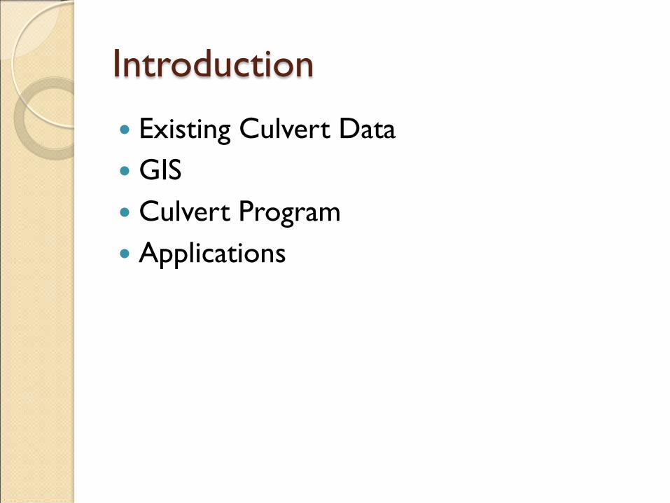
Introduction
Existing Culvert Data GIS Culvert Program Applications

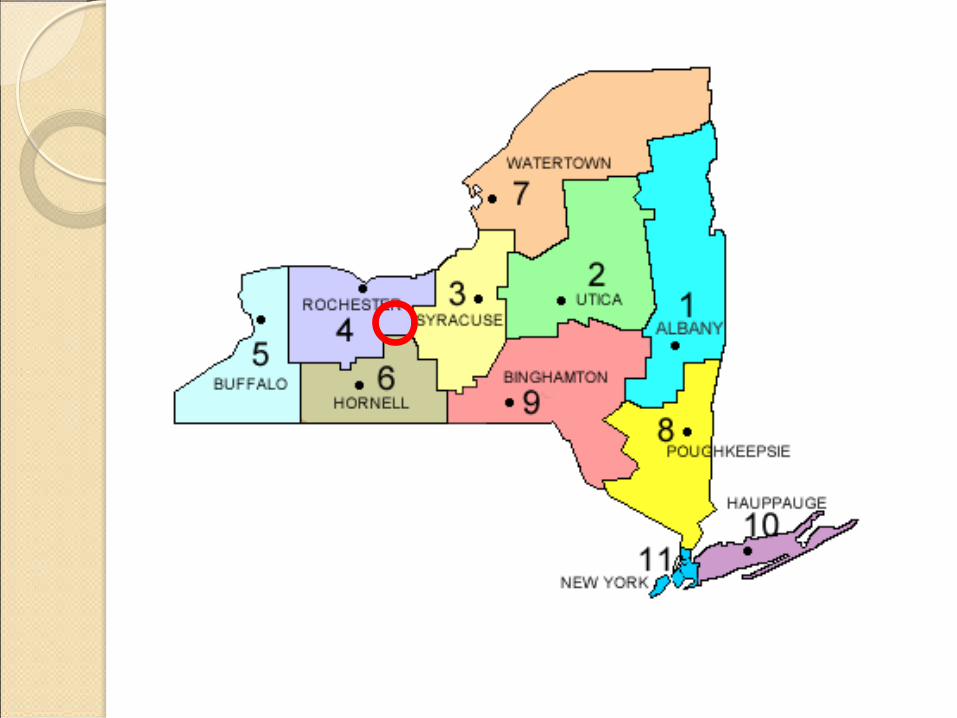


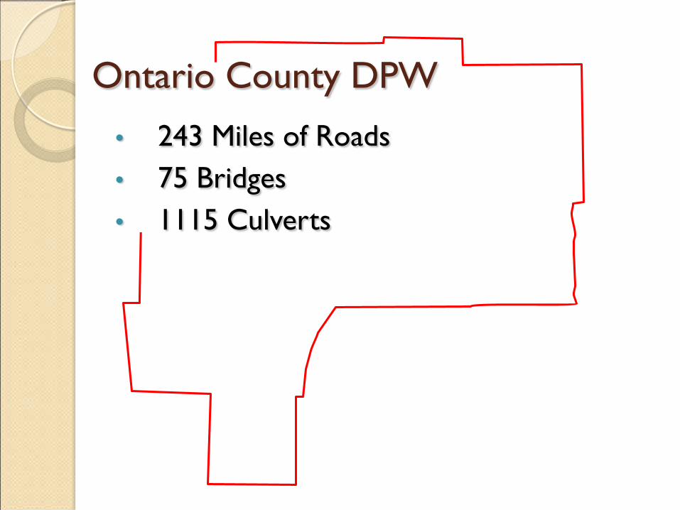
Ontario County DPW • 243 Miles of Roads
• 75 Bridges • 1115 Culverts

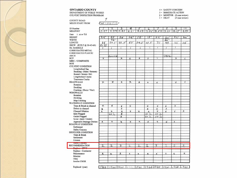
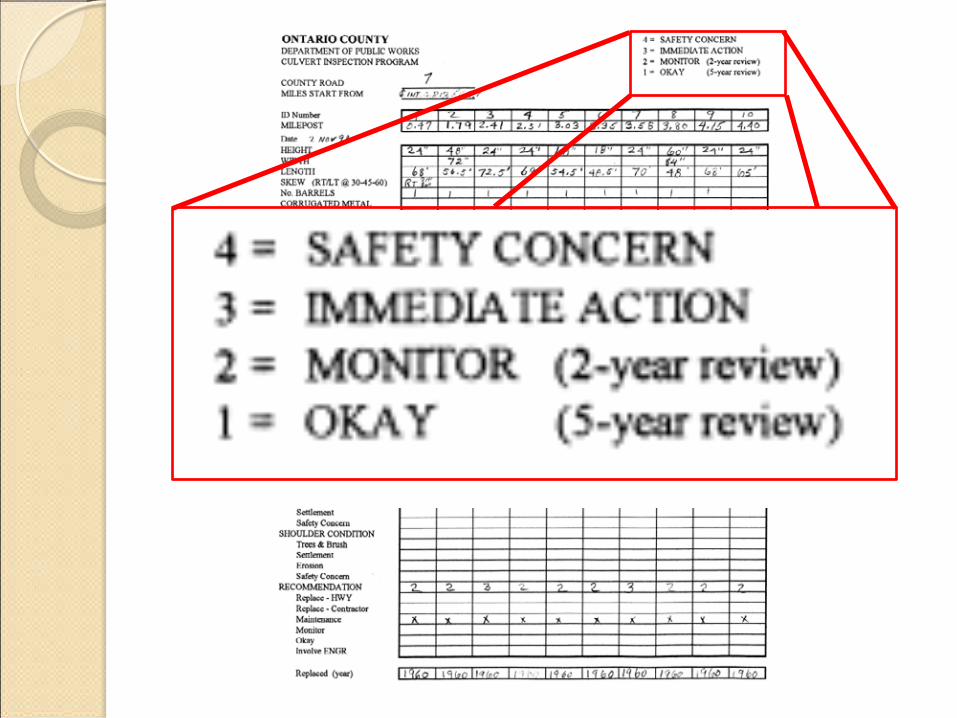
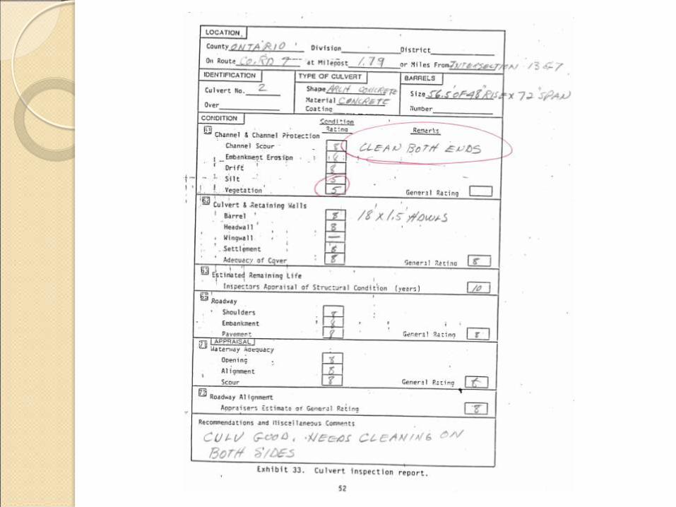
Culvert Data Issues
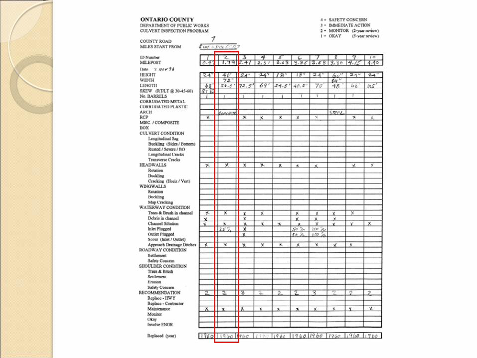
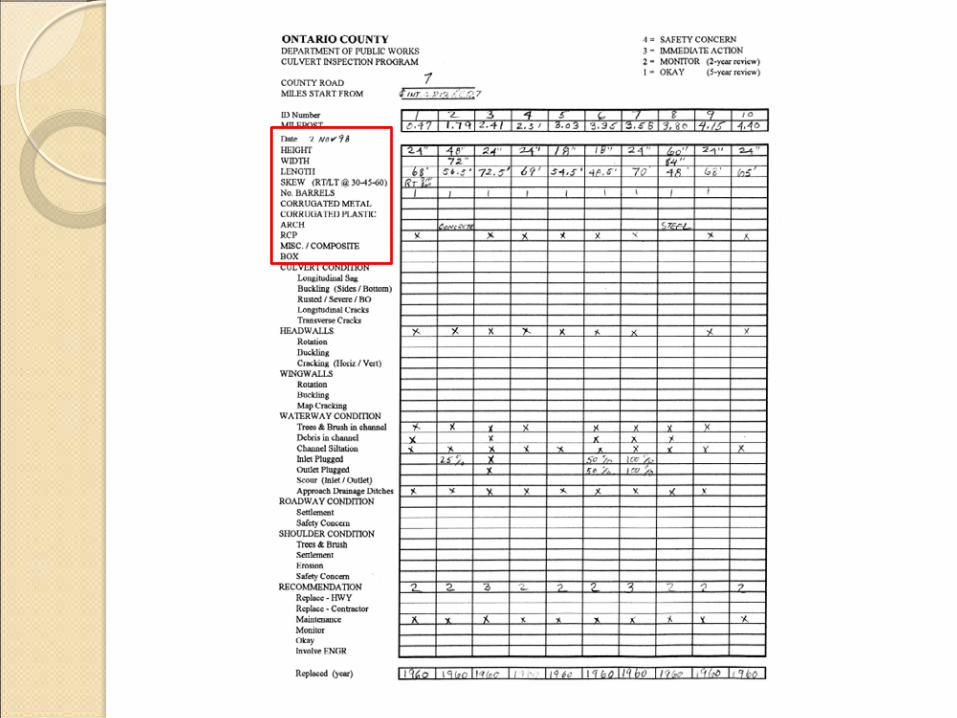
• Hand written forms


Culvert Data Issues
• Hand written forms

Culvert Data Issues
• Hand written forms • Outdated • Cumbersome • Current condition • Difficult to prioritize
County designated with MS4 area
• What is MS4? • Municipal • Storm • Separate • Sewer • System

County designated as MS4 area • Under Phase II EPA NSPDES
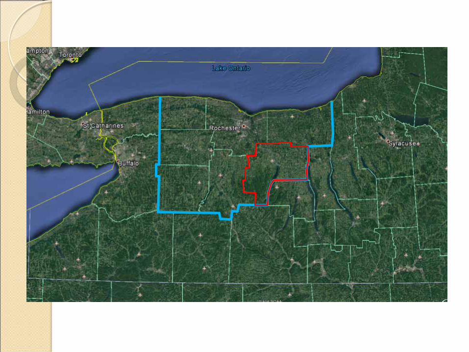
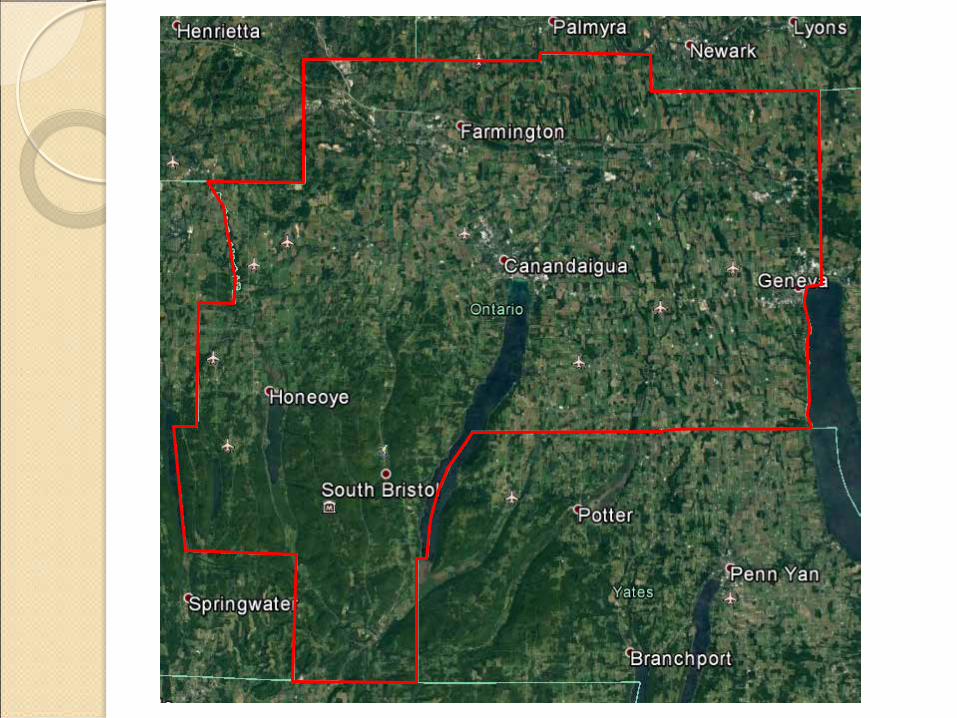
• Based on 2000 census data • Expanded Greater Rochester
Area MS4

Rochester MS4 boundary
MS4 Data Issues
• Required MS4 Program Development • Document/Inspect • Storm Water Outfalls
What to do?
• Large Data Set • Geographically Based • Routine Updating • Accurate Locating • MS4 & Culverts • GIS/GPS
• Geographic Information Systems • Global Positioning System
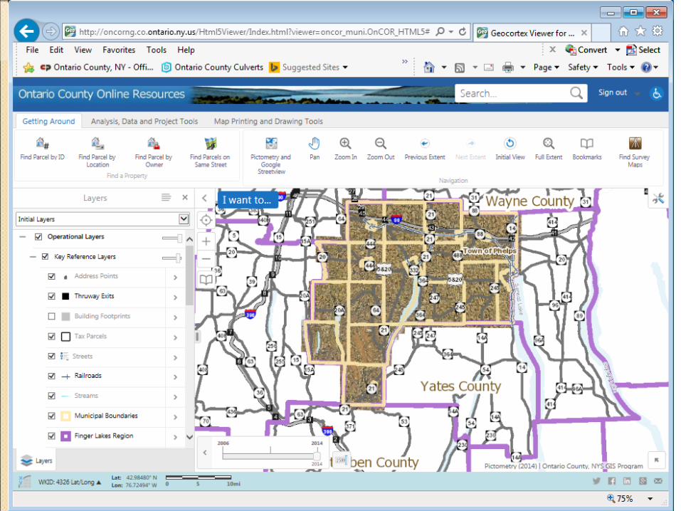
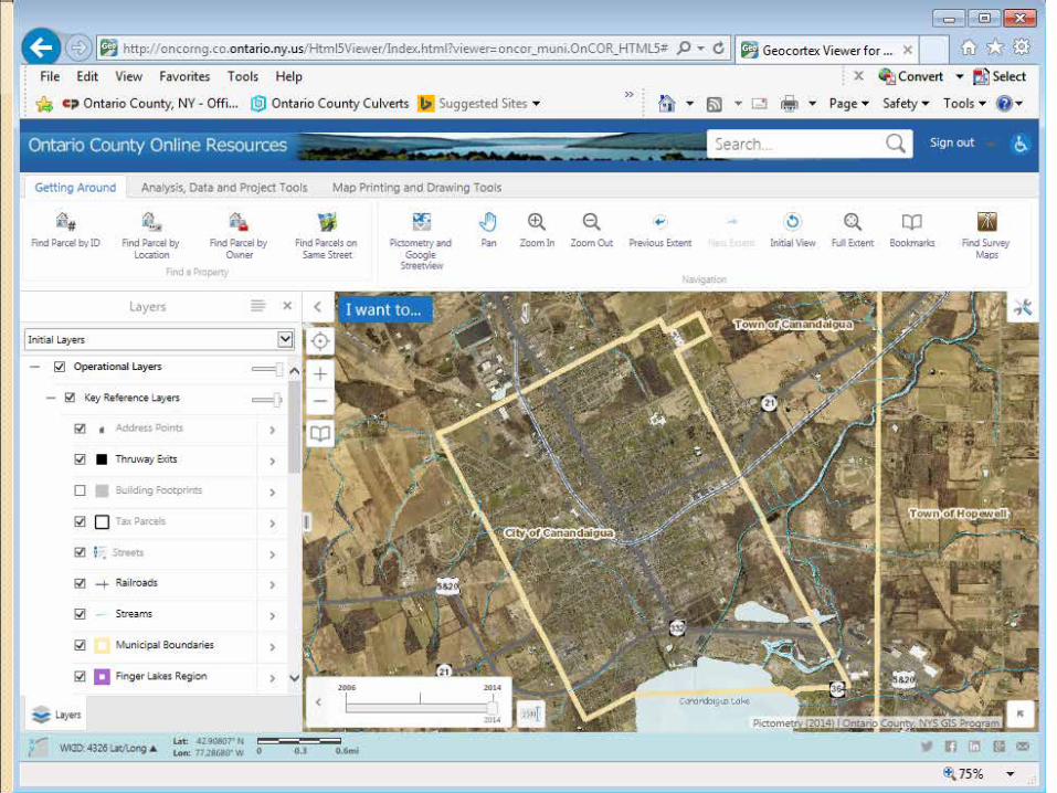
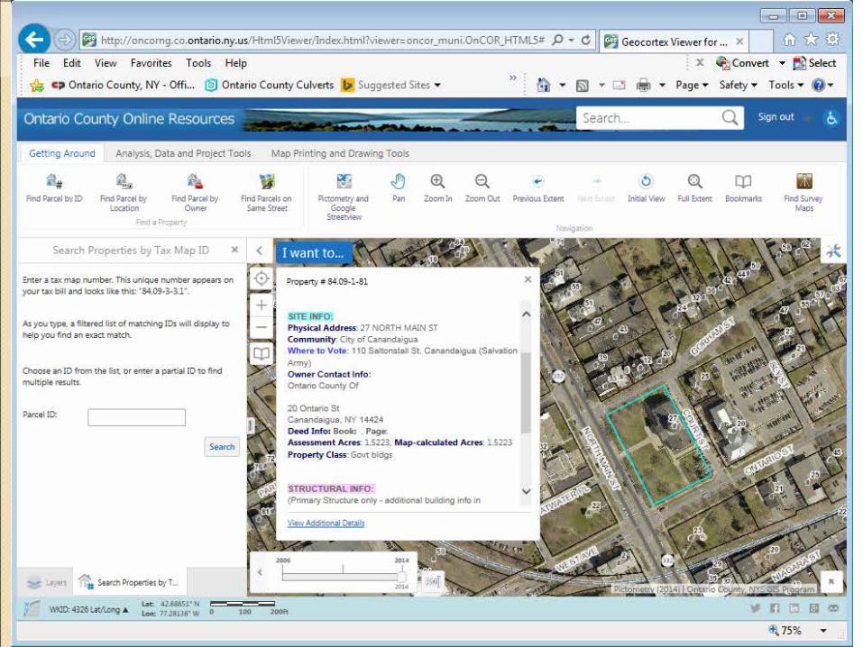
Planning Department
• Heavily Invested GIS • Extremely Large Data Sets • Integrated planning/tax
data sets • Beta “ONCOR” System


Decided to use GIS
• Expansion of data sets • Signs • Guiderail • Sanitary Sewer

Partnership Planning Department
• GIS complicated • DPW limited GIS experience • Reliance on Planning • Move Forward with GIS/GPS
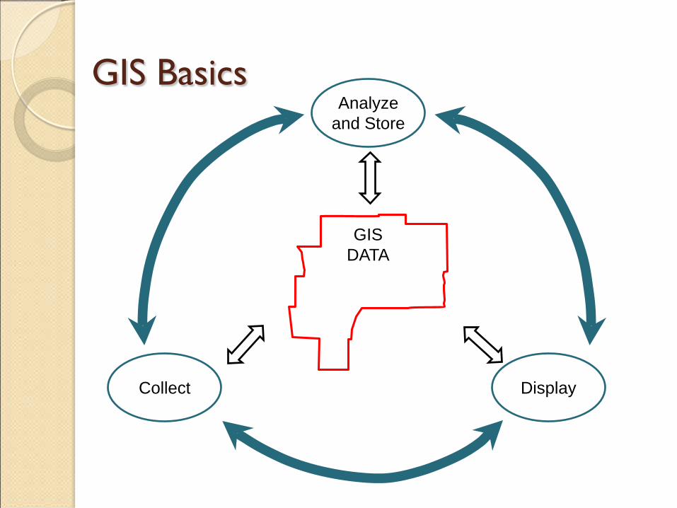
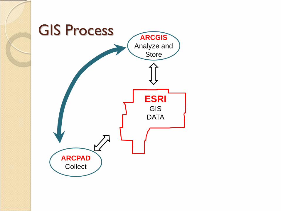
GIS Basics
GIS DATA
Analyze and Store
Collect Display

GIS Basics
ESRI GIS
DATA
ARCGIS Analyze and
Store
ARCPAD Collect
ARCGIS Online Display

How do we get there?
• Handwritten Forms converted electronic database
• Manually Plotted Culvert locations in ARCGIS
• Rudimentary Data Set
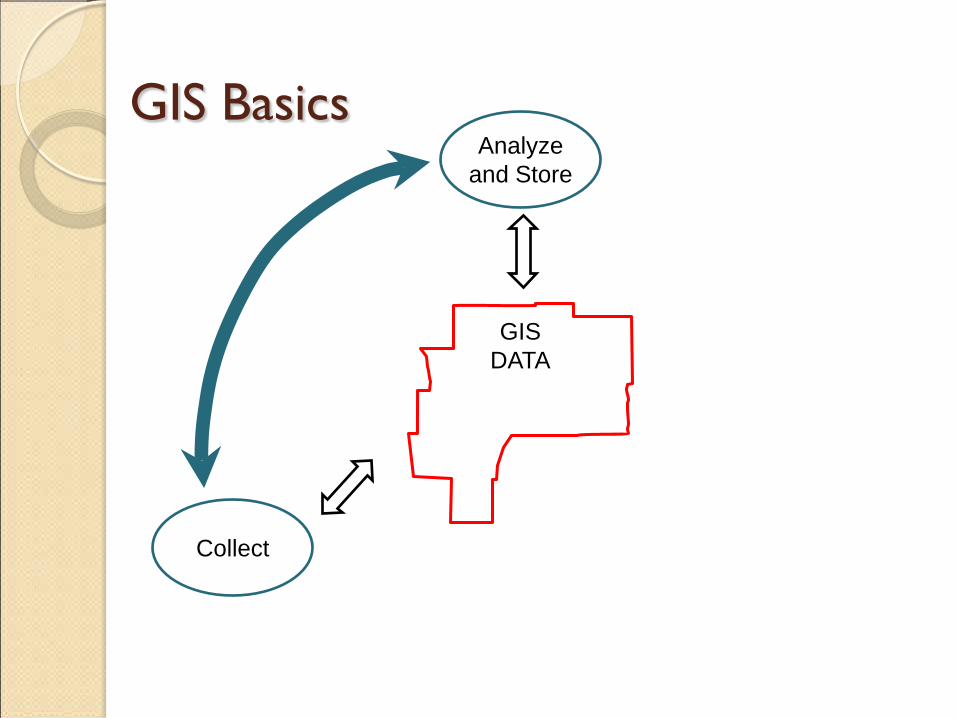
GIS Basics
GIS DATA
Analyze and Store
Collect
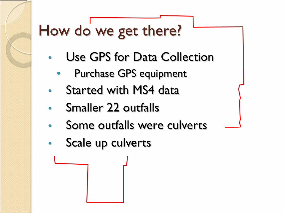
How do we get there?
• Use GPS for Data Collection • Purchase GPS equipment
• Started with MS4 data • Smaller 22 outfalls • Some outfalls were culverts • Scale up culverts
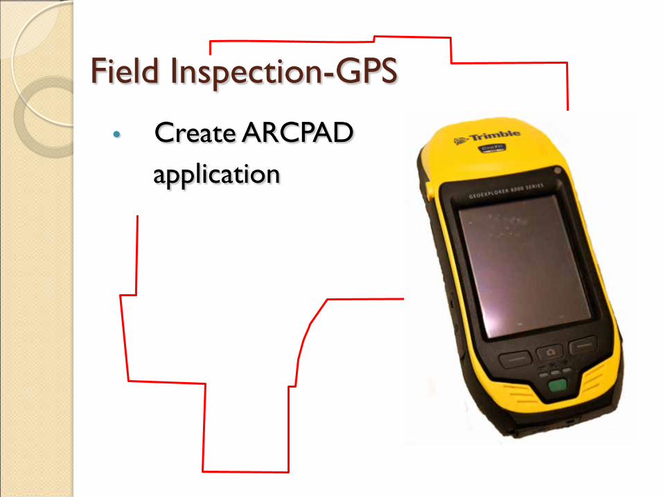
Field Inspection-GPS
• Create ARCPAD application
GIS Process
ESRI GIS
DATA
ARCGIS Analyze and
Store
ARCPAD Collect

How do we get there?
• GIS/GPS working for MS4 outfalls • Modify the ARCPAD for Culverts • Scale to 1115 culverts

How do we get there?
• Problem
How do we get there?
• Problem • Planning GIS/DPW staff both QUIT
How do we get there?
• Solution • County Hires GIS coordinator • DPW GIS Specialist

How do we get there?
• Modify the ARCPAD for Culverts • Scale to 1115 culverts

What data for culverts?
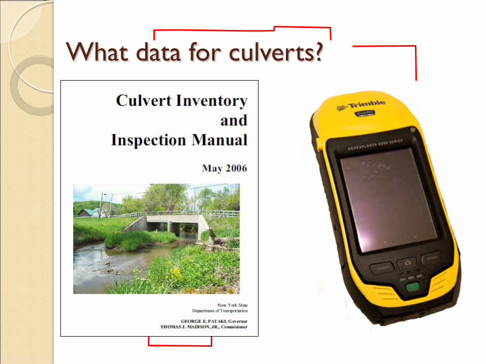
What data for culverts?
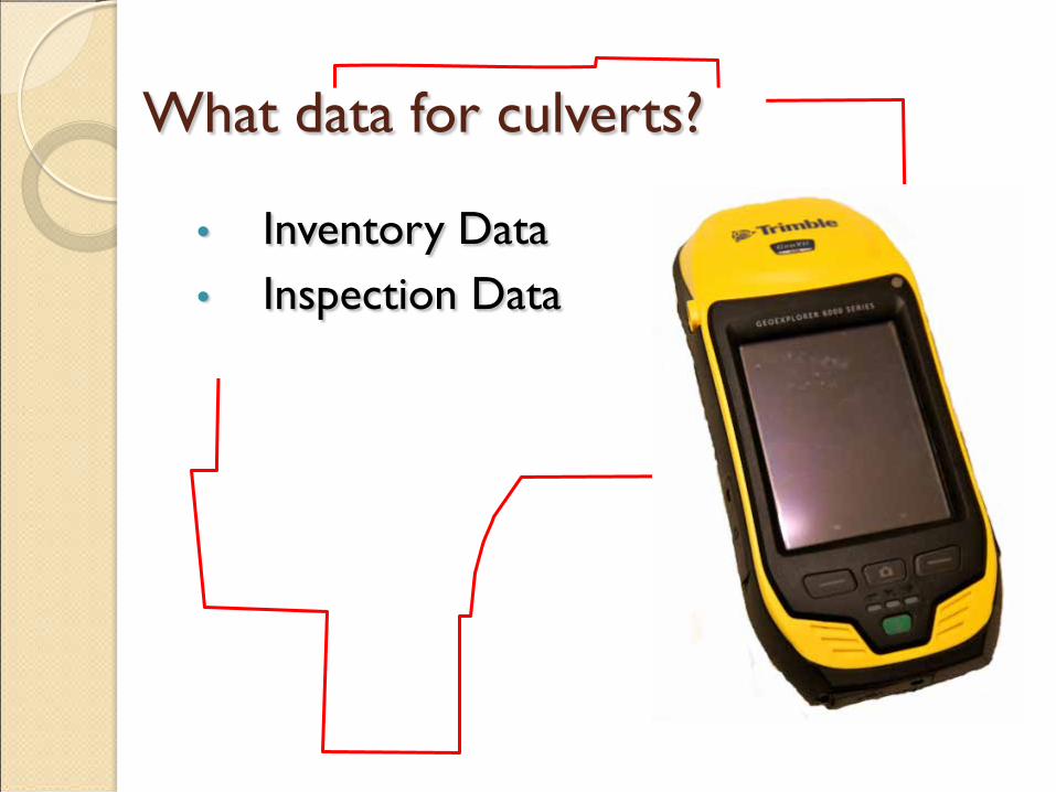
What data for culverts?
• Inventory Data • Inspection Data
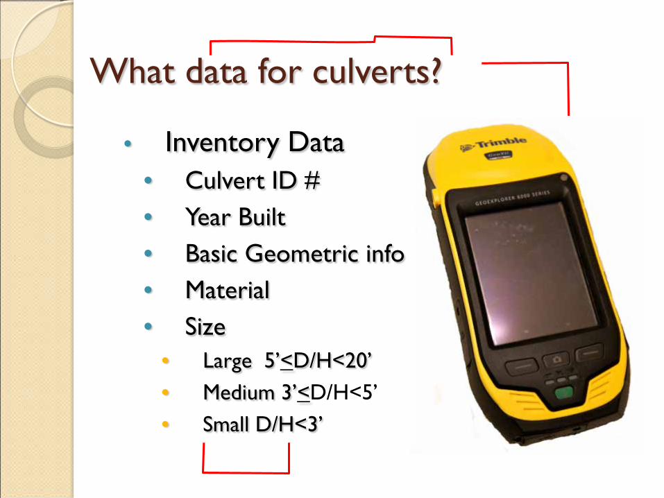
What data for culverts?
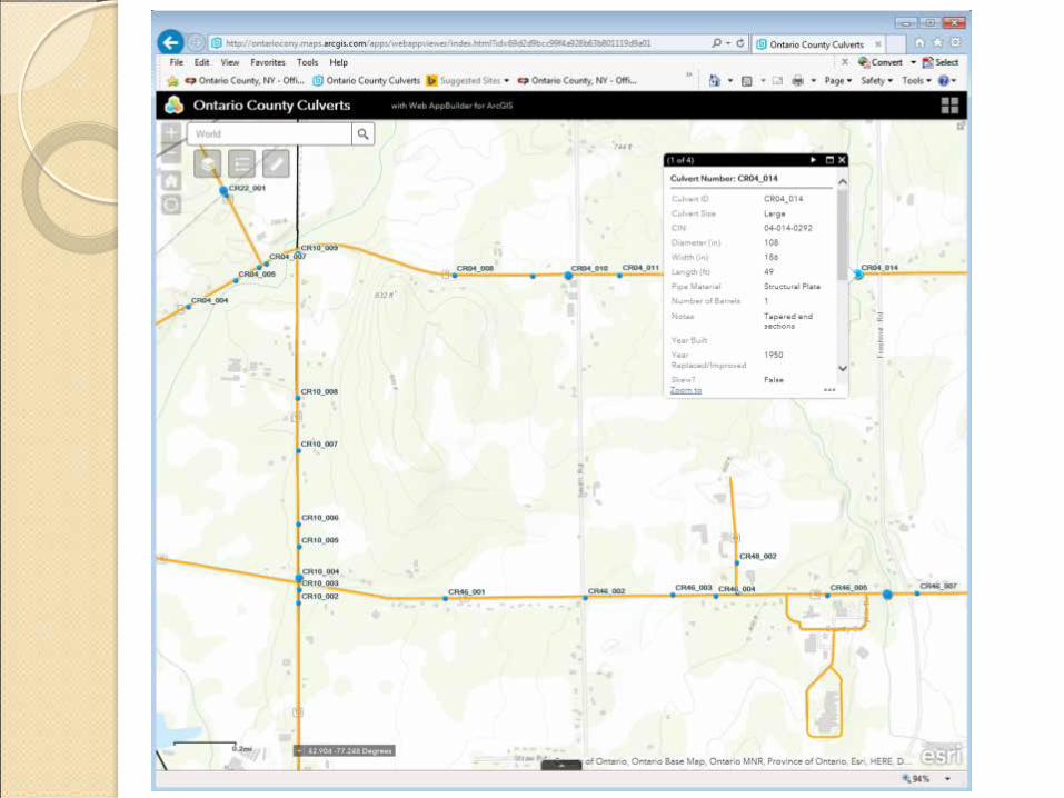
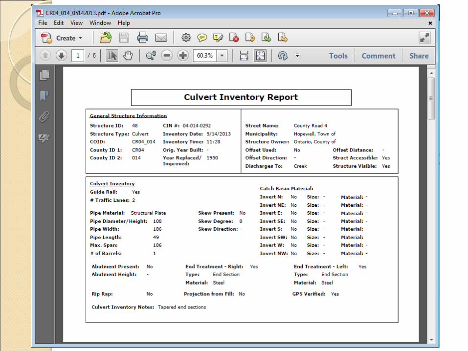
• Inventory Data • Culvert ID # • Year Built • Basic Geometric info • Material • Size
• Large 5’<D/H<20’ • Medium 3’<D/H<5’ • Small D/H<3’
What data for culverts?
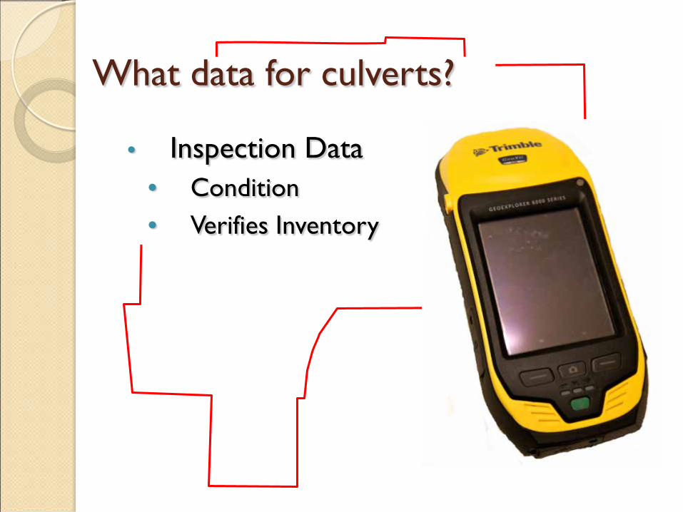
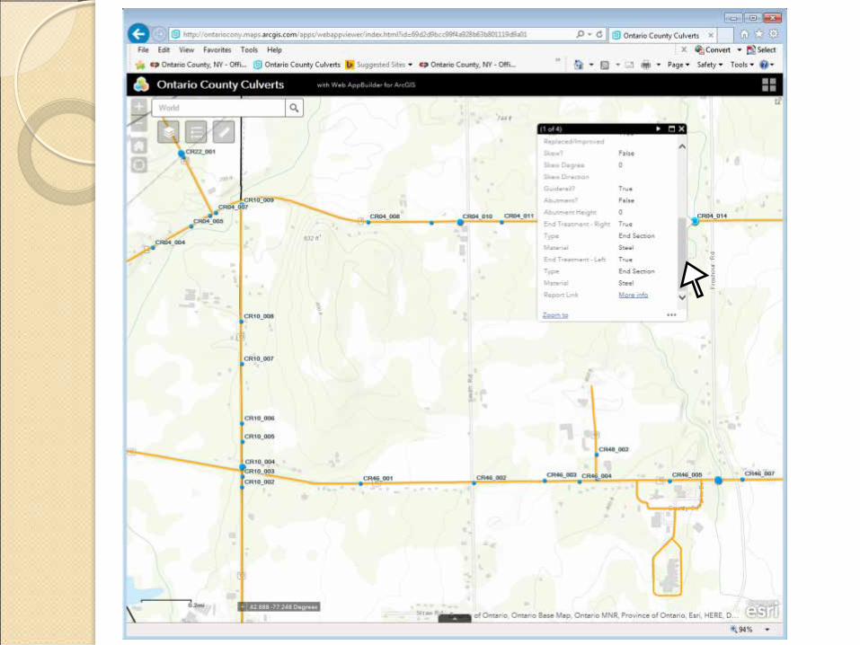
• Inspection Data • Condition • Verifies Inventory
What data for culverts?
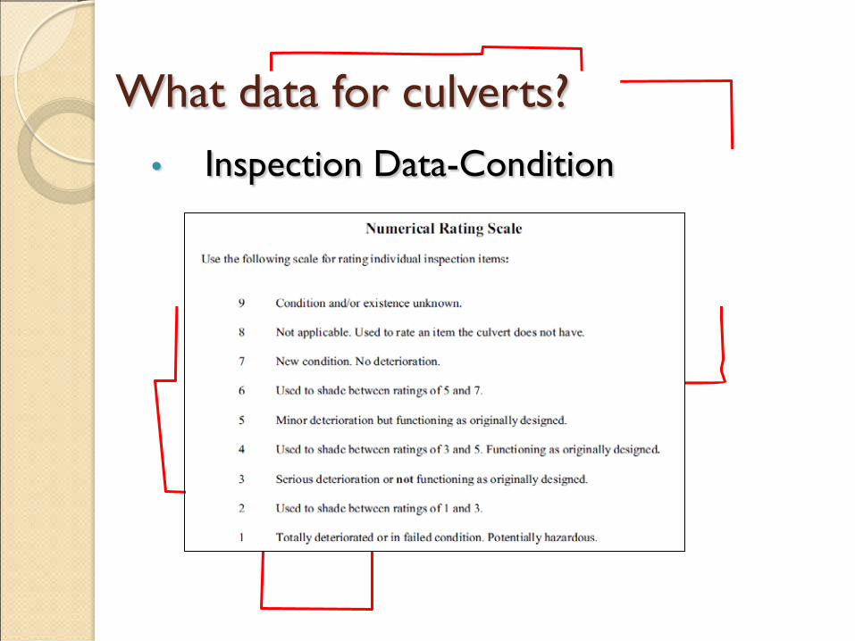
• Inspection Data-Condition
What data for culverts?
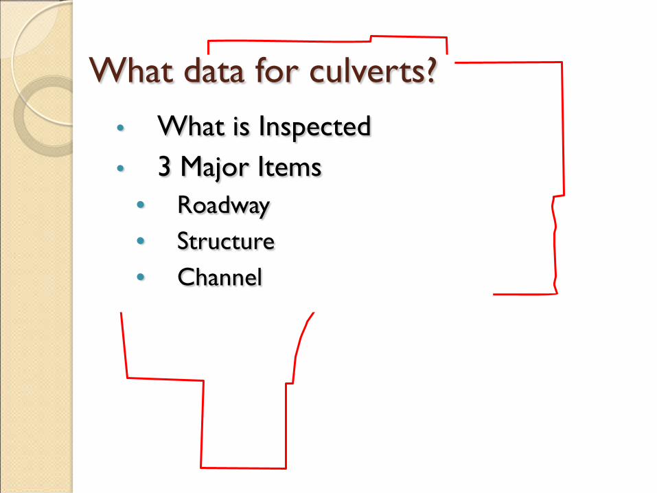
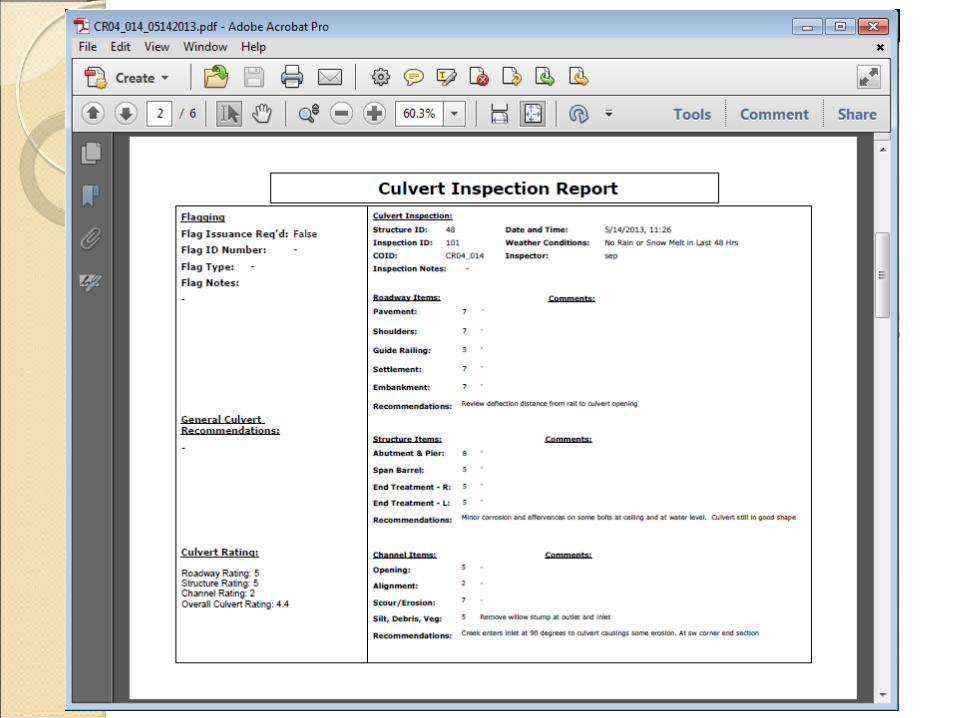
• What is Inspected • 3 Major Items
• Roadway • Structure • Channel
What data for culverts?
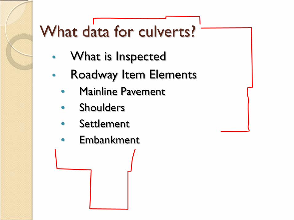
• What is Inspected • Roadway Item Elements
• Mainline Pavement • Shoulders • Settlement • Embankment
What data for culverts?
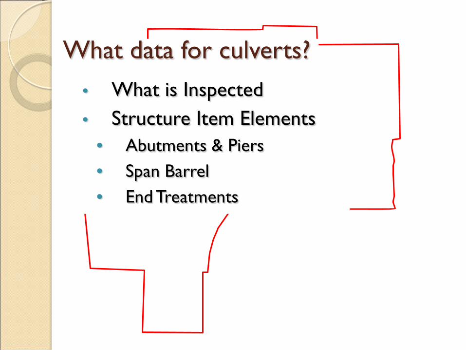
• What is Inspected • Structure Item Elements
• Abutments & Piers • Span Barrel • End Treatments
What data for culverts?
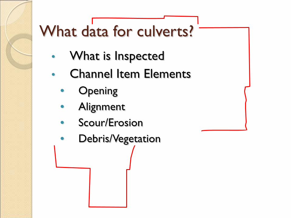
• What is Inspected • Channel Item Elements
• Opening • Alignment • Scour/Erosion • Debris/Vegetation

What data for culverts?
• Weighted Overall Culvert Rating • 10% Roadway Elements • 70% Structure Elements • 20% Channel Elements
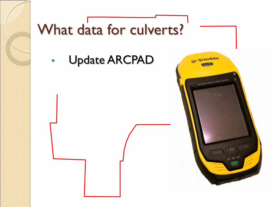
What data for culverts?
• Update ARCPAD
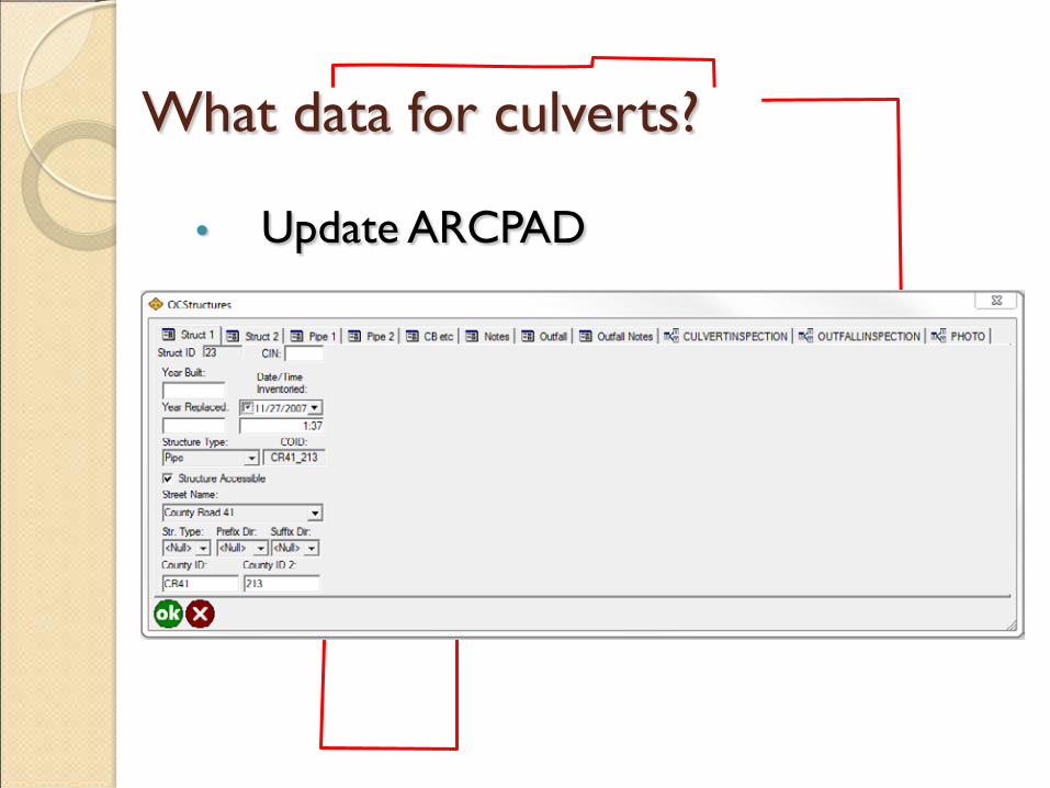
What data for culverts?
• Update ARCPAD
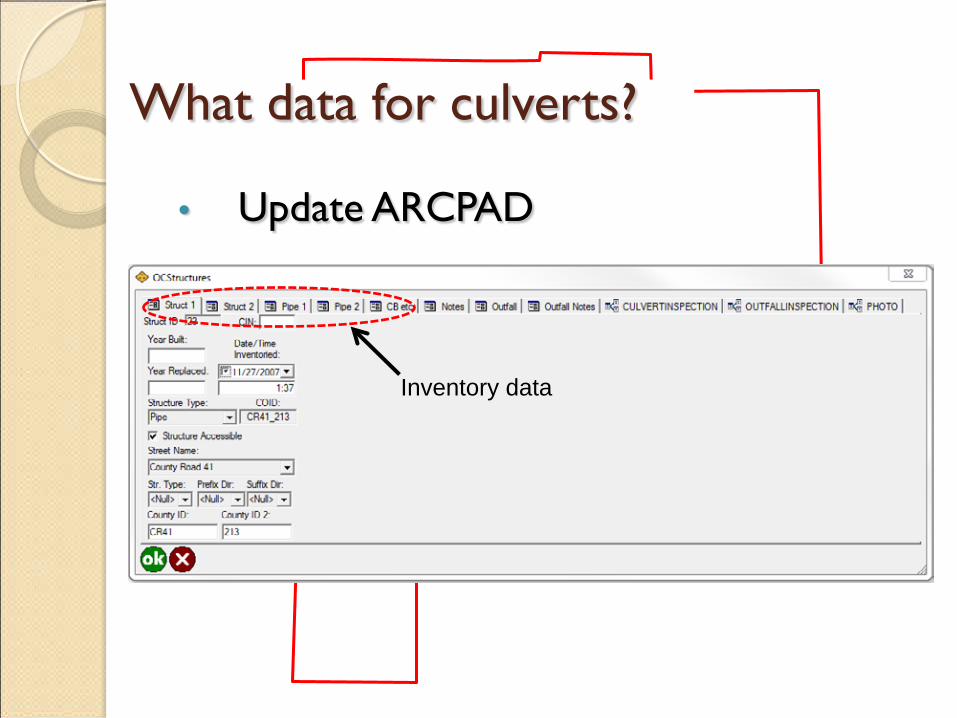
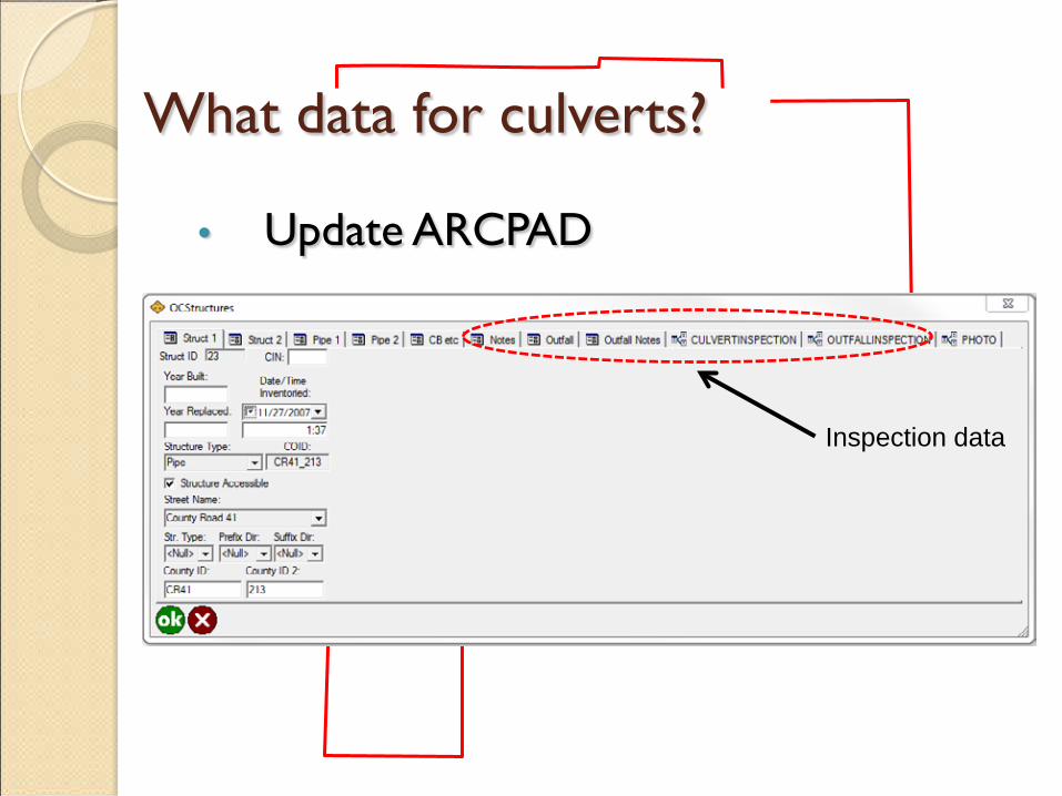
What data for culverts?
• Update ARCPAD
Inventory data
What data for culverts?
• Update ARCPAD
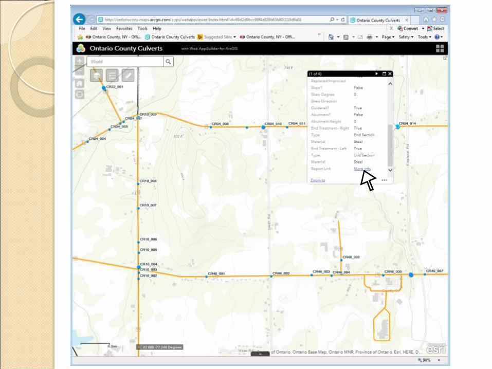
Inspection data

What data for culverts?
• Update ARCPAD
MS4 Outfall Data
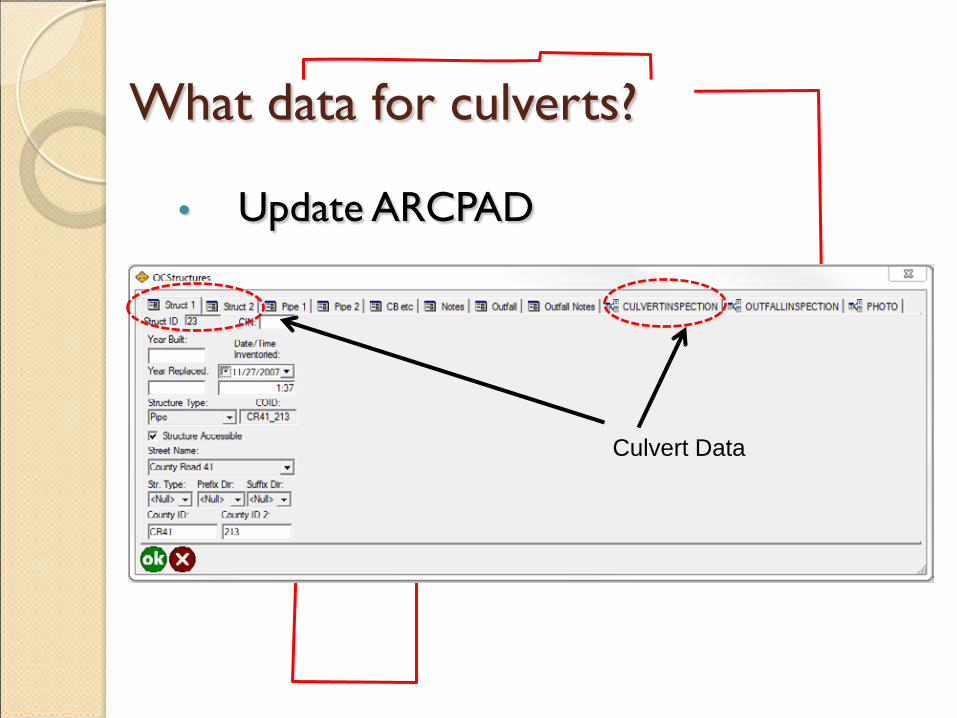
What data for culverts?
• Update ARCPAD
Culvert Data
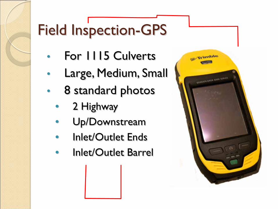
Field Inspection-GPS
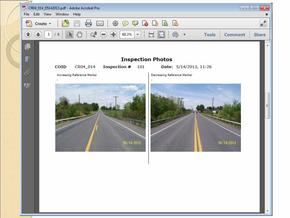
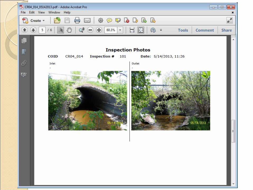
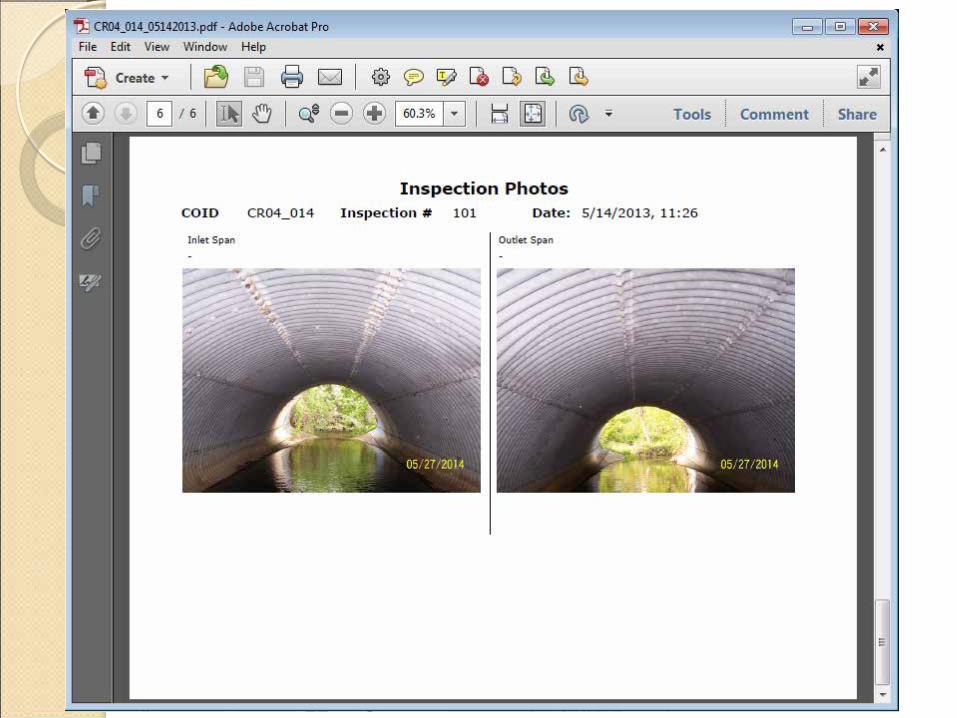
• For 1115 Culverts • Large, Medium, Small • 8 standard photos
• 2 Highway • Up/Downstream • Inlet/Outlet Ends • Inlet/Outlet Barrel
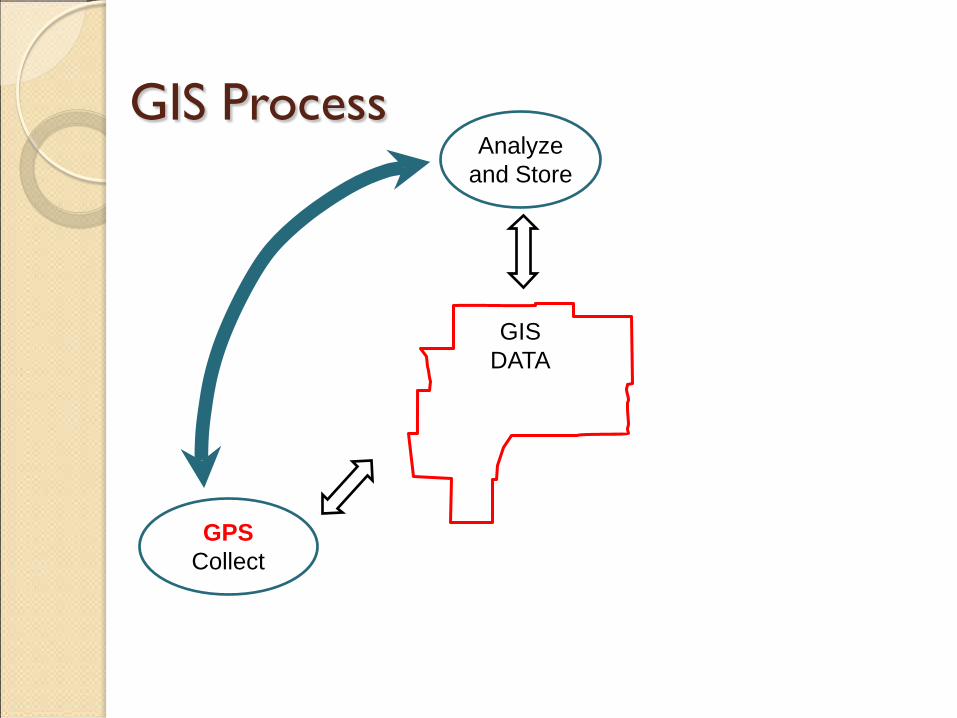
GIS Process
GIS DATA
Analyze and Store
GPS Collect

GIS Process
GIS DATA
Analyze and Store
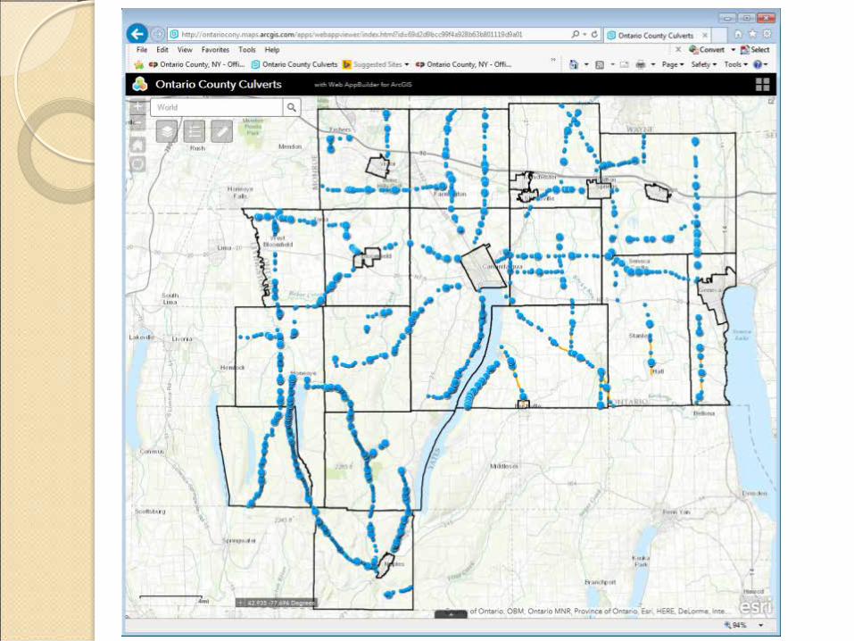
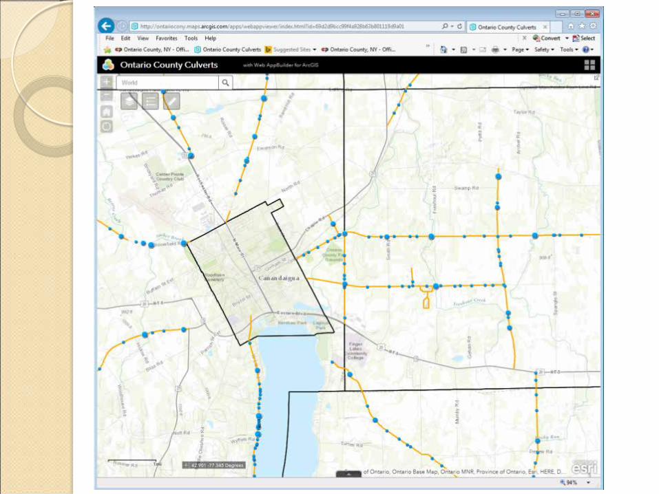
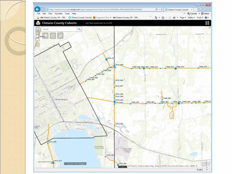
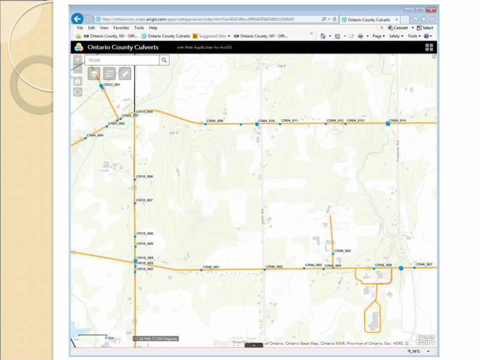
Collect ARCGIS
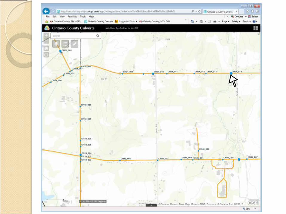
Web base Display


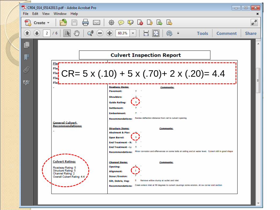
CR= 5 x (.10) + 5 x (.70)+ 2 x (.20)= 4.4

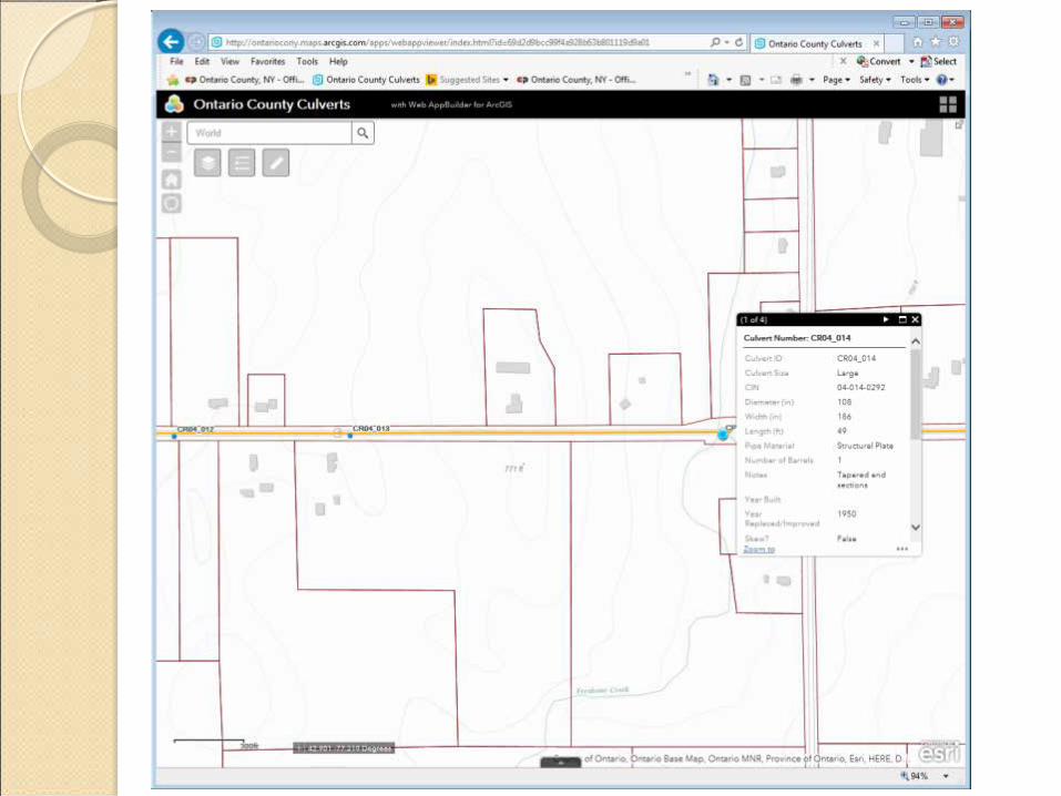
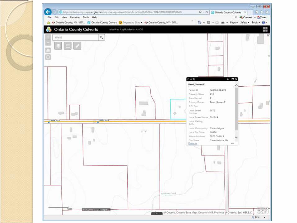
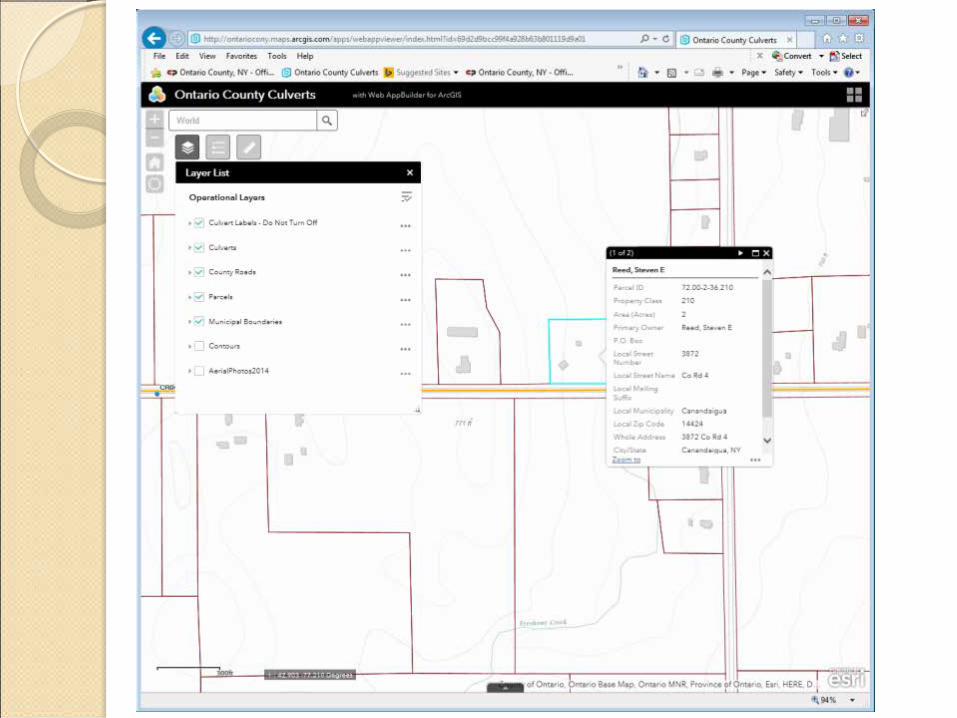
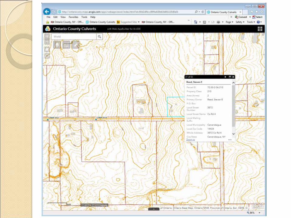
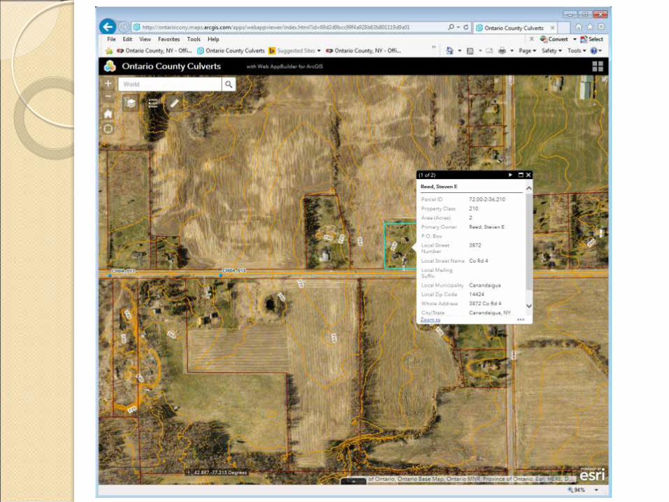
Data Query
• For any culvert attribute • Size • Material • Rating


PDH Questions What does GIS stand for?
Geographic Information Systems

PDH Questions Name a basic component of GIS?
a. Analyze & Store Data b. Displaying Data c. Collecting Data d. All of the above
PDH Questions What are examples of Inventory Data?
a. Current condition of component b. Size of component c. Year constructed d. Both b & c