Crowley’s Ridge. Location: Shade in Red on your map Main Crop/Product: Wheat Known For: Being...
12
Crowley’s Ridge
-
Upload
georgia-jordan -
Category
Documents
-
view
216 -
download
0
description
Ozark Mountains
Transcript of Crowley’s Ridge. Location: Shade in Red on your map Main Crop/Product: Wheat Known For: Being...
Crowley’s Ridge

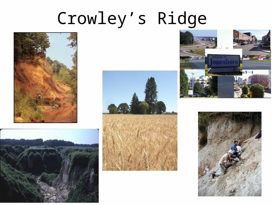
Crowley’s Ridge• Location: Shade in Red on your map• Main Crop/Product: Wheat• Known For: Being the smallest region in
Arkansas• Major concern: Erosion and landslides• Town(s): Jonesboro
From Jonesboro, travel west on 540 to Bentonville in the Ozark Mountains!

Ozark Mountains

Ozark Mountains• Location: Shade in Green on your map • Main Crop/Product: Dairy and Tourism• Known For: Rugged topography, rugged valleys
and high, flat plateaus, limestone caves, and Wal-Mart
• Major Concern: Drought will affect rivers and lakes and harm tourism
• Town(s): Bentonville, Rogers
From Bentonville, travel south on 540 to Fort Smith in the Arkansas River Valley!

Arkansas River Valley
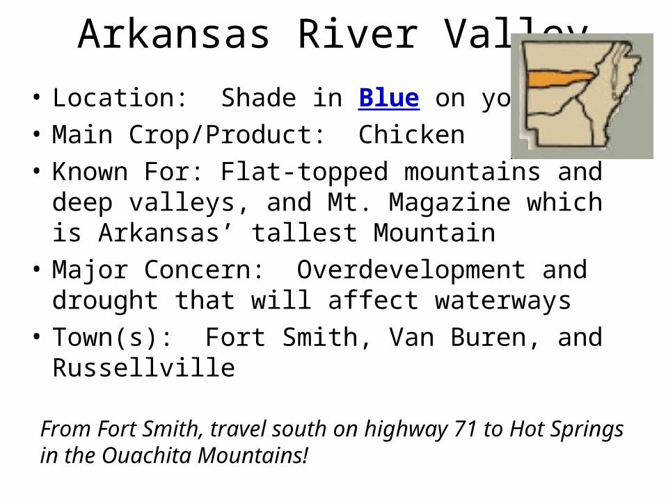
Arkansas River Valley• Location: Shade in Blue on your map • Main Crop/Product: Chicken• Known For: Flat-topped mountains and deep
valleys, and Mt. Magazine which is Arkansas’ tallest Mountain
• Major Concern: Overdevelopment and drought that will affect waterways
• Town(s): Fort Smith, Van Buren, and Russellville
From Fort Smith, travel south on highway 71 to Hot Springs in the Ouachita Mountains!

Ouachita Mountains

Ouachita Mountains• Location: Shade in Orange on your map • Main Crop/Product: Forestry• Known For: Long narrow ridges that run from
east to west• Major Concern: Loss of tourism to Hot Springs
and destruction of forest land• Town(s): Hot Springs and Mena
From Hot Springs, travel west on highway 30 to Texarkana in the Gulf Coastal Plain!

Gulf Coastal Plain

Gulf Coastal Plain• Location: Shade in Purple on your map • Main Crop/Product: Diamonds• Known For: Crater of Diamonds State Park• Major Concern: Changes in forest due to
logging has led to loss or endangerment of native species such as Red-Cockaded Woodpecker
• Town(s): Arkadelphia and Texarkana
From Texarkana, travel east on highway 30 and 40 to West Memphis in the Mississippi Alluvial Plain (Delta)!

Mississippi Alluvial Plain (Delta)
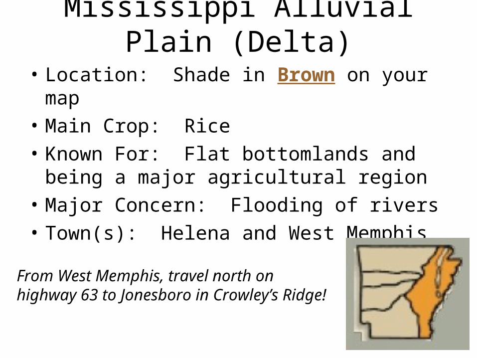
Mississippi Alluvial Plain (Delta)
• Location: Shade in Brown on your map • Main Crop: Rice• Known For: Flat bottomlands and being a
major agricultural region• Major Concern: Flooding of rivers• Town(s): Helena and West Memphis
From West Memphis, travel north on highway 63 to Jonesboro in Crowley’s Ridge!


![arXiv:1910.03676v1 [cs.CV] 8 Oct 2019 · arXiv:1910.03676v1 [cs.CV] 8 Oct 2019. Shade 1 Shade 2 Shade 3 Shade 4 Shade 5 Shade 6 1 0 Average Face per Shade Baseline VGG16 BR-Net VGG16](https://static.fdocuments.in/doc/165x107/5f06e0387e708231d41a2ca7/arxiv191003676v1-cscv-8-oct-2019-arxiv191003676v1-cscv-8-oct-2019-shade.jpg)