
Crime Analyst Extension · Crime Analyst •The Crime Analyst brings together new and existing...
27
Transcript of Crime Analyst Extension · Crime Analyst •The Crime Analyst brings together new and existing...
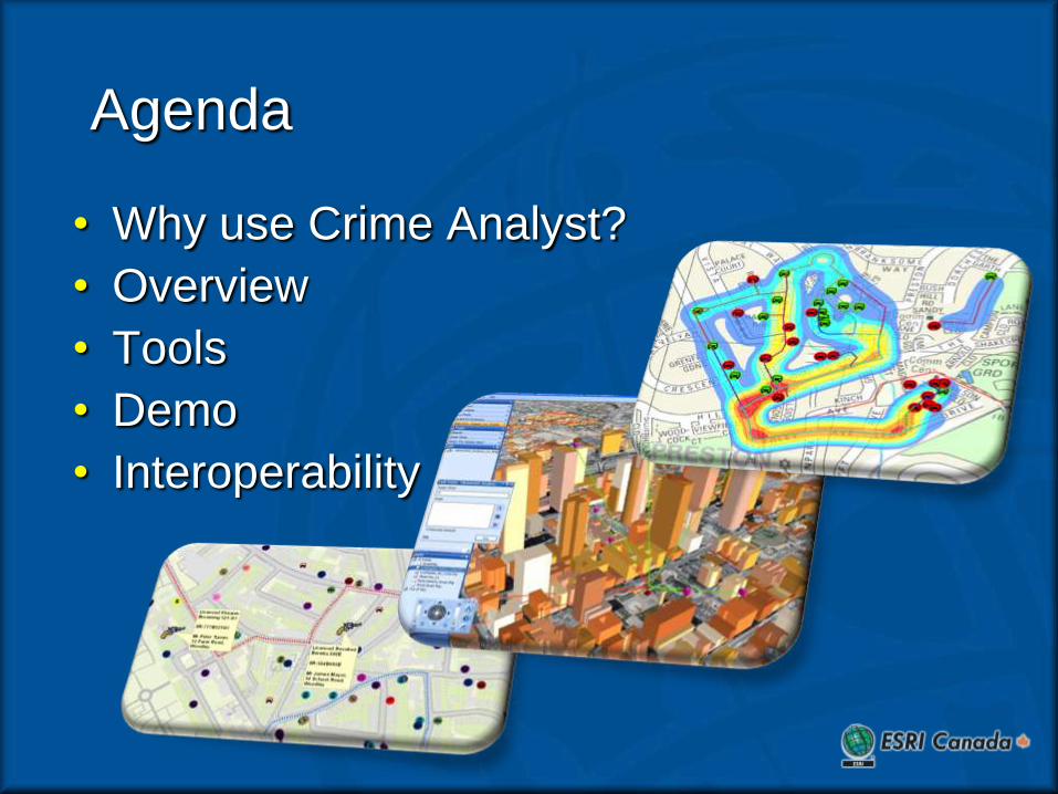
Agenda
• Why use Crime Analyst?
• Overview
• Tools
• Demo
• Interoperability
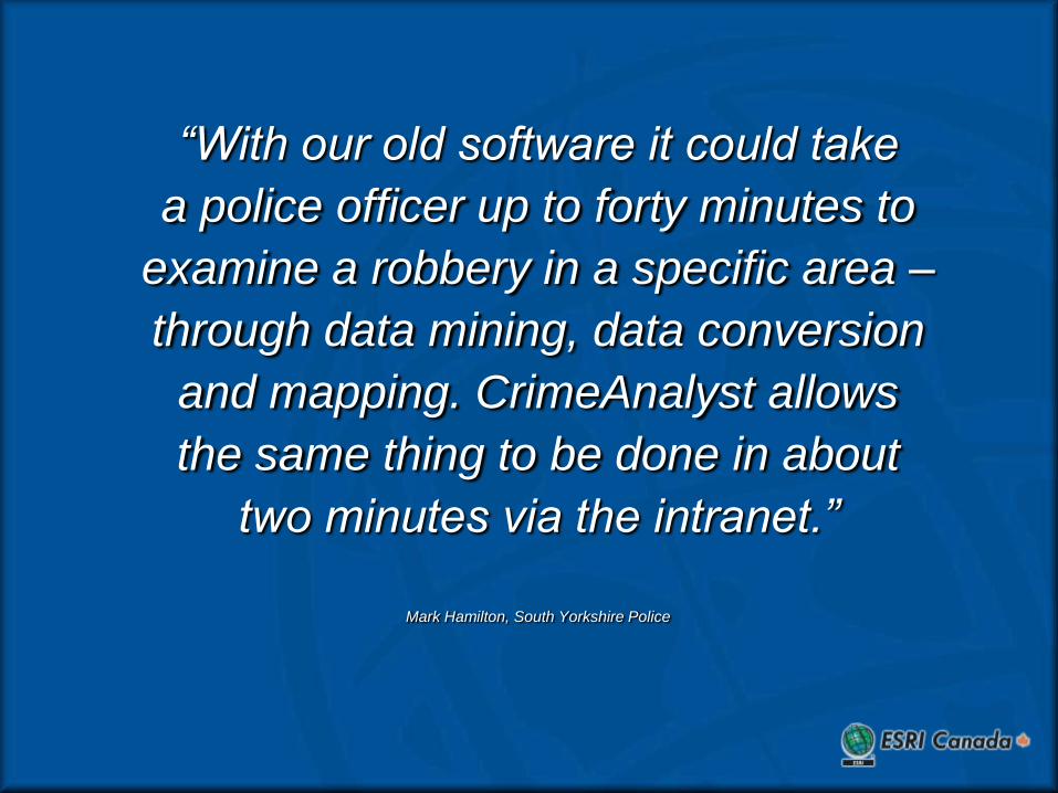
“With our old software it could take
a police officer up to forty minutes to
examine a robbery in a specific area –
through data mining, data conversion
and mapping. CrimeAnalyst allows
the same thing to be done in about
two minutes via the intranet.”
Mark Hamilton, South Yorkshire Police

Why Crime Analyst?
• 5 hours/week
• Real Time Information
• Improved Performance
• Operational Planning and Support
Crime Analyst
• The Crime Analyst brings together new and existing ArcGIS functionality to a single tool bar
• Designed specifically with crime analysts in mind the extension provides all the tools necessary for advanced crime analysis
• Complex functions are a single click away improving efficiency and effectiveness

Crime Theory
• To understand how crime initiatives work it is important to understand the theory behind why crimes take place
• Academic research has identified these three main theories which examine why crime occurs plus research looking at offenders crime trips
– Journey to Crime Theory (JTC)
– Routine Activity Theory (RAT)
– Rational Choice Theory (RCT)
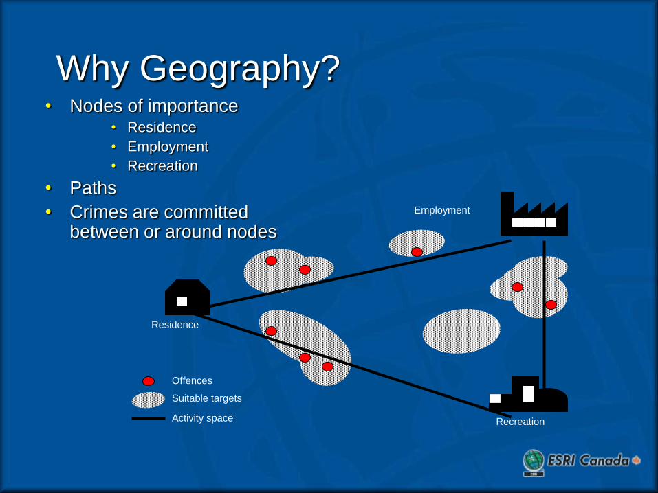
Why Geography?• Nodes of importance
• Residence
• Employment
• Recreation
• Paths
• Crimes are committed between or around nodes
Residence
Employment
Recreation
Suitable targets
Offences
Activity space

Crime Analyst has four key goals
1. Delivering increased analyst productivity
2. Providing new analytical capabilities
3. Making that analysis consistent and reliable
4. Offering value for money

Increasing Analyst Productivity
Spend less time on simple tasks…
Make tasks quicker and easier
Single toolbar for all crime functions
Save standard queries Simple interface for selecting
incidents by date/time
“Many aspects of our data analysis were made easier and more readily available, for example, hotspot analysis, filtering by date/time, and saving queries” Phil Moore, Warwickshire Constabulary

Analytical Capabilities
…use the time you save to do NEW analysis…
Temporal analysis of crime Investigate repeat
victimisation Search for related incidents Journey to crime analysis
“Aoristic clocks assist greatly in planning resource time for specific problems.” Gary Birchall, South Yorkshire Police
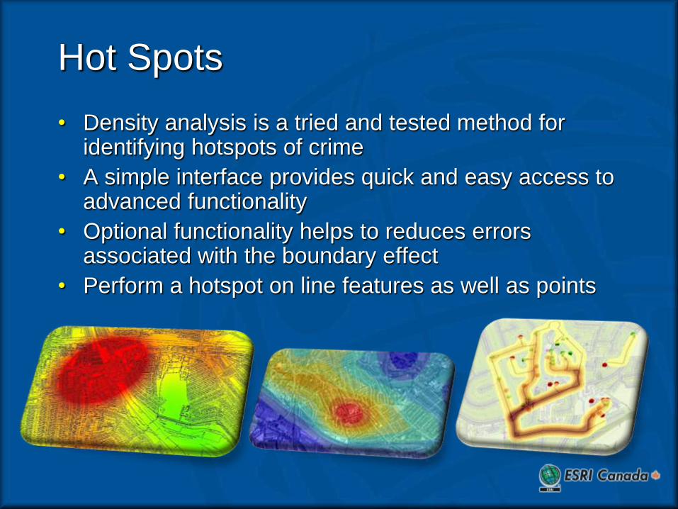
Hot Spots
• Density analysis is a tried and tested method for identifying hotspots of crime
• A simple interface provides quick and easy access to advanced functionality
• Optional functionality helps to reduces errors associated with the boundary effect
• Perform a hotspot on line features as well as points
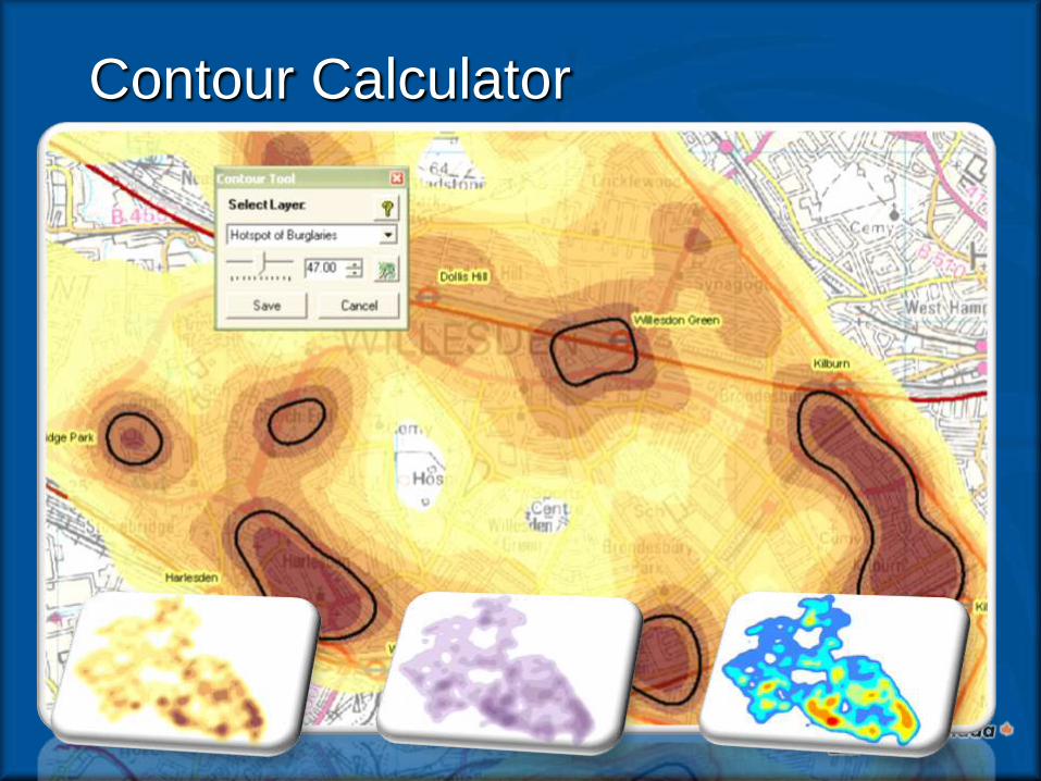
Contour Calculator
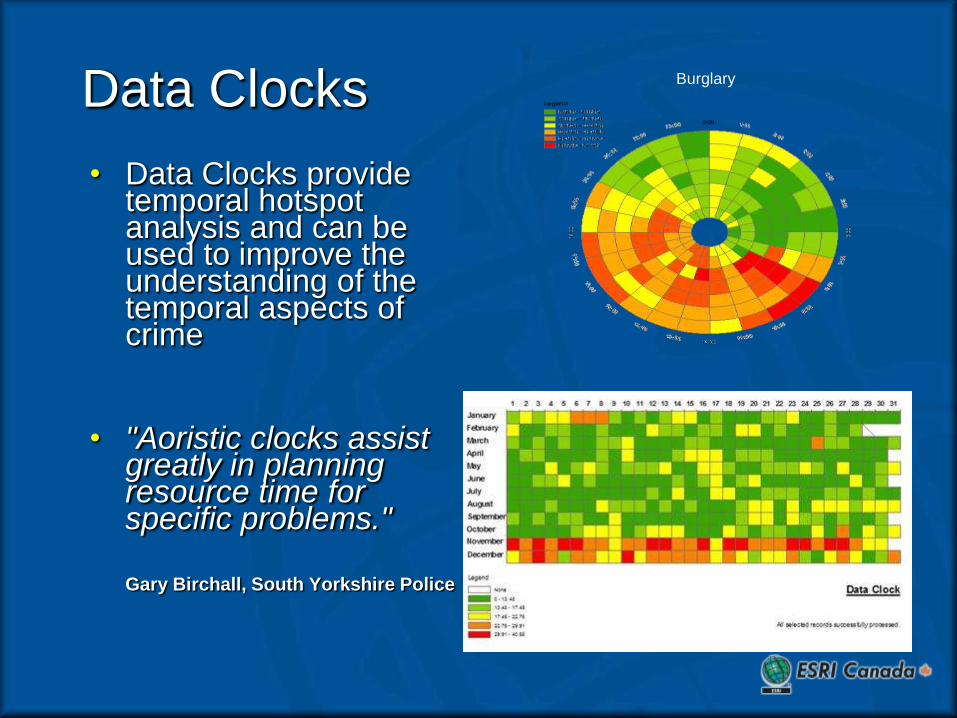
Data Clocks
• Data Clocks provide temporal hotspot analysis and can be used to improve the understanding of the temporal aspects of crime
• "Aoristic clocks assist greatly in planning resource time for specific problems."
Gary Birchall, South Yorkshire Police
Burglary

Temporal Slider
• Spatial and Temporal occurrences
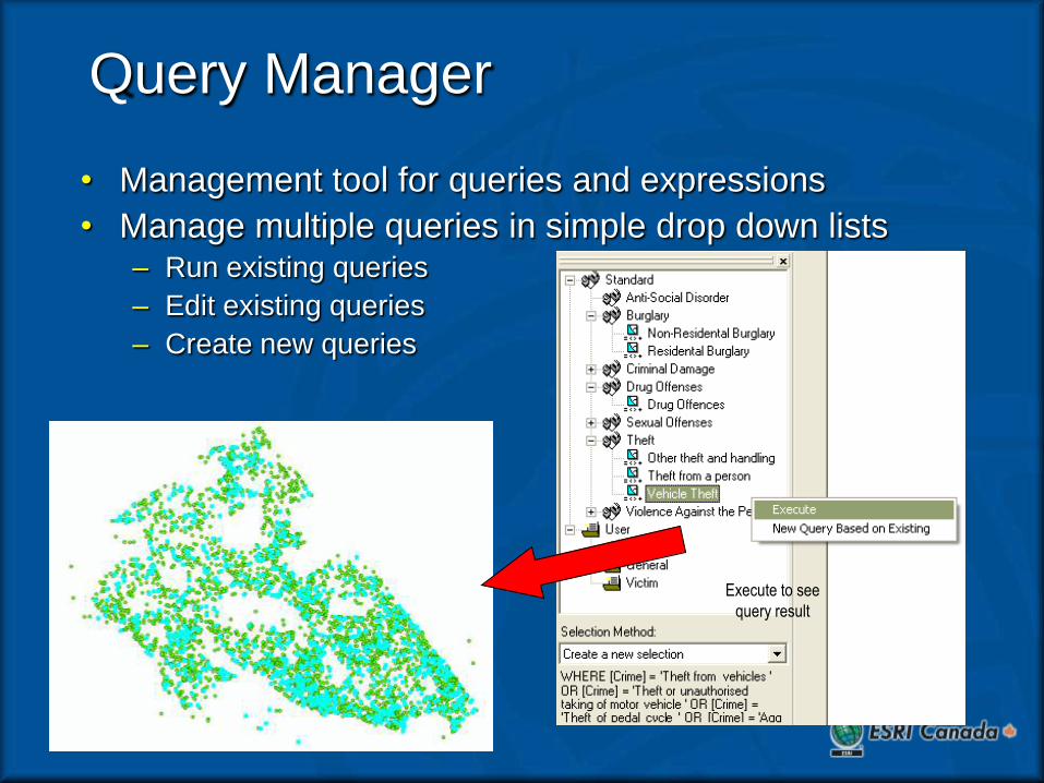
Query Manager
• Management tool for queries and expressions
• Manage multiple queries in simple drop down lists– Run existing queries
– Edit existing queries
– Create new queries
Execute to see
query result
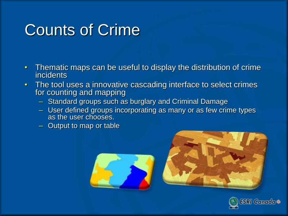
Counts of Crime
• Thematic maps can be useful to display the distribution of crime incidents
• The tool uses a innovative cascading interface to select crimes for counting and mapping– Standard groups such as burglary and Criminal Damage
– User defined groups incorporating as many or as few crime types as the user chooses.
– Output to map or table
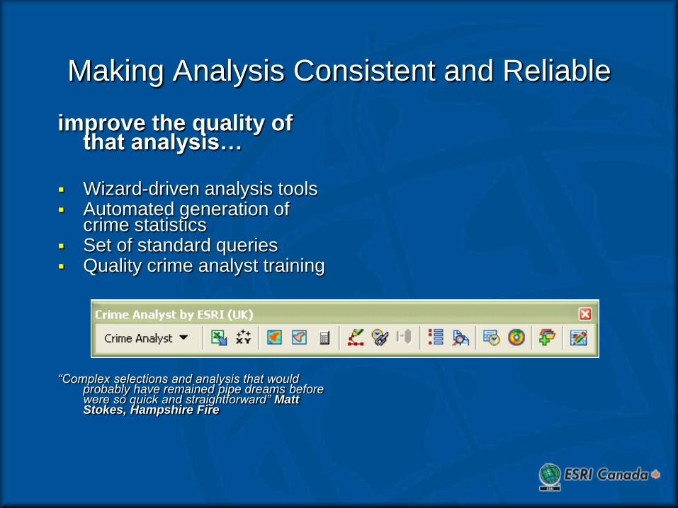
Making Analysis Consistent and Reliable
improve the quality of that analysis…
Wizard-driven analysis tools Automated generation of
crime statistics Set of standard queries Quality crime analyst training
“Complex selections and analysis that would probably have remained pipe dreams before were so quick and straightforward” Matt Stokes, Hampshire Fire
Demo

ESRI’s Software Strategies
Geodatabase
Desktop
Server
Mobile GIS
• Enhance ArcGIS
Desktop
• Strengthen /
Simplify Geodata
Management
• Extend ArcGIS
Server
• More Mobile GIS
. . . With Increased Focus on Quality,
Usability and Performance

Enabling Technology
GIS Server
Enterprise Bus
Services-Oriented Architecture
Web
Services
Laptop
Desktop
Servers
Cell
Phone
PDA
Scalable Networked Hardware
• Faster Processing
— Multi-core
— Blades
• Increased Bandwidth
• Larger Storage
• Web Services Standards
• Mobile Technologies
• Real-Time Networks
• GIS Software
Open, Flexible, and Standards Based

ArcGIS Is Being Integrated On Networks
Mobile
Devices
Non-GIS
Enterprise
Server
Common Web Services
Messaging Protocol
Internet/Intranet
DBMS
Web
Server
DBMS
GIS
Server
Web
Server GIS
Server
PCs
Browsers
GIS
Server
Web
Server
DBMS
App
Server
Web
Server
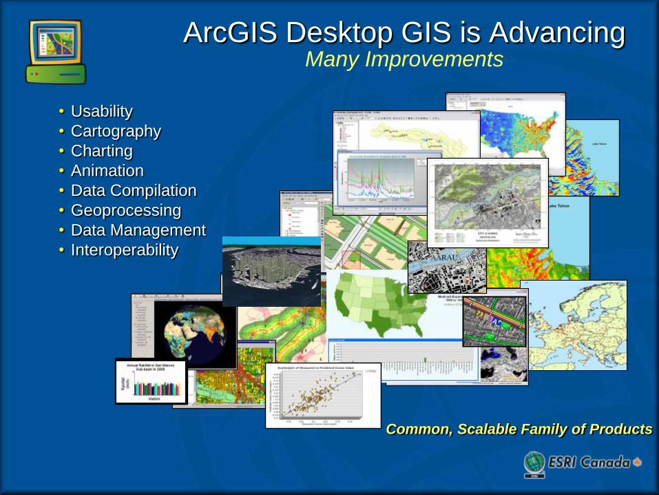
ArcGIS Desktop GIS is AdvancingMany Improvements
Common, Scalable Family of Products
• Usability
• Cartography
• Charting
• Animation
• Data Compilation
• Geoprocessing
• Data Management
• Interoperability
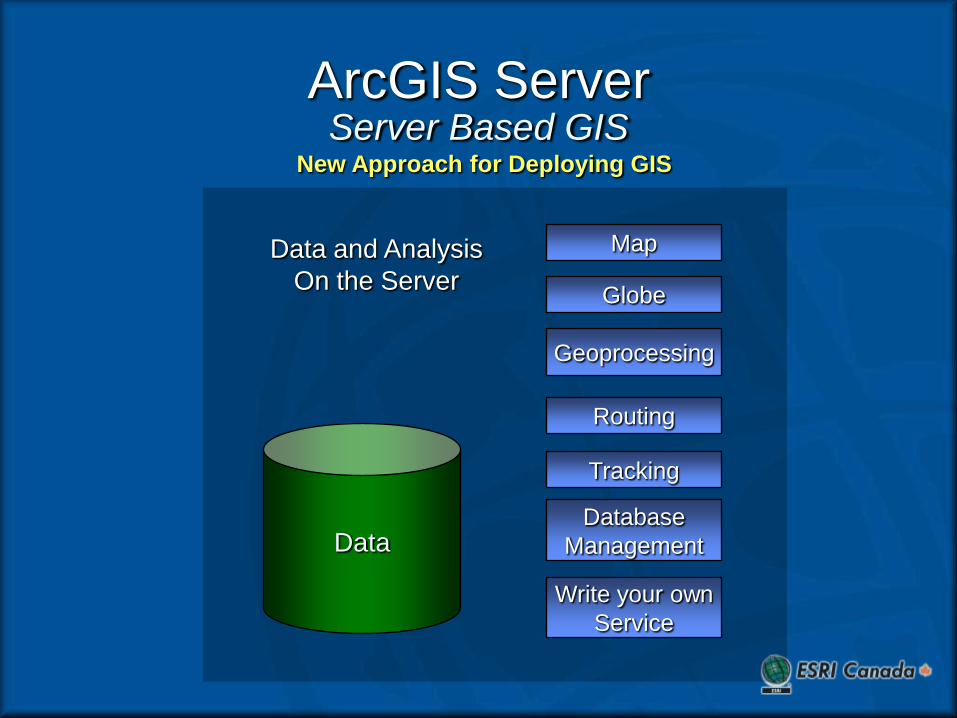
ArcGIS ServerServer Based GIS
New Approach for Deploying GIS
Data
Map
Globe
Geoprocessing
Routing
Tracking
Write your own
Service
Data and Analysis
On the Server
Database
Management

GIS ServerA New Architecture For
GIS
Data
Map
Globe
Geoprocessing
Routing
Tracking
Write your own
Service
Services
Database
Management
…Centralized GIS
Development and Processing
Internet or
Intranet
Many clients
WebServices
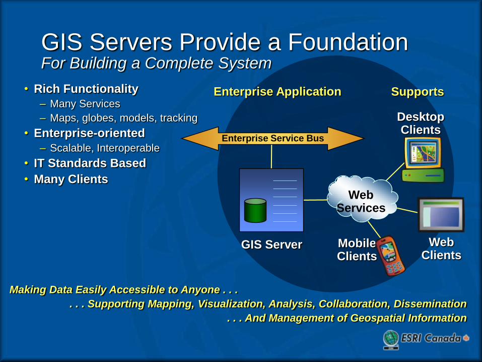
Enterprise Application
DesktopClients
WebClients
MobileClients
Supports
GIS Server
• Rich Functionality
– Many Services
– Maps, globes, models, tracking
• Enterprise-oriented
– Scalable, Interoperable
• IT Standards Based
• Many Clients
Making Data Easily Accessible to Anyone . . .
. . . Supporting Mapping, Visualization, Analysis, Collaboration, Dissemination
. . . And Management of Geospatial Information
Enterprise Service Bus
GIS Servers Provide a FoundationFor Building a Complete System
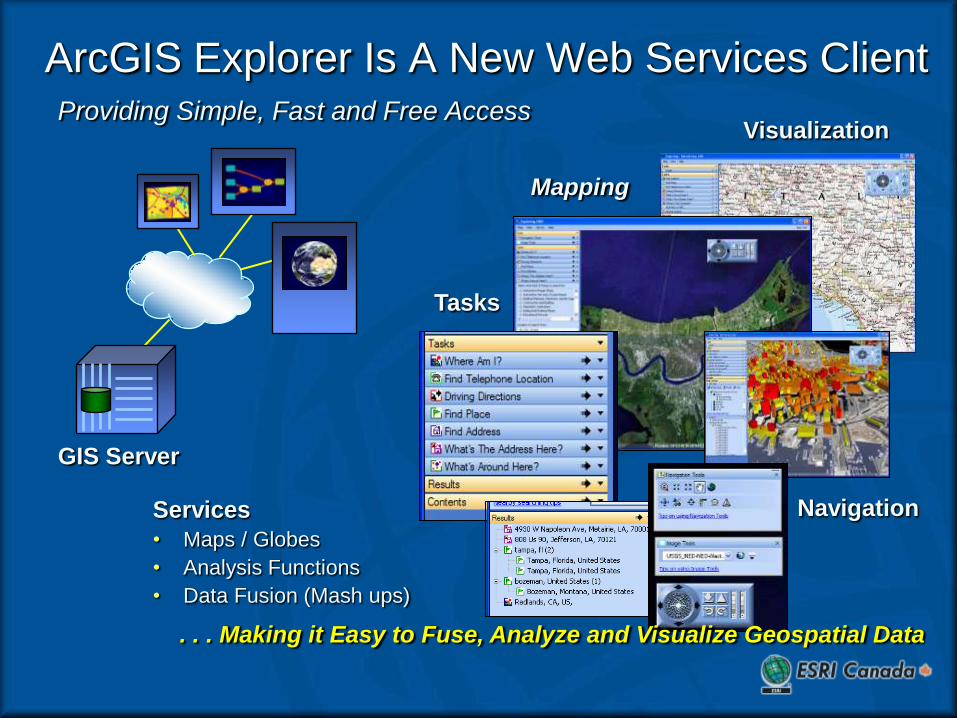
ArcGIS Explorer Is A New Web Services ClientProviding Simple, Fast and Free Access
Services
• Maps / Globes
• Analysis Functions
• Data Fusion (Mash ups)
GIS Server
Tasks
Navigation
Visualization
Mapping
. . . Making it Easy to Fuse, Analyze and Visualize Geospatial Data