
Creating Transparency, Openness and Trust: Modern …€¦ · Creating Transparency, Openness and...
33
Creating Transparency, Openness and Trust: Modern Approach to Redistricting Richard Leadbeater, Esri Jerry Howe, Utah Legislature Larry Boden, Esri NCSL Legislative Summit Sunday, Aug. 6 | 11:15 am-12:15 pm
Transcript of Creating Transparency, Openness and Trust: Modern …€¦ · Creating Transparency, Openness and...

Creating Transparency, Openness and Trust: Modern Approach to Redistricting
Richard Leadbeater, Esri
Jerry Howe, Utah Legislature
Larry Boden, Esri
NCSL Legislative Summit
Sunday, Aug. 6 | 11:15 am-12:15 pm

InsightsExploratory Analysis and Visualization
A New App
• Visual, Intuitive, Responsive
• Dynamic Spatial Analytics and Visualizations
• Very Fast
Linked and Responsive Charts and Maps
On-the-Fly Visual Models
Integrated Spatial and Tabular Analysis
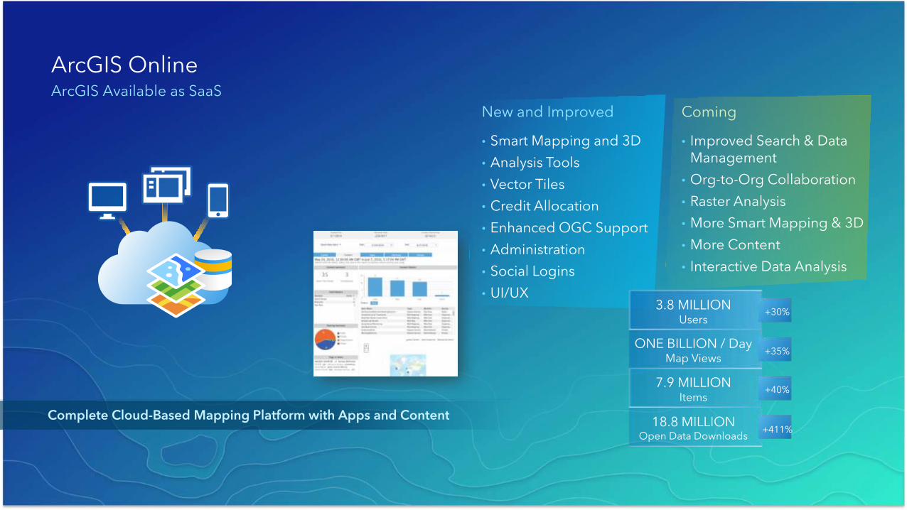
Complete Cloud-Based Mapping Platform with Apps and Content
ArcGIS OnlineArcGIS Available as SaaS
Coming
• Improved Search & Data Management
• Org-to-Org Collaboration
• Raster Analysis
• More Smart Mapping & 3D
• More Content
• Interactive Data Analysis
New and Improved
• Smart Mapping and 3D
• Analysis Tools
• Vector Tiles
• Credit Allocation
• Enhanced OGC Support
• Administration
• Social Logins
• UI/UX3.8 MILLION
Users
ONE BILLION / DayMap Views
7.9 MILLIONItems
18.8 MILLIONOpen Data Downloads
+30%
+35%
+40%
+411%
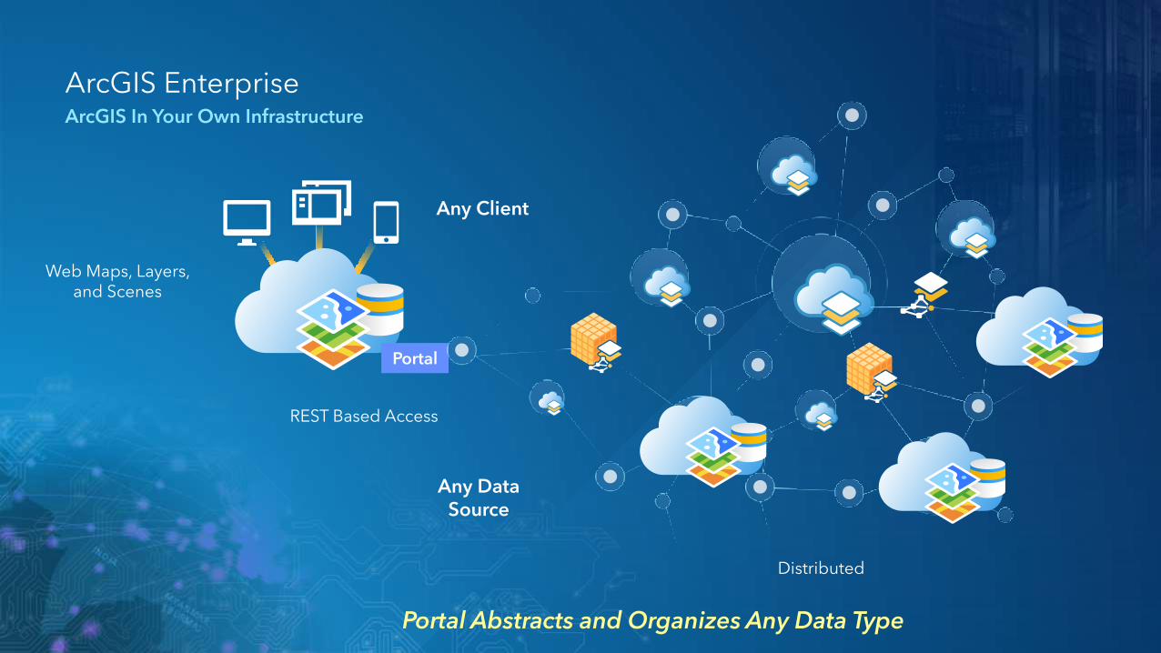
Portal Abstracts and Organizes Any Data Type
Portal
Web Maps, Layers, and Scenes
Any Data Source
REST Based Access
Any Client
Distributed
ArcGIS EnterpriseArcGIS In Your Own Infrastructure
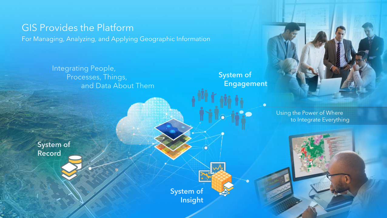
Using the Power of Where to Integrate Everything
Integrating People, Processes, Things,
and Data About Them
GIS Provides the PlatformFor Managing, Analyzing, and Applying Geographic Information
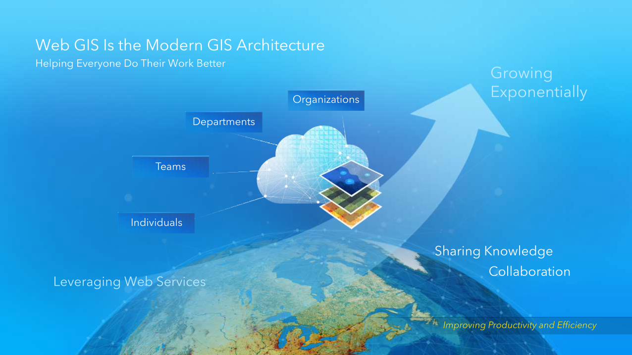
Web GIS Is the Modern GIS Architecture
Leveraging Web Services
Sharing Knowledge
Growing Exponentially
Individuals
Teams
Departments
Collaboration
Organizations
Helping Everyone Do Their Work Better
Improving Productivity and Efficiency

Product Vision
• Create a product line that solves election management and redistricting and territory design problems for the desktop, enterprise, and online users
• Establish an online community where users can collaborate and share their results
• Provide online access to standard data content used by this community (Census, Zip, Precincts, etc.)
• Provide online tools to manage and disseminate election data and results

Redistricting OnlineIncreasing the collaboration between government and citizens
•Create
•Edit
•Publish
•Review
•Collaborate
US Census P.L DataDOJ
Consulting Data
Historic Election Files
Advocacy GroupsLegislators
Consultants
Legislative Staff
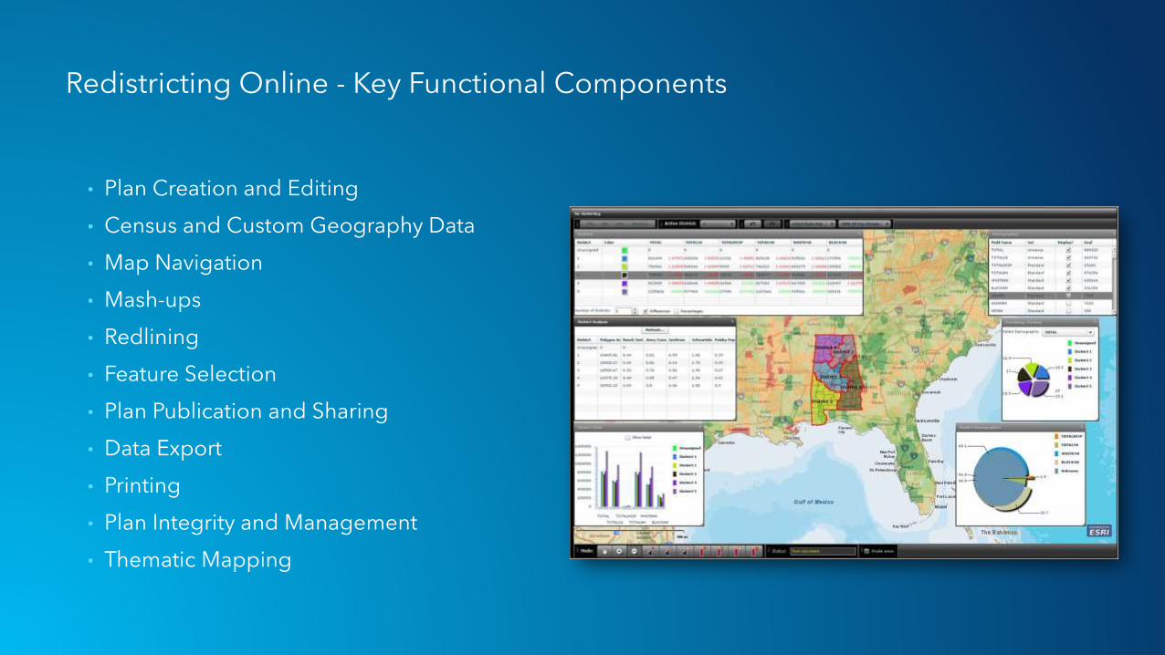
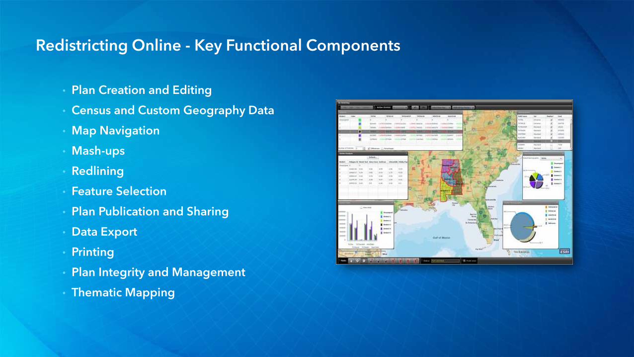
Redistricting Online - Key Functional Components
• Plan Creation and Editing
• Census and Custom Geography Data
• Map Navigation
• Mash-ups
• Redlining
• Feature Selection
• Plan Publication and Sharing
• Data Export
• Printing
• Plan Integrity and Management
• Thematic Mapping
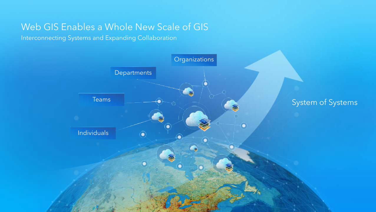
Web GIS Enables a Whole New Scale of GISInterconnecting Systems and Expanding Collaboration
Individuals
Teams
Departments
Organizations
System of Systems

Web GIS Enables Community EngagementOrganizing and Managing Community Interactions
Providing Citizens Information . . .. . . And Leaders Input
Status Reporting
Open Data
Citizen Communication
Citizen Surveys(Crowdsourcing)
Storytelling
Community GIS Hub
Demographic Information
Policy Initiative Based
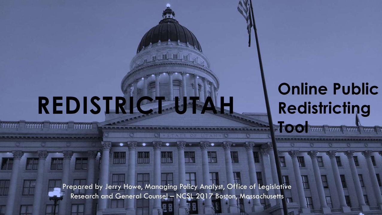
Online Public
Redistricting
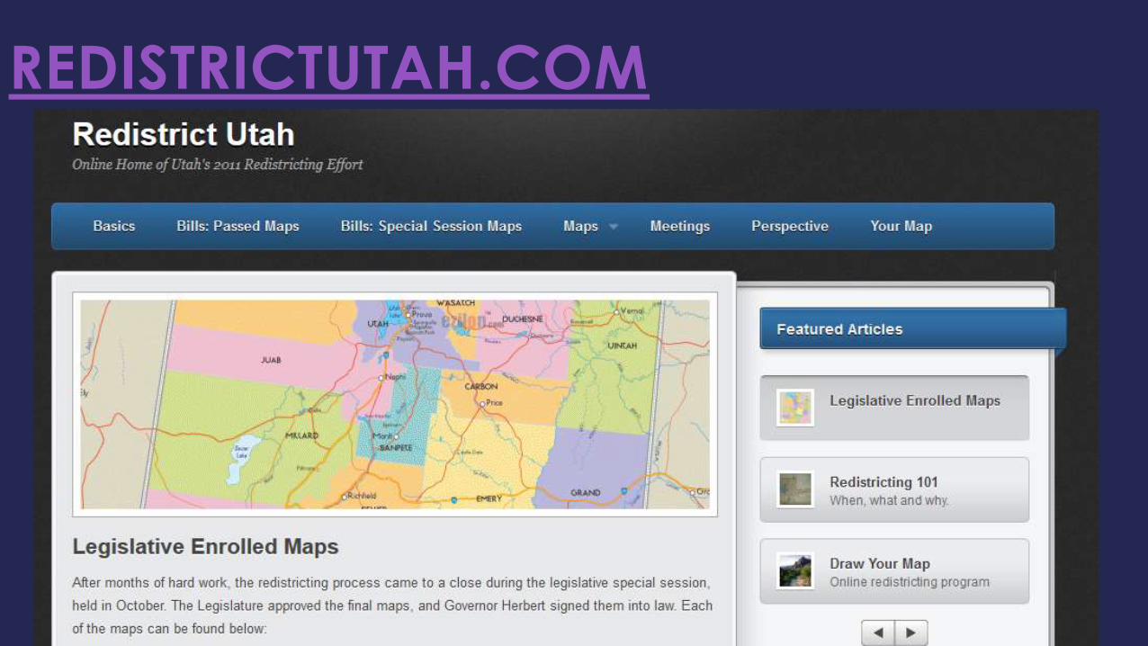
ToolREDISTRICT UTAH
Prepared by Jerry Howe, Managing Policy Analyst, Office of Legislative
Research and General Counsel – NCSL 2017 Boston, Massachusetts

REDISTRICT UTAH
“…the Legislature shall divide the state into congressional,
legislative, and other districts…”
Utah Constitution – Article IX, Section 1

REDISTRICT UTAH
Redistricting Committee• 20 legislators appointed
by President and Speaker
• Adopted principles and guidelines
• 28 meetings; including 17 public hearings across state

Districts to be:
Single Member;
Contiguous; and
Compact
Acceptable Deviations:
Congressional ± 0.1%
Legislative ± 3.5%
School Board ± 3.5%
PRINCIPLES ADOPTED BY 2011 REDISTRICTING COMMITTEE
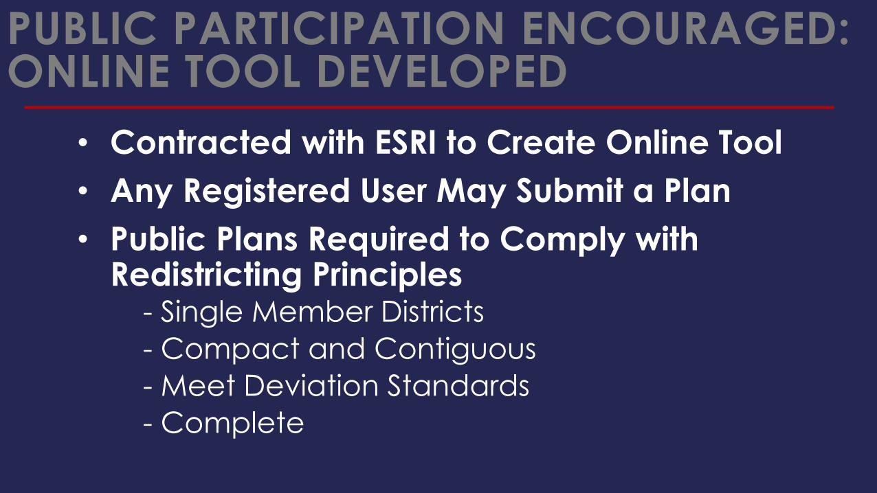
PUBLIC PARTICIPATION ENCOURAGED: ONLINE TOOL DEVELOPED
• Contracted with ESRI to Create Online Tool
• Any Registered User May Submit a Plan
• Public Plans Required to Comply with Redistricting Principles
- Single Member Districts
- Compact and Contiguous
- Meet Deviation Standards
- Complete

REDISTRICT UTAH
• Staff used ArcGIS and
autoBound
• Public used an ESRI
web-based
redistricting tool
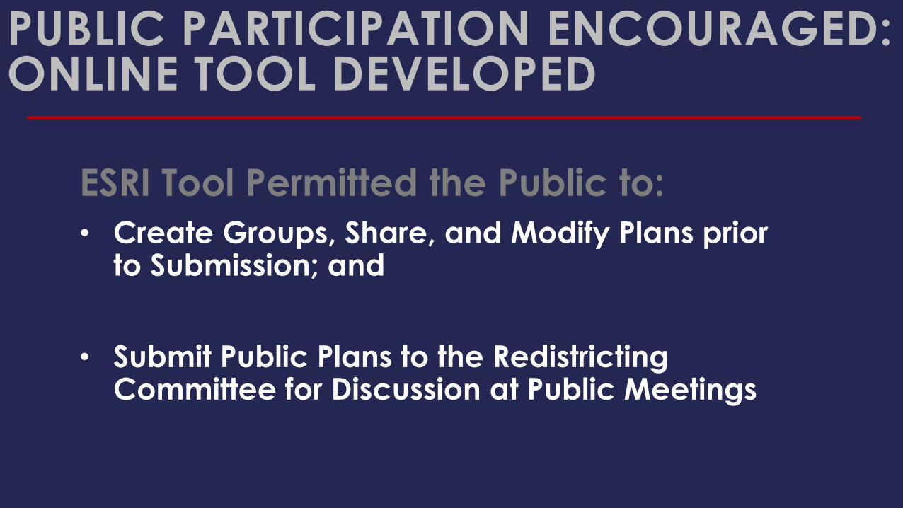
ESRI Tool Permitted the Public to:
• Create Groups, Share, and Modify Plans prior to Submission; and
• Submit Public Plans to the Redistricting Committee for Discussion at Public Meetings
PUBLIC PARTICIPATION ENCOURAGED: ONLINE TOOL DEVELOPED
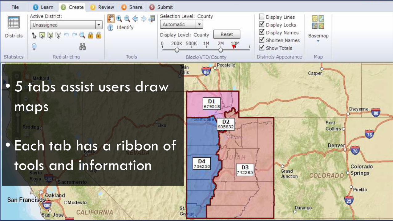
• 5 tabs assist users draw
maps
• Each tab has a ribbon of
tools and information

PUBLIC USE OF ESRI TOOL
1,000Registered
Users
271Met
Criteria
323Plans
Submitted
198Congress
Plans
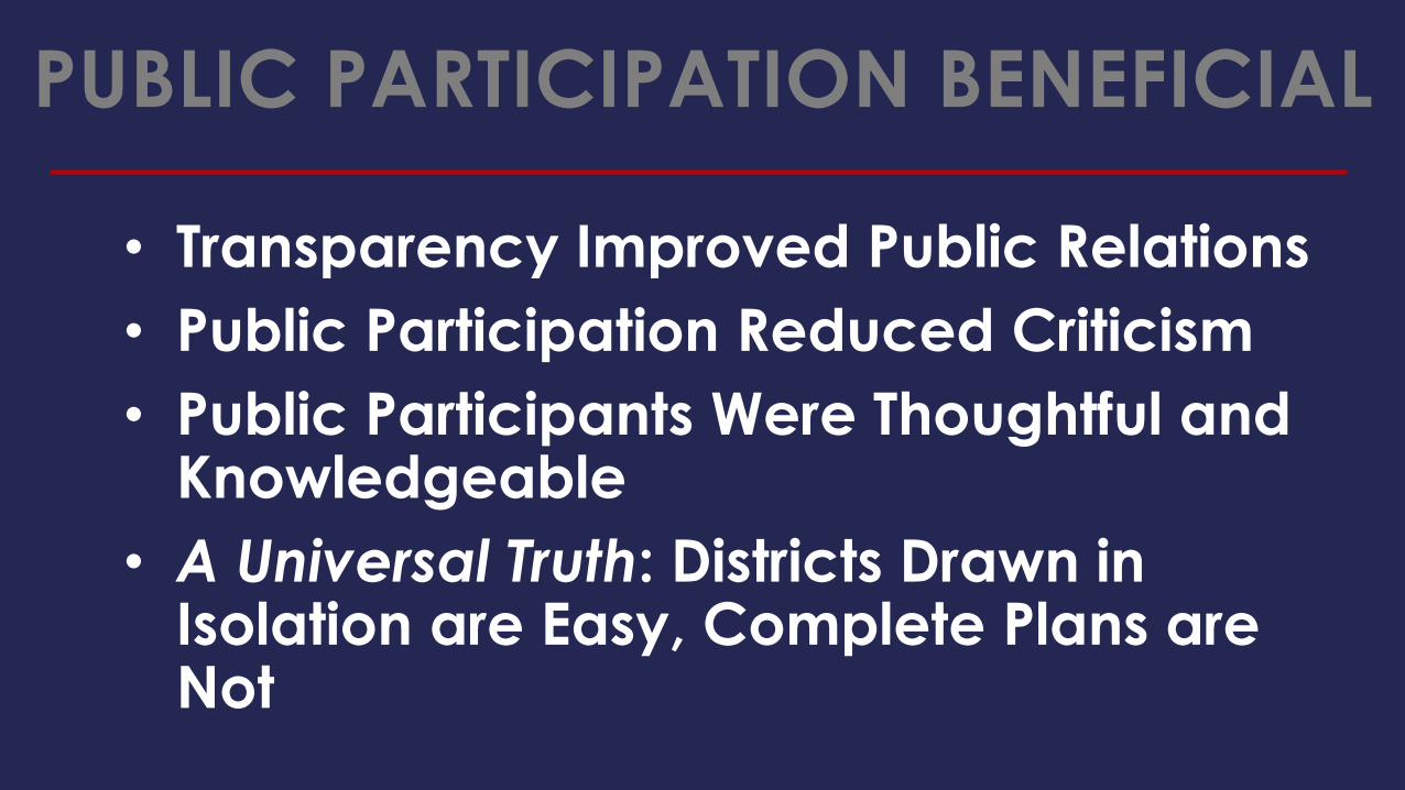
PUBLIC PARTICIPATION BENEFICIAL
• Transparency Improved Public Relations
• Public Participation Reduced Criticism
• Public Participants Were Thoughtful and Knowledgeable
• A Universal Truth: Districts Drawn in Isolation are Easy, Complete Plans are Not
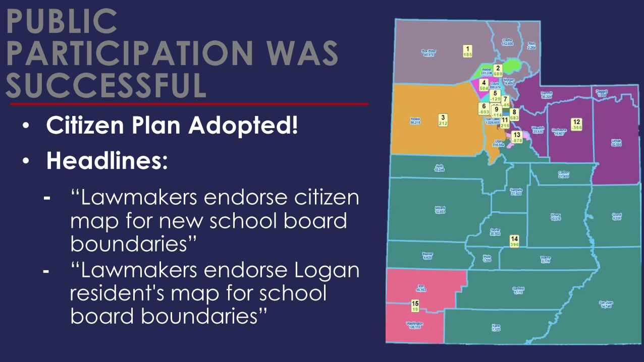
PUBLIC PARTICIPATION WAS SUCCESSFUL• Citizen Plan Adopted!
• Headlines:
- “Lawmakers endorse citizen map for new school board boundaries”
- “Lawmakers endorse Logan resident's map for school board boundaries”

UNINTENDED CONSEQUENCES
We did not anticipate the public’s desire to:
• explain in writing the merits of their plans; and
• comment on other public plans.

ACCOMMODATE PUBLIC COMMENT
In 2010, legislative leaders created a blog- Posted all redistricting plans (public and
legislative) on web
- Public comment and analysis was encouraged
on all plans
In 2020, Utah Will Improve Online Public Comment Options


What do you get with the Redistricting Solution?
• Software
- ArcGIS Server
- ArcView w/ Free Redistricting Add-On
• Data
- ArcGIS Online Basemaps
- ESRI Demographic Data
- U.S. Census Data (2000, 2010 TIGER, PL 94-171)
- Optional Data Packs
- ArcGIS Online Subscriber Content
- ESRI Business & Demographic Data Nationwide
- Custom Data (polling places, historical voting statistics, etc.)
• Deployment Support
- ESRI Managed Services (24/7 infrastructure support and monitoring, high system availability, data management, etc.)
- On Premise Deployment Consulting
• Resources
- ArcGIS Online Resource Center (blogs, forums, downloads, etc.)
Redistricting Online - Key Functional Components
• Plan Creation and Editing
• Census and Custom Geography Data
• Map Navigation
• Mash-ups
• Redlining
• Feature Selection
• Plan Publication and Sharing
• Data Export
• Printing
• Plan Integrity and Management
• Thematic Mapping

Redistricting Online Deployment Options
• Software as a Service (SaaS) subscription model
- Per user pricing
- No custom features or data
• Managed Services Offering
- Configured for organization
- Custom data packs
- All hosting components managed by ESRI
• On Premise Offering
- Installed behind organizations firewall
- Custom data packs
- Hosting components managed by organization
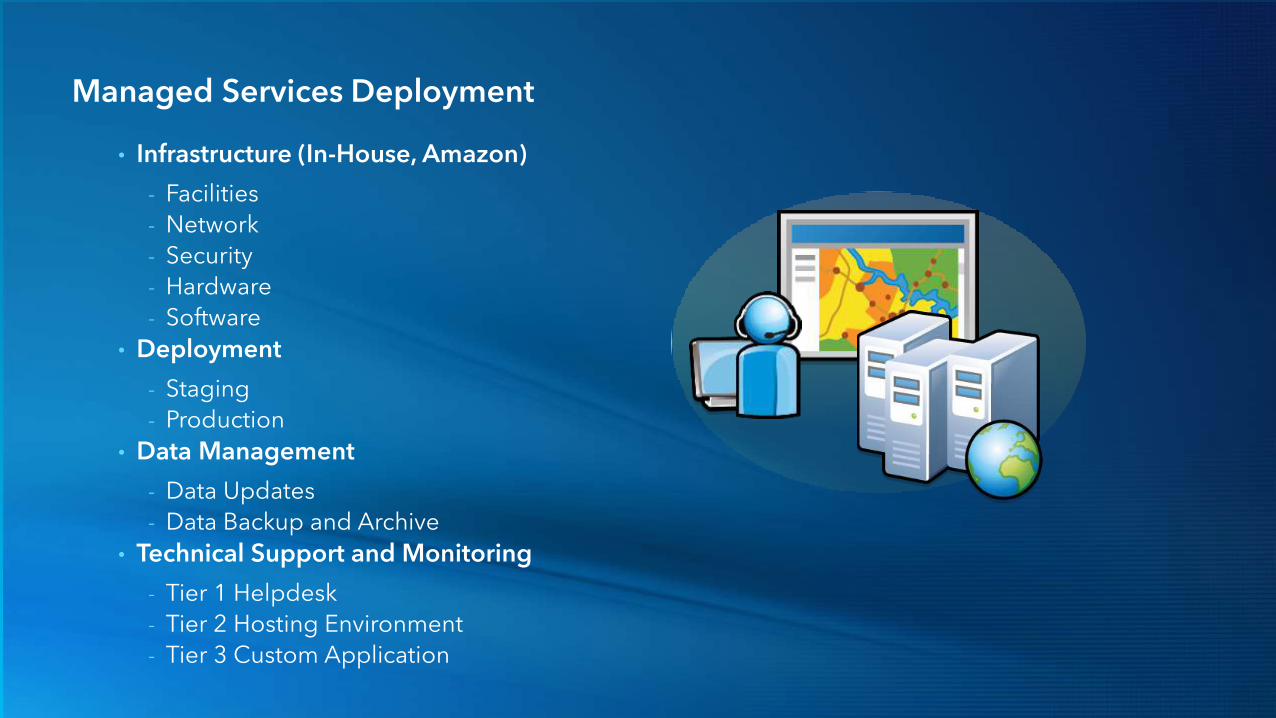
Managed Services Deployment
• Infrastructure (In-House, Amazon)
- Facilities
- Network
- Security
- Hardware
- Software
• Deployment
- Staging
- Production
• Data Management
- Data Updates
- Data Backup and Archive
• Technical Support and Monitoring
- Tier 1 Helpdesk
- Tier 2 Hosting Environment
- Tier 3 Custom Application

Technology StackTechnologies for the desktop and web
• ArcGIS Server 10
- Map Services
- Feature Services
- Geometry Services
• ArcGIS Online
- Online Base Maps
- Geocoding Services
- Sharing & Discovery
• Other Technologies
- Adobe Flex
- Amazon Cloud
• ArcGIS Desktop 10
- Layer Packages
- Map Packages
Web UsersGIS Users
Geodatabases
ArcGIS Online
ArcGIS Servers
ArcGIS DesktopAuthors
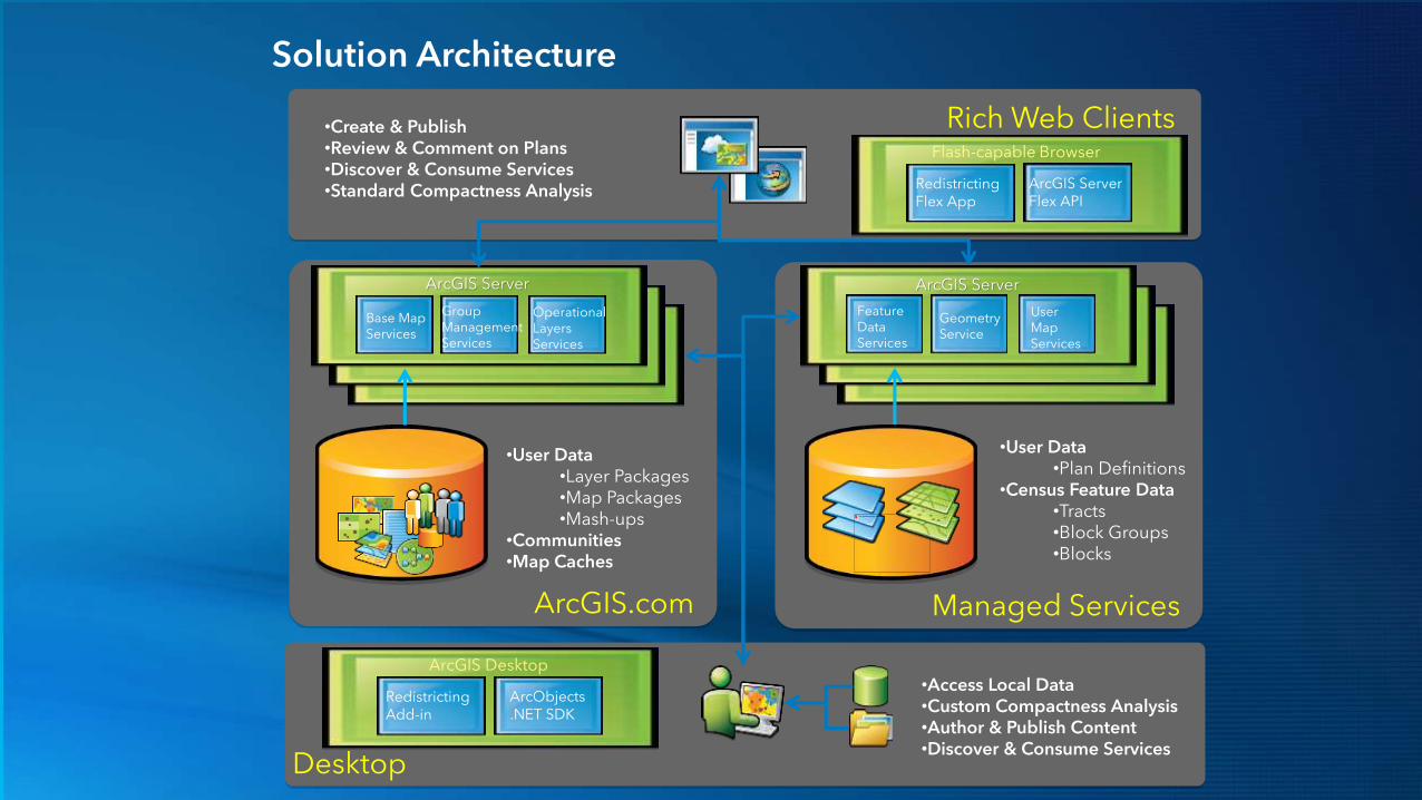
Solution Architecture
•Create & Publish•Review & Comment on Plans•Discover & Consume Services•Standard Compactness Analysis
OperationalLayersServices
GroupManagementServices
Base MapServices
•User Data•Layer Packages•Map Packages•Mash-ups
•Communities•Map Caches
UserMapServices
GeometryService
FeatureDataServices
•User Data•Plan Definitions
•Census Feature Data•Tracts•Block Groups•Blocks
ArcGIS.com Managed Services
ArcGIS Server ArcGIS Server
Rich Web Clients
Desktop
•Access Local Data•Custom Compactness Analysis•Author & Publish Content•Discover & Consume Services
ArcGIS Desktop
ArcObjects.NET SDK
RedistrictingAdd-in
Flash-capable Browser
ArcGIS ServerFlex API
RedistrictingFlex App