County Scorecard Update NACS Ronnie L. Taylor NGS State Advisor – Branch Chief Brett Howe NGS...
18
County Scorecard Update NACS Ronnie L. Taylor Ronnie L. Taylor NGS State Advisor – Branch Chief NGS State Advisor – Branch Chief Brett Howe Brett Howe NGS Headquarters Staff NGS Headquarters Staff 7 March, 2008 7 March, 2008 Joe Whitsitt Joe Whitsitt NGS Headquarters Staff NGS Headquarters Staff
-
Upload
kenneth-king -
Category
Documents
-
view
215 -
download
1
Transcript of County Scorecard Update NACS Ronnie L. Taylor NGS State Advisor – Branch Chief Brett Howe NGS...
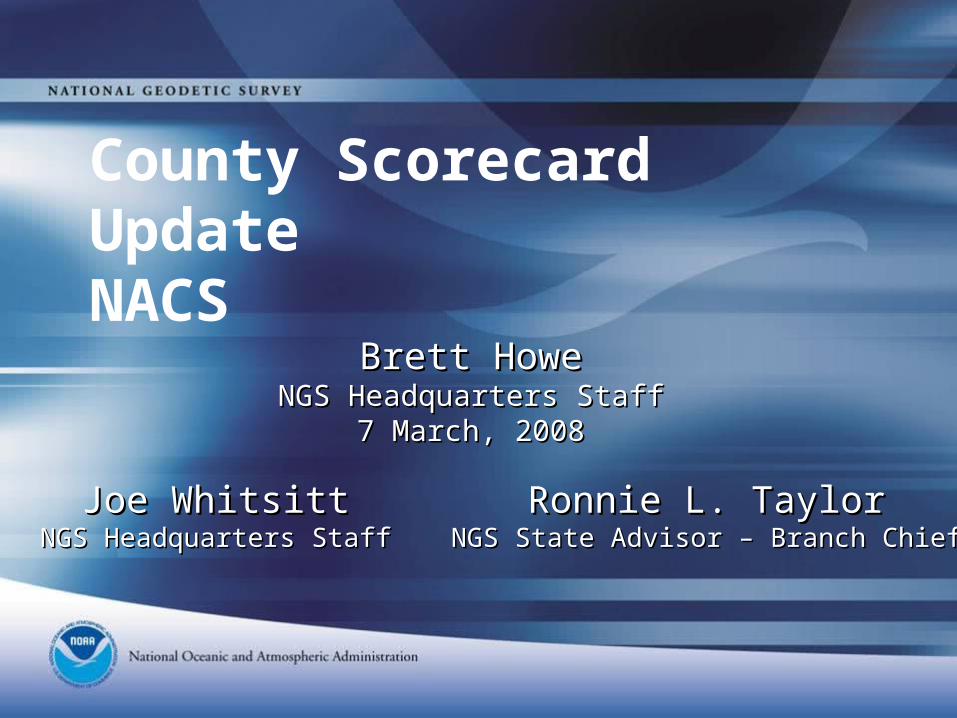
County Scorecard UpdateNACS
Ronnie L. TaylorRonnie L. TaylorNGS State Advisor – Branch ChiefNGS State Advisor – Branch Chief
Brett HoweBrett HoweNGS Headquarters StaffNGS Headquarters Staff
7 March, 20087 March, 2008
Joe WhitsittJoe WhitsittNGS Headquarters StaffNGS Headquarters Staff
• NOAA has a relatively new performance metric that assesses how well we are doing at “enabling” local capacity for accurate positioning. This metric: Makes use of NOAA’s Online Positioning User Service (OPUS) as a proxy to
assess the local use of NOAA positioning tools and services. Was developed over the past several years in partnership with National Association of County Surveyors (NACS).
Involves the use of a web-based county scorecard of 23 survey questions specifically focusing on infrastructure, NGS models and tools, NGS capacity building and outreach, and overall satisfaction.
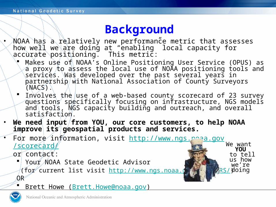
• We need input from YOU, our core customers, to help NOAA improve its geospatial products and services.
• For more information, visit http://www.ngs.noaa.gov/scorecard/or contact: Your NOAA State Geodetic Advisor
(for current list visit http://www.ngs.noaa.gov/ADVISORS/)OR Brett Howe ([email protected])
We want YOU
to tell us how we’re
doing
Background
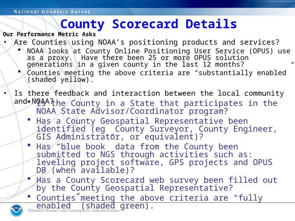
Our Performance Metric Asks• Are Counties using NOAA’s positioning products and services?
NOAA looks at County Online Positioning User Service (OPUS) use as a proxy. Have there been 25 or more OPUS solution generations in a given county in the last 12 months?
Counties meeting the above criteria are “substantially enabled” (shaded yellow).
• Is there feedback and interaction between the local community and NOAA?
Is the County in a State that participates in the NOAA State Advisor/Coordinator program?
Has a County Geospatial Representative been identified (eg County Surveyor, County Engineer, GIS Administrator, or equivalent)?
Has “blue book” data from the County been submitted to NGS through activities such as: leveling project software, GPS projects and OPUS DB (when available)?
Has a County Scorecard web survey been filled out by the County Geospatial Representative?
Counties meeting the above criteria are “fully enabled” (shaded green).
County Scorecard Details
GPRA Measure Details
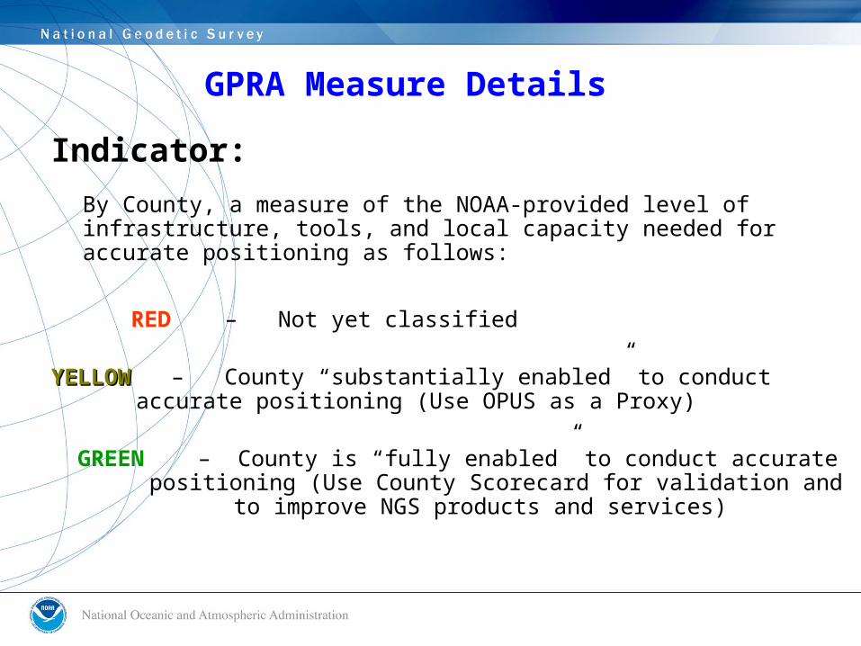
Indicator:
By County, a measure of the NOAA-provided level of infrastructure, tools, and local capacity needed for accurate positioning as follows:
RED – Not yet classified
YELLOWYELLOW – County “substantially enabled” to conduct accurate positioning (Use OPUS as a Proxy)
GREEN – County is “fully enabled” to conduct accurate positioning (Use County Scorecard for validation
and to improve NGS products and services)
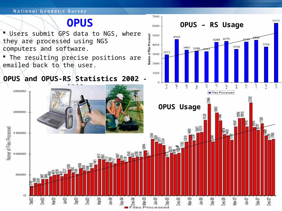
OPUS and OPUS-RS Statistics 2002 - 2008
Users submit GPS data to NGS, where they are processed using NGS computers and software. The resulting precise positions are emailed back to the user.
OPUS – RS Usage
OPUS Usage
OPUS
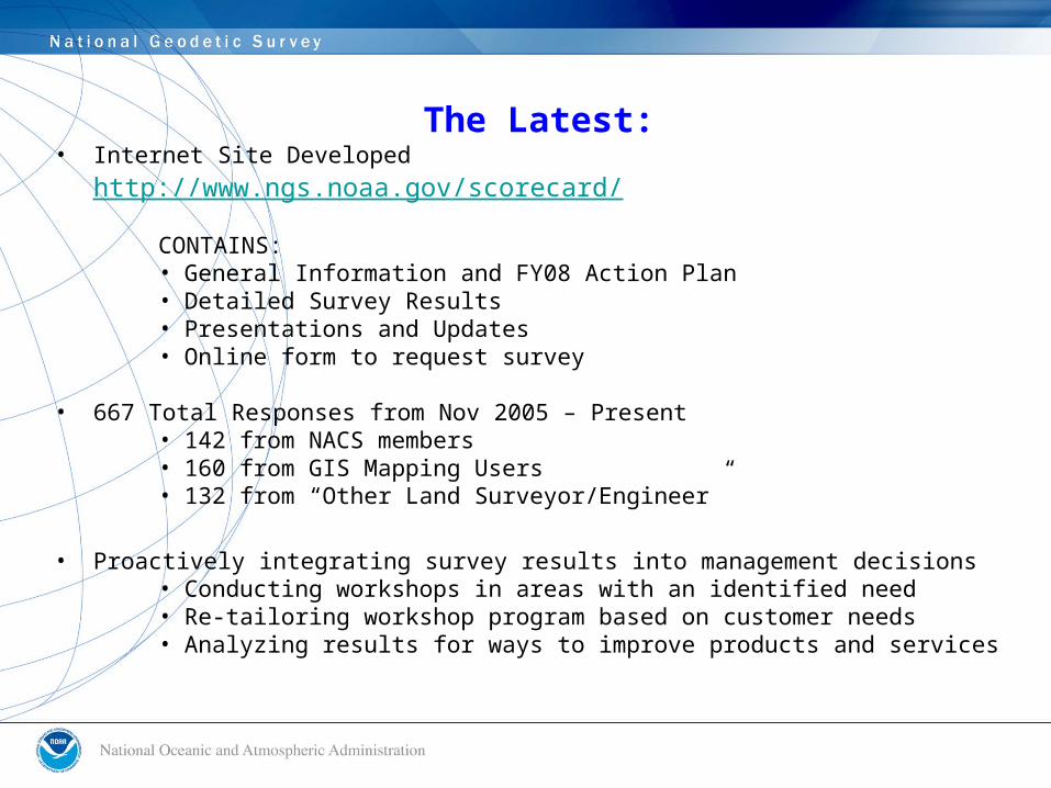
The Latest:• Internet Site Developed
http://www.ngs.noaa.gov/scorecard/
CONTAINS:• General Information and FY08 Action Plan• Detailed Survey Results• Presentations and Updates• Online form to request survey
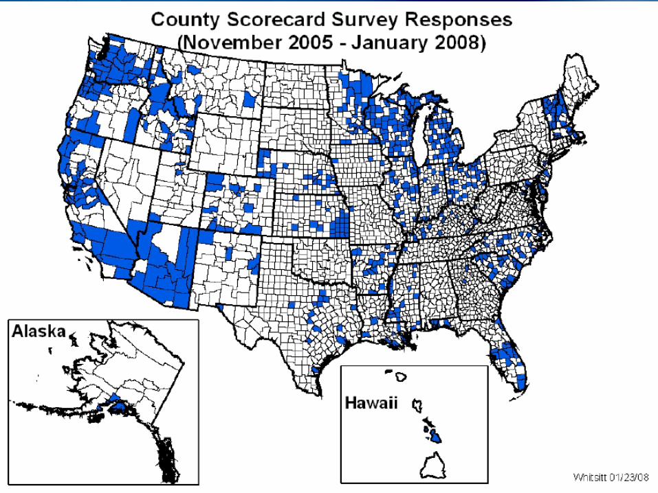
• 667 Total Responses from Nov 2005 – Present• 142 from NACS members• 160 from GIS Mapping Users• 132 from “Other Land Surveyor/Engineer”
• Proactively integrating survey results into management decisions• Conducting workshops in areas with an identified need• Re-tailoring workshop program based on customer needs• Analyzing results for ways to improve products and services
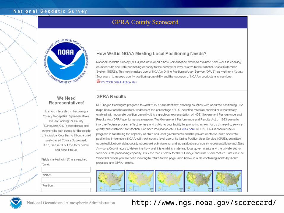
http://www.ngs.noaa.gov/scorecard/

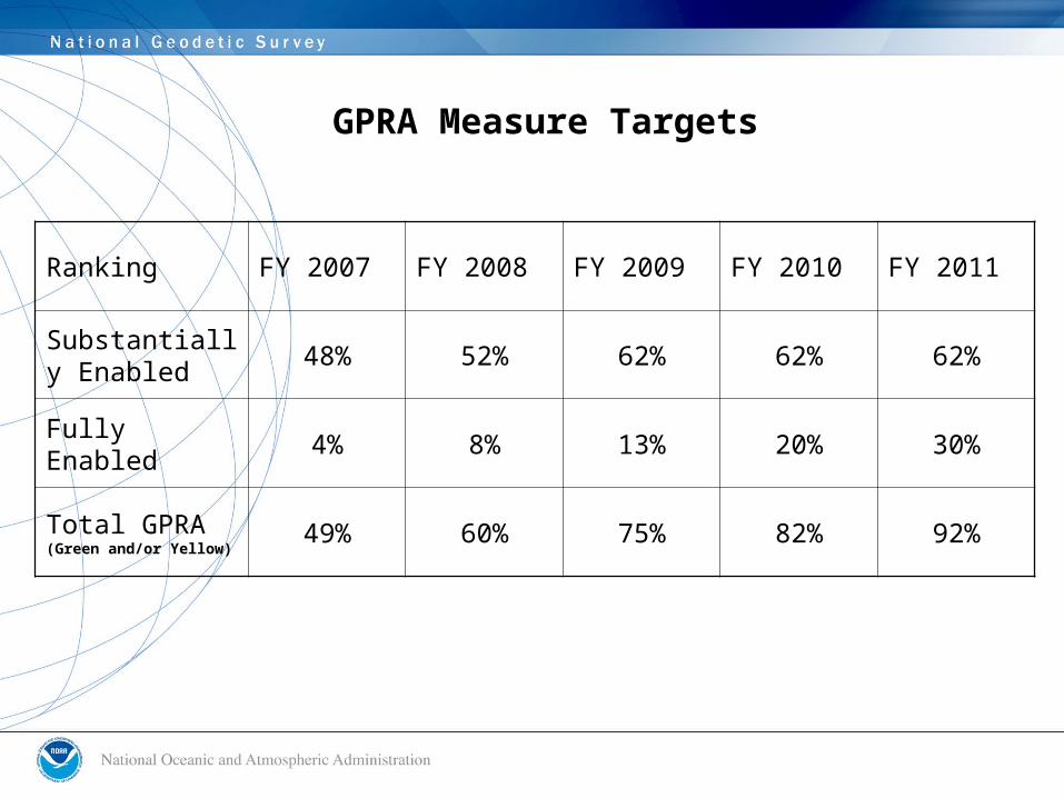
GPRA Measure Targets
Ranking FY 2007 FY 2008 FY 2009 FY 2010 FY 2011
Substantially Enabled
48% 52% 62% 62% 62%
Fully Enabled 4% 8% 13% 20% 30%
Total GPRA (Green and/or Yellow)
49% 60% 75% 82% 92%
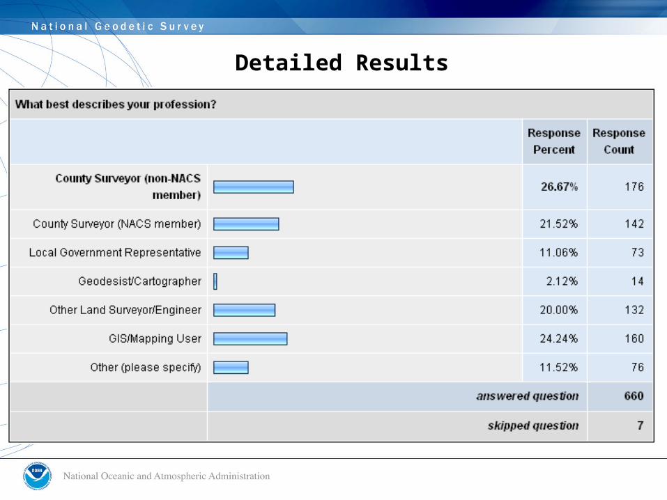
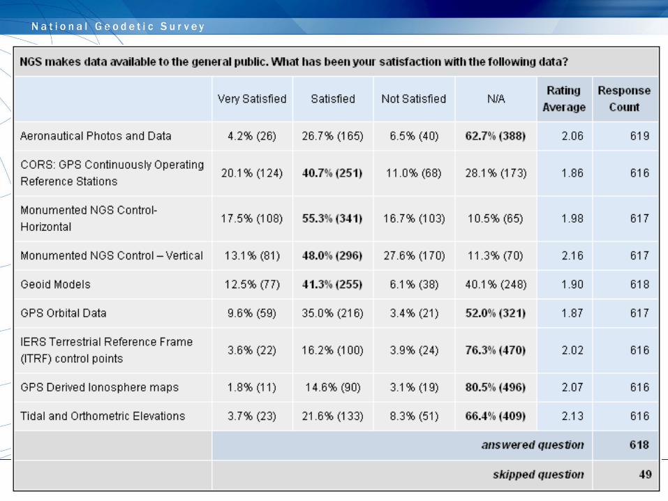
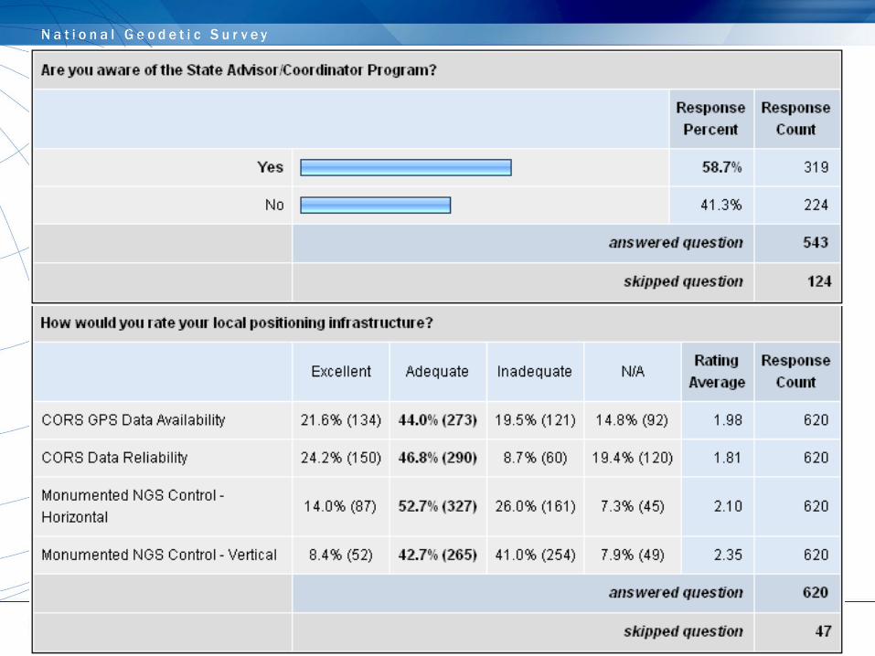
Detailed Results

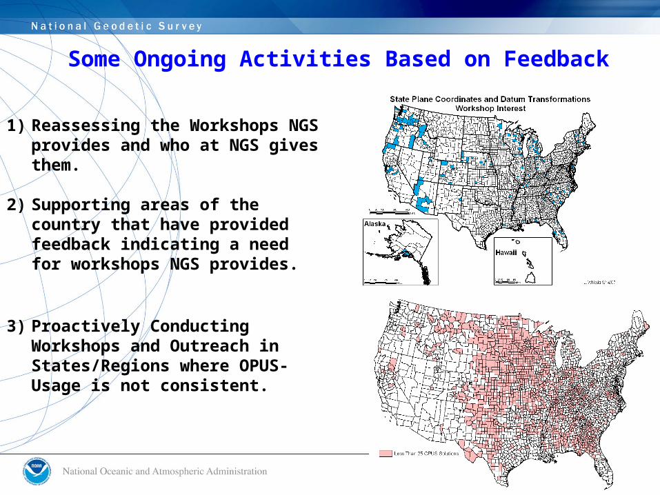
Some Ongoing Activities Based on Feedback
1) Reassessing the Workshops NGS provides and who at NGS gives them.
2) Supporting areas of the country that
have provided feedback indicating a need for workshops NGS provides.
3) Proactively Conducting Workshops and Outreach in States/Regions where OPUS-Usage is not consistent.
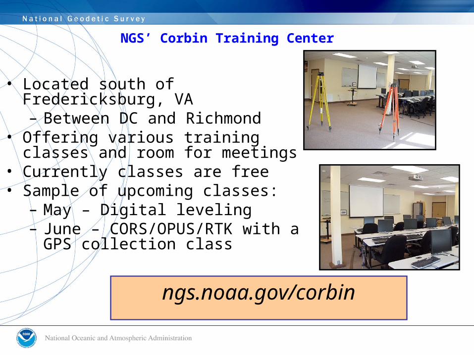
NGS’ Corbin Training Center
ngs.noaa.gov/corbin
• Located south of Fredericksburg, VA– Between DC and Richmond
• Offering various training classes and room for meetings
• Currently classes are free • Sample of upcoming classes:
– May – Digital leveling – June – CORS/OPUS/RTK with a
GPS collection class
County Scorecard Next Steps
• Involve NACS and NACo GIS Committee members in 2008 ESRI Survey & Engineering GIS Summit (August 2 – 5, 2008)
• Work with NACo on possibility of hosting focus groups or other workshops with core customers to provide an independent evaluation of NGS programs and how we are doing.
• Add NACo National Association of County Engineers events to NGS’ outreach calendar (for example NACE Illinois 2009 Annual Conference)
• Reach out to and brief other NACo constituencies• Provide feedback to further incorporate stakeholder
feedback into NGS management decisions.• Investigate linkages to National Height Modernization efforts• Other areas? We welcome your input.
Questions? Comments?