
County Review Officer Training - North Carolina Secretary ...
135
County Review Officer Training North Carolina Secretary of State Elaine F. Marshall, Secretary Land Records Management Program Instructor: Thomas W. Morgan, PLS [email protected] 1
Transcript of County Review Officer Training - North Carolina Secretary ...

County Review Officer Training
North Carolina Secretary of State Elaine F. Marshall, Secretary
Land Records Management Program Instructor: Thomas W. Morgan, PLS
1
G.S. § 47-30.2 Review Officer
2
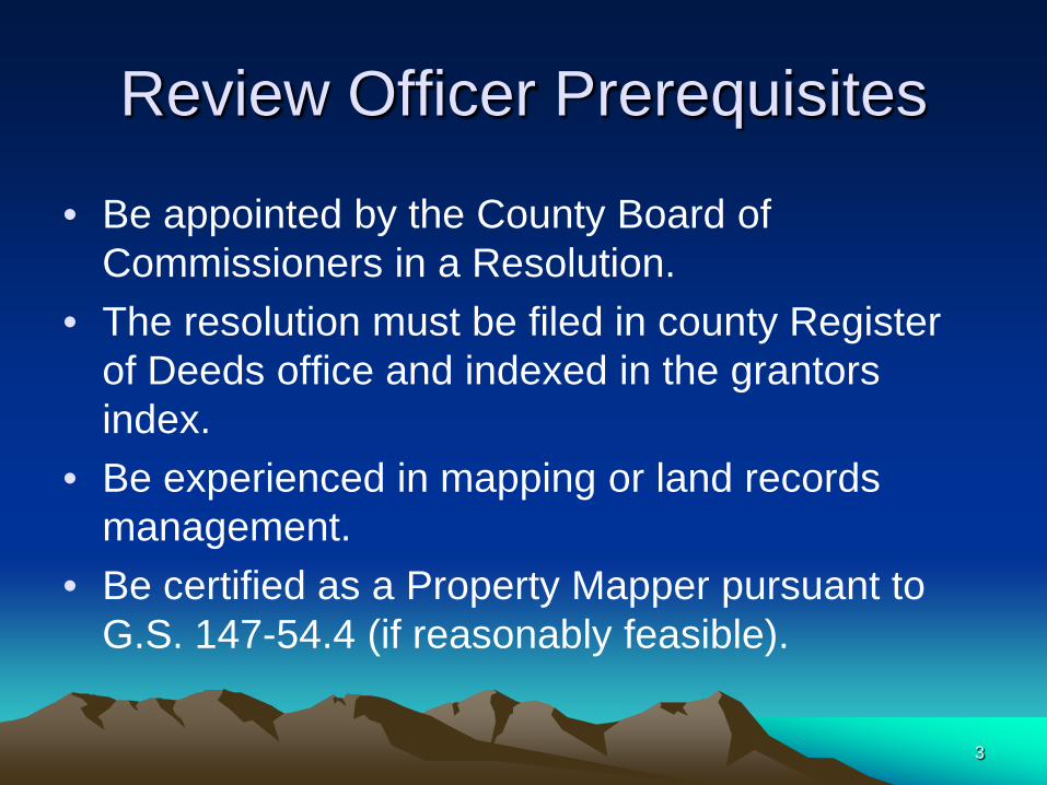
Review Officer Prerequisites
• Be appointed by the County Board of Commissioners in a Resolution.
• The resolution must be filed in county Register of Deeds office and indexed in the grantors index.
• Be experienced in mapping or land records management.
• Be certified as a Property Mapper pursuant to G.S. 147-54.4 (if reasonably feasible).
3
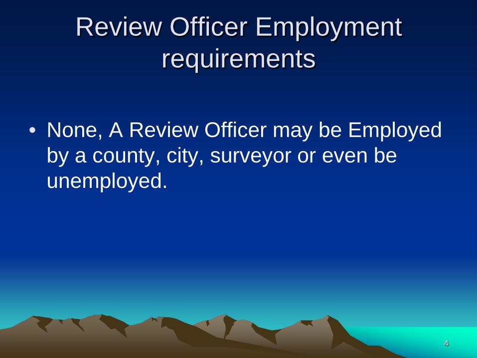
Review Officer Employment requirements
• None, A Review Officer may be Employed
by a county, city, surveyor or even be unemployed.
4

Review officer term of duty
• 1. Until county board of commissioners
pass and file a resolution revoking the Review Officer Appointment.
5

Review Officer duties:
• Review expeditiously each map or plat
required to be submitted to the Officer • Certify the map or plat if it complies with all
statutory requirements for recording.
6
G.S. § 47-30 Plats and subdivisions; Mapping Requirements
7
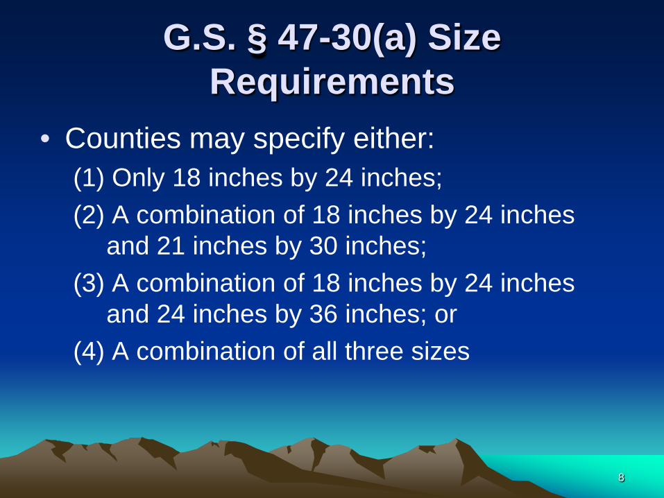
G.S. § 47-30(a) Size Requirements
• Counties may specify either: (1) Only 18 inches by 24 inches; (2) A combination of 18 inches by 24 inches
and 21 inches by 30 inches; (3) A combination of 18 inches by 24 inches
and 24 inches by 36 inches; or (4) A combination of all three sizes
8

Size Requirements by County
• A master list of Plat Size Requirements is posted on the Land Records Management Division page of the North Carolina Secretary of State web site. www.sosnc.com under “County Map and Plat Size Requirements”
• Note: The terms Map and Plat are synonymous.
9

G.S. § 47-30(a) Margin Requirements
• Minimum Margins – One and one-half inch border on the left side – One-half inch borders on all other sides
I ½ inch
½ inch
½ inch
½ inch 10

G.S. § 47-30(b) Plat to be Reproducible
• Each Plat presented for recording shall be a reproducible plat: – Original ink on polyester film (Mylar) – Or – A reproduced drawing, transparent and
archival ( Archival is the responsibility of the Surveyor not the Review Officer, see G.S. 47-30(g)(1) ).
11
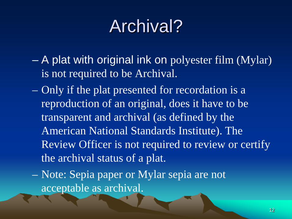
Archival?
– A plat with original ink on polyester film (Mylar) is not required to be Archival.
– Only if the plat presented for recordation is a reproduction of an original, does it have to be transparent and archival (as defined by the American National Standards Institute). The Review Officer is not required to review or certify the archival status of a plat.
– Note: Sepia paper or Mylar sepia are not acceptable as archival.
12
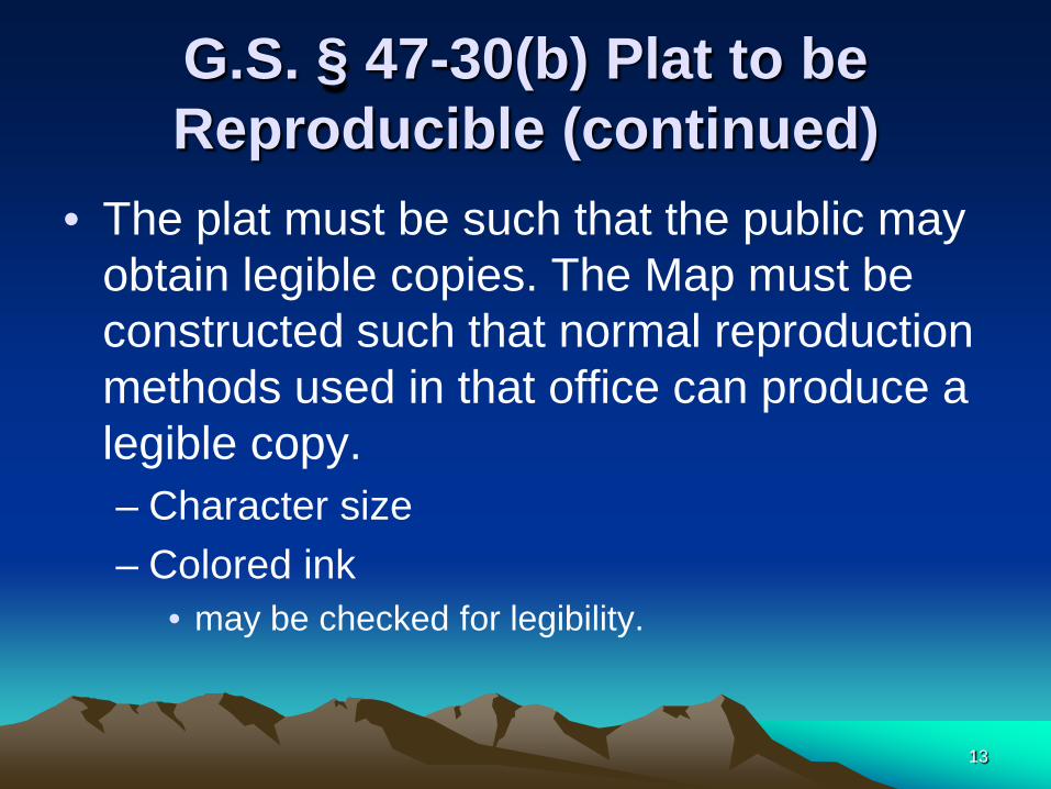
G.S. § 47-30(b) Plat to be Reproducible (continued)
• The plat must be such that the public may obtain legible copies. The Map must be constructed such that normal reproduction methods used in that office can produce a legible copy. – Character size – Colored ink
• may be checked for legibility.
13

Check before using Color
14
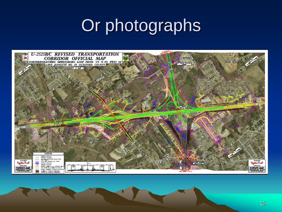
Or photographs
15

G.S. § 47-30(c)Information contained in Title of Plat
• Property Designation: – Name of Client – Name of Farm – Name of Subdivision – Name of Shopping Center – ETC
16

G.S. § 47-30(c)Information contained in Title of Plat
• Name of Owner: – (The name of the owner shall be shown for
indexing purposes only and is not to be considered as title certification.)
– Owner: John J. Smith
17
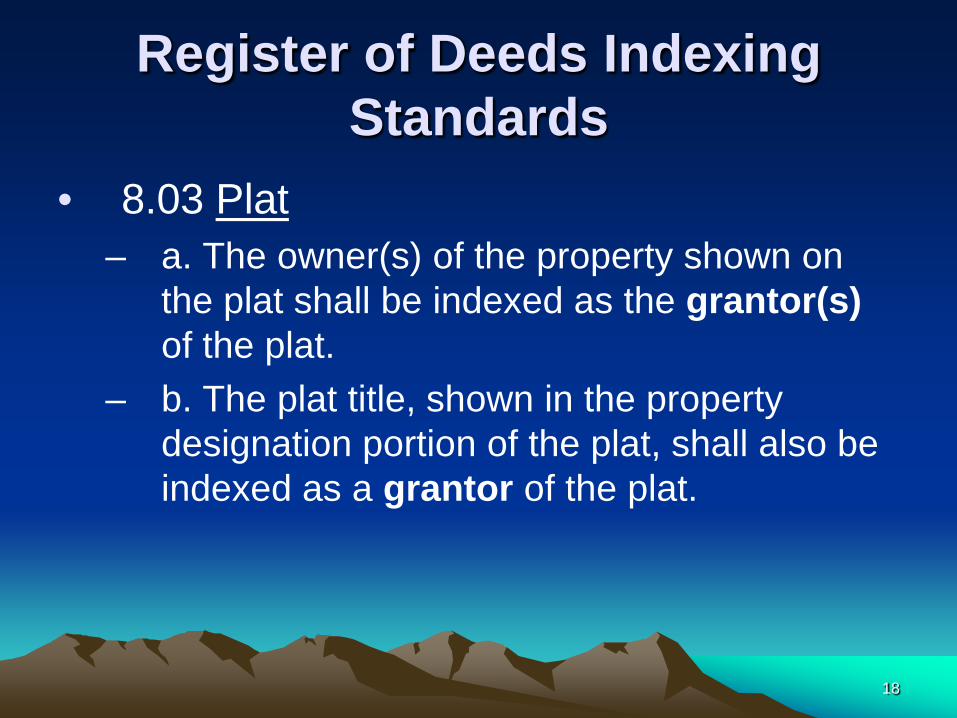
Register of Deeds Indexing Standards
• 8.03 Plat – a. The owner(s) of the property shown on
the plat shall be indexed as the grantor(s) of the plat.
– b. The plat title, shown in the property designation portion of the plat, shall also be indexed as a grantor of the plat.
18

Register of Deeds Indexing Standards (continued)
• b. 1. Descriptive plat title. When the plat title is descriptive (i.e., name of subdivision, name of property, etc.), the plat title shall be considered as a non-human name.
19

G.S. § 47-30(c)Information contained in Title of Plat
• Location To include: – Township
• (town or city if appropriate) – County – State
20
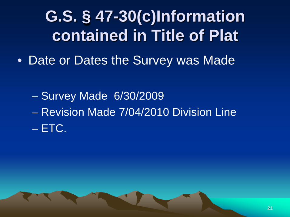
G.S. § 47-30(c)Information contained in Title of Plat
• Date or Dates the Survey was Made – Survey Made 6/30/2009 – Revision Made 7/04/2010 Division Line – ETC.
21

G.S. § 47-30(c) Information contained in Title of Plat
• Scale or Scale Ratio: • In Words or Figures
– One Inch = Four Hundred Feet
– 1”=400’ – 1:4800
• And
22

G.S. § 47-30(c)Information contained in Title of Plat
• Bar Graph
23

Do You see anything wrong?
• 1:100 is 1” = 8.33’
24

G.S. § 47-30(c)Information contained in Title of Plat
• Name and Address of the Surveyor or • Name and Address of the Surveying Firm
– Preparing the plat
• Surveyors, remember there additional requirements in the Board Rules.
• See NCAC, Title 21 – Occupational Licensing Boards and Commissions > Chapter 56 - Engineers and Surveyors
• http://www.ncbels.org/rulesandlaws.html 25
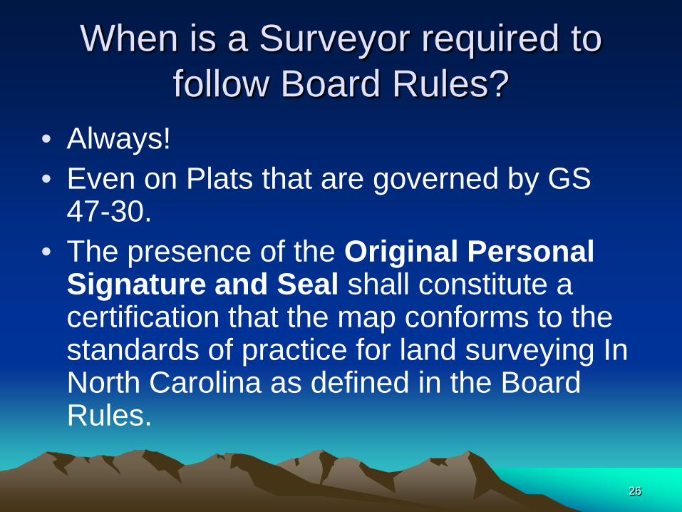
When is a Surveyor required to follow Board Rules?
• Always! • Even on Plats that are governed by GS
47-30. • The presence of the Original Personal
Signature and Seal shall constitute a certification that the map conforms to the standards of practice for land surveying In North Carolina as defined in the Board Rules.
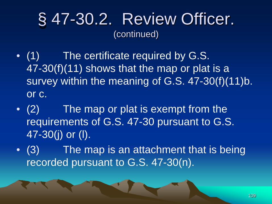
26
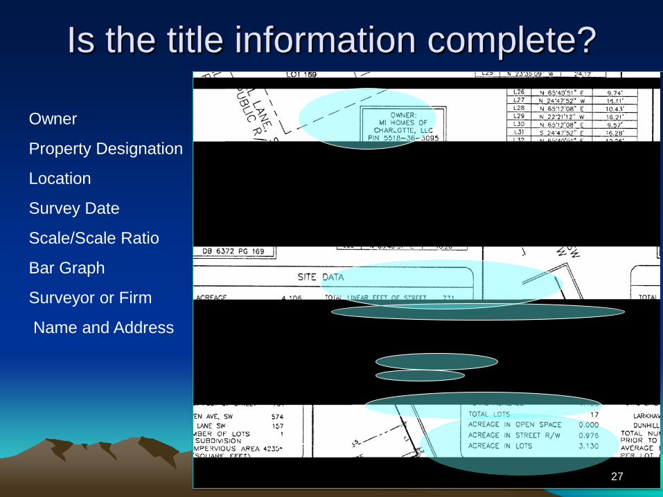
Is the title information complete?
Owner
Property Designation
Location
Survey Date
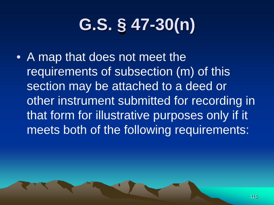
Scale/Scale Ratio
Bar Graph
Surveyor or Firm
Name and Address
27

Information contained in Title of Plat
The Title of a Plat may be free form as in the previous example or may be contained in a block format like this one.
28
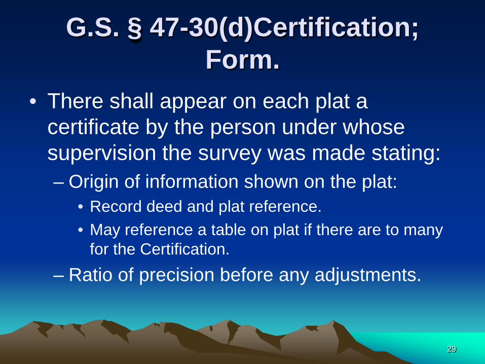
G.S. § 47-30(d)Certification; Form.
• There shall appear on each plat a certificate by the person under whose supervision the survey was made stating: – Origin of information shown on the plat:
• Record deed and plat reference. • May reference a table on plat if there are to many
for the Certification. – Ratio of precision before any adjustments.
29

Ratio of Precision / Positional Tolerance
• Title 21 Chapter 56 (Board Rules) has now been revised to allow a statement of positional tolerance in place of ratio of precision at the discretion of the surveyor, but G.S. 47-30 does not enjoy any such revision; does that mean we are still locked into ratio of precision on recorded plats?
30
Yes!

G.S. § 47-30(d)Certification; Form.
– Lines not Surveyed must be: • CLEARLY IDICATED • Include source data
– Signature and Seal of the Professional Land Surveyor under whose supervision the survey plat was made.
31
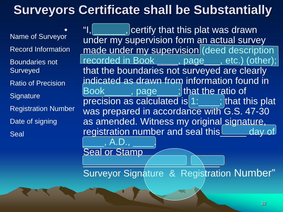
Surveyors Certificate shall be Substantially • “I, ______, certify that this plat was drawn
under my supervision form an actual survey made under my supervision (deed description recorded in Book ____, page___, etc.) (other); that the boundaries not surveyed are clearly indicated as drawn from information found in Book_____, page____; that the ratio of precision as calculated is 1:____; that this plat was prepared in accordance with G.S. 47-30 as amended. Witness my original signature, registration number and seal this_____ day of ____, A.D., ____. Seal or Stamp __________________________ Surveyor Signature & Registration Number”
Name of Surveyor
Record Information
Boundaries not Surveyed
Ratio of Precision
Signature
Registration Number
Date of signing
Seal
32
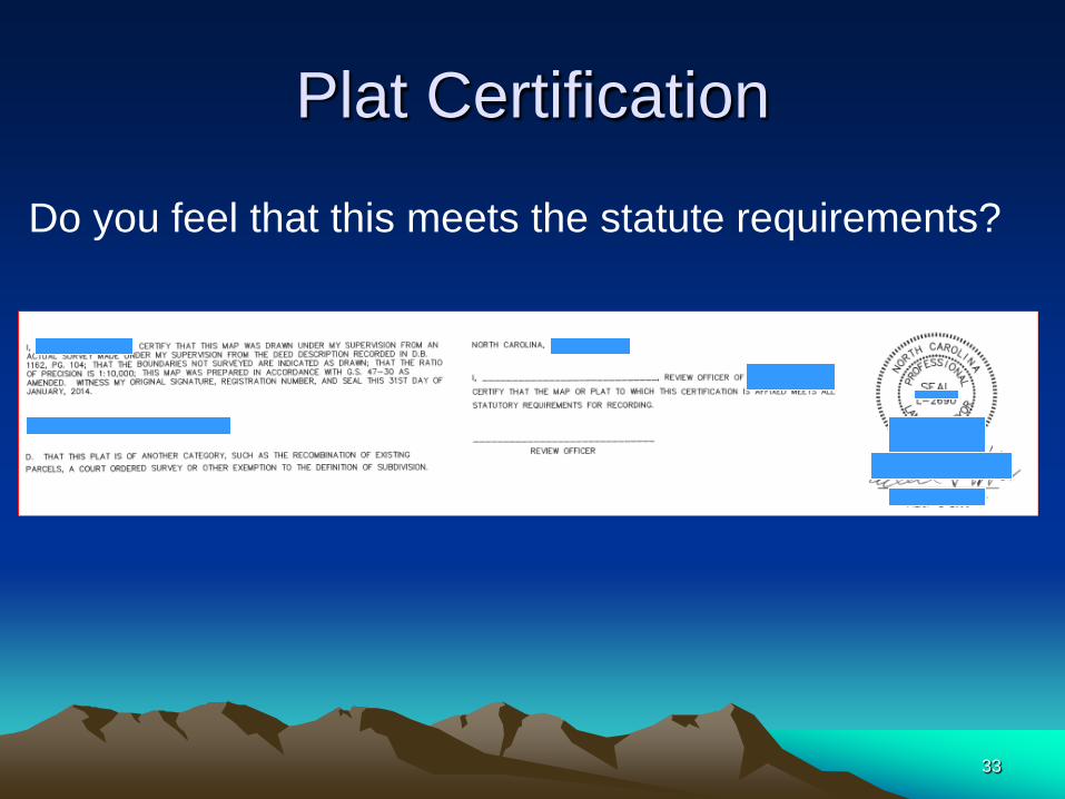
Plat Certification
Do you feel that this meets the statute requirements?
33
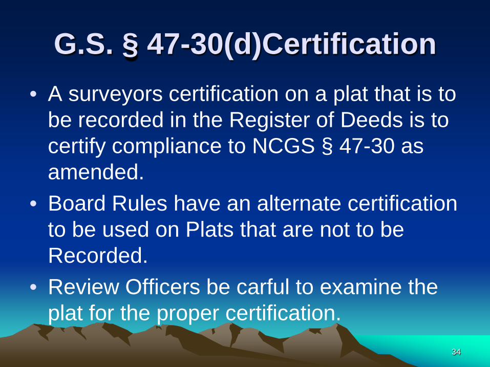
G.S. § 47-30(d)Certification • A surveyors certification on a plat that is to
be recorded in the Register of Deeds is to certify compliance to NCGS § 47-30 as amended.
• Board Rules have an alternate certification to be used on Plats that are not to be Recorded.
• Review Officers be carful to examine the plat for the proper certification.
34
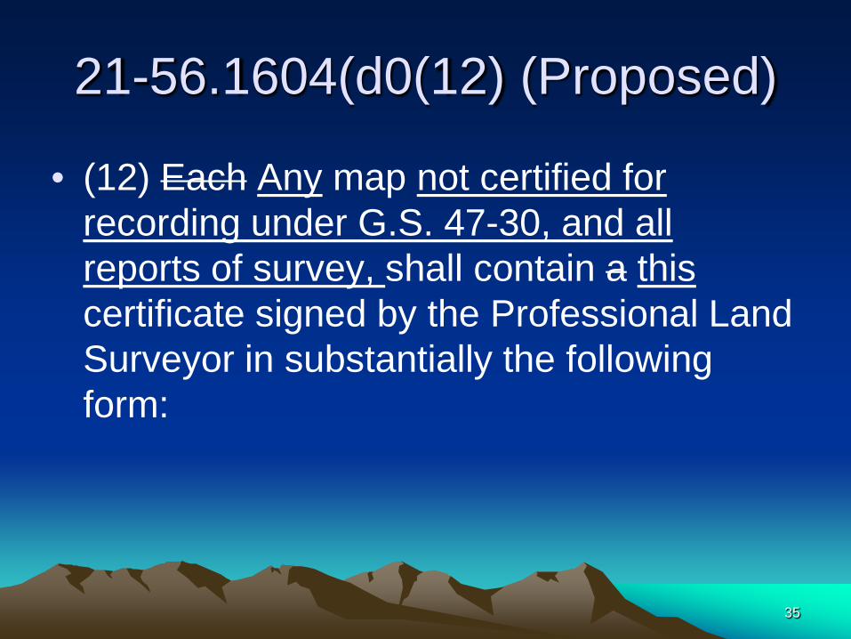
21-56.1604(d0(12) (Proposed)
• (12) Each Any map not certified for recording under G.S. 47-30, and all reports of survey, shall contain a this certificate signed by the Professional Land Surveyor in substantially the following form:
35
• "I certify that this map was drawn under my supervision from an actual survey made under my supervision (deed description recorded in Book , page or other reference source
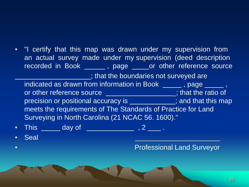
; that the boundaries not surveyed are indicated as drawn from information in Book , page , or other reference source _; that the ratio of precision or positional accuracy is ; and that this map meets the requirements of The Standards of Practice for Land Surveying in North Carolina (21 NCAC 56. 1600)."
• This day of , 2 . • Seal ______________________ • Professional Land Surveyor
36
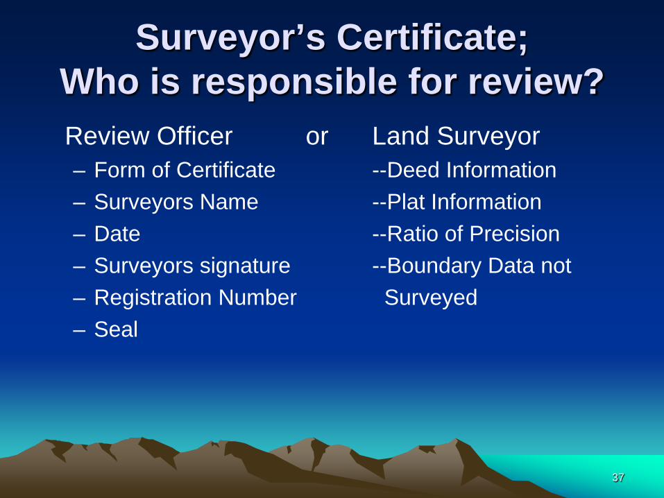
Surveyor’s Certificate; Who is responsible for review?
Review Officer or Land Surveyor – Form of Certificate --Deed Information – Surveyors Name --Plat Information – Date --Ratio of Precision – Surveyors signature --Boundary Data not – Registration Number Surveyed – Seal
37
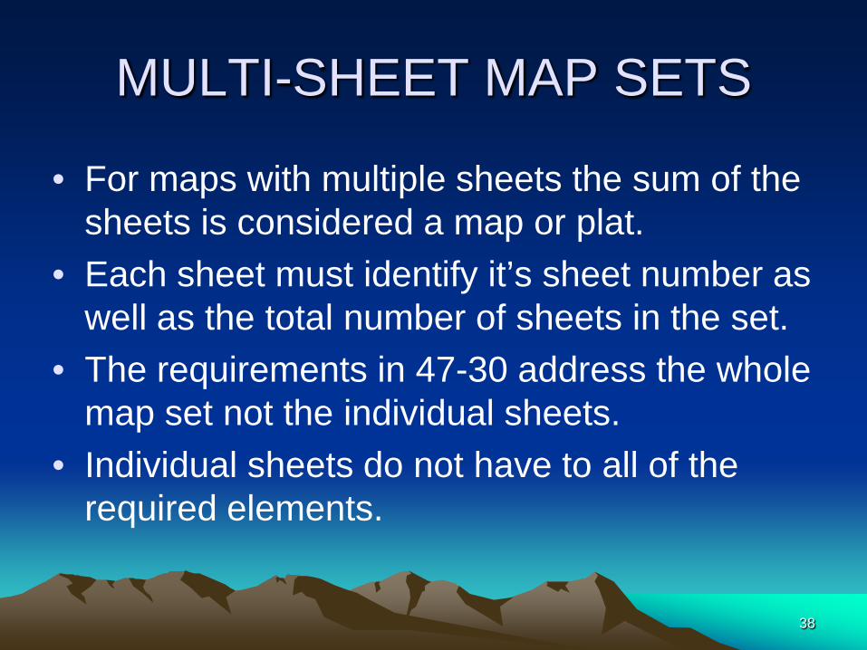
MULTI-SHEET MAP SETS
• For maps with multiple sheets the sum of the sheets is considered a map or plat.
• Each sheet must identify it’s sheet number as well as the total number of sheets in the set.
• The requirements in 47-30 address the whole map set not the individual sheets.
• Individual sheets do not have to all of the required elements.
38

MULTI-SHEET MAP SETS
• NC GS 47-30(d) Certificate; Form. – … Where a plat consists of more than one
sheet, only one sheet must contain the certification and all other sheets must be signed and sealed.
39

MULTI-SHEET MAP SETS
• The Review Officer only needs to signoff on one sheet, preferably the sheet with the 47-30 (f)(11) statement.
• GS 47-30 (m) Certified Deed Attachment Plats are treated the same as stand alone plats.
40

Signature and Seal
• The seal may be computer generated or ink stamp. Any thing other than ink on mylar must be archival.
• The registrant is still required to apply an original signature and date. (NCBES December 11, 1995)
41
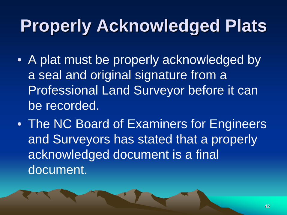
Properly Acknowledged Plats
• A plat must be properly acknowledged by a seal and original signature from a Professional Land Surveyor before it can be recorded.
• The NC Board of Examiners for Engineers and Surveyors has stated that a properly acknowledged document is a final document.
42

Properly Acknowledged Plats (continued)
The North Carolina Court of Appeals stated “ …By marking the map “preliminary,” the
appellant essentially negated the effect of his certification…”. NC Court of Appeals, NO. COA 12-1350, 7 May 2013
A preliminary statement on the plat is a contrary statement to that document being final and negates the acknowledgment.
43
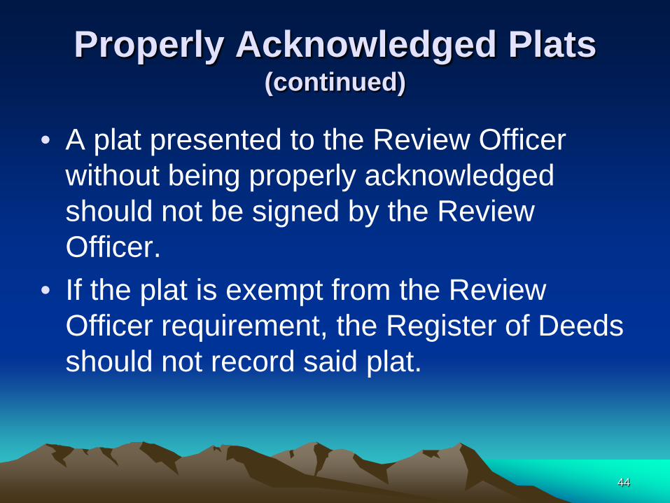
Properly Acknowledged Plats (continued)
• A plat presented to the Review Officer without being properly acknowledged should not be signed by the Review Officer.
• If the plat is exempt from the Review Officer requirement, the Register of Deeds should not record said plat.
44

Properly Acknowledged Plats (continued)
Final Drawing – For Review Purposes Only
45
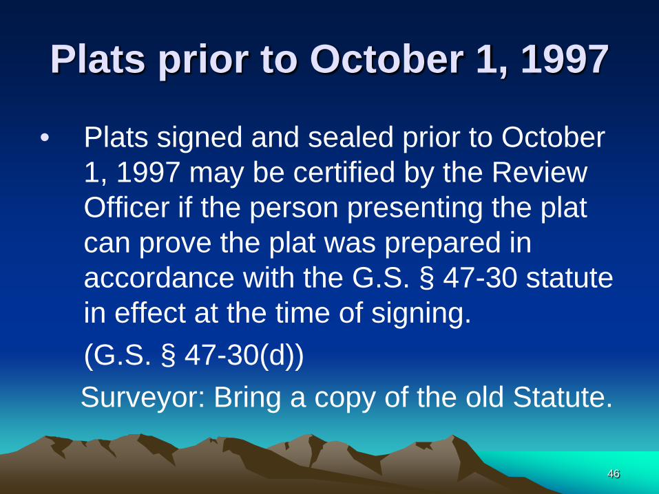
Plats prior to October 1, 1997
• Plats signed and sealed prior to October 1, 1997 may be certified by the Review Officer if the person presenting the plat can prove the plat was prepared in accordance with the G.S. § 47-30 statute in effect at the time of signing.
(G.S. § 47-30(d)) Surveyor: Bring a copy of the old Statute.
46

Review Officer Certification for a Map drawn under a previous version of
NC GS 47-30.
I, ___________, Review Officer of _________ County, certify that the map to which this certificate is affixed was
prepared in accordance with a previous version of G.S. 47 30 as amended, properly signed, and notarized under the statutes applicable at the time of the signing of the map. Said certification is authorized by NC GS 47-30(d)
_________________ ___________________ Review Officer Date
47

G.S. § 47-30 Requirements not subject to Review Officer Review.
• The following requirements are the responsibility of the Surveyor for inclusion.
• The Plat can be recorded with out these Items.
• Just remember, a surveyor’s oversight is recorded for everyone to see forever.
48
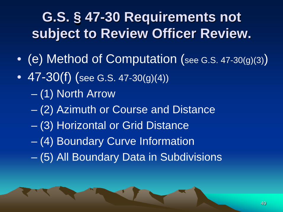
G.S. § 47-30 Requirements not subject to Review Officer Review.
• (e) Method of Computation (see G.S. 47-30(g)(3)) • 47-30(f) (see G.S. 47-30(g)(4))
– (1) North Arrow – (2) Azimuth or Course and Distance – (3) Horizontal or Grid Distance – (4) Boundary Curve Information – (5) All Boundary Data in Subdivisions
49

G.S. § 47-30 Requirements not subject to Review Officer Review
• 47-30(f) – (6) Control Corners
• While 47-30(g)(4) exempts Control Corners from Review Officer Review,
• 47-30.2(b) states “The Review Officer shall certify the map or plat if it complies with all statutory requirements for Recording.” and
• 39-32.3 states “No map or plat of a real estate subdivision of development made after July 1, 1947, shall be certified for recording Pursuant to G.S. 47-30.2 unless the location of control corners is shown thereon.”
50

Control Corners (continued)
• Because Statute G.S. 39-32.3 specifically refers to G.S. 47-30.2,
• the Review Officer must verify that a Plat of a Subdivision including a new or revised street has at least 2 control corners designated.
• This does not mean that the Surveyor has met all control corner requirements.
51

§ 39-32.1. Requirement of permanent markers as "control corners.”
• Whenever any person, firm or corporation shall hereafter divide any parcel of real estate – into lots and – lay off streets through such real estate development
and sell or offer for sale any lot or lots in such real estate development,
– it shall be the duty of such person, firm or corporation to cause one or more corners of such development to be designated as "control corner"
52
Control Corners (continued)
• and shall cause two or more street center lines or offset lines within or on the street right-of-way lines to be permanently monumented – at intersecting center lines or – offset lines, – points of curvature or – such other control points,
53

Control Corners (continued)
• which monuments shall also be designated as control corners
• and • to affix or place at such control corner or
corners permanent markers which shall be of such material and affixed to the earth in such a manner as to insure as great a degree of permanence as is reasonably practical.
54

Control Corners Sometimes you have to look at the
legend to know what to look for.
55
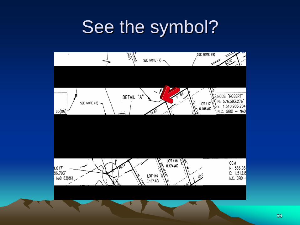
See the symbol?
56
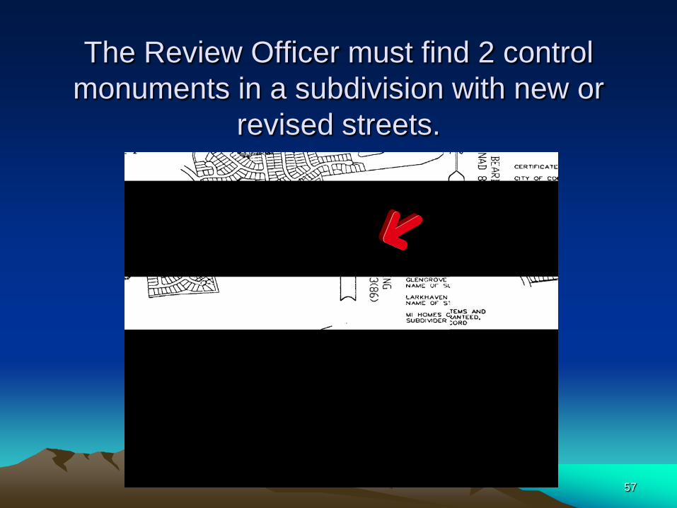
The Review Officer must find 2 control monuments in a subdivision with new or
revised streets.
57

G.S. § 47-30 Requirements not subject to Review Officer Review
• (7) Name of adjacent landowners with legal reference where applicable.
• (8) Right-of-ways, water courses, utilities, etc. adjoining or crossing property.
• (9) Grid Tie • (10) Vicinity Map
58

G.S. § 47-30(f)(11) Surveyors certification as to survey category.
• The Surveyor shall certify on the face of the plat to one of the required categories.
• Note: the Board of Registration has ruled that a certification that only includes a Statute reference and not the certification wording is not valid.
59
NC GS 47-30 (F)(11) Statement
Certified Deed Attachment Plats as well as full size stand alone plats are required to have a (f)(11) statement.
60
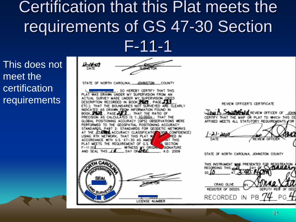
Certification that this Plat meets the requirements of GS 47-30 Section
F-11-1 This does not meet the certification requirements
61

NC GS 47-30 (f)(11) by Statute reference is not valid.
62
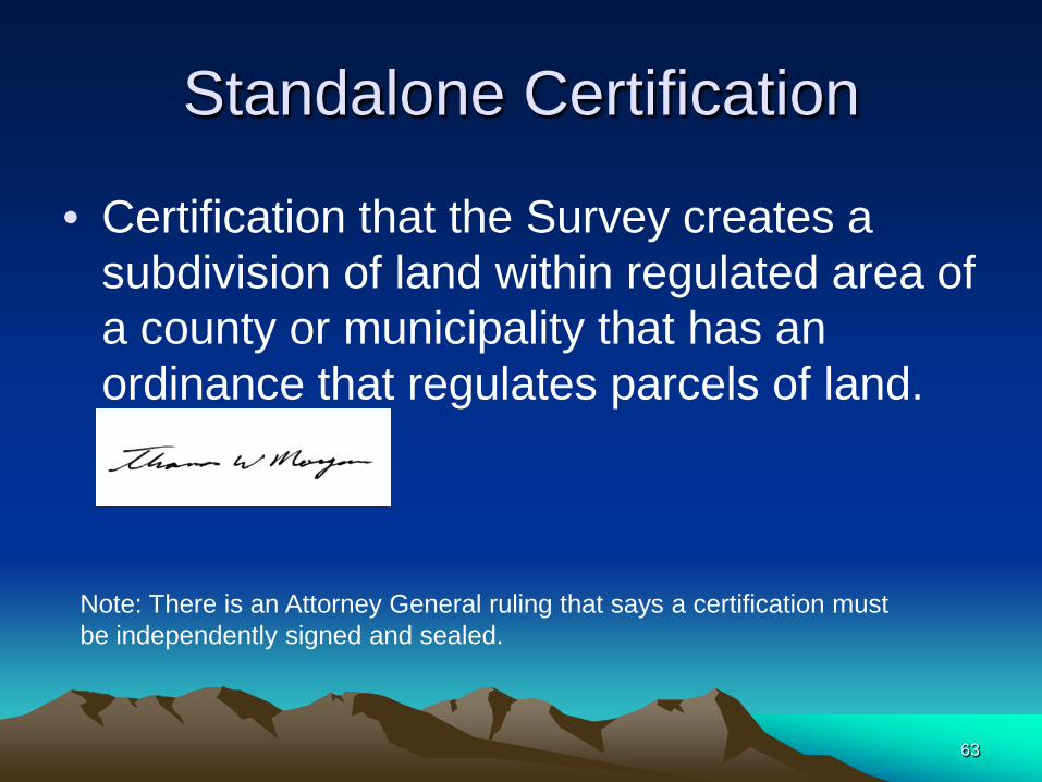
Standalone Certification
• Certification that the Survey creates a subdivision of land within regulated area of a county or municipality that has an ordinance that regulates parcels of land.
Note: There is an Attorney General ruling that says a certification must be independently signed and sealed.
63

Example- Standalone Certification
No Seal and Signature
64

A (f)(11) certification may be combined with the surveyor’s certification
• The Attorney General ruling stated that the (F)(11) certification could be included in the Surveyor’s certification and if done, only one signature would be required.
65
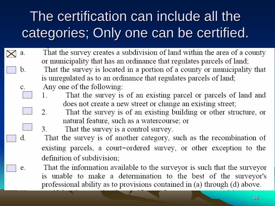
The certification can include all the categories; Only one can be certified.
66
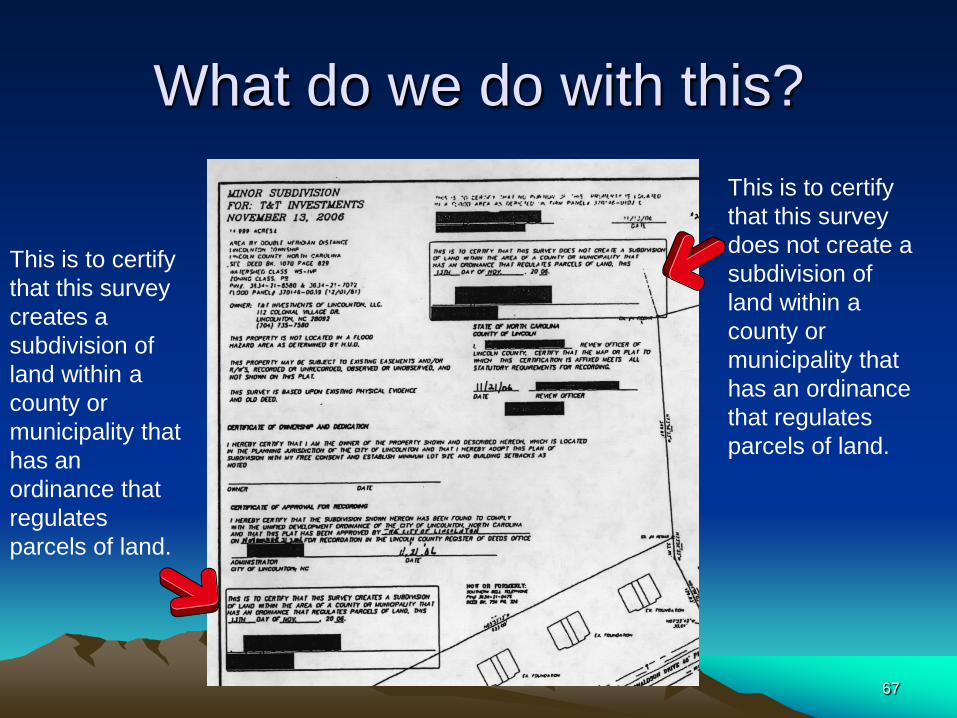
What do we do with this? This is to certify that this survey does not create a subdivision of land within a county or municipality that has an ordinance that regulates parcels of land.
This is to certify that this survey creates a subdivision of land within a county or municipality that has an ordinance that regulates parcels of land.
67
G.S. § 47-30(f)(11)
• However, if the plat contains the certificate of a surveyor as stated in a., d., or e. above, then the plat shall have, in addition to said surveyor's certificate, a certification of approval, or no approval required, as may be required by local ordinance from the appropriate government authority before the plat is presented for recordation.
68

G.S. § 47-30(f)(11) a. Survey Creates a Subdivision
• That the survey creates a subdivision of land within the area of a county or municipality that has an ordinance that regulates parcels of land.
• Local Jurisdiction must sign off that all local ordinances have been met.
69

Water Supply Watershed Protection Ordinance
• G.S. § 143-215.5 establishes the frame work for a Local Ordinance that has the power to establish development control within a county.
• In the absence of a Subdivision Ordinance, a division of land within a Water Supply Watershed Protection Area may require the Surveyor Certification: G.S. § 47-30(f)(11) a. Survey Creates a Subdivision
70

G.S. § 153A-335 or G.S. § 160A-376 "Subdivision" Defined
• (a) For purposes of this part, "subdivision" means all divisions of a tract or parcel of land into two or more lots, building sites, or other divisions when any one or more of those divisions are created for the purpose of sale or building development (whether immediate or future) and includes all division of land involving the dedication of a new street or a change in existing streets;
71
The Definition of a Subdivision in North Carolina
• The court has ruled that a division of land among heirs in order to settle an estate is not a “subdivision.” Williamson v. Avant, 21 N.C.App. 211, 203 S.E.2d 634, cert. denied, 285 N.C. 596 (1974).
• Ref: UNC School of Government, NC Planning, Key Legal Issues, David W. Owens, June 2002
72
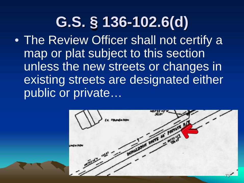
G.S. § 136-102.6(d) • The Review Officer shall not certify a
map or plat subject to this section unless the new streets or changes in existing streets are designated either public or private…
73
G.S. § 136-102.6(d) (continued)
• …The plat or map required by this section shall not be recorded by the Register of Deeds without a certification pursuant to G.S. § 47-30.2 and, if determined to be necessary by the Review Officer, a certificate of approval by the Division of Highways of the plans for the public street as being in accordance with the minimum standards of the Board of Transportation for acceptance of the subdivision street on the state highway system for maintenance.
74
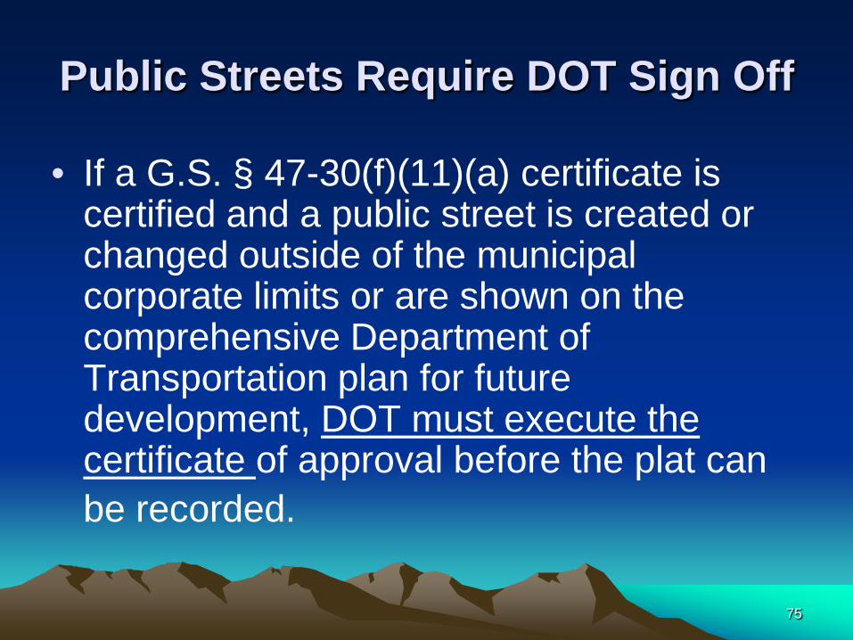
Public Streets Require DOT Sign Off
• If a G.S. § 47-30(f)(11)(a) certificate is certified and a public street is created or changed outside of the municipal corporate limits or are shown on the comprehensive Department of Transportation plan for future development, DOT must execute the certificate of approval before the plat can be recorded.
75

G.S. § 47-30(f)(11) • ….If the plat contains the certificate of a
surveyor as stated in b. or c. above, nothing shall prevent the recordation of the plat if all other provisions have been met.
76

A (b) or (c) plat presented to the Register of Deeds should be
reviewed for: • G.S. § 47-30: • (a) Size, • (b) Reproducibility and Material, • (c) Title of Plat (information for indexing),
and • (d) Surveyors Certificate, Seal, and
Surveyors Original Signature. 77
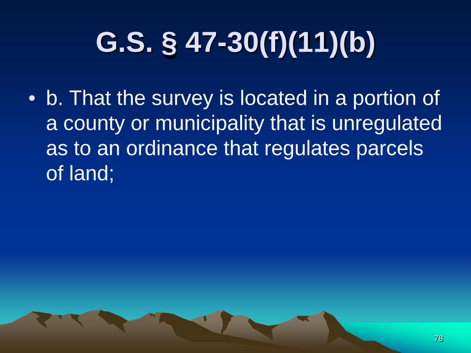
G.S. § 47-30(f)(11)(b)
• b. That the survey is located in a portion of a county or municipality that is unregulated as to an ordinance that regulates parcels of land;
78

(b) Area Unregulated by Subdivision Ordinance
• If b. is certified and the plat does not create or modify a public right-of-way (G.S. § 136-102.6(d)) there is no Review Officer certification of approval required to be placed on the plat. (G.S. § 47-30(f)(11))
79
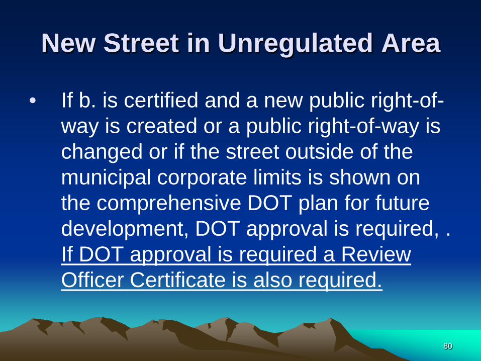
New Street in Unregulated Area
• If b. is certified and a new public right-of-way is created or a public right-of-way is changed or if the street outside of the municipal corporate limits is shown on the comprehensive DOT plan for future development, DOT approval is required, . If DOT approval is required a Review Officer Certificate is also required.
80
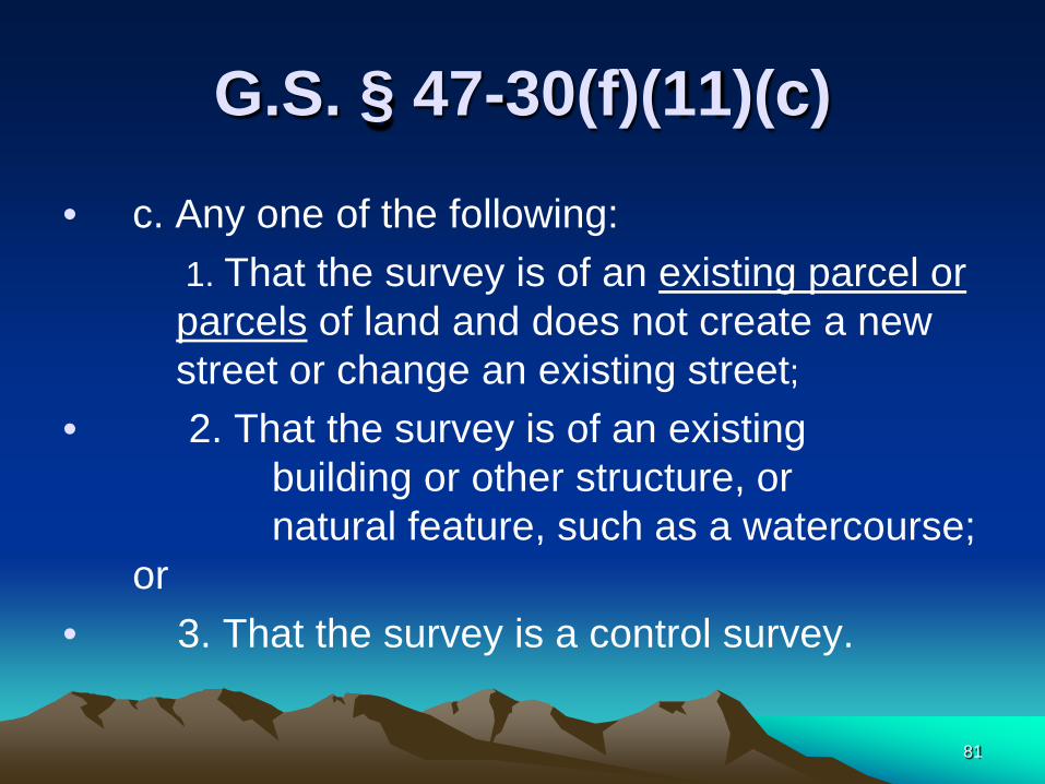
G.S. § 47-30(f)(11)(c)
• c. Any one of the following: 1. That the survey is of an existing parcel or
parcels of land and does not create a new street or change an existing street;
• 2. That the survey is of an existing building or other structure, or natural feature, such as a watercourse; or
• 3. That the survey is a control survey.
81

Parcel Definition
• A parcel is a contiguous area of land described in a single description or legally recorded plat of subdivision that has been or may be legally conveyed to a new owner by deed in its existing configuration.
82

Which 47-30(f)(11) Statement?
83
G.S. § 47-30(f)(11)
• d. That the survey is of another category, such as the recombination of existing parcels, a court ordered survey, or other exception to the definition of subdivision;
84

G.S. § 153A-335 or G.S. § 160A-376 "Subdivision" exemptions
• however, the following is not included within this definition and is not subject to any regulations enacted pursuant to this part;
85

G.S. § 153A-335 or G.S. § 160A-376 "Subdivision" exemptions (continued)
• (1) The combination or recombination of portions of previously subdivided and recorded lots if the total number of lots is not increased and the resultant lots are equal to or exceed the standards of the county as shown in its subdivision regulations.
86

G.S. § 153A-335 or G.S. § 160A-376 "Subdivision" exemptions (continued)
• (2) The division of land into parcels greater than 10 acres if no street right-of-way dedication is involved.
87
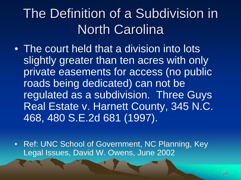
The Definition of a Subdivision in North Carolina
• The court held that a division into lots slightly greater than ten acres with only private easements for access (no public roads being dedicated) can not be regulated as a subdivision. Three Guys Real Estate v. Harnett County, 345 N.C. 468, 480 S.E.2d 681 (1997).
• Ref: UNC School of Government, NC Planning, Key Legal Issues, David W. Owens, June 2002
88
G.S. § 153A-335 or G.S. § 160A-376 "Subdivision" exemptions (continued)
• (3) The public acquisition by purchase of strips of land for widening or opening streets or for public transportation system corridors.
89
G.S. § 153A-335 or G.S. § 160A-376 "Subdivision" exemptions (continued)
• (4) The division of a tract in single ownership the entire area of which is no greater than two acres into not more than three lots, if no street right-of-way dedication is involved and if the resultant lots are equal to or exceed the standards of the county as shown by its subdivision regulations.
90

Additional Exemptions to the Definition of Subdivision
• The General Assembly has passed local laws at the request of some counties expanding the exemptions to the definition on subdivision in that county.
• Some examples: • HENDERSON COUNTY, 1990 (CH. 863), EXEMPTING
INTRAFAMILY SUBDIVISIONS; • STANLEY COUNTY, 1994 (CH. 574), EXEMPTING FIVE ACRE
LOTS IF CERTAIN RIGHT OF WAY CONDITIONS ARE MET; • ROBESON COUNTY, 1994 (CH. 638), EXEMPTING TWO AND A
HALF ACRE LOTS IF CERTAIN RIGHT OF WAY CONDITIONS ARE MET;
• ETC. 91

G.S. § 47-30(f)(11) e. • e. That the information available to the
surveyor is such that the surveyor is unable to make a determination to the best of the surveyor's professional ability as to provisions contained in (a) through (d) above.
92
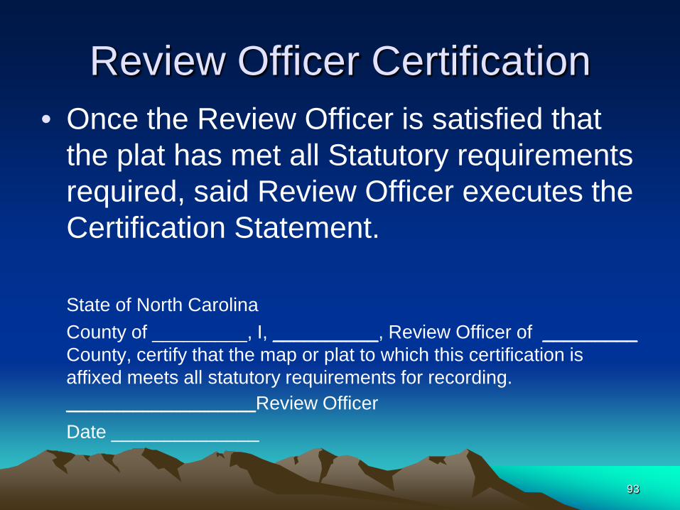
Review Officer Certification • Once the Review Officer is satisfied that
the plat has met all Statutory requirements required, said Review Officer executes the Certification Statement.
State of North Carolina County of _________, I, __________, Review Officer of _________
County, certify that the map or plat to which this certification is affixed meets all statutory requirements for recording.
____________________Review Officer Date ______________
93
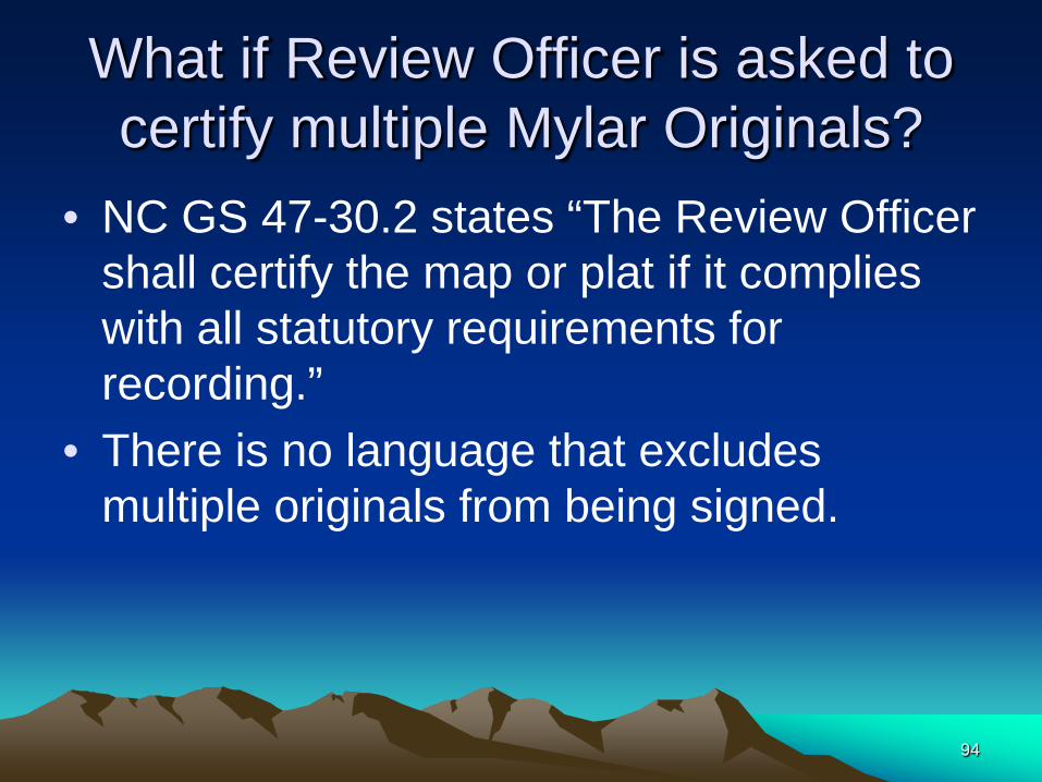
What if Review Officer is asked to certify multiple Mylar Originals?
• NC GS 47-30.2 states “The Review Officer shall certify the map or plat if it complies with all statutory requirements for recording.”
• There is no language that excludes multiple originals from being signed.
94

G.S. § 47-30(g) Recording of Plat
• A Plat if: – Certified Pursuant to 47-30.2 and Presented
for recording • Shall be:
– Recorded in the plat book or plat file and – When so recorded shall be duly indexed.
95
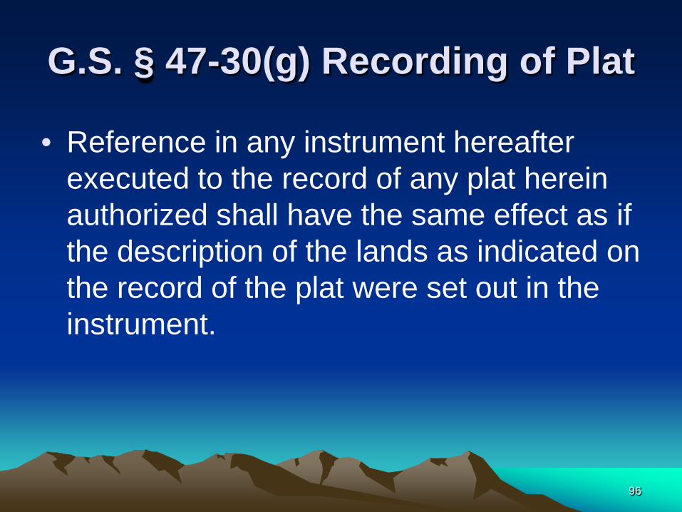
G.S. § 47-30(g) Recording of Plat
• Reference in any instrument hereafter executed to the record of any plat herein authorized shall have the same effect as if the description of the lands as indicated on the record of the plat were set out in the instrument.
96
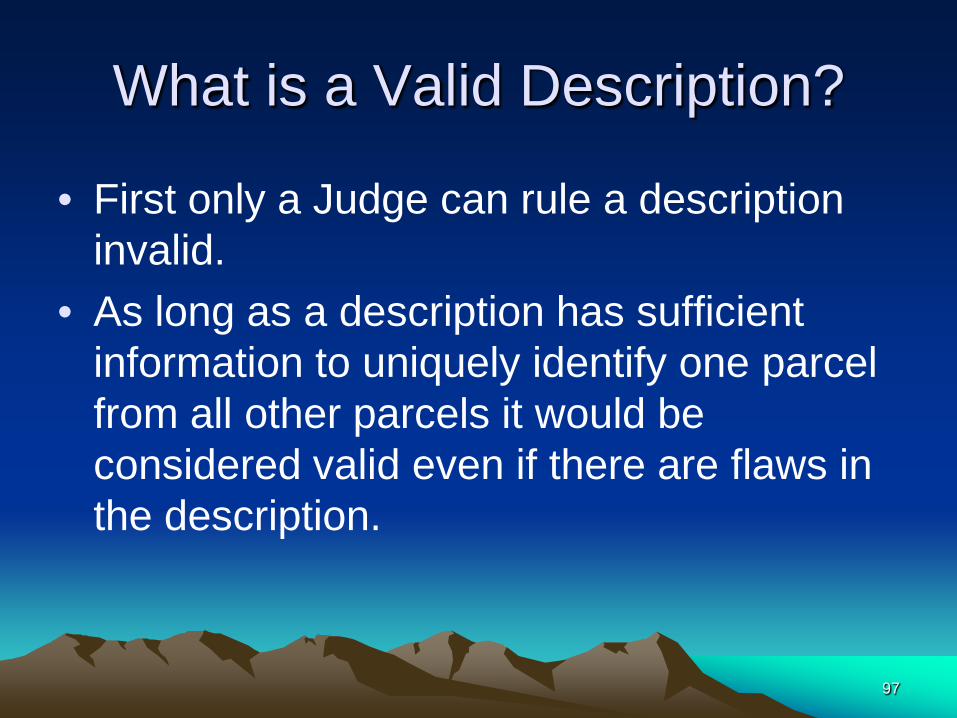
What is a Valid Description?
• First only a Judge can rule a description invalid.
• As long as a description has sufficient information to uniquely identify one parcel from all other parcels it would be considered valid even if there are flaws in the description.
97

What is a Valid Description?
• A deed call for an unrecorded map is sufficient notice for a valid description if said map can be produced.
98

G.S. § 47-30(h), Deceased Surveyor Plat
• Nothing in this section shall be deemed to prevent the filing of any Plat prepared by a Registered Land Surveyor but not recorded before his death may be recorded if: – 1. The plat is presented to the Review Officer and – 2. The presenter proves that the plat was
prepared by the deceased surveyor. – 3. For preservation these plats may be filed
without signature, notary acknowledgement or probate, in a special plat file
99
G.S. § 47-30(h), Deceased Surveyor Plat File
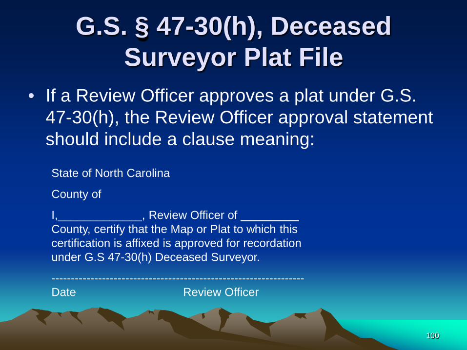
• If a Review Officer approves a plat under G.S. 47-30(h), the Review Officer approval statement should include a clause meaning: State of North Carolina
County of
I,_____________, Review Officer of _________ County, certify that the Map or Plat to which this certification is affixed is approved for recordation under G.S 47-30(h) Deceased Surveyor.
-----------------------------------------------------------------Date Review Officer
100

G.S. § 47-30(h), Deceased Surveyor Plat
• When a Register of Deeds records a survey plat approved under G.S 47-30(h) Deceased Surveyor, it should be so noted in the index description.
101

G.S. § 47-30(i),
• Nothing in this section shall be deemed to invalidate any instrument or the title thereby conveyed making reference to any recorded plat.
102
G.S. § 47-30(j), • The provisions of this section shall not apply to
boundary plats of areas annexed by municipalities nor to plats of municipal boundaries, whether or not required by law to be recorded.
• Surveyors, Even when a plat is not subject to 47-30 remember if you sign and seal a plat you are certifying that the plat meets Board Rules.
• There is no Review Officer review for these plats.
• Size and legibility may be a Register of Deeds’ issue.
103

G.S. § 47-30(k),
• The provisions of this section shall apply to all counties in North Carolina
104
G.S. § 47-30(l),
• This section does not apply to the registration of highway right-of-way plans provided for in G.S. 136-19.4 or G.S. 136-89.184, nor to the registration of roadway corridor official maps provided for in Article 2E of Chapter 136 of the General Statutes.
• No Review Officer Approval Required
105
NC GS 47-30(m) • (m) Maps attached to deeds or other instruments and
submitted for recording in that form must be no larger than 8 1/2 inches by 14 inches and comply with either this subsection or subsection (n) of this section. Such a map shall either
• (i) have the original signature of a registered land surveyor and the surveyor's seal as approved by the State Board of Registration for Professional Engineers and Land Surveyors, or
• (ii) be a copy of a map, already on file in the public records, that is certified by the custodian of the public record to be a true and accurate copy of a map bearing an original personal signature and original seal.
106

Is a NC GS 47-30 (m)(i) “Certified Deed Attachment Plat” Exempt for
47-30 ?
•No!
• See § 47-30.2. Review Officer.
107

§ 47-30.2. Review Officer.
• (c) A map or plat must be presented to the Review Officer unless one or more of the following conditions are applicable:
108
§ 47-30.2. Review Officer. (continued)
• (1) The certificate required by G.S. 47-30(f)(11) shows that the map or plat is a survey within the meaning of G.S. 47-30(f)(11)b. or c.
• (2) The map or plat is exempt from the requirements of G.S. 47-30 pursuant to G.S. 47-30(j) or (l).
• (3) The map is an attachment that is being recorded pursuant to G.S. 47-30(n).
109

Is a NC GS 47-30 (m)(i) “Certified Deed Attachment Plat” Exempt for
47-30 ? • A Certified Deed Attachment plat is not
one of the named exemptions.
• 47-30 (m) waves the Size and Material requirement. All other requirements must be met.
110

NC GS 47-30(m)(i)
• Deed attachment plats with original signature and seal must also have a 47-30 (f)(11) surveyors certification and
• The local jurisdiction and Review Officer sign-offs if required. – Note: The same approval requirements apply to
certified deed attachment plats as to stand-alone plats except the surveyors survey certification may be the 47-30 (d) Certification or the Board Rules Certification.
111

Remember!
• A Certified Deed Attachment Plat has the same legal significance as a Stand Alone Plat and therefore must be processed the same way.
112

NC GS 47-30(m)(ii)
• (ii) be a copy of a map, – already on file in the public records, – that is certified by the custodian of the public
record to be a true and accurate copy of a map bearing an original personal signature and original seal.
113

MINIMUM STANDARDS FOR INDEXING REAL PROPERTY INSTRUMENTS
8.06 Maps Attached to Documents.
• A map or plat that is attached to or a part of a document shall be considered as part of the document and shall not be indexed as a separate map or plat.
114
G.S. § 47-30(n)
• A map that does not meet the requirements of subsection (m) of this section may be attached to a deed or other instrument submitted for recording in that form for illustrative purposes only if it meets both of the following requirements:
115

G.S. § 47-30(n)
• (1) It is no larger than 8 1/2 inches by 14 inches.
• (2) It is conspicuously labeled, "THIS MAP IS NOT A CERTIFIED
SURVEY AND HAS NOT BEEN REVIEWED BY A LOCAL GOVERNMENT AGENCY FOR COMPLIANCE WITH ANY APPLICABLE LAND DEVELOPMENT REGULATIONS."
116

G.S. § 47-30(n)
• The wording must be exact!
117
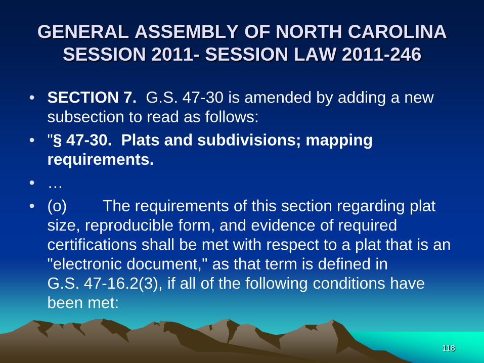
GENERAL ASSEMBLY OF NORTH CAROLINA SESSION 2011- SESSION LAW 2011-246
• SECTION 7. G.S. 47-30 is amended by adding a new subsection to read as follows:
• "§ 47-30. Plats and subdivisions; mapping requirements.
• … • (o) The requirements of this section regarding plat
size, reproducible form, and evidence of required certifications shall be met with respect to a plat that is an "electronic document," as that term is defined in G.S. 47-16.2(3), if all of the following conditions have been met:
118
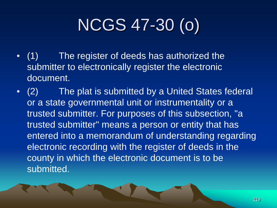
NCGS 47-30 (o)
• (1) The register of deeds has authorized the submitter to electronically register the electronic document.
• (2) The plat is submitted by a United States federal or a state governmental unit or instrumentality or a trusted submitter. For purposes of this subsection, "a trusted submitter" means a person or entity that has entered into a memorandum of understanding regarding electronic recording with the register of deeds in the county in which the electronic document is to be submitted.
119

NCGS 47-30 (o)
• (3) Evidence of required certifications appear on the digitized image of the document as it will appear on the public record.
• (4) With respect to a plat submitted by a trusted submitter, the digitized image of the document as it will appear on the public record contains the submitter's name in the following completed statement on the first page of the document image: "Submitted electronically by – – – – – – – (submitter's name) in compliance with North Carolina statutes governing recordable documents and the terms of the submitter agreement with the – – – – – (insert county name) County Register of Deeds.
120

NCGS 47-30 (o) (4)
• This statement must appear on the first page of the document image submitted electronically for recordation.
• "Submitted electronically by ___ (submitter's name) in compliance with North Carolina statutes governing recordable documents and the terms of the submitter agreement with the ___ (insert county name) County Register of Deeds." 121
NCGS 47-30 (o)
• (5) Except as otherwise provided in this subsection, the digitized image of the plat conforms to all other applicable laws and rules that prescribe recordation."
122
Review of a plat submitted electronically. • If a Register of Deeds has elected to receive documents
electronically, and – If “plats” is one of the document types that is
excepted, and – If the submitter is authorized by the register to submit
electronically and – If the submitter has fulfilled the requirements in NC
GS 47-14. • Then the review process for an electronically
submitted document is the same as that of a paper document.
123

What if the Review Officer is asked to sign paper copies?
• NC GS 47-30(g) states: “A plat, when certified pursuant to G.S. 47-30.2 and presented for recording, shall be recorded in the plat book or plat file and when so recorded shall be duly indexed”
• Paper Copies (except under 47-30(m)) do not meet 47-30 requirements for recordation.
124

Definition - Conformed Copy
• An exact copy of a document on which has written explanations of things that could not nor were not copied; e.g. written signature might be replaced on the conformed copy with notation that is was signed by the person whose signature appears on the original.
• (Black’s Law Dictionary, Fifth Edition, West Publishing Company)
125
Conformed Copy
• Review Officer, upon request, should annotate the paper copies by filling out the Review Officer Statement, but instead of signing the statement, insert the words “Conformed Copy” and his or her initials in the signature block.
126

Example State of North Carolina County of No Where, I Thomas W. Morgan,
Review Officer of No Where County, certify that the map or plat to which this certification is affixed meets all statutory requirements for recording.
Conformed Copy TWM Review Officer Date10/26/2010
127

Condominiums Exempt from 47-30
• § 47C-2-109. Plats and plans. • (a) The declarant shall file with the
register of deeds in each county where the condominium is located the condominium's plat or plan prepared in accordance with this section.
128

Protected Mountain Ridges Maps: Exempt from 47-30
• NC GS §113A-212 – The map, drawing, or document identifying the
protected mountain ridge crests shall be permanently filed by the Secretary of Environment and Natural Resources with the register of deeds in the county where the land lies.
129

Additional Information • UNC School of Government Bulletin
“Land Records-Number 32, October 2006” • Free Down load from: http://shopping.netsuite.com/s.nl/c.433425/sc.7/category.
52/.f And
• Guidebook for North Carolina Property
Mappers, 2001 for $14.00 http://shopping.netsuite.com/s.nl?c=433425&sc=7&categ
ory=3&search=%20property%20mappers
130

Contact Information
North Carolina Department of the Secretary of State Elaine F. Marshall, Secretary of State Web Site - www.sosnc.com Instructor: Thomas W. Morgan, Land Records Manager
[email protected] 919-807-2268 P.O. Box 29626 Raleigh, NC 27626-0626
131

132

Appendix - A Review Officer Statutory Requirements:
• N.C. G.S. 47-30 Plats and subdivision Requirements
• N.C. G.S. 47-30.2 Review Officer (Statutory Requirements)
• N.C. G.S. 136-102.6 Compliances of subdivision streets with minimum standards of the Board of Transportation required of developers.
133
Review Officer Statutory Requirements (continued)
• N.C. G.S. 153A-332 Ordinance to contain Procedure for Plat Approval; Approval prerequisite to plat recordation; statement by owner (County) Local signoff
• N.C. G.S. 160A-373 Ordinance to contain Procedure for Plat Approval; Approval prerequisite to plat recordation; statement by owner (Municipality) Local signoff
• N.C. G.S. 39-32.3 Recordation of plat showing control corners
134

Appendix – B Review Officer Exempt Statutes:
• N.C. G.S. 47-30(j) Municipal Annexations and Boundaries
• N.C. G.S. 47C-109 Plats and Plans (Condominiums)
• N.C. G.S. 136-19.4 Registration of right-of-way plans (DOT) N.C. G.S. 47-30(l)
• N.C. G.S. 136-44.50 Transportation corridor official map act (DOT) N.C. G.S. 47-30(l)
• N.C. G.S. 47-30(n) Non-certified deed attachment plat with statement.
• N.C. G.S. 47-30(f)(11) b. or c.
135