CORINTHIA PROJECT · MINING PROPOSAL Corinthia Project P a g e | 6 1 INTRODUCTION The Southern...
102
CORINTHIA PROJECT MINING PROPOSAL 6 NOVEMBER 2018 DOCUMENT ID: ADA-COR-MPR-02_REVB EGS: S0232164 CONTACT: CLAY GORDON – GROUP GEOLOGIST EMAIL: CLAY.GORDON@ADAMANRESOURCES.COM.AU PHONE: (61) 427 491 680 STREET ADDRESS: LEVEL 3, 140 ST GEORGES TERRACE, PERTH, WA, 6000 POSTAL ADDRESS: PO BOX 7515, CLOISTERS SQUARE, PERTH, WA, 6850
Transcript of CORINTHIA PROJECT · MINING PROPOSAL Corinthia Project P a g e | 6 1 INTRODUCTION The Southern...

P a g e | i
CORINTHIA PROJECT MINING PROPOSAL
6 NOVEMBER 2018
DOCUMENT ID: ADA-COR-MPR-02_REVB
EGS: S0232164 CONTACT: CLAY GORDON – GROUP GEOLOGIST
EMAIL: [email protected] PHONE: (61) 427 491 680
STREET ADDRESS: LEVEL 3, 140 ST GEORGES TERRACE, PERTH, WA, 6000 POSTAL ADDRESS: PO BOX 7515, CLOISTERS SQUARE, PERTH, WA, 6850

MINING PROPOSAL Corinthia Project
P a g e | ii
Document prepared for:
ADAMAN RESOURCES PTY LTD Contact Person: Clay Gordon – Group Geologist Email: [email protected] Phone: +61 427 491 680 Street Address: Level 3, 140 St Georges Terrace, Perth, WA, 6000 Postal Address: PO Box 7515, Cloisters Square, Perth, WA, 6850 Document developed by:
PRESTON CONSULTING PTY LTD
Contact Person Phil Scott – Director Email: [email protected] Website: www.prestonconsulting.com.au Phone: +61 8 9221 0011 Fax: +61 8 9221 4783 Street Address: Level 3, 201 Adelaide Terrace, East Perth WA 6004 Postal Address: PO Box 3093, East Perth WA 6892 Disclaimer This Report has been prepared on behalf of and for the exclusive use of Adaman Resources Pty Ltd and is subject to and issued in accordance with the agreement between Preston Consulting Pty Ltd and Adaman Resources Pty Ltd. Preston Consulting Pty Ltd accepts no liability or responsibility whatsoever for or in respect of any use of or reliance upon this Report by any third party.
Copying of any part of this Report without the express permission of Preston Consulting Pty Ltd and Adaman Resources Pty Ltd is not permitted.

MINING PROPOSAL Corinthia Project
P a g e | iii
CONTENTS LIST OF FIGURES ............................................................................................................................................... V
LIST OF TABLES ................................................................................................................................................ V
LIST OF APPENDICES ...................................................................................................................................... V
1 INTRODUCTION ................................................................................................................................ 6
2 MINING PROPOSAL CHECKLIST .................................................................................................. 8
3 SUMMARY AND COMMITMENTS ............................................................................................. 12
4 BACKGROUND INFORMATION ................................................................................................. 16
Ownership ................................................................................................................................................................ 16
Project Objectives ................................................................................................................................................. 18
Location and Site Layout Plans ...................................................................................................................... 18
History ........................................................................................................................................................................ 21
Existing Facilities .................................................................................................................................................. 21
5 EXISTING ENVIRONMENT .......................................................................................................... 22
Regional Setting .................................................................................................................................................... 22
Geology ...................................................................................................................................................................... 22
Acid Generation from Waste Rock and Tailings ..................................................................................... 24
Soils and Soil Profiles .......................................................................................................................................... 24
Hydrology ................................................................................................................................................................. 27
SURFACE WATER ....................................................................................................................................................... 27
GROUNDWATER ......................................................................................................................................................... 29
Climate ....................................................................................................................................................................... 29
Flora and Fauna .................................................................................................................................................... 30
FLORA AND VEGETATION ........................................................................................................................................ 30
WEEDS .......................................................................................................................................................................... 31
FAUNA ........................................................................................................................................................................... 32
FERAL ANIMALS ......................................................................................................................................................... 34
Social Environment .............................................................................................................................................. 34
European Heritage ................................................................................................................................................ 34
Aboriginal Heritage .............................................................................................................................................. 34
6 PROJECT DESCRIPTION .............................................................................................................. 34
Area of Disturbance Table ................................................................................................................................ 35
Mining Operations ................................................................................................................................................ 36
Mine Design .............................................................................................................................................................. 37
Waste Rock ............................................................................................................................................................... 37
Dewatering ............................................................................................................................................................... 37

MINING PROPOSAL Corinthia Project
P a g e | iv
Ore Processing ........................................................................................................................................................ 40
Tailings Storage .................................................................................................................................................... 40
Support Facilities .................................................................................................................................................. 40
Workforce ................................................................................................................................................................. 40
Transportation Corridors ................................................................................................................................. 40
Resource Requirement and Regional Infrastructure ........................................................................... 40
Water Supply ........................................................................................................................................................... 40
Power Supply ........................................................................................................................................................... 41
Compliance with Legislation and Other Approvals .............................................................................. 41
7 ENVIRONMENTAL IMPACTS AND MANAGEMENT ............................................................. 42
Risk Assessment ..................................................................................................................................................... 44
Land Clearing ......................................................................................................................................................... 47
Water .......................................................................................................................................................................... 47
Surface Water .......................................................................................................................................................... 47
Groundwater ............................................................................................................................................................ 47
Flora, Fauna and Ecosystem ............................................................................................................................ 49
Topsoil and Soil Profiles .................................................................................................................................... 50
Domestic and Industrial Waste Products .................................................................................................. 50
Waste Rock and Tailings Management ...................................................................................................... 50
Hydrocarbon Management .............................................................................................................................. 50
Dangerous Goods and Hazardous Substances ........................................................................................ 52
Atmospheric Pollution and Noise .................................................................................................................. 52
Air Emissions (Dust) ............................................................................................................................................. 52
Noise ............................................................................................................................................................................ 52
8 SOCIAL IMPACTS ........................................................................................................................... 53
Heritage..................................................................................................................................................................... 53
Land Use and Community ................................................................................................................................. 53
Stakeholder Engagement ................................................................................................................................... 53
Social Environment .............................................................................................................................................. 56
Workforce Induction and Training .............................................................................................................. 56
9 MINE CLOSURE .............................................................................................................................. 56
10 GLOSSARY........................................................................................................................................ 56
11 REFERENCES ................................................................................................................................... 58
12 APPENDICES ................................................................................................................................... 60

MINING PROPOSAL Corinthia Project
P a g e | v
LIST OF FIGURES
Figure 1: Location Map. .................................................................................................................................................. 7
Figure 2: Project Tenure .............................................................................................................................................. 17
Figure 3: Site Layout ...................................................................................................................................................... 19
Figure 4: Dewatering pipeline route ....................................................................................................................... 20
Figure 5: Regional geology .......................................................................................................................................... 23
Figure 6: Soils Map (from DPIRD, 2018) .............................................................................................................. 26
Figure 7: Topography and Surface Water Drainage ........................................................................................ 28
Figure 8: Southern Cross Airfield climate statistics (BOM, 2018). ............................................................ 30
Figure 9: Underground mining schematics – Current underground ......................................................... 38
Figure 10: Underground mining schematics – Proposed underground. .................................................. 39
Figure 11: Location of dewatering pipeline catchment pits.......................................................................... 48
LIST OF TABLES
Table 1: Mining Proposal Checklist ........................................................................................................................... 8
Table 2: Project Description ....................................................................................................................................... 12
Table 3: Commitments .................................................................................................................................................. 13
Table 4: Key Environmental Factors ....................................................................................................................... 14
Table 5: Project tenements ......................................................................................................................................... 16
Table 6: Soil sub-systems............................................................................................................................................. 24
Table 7: Fauna of Conservation Significance Records within 20 km radius of Corinthia (Botanica
Consulting, 2015) ............................................................................................................................................................ 33
Table 8: Area of disturbance ...................................................................................................................................... 36
Table 9: Environmental legislative framework .................................................................................................. 41
Table 10: Likelihood Definitions ............................................................................................................................. 43
Table 11: Consequence Definitions ........................................................................................................................ 43
Table 12: Risk rating matrix ...................................................................................................................................... 44
Table 13: Environmental Risk Register ................................................................................................................. 45
Table 14: Stakeholder engagement register ........................................................................................................ 54
LIST OF APPENDICES
Appendix 1: Authorisation from Tianye SXO Gold Mining Pty to dewater to the Pilot Pit
Appendix 2: Aboriginal Heritage Inquiry System database query.
Appendix 3: Corinthia and Pilot Pit water sample analysis
Appendix 4: PMST and NatureMap search results
Appendix 5: Haulage agreement with Shire of Yilgarn
MINING PROPOSAL Corinthia Project
P a g e | 6
1 INTRODUCTION
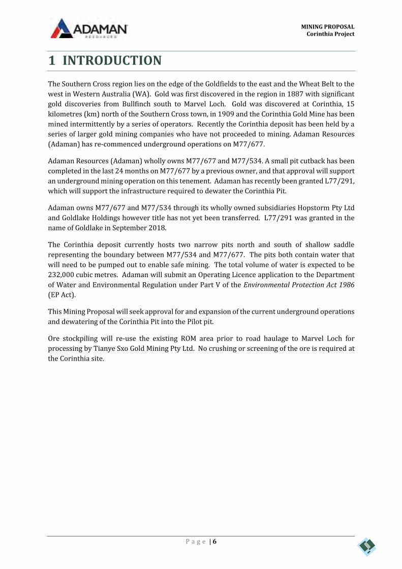
The Southern Cross region lies on the edge of the Goldfields to the east and the Wheat Belt to the
west in Western Australia (WA). Gold was first discovered in the region in 1887 with significant
gold discoveries from Bullfinch south to Marvel Loch. Gold was discovered at Corinthia, 15
kilometres (km) north of the Southern Cross town, in 1909 and the Corinthia Gold Mine has been
mined intermittently by a series of operators. Recently the Corinthia deposit has been held by a
series of larger gold mining companies who have not proceeded to mining. Adaman Resources
(Adaman) has re-commenced underground operations on M77/677.
Adaman Resources (Adaman) wholly owns M77/677 and M77/534. A small pit cutback has been
completed in the last 24 months on M77/677 by a previous owner, and that approval will support
an underground mining operation on this tenement. Adaman has recently been granted L77/291,
which will support the infrastructure required to dewater the Corinthia Pit.
Adaman owns M77/677 and M77/534 through its wholly owned subsidiaries Hopstorm Pty Ltd
and Goldlake Holdings however title has not yet been transferred. L77/291 was granted in the
name of Goldlake in September 2018.
The Corinthia deposit currently hosts two narrow pits north and south of shallow saddle
representing the boundary between M77/534 and M77/677. The pits both contain water that
will need to be pumped out to enable safe mining. The total volume of water is expected to be
232,000 cubic metres. Adaman will submit an Operating Licence application to the Department
of Water and Environmental Regulation under Part V of the Environmental Protection Act 1986
(EP Act).
This Mining Proposal will seek approval for and expansion of the current underground operations
and dewatering of the Corinthia Pit into the Pilot pit.
Ore stockpiling will re-use the existing ROM area prior to road haulage to Marvel Loch for
processing by Tianye Sxo Gold Mining Pty Ltd. No crushing or screening of the ore is required at
the Corinthia site.

CREATED DATE REVISIONJOB
!( !(
!(
!(
!(
G
G
G
SHIREOF YILGARN
SHIRE OFWESTONIA
CORINTHIA MINE PEARCE RD
Baladjie Lake
Lake Julia
Lake Koorkoordine
Copperhead Mine
Hopes Hill Mine
Frasers Gold Mine
Noongar
Baladjie Bullfinch
Moorine Rock
Southern Cross
BULLFINCH RD
GREAT EASTERN H WY
NOON
GAR
NORT
HRD
TURK
EY H
ILL R
D
CORINTHIA WEST RD
PRIC
E RD
NARL
A SOU
TH R
D
GARRETT RDCA
IRNS
RD
KING RDMT JACKSON RD
NARLA LOOP
BEATON RD
KOORDA - BULLFINCH RD
PARKER RD DAIRY
RD
GRANICH RD
CORINTHIA EAST RD
GREENSILL RD
NEWB
URY R
D
BULLFINCH - TURKEY HILL RD
GUER
INI R
D
MOORINE ROCK RD
EACOTT RD
BULL
FINCH
- EVA
NSTO
N RD
VERSACE RD
TRAIL RD
PERILYA - TURKEY HILL RD
MURRAY RD
LIDDELL RDUNKOVICH RD
NULL
ANUL
LA N
ORTH
RD
GO LDEN VA LLEY RD
ROBERTS RD
WITH
ERS F
IND
NORT
H RD
TURN
ER RD
MT ADAM RD
DELLA - BOSCA RD
MEHARRY RD
CORINTHIA - TURKEY HILL RD
ROGE
R SNO
RTH RD
NICH
O LSO
NRD
RACKICH RD
PAS IN
I RD
MOORINE ROCK RD
GARRETT RD
BEATON RD
EACOTT RD
681517
681517
701517
701517
721517
721517 6528
419
6548
419
6548
419
6568
419
6568
419
±
ENVIRONMAPS PC2900078 31/01/2018
Source: Orthophoto - LandgateTopography - Geoscience Australia
0Client:
COPY
RIGH
T: TH
IS D
OCUM
ENT
IS AN
D SH
ALL R
EMAI
N TH
E PR
OPER
TY O
F PRE
STON
CON
SULT
ING.
THIS
DOC
UMEN
T MAY
ONL
Y BE
USE
D FO
R TH
E PU
RPOS
E FOR
WHI
CH IT
WAS
COM
MISS
IONE
D AN
D IN
ACCO
RDAN
CE W
ITH TH
E TE
RMS
OF E
NGAG
EMEN
T FOR
THE
COMM
ISSI
ON. P
REST
ON C
ONSU
LTIN
G DO
ES N
OT H
OLD
ANY R
ESPO
NSIBI
LITY F
OR TH
E MIS
USE
OF TH
IS D
OCUM
ENT.
- NOTE THAT POSITION ERRORS CAN BE >5M IN SOME AREAS
LegendLocal Government Authority BoundaryRoadRailwayWaterbody
LOCALITY
C:\GIS\Jobs\Preston Consulting\PC2900078 - Corinthia Pit Cutback\Figures\PC2900078_Location Map_180131.mxd!
!
!
!!
COOLGARDIE
PERTH
ALBANY
ESPERANCE
KALGOORLIE
Scale: 1:250,000 @ A4
0 5 102.5Kilometres
0 10050km
hjockel
Text Box
Figure 1: Location Map.

MINING PROPOSAL Corinthia Project
P a g e | 8
2 MINING PROPOSAL CHECKLIST
Table 1 provides the completed Mining Proposal Checklist for the Project in accordance with the
Department of Mines, Industry Regulation and Safety’s (DMIRS’s) 2006 Mining Proposal
Guidelines (DMP, 2006).
Table 1: Mining Proposal Checklist
Question No.
Mining Proposal Checklist Y / N / NA Page No. Comments
Public availability
1. Are you aware that this Mining Proposal is publicly availability?
Y 8
2. Is there any information in this mining proposal that should not be publicly available?
N
3. If ‘No’ to Q2, do you have any problems with the information contained within this Mining Proposal being publicly availability?
N
4. If ‘Yes’ to Q2, has confidential information been submitted in a separate document / section?
NA
5. Has the Mining Proposal been endorsed? (See last page Checklist.)
Y 11
Mining Proposal Details
6. Have you included the tenement number(s), site name, proposal overview and date in the title page?
Y Title page Addition of L 77/291 for dewatering pipeline
7. Who Authored the Mining Proposal?
Original Mining Proposal: Corinthian Mining Pty Ltd– Lauren Pick
Amendment: Preston Consulting Pty Ltd – Harry Jockel
8. State who to contact for enquiries about the Mining Proposal?
Preston Consulting Pty Ltd – Harry Jockel
9. How many copies were submitted to DoIR?
Hard Copies = 0
Electronic = 1
10. Is this Mining Proposal to support lease application?
N NA No change
11. Has a Geological Resource Statement been included (refer section 4.3.2 of Mining Proposal Guidelines)
N NA No change
12. Will more than 10 million tonnes of ore and waste be extracted per year? State total tonnage:
240, 000 tonnes per annum (tpa) total
N 36 Total ore extraction will be 1.2 Million tonnes.

MINING PROPOSAL Corinthia Project
P a g e | 9
Question No.
Mining Proposal Checklist Y / N / NA Page No. Comments
13. Will more than 2 million tonnes or ore be processed per year? State total throughput:
240,000 tpa
N 36 Total throughput of 240,000 tpa..
14. Is the Mining Proposal located on pre-1899 Crown Grant Land? (not subject to the Mining Act 1978)
N 16
15. Is the Mining Proposal located on Reserve Land? If ‘Yes’ state the Reserve types below:
N 16
16. Will the Mining Proposal occur within or affect a declared occupied townsite?
N 16
17. Is the Mining Proposal within 2 km of the coastline or a Private Conservation Reserve?
N 16
18. Is the Mining Proposal wholly or partially within a World Heritage Property, Biosphere Reserve, Heritage Site or Soil Reference Site.
N 16
Tenement Details
19. Are all mining operations within granted or applied for tenement boundaries?
Y 16 All operations are within Mining Act tenure
20. Are you the tenement holder of all tenements?
Y 16 Adaman Resources owns all the necessary tenure for all activities proposed
21. If ‘No’ at 20, do you have written authorisation from the tenement holder(s) to undertake the Mining Proposal activities? (Refer to section 4.2.1 of the Mining Proposal Guidelines)
N/A N/A
22. Is ‘Yes’ at 21, then is a copy of the authorisation contained within the Mining Proposal?
N/A N/A
23. Have you checked for compliance against tenement conditions?
Y N/A Adaman Resources has reviewed all tenement conditions and confirmed that activities in this Mining Proposal are compliant.
Location and Site Layout Plans
24. Have you included location plans showing tenement boundaries and mining operations?
Y 16
25. Have you included site layout plans showing all mining operations and infrastructure in relation to tenement boundaries?
Y 18
26. Have you included “Area of Disturbance Tables” for all tenements impacted by mining operations?
Y 35

MINING PROPOSAL Corinthia Project
P a g e | 10
Question No.
Mining Proposal Checklist Y / N / NA Page No. Comments
Environmental Protection Act 27. Does the Mining Proposal require
referral under Part IV or the MOU? If ‘Yes’ describe why in space below:
N N/A
28. Has the EPA set a level of assessment? If yes state:
N/A N/A
29. Is a clearing permit required? If ‘No’ then explain why in space below?
N 34 Only minor clearing required. Will be kept below 10 ha exemption.
30. If ‘Yes’ at Q29 then has a permit been applied for?
N/A N/A
31. Is a Works Approval required by the DEC (formerly DoE)?
N 41 Not required.
32. Has a Works Approval application been submitted to the DEC (formerly DoE)?
N 41 Not required.
Stakeholder Consultation
33. Have the following stakeholders been consulted? (use N/A if not applicable)
Y 53
Shire? Y 53
Pastoralist? Y 53
DEC (formerly CALM)? Y 53
Main Roads? Y 53
Others? (Specify):
Water Corporation
Y 53
34. Is the Mining Proposal wholly or partially within DEC (formerly CALM) managed areas?
N N/A
35. If ‘yes’ at Q34 has DEC (formally CALM) been consulted?
N/A N/A
36. Is the Mining Proposal wholly or partially within a Red Book Area or a Bush Forever Site?
N N/A
37. Will the Mining Proposal impact upon a Water Resource Area, Water Reserve, declared or proposed catchment, Groundwater Protection Area, significant lake or Wetland?
N N/A
38. Is a water or de-watering licence required?
Y 41 A 5C licence has already been approved for the existing site (GWL 179464)
39. If ‘Yes’ at Q38 then has the licence(s) application been submitted?
Y 41 A 5C licence has already been approved for the existing site (GWL 179464)
40. Does the Mining Proposal include a new tailings storage facility or changes to existing tailings storage facility?
N N/A No tailings stored on site

MINING PROPOSAL Corinthia Project
P a g e | 12
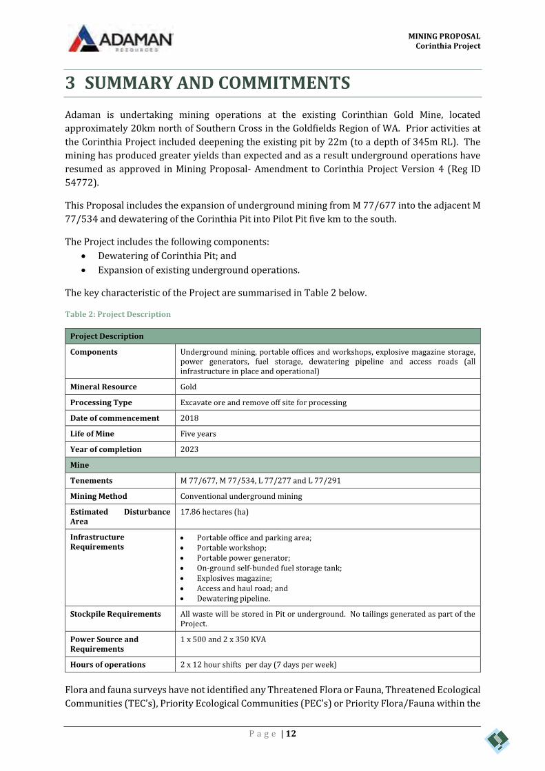
3 SUMMARY AND COMMITMENTS
Adaman is undertaking mining operations at the existing Corinthian Gold Mine, located
approximately 20km north of Southern Cross in the Goldfields Region of WA. Prior activities at
the Corinthia Project included deepening the existing pit by 22m (to a depth of 345m RL). The
mining has produced greater yields than expected and as a result underground operations have
resumed as approved in Mining Proposal- Amendment to Corinthia Project Version 4 (Reg ID
54772).
This Proposal includes the expansion of underground mining from M 77/677 into the adjacent M
77/534 and dewatering of the Corinthia Pit into Pilot Pit five km to the south.
The Project includes the following components:
Dewatering of Corinthia Pit; and
Expansion of existing underground operations.
The key characteristic of the Project are summarised in Table 2 below.
Table 2: Project Description
Project Description
Components Underground mining, portable offices and workshops, explosive magazine storage, power generators, fuel storage, dewatering pipeline and access roads (all infrastructure in place and operational)
Mineral Resource Gold
Processing Type Excavate ore and remove off site for processing
Date of commencement 2018
Life of Mine Five years
Year of completion 2023
Mine
Tenements M 77/677, M 77/534, L 77/277 and L 77/291
Mining Method Conventional underground mining
Estimated Disturbance Area
17.86 hectares (ha)
Infrastructure Requirements
Portable office and parking area; Portable workshop; Portable power generator; On-ground self-bunded fuel storage tank; Explosives magazine; Access and haul road; and Dewatering pipeline.
Stockpile Requirements All waste will be stored in Pit or underground. No tailings generated as part of the Project.
Power Source and Requirements
1 x 500 and 2 x 350 KVA
Hours of operations 2 x 12 hour shifts per day (7 days per week)
Flora and fauna surveys have not identified any Threatened Flora or Fauna, Threatened Ecological
Communities (TEC’s), Priority Ecological Communities (PEC’s) or Priority Flora/Fauna within the
MINING PROPOSAL Corinthia Project
P a g e | 13
Corinthia Project tenement. The Project has no recorded sites of European Heritage significance
or Aboriginal Heritage significance.
Acid generating materials are not expected to have any impacts as all waste material will be stored
in the Pit or underground.
Development of the project provides increased opportunities for local employment.
Environmental effects from mining activities, such as dust generation, erosion and waste
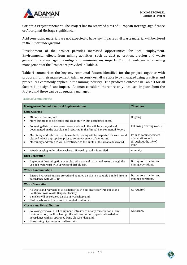
generation are managed to mitigate or minimise any impacts. Commitments made regarding
management of the Project are provided in Table 3.
Table 4 summarises the key environmental factors identified for the project, together with
proposals for their management. Adaman considers all are able to be managed using practices and
procedures commonly applied in the mining industry. The predicted outcome in Table 4 for all
factors is no significant impact. Adaman considers there are only localised impacts from the
Project and these can be adequately managed.
Table 3: Commitments
Management Commitment and Implementation Timelines
Land Clearing
Minimise clearing; and Mark our areas to be cleared and clear only within designated areas.
Ongoing
Following disturbance cleared areas and stockpiles will be surveyed and documented on the site plan and reported in the Annual Environmental Report.
Following clearing works
Machinery and vehicles used to conduct clearing will be inspected for weeds and cleaned where appropriate prior to commencement of works; and
Machinery and vehicles will be restricted to the limits of the area to be cleared.
Prior to commencement of operations and throughout the life of mine
Weed spraying undertaken each year if weed spread is identified. Annually
Dust Generation
Implement dust mitigation over cleared areas and hardstand areas through the use of a water cart with sprays and dribble bar.
During construction and mining operations.
Water Contamination
Ensure hydrocarbons are stored and handled on site in a suitable bunded area in accordance with AS1940.
During construction and mining operations.
Waste Generation
All waste and recyclables to be deposited in bins on site for transfer to the Southern Cross Waste Disposal Facility;
Vehicles will be serviced on site in workshop; and Hydrocarbons will be stored in bunded containers.
As required
Closure and Rehabilitation
Following removal of all equipment, infrastructure any remediation of any contamination, the final land profile will be contour ripped and seeded in accordance with an approved Mine Closure Plan; and
Dewatering pipeline removed from site.
At closure.

MINING PROPOSAL Corinthia Project
P a g e | 14
Table 4: Key Environmental Factors
Environmental Factor Existing Environment Potential Impacts Environmental Management Predicted Outcome
Biodiversity The Project is located in the Southern Cross subregion, which is characterized by Eucalypt woodlands.
Very minor reduction in biological diversity impact at the local level due to land clearing. All areas to be cleared have previously been disturbed.
Clearing of native vegetation will be kept to a practical minimum.
Rehabilitation of mined areas to return native vegetation and habitat for native fauna.
No significant impact on biodiversity
Vegetation Vegetation and flora studies have been conducted over the project site.
There are no TEC’s or PEC’s recorded in the project site. All areas to be cleared already degraded by historic mining.
The proposal will result in minimal native vegetation being cleared.
Very minor reduction in abundance of vegetation due to clearing.
Clearing of native vegetation will be kept to a practical minimum
No significant impact on vegetation
Flora Flora species are well represented in the wider region.
Very minor impact to flora from clearing.
Clearing of native vegetation will be kept to a practical minimum
No significant impact on flora
Significant Flora No Threatened or Priority Flora taxon identified within the Corinthian Project area
No impact to significant flora. Clearing of native vegetation will be kept to a practical minimum
No significant impact on significant flora
Weeds Two introduced exotic plant species, neither of which are Declared Plant Species.
Machinery and equipment may introduce and spread weeds in the Project area
Implement procedures to clean down equipment and site inspection to identify weed infestations.
No introduction or spread of significant weeds
Fauna No Fauna species unique to the Project disturbance area.
The proposal will result in minimal habitat being cleared.
Rehabilitation of mined areas to return native vegetation and habitat for native fauna.
No significant impact on threatened fauna.
Surface water Quality / Quantity No significant drainage lines within the Project Area
No additional alteration to drainage lines.
Re-contour disturbance following mining to reinstate natural surface drainage.
No significant impact to on surface water.
Groundwater Quality / Quantity Groundwater is approximately 61m below ground level, saline and acidic.
Localised temporary depression of water table during underground mining and dewatering.
Dewatering of local groundwater during operations
Bulk hydrocarbons are to be stored in bunded facilities.
No long-term impact on ground water

MINING PROPOSAL Corinthia Project
P a g e | 15
Mine Waste Historic re-processed tailings represent on site.
Erosion/sedimentation into surrounding environment
All waste material will be stored in the Pit or underground. No tailings generator from the Project.
No significant impact.
Aboriginal and Cultural Heritage No aboriginal or European heritage registered sites within the Project area.
No potential impact. No specific management required. No significant impact.
MINING PROPOSAL Corinthia Project
P a g e | 16
4 BACKGROUND INFORMATION
OWNERSHIP
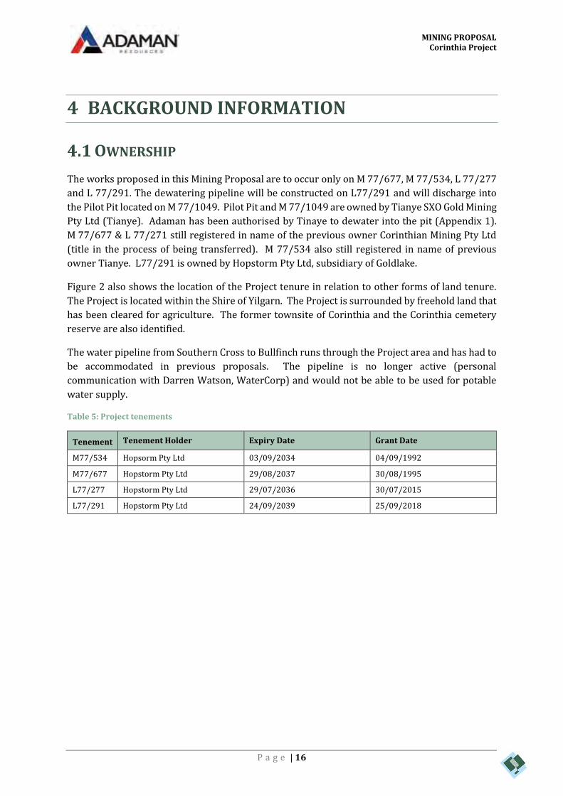
The works proposed in this Mining Proposal are to occur only on M 77/677, M 77/534, L 77/277
and L 77/291. The dewatering pipeline will be constructed on L77/291 and will discharge into
the Pilot Pit located on M 77/1049. Pilot Pit and M 77/1049 are owned by Tianye SXO Gold Mining
Pty Ltd (Tianye). Adaman has been authorised by Tinaye to dewater into the pit (Appendix 1).
M 77/677 & L 77/271 still registered in name of the previous owner Corinthian Mining Pty Ltd
(title in the process of being transferred). M 77/534 also still registered in name of previous
owner Tianye. L77/291 is owned by Hopstorm Pty Ltd, subsidiary of Goldlake.
Figure 2 also shows the location of the Project tenure in relation to other forms of land tenure.
The Project is located within the Shire of Yilgarn. The Project is surrounded by freehold land that
has been cleared for agriculture. The former townsite of Corinthia and the Corinthia cemetery
reserve are also identified.
The water pipeline from Southern Cross to Bullfinch runs through the Project area and has had to
be accommodated in previous proposals. The pipeline is no longer active (personal
communication with Darren Watson, WaterCorp) and would not be able to be used for potable
water supply.
Table 5: Project tenements
Tenement Tenement Holder Expiry Date Grant Date
M77/534 Hopsorm Pty Ltd 03/09/2034 04/09/1992
M77/677 Hopstorm Pty Ltd 29/08/2037 30/08/1995
L77/277 Hopstorm Pty Ltd 29/07/2036 30/07/2015
L77/291 Hopstorm Pty Ltd 24/09/2039 25/09/2018

CREATED DATE REVISIONJOB
CORINTHIA PIT
PILOT PIT
CORINTHIATOWNSITE
CEMETERYCEMETERYRESERVERESERVE
M 77/534
M 77/677
L 77/291
L 77/277
L 77/272
E 77/2211
E 77/2522
P 77/4341
P 77/4340P 77/4015
P 77/4336
E 77/2211
P 77/4339
P 77/4335
M 77/1049
PEARCE RD
BULLFINCH RD
PARKER RD
HOPES HILL - CORINTHIA RD
CORINTHIA WEST RD CORINTHIAN RD
CORINTHIA EAST RD
CORINTHIA - TURKEY HILL RD712000
712000
714000
714000
6550
000
6550
000
6552
000
6552
000
6554
000
6554
000
6556
000
6556
000
±
ENVIRONMAPS PC2900078 2/10/2018
Source: Mining Tenement - DMIRS
0Client:
COPY
RIGH
T: TH
IS D
OCUM
ENT
IS AN
D SH
ALL R
EMAI
N TH
E PR
OPER
TY O
F PRE
STON
CON
SULT
ING.
THIS
DOC
UMEN
T MAY
ONL
Y BE
USE
D FO
R TH
E PU
RPOS
E FOR
WHI
CH IT
WAS
COM
MISS
IONE
D AN
D IN
ACCO
RDAN
CE W
ITH TH
E TE
RMS
OF E
NGAG
EMEN
T FOR
THE
COMM
ISSI
ON. P
REST
ON C
ONSU
LTIN
G DO
ES N
OT H
OLD
ANY R
ESPO
NSIBI
LITY F
OR TH
E MIS
USE
OF TH
IS D
OCUM
ENT.
- NOTE THAT POSITION ERRORS CAN BE >5M IN SOME AREAS
LegendMining Tenement of InterestMining TenementCadastreCorinthia TownsiteCemetery ReserveRoad
EXISTING SITE
C:\GIS\Jobs\Preston Consulting\PC2900078 - Corinthia Pit Cutback\Figures\PC2900078_Corinthia Pit to Pilot Pit_181002.mxd!
!
!
!!
COOLGARDIE
PERTH
ALBANY
ESPERANCE
KALGOORLIE
Scale: 1:30,000 @ A4
0 500 1,000250Metres
0 10050km
hjockel
Text Box
Figure 2: Project Tenure
MINING PROPOSAL Corinthia Project
P a g e | 18
PROJECT OBJECTIVES
This Mining Proposal seeks approval to expand the current operations at Adaman’s Corinthia
Project (the Project) in the Shire of Yilgarn. This Proposal includes the expansion of underground
mining from M 77/677 into the adjacent M 77/534 and dewatering of the Corinthia Pit into Pilot
Pit five km to the south. The Proposal seeks to mine 1.2 Million tonnes of ore and 350,000 tonnes
of waste rock. The Life of Mine (LoM) of the Project is five years. Resource drilling will continue
throughout the life of the Project.
LOCATION AND SITE LAYOUT PLANS
The Corinthia Project is located approximately 20 km north of Southern Cross and directly west
of the Southern Cross-Bullfinch Road (Figure 1)
A site plan for the Project is provided in Figure 3 and Figure 4. The site plan identifies tenement
boundaries and proposed mine activity types for the Mining Leases.
The key features of the activities are:
Ancillary facilities including workshop, offices etc.;
Dewatering of Corinthia Pit; and
Expansion of existing underground operations.

CREATED DATE REVISIONJOB
CORINTHIA PIT
CORINTHIATOWNSITE
CEMETERYCEMETERYRESERVERESERVE
CURRENT UNDERGROUND PORTAL
PROPOSED UNDERGROUND PORTAL
TO PILOT PIT 4.5 km
M 77/534
L 77/291
M 77/677 L 77/272
L 77/277
E 77/2211
P 77/4340
P 77/4336
PEARCE RD
CORINTHIA WEST RD
CORINTHIAN RD
HOPES HILL - CORINTHIA RD
712000
712000
6554
000
6554
000
±
ENVIRONMAPS PC2900078 17/10/2018
Source: Mining Tenement - DMIRS
0Client:
COPY
RIGH
T: TH
IS D
OCUM
ENT
IS AN
D SH
ALL R
EMAIN
THE
PROP
ERTY
OF P
REST
ON C
ONSU
LTIN
G. TH
IS D
OCUM
ENT M
AY O
NLY
BE U
SED
FOR
THE
PURP
OSE
FOR
WHI
CH IT
WAS
COM
MISS
IONE
D AN
D IN
ACCO
RDAN
CE W
ITH TH
E TE
RMS
OF E
NGAG
EMEN
T FOR
THE
COMM
ISSIO
N. PR
ESTO
N CO
NSUL
TING
DOES
NOT
HOL
D ANY
RES
PONS
IBILIT
Y FO
R TH
E MI
SUSE
OF T
HIS
DOCU
MENT
.
- NOTE THAT POSITION ERRORS CAN BE >5M IN SOME AREAS
LegendMining Tenement of InterestMining TenementCadastreCorinthia TownsiteCemetery Reserve
Dewatering Pipeline AlignmentRoadCurrent Underground WorksProposed Underground Works
REGIONAL LOCATION
C:\GIS\Jobs\Preston Consulting\PC2900078 - Corinthia Pit Cutback\Figures\PC2900078_Site Layout_181017.mxd!
!
!
!!
COOLGARDIE
PERTH
ALBANY
ESPERANCE
KALGOORLIE
Scale: 1:10,000 @ A4
0 200 400100Metres
0 10050km
hjockel
Text Box
Figure 3: Site Layout

CREATED DATE REVISIONJOB
CORINTHIA PIT
PILOT PIT
CORINTHIATOWNSITE
CEMETERYCEMETERYRESERVERESERVE
M 77/534
M 77/677
L 77/291
L 77/277
L 77/272
E 77/2211
E 77/2522
P 77/4341
P 77/4340P 77/4015
P 77/4336
E 77/2211
P 77/4339
P 77/4335
M 77/1049
PEARCE RD
BULLFINCH RD
PARKER RD
HOPES HILL - CORINTHIA RD
CORINTHIA WEST RD CORINTHIAN RD
CORINTHIA EAST RD
CORINTHIA - TURKEY HILL RD712000
712000
714000
714000
6550
000
6550
000
6552
000
6552
000
6554
000
6554
000
6556
000
6556
000
±
ENVIRONMAPS PC2900078 4/10/2018
Source: Mining Tenement - DMIRS
0Client:
COPY
RIGH
T: TH
IS D
OCUM
ENT
IS AN
D SH
ALL R
EMAI
N TH
E PR
OPER
TY O
F PRE
STON
CON
SULT
ING.
THIS
DOC
UMEN
T MAY
ONL
Y BE
USE
D FO
R TH
E PU
RPOS
E FOR
WHI
CH IT
WAS
COM
MISS
IONE
D AN
D IN
ACCO
RDAN
CE W
ITH TH
E TE
RMS
OF E
NGAG
EMEN
T FOR
THE
COMM
ISSI
ON. P
REST
ON C
ONSU
LTIN
G DO
ES N
OT H
OLD
ANY R
ESPO
NSIBI
LITY F
OR TH
E MIS
USE
OF TH
IS D
OCUM
ENT.
- NOTE THAT POSITION ERRORS CAN BE >5M IN SOME AREAS
LegendMining Tenement of InterestMining TenementCadastreCorinthia TownsiteCemetery ReservePipeline AlignmentRoad
EXISTING SITE
C:\GIS\Jobs\Preston Consulting\PC2900078 - Corinthia Pit Cutback\Figures\PC2900078_Corinthia Pit to Pilot Pit_181004.mxd!
!
!
!!
COOLGARDIE
PERTH
ALBANY
ESPERANCE
KALGOORLIE
Scale: 1:30,000 @ A4
0 500 1,000250Metres
0 10050km
hjockel
Text Box
Figure 4: Dewatering pipeline route
MINING PROPOSAL Corinthia Project
P a g e | 21
HISTORY
The Yilgarn region has a mixture of agricultural and mining land uses. The mines generally follow
the Southern Cross greenstone belt from Bullfinch south through Marvel Loch. The greenstone
belt has not been cleared for agriculture to the same extent as the areas to the west and east and
hence the region has a belt of remnant native vegetation.
The discovery of gold in Southern Cross pre-dates the gold rush of 1893 triggered by the finds in
Kalgoorlie. Gold was discovered at Lake Kookardine (just south of Corinthia) in 1888 and enabled
the small town to boom for a few years. Yilgarn is an Aboriginal word for white quartz, a common
indicator of gold (Western Australian Museum, 2017).
The Project is located directly west of the former Corinthia townsite. The townsite was originally
gazetted in 1911. Initially just tents and corrugated iron humpies that housed the Corinthian and
North Corinthia mine workforce, the town expanded to include a school, general store, news
agency and more substantial houses. Whilst the town grew to have a population of over 100 the
town never lived up to its initial plans. The town underwent a series of booms and busts as first
mining in region took off followed by agriculture, interrupted by War and changing economic
climates.
In 1944, the vast majority of the town was closed and few people remained. The majority of the
farmers in the region were unable to run economically viable farms and eventually moved
elsewhere in the state. Whilst the remaining agriculture in the area survived as farms
conglomerated, the closure of the Bullfinch mine to the North in 1962 and the subsequent closure
of the Corinthian mine saw the abandonment of the townsite. The sites of former buildings are
still visible among the native vegetation. Whilst no one currently resides and no land titles are
current at the Corinthia townsite the remains have historical value (Southern Cross Museum,
2018).
Remnants of old mining infrastructure, the foundations of a battery that was built in the 1930s at
the Corinthia Mine, are located within M77/677. Given little other than the foundations of the
battery remains, the values of this are expected to be of low significance compared to other
heritage sites in the Shire of Yilgarn, however design considerations have enabled sites of any
potential heritage value to be avoided.
A desktop review of the Department of Planning, Lands and Heritage’s (DPLH) Aboriginal Heritage
Inquiry System database identified that there are no registered heritage sites that occur within or
in close proximity to the Project (Appendix 2).
EXISTING FACILITIES
The Corinthia Project is a relatively small scale mining operation and requires modest and
temporary infrastructure. All ore is transported off site and processed remotely. To facilitate the
current operations there is an existing Run of Mine (ROM) pad, power generators, laydown area,
office centre, workshops and access roads (Figure 3). This infrastructure will be adequate to
facilitate the expansion and no major infrastructure changes are proposed.

MINING PROPOSAL Corinthia Project
P a g e | 22
5 EXISTING ENVIRONMENT
REGIONAL SETTING
The Corinthia Project lies within the western part of the Coolgardie Botanical District of the south
western Botanical Province as described by Beard (1990). According to the Interim
Biogeographical Regionalisation for Australia (IBRA), the Corinthia Project is located within the
Southern Cross Subregion (COO2) of the Coolgardie Bioregion. The Southern Cross Subregion is
characterised by subdued relief, comprising gently undulating uplands dissected by broad valleys
with bands of low greenstone hills. It lies on the 'Southern Cross Terrains' of the Yilgarn Craton.
The granite strata of Yilgarn Craton are interrupted by parallel intrusions of Archaean Greenstone.
Drainage is occluded (Cowan, Graham & McKenzie, 2001).
The dominant land uses of the Southern Cross Subregion are grazing – native pastures (17%),
Unallocated Crown Land (UCL) and Crown Reserves (66.74%), Cultivation -Dry Land agriculture
(2.27%) and Conservation Reserves (11.53%)(Cowan, Graham & McKenzie, 2001)..
GEOLOGY
The Corinthia Project lies within a significant greenstone belt in the center of the Yilgarn Craton.
The belt is bounded by granitoid units and runs NW/SE showing three broad lithological units:
extrusive and intrusive mafic igneous rocks;
mixed sediments; and
banded iron formations (BIF).
The ore zones in the Corinthia mineralised area are stratabound and located in a number of
horizons in stretched (and possibly sheared) and folded volcano sedimentary rocks. The host
rocks are BIF and jasperlites and banded mafic to ultramafic iron rich units.
The mineralised zones are on the contacts between the ultramafics, mafics and BIFs with gold
mineralisation loosely associated with the presence of sulphide minerals and the presence of a
quartz vein network, ranging from 3 to 5 m in width. The quartz veins occur at the contact
between foliated amphibolite and sericite-chlorite schist. The quartz sericite schist is bounded to
the east by gneissic granite and to the west by foliated amphibolite. The BIFs and jasperlites occur
on the contact between the amphibolite and quartz vein. Fine-grained dolerite dykes intrude the
mineralised quartz vein and crosscut surrounding wall rocks.
The portion of the regional geology map relevant to Corinthia is shown in Figure 5

CREATED DATE REVISIONJOB
!(
!(
CORINTHIA MINE
AYI(gn)AYI(gn)
AYI(gn)AYI(gn)
AYI(ba)AYI(ba)
AYI(g)AYI(g)
AYI(ba)AYI(ba)
AYI(ba)AYI(ba)
AYI(s)AYI(s)
AYI(u)AYI(u)
AYI(u)AYI(u)AYI(s)AYI(s)
AYI(ba)AYI(ba)
AYI(ba)AYI(ba)
AYI(g)AYI(g)
AYI(s)AYI(s)
AYI(u)AYI(u)AYI(s)AYI(s)
AYI(u)AYI(u)
AYI(s)AYI(s)
AYI(ba)AYI(ba)
AYI(ba)AYI(ba)
AYI(ba)AYI(ba)
AYI(ba)AYI(ba)
AYI(s)AYI(s)
AYI(s)AYI(s)
AYI(ba)AYI(ba)
AYI(s)AYI(s)
AYI(s)AYI(s)
AYI(ba)AYI(ba)
AYI(s)AYI(s)
AYI(u)AYI(u)
AYI(ba)AYI(ba)
AYI(ba)AYI(ba)
AYI(u)AYI(u)
AYI(ba)AYI(ba)
AYI(ba)AYI(ba)
AYI(s)AYI(s)
AYI(s)AYI(s)
AYI(s)AYI(s)
AYI(ba)AYI(ba)
AYI(s)AYI(s)
Lake Koorkoordine
Southern Cross
BULLFINCH RD
TURK
EY H
ILL R
D
CAIR
NS R
D
CORINTHIA WEST RD
GARRETT RD
BEATON RD
PARKER RD
PEARCE RD
KING RD NARLA LOOP
GREENSILL RD
NEWB
URY R
D
CO RINTHIA EAST RD
PERILYA - TURKEY HILL RD
ROBERTS RD
MOORINE ROCK RD
TURN
ER RD
MEHARRY RD
CORINTHIA - TURKEY HILL RD
RACKICH RD
MT ADAM RD
GRANICH RD
CAM ERON RD
BURRO RD
BEATON RD
MOORINE ROCK RD
Bullfinch
Source: Esri, DigitalGlobe, GeoEye, Earthstar Geographics, CNES/AirbusDS, USDA, USGS, AeroGRID, IGN, and the GIS User Community
695772
695772
715772
715772 6539
725
6559
725
6559
725
±
ENVIRONMAPS PC2900078 1/02/2018
Source: Geology - 500k DMPTopography - Geoscience Australia
0Client:
COPY
RIGH
T: TH
IS D
OCUM
ENT
IS AN
D SH
ALL R
EMAI
N TH
E PR
OPER
TY O
F PRE
STON
CON
SULT
ING.
THIS
DOC
UMEN
T MAY
ONL
Y BE
USE
D FO
R TH
E PU
RPOS
E FOR
WHI
CH IT
WAS
COM
MISS
IONE
D AN
D IN
ACCO
RDAN
CE W
ITH TH
E TE
RMS
OF E
NGAG
EMEN
T FOR
THE
COMM
ISSI
ON. P
REST
ON C
ONSU
LTIN
G DO
ES N
OT H
OLD
ANY R
ESPO
NSIBI
LITY F
OR TH
E MIS
USE
OF TH
IS D
OCUM
ENT.
- NOTE THAT POSITION ERRORS CAN BE >5M IN SOME AREAS
LegendRoadRailway
GeologyAYI(ba): Amphibolite.AYI(s): Metasedimentary rock dominant.AYI(u): Metamorphosed ultramafic rock dominant.AYI(g): Granitoid rock; monzogranite dominant.AYI(gn): Foliated; gneissic; and migmatitic granitoid.
LOCALITY
C:\GIS\Jobs\Preston Consulting\PC2900078 - Corinthia Pit Cutback\Figures\PC2900078_Regional Geology_180201.mxd!
!
!
!!
COOLGARDIE
PERTH
ALBANY
ESPERANCE
KALGOORLIE
Scale: 1:150,000 @ A4
0 3 61.5Kilometres
0 10050km
hjockel
Text Box
Figure 5: Regional Geology
MINING PROPOSAL Corinthia Project
P a g e | 24
ACID GENERATION FROM WASTE ROCK AND TAILINGS
Waste rock will be store in Pit and underground,
No tailings will be produced on site.
SOILS AND SOIL PROFILES
Soil sub-system mapping has been completed around the Project area (Figure 6). The three major
soil sub-systems surrounding the Project are:
Greenmount 3;
Greenmount Perilya; and
Garrat 1Qa Phase.
These sub-systems are described in Table 6 (DPIRD, 2018). The Greenmount 3 soil and
Greenmount Perilya soil sub-systems are similar and are found in the area to be disturbed by the
Project.
Table 6: Soil sub-systems
Soil sub-system Description
Greenmount 3 Rises to low hills with occasional rock outcrop on greenstone in the Southern Cross Zone. Calcareous loamy earths, red/brown non-cracking clays and red loamy earths and some duplexes. Eucalypt woodland.
Greenmount Perilya
Tributary valley floors on alluvium and colluvium form greenstone in the Southern Cross Zone. Calcareous loamy earths, red loamy earths, red shallow loamy duplexes and alkaline grey shallow loamy duplexes.
Garrat 1Qa Phase Valley floors on Quaternary alluvium in the Southern Cross Zone. 35% friable red brown loamy earths and red brown red non-cracking clays 25% sandy and loamy duplexes grading from red to grey. Morrell woodland and saltbush.
Regional soil mapping by CSIRO (2018) shows that the Project is situated in an area that is rated
as C4 an extremely low risk of Acid Sulfate Soils (rated as C4) (CSIRO, 2018).
Topsoil samples were taken from a number of locations across the Project to assess the physical,
chemical characteristics and rehabilitation potential of the soil. The samples included areas of
“native topsoil” from undisturbed areas and “rehabilitation topsoil” from areas that had
previously been rehabilitated on the Eastern Waste Rock Landform. The samples were limited to
the top 10 centimetres of material. In summary, the samples show:
All topsoil samples were brown sandy clay loams with very little gravel content (<2% for
native topsoil and <15% for rehabilitation topsoil) typical of the above descriptions;
All samples were neutral to alkaline and non-saline;
All samples were only slightly dispersive (Emerson class 3 to 4);
All samples have moderate to high Cation Exchange Capacity (markedly higher in
rehabilitation topsoil); and
The native topsoil materials are likely to be suitable to promote plant germination and
growth without the need for segregation (due to different soil types and suitability’s) or
amendment (to promote stability).

MINING PROPOSAL Corinthia Project
P a g e | 25
No sampling of subsoil was completed, but regional experience with subsoils is that they are likely
to be sodic and dispersive and should not be relied upon as a surrogate for topsoil. Stripping for
topsoil should generally avoid capturing subsoils and spreading them at surface. The Western
WRL (see discussion below) provides further evidence of unstable subsoil behaviour when placed
on the surface of a WRL.
A site visit revealed that the historic rehabilitation results are variable, with a stable landform
with good quality rehabilitation on the eastern WRL. Although the species diversity is noticeably
lower than the surrounding native vegetation, the rehabilitated area includes trees approximately
5 m high, an understory that includes saltbush and bluebush as well as a range of annual grasses,
perennial shrubs and in many locations a layer of moss and cryptogams. The Western WRL was
not sampled for soils and shows less inherent stability and cover.
The recently completed NE WRL showed areas of cracking, dispersive topsoil interspersed with
areas of stable topsoil with a good germination of saltbush and blue bush.

CREATED DATE REVISIONJOB
CORINTHIA MINE
M 77/534
E 77/2211
P 77/4340
P 77/4015
P 77/4336
P 77/4335E 77/2211
E 77/2211
M 77/677
L 77/277
L 77/272261GrPE261GrPE
261Gr_3261Gr_3
261Gt_1Qa261Gt_1Qa
261Bd_3ge261Bd_3ge
261GrPE261GrPE
261Gt_1Qc261Gt_1Qc
261Gr_3261Gr_3
261Gr_3l261Gr_3l
261Gr_3261Gr_3
261Gr_3261Gr_3
261Bd_1261Bd_1
261GrPE261GrPE
PEARCE RD
CORINTHIA WEST RD
BULLFINCH RD
CORINTHIAN RD
HOPES HILL - CORINTHIA RD
710177
710177
712677
712677 6551
955
6554
455
6554
455
±
ENVIRONMAPS PC2900078 12/02/2018
Source: Topography - Geoscience AustraliaMining Tenements - DMIRS, 2108Soil Landscape Subsystems - DAFWA, 13.06.13
0Client:
COPY
RIGH
T: TH
IS D
OCUM
ENT
IS AN
D SH
ALL R
EMAI
N TH
E PR
OPER
TY O
F PRE
STON
CON
SULT
ING.
THIS
DOC
UMEN
T MAY
ONL
Y BE
USE
D FO
R TH
E PU
RPOS
E FOR
WHI
CH IT
WAS
COM
MISS
IONE
D AN
D IN
ACCO
RDAN
CE W
ITH TH
E TE
RMS
OF E
NGAG
EMEN
T FOR
THE
COMM
ISSI
ON. P
REST
ON C
ONSU
LTIN
G DO
ES N
OT H
OLD
ANY R
ESPO
NSIBI
LITY F
OR TH
E MIS
USE
OF TH
IS D
OCUM
ENT.
- NOTE THAT POSITION ERRORS CAN BE >5M IN SOME AREAS
LegendMining Tenement
Soil Landscape Subsystems261Gr_3: Greenmount 3 Subsystem - Rolling lowhills in the eastern Zone of Ancient Drainage.Loamy earth (mostly calcareous) and clay.261GrPE: Greenmount, Perilya Subsystem -Tributary valley floors on greenstone, in theSouthern Cross Zone. Calcareous loamy earthsand shallow duplex.261Gr_3l: Greenmount 3l Phase - Rolling lowhills in the eastern Zone of Ancient Drainage.Loamy lateritic earths.
261Bd_1: Buladagie 1 Sandplain Subsystem -Gently undulating mainly yellow lateriticsandplain containing iron stone gravelly soils withassociated brown yellow sandy and loamyearths, interspersed with alkaline red loamyhardsetting duplexes.261Bd_3ge: Buladagie 3 with mafic or schistinfluence Phase - Areas of rocky heavy soilsassociating with mafic schist and phyllitegeology.261Gt_1Qa: Garratt 1Qa Phase - Alluvial flatsadjacent to salt lakes in the eaten Zone ofAncient Drainage. Loamy earth (mostlycalcareous), hard cracking clay and alkalineshallow duplex.261Gt_1Qc: Garratt 1Qc Phase - Lower slopesand footslopes adjacent to salt lakes in theeaten Zone of Ancient Drainage.
LOCALITY
C:\GIS\Jobs\Preston Consulting\PC2900078 - Corinthia Pit Cutback\Figures\PC2900078_Soils_180212.mxd!
!
!
!!
COOLGARDIE
PERTH
ALBANY
ESPERANCE
KALGOORLIE
Scale: 1:20,000 @ A4
0 300 600150Metres
0 10050km
hjockel
Text Box
Figure 6: Soils Map (from DPIRD, 2018).

MINING PROPOSAL Corinthia Project
P a g e | 27
HYDROLOGY
SURFACE WATER
The Project is located within the sub-catchment for Lake Julia. Lake Julia consist of series of salt
lakes that extend north of Southern Cross and eventually lead into the upper Seabrook – Deborah
– Campion catchment. The entire area is located within the Swan – Avon Yilgarn catchment
(DPIRD, 2018a). Water from this catchment ultimately flows into the Avon River and then the
Swan River.
On a more local scale, the Project is located on the side of a low rise in an area with poorly defined
drainage and with no ephemeral or permanent creeks. Runoff from the catchment will flow away
through a topographic low from the Project area in a south easterly direction through
approximately 800 m of native vegetation and then across cleared paddocks (Figure 7).
Approximately 1,500 m from the Project area it joins a more defined drainage channel proceeding
through paddocks towards Lake Koorkadine - approximately 10 km to the south east of the
Project.

CREATED DATE REVISIONJOB
CORINTHIA MINE
E 77/2211
M 77/534
P 77/4335
P 77/4341
P 77/4015
P 77/4334
P 77/4340
P 77/4329
P 77/4336
P 77/4339
M 77/677
M 77/1049
L 77/277
E 77/2216
L 77/272
BULLFINCH RD
PEARCE RD
PARKER RD
CORINTHIA WEST RD
HOPES HILL - CORINTHIA RD
CORINTHIA - TURKEY HILL RD
CORINTHIA EAST RD
CORINTHIAN RD40 0
39 0
410
420
3 80
370
430
360
400
390
420
420
410
400
390
410
410
420
4 20
420
41 0
430
707384
707384 6549
440±
ENVIRONMAPS PC2900078 12/02/2018
Source: Mining Tenements - DMIRSTopography - Geoscience Australia
0Client:
COPY
RIGH
T: TH
IS D
OCUM
ENT
IS AN
D SH
ALL R
EMAI
N TH
E PR
OPER
TY O
F PRE
STON
CON
SULT
ING.
THIS
DOC
UMEN
T MAY
ONL
Y BE
USE
D FO
R TH
E PU
RPOS
E FOR
WHI
CH IT
WAS
COM
MISS
IONE
D AN
D IN
ACCO
RDAN
CE W
ITH TH
E TE
RMS
OF E
NGAG
EMEN
T FOR
THE
COMM
ISSI
ON. P
REST
ON C
ONSU
LTIN
G DO
ES N
OT H
OLD
ANY R
ESPO
NSIBI
LITY F
OR TH
E MIS
USE
OF TH
IS D
OCUM
ENT.
- NOTE THAT POSITION ERRORS CAN BE >5M IN SOME AREAS
LegendMining TenementRoadRailwayWater Pipeline (above ground)Contour (mAHD)Drainage Flow
LOCALITY
C:\GIS\Jobs\Preston Consulting\PC2900078 - Corinthia Pit Cutback\Figures\PC2900078_Topography and Surface Water Drainage_180212.mxd!
!
!
!!
COOLGARDIE
PERTH
ALBANY
ESPERANCE
KALGOORLIE
Scale: 1:50,000 @ A4
0 1 20.5Kilometres
0 10050km
hjockel
Text Box
Figure 7: Topography and Surface Water Drainage

MINING PROPOSAL Corinthia Project
P a g e | 29
GROUNDWATER
Groundwater throughout the region is typically hypersaline with total dissolved solids (TDS)
generally ranging between 20,000 and 60,000 milligrams per litre (mg/L) (Hanking, 2015). The
regional water table at Corinthia was located 45 m below ground level (Broken Hill Metals, 1987).
Flow is generally in a north‐west direction (Hanking, 2015).
Water samples were taken from both Corinthia Pits and the Pilot Pit. Noting that evaporation will
concentrate salts, groundwater quality of samples taken from the Corinthia and Pilot pits shows
that the local groundwater is (Appendix 3):
Hypersaline: salinity of 93,000 - 100,000 mg/L TDS dominated by NaCl;
Acidic: pH of 3.3 - 5.8; and
Elevated in sulphates: 6,100 - 8,300 mg/L.
The results are consistent with the regional deeper groundwater quality, with capture of acid rock
drainage products and concentration via evaporation in the pit water bodies likely to be
increasing salinity. Currently no other mining operations access water from around the Corinthia
Project area. Historically, gold processing is the only beneficial user of hypersaline groundwater
and the gold extraction process is tolerant of a wide range of salinities. .
Thus, the only other potential user of the deeper groundwater resource is another mining
company. Currently, no such activity occurs within 50 km of Corinthia, nor is planned.
Local farm stock watering is based largely on farm dams capturing surface water runoff,
occasionally supplemented by shallow bores that are viable as long as they do not penetrate to
the regional deeper groundwater system. No windmills are located near the Project Area
CLIMATE
The nearest meteorological station recording average daily maximum temperature and average
monthly rainfall is located at Southern Cross Airfield. The climate in the Southern Cross region is
described as dry, warm Mediterranean. Temperatures range dramatically with temperatures
reaching over 45°C in summer months and below 0°C in winter months (BOM, 2018).
The region has predominantly winter rainfall (Figure 8), with limited sporadic rainfall through
the warmer months of September to February. It is not uncommon to experience large rainfall
events in summer months which are generally triggered by cyclonic weather activity in the north
or local thunderstorms. The average annual rainfall is exceeded by the average evaporation rate
of approximately 2,350 millimetres (mm) (BOM, 2018).

MINING PROPOSAL Corinthia Project
P a g e | 30
Figure 8: Southern Cross Airfield climate statistics (BOM, 2018).
Botanica Consulting (2015) reviewed the BOM rainfall statistics for the area for the full range of
return intervals and durations. They noted that a 1:100 year 72 hour event equates to a rainfall
depth of 153 mm, whilst a 1:10 year average return interval event equates to 86.9 mm.
FLORA AND FAUNA
FLORA AND VEGETATION
The following studies were undertaken to assess the flora and vegetation in the area surrounding
the Project and have been used to complete the following sections of this Mining Proposal:
Botanica Consulting completed a Level 1 flora and vegetation survey and targeted search
for flora of conservation significance on the 25 June 2015 covering M77/677(Botanica
Consulting, 2015); and
Preston Consulting conducted a high-level desktop assessment including NatureMap,
Protected Matters Search Tool (PMST)) and DPIRD NRinfo database search (DPIRD,
2018a) database searches (Appendix 4).
Vegetation
The Project is located in the Coolgardie 2 (COO2) Southern Cross subregion within Coolgardie
region as classified in the Interim Biogeographic Region for Australia (IBRA). The subregion is
described as having ‘subdued relief, comprising of gently undulating uplands dissected by broad
valleys with band of low greenstone hills’ (Cowan et al. 2001). Vegetation is split between diverse
Eucalyptus woodlands surrounding salt playa-lakes, granite basement outcrop supporting swards
of Borya constricta, with stands of Acacia acuminata and Eucalyptus loxophleba and Mallees
(Eucalyptus leptopoda, E. platycorys and E. scyphocalyx) and scrub-heaths (Allocasuarina
0
5
10
15
20
25
30
35
40
45
0
5
10
15
20
25
30
35
40
Jan Feb Mar Apr May Jun Jul Aug Sep Oct Nov Dec
Rai
nfa
ll (m
m)
Tem
per
atu
re (
°C)
Month
Mean monthly rainfall Mean min temp Mean max temp

MINING PROPOSAL Corinthia Project
P a g e | 31
corniculata, Callitris preissii, Melaleuca uncinata and Acacia beauverdiana) (Cowan et al. 2001).
Greater than 40% of the remnant vegetation still exists in the region (NLWRA, 2017).
The DPIRD NRinfo database search identified one vegetation unit across the entire Project
(DPIRD, 2018a) described as Medium woodland; salmon gum, morrel, gimlet & Eucalyptus
sheathiana. Botanica Consulting (2015) described the vegetation community across M77/677 as
low woodland of Eucalyptus melanoxylon/ E. salmonophloia/ E. salubris over open scrub of
Melaleuca pauperiflora subsp. pauperiflora and dwarf scrub of Atriplex stipitata/Atriplex vesicaria.
No Threatened Ecological Communities (TEC) or Priority Ecological Communities (PEC) as listed
under the EPBC Act 1999 or the Wildlife Conservation Act 1950 are located within the Corinthia
Project area. Corinthia is not located within or near any Conservation Reserves / Department of
Biodiversity, Conservation and Attractions (DBCA) managed lands, proposed DBCA-managed
lands or within any EPA Red Books proposed reserves (1976-1991). The closest nature reserve
is the Lake Koorkoordine Nature Reserve approximately 20 km south east of the Corinthia Project.
The Corinthia Project is not located within any Environmentally Sensitive Area (ESA) as listed
under the EP Act or a Schedule 1 Area, as described in the Environmental Protection (Clearing of
Native Vegetation) Regulations 2004.
The site has disturbed areas that have been rehabilitated – largely the eastern WRL and the
western WRL. The eastern WRL was noted in 2006 to have been rehabilitated with self-sustaining
vegetation, whilst the western WRL was noted to have rehabilitation at a range of stages (St
Barbara Ltd, 2006). Due to the age of the rehabilitation and the fact that any additional work
would destroy the existing vegetation, St Barbara Mining submitted that the western WRL also be
classed as complete. Photo monitoring and site inspections were used to make these
determinations.
Inspection of the existing WRLs was completed on 3 January 2018 to assist with project planning.
The vegetation on the eastern WRL was noted to be stable, with good cover provided by a
combination of Atriplex, Marianthus and Eucalyptus species as well as annual grasses, moss and a
cryptogamic crust. The western WRL persists in a similar condition to that noted in 2006, with
stable vegetation cover, not as diverse or with as much cover or continuity as on the eastern WRL.
Flora
The desktop assessment identified ten Priority and two Threatened flora species listed under the
Wildlife Conservation Act 1950 within 20 km of the Project, however no records were identified
within or immediately surrounding the Project area. Botanica Consulting identified no
conservation significant flora during field surveys (Botanica Consulting, 2015).
WEEDS
Botanica Consulting (2015) identified two invasive flora species Carrichtera annua (Ward’s
Weed) and Centaurea melitensis (Maltese Cockspur). Neither species is a declared plant under the
Biosecurity and Agriculture Management Act 2007 (DPIRD, 2018b).

MINING PROPOSAL Corinthia Project
P a g e | 32
Agricultural activities involve the movement of equipment and livestock from place to place,
providing a vector for weed migration. As agricultural activities are separated by a significant
bushland buffer from the Project Area, the threat of agricultural activities introducing weeds into
the Project Area is limited.
FAUNA
Vertebrate Fauna
Desktop studies previously completed were documented by Botanica Consulting (2015). Their
report suggests that the native vegetation around Corinthia has retained its basic habitat value:
“One vegetation community was identified within the survey area; Low woodland of
Eucalyptus melanoxylon/ E. salmonophloia/ E. salubris over open scrub of Melaleuca
pauperiflora subsp. pauperiflora and dwarf scrub of Atriplex stipitata/Atriplex vesicaria.
Based on the Keighery (1994) vegetation health rating scale, this vegetation community was
rated as ‘good’, which depicts vegetation structure significantly altered by very obvious signs
of multiple disturbances (grazing, pastoral land use, introduced species, exploration);
however it still retains its basic structure and has the ability to regenerate naturally.”
Botanica completed a habitat assessment for the conservation significant species identified in the
desktop study (Table 7).

MINING PROPOSAL Corinthia Project
P a g e | 33
Table 7: Fauna of Conservation Significance Records within 20 km radius of Corinthia (Botanica Consulting, 2015)
Taxon Conservation Status Habitat Description Likelihood of Occurrence
Aganippe castellum
(Tree-stem Trapdoor
Spider)
Priority 4 Flood-prone depressions
and flats that support
myrtaceous shrub
communities.
Unlikely
Aspidites ramsayi
(Woma)
Priority 1 Open myrtaceous heath
on sand plains, and dune
fields dominated by
spinifex (Triodia spp.).
Unlikely
Dasyurus geoffroii
(Chuditch, Western Quoll)
Threatened (Vulnerable) Inhabit most kinds of
wooded habitat within its
current range including
eucalypt forest (especially
Jarrah, Eucalyptus
marginata), dry woodland
and mallee shrublands.
Possible (but only
occasionally at best)
Falco peregrinus
(Peregrine Falcon)
Schedule 4 Large trees with open
spouts suitable for
nesting, abandoned bird
of prey nests.
Possible (but only
occasionally at best)
Leipoa ocellata
(Malleefowl)
Threatened (Vulnerable) Dense shrublands and low
woodlands that are
dominated by mallee
vegetation. It also occurs
in other habitat types
including dense Eucalypt
or native pine Callitris
woodlands, Acacia
shrublands, Broombush
Melaleuca uncinata
vegetation or coastal
heathlands
Unlikely
The nearest Malleefowl and Chuditch records are over 15 km to the south of the Project. The
minimal disturbance to native vegetation (10 ha) represents an incremental extension to the
existing disturbed area and a small portion (<0.5%) of the available habitat in the immediate
surrounds, meaning that even if either species were present in the area, they are unlikely to be
significantly impacted by the Project.
The Peregrine Falcon may be a transient visitor potentially utilising some of the area surrounding
the Project as a part of much wider foraging range. Records in the area are sparse and it is
considered unlikely the Peregrine Falcon will be significantly impacted by Project activities.
Subterranean Fauna
Subterranean fauna were not considered to be present due to the geological setting and
hypersaline groundwater.

MINING PROPOSAL Corinthia Project
P a g e | 34
FERAL ANIMALS
The following feral animals are indicated by desktop studies as likely to occur with the Project
area:
Columba livia (Rock Pigeon, Rock Dove, Domestic Pigeon);
Streptopelia senegalensis (Laughing Turtle-dove, Laughing Dove);
Capra hircus (Goat);
Felius catus (Cat, House Cat, Domestic Cat);
Oryctolagus cuniculus (Rabbit, European Rabbit);
Equus asinus (Donkey, Ass); and
Vulpes vulpes (Red Fox, Fox).
Several of the listed feral animals are already common in the Southern Cross region and as the
Project is small the threat posed by feral animals is limited.
SOCIAL ENVIRONMENT
The Shire of Yilgarn covers an area of 30,720km² which is sparsely populated by approximately
3,000 people. The Yilgarn is known by many as the Gateway to the Wheatbelt and the Goldfields.
The name ‘Yilgarn’ is aboriginal for ‘white stone’ or ‘quartz’. Southern Cross is the major town
centre of the Shire of Yilgarn and is located 370km east of Perth along the Great Eastern Highway.
Other town sites in the Shire include Bodallin, Bullfinch, Ghooli, Koolyanobbing, Marvel Loch,
Moorine Rock and Yellowdine. Agricultural production and a continual increase in mining
activities are the main primary industries for the Shire. Mining employees make up an increasing
percentage of the workforce and the sector generates approximately $80 - $90 million worth of
royalties for the state of Western Australia.
EUROPEAN HERITAGE
Database searches revealed there are no known European heritage sites within the Corinthia
Project area.
ABORIGINAL HERITAGE
A desktop review of the Department of Planning, Lands and Heritage’s (DLPH) heritage database
identified that there are no registered heritage sites that occur within or in close proximity to the
project (DAA, 2015). An ethnographic field survey (under the Aboriginal Heritage Act 1972) was
completed for the Project. No areas of heritage significance were identified within the survey area.
6 PROJECT DESCRIPTION
The Corinthia Project currently includes the following:
Open pit mining at the existing Corinthian Pit (to a depth of 330m RL)
Underground mining at completion of open pit activities
Development of a WRL designed to a capacity of 412,579 CM of waste rock
Construction of access roads linking the various site infrastructures;

MINING PROPOSAL Corinthia Project
P a g e | 35
Mine dewatering (water pumped to the Corinthia South Pit located in adjacent tenement);
and
Road haulage of ore from the project site to an offsite processing plant.
The Corinthia Project commenced in October 2015 and was anticipated to be mined (open pit and
underground) for an 18 month period. The total amended disturbance footprint /area is
approximately 15.13 ha for mining activities and 2.73 ha for pipeline route. The 15.13 ha has been
previously approved under Mining Proposal Reg ID: 54772.
The expansion will include extended underground operations and dewatering of Corinthia Pit into
the Pilot Pit.
AREA OF DISTURBANCE TABLE
Table 8 outlines the previously approved and amened total disturbance area for the Project. Note
that the area of disturbance does not include the historic rehabilitated waste rock landforms that
have been classified as complete by DMIRS.

MINING PROPOSAL Corinthia Project
P a g e | 36
Table 8: Area of disturbance
Mining Disturbance Existing Disturbance Approved
Proposed Disturbance Change
Total
M 77/677
Corinthian Open Pit 3.09 0 3.09
Waste Dump 4.39 0 4.39
ROM Pad 0.49 0 0.49
Ore Sampling Pad 0.57 0 0.57
Safety Bund 0.29 0 0.29
Abandonment Bund 0.06 0 0.06
Magazine 0.02 0 0.02
Soil Stockpiles 0.25 0 0.25
Workshop / Laydown 0.24 0 0.24
Office 0.04 0 0.04
Carpark 0.03 0 0.03
Access Tracks 0.35 0 0.35
Turkeys Nest 0.01 0 0.01
Historic Disturbance / Rehabilitation area
1.35 0 1.35
TOTAL Tenement Disturbance
11.18 0 11.18
M 77/534
Abandonment Bund 0.16 0 0.16
Waste Dump 2.37 0 2.37
TOTAL Tenement Disturbance
2.53 0 2.53
L 77/277
Haul Road 1.42 0 1.42
TOTAL Tenement Disturbance
1.42 0 1.42
L 77/291
Dewatering Pipeline 0 1.5 1.5
Catchment Pits 0 1.23 1.23
TOTAL Tenement Disturbance
0 2.73 2.73
TOTAL Disturbance 15.13 2.73 17.86
MINING OPERATIONS
Underground mining will be carried out using standard underground mining equipment including
utilising jumbo drilling for the decline, level and ore development; long hole production drill rigs
for conventional stoping and conventional and tele-remote loaders.

MINING PROPOSAL Corinthia Project
P a g e | 37
MINE DESIGN
The portal for underground mining can be seen in Figure 3. The proposed underground
schematics can be seen in Figure 9 and Figure 10. It is anticipated that 1.2 Million tonnes of ore
will be mined at a rate of 240 thousand tpa. 350 000 tonnes of waste will be removed.
WASTE ROCK
Waste material will be stored in the existing pit and underground.
DEWATERING
In order to allow safe underground mining the Corinthia Pit must be dewatered. Currently the pit
holds 262,000 cubic metres of groundwater. This will be transferred by a pipeline along L 77/291
to the Pilot Pit. An agreement is in place with Tianye (the owner of the Pilot Pit) to allow Adaman
to transfer water into the Pit.
The dewatering pipeline will be installed in a V-drain adjacent to an existing access track (Figure
4) All culverts, V drain and spill catchment pits have already been installed by Sons of Gwalia in
2000 as part of a previous Project, however whilst a pipeline was installed no pumping occurred.
It is expected that minor work will be required to re-instate the existing infrastructure which will
have minimal disturbance. Adaman will install a new PE pipe. Regular (every eight hours)
pipeline inspections will be carried out and telemetry installed.
The water quality of Corinthia Pit and the Pilot pit is described in Section 5.5
CREATED DATE REVISIONJOB
M 77/677
M 77/534
L 77/277
711484
711484 6554
694±
ENVIRONMAPS PC2900078 17/10/2018
Source: Mining Tenements - DMIRSTopography - Geoscience Australia
0Client:
COPY
RIGH
T: TH
IS D
OCUM
ENT
IS AN
D SH
ALL R
EMAIN
THE
PROP
ERTY
OF P
REST
ON C
ONSU
LTIN
G. TH
IS D
OCUM
ENT M
AY O
NLY
BE U
SED
FOR
THE
PURP
OSE
FOR
WHI
CH IT
WAS
COM
MISS
IONE
D AN
D IN
ACCO
RDAN
CE W
ITH TH
E TE
RMS
OF E
NGAG
EMEN
T FOR
THE
COMM
ISSIO
N. PR
ESTO
N CO
NSUL
TING
DOES
NOT
HOL
D ANY
RES
PONS
IBILIT
Y FO
R TH
E MI
SUSE
OF T
HIS
DOCU
MENT
.
- NOTE THAT POSITION ERRORS CAN BE >5M IN SOME AREAS
LegendMining TenementRoadRailway
Current Underground Elevation (mAHD)356.5
321.5
LOCALITY
C:\GIS\Jobs\Preston Consulting\PC2900078 - Corinthia Pit Cutback\Figures\PC2900078_Current Underground_181017.mxd!
!
!
!!
COOLGARDIE
PERTH
ALBANY
ESPERANCE
KALGOORLIE
Scale: 1:1,000 @ A4
0 20 4010metres
0 10050km
hjockel
Text Box
Figure 9: Underground mining schematics - Current underground

CREATED DATE REVISIONJOB
M 77/677
M 77/534
L 77/277
L 77/272M 77/534
711482
711482 6554
665±
ENVIRONMAPS PC2900078 17/10/2018
Source: Mining Tenements - DMIRSTopography - Geoscience Australia
0Client:
COPY
RIGH
T: TH
IS D
OCUM
ENT
IS AN
D SH
ALL R
EMAIN
THE
PROP
ERTY
OF P
REST
ON C
ONSU
LTIN
G. TH
IS D
OCUM
ENT M
AY O
NLY
BE U
SED
FOR
THE
PURP
OSE
FOR
WHI
CH IT
WAS
COM
MISS
IONE
D AN
D IN
ACCO
RDAN
CE W
ITH TH
E TE
RMS
OF E
NGAG
EMEN
T FOR
THE
COMM
ISSIO
N. PR
ESTO
N CO
NSUL
TING
DOES
NOT
HOL
D ANY
RES
PONS
IBILIT
Y FO
R TH
E MI
SUSE
OF T
HIS
DOCU
MENT
.
- NOTE THAT POSITION ERRORS CAN BE >5M IN SOME AREAS
LegendMining TenementRoadRailway
Proposed Underground Elevation (mAHD)372.2
252.5
LOCALITY
C:\GIS\Jobs\Preston Consulting\PC2900078 - Corinthia Pit Cutback\Figures\PC2900078_Proposed Underground_181017.mxd!
!
!
!!
COOLGARDIE
PERTH
ALBANY
ESPERANCE
KALGOORLIE
Scale: 1:1,250 @ A4
0 25 5012.5metres
0 10050km
hjockel
Text Box
Figure 10: Underground mining schematics - Proposed underground.

MINING PROPOSAL Corinthia Project
P a g e | 40
ORE PROCESSING
Ore is to be processed offsite at Marvel Loch processing plant owned and operated by Tianye
under a mine gate sale arrangement. A total of 1.2 Million tonnes of ore is expected to be
processed.
TAILINGS STORAGE
No tailings will be generated on site. Tianye are responsible for the management of tailings at
Marvel Loch.
SUPPORT FACILITIES
All infrastructure required to facilitate mining has been constructed and is currently be utilised
on site.
No accommodation facilities are on site instead workers are accommodated at the near-by
Southern Cross Hotel (purchased by Adaman in 2017).
WORKFORCE
80 staff will be employed for the Project based on an eight and six roster. Whilst on site personnel
will use accommodation at the Southern Cross Hotel.
TRANSPORTATION CORRIDORS
The haul road is situated on tenement L77/277. Ore will be hauled to Marvel Loch for processing
by Tianye.
Adaman has an agreement in place with the Shire of Yilgarn to transport the ore through Southern
Cross (Appendix 5).
RESOURCE REQUIREMENT AND REGIONAL INFRASTRUCTURE
WATER SUPPLY
Only small amounts of potable water is required (approximately 30 litres per day) which is
sourced from Southern Cross.
Water for dust suppression of mining activities/internal roads is sourced from the open pit. Water
for dust suppression of the haul road is sourced from existing freshwater bores used by the Shire
of Yilgarn.

MINING PROPOSAL Corinthia Project
P a g e | 41
POWER SUPPLY
Diesel generators are currently used on site for all power supply. Dewatering pumps will be
powered by diesel generators near to each pump.
COMPLIANCE WITH LEGISLATION AND OTHER APPROVALS
A list of all relevant environmental approvals and statutory requirements for environmental
management of the Project is provided in Table 9. Adaman will liaise with each of the
corresponding regulatory authorities to ensure all required approvals are obtained. All works
will be undertaken in accordance with the relevant legislation.
Table 9: Environmental legislative framework
Approval Mechanism Nature of Approval
Environmental Protection Act 1986 (Part IV)
Referral not required. Proposal excludes the (unoccupied) Corinthia Town Reserve.
Environmental Protection Act 1986 (Part V)
Works Approval not required. An Operating Licence application will be submitted to DWER.
Aboriginal Heritage Act 1972 None required.
Mining Act 1978
Mining Leases are approved.
Mining Proposals and Mine Closure Plans (MCPs) are already approved for existing activities. Pit Cutback Mining Proposal and MCP captures and includes in this document.
Mining Rehabilitation Fund Act 2012 Annual reporting of disturbance areas and payment of levy.
Dangerous Goods Safety Act 2004 Dangerous Goods Site Licence for explosives ETS002711.
Rights in Water and Irrigation Act 1914 A 5C licence has already been approved for the existing site (GWL 179464)
Mines Safety and Inspection Act 1994
Project Management Plan – to be submitted
Equipment Registration – to be submitted
Registration of Principal Employer – to be submitted
Registration of Mine Manager and nominated site safety representatives – to be submitted
Health Act 1911 Approval to construct or install an apparatus for the treatment of sewage for office and workshop. Sewage to be removed from site or approval to be submitted.
Main Roads Act 1930
Heavy Haulage route acceptance from Shire of Yilgarn.
Restricted Access Vehicles (RAV) from Main Roads to be submitted.

MINING PROPOSAL Corinthia Project
P a g e | 42
7 ENVIRONMENTAL IMPACTS AND
MANAGEMENT
An environmental risk assessment was completed to identify and evaluate risks, determine
measures that will be used to treat risks (using a risk reduction hierarchy) and demonstrate that
residual risks are ‘As Low as Reasonably Practicable’ (ALARP) and consistent with DMIRS
environmental objectives (DMIRS, 2006).
The risk assessment workshop and Environmental Risk Register adopted a systematic approach,
aligned with standard risk assessment and management methodologies outlined in:
AS/NZS ISO 31000:2009: Risk management - Principles and Guidelines (Standard);
Guidelines for Mining Proposals in WA (DMP, 2006); and
Guidance Note – Environmental Risk Assessment for Mining Proposals and Mine Closure
Plans (DMIRS, 2018a).
Risk is defined as the chance of something happening that will have an impact on objectives. The
first step in the risk assessment process was to identify the hazards (defined as anything that will
cause harm and can affect meeting of outcomes and objectives) and impacts associated with the
hazards.
Each hazard was analysed for likelihood and consequence and a risk ranking was developed. The
likelihood and consequences for the hazard are initially considered in the absence of any
particular risk mitigation measures to identify the inherent risk (pre-treatment). Management
controls were considered for each hazard and a new likelihood, consequence and risk ranking
(now the residual risk) was defined.
Management controls were selected so the identified environmental impacts and risks would be
reduced to ALARP. In determining management controls, the following hierarchy of control
principles was adopted:
Elimination of the hazard;
Substitution with a lower risk activity or product;
Engineering solutions to reduce the impact of the hazard; and
Implementation of administrative procedures to control the hazard.
In undertaking the risk analysis component of the overall assessment, the approach focussed on
addressing the ‘credible worst case consequence of the risk and the likelihood of the credible
worst case consequence occurring’.
The approach taken in the Project’s Environmental Risk Register (Table 13) was to quantify the
risk using a combination of its likelihood (Table 10) and consequences (Table 11) to determine
the risk rating (Table 12). The likelihood and consequences are rated for both the inherent risks
(i.e. before the application of risk mitigation measures) and residual risks (i.e. after consideration
of the change in likelihood and/or consequence that the risk mitigation measures).
The definitions used to determine the likelihood of an event occurring are provided in Table 10.
These range from ‘Almost Certain’ to ‘Rare’.

MINING PROPOSAL Corinthia Project
P a g e | 43
Table 10: Likelihood Definitions
Descriptor Expected Frequency
PROBABILITY
Select most relevant to the activity / risk (e.g. Probability of occurrence within lifetime of the project or Probability %)
A Almost Certain
More than once per month
The event is expected to occur at some time as there is a history of continuous occurrence with similar projects/activities.
91 – 100%
B Likely Less than once per month, but more than once per year
There is a strong possibility the event will occur as there is a history of frequent occurrence with similar projects / activities.
61 – 90%
C Possible Less than once per year, but more than once per five years
The event might occur at some time as there is a history of infrequent occurrence of similar issues with similar projects / activities.
41 – 60%
D Unlikely Less than once per five years
Not expected, but there’s a slight possibility it may occur at some time.
11 – 40%
E Rare Unlikely to ever occur Highly unlikely, but it may occur in exceptional circumstances
0 – 10%
Consequence definitions for each of the environmental factors identified are provided in Table 11.
These range from ‘Insignificant’ through to ‘Extreme’.
Table 11: Consequence Definitions
Environmental Factor
Insignificant 1
Minor 2
Moderate 3
Major 4
Extreme 5
Biodiversity / Flora / Fauna / Ecosystem
No or insignificant impact
Minor – moderate onsite impact Minor offsite impact at a local scale
Long-term onsite impact Moderate offsite impact at a local scale Minor and short-term impact to ESA or area of high environmental value
Long-term impact to ESA or area of high environmental value Long-term impact on a broad scale Adverse impact to listed species
Irreversible impact to ESA or area of high environmental value Irreversible and significant impact on a broad scale Total loss of a listed species
Water Resources
No or insignificant impact to surface water and groundwater resources
Contained low impact with negligible effect on surface water and groundwater resources
Uncontained impact that will affect surface water and groundwater resources in the short-term
Extensive hazardous impact that will require long-term remedial works
Uncontained hazardous impact with residual effects
Land Degradation
Negligible impact to isolated area
Contained low impact, not impacting on any environmental value
Uncontained impact, able to be rectified in short-term
Extensive hazardous impact that will require long-term remedial works
Uncontained hazardous impact with residual effects
Mine Closure Site is safe, stable and non-polluting Post mining land use is not adversely affected
The site is safe, all major landforms are stable, and any stability or pollution issues are contained and require no residual management. Post-mining land use is not adversely affected
The site is safe, and any stability or pollution issues require minor, ongoing maintenance by end land-user
The site cannot be considered safe, stable or non-polluting without long-term management or intervention. Agreed post mining land-use cannot proceed without ongoing management.
The site is unsafe, unstable and / or causing pollution or contamination that will cause an ongoing residual affect. The post-mining land use cannot be achieved.

MINING PROPOSAL Corinthia Project
P a g e | 44
Once a consequence and likelihood have been determined for a hazard, the Risk Rating Matrix as
illustrated in Table 12 calculates a risk rating for the hazard being assessed.
Table 12: Risk rating matrix
CONSEQUENCE
LIKELIHOOD
1
Insignificant 2
Minor
3
Moderate
4
Major
5
Extreme
A Almost Certain
H H E E E
B Likely M H H E E
C Possible L M H E E
D Unlikely L L M H E
E Rare L L M H H
E – Extreme. H – High. M – Moderate. L - Low
RISK ASSESSMENT
The Project’s Environmental Risk Register is shown in Table 13.
The key risks and management controls are summarised below.

MINING PROPOSAL Corinthia Project
P a g e | 45
Table 13: Environmental Risk Register
Issues Potential Impacts Likelihood Consequence Inherent Risk Management Actions Likelihood Consequence Residual Risk
Biodiversity / Flora / Fauna /
Ecosystem
Unplanned and non-permitted clearing
C 2 Moderate
Areas to be cleared will be adequately marked to ensure only the required clearing is undertaken Following disturbance cleared Areas will be surveyed, documented on the site plan and reported in the AER and MRF
D 2 Low
Disturbance to flora/fauna or communities of conservation significance
E 2 Low
No flora/fauna or communities of conservation significance identified in the project area or proposed to be impact. No specific management strategy required
E 2 Low
Loss of vegetation due to dewatering pipeline leak or rupture
C 3 High
Pipeline will be laid in V-drain, which will direct any spills to catchment pits. Regular inspections of the pipeline (once per 8 hours). Catchment pits will have the capcity to store 8 hours of water. Telemtry will be installed and connected to automatic shut-off switches on the pumps
D 2 Low
Unacceptable levels of dust generated that result in vegetation and visual impacts
C 2 Moderate
Dust mitigation techniques to be implemented. Visual monitoring of dust. Halt activities if dust exceeds acceptable levels. D 1 Low

MINING PROPOSAL Corinthia Project
P a g e | 46
Issues Potential Impacts Likelihood Consequence Inherent Risk Management Actions Likelihood Consequence Residual Risk
Contamination of land as a result of mining operations (e.g. hydrocarbon spills)
C 3 High
Spill kits will be available and incidental spills will be cleaned up immediately then reported to authorities as required. Vehicles and machinery serviced off site to avoid generating waste hydrocarbon products. Regular inspections of workshop will be conducted. Hydrocarbons stored on site will be kept in bunded containers. No hydrocarbons to be stored underground.
D 2 Low
Release of hostile materials (PAF) C 3 High
All waste material will be store in the Pit or underground. D 2 Low
Water resources
Alteration to natural surface drainage due to development of mining infrastructure
D 3 Moderate
Remove any water catchment areas/infrastructure following mining to reinstate natural surface water flow. D 2 Low
Contamination of groundwater as a result of mining operations (e.g. hyrdocarbon spills)
C 3 High
Spill kits will be available and incidental spills will be cleaned up immediately then reported to authorities as required. Vehicles and machinery serviced off site to avoid generating waste hydrocarbon products. Regular inspections of workshop will be conducted. Hydrocarbons stored on site will be kept in bunded containers. No hydrocarbons to be stored underground.
D 2 Low
Alteration to groundwater table as a result of mine dewatering
C 3 High
Management of groundwater in accordance with groundwater licence.
D 2 Low

MINING PROPOSAL Corinthia Project
P a g e | 47
LAND CLEARING
This Proposal will only require minimal clearing (less than 2.73 ha). The majority of this area has
been previously disturbed and is clear of vegetation. The vegetation association within the Project
area is reasonably well represented throughout the region and therefore the proposed clearing
will result in negligible regional impacts on floristic communities and fauna habitats.
To ensure the impacts from land clearing are minimised, management measures will be
incorporated into the Project.
Specific management strategies that will be implemented in relation to land clearing are:
Minimise clearing requirements wherever possible;
Areas to be cleared will be adequately marked to ensure only the required clearing is
undertaken;
To avoid weed spread, machinery and vehicles used to conduct clearing will be inspected
for weeds and cleaned where appropriate prior to commencement of works;
Conduct clearing in a manner that facilitates the re-use of topsoil, subsoil and vegetation
debris for rehabilitation activities;
Following disturbance, cleared areas and stockpiles will be surveyed, documented on the
site plan and reported in the AER; and
Where cleared, exposed areas are presenting signs of wind or water erosion, measures
such as surface water management and dust suppression techniques will be implemented
to reduce impacts. These measures are discussed further in following sections.
WATER
SURFACE WATER
It is not expected that this Proposal will have an impact on surface water flows.
Impacts to vegetation may be caused by leaks or ruptures in the dewatering pipeline. Specific
management strategies that will be implemented in relation to the dewatering pipeline are:
The pipe will placed in a V-drain three metres wide;
All spills and leaks will be channel towards catchment pits (Figure 11);
Pipeline inspections will occur once per shift (every eight hours) and immediately after
turning on the pumps;
Catchment pits will be large enough to contain eight hours of flow from the pipe; and
Telemetry will be installed which will shut the pump off should a leak be detected.
GROUNDWATER
No impacts to groundwater are expected.

CREATED DATE REVISIONJOB
CORINTHIA MINE
PILOT PIT
M 77/534
E 77/2211P 77/4341
P 77/4340
E 77/2211
P 77/4339
M 77/677
M 77/1049
L 77/277
P 77/4015
L 77/272
PARKER RD
PEARCE RD
BULLFINCH RD
HOPES HILL - CORINTHIA RD
CORINTHIA EAST RD
CORINTHIA WEST RD
380
390
370
400 4 10
420
430
360
350
380
400
390
410
390
370
420
711308
711308 6549
623±
ENVIRONMAPS PC2900078 17/10/2018
Source: Mining Tenements - DMIRSTopography - Geoscience Australia
0Client:
COPY
RIGH
T: TH
IS D
OCUM
ENT
IS AN
D SH
ALL R
EMAIN
THE
PROP
ERTY
OF P
REST
ON C
ONSU
LTIN
G. TH
IS D
OCUM
ENT M
AY O
NLY
BE U
SED
FOR
THE
PURP
OSE
FOR
WHI
CH IT
WAS
COM
MISS
IONE
D AN
D IN
ACCO
RDAN
CE W
ITH TH
E TE
RMS
OF E
NGAG
EMEN
T FOR
THE
COMM
ISSIO
N. PR
ESTO
N CO
NSUL
TING
DOES
NOT
HOL
D ANY
RES
PONS
IBILIT
Y FO
R TH
E MI
SUSE
OF T
HIS
DOCU
MENT
.
- NOTE THAT POSITION ERRORS CAN BE >5M IN SOME AREAS
LegendMining TenementRoadRailwayContour (mAHD)Catchment Pit
LOCALITY
C:\GIS\Jobs\Preston Consulting\PC2900078 - Corinthia Pit Cutback\Figures\PC2900078_Topography and Catchment Pits_181017.mxd!
!
!
!!
COOLGARDIE
PERTH
ALBANY
ESPERANCE
KALGOORLIE
Scale: 1:25,000 @ A4
0 0.5 10.25Kilometres
0 10050km
hjockel
Text Box
Figure 11: Location of dewatering pipeline catchment pits

MINING PROPOSAL Corinthia Project
P a g e | 49
FLORA, FAUNA AND ECOSYSTEM
The following are an outline of potential impacts to native flora within the Corinthia Project:
Loss of flora due to clearing of native vegetation; Spread of weeds; Accidental fire; Adverse impacts to adjacent flora due to dust; and Contamination of soil/water with chemicals, hydrocarbons or saline water.
Corinthian will manage these potential impacts to native flora by:
Strictly control all clearing activities ensuring that significant species and vegetation are
avoided where possible;
Clearing will be kept to a minimum and be restricted to areas directly impacted by the
mine and infrastructure;
All ground disturbance will be rehabilitated to best practice standards;
Vehicle access will be restricted to cleared areas only;
Procedures on stripping of topsoil and stockpiling of vegetation will be adhered to;
Strict dust suppression procedures will be adhered to; and
Telemetry and regular inspection of dewatering pipeline.
The proposal to recommence mining activities at Corinthia has the potential to introduce weed
and soil borne diseases to the area. Therefore all machinery that enter and leave the mine site will
be cleaned and free of soil and organic matter. Weed monitoring and eradication programme will
continue to be implemented and all site personnel will be educated on weed identification.
Potential impacts to fauna through the commissioning and operation of this project include:
Localised loss of habitat through vegetation clearing;
Fauna deaths through clearing and road kill from increased traffic;
Fauna deaths due to construction and operation of the mine;
Ecological impacts such as the change in hydrology, contamination of surface water flows
and changes to fire frequencies
Increase in feral animal numbers
Dissection of habitat
Management strategies to minimise the impacts to the local fauna include:
Minimise loss of habitat through the minimisation of land clearing;
Minimise disturbances to surface water drainage;
Restrict clearing to areas that will be directly impacted on through the recommencement
of mining;
Disturbed areas that are no longer required will be rehabilitated to best practice
standards;
Implementation of a feral animal control plan where necessary;
Personnel inducted to report wildlife deaths; and
Driving speeds will be limited in areas of suspected high wildlife activities (haul roads and
access tracks).

MINING PROPOSAL Corinthia Project
P a g e | 50
TOPSOIL AND SOIL PROFILES
There will be very minimal disturbances to topsoil and soil profiles. The V-drain and catchment
pits for the dewatering pipeline already exist. No other disturbances are proposed.
DOMESTIC AND INDUSTRIAL WASTE PRODUCTS
All waste from the construction, commissioning and operation of the Corinthia project will be
managed through the below methods;
Controlled waste such as hydrocarbons, oils and chemicals will be collected and disposed
of in accordance with the Environmental Protection (Controlled Waste) Regulations 2004.
Industrial waste and other non-regulated waste will be disposed of off-site at the Southern
Cross Landfill facility
All putrescible waste will be collected in secure bins and disposed of offsite with a licenced
contractor.
A recycling programme will be in place for metals and batteries and will be collected by a
licenced contractor for recycling.
Toilet facilities will be housed in a portable ablutions block. Effluent will be collected and
disposed of, by a licenced contractor when required.
WASTE ROCK AND TAILINGS MANAGEMENT
No tailings will be generated on site.
Waste rock will be stored in the existing pit and underground.
HYDROCARBON MANAGEMENT
It is anticipated that only small amounts of hydrocarbons such as oils, lubricants and fuel will be
stored on site in the workshop. No hydrocarbons will be stored underground. It is anticipated that
the project will use approximately 1000 L of diesel fuel a day and about 6 litres of top up oil and
grease. Servicing of vehicles/machinery and refuelling of vehicles/machinery will be conducted
within a designated, bunded refuelling area at the workshop.
Any minor fuel spills will be treated with a spill kit and shovelled up and placed into 200 litre
drums that will be disposed of at the Southern Cross waste disposal facility. More significant spills
such as those that could occur from broken hydraulic hoses will be scooped up with a loader or
excavator into a tip truck and taken to the waste disposal facility in Southern Cross. Hydrocarbons
will be bought to Kalgoorlie for disposal. All hydrocarbon spills will be recorded internally and
reported, if required, to the appropriate regulators within 24 hours of the spill occurring. Oil and
fuel leaks on equipment will be repaired as soon as possible after discovering the leak.
Lubricants and other contaminants will be stored in 20 L or 200 L containers placed in a steel 4 m
x 2 m x 0.5 m (4,000 Litre) bund tray located within or next to the workshop.
Hydrocarbon management procedures, including incident prevention and management, will also
be outlined in the site induction and any personnel involved in the activities will be adequately

MINING PROPOSAL Corinthia Project
P a g e | 51
trained and Material Safety Data Sheets (MSDS) will be located at storage sites. Specific
management strategies in relation to hydrocarbon storage are presented in Table 5-5.
At closure, these sites will be assessed against soil contamination threshold levels. Should
contamination above threshold levels be found, site remediation measures will be implemented
as detailed in the MCP.
Implementing good hydrocarbon and chemical management practices will minimise
environmental impacts from spills and accidents. It is anticipated that, due to the relatively
localised nature of site activities, impacts from hydrocarbons and chemicals will also be localised.
Potential impacts from hydrocarbons and chemicals are contamination of soil and water from
spills and leaks.
The following management actions will be implemented:
All personnel will be inducted on the appropriate precautions to minimise risk of chemical
spillage and misuse. All employees are to be aware of the spill response procedure;
Flammable and combustible liquids will be stored to requirements of Australian Standard
AS 1940 – 2004;
Equipment will be refuelled on contained pads in designated locations. Tracked vehicles
and stationary plant (gensets etc.) will be refuelled in the field by field service vehicles;
Maintain a hazardous materials register which includes an inventory of all receivables and
dispatches of hydrocarbon and chemical products. The register is to also include details of
supplier, quantities, storage location and MSDS;
Maintain an inventory of explosives and associated products used on site;
Storage facilities will be appropriate to the type of chemical and will, as a minimum, meet
the relevant Australian Standards;
All storage facilities on site are to be recorded in the hazardous materials register;
Regular monitoring of facilities will be carried out on a monthly basis. Records of all
inspections are maintained by the environmental officer;
Auditing will be carried out on an annual basis. Records of all audits are maintained in the
register;
All hydrocarbon containers will be stored in bunded areas compliant with licence
conditions, Regulations, and relevant Standards;
Wherever possible, hydrocarbons and chemicals will be purchased in re-useable or
returnable bulk containers;
Wherever possible, all oils and greases used in plant maintenance and servicing at
workshops will have drip trays located under outlets;
Transfer points to or from bulk containers or permanent refuelling stations will be
provided with a bunded concrete apron with collection of drainage discharging to a triple
oil interceptor tank;
If a spill of hydrocarbons occurs, the spill response procedure is to be followed. The
incident is to be reported as required in the procedure;
When waste oils are collected from servicing of equipment or machinery, they should be
transferred immediately to a waste oil collection system in the relevant area;
Filters should be placed on a rack to drain before disposing; and
Conduct regular housekeeping inspections to determine when containers drip trays
require emptying and to ensure area is kept clean and tidy with no fire hazards.

MINING PROPOSAL Corinthia Project
P a g e | 52
DANGEROUS GOODS AND HAZARDOUS SUBSTANCES
A magazine has been established on site and is managed under the Dangerous Goods Safety Act
2004 and Goods Safety Regulations 2007.
ATMOSPHERIC POLLUTION AND NOISE
AIR EMISSIONS (DUST)
Dust can be generated from mining and construction activities such as drilling, blasting, removal
of vegetation/topsoil and heavy vehicle haulage. This generation of dust has the potential to
impact on employee health and amenity of the project:
Management strategies that aim to minimise the dust levels at the project site are; and
Restriction of clearing of native vegetation and the associated removal of topsoil/subsoil;
Rehabilitation of cleared areas as soon as practicable:
The use of dust suppression including water carts/water sprays on processing plant
equipment and reticulation of surfaces such as the mined tailings which will sit on the
ROM pad prior to processing;
Ongoing monitoring of dust to ensure levels and quality are below the recommended
environmental and health thresholds; and
Personnel will be required to wear the appropriate personal protective equipment (PPE)
as per the working situation.
NOISE
The generation of noise can occur through drilling, blasting and vehicle movement. This could
result in the following impacts:
Employee health
Nuisance to neighbours (the nearest neighbours are the Bullfinch townsite 15km north of
the project) and given this distance the impact is considered low.
Altered behaviour of fauna
Management measures to reduce these noise impacts are:
Standard occupational health and safety procedures to manage occupational noise
exposure to all personnel.
Ensure noise levels comply with the requirements outlined in the Environmental
Protection
(Noise) Regulations 1997 and the Mines Safety and Inspection Act 1994 and Regulations
1995.
Implement noise mitigation measures if these levels do not meet the above requirements.
Personnel are to wear appropriate PPE.

MINING PROPOSAL Corinthia Project
P a g e | 53
8 SOCIAL IMPACTS
HERITAGE
The Corinthia Project has no recorded European Heritage significance or Aboriginal Heritage
significance. It is unlikely that any cultural material is located within the Project area; however,
should any cultural material be discovered during any stage of the operation, work will cease
immediately and the site(s) recorded, and the DLPH notified.
LAND USE AND COMMUNITY
The Corinthia Project is located within the Shire of Yilgarn and a copy of this mining proposal will
be forwarded to the Chief Executive Officer. The project is surrounded by local farm land and local
farmers will also be made aware of the project recommencement.
Consultation with the local farmers and shire council will continue through the project approval
process and commissioning, operational phases.
STAKEHOLDER ENGAGEMENT
Adaman has undertaken the process of adequate upfront consultation with relevant stakeholders.
The purpose of the consultation was to:
Communicate the project to all relevant stakeholders;
Provide the opportunity for all relevant stakeholders to comment on the proposal and
have input
into outcomes;
Identify all relevant environmental issues to be addressed as part of the assessment; and
Seek agreement on the scope of any environmental investigations to be undertaken
and/or management approaches/actions proposed.
A stakeholder engagement register is presented below:

MINING PROPOSAL Corinthia Project
P a g e | 54
Table 14: Stakeholder engagement register
Stakeholder Date/s Issues / Topics Raised Proponent Response / Outcome
Graham McGarry 23/3/2016 Discussion about use of M77/534 for waste dump, and offer of assistance for rehabilitation of Corinthia areas.
McGarry to provide draft agreement for Hanking in relation to waste rock dump. Hanking to investigate work required for rehab at Corinthia.
DMIRS 10/1/2018 Mining Proposal and MCP information requirements. Environmental risks and management. Tenure.
Mining Proposal and MCP addressing issues raised. Agreement to one further consultation meeting. Risk registers address risks raised. Appropriate tenure.
10/1/2018 Initial briefing for DMIRS in preparation for the submission of the Mining Proposal and Mine Closure Plan. Issues raised included tenure requirements for dewatering pipeline, use of new Mining Proposal guidelines, preliminary designs and clearing of native vegetation.
Adaman to consider scope of proposal to ensure that all elements of the Proposal are supported by current tenure and investigate Corinthia townsite and triggers for EPA referral.
5/2/2018 Second briefing to update DMIRS on plans and identified issues. Triggers for EPA referral including Corinthia townsite and cemetery. Identification and management of potentially acid forming material. Rehabilitation and closure requirements. Environmental Management System.
Review of development envelopes and liaison with Shire regarding Corinthia townsite and cemetery.
2/10/2018 Briefing to discuss new Project scope (as presented in this Proposal) with DMIRS. Discuss best way to proceed.
DMIRS advised to submit Mining Proposal as per 2006 guidelines and only include underground operations and dewatering pipeline.
DWER – Water 20/10/2017 Re-establishment of water line to Corinthia from the Southern Cross to Koorda-Bullfinch water pipe line.
Application form sent
24/10/2017 Filled in application form with photos and location of Corinthia N/A
13/11/2017 Contacted and didn't hear response back from submitted application Contact person on annual leave.
21/11/2017 Spoke to Darren Watson, Business Analysis for the Water Corp. Email sent relaying number of issues for connection of water pipe line
22/11/2017 Spoke to Darren Watson and revised water requirement for Corinthia as this reduces the water cost charge.
Mining Regulation Agreement example sent by Darren Watson.

MINING PROPOSAL Corinthia Project
P a g e | 55
Stakeholder Date/s Issues / Topics Raised Proponent Response / Outcome
Shire of Yilgarn 11/1/2018 Meeting with Southern Cross Shire. Telephone meeting, - Robert Bosenborg: Works Manager, - Nick Warren: Manager of Regulatory Services, - Phil Scott: Preston Consulting Director, and - Richard Jurak: Adaman Group Mining Engineer Discussion and introduction Adaman Resources and outline of Corinthia Project. Adaman purchase of Palace Hotel and plans to utilise for workforce accommodation while operating as a commercial hotel. Shire requirements.
Adaman to consider contribution to road maintenance and haulage route through Southern Cross. Adaman to liaise with the Shire regarding renovations to Palace Hotel. Further briefing when Project details are available.
6/2/2018 Second briefing to update Shire of Yilgarn on plans and identified issues. Corinthia townsite and cemetery - Shire agreed to investigate. Consideration of haulage route through Southern Cross and liaison with Minjar Gold. Consideration of covers for haul trucks. Briefing for Council.
Proposal amendment to avoid Corinthia townsite and cemetery buffer. Investigate potential to amend tenement condition. Commit to best available haulage route in liaison with Shire. Covers on trucks standard. Agreed to present to council.
28/5/2018 Discussion regarding haulage through Southern Cross and on local roads. Local stakeholders involved in discussion.
Discussion regarding works along the Corinthia – Pilot Pit road (L 77/291)
Shire of Yilgarn has approved heavy haulage on Local Roads.
The Shire has indicated they are not concerned with works along the road as its
MINING PROPOSAL Corinthia Project
P a g e | 56
SOCIAL ENVIRONMENT
The Project is located 20km north of the township of Southern Cross. Exploration and mining in
the area has been occurring since the late 1800’s. Today, mining is an important source of
employment for the region. The re-commissioning of the Corinthia operations will provide local
employment opportunities.
WORKFORCE INDUCTION AND TRAINING
Adaman will conduct an induction and training program which will incorporate all induction and
training policies, procedures and competencies, along with the environmental controls of the site.
9 MINE CLOSURE
Mine closure will occur as previously approved for the Project.
On closure of the Project the dewatering pipeline will be removed and disposed of at a licenced
disposal facility. The V-drain and catchment pits will remain in place to aid with drainage of the
existing road.
10 GLOSSARY
Term Meaning
Adaman Adaman Resources Pty Ltd
AER Annual Environmental Reports
ALARP As Low as Reasonably Practicable
AS 1940—2004 Australian Standard for storage and handling of hydrocarbons
BIF Banded Iron Formation
BOM Bureau of Meteorology
Cryptogamic crust A type of microbiotic crust consisting of a thin, biotic layer at the ground surface composed predominantly of cryptogams (i.e., algae, lichen, mosses, lichens and liverworts); most commonly found in semiarid or arid environments.
CSIRO Commonwealth Scientific and Industrial Research Organisation
ESA Environmentally Sensitive Area
DBCA Department of Biodiversity, Conservation and Attractions
DMIRS Department of Mines, Industry Regulation and Safety
DMP Department of Mines and Petroleum (now DMIRS)
DPIRD Department of Primary Industries and Regional Development
DPLH Department of Planning, Lands and Heritage
DWER Department of Water and Environmental Regulation
EP Act Environmental Protection Act 1986
EPA Environmental Protection Authority
Ha Hectares
MINING PROPOSAL Corinthia Project
P a g e | 57
Term Meaning
IBRA Interim Biogeographic Region for Australia
km Kilometres
M Metres
MCP Mine Closure Plan
Mg/L Milligrams per litre
Mining Act Mining Act 1978
Mm millimetres
MRF Mine Rehabilitation Fund
Mt Million tonnes
NAF Non-acid forming
NE North-east
NOI Notice of Intent
PAF Potentially acid forming
PAF - HC Potentially acid forming with a high capacity to produce acid (i.e. likely to be highly reactive and will form large quantities of acid)
PAF - LC Potentially acid forming with a low capacity to produce acid (i.e. likely to be slow to react and will not form large quantities of acid)
PEC Priority Ecological Communities
pH Measure of acidity/alkalinity
PMST Protected Matters Search Tool
The Project Corinthia Pit Cutback Project. Pit cutback to expand width and depth of existing open pit mine at Corinthia.
RAV Restricted Access Vehicles – approval to run heavy haulage vehicles on road network
ROM Run-of-mine
SE South-East
TDS Total dissolved solids
TEC Threatened Ecological Communities
WA Western Australia
WRD Waste rock dump
WRL Waste rock landform

MINING PROPOSAL Corinthia Project
P a g e | 58
11 REFERENCES
Adaman Resources (2018). Mine Closure Plan – Corinthia Mine Pit Cutback. Submitted with this
Mining Proposal to DMIRS. February 2018.
Botanica Consulting (2015). Level 1 Flora and Vegetation Survey and Targeted Search for Flora
and Fauna of Conservation Significance for the Corinthian Project. Unpublished report, June 2015,
Botanica Consulting.
Broken Hill Metals (1987). Notice of Intent Hopes Hill and Corinthia.
Bureau of Meteorology (2018). Climate statistics for Australian locations – Southern Cross.
Available from http://www.bom.gov.au/climate/averages/tables/cw_012074_All.shtml 18
January 2018.
Commonwealth Scientific and Industrial Research Organisation (2018). Australian Soil Resource
Information System: Atlas of Australian Acid Sulphate Soils. CSRIO Land and Water. Available
from http://www.asris.csiro.au/mapping/viewer.htm. Accessed 25 January 2018.
Corinthian Mining (2015). Mining Proposal – Recommencement of Operations Corinthia Project
M77/534, M77/677 & L77/277. Reg ID 54772. Version 3: August 2015.
Corinthian Mining (2016). Mining Proposal – Amendment to Corinthia Project M77/534,
M77/677 & L77/277. Reg ID 54772. Version 4: August 2016. Approved as Reg ID #60738.
Cowan M, Graham G, McKenzie K (2001). Coolgardie 2 (COO2 – Southern Cross subregion). A
biodiversity Audit of WA.
Department of Fire and Emergency Services (2017). Map of Bush Fire Prone Areas. Available at
https://maps.slip.wa.gov.au/landgate/bushfireprone/. Accessed 25 January 2018.
Department of Mines, Industry Regulation and Safety (1997). Safety Bund Walls Around
Abandoned Open Pit Mines. Department of Mines, Industry Regulation and Safety, Western
Australia, December 1997.
Department of Mines, Industry Regulation and Safety (2016). Guidelines for Mining Proposals in
Western Australia. Department of Mines, Industry Regulation and Safety, Western Australia,
April 2016.
Department of Mines, Industry Regulation and Safety (2018a). Guidance Note – Environmental
Risk Assessment for Mining Proposal and Mine Closure Plans. Technical guidance. Department of
Mines, Industry Regulation and Safety, Western Australia, January 2018.
Department of Mines, Industry Regulation and Safety (2018b). Guidance Note – Environmental
Outcomes for Mining Proposals. Technical guidance. Department of Mines, Industry Regulation
and Safety, Western Australia, January 2018.
Department of Primary Industry and Regional Development (2018a). NRInfo for Western
Australia. Interactive Map. Available from https://www.agric.wa.gov.au/resource-
assessment/nrinfo-western-australia. Accessed 23 January 2018.

MINING PROPOSAL Corinthia Project
P a g e | 59
Department of Primary Industry and Regional Development (2018b). Declared plants. Declared
plant control table. Available from https://www.agric.wa.gov.au/declared-plants/declared-
plant-control-table. Accessed 23 January 2018.
Department of Primary Industry and Regional Development (2016). South West Agriculture
Region Report.
Envirolab Services (2018). Pit Water Quality Assessment. Report prepared for Adaman Resources
January 2018.
Environmental Protection Authority (2016). Technical Guidance – Sampling methods for
subterranean fauna. Environmental Protection Authority, Western Australia, December 2016.
Graeme Campbell & Associates (2018). Corinthia Project: Appraisal of Available Information on
Mine-Waste Geochemistry and Implications for Mine Waste Management. Report prepared for
Adaman Resources 6 February 2018.
GHD (2015). Southern Cross Operations Preliminary Geochemistry Report. November 2015.
Draft report prepared for St Barbara Limited and included in Hanking (2015).
Green Geotechnical (2018). Corinthia Pit Geotechnical Evaluation. Report prepared for Adaman
Resources. February 2018.
Hanking (2015). Southern Cross Operations Mine Closure Plan. Version: B. Mineral Field
Number:77. Hanking Gold Pty Ltd.
National Land and Water Resource Audit (2017). Native Vegetation Extent. Available from
https://catalogue.data.wa.gov.au/dataset/native-vegetation-extent. Accessed January 2018.
Purdie, B R, Tille, P J, and Schoknecht, N R. (2004). Soil-landscape mapping in south-Western
Australia : an overview of methodology and outputs. Department of Agriculture and Food,
Western Australia. Report 280, 160p available from:
https://researchlibrary.agric.wa.gov.au/cgi/viewcontent.cgi?referer=https://www.google.com.
au/&httpsredir=1&article=1262&context=rmtr
Southern Cross Museum (2018). Excerpt taken from unknown publication. Southern Cross
Museum, Shire of Yilgarn, Western Australia.
St Barbara Ltd (2006). Southern Cross Region. Review of Disturbance, Rehabilitation and Bonds
Across The Southern Cross Region. Volume 1. Report to DoIR. October 2006.
Western Australian Museum (2017). The Rush for Gold. Government of Western Australia,
available from http://museum.wa.gov.au/explore/wa-goldfields/rush-gold. Accessed 31
January 2018).

MINING PROPOSAL Corinthia Project
P a g e | 60
12 APPENDICES
Appendix 1: Authorisation from Tianye SXO Gold Mining Pty to dewater to the Pilot Pit
Appendix 2: Aboriginal Heritage Inquiry System database query.
Appendix 3: Corinthia and Pilot Pit water sample analysis
Appendix 4: PMST and NatureMap search results
Appendix 5: Haulage agreement with Shire of Yilgarn
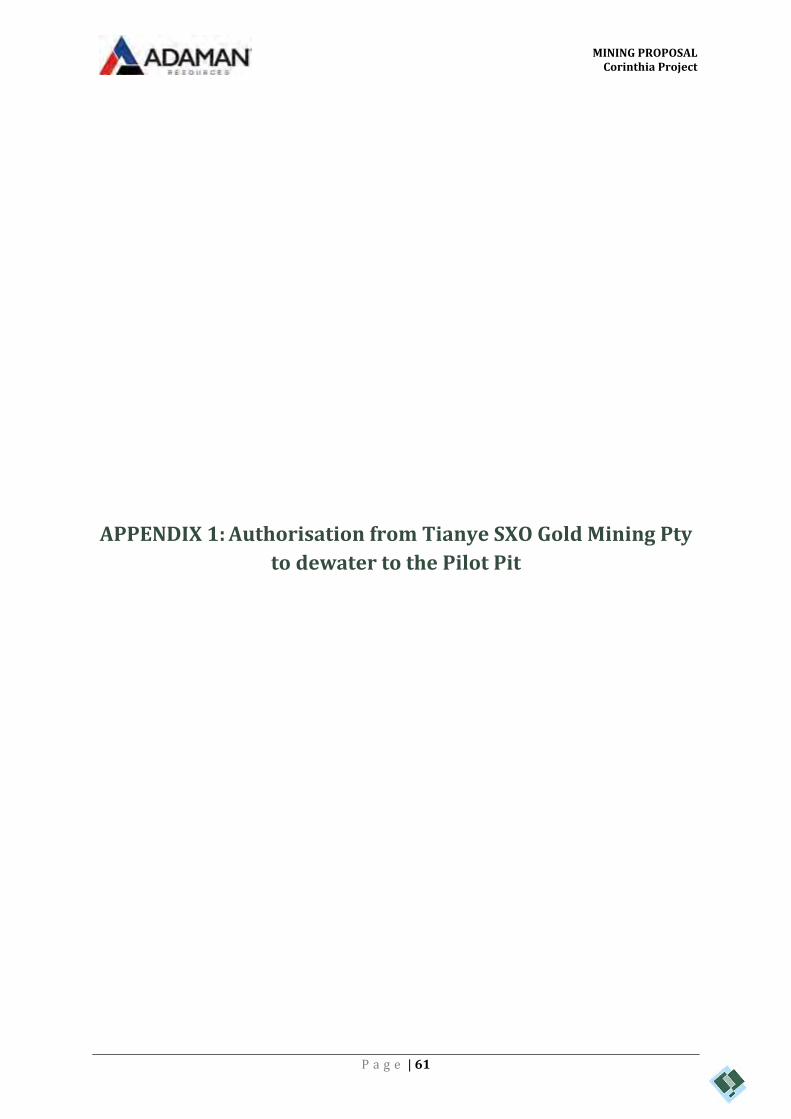
MINING PROPOSAL Corinthia Project
P a g e | 61
APPENDIX 1: Authorisation from Tianye SXO Gold Mining Pty
to dewater to the Pilot Pit

MINING PROPOSAL Corinthia Project
P a g e | 61
APPENDIX 1: Authorisation from Tianye SXO Gold Mining Pty
to dewater to the Pilot Pit

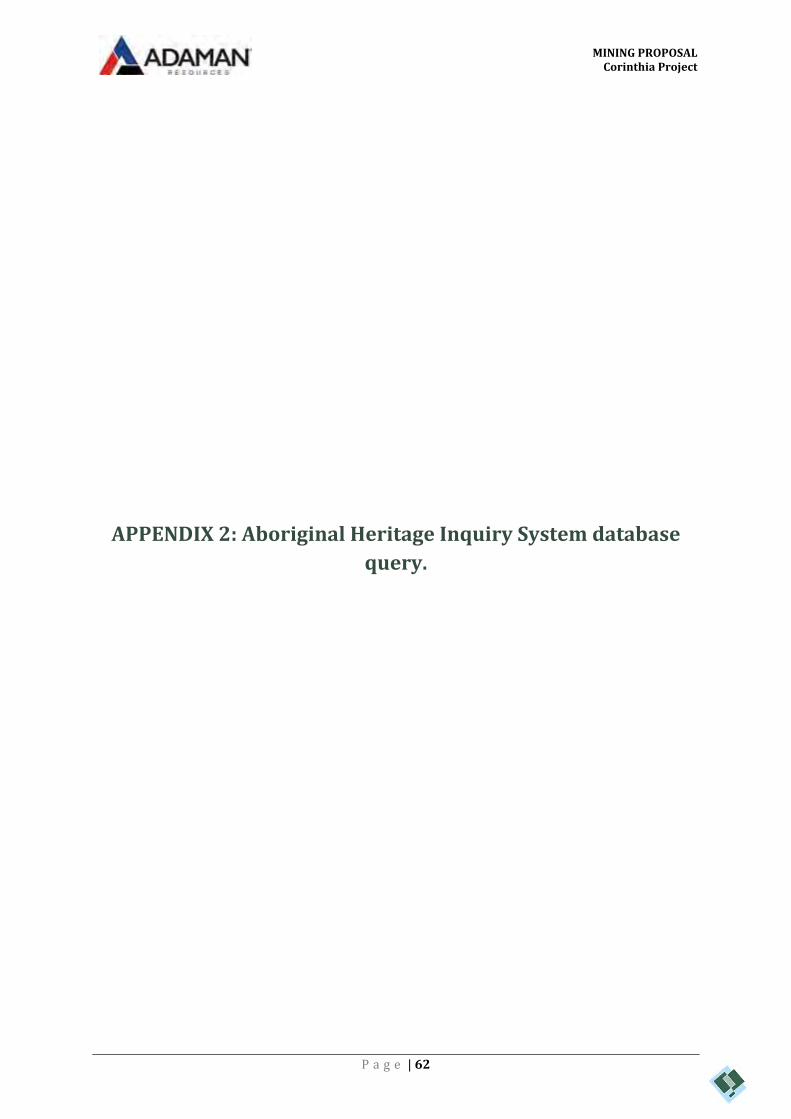
MINING PROPOSAL Corinthia Project
P a g e | 62
APPENDIX 2: Aboriginal Heritage Inquiry System database
query.

Search Criteria
No Registered Aboriginal Sites in Custom search area - Polygon - 119.21655056952°E, 31.0941896660515°S (GDA94) : 119.250367860779°E, 31.1268908624326°S (GDA94) : 119.237235765442°E, 31.1367357573908°S (GDA94) : 119.241269807801°E, 31.1437881882262°S (GDA94) : 119.233802537903°E, 31.1492240790093°S (GDA94) : 119.228137712464°E, 31.1438616482872°S (GDA94) : 119.222129564271°E, 31.1489302550435°S (GDA94) : 119.188569765076°E, 31.1163101349874°S (GDA94) : 119.21655056952°E, 31.0941896660515°S (GDA94)
Copyright
Copyright in the information contained herein is and shall remain the property of the State of Western Australia. All rights reserved.
Coordinate Accuracy
Coordinates (Easting/Northing metres) are based on the GDA 94 Datum. Accuracy is shown as a code in brackets following the coordinates.
Disclaimer
The Aboriginal Heritage Act 1972 preserves all Aboriginal sites in Western Australia whether or not they are registered. Aboriginal sites exist that are not recorded on the Register of Aboriginal
Sites, and some registered sites may no longer exist.
The information provided is made available in good faith and is predominately based on the information provided to the Department of Planning, Lands and Heritage by third parties. The
information is provided solely on the basis that readers will be responsible for making their own assessment as to the accuracy of the information. If you find any errors or omissions in our records,
including our maps, it would be appreciated if you email the details to the Department at [email protected] and we will make every effort to rectify it as soon as possible.
Aboriginal Heritage Inquiry System For further important information on using this information please see theDepartment of Planning, Lands and Heritage’s Terms of Use statement at
http://www.daa.wa.gov.au/Terms-Of-Use/List of Registered Aboriginal Sites
© Government of Western Australia Identifier: Page 1323992Report created: 05/02/2018 1:35:24 PM GIS_NET_USERby:

Basemap Copyright
Map was created using ArcGIS software by Esri. ArcGIS and ArcMap are the intellectual property of Esri and are used herein under license. Copyright © Esri. All rights reserved. For more
information about Esri software, please visit www.esri.com.
Satellite, Hybrid, Road basemap sources: Esri, DigitalGlobe, GeoEye, Earthstar Geographics, CNES/Airbus DS, USDA, USGS, AeroGRID, IGN, HERE, DeLorme, Intermap, INCREMENT P,
NRCan, Esri Japan, METI, Esri China (Hong Kong), Esri Korea, Esri (Thailand), MapmyIndia, NGCC, © OpenStreetMap contributors, and the GIS User Community.
Topographic basemap sources: Esri, HERE, DeLorme, Intermap, increment P Corp., GEBCO, USGS, FAO, NPS, NRCAN, GeoBase, IGN, Kadaster NL, Ordnance Survey, Esri Japan, METI, Esri
China (Hong Kong), swisstopo, MapmyIndia, © OpenStreetMap contributors, and the GIS User Community.
Aboriginal Heritage Inquiry System For further important information on using this information please see theDepartment of Planning, Lands and Heritage’s Terms of Use statement at
http://www.daa.wa.gov.au/Terms-Of-Use/List of Registered Aboriginal Sites
© Government of Western Australia Identifier: Page 2323992Report created: 05/02/2018 1:35:24 PM GIS_NET_USERby:

Aerial Photos, Cadastre, Local Government Authority,Native Title boundary, Roads data copyright © WesternAustralian Land Information Authority (Landgate).
kilometres
Map Scale 1 : 94,400
Copyright for topographic map information shall at all timesremain the property of the Commonwealth of Australia,Geoscience Australia - National Mapping Division. Allrights reserved.
3.11
Mining Tenement, Petroleum Application, Petroleum Titleboundary data copyright © the State of Western Australia(Department of Mines, Industry Regulation and Safety).
Legend
MGA Zone 50 (GDA94)
For further important information on using this information please see theDepartment of Planning, Lands and Heritage’s Terms of Use statement at
http://www.daa.wa.gov.au/Terms-Of-Use/
Aboriginal Heritage Inquiry System
Map of Registered Aboriginal Sites
Map created: 05/02/2018 1:36:49 PM© Government of Western Australia Identifier: 323992GIS_NET_USERby:
MINING PROPOSAL Corinthia Project
P a g e | 63
APPENDIX 3: Corinthia and Pilot Pit water sample analysis

Envirolab Services (WA) Pty Ltd trading as MPL Laboratories
ABN 53 140 099 207
16-18 Hayden Court Myaree WA 6154
ph 08 9317 2505 fax 08 9317 4163
www.mpl.com.au
CERTIFICATE OF ANALYSIS 205236
L17, 300 Murray Street, PERTH, WA, 6000Address
P ScottAttention
Adaman Resources Pty LtdClient
Client Details
04/01/2018Date completed instructions received
04/01/2018Date samples received
3 WaterNumber of Samples
Water AnalysisYour Reference
Sample Details
Please refer to the last page of this report for any comments relating to the results.
Results are reported on a dry weight basis for solids and on an as received basis for other matrices.
Samples were analysed as received from the client. Results relate specifically to the samples as received.
Please refer to the following pages for results, methodology summary and quality control data.
Analysis Details
Tests not covered by NATA are denoted with *Accredited for compliance with ISO/IEC 17025 - Testing.
NATA Accreditation Number 2901. This document shall not be reproduced except in full.
11/01/2018Date of Issue
11/01/2018Date results requested by
Report Details
Todd Lee, Laboratory Manager
Authorised By
Joshua Lim, Operations Manager
Results Approved By
Revision No: R00
205236MPL Reference: Page | 1 of 13

Client Reference: Water Analysis
280130275mg/LAcidity as CaCO3
93,000100,000100,0005mg/LTotal Dissolved Solids (grav)
110,000120,000120,0001µS/cmElectrical Conductivity (EC)
3.53.35.8pH UnitspH
09/01/201809/01/201809/01/2018-Date analysed
09/01/201809/01/201809/01/2018-Date prepared
WaterWaterWaterType of sample
03/01/201803/01/201803/01/2018Date Sampled
C NorthC SouthPilot PitPQLUNITSYour Reference
205236-3205236-2205236-1Our Reference
Miscellaneous Inorganics
MPL Reference: 205236
R00Revision No:
Page | 2 of 13

Client Reference: Water Analysis
20,00022,00021,0003mg/LHardness as CaCO3
1,5301,6901,6900meq/LSum of Cations
1,5901,6501,6300meq/LSum of Anions
-1.71.21.7%Ionic Balance
6,1006,4008,3001mg/LSulphate
52,00054,00052,0001mg/LChloride
<5<555mg/LTotal Alkalinity as CaCO3
<5<5<55mg/LHydroxide OH- as CaCO3
<5<5<55mg/LCarbonate CO3 2- as CaCO3
<5<555mg/LBicarbonate HCO3 as CaCO3
26,00029,00029,0000.5mg/LSodium - Dissolved
4,1004,3004,3000.5mg/LMagnesium - Dissolved
4104405400.5mg/LPotassium - Dissolved
1,4001,5001,4000.5mg/LCalcium - Dissolved
09/01/201809/01/201809/01/2018-Date analysed
09/01/201809/01/201809/01/2018-Date prepared
WaterWaterWaterType of sample
03/01/201803/01/201803/01/2018Date Sampled
C NorthC SouthPilot PitPQLUNITSYour Reference
205236-3205236-2205236-1Our Reference
Ionic Balance
MPL Reference: 205236
R00Revision No:
Page | 3 of 13
Client Reference: Water Analysis
8130<0.050.01mg/LIron-Dissolved
0.320.140.130.001mg/LZinc-Dissolved
<0.005<0.005<0.0050.001mg/LVanadium-Dissolved
0.00690.00310.00320.0005mg/LUranium-Dissolved
<0.005<0.005<0.0050.001mg/LTin-Dissolved
<0.005<0.005<0.0050.001mg/LSilver-Dissolved
<0.005<0.005<0.0050.001mg/LSelenium-Dissolved
3.93.53.70.001mg/LNickel-Dissolved
<0.005<0.005<0.0050.001mg/LMolybdenum-Dissolved
5862710.005mg/LManganese-Dissolved
0.013<0.005<0.0050.001mg/LLead-Dissolved
1.92.03.00.0005mg/LLithium-Dissolved
0.600.110.0200.001mg/LCopper-Dissolved
<0.005<0.005<0.0050.001mg/LChromium-Dissolved
0.850.770.400.001mg/LCobalt-Dissolved
0.00130.00080.00080.0001mg/LCadmium-Dissolved
0.0230.0110.00400.0005mg/LBeryllium-Dissolved
0.0970.140.200.001mg/LBarium-Dissolved
0.006<0.0050.0060.001mg/LArsenic-Dissolved
8.11.80.160.01mg/LAluminium-Dissolved
10/01/201810/01/201810/01/2018-Date analysed
10/01/201810/01/201810/01/2018-Date prepared
WaterWaterWaterType of sample
03/01/201803/01/201803/01/2018Date Sampled
C NorthC SouthPilot PitPQLUNITSYour Reference
205236-3205236-2205236-1Our Reference
Dissolved Metals in Water
MPL Reference: 205236
R00Revision No:
Page | 4 of 13

Client Reference: Water Analysis
69260.160.01mg/LIron-Total
0.320.140.140.001mg/LZinc-Total
<0.005<0.005<0.0050.001mg/LVanadium-Total
0.00690.00330.00360.0005mg/LUranium-Total
<0.005<0.005<0.0050.001mg/LTin-Total
<0.005<0.005<0.0050.001mg/LSilver-Total
<0.005<0.005<0.0050.001mg/LSelenium-Total
3.93.63.90.001mg/LNickel-Total
<0.005<0.005<0.0050.001mg/LMolybdenum-Total
5761720.005mg/LManganese-Total
0.013<0.005<0.0050.001mg/LLead-Total
1.81.92.70.0005mg/LLithium-Total
0.600.110.0230.001mg/LCopper-Total
<0.005<0.005<0.0050.001mg/LChromium-Total
0.870.800.420.001mg/LCobalt-Total
0.00130.00080.00060.0001mg/LCadmium-Total
0.0200.00980.00330.0005mg/LBeryllium-Total
0.0940.140.200.001mg/LBarium-Total
0.0150.0050.0060.001mg/LArsenic-Total
8.32.00.610.01mg/LAluminium-Total
10/01/201810/01/201810/01/2018-Date analysed
10/01/201810/01/201810/01/2018-Date digested
WaterWaterWaterType of sample
03/01/201803/01/201803/01/2018Date Sampled
C NorthC SouthPilot PitPQLUNITSYour Reference
205236-3205236-2205236-1Our Reference
Total Metals in water
MPL Reference: 205236
R00Revision No:
Page | 5 of 13

Client Reference: Water Analysis
Determination of various metals by ICP-MS. METALS-022
Metals in soil and water by ICP-OES.METALS-020
Hardness calculated from Calcium and Magnesium as per APHA latest edition 2340B.METALS-008
Anions - a range of anions are determined by Ion Chromatography based on APHA latest edition Method 4110-B. Soils and other sample types reported from a water extract unless otherwise specified (standard soil extract ratio 1:5).
INORG-081
Ion Balance Calculation: Cations in water by ICP-OES; Anions in water by IC; Alkalinity in water by Titration using APHA methods.
INORG-040
Total Dissolved Solids - determined gravimetrically. The solids are dried at 180±5°CINORG-018
Alkalinity - determined titrimetrically based on APHA latest edition, Method 2320-B. Soils reported from a 1:5 water extract unless otherwise specified.
INORG-006
Acidity - determined by titration based on APHA latest edition, Method 2310 B. Soils reported from a 1:5 water extract unless otherwise specified.
INORG-005
Conductivity and Salinity - measured using a conductivity cell at 25°C based on APHA latest edition Method 2510. Soils reported from a 1:5 water extract unless otherwise specified.
INORG-002
pH - Measured using pH meter and electrode base on APHA latest edition, Method 4500-H+. Please note that the results for water analyses may be indicative only, as analysis can be completed outside of the APHA recommended holding times. Soils are reported from a 1:5 water extract unless otherwise specified.
INORG-001
Methodology SummaryMethod ID
MPL Reference: 205236
R00Revision No:
Page | 6 of 13

Client Reference: Water Analysis
[NT]97[NT][NT][NT][NT]<5INORG-0055mg/LAcidity as CaCO3
[NT]100[NT][NT][NT][NT]<5INORG-0185mg/LTotal Dissolved Solids (grav)
[NT]100[NT][NT][NT][NT]<1INORG-0021µS/cmElectrical Conductivity (EC)
[NT]101[NT][NT][NT][NT][NT]INORG-001pH UnitspH
[NT]09/01/2018[NT][NT][NT][NT]09/01/2018-Date analysed
[NT]09/01/2018[NT][NT][NT][NT]09/01/2018-Date prepared
[NT]LCS-1RPDDup.Base#BlankMethodPQLUnitsTest Description
Spike Recovery %DuplicateQUALITY CONTROL: Miscellaneous Inorganics
MPL Reference: 205236
R00Revision No:
Page | 7 of 13

Client Reference: Water Analysis
[NT][NT][NT][NT][NT][NT]<3METALS-0083mg/LHardness as CaCO3
[NT]99[NT][NT][NT][NT]<1INORG-0811mg/LSulphate
[NT]103[NT][NT][NT][NT]<1INORG-0811mg/LChloride
[NT]97[NT][NT][NT][NT]<5INORG-0065mg/LTotal Alkalinity as CaCO3
[NT]97[NT][NT][NT][NT]<5INORG-0065mg/LCarbonate CO3 2- as CaCO3
[NT]97[NT][NT][NT][NT]<5INORG-0065mg/LBicarbonate HCO3 as CaCO3
[NT]101[NT][NT][NT][NT]<0.5METALS-0200.5mg/LSodium - Dissolved
[NT]101[NT][NT][NT][NT]<0.5METALS-0200.5mg/LMagnesium - Dissolved
[NT]100[NT][NT][NT][NT]<0.5METALS-0200.5mg/LPotassium - Dissolved
[NT]98[NT][NT][NT][NT]<0.5METALS-0200.5mg/LCalcium - Dissolved
[NT]09/01/2018[NT][NT][NT][NT]09/01/2018-Date analysed
[NT]09/01/2018[NT][NT][NT][NT]09/01/2018-Date prepared
[NT]LCS-1RPDDup.Base#BlankMethodPQLUnitsTest Description
Spike Recovery %DuplicateQUALITY CONTROL: Ionic Balance
MPL Reference: 205236
R00Revision No:
Page | 8 of 13

Client Reference: Water Analysis
[NT]96[NT][NT][NT][NT]<0.01METALS-0220.01mg/LIron-Dissolved
[NT]99[NT][NT][NT][NT]<0.001METALS-0220.001mg/LZinc-Dissolved
[NT]100[NT][NT][NT][NT]<0.001METALS-0220.001mg/LVanadium-Dissolved
[NT]98[NT][NT][NT][NT]<0.0005METALS-0220.0005mg/LUranium-Dissolved
[NT]102[NT][NT][NT][NT]<0.001METALS-0220.001mg/LTin-Dissolved
[NT]99[NT][NT][NT][NT]<0.001METALS-0220.001mg/LSilver-Dissolved
[NT]102[NT][NT][NT][NT]<0.001METALS-0220.001mg/LSelenium-Dissolved
[NT]99[NT][NT][NT][NT]<0.001METALS-0220.001mg/LNickel-Dissolved
[NT]101[NT][NT][NT][NT]<0.001METALS-0220.001mg/LMolybdenum-Dissolved
[NT]98[NT][NT][NT][NT]<0.005METALS-0220.005mg/LManganese-Dissolved
[NT]97[NT][NT][NT][NT]<0.001METALS-0220.001mg/LLead-Dissolved
[NT]101[NT][NT][NT][NT]<0.0005METALS-0220.0005mg/LLithium-Dissolved
[NT]98[NT][NT][NT][NT]<0.001METALS-0220.001mg/LCopper-Dissolved
[NT]95[NT][NT][NT][NT]<0.001METALS-0220.001mg/LChromium-Dissolved
[NT]98[NT][NT][NT][NT]<0.001METALS-0220.001mg/LCobalt-Dissolved
[NT]101[NT][NT][NT][NT]<0.0001METALS-0220.0001mg/LCadmium-Dissolved
[NT]92[NT][NT][NT][NT]<0.0005METALS-0220.0005mg/LBeryllium-Dissolved
[NT]98[NT][NT][NT][NT]<0.001METALS-0220.001mg/LBarium-Dissolved
[NT]99[NT][NT][NT][NT]<0.001METALS-0220.001mg/LArsenic-Dissolved
[NT]98[NT][NT][NT][NT]<0.01METALS-0220.01mg/LAluminium-Dissolved
[NT]10/01/2018[NT][NT][NT][NT]10/01/2018-Date analysed
[NT]10/01/2018[NT][NT][NT][NT]10/01/2018-Date prepared
[NT]LCS-1RPDDup.Base#BlankMethodPQLUnitsTest Description
Spike Recovery %DuplicateQUALITY CONTROL: Dissolved Metals in Water
MPL Reference: 205236
R00Revision No:
Page | 9 of 13

Client Reference: Water Analysis
[NT]103[NT][NT][NT][NT]<0.01METALS-0220.01mg/LIron-Total
[NT]104[NT][NT][NT][NT]<0.001METALS-0220.001mg/LZinc-Total
[NT]104[NT][NT][NT][NT]<0.001METALS-0220.001mg/LVanadium-Total
[NT]95[NT][NT][NT][NT]<0.0005METALS-0220.0005mg/LUranium-Total
[NT]105[NT][NT][NT][NT]<0.001METALS-0220.001mg/LTin-Total
[NT]99[NT][NT][NT][NT]<0.001METALS-0220.001mg/LSilver-Total
[NT]112[NT][NT][NT][NT]<0.001METALS-0220.001mg/LSelenium-Total
[NT]103[NT][NT][NT][NT]<0.001METALS-0220.001mg/LNickel-Total
[NT]104[NT][NT][NT][NT]<0.001METALS-0220.001mg/LMolybdenum-Total
[NT]100[NT][NT][NT][NT]<0.005METALS-0220.005mg/LManganese-Total
[NT]98[NT][NT][NT][NT]<0.001METALS-0220.001mg/LLead-Total
[NT]97[NT][NT][NT][NT]<0.0005METALS-0220.0005mg/LLithium-Total
[NT]105[NT][NT][NT][NT]<0.001METALS-0220.001mg/LCopper-Total
[NT]102[NT][NT][NT][NT]<0.001METALS-0220.001mg/LChromium-Total
[NT]108[NT][NT][NT][NT]<0.001METALS-0220.001mg/LCobalt-Total
[NT]99[NT][NT][NT][NT]<0.0001METALS-0220.0001mg/LCadmium-Total
[NT]81[NT][NT][NT][NT]<0.0005METALS-0220.0005mg/LBeryllium-Total
[NT]95[NT][NT][NT][NT]<0.001METALS-0220.001mg/LBarium-Total
[NT]100[NT][NT][NT][NT]<0.001METALS-0220.001mg/LArsenic-Total
[NT]98[NT][NT][NT][NT]<0.01METALS-0220.01mg/LAluminium-Total
[NT]10/01/2018[NT][NT][NT][NT]10/01/2018-Date analysed
[NT]10/01/2018[NT][NT][NT][NT]10/01/2018-Date digested
[NT]LCS-1RPDDup.Base#BlankMethodPQLUnitsTest Description
Spike Recovery %DuplicateQUALITY CONTROL: Total Metals in water
MPL Reference: 205236
R00Revision No:
Page | 10 of 13

Client Reference: Water Analysis
Not ReportedNR
National Environmental Protection MeasureNEPM
Not specifiedNS
Laboratory Control SampleLCS
Relative Percent DifferenceRPD
Greater than>
Less than<
Practical Quantitation LimitPQL
Insufficient sample for this testINS
Test not requiredNA
Not testedNT
Result Definitions
Australian Drinking Water Guidelines recommend that Thermotolerant Coliform, Faecal Enterococci, & E.Coli levels are less than1cfu/100mL. The recommended maximums are taken from "Australian Drinking Water Guidelines", published by NHMRC & ARMC2011.
Surrogates are known additions to each sample, blank, matrix spike and LCS in a batch, of compounds whichare similar to the analyte of interest, however are not expected to be found in real samples.
Surrogate Spike
This comprises either a standard reference material or a control matrix (such as a blank sand or water) fortifiedwith analytes representative of the analyte class. It is simply a check sample.
LCS (LaboratoryControl Sample)
A portion of the sample is spiked with a known concentration of target analyte. The purpose of the matrix spikeis to monitor the performance of the analytical method used and to determine whether matrix interferencesexist.
Matrix Spike
This is the complete duplicate analysis of a sample from the process batch. If possible, the sample selectedshould be one where the analyte concentration is easily measurable.
Duplicate
This is the component of the analytical signal which is not derived from the sample but from reagents,glassware etc, can be determined by processing solvents and reagents in exactly the same manner as forsamples.
Blank
Quality Control Definitions
MPL Reference: 205236
R00Revision No:
Page | 11 of 13

Client Reference: Water Analysis
Measurement Uncertainty estimates are available for most tests upon request.
Where sampling dates are not provided, Envirolab are not in a position to comment on the validity of the analysis whererecommended technical holding times may have been breached.
When samples are received where certain analytes are outside of recommended technical holding times (THTs), the analysis hasproceeded. Where analytes are on the verge of breaching THTs, every effort will be made to analyse within the THT or as soon aspracticable.
In circumstances where no duplicate and/or sample spike has been reported at 1 in 10 and/or 1 in 20 samples respectively, thesample volume submitted was insufficient in order to satisfy laboratory QA/QC protocols.
Matrix Spikes, LCS and Surrogate recoveries: Generally 70-130% for inorganics/metals; 60-140% for organics (+/-50% surrogates)and 10-140% for labile SVOCs (including labile surrogates), ultra trace organics and speciated phenols is acceptable.
Duplicates: <5xPQL - any RPD is acceptable; >5xPQL - 0-50% RPD is acceptable.
For VOCs in water samples, three vials are required for duplicate or spike analysis.
Spikes for Physical and Aggregate Tests are not applicable.
Filters, swabs, wipes, tubes and badges will not have duplicate data as the whole sample is generally extracted during sampleextraction.
Duplicate sample and matrix spike recoveries may not be reported on smaller jobs, however, were analysed at a frequency to meetor exceed NEPM requirements. All samples are tested in batches of 20. The duplicate sample RPD and matrix spike recoveries forthe batch were within the laboratory acceptance criteria.
Laboratory Acceptance Criteria
MPL Reference: 205236
R00Revision No:
Page | 12 of 13

Client Reference: Water Analysis
Note: Some results have raised pqls. In these cases the sample's high TDS required the sample to be diluted prior to analysis.
Report Comments
MPL Reference: 205236
R00Revision No:
Page | 13 of 13

MINING PROPOSAL Corinthia Project
P a g e | 64
APPENDIX 4: PMST and NatureMap search results

Page 1
NatureMap Species Report
Created By Guest user on 19/01/2018
Current Names Only Core Datasets Only
Method Vertices
Yes Yes 'By Polygon' 31° 07' 15" S,119° 12' 33" E 31° 06' 29" S,119° 13' 38" E 31° 07' 35" S,119° 14' 56" E 31° 08'
31" S,119° 13' 52" E 31° 07' 15" S,119° 12' 33" E
Name ID Species Name Naturalised Conservation Code 1Endemic To QueryArea
1. 12903 Eucalyptus capillosa subsp. capillosa (Wheatbelt Wandoo)
2. 4089 Mirbelia depressa
3. 25253 Parasuta gouldii
4. 42416 Pseudonaja mengdeni (Western Brown Snake)
5. 10897 Pterostylis spathulata
6. 30434 Salsola australis
Conservation CodesT - Rare or likely to become extinctX - Presumed extinctIA - Protected under international agreementS - Other specially protected fauna1 - Priority 12 - Priority 23 - Priority 34 - Priority 45 - Priority 5
1 For NatureMap's purposes, species flagged as endemic are those whose records are wholely contained within the search area. Note that only those records complying with the search criterion are included in the
calculation. For example, if you limit records to those from a specific datasource, only records from that datasource are used to determine if a species is restricted to the query area.
NatureMap is a collaborative project of the Department of Parks and Wildlife and the Western Australian Museum.
Page 1
NatureMap Species Report
Created By Guest user on 24/01/2018
Current Names Only Core Datasets Only
Method Centre Buffer
Group By
Yes Yes 'By Circle' 119° 13' 53'' E,31° 07' 03'' S 20km Kingdom
Kingdom Species Records Animalia 103 218 Fungi 13 19 Plantae 420 884 TOTAL 536 1121
Name ID Species Name Naturalised Conservation Code 1Endemic To QueryArea
Animalia1. 24559 Acanthagenys rufogularis (Spiny-cheeked Honeyeater)
2. 24261 Acanthiza chrysorrhoa (Yellow-rumped Thornbill)
3. 24265 Acanthiza uropygialis (Chestnut-rumped Thornbill)
4. 24282 Accipiter fasciatus subsp. fasciatus (Brown Goshawk)
5. 33902 Aganippe castellum (Tree-stem Trapdoor Spider) P4
6. Aname mainae
7. 24312 Anas gracilis (Grey Teal)
8. 24561 Anthochaera carunculata (Red Wattlebird)
9. Antichiropus sp.
10. 24266 Aphelocephala leucopsis subsp. castaneiventris (Southern Whiteface)
11. 24285 Aquila audax (Wedge-tailed Eagle)
12. 25236 Aspidites ramsayi (Woma)
13. Atelomastix bamfordi
14. 24318 Aythya australis (Hardhead)
15. Barnardius zonarius
16. 42307 Cacomantis pallidus (Pallid Cuckoo)
17. 25717 Calyptorhynchus banksii (Red-tailed Black-Cockatoo)
18. Cercophonius michaelseni
19. 24564 Certhionyx variegatus (Pied Honeyeater)
20. 24186 Chalinolobus gouldii (Gould's Wattled Bat)
21. 24321 Chenonetta jubata (Australian Wood Duck, Wood Duck)
22. Chroicocephalus novaehollandiae
23. 24774 Cladorhynchus leucocephalus (Banded Stilt)
24. 25675 Colluricincla harmonica (Grey Shrike-thrush)
25. 24613 Colluricincla harmonica subsp. rufiventris (Grey Shrike-thrush)
26. 25568 Coracina novaehollandiae (Black-faced Cuckoo-shrike)
27. Cormocephalus turneri
28. 25592 Corvus coronoides (Australian Raven)
29. 24420 Cracticus nigrogularis (Pied Butcherbird)
30. 25595 Cracticus tibicen (Australian Magpie)
31. 25596 Cracticus torquatus (Grey Butcherbird)
32. 24918 Crenadactylus ocellatus subsp. ocellatus (Clawless Gecko)
33. 24883 Ctenophorus ornatus (Ornate Crevice-Dragon)
34. 24889 Ctenophorus scutulatus (Lozenge-marked Dragon)
35. 24092 Dasyurus geoffroii (Chuditch, Western Quoll) T
36. Egretta novaehollandiae
37. 24290 Elanus caeruleus subsp. axillaris (Australian Black-shouldered Kite)
38. Eolophus roseicapillus
39. 24567 Epthianura albifrons (White-fronted Chat)
40. 24570 Epthianura tricolor (Crimson Chat)
41. Ethmostigmus rubripes
42. 25622 Falco cenchroides (Australian Kestrel, Nankeen Kestrel)
43. 25624 Falco peregrinus (Peregrine Falcon) S
NatureMap is a collaborative project of the Department of Parks and Wildlife and the Western Australian Museum.
Page 2
Name ID Species Name Naturalised Conservation Code 1Endemic To QueryArea
44. 25727 Fulica atra (Eurasian Coot)
45. 24959 Gehyra variegata
46. Gonorynchus greyi
47. 24443 Grallina cyanoleuca (Magpie-lark)
48. Gymnapistes marmoratus
49. 24961 Heteronotia binoei (Bynoe's Gecko)
50. 25734 Himantopus himantopus (Black-winged Stilt)
51. 24491 Hirundo neoxena (Welcome Swallow)
52. Hoggicosa forresti
53. Hoggicosa storri
54. Isometroides vescus
55. 24557 Leipoa ocellata (Malleefowl) T
56. 25137 Lerista gerrardii
57. 25659 Lichenostomus leucotis (White-eared Honeyeater)
58. 25661 Lichmera indistincta (Brown Honeyeater)
59. Lycosa godeffroyi
60. 25652 Malurus leucopterus (White-winged Fairy-wren)
61. 24583 Manorina flavigula (Yellow-throated Miner)
62. 25184 Menetia greyii
63. 24654 Microeca fascinans subsp. assimilis (Jacky Winter)
64. Missulena occatoria
65. 24904 Moloch horridus (Thorny Devil)
66. Muscidae sp. H (SAP)
67. Nicodamus mainae
68. 24742 Nymphicus hollandicus (Cockatiel)
69. 24407 Ocyphaps lophotes (Crested Pigeon)
70. Oecobius navus
71. 24618 Oreoica gutturalis (Crested Bellbird)
72. 24619 Pachycephala inornata (Gilbert's Whistler)
73. 25680 Pachycephala rufiventris (Rufous Whistler)
74. 25253 Parasuta gouldii
75. 25682 Pardalotus striatus (Striated Pardalote)
76. 24659 Petroica goodenovii (Red-capped Robin)
77. 24409 Phaps chalcoptera (Common Bronzewing)
78. 24751 Platycercus zonarius subsp. zonarius (Port Lincoln Parrot)
79. 24683 Pomatostomus superciliosus (White-browed Babbler)
80. 34013 Pomatostomus superciliosus subsp. ashbyi (White-browed Babbler (western
wheatbelt))
81. 25261 Pseudechis australis (Mulga Snake)
82. 42416 Pseudonaja mengdeni (Western Brown Snake)
83. 25263 Pseudonaja modesta (Ringed Brown Snake)
84. 25434 Pseudophryne occidentalis (Western Toadlet)
85. 42344 Purnella albifrons (White-fronted Honeyeater)
86. 24278 Pyrrholaemus brunneus (Redthroat)
87. 24776 Recurvirostra novaehollandiae (Red-necked Avocet)
88. 48096 Rhipidura albiscapa (Grey Fantail)
89. 25614 Rhipidura leucophrys (Willie Wagtail)
90. Scolopendra morsitans
91. 25266 Simoselaps bertholdi (Jan's Banded Snake)
92. 30948 Smicrornis brevirostris (Weebill)
93. 25590 Streptopelia senegalensis (Laughing Turtle-Dove) Y
94. Supunna funerea
95. 25705 Tachybaptus novaehollandiae (Australasian Grebe, Black-throated Grebe)
96. 24331 Tadorna tadornoides (Australian Shelduck, Mountain Duck)
97. 30870 Taeniopygia guttata (Zebra Finch)
98. Tasmanicosa leuckartii
99. 25203 Tiliqua occipitalis (Western Bluetongue)
100. 24983 Underwoodisaurus milii (Barking Gecko)
101. Urodacus armatus
102. Urodacus hoplurus
103. 24206 Vespadelus regulus (Southern Forest Bat)
Fungi104. 27574 Acarospora citrina
105. 38755 Amanita ochroterrea
106. 44000 Austroparmelina chlorolecanorica
107. 34461 Buellia tetrapla
108. 27664 Cladia corallaizon
109. 27748 Flavoparmelia rutidota
110. Lecidea sp.
111. 44943 Physcia rolandii
NatureMap is a collaborative project of the Department of Parks and Wildlife and the Western Australian Museum.

Page 3
Name ID Species Name Naturalised Conservation Code 1Endemic To QueryArea
112. 28324 Protoparmelia pulchra
113. 28000 Psora decipiens
114. 28065 Teloschistes chrysophthalmus
115. Uromycladium tepperianum
116. 28172 Xanthoparmelia reptans
Plantae117. 3200 Acacia acuminata (Jam, Mangard)
118. 3218 Acacia anfractuosa
119. 15467 Acacia assimilis subsp. assimilis
120. 3249 Acacia calcarata
121. 16117 Acacia consanguinea
122. 3269 Acacia coolgardiensis (Spinifex Wattle)
123. 14068 Acacia cylindrica P3
124. 16169 Acacia deficiens
125. 14069 Acacia desertorum var. nudipes P3
126. 16119 Acacia dissona var. dissona
127. 16168 Acacia enervia subsp. enervia
128. 3324 Acacia erinacea
129. 3337 Acacia filifolia P3
130. 14076 Acacia formidabilis P3
131. 15282 Acacia gibbosa
132. 44473 Acacia haematites P1
133. 3366 Acacia hemiteles
134. 15285 Acacia heteroneura var. jutsonii
135. 3378 Acacia inaequiloba
136. 3389 Acacia intricata
137. 3392 Acacia jamesiana
138. 3393 Acacia jennerae
139. 3426 Acacia longispinea
140. 3440 Acacia merrallii
141. 3452 Acacia murrayana (Sandplain Wattle)
142. 15290 Acacia neurophylla subsp. erugata
143. 3463 Acacia nyssophylla
144. 3495 Acacia prainii (Prain's Wattle)
145. 19499 Acacia ramulosa var. ramulosa
146. 3513 Acacia resinimarginea
147. 3524 Acacia rossei
148. 3555 Acacia steedmanii
149. 23525 Acacia steedmanii subsp. steedmanii
150. 15294 Acacia stereophylla var. stereophylla
151. 3577 Acacia tetragonophylla (Kurara, Wakalpuka)
152. 1720 Allocasuarina acutivalvis
153. 6565 Alyxia buxifolia (Dysentery Bush)
154. 12025 Amphipogon caricinus var. caricinus
155. 40903 Androcalva aphrix
156. 7836 Angianthus tomentosus (Camel-grass)
157. 17963 Aotus tietkensii
158. 207 Aristida contorta (Bunched Kerosene Grass)
159. 1201 Asparagus officinalis (Asparagus) Y
160. 1364 Asphodelus fistulosus (Onion Weed) Y
161. 7846 Asteridea athrixioides
162. 6336 Astroloma serratifolium (Kondrung)
163. 20726 Astus subroseus
164. 11435 Atriplex acutibractea subsp. acutibractea
165. 11489 Atriplex acutibractea subsp. karoniensis
166. 2453 Atriplex codonocarpa (Flat-topped Saltbush)
167. 2455 Atriplex eardleyae
168. 2459 Atriplex holocarpa (Pop Saltbush)
169. 2461 Atriplex hymenotheca
170. 12042 Atriplex lindleyi subsp. inflata
171. 11516 Atriplex nummularia subsp. spathulata (Old Man Saltbush)
172. 11525 Atriplex paludosa subsp. baudinii
173. 2472 Atriplex pumilio
174. 11791 Atriplex quadrivalvata var. quadrivalvata
175. 2475 Atriplex semibaccata (Berry Saltbush)
176. 2476 Atriplex semilunaris (Annual Saltbush)
177. 2479 Atriplex stipitata (Mallee Saltbush)
178. 2480 Atriplex suberecta
179. 2481 Atriplex vesicaria (Bladder Saltbush)
180. 17237 Austrostipa elegantissima
NatureMap is a collaborative project of the Department of Parks and Wildlife and the Western Australian Museum.

Page 4
Name ID Species Name Naturalised Conservation Code 1Endemic To QueryArea
181. 17246 Austrostipa nitida
182. 17247 Austrostipa platychaeta
183. 17250 Austrostipa pycnostachya
184. 17254 Austrostipa tenuifolia
185. 5344 Baeckea elderiana
186. 5349 Baeckea grandibracteata
187. 5375 Balaustion pulcherrimum (Native Pomegranate)
188. 1801 Banksia audax
189. 1815 Banksia elderiana (Swordfish Banksia)
190. 5388 Beaufortia micrantha (Little Bottlebrush, Small-leaved Beaufortia)
191. 7852 Bellida graminea (Rosy Bellida)
192. 34257 Beyeria sulcata var. sulcata
193. 7856 Blennospora drummondii
194. 7857 Blennospora phlegmatocarpa
195. 11201 Boronia ternata var. ternata
196. 1267 Borya constricta
197. 30234 Bossiaea barbarae
198. 3722 Bossiaea walkeri
199. 10915 Brachychiton populneus (Kurrajong) Y
200. 7871 Brachyscome ciliaris
201. 7883 Brachyscome pusilla
202. 19437 Brachysola coerulea
203. 3000 Brassica tournefortii (Mediterranean Turnip) Y
204. 11136 Caladenia denticulata
205. 2853 Calandrinia eremaea (Twining Purslane)
206. 2854 Calandrinia granulifera (Pygmy Purslane)
207. 92 Callitris canescens
208. 7903 Calotis hispidula (Bindy Eye)
209. 5451 Calytrix desolata
210. 5465 Calytrix leschenaultii
211. 3008 Carrichtera annua (Ward's Weed) Y
212. 2955 Cassytha nodiflora
213. 1742 Casuarina obesa (Swamp Sheoak, Kuli)
214. 1126 Centrolepis eremica
215. 1130 Centrolepis humillima (Dwarf Centrolepis)
216. 1134 Centrolepis polygyna (Wiry Centrolepis)
217. 7922 Cephalipterum drummondii (Pompom Head)
218. 7924 Ceratogyne obionoides (Wingwort)
219. 5491 Chamelaucium ciliatum
220. 35640 Chamelaucium pauciflorum subsp. Perenjori (B.J. Conn 2181)
221. 42180 Chamelaucium sp. Bendering (T.J. Alford 110)
222. 37 Cheilanthes lasiophylla (Woolly Cloak Fern)
223. 3168 Cheiranthera filifolia
224. 1424 Conostylis bealiana
225. 15400 Cyanicula amplexans
226. 6747 Cyanostegia angustifolia (Tinsel-flower)
227. 6751 Cyanostegia microphylla (Tinsel Flower)
228. 7438 Dampiera eriocephala (Woolly-headed Dampiera)
229. 7449 Dampiera juncea (Rush-like Dampiera)
230. 7454 Dampiera linearis (Common Dampiera)
231. 7456 Dampiera luteiflora (Yellow Dampiera)
232. 7475 Dampiera spicigera (Spiked Dampiera)
233. 7477 Dampiera stenostachya (Narrow-spiked Dampiera)
234. 13158 Dampiera tenuicaulis var. curvula
235. 7483 Dampiera tomentosa (Felted Dampiera)
236. 35618 Darwinia sp. Karonie (K. Newbey 8503)
237. 41026 Dasymalla teckiana
238. 41025 Dasymalla terminalis (Native Foxglove)
239. 3802 Daviesia croniniana
240. 3813 Daviesia grahamii
241. 12327 Daviesia microcarpa T
242. 3823 Daviesia nematophylla
243. 11964 Dichanthium sericeum subsp. sericeum
244. 2498 Didymanthus roei
245. 11681 Disphyma crassifolium subsp. clavellatum
246. 2499 Dissocarpus paradoxus (Curious Saltbush)
247. 7960 Dithyrostegia amplexicaulis
248. 4753 Dodonaea amblyophylla
249. 4755 Dodonaea bursariifolia
250. 12034 Dodonaea microzyga var. acrolobata
NatureMap is a collaborative project of the Department of Parks and Wildlife and the Western Australian Museum.

Page 5
Name ID Species Name Naturalised Conservation Code 1Endemic To QueryArea
251. 4782 Dodonaea viscosa (Sticky Hopbush)
252. 11247 Dodonaea viscosa subsp. angustissima
253. 3088 Drosera andersoniana (Sturdy Sundew)
254. 3098 Drosera glanduligera (Pimpernel Sundew)
255. 14298 Drosera macrantha subsp. macrantha
256. 4459 Drummondita hassellii
257. 6966 Duboisia hopwoodii (Pituri, Kundugu)
258. 2511 Enchylaena tomentosa (Barrier Saltbush)
259. 378 Eragrostis dielsii (Mallee Lovegrass)
260. 13807 Eremophila caperata
261. 7189 Eremophila clarkei (Turpentine Bush)
262. 14895 Eremophila decipiens subsp. decipiens
263. 17175 Eremophila glabra subsp. albicans
264. 7219 Eremophila granitica (Thin-leaved Poverty Bush)
265. 15112 Eremophila interstans subsp. interstans
266. 7226 Eremophila ionantha (Violet-flowered Eremophila)
267. 7231 Eremophila lehmanniana
268. 7242 Eremophila miniata (Kopi Poverty Bush)
269. 18570 Eremophila oppositifolia subsp. angustifolia
270. 7267 Eremophila scoparia (Broom Bush ()
271. 3869 Erichsenia uncinata
272. 2514 Eriochiton sclerolaenoides (Woolly Bindii)
273. 4333 Erodium cicutarium (Common Storksbill) Y
274. 4335 Erodium cygnorum (Blue Heronsbill)
275. 14377 Erymophyllum ramosum subsp. ramosum
276. 19508 Eucalyptus calycogona subsp. calycogona
277. 12903 Eucalyptus capillosa subsp. capillosa (Wheatbelt Wandoo)
278. 14300 Eucalyptus celastroides subsp. celastroides (Mirret)
279. 5607 Eucalyptus corrugata (Rough-fruited Mallee)
280. 11294 Eucalyptus crucis subsp. crucis (Silver Mallee) T
281. 42027 Eucalyptus erythronema subsp. erythronema (Red-flowered Mallee)
282. 5662 Eucalyptus gracilis (Yorrell)
283. 15670 Eucalyptus kochii subsp. plenissima
284. 15682 Eucalyptus leptophylla (Narrow-leaved Red Mallee)
285. 5697 Eucalyptus lesouefii (Goldfields Blackbutt)
286. 5701 Eucalyptus longicornis (Red Morrel, Moril)
287. 13037 Eucalyptus loxophleba subsp. lissophloia
288. 5711 Eucalyptus melanoxylon (Black Morrel)
289. 5717 Eucalyptus myriadena
290. 13513 Eucalyptus myriadena subsp. myriadena
291. 13514 Eucalyptus myriadena subsp. parviflora P1
292. 13524 Eucalyptus olivina
293. 5747 Eucalyptus platycorys (Boorabbin Mallee)
294. 13520 Eucalyptus polita
295. 5761 Eucalyptus rigidula (Stiff-leaved Mallee)
296. 12693 Eucalyptus salicola (Salt Gum)
297. 5767 Eucalyptus salubris (Gimlet)
298. 5772 Eucalyptus sheathiana (Ribbon-barked Gum)
299. 12881 Eucalyptus subangusta subsp. cerina
300. 16722 Euryomyrtus maidenii
301. 19292 Eutaxia lasiophylla
302. 5191 Frankenia cinerea
303. 5205 Frankenia irregularis
304. 5209 Frankenia pauciflora (Seaheath)
305. 5212 Frankenia setosa (Bristly Frankenia)
306. 11571 Galenia pubescens var. pubescens Y
307. 3900 Gastrolobium floribundum (Wodjil Poison)
308. 7977 Gilruthia osbornei
309. 8002 Gnephosis tenuissima
310. 8003 Gnephosis tridens
311. 10777 Gompholobium gompholobioides
312. 3959 Gompholobium viscidulum
313. 7495 Goodenia berardiana
314. 12523 Goodenia helmsii
315. 7527 Goodenia mimuloides
316. 7565 Goodenia xanthosperma (Yellow-seeded Goodenia)
317. 1946 Grevillea acacioides
318. 13447 Grevillea anethifolia
319. 1971 Grevillea cagiana (Red Toothbrushes)
320. 13453 Grevillea didymobotrya subsp. didymobotrya
NatureMap is a collaborative project of the Department of Parks and Wildlife and the Western Australian Museum.

Page 6
Name ID Species Name Naturalised Conservation Code 1Endemic To QueryArea
321. 8832 Grevillea excelsior (Flame Grevillea)
322. 19314 Grevillea hookeriana subsp. apiciloba
323. 15974 Grevillea incurva
324. 2047 Grevillea nematophylla
325. 19541 Grevillea nematophylla subsp. nematophylla
326. 15981 Grevillea obliquistigma subsp. obliquistigma
327. 2057 Grevillea paradoxa (Bottlebrush Grevillea)
328. 2077 Grevillea pterosperma
329. 15766 Grevillea shuttleworthiana subsp. obovata
330. 2104 Grevillea teretifolia (Round Leaf Grevillea)
331. 2124 Grevillea yorkrakinensis
332. 2805 Gunniopsis intermedia (Yellow Salt Star)
333. 2810 Gunniopsis septifraga
334. 2157 Hakea erecta
335. 2182 Hakea minyma
336. 2184 Hakea multilineata (Grass Leaf Hakea)
337. 12232 Hakea pendens P3
338. 17556 Hakea recurva subsp. arida
339. 6684 Halgania andromedifolia
340. 6691 Halgania integerrima
341. 6843 Hemigenia brachyphylla
342. 6875 Hemigenia westringioides (Open Hemigenia)
343. 6776 Hemiphora elderi (Red Velvet)
344. 5115 Hibbertia conspicua (Leafless Hibbertia)
345. 5122 Hibbertia eatoniae
346. 19779 Hibbertia glomerosa var. glomerosa
347. 15863 Hibbertia stowardii
348. 5813 Homalocalyx pulcherrimus
349. 5815 Homalocalyx thryptomenoides
350. 448 Hordeum glaucum (Northern Barley Grass) Y
351. 8085 Hyalochlamys globifera
352. 5221 Hybanthus floribundus
353. 12007 Hybanthus floribundus subsp. floribundus
354. 8086 Hypochaeris glabra (Smooth Catsear) Y
355. 14436 Isopogon scabriusculus subsp. stenophyllus
356. 4021 Jacksonia nematoclada
357. 4043 Kennedia prorepens
358. 6779 Lachnostachys coolgardiensis
359. 29046 Lactuca serriola forma serriola Y
360. 13284 Lawrencella rosea
361. 4957 Lawrencia repens
362. 1300 Laxmannia arida
363. 44490 Leontodon rhagadioloides Y
364. 3018 Lepidium africanum (Rubble Peppercress) Y
365. 3044 Lepidium rotundum (Veined Peppercress)
366. 41647 Lepidosperma sanguinolentum
367. 17641 Leptosema cervicorne
368. 5855 Leptospermum roei
369. 7671 Levenhookia leptantha (Trumpet Stylewort)
370. 7677 Levenhookia stipitata (Common Stylewort)
371. 6488 Limonium lobatum Y
372. 6489 Limonium sinuatum (Perennial Sea Lavender) Y
373. 20645 Lissanthe scabra P2
374. 1226 Lomandra effusa (Scented Matrush)
375. 4061 Lotus cruentus (Redflower Lotus)
376. 2396 Lysiana casuarinae
377. 36375 Lysimachia arvensis (Pimpernel) Y
378. 34736 Lysinema pentapetalum
379. 2533 Maireana amoena
380. 2537 Maireana brevifolia (Small Leaf Bluebush)
381. 2538 Maireana carnosa (Cottony Bluebush)
382. 2544 Maireana georgei (Satiny Bluebush)
383. 2568 Maireana trichoptera (Downy Bluebush)
384. 5864 Malleostemon peltiger
385. 5865 Malleostemon roseus
386. 5866 Malleostemon tuberculatus
387. 4961 Malva parviflora (Marshmallow) Y
388. 4077 Medicago minima (Small Burr Medic) Y
389. 4078 Medicago orbicularis (Button Medic) Y Y
390. 20284 Melaleuca atroviridis
NatureMap is a collaborative project of the Department of Parks and Wildlife and the Western Australian Museum.

Page 7
Name ID Species Name Naturalised Conservation Code 1Endemic To QueryArea
391. 19380 Melaleuca calyptroides
392. 5895 Melaleuca conothamnoides
393. 19486 Melaleuca hamata
394. 5917 Melaleuca hamulosa
395. 5929 Melaleuca leiocarpa
396. 15663 Melaleuca pauperiflora subsp. fastigiata
397. 37620 Melaleuca protrusa
398. 20289 Melaleuca vinnula
399. 20287 Melaleuca zeteticorum
400. 2813 Mesembryanthemum crystallinum (Iceplant) Y
401. 2814 Mesembryanthemum nodiflorum (Slender Iceplant) Y
402. 9187 Micromyrtus erichsenii
403. 8106 Millotia tenuifolia (Soft Millotia)
404. 4089 Mirbelia depressa
405. 4099 Mirbelia seorsifolia
406. 4104 Mirbelia trichocalyx
407. 490 Monachather paradoxus
408. 19587 Monotaxis grandiflora var. obtusifolia
409. 19177 Moraea setifolia Y
410. 6974 Nicotiana glauca (Tree Tobacco) Y
411. 8140 Olearia muelleri (Goldfields Daisy)
412. 8145 Olearia pimeleoides (Pimelea Daisybush, Burrobunga)
413. Oligochaetochilus macrosceles
414. 12646 Ozothamnus occidentalis
415. 40424 Pentameris airoides subsp. airoides Y
416. 2259 Persoonia coriacea (Leathery-leaf Persoonia)
417. 15630 Persoonia inconspicua
418. 3674 Petalostylis cassioides
419. 14446 Petrophile arcuata
420. 14451 Petrophile cyathiforma
421. 16556 Phebalium megaphyllum
422. 18539 Philotheca brucei
423. 18537 Philotheca brucei subsp. brucei
424. 18519 Philotheca coccinea
425. 5229 Pimelea aeruginosa
426. 11227 Pimelea brevifolia subsp. modesta
427. 11185 Pimelea microcephala subsp. microcephala
428. 12104 Pimelea spiculigera var. thesioides
429. 11910 Pimelea suaveolens subsp. flava
430. 19744 Pittosporum angustifolium
431. 6812 Pityrodia lepidota
432. 14999 Platysace trachymenioides
433. 571 Poa annua (Winter Grass) Y
434. 8173 Podolepis capillaris (Wiry Podolepis)
435. 8182 Podotheca angustifolia (Sticky Longheads)
436. 8184 Podotheca gnaphalioides (Golden Long-heads)
437. 8187 Pogonolepis muelleriana
438. 29098 Poranthera leiosperma
439. 6912 Prostanthera campbellii
440. 6916 Prostanthera grylloana
441. 6923 Prostanthera semiteres
442. 12120 Prostanthera semiteres subsp. semiteres
443. 10778 Pterostylis picta
444. 1693 Pterostylis recurva (Jug Orchid)
445. 10897 Pterostylis spathulata
446. 2707 Ptilotus carlsonii
447. 2727 Ptilotus gaudichaudii
448. 41506 Ptilotus gaudichaudii subsp. gaudichaudii
449. 2729 Ptilotus grandiflorus
450. 2732 Ptilotus holosericeus
451. 41001 Ptilotus nobilis subsp. nobilis (Yellow Tails)
452. 2747 Ptilotus obovatus (Cotton Bush)
453. 4964 Radyera farragei (Knobby Hibiscus)
454. 2581 Rhagodia drummondii
455. 13241 Rhodanthe chlorocephala subsp. rosea
456. 13249 Rhodanthe oppositifolia subsp. oppositifolia
457. 13253 Rhodanthe rubella
458. 13309 Rhodanthe spicata
459. 4704 Ricinocarpos velutinus
460. 6026 Rinzia rubra (Red-based Rinzia) P2
NatureMap is a collaborative project of the Department of Parks and Wildlife and the Western Australian Museum.

Page 8
Name ID Species Name Naturalised Conservation Code 1Endemic To QueryArea
461. 11151 Rostraria pumila Y
462. 2587 Roycea divaricata
463. 40425 Rytidosperma caespitosum
464. 30434 Salsola australis
465. 2356 Santalum acuminatum (Quandong, Warnga)
466. 7639 Scaevola restiacea
467. 7644 Scaevola spinescens (Currant Bush, Maroon)
468. 8200 Schoenia cassiniana (Schoenia)
469. 993 Schoenus hexandrus
470. 2609 Sclerolaena diacantha (Grey Copperburr)
471. 2615 Sclerolaena fusiformis
472. 2626 Sclerolaena parviflora (Small-flower Saltbush)
473. 17645 Senna artemisioides
474. 12276 Senna artemisioides subsp. filifolia
475. 16378 Senna pleurocarpa
476. 3072 Sisymbrium orientale (Indian Hedge Mustard) Y
477. 3073 Sisymbrium runcinatum Y
478. 7013 Solanum hoplopetalum (Thorny Solanum)
479. 7022 Solanum nigrum (Black Berry Nightshade) Y
480. 7023 Solanum nummularium (Money-leaved Solanum)
481. 8231 Sonchus oleraceus (Common Sowthistle) Y
482. 16200 Stenanthemum stipulosum
483. 3076 Stenopetalum filifolium
484. 19419 Stenopetalum salicola
485. 7685 Stylidium arenicola
486. 7701 Stylidium choreanthum (Dancing Triggerplant) P3
487. 7714 Stylidium dielsianum (Tangle Triggerplant)
488. 7751 Stylidium limbatum (Fringed-leaved Triggerplant)
489. 7774 Stylidium piliferum (Common Butterfly Triggerplant)
490. 43203 Surreya diandra
491. 4221 Swainsona colutoides (Bladder Vetch)
492. 33236 Tecticornia halocnemoides (Shrubby Samphire)
493. 33319 Tecticornia indica subsp. bidens
494. 31675 Tecticornia lylei
495. 31674 Tecticornia peltata
496. 33297 Tecticornia pergranulata subsp. pergranulata (Blackseed Samphire)
497. 31618 Tecticornia pruinosa
498. 33218 Tecticornia pterygosperma subsp. pterygosperma
499. 33216 Tecticornia sp. Dennys Crossing (K.A. Shepherd & J. English KS 552)
500. 31600 Tecticornia tenuis
501. 31717 Tecticornia undulata
502. 4257 Templetonia smithiana
503. 42065 Tetrapora tenuiramea
504. 4530 Tetratheca efoliata
505. 19396 Teucrium sp. Norseman (T.E.H. Aplin 1851)
506. 13298 Thiseltonia gracillima
507. 6058 Thryptomene kochii
508. 1338 Thysanotus manglesianus (Fringed Lily)
509. 1348 Thysanotus rectantherus
510. 6268 Trachymene cyanopetala
511. 678 Tragus australianus (Small Burrgrass)
512. 4383 Tribulus terrestris (Caltrop) Y
513. 15509 Trifolium tomentosum var. tomentosum Y
514. 17881 Triodia desertorum
515. 9008 Urodon dasyphyllus (Mop Bushpea)
516. 7656 Velleia cycnopotamica
517. 38061 Verreauxia dyeri (Hairy Verreauxia)
518. 6073 Verticordia chrysantha
519. 12422 Verticordia eriocephala (Common Cauliflower)
520. 12428 Verticordia halophila
521. 6087 Verticordia helmsii
522. 12432 Verticordia inclusa
523. 36801 Verticordia mitchelliana subsp. implexior
524. 6109 Verticordia picta (Painted Featherflower)
525. 6113 Verticordia pritzelii (Pritzel's Featherflower)
526. 6114 Verticordia rennieana
527. 15267 Verticordia roei subsp. roei
528. 8266 Vittadinia gracilis
529. 8268 Vittadinia humerata
530. Vulpia sp.
NatureMap is a collaborative project of the Department of Parks and Wildlife and the Western Australian Museum.

Page 9
Name ID Species Name Naturalised Conservation Code 1Endemic To QueryArea
531. 13331 Waitzia acuminata var. acuminata
532. 9247 Westringia rigida (Stiff Westringia)
533. 1248 Xerolirion divaricata (Basil's Asparagus)
534. 4386 Zygophyllum aurantiacum (Shrubby Twinleaf)
535. 4389 Zygophyllum eremaeum
536. 17278 Zygophyllum tetrapterum
Conservation CodesT - Rare or likely to become extinctX - Presumed extinctIA - Protected under international agreementS - Other specially protected fauna1 - Priority 12 - Priority 23 - Priority 34 - Priority 45 - Priority 5
1 For NatureMap's purposes, species flagged as endemic are those whose records are wholely contained within the search area. Note that only those records complying with the search criterion are included in the
calculation. For example, if you limit records to those from a specific datasource, only records from that datasource are used to determine if a species is restricted to the query area.
NatureMap is a collaborative project of the Department of Parks and Wildlife and the Western Australian Museum.

EPBC Act Protected Matters Report
This report provides general guidance on matters of national environmental significance and other mattersprotected by the EPBC Act in the area you have selected.
Information on the coverage of this report and qualifications on data supporting this report are contained in thecaveat at the end of the report.
Information is available about Environment Assessments and the EPBC Act including significance guidelines,forms and application process details.
Other Matters Protected by the EPBC Act
Acknowledgements
Buffer: 1.0Km
Matters of NES
Report created: 19/01/18 18:53:36
Coordinates
This map may contain data which are©Commonwealth of Australia(Geoscience Australia), ©PSMA 2010
CaveatExtra Information
DetailsSummary

Summary
This part of the report summarises the matters of national environmental significance that may occur in, or mayrelate to, the area you nominated. Further information is available in the detail part of the report, which can beaccessed by scrolling or following the links below. If you are proposing to undertake an activity that may have asignificant impact on one or more matters of national environmental significance then you should consider theAdministrative Guidelines on Significance.
Matters of National Environmental Significance
Listed Threatened Ecological Communities:
Listed Migratory Species:
None
Great Barrier Reef Marine Park:
Wetlands of International Importance:
Listed Threatened Species:
None
7
None
None
National Heritage Places:
Commonwealth Marine Area:
World Heritage Properties:
None
None
6
The EPBC Act protects the environment on Commonwealth land, the environment from the actions taken onCommonwealth land, and the environment from actions taken by Commonwealth agencies. As heritage values of aplace are part of the 'environment', these aspects of the EPBC Act protect the Commonwealth Heritage values of aCommonwealth Heritage place. Information on the new heritage laws can be found athttp://www.environment.gov.au/heritage
This part of the report summarises other matters protected under the Act that may relate to the area you nominated.Approval may be required for a proposed activity that significantly affects the environment on Commonwealth land,when the action is outside the Commonwealth land, or the environment anywhere when the action is taken onCommonwealth land. Approval may also be required for the Commonwealth or Commonwealth agencies proposing totake an action that is likely to have a significant impact on the environment anywhere.
A permit may be required for activities in or on a Commonwealth area that may affect a member of a listed threatenedspecies or ecological community, a member of a listed migratory species, whales and other cetaceans, or a member ofa listed marine species.
Other Matters Protected by the EPBC Act
None
None
None
Listed Marine Species:
Whales and Other Cetaceans:
9
Commonwealth Heritage Places:
None
None
Critical Habitats:
Commonwealth Land:
Commonwealth Reserves Terrestrial:
NoneCommonwealth Reserves Marine:
Extra Information
This part of the report provides information that may also be relevant to the area you have nominated.
None
NoneState and Territory Reserves:
Nationally Important Wetlands:
NoneRegional Forest Agreements:
Invasive Species: 8
NoneKey Ecological Features (Marine)

Details
Listed Threatened Species [ Resource Information ]Name Status Type of PresenceBirds
Curlew Sandpiper [856] Critically Endangered Species or species habitatmay occur within area
Calidris ferruginea
Malleefowl [934] Vulnerable Species or species habitatlikely to occur within area
Leipoa ocellata
Mammals
Chuditch, Western Quoll [330] Vulnerable Species or species habitatmay occur within area
Dasyurus geoffroii
Plants
Chiddarcooping Wattle [55567] Endangered Species or species habitatlikely to occur within area
Acacia lobulata
Native Foxglove [38829] Critically Endangered Species or species habitatmay occur within area
Dasymalla axillaris
Campion Eremophila, Green-flowered Emu bush[21433]
Endangered Species or species habitatmay occur within area
Eremophila virens
Varnish Bush [2394] Endangered Species or species habitatlikely to occur within area
Eremophila viscida
Listed Migratory Species [ Resource Information ]* Species is listed under a different scientific name on the EPBC Act - Threatened Species list.Name Threatened Type of PresenceMigratory Marine Birds
Fork-tailed Swift [678] Species or species habitatlikely to occur within area
Apus pacificus
Migratory Terrestrial Species
Grey Wagtail [642] Species or species habitatmay occur within area
Motacilla cinerea
Migratory Wetlands Species
Common Sandpiper [59309] Species or species habitatmay occur within area
Actitis hypoleucos
Matters of National Environmental Significance
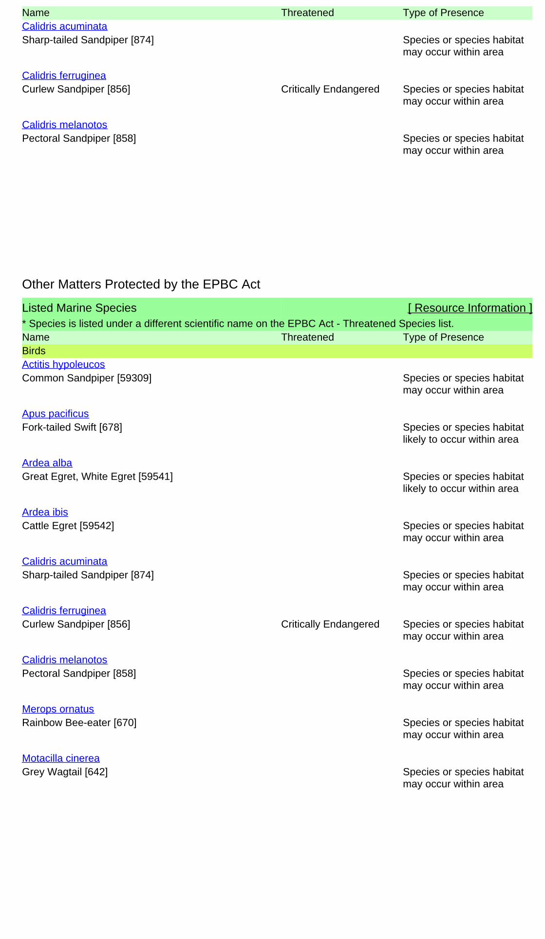
Name Threatened Type of Presence
Sharp-tailed Sandpiper [874] Species or species habitatmay occur within area
Calidris acuminata
Curlew Sandpiper [856] Critically Endangered Species or species habitatmay occur within area
Calidris ferruginea
Pectoral Sandpiper [858] Species or species habitatmay occur within area
Calidris melanotos
Listed Marine Species [ Resource Information ]* Species is listed under a different scientific name on the EPBC Act - Threatened Species list.Name Threatened Type of PresenceBirds
Common Sandpiper [59309] Species or species habitatmay occur within area
Actitis hypoleucos
Fork-tailed Swift [678] Species or species habitatlikely to occur within area
Apus pacificus
Great Egret, White Egret [59541] Species or species habitatlikely to occur within area
Ardea alba
Cattle Egret [59542] Species or species habitatmay occur within area
Ardea ibis
Sharp-tailed Sandpiper [874] Species or species habitatmay occur within area
Calidris acuminata
Curlew Sandpiper [856] Critically Endangered Species or species habitatmay occur within area
Calidris ferruginea
Pectoral Sandpiper [858] Species or species habitatmay occur within area
Calidris melanotos
Rainbow Bee-eater [670] Species or species habitatmay occur within area
Merops ornatus
Grey Wagtail [642] Species or species habitatmay occur within area
Motacilla cinerea
Other Matters Protected by the EPBC Act
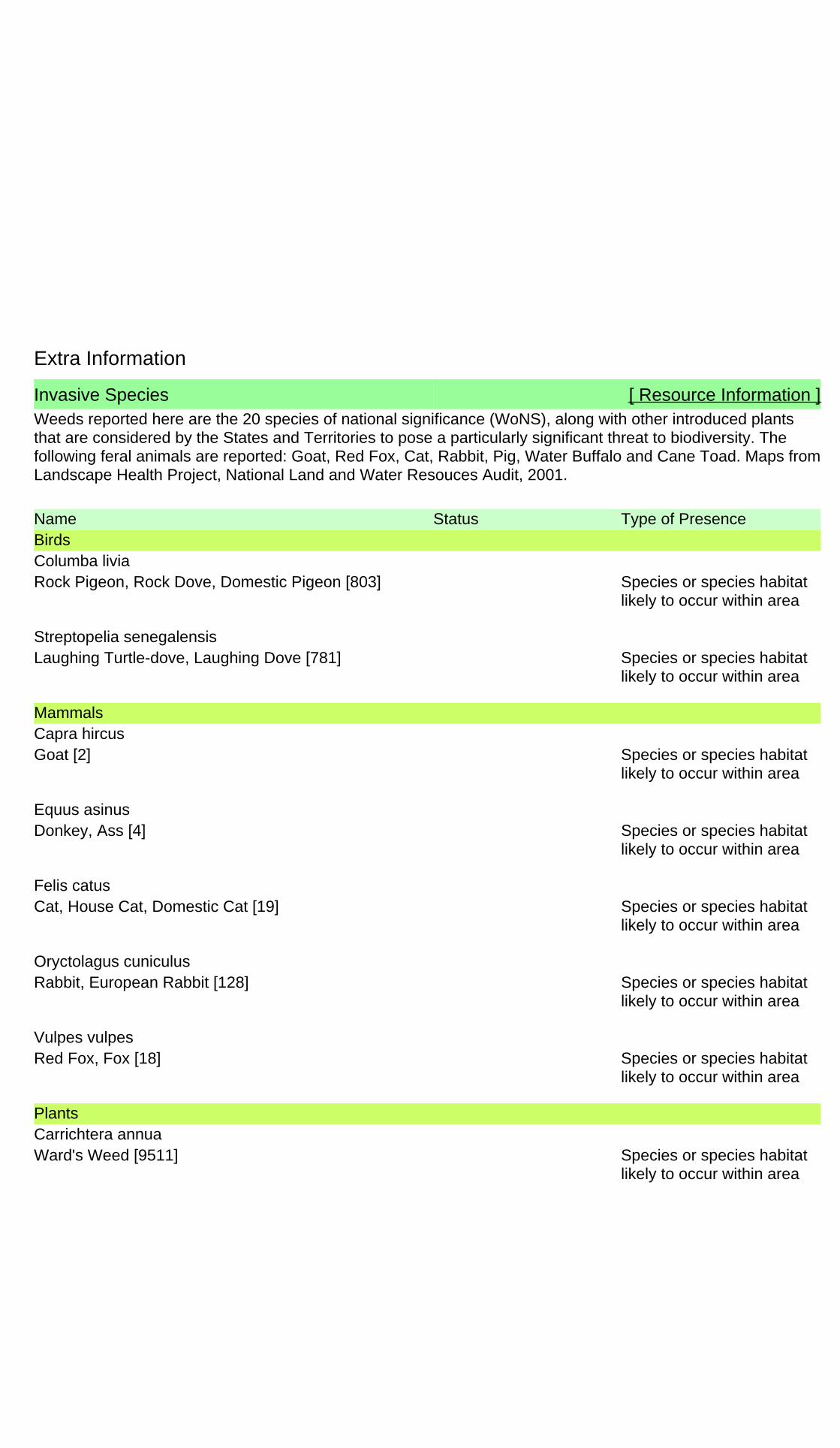
Extra Information
Invasive Species [ Resource Information ]Weeds reported here are the 20 species of national significance (WoNS), along with other introduced plantsthat are considered by the States and Territories to pose a particularly significant threat to biodiversity. Thefollowing feral animals are reported: Goat, Red Fox, Cat, Rabbit, Pig, Water Buffalo and Cane Toad. Maps fromLandscape Health Project, National Land and Water Resouces Audit, 2001.
Name Status Type of PresenceBirds
Rock Pigeon, Rock Dove, Domestic Pigeon [803] Species or species habitatlikely to occur within area
Columba livia
Laughing Turtle-dove, Laughing Dove [781] Species or species habitatlikely to occur within area
Streptopelia senegalensis
Mammals
Goat [2] Species or species habitatlikely to occur within area
Capra hircus
Donkey, Ass [4] Species or species habitatlikely to occur within area
Equus asinus
Cat, House Cat, Domestic Cat [19] Species or species habitatlikely to occur within area
Felis catus
Rabbit, European Rabbit [128] Species or species habitatlikely to occur within area
Oryctolagus cuniculus
Red Fox, Fox [18] Species or species habitatlikely to occur within area
Vulpes vulpes
Plants
Ward's Weed [9511] Species or species habitatlikely to occur within area
Carrichtera annua

- non-threatened seabirds which have only been mapped for recorded breeding sites
- migratory species that are very widespread, vagrant, or only occur in small numbers
- some species and ecological communities that have only recently been listed
Not all species listed under the EPBC Act have been mapped (see below) and therefore a report is a general guide only. Where available datasupports mapping, the type of presence that can be determined from the data is indicated in general terms. People using this information in makinga referral may need to consider the qualifications below and may need to seek and consider other information sources.
For threatened ecological communities where the distribution is well known, maps are derived from recovery plans, State vegetation maps, remotesensing imagery and other sources. Where threatened ecological community distributions are less well known, existing vegetation maps and pointlocation data are used to produce indicative distribution maps.
- seals which have only been mapped for breeding sites near the Australian continent
Such breeding sites may be important for the protection of the Commonwealth Marine environment.
Threatened, migratory and marine species distributions have been derived through a variety of methods. Where distributions are well known and iftime permits, maps are derived using either thematic spatial data (i.e. vegetation, soils, geology, elevation, aspect, terrain, etc) together with pointlocations and described habitat; or environmental modelling (MAXENT or BIOCLIM habitat modelling) using point locations and environmental datalayers.
The information presented in this report has been provided by a range of data sources as acknowledged at the end of the report.Caveat
- migratory and
The following species and ecological communities have not been mapped and do not appear in reports produced from this database:
- marine
This report is designed to assist in identifying the locations of places which may be relevant in determining obligations under the EnvironmentProtection and Biodiversity Conservation Act 1999. It holds mapped locations of World and National Heritage properties, Wetlands of Internationaland National Importance, Commonwealth and State/Territory reserves, listed threatened, migratory and marine species and listed threatenedecological communities. Mapping of Commonwealth land is not complete at this stage. Maps have been collated from a range of sources at variousresolutions.
- threatened species listed as extinct or considered as vagrants
- some terrestrial species that overfly the Commonwealth marine area
The following groups have been mapped, but may not cover the complete distribution of the species:
Only selected species covered by the following provisions of the EPBC Act have been mapped:
Where very little information is available for species or large number of maps are required in a short time-frame, maps are derived either from 0.04or 0.02 decimal degree cells; by an automated process using polygon capture techniques (static two kilometre grid cells, alpha-hull and convex hull);or captured manually or by using topographic features (national park boundaries, islands, etc). In the early stages of the distribution mappingprocess (1999-early 2000s) distributions were defined by degree blocks, 100K or 250K map sheets to rapidly create distribution maps. More reliabledistribution mapping methods are used to update these distributions as time permits.
-31.107951 119.199434,-31.094869 119.216772,-31.126762 119.250246,-31.137195 119.237199,-31.143512 119.241148,-31.148948119.234453,-31.143806 119.228273,-31.148067 119.22278,-31.142337 119.215742,-31.144835 119.211622,-31.142484 119.20836,-31.13837119.207159,-31.13117 119.199434,-31.12926 119.202009,-31.123382 119.195657,-31.124999 119.193598,-31.123088 119.190679,-31.117063119.187933,-31.113683 119.185701,-31.105746 119.196172,-31.107951 119.199434
Coordinates

-Environment and Planning Directorate, ACT-Birdlife Australia-Australian Bird and Bat Banding Scheme
-Department of Parks and Wildlife, Western Australia
Acknowledgements
-Office of Environment and Heritage, New South Wales
-Department of Primary Industries, Parks, Water and Environment, Tasmania
-Department of Land and Resource Management, Northern Territory-Department of Environmental and Heritage Protection, Queensland
-Department of Environment and Primary Industries, Victoria
-Australian National Wildlife Collection
-Department of Environment, Water and Natural Resources, South Australia
This database has been compiled from a range of data sources. The department acknowledges the followingcustodians who have contributed valuable data and advice:
-Australian Museum
-National Herbarium of NSW
Forestry Corporation, NSW-Australian Government, Department of Defence
-State Herbarium of South Australia
The Department is extremely grateful to the many organisations and individuals who provided expert adviceand information on numerous draft distributions.
-Natural history museums of Australia
-Queensland Museum
-Australian National Herbarium, Canberra
-Royal Botanic Gardens and National Herbarium of Victoria
-Geoscience Australia
-Ocean Biogeographic Information System
-Online Zoological Collections of Australian Museums-Queensland Herbarium
-Western Australian Herbarium
-Tasmanian Herbarium
-Northern Territory Herbarium
-South Australian Museum
-Museum Victoria
-University of New England
-CSIRO
-Other groups and individuals-Tasmanian Museum and Art Gallery, Hobart, Tasmania
-Museum and Art Gallery of the Northern Territory
-Reef Life Survey Australia-Australian Institute of Marine Science-Australian Government National Environmental Science Program
-Australian Tropical Herbarium, Cairns
-Australian Government – Australian Antarctic Data Centre
-Queen Victoria Museum and Art Gallery, Inveresk, Tasmania
-eBird Australia
-American Museum of Natural History
© Commonwealth of Australia
+61 2 6274 1111
Canberra ACT 2601 Australia
GPO Box 787
Department of the Environment
Please feel free to provide feedback via the Contact Us page.

MINING PROPOSAL Corinthia Project
P a g e | 65
APPENDIX 5: Haulage agreement with Shire of Yilgarn