Core Strategy Preferred Options Working Document Spring 08 1
202
i DRAFT APPENDIX 2
Transcript of Core Strategy Preferred Options Working Document Spring 08 1

i
DRAFT
APPENDIX 2

ii
PLANNING YOUR FUTURE Preface Looking forward to 2021 and beyond, the District will remain a prosperous, safe and healthy place where people want and are able to live and work. This is our vision for Three Rivers over the next 15 years or so. In seeking to deliver this vision, the Council is preparing a new type of development plan for the District called the Local Development Framework. This will replace the existing Local Plan with a suite of new planning documents, the first of which is the Core Strategy. It will link with other strategies such as the Sustainable Community Strategy and set out the long term vision for Three Rivers, along with the spatial strategy and policies to deliver the vision. The plan will set out the broad locations for where new houses, jobs and services will go over the period to 2021 and how we can effectively control development. The Council carried out extensive public consultation at an early stage of the Core Strategy (known as ‘Issues and Options’ consultation) during 2006 and 2007. This identified the many challenges facing the District, including how the future needs of the community could be met, whilst retaining and enhancing the special character of the District. This document, known as the ‘Preferred Options’, sets out the Council’s preferred approach to the spatial planning of the District. It reflects the results of earlier consultation and takes into account a range of research. Whilst the document has been prepared within the context of national and regional policy requirements, it also reflects the District’s specific local requirements. Following public consultation on these ‘Preferred Options’, the Core Strategy will be reviewed in the light of responses received before reaching the next stage known as the ‘Publication’ stage. The document will then be sent to the Government for independent public examination at the ‘Submission’ stage before being finalised and adopted. The ‘Preferred Options’ stage is therefore important as it is a key decision-making stage; it is about offering real choices for the future development of our area. We need your views in helping us decide if the identified choices are the right ones for the District and for you.

iii
Have your Say The Council is interested to hear the views of everyone including residents, businesses, community groups and all other stakeholders. All comments received will contribute towards the final document that will be submitted to the Government later this year. This paper and all supporting documents can be found on the Council’s website at: www.threerivers.gov.uk (under Local Development Framework). Hard copies are available for inspection at the Council’s offices in Rickmansworth and at all public libraries in the District. A summary and questionnaire can also be obtained at the above locations and downloaded from the Council’s website. This paper highlights particular questions where we would like your input and these are set out in full in a separate questionnaire document.
Please let us have your comments in one of the following ways: Fill in the questionnaire enclosed with this document and send it back to us in the reply-paid envelope. Make comments electronically by completing the online questionnaire on the Council’s website, or through the following link to Public Access: http://www2.threerivers.gov.uk/publicaccess/ldf/ldf_home.aspx The closing date for responses is .. For further information on this document, please contact the Council: By e-mail: [email protected] By telephone: 01923 727106 or Minicom on 01923 727303. In writing: Planning Policy, Three Rivers District Council, Three Rivers House, Northway, Rickmansworth, WD3 1RL. A separate sustainability appraisal report has been prepared on an independent basis for the Council. This document appraises the environmental, social and economic implications of the options. As with the Preferred Options document, the appraisal can be viewed at the Council’s website, at the Council’s reception and at the libraries within the District.

iv

v
Contents Page Chapter 1: Introduction 1
Chapter 2: Arriving at ‘Preferred Options’ 4
Chapter 3: Background and Context 5
Chapter 4: The Content of the Core Strategy 13
Chapter 5: Spatial Vision and Strategic Objectives 14
Spatial Strategy 19
Spatial Strategy 26
Chapter 6: Place-Shaping Policies 29
Development in the Principal Town 29
PSP1: Development in the Principal Town 29
Development in the Key Centres 31
PSP2: Development in Key Centres 31
Development in Secondary Centres 32
PSP3: Development in Secondary Centres 32 Development in Villages 34
PSP4: Development in Villages 34
Chapter 7: Core Policies 35
Sustainable Development 35
CP1: Overarching Policy on Sustainable Development 36
Housing 38
CP2: Housing Supply 41
CP3: Housing Mix and Density 45
CP4: Affordable Housing 49
CP5: Gypsy and Traveller Provision 52
Employment and Economic Development 54
CP6: Employment and Economic Development 57
Town Centres and Shopping 60
CP7: Town Centres and Shopping 63
Transport 65
CP8: Transport 69
Infrastructure and Planning Obligations 74
CP9: Infrastructure and Planning Obligations 78
Monitoring Framework 79
CP10: Monitoring and Delivery 80
Chapter 8: Development Policies 82
Green Belt 82
DC1: Green Belt 83
Biodiversity, Trees and Woodland s 85
DC2: Biodiversity, Trees and Woodlands 87

vi
Landscape Character 90
DC3: Landscape Character 92
Open Space, Sport and Recreation Facilities 94
DC4: Open Space, Sport and Recreation Facilities 96
Children’s Play Space 99
DC5: Children’s Play Space 100
Community, Leisure and Cultural Facilities 102
DC6: Community, Leisure and Cultural Facilities 103
Design of Development 105
DC7: Design of Development 107
DC8: Residential Design 108
Flood Risk and Water Resources 110
DC9: Flood Risk and Water Resources 112
Carbon Emissions and Renewable Energy 115
DC10: Carbon Dioxide Emissions and On-Site
Renewable Energy 117
Renewable Energy Developments 119
DC11: Renewable Energy Developments 120
Waste Management 122
DC12: Waste Management 124
Historic Environment 126
DC13: The Historic Built Environment 129
Contamination and Pollution 133
DC14: Contamination and Pollution Control 135
Parking 138
DC15: Parking 139
Appendix 1: Settlement Information 142
Map 1: Settlements 145
Map 2: Key Diagram 146
Map 3: Spatial Option 1 147
Map 4: Spatial Option 2 148
Map 5: Spatial Option 3 149
Appendix 2: Issues and Options Housing Locations 150
Appendix 3: Housing Sites Selection Criteria 153
Appendix 4: Larger Housing Sites 160
Appendix 5: Monitoring Indicators 166
Map 6: Retail Centres 172
Map 7: Transport 173
Map 8: Biodiversity Corridors 174
Map 9: Landscape Regions 175

vii
Appendix 6: Parking Standards 176
Map 10: Car Parking Zones 188
Appendix 7: Glossary and Abbreviations 189
Appendix 8: Planning Policy Statements and Guidance 195
Figures Page Figure 1: Core Strategy Key Elements 3 Figure 2: Population of Three Rivers Settlements 5 Figure 3: Inter-Relationships between Core Strategy and Sustainable Community Strategy 8 Figure 4: Alignment of the Core Strategy Strategic Objectives with other Plans/ Strategies affecting Three Rivers 18 Figure 5: Accessibility Rating of Main Settlements in Three Rivers 21 Figure 6: Hierarchy of Main Settlements in Three Rivers 22 Figure 7: Housing Trajectory Table 2001-2021 at 2008 Preferred Options 39 Figure 8: Indicative Phasing Strategy for Broad Housing Areas 40 Figure 9: Summary of Main Employment Areas in Three Rivers 55 Figure 10: Hierarchy of Retail Centres 61

1
CHAPTER 1: INTRODUCTION In 2005 the Council began preparing the Three Rivers Local Development Framework (LDF). The Local Development Framework is a new type of plan that will eventually replace the existing Three Rivers Local Plan 1996-2011, and create a new set of planning documents to help plan for, and manage, development in the District over the next 15 years or so. Significant progress has been made on the various component parts of the Local Development Framework including:
• The Local Development Scheme (LDS): a project plan for the Local Development Framework setting out which documents will be produced by when and how the process will be managed and resourced. The original Local Development Scheme was submitted in April 2005 and was subsequently revised in March 2007.
• The Statement of Community Involvement (SCI): a document setting out the Council’s approach to how, when and with whom the Council will consult with the community at various stages of the Local Development Framework process. This was adopted in July 2006.
• The Annual Monitoring Report (AMR): a document measuring the
effectiveness of planning policies and setting out a housing delivery programme for the District. Three successive Annual Monitoring Reports were submitted at the end of 2005, 2006 and 2007.
• The Evidence Base: a series of research documents establishing an understanding of the needs, opportunities and constraints within the District. To date the following studies have been completed:
� Urban Housing Capacity Study (January 2005) � Employment Land Study (January 2005) � Open Space, Sport and Recreation Study (July 2005) � Gypsy and Travellers’ Needs Study (April 2005) and Identification of
Potential Sites (September 2006) � Retail Capacity Study (March 2007) � Transport Background Paper (March 2007) � Access to Services and Infrastructure Background Paper (March
2007) � Settlement Appraisal Paper (March 2007, update May 2008) � Housing Market Needs Background Paper (November 2006) � Strategic Flood Risk Assessment (June 2007) � Appropriate Assessment report (December 2007) � Strategic Housing Market Assessment (to be completed October
2008) � Housing Viability Study (to be completed October 2008) � Strategic Housing Land Availability Assessment (to be completed
October/November 2008) � London Arc Employment Study (to be completed October 2008)

2
� Hertfordshire Investment and Infrastructure Strategy (to be completed November 2008)
� Biodiversity Background Paper (September 2008)
• The Sustainability Appraisal: a series of documents assessing the social, environmental and economic effects of plans and documents to ensure that development is ‘sustainable’. A scoping report was produced in February 2006, together with an initial sustainability appraisal for the Core Strategy document in June 2006. A further appraisal was carried out for the Supplemental Issues and Options Paper in July 2007. A final Sustainability Appraisal has been produced alongside this ‘Preferred Options’ document.
• Appropriate Assessment: an assessment required under the European Habitats Directive to ensure that development proposals do not have any significant adverse impacts on Special Areas of Conservation (SAC). The screening carried out indicated that the proposed development outlined at Issues and Options stage would have no significant impact on the Burnham Beeches Special Area of Conservation, which is the relevant Area for Three Rivers.
• Supplementary Planning Documents (SPDs): two Supplementary Planning Documents were adopted in December 2007:
o Sustainable Communities Supplementary Planning Document - this sets out guidance on good principles and practice on how development in the District can reduce carbon emissions through appropriate design, energy and water efficiency and waste reduction and recycling
o Open Space, Amenity and Children’s Play Space Supplementary Planning Document - this sets out guidance on good principles and practice for designing open spaces and securing amenity and children’s play space as part of appropriate development in the District.
The Council intends to produce further Supplementary Planning Documents on other topics including affordable housing and design guidance.
• The Core Strategy Development Plan Document (DPD): the key part of the Local Development Framework setting out the broad vision, objectives and policies for the District. Between June and September 2006 the Council carried out extensive consultation with the local community on the Core Strategy Issues and Options Paper, referred to as ‘Planning your Future’. This Paper identified the vision, objectives and key challenges facing the District in terms of future development.
Further public consultation was carried out on a Supplemental Issues and Options Paper between July and September 2007. This covered additional key areas including spatial options for the future location of housing, employment and retail in the District, policies to control development and an implementation and monitoring framework. The combined consultation on the Core Strategy resulted in over 900 responses being made. A summary of the responses received together with an assessment of the options put forward can be viewed on the Council’s website.

3
The Council also intends to prepare a Site Allocations Development Plan Document: this document will relate directly to the Core Strategy and will allocate key land uses in more details including housing, employment, gypsies and travellers, retail and open space. All parts of the existing Local Development Framework and the timetable for the preparation of future documents can be found at on-line at: www.ThreeRivers.gov.uk/Local Development Framework
How the Core Strategy Fits Together
A Core Strategy should be based on the following key elements:
• A brief description of the essential characteristics of the area
• The critical issues, problems and challenges facing the area
• The development of the spatial vision for the area
• The strategies to achieve the spatial vision
• The core policies containing the activities and actions to deliver the strategy
• A clear set of delivery mechanisms and measures for monitoring how effective the overall strategy is.
Figure 1 sets out how the key elements fit together.
Figure 1: Core Strategy Key elements (Source: Core Strategy Guidance, PAS, Dec 2006)

4
CHAPTER 2: ARRIVING AT ‘PREFERRED OPTIONS’ The ‘Preferred Options’* document builds on and refines earlier Issues and Options and focuses on the key decisions for the Core Strategy. In arriving at the Preferred Options that are set out in this document, the Council has taken into consideration the following:
• The views arising from previous public consultation involving a range of stakeholders in the District including residents, businesses, statutory bodies, local groups and individuals with interest in Three Rivers (over 900 combined responses)
• National and regional planning policy requirements and other plans and strategies affecting the area
• The long-term priorities for the Three Rivers area as defined by local people and main service providers in the area (Local Strategic Partnership)
• The rigorous testing of options and alternatives primarily through a
sustainability appraisal process, taking into account environmental, social and economic impacts of choices
• The extensive research and technical studies known as the evidence base that the Council has compiled in order to understand the needs of the area and the opportunities and constraints that exist
• The Government’s principles of sustainable development, whereby development helps to maintain high and stable levels of employment, achieves social progress which recognises the needs of everyone, provides effective protection of the environment and represents prudent use of natural resources.
---------------------------------------------------------------------------------------------------------- *At the time of writing, the Government introduced new planning guidance in the form of Planning Policy Statement 12: Local Spatial Planning. This document together with the accompanying regulations which came into force on the 27 June 2008 changed the way a Development Plan Document such as a Core Strategy should be prepared. The result is that the stage previously known as ‘Preferred Options’ has now effectively been subsumed into a new public participation stage, known as Regulation 25. The Council considers that the previous ‘Issues and Options’ consultation carried out in 2006 and 2007, combined with the current ‘Preferred Options’ consultation, will be sufficient to meet the requirements of Regulation 25. Whilst a formal ‘Preferred Options’ stage no longer exists, this document will nevertheless be known as a ‘Preferred Options’ document. This is considered necessary in order to provide continuity from previous consultation giving a clear context in which options have been developed.

5
CHAPTER 3: BACKGROUND AND CONTEXT Overview of the District Three Rivers is a sub-urban District of 88.8 square kilometres located in south-west Hertfordshire. It borders Watford and Hertsmere boroughs to the east, Buckinghamshire County (Chiltern and South Bucks Districts) to the west, St Albans City & District and Dacorum Borough to the north, and the London Boroughs of Hillingdon and Harrow to the south. The District is on the inner fringe of London and benefits from excellent road and rail connections including the M1 and M25 motorways which run through the District, the West Coast main line, the Chiltern Line and the London Underground Metropolitan line. Heathrow and Luton airports are in close proximity and Gatwick and Stansted are about an hour away. Over three-quarters (77%) of the District is designated as Green Belt and there are a number of small and medium sized settlements: Settlement Approx. Population Parish Area Rickmansworth 15,000 Unparished South Oxhey 12,000 Watford Rural
Croxley Green 12,000 Croxley Green Abbots Langley 11,000 Abbots Langley Chorleywood 7,000 Chorleywood Carpenders Park 5,000 Watford Rural Oxhey Hall 3,000 Watford Rural Eastbury 3,000 Unparished
Maple Cross 2,000 Unparished Figure 2: Population of Three Rivers Settlements (Source: Census 2001)
The District has a population of 86,400 (Source: mid-2007 population estimates, Office for National Statistics, 2008), with a higher proportion of older residents than the County average: 21.2% are over 60 compared to a county average of 19.7%. The minority ethnic population of Three Rivers increased between the 1991 and 2001 Census: 12.9% of the District population were from minority ethnic communities in the 2001 Census. The minority ethnic population varies by ward, ranging from 5.2% to 39.6%, and is greatest in the wards of Moor Park & Eastbury, Chorleywood East and Carpenders Park. Between the 1991 and 2001 Census, the overall population increased by 4.8%, while the numbers of households increased by 9%. 27% of all households are single people households as a result of people living longer and relationship breakdown. Population projections indicate that the population as a whole will increase by 1.8% by 2021, with the under 50s falling and the over 50s increasing (Source: Housing Market Assessment, 2008).

6
Crime is low in Three Rivers and levels are below the county average. However, fear of crime remains a prominent issue and anti-social behaviour is a concern amongst residents. The District has a mixed economy of business and industry with no dominant employer but with the head or regional offices of a number of large national and international companies (examples include Nissan, BT, Cadbury-Trebor-Basset and Comet). These are complemented by small businesses. The film studios at Leavesden are an internationally acclaimed site for making blockbuster films. Each weekday, 17,000 workers come into the District compared to 27,000 going out (Source: Census, 2001). This is the second highest daily outflow of commuters in Hertfordshire and reflects the high importance of the adjacent London job market. The majority of employees are engaged in managerial, administrative, clerical, and secretarial positions, principally in the banking, finance, distribution and catering sectors. Unemployment in the District is historically low compared to other parts of the country. At May 2008, the claimant count rate was 0.9% compared to a Hertfordshire average of 1.3% and a national level of 2.2% (Source: Hertfordshire County Council). The October to September Annual Population Survey records unemployment at a rate of 3.5% in Three Rivers. In relation to the District as a whole, Northwick, Hayling, Ashridge, Maple Cross and Langleybury wards feature comparatively high on the national Index of Multiple Deprivation, whilst wards such as Moor Park & Eastbury and Chorleywood West feature relatively low. Overall, Three Rivers is ranked 293 out of 354 local authorities where 1= the most deprived and 354 the least deprived (Source: Index of Multiple Deprivation 2007). The Index is a measure of health, access to education, relative incomes, unemployment and other social and economic factors. The average annual income for Three Rivers is £46,419 and is the highest in Hertfordshire (Source: Annual Survey of Hours and Earnings, 2007). The District is also second highest for detached house prices (£643,600), third highest for semi-detached (£296,800), fourth highest for terraced (£242,700), and highest for flats/maisonettes (£214,100). The Strategic Housing Market Assessment (2008) indicates a shortfall in affordable housing amounting to XXX units a year, when comparing need against provision. This lack of affordable housing can lead to people moving out of the District and to recruitment problems for local businesses and public sector organizations. Local Distinctiveness Three Rivers District is a mixture of beautiful countryside, villages and small towns, and the majority of its inhabitants are healthy, well educated, affluent, articulate and able to access our public services. People are attracted to live here because of the amenities and way of life, the proximity to central London and the excellent communication links by road, rail and air. However, access to services and facilities does vary in places and some pockets of deprivation exist as a result. Whilst Rickmansworth is the principal town in the District, no one town dominates. There are a number of settlements distributed fairly evenly throughout the District. Many Three Rivers residents also rely on towns in neighbouring areas for work, shopping and leisure purposes including parts of north London, Watford, Hemel

7
Hempstead and St Albans. However, the District remains fairly ‘self-sufficient’ in a number of areas including the provision of everyday local facilities, services and recreation. Although there are no key health centres in Three Rivers, residents are served by several hospitals situated in neighbouring Districts. Watford General and Hemel Hempstead Hospitals both provide Accident & Emergency facilities whilst St Alban’s City Hospital provides a Minor Injuries Unit to the north-east of the District. To the south of the District there is Mount Vernon Hospital which has a Minor Injuries Unit and is renowned for its Cancer Care Unit. Bishops Wood Hospital is also situated on the same grounds. There is also Harefield Hospital which is a regional centre for cardiology and its Heart and Lung Transplant Unit is one of the largest and most experienced centres in the world. Appendix 1 sets out a brief description of each settlement in the District, covering its history, role and function and the issues that local people raise on a regular basis, which make it unique. Local Policy Context There are a number of strategies and plans which affect the Three Rivers areas in terms of priorities and actions. It is therefore important that the Core Strategy relates to these so that the community’s aspirations can be delivered in an effective and joined-up way. The key strategic plans are referred to below: The Community Strategy for Three Rivers (2006-2012) has been prepared by the Local Strategic Partnership (LSP) to improve the quality of life in the District. The Local Strategic Partnership consists of the following organisations:
• Three Rivers District Council
• Hertfordshire County Council
• Hertfordshire Police Authority
• Hertfordshire Constabulary
• Centre for Voluntary Services
• Citizen’s Advice Bureau
• Three Rivers Parish Councils
• West Hertfordshire Primary Care Trust
• Hertfordshire Chamber of Commerce
• WENTA The five priorities of the Strategy are to address:
i. Anti-social behaviour, crime, and the fear of crime ii. Access to services iii. Improving the environment iv. Children’s and young people’s access to education, skills and training v. Improving the supply and standard of affordable housing.

8
Figure 3: Inter-relationship between Core Strategy and Sustainable Community Strategy There are further ‘cross-cutting’ themes around promoting equal opportunities and improved health for all residents, meeting the needs of children and young people and sustainable communities.
Community Strategy Priority
Delivery through the Core Strategy
Relevant Core Strategy Policies and Objectives
Priority 1: Anti-social behaviour, crime and fear of crime
• Promote safety and security as a high priority in the design of new development in order to create attractive and safe places in which to live, work and play.
• CP1
• CP3
Priority 2: Access to services
• Facilitate the provision of services, shops and infrastructure to meet the needs of existing development and new development
• Deliver improved and more integrated transport systems and to reduce the need to travel by locating development in accessible locations.
• CP1
• CP6
• CP7
• CP8
• CP9
• PSP1
• PSP2
• PSP3
• PSP4
Priority 3: Improving the environment
• Reduce the impact on the environment by reducing waste, pollution and energy consumption
• Make efficient use of previously developed land and to protect the Green Belt and open countryside
• Protect and enhance the historic environment
• Protect and improve the countryside and the diversity of wildlife and habitats.
• CP1
• CP2
• CP3
• CP8
• PSP1
• PSP2
• PSP3
• PSP4
Priority 4: Children’s and young people’s access to education, skills and training
• Facilitate the provision of education services, sport, recreation and open space facilities
• Retain and improve the range of local employment opportunities in the District.
• CP1
• CP6
• CP9
• PSP1
• PSP2
• PSP3
• PSP4
Priority 5: Improving supply and standard of affordable housing
• Seek a greater proportion of new housing development to be locally affordable in both the urban and rural areas of the District.
• CP1
• CP4
• PSP1
• PSP2
• PSP3
• PSP4

9
It is important that the Sustainable Community Strategy (SCS) is closely linked with the Local Development Framework in an area so that an integrated approach to community planning can be achieved. The Local Development Framework is the key mechanism for delivering on the ground what the community has said it needs in the Sustainable Community Strategy. Figure 3 details how the Core Strategy can contribute to the Sustainable Community Strategy priorities. The Local Strategic Partnership Partners have also developed further specific strategies and action plans stemming from the main Community Strategy. These include:
• The Three Rivers Community Safety Strategy and Action Plan (2008-2009) setting out priorities and targets to make the District a safer place
• Improving the Environmental Draft Action Plan setting out priorities and targets to improve and manage open spaces and sites of nature conservation, waste and recycling improvements, and planning related environmental projects
• The District Children and Young People’s Plan 2008-2009 setting out the priorities and targets to improve outcomes for children and young people in the District
• The Three Rivers Housing Strategy 2006-2011 Action Plan setting out priorities for improving the quality and affordability of housing in the District.
During 2008, the Local Strategic Partnership reviewed its priorities and action plans against the new County-wide Sustainable Community Strategy and the associated Local Area Agreement. Three new areas of work have been identified for new action plans as follows:
• Family Intervention Project: to identify the broader support needs of families associated with anti-social behaviour and crime
• Poverty Action Group: to identify ways to increase access to benefits advice and insulation grants for families on low incomes and those challenged by fuel poverty such as the elderly
• Health Inequalities: to develop projects through the Watford and Three Rivers Health Partnership to increase access to health and fitness services for the most vulnerable in the District
• Employment Group: to assess the need to maintain current employment opportunities in the District and the training needs of local residents to secure employment.
Hertfordshire Forward, the County Strategic Partnership, issued its draft Sustainable Community Strategy (‘Hertfordshire 2021-A Brighter Future’) in early 2008. This sets out the strategic plan for Hertfordshire and provides the long-term context for future reviews of local Community Strategies. The emerging Hertfordshire Strategy identifies nine themes and short-term actions for Hertfordshire which broadly correspond to the existing priorities and actions identified in the existing Three Rivers Sustainable Community Strategy. The emerging Sustainable Community Strategy short-term actions also provide a framework for the next rounds of Local Area Agreements (LAA) targets. The Local Area Agreement is a three-year contract between central Government, local

10
authorities and local partners in improving local services. They are structured around six main themes in Hertfordshire:
• Safer and Stronger
• Children and Young People
• Health and Older People
• Economic Development and Enterprise
• Housing and Character
• Transport and Sustainable Development. New targets and outcomes for the Local Area Agreement 2008-2011 are being agreed with Central Government. Reward grants will apply to the achievement of the Local Area Agreement 2006-2009 targets payable from the end of 2009. This reward grant will provide an important source of funding towards the achievement of Local Strategic Partnership priorities in the District and Hertfordshire Forward priorities across the County. New Local Area Agreements will not receive such significant reward grants. It is important that the new Local Area Agreement reflects local priorities, including those of the Local Development Framework, to ensure that County-wide use of reward grant is coordinated and invested locally. The Three Rivers Strategic Plan (2008-2011) identifies the priorities for the Council which are linked to the Sustainable Community Strategy Themes. Consultation with residents has indicated that there are five main priorities for the District. These are, in priority order:
i. Anti-social behaviour, crime, and fear of crime ii. Access to services for all residents iii. Improving the environment iv. Children’s and young people's access to education, skills and training v. Finding affordable housing
The Three Rivers Strategic Plan reflects these priorities in its vision, whereby:
‘the District should remain a prosperous, safe and healthy place where people want and are able to live and work’.
Future planning of development and infrastructure through the Local Development Framework is seen as a critical tool in delivering the strategic vision for the District. The Strategic Plan centres around two main themes relevant to the Local Development Framework: Safer Communities
• Working with partners to ensure the District is safe in terms of crime and anti-social behaviour
• Enforcing public health and safety regulations. Sustainable Communities
• Improving access to services, facilities, jobs and housing particularly for vulnerable residents such as elderly, disabled and young people
• Maintaining a high quality local environment by protecting the character of the District and minimising the impact of the built environment

11
• Reducing the carbon footprint of the District by minimising the use of energy, water and waste, reducing carbon dioxide emissions and increasing the use of renewable energy and waste recycling.
The Three Rivers Housing Strategy 2006-2011 This identifies the Council’s priorities to improve the quality and range of the public and private stock of housing and provide more affordable housing. The Council is committed to working with partners to achieve these priorities. The partners include Thrive Homes, the housing association which recently acquired the Council’s housing stock (April 2008). The Hertfordshire Local Transport Plan (2006-2011) This sets the framework for achieving the vision for a better transport system for all. It focuses on delivering the shared priorities of tackling congestion, delivering accessibility, providing safer roads, improving air quality and improving the quality of life for residents. Specific measures and schemes are included in the Plan for Three Rivers; these are referred to in this document. Health Authority Strategy This follows the “Delivering Quality Health Care for Hertfordshire” consultation in 2007, the West Hertfordshire and East & North Hertfordshire Primary Care Trusts and the Hertfordshire NHS Trusts have agreed the following improvements in key health centre provision in Hertfordshire taking into account the likely growth in population across the area using information from the local planning bodies and the East of England Regional Authority:
• The Acute Hospitals will be located at Watford and at the Lister Hospital in Stevenage
• Development of a new Local General Hospital in Hemel Hempstead
• Planned surgery to be at St Albans City Hospital
• A network of eight Urgent Care Centres, four of which will be 24 hour service based at Watford, Lister, Welwyn and Hemel Hempstead, and four reduced hours service at St Albans, Herts & Essex, Hertford and Cheshunt.
Building Schools for the Future Programme This sets out how Hertfordshire County Council will be implementing a programme to improve all the public secondary schools in the County over a 10-15 year period, either through refurbishing or rebuilding and the provision of ICT equipment. There are 27 primary schools, six secondary schools and a further five private schools, providing primary and secondary education in the District. Improvements of schools in Three Rivers are scheduled for the end of the programme period. There are no current plans for any major expansion of facilities. Hertfordshire Policing Plan 2008-2011 This sets out the priorities for the Police to make Hertfordshire an even safer community. It focuses on several key priority areas and places particular emphasis on the following:
• Reducing crime
• Protecting vulnerable people
• Bringing more serious offenders to justice

12
• Improving public confidence and satisfaction in police services
• Increasing people’s feelings of safety; and
• Reducing anti-social behaviour. Hertfordshire has one of the top performing forces in the county and levels of crime continue to fall – recent figures showed a 12% reduction across the county. The Council and Parish Councils currently help fund 23 Police Community Support Officers who work in the District. Local community priorities for all the Wards in the District are agreed by Neighbourhood Action Panels and these can be viewed at the following link: www.herts.police.uk
The Core Strategy will need to draw on any strategies of the local authority and other organisations that have implications for the development and use of land. Where appropriate, it should provide an integrated approach to the implementation and delivery of these aspects of other strategies. A range of specific local plans and strategies are also referred to in this ‘Preferred Options’ document.

13
CHAPTER 4: THE CONTENT OF THE CORE STRATEGY In practice a Core Strategy will:
• Provide an overall vision which sets out how the area and the places within it should develop
• Identify strategic objectives for the area focusing on the key issues to be addressed
• Seek to implement the spatial and transport policies of the Regional Spatial Strategy and incorporate its housing requirement
• Identify broad locations for delivering the housing and other strategic development needs such as employment, retail, leisure, community, essential public services and transport development
• Set out how much development is intended to happen where, when, and by what means it will be delivered
• Set out clear arrangements for managing and monitoring the delivery of the strategy.
The format of this document In the following sections, the Council’s ‘Preferred Option’ is presented on each aspect of the Core Strategy. For each ‘Preferred Option’ a range of information is given and is usually set out in the following format:
• Context - an overview is given of the national, regional and local policy context affecting the relevant issue
• ‘What you told us’ - sets out what previous public consultation has shown; this is taken primarily from previous public consultation undertaken on the ‘Issues and Options’ during 2006 and 2007. It also includes other relevant consultation, for example, undertaken as part of the Community Strategy
• ‘What the Sustainability Appraisal told us’ - sets out how the previous Issues and Options performed in relation to their social, economic and environmental impacts and recommendations in relation to developing the ‘Preferred Options’
• The Preferred Policy Option - sets out what the Council considers to be the best way forward taking into account all considerations
• Reasoned Justification - sets out why the Preferred Policy approach is considered to be the best option for Three Rivers
• Options Rejected - sets out the options previously considered where relevant and why they have been rejected.
Further details of the evaluation of alternatives are presented in the accompanying Sustainability Appraisal document.

14
CHAPTER 5: SPATIAL VISION AND STRATEGIC OBJECTIVES The Core Strategy should set out the long term spatial vision for the authority's area and the strategic policy objectives required to deliver that vision.
What you told us Public consultation on the Council’s original Vision and Objectives (2006) was generally supportive with some changes/additions requested. These included strengthening the vision and making it locally distinctive and adding more specific objectives in relation to water management. Further comments in 2007 included ensuring more compatibility between some of the objectives. The Local Development Framework Focus Group also reinforced what should be the main priorities including affordable housing, crime prevention, improving public transport and maintaining communities and the distinctive settlement pattern in the District.
What the Sustainability Appraisal told us The Sustainability Appraisal supports that the fact that the overall strategy should be solidly and unequivocally grounded in the principles of sustainability.
Taking into account the plans and strategies and evidence base referred to earlier and reflecting the priorities and concerns addressed through public consultation to date, the following spatial vision and strategic objectives are proposed for the Local Development Framework:
Preferred Spatial Vision Looking forward to 2021 and beyond, the District will remain a prosperous, safe and healthy place where people want and are able to live and work. This means promoting development that is sustainable so that the present needs of residents and businesses in Three Rivers can be met without compromising the ability of future generations to meet their own needs. In essence future development must secure a balanced provision between homes and jobs that also safeguards and enhances the environment, maintains the Green Belt, secures good services and facilities for all and achieves a sustainable transport system.

15
Preferred Strategic Objectives In order to implement and deliver the Local Development Framework’s Vision, the following set of strategic objectives have been identified. These provide more specific direction for the Spatial Strategy and Core Policies, which are developed in later sections of this document.
1. To ensure that development in Three Rivers recognises and safeguards the District’s distinctive character of small towns and villages interspersed with attractive countryside and Green Belt, through sustainable patterns of development The need for development in the District needs to be achieved whilst protecting the very assets that make Three Rivers unique, and help maintain a high quality of life. There will remain a strong commitment to the protection of the Green Belt which occupies 77% of the area of the District, although it is recognised that some minor adjustments to the Green Belt boundary may be necessary over the plan period to meet development needs, prevent over-development in some areas and generally promote a sustainable pattern of development.
2. To make efficient use of previously developed land
The re-use of land in the urban area is necessary to act as a stimulus for existing settlements, to concentrate development in the most accessible areas and to protect more open parts of the District. Continuing to achieve very high rates of development on previously developed land (PDL) will remain a priority for Three Rivers.
3. To reduce the impact on the environment by reducing waste, pollution
and energy consumption, by promoting the use of renewable energy and the conservation of water resources and by designing development to take into account future changes to the climate There is little doubt that the burning of fossil fuels is contributing to long-term changes in the climate and to pollution generally. It is important that the problem is tackled at all levels including the local. This means designing, constructing and re-using buildings and materials to minimise the use of natural resources and reduce the amount of waste going to landfill. It also means dealing with the effects of extreme weather and potential flood risk through appropriate design and siting of development.
4. To balance the community’s need for future homes and jobs by
providing sufficient land to meet a range of local housing needs and to maintain a prosperous local economy This will include making appropriate provision for the required numbers of homes and jobs, in line with the requirements of the Regional Spatial Strategy. For housing this also means meeting local needs in terms of size, type and tenure of units including affordable, special needs and gypsies’ and traveller’s accommodation. For employment, this means meeting local needs in terms of the type of jobs and within the employment sectors. Some ‘balance’ between the provision of homes and jobs is needed in order to redress the relatively high daily outflow of commuters from Three Rivers into London and other adjoining areas.

16
5. To increase levels of affordable housing in the District
A step-change in the provision of affordable housing is needed in order to seek to meet the large identified need for affordable housing in the District. House prices are high relative to incomes in the District and a significant proportion of the population, particularly the young and those within the less affluent parts of the District, are unable to access housing in the general market. The lack of suitable and affordable housing within the District also has impacts on the ability of the District to attract and retain workers with impacts on the key services and the local economy.
6. To facilitate the provision of services and infrastructure to meet the
needs of existing development and new development by working on cross- boundary issues with adjoining authorities, service providers and the development industry It is important that all residents, particularly vulnerable groups and those within the pocketed areas of deprivation in the District, have good access to services including health, education, transport and emergency services and that this is maintained or improved in the future. Potential deficiencies will need to be addressed through planning obligations and other funding regimes as part of new development proposals. The Council will continue to foster relationships with neighbouring Hertfordshire and Buckinghamshire Districts and with London.
7. To deliver improved and more integrated transport systems and reduce
the need to travel by locating development in accessible locations Although levels of car ownership are high within Three Rivers, not everyone has access to a car and nor is it necessary or desirable to use a car for all trips, particularly for short journeys. Providing alternatives to car travel such as better public transport, and better opportunities for cycling or walking, and by locating development within locations which have good access to services and a range of transport options will be major contributors to achieving a more sustainable District. It will also be important to integrate transport networks to enable people to change easily between road, rail, bus and cycle modes.
8. To maintain the viability, vitality and variety of shops and services
within the five key settlements in the District Ensuring that Abbots Langley, Chorleywood, Croxley Green, Rickmansworth and South Oxhey provide a good range of goods and services across the District will reduce the need to travel to centres further away, especially to meet everyday local needs, and support local businesses.
9. To protect and improve the countryside and the diversity of wildlife and
habitats Three Rivers has visually attractive landscapes and important habitats for wildlife. There is however scope to improve the diversity and connectivity of landscape and habitats. The protection and improvement of these assets will be an important Local Development Framework objective.

17
10. To protect and enhance the historic environment by resisting the loss of important buildings and ensuring that new development respects the unique character and identity of the towns and villages in the District Three Rivers is an area rich in its historic buildings, structures, spaces and conservation areas. It will be important to protect this heritage through appropriate control of development but also to enhance the historic environment where opportunities arise.
11. To provide accessible and varied opportunities for leisure, arts, sport
and recreational activities in order to promote healthy lifestyles The Local Development Framework can make a significant contribution towards improved levels of health by supporting the location and provision of suitable open space, children’s play space and sports facilities to increase opportunities to exercise as part of a healthy lifestyle for the whole community.
12. To promote safety and security as a high priority in the design of new
developments in order to create attractive and safe places in which to live, work and play Reducing crime, fear of crime and anti-social behaviour are key community priorities that can be addressed by the Local Development Framework by promoting good design, securing contributions towards increased police resources and improving access to training facilities provided by the Learning and Skills Council and other agencies.
Figure 4 shows how these strategic objectives align with the other strategic plans and strategies affecting the Three Rivers area. The majority of the objectives are compatible with other plans and strategies. Where objectives are not directly compatible, there are no conflicts. Reasoned Justification The Preferred Spatial Vision and Strategic Objectives are considered to provide the correct framework for the Core Strategy, taking into account the views of the local community. They also reflect and align with other plans and strategies affecting the area. Options Rejected The original Spatial Vision and Strategic Objectives have been refined over time to reflect more accurately local aspirations and sustainability objectives and to be more focused and better defined.

18
���� Objective is compatible/ in alignment with Plan/Strategy _ Objective is not in conflict with Plan/Strategy
Figure 4: Alignment of the Core Strategy strategic objectives with other Plans/Strategies affecting Three Rivers
Core Strategy strategic objectives
Three Rivers Community Strategy (2006-2012)
Draft Hertfordshire
Sustainable Community Strategy (2007-2021)
Three Rivers District Council Strategic Plan (2008-2011)
Three Rivers District Council Housing Strategy (2006-2011)
Hertfordshire Local Transport Plan (2006-2011)
Local Area Agreements (2008-2011)
1. To ensure development is sustainable, in environmental, social and economic terms
���� ���� ���� ���� ���� ����
2. To reduce the impact on the environment
���� ���� ���� _ ���� ����
3. To balance the need for homes and jobs
���� ���� ���� _ _ ����
4. To increase levels of affordable housing
���� ���� ���� ���� _ ����
5. To make efficient use of land
���� _ ���� _ ���� _
6. To facilitate the provision of services and infrastructure
���� _ ���� _ ���� ����
7. To deliver improved/integrated transport and to reduce the need to travel
���� ���� _ _ ���� _
8. To maintain shops and services in District centres
���� _ ���� _ _ ����
9. To protect and improve the countryside and biodiversity
���� _ ���� _ _ _
10. To protect and enhance the historic environment
���� ���� ���� _ _ _
11. To provide opportunities for leisure, sport and recreation
���� ���� ���� _ _ _
12. To promote safety and security in new development
���� ���� ���� _ _ ����

19
SPATIAL STRATEGY The preceding sections of this document set out the proposed vision for the future, and the suggested key objectives. However, in order for them to be achieved, it is necessary to have in place a basic strategy to help direct all future development and activity in the District. This part of the document sets out the preferred strategy and basic spatial principles. These are later developed into more detailed policies. National Context Government policy1 states that in delivering ‘sustainable development’ local planning authorities need to:
• Bring forward land in appropriate locations to meet the expected needs for housing, for industrial development, for retail and commercial development, and for leisure and recreation
• Set out a strategy for the planned location of new housing, using criteria for identifying broad locations and specific sites
• Improve access to affordable housing in urban and rural areas
• Promote economic growth to support business
• Promote urban and rural regeneration by improving facilities, providing high quality development including mixed-use development
• Promote mixed sustainable communities which respects the diverse and special needs of communities
• Address issues such as accessibility and sustainable transport needs, the provision of essential infrastructure, including for sustainable waste management, and the need to avoid flood risk and other natural hazards
• Provide improved access for all to jobs, health, education, shops, leisure and community facilities, open space, sport and recreation, by ensuring that new development is located where everyone can access services or facilities on foot, bicycle or public transport rather than having to rely on access by car
• Focus developments that attract a large number of people, especially retail, leisure and office development, within existing centres and/or areas with good public transport to promote their vitality and viability and social inclusion, reduce the need to travel and cut carbon emissions
• Promote more efficient use of land through higher density, mixed-use development and suitably located previously developed land and buildings
• Enhance as well as protect biodiversity, natural habitats, the historic environment and landscape and townscape character
• Address climate change, through the management of pollution and natural hazards and the safeguarding of natural resources
• Strictly control new building development in the open countryside, away from existing settlements
• Adopt a positive approach to sustaining village communities and rural services and facilities.
Through development, the Government wants to make sure there is adequate provision for housing and employment to meet the needs of a growing population
1 Planning Policy Statement 1: Delivering Sustainable Development, Planning Policy Statement 3:
Housing, Planning Policy Statement 7: Sustainable Development in Rural Areas

20
and to maintain prosperity nationally. In particular, there is a need to ensure a continuous supply of housing land over the next 5, 10 and 15 years. Regional Context The East of England Plan (known also as the Regional Spatial Strategy or RSS) reinforces Government policy regarding development, particularly in terms of the need to meet housing needs, support economic growth, reducing carbon emissions. Growth needs to be reconciled with the protection of the environment and maintenance of the general extent of the Green Belt. The spatial approach for the Regional Spatial Strategy seeks to direct the most strategically significant growth to the region’s major urban areas where:
• Good strategic networks and public transport already exist and there is scope to improve them
• There is the greatest potential to build on existing concentrations of activities and infrastructure (physical and social) and enhance them efficiently.
In practice this means directing development to the major towns within the region. These are known as Key Centres for Development and Change (KCDCs). Three Rivers does not contain any Key Centres for Development and Change, however;
• The neighbouring town of Watford is identified as a Key Centre for Development and Change because of its role as a regional retail centre and transport interchange. Compared to other Key Centres for Development and Change, the town has a relatively small allocation of housing (5,200 dwellings up to 2021) but the town’s growth is seen within the context of a ‘greater Watford area’, which includes settlements within Three Rivers and Hertsmere Districts; these Districts will support Watford as a Centre through their own housing and employment allocations
• The neighbouring Hemel Hempstead is also identified as a Key Centre for Development and Change. Part of Dacorum’s 12,000 housing allocation up to 2021 will need to be located within ‘urban extensions’ around Hemel Hempstead.
Three Rivers District is also expected to contribute directly to the growth of the region. Specifically this means planning for the provision of 4,000 new dwellings between 2001 and 2021 and contributing to a growth target of 68,000 jobs within Hertfordshire. With regard to towns other than in Key Centres for Development and Change, the Regional Spatial Strategy sets out that development will still be appropriate. Local development documents should set out the approach to development in these towns with the aim of increasing their economic and social sustainability through measures to:
• Support urban and rural renaissance
• Secure appropriate amounts of new housing and employment and
• Improve accessibility, especially by public transport. In rural areas the Regional Spatial Strategy seeks to ensure that the local economy such as agriculture is supported and diversified, local housing needs are provided for and local services are sustained.

21
Within the Region, Three Rivers is located within the London Arc sub-region, covering parts of Hertfordshire and Essex. This is a complex network of market towns, commuter settlements and 20th century new towns over which London has a powerful influence. The sub-region faces pressure for development but is constrained by the Metropolitan Green Belt. The Regional Spatial Strategy2 states that there is a need to strike a balance between restraining urban sprawl, enhancing the countryside and meeting development needs in sustainable ways. This will be done by making effective use of land within urban areas. Whilst the emphasis is on retaining and enhancing the Green Belt, selective reviews of the Green Belt may also be necessary. Local Context In considering spatial strategy options, it is important to consider existing access to services and facilities within each part of the District. The Council carried out a Settlement Appraisal (2007, update 2008) for each of the 35 defined ‘settlements’, large and small within the District. The appraisal took into account access to education, health care, shops, post offices and library services as well as to bus and rail services in the District. The appraisal provides a useful tool in:
• Identifying the settlements which have the best access, and therefore where any development should generally be concentrated
• Identifying the settlements with the poorest access, and therefore where development should generally be avoided
• Identifying specific deficiencies in services and facilities across all settlements, and therefore where opportunities should be taken to improve them with or without further development.
The appraisal found that the settlements with the best accessibility score and category rating were generally those with the largest populations: Settlement Population
(Census, 2001) Accessibility Score
Accessibility Category
Rickmansworth 14,571 9.75 Very Good Croxley Green 11,519 9.25 Very Good South Oxhey 11,984 8.8 Very Good Leavesden 4,499 7.85 Very Good Abbots Langley 10,472 7.35 Very Good
Chorleywood 6,814 6.75 Very Good Kings Langley 4,942 6.3 Very Good Carpenders Park 4,875 5.1 Good Moor Park 1925 5 Good Oxhey Hall 3,240 4.7 Good Eastbury 3,230 3.8 Good Maple Cross 2,198 3.55 Good
Bedmond 977 2.8 Fair Sarratt 924 2.35 Fair Figure 5: Accessibility rating of main settlements in Three Rivers (Source: Access to Services and Background Paper Update, May 2008)
2 Policy LA1: London Arc

22
Settlement Hierarchy The settlement appraisal provides a useful basis as to where future development in District should be broadly directed. Rickmansworth is the principal town in the District in terms of its size, function and overall importance. However in terms of population it is only slightly larger than South Oxhey, Croxley Green and Abbots Langley. Also in terms of overall accessibility, all four towns are broadly comparable and are categorised as ‘Very Good’. Future major development in Three Rivers should therefore be primarily focused in and around these settlements. Major development in other parts of the District needs to be carefully considered because of lower accessibility, but it is not necessarily precluded. Development may be appropriate in these areas particularly where it offers opportunities to rectify specific deficiencies in vital services and facilities or where it provides development necessary to sustain centres as providers of local employment, shopping and other services. Existing settlements in the District are shown on Map 1. Taking into account settlement size, population, existence of, and accessibility to, a range of services and transport infrastructure, and importance in economic and retailing terms, a settlement hierarchy can be defined as follows: Principal Town
Rickmansworth Key Centres
South Oxhey Croxley Green Abbots Langley Chorleywood Secondary Centres
Kings Langley Carpenders Park Eastbury Leavesden Oxhey Hall Maple Cross Moor Park Villages
Bedmond Sarratt
Figure 6: Hierarchy of main settlements in Three Rivers

23
Spatial Strategy Options During consultation in 2006 a number of options were considered around the central spatial theme of balancing homes and jobs and protecting the Green Belt. On the basis of an Urban Capacity Study (2005), it was anticipated that the draft Regional Spatial Strategy housing allocation of 3,600 dwellings between 2001 and 2021 could be met on land within the existing built-up settlements, without the need to consider Green Belt land. The options ranged from:
• A continuation of the existing Local Plan approach, whereby development is directed towards all parts of the residential built-up areas of the District which by definition have generally good accessibility to shops, local services and public transport network; to
• The consideration of the use of surplus employment land within the built-up area, should the need arise, either solely for housing development or as part of mixed-use development.
What you told us The results from the public consultation indicated that there was general support to direct development within existing built-up settlements and reduce the need to travel but recognition also that surplus employment land could be used if necessary, at least in part, for mixed-use development including housing.
What the Sustainability Appraisal told us The Sustainability Appraisal supports the focusing of development within the built-up area, close to existing services and transport. However it is acknowledged that some employment sites could be equally accessible and there would be merits in using previously developed land and creating thriving mixed-use development.
The 2006 consultation also considered where the highest concentration of development by density should be directed according to the nature of the settlement (hierarchy). The options ranged from:
• Assessing each form of development on its merits taking into account the character of the area and the location of the site in relation to shops, services and public transport; to
• Setting density guidelines according to the type and accessibility of each settlement in the District whereby the higher order towns such as Rickmansworth would accommodate higher concentrations of development and lower order villages such as Bedmond and Sarratt the lowest levels.
What you told us The results from the public consultation indicated strong support for development to respect the character of existing areas and for development to be considered on its merits.

24
What the Sustainability Appraisal told us The Sustainability Appraisal found that linking the level of density with the level of accessibility was the most beneficial. Setting levels too low may end up forcing development towards green field/Green Belt sites. High density options can also lead to social problems without careful attention to design.
By 2007, changes in Government policy3 in relation to housing supply, and an 11% increase to the District’s housing allocation in the emerging Regional Spatial Strategy, meant that the Council had to consider a new strategy in order to deliver its regional commitment. It was projected that the required number of dwellings (4000) could not be accommodated entirely within the urban area and that a shortfall of around 900 dwellings in the latter part of the plan period would need to be accommodated on the edge of the existing settlement on green field and/or Green Belt land. In this regard a number of broad locations for housing growth across the District were put forward for consultation as part of the Supplemental Issues and Options paper in 2007.
What you told us The consultation showed there was support in principle for this spatial approach, accepting that the Council had no real choice but to explore locations outside of the existing urban area for new housing development in order to meet future housing needs.
The Supplemental Issues and Options consultation in 2007 also considered spatial options for employment and retail development. In terms of employment and in providing the required number of jobs in the local area, there was broad public support to continue to focus employment opportunities within the established employment areas in the District. These are located primarily within the urban area (Croxley/Tolpits Area, East Kings Langley, Maple Cross, South Oxhey and Rickmansworth Town Centre) but also on the edge of the existing settlement (Leavesden).
What you told us There was strong public support to use surplus employment land in these areas for other uses such as residential.
What the Sustainability Appraisal told us The Sustainability Appraisal supports the principle of mixed-use development on employment sites, particularly on previously developed land, providing an element of employment use is retained in order to sustain the local economy and reduce out-commuting.
3 Planning Policy Statement 3: Housing

25
In terms of where future retailing should be located, various spatial options were put forward to accommodate future growth in retail provision amongst the five main centres (Rickmansworth, Abbots Langley, Chorleywood, South Oxhey and Croxley Green). The options covered:
• Rickmansworth as the principal town in the District
• Rickmansworth and Abbots Langley to provide a north and south focus
• All five key centres to provide an even distribution
• One or two key centres only to target investment where needed.
What you told us The consultation indicated support for a multi-centre focus amongst all five centres, though Abbots Langley, South Oxhey and Rickmansworth were seen as the areas which should be considered for enlargement and/or improvement.
What the Sustainability Appraisal told us The Sustainability Appraisal considers that spreading retail development amongst all five key centres is potentially the most sustainable in so far as encouraging the viability of all centres in the District. Ensuring that all centres can provide the basic daily requirements for local shoppers will also help avoid the need to travel further. A broad geographical spread of facilities would also ensure that the needs of residents in outlying areas of the District can be served.
In summary, as part of the Issues and Options stage, three broad spatial strategies were considered in order to deliver national and regional requirements:
1. Focus future housing development within the existing built-up residential settlements. This would continue a historic pattern of residential infilling throughout the urban area, with major development focused in the most accessible settlements; principally within Rickmansworth, Abbots Langley, Croxley Green, South Oxhey and Chorleywood
2. As per number 1 above but in addition, surplus employment land, principally
within the existing built-up area, would also be used for housing development or as part of mixed-use development to meet future development needs.
3. Focus future housing development within the existing urban area, use
surplus employment land where available, and also land on the edge of existing settlements. This would involve continuing to infill within the urban area but also making some provision in the long-term for development in more peripheral locations, involving some minor alterations to the Green Belt boundary.
Strategy option 3 is considered to be the preferred option. These spatial options are illustrated on Maps 3, 4 and 5.

26
Preferred Option - Spatial Strategy Adopting an approach (Option 3) which:
• Continues to focus development within the existing urban area through infilling
• Makes planned provision for longer-term development on the edge of the existing settlements within identified broad areas for housing growth.
The preferred broad areas of housing growth outside the main urban areas have been identified on the Key Diagram. These are generally spread throughout the District in order to enable the existing key centres to continue to meet local service needs. A phasing strategy will be adopted to ensure development in these areas generally occurs over the latter period of the Plan (post 2014/15). Regular monitoring will also be employed to assess the need to bring forward these areas in order to maintain a 5/10/15 year land supply in accordance with national guidance. Where appropriate, minor alterations to the Green Belt boundary will be made.
The Key Diagram (Map 2) sets out the preferred broad housing areas on the edge of existing settlements. Six larger housing sites are put forward. These are generally capable of accommodating at least 100 dwellings (2 hectares) and will generally be suitable for mixed-use development including employment and community uses. In accordance with national guidance, these have been identified on the basis of testing a number of potential locations against an extensive range of planning and sustainability criteria. Eight initial broad areas of housing were consulted upon as part of the Supplemental Issues and Options Paper in 2007. The results of public consultation and the sustainability appraisal in relation to each of these broad areas are set out in Appendix 2, together with details of other areas/sites put forward by the public, landowners and developers to meet long-term housing needs.
As part of the consultation, comments were also sought on the range of criteria that
had been used to assess areas. Taking into account the consultation, the Council has developed a greater range of planning and sustainability criteria to evaluate housing areas. Details of how the criteria have been developed are set out in Appendix 3.
The revised criteria have been applied to a broader range of areas across the
District to redefine the ‘preferred option’ broad housing areas. Those with the highest scores have been included as the preferred broad housing areas. Those with the lower scores have not been included. Appendix 4 sets out more detailed information on these larger housing areas, including maps.
27
Reasoned Justification It is considered that Option 3 provides the most sustainable means of meeting development needs in Three Rivers and the one that is proposed as the ‘Preferred Option’. This option enables:
• Development to continue to take place within the urban area, making full use of previously developed land
• Development in the urban area not to exceed concentrations that would have a detrimental effect on the existing character and amenities and put a strain on existing services and infrastructure
• Development to come forward on larger sites, facilitating the provision of better planned development and improvements to services and facilities in an area
• Development to be well distributed in the District taking into account the settlement hierarchy and the role, nature of capacity of existing centres to service new development
• A phased and flexible approach that continues to focus development in and around existing settlements, meeting local development needs and reducing the need to travel to work and to shops and services
• An approach that can sustainably deliver the levels of growth in housing and employment as prescribed by the Regional Spatial Strategy.
The selected preferred housing areas are considered to be the most appropriate for future development taking into account:
• Their potential impact on the Green Belt and the wider natural and built environment
• Their accessibility in relation to transport, services and facilities
• The likelihood of the area coming forward over the Plan period. Options Rejected Options 1 and 2 were rejected on the basis that they would not be able to deliver the required levels of growth as set out in the emerging Regional Plan without significant impacts on the character, amenities and infrastructure within the existing built-up area. Option 1 in particular would require the capacity of sites in the urban area to be increased by more than double current rates. A ‘do nothing’ approach, whereby development would simply come forward on the basis of market forces and then be considered on its merits in the absence of any defined spatial strategy, was also considered but rejected at an early stage of the process. This was not considered to be a realistic option as it would not deliver required levels of growth in a sustainable manner nor deliver it quickly enough to meet local needs. As set out in the 2007 consultation paper, the Council believes that there is no realistic alternative to the principle of planning for development needs in the area. Instead attention should focus on options around how future development can be planned effectively, taking into account the spatial implications of growth strategies,

28
the needs of service and infrastructure providers and ensuring that development is ‘sustainable’.
In terms of suitable broad housing areas, a range of areas/sites were put forward for housing by landowners and developers. It is considered that many of these are not appropriate as broad housing areas because they are not of sufficient size to be considered as strategic areas of growth for the Core Strategy. However, some of these may be considered as part of the Council’s general housing supply through Strategic Housing Land Availability Assessment and subsequently through the Site Allocation document.

29
POLICIES
The role of the Policies is to set out the fundamental principles that should be adhered to in order to support the delivery of development in accordance with the Spatial Strategy. These can be split into three parts:
• Place-Shaping Policies for each settlement;
• Core Policies covering main topic areas and themes;
• Development Policies covering the control of development.
CHAPTER 6: PLACE-SHAPING POLICIES In delivering the spatial strategy it is important to assess how each of the settlements in the District will be expected to contribute to it. In recognition that the role and function of each settlement can vary and that each has locally defined characteristics, ‘place-shaping’ policies have been developed for each settlement or group of settlements. This new policy approach, developed by taking on board comments made at the Issues and Options stage and other relevant sources of information from the Evidence Base (see Chapter 1: Introduction) , makes the Core Strategy more ‘locally distinctive’. Appendix 1 gives a brief description of each settlement.
PSP1 Preferred Policy Approach Development in the Principal Town (Rickmansworth) The preferred approach to development in Rickmansworth is to:
• Focus future development predominantly on sites within the urban area, on previously developed land
• Provide approximately 20% of the District’s future housing requirements over the Plan period to include approximately xx % of affordable housing as informed by the Strategic Housing Market Assessment and Strategic Housing Land Availability Assessment (2008)
• Maintain the overall amount of existing employment floorspace in the town, including the general supply of office accommodation in the town centre.
• Maintain the retail core in the town centre and where appropriate enhance it through a modest increase in retail floorspace in accordance with the Retail Capacity Study
• Contribute to an integrated approach to improve transport and movement into, and around, the town and connectivity with all other key centres in the District and service centres in adjoining Districts
• Promote development, infrastructure and services that will help tackle issues of deprivation affecting Penn Ward particularly in relation to children and young people
• Maintain and enhance the vitality and viability of the town centre by promoting a range of town centre uses including housing, employment, shopping, leisure and community uses. This should help to improve access to housing and services

30
• Support the town centre as a focus for community interaction and the viability of existing facilities such as Watersmeet
• Preserve and where possible enhance the distinctive and historic character of the centre particularly within the area defined by the Rickmansworth Town Centre Conservation Area through appropriate and well designed development
• Preserve and enhance the unique natural landscape, biodiversity and habitat surrounding the town in the River Chess Valley to the east and the River Colne Valley to the south and
• Improve the provision of, and access to, services and facilities to meet future demands, specifically through:
o Improvements of parking and cycle facilities at Rickmansworth station o Provision of waiting facilities for hackney carriage ranks within
Rickmansworth Town Centre o Improvements to rail services and rail links at Rickmansworth Station
specifically through the Croxley Rail Link o Provision of a strategic cycle route between Rickmansworth Town
Centre and Chorleywood and Maple Cross o Improved bus service between Rickmansworth Town Centre and
surrounding centres o Road safety improvements to Park Road (A412) and Chorleywood
Road (A404) by Royal Masonic School o The extension of cemetery facilities at the site in Woodcock Hill to
increase capacity o Maintain and improve biodiversity, recreational access and
watersports facilities at Rickmansworth Aquadrome in accordance with the management plan and master plan
o Develop a play area to meet identified needs in the Rickmansworth area
Reasoned Justification Rickmansworth is the principal town in the District with the largest town centre, with a good range of services and facilities and public transport facilities. It is therefore appropriate that a proportion of future development should be located within the town. There is scope for continued infilling within the urban area, primarily on previously developed land, subject to the protection of existing residential and historic character and amenities. However the scope for development on the edge of the town is generally constrained by the open space and Green Belt on all sides, and by flood risk areas and wildlife designations particularly to the east and to the south.

31
PSP2 Preferred Policy Approach Development in the Key Centres (South Oxhey, Croxley Green, Abbots Langley, Chorleywood) The preferred approach in Key Centres is to:
• Focus future development predominantly on sites within the urban area, on previously developed land
• Plan for areas of housing growth on the edge of South Oxhey and Abbots Langley as defined on the Key Diagram, specifically through development at:
o Leavesden Park, South-east of Abbots Langley o Oxhey Drive and Northwick Road, South Oxhey o Little Furze School, West of South Oxhey o Woodside Road, East of Abbots Langley
• Provide approximately 50% of the District’s future housing requirements over the Plan period to include xx % of affordable housing as informed by the Strategic Housing Market Assessment and Strategic Housing Land Availability Assessment (2008)
• Maintain and enhance employment opportunities in the Key Centres but reduce oversupply of office provision at Leavesden Park through mixed-use development including housing
• Maintain and enhance primary and secondary shopping frontages within Abbots Langley, Chorleywood and South Oxhey District Shopping Centres and the Local Shopping Centre at Croxley Green to meet needs from new housing development and to enable Key Centres to be sufficient in meeting local daily needs
• Provide for a modest extension of retail floorspace within the Key Centres where opportunities arise
• Contribute to an integrated approach to improve transport and movement into, and around, the Key Centres and connectivity with all other centres in the District, and service centres in adjoining authorities in Hertfordshire, Buckinghamshire and London
• Promote development, infrastructure and services that will help tackle deprivation affecting South Oxhey (Ashridge, Hayling and Northwick wards) particularly in relation to improving access to education, skills, training and employment and reducing crime
• Regenerate parts of South Oxhey such as ‘The Strip’ area of Oxhey Drive and surroundings
• Preserve and enhance the local distinctiveness of the Key Centres, particularly the historic cores of Abbots Langley, Croxley Green and Chorleywood
• Improve provision of, and access to, services and facilities, to meet future demands, specifically through:
o Junction improvements to A41 in relation to Leavesden Park o Improvements to bus services to and from Leavesden area including
shuttle service from Leavesden Park to Watford Junction station o Traffic management improvements to A4125 (Hampermill Lane) o Provide a strategic cycle link between Croxley Station and the Ebury
Way cycle route via the Byewaters estate

32
o Improvement of parking and cycling facilities at Croxley and Chorleywood stations
o Road safety improvements to A404 by St Clement Danes School o Improve the range of youth facilities in all Key Centres o Improve facilities and accessibility at Leavesden Country Park o Maintain biodiversity and access improvements to Chorleywood
House Estate as part of agreed management plan o Improve access at Croxley Hall Wood o Develop a play area in Chorleywood to address current deficiency in
provision o Improve facilities at Oxhey Woods Local Nature Reserve including the
provision of an education centre on site o Improve quality of and access to children’s play space in South Oxhey o Improve facilities at Abbots Langley Community Centre o Provide a new Area Police Headquarters at Leavesden Park
Reasoned justification
The Key Centres include a range of medium sized settlements distributed throughout the District. All are fairly ‘self contained’ centres that primarily serve the local population. They provide a range of services and facilities, and access to public transport is generally very good. Therefore it is appropriate that a proportion of future development should be located within and immediately surrounding the Key Centres. There is scope for continued infilling within the urban areas, primarily on previously developed land, subject to the protection of existing residential and historic character and amenities. Whilst the scope for development on the edge of the Key Centres is constrained by Green Belt and other environmental designations, there are opportunities to promote sustainable development through limited development within the Green Belt, including on previously developed land, and consequently to also improve services and facilities within the Key Centres.
PSP3 Preferred Policy Approach Development in Secondary Centres (Kings Langley, Carpenders Park, Eastbury, Maple Cross, Moor Park)
• Focus future development predominantly on sites within the urban area, on previously developed land
• Plan for areas of housing growth on the edge of Carpenders Park and at Kings Langley as defined on the Key Diagram, specifically through development at:
o Kings Langley Employment Area, East of Kings Langley o Little Oxhey Lane, East of Carpenders Park
• Provide approximately 20% of the District’s future housing requirements over the Plan period to include xx % of affordable housing as informed by the Strategic Housing Market Assessment and Strategic Housing Land Availability Assessment (2008)

33
• Maintain and enhance employment opportunities in Secondary Centres but re-distribute some employment floorspace through mixed-use development in Kings Langley Employment Area and an extension of floorspace at Maple Cross/Maple Lodge
• Allowing development in the centres in order to meet local community and business needs, and to maintain the vitality of communities. This should help tackle deprivation in areas of Maple Cross and Carpenders Park, particularly in relation to access to housing, and services
• Maintain and enhance the provision of local shops within the Secondary Centres to meet future local daily needs
• Contribute to an integrated approach to improve transport and movement into, and around, the secondary centres and connectivity with all other centres in the District and service centres in adjoining Districts
• Promote development, infrastructure and services that will help tackle deprivation affecting Maple Cross particularly in relation to access to housing and services and reducing crime
• Preserve and enhance the local distinctiveness and the historic cores of Eastbury and Moor Park
• Improve provision of access to services and facilities, to meet future demands, specifically through:
o Traffic management improvements to the C76 between Kings Langley Station and Barnacres Lane (in Dacorum District) and to the A412 (Denham Way) in Maple Cross
o Improvement of bus services from Maple Cross to Rickmansworth o Improvement of bus services from Kings Langley Employment Area to
Key Centres in District o Improvement of parking and cycling facilities at Kings Langley, Moor
Park and Carpenders Park stations.
• Develop a play area to address identified deficiency in Moor Park, Eastbury and Northwood area.
Reasoned Justification Secondary Centres include a range of smaller sized settlements distributed throughout the District. They provide a more limited range of services and facilities than the Key Centres but are still important in meeting local needs. They are generally well located with regard to access to adjoining centres and public transport facilities. Therefore it is appropriate that a proportion of future development should be located within and immediately surrounding the Secondary Centres. There is scope for continued infilling within the urban areas, primarily on previously developed land, subject to the protection of existing residential and historic character and amenities. Whilst the scope for development on the edge of the Secondary Centres is constrained by Green Belt and other environmental designations, there are opportunities to promote sustainable development on previously developed sites such as within employment areas at Kings Langley Employment Area and previously identified sites within the Green Belt such as at Maple Lodge, Maple Cross.

34
PSP4 Preferred Policy Approach Development in Villages (Bedmond, Sarratt)
• Strictly control development within the villages in order to protect the character, landscape, heritage and wildlife of the wider countryside, and the openness of the Green Belt
• Ensure that new development is well designed and inclusive, in keeping and scale with its location, and sensitive to the character of the countryside and local distinctiveness.
• Allow some limited small-scale development in the villages in order to meet local community and business needs, to maintain the vitality of these communities. This should help tackle deprivation in these villages, particularly in relation to access to housing, employment and services
• Improve the viability, accessibility and community value of existing services and facilities, e.g. village shops and post offices, rural petrol stations, village and church halls, rural public houses and bus services that play an important role in sustaining village communities
• Allocate and release sites solely for affordable housing using a Rural Exception Site Policy approach to accommodate households which contain current residents or have an existing family or employment connection in perpetuity (these will be allocated in a subsequent Site Allocations document)
• Provide approximately 2% of the District’s future housing requirements over the Plan period to include xx % of affordable housing as informed by the Strategic Housing Market Assessment and Strategic Housing Land Availability Assessment (2008)
• Improve provision of and access to, services and facilities to meet future demands, specifically through:
o Traffic management improvements to the C77 (Bedmond Road) o Extending provision at Bedmond Sports and Social Club site, Toms
Lane, to include facilities for young people o Extending and improving facilities at Frogmore Meadow Site of
Special Scientific Interest, Sarratt o Creating a play area in Sarratt to meet identified need
Reasoned Justification Bedmond and Sarratt are small village settlements within the Green Belt to the north and west of the District, surrounded by open countryside. They provide a limited range of services and facilities to serve the villages and other smaller surrounding populations. Access to public transport is also limited. The villages provide an important role in supporting the local economies of agriculture, forestry and other small businesses. There is some scope for development within the villages, although this will be limited in view of the nature and scale of these settlements and surroundings. Development will need to be small-scale and help sustain the rural communities through the provision of affordable housing, rural employment opportunities and improved services and facilities.

35
CHAPTER 7: CORE POLICIES The policies in this section apply across the whole District and are based on themes.
SUSTAINABLE DEVELOPMENT National Context Sustainable development is the core principle underpinning planning. At the heart of sustainable development is the simple idea of ensuring a better quality of life for everyone, now and for future generations. The Government set out four aims for sustainable development in its Strategy for Sustainable Development in the UK (1999):
• Social progress which recognises the needs of everyone
• Effective protection of the environment
• The prudent use of natural resources
• The maintenance of high and stable levels of economic growth and employment.
National Policy4 sets out planning priorities particularly in relation to environmental sustainability. This includes the need to reduce carbon emissions and to promote renewable energy and sustainable transport.
Regional Context Sustainable development principles are at the core of the Regional Spatial Strategy5. Local Development documents are required to help deliver sustainable development particularly through:
• Reducing carbon emissions and impact on climate change
• Creating sustainable communities with good access to services and facilities
• Protecting and enhancing the environment. Local Context Sustainable development is critical to the delivery of many of the Council’s and community’s aspirations and is central to the Spatial Vision and Strategic Objectives for the Core Strategy. Time and time again the key priorities of local people are to deliver a strategy which:
• Improves access to jobs, services and facilities for all groups
• Achieves a high quality environment
• Reduces our carbon footprint
• Reduces crime and anti-social behaviour and
• Increases the supply of affordable housing. These can all be addressed by future development and ensuring that it is sustainable in terms of its economic, social and environmental impact. The policies
4 Planning Policy Statement: Planning and Climate Change - Supplement to Planning Policy
Statement 1 5 Policy SS1: Achieving Sustainable Development

36
and plans in the document have been tested by a Sustainability Appraisal with this in mind. Building Futures: a Hertfordshire Guide to Promoting Sustainability in Development Hertfordshire County Council, together with the Hertfordshire Districts, has produced guidance for planning officers and developers on how to make development in Hertfordshire as sustainable as possible. It offers practical and user-friendly advice for everyone involved in the preparation of development proposals, for local authorities and other agencies in assessing those proposals, and for individuals with an interest in development in the county. It is a web-based facility which is updated regularly to address emerging policy requirements, legislation changes and new examples of good practice. It can be viewed at: http://www.hertslink.org/buildingfutures and includes topic areas on Air, Design, Energy, Materials, Noise, Safety, Waste and Water. What you said There was strong support for all future development in Three Rivers to be sustainable, particularly in relation to protecting the environment. Specific comments are covered in detail within each of the relevant preferred policy approaches within this document.
What the Sustainability Appraisal said The principal objective of the Sustainability Appraisal is to ensure the promotion of sustainable development as part of all plans, strategies and policies. Specific comments are covered in detail within each of the relevant preferred policy approaches within this document.
CP1 Preferred Policy Approach - Overarching Policy On Sustainable Development The preferred approach is to ensure all development in Three Rivers is sustainable. This means promoting development that takes into account the need to:
• Tackle climate change by reducing carbon emissions, increasing energy efficiency of buildings, promoting the use of renewable energy systems, avoiding development in areas at risk from flooding and using water and other natural resources wisely, including through the use of sustainable building materials (Policies DC9,DC10, DC11)
• Make efficient use of land by guiding development onto previously developed, brown-field land and with mixed-use development wherever possible (CP2, CP3, CP6, CP7)
• Reduce waste going to landfill by re-using and recycling building materials and providing opportunities for recycling wherever possible (Policy DC12)

37
• Protect our natural, built and historic environments from inappropriate development and improve the diversity of wildlife and habitats (Policies DC2, DC3, DC13)
• Build mixed and sustainable communities by providing housing across a range of tenures and types including affordable housing (Policies CP3, CP4)
• Maintain high levels of employment by attracting jobs and training opportunities for local people (Policy CP6)
• Improve access to jobs, skills, services and facilities particularly within areas of deprivation in the District (Policies CP6, CP7, CP9, DC6)
• Reduce the need to travel by locating development in accessible locations and promoting a range of travel modes other than the private car (Policy CP8)
• Promote buildings and public spaces of a high design quality that respects local distinctiveness and will endure and reduces opportunities for crime and anti-social behaviour (Policies DC7, DC8)
• Manage risk of and from pollution in relation to quality of land, air and water and dealing with land contamination (Policy DC14)
As part of their applications for development, applicants will be required to submit a ‘Sustainability Statement’ demonstrating the extent to which sustainability principles have been incorporated into the location, design, construction and future use of their proposals. Development will not be permitted unless it is demonstrated that sustainable development principles are satisfied through compliance with the policies of this Core Strategy and other relevant regional and national policy requirements. Reasoned Justification The need for sustainable development at national, regional and local level is well established and is of the highest priority. The preferred policy approach seeks to provide an over-arching framework against which all applications will be considered. It also highlights the more detailed policy requirements set out elsewhere in the Core Strategy and the context for the Sustainability Statements. The requirement for a Sustainability Statement will ensure that sustainability requirements are carefully considered by applicants at an early opportunity and can be integrated within development proposals. Further details of the Sustainability Statement will be prepared by the Council (as part of a subsequent stage of the Core Strategy and/or though a separate guidance note). The Statement will include a template covering a range of environmental, social and economic objectives that need to be addressed by development proposals (broadly following those contained within the sustainability checklist within Appendix 1 of the Local Plan). It will also include the requirement for a ‘C-Plan’ energy statement (Policy DC10). Options Rejected Specific options relating to each of the policy areas referred to are covered in detail within each of the relevant preferred policy approaches in the Core Strategy.

38
HOUSING National guidance requires that housing provision in the District must fulfil the following four key objectives:
i. To provide an adequate and continuous supply of housing to meet strategic requirements
ii. To provide a range of types and sizes of homes to meet needs at an appropriate density
iii. To address local affordability issues iv. To provide accommodation for the needs of Gypsy and Traveller groups
and Travelling Showpeople.
Providing an Adequate and Continuous Supply of Housing to meet Strategic Requirements
National Context Local planning authorities must ensure a continuous supply of housing land over the next 5, 10 and 15 years to meet local needs. They should undertake a Strategic Housing Land Availability Assessment to assess the potential to accommodate new housing development within, or adjacent to, urban areas. Whilst the priority is to re-use previously developed land (brown-field) and make better use of existing land and buildings, land outside the urban area also needs to be investigated including green field sites and sites in the Green Belt. The Strategic Housing Land Availability Assessment helps inform decisions on the type, location, availability and phasing of future housing sites over a 15-year period from the date of adoption of the Core Strategy document. Regional Context
The East of England Plan6 requires Three Rivers to accommodate 4,000 dwellings over the period from 2001-2021, which equates to a target of 200 homes per year.
Local Context During the Issues and Options consultation in 2007, it was projected that there would be insufficient capacity in the District to meet the regional target. At that time, this took into account:
• What had already been built since 2001
• What was ‘in the pipeline’ in terms of sites with planning permission
• The ‘capacity’ of the urban area to accommodate new houses.
It was projected that there was likely to be a shortfall of around 900 dwellings over the Plan period, with insufficient annual provision being made, particularly from 2014/15 onwards. As a consequence, the Council consulted on a broad range of
6 Policy H1: Regional Housing Provision 2001-2021

39
housing locations outside the urban area, on the edge of existing settlements, which could potentially meet the identified shortfall. The Council has now updated the position regarding future housing supply (through a ‘housing trajectory’). Importantly, the trajectory takes into account the emerging results of new research undertaken by the Council; this is known as the Strategic Housing Land Availability Assessment. The Strategic Housing Land Availability Assessment (2008) has been undertaken with the adjoining authorities (Dacorum and Watford) and in consultation with landowners, developers and housing providers. This updates and extends the 2005 Urban Capacity Study and identifies sites with potential to accommodate new housing development within or adjacent to defined urban areas. It also considers how easily the sites can be developed and the likely time frame for their development. The Strategic Housing Land Availability Assessment looks beyond the 2021 regional timeframe to 2026, as local authorities are required to plan to meet housing needs 15 years after the date upon which the Core Strategy document has been adopted.
What you told us Public consultation on the Issues and Options showed that housing development should make full and effective use of land having regard to the character of the surrounding area
What the Sustainability Appraisal told us The Sustainability Appraisal indicates that a steady supply of housing is necessary to generate vitality, facilitate economic prosperity, and help support local shops and services required by local residents
The Future Supply of Housing in Three Rivers The preliminary findings of the Strategic Housing Land Availability Assessment can be fed into the Council’s overall projected supply for housing up to 2021, which is known as the housing ‘trajectory’. The figures have changed since those produced as part of the Supplemental Issues and Options consultation in summer 2007. This is a result of updated completions and planning permissions information, and revised estimates of capacities on both brownfield and greenfield/ Green Belt sites based on emerging information from the Strategic Housing Land Availability Assessment. 1 Sites under construction (including allocated sites) 394 2 Sites with full permission 343 3 Sites with outline permission 59 4 Larger Housing Sites 935 5 Smaller Housing Sites (as informed by the Strategic
Housing Land Availability Assessment) 850
6 Windfall allowance (years 13-15 only) 114

40
A Total capacity identified (total of 1 to 6) 2695 B Completions 2001-2008 1595 C Total projected supply (A+B) 4290 D Regional Housing Allocation 4000 BALANCE (D-C) + 290
Figure 7: Housing Trajectory Table 2001-2021 at 2008 Preferred Options Taking into account the numbers of housing already completed, those ‘in the pipeline’ with planning permission and those that are expected to come forward on identified sites, it is expected that there will be sufficient capacity in the District to meet the regional target up to 2021. On the assumption that all of the identified housing sites come forward, there will be sufficient capacity to 2022. This reflects that some housing will be located on the edge of existing settlements, within the broad housing areas as referred to in the Preferred Spatial Strategy and Place-Making policies (see chapter 6) and Key Diagram. Local authorities are required to plan to meet housing needs 15 years after the date upon which the Core Strategy document has been adopted. It is anticipated that the Core Strategy will be adopted in 2010, requiring a continuous supply until 2025. However the Council considers that the supply of housing post-2021 will need to be reassessed as part of the review of the Regional Spatial Strategy. At that time the Council will identify broad locations for growth to cover the period up to 2026/2031. It is anticipated that housing supply over this period will continue to come from within, and on the edge of, existing settlements. In essence whilst priority will be given to focusing development on sites within the existing settlements, there is recognition that some peripheral locations will also be needed in the longer term to meet need. Regular monitoring will help assess the appropriateness of this strategy over time. A broad indication of when housing will come forward over future years can be provided through a phasing strategy. The Council will seek to phase the amount of housing coming forward having regard to the following considerations:
• The need to provide a rolling 5-year supply of housing averaging a minimum of 200 dwellings per annum to meet the Regional Spatial Strategy target
• The deliverability of housing sites on the ground
• The likely infrastructure requirements of development
• The sequential approach whereby previously developed and urban sites come forward in advance of greenfield sites and taking into account flood risk
• Regular monitoring of sites coming forward
Phase Indicative Completions 2006-2011 1445 2011-2016 663 2016-2021 1154 2001-2021 3262
Figure 8: Indicative Phasing Strategy for Housing Supply

41
CP2 Preferred Policy Approach- Housing Supply The preferred approach is to identify sufficient land for housing in the District to meet the East of England Plan’s regional housing target of 200 dwellings per year by 2021. This will entail making provision primarily with the existing urban area (approximately 70% of total housing development to 2021), and also within broad areas of housing growth on the edge of existing settlements (approximately 30% of total supply to 2021). The preferred broad areas are identified in Policies PSP2, PSP3 (Place–Making policies) and on the Key Diagram. The supply of land coming forward will be regularly monitored and adjustments made to where and how provision will be made. Provision will be made through the identification of specific housing sites in the Site Allocations document. This will be based on the Council’s Housing Land Availability Assessment (2008) and subsequent updates. Specific sites will be identified on the basis of a criteria-based approach, taking into account whether development on the site:
• Will be accessible to public transport, services and facilities
• Will not have a significant impact on the environment in terms of visual amenity, wildlife and flood-risk
• Is likely to come forward over the Plan period. A sequential approach will also be applied whereby preference will be given to:
1. Previously developed land within the urban area, followed by 2. Previously developed sites on the edge of existing settlements, followed by 3. Greenfield sites on the edge of existing settlements
With regard to categories 2) and 3), preference will be given to sites that fall within the broad areas of housing growth as identified in Policies PSP2 and PSP3 (Place–Making policies) and on the Key Diagram. Development outside of the identified broad areas that lie within the Green Belt will be resisted. Through a phasing strategy the Council will seek to ensure that a rolling five year supply of land is maintained and overall supply spread throughout the Plan period so that there is not an undue burden on services and infrastructure to the detriment of existing and new householders. The supply of housing post-2021 will need to be re-assessed at a later date within the context of a review of the Regional Spatial Strategy. At that time the Council will identify broad locations for growth to cover the period up to 2026/2031. It is anticipated that housing supply over this period will continue to come from within, and on the edge of, existing settlements.

42
Reasoned Justification The preferred approach seeks to ensure that a continuous supply of housing can be delivered to meet regional targets and local needs by:
• Identifying sufficient capacity for sites in the District (both in urban and edge of settlement areas)
• Creating a framework for allocating specific sites through the Site Allocation Development Plan Document and
• Providing flexibility in delivery of supply through a phasing strategy and monitoring framework.
A windfall allowance has been included after the first 10 years in line with previous trends that have been identified through monitoring and the Strategic Housing Land Availability Assessment. Options Rejected As set out in the Spatial Strategy section, the Council believes that there is no realistic alternative to the principle of planning for development needs in the area and meeting regional housing targets in the area. A rigorous process of selecting and rejecting broad housing areas on the edge of existing settlements has been undertaken to ensure as far as possible that growth will be sustainable.

43
Providing a Range of Types and Sizes of Homes to meet Needs at an Appropriate Density National Context The Government wishes to promote and develop high quality housing that creates mixed, sustainable communities across wider local authority areas as well as at neighbourhood levels. This means providing for all members of the community including families with children, single person households, older people and disabled people. Local authorities should develop housing density policies having regard to:
• The level of housing demand and need and the availability of suitable land in the area
• The current and future level and capacity of infrastructure, services and facilities
• Using land efficiently and reducing, and adapting to, the impacts of climate change
• The current and future levels of accessibility, particularly public transport accessibility
• The characteristics of the area, including the current and proposed mix of uses and
• The desirability of achieving high quality, well-designed housing. Reflecting the above, local authorities may wish to set out a range of densities across the plan area rather than one broad density range, although 30 dwellings per hectare (dph) net should be used as a national indicative minimum to guide policy development and decision-making, until local density policies are in place. Regional Context The Regional Spatial Strategy supports national objectives to promote social inclusion and efficient use of land. Local Context 85% of the housing stock in Three Rivers is in private ownership. The Council’s Private Sector Stock Condition Survey (2006) found that the condition of housing in Three Rivers is generally good. However 9% of properties do not meet the Decent Homes Standard primarily because of deterioration of properties over time and older properties not having reasonably modern kitchens and bathrooms or poor heating/insulation. Most people living in such properties tend to be over 65. Whilst the Council’s Housing Strategy (2006) seeks to improve conditions in the existing stock, it will also be important for the planning system to provide a range of high quality housing and offer residents a choice of housing suitable to their needs and circumstances; this will enable the best use to be made of the overall stock. The Council’s Strategic Housing Market Assessment (2008) looks at the needs of specific household groups including:
• Young people/students
• Key workers

44
• Black and Minority Ethnic groups
• Homelessness
• Supported Housing/Elderly
• First time buyers/young families. The report will be updated with the key findings of the Strategic Housing Market Assessment prior to public consultation. Consultation in 2006 considered whether it would be appropriate to require a range in the type and size of dwellings for development or whether it should apply only to a certain size of development (see ‘What You Told Us’ below). With regard to housing density, the Council acknowledges that, whilst it is important to make more efficient use of land, particularly to reduce pressure on greenfield sites, this should not compromise the quality of the environment and existing residential areas in Three Rivers, some of which may fall within areas of special landscape or historic value. Consultation in 2006 considered various options relating to the setting of housing densities. This ranged from:
• Assessing each form of development on its merits, taking into account the character of the area and the location of the site in relation to shops, services and public transport
• Requiring housing development to meet specific density guidelines set on a settlement-by-settlement basis, whereby the higher order towns, such as Rickmansworth, would accommodate higher concentrations of development and lower order villages, such as Bedmond and Sarratt, the lowest levels
• Setting specific density guidelines based on accessibility to public transport, services and facilities.
What you told us There was strong support for a full range of housing to be provided to meet identified needs on all sizes of development; this includes providing a range of dwelling sizes and dwelling types include specialist housing for elderly and those with mobility disabilities. The results from the public consultation also indicated strong support for development to respect the character of existing areas and for development to be considered on its merits.
What the Sustainability Appraisal told us The Sustainability Appraisal supports a range of housing as it will help create mixed and balanced communities, social inclusiveness and reducing levels of inward commuting. The Sustainability Appraisal found that linking the level of density with the level of accessibility was the most beneficial. Setting levels too low may end up forcing

45
development towards greenfield/Green Belt sites. High density options can also lead to social problems without careful attention to design.
CP3 Preferred Policy Approach- Housing Mix And Density The preferred approaches are twofold
o Promote high quality residential development across the District that caters for a range of housing needs as identified by the Strategic Housing Market Assessment. These will meet the needs of specific groups including young, elderly and disabled people, and Black and Minority Ethnic Groups.
o Provide through new development a range of house types and sizes to reflect the existing and future needs of the Three Rivers population and the characteristic housing in the area.
Ensure that development makes the best use of land through appropriate density. The Council will produce guidance as part of an overall Design Guide for the District, as a Supplementary Planning Document. In the meantime, the density of development will be considered on its merits taking into account the need to:
• Maintain an average density of at least 30 dwellings per hectare on new development sites across the District
• Promote higher densities in locations that are highly accessible to public transport, services and facilities
• Respect density levels within existing residential areas particularly within areas of special landscape and/or historic value in the District
Reasoned Justification The preferred policy approach will help meet national and regional requirements to promote social inclusion and make efficient use of land. The range of housing requirements reflect the findings of the Strategic Housing Market Assessment. The density requirements seek to balance the need to increase densities where possible whilst still respecting the special character of the District. The Council’s Design Guide Supplementary Planning Document will be used to inform appropriate densities of new development within a particular locality and encourage good and imaginative design of new development so that more efficient use of land can be achieved without compromising the quality of the local environment. Options Rejected The option of only seeking a range of dwelling types and sizes on larger developments is rejected. This is because the Council receives a large number of

46
applications for development that are relatively small. Therefore, in order to fully address the objectives for mixed communities and in meeting the community’s needs, it is necessary for all development to contribute. The options of specifying density levels only according to the type of settlement or the level of accessibility has also been rejected as it is essential that the character of the area is also taken into account. However, the Council’s proposed Design Guide will provide further guidance on densities appropriate to particular areas and locations.

47
Addressing Local Affordability National Context The Government has indicated its commitment to providing high quality housing for people who are unable to access or afford housing on the open market. The Government’s definition of affordable includes social rented and intermediate housing7. Low cost market housing is not included within the Government’s definition of affordable housing. Regional Context The housing strategy for the London Commuter Belt Sub-Region (LCBSR) recognises that the housing markets of the sub-region are significantly influenced by their proximity to the Capital and its economy and the impact of migration and commuting. As a consequence, access to housing is financially out of reach for a large and growing sector of the population; house price inflation over recent years has consistently outstripped growth in household incomes. The East of England Plan8 sets a target that 35% of all new residential units delivered in the region will be affordable. Local Context Within Three Rivers, the Housing Needs Study (2004 update) estimated that 429 affordable dwellings would be needed each year to satisfy need. Such provision would exceed the total number of all housing types in the District in any year. The Council has undertaken a more up-to-date assessment of need through the Strategic Housing Market Assessment in partnership with some of the Hertfordshire authorities in the London Commuter Belt Sub-Region. The Strategic Housing Market Assessment provides a thorough assessment of current and future housing markets and needs and the housing requirements of specific groups. The report will be updated with the key findings of the Strategic Housing Market Assessment prior to public consultation. In terms of viability, the Council has also undertaken a Housing Viability Study in partnership with adjoining authorities. This study assessed the economic viability of land for housing within the area, taking account of risks to delivery and likely levels of finance available for affordable housing, including public subsidy and the level of developer contribution that can reasonable be secured. The report will be updated with the key findings of the Housing Viability Study prior to public consultation. The Local Plan policy in Three Rivers required all sites providing 25 units or more (or on sites of one hectare or more) to provide an element of affordable housing (previously 30%). National guidance9 superseded this Local Plan policy approach
7 Planning Policy Statement 3: Housing
8 Policy H2: Affordable Housing
9 Planning Policy Statement 3: Housing

48
whereby it indicates a minimum development site threshold of 15 units for local authorities to seek affordable housing. Furthermore, local authorities can now set lower minimum thresholds, where viable and practicable, including in rural areas.
What you told us
• The amount of affordable housing that can be secured through new development should be enhanced by increasing the proportion of affordable housing required and requiring it from smaller sites
• Some sites should be allocated wholly or mostly for affordable housing and allowing small-scale affordable development in rural villages to meet local need
• There was support to lower the existing threshold at that time from 25 units to 10 units. There was also support to increase the element of affordable housing sought from 30% to 40%
• There was particular support for allocating sites wholly or mostly for affordable housing and allowing small-scale affordable housing schemes in the rural villages of Bedmond and Sarratt to meet local needs
• There was some concern from developers about the economic viability of providing affordable housing.
What the Sustainability Appraisal told us
• The provision of affordable housing is important in terms of equity and preventing social exclusion, increasing prosperity and growth and revitalizing centres
• Delivering increased amounts of affordable housing will be beneficial in terms of equity and preventing social exclusion, increasing prosperity and growth and revitalizing centres
• Financial viability and impact on creating mixed communities need to be taken into account
• The provision of rural affordable housing will help support and maintain thriving and sustainable rural communities.
Since the Council undertook public consultation on this issue, the need for affordable housing has become an increasing priority as reflected in the Community Strategy. Monitoring also indicates that the majority of housing sites coming forward in recent years are for relatively small developments (just 7% of sites given planning permission for new housing development in 2007/08 were for sites of 15 or more units). It is clear therefore that, in order to ensure affordability in the District in any meaningful way, a step-change in policy approach and delivery is required. This means lowering the site threshold at which affordable housing is sought as a part of development and increasing the percentage of affordable housing as a proportion of all housing on a site. It is proposed that the following Preferred Approach is taken towards affordable housing:

49
CP4 Preferred Policy Approach - Affordable Housing Adopting an affordable housing target for development which:
• Contributes to meeting the East of England Plan indicative target of 35% of all new housing to be affordable (including social rented and intermediate housing)
• Meets local need as informed by the Strategic Housing Market Assessment and Housing Viability Study 2008. This means in practice that:
o On sites delivering between 10 and 24 units, 35% of all new housing will be affordable (of which 70% should be social rented, and 30% intermediate) ?
o On sites delivering 25 or more units, 50% of all new housing will be affordable (of which 70% should be social rented and 30% intermediate) ?
o Allocating some specific sites, including those not in previous residential use, mostly for affordable housing (ie. more than 50%). This will be made through the Site Allocations Development Plan Document.
o Permitting small-scale affordable housing within the village core areas of Sarratt and Bedmond on the basis of need through the release and allocation of Rural Exception Sites. Allocations will be made through the Sites Allocation Development Plan Document.
The policy will be updated with the key findings of the Strategic Housing Market Assessment and the Housing Viability Study prior to public consultation.
Reasoned Justification
The Preferred Option provides an approach which will help deliver the regional and local affordability targets within the urban and rural parts of the District and provide an increase in the numbers of affordable units that can be delivered in future. It is based on an up-to-date assessment of housing needs and markets in the area and economic viability. The Council will also produce further guidance about affordable housing, in the form of an Affordable Housing Supplementary Planning Document; this will be regularly updated taking into account the findings from new research and monitoring information. This may result in the tenure mix (between ‘social rented’ and ‘intermediate’ being changed over time to reflect local circumstances. In calculating the percentage of affordable units to be provided as part of a development scheme, the affordable housing requirement will normally be ‘rounded up’ to the nearest whole number. Options Rejected

50
Options proposing higher site thresholds and lower target proportions of affordable housing than specified in the Preferred Approach have been considered. They have been rejected because they:
• Will not adequately meet affordable housing needs in the District
• Will not maximise opportunities on different types of site
• Do not reflect the nature of land supply in the District
• Will not deliver economically viable schemes.
The option of off-site financial contributions towards affordable housing provision has also been rejected as on-site provision is more likely to contribute towards the Government objective of mixed communities in the area. Also in view of high land values within the District and scarcity of land, it is likely to prove very difficult to find suitable alternative sites where pooled contributions can be used in any meaningful way to tackle affordability. In accordance with Government guidance, the presumption will be that affordable housing will be provided on the application site.
51
Providing for the Needs of Gypsy and Traveller Accommodation and Travelling Showpeople National Context Government policy10 requires local authorities to make provision for gypsies and travellers where there is evidence of need, through their Local Development Framework. Need is often expressed in terms of ‘pitches’ and/or ‘sites’. A pitch is an area of land where a Gypsy or Traveller household can reside; typically this may contain a building, parking space and one or more caravans (the average number of caravans per pitch is currently estimated as 1.7), while a site is an area of land comprising multiple pitches. Regional Context The Single Issue Review of the Regional Spatial Strategy11, indicates that 1,187 new pitches will be required in the region as a whole by 2011. Of this Three Rivers’ allocation is 15 additional pitches up to 2011. Beyond 2011, the Review proposes that Districts will need to plan for an annual 3% increase in pitch provision. For Three Rivers, this equates to an overall allocation of 28 additional pitches up to 2021. Whilst accepting that the needs of gypsies and travellers need to met, the Council has expressed its concern about the level of pitch provision proposed for Three Rivers because:
• There is a lack of proven need to justify this level of provision locally
• Account has not been taken of the significant environmental and physical restraints in the District
• It is neither workable nor feasible to suggest that the traveller community would wish to move into Three Rivers from other parts of the Region.
The Government will determine the final number of pitches required in 2009 following an Examination in Public by Planning Inspectors in October 2008. Once the allocation has been approved by the Secretary of State, the Council will need to make provision through site allocations in the Site Allocations DPD and through the development control process using a criteria-based policy approach. Local Context Evidence of need ‘An Assessment of the Accommodation Needs of Gypsies and Travellers in South and West Hertfordshire,’ (known as the CURS Report) was commissioned by Dacorum, Hertsmere, Watford, Three Rivers and St Albans councils and Hertfordshire County Council (2005). The report concluded that within South and West Hertfordshire there was the need for about 125 additional pitches over the next 5 years (i.e. to 2010). This comprised about 90 residential pitches and 35 pitches arising from household growth. In addition a need for 30 additional transit plots was identified. The Assessment provides a useful indication of need in the area, although subsequent analysis indicates that this has been over-estimated.
10 ODPM Circular 01/06: Planning for Gypsy and Traveller Caravan Sites
11 Draft Policy H4: Provision of pitches for Gypsy and Traveller Caravans (February 2008)

52
Scott Wilson Report This report follows on from the Assessment of the Accommodation Needs of Gypsies and Travellers in South and West Hertfordshire report and was commissioned by the south and west Hertfordshire authorities to help identify potential Gypsy and Traveller sites in the study area. This consultant report known as the Scott Wilson Report (published in March 2007) identifies 16 sites in Three Rivers as potential sites. However, the findings of the report were not supported by Three Rivers District Council as the majority of the identified sites are located deep within the Green Belt and are remote from services and infrastructure.
What you told us That additional provision in the District is needed to meet Gypsy and Traveller need but there were more in favour of dealing with applications for sites on an ad hoc basis rather than allocating new sites.
What the Sustainability Appraisal told us That additional provision will in principle add to social inclusiveness objectives and to promoting balanced and integrated communities.
CP5 Preferred Policy Approach - Gypsy And Traveller Provision Adopting a policy approach that meets the needs of Gypsy and Traveller groups in the local area by: Allocating sites in a subsequent Site Allocations Development Plan Document which reflects the level of pitch provision set out in the Regional Spatial Strategy Single Issue Review on Gypsies and Travellers (when finalised) up to 2011; beyond 2011 provision will be made for an annual 3% increase in pitch provision (calculated from overall planned provision in 2011). In the meantime, in accordance with national guidance, a policy approach is proposed that allows the Council to respond to planning applications for Gypsy and Traveller sites and Travelling Showpeople sites. A criteria-based approach will be used to assess applications, which are similar to criteria for other types of residential accommodation. Sites would need to:
• Avoid areas at risk from flooding
• Avoid causing an adverse impact on areas of recognised wildlife and landscape importance, and on the openness of the Green Belt
• Be in or near existing settlements with access to local services, including shops, schools and healthcare
• Be well located to the highway network, with safe and convenient vehicular and pedestrian access

53
• Provide adequate on-site facilities for parking, storage, play and residential amenity
• Provide adequate levels of privacy and residential amenities for occupiers and not be detrimental to the amenities of adjacent occupiers.
The Council will use the above criteria to help guide the allocation of sites in a subsequent Site Allocations Development Plan Document. Reasoned Justification The preferred policy approach seeks to provide a framework for meeting the needs of Gypsies and Traveller groups in the local area through the future allocation of specific sites once the East of England’s policy is finalised. In the meantime a criteria-based approach is proposed for dealing with planning applications. The Council will work on the basis of a 3% increase in provision beyond 2011, if the Secretary of State considers this to be justified following the Examination into the RSS Single Issue Review document. It will also continue to monitor provision and assess need through updates of the needs assessment. The RSS Single Issue Review does not include any level of transit pitch provision nor does it include any consideration of plot requirements for Travelling Showpeople. Both of these issues are the subject of ongoing research. The Council will have regard to interim advice12 in relation to meeting needs for Travelling Showpeople. Options Rejected The option of not allocating sites and simply determining any application for sites on an ad hoc basis was considered. However, this is considered to be a ‘reactive’ approach and was rejected on the basis that it is now contrary to Government policy. Whilst the Council proposes to use a criteria-based policy approach in the short term, it recognises that site allocations have the benefit of providing some certainty for local people and Gypsies and Travellers, and provide the best way of planning for provision in the long term.
12 Circular 04/07: Planning for Travelling Showpeople

54
EMPLOYMENT AND ECONOMIC DEVELOPMENT National Context The Government’s key aims are to:
• Raise the productivity of the UK economy
• Maximise job opportunities for all
• Improve the economic performance of all English regions and reduce the gap in economic growth rates between regions
• Deliver sustainable development, the key principles of which include responding to climate change
• Build prosperous communities by improving the economic performance of cities, sub-regions and local areas, promoting regeneration and tackling deprivation.
Employment in planning terms normally refers to ‘B Class’ employment uses. This means focusing on jobs which occupy factories/workshops, warehouses and offices. However in meeting the Government’s aims, a full and diverse range of jobs will need to be promoted including those in retailing and service sectors. Regional Context In regional terms, the Regional Spatial Strategy states that the regional economy should be supported and developed in order to improve the quality of life of all those who live and work in the region. It is also important that economic growth is in alignment with growth in housing development, so that there is a balance between homes and jobs. Jobs growth will need to be concentrated where key economic sectors and clusters already exist (including in Hertfordshire). English regions are required by the Government to deliver an economic growth target. Growth is measured in Gross Value Added per capita growth. The target is one that raises the annual Gross Value Added per capita growth rate above the 1990-2002 baseline period, which for the East of England averaged 2.1 per cent per annum. The draft Regional Economic Strategy 2008-2031 sets out a range of GVA per capita growth scenarios for consultation. The Regional Economic Strategy is due to be launched in autumn 2008. In sub-regional terms, Three Rivers forms part of the ‘London Arc’ area, which also includes Watford, Hertsmere, Broxbourne, St Albans and Welwyn Hatfield Districts. Hertfordshire as a whole will be expected to provide 68,000 jobs up to 2021. Local Context The economy of south-west Hertfordshire (Three Rivers, Watford and Dacorum) is dominated by service industries such as those associated with motor vehicles sales and maintenance, computing, post and telecoms, construction, printing and publishing. These are the areas which offer the greatest opportunity for economic growth in the south-west Herts area in future. Three Rivers is particularly attractive to small businesses often relocating from London, and to film and media (as illustrated at Leavesden Park).

55
As set out in the Background and Context section, the District has a mixed economy of business and industry with large and small companies. There is a daily net outflow of workers to surrounding areas including London. Three Rivers provides for around 30,900 jobs (Annual Business Inquiry, 2006), which can be broken down into the following broad activity sectors: Distribution, hotels and restaurants 23.4% Public administration, education and health 20.5% Banking, finance and insurance 21.1% Construction 16.2% Manufacturing 6.8% Other services 6.8% Transport and communications 5.2% (Source: ABI 2006)
The existing main employment areas in the District are set out below, and are identified on the Key Diagram (Map 1). Employment Area
Size (ha)
Croxley/Tolpits Area 37.8
East of Kings Langley 13.85 Leavesden 32 Maple Cross 7.25 South Oxhey 1.0 Rickmansworth Town Centre 2.0 TOTAL 93.9 Figure 9: Summary of Main Employment Areas in Three Rivers Source: south-west Herts Employment Space Report 2005
Employment Land Study The Employment Land Study (2005) undertaken for the Districts in south-west Hertfordshire indicated that on the basis of projected growth within the area, Three Rivers cannot afford to lose any more employment floorspace within the industrial and warehousing sectors. There was however a projected oversupply of offices within Three Rivers, largely as a result of existing commitments at Leavesden Park. The Study also identified the need to retain an element of employment land in the District in order to keep a check on existing high levels of out-commuting by Three Rivers residents. There also continues to be a demand for small and medium sized units for all types of employment and it remains important to protect and provide these types of units. London Arc Study Following on from the Issues and Options consultations, the Council has undertaken a further study with other Hertfordshire authorities within the ‘London

56
Arc’ to assess the implications of the jobs growth targets within the Regional Spatial Strategy in term of land-use and employment sites within the District to 2021 and beyond. Initial findings indicate:
• Across the Arc area the demand for industrial/warehousing space is likely to remain strong and there is a need to continue to provide space particularly in terms of smaller, flexible business units.
• Across the Arc area there is evidence that the office market is affected by sluggish demand for space and that there is likely to remain an oversupply of offices in the District, largely due to slow take up of space at Leavesden Park.
In terms of specific sites:
• The promotion of mixed-use development at Leavesden, including offices and residential, is recommended as a future approach
• The continued success of the Maple Cross employment area would benefit from a limited extension of space in the area
• The Kings Langley Employment area should be largely retained as a location for industrial uses, although there is scope for introducing other uses including residential
The report will be updated with the results of the London Arc Employment Study prior to public consultation.
What you told us The Issues and Options consultation carried out in 2006 and 2007 showed strong support for the release of employment land for residential and/or mixed-use development, if the required levels of new homes could not be achieved within existing residential areas. The most popular forms of alternative uses for employment areas was for residential and community uses. There was also support for seeking local recruitment and training initiatives as part of attracting major economic employers to the area, although some concern was expressed about whether the securing of jobs for local people as part of new development would fall outside the scope of the planning system. In locational terms there was support:
• To release 45% of land at Leavesden Park for non-employment uses and about one-third of land at Croxley Business Park and Kings Langley Employment Area
• To extend the Maple Cross Employment area eastwards into the Maple Lodge site with some further office/light industrial uses
• To release existing employment land at East Carpenders Park, primarily for residential use
• To retain office space accommodation in Rickmansworth Town Centre

57
What the Sustainability Appraisal told us The release of some employment sites would be sustainable in terms of being accessible to residential areas and making use of previously developed land and creating thriving mixed-use development. Any release of land would also need to cater for services and amenities to enable mixed-use developments to function viably. Where employment land is retained, it may also be sustainable to convert some office space into industrial and warehousing use, particularly as part of developing small and medium-sized businesses. It is important that some employment areas are retained to some extent and spread evenly throughout the District to help with reducing out-commuting. The adoption of a local recruitment and training policy would help improve the skills base of the local population and help deliver a skilled workforce. In terms of locations:
• Leavesden Park - mixed-use development and some release of vacant office space is supported
• Croxley Business Park - office space here is of good quality and should be retained but some possibility of introducing residential uses in longer-term through higher density infilling
• Kings Langley Employment Area- continuation of current trend for some pockets to be converted to mixed-use accepted but more large-scale residential could be problematic given the character of the area and present land uses and should be avoided. Some office space could be released to industrial and warehousing
• Maple Cross Employment Area/Maple Lodge site - a viable mixed-use scheme (residential and employment) with added services and amenities on the Maple Lodge site has potential, though account needs to be taken of the environmental constraints in the area. Employment uses are best located to the north-western part of the area
• East Carpenders Park - there are opportunities to promote as part of a viable mixed-use development and it is recommended that at least part of the area is retained for employment use, particularly for office uses which would benefit from public transport links
• Rickmansworth Town Centre - existing office space should be retained in the Town Centre so that it can continue to function as a viable mixed-use area.
CP6 Preferred Policy Approach - Employment And Economic Development Adopting a policy approach that:
• Sustains parts of the District as attractive areas for business location
• Provides an appropriate number of jobs to meet strategic requirements
• Promotes skills and learning of the local workforce
• Provides for a range of small, medium and large business premises

58
Reinforces the south-west Herts area’s existing economic clusters including film, printing and publishing, telecommunications and construction
• Further develops knowledge-based industries (including high-tech manufacturing, finance and business services, computing and Research & Development, communications and media industries)
• Aligns economic growth with housing growth in the area in order to balance the provision of homes and jobs and reduce out-commuting
• Retains overall levels of industrial and warehousing floorspace in the District and adopts a more flexible approach to the release of office floorspace for other uses
• Reduces the need to travel by promoting mixed-use development, including ‘live-work’ units (where these can be demonstrated to be appropriate), and homeworking, whilst taking into account the need to protect existing residential amenities
In spatial terms this means:
• Continuing to focus employment use within the key employment areas within the District: Leavesden Park, Croxley Business Park, Maple Cross/Maple Lodge, Kings Langley Employment Area, Carpenders Park East, Rickmansworth Town Centre
• Ensuring that employment uses are accessible through a range of transport modes including by public transport
• Providing opportunities for the introduction of residential and other uses as part of mixed-use development at:
o Leavesden Park - releasing about 8 hectares of land earmarked for offices north of the spine road for residential and community uses
o Kings Langley Employment Area - through small-scale residential infilling where opportunities arise. Based on past rates of mixed-use development, this will result in the release of about 4 hectares of land by 2021
o Delta Gain- retaining the existing employment activity but releasing a limited amount of underused land by the railway line (0.5ha) for mixed development including residential
• Expanding business activity at Maple Cross- creating around an additional 4 hectares on the adjoining Maple Lodge site
Reasoned Justification The preferred policy approach would help ensure that Three Rivers continues to contribute to the economy of the sub-region and provides a range of jobs to meet local needs. It would involve retaining the majority of land previously designated for employment use. This is important in both retaining jobs locally and reducing out-commuting to other areas such as London. It also recognises that in order to meet housing needs in the area, a proportion of employment land can be allocated to residential and other uses. The approach sets out the preferred spatial locations where employment land can be released (Leavesden Park), intensified/infilled by residential development (Kings Langley Employment Area and expanded (Maple Lodge site). Where new development within employment areas is permitted, this will normally be as part of a mixed

59
development approach which allows the opportunity to retain an element of the area in employment use. Mixed-use development, where compatible, can allow people to live close to where they work and therefore reduce the need to travel. It will be important to monitor closely economic development trends and jobs uptake during the lifetime of the Plan, so that land re-allocations can be adjusted and phased accordingly. The areas referred to are illustrated on the Key Diagram and are reflected within the Preferred Spatial Strategy (see earlier section). The precise boundaries and extent of land allocated for mixed-use development will be clarified in the Site Allocations Development Plan Document. This will include consideration of the need to reserve land for services and amenities to enable mixed-use development to function viably. Options Rejected The options considered are also closely related to those associated with housing provision in maintaining a balance between homes and jobs and these are reflected in the proposed spatial strategy. In terms of spatial options, the release of employment land at Croxley Business Park was not taken forward on the basis of the quality of existing accommodation in the area, the limited opportunities for intensification in the short-medium term and the environmental risks in terms of flooding and the impact on wildlife sites. The re-designation of land at Carpenders Park East to residential was also rejected on the basis that there are few other employment opportunities in the area and its proximity to public transport would make it particularly suitable for employment use. However, we shall treat any future proposals for mixed-use development in these areas on their merits.

60
TOWN CENTRES AND SHOPPING National Context National retail planning policy13 requires local authorities to set out a hierarchy or network of centres within their areas, which identifies their various roles and position. They are required to plan positively for the growth of, and development within, existing town centres and define the extent of primary shopping area within them, and identify subordinate but complementary centres which meet people’s day-to-day needs. Government policy also sets out that shopping provision should generally be concentrated in existing centres rather than outside them, so that the vitality and viability of existing centres are protected. Using retail assessments to identify needs and gaps in provision over the plan period, local authorities are charged with allocating sufficient sites to meet a five-year need. Regional Context The East of England Plan14 sets out that thriving, vibrant and attractive town centres are fundamental to the sustainable development of the region and should continue to be the focus for investment, environmental enhancement and regeneration. Local development documents should:
• Define the role of each town centre and include a strategy to manage change, promote a healthy mix of uses, build upon positive elements of its distinctive character and reflect local heritage
• Ensure sufficient land is allocated or can be made available to meet the town centre’s needs
• Protect and enhance existing neighbourhood centres and, where the need is established, promote the provision of new centres of an appropriate scale and function to meet local day-to-day needs.
Local Context The main existing shopping centres in the District are shown on the Key Diagram. Map 6 also shows the size and relative importance of each centre and helps to define the ‘retail hierarchy’ for the District. The main centres in the hierarchy are set out in the following table:
13 Planning Policy Statement 6: Planning for Town Centres
14 Policy SS6: City and Town Centres
61
Town Centre Rickmansworth Town Centre - the principal shopping and service centre in Three Rivers containing a range of facilities and services, serving a District-wide catchment area District Centre South Oxhey Abbots Langley Chorleywood
} centres comprising a varied but more limited range of shops and services and serving a smaller catchment area
Local Centres
Croxley Green (Watford Road) Mill End (Money Hill Parade) } smaller centres serving more local needs
Local Shops
A range of local shopping parades, groups or individual shops distributed throughout the District normally serving very local convenience needs Figure 10: Hierarchy of Retail Centres Each centre can be further broken down by area according to the level of retail activity and importance within those areas. The main centres contain both ‘Primary’ and ‘Secondary’ frontages; primary frontages are generally located within the core parts of the centres, with secondary frontages on the edges. The extent of these frontages will be set out on the Proposals Map. The quality of shopping provision in the District is generally good, although the Council is aware that some centres need environmental enhancements to maintain and/or improve the appearance and vitality of local shopping centres across the District. Recent enhancements have been made to Tudor Parade, Mill End and Baldwins Lane, Croxley Green. The Council will continue with its programme of enhancements to retail parades. Three Rivers Retail Capacity Study A retail capacity study was undertaken by the Council (March 2007) in order to assess the need to plan for additional retail floorspace within Three Rivers over the coming years. This involved undertaking research within the Three Rivers catchment area; this includes the area in and around the District from where shoppers originate. On the basis of projected expenditure by shoppers, the ability of existing centres to retain and attract shoppers (market shares) and the population changes anticipated up to 2021, the Study found two main conclusions for the District as a whole:
• There is likely to be an oversupply in relation to convenience goods (food shopping) in the order of 450 square metres to 2021. Whilst this means that no further large-scale supermarkets are needed in the District over the next 10 years or so, it does not prevent smaller-scale local convenience stores coming forward within the key settlements where there is a particular local need and where such provision will reduce journeys to centres further away.

62
• There is likely to be an undersupply in relation to comparison goods (non- food retail such as clothes, footwear, electricals etc.) The predicted deficit is around 2000 square metres to 2021. If this came forward, it would represent an increase of 10.7% in total retail floorspace that currently exists, or is planned, within the District over the next 14 years. In terms of size this roughly equates to the existing Tesco store in Rickmansworth (2230 square metres net).
The Issues and Options consultation in 2007 set out various spatial options as to where the additional comparison goods floorspace should be located. Whilst larger towns such as Watford, Hemel Hempstead and St Albans are likely to remain the primary destination for residents for comparison goods, the centres in Three Rivers will continue to provide an important function in meeting all types of local needs.
What you told us
• There was support for continuing to guide retail development within existing shopping areas subject to it being appropriate to the character and function of those areas
• There was a mixed response about whether existing shopping centres should have greater or less protection from the introduction of non-retail uses into these areas
• There was less support for the need to plan for additional retail floorspace (although results of retail capacity study were not yet known)
• In terms of spatial options there was support for a multi-centre focus amongst all five centres, though Abbots Langley, South Oxhey and Rickmansworth were seen as the areas which should be considered for enlargement and/or improvement
What the Sustainability Appraisal told us
• Encouraging retail development within existing shopping centres has the potential to provide positive economic benefits and employment opportunities.
• Retail markets offer good opportunities to enhance the vitality and viability of town and local centres. Where non-residential uses are introduced such as leisure use, there is potential also to develop the evening economy.
• However, the introduction of excessive non-retail food and drink uses in centres can lead to nuisance and anti-social behaviour problems
• The Sustainability Appraisal considers that spreading development amongst all five key centres is potentially the most sustainable in so far as encouraging the viability of all centres in the District. Ensuring that all centres can provide the basic daily requirements for local shoppers will also help avoid the need to travel further. A broad geographical spread of facilities would also ensure that the needs of residents in outlying areas of the District can be served.

63
CP7 Preferred Policy Approach - Town Centres And Shopping Adopting a policy approach that:
• In considering retail development, account is taken of:
o The location for the development with preference given to centrally located and accessible areas, served by a range of transport modes including public transport
o The impact of development on the viability and vitality of existing centres and local shops
o The appropriateness of the type and scale of development in relation to the centre and its role, function and catchment area
• Directs most retail development towards Rickmansworth Town Centre and the District Centres of South Oxhey, Abbots Langley and Chorleywood and specifically within the Primary Frontages within these centres.
• Protects and enhances the vitality and viability of the retail cores within the main centres by resisting the loss of Class A1 retail uses particularly within their Primary Frontages
• Promotes uses which are complementary to the main centres, normally within adjoining Secondary Frontages
• Protects and enhances existing Local Centres (within Croxley Green and Mill End) and other local shops which cater for local day-to-day needs
• Resists any future out-of-town retailing that would adversely affect existing centres
• Accommodates projected increases in expenditure and population; this means providing additional comparison (non-food) floorspace, equating to a net gain of around 2,000 square metres by 2021- the target provision over forthcoming five-year periods will be broadly as follows:
o 350 square metres net by 2011 o 700 square metres between 2011-2016 o 950 square metres between 2016- 2021
These targets will be reviewed regularly and amended in light of new evidence in relation to forecast expenditure and population. Proposals that would result in provision over and above these targets will be considered on their merits taking into account their appropriateness in scale and function to the relevant centre. With regard to convenience (food) shopping:
• Proposals for any major convenience (food) floorspace (over 1,000sq metres) over the Plan period will generally be resisted
• Smaller scale local convenience stores coming forward within the main centres will be considered on their merits taking into account the criteria listed above

64
Reasoned Justification The preferred policy approach sets out a positive approach toward shopping provision with the District’s centres and will ensure that the vitality and viability of these centres can be protected and enhanced, providing positive economic and employment opportunities. It also takes into account the need for future modest retail growth in the District as demonstrated by a retail capacity assessment. The preferred spatial strategy approach is to spread future growth amongst the centres so that each centre will become increasingly ‘self-sufficient’ in the provision of day- to-day needs, thus reducing the need to travel further afield. Options Rejected The option of giving existing retail centres greater protection by further resisting non-retail uses was considered but rejected on the basis that it would potentially lead to more empty shop units, would stifle future investment and adversely affect the vitality and viability of centres. The option of allowing more flexibility of uses within centres, by letting local market forces determine the mix of uses, was also considered but rejected on the basis that it could lead to too many non-retail uses such as bars, takeaways and estate agents, affecting the retail function of centres and affecting the amenities of residents at night. The option of not making any further provision for future retail growth in the District was considered but rejected on the basis that not meeting future needs would be detrimental. This is because the ‘retail offer’ of the District would diminish over time and be affected by competition from shops outside the area, harming the local economy and leading to residents travelling further afield for goods and services. In considering where to focus future retail growth in spatial terms, a number of options were considered but rejected:
• Focusing on Rickmansworth only - the town’s geographical position does not necessarily best serve the needs of the entire District, particularly the outlying areas to the north (Abbots Langley, Bedmond, Sarratt) and east (South Oxhey and Carpenders Park).
• Focusing on Rickmansworth and Abbots Langley only - this would provide a north and south focus but the needs of the eastern parts of the District would still not be met.
• Focusing on one or two centres only - this would not ensure that needs from across the District would be served.

65
TRANSPORT National Context The Government’s priorities15 are for a safe, efficient and integrated transport system. The objectives are to: � Integrate transport at the national, regional, strategic and local level in order to
promote more sustainable transport choices for people and freight movement � Promote accessibility to jobs, shopping, leisure facilities and services, by public
transport, walking and cycling and � Reduce the need to travel, particularly by car, by locating development in
accessible locations. Planning applications involving development that will have significant transport implications needs to be accompanied by a detailed Transport Assessment. The use of Green Travel Plans may also be necessary to reduce car use and promote the use of sustainable transport modes for people and freight. Regional Context The priority of the East of England Plan Regional Transport Strategy is to increase travel by more sustainable modes and increase mobility and access as part of delivering the region’s development needs, whilst minimising the impact on the environment. Watford and Hemel Hempstead are identified as Regional Transport Nodes in the Strategy and these should be the focus for improvements to inter-urban public transport. Hertfordshire County Council has produced a second Local Transport Plan covering 2006/07-2011/12. It identifies nine objectives within the following five priorities:
• Safety: to improve safety by minimising the number of collisions and injuries occurring as a result of the transport system
• Congestion: to obtain the best use of the existing network through effective design, maintenance and management and to manage the growth of transport and travel volumes across the County
• Accessibility: to develop a transport system that provides access to employment, shopping, education, leisure and health facilities for all
• Air Quality: to mitigate the effect of the transport system on the built and natural environment and on personal health
• Quality of life: to raise awareness and encourage use of more sustainable modes of transport and to reduce the need for movement of people and goods through integrated land use planning, the promotion of sustainable distribution and the use of telecommunications
Hertfordshire County Council is also leading on a Joint Infrastructure and Investment Strategy to define infrastructure requirements across Hertfordshire necessary to meet RSS growth targets. The study will also provide an infrastructure
15 Planning Policy Guidance 13: Transport, Planning Policy Statement 1: Delivering Sustainable
Development

66
funding model to match costed infrastructure requirements with funding opportunities (see also Chapter 7 and policies CP9 and CP10 on Implementation). The Hertfordshire Bus Network Strategy Review (2006) identifies priority routes for bus corridor improvements on the following strategic routes:
• 500 (between Hemel Hempstead and Watford
• W5/6 (between Maple Cross and Hemel Hempstead)
• W8/10 (between North Watford and Northwood)
• 724 (Harlow to Heathrow) These improvements may take the form of investment in new and/or accessible vehicles; improved bus stop and shelter improvements; marketing measures to increase awareness of the service and changes. The aim is to improve reliability, punctuality and service delivery. Within Hertfordshire, Three Rivers, Watford and Hertsmere are covered by the South-West Herts Transportation Strategy (SWHTS), currently under review. The South-West Herts Transportation Strategy sets an overall approach to meeting Local Transport Plan objectives and contains measures designed to address congestion, improve transport infrastructure and promote alternatives to journeys by car. The objectives of the South-West Herts Transportation Strategy are to develop a package of integrated transportation measures to:
• Improve quality of life by addressing transport-related environmental issues
• Assist in maintaining the vitality and viability of commercial centres
• Promote and develop a transport system in conjunction with land use patterns
• Allow proper assessment of the impacts of any future development proposals
• Address future demands. Within the south-west Hertfordshire area the following key developments and infrastructure improvements are likely to take place over the Plan period:
• Watford Health Campus: a major development proposal in neighbouring West Watford for a Health Campus, which would include a new access road from Wiggenhall Road over the line of the proposed Croxley Rail Link, with a connection to the Dalton Way gyratory system by a new link road
• M25 Widening/Integrated Demand Management: proposals to widen the M25 between junction 16 and 23 from dual three lanes to dual four lanes will directly affect transport in Three Rivers and involve building new lanes, partly over the current hard shoulders with new hard shoulders built alongside, except under or over bridges. Construction is anticipated to begin in early 2009. Integrated Demand Management to management traffic more effectively is currently being considered for the M25 junctions 17 and 18 following completion of widening works
• Croxley Rail Link: includes plans to re-route and extend the Metropolitan line to Watford Junction and improve access to and from London. The project has the strong backing of local authorities, the regional authority, Transport

67
for London and public support but full funding for the project has yet to be secured
• Watford Junction Improvements: combines improved access for all modes to the station and Colonial Way Link Road, anticipated to be operational by late 2011.
As part of the South-West Herts Transportation Strategy, further work has been commissioned on developing a network of high frequency radial bus services in the area that will link the main retail, commercial and service areas in the south-west Hertfordshire areas. Bus priority measures, smartcard ticketing systems and the creation of a network of ‘MobiHubs’ are also being investigated. MobiHubs involve the creation of a series of neighbourhood hubs in urban and rural areas with improved facilities for users, offering real-time traveller information and covered waiting areas. They are located along bus routes and would integrate with cycle and footpath networks and taxi services. The work is expected to be completed in August 2008 and will feed into the wider South-West Herts Transportation Strategy. The South-West Herts Transportation Strategy also includes ‘legacy schemes’ which have been carried forwards from the original South-West Hertfordshire Strategy, including the Tolpits Lane Link (a bus and HGV route to link Tolpits Lane and West Watford Industrial Estates) and Watford Town Centre ring road alterations. Other new schemes include better management of the existing transport network; development of cycle facilities; implementation of Hertfordshire County Council’s Intelligent Transport Systems; and bus network reviews. Local context Meeting the transport needs of Three Rivers effectively is of paramount importance in delivering the Core Strategy’s spatial strategy. We will work with Hertfordshire County Council, the Highways Agency and other transport providers to provide a co-ordinated and enhanced transport system to improve access to existing development and to support proposed new development. Map 7 (Transport Strategy Map) shows key transport needs and schemes in Three Rivers, and the linkages with the surrounding area. The Council’s Transport Background Paper (2007) provides information on transport issues in Three Rivers. In essence:
• Three Rivers is well served by communications links. The M25 and M1 motorways both run through the District. There are four underground stations on the Metropolitan Line and two stations on the West Coast Mainline. The Grand Union Canal also runs through the District.
• Car ownership levels in Three Rivers are higher than the regional and national averages; at the 2001 Census, 84% of households had at least one car or van. This has led to car usage increasingly dominating patterns of movement within the District. Traffic levels in Three Rivers are forecast to grow by 21% by 2021 (Local Transport Plan, 2006/07-2010/11). Existing congestion hot spots are shown on the Transport Strategy Map (Map 7)
• The predicted increase in congestion and car-dominated environment could undermine the economic growth of the District and detract from its environmental quality and social well-being. High volumes of car use

68
continue to make walking, cycling and bus use less attractive options despite many journeys being short in distance
• Demand for rail services remains high but access to and parking at stations are additional pressures. However, bus networks are shrinking reducing the potential for use of buses rather than cars and reducing accessibility for people without access to a car
• There are a variety of cycle routes within Three Rivers, including the Ebury Way, a 3.5 mile (5.6km) traffic free section of route 6/61 of the National Cycle Network, signposted routes and designated on-road cycle lanes.
• The pedestrian network is extensive but facilities for pedestrians are often provided alongside roads, where high traffic levels adjacent may make walking a less attractive option
What you told us Issues and Options consultation highlighted strong support for effective promotion of alternative modes of transport to the car and integration of systems. There was also support for implementing policy measures to reduce congestion, increase public transport and non-motorised modes of transport, reduce local traffic impacts, manage traffic for quality of life and environmental benefits, improve bus and rail services, improve safety and facilities for cyclists and pedestrians, improve access and facilities for mobility impaired and elderly people, control parking in the District and to ensure that new development does not place undue pressure on infrastructure and supports sustainable transport modes. Physical measures were also supported including implementation of the Croxley Rail Link, extension of Rickmansworth Controlled Parking Zone, implementation of other parking restraints through Three Rivers, installation of programmed parking bays and a continued programme of highway improvements. Improving public transport networks generally and reducing the cost were also supported. Specific areas of concern relating to transport were highlighted around: Bus services
• Poor access between outlying parts of the District and Watford General Hospital and between Rickmansworth and surrounding areas of Sarratt, Abbots Langley and South Oxhey
• Desire for increased services at evenings and weekends and to cover areas of Chorleywood (bottom of Dog Kennel Lane), Eastbury, Croxley Green (Byewaters Estate), Oxhey Hall, Maple Cross and Rickmansworth (Upper Cedars Estate)
• Better promotion of bus services and increased availability of information about services.
• Need for more small ‘hopper’ type buses and community transport initiatives. Road Infrastructure
• Destire for better traffic management schemes
• Desire for safer cycling routes and other cycling-friendly infrastructure, together with cycle training for young people

69
• Congestion issues, particularly in Croxley Green at peak hours. Other
• Desire for better coordination between modes, particularly along main transport corridors
• Desire for work with rail operators to reduce the cost of parking at stations.
What the Sustainability Appraisal told us
• Future growth pressures will increase pressure on Three Rivers’ transport infrastructure
• Promoting alternative modes of transport and integrating systems would help increase the proportion of journeys made by public transport and help reduce car-based journeys, with beneficial impacts on energy consumption, air quality and healthy lifestyles, and increase accessibility to employment opportunities and open space and leisure facilities
• Implementation of the Croxley Rail Link would improve access to London by public transport which is encouraged in principle
• Implementation of a District-wide cycling strategy supports a number of Sustainability Appraisal objectives, including health, air quality and noise/ vibration
• Measures to install parking bays and highway improvements must be implemented alongside public transport improvements, and works should not compromise biodiversity, cultural heritage or landscape/ townscape value
• Policies should be included to increase rural accessibility and increase accessibility in areas of social and economic deprivation, principally through public transport provision
• Policies to address flooding and transport infrastructure should be included; highway improvements should include the installation of Sustainable Drainage Schemes (SuDS) in flood risk areas
• Physical and policy measures to reduce greenhouse gases from transport could be included, for example through encouraging Green Travel Plans
• Physical and policy measures to support the principles of sustainable freight distribution could provide important social and environmental benefits.
CP8 Preferred Policy Approach - Transport Delivering the Spatial Strategy In taking forward the proposed levels of growth and development proposed in the Three Rivers Spatial Strategy, the Council will seek to promote the following transportation measures with the South West Herts Transportation Strategy authorities and other adjoining authorities, Hertfordshire County Council, the Highways Agency and transport providers:

70
• Implementation of the Croxley Rail Link
• Improvement to the strategic cycle network
• Continuing improvement of pedestrian facilities
• Improvement of bus services and facilities including the provision of bus stops, frequency of services and extension to existing routes across the District and the wider area
• Improvement of the highway network to increase efficiency of movement and safety
• Improvement of parking and cycling facilities at all rail stations in the District
• Improvement of the transport interchange at Watford Junction Station (located within Watford Borough Council area)
• Improvement of accessibility and transport integration between settlements in the District and with services and facilities in adjoining areas.
Specific improvement measures and schemes are set out below, in the Place-Shaping policies and on the Transport Strategy Map (Map 7). Development proposals will be expected to contribute to their delivery as part of on-site development proposals or off-site contributions as appropriate. Development proposals Development will need to be designed and located to minimise the impacts of travel by motor vehicle on the District. In particular, major development will be expected to be located in areas highly accessible by the most sustainable modes of transport (as identified in the modal hierarchy - see below). Where appropriate, measures to improve the accessibility of development will be required, particularly improvements to interchange and access by public transport, walking and cycling. Development proposals will be required to be accessible to people of all abilities in a socially inclusive and safe manner in accordance with the user hierarchy below. Priority will be given in the following descending order:
i. Pedestrians, particularly people with restricted mobility ii. Cyclists and where appropriate, horse riders iii. Public transport (including taxis) iv. All forms of motor vehicles.
Development will need to demonstrate that:
i. It provides a safe and adequate means of access ii. It is appropriate in scale to the existing transport infrastructure,
including public transport, and where necessary infrastructure can be improved
iii. It is integrated with the wider network of transport routes including public rights of way and cycle paths where appropriate
iv. It makes adequate provision for all users, including car and other vehicle parking, giving priority to people with mobility difficulties, pedestrians, cyclists and equestrians
v. It includes, where appropriate, provision for public transport either within the scheme or through contributions
vi. The impact of the proposal on transport has been fully assessed; for major development this should be done through a comprehensive Transport Assessment detailing the measures that will be used to

71
reduce impacts vii. The proposal is accompanied by a draft Green Travel Plan for
prospective users and employees of the development for all major development.
Integrated Transport Every opportunity will need to be taken to integrate means of travel wherever possible. Major development will need to consider the provision of measures and facilities that encourage integration including:
• Secure cycle parking
• A safe network for pedestrians
• Taxi ranks
• A layout to enable convenient access for buses
• Provision of covered waiting facilities
• Improvements to transport hubs within and including the provision of Mobi- Hubs where appropriate.
Freight transport The transfer of road freight to the railways and canals in the District will be supported in principle, subject to the assessment against the following criteria:
• The protection of landscape, Green Belt and wildlife habitats
• The protection of residential and recreational amenities
• No significant increase in local road freight traffic levels
• The provision of a full Transport Assessment
• Compliance with other relevant detailed criteria contained in the Development Policies (Chapter 8).
Specific Transport measures and Schemes In helping to deliver the Spatial Strategy the following specific measures and schemes are identified as priorities: Cycling facilities
• New cycle route between Rickmansworth Town Centre and Chorleywood (St Clement Danes School)
• Completion of cycle route between Maple Cross and Rickmansworth Town Centre
• New cycle route between Croxley Green and Rickmansworth Town Centre
• New cycle route between Croxley Station and the Ebury Way (via Byewaters estate)
• Improvements to cycle parking facilities at all stations in the District (Moor Park, Croxley, Carpenders Park, Kings Langley, Chorleywood)
• Improvements to provide safe cycle parking facilities in shopping centres.

72
Bus Network
• Improved bus service and frequency between northern and eastern parts of the District (Abbots Langley, South Oxhey) and Watford General Hospital
• Improved bus service and frequency between Rickmansworth Town Centre and surrounding centres, notably Sarratt, Abbots Langley and South Oxhey
• Better service penetration and frequencies into housing estates/areas of Chorleywood (bottom of Dog Kennel Lane), Eastbury, Croxley Green (Byewaters Estate), Oxhey Hall, Maple Cross and Rickmansworth (Upper Cedars Estate)
• Improved shuttle service between Leavesden Park and key centres including Rickmansworth, Watford Town Centre and Watford Junction Transport Interchange
• Improved bus service and frequency between Maple Cross and Rickmansworth
• Improved bus service frequency between Kings Langley Employment Area and key centres in the District
• Bus corridor improvements on routes 500 (between Hemel Hempstead and Watford, W5/6 (between Maple Cross and Hemel Hempstead), W8/10 (between North Watford and Northwood), and 724 (Harlow to Heathrow)
• Supporting uneconomic services for trips to hospitals or to shops/post offices from Sarratt and Bedmond and other rural settlements to cater for the elderly and people with special needs or without access to a car.
Traffic Management and highway improvements
• Junction improvements at Leavesden Park (A41)
• Transport management improvements to C76 (from Station Road, Kings Langley to Barnacres Lane, Dacorum District)
• Transport management improvements to C77 (Bedmond Road, Bedmond)
• Transport management improvements to A404 (Rickmansworth Road/Chenies Road, Chorleywood close to St Clement Danes School)
• Transport management improvements to A4125 (Hampermill Lane, South Oxhey)
• Transport management improvements to A412 (Park Road, Rickmansworth)
• Transport management improvements and junction improvements to A412 (Denham Way, Maple Cross).
Parking Facilities
• Improved parking facilities where feasible at all stations in the District (Moor Park, Croxley, Carpenders Park, Kings Langley, Chorleywood).
Taxi Facilities
• Additional provision of hackney carriage waiting facilities in Rickmansworth Town Centre.

73
Pedestrian facilities
• Supporting the implementation of the strategic London Outer Orbital Route (London LOOP) in conjunction with Greater London Authority/Transport for London.
Reasoned Justification The preferred policy approach sets out the specific transport infrastructure which is necessary in the District to deliver the required levels of growth and development set out in the Spatial Strategy. It also provides a framework for guiding the location of development and influencing design details to both reduce the need to travel and to promote a genuine choice of modes of travel, with emphasis on walking, cycling and public transport, rather than reliance on the private car or lorry. Ensuring that sustainable transport modes are a realistic option for a greater proportion of journeys should both ease congestion and benefit the environment. The Council accepts that it will need to work closely with a range of authorities and providers that are responsible for transport and where appropriate will support strategic schemes in adjoining areas; for example the upgrading and extension of the Bakerloo Underground line in London. Options Rejected There were no objections at Issues and Options consultation to including policies on transport. No new additional policies were suggested for this policy area, and therefore none was rejected. However, the preferred approach has been developed on the basis of suggestions put forward at consultation. It should be noted that the Cross Rail proposals, which were referred to at Issues and Options stage, will no longer have a direct impact on the Three Rivers area. This is because one of the options originally put forward for the western spur of the scheme to run through the District will now not be happening. Matters relating to operational car parking and standards are considered to be more appropriately covered within the Development Policies section.

74
INFRASTRUCTURE AND PLANNING OBLIGATIONS National Context In delivering sustainable development and making available sufficient land for development, Government policy16 states that planning authorities should take into account access and transport needs and the provision of essential infrastructure. Infrastructure is normally secured as part of development through planning obligations secured by legal agreement (known as section 106 agreements). Government guidance17 sets out a number of ‘tests’ that need to be satisfied in order for planning obligations to be required. These include that the obligation is fairly and reasonably related in scale and kind to the proposed development. The Government has been considering changing the way that obligations are sought. This includes the use of Planning Gain Supplements whereby a proportion of the land value increase created by the planning process is captured. More recently, a Community Infrastructure Levy (CIL) is proposed, with the aim that the levy will contribute to the costs of the infrastructure needed to support the delivery of homes and jobs envisaged in an authority’s Local Development Framework. The anticipated implementation date is April 2009. Regional Context The Regional Spatial Strategy recognises that implementation and effective delivery of the East of England Plan will require a co-ordinated approach between the public, private and voluntary sector, through an implementation plan. However, an implementation plan has yet to be completed by the East of England Regional Assembly. Hertfordshire Investment and Infrastructure Strategy In order to provide further information about the scale of resources likely to be needed to deliver the Regional Spatial Strategy, the likelihood of those resources becoming available and the agencies responsible for producing them, the Hertfordshire authorities commissioned a County-wide Infrastructure and Investment Strategy. This addresses the following key areas for the long- term (up to 2031):
• A full assessment of the nature, location and timing of growth anticipated within Hertfordshire as a consequence of the Regional Spatial Strategy
• The current infrastructure deficit: the level of under-investment in infrastructure and services that would need to be addressed before any consequences of future growth can be factored in
• Anticipated future investment/infrastructure requirements arising out of Regional Spatial Strategy growth as far as they can be known
• The cost of providing the necessary infrastructure and how it can be funded/secured.
16 Planning Policy Statement 1: Delivering Sustainable Development
17 ODPM Circular 05/2005: Planning Obligations

75
The Strategy will also provide a Funding Model to enable local authorities to secure contributions from development through a tariff-based approach. This could link into future Government plans to introduce the Community Infrastructure Levy. The Strategy will cover the following topics:
• Transport – highways and public transport
• Education – including additional primary and secondary schools provision, further education and early years
• Affordable housing - social rented housing, intermediate and key worker homes
• Primary and secondary healthcare, ambulance services
• Leisure, indoor and outdoor sports facilities, equipped play areas
• Libraries
• Supported accommodation and children’s homes/centres
• Fire and police service
• Waste management - collection and management
• Utilities – water, wastewater, electricity, gas
• Flood defences
• Arts and cultural facilities and heritage
• Community facilities
• Major public realm improvements
• Cemeteries and faith needs. The Strategy is expected to be finalised in the Autumn of 2008. It will be used to supplement existing information on infrastructure and to inform future stages of the Core Strategy. Local Context The Council has already collected a range of information about existing infrastructure, services and facilities in the Three Rivers area. This has been referred to in previous consultation and studies. For example, as part of the 2007 Issues and Options document, the Council carried out research on both the perceived and actual levels of access to key services and facilities in the District. Using a combination of mapping, public perceptions and the Index of Multiple Deprivation, the Council produced an Access to Services and Infrastructure Background Paper (March 2007), setting out a detailed picture of access to education, health care, shops, post offices and library services, as well as to bus and rail services in the District. This helped inform the Settlement Appraisal referred to in Chapter 5, which gives an accessibility classification for each settlement in the District, ranging from ‘Very Good’ to ‘Poor’. Historically the Council has negotiated with developers, through the use of planning obligations, to contribute towards infrastructure as part of relevant development proposals. This includes:
• Affordable housing
• Open space
• Sports and recreation facilities
• Site-specific matters.

76
Hertfordshire County Council is responsible for negotiating planning obligations with developers in respect of contributions to the following areas:
• Passenger transport
• Highways
• Education (nursery, primary and secondary)
• Libraries
• Youth facilities
• Child care
• Fire & rescue services
• Adult care facilities (special needs accommodation and other services)
• Other matters such as economic development, archaeology, waste facilities, green infrastructure and key worker housing.
The type and scale of infrastructure required, or in some cases a contribution towards it, has been determined on a case-by-case basis using guidance and formulae. For example, contributions towards open space, amenity and children’s play facilities are set out in the Council’s Supplementary Planning Document (SPD). Contributions that are sought by the County Council are calculated using the Hertfordshire ‘Toolkit’ guidance document (2008). This is based on a tariff approach and contributions are calculated on a property by property basis.
What you told us Schools - some concern expressed about the capacity of schools in the District to cope with impact of new development. Hertfordshire County Council advises that some limited capacity exists within primary schools but secondary schools are generally over-subscribed. Additional secondary provision is likely to be provided through expansion of existing facilities rather than a new school. Policing - Desire for more police resources particularly in terms of more ‘visible’ policing on the street. Herts Constabulary (Western Division) identifies potential future deficiency of police resources within the Abbots Langley area; suggestion that any planned development at Leavesden Park makes provision for a new neighbourhood police facility to house additional personnel. Health - Desire for more, better and more mobile health facilities and more flexible hours of service. Better transport access is needed from parts of the District to neighbouring facilities in Watford. The Primary Care Trust advises that GP services are generally well covered in District. No new significant primary care facilities are planned in the District, although future development of Acute Hospital at Watford, Local General Hospital at Hemel and Planned Surgery Hospital at St Albans together with other urgent care centres and ‘surgi-centres’ in the SW Herts area will have implications for development, particularly in terms of ensuring good transport access to them. Utilities - some concern was expressed about the ability of utilities to cope with new development. Discussions with key providers (water supply, sewerage, energy) indicate that there are no strategic issues in relation to future development, although developments would generally be expected to contribute towards enhanced provision locally. Highways - some concern was expressed about local pockets of congestion and desire for improved public transport and cycling facilities. The Highways Agency

77
advises that a Transport Evaluation/Assessment will be required to assess the impact of development on the road. Transportation - existing bus services were considered to be poor in some parts of the District, particularly between Rickmansworth and outlying areas of Sarratt, Abbots Langley and South Oxhey. Smaller and more frequent buses are needed to service the District, including during evenings and weekends. There was support to maintain current parking standards for new development (location specific in relation to proximity to public transport and services) and strong support to promote public transport, cycling and walking and to integrate transport modes. There was strong support for the physical transport improvements and policy measures put forward in the 2007 consultation, including implementation of the Croxley Rail Link and cycling strategy and improvements to public transport. Leisure/Community services - general need was identified for more facilities for children and young people, particularly for more indoor facilities.
In terms of the way contributions are secured for infrastructure, the Council consulted on two possible options in 2007. These included:
• A ‘discretionary case-by-case’ approach, whereby each application is treated on its merits, taking into account policy and site considerations
• A ‘standard charge’ approach, whereby all obligations are rolled into a single contribution covering a range of service and infrastructure issues in an area.
What you told us
• There was strong support for the range of planning obligations put forward as policy issues by the Council in 2007
• The planning obligations that should be prioritised include healthcare, education, open space and sports provision, sustainable transport, nature conservation and affordable housing
• There was greater support for a discretionary approach than a standard charge approach towards securing planning obligations.
What the Sustainability Appraisal told us
• The Sustainability Appraisal supports the discretionary approach as it allows priorities to be set on a case-by-case basis and is the most flexible approach
• However, it could be integrated, with smaller sites to contribute as well by means of a formula, thereby developing a kind of hybrid approach
• The use of the standard approach alone may result in a lack of transparency and delivery of funds may be used away from the localised area of development
• There were no sustainability conflicts with the range of planning obligations put forward by the Council and all should be taken forward
• Obligations should be prioritised relating to the area where specific development is proposed and to any existing or likely infrastructure deficit in that area
• Access solutions should sometimes be given priority with the focus upon public transport and highways infrastructure improvements.

78
CP9 Preferred Policy Approach - Infrastructure And Planning Obligations Adopting a policy approach whereby: Development provides, or makes adequate contribution towards, infrastructure and services that:
• Makes a positive contribution to safeguarding or creating sustainable, linked communities
• Offsets the loss of any significant amenity or resource through compensatory provision
• Meets ongoing maintenance costs where appropriate. Such provision will take full account of the Hertfordshire Investment and Infrastructure Strategy (2008) so that it helps to address infrastructure deficit identified in the District and contributes towards the infrastructure necessary to support growth in the south-west Hertfordshire area. Until such time as the Community Infrastructure Levy comes into operation (expected April 2009), the Council will continue to use standard charges and formulae to calculate indicative contributions and to seek on-site provision of the required facilities. Applications for development will be considered on a case-by-case basis to allow individual site circumstances to be reflected where appropriate. Detailed charges and formulae will continue to be set out in the Council’s supplementary planning documents (for example ‘Open Space, Amenity and Children’s Play Facilities’, 2007) and other guidance documents as appropriate including Hertfordshire County Council’s ‘Planning Obligations Guidance – Toolkit for Hertfordshire’ (2008).
Reasoned Justification The preferred policy approach sets out a positive approach towards ensuring that all development is supported by the necessary infrastructure and services to enable it to take place, to function properly and efficiently and to ensure that undue burden due to cumulative development is not placed on existing provision to the detriment of surrounding communities. It is based on an assessment of infrastructure needs, taking into account proposed growth in the area but also allows a flexible approach to enable the Hertfordshire Infrastructure and Investment Strategy and the Government’s proposed Community Infrastructure Levy to be considered as they emerge. Options Rejected With regard to planning obligations, neither the discretionary ‘case-by-case’ approach nor the ‘standard tariff’ approach considered at Issues and Options stage have been rejected. Both approaches are seen to have merits and it is proposed to use them in combination until such time as the Community Infrastructure Levy comes into effect.

79
MONITORING AND DELIVERY FRAMEWORK National Context The Government is keen to ensure that the planning system delivers a flexible and responsive supply of land particularly in relation to housing18. Using the principles of ‘Plan, Monitor and Manage’, local authorities should develop policies and implementation strategies to ensure that sufficient and suitable land is available to achieve objectives. Regular and continuous monitoring and review are key aspects of the new planning system needed to ensure that the Core Strategy remains relevant and responds to changing needs and circumstances, locally, regionally and nationally. The Government has laid down a standard set of indicators that can be compared on a national basis. The results of these indicators (together with other locally set indicators) are published in the annual monitoring report, which the Council is required to publish every December. The Annual Monitoring Report should demonstrate the extent to which the Core Strategy policies are being achieved and their effectiveness in delivering the vision and spatial objectives and implementing the spatial strategy. The Annual Monitoring Report will also indicate whether changes should be made, particularly if policies are not being met or outcomes are not being delivered. Regional Context The East of England Plan seeks to implement regional development through a partnership approach to develop a region-wide implementation plan19. It acknowledges that annual monitoring is important in tracking the delivery of development especially delivery of housing, infrastructure, economic development and in helping to deliver environmental objectives including water conservation, waste water and emissions20. Local Context The Council set out a range of measures at Issues and Options stage to help ensure effective and timely delivery. These included:
• Working with other partners including the Local Strategic Partnership and infrastructure and service providers
• Ensuring a continual supply of housing land primarily through the preparation of a Strategic Housing Land Availability Assessment
• Developing an Implementation Strategy to deal to unexpected changes
• Continual monitoring of the implementation of policies. The Council has developed a monitoring framework containing targets and indicators linked to policy objectives (Appendix 5). They include some Government specified ‘core’ indicators, other ‘local’ indicators and some taken from the
18 Planning Policy Statement 3: Housing
19 Policy IMP1: Implementing the RSS
20 Policy IMP2: Monitoring the RSS

80
Sustainability Appraisal reports. The main purpose of the framework is to reveal any significant failure(s) to meet targets, so that the Council can take action to rectify the situation as soon as possible.
What you told us Issues and Options consultation showed strong support for the implementation and monitoring measures identified by the Council. These were seen as necessary in order to ensure that the spatial vision and objectives of the Local Development Framework can be delivered. In addition, measures such as ensuring the use of empty properties, focusing on brownfield development and communication with the community were also identified as being important.
What the Sustainability Appraisal told us
• The Sustainability Appraisal supports working with other agencies to ensure delivery, particularly with environmental groups
• There needs to be a balance between delivery of development with environmental and social impacts
• The Implementation Strategy should also be flexible enough to take account of climate change
• Monitoring through the existing Annual Monitoring Report process is supported but it should also cover and measure the extent to which sustainability objectives in the Sustainability Appraisal are being achieved together with other environmental and social performance indications.
CP10 Preferred Policy Approach –Monitoring And Delivery The preferred approach will be to ensure that key components of development and growth in the Core Strategy can be delivered through:
• The effective and timely release of land and provision of the necessary and supporting infrastructure, services and facilities
• A robust monitoring framework to respond to changes in circumstances. The Council will seek to achieve this by:
• Working with a range of partners such as the Local Strategic Partnership, infrastructure and service providers, environmental bodies and interest groups to identify and provide the necessary improvements to infrastructure, services and facilities
• Co-ordinating and integrating delivery with the implementation of the Three Rivers Community Strategy and funding opportunities such as through the

81
Local Area Agreements
• Ensuring a continuous supply of deliverable housing by preparing and updating a Strategic Housing Land Availability Assessment in conjunction with the development industry and housing suppliers
• Developing an Implementation Strategy that is sufficiently flexible to take into account changing circumstances such as changes in national or regional policy, housing need and supply, climate change and delivery of transport and other infrastructure
• Regularly monitoring and reviewing policies, proposals and related targets to ensure that they:
o Are effectively contributing towards the delivery of the Core Strategy’s Spatial Vision, Strategic Objectives and Spatial Strategy
o Are consistent with up-to-date national and regional policy o Can respond effectively to change.
Effective monitoring will be achieved by focusing on a key set of indicators (as set out in Appendix 5).
Reasoned Justification The preferred policy approach is considered necessary and appropriate to ensure that the growth and development identified in the Core Strategy can be effectively delivered. A number of the improvements to infrastructure, services and facilities necessary to support growth are set out in the Place-Shaping policies under each of the key settlements in the District. These will be further supplemented by the findings of the Hertfordshire Investment and Infrastructure Study (later in 2008), followed by the preparation of an Implementation Plan. The Plan will identify a full range of measures and set out in detail:
• What the required measure is
• Why it is needed
• Where it will be provided
• What the requirement is in land-use terms
• What the cost is and how it will be funded
• Who the lead authority/agency is
• When it will be delivered. The preferred approach also reflects the importance of having a robust monitoring system in place in order to ensure effective delivery. Options Rejected The preferred approach expands and develops the ‘Plan, Monitor and Manage’ actions identified at the Issues and Options and comments made. This is reflected in both the policy approach and the set of monitoring indicators in Appendix 5.

82
CHAPTER 8: DEVELOPMENT POLICIES
GREEN BELT National Context The fundamental aim of the Green Belt is to prevent urban sprawl by keeping land permanently open21. Green Belts perform five important functions in:
• Preventing urban sprawl
• Preventing towns from merging into one another
• Safeguarding the countryside from encroachment
• Preserving the setting and character of historic towns
• Helping urban regeneration, by encouraging the recycling of under-used and outworn urban land and buildings.
The Green Belt has a positive role to play in providing opportunities for access to the countryside for the urban population. Within Green Belt, there is a general presumption against inappropriate development, which should not be approved, except in very special circumstances. Inappropriate development is that which is harmful to the visual amenities of the Green Belt by reason of siting, materials or design. Regional Context The East of England Plan22 states that extensive areas of the region are designated as Green Belt to constrain the growth of large urban areas, prevent coalescence, safeguard the countryside, preserve the setting of historic towns and assist urban regeneration. The Plan aims to reconcile growth with the protection of the environment and maintenance of the general extent of the Green Belt. Whilst the emphasis is on retaining and enhancing the Green Belt, selective reviews of the Green Belt have been identified as necessary; this is both in relation to the Key Centres for Development and Change where strategic reviews will be required and also outside these areas where minor alterations to the Green Belt boundary may be necessary. Local Context Green Belt covers 77% of the area of Three Rivers. Protecting the Green Belt and open countryside is a strategic objective for the Core Strategy. However, as set out in the Spatial Strategy, some minor adjustments to the Green Belt boundary may be necessary over the Plan period to promote a sustainable pattern of development. Detailed changes to the established boundary as defined in the Local Plan will be shown on the Proposals Map. The main focus for future development in Three Rivers will continue to be the main urban areas, but there is also a need for some development in the longer term on the boundaries of the urban area to meet Regional Spatial Strategy housing targets
21 Planning Policy Guidance 2: Green belts
22 Policy SS7: Green Belt

83
post-2014. This is covered in Spatial Strategy and developed further in the Place-Shaping and Core Policies. Two sites in the Green Belt are identified in the Local Plan as Major Developed Sites: Leavesden Studios Site (now known as Leavesden Park) and Maple Lodge Sewage Treatment Works. This designation acknowledges that development in these areas may be necessary over the Plan period for strategic and operational reasons. It is proposed that these designations continue to apply to these sites and are reviewed as they come forward for development in accordance with the Spatial Strategy. A need for similar designations to other sites in the District is not considered necessary at this stage.
What you told us Issues and Options consultation highlighted strong support for protecting the Green Belt and focusing development on brownfield land. However, it was recognised that small-scale review of the Green Belt may be necessary to ensure the integrity of the Green Belt and to ensure that development is genuinely sustainable; in such cases development should be clustered at transport corridors and the edge of urban areas to ensure this.
What the Sustainability Appraisal told us
• Placing future development in Green Belt areas risks detracting from the viability of town centres, especially if new developments are mixed-use.
• The consequence of avoiding development in the Green Belt could place excessive concentration of development within the urban area and potentially lead to impacts on natural areas, built heritage, residential amenity and undue burden on existing infrastructure.
DC1 Preferred Policy Approach - Green Belt The preferred approach is to:
• Maintain the general extent of the Metropolitan Green Belt in the District: this will be shown on the Proposals Map
• Make minor revisions to the detailed Green Belt boundaries around the main urban area, as necessary to accommodate development needs, as detailed in the Spatial Strategy and Place-Shaping Policies
• Retain ‘Major Developed Site in the Green Belt’ status for Leavesden Park and Maple Lodge Sewage Treatment Works; no changes or additional designations elsewhere are proposed.
There will be a general presumption against inappropriate development that would not preserve the openness of the Green Belt, or which would conflict with the

84
purpose of including land within it. Any new development will need to accord with:
• National planning policy
• Three Rivers Design Guidance Supplementary Planning Document. The proposed Design Guidance Supplementary Planning Document will contain detailed guidance for development proposals within and/or affecting the Green Belt. It will incorporate detailed guidance currently contained with Policies GB1, GB5-10 of the Local Plan and Extensions to Dwelling in The Green Belt Supplementary Planning Guidance. The Design Guidance Supplementary Planning Document will cover:
• Criteria for infilling development
• Replacement dwellings
• Extensions to dwellings
• Extensions to residential curtilage
• Ancillary buildings
• Non-residential development. Reasoned Justification The Metropolitan Green Belt is a long-standing instrument of national and regional planning policy. Whilst much guidance is provided in national policy, the preferred approach supplements this with other relevant local criteria. The preferred policy approach seeks to provide the context for protecting the Green Belt in Three Rivers and ensures that development does not harm the Green Belt. This policy links directly to the Core Strategy Objective 1: to ensure that development in Three Rivers recognises and safeguards the District’s distinctive character of small towns and villages interspersed with attractive countryside and Green Belt, through sustainable patterns of development. Options Rejected There were no objections at Issues and Options consultation to including policies on Green Belt, although two respondents suggested that policies for replacement of dwellings in the Green Belt should not be included. This was rejected as it would not allow the Council to ensure the appropriateness of replacement dwellings in the Green Belt.
• Requests were made to designate land at Royal Masonic School, Rickmansworth, Merchant Taylors School, Moor Park and at The Grove and Langleybury, as Major Developed Sites in the Green Belt. These were rejected on the basis that they are not considered to be suitable for designation in accordance with national policy for reasons relating to their size, established use and consequential potential impact on the Green Belt of any further development.

85
BIODIVERSITY, TREES AND WOODLANDS National Context
Biodiversity encompasses the whole variety of plant and animal life on Earth including all species of plants and animals and the complex ecosystems of which they are part. The world is losing biodiversity at an ever-increasing rate as a result of human activity. In the UK over 100 species were lost during the last century.
Woodlands, trees and hedgerows are important contributors to biodiversity and may be protected by wildlife or conservation designations, tree preservation orders or the Hedgerow Regulations. It is important that those not covered by designations are retained, protected and wherever possible, added to, since pressure for development will increasingly threaten trees, woodlands and hedgerows. National Planning policy23 requires the potential impacts of planning decisions on biodiversity, landscape, trees and geological conservation to be fully considered. Authorities are also obliged to enhance wildlife and landscape under the Natural Environment and Rural Communities Act 2006. Local Development Frameworks are required to indicate the location of designated sites of biodiversity and geological importance, and identify any areas or sites for the restoration or creation of new priority habitats. Appropriate weight should be attached to designated sites of international, national and local importance, protected species and to biodiversity and geological interests in the wider environment. Regional Context The East of England Plan24 requires policies to ensure that internationally and nationally designated sites of biodiversity and geological interest are given the strongest level of protection. Potential effects of development on the conservation of habitats and species outside designated sites should also be considered. Local Context
Biodiversity is an integral part of the character of Three Rivers and contributes to the high quality of life in the area. The District supports a variety of wildlife in habitats as diverse as wetlands, woodlands, grasslands, heath and urban gardens. Protecting and improving the diversity of wildlife and habitats in Three Rivers is therefore a strategic objective for the Core Strategy. Three Rivers has a number of important wildlife sites, ranging from nationally designated Sites of Special Scientific Interest (SSSIs) to Local Nature Reserves (LNRs) and sites of local wildlife importance. These include: Sites of Special Scientific Interest at:
• Frogmore Meadows
• Sarratt Bottom
• Croxley Common Moor
23 Planning Policy Statement 9: Biodiversity and Geological Conservation
24 Policy ENV3: Biodiversity and Earth Heritage
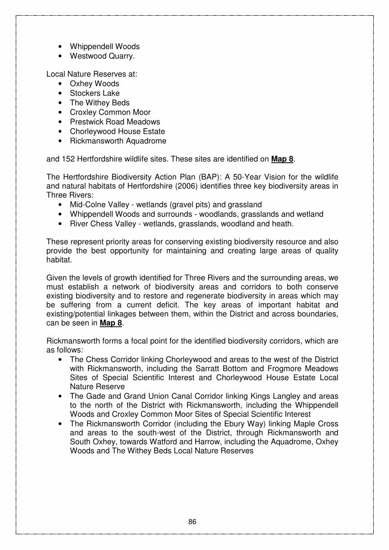
86
• Whippendell Woods
• Westwood Quarry. Local Nature Reserves at:
• Oxhey Woods
• Stockers Lake
• The Withey Beds
• Croxley Common Moor
• Prestwick Road Meadows
• Chorleywood House Estate
• Rickmansworth Aquadrome and 152 Hertfordshire wildlife sites. These sites are identified on Map 8. The Hertfordshire Biodiversity Action Plan (BAP): A 50-Year Vision for the wildlife and natural habitats of Hertfordshire (2006) identifies three key biodiversity areas in Three Rivers:
• Mid-Colne Valley - wetlands (gravel pits) and grassland
• Whippendell Woods and surrounds - woodlands, grasslands and wetland
• River Chess Valley - wetlands, grasslands, woodland and heath.
These represent priority areas for conserving existing biodiversity resource and also provide the best opportunity for maintaining and creating large areas of quality habitat. Given the levels of growth identified for Three Rivers and the surrounding areas, we must establish a network of biodiversity areas and corridors to both conserve existing biodiversity and to restore and regenerate biodiversity in areas which may be suffering from a current deficit. The key areas of important habitat and existing/potential linkages between them, within the District and across boundaries, can be seen in Map 8. Rickmansworth forms a focal point for the identified biodiversity corridors, which are as follows:
• The Chess Corridor linking Chorleywood and areas to the west of the District with Rickmansworth, including the Sarratt Bottom and Frogmore Meadows Sites of Special Scientific Interest and Chorleywood House Estate Local Nature Reserve
• The Gade and Grand Union Canal Corridor linking Kings Langley and areas to the north of the District with Rickmansworth, including the Whippendell Woods and Croxley Common Moor Sites of Special Scientific Interest
• The Rickmansworth Corridor (including the Ebury Way) linking Maple Cross and areas to the south-west of the District, through Rickmansworth and South Oxhey, towards Watford and Harrow, including the Aquadrome, Oxhey Woods and The Withey Beds Local Nature Reserves

87
What you told us
• There was strong support for protecting important wildlife sites and species, with the suggestion that policy should also require enhancement of biodiversity where possible
• There was also support for including policies to cover protection of trees, woodlands and hedgerows
• It was felt that assessment of biodiversity should be undertaken to ensure that decisions are evidence-based.
What the Sustainability Appraisal told us
• Protection of important wildlife sites and species would have positive benefits in relation to landscape and townscape, biodiversity, air quality, human health, water quality, social well-being and the economy
• Protecting the natural environment will enhance the area as an attractive business location and will subsequently help economic growth and vitality through attracting potential investors
• Protection and enhancement of biodiversity is a Strategic Environmental Assessment objective against which all issues and options have been assessed.
DC2 Preferred Policy Approach - Biodiversity, Trees And Woodlands The preferred approach is: Biodiversity In accordance with national policy on biodiversity and geology the Council will protect and, where possible, enhance:
• Sites of Special Scientific Interest
• Local Nature Reserves
• County Wildlife Sites
• Protected Species
• Trees and Ancient Woodlands
• Geological and physiographical features. Development should result in no net loss of biodiversity value in any of the following key biodiversity areas as identified in the Hertfordshire Biodiversity Action Plan:
• Mid Colne Valley
• Whippendell Woods and surrounds
• River Chess Valley. Development that would affect a Site of Special Scientific Interest, Local Nature Reserve, County Wildlife Site or protected species under UK or European law, or identified as being in need of conservation by the UK Biodiversity Action Plan, will

88
not be permitted where there is an adverse impact on the ecological, geological or biodiversity interests of the site, unless it can be demonstrated that:
• There are exceptional circumstances for the development which clearly outweigh the need to safeguard the biodiversity of the site, and where alternative wildlife habitat provision can be made in order to maintain local biodiversity; and
• Adverse effects could be satisfactorily minimised through mitigation and compensation measures to maintain the level of biodiversity in the area.
Development must conserve, enhance and, where appropriate, restore biodiversity through:
• Protecting habitats and species identified for retention
• Providing compensation for the loss of any habitats
• Providing for the management of habitats and species
• Maintaining the integrity of important networks of natural habitats, and
• Enhancing existing habitats and networks of habitats and providing roosting, nesting and feeding opportunities for rare and protected species.
When considering development, the Council will take account of the Hertfordshire Biodiversity Action Plan and other relevant information to:
• Assess the importance of a habitat
• Consider the potential impact of development
• Identify ways to maintain and enhance biodiversity in Three Rivers
• Improve connectivity between habitats through establishment of networks of semi-natural green spaces within and between built-up areas and expansion of wildlife corridors, as shown in Map 8
• Expect the developer to contribute where appropriate to improvements in biodiversity as part of the development proposals.
The Council will support measures identified in management plans and related status reports for Sites of Special Scientific Interest, Local Nature Reserves and other wildlife sites that seek to protect, enhance and restore biodiversity. Important Trees and Woodlands Development proposals should demonstrate that existing trees, hedgerows and woodlands will be retained, safeguarded and managed during and after development in accordance with the relevant British Standards. Planning permission will be refused for any development that would be liable to cause demonstrable harm to protected woodland (including ancient woodland), trees and hedgerows, unless conditions can be imposed to secure their protection. Where the felling of a tree or removal of a hedgerow is permitted, a replacement tree or hedge of an appropriate species, size and in a suitable location will be required, taking account of issues such as landscape and biodiversity. Development should be designed in such a way as to allow trees and hedgerows to grow to maturity without causing undue problems of visibility, shading or damage. Development likely to result in future requests for significant topping, lopping or felling will be refused.

89
Reasoned Justification The preferred policy approach demonstrates the Council’s commitment to meet the relevant national requirements to protect and enhance biodiversity, trees and woodland. It also recognises that where development is necessary it is not at the expense of irreplaceable natural assets. The policy will contribute directly to achieving Core Strategy Objective 9 which is to protect and improve the countryside and the diversity of wildlife and habitats. Options Rejected There were no objections at Issues and Options consultation to including policies on biodiversity. The broad approach previously put forward has been developed and expanded into more detailed policies taking into account comments made. No new additional policies were suggested for this policy area and therefore none was rejected.

90
LANDSCAPE CHARACTER National Context National policy25 states that the most valued landscapes should have the highest level of protection and that locally valued landscapes should be protected through appropriate policies, with reference to landscape character assessments. Areas of Outstanding Natural Beauty (AONBs) are designations of national importance for reasons relating to their natural beauty and contribution to the wider countryside. Regional Context The East of England Plan requires protection and enhancement of local distinctiveness and all important aspects of the wider landscape. Policy26 states that planning authorities’ policies should recognise and aim to protect and enhance the diversity and local distinctiveness of nationally defined countryside character areas by:
• Developing area-wide strategies based on landscape character assessments, setting long-term goals for landscape change, targeting planning and land management tools and resources to influence that change and giving priority to those areas subject to most growth and change
• Developing criteria-based policies, informed by the area-wide strategies and landscape character assessments to ensure that all development respects and enhances local landscape character
• Securing appropriate mitigation measures where avoidance of damage to local landscape character is unavoidable.
Local Context The landscape of Three Rivers is a complex mix of rural and urban areas, woodlands, wildlife habitats, farmland, water features and other land forms. The landscape has been heavily altered by human activity so many distinctive features such as field boundaries are of historical interest as well as visual and ecological merit. Wildlife habitats such as meadows, woodlands, hedgerows and wetlands are valued components of the landscape and have their own special management requirements. Three Rivers incorporates 546ha of the Chilterns Area of Outstanding Natural Beauty, an area of national landscape importance, made up of a mosaic of woodland, copses, enclosed pastures, arable fields, wooded and open heath and scattered farms and villages, overlying rolling hills and valleys. The areas of the District within the Area of Outstanding Natural Beauty will be shown on the Proposals Map. Hertfordshire County Council has completed a landscape character assessment for the whole of Hertfordshire. This identifies three landscape regions in Three Rivers (shown on Map 9): the Chilterns (including parts of the Chilterns Area of
25 Planning Policy Statement 7: Sustainable Development in Rural Areas
26 Policy ENV2: Landscape Conservation
91
Outstanding Natural Beauty), the Central River Valleys, and the South Hertfordshire Plateau.
• The Chilterns landscape region of rounded hills is part of the chalk ridge which crosses England from Dorset to Yorkshire. It contains a diversity of habitats and contains many prehistoric traces.
• The Central River Valleys landscape region is defined by the former route of the Thames and now contains the major rivers of Hertfordshire, the major communication corridors and the centre of many major settlements. Most of the valleys are broad, shallow, land forms of open character.
• The South Hertfordshire Plateau is a complex topographical region of many valleys, often dry and with vegetation obscuring the topography. The region generally consists of small fields, woodland and heaths of some historic, scientific and amenity importance.
These landscape regions contain a variety of landscape character areas, for which assessments have been produced identifying key characteristics and influences. A Landscape Strategy (2001) has been produced which includes suggestions for managing future change (further details can be seen at http://enquire.hertscc.gov.uk/landscsh/ ).
What you told us
• There was strong support for ensuring that development should make full and effective use of land whilst respecting the character of the surrounding area
• There was also support for requiring development to also enhance the landscape where possible through design and setting
• Full use should be made of landscape character assessment to ensure that decisions are based on evidence
• Landscapes of the highest quality, such as the Chilterns Area of Outstanding Natural Beauty, should be protected from inappropriate development that would be potentially damaging.
What the Sustainability Appraisal told us
• Although landscape character should be protected, this could limit residential densities and result in additional housing being directed to greenfield sites, whilst the dispersed nature of development could increase car use and compromise the viability of public transport
• Protecting the landscape will enhance the area as an attractive business location and subsequently help economic growth and vitality through attracting potential investors

92
DC3 Preferred Policy Approach - Landscape Character The preferred approach is that : Development should complement the surrounding local landscape character of Three Rivers as identified in the current landscape character assessment, through the siting, layout, design, appearance and landscaping of development. Consideration should be given to:
• The development pattern of the area, its historical and ecological qualities, tranquillity and sensitivity to change
• The pattern of woodlands, fields, hedgerows, trees, waterbodies, walls and other features
• The topography of the area. Development will not be permitted where there is any:
• Unsympathetic intrusion in the wider landscape
• Detrimental effect on the character of the immediate environment
• Detrimental effect on any important long distance views or skylines.
Within or near the Chilterns Area of Outstanding Natural Beauty, in accordance with national policy, the setting, siting, design and external appearance of any development will be of the highest standard to respect and enhance the existing high quality landscape. The conservation of natural beauty, wildlife and cultural heritage will be given priority over other considerations. Development will only be permitted where there would be no adverse impacts on the character, quality, views, natural beauty, distinctiveness or public enjoyment of the AONB landscape. (The Chiltern Design Guides available from [email protected] provide further information on acceptable design in the Chilterns Area of Outstanding Natural Beauty) In all landscape regions, the Council will require proposals to make a positive contribution to the surrounding landscape. In addition it will support proposals that:
• Lead to the removal or a reduction in the impact of existing structures and land uses that are detrimental to the visual quality of the landscape
• Enhance public access and recreation opportunities without detriment to the landscape or wildlife
• Contribute to the measures identified in the Hertfordshire Landscape Strategy (2001) to strengthen, reinforce, safeguard, manage, improve, restore and reconstruct landscapes.
Reasoned Justification As there will be increasing pressure for development across the District, it is important that all landscape, including the Chilterns Area of Outstanding Natural Beauty, is either protected, enhanced or improved. The preferred policy approach

93
ensures that the design of development proposals is sensitive enough to ensure that schemes make a positive contribution to the landscape. This policy will contribute directly to achievement of the Core Strategy Objective 9: to protect and improve the countryside and the diversity of wildlife and habitats and part of the Core Strategy Objective 10: ensuring that new development respects the unique character and identity of the towns and villages in the District. Options Rejected There were no objections at Issues and Options consultation to including policies on landscape. The broad approach previously put forward has been developed and expanded into more detailed policies, taking into accounts comments made. No new additional policies were suggested for this policy area, and therefore none was rejected.

94
OPEN SPACE, SPORT AND RECREATION FACILITIES National Context National Guidance27 states that local authorities should complete robust assessments of existing open space, sport and recreation provision, and future needs of communities for open space, sport and recreation facilities. Open space standards should also be set locally and include:
• Quantitative estimates of how much is needed
• A qualitative component (against which to measure the need for enhancement of existing facilities) and
• Accessibility (including distance thresholds and consideration of the cost of using a facility).
Existing open space, sports and recreation buildings and land should not be redeveloped unless an assessment has been undertaken which has clearly shown that they are/will be surplus to requirements. Planning obligations should be used to remedy local deficiencies in the quality or quantity of open space, sports or recreational provision. National guidance28 also states that proposed residential development should provide or enable good access to community and green and open amenity recreational space (including play space) as well as private outdoor space. Regional Context The East of England Plan29 states that Local Development Documents should include policies to respond to locally identified need for open space, including any increased demand for recreational open space associated with planned development, and to identify the scale and location of green networks required to ensure that existing, extended and new communities are attractive places in which to live and work. Local Context In accommodating additional growth it is important that the quality, pattern and character of the environment in the District is maintained and enhanced for new and existing residents. The Council carried out an assessment of open space, sport and recreation facilities in line with national requirements30. The Assessment was carried out in three parts:
• Open Space – a comprehensive analysis of open spaces which included parks and gardens, semi/natural green spaces, green corridors, amenity green space, allotments, cemeteries/church yards, civic spaces and small and large play areas
27 Planning Policy Guidance 17: Planning for Open Space, Sport and Recreation
28 Planning Policy Statement 3: Housing
29 Policy ENV1: Green Infrastructure (supporting text)
30 Planning Policy Guidance 17: Planning for Open Space, Sport and Recreation

95
• Indoor Sports Facilities – considered the supply of and demand for indoor sports facilities such as leisure centres, community centres, village halls and schools and their ancillary facilities
• Outdoor Sports Facilities – considered the supply of and demand for outdoor sports facilities such as football, cricket, rugby, hockey, bowls, tennis, netball, golf and watersports and their ancillary facilities.
Further details can be viewed at: http://www.threerivers.gov.uk/Default.aspx/Web/EvidenceBase The Assessment identified some areas of surplus provision and under-provision across the District. The agreed Action Plan includes the following area specific priorities (also referred to in the Place Shaping Policies): Rickmansworth:
• Extend cemetery facilities at Woodcock Hill
• Maintain and improve biodiversity, recreational access and watersports facilities at Rickmansworth Aquadrome
• Develop a play area to meet identified need.
Abbots Langley:
• Improve facilities and access at Leavesden Country Park
• Improve facilities at Abbots Langley Community Centre.
Chorleywood:
• Maintain biodiversity and access improvements to Chorleywood House Estate as part of the agreed management plan
• Develop play area in Chorleywood to address current deficiency.
Croxley Green:
• Improve access at Croxley Hall Wood.
South Oxhey:
• Support the development of a ‘friends group’ at Oxhey Woods Local Nature Reserve and assess the feasibility of providing an education centre on site.
Eastbury:
• Develop play area to address identified deficiency.
Sarratt:
• Extend and improve Frogmore Meadows
• Develop play area to meet identified need. The Council has adopted a Supplementary Planning Document on Open Space, Amenity and Children’s Play Space which sets out the Council’s requirements for the provision of these facilities as part of new residential developments.

96
What you told us
• There was support at Issues and Options to plan for additional space and/or improvements where deficiencies in the District have been identified
• There was also strong support for continuing to require developers to contribute towards the provision of sports facilities, amenity and children’s play space, both directly on site and through commuted payments
• Planning obligations to contribute to open space, sport, leisure and recreation were identified as a priority
• There was also support for including policies in the Local Development Framework to deal specifically with parks and open spaces.
What the Sustainability Appraisal told us
• Retaining and protecting open space and increasing accessibility would help to provide a good quality environment, retain existing businesses and attract new investment
• Protection and enhancement of public open space would also improve human health through providing an area where people can walk, socially interact, encourage community gathering and social cohesion
• Ensuring provision of sports, recreational facilities and open space should benefit social objectives and human health if provision is focused in those communities where they are most needed and where health benefits can be delivered
• Consideration should be given to the role of nature conservation sites as recreational areas and potential impact on biodiversity
• Where biodiversity may be adversely affected, ring-fenced money obtained from contributions from local developers may help to manage recreational activities in a more sustainable manner.
DC4 Preferred Policy Approach - Open Space, Sport And Recreation Facilities The preferred approach is: Protection Protect against the loss of open space, sport and recreation facilities, including playing pitches which will be identified on the Proposals Map. Development proposals which result in the whole or partial loss of existing sport, recreational or open spaces will only be permitted where:
• The proposed development includes provision for open space, sports and recreation facilities of sufficient benefit to recreation provision to outweigh the loss or
• Alternative provision of equivalent or better quality is made for the

97
catchment area served by the open space in an accessible location served by sustainable modes of transport or
• The proposal is ancillary to an existing leisure use serving the catchment area or
• A deficiency of open space is not created through its loss, now or over the plan period or
• It can be demonstrated that the users would benefit more from the improvement of the facilities on the open space despite a loss of part of the site.
New provision and enhancement The Council will seek to rectify deficiencies in the quality and quantity of facilities in the District as identified in the Assessment of Open Space, Sport and Recreation Facilities (2005) and related Action Plans (2006). Specific area-based proposals are set out in the Place-Shaping Policies of this document. Development proposals for open space, sport and recreation facilities will need to accord with the criteria contained in Policy DC7 (Design of Development), other relevant policies in this document and the Council’s Design Guidance Supplementary Planning Document. All residential developments will be expected to contribute to the provision of formal and informal open space in the local area to meet the needs of the population.
• For developments of 25 or more dwellings, or 0.6 hectares and above, 10% of the site area will be required for the provision of amenity open space. Proper maintenance of the open space will be required or, where the Council is requested to adopt the open space, acceptance will depend on the agreement of a commuted sum for maintenance
• For developments of less than 25 dwellings or 0.6 hectares, financial contributions to open space will be required, based on a ratio of 0.4 hectares of amenity open space per 1000 population.
Variation to these standards may be appropriate where the development is already fully served by existing amenity space within 400m of the site without the need to cross a main road.
Detailed guidance on requirements for the provision of facilities and maintenance as part of new development, including formulae for the calculation of contributions, is set out in the Council’s Supplementary Planning Document on Open Space, Amenity and Children’s Play Space. The Document also sets out design standards for new open space provision. Reasoned Justification The preferred policy approach aims to protect the existing open spaces to maintain the character of the settlements, the quality of environment and provide opportunities for recreation. It also requires provision of an adequate level of open space within new developments to meet the needs of the community.

98
This policy will contribute directly to achievement of Core Strategy Objective 11: to provide accessible and varied opportunities for leisure, sport and recreational activities in order to promote healthy lifestyles. Options Rejected There were no objections at Issues and Options consultation to including policies on open space, sport and recreation. The broad approach previously put forward has been developed and expanded into more detailed policies, taking into account comments made. No new additional policies were suggested for this policy area, and therefore none was rejected.

99
CHILDREN’S PLAY SPACE National Context New housing developments are likely to increase demands on existing local open space provision including children’s play areas. National policy31 states that proposed development should enable good access to community and green and open amenity recreational space (including play space) as well as private outdoor space. Furthermore national policy32 also recognises the value of recreation provision and advises that local planning authorities should draw up their own standards of provision based on their assessment of need. Regional Context The East of England Plan33 states that Local Development Documents should include policies to respond to locally identified need, including any increased demand for recreational open space associated with planned development and to identify the scale and location of green networks required to ensure that existing, extended and new communities are attractive places in which to live and work. Local Context Three Rivers has carried out an assessment of open space, sport and recreation facilities in line with national policy34. The Assessment identifies deficiency in children’s play area provision in Chorleywood, Moor Park, Eastbury, Northwood and Sarratt and local demand for additional play areas in Rickmansworth. The District Play Strategy has been developed in consultation with children, young people and families, and aims to ensure that more children and young people can play freely in the outdoors close to their homes and have a freedom of choice in play. Detailed guidance on requirements for the provision of children’s play space and maintenance as part of new development, including formulae for the calculation of contributions, is set out in the Council’s Supplementary Planning Document on Open Space, Amenity and Children’s Play Space. The Document also contains guidelines for designing children’s play space. What you told us
• There was strong support for continuing to require new residential development to contribute towards the provision of sports facilities, amenity and children’s play space both directly on site and through commuted payments.
• There was also support for inclusion of policies for the protection and provision of open spaces, parks and children’s play space.
31 Planning Policy Statement 3: Housing
32 Planning Policy Guidance 17: Planning for Open Space, Sport and Recreation
33 Policy ENV1: Green Infrastructure (supporting text)
34 Planning Policy Guidance 17: Planning for Open Space, Sport and Recreation

100
What the Sustainability Appraisal told us
• Protection and enhancement of public open space can enhance human health through providing an area where people can walk, socially interact, encourage community gathering and social cohesion.
• Ensuring provision of sports, recreational facilities and open space should benefit social objectives and human health if provision is focused in those communities where they are most needed and where health benefits can be delivered.
DC5 Preferred Policy Approach- Children’s Play Space The preferred approach is to protect existing children’s play spaces and to rectify deficiencies in the quality and quantity of children’s play space as identified in the Assessment of Open Space, Sport and Recreation Facilities (2005) and related Action Plans (2006). Specific area-based proposals are set out in the Place-Shaping Policies of this document. Development proposals for children’s play space will need to accord with the criteria contained in Policy DC7, other relevant policies in this document and the Council’s Design Guidance Supplementary Planning Document. Protection Development proposals which result in the loss of, or prejudice the use of, any existing children’s play space will only be permitted where:
• A carefully quantified and documented assessment of current and future needs demonstrates that there is an excess of the particular type of amenity space in the local catchment
• The proposed development is ancillary to the principal use of the site and does not affect the quality, quantity, use or availability of the amenity space
• The amenity space that would be lost would be replaced by a facility of equivalent or better usefulness and quantity and subject to equivalent or better management arrangements being in place prior to the commencement of the development.
New Provision and Enhancement All residential developments will be expected to contribute to the provision of new children’s play space to meet the needs of the population as follows:
• For developments of 25 or more dwellings, or 0.6 hectares and above where the development is likely to be occupied by families, on-site provision of children’s play space will be required, comprising 2% of the site area. Appropriate equipment should be provided by the developer directly or by funding agreement with the Council. Proper maintenance of the play space will be required, or where the Council is

101
requested to adopt the play space, acceptance will depend on the agreement of a commuted sum for maintenance
• For development of less than 25 dwellings, or 0.6 hectares, financial contributions to children’s play space will be required, based on a ratio of 0.2 hectares of amenity open space per 1000 population.
Reasoned Justification The preferred policy approach aims to protect existing children’s play spaces, to maintain opportunities for recreation and provide an adequate level of open space within new developments to meet the needs of the community. This policy will contribute directly to achievement of Core Strategy Objective 11: to provide accessible and varied opportunities for leisure, sport and recreational activities in order to promote healthy lifestyles. Options Rejected There were no objections at Issues and Options consultation to including policies on children’s play facilities. The broad approach previously put forward has been developed and expanded into more detailed policies, taking into account comments made. No new additional policies were suggested for this policy area, and therefore none was rejected.

102
COMMUNITY, LEISURE AND CULTURAL FACILITIES National Context An important element of sustainable development and creating sustainable communities is the provision and protection of community uses such as health, education, places of worship, facilities for arts and community halls at locations that are readily accessible. In addition, especially outside the urban areas, facilities such as public houses, post offices and petrol stations can perform a vital function in terms of the economic and social welfare of such areas and to help ensure the continued vitality of village and rural communities. Government policy35 makes it clear that all members of the community should be able to access leisure and community facilities and that they should not be disadvantaged as a result of development proposals. Regional Context The East of England Plan36 states that sustainable communities will be well served by public, private, community and voluntary services. Local Context The Three Rivers Community Strategy 2006-2012 identifies the provision of local services such as education, leisure, health and council services as a priority for Three Rivers. The provision of these facilities is an important factor in the promotion of healthier lifestyles, the creation of sustainable communities, providing varied cultural opportunities for local communities including the most vulnerable groups. What you told us
• There was support at Issues and Options for including policies to deal with community and cultural facilities, in order to ensure adequate provision
• In particular, there were requests for the Local Development Framework to make provision for worship facilities for different faith groups
• Consultation carried out with the Three Rivers Citizen Panel (2006) on perceived access to facilities indicated that access to cultural/recreational facilities was of highest concern. Access to other facilities such as neighbourhood centres, banking facilities and local shops also ranked relatively highly.
What the Sustainability Appraisal told us
• Policies should increase access to services and facilities, particularly for those who need it most.
35 Planning Policy Statement 1: Delivering Sustainable Development
36 Policy SS1: Achieving Sustainable Development

103
DC6 Preferred Policy Approach - Community, Leisure And Cultural Facilities The preferred approach is to protect existing community, leisure and cultural facilities and to support the provision of new facilities where appropriate. Protection Proposals for the redevelopment or change of use of any premises resulting in the loss of facilities or services that support the local community, will only be permitted where the Council is satisfied that:
• The existing facility can be satisfactorily relocated within the development
• The use concerned is not economically viable, could be provided by some other means, or it can be demonstrated that there is no longer a demand for the use
• The premises or site cannot readily be used for, or converted to, any other community facility
• The facility or service which will be lost will be adequately supplied or met by an easily accessible existing or new facility in an appropriate alternative location, served by sustainable modes of transport.
New provision and enhancement Where development proposals are submitted for new or improved leisure, community or recreation facilities they will be permitted subject to the following criteria:
• The facility is accessible by sustainable modes of transport
• It accords with Policy DC7 on Design and other relevant policies in this document.
The Council will support in principle the implementation of strategies by partner organisations to address deficiencies and to realise enhancements of education and health facilities, which are vital community facilities, and measures to make better use of existing facilities. Within the context of this policy, community, leisure and cultural facilities will include (but not be limited to) village halls, community centres, sports halls, theatres, public halls, doctors’ and dental surgeries, post offices, public houses, schools and local shops.
Reasoned Justification Local facilities, whether publicly or privately owned, can be subject to development pressures from alternative uses. It is therefore important that where appropriate such facilities are retained within the local community. The preferred policy approach seeks to both protect existing facilities from development pressures and

104
to provide new or enhanced facilities wherever possible. The provision of facilities will meet local needs and reduce the need to travel further afield. This policy will contribute directly to achievement of Core Strategy Objective 6: to facilitate the provision of services and infrastructure to meet the needs of existing development and new development by working on cross-boundary issues with adjoining authorities, service providers and the development industry. Options Rejected There were no objections at Issues and Options consultation to including policies on community facilities. Specific areas for inclusion were suggested and have been incorporated and no suggestions were rejected.

105
DESIGN OF DEVELOPMENT National Context National policy requires the achievement of high quality, sustainable design37. It seeks planning policies that promote high quality, inclusive design in layouts and buildings in terms of function and impact. Design can have a large impact not only on individual buildings but also on the wider ‘public realm’, including our streets, town centres, parks and open spaces. Design which does not make the most of opportunities to improve the character and quality of an area should be refused. Design and Access Statements are required to be submitted with most planning applications and these should demonstrate how a proposal is functional, attractive and accessible to all. Further guidance on design is provided by the Commission for Architecture and Built Environment (CABE), for example through the national standard ‘Building for Life’. This includes how to considering character, public space, design and construction and the surrounding environment and community, and developers are encouraged to incorporate these principles in proposals. Design and Access Statements The Government now requires that design and access statements accompany most planning applications and applications for listed building consent. This requirement provides an opportunity for the early consideration of design and access. These should contain relevant information and details compatible with the scale and complexity of the proposal, including:
• A full site analysis of existing features and designations
• An accurate site survey including landscape features and site levels
• The relationship of the site to its surroundings
• Existing access for pedestrians, cyclists and vehicles
• Any known historical importance. It will need to demonstrate how the proposed development will:
• Maximise energy efficiency and address water and drainage requirements
• Achieve an inclusive environment that can be used by everyone, regardless of age, gender or disability and
• Take account of the transport considerations.
The Commission for Architecture and Built Environment provide guidance on Design and Access Statements and is available on the following website: http://www.cabe.org.uk Regional Context
37 Planning Policy Statement 1: Delivering Sustainable Development, Planning Policy Statement 3:
Housing, Planning Policy Guidance 15: Planning and the historic environment

106
The East of England Plan38 states that Local Development Documents should require new development to be of high quality and draws together the different strands of national policy which underpin quality in the built environment. Building Futures: A Hertfordshire Guide to Promoting Sustainability in Development The Council, working in partnership with the County Council and other Districts in Hertfordshire, has prepared guidance on how design should complement local architectural traditions and how sustainable construction techniques can be incorporated within the context of quality and character of the existing built heritage. It also includes guidance on how to take account of crime prevention and community safety considerations as part of the design and layout of new development. Further details can be found at: www.hertslink.org/buildingfutures Local Context The promotion of sustainable design, dealing with crime and anti-social behaviour and reducing, re-using and recycling waste are all key Council and community objectives in Three Rivers. The Council has produced a range of detailed guidance for development. However, these are covered in a number of separate documents. It is proposed that this guidance will be brought together and further supplemented as part of a Three Rivers Design Guide, which will appear as a Supplementary Planning Document. This will bring together a range of existing design guidance contained in the following documents:
• Residential development and extensions (Appendix 2 in the Local Plan)
• Various appraisals relating to Conservation Areas
• Design modules in Building Futures: A Hertfordshire Guide to Promoting Sustainability in Development
• Extensions to Dwellings in the Green Belt Supplementary Planning Guidance
• Design of Open Space within the Open Space, Amenity and Children’s Play Space Supplementary Planning Document
• Chilterns Area of Outstanding Natural Beauty Design and Material Guides
• Shopfront Design Guide
• Good design principles as prescribed by the Commission for Architecture and Built Environment and others.
What you told us In the Core Strategy Issues and Options Consultation (Spring/Summer 2006) there was strong support for:
• New housing development to respect the character of the surrounding area
• New development to be designed and built sustainably
• New development to use recycled or reclaimed materials and to provide recycling facilities on site to allow the recovery and recycling of materials wherever possible
38 Policy ENV7: Quality in the Built Environment

107
• Reducing crime through several options including through the design of new development (Safer by Design)
• A range of housing to be provided to meet identified needs, including a range of dwelling sizes and types.
What the Sustainability Appraisal told us There are no conflicts with sustainability objectives provided due consideration and sensitivity are shown when establishing the design principles towards the heritage in the area and the landscape/townscape character. This is particularly important when looking at the design policies requiring new developments to be in keeping with neighbouring buildings and the local area.
DC7 Preferred Policy Approach - Design Of Development The preferred approach is that: In seeking a high standard of design, the Council will expect all development proposals to:
• Have regard to the local context and preserve or enhance the character, amenities and quality of an area
• Protect residential amenities by taking into account the need for adequate levels and disposition of privacy, prospect, amenity and garden space
• Make efficient use of land whilst respecting the distinctiveness of the surrounding area in terms of density, character, layout and spacing, amenity, scale, height, massing and use of materials
• Build resilience into a site’s design taking into account climate change (eg. flood resistant design)
• Use innovative design to reduce energy and waste and optimise the potential of the site
• Ensure buildings and spaces are, wherever possible, orientated to gain benefit from sunlight and passive solar energy
• Design out opportunities for crime and anti-social behaviour through the incorporation of appropriate measures to minimise the risk of crime and create safe and attractive places
• Incorporate visually attractive frontages to adjoining streets and public spaces; all appropriate frontages to contain windows and doors that assist informal surveillance of the public realm
• Use high standards of building materials, finishes and landscaping; also provide/contribute towards street furniture and public art where appropriate
• Ensure the development is adequately landscaped and is designed to retain, enhance or improve important existing natural features; landscaping should reflect the surrounding landscape of the area and where appropriate integrate with adjoining networks of green open spaces

108
• Make a clear distinction between public and private spaces and enhance the public realm
• Ensure that places and buildings are accessible to all potential users
• Provide convenient, safe and visually attractive areas for the parking of vehicles and cycles without dominating the development or its surroundings
• Be durable and, where practical, buildings should be capable of adapting to other uses and functions in order to ensure their long-life.
Detailed design guidance and standards will be provided in the Three Rivers Design Guide Supplementary Planning Document.
DC8 Preferred Policy Approach - Residential Design The preferred approach is that all residential development should:
• Protect existing and proposed residential amenities by taking into account the need for adequate levels and disposition of privacy, prospect, amenity and garden space
• Protect the character of the existing area. New Residential Development The Council will seek to protect the character and residential amenity of existing areas of housing from forms of “backland” or “infill” development which the Council considers to be inappropriate for the area. Proposals for new residential or other development will not be permitted where the proposal involves:
• Tandem development
• Servicing by an awkward access drive which cannot easily be used by service vehicles
• The generation of excessive levels of traffic
• Loss of residential amenity
• Layouts unable to maintain the particular character of the area in the vicinity of the application site in terms of plot size, building footprint, plot frontage width, frontage building line, height, gaps between buildings and streetscape features (e.g. hedges, walls, grass verges etc.) particularly in a Conservation Area.
Subdivision of Dwellings
Subject to other development policies, proposals for the conversion of single dwellings into two or more units will be acceptable where:
• The building is suitable for conversion by reason of its size, shape and number of rooms. Normally, only dwellings with three or more bedrooms will be considered suitable for conversion
• The dwellings created are completely self-contained, with separate front doors either giving direct access to the dwelling, or a secure communal lobby or stairwell which itself has a secure entrance

109
• Adequate car parking, services and amenity space can be provided for each new unit in compliance with the Council’s standards
• The character of the area and the residential amenity of immediate neighbours are protected
• If conversion of semi-detached dwellings is proposed, this takes place in pairs in order that privacy and the amenities of the occupants of the adjoining dwelling are maintained.
The Council will take into account the individual and cumulative effect of applications for development on the character of an area, and will resist piecemeal development in favour of comprehensive proposals that properly address the criteria above. Reasoned Justification The preferred policy approach is in accordance with national and regional policy frameworks and reflects local priorities to maintain, protect and enhance the quality of the built environment and in particular residential amenities. The approach will contribute directly to the Core Strategy Objective 3: in relation to adapting design and climate change; to Objective 10: whereby new development respects the unique character and identity of the towns and villages in the District; and Objective 12: in creating safe and attractive places to live. Options Rejected There were no alternative options at Issues and Options on design matters. The broad approach previously put forward has been developed and expanded into more detailed policies, taking into account comments made. In order to meet sustainable development objectives locally, there is no real alternative to the preferred approach.

110
FLOOD RISK AND WATER RESOURCES National Context National Guidance39 aims to ensure that flood risk is taken into account at all stages of the planning process and to avoid inappropriate development in areas at risk from flooding. Areas can be mapped according to the level of flood risk:
• Zone 1 (Low probability - less than a 1 in 1000 annual probability of flood)
• Zone 2 (Medium probability - between a 1 in 100 and a 1 in 1000 probability)
• Zone 3a (High probability - a 1 in 100 or greater probability)
• Zone 3b (Functional floodplain - area providing flood storage) Through a ‘sequential approach’, the overall aim should be to steer new development to Flood Zone 1 (Low risk) in the first instance; development in Zone 2 and the Zone 3 may be considered if no other reasonably available sites exist and an ‘Exception Test’ is satisfied. Development in higher risk zones will be restricted to certain categories where an identified need for that type of development in that location exists. The use of Sustainable Drainage Systems to manage water flows can be an important tool in minimising flood risk by increasing permeable surfaces in an area which allows water to seep into the ground rather than running off into the drains system, and in reducing the impact of pollution from run-off and flooding. The use of Sustainable Drainage Systems should be incorporated in all new development where technically possible. Site-specific Flood Risk Assessments need to be submitted with certain planning applications. It is essential to protect water quality and, where possible, make efficient use of it. This means protecting and enhancing the quality and quantity of groundwater; protecting and enhancing surface water features and controlling aquatic pollution; ensuring new development has an adequate means of water supply and sufficient foul and surface water drainage. In addition, efficient use of water resources, including recycling, should be sought through sustainable construction methods that conserve and make prudent use of water and other natural resources. Regional Context The East of England Plan40 states that parts of the East of England are at a significant risk of flooding and that the main priorities are to defend existing properties from flooding and locate new development where there is little or no risk of flooding. The East of England is the UK’s driest region, and Hertfordshire is one of the driest counties with the average rainfall returning only two-thirds of the national average. People in Hertfordshire also use more water than any other county – 20% above the national average. Hertfordshire’s natural water environment is constantly at risk to periods of drought and floods. Groundwater resources are now at or approaching
39 Planning Policy Statement 25: Development and Flood Risk and the Companion Guide
40 Policy WAT4: Flood Risk Management

111
full utilisation, and many rivers and streams suffer from low flows which detrimentally impacts upon water quality. Local Context Some areas within Three Rivers are at risk of river or surface water flooding and it is likely that the effects of climate change will lead to increased risks. As a means of assessing levels of risk, the Council in conjunction with adjoining authorities in south and west Hertfordshire commissioned a Strategic Flood Risk Assessment (SFRA). This further refines the flood risk areas and takes into account other sources of flooding and future climate change impacts. This document details the following five Flood Risk Objectives:
• Achieve flood risk reduction through spatial planning and site design
• Enhance and restore the river corridor
• Reduce surface water run-off from new developments
• Safeguard functional floodplain and areas for future flood alleviation schemes
• Improve flood awareness and emergency planning. The Council has taken into account flood risk in identifying the broad areas of housing growth within the Spatial Strategy Section. The Three Rivers area has a high level of surface water resources including the Rivers Colne, Gade and Chess, the Grand Union Canal, several lakes and numerous ponds. In addition the District is entirely underlain by a pervious aquifer (high quality water-table) which is the main drinking water resource for the area. It is important to protect these resources from pollution and to safeguard them, taking into account future climate change. What you told us As part of Issues and Options consultation there was concern about the effect new development would have on the existing water supply and that development in the floodplain should be avoided. What the Sustainability Appraisal told us
• Flood risk - Controlling development in flood risk areas and also to the use of Sustainable Drainage Systems is supported.
• Additional policies recommended, for example, in encouraging innovative design when ‘future-proofing’ new developments and infrastructure to take into account the causes and effects of climate change
• Water Resource Usage - new developments will need to be future-proofed against a drier climate. This includes the issue of decreasing water supply for an increasing number of dwellings.
• Policies and criteria should relate to requirements encouraging innovative forms of water storage and water usage efficiency within new developments

112
DC9 Preferred Policy Approach - Flood Risk And Water Resources The preferred approach is: Flood Risk In assessing development proposals, the Council will accord with national policy and the Three Rivers Strategic Flood Risk Assessment (SFRA). Areas at risk from flooding are available from the Environment Agency. Future development in Flood Zone 1 (low probability)
• For sites of 1ha or above, the vulnerability of other sources of flooding should be considered as well as the effect of new development on surface water run-off
• A Drainage Impact Assessment will be required to demonstrate that run-off from the site is reduced, thereby reducing surface water flood risk. This will involve the use of Sustainable Drainage System techniques
Future development in Flood Zone 2 (medium probability)
• Development is restricted to ‘water compatible’, ‘less vulnerable’ and ‘more vulnerable’ categories. ‘Highly vulnerable’ uses will need to satisfy the Exception Test.
• A detailed site-specific Flood Risk Assessment should be prepared and submitted with development proposals
• Floor levels should be situated above the 1% (1 in 100 year) plus climate change predicted maximum level plus a minimum freeboard of 300mm
• The development should be ‘safe’ - dry pedestrian access to and from the development should be possible above the 1 in 100 year plus climate change flood level and provision of emergency vehicular access during flooding
• The approved Sustainable Drainage Systems and mitigation measures should be implemented to reduce run-off from the site, post-development and controlled by conditions.
• The proposed development should be set back from the watercourse with a minimum 8m wide undeveloped buffer zone
Future development in Floodzone 3a (high probability)
• Land uses should be restricted to ‘less vulnerable’ uses. For more vulnerable uses the Exception test needs to be satisfied
• A detailed site-specific Flood Risk Assessment should be prepared and submitted with development proposals
• Floor levels should be situated above the 1% (1 in 100 year) plus climate change predicted maximum level plus a minimum freeboard of 300mm
• The development should be ‘safe’- dry pedestrian access to and from the development should be possible above the 1 in 100 year plus climate change flood level and provision of emergency vehicular access during flooding
• Sustainable Drainage Systems should be implemented to reduce run-off from the site, post development

113
• The proposed development should be set back from the watercourse with a minimum 8m wide undeveloped buffer zone
• Basements should not be used for habitable purposes. Where they are permitted for commercial use, basement access points should be above the 1 in 100 year flood level plus climate change.
Future Development in Floodzone 3b (functional floodplain)
• Development should be restricted to ‘water compatible uses’, or ‘essential infrastructure’ that passes the Exception Test and is designed and constructed to remain operational in times of flood and not impede water flow
Land in Flood Zone 1 that is surrounded by areas of Flood Zone 2 or 3 will be treated as if it is in the higher risk zone and a Flood Risk Assessment will be required to prove that safe access/egress exists for the development or that the land will be sustainable for the duration of the flood period. Where planning permission is granted, developers will be required to show that any flood protection and mitigation measures which may be necessary do not have an unacceptable impact on nature conservation, landscape, recreation or other important issues. Where appropriate, developers will be required to contribute to the delivery of flood risk management schemes and facilities as identified in the Three Rivers Strategic Flood Risk Assessment (2007), enhance and restore river corridors and improve flood awareness and emergency planning, in partnership with the Council, the Environment Agency and other authorities. Water resources New development will need to ensure that:
• The quantity and quality of surface and groundwater resources are protected from aquatic pollution and where possible enhanced.
• There is an adequate and sustainable means of water supply and sufficient foul and surface water drainage
• Efficient use is made of water resources and account taken of climate change. This means incorporating the following measures as part of development:
• Rainwater harvesting techniques (for example providing waterbutts fitted to drainpipes and underground water storage as part of new development)
• Harvesting and recycling greywater (wastewater from baths, showers, washbasins, kitchen sinks)
• Using water efficient appliances (for showers, taps, washing machines, toilets etc.)
• Using water efficient landscaping and irrigation measures (for example by using drought tolerant plants).

114
Reasoned Justification The preferred policy approach recognises that due to the potential impacts of climate change and the increasing pressure for development across the District, it is vital that developments are protected as reasonably as possible against the flood risk, the risk of pollution to water is reduced and that the development itself is as water efficient as possible. The approach will contribute directly to the Core Strategy Objective 3: in reducing pollution, conserving water resources and taking into account climate change through design of development. Further guidance on ways to conserve water are continued in Building Futures: A Hertfordshire guide to promoting sustainability in development (http://www.hertslink.org/buildingfutures) Options Rejected There were no objections at Issues and Options consultation to including policies for the above. No new additional policies were suggested for this policy area, and therefore none was rejected. The broad approach previously put forward has been developed and expanded into more detailed policies, taking into account comments made.

115
CARBON EMISSIONS AND RENEWABLE ENERGY National Context The legally binding Kyoto protocol (which came into force on 16 February 2005) requires the UK to reduce greenhouse gas emissions to 12.5% below 1990 levels by 2008–2012. In response to climate change the Government has also set the following targets for carbon dioxide emissions and percentage increases in the contribution to electricity generation from renewable sources:
• A 20% reduction in carbon dioxide emissions below 1990 levels by 2010 and a 60% reduction below 1990 levels by 2050
• A 10% contribution to electricity generation by renewable sources by 2010 to increase to 20% by 2020 and 30 – 40% by 2050.
National policy41 states that local authorities should ensure that development plans contribute to global sustainability by addressing the causes and potential impacts of climate change. This includes preparing planning policies that promote the prudent use of resources by making more efficient use or re-use of existing resources and encouraging the development of renewable energy resources. In particular, consideration should be given to encouraging energy efficient buildings, community heating systems and the use of combined heat and power in developments. Building a Greener Future: Towards Zero Carbon Development, and its subsequent Policy Statement, state:
• Where the net carbon emissions from all energy use in the home would be zero over a year, development may be described as zero carbon
• The Government’s intention for all new homes to be zero carbon by 2016 with a progressive tightening of the energy efficiency building regulations.
The Housing Green Paper (2007) establishes targets for all new homes to emit 25% less carbon from 2010, 44% less from 2013 and to be zero carbon from 2016. National policy42 states that local authorities should set out a target percentage of the energy to be used in new development to come from decentralised and renewable or low carbon energy sources where it is viable. The Government is committed further to change in seeking to achieve a zero carbon target by 2016. Regional Context The East of England Plan43 states that local authorities should contribute to the achievement of medium- and long-term national emissions targets through planning policies that move development in the Region towards zero carbon development. It also states that:
41 Planning Policy Statement 1: Delivering Sustainable Development
42 Planning Policy Statement: Planning and Climate Change - Supplement to Planning Policy
Statement 1 43
Policy ENG1: Carbon Dioxide Emissions and Renewable Energy

116
• Development Plan Documents should set ambitious but viable proportions of the energy supply of new developments to be secured from decentralised, renewable and low-carbon energy sources
• Until targets are set in Development Plan Documents, new developments of more than ten dwellings or 1000m2 of non-residential floorspace should secure at least 10% of their energy from decentralised and renewable or low-carbon sources.
Local Context The Council is already committed to and working towards lower carbon emissions and increasing the use of renewable energy through:
• Sustainable Communities: Supplementary Planning Document: this sets out guidance on good principles and practice on how development in the District can reduce carbon emissions through appropriate design, energy and water efficiency, waste reduction and recycling.
• Building Futures: A Hertfordshire Guide to promoting Sustainability in Development: this guide is produced by the ten local planning authorities and Hertfordshire County Council. It gives practical guidance for local authorities and developers and provides possible solutions for energy efficient construction processes, sustainable building materials and building operation, the use of sustainable approaches to design, increased renewable energy generation and water and waste management.
• C-Plan: Carbon Impact Assessment: this is a web-based service that enables applicants for development to evaluate a variety of sustainable energy measures including energy efficiency, combined heat and power and renewable energy. It enables applicants to submit an energy statement as part of planning applications to demonstrate the carbon emissions performance of the development electronically to the Council.
• The Hertfordshire Renewable Energy Study (2005): this assesses how the County could meet the regional target for renewable energy. The study indicated that there is the potential within Hertfordshire to achieve levels of renewable energy production by a number of various means. These include, but are not limited to, photovoltaic, solar water heating, ground source heat pumps, wood pellet boilers, micro Combined Heat & Power and increased insulation. The study concluded that almost 50% of Hertfordshire’s renewable energy target could be achieved if 10% of the average household energy demand for new build dwellings were to be reduced.
• The Council is leading by example on reducing energy carbon emissions, increasing energy efficiency and using renewable energy sources within its own stock of properties. A recent example includes the installation of a ground source heat pump at Three Rivers House.

117
What you told us In the Core Strategy Issues and Options Consultation (Spring/Summer 2006) there was a general support for development to be:
• Sustainable in terms of energy efficiency, and for all new major developments to provide up to 20% of their energy requirements through on site renewable energy
• Designed and built sustainably to ensure that greenhouse gas emissions are minimised.
What the Sustainability Appraisal told us
• Support is given to policies that incorporate resource and energy efficiency within the design and construction of new housing.
• As well as policies requiring renewable energy as part of new development consideration also needs to be given to energy efficiency. Standards could be set/adopted by the Council and achieved through innovative sustainable design.
DC10 Preferred Policy Approach- Carbon Dioxide Emissions And On-Site Renewable Energy The preferred approach is that applications for all new residential development of one unit and above, and for all new commercial development, must be submitted with a C-Plan energy statement available at http://www.carbonplanner.co.uk
Up to 2012, applicants are required to demonstrate that their development will produce 25% less carbon dioxide emissions than Building Regulations Part L requirements with a minimum of 10% being provided by on-site renewable and/or low carbon (i.e. Combined Heat & Power) energy supply systems. From 2013, applicants will be required to demonstrate that their development will produce 44% less carbon dioxide emissions than Building Regulations Part L requirements with a minimum of 20% being provided by on-site renewable and/or low carbon (i.e. Combined Heat & Power) energy supply systems. From 2016, applicants will be required to demonstrate that their development will produce zero net emissions of carbon dioxide from all energy use and/or achieves a Code Level 6 as defined in The Code for Sustainable Homes. In line with Government policy, where it can be proven that on-site renewable technology is not feasible, the Council will consider connection to a local, decentralised, renewable or low carbon energy supply as a substitute for on-site renewable energy technology.

118
Reasoned Justification The proposed policy approach is critical to helping to address global warming and reflects national and regional policy and the local high priority to tackle this issue.
Buildings such as houses and offices account for approximately 40% of all carbon dioxide emissions in the UK and the Council will encourage all new development to be as energy efficient as possible as well as requiring a proportion of energy use to be met through renewable energy sources. The benchmark used for targets to reduce carbon emissions is the current Part L of the Building Regulations, in line with national policy. The Council’s proposed use of the C-Plan system provides a reliable, consistent and transparent method of assessing the likely energy use of a proposed development for developers and the Council. The policy approach will contribute directly to the Core Strategy Objective 3: in terms of reducing energy consumption, promoting use of renewable energy and addressing climate change. Options Rejected The 20% target for renewables, as put forward at the Issues and Options stage, has been incorporated into the policy from 2013 to align with national and regional targets and the expectant advancement in technologies required to meet such targets. More ambitious targets and standards will be considered once viability has been proven through future analysis of C-Plan energy statements.

119
RENEWABLE ENERGY DEVELOPMENTS National Context The Government’s Energy White Paper set a target that by 2010, 10% of the UK’s electricity would be from zero carbon or carbon neutral sources. Renewable sources of energy include: wind, wave, tidal, hydro or solar power and biomass. Regional Context The East of England Plan’s44 policy for renewable energy targets for the Region (excluding energy from offshore wind) aim for:
• 10% of the Regions’ energy to come from renewable sources by 2010
• 17% of the Region’s energy to come from renewable sources by 2020 Of the Region’s electricity that could be generated from renewable sources by 2010, the broken down figure for Hertfordshire was the production of 153,000 megawatt hours per year (MWh/year) by 2010; this figure was 3% of the County’s predicted electricity consumption by 2010. Local Context Hertfordshire County Council, in conjunction with the 10 Districts, commissioned the Hertfordshire Renewable Energy Study (2005) to assess how the County could meet the regional target for renewable energy. It found that if renewable energy targets are to be met, much of the energy targets will have to be produced by wind power. However, the Three Rivers area was not considered suitable for large-scale renewable energy involving wind; greater potential exists in North Hertfordshire and East Hertfordshire. However, the Study found that Hertfordshire as a whole has the technical potential to achieve a significant amount of renewable energy production by a number of other various means including Biomass, dedicated Combined Heat & Power facilities, Bio-diesel and Bio-ethanol.
What you told us There has been no consultation on specific renewable energy developments. However, from the Issues and Options Consultation (2006), there was a general support for development to be sustainable in terms of energy efficiency and for all new major developments to provide a percentage of their energy requirements through on site renewable energy.
What the Sustainability Appraisal told us
• Support given to policies that incorporate resource and energy efficiency within the design and construction of new housing
44 Policy ENG2: Renewable Energy Targets

120
• Energy efficiency – as well as policies requiring renewable energy as part of new development consideration also needs to be given to energy efficiency. Standards could be set/ adopted by the Council and achieved through innovative sustainable design.
DC11 Preferred Policy Approach - Renewable Energy Developments In considering proposals for large-scale renewable energy development, assessment will be made taking into account the following potential impacts on:
• Residential/workplace amenity;
• The visual amenity of the local area, including landscape character;
• Local natural resources, including air and water quality;
• Biodiversity, nature conservation and historical/archaeological interests;
• Public access to the countryside;
• The openness and visual amenity of the Green Belt. Developments will be expected to be located at, or as close as possible to, the source of the resource needed for that particular technology, unless, exceptionally, it can be demonstrated that the benefits of the scheme outweigh the costs of transportation of the resource. In all cases, the Council will expect the end of life/redundant plant, buildings, apparatus and infrastructure to be removed and the site restored to its former state. Applications for all major renewable energy proposals will need to be accompanied by a statement detailing:
• The environmental effects of the development; and
• Its benefits in terms of the amount of energy it is expected to generate; and
• Any unavoidable damage that would be caused during installation, operation or decommissioning, and how this will be minimised and mitigated, or compensated for.
Micro-renewables In considering proposals for micro-renewables (such as, but not limited to, micro-wind turbines, solar panels), assessment will be made taking into account the following potential impacts on:
• The character and appearance of the local area
• Residential/workplace amenity
• The visual amenity of the local area.

121
Reasoned Justification Policy CP1 requires development to consider the need to tackle climate change by reducing carbon emissions, including through use of renewable energy. In considering proposals for renewal energy development, large and small, the preferred policy approach seeks to balance the beneficial outcomes of renewable energy and any adverse impacts produced by the development itself. The policy approach will contribute directly to Core Strategy Objective 3: in terms of reducing energy consumption, promoting use of renewable energy and addressing climate change. Options Rejected
There was no specific consultation on renewable energy developments at Issues and Options stage. However, comments received in relation to the use of renewable energy generally have been used to develop this policy.

122
WASTE MANAGEMENT
National Context National policy45 sets out a number of objectives including:
• Encouraging and engaging with the community to take more responsibility for dealing with waste
• Disposing of waste without harming human health and the environment
• Locating waste recycling, handling and reduction facilities as close as practicable to the origin of waste
• Driving waste management up the waste hierarchy, with disposal as a last resort (see below).
The ‘waste hierarchy’ consists of the following:
Prevent/Reduce/Minimise waste production Most preferred option
↓
Re-Use waste ↓
Re-cycle waste ↓
Recover energy from waste ↓
Disposal
↓
Least preferred option
Whilst the responsibility for dealing with waste (and minerals) lies principally with County Councils, District councils can help also help promote kerbside collection and community recycling through planning policy. This can be done by ensuring that new development makes sufficient provision for waste management and promoting designs and layouts that secure the integration of waste management facilities; this should be done without adverse impact on the street scene or, in less developed areas, the local landscape. Regional Context The East of England Plan46 supports national objectives and refers to the waste management targets for the Region which are to secure at least the following minimum levels of recovery:
• Municipal waste - recovery of 50% at 2010 and 70% at 2015
• Commercial and industrial waste - recovery of 72% at 2010 and75% at 2015
• Eliminate the landfilling of untreated municipal and commercial waste in the region by 2021.
45 Planning Policy Statement 10: Planning for Sustainable Waste Management
46 Policy WM1: Waste Management Objectives, Policy WM2: Waste Management Targets

123
The RSS acknowledges that there is a significant need to minimise construction and demolition waste because it represents the largest waste stream in the Region and is forecast to grow by some 17½ million tonnes between 2003/4 and 2021. Policies that encourage the use of construction and demolition methods which minimise waste generation and re-use/recycle materials as far as practicable on site are supported. Herts Waste Development Framework Hertfordshire County Council has produced three waste development documents that will eventually replace the Hertfordshire Waste Local Plan 1995-2005:
• The Core Strategy Submission document; sets out the spatial vision and strategic objectives for waste planning in Hertfordshire up to 2021, with a view to providing the basis for the County’s Waste Management Strategy to 2024. The Plan seeks to ensure that sufficient waste management facilities are located as close as possible to the Key Centres for Development and Change (Watford and Hemel Hempstead are the nearest Centres to Three Rivers).
• Site Allocations Preferred Options Document; identifies a range of sites for waste management facilities including municipal, commercial, industrial and commercial wastes. A number of sites are included in Three Rivers and these will be referred to in the Three Rivers Site Allocations document.
• Development Policies Preferred Options Document; sets out the criteria for determining waste planning applications. The County Council is responsible for determining all waste management related planning applications.
Further information on these documents can be viewed at http://www.hertsdirect.org Local Context The amount of waste produced in Hertfordshire is approximately 2 million tonnes per year, around a quarter of which (550,000 tonnes) is household waste. By 2010 the majority of sites currently accepting household waste in Hertfordshire will be almost full. Levels of recycling are increasing, particularly in Three Rivers which has the highest rate of recycling of household waste in Hertfordshire at 50% (at June 2007). Nevertheless, 58% of all of Hertfordshire’s waste still goes to landfill. In seeking to reduce the amount of overall waste produced locally it will be important to:
• Re-use materials wherever possible: high value materials such as bricks, slates, tiles, beams and architectural details can often be re-used for the same function
• Sorting of waste and recycling on-site: allowing space on-site for segregating of construction waste and recycling where conditions allow
• Use of pre-cast/pre-fabricated materials and modular construction: components such as pre-cast concrete beams, insulated wall panels, bathroom pods reduce the amount of waste generated

124
• Use materials with recycled content: products are available that incorporate waste into the manufacturing process that have the same performance and costs as non-recycled materials. The Sustainable Buildings Task Group (2004) recommended that the target for recycled and re-used content in new buildings is at least 10%.
• Allocate appropriate recycling storage facilities: providing sufficient space within development for domestic kerbside collection and composting facilities, or larger commercial waste recycling facilities, will facilitate recycling generally.
What you told us
• There was strong support for policy options proposing to require use recycled or reclaimed materials as part of new development
• There was strong support for policy options proposing to require provision of recycling facilities on site such as composters and bottle banks.
What the Sustainability Appraisal told us
• The Sustainability Appraisal supports the policy measures proposed as they would reduce waste produced, enable the use of previously developed land, and reduce agricultural land and soil loss. They will also help provide employment opportunities in waste management, reduce fly-tipping, and potentially reduce the health impacts from the transport of waste
• There is a risk that waste management uses could have an adverse impact on the landscape and so careful choice in site location will be essential to minimise any adverse impacts.
DC12 Preferred Policy Approach - Waste Management The preferred policy is that new development will be expected to contribute to reducing the amount waste generated through the following measures:
• Re-using materials wherever possible as part of construction
• Planning ahead to enable the sorting of waste and recycling on-site taking into account impact on residential amenities and the environment
• Using pre-cast/pre-fabricated materials and modular construction wherever possible so that the amount of recycled and re-used content in new buildings reaches a target of 20%
• Allocating appropriate refuse and recycling storage facilities for domestic kerbside collection, composting facilities and commercial waste recycling facilities.
Developers will be expected to provide information on how development accords with these measures as part of the Sustainability Statement which will accompany planning applications (Policy DC10).

125
New developments should be flexible enough to accommodate different collection systems and the potential for future changes. In particular, full consideration should be given to:
• The location and design of facilities to ensure minimal impact on residential and workplace amenity and full integration into the scheme design
• Access to ensure waste containers can be easily accessed (and moved) by occupiers and local authority/private waste contractors
• Safety to ensure that bins do not obstruct pedestrian, cyclist or driver sight lines.
In all new development waste and recycling storage areas should be designed into the scheme layout at the initial stages and must demonstrate adequate space to facilitate waste recycling through separation, storage, handling, bulking and collection of waste generated within the property. Reasoned Justification The need to reduce waste as part of development is acknowledged at all levels. The preferred approach seeks to reduce, re-use and recycle waste as part of the construction process and design development in order to facilitate waste recycling. The policy approach will contribute directly to the Core Strategy Objective 3: reducing the impact on the environment by reducing waste. Options Rejected None of the specific options put forward at Issues and Options stage have been rejected. However the preferred policy approach refines earlier proposals particularly in terms of adding a target for use of recycled and re-used content as part of development proposals and adding further guidance for the design of development in relation to waste issues.

126
HISTORIC ENVIRONMENT National Context Government policy47 sets out objectives for achieving sustainable development, protecting and enhancing the natural and historic built environment and setting the policy for the treatment of archaeological remains on land. The protection of the District’s Listed Buildings and Ancient Monuments is covered by statute and Government policy and are therefore not repeated in the preferred policy approach. Regional Context The need to protect, preserve and enhance the historic environment is identified at the regional level through the East of England Plan48 highlighting the importance of the historic built environment to reflect local character and distinctiveness. Local authorities should protect, conserve and enhance all aspects of the historic environment including landscapes, historic buildings and their settings. Local Context Three Rivers District contains approximately 400 Nationally Listed buildings, over 250 Locally Important Buildings, 22 Conservation Areas, 3 Ancient Monuments, some historic parks and gardens, as well as 18 sites of archaeological interest. All of these heritage assets contribute to the unique character and quality of Three Rivers’ historic built environment and provide an invaluable record of the District. Therefore, it is essential that these special buildings and sites are preserved, protected and, where appropriate, enhanced using all tools available in line with national and regional planning policy. The Council will continue to offer the Historic Buildings Grant Scheme which exists to encourage and promote the repair and restoration of buildings of architectural or historic interest within the District, by helping towards the costs involved and by making advice available. Policy Approach Conservation Areas Conservation Areas are designated not on the basis of individual buildings but because of the overall quality of the area, its mix of uses, historic layout, characteristic materials, scale and detailing of open spaces. Designation also takes into account the need to protect trees, hedges, walls, railings and other characteristic features. Once designated, special attention must be paid in all planning decisions to the desirability of preserving or enhancing its character and appearance. In Three Rivers there are 22 Conservation Areas which make a very significant contribution to protecting the attractiveness and character of the District.
47 Planning Policy Statement 1: Delivering Sustainable Development, Planning Policy Guidance 15:
Planning and the historic environment, Planning Policy Guidance 16: Archaeology and planning 48
Policy ENV6: The Historic Environment

127
The Council will continue with a programme of Conservation Area Appraisals which will assess the existing boundaries, character and important features of the areas and Management Plans which will be used as a material consideration when assessing planning applications. Applicants should also refer to the Design Supplementary Planning Document which will set out guidance for development affecting Conservation Areas. Demolition in Conservation Areas National policy states that the Council’s general presumption will be in favour of retaining buildings and structures which make a positive contribution to the character and appearance of a Conservation Area. The extent of a building’s contribution can be judged taking into account the following characteristics: age, style, materials, form, function, setting, historic association, landmark quality and use of public space. Development in Conservation Areas New development within Conservation Areas needs to ensure that it will preserve and where possible enhance the character of the area. Shop Fronts, Advertisements, Displays in Conservation Areas Some Conservation Areas, such as the Rickmansworth and Abbots Langley Conservation Areas in particular, contain many shops and commercial buildings. Conservation Area status should not inhibit commercial activities but at the same time it is important that advertising displays, shop front design (including the use of roller shutters and external grilles for security) should not detract from the appearance of areas of architectural or historic interest. New or replacement shop fronts will also have to be acceptable in terms of the criteria set out in the Design Supplementary Planning Document. Enabling Development of Listed Buildings National policy49 sets out the policies for the identification and protection of Listed Buildings of national importance and applications for development will be assessed against these policies. The main aim of policies on Listed Buildings is to protect them from harm. However, Listed Buildings can be very costly to maintain and are sometimes left neglected where they have ceased to have an economic purpose or are beyond economic repair. In order to keep Listed Buildings in use and thereby secure their upkeep, exceptions to existing policy may be considered, for example, allowing alternative uses or to provide funds to enable a Listed Building or its setting to be restored. Further guidance on enabling development is contained within the English Heritage booklet “Enabling Development and the Conservation of Heritage Assets”, available from their web site www.english-heritage.org.uk
49 Planning Policy Guidance 15: Planning and the historic environment

128
Locally Important Buildings Listed Buildings are determined on the basis of their importance to the Nation either for their architecture or built quality, or for their historic associations. However, there are a large number of other buildings that, whilst not of sufficient quality or importance to be listed, nevertheless make a significant local contribution to the local area and/or local history. In Three Rivers there are large numbers of nineteenth and early twentieth century buildings which fall into this category. At present, there are over 250 Locally Important Buildings on the Council’s list and further buildings will be added which are considered to have local importance. Historic Parks and Gardens Historic parks and gardens complement the historic buildings and landscapes of the District and are an important feature of the area. They are identified in the English Heritage Register of Parks and Gardens of Special Historic Interest. Within Three Rivers the grounds at Moor Park Mansion are listed as Grade II* because of their important contribution to the historic, recreational and conservation value of the landscape. Part of Cassiobury Park, which is also a Registered Park, falls within Three Rivers District. In addition, there are other unregistered parks and gardens in the District which include Rickmansworth Park, The Grove, Oxhey Grange, Sandy Lodge, Redheath, Micklefield Green and Chorleywood House. Although these currently fall below the threshold for inclusion in the English Heritage Register, they are of importance locally and as such their character will be protected from harmful development. Archaeology The Hertfordshire Historic Environment Record, held by Hertfordshire County Council, gives information on archaeological sites and monuments. However, given the wealth of the past in Hertfordshire, this record can never be complete and new areas will be added as new information comes forward. Prospective developers should contact the County Council to establish whether there is potential archaeological interest and establish the need for investigation and evaluation at an early stage. Sites of known archaeological interest will be shown on the Proposals Map. Where it is deemed that there is archaeological potential, the developer will be required to commission an archaeological evaluation to define the character and condition of any remains. This will include the character and depth of remains together with an impact of development upon the remains together with any mitigation measures to avoid unnecessary damage.
What you told us There was strong support in the Issues and Options consultation (2006) for the protection and enhancement of all aspects of the historic environment including Listed, Locally Important Buildings and the character of Conservation Areas. The need to protect areas of archaeological importance was also identified.

129
There was also strong support in 2007 for Environment and Resource Conservation including policies for the:
• Preservation and enhancement of the historic environment and criteria for assessing applications for development: and
• Protection, enhancement and preservation of sites of archaeological interest and their settings.
What the Sustainability Appraisal told us
• Recognises the need to protect local character and to protect and enhance locally important sites, buildings and townscape with positive benefits in relation to social well-being, human health, townscape, the economy and the vitality of town and local centres
• The historic environment also acts as an important lure for new residents and businesses.
DC13 Preferred Policy Approach -The Historic Built Environment The preferred approach is that: Planning applications for development proposals (including applications for Conservation Area Consent for demolitions) in or affecting Conservation Areas will be determined in accordance with:
• Legislative provisions and national policy50
• Guidance contained in specific Conservation Area Appraisals and Management Plans (where they exist)
• The Design Supplementary Planning Document. Conservation Areas Within Conservation Areas development will only be permitted if the proposal:
• Is of a design and scale that preserves or enhances the special character, local distinctiveness and appearance of the area
• Uses building materials, finishes and building techniques, including those for features such as walls, railings, gates and hard surfacing, that are appropriate to the local context
• Retains historically significant boundaries, important open spaces and other elements of the area’s established pattern of development, character and historic value, including gardens, roadside banks and verges
• Retains and restores, where relevant, traditional features such as shop fronts, walls, railings, paved surfaces and street furniture, and improves the
50 PPG15: Planning and the Historic Environment

130
condition of structures worthy of retention
• Does not harm important views into, out of or within the area
• Protects trees, hedgerows and other significant landscape features and incorporates landscaping appropriate to the character and appearance of the Conservation Area
• Results, where relevant, in the removal of unsympathetic features and the restoration or reinstatement of missing features.
Within Conservation Areas permission for development involving demolition will only be granted if it can be demonstrated that:
• The structure to be demolished makes no material contribution to the special character or appearance of the area; or,
• It can be demonstrated that the structure is wholly beyond repair or incapable of beneficial use; or
• It can be demonstrated that the removal of the structure and its subsequent replacement with a new building and/or open space would lead to the enhancement of the Conservation Area.
The Council will only grant consent for the demolition of a building in a Conservation Area once permission has been granted for redevelopment of the site. Permission will not be granted for development outside but near to a Conservation Area if it adversely affects the setting, character, appearance of or views in to and out of that Conservation Area. Shop Fronts, Advertisements and Displays The Council will only permit development proposals involving solutions to shop front security and/or use of standardised shop front designs, fascias or advertisement displays in a Conservation Area if they:
• Are sympathetic to the character and appearance of the Conservation Area;
• Respect the scale, proportions, character and materials of construction of the upper part of the building and adjoining buildings and the street scene in general;
• Incorporate traditional materials where the age and character of the building makes this appropriate.
Signage
• Totally internally illuminated fascias or projecting signs will not be permitted.
• Applications for additional signs that would result in a proliferation of, and excess amount of, advertisement material on any individual building or group of buildings will not be permitted.
Locally Important Buildings Planning Permission or Conservation Area Consent for the demolition of a Locally Important Building will only be granted where:

131
• The building is structurally unsound and cannot reasonably be made sound; or
• It is not feasible to sustain the existing use and there are no viable alternative uses; or
• Redevelopment would produce substantial community benefits outweighing the resultant loss of the building; and
• Full planning permission has been granted for a redevelopment scheme that will be commenced prior to or immediately after demolition.
Development proposals for the alteration or extension of a Locally Important Building will be refused unless features of historic or architectural interest are retained and conserved in an appropriate manner. Where demolition or alteration is permitted, the following will be required:
• The recording of features and the proper archiving of the results and/or
• Materials and/or components to be set aside for re-use or salvage. Planning permission will not be granted for development which adversely affects the character or appearance of a Locally Important Building. Historic Parks and Gardens Planning permission will not be granted for proposals that would cause unacceptable harm to historic parks or gardens (both registered and unregistered), their settings or public views into, out of, or within them. Applicants are required to submit a Historic Landscape Assessment prior to the determination of the application. This may include an archaeological assessment if located within an area of archaeological importance. The extent of Conservation Areas and historic parks and gardens will be set out in the Proposals Map. Archaeology Archaeological sites will be protected in accordance with national Policy. Sites of known archaeological importance will be shown on the Proposals Map. Reasoned Justification Protection of the District’s heritage is an important function of the Council, particularly through the determination of planning applications. The preferred approach seeks to reflect national policy and includes clarification on what characteristics will be considered when determining development within the historic environment of Three Rivers. This approach will contribute directly to Core Strategy Objective 10: protecting and enhancing the historic environment and unique character of the District. It is acknowledged that the preferred approach may in due course need to be altered in parts to reflect the Government’s proposals to reform the way in which

132
places, sites and buildings are designated, protected and managed. The proposals are set out in the Draft Heritage Protection Bill; it is anticipated that legislation will come into force in 2010. Options Rejected There were no alternative options at Issues and Options on Historic Built Environment other than to continue to protect and enhance the historic environment. The policy has been developed and expanded in the light of comments received at the Issues and Options stage.

133
CONTAMINATION AND POLLUTION National Context The planning system has an important role to play in protecting the environment, biodiversity, local residents, businesses and the public in general from all forms of development that could give rise to pollution. Pollution can be in many forms and includes all solid, liquid and gaseous emissions to air, land and water (including groundwater) from all types of development. Pollution includes noise, light, vibration, smell, smoke and fumes, soot, ash, dust or grit which has a damaging effect on the environment and the public’s enjoyment, health or amenity. Government policy51 gives guidance on the pollution control regimes, including those affecting noise, that interact with the planning system. These considerations are complemented by legislation outside the planning process52. Regional Context The need to protect, preserve and enhance the environment, is identified at the regional level through the East of England Plan53, highlighting the importance of reducing pollution and considering the nature and location of proposed development as part of a broadly based concern for, and awareness of, biodiversity and other environmental issues, including light and noise pollution. Local Context Three Rivers District enjoys a generally high environmental standard (Strategic Environmental Assessment/Sustainability Appraisal Scoping report, 2006). However, whilst air pollution levels and carbon emissions per capita are below national targets, biological water quality has fallen in recent years. Also light pollution and loss of tranquillity has also increased on a county-wide basis. The minimisation of pollution and contamination remains a key local priority. The Council will consider the possible polluting effects of a development proposal on aspects such as amenity and surrounding land-uses. There are a number of potentially polluting activities that need to be addressed locally: Contaminated Land The Council wishes to ensure that sustainable development is achieved through securing the regeneration and the redevelopment of previously developed sites. However, the risk of pollution arising from contamination and the impact on human health, property and the wider environment also needs to be considered. The Council maintains a register of contaminated land. The information stored on the formal register is that relating to regulatory action and remediation that has been undertaken at sites within the District. At the time of writing no sites within Three
51 Planning Policy Statement 23: Planning and Pollution Control, Planning Policy Guidance 24:
Planning and noise 52
Pollution Prevention and Control Act 1999, Pollution Prevention Control Regulations 2000, Environment Act 1995. 53
Policy ENV6: The Historic Environment

134
Rivers had been determined as “contaminated land” or as “special sites” and so there are no entries in the register. In order to establish the risks that a site poses, it is necessary for applicants to use a competent and suitably experienced consultant to investigate and, where necessary, remediate to reduce the risk to an acceptable level. Air Quality Air pollutants (including dust and odours) have been shown to have an adverse effect on health and the environment. Emissions arising from any development including indirect emissions, such as those attributable to associated traffic generation must therefore be considered in determining planning applications. The District Council is required to carry out a review and assessment of air quality across the District. This involves measuring air pollution and trying to predict how it will change in the next few years. The aim of the review is to make sure that the national air quality objectives are achieved by the relevant deadlines. These objectives have been put into place to protect public health and the environment. In locations where the objectives are not likely to be achieved, the Council will designate an Air Quality Management Area and will put together a plan to improve the air quality through a Local Air Quality Action Plan. Further information regarding Air Quality Management Areas can be obtained from the Council’s Environmental Health Department. Noise In line with national guidance54, it will be important to ensure noise-sensitive developments are located away from existing sources of significant noise and that potentially noisy developments are located in areas where noise will not be such an important consideration or where its impact can be minimised. Lighting Proposals In common with all other built-up areas, artificial lighting is essential for safety and security within the District. There may also be some opportunities to add to the amenity of the built environment by highlighting buildings and open spaces of character. However, it is important to avoid insensitive lighting (light pollution) which can have a negative effect on the amenity of surrounding areas and have a negative impact on biodiversity by influencing plant and animal activity patterns. Water Three Rivers has a high level of surface water resources including the Rivers Colne, Gade and Chess, the Grand Union Canal, several lakes and numerous ponds. In addition the District is entirely underlain by a pervious aquifer (high quality water-table) which is the main drinking water resource for the area. Surface and groundwater contamination may occur from pollutants entering or filtering down from a variety of sources, from simple urban run-off to seriously polluting land uses.
54 Planning Policy Guidance 24: Planning and noise

135
Once groundwater has been contaminated, it is virtually impossible to reverse and it is therefore important to safeguard resources from pollution.
What you told us
• As part of Issues and Options consultation (2006) there was support to achieve a measurable reduction of pollution and green house gas emissions
• The responses to the Issues & Options 2007 indicated strong support for the Council’s Sustainable Development Policies, which include criteria against which potentially polluting development should be considered, and for policies to deal with the potential for contamination and remediation of land
• There was general concern about the effect of new development on the existing water supply.
What the Sustainability Appraisal told us The following are key Sustainability Appraisal objectives against which plans and proposals will be assessed:
• To maintain/enhance water quality
• To minimise loss of valuable soils to development
• To achieve good air quality especially in urban areas
• To reduce the emissions of carbon dioxide and other green house gases.
DC14 Preferred Policy Approach- Contamination And Pollution Control The preferred approach is to: Amenity and Pollution Refuse planning permission for development, including changes of use, which would or could give rise to polluting emissions to land, air and water by reason of disturbance, noise, light, smell, fumes, vibration or other (including smoke, soot, ash, dust and grit) unless appropriate mitigation measures can be put in place and be permanently maintained. Contaminated Land Only grant planning permission for development on, or near to, former landfill sites or on land which is suspected to be contaminated, where the Council is satisfied that:
• There will be no threat to the health of future users or occupiers of the site or neighbouring land; and
• There will be no adverse impact on the quality of local groundwater or surface water quality.

136
Applications for development should be submitted with details of an investigation of the site detailing any remedial measures that need to be carried out. The approved remedial measures will be required by condition. In considering the amount and type of development on or near contaminated land, the Council will take into account the viability of development in relation to the cost of remedial works particularly where the contamination from the site poses a significant risk to human health or biodiversity. Air Quality Development proposals will need to have regard to any emissions arising from the proposed use and seek to minimise those emissions to control any risks arising and prevent any detriment to the local amenity by locating such development appropriately. Where significant increases in emissions covered by the nationally prescribed air quality objectives are proposed, the applicant will need to assess the impact on local air quality by undertaking an appropriate modelling exercise to show that the national objectives will still be achieved. Development will not be permitted where it would adversely affect air quality in an Air Quality Management Area. Noise Pollution Planning permission will not be granted for development which:
• Has an unacceptable adverse impact on the indoor and outdoor acoustic environment of existing or planned development
• Has an unacceptable adverse impact on countryside areas of tranquillity which are important for wildlife and countryside recreation; or
• Would be subject to unacceptable noise levels or disturbance from existing noise sources, both ambient levels and having regard to noise impulses whether irregular or not.
Conditions may be attached to any planning permission to ensure adequate attenuation of noise emissions or to control the noise at source. Consideration will be given to the increase in road traffic that may arise due to development and conditions or Section 106 agreements may be used to minimise such noise. In particular sensitive locations, business-use development may be restricted to office use only (B1(a) as defined in the Town & Country Planning (Use Classes) Order 1987 as amended. The Council will seek to ensure that noise from proposed commercial, industrial, recreational or transport use does not cause any significant increase in the background noise level of nearby existing noise-sensitive property such as dwellings, hospitals, residential institutions, nursing homes, hotels, guesthouses, schools and other educational establishments. Lighting Proposals

137
Development proposals which include external lighting should ensure that:
• Proposed lighting schemes are the minimum required for public safety and security
• There is no unacceptable adverse impact on neighbouring or nearby properties or on the surrounding countryside
• There is no dazzling or distraction to road users including cyclists, equestrians and pedestrians
• Road and footway lighting meets the County Council’s adopted standards.
• There is no unacceptably adverse impact on wildlife. The use of planning conditions to limit times when lighting is used to minimise the disturbance may be considered. Water Permission will only be granted for development that will not significantly adversely affect the quantity and quality of surface and groundwater resources or wetland habitats. Applications for planning permission will be required to demonstrate that the proposal:
• Will not produce run-off which will adversely affect the quality of surface or groundwater
• Has sufficient capacity to accept, and where necessary, treat, run-off which would otherwise have an adverse effect on the quality of surface or groundwater.
Reasoned Justification The preferred policy approach is in accordance with national and regional policy frameworks and reflects local priorities to maintain, protect and enhance the quality of the environment in relation to pollution and contamination. This approach will contribute directly to Core Strategy Objective 3: to reduce impact on the environment by reducing pollution and conserving water resources. The Council will consult with the Environment Agency, British Waterways and other authorities as appropriate in relation to water and have regard to their views when determining applications. Where emissions from industrial processes are subject to pollution control legislation the regulatory authority will also be consulted with respect to controlling these emissions. Options Rejected There were no alternative options at Issues and Options on contamination and pollution issues. The broad approach previously put forward has been developed and expanded into more detailed policies, taking into account comments made. In order to accord with national regional policy and to meet sustainable development objectives locally, it is considered that there is no real alternative to the preferred approach.

138
PARKING National Context Virtually all development proposals generate demand for parking of some kind, whether for residents, visitors, employees or for operational purposes. It is therefore necessary to ensure that parking is provided at a level appropriate to location, type and scale of development. Parking may also help to influence travel demand and mode of travel. National policy55 states that parking policies should be used alongside other planning and transport measures to promote sustainable transport choices and reduce reliance on the car. It states that reducing the amount of parking in new development (and in the expansion and change of use of existing development) is essential as part of a package of measures to promote sustainable travel choices. At the same time, the amount of good quality cycle parking should be increased to promote more cycle use. Policies should:
• Set maximum levels of parking for broad classes of development
• Be developed as part of a package of planning and transport measures to promote sustainable transport choices
• Not require developers to provide more spaces than they themselves wish, other than in exceptional circumstances
• Encourage the shared use of parking
• Require developers to provide designated parking spaces for disabled people
• Require safe, convenient and secure cycle parking in development; and
• Consider appropriate provision for motorcycle parking. Furthermore, national policy56 states that residential parking policies should be developed taking account of expected levels of car ownership, the importance of promoting good design and the need to use land efficiently. Regional Context The East of England Plan57 requires parking controls to be used as part of packages to influence travel change, using parking standards as maxima, while adopting more rigorous local standards where necessary. Local Context Parking standards for the District were established in the Local Plan, in Supplementary Planning Guidance: Parking at New Developments (2002) and in Hertfordshire County Council’s Supplementary Planning Guidance: Parking at New Development (2000). These standards will be maintained, though they may also be
55 Planning Policy Guidance 13: Transport
56 Planning Policy Statement 3: Housing
57 Policy T14: Parking

139
influenced at a later date by work taking place at County level to establish the need for any revisions. Three Rivers has Controlled Parking Zones in Rickmansworth and Chorleywood and other parking schemes, including permit parking, which have been established to meet the requirements of existing residents in areas where off-street parking is either limited or not available. Parking space in these areas is frequently used to maximum capacity and, as a consequence, there may be a conflict in the use of space between existing residents and occupiers of new residences.
What you told us There was support at Issues and Options stages for maintaining existing car parking standards, and the need to encourage a shift towards sustainable modes of transport was highlighted.
What the Sustainability Appraisal told us
• Maintaining existing car parking standards for new developments would help limit car use and therefore have positive benefits in relation to landscape and townscape quality, air quality and human health objectives
• The impacts of reviewing parking standards for new development are uncertain; high parking standards could encourage more traffic and adversely affect air quality, congestion and traffic accidents and the demand for new roads; limiting car parking provision could reduce accessibility and harm the economy and vitality of town and local centres
• A balance between restricting traffic flows and improving accessibility to town and local centres should be sought, whilst ensuring that alternative sustainable modes of transport are in place before lowering standards.
DC15 Preferred Policy Approach - Parking The preferred approach is that: Development should make provision for parking in accordance with the parking standards and, where relevant the zone based reductions set out in Appendix 6. Standards comprise a set of maximum vehicle parking standards for residential and non-residential uses and a set of minimum parking standards for cycle and disabled parking. For new development in Controlled Parking Zones (CPZ) and other areas covered by permit parking and other restrictions, the following conditions will apply:
• Where developments are large enough to have their own new roads, residents will not qualify for permits within any existing Controlled Parking

140
Zone or other relevant parking scheme, unless the Council makes the decision to include the roads as a new zone or as an extension of an existing parking scheme
• For all other developments within an existing Controlled Parking Zone or area covered by parking restrictions (including permit schemes) which are expected to add to the demand for on-street parking in local streets, and where the local streets can be shown to have difficulty in meeting this demand, the residents of the new development will not qualify to receive parking permits
• Developers will be required to fund changes to Traffic Regulation Orders to exclude the above developments as part of the granting of planning permission.
Guidance on the design and layout of parking areas will be contained in the Council’s Design Supplementary Planning Document. Reasoned Justification The preferred policy approach seeks to strike the balance between providing sufficient parking to meet the operational requirements of development whilst at the same time encourage a range of sustainable transport options. The approach addresses the needs of all users including parking for people with disabilities, cyclists, powered two-wheelers. The approach will contribute directly to Core Strategy Objective 7: to deliver improved and more integrated transport systems. Options Rejected There were no objections at Issues and Options consultation to including policies on parking. No new additional policies were suggested for this policy area, and therefore none was rejected. The broad approach previously put forward has been developed and expanded into more detailed policies, taking into account comments made. Higher and lower parking standards have subsequently been considered but have been rejected on the basis that they could adversely affect the delicate balance between the Council’s objectives of encouraging more sustainable forms of transport on the one hand and safeguarding the vitality and viability of shopping centres in Three Rivers on the other. However the Council may reconsider the setting of standards at a later date in the light of new research being undertaken by Hertfordshire County Council.

141
MAPS AND APPENDICES

142
APPENDIX 1: SETTLEMENTS INFORMATION RICKMANSWORTH Rickmansworth has a population of around 15,000 people and lies on the Grand Union Canal and the River Colne and its tributaries, the Chess and the Gade at the northern end of Colne Valley Park. It began to grow in the 1920s and 1930s as part of the metroland area due to the arrival of the Rickmansworth Station. As such it is largely a commuter town. It is contained within the M25 with good transport links to Luton and Heathrow Airports. Rickmansworth Town is a market town and the main settlement in Three Rivers and home to Three Rivers District Council. It contains a range of building styles and materials, with a number of Nationally Listed and Locally Important Buildings. Rickmansworth was designated a Conservation Area in 1974 and extended in 1980 to include the Victorian development of the town. Three further conservation areas were designated between 1998 and 2006 to the west of the Town Centre as good examples of “metroland” development. Rickmansworth is home to the Watersmeet Theatre, a 481-seat venue, which hosts amongst other things annual pantomimes and plays. SOUTH OXHEY South Oxhey is a large estate almost exclusively made up of council-built properties. The estate was built after the Second World War to alleviate the housing pressures thrust upon London during the Blitz as well as general inadequate housing. South Oxhey was originally built and managed by the London County Council and later the Greater London Council. In 1980, the Council-owned properties were transferred to Three Rivers District Council. By 2007, due to the Right to Buy policies of the 1980s, some 70% of houses on the estate are now privately owned. In 2008, the remaining Council-owned properties were transferred to Thrive Homes. South Oxhey is served well by local shops in St Andrew’s Precinct, which has the only Civic Space in the District. Weekly and monthly markets are held here. CROXLEY GREEN The main settlement of Croxley Green is situated along New Road and Watford Road with most of the houses being built in the 1930’s as “metroland” development following the arrival of the station. Croxley Green does not have a retail centre but several small shopping parades including West and East Baldwins Lane, New Road, Watford Road and Scots Hill. Croxley Green is located between Watford and Rickmansworth and, as its name suggests, has a large village green. The Green and its buildings were designated a conservation

143
area in 1980 due to its ancient origins (as proven by the discovery of Palaeolithic objects), the buildings, of which approximately thirty are Nationally Listed or Locally Important Buildings, and the importance of the open space. ABBOTS LANGLEY Abbots Langley was formerly part of the District of Watford until the boundary changes in 1974, when it was included in the Three River District. Abbots Langley has one of the largest retail centres in the District and was also designated a conservation area in 1969. It is the oldest conservation area in Three Rivers and roughly follows the Three Rivers area of Archaeological Significance No 5 containing the medieval centre of the settlement. The centre of Abbots Langley is built around the parish church of St Lawrence The Martyr. In the church there is a memorial to Nicholas Breakspear who became Pope Adrian IV. He was the only Englishman to become Pope and was born in the Parish of Abbots Langley in the 12th Century. Abbots Langley Carnival is an annual event which starts with a parade along the High Street and culminates in the Manor House Sports Playing Fields where other activities including fairground stalls, a dog show and other amusements. To the south of the village are Leavesden Film Studios where scenes from movies including the Harry Potter series, Goldeneye and Sleepy Hollow have been filmed. CHORLEYWOOD Chorleywood is situated two miles north-west of Rickmansworth and lies just inside the Hertfordshire County boundary with Buckinghamshire. It has easy reach to the M25 and has its own London Transport and main line rail station. The settlement is mainly “metroland” development following the introduction of the railway. There is a conservation area south of the station which seeks to preserve the “metroland” development. The British Baking Industries Research Association, based in Chorleywood, was responsible for Chorleywood Bread Process in the 1960s which is now used in over 80% of commercial bread production in the UK. North-east of the station is the 200 acre Chorleywood Common, dotted with beautiful old pubs and providing a superb recreational area including a nine-hole golf course, riding track and cricket pitch. There are 21 Nationally Listed buildings and 9 Locally Important Buildings in the Conservation Area. The Common is a protected open space and also a Local Nature Reserve and Wildlife Site. CARPENDERS PARK Carpenders Park is located in the parish of Watford Rural situated east of South Oxhey. This extensive residential area has developed alongside the station on the main Watford to Euston railway and is an area of mainly post-war housing.

144
There are substantial areas of open space and woodland immediately adjacent to the Green Belt, together with some small local parks. The author Leslie Thomas lived in this area for a period and the locality is referred to in his book “Tropic of Ruislip”. OXHEY HALL Oxhey Hall is situated south of Watford and is a relatively small residential area with open spaces and Green Belt. The properties are mainly 1930’s “metroland” development and the core of the settlement was designated a Conservation Area in 2007. EASTBURY Eastbury is primarily a residential area and lies largely to the east of Moor Park and south of Watford and is home to what is locally known as HMS Warrior. The mansion known as “Eastbury” became the Headquarters of the NATO Commander in Chief Eastern Atlantic Area. Unfortunately the mansion was destroyed by fire in 1969 and only one room survived to be retained as part of the Officer’s Mess. MAPLE CROSS Maple Cross is mainly a residential area with a large proportion of the housing being either Council owned or formerly Council owned. The area is situated west of Rickmansworth Town Centre and served by Junction 17 of the M25. Many multi-national businesses have offices here, including Cadbury, Renault and the UK headquarters of Skanska. Maple Cross is also the location of the Thames Water Maple Lodge Sewage Treatment Works which together with the sewage works in Aldenham, serve the whole of West Hertfordshire.

145
MAP 1: SETTLEMENTS

146
MAP 2: KEY DIAGRAM

147
MAP 3: SPATIAL OPTION 1

148
MAP 4: SPATIAL OPTION 2

149
MAP 5: SPATIAL OPTION 3

150
APPENDIX 2: ISSUES AND OPTIONS HOUSING LOCATIONS Issues and Options Consultation Supplemental Issues and Options consultation in 2007 considered broad housing locations at South East Abbots Langley, West of South Oxhey, South East Croxley Green, East Kings Langley, North East Maple Cross, North Croxley Green, East Carpenders Park, and East Abbots Langley and asked which should be taken forward through the Local Development Framework. The results of this consultation gave the following priority ranking for the areas (1= highest, 8= lowest).
Rank Area 1 South East Abbots Langley
2 West of South Oxhey 3 East Kings Langley 4 East Carpenders Park 5 North East Maple Cross 6 South East Croxley Green 7 East of Abbots Langley 8 North Croxley Green
Sustainability Appraisal Each broad location was assessed by the Sustainability Appraisal against 33 criteria set out within three broad categories: environmental designations, accessibility/key services and land uses. For each housing option an assessment was made to identify any conflicts between the option and the attributes. The SA findings for each site are as follows: � South East Abbots Langley This option is located on Green Belt land. However, planning permission for an office development on the site has already been granted and as such there is already some inherent traffic in the surrounds of the site (any future mixed-use scheme needs to be viewed in that context). The site suffers from some accessibility issues being over 1km from the nearest railway station and serviced by a limited bus service. Public transport links and the surrounding road network may need to be upgraded as part of any planning obligations (especially as the future development will be mixed-use and there is likely to be additional daytime employment generated transport). � West of South Oxhey The most significant environmental conflict involved with the consideration of this site is with the Oxhey Woods Local Nature Reserve which surrounds it. However, taking into account the existing buildings and the proposal to maintain an open area as a buffer, impacts upon setting and wildlife should be minimised. Any increase of pressure on biodiversity aspects of the Local Nature Reserve resulting from rising recreational use of the area derived from the increase in population, should be carefully managed. The site is also on Green Belt land and given its location (surrounded by Oxhey Woods) there could be opportunity to reinforce the integrity of the Green Belt in this area by re-establishing the site as an open area.

151
� South East Croxley Green This site is restricted by several environmental factors, the most prominent of which being the flood risk zones infringing its boundary (therefore at risk of flooding). The site is also in close proximity to Croxley Common Moor Site of Special Scientific Interest which may be particularly susceptible to construction noise impacts. However, due to the current office/industry land use on the site, precedence has been set and impacts upon these environmental factors once redevelopment has been completed may be even less (e.g. through use of Sustainable Drainage Systems). However, the local amenities and facilities are approximately 1km away, and school and healthcare facilities may need upgrading. � East Kings Langley This site is restricted by being surrounded by Green Belt and a railway line. The main environmental conflicts centre on the site having an area of archaeological importance within its footprint and listed buildings in the vicinity. The area is also at high risk of flooding due to the flood zones that extend through the proposed site. Although the site has relatively high accessibility levels, there is a lack of education facilities in the locality and this will need to be addressed. The site benefits from essentially being a redevelopment of previously developed land (and encouraging mixed-use development). � North East Maple Cross This option is located on Green Belt land. However, planning permission for partial redevelopment of the site into office space has already been granted. The potential site is bordered by high risk flood zones. Access to the site is reasonable although increased public transport provision, between Rickmansworth station and the development, would be desirable. Enhanced healthcare and education provision would be required as part of the development. � North Croxley Green This site has several key restrictions to its development including the Green Belt, lying within a conservation area and direct impacts on a listed building. The site would also require a significant improvement in nearby facilities (health, education, bus services) and an upgrade of the local road network. � East Carpenders Park The key restriction to developing this site is its location within the Green Belt, however, its proximity to flood zone 3a (adjacent) and the improvements needed in services also need to be considered. � East Abbots Langley This option is located on Green Belt land; it is likely that development would compromise the open character of the Green Belt in this area. In terms of which options are the most sustainable and should be taken forwards, the Sustainability Appraisal concludes that the ‘preferred options’ should be South East Abbots Langley and East of Abbots Langley; options for potential further development and appraisal should be East Carpenders Park, North East Maple Cross, East Kings Langley and West of South Oxhey; and options for potential omission from further consideration should be North Croxley Green and South East Croxley Green.

152
Alternative Sites The consultation also asked if any other areas of the District should be taken forwards as broad housing locations. Responses suggested both general locations and specific sites. The principle of considering other areas of the District was supported, and Chorleywood, Moor Park, Loudwater and South Oxhey were the general locations suggested most often. Specific sites put forwards were at Chorleywood (Hall Farm, Green Street), Abbots Langley (Love Lane), Croxley Green (Watford Road, Little Green Lane), Kings Langley (Railway Terrace), Bedmond (Bedmond Road, Bluebell Drive, St Albans Lane), Rickmansworth (Stockers Farm Road, Tolpits Lane), Oxhey Hall (Vivian Gardens), Maple Cross (Longmore Close), Batchworth Heath (Griggs Field), Eastbury (Sandy Lane), Langleybury (Langleybury House), Garston (Bucknalls Lane), and land between Abbots Langley and Toms Lane.

153
APPENDIX 3: HOUSING SITES SELECTION CRITERIA Issues and Options Consultation In assessing the potential housing locations as part of 2007 Supplementary Issues and Options Consultation, locations were described on the basis of the existing designation and status of the location; indicative housing capacity; planning constraints such as Green Belt, landscape designations and flood zones; access to key local facilities such as schools, GPs, convenience stores and transport services; and issues relating to utilities provision (gas, water, sewerage, electricity). The majority of respondents agreed with using these criteria, though some additional criteria were also suggested. These were: � Environmental quality (including noise, air quality, light levels) � Congestion in area/road capacity/road safety/parking � Protection of Green Belt � Capacity of Schools/access to nurseries � Wildlife habitats, Sites of Special Scientific Interest, Local Nature Reserves,
Regionally Important Geological and Geomorphological sites, biodiversity value � Transport provision/capacity/access to footpaths � Capacity of healthcare services � Impact on existing residents � Current land value (in terms of amenity/employment) � Existing dwelling densities in area � Potential for minimising environmental impact and creating sustainable
communities � Proximity to employment opportunities � Proximity to youth and social facilities � Drainage � Flood zones � Landscape quality � Proximity to leisure facilities/open space � Quality of life (including social issues and crime) � Site ownership/availability � Utility provision � Archaeological potential of areas � Contamination and development costs � Potential of sites to achieve affordable housing � Visual impact. Sustainability Appraisal The Sustainability Appraisal supports the criteria and methodology used to assess proposed housing locations and the use of Geographic Information Systems to assess them in terms of potential constraints and opportunities. The Sustainability Appraisal expands on the criteria, and uses 33 criteria within three broad categories: environmental designations; accessibility/key services; and land uses. The criteria used are as follows: Environmental Designations � Area of Archaeological Importance � Area of Outstanding Natural Beauty � Area subject to local preservation

154
� Groundwater Protection Zone � Conservation area � Flood zone 2 � Flood zone 3 � Regionally Important Geological/Geomorphological site � Registered parks and gardens � Scheduled Monuments � Wildlife sites � Sites of Special Scientific Interest/Local Nature Reserves � Listed buildings. Accessibility/key services � Employment area � Within 2000m of an employment area � Within 5000m of a residential area � Within 2000m of a residential area � School � Within 600m of a school � Within 800m of a local centre � Within 1000m of a railway station � Within 500m of a bus service � Doctor’s surgery � Within 800m of a doctors surgery. Land uses � Public open space � Common land � Agricultural land (Grade 2) � Reservoirs � Rivers � Railway line � Sand/ gravel belt � Hazardous substances � Green Belt. Agreed Criteria for Assessing Housing Locations Scoring For every site/area being considered a score of 1-10 will be allocated where 1 reflects where a site/area scores poorly in relation to the Criteria and 10 where it reflects very highly. Each site/area will be assessed and scored in turn against each of the Criteria in Table 2 below and all of the scores derived for each Criterion will be added up to give an overall score for each site/area. Those sites/areas with the highest overall scores will be considered as those with the most potential for future housing development. Those with the lowest scores will be eliminated and not considered further. The scoring will be carried out as objectively as possible taking into account the location of the site/area in relation to the Criterion/Constraint and potential impact. GIS mapping systems will be used to help with the process to measure distances in this regard. In some cases, for a site/area to score highly it is better to be further

155
away from a Criterion (e.g. an environmental designation such as a Site of Special Scientific Interest) but in others it is better to be located closer to services (e.g. a rail station or health facility). The distances specified will vary according to the Criteria and what is considered ‘reasonable’ distances in relation to each. They have been derived from standards used in national, regional and local planning policy and/or Sustainability Appraisals. Weighting Once scores for each Criterion have been ascertained (this will range from between 1 and 10), they will be multiplied by a factor of between 1 and 5 depending on how important that Criterion is in relation to permitting development in an area. All the Criteria identified are important but it is necessary to distinguish between degrees of importance in this exercise. The five different categories of Weighting are set out in Table 1 below. Table 1: Weighting Applicable to Criteria Weighting
Multiplication Factor
Explanation
Most Important
X 5
Criteria with this weighting are of the highest importance and will relate to environmental or landscape designations of the highest national order (Green belt, AONB, SSSI) and where development could have the greatest impact.
Very Important
X4
Criteria with this weighting are very important and will relate to regionally important environmental designations such as Local Nature Reserves as well as considerations such as flood risk and urban conservation. Whilst very important, it may however be possible to mitigate or reduce the impact of development in relation to these criteria through design/ siting and/or environmental enhancement measures
Important X3
Criteria with this weighting are of some importance and will relate to environmental designation of local importance such as Wildlife sites and access to a range of local services. It will often be possible to mitigate or reduce the impact of development in relation to these criteria through design/ siting and/or environmental enhancement measures and by improving accessibility to local services or facilities through on site provision or nearby.
Significant X 2
Criteria with this weighting are also significant in relation to others and will relate to Criteria where the direct impact of development is likely to be more easily controlled through development. For example where a site affects a site of archaeological importance, it can often be a condition of permitting development that further survey work is carried and remains recorded before development is carried out. Similarly where

156
a site is affected by land contamination it is often possible to deal with it through removal and/or remediation.
Other relevant factors
X1
Criteria with this weighting are also relevant in relation to others and will relate to Criteria which will be affected usually only in an indirect manner and/or where it can be more easily controlled through development.
Table 2: Site Selection Criteria
CATEGORY WEIGHTING EXPLANATION Impact on Green Belt
Most Important
Assessment of the impact that development at this location would have on the openness of the Green Belt taking into account coalescence of settlements and degree of encroachment. Sites with the least impact on the Green Belt will score highest.
Contribution to Green Belt Objectives
Most Important
Assessment of the contribution made by the site to Green Belt objectives as defined in Planning Policy Guidance 2. Sites that contribute well to Green Belt objectives will score lower, while sites that do not contribute to Green Belt objectives will score highest.
Area of Outstanding Natural Beauty
Most Important
Assessment of whether the site lies within the Area of Outstanding Natural Beauty (AONB) or within 1000m of it. Sites further than 1000m from the AONB will score highest.
Site of Special Scientific Interest
Most Important
Assessment of whether the site lies within a Site of Special Scientific Interest (SSSI), or within 1000m of it. Sites further than 1000m from any SSSI will score highest.
Previously Developed Land
Most Important
Assessment of the potential for development on the site to take place on previously developed land (PDL) as opposed to Greenfield land. Sites with potential for development to take place on PDL will score highest.
Floodzone Very Important
Assessment of whether the site lies within a floodzone as identified in the Council’s Strategic Flood Risk Assessment (SFRA) or within 1000m of it. Sites further than 1000m from floodzones will score highest. Type of floodzone by flood risk (eg. 3a or 3b) also taken into account.
Local Nature Reserve
Very Important
Assessment of whether the site lies within a Local Nature Reserve (LNR), or within 1000m of it. Sites further than 1000m from any LNR will score highest.
Listed Building Very Important
Assessment of whether the site contains any listed buildings or whether there are any within 1000m of it. Sites further than 1000m from any listed buildings will score highest.
Scheduled Ancient Monument
Very Important
Assessment of whether the site contains any Scheduled Ancient Monument, or whether there are any within 1000m of it. Sites further than 1000m from any Scheduled Ancient Monument will score highest.
Rail Station Very Important
Assessment of whether there is a rail station within 1000m of the site. Sites closer to a rail station will score higher.
Critical Mass Very Important
Assessment of the potential for any development at the site to form a natural extension of the urban area and to expand

157
nearby existing facilities. Sites with the greatest potential will score highest.
Site availability Important Assessment of the availability of the site for development and likelihood of site coming forward during the lifetime of the LDF; sites in largely single ownership and where there is interest shown by the landowner/agent to bring the site forward, as expressed in previous representations/discussions with the Council, will score highest.
Wildlife Site Important Assessment of whether the site lies within a designated wildlife site, or within 1000m of it. Sites further than 1000m from any wildlife site will score highest.
Conservation Area
Important Assessment of whether the site lies within a conservation area, or within 1000m of it. Sites further than 1000m from any conservation area will score highest.
Registered Park or Garden
Important Assessment of whether the site is within a registered park or garden, or whether there are any within 1000m of it. Sites further than 1000m from any registered park or garden will score highest.
Common Land/ Village Green
Important Assessment of whether the site is within registered common land or village green, or whether there is any within 1000m of it. Sites further than 1000m from any registered common land or village green will score highest.
Hospital (A&E) Important Assessment of whether there is a hospital with accident and emergency facilities within 3000m of the site. Sites closer to a hospital(s) will score higher.
GP Important Assessment of whether there is a GP surgery within 800m of the site. Sites closer to a GP(s) will score higher.
Employment Important Assessment of whether there is an employment area (as set out in the Local Plan) within 3000m of the site. Sites closer to an employment area(s) and local job opportunities will score higher.
Primary School Important Assessment of whether there is a primary school within 600m of the site. Sites closer to a primary school(s) will score higher.
Secondary School Important Assessment of whether there is a secondary school within 2000m of the site. Sites closer to a secondary school(s) will score higher.
Primary Shopping Important Assessment of whether there is a primary shopping area (as defined in the Local Plan) within 800m of the site. Sites closer to a primary shopping area(s) will score higher.
Secondary Shopping
Important Assessment of whether there is a secondary shopping area (as defined in the Local Plan) within 800m of the site. Sites closer to a secondary shopping area(s) will score higher.
Local Centre Important Assessment of whether there is a local shopping centre (as defined in the Local Plan) within 800m of the site. Sites closer to a local shopping centre(s) will score higher.
Local Shop Important Assessment of whether there is a local shop within 500m of the site. Sites closer to a local shop(s) will score higher.
Open Space Important Assessment of whether there is publicly accessible open space (as defined in the Local Plan) within 800m of the site. Sites closer to publicly accessible open space(s) will score higher.

158
Children’s Play Important Assessment of whether there is children’s play space within 400m of the site. Sites closer to a children’s play space facility(s) will score higher.
Bus Service Important Assessment of whether there is a bus service within 500m of the site. Sites within 500m of a 15 minute frequency bus service will score higher than a 30 minute frequency service, which will score higher than a 60 minute frequency service.
Regionally Important Geological/ Geomorphological Site
Significant Assessment of whether the site lies within a regionally important geological/ geomorphological site (RIG), or within 1000m of it. Sites further than 1000m from any RIG will score highest.
Locally Important Building
Significant Assessment of whether the site contains any locally important buildings, or whether there are any within 1000m of it. Sites further than 1000m from any locally important buildings will score highest.
Archaeological Site
Significant Assessment of whether the site contains any known archaeological sites, or whether there are any within 1000m of it. Sites further than 1000m from any known archaeological site will score highest.
Contamination Significant Assessment of whether the site is affected by any landfill (current or historic) or known contamination issues. Sites with no contamination issues will score highest.
Agricultural (Grade 2) Land
Significant Assessment of whether the site is on the best agricultural land (Grade 2), or whether there is any within 1000m of it. Sites further than 1000m from any Grade 2 agricultural land will score highest.
Police Station Significant Assessment of whether there is a police station within 3000m of the site. Sites closer to a police station(s) will score higher.
Fire Station Significant Assessment of whether there is a police station within 3000m of the site. Sites closer to a fire station(s) will score higher.
Dentist Significant Assessment of whether there is a dentist surgery within 800m of the site. Sites closer to a dentist(s) will score higher.
Further Education Significant Assessment of whether there is a further education facility within 2000m of the site. Sites closer to a further education facility(s) will score higher.
Library Significant Assessment of whether there is a library, or a mobile library stop, within 800m of the site. Sites closer to a library(s) will score higher.
Sports Facility Significant Assessment of whether there is a sports facility (leisure centre/swimming pool/sports hall) within 3000m of the site. Sites closer to a sports facility(s) will score higher.
Community Hall Significant Assessment of whether there is a community hall within 3000m of the site. Sites closer to community hall(s) will score higher.
Cycle Network Significant Assessment of whether there is a cycle route within 500m of the site. Sites closer to a cycle network will score higher.
Traffic Congestion Significant Assessment of whether there is a congestion zone (as defined by the Hertfordshire County Council ‘Tackling Congestion in Hertfordshire’ document) within 1000m of the site. Sites further than 1000m from a congestion zone will score highest.

159
Road Capacity Significant Assessment of the capacity of roads surrounding sites to accommodate extra demand. Sites with no capacity issues on the surrounding road network will score highest.
Tree Preservation Order
Other relevant issues
Assessment of whether tree preservation orders, up to date tree survey information or other data about significant amenity trees exists in relation to the site, and if so the distribution of the trees and whether they could affect development opportunities.
Groundwater Source Protection Zone
Other relevant issues
Assessment of which groundwater source protection zone the site falls in. These zones are defined by the Environment Agency and show the risk of contamination to wells, boreholes and springs used for public drinking water supply by identifying zones- inner, outer, and total catchment. Sites outside zones of risk will score highest.
Air Quality Other relevant issues
Assessment of whether the site crosses any air quality management areas (AQMAs- identified on the basis of higher levels of air pollution in the area), or is within 1000m of any. Sites further than 1000m from any AQMA will score highest.
Historic Landscape Character
Other relevant issues
Assessment of the Historic Landscape Character of the site. Historic Landscape Character has been assessed by Hertfordshire County Council through a number of categories. Sites of ‘built up modern’ character will score highest as this has the least historic character.
Noise Other relevant issues
Assessment of whether the site includes any major roads or railways, or whether there are any within 1000m. Sites further than 1000m from noise generating major roads or railways will score highest.

160
APPENDIX 4: LARGER HOUSING SITES Leavesden Aerodrome, Leavesden
Current Status/ Existing Use
� Film studios, open space including an area of unimplemented planning permission for 89 000sqm office floorspace.
Site Area 13.4ha (8.9ha if site are reduced by 1/3 to allow for employment use)
Indicative Dwelling Capacity
350 dwellings
Opportunities � Unimplemented planning permission for office floorspace on site;
� good access to secondary education and employment; Constraints � Green Belt (but Previously Developed Land);
� limited access to shopping, GP surgery and hospital services;
� limited access to public transport � Road capacity issues at Langleybury junction, Ashfields
and A41 junction. Potential for Improvements through Development
� New services and facilities on site; � new police station and school suggested; � improvement to bus services in area; � improvements to A41 junction; � other environmental improvements.

161
Woodside Road, Abbots Langley
Current Status/ Existing Use
� Open space/ grazing land
Site Area 4.3ha Indicative Dwelling Capacity
100 dwellings
Opportunities � Good access to secondary education, open space and GP services.
Constraints � Green Belt; � limited public transport; � limited access to primary education.
Potential for Improvements through Development
� Improved bus service; � support for local shops and facilities.

162
Oxhey Drive/ Northwick Road, South Oxhey
Current Status/ Existing Use
� Police station, offices including Council offices, health centre
Site Area 1.3ha Indicative Dwelling Capacity
105 dwellings
Opportunities � Good access to shops, healthcare, primary education � Good access to public transport
Constraints � Existing uses for health care/ community facilities � Wildlife site adjacent � Limited access to secondary education
Potential for Improvements through Development
� Support for local shops and services

163
Little Oxhey Lane, Carpenders Park
Current Status/ Existing Use
Open space
Site Area 5.6ha Indicative Dwelling Capacity
100 dwellings
Opportunities � Good access to open space and sports facilities. Constraints � Green Belt;
� floodzone; � wildlife site; � narrow bridge on Little Oxhey Lane leads to potential for
capacity issues on surrounding routes � limited access to secondary education and shopping
facilities; � limited public transport.
Potential for Improvements through Development
� Improvement to bus services.

164
Little Furze School, South Oxhey
Current Status/ Existing Use
� Primary school, closed down
Site Area 3.5ha Indicative Dwelling Capacity
100 dwellings
Opportunities � Existing development on site; � primary education well provided for; � good access to employment, sports and community
facilities. Constraints � Green Belt (but previously developed land);
� Local Nature Reserve and wildlife site adjacent; � limited access to secondary education, shopping,
children’s play and GP facilities. Potential for Improvements through Development
� Improvements to bus service; � additional support for local shops; � provision of children’s play.

165
Kings Langley Employment Area, Kings Langley
Current Status/ Existing Use
� Industrial units, open space and; � Opportunity for mixed use development on previously
developed land. Site Area N/A as individual employment sites within East Kings
Langley have not been specifically identified for redevelopment
Indicative Dwelling Capacity
180 dwellings
Opportunities � Good access to GP, shopping facilities and open space. Constraints � Floodzone;
� listed buildings and archaeological site adjacent; � C76 road capacity/ safety issues; � limited bus services.
Potential for Improvements through Development
� Improvement to bus services; � support of local shopping.

166
APPENDIX 5: MONITORING INDICATORS
Place Shaping
POLICY STRATEGIC OBJECTIVES
INDICATOR TARGET REFERENCE/ COMMENTS
PARTNERS
Dwelling completions by settlement
20% in the principal town, 50% in the key centres, 20% in the secondary centres
SHLAA Private sector/ housing associations/ District Council PSP
Place Shaping Policies
S1 S4 S5
Employment growth by settlement
Core Policies
POLICY STRATEGIC OBJECTIVES
INDICATOR TARGET REFERENCE/ COMMENTS
PARTNERS
New and converted dwellings on previously developed land
At least 60% on previously developed land
Core Indicator. SHLAA/UCS/ National target
Private sector/ housing associations
Total amount of employment floorspace on previously developed land
At least 60% on previously developed land
Core Indicator. National target
Private sector/ businesses
CP1 Sustainable Development
S2 S3 S4 S5 S9
Promote buildings and public spaces of a high design quality that respects local distinctiveness
Private sector/ housing associations/ District Council
Housing trajectory Complete 4000 dwellings 2001-2021 at an average of 200 pa
Core Indicator. Regional target
Private sector/ housing associations/ District Council
CP2 Housing Supply S1 S4
Housing completions within 70% of total supply 2001- SHLAA Private sector/

167
the existing urban area 2021 to be within the urban area
housing associations/ District Council
Density of housing completions
Average density of housing completions to be maintained at 30dph or above
National target Private sector/ housing associations/ District Council CP3
Housing Mix and Density
S4 Size of completed dwellings SHMA Private sector/
housing associations/
Gross affordable housing completions
100% of new residential development for more than 10 units to provide affordable housing; 35% of all new housing to be affordable
SHMA, Regional target
Private sector/ housing associations/ District Council
CP4 Affordable Housing S4 S5
Tenure mix of affordable housing completions
SHMA Private sector/ housing associations/ District Council
CP5 Gypsy and Traveller
Provision S4
Net additional pitches for Gypsies and Travellers
Meet the requirements for pitch provision set out in the RSS
Core Indicator. Regional target
District Council, Private sector,
Total amount of additional employment floorspace by type
Core Indicator Private sector/ businesses
Employment land available by type
Core Indicator Private sector/ businesses
Progress towards jobs target London Arc Employment Study. Regional target
Private sector/ businesses/ District Council
CP6 Employment and
Economic Development
S4
Economically active people Maintain a higher Private sector/

168
in employment percentage of economically active people in employment than the level for East of England and Great Britain
businesses/ District Council
% of 15 year old pupils in schools maintained by the local education authority achieving 5 or more GCSEs at grades A to C
Year on year increase in percentage
LEA
CP7 Town Centres and
Shopping S6 S8
Total floorspace for ‘town centre uses’
Core Indicator Private sector/ businesses
Amount of new residential development within 30 minutes public transport time of a GP, hospital, primary school, secondary school, major retail centre
At least 90% of new residential development to be within 30 minutes public transport time each of a GP, hospital, primary school, secondary school and major retail centre
Private sector/ housing associations/ District Council/ County Council/ PCT/ transport operators
Implementation of identified transport measures and schemes
No specific target as depends on specific circumstances
Private sector/ District Council/ County Council
Number of people killed or seriously injured in road traffic accidents
Reduction in numbers County Council/ District Council/ private sector
CP8 Transport S3 S7
Journeys made by bus/ train County Council/ District Council/ transport operators
CP9 Infrastructure and
Planning Obligations S6 S7
Financial contributions received/ on site facilities provided for community services and infrastructure through development
No specific target as depend on site circumstances.
Need to monitor any problems of service delivery
District Council/ County Council/ private sector/ housing associations

169
Development Policies
POLICY STRATEGIC OBJECTIVES
INDICATOR TARGET REFERENCE/ COMMENTS
PARTNERS
New dwellings in the Green Belt
No specific target- number will be monitored
District Council
DC1 Green Belt S1 S9 New employment floorspace
in the Green Belt No specific target- levels will be monitored
District Council
DC2 Biodiversity, Trees
and Woodlands S9
Change in areas of biodiversity significance
No net loss of Sites of Special Scientific Interest, Local Nature Reserves or local wildlife sites
Core Indicators District Council/ HBRC
DC3 Landscape Character S1 S9
New development in the Chilterns AONB
No specific target- levels will be monitored
District Council/ Chilterns AONB Conservation Board
DC4 Open Space, Sport
and Recreation Facilities
S6 S11
Loss of public open space, sport and recreation facilities
DC5 Children’s Play
Space S6
S11
DC6 Community, Leisure
and Cultural Facilities S6
DC7 Design of
Development
S1 S10 S12
Residential development for 10 or more dwellings approved contrary to safety and security advice
No development District Council

170
Commercial development for 1000sqm or more approved contrary to safety and security advice
No development District Council
Crime/ domestic burglaries per 1000 of the population
Reduce levels year on year
District Council/ police authority
Number of appeals allowed following refusal on design grounds
0 District Council
DC8 Residential Design S1
S10 S12
Building for life assessment Core Indicator Private sector/ housing associations
Planning permissions granted contrary to Environment Agency advice on flooding and water quality grounds
0 Core Indicator Environment Agency/ District Council
DC9 Flood Risk and Water
Resources S3
River samples graded C and above for chemistry and biology
Maintain and increase levels
Water quality not attributable to development alone but may give indication of change after new development
Environment Agency
On-site renewable energy generation
At least 10% by 2012, 20% by 2013
Measured by C Plan. National
Private sector/ housing associations
DC10
Carbon Dioxide Emissions and On-
Site Renewable Energy
S3 Carbon dioxide emissions from new development
Emissions to be 25% below Building Regulations Part L by 202, 44% below by 2013, and zero net emissions by 2016
Measured by C Plan. National
Private sector/ housing associations

171
DC11 Renewable Energy
Developments S3
Renewable energy generation
Contribute to regional targets of 10% of energy demands by 2010 and 17% by 2020
Core Indicator Private sector/ energy companies
Waste going to landfill Contribute to meeting European Directive requirements for reducing waste going to landfill to 75% of 1995 levels by 2010, 50% by 2013 and 35% by 2020
European target County Council/ District Council
DC12 Waste Management S3 Recycling Levels Household recycling
levels to exceed national targets set out in the Waste Strategy for England of 40% by 2010, 45% by 2015 and 50% by 2020
National target District Council/ private sector
Demolitions of listed buildings
No loss District Council/ private sector
Demolitions of locally important buildings
No loss District Council/ private sector
S1 S10
Number of listed buildings at risk
No increase District Council/ private sector
DC13 The Historic Built
Environment
Conservation areas with an up to date appraisal
70% by 2011, 85% by 2015
District Council
DC14 Contamination and Pollution Control
S3
DC15 Parking S7

172
MAP 6: RETAIL CENTRES

173
MAP 7: TRANSPORT

174
MAP 8: BIODIVERSITY CORRIDORS

175
MAP 9: LANDSCAPE REGIONS

176
APPENDIX 6: PARKING STANDARDS The following standards are taken from the adopted Local Plan 1996-2011, and Supplementary Planning Guidance on parking at new developments. They cover standards for car parking, disabled parking, cycle parking, and parking for powered two-wheelers. The standards for car parking represent maximums, which may be adjusted according to which zone the proposed development is located in (zones are indicated in map10). Zone Type Car parking provision allowed in urban areas
1 0-25% of maximum demand-based standard.
2 25-50% of maximum demand-based standard.
3 50-75% of maximum demand-based standard.
4 75-100% of maximum demand based standard.
The ranges shown (expressed as percentages of maximum demand-based standards) identify the degree of restraint that will normally be applied to new development within each zone type. The higher percentage in each range represents the least amount of restraint acceptable (thus imposing maximum standards) per zone type. The lower percentage does not represent a minimum standard, it reflects the break point between adjacent zone types.
The general presumption is to impose the lower (most restrictive) end of each range. However, having a range allows development to be tailored to particular circumstances.
Car Parking Standards Use Class Description Car parking standards A1 Retail Foodstores
• Small food shops up to 500sqm gross floor area.
• Food superstores/ hypermarkets exceeding 2,500sqm retail floor area
• 1 space per 30sqm gross floor area
• 1 space per 18sqm gross floor area
A1 Retail Foodstores
• Food superstores/ hypermarkets exceeding 2,500 sqm retail floor area.
• Food retail parks.
• 1 space per 15sqm gross floor area
• 1 space per 14sqm (threshold 1000sqm) below this figure to be decided in each case on individual merits (shared parking an overall reduction in provision, taking into account linked trips on site).

177
A1 Non-food Retail
• Non-food retail warehouses with garden centres.
• Non-food retail warehouses without garden centres.
• Garden centres up to 4,000sqm gross floor area.
• Garden centres exceeding 4,000sqm gross floor area.
• Non-food retail parks where individual land use components are known.
• Non-food retail parks where individual land use components are not known.
• 1 space per 25sqm gross floor area
• 1 space per 35sqm gross floor area
• 1 space per 25sqm gross floor area
• Decided in each case on individual merits.
• Decided in each case on individual merits (shared parking and an overall reduction in provision, taking into account linked to trips on site).
• 1 space per 40sqm gross floor area (shared parking).
A2 Financial and professional services
• Banks, building societies, estate agencies, betting shops.
• 1 space per 30sqm gross floor area
A3 Food and drink
• Restaurant/cafes
• Public houses/bars
• Hot food takeaway shops (excluding fast food drive thru restaurants)
• Fast food drive thru restaurants
• 1 space per 5sqm of floorspace of dining area plus 3 spaces per 4 employees.
• 1 space per 3sqm of floorspace of bar area plus 3 spaces per 4 employees.
• 1 space per 3sqm of floorspace of public area plus 3 spaces per 4 employees.
• 1 space per 8sqm gross floor area.
A3 Food and drink
• Roadside restaurants
• Transport café
• 1 space per 5sqm of floorspace of dining area plus 3 squares per 4 employees.
• 1 lorry space per 3.5sqm gross floor area plus 3 spaces per 4 employees.
B1 Business B2 General Industry
• B1 (a) offices
• B1 (b) research and development, high-tech/ B1 (c) light industry.
• General industry
• 1 space per 30sqm gross floor area
• 1 space per 35sqm gross floor area
• 1 space per 50sqm gross floor area (lorry provision to be checked against benchmark standards)
B8 Storage • Wholesale distribution, builders • 1 space per 75sqm gross

178
and distribution
merchants, storage floor area (lorry provision to be checked against benchmark standards)
Business Parks
• Mixed B1/B2/B8 (unless heavily oriented to B8) for use where individual land use components are not known.
• 1 space per 40sqm gross floor area (lorry provision to be checked against benchmark standards)
C1 Hotels and Hostels
• Hotels
• 1 space per bedroom (including staff accommodation) plus
• 1 space per manager plus
• 2 spaces per 3 staff minus spaces related to staff bedrooms plus
• 1 space per 5sqm dining area plus
• 1 space per 3sqm bar area plus
• 1 space per 5sqm public area in conference facility plus
• 1 space per 6sqm of public area in exhibition hall plus
• a minimum of 1 coach parking space per 100 bedrooms.
• Hostels
• Small (single parent or couple with no children)
• Family (2 adults and 2 children)
• 3 space per 4 units.
• 1 space per unit.
C2 Residential institutions
• Institutions/homes with care staff on premises at all times (excluding nursing homes, hospitals, residential schools, colleges or training centres).
• Elderly persons residential and nursing homes.
• Hospitals
• 1 space per 5 resident bed spaces plus
• 1 space per 2 non-resident staff (parking for resident staff to be based on general needs standard).
• 0.25 spaces per resident bed space; parking for resident staff to be based on general needs standard.
• 1 space per 0.5 beds or to be decided on individual merits (including a full transport assessment and proposals in a green transport plan); special hospitals must be considered individually.
C2 Residential • Education – halls of residence. • 1 space per 2 full-time staff

179
institutions plus
• 1 space per 6 students (linked with student transport plans where appropriate).
C3 Residential
• General needs
• 1 bedroom dwellings
• 2 bedroom dwellings
• 3 bedroom dwellings
• 4 or more bedroom dwellings
• Houses in multiple occupation (i.e. separate households sharing facilities)
• 1.75 spaces per dwelling (1 assigned space)
• 2 spaces per dwelling (1 assigned space)
• 2.25 spaces per dwelling (2 assigned spaces)
• 3 spaces per dwelling (3 assigned spaces within curtilage)
• 0.5 spaces per tenancy
C3 Residential • Elderly person’s accommodation. Retirement dwellings – no warden control, 1 or 2 bedroom (Category 1). Sheltered dwellings – warden control (Category 2)
• 1.5 spaces per unit including 0.25 visitor space.
• 0.75 spaces per unit including 0.25 visitor space.
D1 Non-residential Institutions
(a) Public halls/places of assembly (excluding D2)
(b) Community/family centres (c) Day centres (d) Places of worship
• 1 space per 9sqm gross floor area or 1 space per 3 fixed seats plus 3 spaces per 4 staff members.
• 1 space per 9sqm gross floor area plus 1 space per full time staff member or equivalent.
• 1 space per 2 staff members plus 1 space per 3 persons attending or 1 space per 9 sqm gross floor area.
• 1 space per 10 sqm gross floor area.
D1 Non-residential Institutions
(e) Surgeries and clinics • 3 space per consulting room plus 1 space per employee other than consulting doctors/dentists/vets.
D1 Non-residential Institutions
(f) Libraries, miscellaneous cultural buildings.
• 1 space per 30sqm gross floor area of freestanding development (otherwise assessed on merits).

180
(g) Miscellaneous cultural buildings. • 2 spaces plus 1 space per 30sqm of public floorspace.
D1 Non-residential Institutions
(h)Educational establishments (including residential). (i) Schools
• 1 space per full-time member of staff plus 1 space per 8 pupils over 17 years old plus 1 space per 20 pupils under 17 years old.
D1 Non-residential Institutions
(ii) Further education • 1 space per 2 staff plus 1 space per full-time 15 students (2,500sqm threshold). The standard for students attending an educational establishment, rather than full-time equivalent.
D1 Non-residential Institutions Note: overspill parking for community purposes (outside school day) should be catered for by use of dual purpose surfaces such as school play areas.
(iii) Nursery schools/Playgroups • 1 space per 4 pupils.
D2 Assembly and Leisure
(a) Places of entertainment/leisure parks for use when individual land use components are known.
(b)Places of entertainment/leisure parks for use when individual land use components are not known.
• 1 space per 22sqm (threshold 1,000sqm). Below threshold to be decided in each case on individual merits: parking for individual land use components should be based on the standards set out in this Guidance, but with an overall reduction in provision to reflect linked trips on site (all parking should be shared and an overall reduction of 25% should form the starting point for discussion).
• 1 space per 22sqm (1,000sqm threshold)
D2 Assembly (c)Cinemas (including multiplexes) • 1 space per 5 seats

181
and Leisure (1,000sqm threshold) D2 Assembly and Leisure
(d)Swimming pools. (e)Tennis/badminton (f)Squash courts (g)Ice rinks (h)Fitness centres/sports clubs
• 1 space per 22sqm (1,000sqm threshold)
• 4 space per court not to exceed 1 space per 22sqm (1,000sqm threshold)
• 3 space per court not to exceed 1 space per 22sqm (1,000sqm threshold)
• 1 space per 12sqm gross floor area of rink not to exceed 1 space per 22sqm (1,000sqm threshold)
• 1 space per 22sqm (1,000sqm threshold)
D2 Assembly and Leisure
(i) Ten pin bowling (j) Indoor bowls
• 4 spaces per lane not to exceed 1 space per 22sqm (1,000sqm threshold)
• 4 spaces per rink not to exceed 1 space per 22sqm (1,000sqm threshold)
D2 Assembly and Leisure
(k) Outdoor sports grounds (i) with football pitches (ii) without football pitches
• 20 spaces per pitch
• 50 spaces per hectare D2 Assembly and Leisure
(l) Golf (i)18 hole golf course
• 100 spaces D2 Assembly and Leisure
(ii) 9 hole golf course • 60 spaces
D2 Assembly and Leisure
(iii) golf driving range • 1.5 spaces per tee
D2 Assembly and Leisure
(iv) golf courses larger than 18 holes and/or for more than local use
• To be decided in each case on individual merits.
Motor trade related
(a) Showroom car sales (b) Vehicle storage (c) Hire cars (d) Ancillary vehicle storage (e) Workshops (f) Tyre and Exhaust
• 3 spaces per 4 employees plus 1 space per 10 cars displayed.
• 3 spaces per 4 employees plus 2 spaces per showroom space or provision at rate of 10% annual turnover.
• 3 spaces per 4 employees plus 1 space per 2 hire cars based at site.
• 3 spaces or 75% of total if more than 3 vehicles.
• 3 spaces per 4 employees plus 3 spaces per bay (for waiting and finished vehicles) in addition to repair bays.
• 3 spaces per 4 employee

182
(g) Part stores/sales
plus 3 spaces for customers.
• 3 spaces per 4 employees plus 3 spaces for customers.
Motor trade related
(h) Car wash/petrol filling station • 3 spaces per 4 employees plus 3 waiting spaces per bay or run in to row of bays (additional parking is required where a shop is provided).
Passenger transport facilities
(a) Rail Stations • To be decided in each case on individual merits.
Passenger transport facilities
(b) Bus Stations • To be decided in each case on individual merits.
Parking for Disabled Motorists The parking needs of disabled motorists shall be met in full irrespective of location i.e. where the zonal procedure results in on-site parking restraint, there shall be corresponding reduction in disabled spaces. (a) Employment generating development; (i) Up to 200 space car park (demand-based as calculated from above standards). (ii) More than 200 space car park (demand-based as calculated from above standards). (b)Shops/premises to which the public have access/recreation; (i) Up to 200 space car park (demand-
based as calculated from above standards).
(i) more than 200 space car park (demand-based as calculated from above standards)
(c)Residential; (i)General (ii)Elderly persons dwellings up to 10 spaces (demand-based as calculated from above standards) more than 10 spaces (demand-based as calculated from above standards).
• Individual spaces for each disabled employee plus 2 spaces or 5% of total capacity, whichever is greater.
• 6 spaces plus 2% of total capacity.
• 3 spaces or 6% of total capacity whichever is greater.
• 4 spaces plus 4% of total capacity.
• 1 space for every dwelling built to mobility standards.
• 3 spaces
• 1 space per 4 spaces

183
Cycle Parking Standards Cycle parking standards have been developed for each Use Class. It is recognised that cycle theft deters greater use and thus the type of cycle provision is important. The cycle parking standards differentiate between short and long term requirements. ‘Sheffield’ stands are satisfactory for short term cycle parking and supervised ‘cycle parks’ provide better weather and security protection for long term use. ‘Full time staff equivalents’ is the main parameter used to express long term cycle parking standards as this can be directly related to modal split targets. The long term standards relate to a modal split target of 10% by cycle, but should be adjusted (up or down) locally to accord with local targets and/or those set out in green transport plans. While it is questionable whether realistic estimates of employee numbers will always be possible at the planning application stage, available data on floorspace: worker ratios is inadequate for converting modal split targets to standards based on ‘gross floor area’ (an alternative parameter). Use Class Description Cycle parking standards A1 Retail foodstores (a) Small food shops up to
500sqm gross floor area.
(b) Food superstores/hypermarkets exceeding 2,500 sqm retail floor area
• 1 short-term space per 150sqm gross floor area plus 1 long-term space per 10 maximum staff on site at any one time.
A1 Retail foodstores (c) Food superstores/ hypermarkets exceeding 2,500 sqm retail floor area.
(d) Food retail parks.
• 1 short-term space per 250sqm gross floor area plus 1 long-term space per 10 maximum staff on site at any one time.
A1 Non-food retail (a) Non-food retail warehouses with garden centres.
(b) Non-food retail warehouses without garden centres.
(c) Garden centres up to 4,000 sqm gross floor area.
(d) Garden centres exceeding 4,000 sqm gross floor area.
(e) Non-food retail parks where individual land use components are known.
(f) Non-food retail parks where individual land use components are not known.
• 1 short-term space per 350sqm gross floor area plus 1 long-term space per 10 maximum staff on site at any one time.

184
A2 Financial and professional services
(a)Banks, building societies, estate agencies, betting shops.
• 1 short-term space per 200sqm gross floor area plus 1 long-term space per 10 full-time staff. (Note: A2 offices should be treated as B1 offices).
A3 Food and drink (a) Restaurant/cafes (b) Public houses/bars (c) Hot food takeaway
shops (excluding fast food drive thru restaurants)
(d) Fast food drive thru restaurants
• 1 short-term space per 100sqm gross floor area plus 1 long-term space per 10 maximum staff on site at any one time.
A3 Food and drink (e) Roadside restaurants (f) Transport café
• 1 long-term space per 10 maximum staff on site at any one time.
B1 Business
(a) B1 (i) offices (b) B1 (ii) research and development, high-tech/ B1 (iii) light industry.
• 1 short-term space per 500sqm gross floor area plus 1 long-term space per 10 full-time staff
B2 General Industry General Industry • 1 short-term space per 500sqm gross floor area plus 1 long-term space per 10 full-time staff
B8 Storage and distribution
Wholesale distribution, builders merchants, storage
• 1 long-term space per 10 full-time staff
Business Parks Mixed B1/B2/B8 (unless heavily oriented to B8) for use where individual land use components are not known.
• 1 short-term space per 500sqm gross floor area plus 1 long-term space per 10 full-time staff
C1 Hotels and hostels (a) Hotels • 1 long-term space per 10 beds plus 1 long-term space per 10 maximum staff on site at any one time
C1 Hotels and hostels (b) Hostels (i)Small (single parent or couple with no children) (ii) Family (2 adults and 2 children)
• 1 long-term space per 3 units
C2 Residential institutions
(a) Institutions/homes with care staff on premises at all times (excluding nursing homes, hospitals, residential schools, colleges or training centres).
(b) Elderly persons residential and nursing
• 1 short-term space per 20 beds plus 1 long-term space per 10 staff on duty at any one time.

185
homes. (c) Hospitals
C2 Residential institutions
(d) Education–halls of residence.
• 1 long-term space per 10 full-time staff plus 1 long-term space per 3 students.
C3 Residential (a) General needs; (i)Bedsits (ii) 1 bedroom dwellings (iii) 2 bedroom dwellings (iv) 3 bedroom dwellings (v) 4 or more bedroom dwellings (b) Houses in multiple occupation (i.e. separate households sharing facilities)
• 1 long-term space per unit if no garage or shed provided.
C3 Residential (c) Flats • 1 space per 2 units C3 Residential (d)Elderly person’s
accommodation. (i) retirement dwellings – no warden control, 1 or 2 bedroom (Category 1). (ii) Sheltered dwellings – warden control (Category 2)
• 1 short-term space per 3 units plus 1 long-term space per 5 units
D1 Non-residential Institutions
(a)Public halls/places of assembly (excluding D2) (b)Community/family centres (c)Day centres (d)Places of worship
• 1 short-term space per 200sqm gross floor area plus 1 long-term space per 10 staff on duty
D1 Non-residential Institutions
(e) Surgeries and clinics • 1 short-term space per consulting room plus 1 long-term space per 10 staff on duty at any one time.
(f) Libraries, miscellaneous cultural buildings.
• 1 short-term space per 100sqm gross floor area plus 1 long-term space per 10 full-time staff
D1 Non-residential Institutions
(g)Educational establishments (including residential). (i) Schools
• 1 long-term space per 10 full-time staff plus:
(i) primary school: 1 long-term space per 15 students. (ii) Secondary school: 1 long-term space per 5 students.
D1 Non-residential Institutions
(ii) Further education • 1 long-term space per 10 full-time staff plus 1 long-term space per 5 students.
D1 Non-residential Institutions
(iii) nursery schools/playgroups
• 1 long-term space per 10 full-time staff
D2 Assembly and Leisure
(a) Places of entertainment/leisure parks for use when individual
• On merit, depending upon mix of uses.

186
land-use components are known. (b) Places of entertainment/leisure parks for use when individual land-use components are not known.
D2 Assembly and Leisure
(c) Cinemas (including multiplexes)
• Cinemas up to 500 seats: 1 short-term space per 20 seats plus 1 long-term space per 10 staff on duty at any one time.
• Cinemas over 500 seats: 25 short-term spaces plus 1 short-term space per 100 seats in excess of 500 plus 1 long-term space per 10 staff on duty at any one time.
D2 Assembly and Leisure
(d) Swimming pools. (e) Tennis/badminton (e) Squash courts (f) Ice rinks (g) Fitness centres/sports
clubs (h) Fitness centres/ sports
clubs
• 1 short-term space per 25sqm
D2 Assembly and Leisure
(i) Ten pin bowling (j) Indoor bowls
• 1 short-term space per 3 lanes or rink plus 1 short-term space per 25 spectator seats plus 1 long-term space per 10 full-time staff.
D2 Assembly and Leisure
(k) Outdoor sports grounds (i) with football pitches (ii) without football pitches
• 1 short-term space per 10 players/participants at busiest period
D2 Assembly and Leisure
(l) Golf (i)18 hole golf course
• 10 long-term spaces per 18 holes
(ii) 9 hole golf course • 5 long-term spaces per 9 holes
(iii) golf driving range • 5 short-term spaces per 20/30 tee driving range
(iv) golf courses larger than 18 holes and/or for more than local use
• Pro rata to above
Motor trade related (a) Showroom car sales (b) Vehicle storage (c) Hire cars (d) Ancillary vehicle storage (e) Workshops (f) Tyre and Exhaust (g) Part stores/sales
• 1 long-term space per 10 full-time staff.
(h) Car wash/petrol filling station
• 1 long-term space per 10 full-time staff plus 5 short-term spaces if shop included

187
Passenger transport facilities
(a) Rail Stations • 5 long-term spaces per peak period train
(b) Bus Stations • 2 long-term spaces per 100 peak period passengers
In addition to cycle parking provision it is also expected that shower and changing facilities are provided. If not built in as part of the normal facilities of a building (in schools and hospitals for example), commercial and institutional uses should consider providing a small room where people can change in privacy. Experience shows that such a facility will not only be used by cyclists, but other staff engaged in exercise activity during lunch breaks or after hours. It need not be looked on as a burden. For commercial and institutional uses, shower and changing facilities should be provided at a minimum rate of 1 locker per 10 persons and 1 shower cubicle per 50 persons. Proposals for a reasonable level of provision for fewer personnel will be assessed on their merits according to the location, use and travel needs of the personnel. Powered Two-Wheeler Parking Standards Motorcycles comprise around 3% of all registered vehicles, and recent large increases in sales of mopeds and other commuter machines have resulted in further demand on existing motorcycle parking places, with indications that this trend will continue. As a guide, local authorities should set aside around 5% of the total stock of publicly accessible motor vehicle parking space for motorcycle use. Local authorities should also take steps to ensure that workplaces, new developments, and other parking not under their direct control, includes sufficient provision to ensure pressure is not simply concentrated on local authority provision.
Powered two wheeler parking should therefore be provided at approximately five per cent of the amount of car parking to be provided on a site. Each use needs to be considered on its merits

188
MAP 10: CAR PARKING ZONES

189
APPENDIX 7: GLOSSARY AND ABBREVIATIONS For the purpose of this document the following terms and definitions apply: Glossary and Abbreviations ABI Obtained from the Office for National Statistics the Annual Business Inquiry
(ABI) estimates cover for all UK businesses registered for Value Added Tax and/or Pay as You Earn, classified to the 1992 or 2003 Standard Classifications.
Accessibility The ability of everybody to go conveniently where they want particularly in relation to services and facilities.
Affordable Housing
Affordable housing includes social rented and intermediate housing, provided to specific eligible households whose needs are not met by the market. (Planning Policy Statement 3). It does not include low-cost market housing.
AMR Annual Monitoring Report (AMR) assesses the Council’s progress in producing the Local Development Documents and implementing policies.
AONB Areas of Outstanding Natural Beauty (AONBs) are designated under the National Parks and Access to the Countryside Act (1949) and, along with National Parks; they represent the finest examples of countryside in England and Wales.
Backland Development
Development hemmed in by houses and accessible only by a long drive.
BAP Biodiversity Action Plan (BAP) is a strategy prepared for the area aimed at conserving biological diversity. The Hertfordshire Biodiversity Action Plan: A 50 Year Vision identifies key biodiversity areas in Three Rivers.
BME Black and Minority Ethnic Groups.
Brownfield Land
Brownfield land (or Previously Developed Land) – land that is, or has been occupied by a permanent structure and associated fixed surface infrastructure. Agricultural and forestry buildings are excluded.
CABE Commission for Architecture and the Built Environment.
CHP Combined Heat and Power (CHP) is the simultaneous generation of useable heat and power (usually electricity) in a single process. It is a form of decentralised energy technology and typically installed on-site, supplying customers with heat and power directly at the point of use.
CIL Community Infrastructure Levy (CIL) – A levy on new developments to support infrastructure delivery. Introduced by the Planning Reform Bill published in November 2007.
Class A1 Retail use classification as defined under the Use Classes (Amendment) Order 2005. Class A1 includes shops, retail warehouses, hairdressers, undertakers, travel and ticket agencies, post offices, dry cleaners, internet cafes etc., pet shops, cat-meat shops, tripe shops, sandwich bars, show rooms, domestic hire shops and funeral directors.
Conservation Area
An area designated under the Planning (Listed Buildings and Conservation Areas) Act 1990 as being of special architectural or historic interest of which it

190
is desirable to preserve and enhance.
Core Strategy The Local Development Framework document which sets out the long-term spatial vision for the local planning authority area and the spatial objectives and strategic policies to deliver that vision. The Core Strategy will have the status of a Development Plan Document.
CPZ Controlled Parking Zone (CPZ) are areas where special parking restrictions apply. To park within a Controlled Parking Zone a valid resident’s, visitors or business permit, a disabled blue badge must be displayed and if parking in a pay and display bay, a valid parking ticket must be displayed.
CURS Centre for Urban and Regional Studies
DES Development Economics Study – A study that assesses the economic viability of land for housing within the District taking account of risks to delivery and likely levels of finance available for affordable housing.
Development Plan
The statutory Development Plan comprises the Regional Spatial Strategy (RSS), the County Waste and Minerals Framework and the Development Plan Documents (DPD) contained in the Local Development Framework (LDF).
District Three Rivers District DPD Development Plan Document (DPD) is a Local Development Document which
forms part of the statutory development plan, including the Core Strategy, Site Allocations and Proposals Map.
Dph Dwellings per hectare
East of England Plan
East of England Plan (also known as the Regional Spatial Strategy (RSS)) – sets out the broad spatial strategy for the region prepared by the East of England Regional Assembly.
EEDA East of England Development Agency (EEDA) – responsible for sustainable economic growth and regeneration in the East of England.
EERA East of England Regional Assembly (EERA) – is the Regional planning and housing body and responsible for the production of the Regional Spatial Strategy. It consists of a partnership of elected representatives from the 54 local authorities in the East of England and appointed representatives from social, economic and environmental interests.
Employment Land
Land allocated for industrial and business use.
Evidence Base
A collective term for technical studies and background research that provides information on key aspects of social, economic and environmental characteristics of the District. This enables the preparation of a sound Local Development Framework meeting the objectives of sustainable development.
GIS Geographic Information Systems - a computer database and software program that allows linking of geographically referenced information related to any number of variables to a map of a geographical area. GIS allows its users to analyze and display data using digitized maps.
Green Belt Also known as the Metropolitan Green Belt – an area of land which has been specifically designated for long-term protection. It is a nationally important designation and exists to prevent urban sprawl by keeping land open and free

191
from development.
Greenfield Land
Land (or a defined site) which has never been built on before or where remains of any structure or activity have blended into the landscape over time (opposite of brownfield land).
GVA Gross Value Added (GVA) from the Office of National Statistics measures the contribution to the economy of each individual producer, industry or sector in the United Kingdom.
HCC Hertfordshire County Council
Hectare A unit of land area equivalent to 10,000 square metres or 0.01 of a square kilometre. One Hectare is approximately equal to 2.5 acres.
Infrastructure Collective term for physical structures, facilities and services needed by the community, for example, buildings, roads, power supplies, affordable housing, health, sports, leisure and educational facilities, village halls, doctor’s surgeries, churches and open space.
IMD Index of Multiple Deprivation (IMD) combines a number of indicators chosen to cover a range of economic, social and housing issues, into a single deprivation score.
Infill Development
The infilling of a small gap which having regard to the width of neighbouring residential curtilages and the general character of the site and surrounding area, is capable of accommodating a single dwelling, pair of dwellings, or short terrace of dwellings in an otherwise built-up frontage.
KCDC Key Centre for Development and Change – an area identified by the Regional Spatial Strategy – for regional focus for housing, employment, retail, leisure, tourism, cultural and educational development.
Key Diagram A diagram which illustrates the main strategic principles of the spatial strategy of the Local Development Framework. It is not site-specific, unlike the proposals map.
Key Workers Essential public sector workers such as nurses, teachers and social workers.
LAA Local Area Agreements (LAAs) set out the priorities for a local area between central government and a local area (the local authority and Local Strategic Partnership) and other key partners.
LCBSR London Commuter Belt Sub-Region – a sub-region of the East of England Region which consists of Hertfordshire and four Essex Districts (Brentwood, Chelmsford, Epping Forrest and Harlow).
LDD Local Development Document – comprising two main types: Development Plan Documents and Supplementary Planning Documents, which together from the Local Development Framework.
LDF Local Development Framework – the portfolio or folder of Local Development Documents, which set out the planning policy framework for the District.
LDS Local Development Scheme – A project plan setting out which documents will make up the Local Development Framework and when they will be produced over a three year period.

192
LEAP Local Equipped Area for Play (LEAP) – is a piece of open space that is
designated and equipped for children of early school age.
Listed Building
A building included on a list of buildings of architectural or historical interest compiled by the Secretary of State, under the Planning (Listed Buildings and Conservation Areas) Act 1990.
LNR Local Nature Reserve – a habitat of local or regional significance that makes a useful contribution both to nature conservation and to the opportunities for the community to see, learn about and enjoy wildlife.
Local Plan The plan produced under the former planning system by District Councils. The Three Rivers Local Plan will be replaced by the Local Development Framework.
London Arc
The London Arc comprises the area in the East of England closest to and most strongly influenced by London. It includes the districts of Broxbourne, Dacorum, Hertsmere, St Albans, Three Rivers, Watford and Welwyn Hatfield in Hertfordshire and Brentwood and Epping Forest in Essex.
LOOP London Outer Orbital Path – also known as the London Loop – is a series of pathways around the outside of London, approximately 240 kilometres (150 miles) long.
LSP Local Strategic Partnership (LSP). The Three Rivers Local Strategic Partnership is an umbrella partnership that brings together public and private organisations and community groups, allowing different initiatives and services to support one another so that they can work more effectively together. One of its main tasks is to prepare and implement the Sustainable Community Strategy.
Major Development
In terms of residential development – 10 dwellings or more or 0.5 hectares. In terms of other development – floorspace of 1,000 square metres or more. (As defined by Communities and Local Government).
Micro-renewables
Collective term for domestic scale renewable energy technologies such as solar thermal, solar photovoltaics and domestic wind turbines.
Minor Development
In terms of residential development – less than 10 dwellings or less than 0.5 hectares. In terms of other development – floorspace less than 1,000 square metres. (As defined by Communities and Local Government).
MW Megawatts – a measure of electric power.
NHS National Health Service
OSS Open Space Sport and Recreation Study (OSS). A strategy covering open space, playing pitches and sport and recreational facilities to guide future provision and management of existing resources in the District as required by PPG17.
PCT Primary Care Trust (PCTs) – cover all parts of England and take control of local health care. Hertfordshire and East & North Hertfordshire Primary Care Trust cover Three Rivers.
PDL Previously Developed Land (or Brownfield land) – land that is, or has been occupied by a permanent structure and associated fixed surface infrastructure.

193
Agricultural and forestry buildings are excluded.
PPG Planning Policy Guidance (PPG) – Guidance produced by the Government setting out national planning policy (being replaced by Planning Policy Statements)
PPS Planning Policy Statement (PPS) – Guidance produced by the Government setting out national planning policy (gradually replacing Planning Policy Guidance).
Proposals Map
This map illustrates the policies and proposals in the Development Plan Documents (DPDs) on an Ordnance Survey base.
RCS Retail Capacity Study is an assessment of retail to identify need and gaps in provision and to inform the allocation of sites to meet such need as required by Planning Policy Statement 6.
RES Regional Economics Strategy (RES) – the strategy that sets out the vision, targets and priorities to drive the region forward as a globally-competitive region. Developed by East of England Development Agency.
RSS Regional Spatial Strategy (RSS) (also known as the East of England Plan) – sets out the broad spatial strategy for the region prepared by East of England Regional Assembly.
SA Sustainability Appraisal (SA) – Identifies and evaluates the effects of the strategy or plan on social, environmental and economic conditions.
SCI Statement of Community Involvement (SCI) – document setting out how and when stakeholders and other interested parties will be consulted and involved in the preparation of the Local Development Framework (and in the consideration of individual planning applications).
SCS Sustainable Community Strategy – the Council’s strategy prepared by the Local Strategic Partnership which takes a partnership approach to improving services, thereby improving quality of life.
SEA Strategic Environmental Assessment (SEA) – an assessment of the environmental effects of a plan or programme required by EU Directive 2001/42/EC. The assessment examines the potential impacts of policies and proposals on the environment and includes proposals for the mitigation of these impacts.
Sequential Approach
A planning principle that seeks to identify, allocate or develop certain types or locations of land before others. For example, brownfield sites before Greenfield sites, town centre retail sites before out-of-centre sites, areas not at risk from flooding before areas at risk.
SFRA Strategic Flood Risk Assessment (SFRA) – a study which assesses and maps all forms of flood risk from groundwater, surface water, sewer and river sources, taking into account future climate change predictions.
SHLAA Strategic Housing Land Availability Assessment (SHLAA) – an assessment of land availability for housing, over a fifteen year period required by Planning Policy Statement 3: Housing. (An update on the Urban Capacity Study (UCS) carried out under the requirements of Planning Policy Guidance 3).

194
SHMA Strategic Housing Market Assessment (SHMA) – an assessment of housing need and demand which can inform the development of Local Development Documents in planning for housing policies, as set out in Planning Policy Statement 3: Housing.
SPD Supplementary Planning Document (SPD) – Elaborates on policies or proposals in Development Plan Documents and gives additional guidance. Successor to Supplementary Planning Guidance.
Spatial Planning
System to integrate land use planning policies with the policies of other plans, programmes and strategies which also influence the nature of places and how they function. Also about an integrated and partnership approach towards delivery of development.
SPG Supplementary Planning Guidance (SPGs) – Provides guidance or development briefs to supplement policies and proposals in a Local Plan.
SSSI Sites of Specific Scientific Interest (SSSIs) – are the best examples of our natural heritage of wildlife habitats, geological features and landforms.
SuDS Sustainable Drainage Systems (SuDS) – a range of techniques to effectively manage drainage which endeavour to mimic the natural movement of water from a development.
Sustainable Development
In broad terms this means development that meets the needs of the present without compromising the ability of future generations to meet their own needs. The Government has set out the following five guiding principles, in its strategy for sustainable development, “Securing the Future” to be achieved simultaneously: Living within environmental limits: Ensuring a strong healthy and just society: Achieving a sustainable economy: Promoting good governance: and using sound science responsibly.
SWHTS South West Herts Transportation Study (SWHTS) – will set out the overall approach to meeting local transport plan objectives and a range of measures to address congestion and improve transport infrastructure.
Tandem Development
Two or more houses directly behind one another on the same plot and sharing an access.
UCS Urban Capacity Study (UCS) – an assessment of land to identify and allocate land for development required under Planning Policy Guidance 3. Updated by the Strategic Housing Land Availability Assessment.
Windfall Windfall refers to a site not specifically allocated for development in a development plan, but which unexpectedly becomes available for development during the lifetime of a plan. Most “windfalls” are referred to in a housing context. They tend to be very small sites.

195
APPENDIX 8: PLANNING POLICY STATEMENTS AND PLANNING POLICY GUIDANCE
Planning Policy Statement 1: Delivering Sustainable Development
Planning Policy Statement: Planning and Climate Change - Supplement to Planning Policy Statement 1
Planning Policy Guidance 2: Green belts
Planning Policy Statement 3: Housing
Planning Policy Guidance 4: Industrial, commercial development and small firms
Planning Policy Guidance 5: Simplified planning zones
Planning Policy Statement 6: Planning for Town Centres
Planning Policy Statement 7: Sustainable Development in Rural Areas
Planning Policy Guidance 8: Telecommunications
Planning Policy Statement 9: Biodiversity and Geological Conservation
Planning Policy Statement 10: Planning for Sustainable Waste Management
Planning Policy Statement 11: Regional Spatial Strategies
Planning Policy Statement 12: Local Spatial Planning
Planning Policy Guidance 13: Transport
Planning Policy Guidance 14: Development on unstable land
Planning Policy Guidance 15: Planning and the historic environment
Planning Policy Guidance 16: Archaeology and planning
Planning Policy Guidance 17: Planning for Open Space, Sport and Recreation
Planning Policy Guidance 18: Enforcing planning control
Planning Policy Guidance 19: Outdoor Advertisement Control
Planning Policy Guidance 20: Coastal planning
Planning Policy Statement 22: Renewable energy
Planning Policy Statement 23: Planning and Pollution Control
Planning Policy Guidance 24: Planning and noise
Planning Policy Statement 25: Development and Flood Risk