Copy of Blue Spring State Park Mountain Bike Trails
7
STARK TRACT OFF–ROAD BICYCLE TRAILS BLUE SPRING STATE PARK ORANGE CITY, FLORIDA OCTOBER 2008 Mark Schweder Friends of Blue Spring State Park Inc. [email protected] 352 281-6567
-
Upload
supat-muang -
Category
Documents
-
view
219 -
download
0
Transcript of Copy of Blue Spring State Park Mountain Bike Trails

8/3/2019 Copy of Blue Spring State Park Mountain Bike Trails
http://slidepdf.com/reader/full/copy-of-blue-spring-state-park-mountain-bike-trails 1/7
STARK TRACT OFF–ROAD BICYCLE TRAILSBLUE SPRING STATE PARK
ORANGE CITY, FLORIDAOCTOBER 2008
Mark Schweder Friends of Blue Spring State Park Inc.
[email protected] 281-6567

8/3/2019 Copy of Blue Spring State Park Mountain Bike Trails
http://slidepdf.com/reader/full/copy-of-blue-spring-state-park-mountain-bike-trails 2/7
2
This is a proposal by the Blue Spring State Park staff and the Friends of Blue Spring State Park,Inc. Citizen Support Organization (CSO) to develop 11 miles of expert, intermediate and
beginner level single track off–road bicycle trails in the 1000acre Stark Tract of the Blue Spring State Park located 2 mileswest of Orange City in Volusia County, Florida.
The Stark Tract is an unutilized, somewhat triangular–shaped
area located north of the Blue Spring State Park main use areathat is bounded on the south by French Avenue, on the west bythe St. Johns River/Lake Beresford and the Volusia CountySpring–to–Spring Trail/CSX railway line on the east.
The Stark Tract is mostly scrub and upland mixed forest withsmaller regions of scrubby flatwoods, mesic flatwoods, hydrichammock, depresssion marsh, shell mounds and some ruderalvegetation within two barrow pits in the southeast corner as wellas a fallow orange grove at the north apex.
The two barrow pits
occupy about 18acres and weremined as a source of sand and clay in the past. The pits have
been unused for many years and more recently have become a dumpsite containing assorted trash scatteredthroughout. Today, the pits are generally covered withvarious types of thick vegetation with a few clearingsthat contain a number of gopher tortoise burrows.
The fallow orange grove is a north – south oriented
rectangle that occupies about 100 acres. Laurel oaksnow stand on most of the orange tree sites. Existingsoils indicate that the grove was originally either sandhill or scrub. The grove also contains anunrecorded farmstead, site of the historic Stark houseand a known mound.
The unrecorded farmstead has been identified as asharecropper’s house consisting of a collapsed residential structure and an associated barn or packing house from an undesignated temporal period with no cultural affiliation.
The 19th century, post–Seminole Wars, historic Stark house site was the residence of John Stark,
an early western Volusia County settler. This structure was burned by vandals in 1962 and only brick, metal as well as other building materials are currently observable on the surface.
Stark’s grove sand mound is a large, obvious feature (possibly from the St. Johns period) topped by a large live oak tree.
Several other mounds, middens, cultural and historic sites are scattered throughout the Stark Tract, particularly along the St. Johns River and Lake Beresford.
The 2005 State of Florida, Department of Environmental Protection, Division of Recreation andParks, Blue Spring State Park, Unit Management Plan consists of two interrelated parts which

8/3/2019 Copy of Blue Spring State Park Mountain Bike Trails
http://slidepdf.com/reader/full/copy-of-blue-spring-state-park-mountain-bike-trails 3/7
3
are the basic statement of policy and direction for park management: 1) the resource manage– ment component; and 2) the land use component. The plan also identifies the objectives, criteria
and standards that guide each aspect of park administration andsets forth the specific measures that should be implemented tomeet management objectives.
The Unit Management Plan for Blue Spring State Park
stipulates that the park is a site for both conservation and publicoutdoor recreation. As a result, management of the park is a balance between maintaining and enhancing natural conditionswhile simultaneously providing various recreational opportun– ities for visitors. Development in the park should provide public access to and within the park while, in reasonable balance, providing recreational facilities that are convenient,safe and capable of sustaining natural systems.
The Stark Property Conceptual Land Use Plan mentions: 1)that the fallow orange grove should be restored to a naturalcommunity; 2) that the barrow pits should receive an
environmental review before undergoing any enhancement; and3) a small trailhead with a kiosk should be established off French Avenue to help publicize a previously established, albeit rarely used, four mile equestrian trail as a multi–use route to potential primitive campsites in the fallow orange grove.
The Stark Tract contains several protected zones, primarily along the St. Johns River and thesoutheast corner surrounding the barrow pits. Protected zones are areas of high sensitivity or outstanding character that must be protected from development that require extensive landalteration or result in intensive resource use (e.g., parking lots, camping areas, shops or maintenance areas) while generally allowing facilities with minimal resource impacts (e.g., trails,interpretive signs and boardwalks). However, all decisions involving the use of protected zonesare made on a case–by–case basis after careful site planning and analysis.
Blue Spring State Park is in an area of rapidly expandingurbanization and will continue to be a primary destination for nature–based travel and recreation. In fiscal year 2003–2004,the park had 358,837 visitors, a 19.3 percent net increase infive years.
The Division of Recreation and Parks estimates these visitorscontributed $10,569,270 in direct economic impact and theequivalent of 211 jobs to the local economy. As a result, the park should continue to provide the recreational activitiesoffered at present as well as initiate development of upgrades
or expansions to existing facilities that enhance the visitor experience and provide easily managed conditions for park staff.
Volusia County and Orange City regard Blue Spring StatePark as a destination for local recreational trail initiatives.The Division of Recreation and Parks supports theseinitiatives and intends to continue coordination efforts to link local projects to the park and manage access at appropriate locations. One phase of the Volusia

8/3/2019 Copy of Blue Spring State Park Mountain Bike Trails
http://slidepdf.com/reader/full/copy-of-blue-spring-state-park-mountain-bike-trails 4/7
4
County Gemini Springs to DeLeon Springs multi–use paved trail (Spring–to–Spring Trail) between French Avenue and Lake Beresford Park, including a connection to Blue Spring StatePark, has been completed.
It’s clear that the Blue Spring StatePark Conceptual Land Use Planconsiders new visitor recreational
opportunities in the Stark Tract ahigh priority. However, to this pointan impetus to begin has been lackingor unsustainable. Today, the directconnection between the adjacentSpring–to–Spring Trail and BlueSpring Park has revealed theopportunity for the Stark Tract, particularly the barrow pits, todevelop a single track, technicallychallenging off–road bicycle trail.
The remainder of the Stark Tractoffers the opportunity for an
extensive, less challenging off–road bicycle trail that will allow park visitors to experience thediverse natural communities and abundant wildlife in this corridor that links the Lower WekivaRiver Preserve State Park, Seminole State Forest and Black Bear Wilderness Area to the southand the Lake Woodruff National Wildlife Refuge and Ocala National Forest in the north.
The 18 acre barrow pit site: 1) has quite a few steep changes in elevation; 2) has a high concen– tration of gopher tortoise burrows; and 3) has a number of localized dump sites.
Previous mining activity in the barrow pits has resulted in someelevation changes as high as ten to twelve meters that overlook the
main pit. A Pit Loop that takes advantage of the elevation changes inthe barrow pits, coupled with numerous and sharp switchbacks, offersan opportunity to provide a technically challenging off–road bicycletrail for expert riders.
Gopher tortoise burrow density is approximately one per acre in andaround the pits. The Pit Loop Trail will be located no closer than threemeters from identified burrows to mitigate disturbance to these sites.
The quantity of solid waste (lumber, tires, corrugated/galvanized metal panels and a 500 gallon steel tank) found in the pits is isolated to small pockets and easily avoided or removed.
The area available for the Pit Loop Trail can be more than doubled byincluding some clear and flat terrain directly north of the barrow pits.This area is delineated by an old fence line about 500 meters to thenorth and will provide a beginner/intermediate trail that is a consider– ably easier ride compared to that in the pits.
The fence line originates at the Spring–to–Spring trail and extends 250meters west before turning southwest and extends another 300 meters before encountering awide firebreak. The 2.7 mile Pit Loop Trail will follow the fence line for about 500 meters and

8/3/2019 Copy of Blue Spring State Park Mountain Bike Trails
http://slidepdf.com/reader/full/copy-of-blue-spring-state-park-mountain-bike-trails 5/7
5
will have two connections along this length to the 8.3 mile Grove Loop off–road bicycle trail for beginner and intermediate level riders.
Access to the Stark Tract Off–Road Bicycle Trails can beeasily controlled by utilizing the existing gated entrance tothe barrow pits along the north side of French Avenue andnearly opposite the main entrance to Blue Spring State
Park. An unattended pay station at this gate will eliminatethe need for trail users to circle through the Ranger Stationor for staff to collect fees.
A wide firebreak just west of the barrow pits canaccommodate vehicle parking as well as providing a kiosk
site. Access to the nearby Ranger Residence can be restricted by installing a gate across the roadleading west from the firebreak.
The two ends of the Pit Loop Trail terminate near the Stark Tract Off–Road Bicycle Trails entrance. The west end of the Pit Loop Trail goes north along the west rim of the
barrow pits and is a relatively easy beginner/intermediatelevel ride. Approximately 600 meters north, the west end of the Grove Loop Trail splits off to the northwest. The PitLoop Trail continues northeast another 280 meters along theold fence line before turning east and continues along thefence line for 150 meters before turning south and connect– ing with the east end of the Grove Loop Trail which splitsoff to the north.
The east end of the Pit Loop near the Stark Tract Off–RoadBicycle Trails entrance immediately enters the technicallychallenging expert level trail and works its way through
2000 meters of difficult climbs, descents and switchbacks before exiting at the northwest corner of the barrow pits.From this point, the Pit Loop becomes a beginner/intermed– iate level trail in mostly open, flat terrain for 1100 metersuntil reaching the old fence line and the east end of theGrove Loop Trail.
The backbone of the beginner/intermediate level GroveLoop is a primitive road (double track trail) that extendsnortheast from the corner of French Avenue where it turnssouthwest. French Avenue continues southwest a shortdistance, terminating at French landing on the St. Johns
River.
The northeast oriented double track trail traverses 2000 meters of open and thick vegetationalong rolling terrain until it reaches the south end of the fallow orange grove. The Grove Loopcontinues north another 2500 meters as a single track trail, crisscrossing the grove and providingvistas of Lake Beresford, before turning south. After turning south, the Grove Loop follows a4000 meter meandering single track trail through thick vegetation on rolling terrain andreconnects with the Pit Loop along the old fence line.
8/3/2019 Copy of Blue Spring State Park Mountain Bike Trails
http://slidepdf.com/reader/full/copy-of-blue-spring-state-park-mountain-bike-trails 6/7
6
An 1800 meter single track trail that wanders through mostly open, rolling terrain completes theGrove Loop by connecting the south end of the double track trail and the west end of the GroveLoop at the point where it splits off the Pit Loop.
All trails in parks and forests have an environmental impact. An impact that is tolerated becausetrails accommodate a variety of recreational activities, provide access to remote sites and protectresources by concentrating visitor trampling to restricted areas.
A well designed and managed trail can mitigate many environmental impacts: 1) by providing anexperience that makes it less likely users will venture off trail; 2) by leading users away fromsensitive areas or critical habitats; and 3) by narrowing the disturbed area to an established,defined region.
Environmental Impacts of Mountain Biking: Science Review and best Practices by Jeff Marionand Jeremy Wimpey in the Managing Mountain Biking: IMBA’s Guide to Providing GreatRiding, 2007 concluded that all forms of outdoor recreation result in measurable impacts tovegetation, soil, water resources and wildlife. However, while the impact and forces of mountain biking are obviously different from hiking, the overall effects of a managed off–road bicycle trailare minimal and comparable to a managed foot trail.
Locally, the SWAMP Mountain Bike Club, in cooperation with the Division of Forestry,marked, mapped and maintained loops of the Croom Off–Road Bike Trails in the WithlacoocheeState Forest as a part of a three year user impact study. At the conclusion of this study, forestrymanagement determined that user impact was minimal and off–road cycling was deemed anacceptable, low impact form of recreation that would fit within the Forests’ Recreation UseGuidelines.
A number of groups and clubs have expressed interest in utilizing the Stark Tract Off–RoadBicycle Trails once established: Central Florida Adventure Racers (www. mycfar.com); WestCentral Florida Adventure Racing Club (www.wecefar.com); Gainesville Cycling Club(gainesvillecyclingclub.org); Ocala Mountain Bike Association (omba.org); Spruce Creek Mountain Bike Association (www.scmountainbike.com); Suwannee Bicycle Association(www.suwanneebike.org); SWAMP Mountain Bike Club (www.swampclub.org); Team BikeWorks Orlando (www.teambikeworksorlando.com); Friends of San Felasco Hammock PreserveState Park Citizen’s Support Organization (www.sanfelasco.net); Team Florida (www.grove.ufl.edu/~cycling); Windermere Roadies (www.windermereroadies.com); and Florida Freewheelers(www.floridafreewheelers.com). In addition, a number of individuals within these groups or clubs have volunteered to help clear, mark and maintain the trails once development is approved.
During trail construction, vegetation and soil receive the most severe abuse. Unfortunately, thisdamage is necessary and unavoidable in order to provide a clear route for trail users. Therefore, asignificant objective during trail construction is limiting vegetation destruction and soil disturb– ance outside the trail corridor.
Development of the Stark Tract Off–Road Bicycle Trails will occur by hand construction. Thismethod can provide a route wide enough to accommodate bicycles while limiting soildisturbance and can be accomplished with readily available tools: 1) machete to chop throughherbaceous vegetation; 2) lopper and handsaw to cut small diameter woody vines and shrubs; 3)chainsaw to remove tree falls; and 4) shovel to shape and smooth tread.
Further damage is expected when users begin utilizing the trail. That disturbance will diminishwith time because visitors will naturally remain on the intended path as trail definition increases,a stable tread develops and an active maintenance program removes tree falls and other impedances as they appear.
8/3/2019 Copy of Blue Spring State Park Mountain Bike Trails
http://slidepdf.com/reader/full/copy-of-blue-spring-state-park-mountain-bike-trails 7/7
7
The following maintenance actions will discourage user trail widening: 1) cutting a narrowsection out of trees that fall across the trail; 2) limiting the width of vegetation trimming; 3)
minimizing soil displacement, erosion and muddiness; and4) defining borders with logs, rocks or other objects thatwill not restrict drainage.
In addition to leaving gopher tortoise burrows undisturbed
and avoiding pockets of trash in the barrow pits, no treeswill be cut down to provide a path for the Stark Tract Off– Road Bicycle Trails. Furthermore, known archeologicaland cultural sites will be protected by routing trails awayfrom these vulnerable assets.
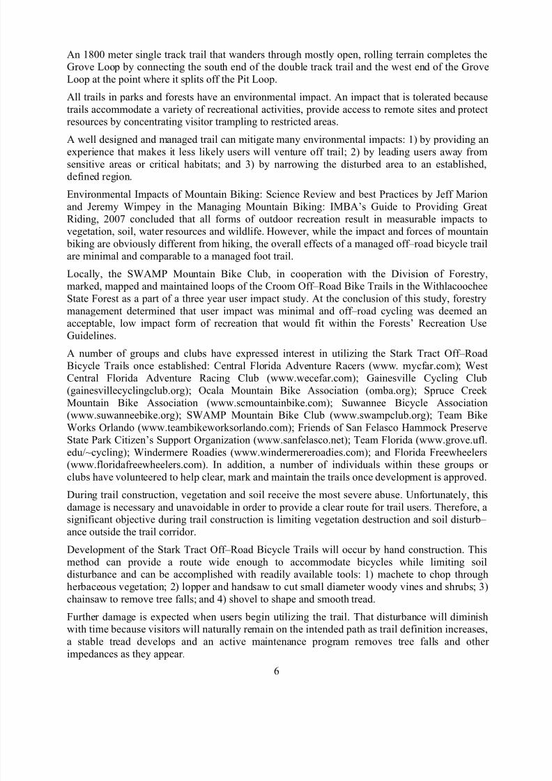
A kiosk erected near the entrance of Stark Tract Off–RoadBicycle Trails will not only educate users with the importance of staying on trail, it will also provide maps of the trails, describe the skill level necessary to safely travel the Pit Loop andGrove Loop as well as the conditions to expect on each trail.
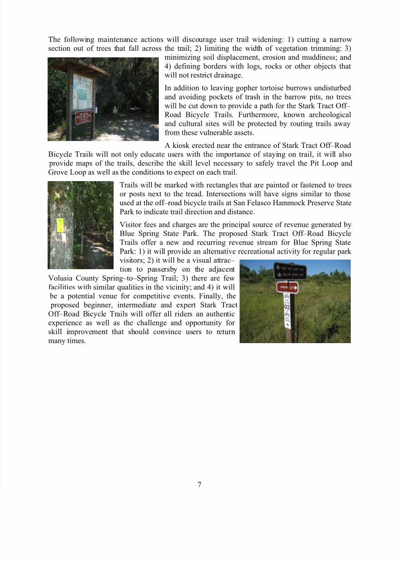
Trails will be marked with rectangles that are painted or fastened to trees
or posts next to the tread. Intersections will have signs similar to thoseused at the off–road bicycle trails at San Felasco Hammock Preserve StatePark to indicate trail direction and distance.
Visitor fees and charges are the principal source of revenue generated byBlue Spring State Park. The proposed Stark Tract Off–Road BicycleTrails offer a new and recurring revenue stream for Blue Spring StatePark: 1) it will provide an alternative recreational activity for regular park visitors; 2) it will be a visual attrac– tion to passersby on the adjacent
Volusia County Spring–to–Spring Trail; 3) there are fewfacilities with similar qualities in the vicinity; and 4) it will
be a potential venue for competitive events. Finally, the proposed beginner, intermediate and expert Stark TractOff–Road Bicycle Trails will offer all riders an authenticexperience as well as the challenge and opportunity for skill improvement that should convince users to returnmany times.