Sara Wynne-Pari Environment Wales Development Officer Cynnal Cymru .
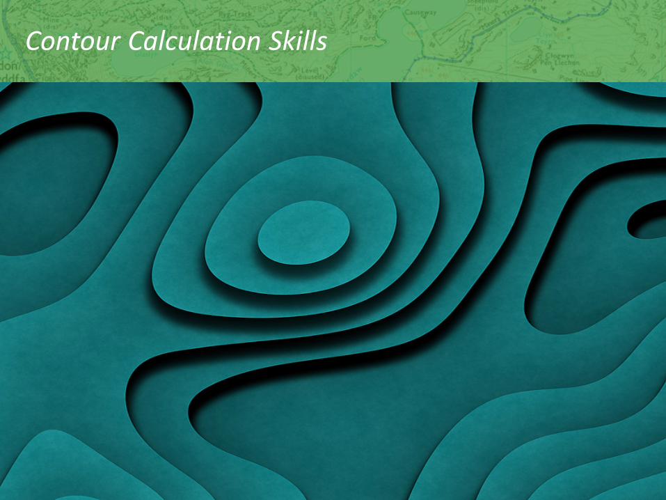
Contour Calculation Skills
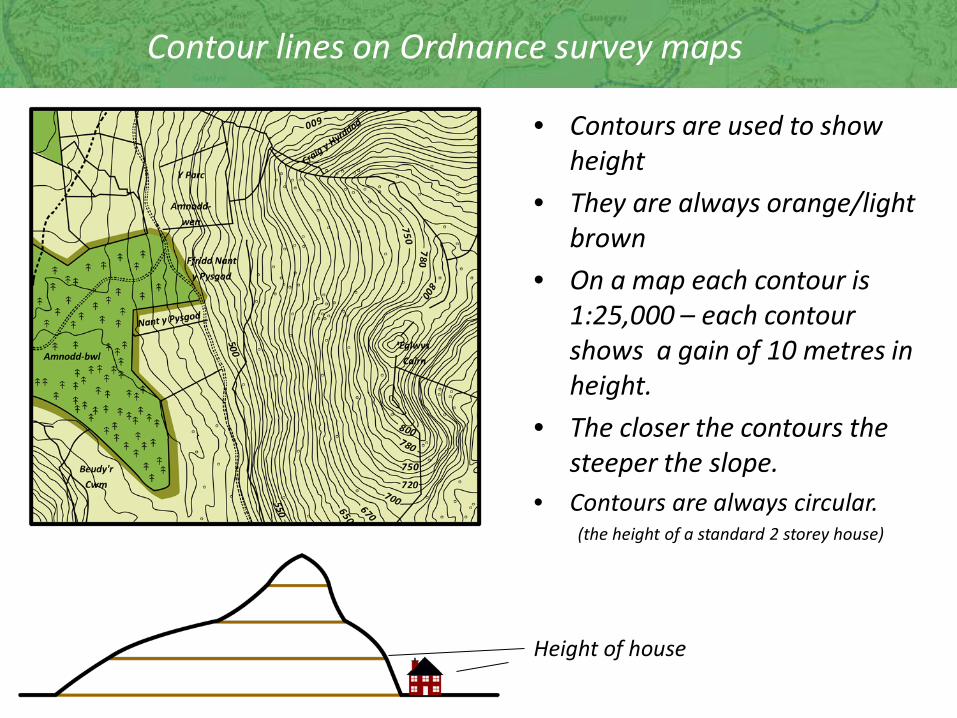
Contour lines on Ordnance survey maps
• Contours are used to show height
• They are always orange/light brown
• On a map each contour is 1:25,000 – each contour shows a gain of 10 metres in height.
• The closer the contours the steeper the slope.
• Contours are always circular. (the height of a standard 2 storey house)
Height of house

Contours
Side View
Top
Sea level
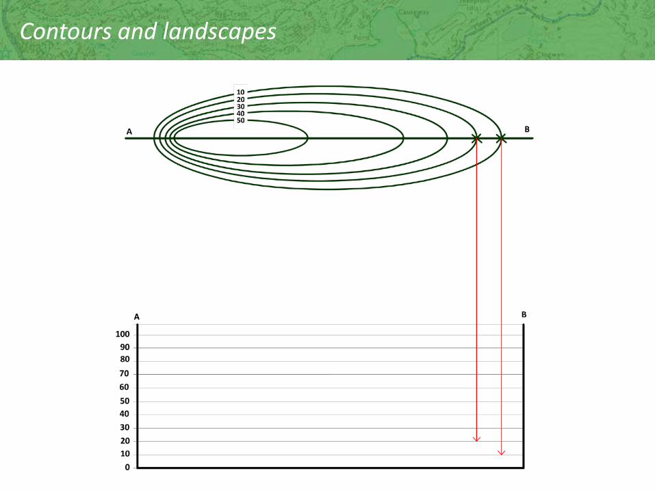
Contours and landscapes

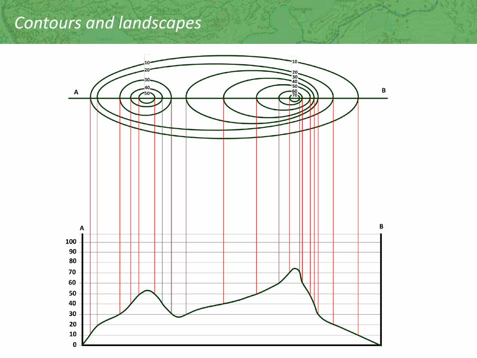
Contours and landscapes

Contours and landscapes
Contours and landscapes
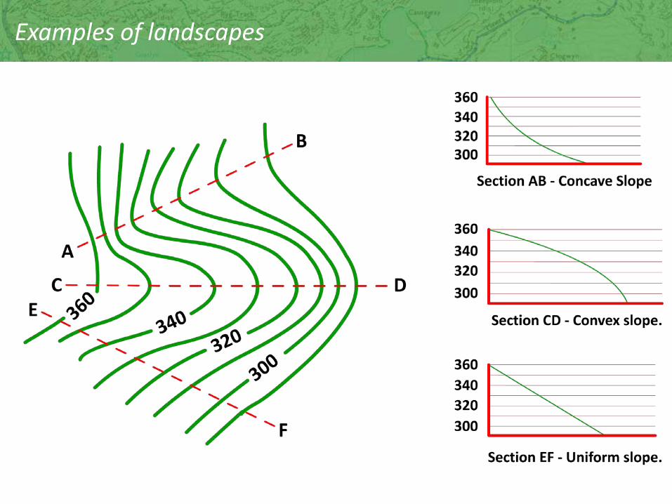
Examples of landscapes

Contours and landscapes
A
B A
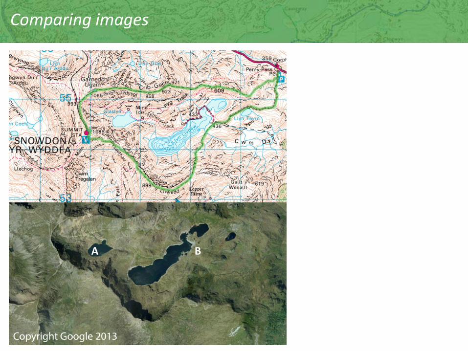
Comparing images