Common Alerting Protocol (CAP) v. 1.0
24
Rev. 2004.07 Common Alerting Protocol (CAP) v. 1.0 Emergency Management Technical Committee
-
Upload
kibo-morrison -
Category
Documents
-
view
40 -
download
3
description
Common Alerting Protocol (CAP) v. 1.0. Emergency Management Technical Committee. Summary. Purpose History Design Philosophy Data Dictionary Examples Who Is Using CAP? Next Steps Resources. Purpose. - PowerPoint PPT Presentation
Transcript of Common Alerting Protocol (CAP) v. 1.0
Rev. 2004.07
Common Alerting Protocol (CAP) v. 1.0
Common Alerting Protocol (CAP) v. 1.0
Emergency Management Technical Committee
Emergency Management Technical Committee
SummarySummary
Purpose History Design Philosophy Data Dictionary Examples Who Is Using CAP? Next Steps Resources
Purpose History Design Philosophy Data Dictionary Examples Who Is Using CAP? Next Steps Resources
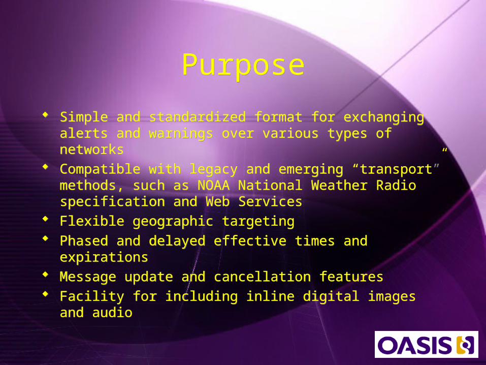
PurposePurpose
Simple and standardized format for exchanging alerts and warnings over various types of networks
Compatible with legacy and emerging “transport” methods, such as NOAA National Weather Radio specification and Web Services
Flexible geographic targeting Phased and delayed effective times and expirations Message update and cancellation features Facility for including inline digital images and audio

HistoryHistory
National Science and Technology Council (NSTC) released “Effective Disaster Warnings” report in November 2000, which recommend standard way to collect and relay warnings
International working group of over 130 emergency managers, IT experts, and telecommunications experts convened in 2001 to adopted the specific recommendations and start CAP
Drafts used and tested in field demonstrations in Virginia and California in 2002 and 2003
CAP 0.7 contributed to EM TC in shortly after formation in 2003
CAP 1.0 becomes OASIS Standard in April 2004

Design PhilosophyDesign Philosophy
Interoperability Completeness Simple Implementation Simple XML and Portable Structure Multi-use Format Familiarity Interdisciplinary and International Utility
Interoperability Completeness Simple Implementation Simple XML and Portable Structure Multi-use Format Familiarity Interdisciplinary and International Utility
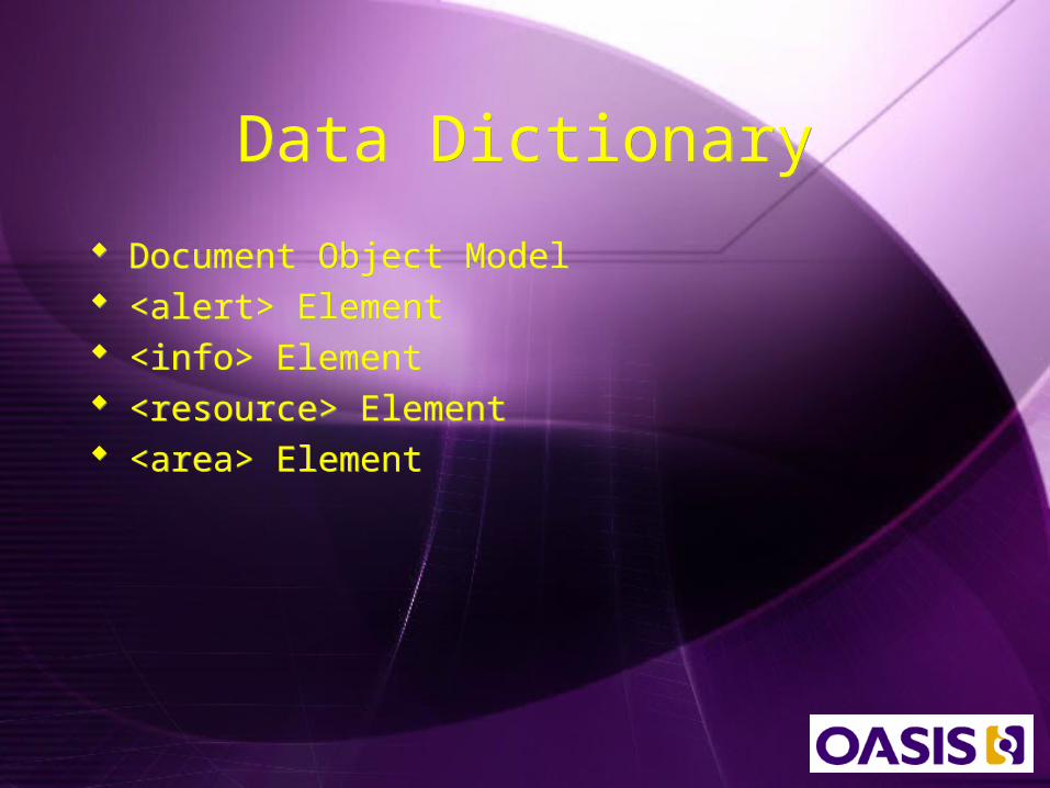
Data DictionaryData Dictionary
Document Object Model <alert> Element <info> Element <resource> Element <area> Element
Document Object Model <alert> Element <info> Element <resource> Element <area> Element
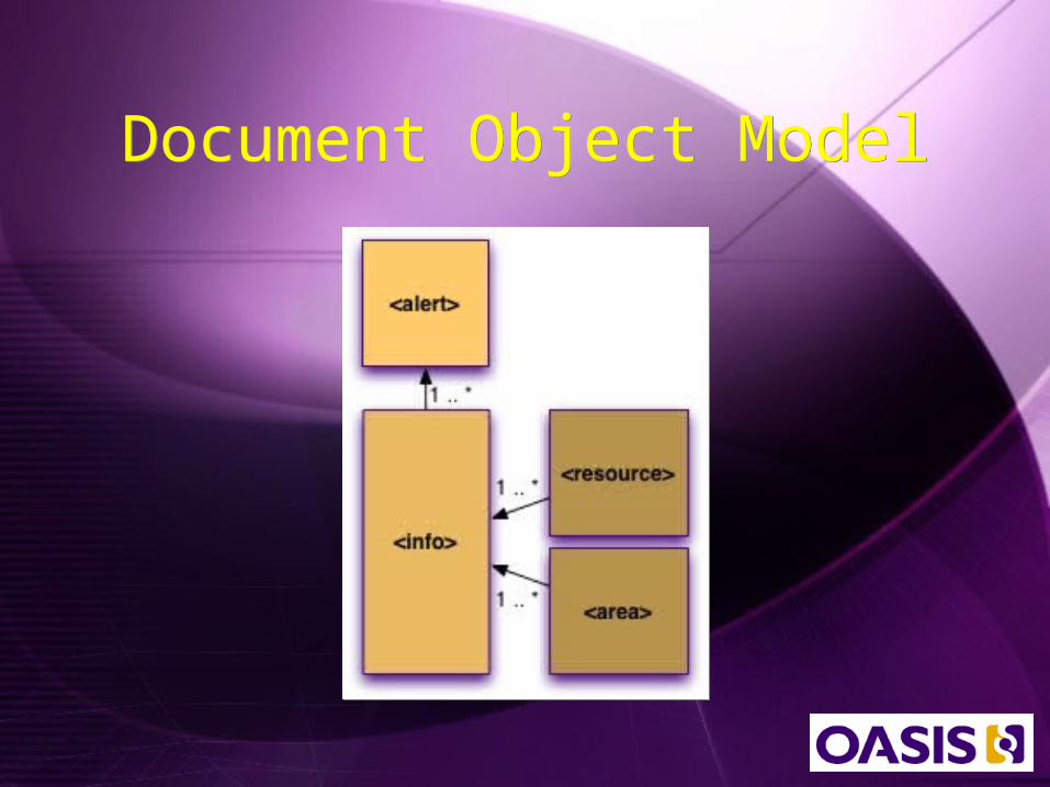
Document Object ModelDocument Object Model
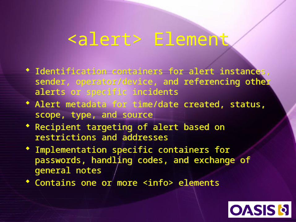
<alert> Element<alert> Element
Identification containers for alert instances, sender, operator/device, and referencing other alerts or specific incidents
Alert metadata for time/date created, status, scope, type, and source
Recipient targeting of alert based on restrictions and addresses
Implementation specific containers for passwords, handling codes, and exchange of general notes
Contains one or more <info> elements
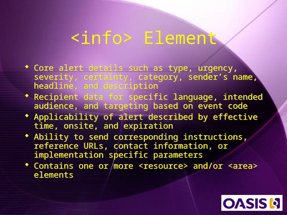
<info> Element<info> Element
Core alert details such as type, urgency, severity, certainty, category, sender’s name, headline, and description
Recipient data for specific language, intended audience, and targeting based on event code
Applicability of alert described by effective time, onsite, and expiration
Ability to send corresponding instructions, reference URLs, contact information, or implementation specific parameters
Contains one or more <resource> and/or <area> elements

<resource> Element<resource> Element
Ability to specify both a human-readable description of the resource as well as the MIME content type
Container for specifying the resource’s size, in bytes, to aid implementations
Provides a URI pointing to the resource and/or a digest (hash) of the resource itself
Mechanism for passing a base-64 encoded version of the resource
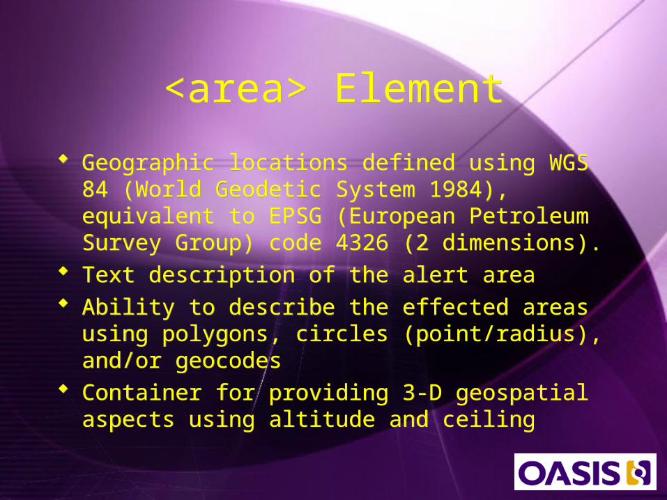
<area> Element<area> Element
Geographic locations defined using WGS 84 (World Geodetic System 1984), equivalent to EPSG (European Petroleum Survey Group) code 4326 (2 dimensions).
Text description of the alert area Ability to describe the effected areas using
polygons, circles (point/radius), and/or geocodes
Container for providing 3-D geospatial aspects using altitude and ceiling
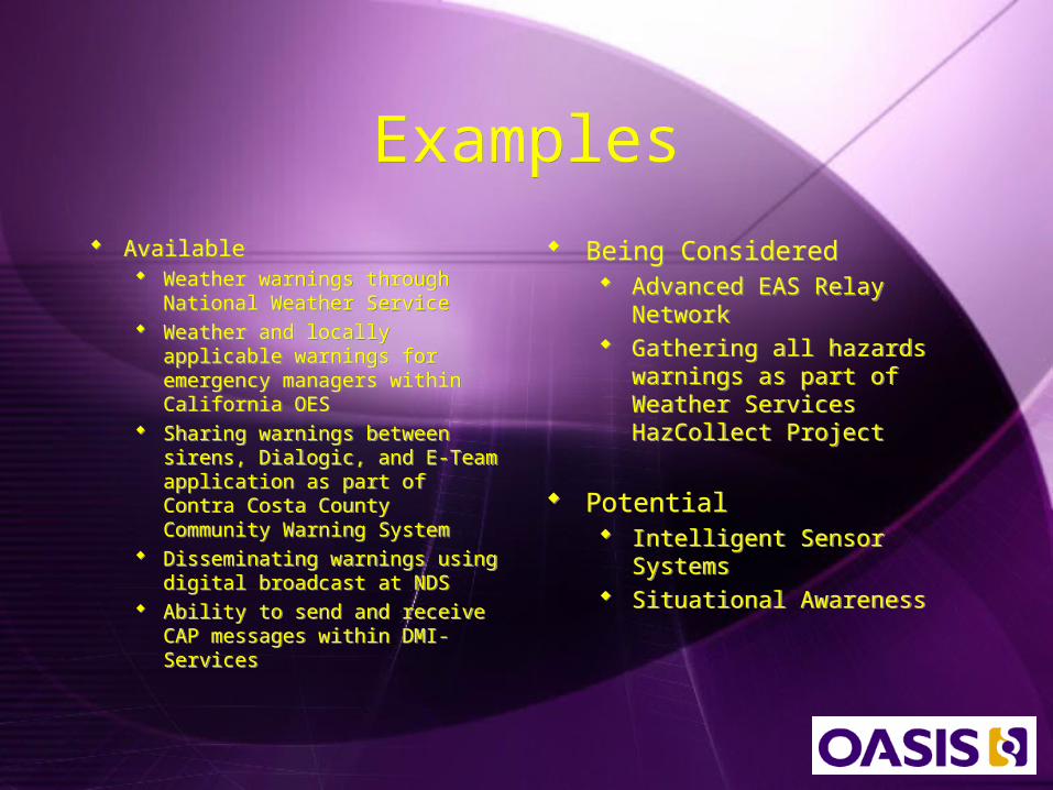
ExamplesExamples Available
Weather warnings through National Weather Service
Weather and locally applicable warnings for emergency managers within California OES
Sharing warnings between sirens, Dialogic, and E-Team application as part of Contra Costa County Community Warning System
Disseminating warnings using digital broadcast at NDS
Ability to send and receive CAP messages within DMI-Services
Available Weather warnings through
National Weather Service Weather and locally applicable
warnings for emergency managers within California OES
Sharing warnings between sirens, Dialogic, and E-Team application as part of Contra Costa County Community Warning System
Disseminating warnings using digital broadcast at NDS
Ability to send and receive CAP messages within DMI-Services
Being Considered Advanced EAS Relay
Network Gathering all hazards
warnings as part of Weather Services HazCollect Project
Potential Intelligent Sensor Systems Situational Awareness
Being Considered Advanced EAS Relay
Network Gathering all hazards
warnings as part of Weather Services HazCollect Project
Potential Intelligent Sensor Systems Situational Awareness
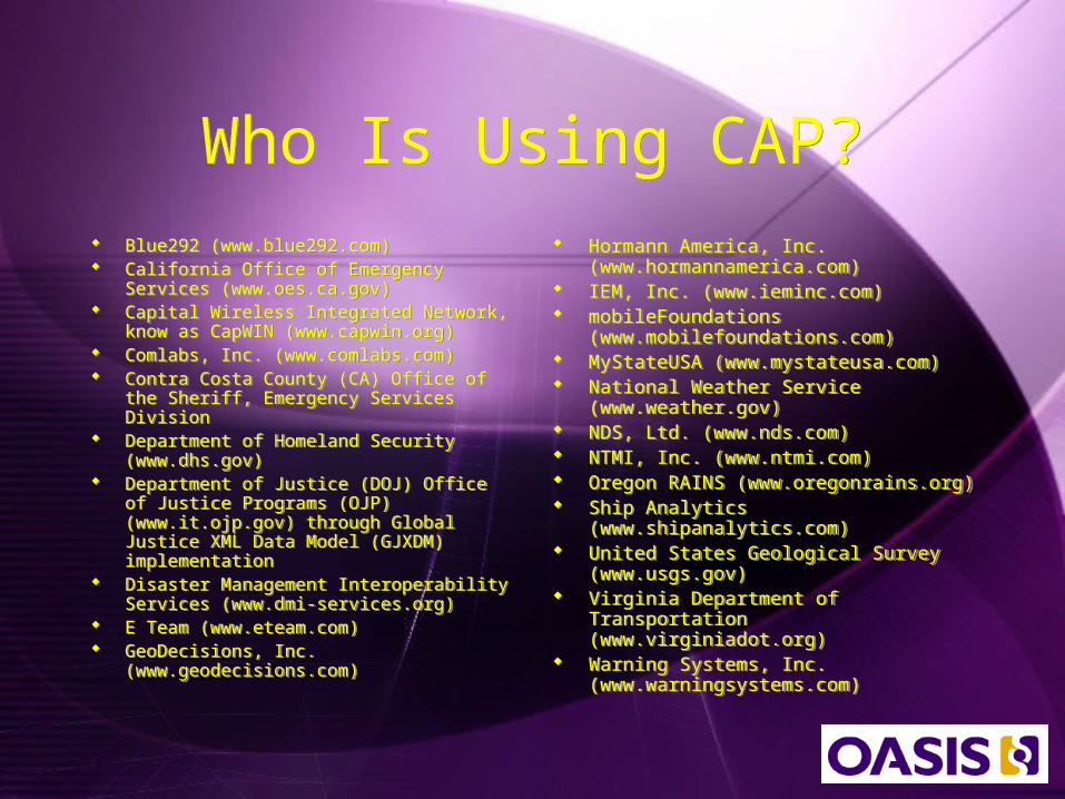
Who Is Using CAP?Who Is Using CAP? Blue292 (www.blue292.com) California Office of Emergency
Services (www.oes.ca.gov) Capital Wireless Integrated Network,
know as CapWIN (www.capwin.org) Comlabs, Inc. (www.comlabs.com) Contra Costa County (CA) Office of the
Sheriff, Emergency Services Division Department of Homeland Security
(www.dhs.gov) Department of Justice (DOJ) Office of
Justice Programs (OJP) (www.it.ojp.gov) through Global Justice XML Data Model (GJXDM) implementation
Disaster Management Interoperability Services (www.dmi-services.org)
E Team (www.eteam.com) GeoDecisions, Inc.
(www.geodecisions.com)
Blue292 (www.blue292.com) California Office of Emergency
Services (www.oes.ca.gov) Capital Wireless Integrated Network,
know as CapWIN (www.capwin.org) Comlabs, Inc. (www.comlabs.com) Contra Costa County (CA) Office of the
Sheriff, Emergency Services Division Department of Homeland Security
(www.dhs.gov) Department of Justice (DOJ) Office of
Justice Programs (OJP) (www.it.ojp.gov) through Global Justice XML Data Model (GJXDM) implementation
Disaster Management Interoperability Services (www.dmi-services.org)
E Team (www.eteam.com) GeoDecisions, Inc.
(www.geodecisions.com)
Hormann America, Inc. (www.hormannamerica.com)
IEM, Inc. (www.ieminc.com) mobileFoundations
(www.mobilefoundations.com) MyStateUSA (www.mystateusa.com) National Weather Service
(www.weather.gov) NDS, Ltd. (www.nds.com) NTMI, Inc. (www.ntmi.com) Oregon RAINS (www.oregonrains.org) Ship Analytics
(www.shipanalytics.com) United States Geological Survey
(www.usgs.gov) Virginia Department of
Transportation (www.virginiadot.org) Warning Systems, Inc.
(www.warningsystems.com)
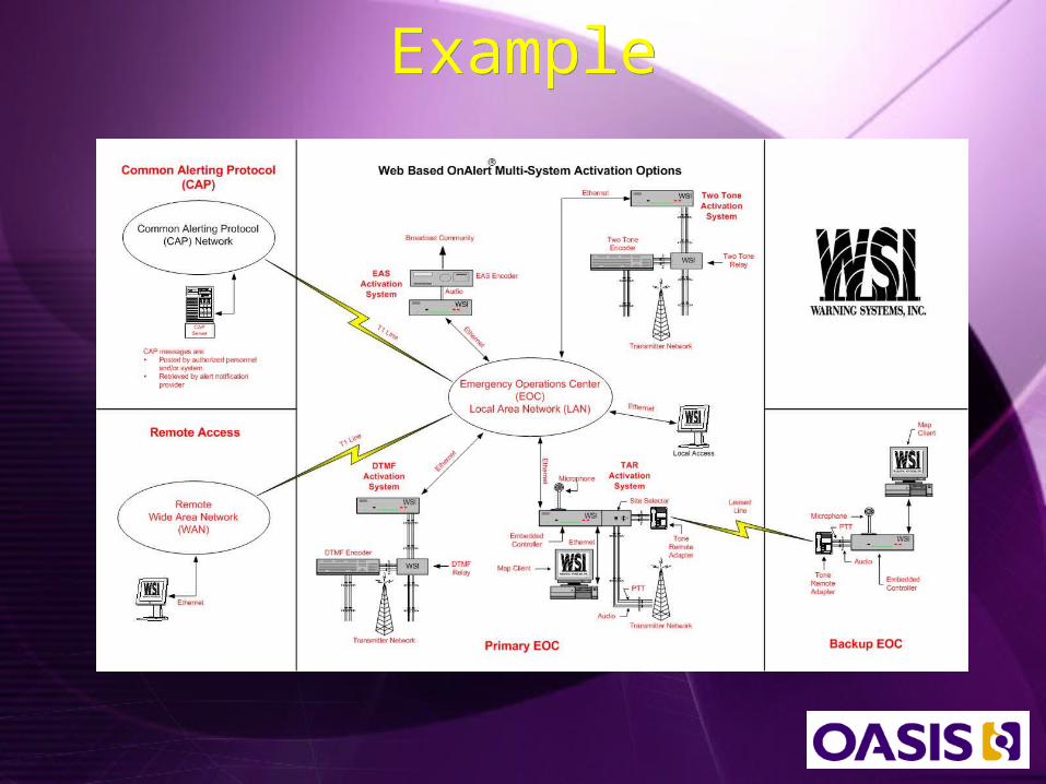
ExampleExample
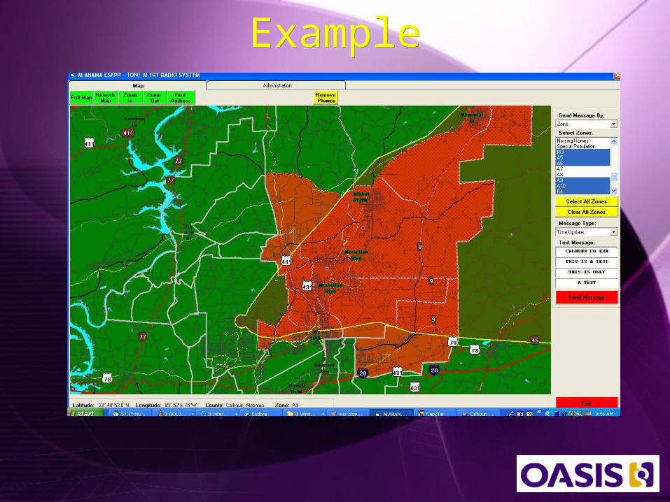
ExampleExample

ExampleExample
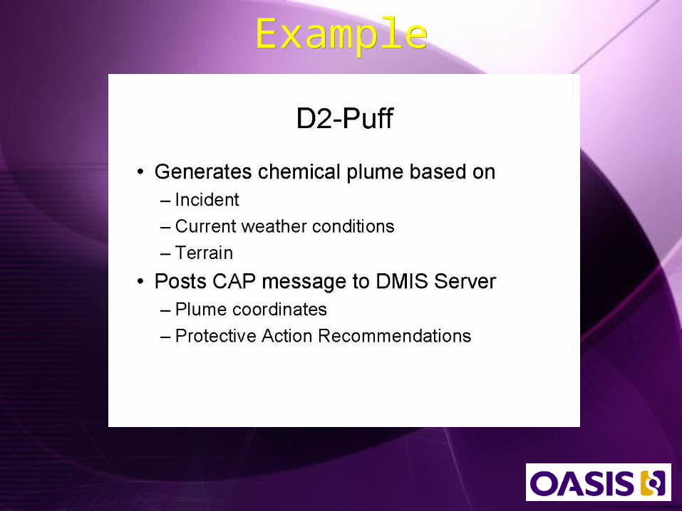
ExampleExample

NEMIS Services at AnteonNEMIS Services at Anteon
Enterprise Wide Disaster Management Database
Disaster Declaratio
n
Damage Assessmen
t
IncidentActivitie
s
Emergency Coordinatio
n
Hazard Mitigation
Public Assistanc
e
Individual Assistanc
e
Program Managemen
t
Emergency Support
Financials
Access Control
Data WarehouseSystems Management NEMIS WIDE
IFMIS
OFM
Incident Occurrence
States
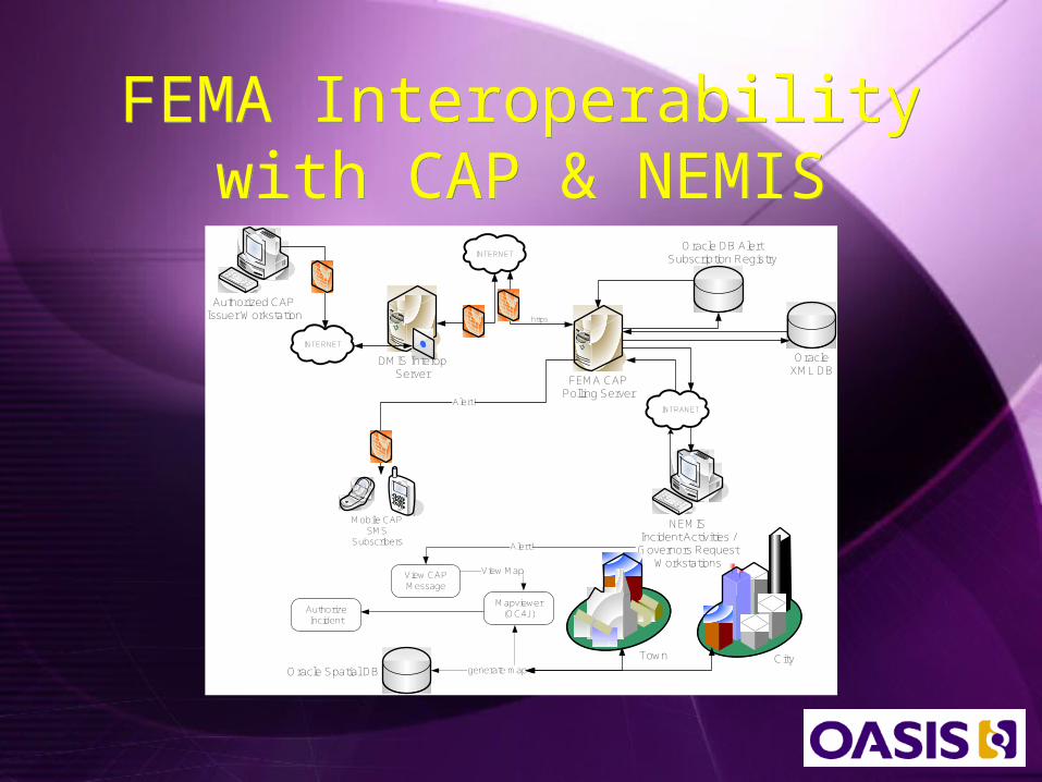
FEMA Interoperability with CAP & NEMIS
FEMA Interoperability with CAP & NEMIS
`
Authorized CAP Issuer Workstation
FEMA CAP Polling Server
DMIS InteropServer
Oracle XML DB
Oracle DB AlertSubscription Registry
INTERNET
https
INTERNET
`
NEMIS Incident Activities /Governors Request
Workstations
INTRANET
Authorize Incident
Alert!
View CAP Message
Mapviewer(OC4J)
View Map
generate map
Mobile CAP SMS
Subscribers
Alert!
Oracle Spatial DB
Town City

What is CapWIN?What is CapWIN?At Full Production A Suite of Tools for Mobile and fixed Station
First Responders & Support Staff Enabling: Incident Management & Coordination
Across Agencies, Regions & Disciplines One-to-One & Group Communication
(messaging & email) Automatic Notifications & Alerts A Robust Directory of Individual First
Responders Access to Operational Data/Resources,
including Multiple State and Federal Law Enforcement Criminal Databases, HAZMAT information, Health data & professionals, GIS, etc.
A Secure, Regional Information Hub Connecting Participants Across Multiple Public Safety Networks
A Local, State, and Federal Governance Partnership
At Full Production A Suite of Tools for Mobile and fixed Station
First Responders & Support Staff Enabling: Incident Management & Coordination
Across Agencies, Regions & Disciplines One-to-One & Group Communication
(messaging & email) Automatic Notifications & Alerts A Robust Directory of Individual First
Responders Access to Operational Data/Resources,
including Multiple State and Federal Law Enforcement Criminal Databases, HAZMAT information, Health data & professionals, GIS, etc.
A Secure, Regional Information Hub Connecting Participants Across Multiple Public Safety Networks
A Local, State, and Federal Governance Partnership
Contact: Roddy Moscoso (CapWIN)(301) 614-3728
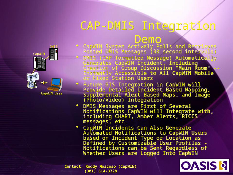
CAP-DMIS Integration Demo
CAP-DMIS Integration Demo
CapWIN System Actively Polls and Retrieves Posted DMIS Messages (30 second intervals)
DMIS (CAP formatted Message) Automatically Generates CapWIN Incident, Including Creation of Group Discussion “Main Room” -- Instantly Accessible to All CapWIN Mobile or Fixed Station Users
Future GIS Integration in CapWIN will Provide Detailed Incident Based Mapping, Supplemental Alert Based Maps, and Image (Photo/Video) Integration
DMIS Messages are First of Several Notifications CapWIN will Integrate with, including CHART, Amber Alerts, RICCS messages, etc.
CapWIN Incidents Can Also Generate Automated Notifications to CapWIN Users based on Incident Type or Location as Defined by Customizable User Profiles - Notifications can be Sent Regardless of Whether Users are Logged Into CapWIN
Contact: Roddy Moscoso (CapWIN)(301) 614-3728
DMIS
CapWIN
CapWIN User
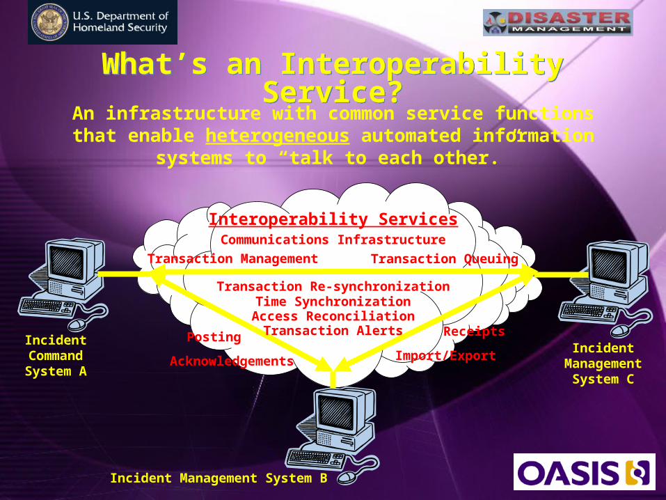
What’s an Interoperability Service?What’s an Interoperability Service?An infrastructure with common service functions that
enable heterogeneous automated information systems to “talk to each other.”
Incident Command System A
Incident Management System B
Incident Management
System C
Interoperability Services
Transaction Management Transaction Queuing
Transaction Re-synchronizationTime SynchronizationAccess Reconciliation
Communications Infrastructure
Transaction Alerts
Acknowledgements
Posting Receipts
Import/Export
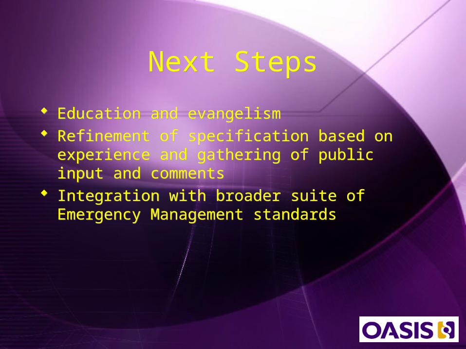
Next StepsNext Steps
Education and evangelism Refinement of specification based on
experience and gathering of public input and comments
Integration with broader suite of Emergency Management standards
Education and evangelism Refinement of specification based on
experience and gathering of public input and comments
Integration with broader suite of Emergency Management standards
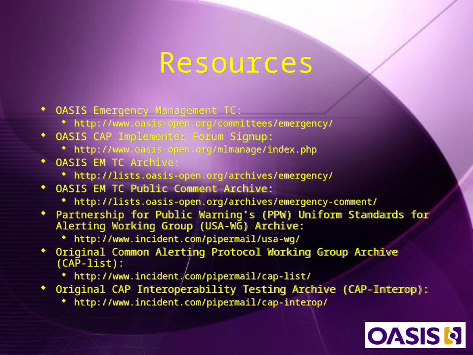
ResourcesResources OASIS Emergency Management TC:
http://www.oasis-open.org/committees/emergency/ OASIS CAP Implementer Forum Signup:
http://www.oasis-open.org/mlmanage/index.php OASIS EM TC Archive:
http://lists.oasis-open.org/archives/emergency/ OASIS EM TC Public Comment Archive:
http://lists.oasis-open.org/archives/emergency-comment/ Partnership for Public Warning’s (PPW) Uniform Standards for Alerting
Working Group (USA-WG) Archive: http://www.incident.com/pipermail/usa-wg/
Original Common Alerting Protocol Working Group Archive (CAP-list): http://www.incident.com/pipermail/cap-list/
Original CAP Interoperability Testing Archive (CAP-Interop): http://www.incident.com/pipermail/cap-interop/
OASIS Emergency Management TC: http://www.oasis-open.org/committees/emergency/
OASIS CAP Implementer Forum Signup: http://www.oasis-open.org/mlmanage/index.php
OASIS EM TC Archive: http://lists.oasis-open.org/archives/emergency/
OASIS EM TC Public Comment Archive: http://lists.oasis-open.org/archives/emergency-comment/
Partnership for Public Warning’s (PPW) Uniform Standards for Alerting Working Group (USA-WG) Archive: http://www.incident.com/pipermail/usa-wg/
Original Common Alerting Protocol Working Group Archive (CAP-list): http://www.incident.com/pipermail/cap-list/
Original CAP Interoperability Testing Archive (CAP-Interop): http://www.incident.com/pipermail/cap-interop/