Colorado Scientific Society
9
Newsletter of the Society November 1997 Colorado Scientific Society In pursuit of the promotion of knowledge, understanding of science, and its application to human needs. STUDENT NIGHT Five 15-minute talks on student research from Front Range colleges and universities Tuesday, November 4, 1997 SOCIAL HOUR 6:30 - 7:30 PM in Geology Museum, Berthoud Hall, Colorado School of Mines - Refreshments provided STUDENT PRESENTATIONS 7:30 PM in Ballroom 3 (Rm 244), 2nd floor, Ben Parker Student Union, Colorado School of Mines 1997 Student Night ..............................................................................................................................................3 Student Abstracts ................................................................................................................................................ 3 Sm-Nd ISOTOPE SYSTEMATICS IN METAMORPHIC MONAZITE FROM NORTHERN NEW MEXICO, IMPLICATIONS FOR THE ORIGIN OF 1.4 GA HIGH TEMPERATURE-LOW PRESSURE METAMORPHISM...... Brook Holcombe ................................................................................................................................................................ 3 LATE QUATERNARY GLACIAL HISTORY OF MID-OUTER CUMBERLAND SOUND, EASTERN CANADIAN ARCTIC ............................................................................................................................................................................... Michael R. Kaplan, ............................................................................................................................................................ 3 FRACTURE NETWORK PREDICTABILITY IN RELATION TO BED THICKNESS, LITHOLOGY, AND FAULT PROXIMITY, BRUSHY CANYON FM., WEST TEXAS ................................................................................................. Aaron John Kullman .......................................................................................................................................................... 4 FLOW UNITS AND UPSCALING OF A COMPLEX CARBONATE RESERVOIR USING A 3-D GEOLOGICAL MODEL ............................................................................................................................................................................... Max Scuta........................................................................................................................................................................... 4 DEVELOPMENT OF A PROTOTYPE GEOSCIENTIFIC INFORMATION SYSTEM OF THE HARAPPA ARCHAEOLOGICAL SITE, PUNJAB PROVINCE, PAKISTAN .................................................................................... Wayne R. Belcher ............................................................................................................................................................... 5 Earth Science Meetings.......................................................................................................................................5 Museums, Internet, News ...................................................................................................................................7
Transcript of Colorado Scientific Society

Newsletter of the Society November 1997
Colorado Scientific Society
In pursuit of the promotion of knowledge,
understanding of science,
and its application to human needs.
STUDENT NIGHT
Five 15-minute talks on student research from Front Range colleges and universities
Tuesday, November 4, 1997
SOCIAL HOUR
6:30 - 7:30 PM in Geology Museum, Berthoud Hall,
Colorado School of Mines - Refreshments provided
STUDENT PRESENTATIONS
7:30 PM in Ballroom 3 (Rm 244), 2nd floor,
Ben Parker Student Union, Colorado School of Mines
1997 Student Night .............................................................................................................................................. 3
Student Abstracts ................................................................................................................................................ 3 Sm-Nd ISOTOPE SYSTEMATICS IN METAMORPHIC MONAZITE FROM NORTHERN NEW MEXICO,
IMPLICATIONS FOR THE ORIGIN OF 1.4 GA HIGH TEMPERATURE-LOW PRESSURE METAMORPHISM......
Brook Holcombe ................................................................................................................................................................ 3
LATE QUATERNARY GLACIAL HISTORY OF MID-OUTER CUMBERLAND SOUND, EASTERN CANADIAN
ARCTIC ...............................................................................................................................................................................
Michael R. Kaplan, ............................................................................................................................................................ 3
FRACTURE NETWORK PREDICTABILITY IN RELATION TO BED THICKNESS, LITHOLOGY, AND FAULT
PROXIMITY, BRUSHY CANYON FM., WEST TEXAS .................................................................................................
Aaron John Kullman .......................................................................................................................................................... 4
FLOW UNITS AND UPSCALING OF A COMPLEX CARBONATE RESERVOIR USING A 3-D GEOLOGICAL
MODEL ...............................................................................................................................................................................
Max Scuta ........................................................................................................................................................................... 4
DEVELOPMENT OF A PROTOTYPE GEOSCIENTIFIC INFORMATION SYSTEM OF THE HARAPPA
ARCHAEOLOGICAL SITE, PUNJAB PROVINCE, PAKISTAN ....................................................................................
Wayne R. Belcher ............................................................................................................................................................... 5
Earth Science Meetings....................................................................................................................................... 5
Museums, Internet, News ................................................................................................................................... 7
2
Fall Field Trip Enlightening............................................................................................................................... 7
Invitation to Join the Colorado Scientific Society ............................................................................................ 8
Colorado Scientific Society Officers, Councilors, and Chairpersons ............................................................ 9
3
HWY 93
Colorado
School
of Mines
19th St
13th St
14th St
15th St
Ford St
Illinois St
Washington St
Jackson St
19th St
Illinois St
16th St
14th St
13th StMaple St
Elm St 18th St
USGS
Student
Union Museum
Green CenterGeology
NGOLDEN AREA
COLORADO SCHOOL OF MINES
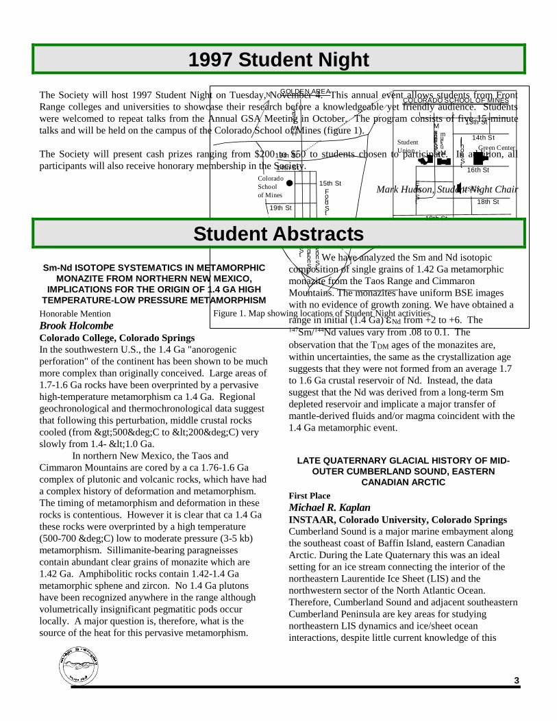
Figure 1. Map showing locations of Student Night activities.
1997 Student Night
The Society will host 1997 Student Night on Tuesday, November 4. This annual event allows students from Front
Range colleges and universities to showcase their research before a knowledgeable yet friendly audience. Students
were welcomed to repeat talks from the Annual GSA Meeting in October. The program consists of five 15-minute
talks and will be held on the campus of the Colorado School of Mines (figure 1).
The Society will present cash prizes ranging from $200 to $50 to students chosen to participate. In addition, all
participants will also receive honorary membership in the Society.
Mark Hudson, Student Night Chair
Student Abstracts
Sm-Nd ISOTOPE SYSTEMATICS IN METAMORPHIC
MONAZITE FROM NORTHERN NEW MEXICO,
IMPLICATIONS FOR THE ORIGIN OF 1.4 GA HIGH
TEMPERATURE-LOW PRESSURE METAMORPHISM
Honorable Mention
Brook Holcombe Colorado College, Colorado Springs
In the southwestern U.S., the 1.4 Ga "anorogenic
perforation" of the continent has been shown to be much
more complex than originally conceived. Large areas of
1.7-1.6 Ga rocks have been overprinted by a pervasive
high-temperature metamorphism ca 1.4 Ga. Regional
geochronological and thermochronological data suggest
that following this perturbation, middle crustal rocks
cooled (from >500°C to <200°C) very
slowly from 1.4- <1.0 Ga.
In northern New Mexico, the Taos and
Cimmaron Mountains are cored by a ca 1.76-1.6 Ga
complex of plutonic and volcanic rocks, which have had
a complex history of deformation and metamorphism.
The timing of metamorphism and deformation in these
rocks is contentious. However it is clear that ca 1.4 Ga
these rocks were overprinted by a high temperature
(500-700 °C) low to moderate pressure (3-5 kb)
metamorphism. Sillimanite-bearing paragneisses
contain abundant clear grains of monazite which are
1.42 Ga. Amphibolitic rocks contain 1.42-1.4 Ga
metamorphic sphene and zircon. No 1.4 Ga plutons
have been recognized anywhere in the range although
volumetrically insignificant pegmatitic pods occur
locally. A major question is, therefore, what is the
source of the heat for this pervasive metamorphism.
We have analyzed the Sm and Nd isotopic
composition of single grains of 1.42 Ga metamorphic
monazite from the Taos Range and Cimmaron
Mountains. The monazites have uniform BSE images
with no evidence of growth zoning. We have obtained a
range in initial (1.4 Ga) Nd from +2 to +6. The 147Sm/144Nd values vary from .08 to 0.1. The
observation that the TDM ages of the monazites are,
within uncertainties, the same as the crystallization age
suggests that they were not formed from an average 1.7
to 1.6 Ga crustal reservoir of Nd. Instead, the data
suggest that the Nd was derived from a long-term Sm
depleted reservoir and implicate a major transfer of
mantle-derived fluids and/or magma coincident with the
1.4 Ga metamorphic event.
LATE QUATERNARY GLACIAL HISTORY OF MID-
OUTER CUMBERLAND SOUND, EASTERN
CANADIAN ARCTIC
First Place
Michael R. Kaplan INSTAAR, Colorado University, Colorado Springs
Cumberland Sound is a major marine embayment along
the southeast coast of Baffin Island, eastern Canadian
Arctic. During the Late Quaternary this was an ideal
setting for an ice stream connecting the interior of the
northeastern Laurentide Ice Sheet (LIS) and the
northwestern sector of the North Atlantic Ocean.
Therefore, Cumberland Sound and adjacent southeastern
Cumberland Peninsula are key areas for studying
northeastern LIS dynamics and ice/sheet ocean
interactions, despite little current knowledge of this
4
history. Glacial geologic studies along the coastline of
Cumberland Peninsula provide evidence for both ice
sheet and local ice cap activity whereas numerical
modeling tests the physical plausibility of ice sheet
reconstructions inferred from the field program in this
region.
The two dominant geomorphic landscapes on
southeastern Cumberland Peninsula are (1) glacially
modified low-lying areas and (2) weathered high
plateaus lacking evidence of recent glacial activity. The
orientation of striations indicates that ice flowed SW
and SE into the low-lying areas of Cumberland
Peninsula before entering the Sound. In addition,
mapping of the limits and elevations of postglacial
marine submergence (raised marine features such as
wave-washing and beaches above present sea level)
along the coast of Cumberland Peninsula indicate that
the Sound was isostatically depressed by the LIS. Dates
based on 26Al and 10Be (cosmogenic) isotope
concentrations in glacially-modified bedrock range from
12,000 to 20,000 years, constraining the timing of both
glacial activity on the Peninsula and the presence of the
LIS. Cosmogenic isotope dates from the higher plateaus
are older and, as expected, show more scatter: dates
range from 29,000 to 61,000 years, indicating complex
exposure histories. Together, these lines of evidence
suggest that recently much of Cumberland Peninsula
was affected by erosive (warm-based) local glaciers
while the adjacent Sound was inundated by a low-
surface slope ice stream. During this time the high
plateaus must have been covered by thin cold-based ice
and/or have remained unglaciated. The latter
explanation is more compatible with recent lake
sediment studies on some of the plateaus. Numerical
modeling allows simulation of this hypothesized
reconstruction in addition to providing insights into the
necessary boundary conditions for such glaciologic
behavior. This study provides the first data for the
glacial history of southeastern Cumberland Peninsula.
The results highlight the glaciologic role Cumberland
Sound may have played during the Late Quaternary
Period, given its influence on the dynamics and
configuration of the northeastern LIS.
FRACTURE NETWORK PREDICTABILITY IN
RELATION TO BED THICKNESS, LITHOLOGY, AND
FAULT PROXIMITY, BRUSHY CANYON FM., WEST
TEXAS
Second Place
Aaron John Kullman Colorado School of Mines, Golden
Characterization of fracture networks is important for
assessing reservoir quality and fault sealing. Knowledge
of how lithology, bed thickness, and faulting can control
fracture spacing and orientation greatly enhances the
predictability of fractures in the subsurface. The effect
of fractures on cementation and sealing is also
important.
Outcrops of the Permian Brushy Canyon Fm. in
the Delaware Mountains of West Texas provide an
excellent analog to many large, deep-water sandstone
reservoirs. The Brushy Canyon Fm. is interpreted to be
a slope and basin low-stand sequence of fine-grained
sandstones and siltstones deposited in deep-water
channels and fans. Migration of carbonate- and hydro-
carbon-bearing fluids accompanied Basin and Range
normal faulting.
Sedimentological architecture within the Brushy
Canyon Fm. contributes significantly to fracture
development. Scan line surveys along cliffs
demonstrate that fracture spacing is related, in part, to
lithology and bed thickness. Fracture spacing and bed
thickness generally show a positive correlation. Spacing
and variance of fractures are smallest in thin fine-
grained sandstone beds, and largest in organic-rich
siltstone beds.
Also, faults and associated fractures can act as
fluid conduits, fluid barriers, or both, depending on the
history of diagenesis related to fluid migration. Fracture
spacing in sandstone beds increases parabolically away
from faults. Carbonate-filled veins are concentrated near
faults. Outcrop seismic velocity measurements quantify
a diagenetic alteration halo across faults resulting from
multiple fluid migration and precipitation events.
Furthermore, fracture orientation and spacing are
dissimilar in the hanging-wall vs. foot-wall of some
faults, suggesting that cementation-related fault sealing
and reservoir damage may be asymmetric around these
faults.
FLOW UNITS AND UPSCALING OF A COMPLEX
CARBONATE RESERVOIR USING A 3-D
GEOLOGICAL MODEL
Honorable Mention
Max Scuta Colorado School of Mines, Golden
The purpose of this study is to define reservoir flow
units in a complex carbonate reservoir using cores, logs,
outcrop analogs, production data, by applying sequence
stratigraphy concepts as well as the interpreted
structural evolution for this area. A further objective is
to construct a 3-D geological model of this field, which

5
has been upscaled for reservoir simulation purposes and
modeled to predict seismic response.
The reservoir is the Permian San Andres
Formation, which is composed of stacked cyclic shallow
marine carbonates deposited in a distally steepened
ramp setting. Pervasive dolomitization, fracturing and
subsequent plugging with anhydrite cement, in addition
to moldic, interparticle and intercrystalline porosities are
the result of extensive diagenesis.
Time-lapse logging using resistivity logs and
injectivity profiles, and the use of porosity-resistivity
overlays show that there are significant zones of
unswept pay. Borehole images provide information to
interpret bedding and fracture orientation, and allows
recognition of breakouts that define the in-situ stress
orientation. Combining these elements with the
sequence stratigraphic interpretation has allowed the
creation of a 3-D geological model using Stratamodel.
This software package provides input into the Eclipse
reservoir simulator using scaling up approaches
contained in Geolink/Gridgenr software packages.
Stratamodel is also used to distribute the attributes
needed for the 3-D synthetic seismogram.
This study provides a bridge between geologic,
engineering, and seismic data. Such combined data can
be used as a tool for helping predict reservoir behavior
and improving exploitation in this and other similar
carbonate reservoirs. A 3-D model becomes a powerful
visualization tool that can help make strategic reservoir-
management decisions.
DEVELOPMENT OF A PROTOTYPE GEOSCIENTIFIC
INFORMATION SYSTEM OF THE HARAPPA
ARCHAEOLOGICAL SITE, PUNJAB PROVINCE,
PAKISTAN
Third Place
Wayne R. Belcher Colorado School of Mines, Golden
The Harappa archaeological site, located in the
Punjab Province, Pakistan, consists of several large
mounds of cultural material on the Ravi River flood
plain. The Harappa site is part of the Bronze Age Indus
Valley Civilization, initially discovered at Harappa.
Current excavations, which begun in 1986, focus on the
evolution and dynamics of this ancient urban center.
My research has incorporated both traditional
2D-GIS and 3D-visualization methods inherent in
geoscientific information systems (GSIS) to produce a
database with a graphical user interface. Several GIS
and GSIS products were integrated to construct these
products.
Data from the Harappa excavations include
thousands of entities or items, such as site maps, area
maps, structure plans and sections, trench plans and
sections, artifact information records and collections,
and archaeologic interpretations. A subset of the data
was used to develop methodologies to manage,
synthesize, and visualize; and to examine
interrelationships of site-wide topographic and
stratigraphic models, paleotopography, archaeologic
structures, reconstructions, archaeologic trenches, and
artifact distributions.
The prototype includes a multi-scaling user
interface to visualize data at appropriate scales (site,
structure, and trench) to present
topographic/stratigraphic data, to manage and display
excavation data, and to present archaeologic
reconstructions of structures. The accuracy and
appropriateness of the 3D-visualization methodology
were evaluated by qualitative and quantitative analyses.
An integrated data management and
visualization approach can serve to archive and preserve
Harappa data and interpretations for future generations
of archaeologists. The results of this work can also be
applied to other geologic work such as geotechnical site
investigations, seismological work, and environmental
engineering work, due to analogies between geology and
archaeology.
Earth Science Meetings
Colorado Scientific Society's regular meetings are held the 2nd Tuesday of the month (unless otherwise
advertised). Social time begins at 7:00 p.m. and program is at 7:30 p.m. Contact Karl Kellogg at 236-1305 for
information.
Denver International Petroleum Society (DIPS) meets the 2nd Friday of each month at the
Wynkoop Brewing Co., 18th and Wynkoop Streets. Reception begins at 11:30 a.m., luncheon at 12 p.m., program

6
at 12:30 p.m. Make reservations (required) by calling Kristine Peterson (303) 980-6770. Reservations accepted
after 8 a.m. on Friday until 10:30 a.m. on Wednesday prior to the meeting. Cancellations accepted until 11:00 am
Wednesday prior to the meeting. Cost: $13 for lunches; talk only is available for $2 (make checks payable to
"DIPS"). Contact Keith Murray at (303) 986-8554 for information.
Denver Region Exploration Geologists' Society (DREGS) meets in the Mutual
Consolidated Water Building, 12700 West 27th Avenue, Lakewood. Social hour 6:00-7:00 p.m. Technical
presentation at 7:00 p.m. Meetings are normally scheduled for the first Monday of each month. For information
contact Jim Cappa, 866-2611.
Denver Mining Club meets Thursdays from 11:30 a.m. to 1:00 p.m. at the Country Harvest Buffet at Villa
Italia, 7200 W. Alameda Avenue, Lakewood. For more information contact Dick Beach at (303) 986-6535.
November 13 — Hal Leith, Gemologist, "Gems/Minerals"
November 20 — Bob Henson, Writer/Meteorologist, UCAR Communication, "El Niño: What's Behind the
Hype?"
December 4 — James A. Cappa, Chief, Minerals and Mineral Fuels Section, Colorado Geological Survey,
"Colorado Mineral and Mineral Fuel Activity, 1996"
December 11 — Ross Bhappu, CEO, Copper Ventures, Ltd., "Role of New Technologies in the Mining Industry"
December 18 — Bob Neukirchner, Pres., Eagle Engineering Services, Inc., "Effects of Ore Body Inundation—A
Case Study of the Eagle Mine, Minturn, Colorado"
Colorado School of Mines Van Tuyl Lectures For information call the Dept. of Geology at 273-3800.
Colorado State University Geology Lectures
All presentations are at 4:00 p.m. in room NR 316, with the exception of the AAPG Distinguished Lecture, which will
be at NOON. For information, contact Eric Erslev at (970) 491-6375.

7
Figure 3. Carl Norbeck describes remediation efforts
near Idaho Springs.
Figure 2. CSS members listen to Carl Norbeck explain the
use of anaerobic methods at an abandoned mine.
Museums, Internet, News Friends of Dinosaur RidgeÖfor information call 697-DINO. Visitors' Center is located at 16831 West
Alameda Parkway (north side of Alameda, just west of the C-470 overpass). Open 9 a.m. to 4 p.m. weekdays and
weekends. Fireside chats are held at the Morrison Town Hall, 110 Stone Street in Morrison starting at 7 p.m.
Morrison Natural History MuseumÖis open 1-4 p.m., Wednesday through Sunday. The Museum is
located on State Highway 8, Ω mile south of Morrison. Fireside chats are cosponsored periodically by Friends of
Dinosaur Ridge (see above).
Fall Field Trip Enlightening
Carl Norbeck led an interesting field trip to the Clear Creek watershed on October 4. About 20 CSS members and
friends learned of exciting community and private activities that are coming together to protect waters that feed into
the Denver metro area. The trip was designed for geoscientists to become more knowledgeable about
geoenvironmental issues of the Clear Creek watershed and efforts underway to provide the communities downstream
with clean water.
The Clear Creek Watershed Forum, along with numerous organizations and individuals, has the goal of
maintaining the environmental soundness of Clear Creek. The consortium is nationally recognized as a stellar
example of cooperation between the community, local industry, the state, and the EPA.
Carl Norbeck, geologist and coordinator for the forum, emphasized various environmental issues related to
mining, industry, agricultural, and urban use of Clear Creek. He also reported on remediation results that have been
achieved through the efforts of private, community, and governmental agencies. Several of the stops were made at
EPA Superfund sites, including wetlands in the Silverplume area that are being used in an experimental metal removal
method, and the Argo Tunnel in Idaho Springs. Also in Idaho Springs, Jack Reed (USGS) described the Precambrian
rocks that make up the Clear Creek area. Other stops included the McClelland Mine at Dumont, the Black Eagle Mill
at Idaho Springs, and the casino at the Gregory Incline in Black Hawk. At Lions Park and Vanover Park in Golden,
we heard how Colorado School of Mines, Coors, and the Clear Creek Water Users Alliance are engaged in cleanup,
stream improvements, and diversion structures.

8
Invitation to Join the Colorado Scientific Society
The Society is dedicated to the advancement of science through open forums and activities. We sponsor lectures, field trips,
student scholarship grants, and discussions of scientific matters of public concern.
I hereby apply for ___________________________________ membership in the Colorado Scientific Society.
(Regular, Corresponding, Student)
(Last Name) (First Name) (Middle)
(Address) (Telephone) (e-mail)
(City) (State) (Zip)
(Company/Agency/University)
(Mailing address if different than above)
School Degree Year Major
Main Scientific Interests
UESYour dues are for the calendar year and help support the newsletter, monthly meetings, two field trips each year,
family night, and the Emmons Lecture.
Regular Member ($15)
Corresponding (outside Denver metro area) Member ($10)
Student Member ($5)
Please make your dues payable to Colorado Scientific Society. Thank you!!
he success of certain Colorado Scientific activities depend on your volunteer help. Please circle those activities for which you
can provide assistance. We will pass your name on to the appropriate Committee Chairperson.
Arrangements Fund Raising Newsletter Publicity
Best Paper Award History Outreach Science Fairs
Field Trips Membership Program Web Site
I certify that all statements in this application are correct and, I agree to promote the objectives of the Society and to abide by its
Constitution, Bylaws, and Rules.
__________________________________ _____________________
Applicant's signature Date
Colorado Scientific Society, P.O. Box 150495, Lakewood, CO 80215-0495
D
T
9
Colorado Scientific Society
P.O. Box 150495
Lakewood, CO 80215-0495
Colorado Scientific Society Officers, Councilors, and Chairpersons OFFICERS COUNCILORS
President: Karl S. Kellogg, USGS, 236-1305 1995-97: Mark Hudson, USGS, 236-7446
President-Elect: Eric Erslev, CSU, (970) 491-6375 1995-97: Lisa R. Bader, USGS, 236-5547
Treasurer: Michael N. Machette, USGS, 273-8612 1996-98: James A. Cappa, CGS, 866-2611
Secretary: Stephen F. Personius, USGS, 273-8611 1996-98: Richard B. Wanty, USGS, 236-1819
Past President: Richard F. Madole, USGS, 236-4612 1997-99: Michelle L. Tuttle, USGS, 273-8626
1997-99: William D. Nesse, UNC, (970) 351-2830
COMMITTEE CHAIRPERSONS
Arrangements: Aaron John Kullman, CSM, 384-2011
Database Manager: Robert C. Bucknam, USGS, 273-8566
Best Paper Award: Bruce R. Bryant, USGS, 238-1234
Field Trips: Robert B. Scott, USGS, 236-1230
History: Marjorie E. MacLachlan, USGS-retired, 986-7192
Membership: Mary-Margaret Coates, 422-8349
Memorial Funds: Richard F. Madole, USGS, 236-4612
Memorial Funds Treasurer: Michael N. Machette, USGS, 273-8612
Newsletter Editor: L. David Nealey, USGS, 236-0249
Outreach (signs): Peter J. Modreski, USGS, 236-5639
Program: Eric P. Nelson, CSM, 273-3811
Publicity: David Moore, USGS, 236-1271
Science Fair: Bonnie L. Crysdale, DOE, 443-7261
** NOTE: Please help us with publicity by posting copies of the Newsletter on bulletin boards.