
COBWEB PROJECT Final publishable summary report · sourced, eg, Fieldtrip Open. Achieving an...
62
This project has received funding from the European Union’s Seventh Programme for research, technological development and demonstration under grant agreement No 308513 COBWEB PROJECT Final publishable summary report Grant Agreement number: 308513 Project acronym: COBWEB Project title: Citizen Observatory Web Funding Scheme: FP7 CP Period covered: from 01/11/2012 to 19/4/2017 Name of the scientific representative of the project's coordinator and organisation: Chris Higgins (University of Edinburgh) Tel: +44 (0) 7595 11 69 91 E-mail: [email protected] Project website address: www.cobwebproject.eu
Transcript of COBWEB PROJECT Final publishable summary report · sourced, eg, Fieldtrip Open. Achieving an...

This project has received funding from the European Union’s
Seventh Programme for research, technological development
and demonstration under grant agreement No 308513
COBWEB PROJECT
Final publishable summary report
Grant Agreement number: 308513
Project acronym: COBWEB
Project title: Citizen Observatory Web
Funding Scheme: FP7 CP
Period covered: from 01/11/2012 to 19/4/2017
Name of the scientific representative of the project's coordinator and organisation: Chris Higgins (University of Edinburgh) Tel: +44 (0) 7595 11 69 91 E-mail: [email protected]
Project website address: www.cobwebproject.eu

This project has received funding from the European Union’s
Seventh Programme for research, technological development
and demonstration under grant agreement No 308513
2
Table of Contents
1. Executive summary ....................................................................................... 3
2. Summary description of project context and objectives ........................... 4
2.1 Project context ................................................................................................. 4
2.2 Project objectives ............................................................................................. 6
3. Description of main S&T results .................................................................. 7
3.1 System design through stakeholder engagement and co-design ..................... 7 3.1.1 Co-Design ....................................................................................................................... 8
3.2 COBWEB Workflow ....................................................................................... 10
3.3 Architecture ................................................................................................... 11 3.3.1 Portal Website ............................................................................................................... 12 3.3.2 Access control and privacy ........................................................................................... 14 3.3.3 Generic application designer ......................................................................................... 16 3.3.4 Mobile applications (Apps) ............................................................................................ 17 3.3.5 Storage Middleware ...................................................................................................... 17 3.3.6 Quality assurance and conflation .................................................................................. 17 3.3.7 Sensor networks ........................................................................................................... 19
3.4 Standards and Spatial Data Infrastructures .................................................... 21
4. Potential impact........................................................................................... 23
4.1 Main dissemination activities and exploitation of results ................................. 25
5. Address of project public website ............................................................. 28
Annex A – An impression of COBWEB ...................................................................... 29
This project has received funding from the European Union’s
Seventh Programme for research, technological development
and demonstration under grant agreement No 308513
3
1. Executive summary COBWEB was a research project that succeeded in its goal of developing a generic
crowdsourcing infrastructure platform and toolkit that could be used in multiple
scenarios generating data of sufficient quality to be used by policymakers. At the end
of the project, different components comprising the platform are at different
Technology Readiness Levels (TRL); with some high TRL outputs being open
sourced, eg, Fieldtrip Open.
Achieving an understanding of how citizen science can be harnessed in the service
of societal goals is important. There is a veritable deluge of data being generated by
citizens and some of that data is useful (or can be made useful) for environmental
decision making. Perhaps more importantly, the technology is creating opportunities
for greater citizen involvement in environmental decision making. For example, it
has been observed that realising the UN’s Sustainable Development Goals will
require massive citizen support. COBWEB made a contribution, most significantly in
the following areas: standardisation, quality control, security/privacy and use of the
UN’s World Network of Biosphere Reserves (WNBR).
A new Open Geospatial Consortium (OGC) Citizen Science Working Group has
been established and looks set to become a key forum for advancing related global
interoperability issues. COBWEB’s Sensor Web Enablement for Citizen Science
(SWE4CS) initiative is a first step in the standardisation process and led the way in
developing a harmonised information model for exchanging CS data and addressing
semantic interoperability issues. The high TRL access management federation
approach advocated by COBWEB for managing privacy and security has had impact
on GEOSS and is being used by followon projects. Quality control continues to be a
major concern for initiatives dealing with crowdsourced data; COBWEB pioneered a
web services chaining approach that allows great flexibility in the processes applied
in response to the multitude of different circumstances under which such data is
collected. This too is being further developed by followon projects.
Using a unique co-design approach, COBWEB concentrated on mobilising citizens
within Biosphere Reserves. We found the WNBR to be an excellent (and underused)
resource for this kind of research project; where access to an already incentivised
and organised pool of citizens enthusiastic about the sustainable development
agenda is a definite advantage.
Having a government involved as a full partner in the project also proved to be an
advantage; COBWEB benefited from direct communication channels with bodies
responsible for setting and delivering policy relating to environmental data. This
impact continues post project as Welsh Government is sustaining the COBWEB
platform for a period in support of environmental decision making and policy.

This project has received funding from the European Union’s
Seventh Programme for research, technological development
and demonstration under grant agreement No 308513
4
2. Summary description of project context and objectives
2.1 Project context Key context for COBWEB was the huge upsurge in the availability of mobile devices
of increasing sophistication with concomitant increase in the volume of citizen
sourced data. The big challenges were, and remain, how to make these data useful
for better decision making while harnessing citizen enthusiasm and technology in the
service of societal goals. In some areas, COBWEB made some significant advances
which are being leveraged post-project by various initiatives, including Citizen
Observatory related followon projects funded under H2020 SC5-17-2015:
Demonstrating the concept of 'Citizen Observatories'.
COBWEB was predicated upon UNESCO’s World Network of Biosphere Reserves
(WNBR) and the original proposal referenced the UN’s Millennium Development
Goals. Over the period of the project, the Sustainable Development Goals (SDG)
were published, including a clear statement referencing the importance of
geographic information. The UN’s Man and Biosphere programme responded by
aligning with the SDG’s as did multiple other public authorities at all levels. COBWEB
also responded appropriately and consideration of the SDG’s informed several
aspects of the work in the latter stages of the project.
The chief expected impact from COBWEB may be summarised as enabling greater
citizen influence in environmental governance. The project set out to use a small
number of Biospheres in Wales, Greece and Germany as representative testbeds for
developing and validating the technology developed. In the process, we developed a
unique co-design approach to respond to community priorities, mobilise citizens and
help gauge the effectiveness of the WNBR concept. This aligned with a general shift
towards co-design/co-creation and encouragement of greater citizen involvement in
environmental decision making. Welsh Government was a full partner in the project
and contributed substantially towards understanding the shifting context in respect of
environmental policy development and delivery. They continue to support the
deployment of the COBWEB platform in mobilising citizen’s associations post-
project.
Standards were an important organising principle for COBWEB from the start and
formed much of the context for the work undertaken. Over the period of the project,
semantic web standards underpinning the open data movement continued to gain
traction. These standards are designed to make it possible to link data and make
clear exact meanings of concepts used, but can represent a challenge in terms of
compatibility with more traditional open geospatial interoperability standards. The
open source toolkit (Fieldtrip Open1) COBWEB created can publish data in various
1 http://fieldtrip.edina.ac.uk/
This project has received funding from the European Union’s
Seventh Programme for research, technological development
and demonstration under grant agreement No 308513
5
formats depending upon what is required, eg, INSPIRE specific schema, linked data,
GEOJson, or Sensor Web Enablement for Citizen Science (SWE4CS). The latter is a
potentially important contribution from COBWEB towards improving interoperability.
Originally conceived as a standard for publishing citizen science data into the Global
Earth Global Earth Observation System of Systems (GEOSS) and published as an
OGC Discussion Paper - Standardized Information Models to Optimize Exchange,
Reusability and Comparability of Citizen Science Data2 - SWE4CS has broad
applicability and is a significant first step on the standardisation ladder.
Linking with authoritative data from initiatives such as the Infrastructure for Spatial
Information in Europe (INSPIRE) directive and GEOSS is part of a broader
movement within the citizen sourced data community towards leveraging the wealth
of related data from different sources for different purposes. COBWEB’s main
contributions were in conflation/fusion with Spatial Data Infrastructure (SDI) initiatives
like INSPIRE for display or analysis purposes, conflation with data from sensors, and
Quality Assurance (QA).
An overarching problem in Citizen Science is that large quantities of data are being
created but exist in silos. Useable standards either don’t exist, are neglected, poorly
understood or tooling is unavailable. In terms of standardising approaches to citizen
sourced data, it is still relatively early days and this is reflected in the different
Technology Readiness Levels (TRLs) of outputs from research projects such as
COBWEB. SWE4CS for example, is at an intermediate TRL. Similarly, the
standards based web services chaining approach to QA pioneered by COBWEB
allows great flexibility. Data from increasingly diverse sources can be brought to bear
and tailored processes applied, customised as necessary, to meet the individual
needs of the huge variety of different Use Cases encountered in the Citizen Science
space.
The access management federation approach advocated by COBWEB for managing
privacy and security is high TRL and is likely to have continuing impact. This is
because of the continued lack of a widely accepted, robust, practical way of securely
sharing valuable data across administrative domains. The requirement to be able to
securely share (with a high level of assurance) in a genuinely interoperable way
controlled data such as the location of endangered species, and the associated need
to maintain individual privacy, is a constant in the volunteered geographic
information, crowdsourcing, citizen science context within which COBWEB was
executed.
2 https://portal.opengeospatial.org/files/?artifact_id=70328

This project has received funding from the European Union’s
Seventh Programme for research, technological development
and demonstration under grant agreement No 308513
6
2.2 Project objectives The following list of key objectives was compiled by considering the original project
proposal and the reality of the project as it was executed over its four year lifetime:
Research and develop a “generic crowdsourcing infrastructure platform”
manifested as a toolkit which could be downloaded and used in multiple
scenarios.
The citizen observatory platform should be capable of integrating a wide variety
of different information sources such as physical sensors embedded in the
environment, cyber sensors leveraging online data, or social sensors leveraging
social media streams.
Explore the potential for integrating the platform into Biosphere information
systems and evaluating the use of the WNBR as an integral part of projects like
COBWEB, which require active cooperation of citizens and citizen groups.
Address the question: how can the business of government be improved using
citizen science data, empowering citizens, and enabling contributions towards
better environmental governance in keeping with policy aims?
Address policy objectives at a local, national, European or global level as
appropriate.
Show how citizen sourced data can help realise the benefits of existing
investment in Spatial Data Infrastructure (SDI) initiatives such as INSPIRE and
GEOSS
Improve interoperability through adherence to open standards and by using the
processes of the standards defining organisations where appropriate
To meet real world needs and address community priorities in a flexible way,
demonstrate the solution working in three pilot case study areas:
1. Creation and validation of data products from Earth Observation data
2. Biological monitoring
3. Flooding
This project has received funding from the European Union’s
Seventh Programme for research, technological development
and demonstration under grant agreement No 308513
7
3. Description of main S&T results The following description of the main Science and Technology results is based on a
paper3 written by the COBWEB consortium in the final year of the project.
The COBWEB project provides open source tooling which can be downloaded ,
configured and modified if necessary to enable citizen observatories – infrastructure
which enables citizens to use their own mobile devices to make observations across
a wide range of different citizen science scenarios. The platform developed and
described below is generic, extensible and powerful enough to accommodate
sophisticated requirements arising from a broad range of stakeholders across
different sectors, yet sufficiently flexible to enable non-experts to create and use
mobile applications which meet their needs.
It should be noted that COBWEB was a research project. As such, the various
components described below are at different levels of technical maturity ranging from
Technology Readiness Level (TRL) 4 (validated in laboratory) to TRL 9 (actual
system proven in operational environment). The TRL scale is used as a tool for
decision making on research and development investments at the EU level and has
been developed to enable assessment and comparison of technologies in respect of
maturity.
COBWEB provides high TRL tooling for collecting new data and, where possible, the
software developed leverages and complements existing well established high TRL
open source projects such as those in the OSGeo4 suite. COBWEB has also
conducted research (low TRL) into the use of other crowdsourced data, for example,
from social media streams and sensors, for both quality assuring and enriching
observations. The latter is an example of the benefits of leveraging SDI as standards
are critical for relating and combining (the terms fusion and conflation are also used)
spatial data from various sources.
3.1 System design through stakeholder engagement and co-design
COBWEB commenced with a process of requirements gathering for a system that
would enable citizens in the Dyfi Biosphere Reserve area in Wales to collect data in
the 3 pilot case study areas as introduced above. Requirements were initially
gathered through a process of desk study reviewing existing systems and structured
interviews. The latter started with citizen groups located within the Biosphere
Reserve and were widened and further refined through broader stakeholder
3 http://ijsdir.jrc.ec.europa.eu/index.php/ijsdir/article/view/406/393
4 http://www.osgeo.org/uk

This project has received funding from the European Union’s
Seventh Programme for research, technological development
and demonstration under grant agreement No 308513
8
engagement; in particular with groups associated with environmental governance
and stewardship.
In parallel, a process of rapid prototyping software development was entered into
with the intention of creating software that demonstrated the feasibility of meeting
identified requirements and surfacing issues and challenges. Once we had reached
the requisite level of software maturity, to further assess the viability of the proposed
solution and better understand the needs of the citizen, COBWEB then engaged in a
period of structured co-design activity.
3.1.1 Co-Design Co-design happens where “participants are invited to cooperate with designers,
researchers and developers during an innovation process5”. A unique approach, of
broad social science interest, was developed and piloted under COBWEB. Seven
citizen groups active in the Dyfi Biosphere Reserve in mid-Wales were
commissioned through an open tendering process to help gather requirements and
validate our concept of a citizen observatory by mobilising citizens (usually
volunteers) to go out in the field to collect data (Table 1).
Table 1: Summary of main Co-Design sub-project activity
Citizen Group Collecting Information on COBWEB Champion
Cardigan Bay Marine
Wildlife Centre
Marine megafauna, e.g.
dolphins, porpoise, seals
Aberystwyth University
Coetiroedd Dyfi Woodlands Variety of different woodland
species (flora and fauna)
Ecodyfi
Penparcau Community
Forum
Variety of species with a focus
on butterflies and larval food
plants
Environment Systems Ltd
RSPB (Royal Society for
the Protection of Birds)
Habitat (salt marsh and peat
bog) reversion processes
Aberystwyth University
Snowdonia National Park
Authority
Invasive species (Japanese
Knotweed)
Welsh Government
The Outward Bound Trust Variety of species Aberystwyth University
Ysgol Bro Hyddgen Variety of species University of Edinburgh
The invitation to tender was issued via the Dyfi Biosphere Reserve and COBWEB
websites and resulted in a strong response from the community within the Biosphere
Reserve expressing a desire to work with an unexpectedly (from the project
consortiums perspective) rich set of environmental phenomena. This generated a
diverse set of requirements and may be interpreted as evidence of the Biosphere
5 https://en.wikipedia.org/wiki/Participatory_design
This project has received funding from the European Union’s
Seventh Programme for research, technological development
and demonstration under grant agreement No 308513
9
Reserve mechanisms successfully working to help meet the sustainable
development agenda in the context of a research project which needs to mobilise
citizens.
Each citizen group proposal was analysed and refined in respect of what it could
offer the project, e.g. research potential, policy implications, technical challenges,
ethical implications, etc. The result of the co-design process was a challenging set of
technical requirements to guide system design, based on real user needs, and the
opportunity to predicate further research on real world requirements.
The seven co-design sub-projects were programme managed by COBWEB partner
Ecodyfi (the delivery arm of the Dyfi Biosphere Reserve partnership) with each sub-
project allocated a ‘champion’ (Table 1) from within the project. A Steering Group
with representation across the COBWEB consortium was established to coordinate
and ensure consistency. Throughout the 2015 and 2016 field seasons the seven co-
design partners listed above had, between them, over a thousand people collecting
data during fieldtrips of varying duration and frequency that they organised. This is a
significant number of people considering that the Dyfi Biosphere Reserve area is
mostly rural.
Regular workshops, interviews, participation in, and feedback from, the fieldtrips
facilitated understanding throughout. Concentrating on the experience gained by the
wide variety of users using the software and access to these users, the consortium
used the field data and the intelligence flowing back from the interactions with the
citizens and co-design partners to refine and improve the concept and system
design.
Some lessons learned: the difficulty of enabling communication between scientists
and ‘ordinary’ citizens to facilitate dialogue on sometimes obscure scientific concepts
should not be underestimated. Interviews with volunteers participating in a project
that can claim to be working towards better environmental governance (having
Welsh Government as a partner on the project was important) proved to be a strong
motivator. A particular challenge of this kind of co-design activity is the need to
continually manage expectations - it was emphasised repeatedly to the sub-project
leads and volunteers that they were participating in a research project which was
testing and validating our concept of a citizen observatory; the components of which
are at various TRL’s with research and development continuing in parallel.
Significant technical support had to be allocated to respond quickly to prevent
disillusionment with failing software.
Participants responded with enthusiasm to software releases where they could see
the issues they identified being addressed and their ideas implemented. One of the
outcomes has been establishment of an enthusiastic partner network interested in
further work. The role of the Biosphere Reserve concept in facilitating scientific
research aligned with the sustainable development agenda, eg, the UN’s

This project has received funding from the European Union’s
Seventh Programme for research, technological development
and demonstration under grant agreement No 308513
10
Sustainable Development Goals, was widely appreciated, particularly by the seven
co-design partner organisations.
3.2 COBWEB Workflow As can be seen from Figure 1 (an illustration of the overall workflow underpinning
COBWEB), the concept of surveys is central to COBWEB. A survey represents the
context for a group of citizens going out into the field with one or more tasks over a
period of time in a certain area. It constitutes a set of forms, workflows (business
processing rules applying to observations) and datasets, all of which may be
adjusted as the needs of a particular survey dictate.
COBWEB has found that, depending upon exact circumstances and the amount of
control required, several key roles may be identified (Table 2) in order to enact
surveys. These roles are of broad applicability, although, depending upon
circumstances, they may overlap.
Table 2: Key Actors and Roles
Actor Role
Principal Investigator Sponsor for a specific crowdsourcing campaign.
Project Coordinator Lead from the perspective of the community carrying out the task
Administrator Maintains instance of the COBWEB system. Where the software
has been installed to meet the needs of a particular organisation.
Survey Manager Defines, sets up surveys and invites citizens where appropriate
Quality Reviewer Configures quality assurance processes in accordance with needs
of the sponsor
Citizen Individuals participating in collecting data. May be known or
anonymous (see section 3.3.2 for different kinds of surveys: public,
registered or private)
Consumer Potentially a large range of actors interested in results
Publisher Actors with the authority and capability of making crowdsourcing
results available
Semantics Expert Individuals that link information to survey terms to help explain
their meaning
COBWEB set out with the aim of being generic; the same software can be used to
enable observations on a wide variety of environmental parameters. This is important
as it frees organisations from the need for expensive and difficult to source expertise
every time a change in Citizen Science initiative is required - it is not necessary to
have to keep engineering new Apps. Reusing the same well written software also
improves the chances that interoperability standards are being adhered to.
Surveys are authored by the ‘Survey Manager’ in order to meet specific
requirements. When doing so and if required, the ‘Quality Reviewer’ liaises with the
sponsor to ensure that quality control processes are established that meet their
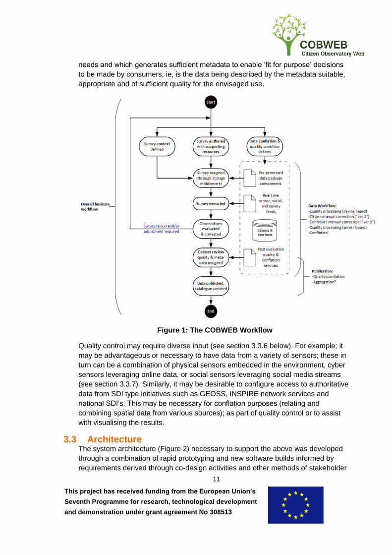
This project has received funding from the European Union’s
Seventh Programme for research, technological development
and demonstration under grant agreement No 308513
11
needs and which generates sufficient metadata to enable ‘fit for purpose’ decisions
to be made by consumers, ie, is the data being described by the metadata suitable,
appropriate and of sufficient quality for the envisaged use.
Figure 1: The COBWEB Workflow
Quality control may require diverse input (see section 3.3.6 below). For example; it
may be advantageous or necessary to have data from a variety of sensors; these in
turn can be a combination of physical sensors embedded in the environment, cyber
sensors leveraging online data, or social sensors leveraging social media streams
(see section 3.3.7). Similarly, it may be desirable to configure access to authoritative
data from SDI type initiatives such as GEOSS, INSPIRE network services and
national SDI’s. This may be necessary for conflation purposes (relating and
combining spatial data from various sources); as part of quality control or to assist
with visualising the results.
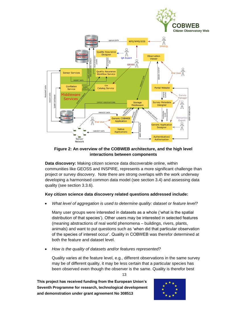
3.3 Architecture The system architecture (Figure 2) necessary to support the above was developed
through a combination of rapid prototyping and new software builds informed by
requirements derived through co-design activities and other methods of stakeholder

This project has received funding from the European Union’s
Seventh Programme for research, technological development
and demonstration under grant agreement No 308513
12
engagement. The architecture consists of the following key components: portal
website, generic application designer, apps, storage middleware, quality assurance
and conflation, sensor networks, whilst also implementing access control and
privacy, and open standards. It is a strength of COBWEB that the components we
have developed embed within an architecture that uses existing open source
projects. This provides flexibility to adapt to the myriad scenarios under which
solutions may be developed in respect of capturing citizen sourced data, it also
creates potential for additional community support and improved sustainability.
3.3.1 Portal Website These are the main points of entry to COBWEB instances, providing access to the
functionality documented in the sections below. In the simplest case, this is where
users login and request to join selected surveys. An example is currently integrated
with the Dyfi Biosphere Reserve website for demonstration purposes. Once users
have contributed observations via their mobile device, results are available for
visualisation via the portal using Web Map Services (WMS), Web Feature Services
(WFS) or Sensor Observation Services (SOS).
At the heart of the portal is the latest version (3.0) of GeoNetwork, extended under
COBWEB to facilitate typical citizen science scenarios. GeoNetwork is an open
source catalogue application offering resource registration capabilities and the ability
to expose those resources for discovery by others via a number of standards, most
notably those of ISO/TC 2116 (ISO Technical Committee – Geographic
information/Geomatics) and the Open Geospatial Consortium7 (OGC), e.g. the OGC
Catalogue Services for the Web (CSW) standard. Metadata can be exported to other
standards such as Dublin core, DCAT8 (Data Catalog Vocabulary), and schema.org9.
Survey discovery: After having been created at the portal website (Figure 2),
surveys can be discovered by any interested parties via the portal. Making surveys
discoverable using accepted and widely used open standards helps avoid waste,
duplication, assists with recruiting volunteers and facilitates research and
development in the field.
6 http://www.isotc211.org/
7 http://www.opengeospatial.org/
8 https://www.w3.org/TR/vocab-dcat/
9 http://schema.org/
This project has received funding from the European Union’s
Seventh Programme for research, technological development
and demonstration under grant agreement No 308513
13
Figure 2: An overview of the COBWEB architecture, and the high level
interactions between components
Data discovery: Making citizen science data discoverable online, within
communities like GEOSS and INSPIRE, represents a more significant challenge than
project or survey discovery. Note there are strong overlaps with the work underway
developing a harmonised common data model (see section 3.4) and assessing data
quality (see section 3.3.6).
Key citizen science data discovery related questions addressed include:
What level of aggregation is used to determine quality: dataset or feature level?
Many user groups were interested in datasets as a whole (‘what is the spatial
distribution of that species’). Other users may be interested in selected features
(meaning abstractions of real world phenomena – buildings, rivers, plants,
animals) and want to put questions such as ‘when did that particular observation
of the species of interest occur’. Quality in COBWEB was therefor determined at
both the feature and dataset level.
How is the quality of datasets and/or features represented?
Quality varies at the feature level, e.g., different observations in the same survey
may be of different quality, it may be less certain that a particular species has
been observed even though the observer is the same. Quality is therefor best
This project has received funding from the European Union’s
Seventh Programme for research, technological development
and demonstration under grant agreement No 308513
14
represented as part of the data and we recommend storing quality elements as
part of the data.
Is dataset quality assessed by aggregating the quality level of each of the
observations in the dataset?
COBWEB decided that there were circumstances under which it made sense to
both store quality information at the individual feature level, and aggregate, where
necessary, at the dataset level for rapid assessment. The ability to visualise quality
cartographically may be useful in many circumstances.
What schema is being used?
The technical solution developed by COBWEB is flexible and enables publication
of metadata and data to various schemas. For metadata the iso19139 and
iso19157 schemas are used, but they can be exported on request to Dublin
Core, DCAT or schema.org . For aggregation at the dataset level, the generic
SWE4CS model was proposed and developed (see section 3.4), which allows
extension to include any external ontologies.
3.3.2 Access control and privacy Citizens can participate in COBWEB surveys anonymously (for reasons of privacy
and data sharing this can be desirable) or they can register by providing identity
information to user management systems integrated with the portal. Whether they do
so or not depends on the survey; three kinds of surveys are distinguished in
COBWEB:
1. Public survey. Any user, anonymous or registered, can join and contribute.
2. Registered survey. Only registered users can see the survey in the portal listings
and contribute. An example of where this might be required is where the identity
of the user making the observation is being used as a proxy for the quality of the
observation, e.g., where the observer is expert in the field of study and
recognized as such by the project coordinator and/or the principal investigator.
3. Private survey. Invited registered users only.
The need for the three kinds of surveys listed above and different levels of control
over who can participate in surveys was identified early in the design process. Initial
stakeholder engagement revealed a desire to be able to make and share
observations of protected species. Therefor, where such species are implicated, we
identified a requirement to be able to control access to sensitive data; for example,
species protected under the UK Wildlife and Countryside Act or listed in the Natural
Resources Wales Sensitive Species List.

This project has received funding from the European Union’s
Seventh Programme for research, technological development
and demonstration under grant agreement No 308513
15
It is not desirable or permitted to make publically available over the web detailed
information on the location of these species without any access control. Conversely,
these are often the most valuable data for consideration in environmental monitoring,
and exactly the kind of information most needed for management and policy
purposes.
The need for a reusable, well understood, high TRL, solution to security
interoperability (sharing restricted data using standards across organizational
boundaries) is a common SDI requirement. Throughout the extensive stakeholder
engagement conducted by COBWEB, we found this requirement recurring over and
over again in citizen science scenarios. The corollary, existing solutions that do not
take security (interoperable or not) into account is also commonplace. The private
survey concept developed by COBWEB is a powerful feature of the platform.
Figure 3: Key Roles within a Typical SAML Access Management Federation
In addition to data security, concomitant questions of privacy were also a
requirement within COBWEB. It is essential to enable users to register using
personal information so that decisions concerning what they are authorised to
access and contribute towards can be made. In the current citizen science
landscape, identity information is also frequently used for quality assurance
purposes and verifying observations.
Based upon the OASIS Security Assertion Markup Language (SAML) standard, the
key advantages of the approach illustrated in Fig 3 are that it is a proven, high TRL,

This project has received funding from the European Union’s
Seventh Programme for research, technological development
and demonstration under grant agreement No 308513
16
industry strength solution that allows Single Sign On (SSO) to protected web based
resources across administrative domains. Users can login using their familiar
organisational credentials (presented via a SAML Identity Provider (IdP)) and then
access protected resources (typically OGC web services in SDI scenarios) presented
as SAML Service Providers (SP). Users only need to login once (SSO) and can then
access multiple protected resources in the federation, providing they are suitably
authorised.
Fine grained authorisation decisions, controlling exactly what information particular
parties are authorised to access, is established based upon attributes of the users
and the actions on resources they want to carry out. The OGC’s GeoXACML
standard, which extends the OASIS eXtensible Access Control Markup Language
(XACML) to enforce geo-specific constraints, is another mature standard with high
TRL guarantee. In COBWEB different levels of access were enforced to ensure the
privacy of citizens that collected information and also the wellbeing of the observed
species.
For the COBWEB framework, this means that surveys can be configured which
access both unprotected and protected data sources, e.g., for conflation and/or
quality assurance purposes. Private surveys can be setup which enable citizens to
collect and share protected data with public authorities in compliance with both data
protection and wildlife protection legislation. Public authorities can leverage the full
benefits of interoperability, for example, by sharing sensitive data across
organisational boundaries with authorised individuals using protected OGC web
services. Potentially all citizen sourced data, sensitive or not, can be accessed
without recourse to non-interoperable, one-off, bespoke security point solutions or
mechanisms such as anonymisation, obfuscation, reduction of spatial resolution, etc.
3.3.3 Generic application designer For each community, there was at least one ‘Survey Manager’ whose privileges
entitle them to setup and create surveys. COBWEB employs a hybrid App approach
enabling survey managers to build custom data collection forms using the generic
application designer component of the portal website. Forms designed at the portal
can then be synchronised with the generic COBWEB application on individual users
mobile devices. The generic and extensible application designer supported a wide
variety of form elements to cater for a broad range of user requirements.
Similar framework approaches to creating citizen science projects are not uncommon
as exemplified by initiatives such as Open Data Kit, Indicia and EpiConnect amongst
others. Some of the aspects that help distinguish COBWEB are its flexible and
powerful approach to automating quality control using multiple inputs, use of an
interoperable security solution and adherence to open standards wherever possible.
This project has received funding from the European Union’s
Seventh Programme for research, technological development
and demonstration under grant agreement No 308513
17
3.3.4 Mobile applications (Apps) The generic Application solution offered the citizens the ability to install onto their
mobile device, and login using an appropriate identity provider (Figure 3). The citizen
then has the ability to either contribute to a directly available survey (public or
registered) or a private survey which they have been invited to by the Survey
Manager. The citizen would then be presented with the form designed by the Survey
Manager, allowing them to participate in data collection with or without network
coverage.
In addition to this, the generic capability described above was complemented by
functionality allowing the cacheing of high quality basemapping on individual
handsets for use in areas of poor or no network coverage. The background mapping
used by COBWEB in the UK has been created using a variety of open products
(mostly OpenStreetMap and Ordnance Survey Open Data Products) cartographically
optimised for zooming in and out on mobile devices in both urban and rural areas. In
the latter phases of the project, where we transferred technology developed in the
UK to Greece and Germany, we discovered that it is difficult to replicate the rich
open map stack available in the UK across Europe.
To demonstrate the effective ‘separation of concerns’ in the architecture, and how
the COBWEB framework can be used in scenarios where lower level access to
inbuilt mobile device functionality is required, a native Application (Figure 2) in the
flooding thematic area case study area was also developed. This uses the same
interface as the generic application for communicating with the ‘Storage Middleware’.
3.3.5 Storage Middleware Storage Middleware is a central component of the COBWEB architecture used for
managing survey schemas and exporting geospatial observations to the desired
encodings, e.g. KML (Keyhole Markup Language), Geopackage, Shapefile,
GeoJSON, CSV, etc. By synchronising all stored information with a relational
database (the pre-quality PostGIS database in Figure 2) export of data via OGC Web
Services (WMS/WFS) is supported.
Observations were received from the App. As long as Oauth v2 authorisation was
supported, the Storage Middleware component provided a generic REST-based API
accessed storage compatibility layer on top of a range of cloud based providers
(Google Drive, Dropbox, etc.) or physical storage media where local storage was
required.
3.3.6 Quality assurance and conflation Since the emergence of citizen science as a means of supporting scientific research,
data quality has been considered an important issue for data use. Quality assurance
accordingly plays an important role for the analysis of data obtained from citizen
science and for the set-up of citizen science projects. It is commonly agreed that
unknown data quality makes citizen science data of limited use. COBWEB’s

This project has received funding from the European Union’s
Seventh Programme for research, technological development
and demonstration under grant agreement No 308513
18
approach to quality assurance was twofold: first, a number of quality measures were
determined based on the variety of data provided by crowdsourcing activities,
observations from the co-design projects, sensor feeds and social media; secondly,
a means to express those measures in observation metadata was provided. This
also included an approach to link and conflate observations with relevant external
datasets on the Web.
To allow for a customizable and dynamic quality assurance, remaining independent
from actual citizen science projects, COBWEB used a standards based web service
chaining approach (the QA Workflow Service in Figure 2 above), and thus enabled
survey designers to adapt and adjust the quality assurance process to their needs.
This generic approach on QA is necessary, because the relevance of specific quality
control processes is usually highly use case dependent. The solution extended a
pre-existing typology of quality assessment types to seven categories (or pillars)
covering a range of specific quality controls generating quality metadata elements
(table 3).
Table 3: The 7 pillars of Quality Controls in Citizen Science
Pillar number &
name
Pillar description
1.LBS-Positioning Location, position and accuracy:
Location-Based-Services focusing on the position of the user of the
targeted feature (if any), local condition or constraints, e.g.
authoritative polygon, navigation, routing, etc.
2.Cleaning Verification, erroneous entries, mistakes, malicious entries:
Erroneous, true mistakes, intentional mistakes, removals, corrections
are checked for the position and for the attributes. Feedback
mechanism can be an important part of this pillar if the mistakes can
be corrected.
3.Automatic
Validation
Simple checks, topology relations and attribute ranges:
Carries further the cleaning aspects by validating potential good
contribution. This aim is more positive than with cleaning and may
keep as outlier a given captured data rather discarding it.
4.Authoritative Data
Comparison
Comparison of submitted observations with authoritative data:
Either on attributes or position performs statistical test, (fuzzy) logic
rule based test qualifying the data captured or reversely qualifies the
authoritative data. Knowledge of the metadata of the authoritative
data is paramount.
5.Model-Based
Validation
Utilising statistical and behavioural models:
Extends pillar 4 testing to modelled data coming e.g. physical models,
behavioural models, other user contributed data within the same
context. This may use intensively fuzzy logics and interactions with
the user within a feedback mechanism of interactive surveying. (if
some tests will be similar to pillar 4 the outcome in quality elements
can be different)

This project has received funding from the European Union’s
Seventh Programme for research, technological development
and demonstration under grant agreement No 308513
19
6. Big/Linked Data
Analysis
Data mining techniques and utilising social media outputs:
Extends pillar 5 testing to using various social media data or related
data sources within a linked data framework. Tests are driven by a
more correlative paradigm than in previous pillars.
7.Semantic
Harmonisation
Conformance enrichment and harmonisation in relation to existing
ontologies:
Level of discrepancy of the data captured to existing ontology or
crowd agreement is transformed into data quality information. In the
meantime data transformation to meet harmonisation can take place.
The implementation of the quality assurance process is based on the Business
Process Model and Notation (BPMN) and OGC Web Processing Service (WPS)
standards. This combination allows for the definition and dynamic binding of atomic
quality control processes, encapsulated by WPS interfaces, to be used in a workflow
environment. Therefore, the JBPM suite (workflow editor and workflow engine) has
been customized to work with OGC services and has been integrated as a
component of the COBWEB portal. Thus, each survey manager has the authority to
create quality assurance workflows for their particular survey.
Capabilities to link and conflate citizen science observations with external data are
designed and implemented to 1) assist the quality assurance process and 2) infer
spatial information from the identified spatial data relations. Since all conflation
processes are also offered via the OGC WPS interface, seamless integration and
use by the workflow engine was assured. Currently, identified links of an observation
can be attached as additional attributes or stored as RDF (Resource Description
Framework) in a Linked Data store. Whereas the first option is primarily used to
enrich and validate observations, the latter option allows for the reasoning on spatial
data relations using semantic web techniques, in particular by the application of
SPARQL (SPARQL Protocol and RDF Query Language) queries.
3.3.7 Sensor networks Though data collection from mobile devices was fundamental to the generic
COBWEB framework, a variety of sensor platforms, monitoring multiple
environmental parameters, within the Dyfi Biosphere Reserve testbed area, have
been deployed. These sensor networks have been developed mainly as a result of
dialogue between research scientists working on COBWEB and the co-design
partners.
There are two ways by which sensor data can be incorporated into the storage
middleware:
1. Automated sensing. The physical sensors embedded in the environment are
augmented with telemetry capabilities that enable them to operate in an
This project has received funding from the European Union’s
Seventh Programme for research, technological development
and demonstration under grant agreement No 308513
20
autonomous manner, without human intervention, in transmitting data to a base
station.
2. Participatory sensing. Data collection by citizen participating in surveys when in
close proximity to suitably equipped sensors. The survey participant’s mobile
device connects directly to the sensor using short range communication and the
citizen physically relays the data back to a position where the data can be
uploaded to the COBWEB servers
Physical sensors: Both participatory and automated approaches were researched
and developed within COBWEB. Some of the Wasp Motes listed in table 4 were
used for participatory sensing. Surveys were configured such that when a citizen
came within range of one of the Wasp Motes, it was discovered by the citizen’s
mobile device. When an observation was made, the mobile communicates with the
sensor via the Bluetooth LE standard and the environmental parameters of interest
were simultaneously captured. Such data can be used in quality control or to
otherwise supplement the metadata associated with that observation.
Table 4. Sensors deployed in COBWEB
Sensor type Measuring
In-Situ sensors water depth levels, pressure (mBar), pressure (PSI),
temperature
Wasp Motes water depth levels, salinity (g/kg)
Davis Weather stations various meteorological parameters
phone-based sensors ambient temperature (C), pressure (mbar), accelerometer
readings (radians)
The In-Situ and Davis Weather station sensors captured data automatically and
transmitted back to the COBWEB servers. Data from the In-Situ sensors was used in
association with habitat reversion at co-design partner RSPB’s Yns-Hir reserve. Data
from the weather stations are being used in educational scenarios with co-design
partner Ysgol Bro Hyddgen and to investigate pollinator scenarios with co-design
partner Penparcau Community Forum. In the pollinator scenarios, citizens go out on
a regular basis to record observations of butterflies and their larval foodplants around
Penparcau in the Dyfi Biosphere Reserve. The data recorded includes plant/butterfly
species, plant coverage, butterfly activity, and habitat information.
Weather data (temperature, wind speed etc.), from weather stations, sited in
strategic locations, is used in a Twitter alert service to send tweets to citizens
following a dedicated Twitter account to encourage participants to go out and collect
data when the weather is suitable for butterfly activity. The weather data is also used
post-data collection to validate and add value to the observations.
This project has received funding from the European Union’s
Seventh Programme for research, technological development
and demonstration under grant agreement No 308513
21
When collecting data within the field, sensors on board the user’s mobile device are
harnessed to provide additional information. For example, accelerometers values are
recorded when the user is taking photographs to enable the line of sight to be
determined - useful for various quality assurance purposes. It should be noted that
the generic COBWEB App accesses this functionality via a Cordova plug-in while the
native flooding App obtains the data directly from the sensor.
Cyber sensing: This form of sensing refers to the harvesting of online geotagged
sensor data from a variety of sources through different web-based API’s. In
COBWEB, the approach has been demonstrated using data accessed through the
Shoothill10 (UK river levels) and Weather Underground11 (network of personal
weather stations) API’s.
There are two ways (Figure 2) in which sensor data were associated with surveys
within COBWEB. In the case of participatory sensed data, sensor data are included
as part of the survey data and exported to the pre-quality database via the storage
middleware in the usual manner. Otherwise, for both cyber and physical sensors, the
data were stored directly in the pre-quality database either by sensor nodes
transmitting the data in the case of physical sensors or by the harvester in the case
of cyber sensors.
Social sensors: Leveraging social media streams. In COBWEB, research and
development has concentrated on the use of Twitter and Flickr API’s. Data from
both social media platforms are acquired by two methods.
1. Bounding boxes for Biosphere Reserves are used to monitor and capture any
social media postings within these areas.
2. Keywords are used to identify relevant postings worldwide.
Once social media postings have been captured they are stored in a database and
are available for viewing at the portal or potentially for use within a Quality Assurance
workflow.
3.4 Standards and Spatial Data Infrastructures COBWEB aimed to maximise technical interoperability by the use of standards
wherever appropriate - the sections above make multiple references to standards
from several standards defining organisations such as, OGC (discovering and
publishing data), ISO/TC 211 (metadata and quality information), OASIS (access
control) and W3C (semantic web).
10 https://www.shoothill.com/our-api/
11 https://www.wunderground.com/weather/api/

This project has received funding from the European Union’s
Seventh Programme for research, technological development
and demonstration under grant agreement No 308513
22
All the citizen observatory’s developed under the FP7 call which funded COBWEB
were required to make data collected available within the GEOSS without restriction.
Publishing data into SDI-like initiatives such as GEOSS was addressed using a
cooperative approach based mainly on the processes of the OGC. For example: the
project contributed to three OGC led GEOSS Architecture Implementation Pilots; five
ad hoc Citizen Science meetings were organised by COBWEB during OGC
Technical Committee meetings over the duration of the project, resulting in the
formation of a fully constituted Citizen Science Domain Working Group.
One of the main results was the publication of the OGC Discussion Paper
‘Standardized Information Models to Optimize Exchange, Reusability and
Comparability of Citizen Science Data’. These are the first steps on the
standardisation ladder, progressing through formation of a standards working group
to eventual publication of an agreed international standard. Broad community
uptake of a harmonised common information model applicable to a wide range of
citizen science scenarios would be a valuable contribution towards being able to
share and future proof the value of data collected. Data compliant with this
information model can be discovered and accessed through standardised web
interfaces, e.g., OGC web services, and integrated with SDI’s as most, if not all,
SDI’s are based on open geospatial interoperability standards.
Two approaches to creation of a harmonised data model were explored within
COBWEB: First, the definition of an application profile by specialising the
Observations and Measurements (O&M), SensorML and SweCommon information
models. Second, the definition of an O&M, SensorML and SweCommon encodings
best practices to allow more efficient reuse of existing components.
Semantic interoperability is a major concern, especially considering the growth in
the open data movement and use of semantic web standards. Semantics is
concerned with attaching unambiguous meaning to terms and concepts, typically,
using ontologies (formal models describing semantics). In the citizen science
domain, as in others, this is very important as understanding exactly what was
observed and in which context is essential to making the data comprehensible; both
for the immediate use, by others and in the future. The ability to share data, reuse,
integrate and compare is often compromised by a lack of semantic interoperability.
As would be expected in a research project whose main objective is developing a
generic infrastructure that aims to satisfy requirements across as broad a range as
possible of the multitude of potential citizen science scenarios, semantics was an
area of intense research and development interest in COBWEB. The approach
described below is documented in the OGC Discussion Paper referenced above.
In terms of the COBWEB workflow (Figure 1), semantics could be introduced at
various stages, but the best place to introduce semantics is when the survey context
is defined. At this point, the goals of the project should be clear, and if not, then it is

This project has received funding from the European Union’s
Seventh Programme for research, technological development
and demonstration under grant agreement No 308513
23
time well spent clarifying exactly what is expected to be observed and to what extent
exact definitions can be incorporated. Ideally, the Survey Manager would liaise with
the Principal Investigator and possibly also the Quality Reviewer and other experts
as appropriate, to incorporate sufficient semantics to ensure that the information
generated by the survey is of maximum usefulness to end Consumers.
During the Sept 2016 OGC Technical Committee meeting, a live demonstration of
the ‘Interoperability Profiles (IP)’ approach developed under COBWEB was given,
demonstrating the projects rigour in effectively delivering semantic interoperability.
Using this method, the Survey Manager selects (or creates) an IP during survey
design; the IP provides unambiguous references to authoritative definitions of
concepts being used in the survey, in this case, it was a link to the relevant
standards entry (biodiversity standard Darwin Core terms) defining the invasive
species Japanese Knotweed. As a consequence of using this IP during survey
creation, every time an observation of a Knotweed was made using this COBWEB
survey, the data then contained references to the authoritative definition thereby
ensuring semantic interoperability.
Note that this approach is independent of, and does not affect, serialisation options;
the Citizen Science application profile enables encoding as XML (Extensible Markup
Language), GeoJSON or linked data. The observations and raw data are of primary
interest, various levels of processed or aggregated data may be required at different
times depending upon circumstances. All types of observations are supported;
including raw observations and those which are derived or result from subsequent
quality assurance or conflation processing. A provenance model is included to
provide information on the history of each observation.
Of course, widespread adoption and use of this approach presupposes that the
relevant semantic resources have endpoints and are internet addressable using
semantic web standards, that IP’s have been created and that the approach has
received widespread community uptake. This is far from the case; however, the low
TRL approach described above demonstrably works, can and is being used as a
platform to stimulate further discussion, research and development.
4. Potential impact COBWEB conducted research into the feasibility of creating a common generic
framework for mobile device apps for use in citizen science for environmental
monitoring, using the UNESCO World Network of Biosphere Reserves as a testbed.
We have demonstrated that, in principle, it is possible and brings multiple benefits
when starting from a position where the importance of interoperability and flexibility is
paramount. This stands in contrast to the current proliferation of Citizen Science
Apps generating silos of data.
This project has received funding from the European Union’s
Seventh Programme for research, technological development
and demonstration under grant agreement No 308513
24
Specifically, it has been shown that creating a generic solution to automating quality
control and assurance, which is sufficiently flexible to address the huge range of
potential scenarios, is beneficial to the reuse of citizen science data. Further
development would result in the ability to make very large volumes of data useable,
and is an area of active ongoing research.
Similarly, COBWEB has contributed to the understanding that further research and
development is needed to address whether it is possible to create an easily useable
framework which is sufficiently flexible to allow a broad range of different kinds of
familiar semantic resources to be employed in designing surveys before citizens go
into the field. Without this, despite post-processing server-side, continued problems
associated with a lack of semantic interoperability may be anticipated.
Despite perceived complexity and proliferation, the use of open interoperability
standards still presents the most realistic chance of preventing the waste of
resources and reuse opportunities inherent in creating silos of data locked into
proprietary solutions. In the citizen science domain, as in other domains that
leverage SDI, the lack of a widely adopted solution to security interoperability is
again apparent as a major barrier. At the technical level, COBWEB has shown that
access management federations work; progressing this relies upon action at the
organisational, legal and political level – outwith the scope of COBWEB.
However, standardisation efforts should continue and adherence be required to help
realise investment in SDI type initiatives such as GEOSS.
COBWEB has had significant potential impact in highlighting that, if agreement can
be reached on a harmonised common information model, with sufficient community
support, most, if not all, crowdsourced, citizen science type data could be made
compliant with the developing standardisation efforts initiated under COBWEB. The
immediate prize would be a boost to the usefulness of these data by reducing
integration costs and enabling the myriad of potential consumers of such data to
exploit existing standards based tooling and develop new standards based solutions
on top. COBWEB has also contributed to the understanding that the long term
curation value of holding citizen sourced data at the observation level of granularity
compliant with a well thought out, agreed and documented information model is to
maximise potential future access and re-use.
The amount of citizen sourced environmental data will continue to increase
dramatically and clearly has the potential to be of use for policy formation and
delivery in respect of environmental decision making. At the global scale, towards
the end of 2015, the UN adopted the 2030 Agenda for Sustainable Development,
this included a set of 17 Sustainable Development Goals (SDG) to end poverty, fight
inequality and injustice, and tackle climate change by 2030. The importance of
geospatial information in monitoring progress with SDG targets is explicitly
recognised in clause 76 of the official resolution (United Nations, 2015). It may be

This project has received funding from the European Union’s
Seventh Programme for research, technological development
and demonstration under grant agreement No 308513
25
argued that citizen sourced geospatial information has a potentially important
contribution towards realising the SDG’s worthy of significant further research.
In this respect, based on experiences in COBWEB, we would recommend increased
focus on the UNESCO World Network of Biosphere Reserves (WNBR) as a testbed
for sustainability science related research and development. This is particularly
appropriate as at the 2016 Fourth World Congress of Biosphere Reserves, the UN’s
Man and Biosphere Programme resolutely aligned the WNBR with the SDG’s in the
resulting Lima Action Plan12.
Using co-design processes and consortia such as those employed in COBWEB,
WNBR mechanisms can be leveraged to more easily mobilise sufficient numbers of
enthusiastic citizens in order to help realise meaningful outcomes based on real
world needs.
The COBWEB framework solution described above is complex and significant further
work is required to present only the required level of complexity, depending upon
circumstances, when required. Integrating all the components (at different TRL’s) to
create an actual system proven in an operational environment (TRL 9) was beyond
the scope of this research project.
4.1 Main dissemination activities and exploitation of results With the direct involvement of OGCE on COBWEB as a full partner, the use of
interoperability standards has always been central to the project and will be key to
exploitation of project results. Towards the end of this four year project, in June
2016, COBWEB sponsored the OGC Technical Committee (TC) meeting in Dublin.
The project was highly visible and was represented multiple times during the week,
including a half day ‘COBWEB Summit’ entirely dedicated to those aspects of the
project within the scope of a standards defining organisation.
An ad hoc Citizen Science meeting was also held during the TC week; this was the
fourth of five ad hoc meetings organised by COBWEB at TC’s held over the course
of the project at various locations around the globe: Barcelona, Sydney, Washington,
Dublin and Orlando.
The culmination of this discussion and community consultation came at the Sept
2016 Orlando TC when the charter for the new Citizen Science Domain Working
Group (DWG) was voted on and approved, as was the release of the OGC
Discussion Paper ‘Standardized Information Models to Optimize Exchange,
Reusability and Comparability of Citizen Science Data’ (published March 2017).
12
http://www.unesco.org/new/fileadmin/MULTIMEDIA/HQ/SC/pdf/Lima_Action_Plan_en_final.p
df

This project has received funding from the European Union’s
Seventh Programme for research, technological development
and demonstration under grant agreement No 308513
26
COBWEB led on all the above and is explicitly acknowledged as doing so, project
representatives in Orlando concluded by giving a live proof-of-concept demonstration
of the documented approach in action.
At the time of writing, the work described above has already had impact and is a
milestone in the standardisation of citizen sourced data. Several recently funded
Horizon 2020 projects referenced the work in their proposals and are exploiting
COBWEB results; this includes NextGEOSS and all four projects funded under
H2020 SC5-17-2015: Demonstrating the concept of 'Citizen Observatories' - the
latter was evident at the Brussels cluster meeting attended by the author in Nov
2016. Indications are that the OGC Citizen Science DWG will continue to be an
important global forum for discussing common approaches to interoperability
challenges in the citizen sourced data domain.
Longer term, the work may lead to the formation of a Standards Working Group and
eventually a full international standard with broad uptake. As noted above, the
potential impact of this is great; vast amounts of potentially valuable citizen sourced
data are currently being locked in silos and opportunities are being lost now and will
continue to be in the future because adherence to a well thought out data model is
not happening. Whether an accepted standard emerges via the OGC route or not is
dependent upon multiple different factors now outside the influence of COBWEB,
although the COBWEB coordinator hopes to positively influence this as the current
European co-chair of the new Citizen Science DWG.
Various other aspects of COBWEB have also filtered through into new projects. One
of the H2020 SC5-17-2015 projects – LandSense, is reusing elements of the
COBWEB approach to Quality Assurance (QA) and security.
As noted above, a major criticism of citizen sourced data is that it is often of
insufficient quality to be of use for the kinds of scenarios typical of policy formation
and delivery. The situation is compounded by the current lack of automated QA
methods and bottlenecks caused by reliance upon experts visually checking the
quality of submitted observations. Raising the TRL of the highly flexible standards
based web services chaining approach, developed under COBWEB, to the point
where it could be used in production to automate QA and add appropriate metrics to
observation metadata would be valuable indeed.
The situation with the access management federation approach used for security
and privacy in COBWEB is different. This is already proven to be high TRL, key
components are, in some cases, eg, SAML based access management federations
in the academic sector, already in use by literally millions round the globe. The
barriers to widespread uptake are not technical; they are political, organisational and
financial. Long term impact will depend upon whether other solutions to sharing data
across administrative domains using interoperability standards emerge, or whether
the lack of a widely accepted approach increases uptake. Over the lifetime of the
This project has received funding from the European Union’s
Seventh Programme for research, technological development
and demonstration under grant agreement No 308513
27
project, COBWEB used the regular GEOSS Architecture Implementation Pilots to
disseminate our knowledge of this area - current indications are that the lack of a
widely adopted interoperable security solution continues to be an issue.
Another key dissemination channel used for summarising and communicating project
results was the scientific paper ‘Citizen OBservatory WEB (COBWEB): A Generic
Infrastructure Platform to Facilitate the Collection of Citizen Science data for
Environmental Monitoring’ published in a special Citizen Science edition of the Joint
Research Centres (JRC) International Journal of Spatial Data Infrastructures
Research. Writing this paper in the final year of the project coincided with the special
edition and JRC hosting a two day workshop (data and service infrastructures for
Citizen Science) during Jan 2016 of a global grouping centred around the European
Citizen Science Association focussed on interoperability of Citizen Science data.
JRC subsequently agreed to be charter members of the new OGC Citizen Science
DWG.
Other core dissemination activities communicating results towards the end of the
project were a COBWEB article intended for a more general audience in the widely
distributed Impact magazine13 and, with greater novelty value, the comic book:
Crowd Power: the COBWEB Guide to Citizen Science, available off the COBWEB
website14. Here you can also find a short documentary video comprised of interviews
with key project personnel recorded during the final consortium meeting in Sept
201615.
From the outset, COBWEB committed to open standards, open data and open
source software. In the last quarter of the project, effort was expended in open
sourcing those high TRL outputs that the consortium considered to have the greatest
exploitation potential. This resulted in the creation of Fieldtrip Open16 as a separate
entity with an existence beyond the end of COBWEB.
Fieldtrip Open is comprised mainly of the generic COBWEB App, the survey
designer and the middleware. It is fully documented and extensible allowing the
incorporation of quality control processes and additional controls as required.
Observations can be published in a variety of different formats/schemas and made
available via OGC web services. The intention is that the software can be used with
other well known open source geospatial projects, eg, GeoNetwork, that it forms the
13 http://www.ingentaconnect.com/content/sil/impact/2017/00002017/00000003/art00007
14 https://cobwebproject.eu/news/promotional-materials
15 https://cobwebproject.eu/news/publications/videos-0
16 http://fieldtrip.edina.ac.uk/
This project has received funding from the European Union’s
Seventh Programme for research, technological development
and demonstration under grant agreement No 308513
28
basis for multiple initiatives and that those benefiting contribute back to the codebase
to create a viable sustained open source community.
In March 2017, the prospect of the latter happening received a boost through the
Welsh Government’s awarding the year long Welsh Citizen Observatory Pilot
(WCOP) contract to a subset of the COBWEB consortium. WCOP was created to
sustain the existence of the COBWEB infrastructure as deployed in the Dyfi
Biosphere Reserve to allow further opportunities to influence citizen science projects
to adopt more mature data collection and management strategies and to
demonstrate the benefits of standards based technology and open data models for
government. The focus for WCOP will be on projects identified by Welsh
Government as having the greatest impact in terms of environmental decision
making and policy. Because the software is generic, flexible and does not require
software engineering expertise to create surveys, the expectation is that it will also
continue to be used by a variety of community groups, including those involved in co-
design during the execution of COBWEB.
The Commission’s investment in COBWEB has clearly had an impact, this is
particularly evident in how citizen involvement using new technology in
environmental governance is viewed in Wales. This may be taken as additional
evidence of the benefit of having direct involvement of government bodies in large
collaborative research projects that aim to have policy impact. As Welsh Government
is a devolved administration, exploitation of COBWEB results by the public sector to
realise policy objectives is having impact, and will continue to have impact, not only
in Wales, but across the UK through national fora such as the UK Environmental
Observation Framework.
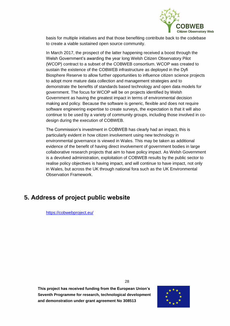
5. Address of project public website
https://cobwebproject.eu/

This project has received funding from the European Union’s
Seventh Programme for research, technological development
and demonstration under grant agreement No 308513
29
Annex A – An impression of COBWEB The following annex provides an impression of COBWEB over the project lifetime by
illustrating and promoting the work in the form of selected photos, videos, press cuttings,
etc.
Kick Off Meeting, Edinburgh – November 2012

This project has received funding from the European Union’s
Seventh Programme for research, technological development
and demonstration under grant agreement No 308513
30
Press cutting: Herald Scotland – Dec 2012
BBC – Jan 2013

This project has received funding from the European Union’s
Seventh Programme for research, technological development
and demonstration under grant agreement No 308513
31
COBWEB Website – from Jan 2013 (refreshed Jan 2016)
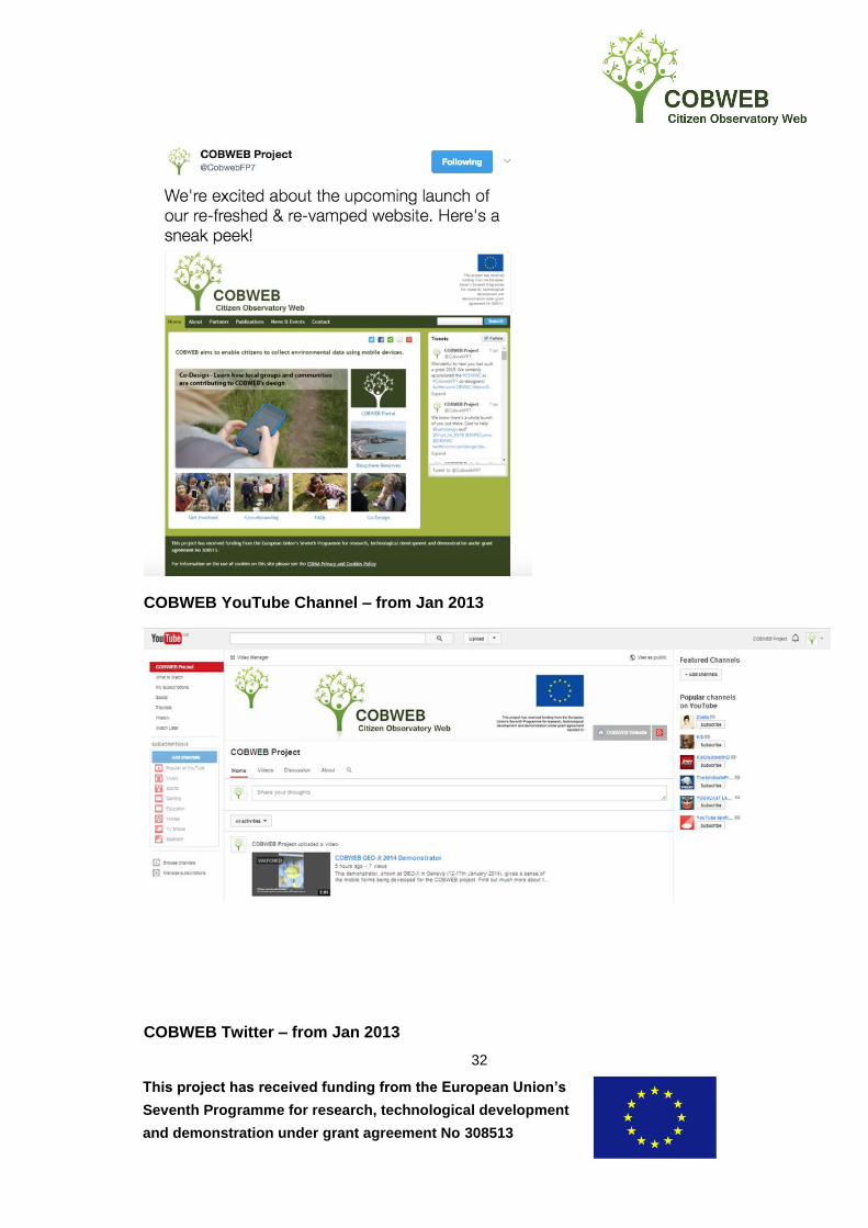
This project has received funding from the European Union’s
Seventh Programme for research, technological development
and demonstration under grant agreement No 308513
32
COBWEB YouTube Channel – from Jan 2013
COBWEB Twitter – from Jan 2013
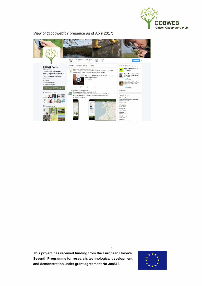
This project has received funding from the European Union’s
Seventh Programme for research, technological development
and demonstration under grant agreement No 308513
33
View of @cobwebfp7 presence as of April 2017:
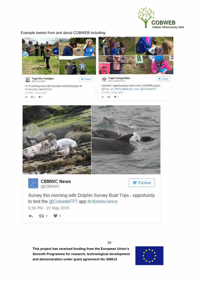
This project has received funding from the European Union’s
Seventh Programme for research, technological development
and demonstration under grant agreement No 308513
34
Example tweets from and about COBWEB including:
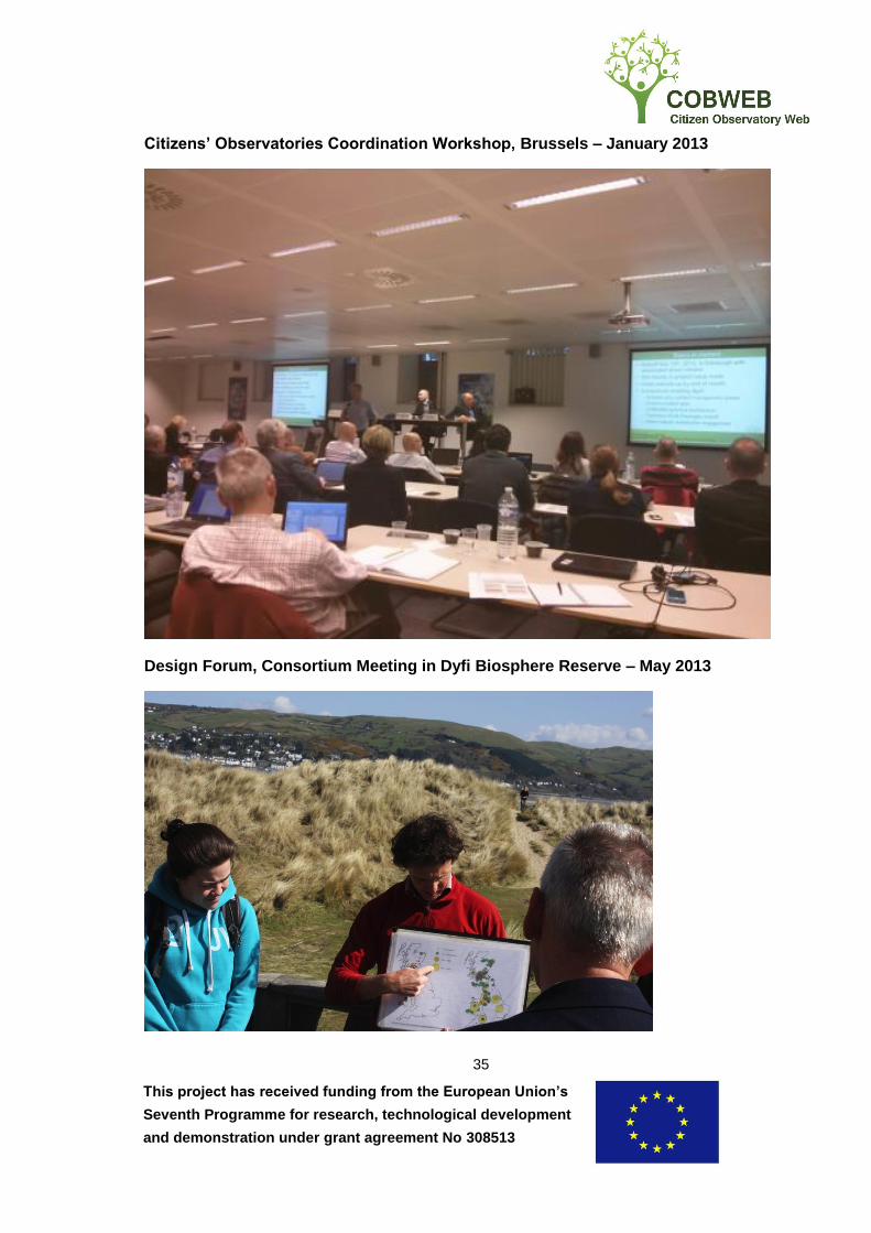
This project has received funding from the European Union’s
Seventh Programme for research, technological development
and demonstration under grant agreement No 308513
35
Citizens’ Observatories Coordination Workshop, Brussels – January 2013
Design Forum, Consortium Meeting in Dyfi Biosphere Reserve – May 2013
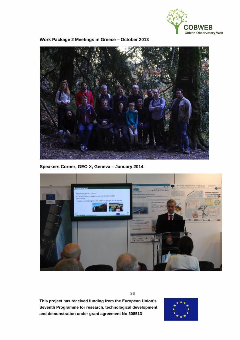
This project has received funding from the European Union’s
Seventh Programme for research, technological development
and demonstration under grant agreement No 308513
36
Work Package 2 Meetings in Greece – October 2013
Speakers Corner, GEO X, Geneva – January 2014

This project has received funding from the European Union’s
Seventh Programme for research, technological development
and demonstration under grant agreement No 308513
37
Janez Potočnik, the European Commissioner for the Environment at the EC Citizens’
Observatories stand, Geo X, Geneva – January 2014
Press cutting: GeoConnexion Article – Mar 2014
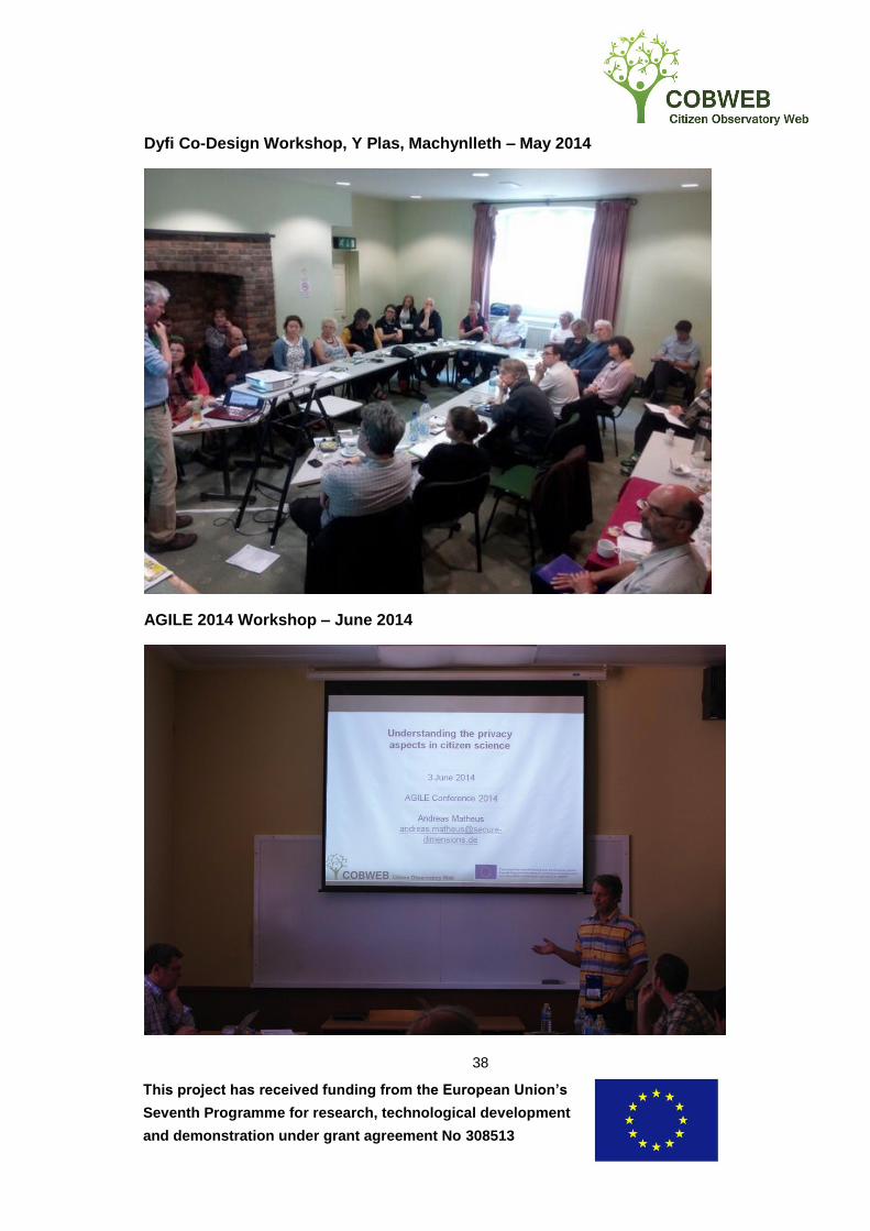
This project has received funding from the European Union’s
Seventh Programme for research, technological development
and demonstration under grant agreement No 308513
38
Dyfi Co-Design Workshop, Y Plas, Machynlleth – May 2014
AGILE 2014 Workshop – June 2014

This project has received funding from the European Union’s
Seventh Programme for research, technological development
and demonstration under grant agreement No 308513
39
8th GEO European Projects Workshop, Athens – June 2014
RSPSoc Conference, Aberystwyth, Sept 2014
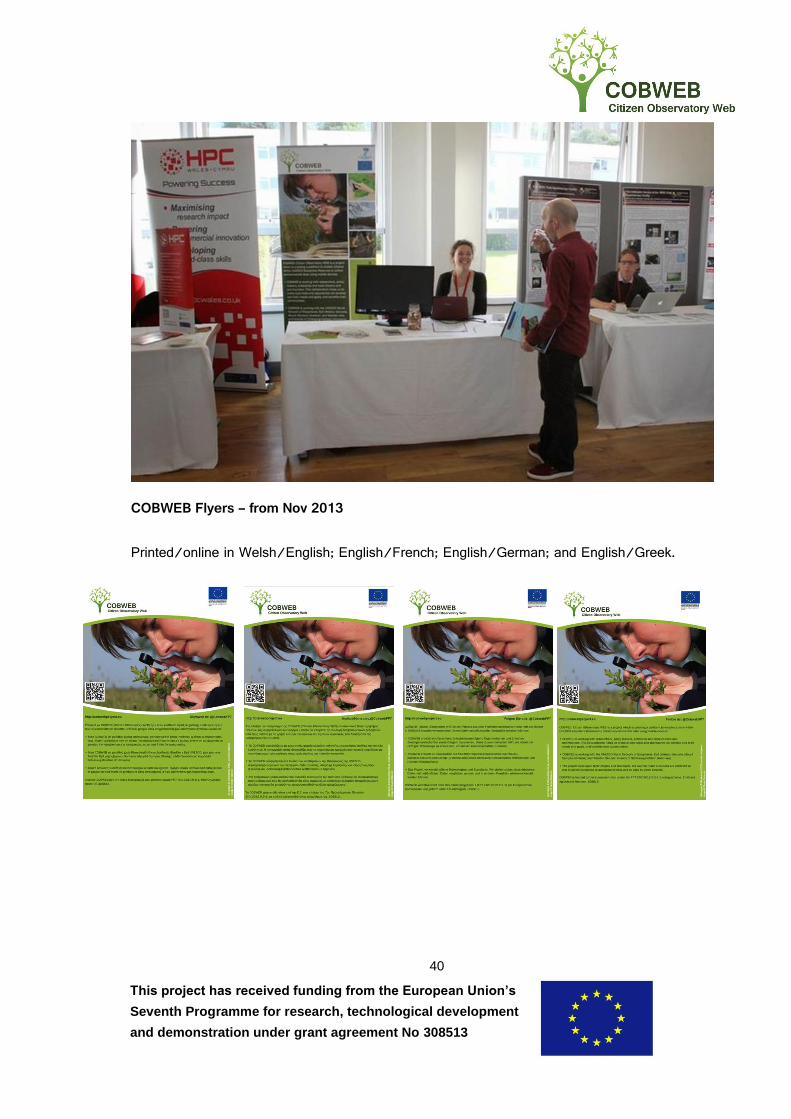
This project has received funding from the European Union’s
Seventh Programme for research, technological development
and demonstration under grant agreement No 308513
40
COBWEB Flyers – from Nov 2013
Printed/online in Welsh/English; English/French; English/German; and English/Greek.
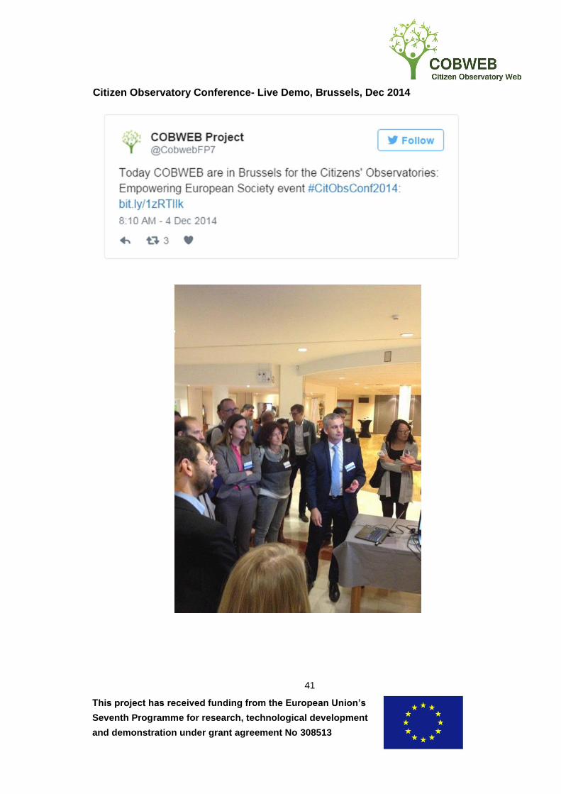
This project has received funding from the European Union’s
Seventh Programme for research, technological development
and demonstration under grant agreement No 308513
41
Citizen Observatory Conference- Live Demo, Brussels, Dec 2014

This project has received funding from the European Union’s
Seventh Programme for research, technological development
and demonstration under grant agreement No 308513
42
COBWEB Co-Design Kickoff Meeting, Machynlleth, Apr 2014
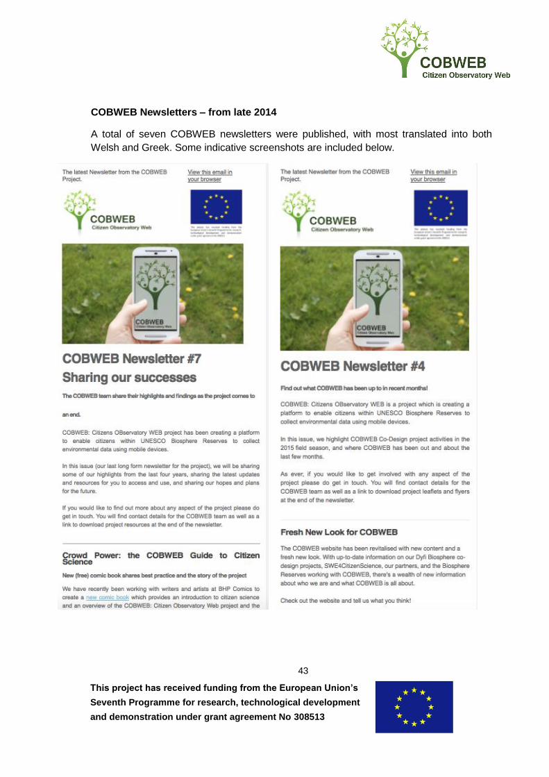
This project has received funding from the European Union’s
Seventh Programme for research, technological development
and demonstration under grant agreement No 308513
43
COBWEB Newsletters – from late 2014
A total of seven COBWEB newsletters were published, with most translated into both
Welsh and Greek. Some indicative screenshots are included below.

This project has received funding from the European Union’s
Seventh Programme for research, technological development
and demonstration under grant agreement No 308513
44
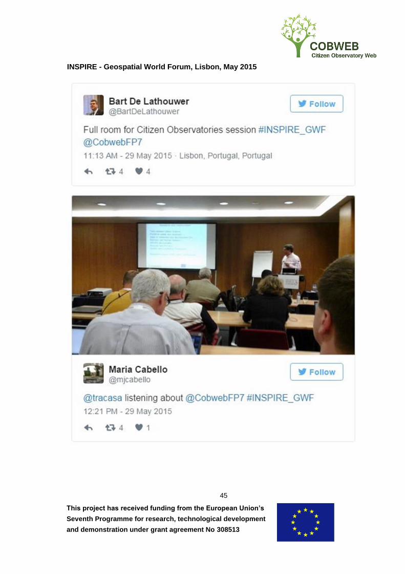
This project has received funding from the European Union’s
Seventh Programme for research, technological development
and demonstration under grant agreement No 308513
45
INSPIRE - Geospatial World Forum, Lisbon, May 2015
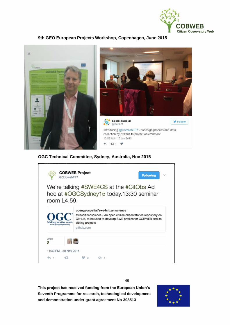
This project has received funding from the European Union’s
Seventh Programme for research, technological development
and demonstration under grant agreement No 308513
46
9th GEO European Projects Workshop, Copenhagen, June 2015
OGC Technical Committee, Sydney, Australia, Nov 2015

This project has received funding from the European Union’s
Seventh Programme for research, technological development
and demonstration under grant agreement No 308513
47
GEO-XII Plenary & Mexico City Ministerial Summit, Nov 2015

This project has received funding from the European Union’s
Seventh Programme for research, technological development
and demonstration under grant agreement No 308513
48
Non-technical COBWEB Poster
Displayed at the ECSA General Assembly Oct 2015 and EU Stand, GEO XII Nov 2015
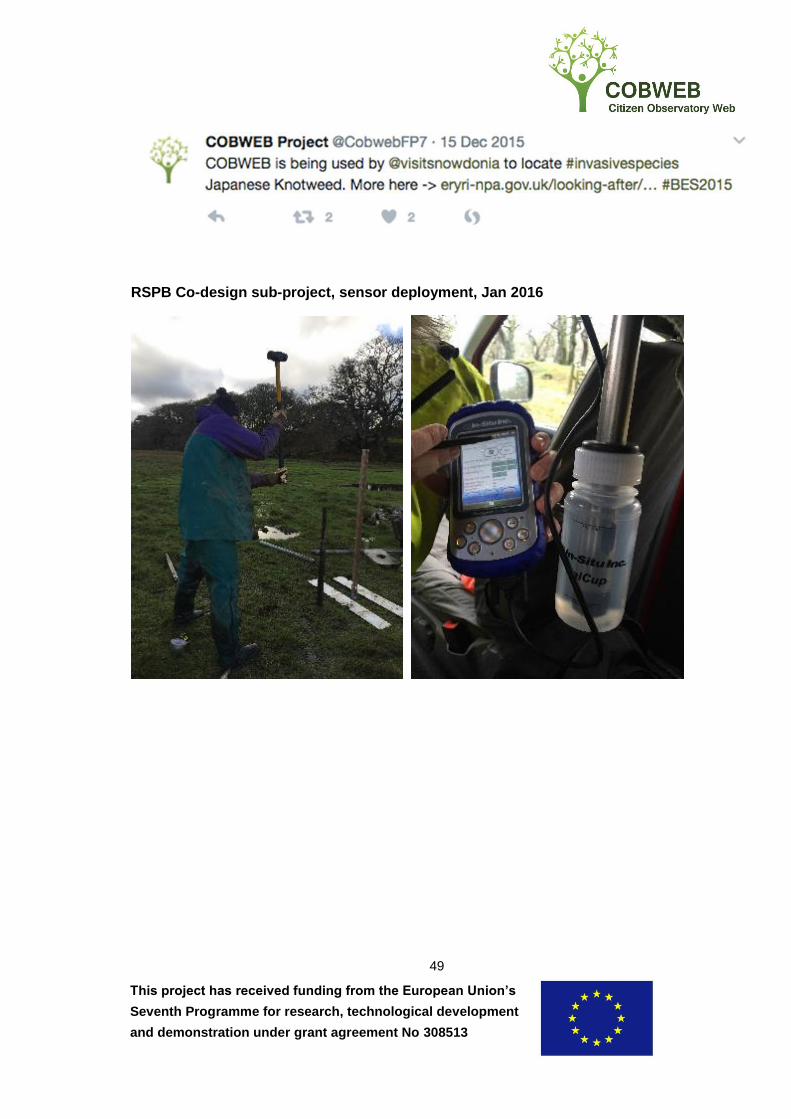
This project has received funding from the European Union’s
Seventh Programme for research, technological development
and demonstration under grant agreement No 308513
49
RSPB Co-design sub-project, sensor deployment, Jan 2016
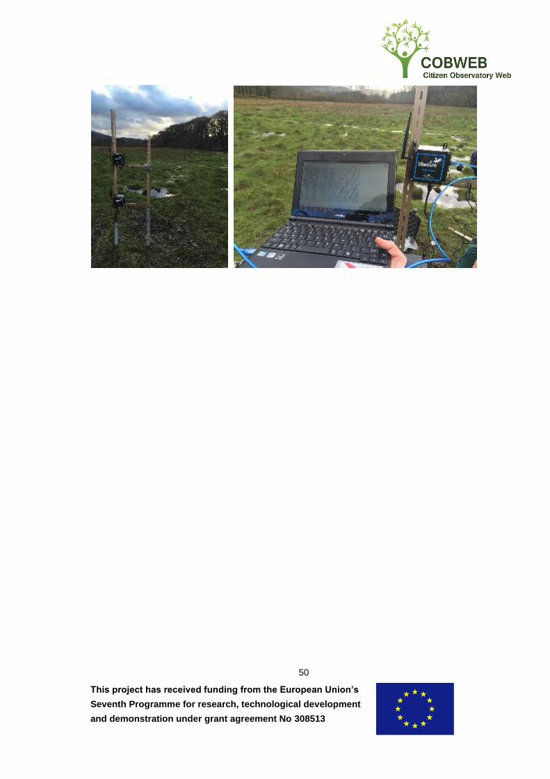
This project has received funding from the European Union’s
Seventh Programme for research, technological development
and demonstration under grant agreement No 308513
50
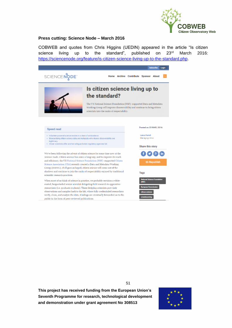
This project has received funding from the European Union’s
Seventh Programme for research, technological development
and demonstration under grant agreement No 308513
51
Press cutting: Science Node – March 2016
COBWEB and quotes from Chris Higgins (UEDIN) appeared in the article “Is citizen
science living up to the standard”, published on 23rd March 2016:
https://sciencenode.org/feature/is-citizen-science-living-up-to-the-standard.php.
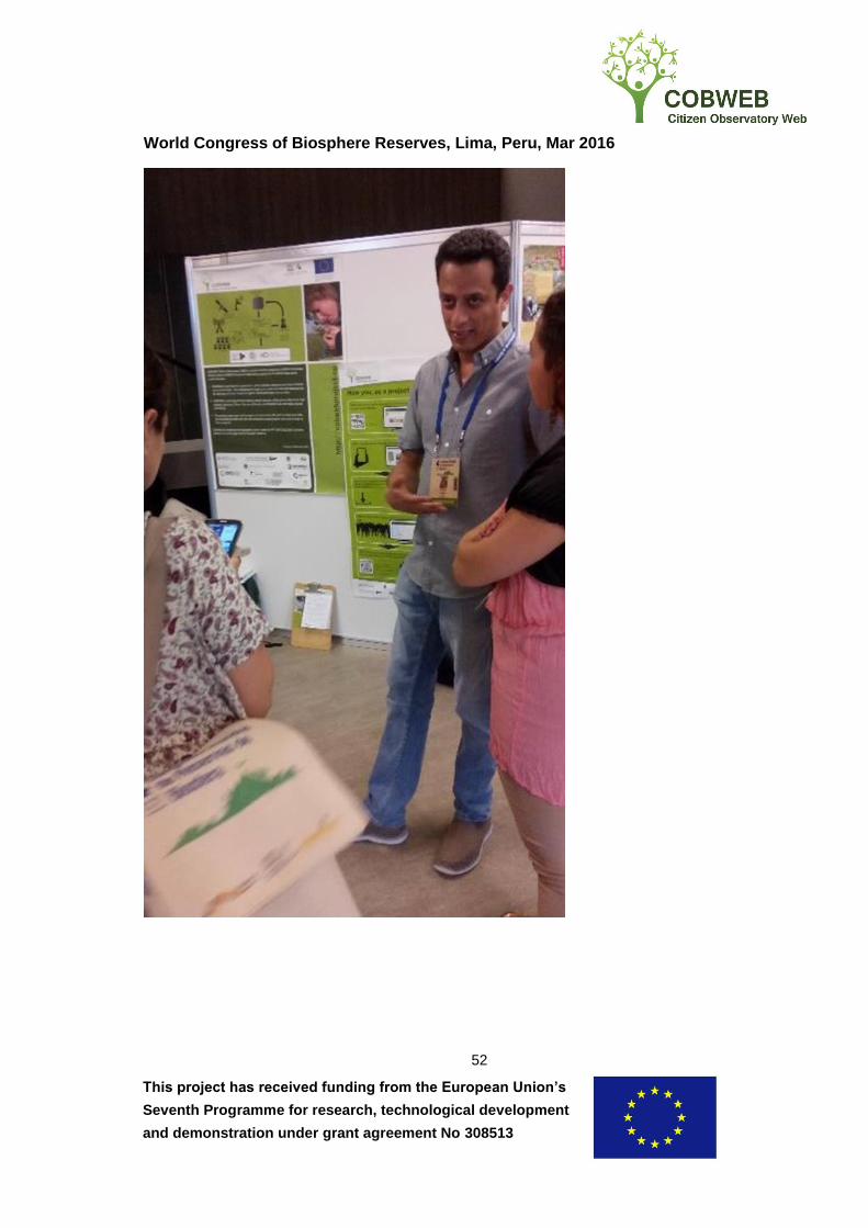
This project has received funding from the European Union’s
Seventh Programme for research, technological development
and demonstration under grant agreement No 308513
52
World Congress of Biosphere Reserves, Lima, Peru, Mar 2016
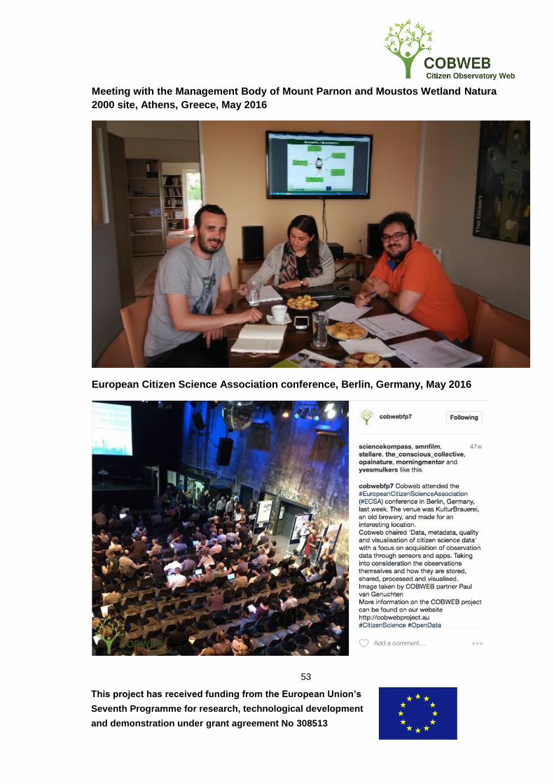
This project has received funding from the European Union’s
Seventh Programme for research, technological development
and demonstration under grant agreement No 308513
53
Meeting with the Management Body of Mount Parnon and Moustos Wetland Natura
2000 site, Athens, Greece, May 2016
European Citizen Science Association conference, Berlin, Germany, May 2016
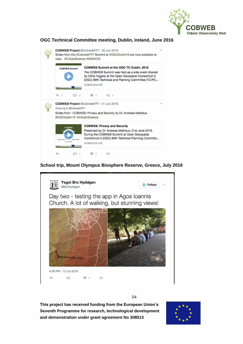
This project has received funding from the European Union’s
Seventh Programme for research, technological development
and demonstration under grant agreement No 308513
54
OGC Technical Committee meeting, Dublin, Ireland, June 2016
School trip, Mount Olympus Biosphere Reserve, Greece, July 2016
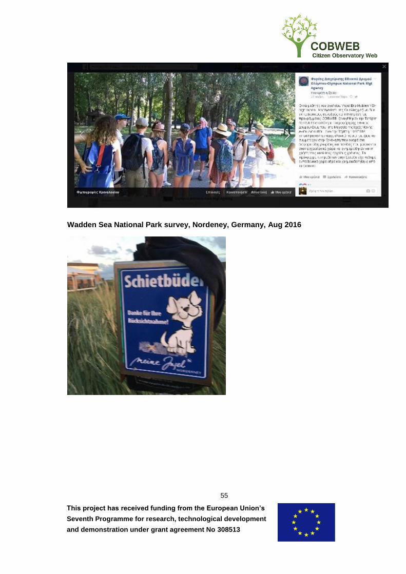
This project has received funding from the European Union’s
Seventh Programme for research, technological development
and demonstration under grant agreement No 308513
55
Wadden Sea National Park survey, Nordeney, Germany, Aug 2016

This project has received funding from the European Union’s
Seventh Programme for research, technological development
and demonstration under grant agreement No 308513
56
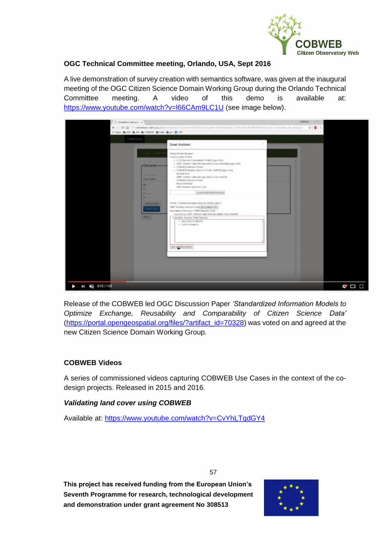
This project has received funding from the European Union’s
Seventh Programme for research, technological development
and demonstration under grant agreement No 308513
57
OGC Technical Committee meeting, Orlando, USA, Sept 2016
A live demonstration of survey creation with semantics software, was given at the inaugural
meeting of the OGC Citizen Science Domain Working Group during the Orlando Technical
Committee meeting. A video of this demo is available at:
https://www.youtube.com/watch?v=l66CAm9LC1U (see image below).
Release of the COBWEB led OGC Discussion Paper ‘Standardized Information Models to
Optimize Exchange, Reusability and Comparability of Citizen Science Data’
(https://portal.opengeospatial.org/files/?artifact_id=70328) was voted on and agreed at the
new Citizen Science Domain Working Group.
COBWEB Videos
A series of commissioned videos capturing COBWEB Use Cases in the context of the co-
design projects. Released in 2015 and 2016.
Validating land cover using COBWEB
Available at: https://www.youtube.com/watch?v=CvYhLTqdGY4
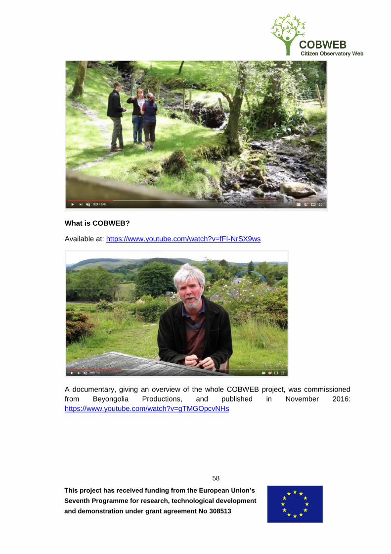
This project has received funding from the European Union’s
Seventh Programme for research, technological development
and demonstration under grant agreement No 308513
58
What is COBWEB?
Available at: https://www.youtube.com/watch?v=fFI-NrSX9ws
A documentary, giving an overview of the whole COBWEB project, was commissioned
from Beyongolia Productions, and published in November 2016:
https://www.youtube.com/watch?v=gTMGOpcvNHs
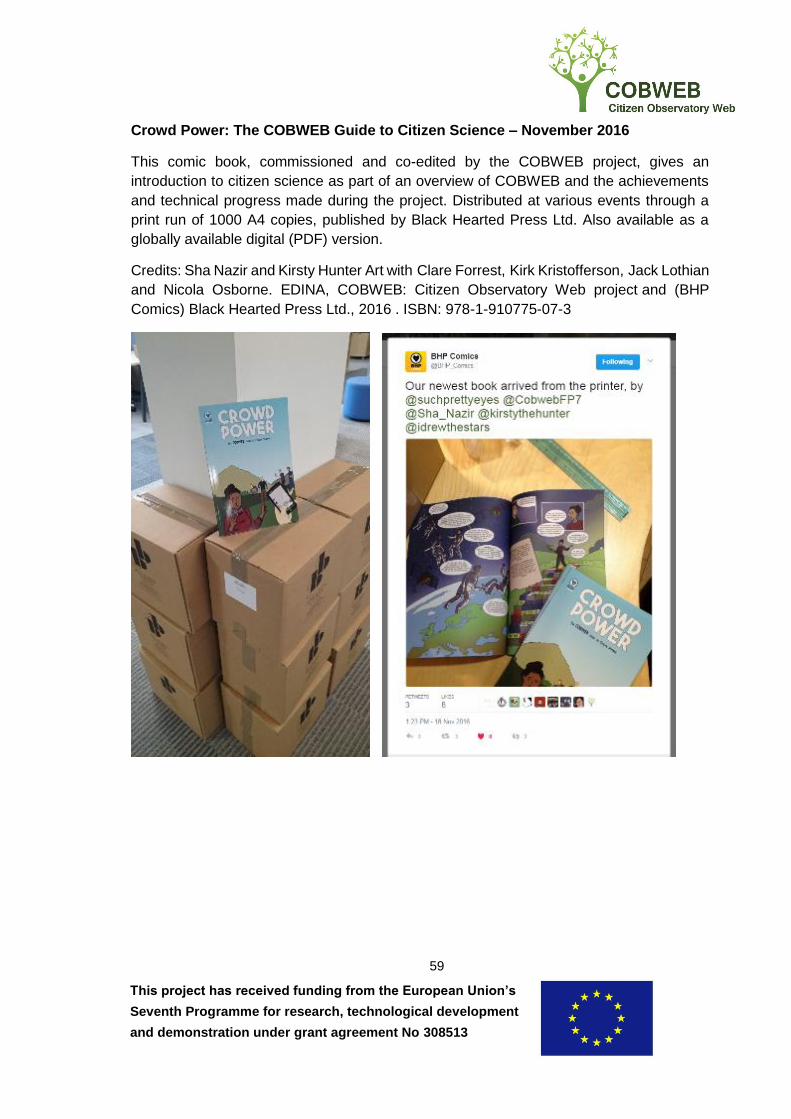
This project has received funding from the European Union’s
Seventh Programme for research, technological development
and demonstration under grant agreement No 308513
59
Crowd Power: The COBWEB Guide to Citizen Science – November 2016
This comic book, commissioned and co-edited by the COBWEB project, gives an
introduction to citizen science as part of an overview of COBWEB and the achievements
and technical progress made during the project. Distributed at various events through a
print run of 1000 A4 copies, published by Black Hearted Press Ltd. Also available as a
globally available digital (PDF) version.
Credits: Sha Nazir and Kirsty Hunter Art with Clare Forrest, Kirk Kristofferson, Jack Lothian
and Nicola Osborne. EDINA, COBWEB: Citizen Observatory Web project and (BHP
Comics) Black Hearted Press Ltd., 2016 . ISBN: 978-1-910775-07-3

This project has received funding from the European Union’s
Seventh Programme for research, technological development
and demonstration under grant agreement No 308513
60

This project has received funding from the European Union’s
Seventh Programme for research, technological development
and demonstration under grant agreement No 308513
61
Fieldtrip Open Website – from Sept 2016
In order to promote and disseminate the open source software created during COBWEB –
including the associated Github repositories, a new Fieldtrip Open website was launched
in autumn 2016: http://fieldtrip.edina.ac.uk/

This project has received funding from the European Union’s
Seventh Programme for research, technological development
and demonstration under grant agreement No 308513
62
Press cutting: Impact: Pathways to Innovation – Mar 2017
Article, “COBWEB, Citizen Observatory Web, FP7” in this outreach publication with both
digital and Print editions: https://doi.org/10.21820/23987073.2017.3.17


![TAILS: COBWEB 1 [1]](https://static.fdocuments.in/doc/165x107/5681623c550346895dd27235/tails-cobweb-1-1.jpg)


